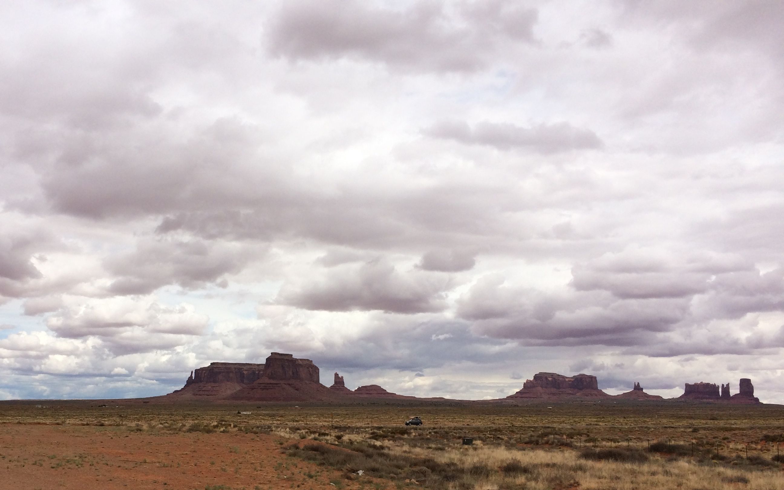
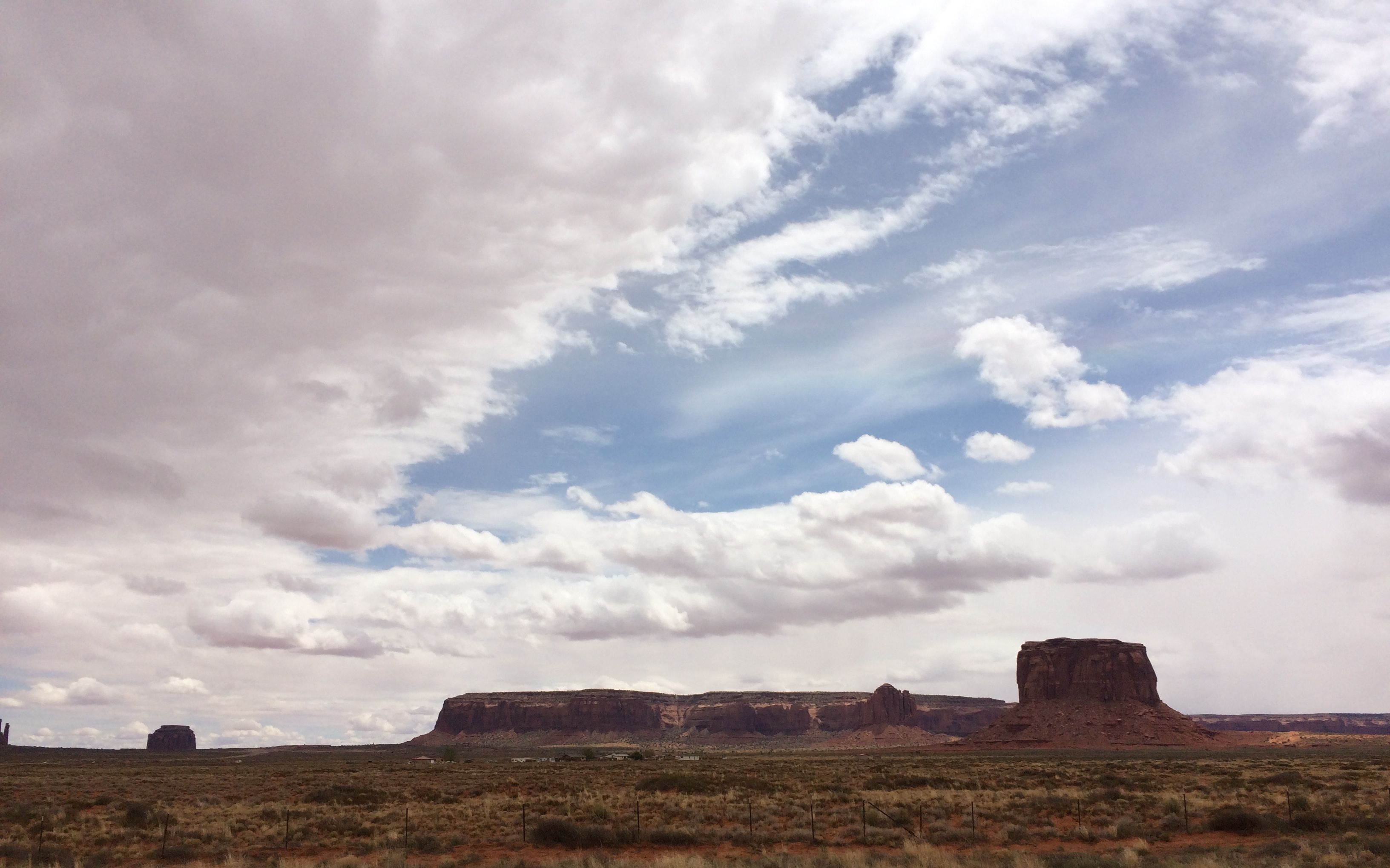
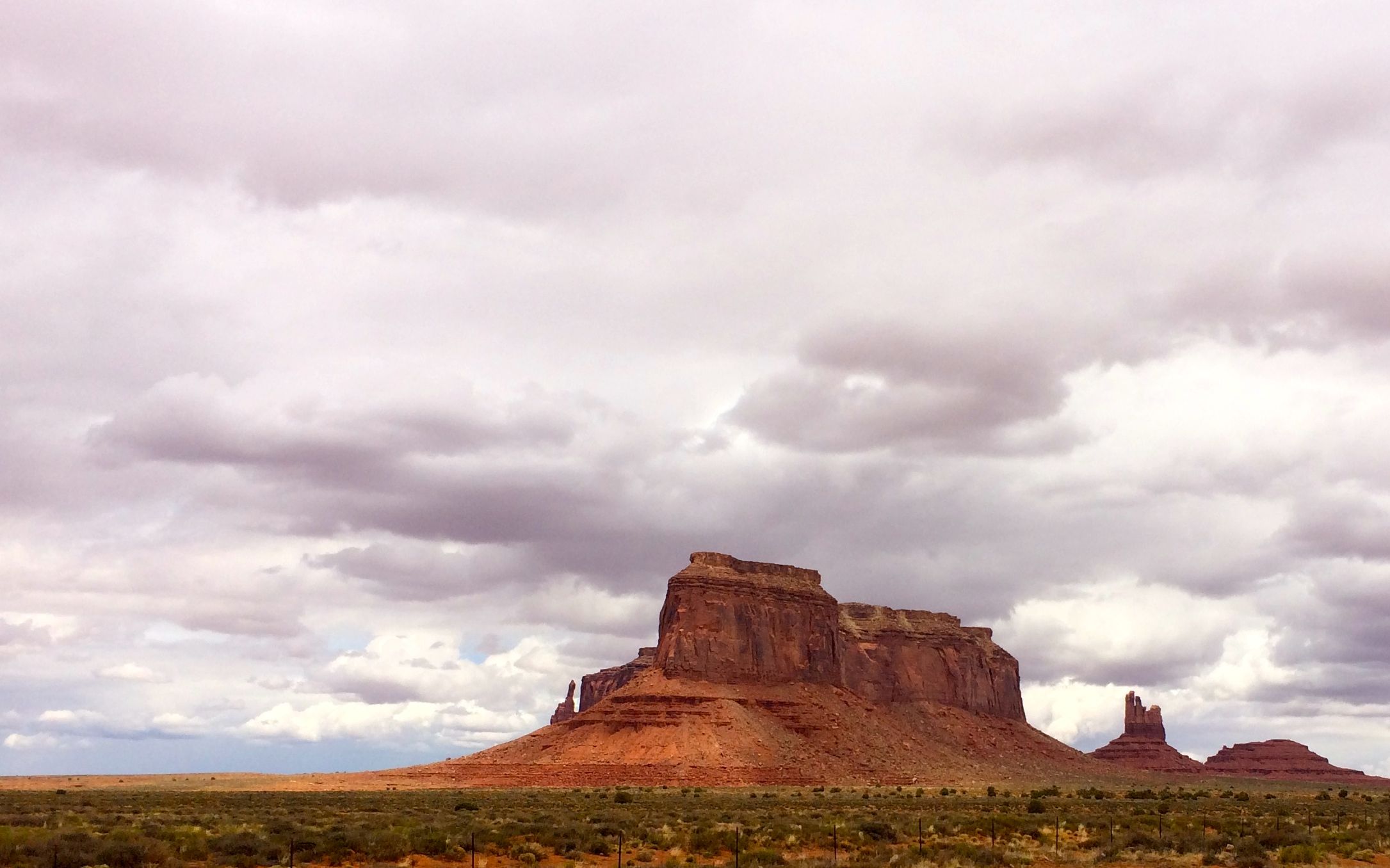
After my close brush with forestry, I wasn’t feeling much like playing tourist while towing my trailer. I drove by Monument Valley. I might have stayed over, but the attendant at the park entrance couldn’t tell me if they had any room in the campground. I didn’t feel like paying the $20 entrance fee to find out. Besides, There were lots of formations visible from the highway.
I was fascinated by the pinkish color in the clouds.
I assume it was caused by the light reflecting off the red sand and rocks.
I guess I will just have to add Monument Valley to the “next time” list.
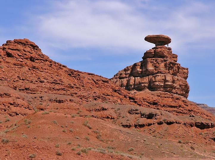
I chugged on out of Arizona and back into Utah. I crossed the San Juan River at Mexican Hat, which is a very small town. According to the 2010 census, 31 hearty souls lived there at an elevation of 4,244 feet. I’m not 100% positive, but I think that it was just a one lane bridge crossing the San Juan River, with a tight turn right after I crossed. I kept both hands on the wheel and both eyes on the road.
I did glance up and spy the rock formation that gives the town it’s name.
I borrowed this shot from the internet, just to let you know why the town was named Mexican Hat. I was too busy driving to snap a photo!
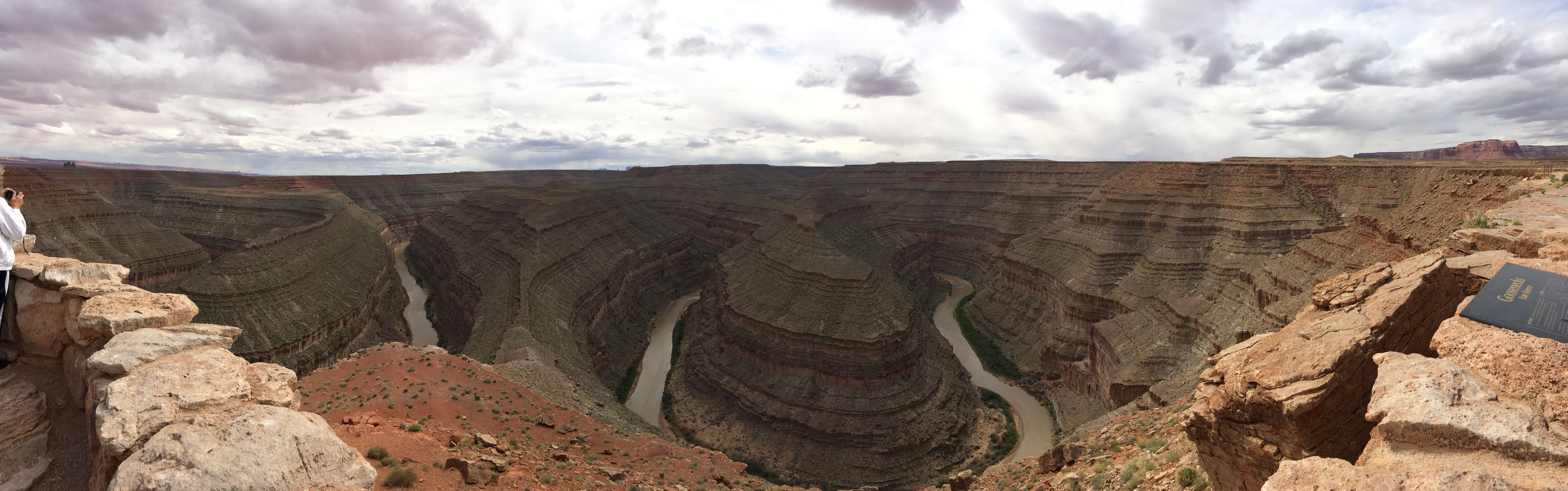
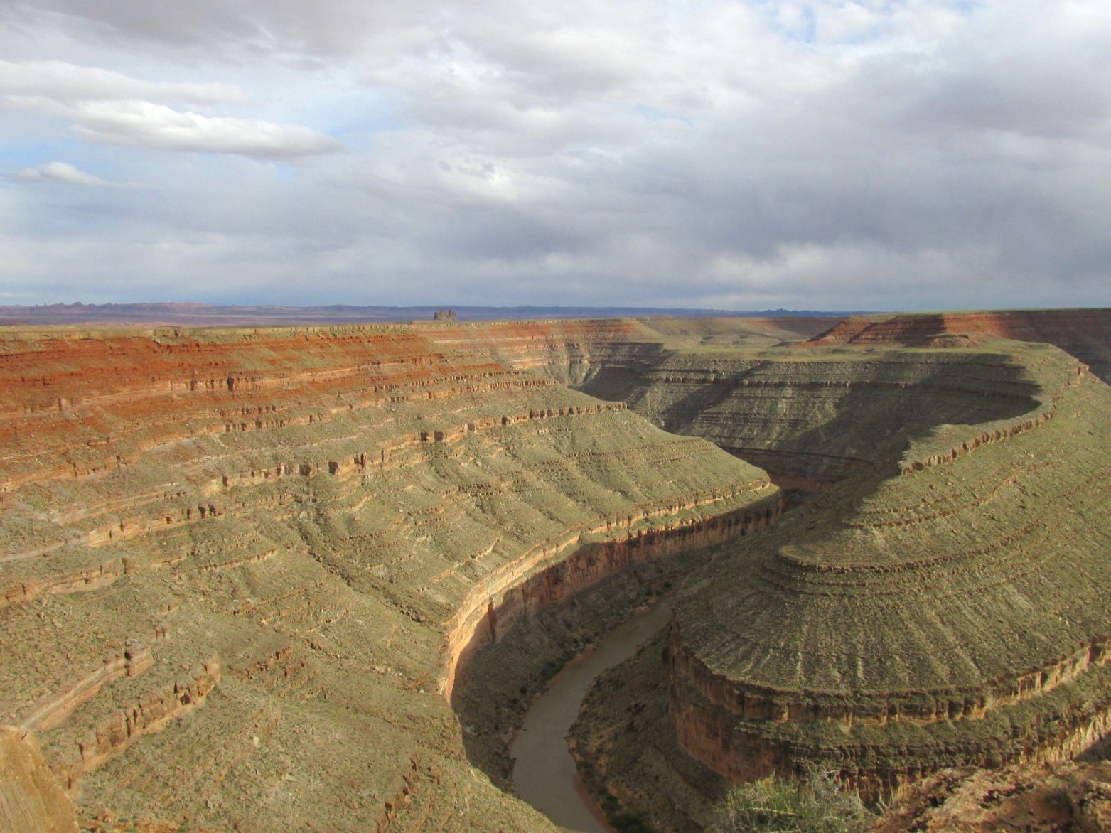
Just a few more miles and I arrived at my destination: Goosenecks State Park. It is named after the goosenecks that the San Juan River created as it headed downstream.
This is my first attempt at a panoramic view using my iPhone. The from the start of the goosenecks to the end, there is six miles of river. That six miles meanders back and forth within a space of four miles. At least, that’s what I remember reading someplace.
It’s 1000 feet from the edge down to the water.
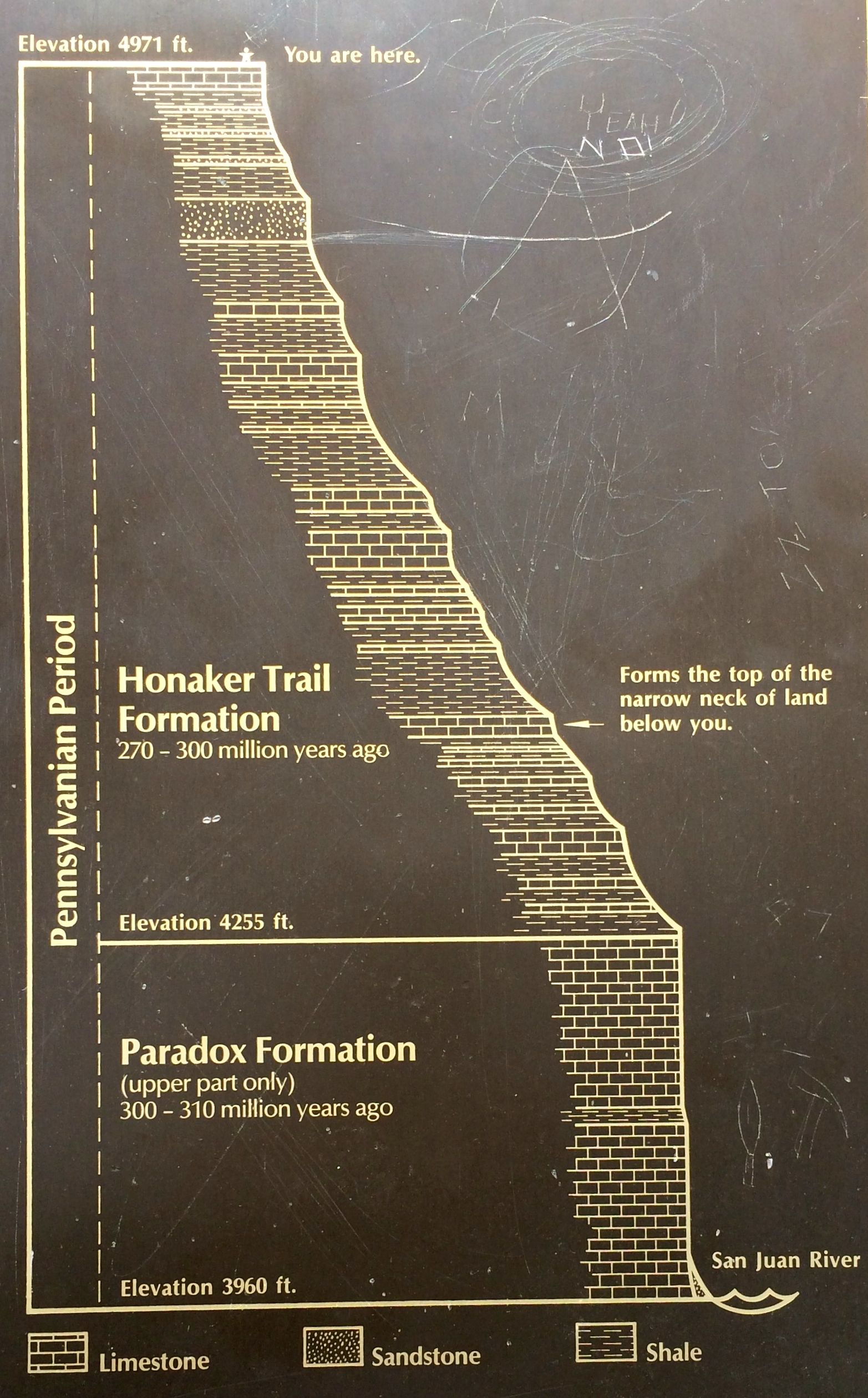
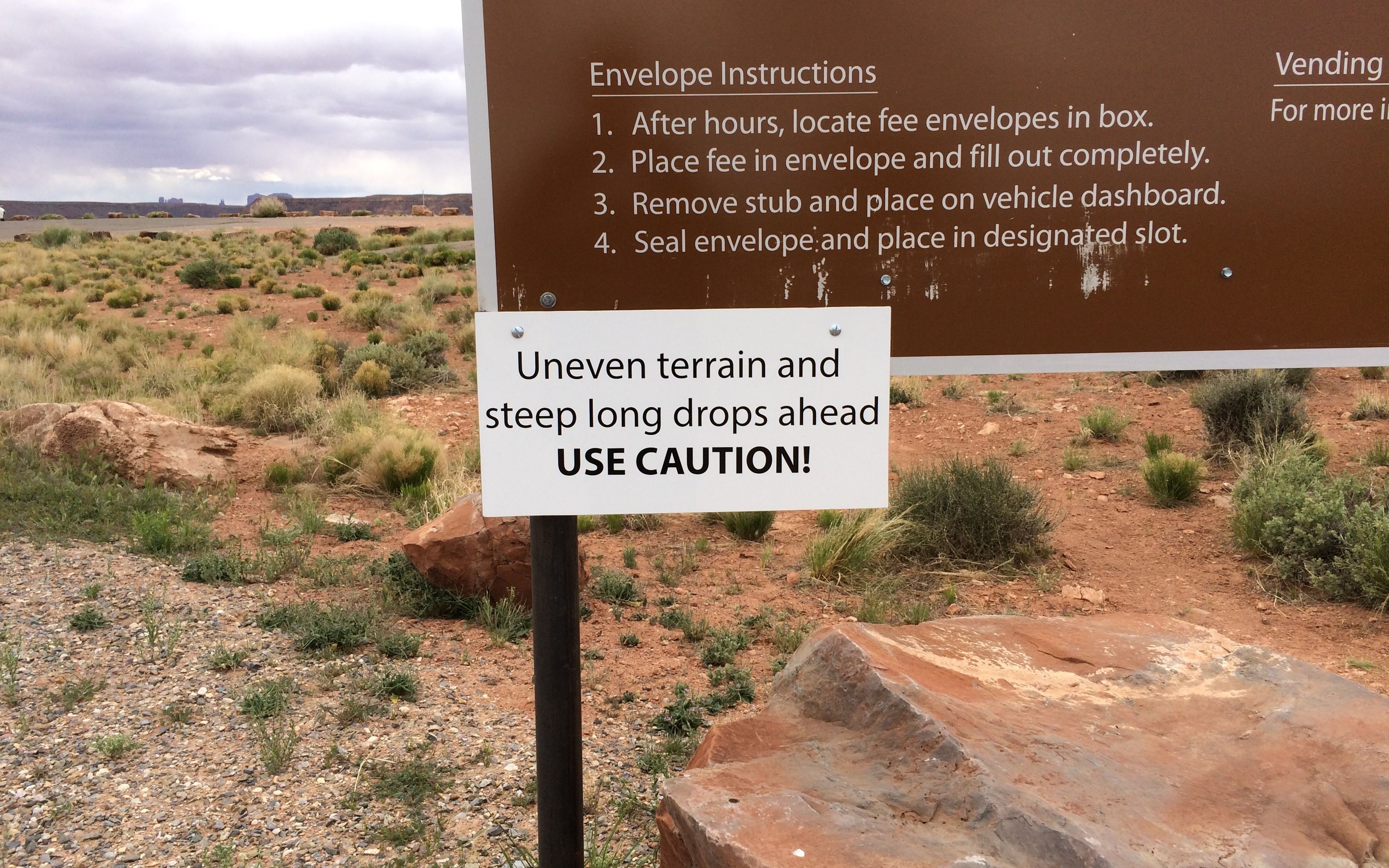
You are here
I was amused by the cross section sign that has a little stick figure at the rim.
This sign drove the message home if the other sign was not explicit enough.
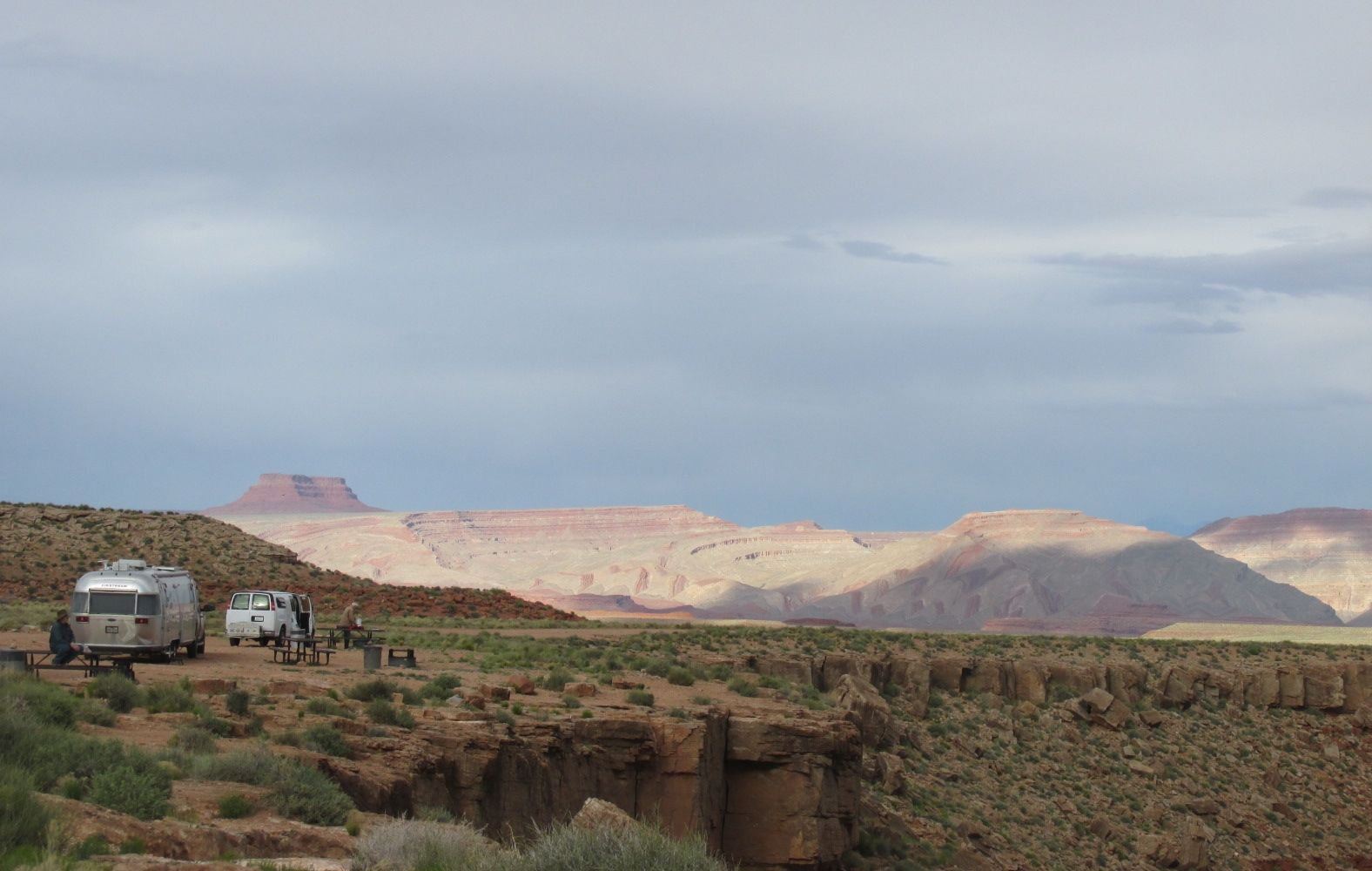
This was the view out the door of my trailer.
If you look carefully, you can see rafters heading downstream in this shot.
I suppose I could have parked a little closer to the edge…but why?
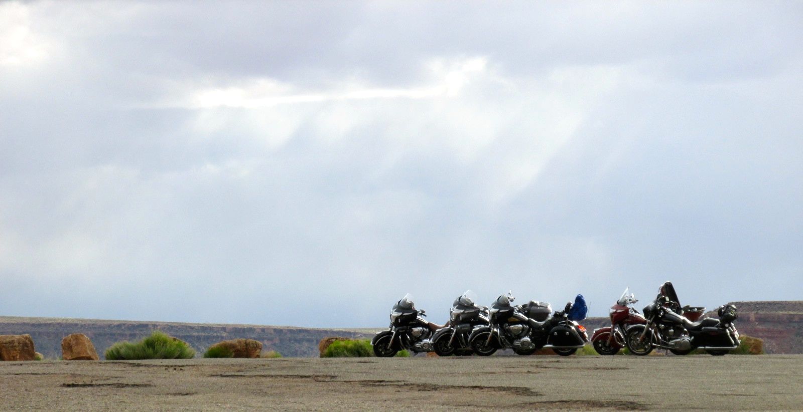
This is a popular park for people just to drive in and visit and then drive back out. When I arrived, I was the only person there. I made camp and fixed a little dinner. When I looked outside again, the park had filled up!
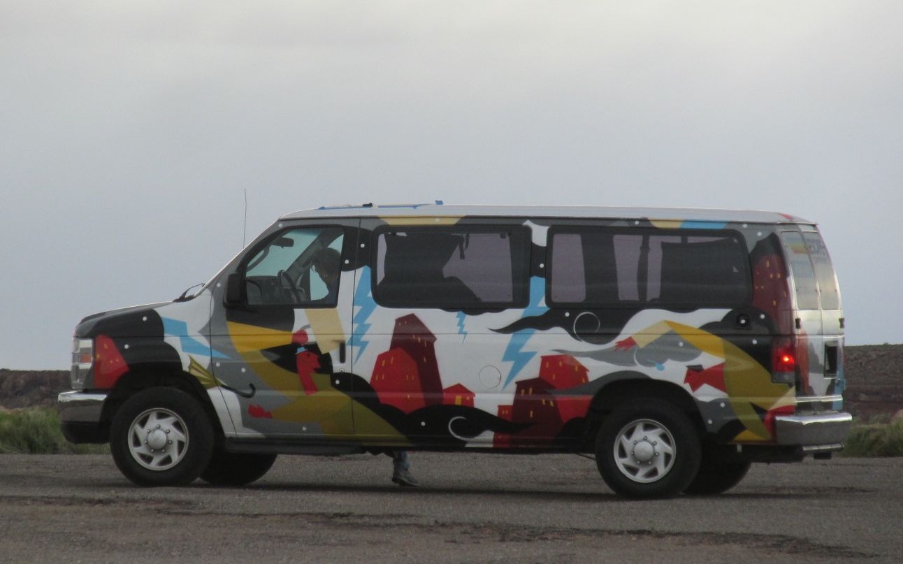
Many people came and stayed one night. There were a large number of rental campers and vans at this park. Some were your usual campers. Others were more interesting.
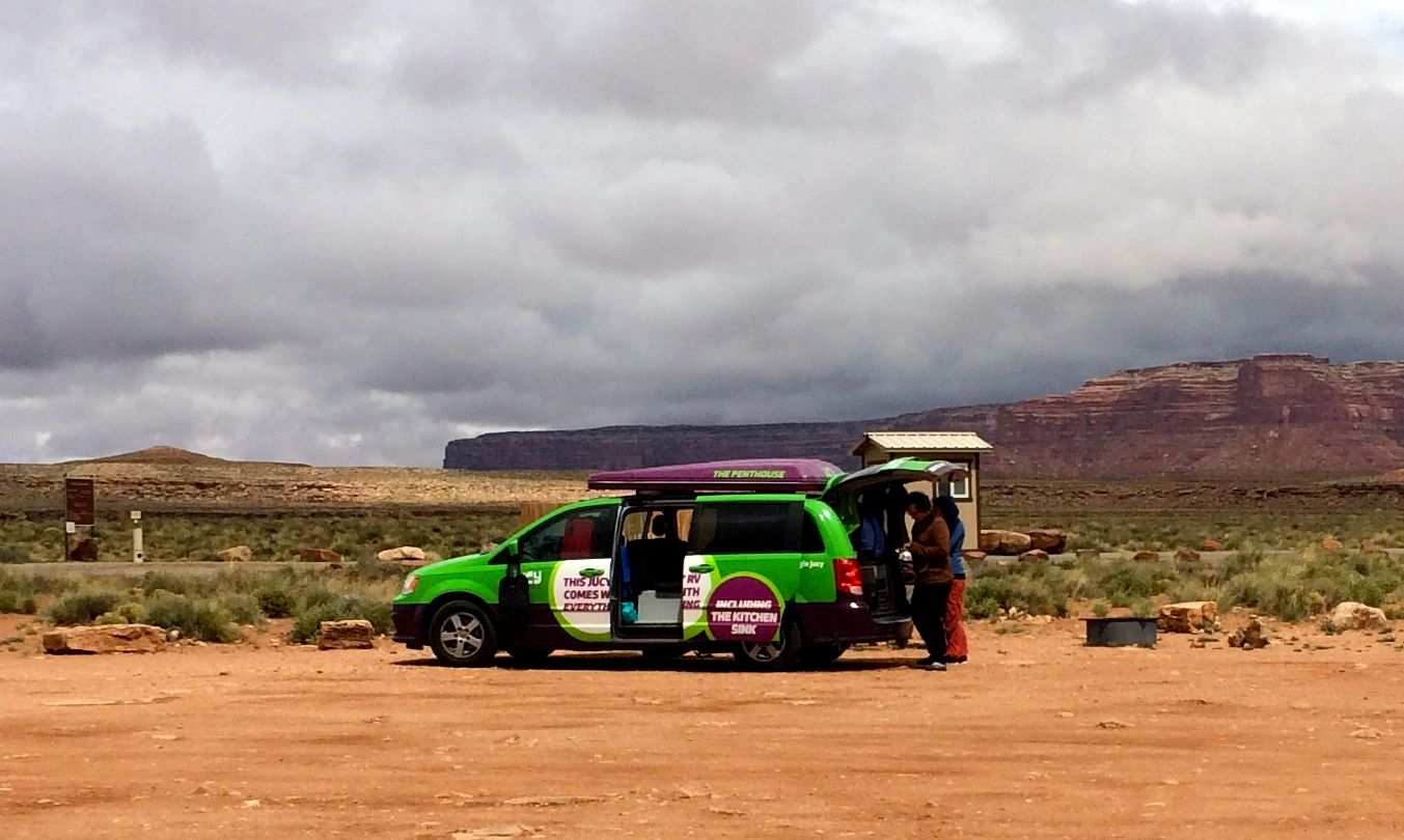
This company is called Jucy RV Rentals and they bill themselves as having “everything including the kitchen sink.” The people using this camper were visiting from Switzerland and they were kind enough to show me the kitchen sink, which is in the back. The rear lift gate opens up to show the kitchen area.
The pod on the top opens up to create a tent. It was cold and the wind was strong, so they just slept inside the night they were there. Of course, I had to show them Flo, too. I gave tours to people from France and Germany as well as a couple American states while I was there.
The price was right and I had a little bit stronger cell phone signal, so that I could continue working on my repair issues, so I decided to make Gooseneck State Park my home base while I was in the area.
I hitched up Flo and crossed the river the next day. I wanted to stay nearby in Page and take a tour of Antelope Canyon. Unfortunately, the only thing available seemed to be the Walmart parking lot. I decided that I would save Antelope Canyon for “next time” and push on.
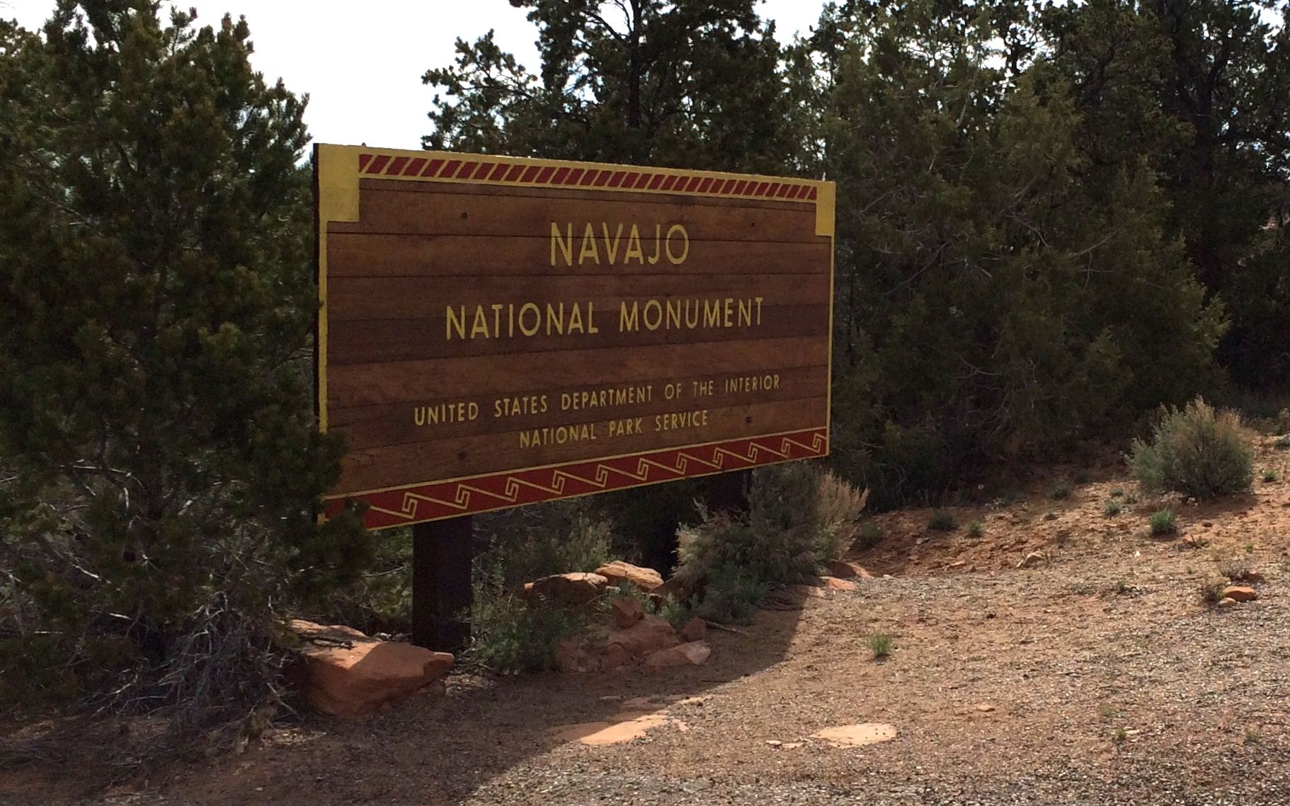
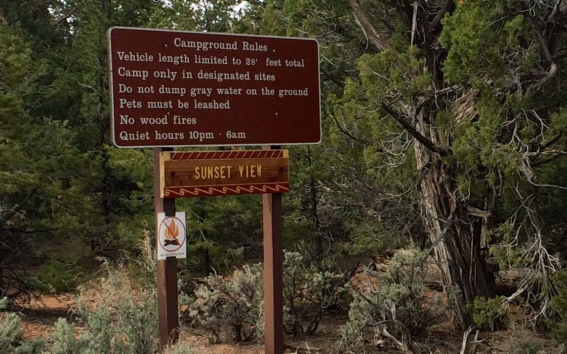
My next stop was Navajo National Monument near Kayenta, Arizona.
They were listed as a “free campground” in Campendium.com. There were warnings about length on the site. They said that there was conflicting information on the signs. The one out by the highway said there was a limit of 28 feet for any individual unit. Since my Airstream is 27 feet, I figured I’d be all right.
The sign at the campground said that the limit was 28 feet overall.
I wish I had looked at the warnings and decided that I should just roll on.
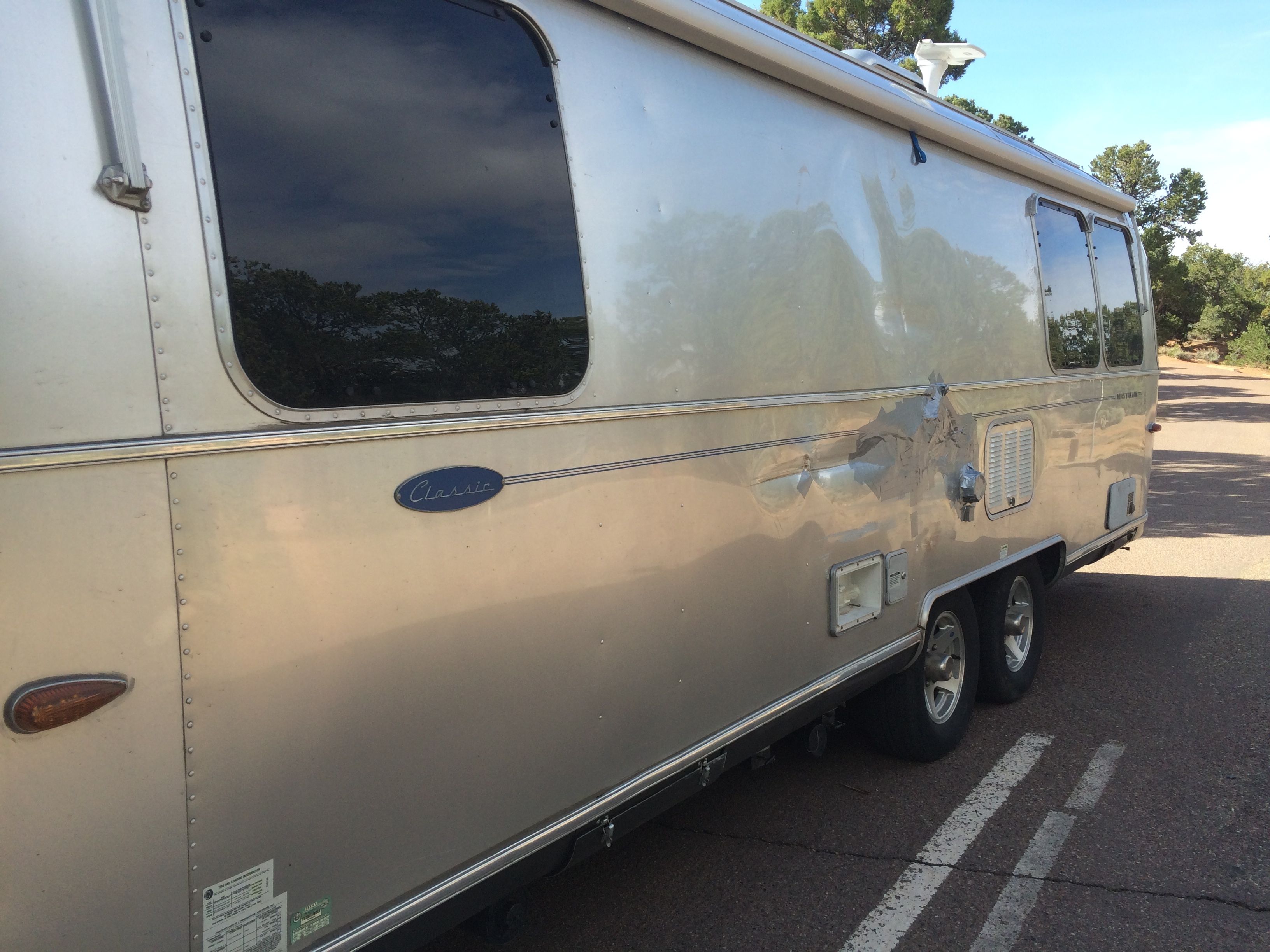
It didn’t seem that tricky to get into the site I picked, but those tough high-desert trees do not yield if you get too close.
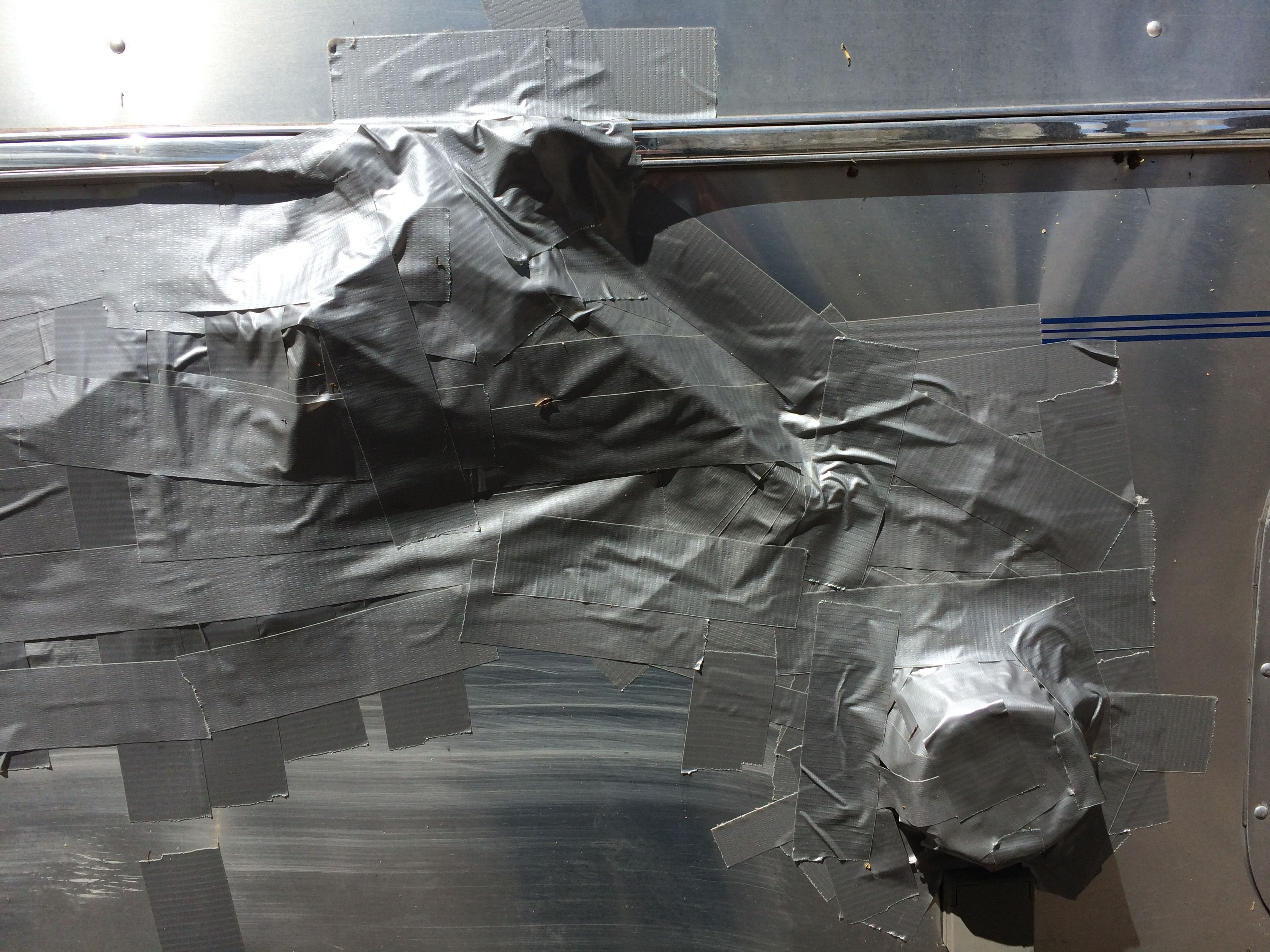
I punched a hole right through the side of my Airstream! This photo was taken in the morning with the sun shining. When I was trying to get settled, It felt like rain was in the offing. I grabbed my duct tape and started closing up the hole.
I was taping away, and a couple in a nice small pop-up van camper came over to help. They brought more tape and a plastic container to put over the electrical connection, which I had also knocked off.
Then, I started working the phone. I had absolutely no internet connection and only the faintest whisper of a phone signal. I couldn’t look up any information, so all I could to was use the information in my phone. I called my good friends at Woodland Travel Center in Grand Rapids, Michigan and told them what had happened. Megan gave me some phone numbers and I started calling.
Some places didn’t answer. The one place I reached said that they couldn’t be able to work me in until July.
July? JULY?!!! (I had this little incident at the end of April.)
That place did give me the phone number for Airstream, at least. However, due to time zone difference, they were closed.
The next morning, I got through to Airstream, and they gave me a few more numbers. I found a dealer, Desert Autoplex, that would be able to help me, but they were in Mesa, Arizona. Mesa was about six hours away, and would involve “doubling back”, but they were able to help me and I was delighted. After that, I called the insurance company and got the ball rolling in that department.
I always say, if a problem can be fixed with money – and you have the money – it’s not really a problem.
And so, I left Navajo National Monument without seeing anything.
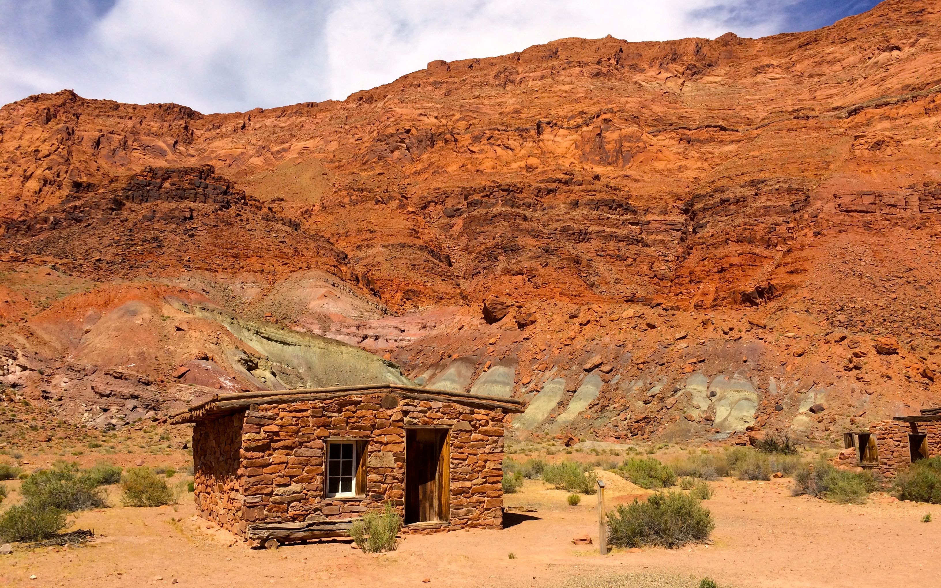
Lee’s Ferry is located at the only place within hundreds of miles where one can easily access the Colorado River from both sides. John Lee came to the crossing in 1870 with the goal of setting up a permanent ferry service for Mormon settlers heading south to Arizona. The ferry was up and running by January of 1873 and was in service until 1927 when a bridge was built across the river a little further downstream.
There is not a lot that remains from the ferry – at least that I saw. There are other interesting remnants, though.
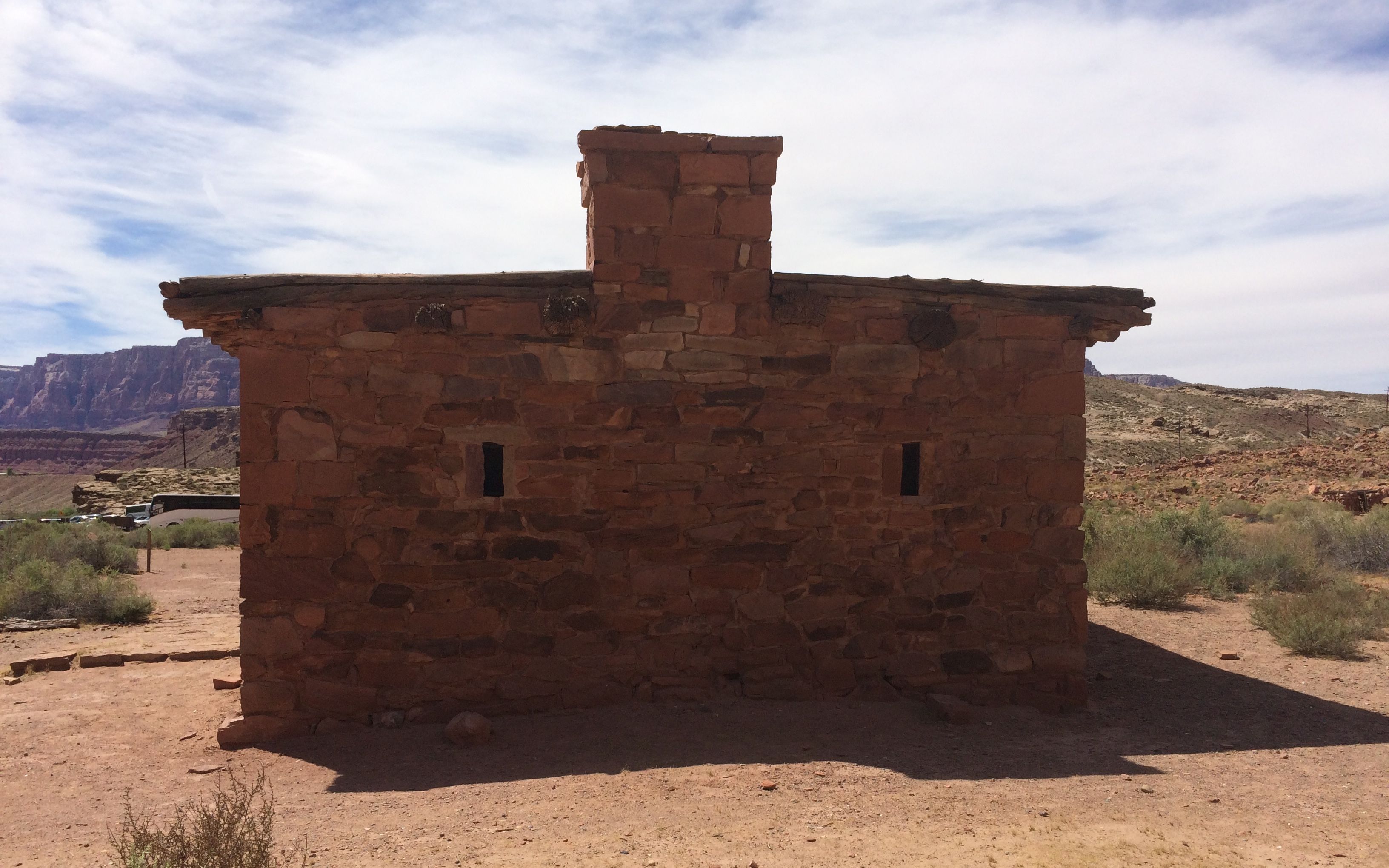
This is Lee’s Fort. It was built at about the same time as the ferry at the direction of Brigham Young to protect the crossing from raids by the Navajo.
Yes, it was a real fort. Here are the gun slits on one end of the ruins. The building has largely fallen down, but enough remains to make it worthwhile to walk over and take a look.
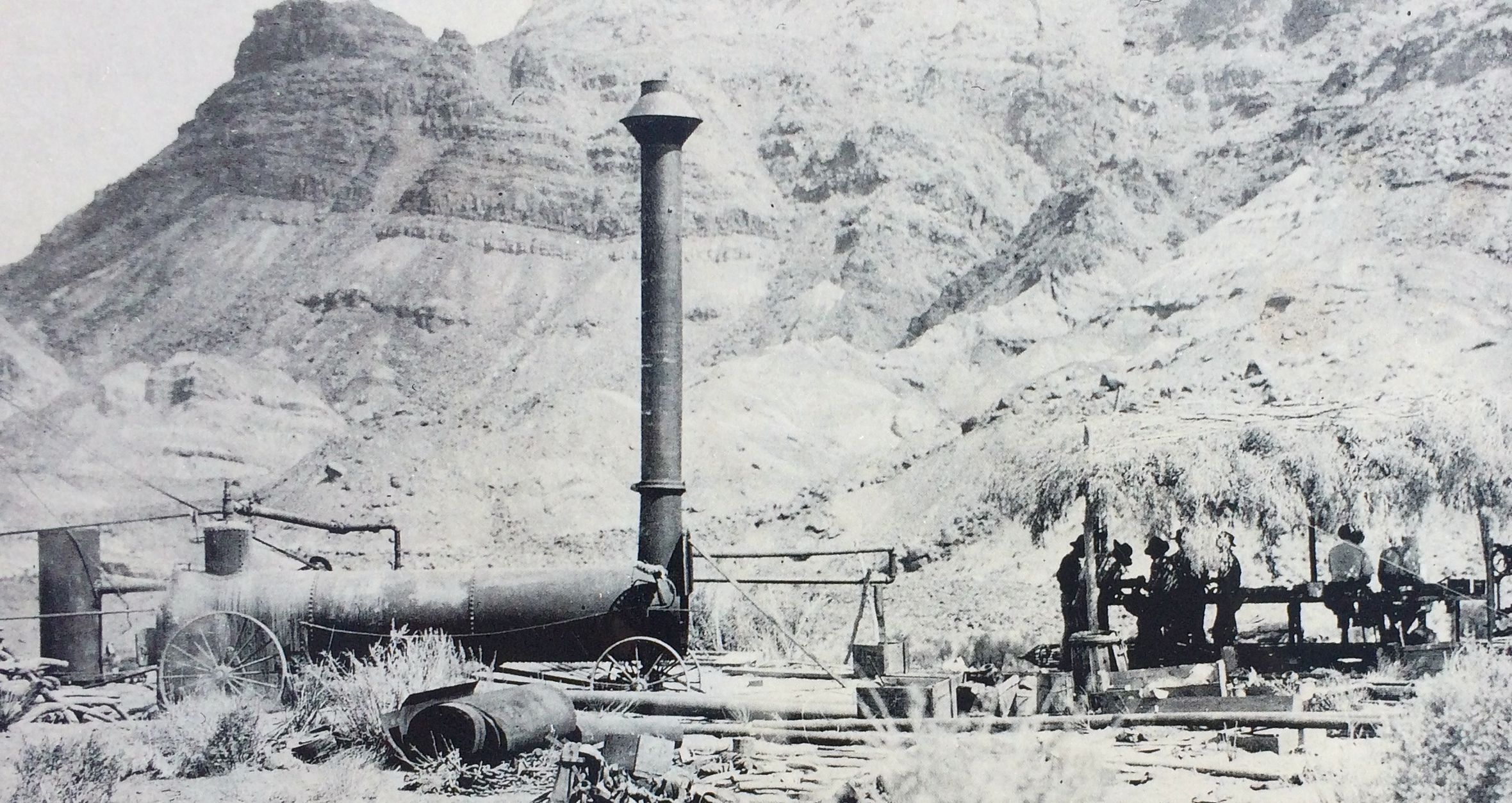
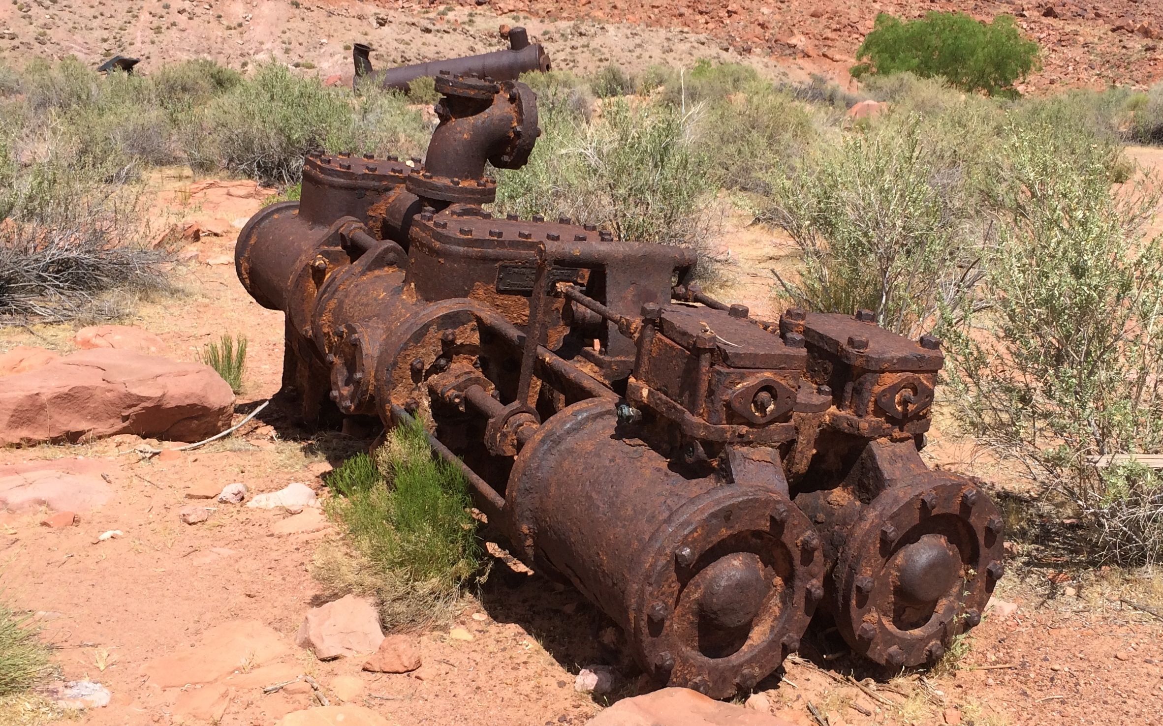
In addition to serving as an important link in transportation, it was also a site of gold mining in the beginning of the 1900’s. Charles Spencer attempted to extract gold from the greenish-colored chinle layer in the photo below.
American Placer Corporation Office
This was his office. He also ran a steamship down the river to bring coal to run his machinery. This was before the Glen Canyon dam was built in the early 1960s.
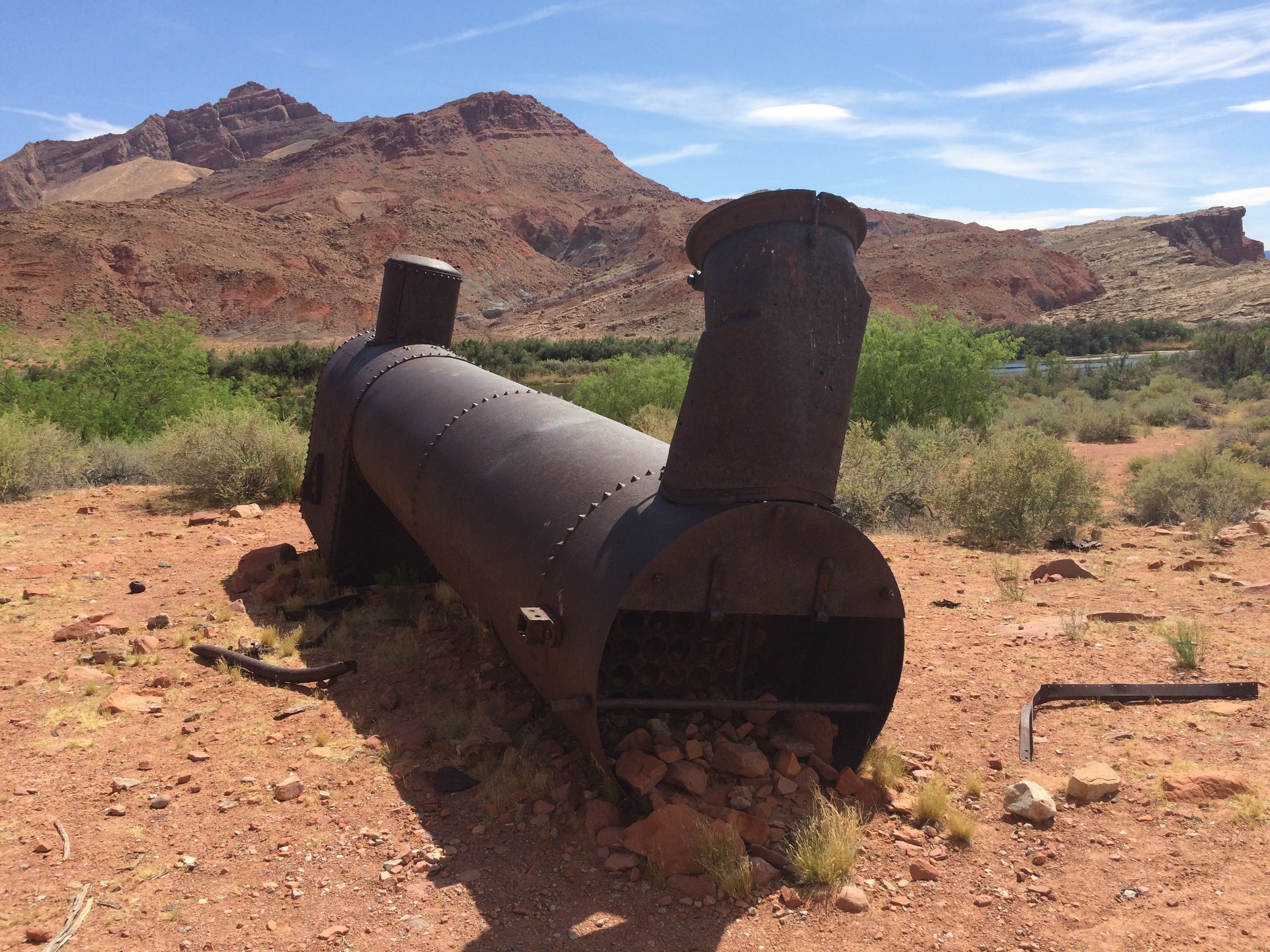
This was the boiler Spencer used back when he was still trying to get gold out of the soil.
And here it is today.
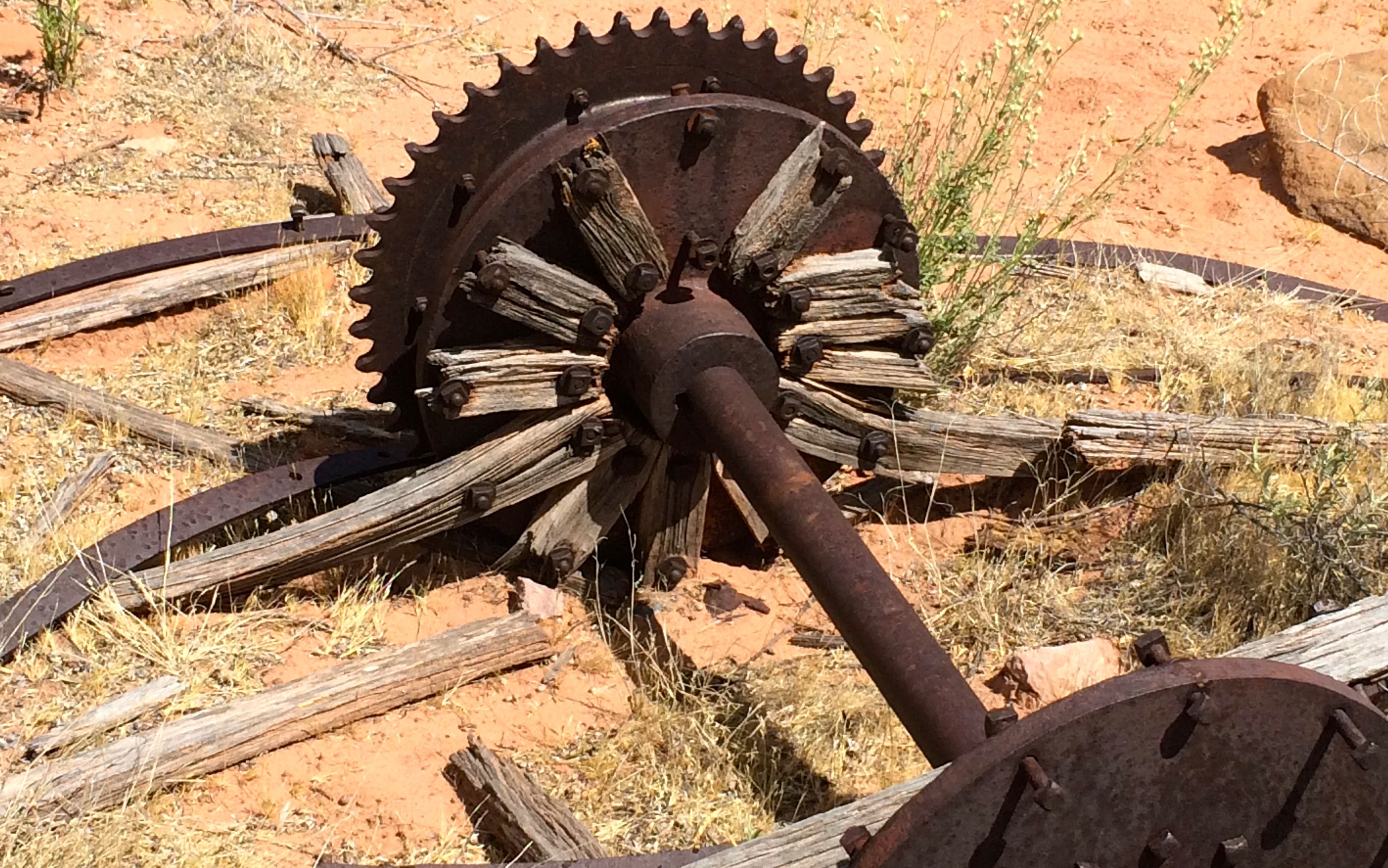
Ah, mining! It seems that whenever you have mining, there are bits and pieces of machinery left behind.
I guess it’s more cost effective to abandon it than to try to do something with it.
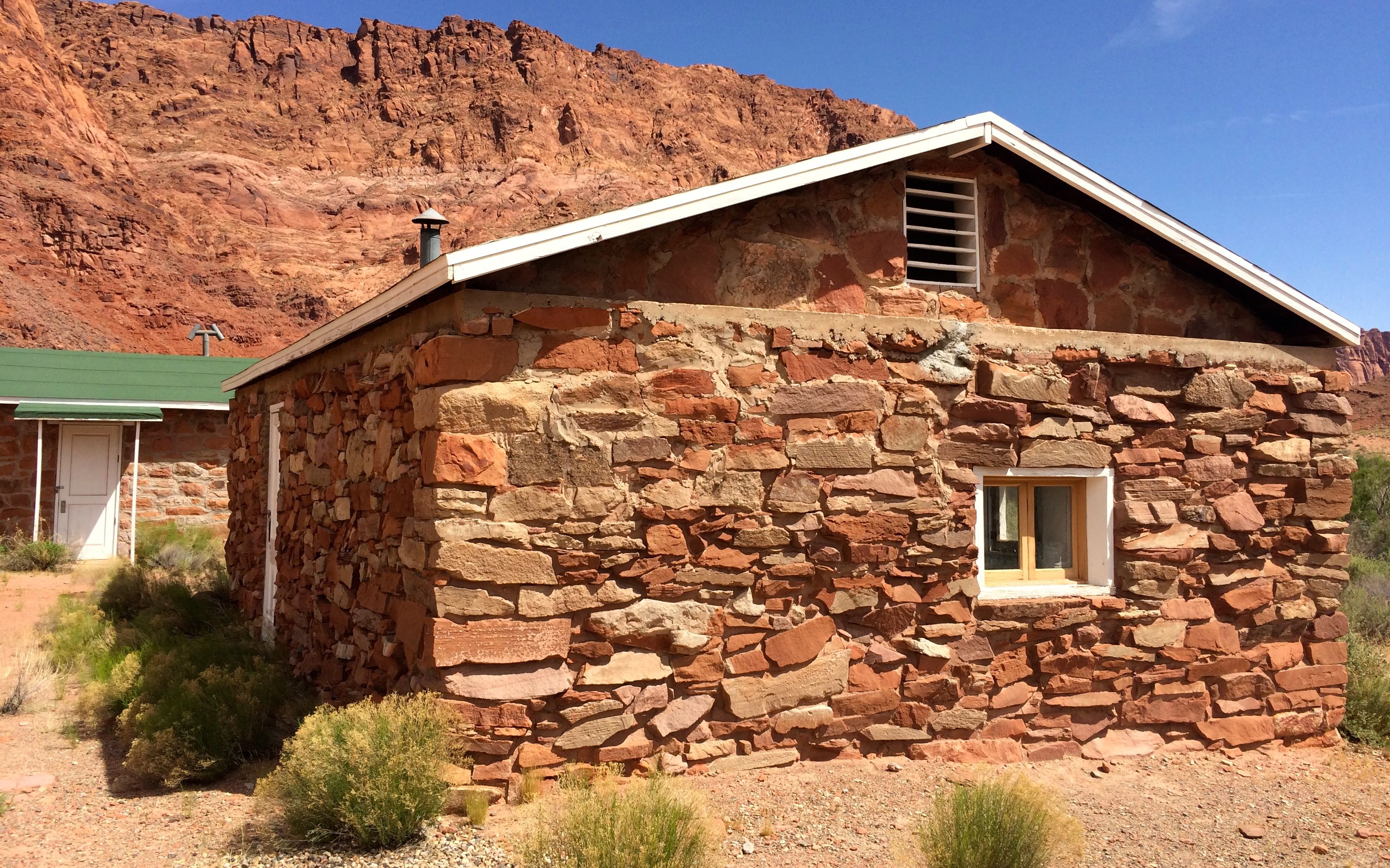
This building was the bunkhouse for Spencer’s operations. When he gave up looking for gold, the US Geologic Survey took it over. According to the sign by the building, it was the silt lab. They didn’t offer an explanation about what a silt lab is, but I imagine that they were measuring the amount silt in the river before the dam went in.
Spencer Bunkhouse and USGS Silt Lab 1911 -1964 (Guest house in the rear.)
The Colorado River was named for the reddish color that it had from the silt that was carried in it before the dam went in. The river is no longer reddish in color. I imagine that there is a lot os silt built up behind the dam. I should look into that.
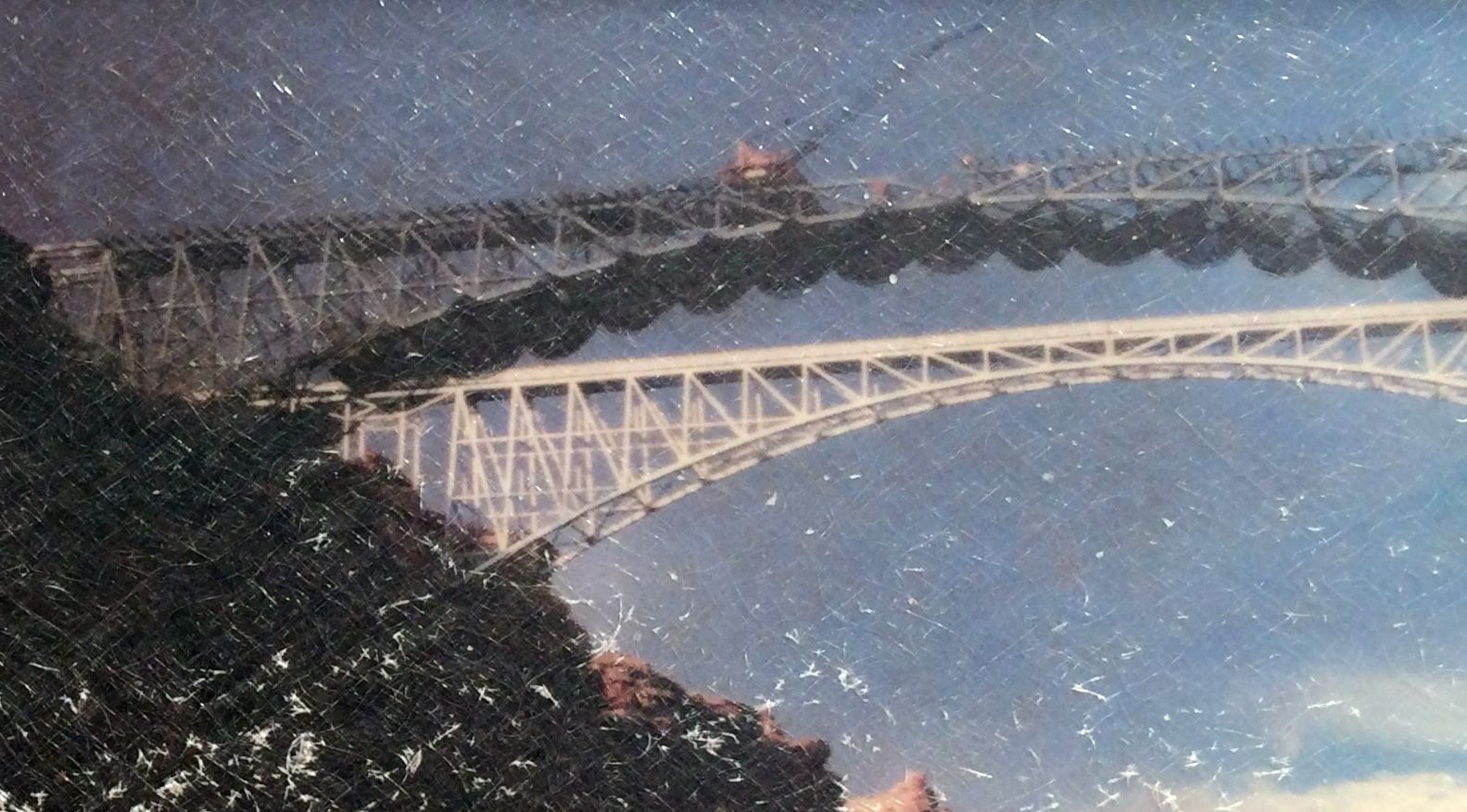
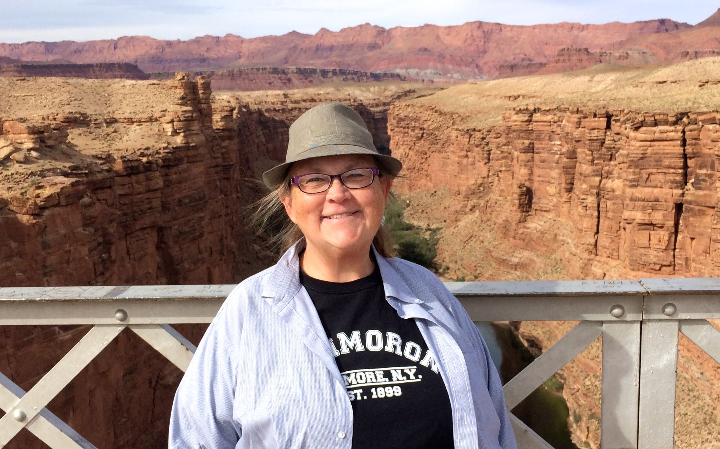
This part of the river is all about crossing it. Right by the entrance to the park, about four miles from the ferry crossing site, is the Navajo Bridge.
The bridge on the left is the original bridge that opened to traffic in 1929 after two years of construction. It was built to meet the needs of the time, and the roadway was only 18 feet wide. In 1990, it was decided that the traffic had become too great for the original span. It took a while to work things out – funding, design and satisfying concerns for preservation of sacred Navajo land, plant species and possible water pollution. The new span opened five years later, in 1995.
When the new span was built, netting was strung beneath to catch anything that might fall into the river.
The new span is 44 feet wide and is constructed with 3.5 times more concrete and 1.75 times more steel than the old bridge.
The old bridge was closed to vehicle traffic when the new bridge opened, but it is still open to pedestrians and equestrians. I didn’t see any horses while I was there, though.
The sign at the entrance to the bridge
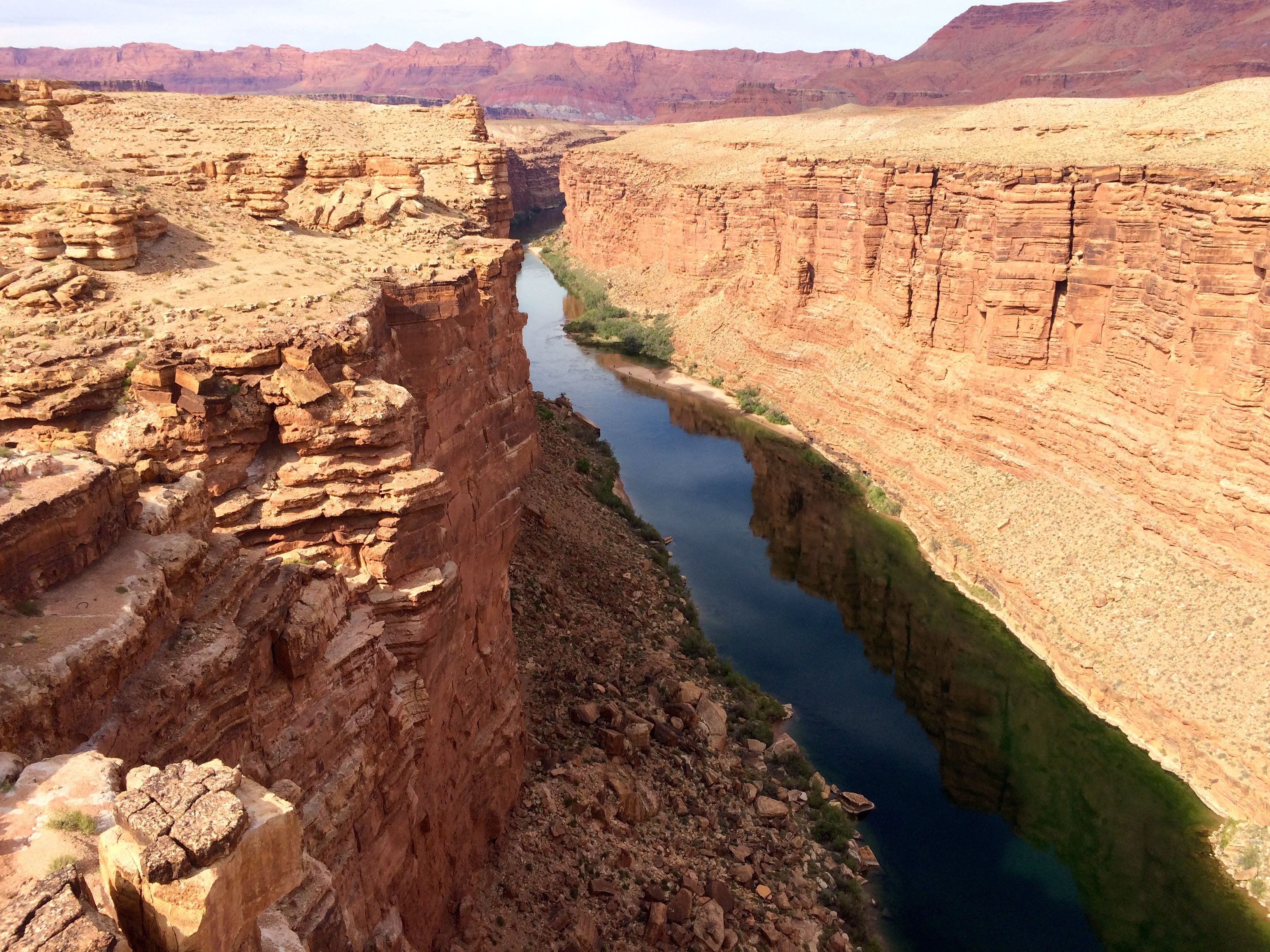
The bridge crossed Marble Canyon about 470 feet above the river. I’m not wild about heights, but there were great guardrails on the sides.
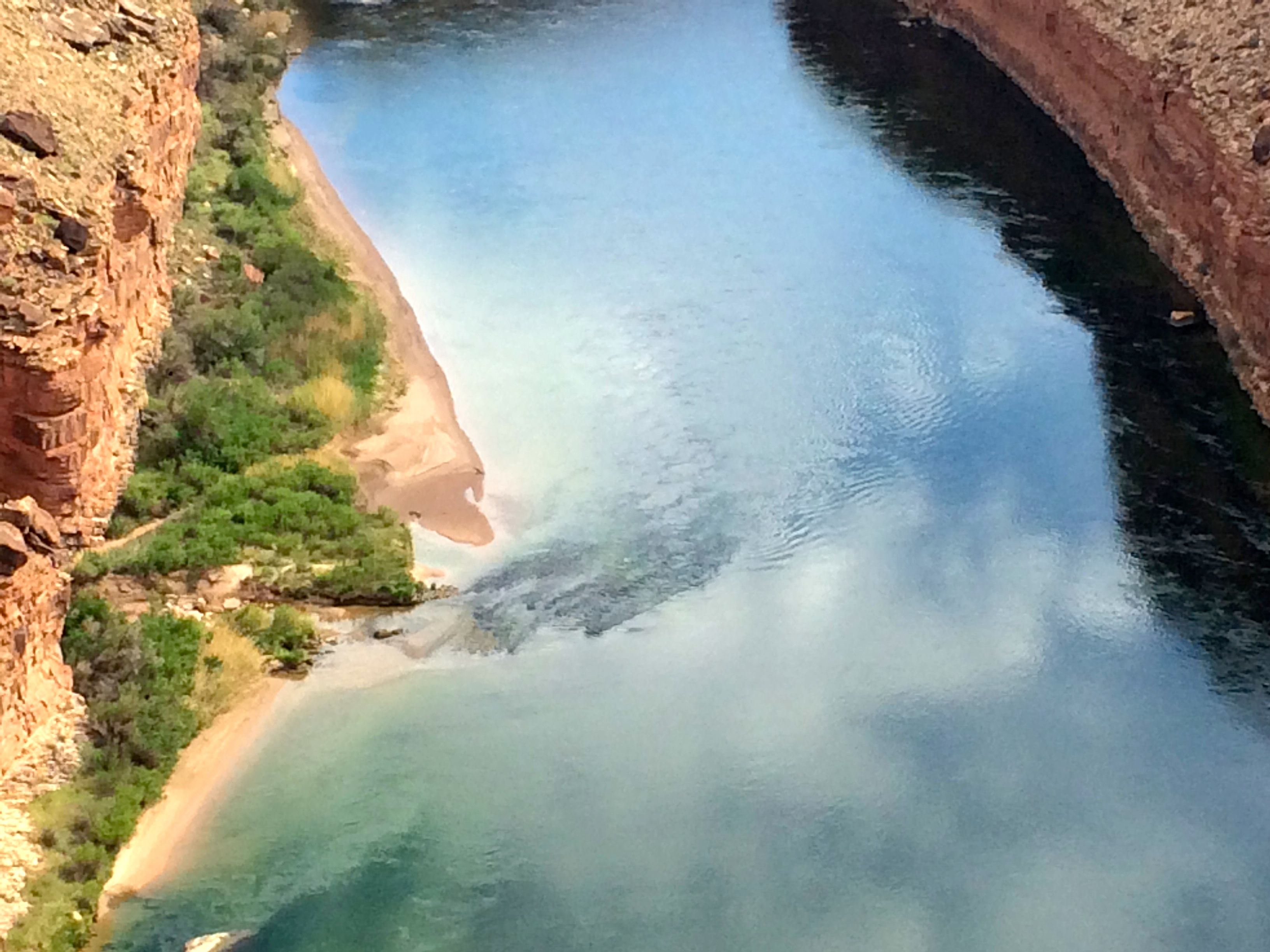
Here’s the view looking upstream.
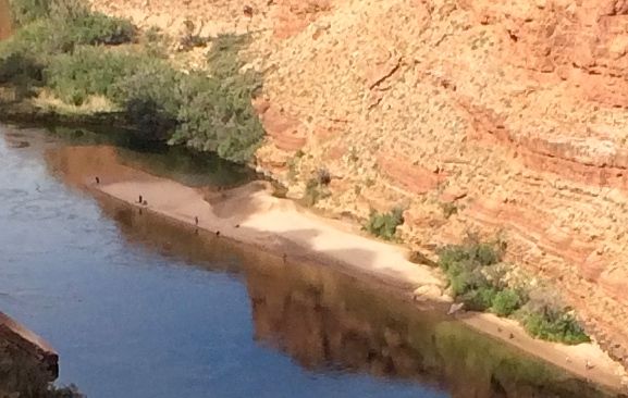
Do you see the people on the beach down there? No? Well, let me zoom in a bit for you.
I don’t know how they got there. Perhaps a boat dropped them off. I never really thought about rivers as having sandy beaches, but they do.
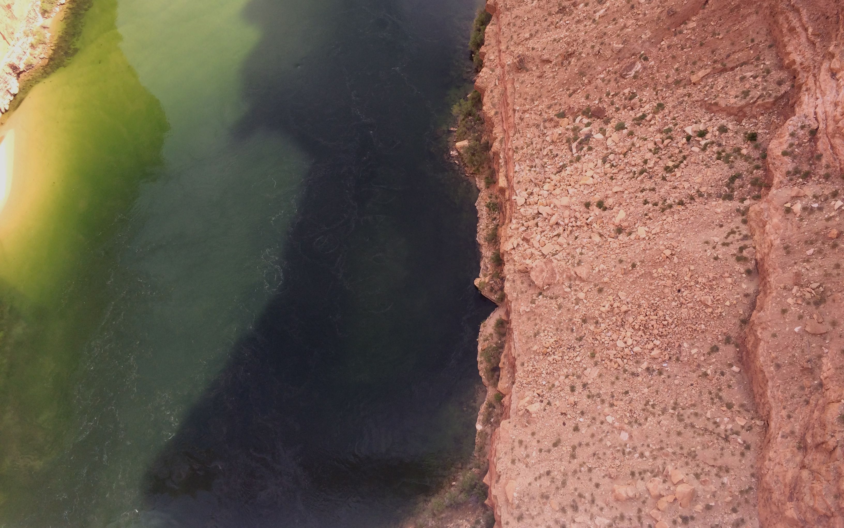
Looking directly down into the water, you can see that there is none of the red colored silt in the river.
Here’s the view of the river looking downstream.
As exciting as the bridges were, I was amazed to see condors flying around.
I’m not skilled birdwatcher, but people told me they were condors, and I believed them. I could tell that they weren’t robins, seagulls or flamingos. It was quite exciting.
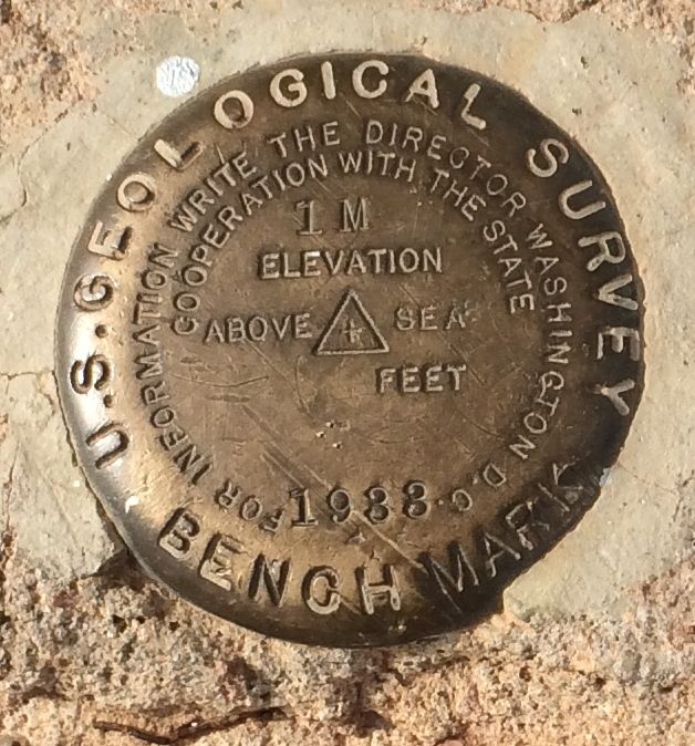
I found another of these benchmarks. Maybe I should contact the Director of the U.S. Geological Survey. I don’t understand how this place can be 1M above sea level.
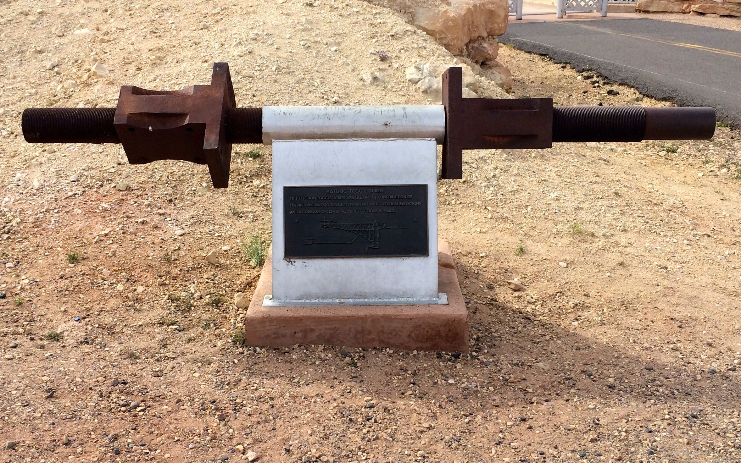
This historic toggle screw is on display on the south side of the bridge. It was an important piece of equipment used in getting the bridge to line up properly.
On the way back to the campground, I stopped to check out the Balanced Rock.
These balanced rocks are formed when boulders from the hard upper layer, which is shinarump conglomerate, break off and roll down the cliff.
They land on the softer lower layer, which is part of the moenkopi formation. As the softer stone is eroded away, the boulders end up on formations that look like pedestals.
The wind, water and freezing temperatures continue their work, and eventually gravity triumphs.
And then you end up with unbalanced rocks.
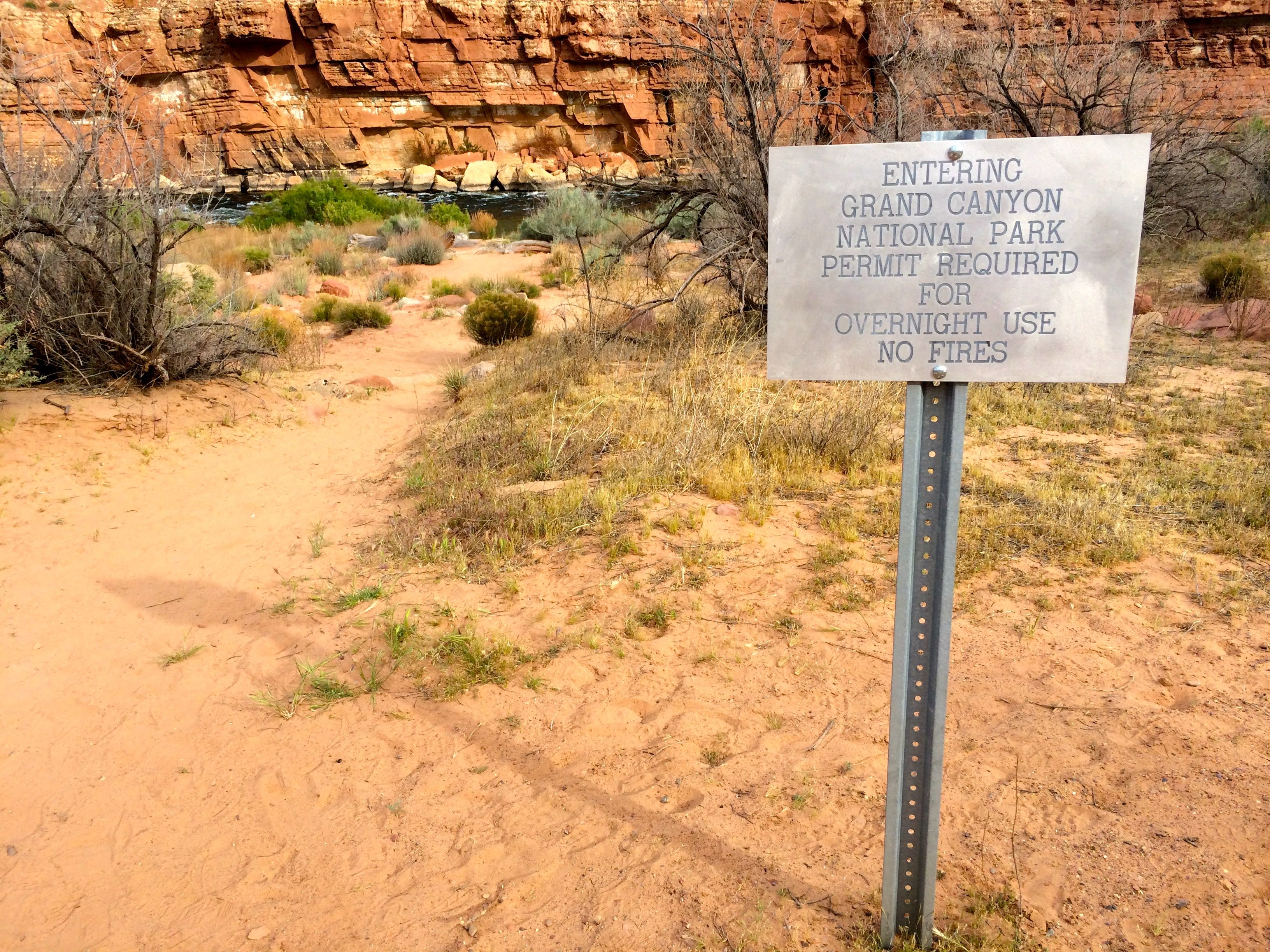
I decided to go down to the river’s edge. I wasn’t going to raft the Colorado, but I could go down and put my feet in it.
Just before I got to the river, I passed this sign:
Cool! I made it to the Grand Canyon National Park from the north side – even if the North Rim wasn’t officially open for the season.
The scent of the water going over the Paria Riffle took me back to Niagara Falls. It reminded me of being on the Three Sisters Islands just off Goat Island. The smell of home!
A riffle is smaller than a rapid. This one is formed where the Paria River empties into the Colorado River. At times of high flow, large rocks are pushed out of the mouth of the Paria River and into the Colorado.
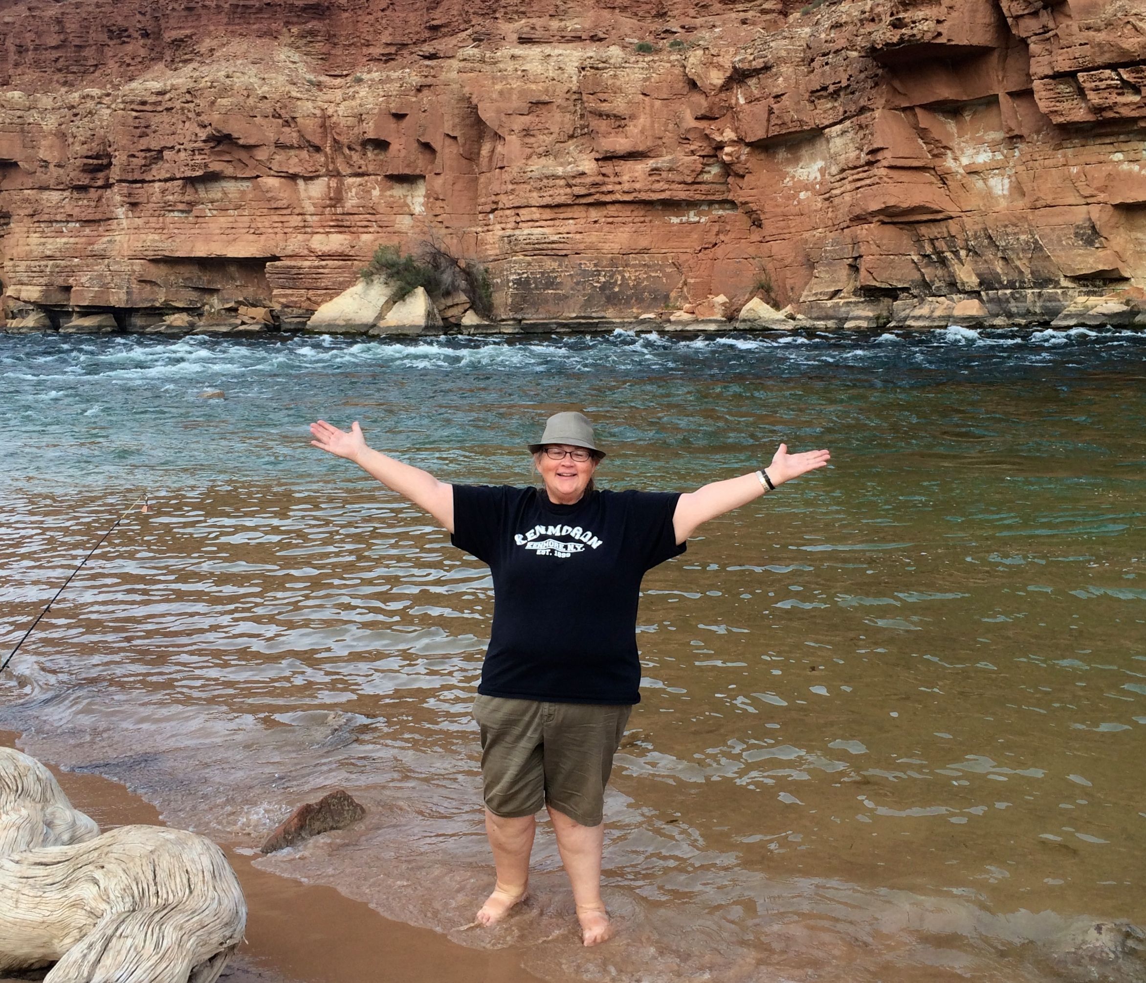
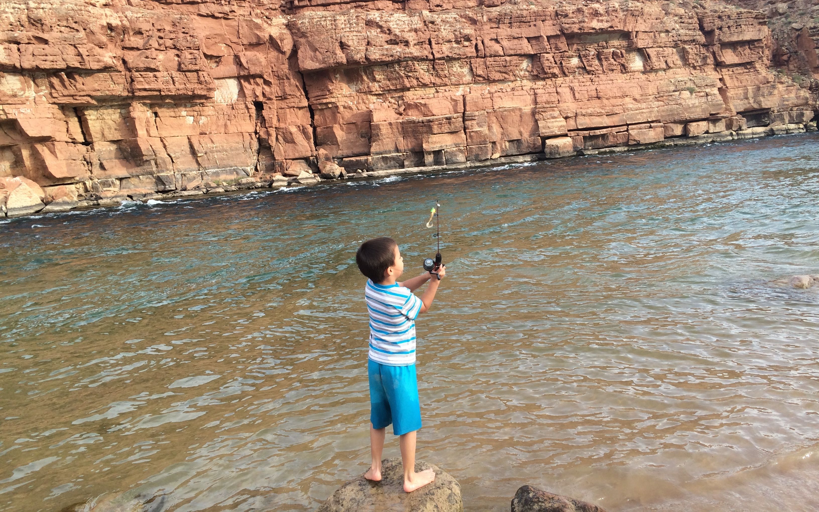
I chatted with some folks who were spending the day by the river. The mother agreed to take a photo of me standing in the water.
The water was a little cool, but not so cold as to keep me out of the water. Down the river a ways, there were people who were actually swimming in the river.
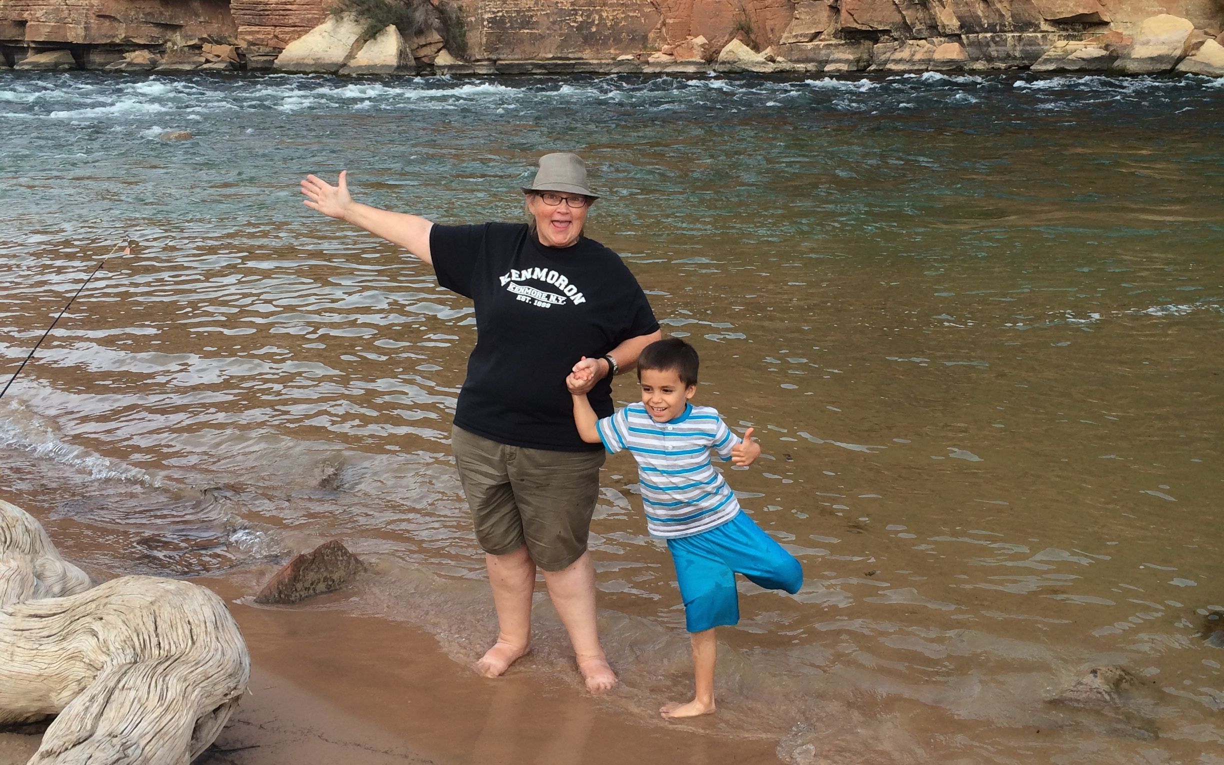
Her son wanted to get in the photo, too, so we took another.
Then, my new buddy wanted to teach me how to fish. First he demonstrated how to cast. His mom told me that there was no hook on the line, so I didn’t have to worry about getting snagged by it.
After demonstrating the proper technique, he handed the rod to me. I let it rip and got the fly a good way out in the river.
On the way back to the parking area, I came across these lizard tracks.
The next day, it was time to make tracks of my own.
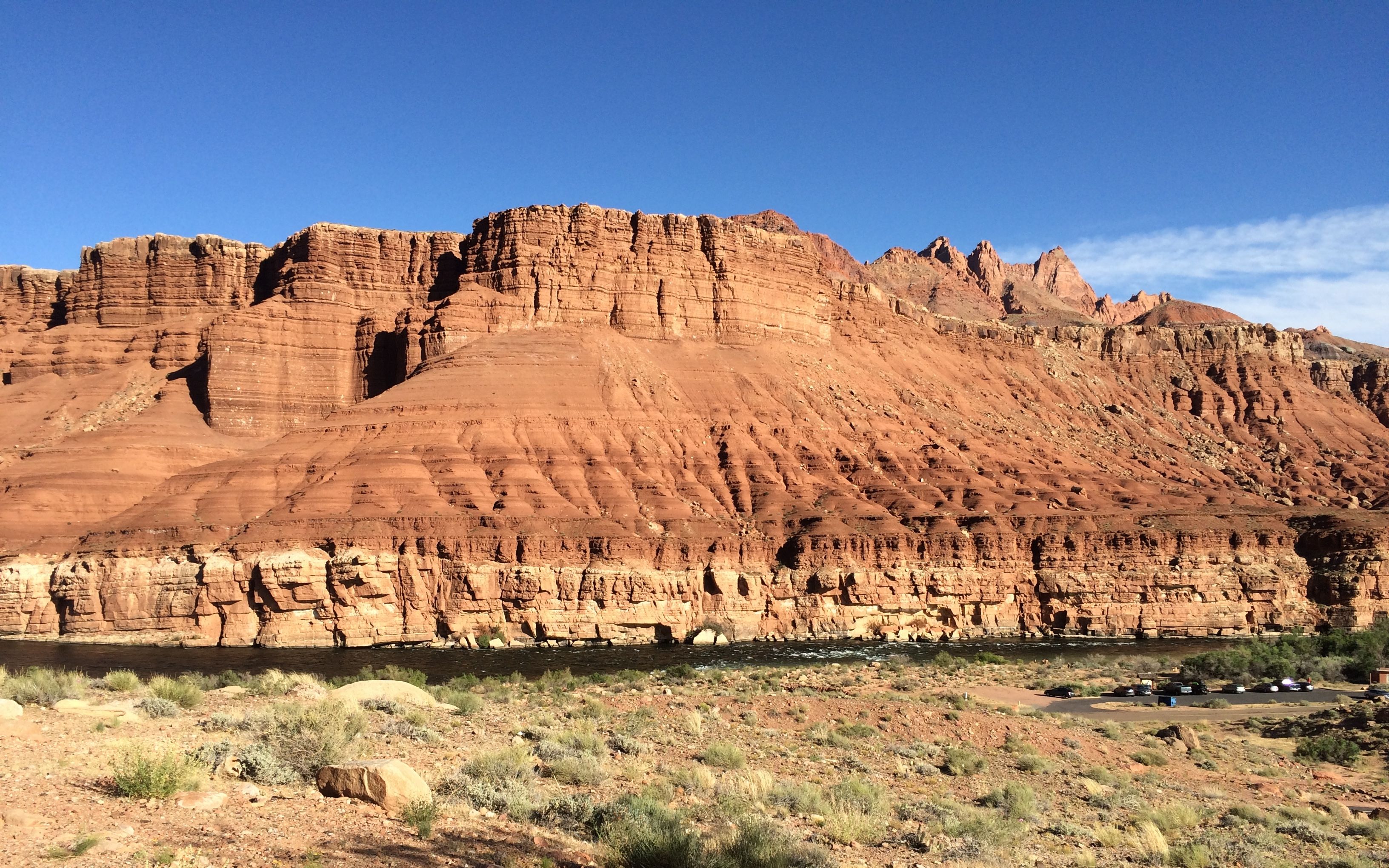
After Bryce Canyon, my next destination was Lee’s Ferry, part of the Glen Canyon National Recreation Area. It’s in Arizona on the bank of the Colorado River.
Ah, but first I had to get there! According to the maps, Lee’s Ferry is about 160 miles from Bryce Canyon. If I were rolling down I-94, from Kalamazoo to Detroit, it would take about three hours. However, this route was full of elevation changes.
Bryce Canyon, Utah 7,664 feet
Mt. Carmel, Utah 5,203 feet
Kanab, Utah 4,970 feet
Jacob Lake, Arizona 8,000 feet
Lee’s Ferry, Arizona 3,200 feet
That adds time to the trip, but the views can be spectacular. Of course, I had to stop at Jacob Lake Inn for the cookies. I had several people tell me that I had to stop. Who am I to reject the advice of random people?
Jacob Lake is the entrance to the North Rim of the Grand Canyon. Even though I was passing through at the end of April, the entrance wasn’t open yet. After seeing the snow in Bryce Canyon, I can imagine that the conditions might not have been right yet.
There was a pine forest around Jacob Lake. Tall pines. I would have liked to have stayed, but the campground wasn’t open yet, either.
Back on the road, I notice a pull off for a scenic view. The traffic was light and there was easy parking, so I pulled off to take a look.
Wow!
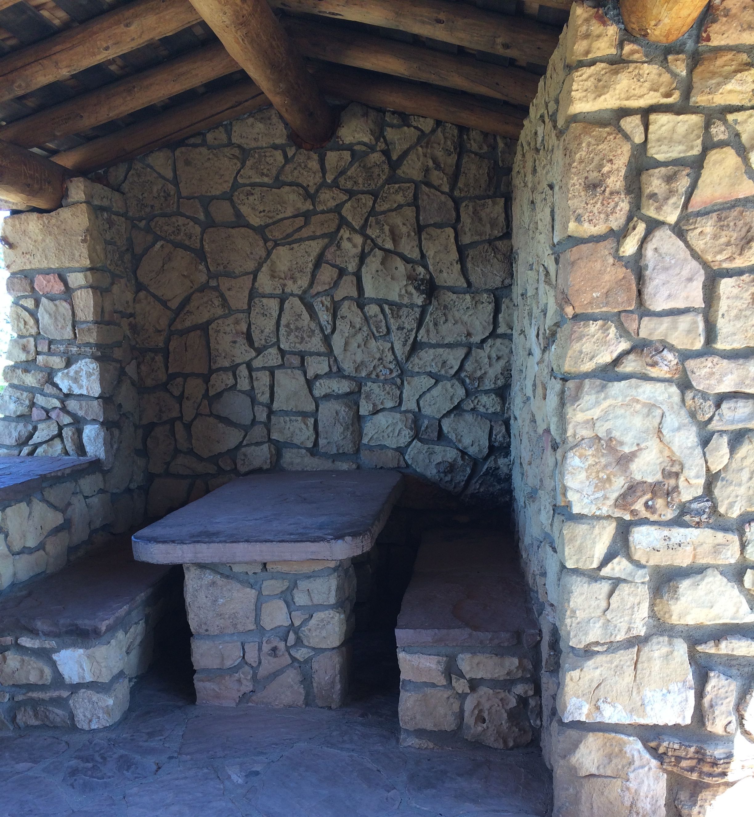
At the top of the stairs to the overlook, there was a cute little shelter. It mad me think of what an Airstream dinette would look like if it was designed by Fred Flintstone.
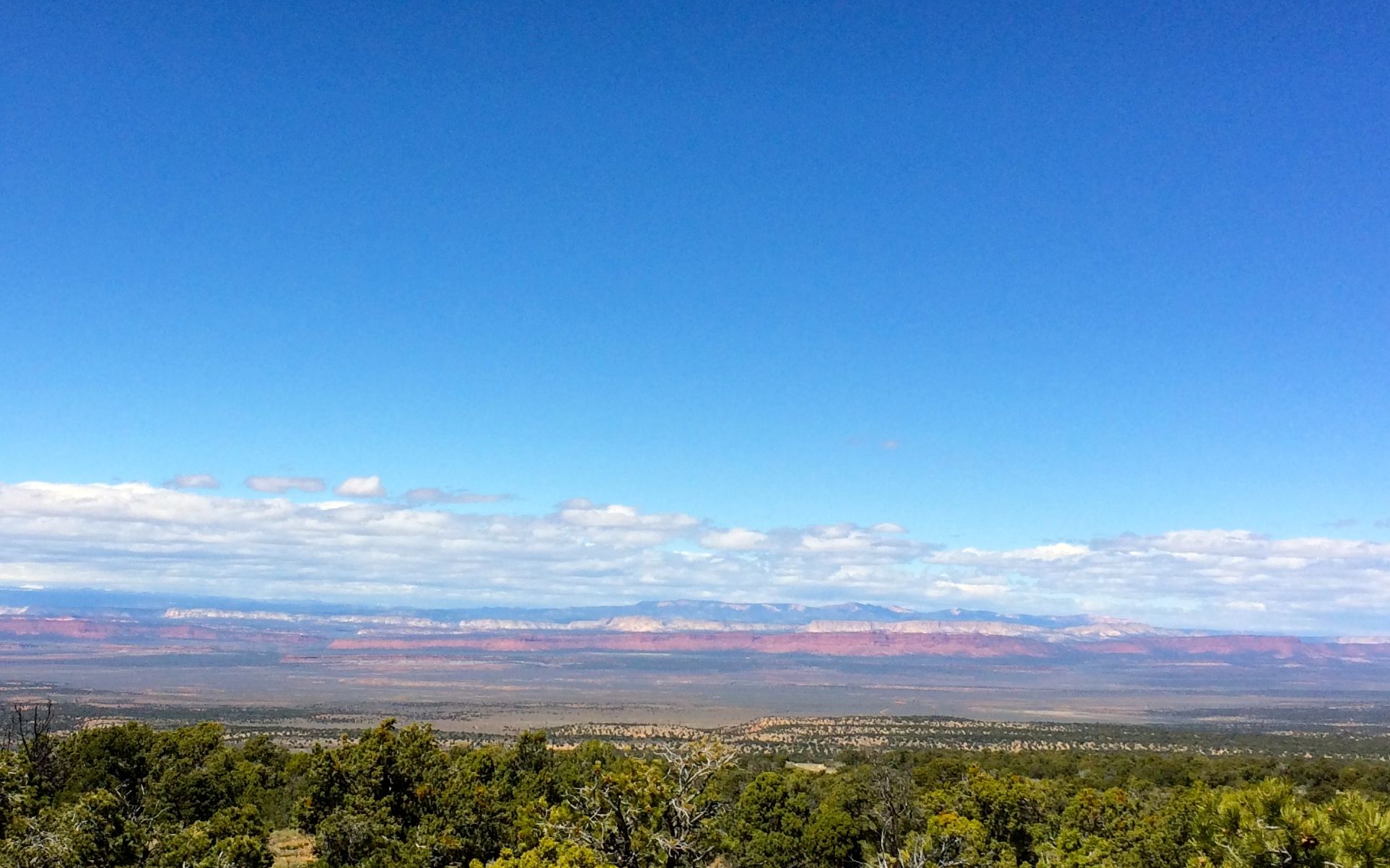
Back on the road, and there was another scenic pull off.
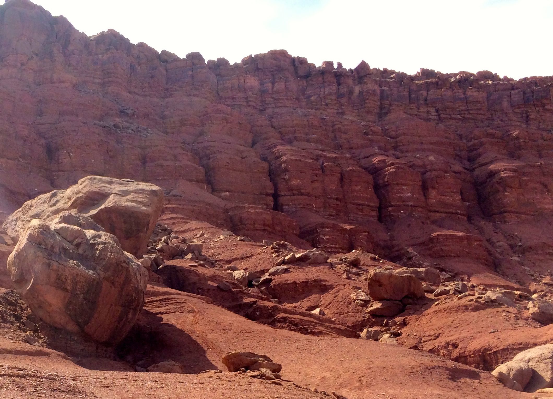
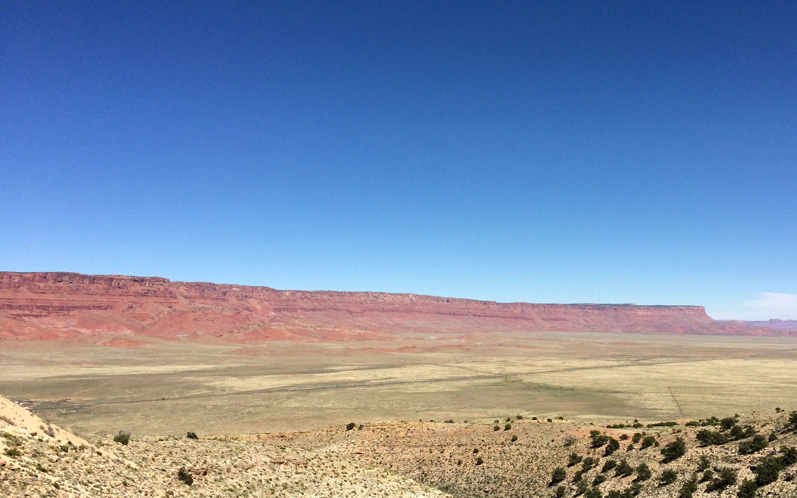
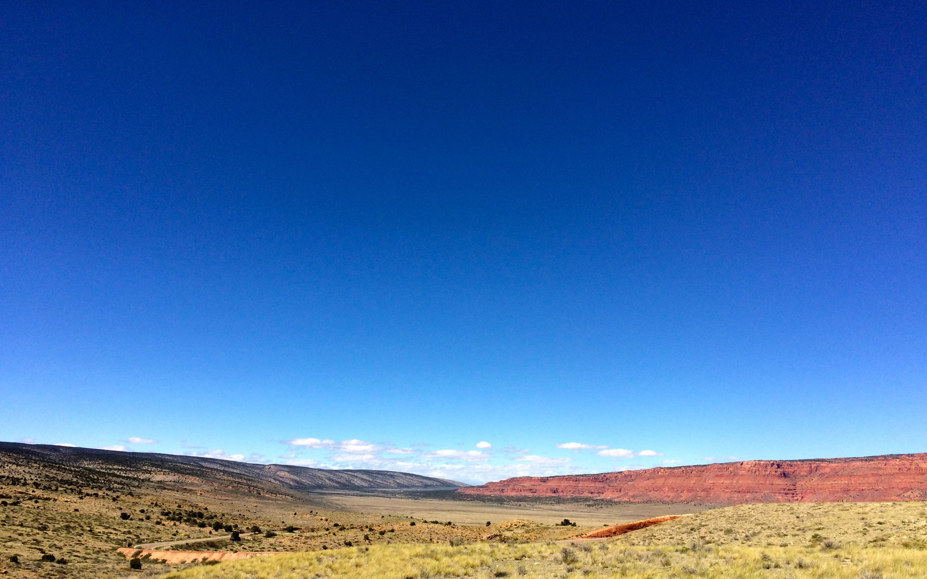
I was getting close to the Vermillion Cliffs National Monument. The land sure does change quickly!
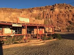
I stopped for a late lunch at a restaurant called Cliff Dwellers. It was also recommended by a random person.
Nourished and refreshed, it was time for the final push to Lee’s Ferry Campground.
I got there and found a pull-though site. I leveled the trailer and got unhitched and then went to pay my $18 nightly fee at the kiosk. It’s a small campground and no one was on duty – at least not this time of year. Someone in an official vehicle toured the camp several times a day, but no one was there to check us in and out.
The campground is perched on a bluff above the Colorado River. There are about three sites that have front row seats. I was tucked in the middle, but I still walked over to take a look.
Yep! That’s the Colorado River down there!
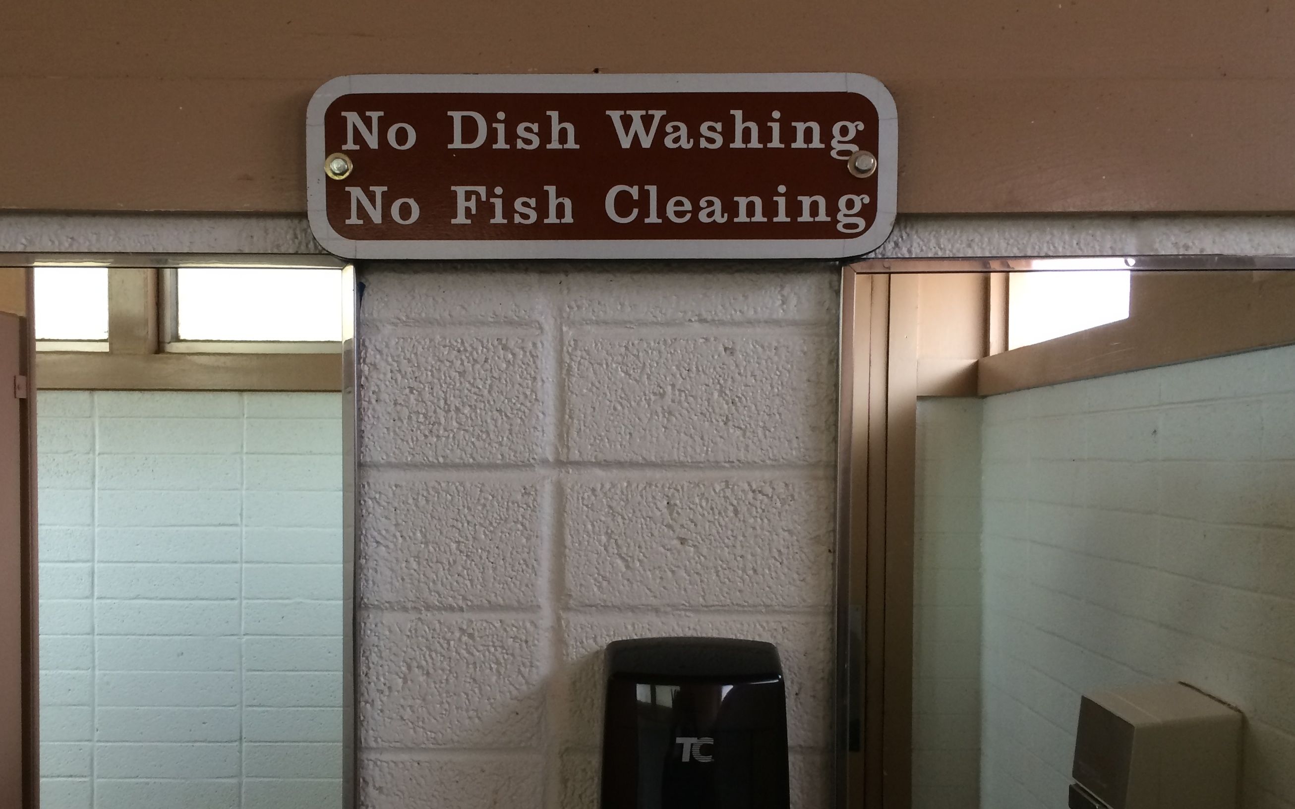
And, judging from the sign in the restroom, there is fishing in the river.
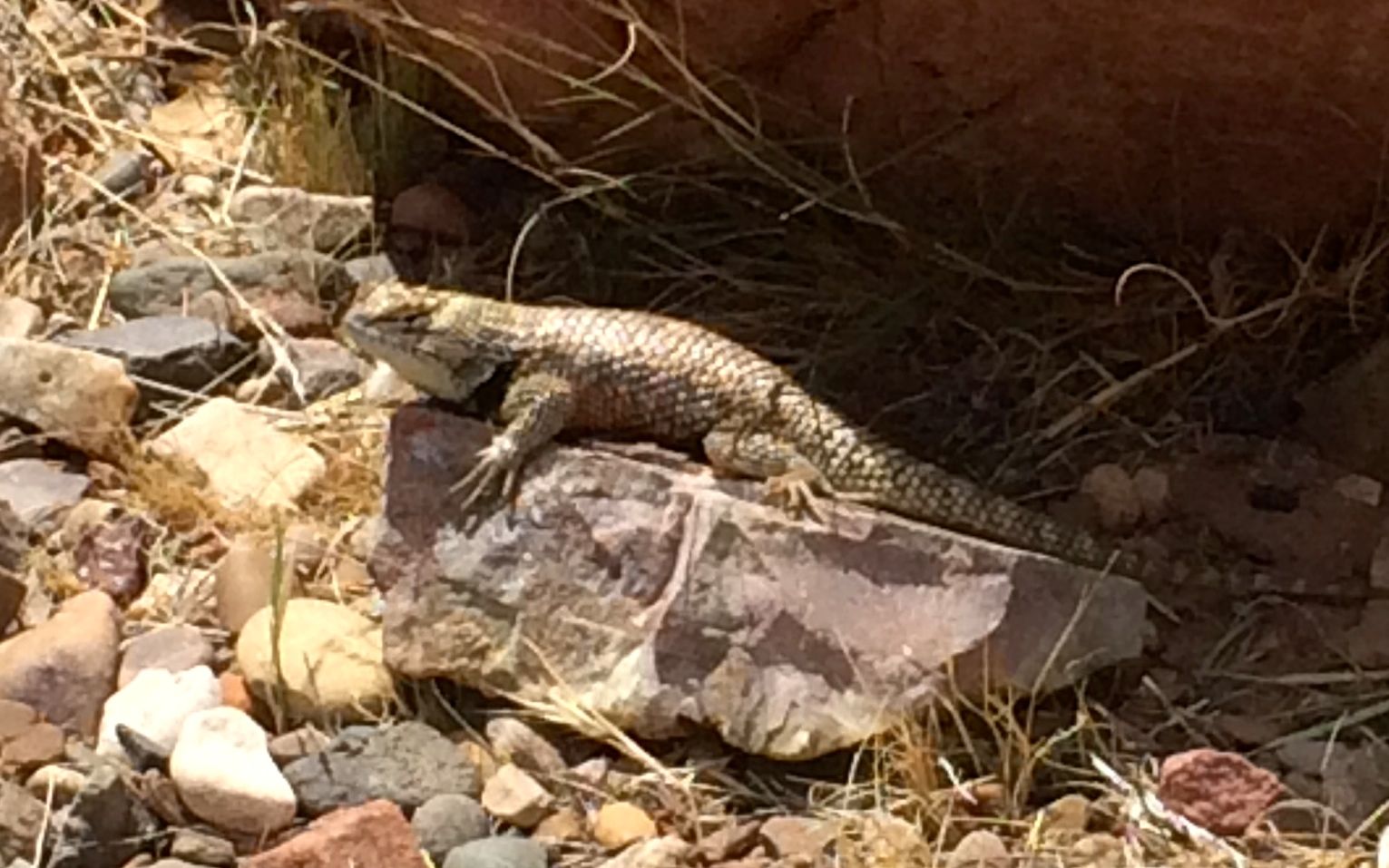
There are lizards up around the campsites.
I met a lizard sunning itself on my way back to the trailer. I had business to attend to back in the trailer, however.
I alluded to the changes in spending that would be coming along in May. Yep, it has been my most expensive month so far this year.
Thank goodness for insurance, is all I can say. At the end of April, I punched a hole in the side of my Airstream. I was trying to back into a space and I think the tires slipped off the asphalt. Those gnarled old trees in Arizona are tough!
It kind of changed my plans, though. I needed to get things taken care of, and the only place that could handle me in a reasonable time frame was Desert Autoplex RV in Mesa, Arizona. So, the guys at Desert Autoplex got all the parts in, I got the claims filed and we got it done. I also got the dent I put in the back end in 2014 taken care of.
Incidentally, if you need Airstream repairs done, I highly recommend them.
Here are my expenses for May:
RV expenses $1770.00
Gas 403.08
Campsites 316.84
Other expenses 306.25
Groceries 163.86
Restaurants 133.58
Tourism 111.50
Truck expenses 80.89
Laundry 11.00
Tolls and parking 10.00
Food and drink on the go 8.42
Clothing 3.13
TOTAL $3,318.55
I drove 2,300 miles during the month. A good chunk of the driving was due to the fact that I had to change plans in order to get the repairs done.
I stayed at ten different campgrounds and I spent ten nights in a HOTEL while the trailer was in the shop. Insurance covered that expense.
I wish I could say that June was going to be better, expenses-wise, but I have the truck and trailer insurance coming due.

 I suppose I could have parked a little closer to the edge…but why?