I hitched up and headed out. I was thrilled to find this rest stop with loads of information about Wisconsin.Menomonie… Does that name make anyone else think of this Muppet bit?
I was singing it for days!
I reached a point when it was time for me to stop and stretch my legs. Cheese!
After all, I was in Wisconsin, land of the Cheeseheads. And ice cream!
Get a load of the nutritional information. “YOU WANT NUTRITION, EAT CARROTS.” Igor the Rat met me at the door.
In spite of their persuasive argument for ice cream, I decided that I was more in the mood for cheese.
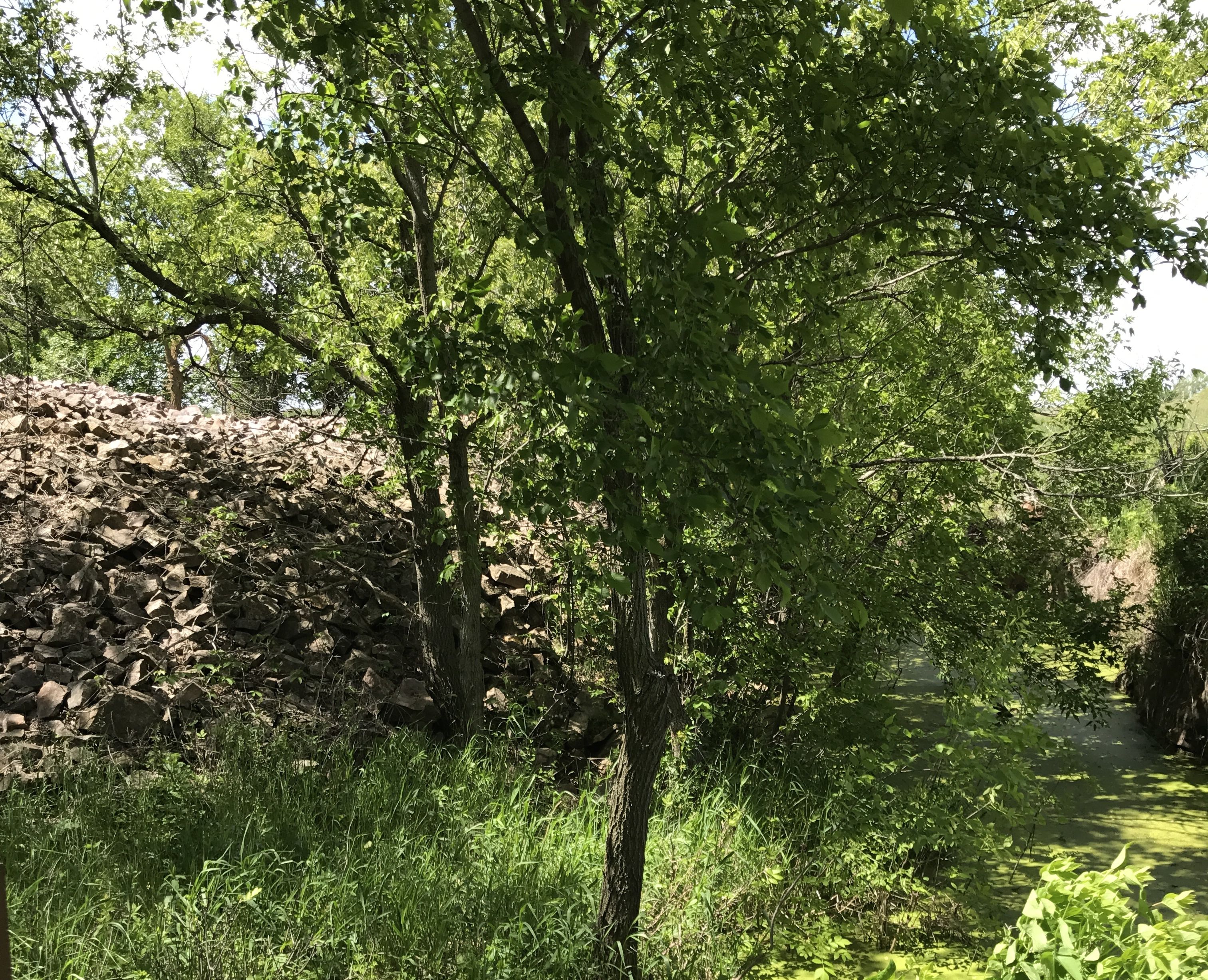
After a quick break I headed off for the day’s destination, Grant River Recreation Area. In spite of the name, it is on the Mississippi River. I was a little leery of the signs that proclaimed “rustic road”. Curvy, rustic roads with a 27 foot trailer are not my favorite thing. But the trip down the rustic, curvy road was worth it. This was an Army Corps of Engineers campground and it was lovely. My site was just a short stroll from the banks of the mighty Mississippi.Of course, train tracks many times follow river beds. My site was quite close to the railroad right of way.
It is kind of exciting when it rolls through. I am glad that I don’t live next to the tracks, though.
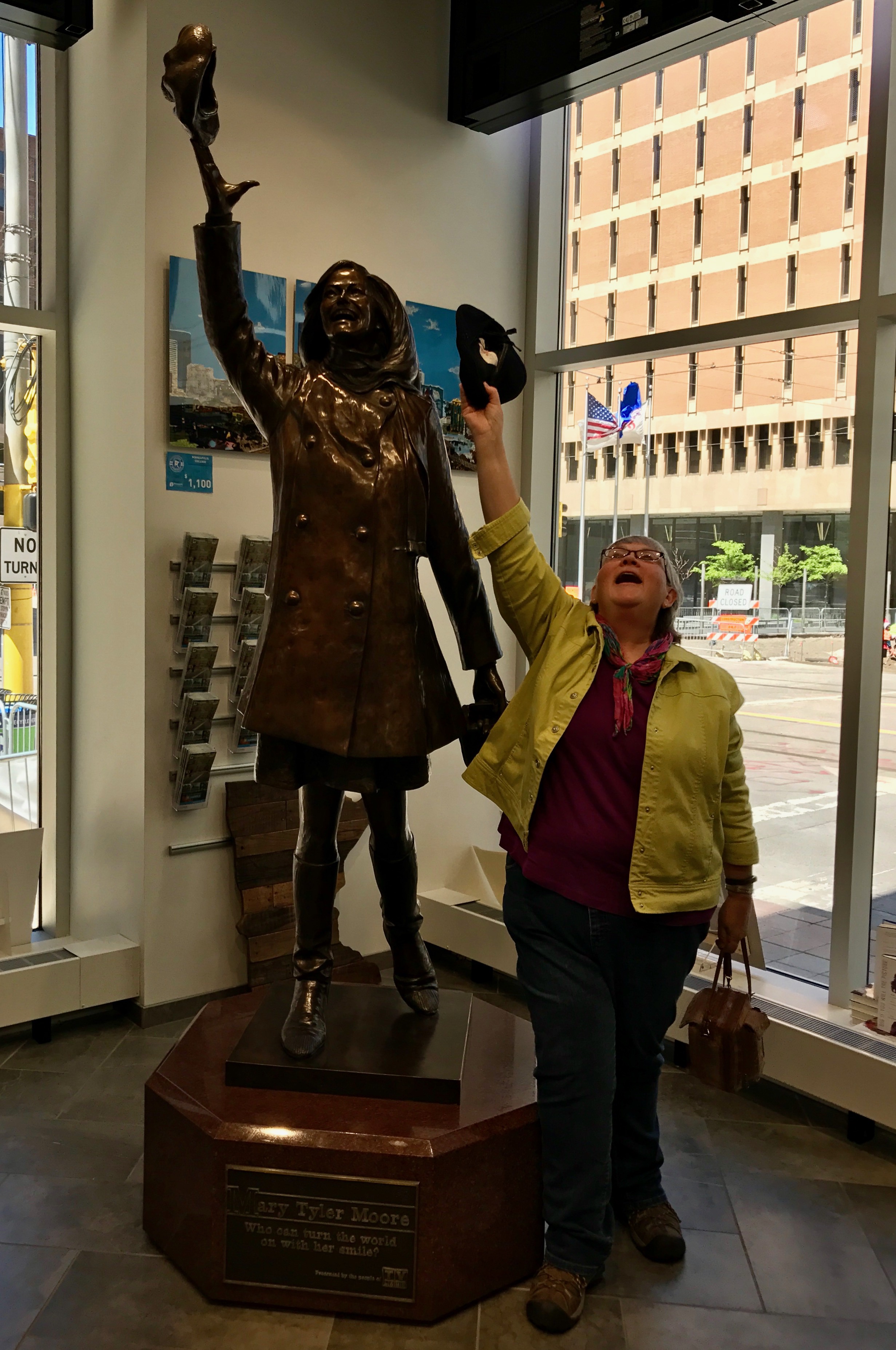
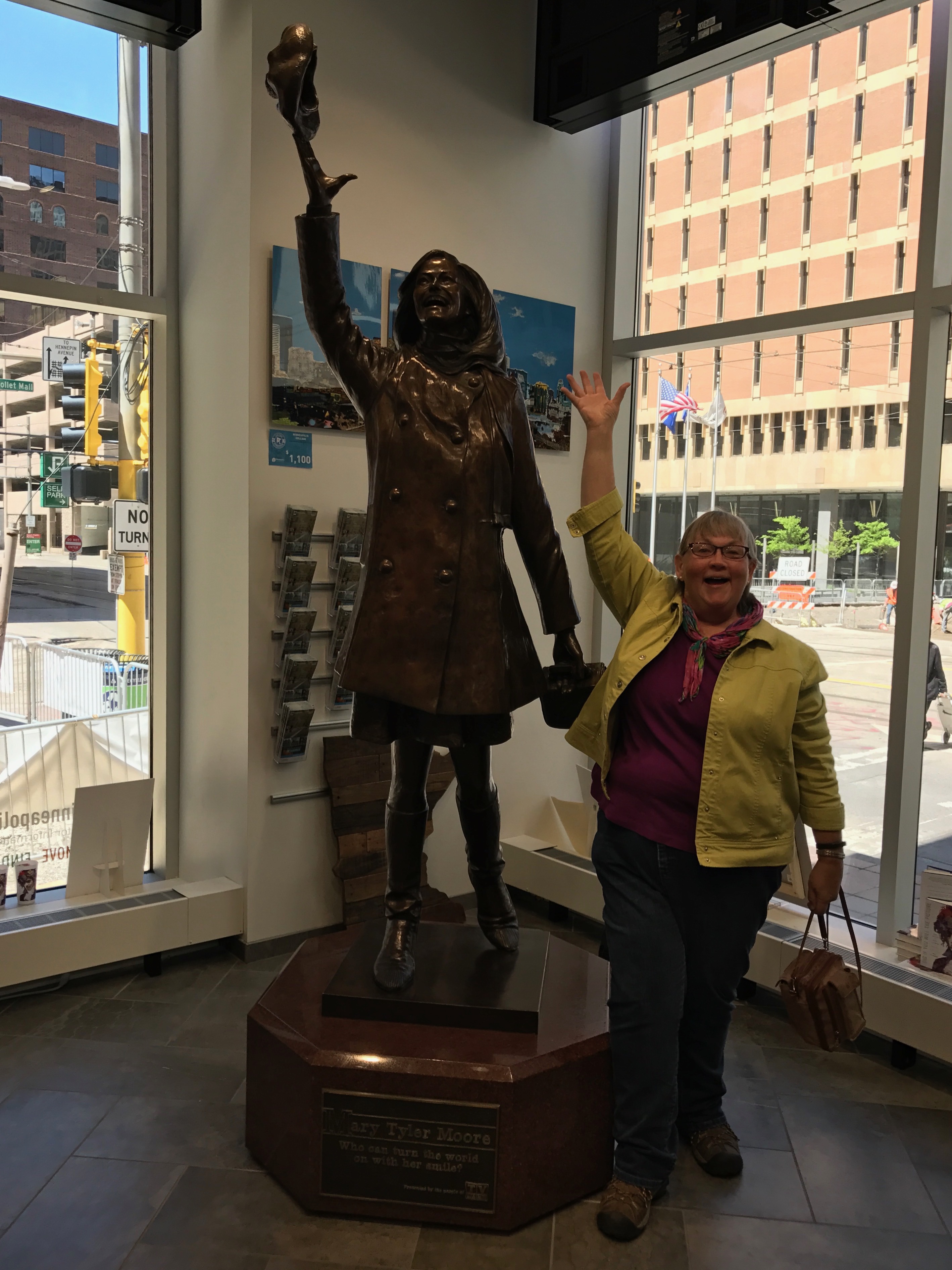
After my visit to St. Paul, my next venture was to Minneapolis. My intention was to visit the statue of Mary Tyler Moore throwing her hat into the air.
I did some research and found out where the statue was these day and set out to find it.
I figured I’d be able to find a spot, even if it meant paying (shudder) to park in a garage. I was kind of wrong.
Traffic was incredible the were in the midst of a lot of road construction. I know it’s summer and places in the north have to do it while they can, but it was too much for me. I did manage to find one garage that said they had a spot. I went all the way up and all the way down and never found an empty one. I came up with plan B.
I drove across the river and found a place to park and I called an Uber. The driver took me right to where I needed to be.
These days, the statue is back at its original location on the Nicollet Mall. When I visited, it was at the city’s visitor center.
One of the workers was very obliging, and he took a couple of shots of me. This one was my favorite. They even had a basket of hats for people to throw.
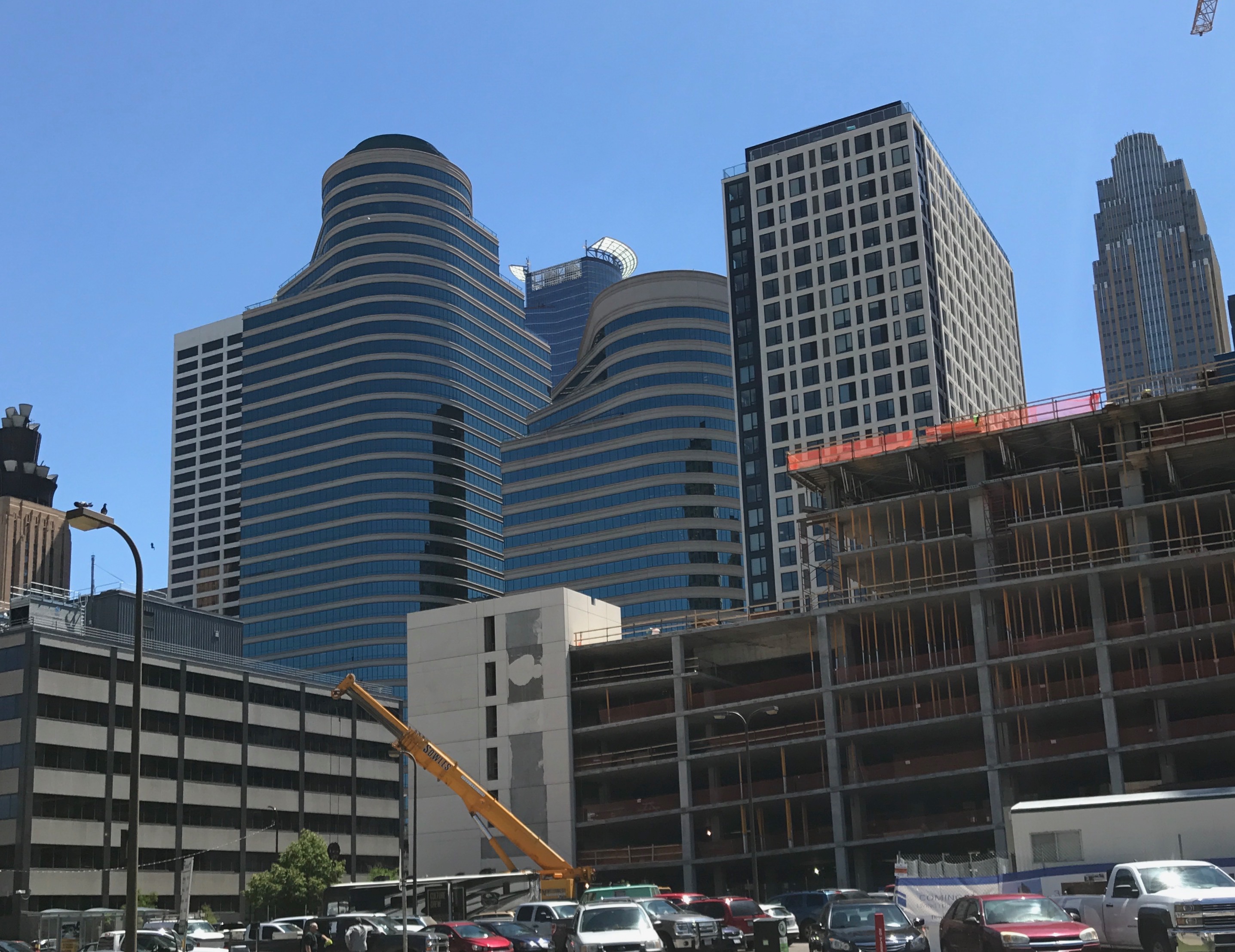
After I got done with the requisite photo shoot, I headed out to see what I could see in Minneapolis.
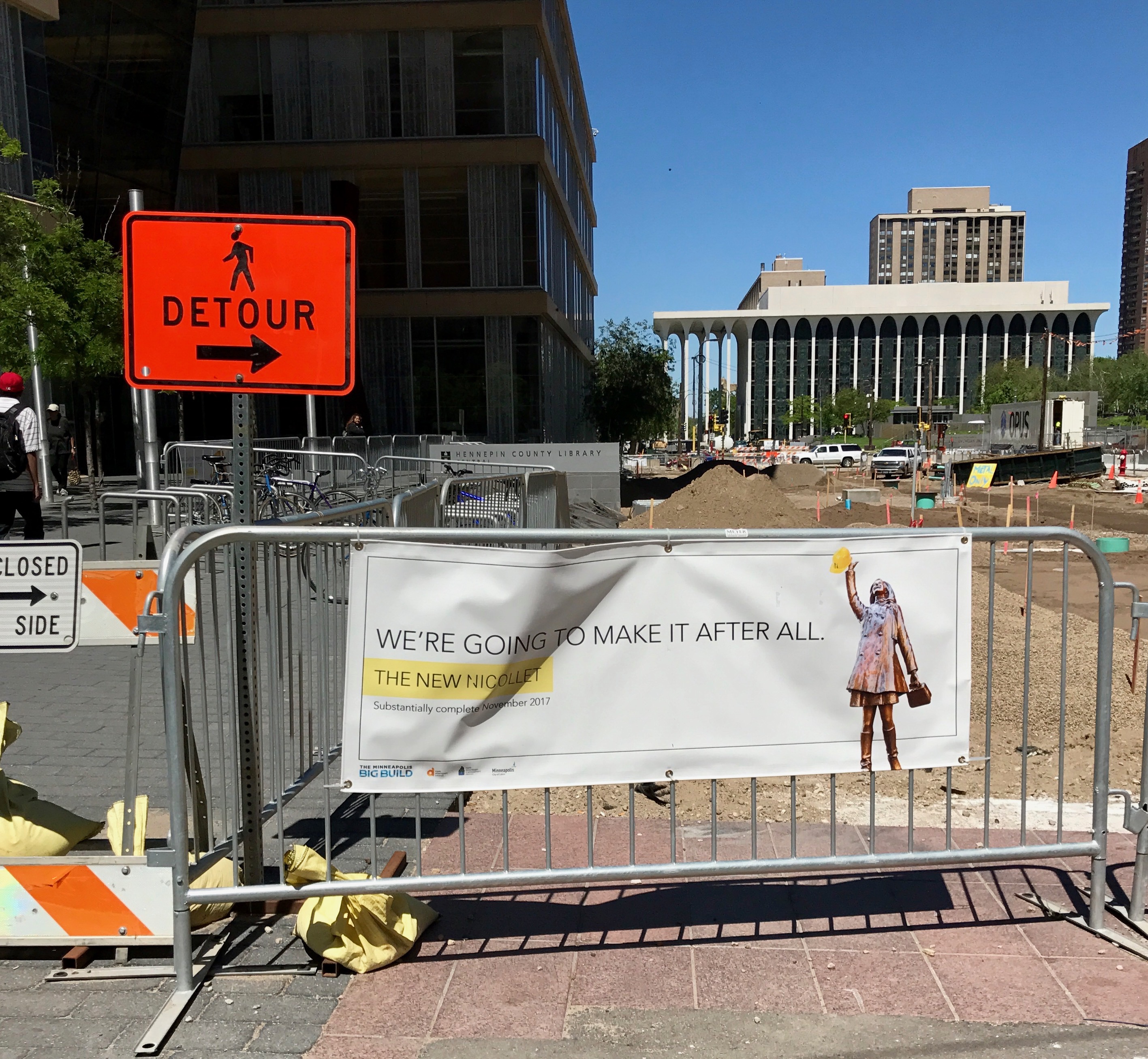
Did I mention that there was a lot of road construction going on?
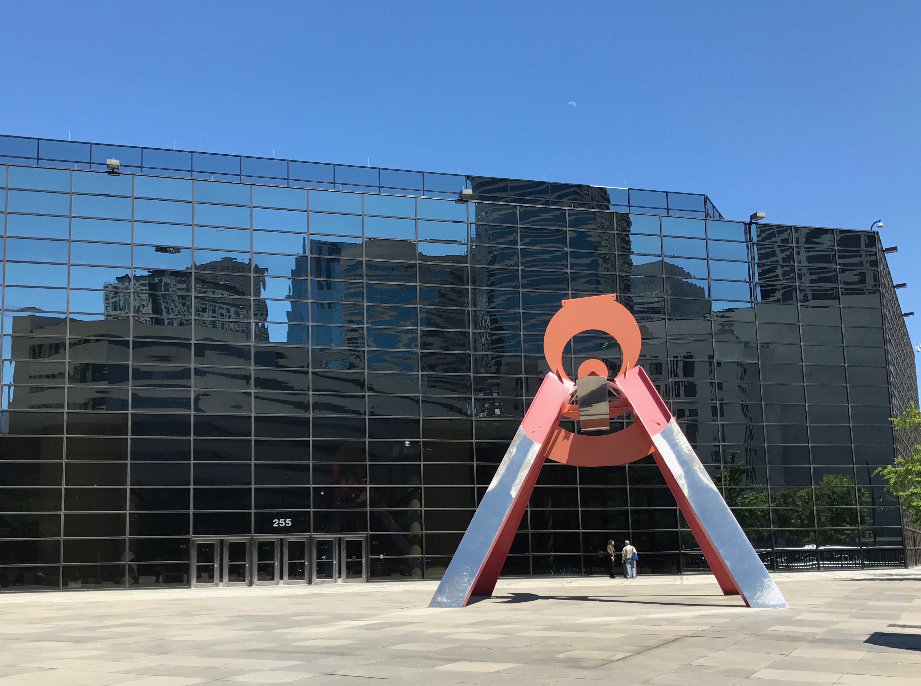
Road were torn up and random pieces of debris where here and there. There was a certain sculptural quality to some of the junk.
Of course, there was also real art. The orange paint on this one makes me think Alexander Calder, but other than the color, it doesn’t look much like his work. I did a little research, but couldn’t find any information on this one.
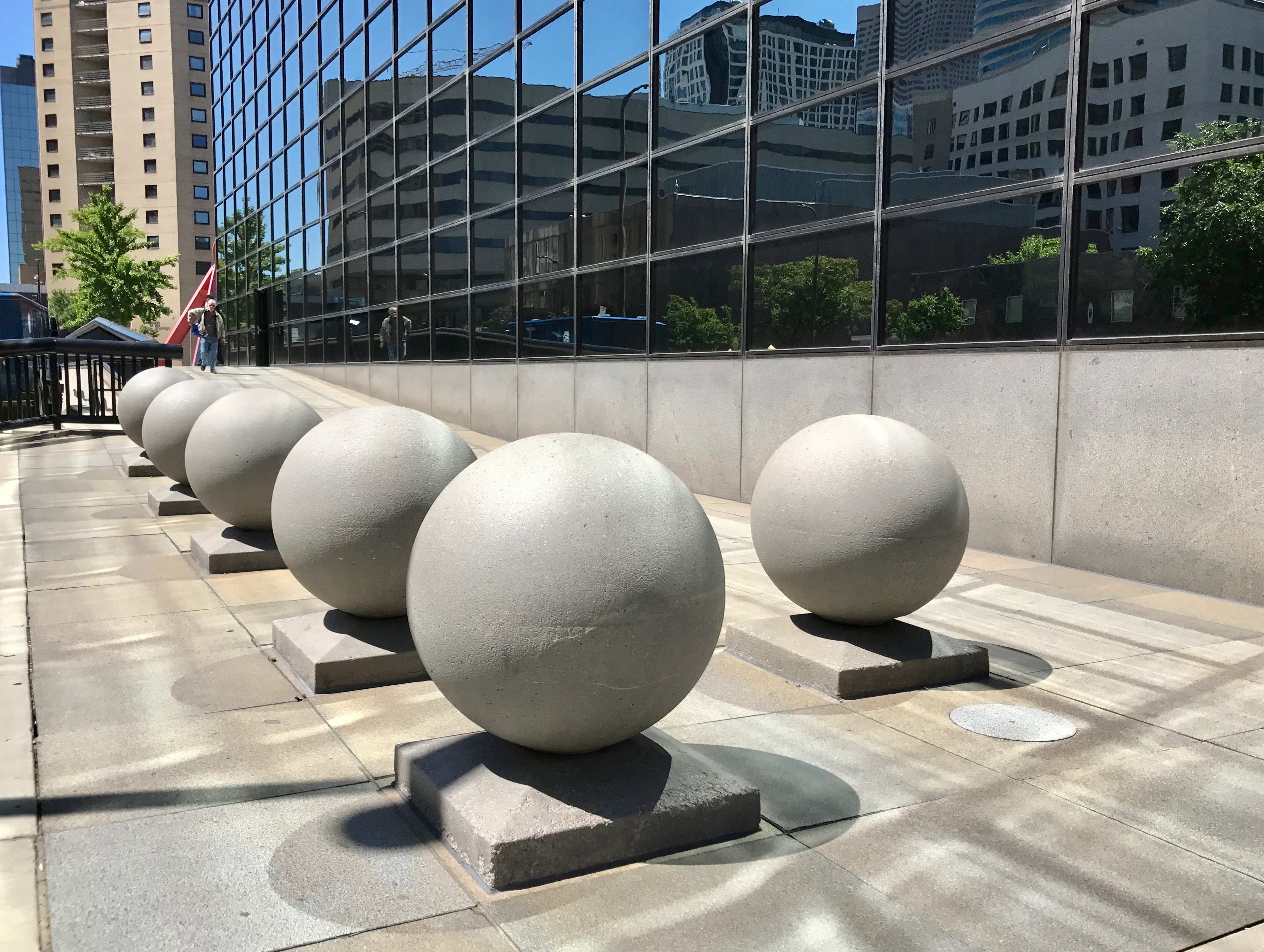
But, really, a modern city on a sunny day – doesn’t everything look like art?
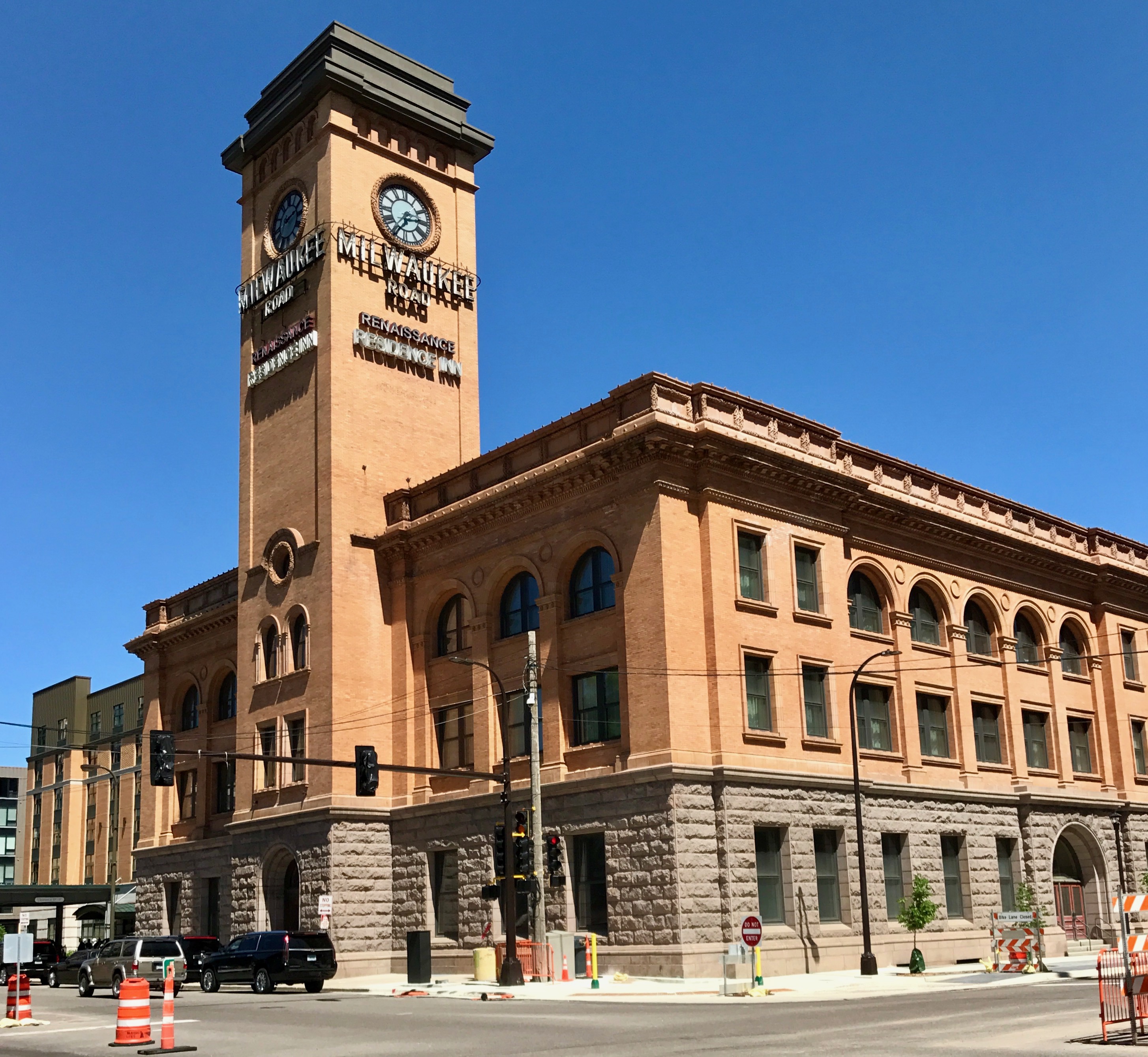
This repurposed train station, which was built in 1899. At its peak in 1920, 29 passenger trains a day used the depot. Through the years, passenger traffic decreased nationwide and freight facilities were moved to other places. The depot was closed in 1971 and it stood vacant for many years. In 2001, it opened as a hotel.
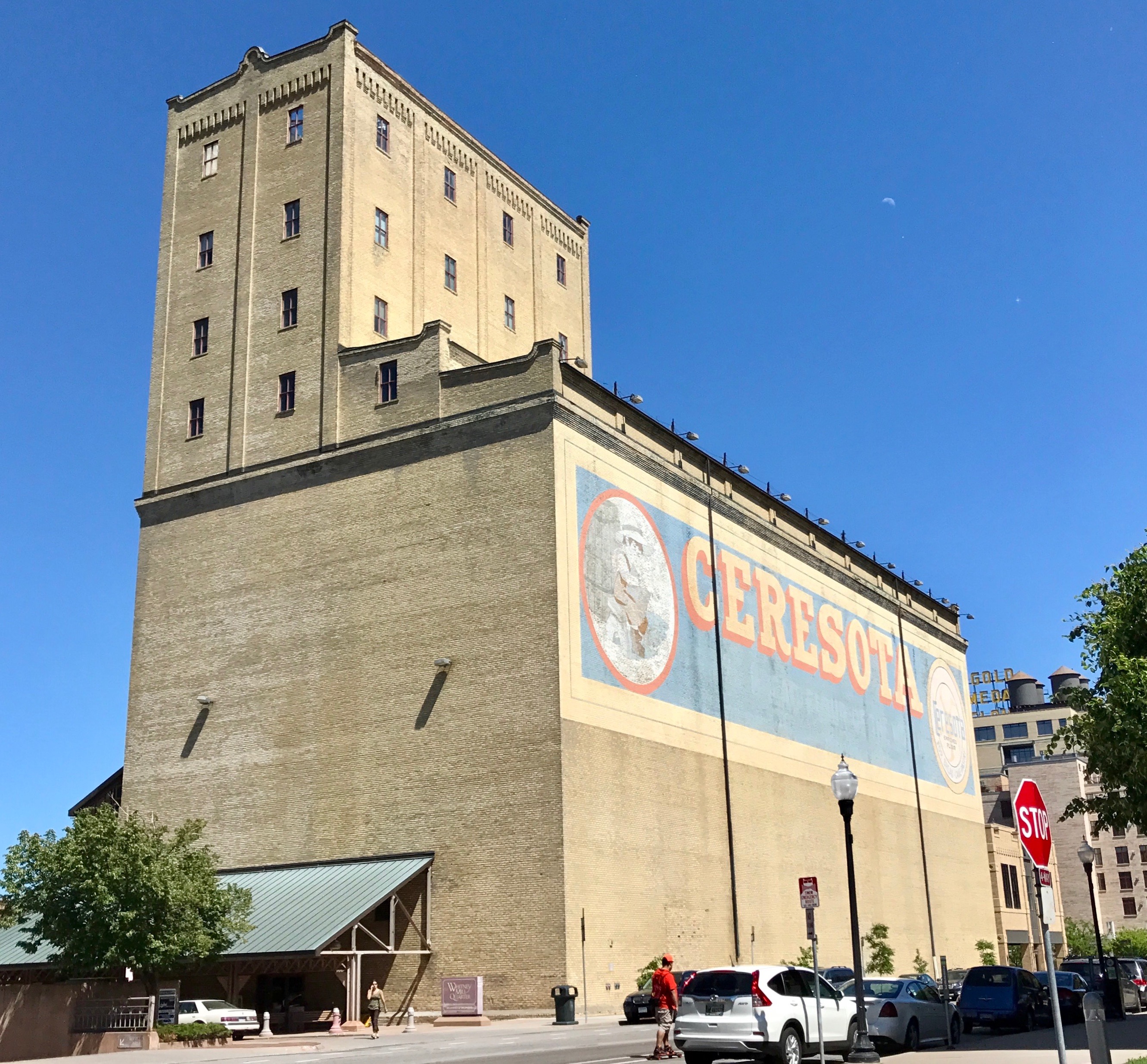
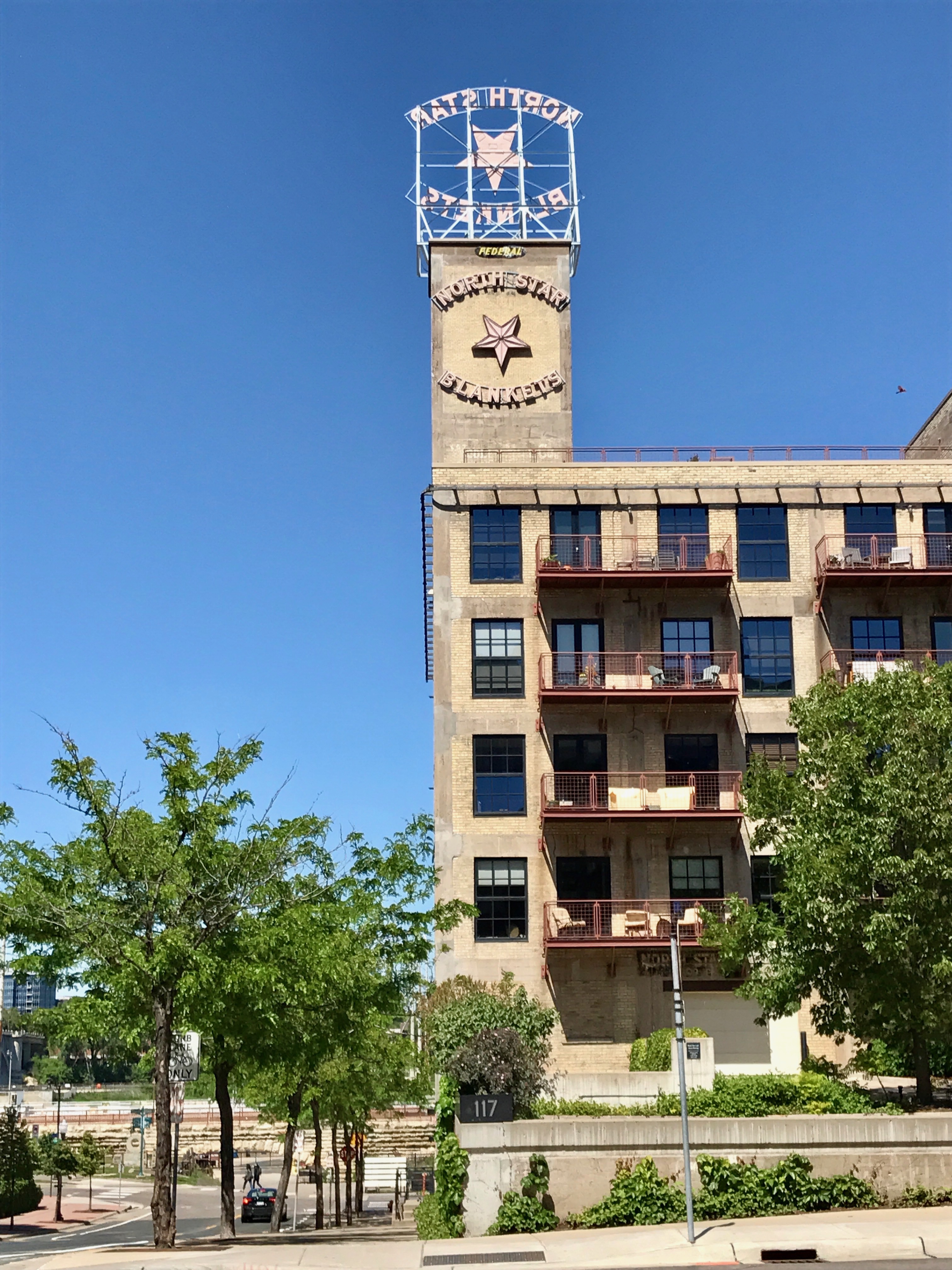
Train depots aren’t the only buildings being repurposed.
I rather fancy a condo in an old blanket factory. Doesn’t that sound cozy? Of course, I am sure I don’t have the funds for something in the cool and groovy part of town.
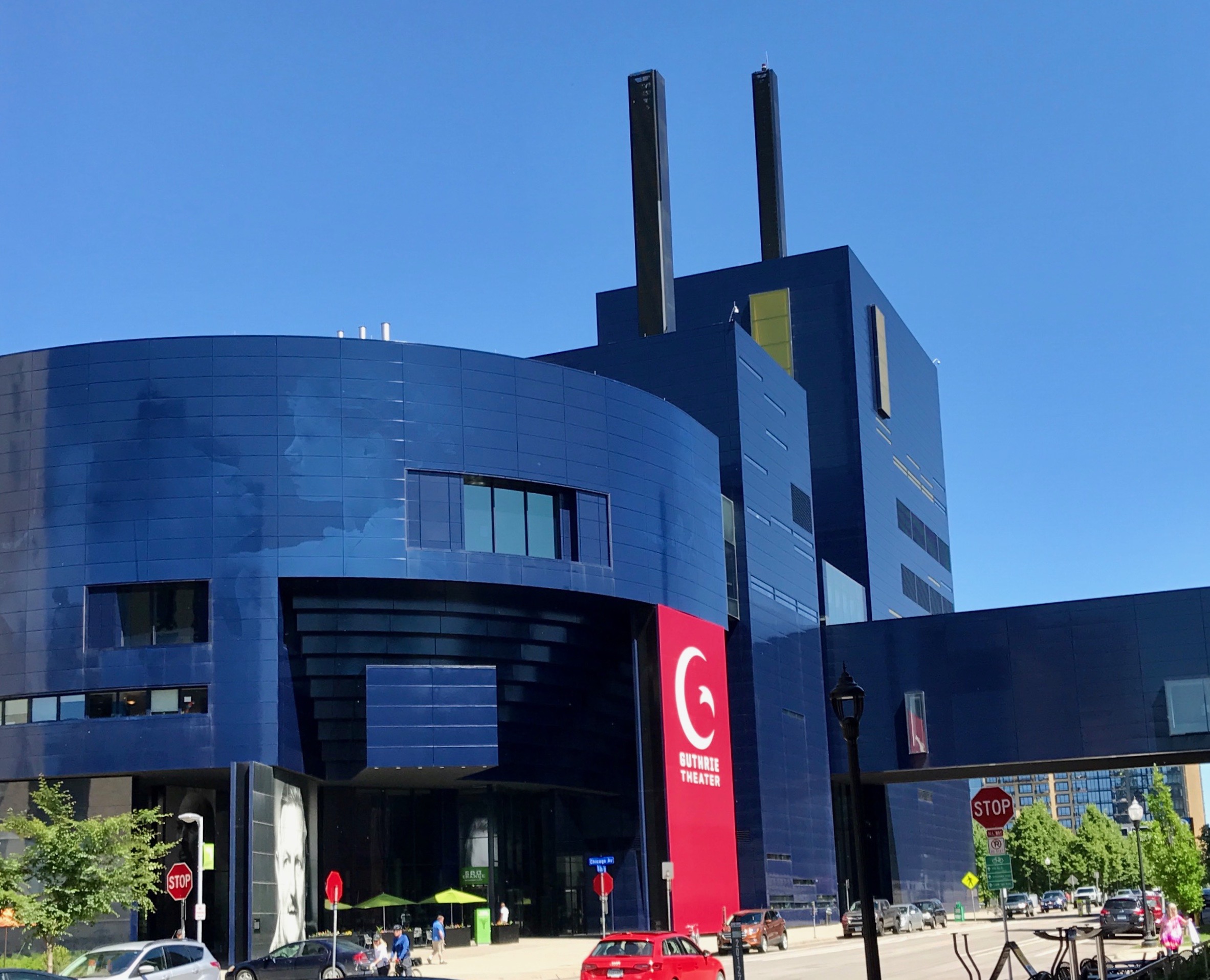
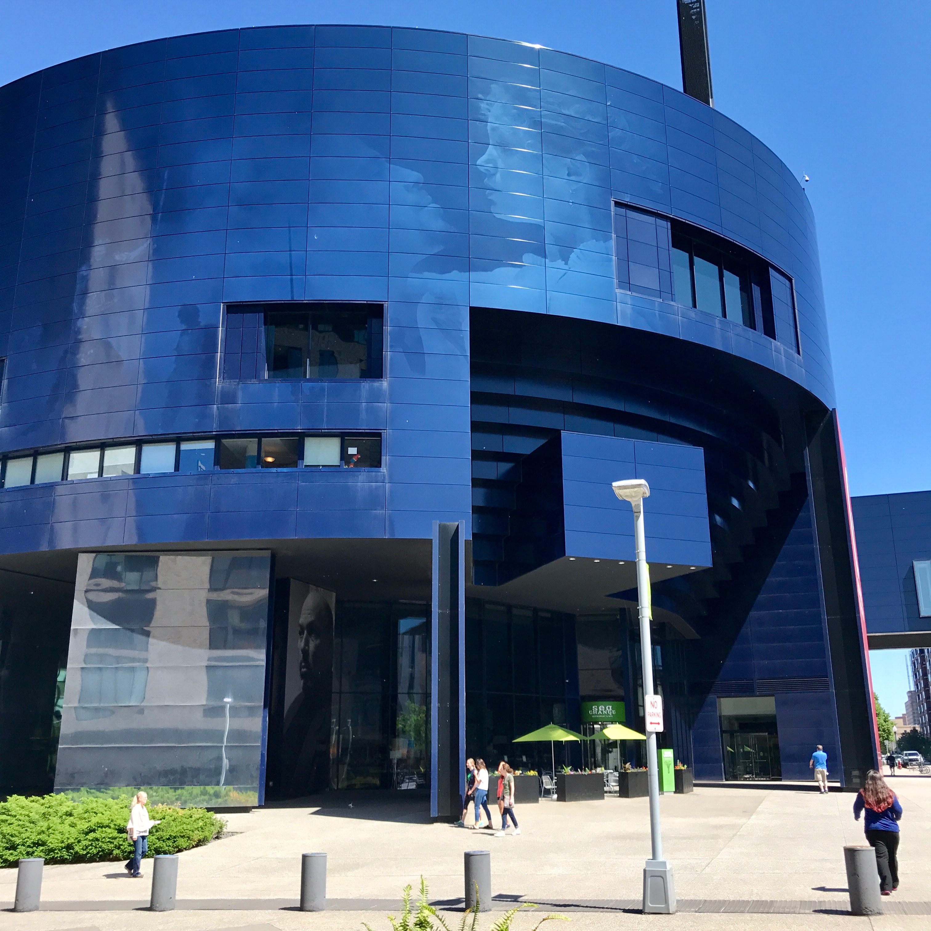
Speaking of cool and groovy, here is the Guthrie Theater.
The entrance rather reminds me of Darth Vader.
Or maybe I’m imagining things.
The theater is named after Sir Tyrone Guthrie, who was an Irish stage director.
And Sir Tyrone does remind me of my cousin, Bill.
Anyway, Sir Tyrone was influential in Canadian theater. He directed the first season at what its now the Stratford Festival, and his five years there proved to have lasting influence on Canadian theater. In the last 1950s, he and colleagues Oliver Rea and Peter Zeisler decided to create a resident theater away from New York. They opened the Guthrie Theater in 1963. Sir Tyrone remained artistic director until 1966. He returned to direct plays during the three seasons after that. He made his final curtain call in 1971.
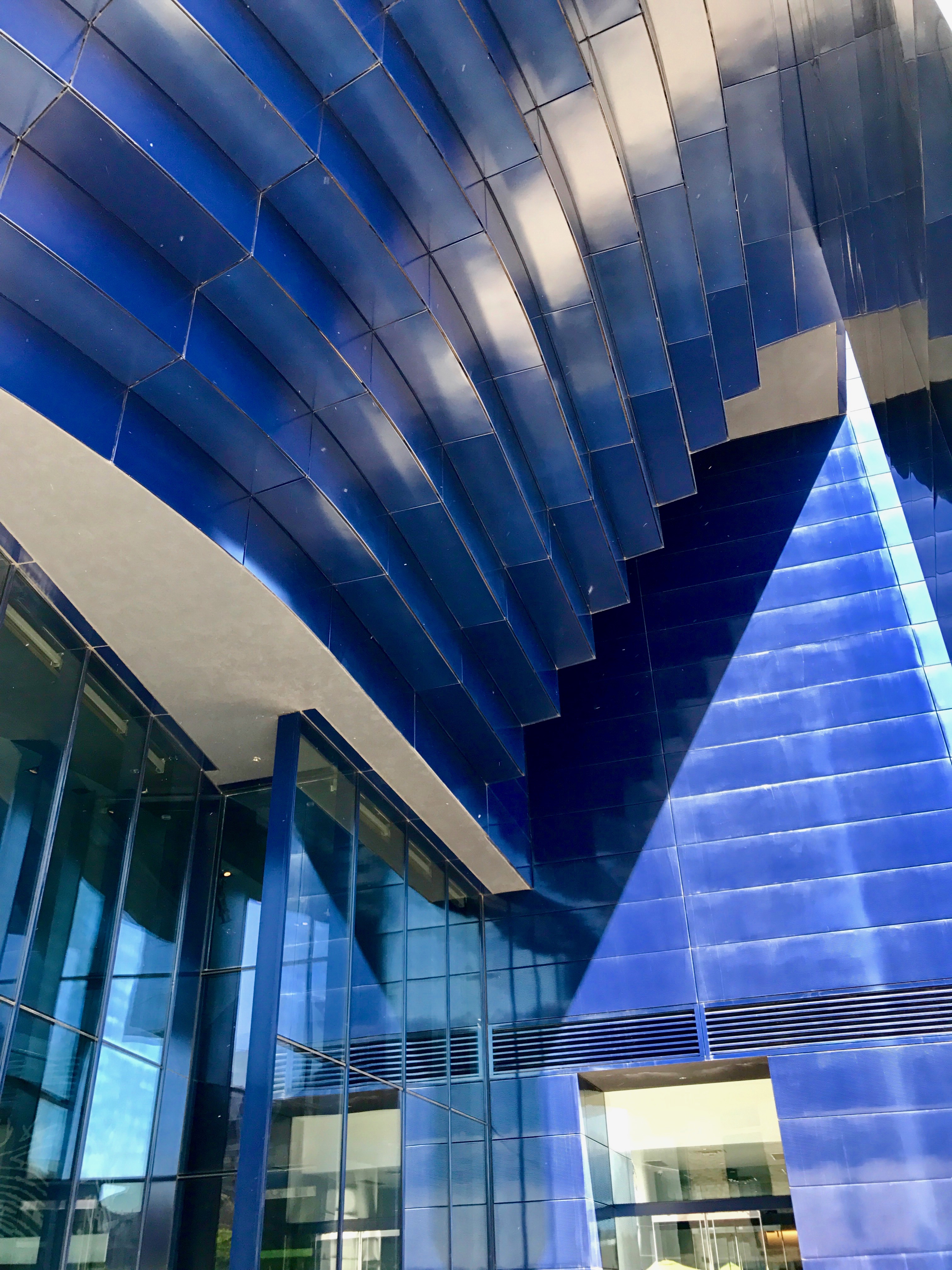
I passed the large portrait of Sir Tyrone and through the entrance. This is quite the sculptural building – and so monochromatic.
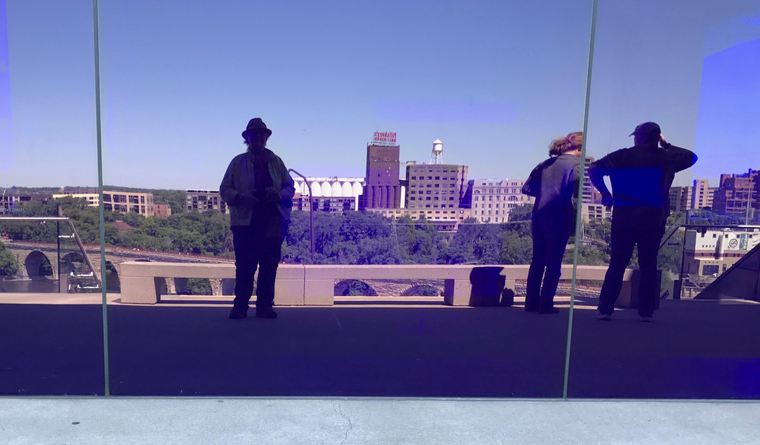
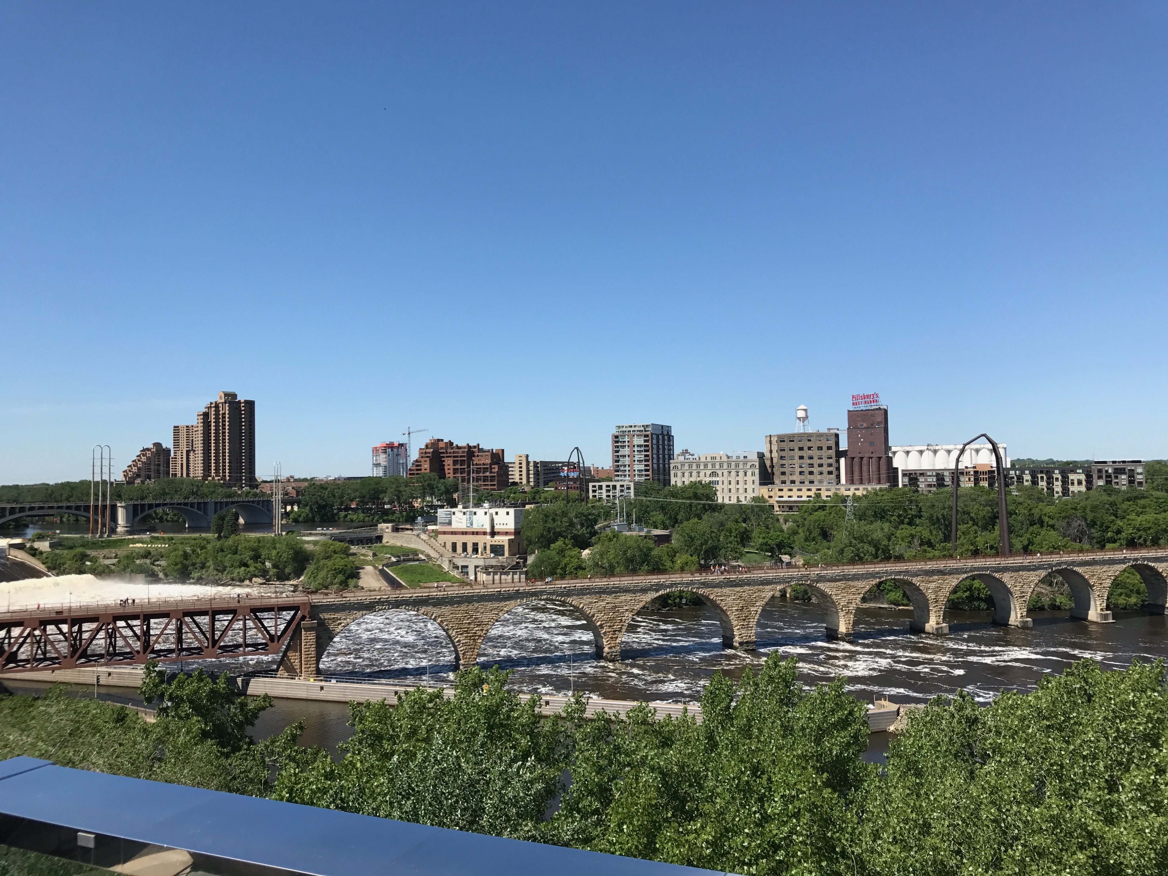
I made my way up to the observation deck. It was a perfect place to take a self portrait.There were some great views of the river. That’s the Mississippi down there!
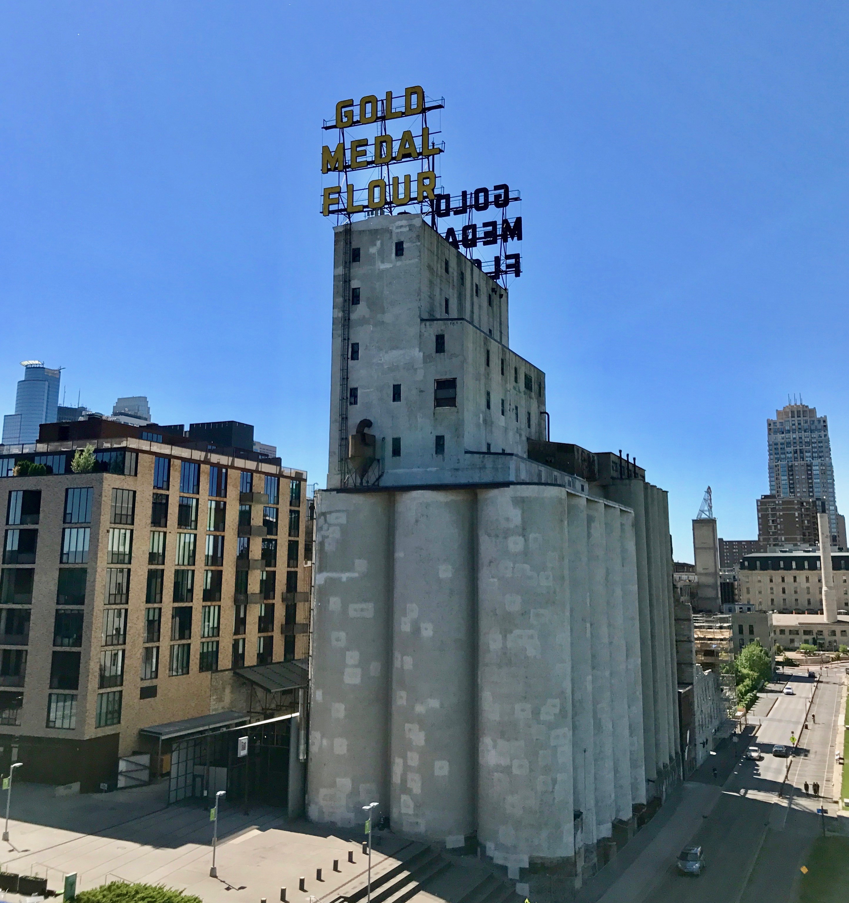
Off in another direction, there was a view of the old Gold Medal grain elevators. Really, doesn’t everything look beautiful with blue skies and bright sunshine?
I figured I had seen what there was to see at the theater, so I headed out.
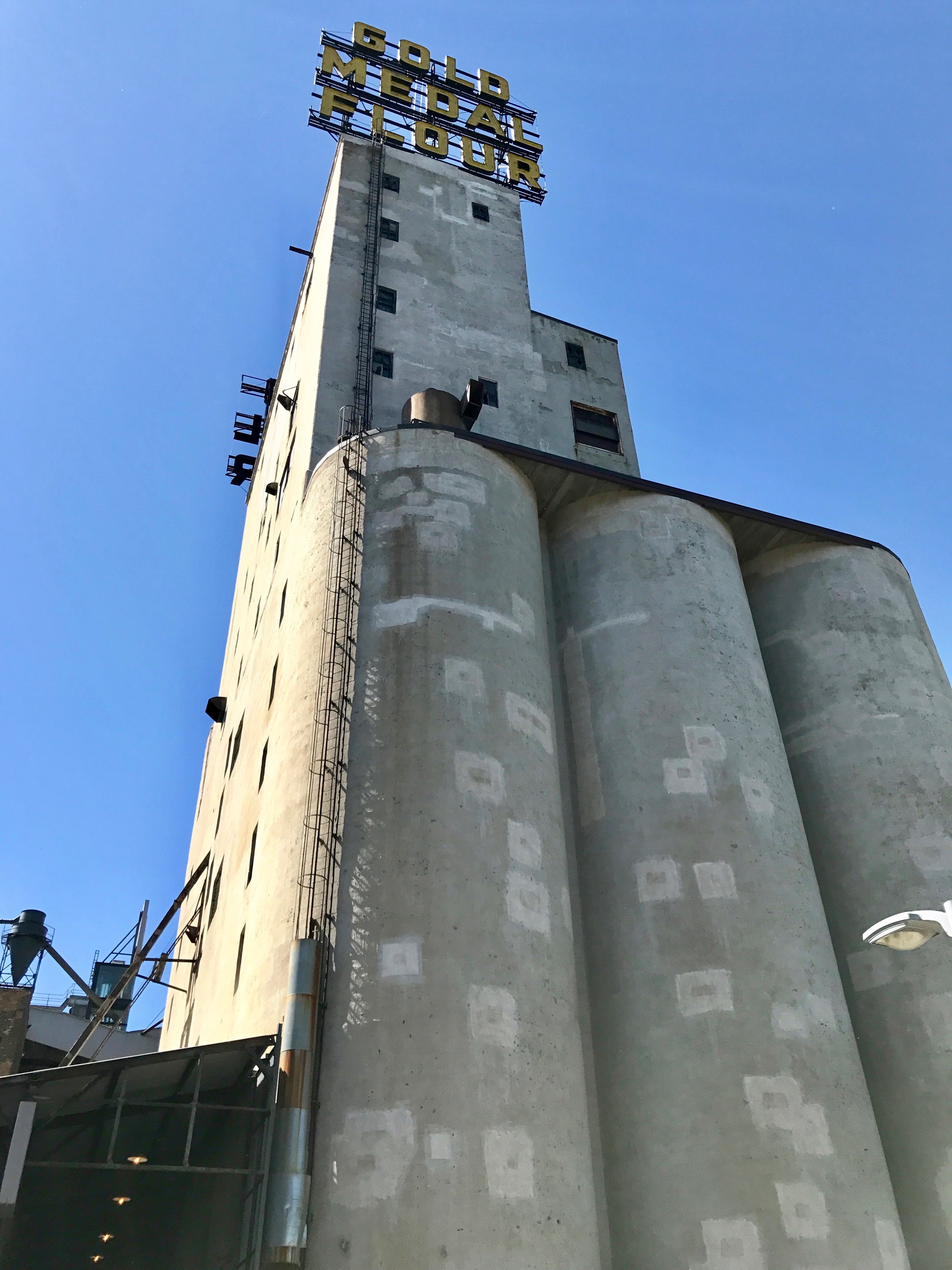
Here’s Gold Medal from the street level.
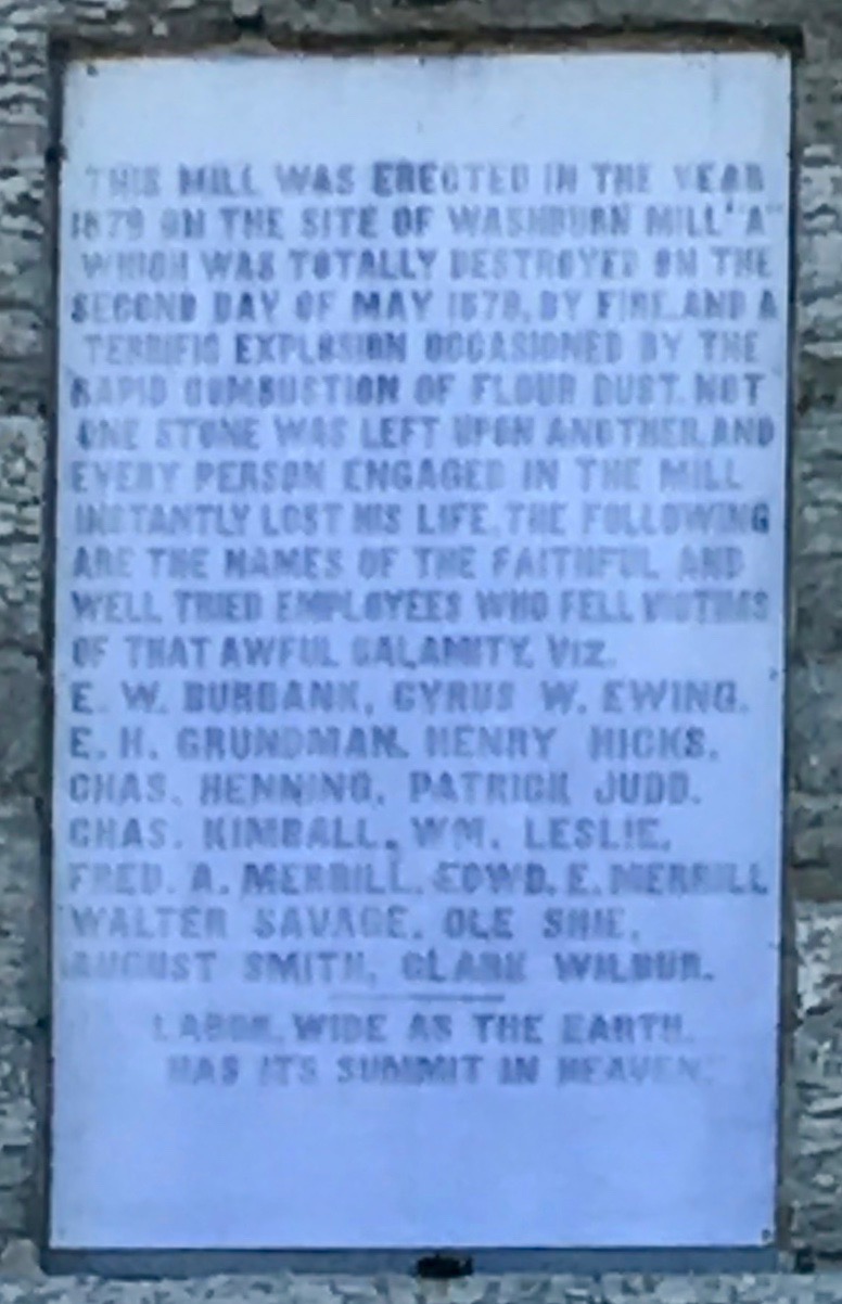
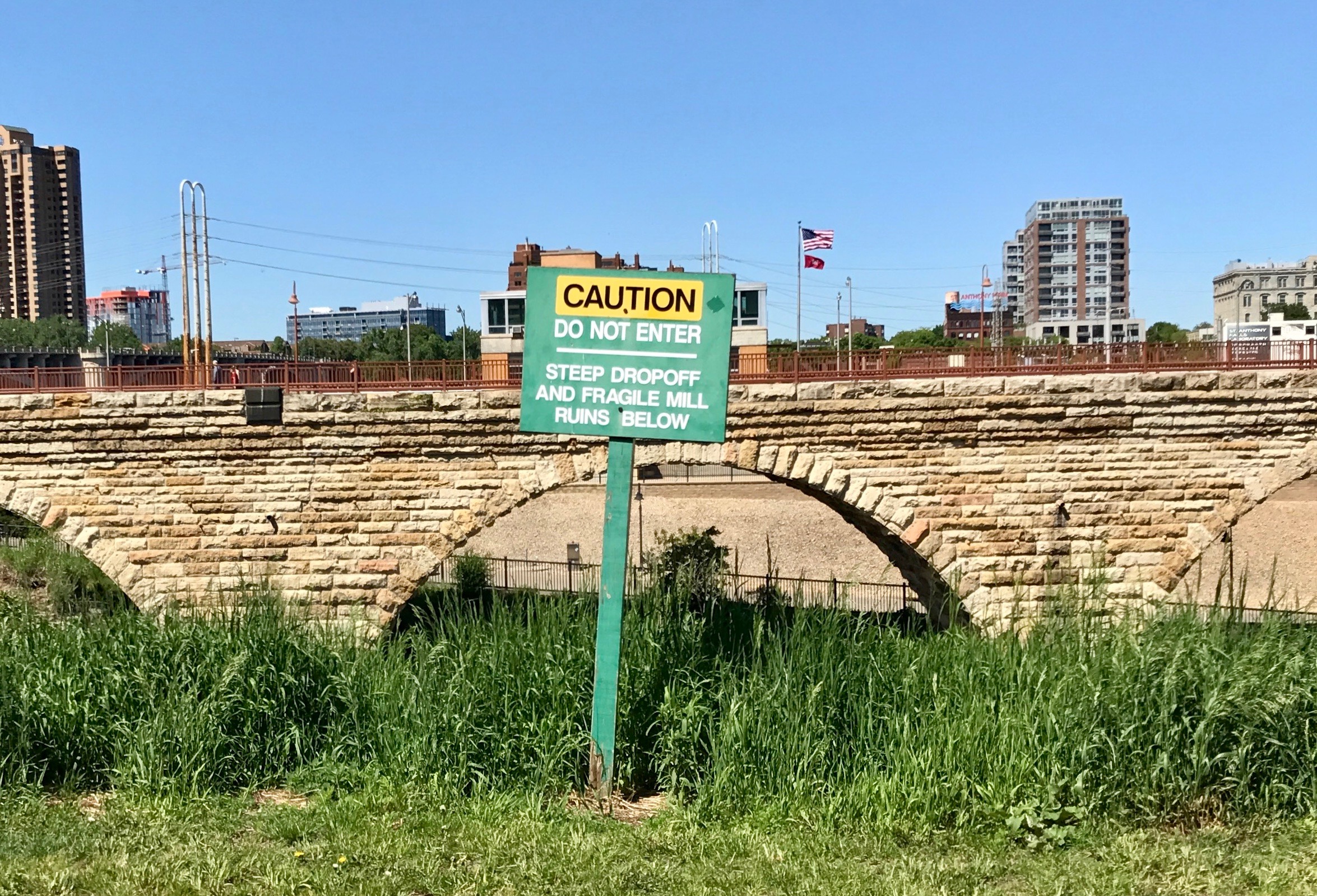
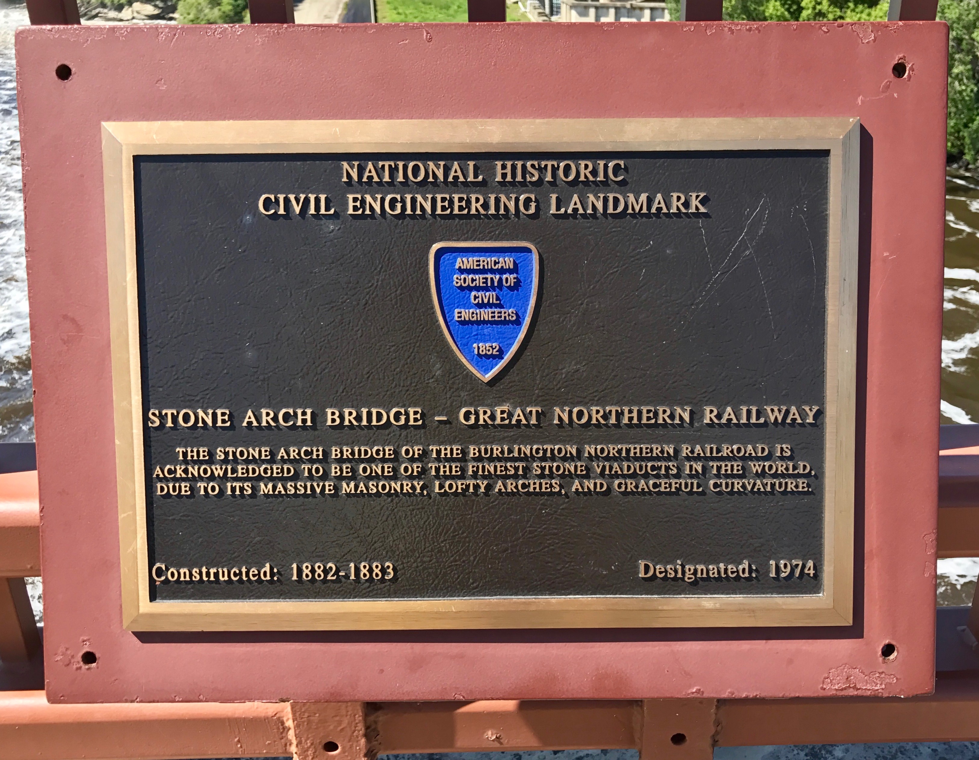
I decided to cross the river on that stone bridge I saw from the observation deck and I headed in that direction. Nothing like having a bird’s eye view to help you plan your route.Hmm. Mill City Museum. I guess I’ll have to put it on my “Next Time” list.This is the plaque that is above the archway. The Washburn Mill explosion was quite a disaster. I was getting closer to the bridge. There was really no need to warn me about staying away from a steep drop off. I guess if you went over the edge, this is what you might see on the way down.
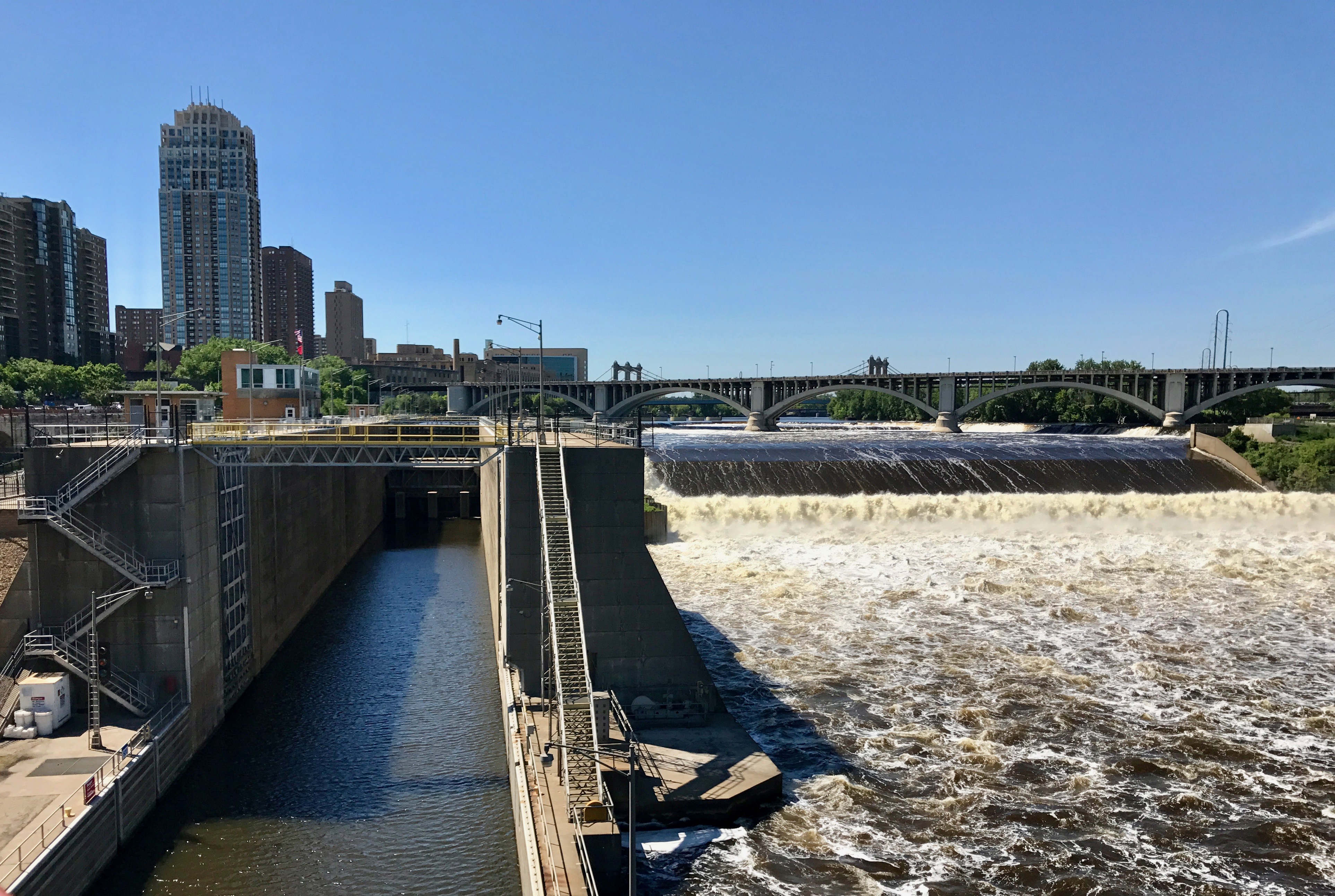
The Mississippi didn’t look particularly navigable from the observation deck. As I got closer, I could see how they did it. There were locks built along side the river.
I set out across the bridge, and discovered that it was a repurposed railroad bridge. The people of Minneapolis are really into maintaining their heritage.
Milling in the area began in the 1820s with the construction of a gristmill and a saw mill that was operated by the soldiers from Fort Snelling. Milling continued and grew until the national flour market shifted to Buffalo, New York as well other cities that were not identified on the historical plaques on the bridge.
I got across the bridge and found that I was less than clear on where I had parked Bart. I had a general idea, so I set off in that direction.
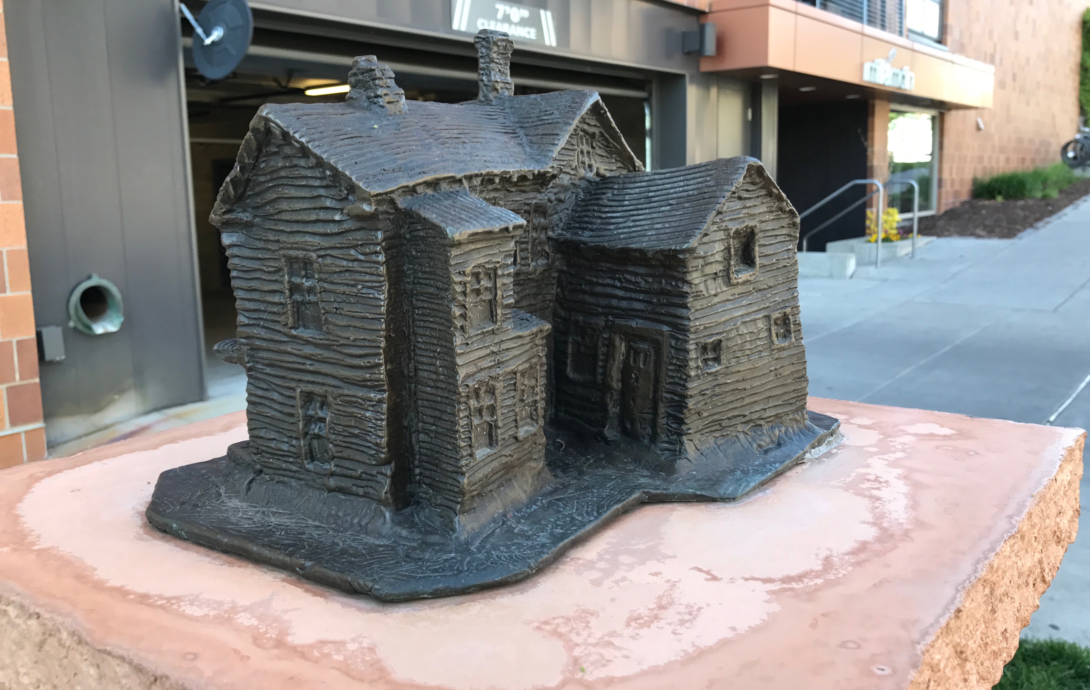
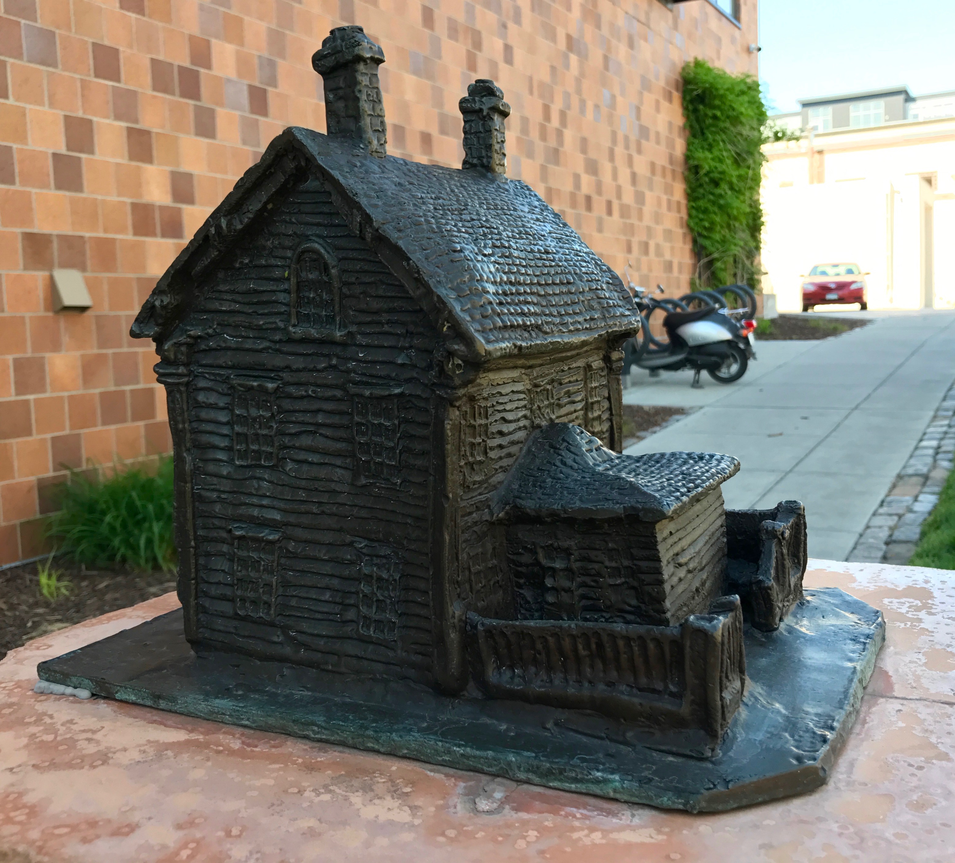
Along the way, I encountered these sculptures honoring the buildings that had been in the area. This is the Van Cleve House that was built in 1858. Horatio Van Cleve was a Civil War general. HIs wife, Charlotte, was an agent of social change who spoke out against slavery, for women’s rights and was even elected to the school board.Businessman John Dudley built this house in 1856. These buildings were built along Main Street in 1855, 1858 and 1890. They housed a hardware business, a bookstore and pharmacy as well as a saloon. You know what they say – All work and no play…The last sculpture I photographed was the Winthrop School/East High School. It was built in 1897 and 1900. The Winthrop School was in operation from 1867 until 1898, When it was replaced by East High School. Part of the school still stands, although I wasn’t sure which part it was.
By this time, I was getting tired, thirsty and a little anxious that I might not find Bart. I wish I had written down where I left him – or maybe taken a photo of the intersection or left a trail of bread crumbs. Something!
But, I took a deep breath and looked around.
And there he was! I had never been so happy to see that big red truck!
Time to go find something to drink and maybe some dinner.
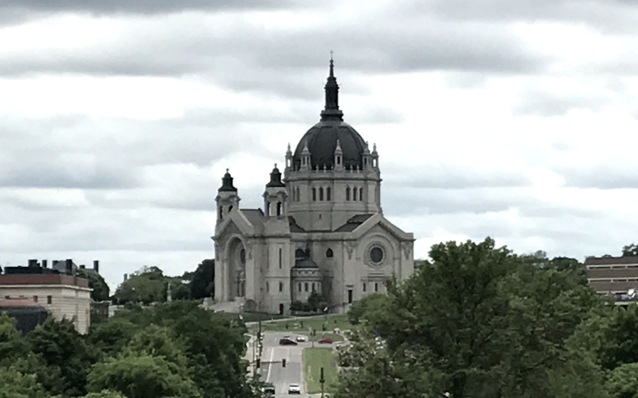
I headed over to what I presumed was the cathedral. It turns out the this diocese has two cathedrals. This one, which is the Cathedral of Saint Paul, and the Basilica of St. Mary in Minneapolis.
The copper-clad dome 76 feet in diameter and 186 feet high. It is the third largest completed church in the United States, as well as the fourth tallest, at least according to my preferred source. I guess my preferred source wasn’t considering mega-churches.
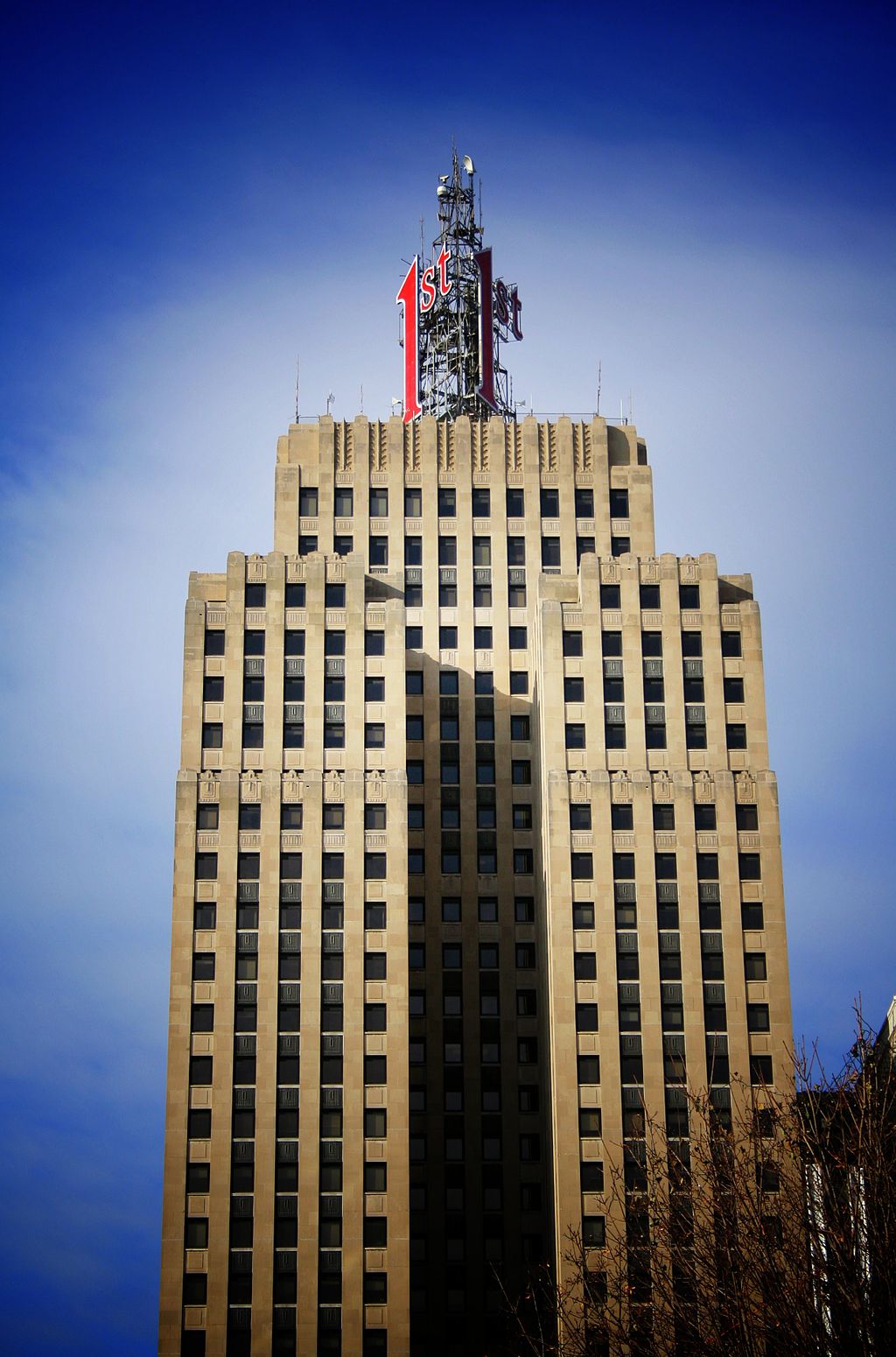
It was, however, the tallest building in St. Paul from when it opened in 1915 until 1931, when the First National Bank Building opened.
By Michael Hicks from Saint Paul, MN, USA – img_3137-lomoUploaded by xnatedawgx, CC BY 2.0, https://commons.wikimedia.org/w/index.php?curid=10402511
The Beaux-Arts era was definitely over when they designed this building. I include this picture of the First National Bank Building merely for reference. I was curious about the building that unseated the Cathedral as the Tallest Building in Saint Paul list and I had to look.
There was a parking lot nearby, and there was plenty of room for Bart on this weekday afternoon.
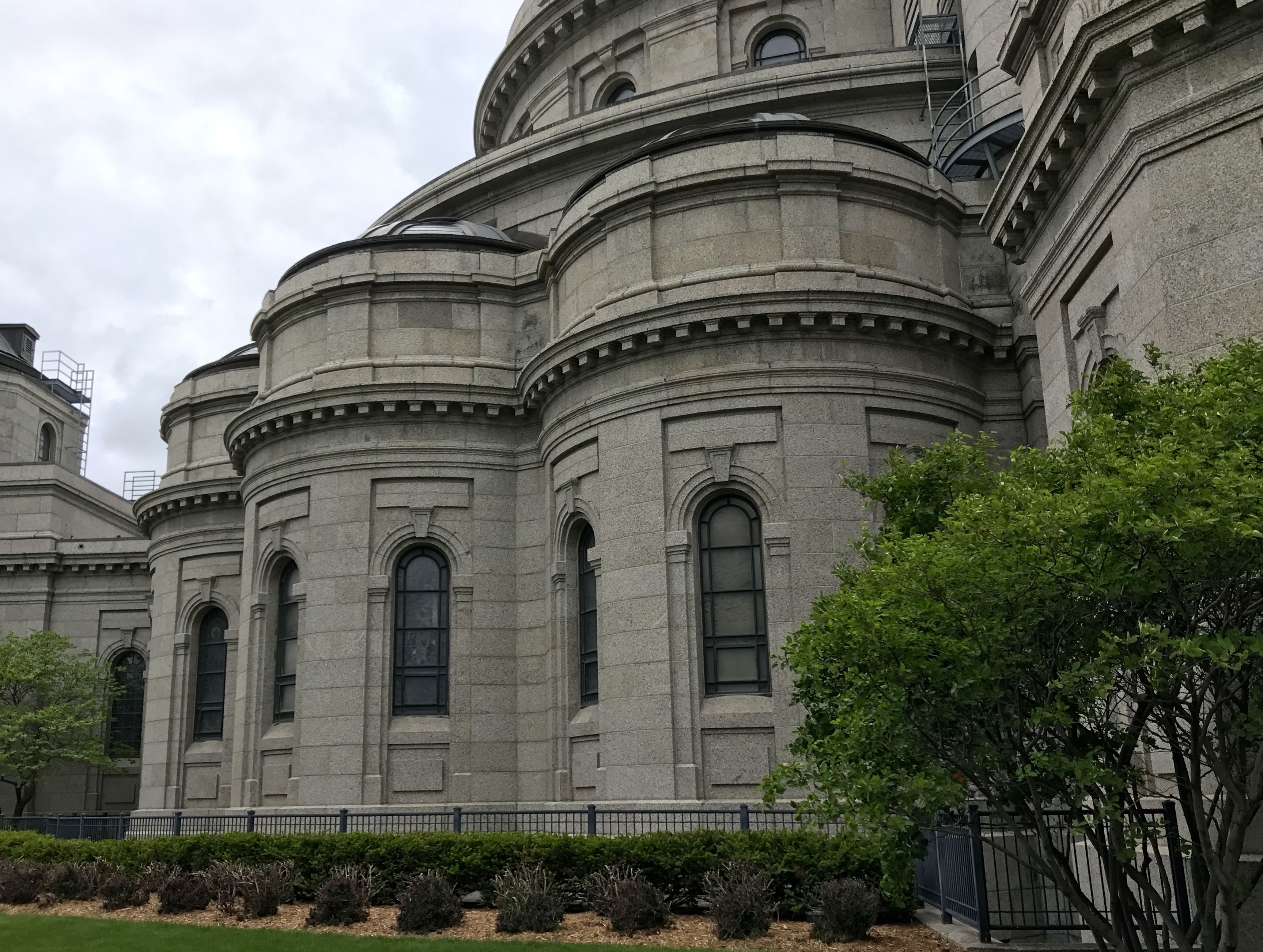
I walked past what I presumed were chapels off the apse.
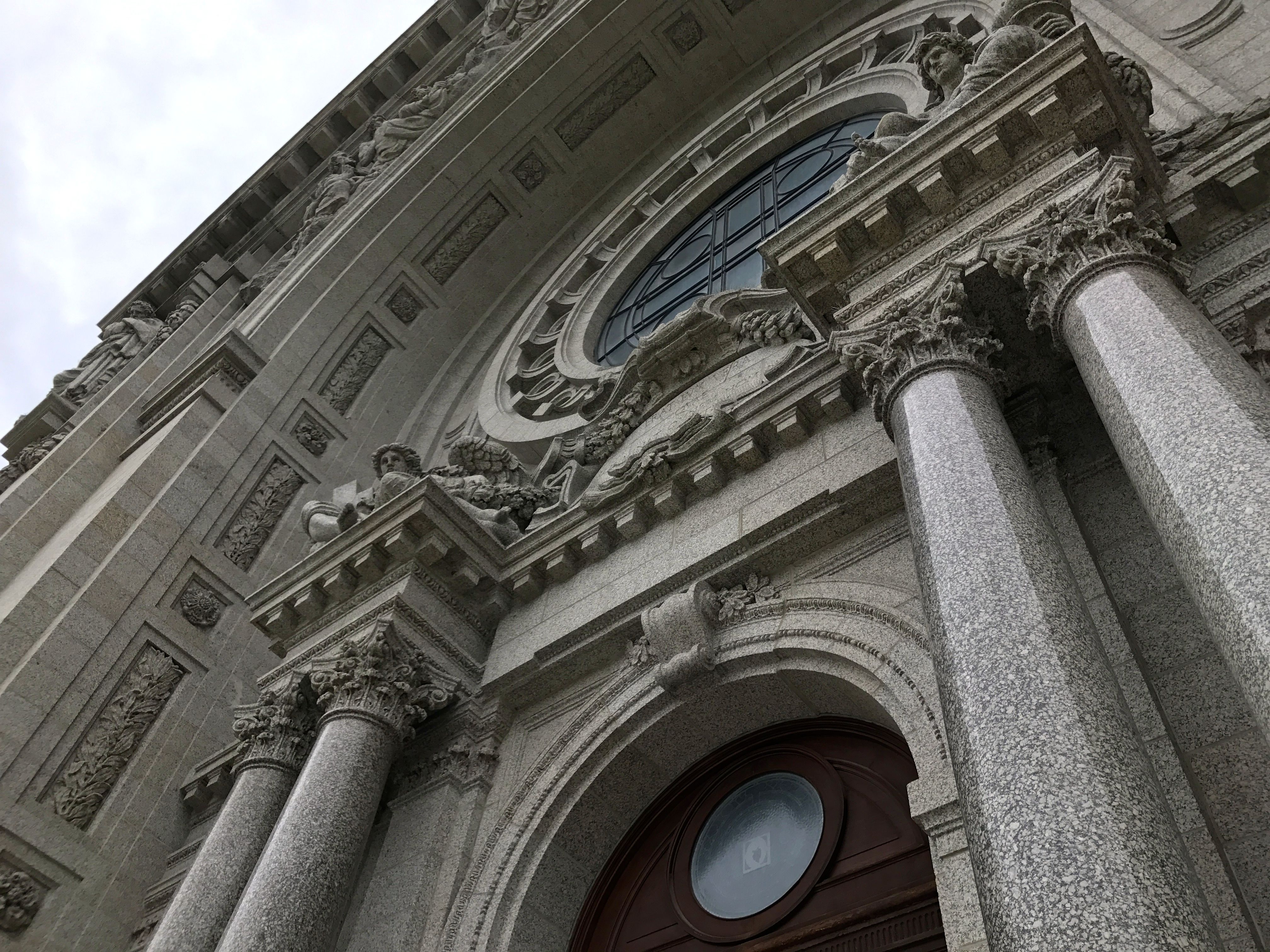
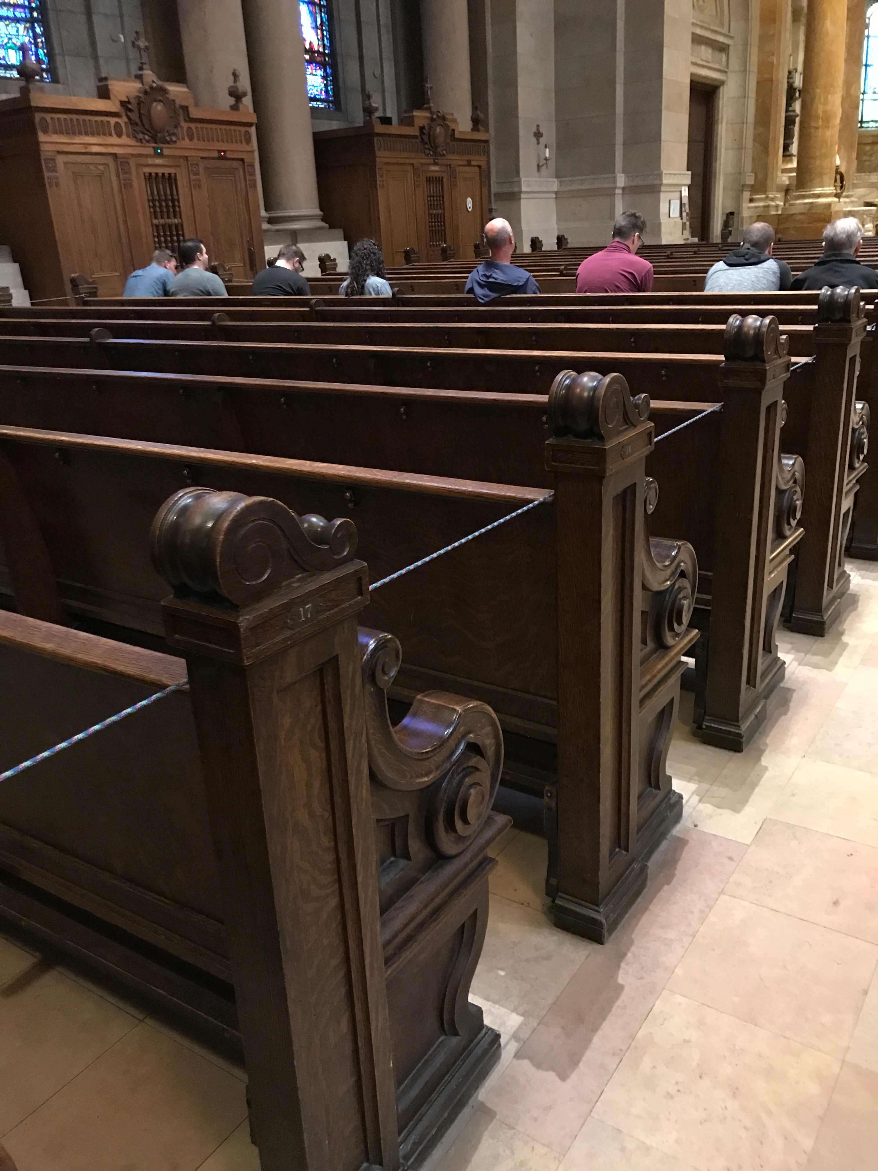
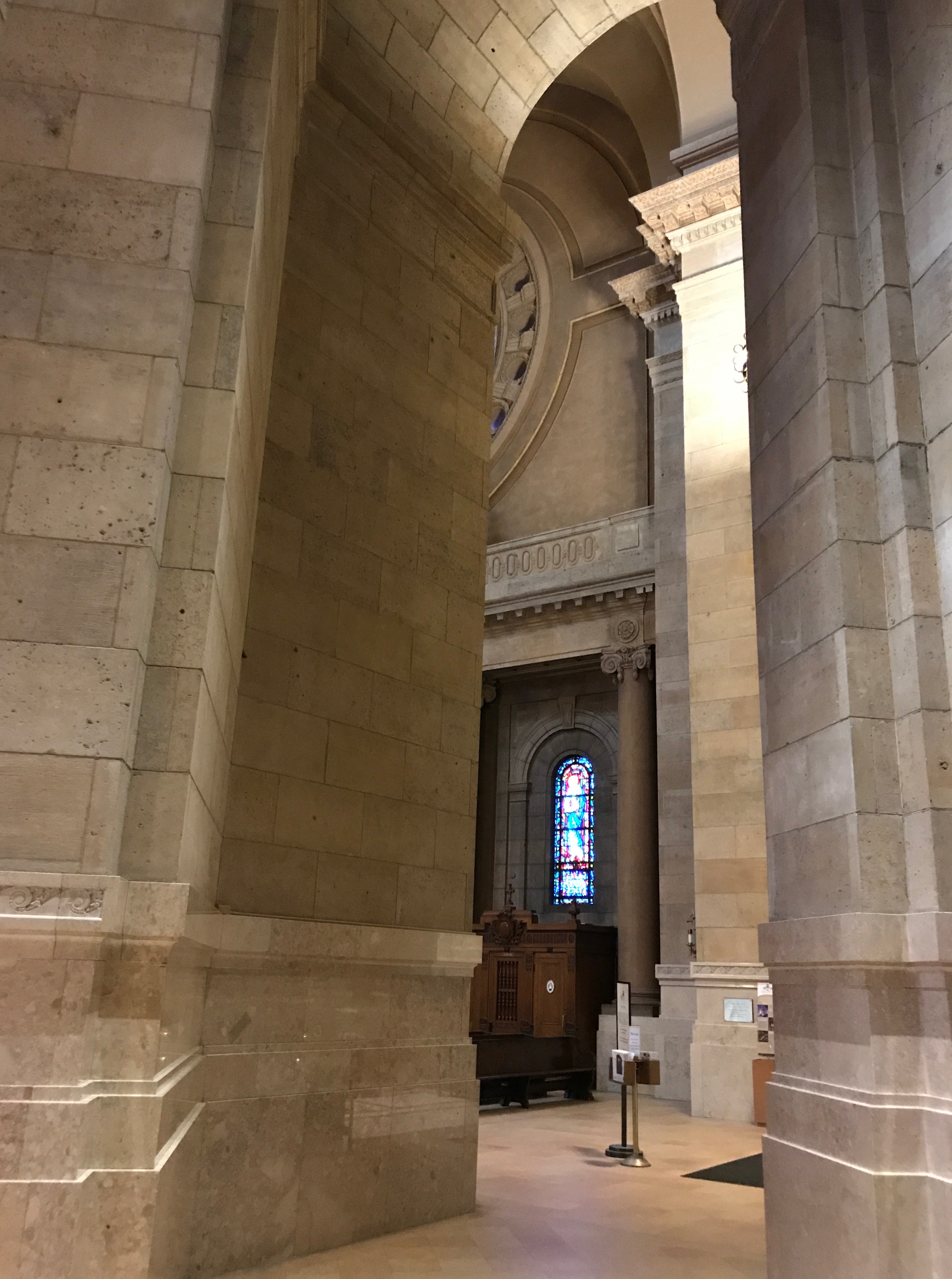
I entered through the front doors into the Cathedral, which became the National Shrine of the Apostle Paul in 2009.
It looked like people were waiting to go to confession, which is one of the seven sacraments of the Catholic church. I tried to be as unobtrusive as possible as I took in the beauty of the building.
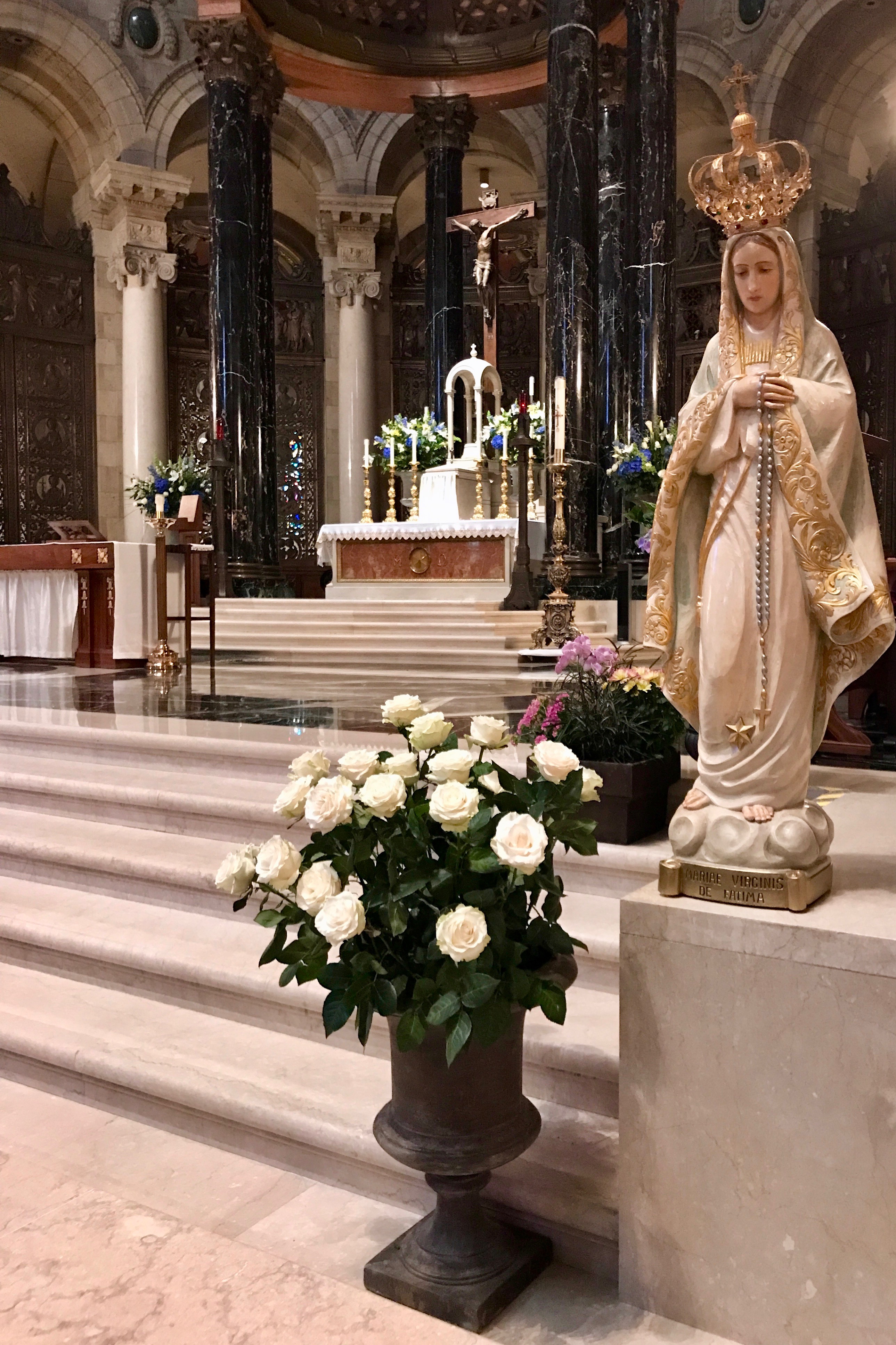
I came up on this statue of Mary. She is wearing a crown in this statue as recognition of one of her epithets, “Queen of Heaven.” (I love it when I learn a new word – or at least a new use of the word.
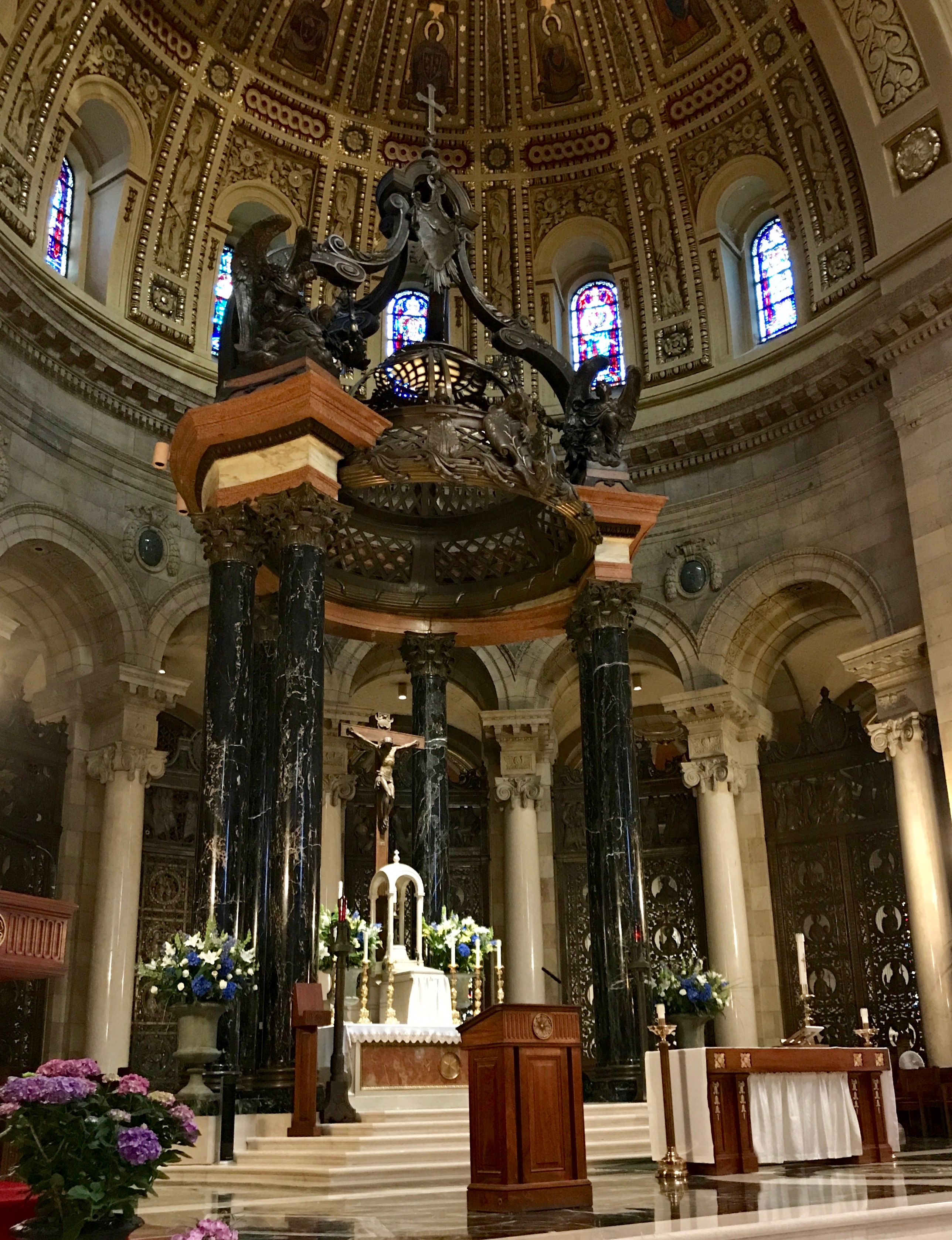
The life of St. Paul is commemorated in the baldachin over the altar. In case you didn’t know, a baldachin is a structure over high altars in cathedrals. Its more proper name is a ciborium, when it is architectural rather than a cloth canopy. I guess they like the idea of recalling the “good old days” when they actually used cloth canopies. Could it be that it is related to the chuppah that they use in Jewish wedding ceremonies?
Again, thanks to Sister Jeanne for all the art history lessons. Sure, I looked things up just to verify that I was remembering correctly, but my last art history course was in 1977. Wow! 41 years ago!
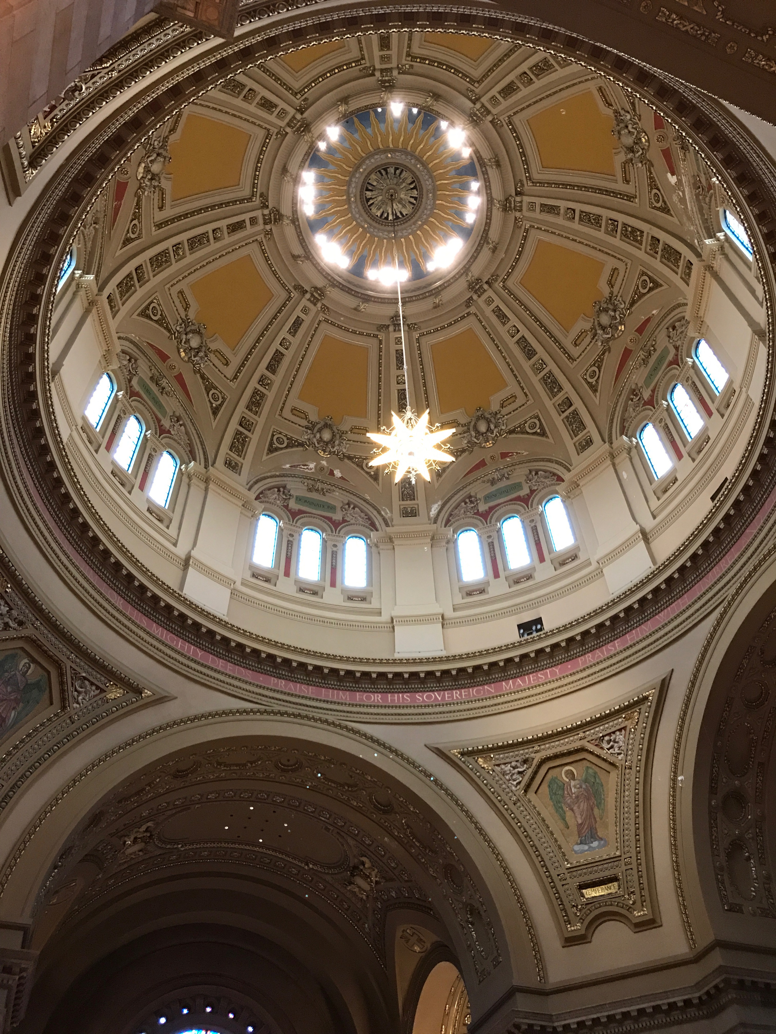
The dome of the cathedral is over the crossing, in front of the altar.. According to my preferred source, warm-colored paint and gold leaf were added during a major renovation of the dome in the 1950s.
The windows were rather magnificent. The light conditions made it hard to get good photos, but they were quite lovely. If you like stained glass windows, it would be worth a trip.
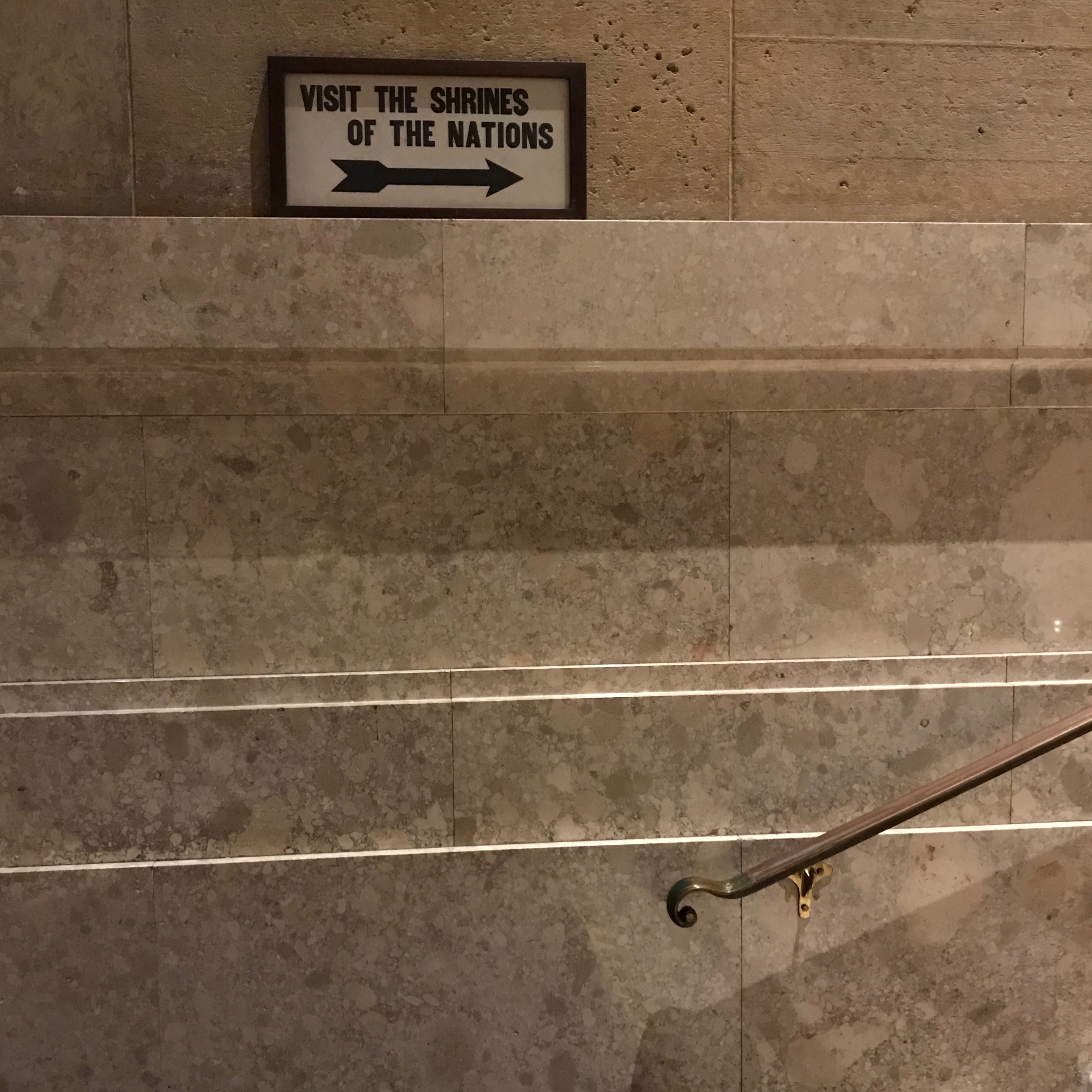
There was this small sign directing us to the Shrines of the Nations. I have no photos of these chapels, but the cathedral has six chapels dedicated to the parton saints of European ethnic groups that settled the area around the city: St. Anthony for the Italians, St. John the Baptist for the French Canadians, St. Patrick for the Irish, St. Boniface for the Germans, and Saints Cyril and Methods for the Slavs. There are also chapels dedicated to the Sacred Heart, to Mary, the Mother of Jesus, to St. Joseph, to St. Peter as well as St. Therese of Lisieux for the missionaries.
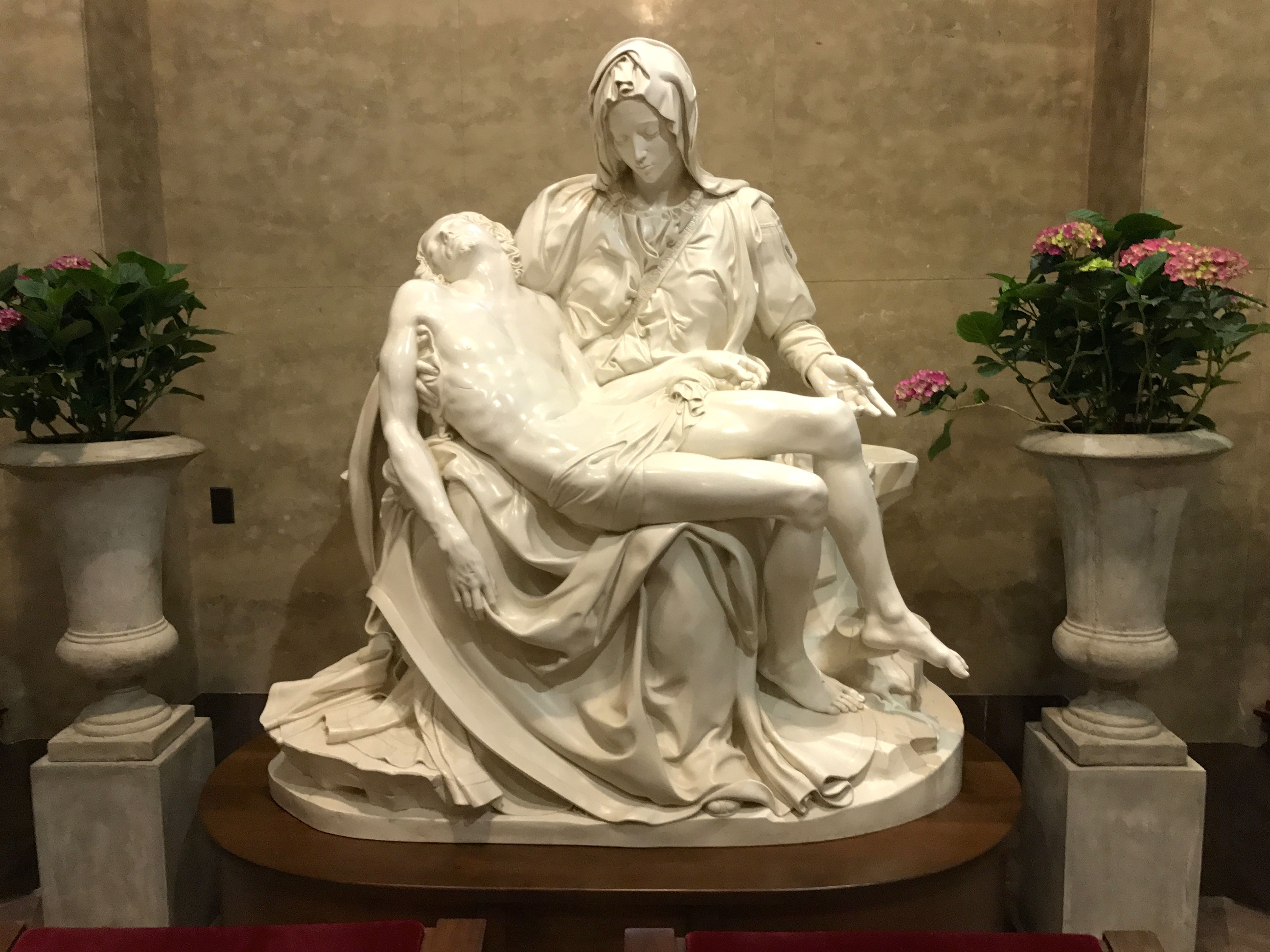
I spent a few minutes admiring the cathedral’s copy of Michelangelo’s Pietà. The original is in St. Peter’s Basilica in Vatican City. I remember the first time I saw it back in 1976. I stood there with my mouth hanging open for the longest time. It was breath taking. This one was nice, but it was much smaller than the original, which was 68.5 in × 76.8 in.
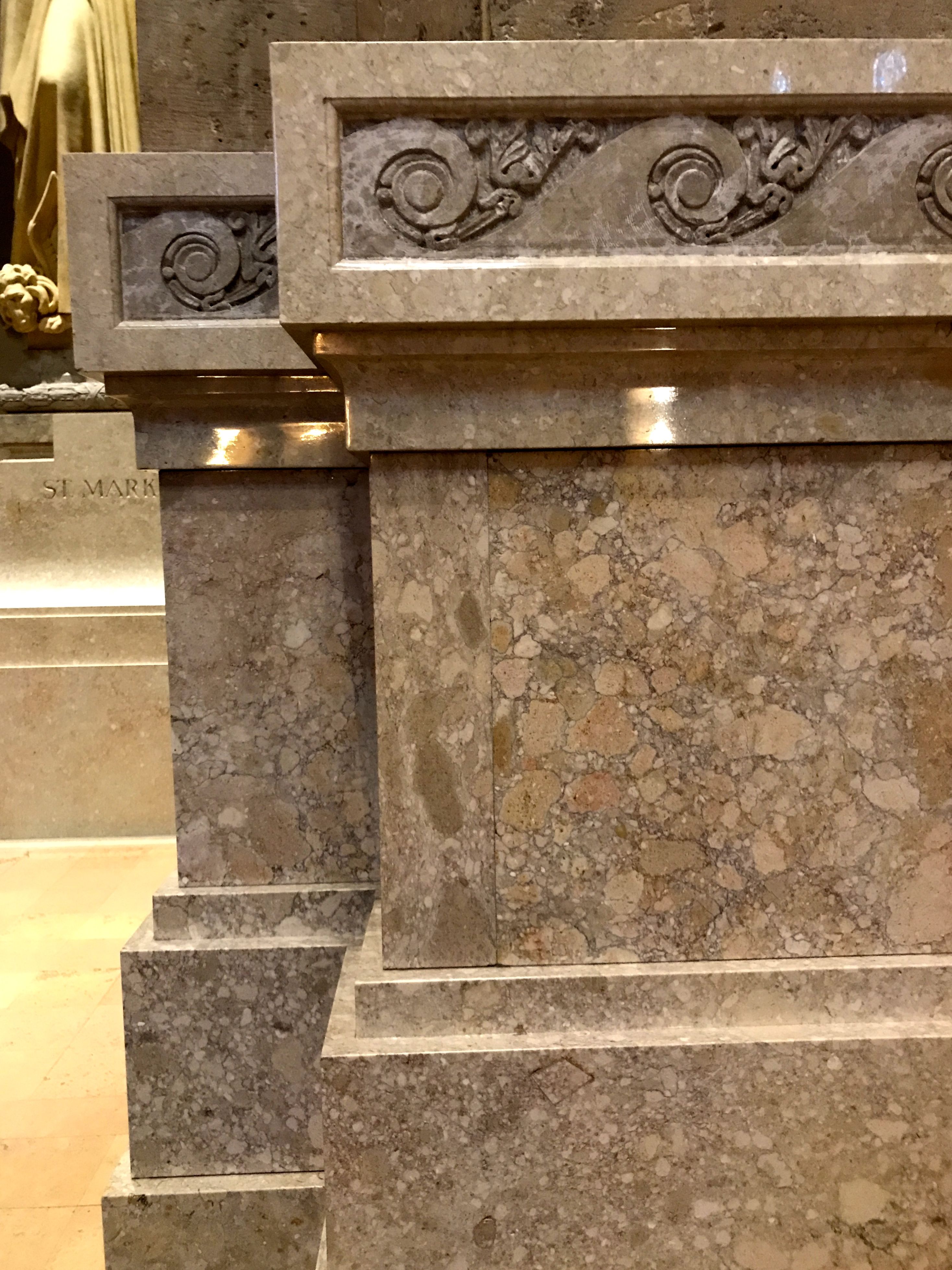
There were lovely details to be found.
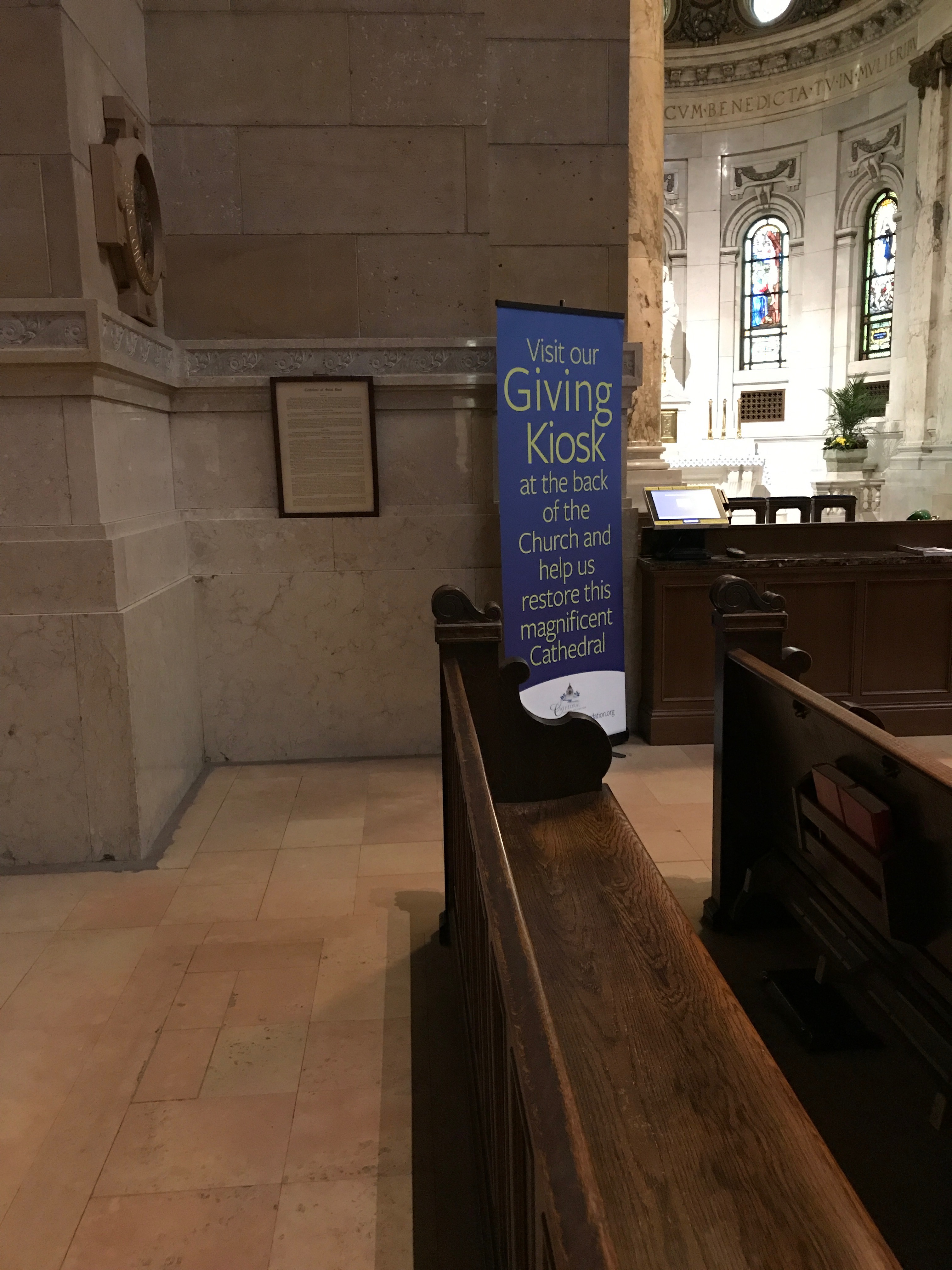
As I walked around, I noticed this banner that directed people to their Giving Kiosk.
They make giving easy. I know I do most of my transactions electronically these days.
I was about to leave when I noticed a sign that directed us to the lower level for more information. There was even an elevator! How could I turn that down?
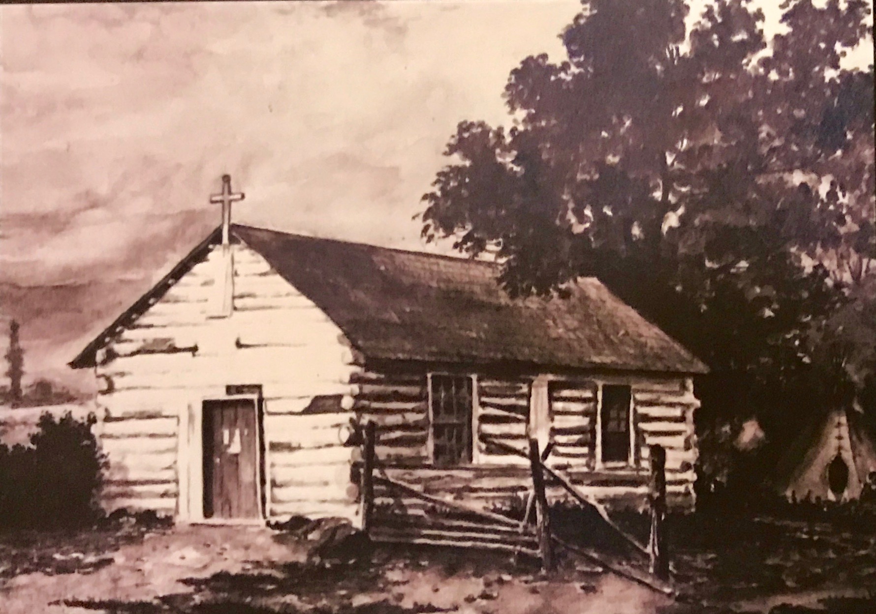
There was a drawing of the first church in what became the Diocese of St. Paul. It was built in 1841 and became the cathedral when Joseph Crétin was appointed as bishop of the newly established diocese in 1851. While this bears little resemblance to what we think of as a cathedral these days, a cathedral is the principal church of a diocese that contains the bishop’s seat, which is called a cathedra.
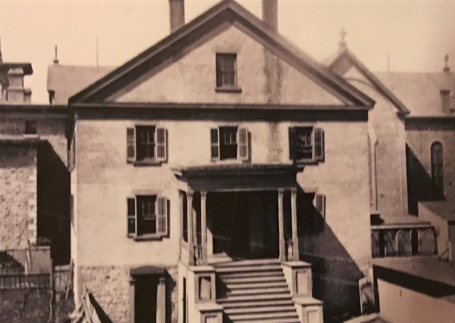
Bishop Crétin started immediately to build a larger church to serve the fast-growing population of St. Paul. The school was on the first floor, the church was on the second and the offices and living quarters for the bishop and his staff on the third floor.
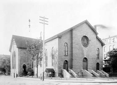
The second building was still too small for the needs of the diocese, so the bishop began plans for a third cathedral. It was started in 1853 and completed in 1858. Its construction was delayed by the Panic of 1857 and Bishop Crétin’s death.
Incidentally, the Panic of 1857 was the first worldwide economic crisis and it started in Britain. In the United States, it was caused by the declining international economy and the over-expansion of the domestic economy. It was a fairly short-lived financial downturn. However, a proper recovery from the downturn didn’t happen until the Civil War in 1861. The banks didn’t recover until after the Civil War.
The Panic of 1857 is significant regarding the third cathedral for two reasons. The first reason is that it delayed its construction. The second reason that the cathedral had practically no ornamentation in an effort to cut costs.
I would be remiss in my report if I didn’t include the last thing I saw in the display.
There was also a nifty model of the fourth cathedral made of Legos.
And with that it was about time for me to head out.
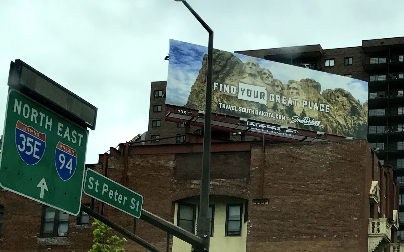
I drove around a bit. While stopped at an intersection, I spied this billboard for South Dakota. Too late! I’ve already done that state.
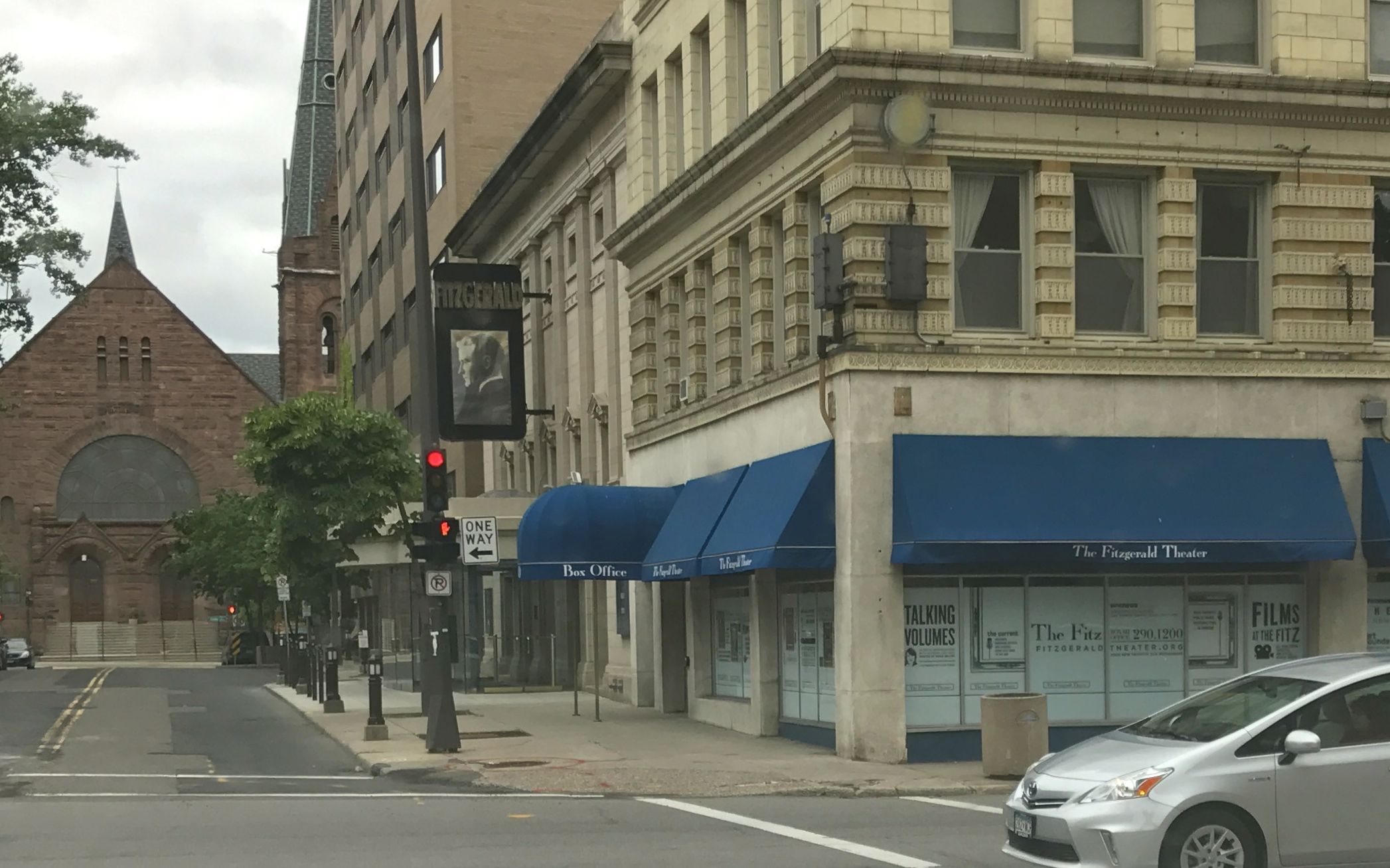
I was rather thrilled to see the Fitzgerald Theater. That was the home theater for A Prairie Home Companion hosted by Garrison Keillor from 1974 until 2016.
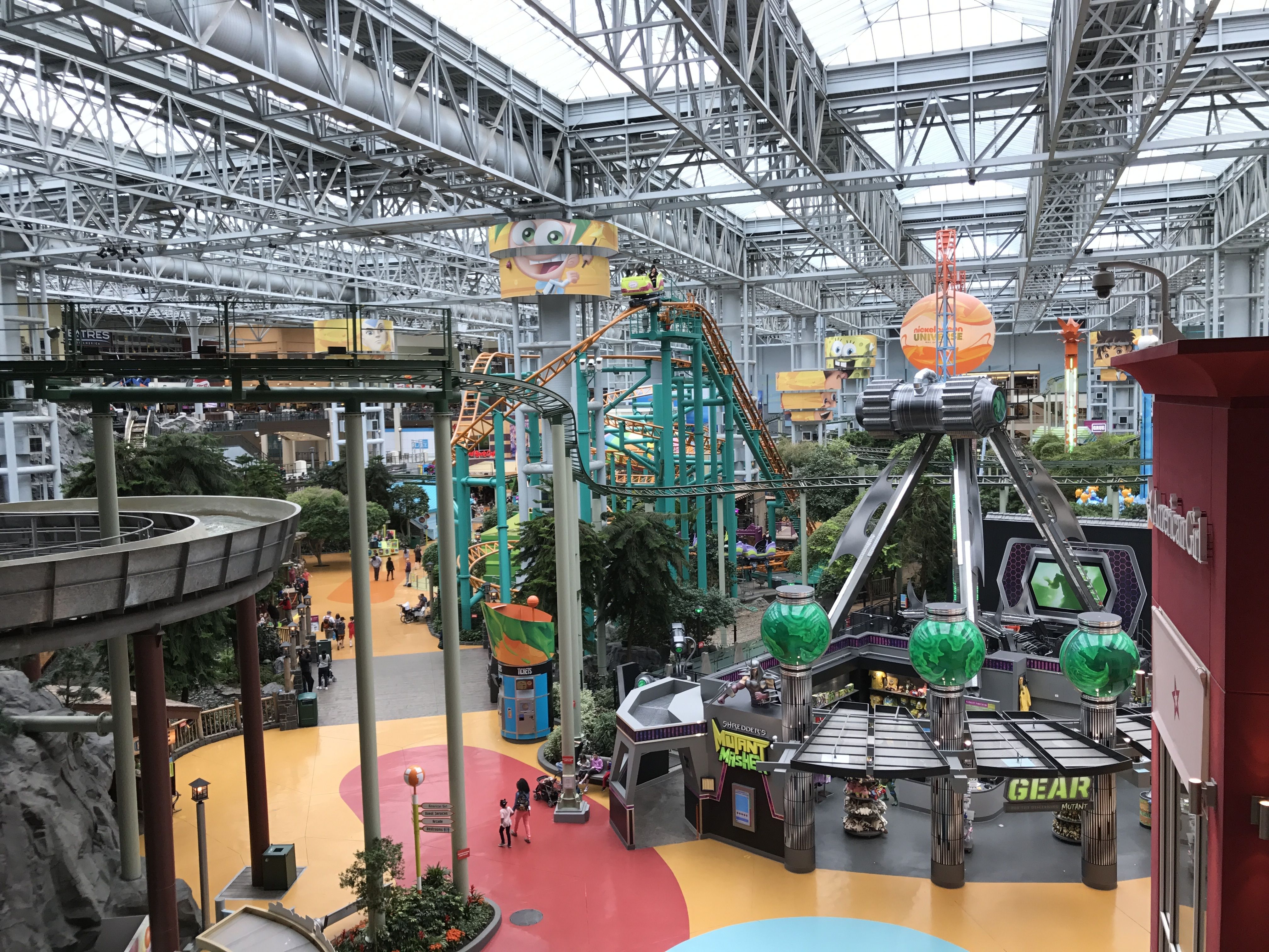
With that I was ready for dinner. I headed out to Mall of America.
Really, malls aren’t my thing, and ENORMOUS malls are even less appealing, but I figured it was one of those “while I’m in the area” places. Besides, I was hungry, and I figured that they had to have restaurants.
I parked and took this picture to help me find my car again. This is one place I didn’t want to have to wander around aimlessly when it was time to leave.
I wandered around for a bit, just looking at what there was to see. In addition to the usual assortment of stores, there was an amusement park.
I stood and looked for a while, but I didn’t find anything tempting enough to make me get any closer. Besides, I was getting hungry.
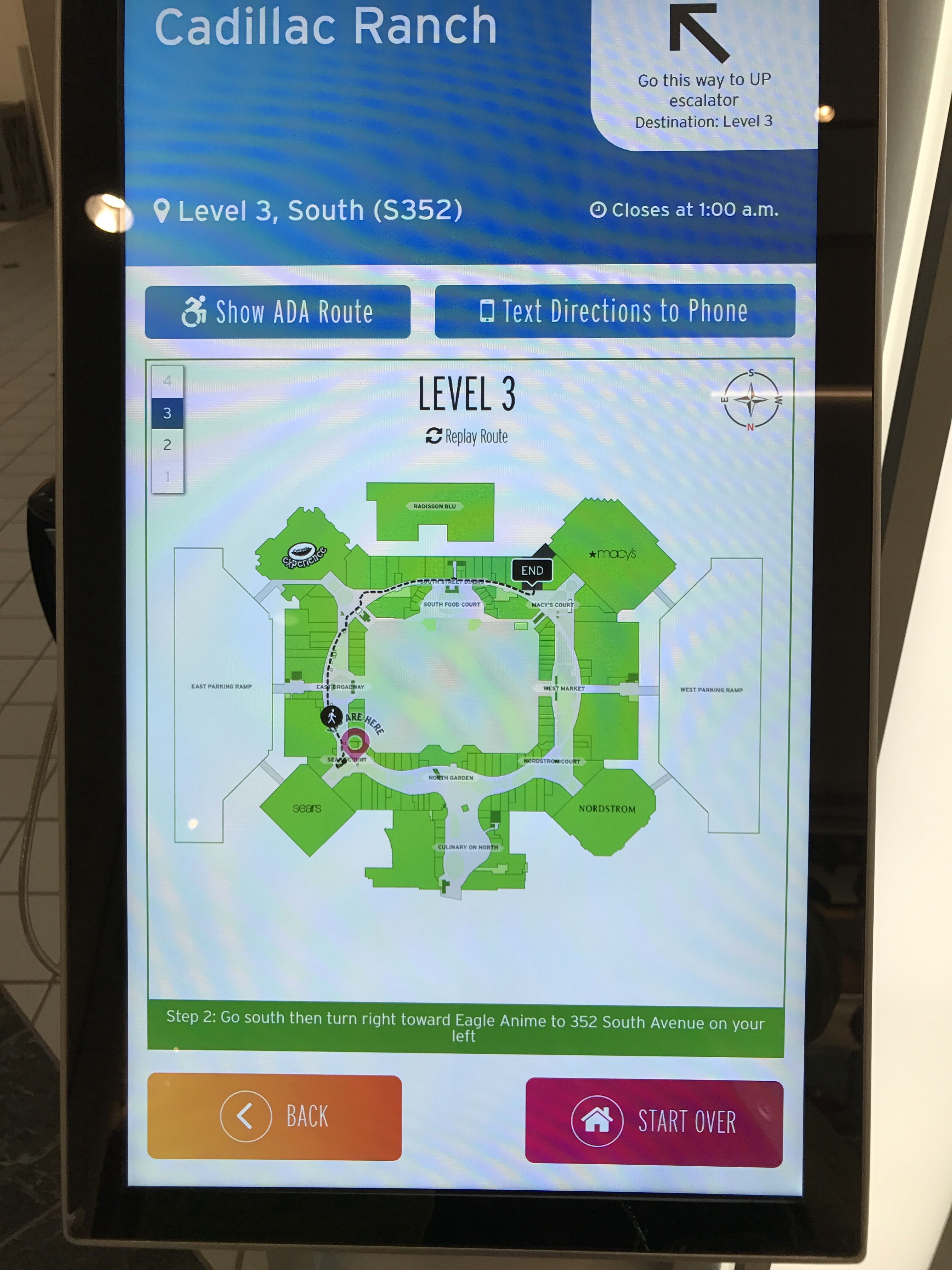
I found a kiosk that I could use to select a restaurant and then help me plan how to get there.
I chose Cadillac Ranch, not because I knew anything about the food, but because I had visited Cadillac Ranch when I visited Amarillo, Texas.
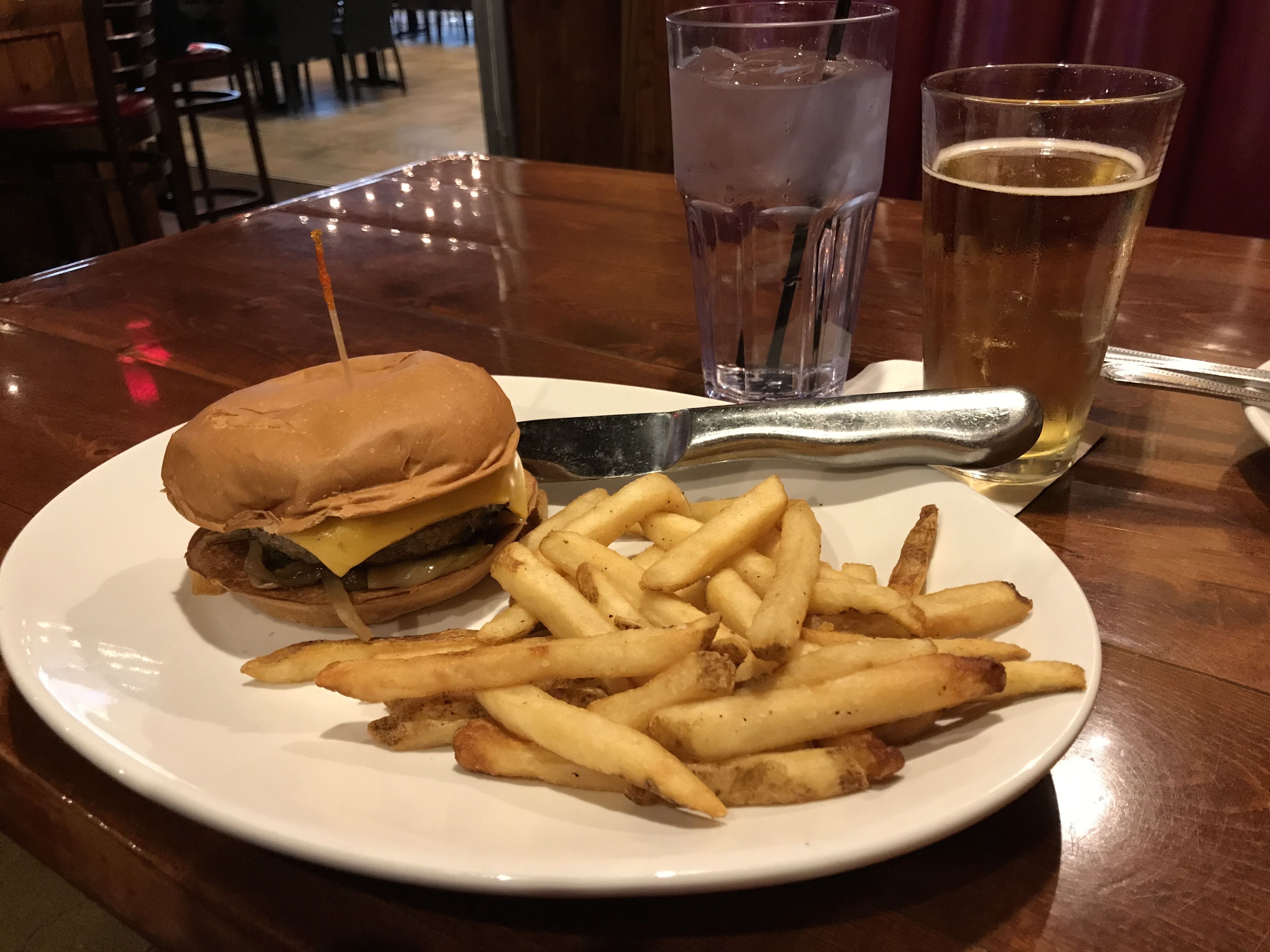
I had asked people what I should eat while I was in the area. They recommended a Juicy Lucy.
It was quite the burger.
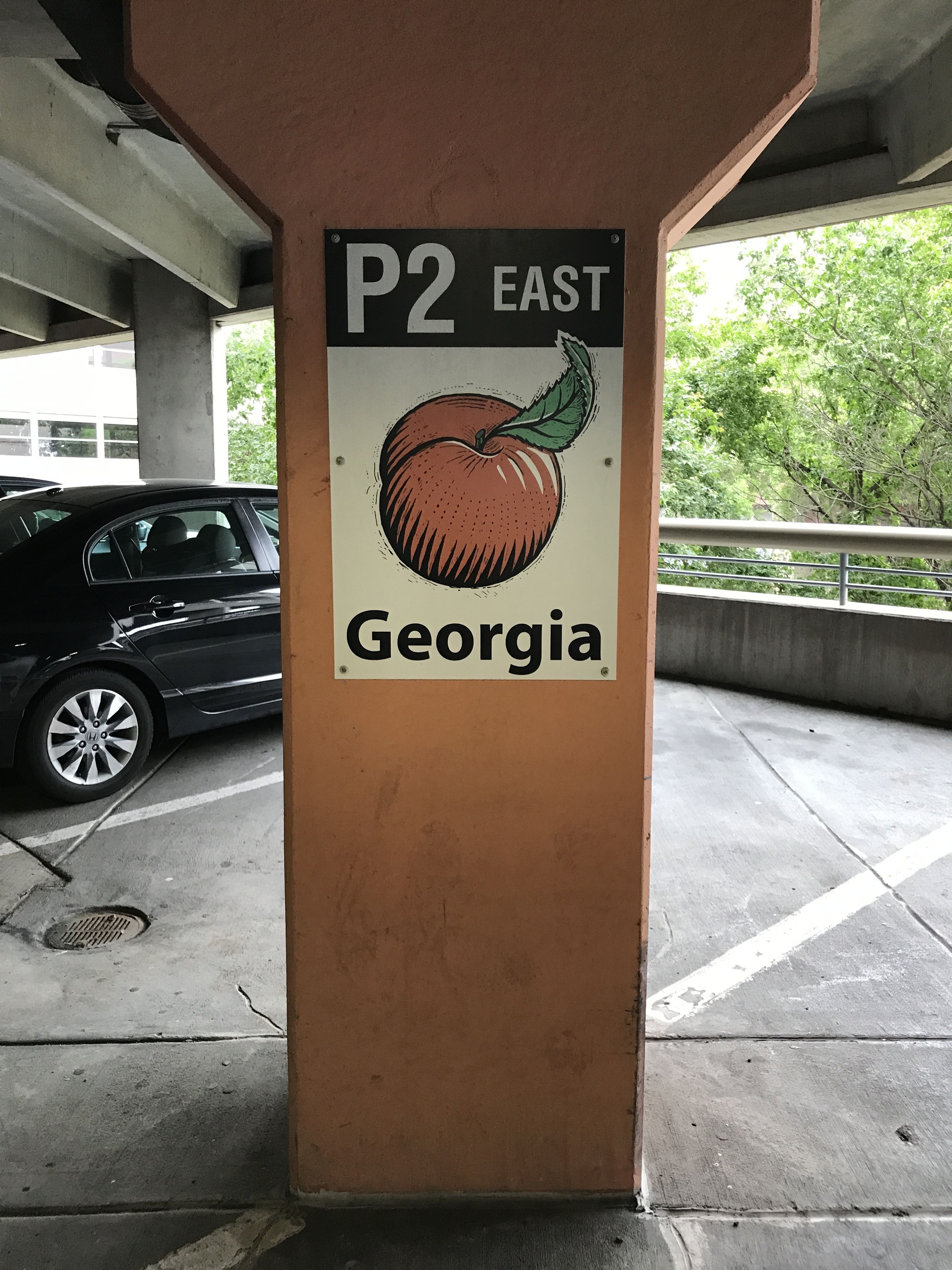
Actually, it was kind of like a double cheeseburger with the cheese on the inside. I managed to eat my dinner. Sufficiently nourished, I head back to find Bart on the P2 floor of Georgia.
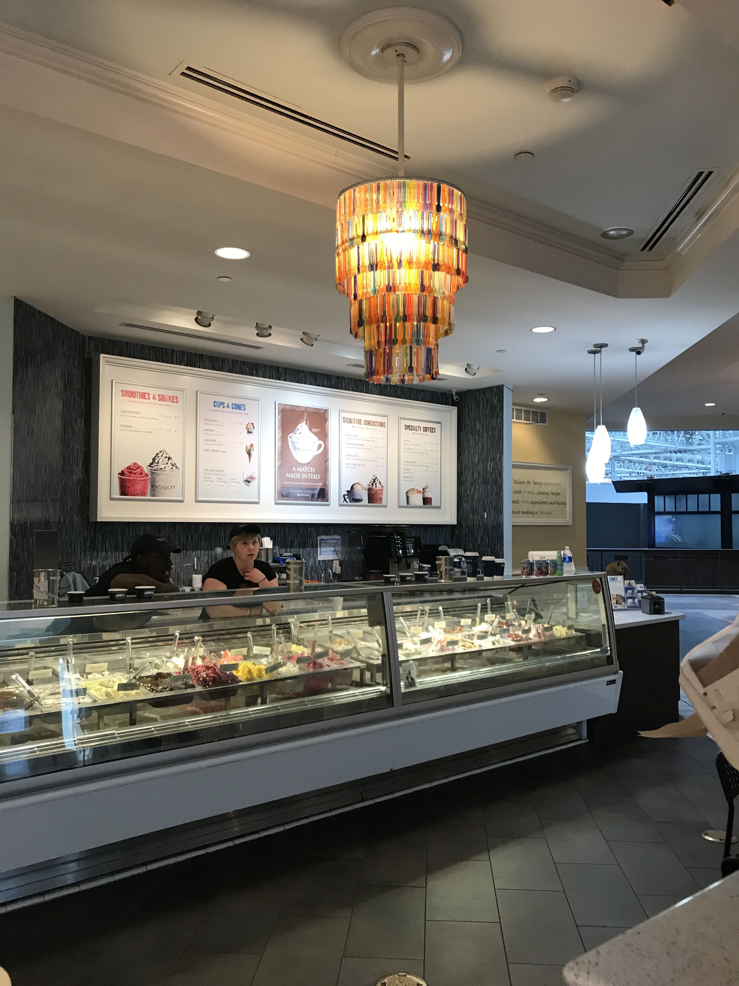
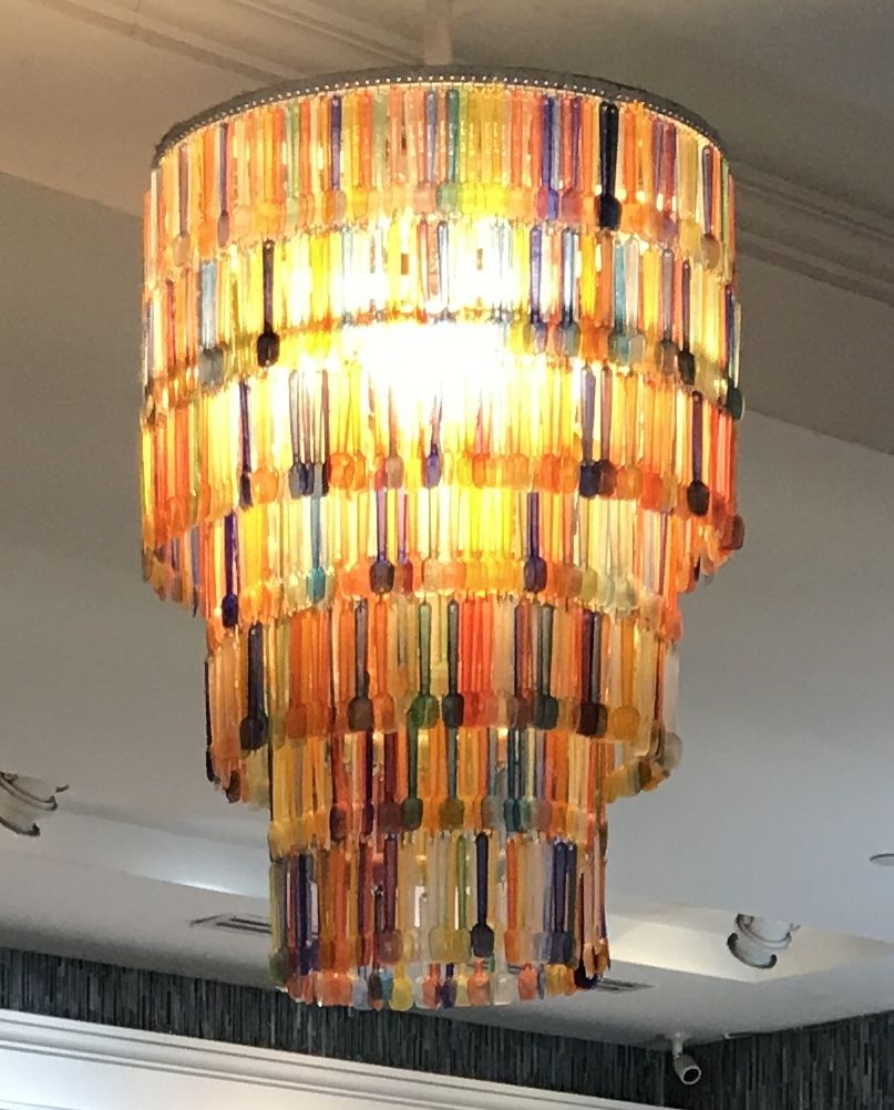
On the way out, I spied this gelato shop.
Actually, what caught my attention was the chandelier made of gelato spoons.
If you are like me, you said Minneapolis. But, no, the capital of Minnesota is St. Paul!
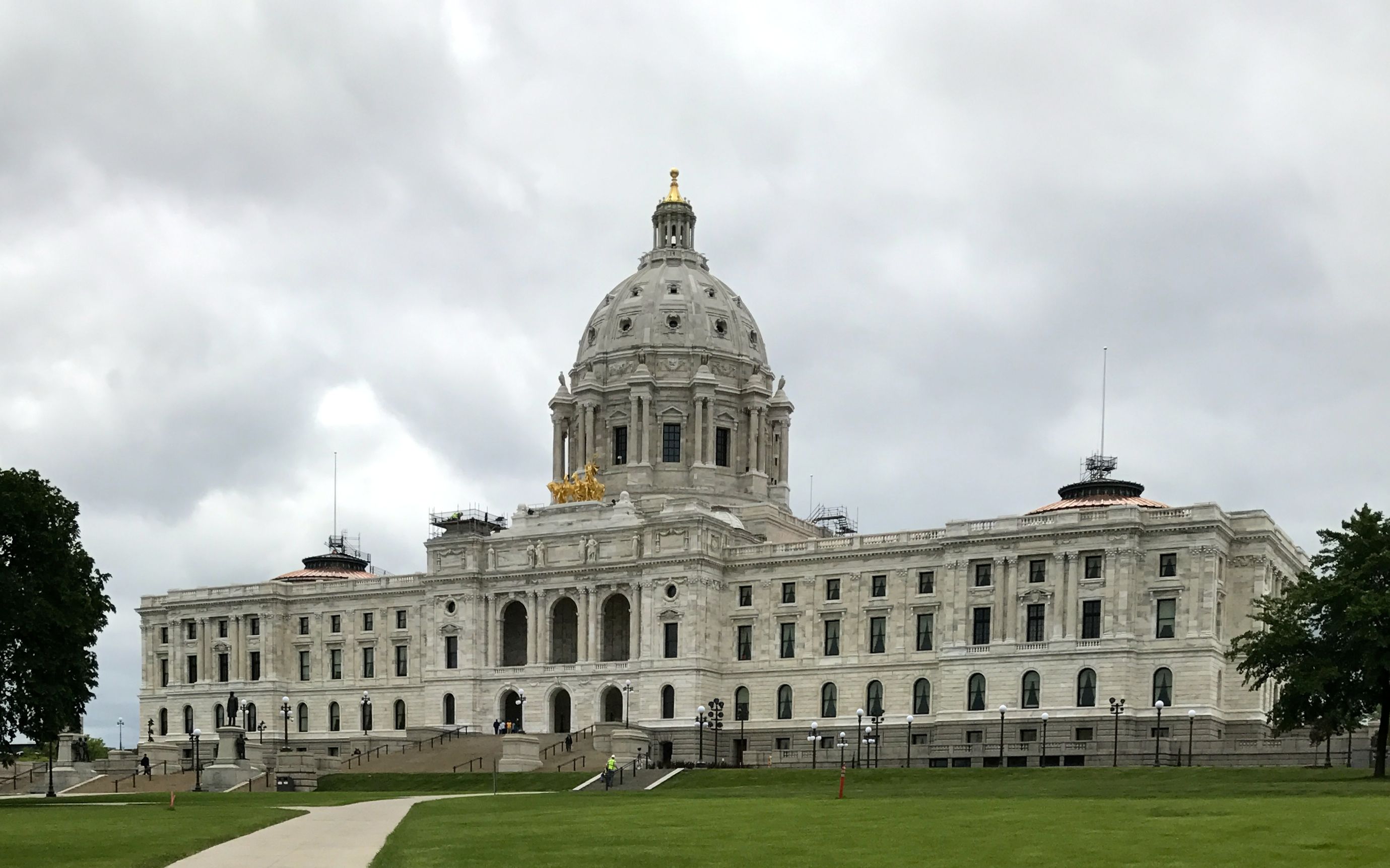
By this time I was going through capitol withdrawal. When was the last time I visited a state capitol building? Helena, Montana? It’s about time I rectified that situation.
It’s quite the grand building. It was designed by Cass Gilbert, who also designed the Arkansas and West Virginia State Capitols as well as the United States Supreme Court building.
You know, I thought I had written about the Arkansas Capitol when I wrote about the Helena, Montana capitol building. I was right! Oddly enough, my sources at that time said that the rejected design was by George R. Mann, who sold it to Arkansas. Sometimes you just don’t know which Wikipedia entry to believe!
In any event, Cass’ public buildings were in the Beaux Arts style, and reflect the optimistic American sense that the nation was heir to Greek democracy, Roman law and Renaissance humanism, according to my preferred source.
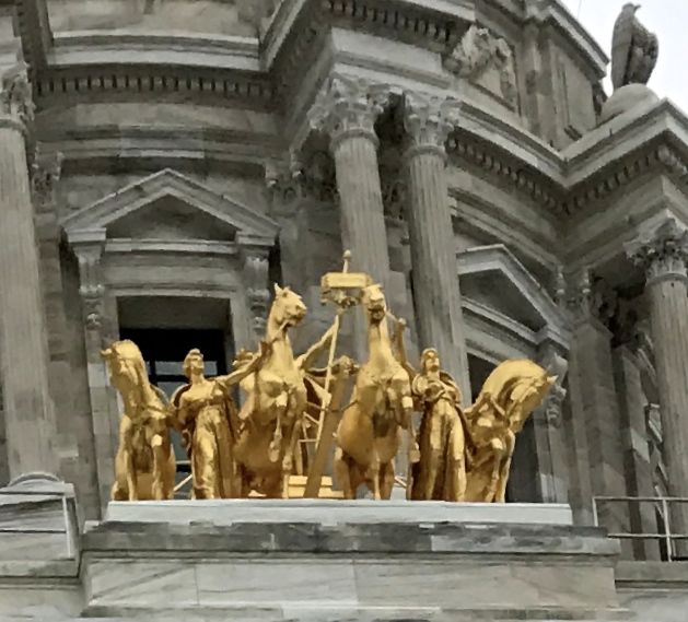
I was quite taken by the statue above the southern entrance. It is a gilded quadriga. Always curious, I had to look up the definition of “quadriga.” In case you didn’t know, a quadriga is a chariot drawn by four horses abreast. Incidentally, this was the Roman Empire’s equivalent of the Ancient Greek tethrippon, in case anyone asks.
The name of this sculpture is The Progress of the State. It was sculpted by Daniel Chester French and Edward Clark Potter. French is probably one of the most well-known sculptors of his era, as he also is responsible for the Lincoln statue in the Lincoln Memorial. Potter’s work is also well known, even if his name is less so. He was well-known for his equestrian and animal statues. His most famous works are the marble lions in front of the New York Public Library, Patience and Fortitude.
But back to this statue. The four horses represent the power of nature: earth, wind, fire and water. The women leading the horses symbolize civilization, and the man on the chariot represents prosperity.
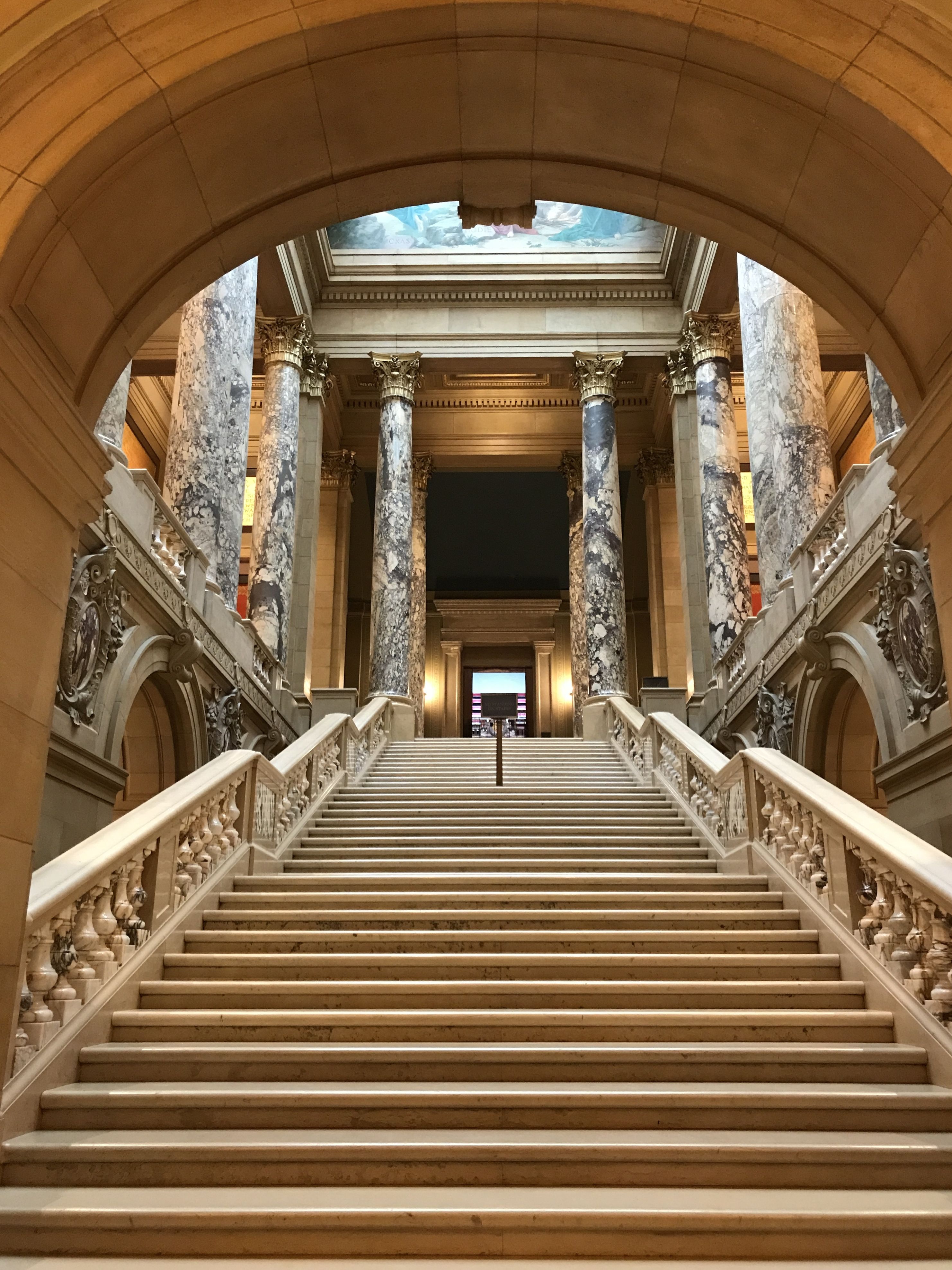
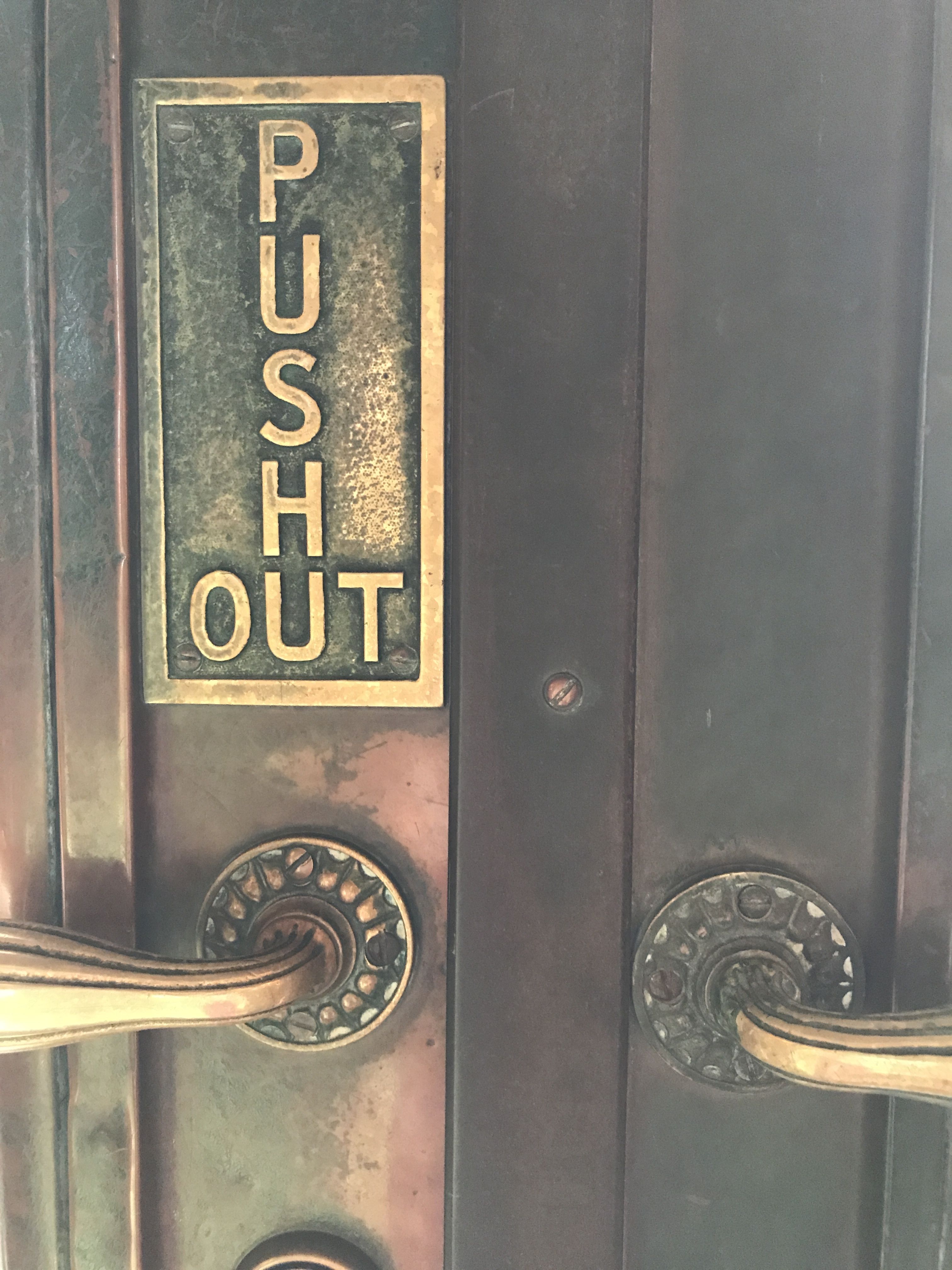
I entered building and somehow slyly joined a tour.
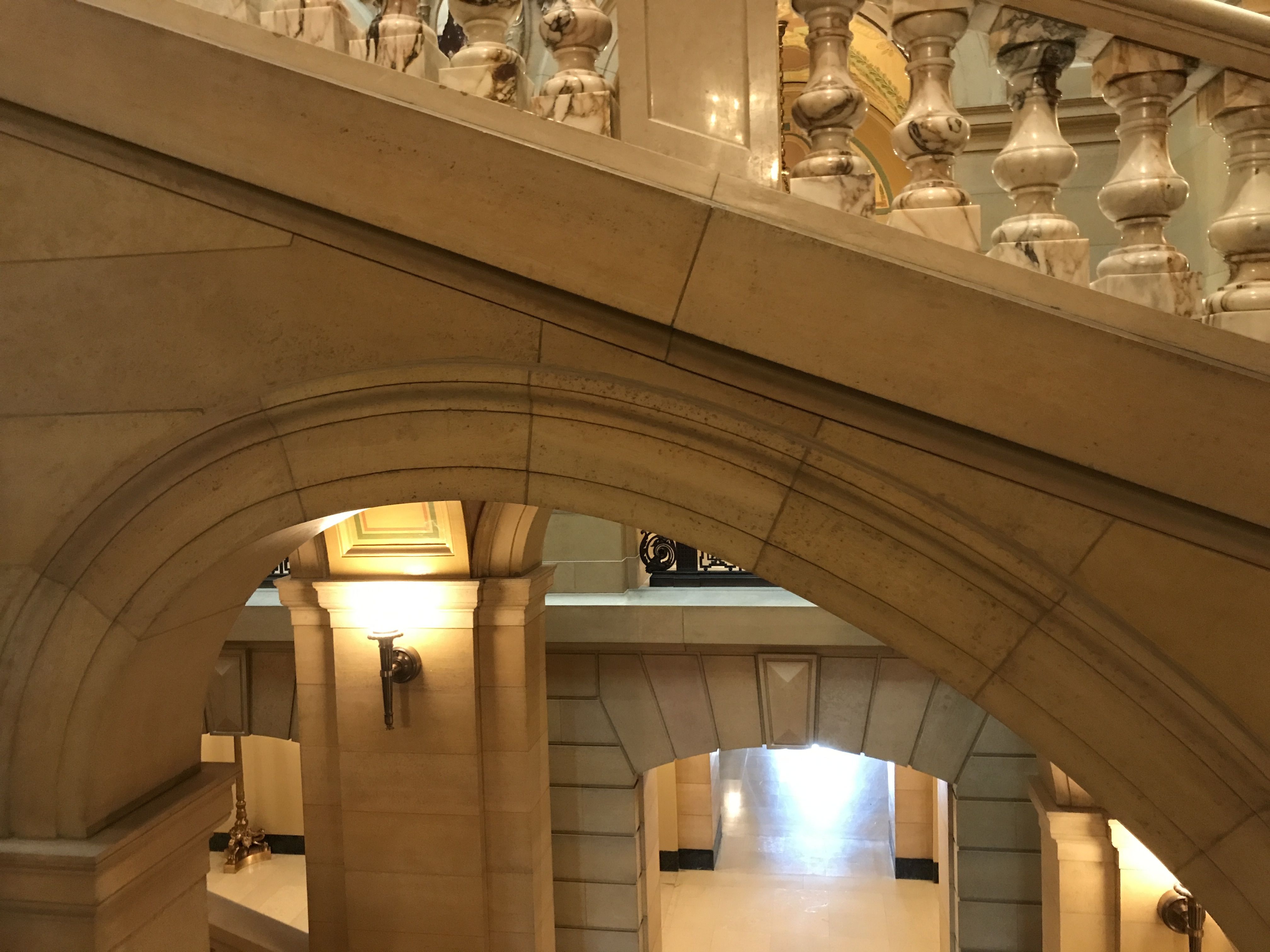
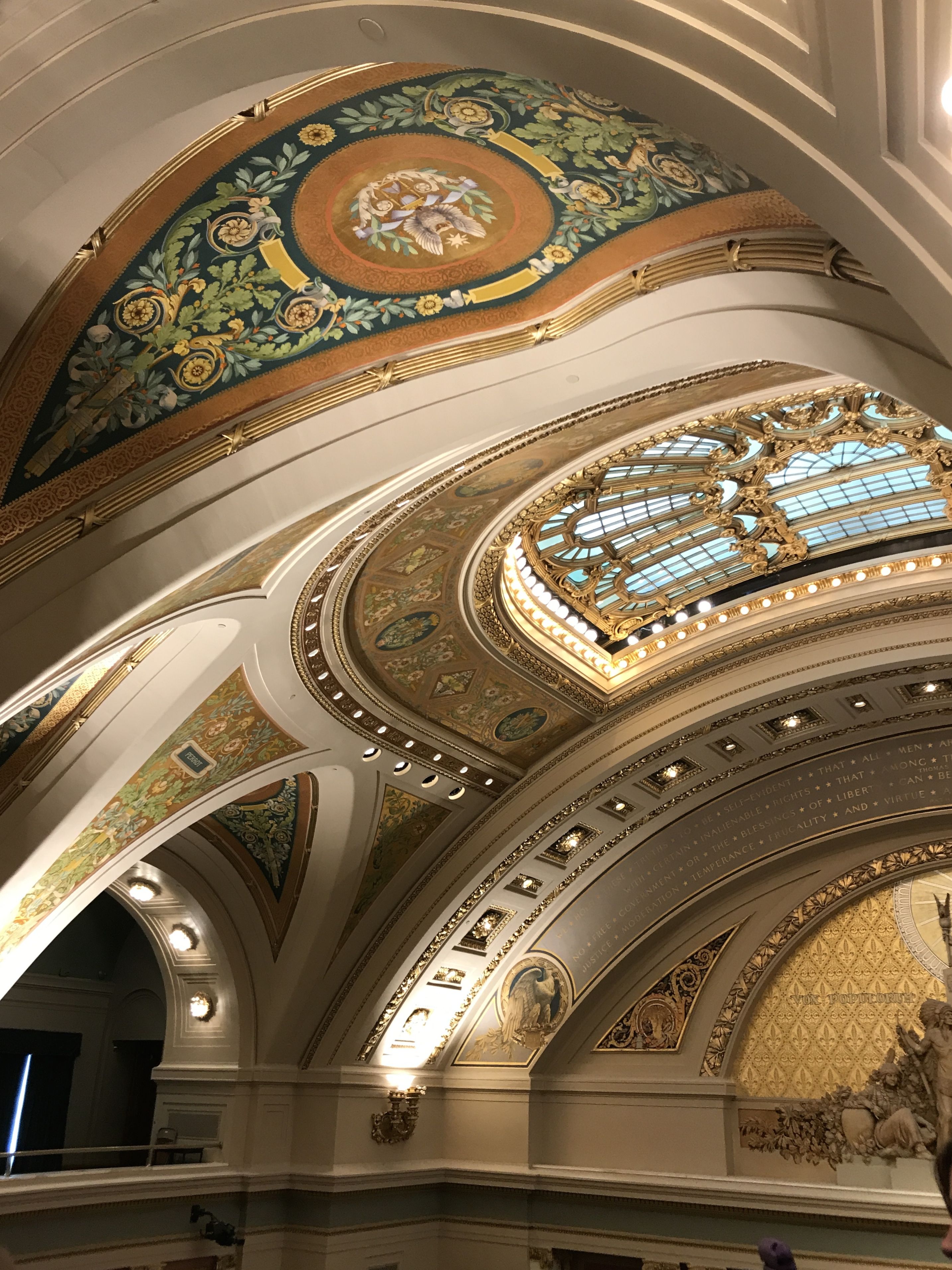
The interior was impressive.
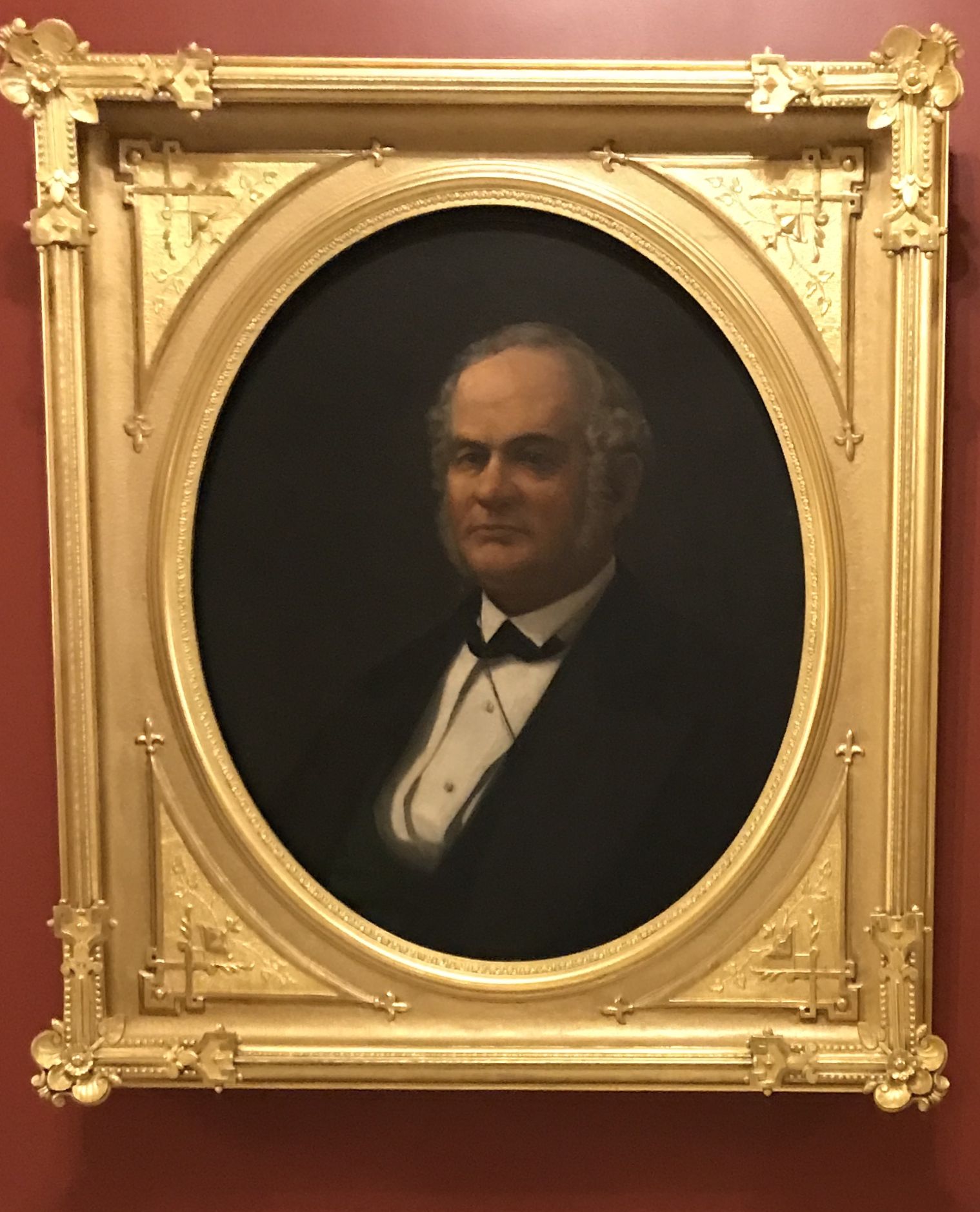
On the way to the governor’s office, we passed this portait of Alexander Ramsey. He was the second state governor, from 1860-1863.
It seemed odd to me that they would have the second governor’s portrait hanging and not the first. Did I miss it? After all, with a last name of Ramsey, we might be related!
Well, it turns out that he was quite the politician, and held a number of offices. Including being the second governor of the state, Zachary Taylor appointed him the first governor of the Minnesota Territory, 1849-1853. Before that, he was a member of the House of Representatives from Pennsylvania. He was also the mayor of St. Paul, a U. S. Senator and the Secretary of War under Rutherford B. Hayes.
We got to peek inside the entrance to the governor’s office. What I was most impressed with, however, was in the hallway outside.
A woman was exercising her first amendment rights to free speech and to petition the Government for a redress of grievances. This was a peaceable assembly of one.
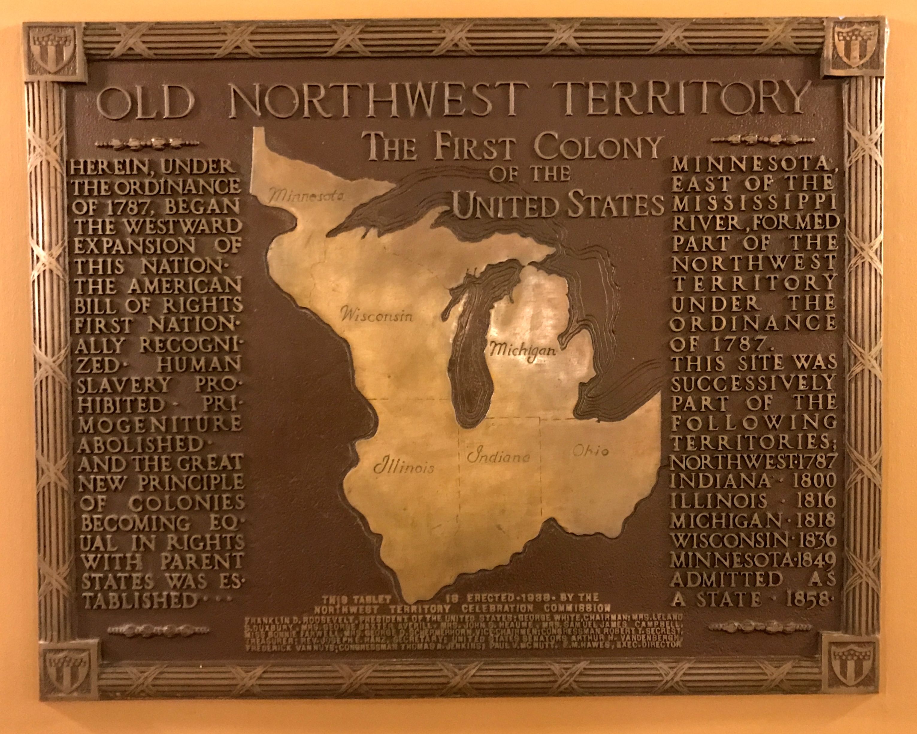
There were all sorts of interesting plaques and quotes throughout the building. You know, I never thought of the Northwest Territory as a colony.
Incidentally, this tablet was erected in 1938 by the Northwest Territory Celebration Commission. It must have been the sesquicentennial celebration.
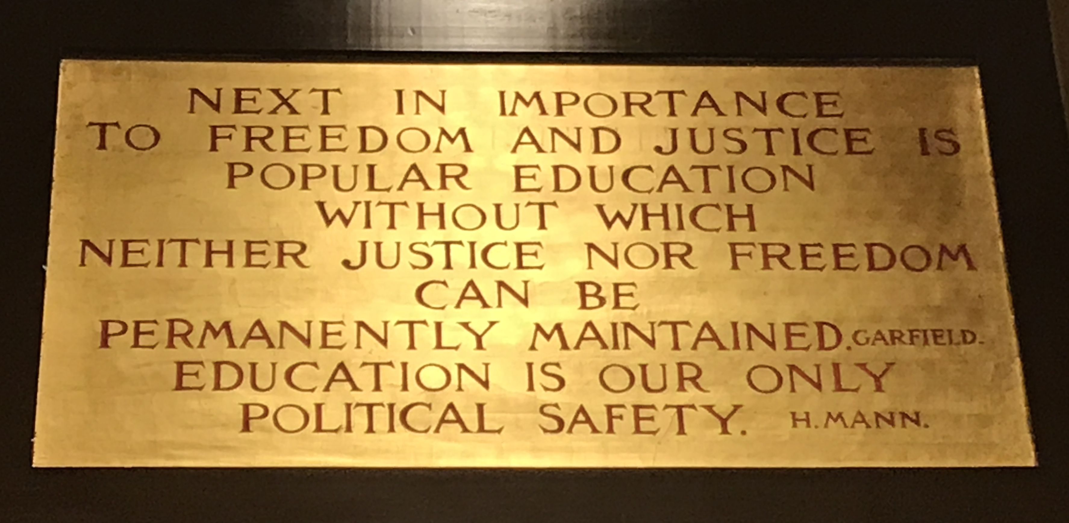
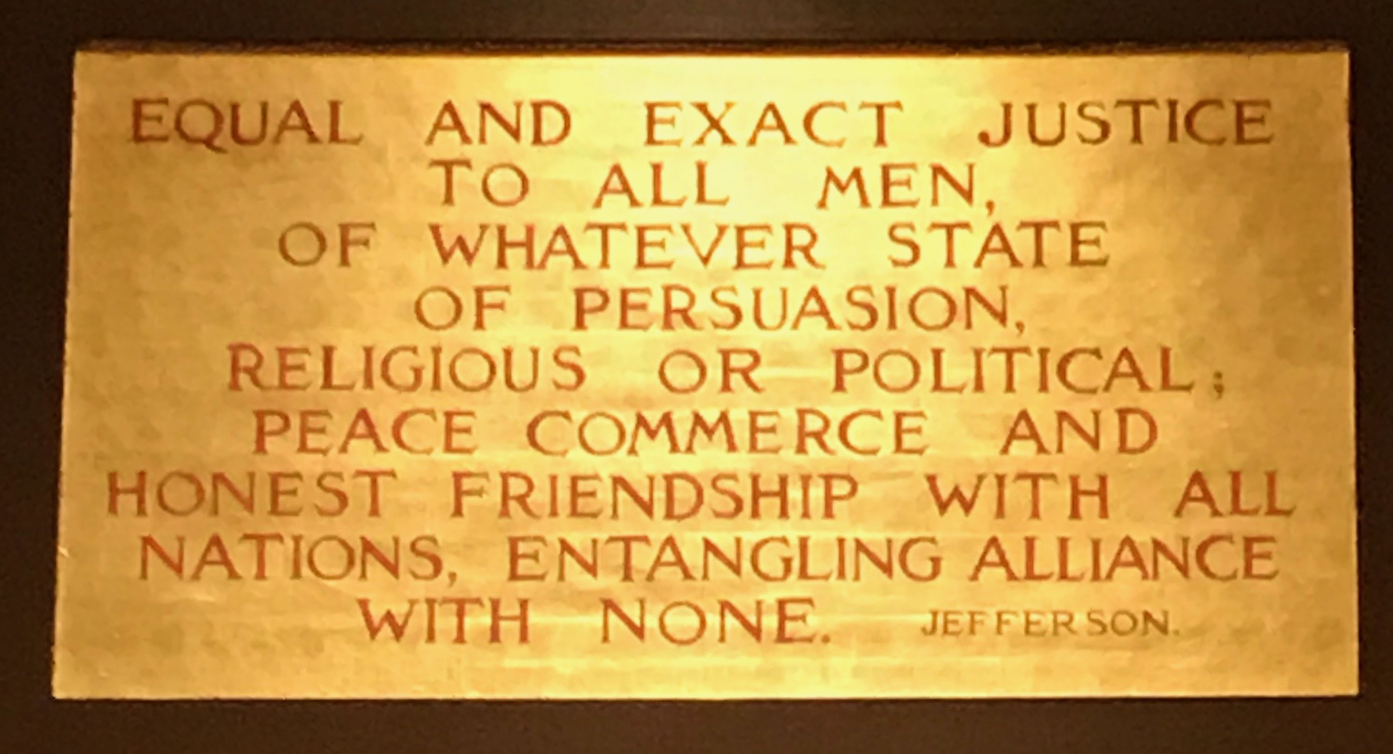
Here’s one of the quotes from around the building:
Here’s another quote.
While taking a tour can be a good thing, they do keep you moving. I rather prefer moseying around at my own pace. But it does save you from looking at a bunch of photos of interesting quotes.
Scattered around the building are decorations with the state motto, L’Étoile du Nord, or, the North Star. According to my preferred source, French was widely spoken in Minnesota until the end of the 20th century.
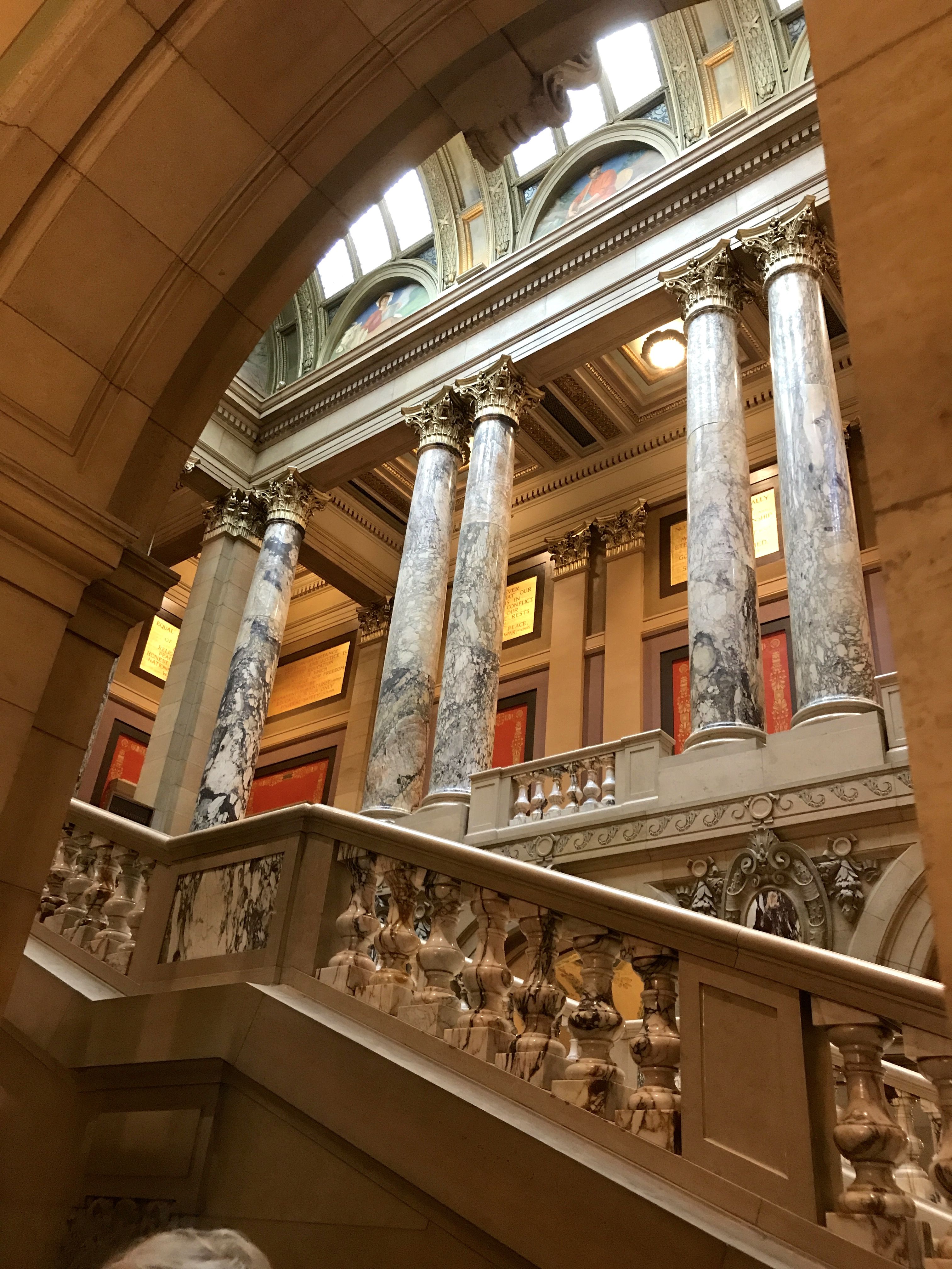
The rotunda was a marvel. It was modeled after Saint Peter’s Basilica in Rome. It is the second largest unsupported marble dome in the world, second only to Saint Peter’s.
There were elegant details all over. This is a skylight in one of the legislative chambers.
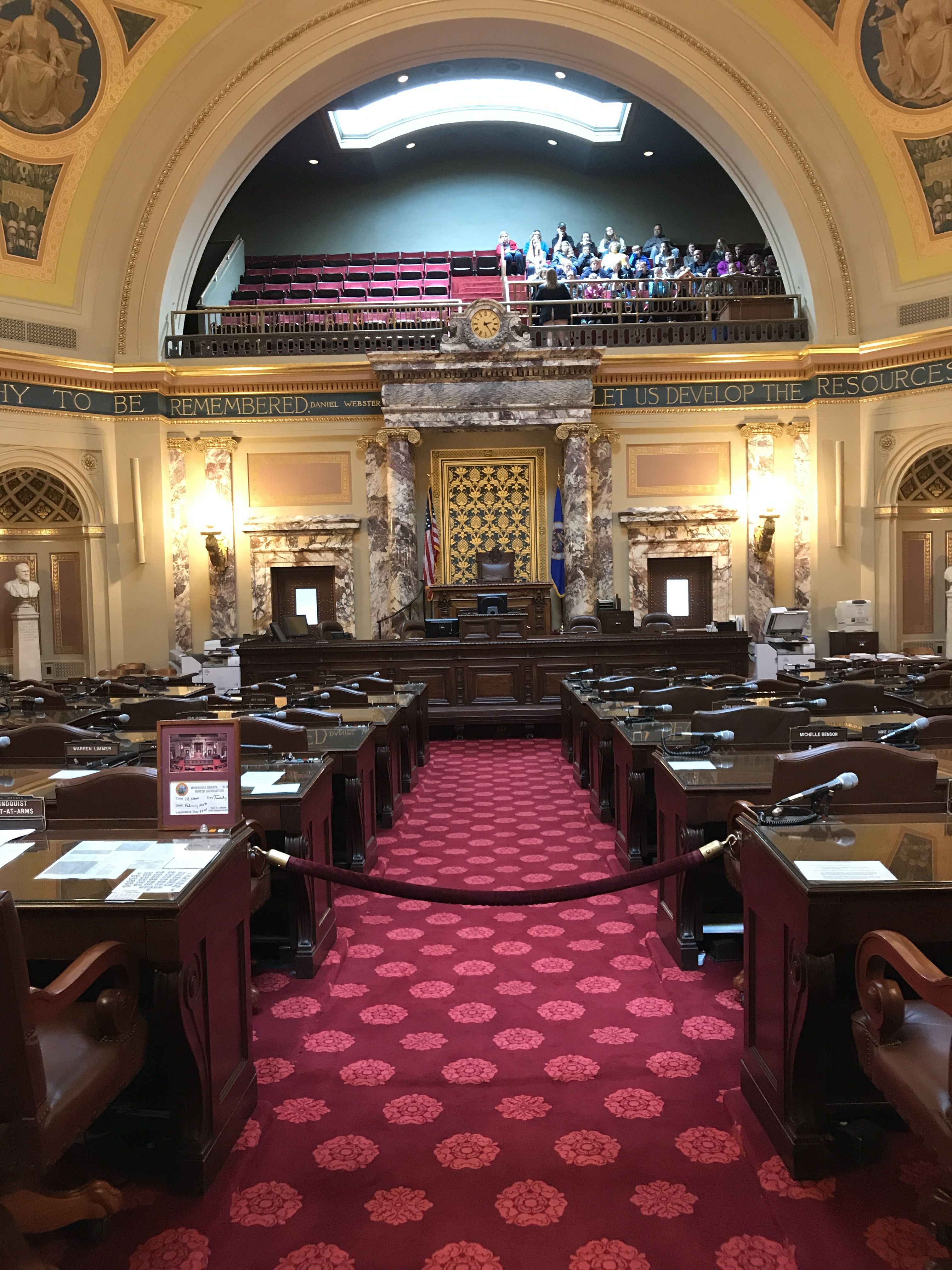
We got to peek into the Senate.
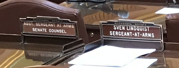
Thank goodness the Sergeant-at-Arms left his desk tidy. Incidentally, can you think of a more typical Minnesotan name than “Sven Lindquist?”
The building had many skylights. After all, it was built in the first years of the 20th century, when electrification was in its beginning stages.
And, with that, the tour was over.
I went back to Bart and looked around. I spied my next location to visit.
That looks like a cathedral! I wonder if it’s a basilica. I’d best go find out.
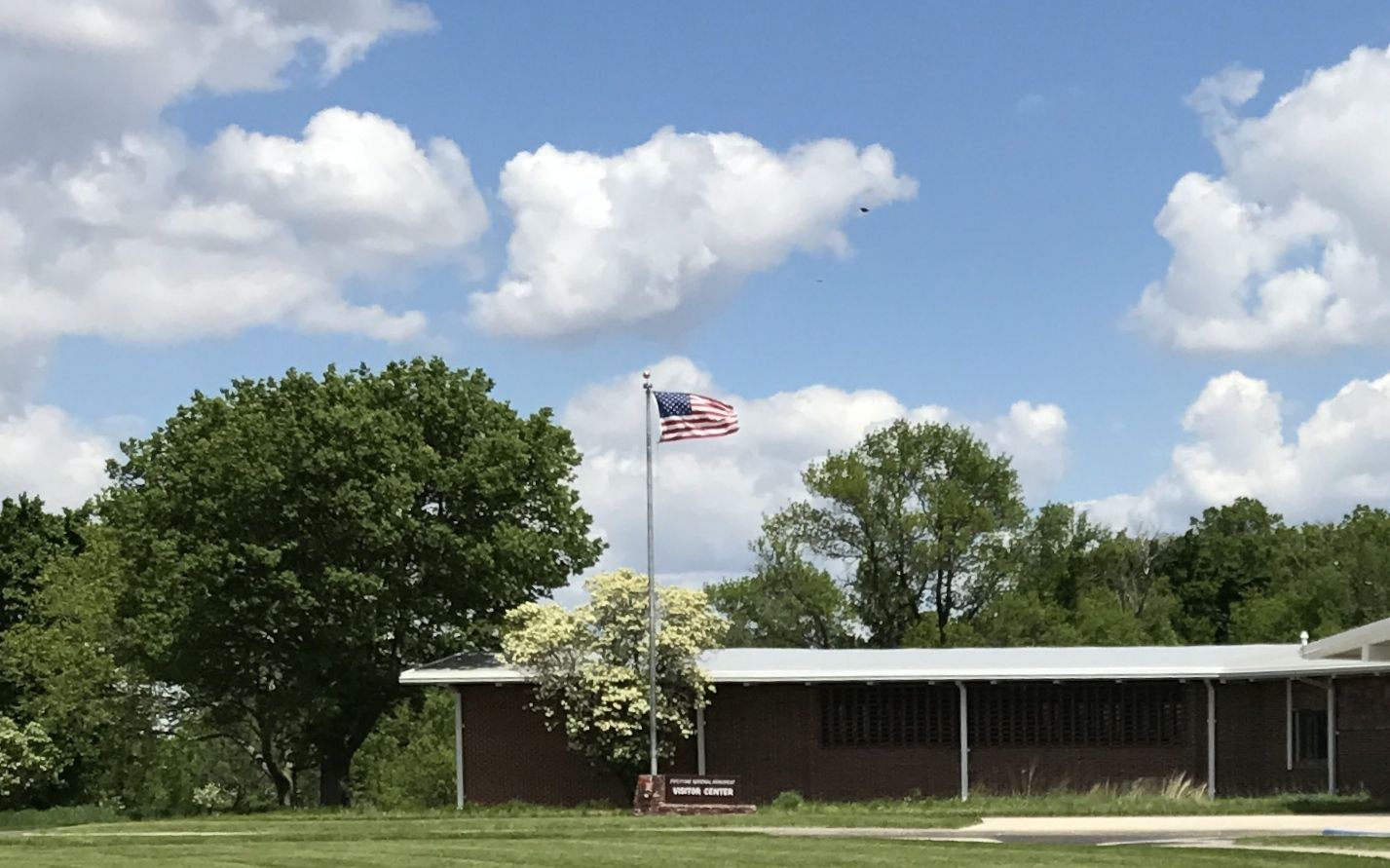
As long as I was in the Southwest corner of Minnesota, I decided to check out Pipestone National Monument. The only “Pipestone” I’d heard of before was a street in Benton Harbor, Michigan. But, I was in the neighborhood, so why not?
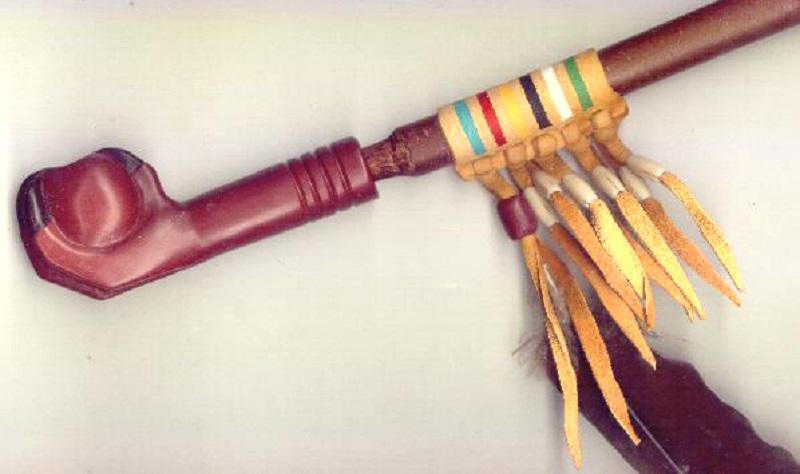
I got to the visitor center and tried to learn what I could about what pipestone was and why it was important.
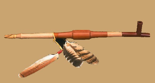
It turns out that pipestone is another name for catlinite. It’s a metamorphosed mudstone that is found in formations of Sioux Quartzite. It’s fine-grained and easily worked and used in making ceremonial pipes for all of the Plains Indians. It was so important that to all the Plains Indians that this was neutral territory where all Nations could quarry stone for ceremonial pipes.
The Sioux tribes may have taken control of the quarries around 1700, but the Minnesota pipestone has been found inside North American burial mounds dating from long before that. I hope they are no longer excavating burial mounds. When you know better, you do better.
The name for the sacred pipe is “chanunpa”. If you are interested in more information, click here.
I imagine that there were any number of different styles. After all, there were numerous Nations and they produced them for many, many years.
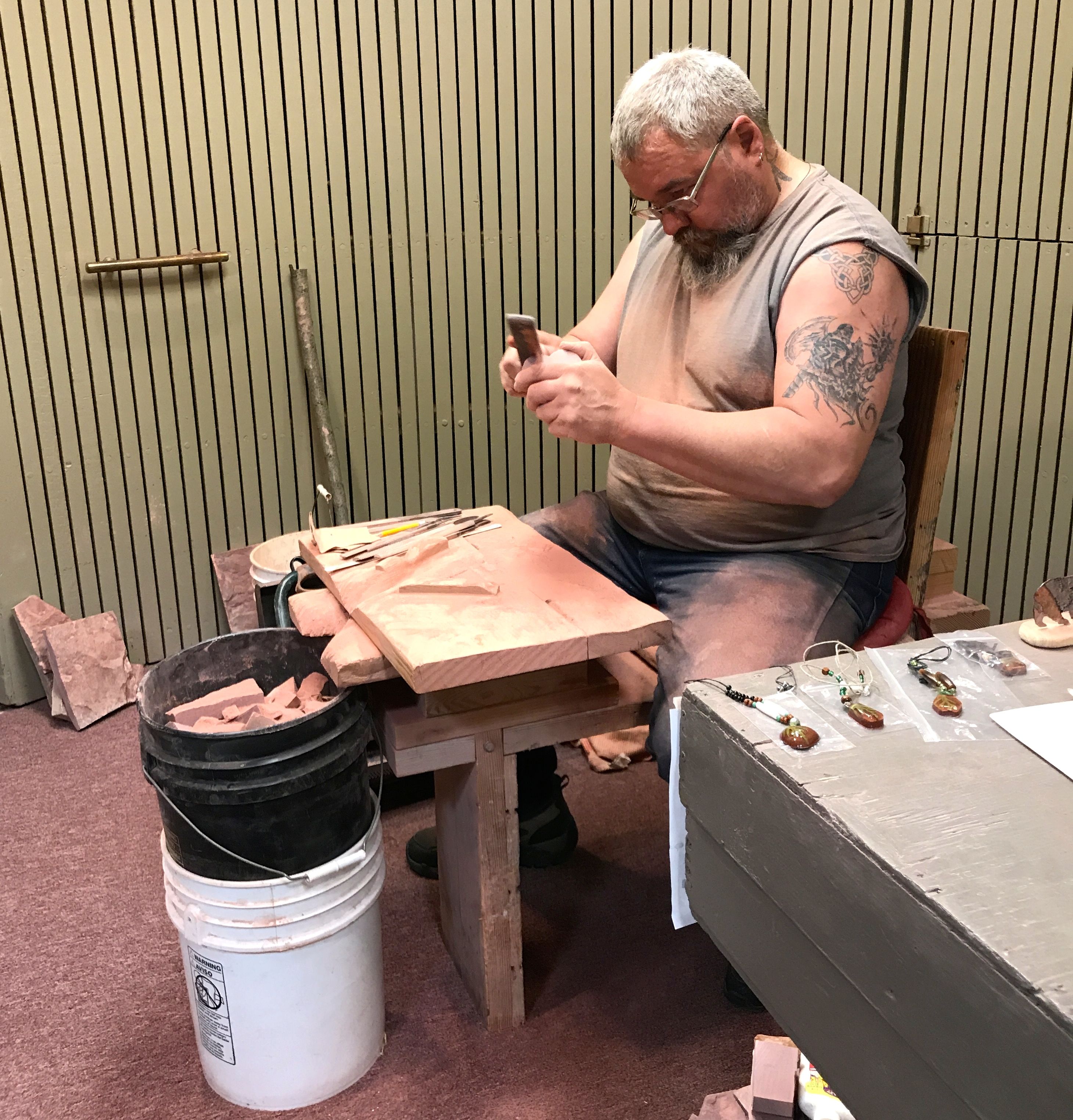
They had some artisans in the visitor center working the soft stone. The ones I saw seemed to be producing articles for the tourist trade.
In spite of the fact that the stone was smooth and attractive, I decided against buying a souvenir. That’s just the way I roll.
There are still active quarries at the monument. In 1937, an act of Congress restored quarrying rights to the Indians. Today, only people of Native American ancestry are allowed to quarry the pipestone.
There was a trail that lead out from the visitor center that went by some of the quarries. I was eager to see what the quarries looked like.
Right outside the visitor center was an exhibition quarry. I was curious about why it was flooded. Was it permanently flooded or was this was a temporary condition? As I write this report, more than a year later, I called the center and spoke with a ranger in the interpretive center. He told me that they do pump it out, but it does tend to fill with water in the spring. Since I was visiting in the spring, I guess that explains it. In any event, there was nothing happening in that quarry when I visited.
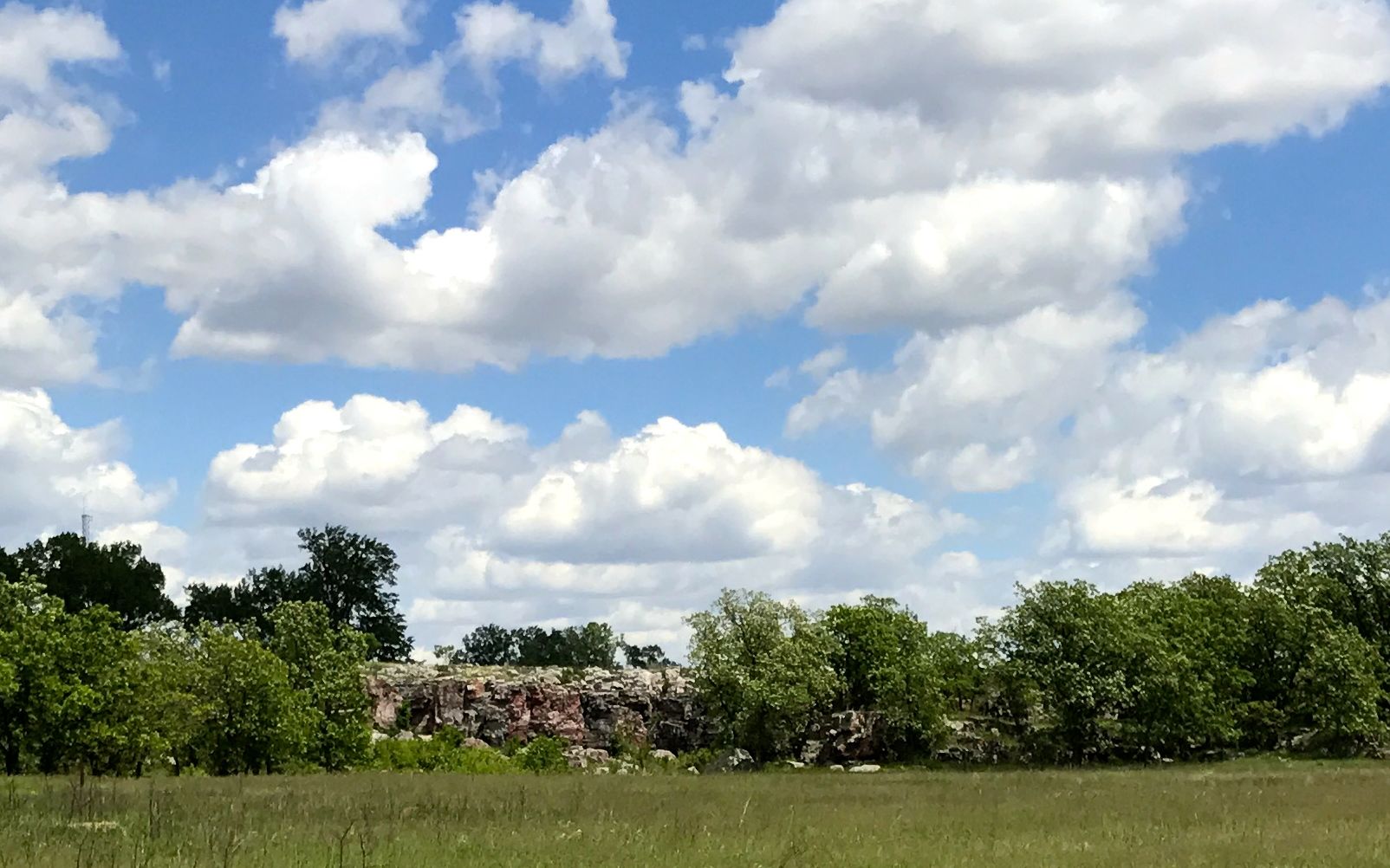
I continued along the path toward the cliff.
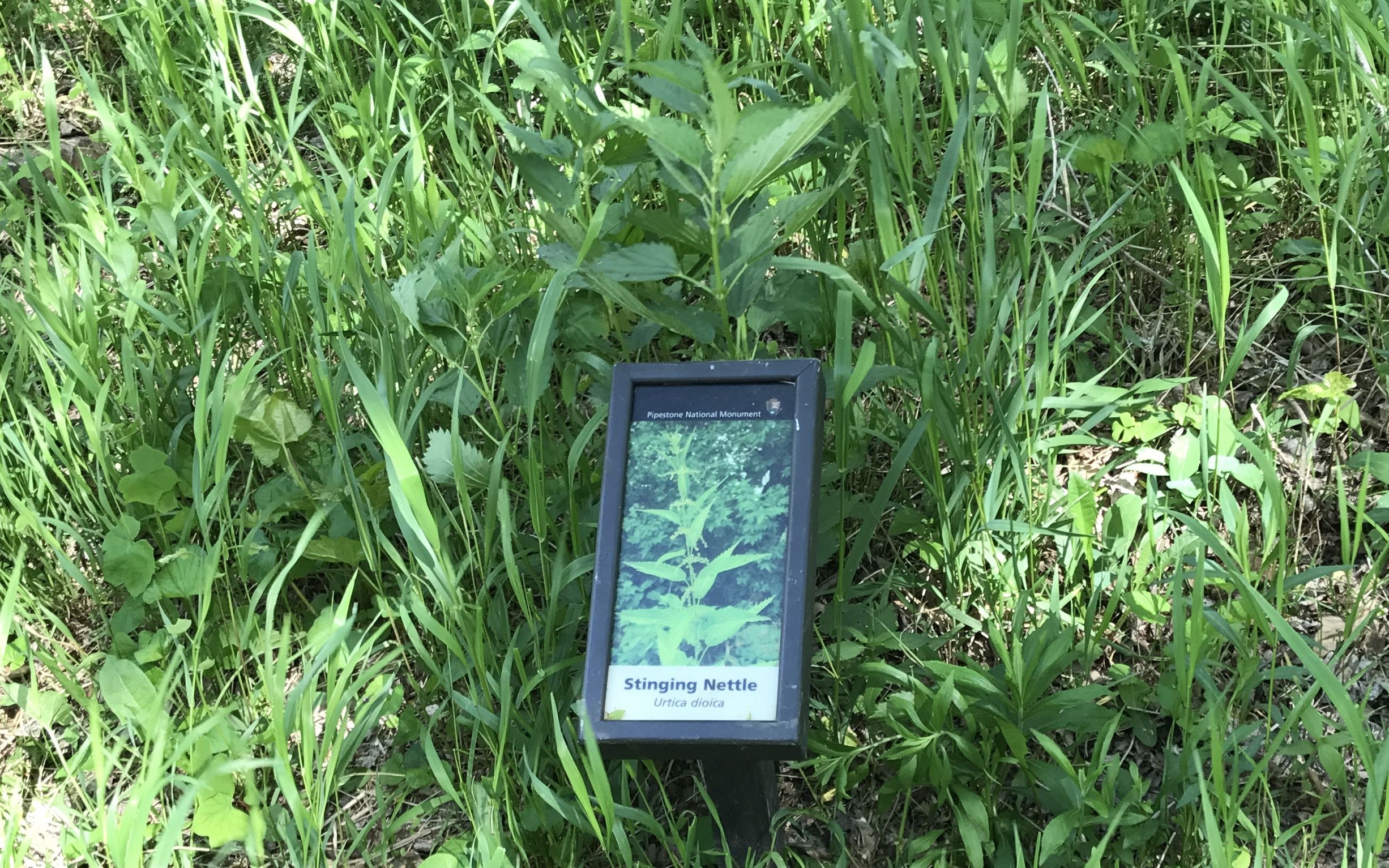
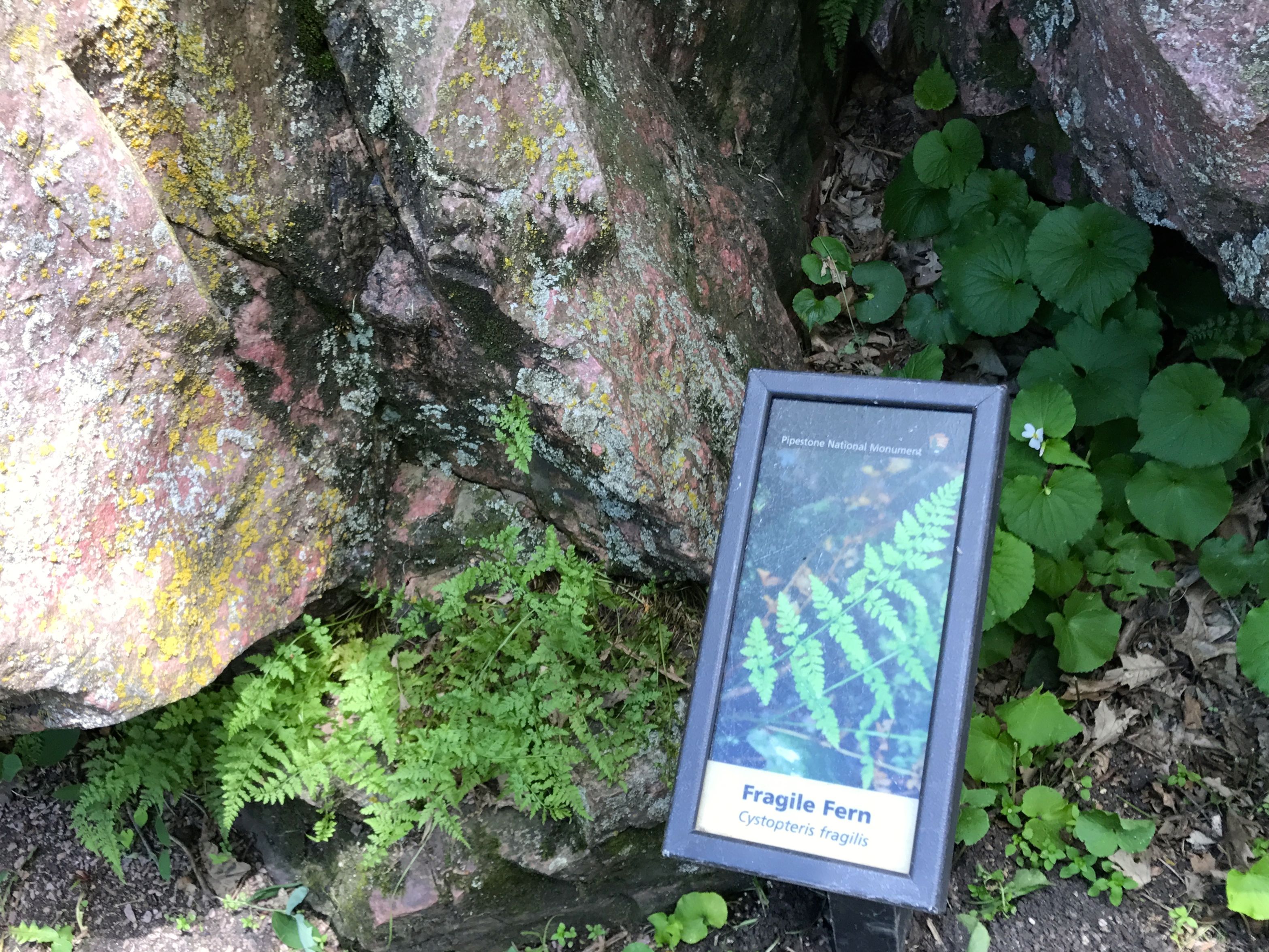
There were some interesting interpretive signs along the way identifying the plants. I always wonder what the plants are the I am looking at.
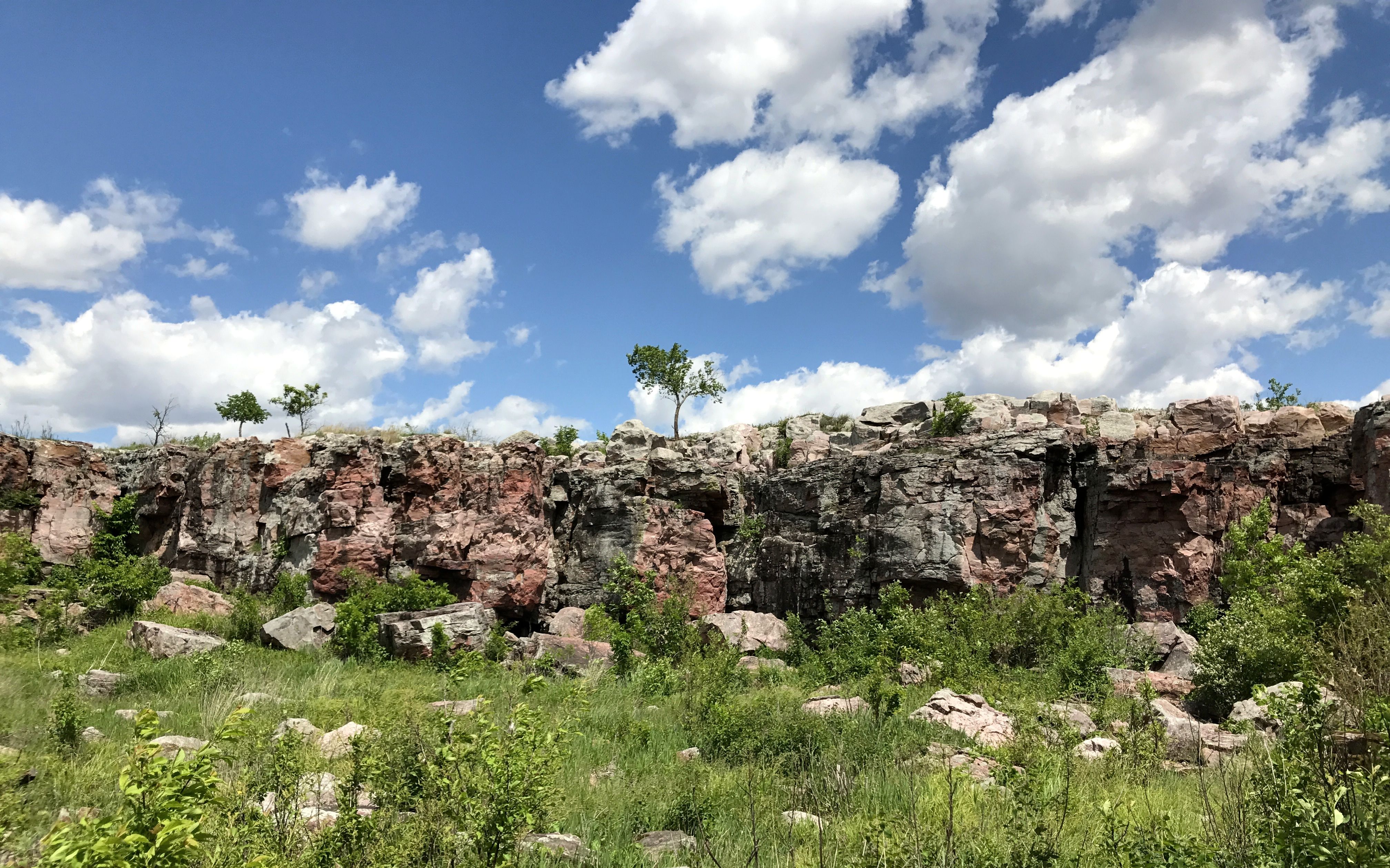
I kept walking and the cliff kept getting larger.
And finally, I was there.
The plant identification signs continued.
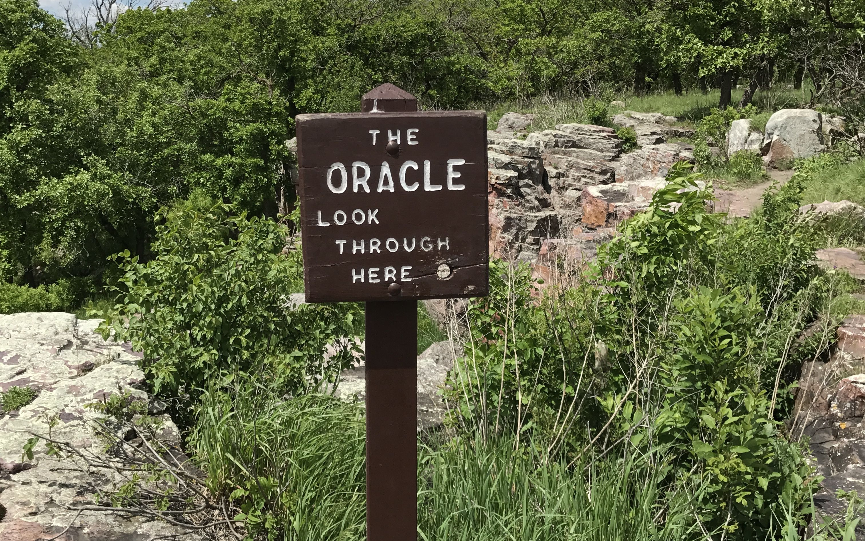
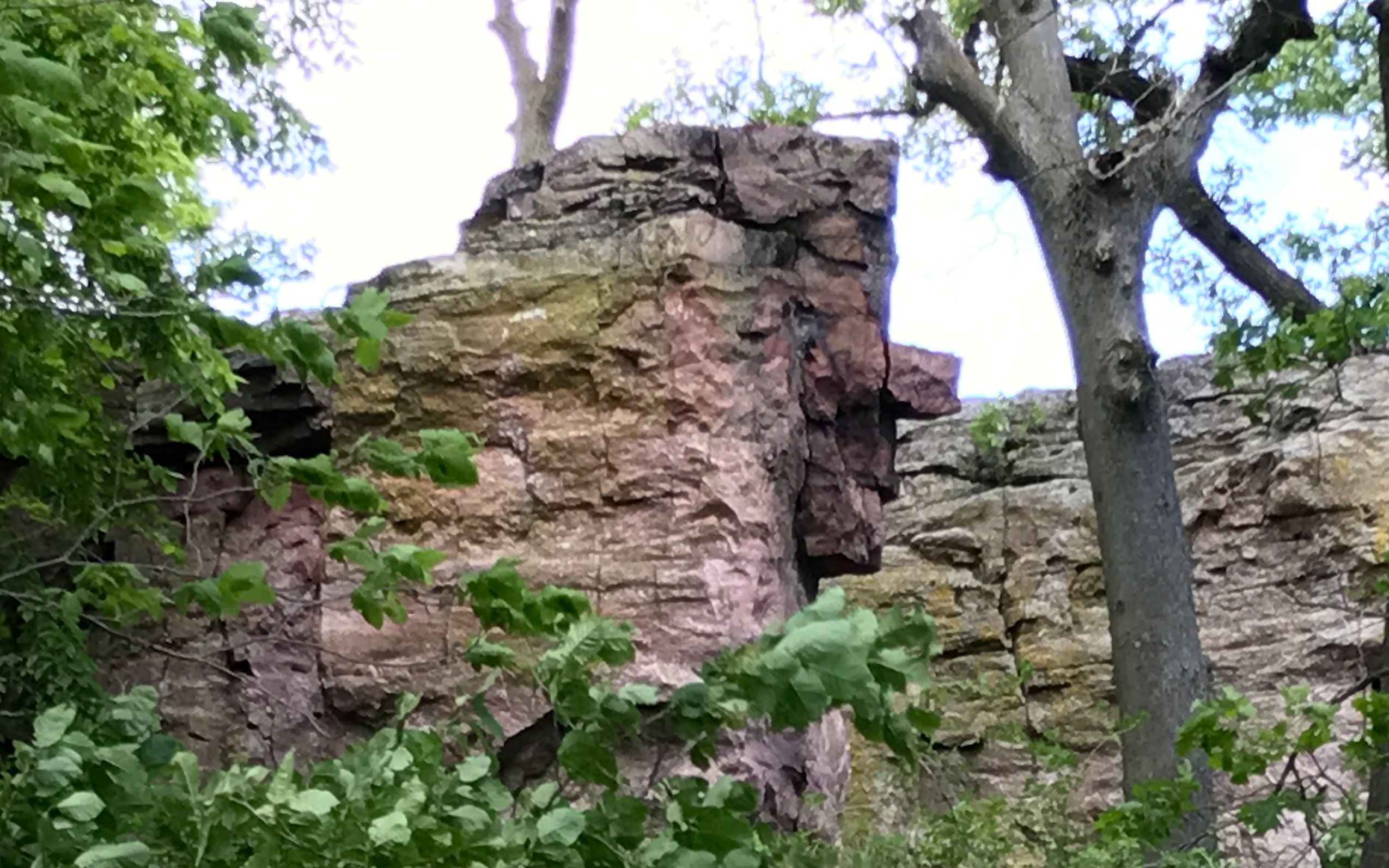
I walked up the path and came across this sign.
Of course I had to look.
This is what I saw. Unfortunately, I didn’t know what I was looking at, so I reached out to the ranger again. This was his reply: “The Oracle is a natural stone face within the Sioux Quartzite cliff. The face is looking to the left, with a lichen covered nose and a protruding chin. Some American Indians believe that The Oracle is a guardian of the quarries, and will impart wisdom to the quarriers in how to get down to the catlinite. Offerings are sometimes left at The Oracle for this reason.”
Do you see it? I do!
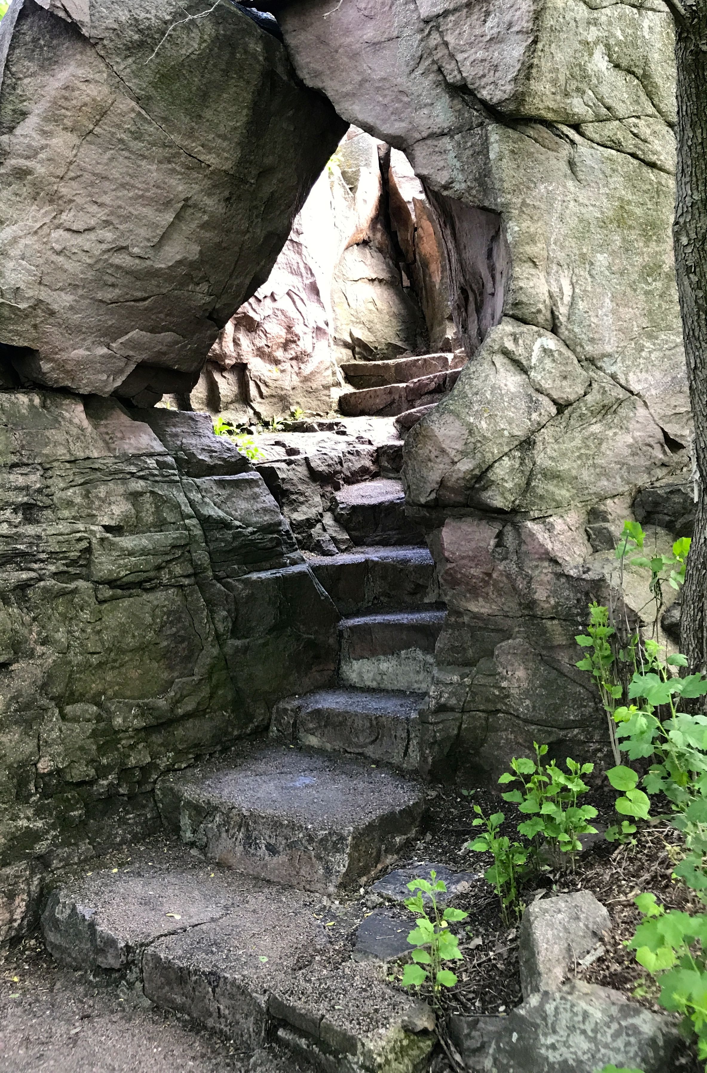
I continued along the trail. The trail went up and so did I.
In 1838, Joseph Nicollet led the first U.S. Government expedition to the pipestone quarries. He mapped the upper Mississippi River basin and his maps were the most accurate of the time.
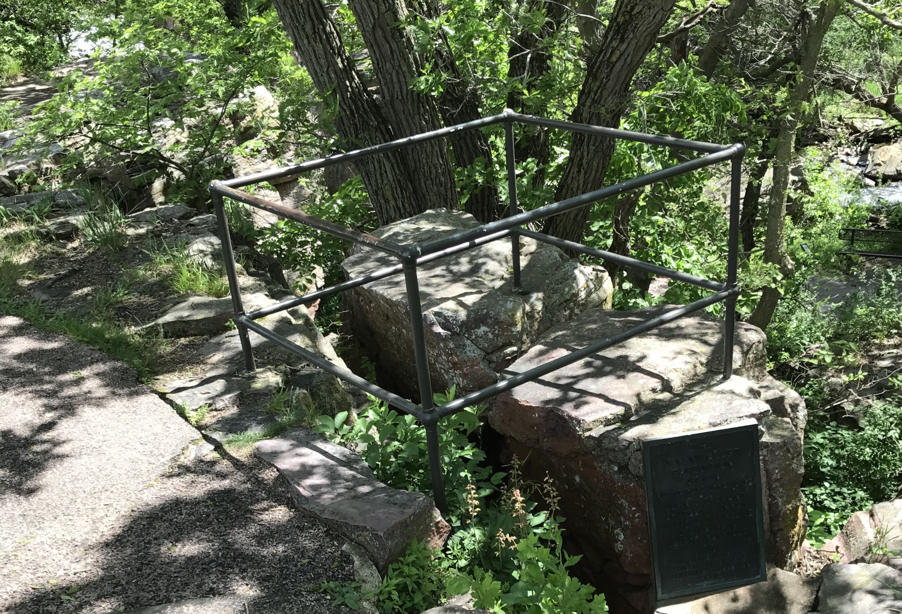
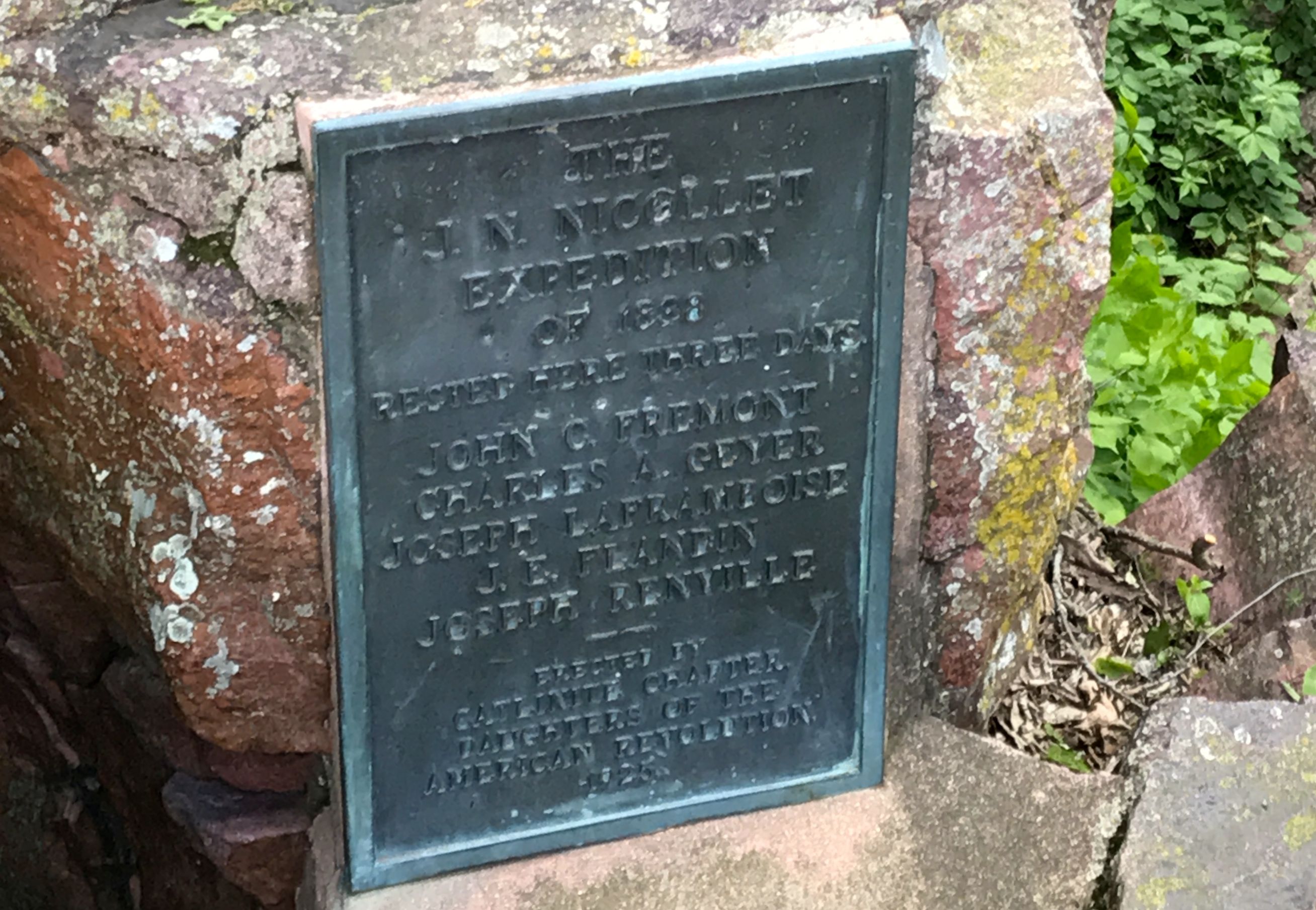
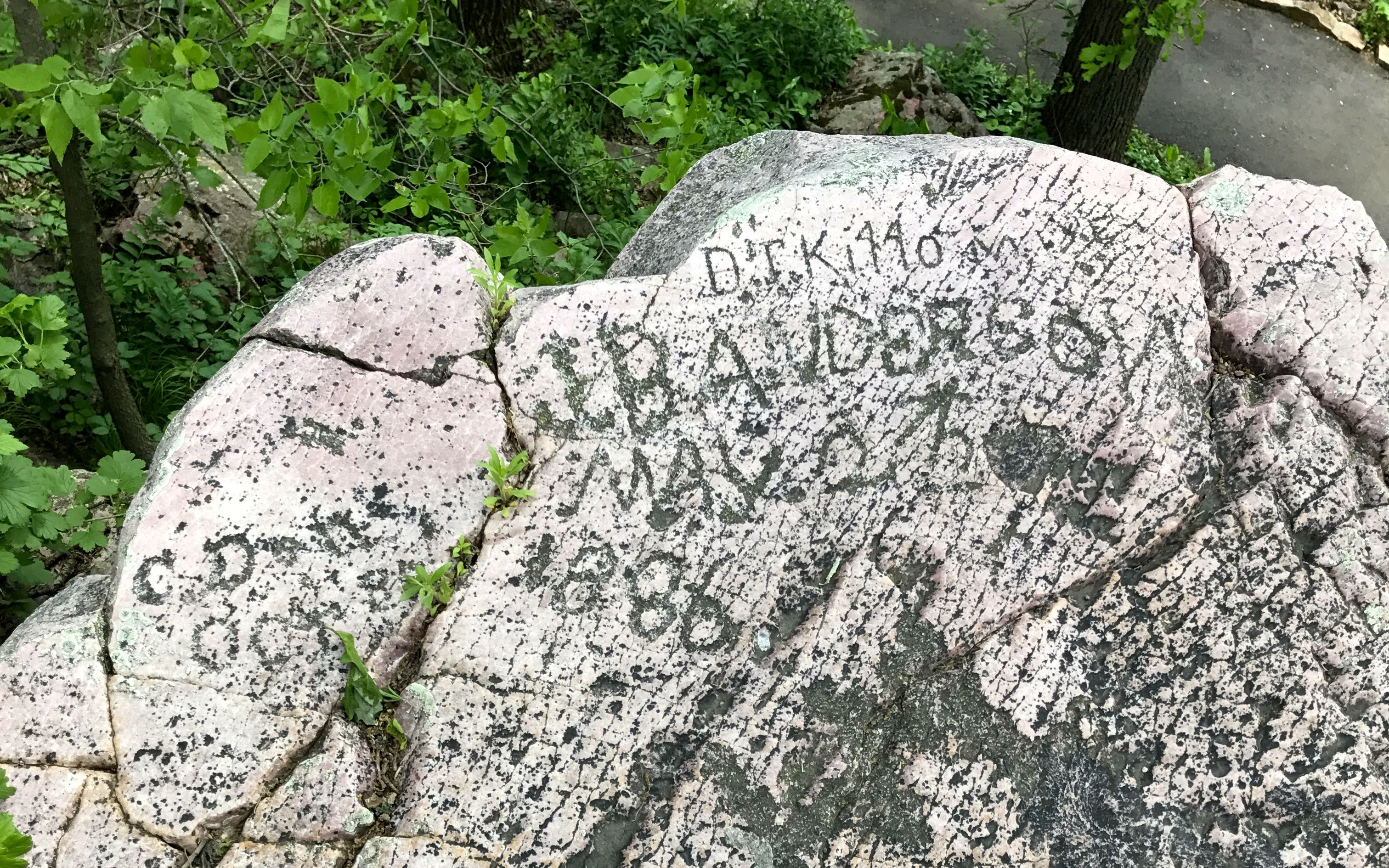
In case you can’t read this plaque memorializing the J.N, Nicollet Expedition of 1838, they rested here for three days. It lists the members of the party. I am always interested in when things were memorialized and who erected the memorial. This plaque was erected in 1925 by the Catlinite Chapter of the Daughters of the American Revolution.
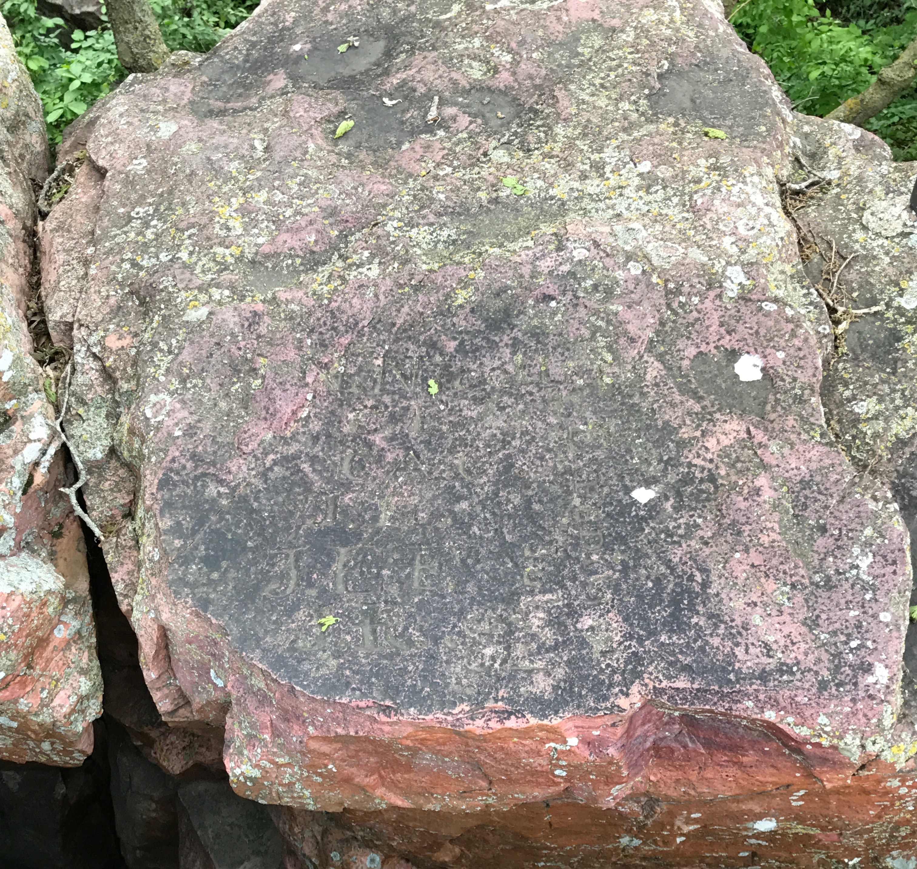
According to a sign nearby, this is what the members of the expedition carved.
I am pretty sure that this is the stone they carved. When I enlarged it and fiddled with the settings in iPhoto, I could kind of make out the letters. The earth and its processes eventually reclaim everything. Just to be sure, I reached out to the ranger again. He said that this was the original stone.
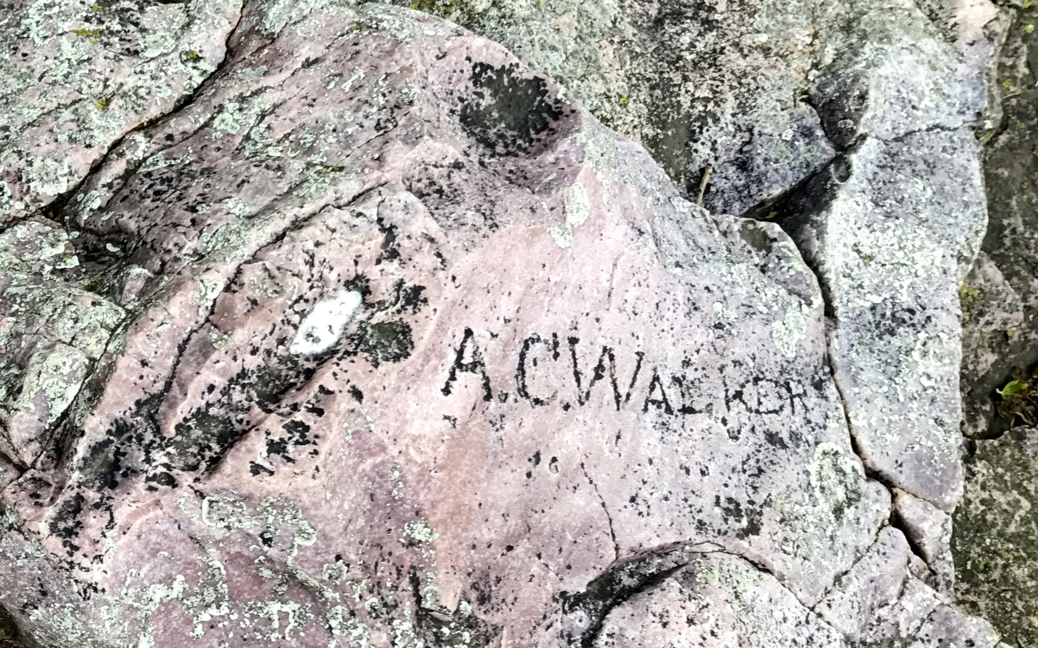
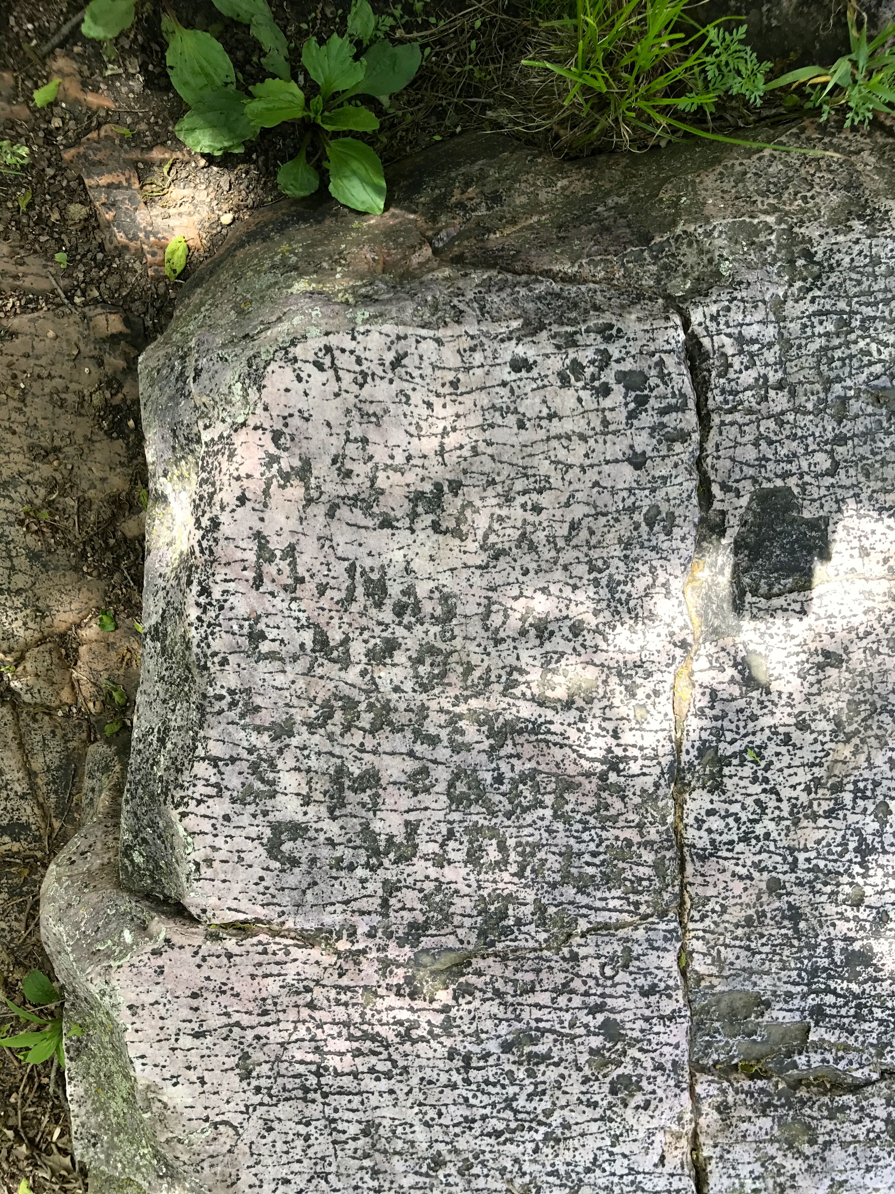
Apparently, people who came along after them left their marks as well.
Given the hardness of the quartzite, it was no mean feat to leave your name behind.
I wonder how long it took these folks?
Some just settled for leaving their initials behind.
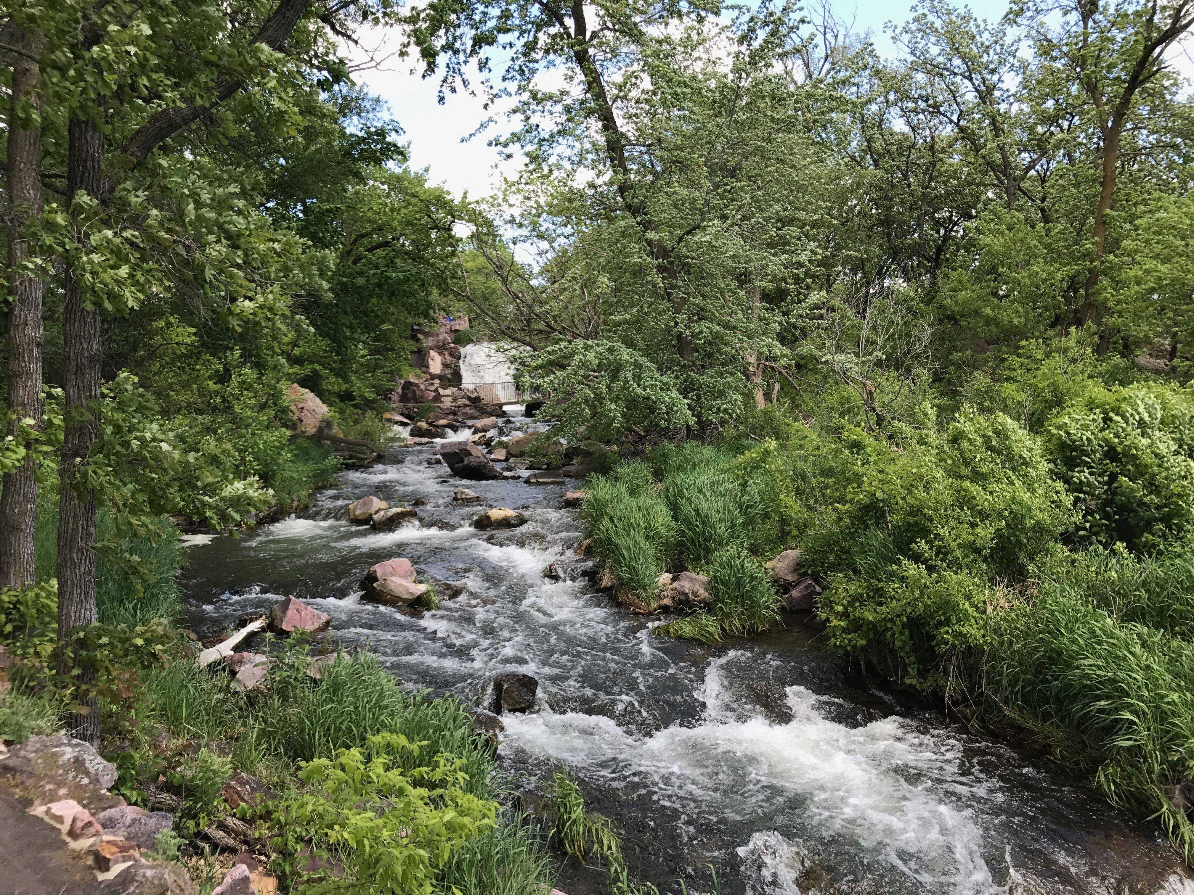
I continued along the trail and came to Winnewissa Falls.
Winnewissa Falls is part of Pipestone Creek.
According to one Native American story, “The Great Spirit called the warring nations together in the valley of the pipestone. There he pulled a piece of pipestone from the earth, formed a pipe, and told them that it was the flesh and blood of their ancestors. He smoked the pipe over them and admonished them to lay down their arms. Here is a place where different tribes can quarry side by side together in harmony. While he was speaking, a water fall poured from the rock nearby.”
I took this story from some of the excellent interpretive materials available at the site.
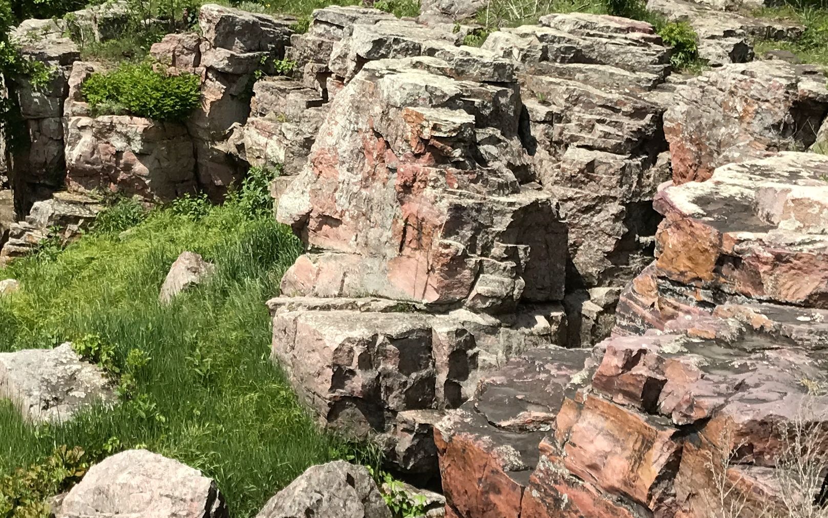
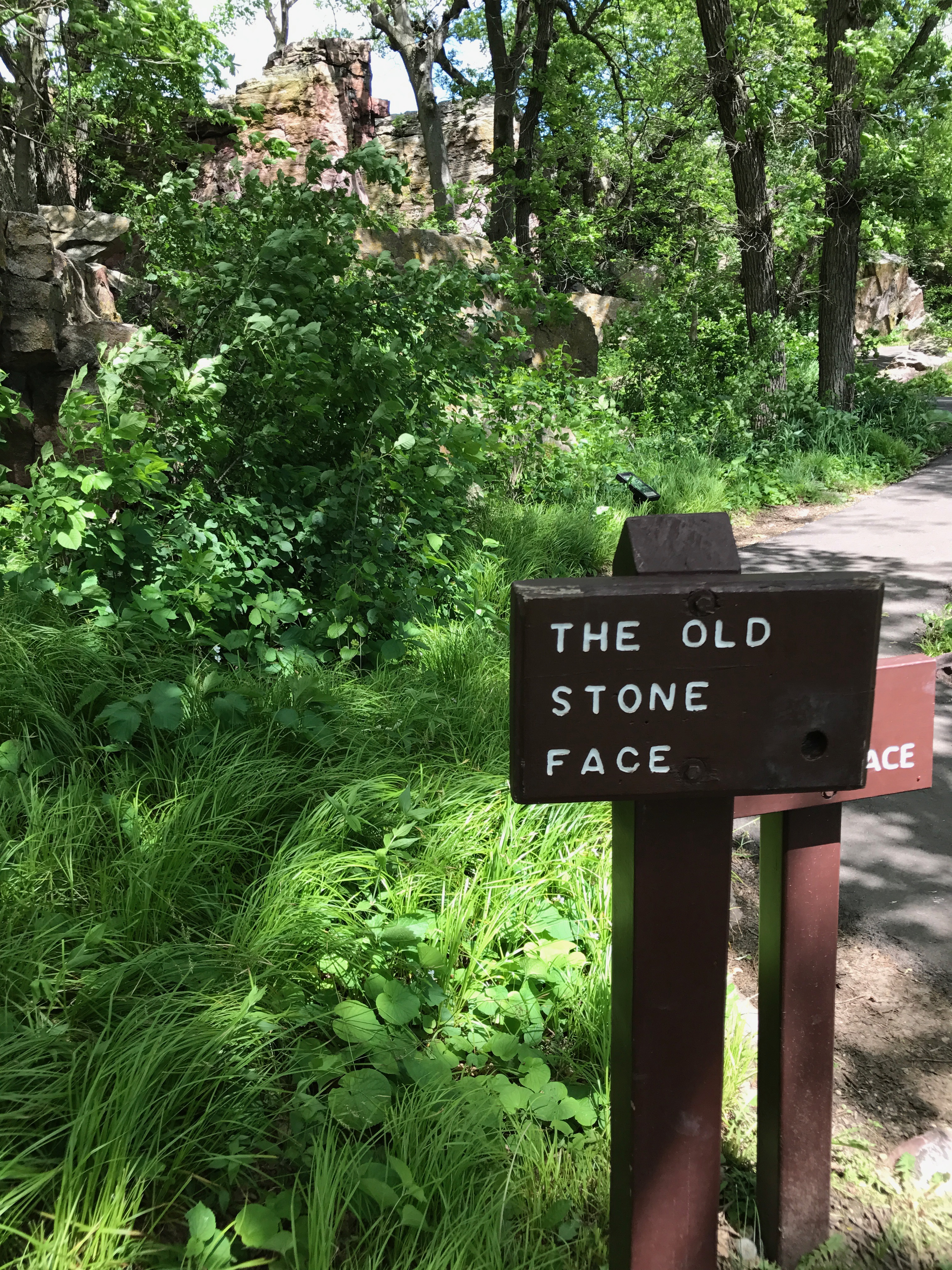
I continued on down the trail and came upon this sign.
Wait! Buster Keaton is down there?
No, not Buster Keaton, but I see the Old Stone Face.
Do you?
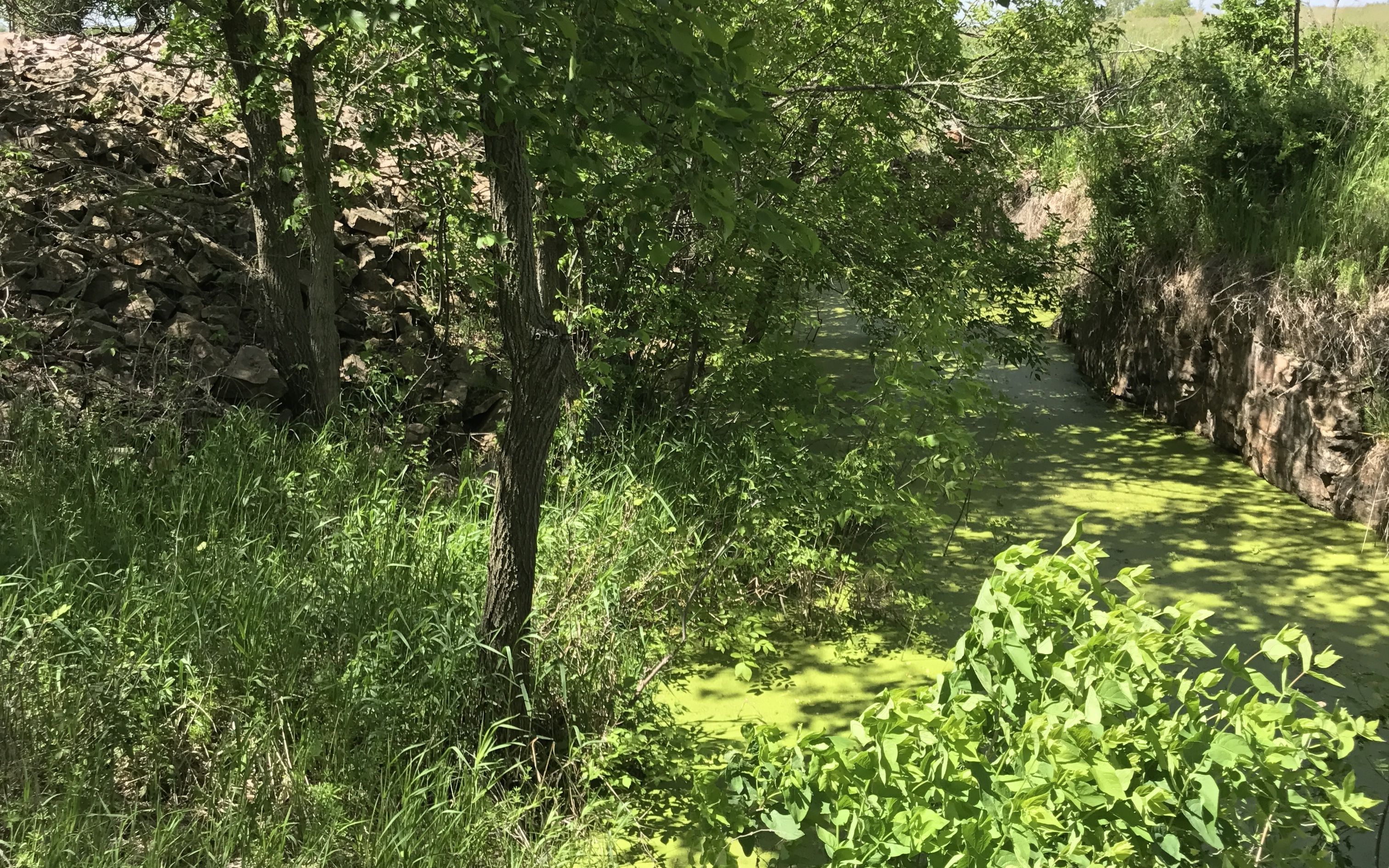
I kept walking.
Pipestone Creek gurgled merrily along.
I passed at least one quarry I could identify. This one was filled with water and covered with duckweed. I wonder if it dries out in the summer?
You could tell it was a quarry because of the pile of tailings left from getting to the stone they were after.
I passed more plants with interpretive plaques. I was most impressed with the legibility of the interpretive plaques. Not only could your read them, but they contained relevant information.
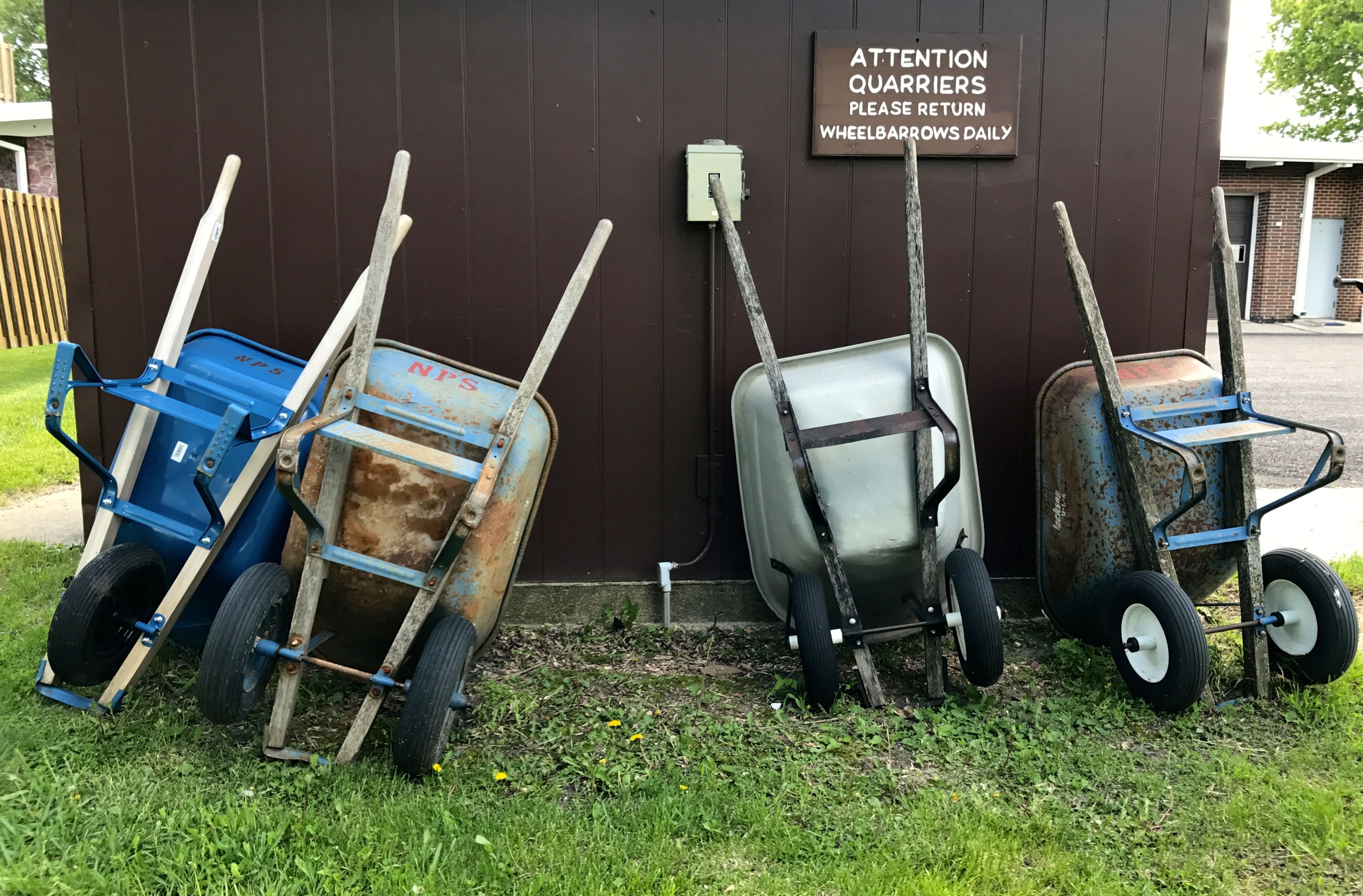
I thought it was nice that wheelbarrows were there for the quarriers to use.
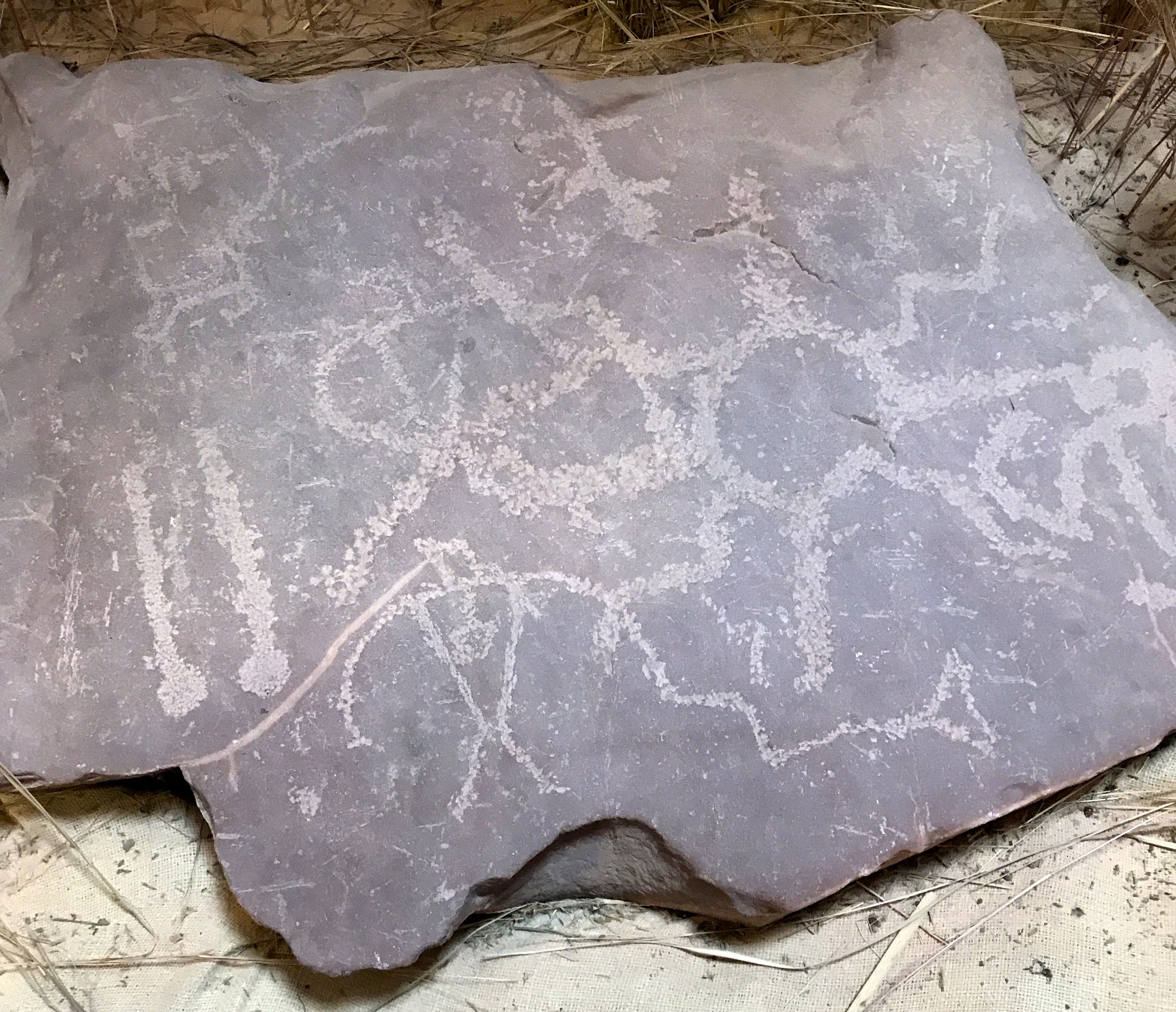
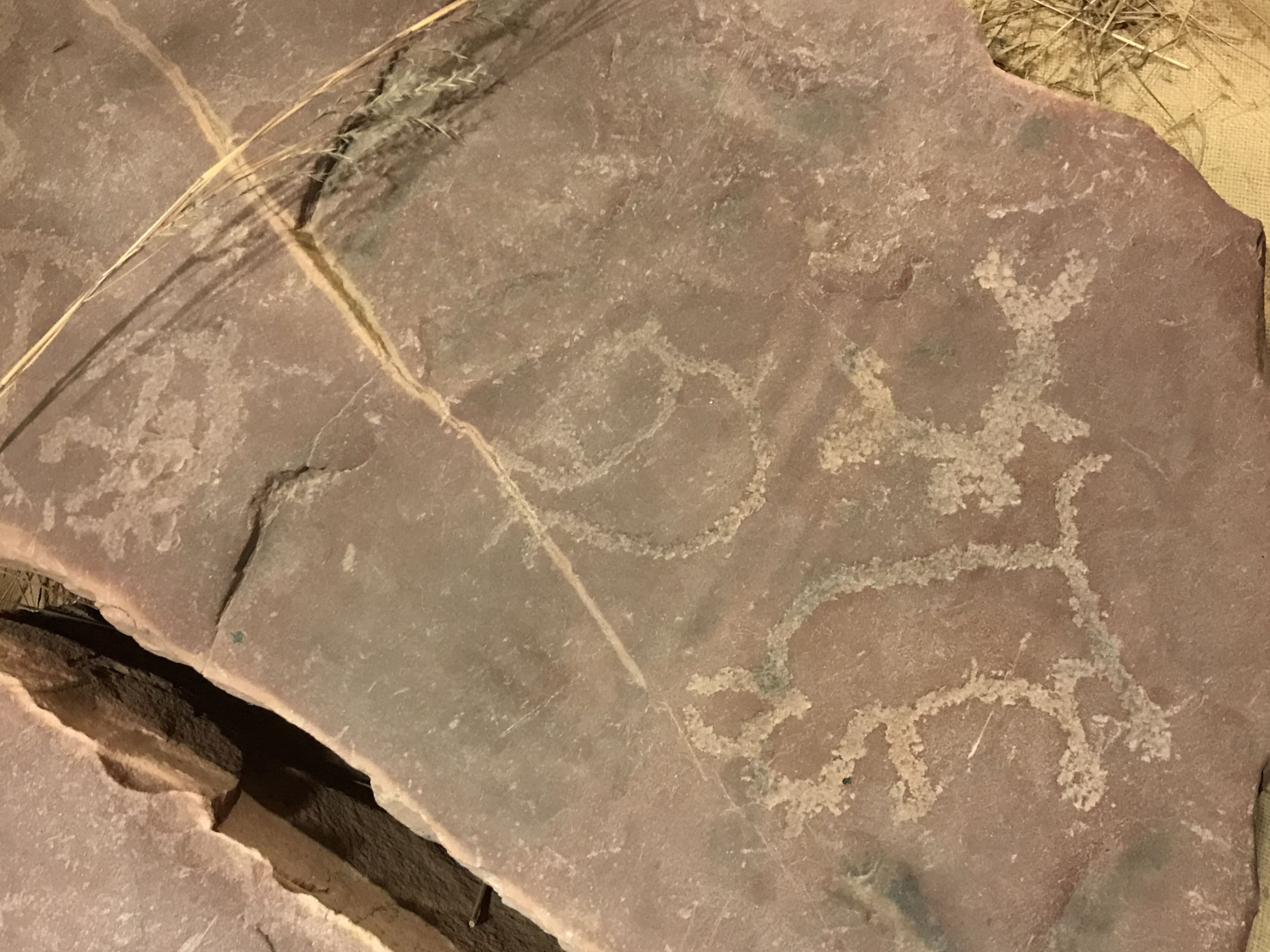
Back inside the visitor center, I spotted more petroglyphs. I love petroglyphs!
According to the information with them, in the late 1880s, the petroglyphs were removed form the quartzite bedrock surround the Three Maidens.
Pipestone businessman, Charles Bennett had them removed over concern that they were being defaced with names and other inscriptions chiseled over the original petroglyphs.
Mr. Bennett kept the collection in his side yard until his death in 1926. After that, they were kept at several places in Pipestone.
In 1946, 19 stones were donated to the National Park Service and were placed on exhibit at Pipestone National Monument.
After being moved around to a number of locations, they were moved into the visitor center for security and interpretation. The current exhibition was developed with the input of many of the tribes affiliated with the quarries. The design was meant to reflect a respect for the spiritual nature of the petroglyphs.
And with that, it was time to head back to Blue Mounds Park.
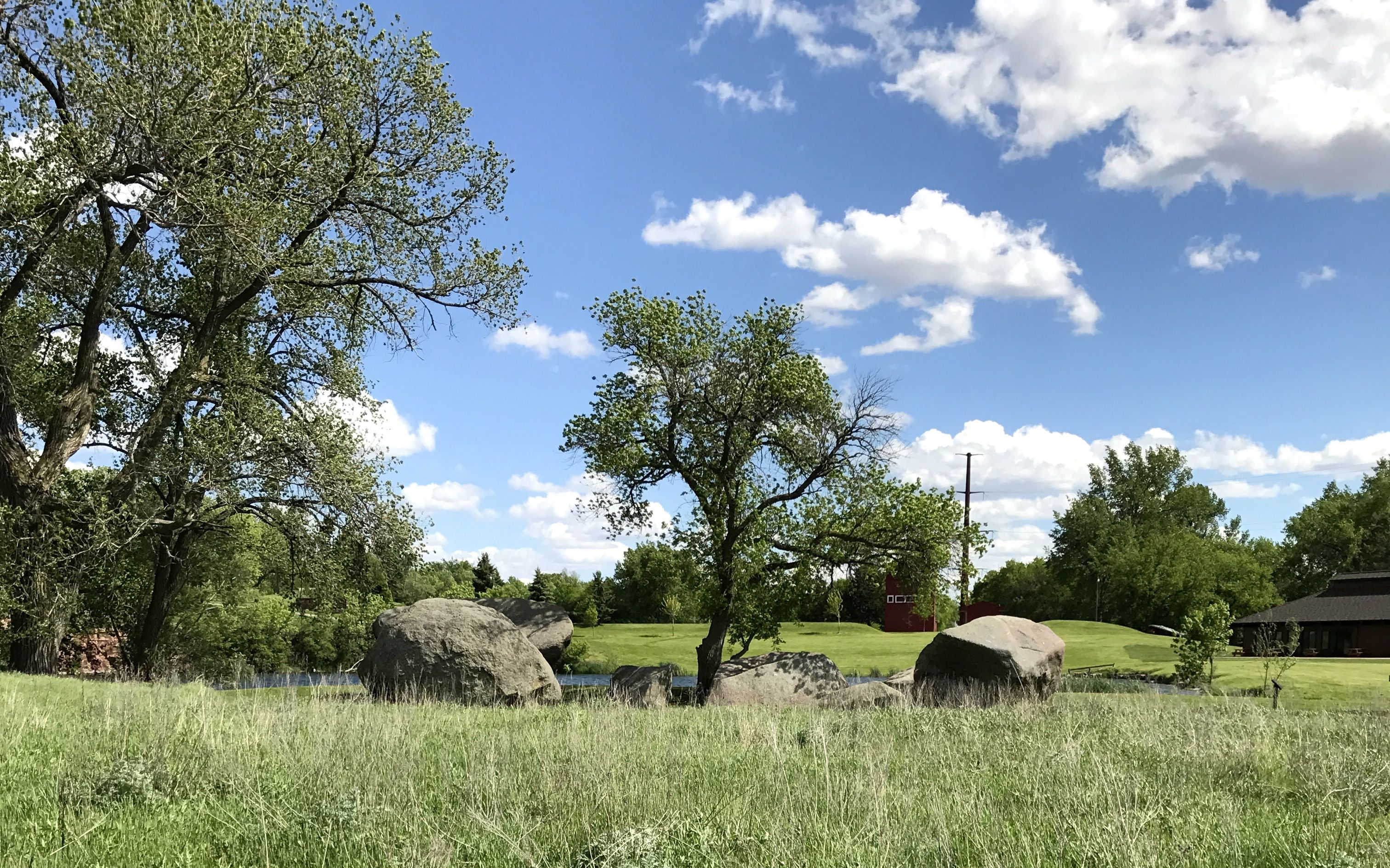
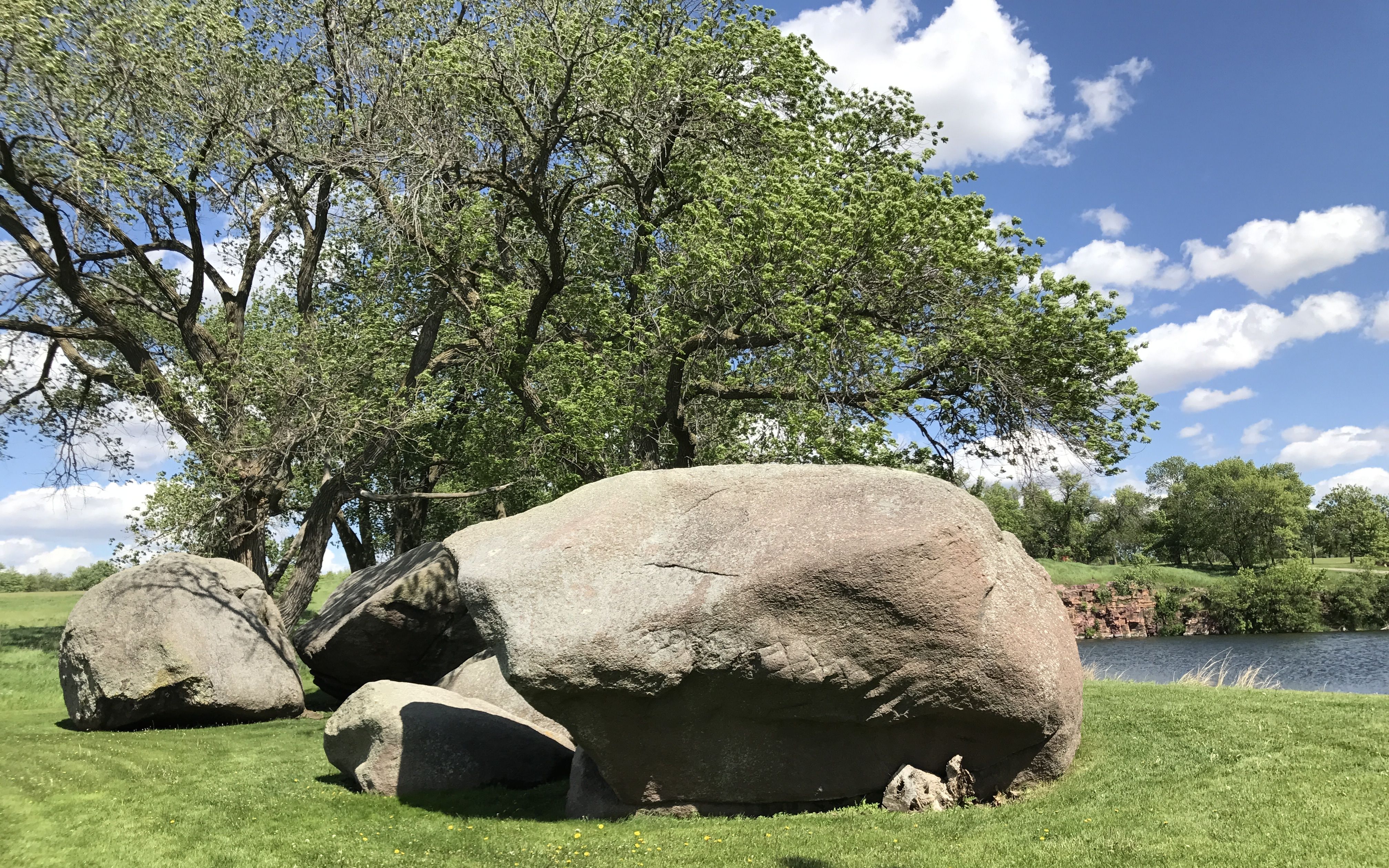
On my way back, I passed the Three Maidens. Many American Indians believe that the large boulder fragments shelter the spirits of maidens who require offerings from visiting Indians before permitting them to quarry pipestone.
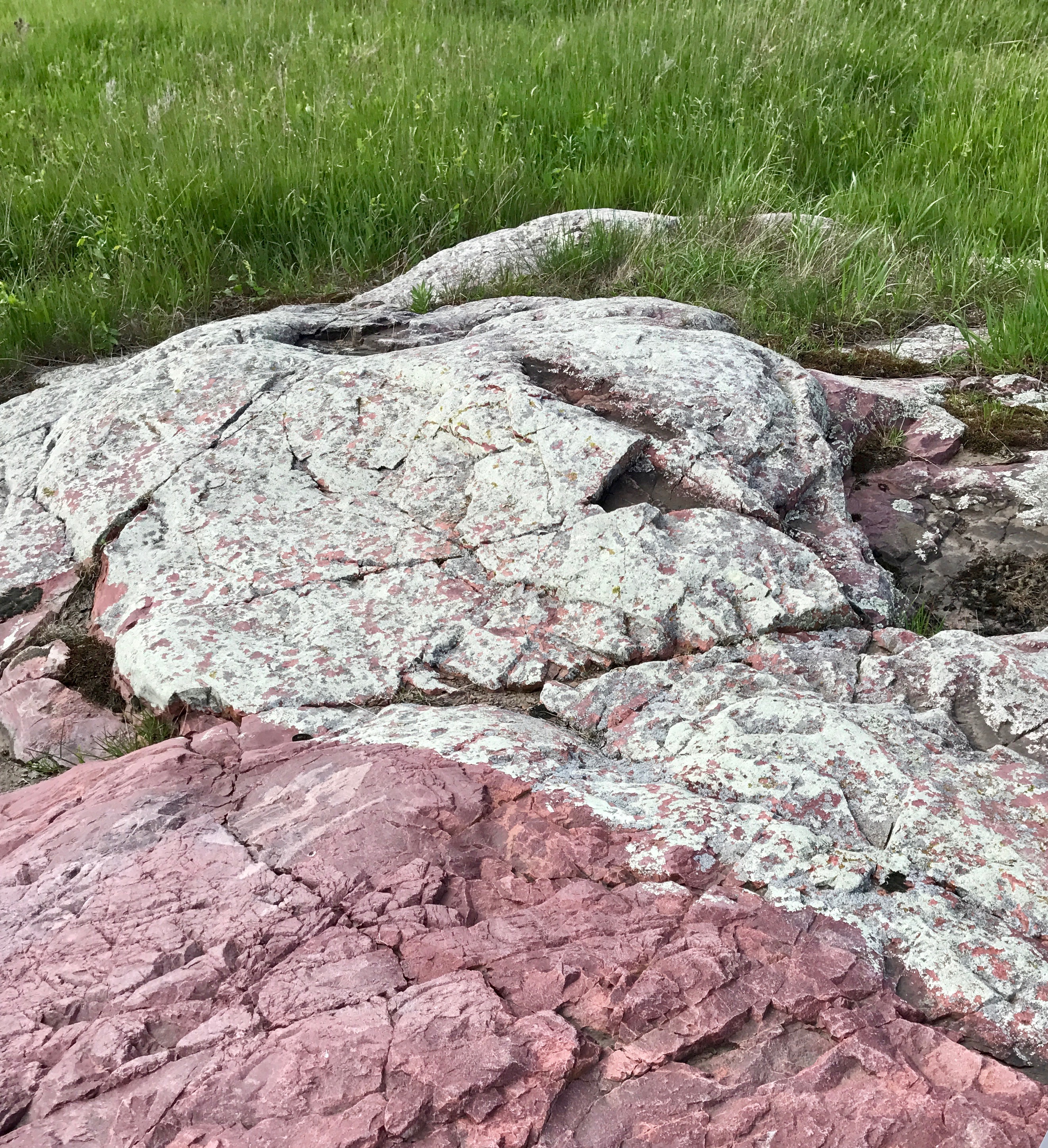
These huge granite rocks seem out of place in this landscape filled with quartzite, don’t they? According to the information at the site, they were carried down from present-day Canada during the last Ice Age. When the glacier receded, it left behind a huge boulder about 30 feet in diameter. The freeze/thaw cycle eventually split this glacial “erratic” into six pieces.
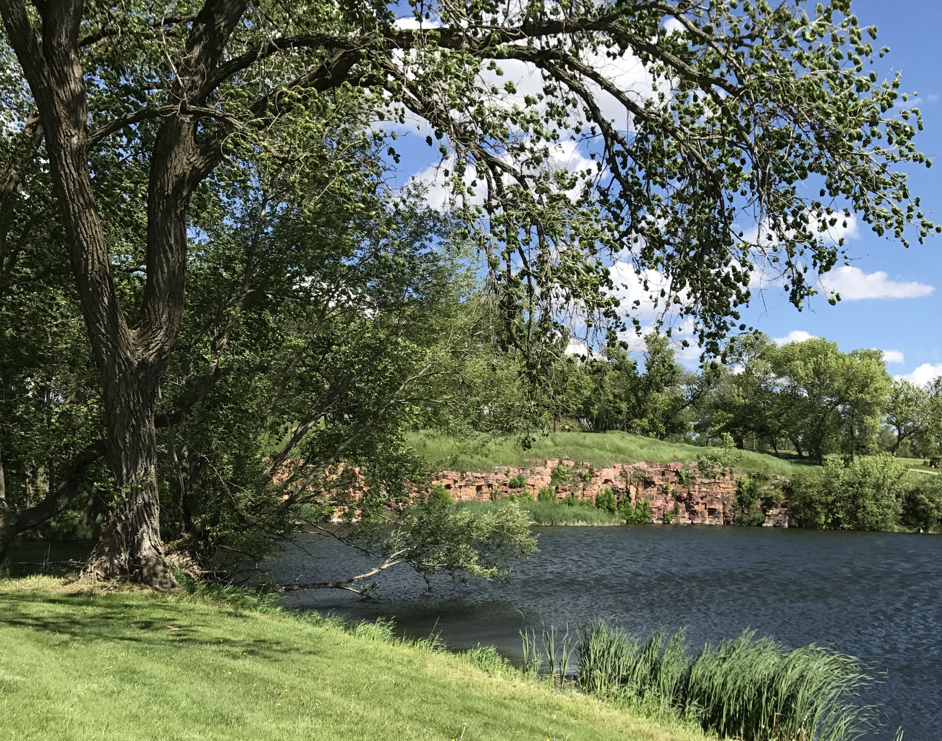
It was a peaceful setting.
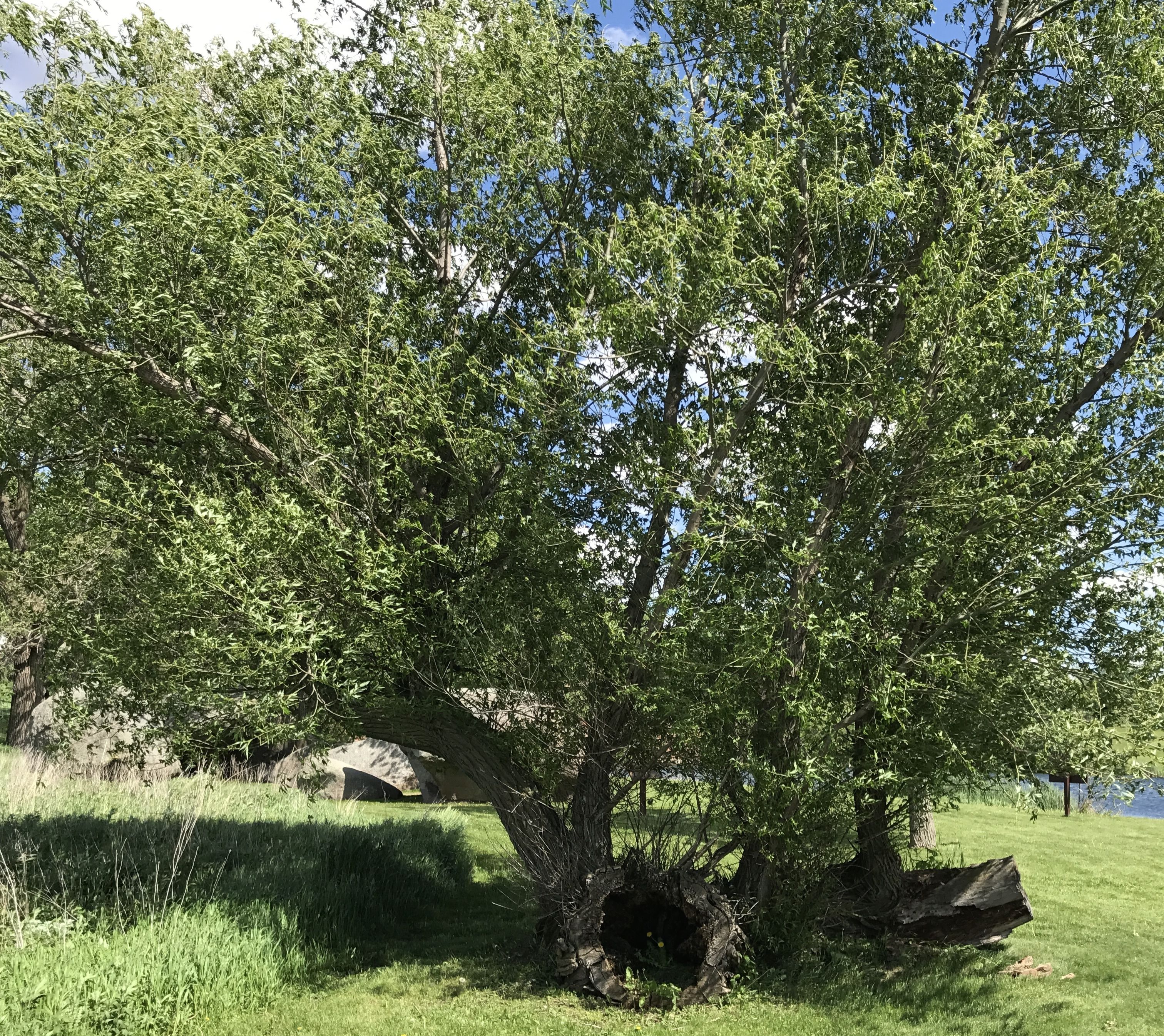
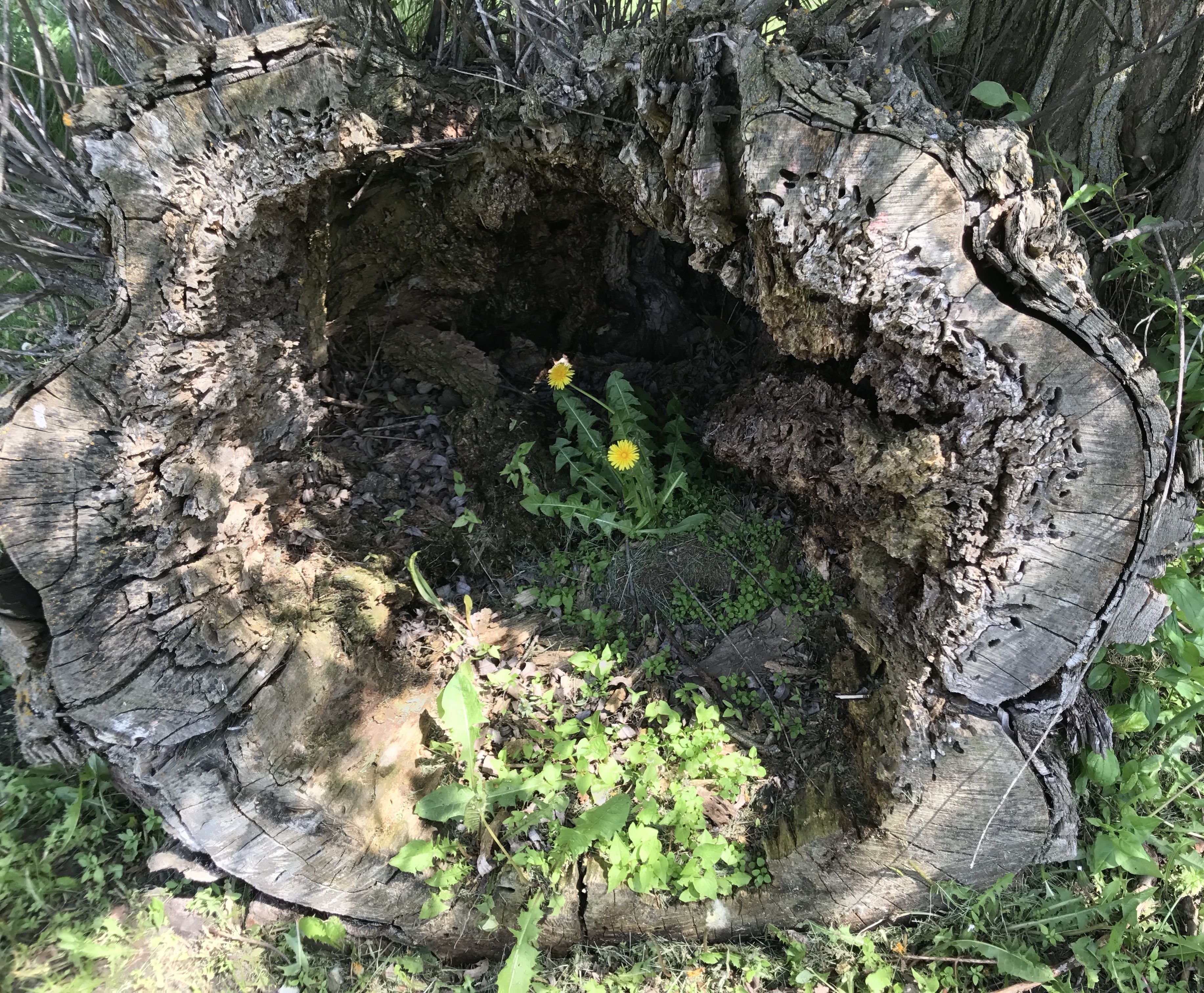
I walked around a bit. I had to admire this tough old tree. Down, but still sending out shoots and leaves.
When I checked in at the Blue Mounds State Park office, I found a brochure about the Jeffers Petroglyphs.
Petroglyphs? In Minnesota?!
With my interest in petroglyphs, you know I had to go check it out.
It was about a two hour drive from the campground to the Jeffers Petroglyphs in Comfrey, Minnesota. Of course, Google Maps said the trip would take about an hour and a half, but you know how it goes with those directions. They lie! Or maybe I drive slowly, although I prefer to think of my driving as safe and cautious.
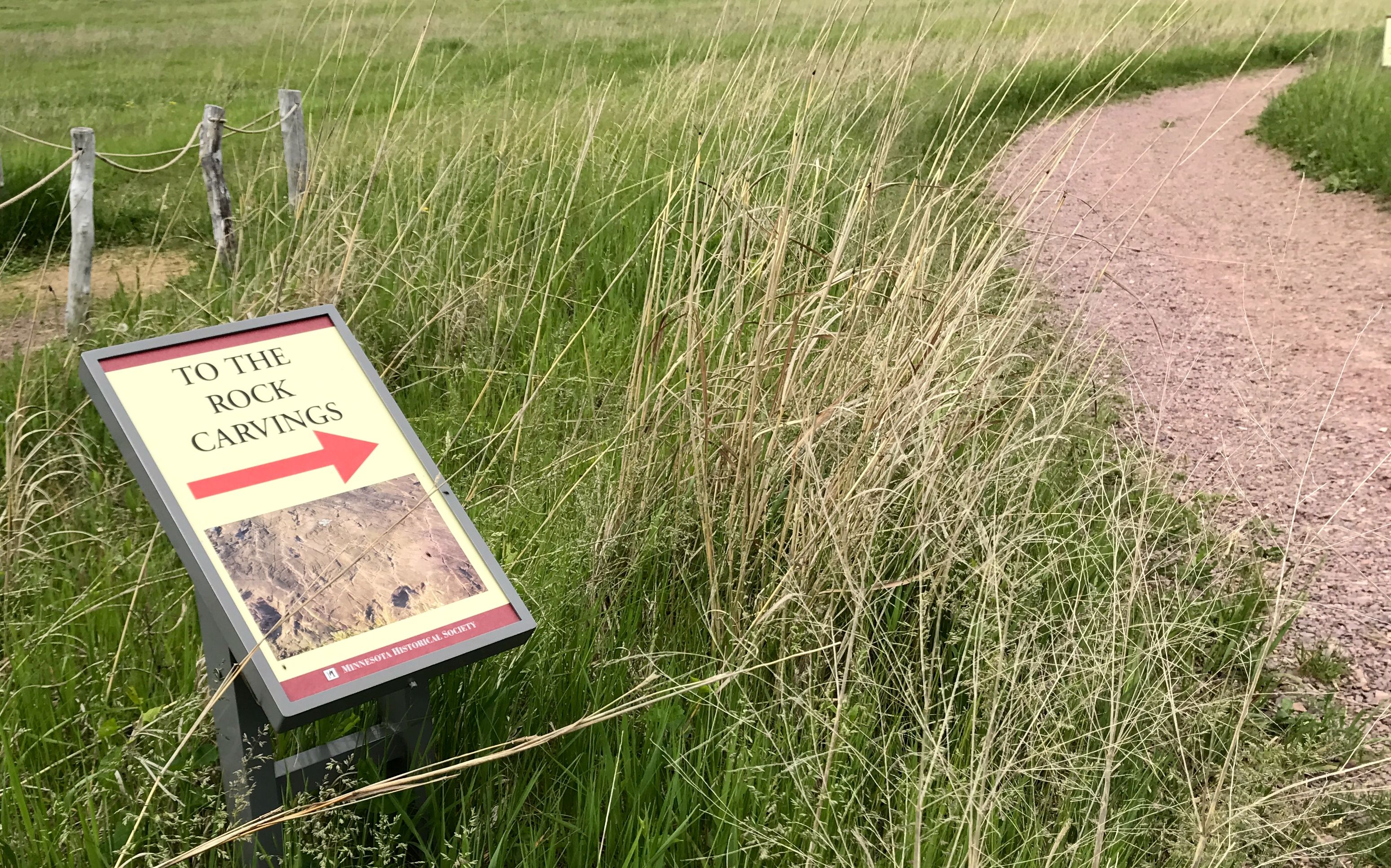
I checked into the visitor center and paid my $8.
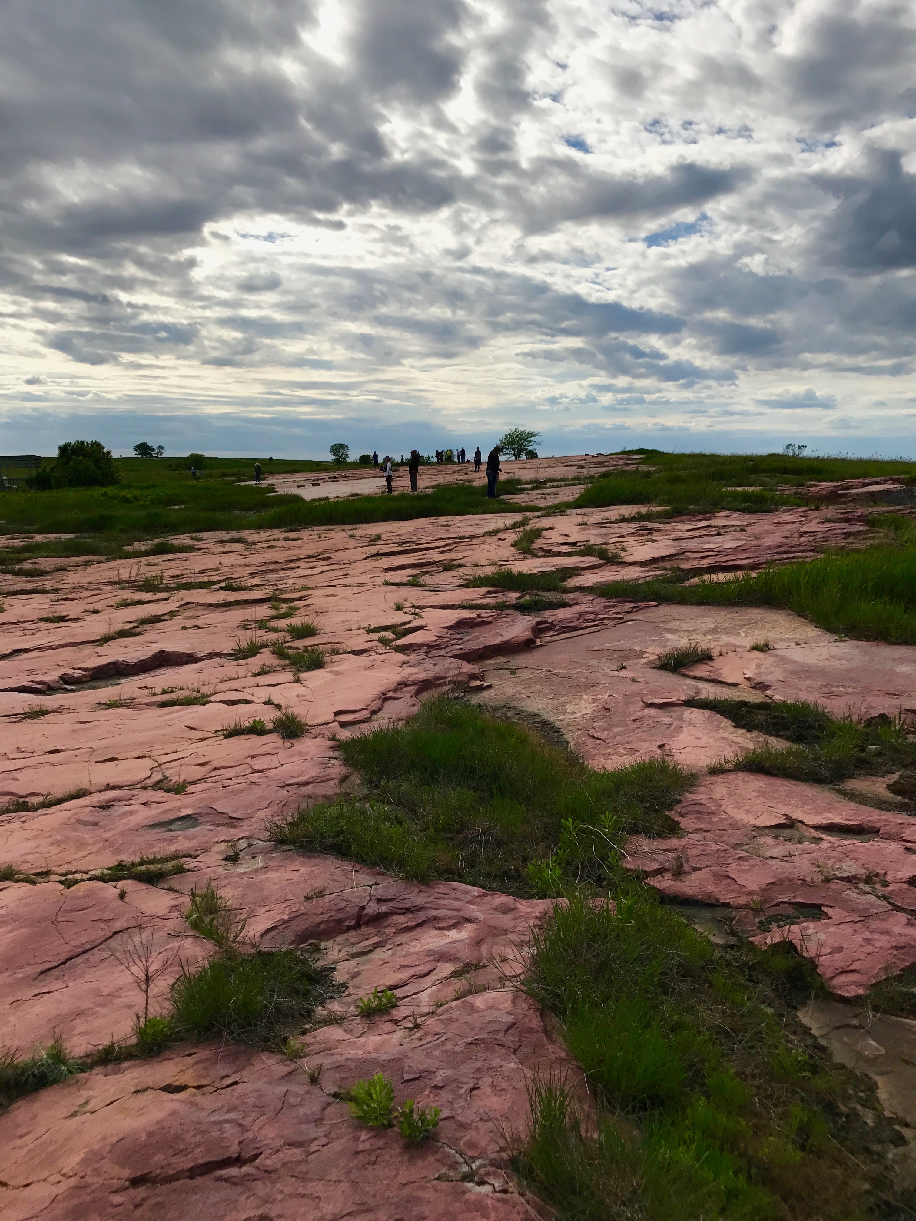
Then I headed down the path to find the rock carvings, which is surrounded by virgin prairie.
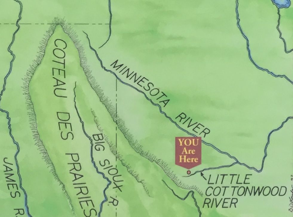
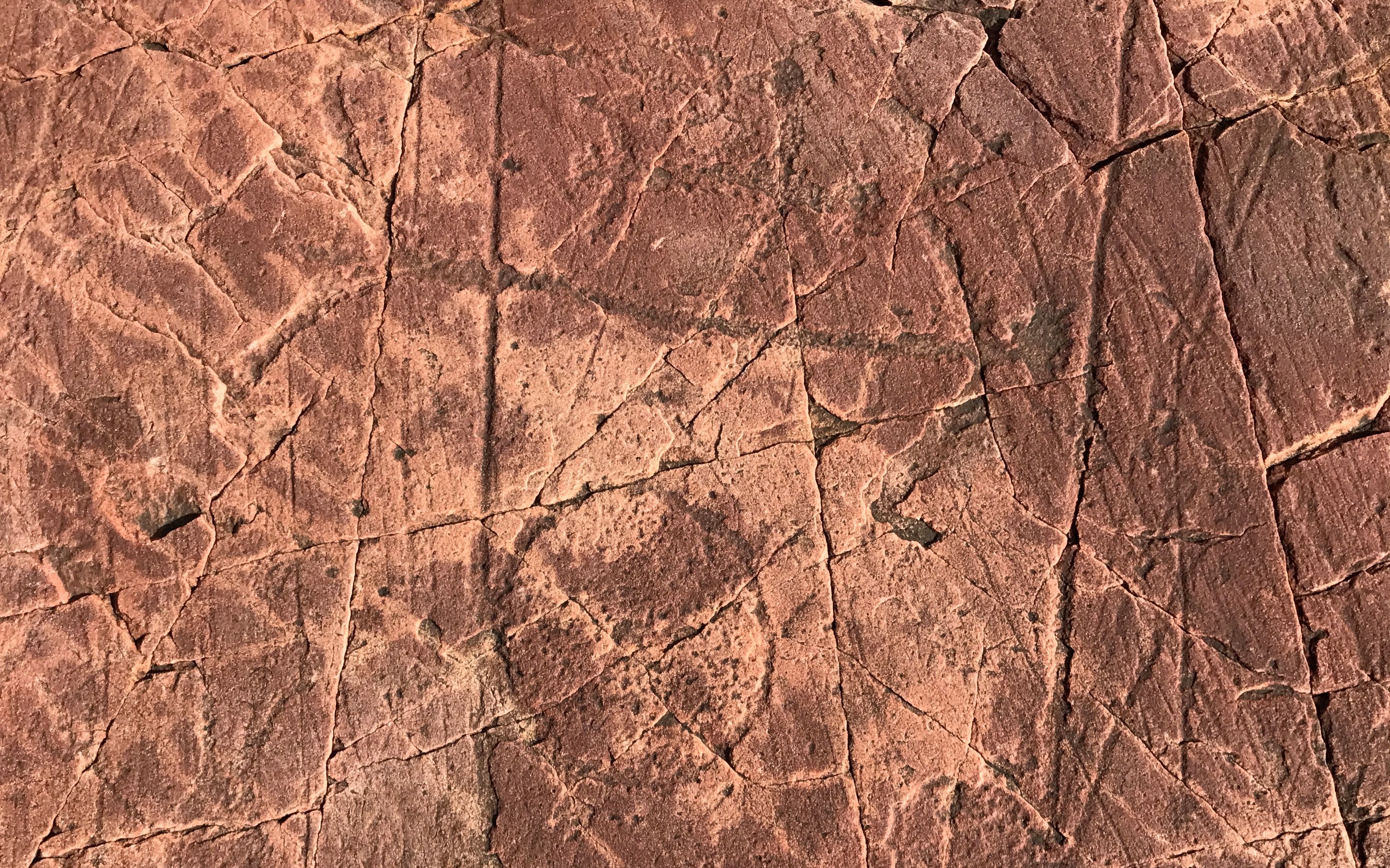
The petroglyphs are pecked into the rock of Red Rock Ridge, which extends from Watonwan Country, Minnesota to Brown County, Minnesota.
The exposed surface is approximately 150 feet by 650 feet.
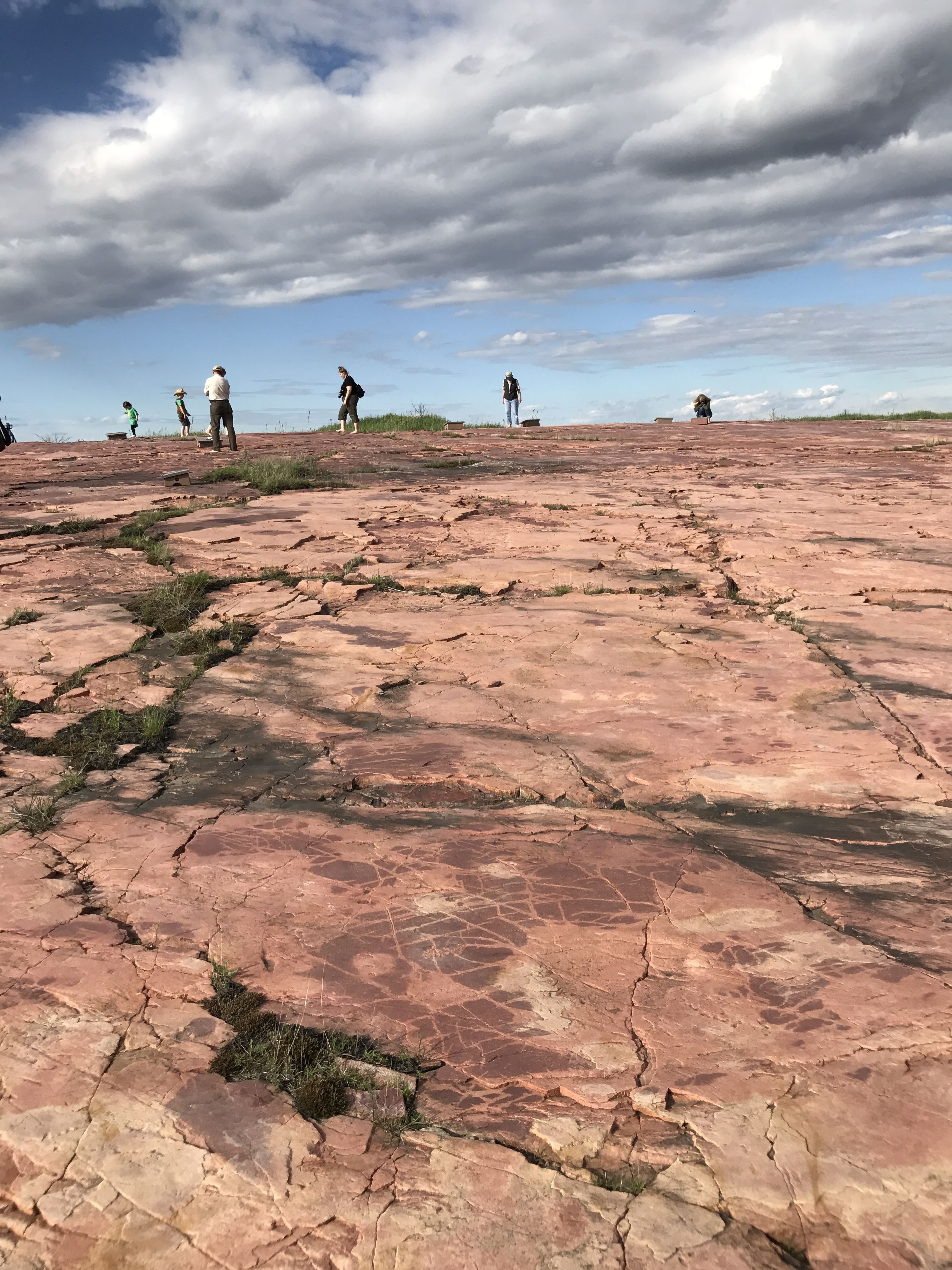
It surprised me that the petroglyphs were carved into a relatively level surface.
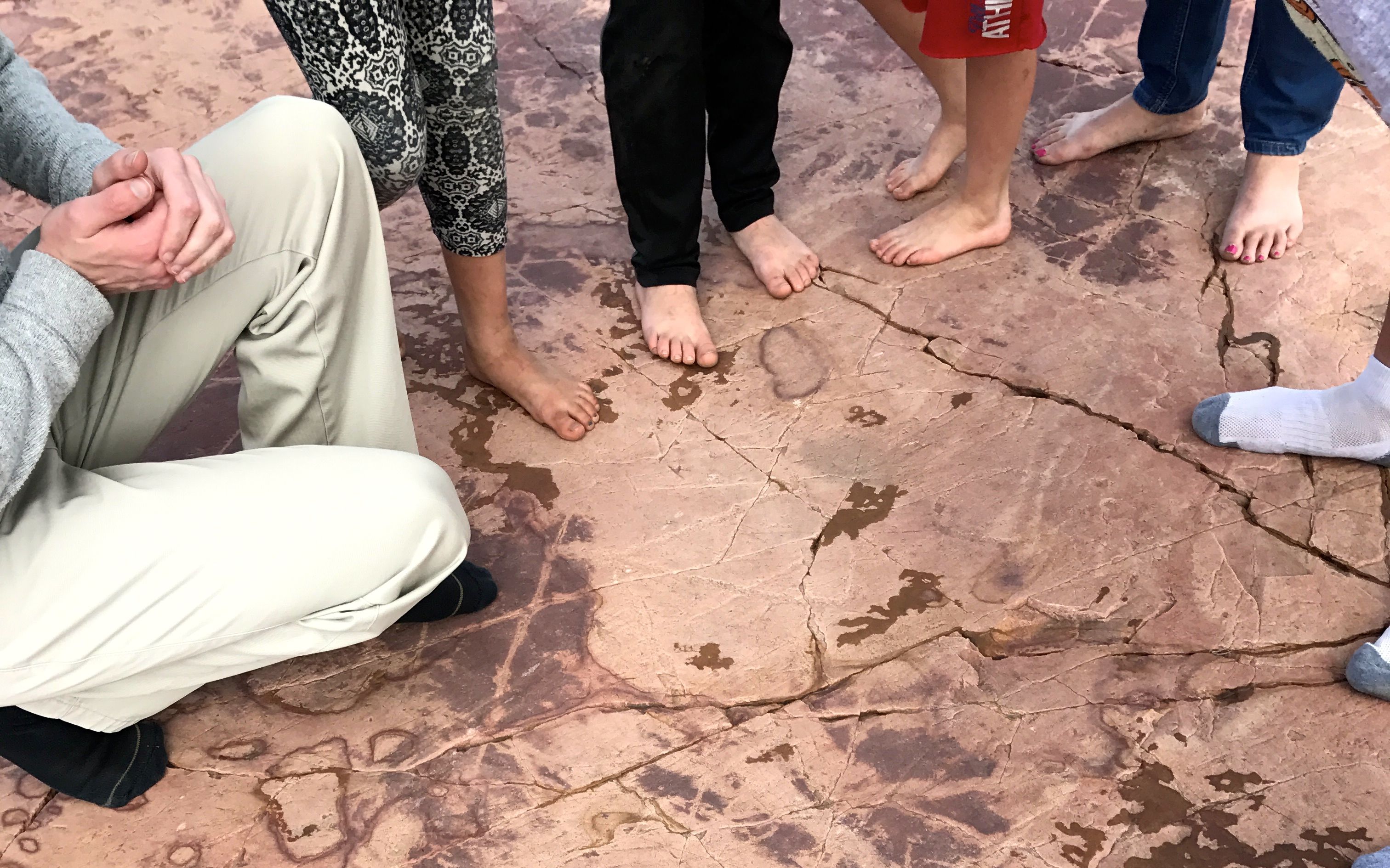
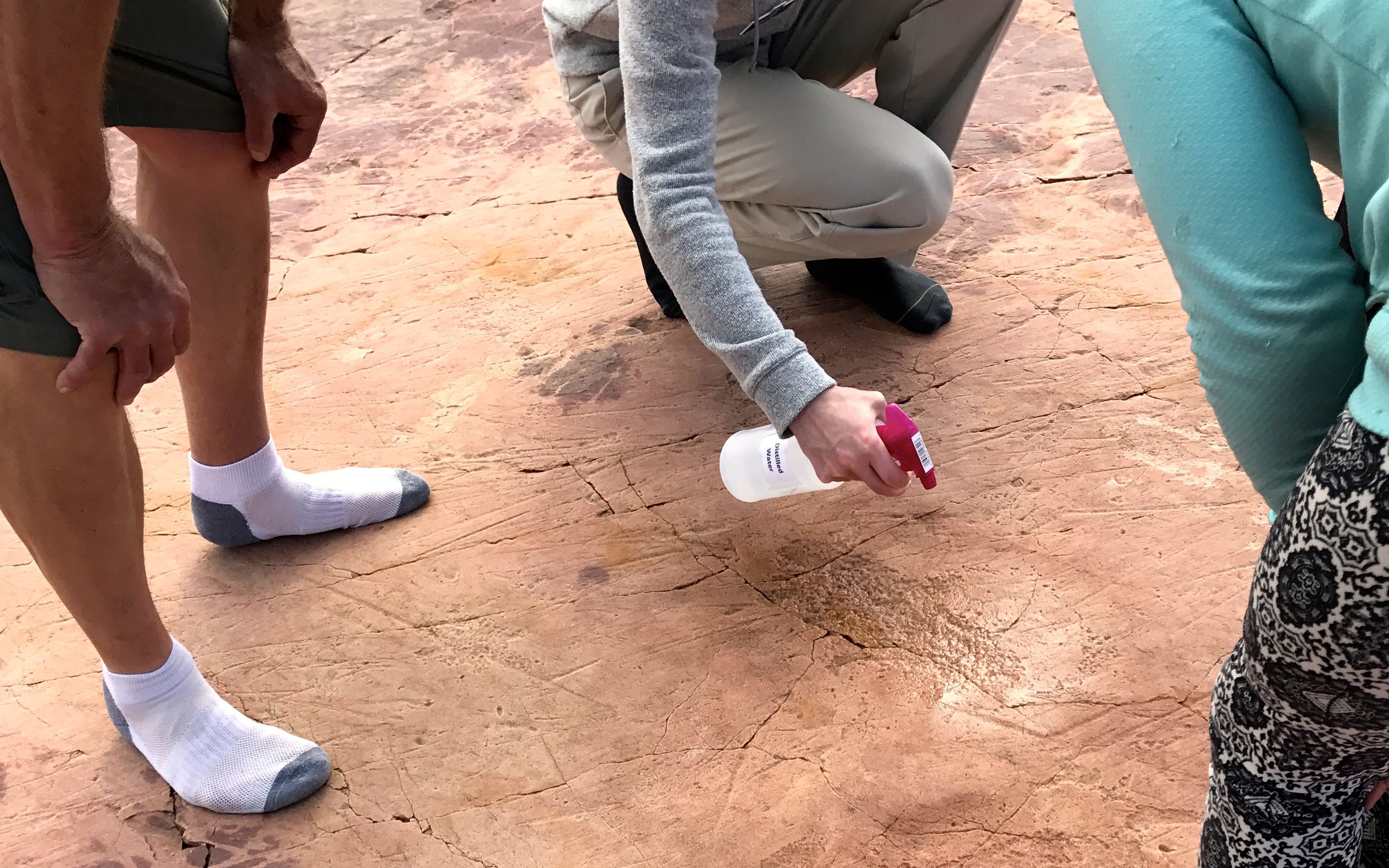
You get to walk around the rock, although you do have to take your shoes off. Socks are allowed.
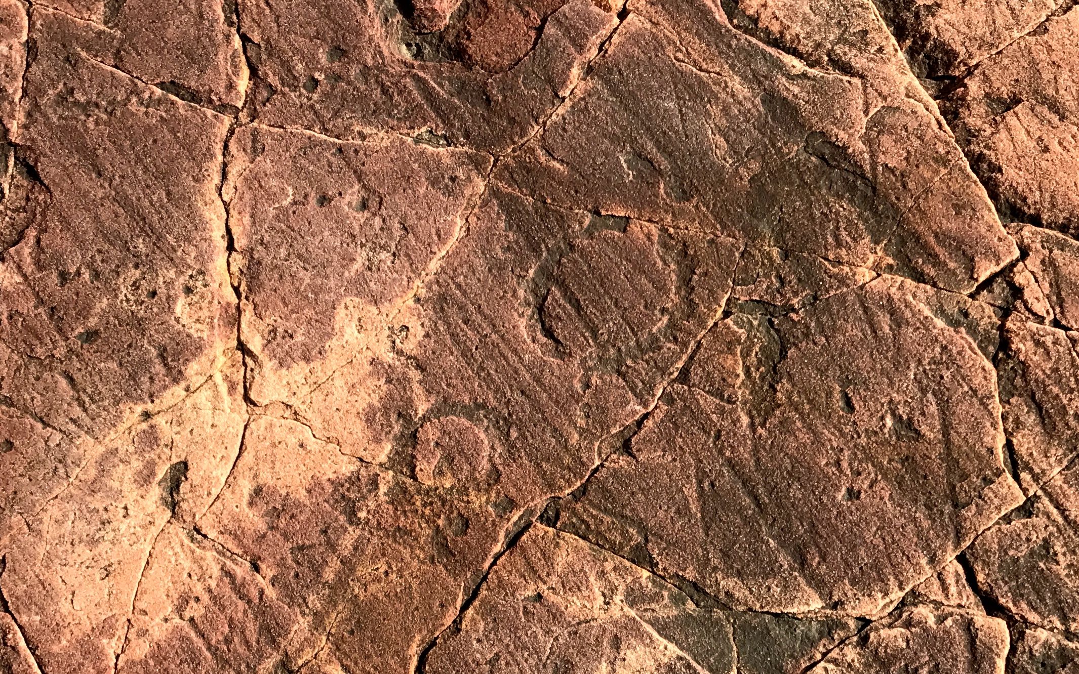
Spraying the rocks help to make the petroglyphs more easy to detect.
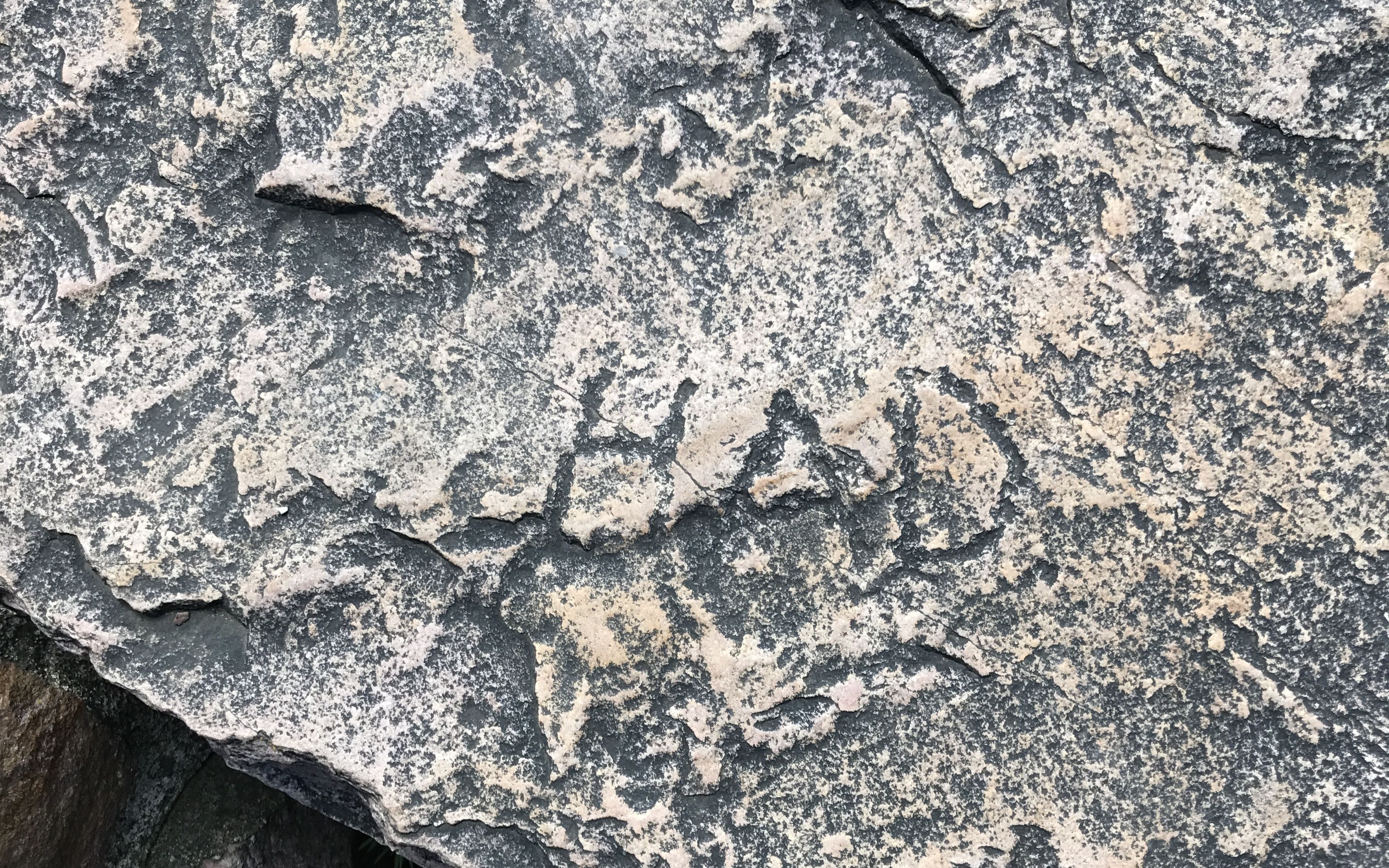
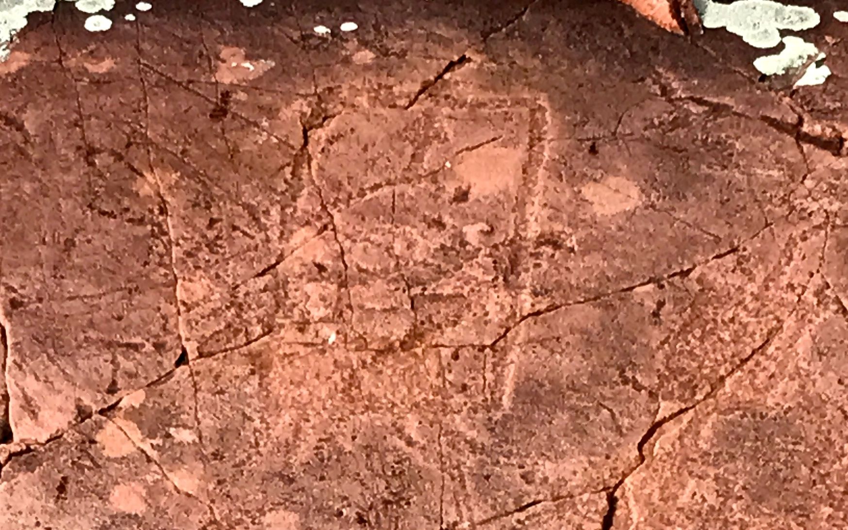
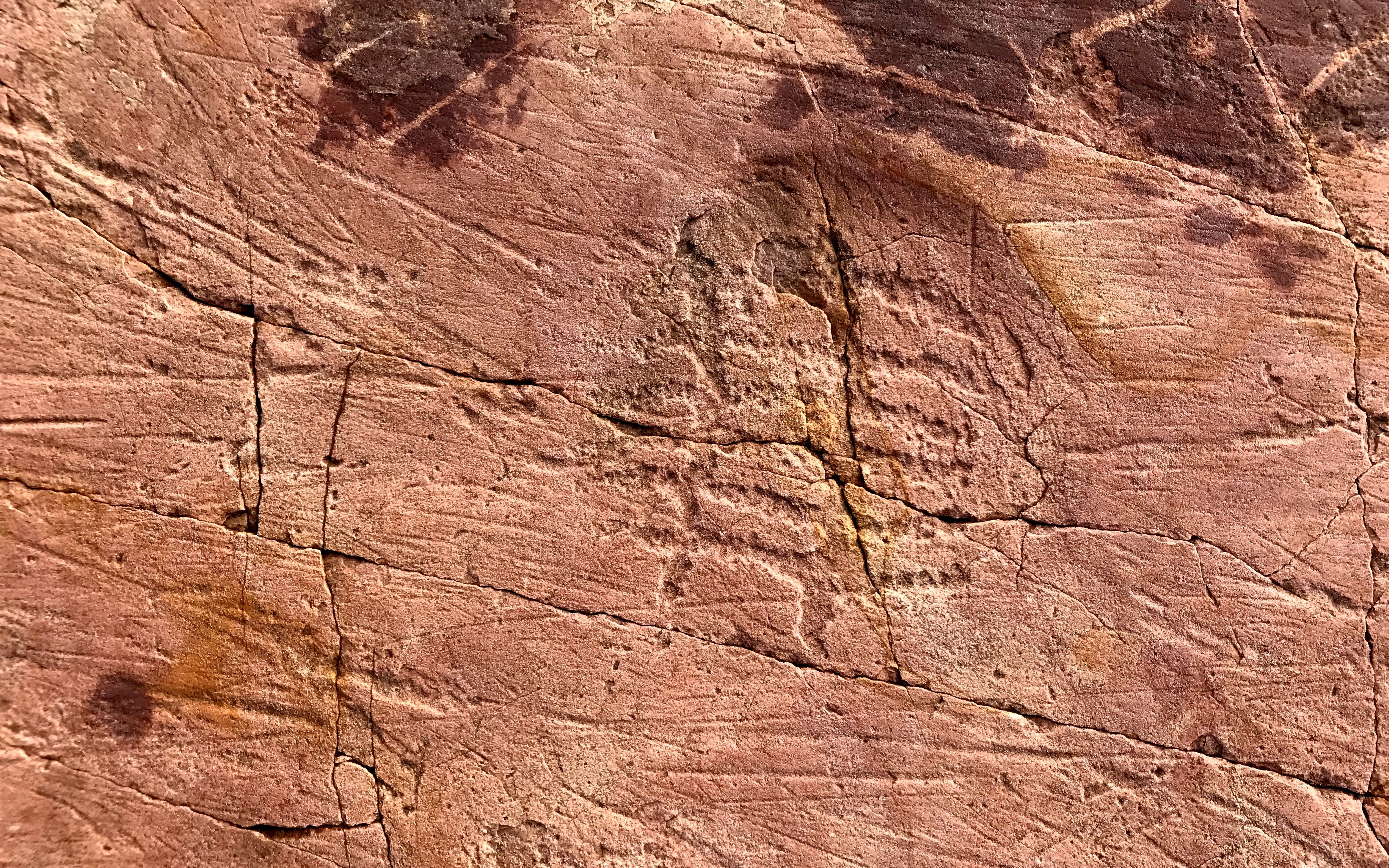
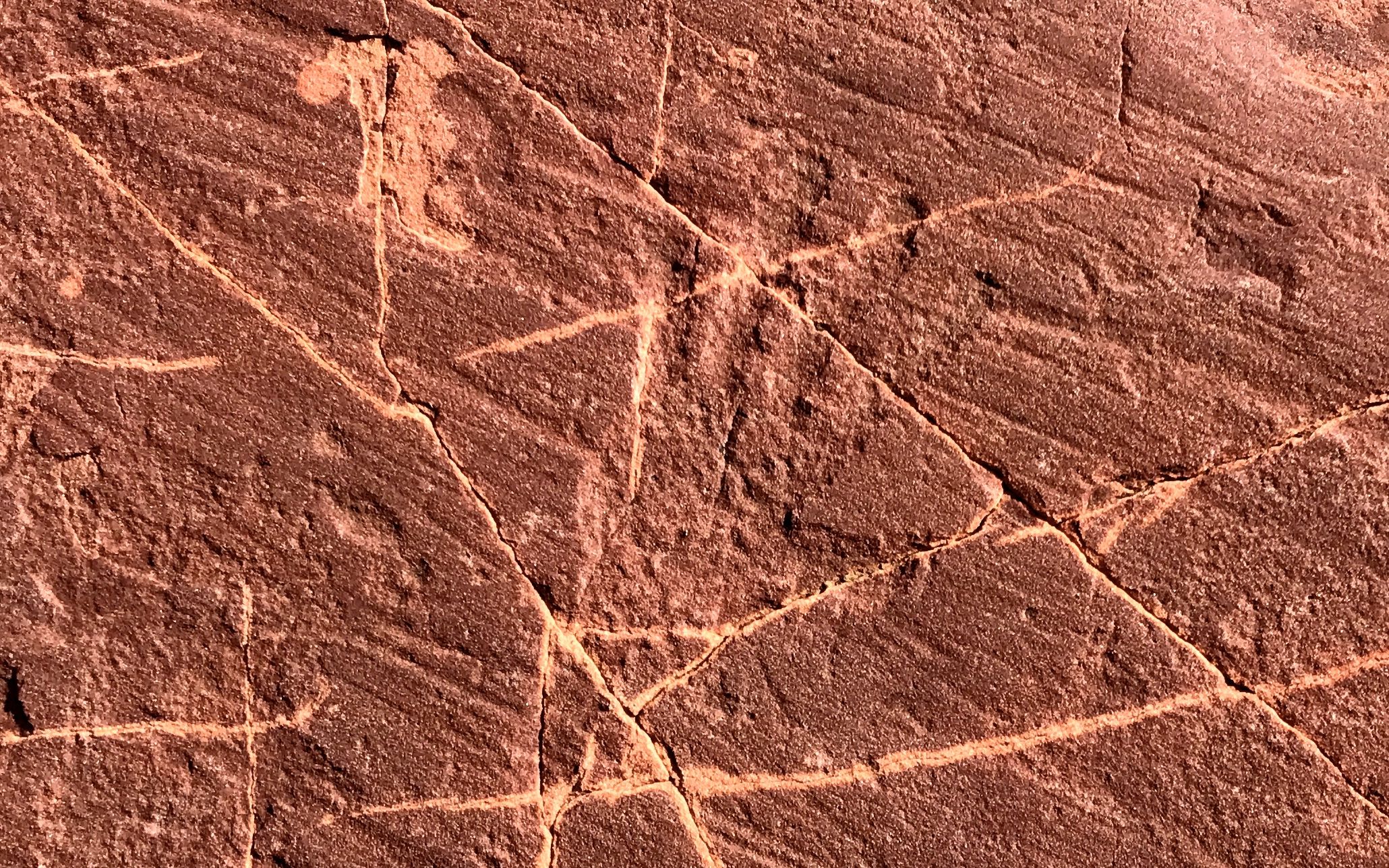
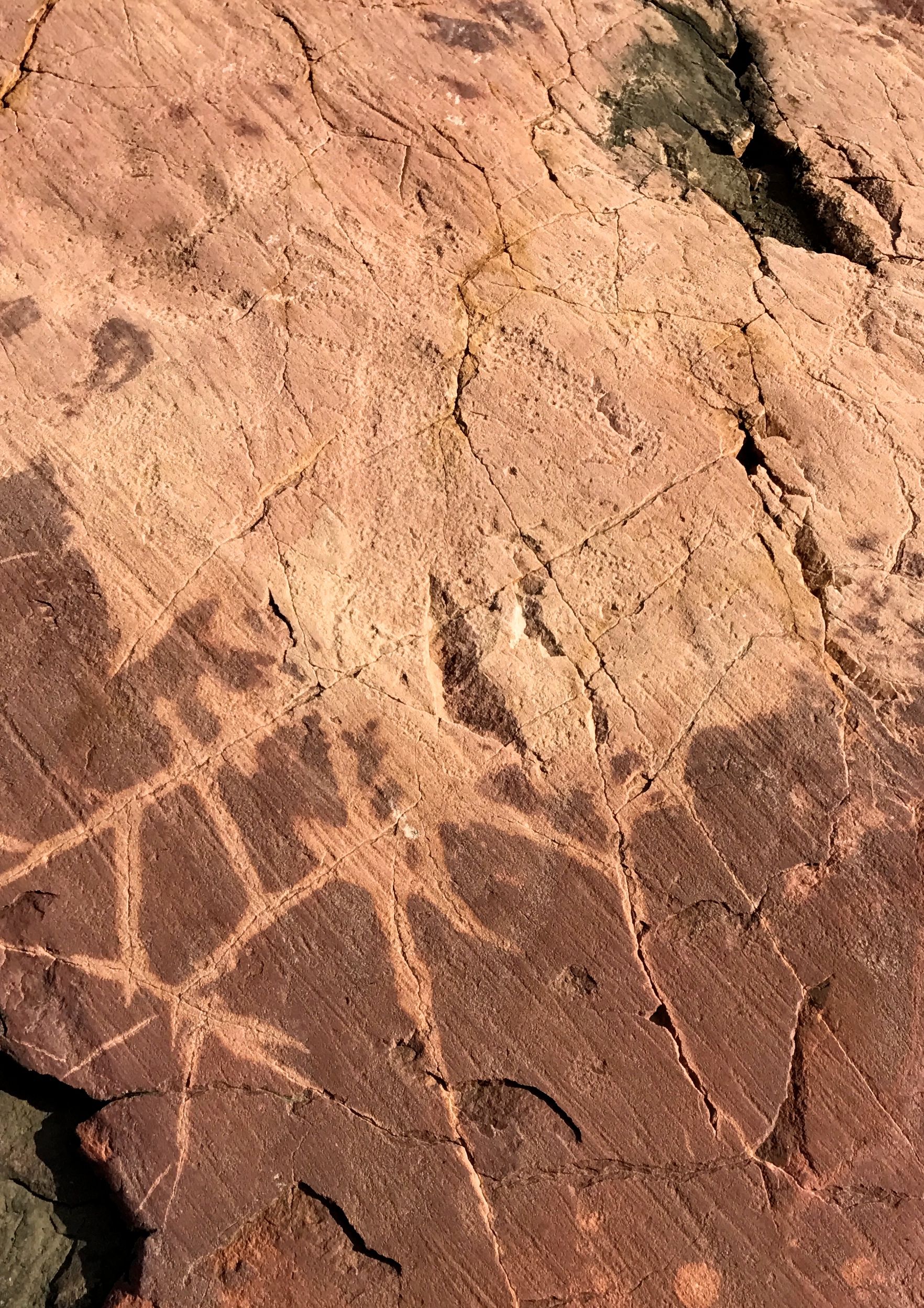
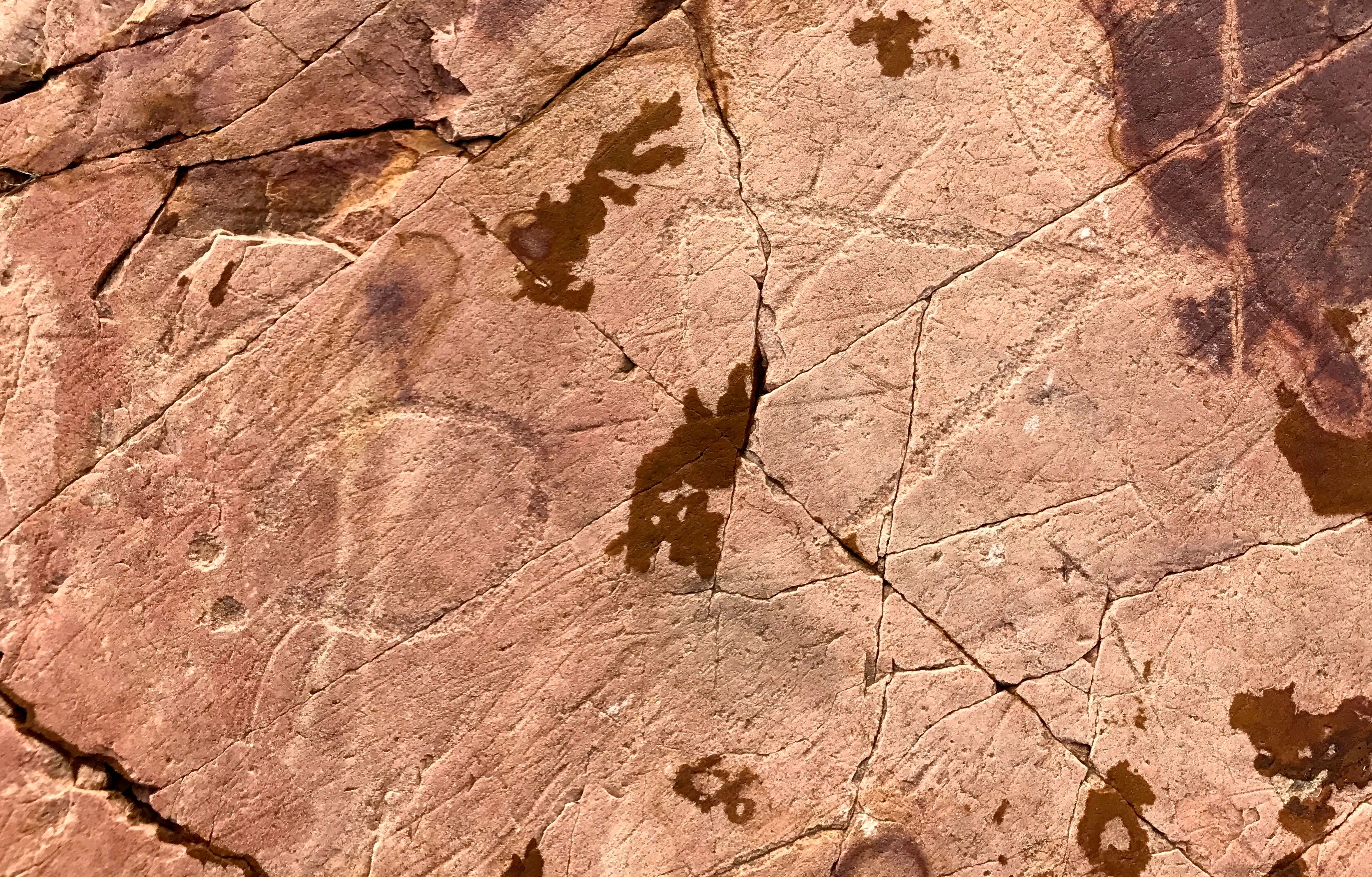
The glyphs are kind of hard to see, and they are not exactly easy to decode.
Some are easier than others. I know a circle when I see it! However, I don’t know what significance it had to the person who made it some 7,000 years ago.
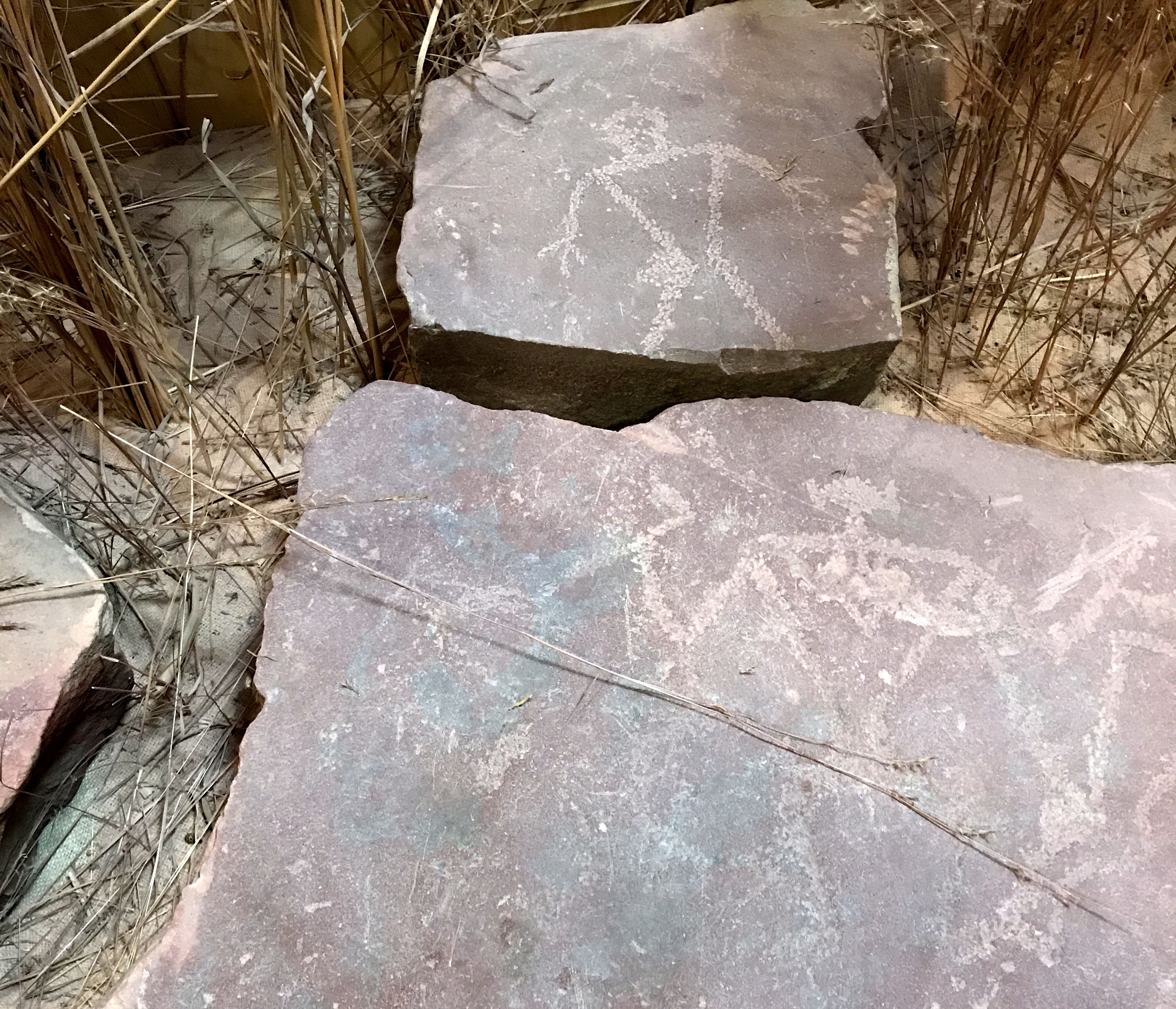
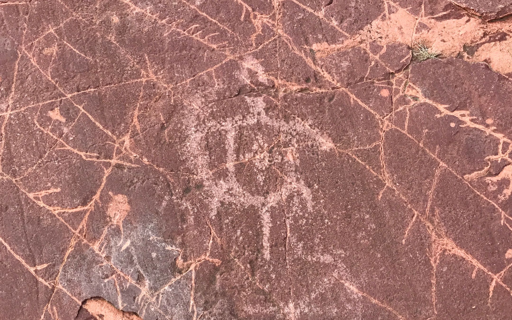
This one clearly shows a man with an arrow. It looks like there might be an axe or a hatchet in from of him. Or, that might be a peace pipe.
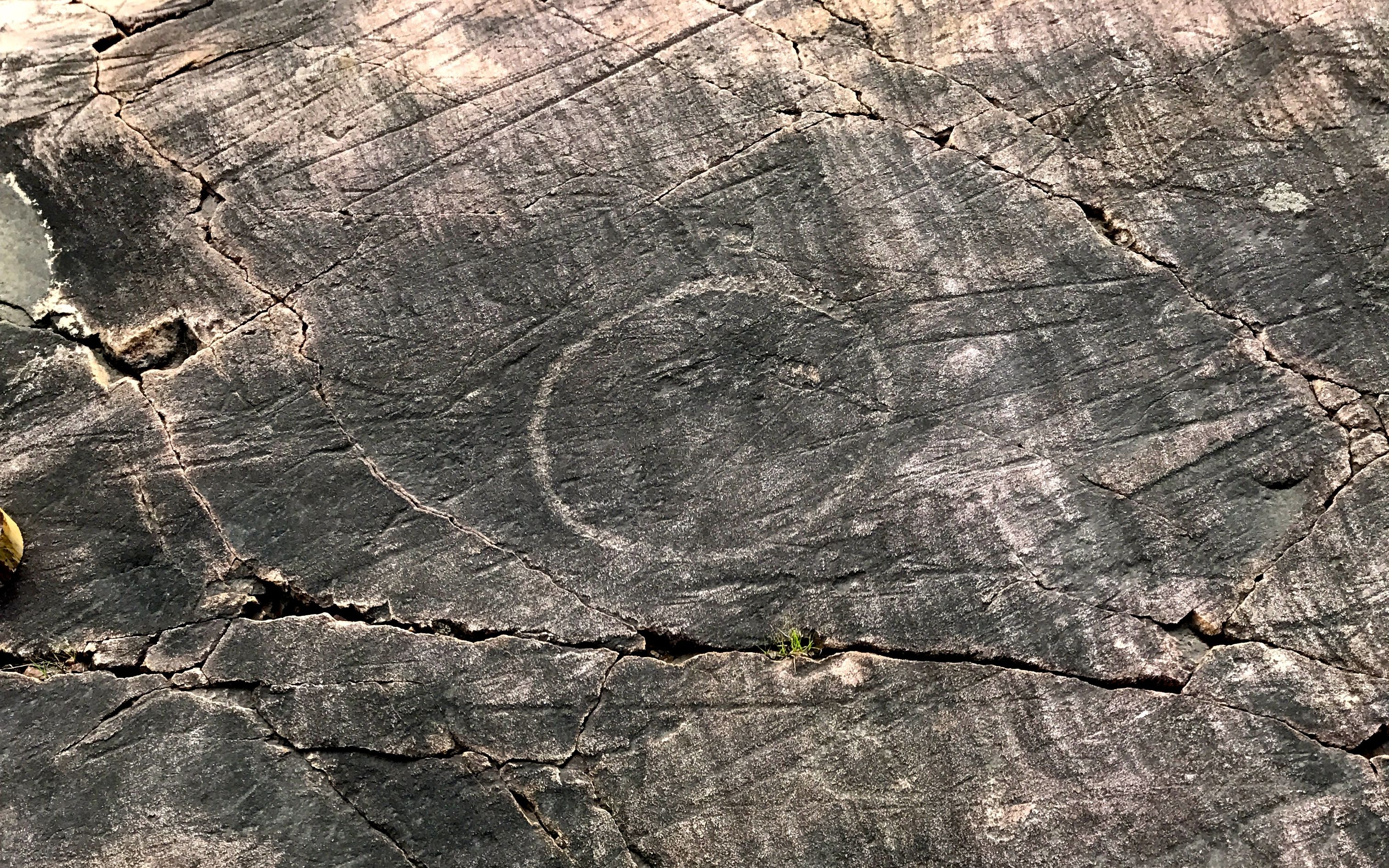
Of course, there are more recent additions. I wonder who Tracy A. Coats was, and was he (or she) from Olivet, Michigan?
This one kind of reminds me of the boxes I saw in petroglyphs out west.
Hands have been popular in artwork since time immemorial.
For instance, these handprints from Chauvet, France that were done approximately 31,000 years ago.
Who hasn’t used their hands to make a Thanksgiving turkey?
Some themes in human expression are universal.
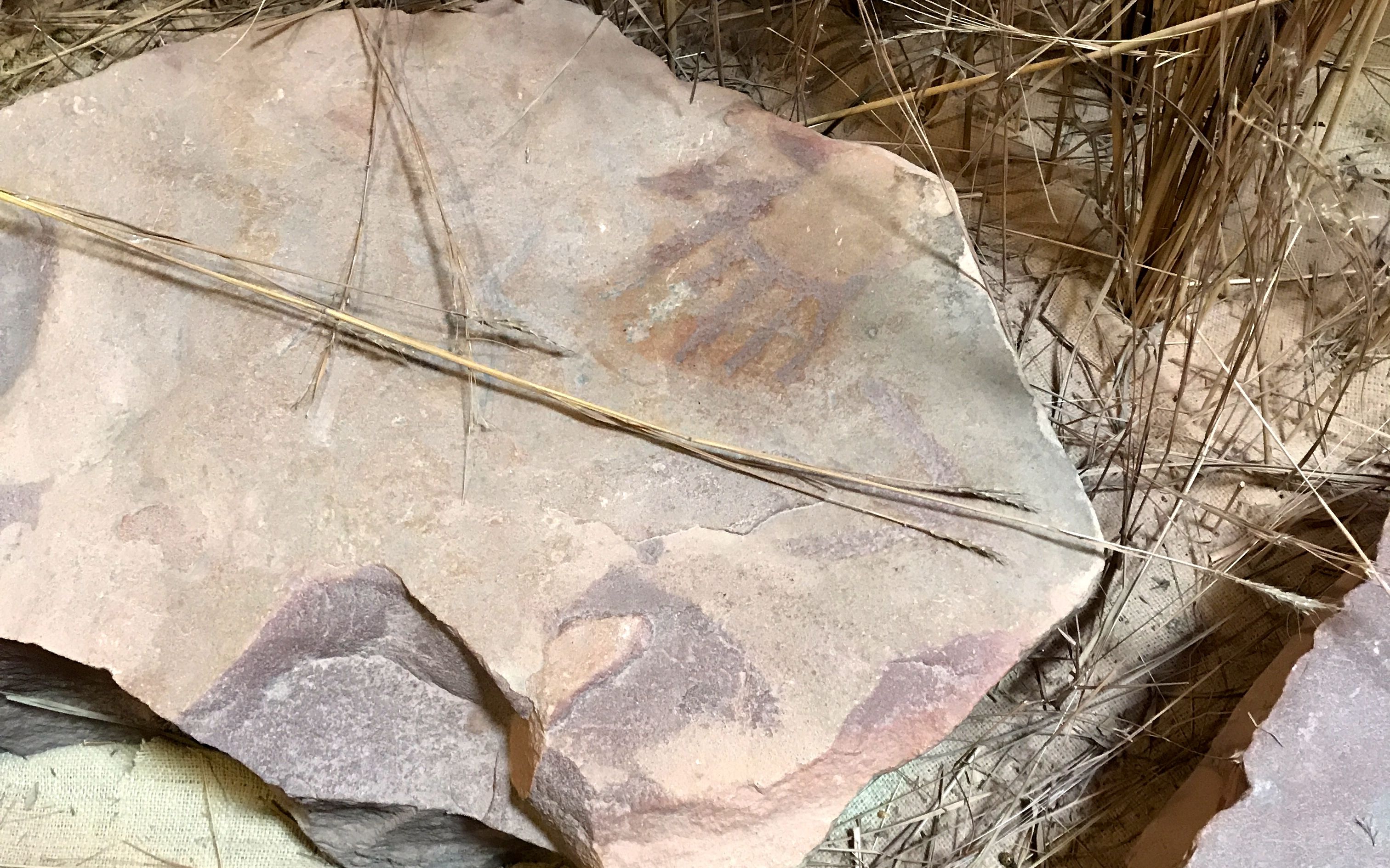
Speaking of hands, this glyph is identified as “The Chief Who Lost His Arm.”
It can be a little hard to make it out, so here is a diagram of the glyph.
According to the interpretive sign, this hand and arm might represent the chief who lost his arm. Lakota tradition tells that the hand constellation found in the lower half of the constellation Orion, depicts the arm lost by a selfish chief when he refused to participate in Spring ceremonies. The thunder beings who cause the rains of Spring, stole his arm and hid it. These beings can take away or give fertility to the earth. A young man was given wisdom by several spirits and he retrieved the arm by tricking the thunder beings. He gained the love of the chief’s daughter as well as the fertility of the earth and continued life for the people.
The first time I looked at this glyph, I thought it was a turtle. In reviewing my photo files, I thought it looked more like a warrior with a shield and bow.
These look like tracks made by a bird.
There are thousands of intentional marks. There must have been a purpose for making them. This rock is very hard and would have required a lot of effort to make the shapes and symbols. It averages between 7.5 and 8 on the Mohs Scale of hardness. That means it’s harder than granite, marble, slate, and even some other types of quartzite.
This group of carvings shows stone weights that are tied to the shaft of an atlatl. The size of the weights are exaggerated – perhaps reflecting the hunter’s desire to increase the spiritual power that guided the dart to its target. While they are depicted on the petroglyphs, very few atlatl weights have been found in Minnesota.
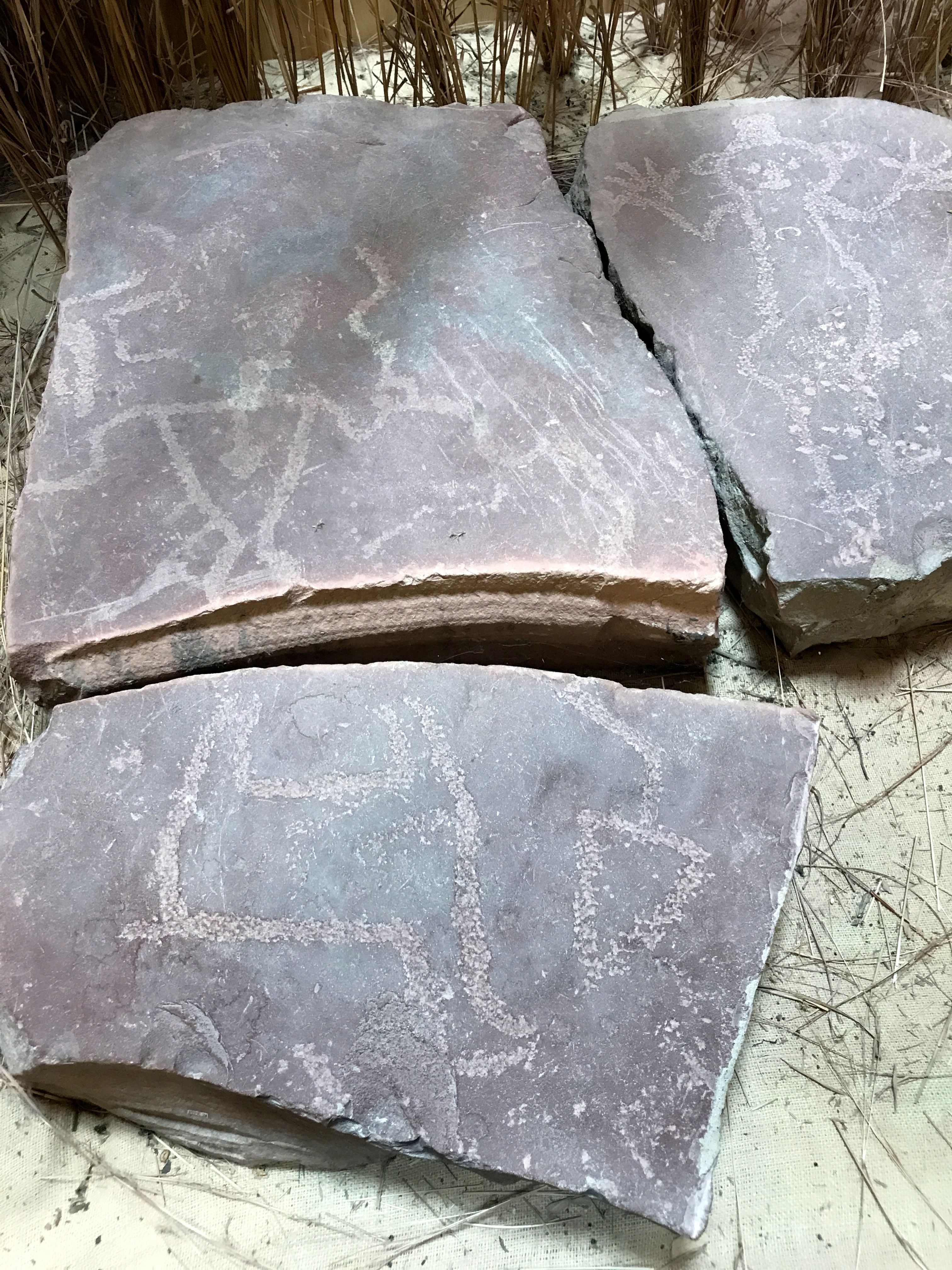
There are shapes that have worn well through the years.
Circles and lines.
And still more circles and lines.
The lichens of most of the rock outcropping have been painstakingly cleaned off, but here is a section that hasn’t been cleaned. It must have been quite an act of faith to clean off so much of it.
I had worked my way to the end of the outcropping. I took a different path back to the visitor center.
This outcropping of rock is a buffalo rub. They have rubbed against this rock to shed their winter hair each spring for perhaps the 9,000 years since they arrived in the region.
The rocks really were smooth.
That was my last stop at the park. I got back in Bart and headed back to Flo and Cora waiting for me back at Blue Mounds State Park.
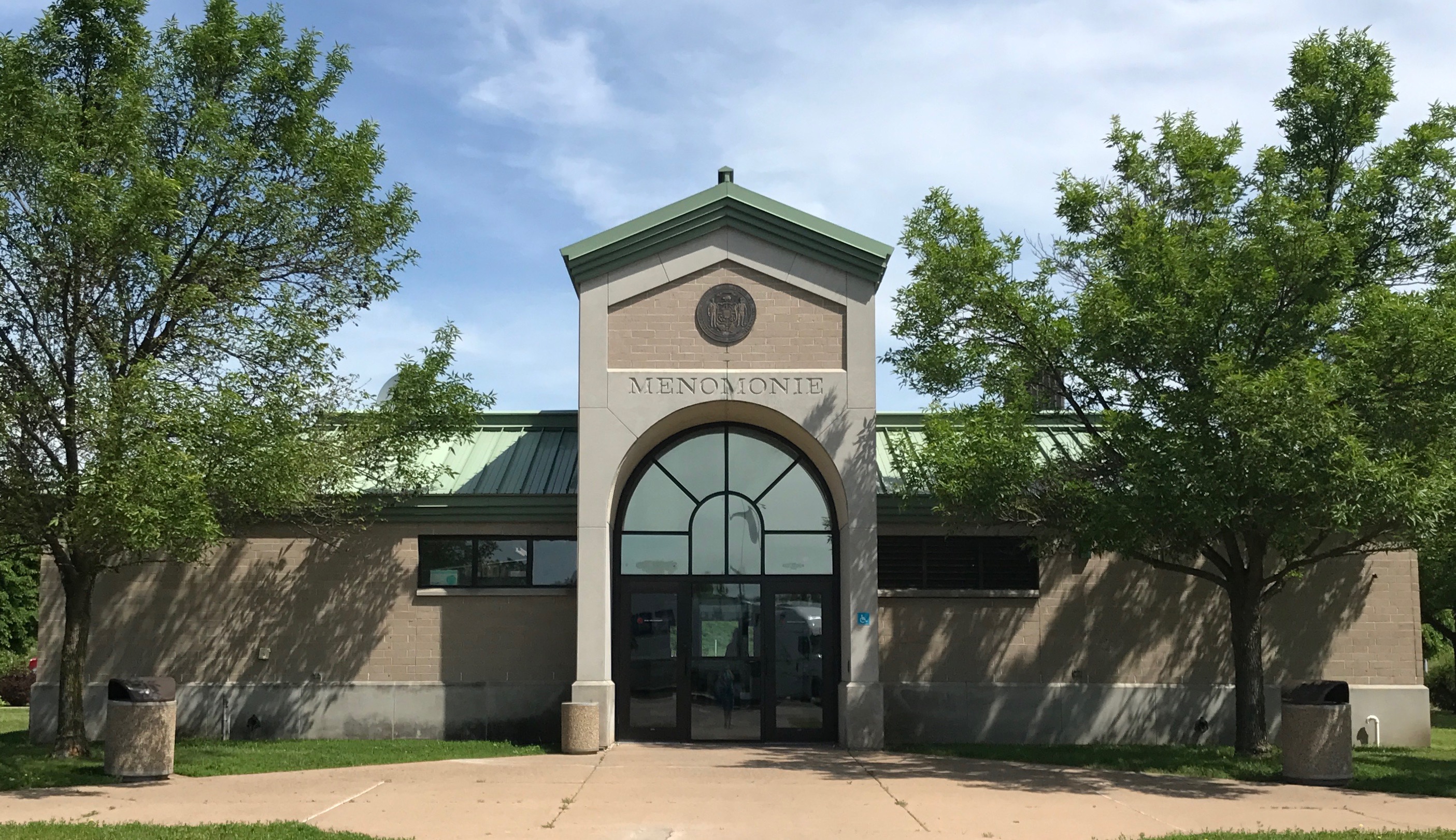 Menomonie… Does that name make anyone else think of this Muppet bit?
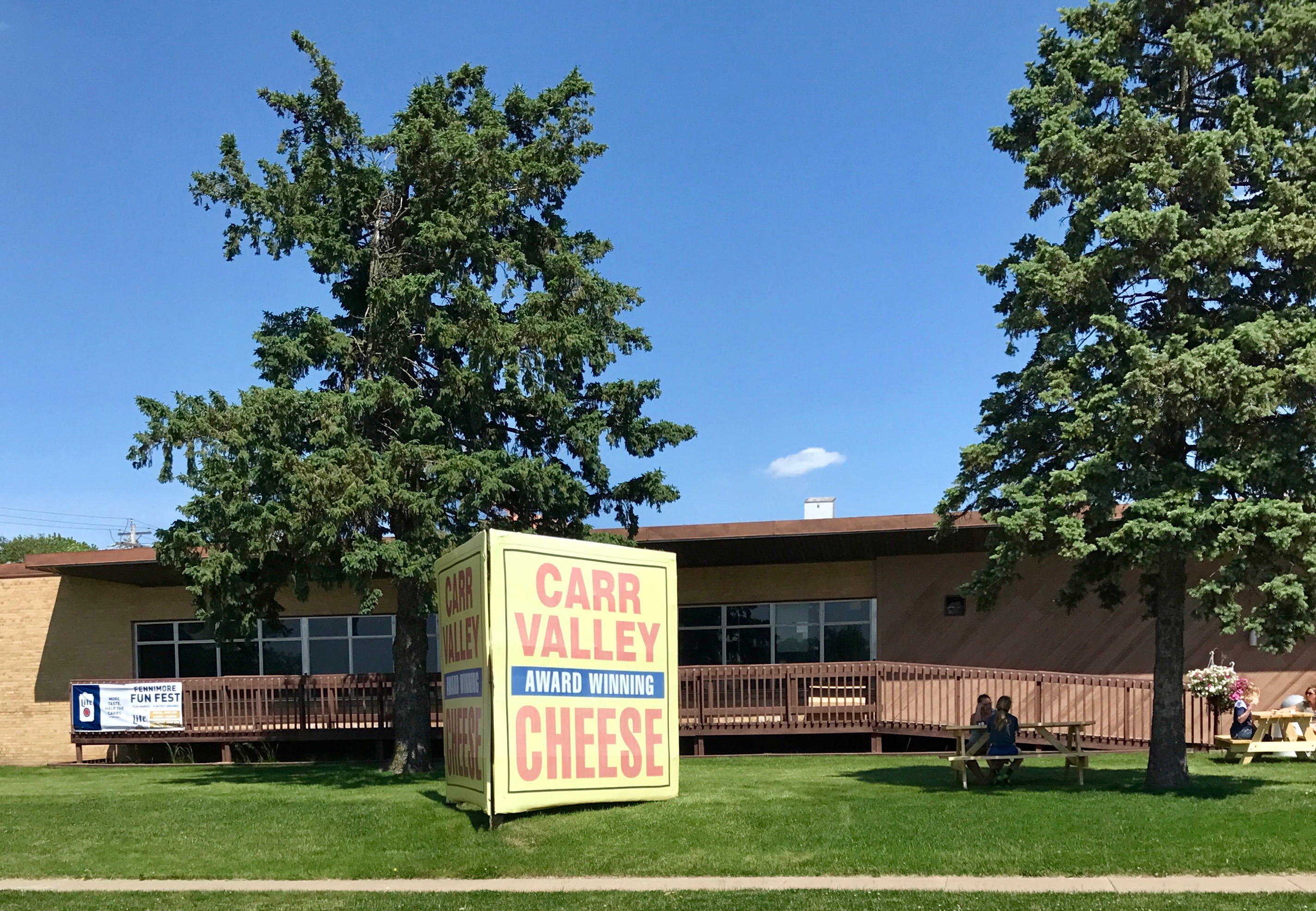 Cheese!
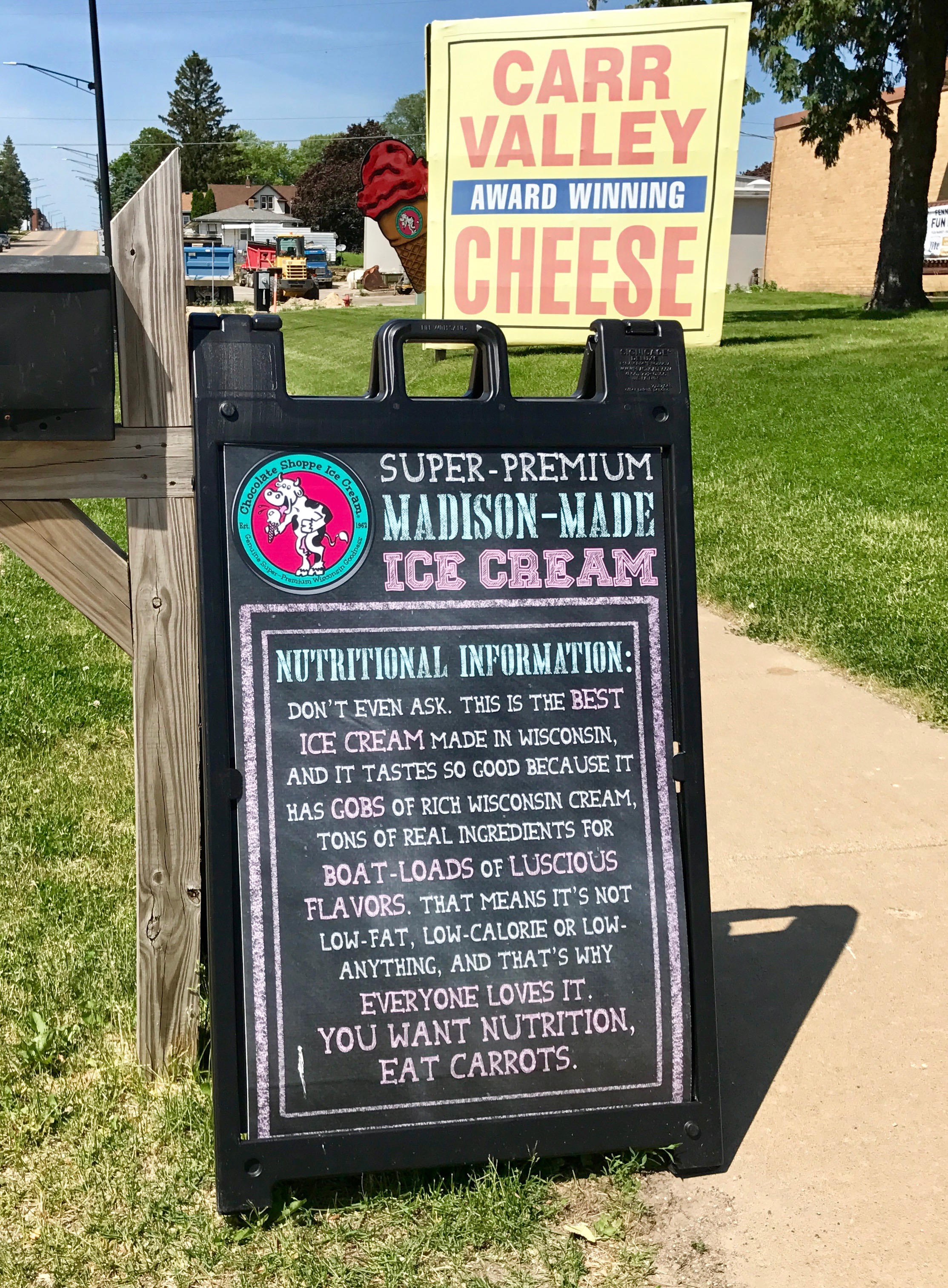 And ice cream!
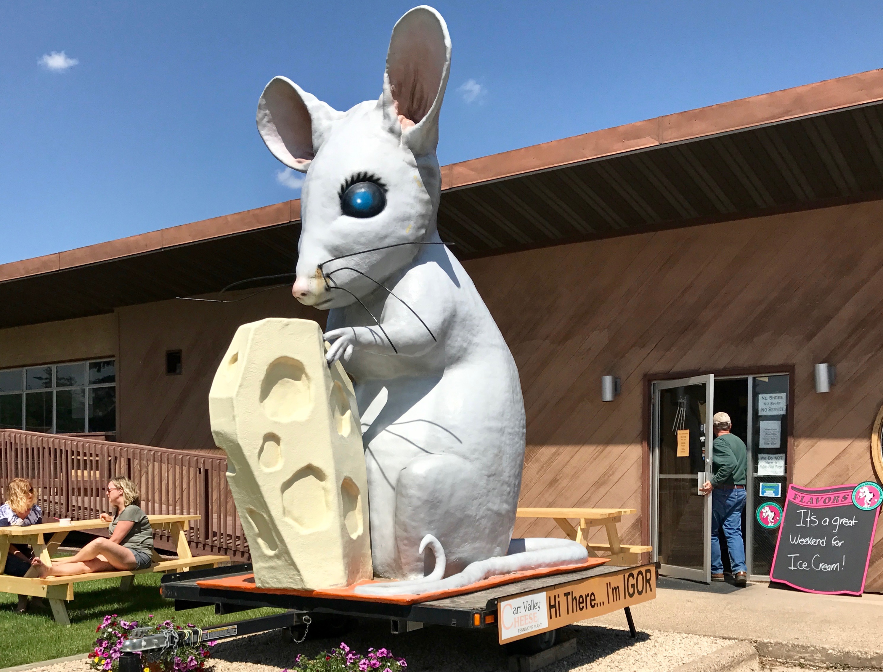 Igor the Rat met me at the door.
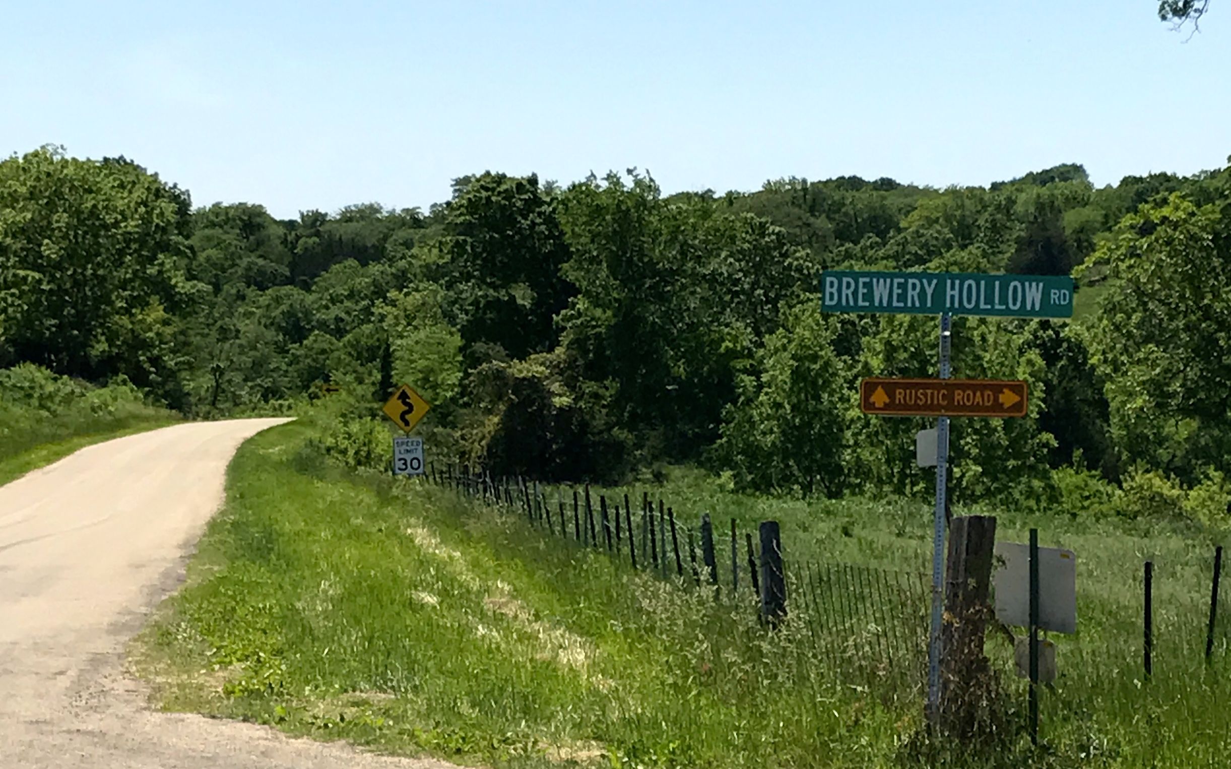 I was a little leery of the signs that proclaimed “rustic road”. Curvy, rustic roads with a 27 foot trailer are not my favorite thing.
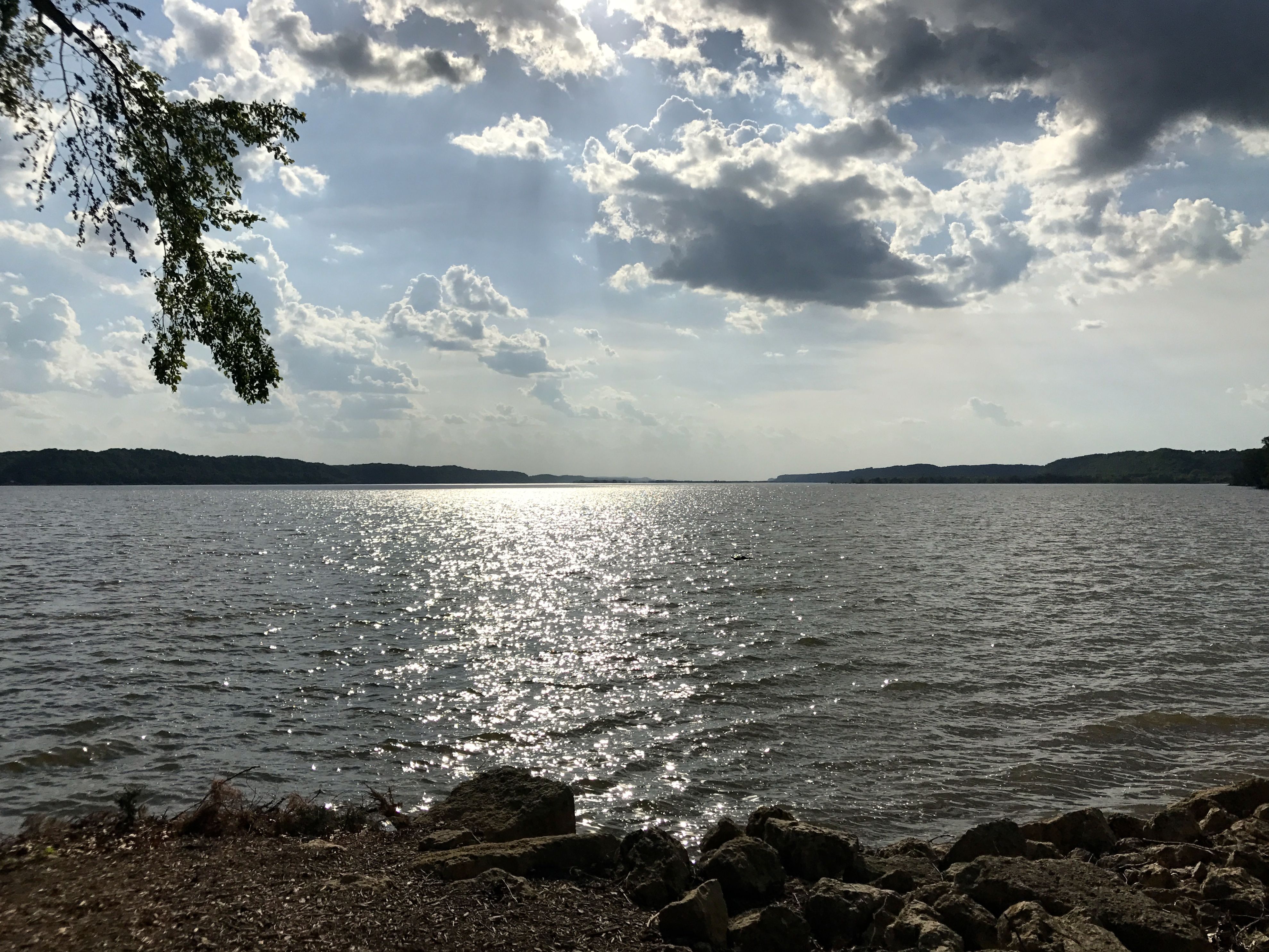 But the trip down the rustic, curvy road was worth it. This was an Army Corps of Engineers campground and it was lovely. My site was just a short stroll from the banks of the mighty Mississippi.
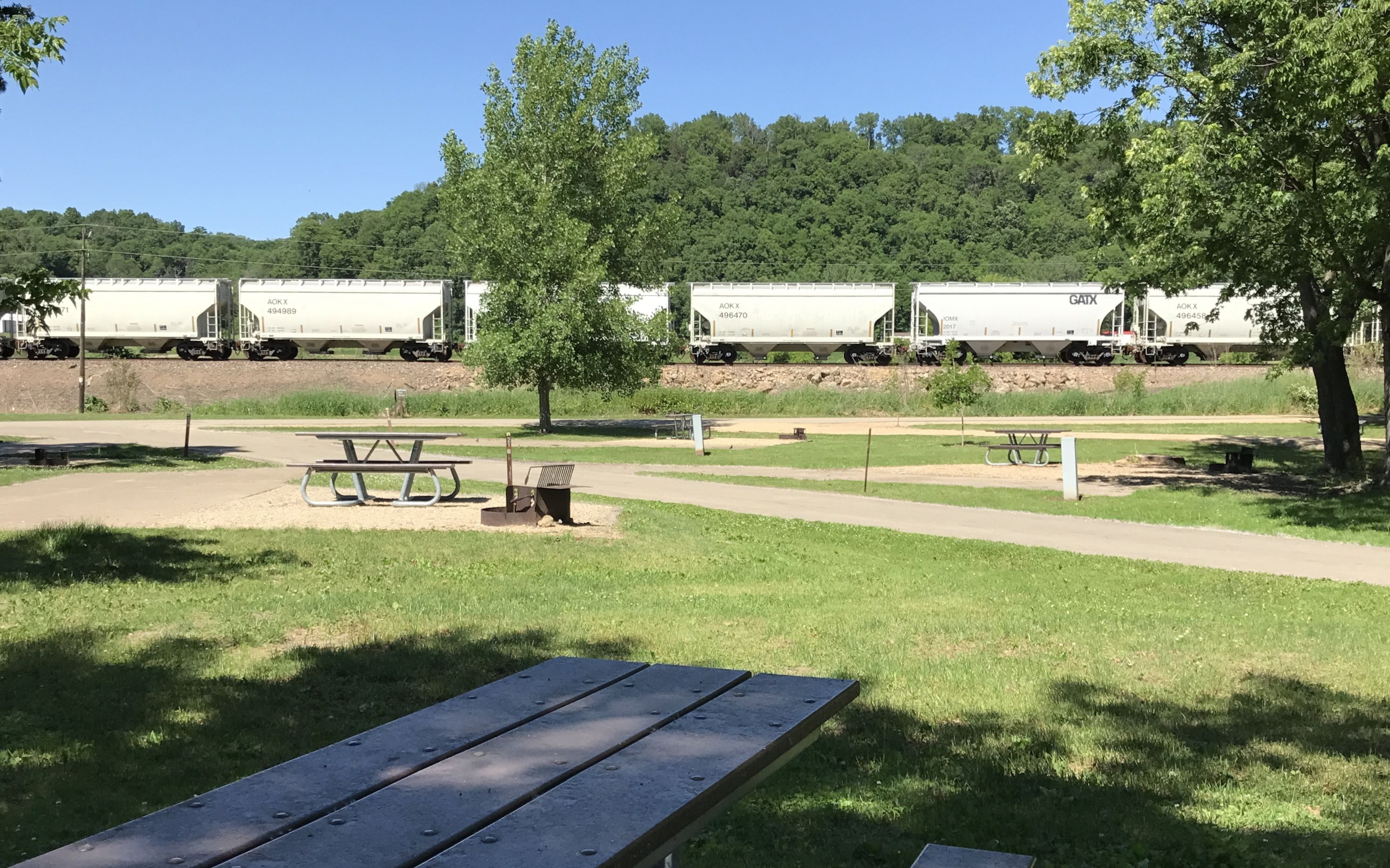 Of course, train tracks many times follow river beds. My site was quite close to the railroad right of way.


