It was time to head out. Jantzen Beach RV Park was right on the bank of the Columbia River. All I had to do was make my way over to the bridge, drive across and I was in Washington.
While I was in Oregon and Washington, they certainly lived up to their reputations as damp and dreary. When the weather would clear, however, there would be spectacular views. For instance, on that gloomy Easter Sunday, The clouds parted for a bit and I caught of glimpse of Mount Hood.
Now, I wasn’t able to take a photo, as I was driving. I borrowed this photo from www.History.com, and I hope I have attributed it correctly. By the time I got to a spot where I could have safely pulled over, I couldn’t locate it. How does one lose an 11,000 foot tall mountain?
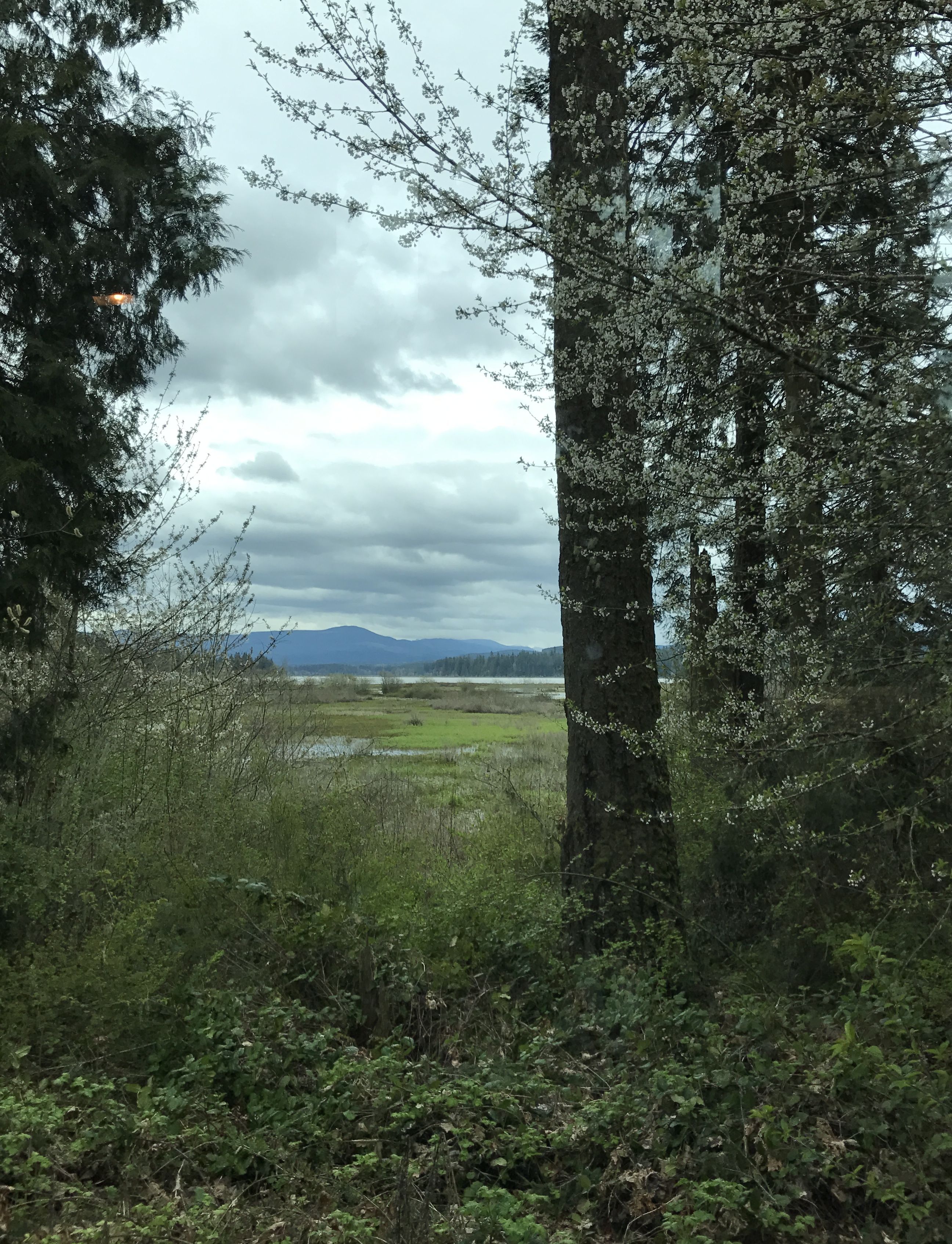
When I set out the next day, the clouds and drizzle had descended once again, like a wet, cold blanket.
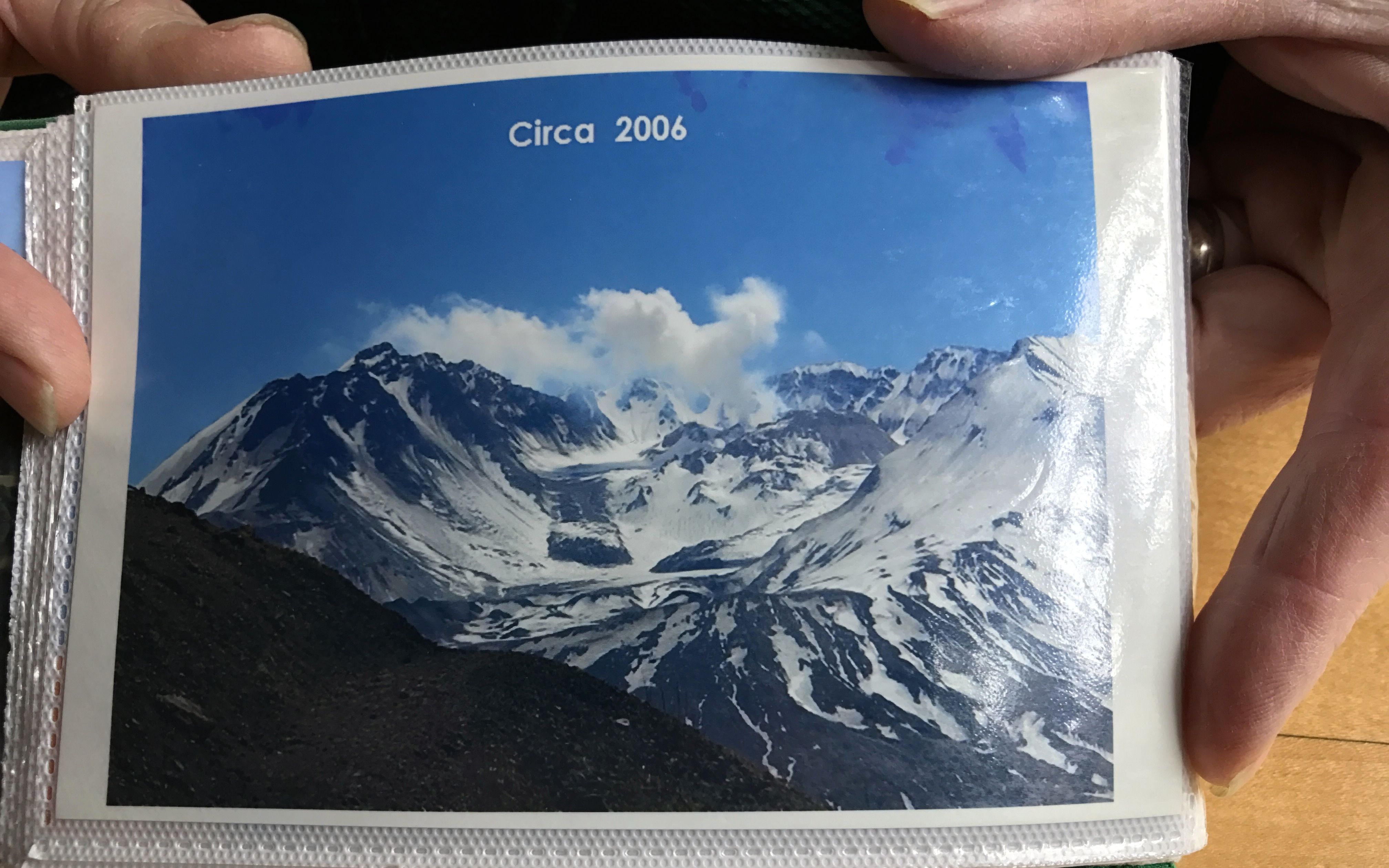
One of the places I was going to pass was Mount St. Helens. Everyone my age and maybe a bit younger probably remembers this image.
It had a major eruption back in 1980, which was the deadliest and most economically destructive volcanic event in the history of the United States. I started seeing signs for a Washington State Park Visitors Center and decided to get off the interstate and see what I could learn.
Unfortunately, this was the view from the site. I guess there is an 8,000 foot tall mountain back there. Norman Vader, a volunteer docent, told me it was lost in the clouds today, so I assume that the mountain that is visible in the photo is not Mount St. Helens.
I roamed the exhibits for a while.
The plaque with this exhibit read,
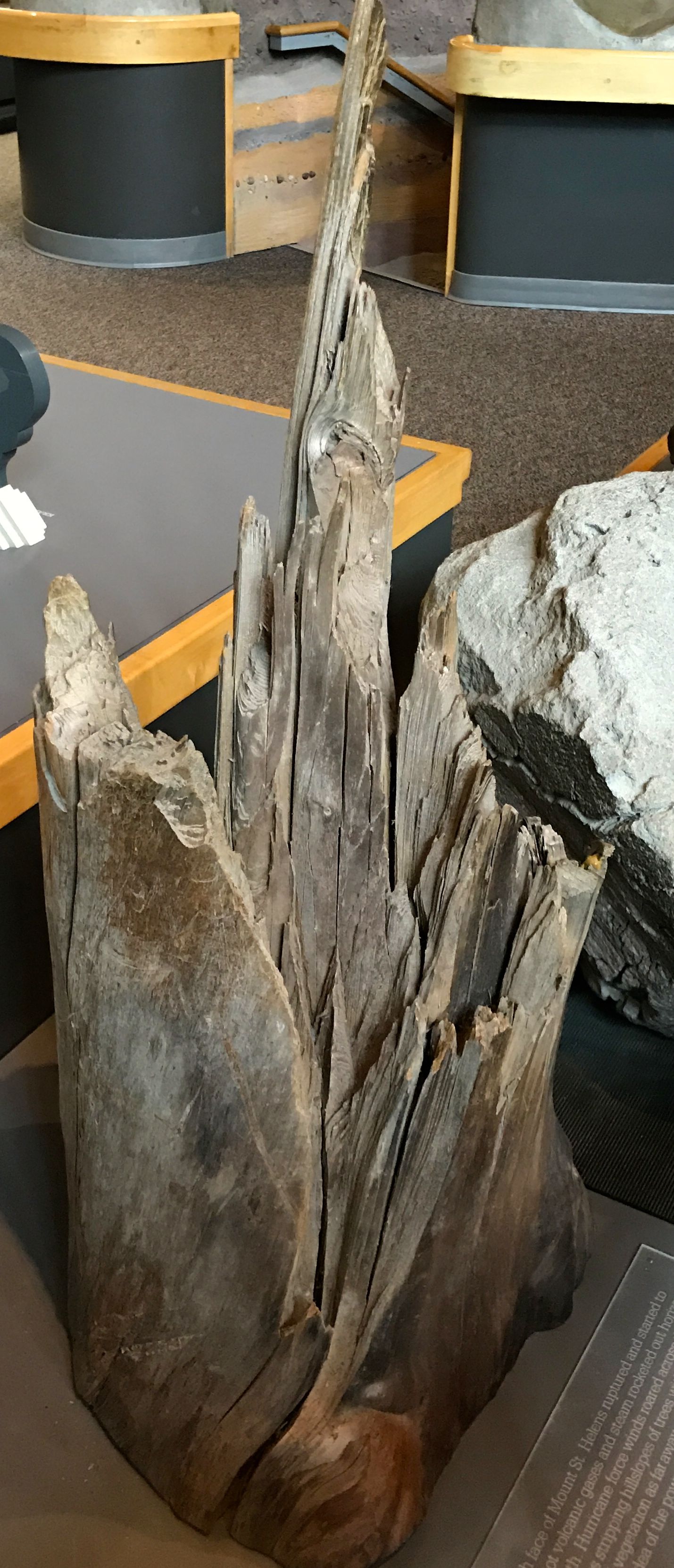
“As the north face of Mount St. Helens ruptured and started to slide away, hot volcanic gases and steam rocketed out horizontally to the north. Hurricane force winds roared across the land for 1015 minutes, stripping hill slopes of trees within 6 miles and leveling nearly all vegetation as far as 13 miles. This tree trunk gives some idea of the power and fury of the initial blast.”
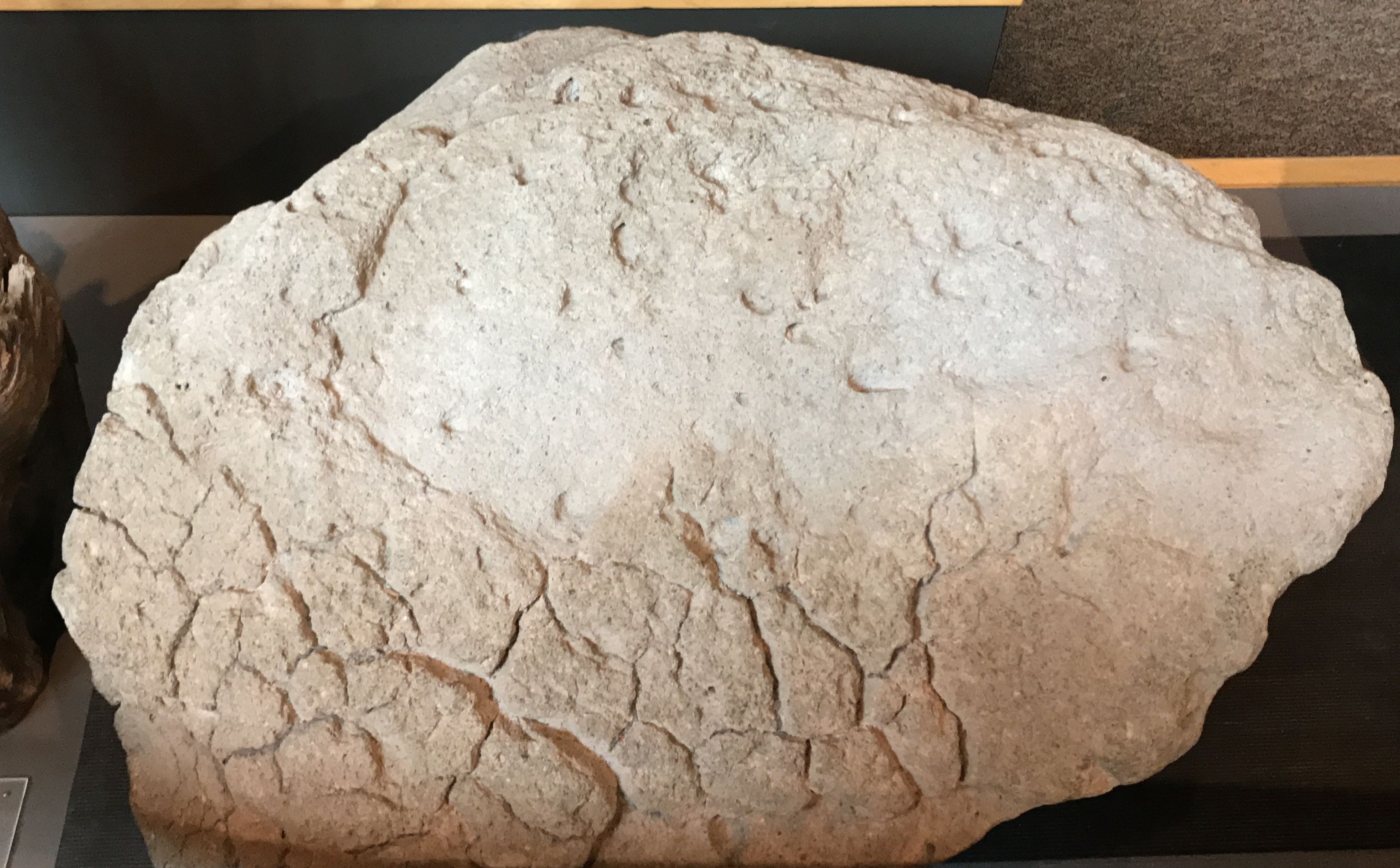
This is a piece of pumice from the eruption. The plaque read,
“This volcanic rock was made when super-heated magma containing a very large amount of water and gas was thrown out of Mount St. Helens. As the gas bubbles escaped from the lava with rapid cooling, they were trapped. The small holes left behind are called pores, and they make the rock very light weight. Pumice rock can actually float on water and covered the surface of Spirit Lake during the 1980 eruptions.”
I used to love to collect pumice, back when I lived in Guatemala. And, yes, it really does float.
It was kind of hard to take pictures in the visitor center. I took a photo of this photo, though. You have to really start worrying when they take away the signs.
You may have caught the episode about a rescue during the eruption on Ann Curry’s “We’ll Meet Again” on PBS. It was quite the story. If you haven’t seen it, you might want to check it out.
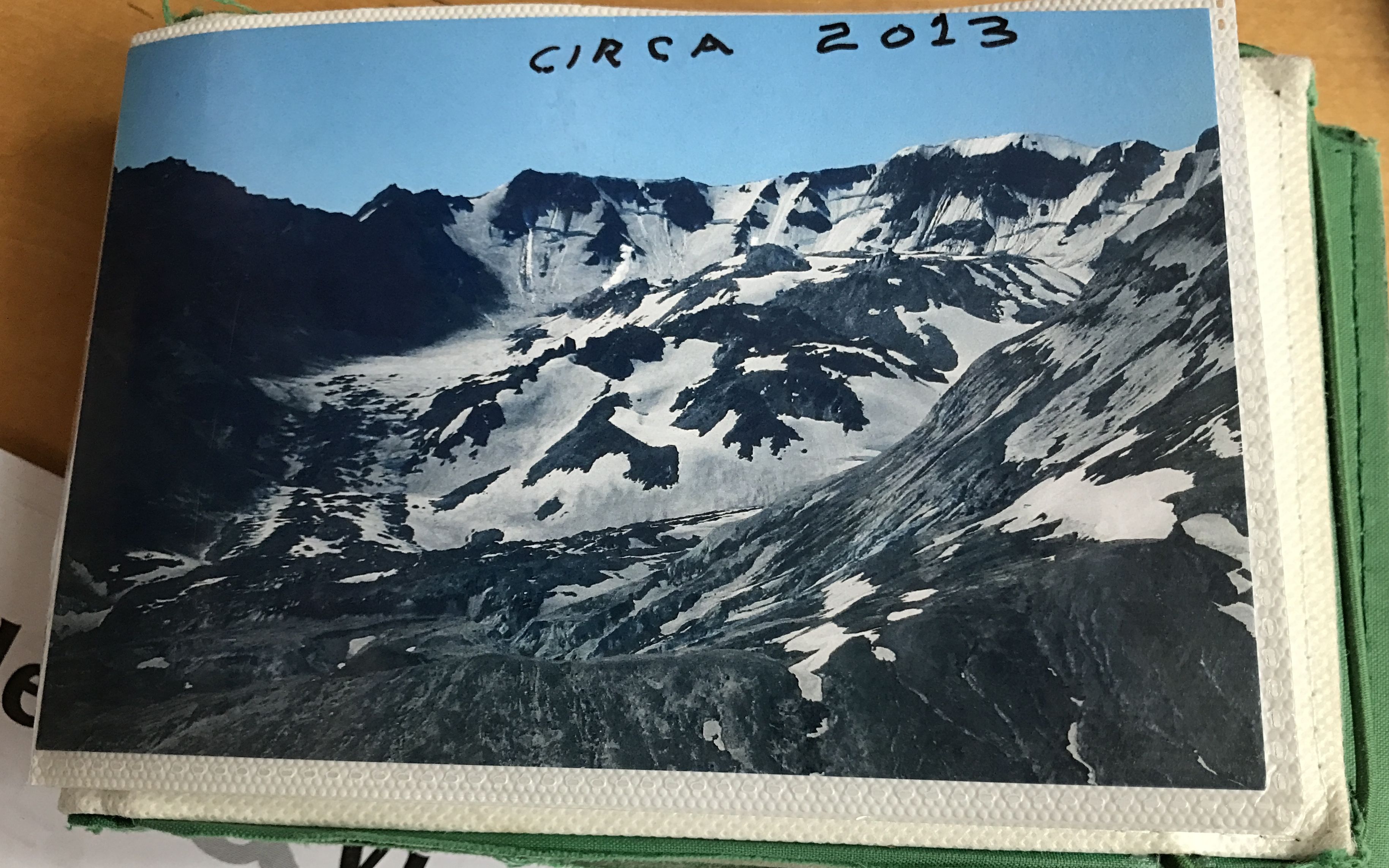
I enjoyed talking with Norman Farber, the docent. He could answer any of the visitors’ question. He had little photo albums that he would pull out to illustrate his answers. I found this pair of photos particularly interesting.
I believe that this is the crater left behind when the eruption occurred. It is interesting to me that glaciers actually started to grow in the crater.
It is a bit distressing that the glaciers that had formed and started to advance have since been retreating.
After about an hour perusing the exhibits and listening to Mr. Farber’s stories, it was time to step into Flo, make a little lunch and head north. Carrying your kitchen with you is one of the delights of RVing.
My next destination was Washington Land Yacht Harbor. I found it on Campendium.com, and I even added my own review to the website. I have to say that it wasn’t the most scenic place I’ve ever stayed.
Photo taken by John Schroeder found on Campendium.com
But, hey, it was only $18 with my WBCCI membership, as it was originally an Airstream-only park. It had full hook ups and it was in a good location for exploring the area. Given the time of year, it was just about that empty.
I should have tried to find a church. At this point, I don’t remember why I didn’t go to church or if I looked or what. (Remember that I am writing this report about a year after the fact.) In any event, I set out to see what I could see. I do take my touristic duties seriously, even if I did neglect my Easter obligations.
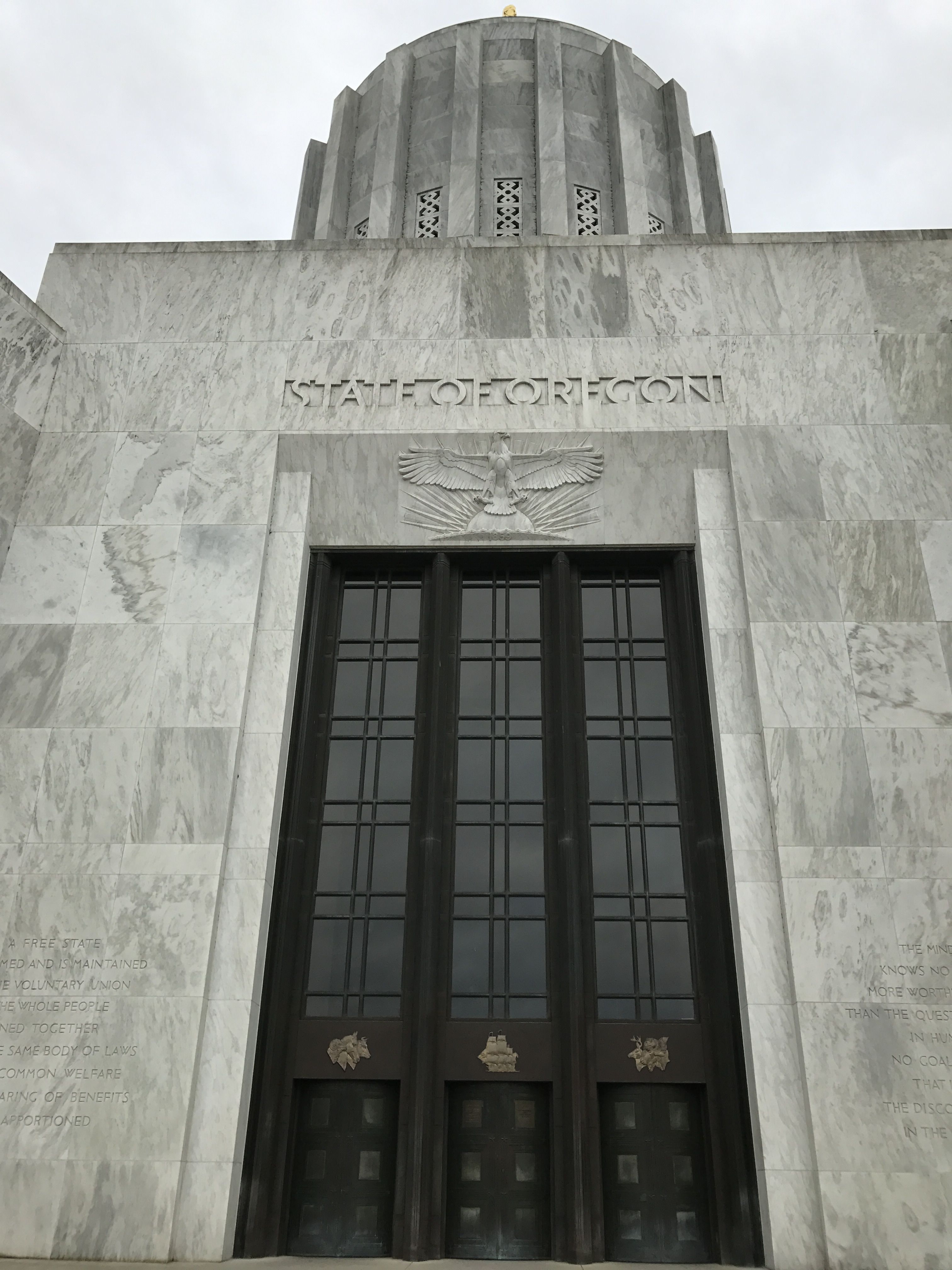
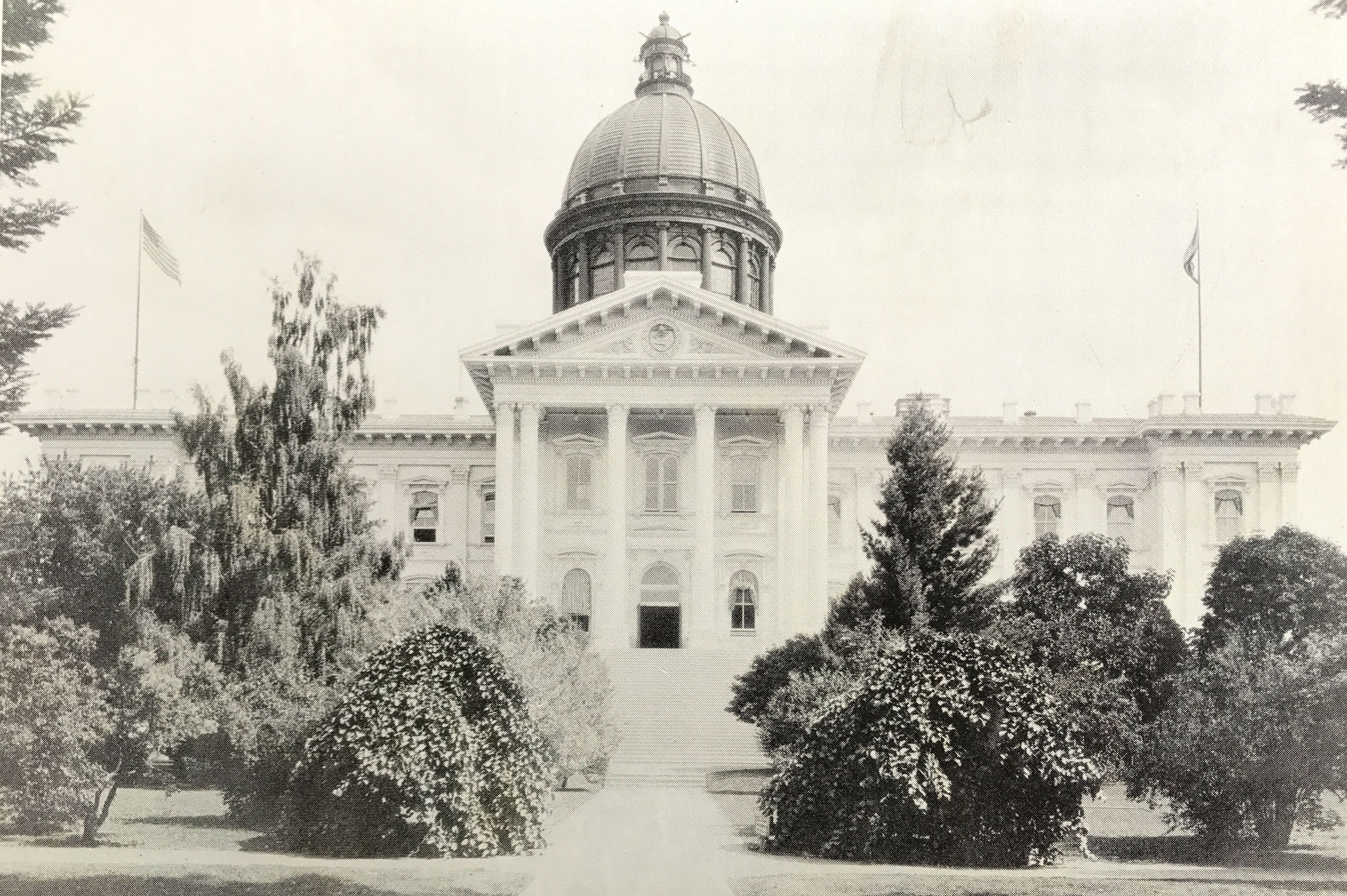
I decided to head over to Salem to see the state capital building.
It has one of the most original domes I’ve ever seen on a state capital – or any building, for that matter.
This is the third state capital building in Salem. The first capital of the Oregon Territory was in Oregon City but moved to Salem in 1850. There was some dispute about there is should be. Corvallis was the next capital, but people objected to that because construction in Salem had already begun. Governor George Curry sent the matter to the Secretary of the Treasury in Washington in 1855. Secretary James Guthrie declared the move invalid unless acted upon by the United States Congress.
So, the legislature convened in Corvallis in December 1855, just long enough to pass a bill that moved the capital back to Salem. The bill passed on December 15. Three days later, the legislature re-convened in Salem. Two weeks later, the statehouse burned down.
The legislature re-opened debate about where the capital should be. They held a vote, but voting irregularities and low voter turnout lead to them ignore the results, which would have moved the capital to Eugene. They tried again in 1860 and in 1862, but no city received the 50 percent minimum required by law. In 1864, Salem received 79 percent and was declared the state capital. By this time, Oregon had been a state for five years.
And, yes, information for this post came from my preferred source. Check it out, if I’ve piqued your curiosity.
As I mentioned earlier, I made my visit on Easter Sunday. I don’t know if it is open on other Sundays, but it was definitely closed when I visited. However, there are always things to see.
The current capital building was completed in 1938. It was partially funded by the Public Works Administration, which was part of FDR’s New Deal of 1933.
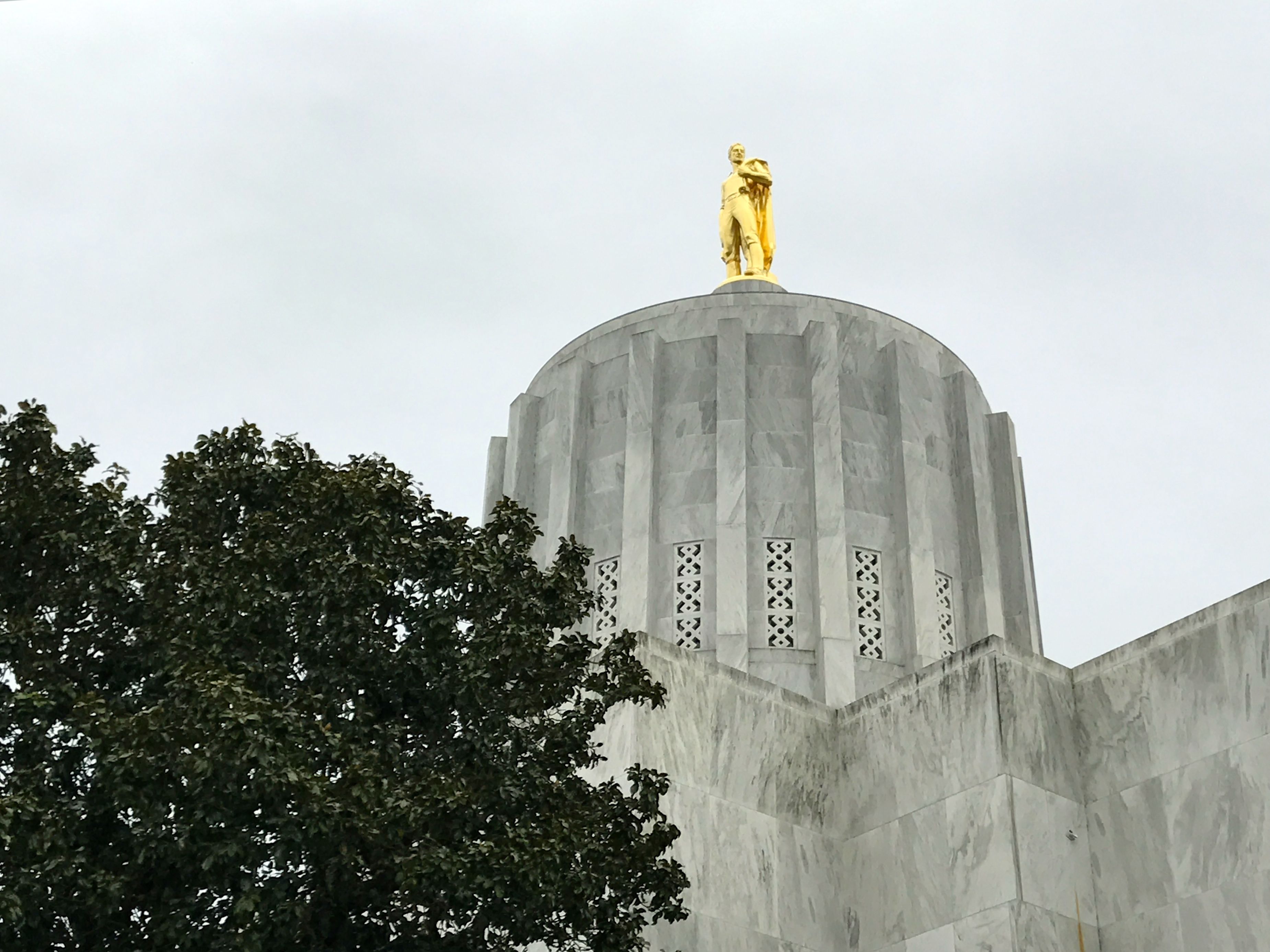
As with any public project, there were complaints. One complaint was that the dome looked like a “paint can”. It was also called a “squirrel cage”. (It kind of reminds me of a nuclear reactor.)
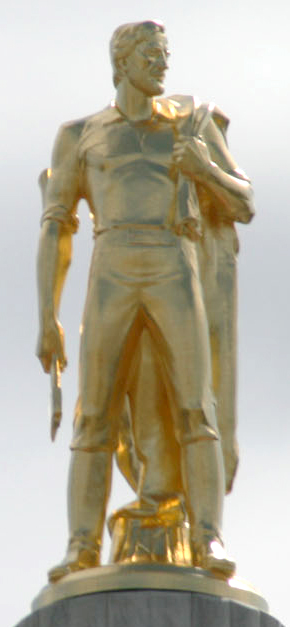
The pubic was also slow to warm up to the gold Oregon Pioneer statue atop the dome.
By Andrew Nealon + EncMstr – EncMstr reprocessed photo w:Image:At the top.jpg by cropping, and adjusting RGB curve for more detail of statue, CC BY-SA 3.0, https://commons.wikimedia.org/w/index.php?curid=1857964
I am proud of myself for finally getting on board with properly attributing sources when I borrow images. Thank goodness that Wikipedia makes it easy! I have been approached a few time by people who want to use photos I’ve taken for their projects, and it feels good to be acknowledged.
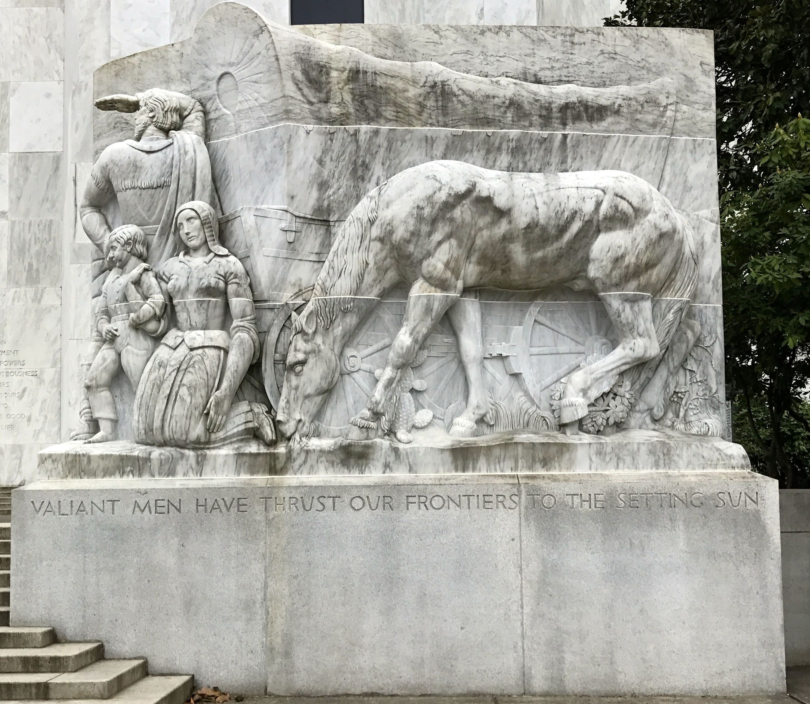
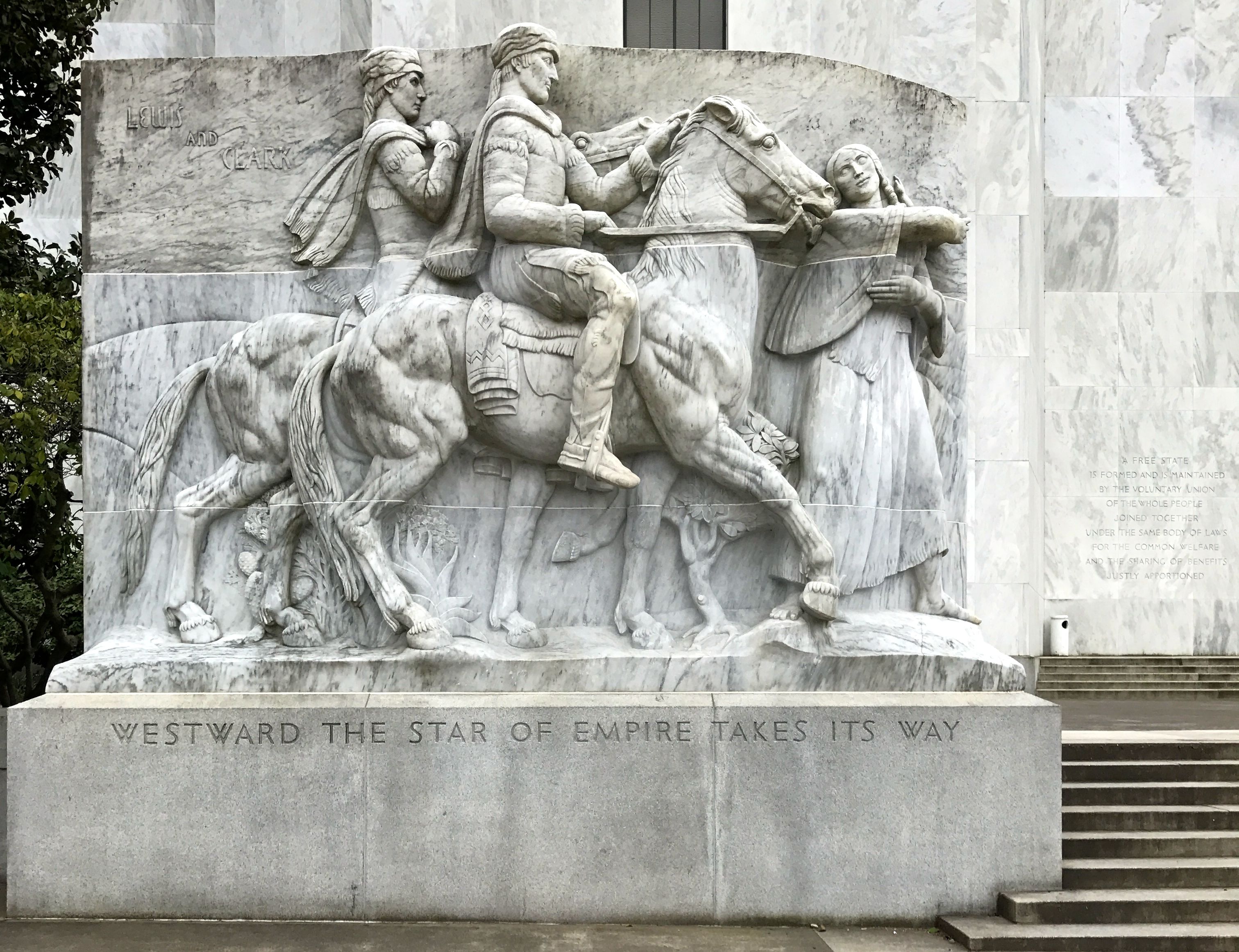
Sculptor Leo Friedlander created the large pieces on either side of the entrance. Ah, those valiant men! How about some mention of the valiant women who went west, too?
I mean, how about some mention of Sacajawea?
There were some bronze statues around the capital as well.
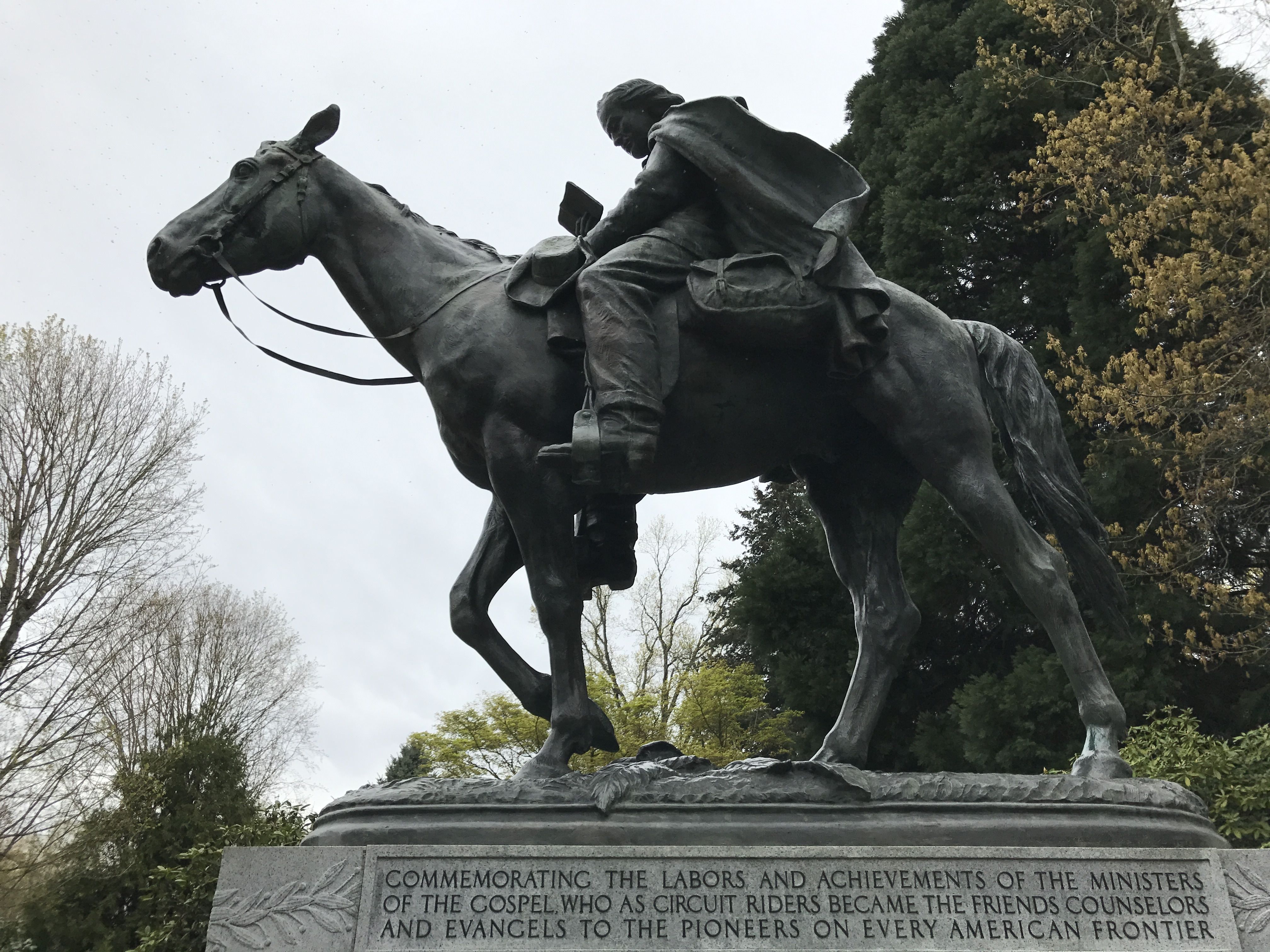
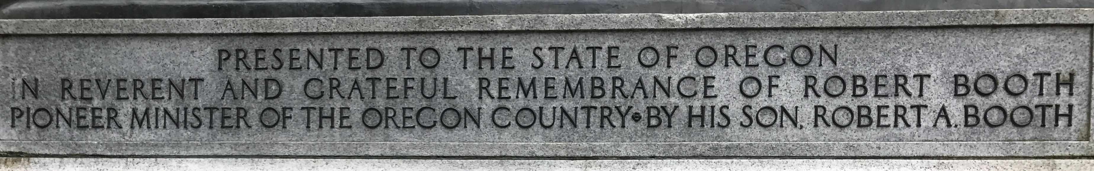
This one is a tribute to Robert Booth, who was a pioneer minister in Oregon.
It was also a tribute to his son, Robert A. Booth, who put his own name on the dedication plaque.
This statue is of Reverend Jason Lee, who lived from 1803 – 1845. The inscription of the plinth describes him as the first missionary in Oregon and a colonizer from 1834 – 1843.
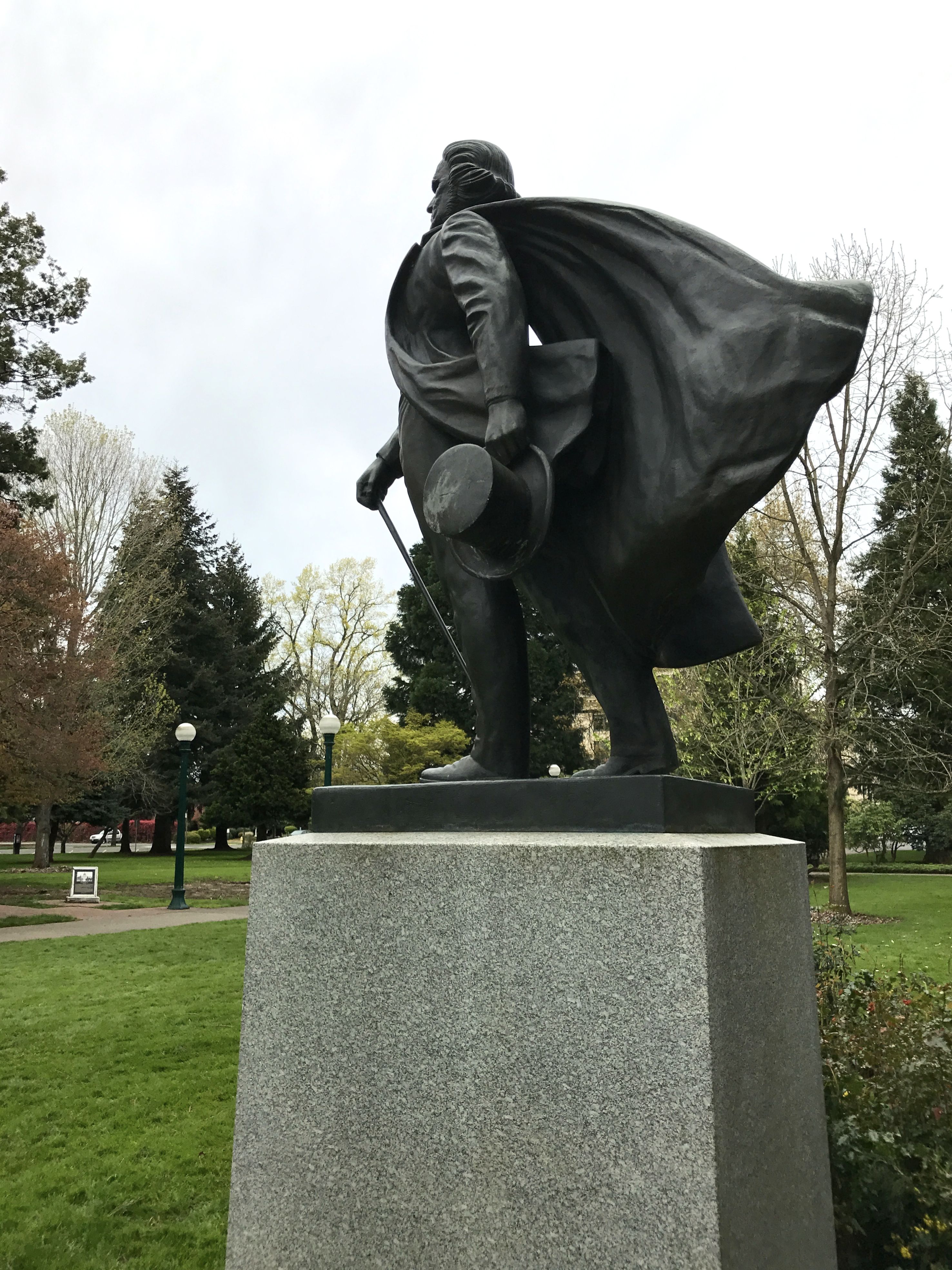
Then there is this dramatic statue of Dr. John McLoughlin, who was the first to govern the Oregon Country, from 1824 – 1843.
I find it interesting that he was born in 1784 in Rivière-du-Loup, Quebec, and he came to government through his work with the Hudson’s Bay Company.
Since I have a primarily east coast orientation, I learned many new things on my west coast adventures. For instance, I did not know that at one time there was talk of establishing Oregon as an independent nation, free of the United States. In fact, Dr. McLoughlin advocated for such an arrangement. He also got in trouble with his bosses for extending aid to the American settlers who arrived in Oregon via the Oregon Trail in the 1840s. His assistance to the new arrivals was not entirely altruistic, however. The aid he extended to the Americans probably prevented armed attacks on his outpost by the numerous settlers.
According to my preferred source, the settlers understood that his motives were not purely selfless. Some resented the assistance and worked against him for the rest of his life.
In 1843, his bosses directed him to relocate to Vancouver Island. He refused to leave the Willamette River Valley and spent the remainder of his life there. He died of natural causes in 1857 at the age of 72 .
As I explored further, I came across these sections of pillars.
They were from the capital that burned in 1935.
According to an information plaque near the column segments, the bricks for the inner core construction of the columns and for the building were made by convicts at the Oregon State Penitentiary. The fluted limestone veneer facings came from Douglas County quarries, south of Salem.
Incidentally, Douglas Country was named after Stephen A. Douglas, who strongly supported statehood for Oregon. You may be familiar with his name from the famous Lincoln-Douglas debates.
(I do go on, don’t I?)
Anyway, according to the plaque, the columns were found in Mill Creek, near the residence of the Governor. First Lady Dolores Atiyeh and Governor Atiyeh promoted the idea of preserving the column segments as a piece of Oregon history.
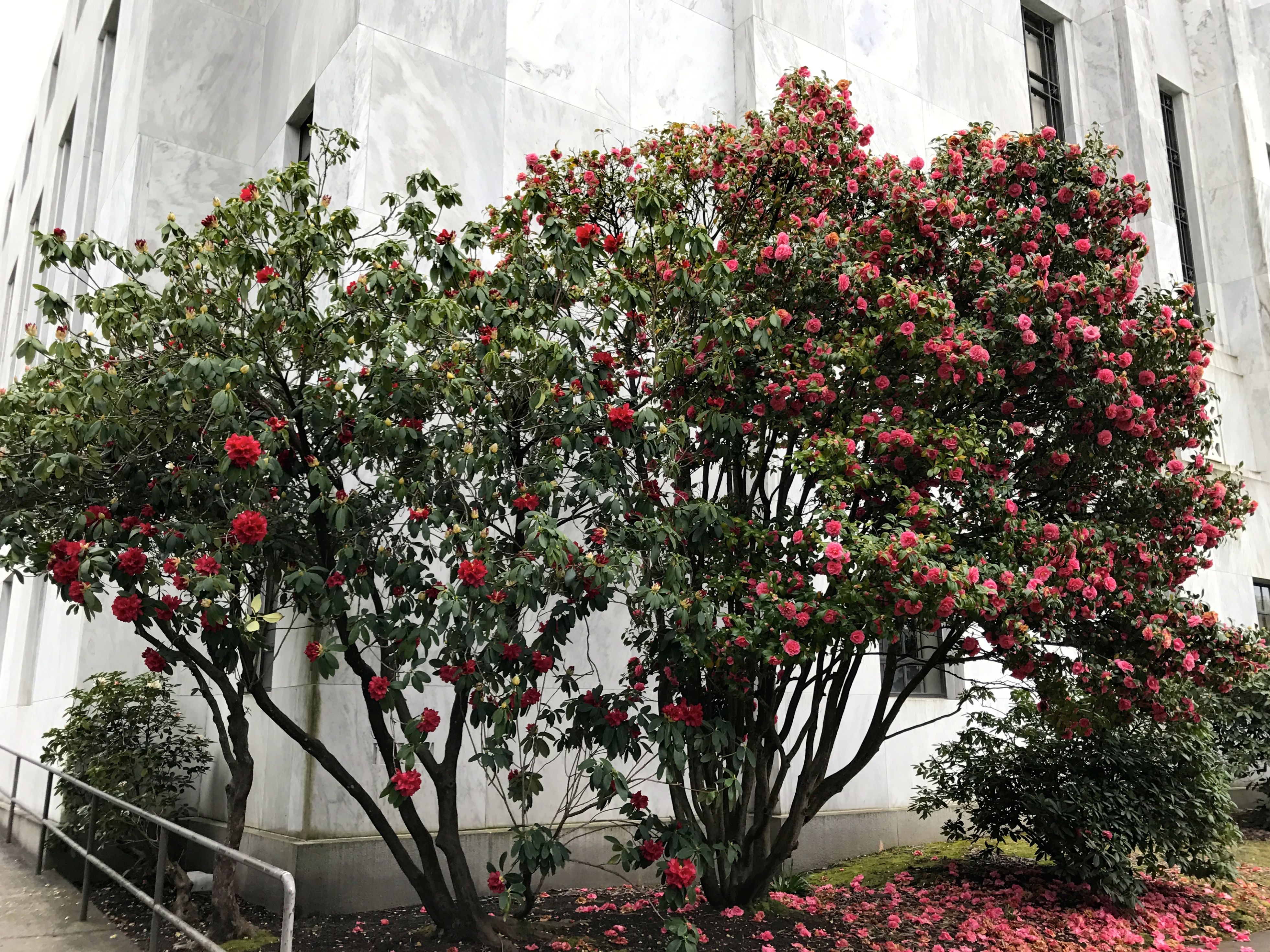
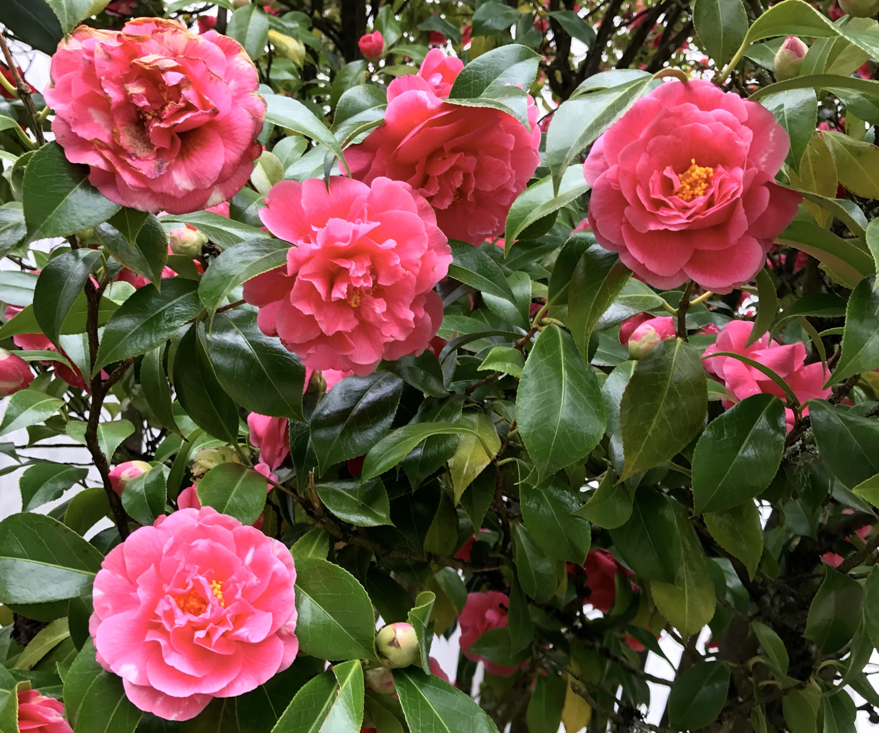
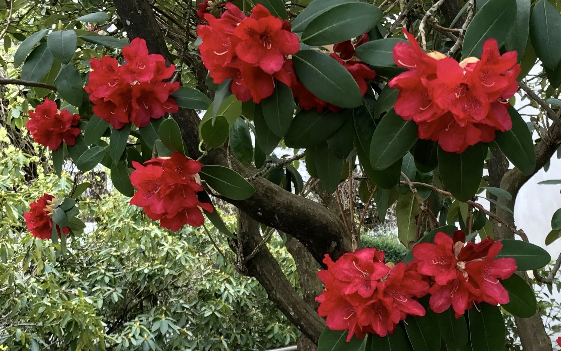
The capital’s campus was in bloom.
Even on this grey day, there were splashes of color.
The flowers seemed exotic to me, in comparison with the ones I grew up with.
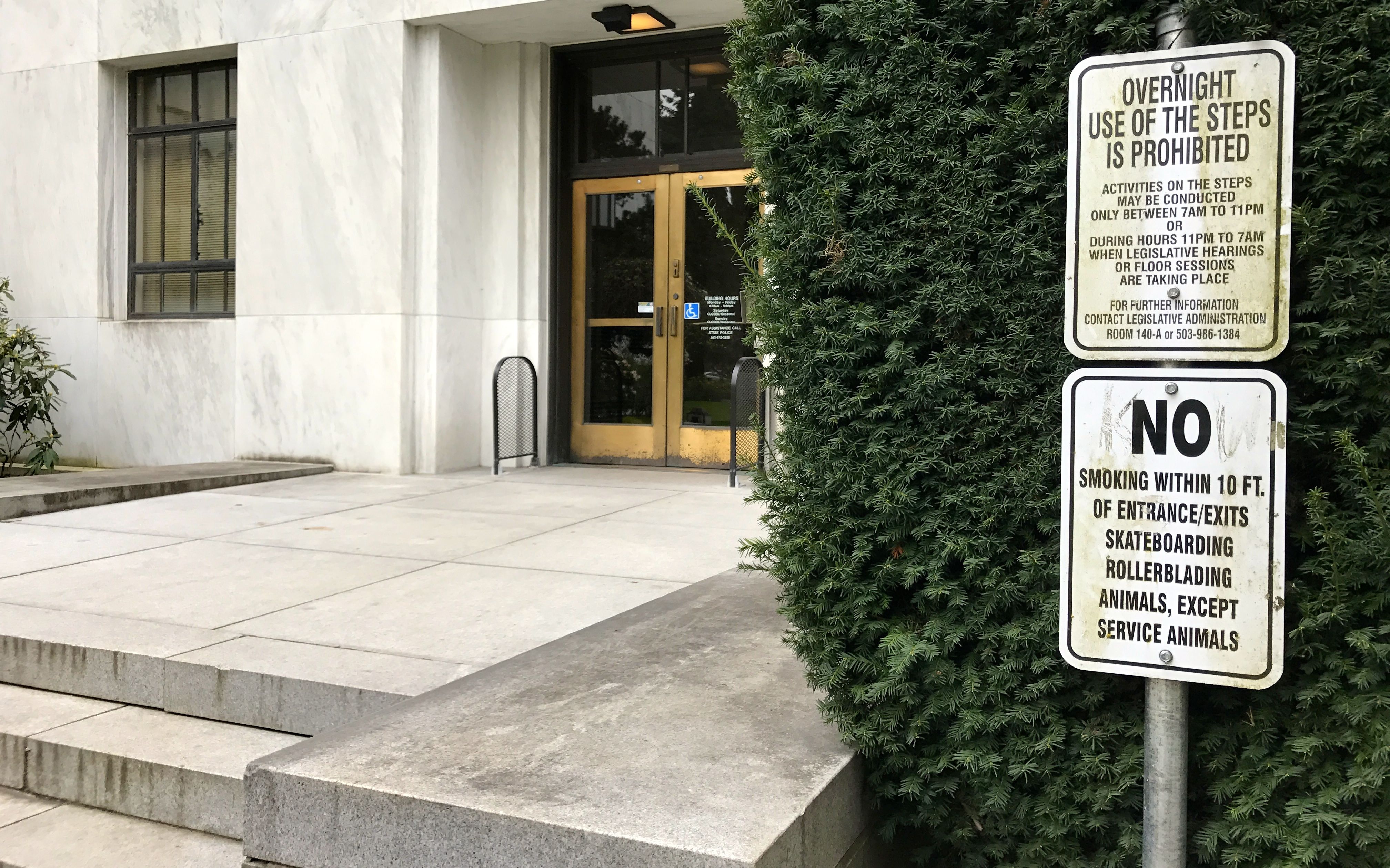
I don’t know about you, but I always thought of Oregon as kind of a free-wheeling place. Would you look at those signs!
OVERNIGHT USE OF THE STEPS IS PROHIBITED
(Okay…there are two steps here.)
Activities on the steps may be conducted only between 7 AM to 11 PM
OR
During hours 11 PM to 7 AM when legislative hearings or floor sessions are taking place.
I wonder what happened to inspire such precise regulation of these two steps?
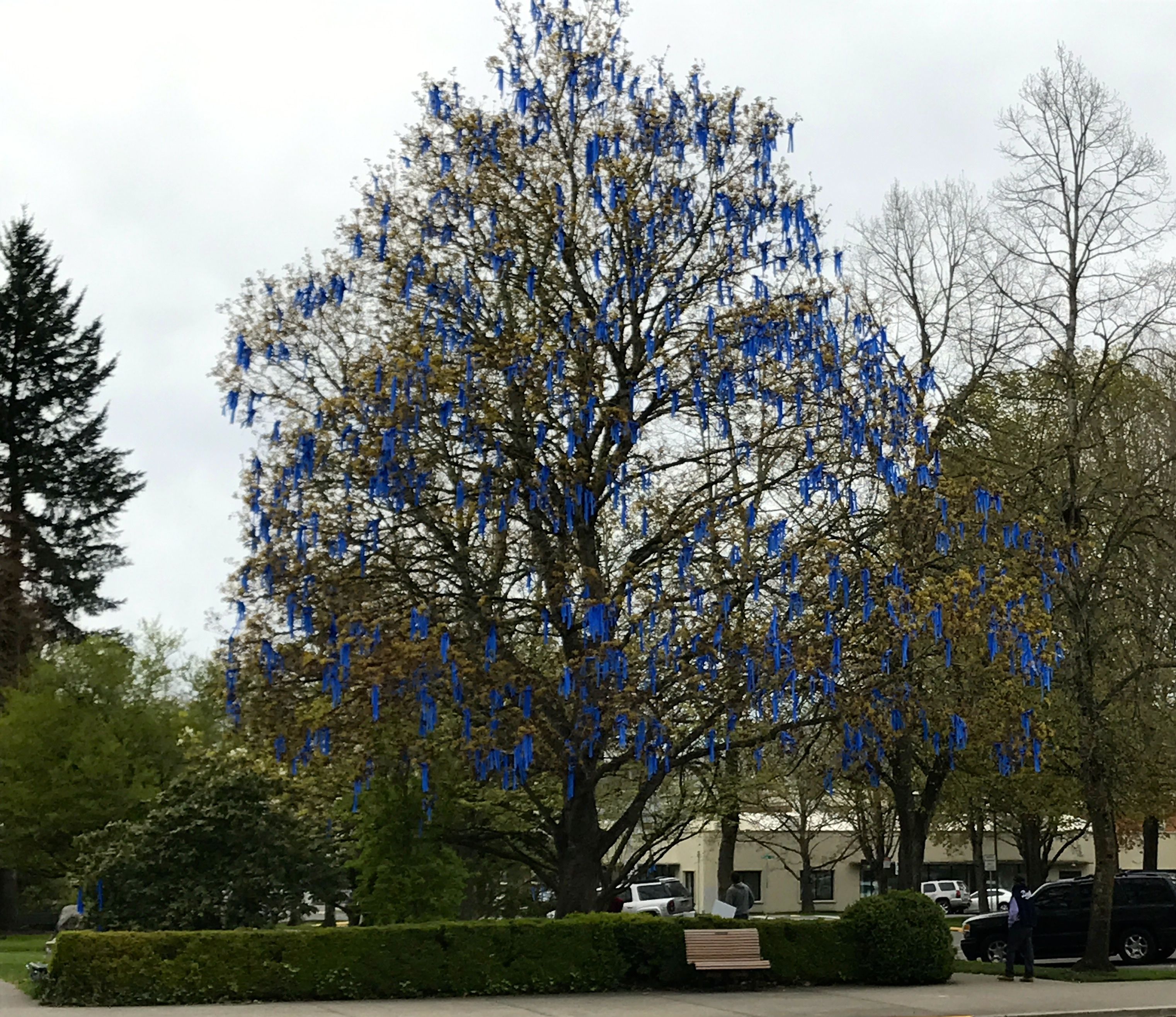
I figured that I had seen all that I was likely to see, what with the building being closed, so I got ready to head back to my truck. This tree festooned with blue decorations caught my eye. I wandered over to check it out.
At the base of the tree was a sign explaining the project.
I got back in my truck as set off for more adventures.
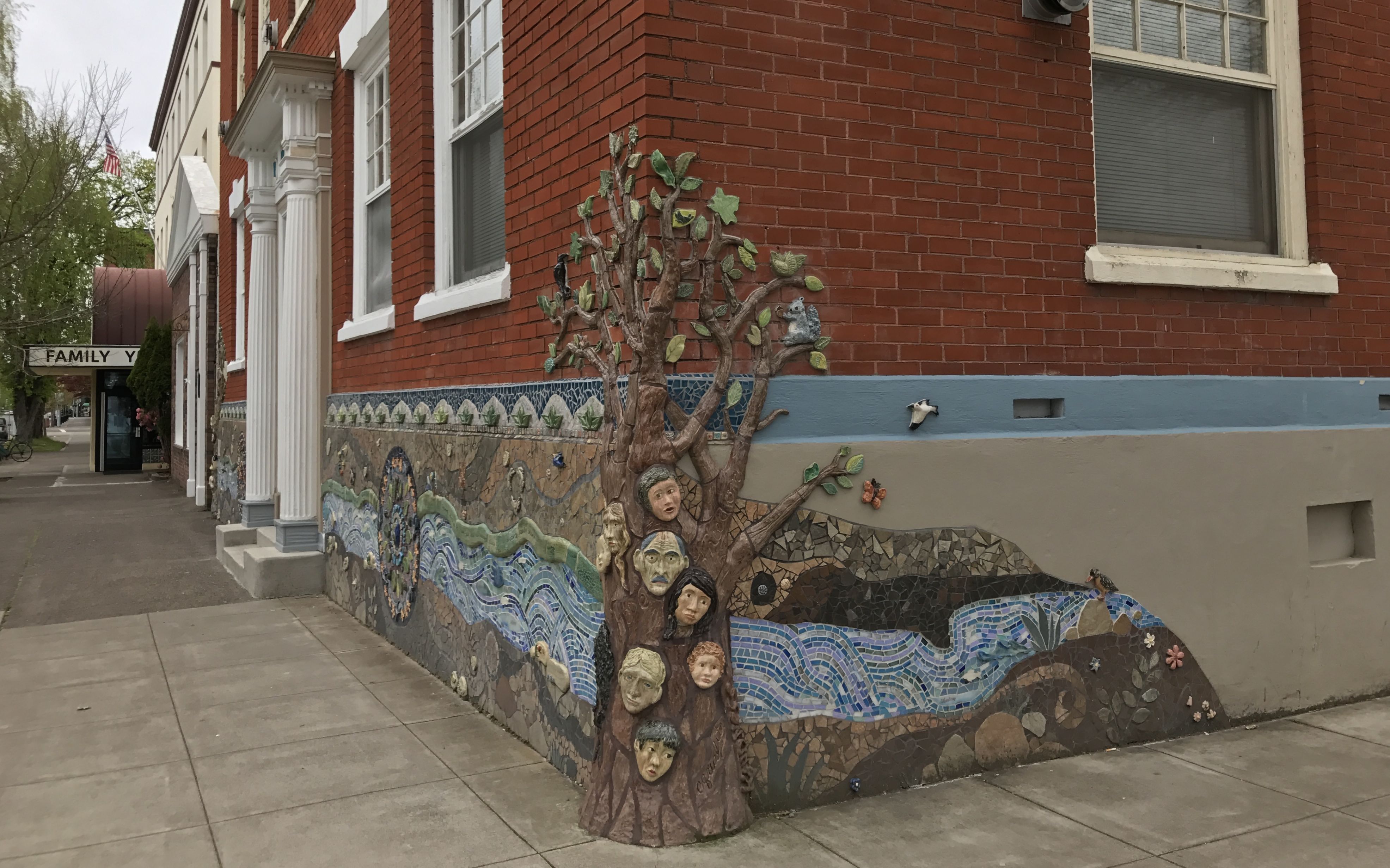
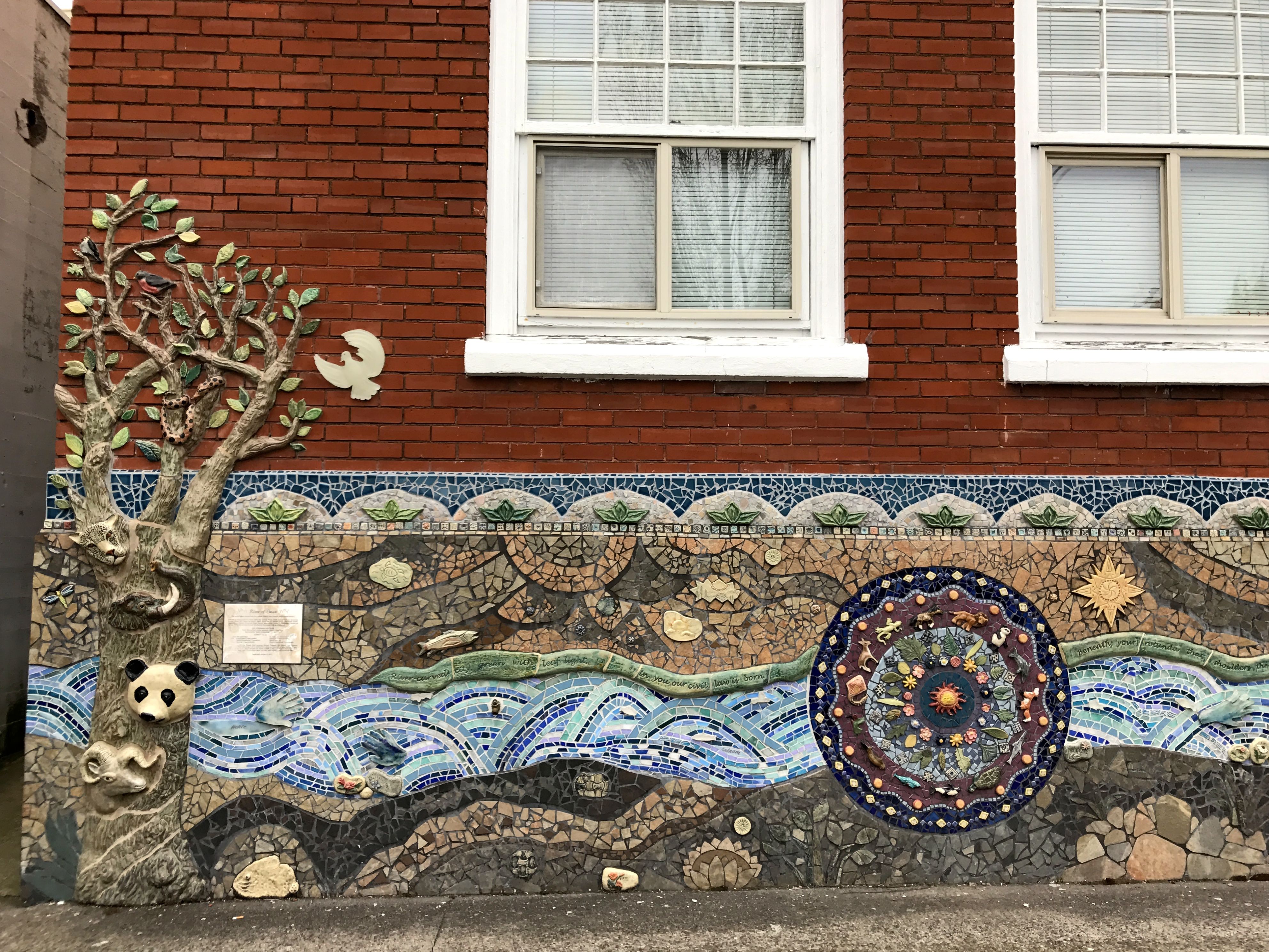
As I tooled down the street, this building with mosaic decorations caught my attention. I love mosaics and I didn’t have to be anywhere at any specific time, so I pulled over and found a place to park.
Things might not be open on Easter Sunday, true, but it sure makes parking easier.
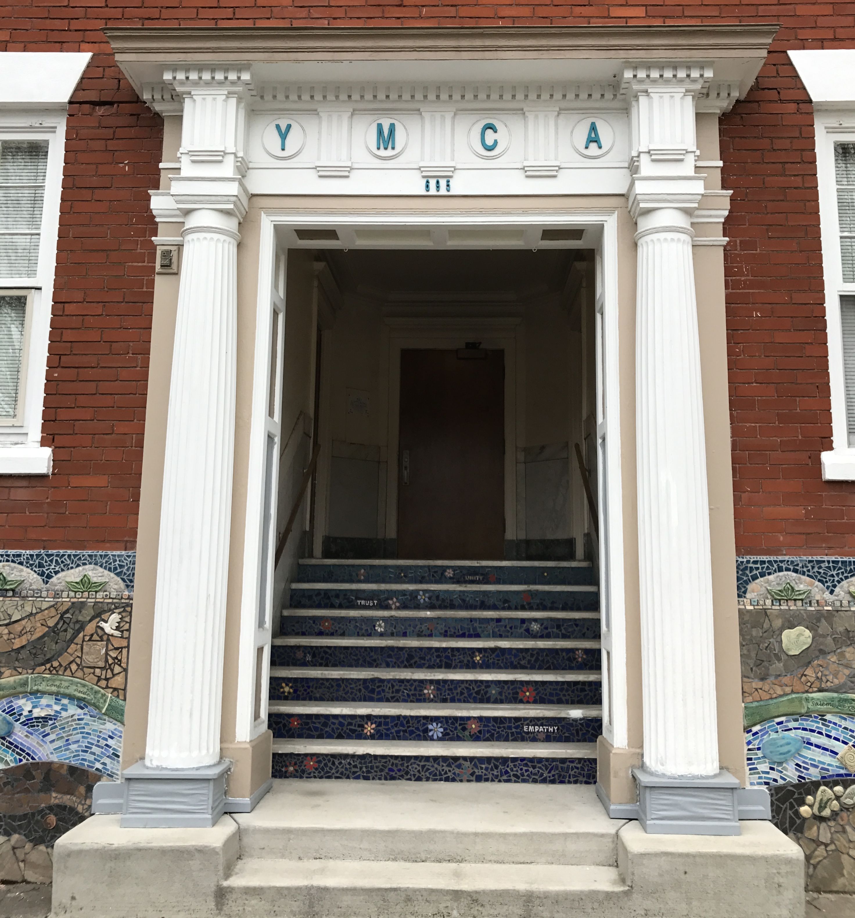
It turns out that this building was the YMCA.
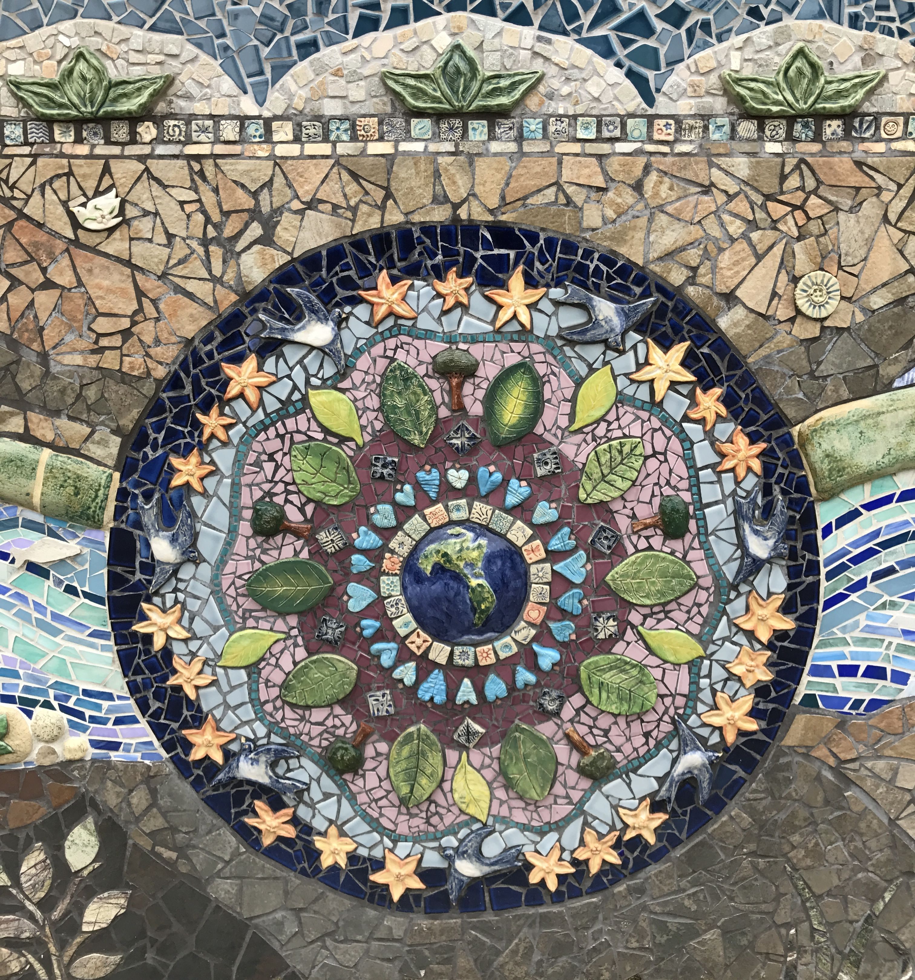
The mosaic is called River of Peace. This was most appropriate, as the word Salem comes from the words “shalom” and “salaam” which mean peace.
Lynn Takata was the artist-in-residence for this project. Over 600 people worked on this mosaic, which is 60 feet long. There are some lovely photos of the work and the process on her website.
It was a rather gloomy day, so my photos don’t really pop. There are some beautiful ones on her website, if you’d like to check them out.
I was glad I stopped. What a wonderful community art project! This is something like a project I had hoped to do at my school before my retirement. Oh, well…
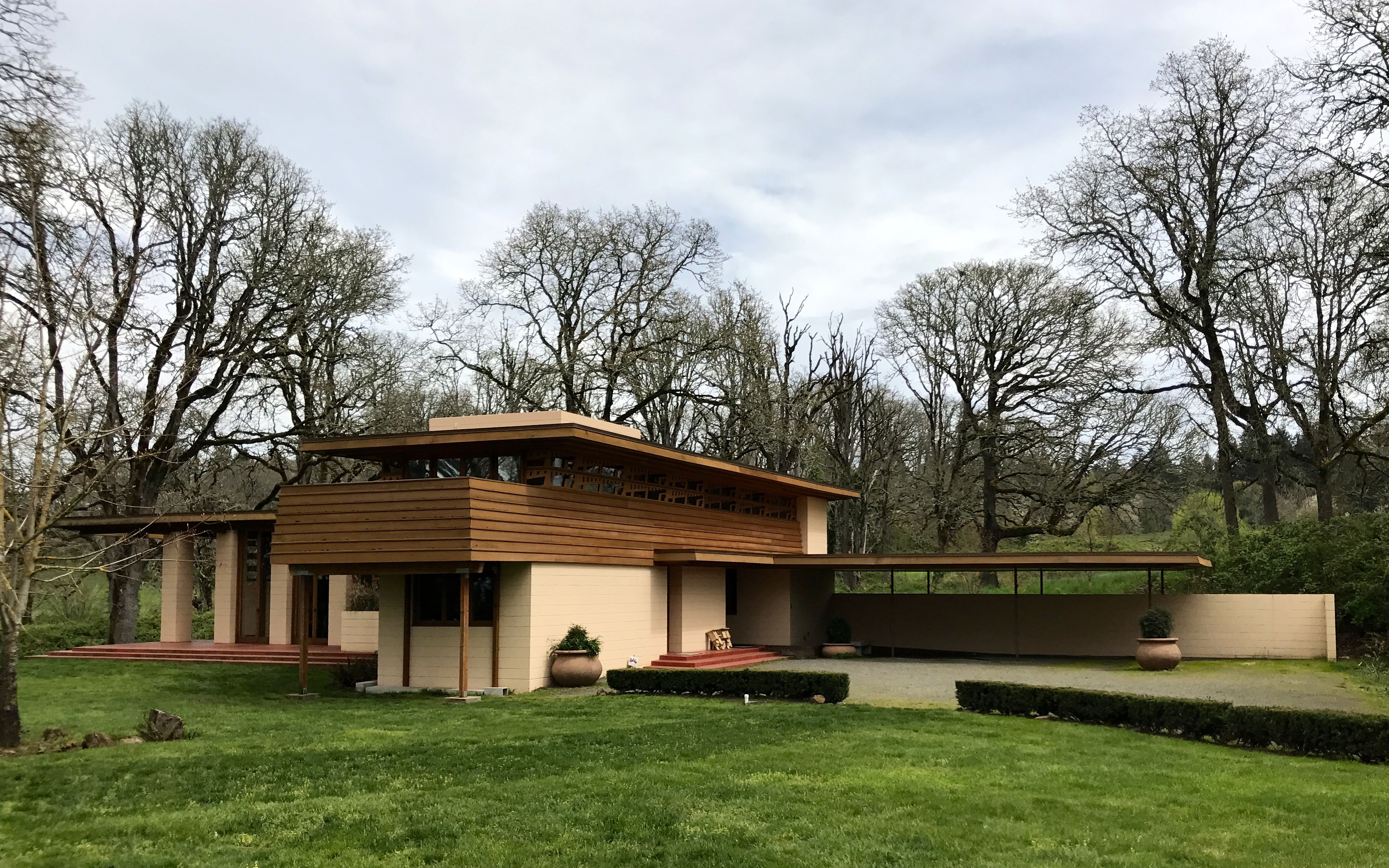
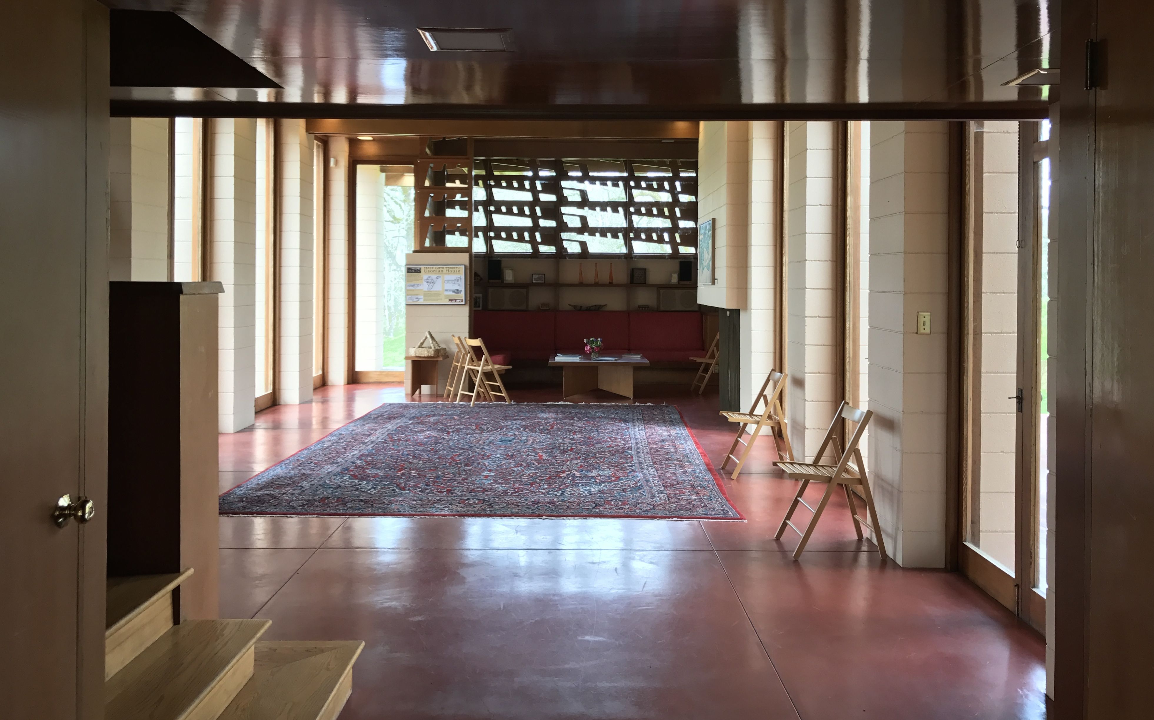
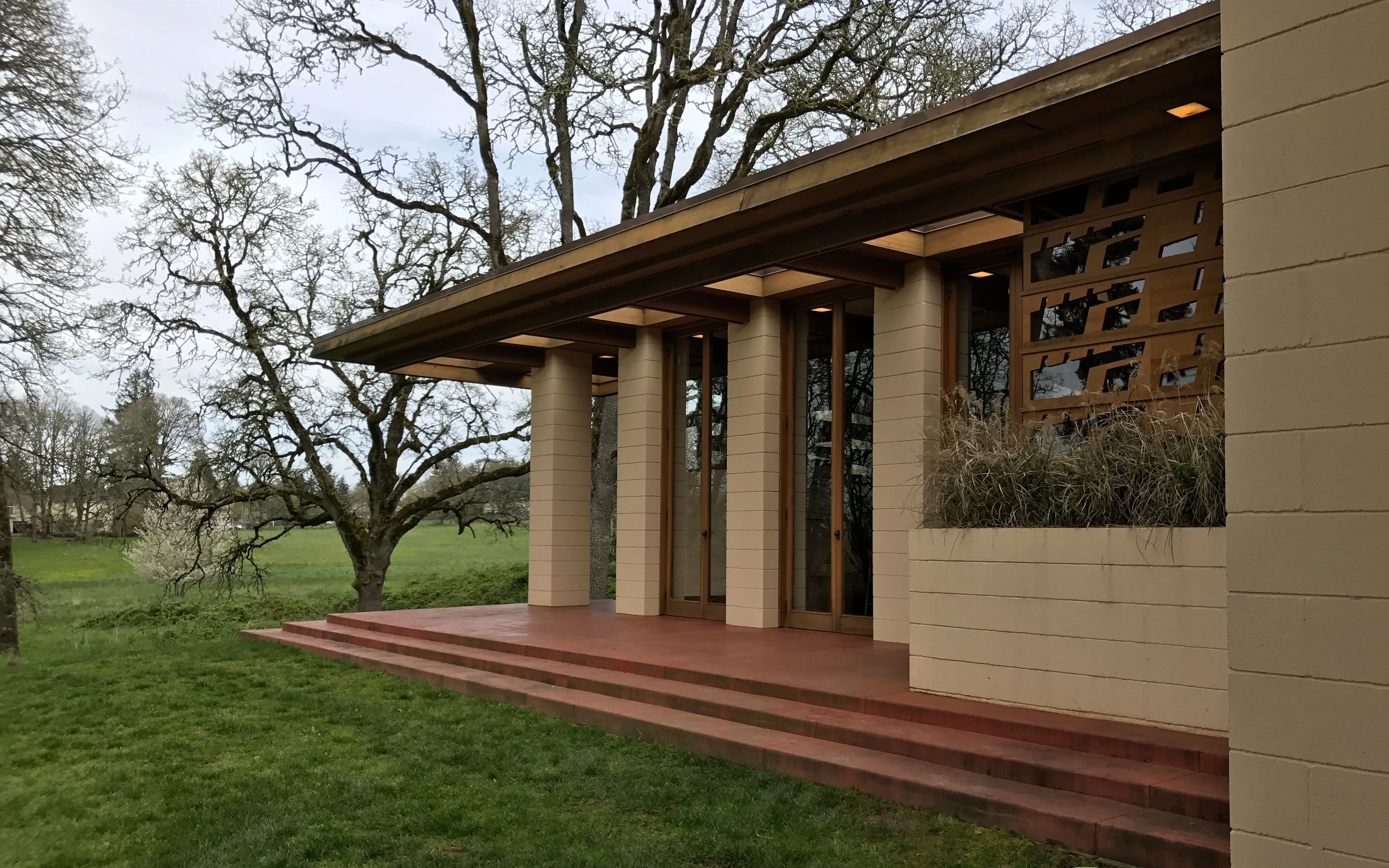
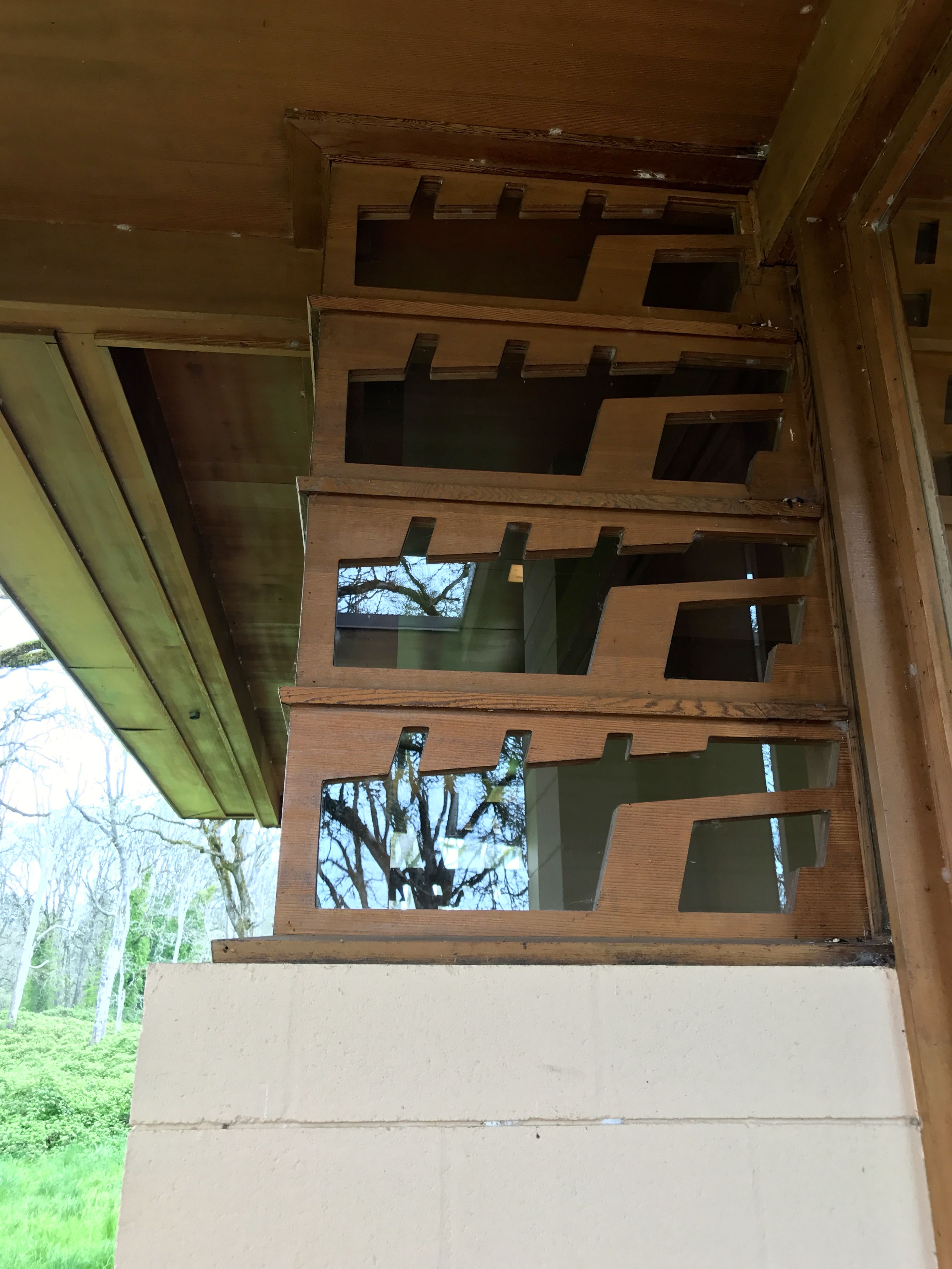
Another love I have, in addition to mosaics, is the architecture of Frank Lloyd Wright. There was one structure he designed in all of Oregon and I wasn’t too far away. The sources I consulted at the time indicated that it was open for visits on Sundays and it didn’t say anything about Easter, so I decided to head over. The Gordon House was my next stop.
This house was designed in Wright’s Usonian style. These smaller, more modest houses were designed for the middle class. He started designing them in the 1930s when an annual income of $5000 – $6000 put you in the middle class. This house was created for Evelyn and Conrad Gordon in 1957, but it wasn’t completed until 1963, four years after Frank Lloyd Wright’s death.
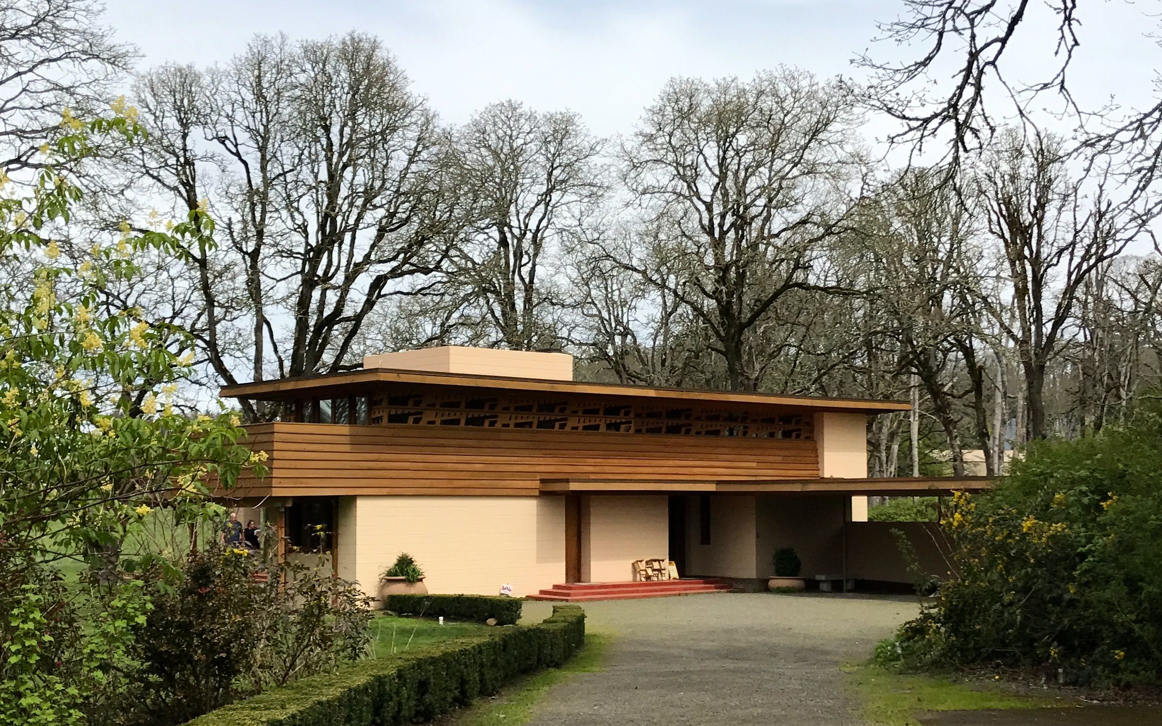
I walked up to the front door. And yes, the house was closed.
But, you can still look inside. This is the view through the front door. You can see the Cherokee red floors. An interesting fact I learned in my study of Wright is that he always identified his red floors as “Cherokee red,” but they weren’t necessarily the same shade of red.
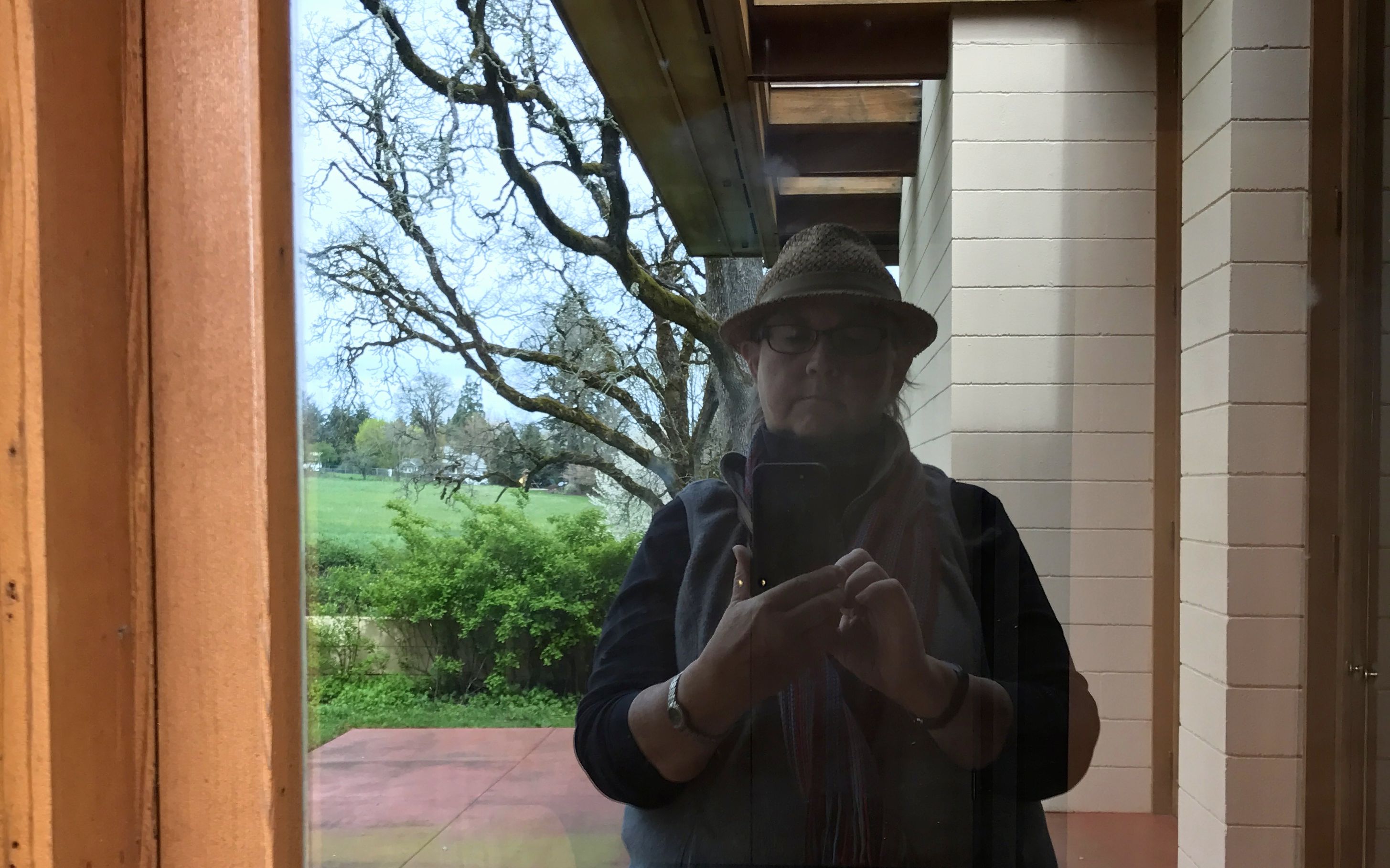
As I made my way around the house, I couldn’t resist the opportunity for a reflection selfie.
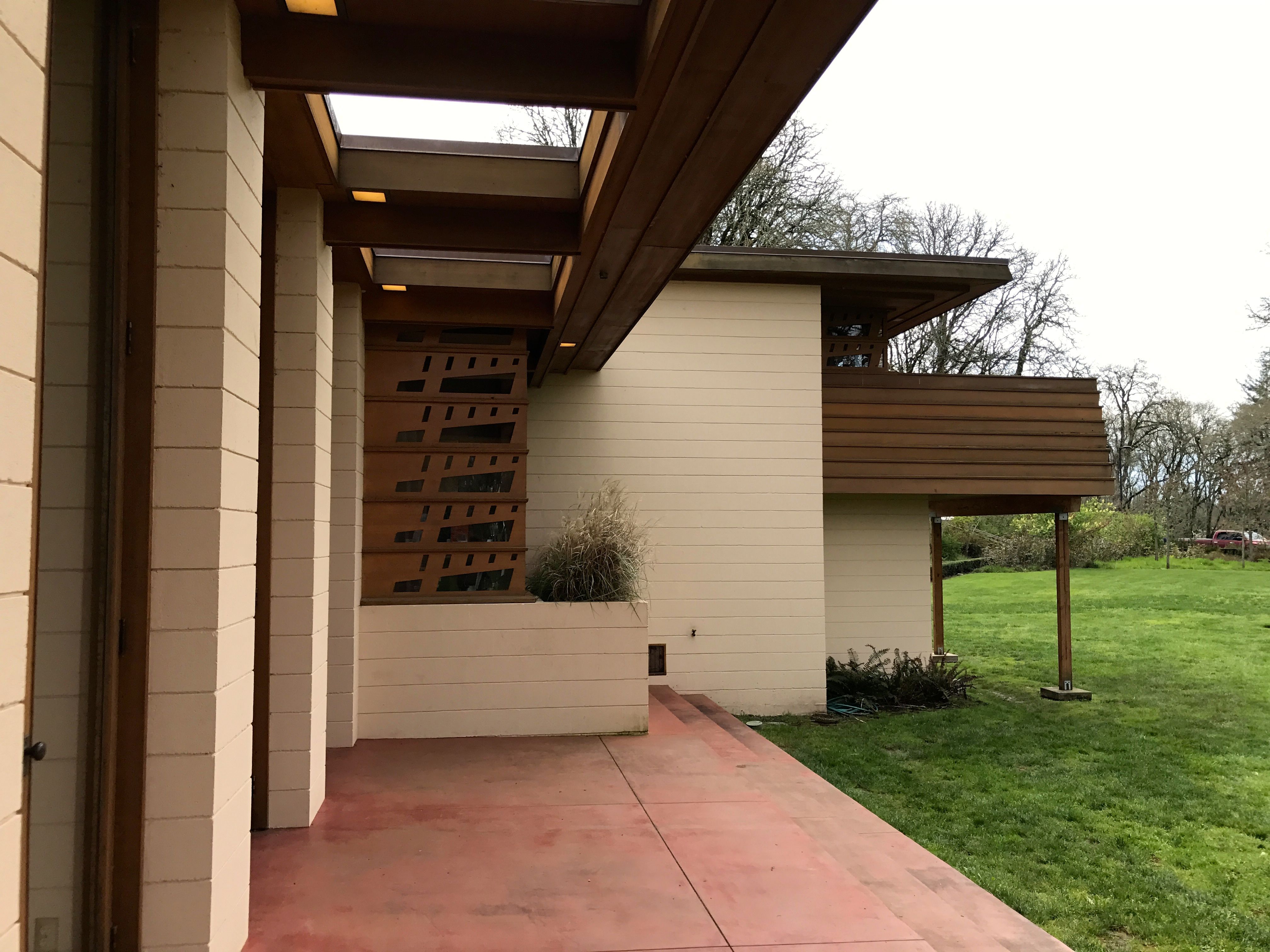
This house was originally located near Wilsonville, Oregon. After Evelyn Gordon’s death in 1997, the house was sold to new owners. They wanted to tear it down to make room for a larger, more contemporary structure. I guess they valued the location, which had views of the Willamette River and Mount Hood.
With all these glorious windows, the views must have been spectacular.
Many groups worked together to preserve the house and move it about 21 miles to the Oregon Garden in Silverton. The dismantling began on March 9, 2001, and it was moved in four large pieces. A lot of work was required to refurbish the building due to overall neglected maintenance. The team working on this project was up to the task and the house was opened to one year later as the only publicly accessible Frank Lloyd Wright home in the Pacific Northwest.
Since I couldn’t go in, I decided to head off for my last stop of the day. Third time’s the charm, maybe?
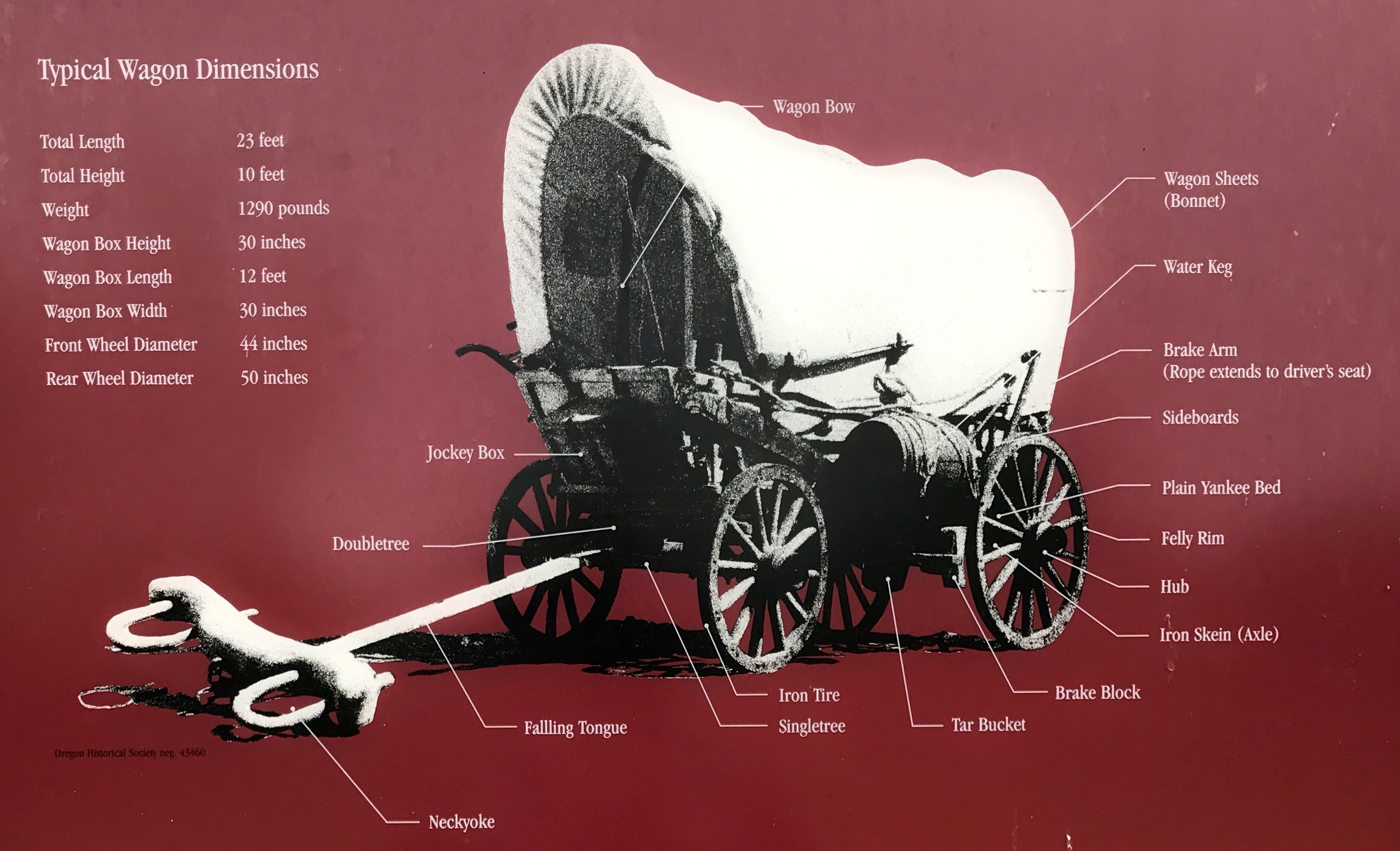
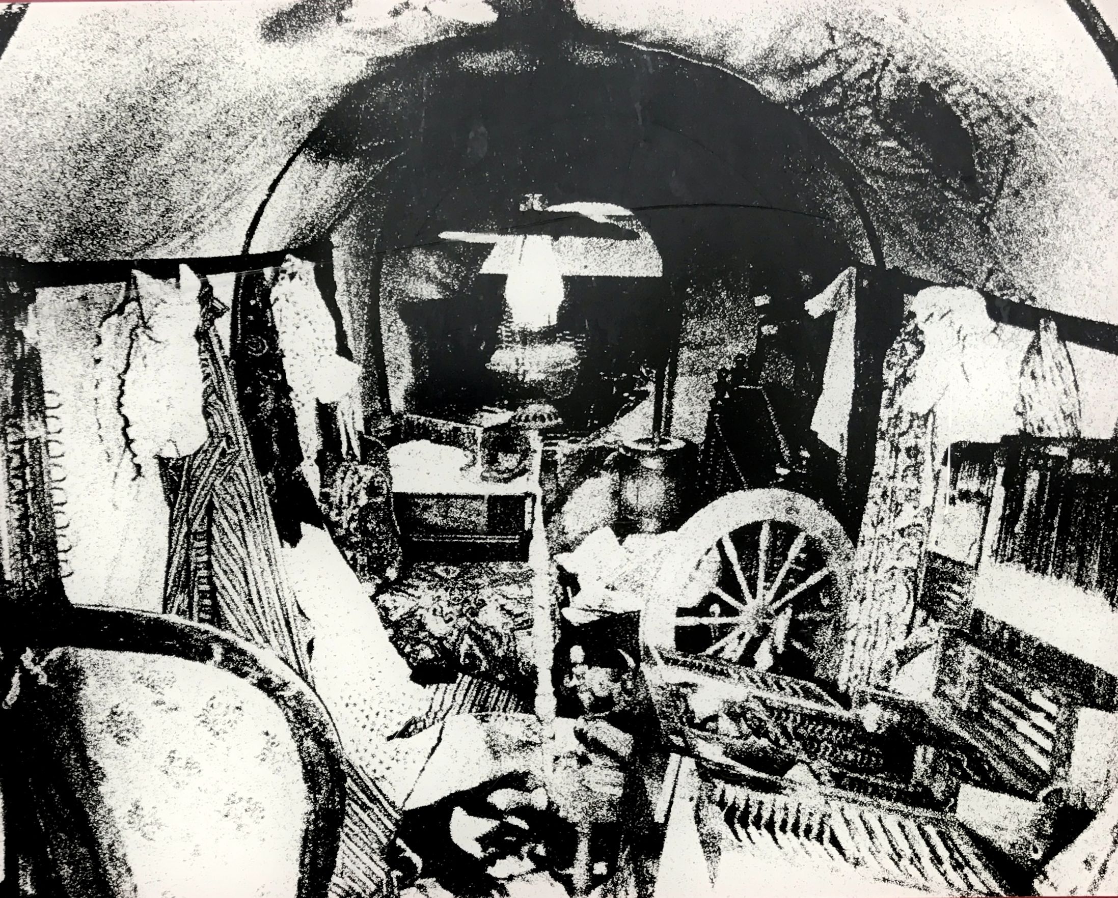
I am always drawn to maps. Can you imagine the effort it took to get from St. Louis to Oregon?
I like diagrams, too. Hmm, with the weight of the wagon at 1290 pounds, I could easily tow it with Bart. Heck! I could have towed two or three of them!
I imagine that they were quite heavy when loaded down with all the settlers’ possessions, though. They were big enough to be an RV, but not all that comfortable. At least, not as comfortable as an Airstream!
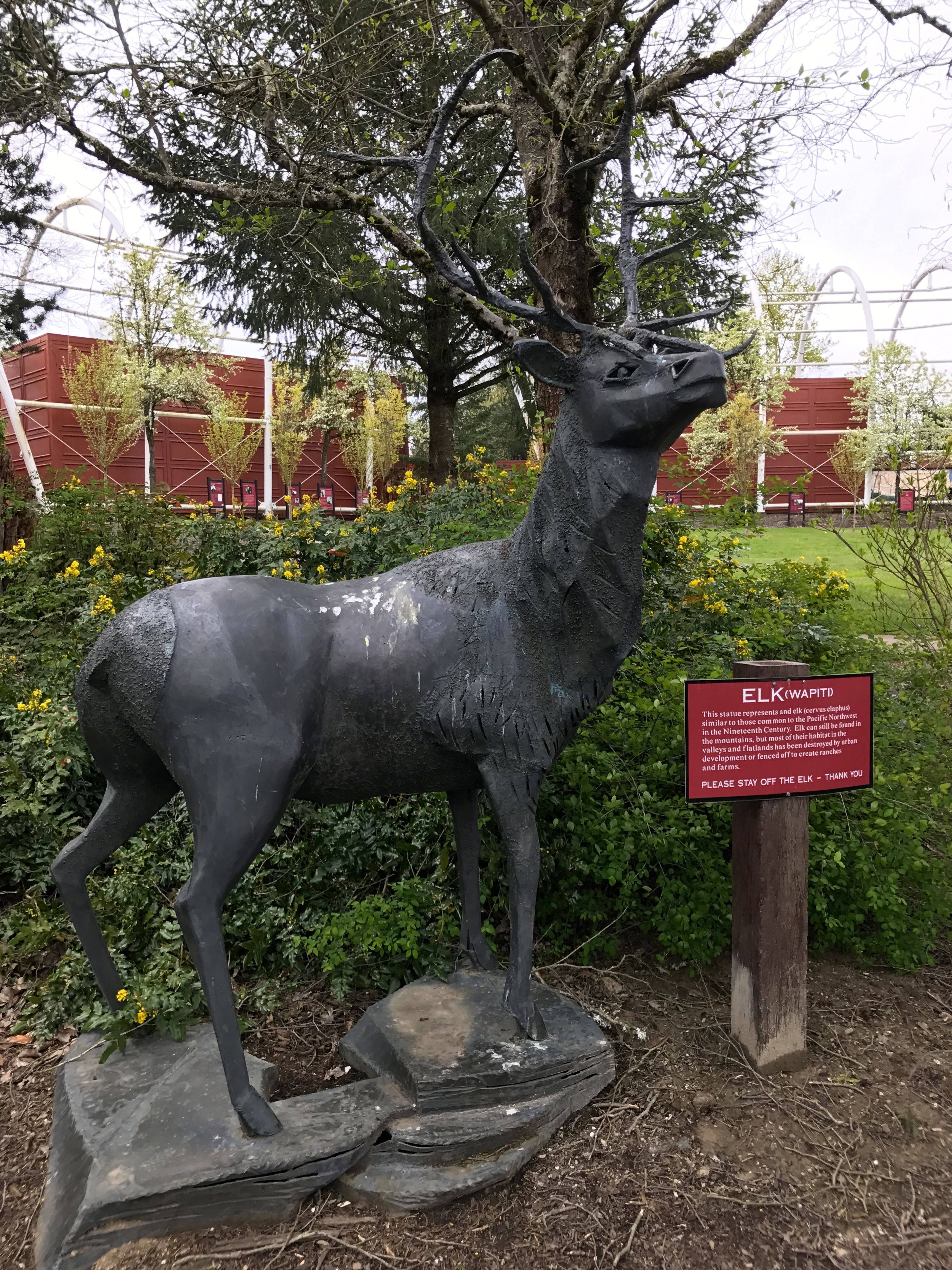
I stopped by to pay my respects to the elk, as many a bird had done before me.
And with that it was time to head back to Flo, have a little dinner and make plans for another day.
Fort Clatsop was the destination I picked out for my second day of adventures in the Portland area.
Fort Clatsop? Why? What is that?
Well, Fort Clatsop is where Lewis and Clark spent the winter of 1805 – 1806. After seeing all the signs for the route they traveled while tooling along down beautifully paved roads in BART, the Big Assed Red Truck, I couldn’t believe I was finally going to see where they ended up.
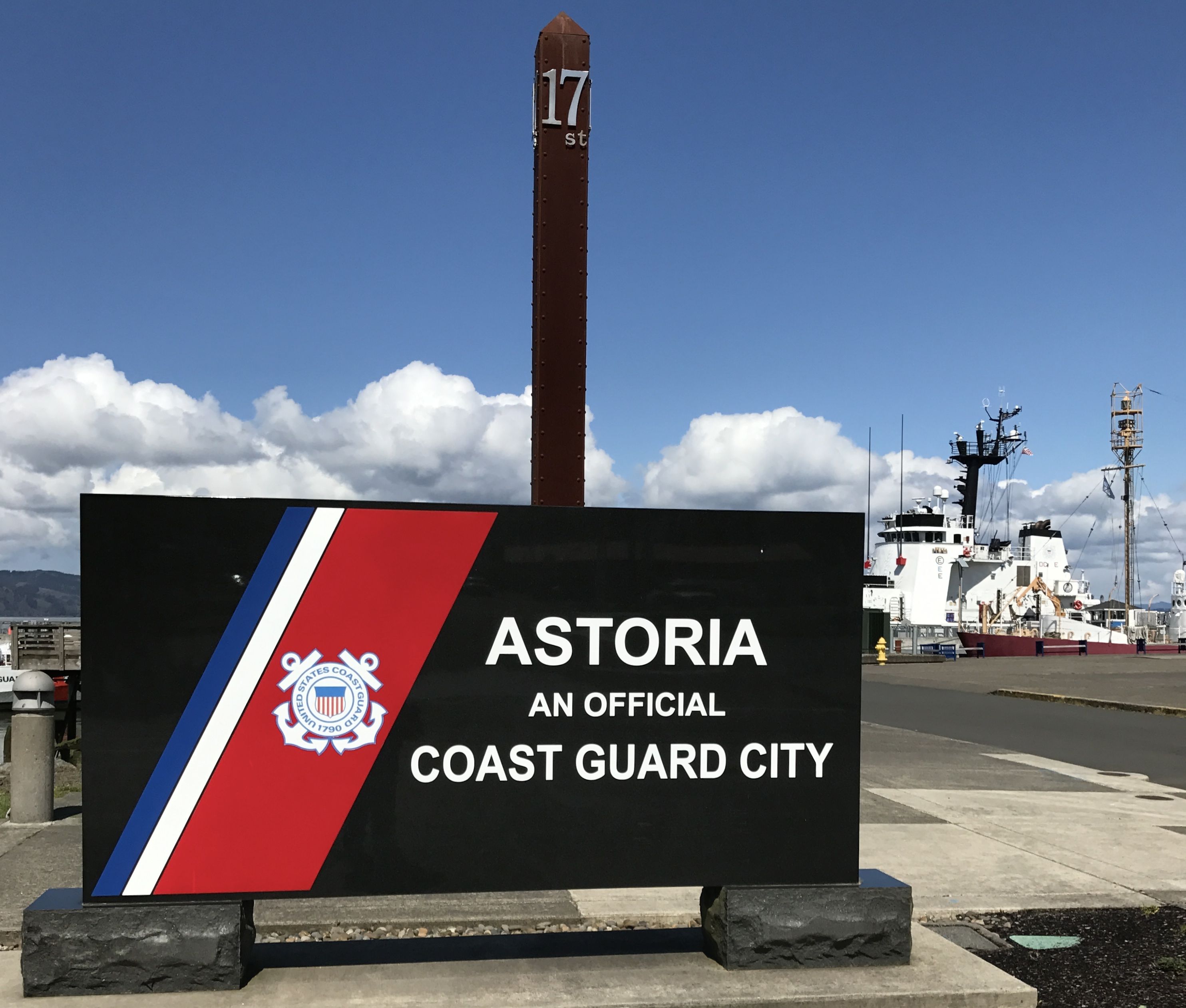
I set out on a beautiful sunny day, and I headed down the Columbia River toward the Pacific. My first stop was Astoria.
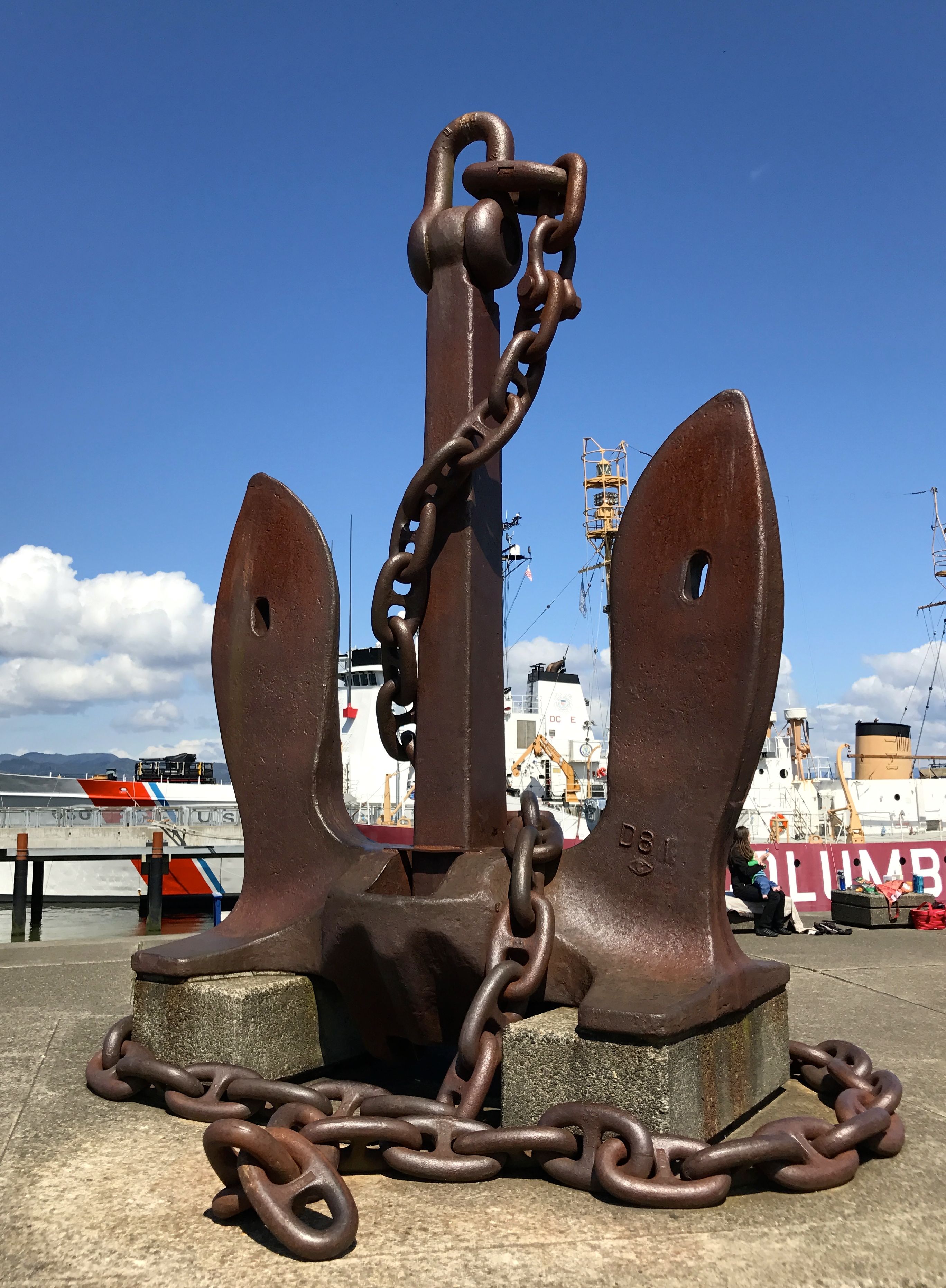
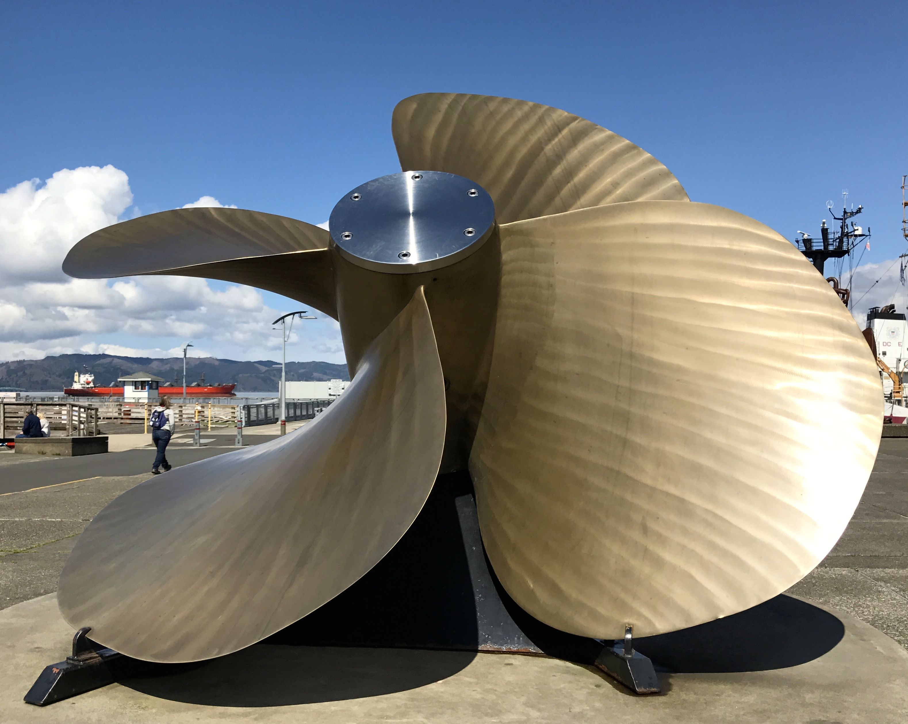
The Columbia River Maritime Museum was there, but there was an entry fee. I figured that I had probably seen every possible ship-related artifact in all the other museums I’ve visited, so I satisfied myself with a look around the outside
That is one big anchor! And while we’re on the topic of “big”, there was also this really large propeller.
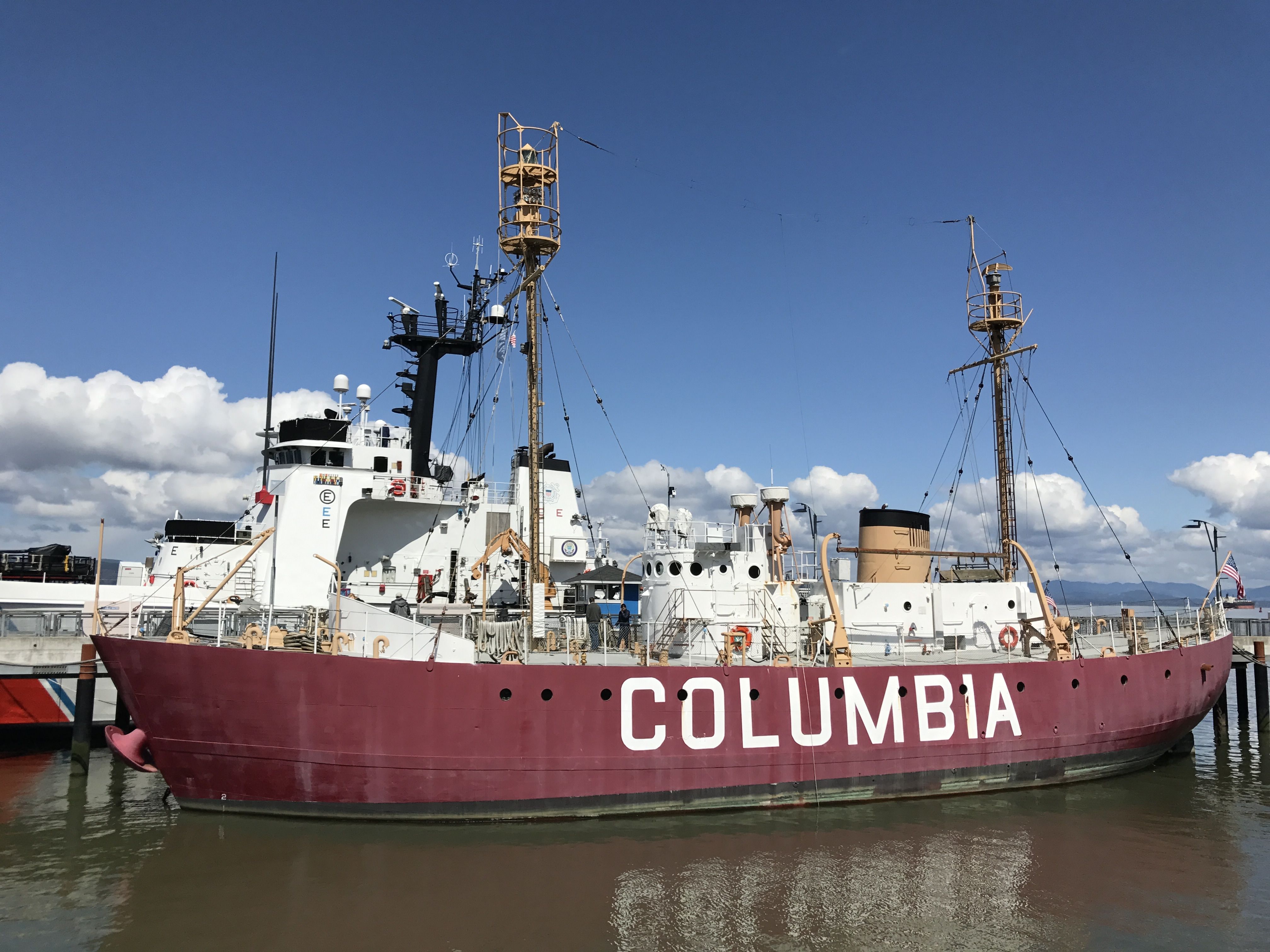
The lightship Columbia was in at the dock.
This particular lightship was commissioned in 1951. It was the fourth and final lightship stationed at the mouth of the Columbia River. Interestingly enough, it was built in Boothbay, Maine, a town I passed through during my visit to Maine.
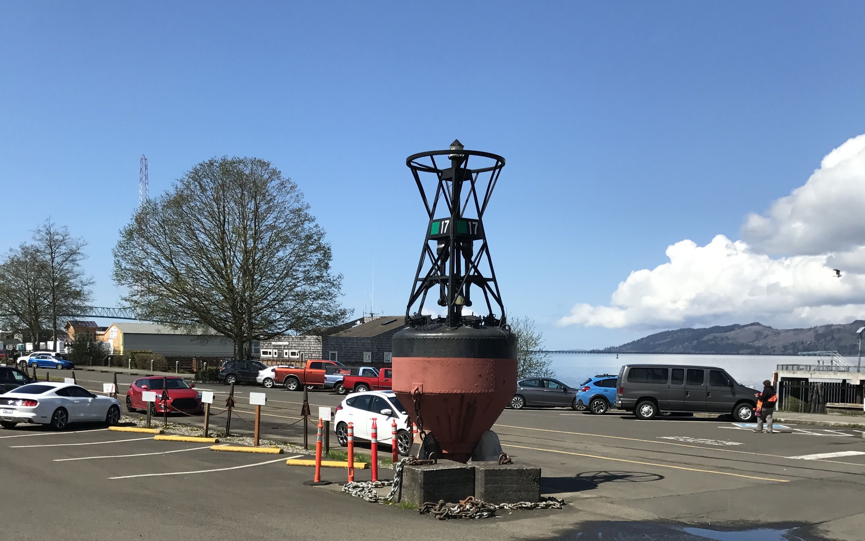
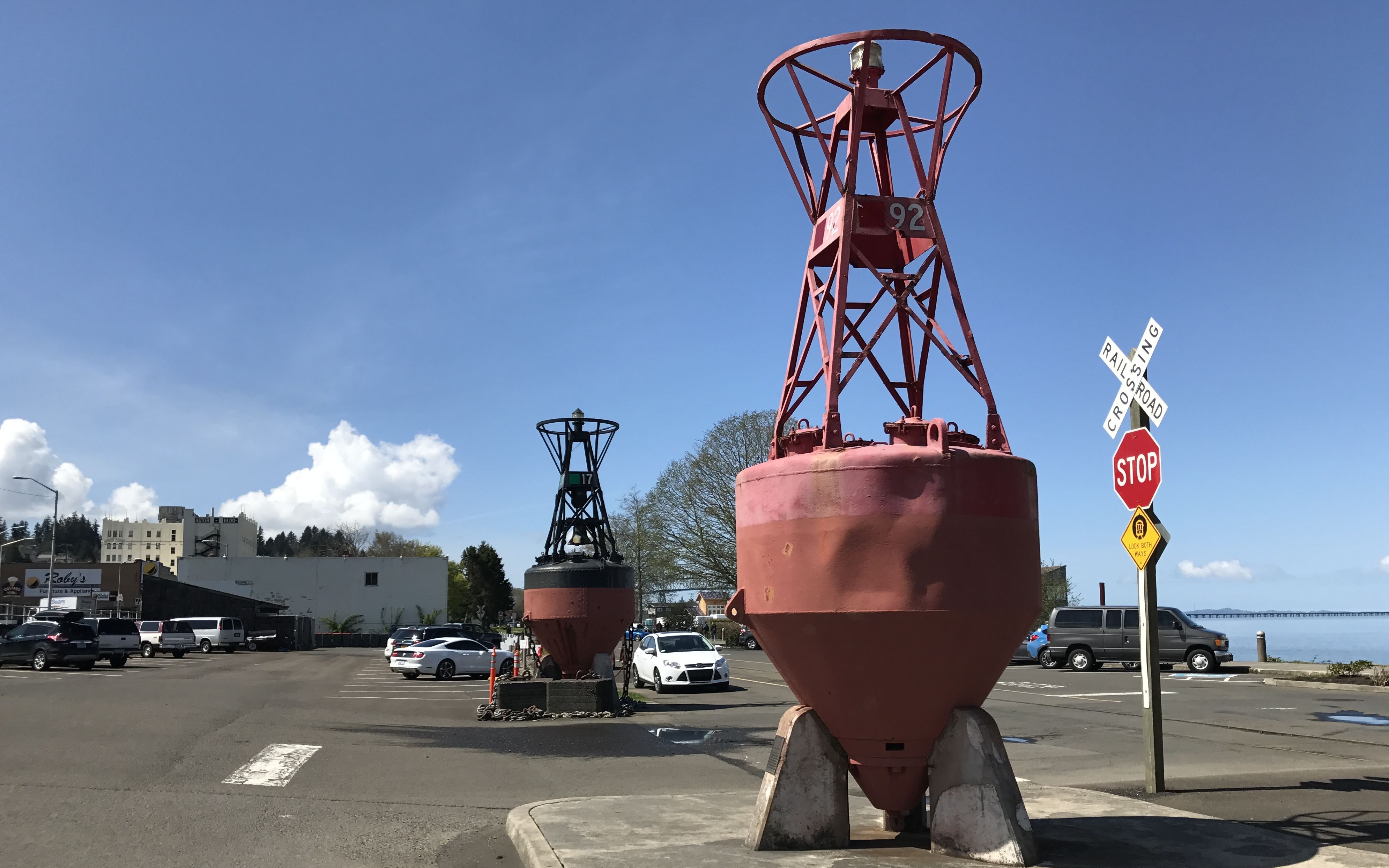
There had been lightships guiding vessels across the Columbia River Bar from 1892 until this final lightship was decommissioned in 1979. This area had the ominous name of the Graveyard of the Pacific. The lightships were eventually replaced by an automated navigational buoy, which has also since been retired.
Buoy.
Buoy – oh – buoy.
There was also an active duty Coast Guard vessel moored at the museum. In the background, you can see the Astoria-Megler bridge.
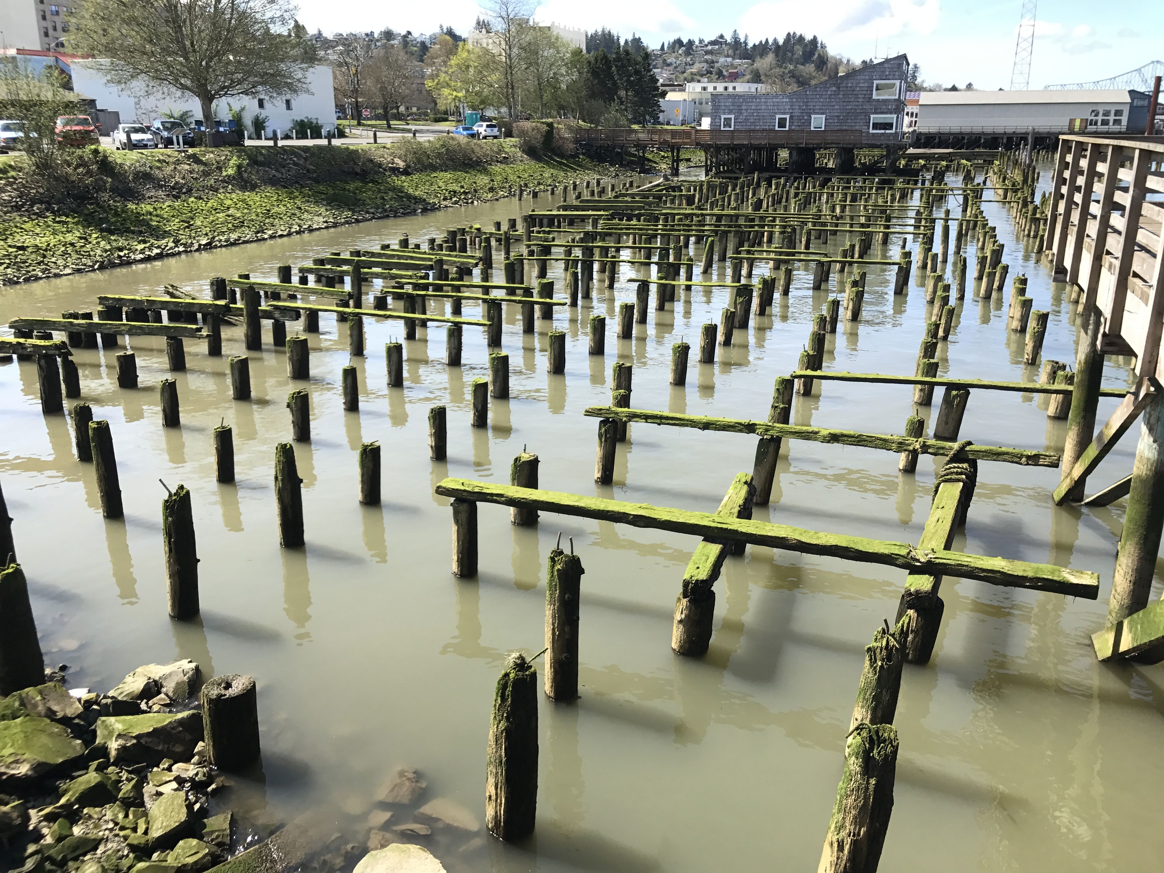
I was fascinated by the remnants of old pilings. It seems to me that it was easier or more cost effective to drive pilings and build on top of them than to build on the land that was available. According to my ultimate information resource (Wikipedia) the downtown was devastated by fires in 1883 and in 1922 due to the buildings being constructed on top of pilings. That might explain why these pilings are just sitting there moldering away.
The 1922 fire destroyed up to 30 blocks. Approximately 2,500 residents lost their homes and damages exceeded millions of dollars. Incidentally, this happened when the Astoria population was at its peak. A little more than 14,000 people lived there at the time. Population has declined since then. Now, around 9,000 folks live there.
Astoria was named after John Jacob Astor. An immigrant from German, he came to the United States after the Revolutionary War and was the first multi-millionaire businessman in the country. He was an investor from New York City, who, among other enterprises, founded the American Fur Company. This company established Fort Astoria here in 1811. Oddly enough, the Oregon Legislative Assembly didn’t get around to incorporating the city until 1876, which was thirteen years after Oregon attained statehood.
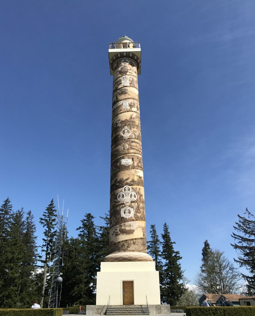
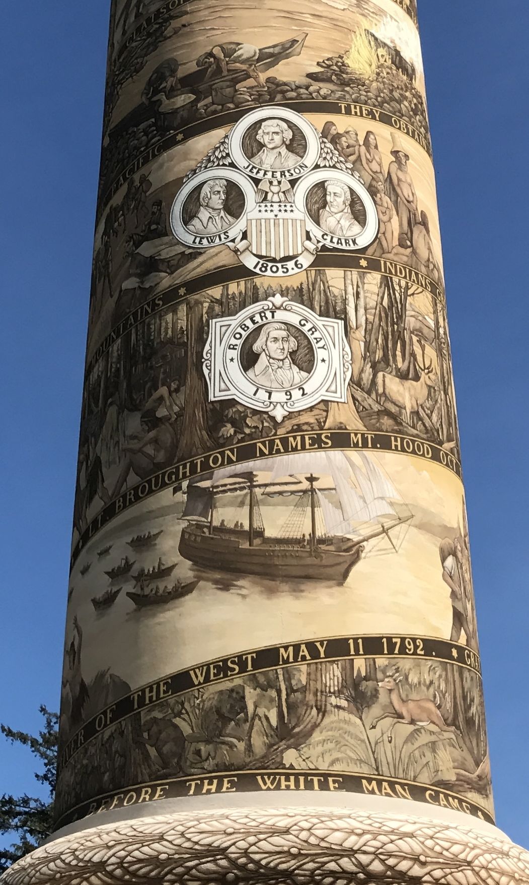
In addition to the maritime museum, the other point of interest in Astoria is the Astoria Column. It was built in 1926 with financial backing of the Great Northern Railway and Vincent Astor, the great-grandson of John Jacob Astor.
Astoria Column is a 125 foot tall tower built atop Coxcomb Hill above the town. Coxcomb Hill is already about 600 feet above the town, so if you climb the tower, you are really up there! Astoria itself is only about 22 feet above sea level.
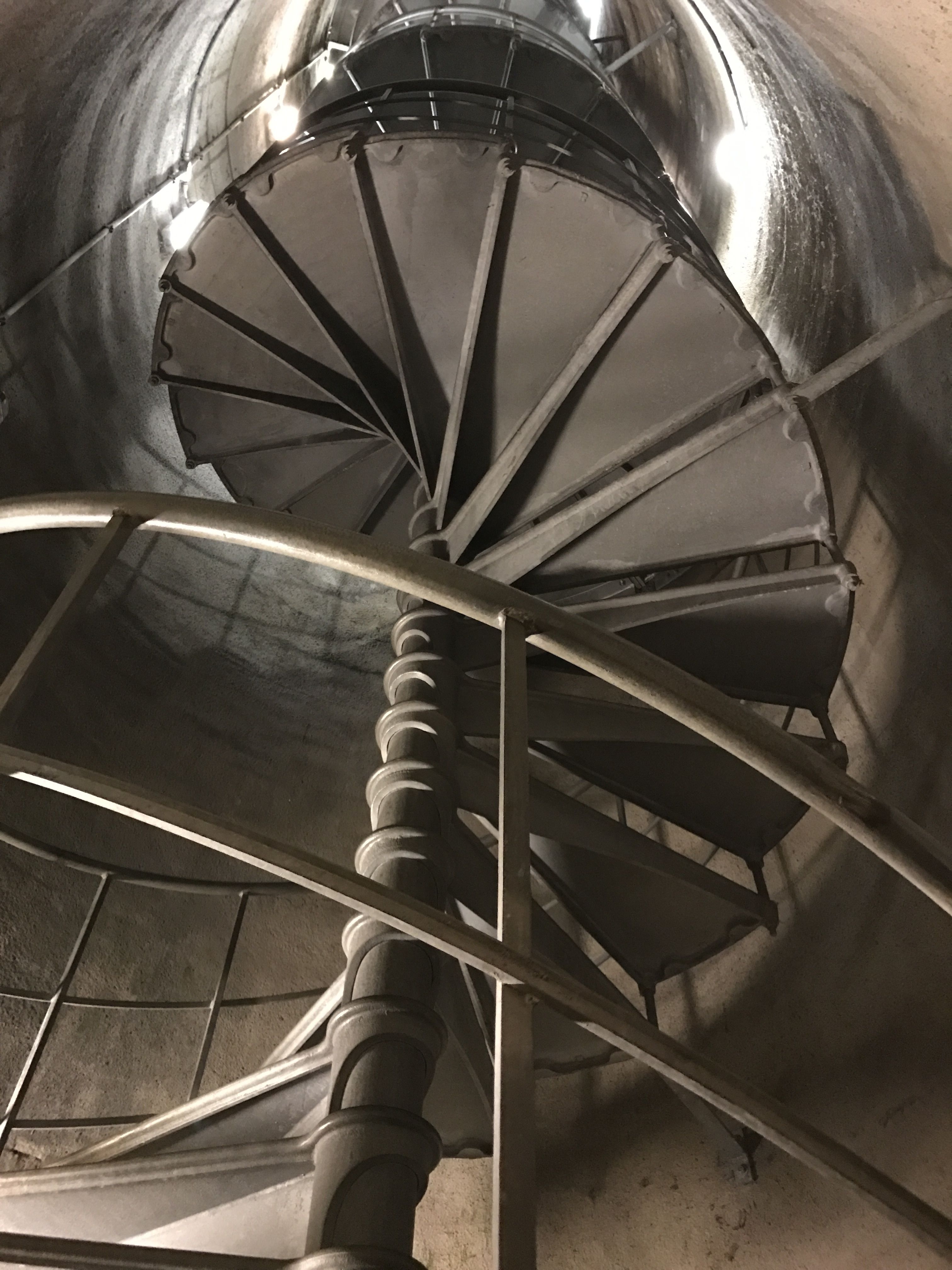
I went up to the door and looked inside. I did not climb those narrow curving stairs! I had to satisfy myself with the view from the ground.
The column is decorated with patriotic images and propaganda. Embellishment is much in the tradition of John Jacob Astor, who hired Washington Irving to mythologize the three-year-reign of his Pacific Fur Company, a subsidiary of the American Fur Company. Yes, Washington Irving, the famed 19th century author responsible for The Legend of Sleepy Hollow and Rip Van Winkle, among other works. While he was the guest of Astor, he wrote “Astoria: Or, Enterprise Beyond the Rockies,” The book became a best seller in 1836. At the time, it was required reading in some schools.
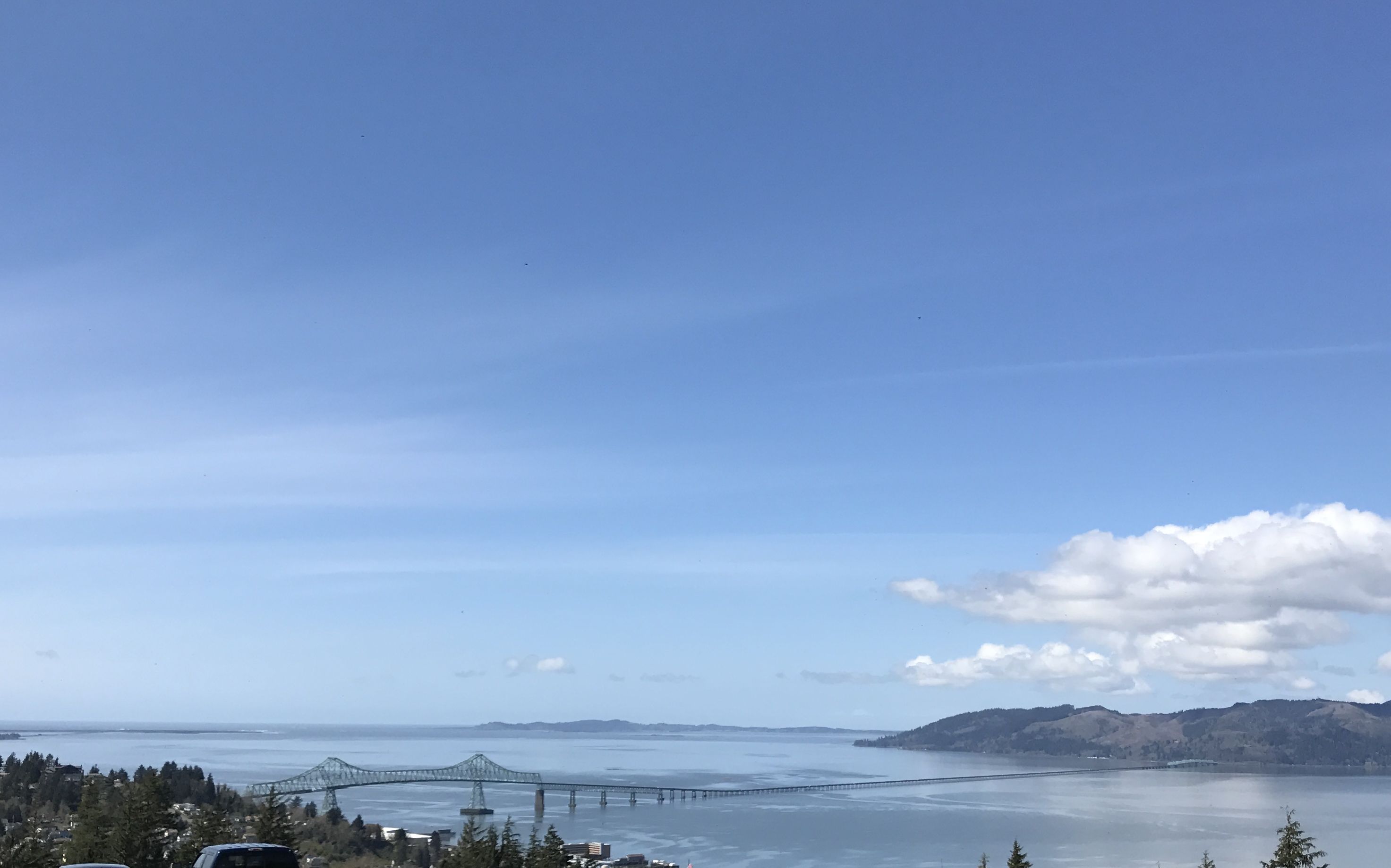
The column is quite amazing, but the real reason for visiting the top of Coxcomb Hill is the view.
Here’s another view of Astoria-Megler Bridge, crossing the Columbia River.
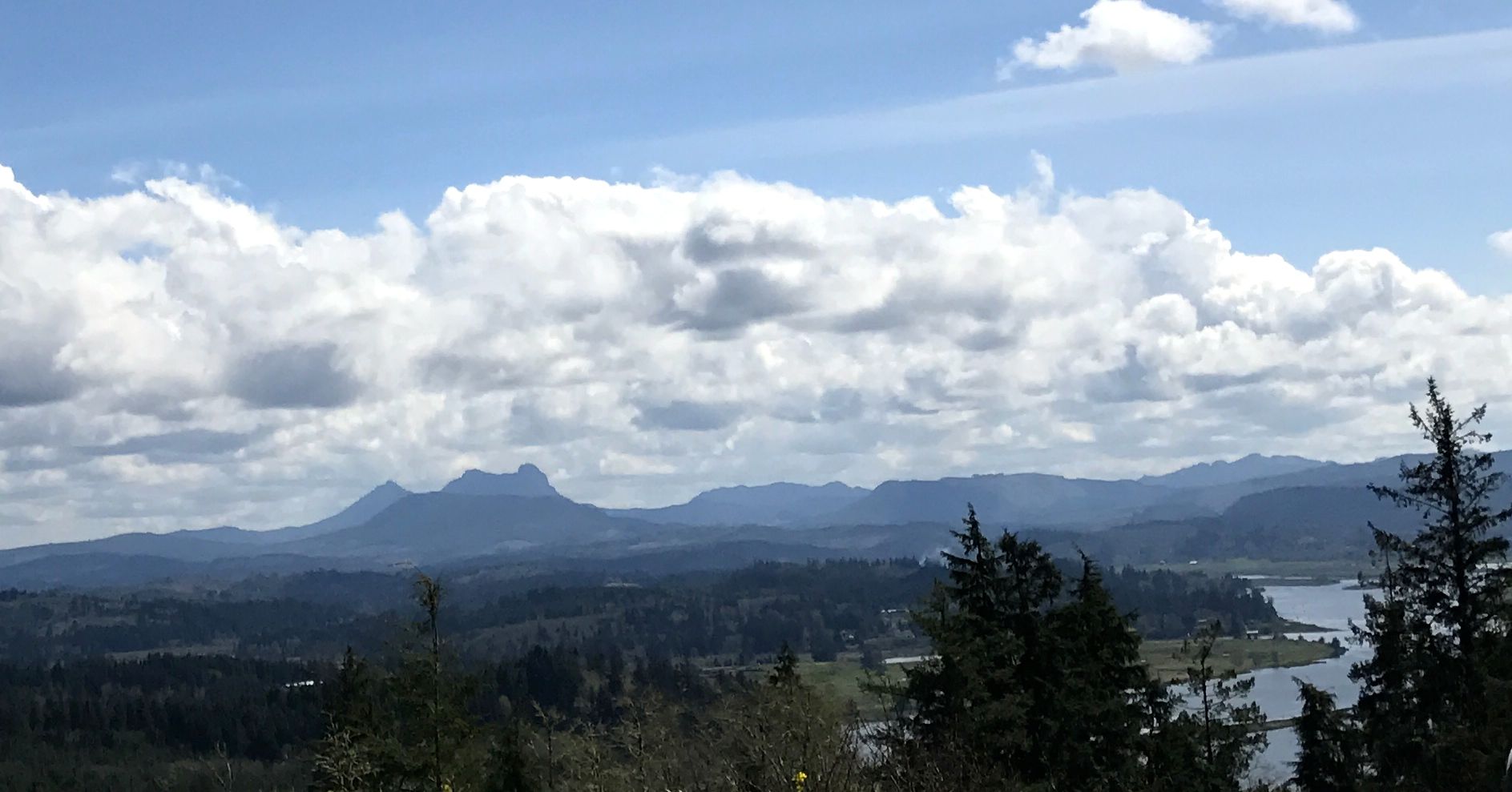
My notes say that this is a view of Saddle Mountain, which is the tallest mountains in Clatsop County. My ultimate source says that it is 3,288 feet tall.
According to the signs at the viewing platforms, this photo is of Fort Clatsop, which is sheltered by the hills. Lewis and Clark and their team spent the winter there, rather than on the other side of the river because the hills provided some shelter from the weather.
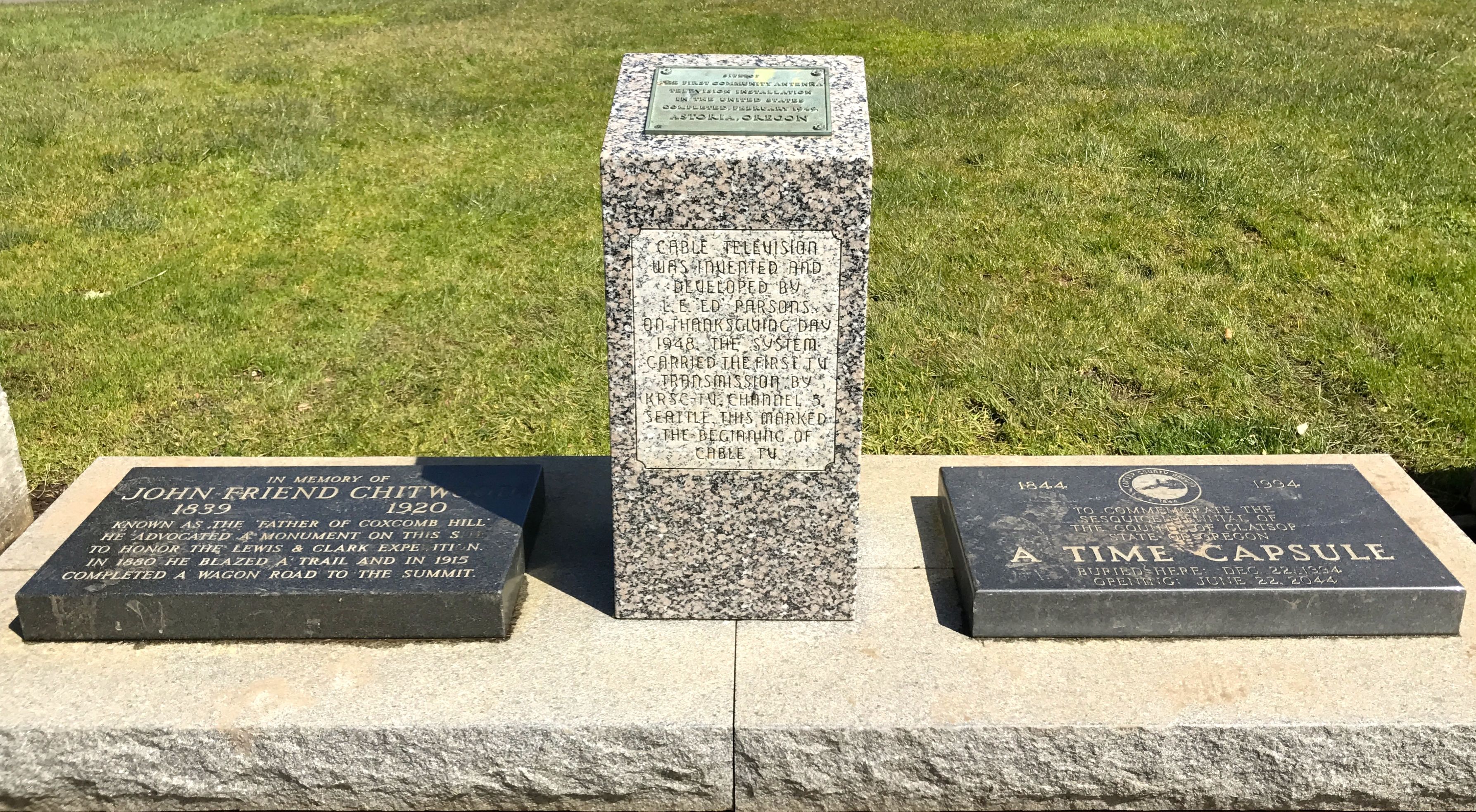
There were some commemorative plaques and time capsules on top of the hill, too.
Time capsules are nice. I guess. Since they are going to be opened at some point in the future, they aren’t much to look at. The plaque in the center caught my interest, though.
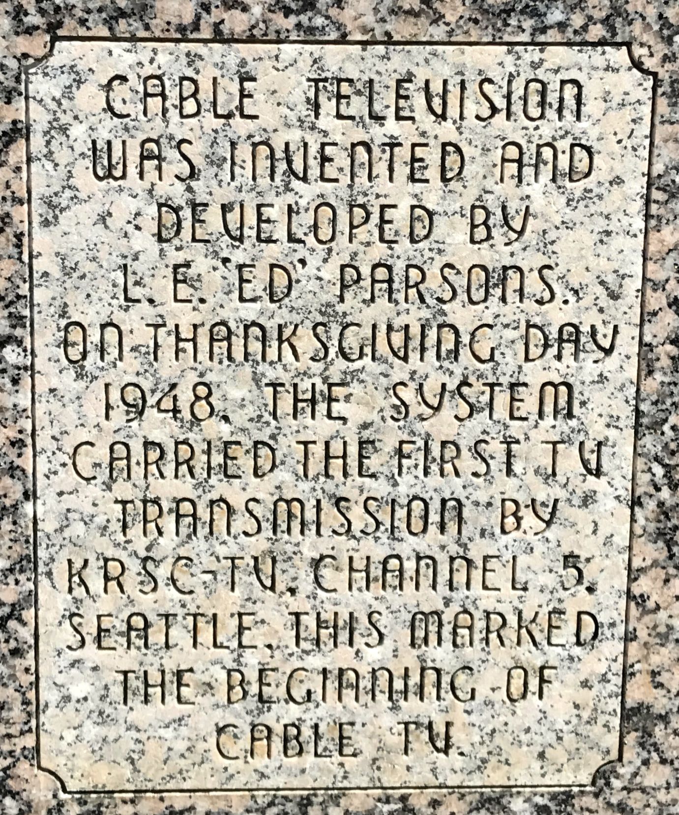
Cable TV was invented in Astoria, Oregon? Amazing! I do tend to go on about things that interest me. I have no idea it anyone else is interested. If you want to know how and why this happened in Astoria, click here. Incidentally, it’s a rather sweet tale of kindness and generosity, at least the way it’s described in this retelling.
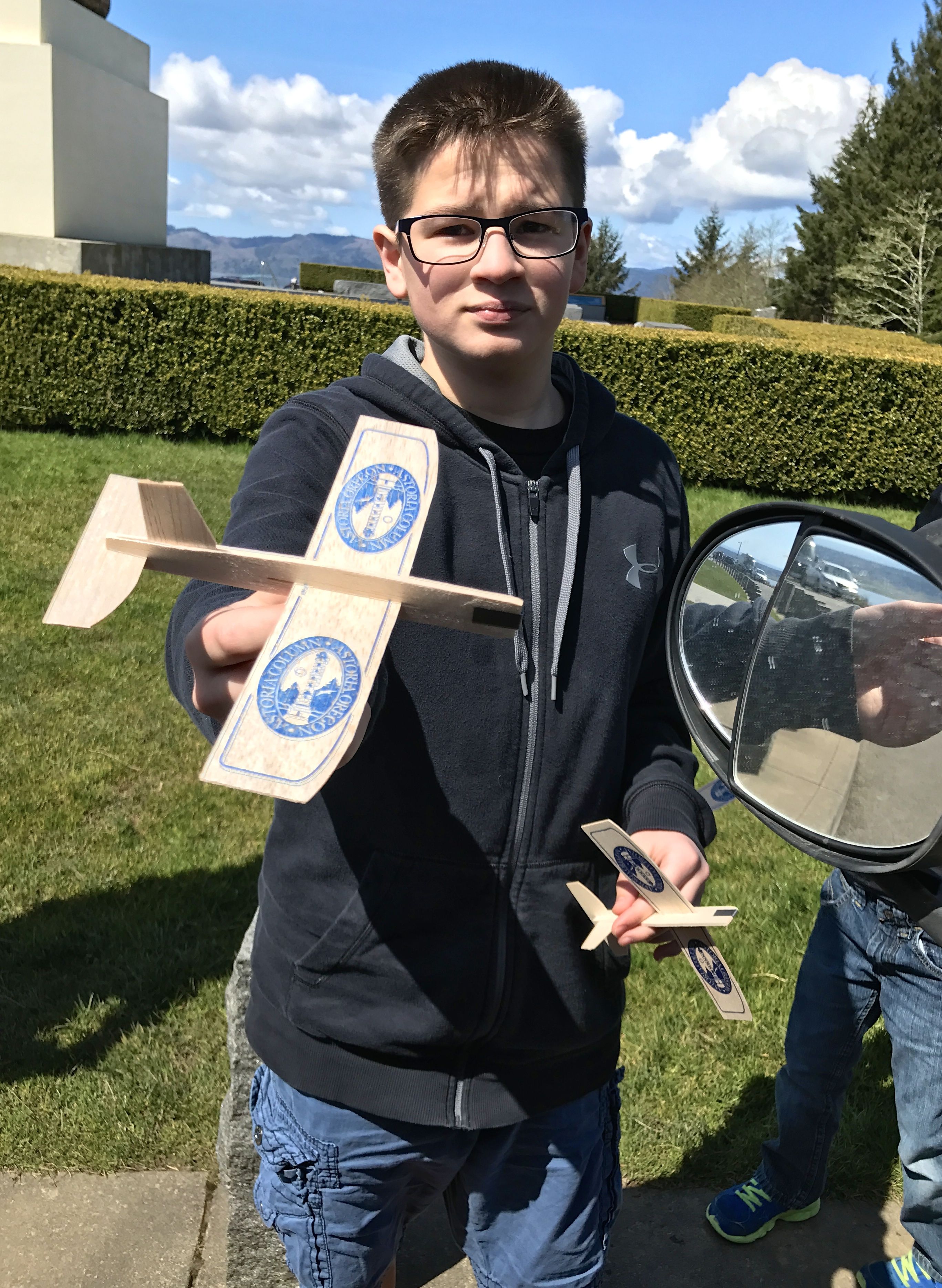
One interesting fundraiser was gliders. You know, those lightweight gliders that used to cost ten cents back in my day. They sell them here and people walk to the top of the column and launch them. At least that is what I was told. Since I didn’t climb up, I can’t verify it. But, on my way out, I met a family ready to make the climb, gliders in hand.
The young man didn’t mind posing for a photo.
I wonder how the people that live down the hill feel about the gliders crash-landing on their property? I didn’t stop to ask, but I did see some gliders stuck in trees and bushes on my way back down.
I set out again.
“Lewis and Clark slept here” should be posted all over. I passed on spot that had a sign that claimed that this was one of their campsites.
I have no idea how they figured that out.
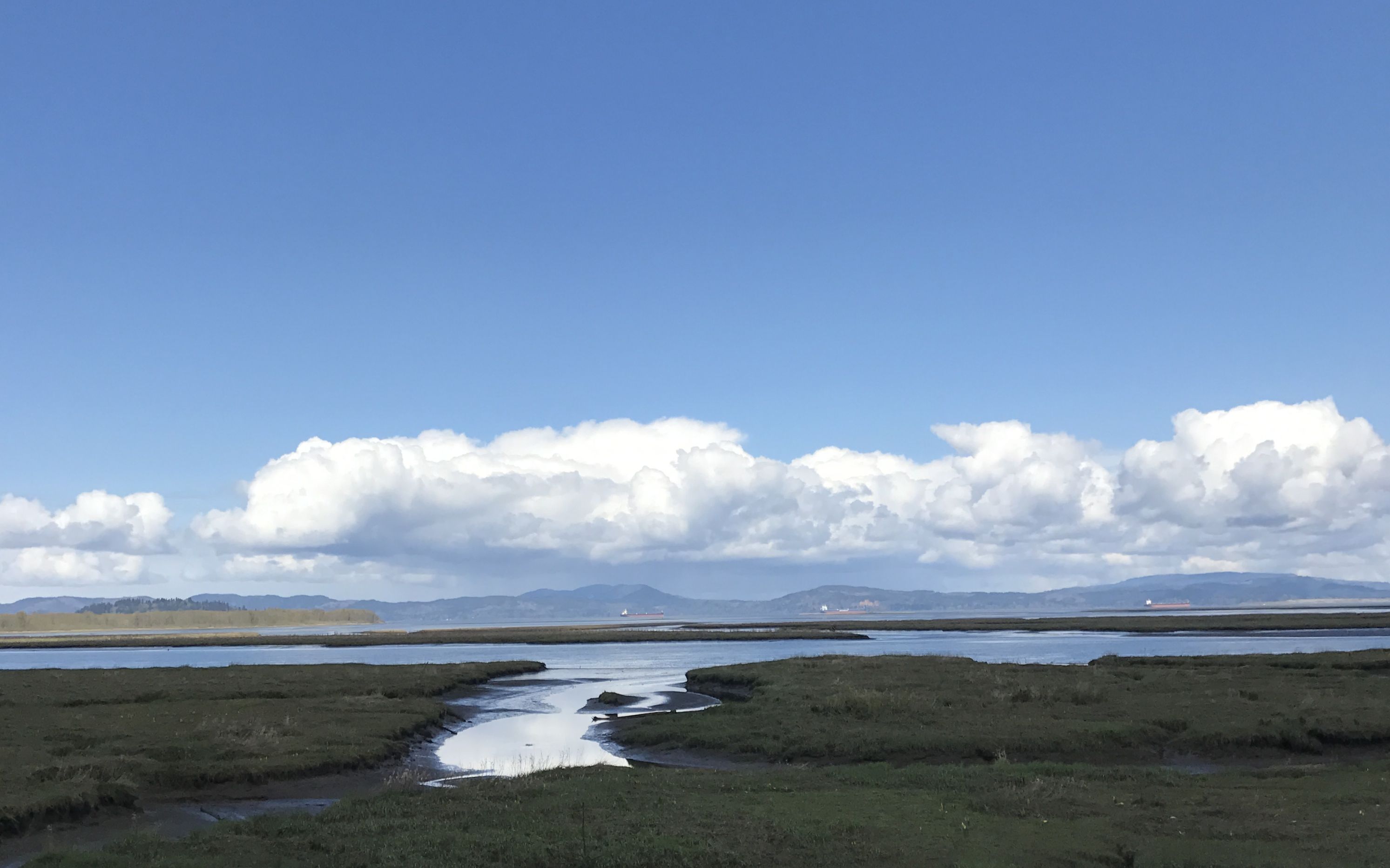
Across the river, in Station Point, is the official end point of Lewis and Clark’s journey west. There is a small park dedicated to the brief time they spent there.
It was rather wind-swept and desolate. In fact, the Clatsop Indians recommend that they more to the other side of the river to a site that was more protected from the weather. I felt this root ball is a suitable photo to leave you with to represent this site.
On to Fort Clatsop!
Of course, there is really nothing left from the original Voyage of Discovery. They spent a winter there before heading back. On your way in to the recreation of the fort, there is a nice museum.
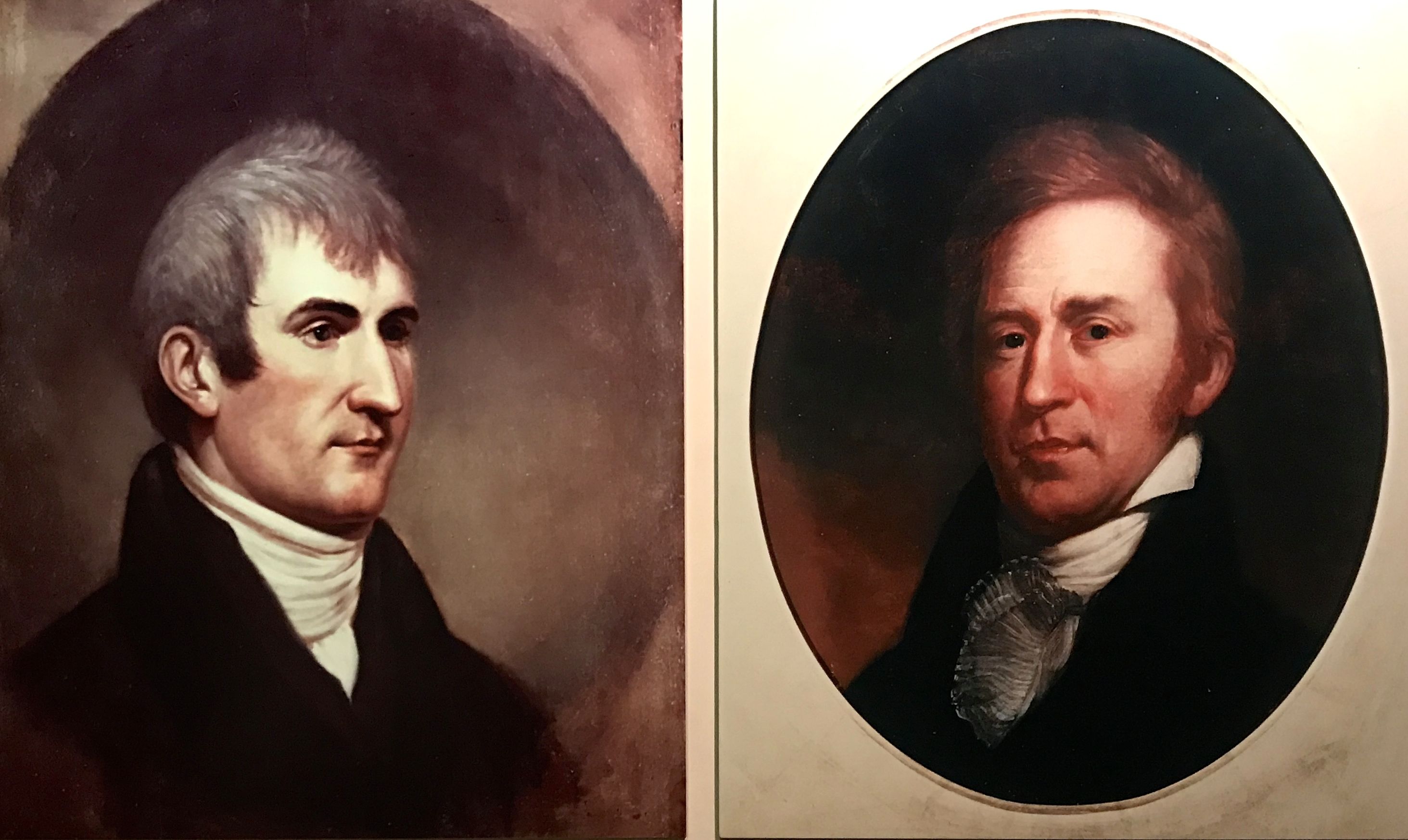
Of course, the focus is strongly on Lewis and Clark. Do you know which is which? A quick Google search leads me to believe that Lewis is on the left and Clark is on the right.
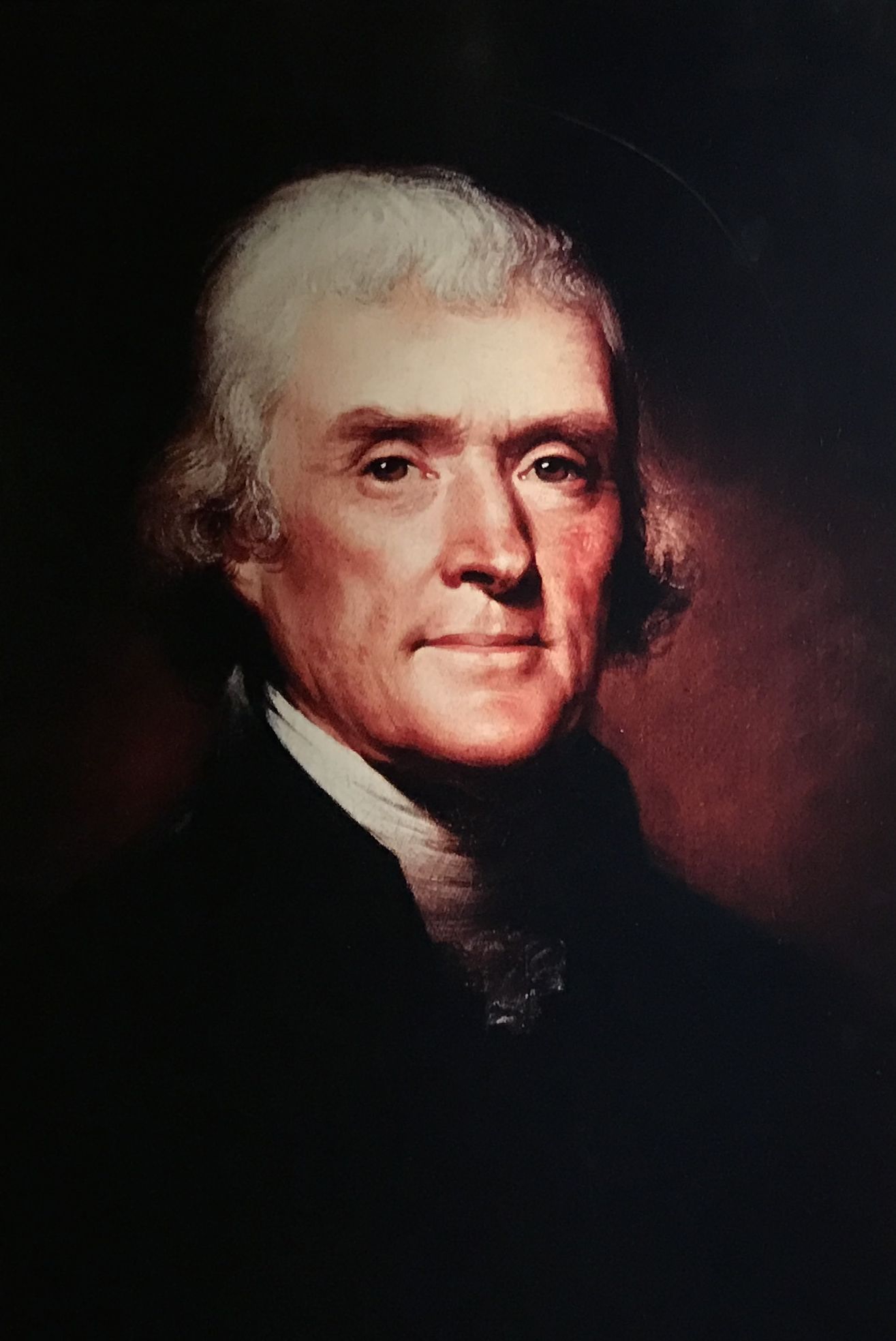
Thomas Jefferson also figures in the story, since he was president at the time.
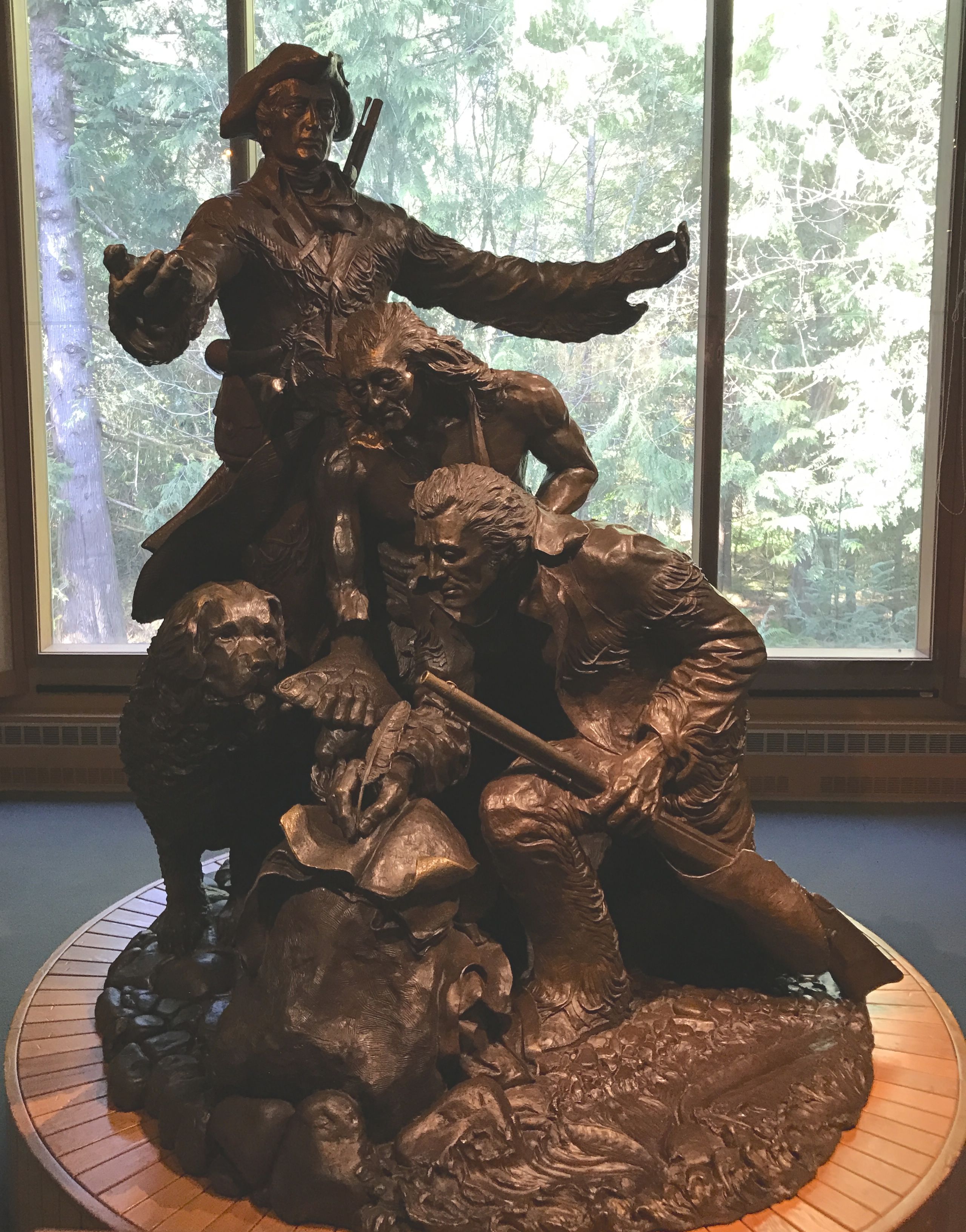
This sculpture is entitled “Arrival” and was made by Stanley Wanlass. It was commissioned but the Fort Clatsop Historical Association in 1980 to celebrate the 175th anniversary of the Lewis and Clark Expedition.
The person standing with outstretched arms is Meriwether Lewis. Just below him is a Clatsop Indian and around his neck is a medal bearing Thomas Jefferson’s image. William Clark is signing something. Lewis’ Newfoundland dog, Seaman, is also included in the grouping.
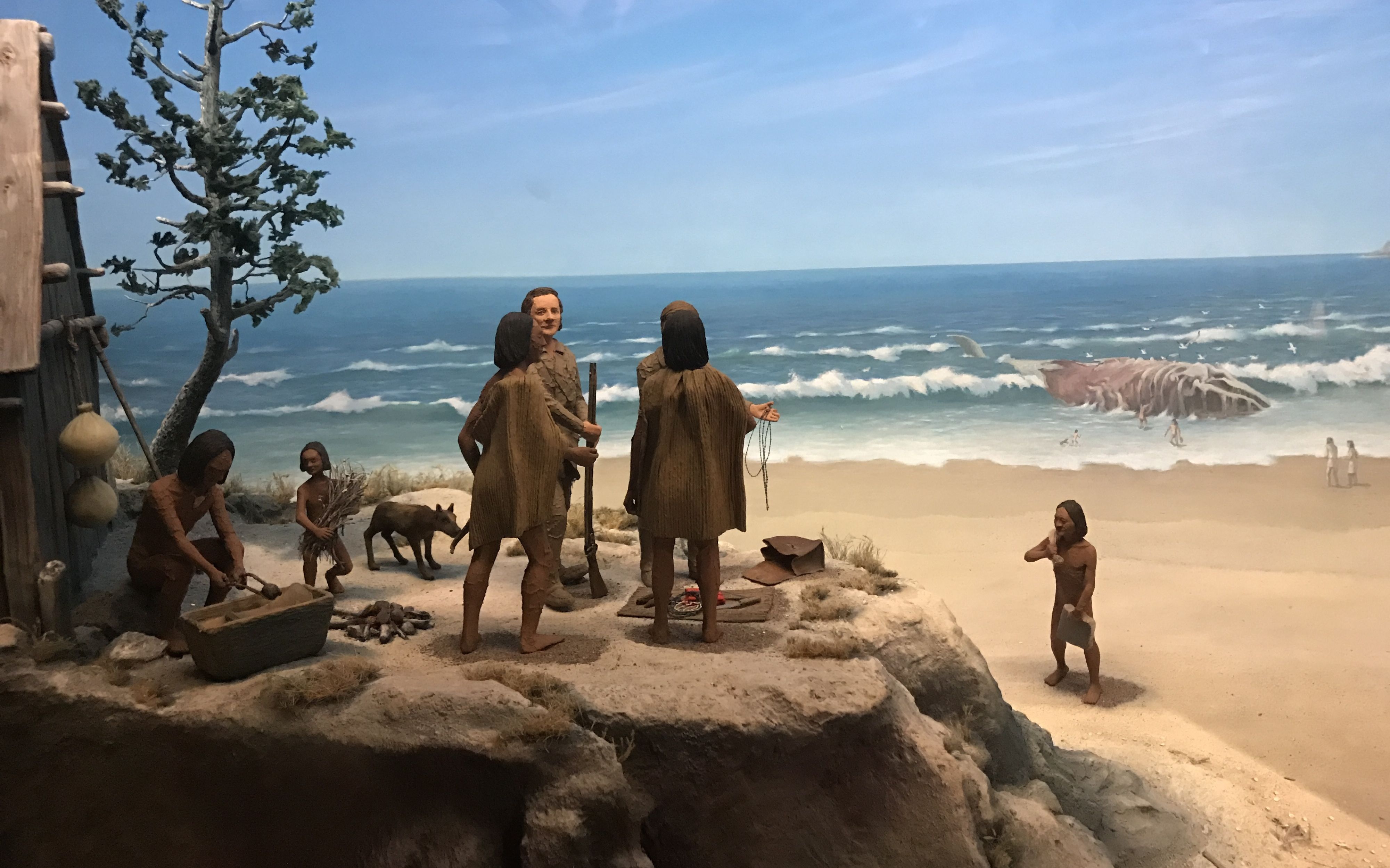
Like many museums, they tend to be dark. I am including this photo of a diorama of a whale hunt because it was well-lit.
There was more light outside. I headed out to see the recreation of Fort Clatsop.
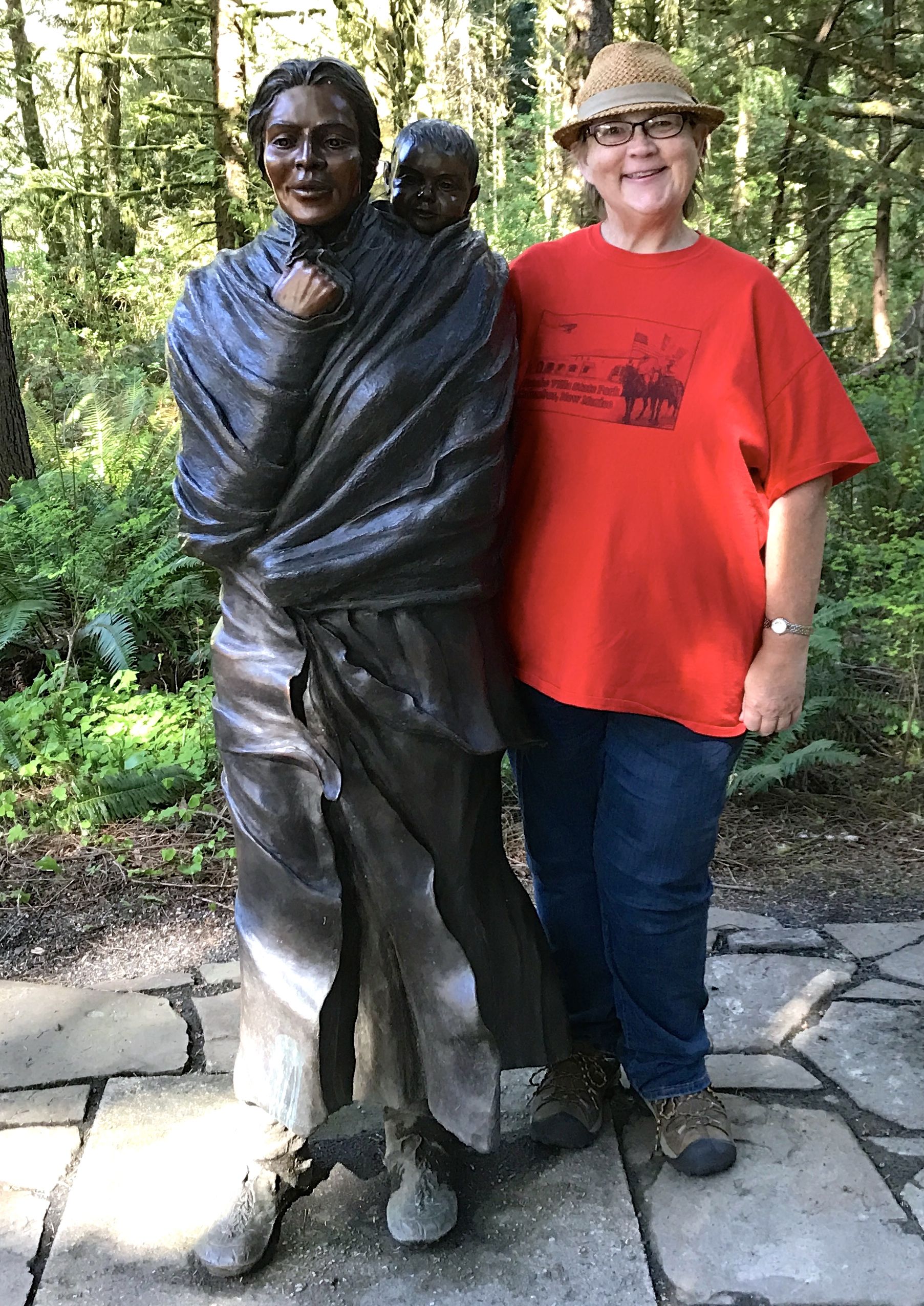
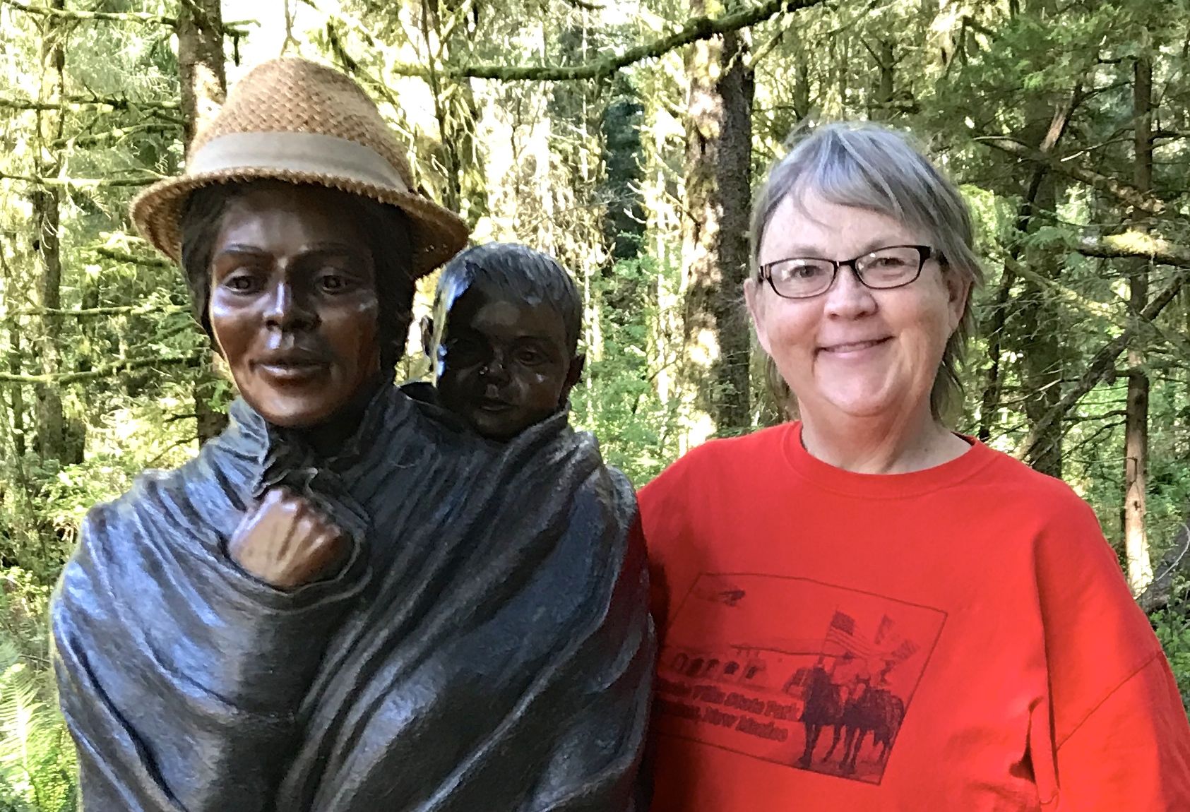
I passed a statute of Sacajawea along the way. Another thing I learned about Sacajawea during my travels is that there were many versions of her name.
Sacajawea
Sacagawea
Sakakawea
It runs in my mind that I saw a few others, as well. I suppose how English speakers chose to record her name is not as important as the fact that they did record her name. She was not lost to history. If you want to read more about her, click here to get started.
I couldn’t resist the opportunity to share my hat with her.
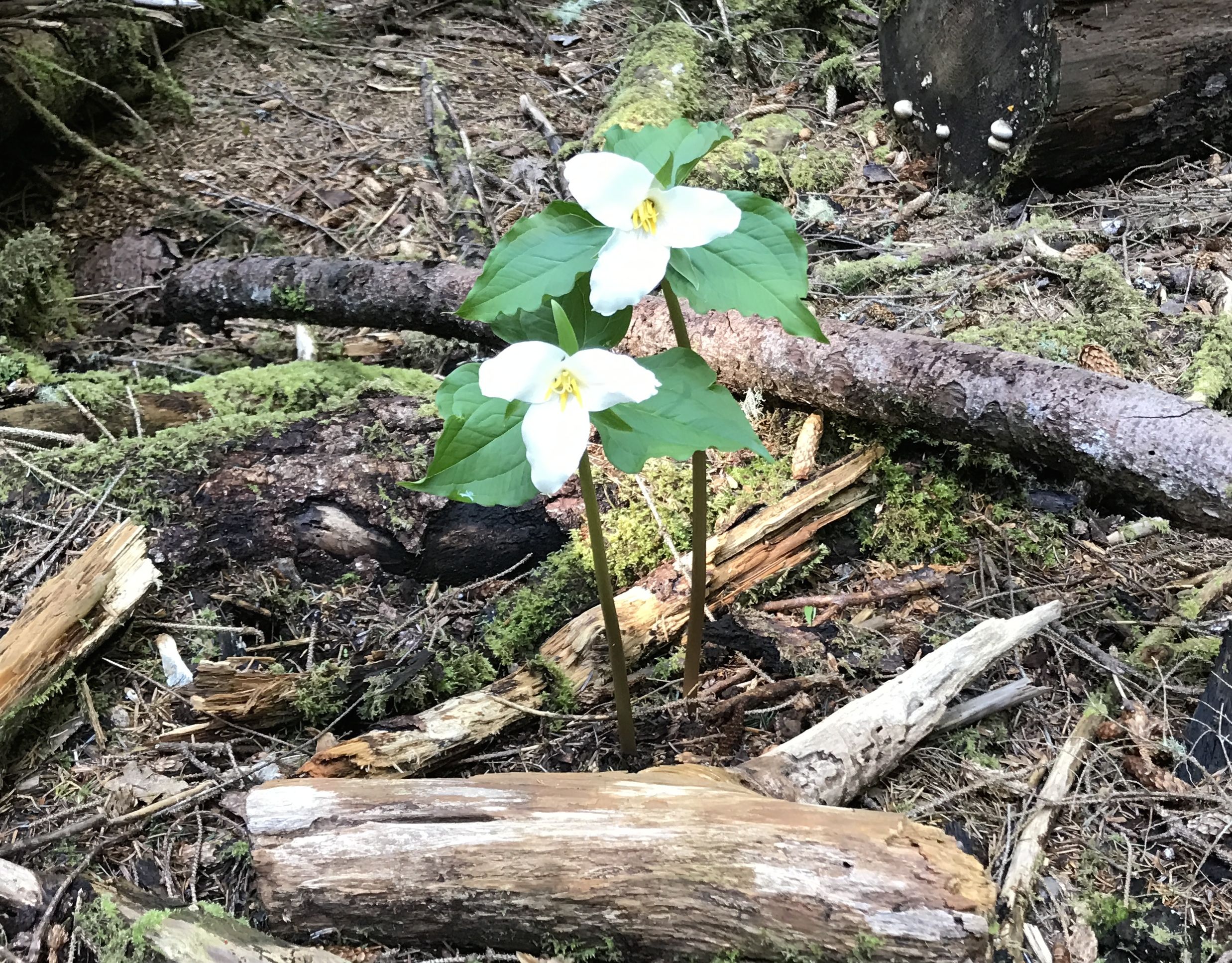
Growing nearby were some trilliums. This is one flower that was a favorite of my family. The forest floor around our cabin was covered with them in the spring.
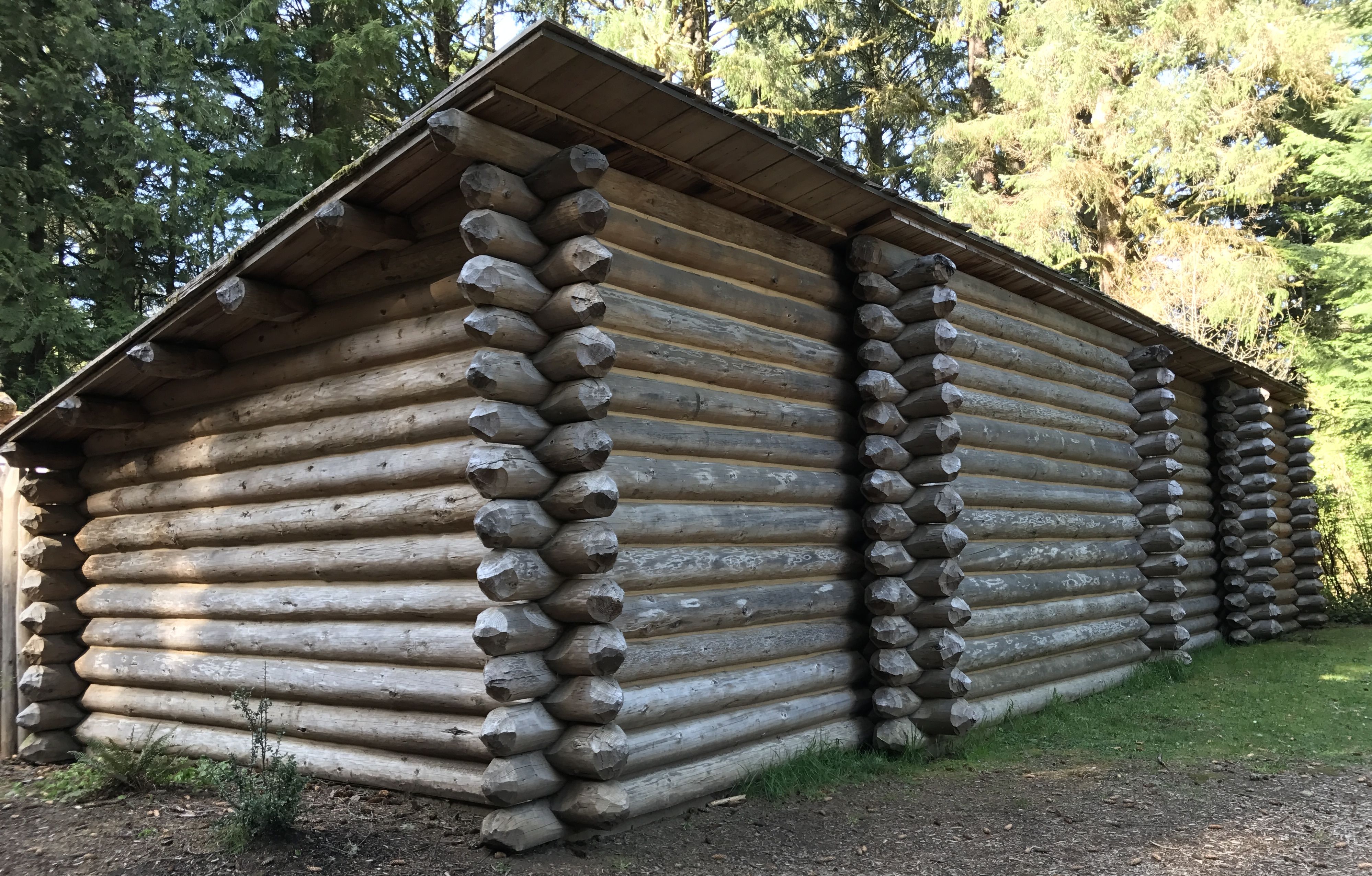
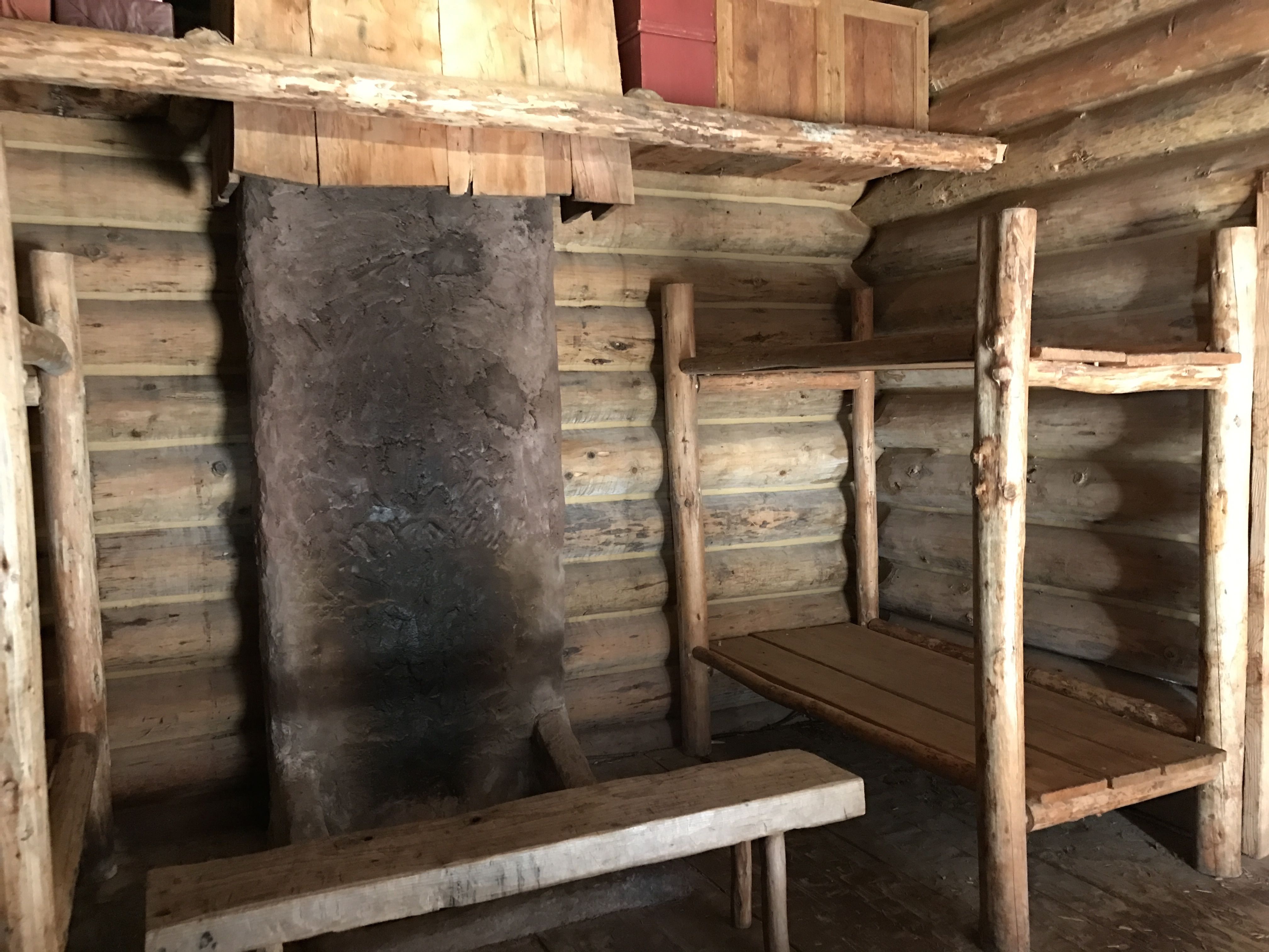
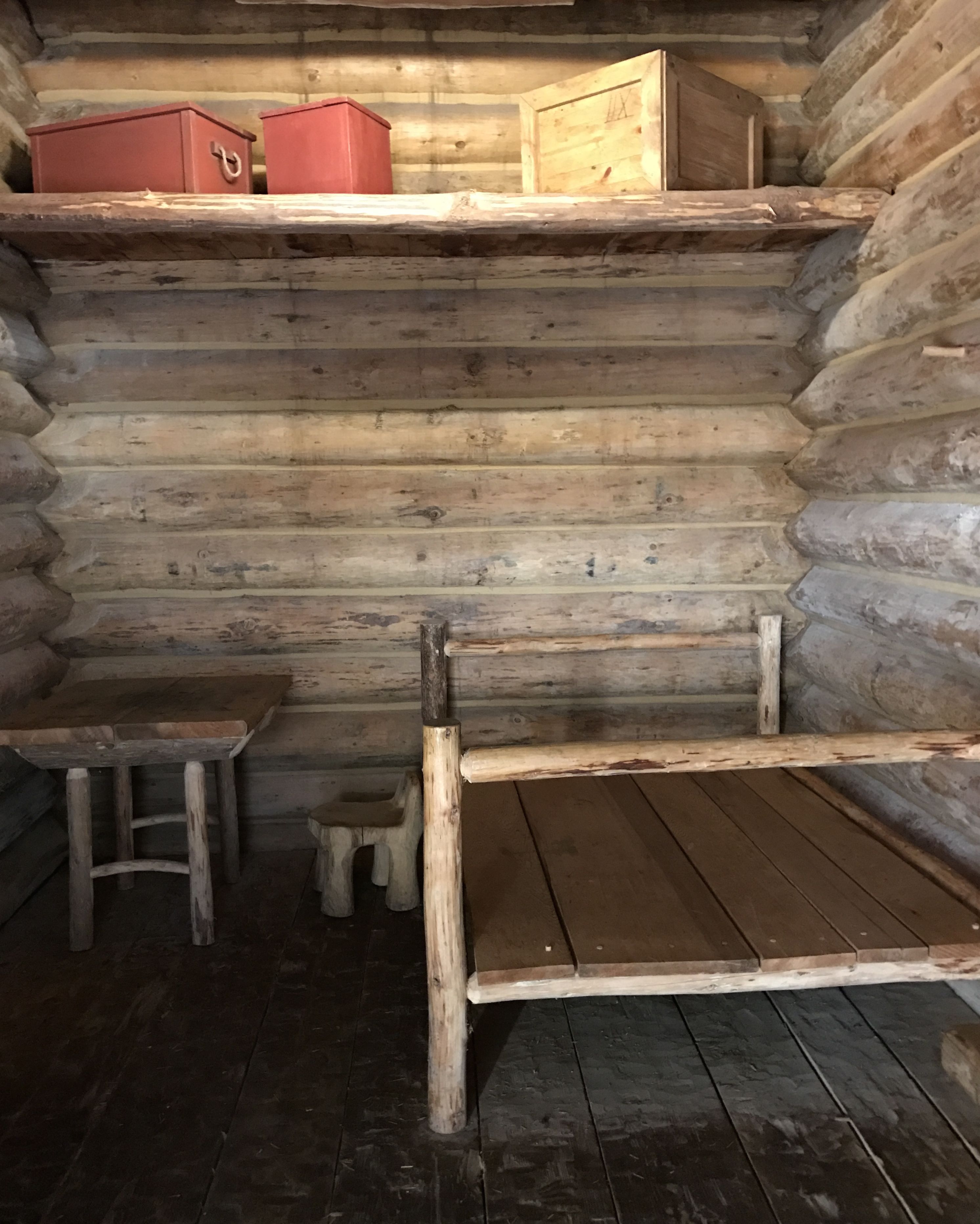
I reached the fort. It was built around a courtyard. The exterior walls were built for protection.
There were seven rooms that met their needs.
Of course, no one really knows exactly what the rooms were like. I know they took good notes, but I doubt they left explicit descriptions of their winter habitation.
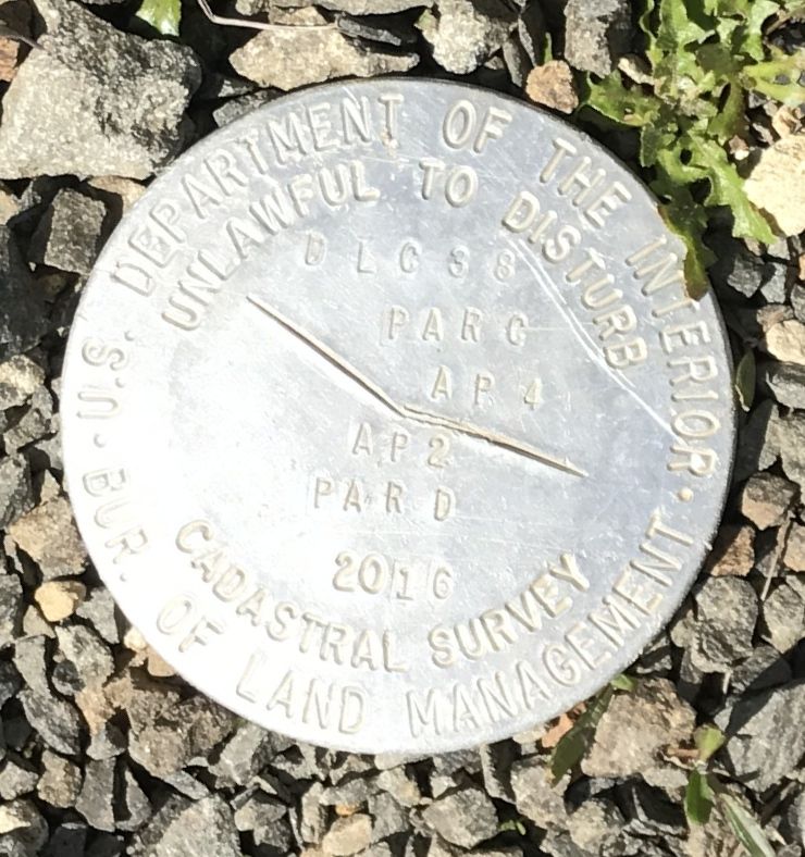
I am always looking down to see what I can see. I came across this marker.
It was the first time I’ve ever seen a “cadastral survey” marker. I had to look it up.
“Cadastral refers to a public record of the extent, value, and ownership of land. It is used as basis of taxation, surveying, and mapping.”
So now we all know.
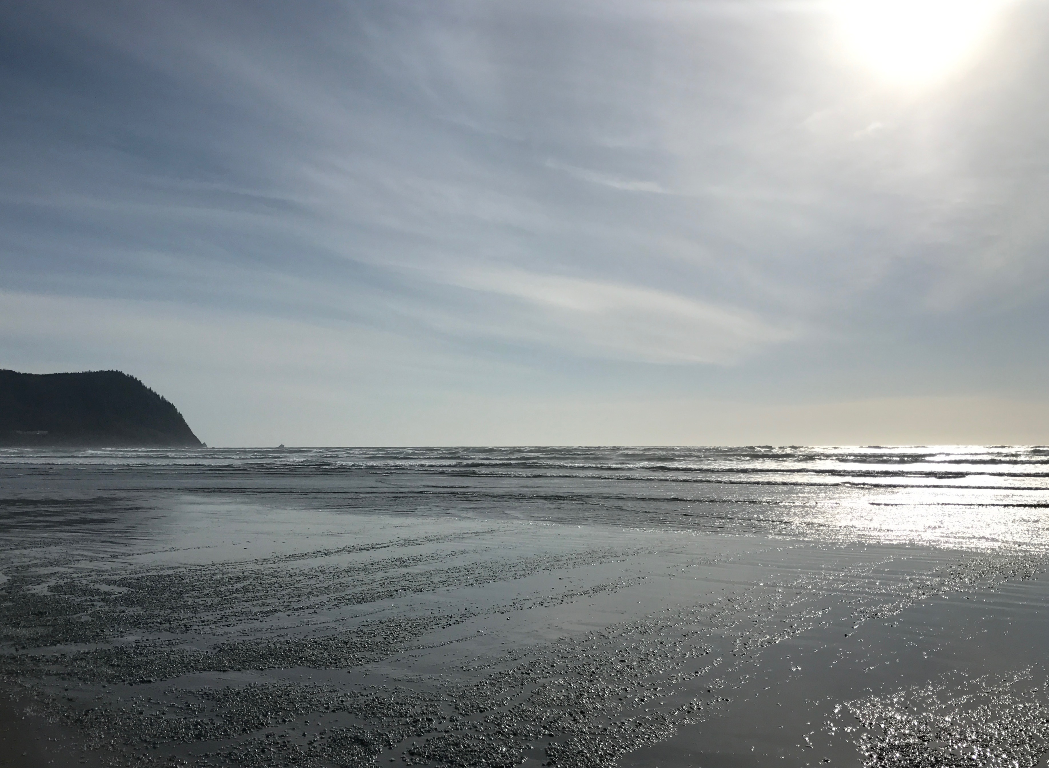
My last stop for the day was the ocean. I’d always heard people raving about the Oregon coast.
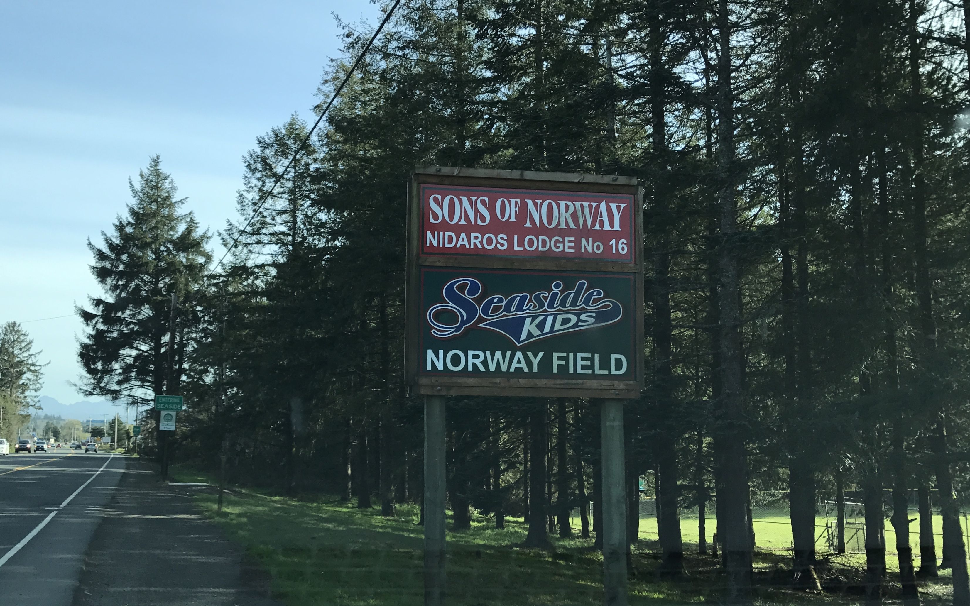
En route, I passed this sign. I had to take a photo to honor my Norwegian ancestors.
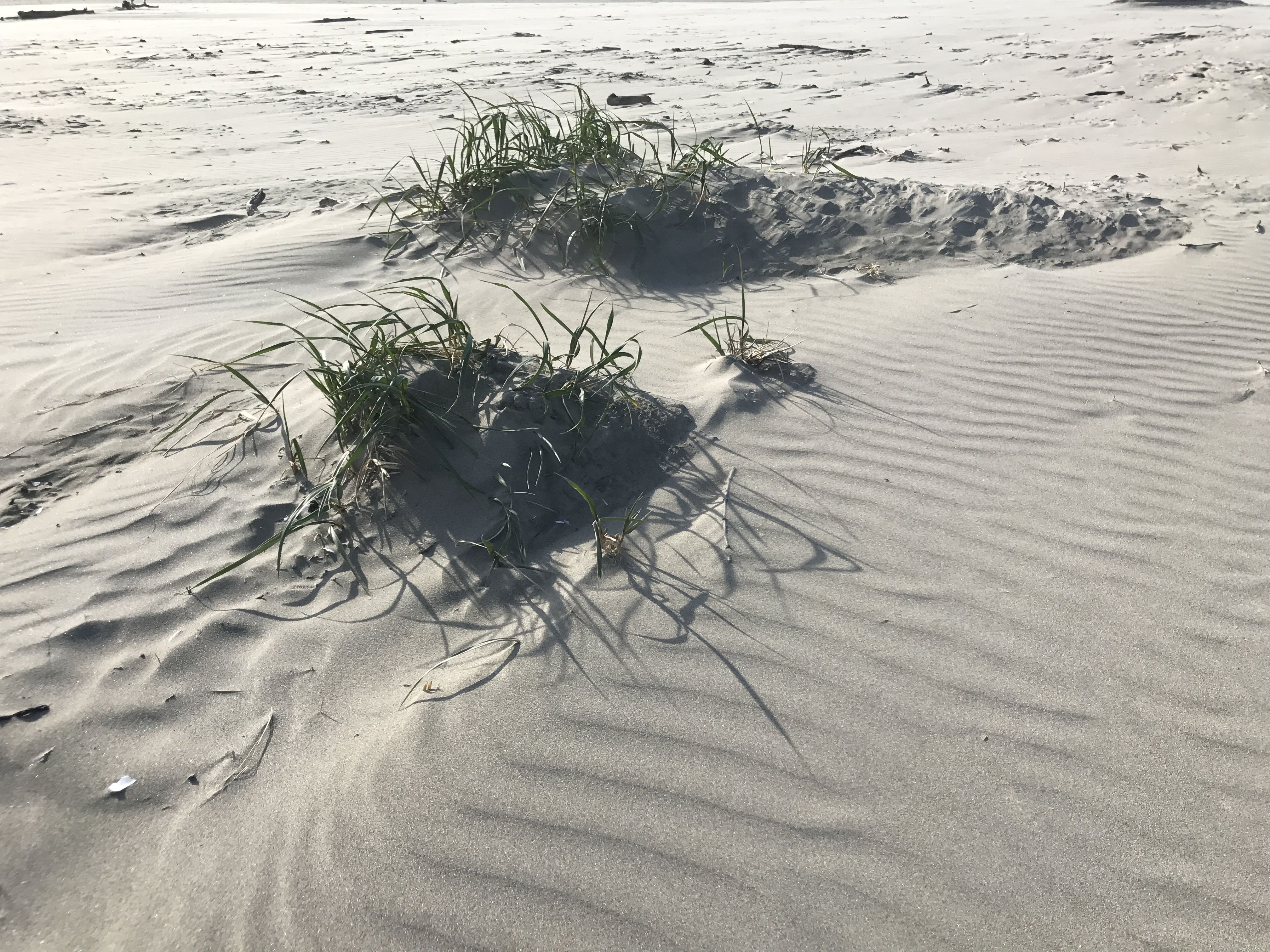
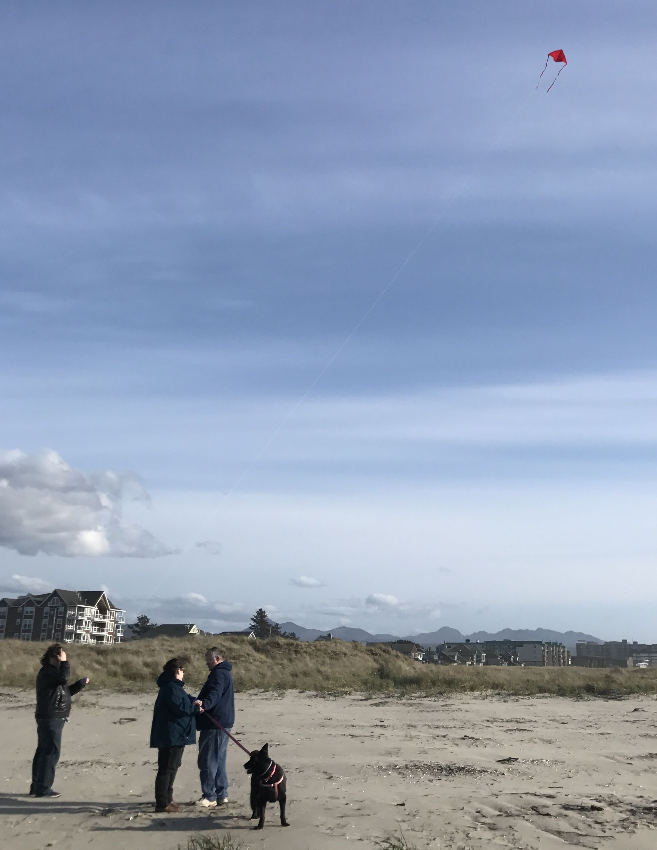
I found a place to park and headed toward the beach. The sun was bright but the wind was vigorous. It wasn’t exactly the weather I prefer for the beach. But then, it was April.
The wind was whipping the sand around.
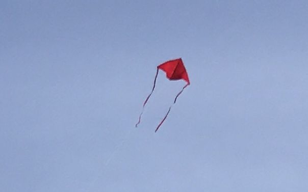
It was also good for flying kites.
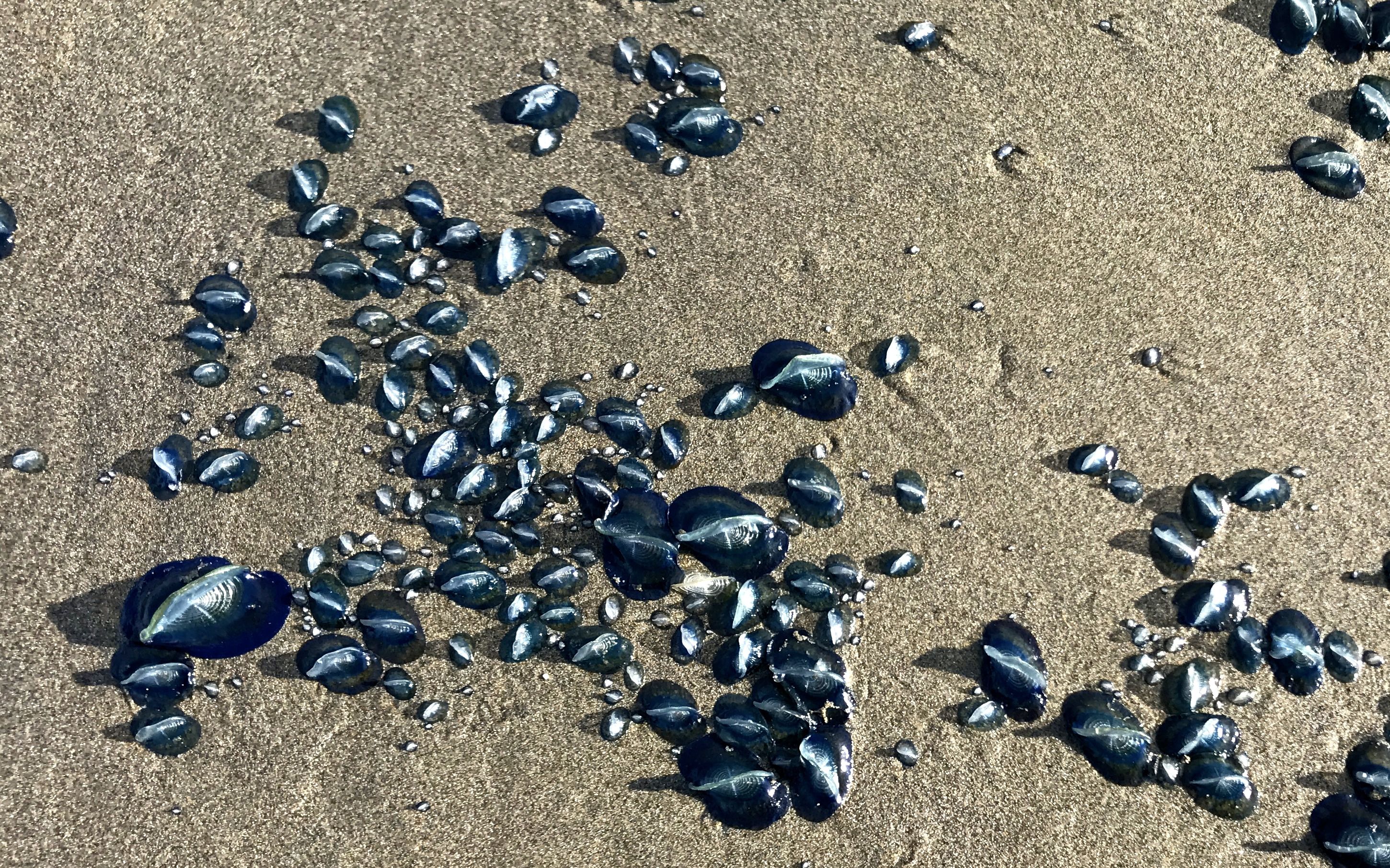
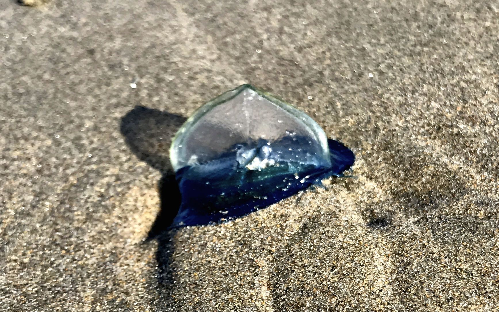
As I walked closer to the ocean, I came upon groups of these amazing blue things. I was pretty sure they were some sort of life form, but I wasn’t sure what they might be.
Incredible! What could they be?
I approached these folks. They were walking the beach with the familiarity of locals. I asked them what these object were. Guess what they said?
Jellyfish!
If you want to get spooked, just Google “jellyfish on the beach”.
And with that, it was time to head back to the Flo the Airstream. Before I headed back to BART, I turned for one last look back at the ocean.