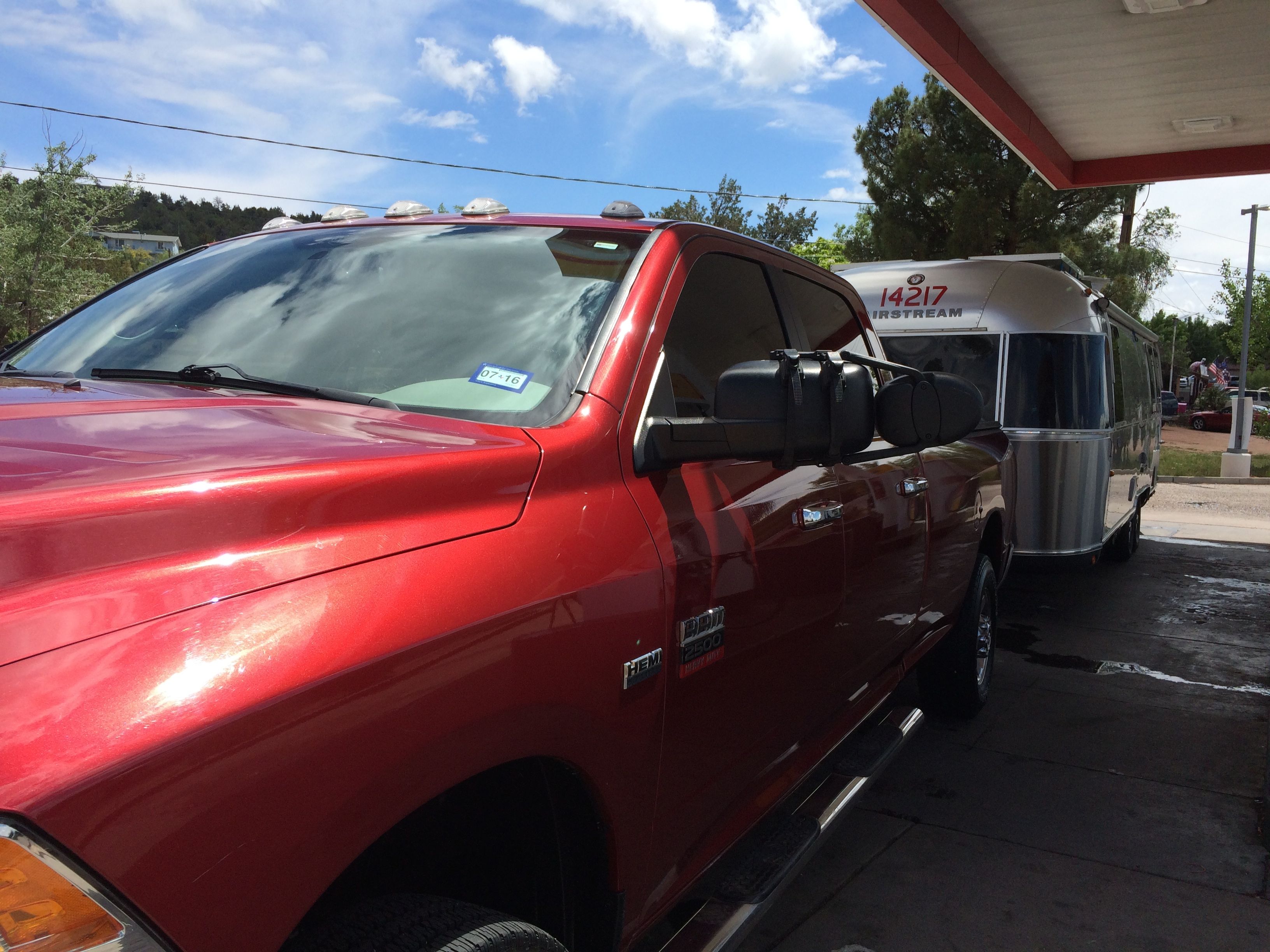
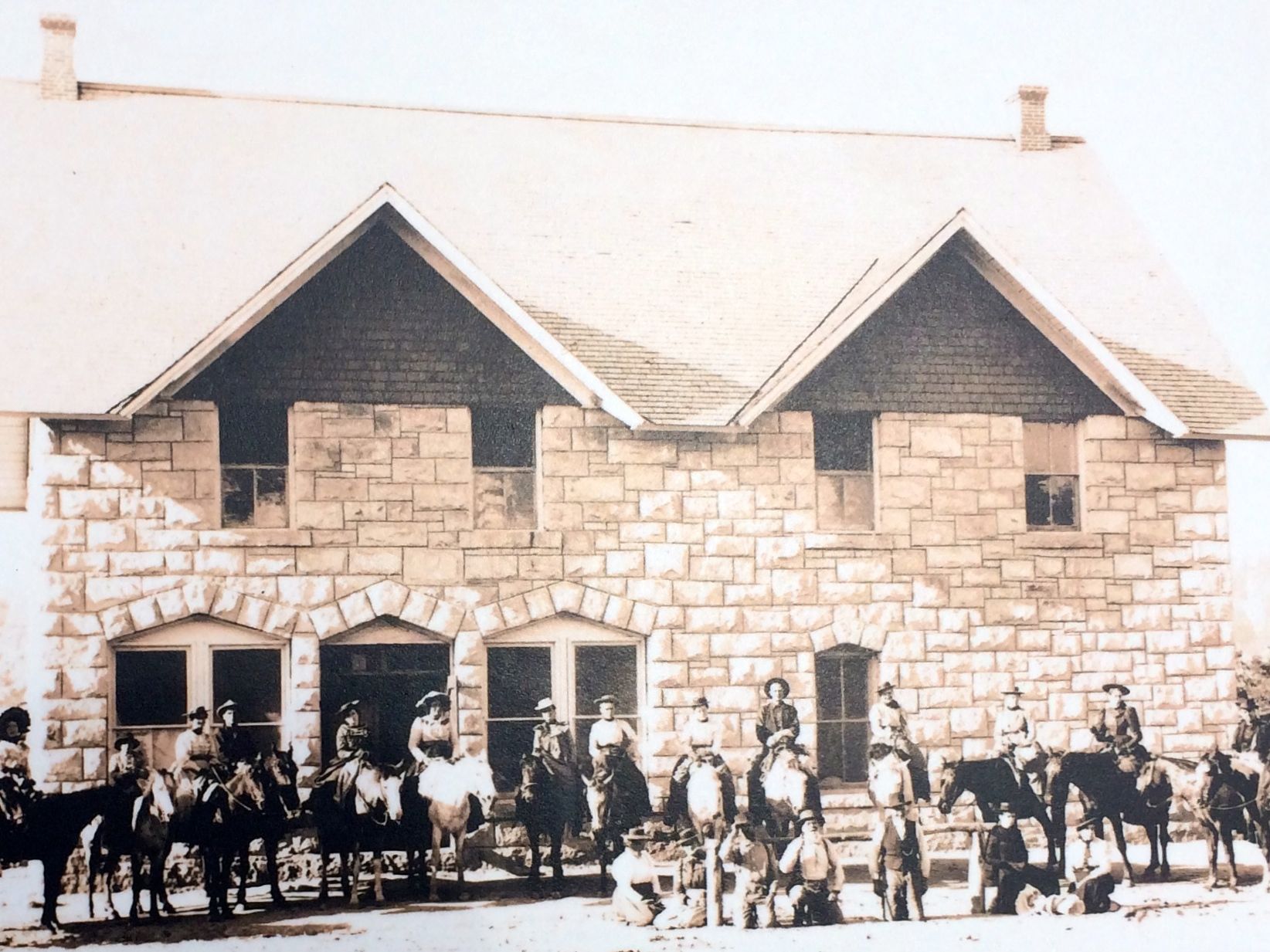
After my night at Mesa Spirit RV Resort, I returned to Desert Autoplex and both Flo and Bart got baths. Then, I entered Payson, Arizona in Google Maps on my iPhone and set out.
Don’t they look pretty?
It was only 75 miles and 10 gallons of gas north of Phoenix.
Along the way, I noticed mile marker 234 on Arizona route 87. Dad and I played a little game – well, I played it and he humored me – that whenever consecutive numbers would show up, like at 12:34, I’d say, “Hey, Dad! That’s good luck!”
So, when I noticed that mile marker, I said out loud, “I wish you were here, Dad.”
As plain as day, I heard the response, “I’m always with you.”
Boy, did I need him today!
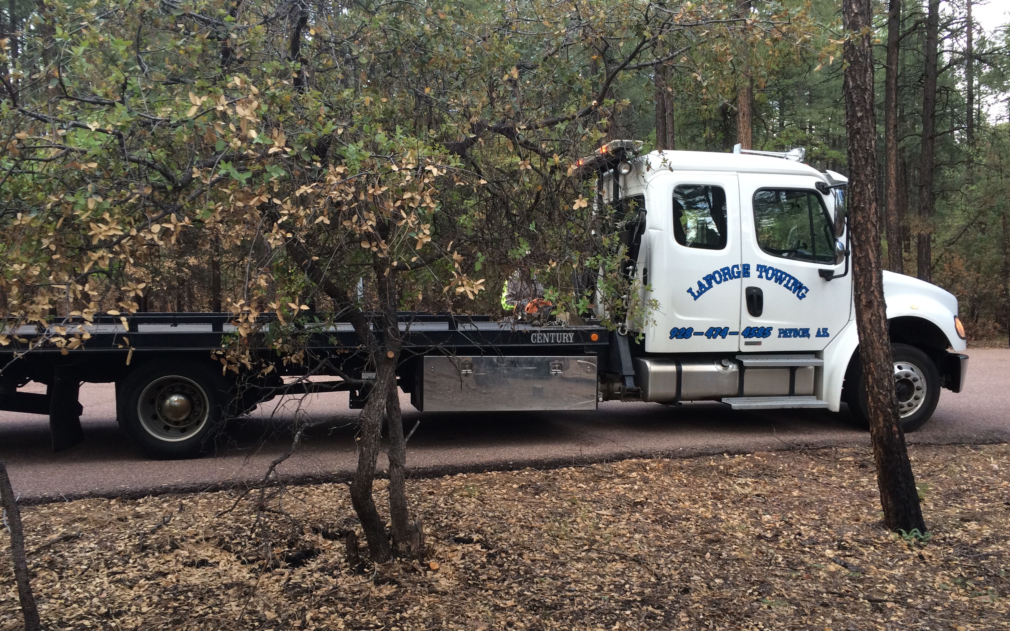
I stopped in at the forestry office and spoke to a very helpful woman who identified some dispersed camping areas (i.e. “free”) and I went to investigate. I got a ways down the road she marked on the map and didn’t see anything that looked really good. I decided that these spots didn’t feel right. I always honor those sorts of feelings, so I managed to get turned around and back out to the main road. I had seen Ponderosa Campground about a mile back, and I knew they had sites available – I checked the campground info before I left Mesa – and I figured paying for a campsite seemed like a good idea.
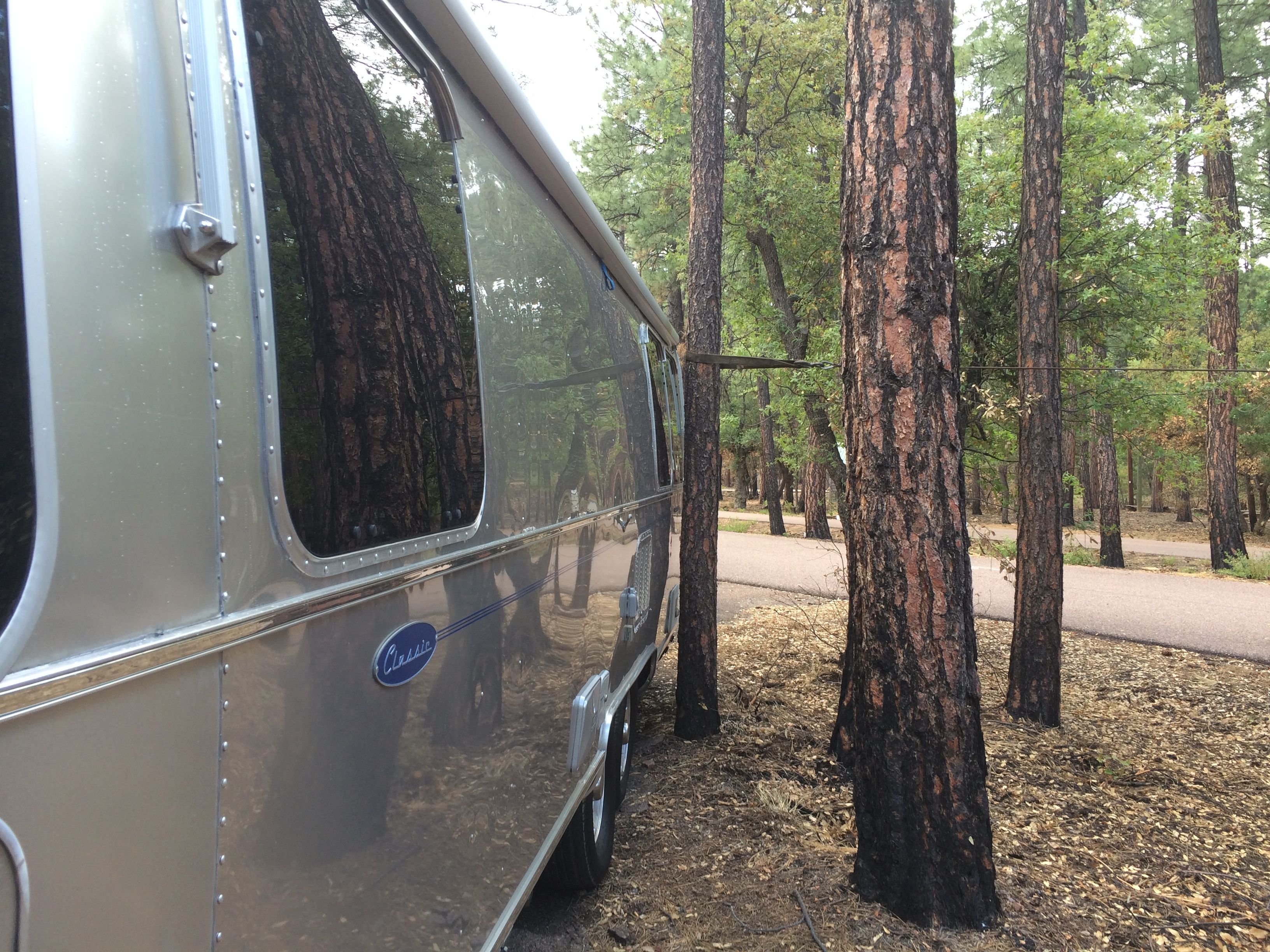
I circled the campground a bit and finally found a site that looked big enough and was a pull-through.
In theory, it was big enough. I pulled in and was just about to pull around the curve, when I got the strong urge to stop and check. I got out and saw that my trailer tire was about an inch from getting hung up on a stump. I backed up, All looked clear, but I had another strong urge to stop and check.
I shifted into park, got out and saw that I was right against a smaller tree that was obscured by a large tree.
I swear I almost got sick. This is the same side I just got fixed!
I made myself stop and think. I walked around and looked at the lay of the land. With the tight turn of the site, I was really stuck. I decided to call AAA. I got through right away and explained the situation. They weren’t phased in the least. “So, you need an extraction?” I allowed as how I did.
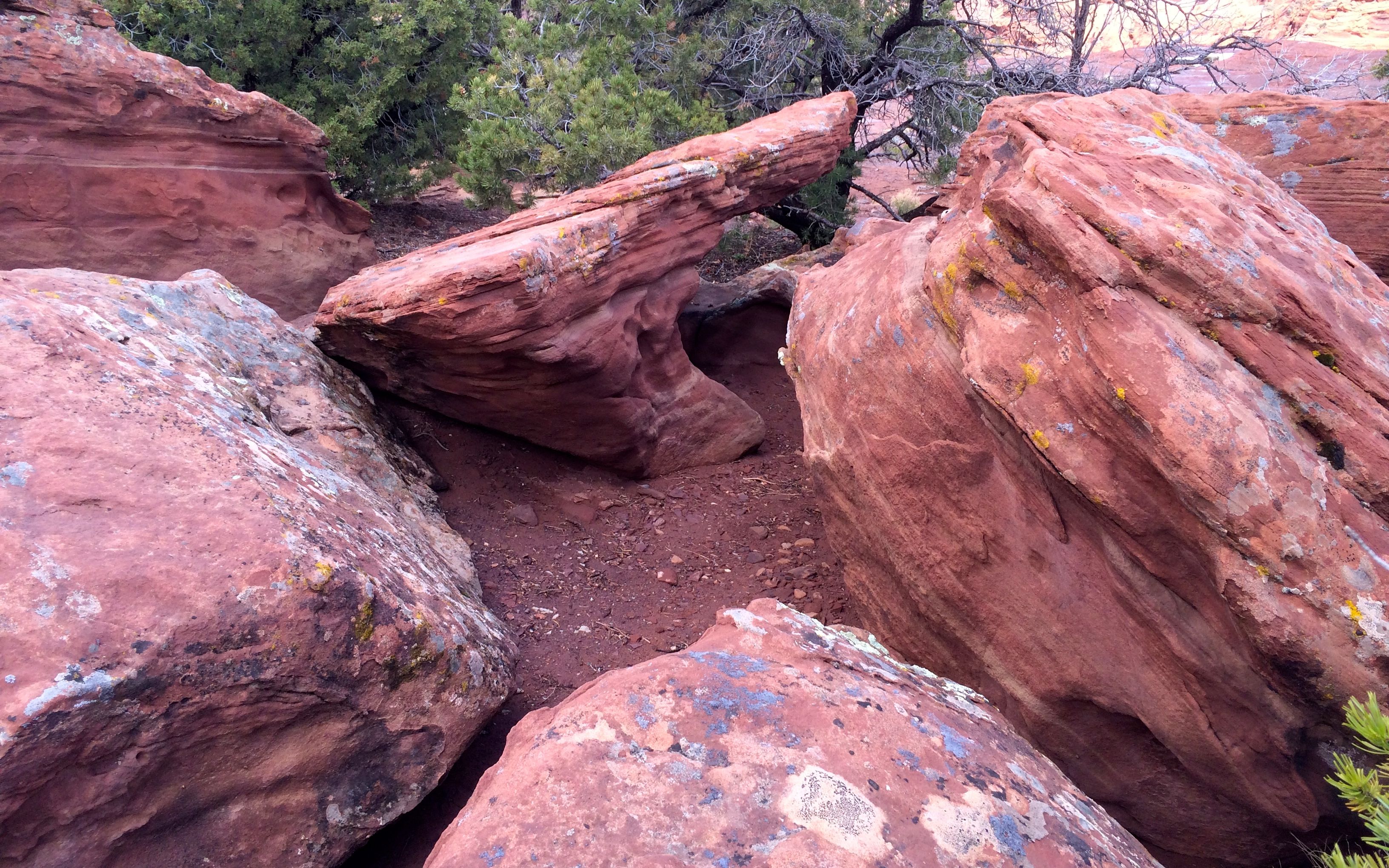
The site was just a little too tight
They set me up with a service call, and I proceeded to wait.
In the meantime, the campground host, Don, came over to see if he could help. We tossed around ideas about what to do. Then another camper came by to get in on the fun. More ideas. More waiting.
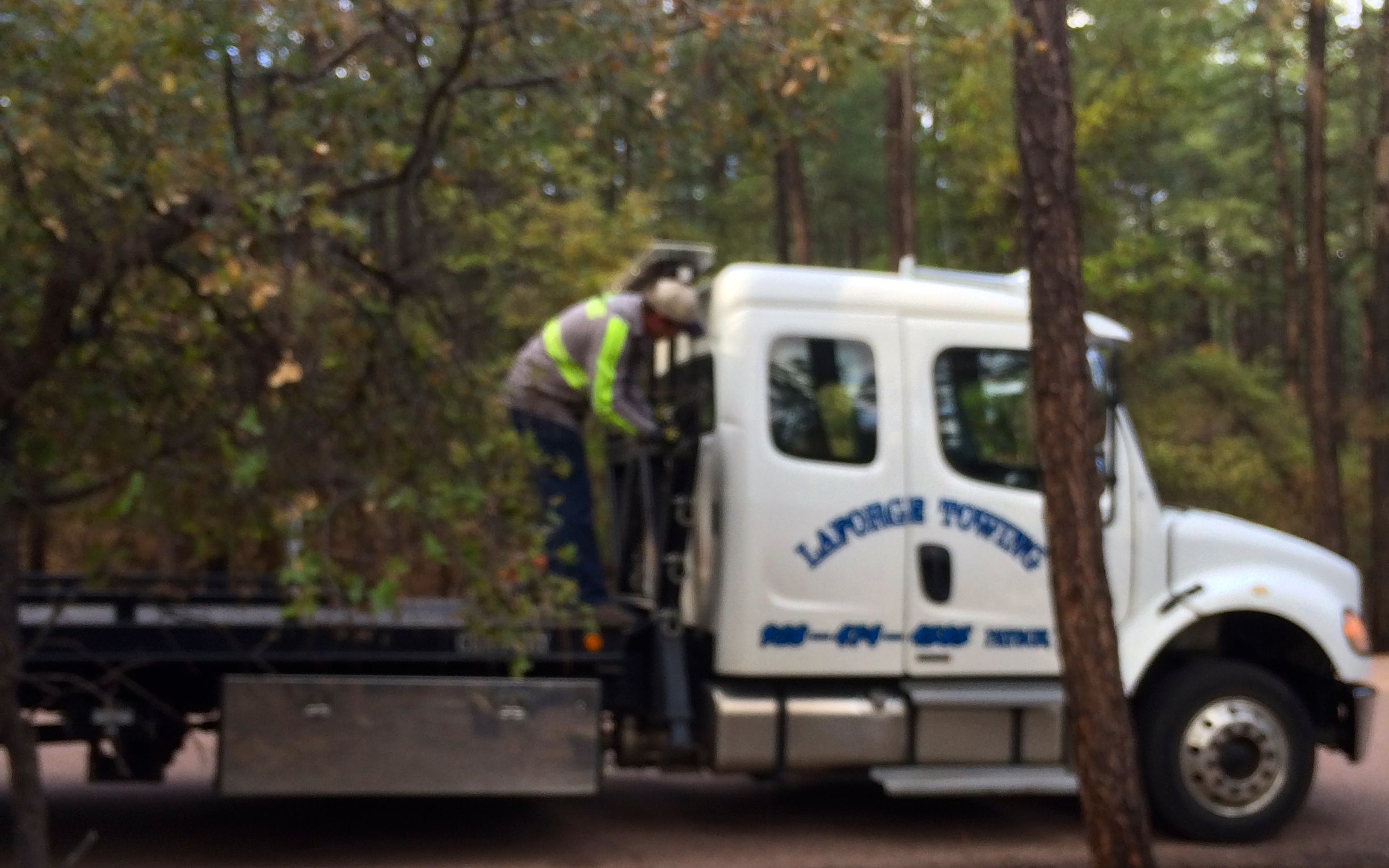
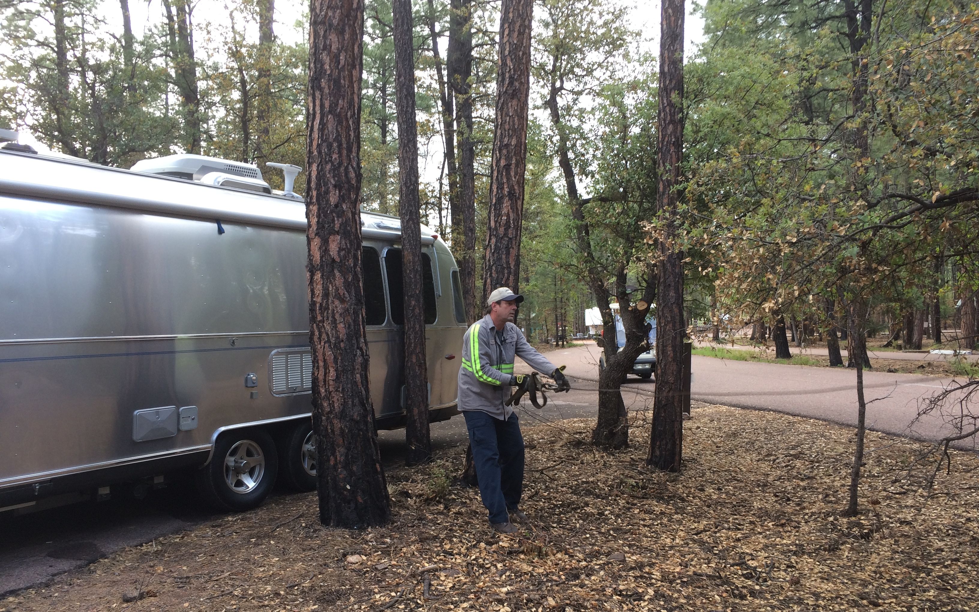
Finally, Tom, my knight in shining armor arrived.
He didn’t have any immediate ideas, so I shared the ideas we had come up with. He like the idea of using his winch to pull the tree away from the trailer and then having me drive out. Don was game to help direct, so there were plenty of eyes on the truck, trailer and all of the trees.
He got the winch ready to go.
He pulled the cable over to the tree.
He got a strap looped around the tree and hooked to the cable.
And he pulled the tree away from the trailer!
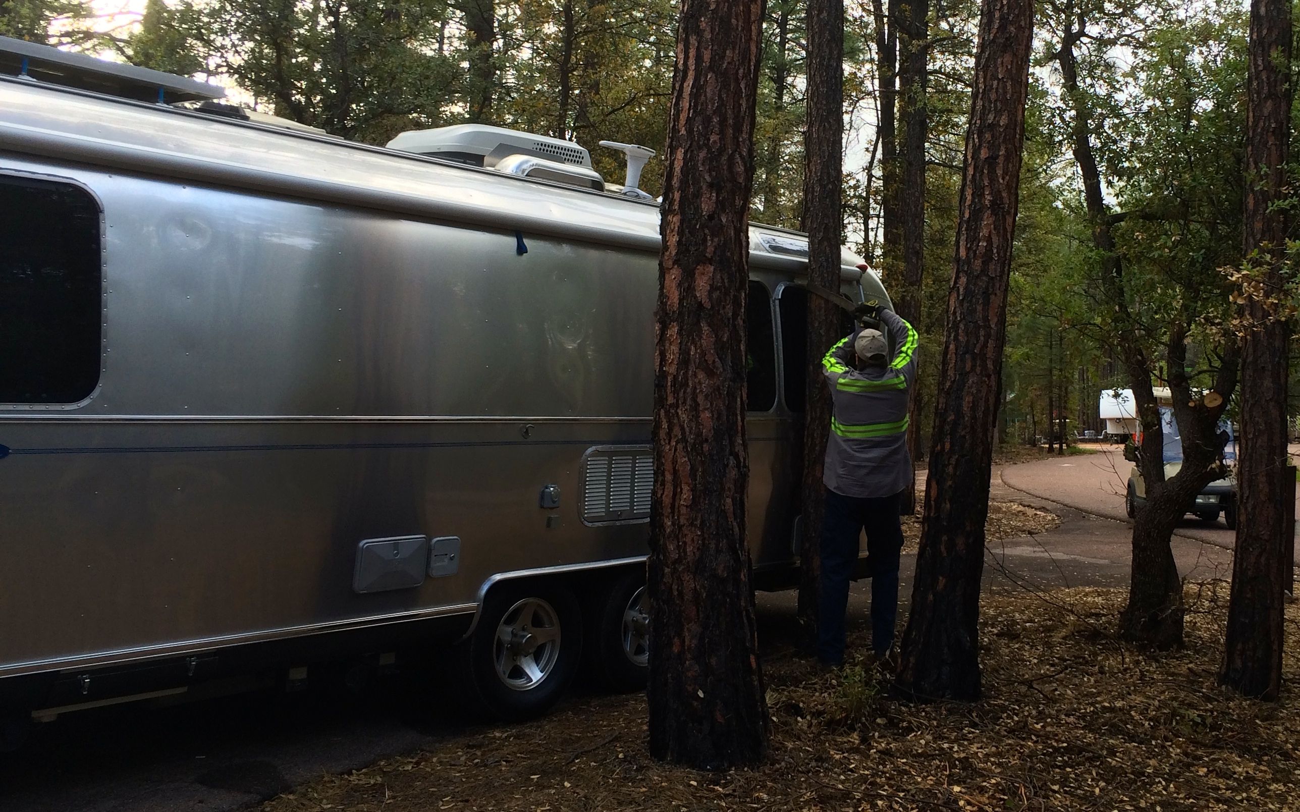
With Tom and Don directing and watching what I couldn’t see, we finally waltzed Flo out of the campsite.
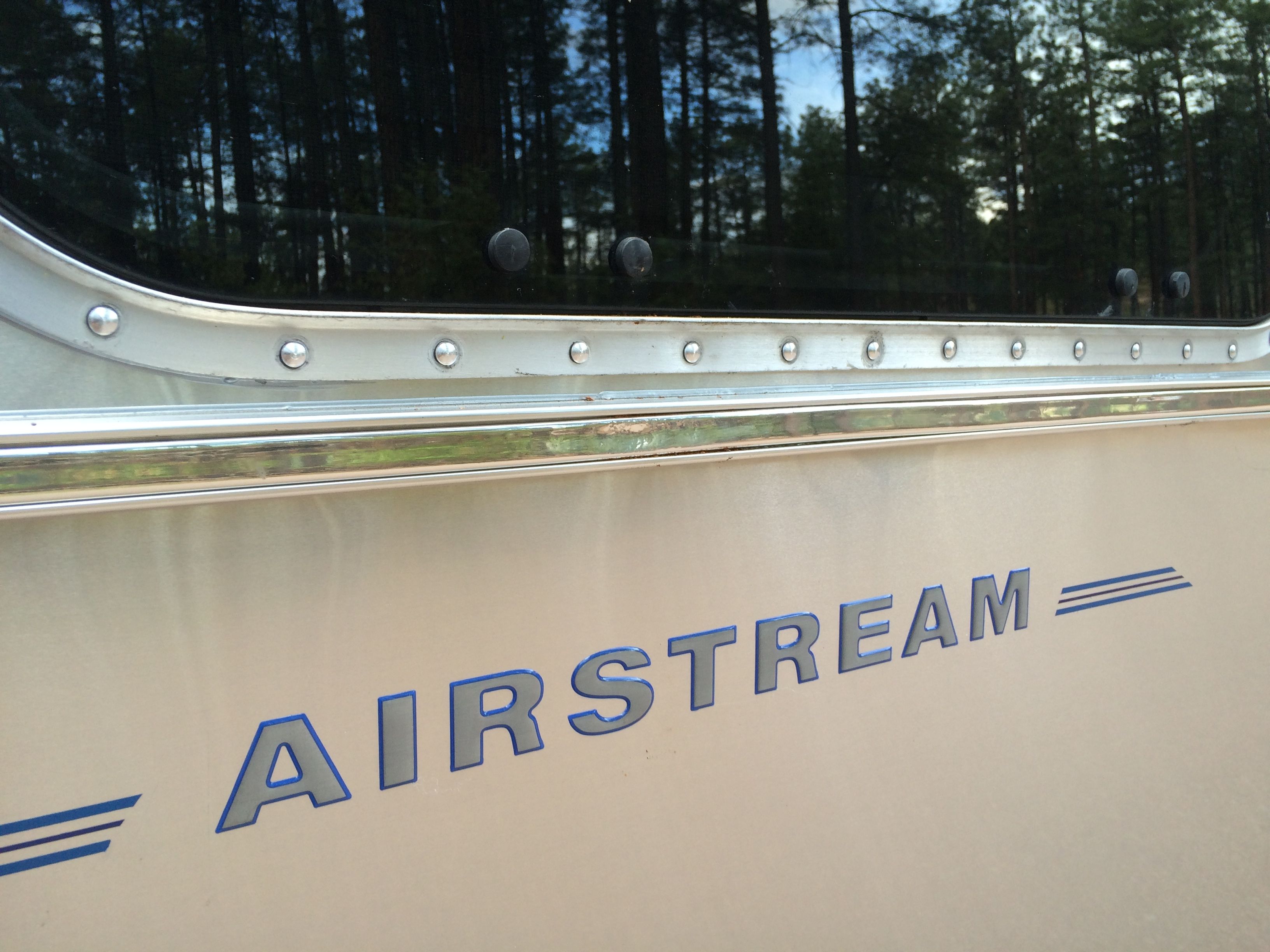
Damage? What damage?
Actually, if you look very carefully, right above the “S” you can see a slight wrinkle in the band.
I’ll take it!
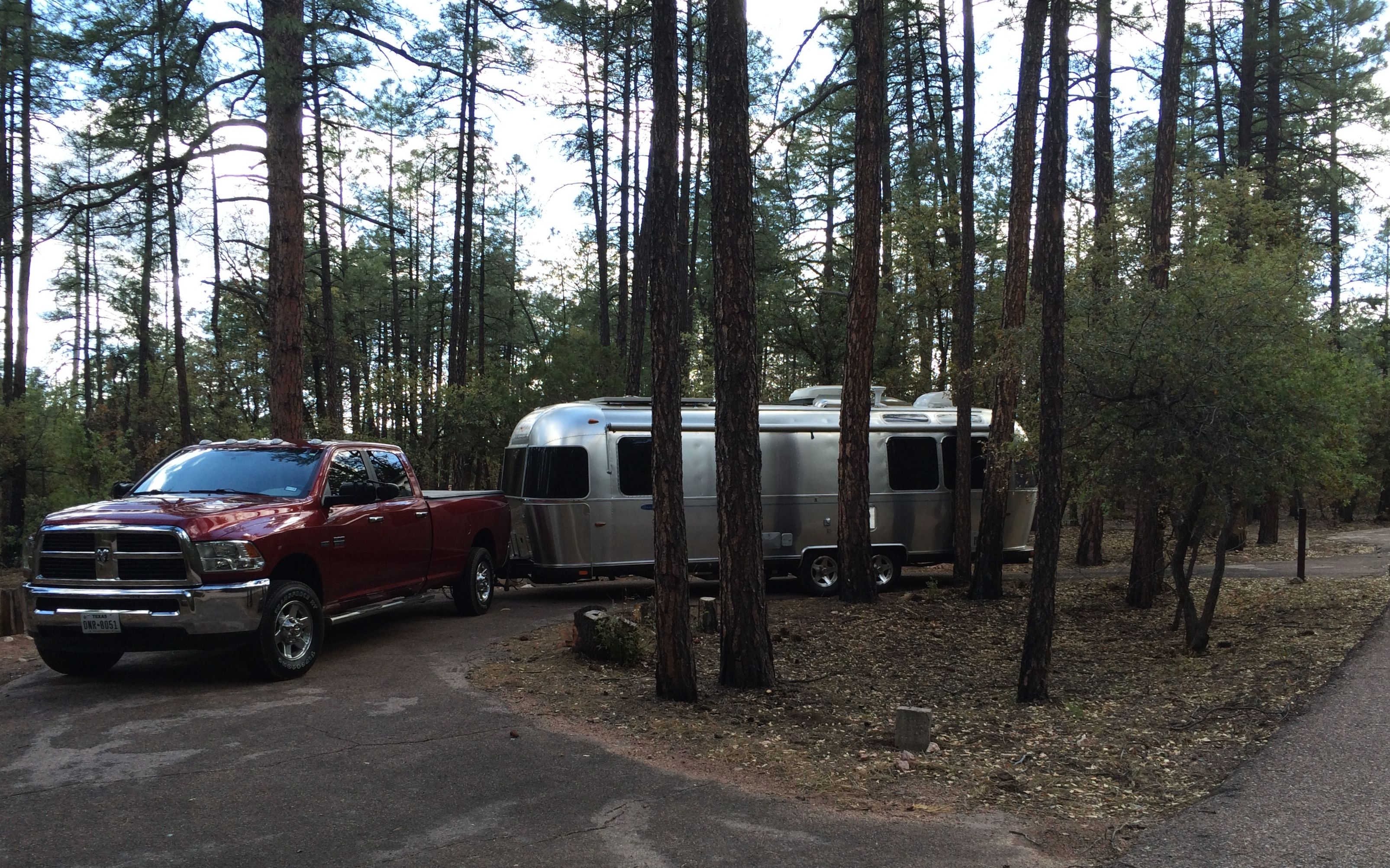
Then, Don helped me get into a site that was easy to get into – and will be easy to get out of.
I am sure that Dad was there with me. How else would I have known to stop when I was about to run into a stump? How would I have known to stop when I snugged the trailer up against the tree?
With all the good people in the world to help when I need it and Dad watching out for me, I have nothing to fear!
You know, even though all I needed to do was spend a few hours overnight in a parking lot, it doesn’t seem like that is an acceptable practice anywhere in the Phoenix area. I called a few of the places that usually let people overnight in their parking lots, and I couldn’t find a place. Cabela’s in Glendale said that they didn’t mind, but it wasn’t allowed in their town. I might get away with it, but then again, I might get woken up in the middle of the night and given a ticket.
Hmm. That was not an attractive alternative, so I booked another night at WestWorld of Scottsdale. In the morning, I packed the truck with all the stuff Cora and I would need while Flo was in the shop, and then headed to Desert Autoplex RV in Mesa.
Flo looked so lonely sitting there as Cora and I drove off. But, she was surrounded by other Airstreams, so I was sure they would treat her well.
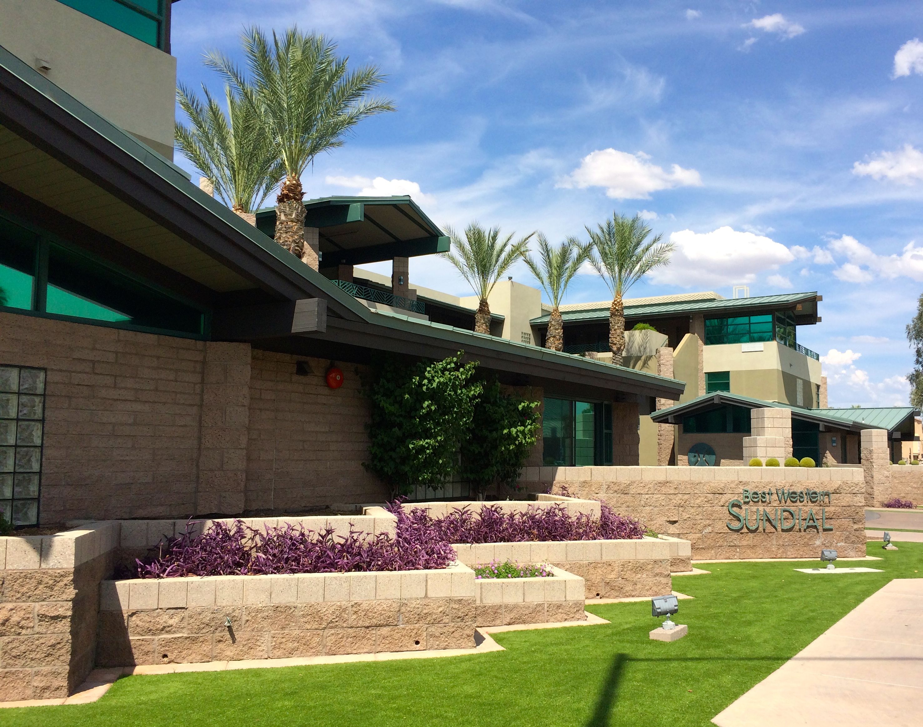
I headed to my home away from home for the next week or so, Best Western Sundial in Scottsdale.
It was a reasonably priced hotel, but it was very nicely designed. According to the hotel manager, Jude, it was designed specifically for the site. It is on a rather small lot, but it makes good use of the space. The architect drew on the Arizona Biltmore for inspiration. You can check out my post on the tour I took, if you need to refresh your memory
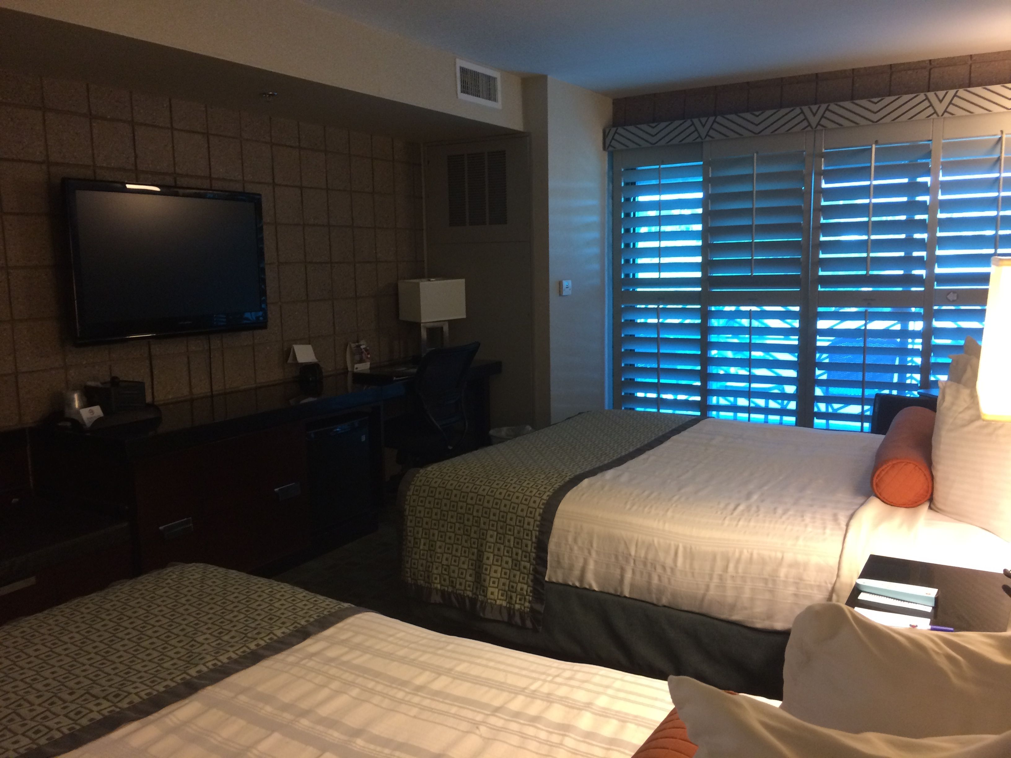
The rooms were comfortable. They had nice flat screen TVs and small refrigerators and very nice showers. (A little confession – this isn’t my room. By the time I got moved in, there was stuff all over. On the morning I left, I asked one of the housekeepers if I could take a quick photo of one of the rooms that was ready for guests.)
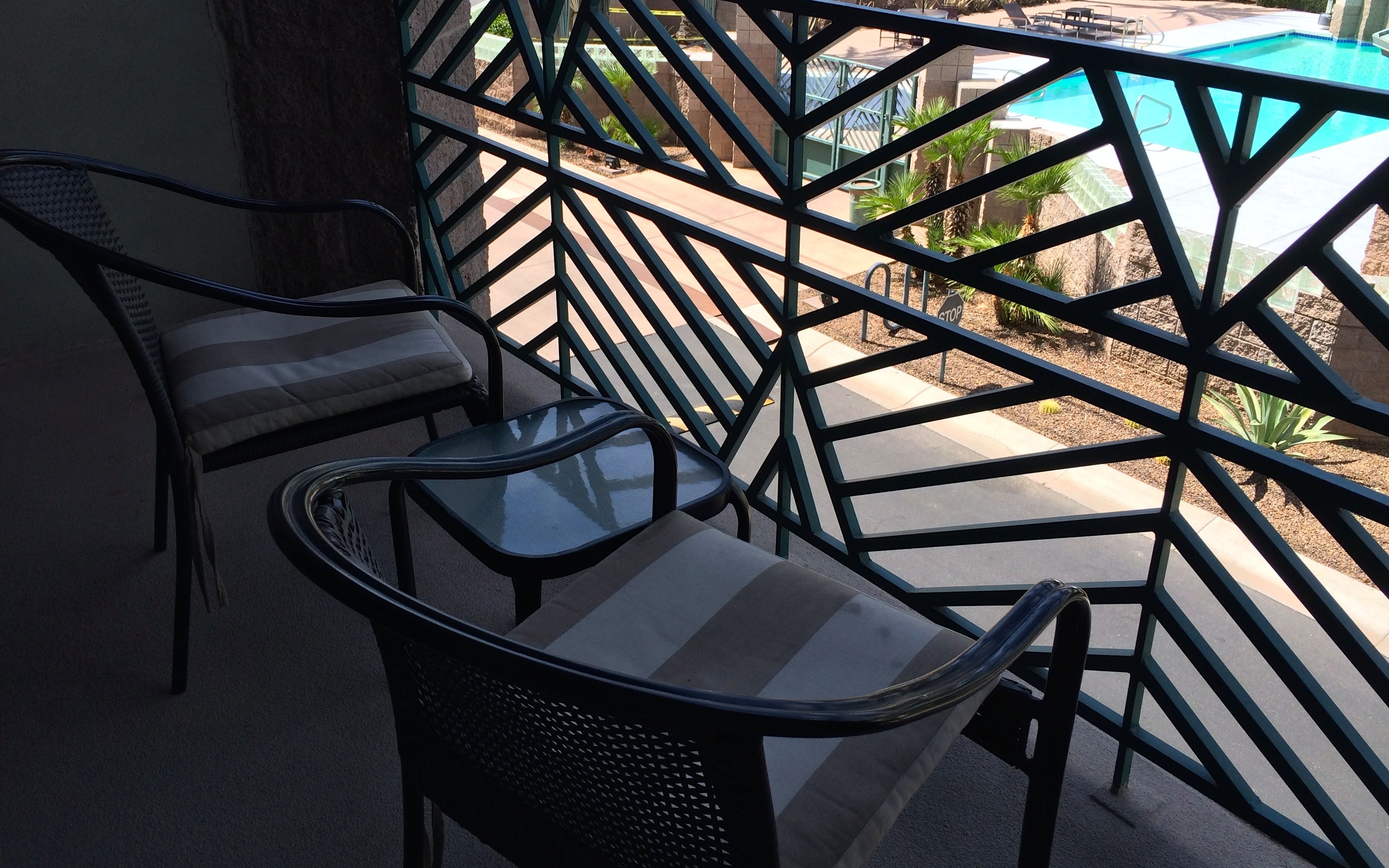
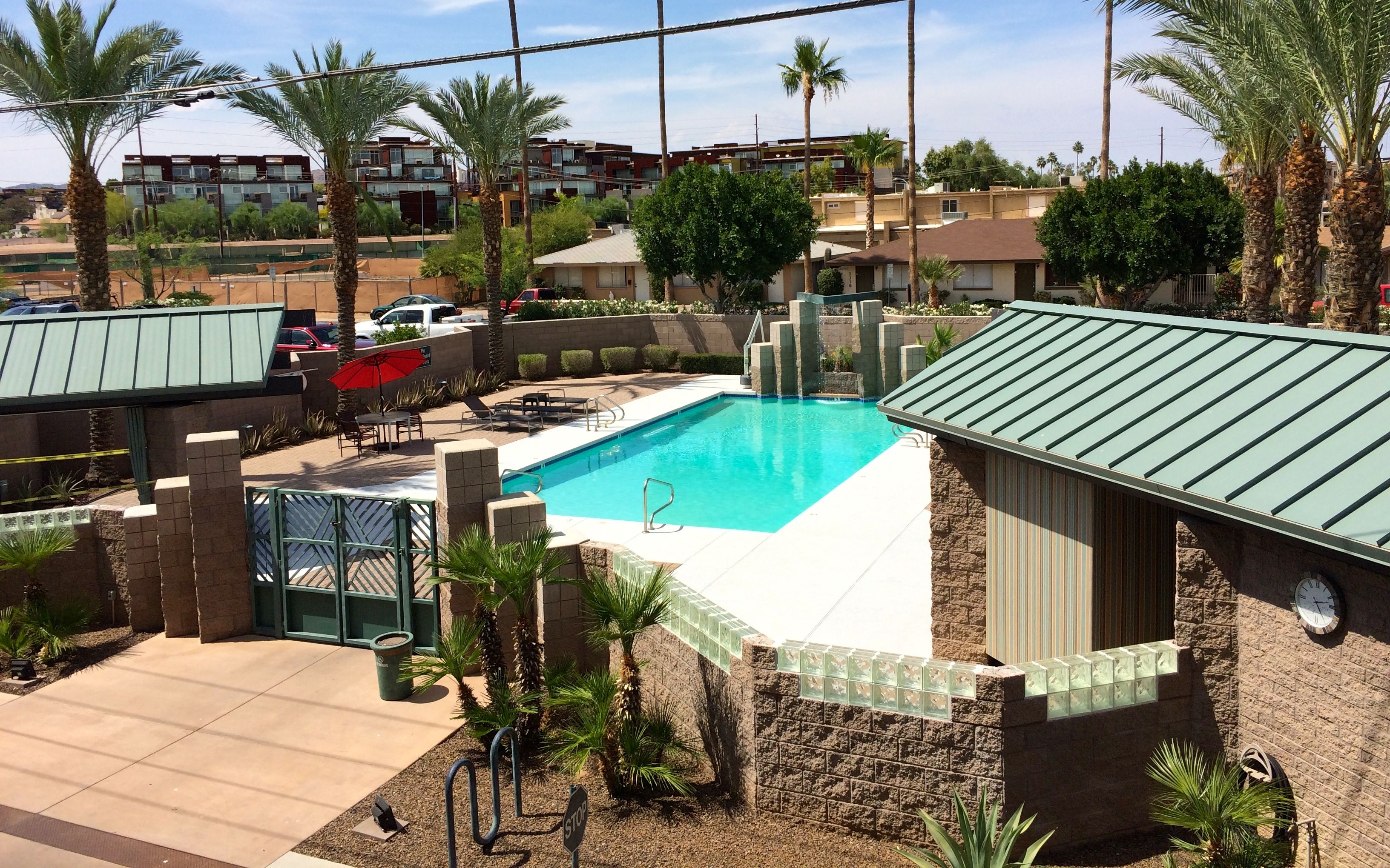
I had a balcony on the cool side of the building, with a nice view of the pool.
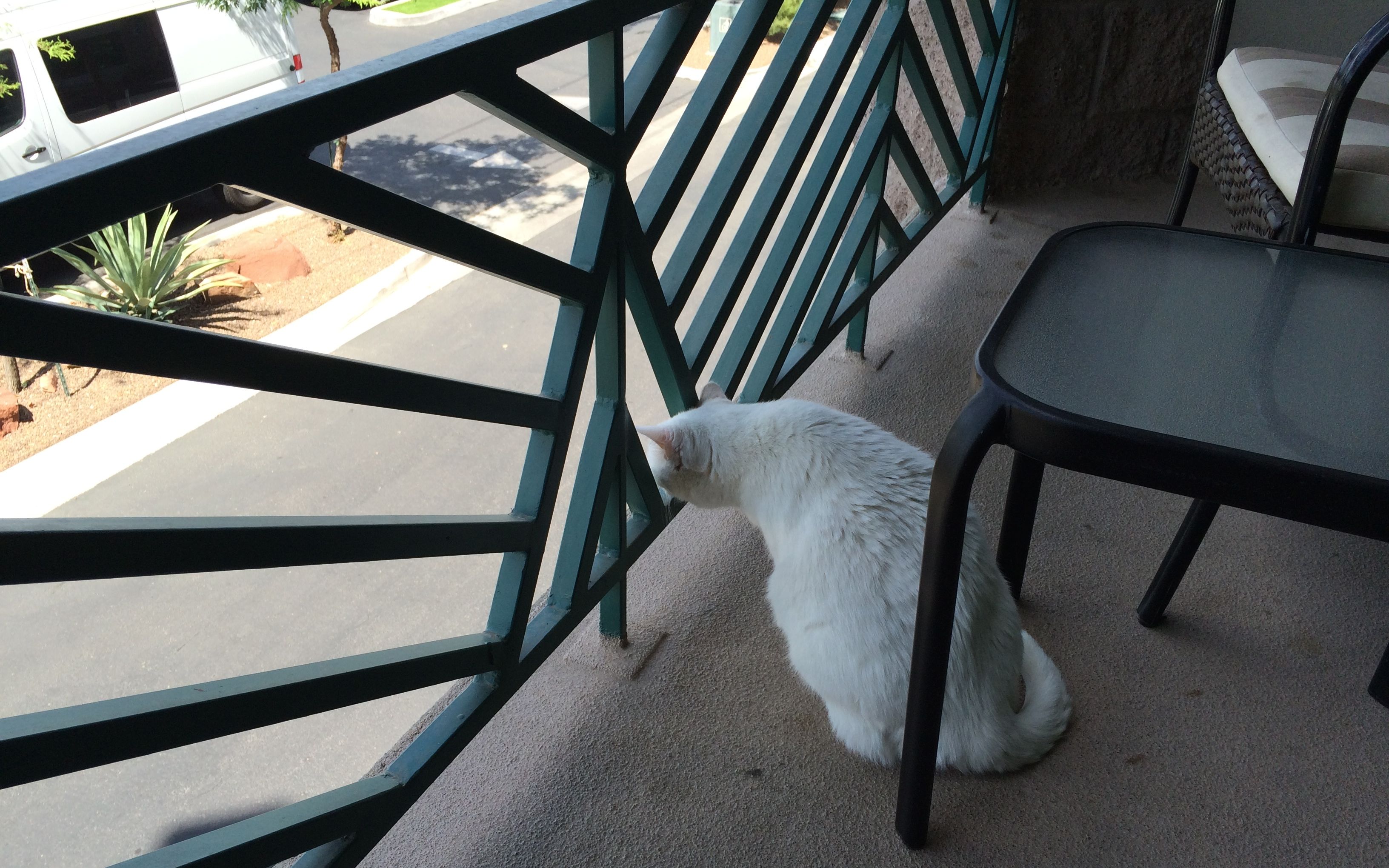
Even Cora enjoyed the view!
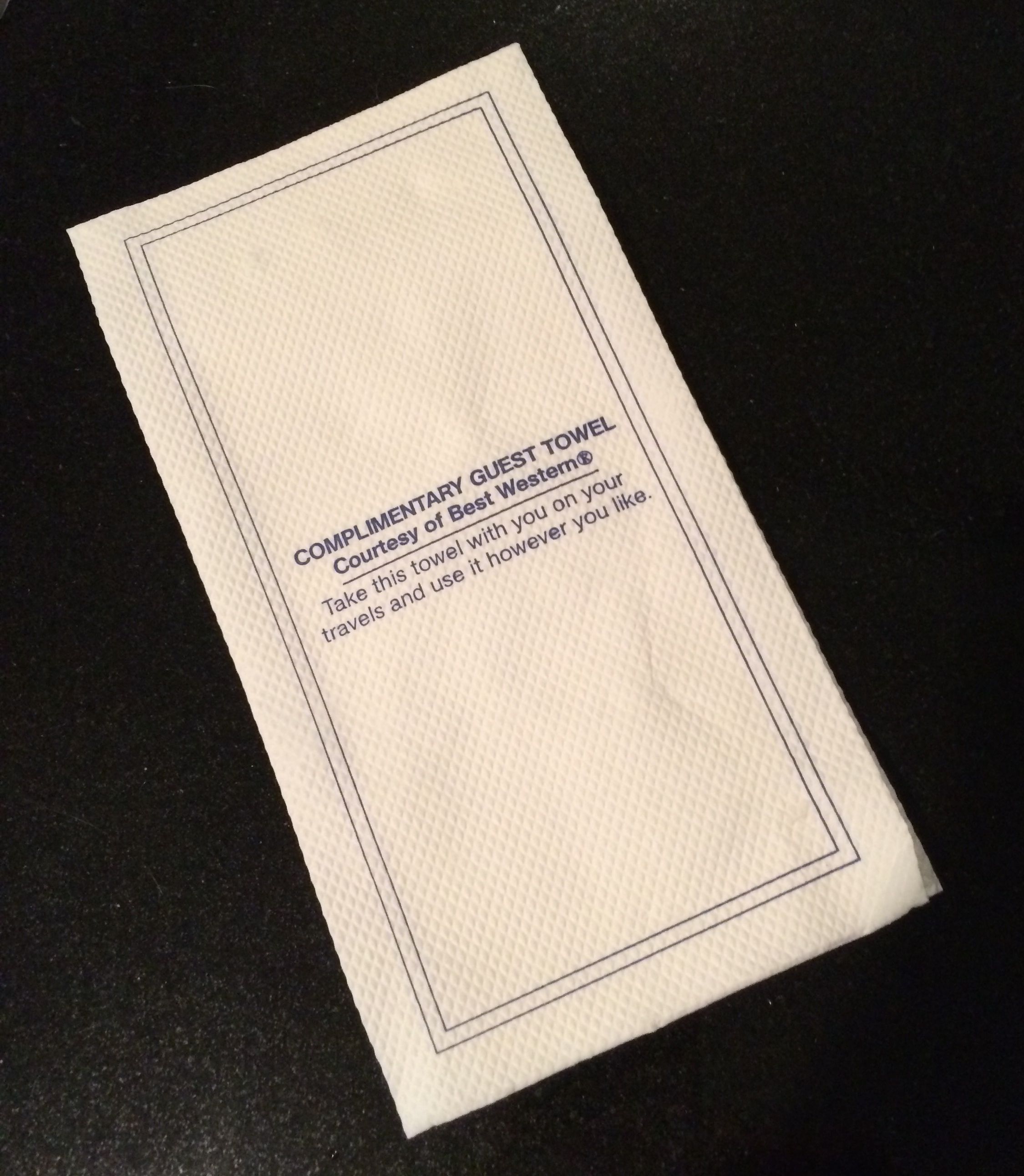
One thing that gave me a chuckle was the Complementary Guest Towel. There were two paper towels on the vanity when I got there with the invitation to take it with me on my travels and use it however I like.
It didn’t make it out of the hotel. I used it in my room.
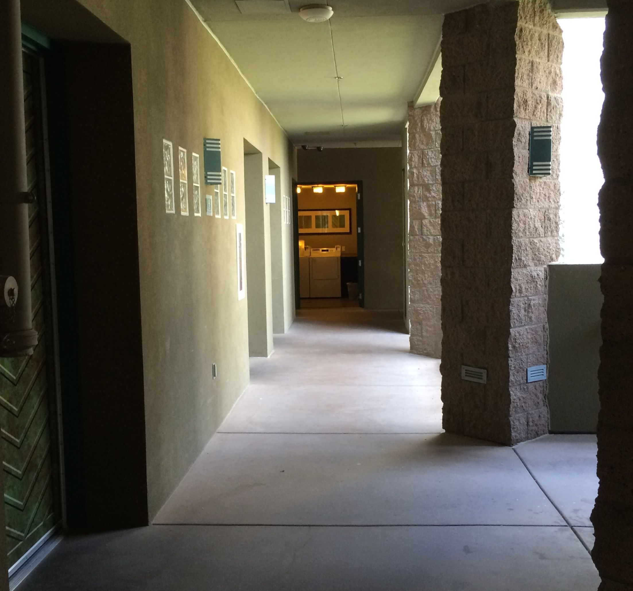
They also had a nice little laundry room available for guests. There was only one washer and one dryer, but probably most guests aren’t there long enough to need to do their laundry.
I really enjoyed the cosy feel of this hotel and the wonderful service that everyone provided.
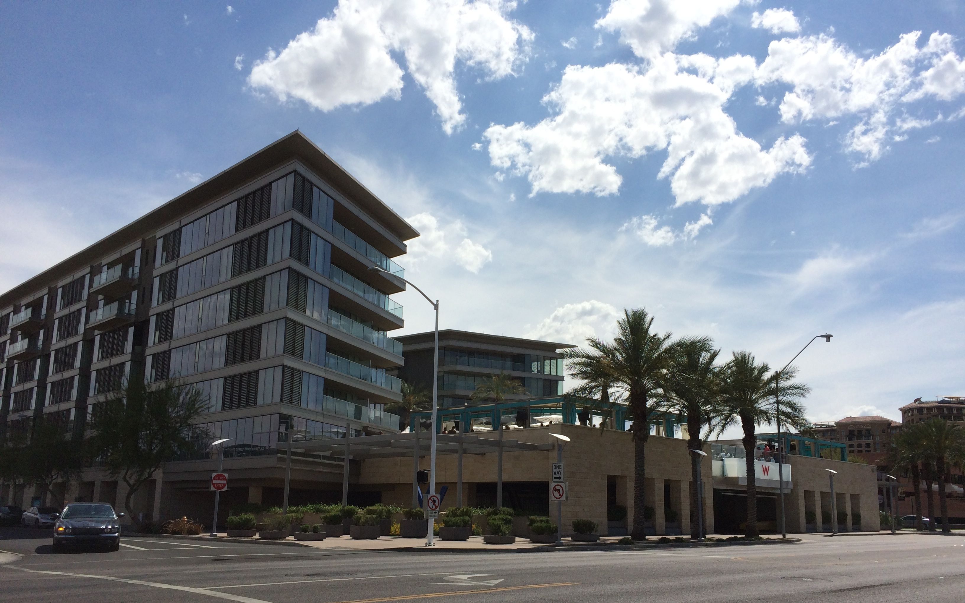
Contrast it with this hotel on the opposite corner – the W.
It was enormous, and the section on the second floor, right behind the palm trees, was their pool area. They played thumpingly LOUD music. It was so loud that I could hear it when I was in my pool. I’ll bet the people there didn’t enjoy their hotel half as much as I enjoyed mine.
When I wasn’t luxuriating in my comfy room, having breakfast down in the lobby or taking a dip in the pool, Konnie and I got together for some more adventures.
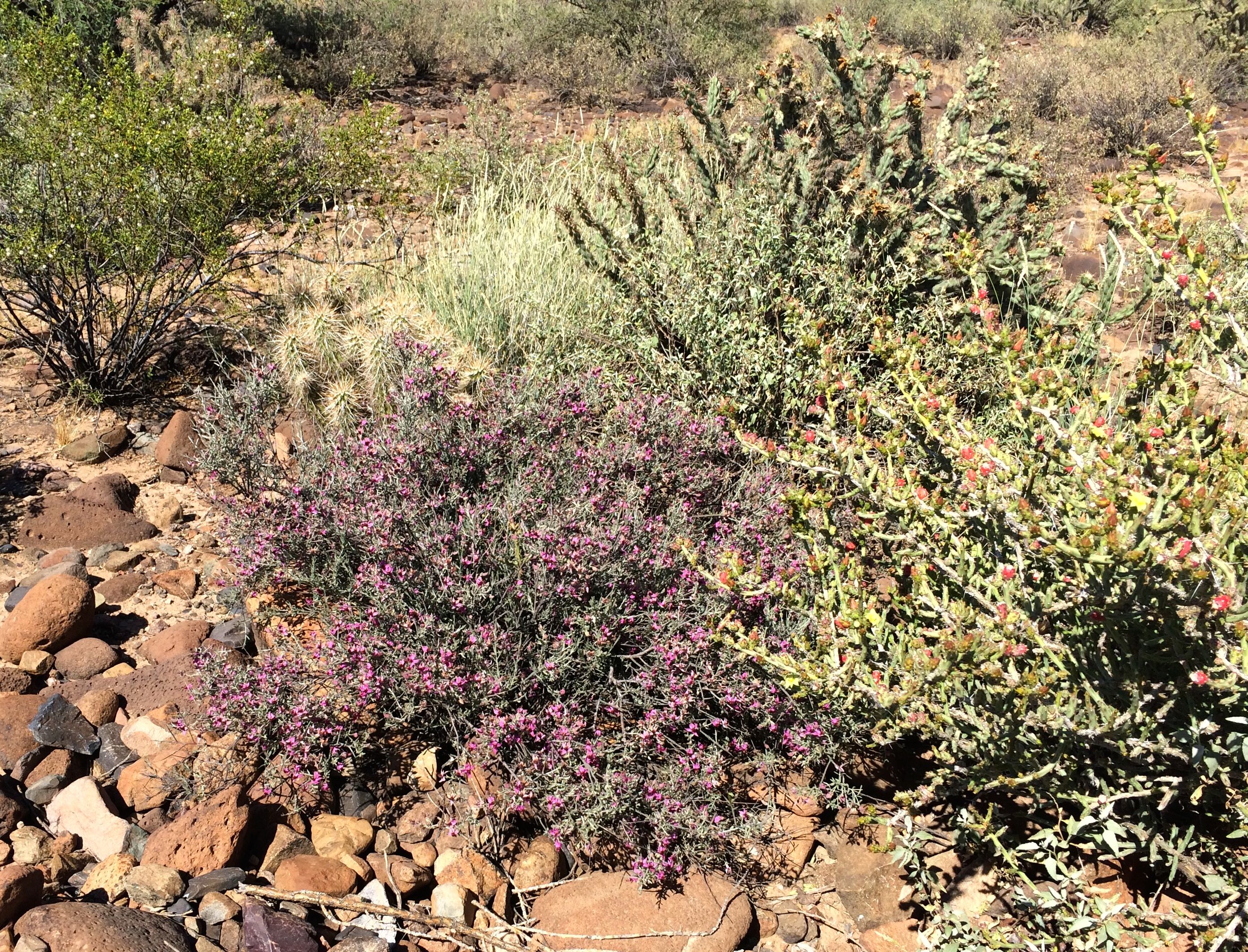
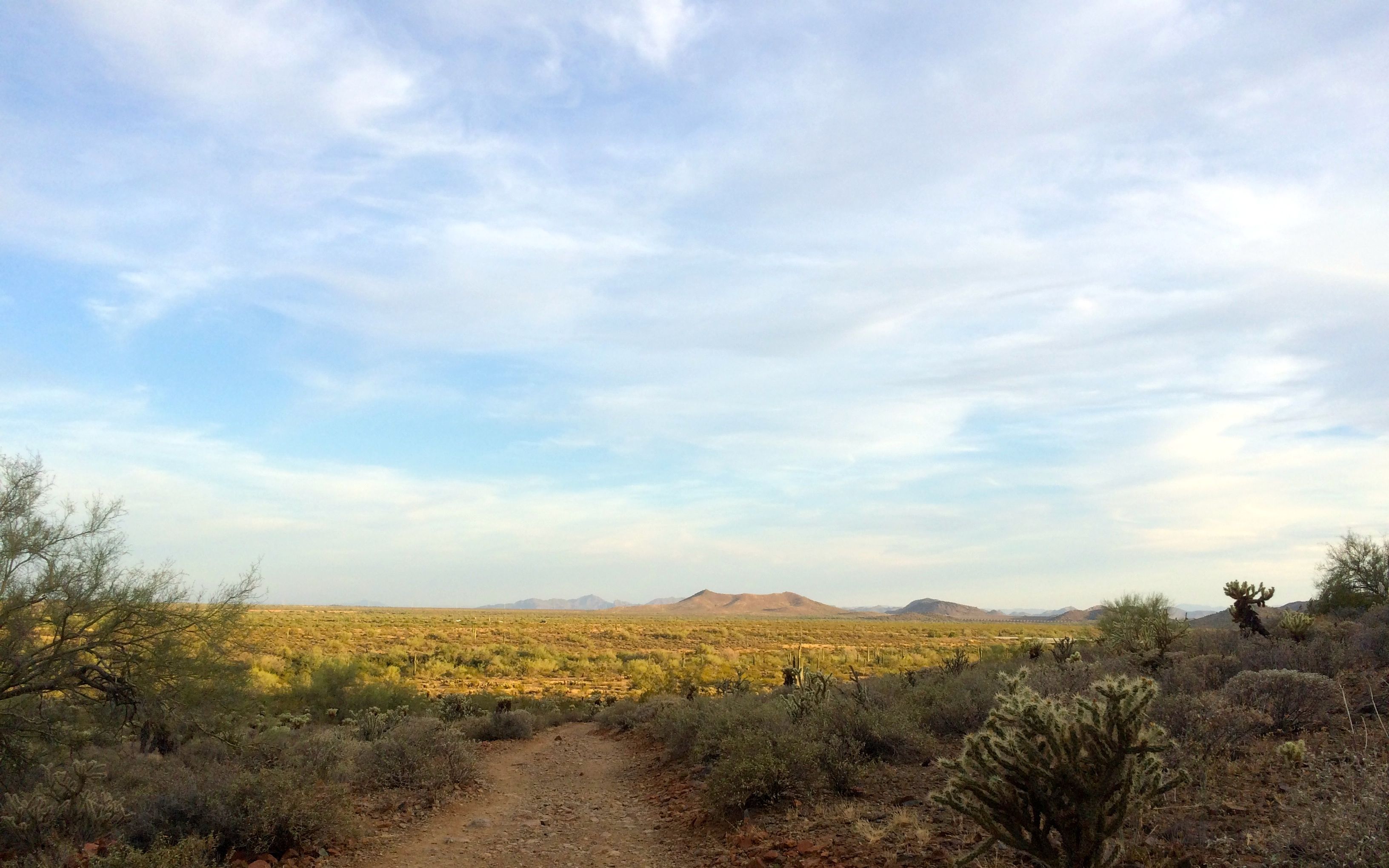
One day, we were hiking among the plants in the desert.
If you take the time to look, there is beauty everywhere.
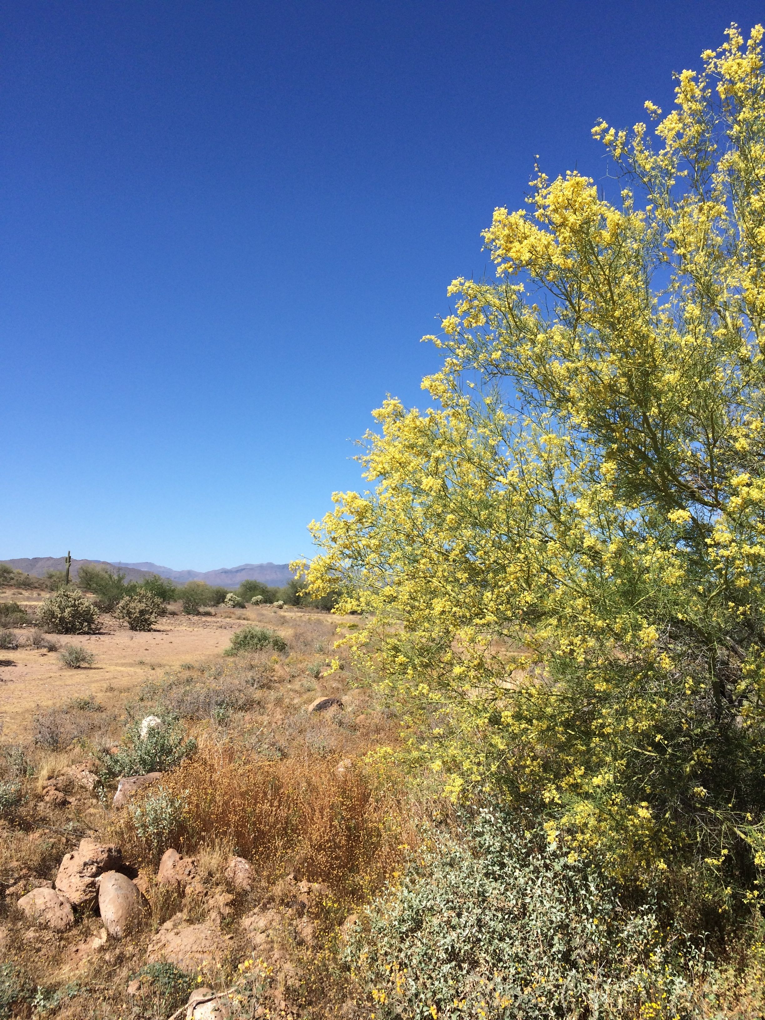
The trees with the yellow flowers are still in bloom.
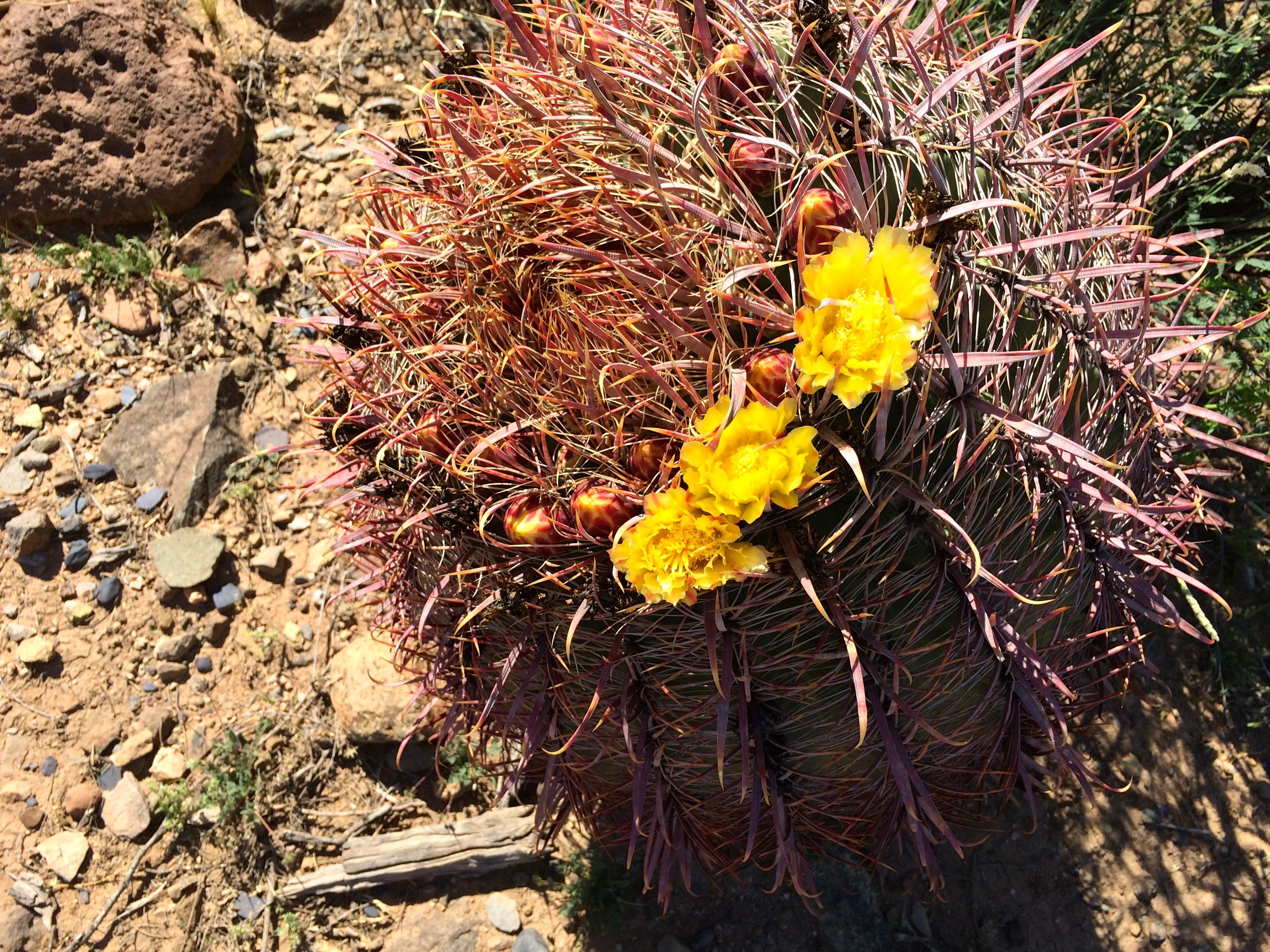
The barrel cactus was in bloom,
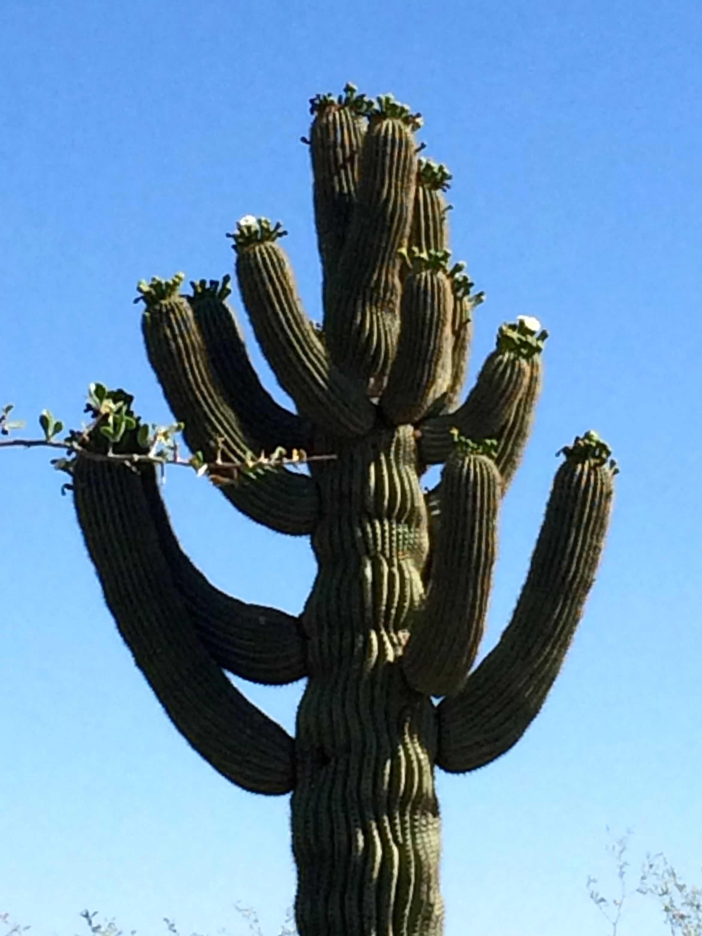
And so were the saguaros.
We also stopped by a consignment shop. I wanted to replace the light blue shirt that I got paint on when I was working on the HistoriCorps project in Sedona. I found a reasonable replacement – not exactly what I had in mind – and a container for Cora’s cat food. I was tired of the looking at the old Folger container on the counter.
It looks fine on my counter!
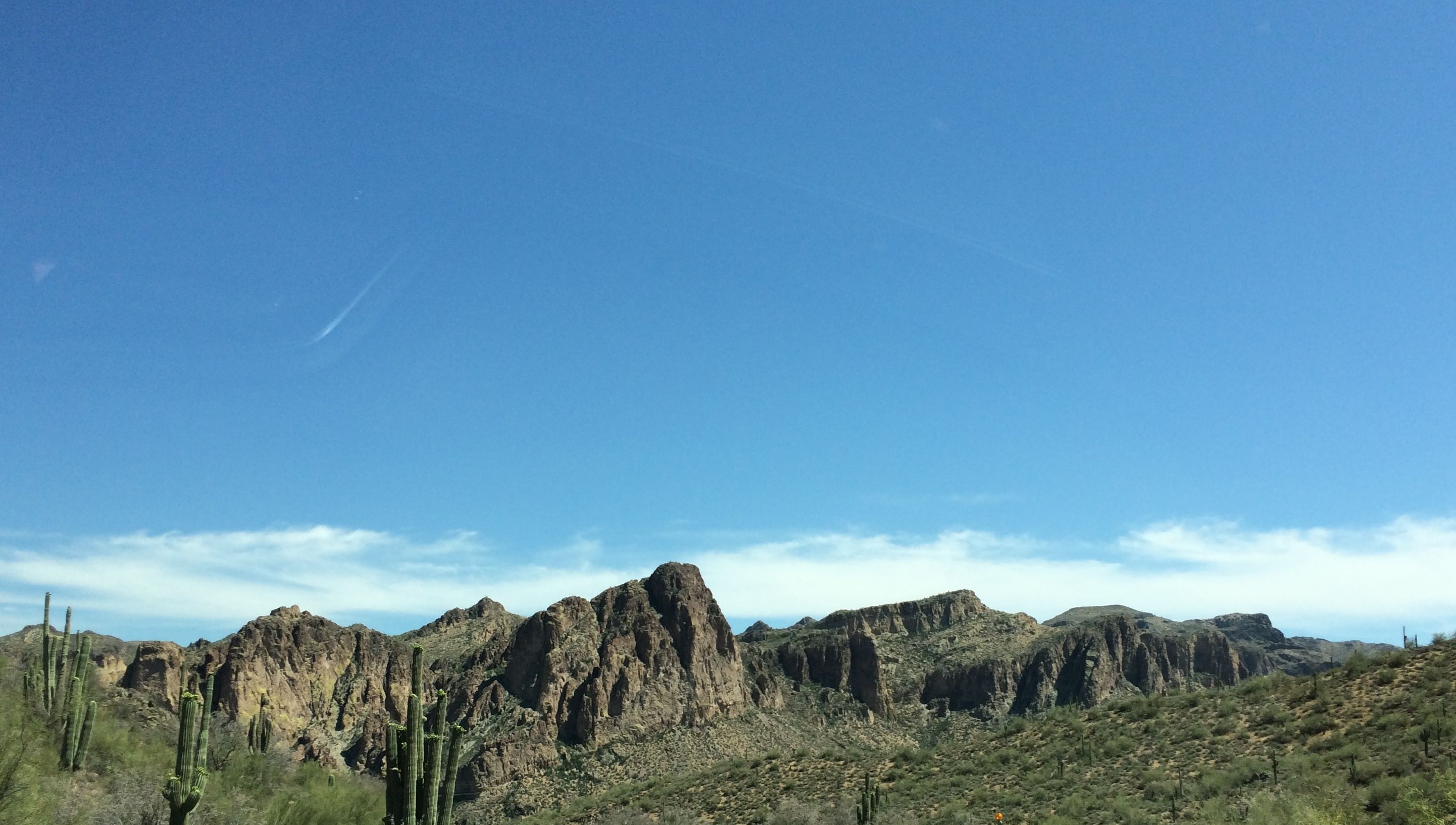
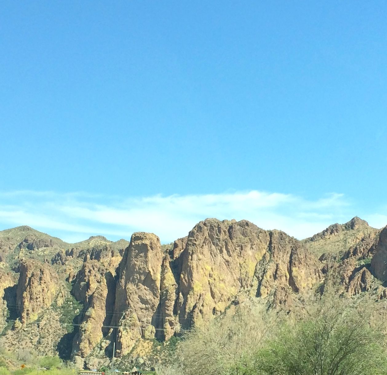
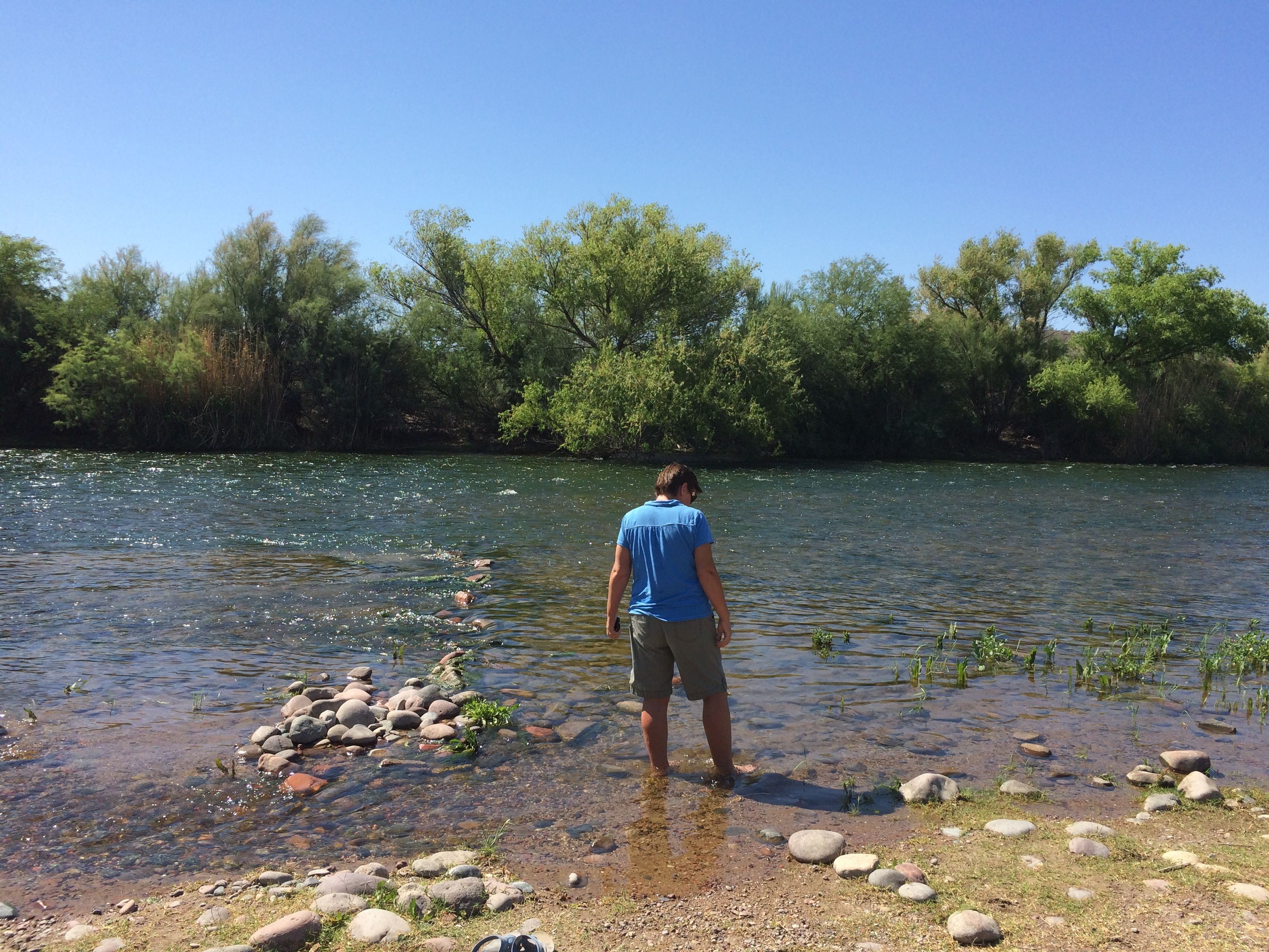
We also took at drive down to the Salt River.
The mountains were so rugged and beautiful.
We finally got to the river.
I was surprised that the river had such a vigorous flow. It seems like whenever I drive across a bridge over a river in Arizona, there is no water in it. In fact, people even go tubing here. We looked into renting tubes and taking part in the fun. That’s on the list for next time.
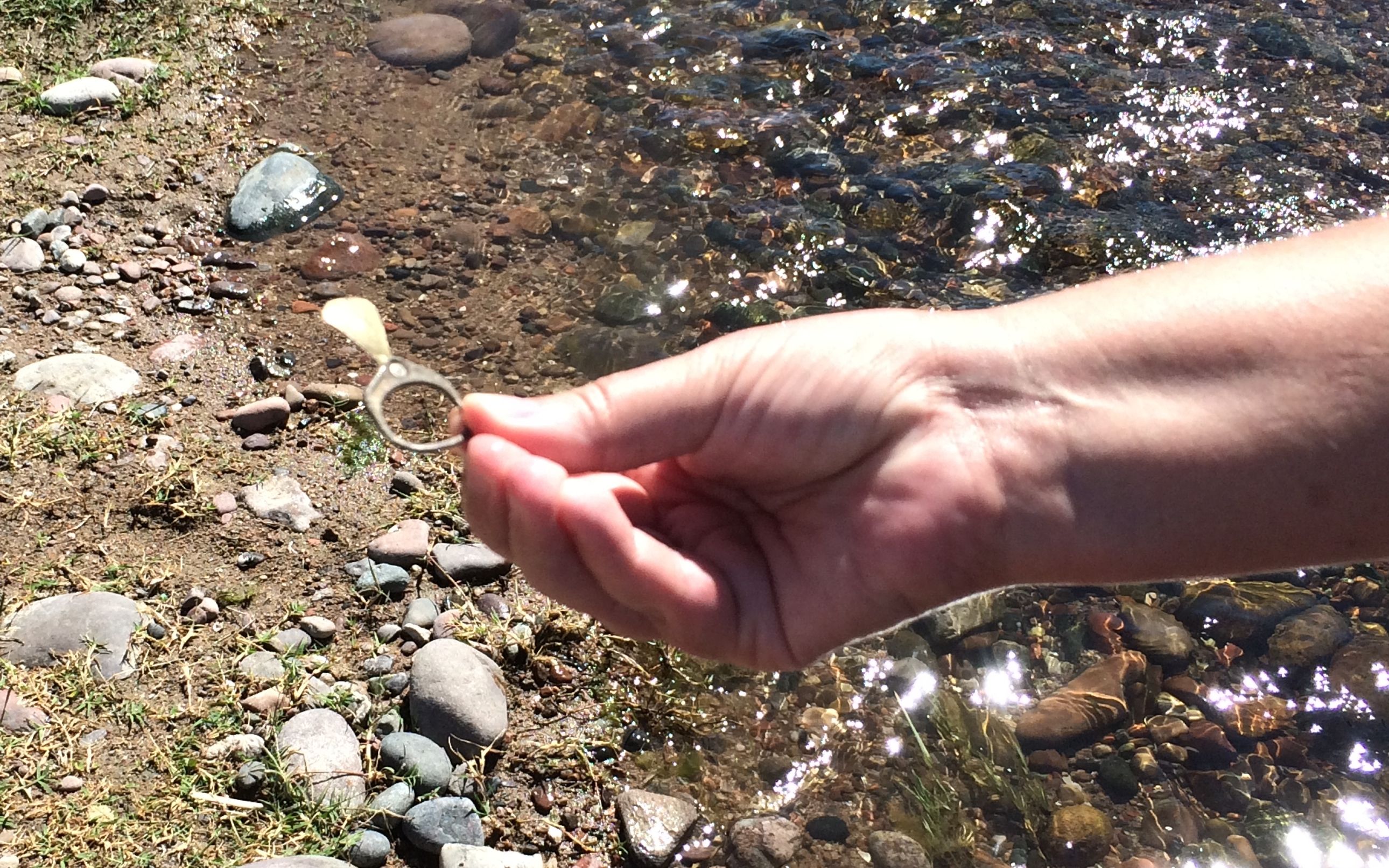
We even made a bit of an archeological discovery. An old fashioned pop top!
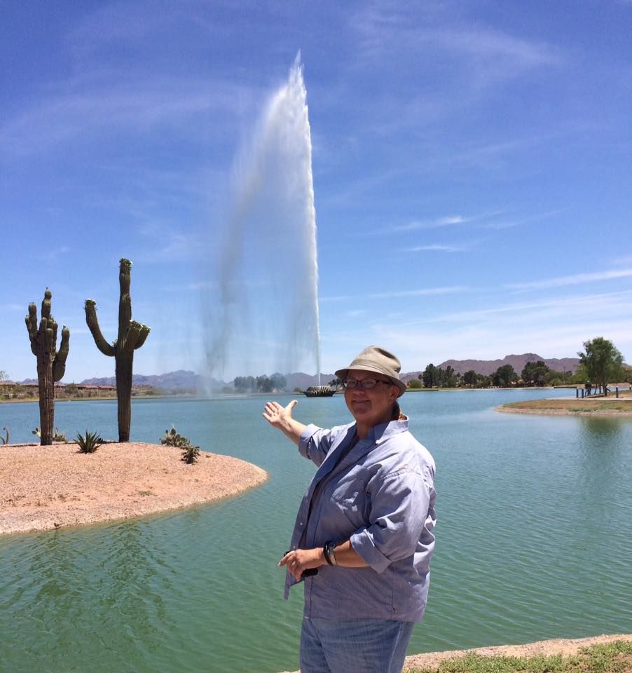
Another day, we took a trip out to Fountain Hills. Here’s the fountain.
It goes off fifteen times a day, on the hour, depending on the weather. It rises from the center of a 28 acre lake to a height of 560 feet. It is five feet taller than Notre Dame Cathedral in Paris. It reaches 110 feet higher than the Great Pyramid in Egypt and is more than three times as high as Old Faithful Geyser in Yellowstone Park.
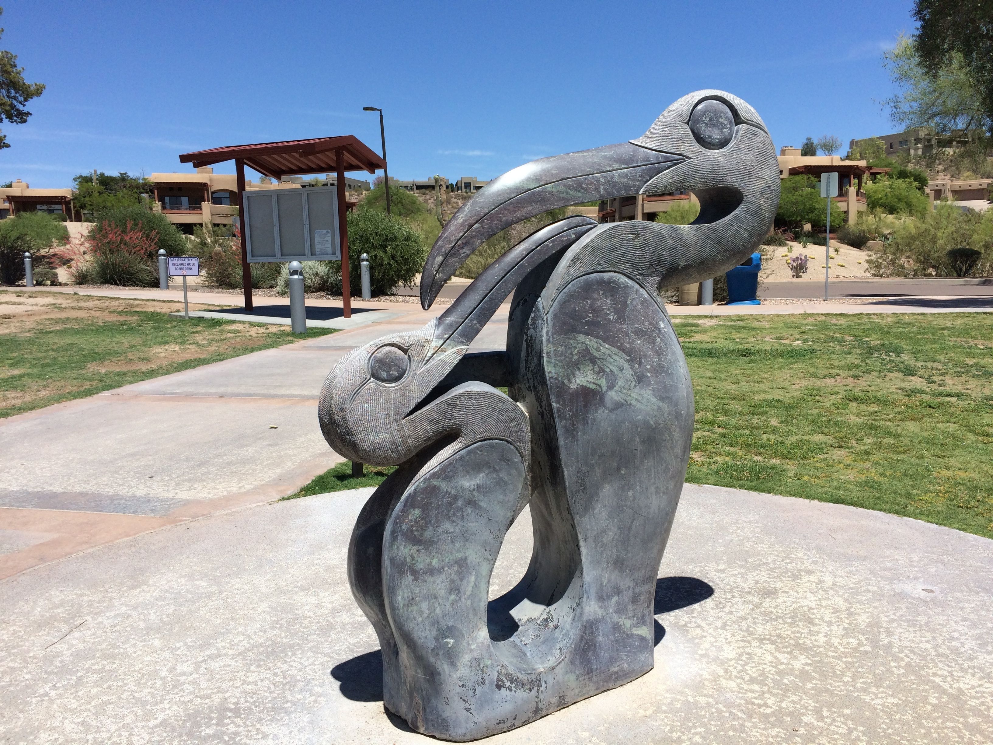
They have sculptures around the lake. Here is a small selection of them.
An All Day Job by Rasheas MukwairaFred and Ginger by Pat Mack
This was donated by two high school sweethearts who married in 1947 and after 65 years of marriage they bought their last home in Fountain Hills.
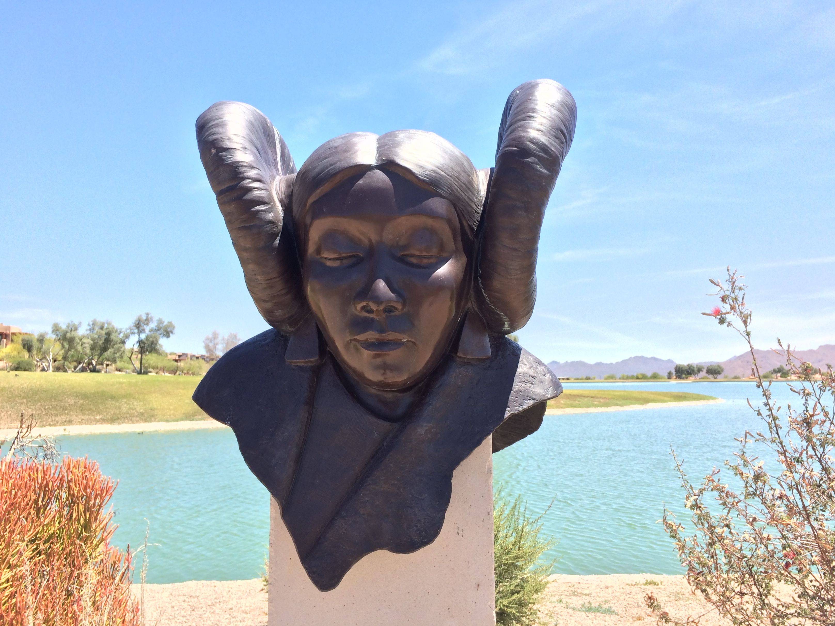
Second Mesa Maiden by Martha Pettigrew
While I was in town, it finally got hot. I mean, it was really hot!
But, as they say, it’s a dry heat. I decided to go for a walk one day. I got about two blocks before I realized that there was no real reason to go for a stroll in the middle of the day when the temperature was hovering around the century mark.
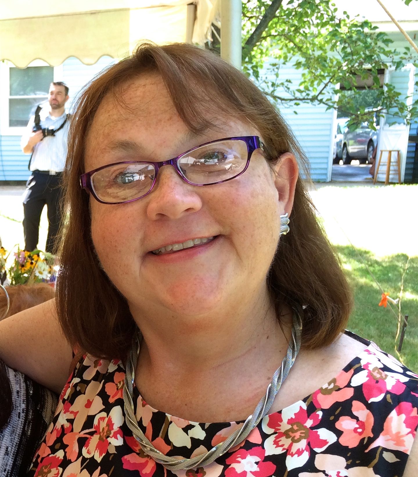
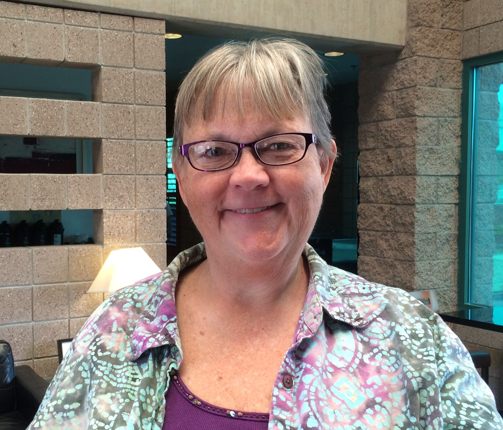
I decided that when I got my hair done for my godson, Paul’s, wedding last summer that I was not going to color my hair anymore.
This is a shot from last summer.
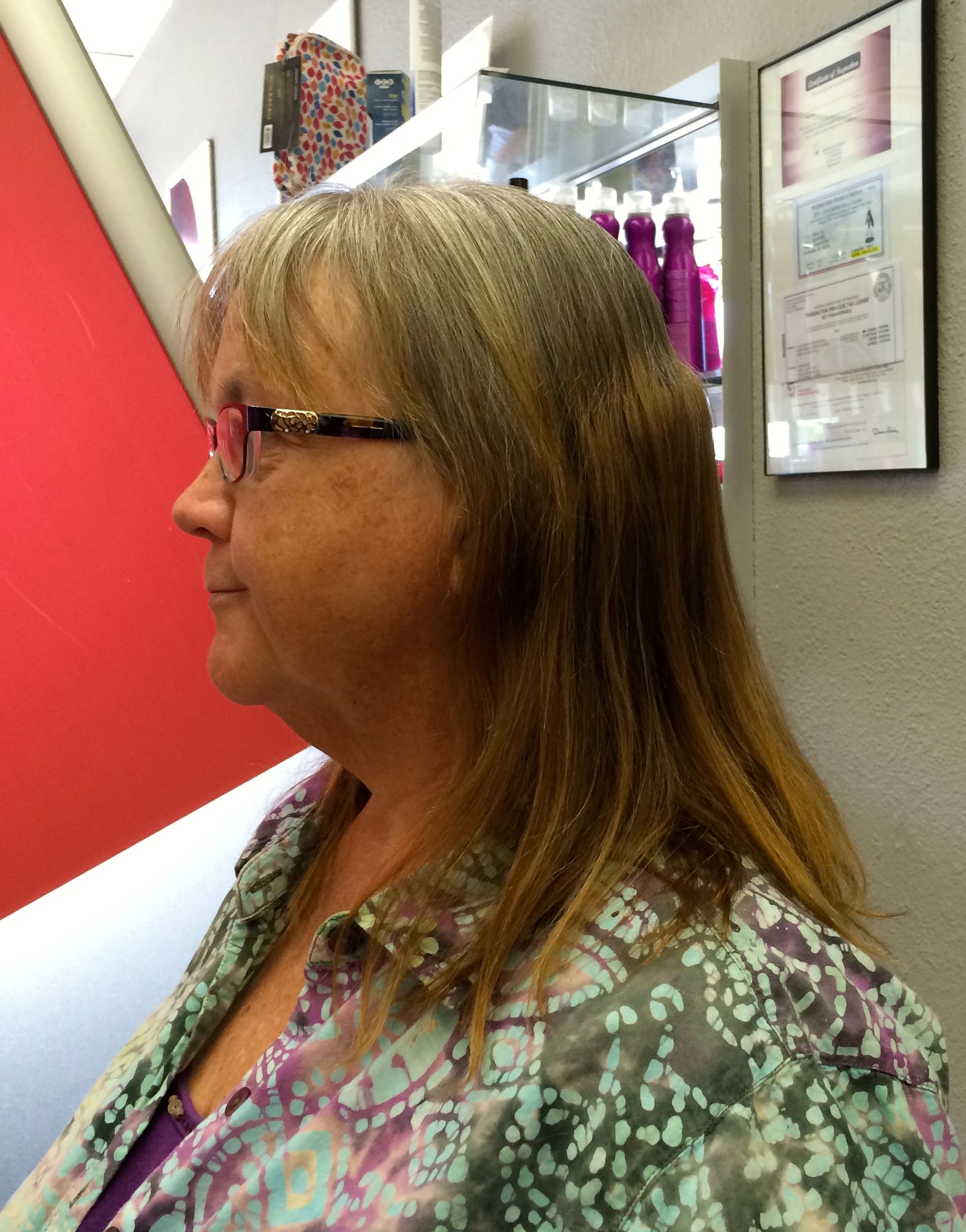
So, I had pretty much been letting it grow. I’d trim my bangs, but other than that, I was definitely going the low maintenance route.
My hair had gotten quite long, but it was time to do something with it. I looked up a Great Clips and presented myself to the stylist. I told him that I wanted to cut away the color processed portions and to turn the remainder into something attractive. I told him that I was thinking a pixie cut, but I wasn’t too worried. After all, hair will grow.
And this is what I got. I thought I would be grayer, but at least it’s all natural.
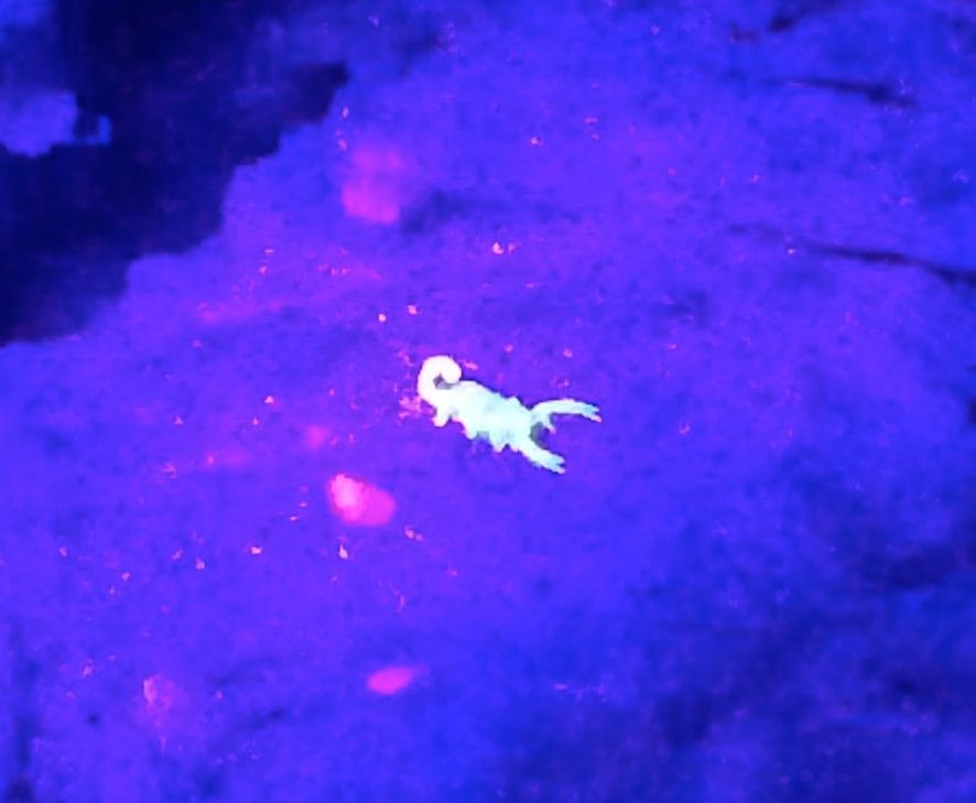
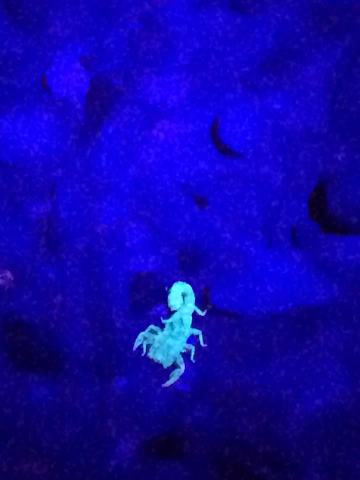
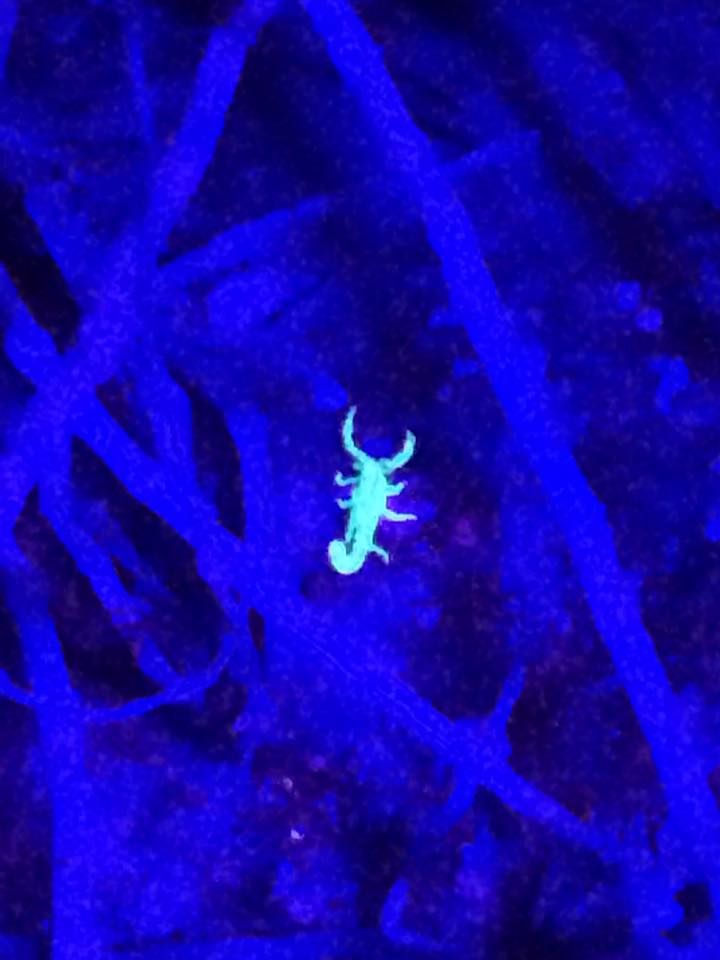
Konnie and I had one more adventure on tap. We were going to go scorpion hunting! This is an activity that takes place after dark. You use a black light flashlight and look at the base of plants and under rocks.
The first thing we had to do was to arrive at the park before 7:00. The gate closes at that hour, although you can get out of the park until 11:00.
So, we took a walk up a trail and waited for the sun to set. It finally got dark and then the magic happened.
As Konnie shone the light, I could see the scorpions glowing between the cracks in the rocks. They had kind of a day-glo green color to them, although they look a different color in the photos.
Some of the rocks even fluoresce.
And it that’s not freaky enough, take a look at the video!
After that fun, my time in Phoenix was drawing to a close.
The great Airstream folks at Desert Autoplex RV did a marvelous job on getting Flo back in shape. They even washed Bart, so I looked really wonderful when I pulled off the lot. They did a great job of accommodating my schedule and I am happy to put them on my list of dealerships I am happy to recommend.
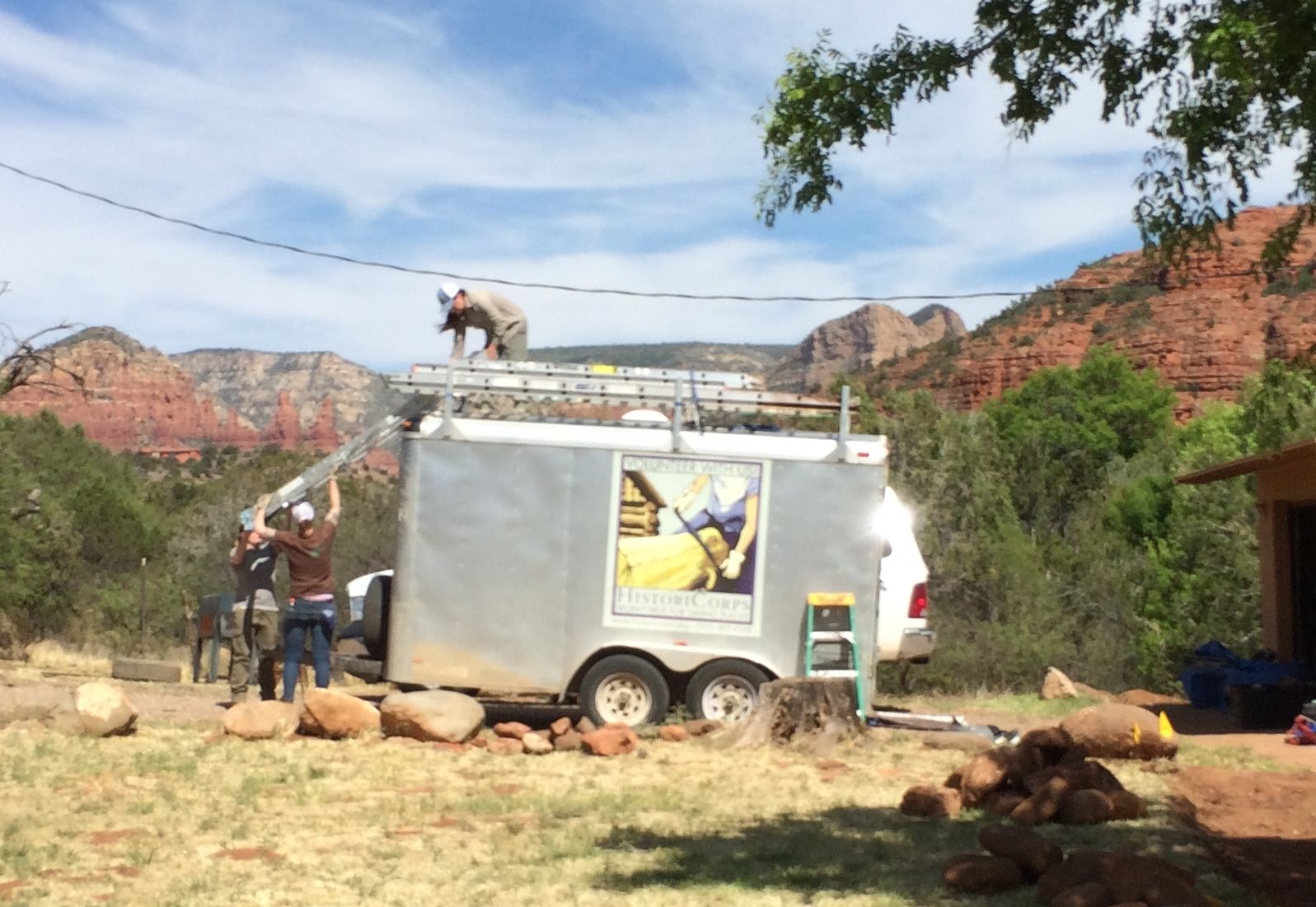
When I had stopped off for dinner in Blanding, Utah, after visiting Natural Arches National Monument, I had a decent cell signal. I checked my mail and found out that HistoriCorps had a project that needed an extra hand in Sedona. Since it fit in with my schedule, I volunteered. I got a phone call the next day that they wanted my help and could accommodate my trailer. That explains why I returned to Sedona so soon.
“We are a nonprofit organization that provides volunteers, students and veterans of all skill levels with a hands-on experience preserving historic structures on public lands across America. Volunteers and students work with HistoriCorps field staff to learn preservation skills and put those skills to work saving historic places that have fallen into disrepair.”
The team I was to be part of was working on Crescent Moon Ranch. It is an historic ranch from the early part of the twentieth century. There were a variety of buildings we were going to work on. My work while I was there focused on the main house, which can be rented out.
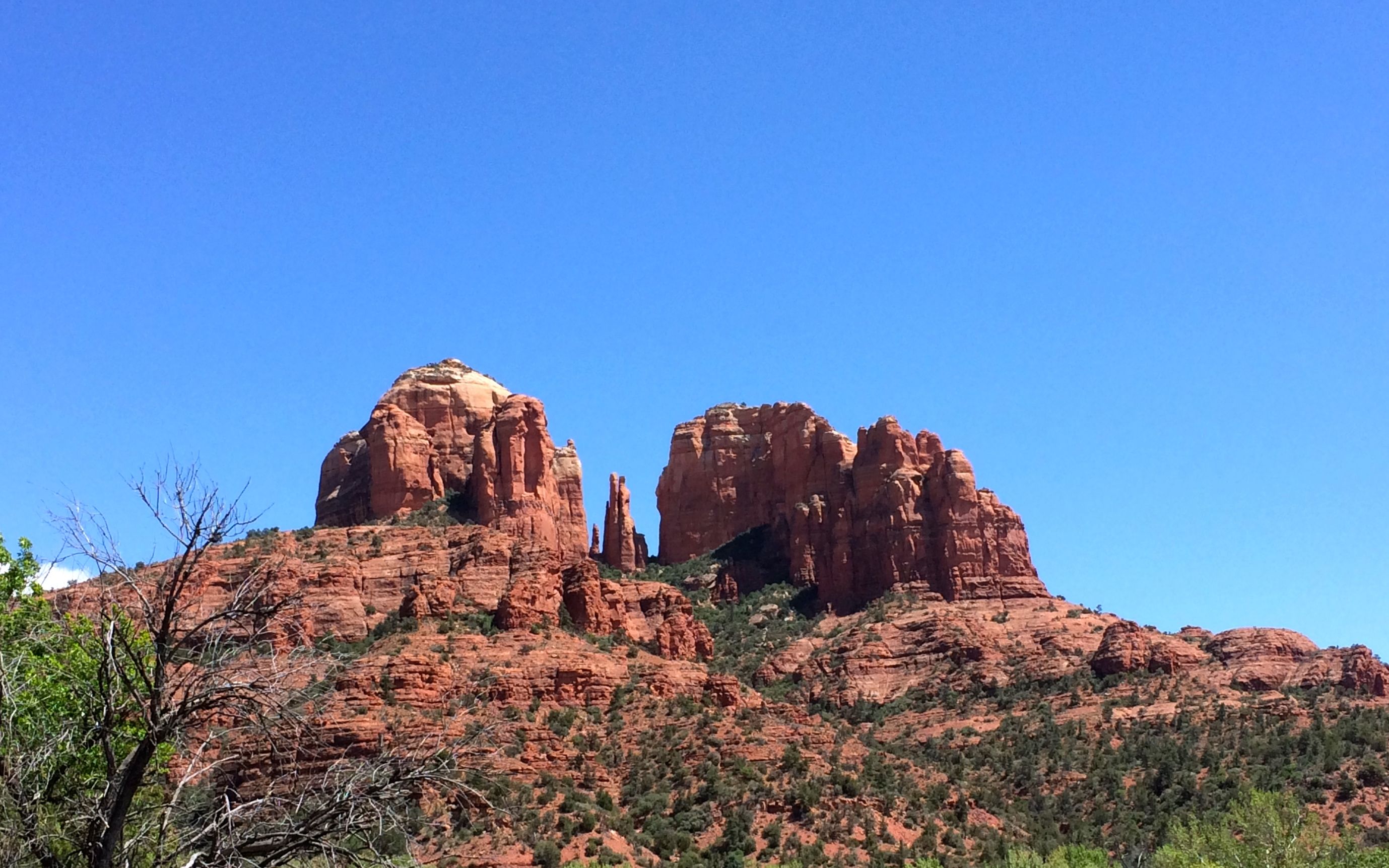
Do you remember my last visit to Sedona? I ended up having to camp quite a ways away. This time, I couldn’t have had a better site with a better view!
This is Cathedral Rock. According to some information I found after the fact, if you follow the creek upstream, you will come to a vortex site known as Buddah Beach. Too bad I didn’t go upstream. I did take a stroll by Oak Creek after work one day, but I went downstream.
The first day, we took a tour of the site.
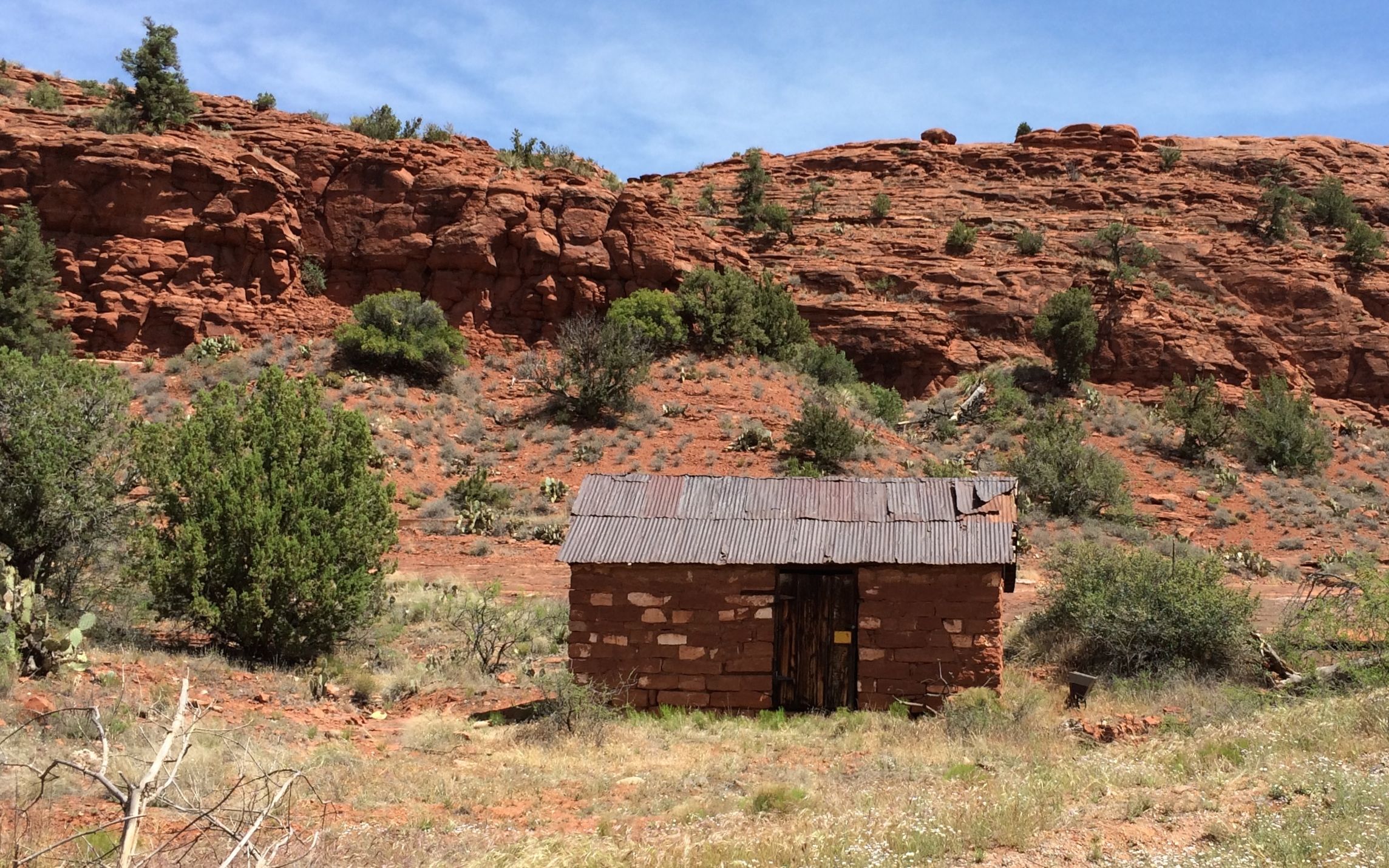
In addition to the cabin, there was a stone building.
I’m not sure what its original purpose was. I think I heard someone say it was a blacksmith shop.
The stonework was in pretty good shape, but some of the other parts were a little rough.
Speaking of rough condition, this was the canning shed. Apparently the famers used to do a steady business selling their canned fruit. One of the old cottonwood trees fell on it and took out a good-sized chunk of the roof.
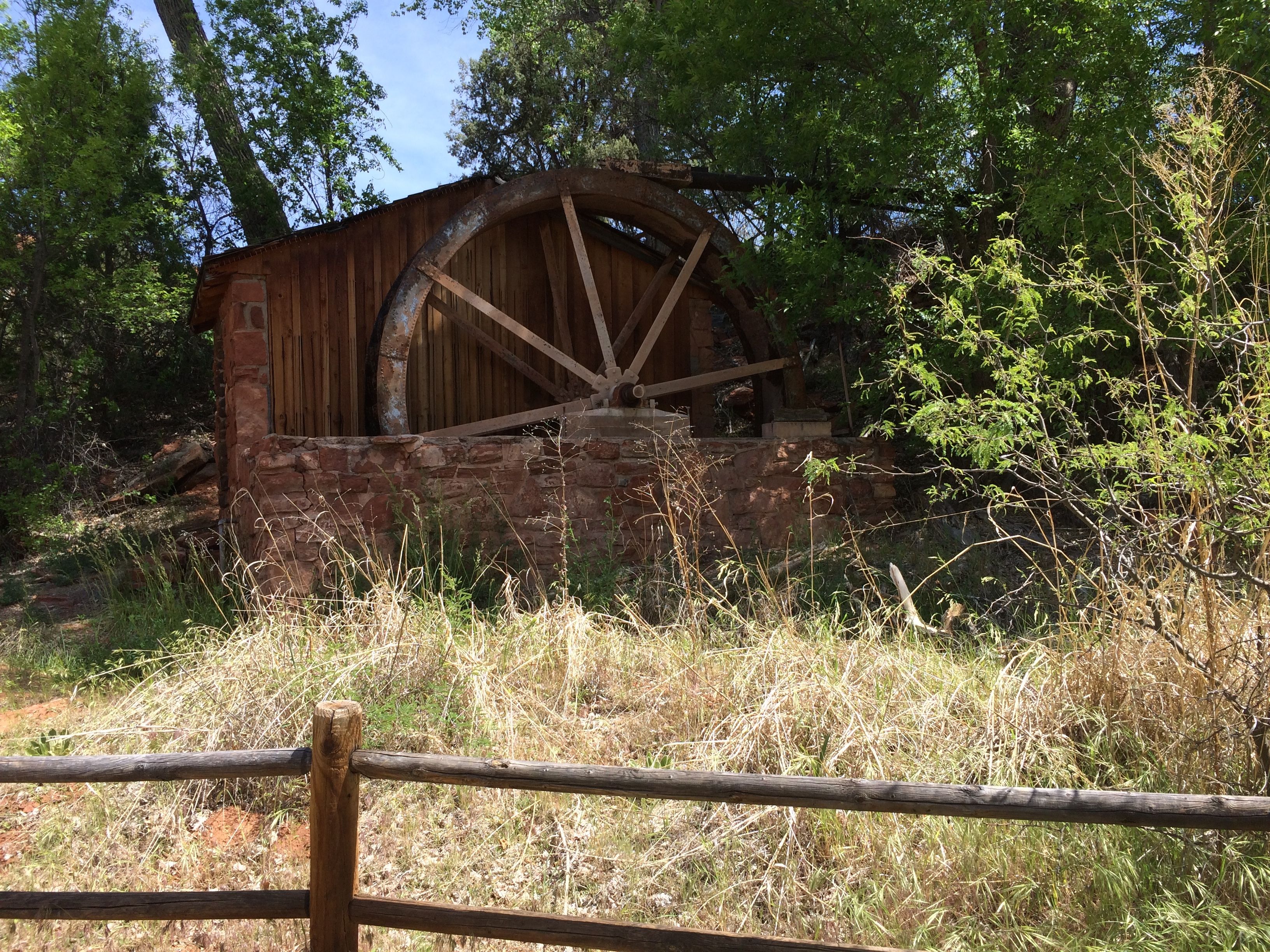
The last building on our tour was an old water wheel. The wheel was still turning, but I think it was being turned by the wind. I didn’t see any water passing over it. The archeologist that was leading the tour said that when the ditch carrying water was cleaned out, the water did power the wheel.
After that, we got to work.
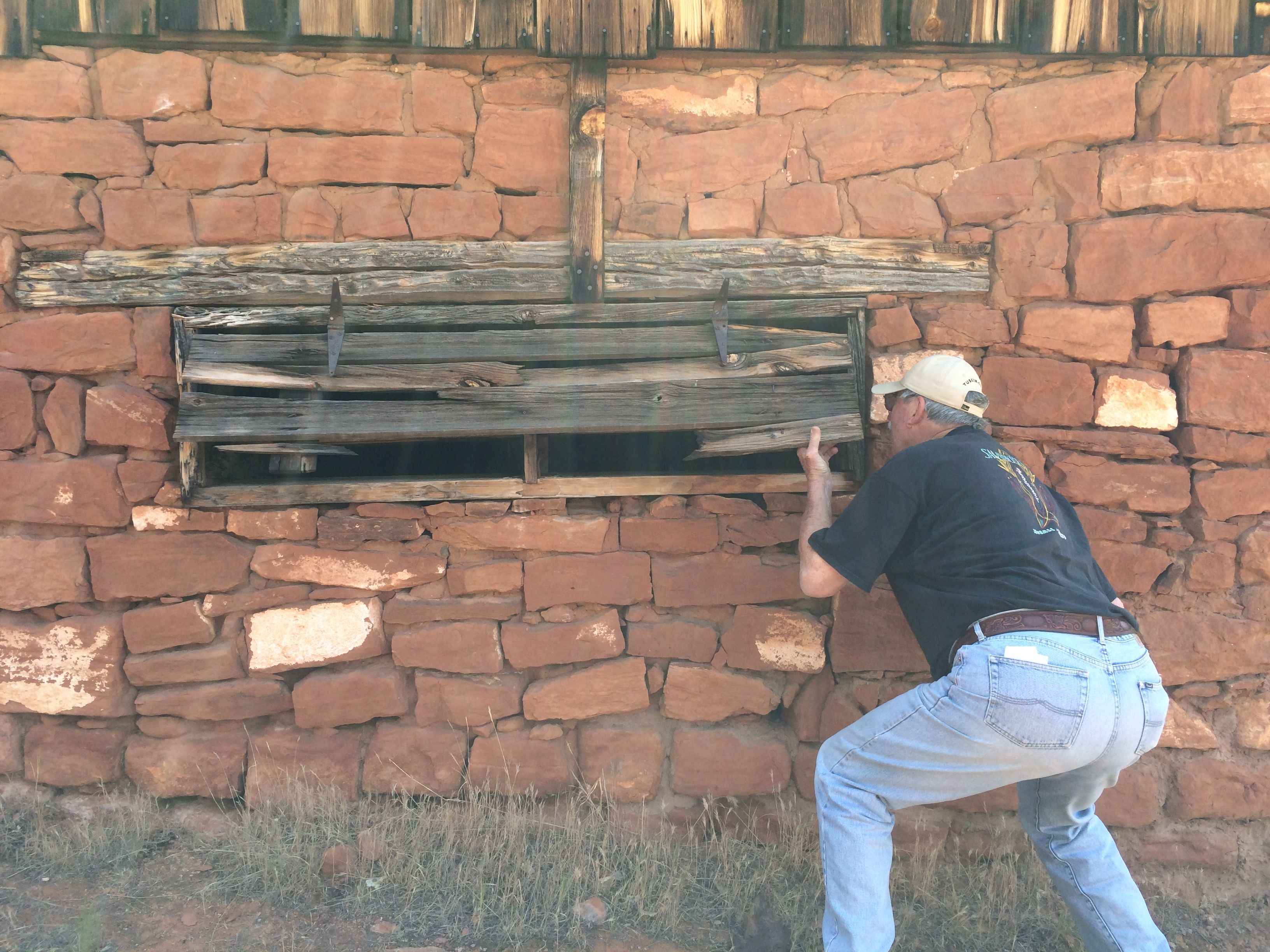
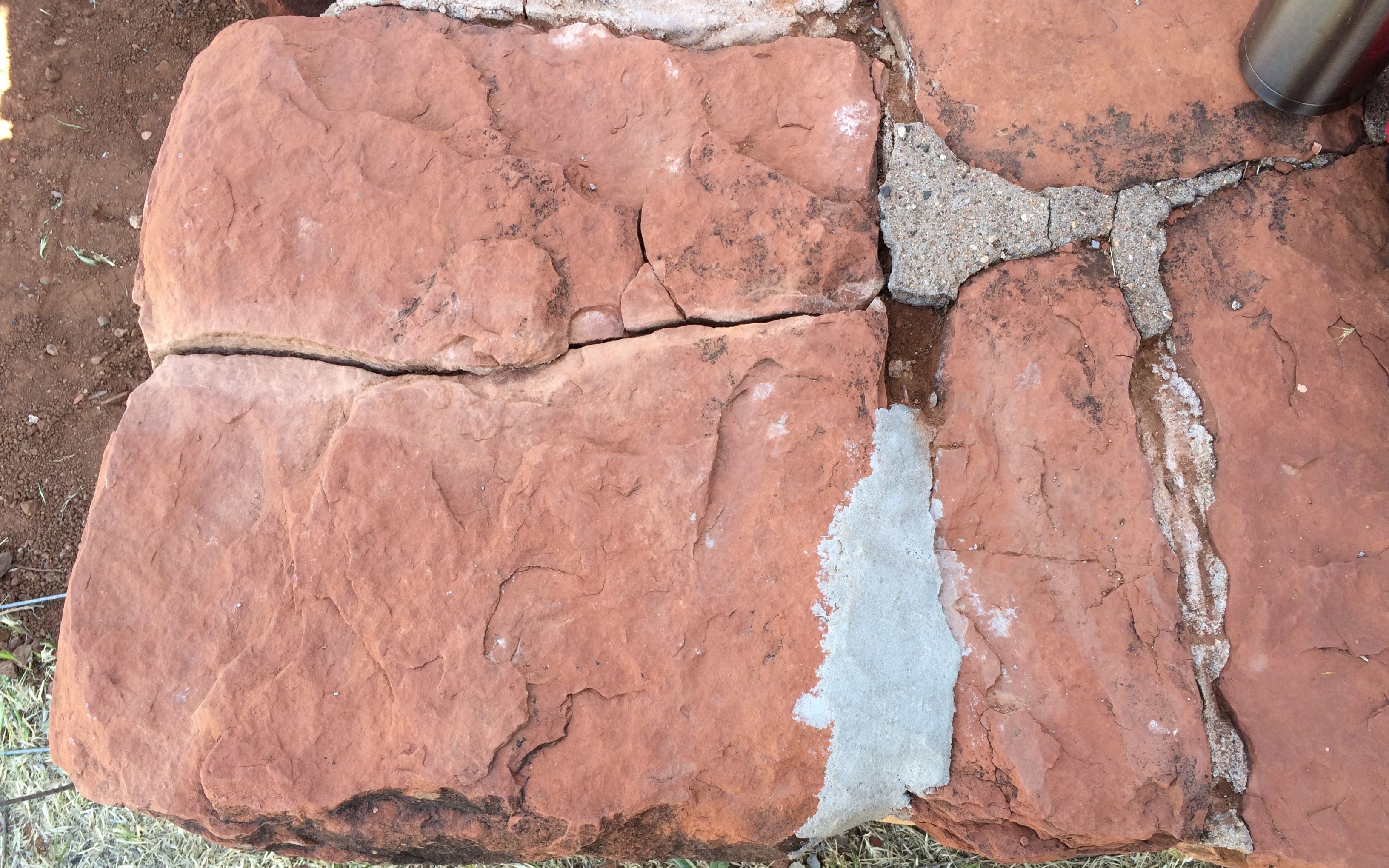
My first job was to remove some inappropriate caulk from the masonry by the pergola at the front door. See that nice clean crack? I did that! Believe it or not, it took me hours to pry it out.
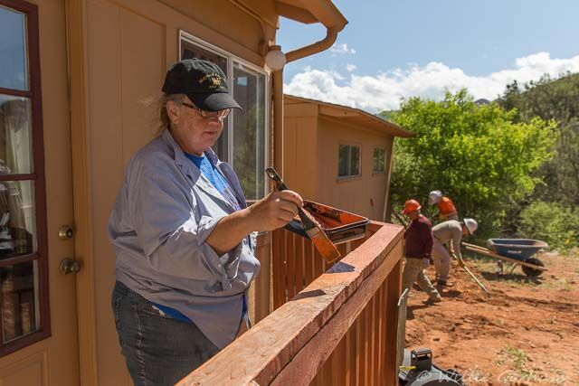
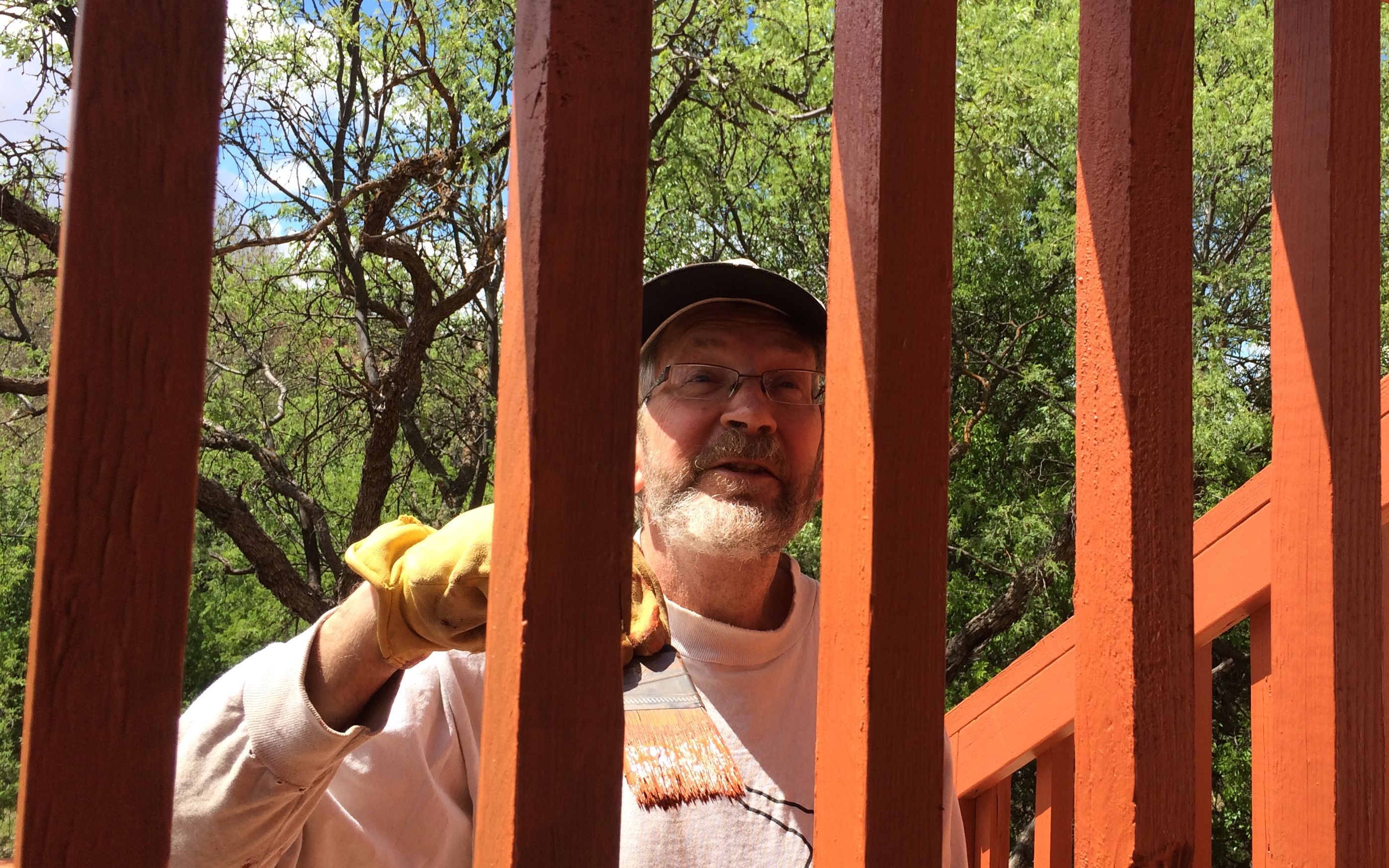
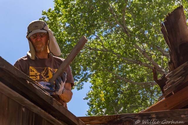
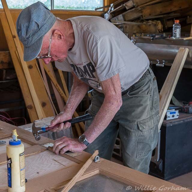
My second job was to work with Willie to stain one of the decks.
Photo copyright Willie Gorham
Here’s my partner in painting.
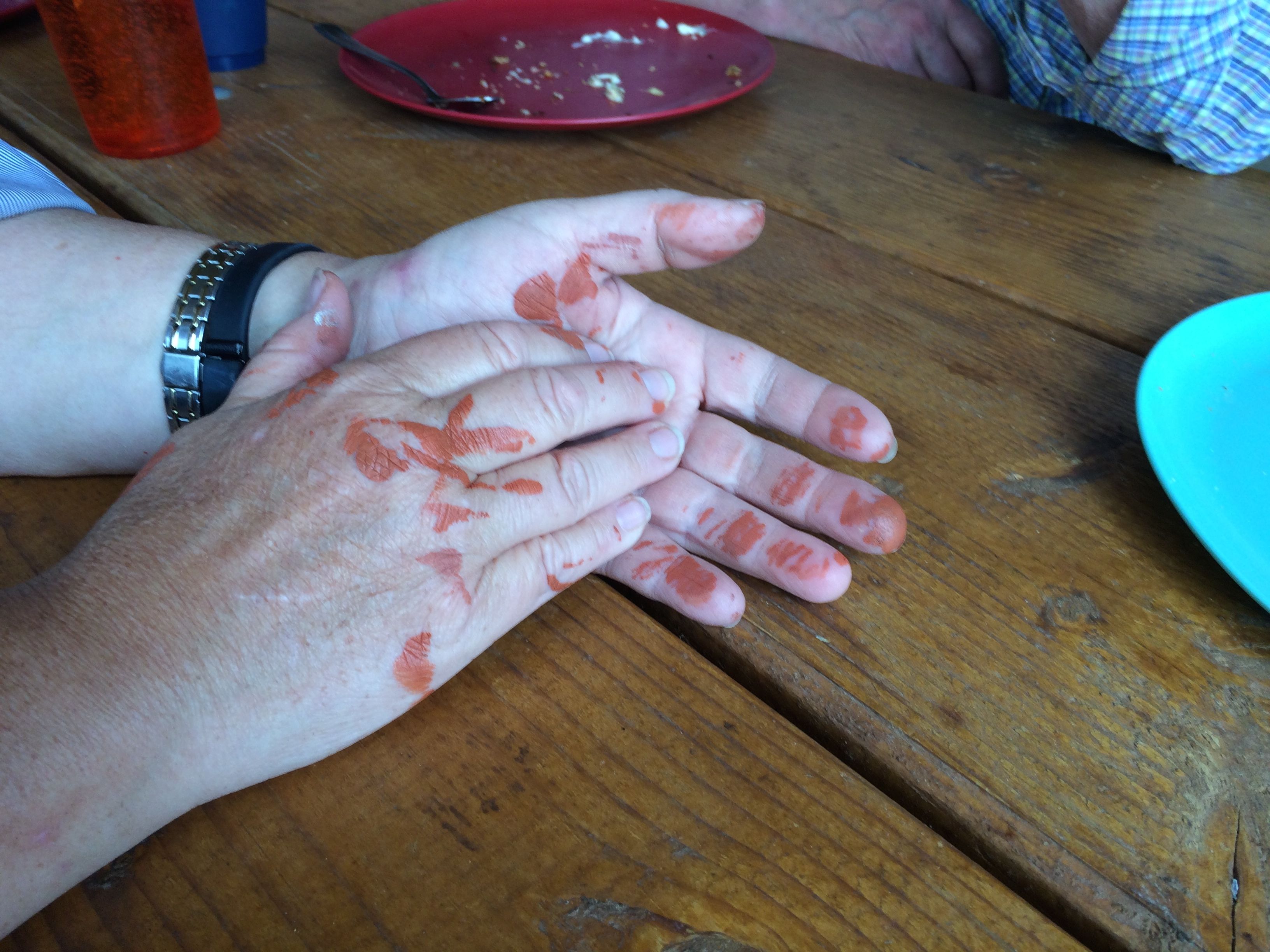
You will notice that Willie is wearing gloves and I am not.
This is what happens when you don’t wear gloves.
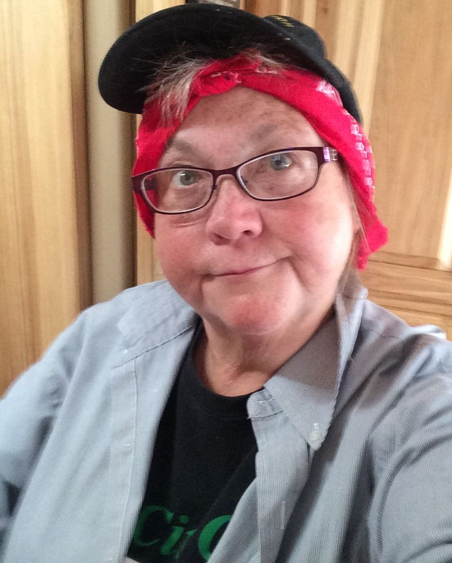
And this is what happens when you don’t wear sunscreen and you feel like the tops of your ears are getting burnt.
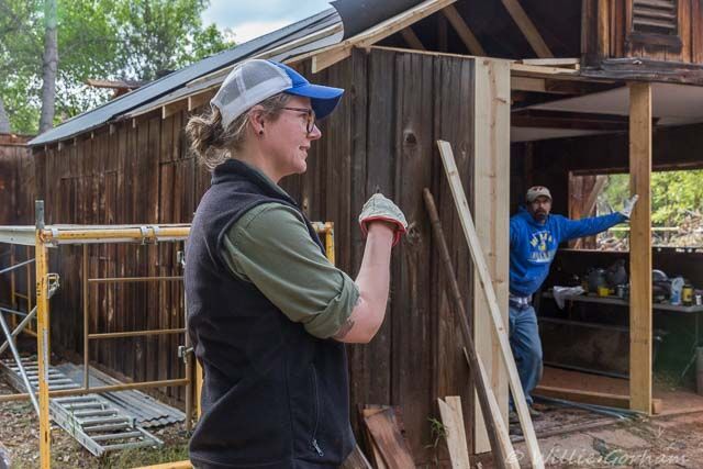
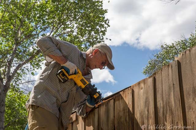
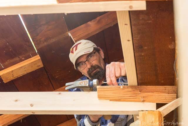
I am not sure about who was leading the project, but there were three people who were making things happen:
Megan
Copyright Willie Gorham
Ruth
Copyright Willie Gorham
and Steve.
Copyright Willie Gorham
Good thing I’m not getting graded on this report.
There was a lot of work going on at the Canning Shed.
Copyright Willie Gorham
Most of it was off the ground work.
Copyright Willie Gorham
I don’t do off the ground. In fact, standing on the deck and staining was adventurous enough for me.
copyright Willie Gorham
The group of people who were taking part in the project while I was there was an interesting group.
First of all, there were the names. We had three men named William – although two went by Bill and one went by Willie. There were two Johns. There were even two Kims! They tried to call me Tex, because of my license plates, but that didn’t seem to stick.
We had a retired dentist and a retired FBI agent. I’m not sure I’ve even met an FBI agent before – retired or not.
And, they were just overall nice people.
copyright Willie Gorham
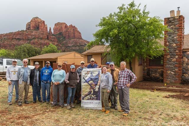
It rained the last day I was there – I had to leave early to get to Phoenix to get Flo repaired. Luckily, the sun came out in time for a group shot.
copyright Willie Gorham
I’m looking forward to my next project with HistoriCorps. I will be working to help restore the first school George Washington Carver attended in Neosho, Missouri.
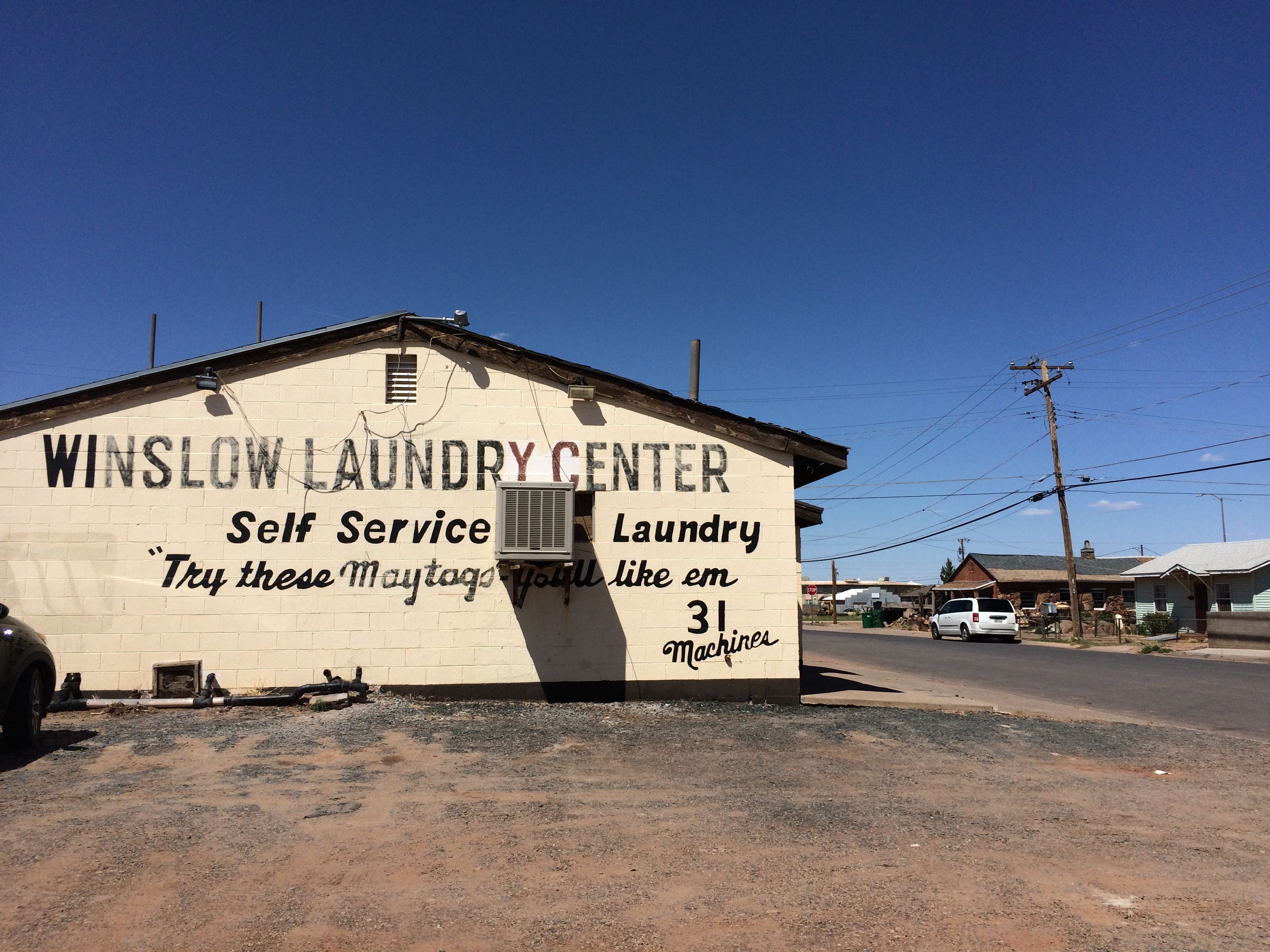
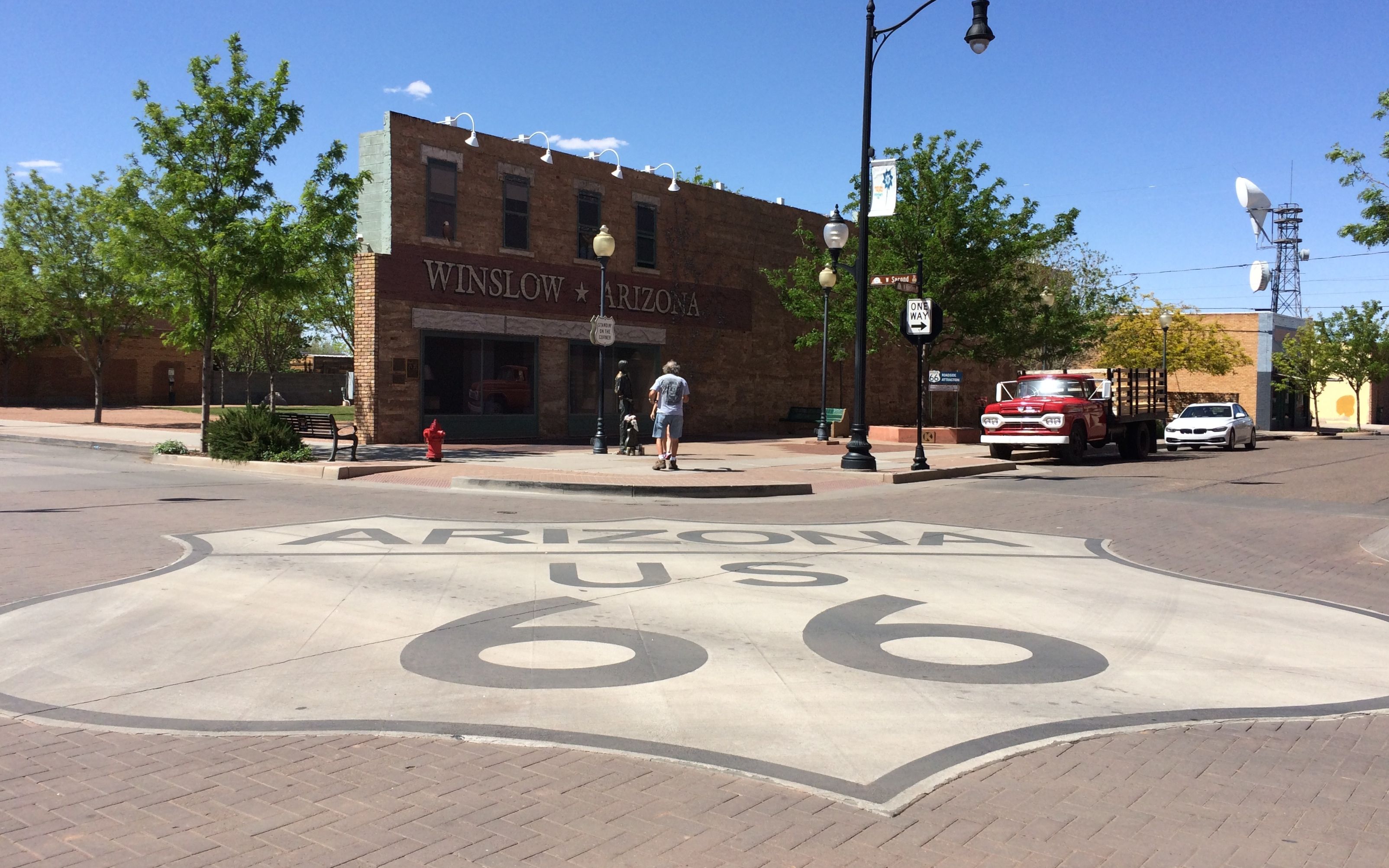
I was just a few miles away, so I had to stop in and visit Winslow, Arizona.
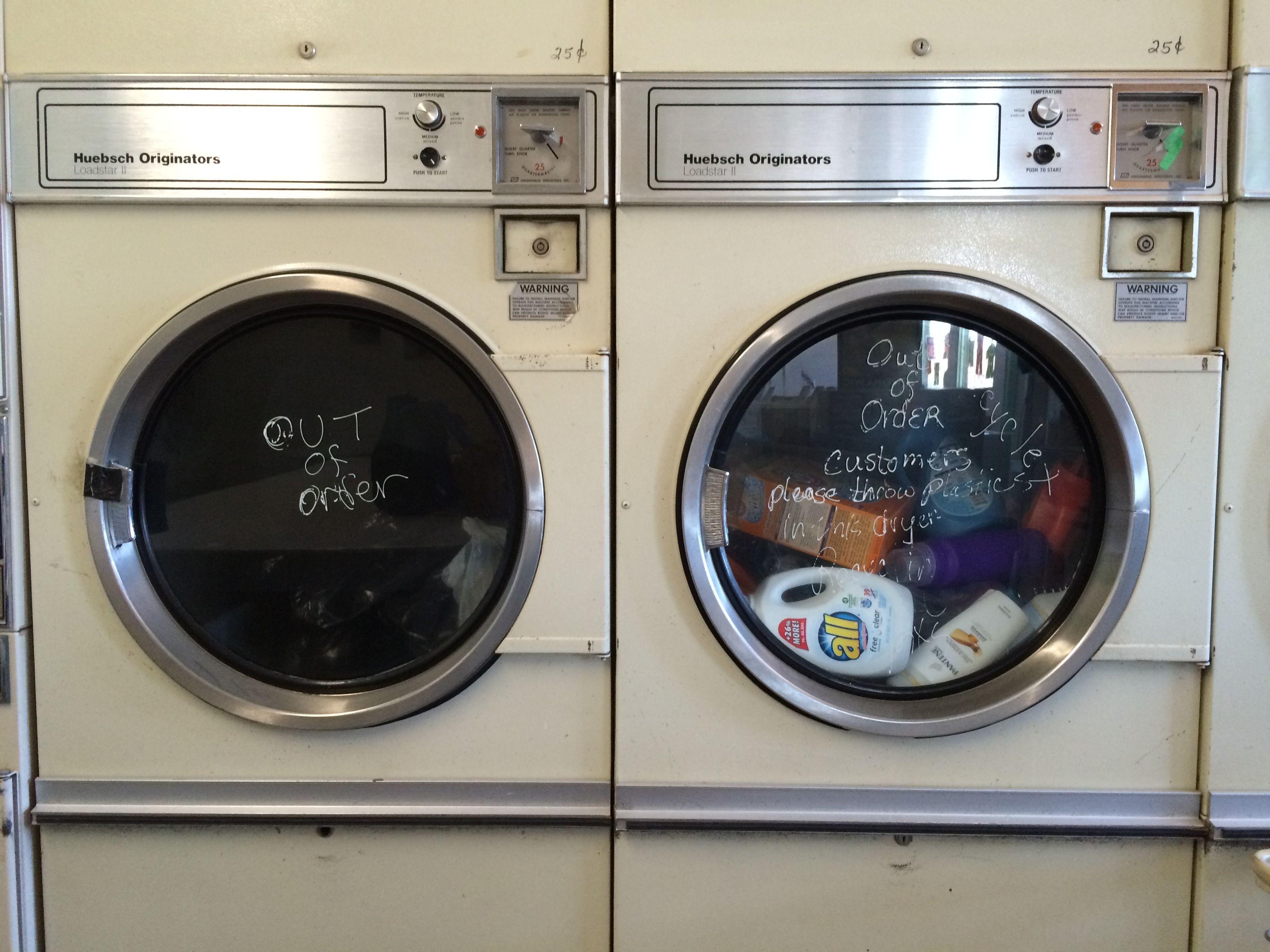
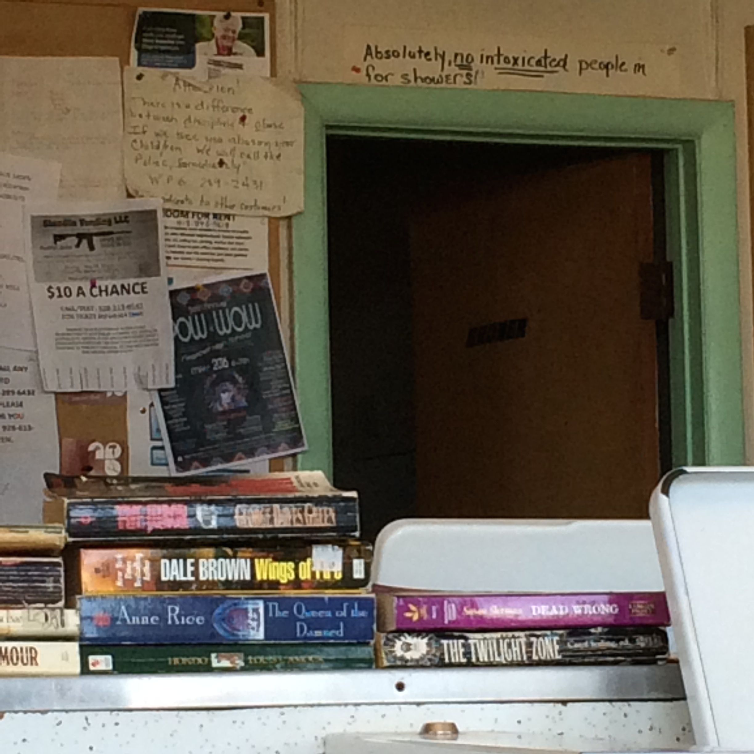
Actually what I really had to do was my laundry.
The did have 31 machines. Many of them worked.
Some of the dryers that didn’t work were repurposed into recycle bins. It wasn’t busy, so I managed to get my clothes cleaned and dried in short order.
I could even have exchanged books and taken a shower. Since I wasn’t intoxicated, I would have been permitted to take one. I knew I’d be able to take one at my next stop, so I skipped the shower.
Clothes done, it was time to find that corner!
Luckily, there was plenty of on-street parking. Of course, I did take up most of a block. I parked and strolled down the street.
The next day, I got hitched up and headed toward the Petrified Forest and Painted Desert. It was only a two hour drive, so I planned to see the park the same day.
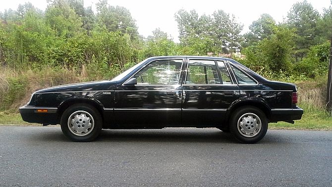
I had been there before, in 1987, after my first year teaching in Kalamazoo. I had my first brand-new car and I did what any sensible person who likes to travel and drive would do: I drove to California.
Ah, I loved my car! It was a Dodge Lancer, and it looked like this:
Lancer, the Wonder Car,
Takes me places near and far.
I drive and drive ’til there we are,
In Lancer, the Wonder Car.
Hmm…Maybe I need to come up with a song for Bart.
Anyway, back to this trip. I got to the park and stopped in the Visitors Center to see what information I could collect.
Then, I set out to explore.
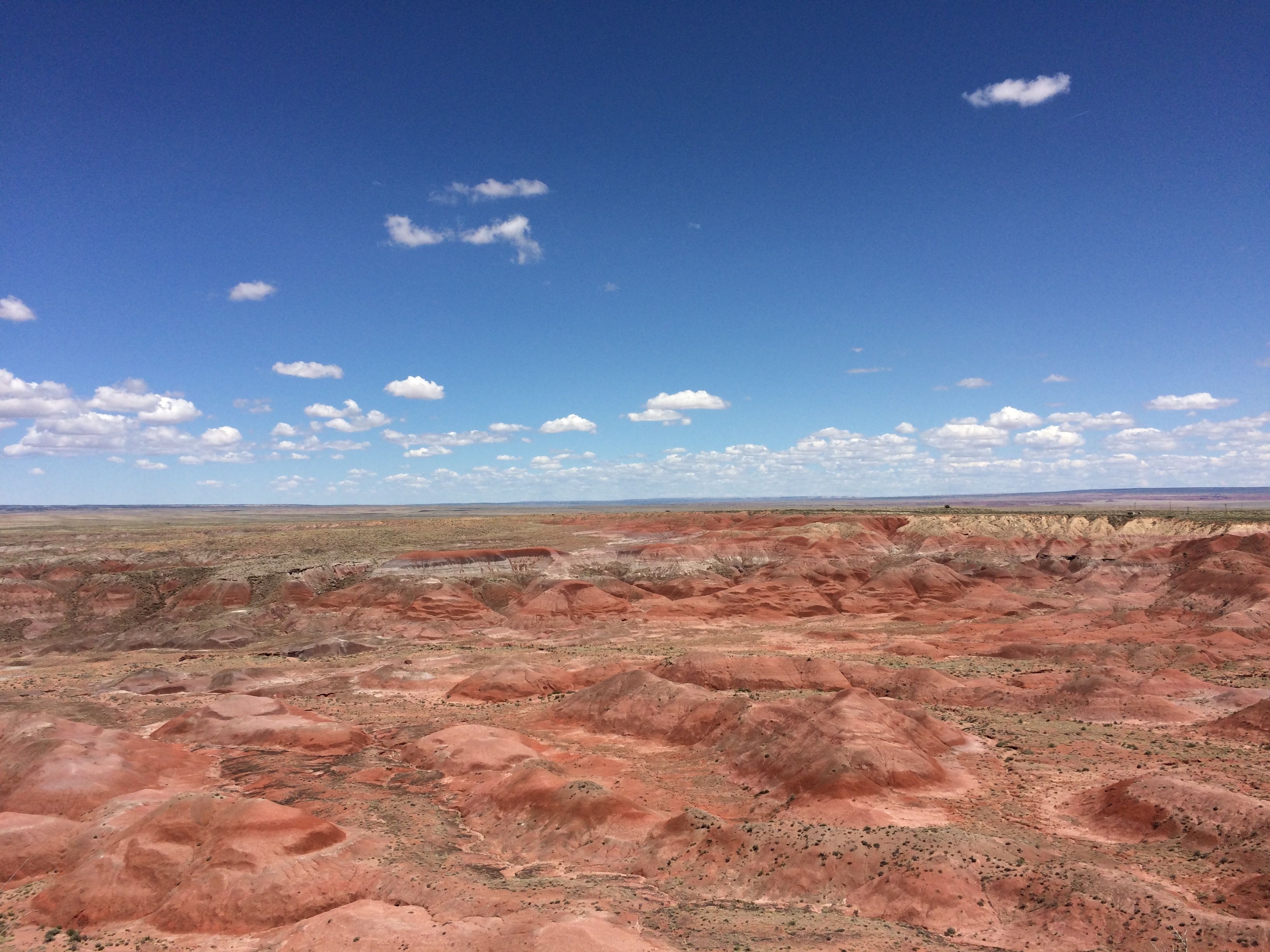
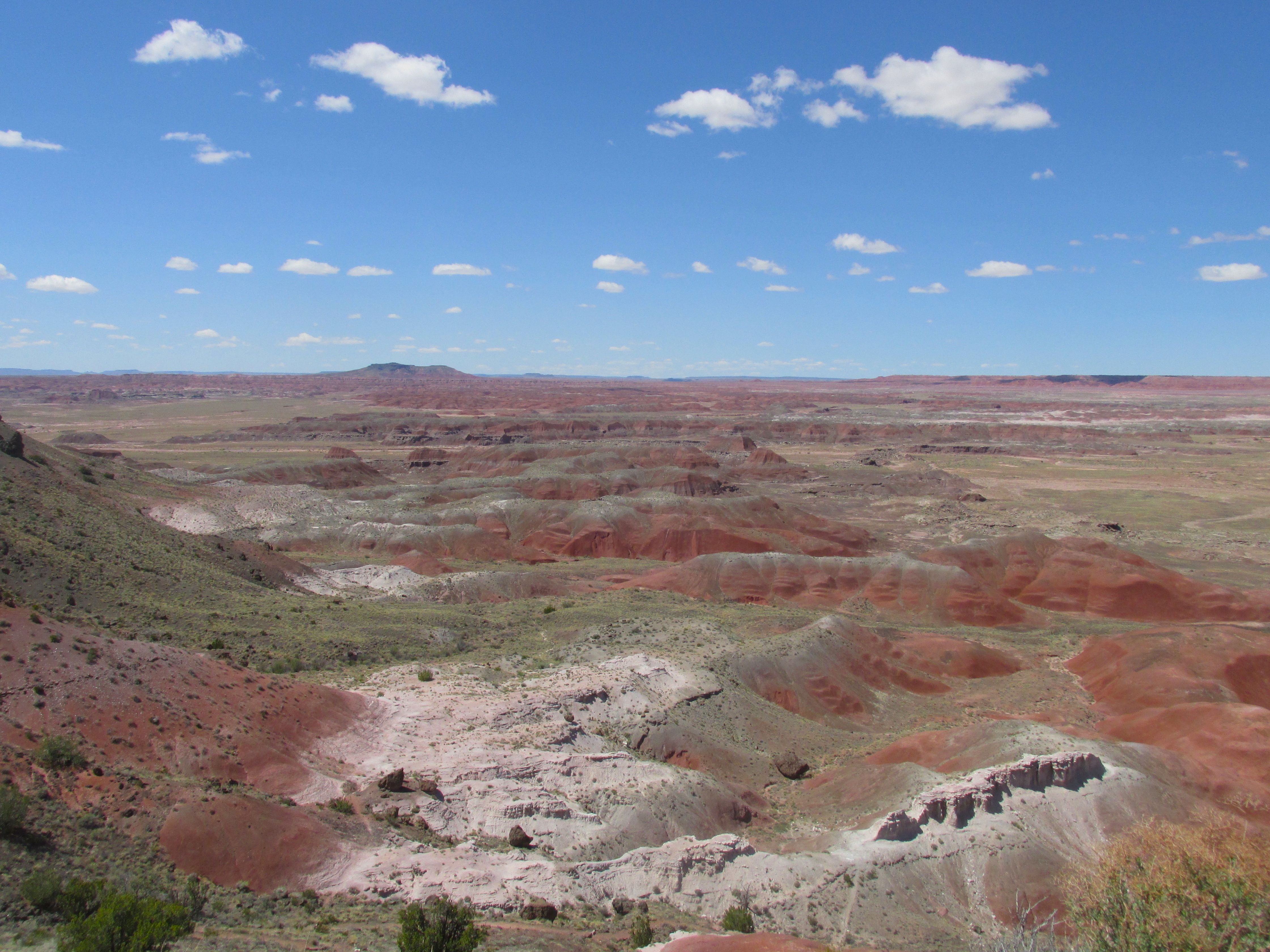
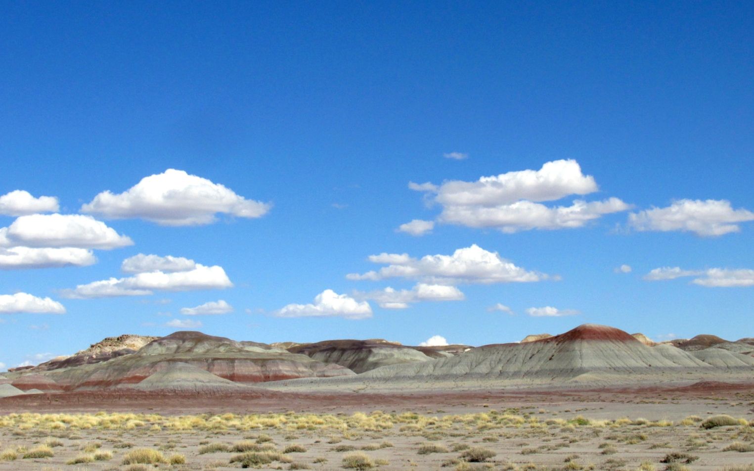
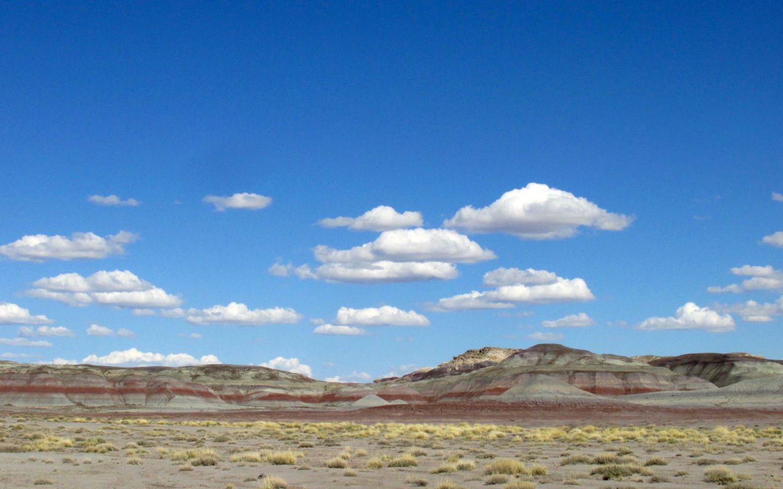
The Painted Desert was the first part I came to. When I was here before, I don’t remember the colors being so vivid. Perhaps the day was overcast.
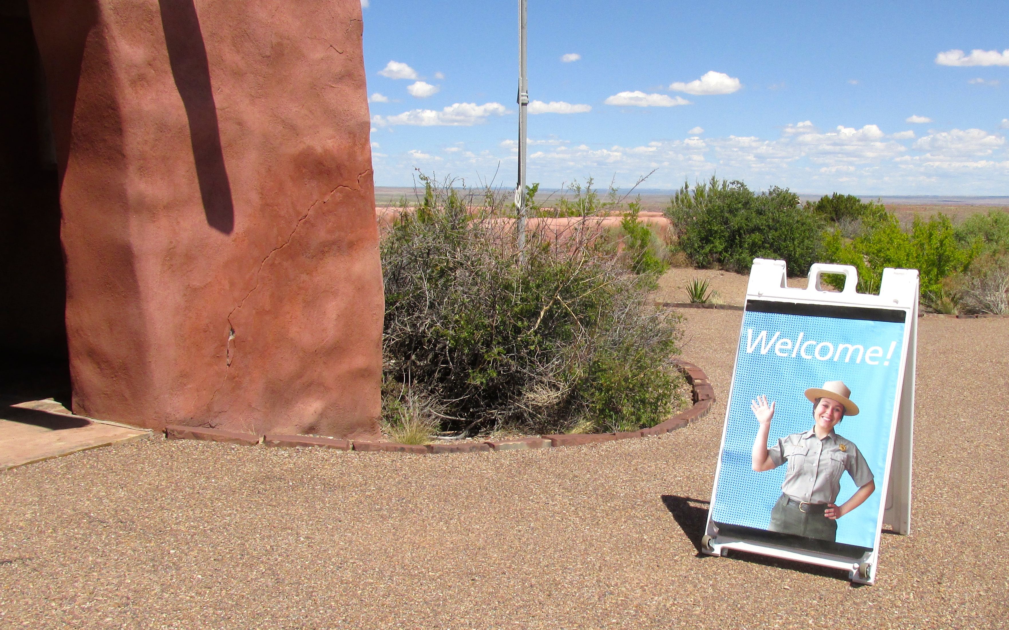
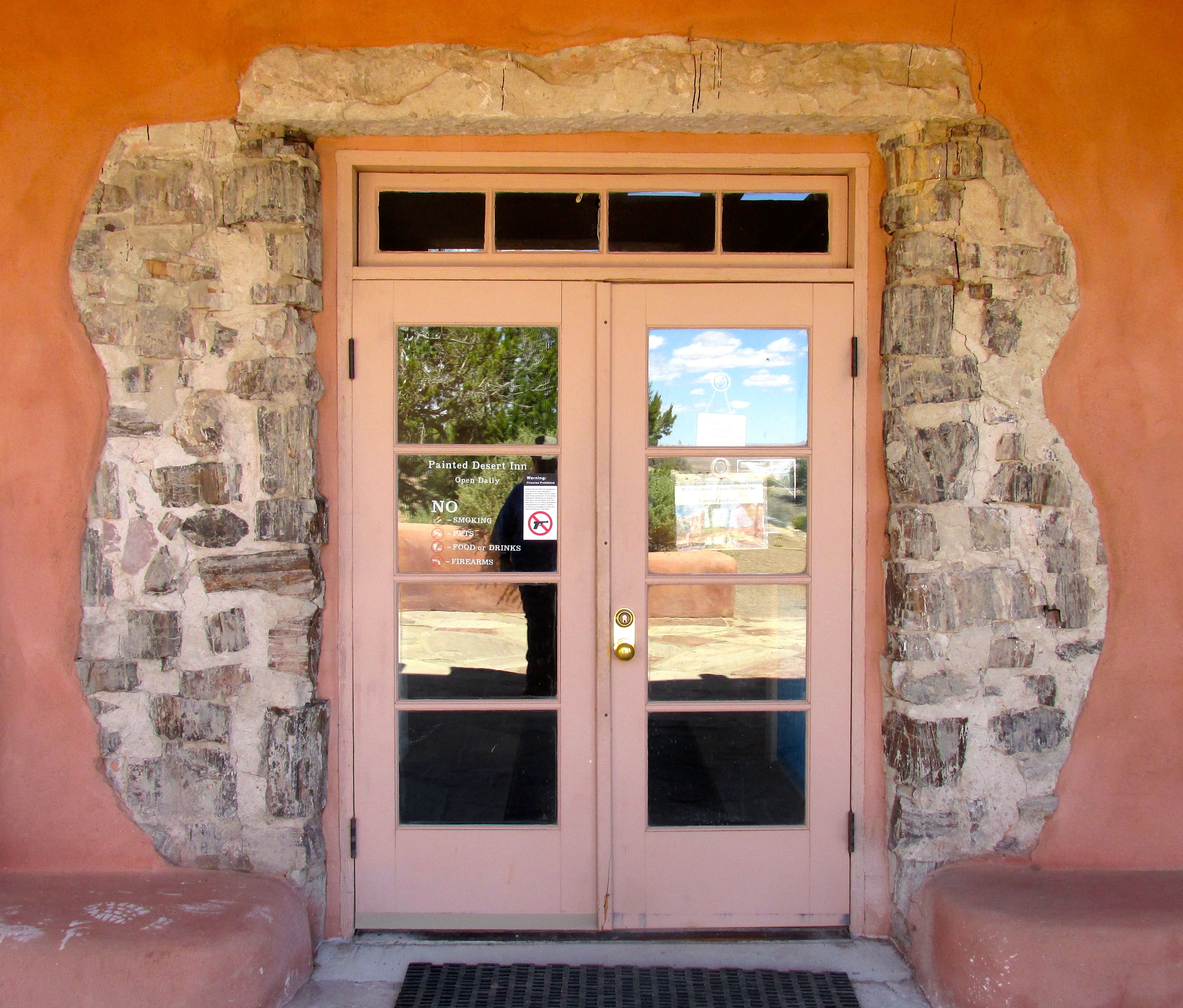
The next stop was the Painted Desert Inn. It has just undergone a restoration, so it was quite something to see.
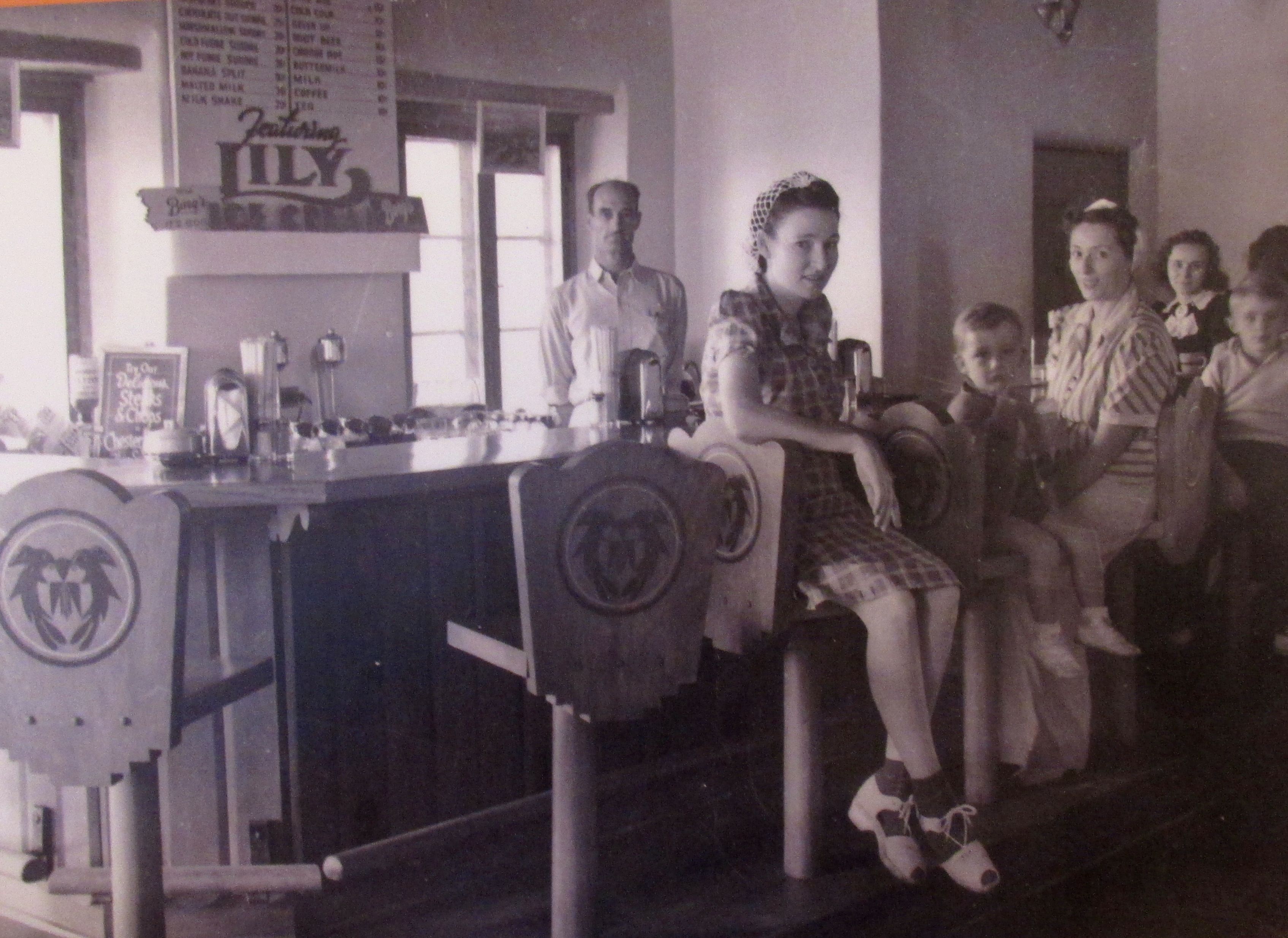
The original Inn was built of petrified wood in the 1920s. The Civilian Conservation Corps reworked the building in an adobe style in the late 1930s. It never had more than guest six rooms, and it appears that its main function was as a place to eat and take refreshment.
The building is now used as a museum.
Around the lower entrance, some of the petrified wood was left exposed.
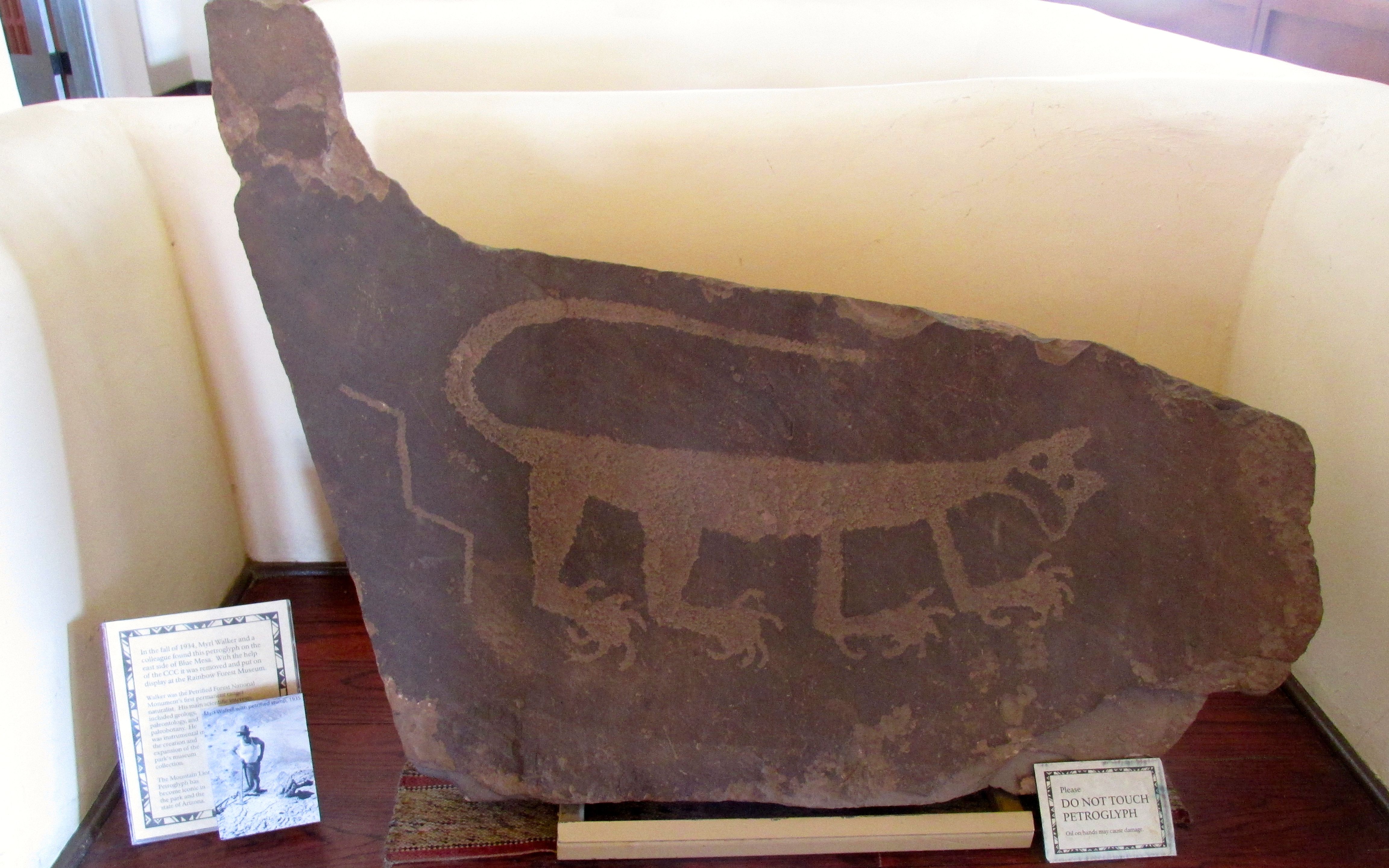
A very striking cat petroglyph is in the lobby. I’d never seen such a naturalistic petroglyph before.
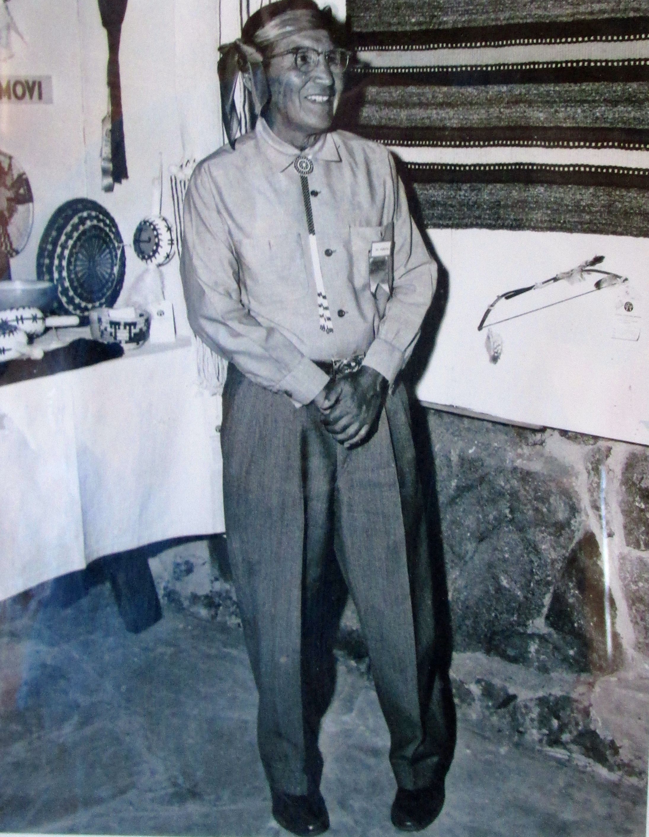
Fred Kabotie, Hopi Artist
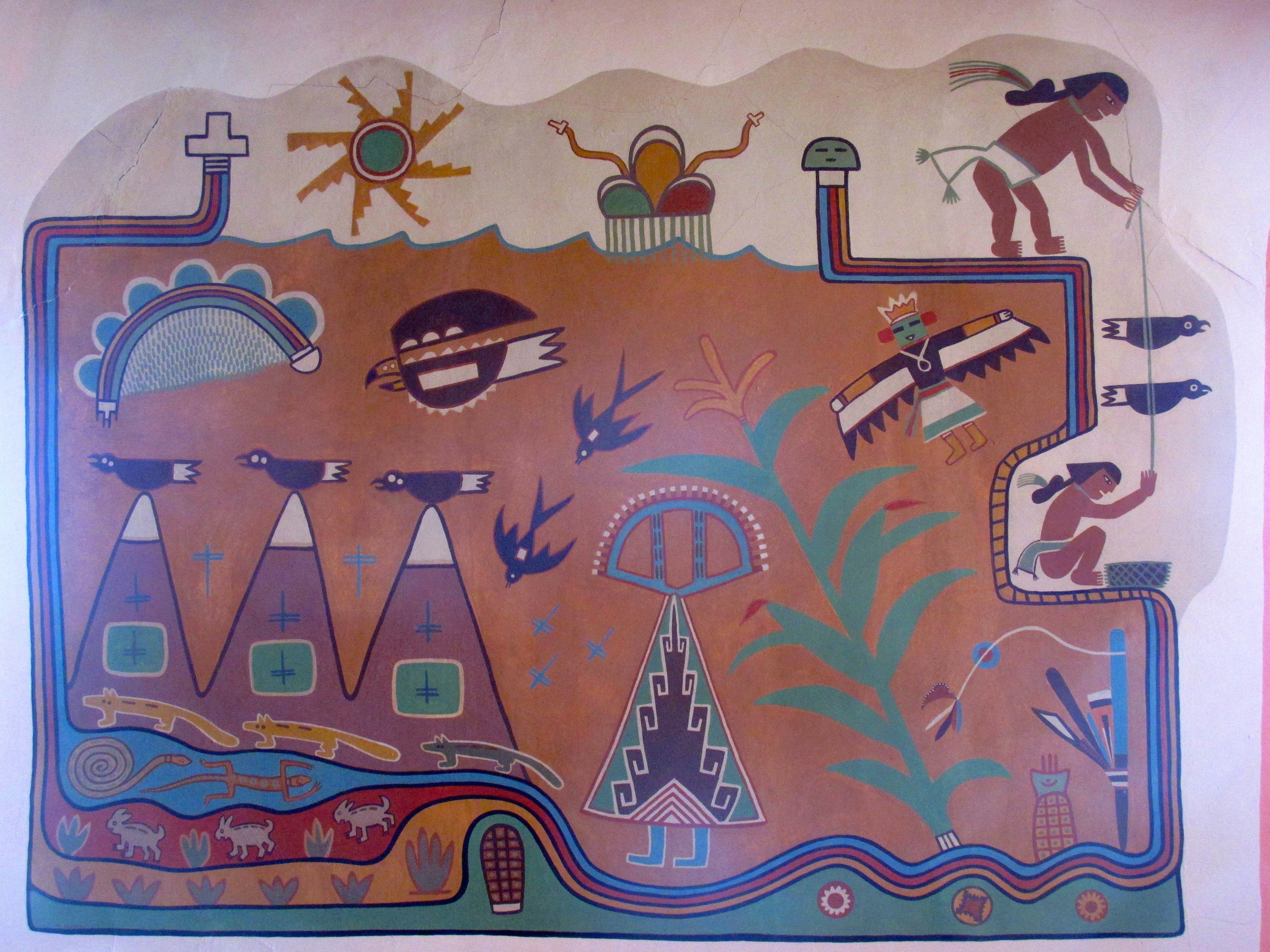
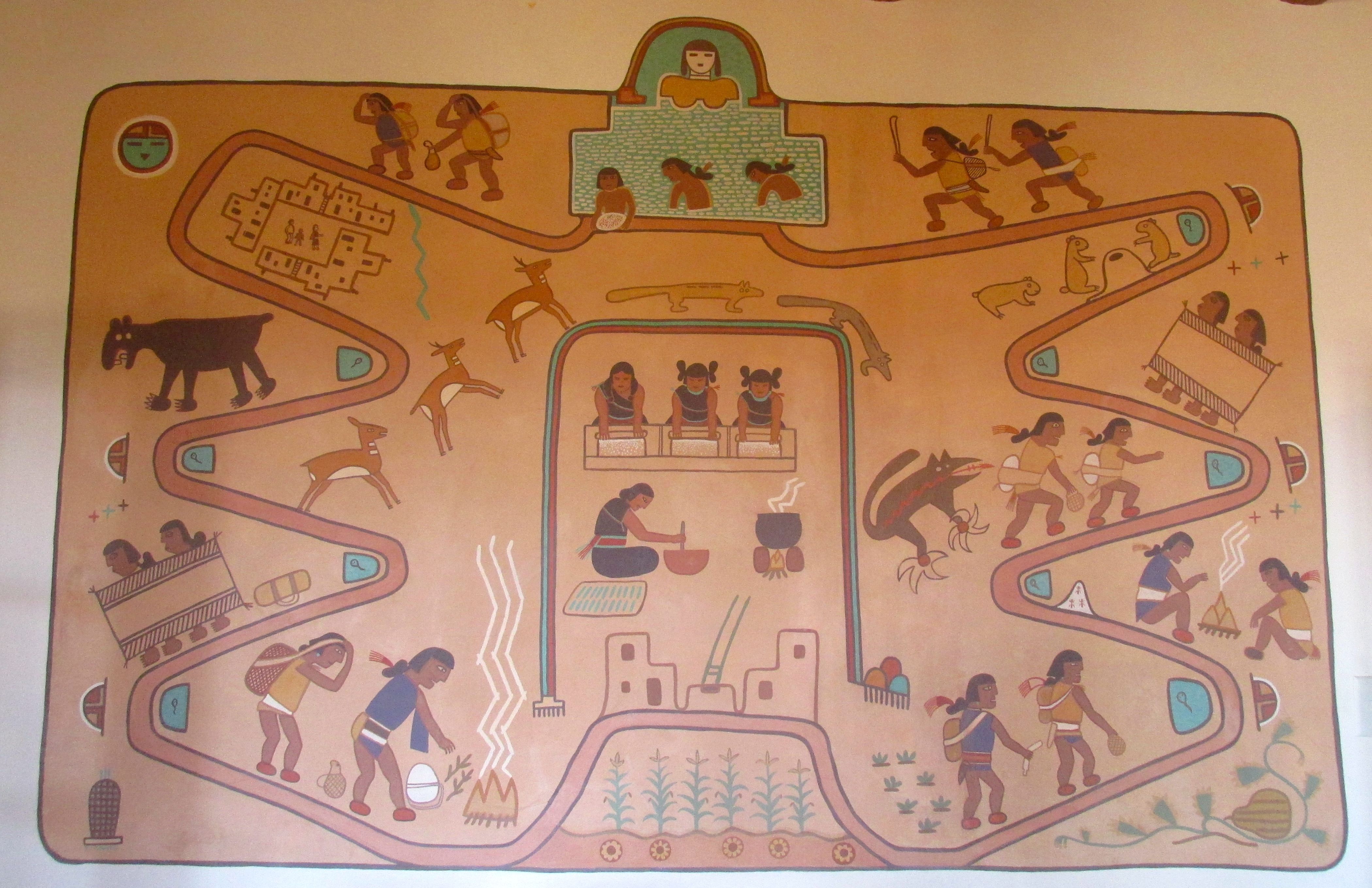
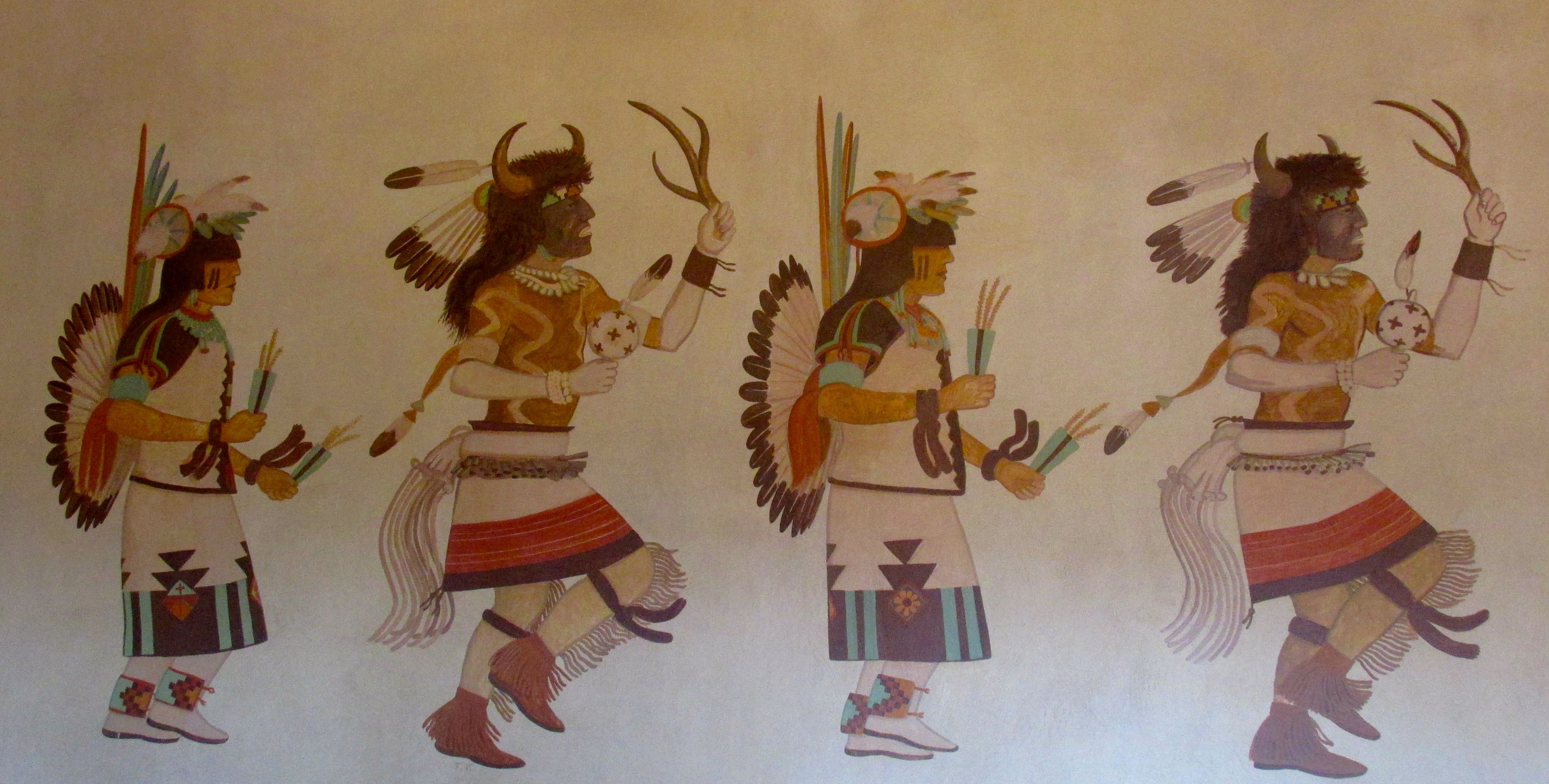
There are murals there by Fred Kabotie. They represent various aspects of the Hopi Culture.
Three Peaks and Corn PlantingSalt Lake MuralHopi Buffalo Dance
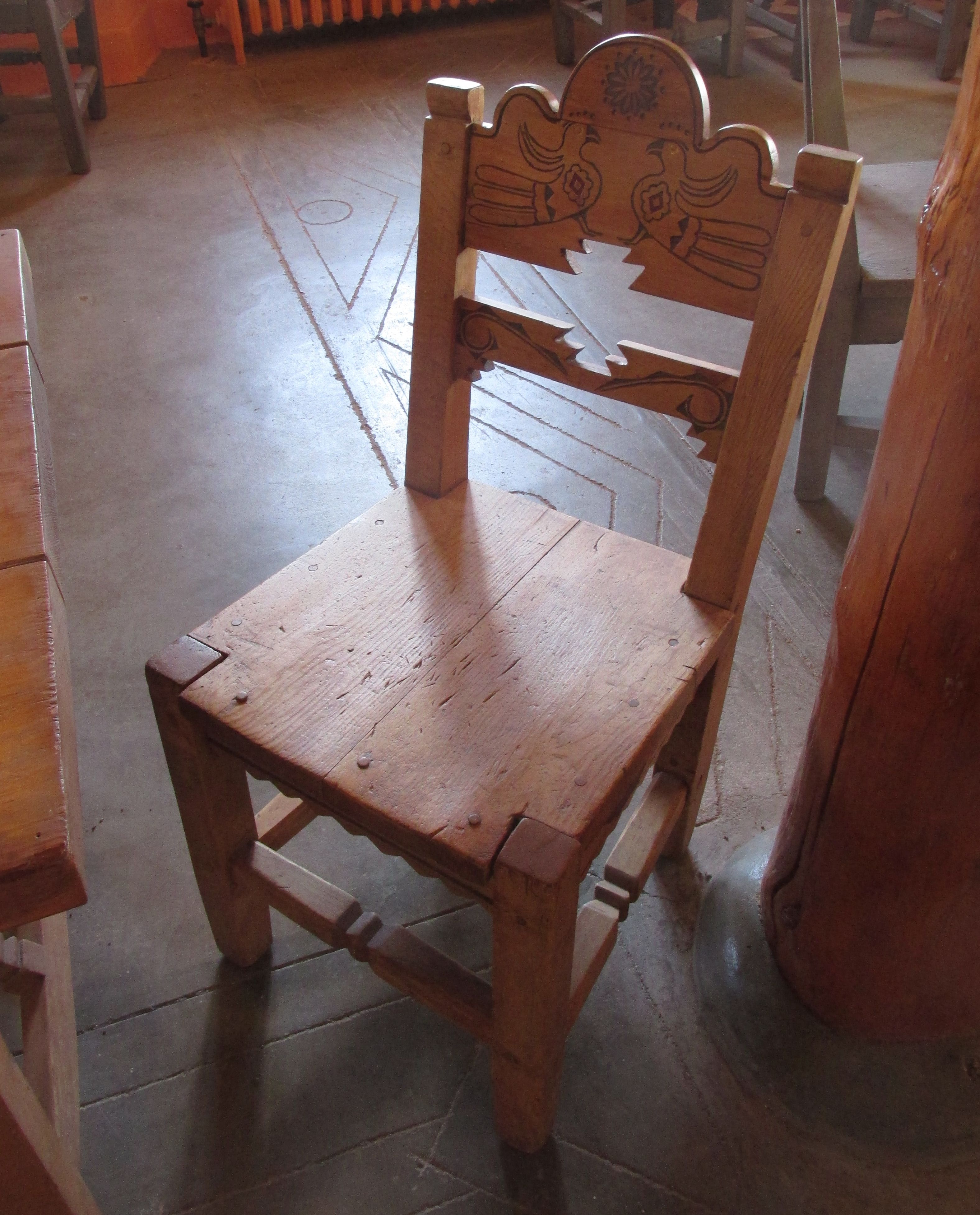
The furniture for the Inn had been built by the CCC. This chair had been restored to its former glory.
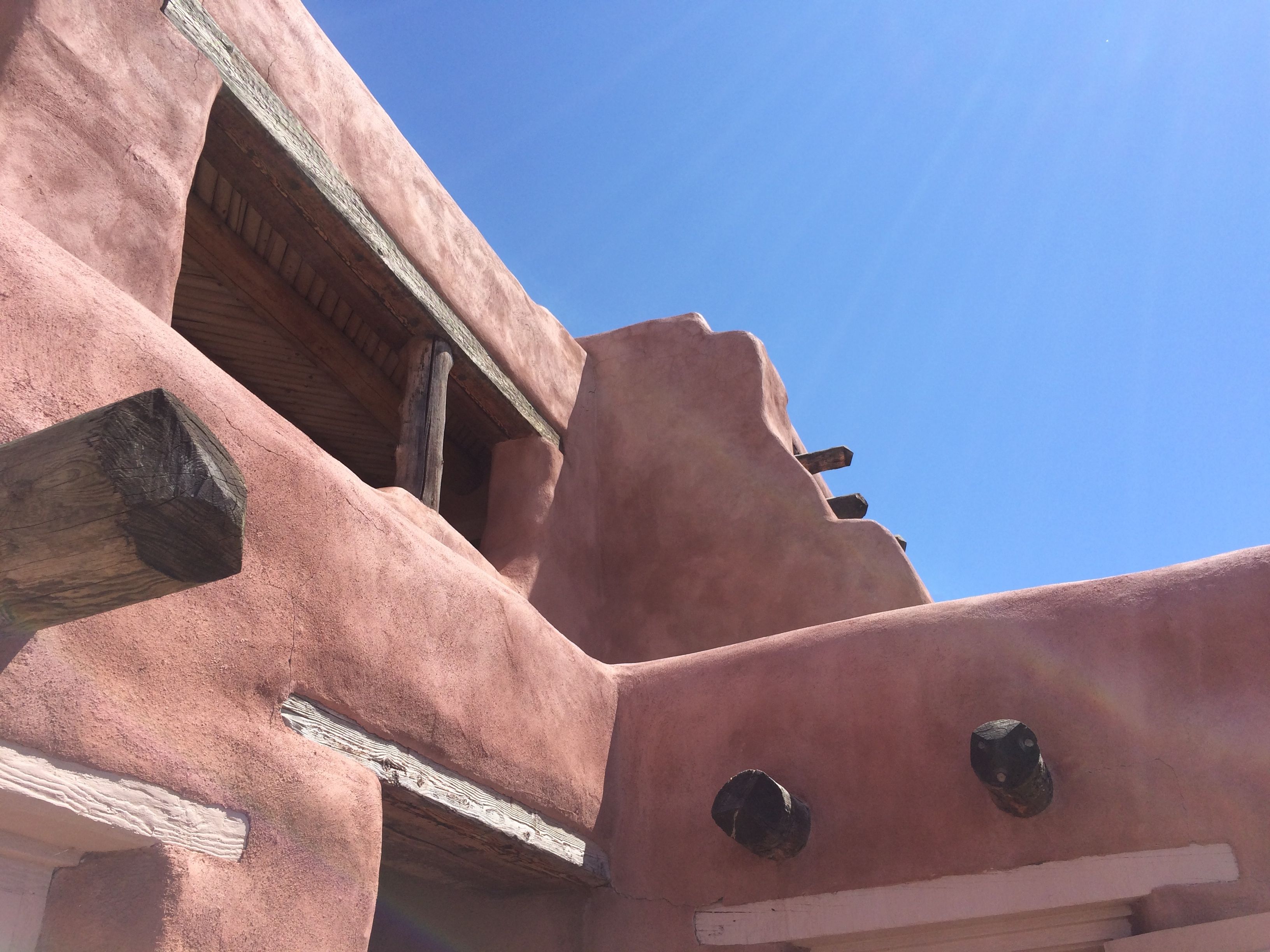
For an Inn with only six rooms, the building was fairly massive looking.
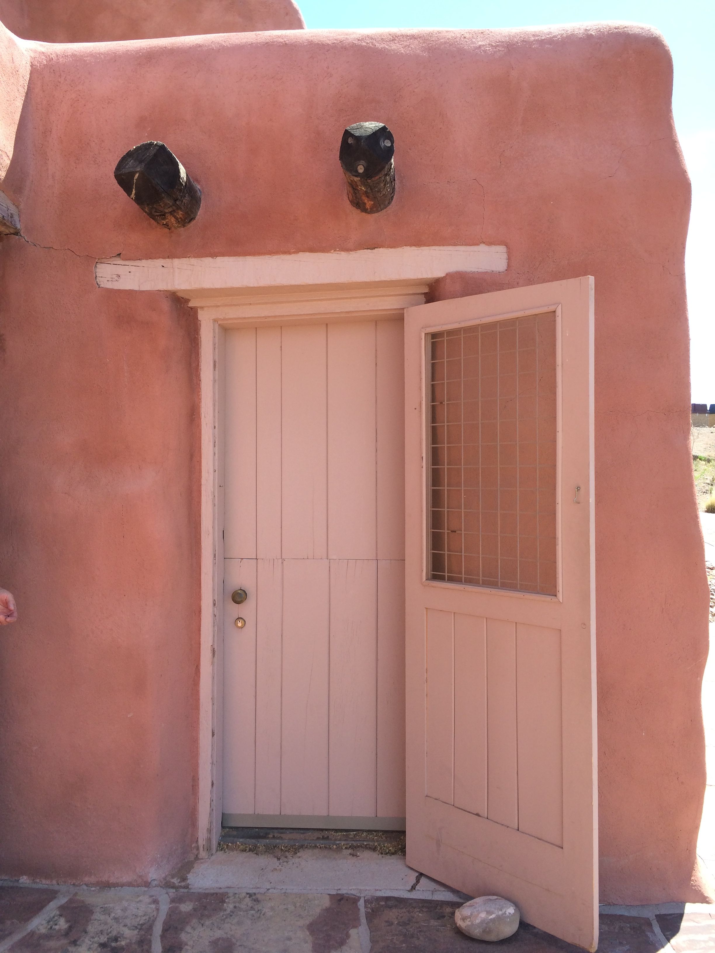
I read in some of the literature there that there was a guest room that could be viewed. I asked the ranger about it, and he took me and several other visitors to see it.
It looks like the door was what I always heard called a “Dutch door”. The bottom could remain closed and the top part opened for ventilation or light.
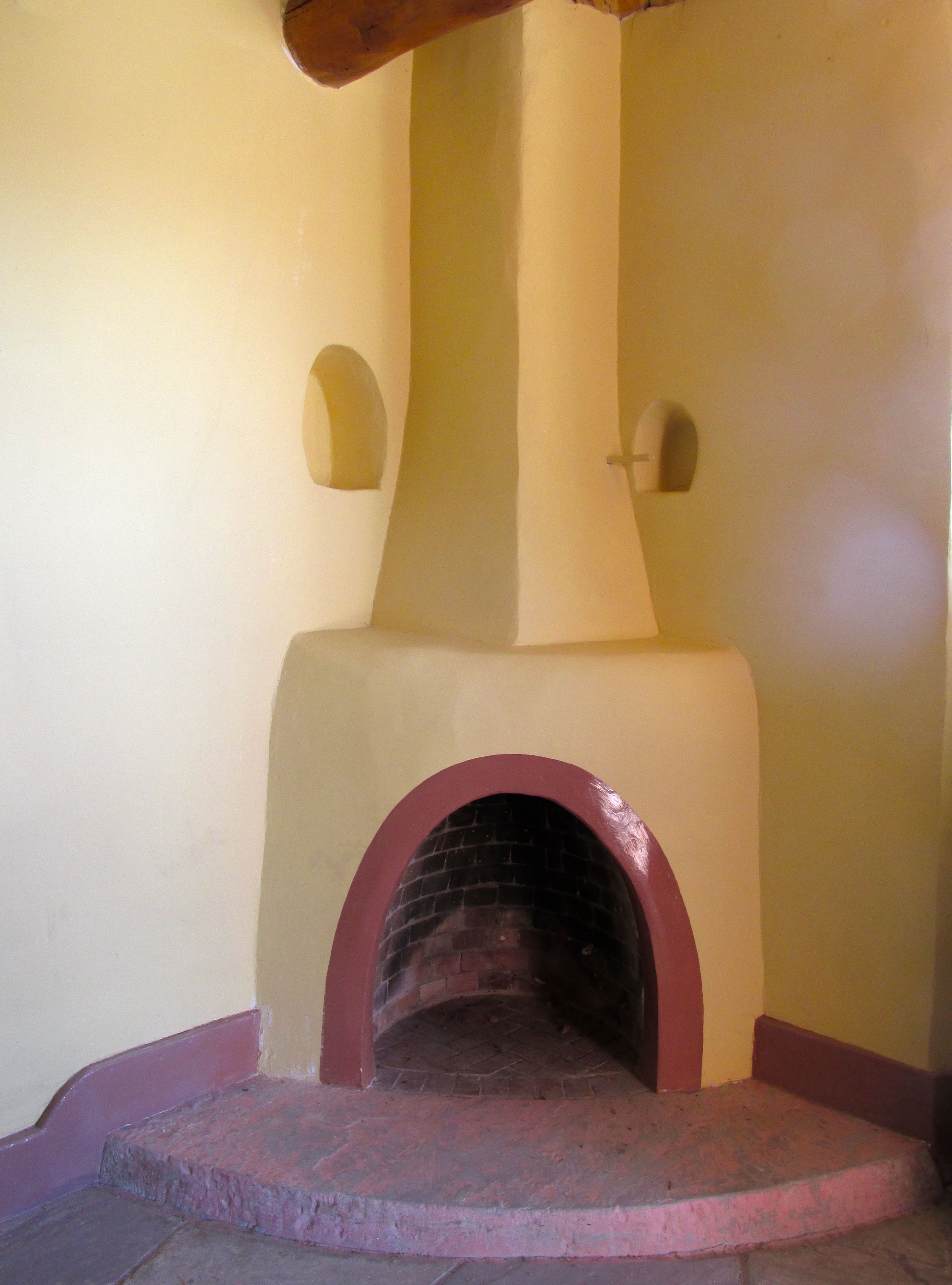
The rooms had their own fireplaces, although there was a radiator in the room.
The rooms also had their own sinks.
The light fixture was attractive, and the ceiling made use of the exposed wood and beams.
Other than that, there was barely enough room to change your mind. A bed, a chair and a nightstand or dresser would take up all the rest of the floorspace.
This is the view directly above the room. Those two vigas on the right side of the picture are right above the door.
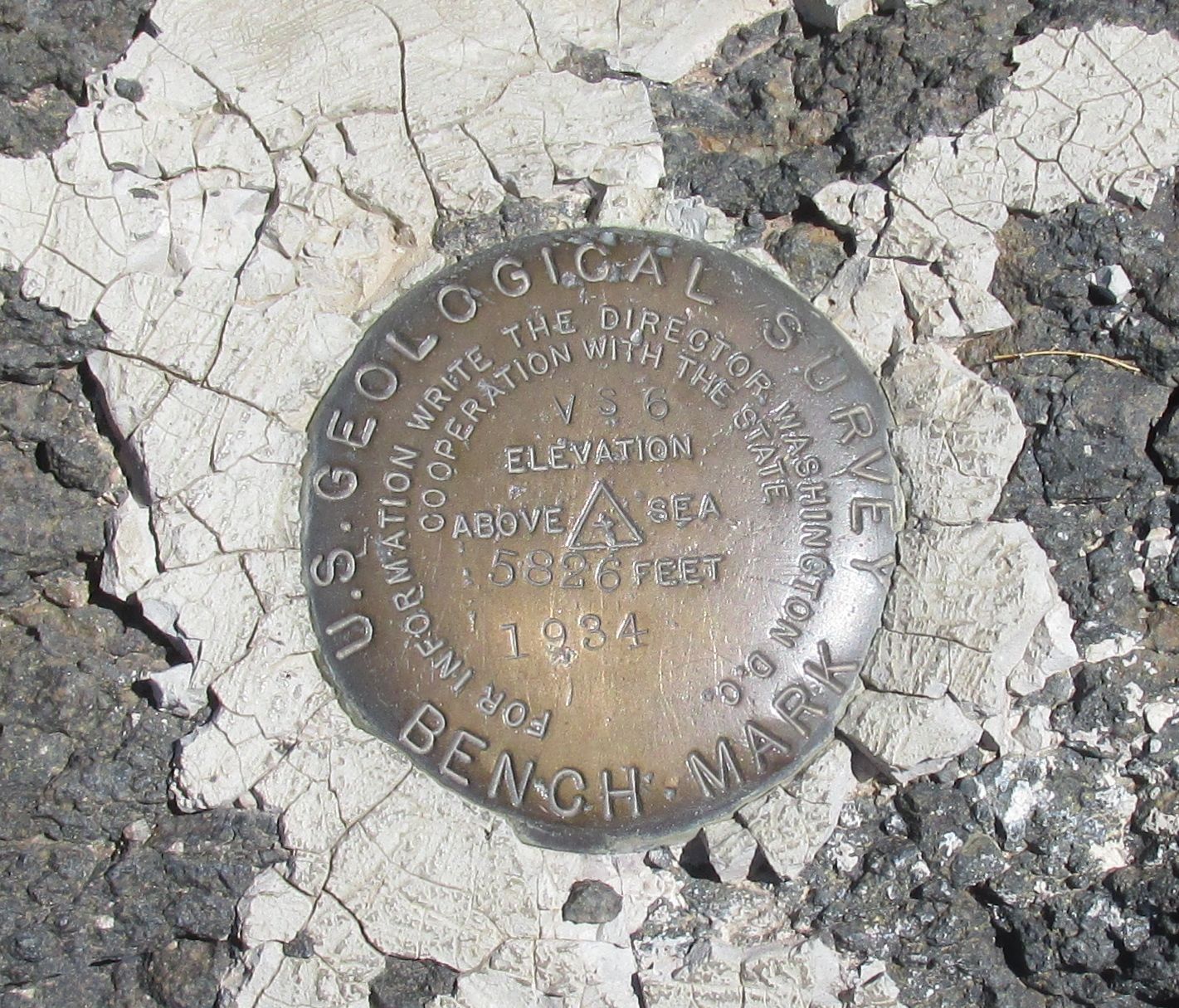
I found this benchmark for the U.S. Geological Survey in the gardens behind the Inn.
This is the view from the patio. Quite attractive, don’t you think? Too bad it’s not possible to book a room there anymore.
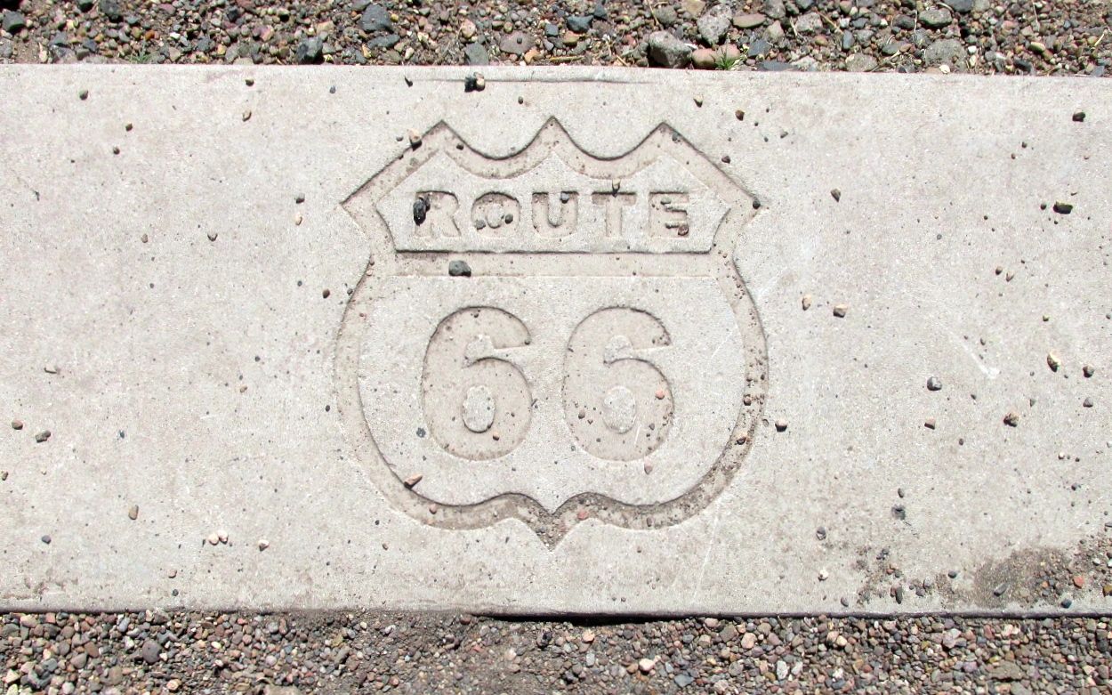
My next stop was Route 66.
Route 66 ran right along the phone poles.
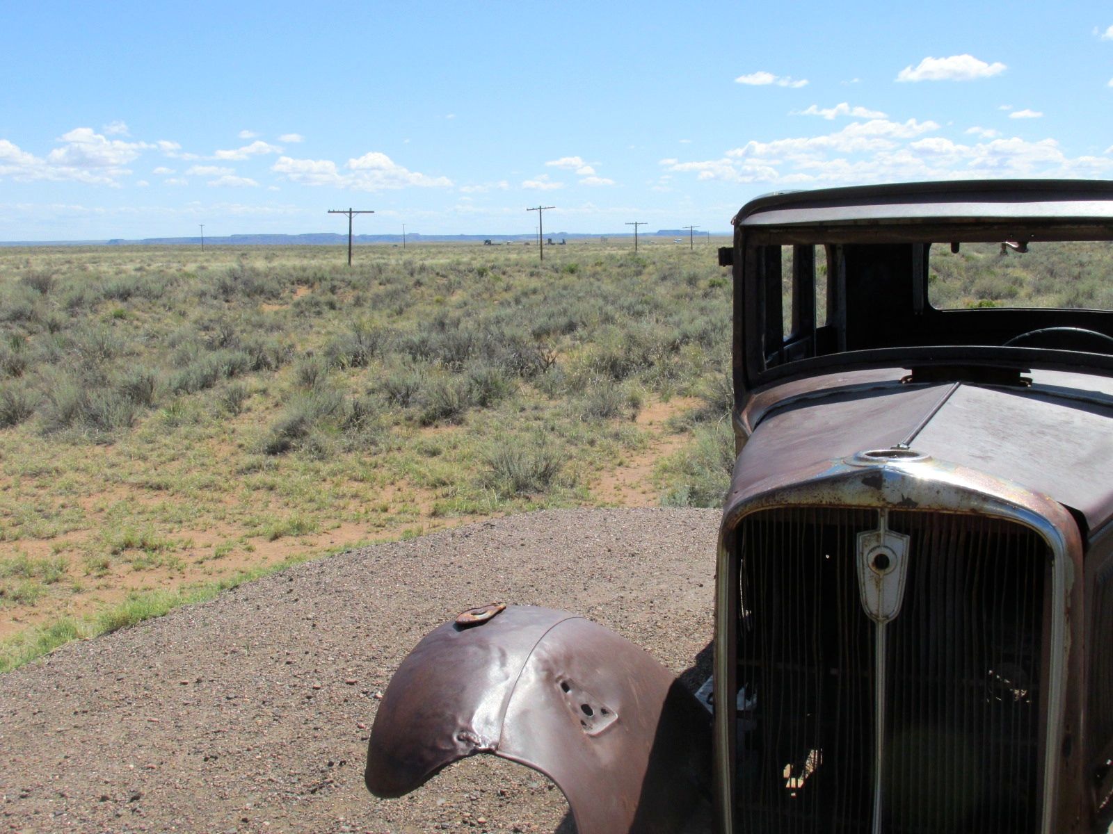
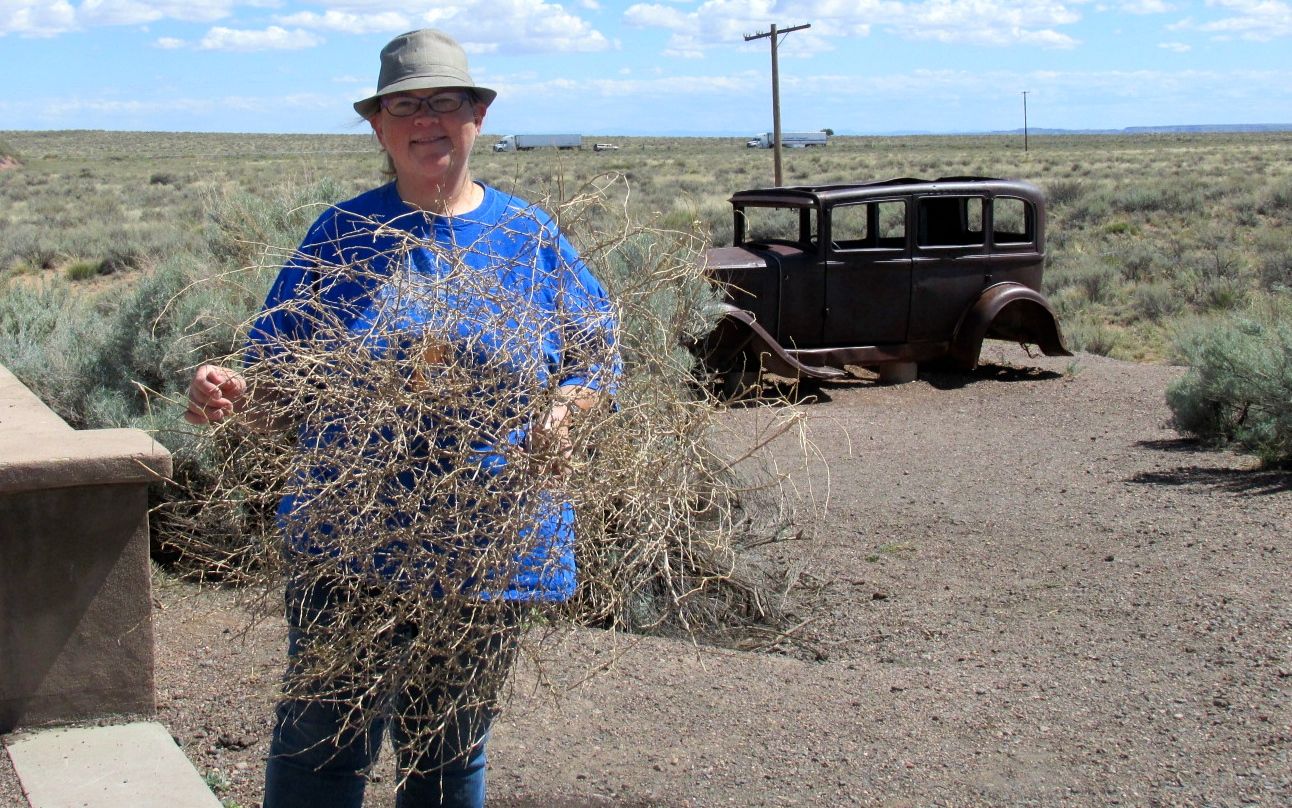
I found a tumble weed lodged against the fence. Luckily, another group of visitors came along just in time to snap my photo. I did leave the tumbleweed behind.
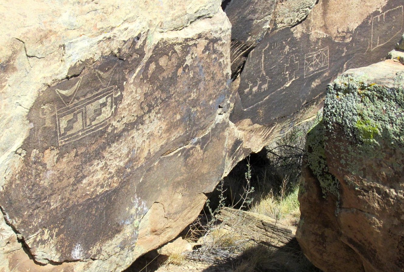
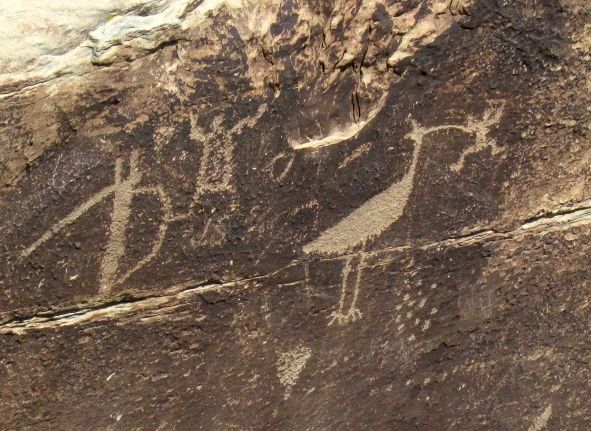
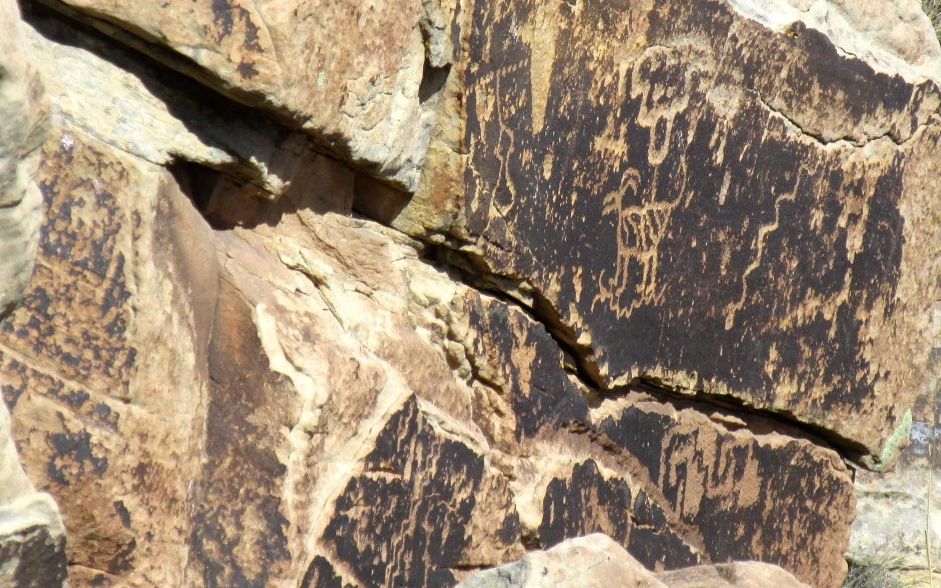
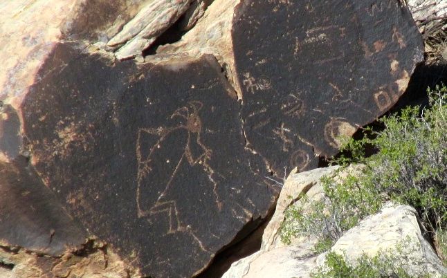
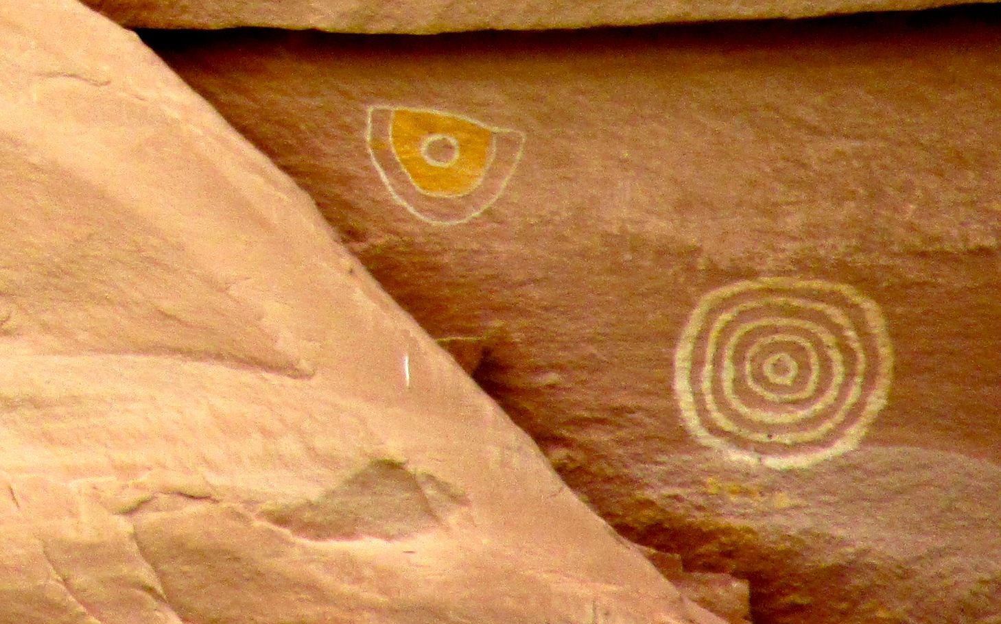
The next stop was Puerco Pueblo, which was right along near the banks of the Puerco River. There were petroglyphs!
There was a variety of styles on the rocks.
You can see more geometric designs as well as representational shapes.
People were represented, as well.
This bird looks like a fearsome creature.
This is an interesting combination of abstract and representational petroglyphs.
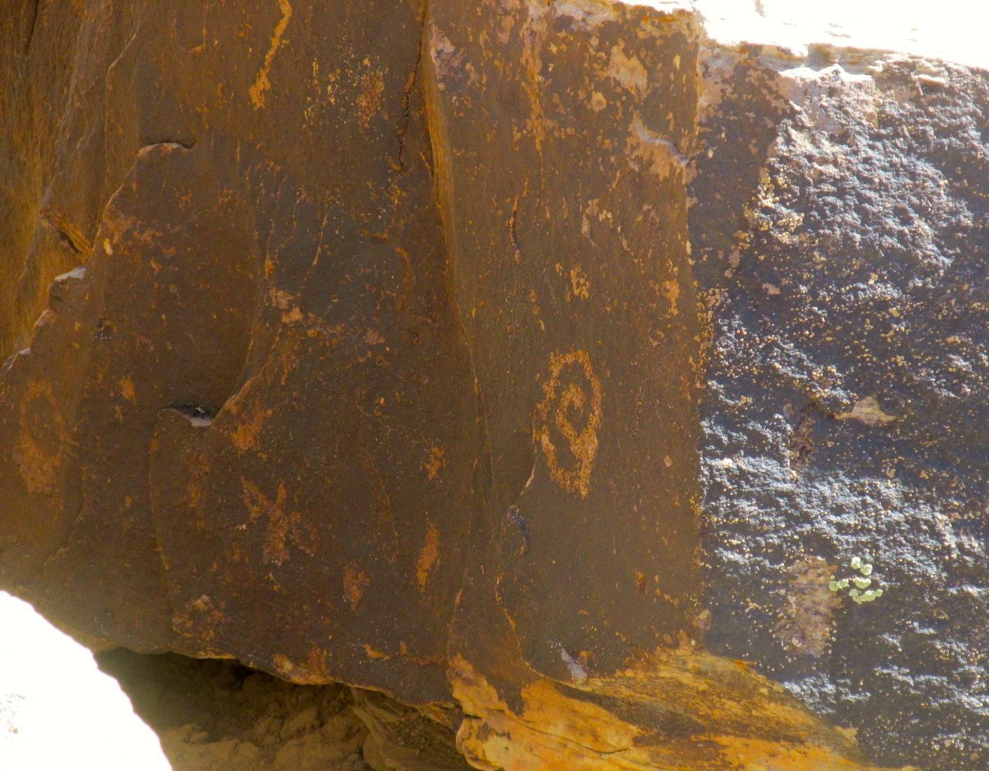
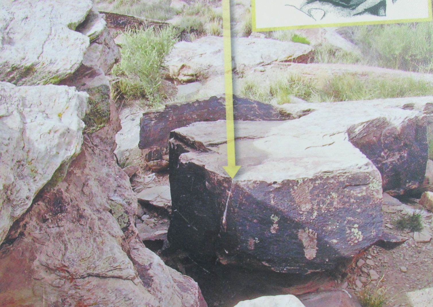
This little circular one is probably the most interesting, though. It’s actually a calendar. On the solstice, the sun shines on it through a space in the rocks. Then they knew it was time to plant.
I snapped this photo from one of the signs. The arrow points to the sun shining on the calendar.
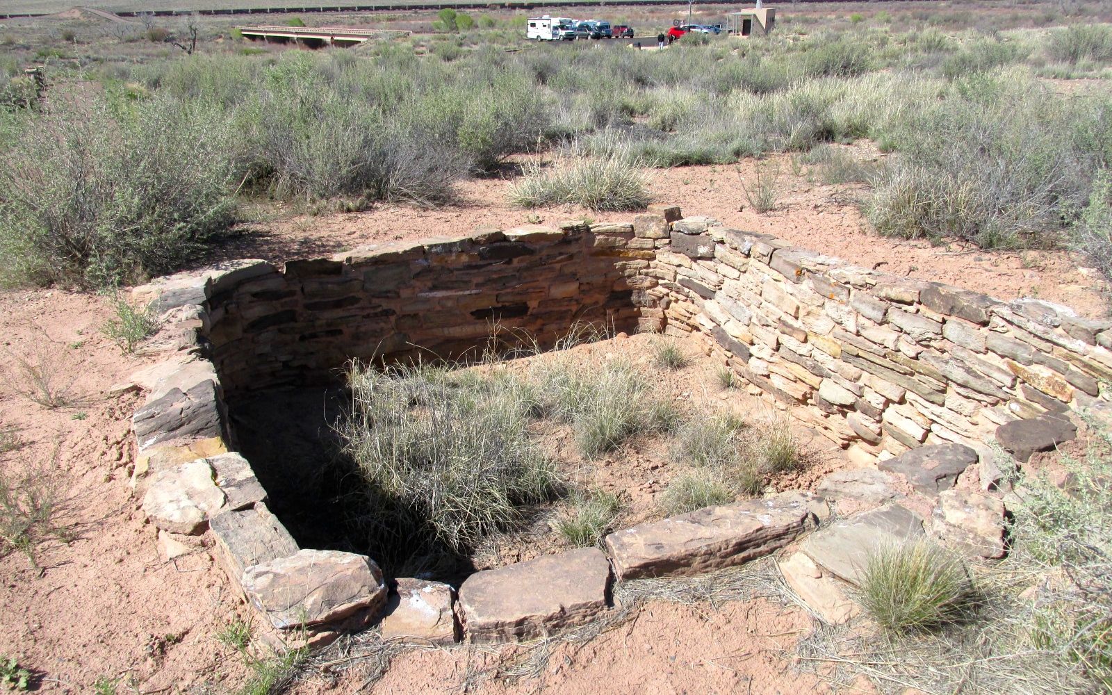
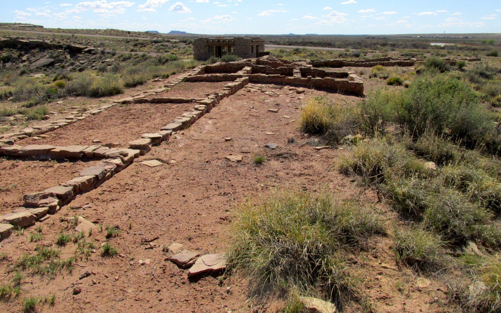
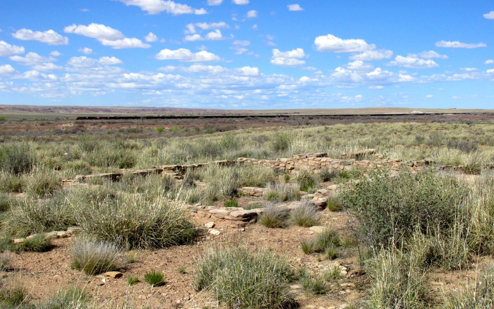
There were also ruins at this location.
The sign said that this was a kiva. If you weren’t sure about what a kiva is, no worries! I looked up the definition for you: “An underground or partly underground chamber in a Pueblo village, used by the men especially for ceremonies or councils.”
There were also rooms for living spaces.
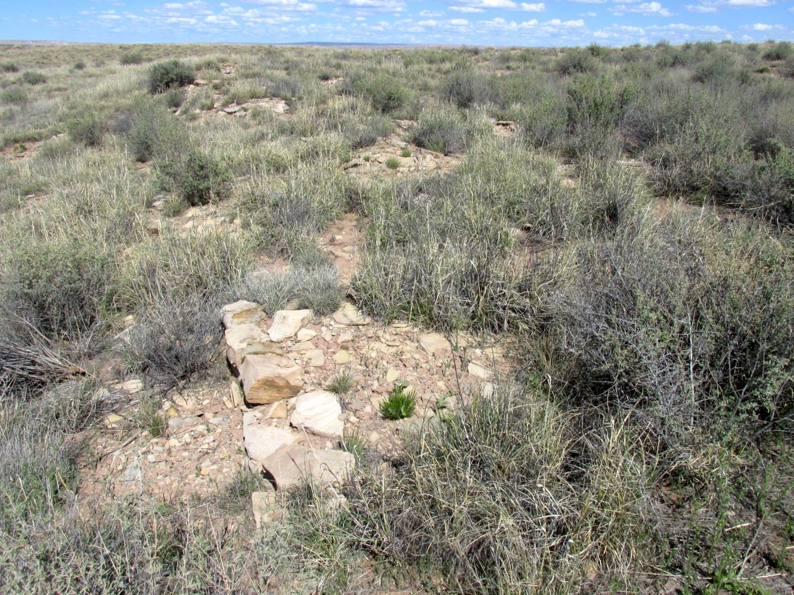
You can see more rooms here.
There were more rooms. The signs said that we were walking over the ruins. I imagine there are many more discoveries to be made.
When I returned to the parking area, I had a happy surprise.
Another Airstream had parked right next to me! I left them a card with a greeting. When we passed each other later on, we gave each other the Airstream salute. We flashed our lights and waved. It’s always fun to see another Airstream.
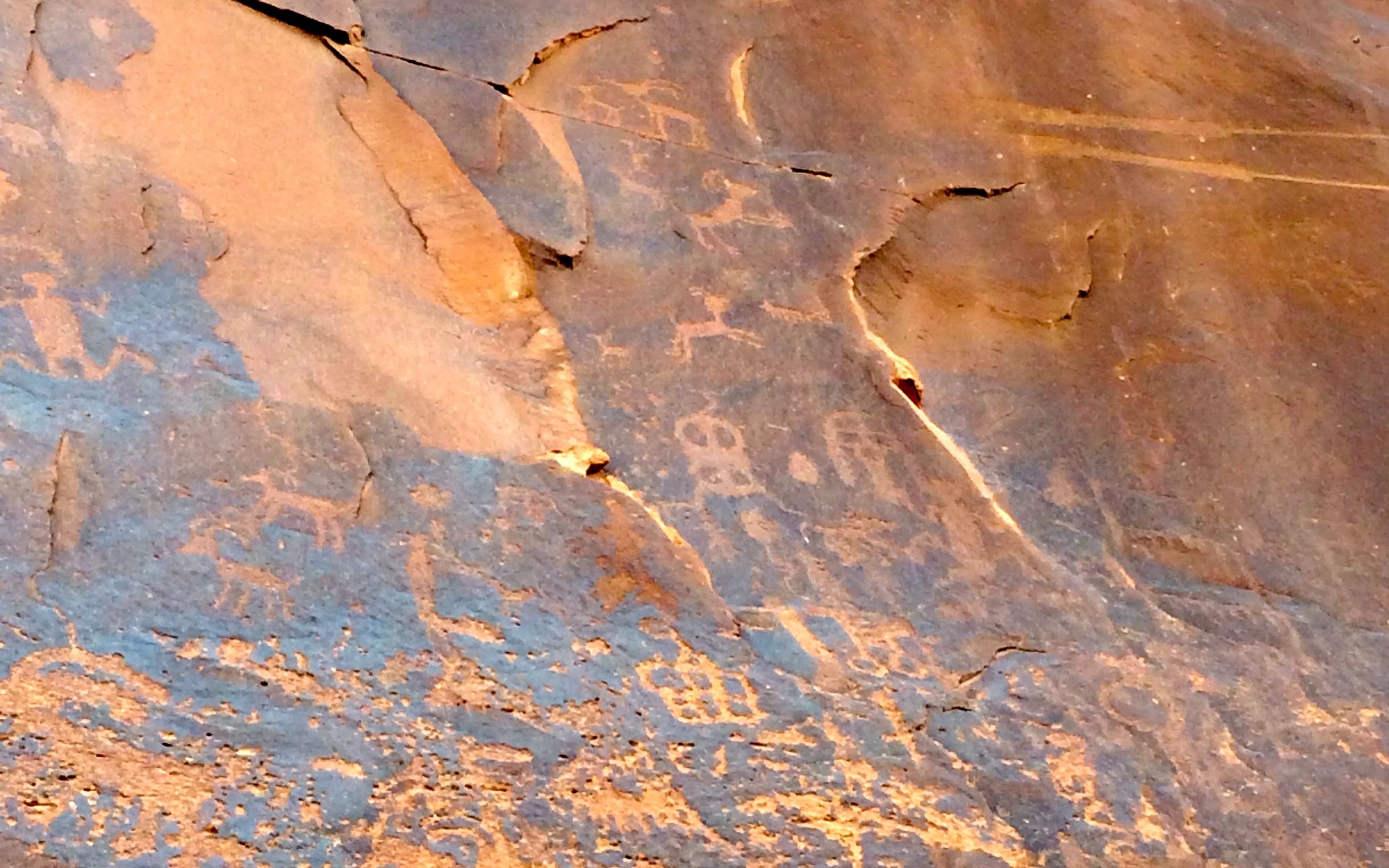
The next stop along the way was a site called the teepees. Some day I will get a camera that allows me to zoom in better, but it you use your imagination, you can see why they were called the teepees.
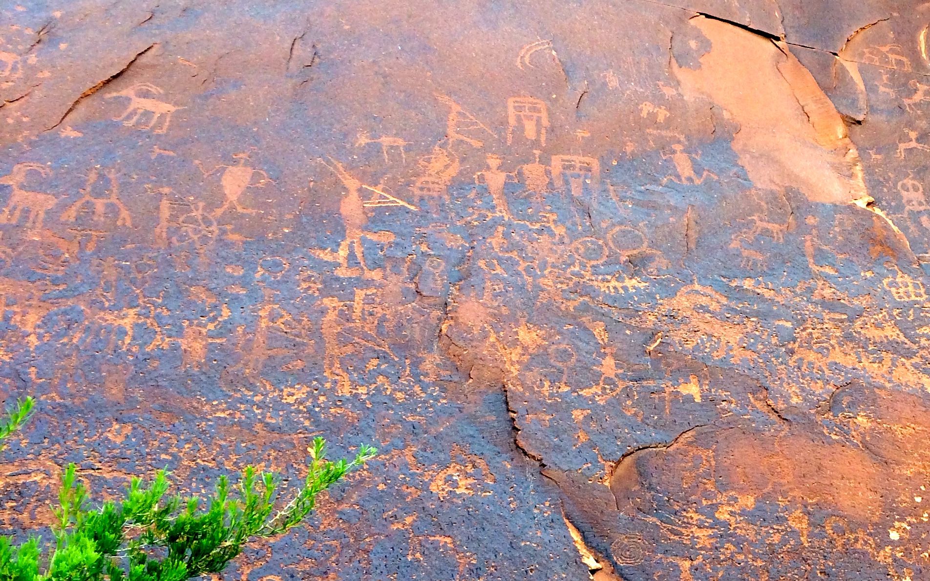
I gave you the teepees at this point, just so you could rest your eyes a bit. Next up: Newspaper Rock!
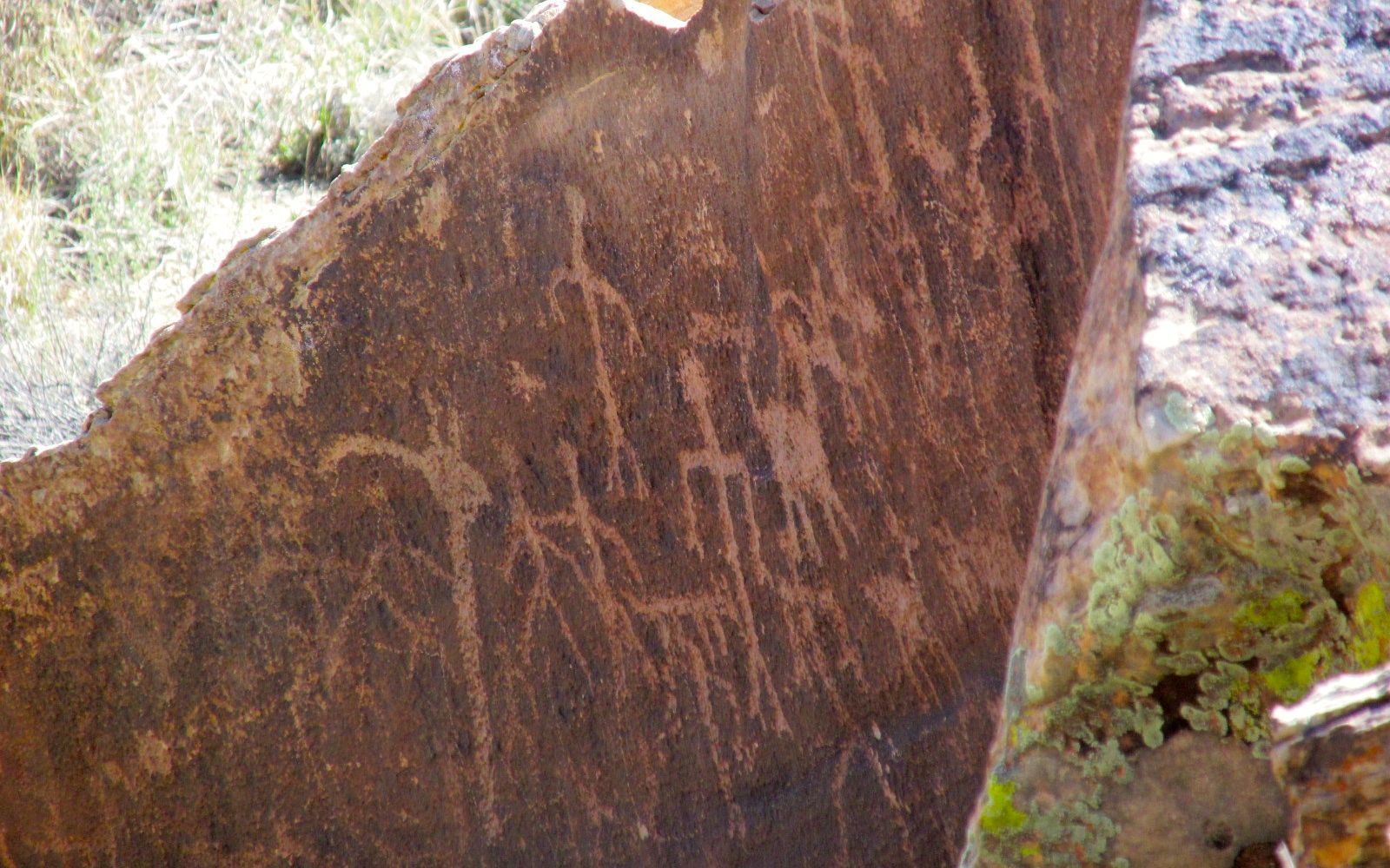
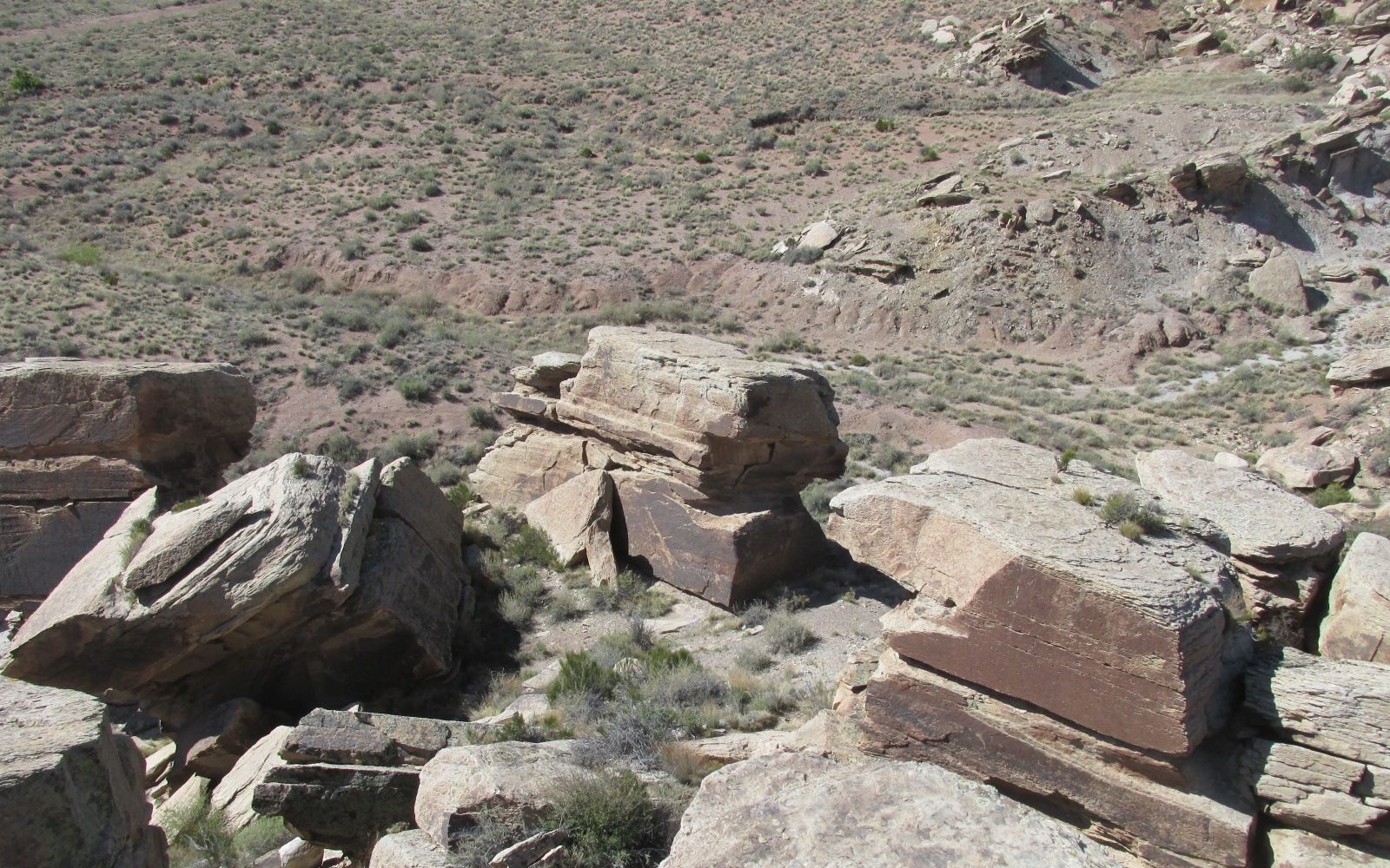
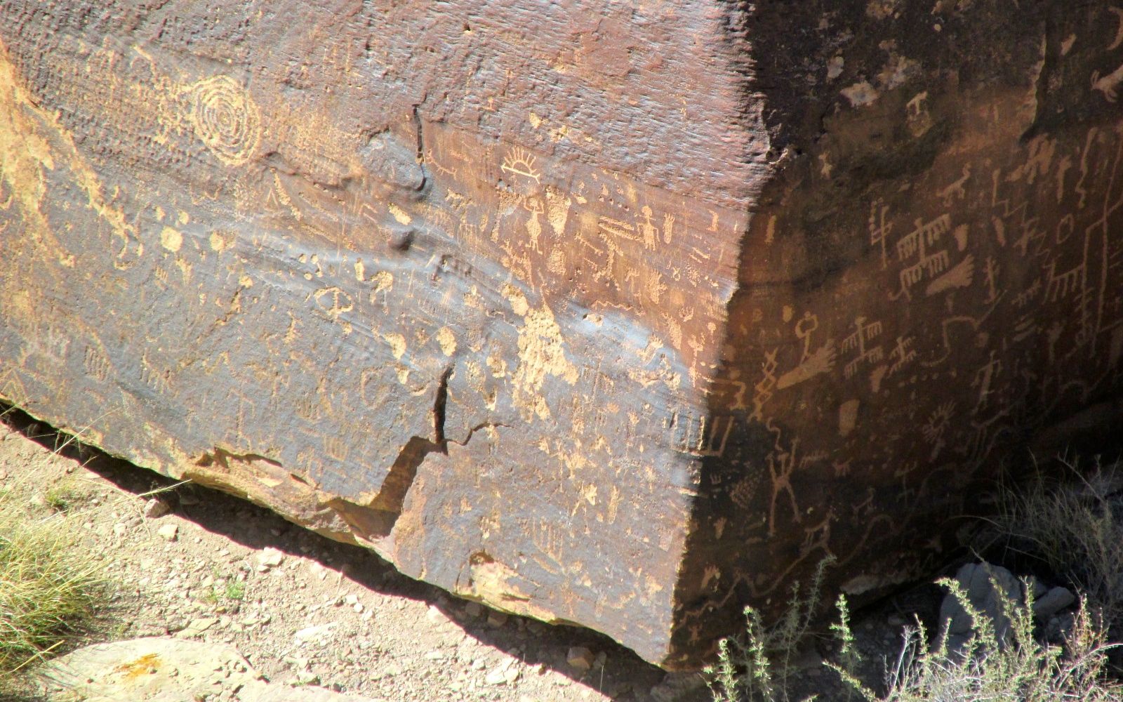
Newspaper Rock is actually a collection of rocks that tumbled down from the cliffs above. According to the information I have, the petroglyphs were created from 650 – 2000 years ago.
Oh, you can’t see them? Let’s see if I can zoom in a bit.
There are more than 650 designs pecked into the desert varnish exposing the lighter stone below.
I haven’t stopped to count, but I don’t think I saw all 650 designs.
On the other hand, maybe I did.
Is that Kokopelli there? Might be!
Again, this was a location I originally learned about from Sister Jeanne in art history class. As far was I am concerned, that woman was a national treasure!
It’s time to move along. I’m at the Petrified Forest National Park, and so far the only petrified wood I’ve see has been in the gift shop and used in building the Painted Desert Inn. Where’s the forest?
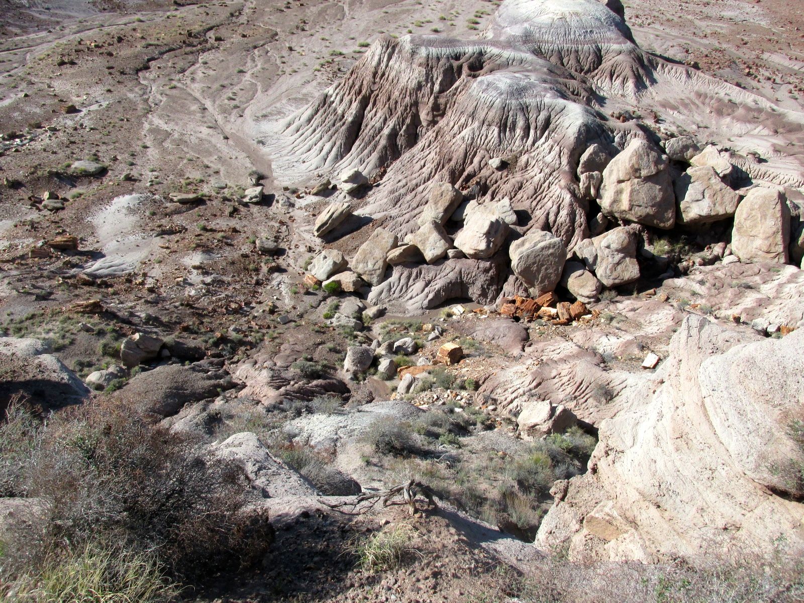
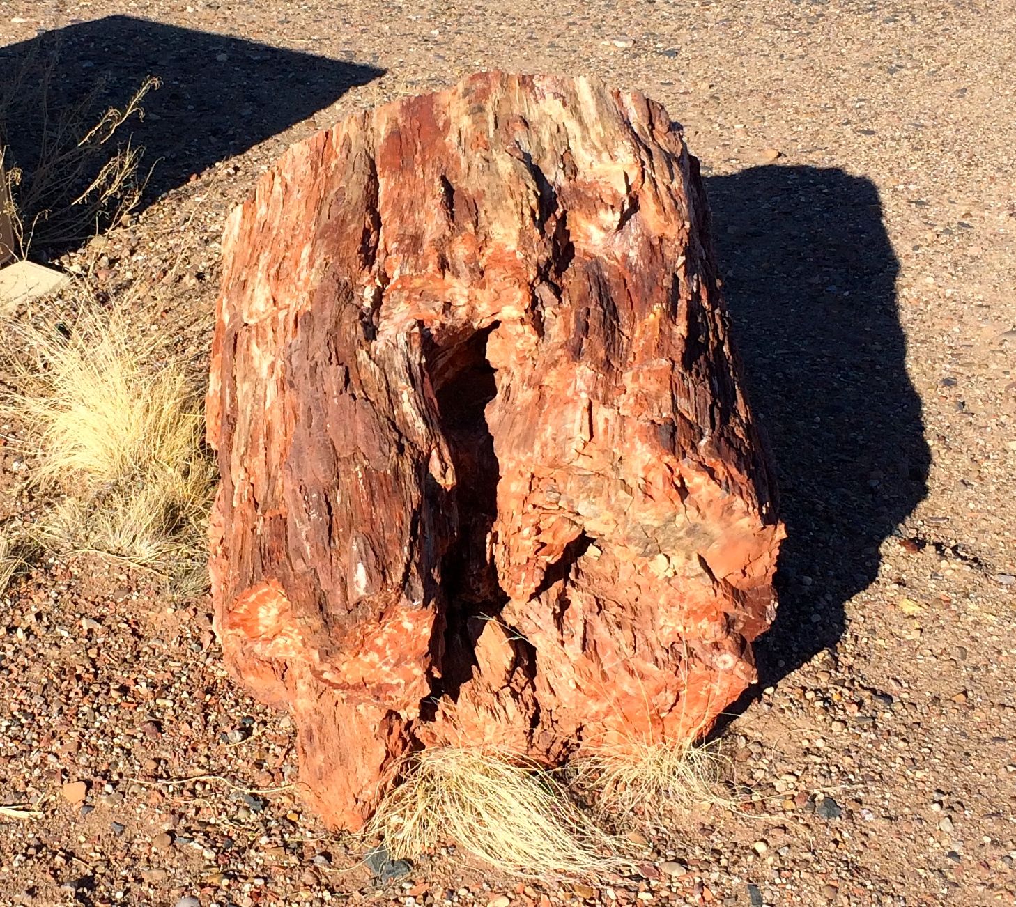
Finally! Here’s some petrified wood at the Blue Mesa.
I wonder if all this petrified wood was lying here exposed when the Puebloans lived in the area?
If so, did they make use of it?
This one looks like it must have extended out from the earth for quite a while before it broke off.
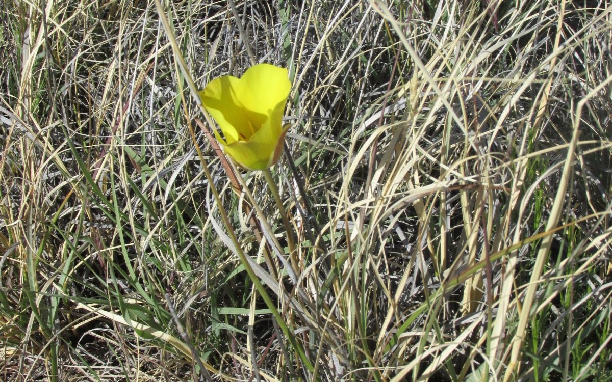
I love it when I find a flower growing that I haven’t seen before. I don’t know what it is, although it reminds me of a poppy.
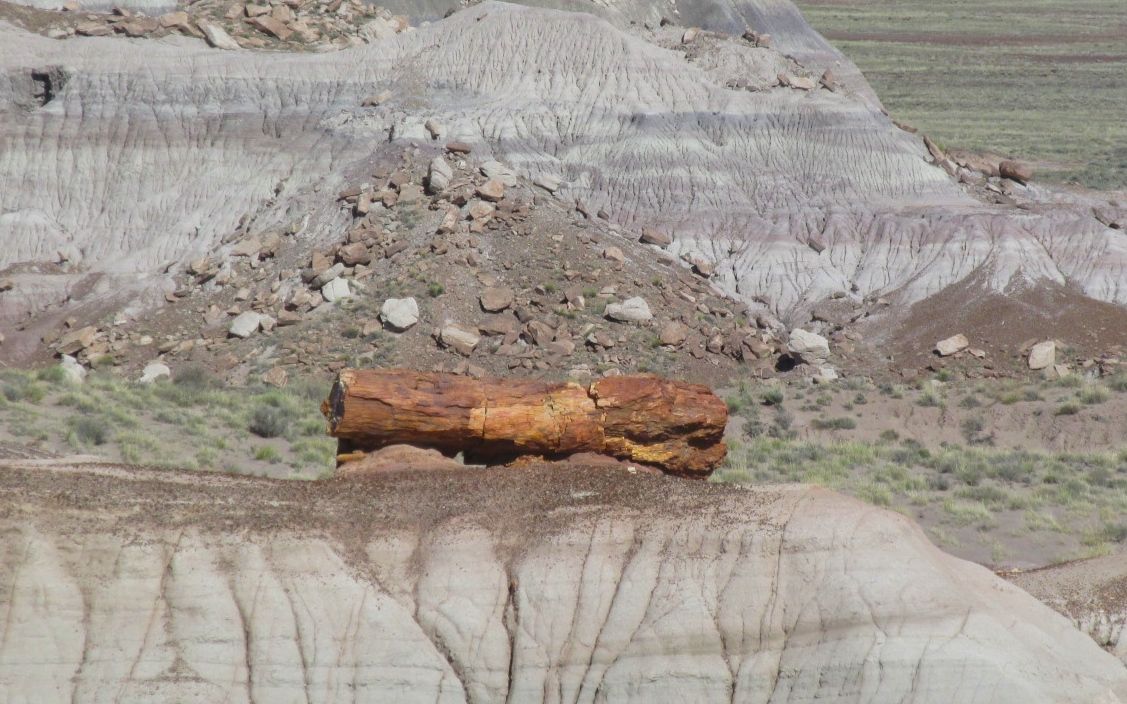
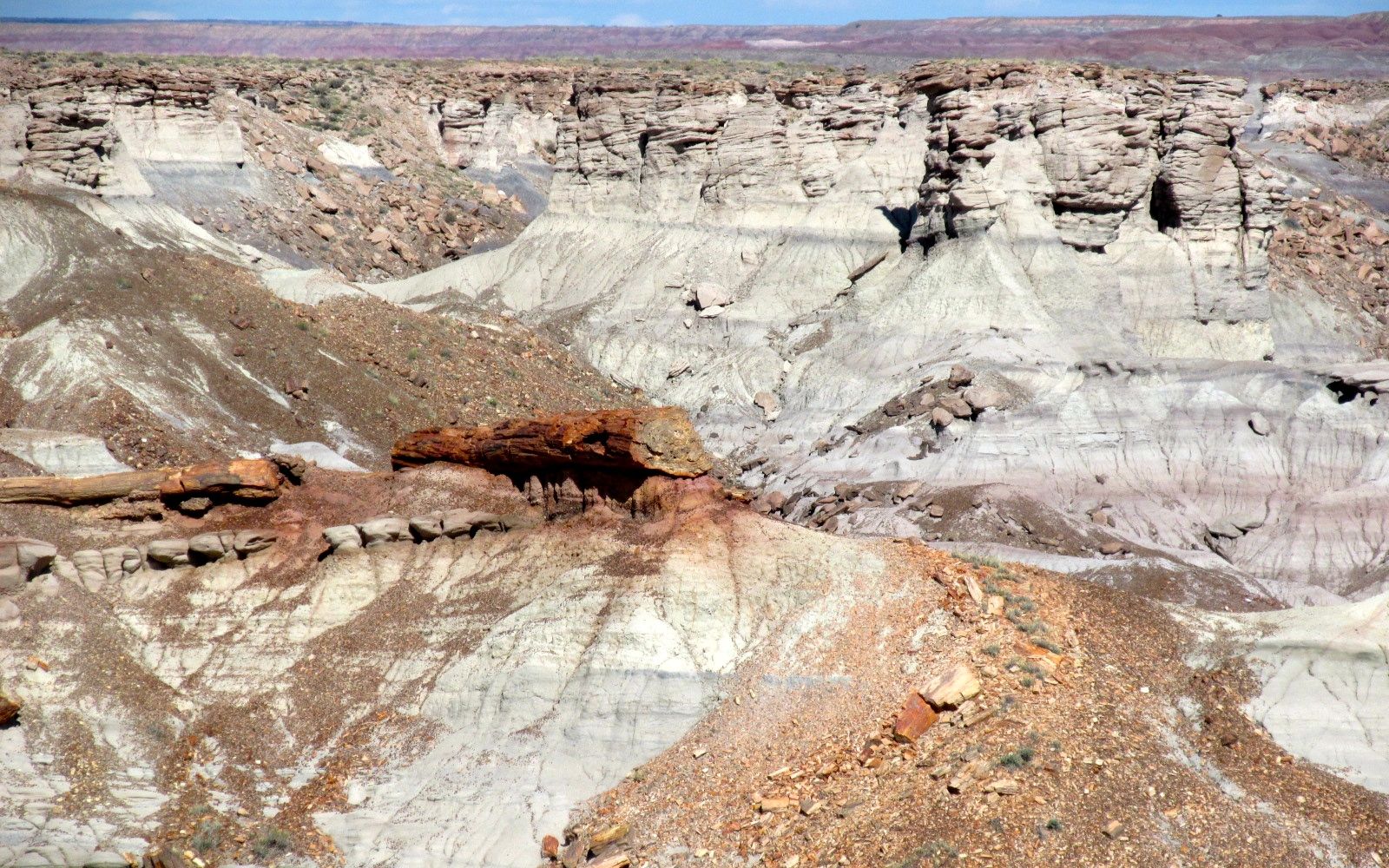
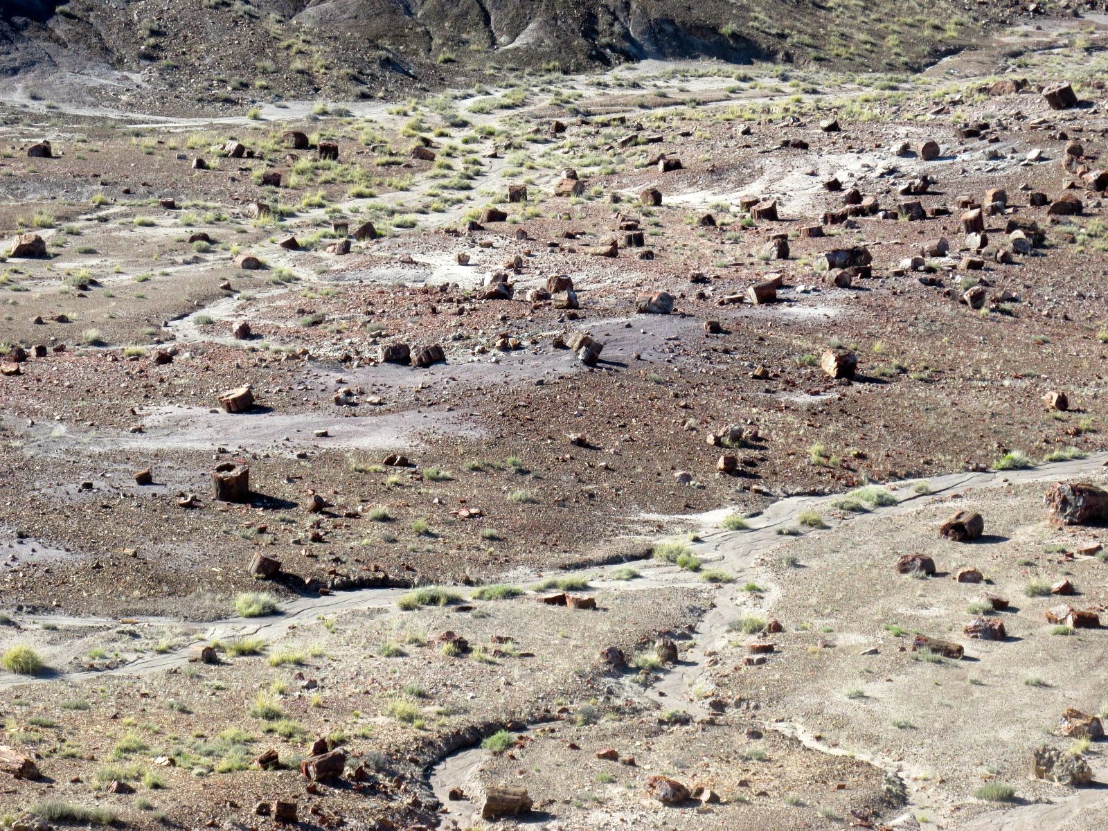
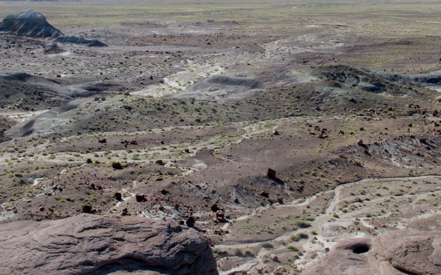
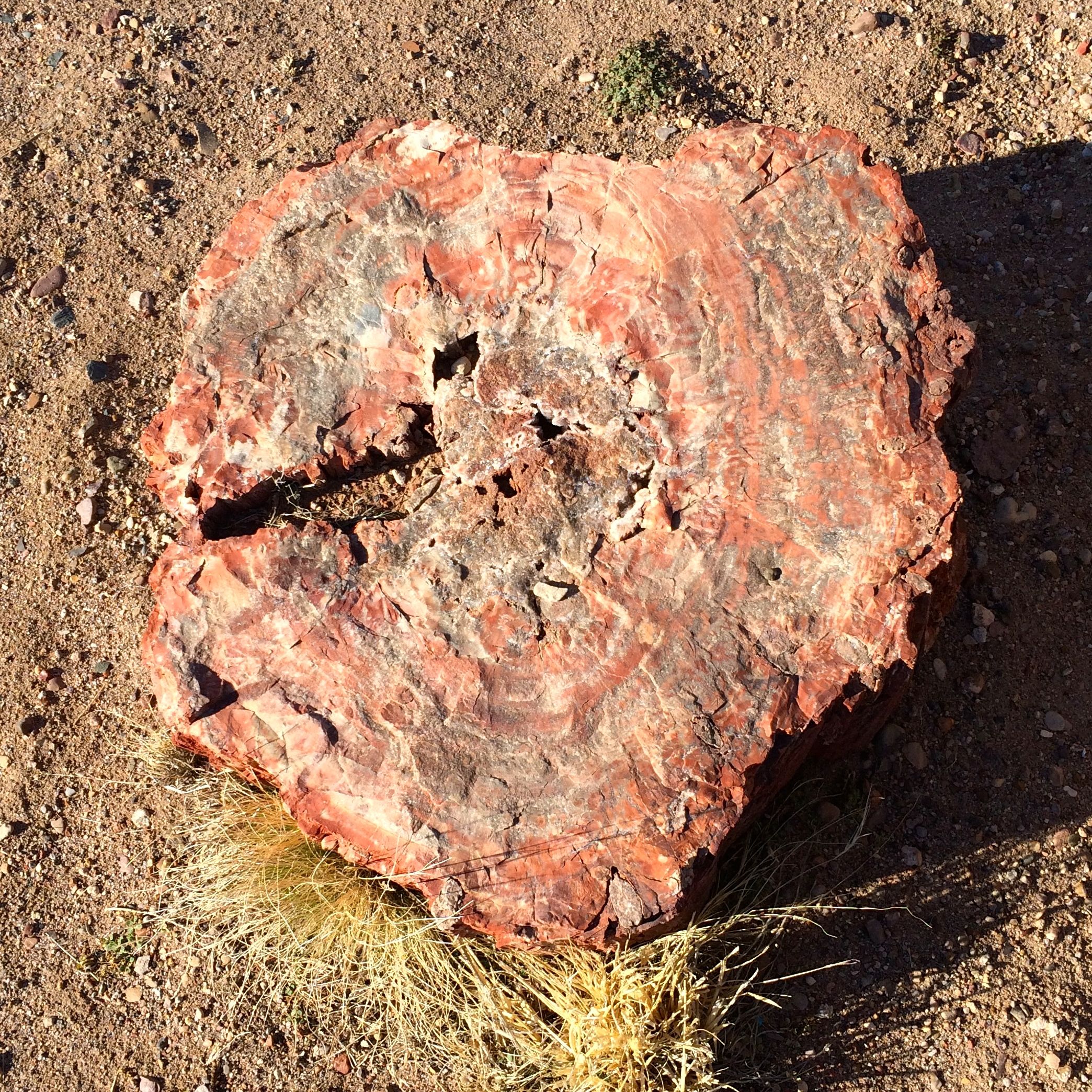
On to the Jasper Forest.
Do you see all the tree trunks lying about?
Since there are relatively small chunks of petrified wood here, I wonder if they were washed down by rain runoff. I wonder how long that would take in a desert?
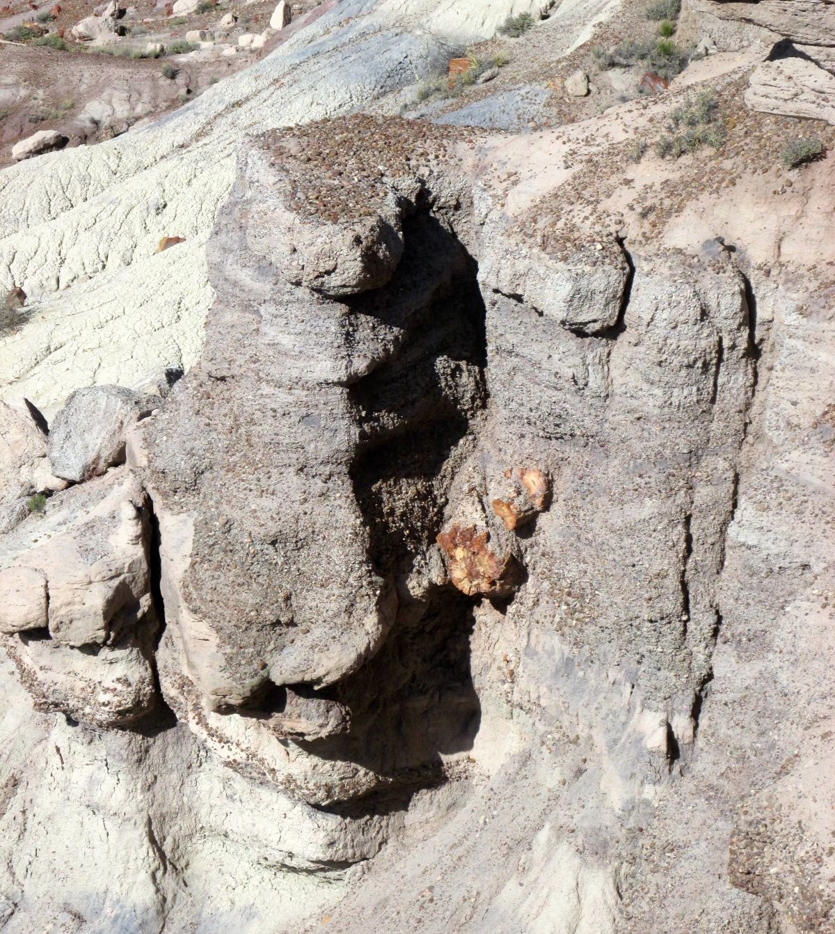
Here’s a log still embedded in a rock formation.
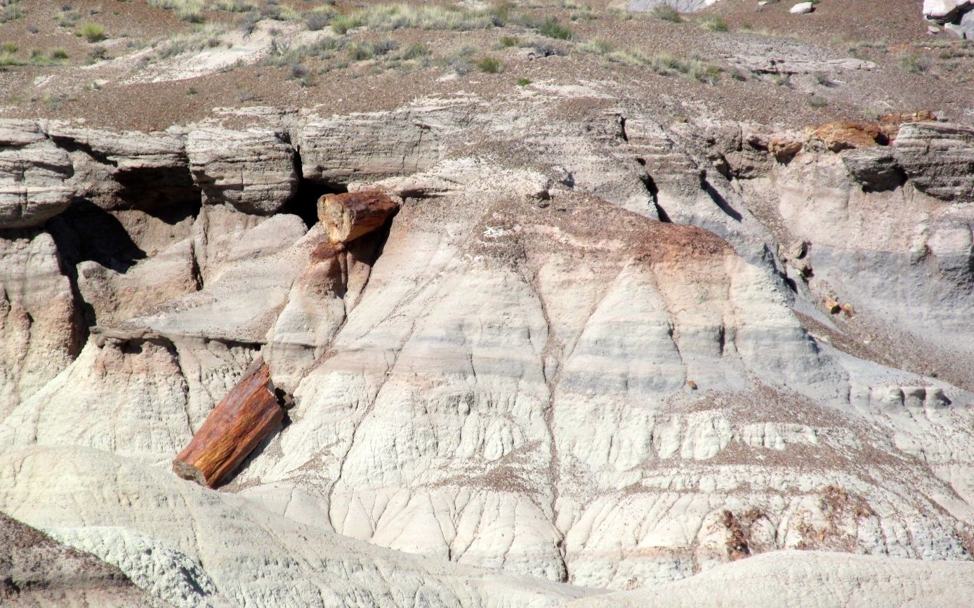
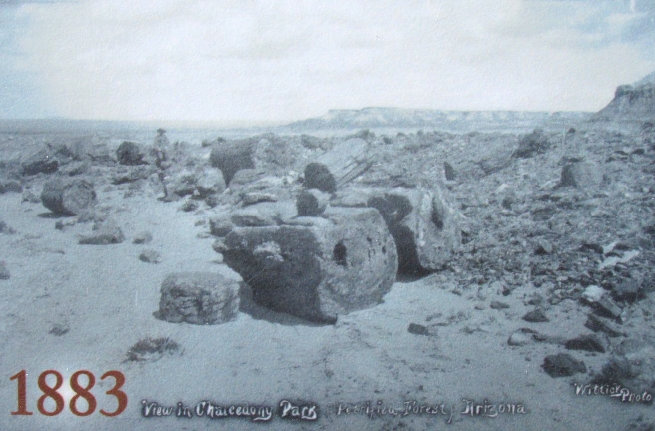
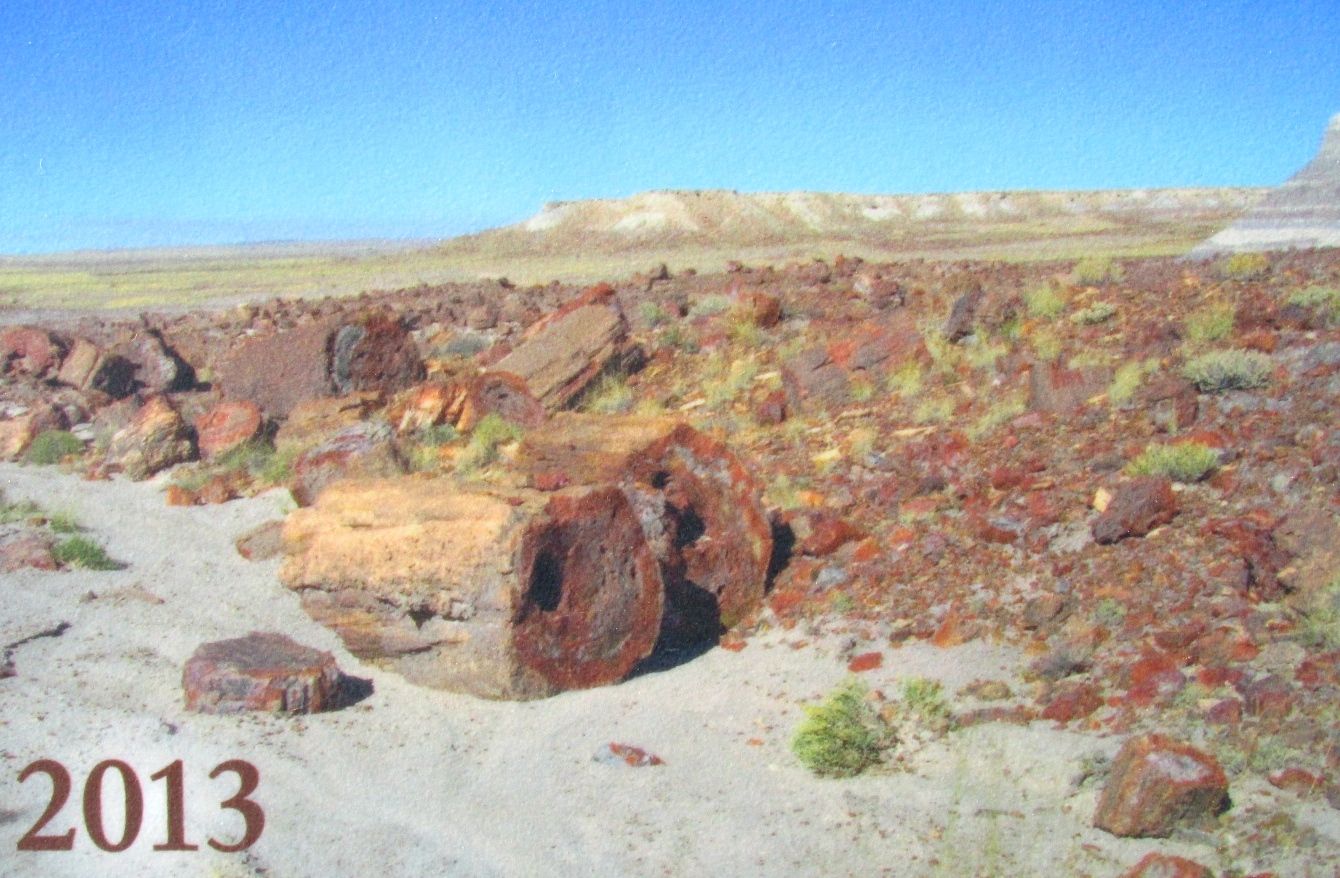
Change happens slowly. Here is a photo of some logs taken in 1883.
And the same logs in 2013.
One last look at the Jasper Forest before moving on.
It would be a lot more impressive if we could actually walk up and touch all those logs, but I guess we have to preserve things for the future.
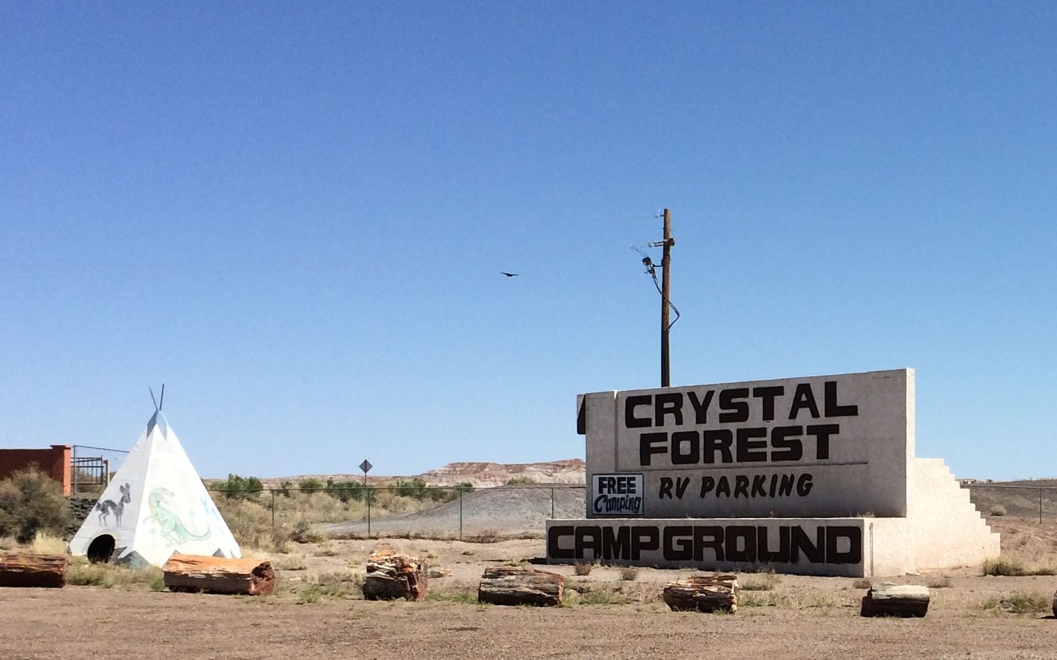
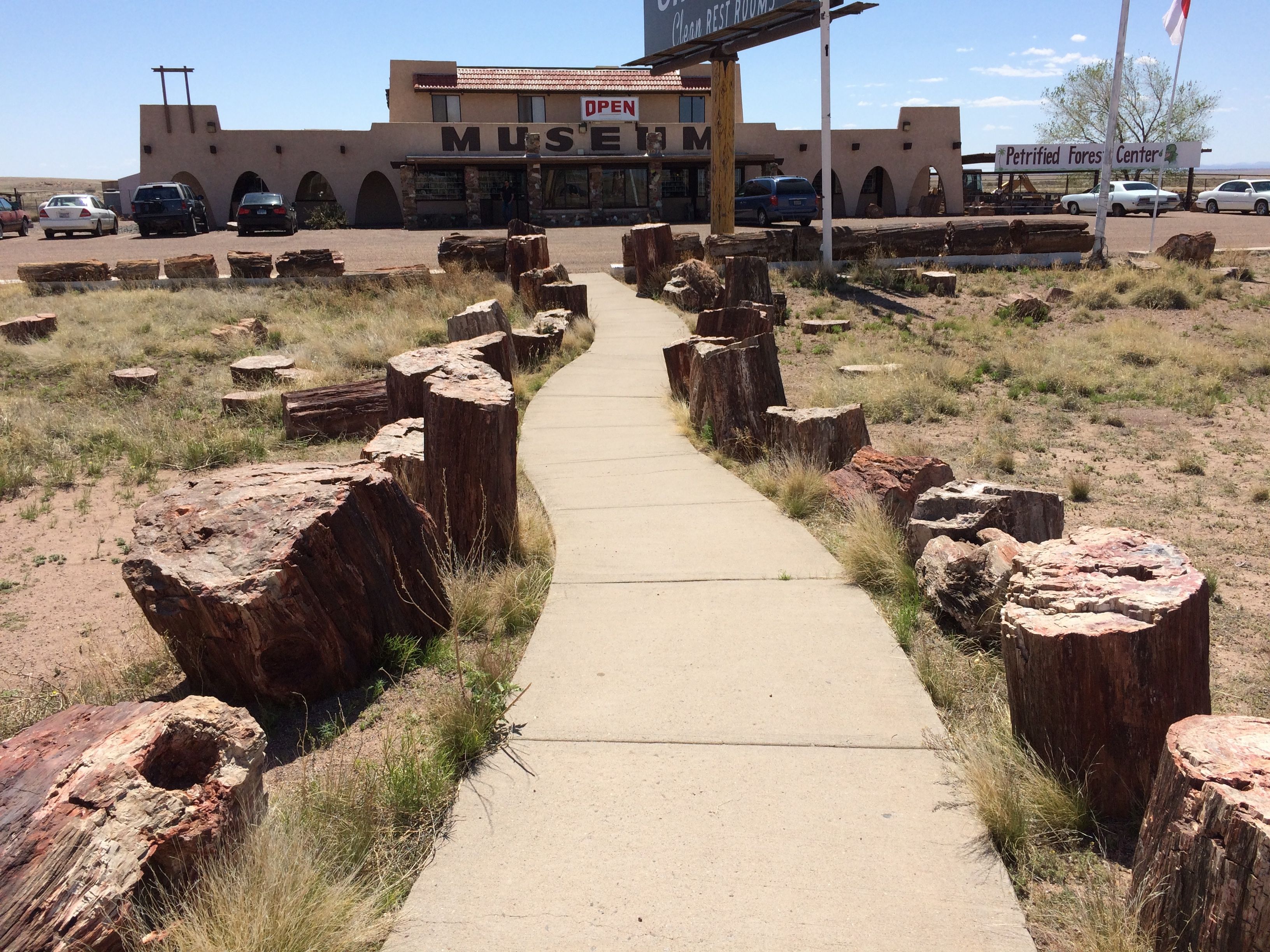
There were a few more stops in the park, but the parking areas were full. My eyes were also getting full, so I decided to see if the rumor was true. I read somewhere that there was free camping at the rock shops at the southern entrance to the park.
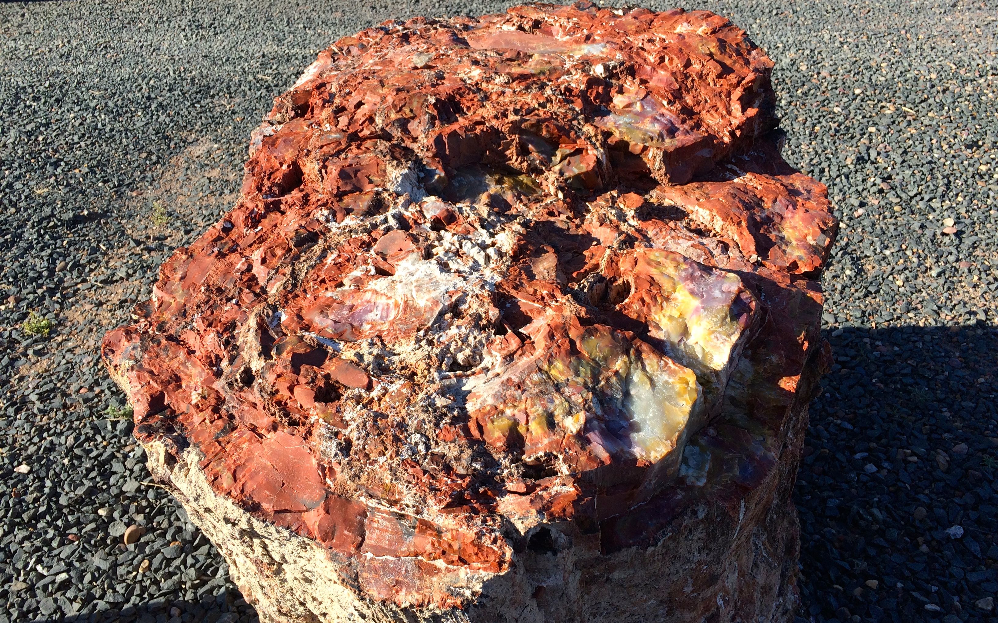
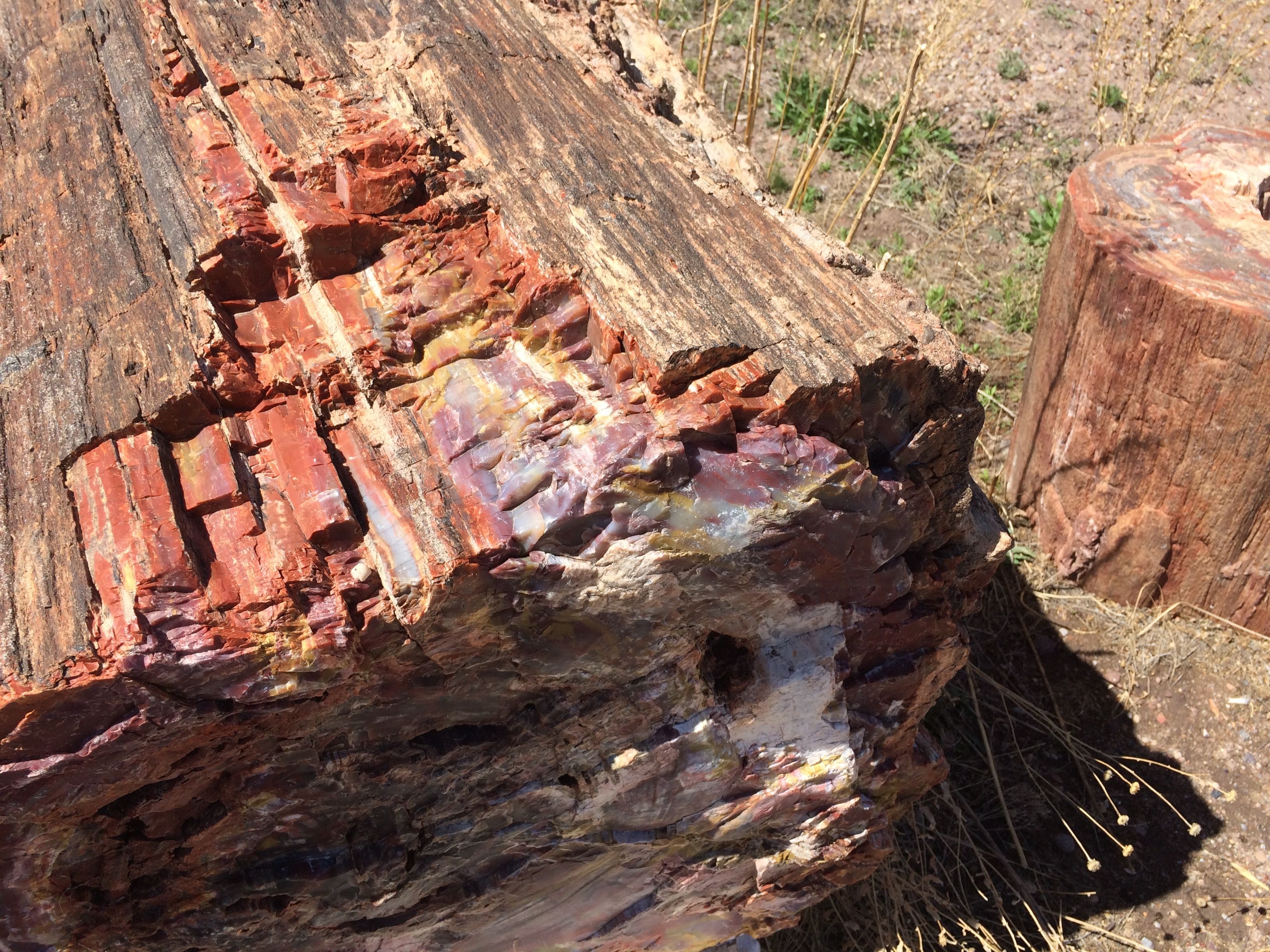
YES!!! Free camping! Not only was the camping free, but they had petrified wool you could actually walk right up to and touch.
This piece was right by my door. Beautiful!
They had petrified wood all over the place. It is Arizona’s state rock, after all.
I wonder when these trees actually started growing?
How long did it take for the minerals to replace the wood?
And just where did these incredible colors come from?
The sign says “OPEN” but the door said “CLOSED”.
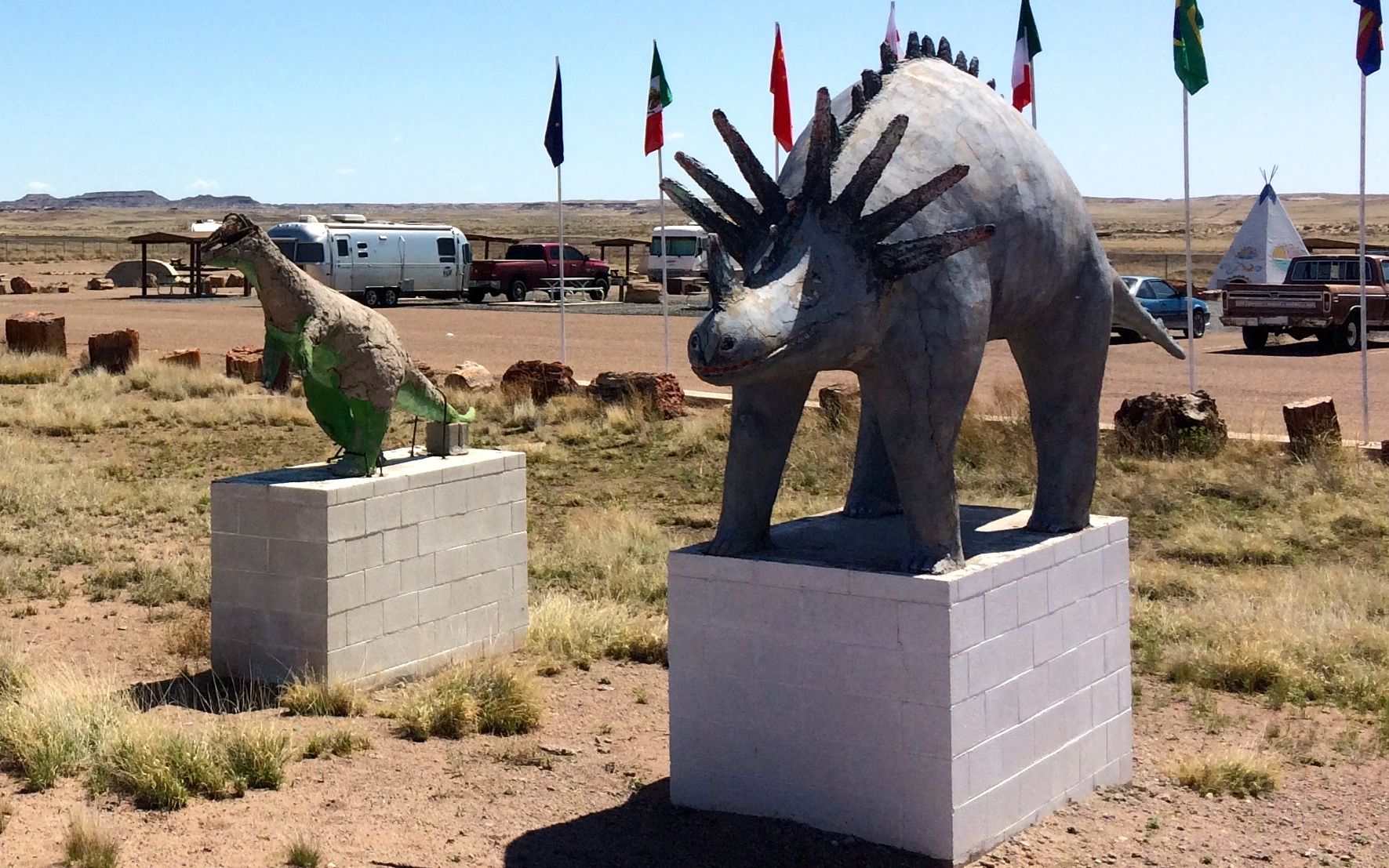
Nevertheless, free camping, up close petrified wood, and kitsch abounding.
Who can beat that?
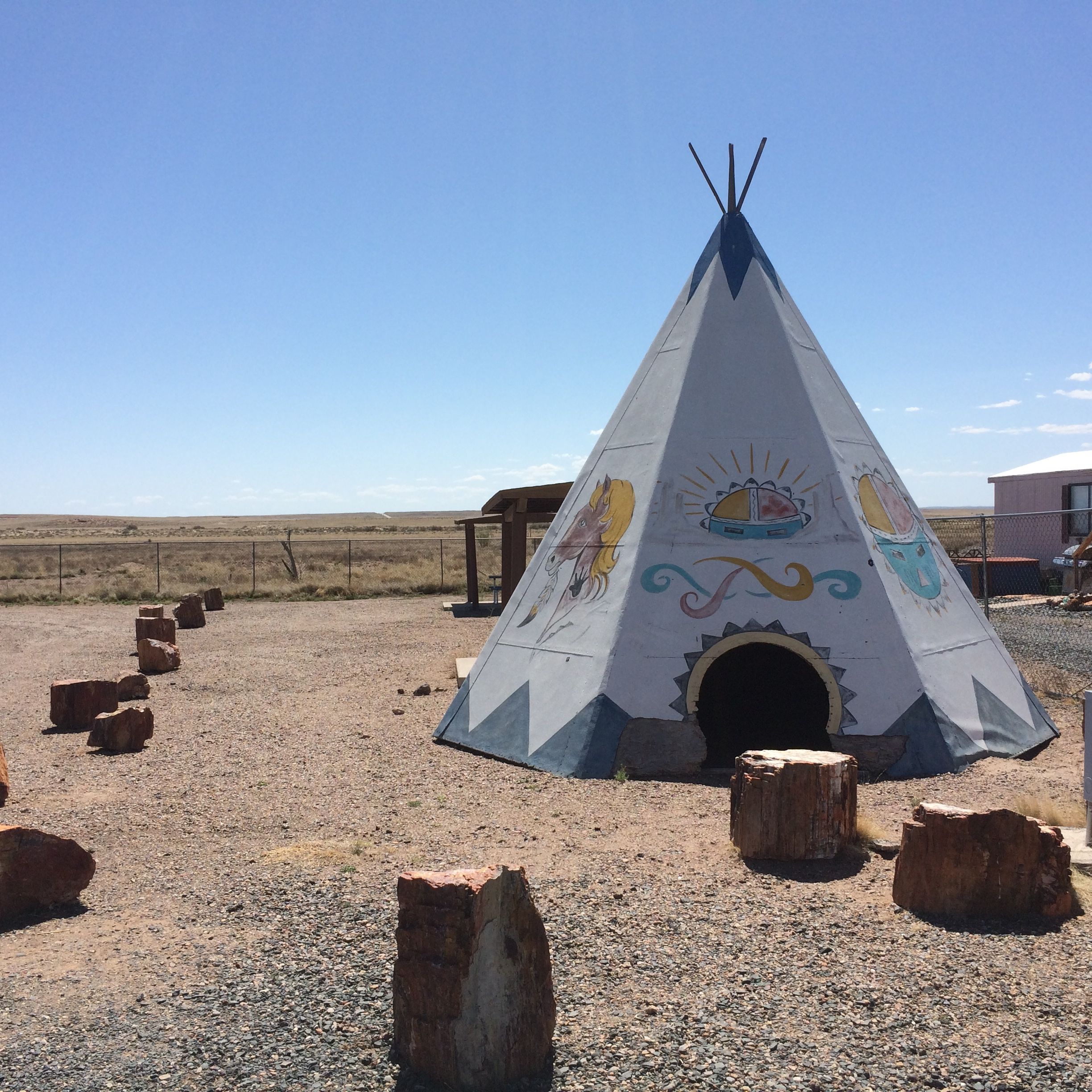
Maybe they even offer free accommodations. I don’t know, but there are doors into the teepees. I had my own bed, though, so it didn’t matter to me.
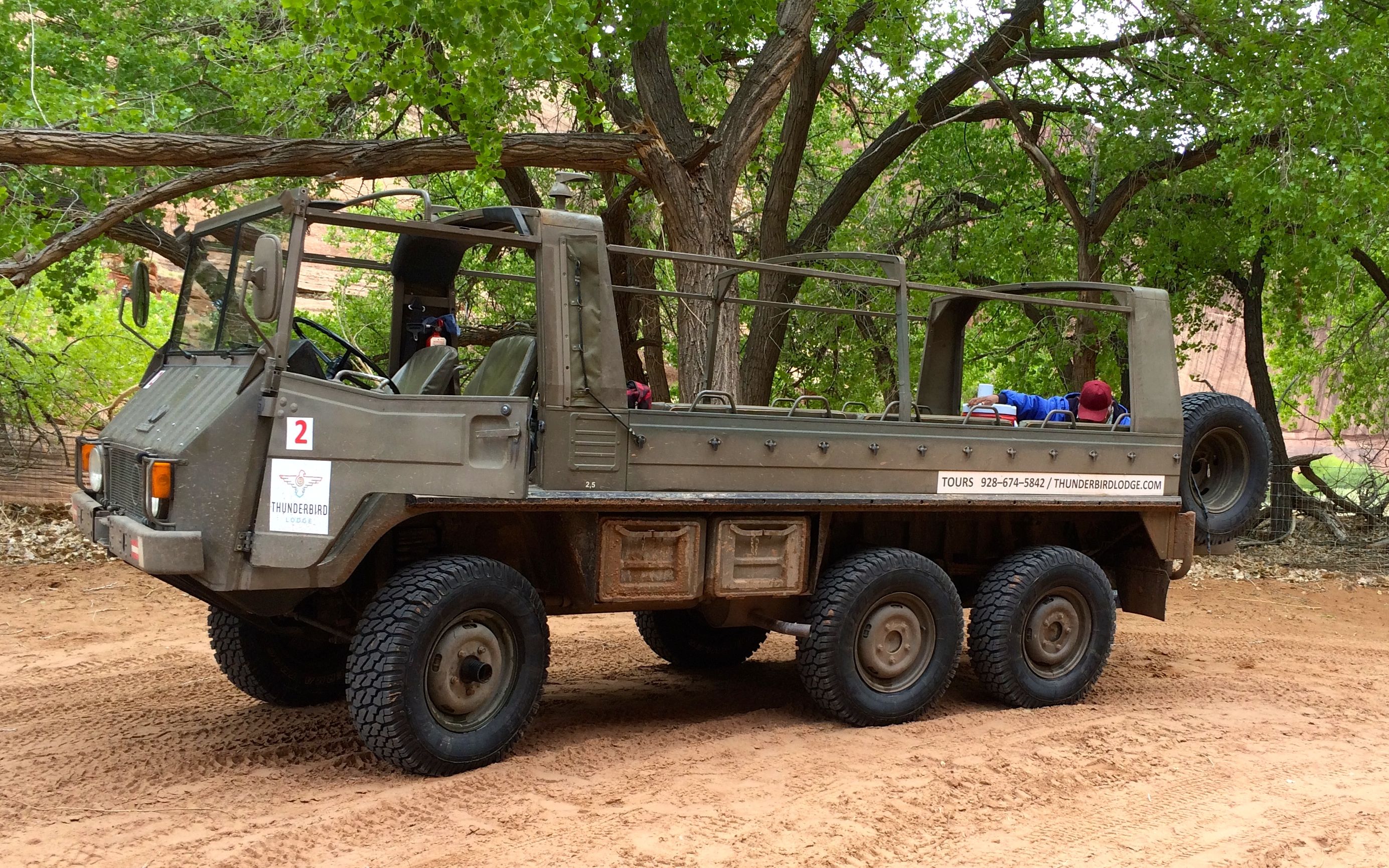
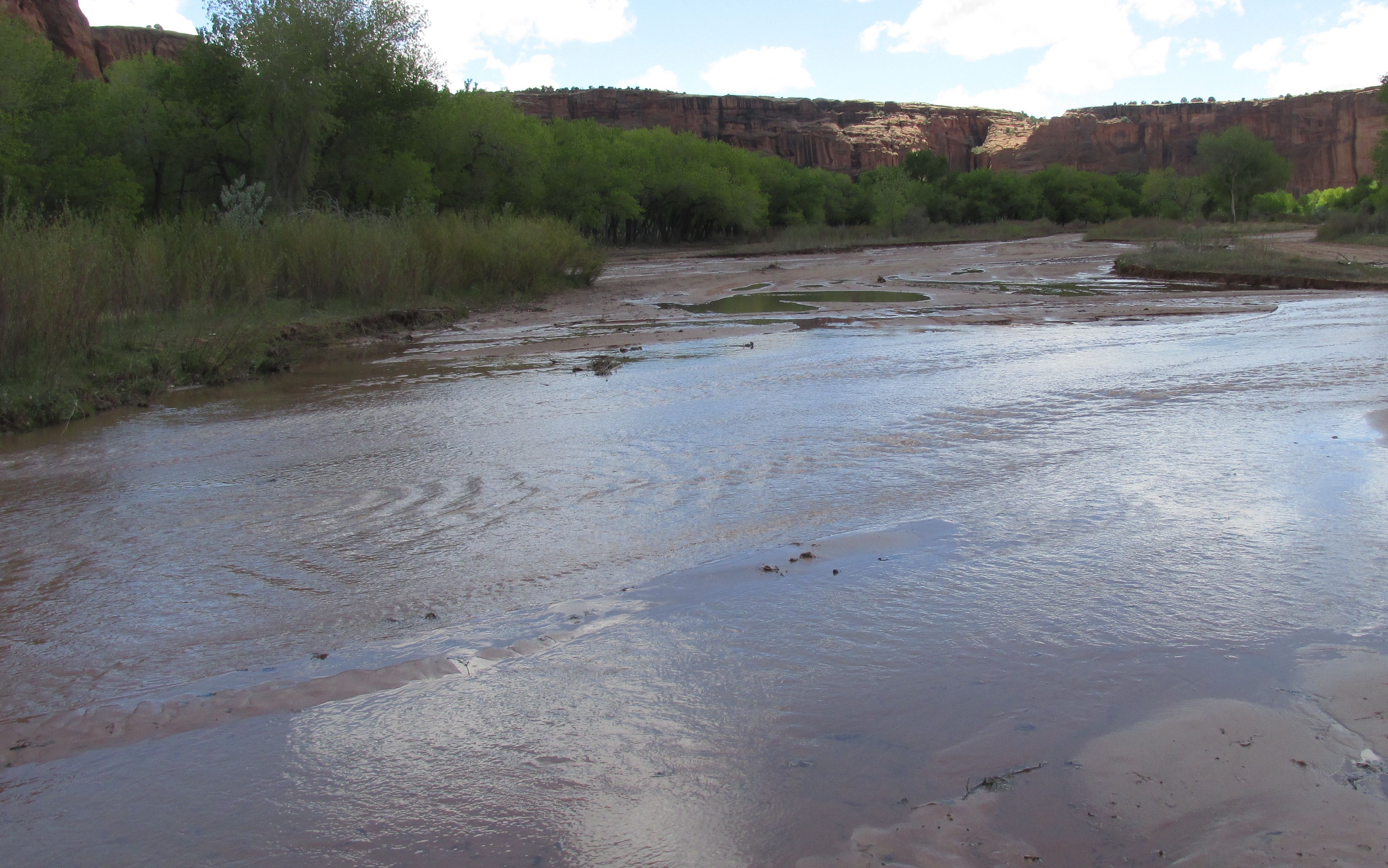
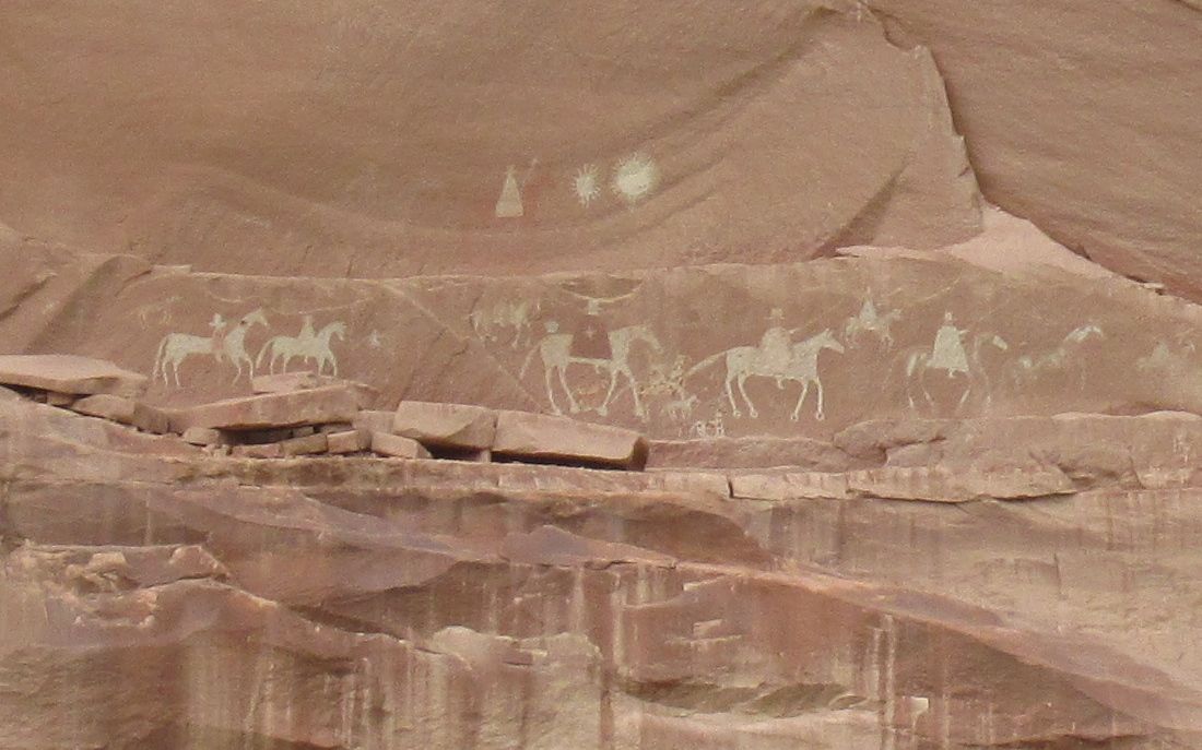
I have to admit that I had to tamp down a bit of resentment that we had to take a tour if we wanted to enter the canyon. Of course, the Navajo have a right to make a living and if it I were in the same situation, I would not enjoy have hordes of visitors walking around in my back yard. However, that being said, when the vehicle you are riding in looks like this:
and you needed all the power and wheels it had, I am just as glad I wasn’t allowed to drive my truck into the canyon.
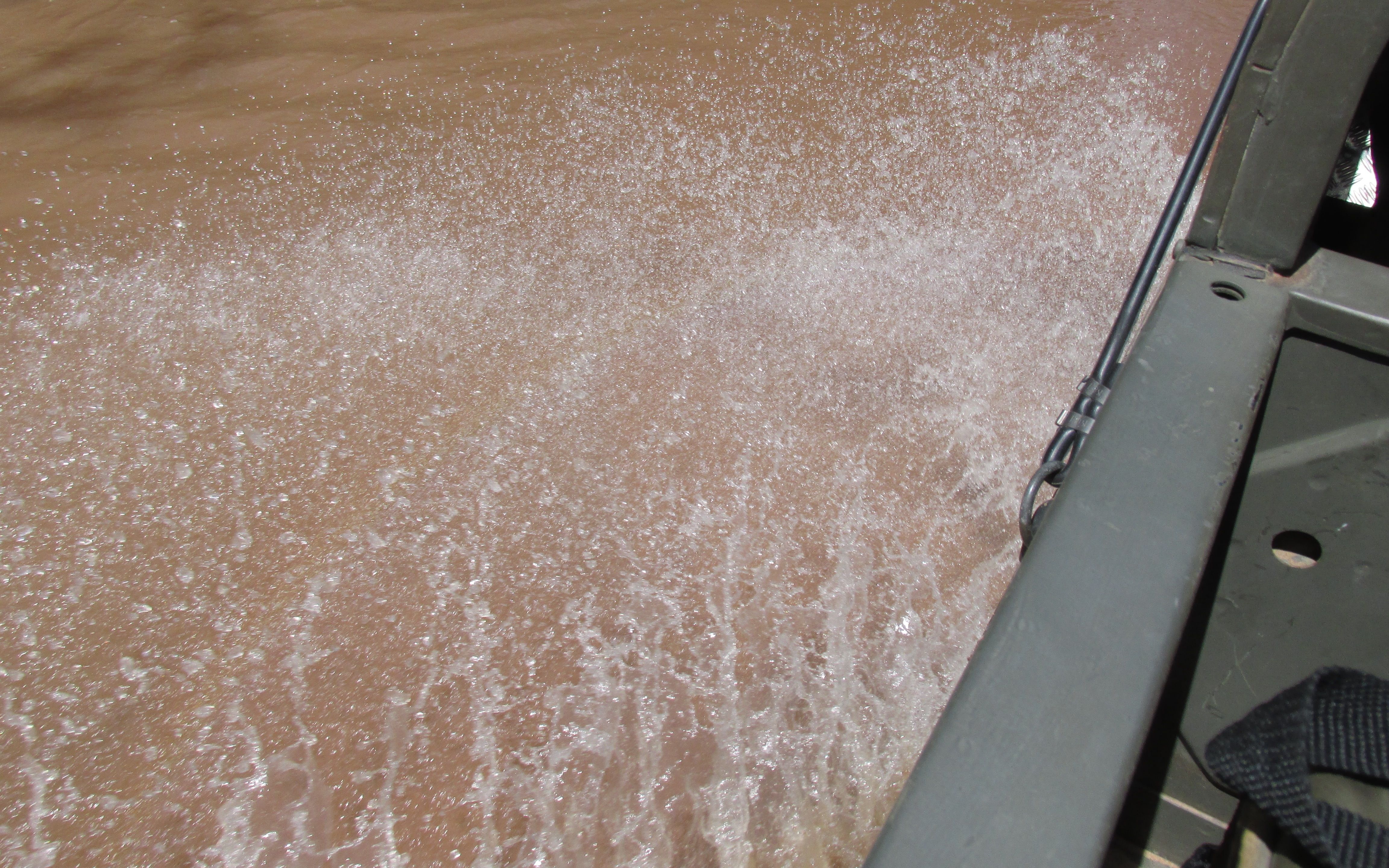
For one thing, this is what the roads looked like:
We drove right up the creek or river that was flowing down the canyon! Some places had more recognizable roads, but splashing through the water was the norm.
And I really appreciated the seat belts that were provided. It was not exactly smooth going.
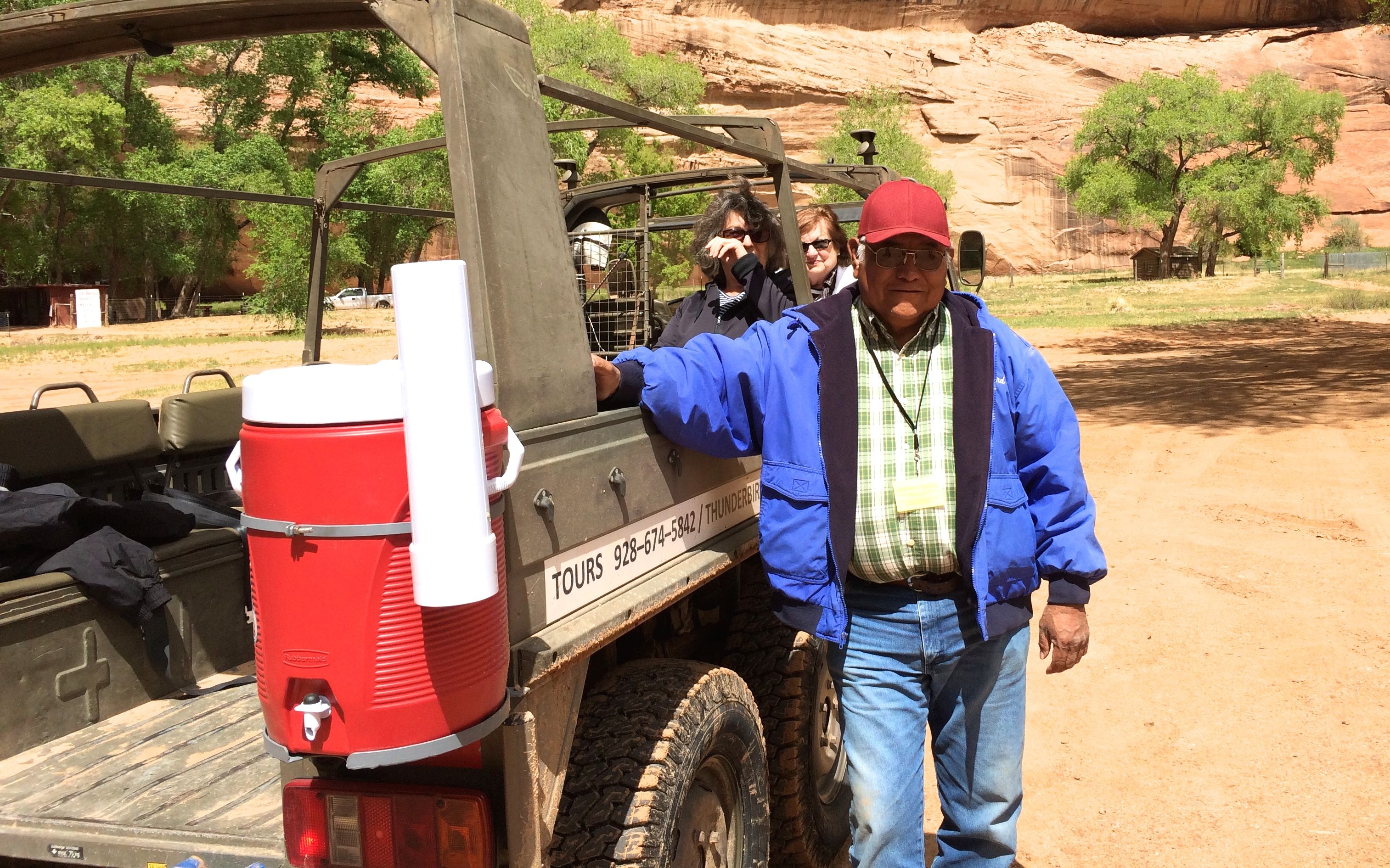
There were five of us on the tour and George was our guide. He did a good job of pointing out all of the main points along the way. The other people on the tour were from California, and they got to talking with him about the state. He told us that he was stationed in San Diego when he was in the Navy. Somehow it came up that his uncle had been one of the code talkers during World War II. We were all quite impressed.
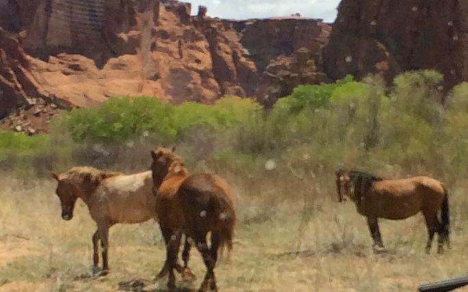
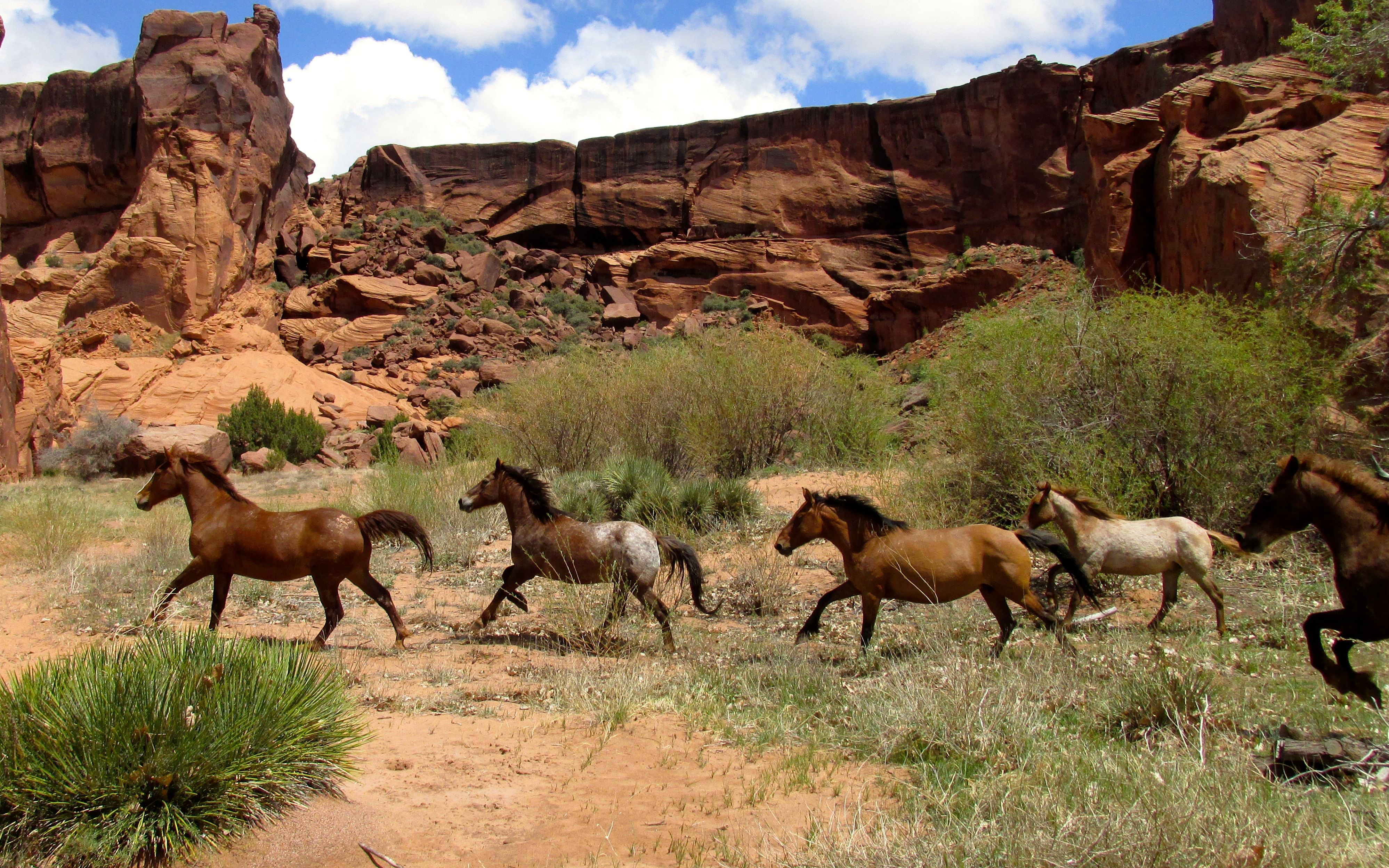
We passed herds of horses from time to time. I asked George if they were wild horses. He said that they belonged to families and that they were branded so that they knew whose horse was whose.
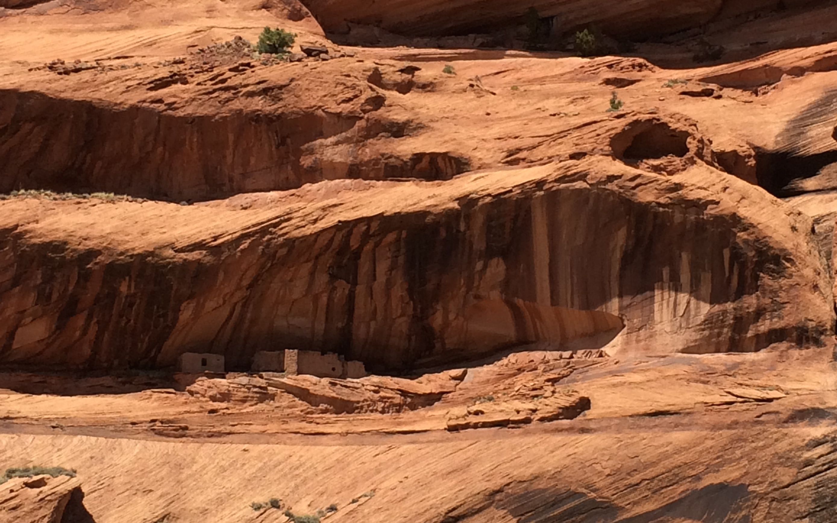
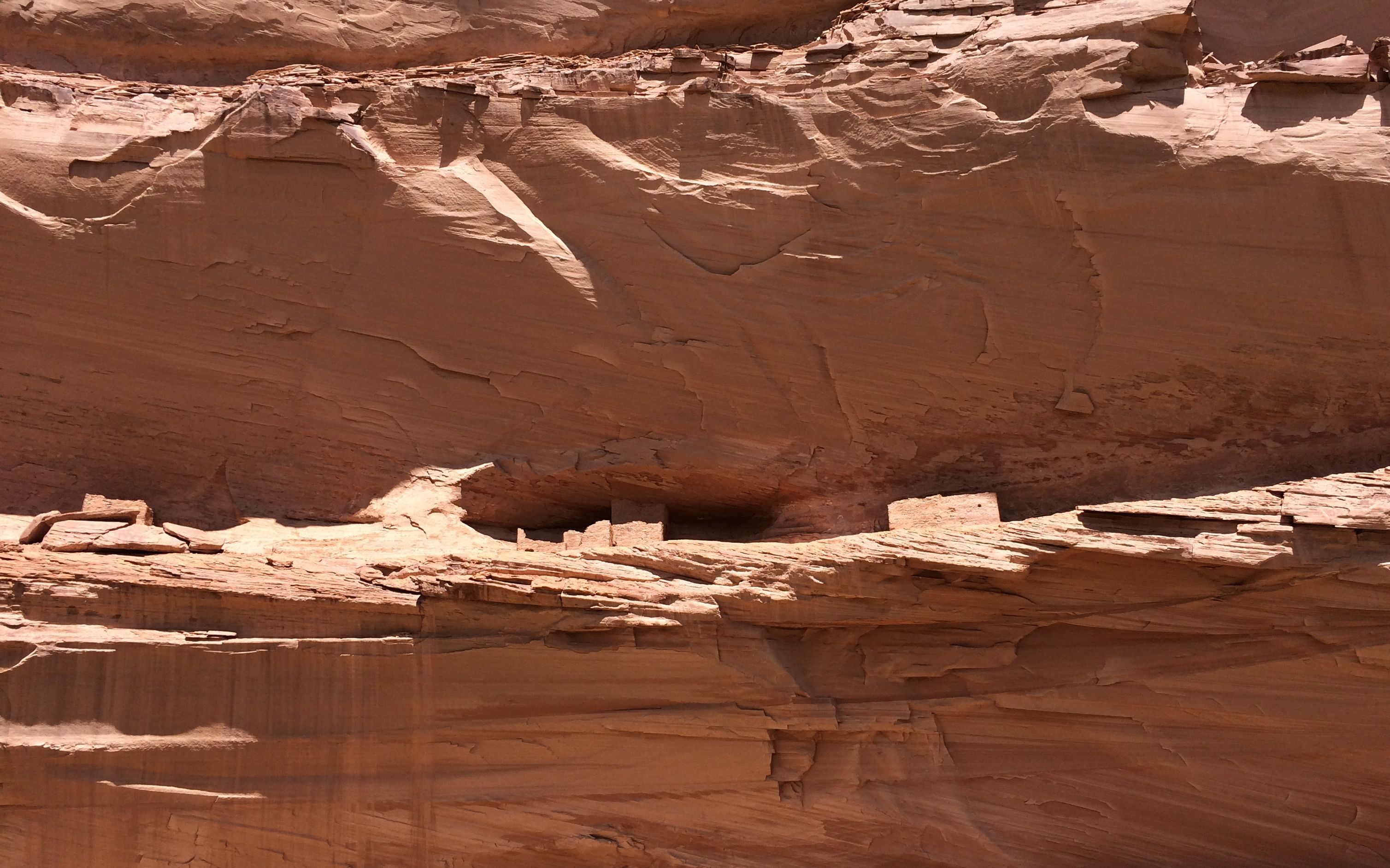
I was really surprised at how many ruins there were in the canyon. We passed by so many that George didn’t identify. The first one we stopped at was called “First Ruin.”
These are the ruins of the Anasazi. They were ruins when the Navajo arrived in the canyon.
They would live up on the ledge and then farm the canyon floor below.
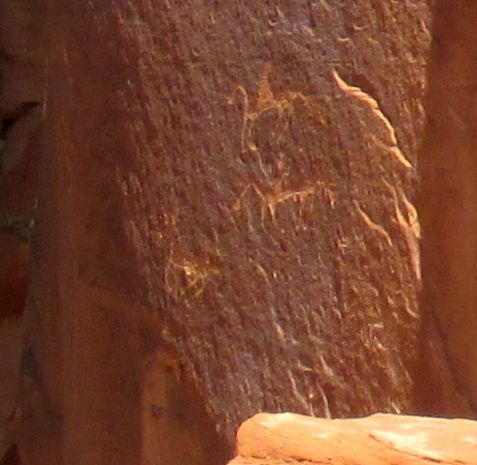
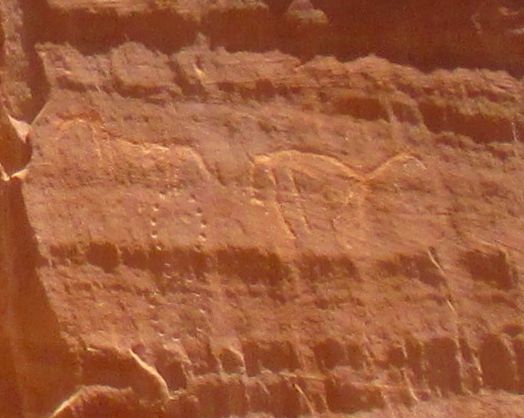
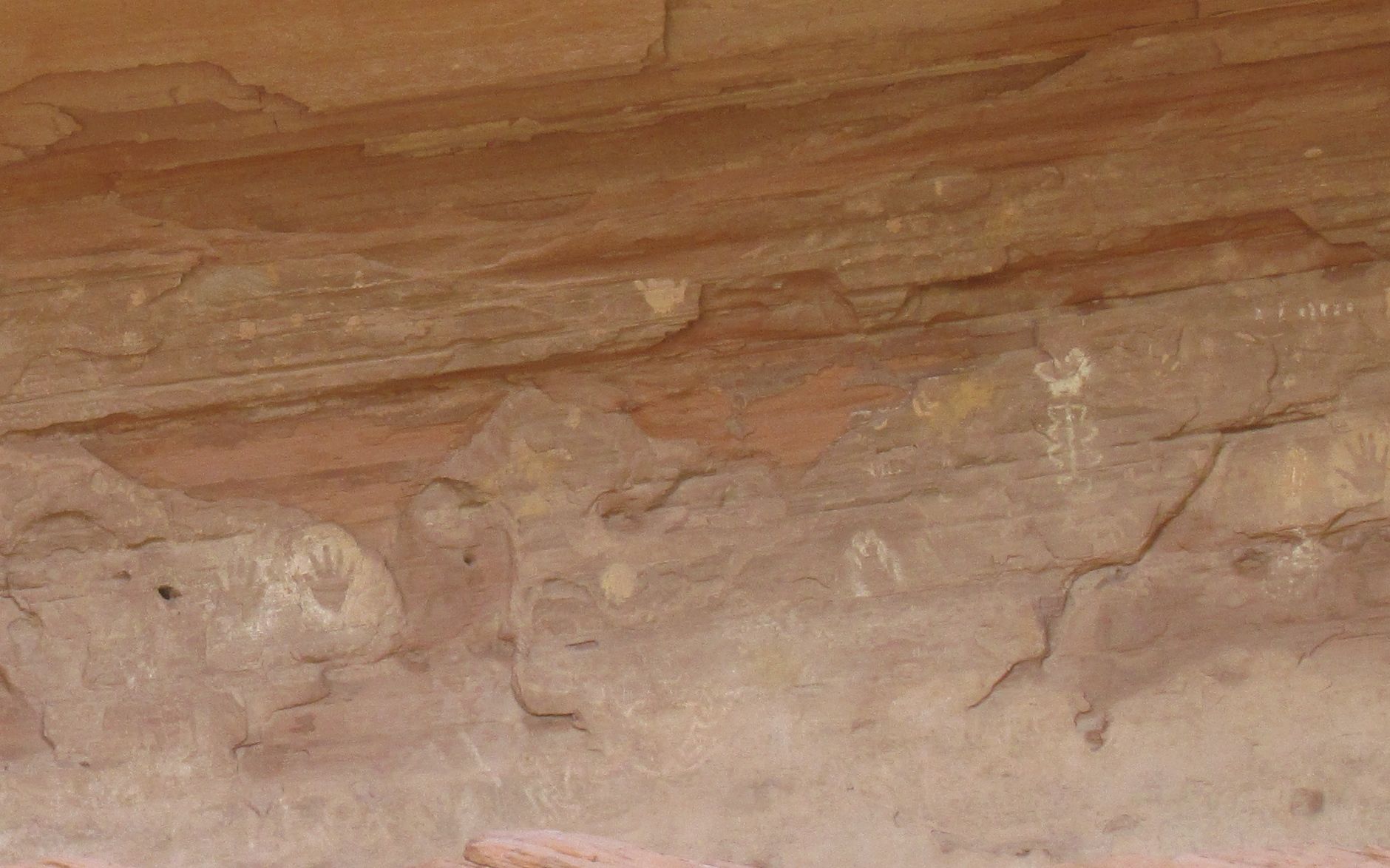
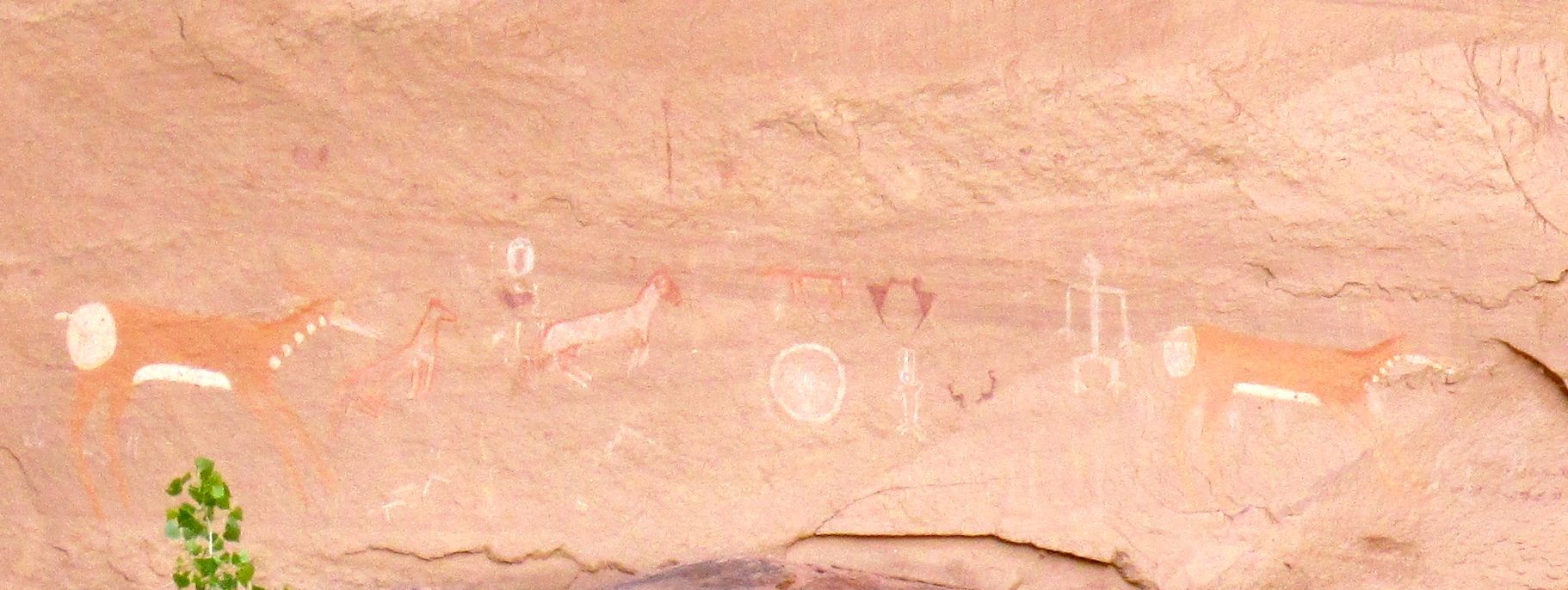
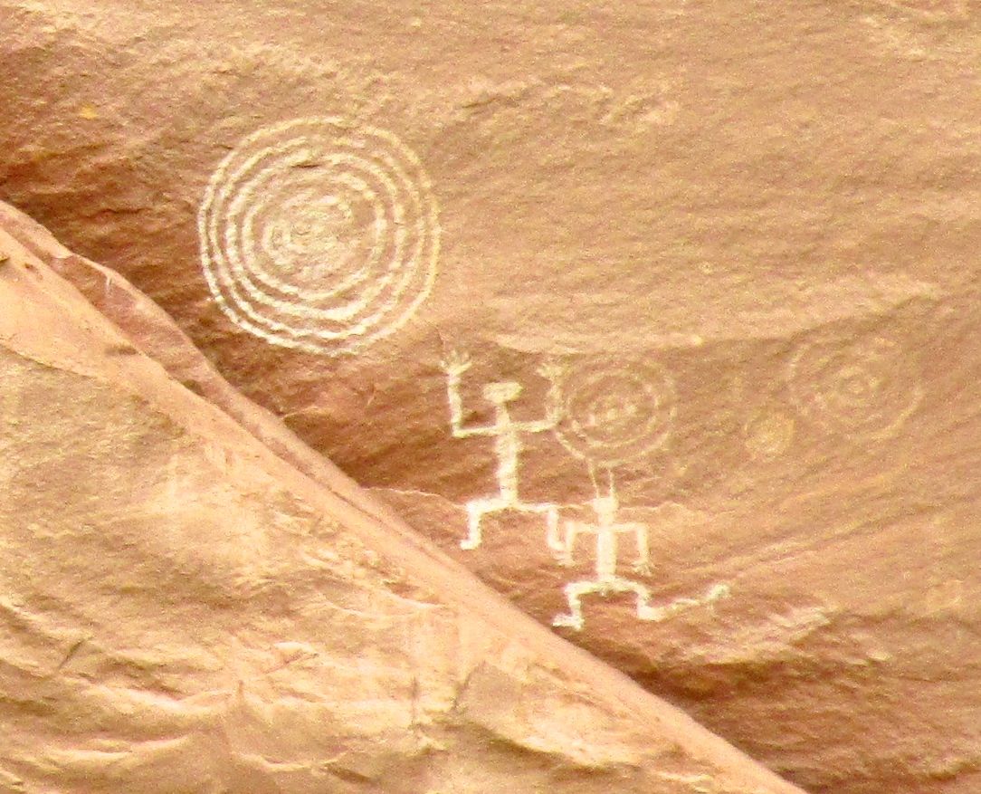
I almost thought George was kidding us when he stopped at this rock to point out the petroglyphs. But, if you look long enough and carefully enough, you start to see them.
This panel is on the left side. George told us that these were carved by the Navajo. You can tell, because they have horses.
This panel is in the center. If I remember correctly, he said that these were carved by the Hopi.
These carvings were on the right. They look like more horses to me. The figure eight reminds me of the analemma – the path that the sun takes in the sky during the year.
In fact, have you see the Tom Hanks movie where he tracks time by plotting the sunlight that comes through a hole in a cave?
I wonder if they were making some sort of a calendar?
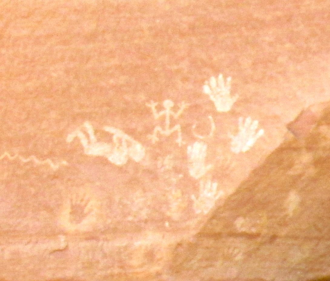
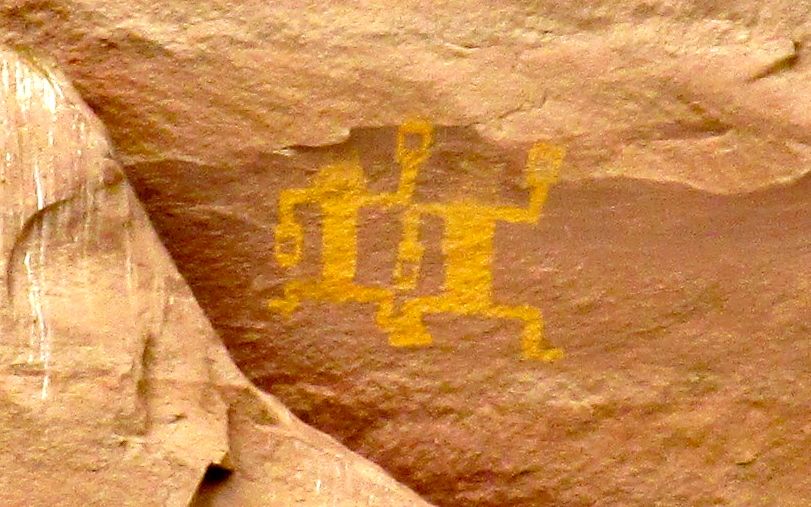
Our next stop was Kokopelli cave. It was filled with pictograms, including Kokopelli himself.
You can see hunch-backed Kokopelli playing his flute.
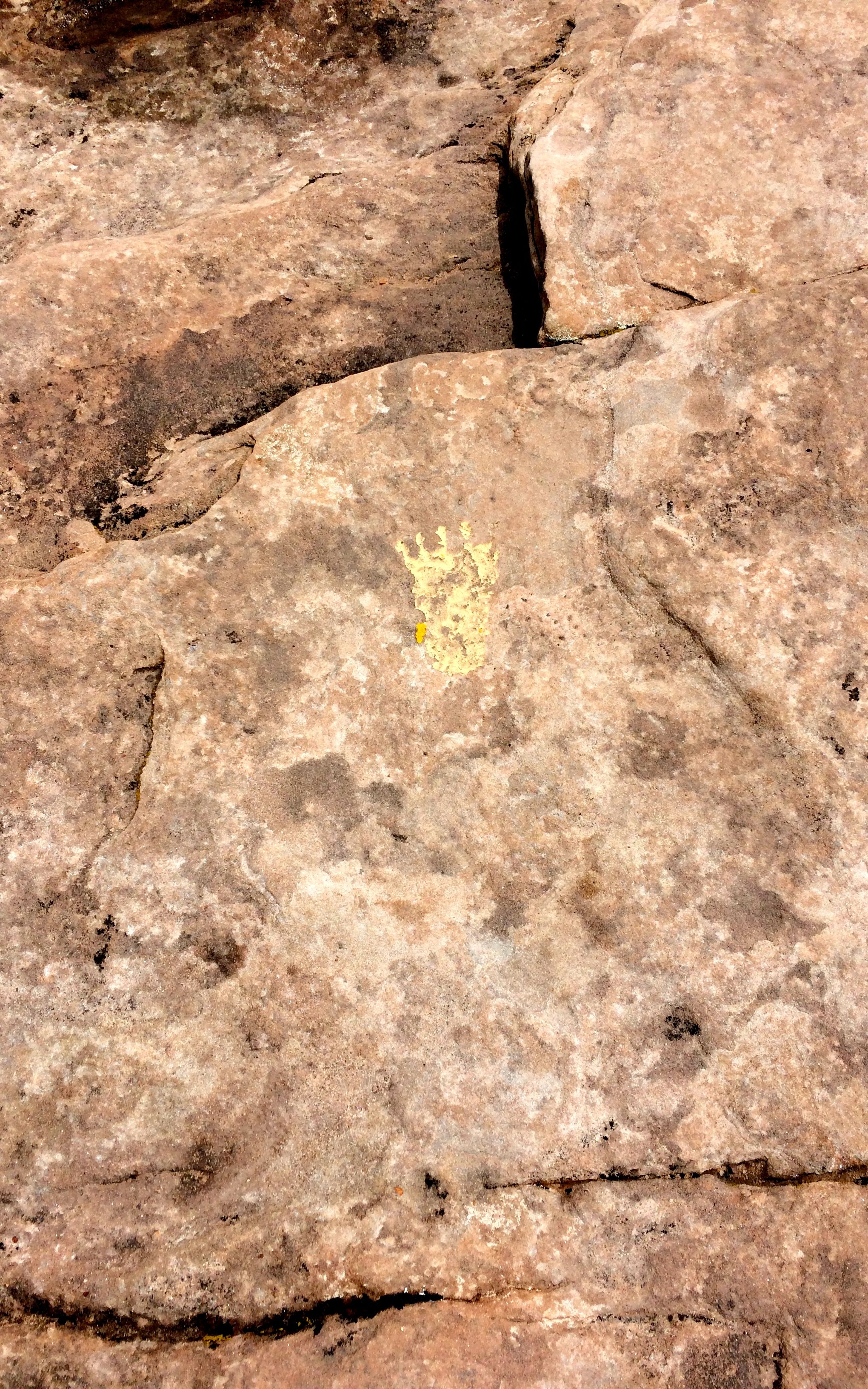
The inside of the cave was full of handprints that were created by taking the pigment in the mouth and spraying it around the hand.
This is another ruin that we passed without explanation. I am surprised I managed to get a photo of it. The Anasazi located their building carefully, on the sides of the canyons that got the most sun.
I wish I had selected my seat in the vehicle with the same care. Every time we stopped to look at something, I had to unbuckle, stand up and turn to see what we were looking at.
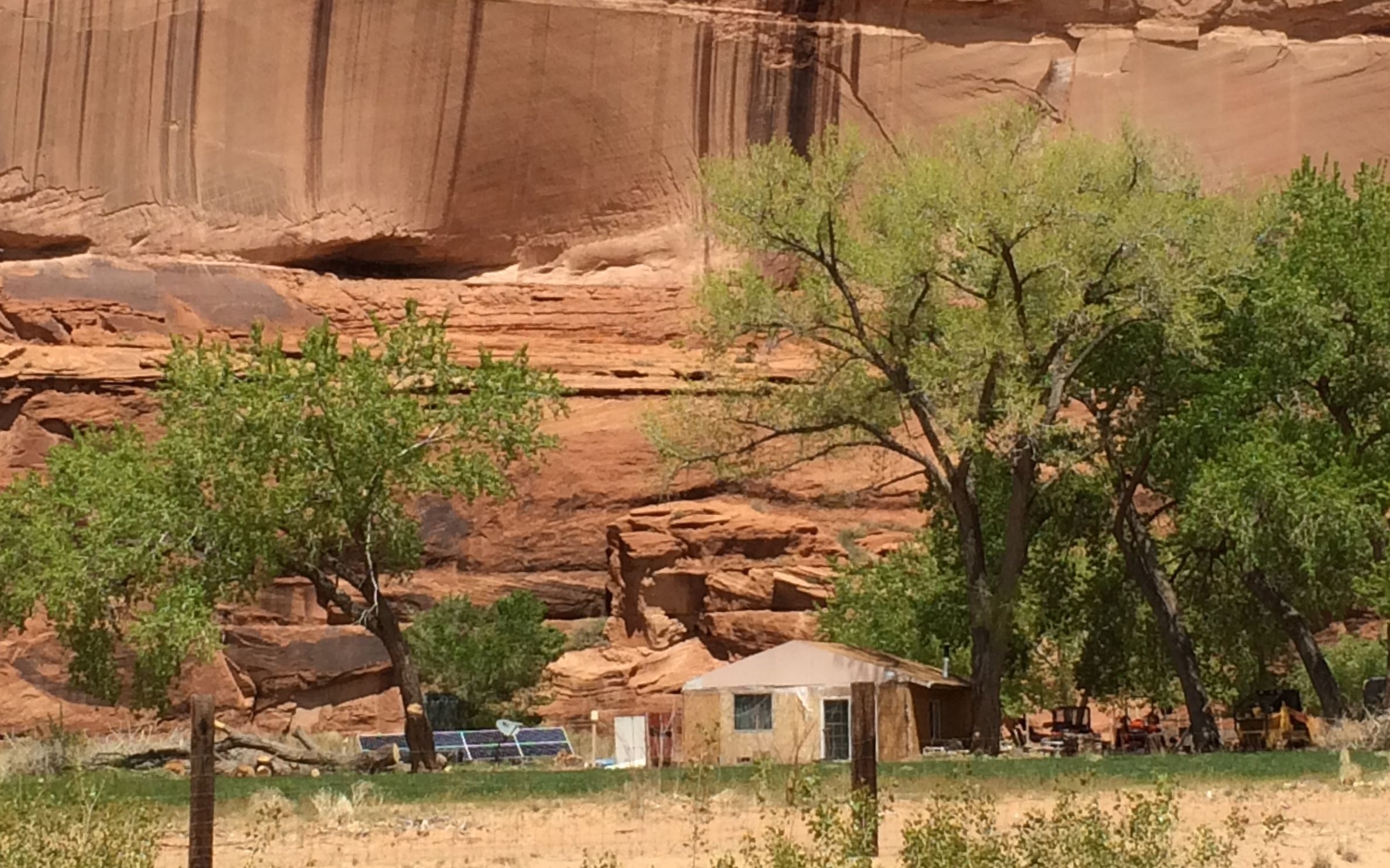
The Navajo today are also taking advantage of the sun. Their farms are down in the canyon, and they move down from the rim once the growing season starts.
You can see that this house, which appears to be based on the hogan, has solar panels and a dish antenna. I don’t know what they pick up down here, but it must be something – otherwise why would they have a dish antenna?
I asked George about how the land was allocated. Did the Navajo nation divide it up? Did they sell it to the families? He told me that after the Navajo were driven out of the canyon and forced to walk to the US Army’s Fort Sumner concentration camp on New Mexico’s Pesos river in 1863, they began to return in 1866. When they got there, they staked their claims to the land. Eventually, ownership was formalized and families now have title to the land. If you would like to read more about The Long Walk, click here.
This is the Navajo fortress, where many of them hid when Kit Carson was trying to drive them out.
We continued along the way. It was always delightful when bands of horses would gallop past us.
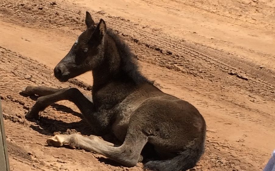
It was foaling season, as some of the young ones hadn’t quite figured out that the road isn’t a great place for a nap. George slowed down so we could get a shot of him. He did get to his feet and saunter away.
I tried to take notes on my phone, but that is hard to do that when you are bouncing all over the place. Forgive me if I can’t do some of these justice.
Channeling my best Jackie Kennedy from Vaughn Meader’s “The First Family”,
There’s this one,
And that one,
And that one over there.
I did get some of the information recorded, though. This is Junction Ruin, which is at the junction of two canyons.
I can easily see how the Navajo could hide in Canyon de Chelly. It is really a series of canyons.
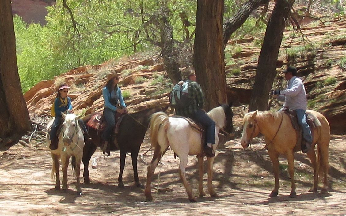
If you didn’t want to ride in the six-wheeled vehicle we took, there were other options. I think the most interesting alternative was on horseback.
However, considering how tired and sore I was after my tour, I can’t imagine how I’d feel after a day-long horseback ride.
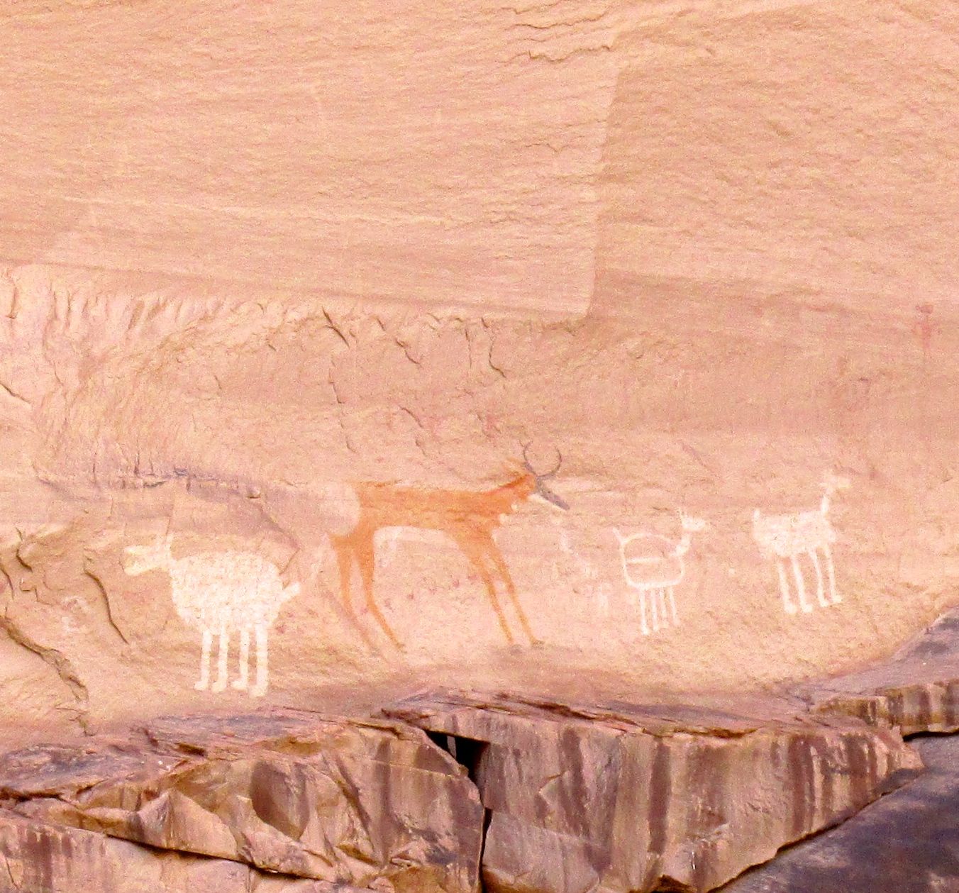
This is Antelope Ruin.
It is named after the pictograms on the canyon walls.
I believe George said that the Hopi made the white images first. When the Navajo took up residence, they added their own touches. Whenever you see horse, you know that it’s the work of the Navajo.
You can see the older Hopi work here. George said that the zig zag represents a snake.
I am quite partial to pictograms and petroglyphs. I am not sure where in the canyon this one was from.
George said that it was from the time of the Spanish exploration.
George told us that this was an old-style summer house. It looks to me like they reused some of the stones from the tumbled down ruins to build it. In the foreground is an orchard. If you look to the right of the house, you can see a loom that is used in weaving rugs.
Over to the left are storage rooms.
The canyon walls behind the house are decorated with pictograms.
I am not sure if these pictograms were from this location or not.
Just enjoy them.
I find this pair charming. I hope they are dancing for joy.
This fellow seems to be saying, “Raise the roof!”
Our last stop on the tour was White House Ruin.
We only had a little time at this stop. There were some vendors there. the other people checked out their wares. I scampered over to get a better look.
I had one of the folks on the tour snap my photo.
If you don’t have a picture, how can you prove it happened?
Then we headed back. It was getting chilly – but at least it wasn’t raining or snowing while we were out.
Back at the campground, it was time to get things ready to roll in the morning.
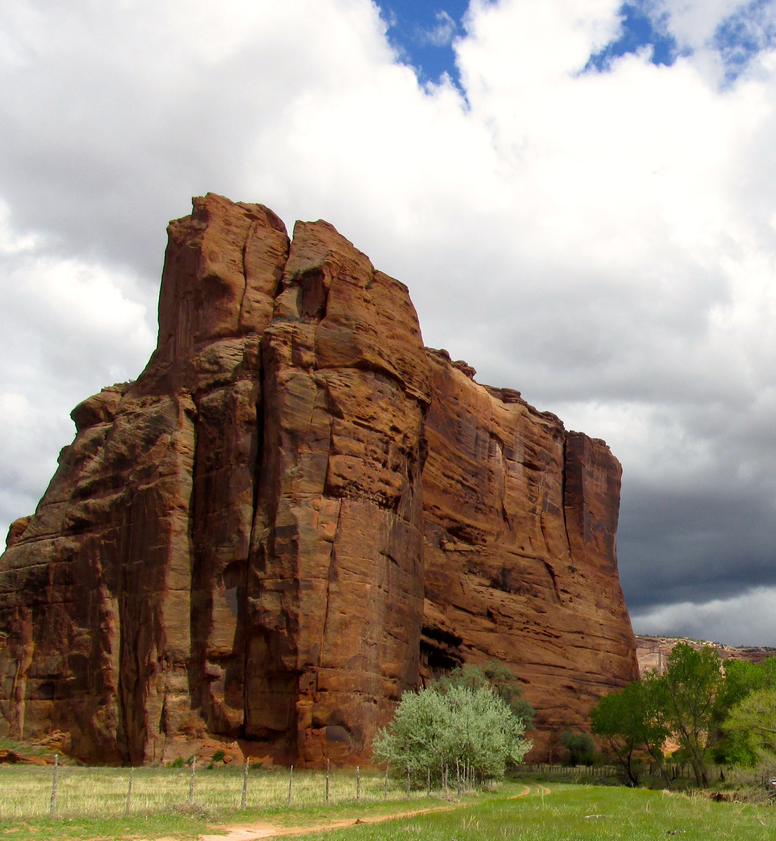
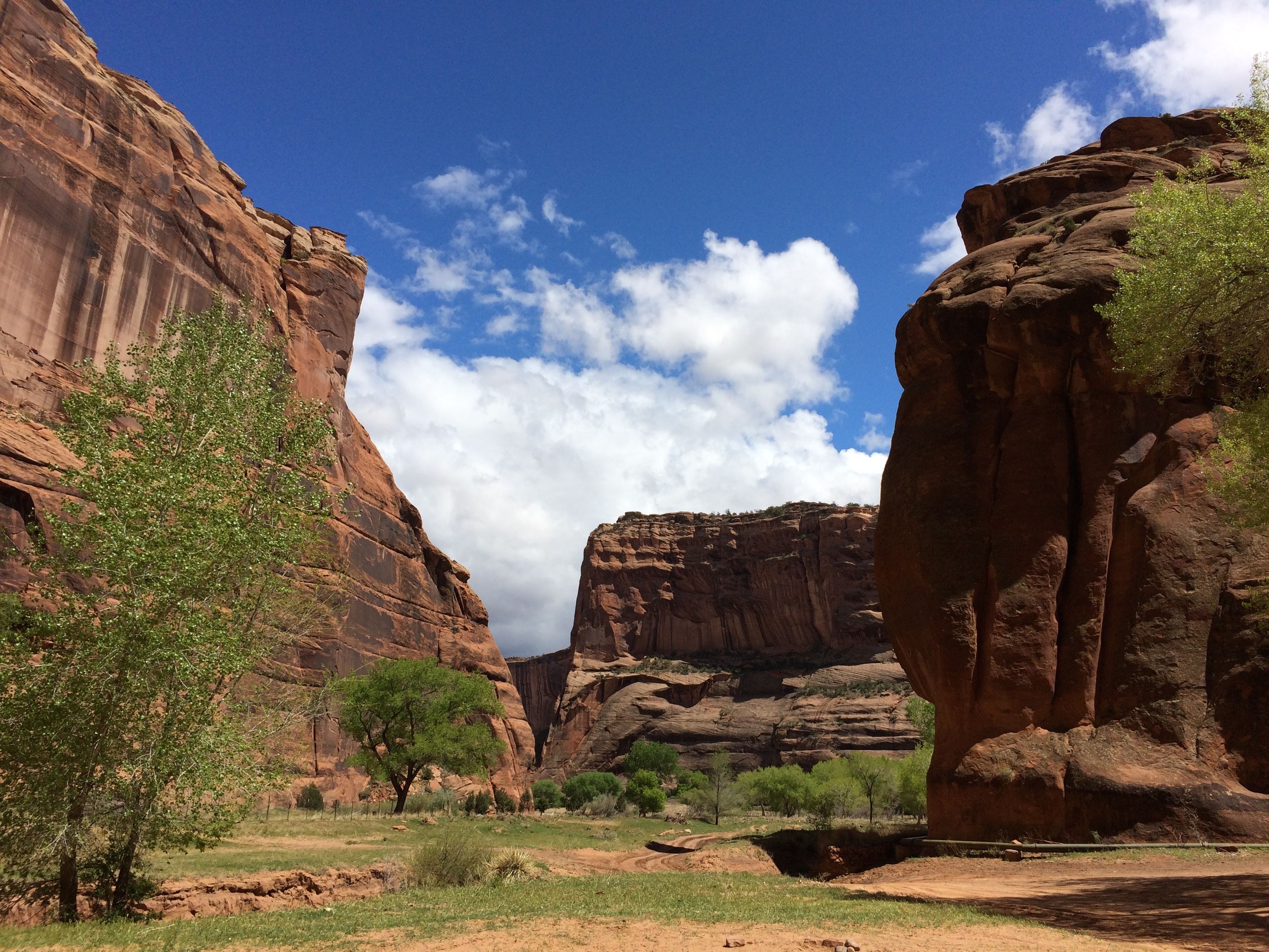
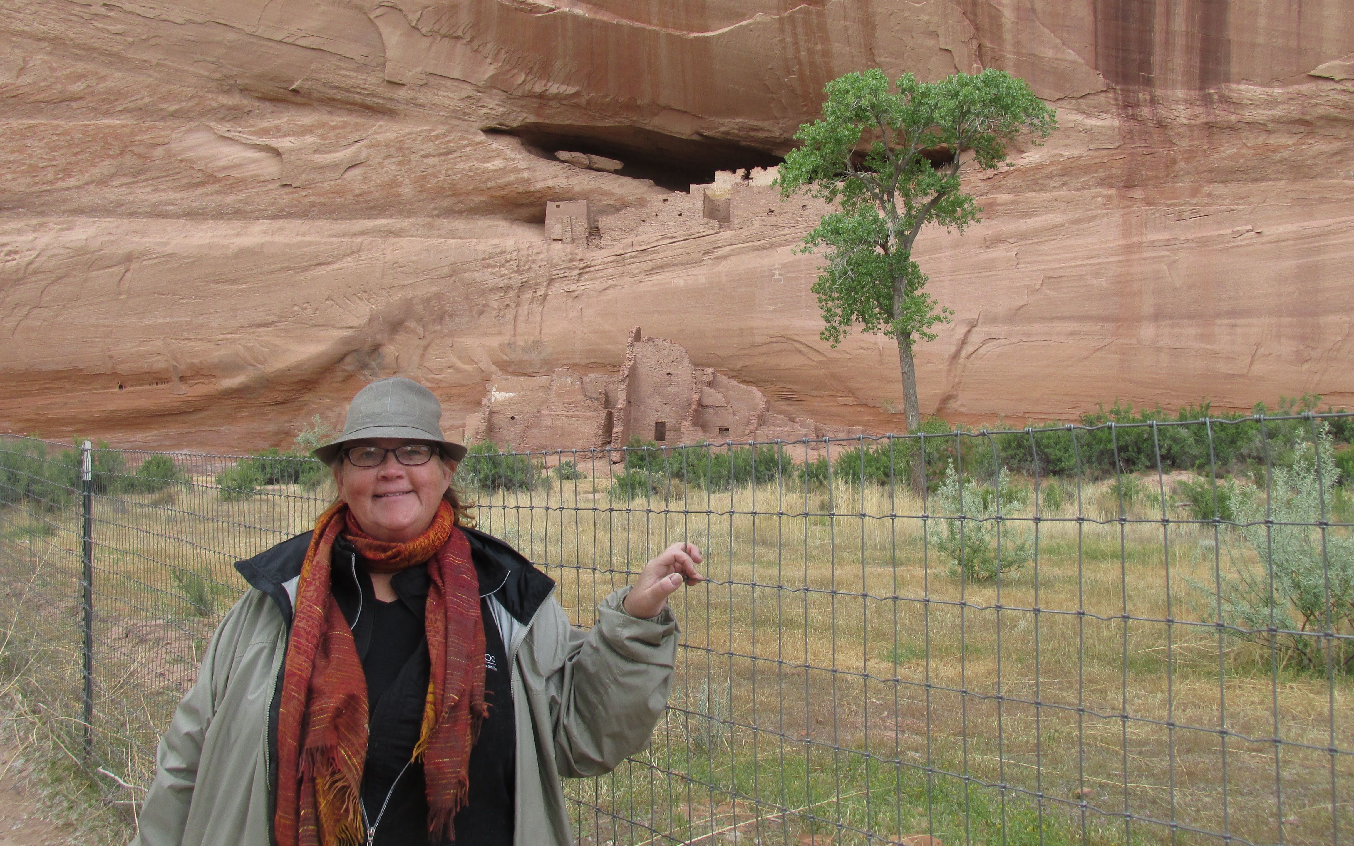
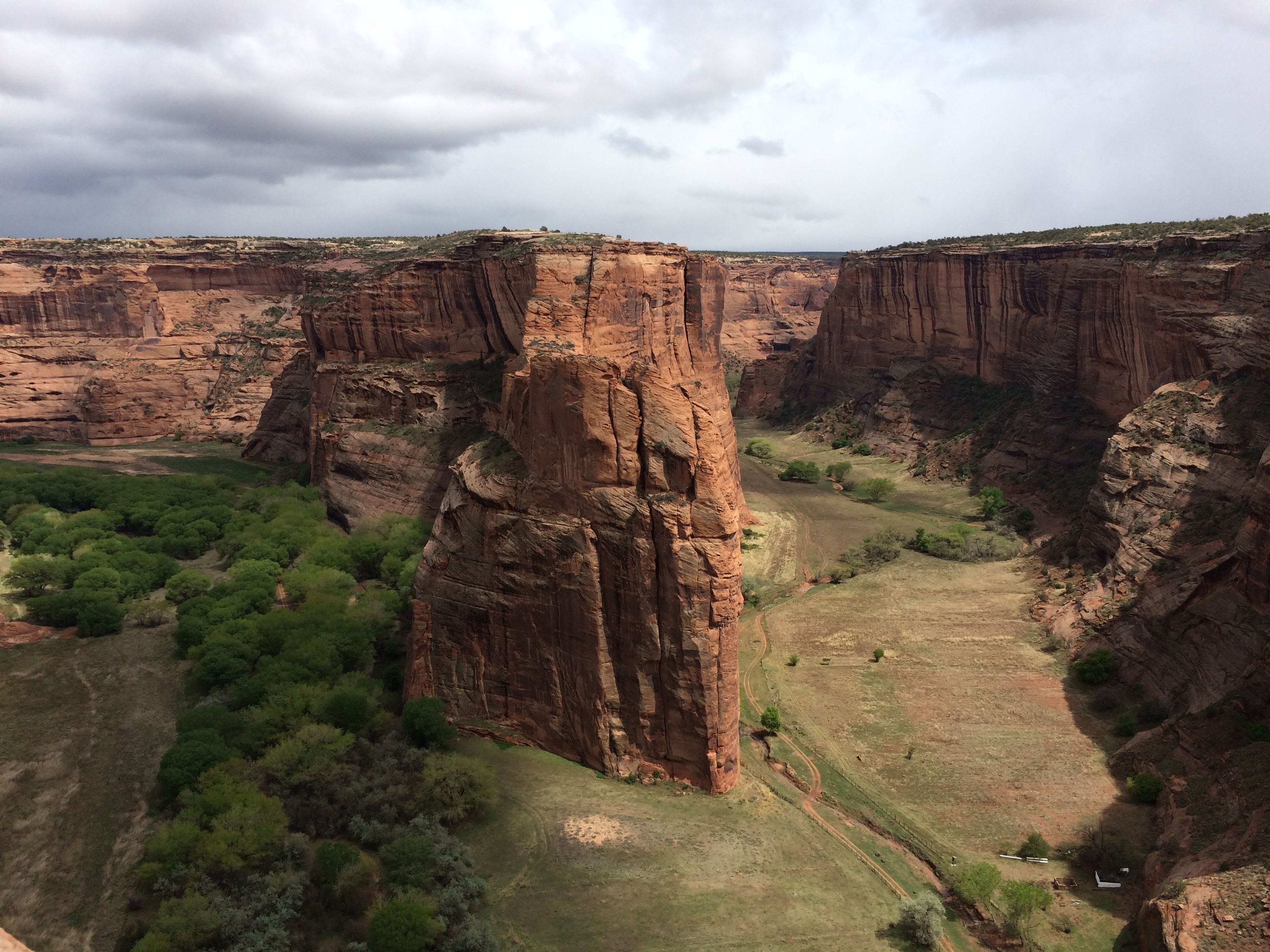
My next stop was Canyon de Chelly National Monument, near Chinle, Arizona. The main reason I wanted to go there was because I remember studying it in art history back in college with Sister Jeanne. I owe so much of what I know about the world and world history to this woman!
First, note on the pronunciation. Canyon de Chelly is pronounced “Canyon d’ Shay.”
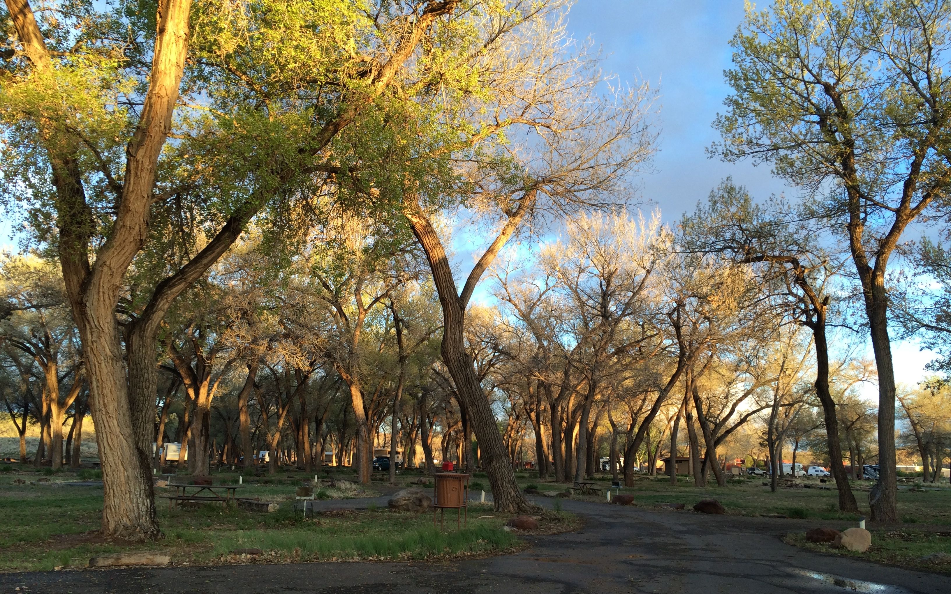
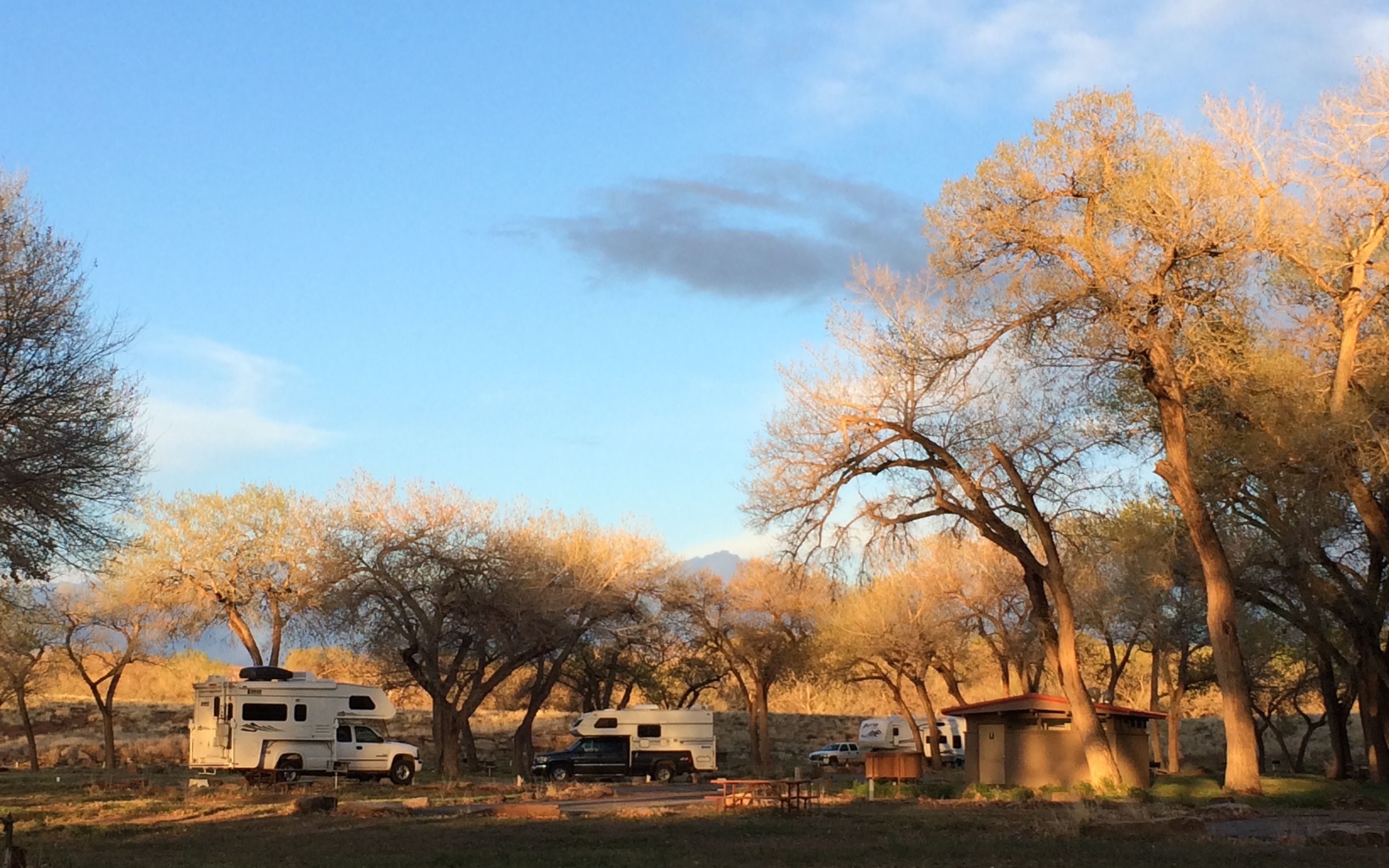
I stopped in at the visitor center to stamp my passport and to inquire about camping. The Navajo Nation runs the campground that is right around the corner from the visitor center, so after checking things out, I headed over and set up camp.
Campsites are available on a first come-first served basis, but I think it was a little too early in the season to need to worry about getting a campsite.
I’ll bet the cottonwoods offer a much appreciated respite from the sun during the summer.
For those who may be interested, the sites cost $14 per night. There are no hook ups, but water and a dump station are available in the campground.
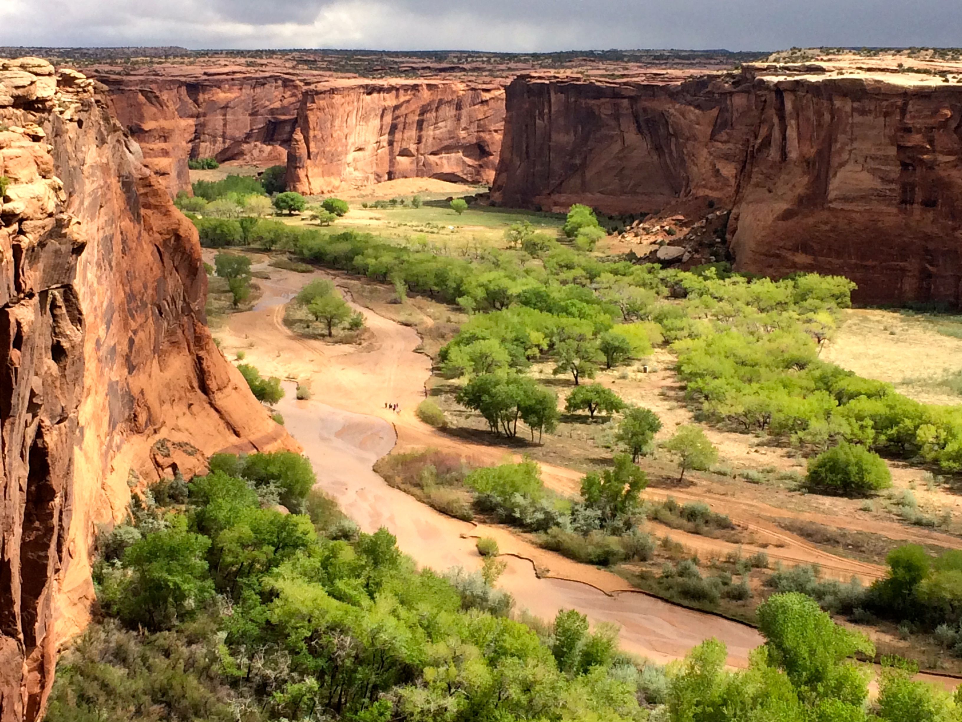
I kind of hunkered down for the night after I arrived. The next day, I headed out to take the drives around the north and south rims.
First, the south rim.
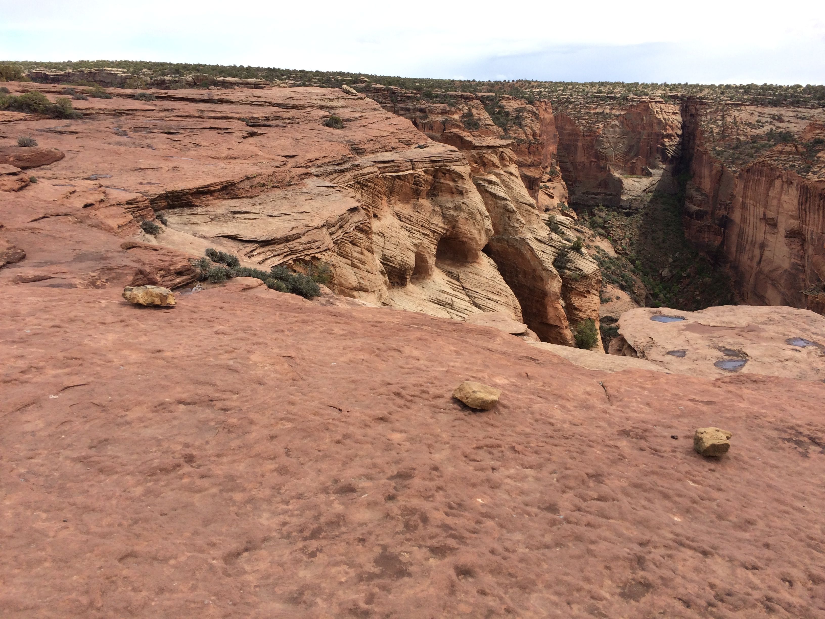
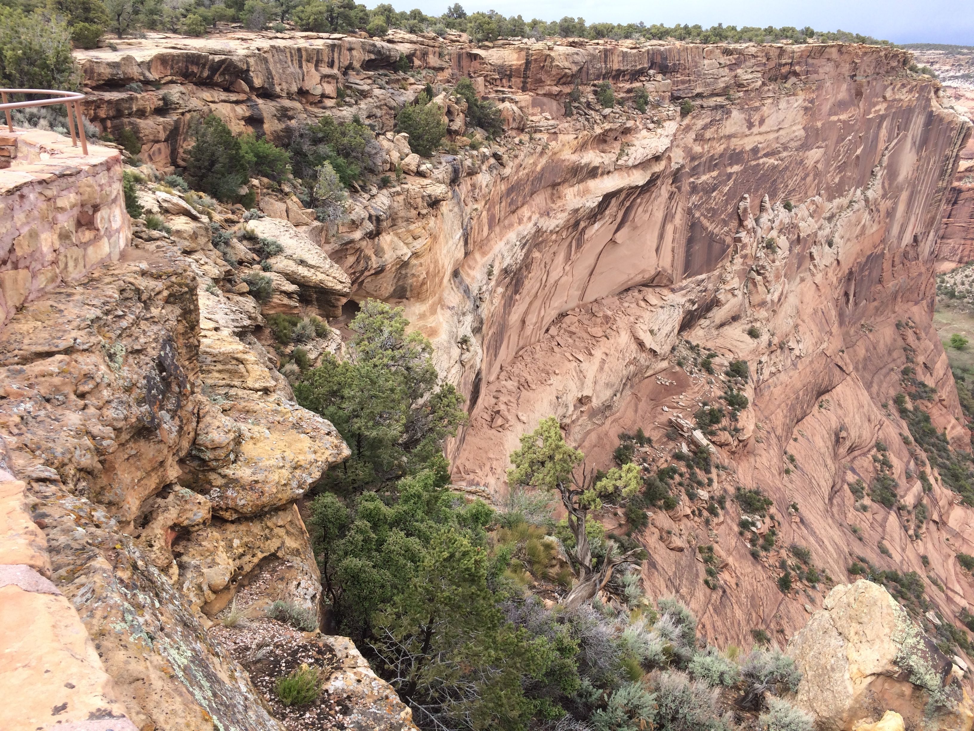
There were many turn outs along the way. This is the Tseyi overlook.
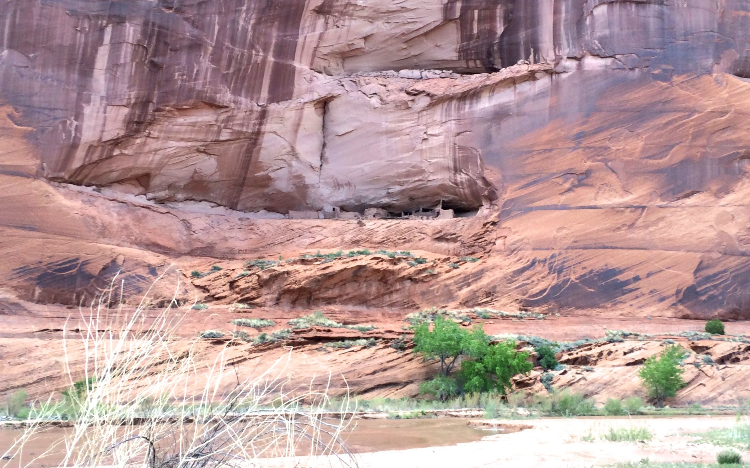
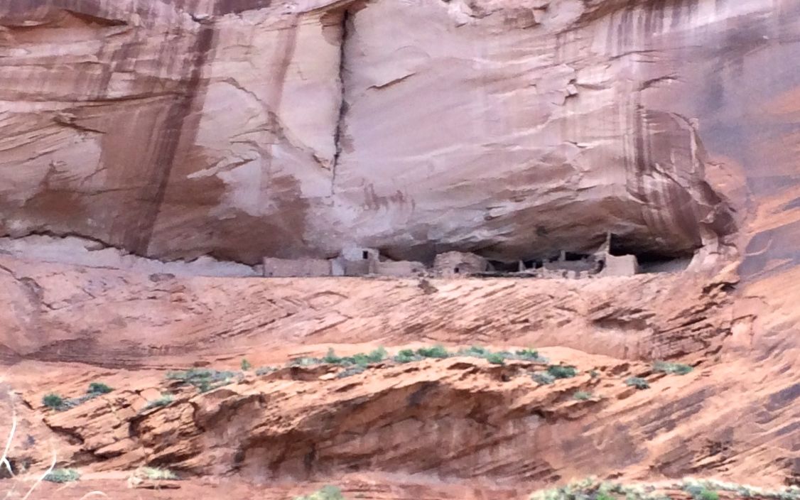
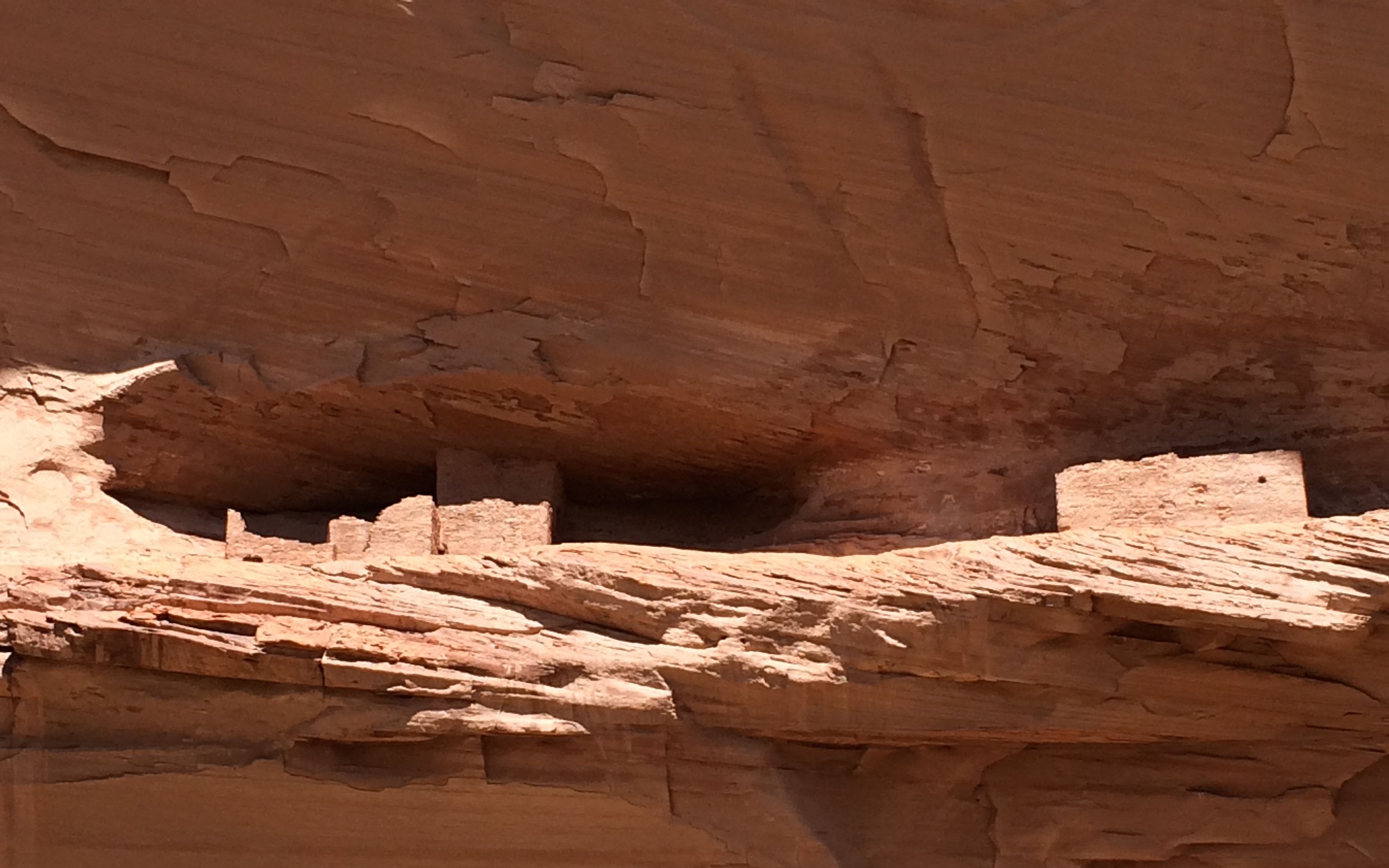
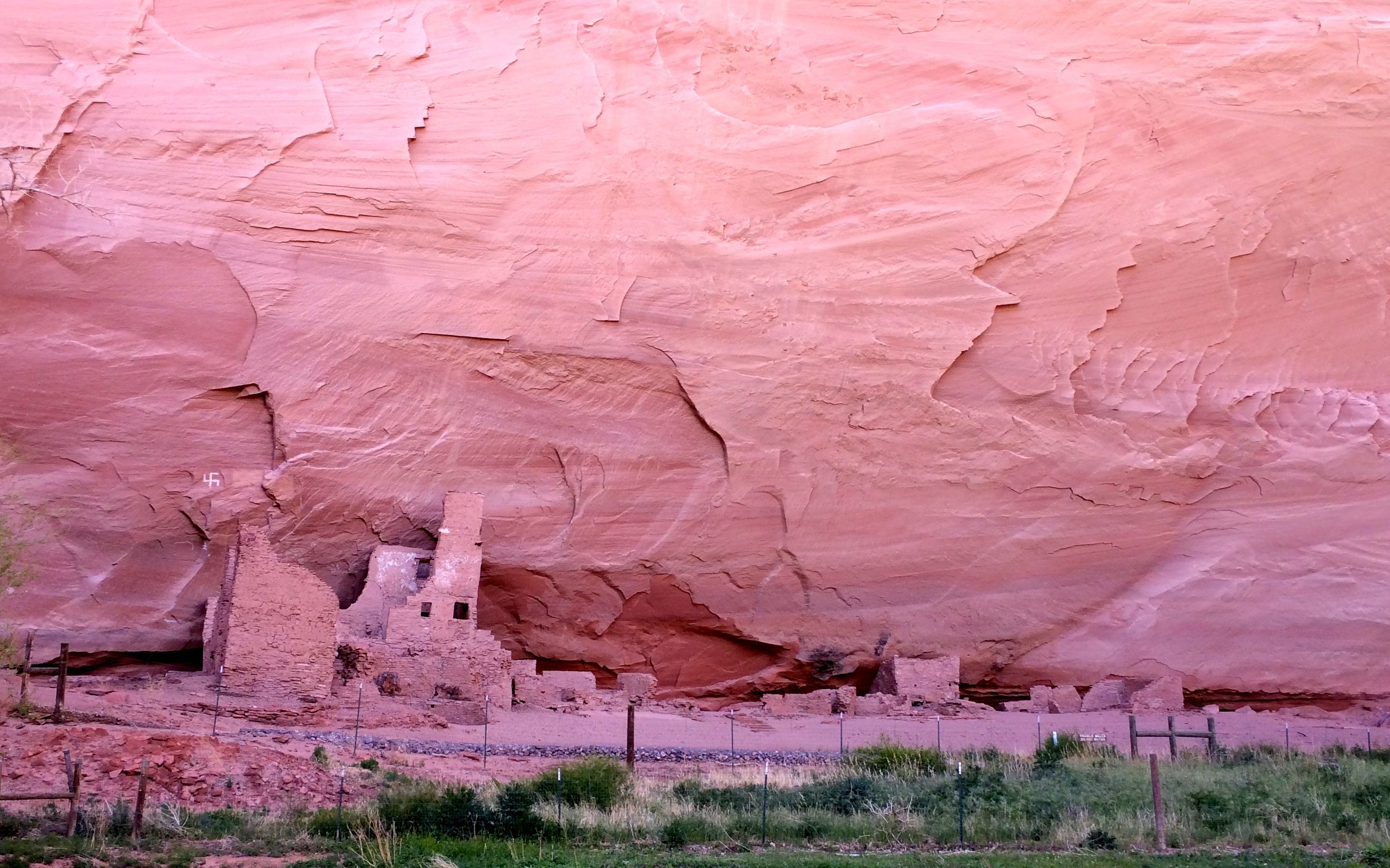
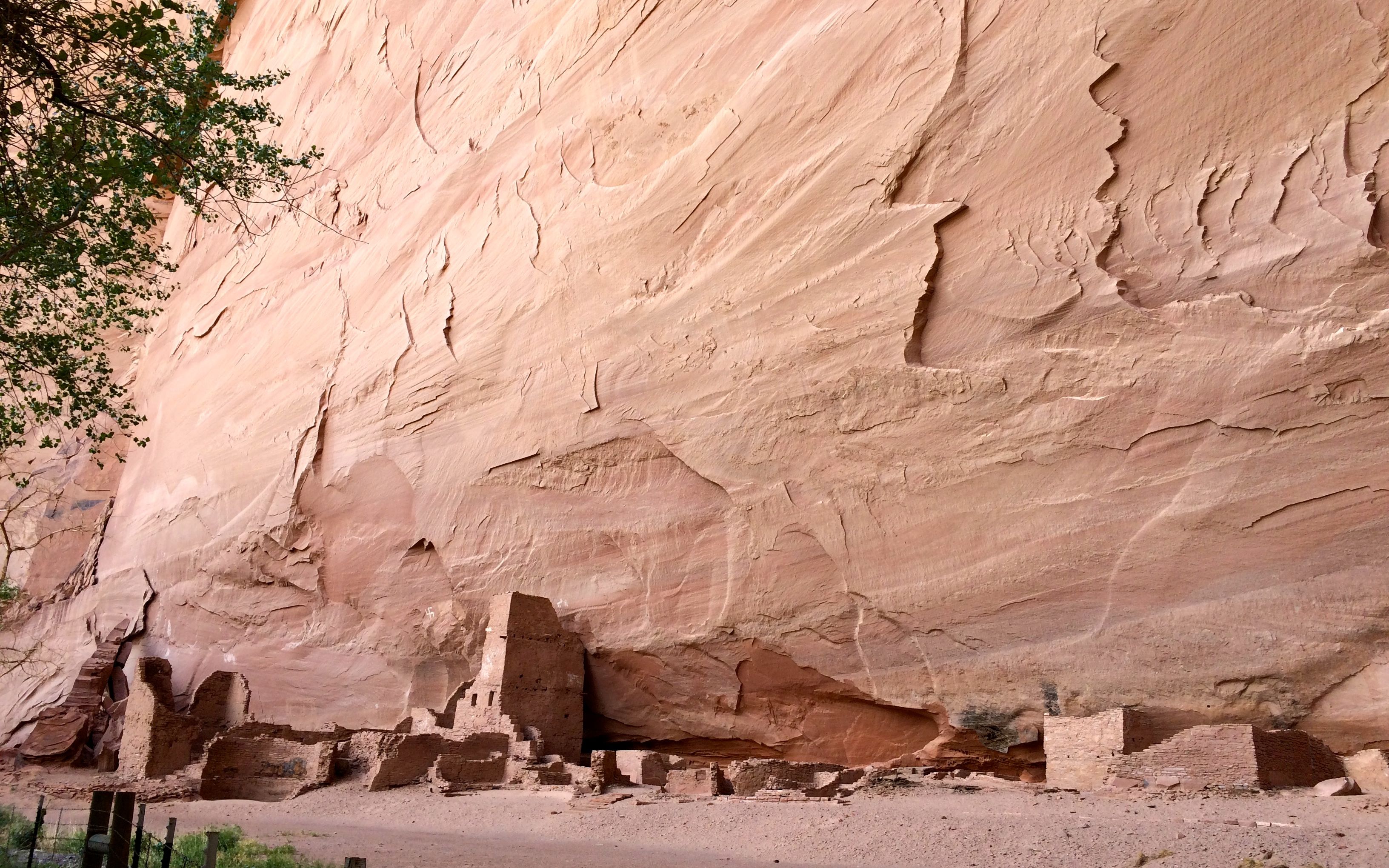
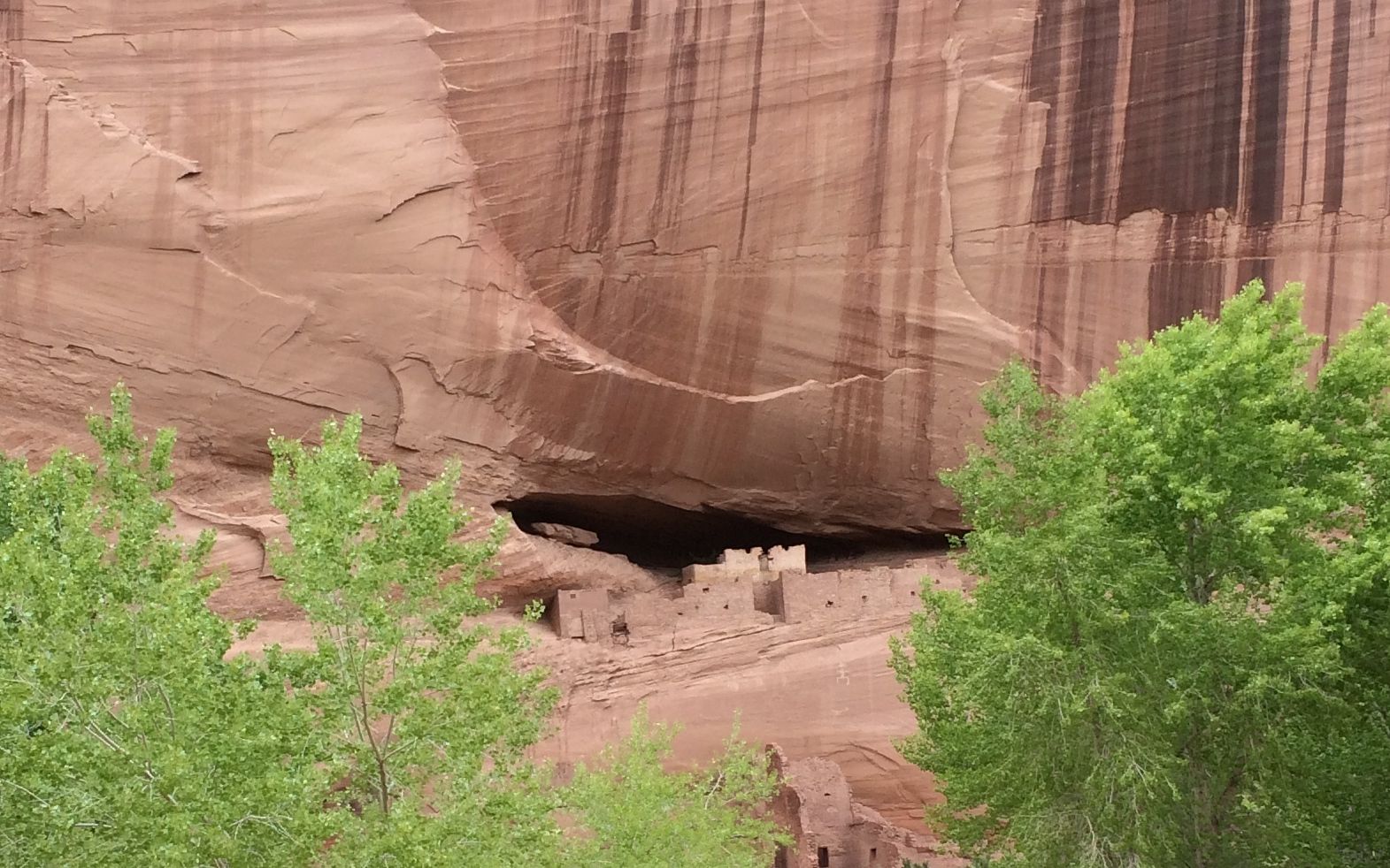
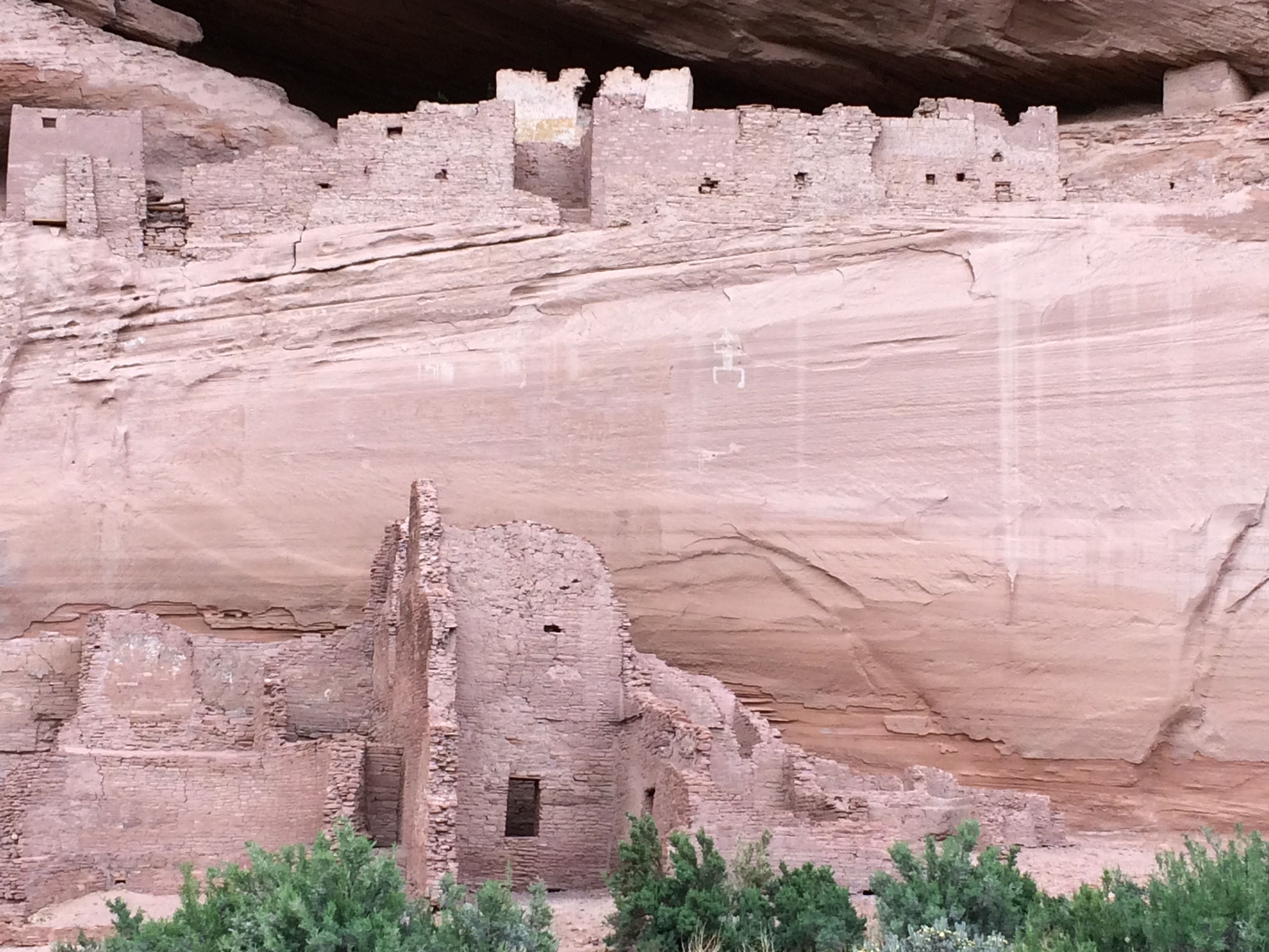
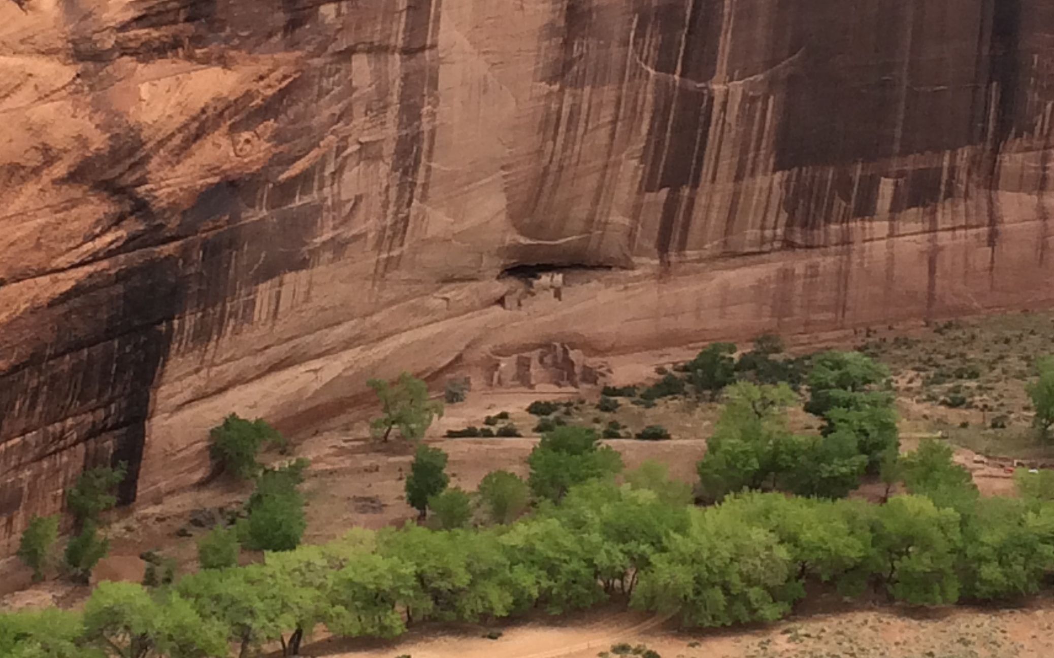
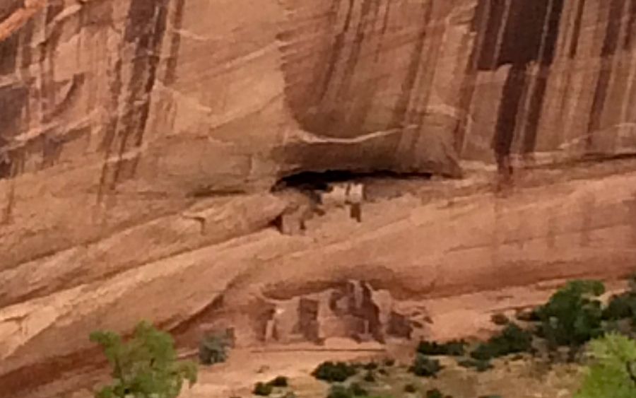
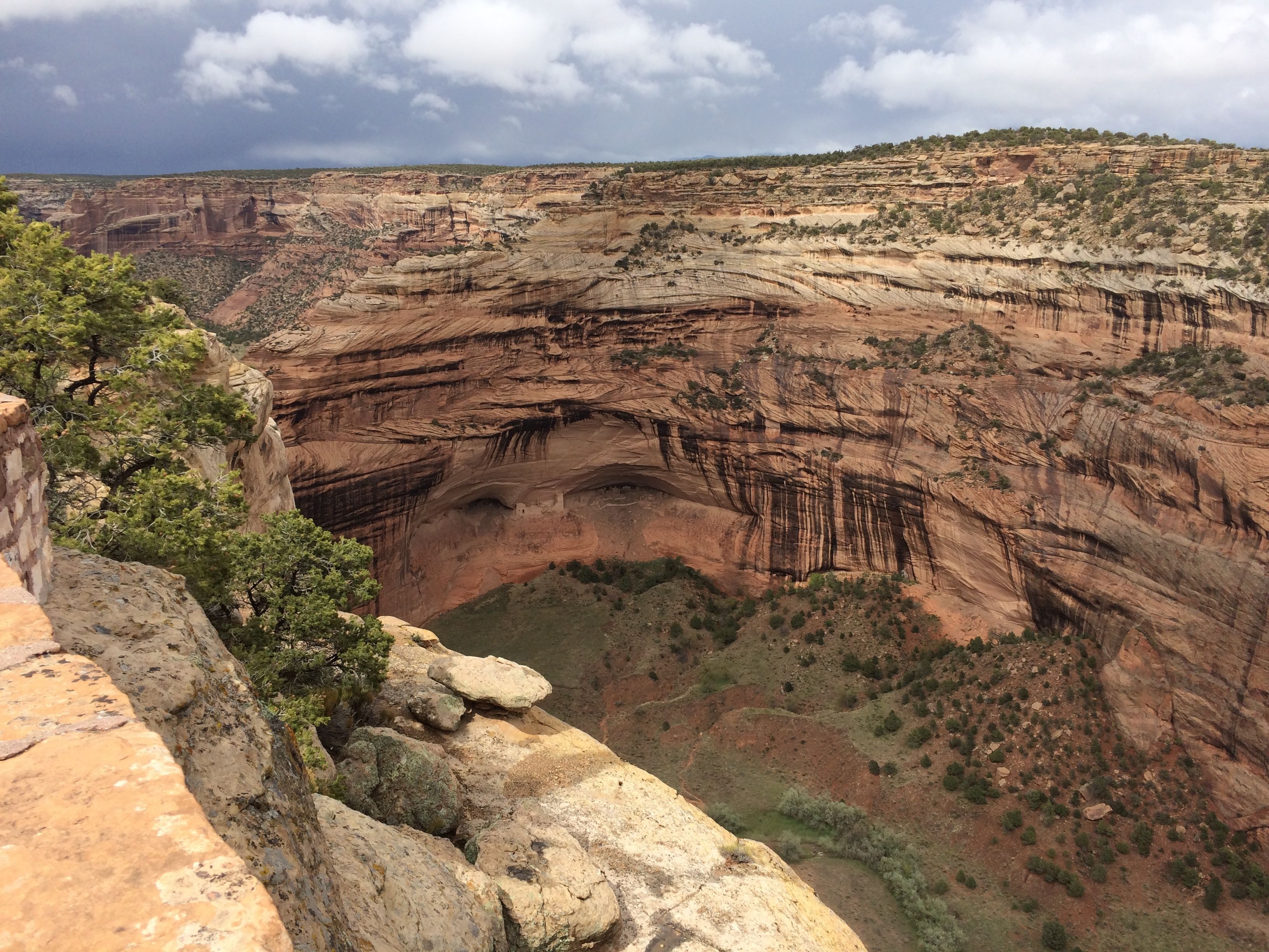
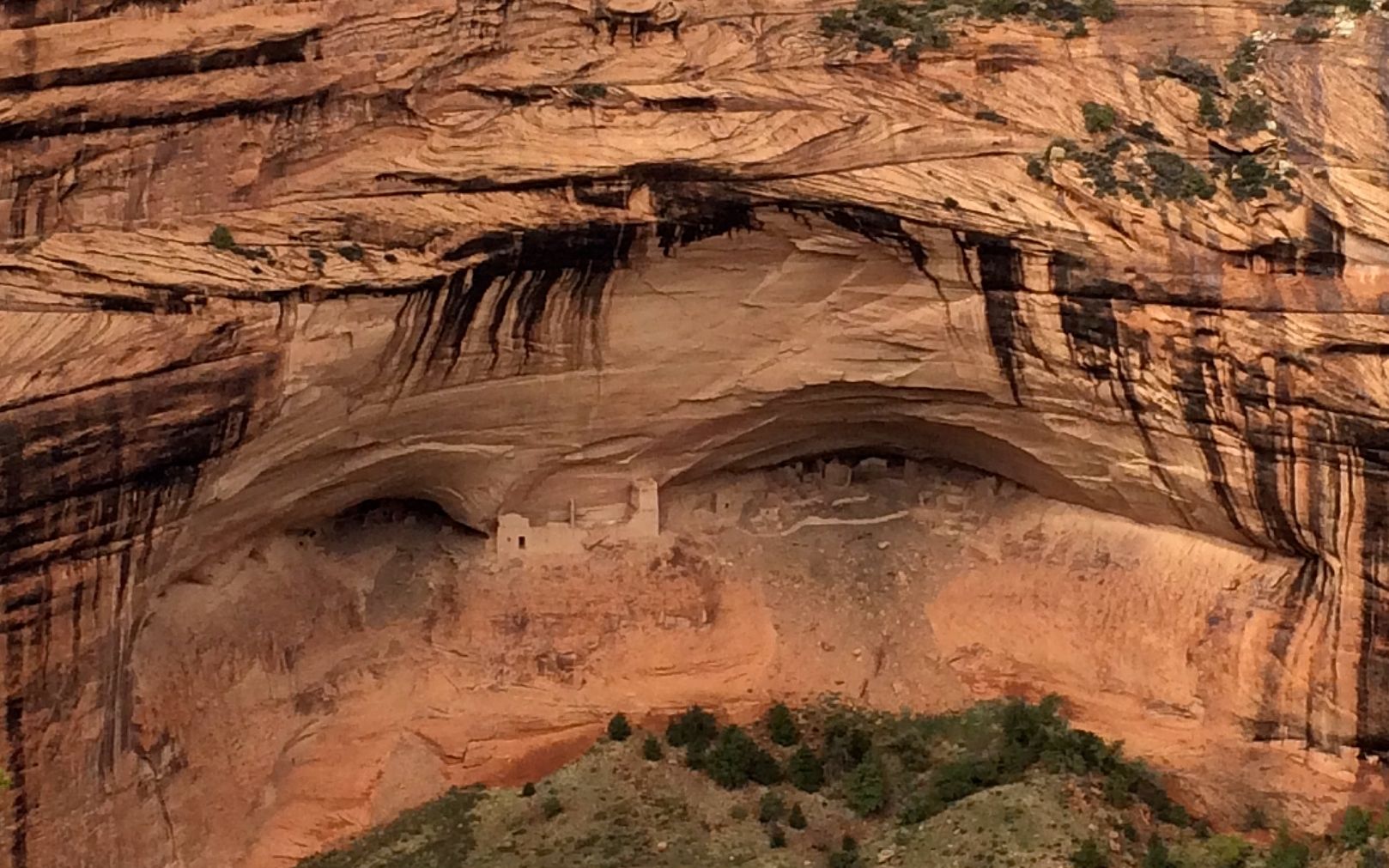
The next stop was White House ruins overlook.
I tried to zoom in a bit. Actually, the ruins are kind of hard to spot from the rim. They are constructed of the same materials as the cliff, so they tend to blend in. This one is called “White House” because one of the rooms was plastered white.
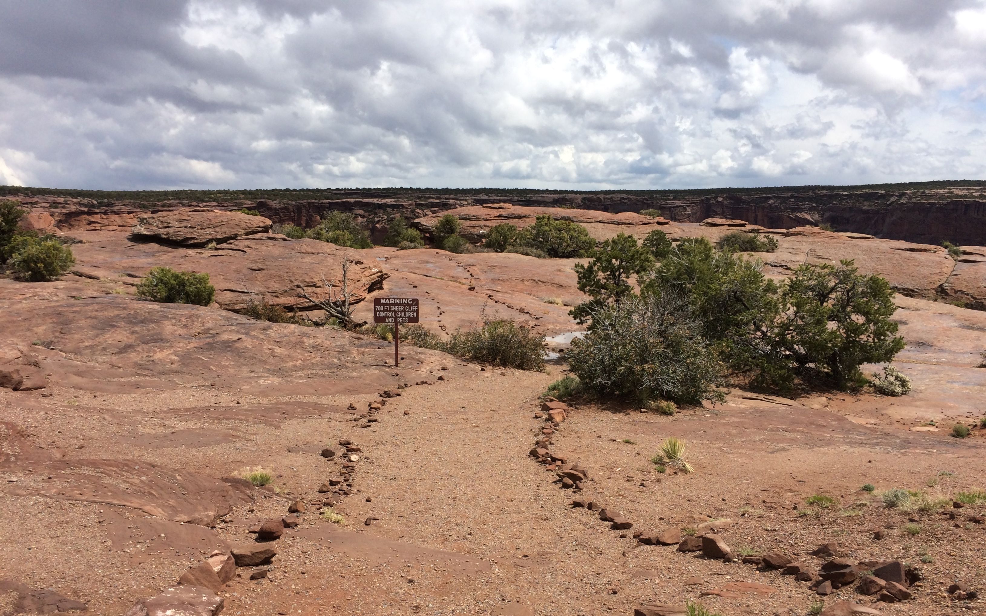
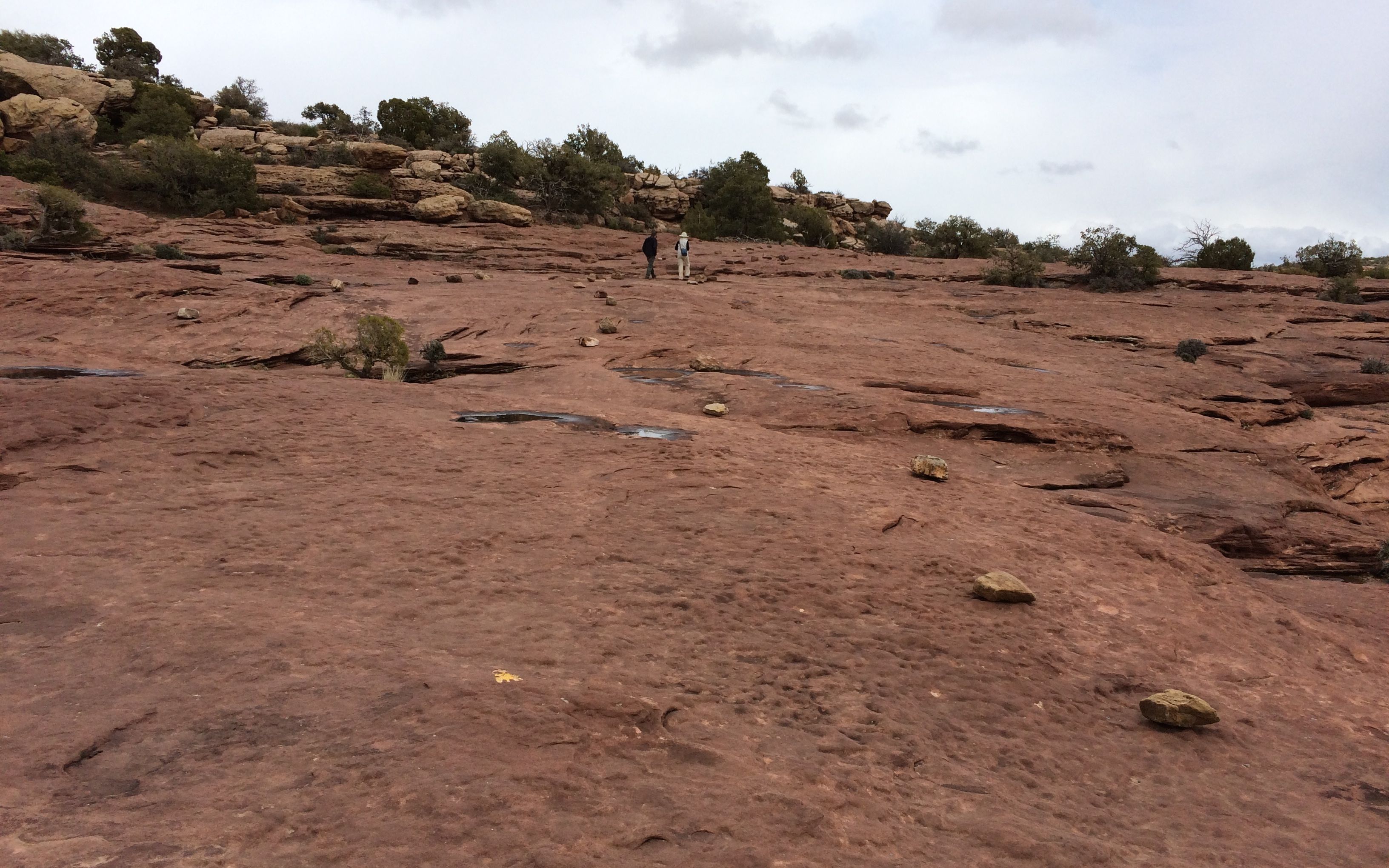
Some of the overlooks required a walk down a trail. The trails went across the rocks on top of the cliff, and the trails were lined with rocks.
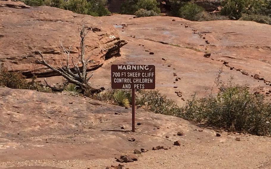
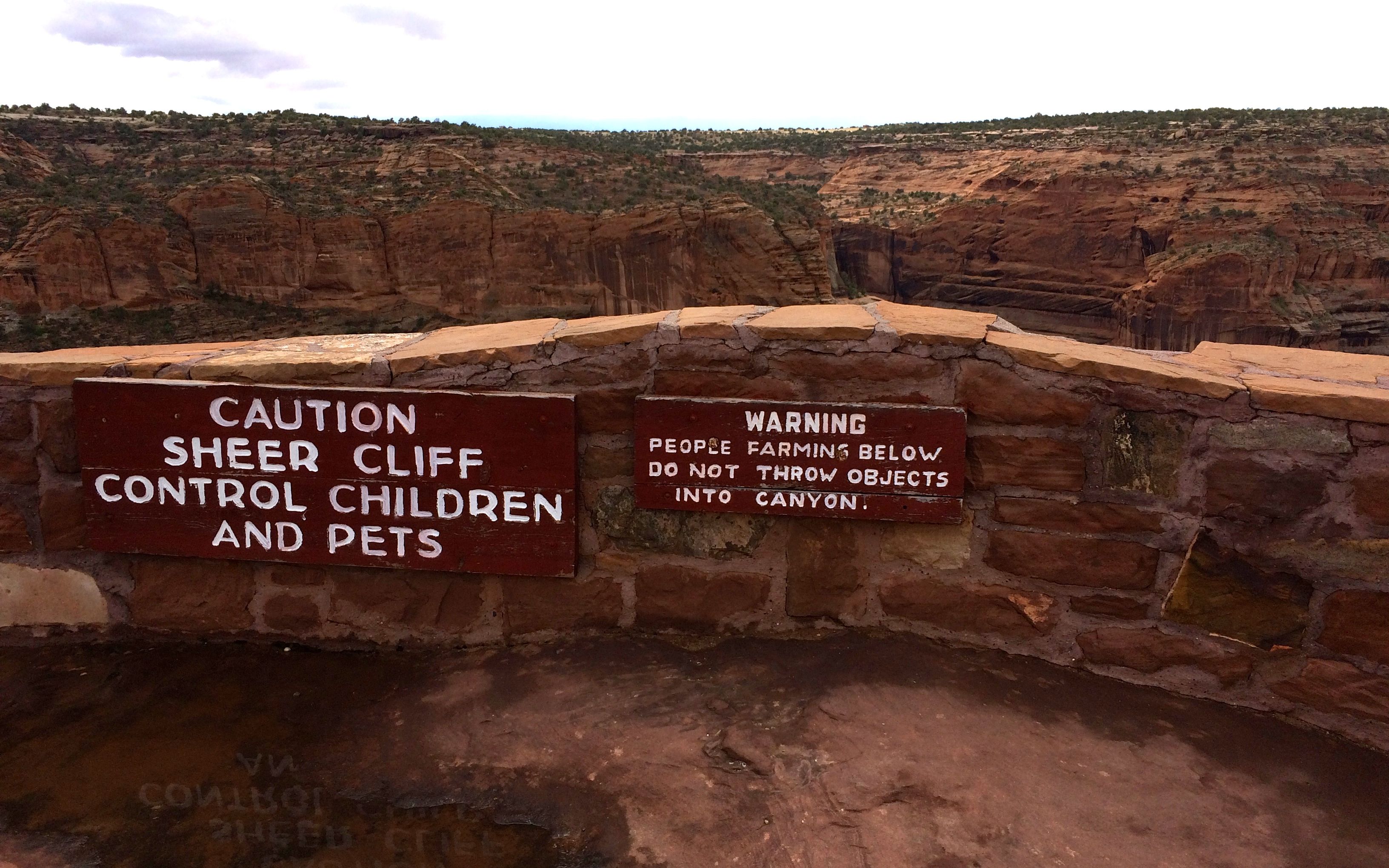
Oh! There’s a warning sign. What does it say?
Always sound advice, whether or not there is a 700 foot sheer cliff ahead.
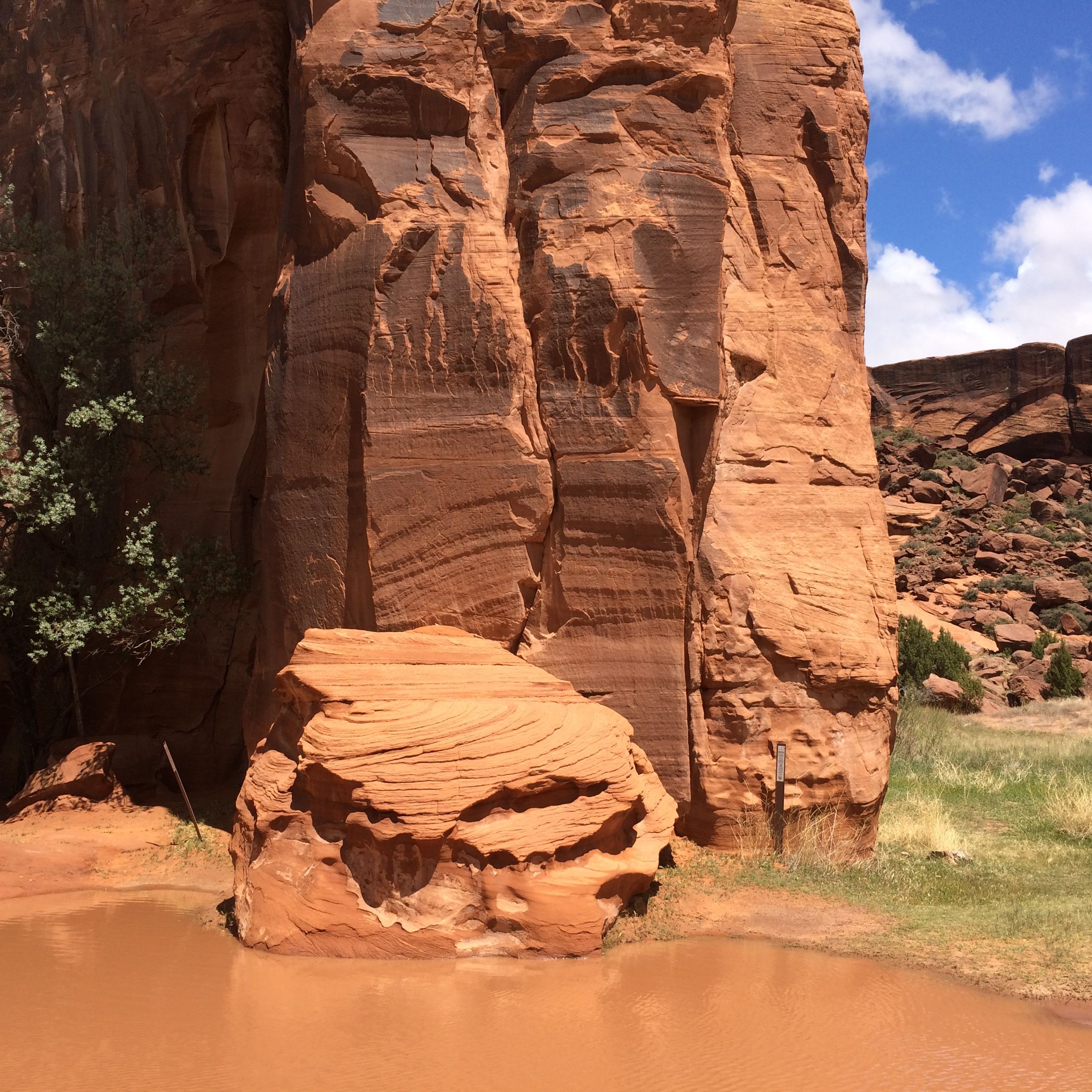
Cool rocks abounded.
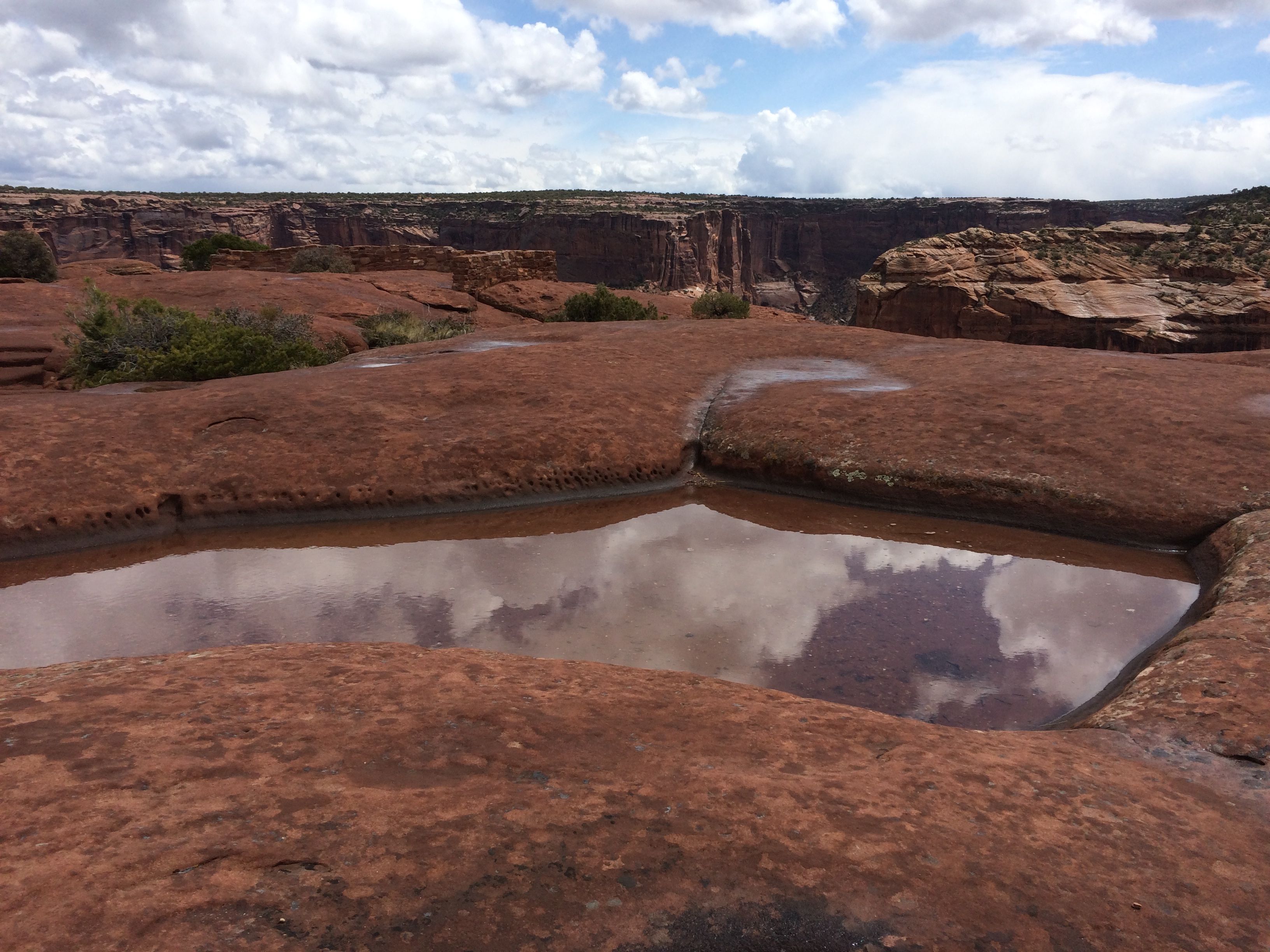
As did pot holes filled with rain water. I took this one before it started raining.
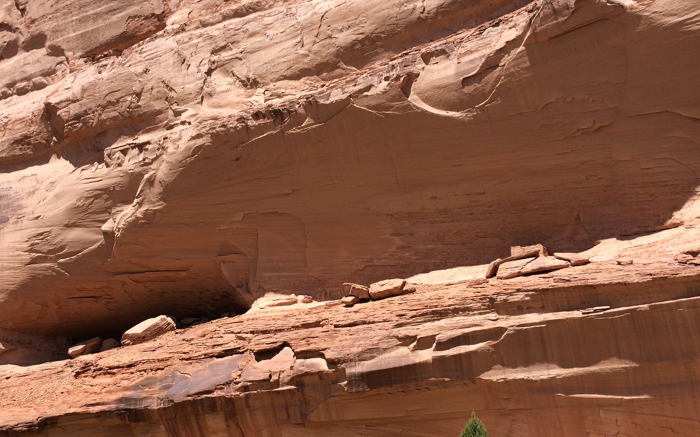
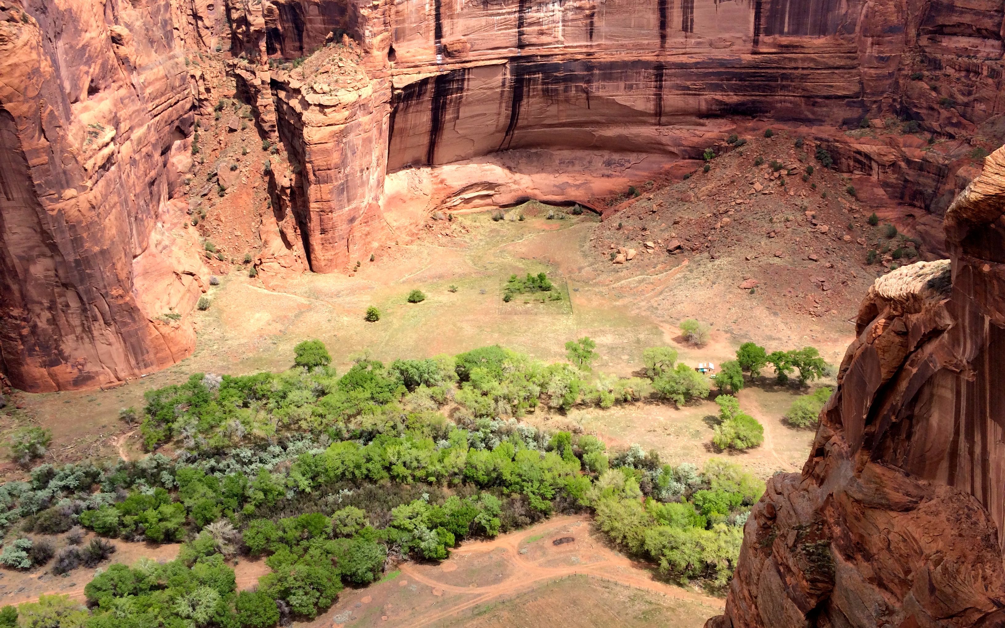
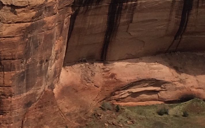
The view from the overlook was Sliding House ruins. I know. Kind of hard to see. Let me try to zoom in a bit.
It’s easy to see where the ruin got its name. It certainly did slide. There’s not much of it left.
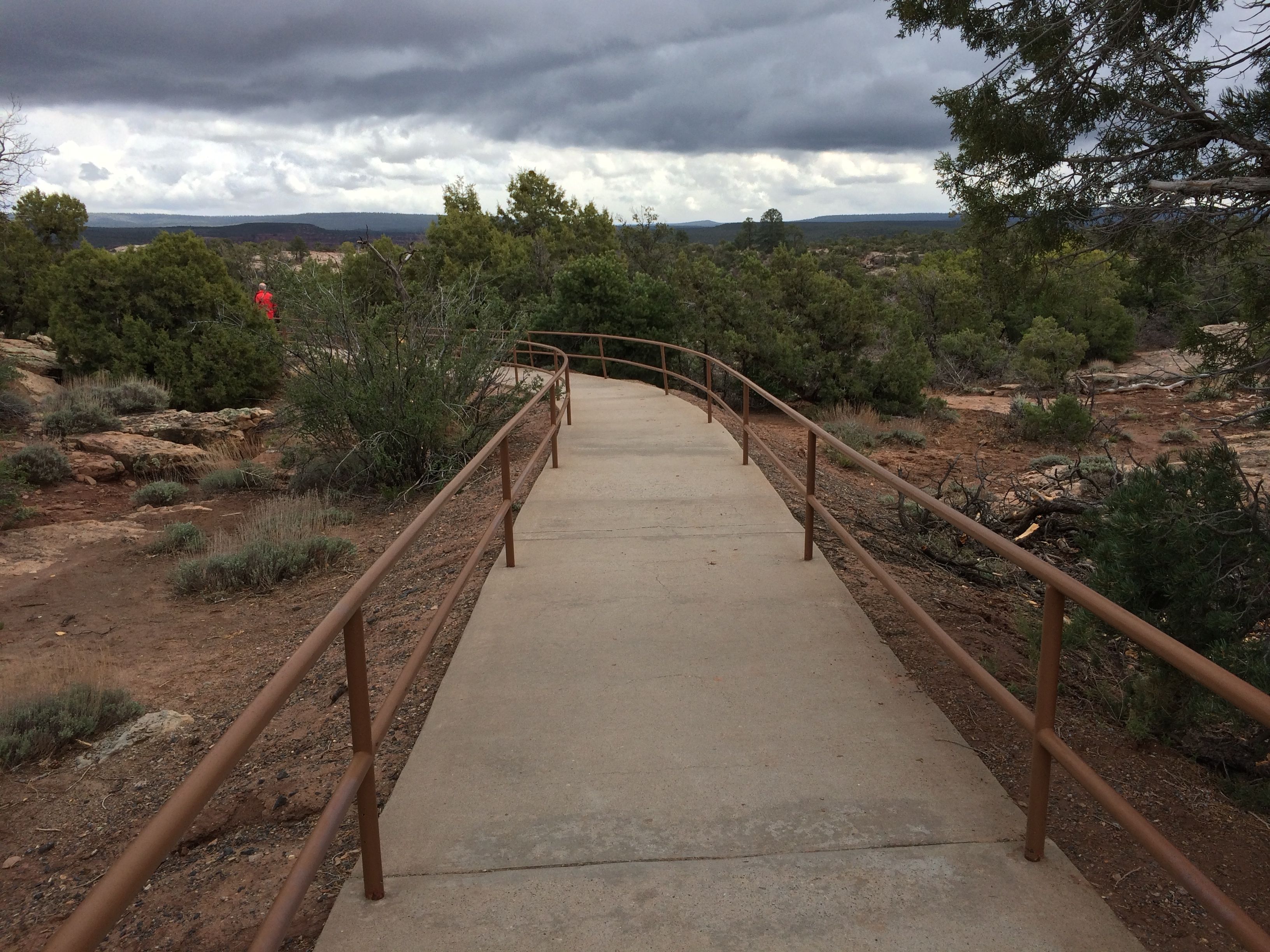
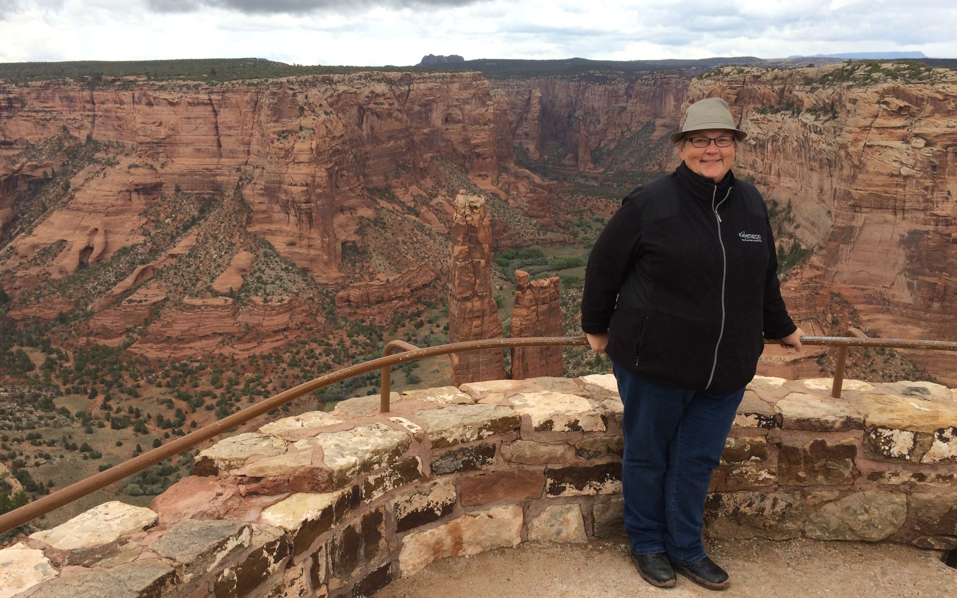
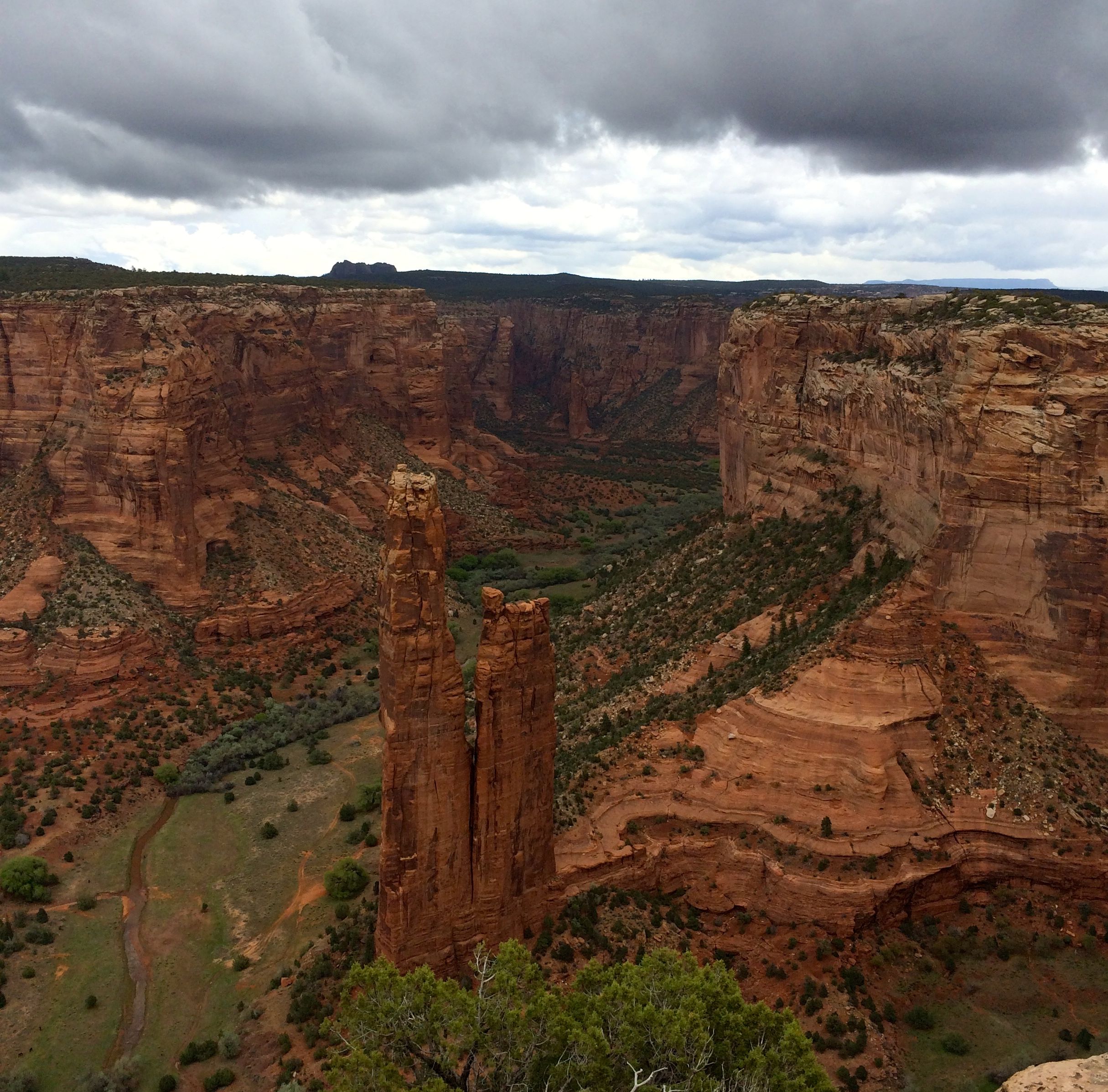
The last stop on the South Rim was Spider Rock.
I was pleased to see a nice smooth trail – with hand rails, even.
With my lack of fondness for heights, I was really happy that there were hand rails at the edge as well. Notice that I am holding on with both hands. That’s Spider Rock behind me.
Here’s a view from a slightly different angle.
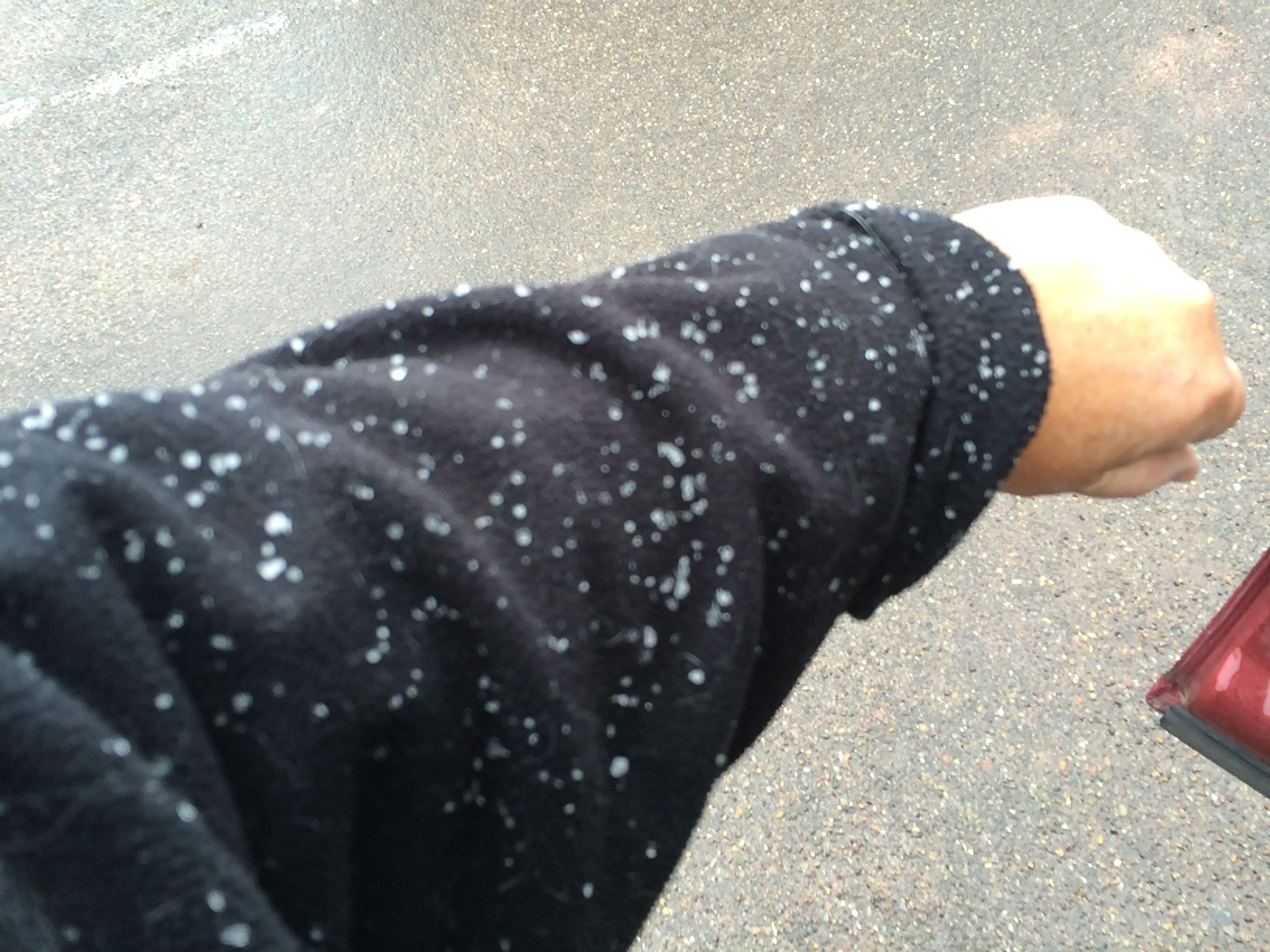
Those ominous looking clouds finally opened up – with snow!
I was quite surprised.
The snow was building up and sticking in places up on the rim.
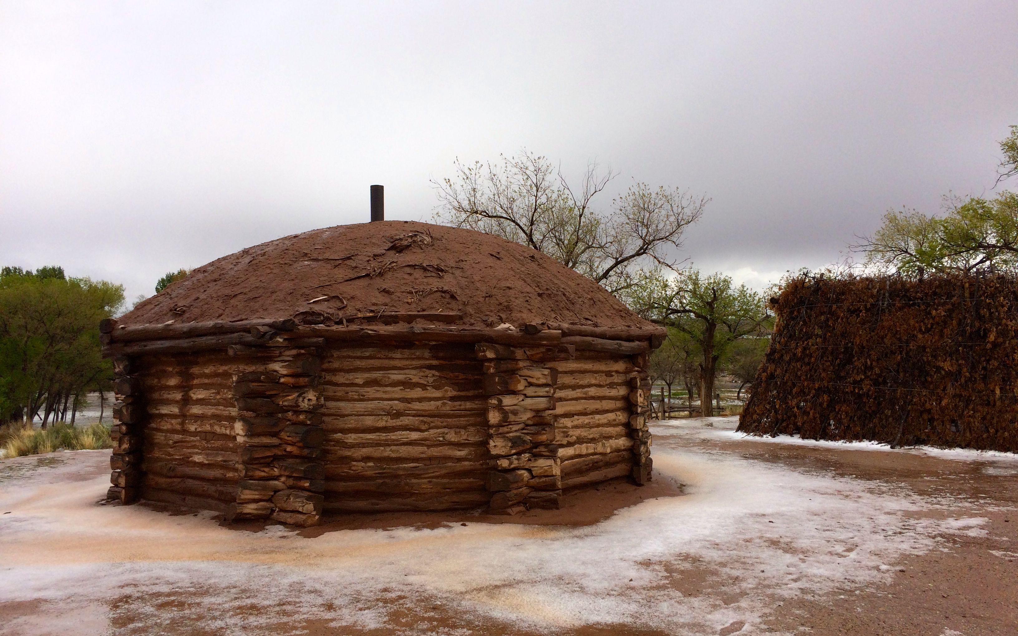
Back at the visitor’s center, there was even more snow. This is a traditional Navajo hogan. They are still in use today. I passed a many of them in the reservation.
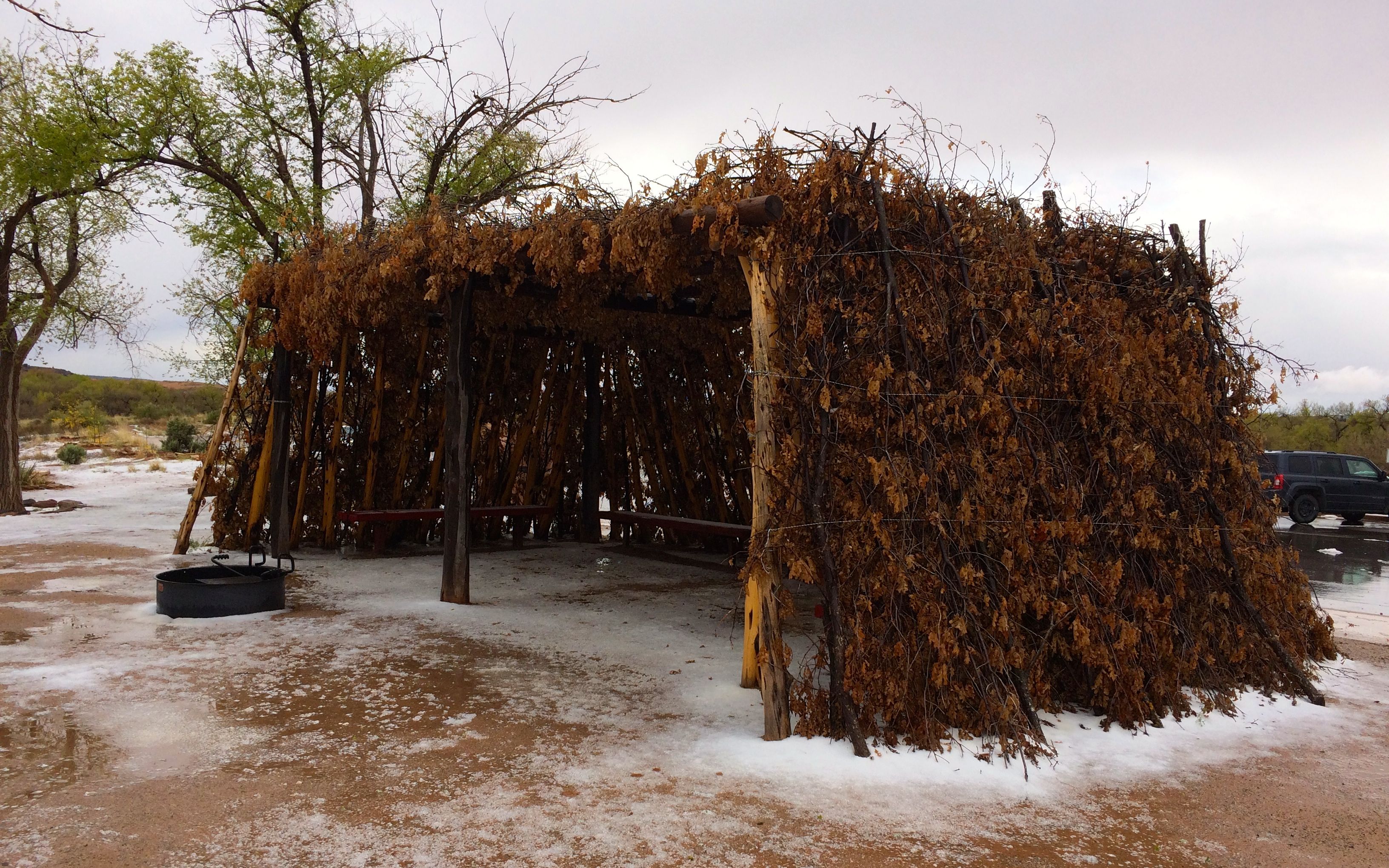
Next to the hogan was a typical shelter. Based on the film in the visitor’s center, it appears that they were used as a shaded area – a place to work in the summer months.
I stopped off back at the trailer and had a bite of lunch before setting out to tour the north rim.
The trails from the parking areas to the overlooks were marked in different ways. Some had yellow footprints painted on the rocks here and there to show the way. Sometimes the yellow paint wore away and then there were only carved divots representing the toes.
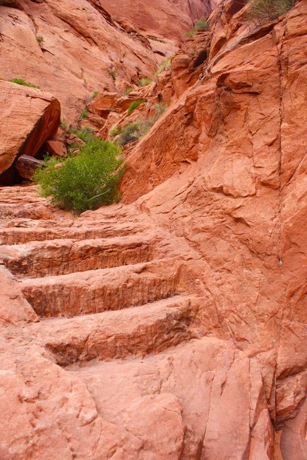
Sometimes the trails were carved into the rock where steps were needed to make it safer.
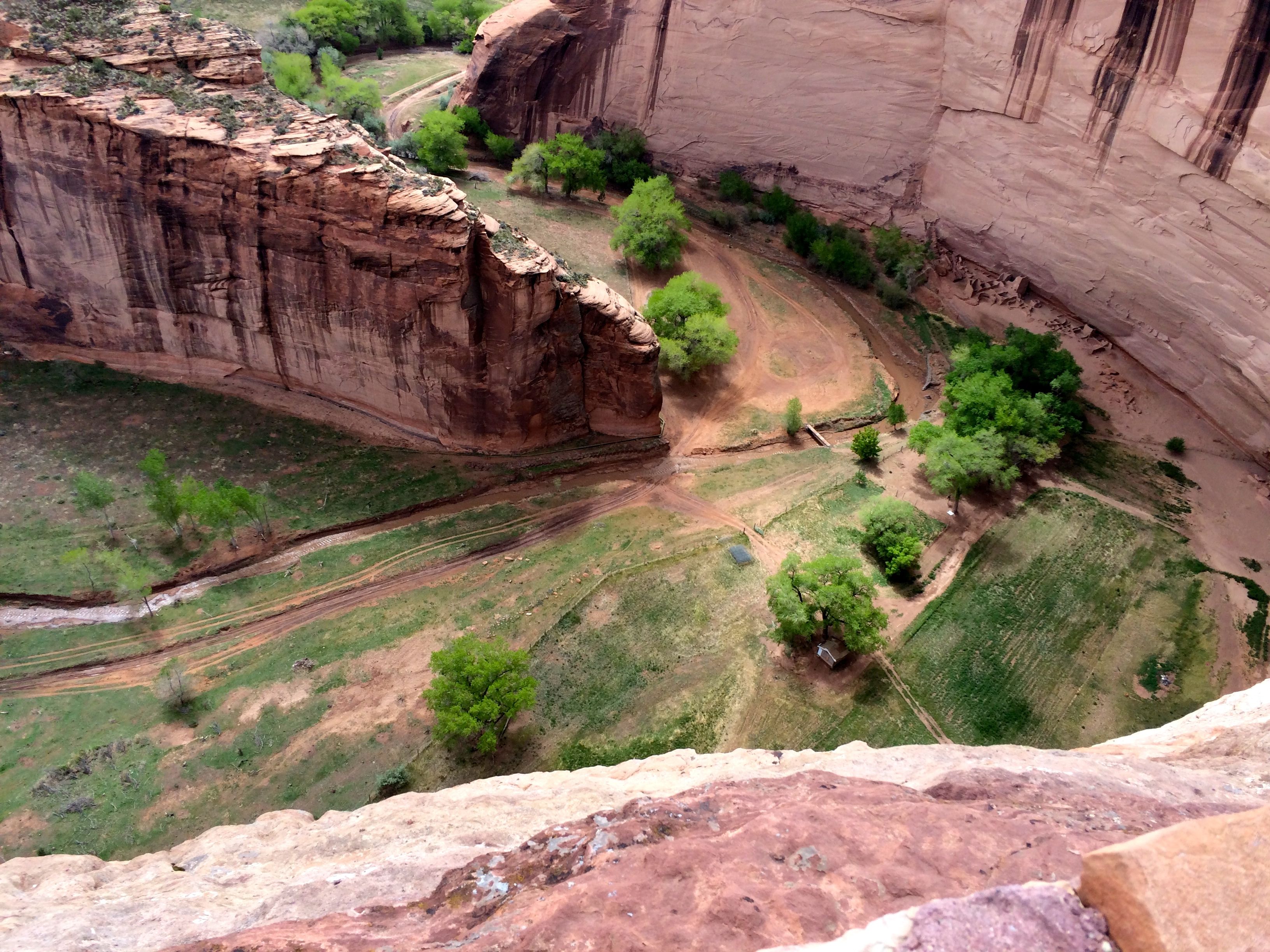
I appreciated the barrier. And, of course, I had to look over the edge to see if I could identify evidence of farming. I realized that it wasn’t quite the season to be out working in the fields.
Oh, look! There are fields down there!
There are ruins down there, too.
These are the Antelope House ruins.
At another stop, I came to the Navajo Fortress.
Even though you can’t tell from the photo, there is a cleft between the main part of the rock and the part in front. The Navajo could climb up and pull their ladders up after them and get away from the attackers.
Sometimes the trails aren’t marked so well.
The edges aren’t marked so well, either.
I have to admit that it kind of made my toes curl, as if I could hold on to the rock surface through the soles of my shoes.
The rocks below the rim are interesting.
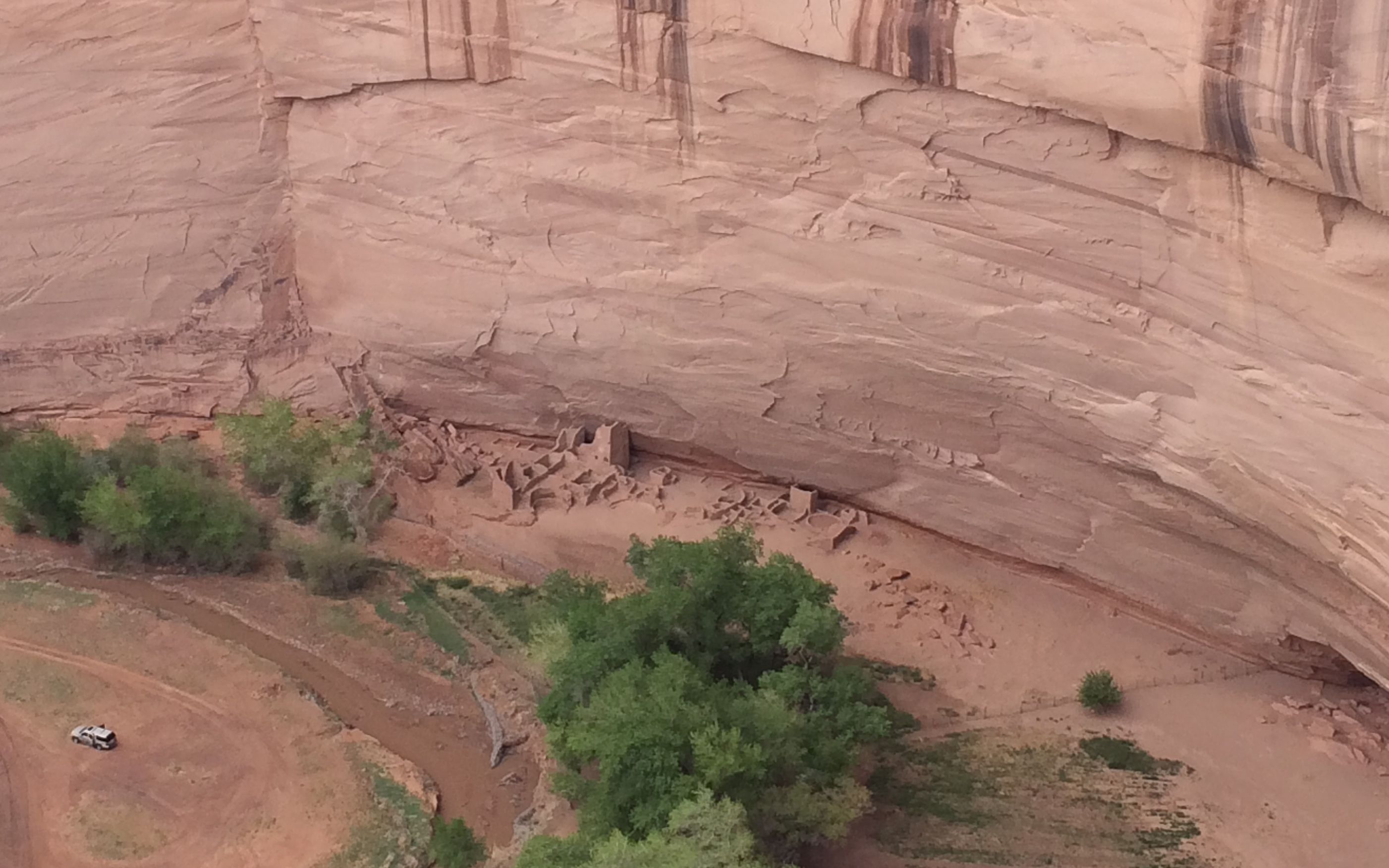
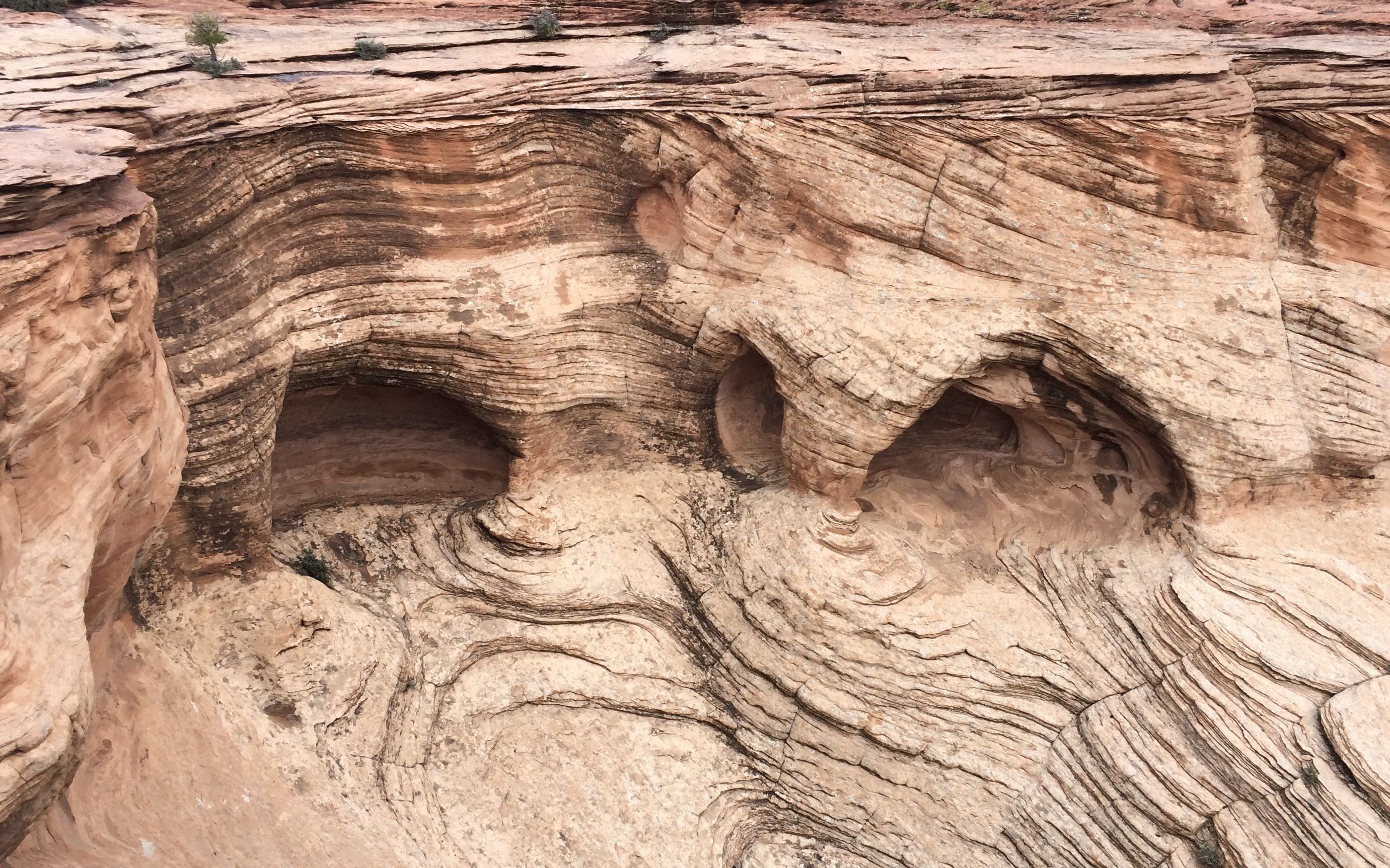
This site is called House Under the Rock or Mummy Cave.
There! See it now?
According to the information at the site, two mummies were discovered in a cave in 1880, and that’s when some people began calling it Mummy Cave. The Navajos refer to this site as House Under the Rock.
There really are farms all along the canyon floor. You can almost make out that the house with the red roof is built in the hogan style with eight sides.
This was my last stop on the north rim. It is called Two Fell Off. It is based on an incident when the Spanish were fighting the Navajo. An old woman fought off a Spanish soldier and they both fell to their deaths at this site.
By that time, I was chilled and ready for dinner. Back to Flo to heat up some chili and plan what I wanted to do next.
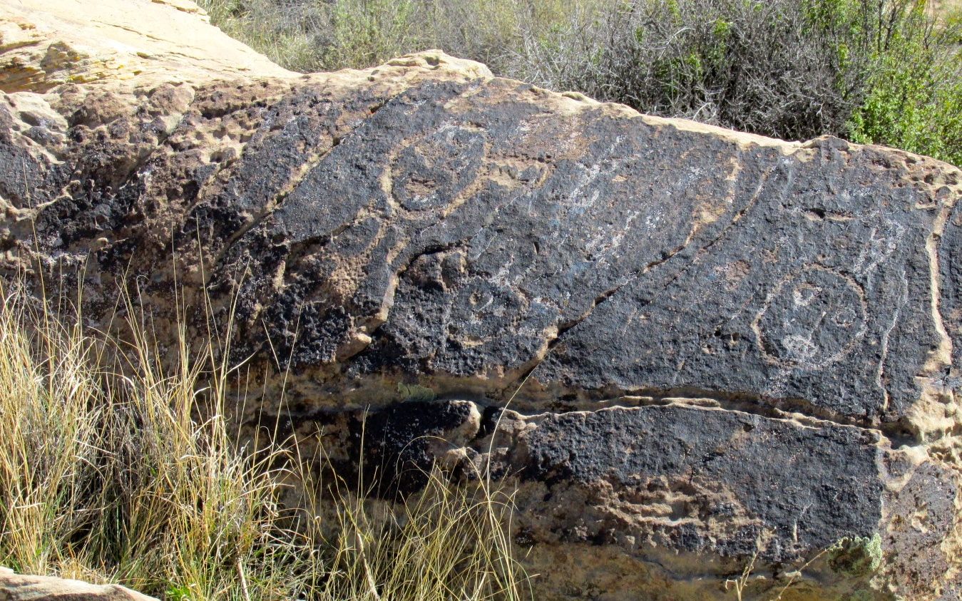
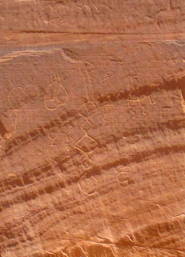
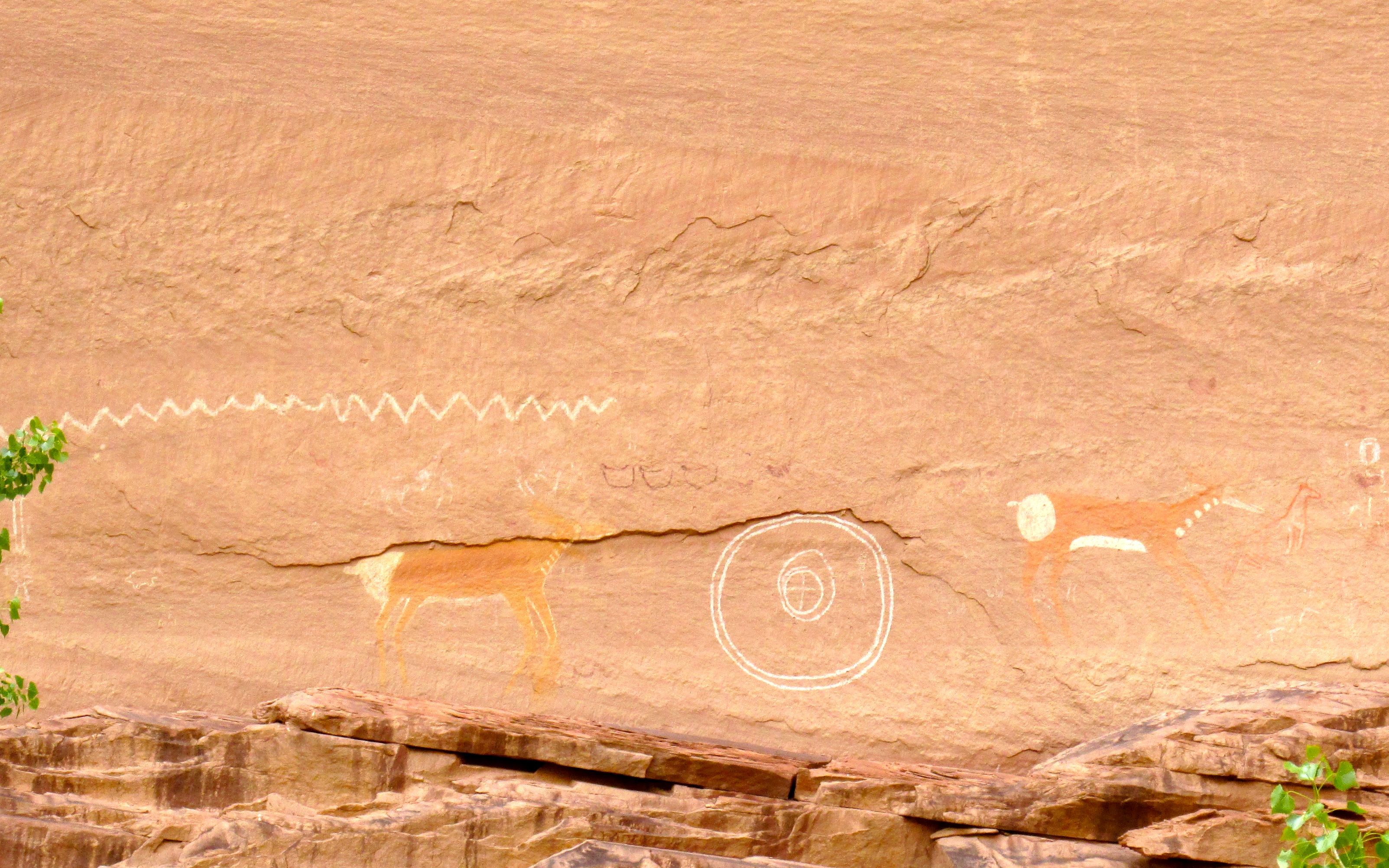
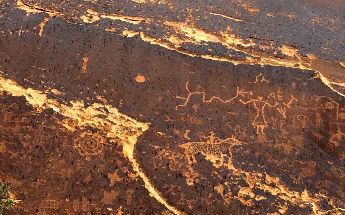
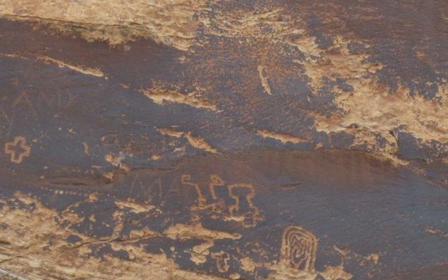
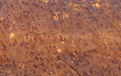
In reviewing the brochures I picked up at Bluff Fort, I found out that there were petroglyphs nearby.
Petroglyphs? Yes, please!
Actually, these petroglyphs weren’t in the most pristine condition.
But there certainly were a lot of them.
The naturalistic animal glyphs were new to me.
There a lot of glyphs that are of more recent creation.
Some were created on top of others.
And there was even political debate taking place.
The petroglyphs were in a piece of land managed by the Bureau of Land Management. In addition to the petroglyphs, they have camping sites. One side is only for tents or maybe very small vehicles – but absolutely no trailers or fifth wheels. The other side has larger sites with easier access. The sites there are $15 a night, with no hook ups at the site, although water is available. They are first-come, first-served, just in case you want to camp there.
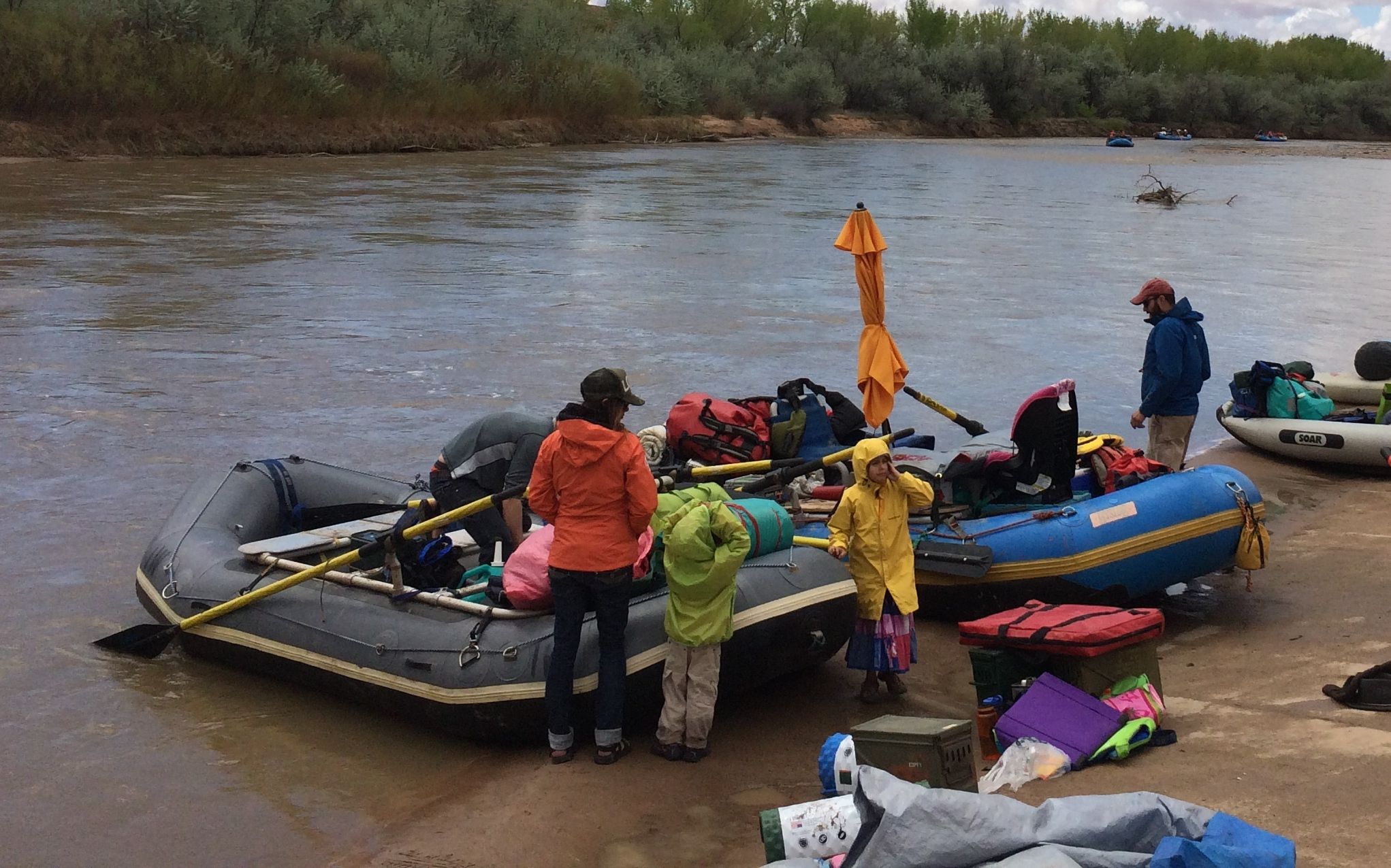
One of the big attractions of the site is the access to the San Juan River. There are rafting companies that take groups down the river.
You can see that the people are packed for a camping trip.
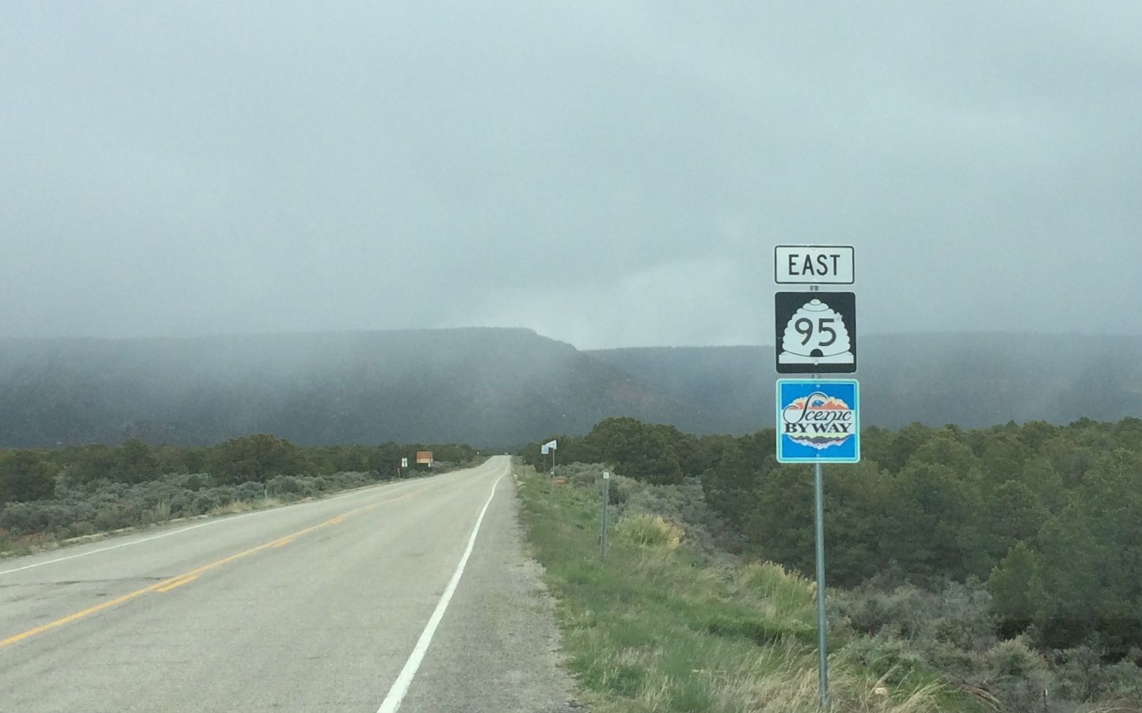
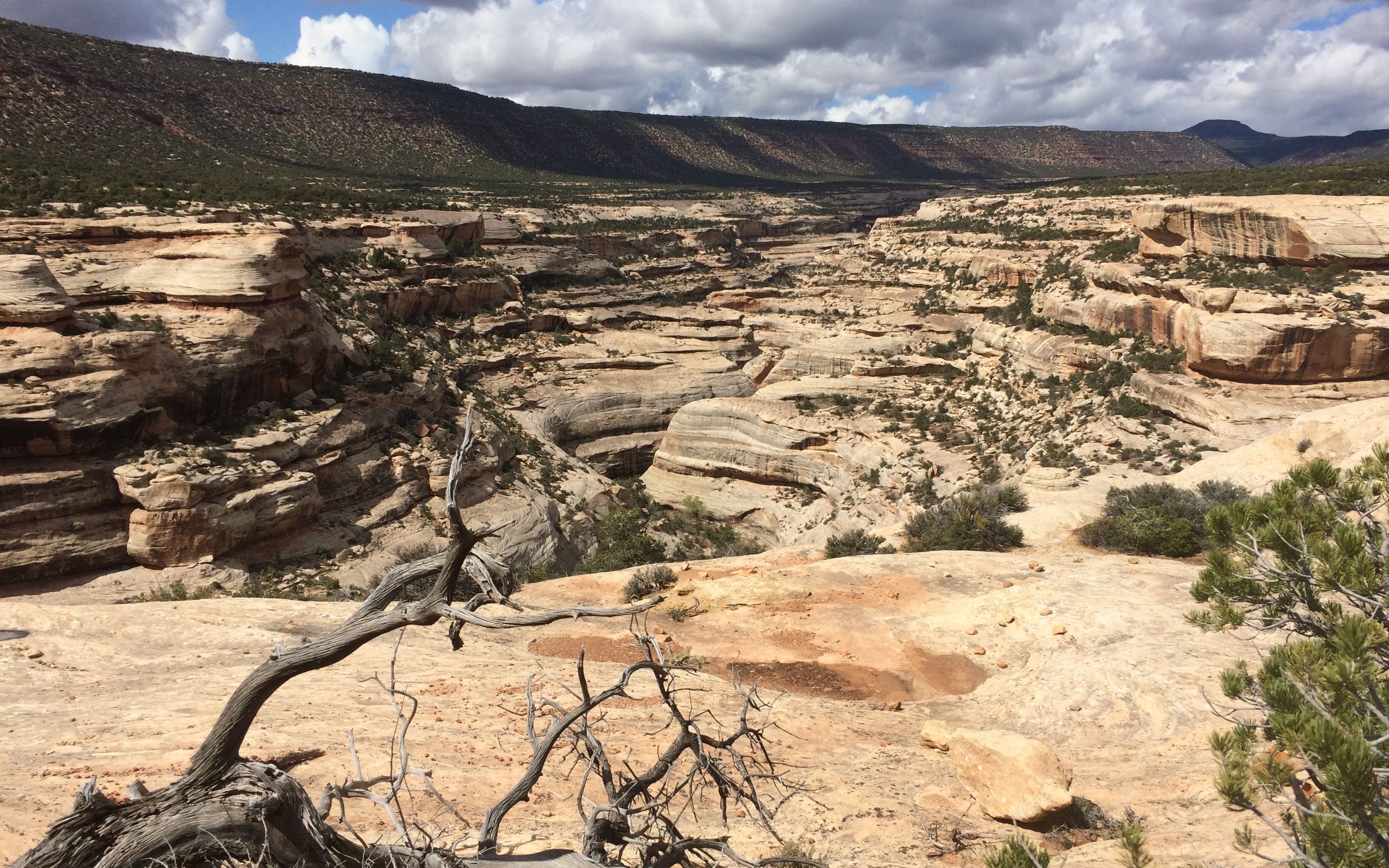
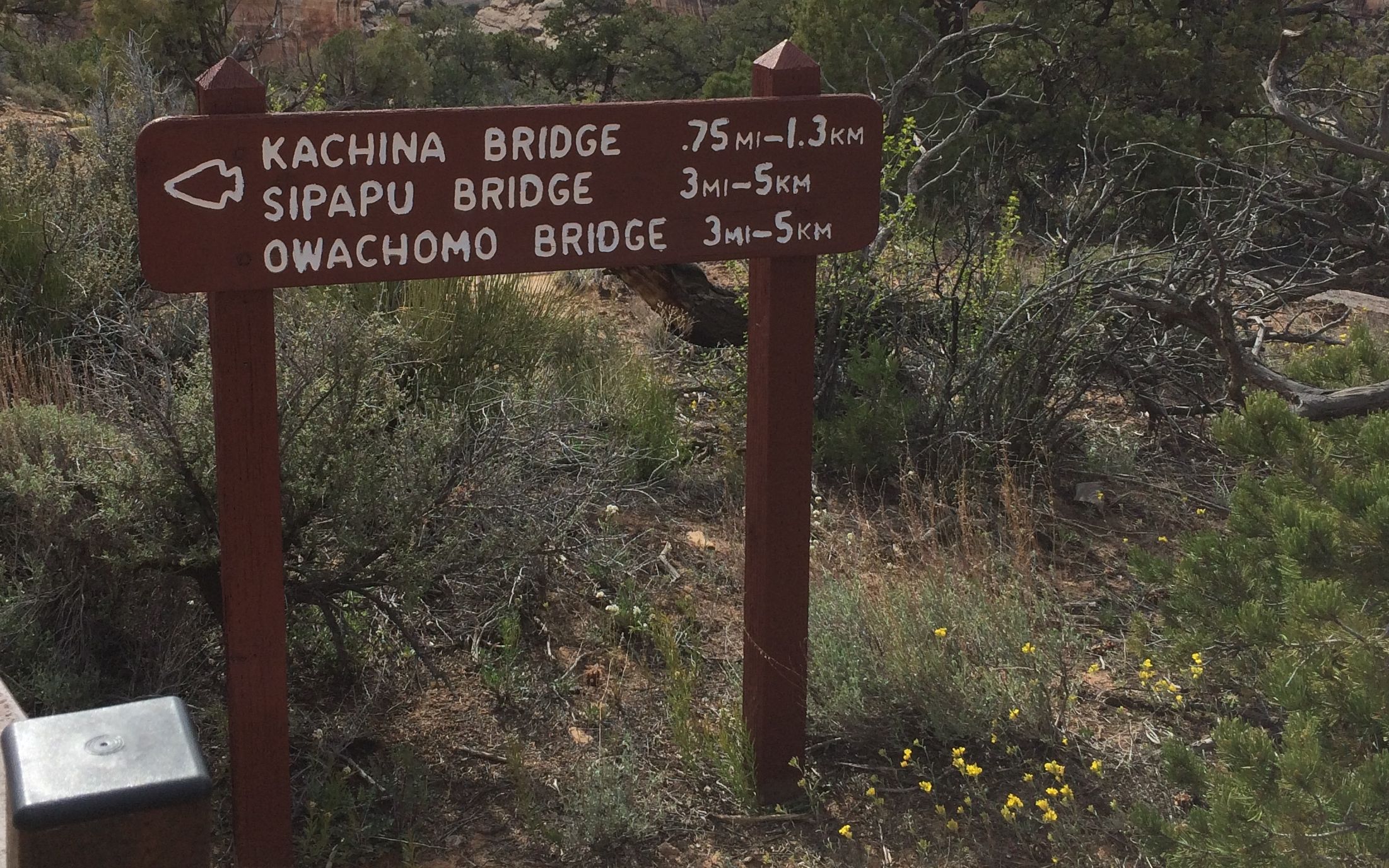
After taking in what was available to see at Sand Island I headed out for Natural Bridges National Monument, which was about 60 miles further down the road. As I said earlier, in “out west miles” that is right next door.
I drove north on highway 191 until I had to turn off onto highway 95. Oh, no! The dreaded “Scenic Byway” sign! That usually means both hands on the wheel and don’t take your eyes off the road. What good is a scenic byway if you can’t look at it?
After going up hills and down and turning right and left, (over and over) I finally arrived at Natural Bridges, which was declared a National Monument in 1908. It was Utah’s first National Monument.
The visitor center had a good video explaining how the arches were formed. There also displayed plants and their names. I always wonder about what I am looking at when I’m out hiking the trails.
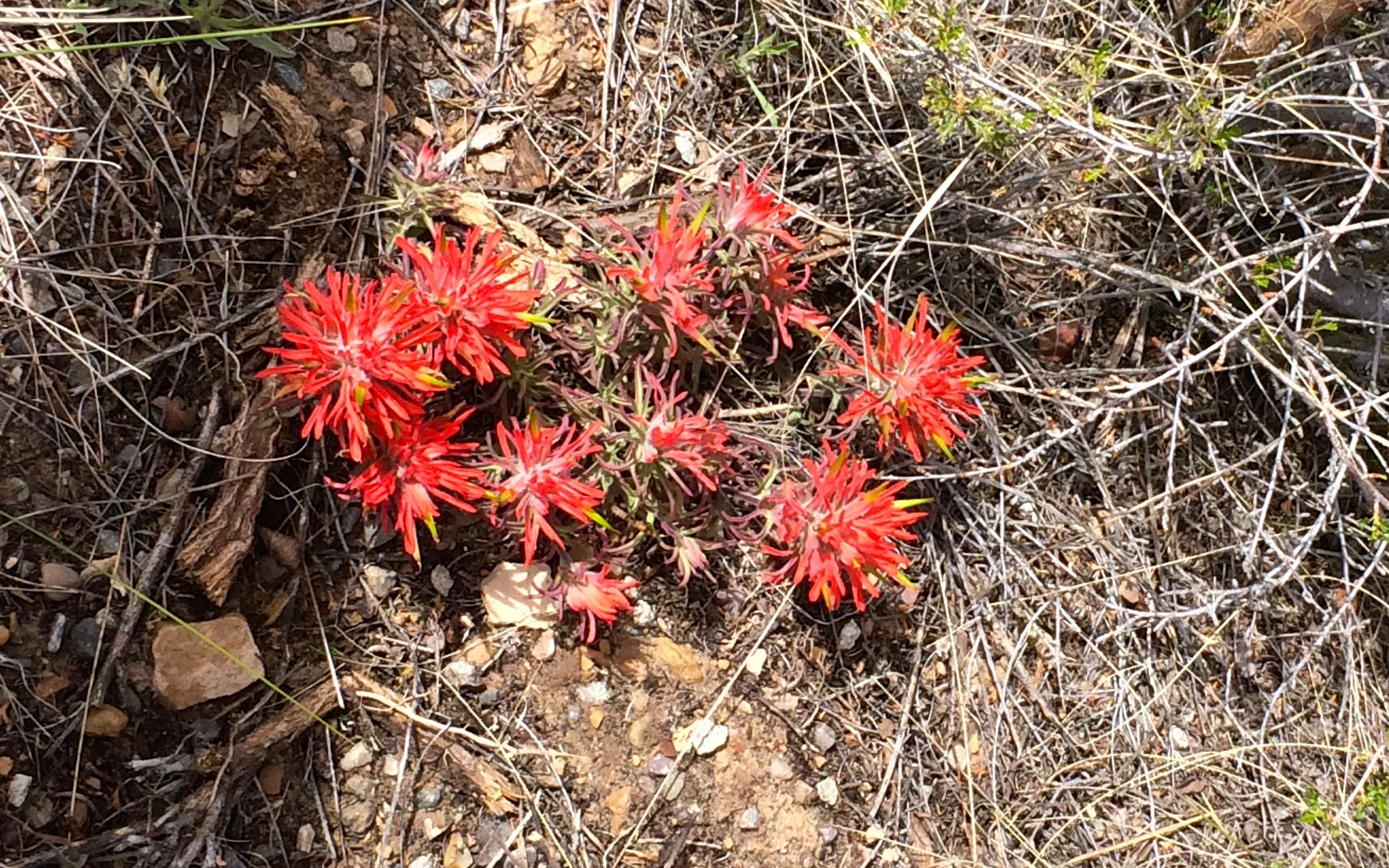
This is paintbrush.
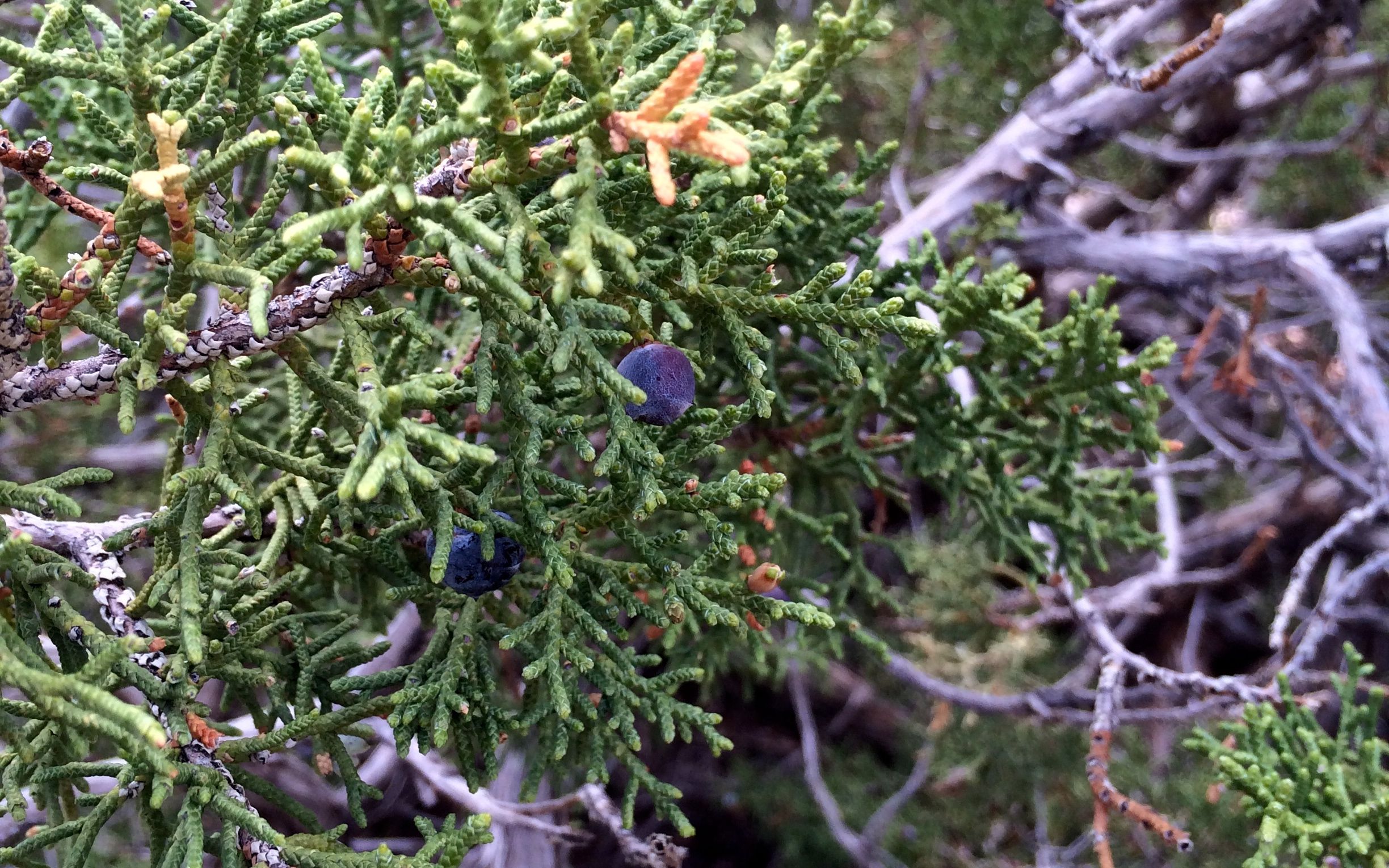
Juniper.
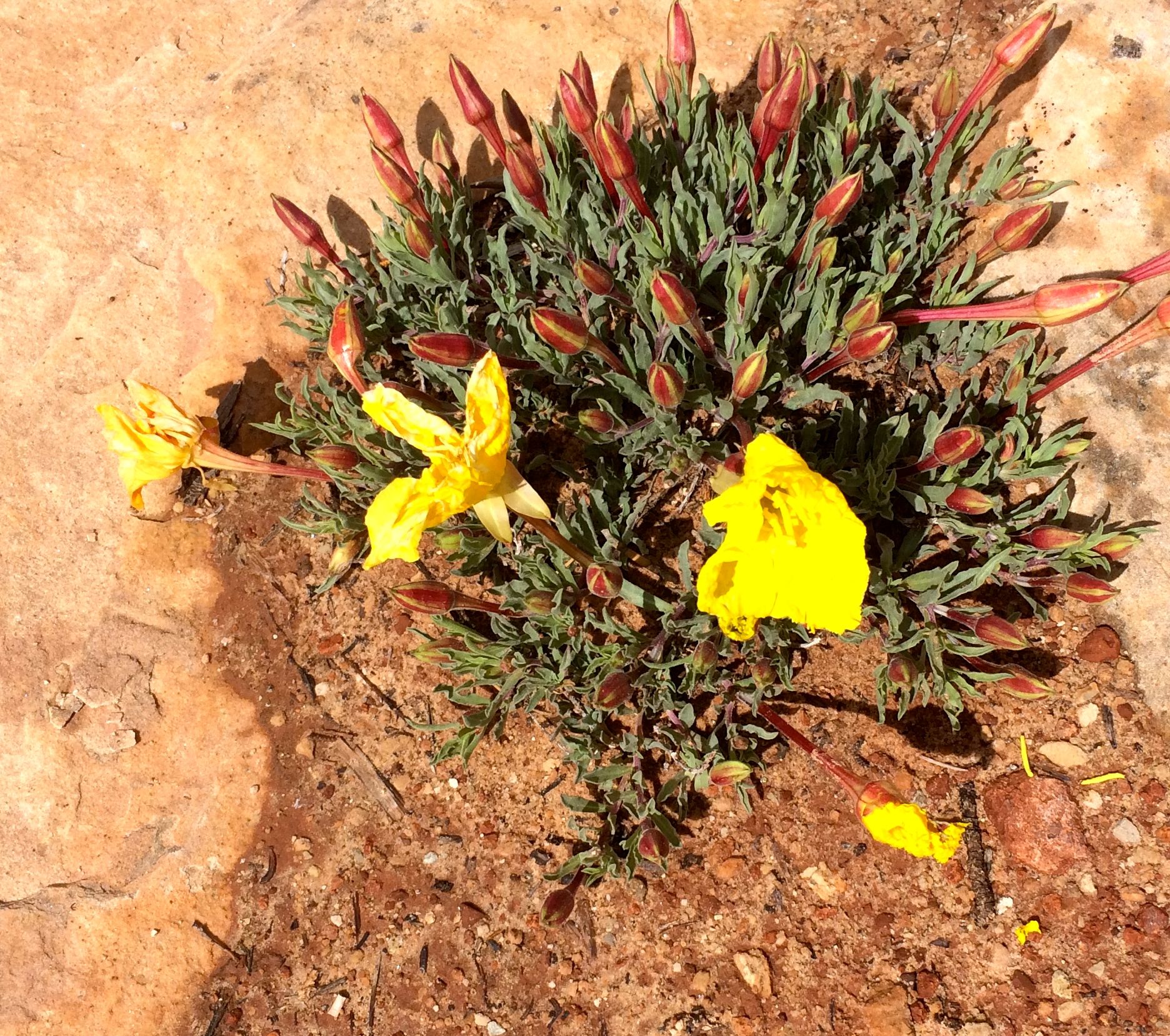
Yellow flowers with red buds.
Okay, so not everything was labeled.
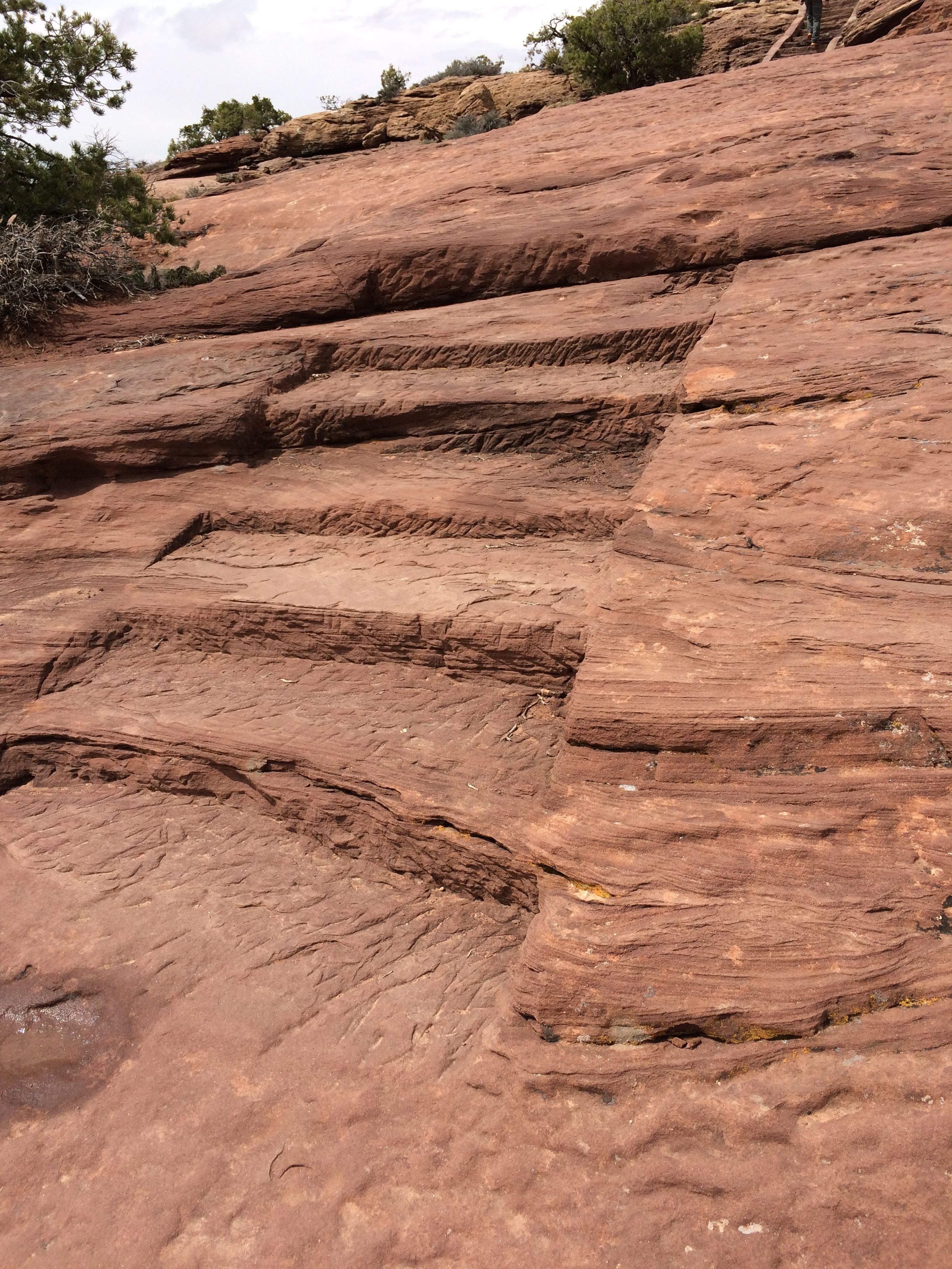
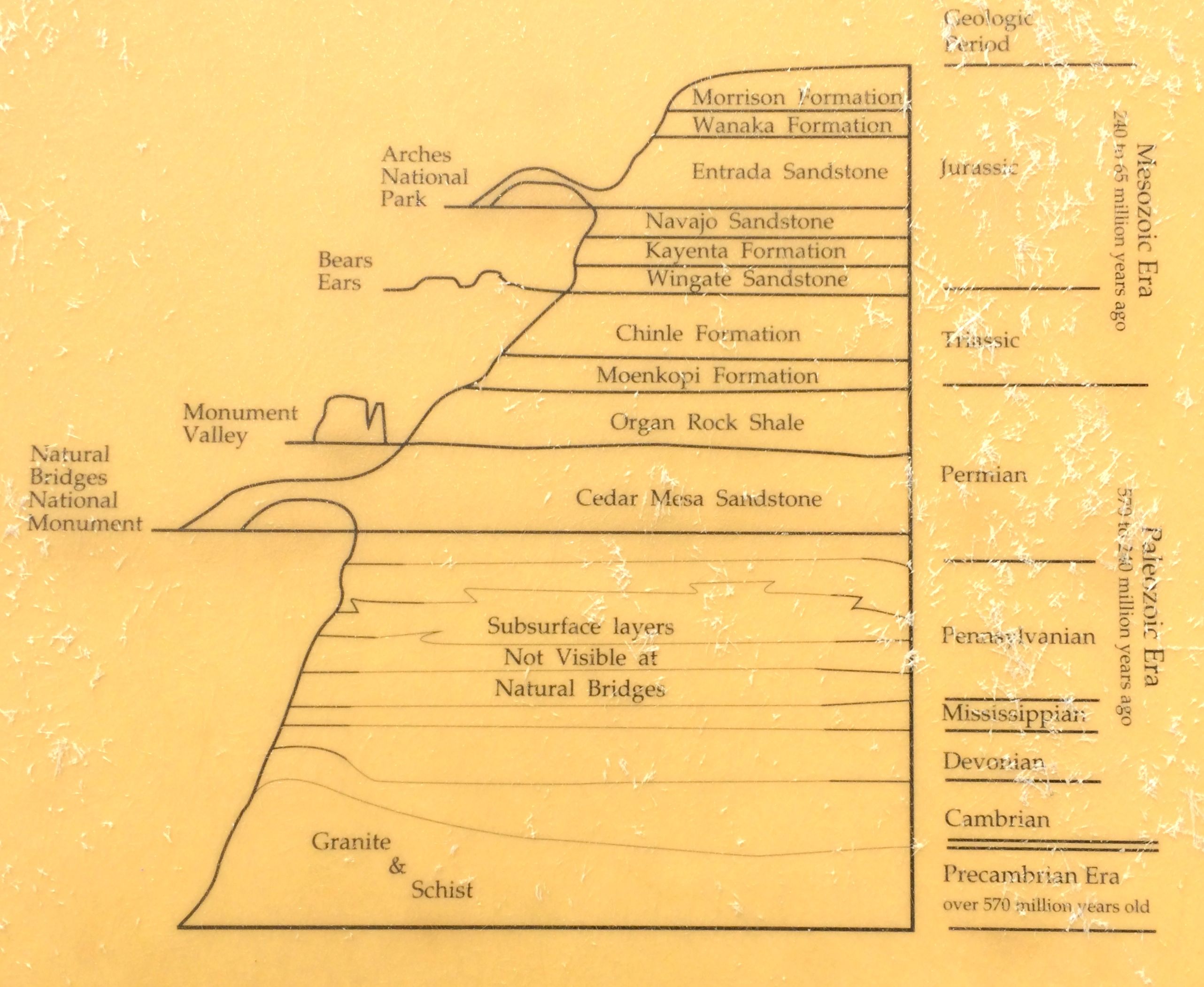
They had informative signage along the way. This park was in a layer above the chinle formation that I saw at Lee’s Ferry.
Unfortunately, the arches were not easy to see from the pull-outs. The information on the sign convinced me that I was not going to be hiking down to get a closer view.
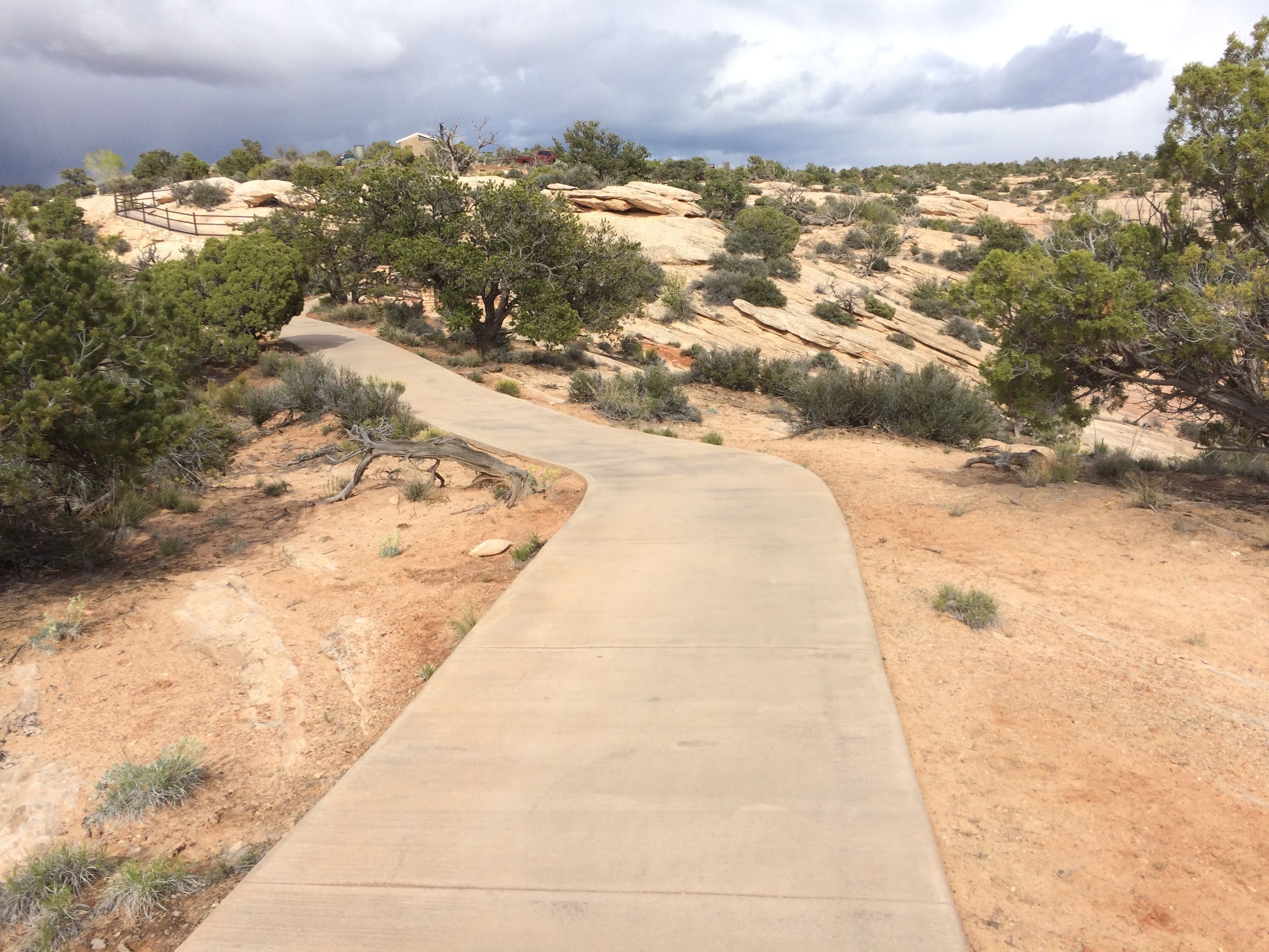
I am much more a paved path sort of hiker.
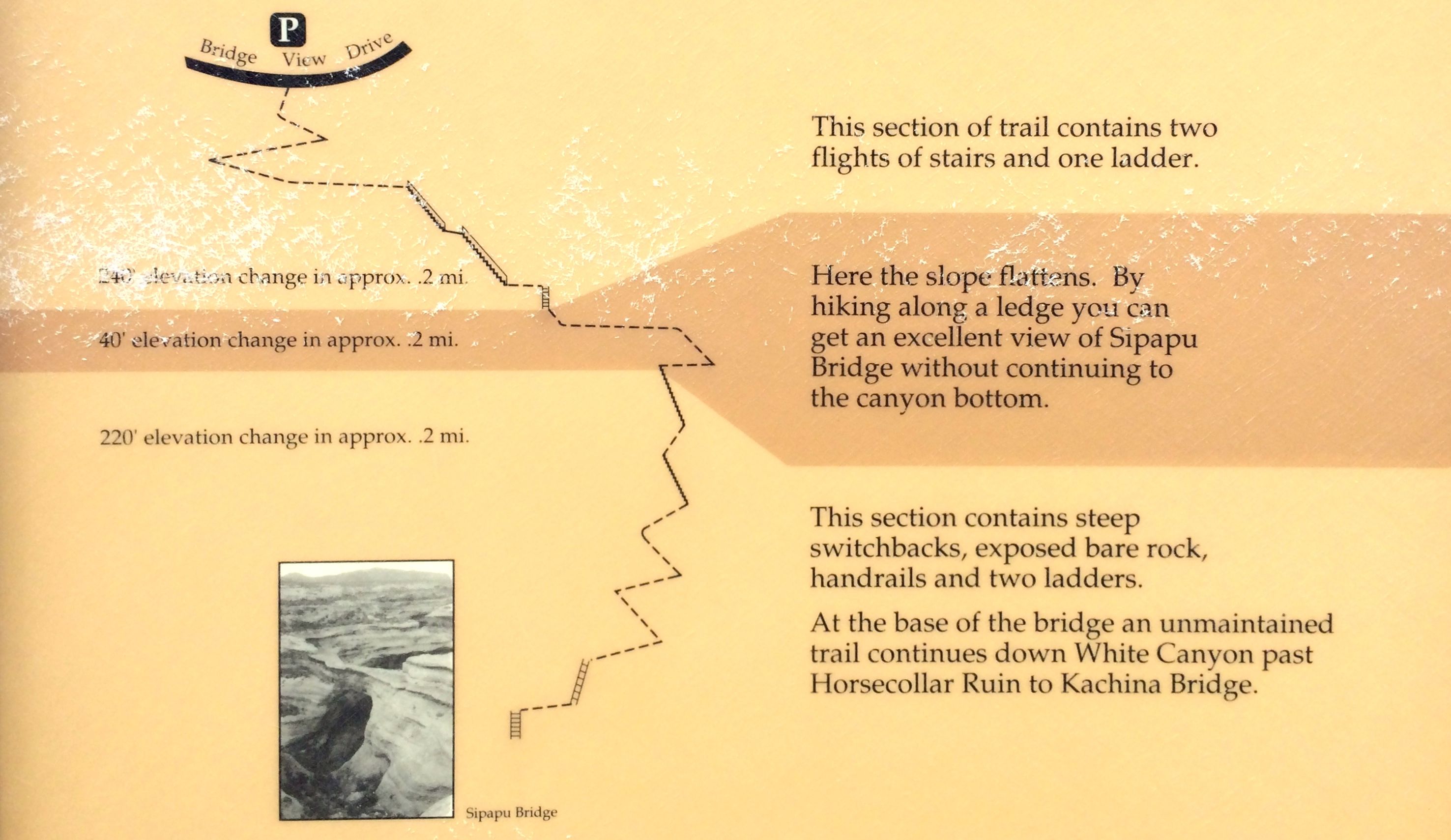
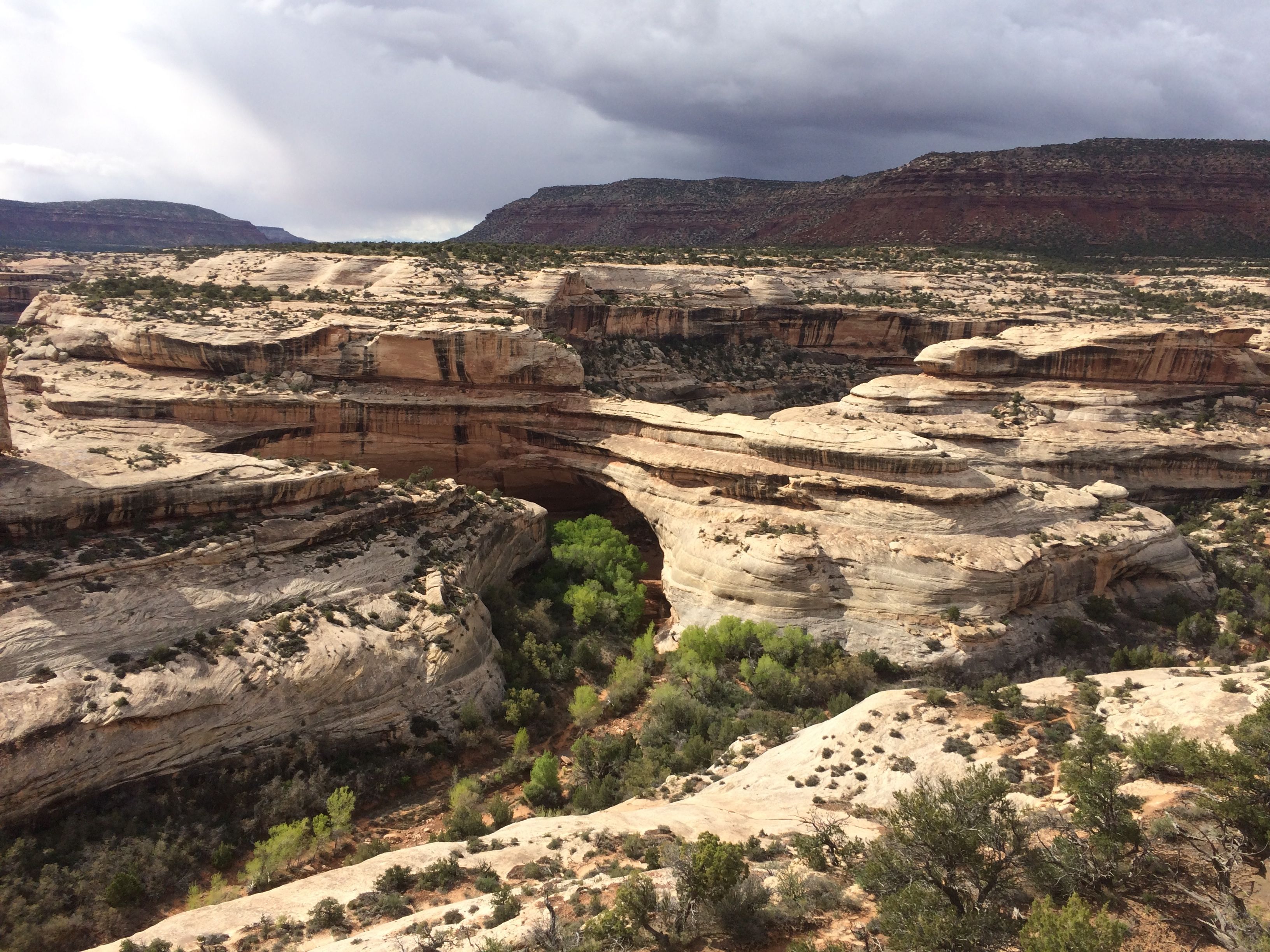
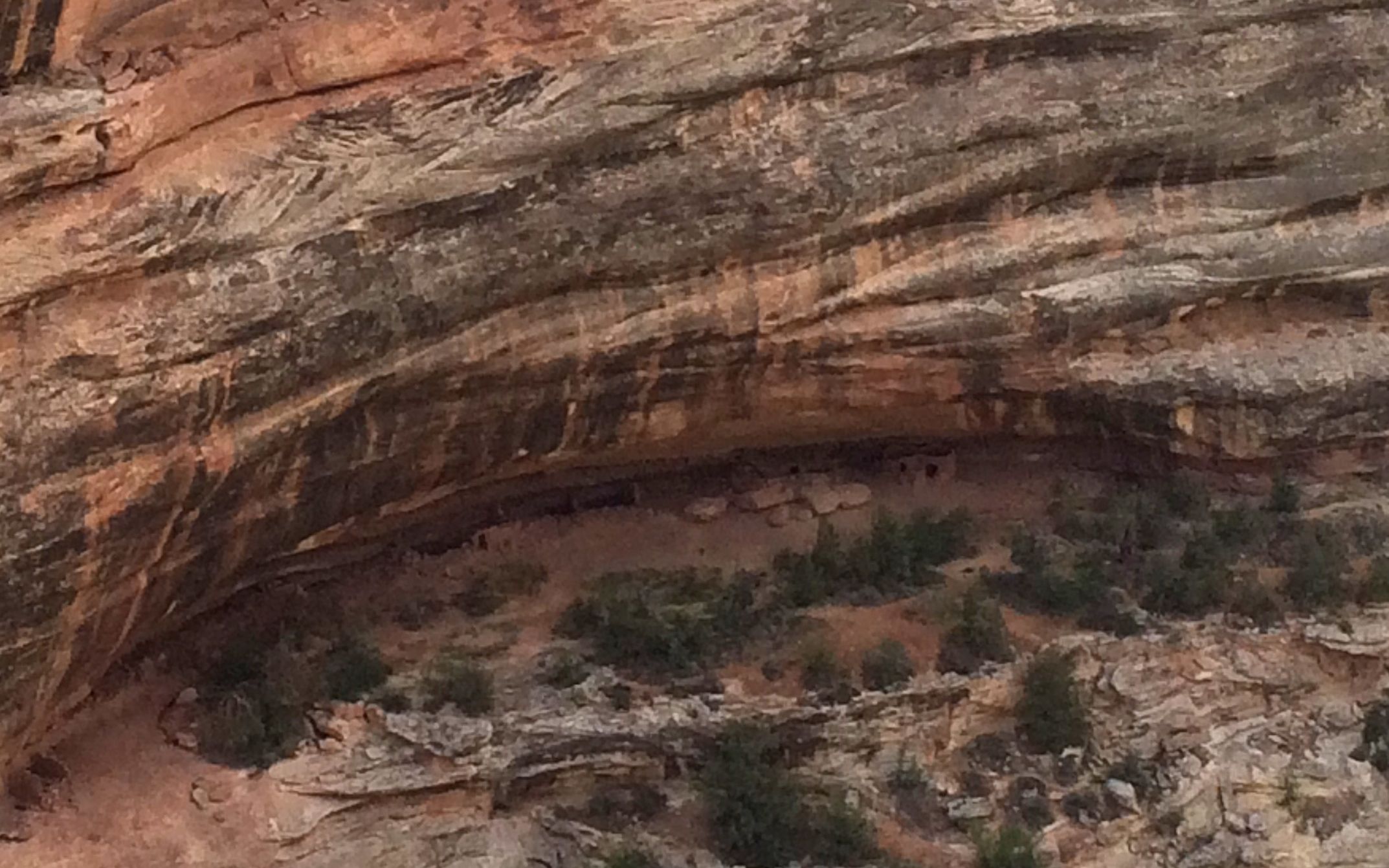
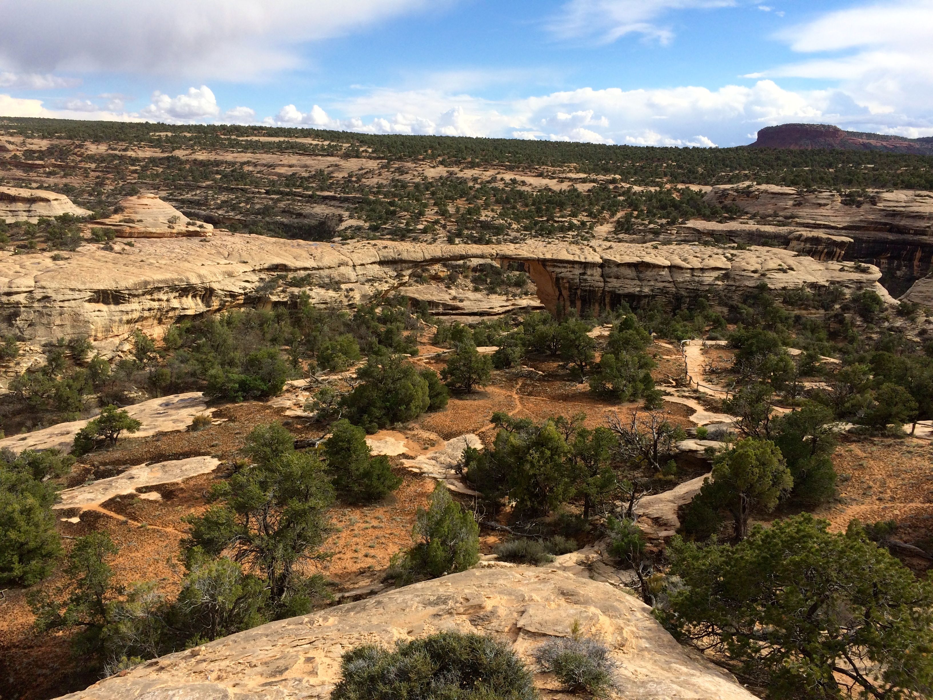
If you look carefully, you can pick out Kachina bridge.
Here’s a map of the canyon in the photo.
This bridge is an old one. The river that originally formed it has changed channels and it no longer flows under it.
I did take one hike to an overlook.
I had to work my way across solid rock that had water-filled pot holes in them.
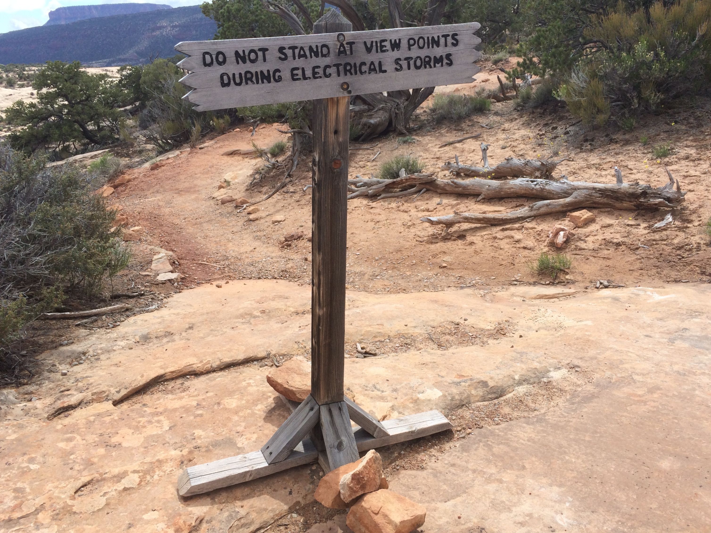
That was a sign that gave one pause.
Along the way, I stopped to chat with a gentleman who was hiking on the trail. It turns out that his name is Gordy and he is from Buffalo. He grew up on the Brinton Street, one street away from my aunt’s street. What a small world!
It’s really hard to see the bridges from above, but there is a bridge in there somewhere.
There are some ruins tucked into the cliff, too.
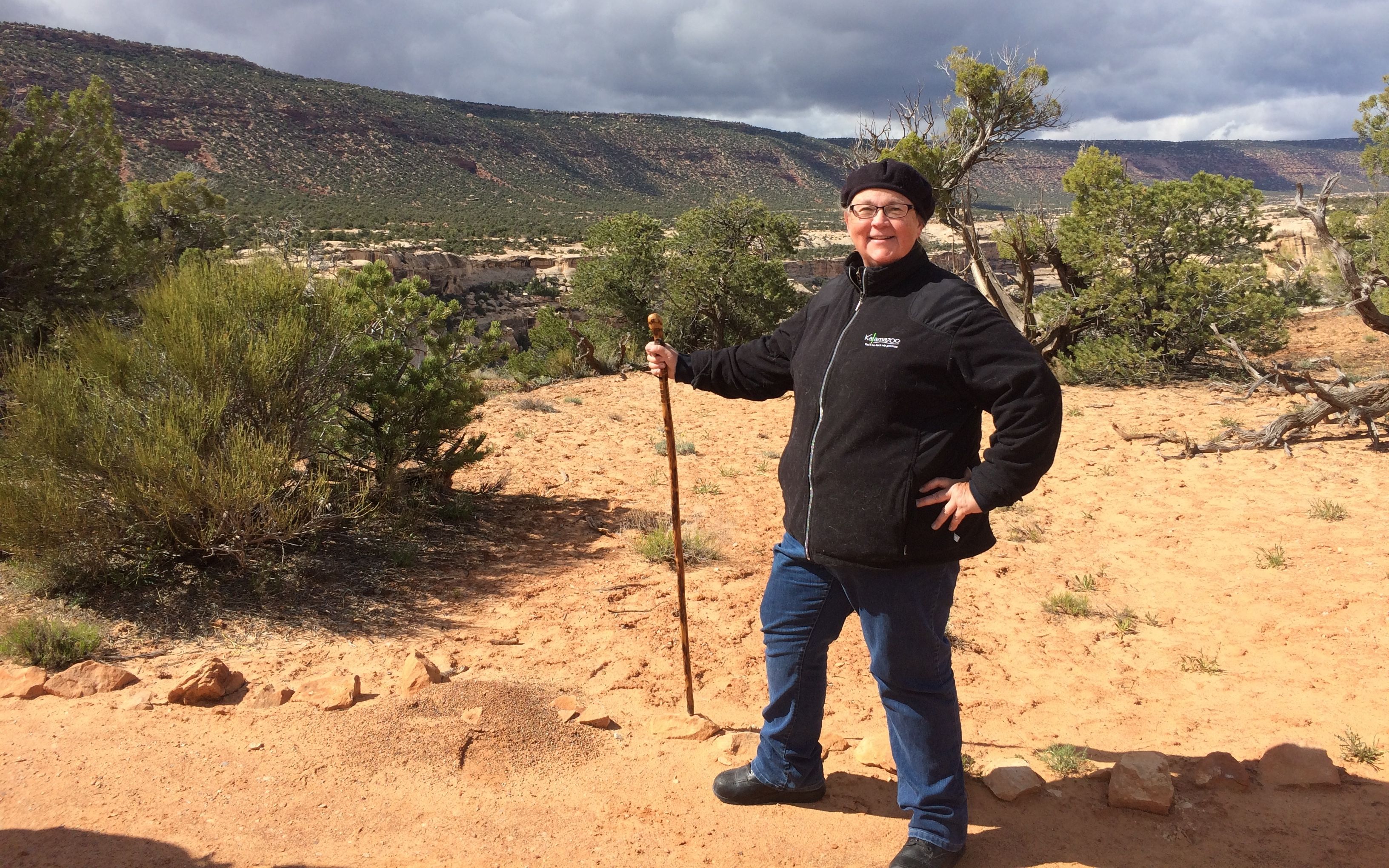
And, here I am, the happy hiker!
The trails were short, but the elevation changes were killers.
The trails start out deceptively civilized, but quickly change to a more vertical orientation.
There is one more bridge in this photo. It’s in the center and connects the two stone formations above the midline.
The last stop in the park was a sign for the piñon pine and Utah juniper pygmy forest. The trees grow slowly and these trees are actually quite old in spite of their short size.
Then it was time to head over to Blanding for dinner. I hoped that they would have a stronger cell signal – and they did! I found a destination for the week before I had to take Flo the Airstream to Mesa, Arizona for repairs. I would be heading back to Sedona to take part in a HistoriCorps project!
The next day it was time to hook up and head out. Destination: Canyon de Chelly!
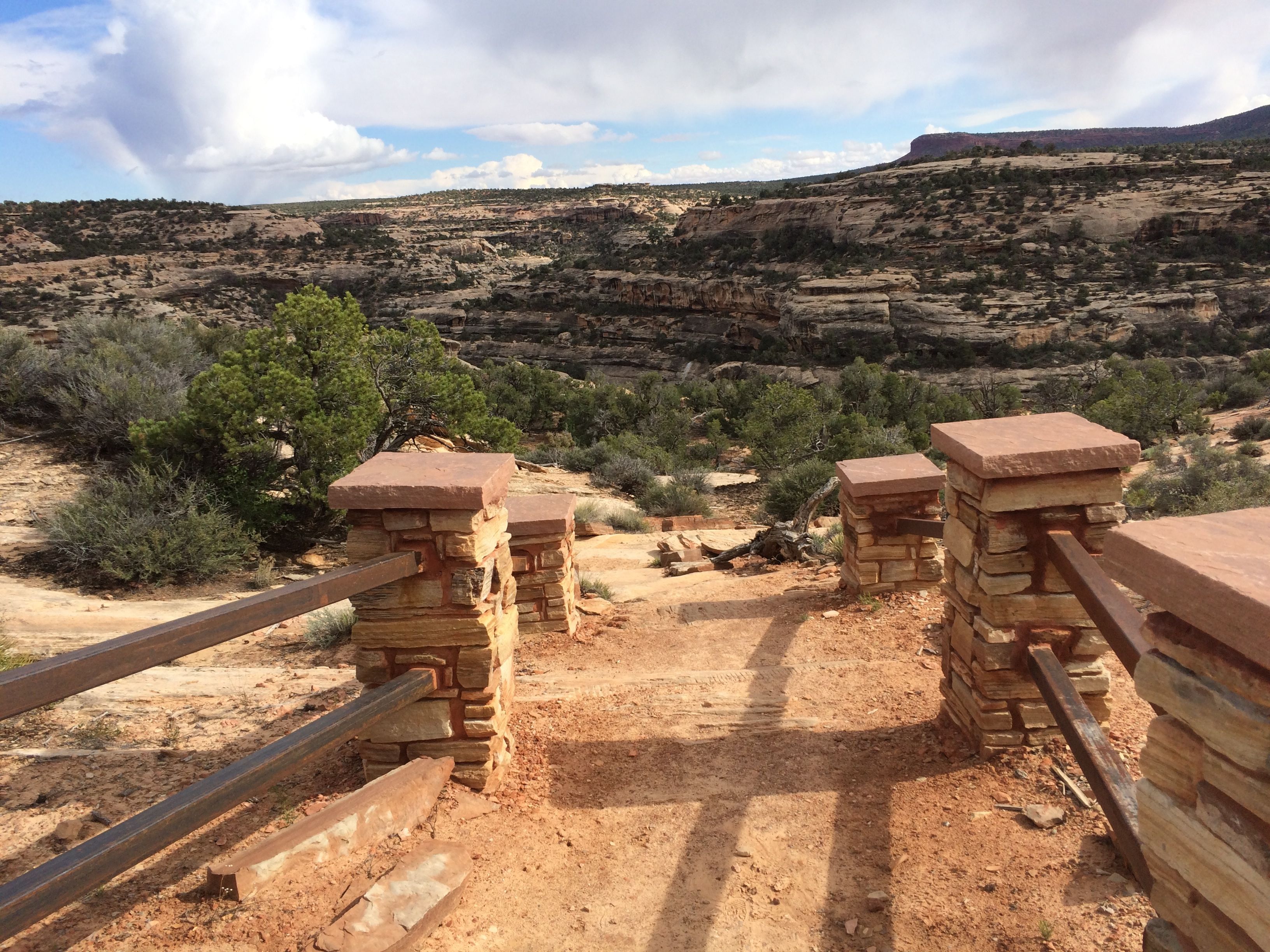
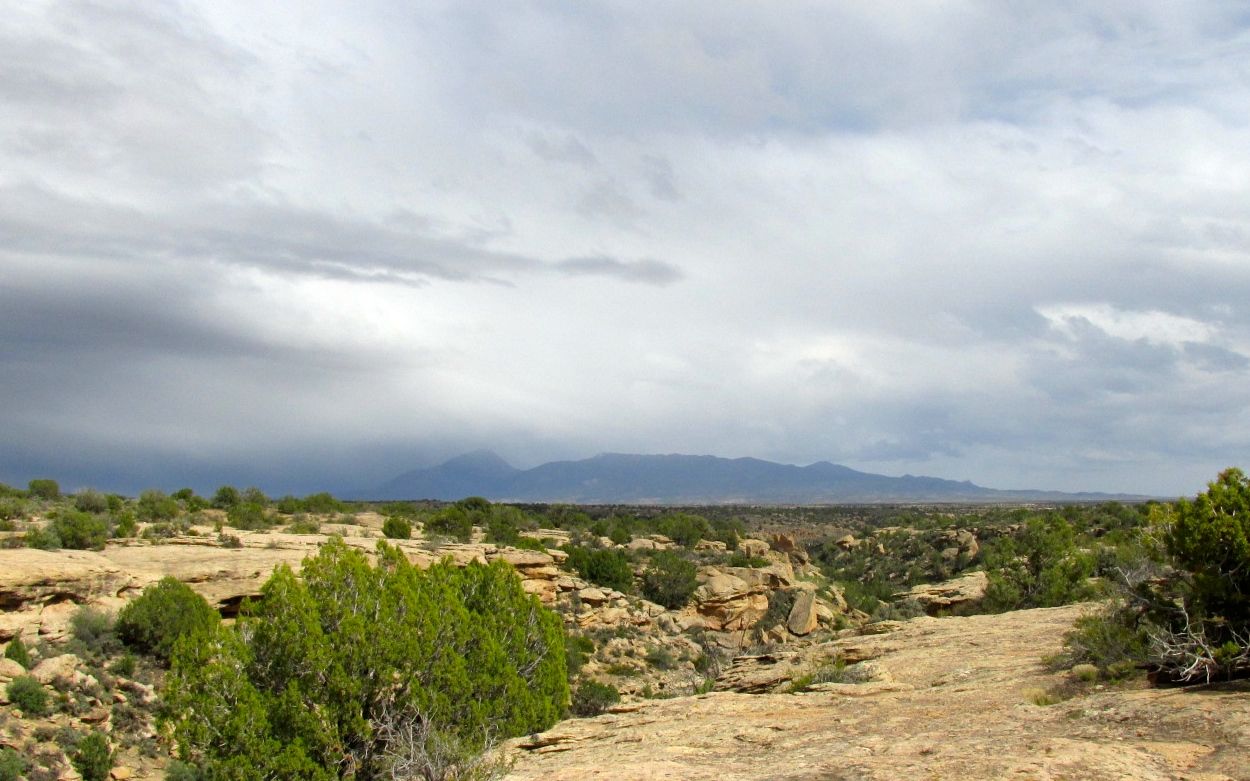
I had heard about Hovenweep National Monument, and it was on my list of places I’d like to visit. It was only about 70 miles away – which in “out west” terms is virtually next door. So, in spite of the cool, overcast weather, I hopped into Bart and headed out – oh, at the crack of 11:00.
By the time I got there, the cloud cover was pretty solid and the temperature had dropped considerably. I stopped in at the visitor center and watched the video about the monument.
I found out the Hovenweep is a Ute word that means “deserted valley.” There are a series of small river valleys and canyons that feed into the San Juan River from Cajon Mesa on the Utah-Colorado border. The Anasazi occupied the area from about 500 to 1300 AD and built the masonry towers and pueblos that are in the Monument.
William D. Huntington, who was on a missionary trip for Brigham Young, discovered the ruins that are in the present day Hovenweep National Monument in 1854. The ruins were already known the Huntington’s Ute and Navajo guides, who considered them to be haunted. Hovenweep was set aside as a National Monument by President Warren Harding in 1923
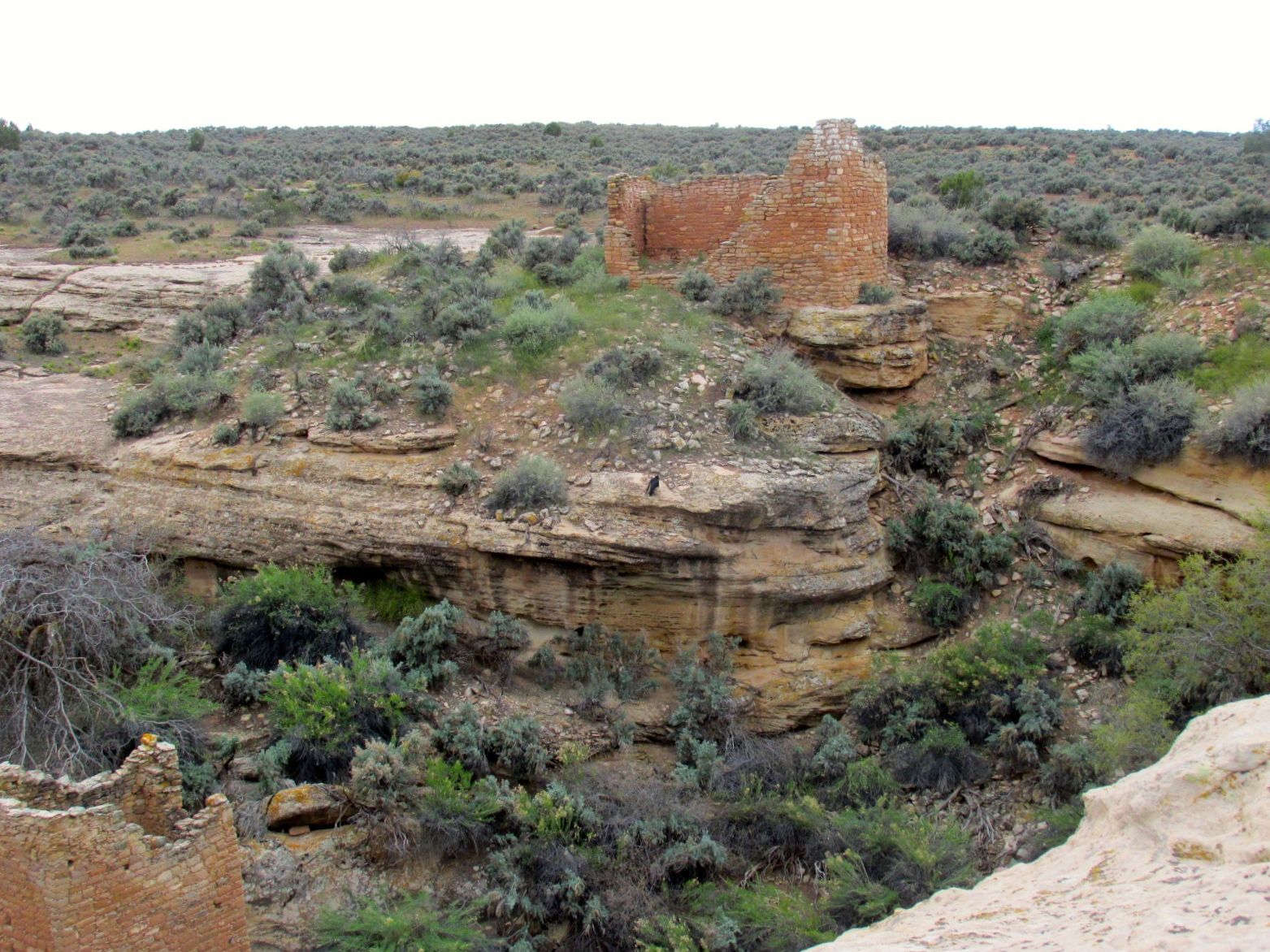
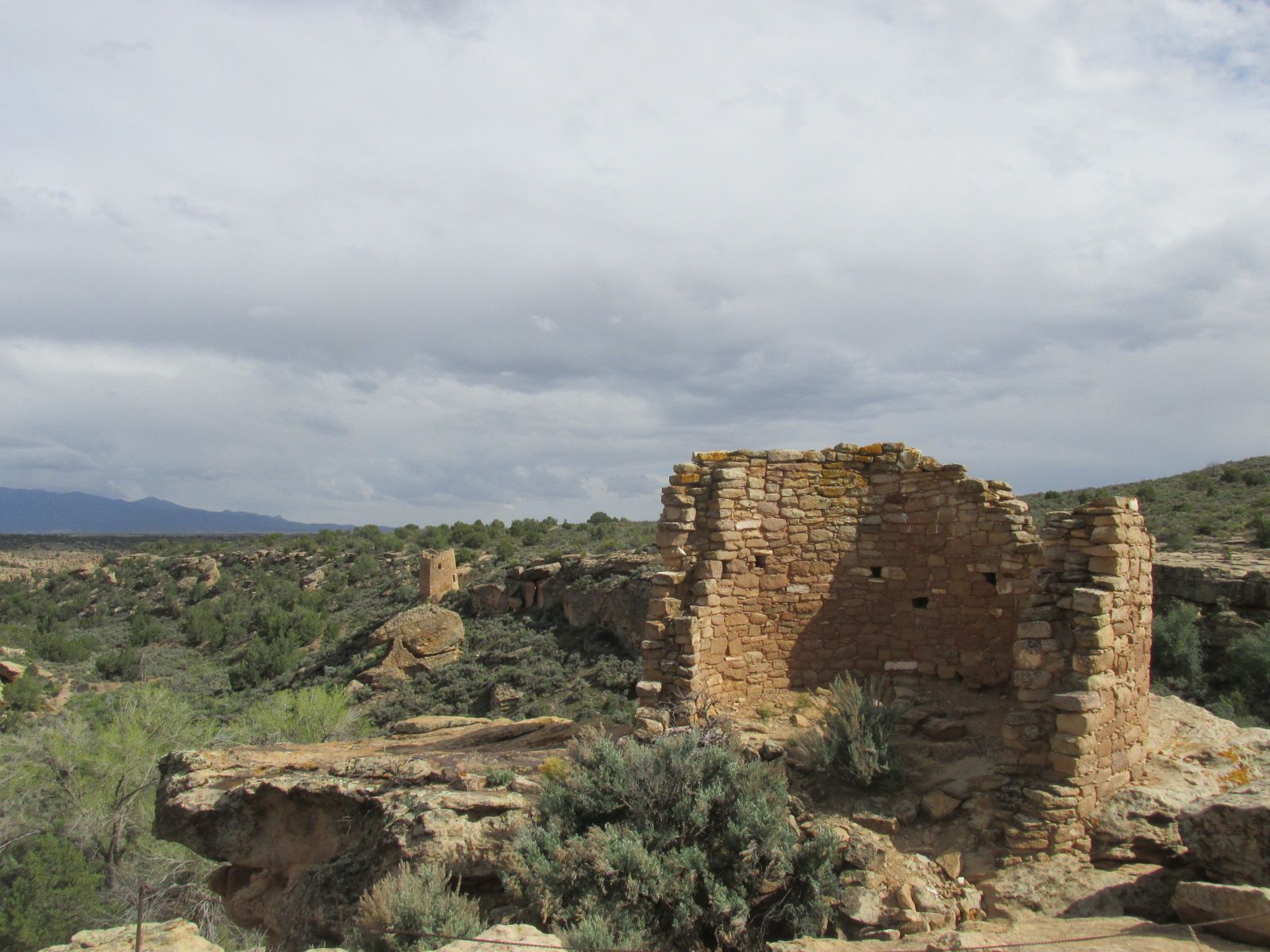
The ranger gave me a map and told me about the trail that went around the Square Tower group. If I did the complete circuit, I would descend one side of the canyon and ascend the other side. I thought I just might do the whole loop.
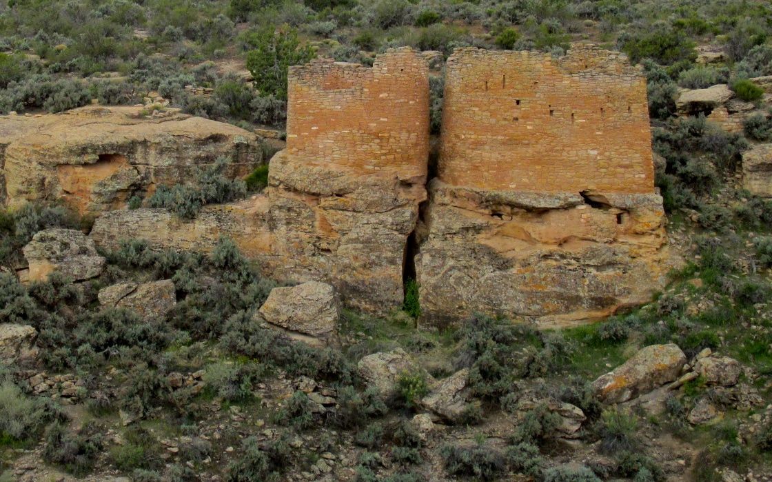
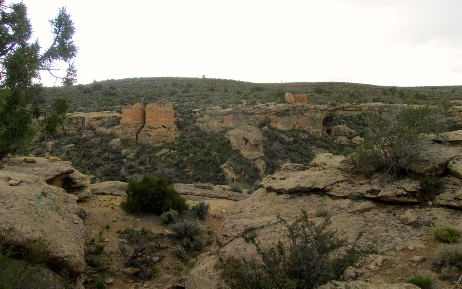
The large masonry towers were all around the rim of the canyon.
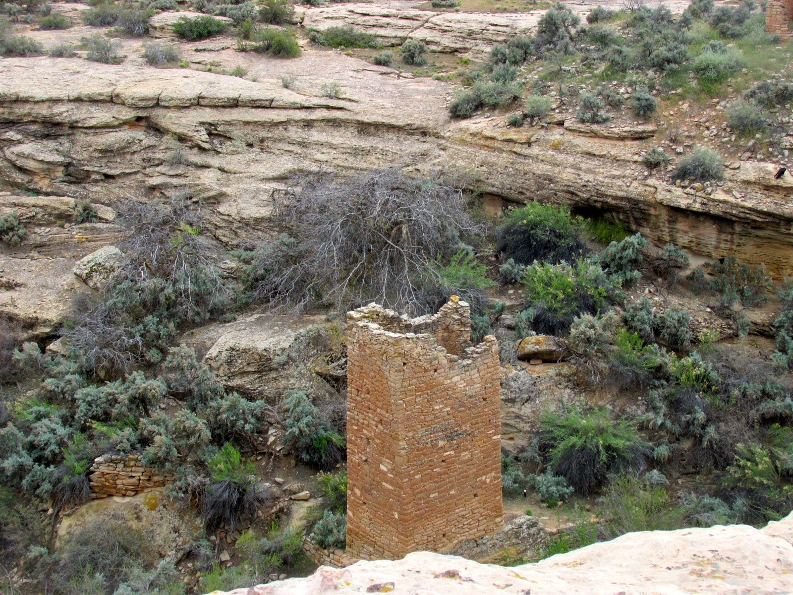
There were ruins that were more ruined.
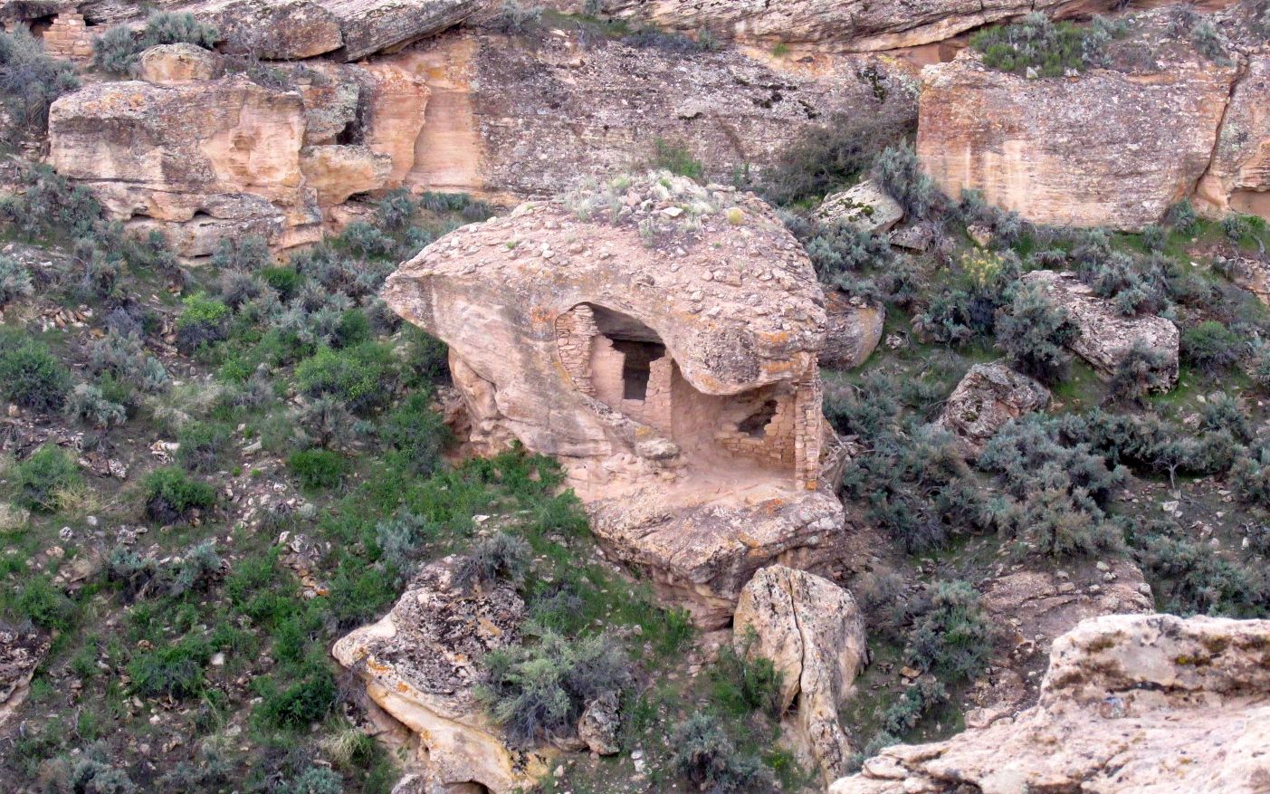
This dwelling was built into an eroded boulder.
You can see the proximity of the structures in this view. This really was a community.
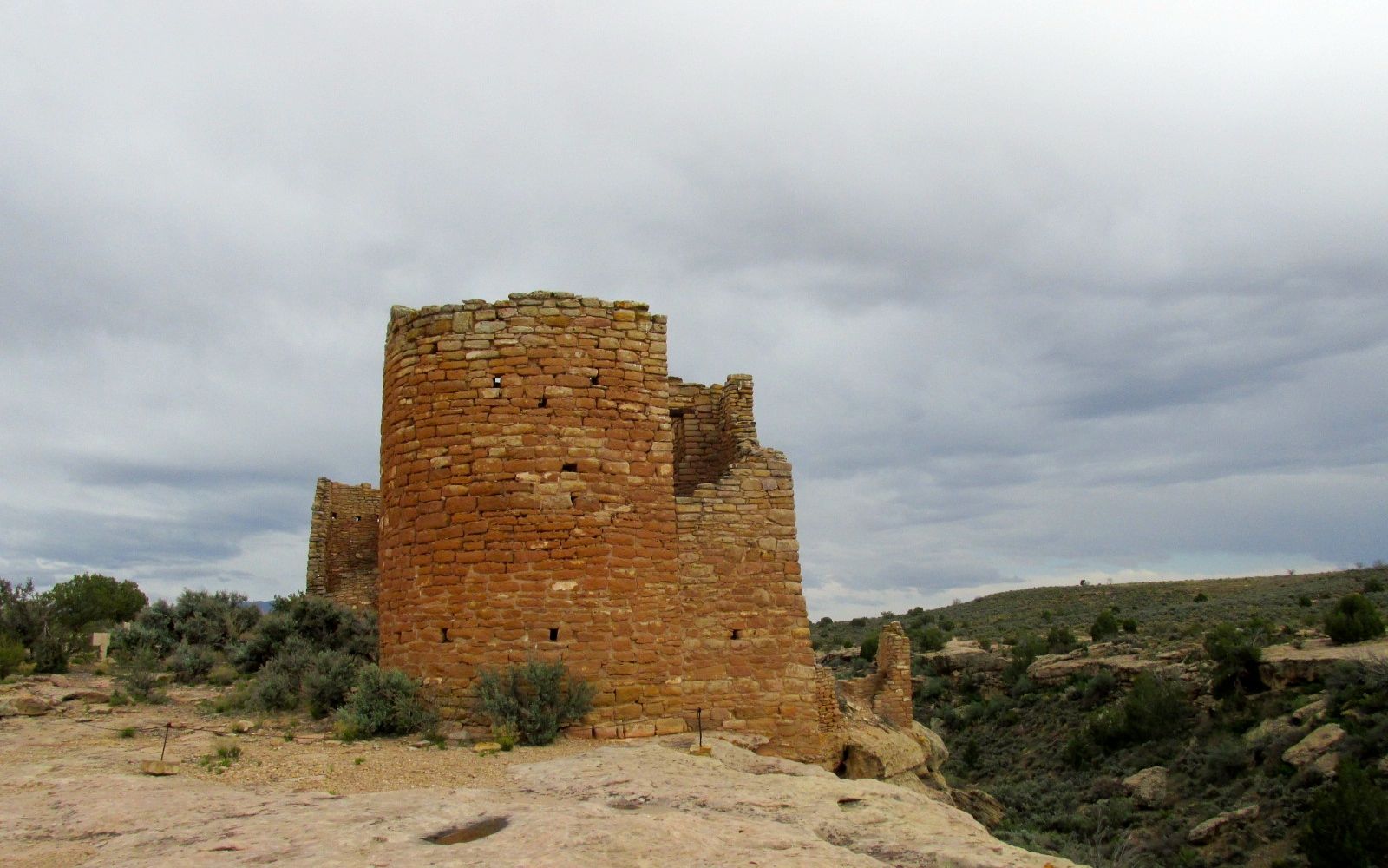
Considering that these towers have withstood at least 600 years of weather and the depredations of people looking for artifacts to sell, it is amazing that these structures are still standing.
In the distance, you can see Sleeping Ute Mountain, which is in Colorado.
The sun peeked out from behind the clouds from time to time.
I persevered, still determined to do the whole loop.
Eventually, though, I decided that I was just not dressed for the weather – even though I was wearing two polar fleece tops, a windbreaker, a hat and a scarf. I made it to the turn, and then decided to head back.
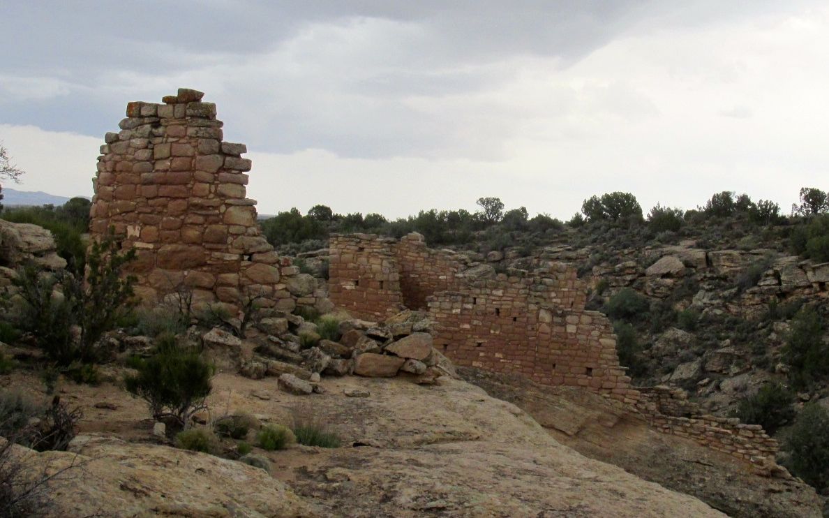
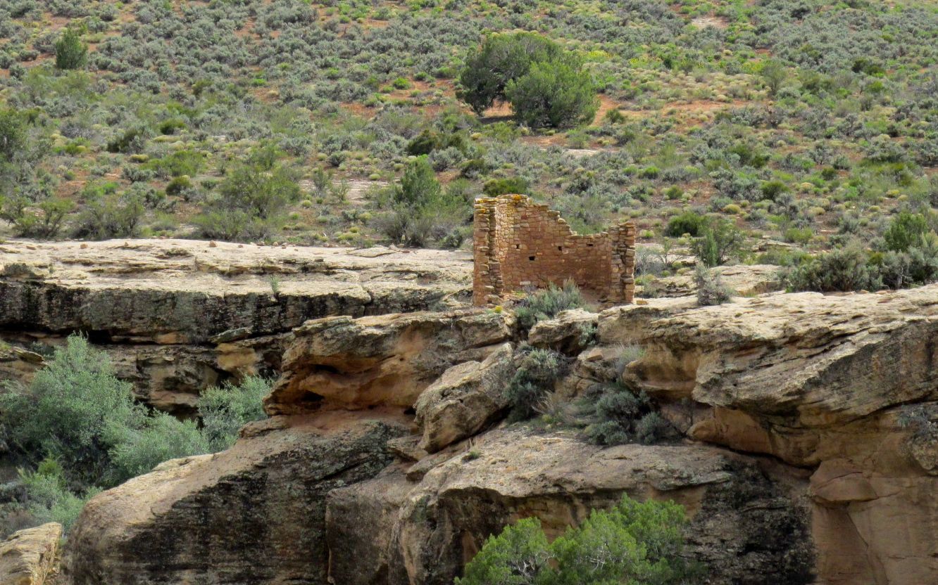
But heading back the way I came allowed me to take another shot of Hovenweep Castle, this time with just a little more light on it.
Wouldn’t you know it? As soon as I head out, the sky clears a bit and there is a bit more light.
The clouds closed back in by the time I got back to Goosenecks State Park. I was surprised to find this German RV at the campground when I arrived.
One of these days, I will talk to the folks who drive these. I wonder what they are like inside.
Having decided that Goosenecks State Park would be my home base while I was in the area, I set out to explore.
Just down highway 191, I came across the town of Bluff. Compared with Mexican Hat, it was a buzzing metropolis. According to the 2000 census, 320 people live there. I was heartened that there were restaurants, hotels and RV parks. If I had been able to plug in, I could have moved there. But, since my backing up woes made me rely on my batteries and solar power, it made no sense to move.
I saw a sign directing me to the historical district and decided to investigate. I came across Bluff Fort and a tourism information office. Since I didn’t know what there was to do in the area, I stopped in.
I was enthusiastically greeted at the door by a gentleman dressed in pioneer garb. After ascertaining that this was my first visit to Bluff, he asked if I wanted to see the multi-media presentation about the history of the town. It was free and so I said, “Yes, please.”
Since I was alone, he got his wife to run the presentation for me. I don’t know if he was afraid that I would take advantage of him or that I might be afraid to be alone with him. He brought his wife over, who was also dressed in period garb. She brought me over to this wall, and the presentation started.
She flipped a switch and three of the portraits started talking to each other! After they finished the introduction, they got up and walked into the next room. That was the most interesting way to begin a presentation I had ever seen.
It turns out the Bluff was founded by the Mormons who sought to stabilize the area by establishing a town, setting up a trading post and farming the area. The settlers were “nominated” by the elders in their temple. They set out to do as they were directed. There were things they expected to happen.
They expected to travel by wagon. Actually, their belongings traveled by wagon. Mostly the people walked.
They expected that they would have to leave things behind.
See those doors in the upper left of the photo? The woman who was giving me the presentation opened the doors and played a video that told the rest of the story.
It turns out that there was no road where they wanted to go. I think they kind of expected that, but they had no idea of the terrain they would have to cross to get to this place on the banks of the San Juan River. They expected the 125 mile trip to take about six weeks. They had planned to use a route that a scouting party had called the Escalante short cut, but that route didn’t work out. Instead, the journey turned into an arduous 260 mile trek that took six months during winter conditions.
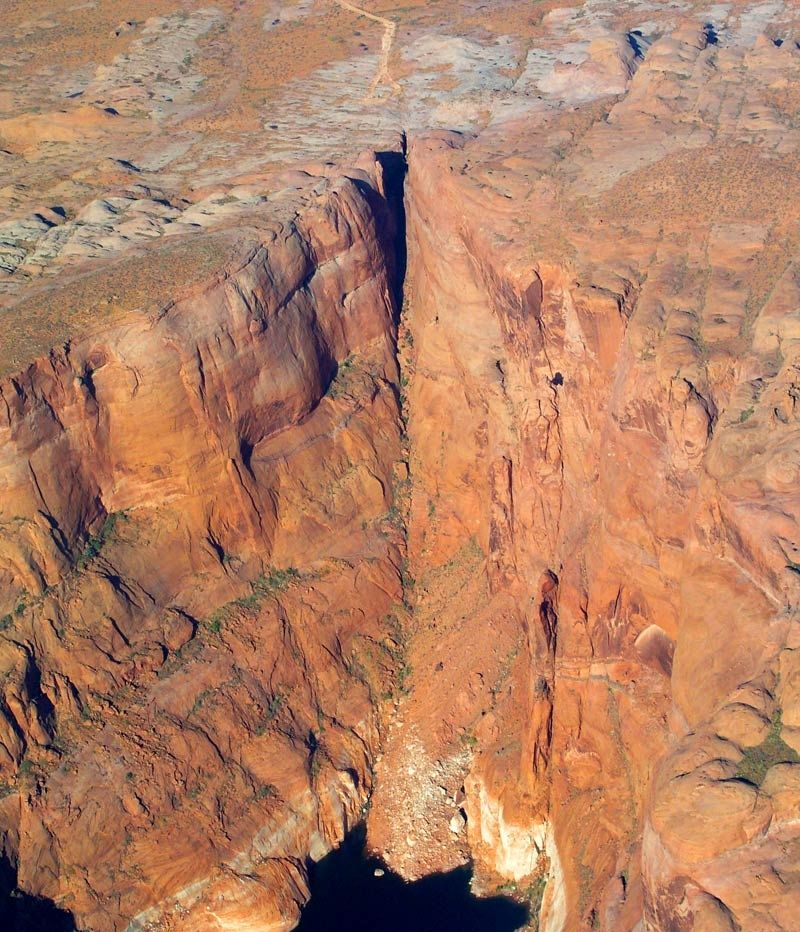
What they ended up doing was spending six weeks blasting and chiseling a trail through a narrow 1,200 foot drop in the sandstone cliffs. It’s known as the Hole-in-the-Rock, which is still visible at present day Lake Powell.
I found out that these kinds of trails are called “dugways”. Merriam Webster defines a dugway as “a road constructed along a hillside by using for the fill on the downhill side material excavated immediately above it”
.I mean, can you imagine going down this cliff? With a wagon, no less!
But, even after they got down this cliff, they still had to cross Comb Ridge, which required that they built another dugway up the face of the ridge.
The pioneers named this “San Juan Hill.” At first, I thought it was named after the battle of San Juan Hill in Cuba, but that didn’t happen until 1898. I imagine it was named after the San Juan River.
Finally they arrived to the site of present day Bluff.
Actually, they were supposed to continue on to a site twenty miles upstream, but they were just too exhausted to continue. They saw that this location had water and good farmland, so they decided to stay here.
After the end of the video, the guide opened the doors and we went to a room that was outfitted like a religious meeting room, where the story was completed.
If you happen to be in the area, I would certainly recommend taking in the presentation. I was absolutely exhausted by the end of it. I can’t imagine what it took to get to this site.
I thought this sign that was displayed on the wall of photos at the beginning of the presentation was an understated representation of what they accomplished.
After the presentation, The guide invited asked me what else I wanted to do in the area and she helped me pick out some brochures to plan my visit. She directed me to the recreated fort that continued the story.
According to the sign, this is one of the original wagons that made the trip down the Hole-in-the-Rock dugway.
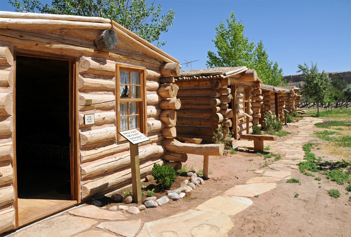
The settlers built their original cabins around a square with the back walls serving as the fortification of Bluff Fort. They reconstructed the cabins and then outfitted them in the style of the time. Outside each cabin were buttons you could press to hear stories about the settlers. The stories were often taken from letters or diaries and were read by the settlers’ descendants. They had a variety of languages you could chose from to hear the stories.
I thought this table had an interesting storage space.
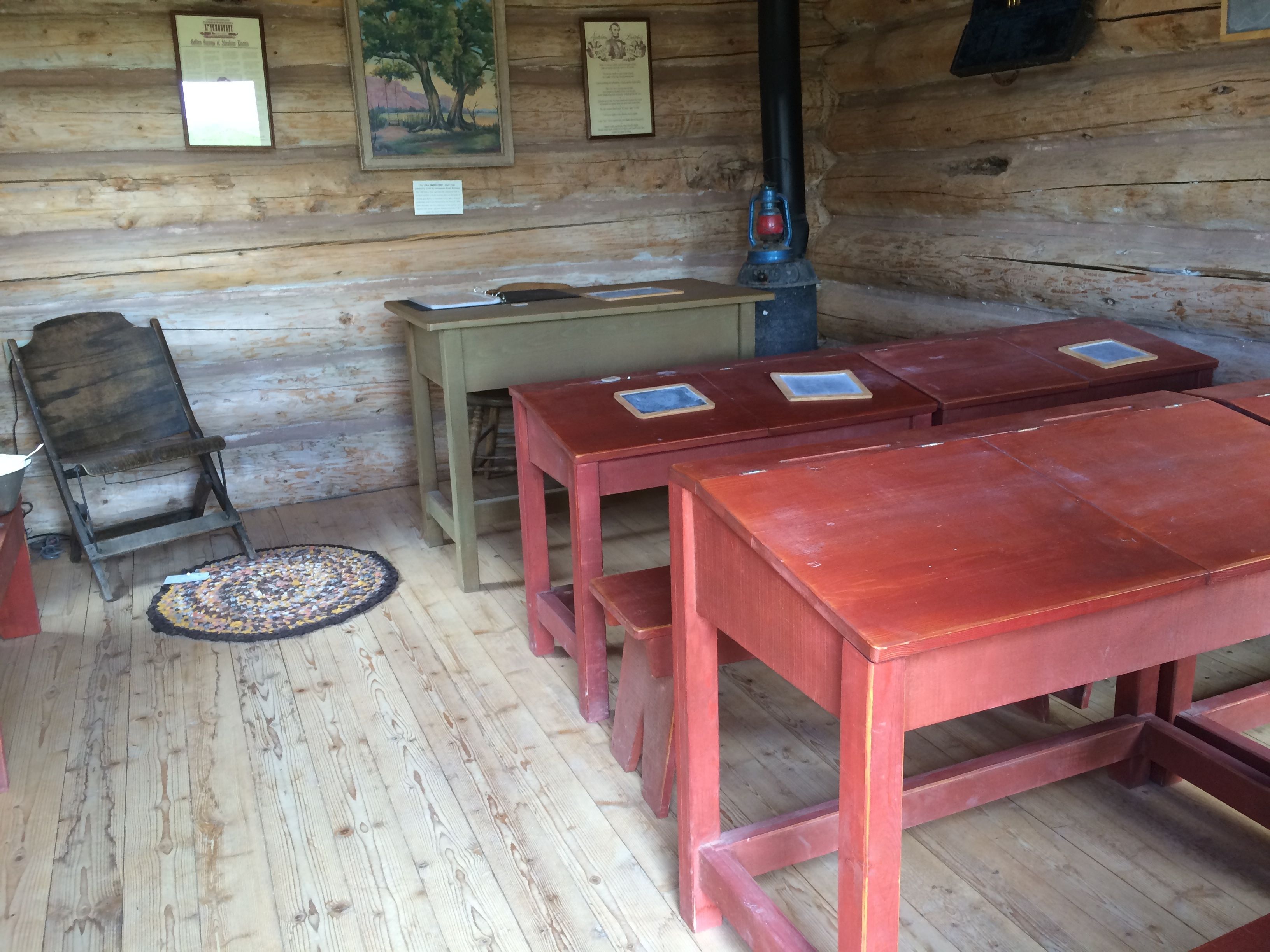
What would a community be without a school? Those are framed Abraham Lincoln quotes on the wall, flanking the painting.
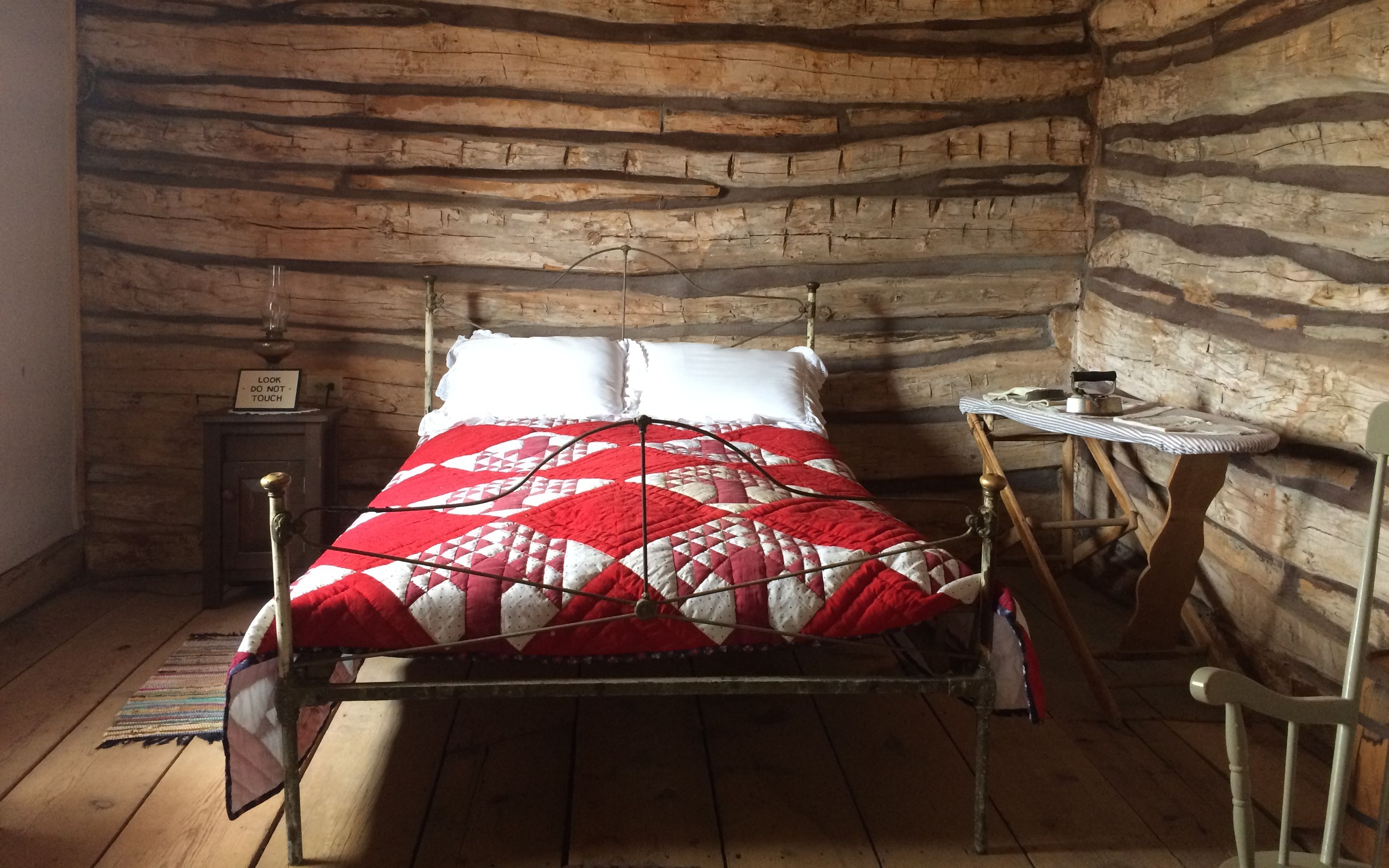
The original cabins were little more than a room that served all purposes.
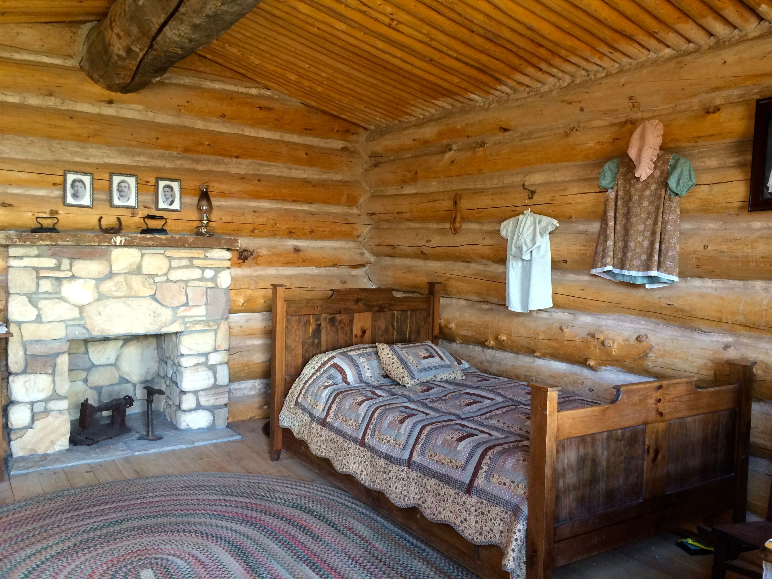
I was surprised to see this quilt in one of the cabins.
I have that same quilt in my Airstream. It was a gift from my sister. I mentioned this to one of the volunteers. She seemed apologetic, but I reassured her that the important thing is that they are telling a story. This quilt is just a prop.
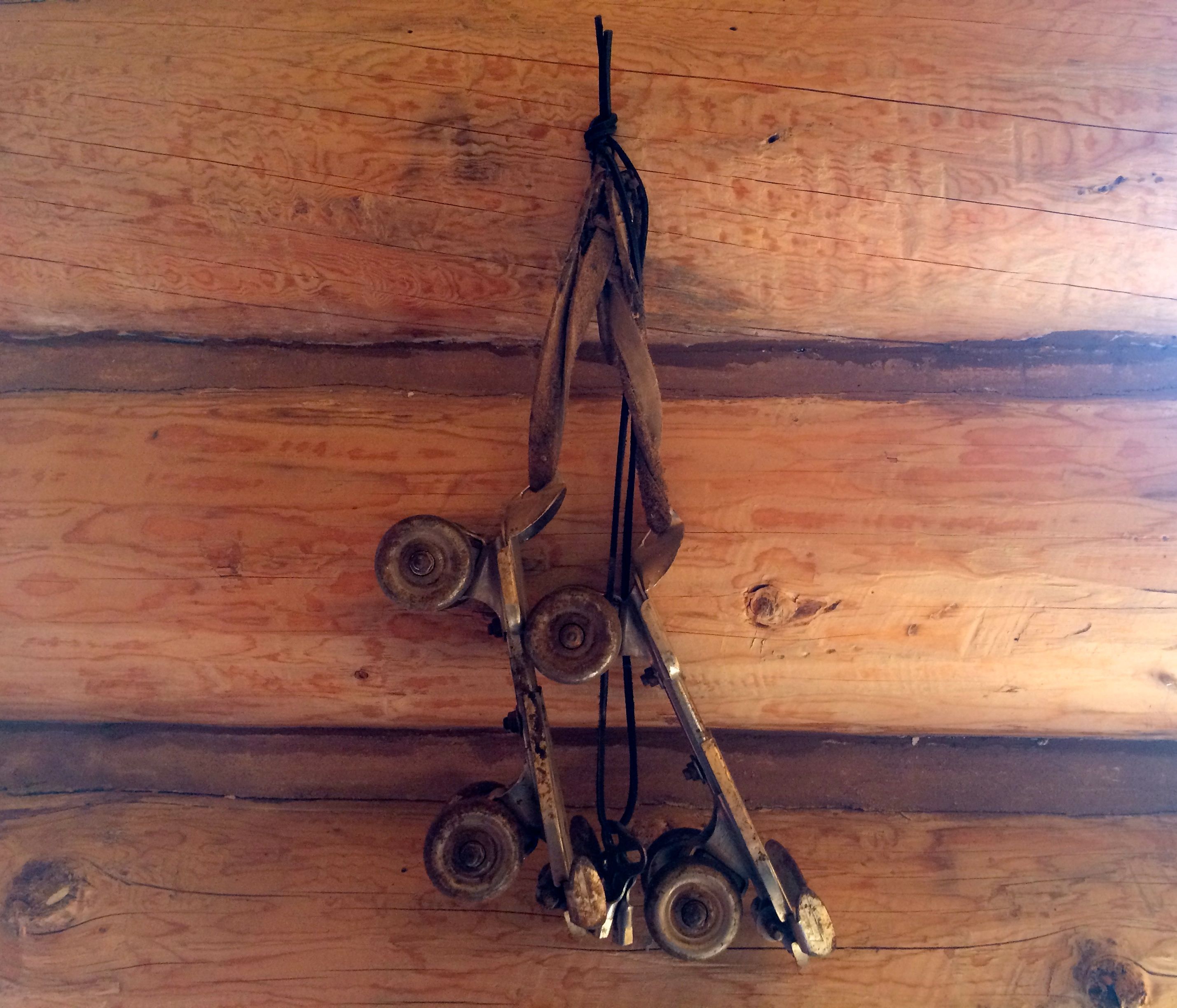
I’m not so sure that the roller skates hanging on the wall were accurate, though.
There is one building that is there from the 1880s. That is the Barton cabin.
There’s not a lot of it left.
They have reconstructed one room of the cabin, and there is a story that plays there that tells of the death of the mother of the family.
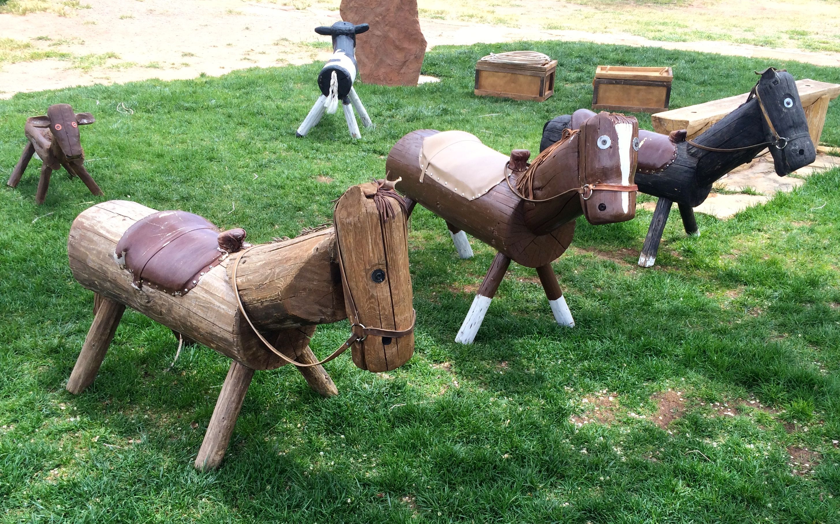
Toward the end of the walk through the fort, I was captivated by these charming toys for the younger visitors to play on.
They even had a box full of lariats so that the kids could practice their roping skills.
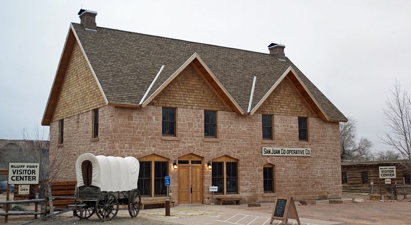
The building that was used for the visitor center – and gift shop – was a reproduction of a building that was destroyed in 1925. According to the sign, a bank robber named Frank Starr used too many sticks of dynamite when trying to open the safe. His failed attempt cause the demise of the building as well as Mr. Starr.
The co-op was rebuilt in 2012 by the settlers’ descendants.
Here’s a photo of it in 1898.
This is a drawing of how it looked in 1894.
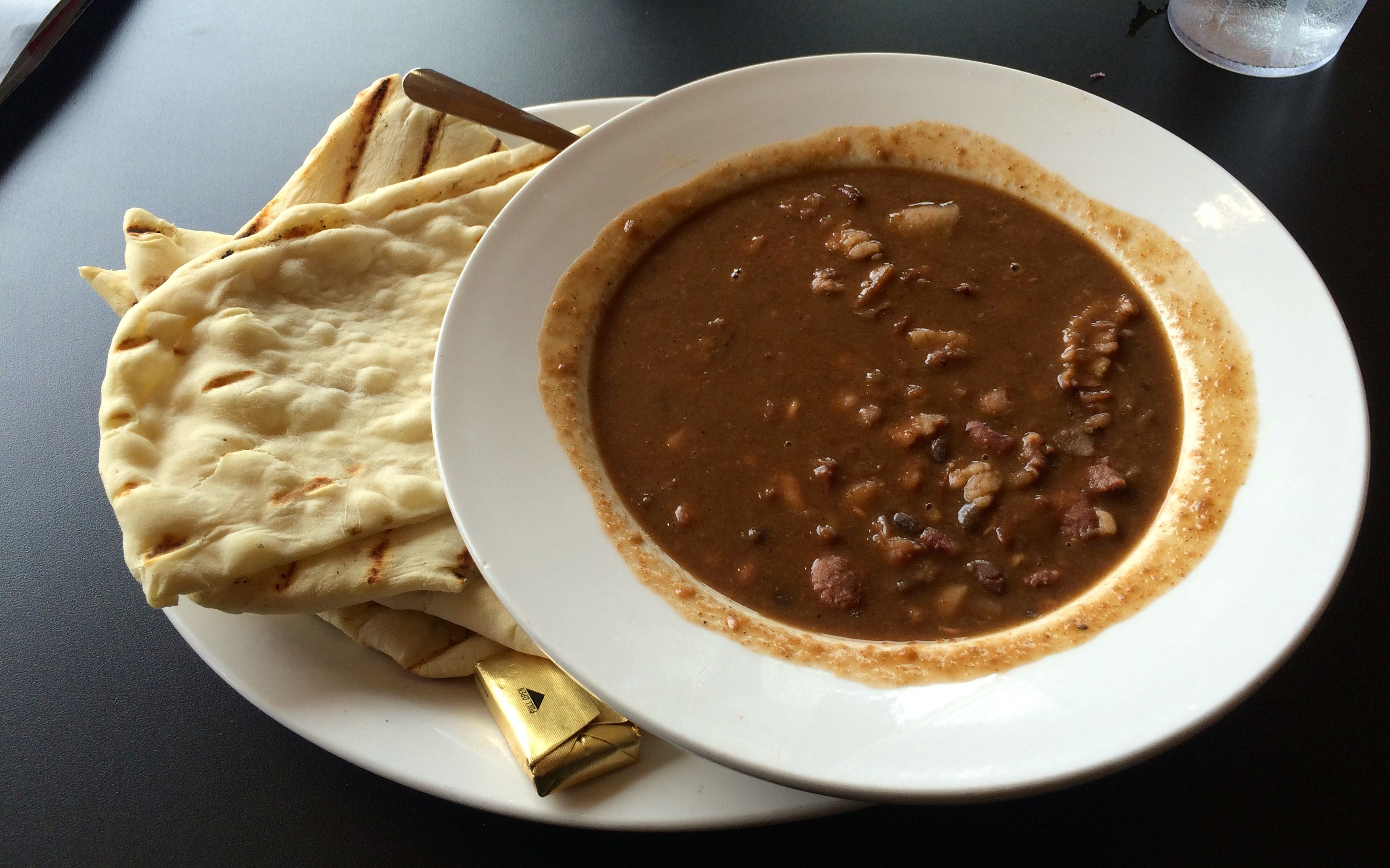
After all this history, I was ready for some sustenance. I hopped in ol’ Bart and set out in search of some food.
I decided on the Twin Rocks Cafe. Cars in the parking lot were a good sign.
I ordered the special of the day, Cliff Dwellers Bean Soup with Ash Bread. I could choose between fry bread or ash bread. I’d had fry bread before, so I asked for the ash bread. The way ash bread was explained to me was that it was baked over the coals after the main dish had been cooked.
On the way back to Goosenecks State Park, I paused to snap a photo of the twin rocks.
I could have driven further, but tomorrow was another day!