I set off down I-57, and picked up I-55 near Sikeston, Missouri. I visited there a couple years ago, when I was doing my seed courier gig in 2018. I ate at Lamberts, the Home of Throwed Rolls. But, there was no time to stop. I had to drive!
A few miles later, though I had to stop to use the restroom and stretch my legs. There was a great rest stop just past New Madrid, which is the site of the country’s largest earthquake back in 1812.
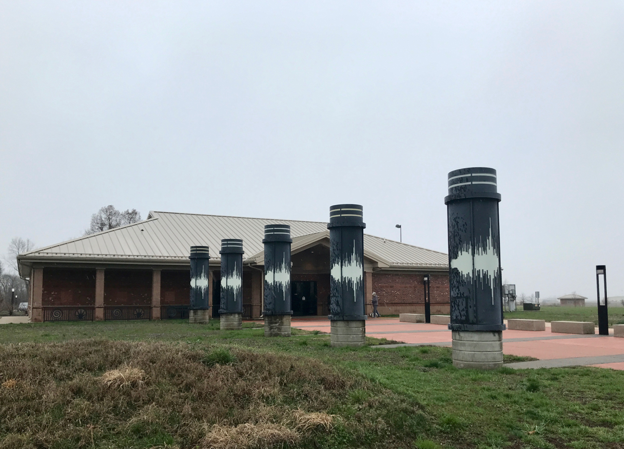
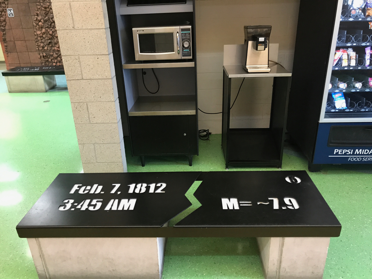
I parked and walked up to the center. I was taken by the pillars that suggest the readout of a seismograph.
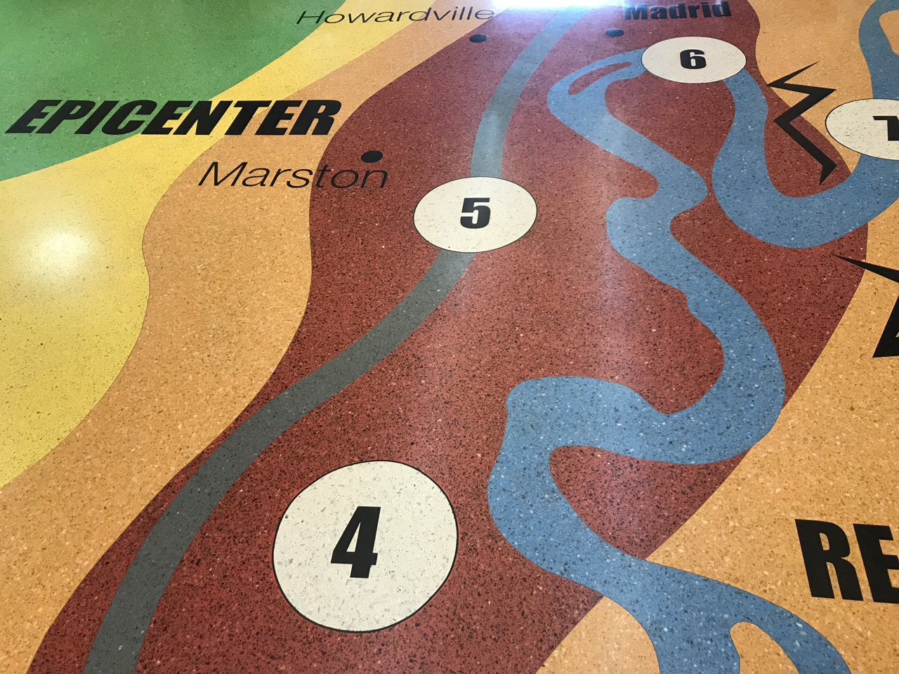
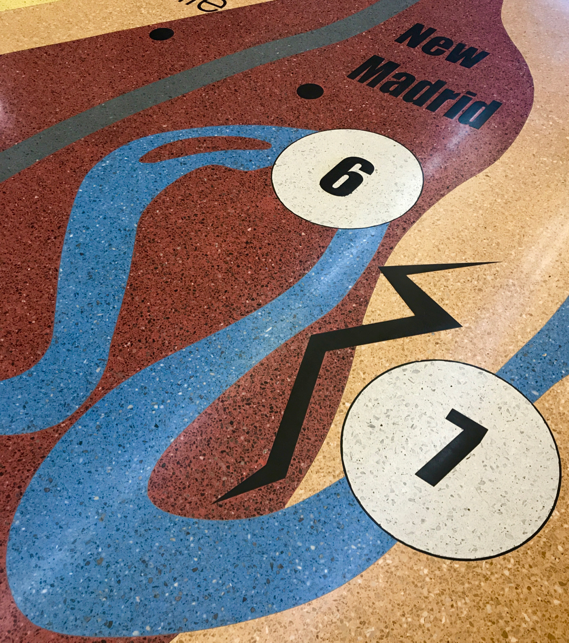
The floor was a spectacular rendition of the map of the area done in epoxy-terrazzo.
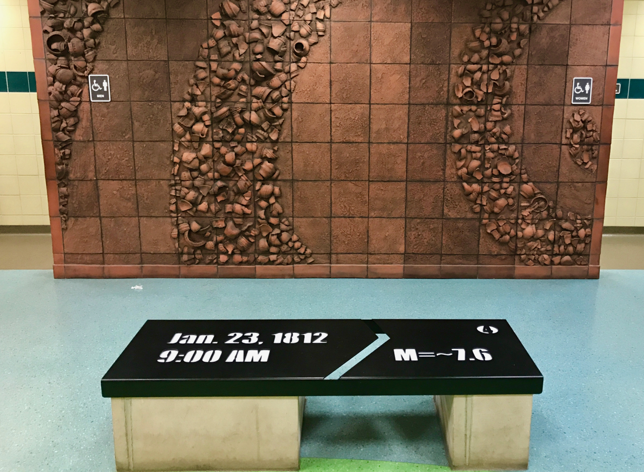
There were benches with lots of interesting information that cued in to the map on the floor. The wall between the restrooms paid homage to the inhabitants of the area at the time. The broken pottery tiles mimic the outward vibrations of the earthquake.
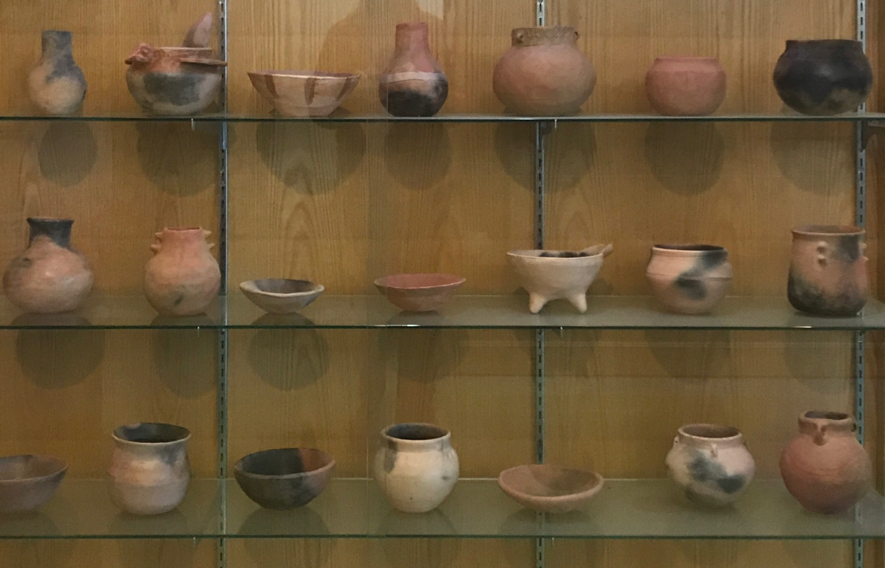
There were two display cases of pottery. They are recreations of Mississippian culture pottery that are found in the Beckwith collection at the Crisp Museum of the Southeast Missouri University in Cape Girardeau, Missouri.
On my way to the rest stop, I passed a sign for the New Madrid Historical Museum, which has information on the earthquake. That is going on my “Next Time” list.
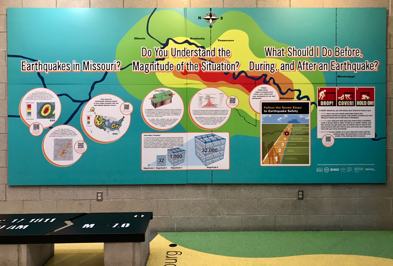
They had a great display. I loved how the colors on it related to the floor.
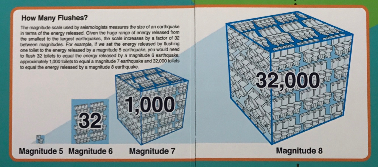
Their illustration of the concept of the Richter scale really made sense to me. I always “knew” this information, but this really drives home the relationship between the different magnitudes.
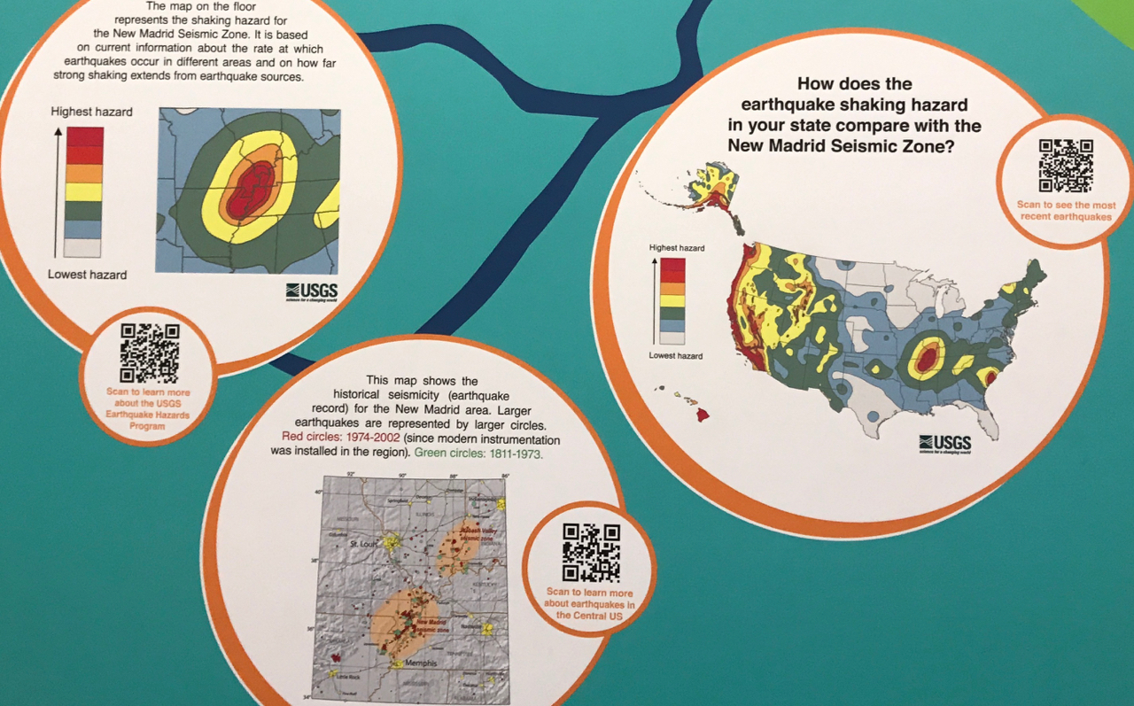
It’s kind of hard to believe that Missouri is as at risk as much as the west coast! But, there it is on the map.
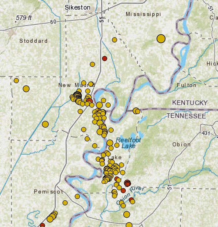
And, earthquakes around here are not only a historical fact. These are the recent quakes that have been detected.
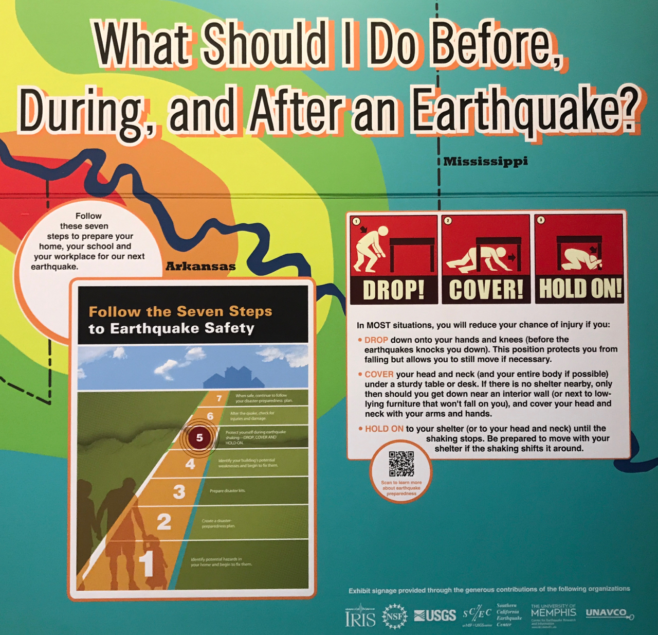
Drop! Cover! Hold on! It reminds me of Stop, drop and roll. I wonder if they have earthquake drills in the schools in this region? I’d call a school in the area, but everything is closed. CoViD, you know.
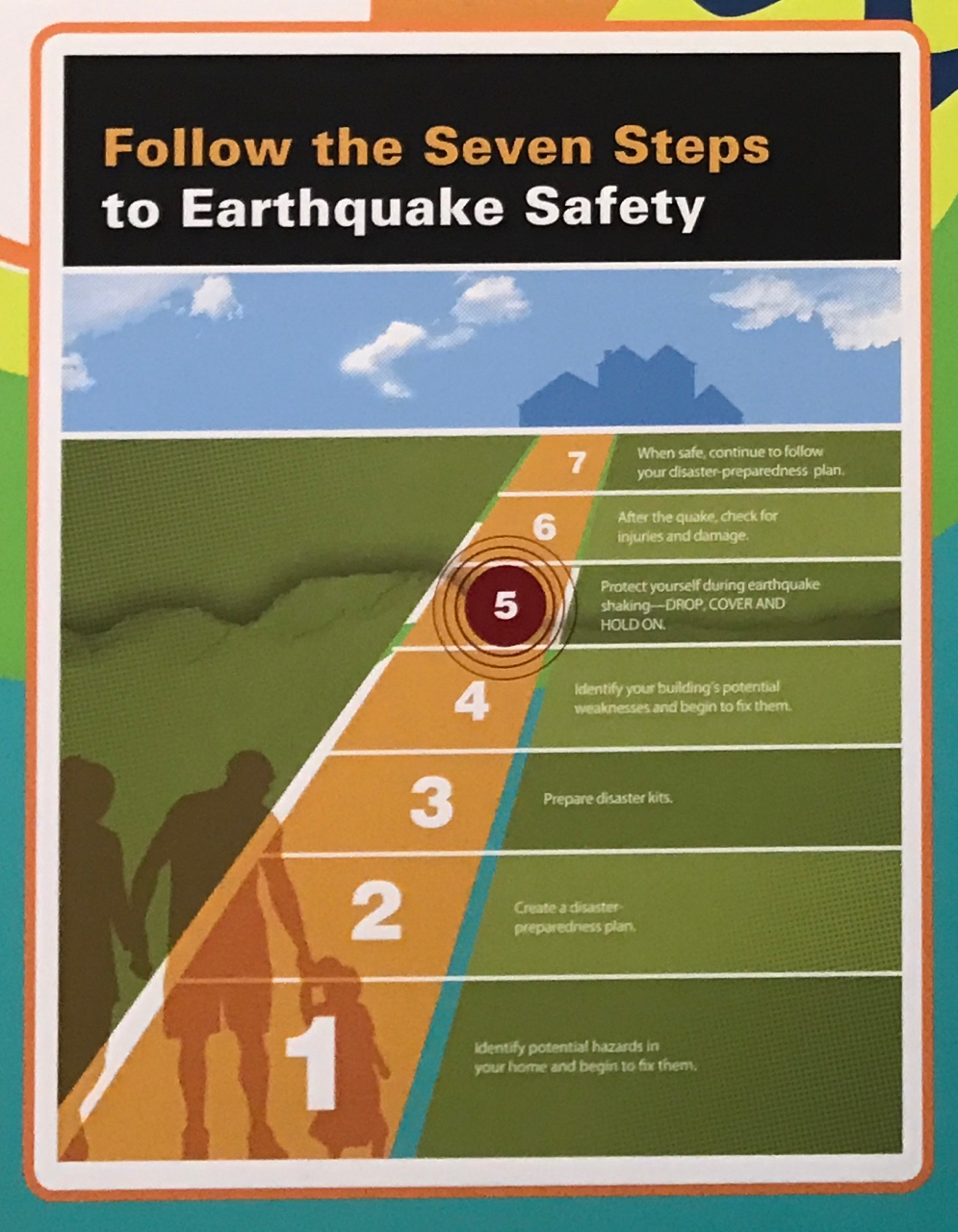
Drop, cover and hold on is actually step 5 out of 7 in the earthquake safety path.
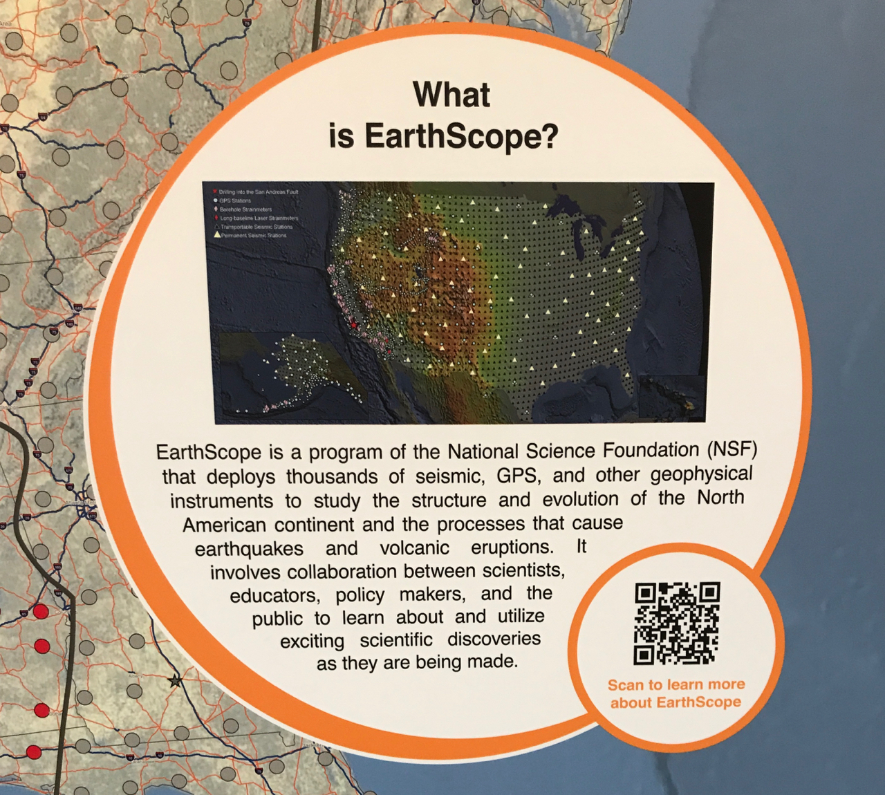
There was also a display about tracking seismic activity.
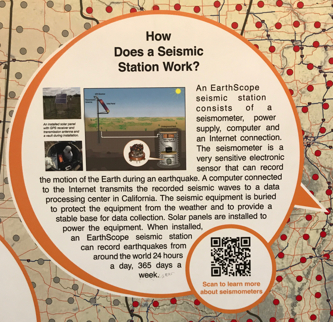
I wonder if they had a seismometer at the rest stop? Next time I’m in the area, I will spend a little more time looking around.
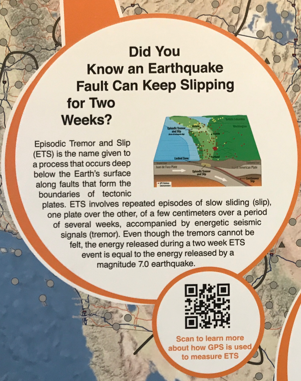
So, that’s where the aftershocks come from! Earthquake faults that keep slipping.

If you want more information, open up your camera app on your phone and focus on the QR code. It will give you the option to open a website. Friends tell me that most newer iPhones have the program built in. If you prefer to do it the “old-fashioned way” the URL for the Incorporated Research Institutions for Seismology is ds.iris.edu.
This is quite the rest stop! I’ve never seen one with a microwave and coffee maker, along with the usual snack machines.
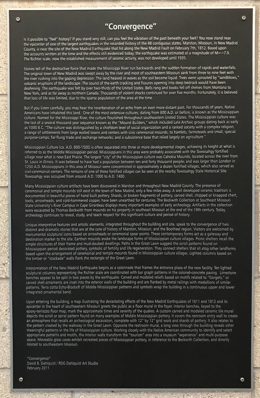
I don’t expect you to read this plaque. It gave great information about the earthquake and the thought that went into designing the rest stop.
I have to share one paragraph from it, though.
“Stories tell of the destructive force that made the Mississippi River run backwards and he sudden formation of rapids and waterfalls. The original town of New Madrid was swept away by the river and most of southeastern Missouri sank from three to nine feet with the river rushing into the gaping depression. The land heaved in waves as the soil became liquid. Tree were uprooted by “sand blows,”volcanic eruptions of the landscape. The sound of the earth cracking and fissures opening into deep bedrock would have been deafening. The earthquake was felt by over two-thirds of the United States. Bells rang and books fell off shelves fro Montana to New York, and as far away as northern Canada. Those of violent shocks continued for over five months. Fortunately, it is believed that loss of life was limited, due to the sparse population of the area at the time.”
Isn’t that incredible?
I will definitely have to make another visit to the area. I want to examine the rest area more closely. It sounds like there are more design details I would find interesting.
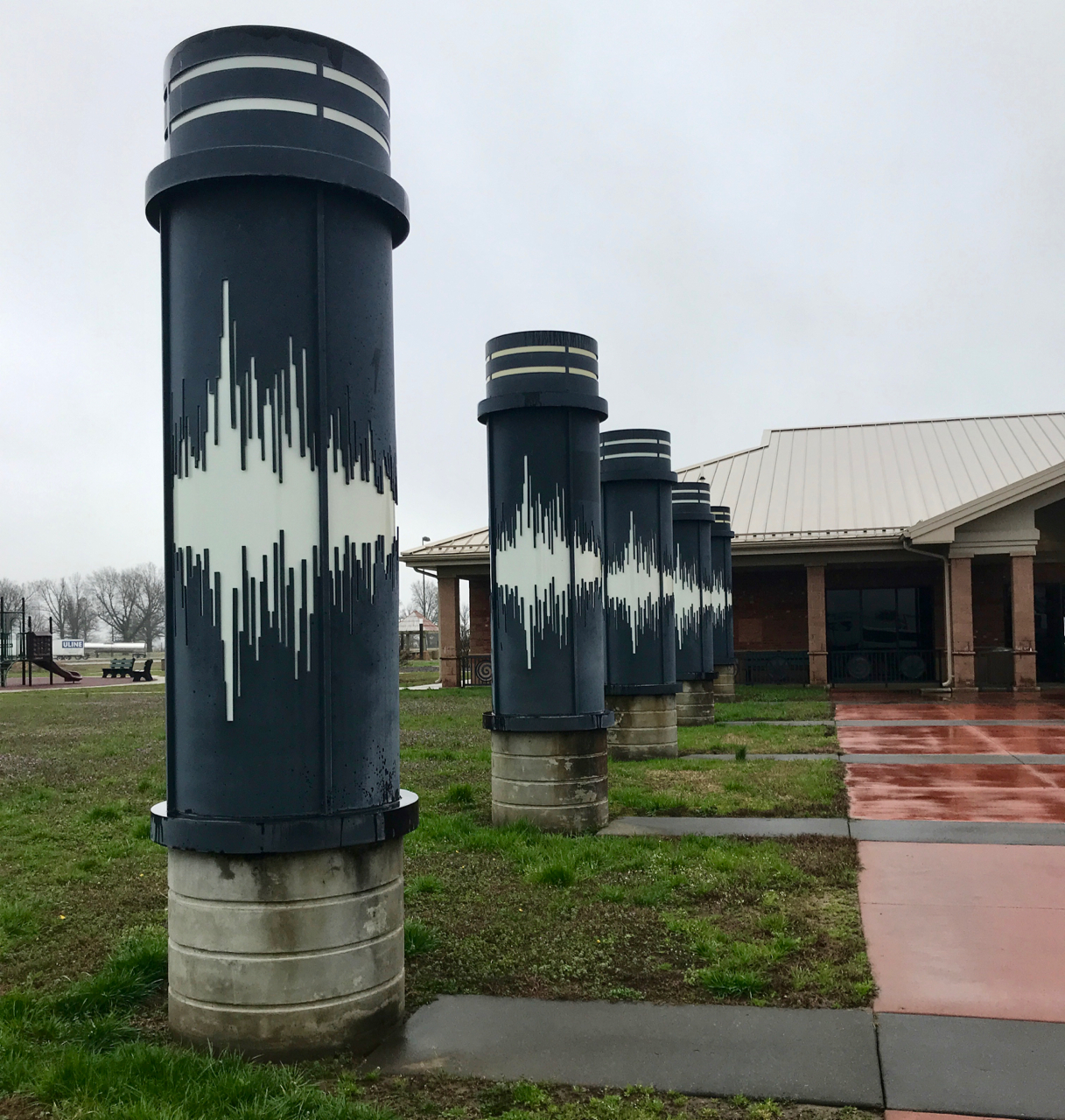
I couldn’t resist a last look back at the rest stop. According to information on the plaque, those pillars light up at night.
I kept driving. Due to getting on the road so early, I would have reached the Jackson Cracker Barrel at 3:00, which was just too early for me to sit in a parking lot. Besides, the weather had improved quite a bit during the day. When I stopped for gas, I spent a few minutes to see if there was a campground in the area that might work.
I called Lake Lincoln State Park in Wesson, Missouri, and they had a spot. They even had a waterside site with FULL HOOK UPS!
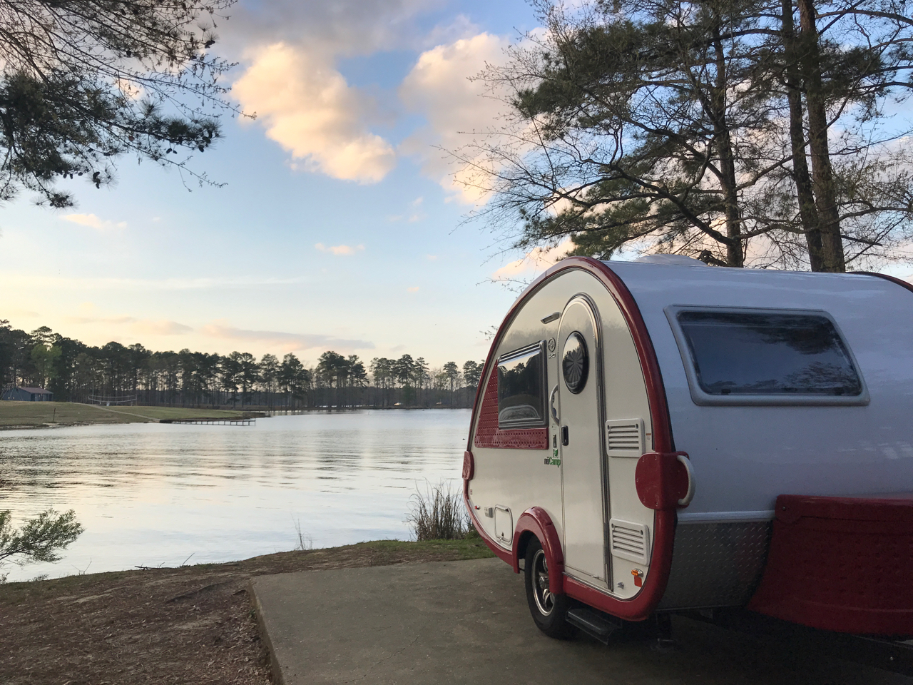
There was some heavy traffic en route, but I finally got there and got set up.
And…it was warm!