After the scenic fill-up, it was time to head toward Montana.
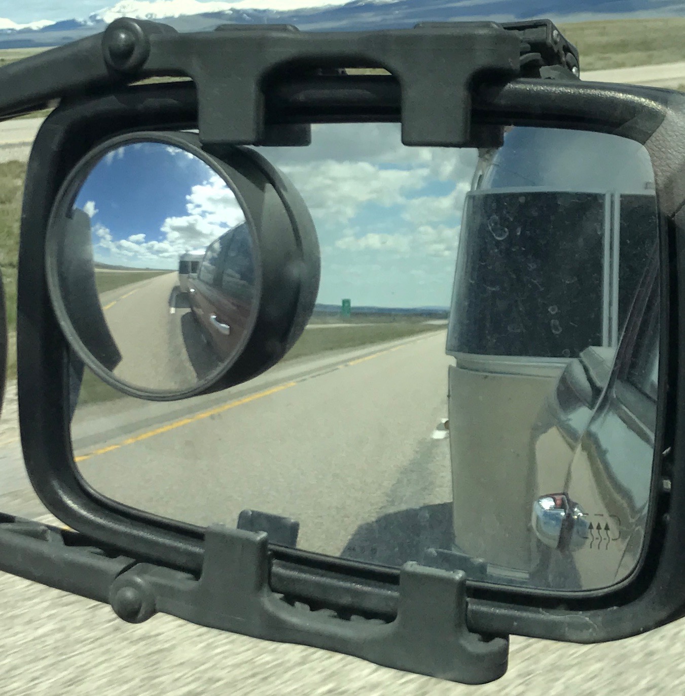
I figure it’s about time for that iconic “Airstream in the rearview mirror” shot.

What a glorious day to drive! It was about a four hour drive to Dillon, Montana. I took a break at a rest stop. Of course I had to read the sign.
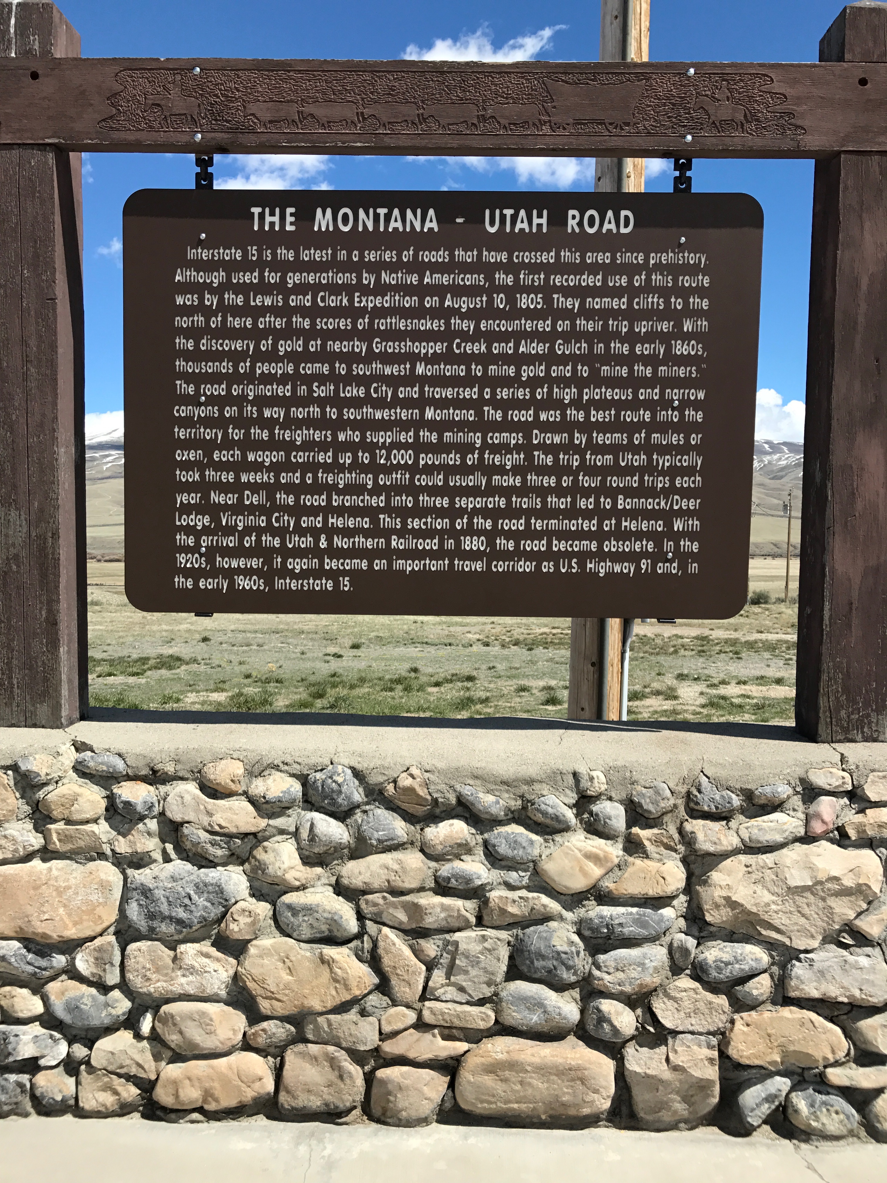
I was rolling down I-15, which was the latest in the series of routes that have crossed the area since prehistory. According to the sign, the Lewis and Clark Expedition made the first recorded use of this route on August 10, 1805.
Gold was discovered nearby in the early 1860s and thousands of people came to southwest Montana to mine gold and to make money off the miners – “mining the miners” as the signs puts it.
The road originated in Salt Lake City and was the best route into the territory for the freighters who supplied the mining camps. Now, freighters were not boats or trucks, but wagons drawn by teams of mules or oxen. Each wagon carried up to 12,000 pounds of freight, and the trip from Utah usually took three weeks. A freighting outfit could usually make three or four round trips each year.
This section of the road, which terminates in Helena, became obsolete with the arrival of the Utah & Northern Railroad in 1880. It became an important travel corridor again in the 1920s, as U.S. Highway 91 and, in the early 1960s, I-15.
Change is the only constant, I guess.
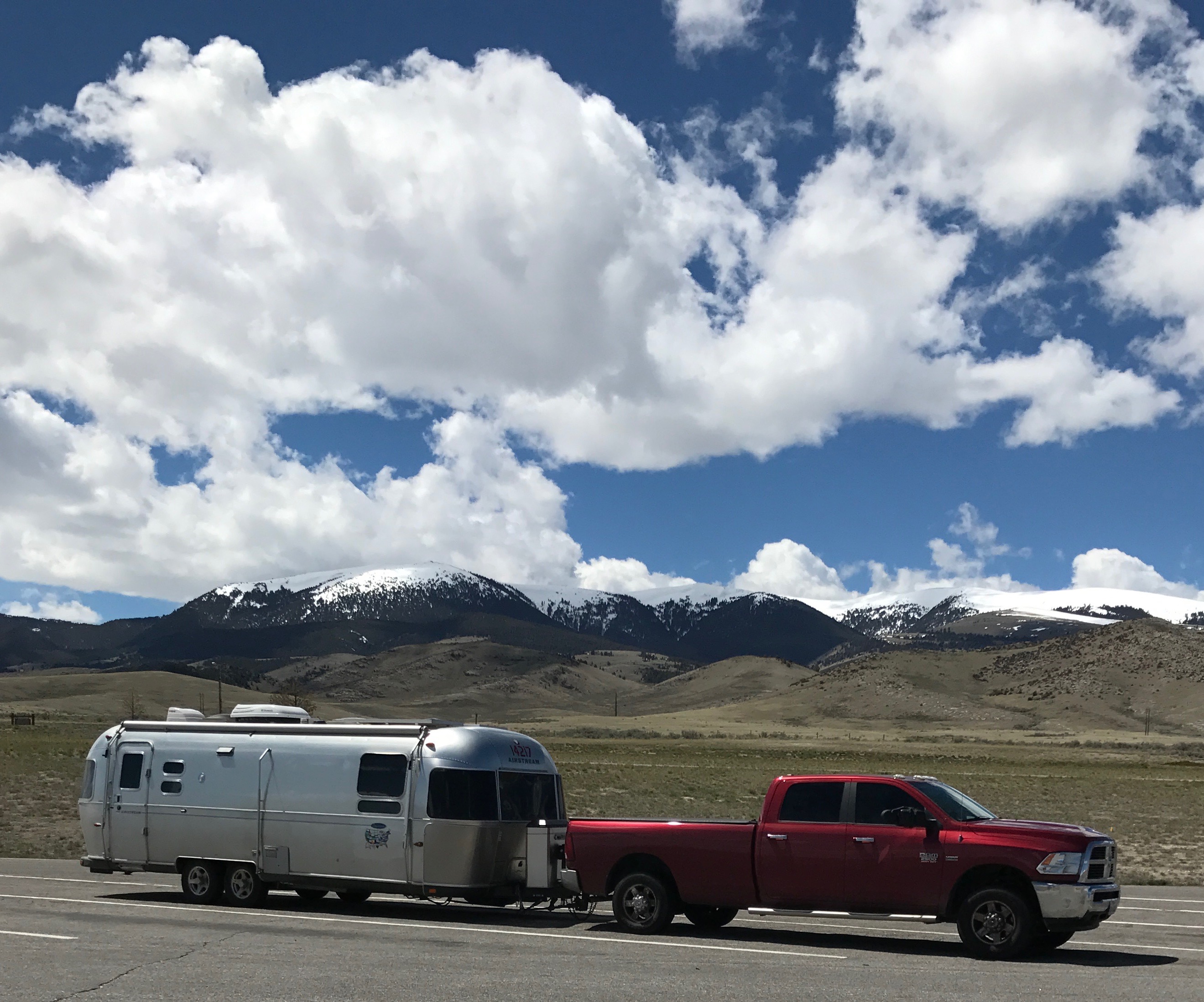
Since I was parked and the sun was shining, it was time for a glamor shot. For some reason, I didn’t take too many of them. Some Airstreamers have great shots of their rigs in the most scenic locations.

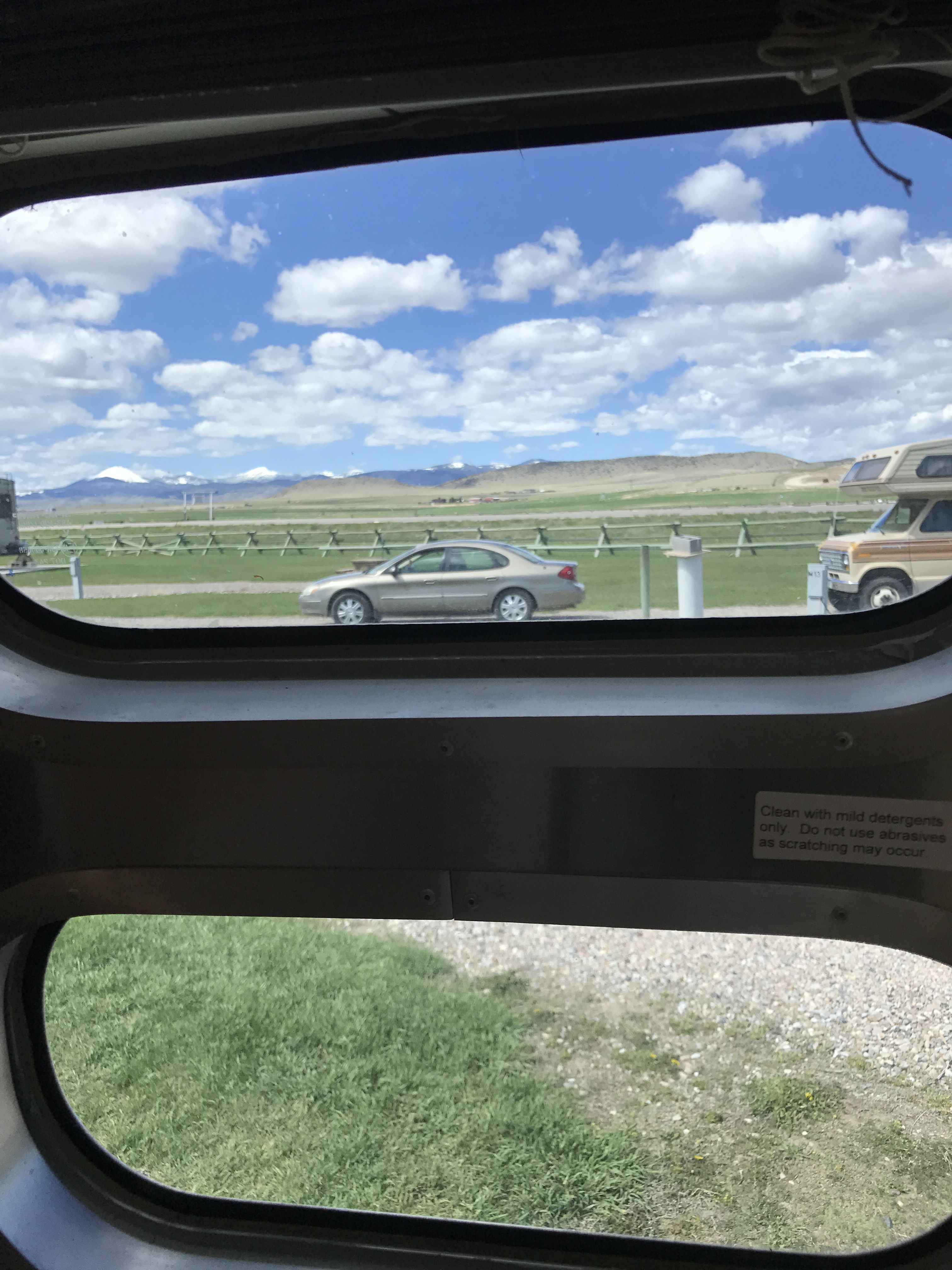
I pulled into the Countryside RV Park, just outside Dillon. As you can tell, it was early in the season. This park had a unique feature – they had a DVD library. And these DVDs were of fairly recent movies. I did check one out, but I don’t remember what is was or if I watched it.
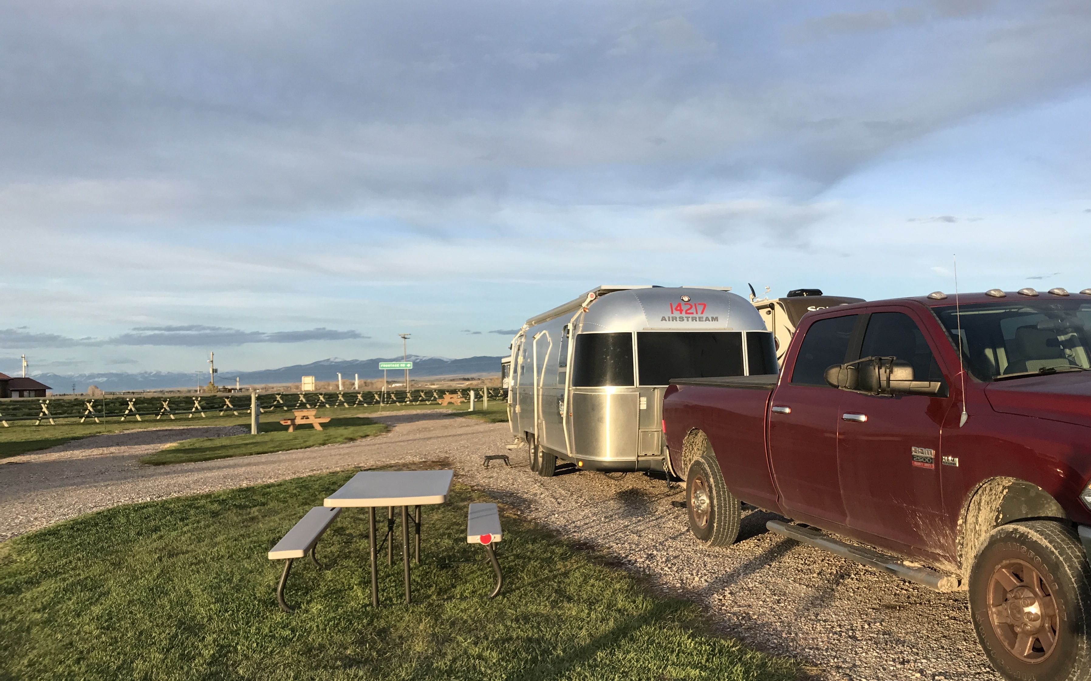
The site was level and it was a pull-though site! I unhitched and got ready to go see what I could see.
HISTORY Here told me that there was a significant landmark I just head to see. This is Beaverhead Rock.

In August 1805, Sacagawea lead the Lewis and Clark expedition to this place, which she identified as the place where her tribe, the Shoshones, had been residing several years prior.
Can you imagine what an important landmark this must have been when the tribes would traverse the land?
The day after they arrived, Sacagawea’s brother, Chief Cameahwait, who lead lead a group of Shoshone warriors, met up with Sacagawea and Lewis and Clark. He told them of a river that ran near the village. According to tales from other tribes, it ran a long distance to the West and ended in a large body of water. This was the first indication of a route that could lead to the Pacific Ocean. Sacagawea’s brother, Chief Cameahwait, traded with the expedition and supplied them with the horses necessary to continue.
HISTORY HERE has lead me to some interesting places that I wouldn’t have found otherwise. Sometimes the information about these places is a bit inaccurate. This land formation was identified as Beaverhead Rock National Park and it gave an address. I put the address in Google maps and headed that way.
Now, Google maps identified the location as a state park. When I got there, there were no signs identifying it as anything.

I drove in on the road around the base of the rock.
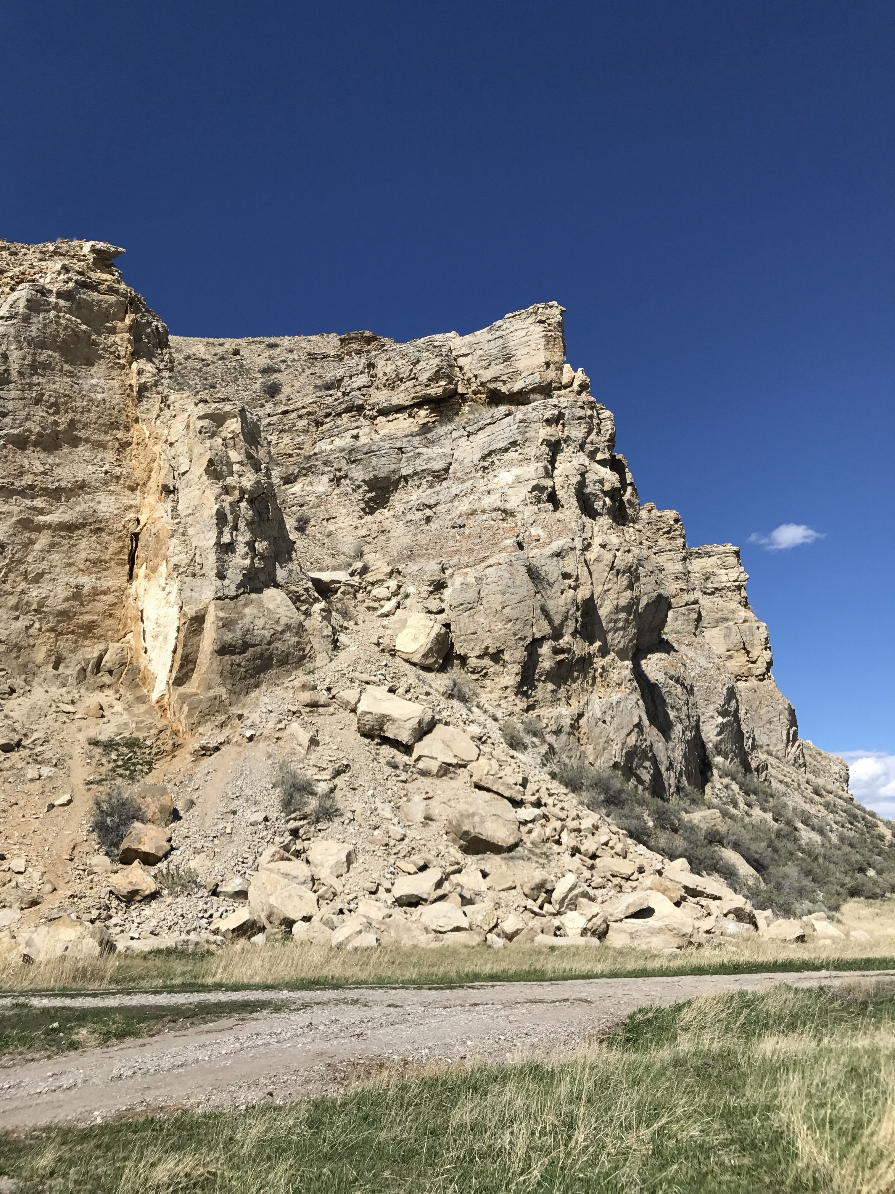
Can you believe how blue the sky is? After months of gloomy grey clouds, this was a most welcome sight! I drove over a small river, which was identified as Beaverhead River, but there was also a smaller creek near the base of the cliff.
According to some information I picked up, these lands have yielded some of the best North American discoveries of the fossils of small mammals that lived at least 37 to 38 million years ago. Some of the species that have been found here were new to science and still haven’t been found elsewhere.
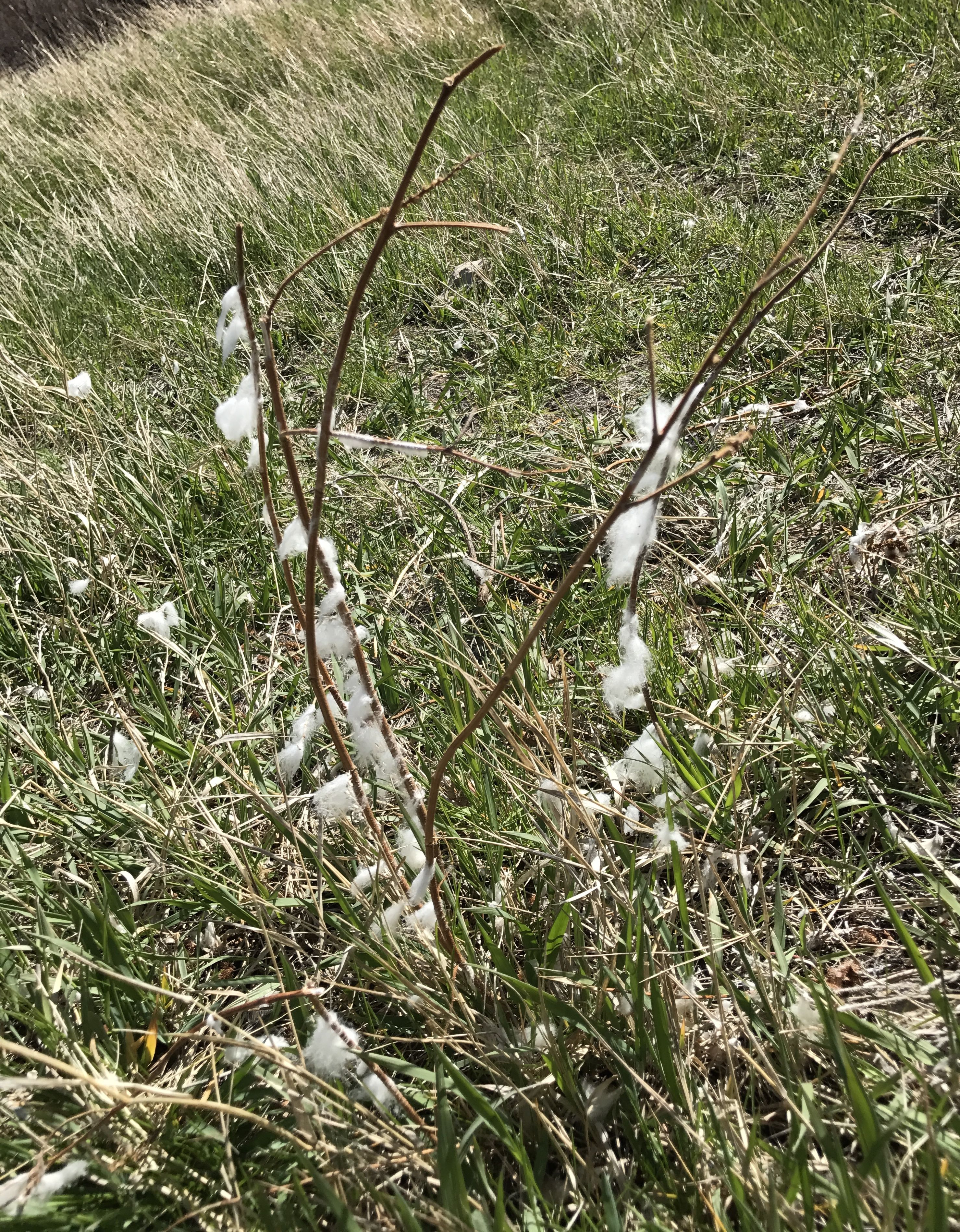
This land is used primarily for ranching. Judging by the wool on the grasses and shrubs, this area is used for sheep.
I could have driven in farther, but I could see that this wasn’t really a National Park or a State Park. I might have been trespassing, so I decided to head back to Dillon.

As I got to highway 41, I had a beautiful view of the snow-capped mountains. In the distance – I like that the snow is in the distance!

There was an overlook that honored the sandhill cranes that frequented the wetland.
I headed back to town to see what I could see.

It was a nice little town.
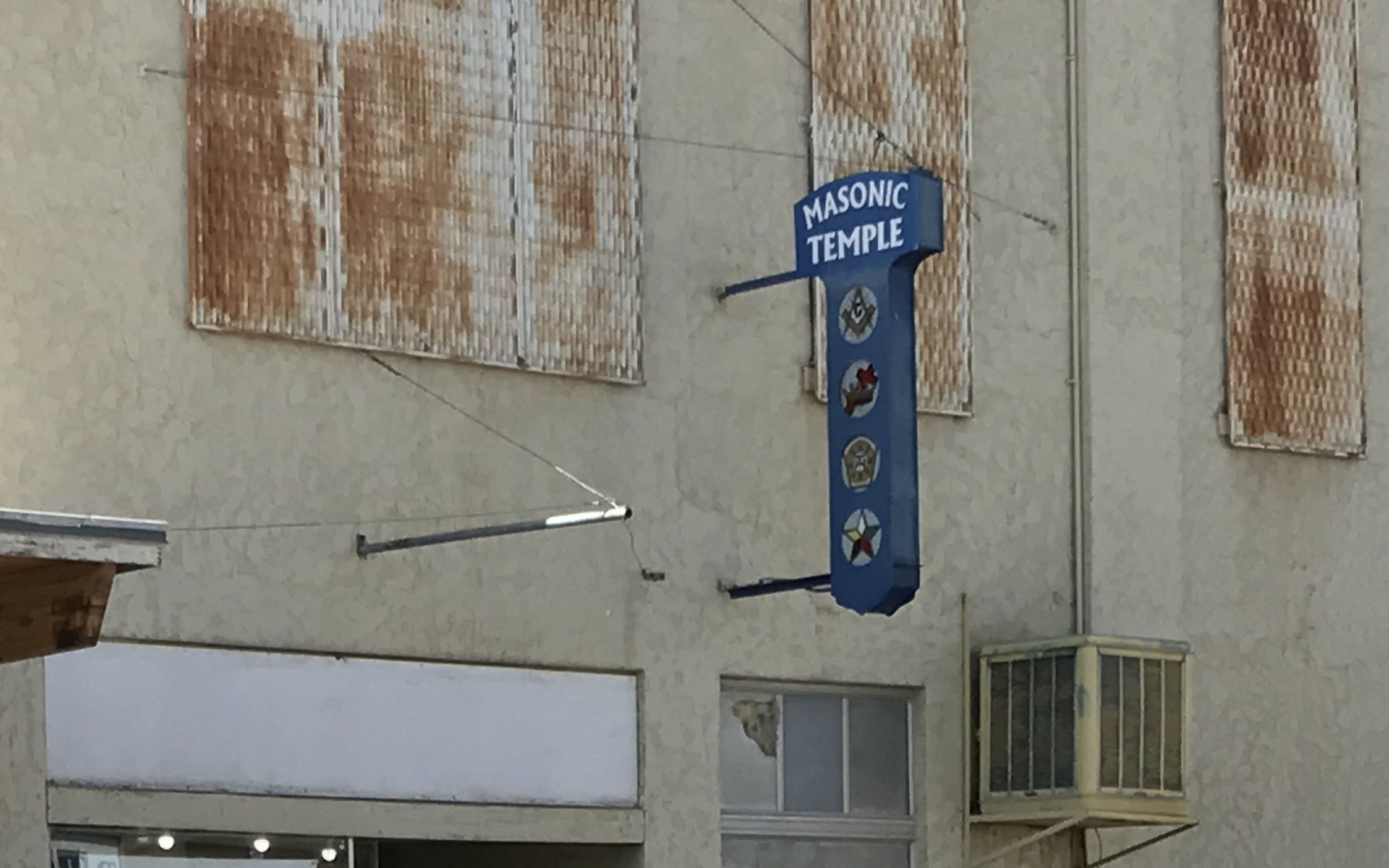
It had the requisite Masonic Temple. It also had a Patagonia Outlet store! It didn’t seem like the kind of place that would have that sort of merchandise. I mean, they were having a sale on the outlet prices – and the price tags still left me breathless.
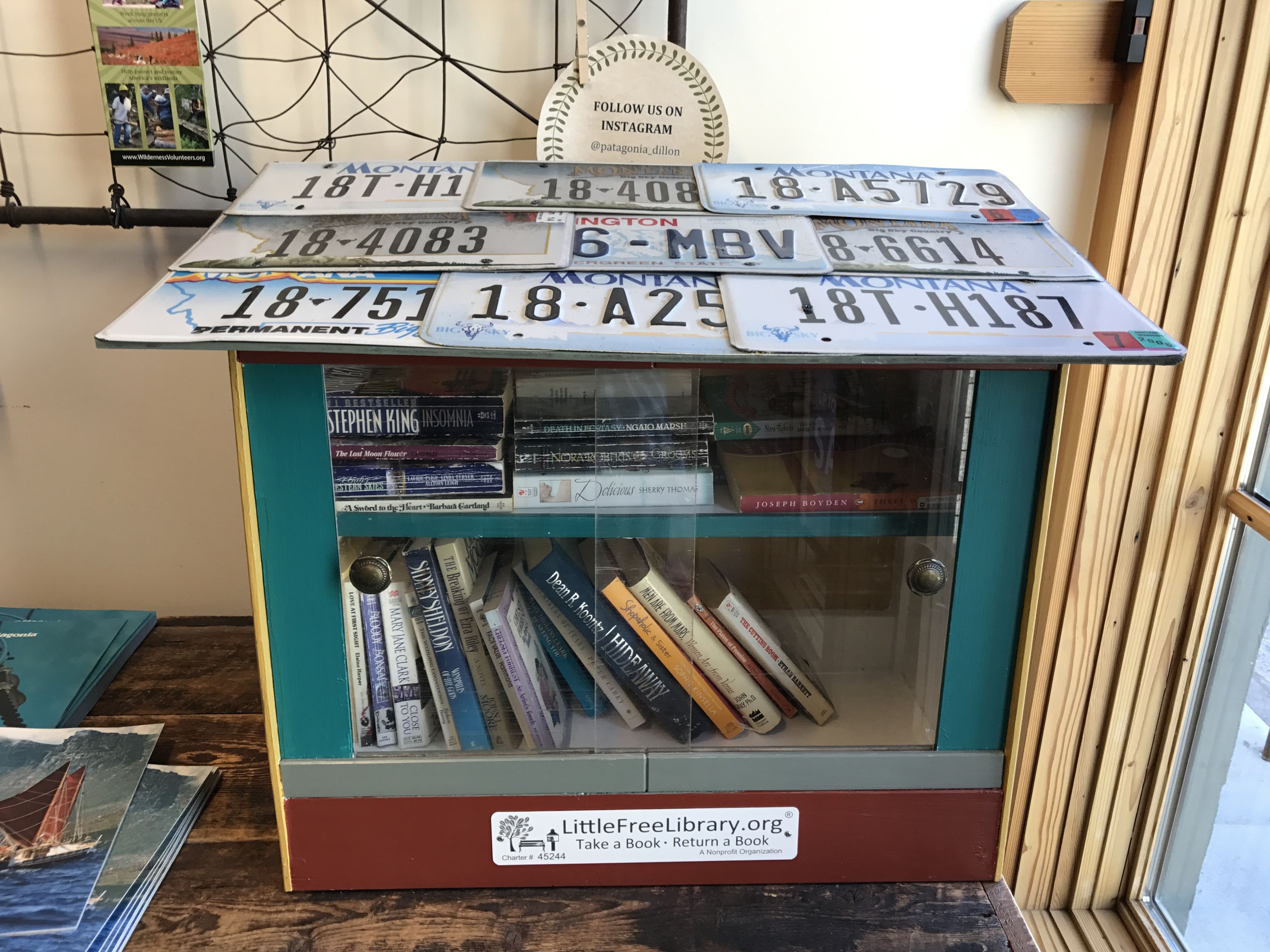
I loved the fact that they had a Little Free Library right in the store.
I headed back to the RV park. How wonderful to look out the windows and not see rain!
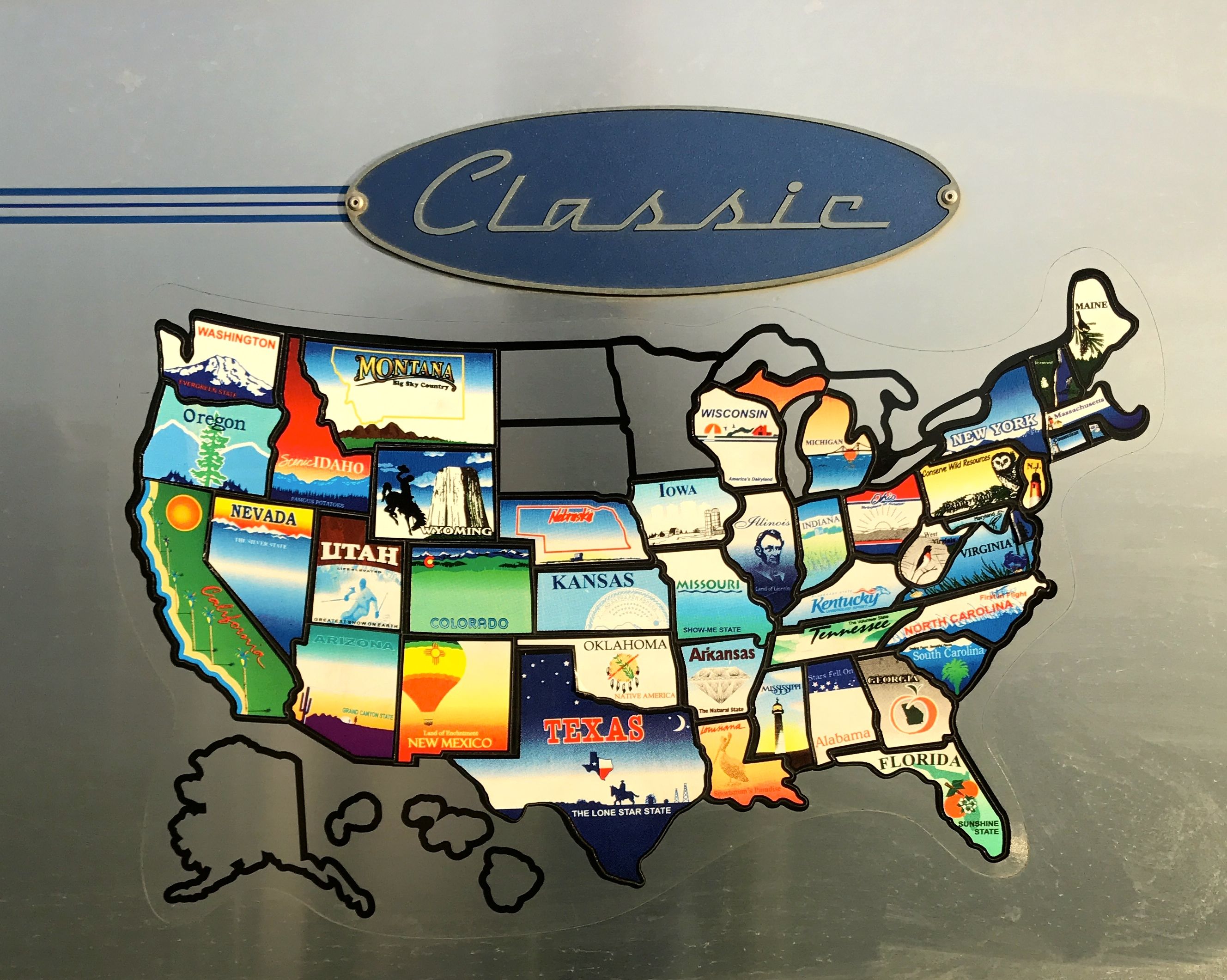
I stuck Montana on the map, had a little dinner and got ready to roll again in the morning.