After my day in Sedona, I decided that I wanted to see some of the remains of the earlier inhabitants of the region. My first stop of the day was Montezuma Castle National Monument, near Camp Verde, Arizona.
First stop, though, was the ranger station to buy my new pass for the National Parks. It costs $80 for the year and I really got my money’s worth last year. I can hardly wait until I’m 62 and then I can plunk down $10 for a pass for the rest of my life!
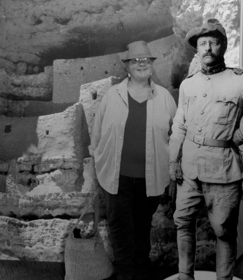
Waiting to greet me at the ranger station was Teddy!
President Roosevelt included Montezuma Castle as part of the first four National Monuments under the Antiquities Act in 1906. Due to looting of the site, very few original artifacts remained in the structure, but he still identified it as a place “of the greatest ethnological value and scientific interest.”
According to the brochure, Roosevelt’s decision assured the continued protection of one of the best preserved prehistoric cliff dwellings in North America.
It was just a short stroll to the castle from the ranger station.
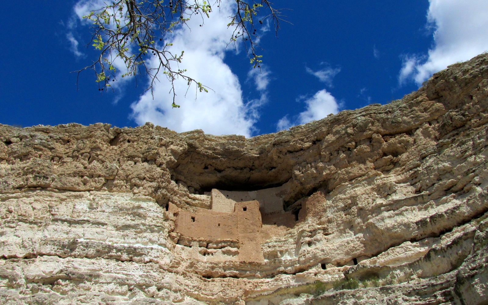
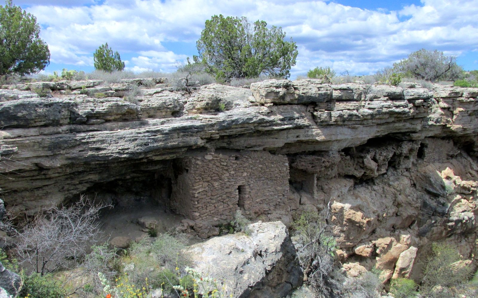
Well, it’s not really a castle, and it has nothing to do with Montezuma. Early anglos visiting the region knew the name, Montezuma, but it was a case of a little knowledge being a dangerous thing.
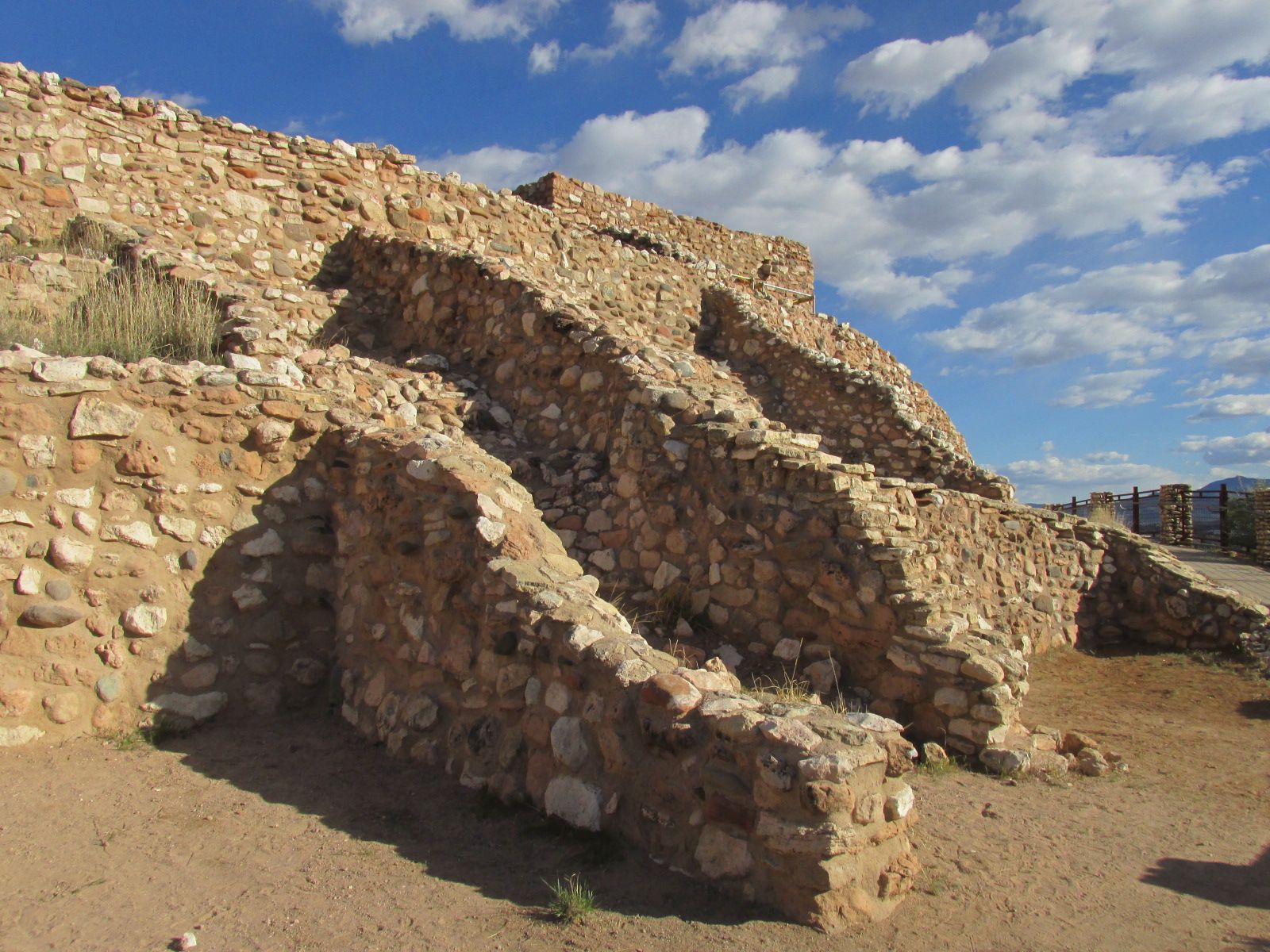
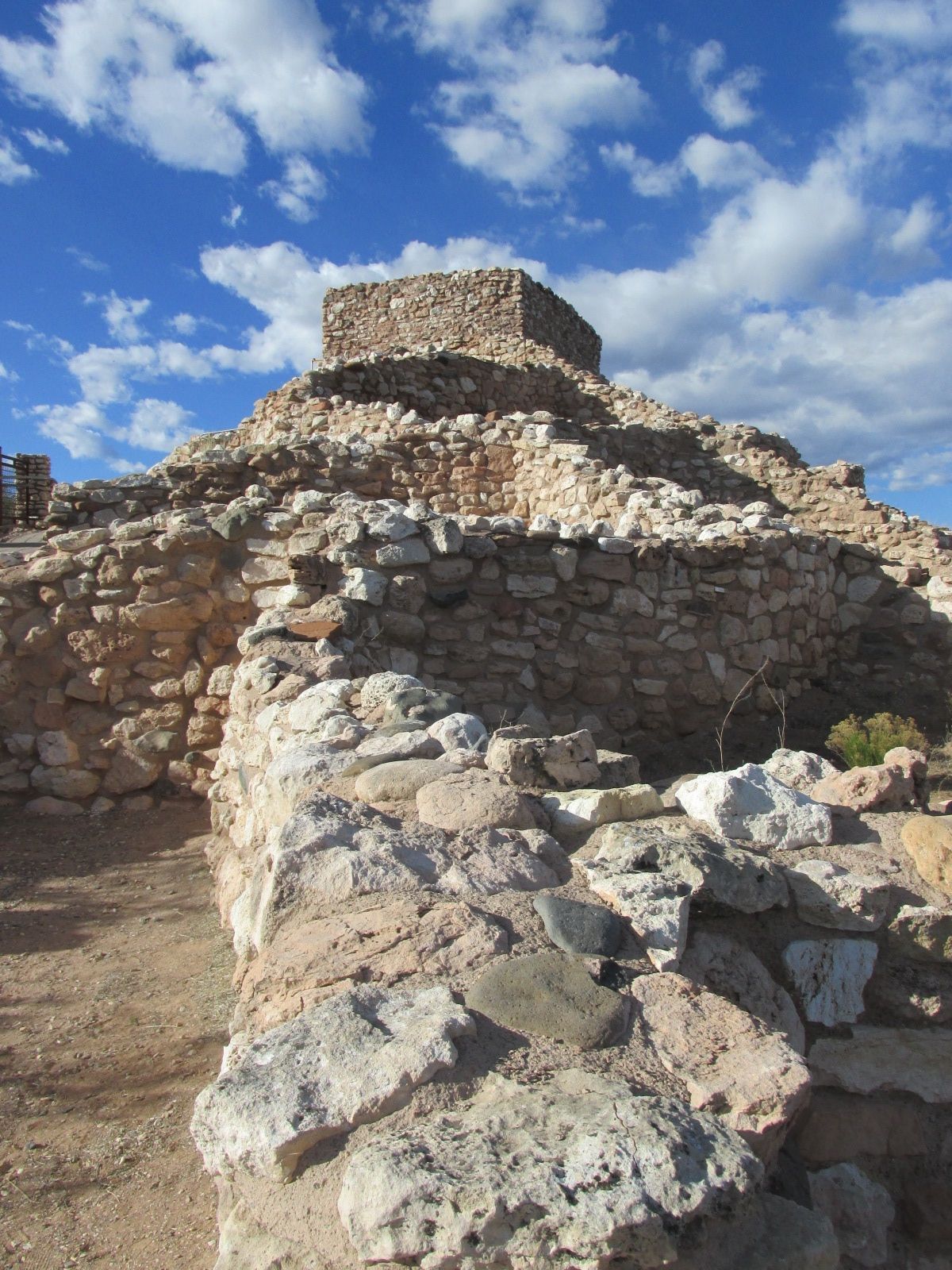
This is a 20-room high-rise apartment building that was constructed about 800 years ago by a group of people that have been named “Sinagua”. The ranger who gave the talk I attended said that these people moved on. They weren’t defeated in battle and there is no evidence of catastrophe. They just left. They didn’t leave a record of their name, but they did leave behind interesting information in their architecture and in other buildings.
The ranger who gave the talk told us that the “fresher” looking part of the dwelling is the result of resent restorations. The workers used the same materials from the creek bed that the original inhabitant would have used. The older parts have just been bleached by the sun for hundreds of years.
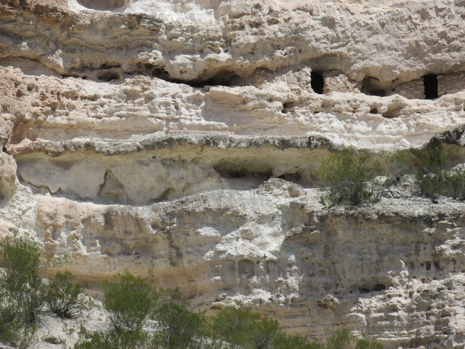
In addition to the 20 rooms in the the main structure, they also tucked rooms in other parts of the cliff.
In 1933, a 45-50 room, pueblo ruin was excavated. They uncovering a wealth of artifacts which added to the information and understanding of the Sinagua people.
This was a riparian community, along Beaver Creek. Life was good here for the residents of the “Castle” for about 400 years. So good that they had time to build elaborate dwellings. They also traded for goods from a long ways away.
Silly me! I always marveled at how sea shells from the Pacific could be trade goods in Arizona. I envisioned a guy loading up his pack at the beach and heading for Arizona. Nope. These were smaller trades – a few miles at a time. Those shells passed through many hands before they got places like these. I was glad the ranger helped me discover the error of my thought process.
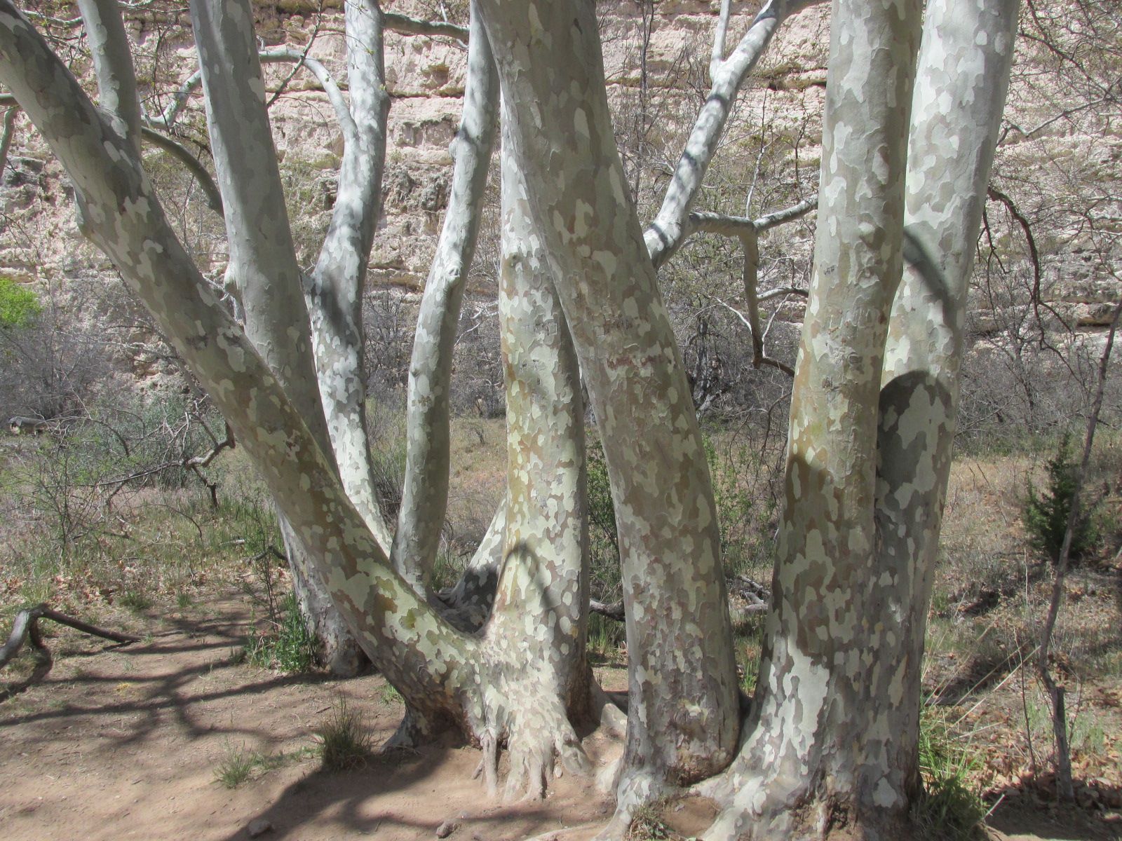
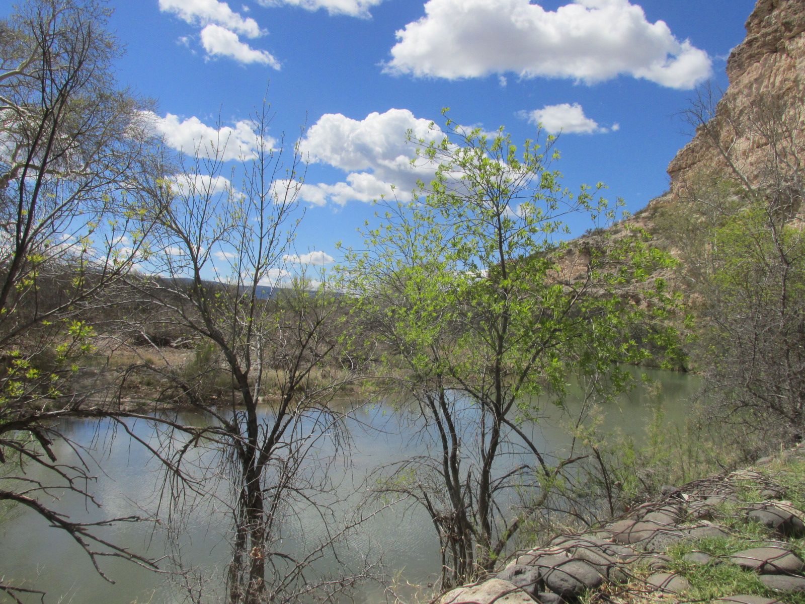
Sycamores, just like these that still line the banks, were used in the building.
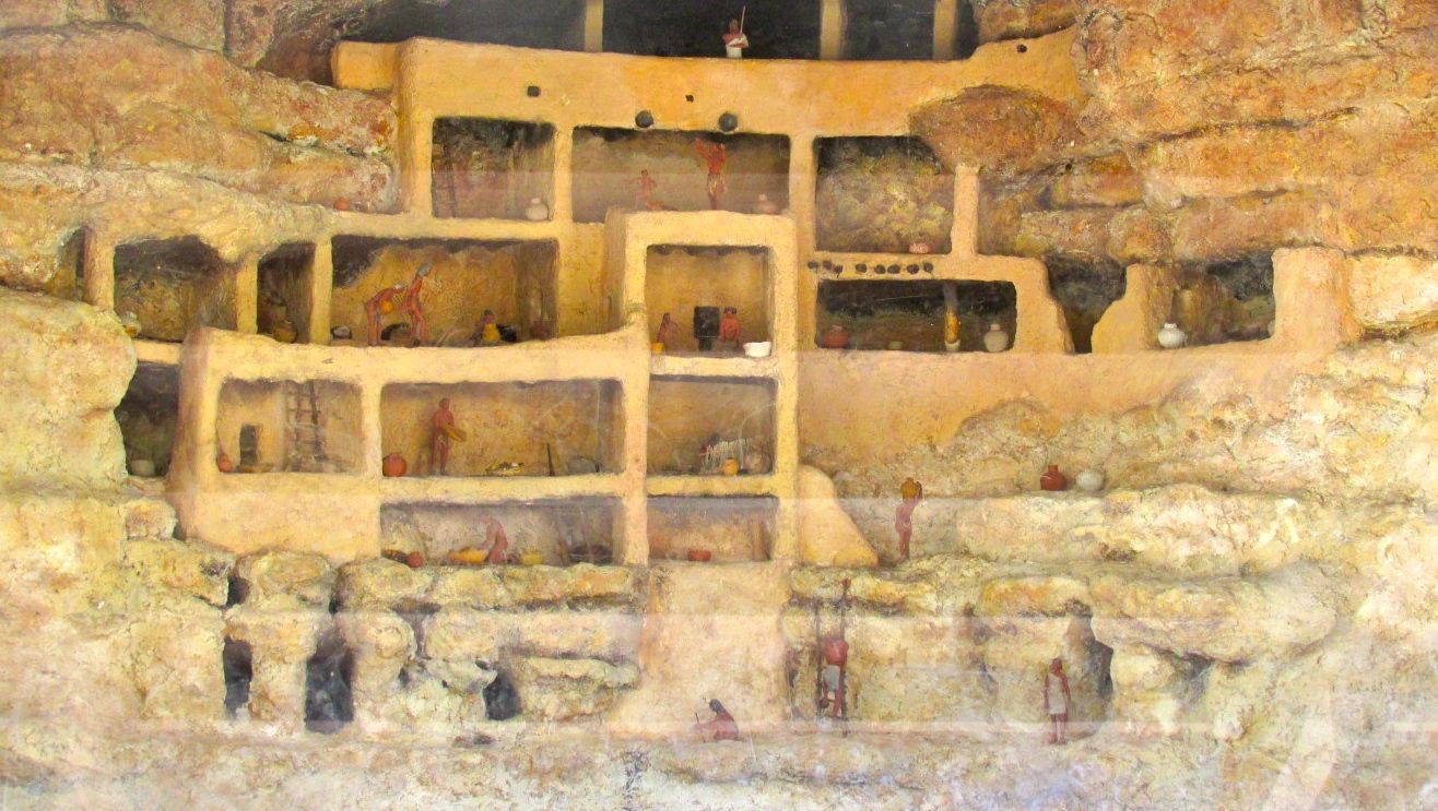
Originally, visitors to the National Monument were able to climb ladders and explore the rooms on their own. Right about the time when they discontinued the ladders, they came up with a diorama that allowed people to see what it would have been like for the people who lived there.
On my way out, this red cactus caught my eye.

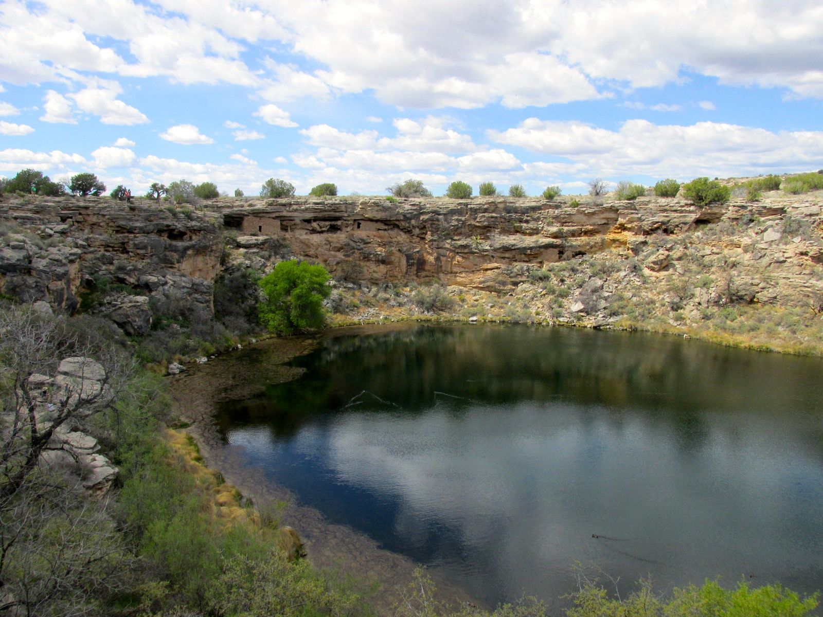
My next stop was Montezuma Well. This was a place I had never heard of before I got to the area. It was mind-blowing!
When I drove onto the site, the first sign I saw was for a pit house excavation. Beneath a roof, there were the remains of a pit house. You can see the poles that held up the roof.
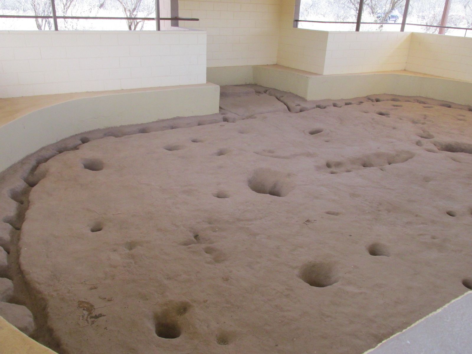
It is built in the traditional Hohokam style, and dates to about one thousand years ago.

This illustration was on the interpretive sign by the dig.
I got to the parking lot and got ready to see the well, which is in a limestone sinkhole. Now, you might think that the well would be on level ground. No. It was a little bit of a hike up a hill to get to the edge of the well.
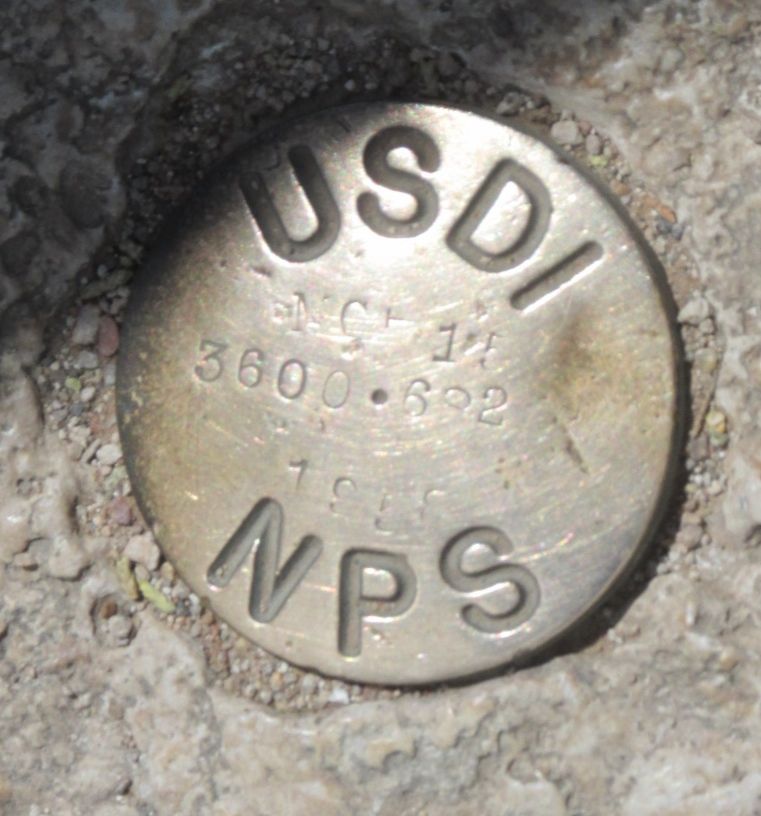
Along the way, I passed a surveying marker. I always think it is interesting to find these along the way.
Once up at the top, I found the well.

It is a source of water that has been used for irrigation since at least the 8th century. Even during times of drought, there is a dependable output of water. A steady 1,500,000 gallons of water enters the well from underground springs.
The water is highly carbonated and contains high levels of naturally occurring arsenic. Fish don’t live here, but it has at least five species of life that are found only in this well. One of the species is a leech.
When you don’t have any clue as to what you might find, you can be surprised and delighted.
Just under the lip of the sinkhole, there are cliff dwellings! I’ll bet that these were very desirable places to live. Warmer in the winter and cooler in the summer – and you only had to build part of the house. The top and back was already taken care of – and sometimes even the sides.
There was a sign pointing to another house. The only drawback was that the sign pointed down a set of stairs on the inside of the sinkhole. I decided to start down. I could always turn around, right?
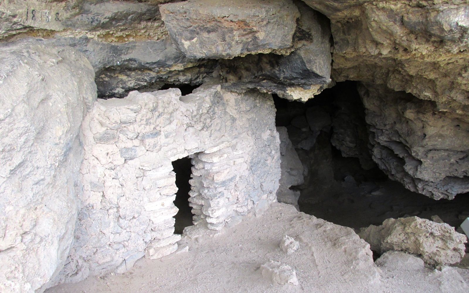
I made it all the way down the stairs and came to some more rooms. According to what I’ve read, there are about 50 rooms around the property.
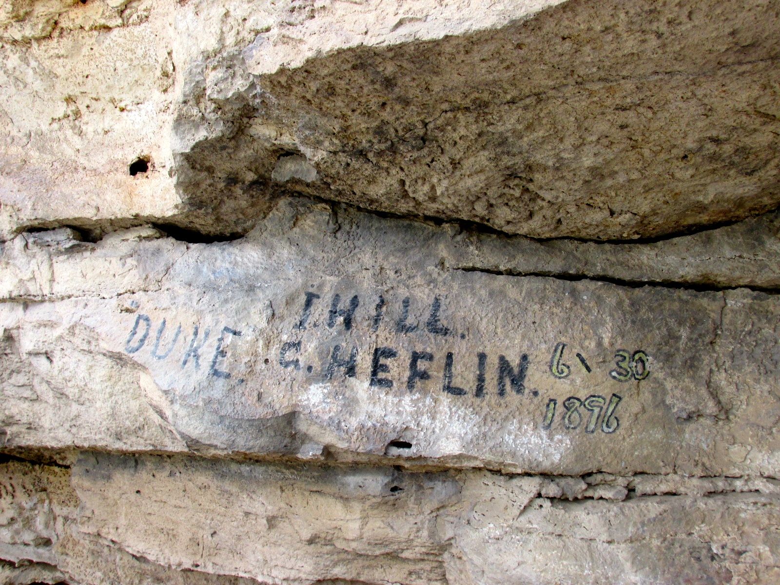
Of course, what would a ruin be without 19th century graffiti?
Actually, these ruins were mostly unknown to the rest of the country until Richard J. Hinton published Handbook to America in 1878. So, Duke Heflin, here, was pretty avant-garde in tagging this site.
I paused on my way back up to take a picture from across the well of the first cliff houses I saw.
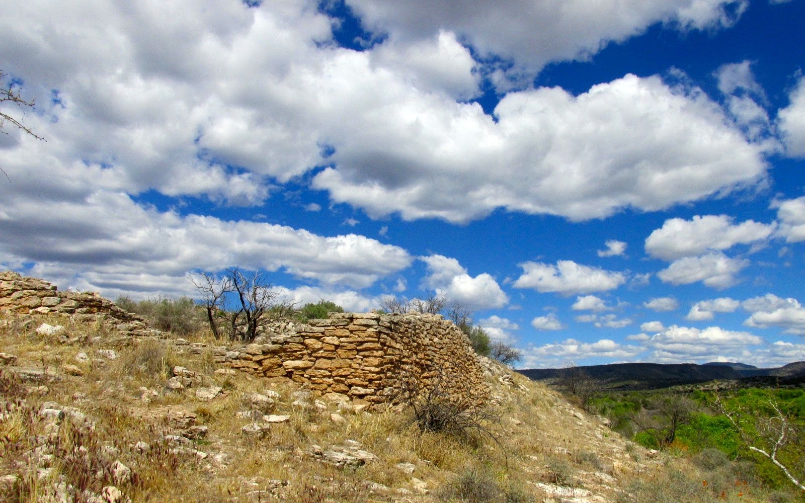
Back up at the top of the hill, there are remains of a large pueblo.
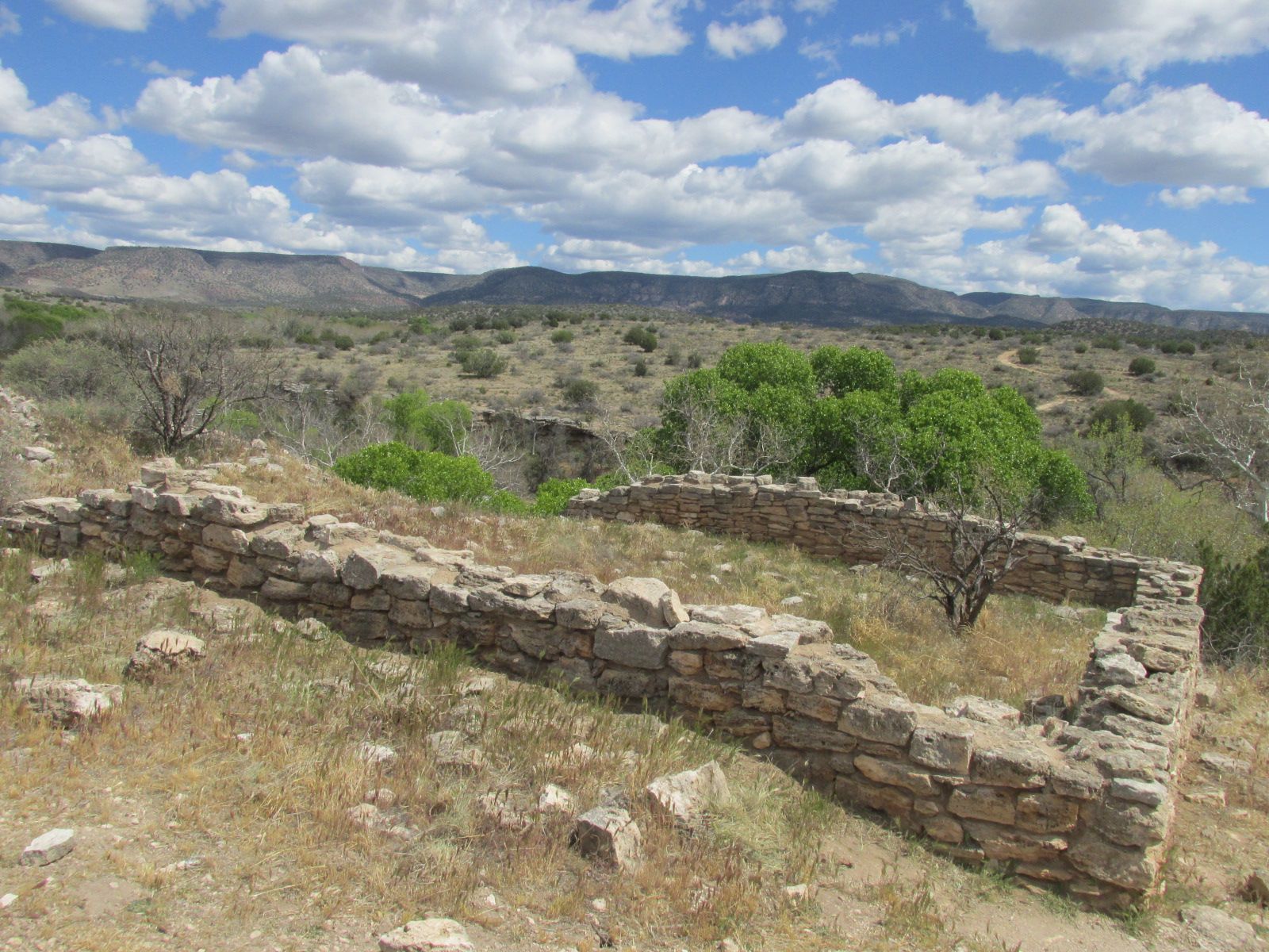
With its dependable supply of water, this must have been a great place to live.
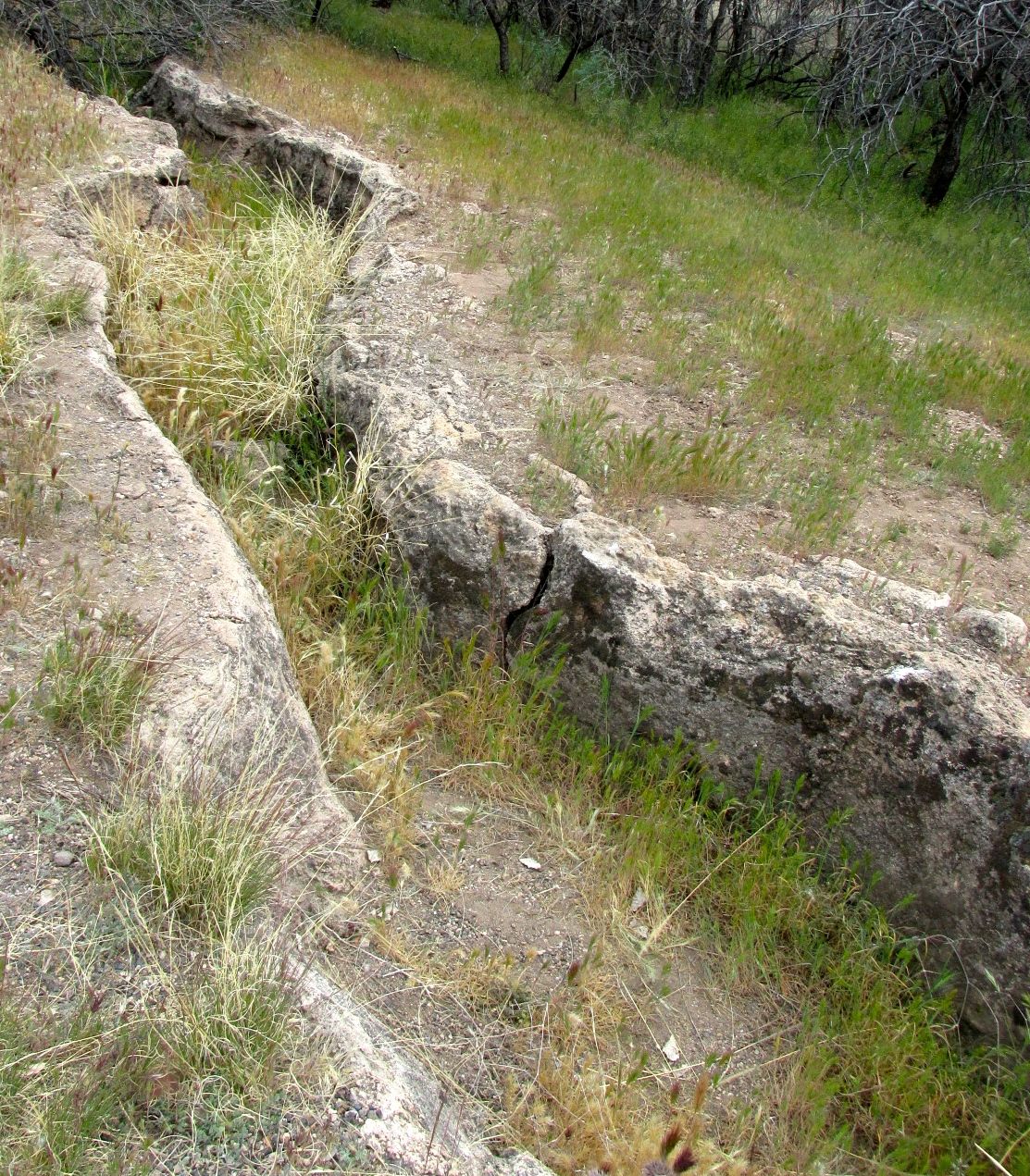
The water exited the well into Wet Beaver Creek. These people directed the water into irrigation channels. Some of these channels can be still be seen today.
My next stop was lunch. Touristic activities can take a toll on a person. I headed toward Cottonwood, Arizona. I had a hankering for some Mexican food, so I stopped in at Plaza Bonita.
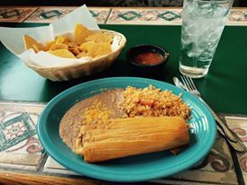
A delicious tamal, beans rice and tortilla chips – all for $8.61. That included the tip!
Thusly restored, I decided to head to Jerome. Konnie had mentioned that she thought it was an interesting place – or maybe she thought it might be interesting. Anyway, I found it on the map and I pointed Bart in that general direction.
I don’t think I knew anything about Jerome, but as I climbed higher and higher, I figured that it must be an old mining town.
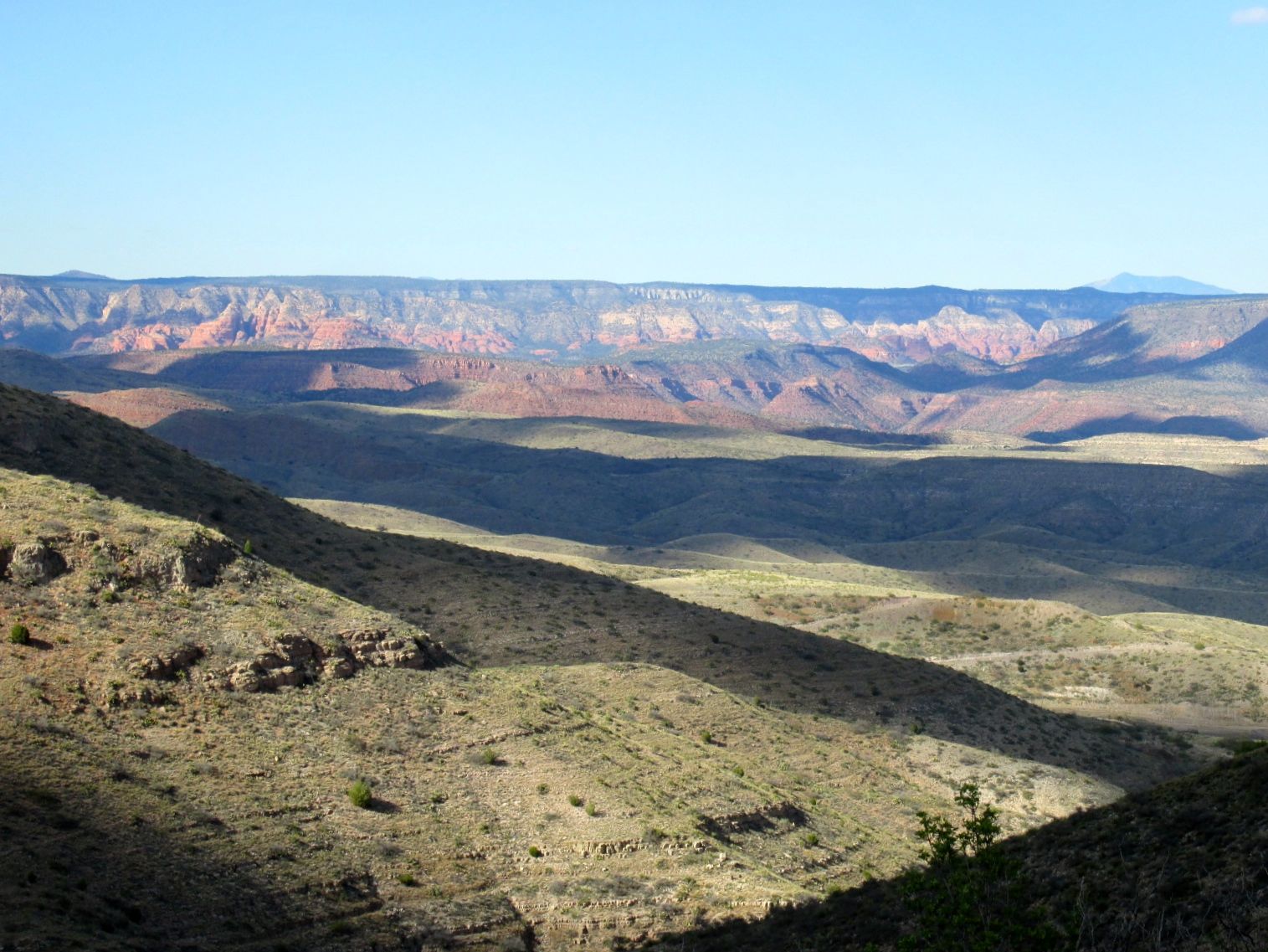
When I finally finished with the switchbacks up the mountain, I pulled over and took this photo. Cottonwood was about 3000 feet above sea level. Jerome is about 5000 feet. As the crow flies, the two places are only about four miles apart, so you can imagine how much climbing was involved.
Luckily, Bart did all the climbing. I just had to keep my eyes on the road and maintain forward momentum.
Once I got up there, I saw a museum surrounded by rusting mining equipment, so my guess that it was an old mining town was confirmed. Since they wanted me to pay to see the rusting equipment and whatever displays they had inside, I opted not to visit. I headed toward the center of town and hoped that there would be an easy loop to head back down the mountain.
I saw lots of artsy places – studios, workshops and artisanal restaurants – since I had already eaten and I wasn’t too thrilled to be so high up, I headed straight back down.
Once back near Cottonwood, I saw a sign for Tuzigoot, that last park in the area about the Sinagua people. I turned toward it and saw it looming on a hillside.
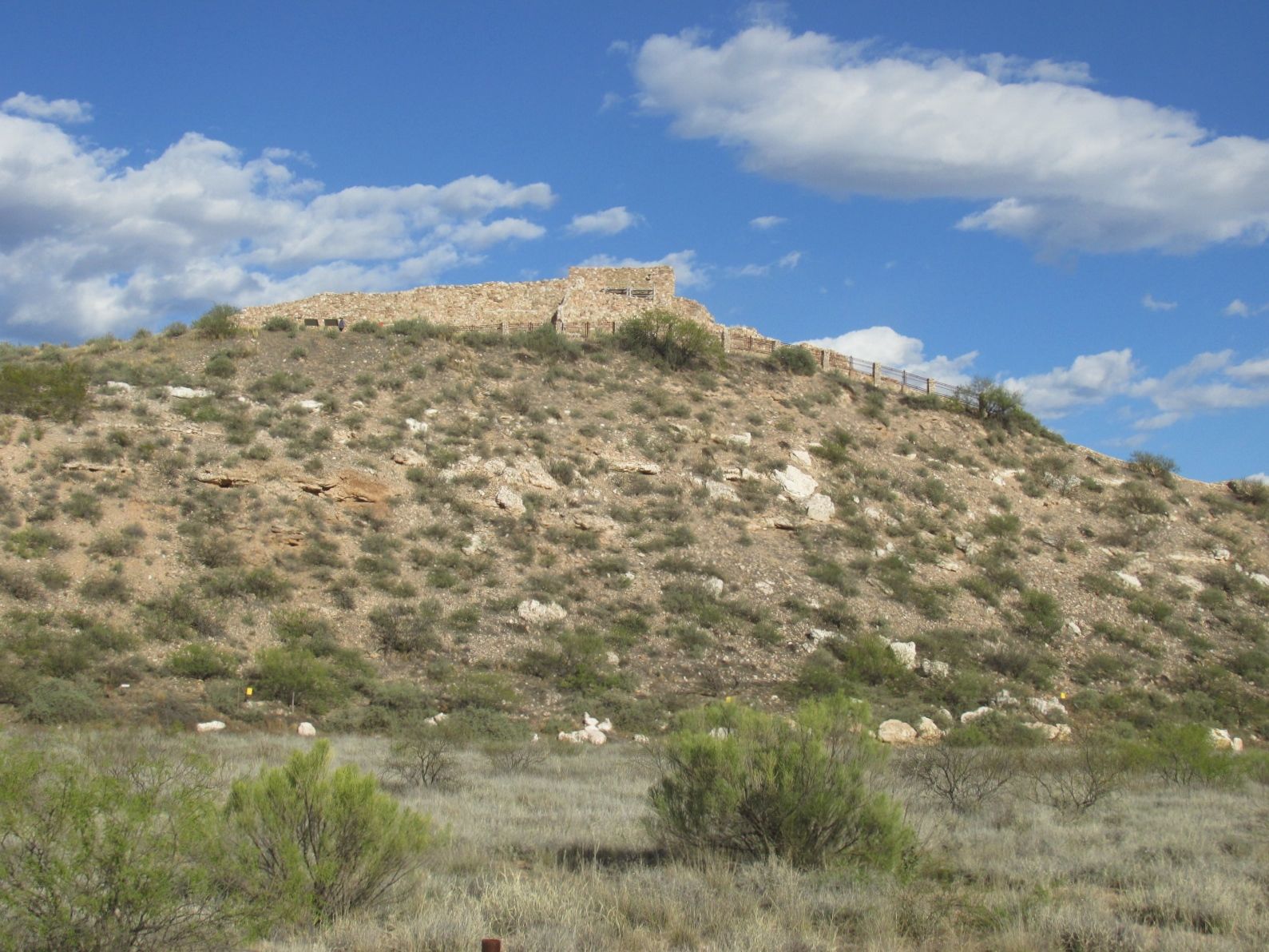
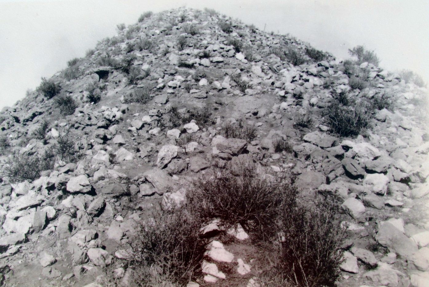
I got there with just fifteen minutes before closing, so I took a quick walk around the site. It turns out that it looked like this before the CCC started working on it in the 1930s.
Archeologists Louis R. Caywood and Edward H. Spicer directed the work here beginning in 1933. The original inhabitants didn’t leave a name for this place. The workers on the site named it Tuzigoot, from the Apache meaning “crooked water”. The pueblo is near a bend in the Verde River.
The site was inhabited between 1000 and 1400. According to the brochure I picked up, the village began as a small cluster of rooms. There were few exterior doors. The residents entered the buildings using ladders through roof openings. In the beginning, there were about 50 inhabitants. At its peak, around 400 people lived here.
Using the archeological tools available to them at the time, they used the stones at the site to replicate some of the 87 ground floor rooms.
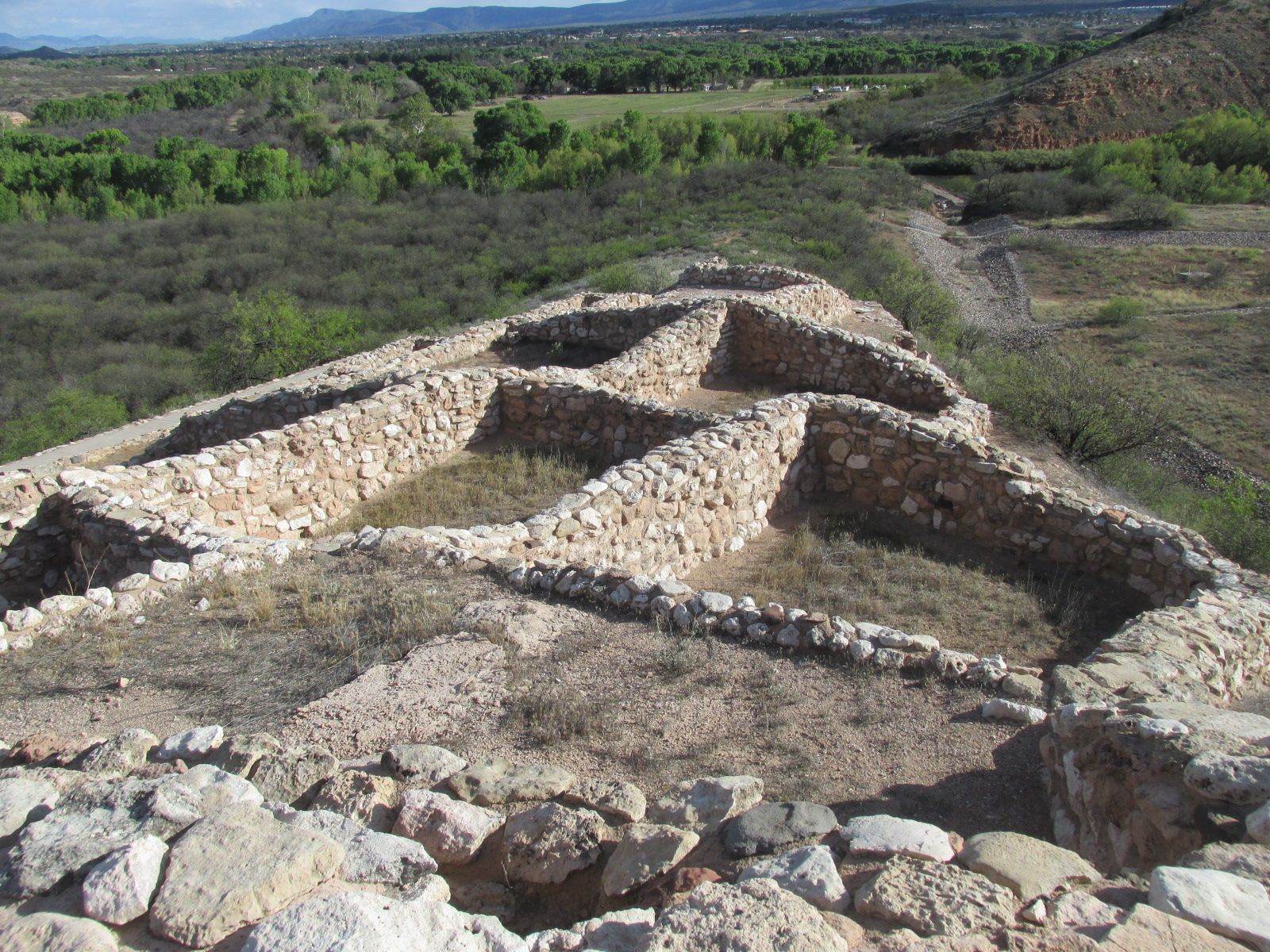
In some places, there were second stories.
Based on the black and white photo of the ruins that they had on the sign, I think it required a great deal of archeological insight and imagination to figure out how the site had been used.
I gave the site a quick tour and managed to get out before they locked the gate. I had a busy day and I was ready to head back to Flo the Airstream to put my feet up.
The next day, it’s time to hitch up and hit the road.