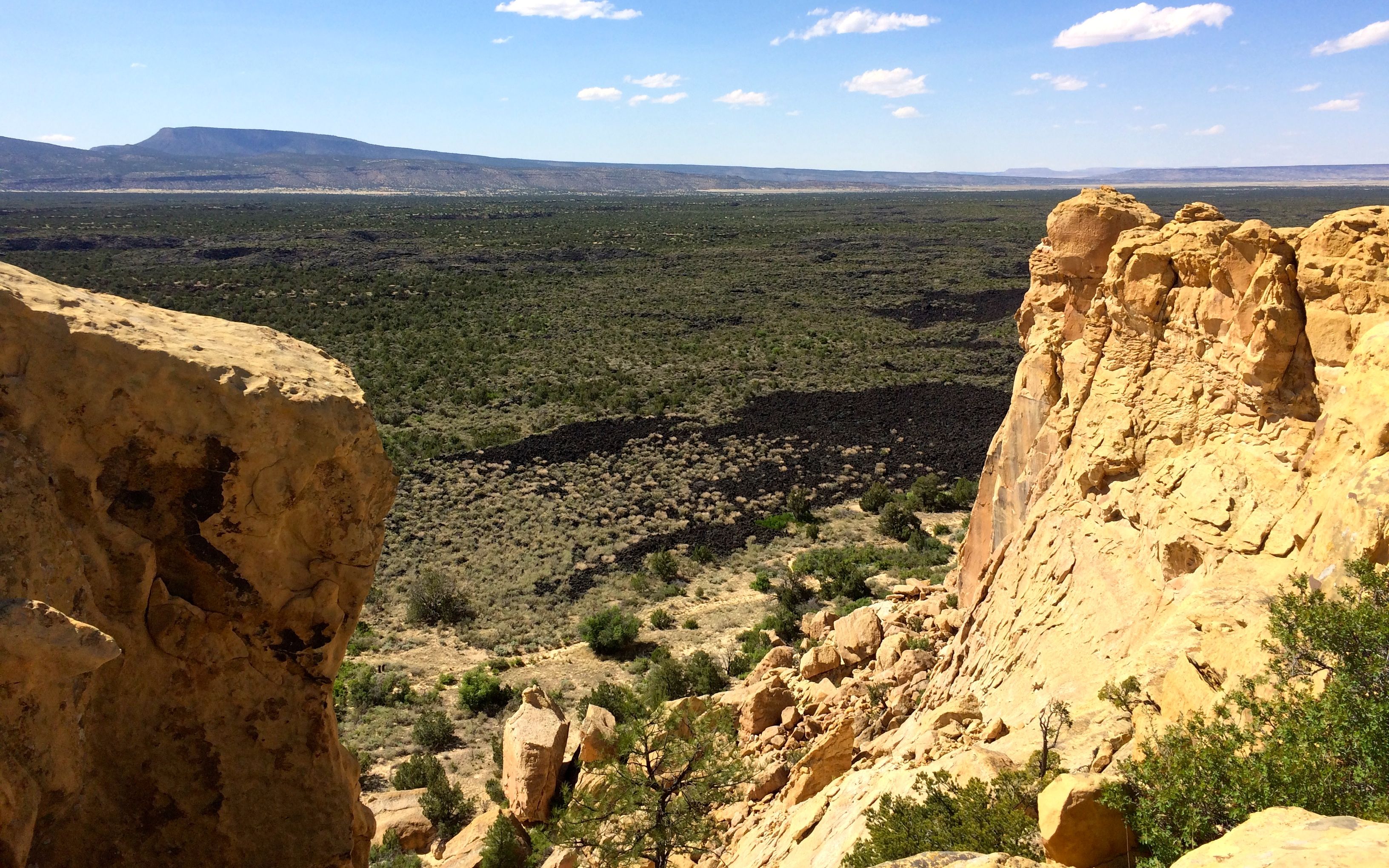
While I was in the Gallup, New Mexico area, I decided to check out El Malpais National Monument. I stopped in at the ranger station and told her that I was interested in seeing La Ventana Arch. She recommended that I take in the view from the Sandstone Bluffs Overlook.
There were lava flows around sandstone bluffs. Most of the lava I saw seemed to be of the a’a type – the blocky lava – although they did have a sample of the pahoehoe lava – the ropey lava – in the ranger station.
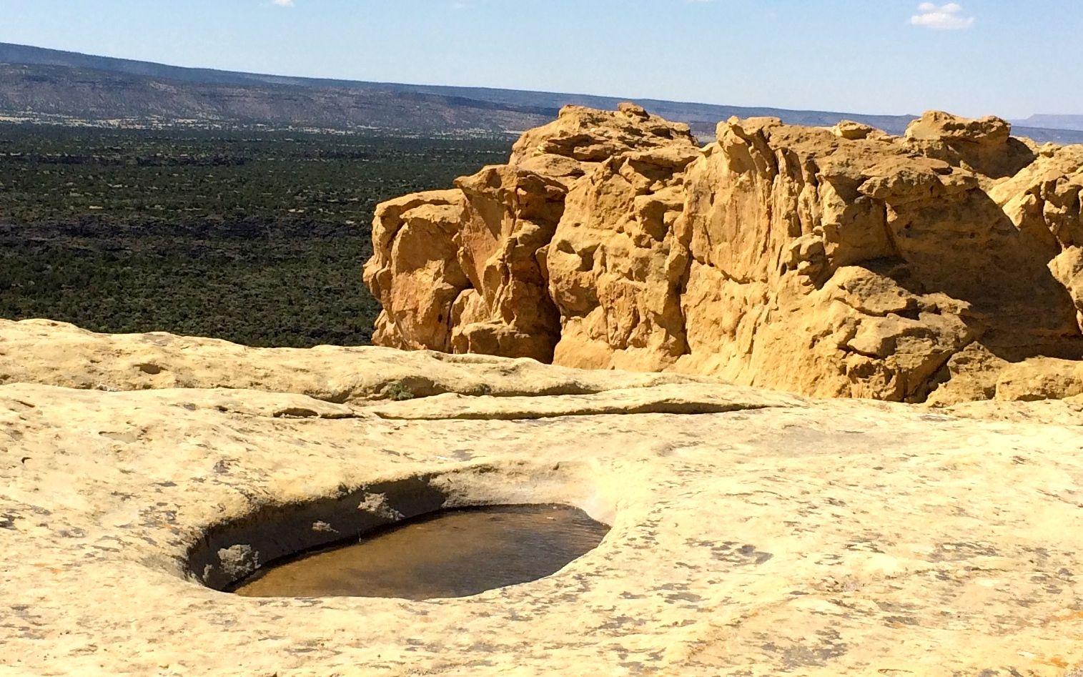
It was really windy on the bluff.
It was so windy that there were little waves in the water in the pothole. I tried to get a shot that captured the water moving, but if you look closely, you can see how the water lapped against the far side of the pothole.
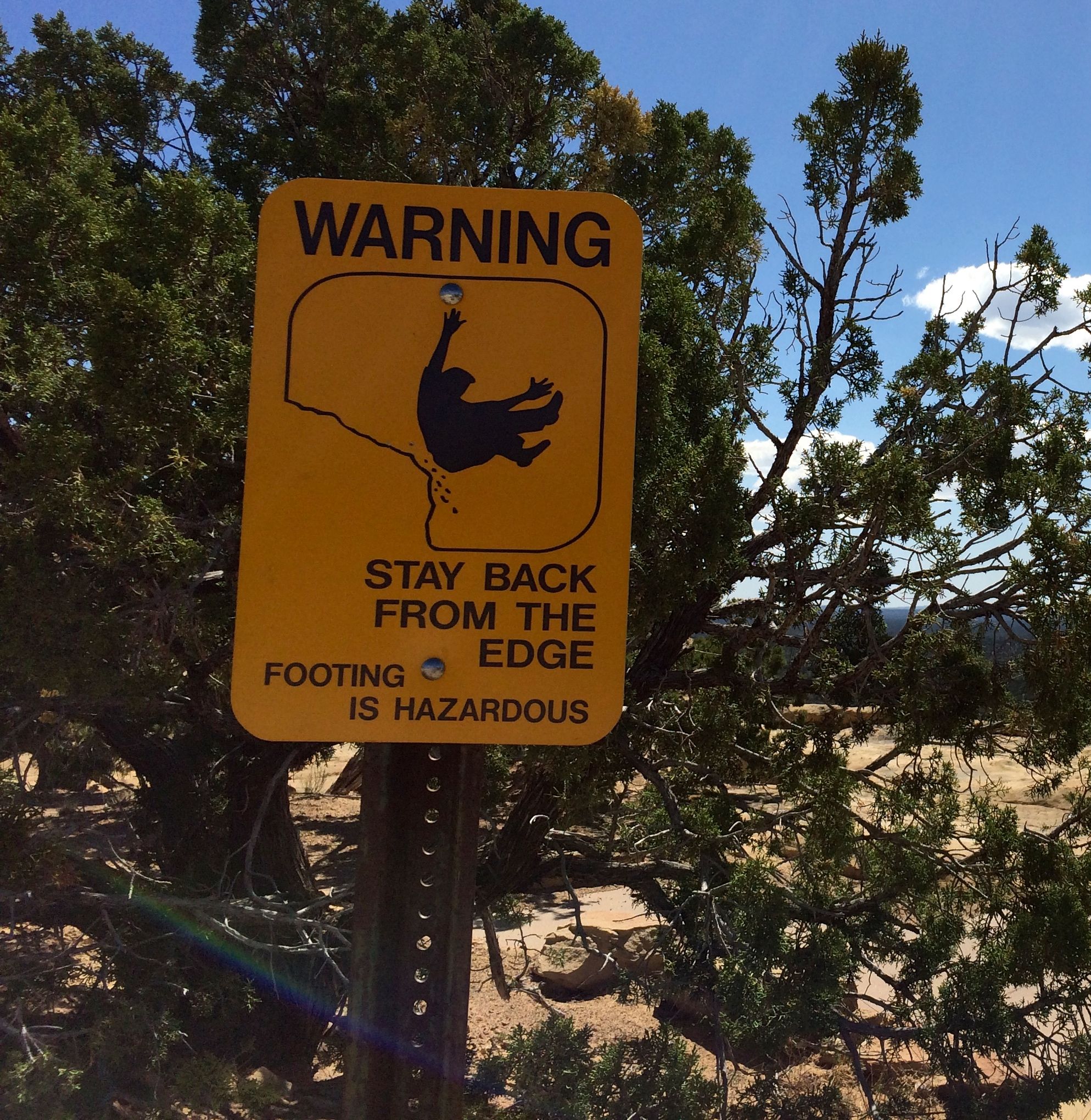
With my avoidance of heights, this sign was unnecessary – for me, at least.
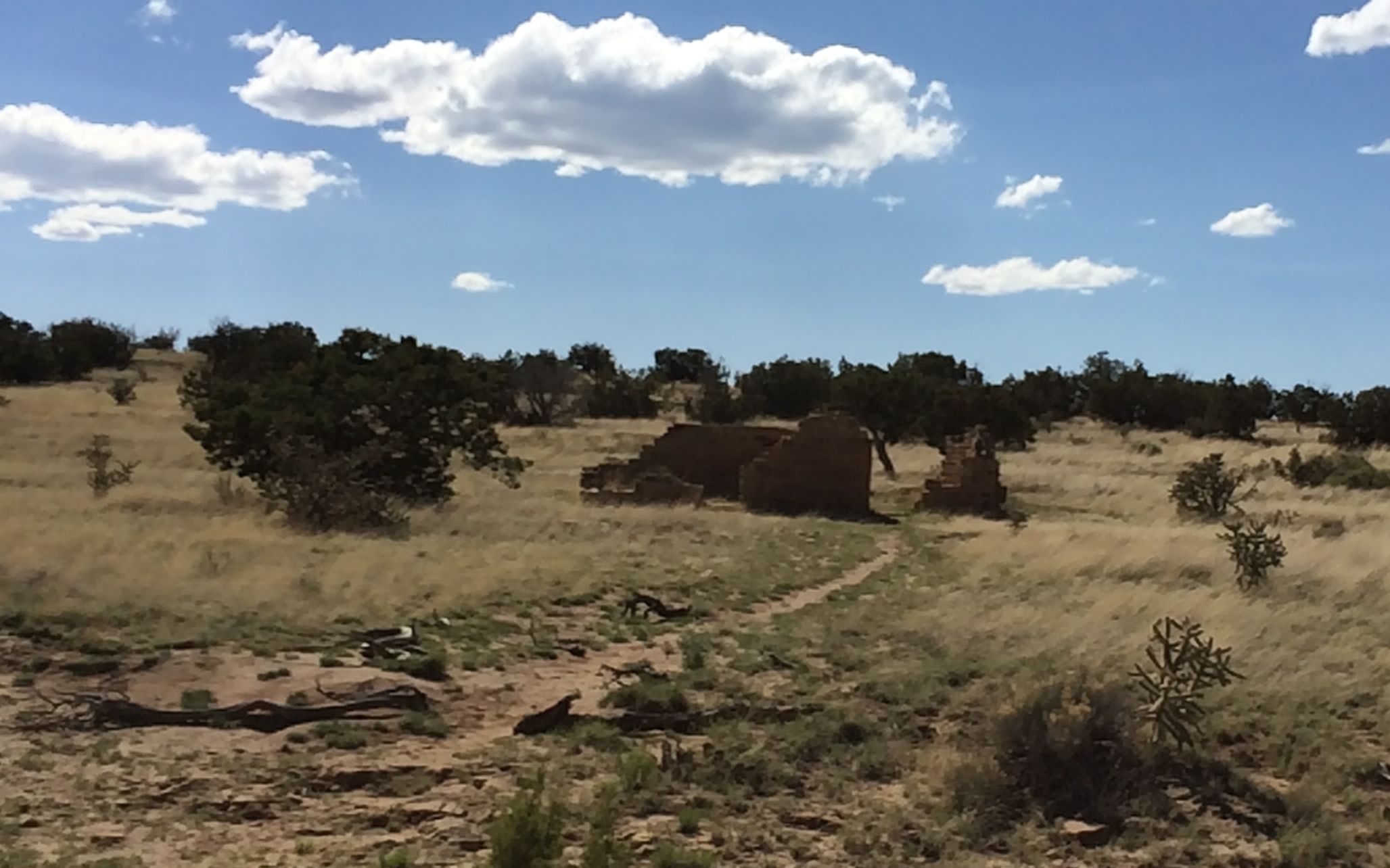
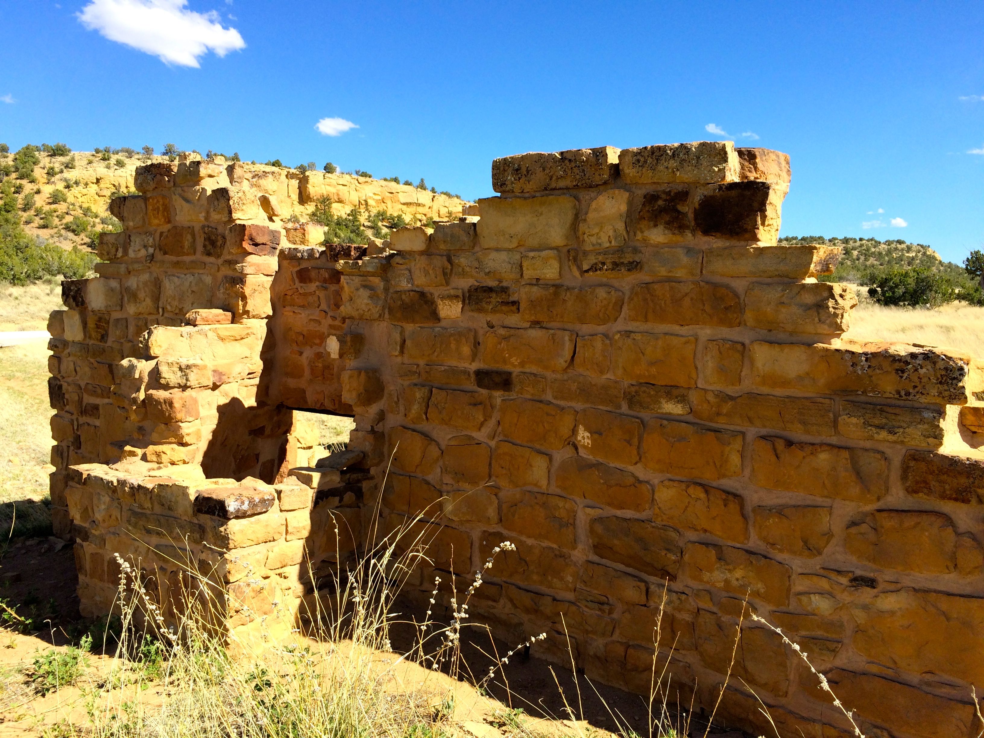
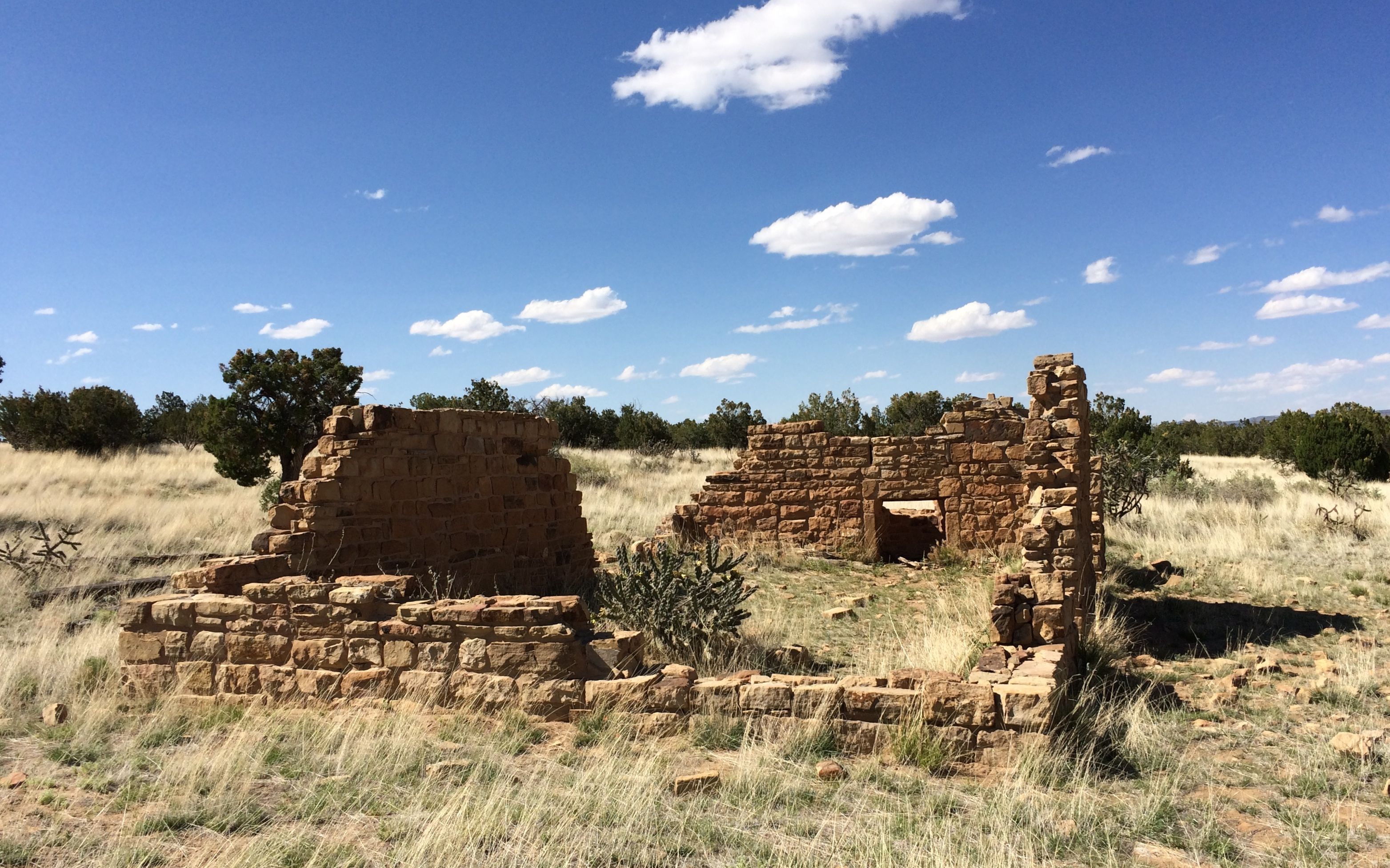
On my way back to the main road, I passed the ruins of the Garrett Homestead. It was built between 1935-1937.
I parked the truck and went over to examine the ruins.
During the Dust Bowl and the Great Depression, people tried to homestead in the area. Homesteaders had to make $800 worth of improvements and live on the land for seven of twelve months for three years before the land was theirs.
It must have been incredibly difficult. According to the information available, many families were not able to make it and moved on to other places.
I got back in BART and continued on to La Ventana.
Mission accomplished!
Time to go back to the RV park and get ready for the next day’s travels.
I love tourism offices – especially when they let me know about places to visit that I didn’t know about before I got there.
In this case, when I entered New Mexico, I learned about Acoma, otherwise known as Sky City. I stayed at the RV park they run next to their casino next to I-40. The next day I went to visit the pueblo. I paused at a scenic overlook to take this photo of the 365 foot high mesa that it’s built on.
I got to the Sky City Cultural Center and looked at the displays in the Haak’u Museum while I was waiting for my tour to begin.
They called my tour and they loaded up the bus for the trip up to the top of the mesa, where we met our tour guide, Brandon. On another note, I happened to meet his parents at a craft show in Cochita Pueblo, which was near my next stop. What a small world!
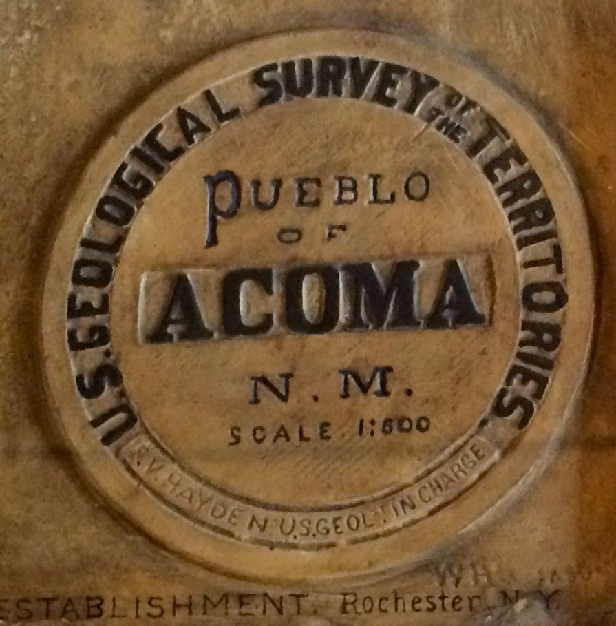
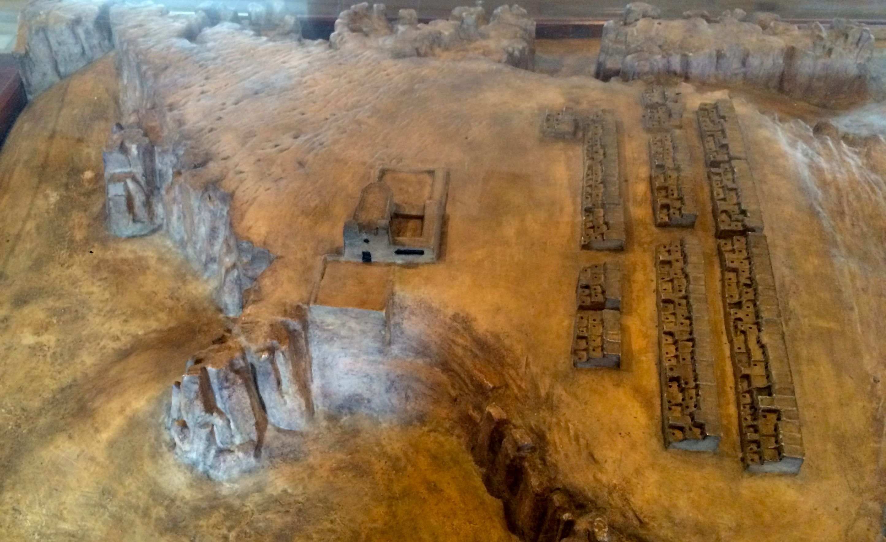
I also happened upon a model of Acoma at the Governor’s Palace Museum in Santa Fe.
It was made by William Henry Jackson for 1876 Centennial Exposition in Philadelphia.
According to the label, this reflects the pueblo as it was in 1875. I include this model at the beginning of the post because it was difficult to take a photo that gave the sense of what I saw.
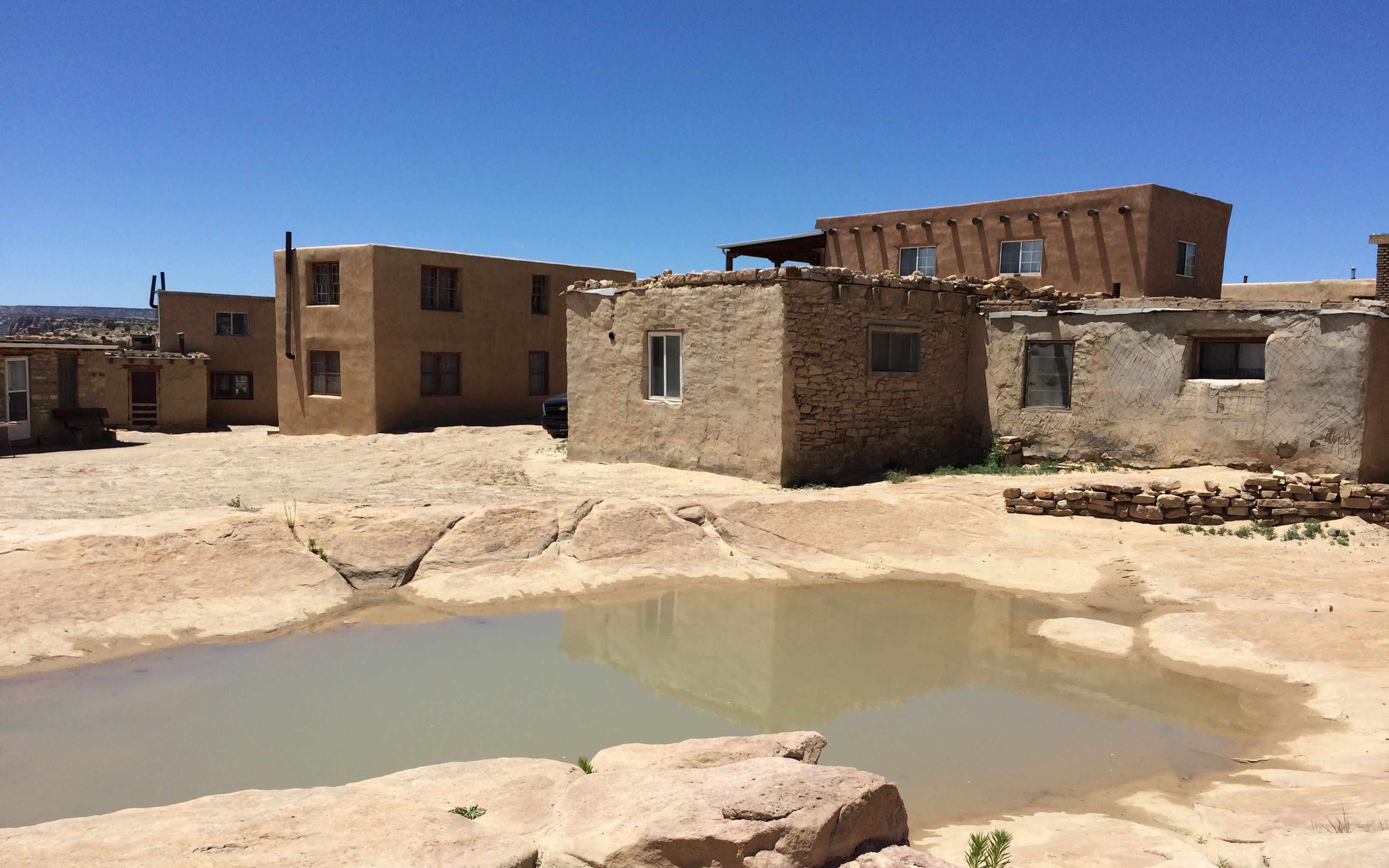
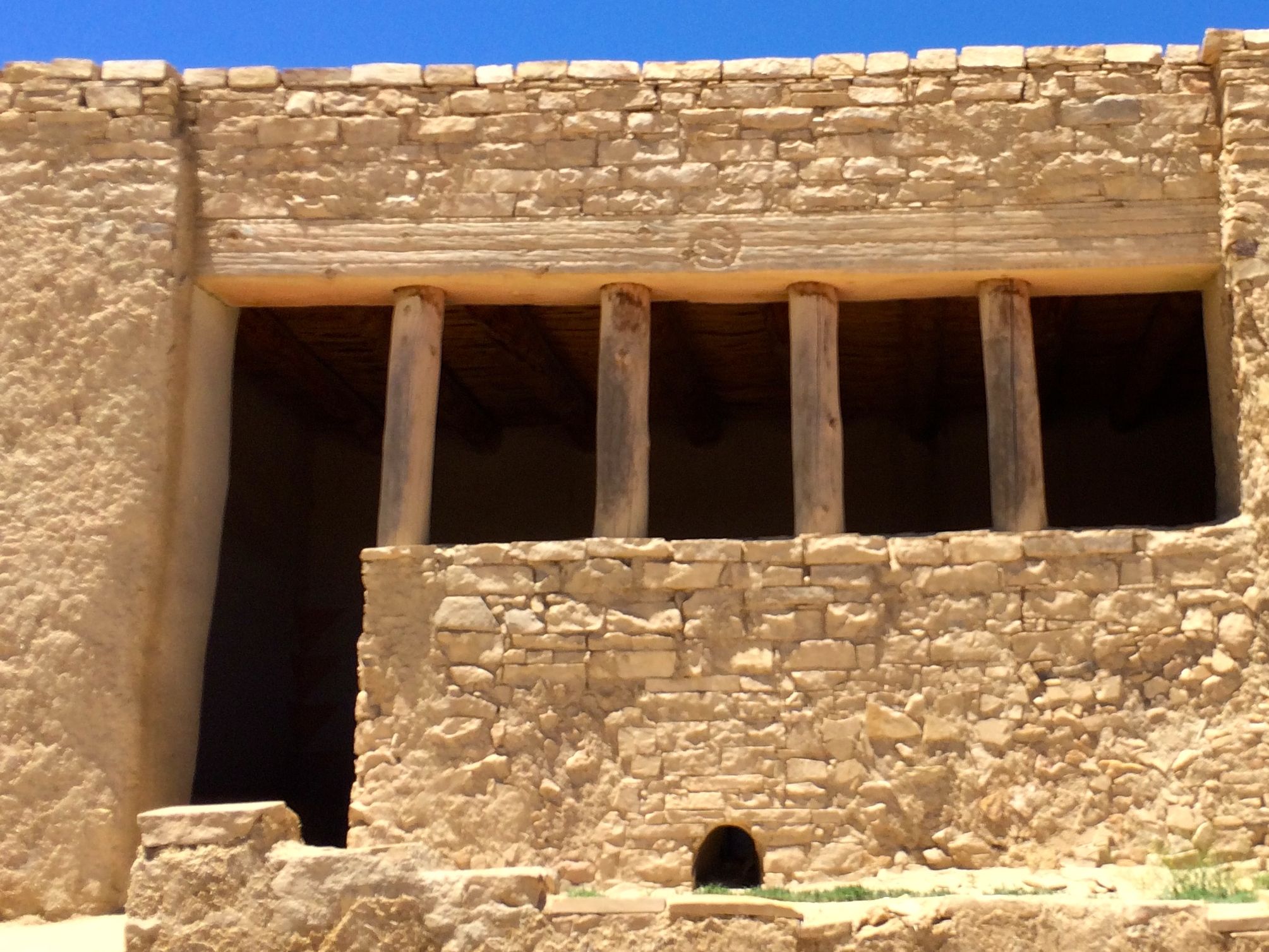
Brandon walked us over to the first stop. Along the way, we passed this interesting shot. It shows that this is a living community. You can see the variety of building materials. They are not living their lives to be on display. They live and adapt and use what makes sense for them.
Brandon pointed out this handholds. You can see two places on the rock on the left side of the photo. Before the road was put in, people used to go up and down via hand and toe holds. If I remember correctly, this path was modified to have steps in it for the Spanish priests to ascend and descend.
One of the rules of the tour was that we couldn’t take notes. We could take all the photos we wanted, but no video or audio recording was allowed. So, if you want to check my facts, I recommend that you visit Sky City yourself. As far as I am concerned, it’s worth a visit, even if you think I remembered everything Brandon told us. (I didn’t.)
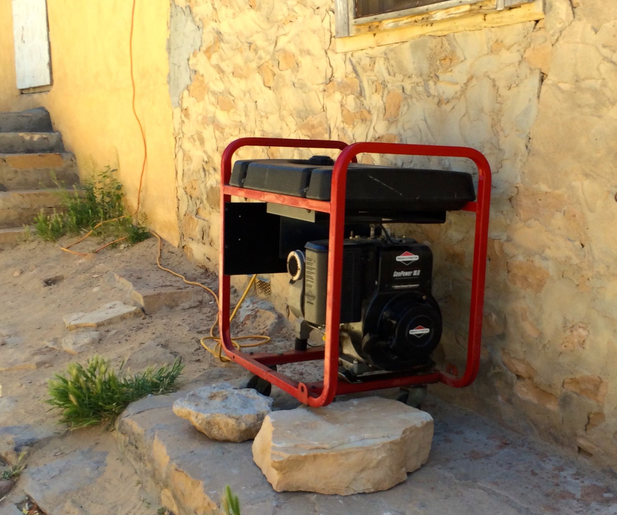
As I said, they live and adapt and use what makes sense for them. They don’t have electricity on the mesa, but they aren’t against using a generator to power tools when they are remodeling.
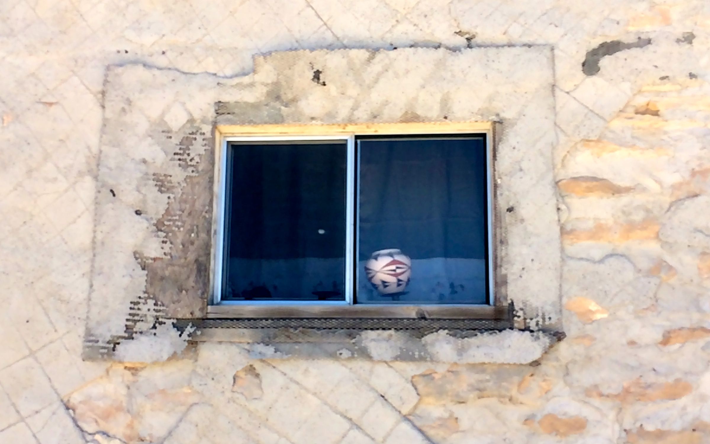
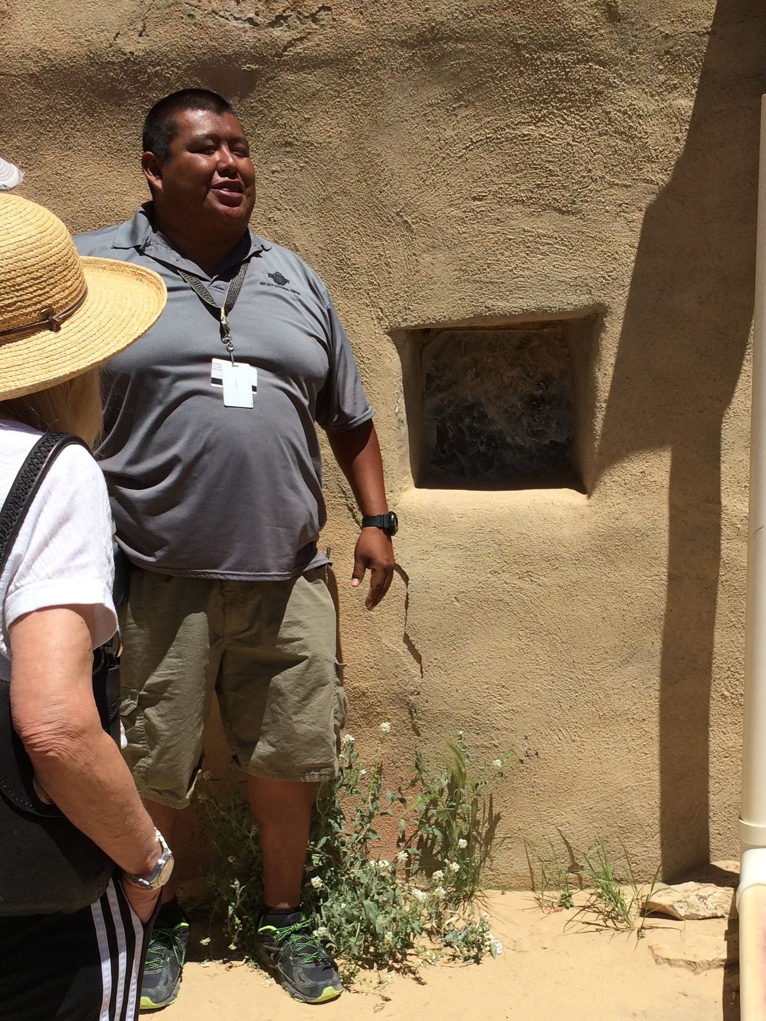
Brandon pointed out one of the remaining mica windows in the pueblo. Mica is a mineral that is found in sheets. It’s translucent and permits light to enter the rooms, although you can’t see through these windows. These windows are several inches thick, and if I understand correctly, after the mineral is mined, it takes a few years to dry out or cure.
The sun glinted off the walls and the mica windows. The Spanish explorers thought that had found one of the cities of gold that they were looking for.
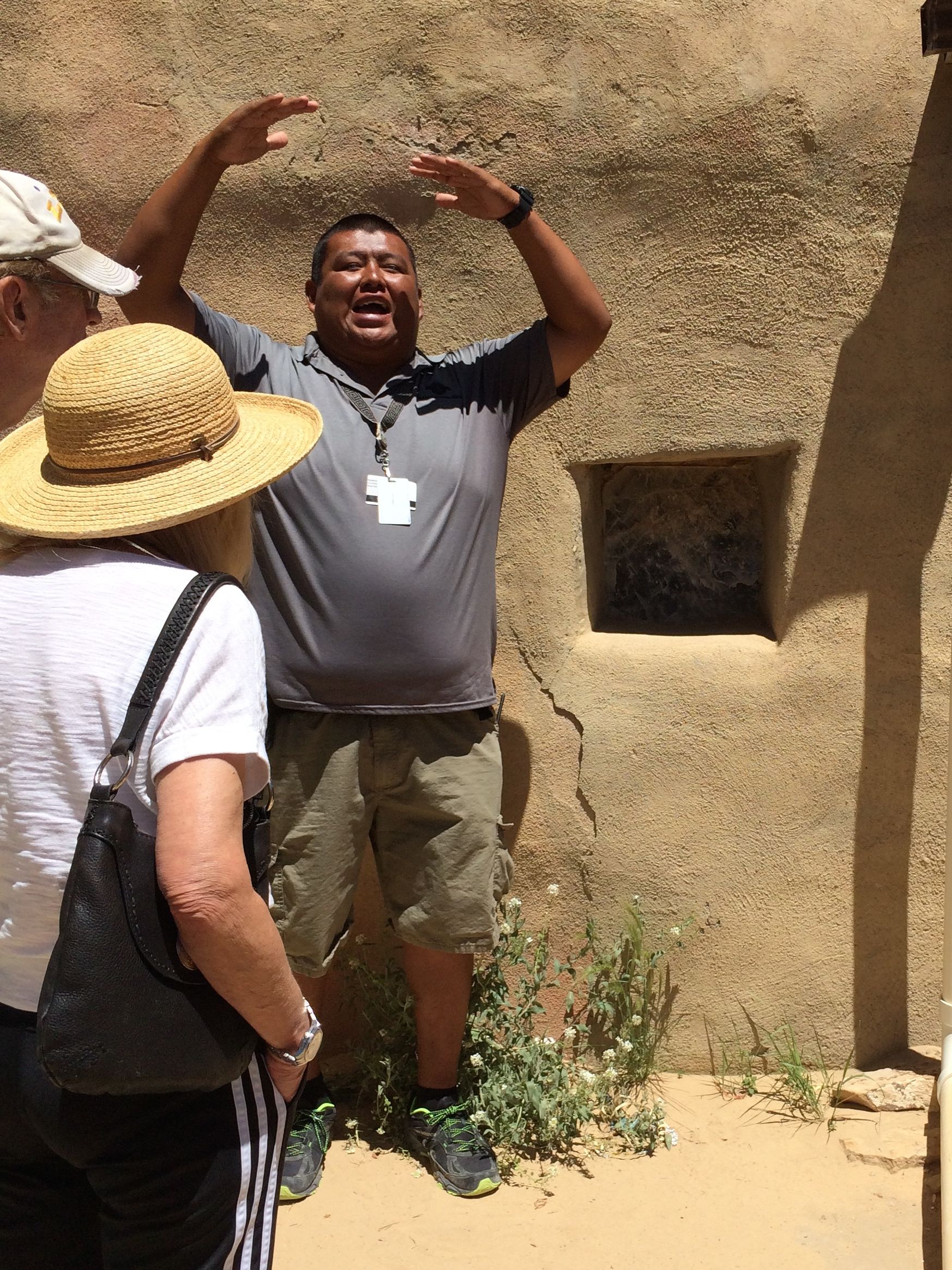
Brandon was a very animated speaker.
From what I remember, the pueblo originally depended on three cisterns for their water. They don’t use them anymore for drinking water, but the cisterns are still there.
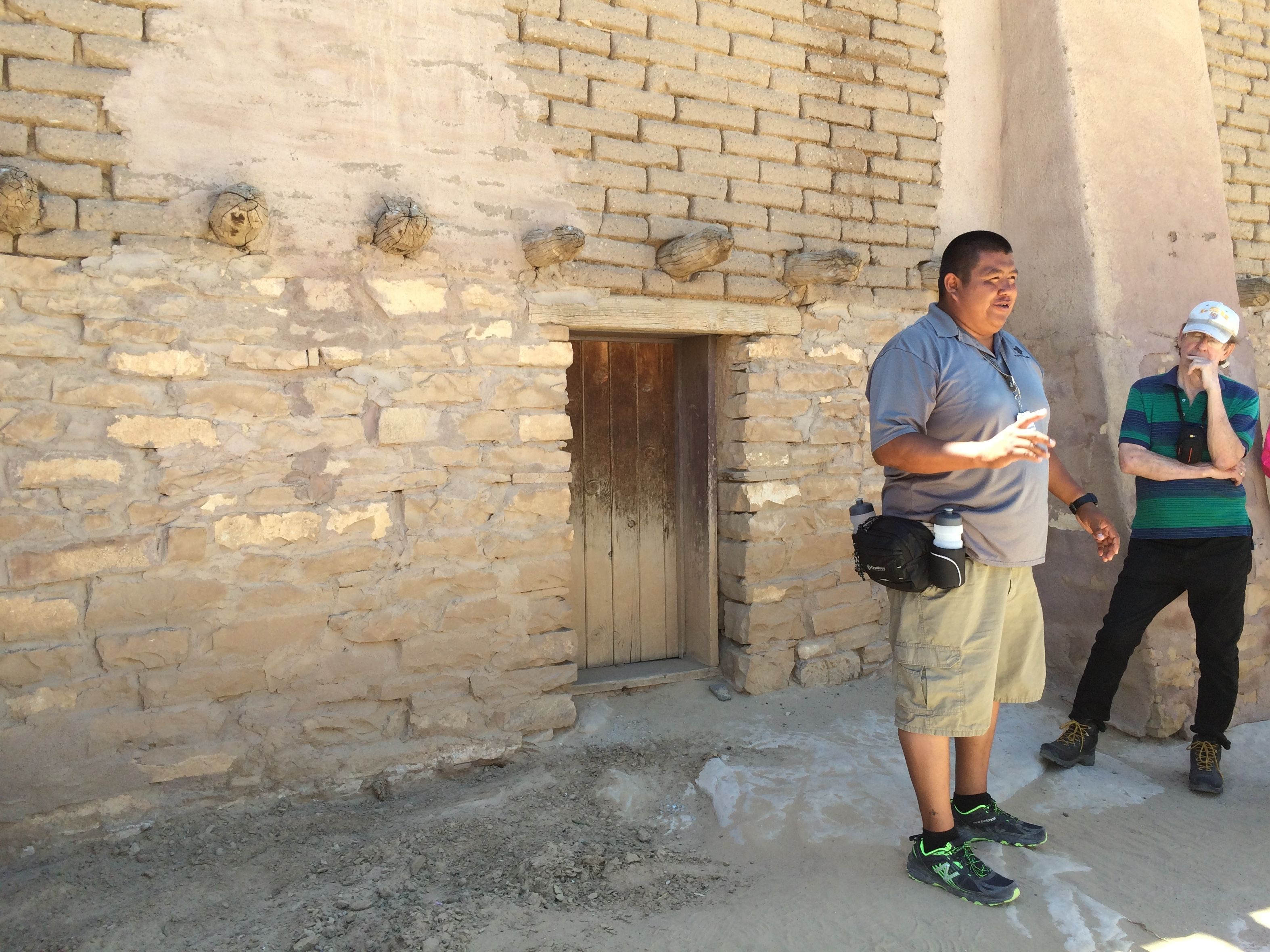
Some of the buildings are older and some are newer. Brandon stopped by a doorway to show us one of the older buildings. Acama has been occupied continuously since 1200.
When they first took up residency and began building their homes, the people were much smaller. Brandon attributed the dietary contributions of the Spanish to the increased height of his people.
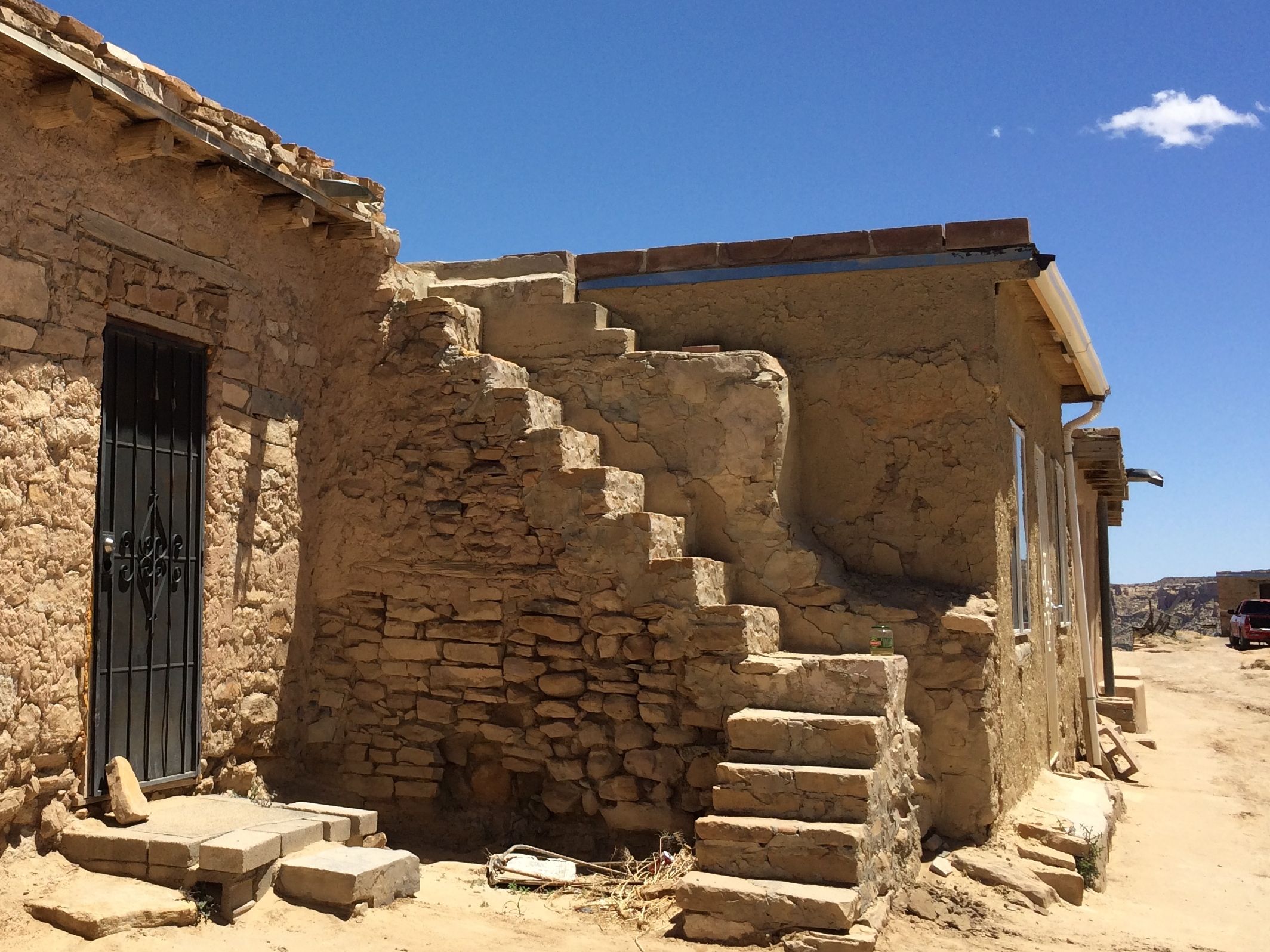
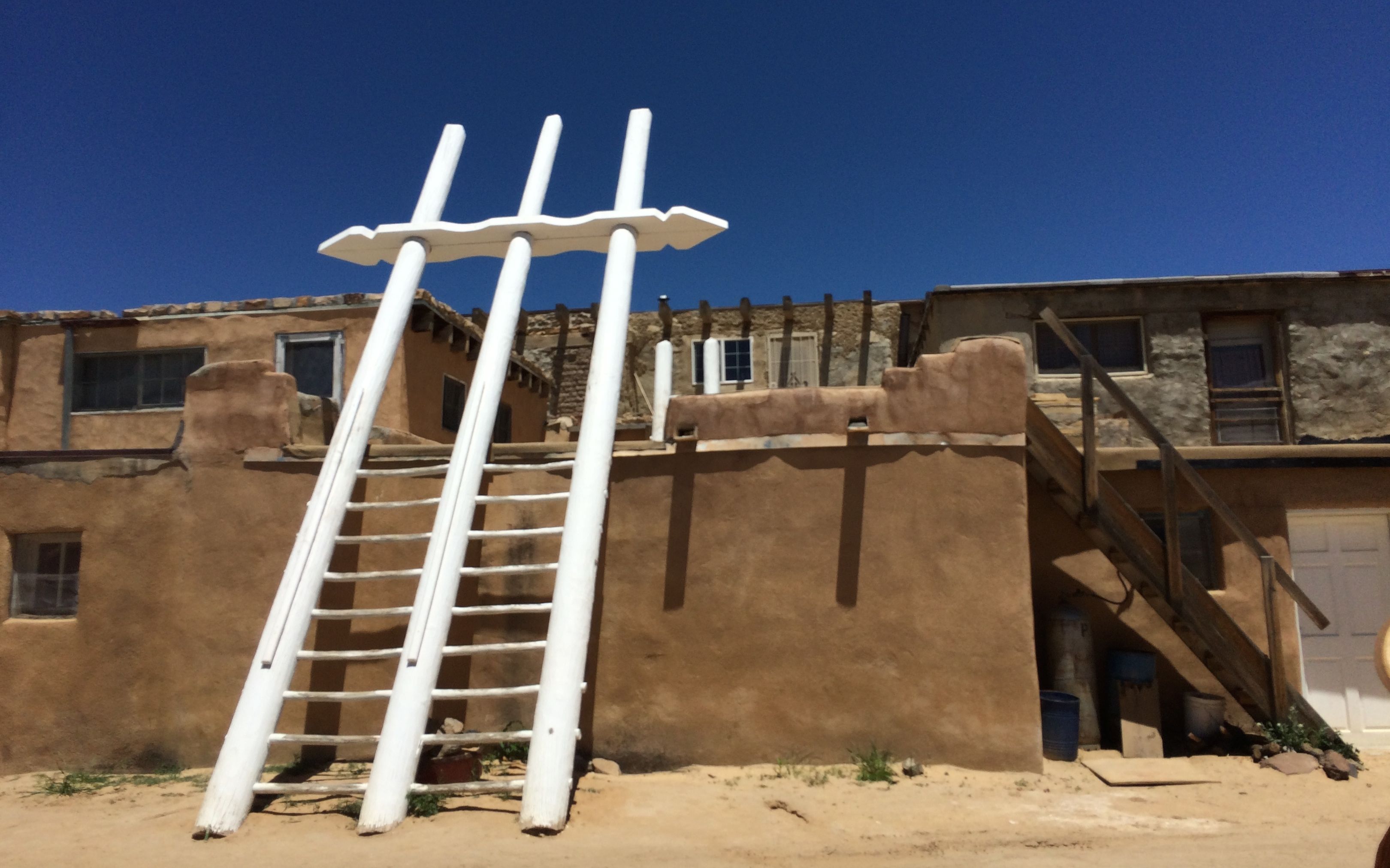
Brandon told us that there were stone staircases inside that the women used. The men used ladders that they leaned against the outside to stay out of their way.
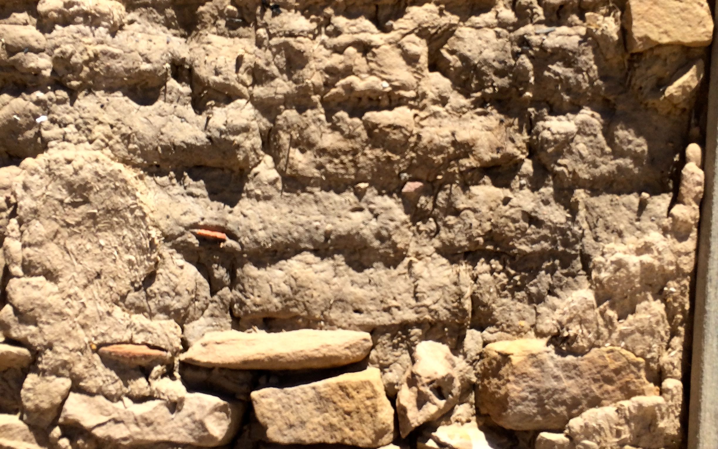
The buildings were originally built of sandstone. Adobe was a contribution from the Spanish, which they picked up in northern Africa – if I remember Brandon’s information correctly.
Here he is, showing some of the older adobe. He is pointing out inclusions of bone, pottery and other materials.
Here’s a close up of the wall he was pointed to.
It gets very windy on top of the mesa. Sometimes the winds peak at 90 miles per hour, which is equivalent to a class 1 hurricane. As a result, some of the screen doors are very sturdy. To be extra secure, when people are out, they will put a heavy stone against the door.
Sturdy door, lock and rock. It seems like wearing suspenders with a belt.
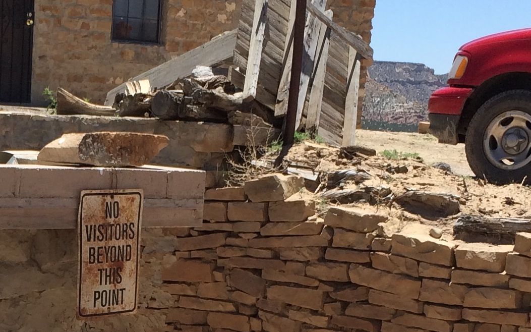
Acoma is an place where people actually live, and so some places are off limits.
This mesa is the site of Old Acoma, which is over 500 feet high. When the people of the pueblo left Mesa Verde, they were directed to go forth and call out “haak’u”. They were to listen for the echo and then build their home there. They heard the echo come from this mesa and built their home on top.
First there was a flood that stranded them on top. Then the pueblo was struck by lightning. According to Brandon, they realized that they made a mistake and went forth again listening for the echo. He told us that archeologists have examined the site and report that there are ruins up there.
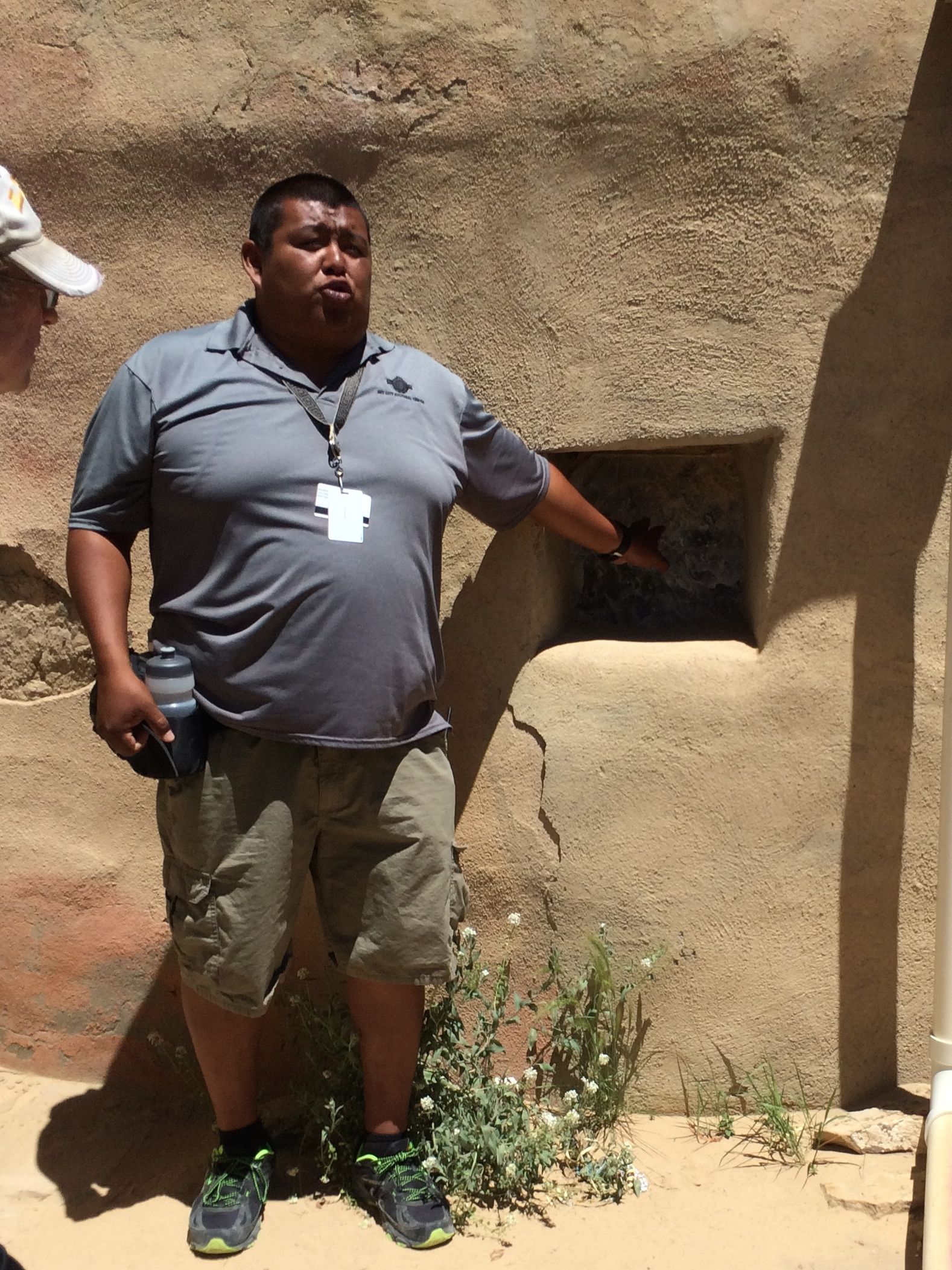
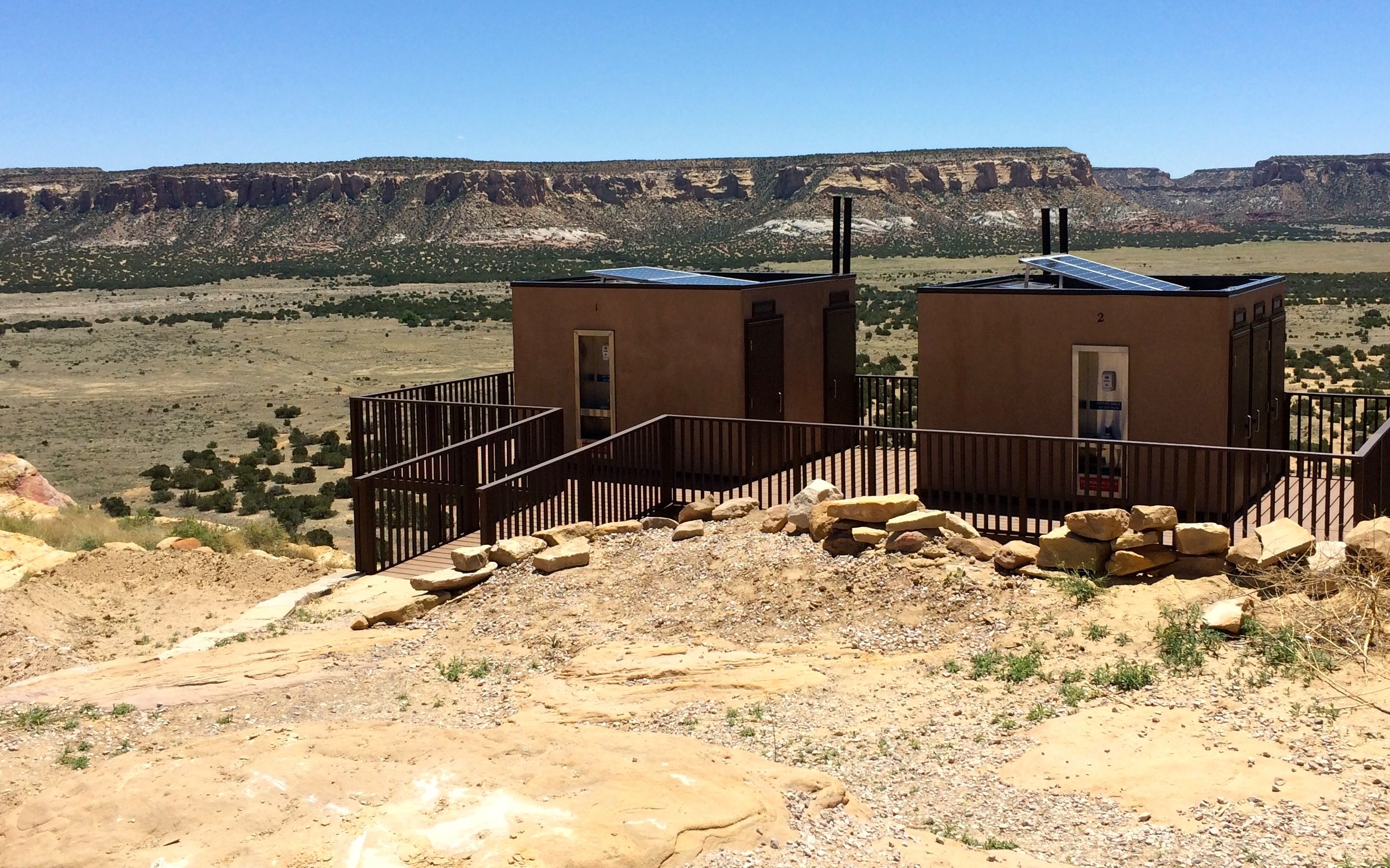
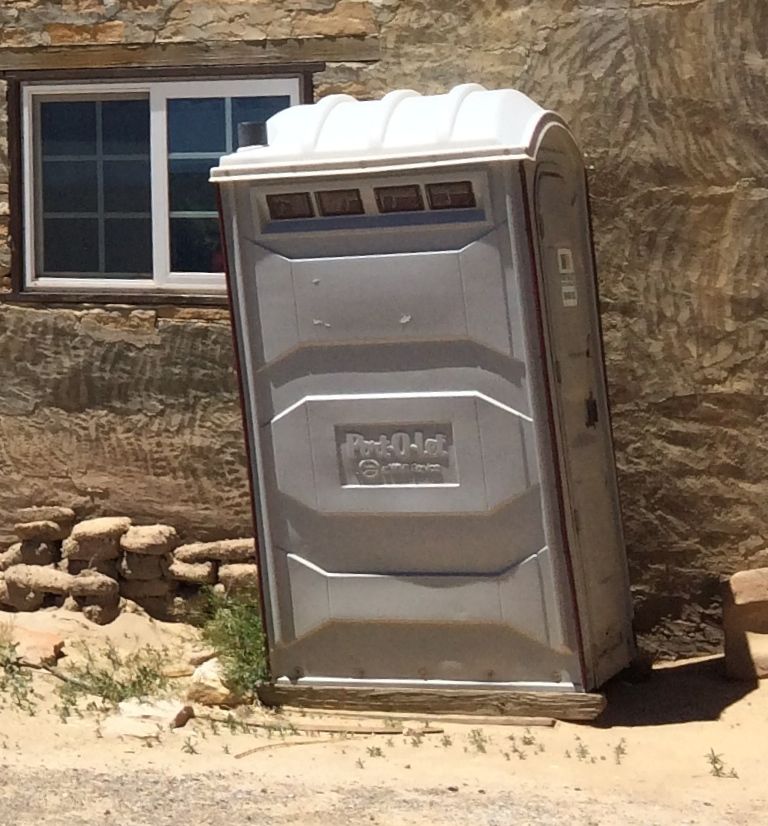
As I mentioned before, the pueblo adopts technologies that work for them. Here are solar powered composting toilets that are available for residents and visitors alike.
The solar powered composting toilets are replacing the previous improvements.
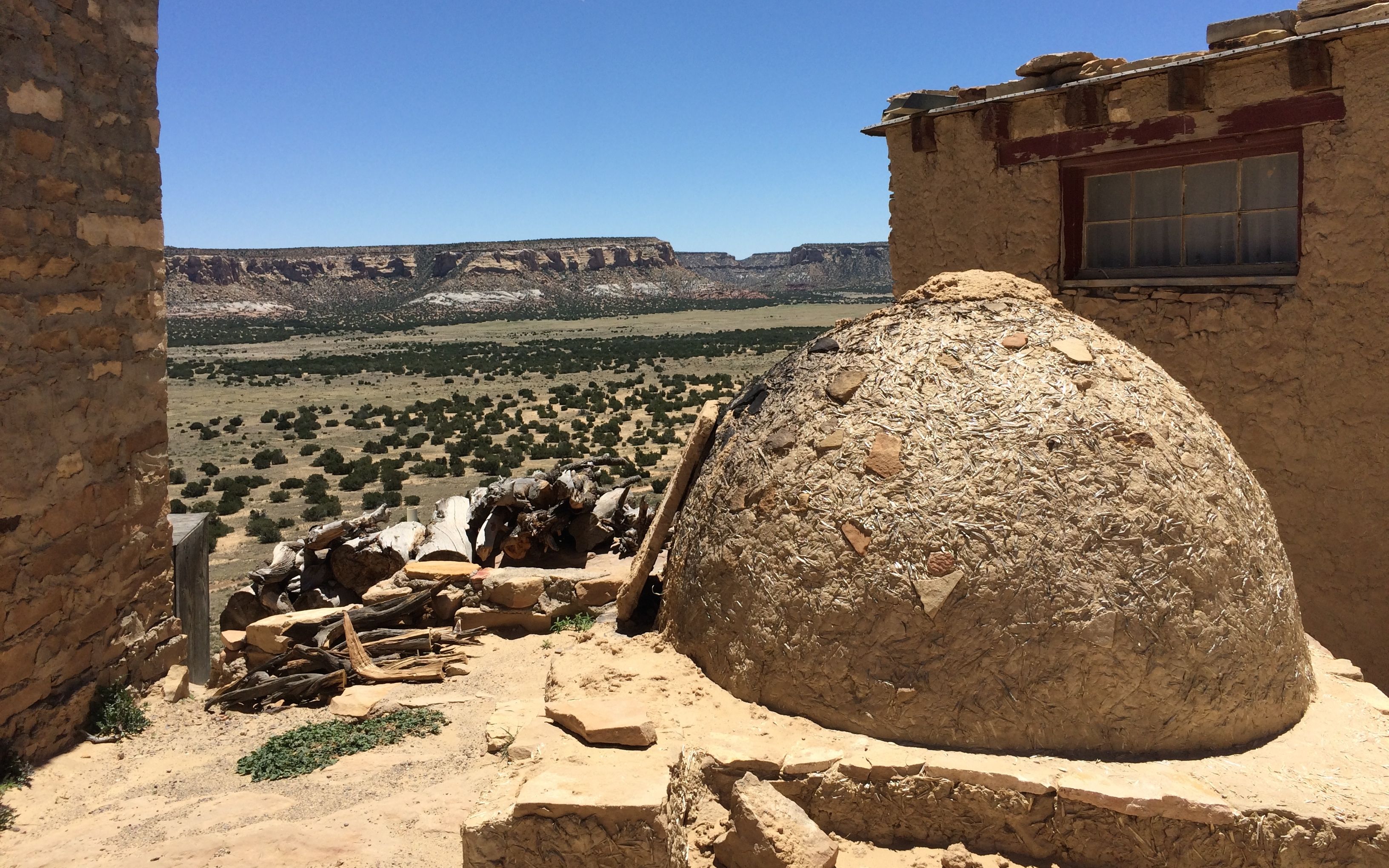
Baking is done in wood fueled ovens. I saw at least three ovens around the pueblo, and stacks of firewood. They also use propane. At one point, I bought a bottle of water and it was cold. I didn’t ask, but I wonder if they have propane refrigerators. I have one in my trailer, although mine also runs on electricity.
In addition to selling water and soft drinks, they also sold crafts. If I weren’t living in a trailer, I would have loved to consider purchasing one of the fine pieces of pottery they had for sale. I enjoyed talking with the craftsmen. One woman even showed me the yucca fibers she used to make the fine lines on her pots.
Brandon pointed out the white ladders and told us that they lead to kivas.
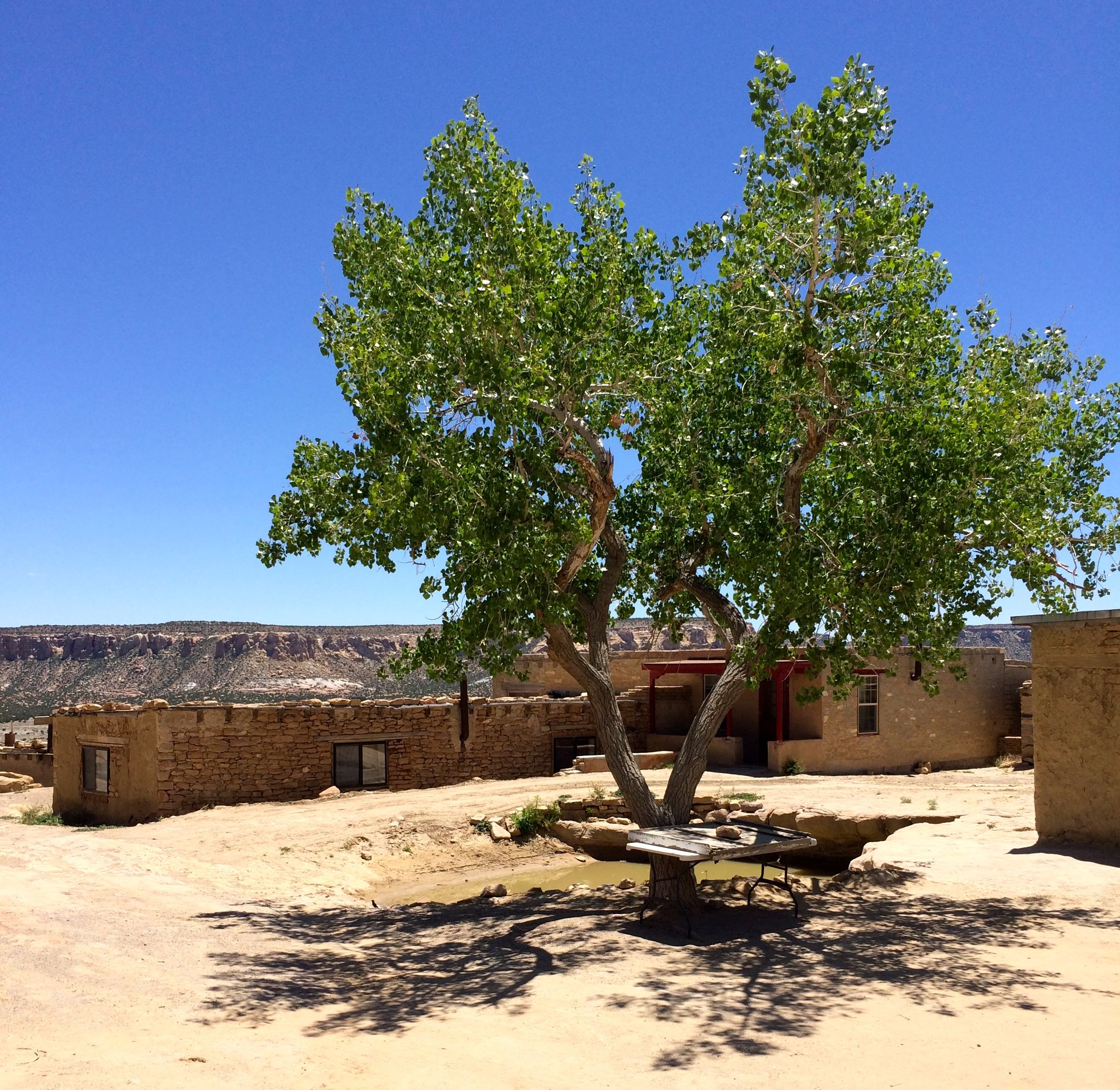
Brandon told us that this is the Acama National Forest. Of course, it was a joke. It was planted in the 1970s by one of the three cisterns. It’s the only tree on the mesa.
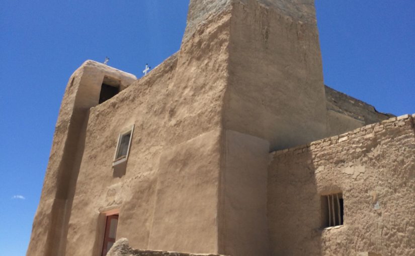
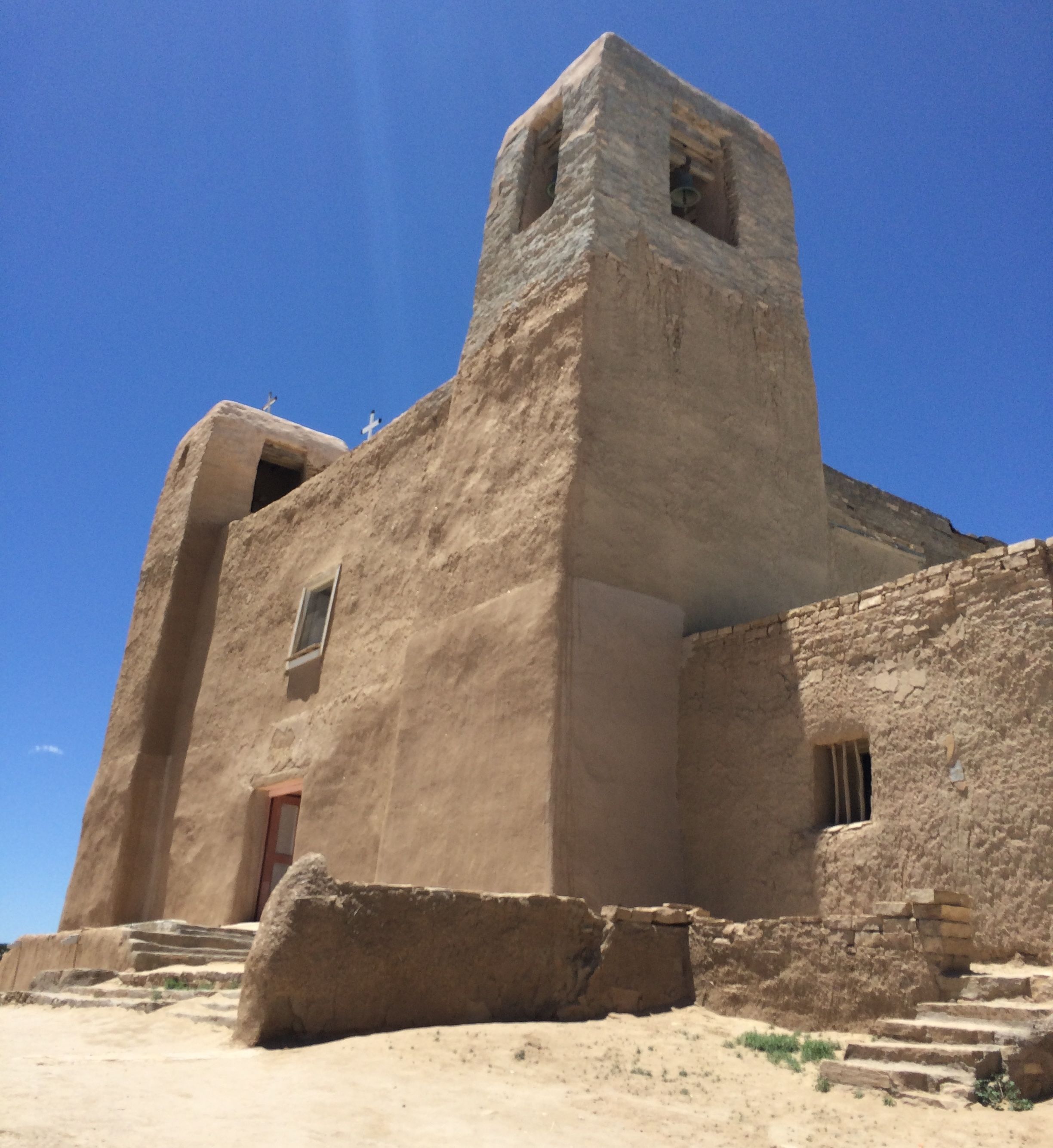
This is the church that the Spanish made the people of the pueblo build after the massacre in 1599. It is too gruesome for me to relate, but if you care to read more about it, here is a report that reflects what Brandon told us.
We weren’t allowed to take pictures closer than this, but let me tell you about the it. The walls are very thick at the base and get thinner as they go up. The beams at the top are made of ponderosa pines that the Spanish made the Acoma carry from Mount Taylor, which is forty miles away. Brandon told us that trees the size of the beams weighed two tons, which the men were forced to carry the entire way.
Information I learned at the Governor’s Palace in Santa Fe said that the construction of the church required 18,000 tones of adobe, sandstone and mud. That’s on top of the trees used in the rafters.
When the church was built, the inside was painted with rainbows and corn, because they made their living farming. Now the people are ranchers, and the inside is decorated with paintings of cattle and sheep.
The flat area in front of the church is where the cemetery is. We weren’t allowed to take pictures of the cemetery, but Brandon told us that originally the cliff fell away at this point. There are four layers of burials in the cemetery. Brandon told us that his grandmother was the last person interred in the cemetery.
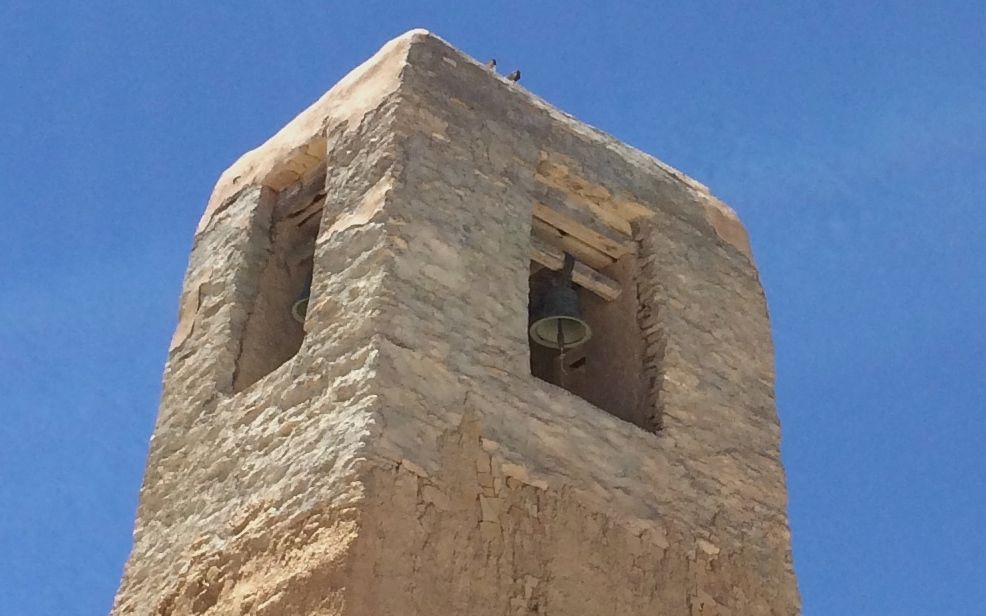
The king of Spain was pleased that the church was completed, and sent bells for the towers.
Adobe, well-maintained, certainly stands up well in this dry climate.
This is part of the church. The wood and the carvings are original from when it was built in 1641.
And then it was time to board the bus for return trip to the Cultural Center.
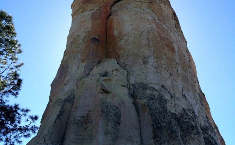
While I was in Gallup, I went for a drive out to El Morro National Monument.
I thought I knew a lot of obscure Spanish words, but apparently I still have a few to learn. “El morro” means “the headland.”
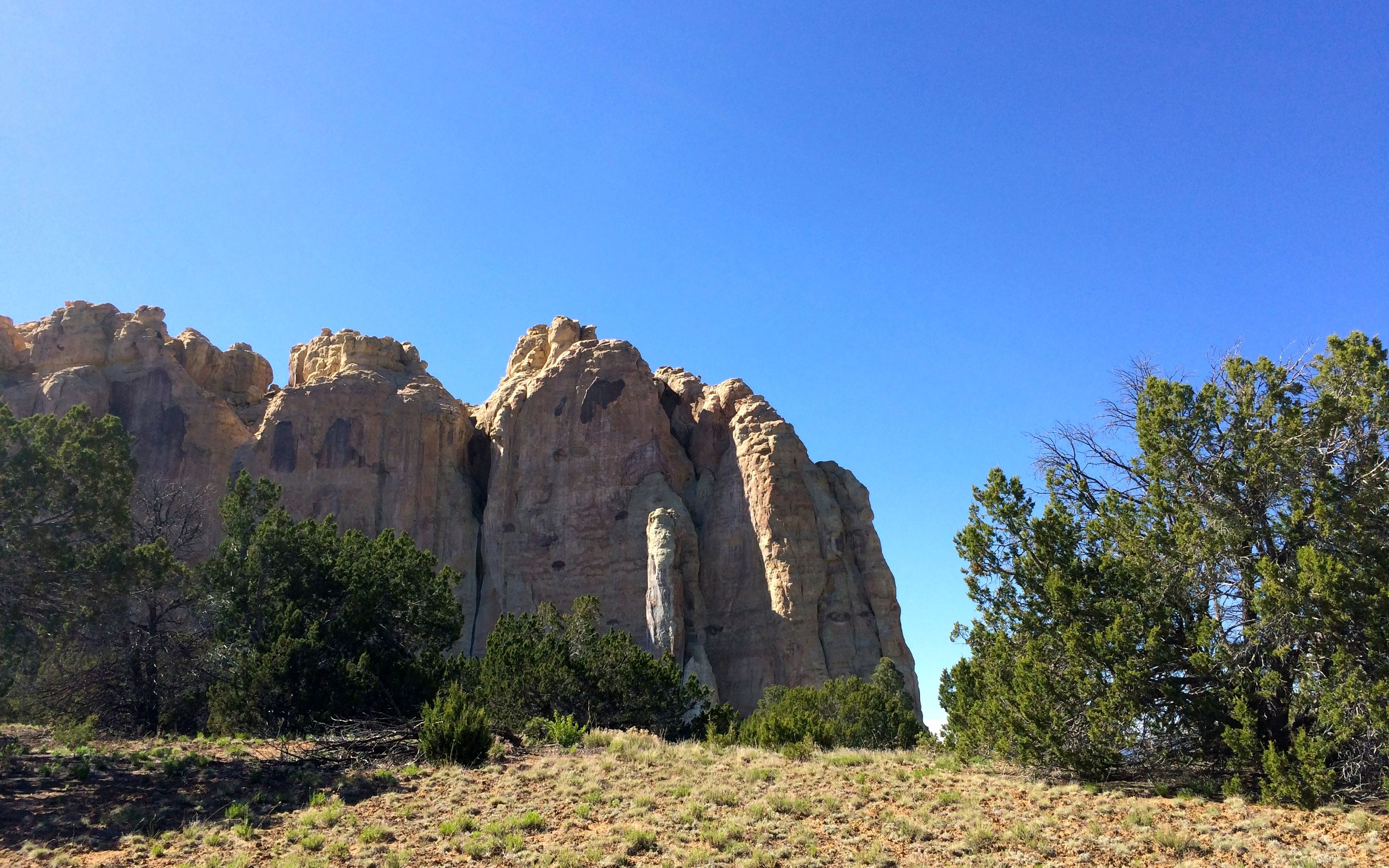
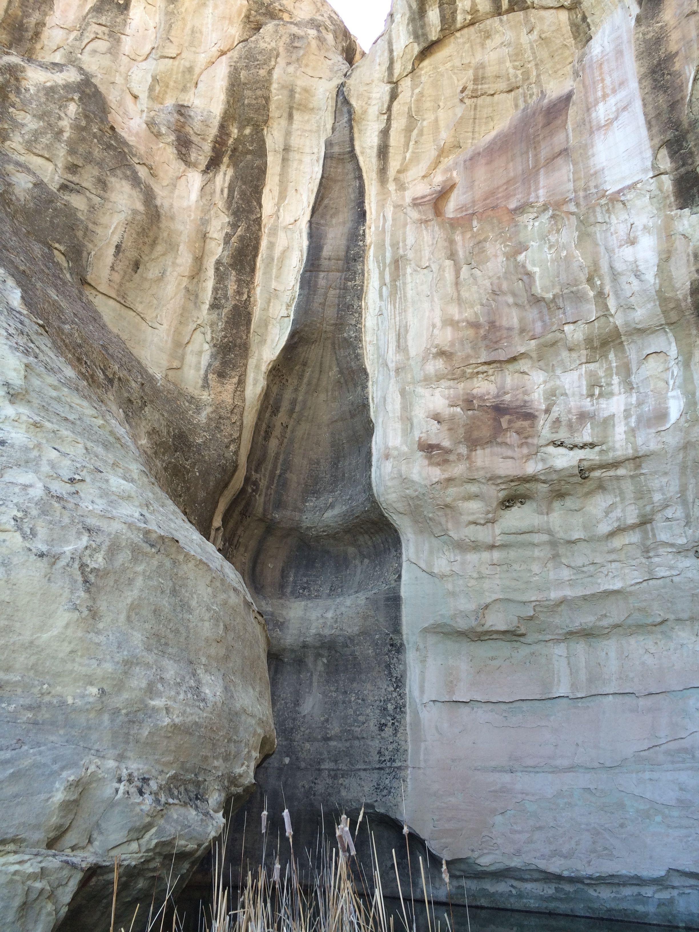
There are plenty of splendid rock formations in the area. What makes this one special is that was pool of water at the base of the rock.
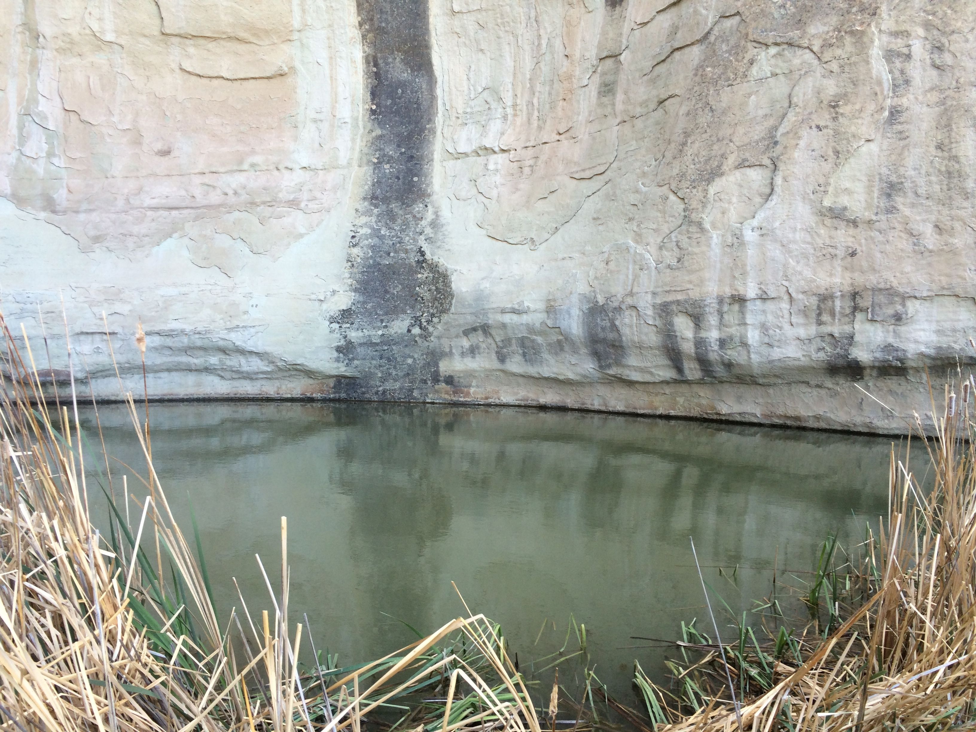
This feature has made it a valuable location down through the ages. On the top of the bluff are the ruins of Ancestral Puebloans and they must have used this pool. It isn’t a spring, rather it’s a catchment basin that collects run off from rain and snow.
You can see where the water has been trickling into the pool for years and years.
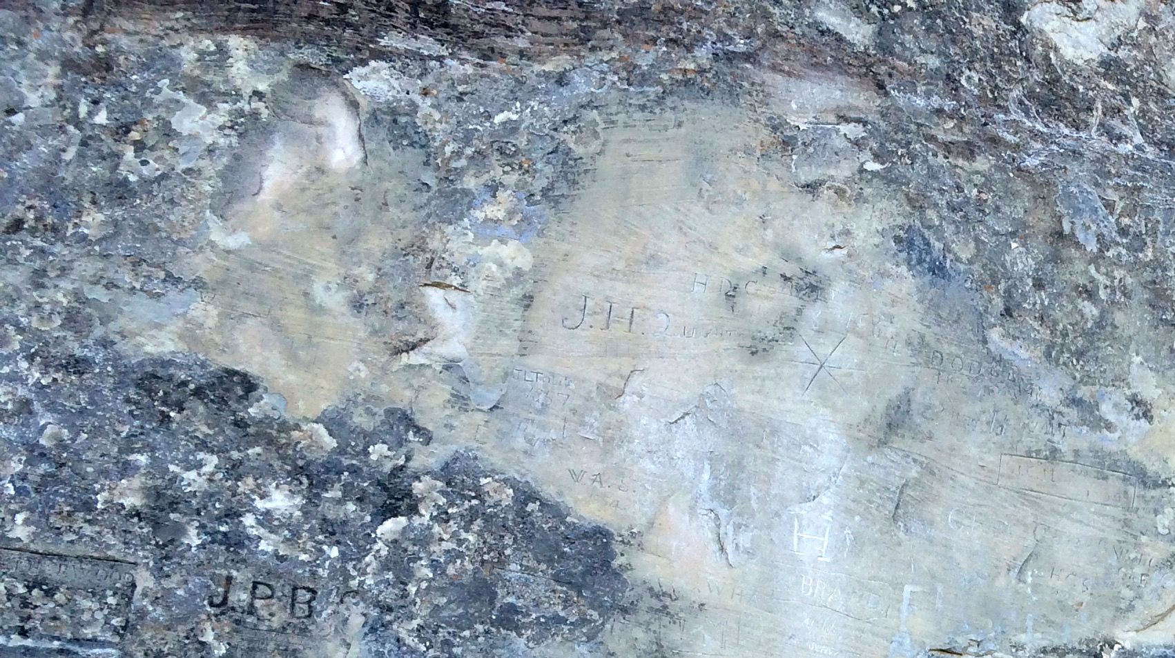
The water is the big draw here, and the rock formation is kind of like a guest book for the people who have passed through over the years.
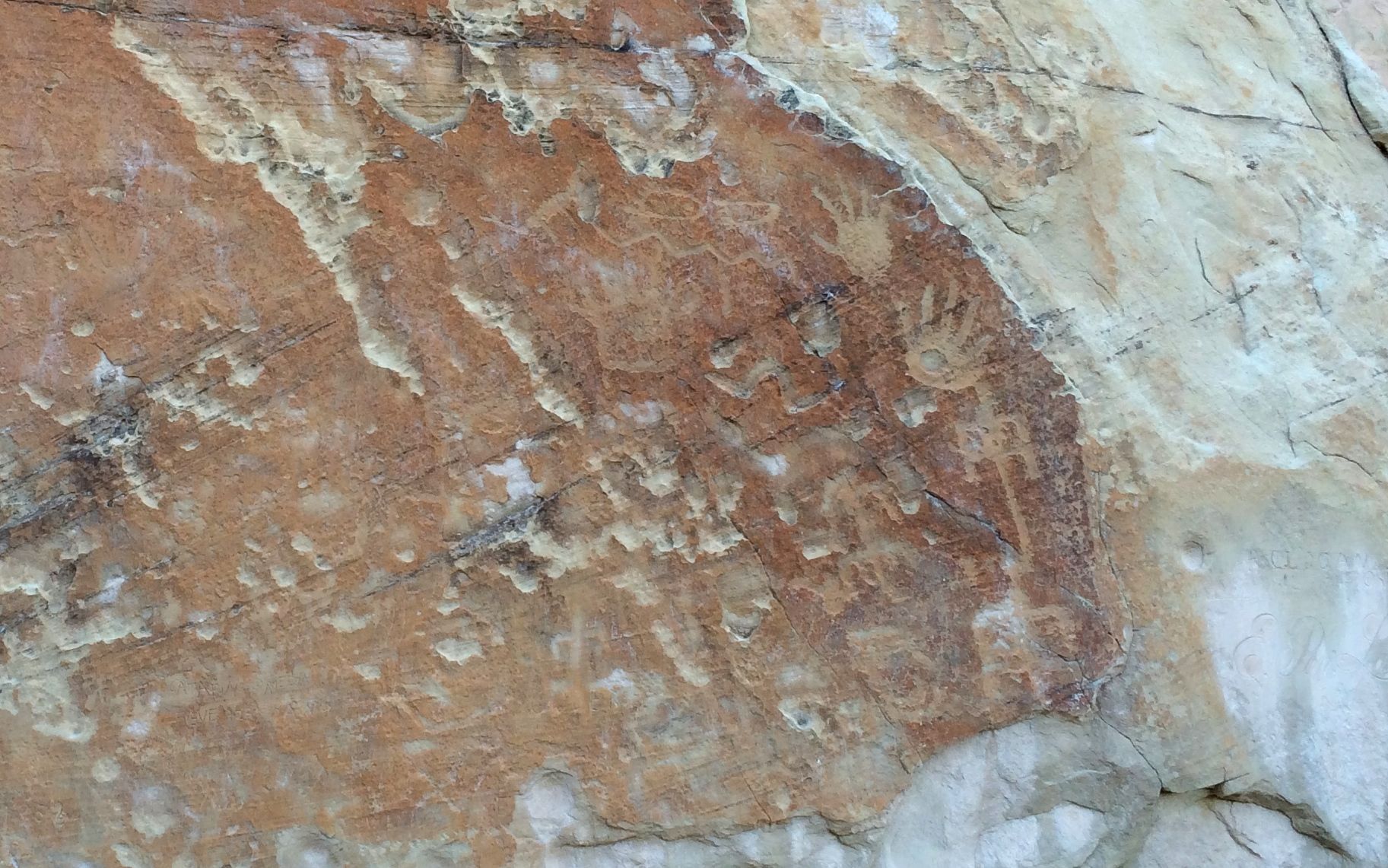
The Ancestral Puebloans left their marks.
At the bottom, just left of center, you can see a bear claw. To the right side, you can see a zig zag line, which I have had several people at other petroglyph sites tell me represents a snake.
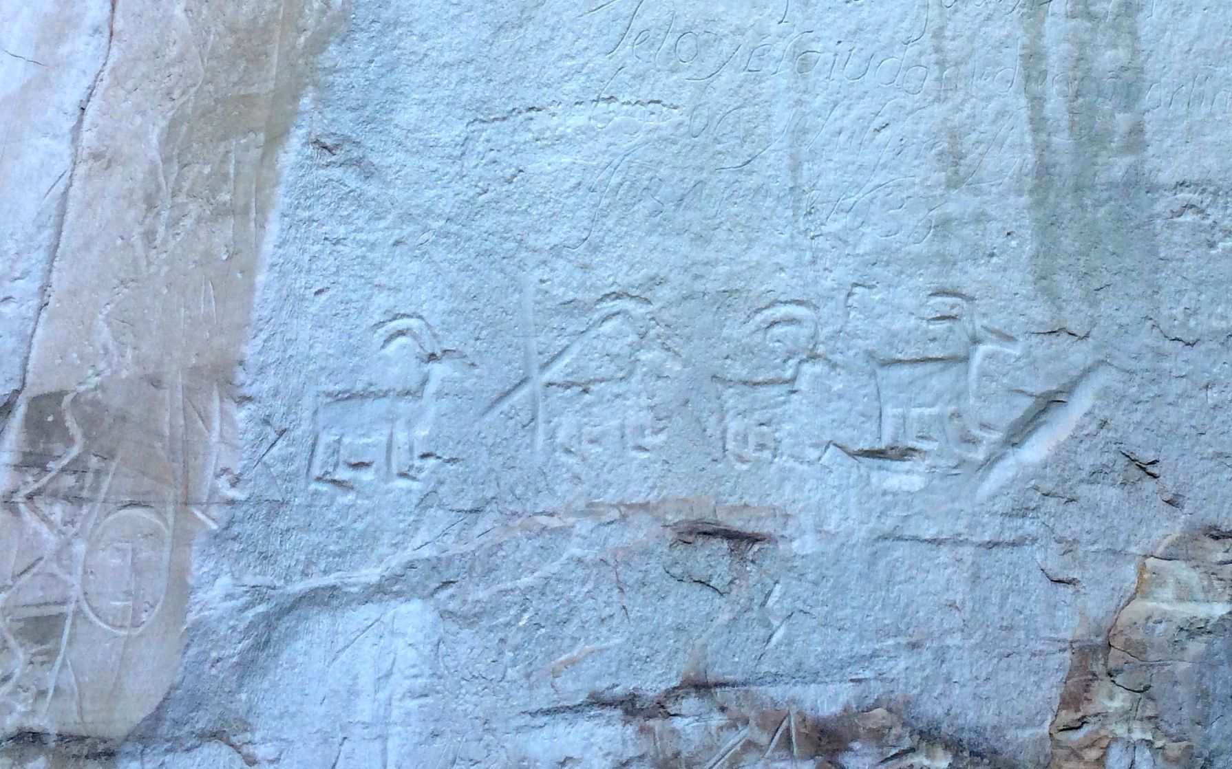
They even put up pictures of big horn sheep!
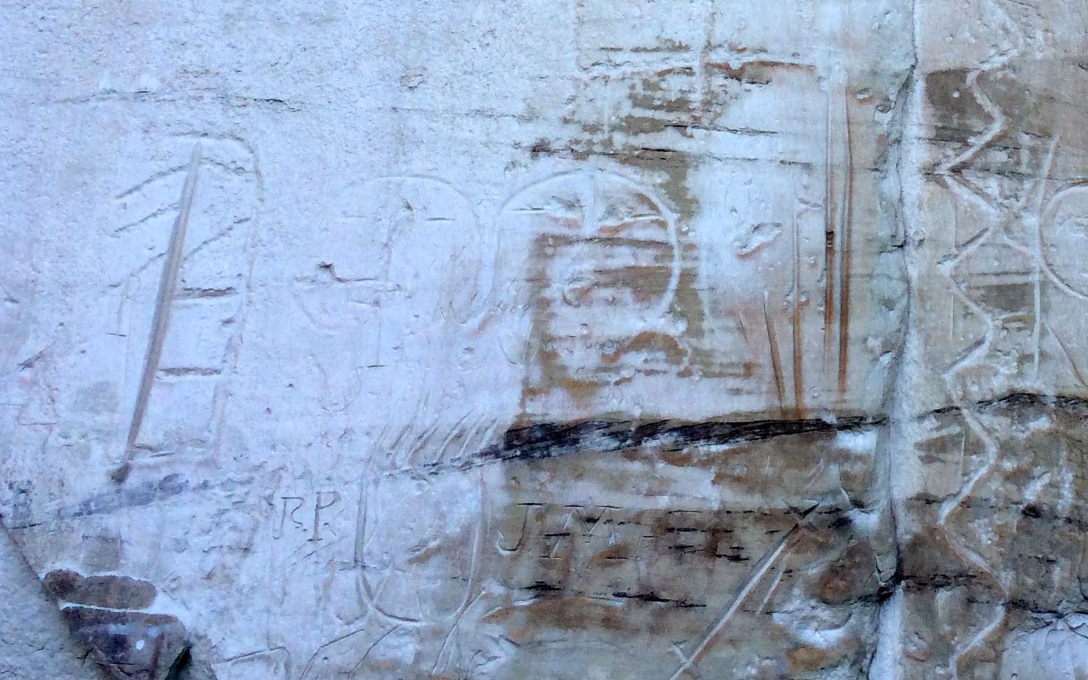
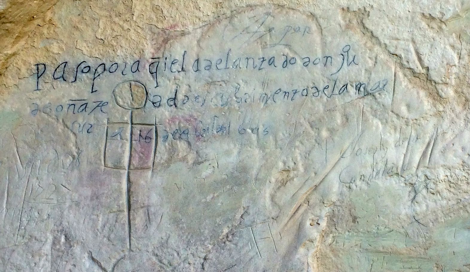
Governor Don Juan de Onate April 16 1605
This signature was put on the rock in 1605, which was fifteen years before the Pilgrims landed on Plymouth Rock. The Spanish were exploring the area.
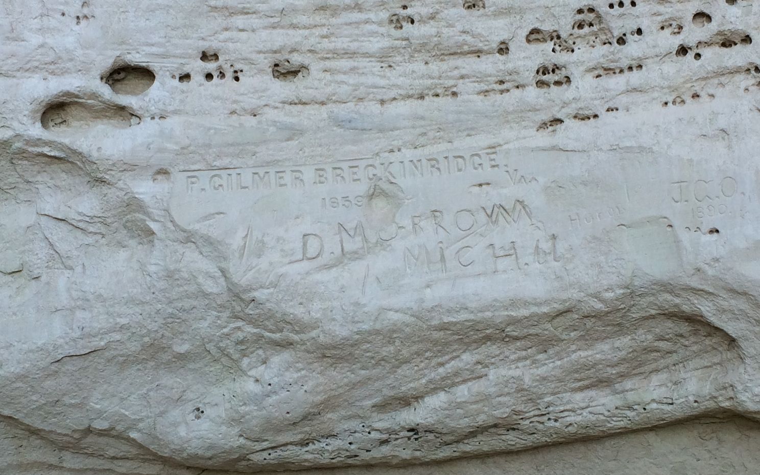
P. Gilmer Breckinridge – otherwise known as “Peachy” – passed through in 1859. He was part of an Army experiment to use camels in the desert. According to the ranger, the Army thought that the camel experiment was a success and, but the Civil War intervened before they could implement the program. The camels were kept at Camp Verde in Texas, and the Confederates captured them at the beginning of the war. Most of the camels were sold at auction to zoos and circuses, although some of them escaped. Some of them were spotted in the wild up through the 1900s.
Just under “Peachy’s” signature, is the signature of D. Morrow from Michigan. He passed through in 1866 on his way to California. He returned to the area and became one of the area’s leading ranchers.
Peachy returned to Virginia and served in the Confederate Army during the Civil War. Unfortunately, he was killed in 1863 during a skirmish at Kennon’s Landing in Virginia.
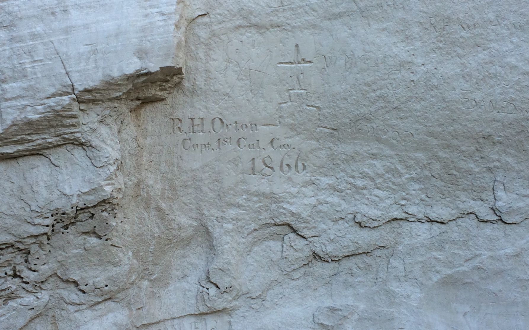
RH Orton Capt1st Cal 1866
Captain Orton served in the Union Army during the Civil War. Later he served in New Mexico, and most likely made his inscription on his war to California, where he served as the adjutant-general.
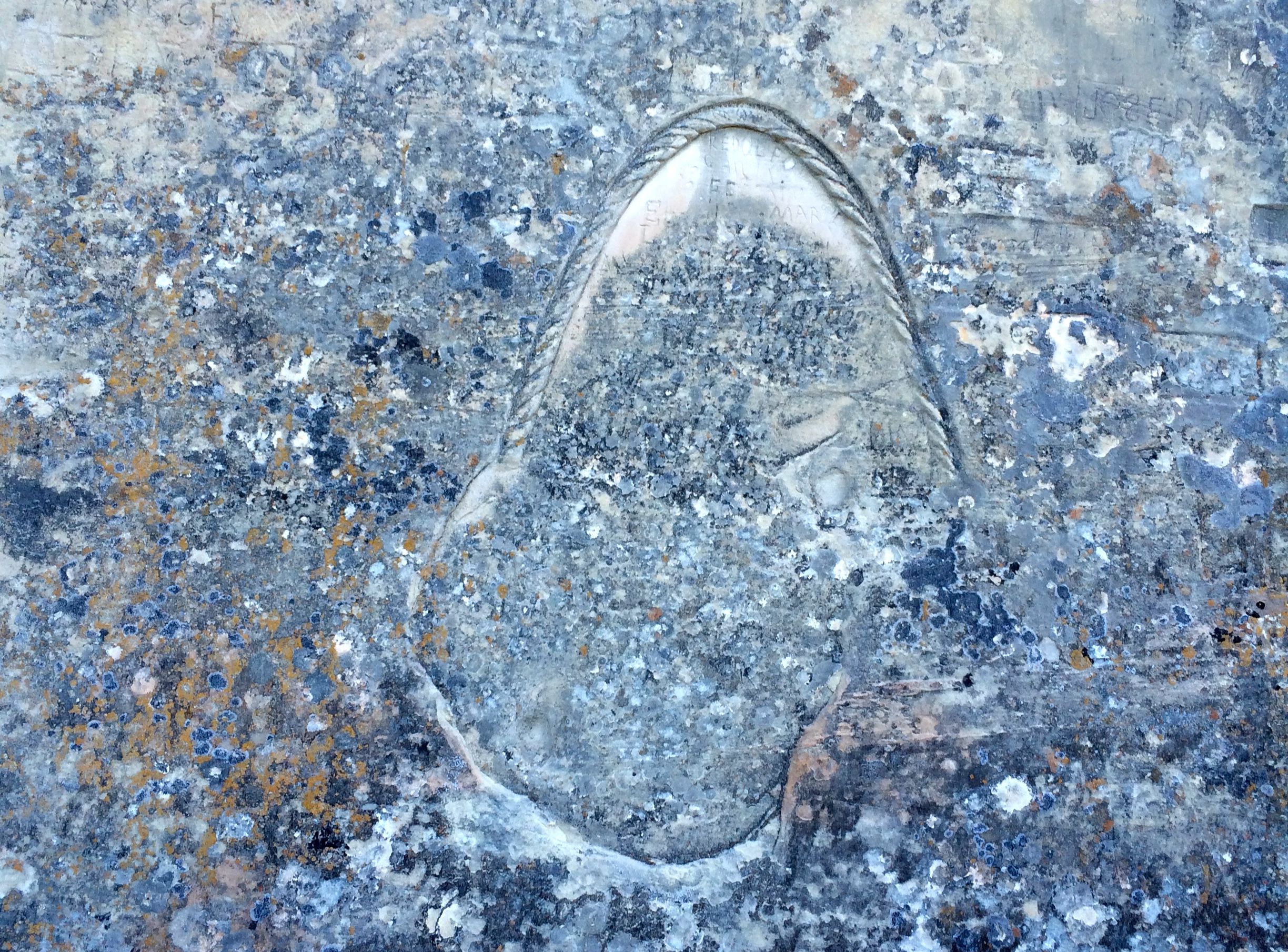
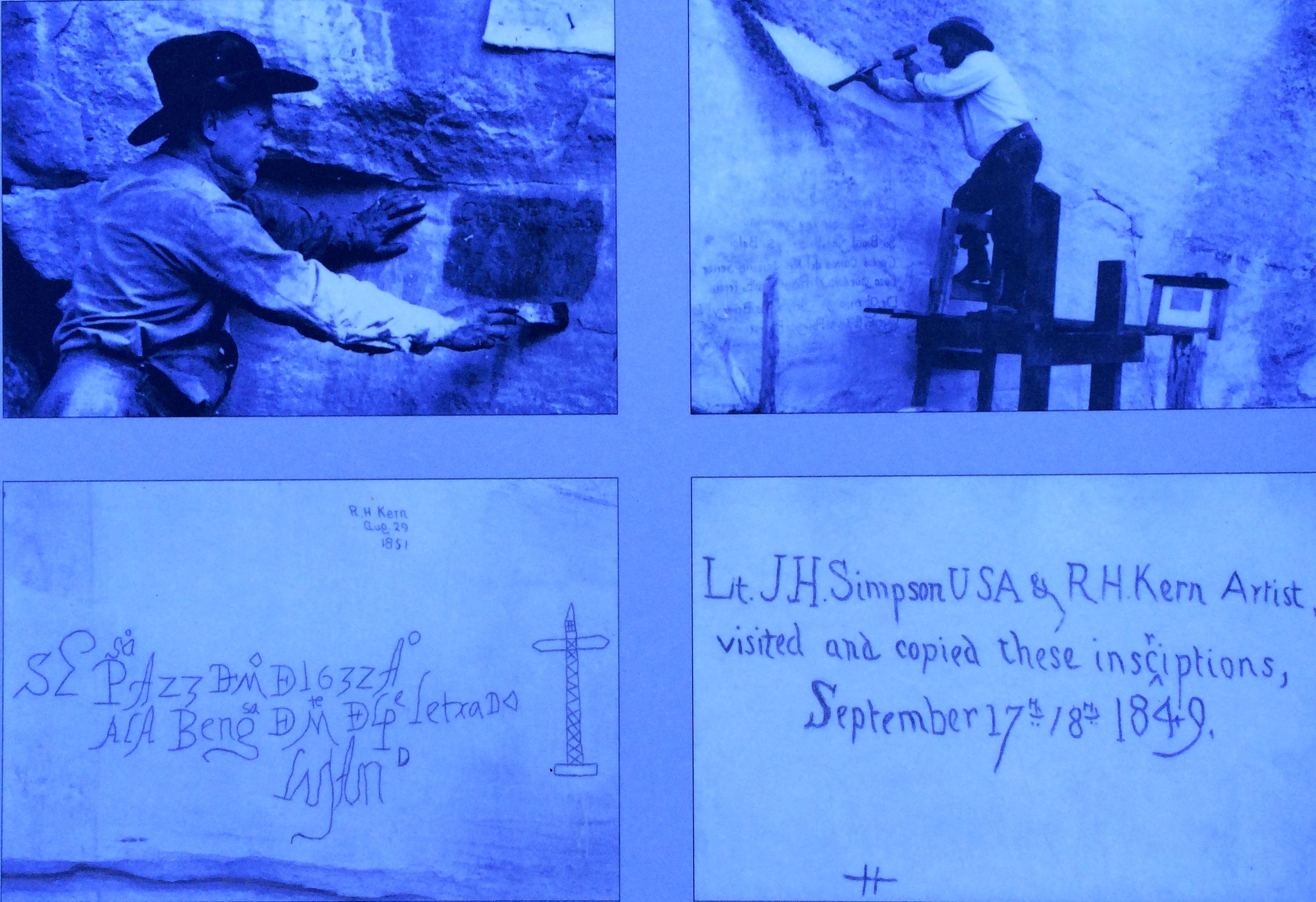
I asked the ranger about this inscription, too. He seemed to think it was made by someone connected with the railroad. The railroad passes quite a few miles to the north, so perhaps they were in the area scouting for a route.
A great many of the 2,000 signatures on El Morro are fading away. The ranger told me that the first superintendent of was very aggressive about preserving the signatures.
He had the signatures deepened. He also used hard black pencils to trace over some of the signatures. He tried coating them with paraffin and carved little gutters to channel water away from the carvings. They don’t do that anymore.
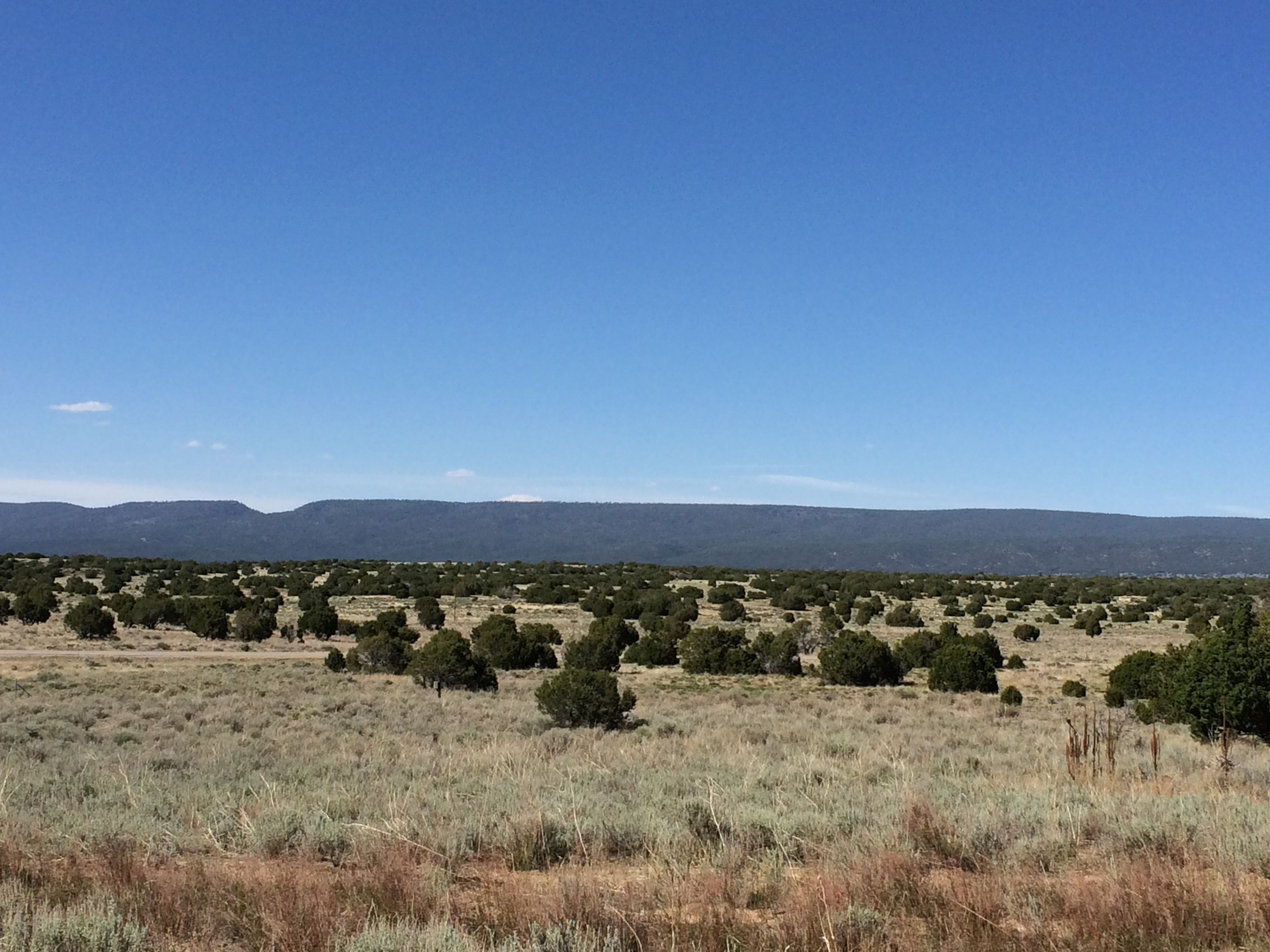
When I got to the junction where the trail returned to the visitor’s center, I paused to admire the view looking away from El Morro.
Then I turned back for one more glance at El Morro before I headed back to my truck.
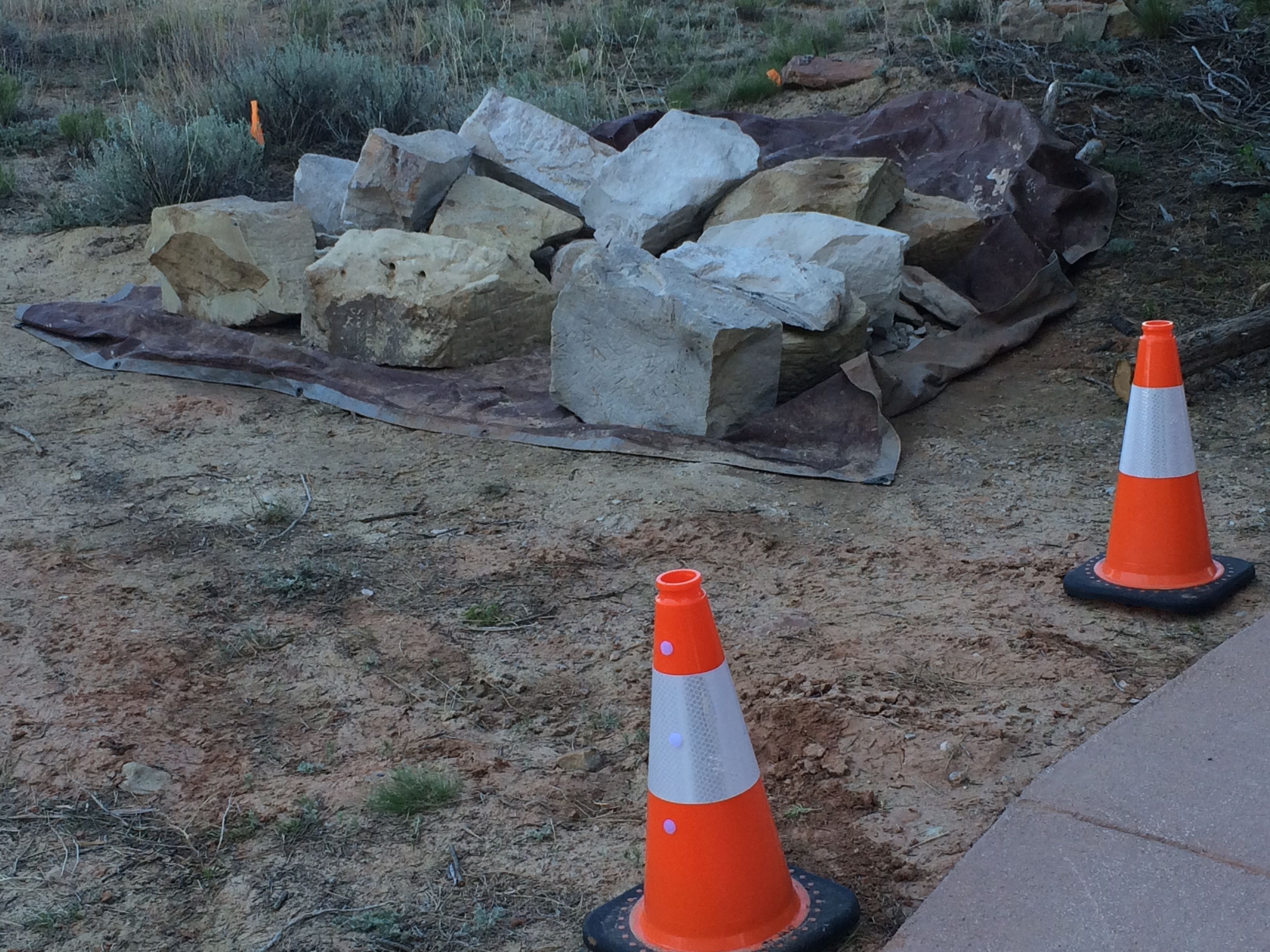
Along the trail, I came across a pile of rocks. They looked like they had inscriptions on it, so of course I had to ask about them when I got back to the visitor’s center. The ranger told me that they used to have rocks in the front of the center for people to carve their names into. She said that they decided to discontinue that practice. I guess they rocks are just here until they put them someplace else.
I took a pass through the campground, just to see what they had to offer. There are nine campsites, but they are kind of tight. They don’t accept reservations and there are no hook ups at the sites, but the sites are free! So, if you are a camper with a smaller RV or a tent, this sounds like a good deal.
After my drive-through of the campground, it was time to head back to Red Rock Park in Gallup. It was time to get packed up and ready to move on in the morning.
I decided that I was ready to leave Arizona behind me. I looked on the map and decided that Gallup looked good. I crossed the border and stopped at the tourism information office at the rest stop right across the state line.
The helpful information specialist helped me identify a campground and she assured me that I wouldn’t have trouble getting a spot in the part – Red Rock Park at Church Rock, on the outskirts of Gallup.
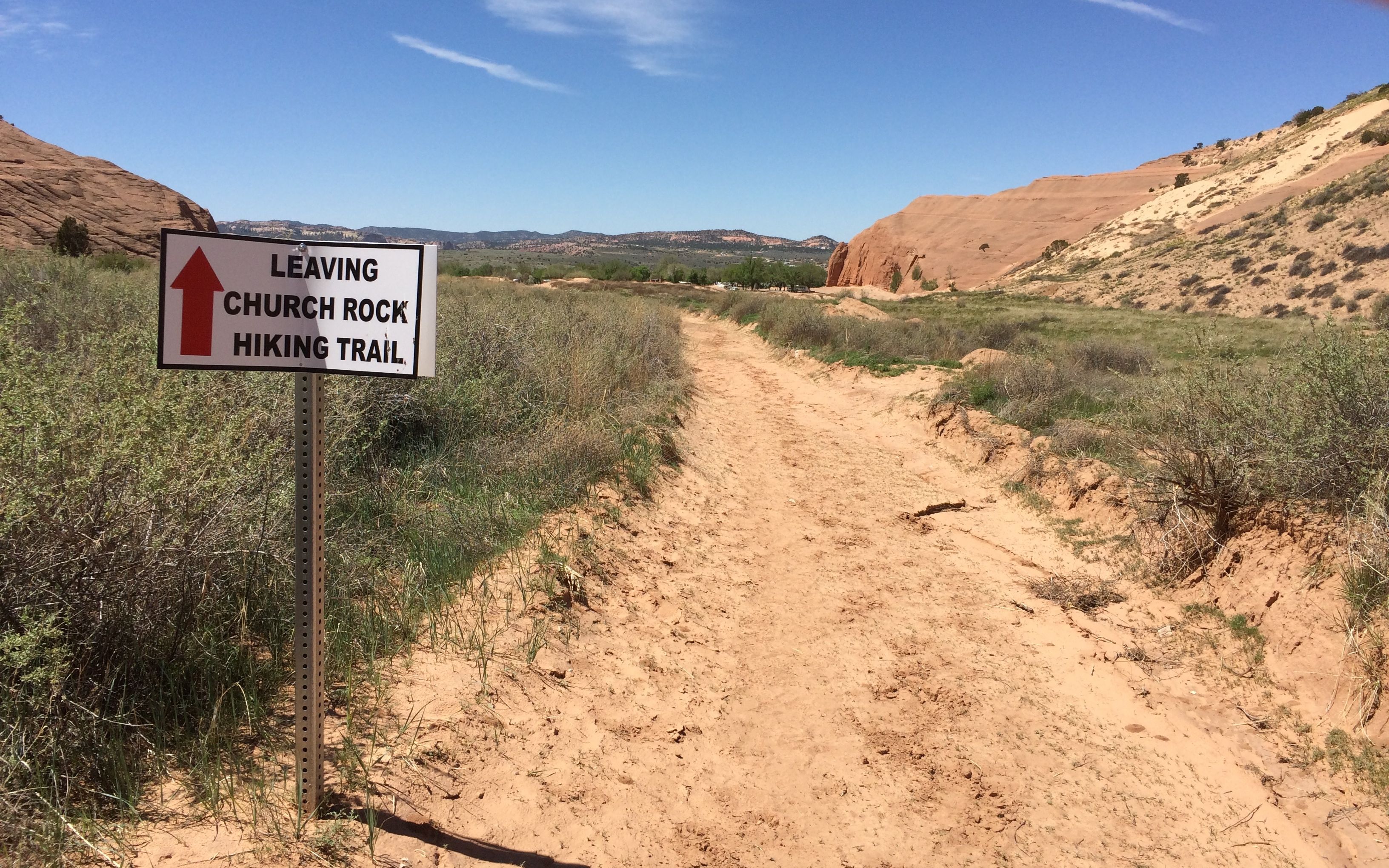
I could see Church Rock from my campsite! They said they had a trail to Church Rock. I decided to give it a shot.
I walked along. I was prepared with a few bottles of water, a peanut butter and jelly sandwich, my hat and my walking stick. The brochure about the trail warned about not going up something you can’t get down. I figured I’d give the trail a try – if it didn’t look like my cup of tea, I could always turn around.
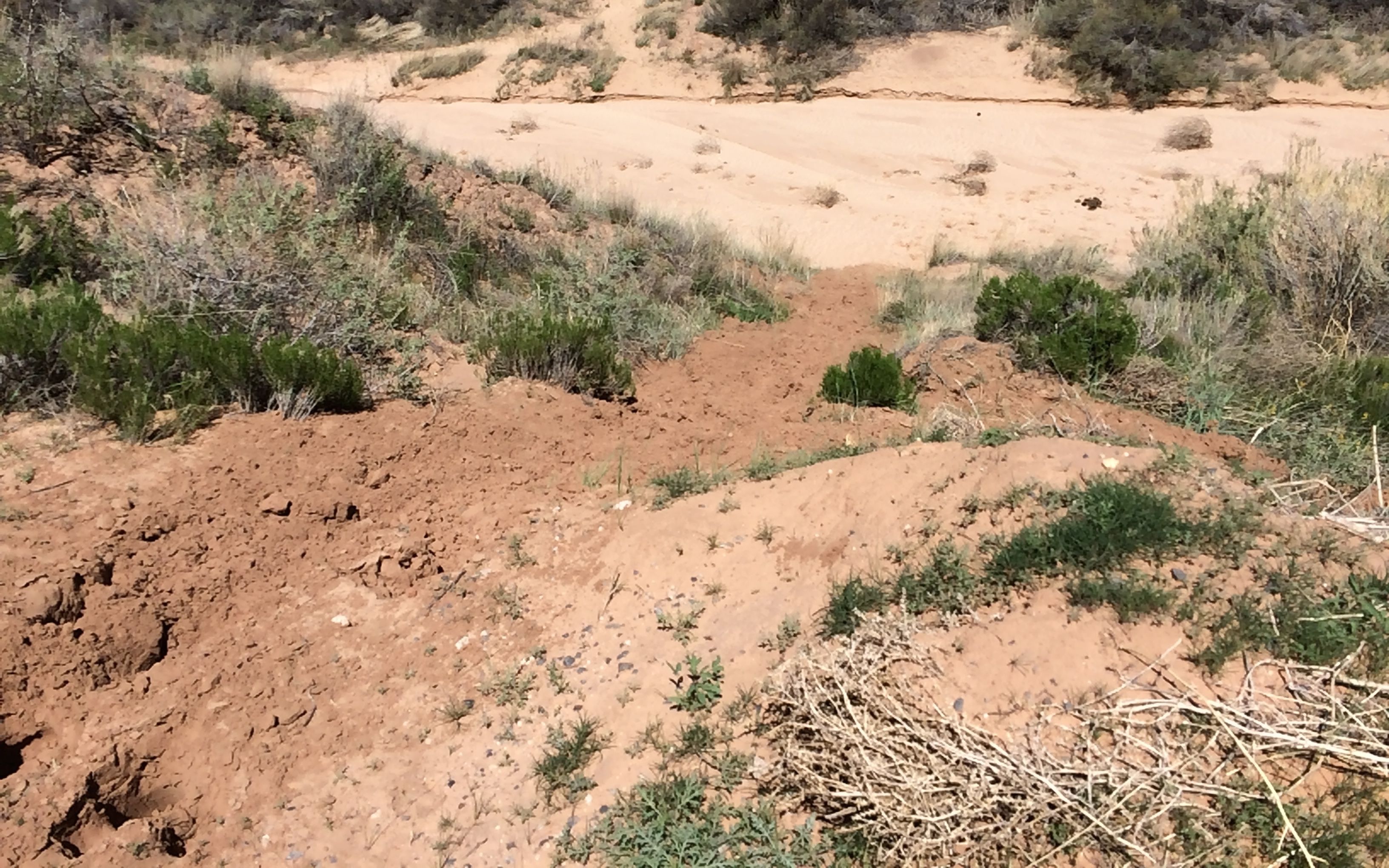
After about a quarter of a mile, the trail kind of disappeared. The rock wall let me know that wasn’t the way.
I looked over to the left.
Uh…I wasn’t going to go down that way, either. Just then, an athletic young woman who had obviously done this trail before came up behind me. She said hello and then showed me the way over the edge. There were some steps cut into the rock.
I followed in her footsteps. I walked a bit further and then came up to a series of steps made out of railroad ties and dirt. They weren’t really stable. I decided that I had gone as far as I was meant to go. I turned around and decided to find something else to do with my day.
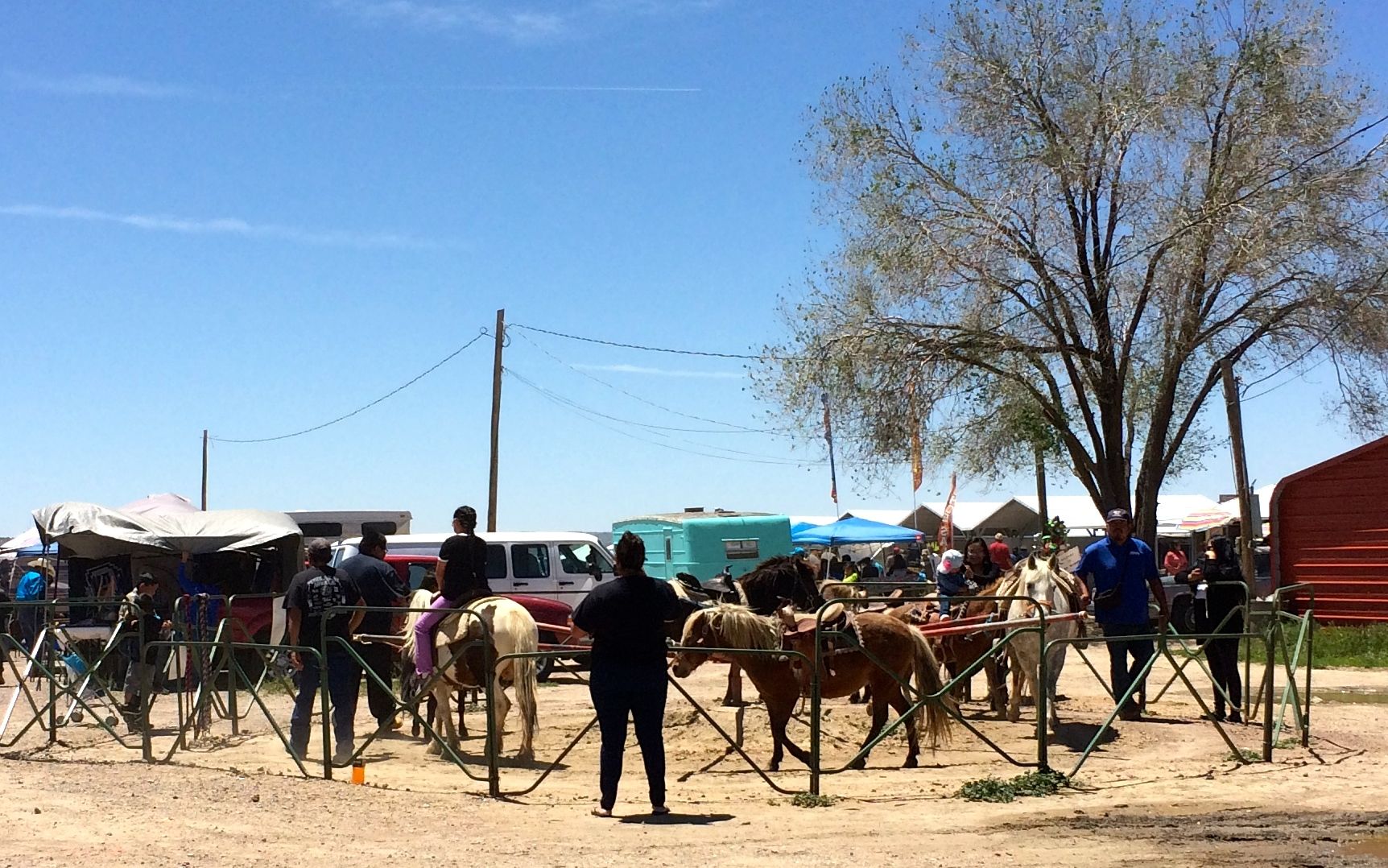
In the tourist literature, it mentioned that Gallup had a flea market, so I decided to check that out.
It was on a dusty patch of land next to a railroad siding. but it was definitely the place to be. It was hard to find a parking spot.
Across the street, vendors were selling bales of hay.
Some of the stalls had more permanent locations.
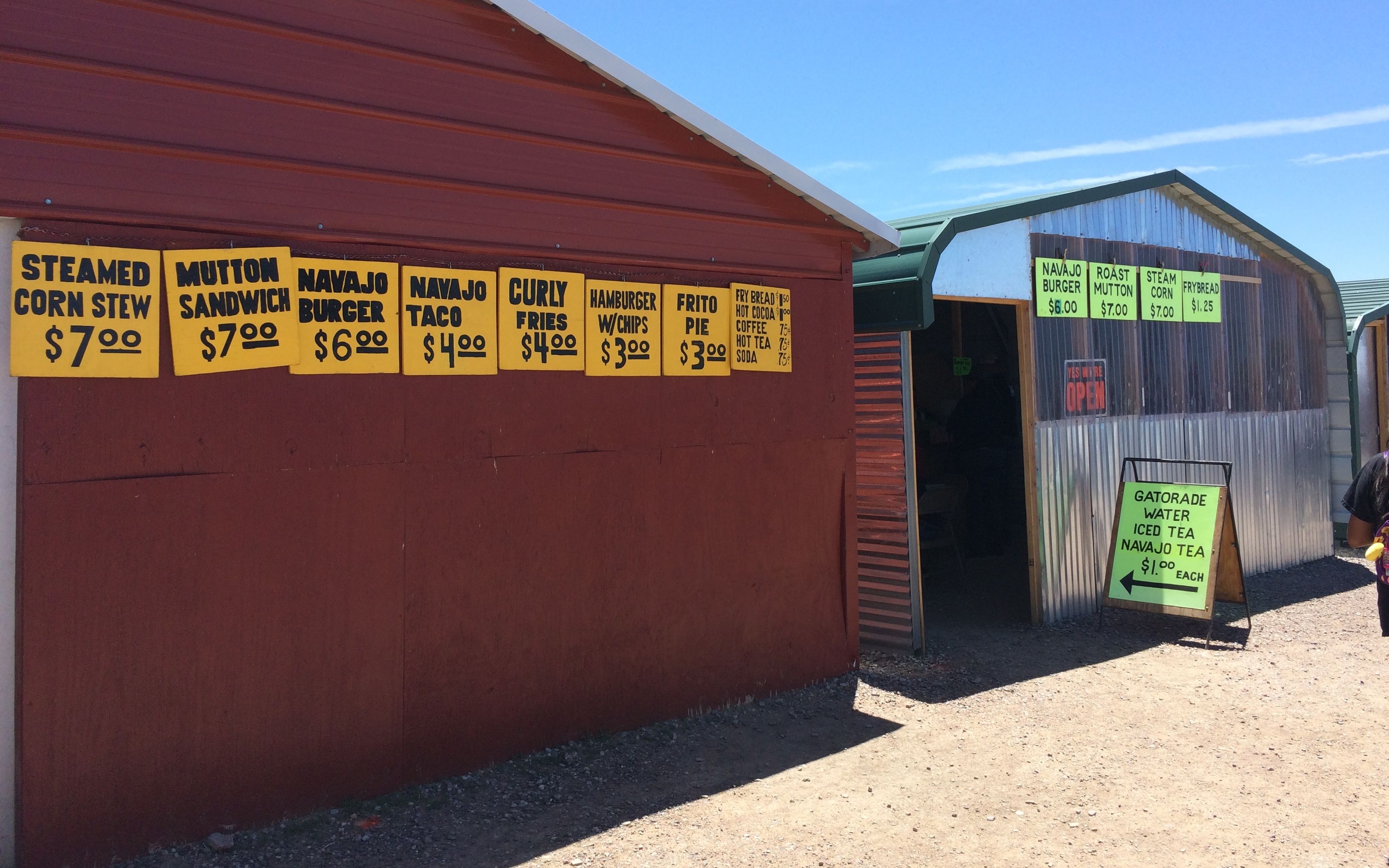
There were a number of food stalls that had some interesting offerings – you know, things that aren’t found at McDonald’s.
I think the pony ride looked like a lot of fun. The little kids were smiling – and so were their parents.
It was a pretty relaxed place. There was the most laid-back busker I’d ever seen. He put out his bag, box and sign and then was nowhere nearby. I did see him later on with his guitar, but there was no music happening. There wasn’t much money in the box, either.
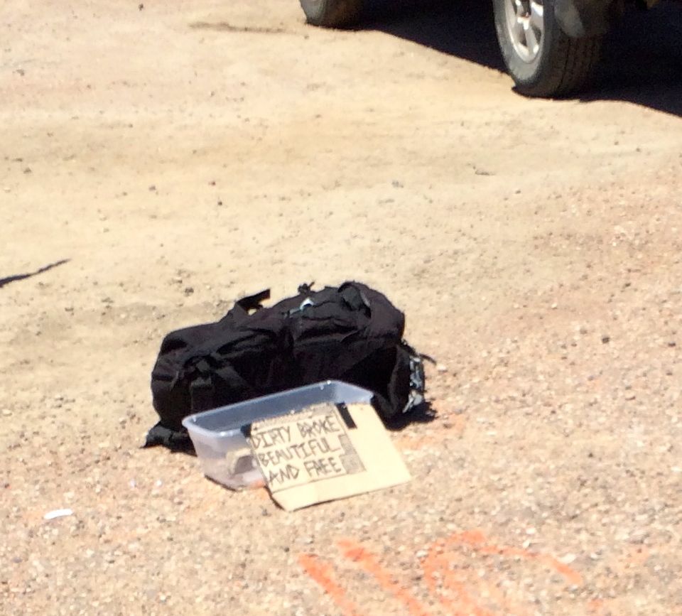
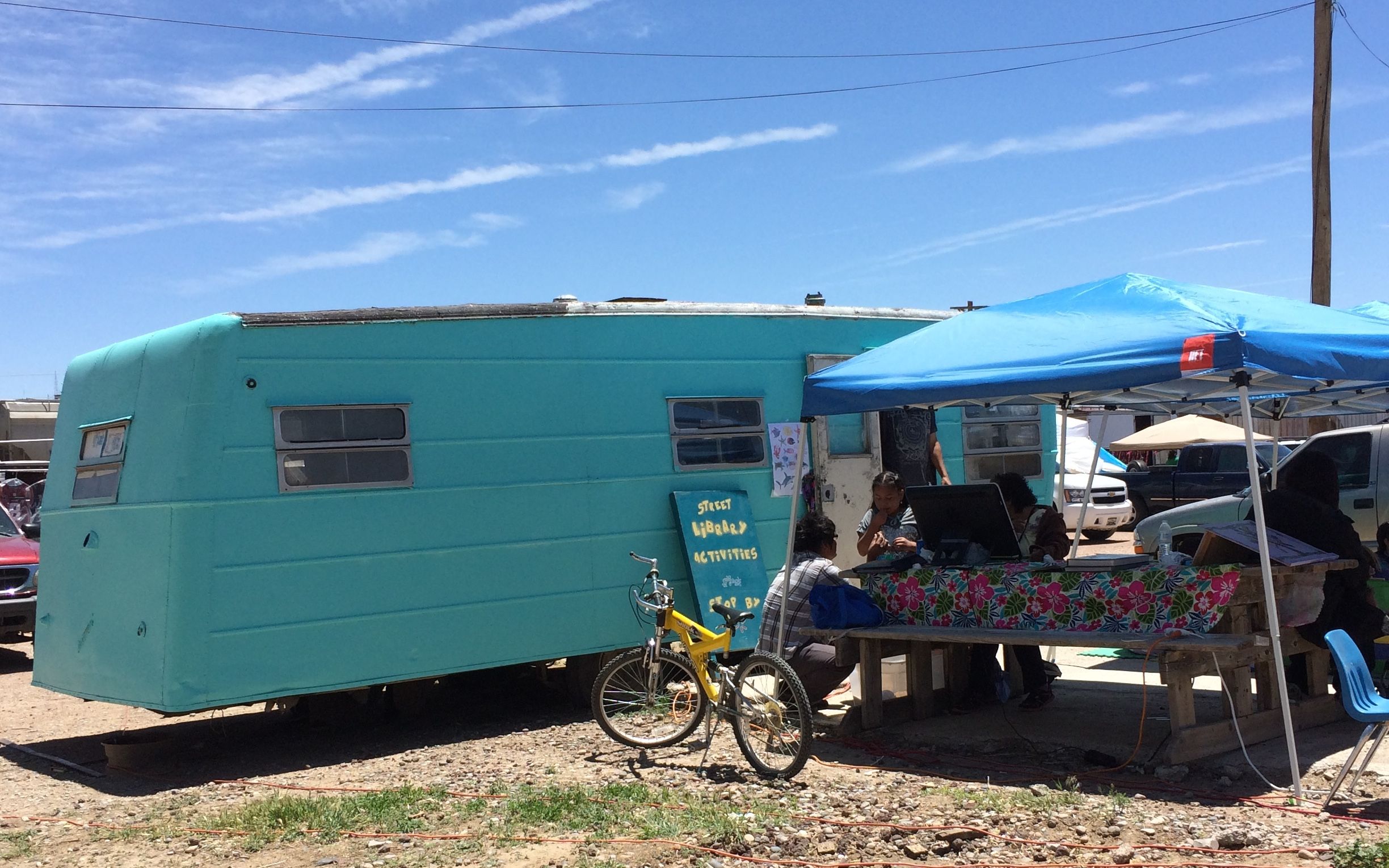
There was a turquoise-colored trailer that had free library activities for the people there. There was an older woman using a computer, and young families playing some games.
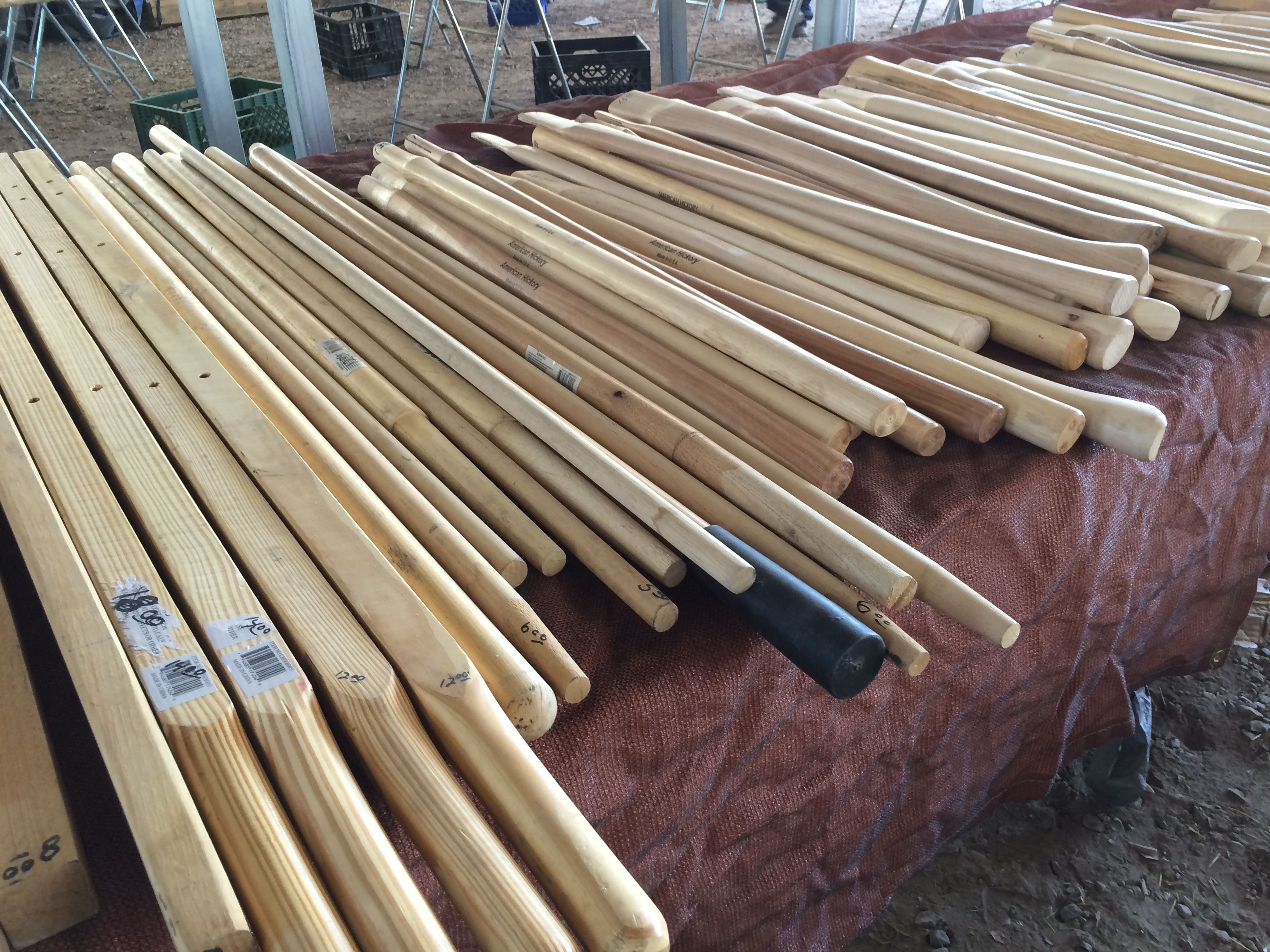
I wandered around, looking at all the different things for sale. I was drawn to a hardware tent. Tools are cool!
Jewelry is a big thing at the market. You know what I learned? Indians wear Indian jewelry! I always figured that Indian jewelry was along the line of Chinese fortune cookies – not very authentic. I learned something.
This gentleman was selling rocks and beads that he made from them. That turquoise machine on the trailer is polishing the rocks. He fed handfuls of rocks into the hopper. After the rough edges were polished off, he drilled holes in them and sold them by the string.
There was a vendor who had used DVDs for sale.She had an eclectic assortment and I joined the crowd sifting through them. They were three for five dollars, so I picked up three for times when I have electricity but no broadcast signal.
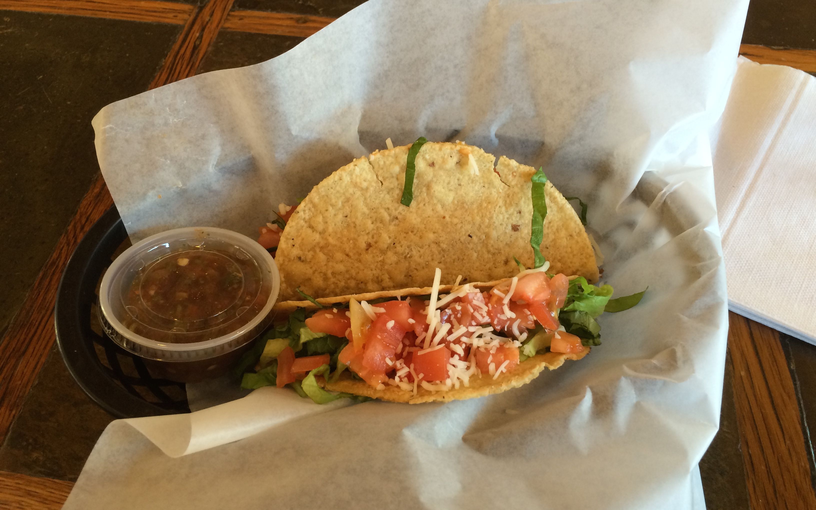
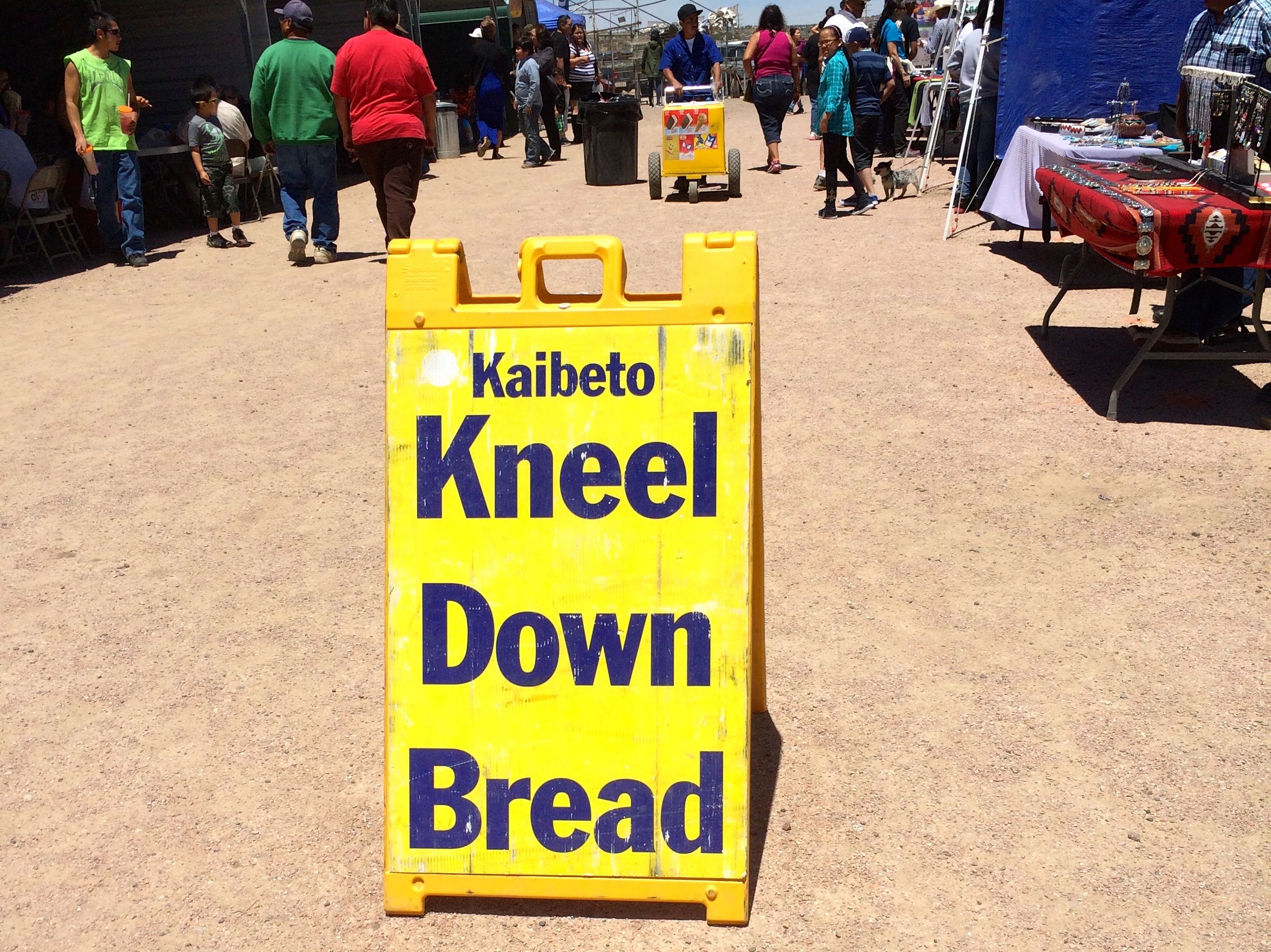
I bought some food to take home – cookies, Navajo tamales, cake and something called “Kneel Down Bread.”
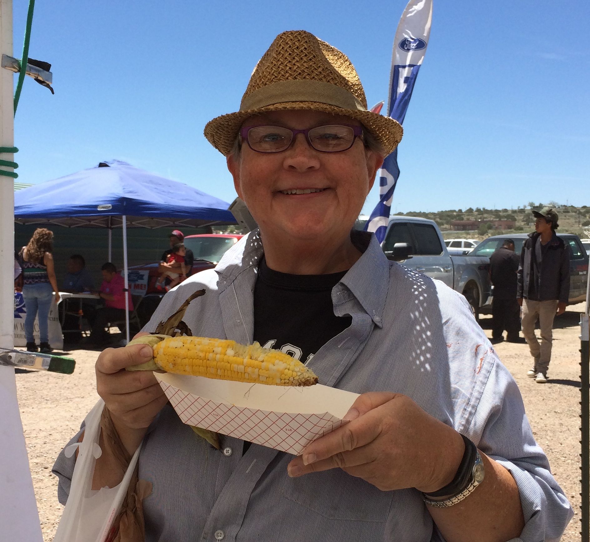
On my way back to the truck, I passed a a stand selling roast corn. The vendor had three ears left and I got one of them. I love corn!
After I got back to the campsite, I took pictures of my purchases.
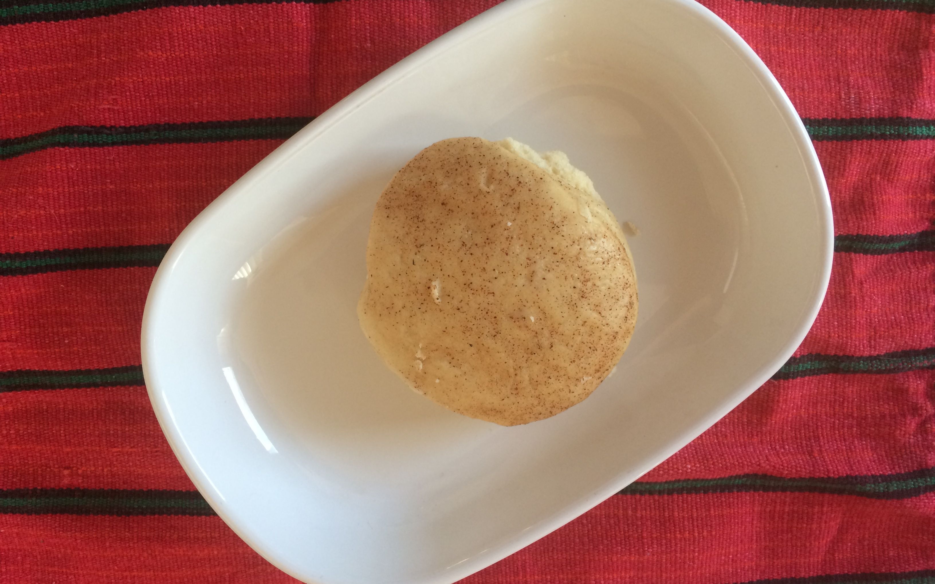
I bought three cookies for one dollar. I ate two of them before I got the picture taken. It seemed kind of like a biscuit that was topped with cinnamon and maybe a dash of nutmeg.
The Navajo tamales were huge! They were tied with strips of corn husks. When I ordered them, the vendor pulled them out of a pot of boiling water. I always thought tamales were steamed. I guess there is more than one way to make them.
This was the cake. I asked the vendor if it was sweet. He looked at me as if I were crazy and said, “Of course it’s sweet. It’s cake.” I took a small taste of it. It wasn’t sweet. I didn’t care for it at all.
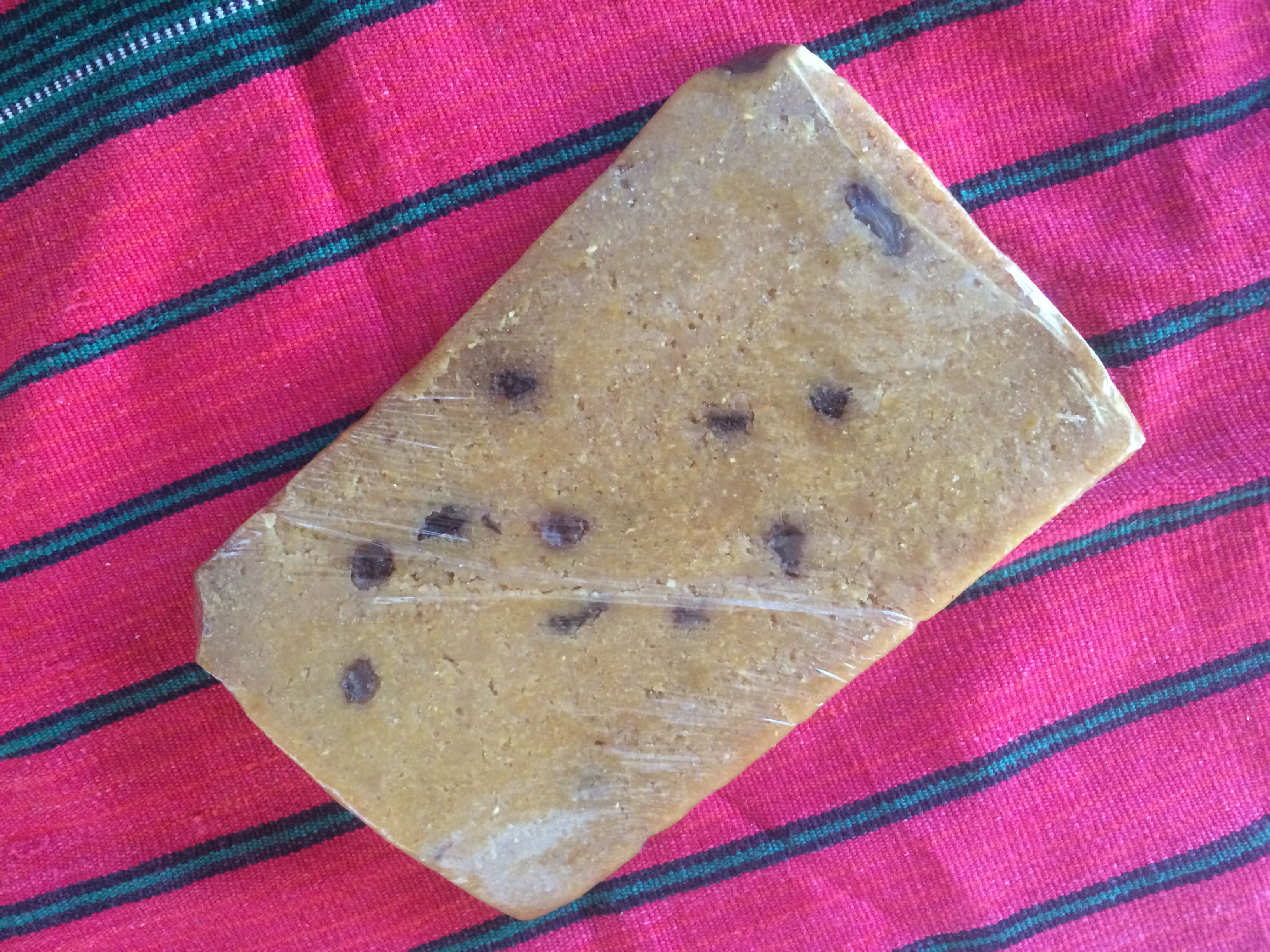
This is the kneel down bread. I rather liked it.
It tasted like freshly ground corn. I do love corn!
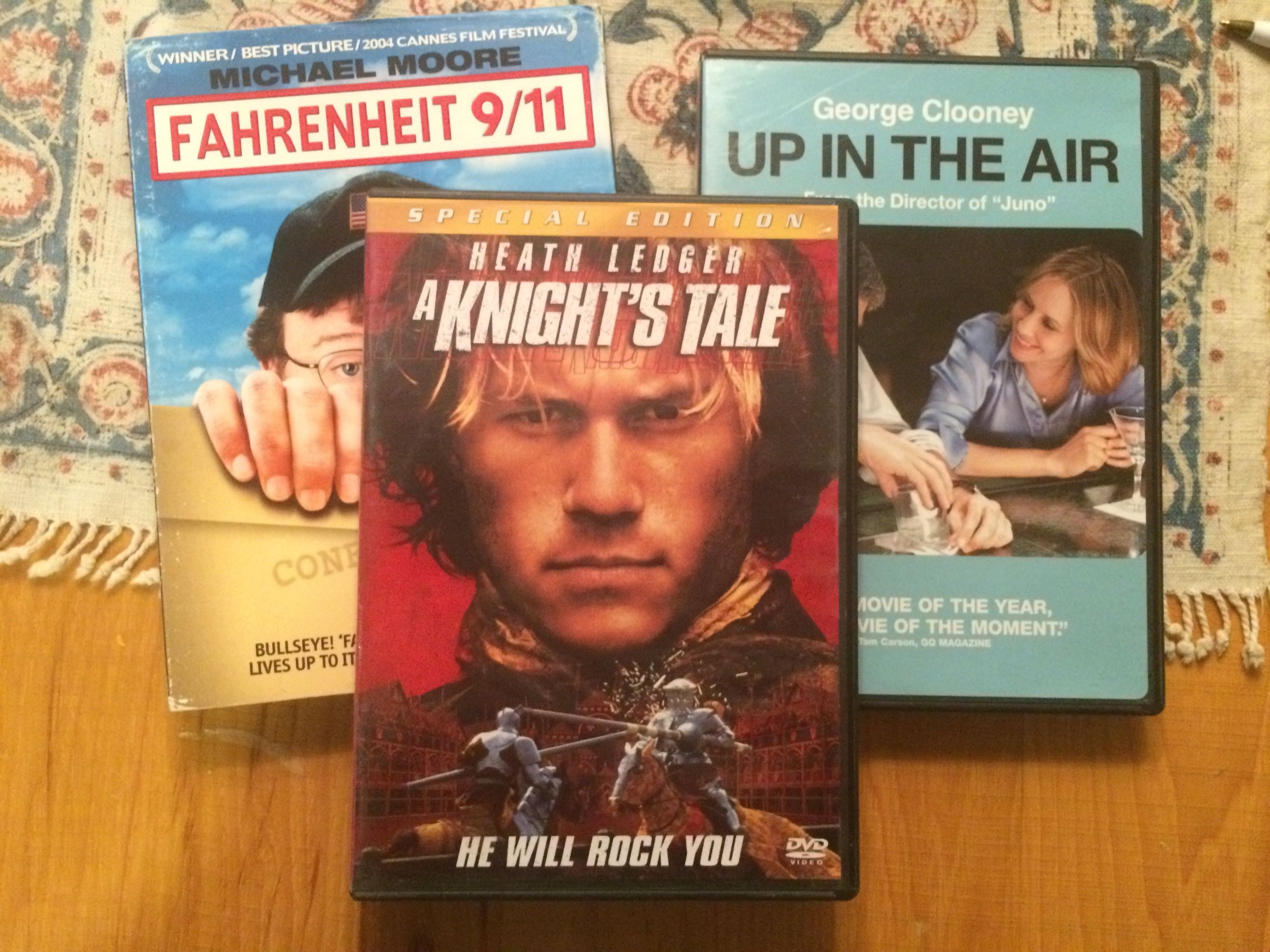
And here are the movies for those times when I just need a little entertainment.
After the overly exciting day getting into and out of the first campsite at Ponderosa Campground, I was glad to open my door on a beautiful new day.
The view from my door
There were a couple things I wanted to do, and both of them involved rocks.
My first stop was hunting for crystals at Diamond Rim Quartz Crystal Collection Site.
Since it was after March 1, I was restricted to looking for crystals on the surface. The ranger at the ranger station recommended that I look in the washes. I parked and headed over to the wash.
I found a rock that looks like it has quartz crystals imbedded in it, but it’s larger than I wanted. It stayed in the wash for someone else.
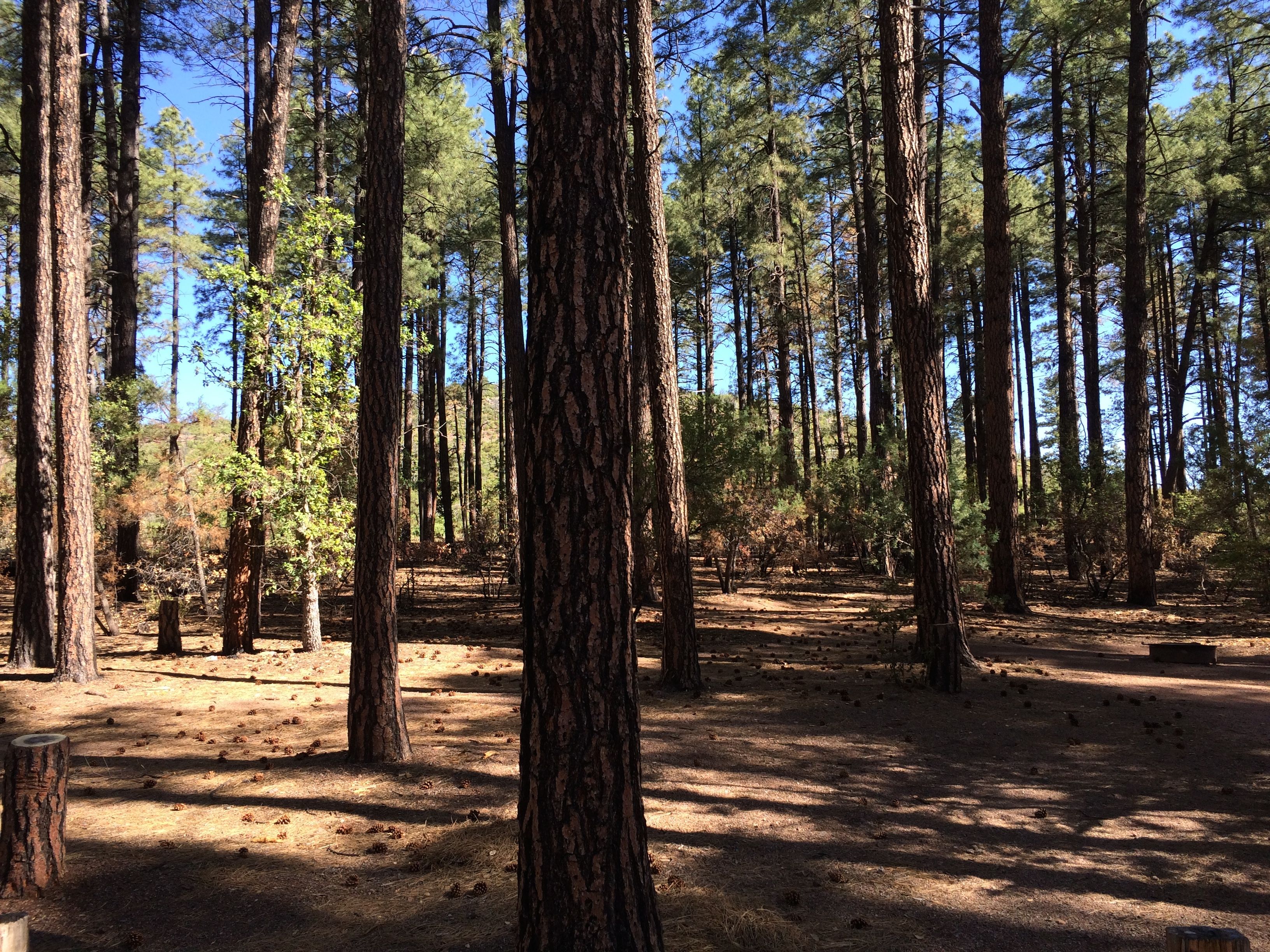
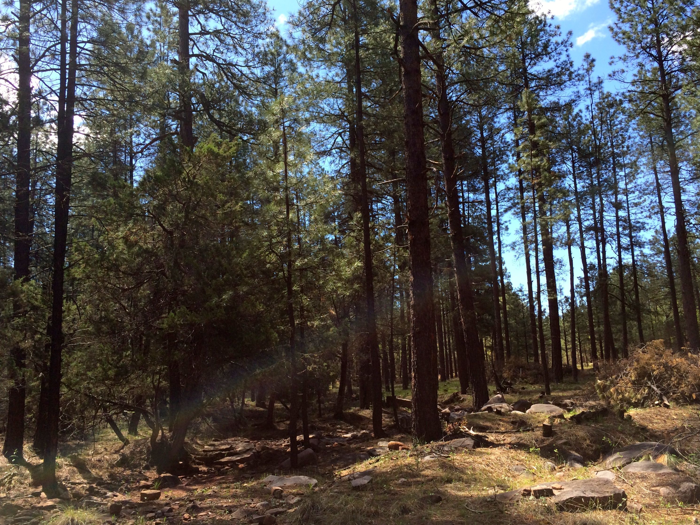
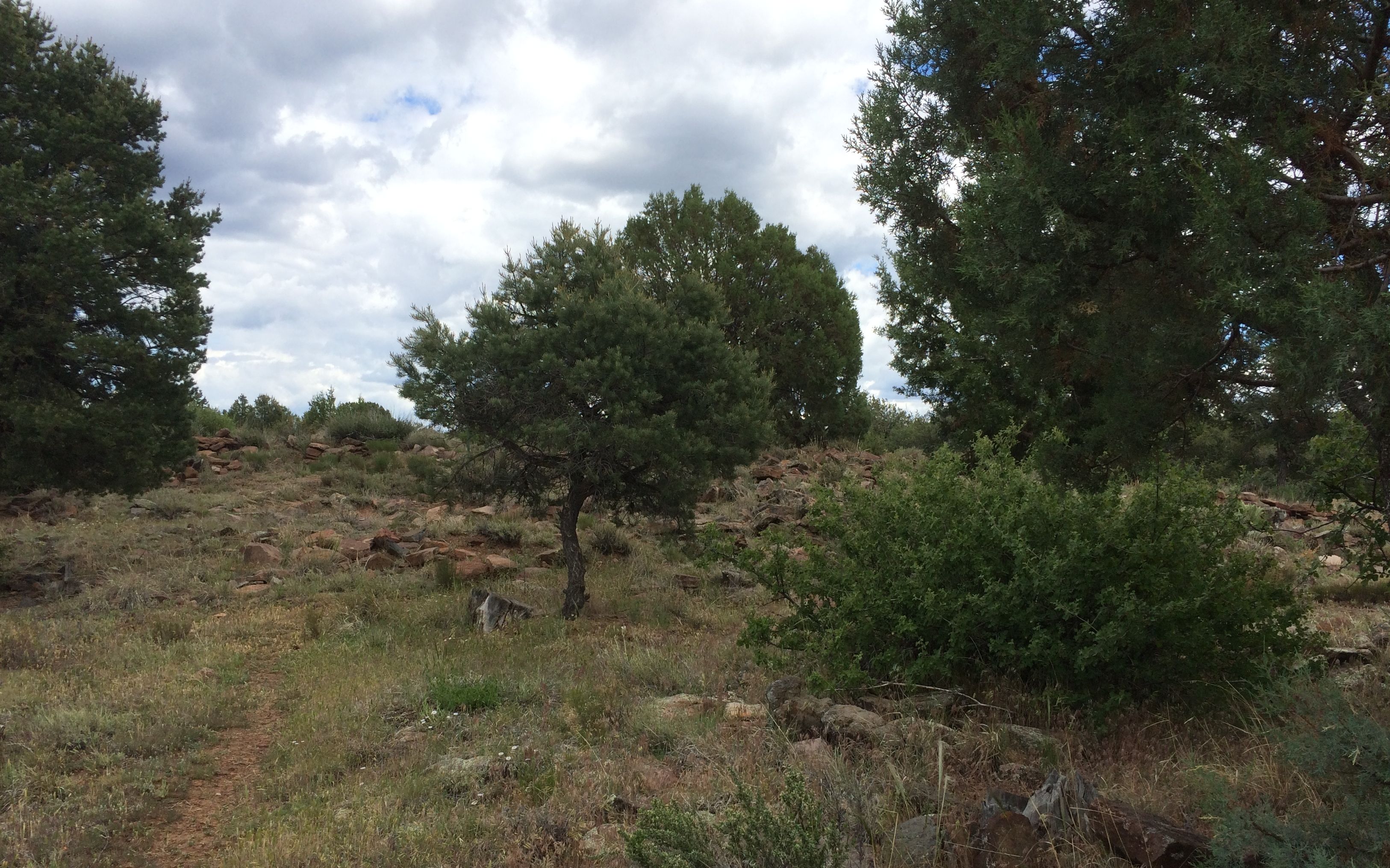
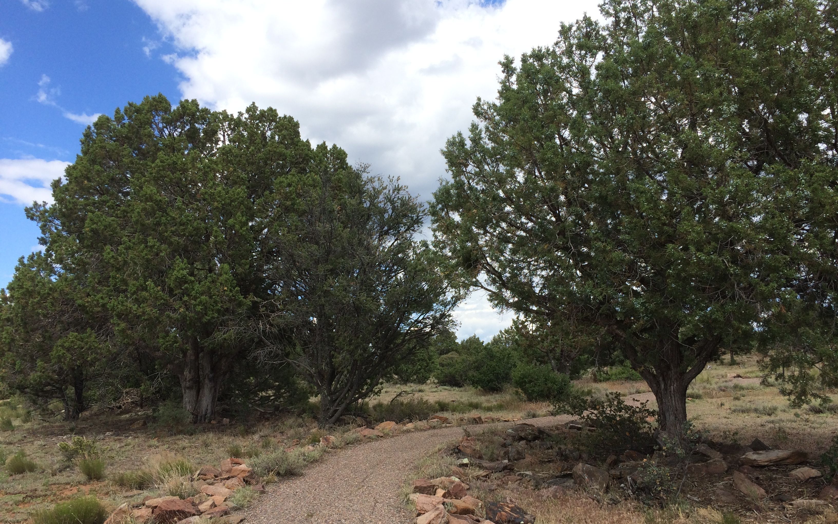
It was a nice day for a walk in the forest.
It smelled very piney. I know pine forests smell piney, but there was a lot of logging taking place. On the way to the site, I passed several active logging locations. The remnants of previous logging were still visible here.
Slash pile
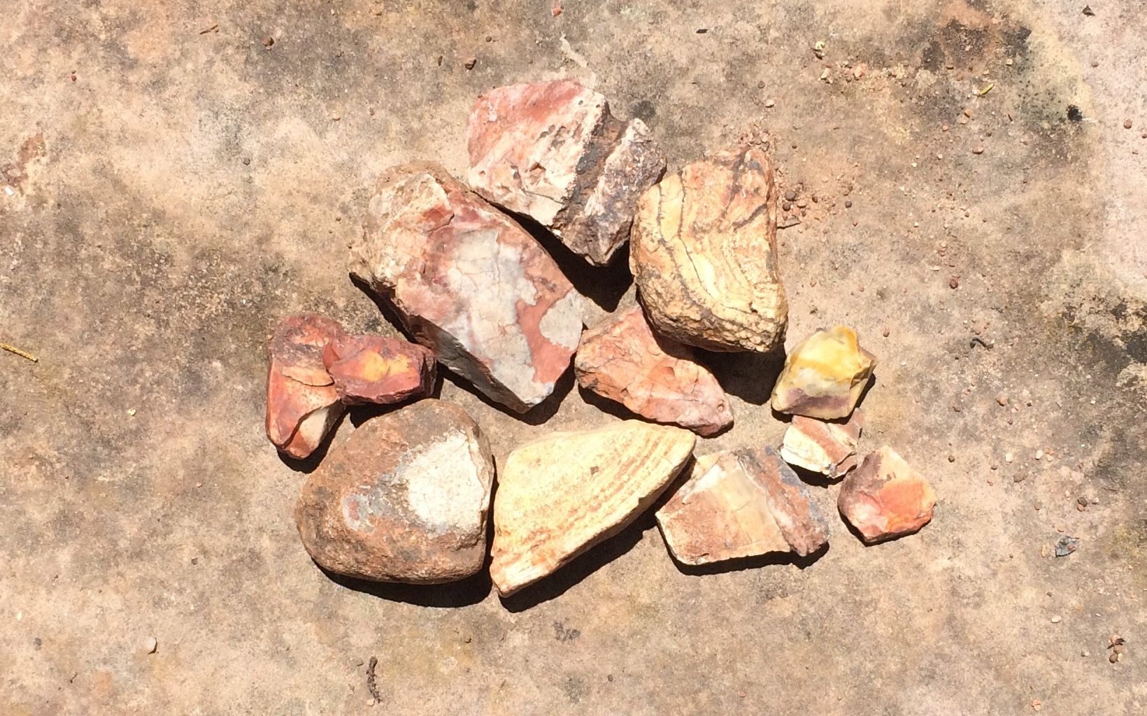
I found some beautiful rocks.
I’m more of a “catch-and-release” rock collector these days. When my pockets got full, I took a picture and left them in the wash.
This was an interesting rock in the bed of the wash. When I found it, it looked like it was filled with sugar-white sand. I started brushing it out, and found damp reddish sand at the bottom. It looks like the rock was gouged out by hand, with finger prints raking from the rim to the center of the rock.
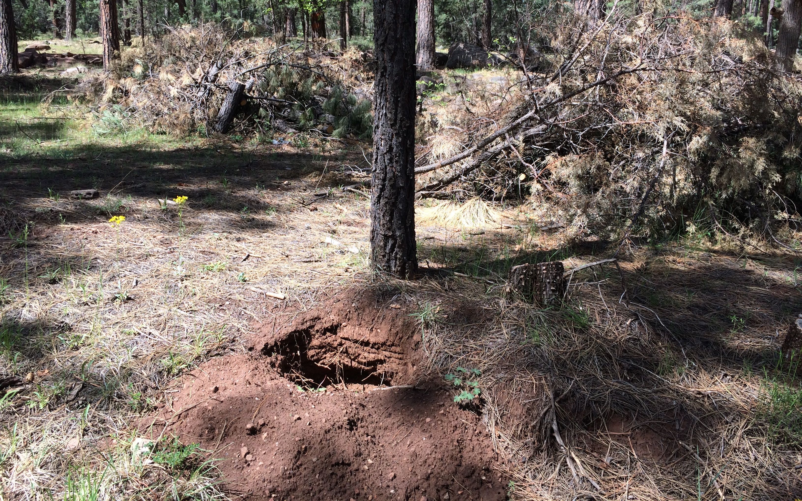
I pushed on, and discover this recent hole. Not only was it not back-filled, it was at the base of a tree. Now, maybe this isn’t a ponderosa – I didn’t think to do a tree ID – but it definitely isn’t backfilled and it looks like it was dug after March 1.
I collected another pocketful of rocks. It was time for a little more “catch-and-release.”
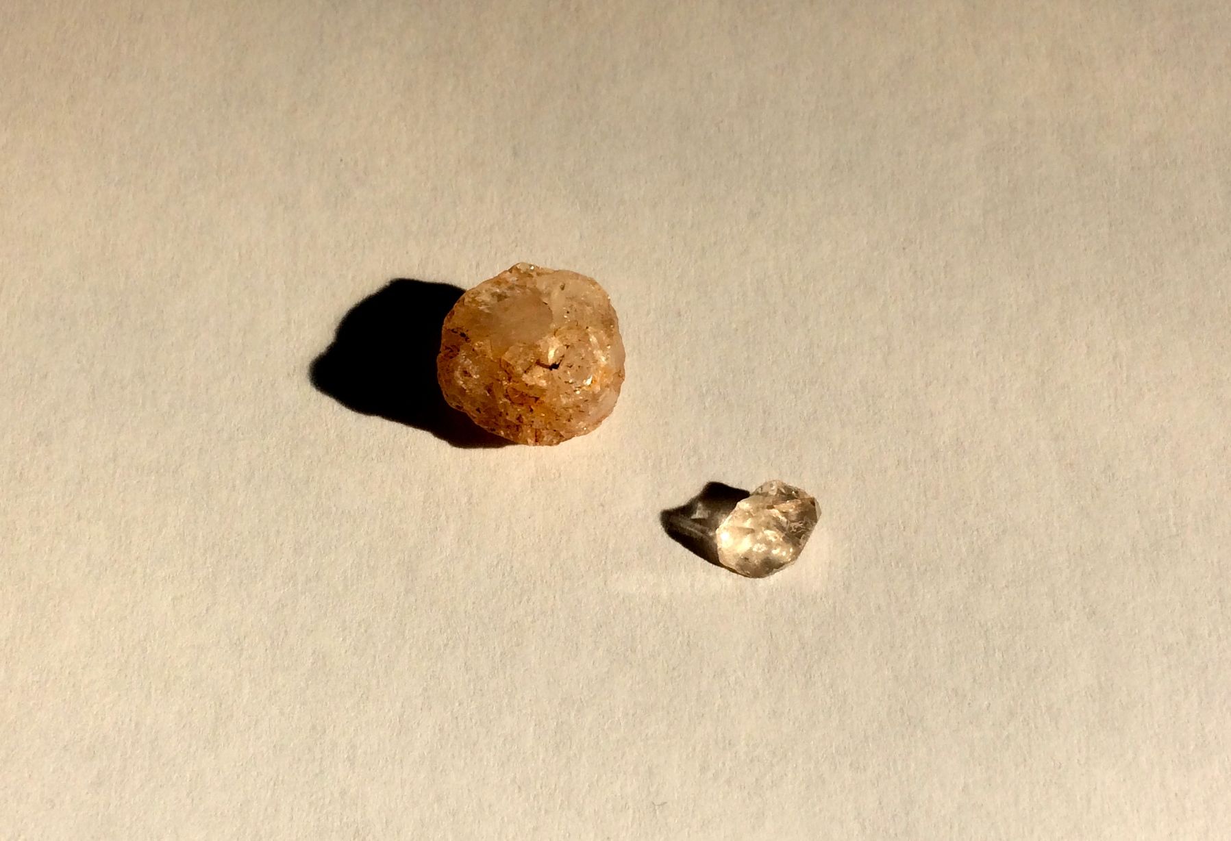
I finally found my crystals!
I’m pretty sure that the one on the left is a crystal. The one on the right might be a piece of glass.
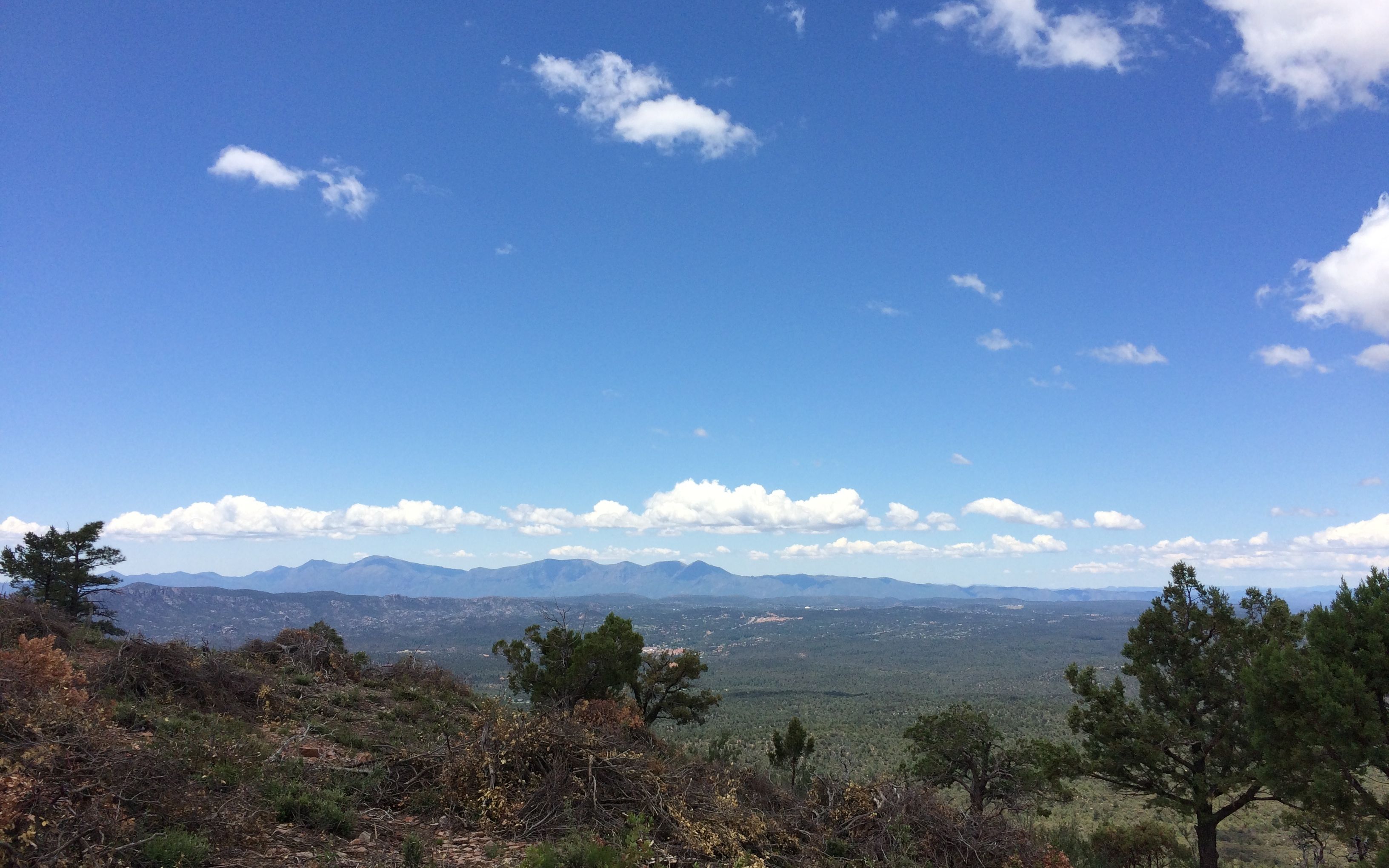
The map the ranger gave me said that there was an overlook at the end of the road I was on. I decided to drive up and take a look.
What a view!
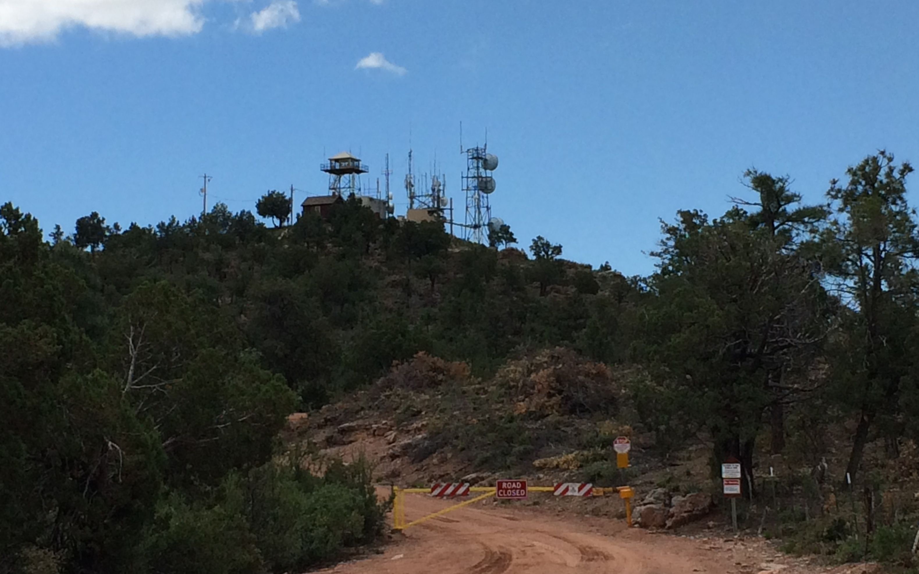
Believe it or not, there was great cell phone reception. Four bars LTE!
It would have been hard to be much closer to the towers!
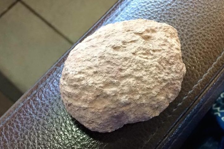
My next rock-related activity was geode hunting. Konnie had shared an article about it that included a location, and the ranger marked the map where I might find them. I drove around and didn’t see any places that looked too promising. I finally found a small wash and got out to look around.
I found some interesting lichens. They almost looked like fractals.
I poked around until I found a rock that looked most likely to be a geode.
I planned to crack it open when I got back to camp.
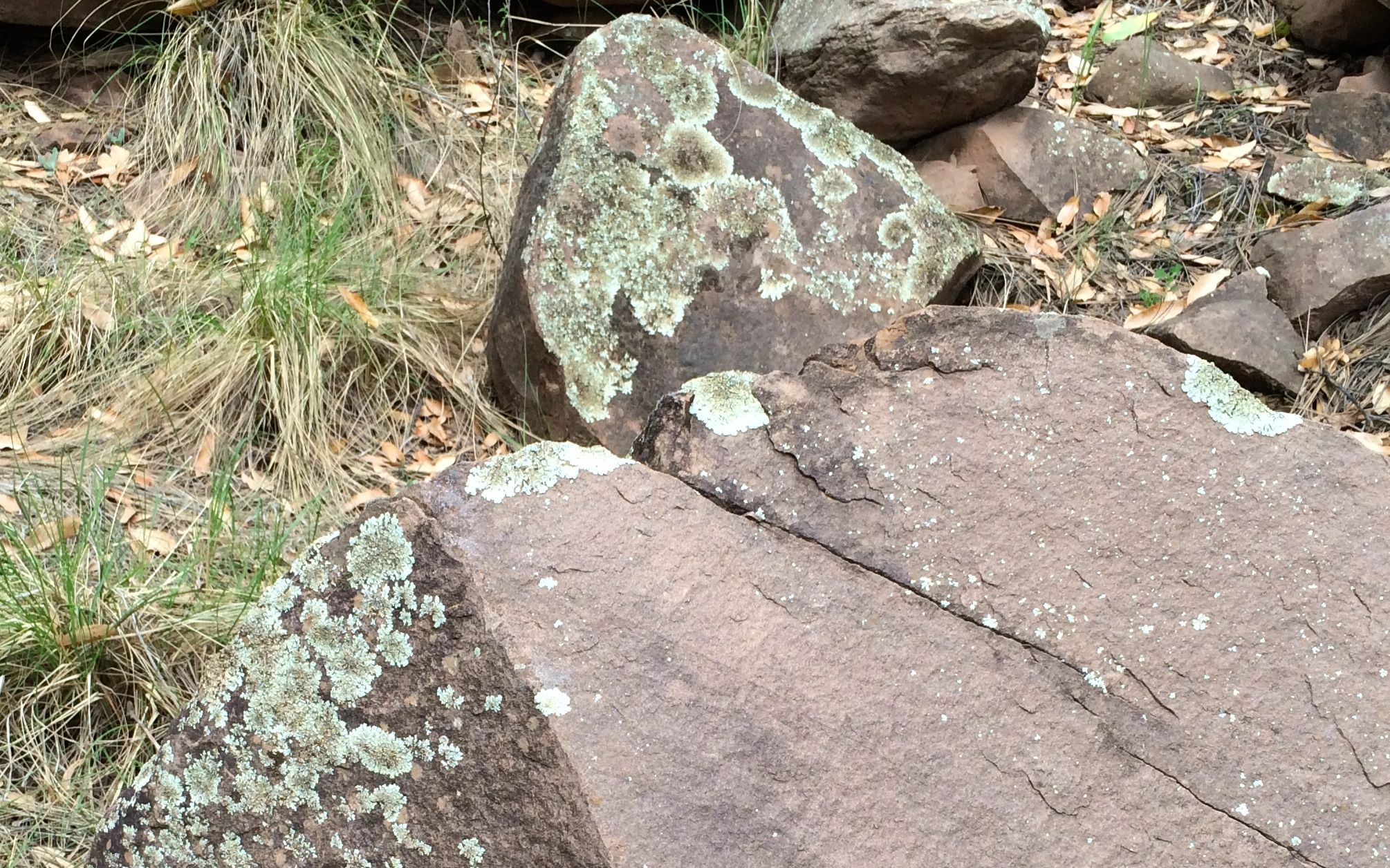
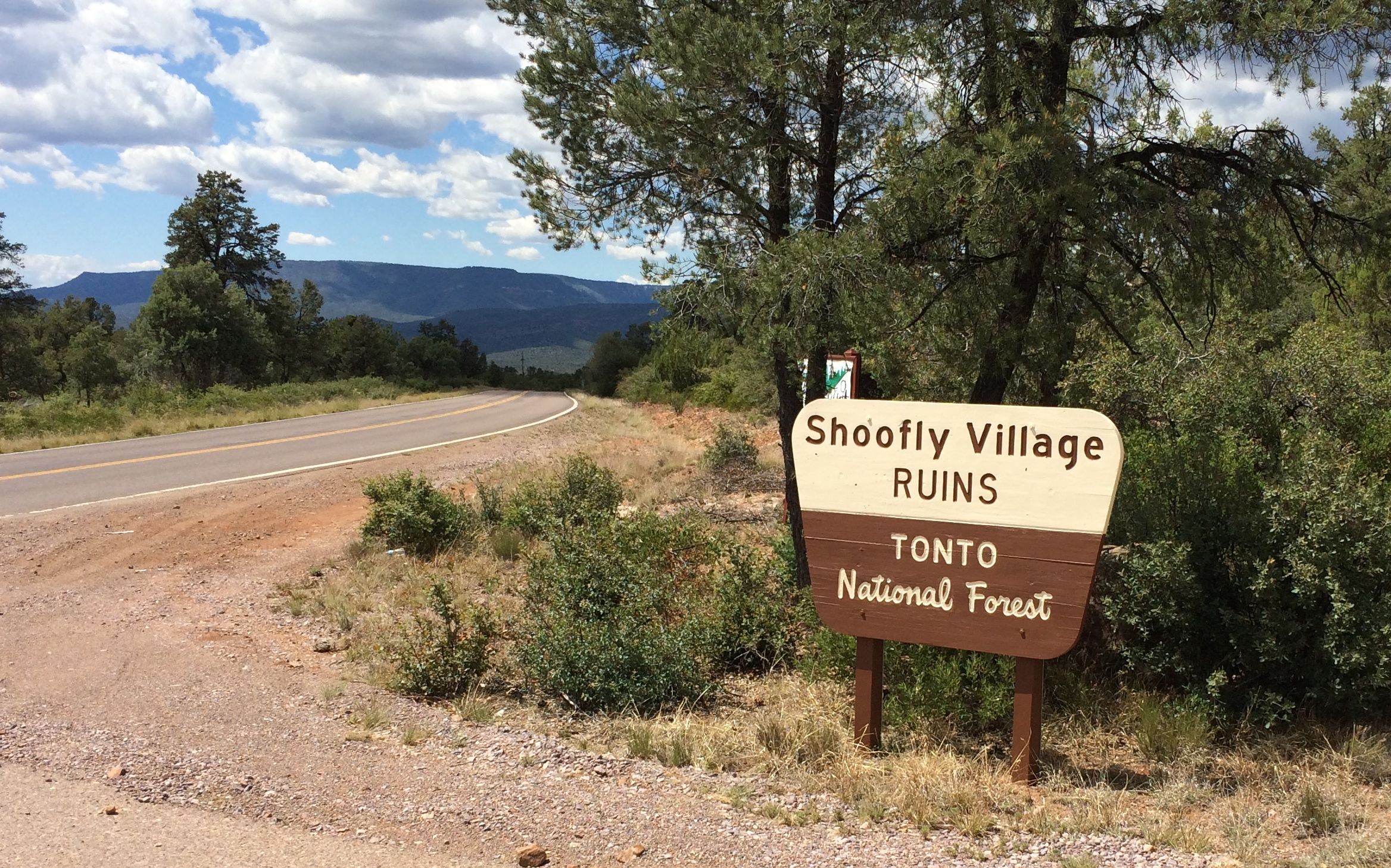
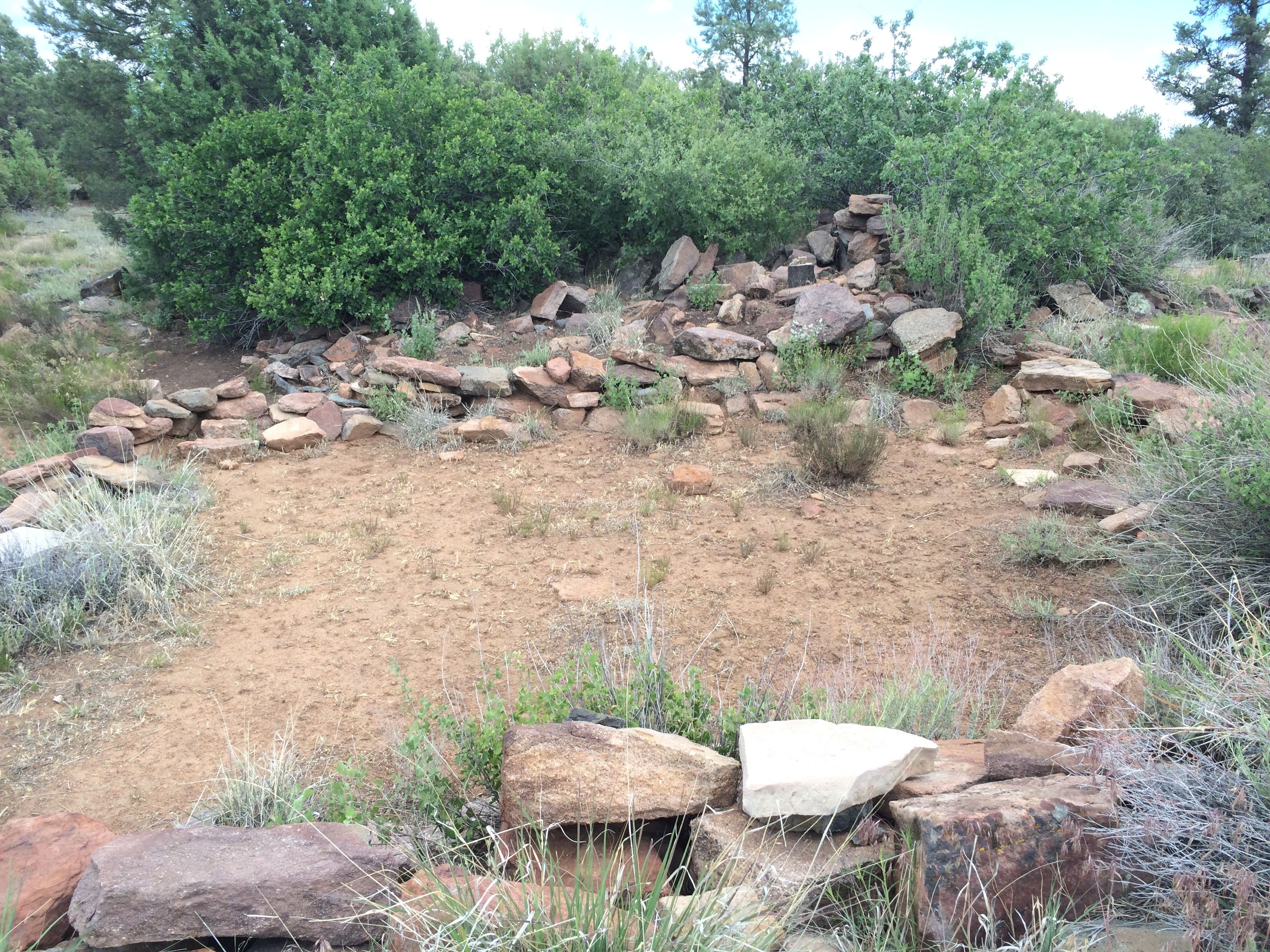
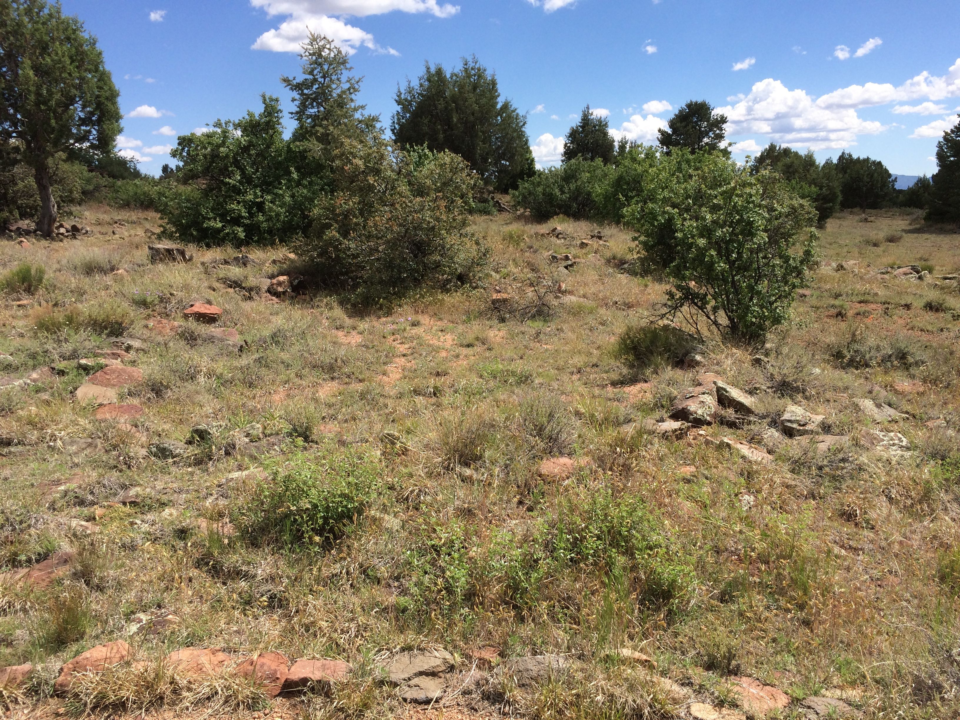
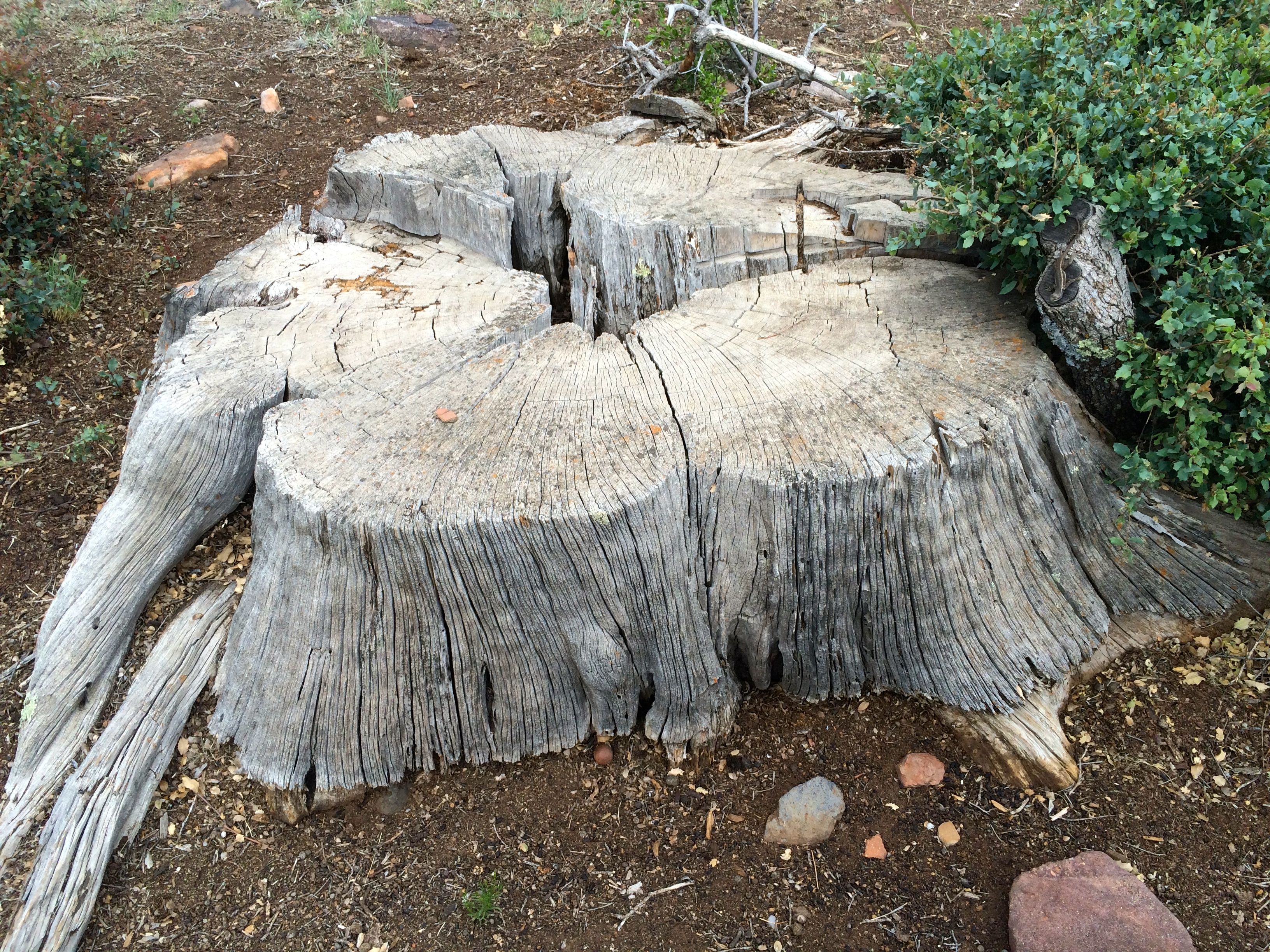
I drove on, intending to head back to Payson and then back to camp. I came across an archeological site.
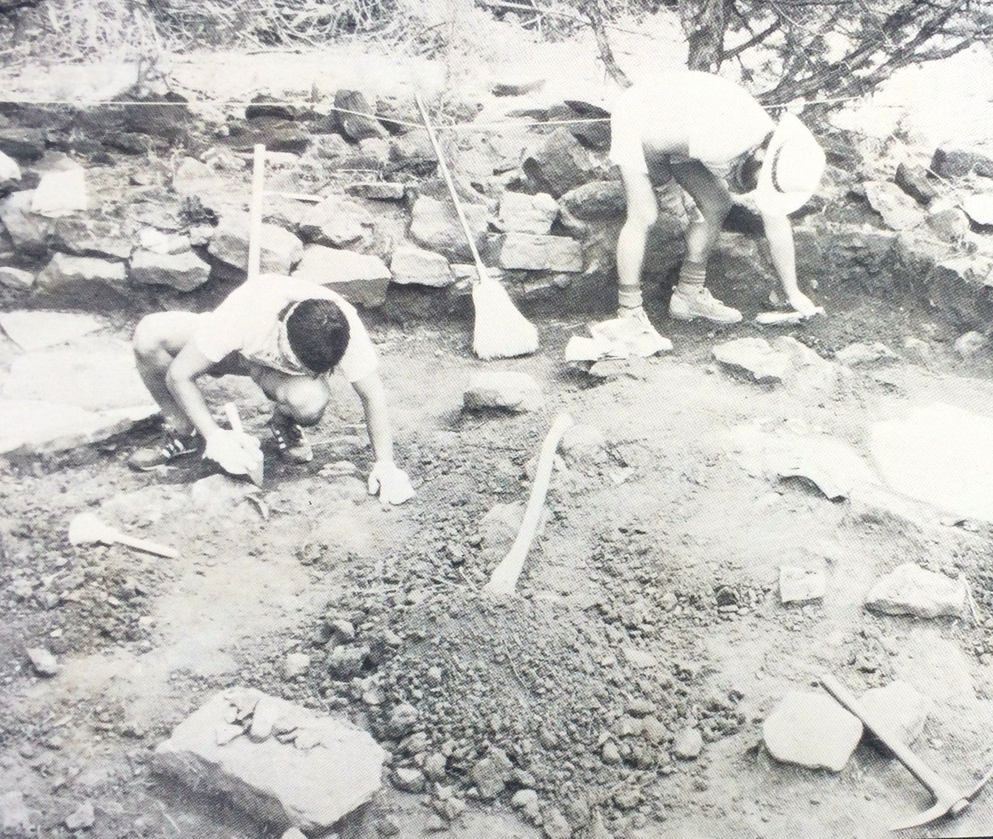
This site had been a walled village that was occupied between 1000 and 1200 AD. There were about 80 rooms in the village and they were built in different styles.
The site was first recorded in 1930 by archeologist John Hughes, but further studies didn’t take place until 1984, when Dr. Charles Redman from Arizona State University lead a field program over a four year period.
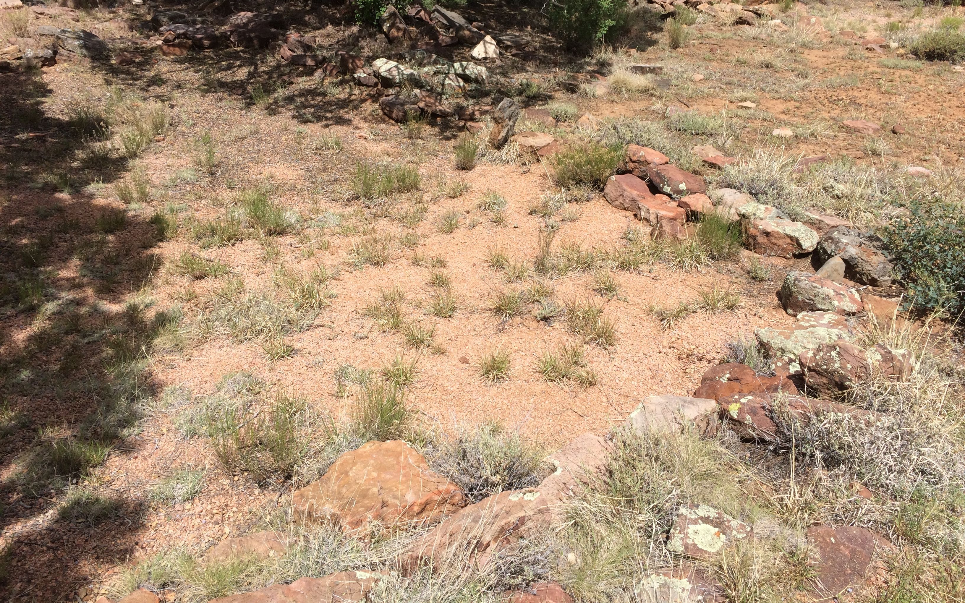
The evidence of the rooms are just outlines now.
Some of the rooms are squarish.
Other rooms are more oval-shaped constructed in a style called “jacal”. From what I understand, these houses had a stone base with the walls constructed of “wattle and daub” – vertical poles were lashed together and then the walls were constructed of branches, grasses, mud and adobe.
There is not much to see anymore.
According to a sign, this pile of rocks is the remains of a two-story apartment building.
This stump is so old that it looks like it might have started growing in the last days of the village.
The site is surround by the remains of the village wall. Trees grow in what is left of it.
Incidentally, I think I know where the name of the village came from. I was swatting flies away from my face the whole time I was walking the trail.
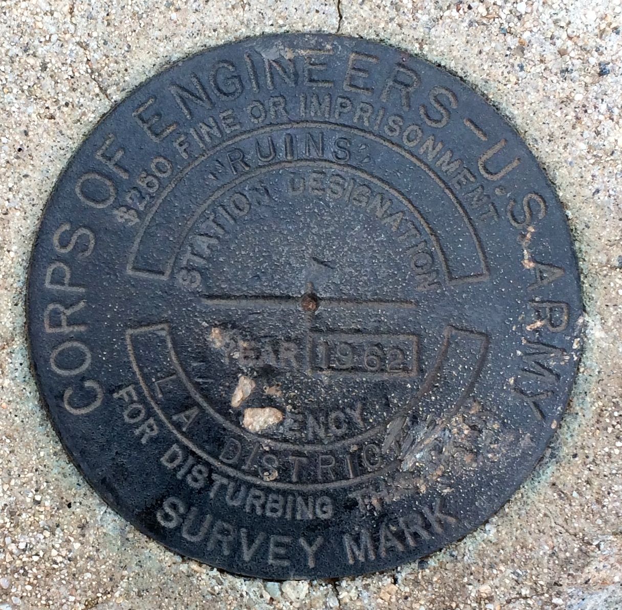
On my way back to the truck, I discovered another survey marker. More for my photo collection!
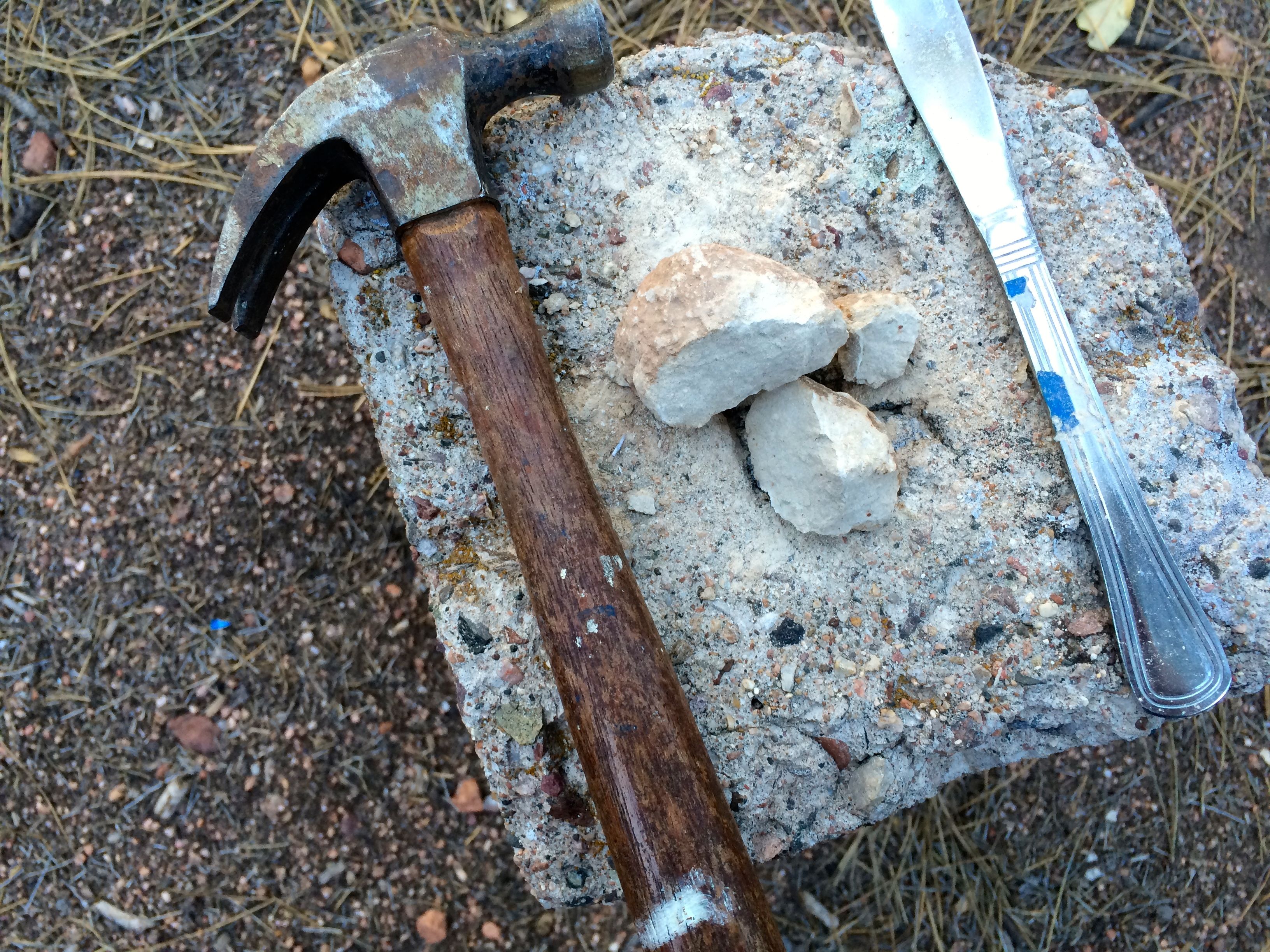
After I stopped off at a store, I headed back to the campsite. I couldn’t wait to see if I had found a geode!
I assembled the tools.
I proceeded to work on splitting the rock. Geode? Node?
At the beginning of last month, I had said that May was the most expensive month so far. I guess June heard that and took it as a challenge.
Just so July doesn’t hear, let me whisper, June is now the most expensive month this year.
If only the insurance hadn’t come due! If you don’t count that, then you could say that June was the least expensive month. But, I guess I kind of have to count insurance.
Here’s the breakdown of where the money went:
Other (which includes insurance) $3,467.10
Gas 523.90
Campsites 400.94
Groceries and such 201.29
Eating out 85.35
Tourism and entertainment 56.55
Food and drink on the go 20.89
Laundry 16.50
Clothing 6.62
Tolls and Parking 2.55
RV 0.00
Truck 0.00
TOTAL $4.781.69
Yikes!
I drove 2504 miles in June and visited seven states. (Texas, Oklahoma, Missouri, Iowa, Illinois and Michigan) I stayed in ten campgrounds, and actually had ten nights of free camping. Six nights were while I was taking part in an HistoriCorps Project to preserve George Washington Carver’s first school in Neosho, Missouri, and the four nights in Branson, Missouri were courtesy of a sales pitch for a camping membership group.
In the words of Groucho Marx, “I wouldn’t want to belong to any club that would have me as a member.”