Fort Clatsop was the destination I picked out for my second day of adventures in the Portland area.
Fort Clatsop? Why? What is that?
Well, Fort Clatsop is where Lewis and Clark spent the winter of 1805 – 1806. After seeing all the signs for the route they traveled while tooling along down beautifully paved roads in BART, the Big Assed Red Truck, I couldn’t believe I was finally going to see where they ended up.
I set out on a beautiful sunny day, and I headed down the Columbia River toward the Pacific. My first stop was Astoria.
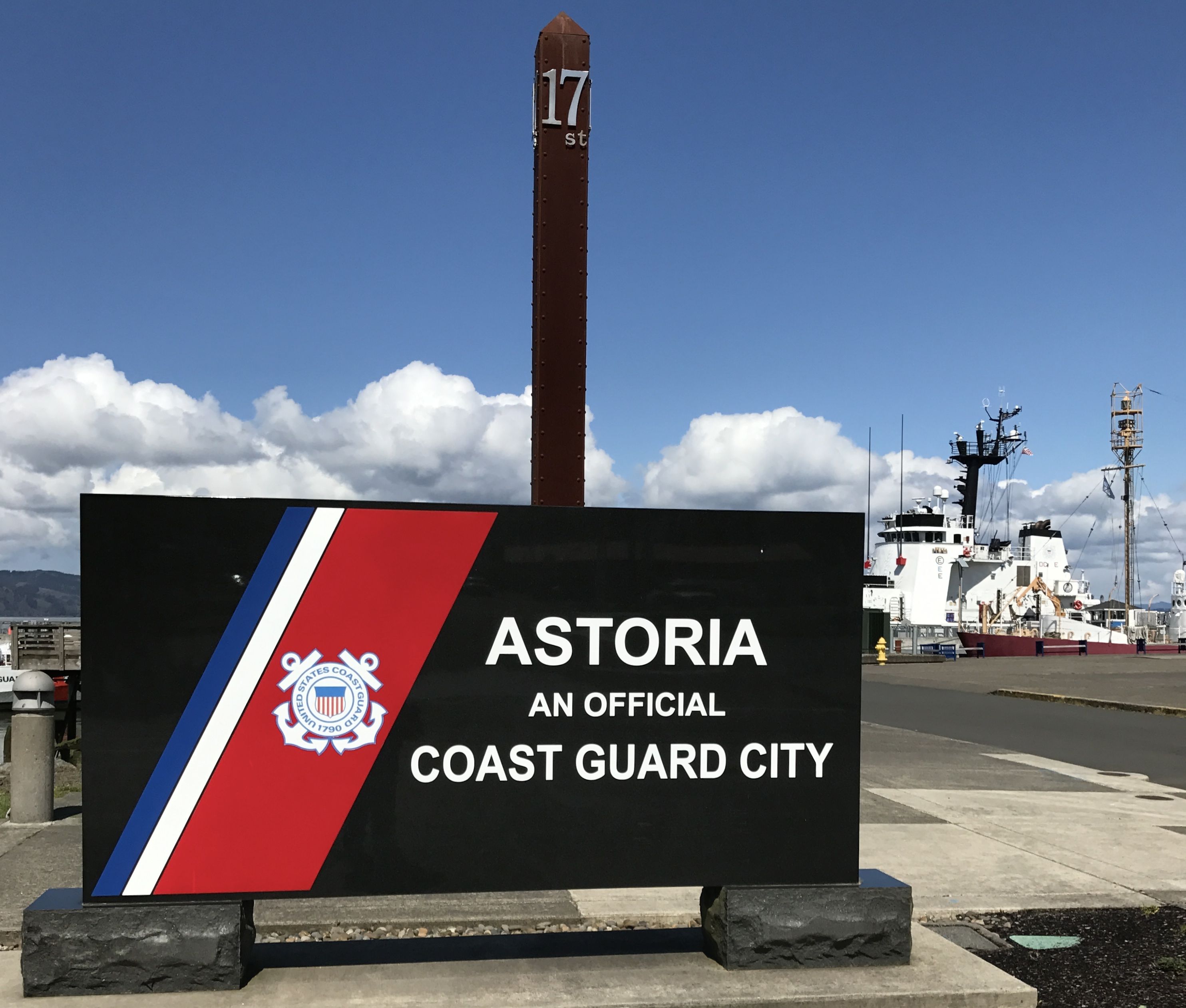
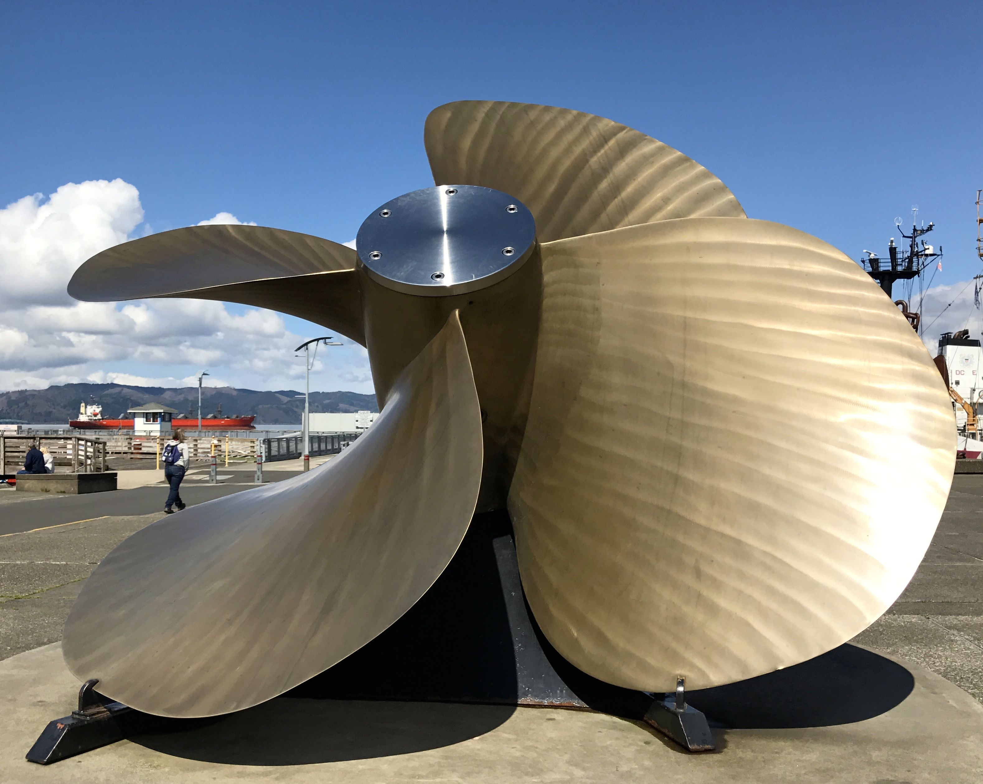
The Columbia River Maritime Museum was there, but there was an entry fee. I figured that I had probably seen every possible ship-related artifact in all the other museums I’ve visited, so I satisfied myself with a look around the outside
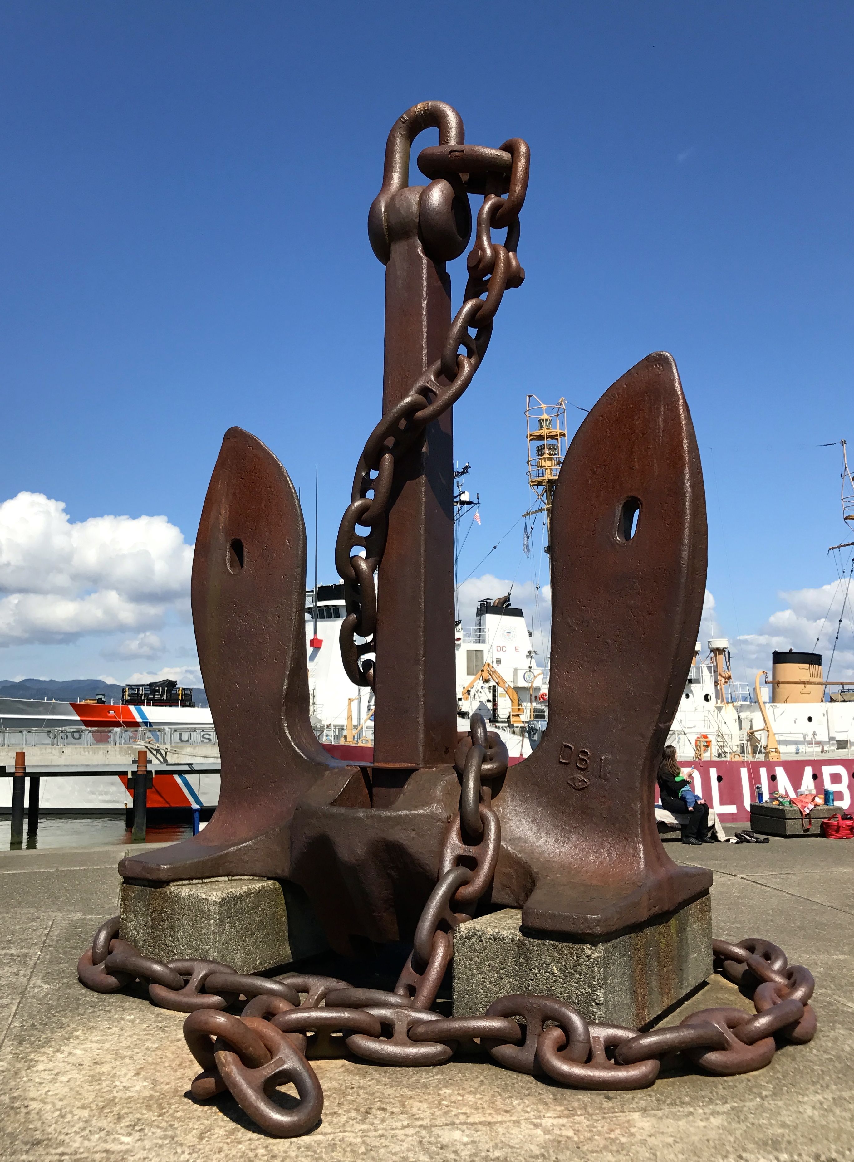
That is one big anchor! And while we’re on the topic of “big”, there was also this really large propeller.
The lightship Columbia was in at the dock.
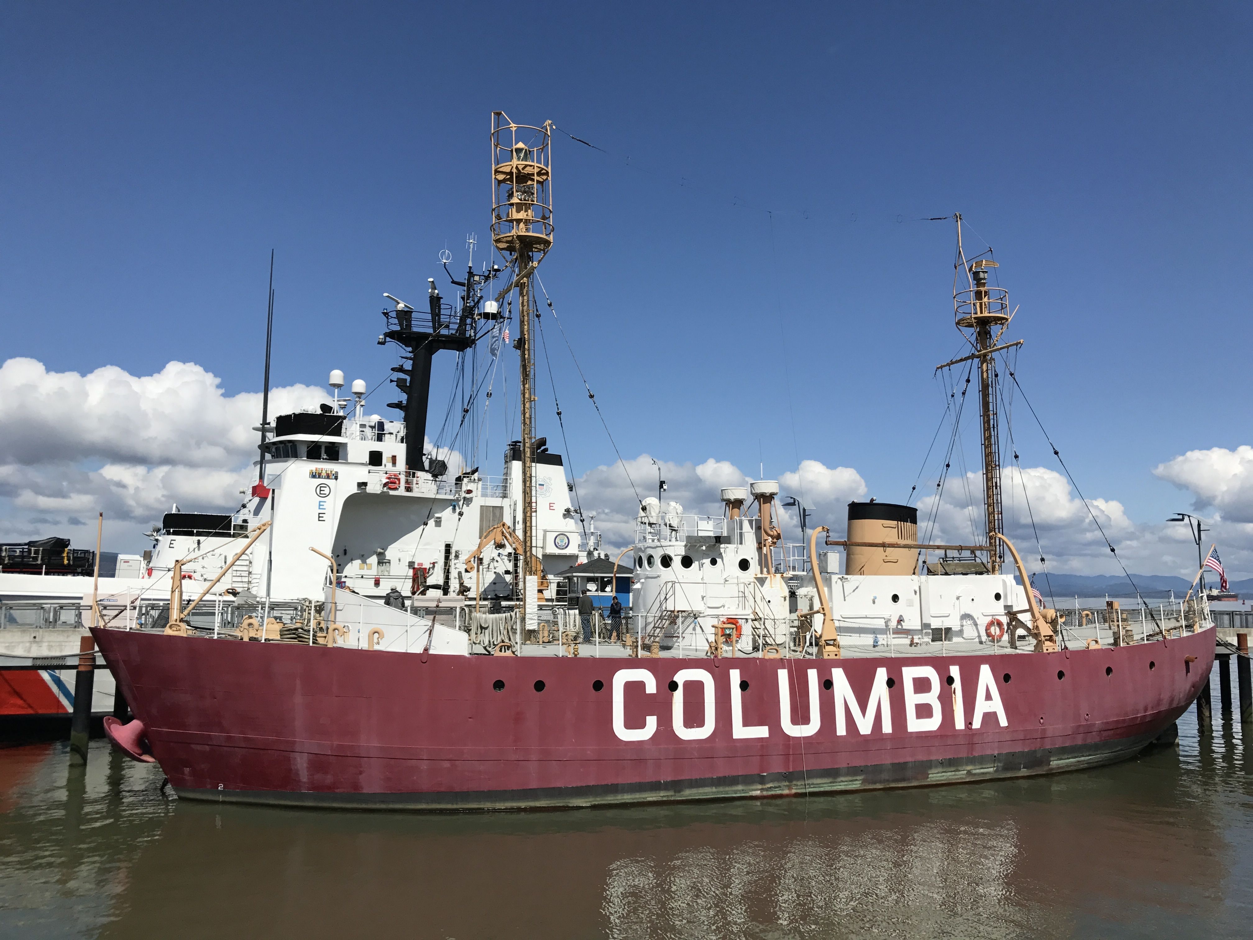
This particular lightship was commissioned in 1951. It was the fourth and final lightship stationed at the mouth of the Columbia River. Interestingly enough, it was built in Boothbay, Maine, a town I passed through during my visit to Maine.
There had been lightships guiding vessels across the Columbia River Bar from 1892 until this final lightship was decommissioned in 1979. This area had the ominous name of the Graveyard of the Pacific. The lightships were eventually replaced by an automated navigational buoy, which has also since been retired.
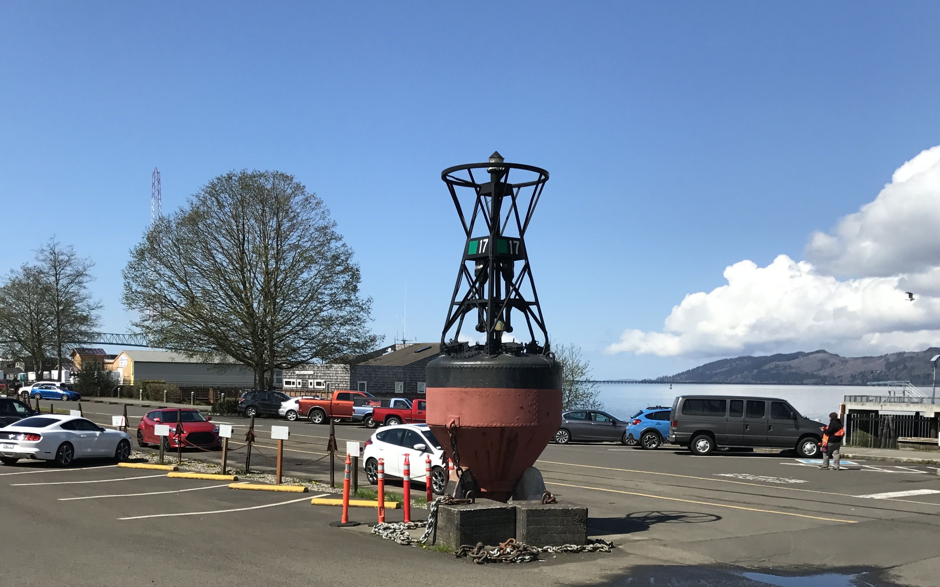
Buoy.
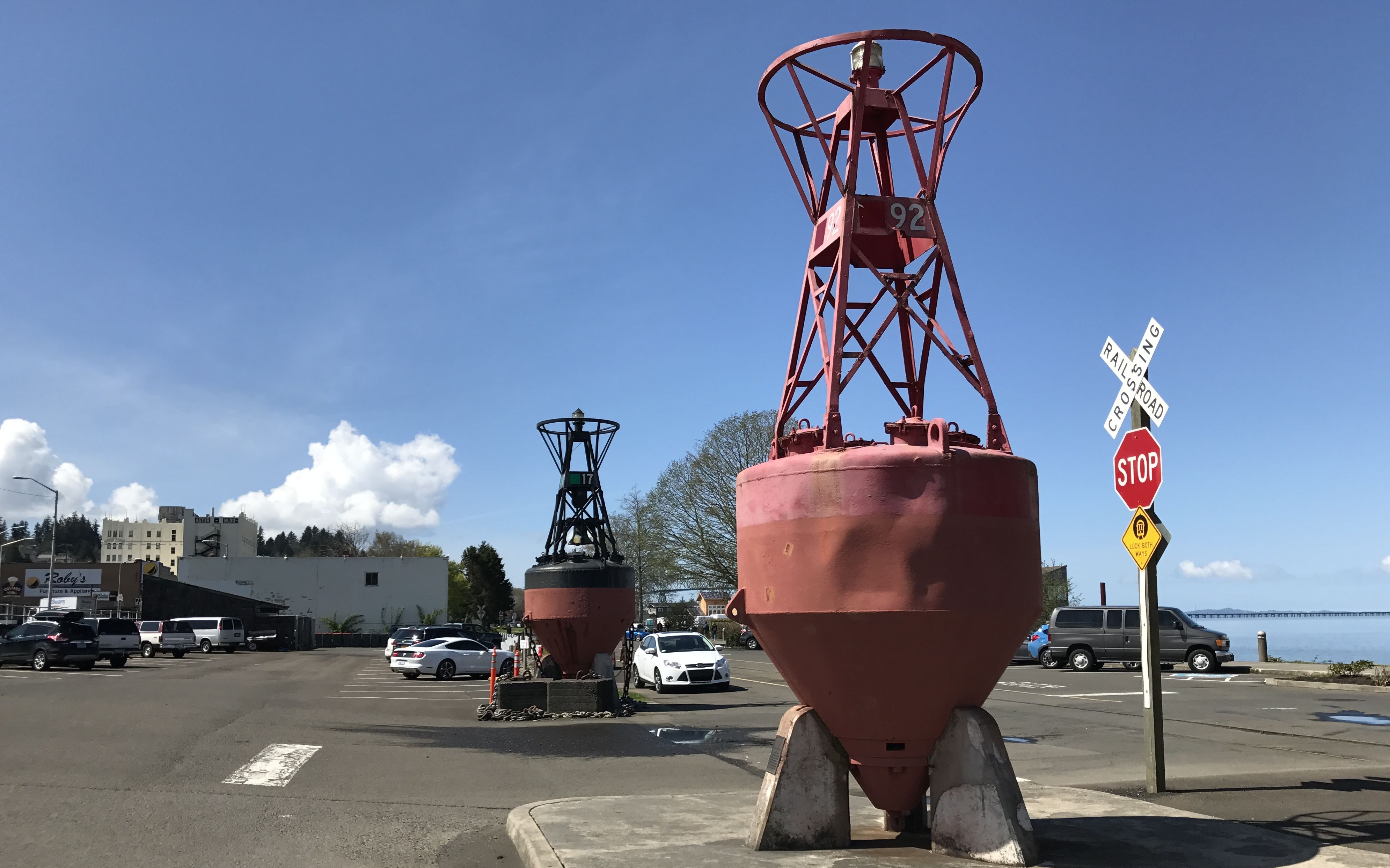
Buoy – oh – buoy.

There was also an active duty Coast Guard vessel moored at the museum. In the background, you can see the Astoria-Megler bridge.
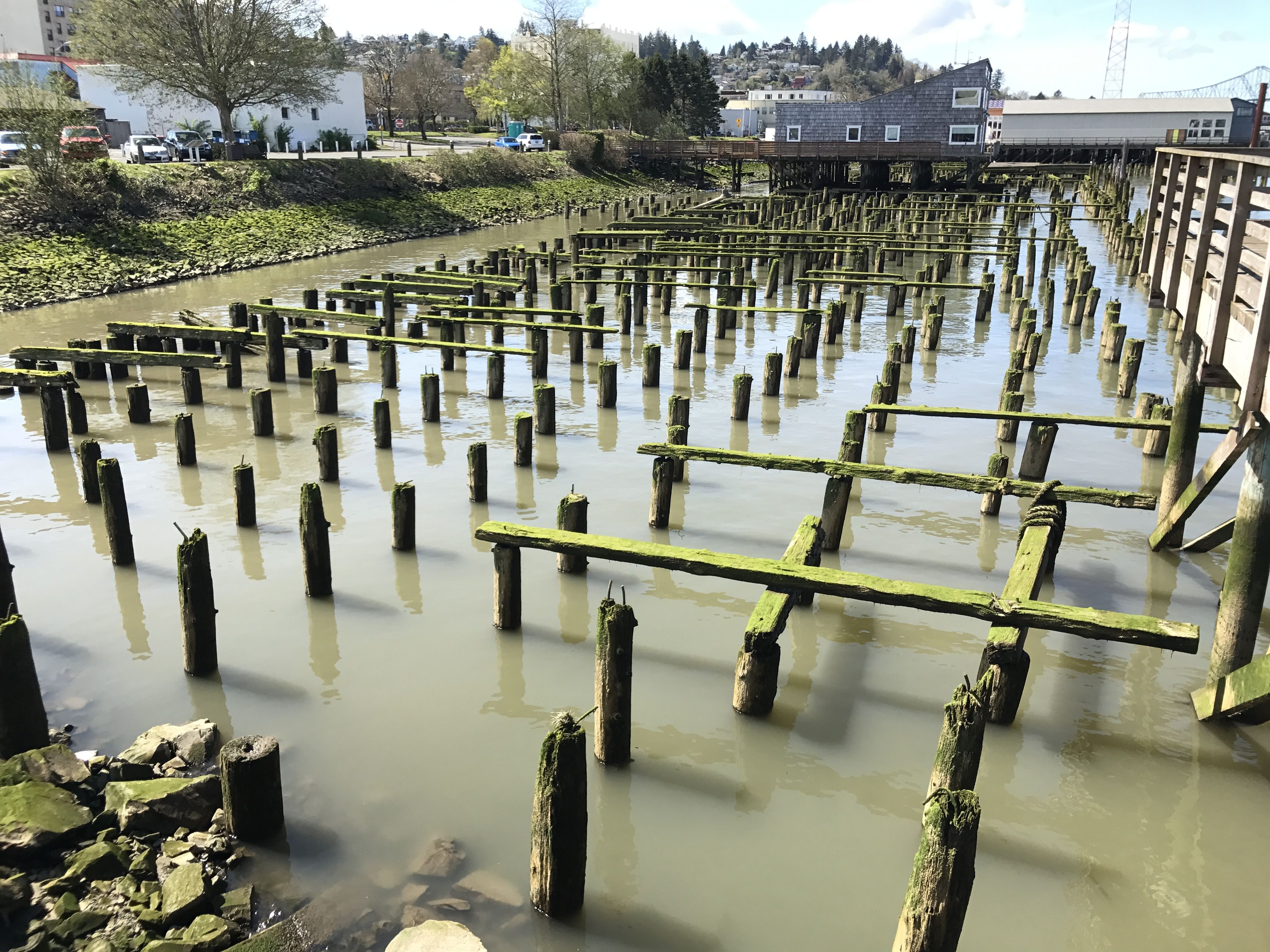
I was fascinated by the remnants of old pilings. It seems to me that it was easier or more cost effective to drive pilings and build on top of them than to build on the land that was available. According to my ultimate information resource (Wikipedia) the downtown was devastated by fires in 1883 and in 1922 due to the buildings being constructed on top of pilings. That might explain why these pilings are just sitting there moldering away.
The 1922 fire destroyed up to 30 blocks. Approximately 2,500 residents lost their homes and damages exceeded millions of dollars. Incidentally, this happened when the Astoria population was at its peak. A little more than 14,000 people lived there at the time. Population has declined since then. Now, around 9,000 folks live there.
Astoria was named after John Jacob Astor. An immigrant from German, he came to the United States after the Revolutionary War and was the first multi-millionaire businessman in the country. He was an investor from New York City, who, among other enterprises, founded the American Fur Company. This company established Fort Astoria here in 1811. Oddly enough, the Oregon Legislative Assembly didn’t get around to incorporating the city until 1876, which was thirteen years after Oregon attained statehood.
In addition to the maritime museum, the other point of interest in Astoria is the Astoria Column. It was built in 1926 with financial backing of the Great Northern Railway and Vincent Astor, the great-grandson of John Jacob Astor.
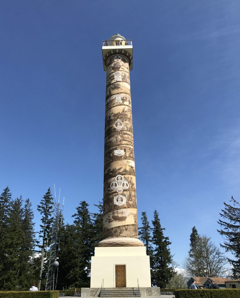
Astoria Column is a 125 foot tall tower built atop Coxcomb Hill above the town. Coxcomb Hill is already about 600 feet above the town, so if you climb the tower, you are really up there! Astoria itself is only about 22 feet above sea level.
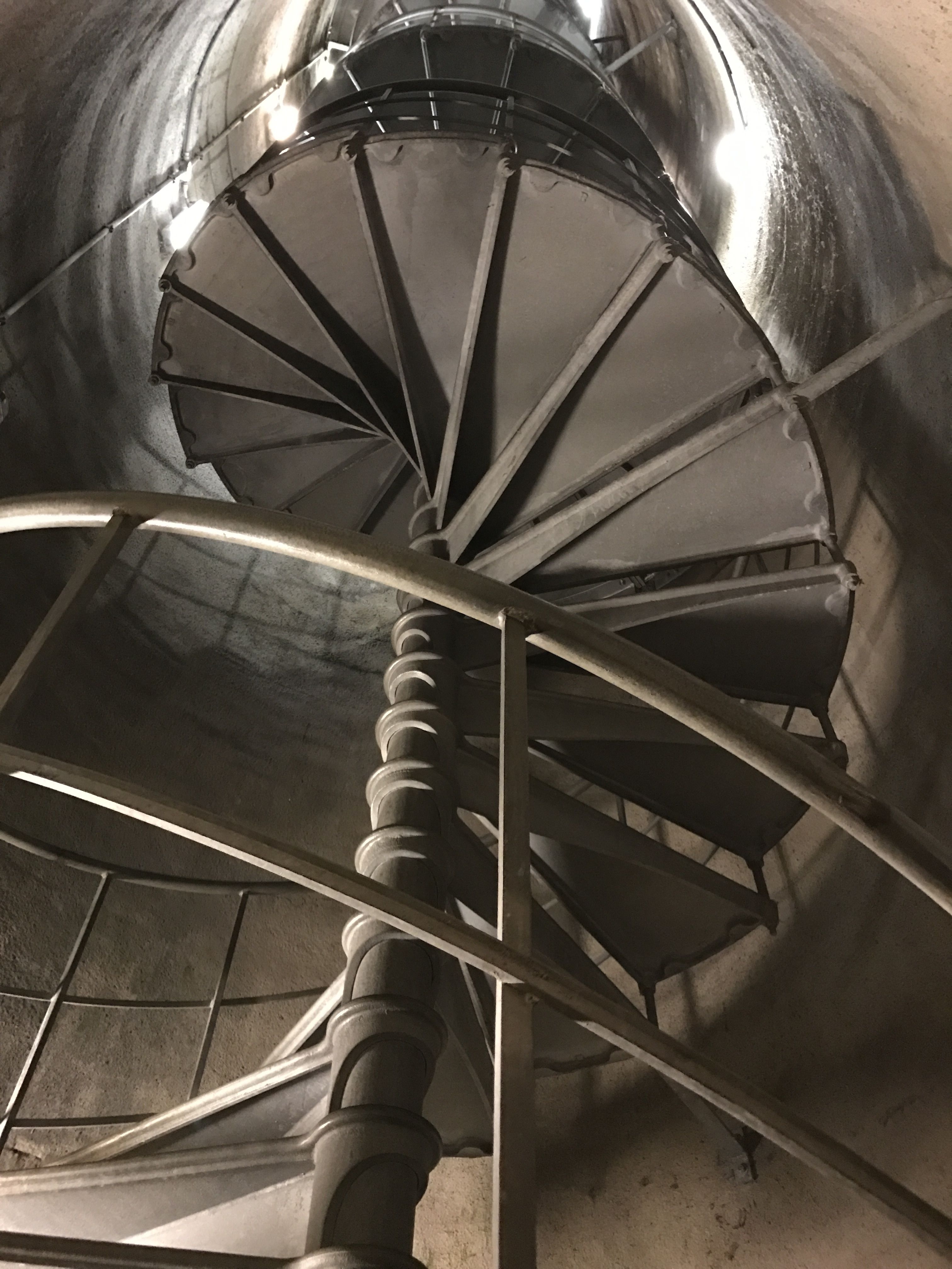
I went up to the door and looked inside. I did not climb those narrow curving stairs! I had to satisfy myself with the view from the ground.
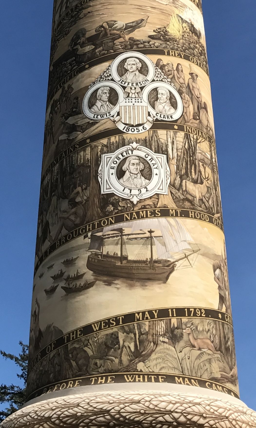
The column is decorated with patriotic images and propaganda. Embellishment is much in the tradition of John Jacob Astor, who hired Washington Irving to mythologize the three-year-reign of his Pacific Fur Company, a subsidiary of the American Fur Company. Yes, Washington Irving, the famed 19th century author responsible for The Legend of Sleepy Hollow and Rip Van Winkle, among other works. While he was the guest of Astor, he wrote “Astoria: Or, Enterprise Beyond the Rockies,” The book became a best seller in 1836. At the time, it was required reading in some schools.
The column is quite amazing, but the real reason for visiting the top of Coxcomb Hill is the view.
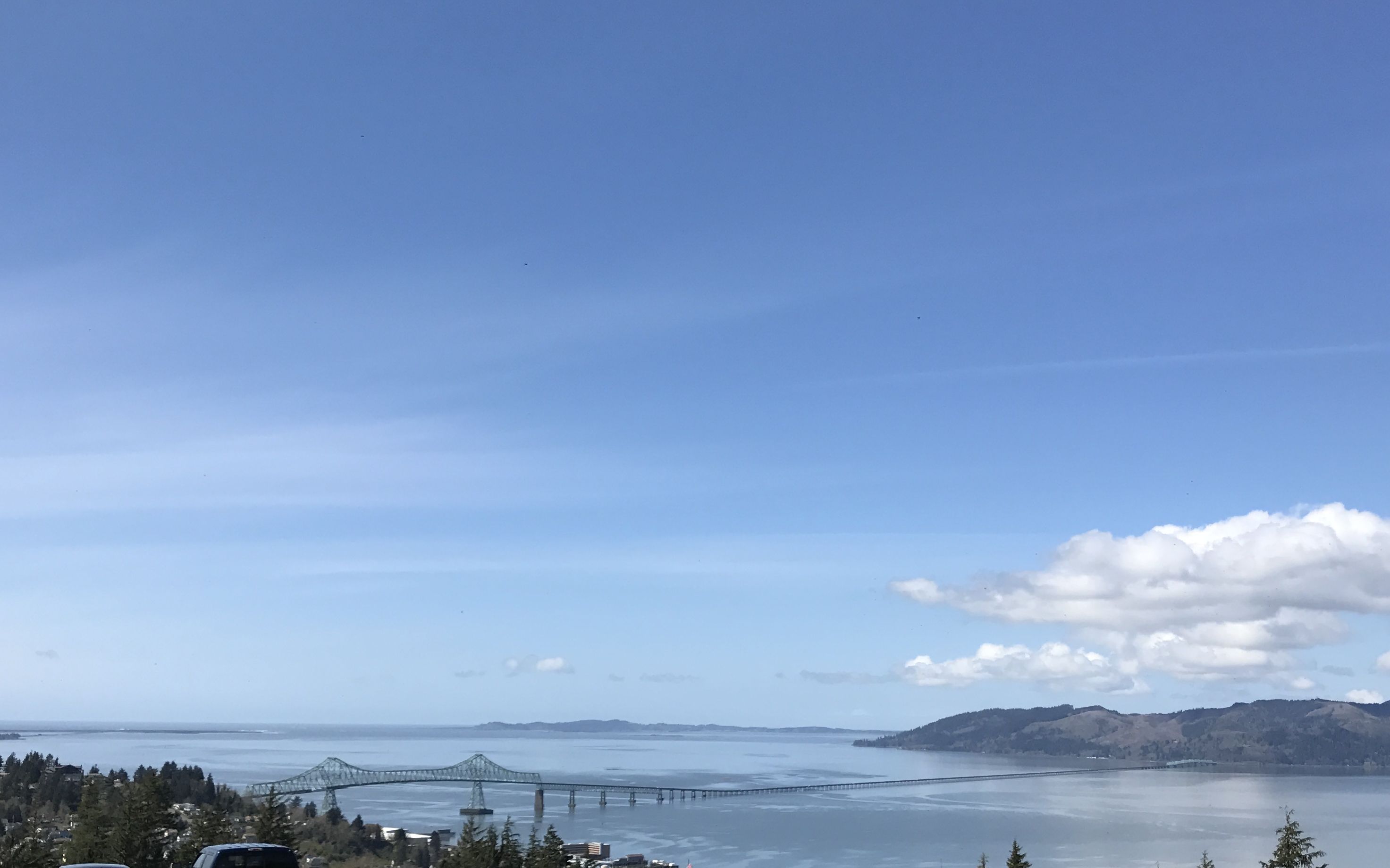
Here’s another view of Astoria-Megler Bridge, crossing the Columbia River.
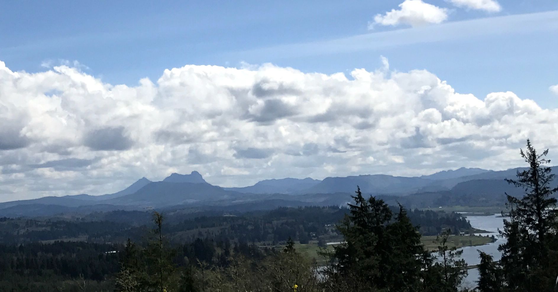
My notes say that this is a view of Saddle Mountain, which is the tallest mountains in Clatsop County. My ultimate source says that it is 3,288 feet tall.

According to the signs at the viewing platforms, this photo is of Fort Clatsop, which is sheltered by the hills. Lewis and Clark and their team spent the winter there, rather than on the other side of the river because the hills provided some shelter from the weather.
There were some commemorative plaques and time capsules on top of the hill, too.
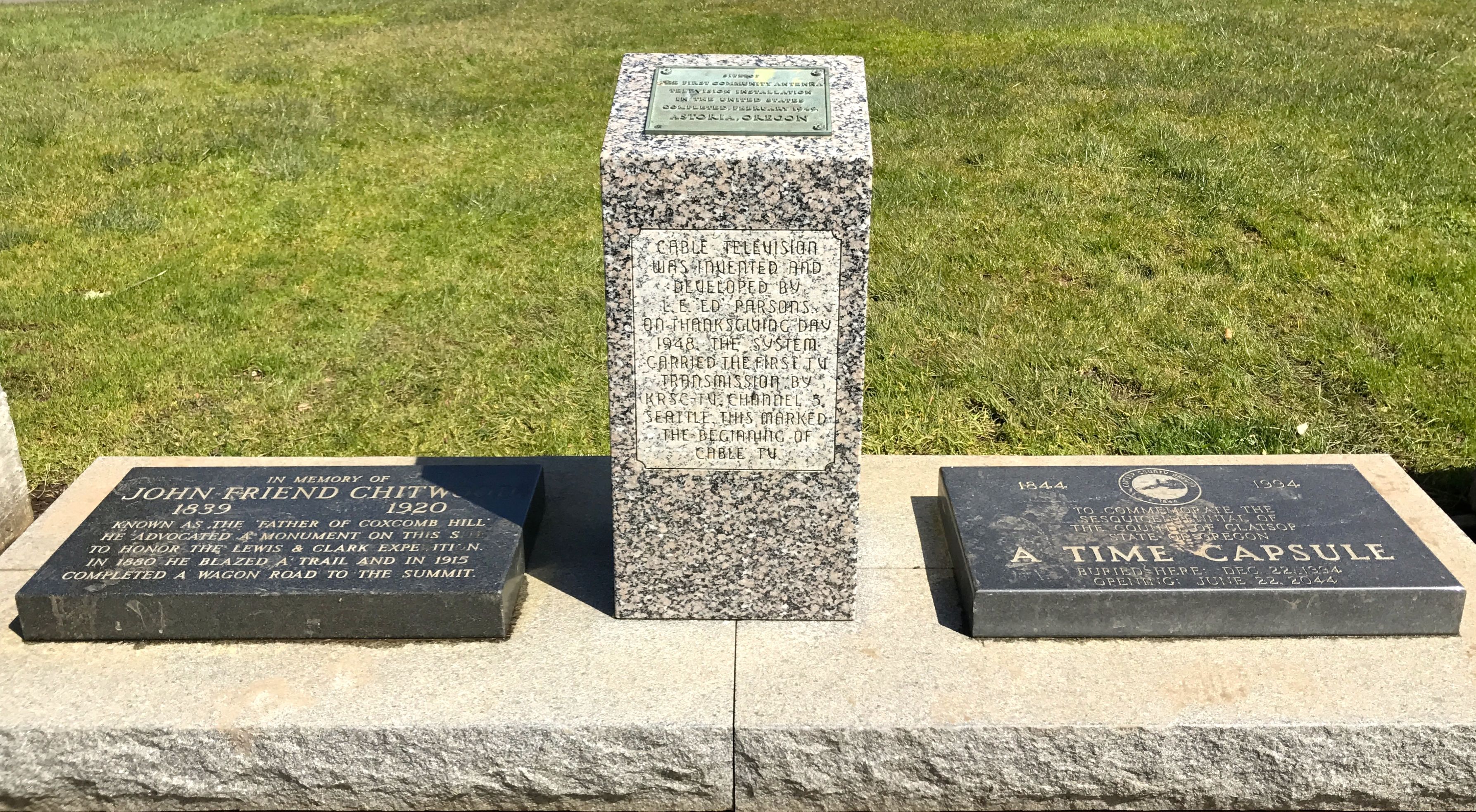
Time capsules are nice. I guess. Since they are going to be opened at some point in the future, they aren’t much to look at. The plaque in the center caught my interest, though.
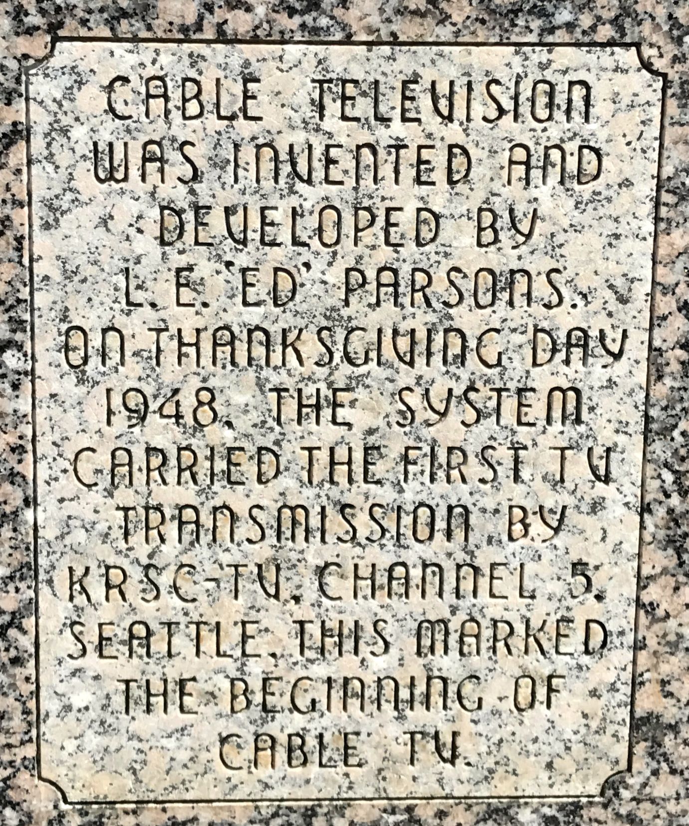
Cable TV was invented in Astoria, Oregon? Amazing! I do tend to go on about things that interest me. I have no idea it anyone else is interested. If you want to know how and why this happened in Astoria, click here. Incidentally, it’s a rather sweet tale of kindness and generosity, at least the way it’s described in this retelling.
One interesting fundraiser was gliders. You know, those lightweight gliders that used to cost ten cents back in my day. They sell them here and people walk to the top of the column and launch them. At least that is what I was told. Since I didn’t climb up, I can’t verify it. But, on my way out, I met a family ready to make the climb, gliders in hand.
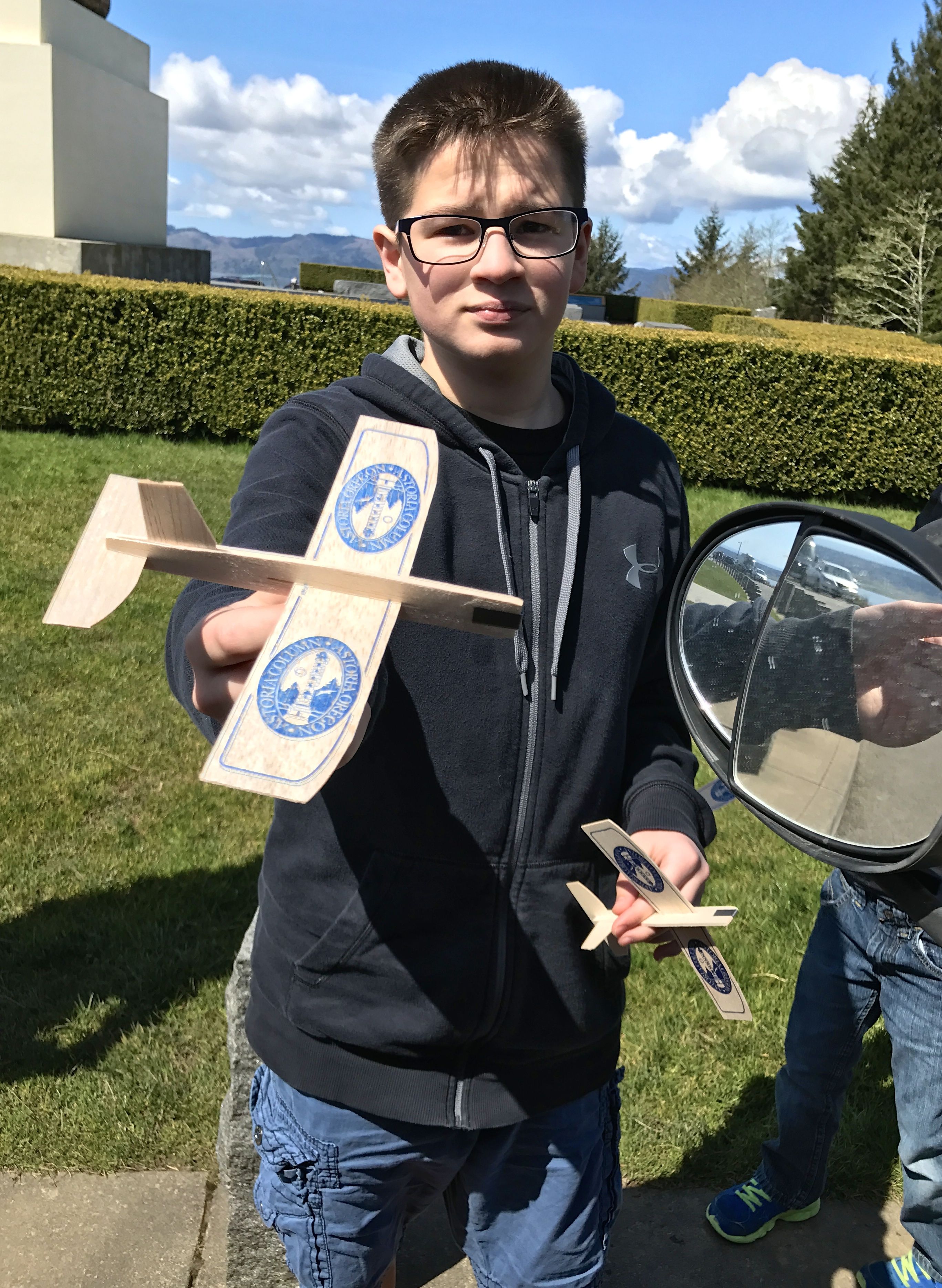
The young man didn’t mind posing for a photo.
I wonder how the people that live down the hill feel about the gliders crash-landing on their property? I didn’t stop to ask, but I did see some gliders stuck in trees and bushes on my way back down.
I set out again.
“Lewis and Clark slept here” should be posted all over. I passed on spot that had a sign that claimed that this was one of their campsites.
I have no idea how they figured that out.
Across the river, in Station Point, is the official end point of Lewis and Clark’s journey west. There is a small park dedicated to the brief time they spent there.
It was rather wind-swept and desolate. In fact, the Clatsop Indians recommend that they more to the other side of the river to a site that was more protected from the weather. I felt this root ball is a suitable photo to leave you with to represent this site.

On to Fort Clatsop!
Of course, there is really nothing left from the original Voyage of Discovery. They spent a winter there before heading back. On your way in to the recreation of the fort, there is a nice museum.
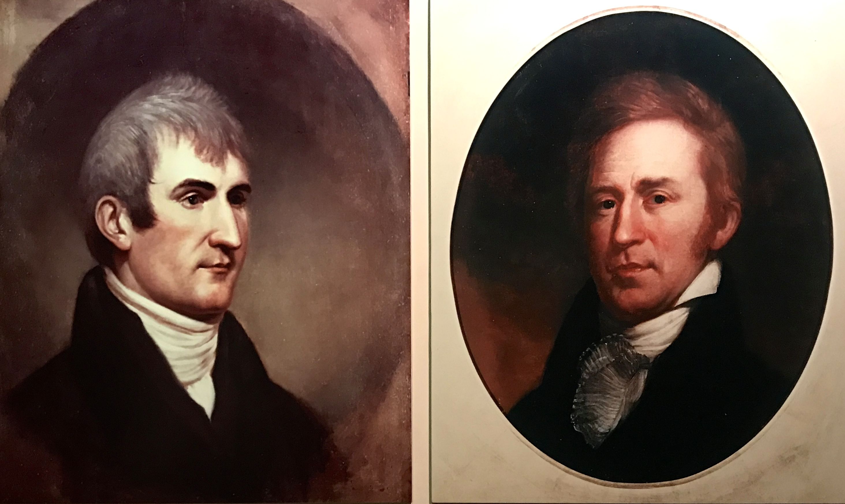
Of course, the focus is strongly on Lewis and Clark. Do you know which is which? A quick Google search leads me to believe that Lewis is on the left and Clark is on the right.
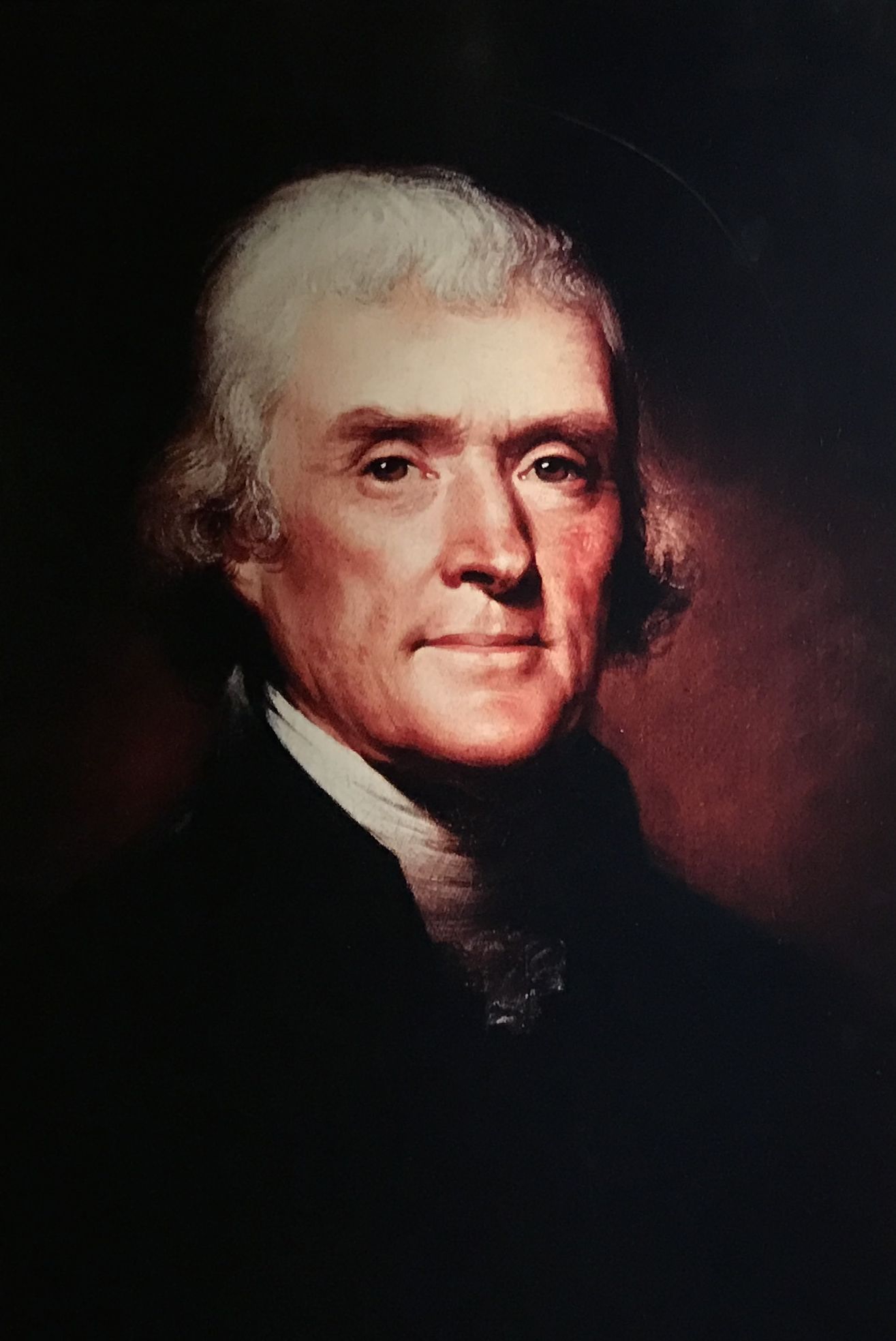
Thomas Jefferson also figures in the story, since he was president at the time.
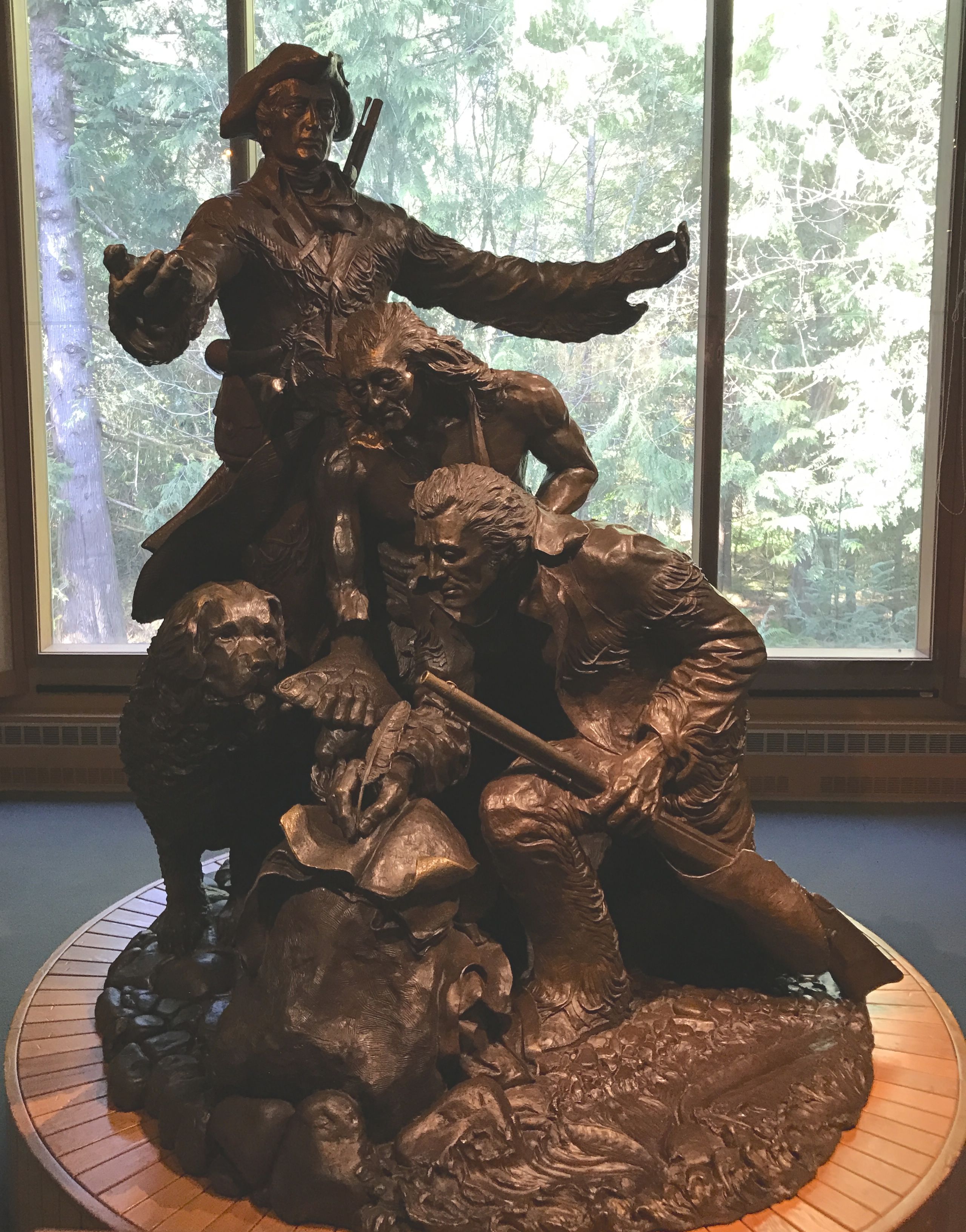
This sculpture is entitled “Arrival” and was made by Stanley Wanlass. It was commissioned but the Fort Clatsop Historical Association in 1980 to celebrate the 175th anniversary of the Lewis and Clark Expedition.
The person standing with outstretched arms is Meriwether Lewis. Just below him is a Clatsop Indian and around his neck is a medal bearing Thomas Jefferson’s image. William Clark is signing something. Lewis’ Newfoundland dog, Seaman, is also included in the grouping.
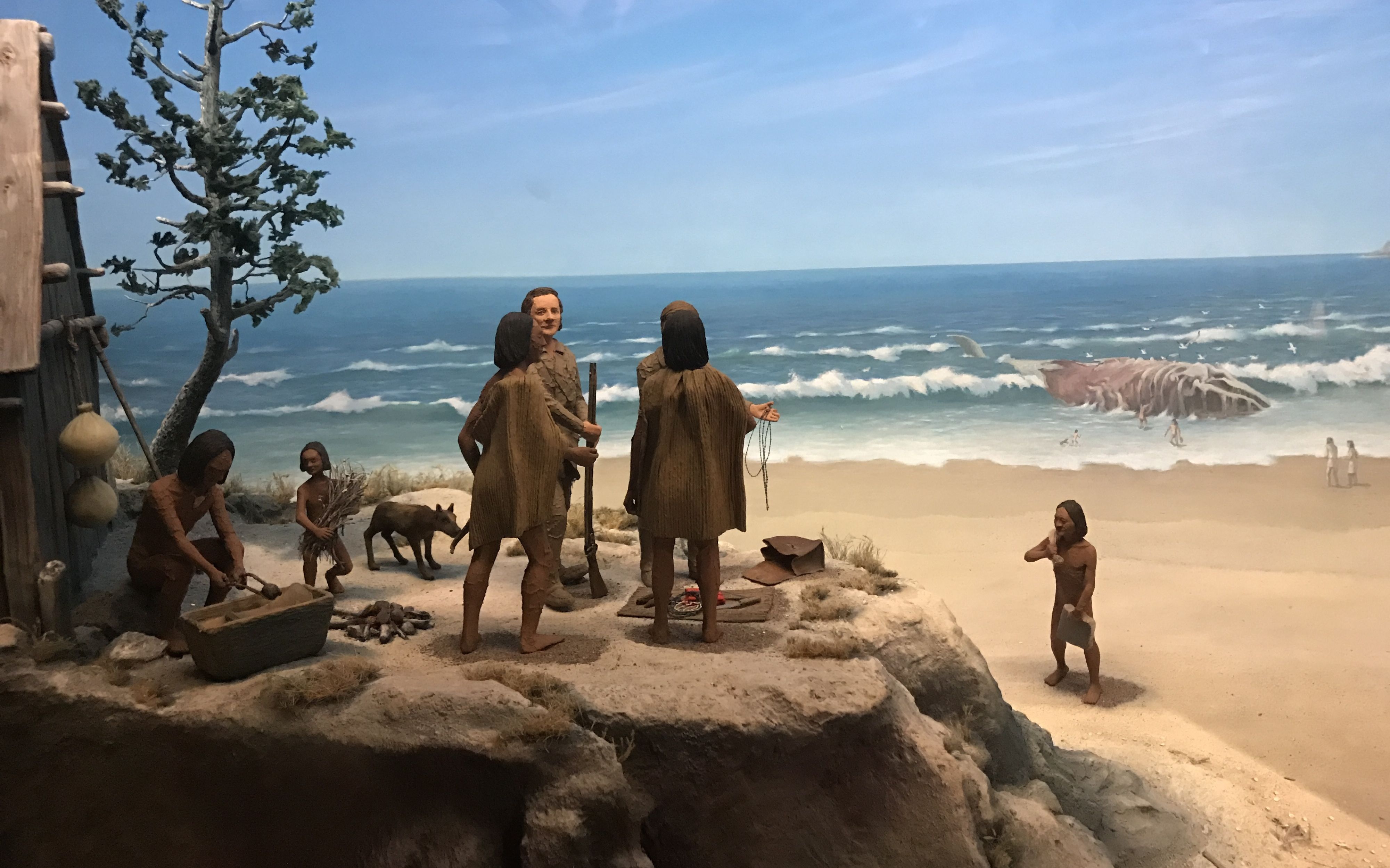
Like many museums, they tend to be dark. I am including this photo of a diorama of a whale hunt because it was well-lit.
There was more light outside. I headed out to see the recreation of Fort Clatsop.
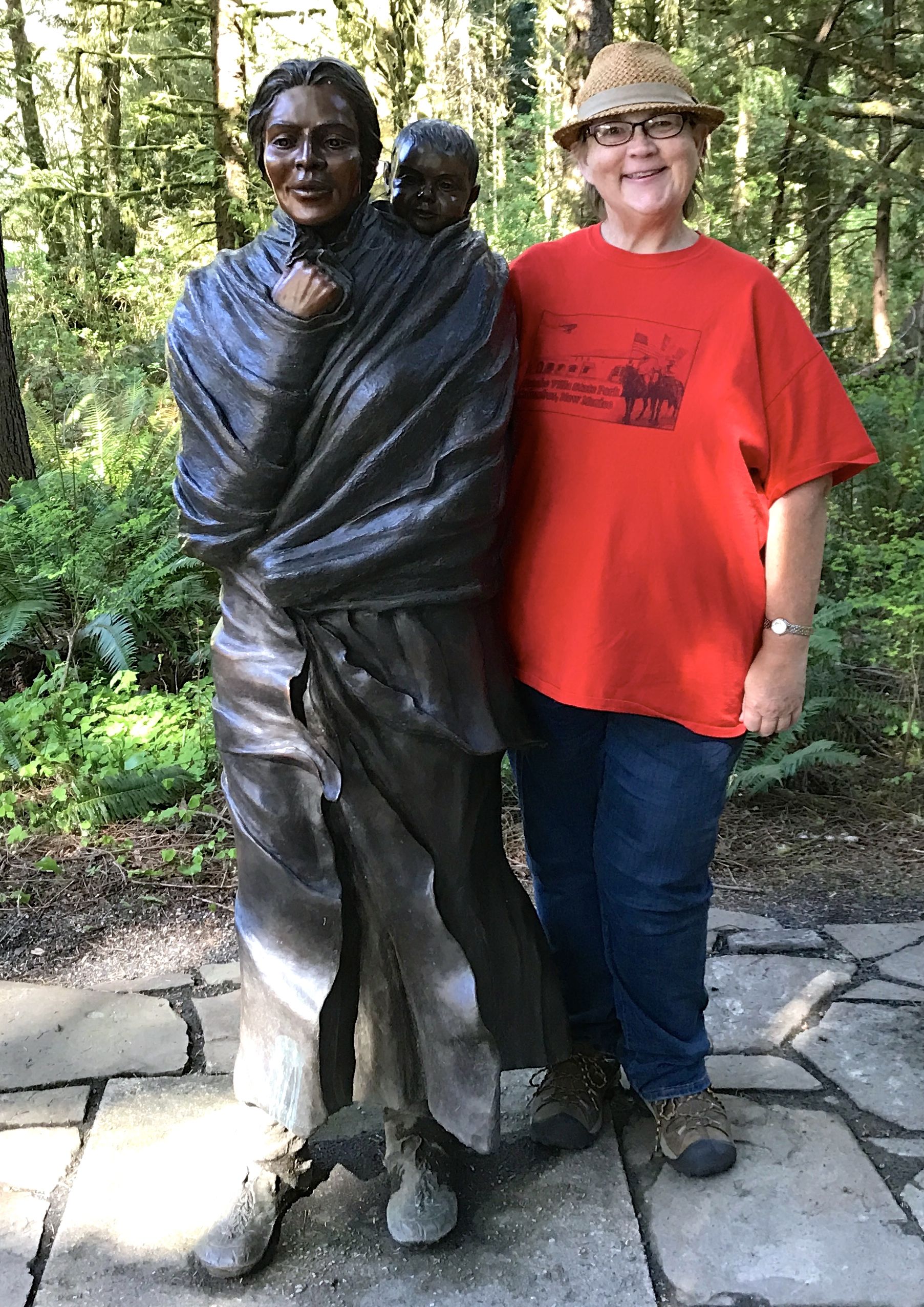
I passed a statute of Sacajawea along the way. Another thing I learned about Sacajawea during my travels is that there were many versions of her name.
Sacajawea
Sacagawea
Sakakawea
It runs in my mind that I saw a few others, as well. I suppose how English speakers chose to record her name is not as important as the fact that they did record her name. She was not lost to history. If you want to read more about her, click here to get started.
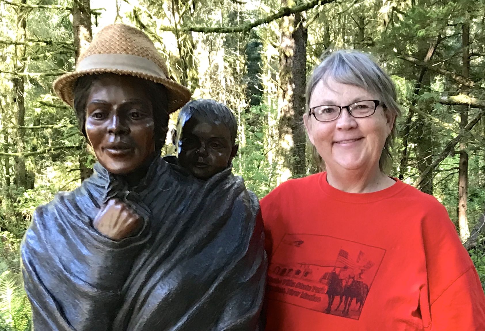
I couldn’t resist the opportunity to share my hat with her.
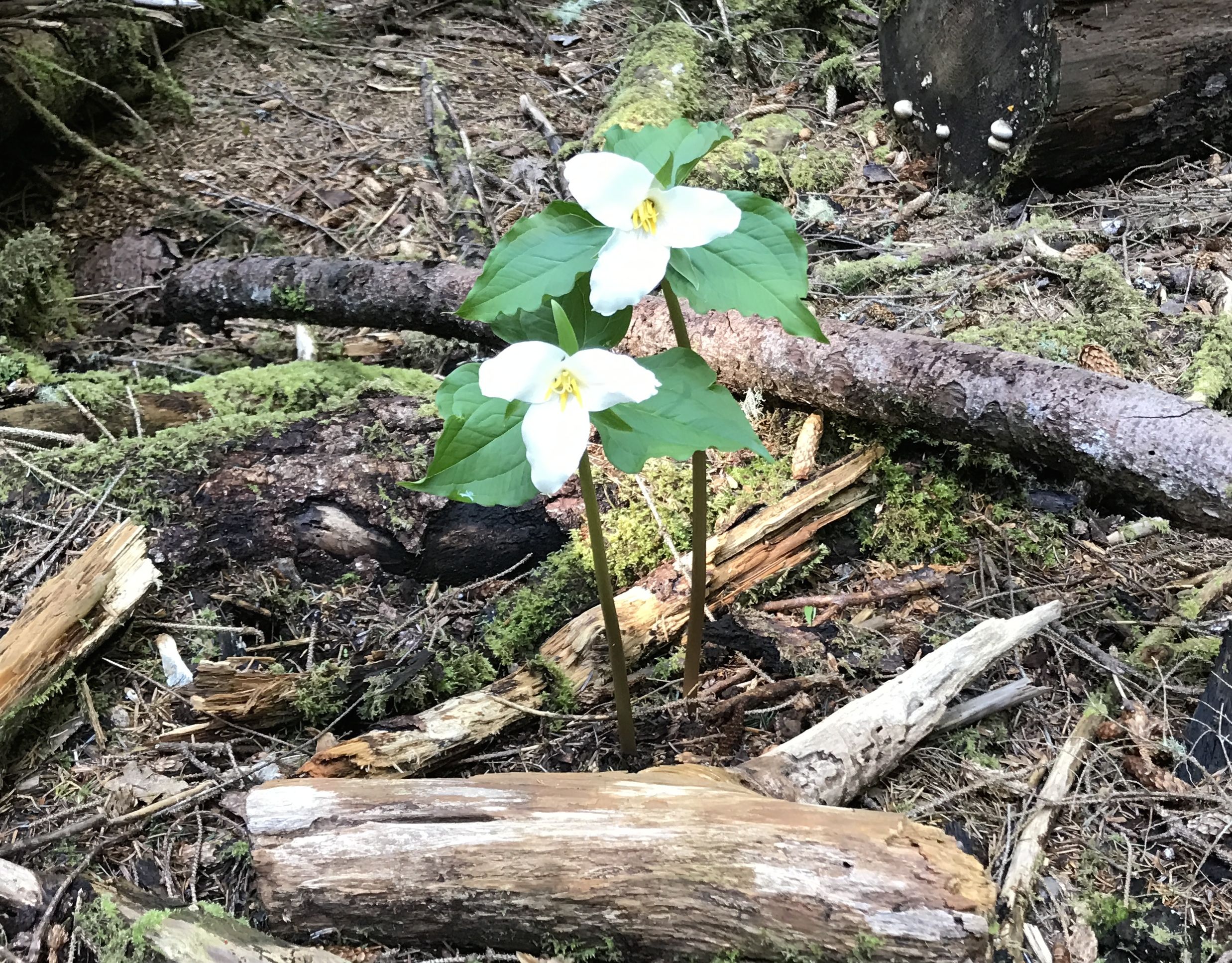
Growing nearby were some trilliums. This is one flower that was a favorite of my family. The forest floor around our cabin was covered with them in the spring.
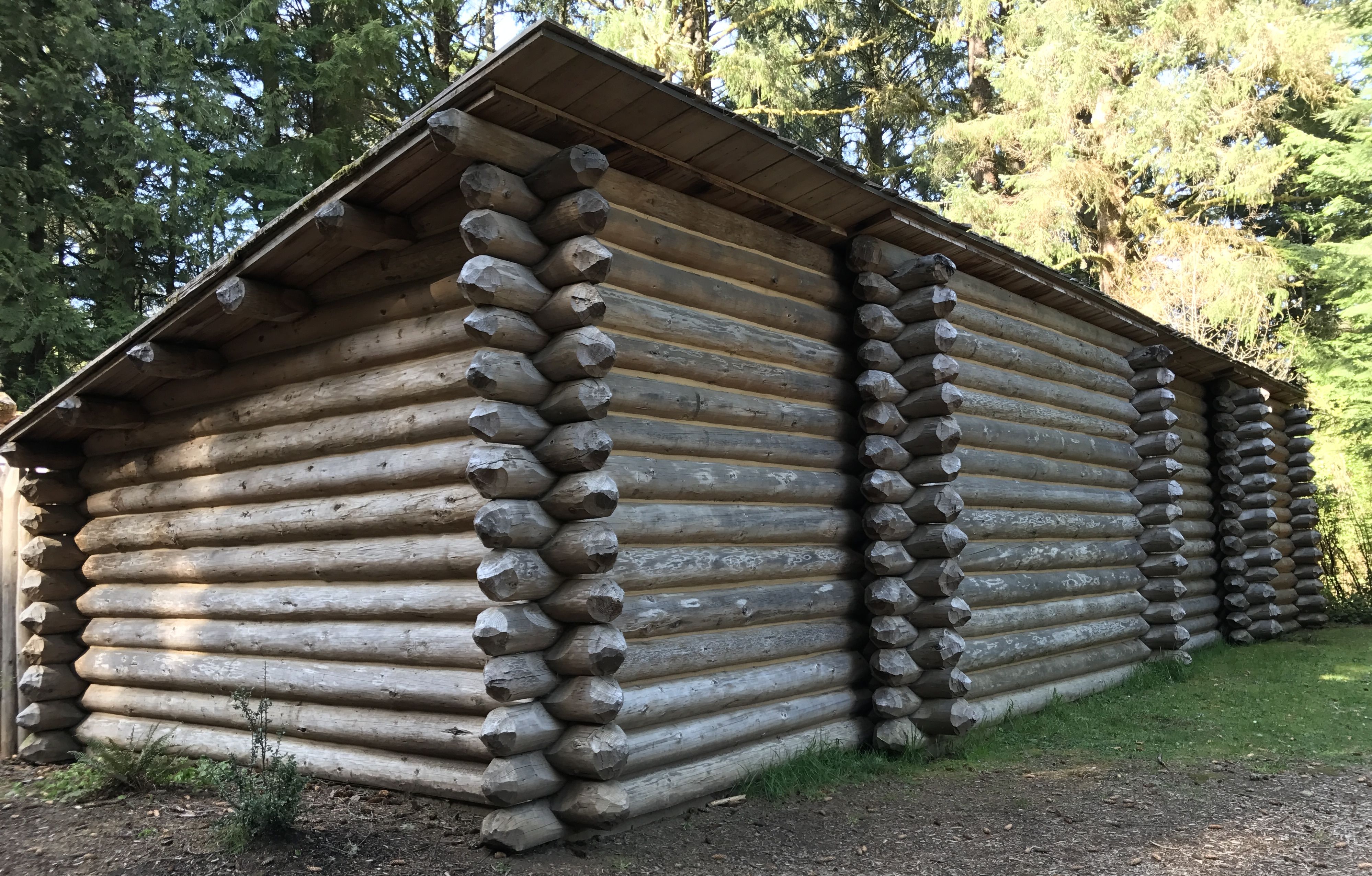
I reached the fort. It was built around a courtyard. The exterior walls were built for protection.
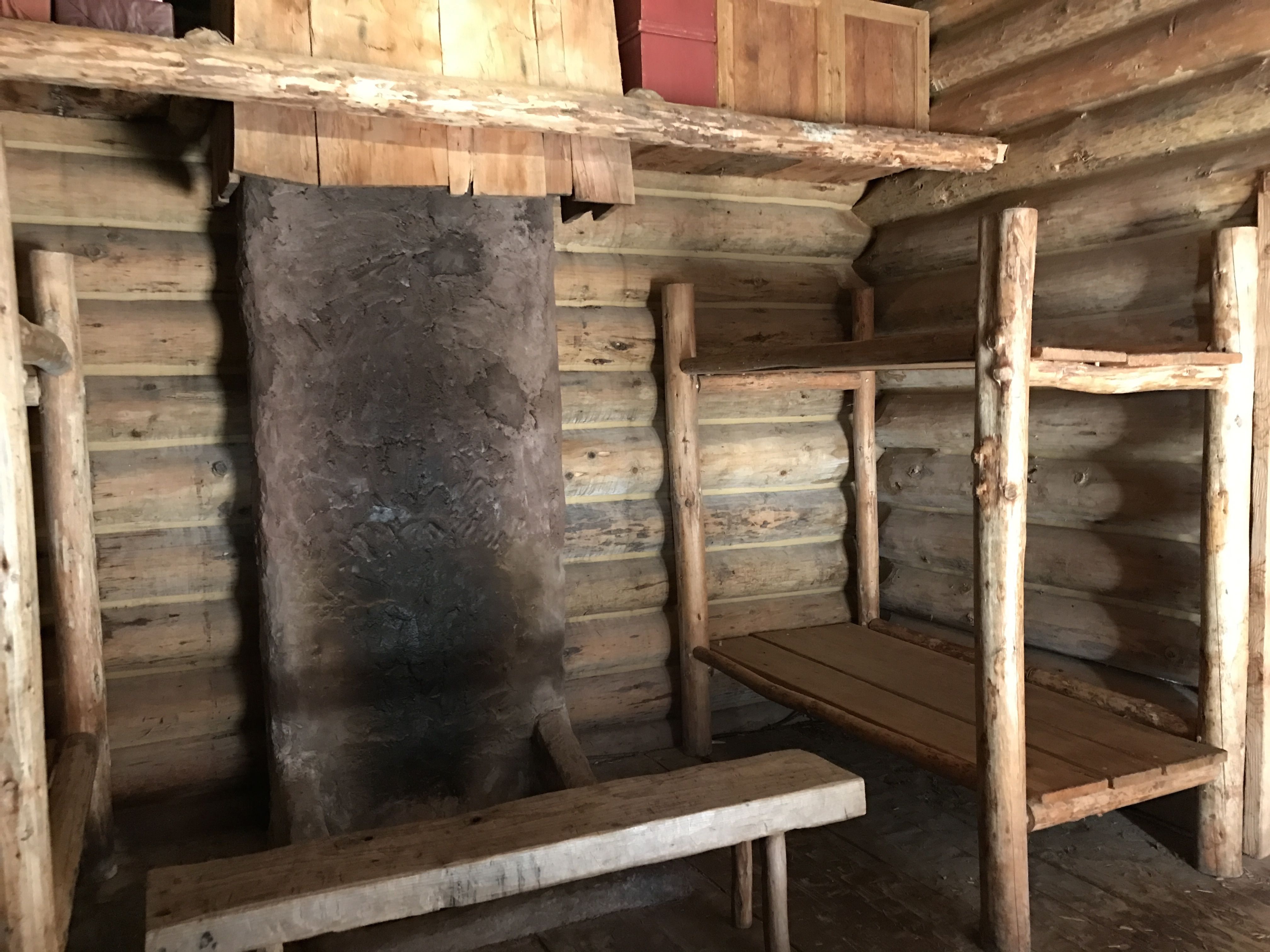
There were seven rooms that met their needs.
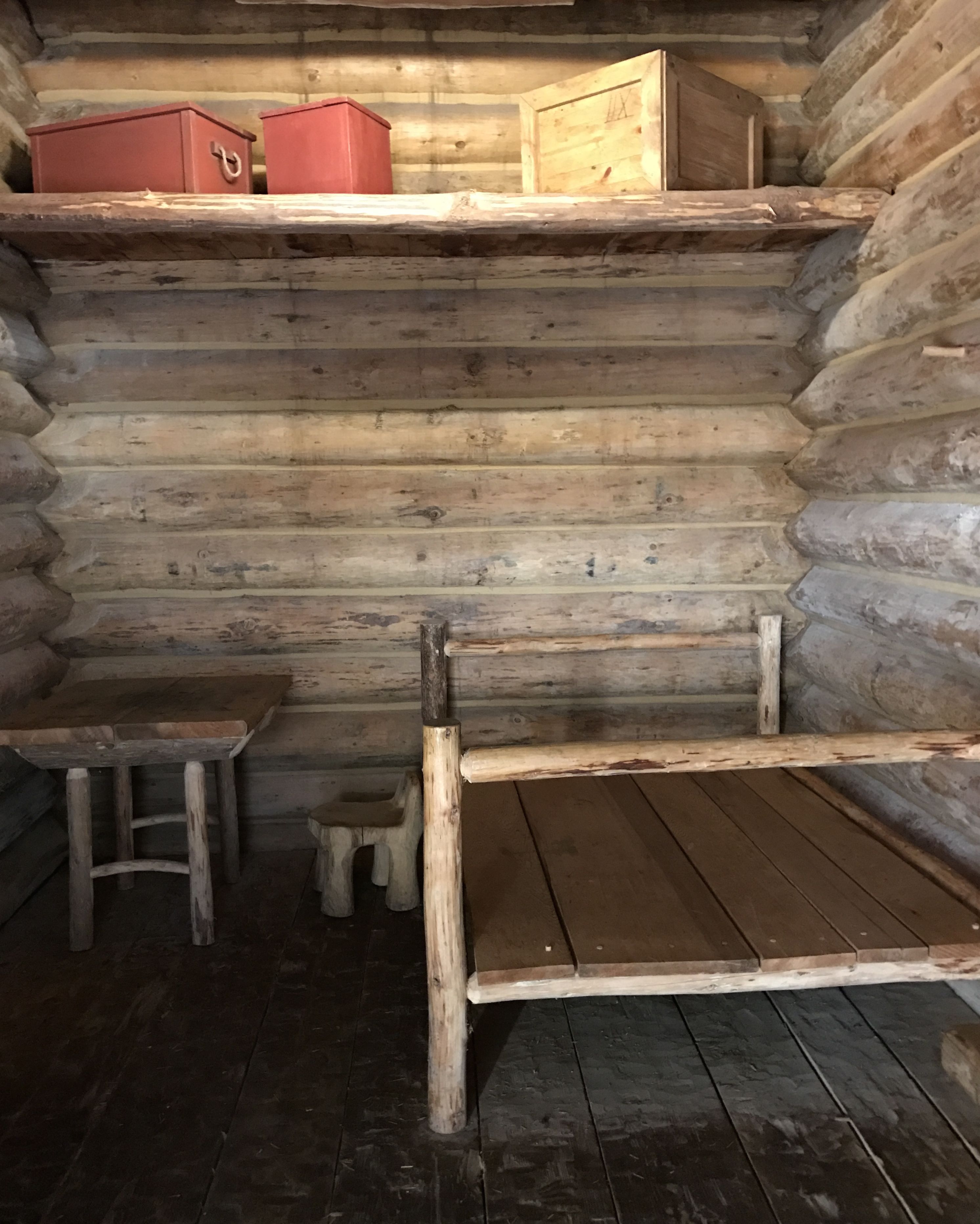
Of course, no one really knows exactly what the rooms were like. I know they took good notes, but I doubt they left explicit descriptions of their winter habitation.
I am always looking down to see what I can see. I came across this marker.
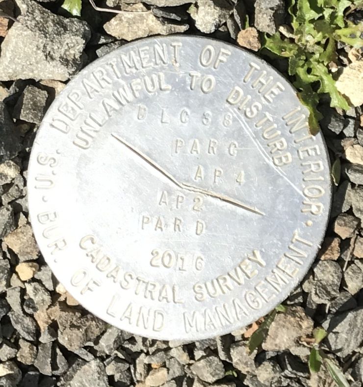
It was the first time I’ve ever seen a “cadastral survey” marker. I had to look it up.
“Cadastral refers to a public record of the extent, value, and ownership of land. It is used as basis of taxation, surveying, and mapping.”
So now we all know.
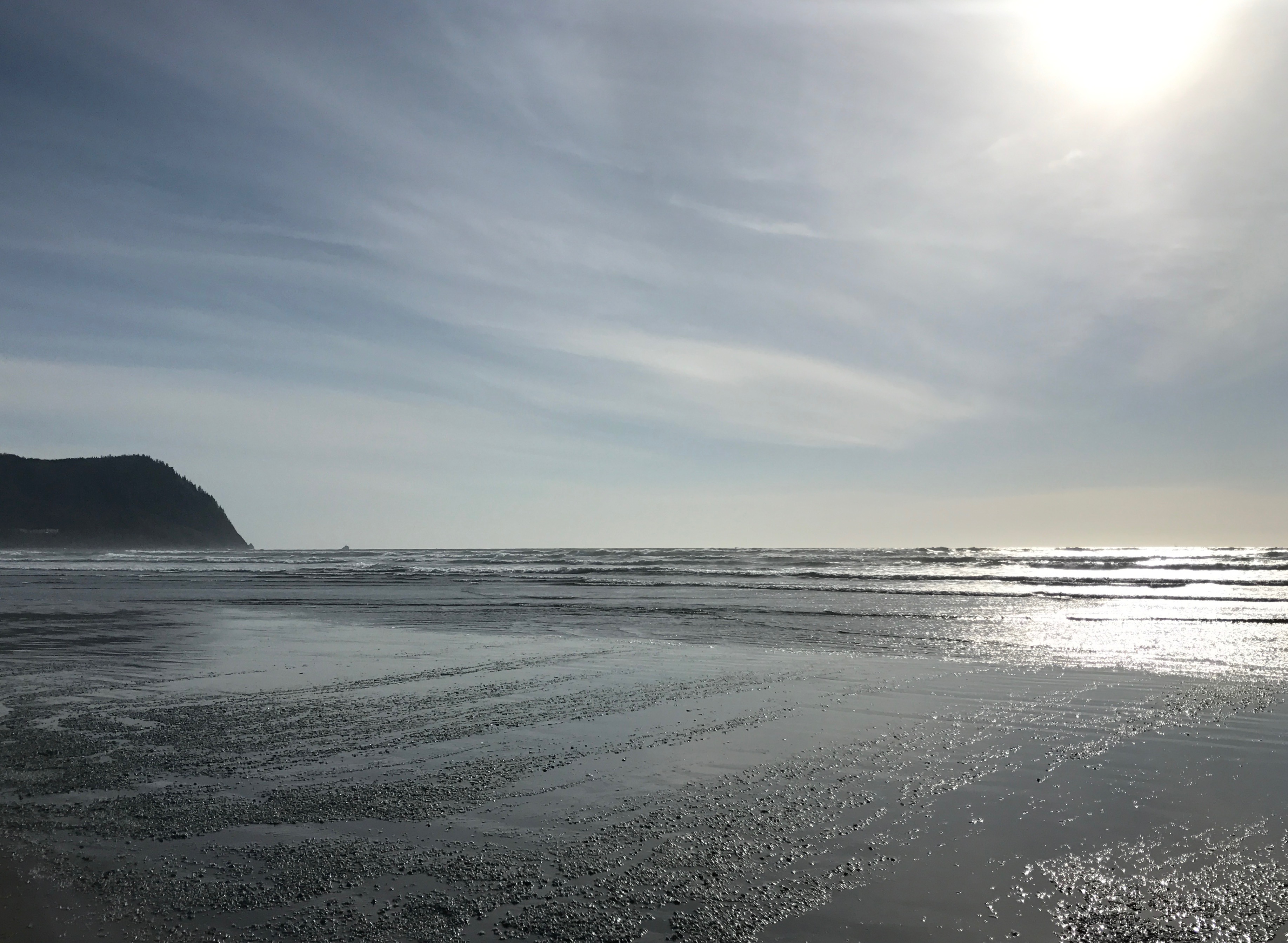
My last stop for the day was the ocean. I’d always heard people raving about the Oregon coast.
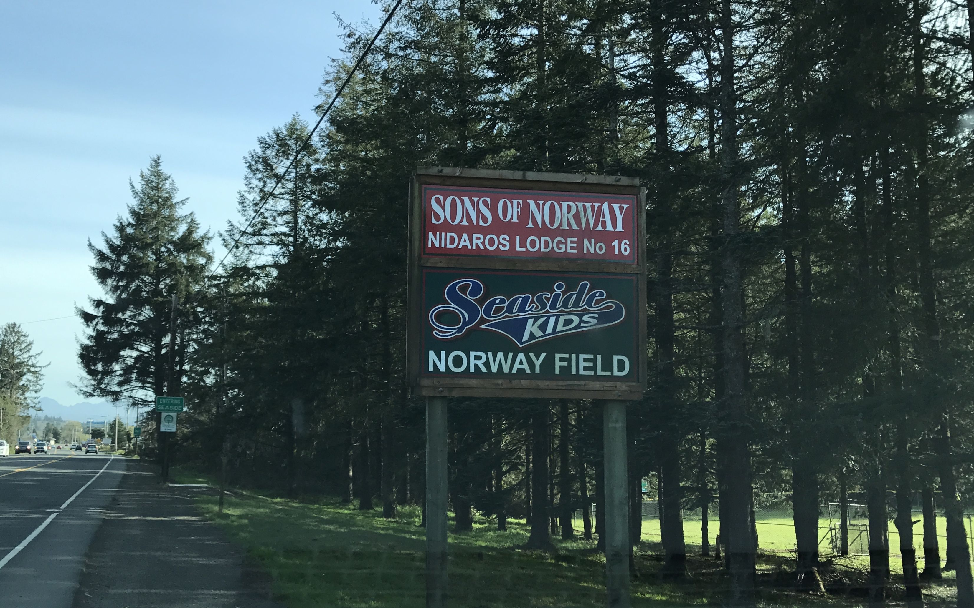
En route, I passed this sign. I had to take a photo to honor my Norwegian ancestors.

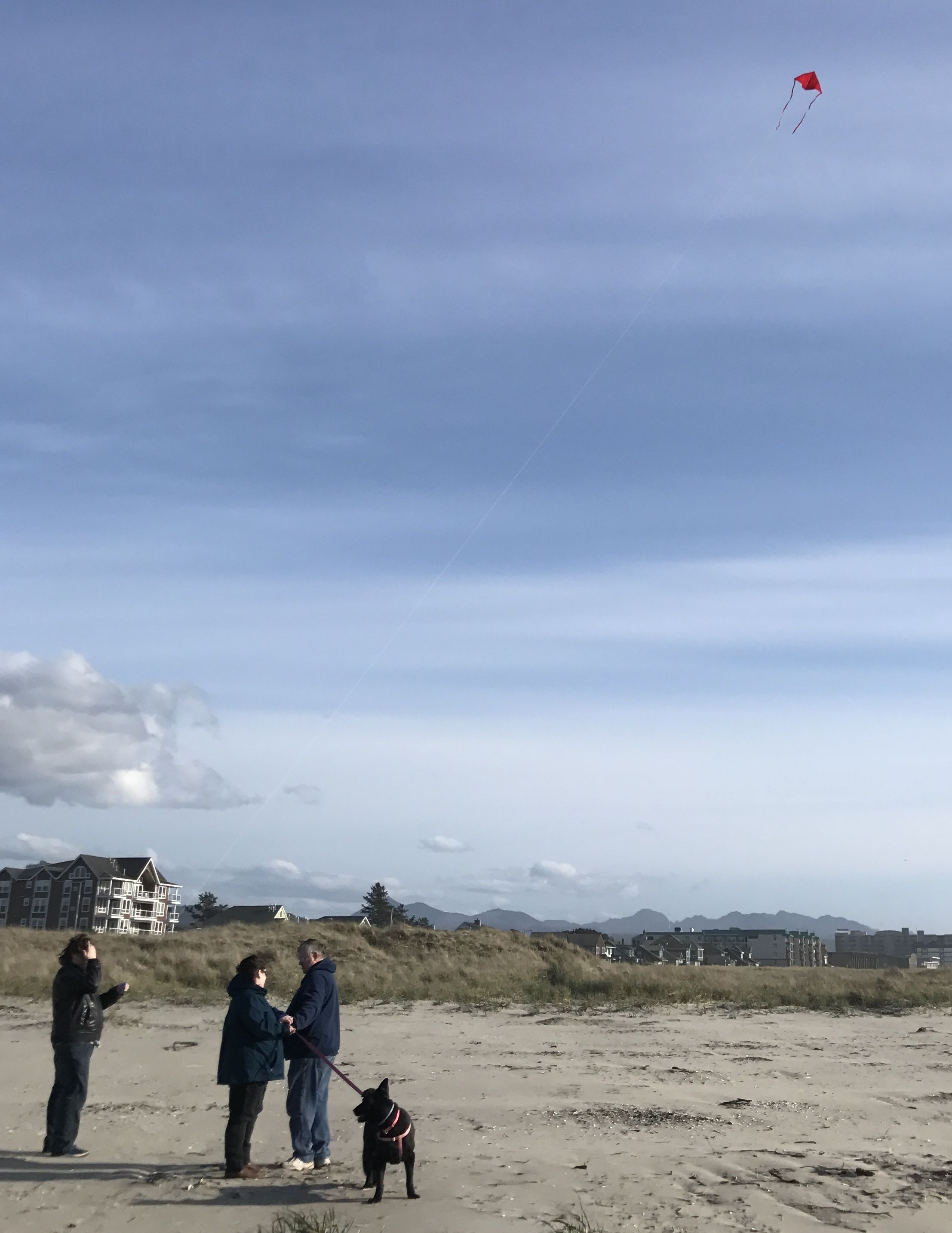
I found a place to park and headed toward the beach. The sun was bright but the wind was vigorous. It wasn’t exactly the weather I prefer for the beach. But then, it was April.
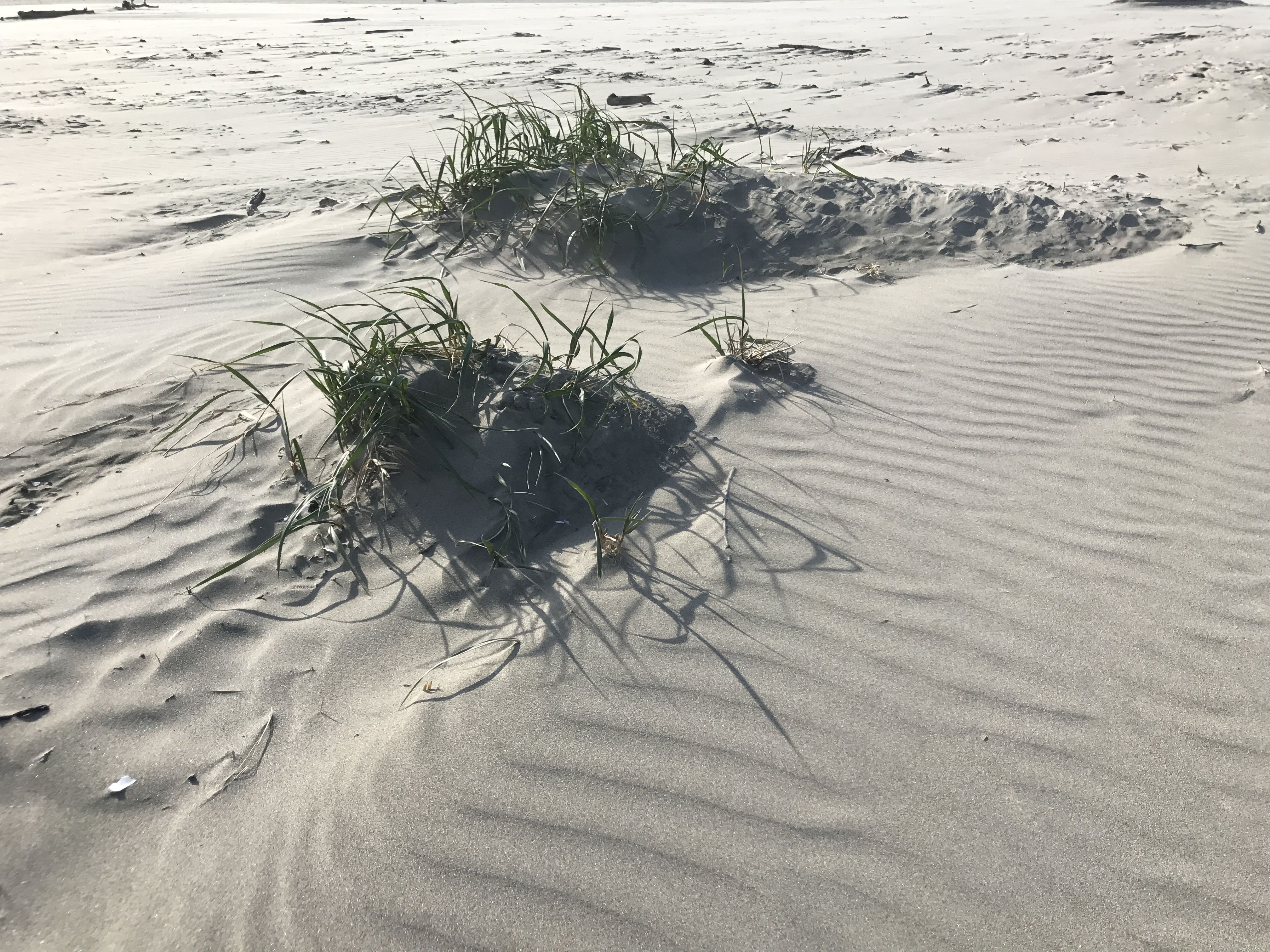
The wind was whipping the sand around.
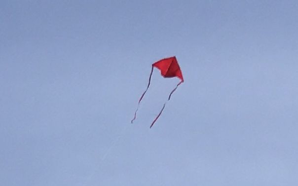
It was also good for flying kites.
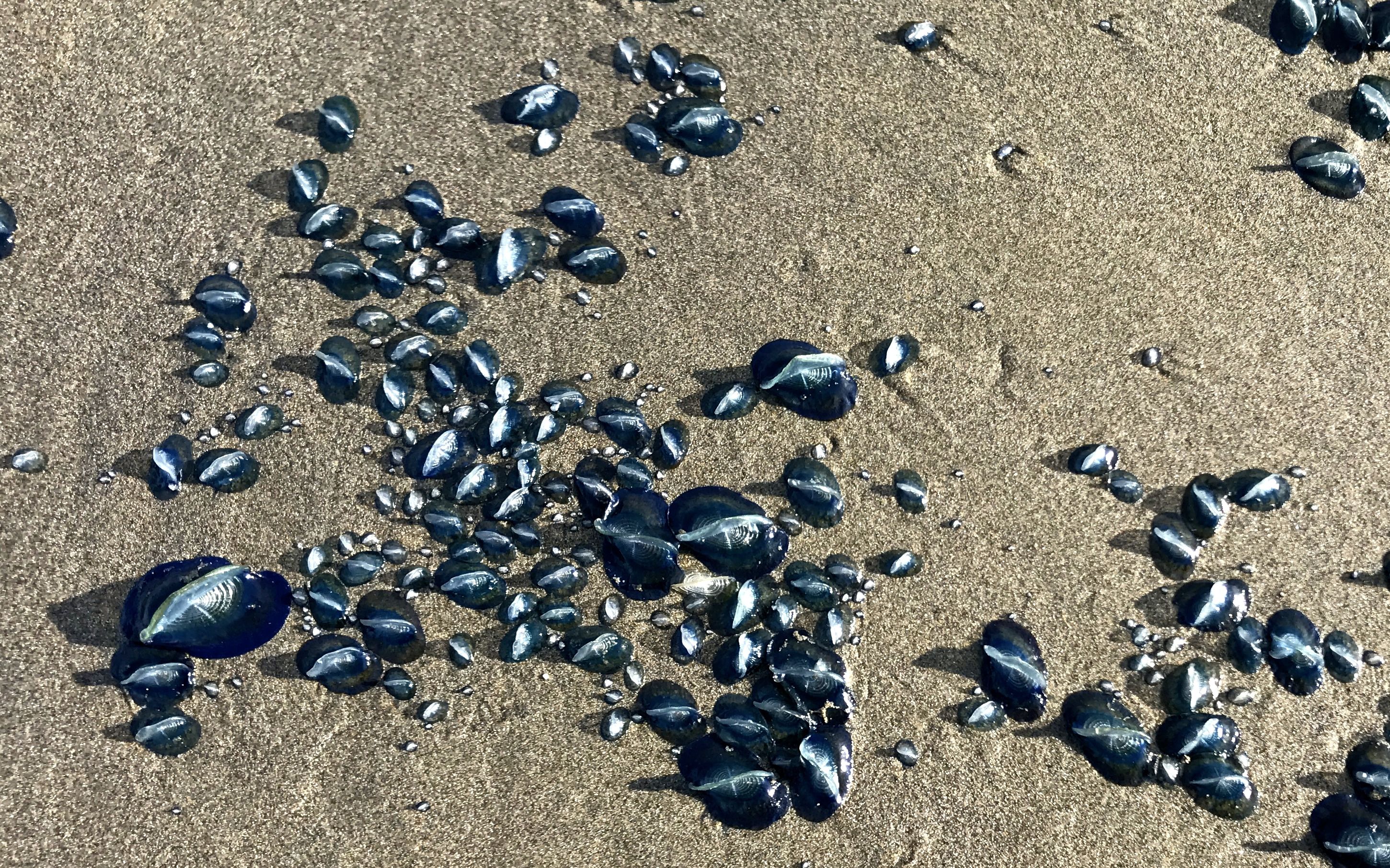
As I walked closer to the ocean, I came upon groups of these amazing blue things. I was pretty sure they were some sort of life form, but I wasn’t sure what they might be.
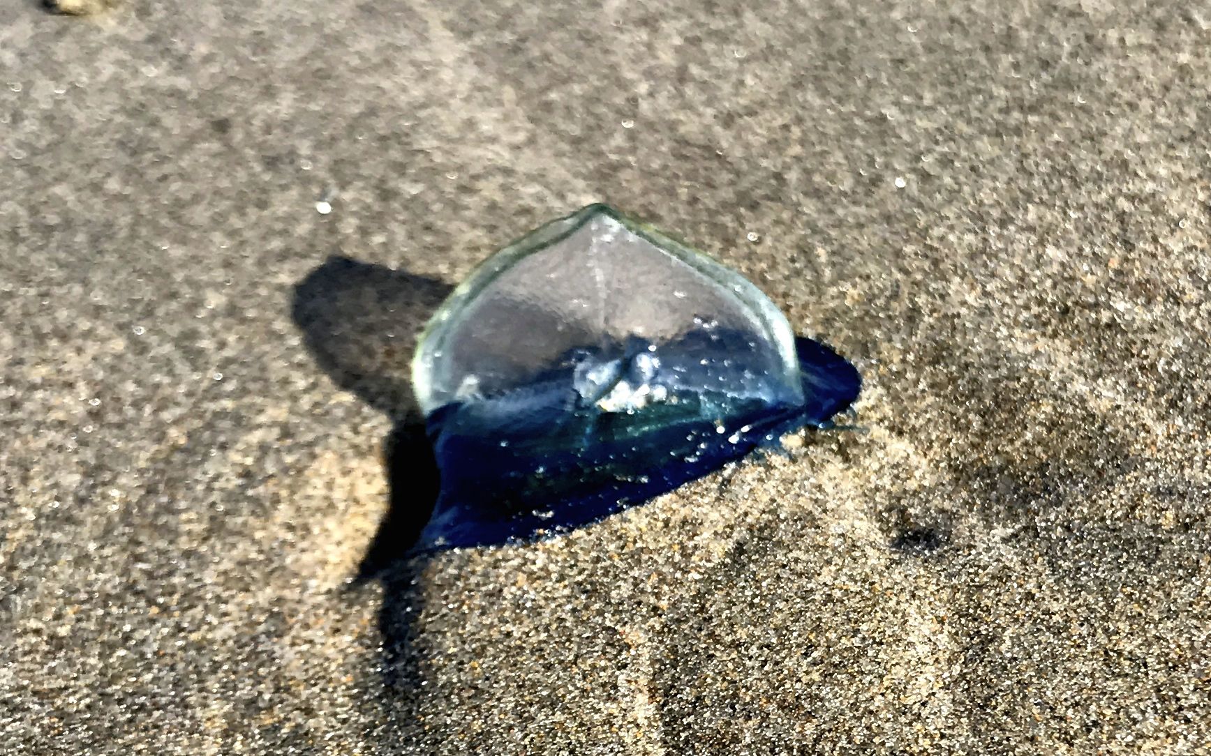
Incredible! What could they be?
I approached these folks. They were walking the beach with the familiarity of locals. I asked them what these object were. Guess what they said?
Jellyfish!
If you want to get spooked, just Google “jellyfish on the beach”.
And with that, it was time to head back to the Flo the Airstream. Before I headed back to BART, I turned for one last look back at the ocean.
I have not followed your entire trip, but what a treat to get this interesting update. I have a fold-out map on my bookshelf of the Lewis and Clark expedition. Just yesterday I thought of decluttering it. But instead now I’ll take it out and look at their route.