I do kind of miss paper maps, but I think I would have had a hard time finding maps that had enough detail to find some of the places I had to find. For instance, just before I ended up here, I once again found myself in the middle of nowhere. Oh, it was a farm, and there was even a grain bin, but it wasn’t what I was looking for. There was no one to ask; I guess they were all out working in the fields.
The facility I was trying to find had a phone number on the card and someone actually answered when I called. They gave me directions and I found them right next to this river. Unfortunately, they had a sign up prohibiting taking photos, so I can’t show you it, but they loaded the grain right into barges.
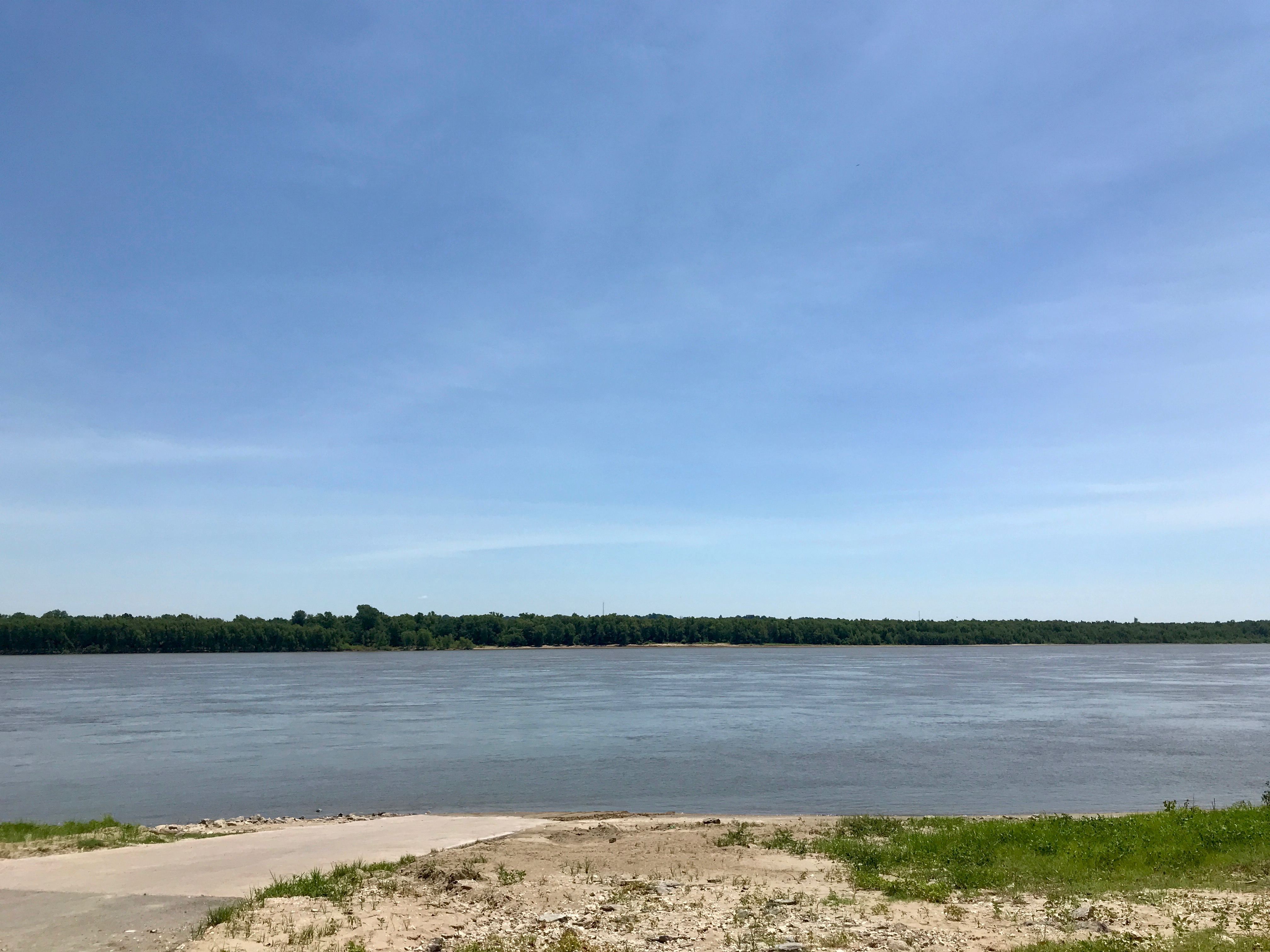
“What’s that river?” I asked the worker who gave me the sample. “The Mississippi,” was the response. I sure felt silly! I had forgotten where I was. Well, with all the zipping around I’d been doing, it’s a miracle I remembered what state I was in. (I was still in Missouri.)
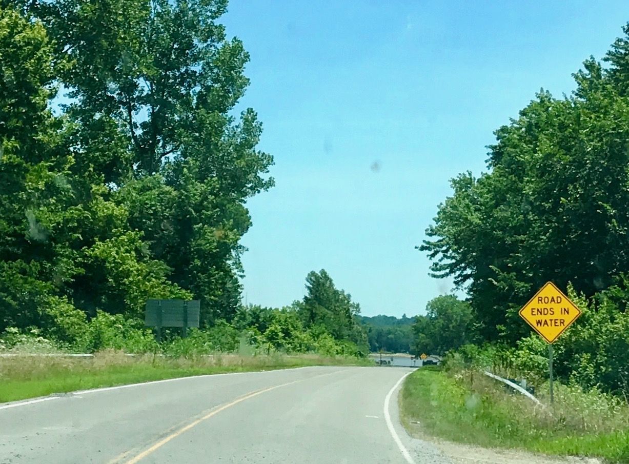
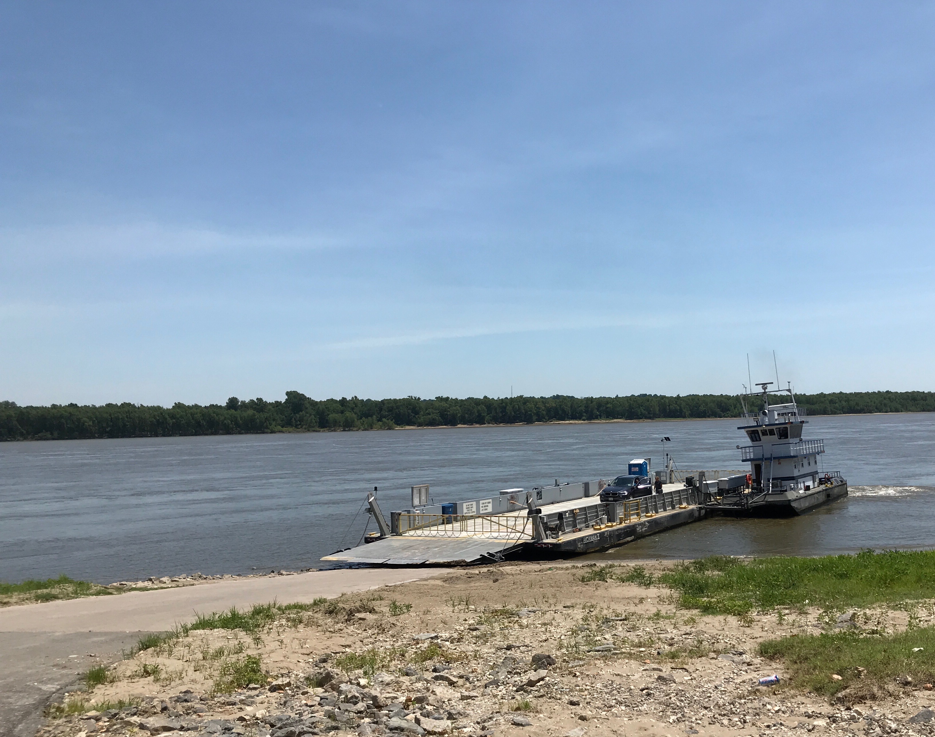
With this intriguing sign, I had to investigate further.
It turns out that it lead to a ferry landing. I spoke to a few travelers who were waiting for the ferry to come. I think that was Tennessee on the other side.
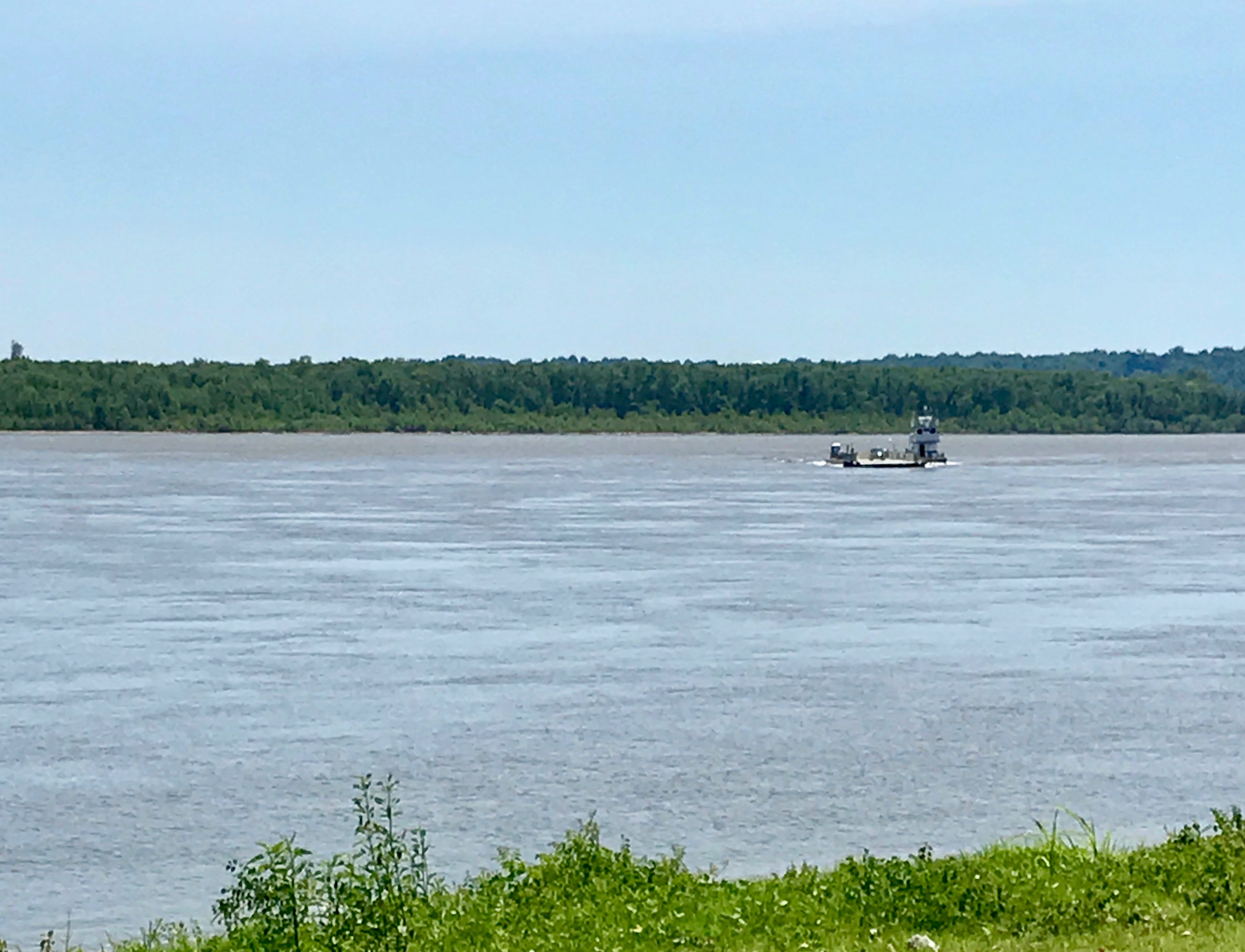
After a bit, the ferry started across.
It’s getting closer.
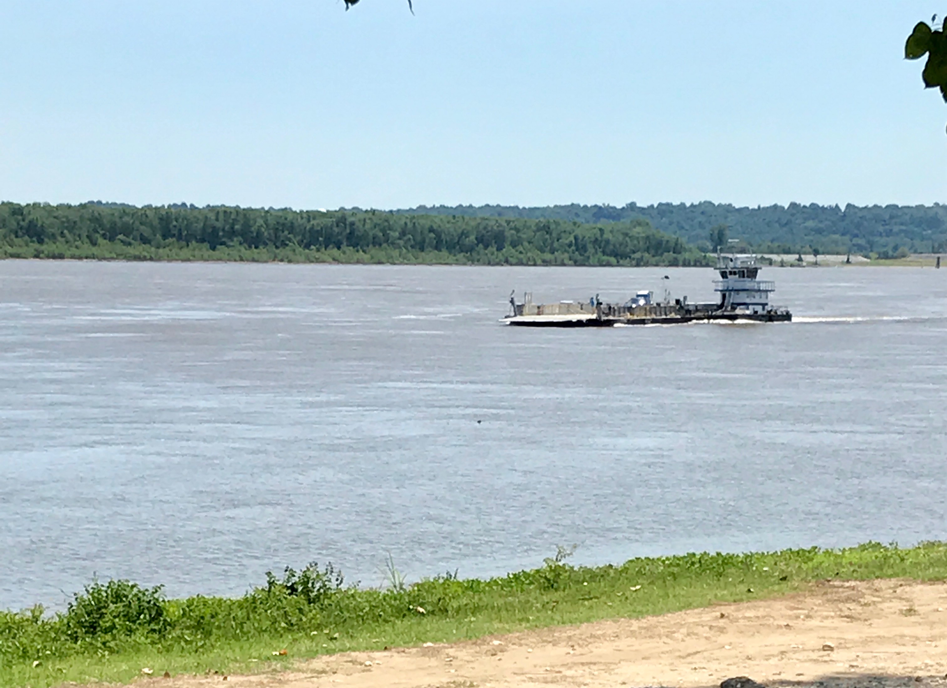
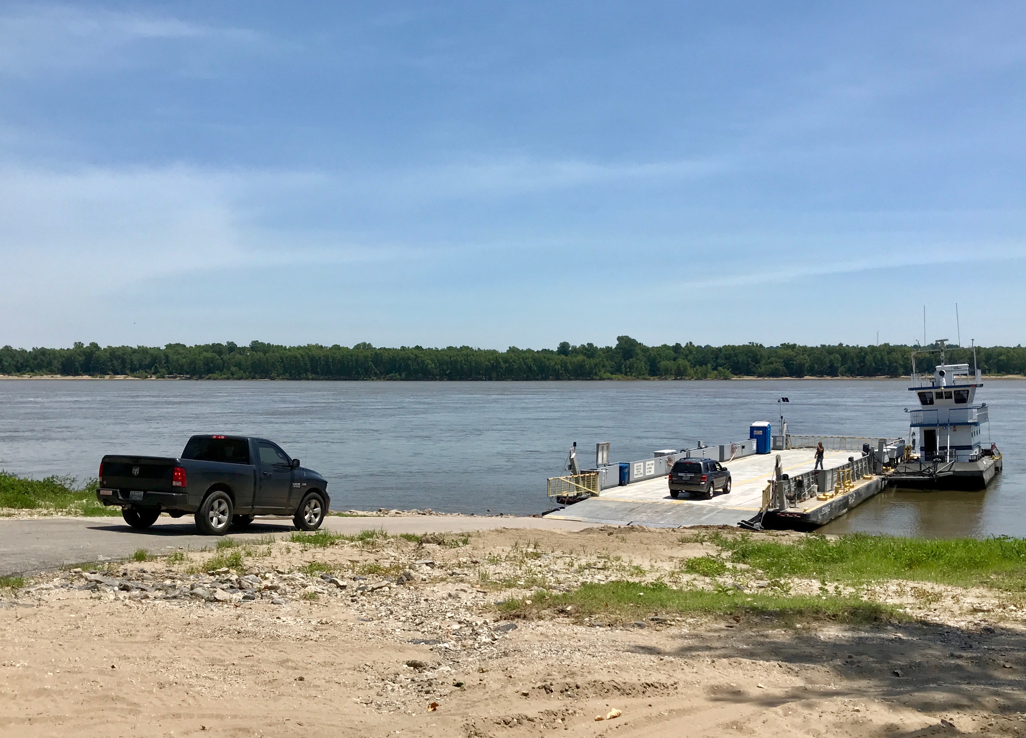
They docked and the vehicles on board prepared to roll off.
Then the folks I had been chatting with rolled aboard and they got ready to head back across the Mississippi.
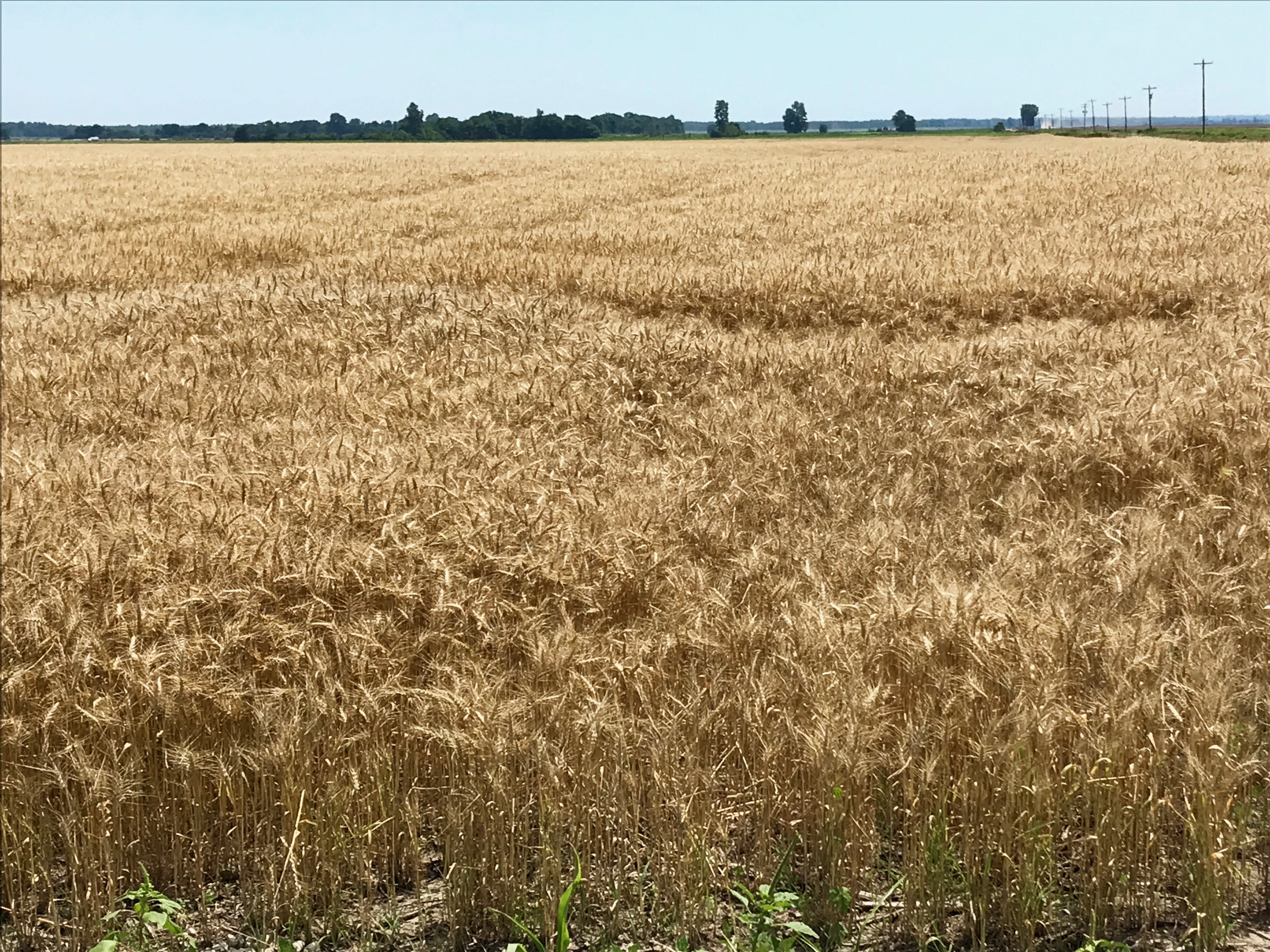
I took off and got ready to hit a few more facilities before close of business. With all the wheat I had been collecting, I wondered where it was. I finally found a field.
Look at those amber waves of grain!
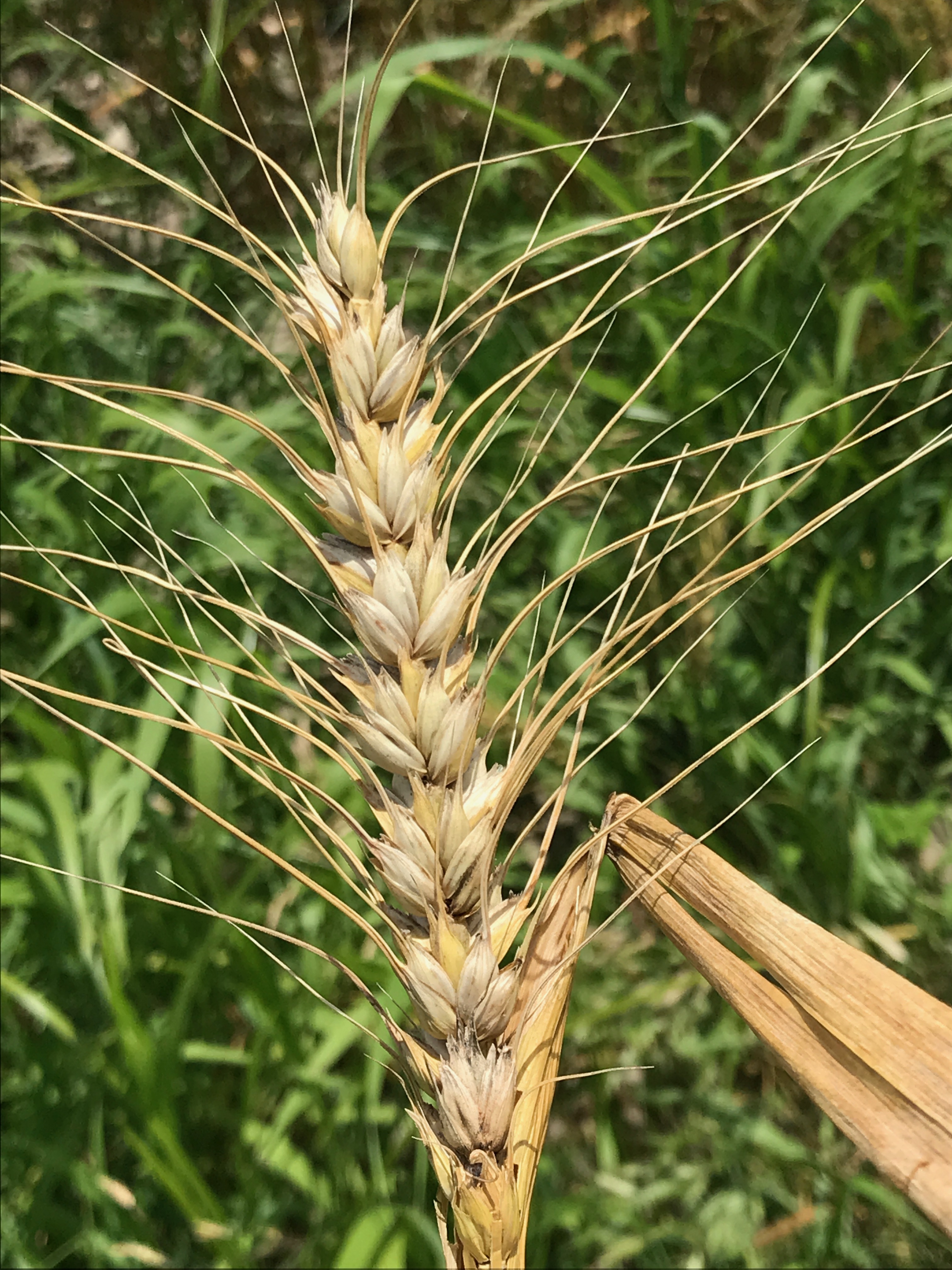
I had to take a close up of the spike. The funny thing is that I wasn’t sure of the name of this part of the plant – in English. I knew it as “espiga” in Spanish, and I knew it translated to spike, but I never heard that term used in English. I finally broke down and looked it up. In addition to being called the spike, it’s also called the “ear” or “head.”
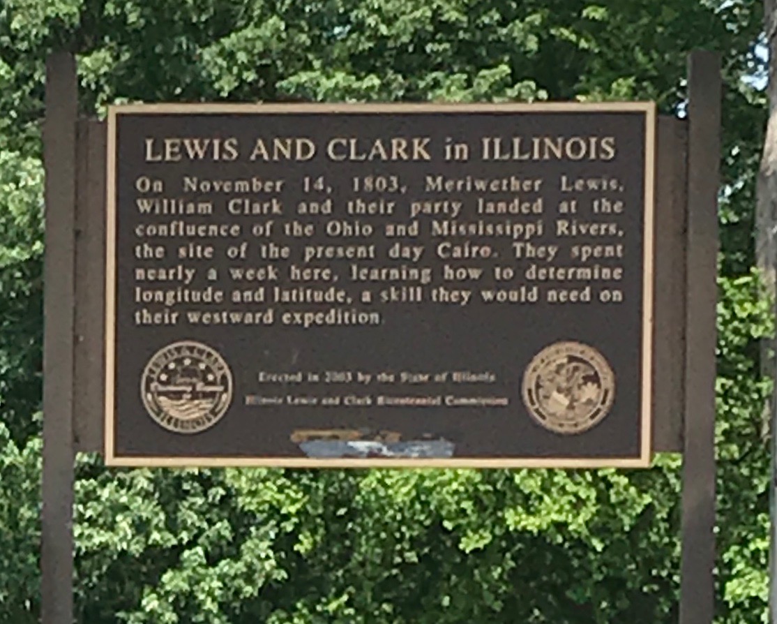
Somehow, I got turned around and ended up crossing the river into Illinois.
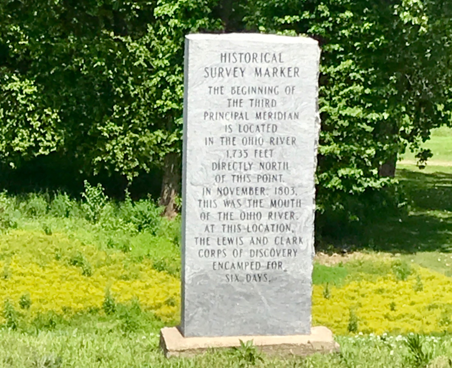
The Corp of Discovery sure did get around!
The river beds get around, too. This is a marker for a place that is in the Ohio River. I wonder how I missed that river?
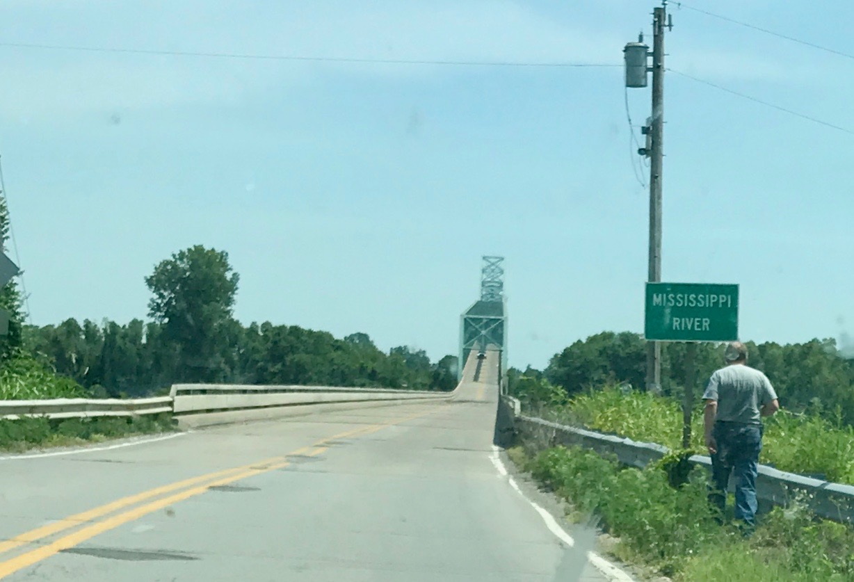
But, it was time to head back across the river. Maybe I could find one more facility before close of business.
And, no, the next place I stayed was not as nice as the Motel 6 in Poplar Bluff.
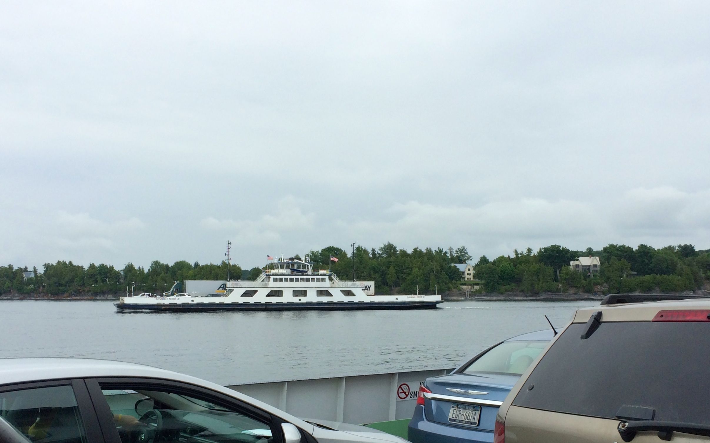
Finally! A new state to add to the map! After talking with a few people and consulting maps, I decided that the way to get to Vermont from Plattsburg, New York would be to take the ferry.
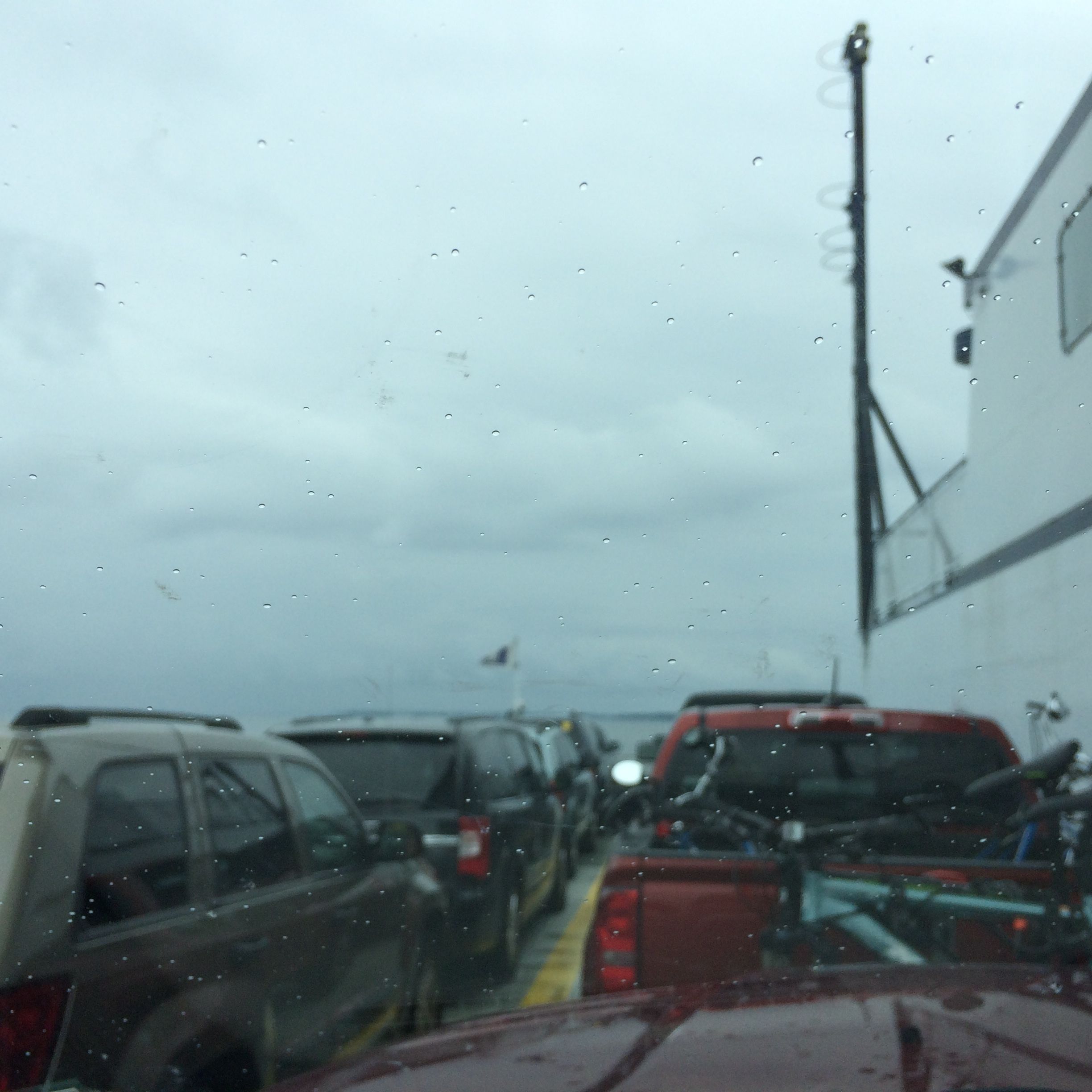
It was a drizzly day when they packed us on the ferry. Incidentally, the toll to ride the ferry with the truck and trailer is based on how long the rig is. I found out that Bart and Flo are about 48 feet long from the front bumper of the truck to the read bumper of the trailer. No wonder maneuvering into campsites is such a challenge at times! Oh, and the 15 minute trip cost $39.50.
Just as we got to the other shore, a ferry set sail from Vermont.
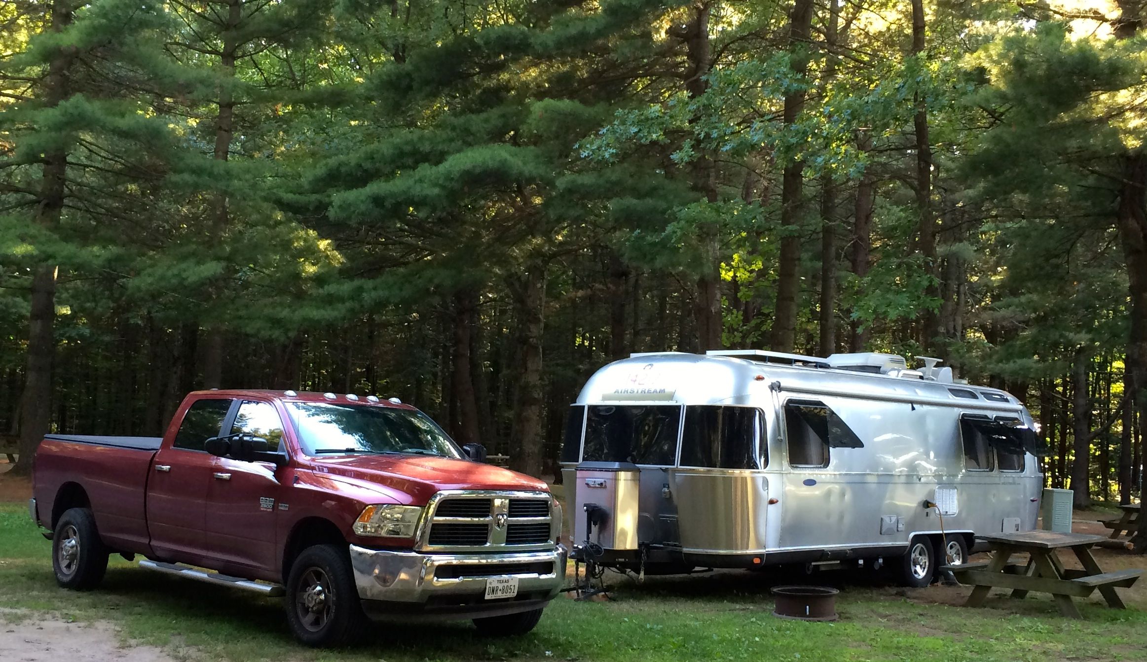
I got settled in to my home for the next week or so – Malletts Bay Campground. Most of the campground was filled with seasonal campers and people in town to work on the oil pipeline. Those people are really packed in, and since they are there for a long period of time, they pack their spots full, from one side to the other and front to back. It was much nicer over in the short term area. People came and left, but it was never crowded.
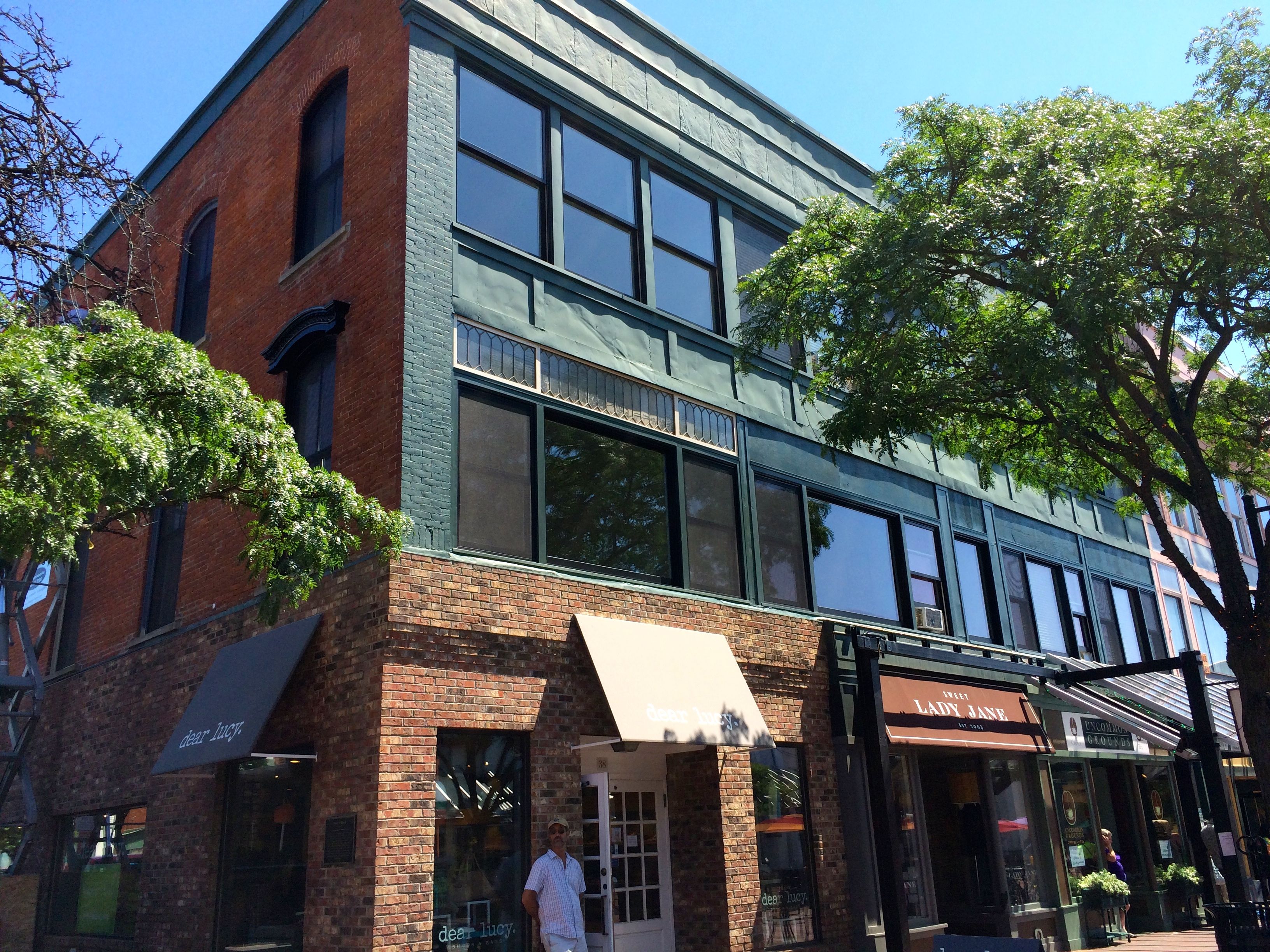
I went into Burlington a couple of times during my stay at Malletts Bay Campground. In my research about what to do in Burlington, I found that they had free two-hour parking in a garage downtown. Since the prince was right, I decided to start my explorations there. I parked and set off to explore the Church Street Marketplace.
It’s a lovely pedestrian mall with an assortment of building styles from the 19th and 20th centuries.
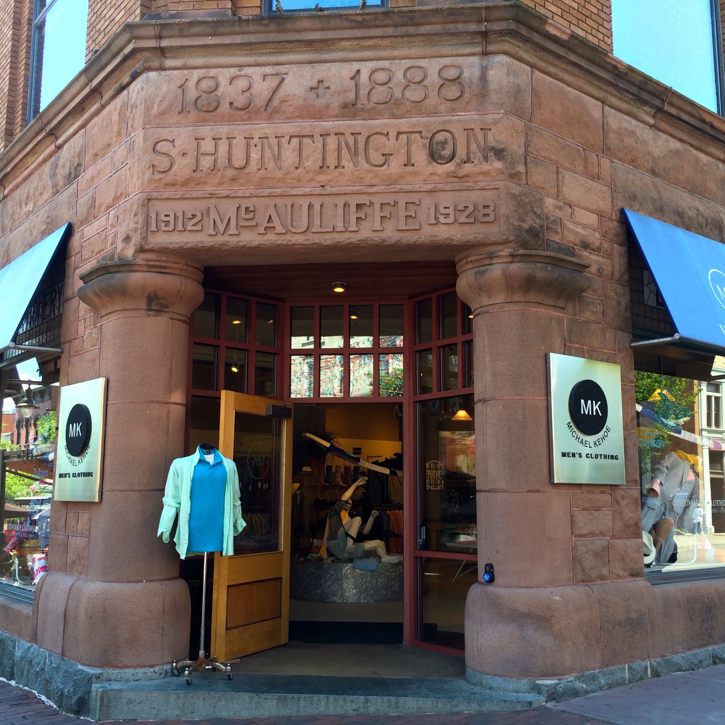
For instance, the building on the corner, Payn’s Block, was built around 1865 for a local metalsmith named Edgar Payn.
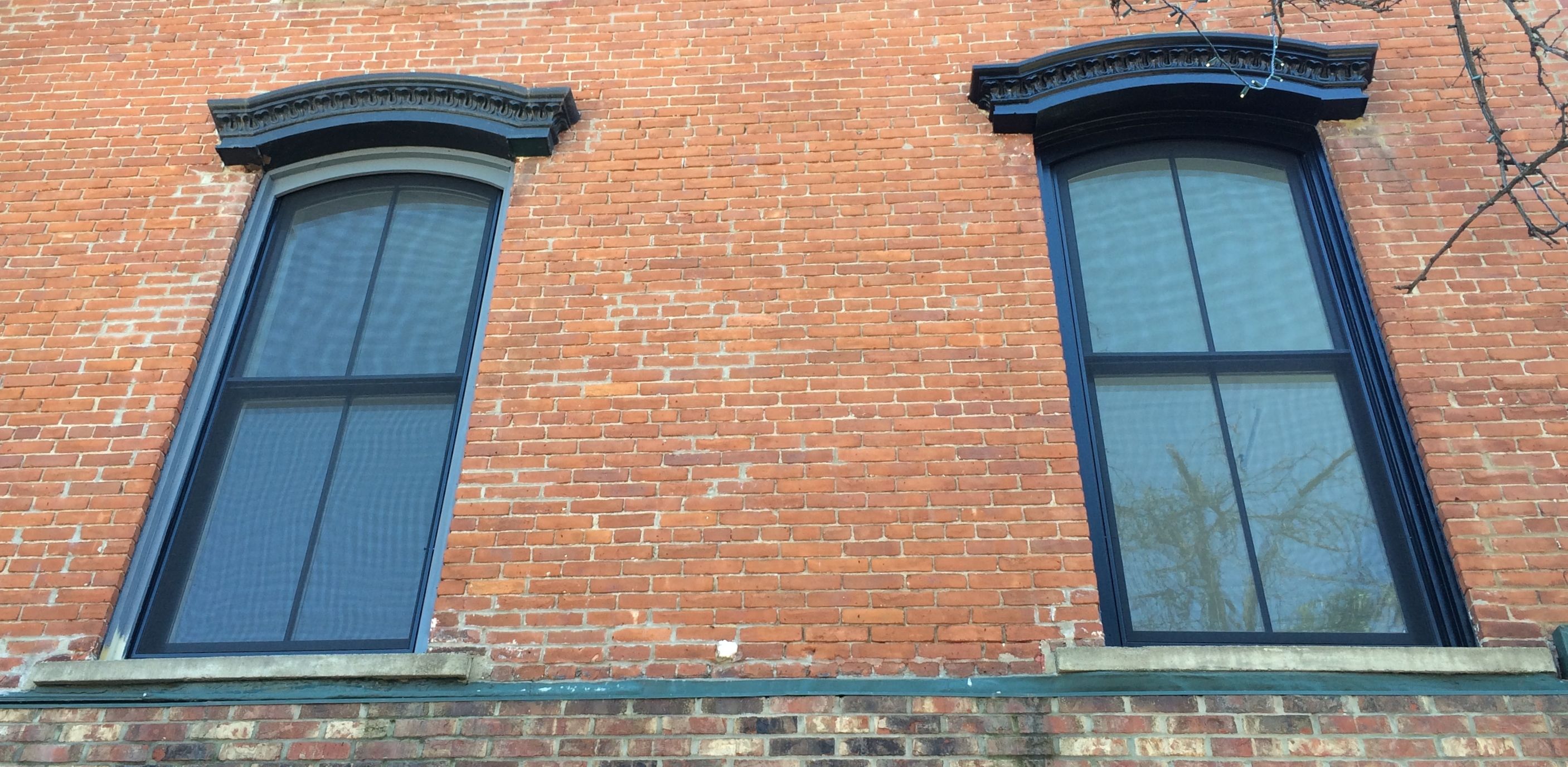
It was built in the Italianate style, which you can still see in the windows on the side of the building. A department store took over the building and the one next to it from the early 1900s through the 1930s. According to the plaque on the building, the Art Deco-style pressed metal facade was added in the 1920’s to visually unite the two buildings.
I particularly liked how some of the different owners engraved their names and dates over the entrance to this building, which is now a men’s clothing store.
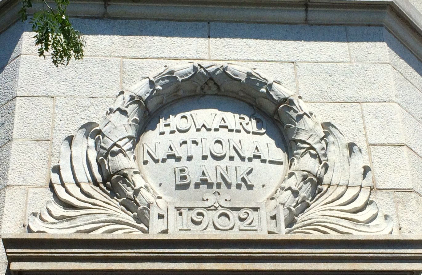
And, if you ever wondered where to store your Howards, the have a bank for that.
Moe and Curly are all set. Poor Larry would have to find his own bank.
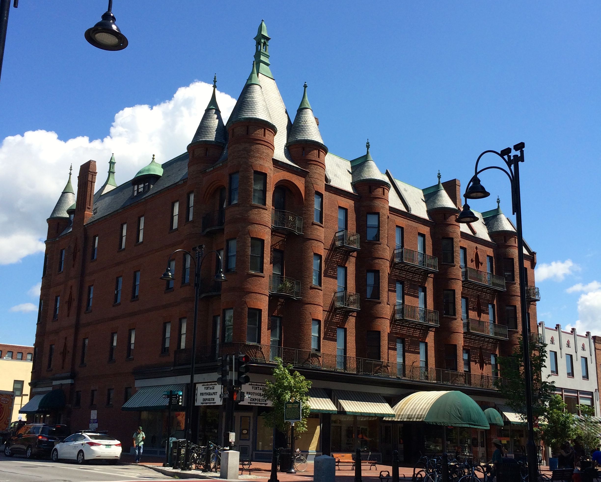
On the north end of Church Street, there was an elegant apartment building, Richardson Place, with commercial space at the street level.
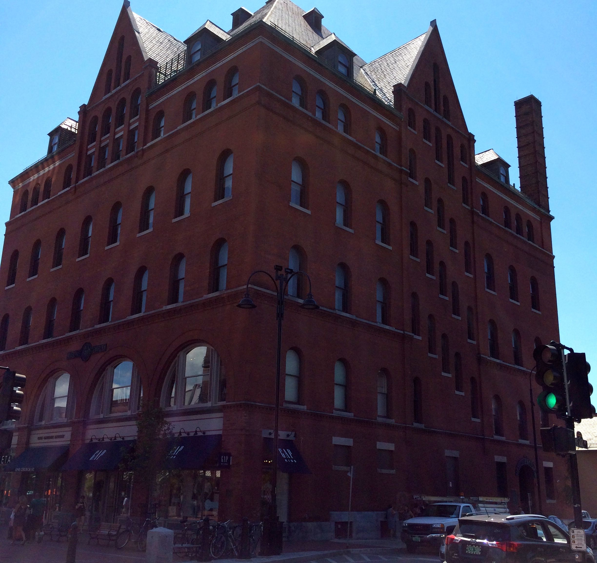
On the opposite corner was the Masonic Temple. According to the information plaque, the cornerstone was laid in 1897 and was built at a cost of $80,000.
At the top of Church State is the First Unitarian Universalist Society Meeting House. It was built in 1816 for the First Congregational Society (Unitarian) and is the oldest surviving place of worship in Burlington. Following a merger of the Unitarians and Universalists in 1982, the congregation voted to become the First Unitarian Universalist Society of Burlington.
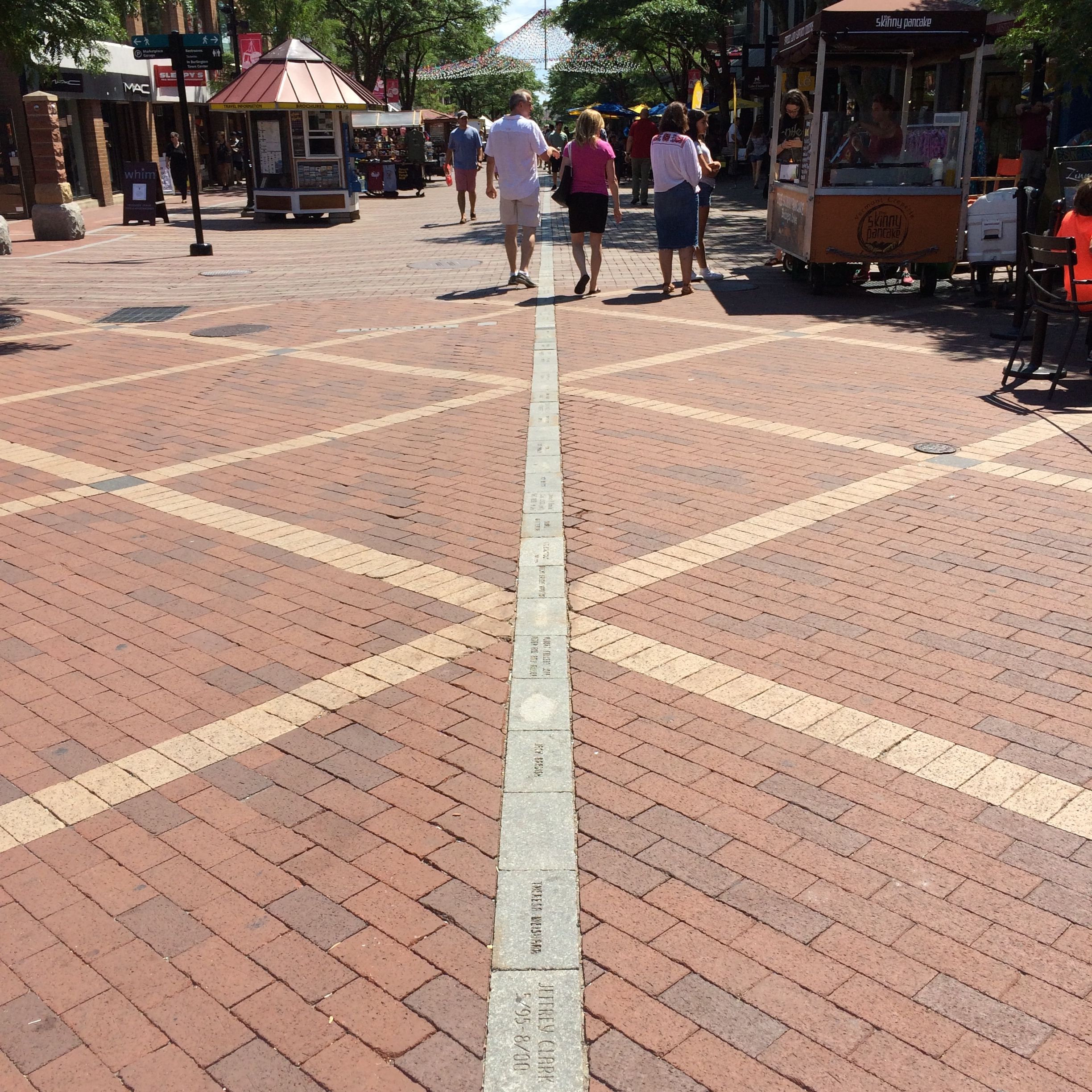
Walking back down the Church Street Marketplace, I was taken by the interesting designs in the pavement. I asked the guy working in the little tourist information kiosk at the top left side of the photo what it was, but he couldn’t help me.
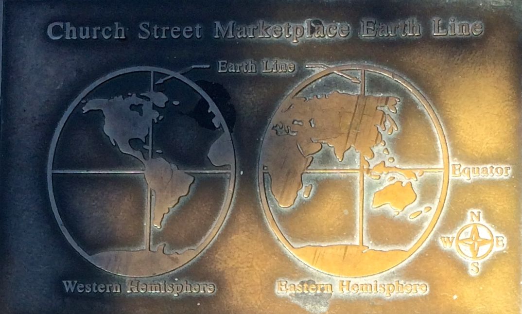
I was determined to find some information about it. If they have plaque about all the buildings, they certainly have information about this. I looked and looked and finally found a plaque.
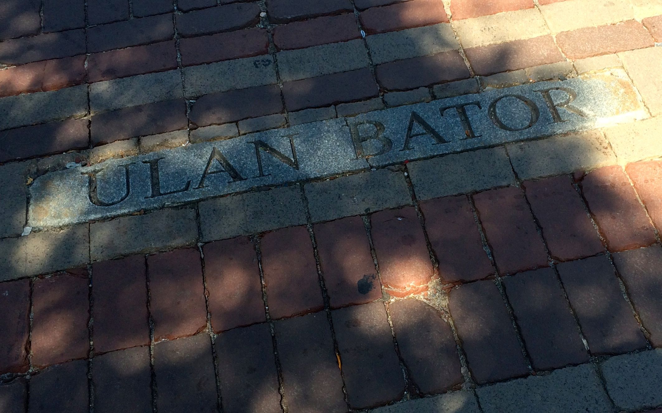
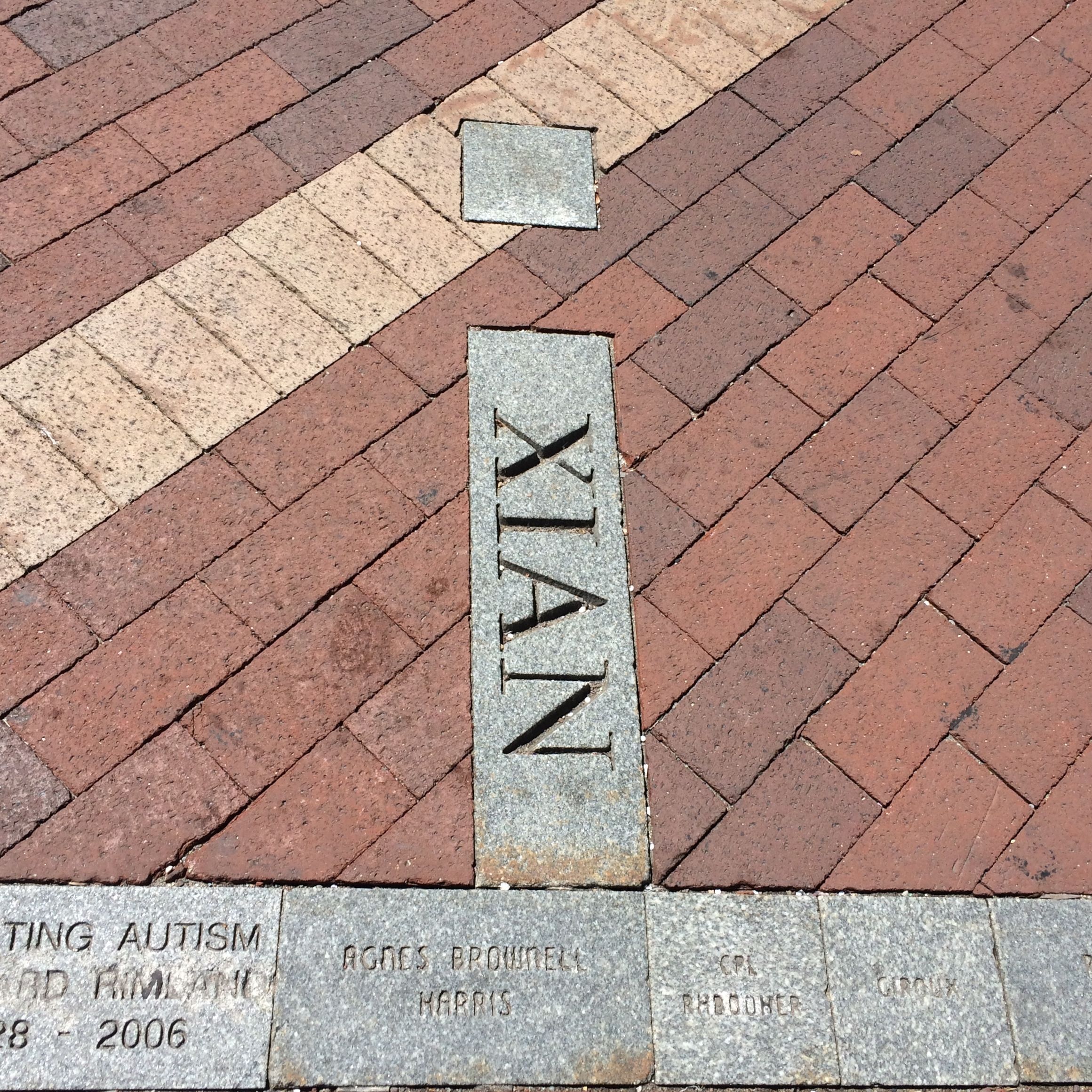
It turns out that the line down the center of the pedestrian mall is what they call an Earth Line. It’s a line of longitude that runs through Burlington.
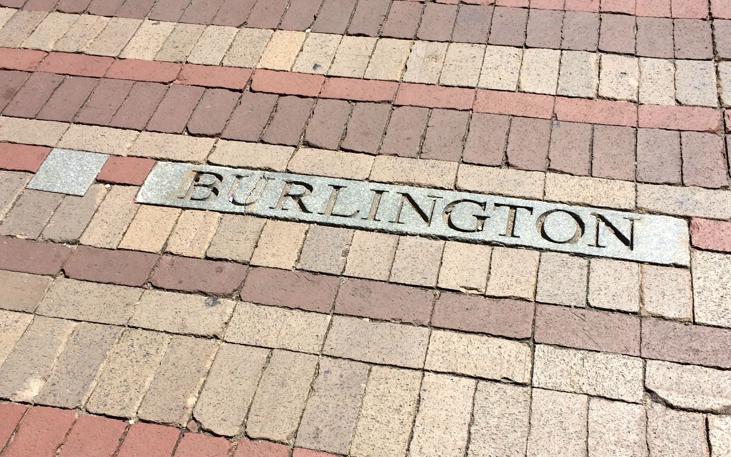
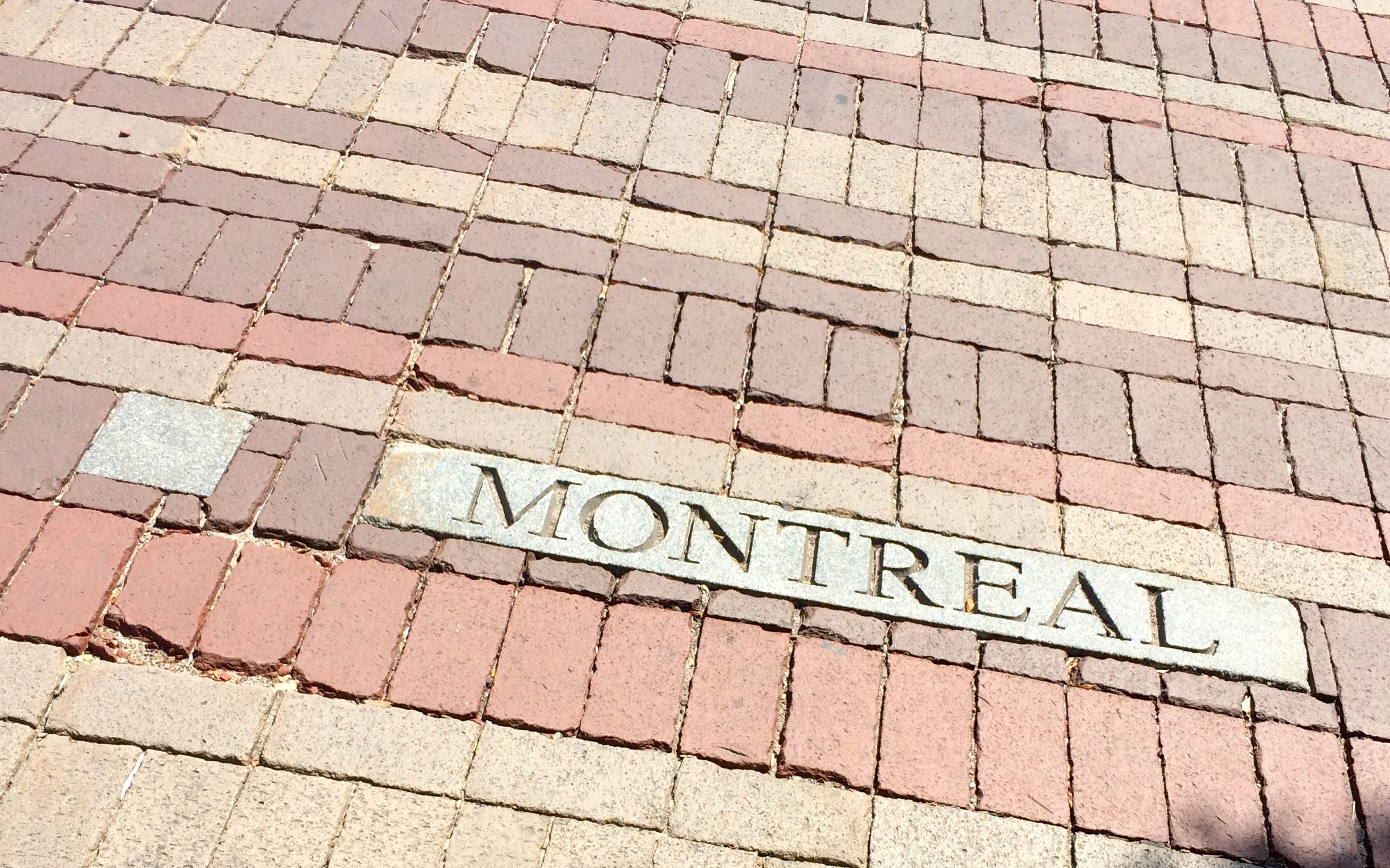
Along the mall, they have identified cities that lie near the Earth Line.
On the Earth Line, you can see the names of people who have sponsored a block.
I was so pleased with myself for having figured out what the story of the pavement design was that I returned to the tourism kiosk to tell the guy where he could look to find the plaque.
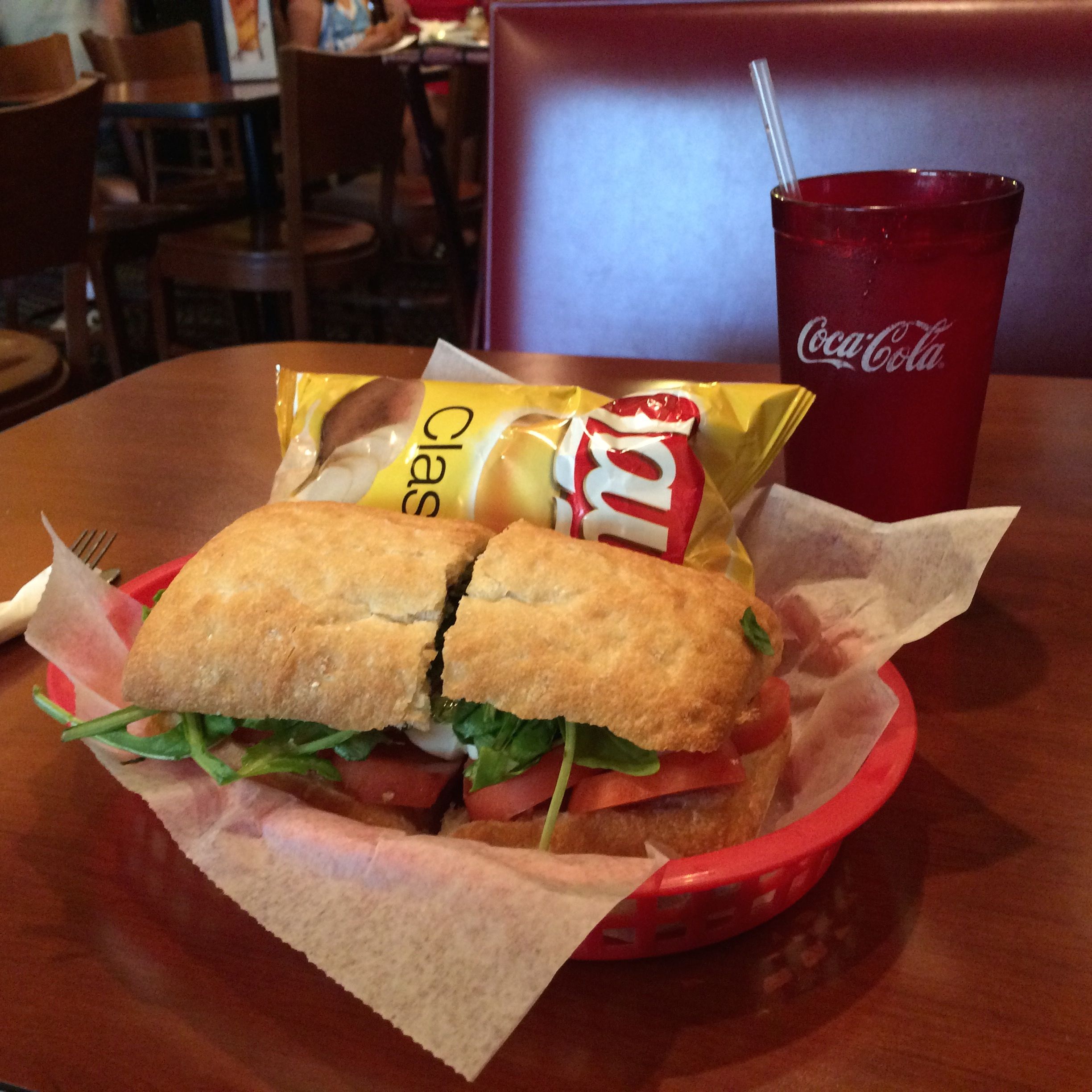
After that, I decided that I had to have some refreshment. There were any number of sidewalk cafes I could have stopped at, but I was getting so tired and thirsty that I finally said to myself that I would stop at the next one that had a seat. At that point, I didn’t even care that I wasn’t sitting on the sidewalk.
I had a Caprese Sandwich, which was delicious! The waiter must have noticed how eagerly I attacked the water he brought me, and he kept coming back to refill my glass.
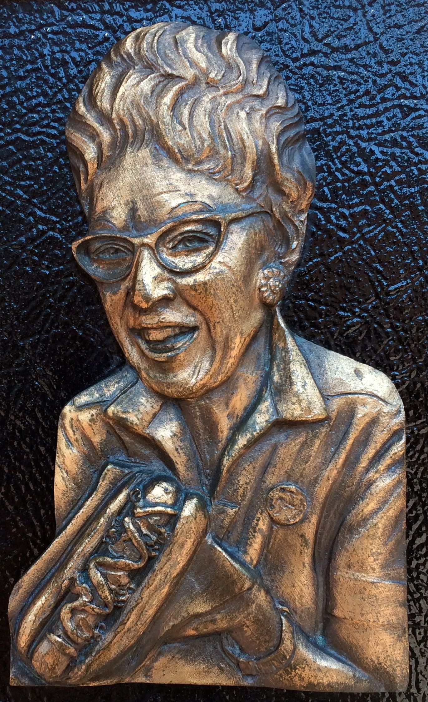
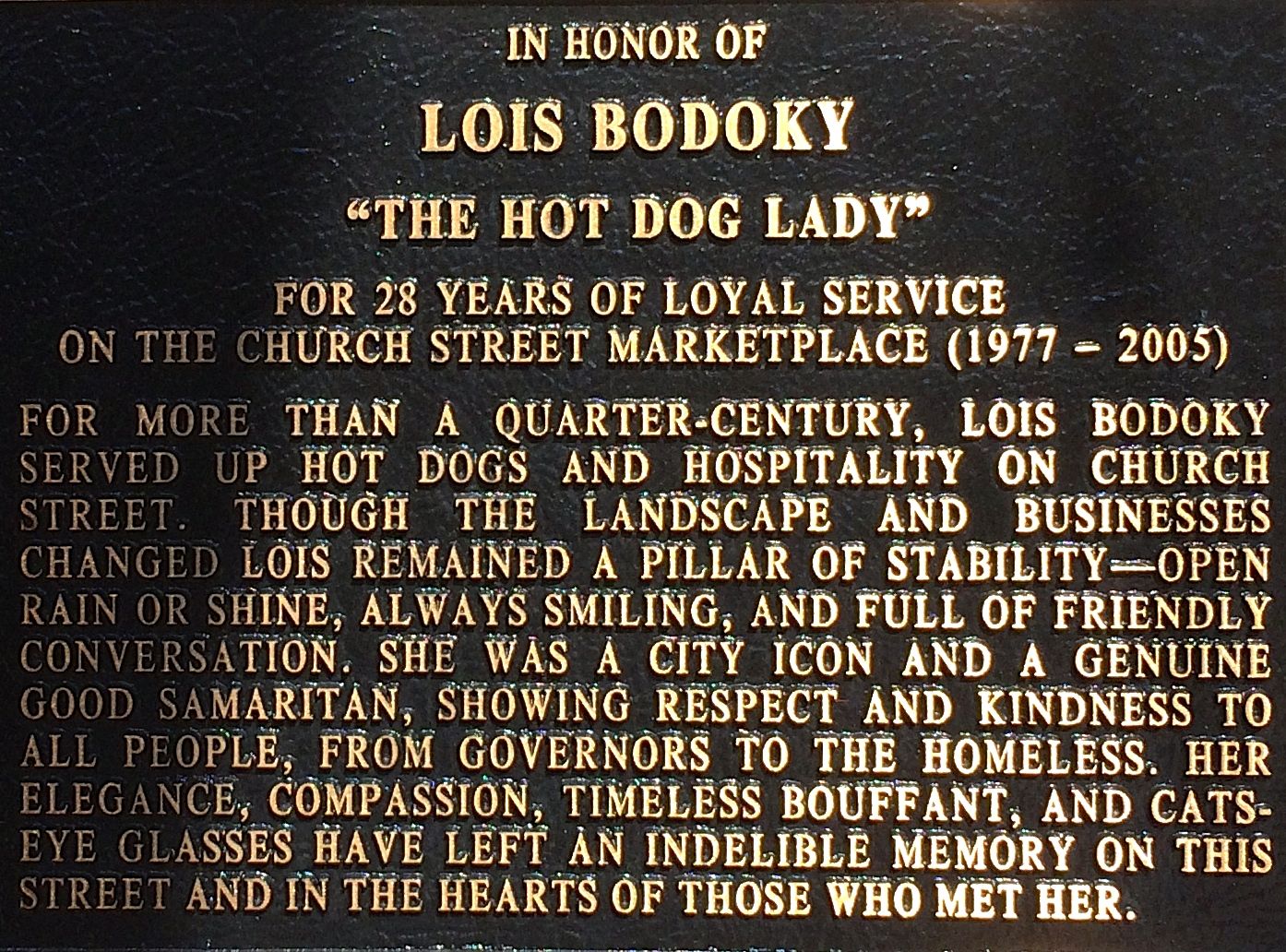
After my late lunch, I continued my strolling about. This plaque about Lois Bodoky, “The Hot Dog Lady”, caught my eye. I had to take a photo of her separate from the information about her because of the way the sun was shining, but take a moment to read about her.
May we all leave such a favorable impression on our communities with our work, no matter how large or small our missions.
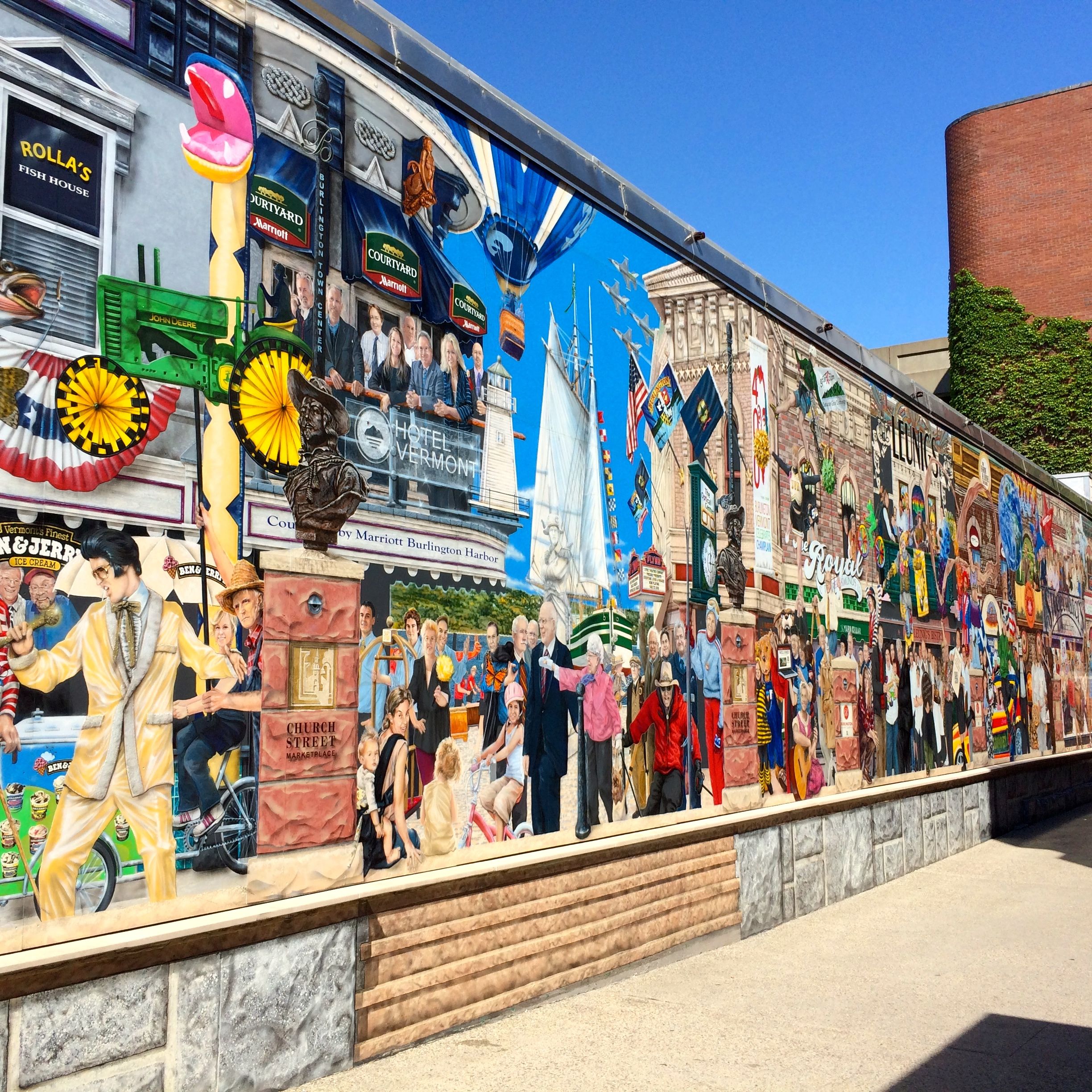
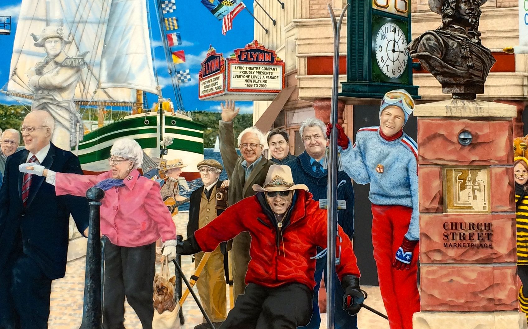
There is a long mural that is on Leahy Way, which leads off Church Street. Incidentally, Leahy Way is named for Senator Patrick Leahy, who has been in office since 1975. The mural was designed by a Canadian muralist named Pierre Hardy and is titled “Everyone Loves a Parade!” Grand Master Samuel de Champlain leads the parade, which depicts an evolution in time with images of the past 400 years.
It wasn’t too hard to find Bernie.
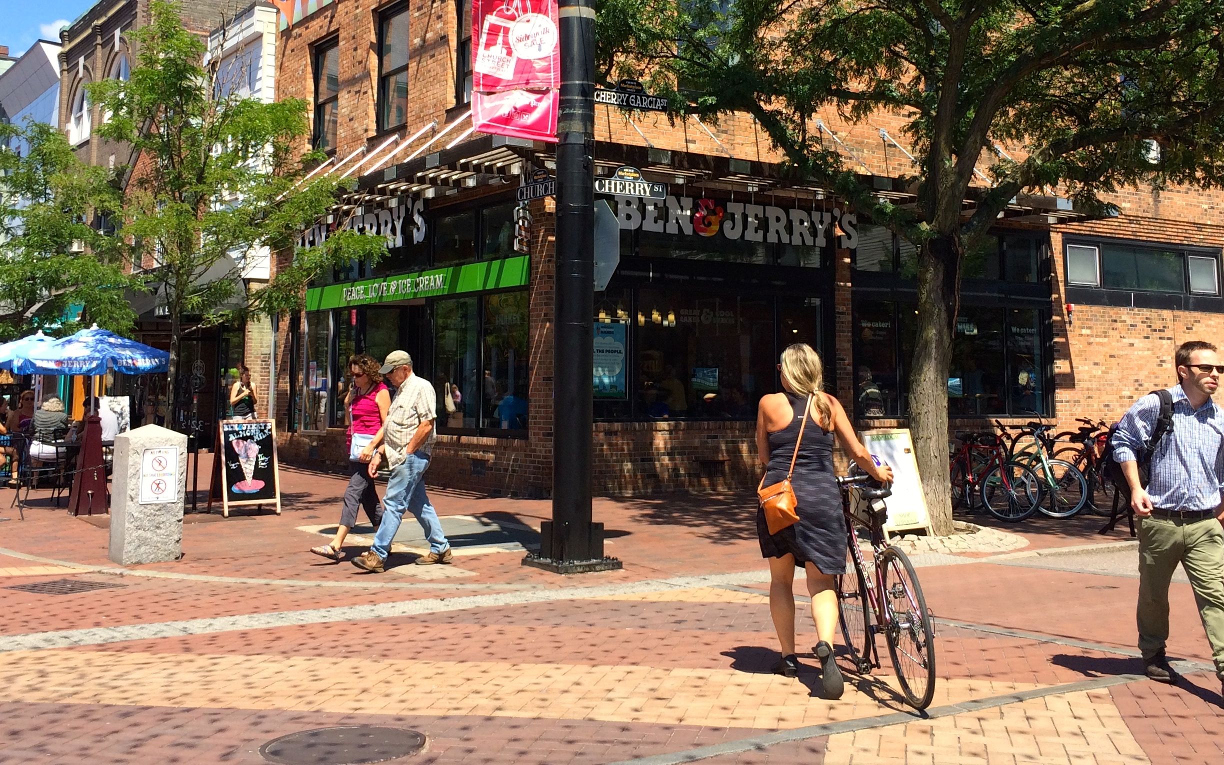
It was almost as easy to find Bernie as it was to find a Ben and Jerry’s. We are in Vermont, after all!
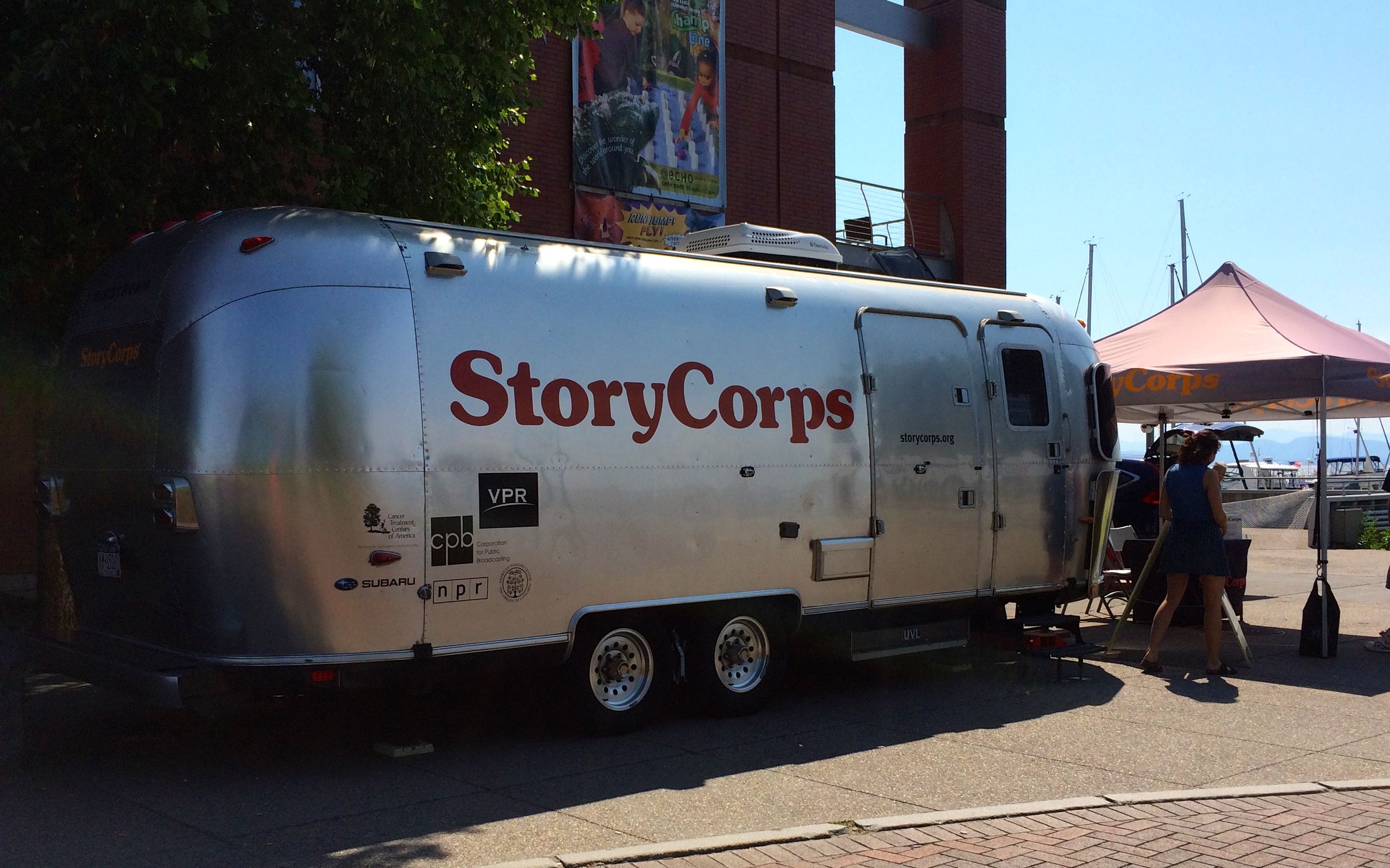
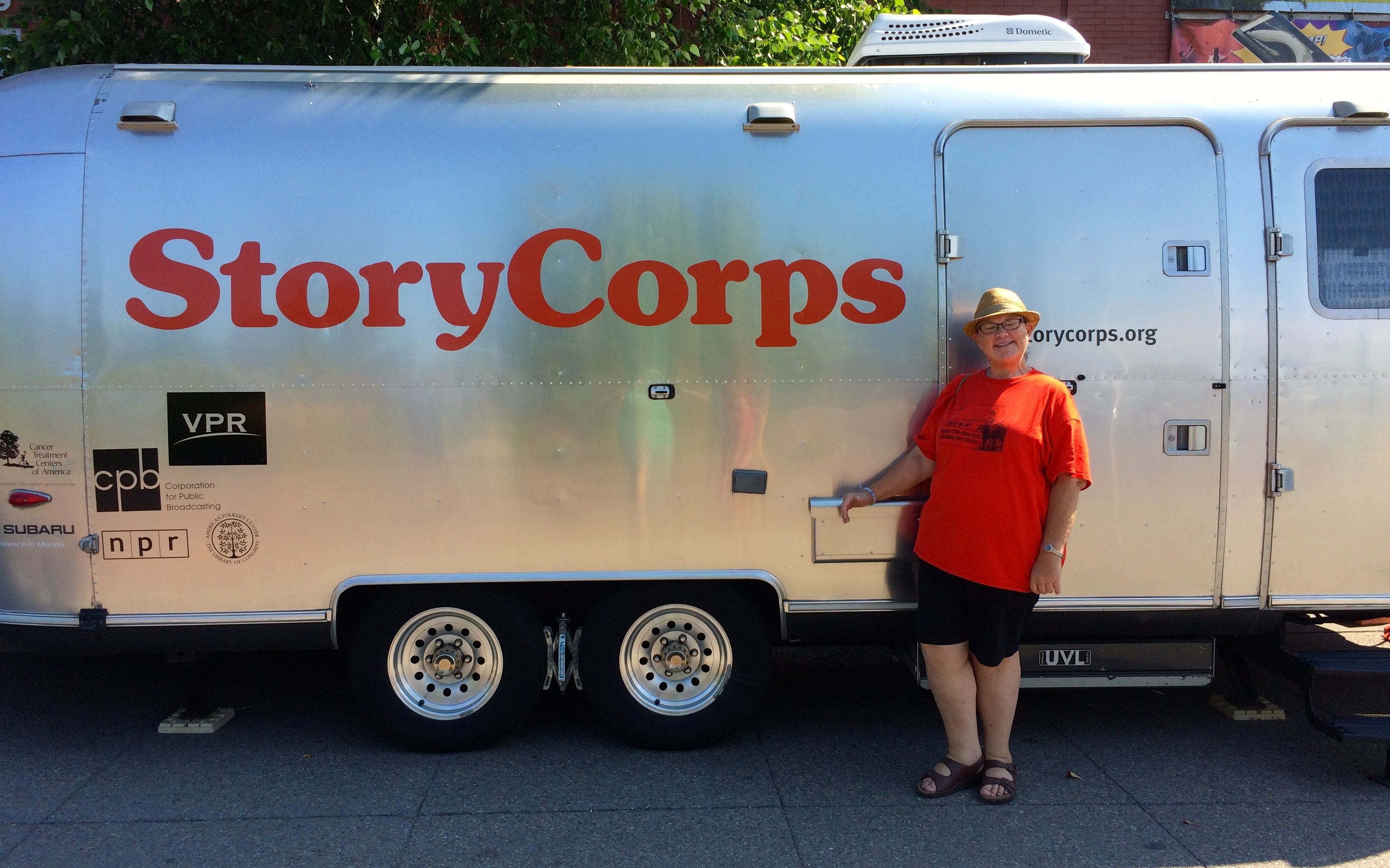
While driving around, I had heard that StoryCorps was in town recording interviews in their iconic Airstream. Another trip into Burlington, I decided to go find it.
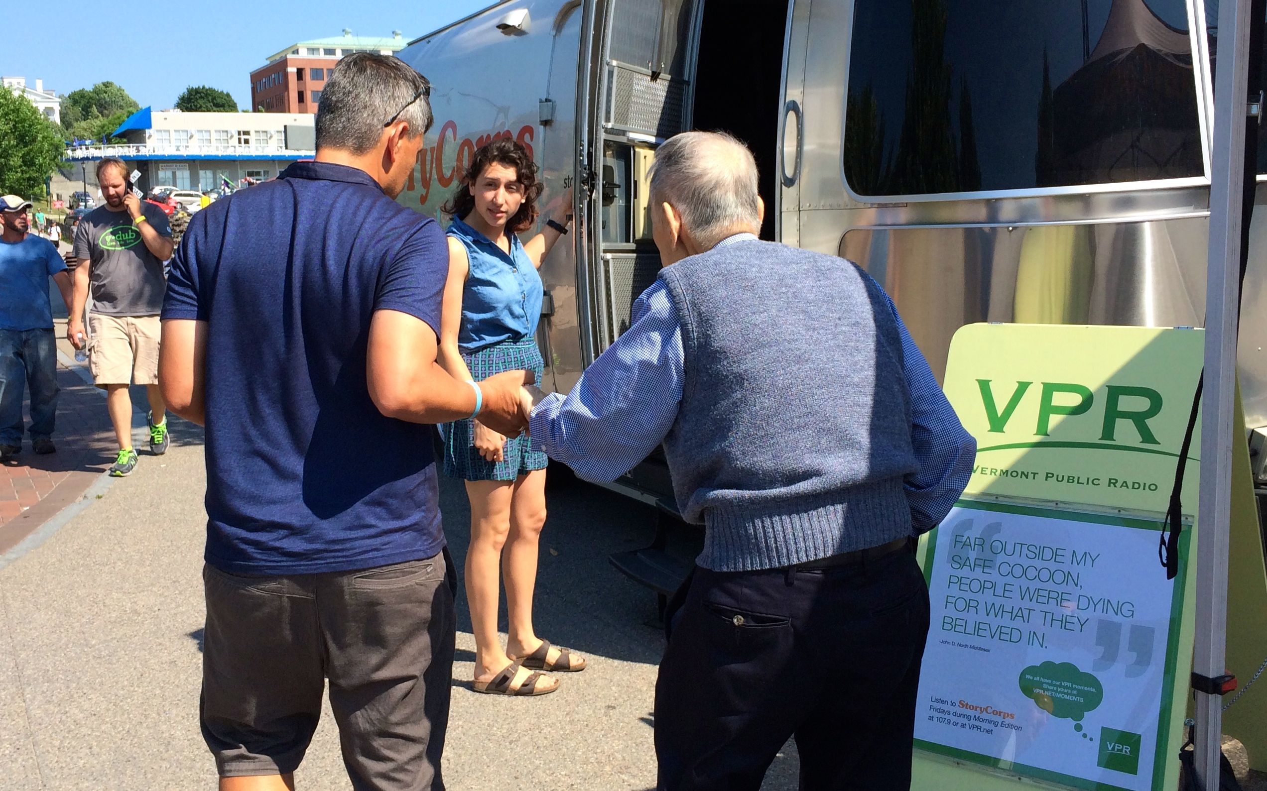
Just as I got there, two people arrived to record their stories. I waited around to see if I might look inside when they were finished.
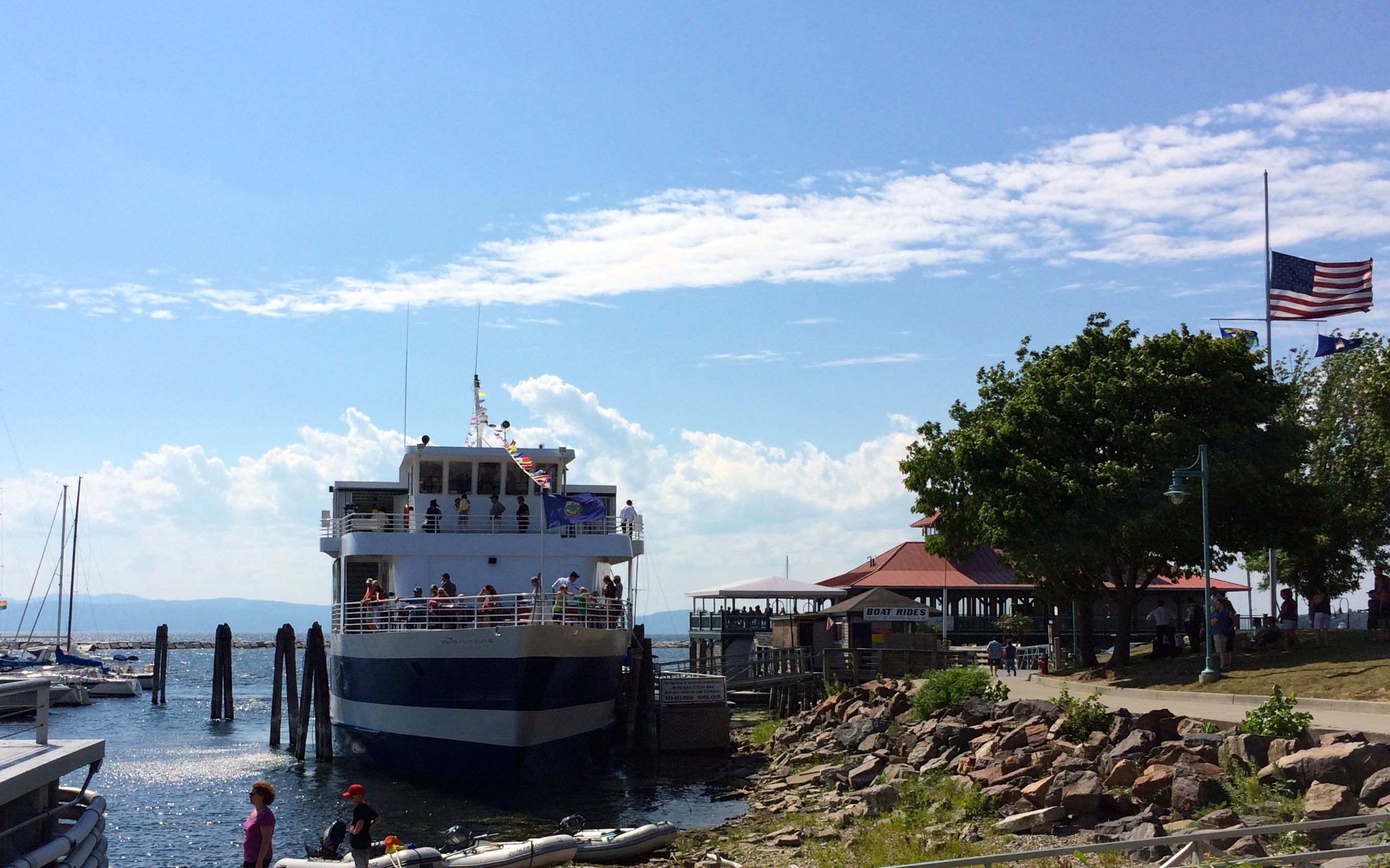
While I was waiting, I looked around the harbor.
A tour boat was coming in to port. One batch of tourists got off and another got on.
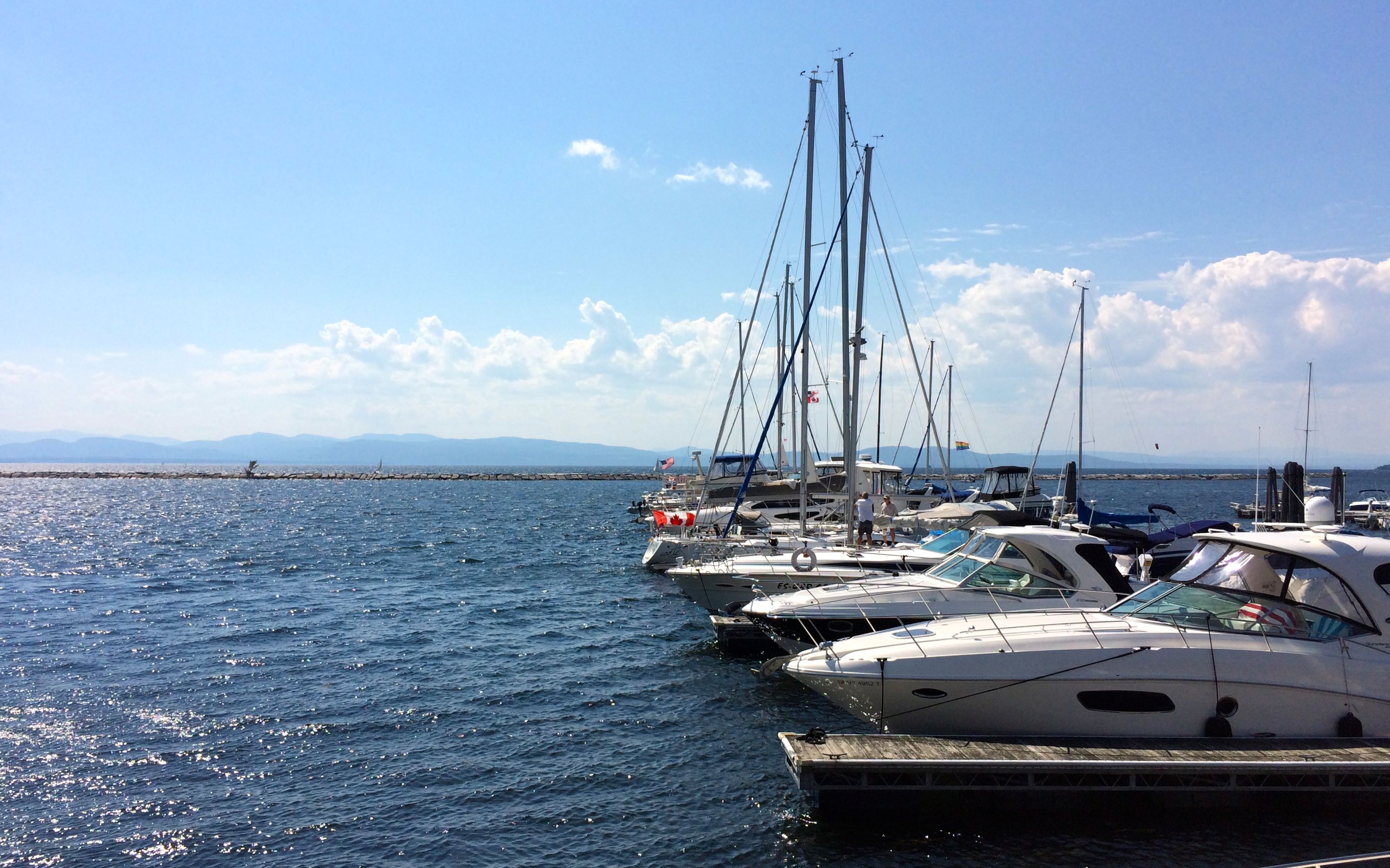
There was also a nice collection of boats at the docks. I think I caught a whiff of money while I was standing there.
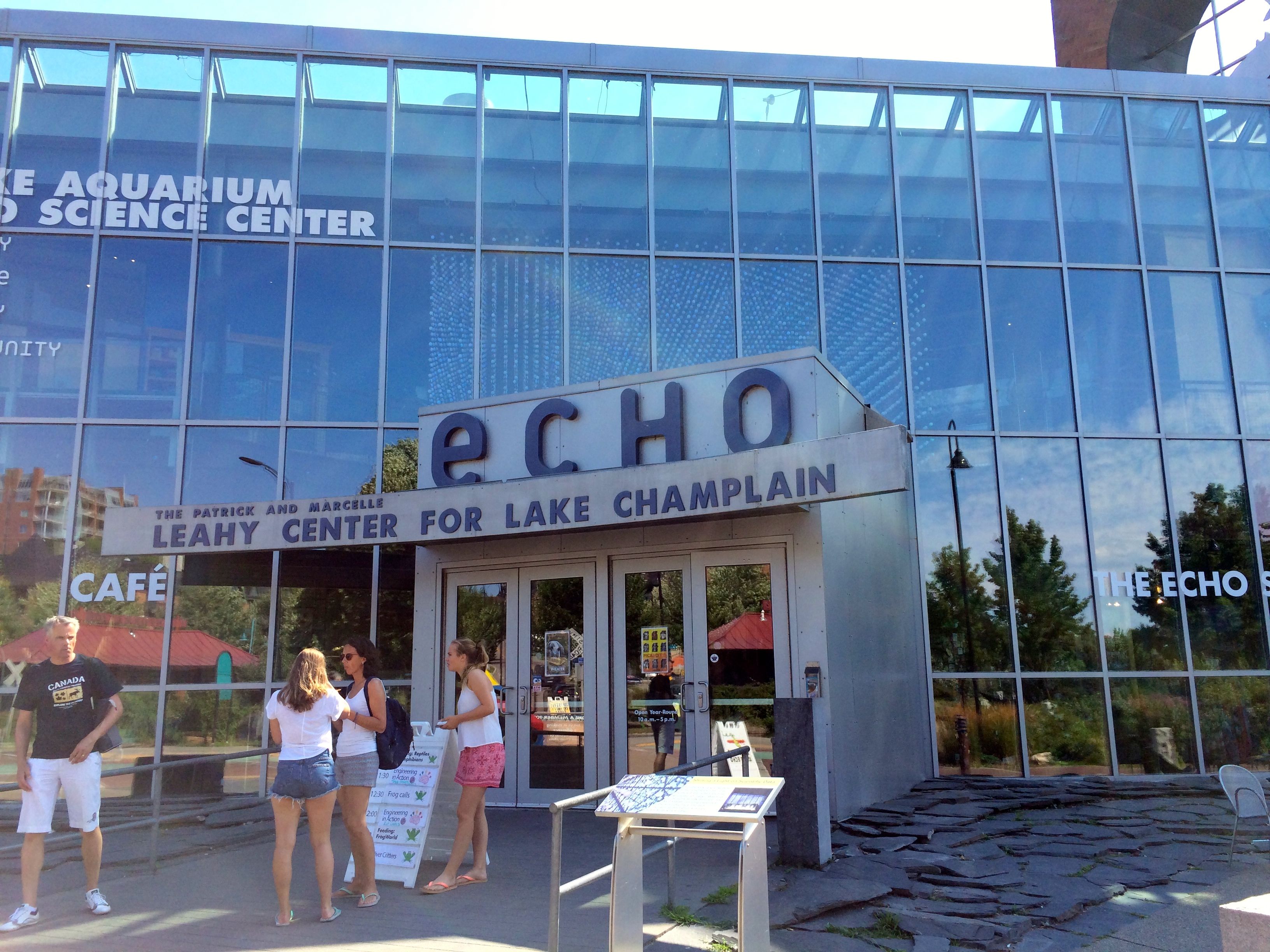
StoryCorps was parked in front of the ECHO Center. (ECHO stand for Ecology, Culture, History Opportunity, just in case you were wondering. I was.)
I thought about visiting, but there were a couple of drawbacks. One was that it was late in the day and the price was kind of high for a short visit. The other thing was that it was full of children. And, while children aren’t necessarily a deal-breaker, I could tell that the adults with them were tired and cranky. It didn’t sound like a great time to visit. Maybe next time.
Apparently, the interview was taking a really long time. I was concerned that the time I had paid for was going to expire, so I had a passer-by snap my photo and I headed back to MY Airstream.