I set out from my campsite at Tetilla Peak fairly early. Not break-of-dawn-early, but definitely before noon. That’s pretty early for me. My plan was to stop at San Jon, New Mexico for the night. I had a lead on a free city park there. The next day, I’d continue on to a Lake Meredith National Recreation Area, where there were also some free campgrounds.
But, when I got to San Jon exit on I-40, I wasn’t ready to stop. It was early and I felt fresh, so I decided to head for Lake Meredith. The government website that I consulted showed some really lovely campsites with lake views, but I couldn’t locate them on a map. I checked with another of my sources, and I got directions for one of them and had my phone guide me there.
The sun was nearing the horizon when I found the campground. It was there. It was free. Unfortunately, it was at the bottom of a canyon and the dirt roads were already puddled. There was no cell reception, no one else was camped there AND rain was in the forecast. I decided that it wouldn’t do. So, I got myself turned around and headed back out of the canyon. Once I had a cell signal, I found another campground and headed that way. Twilight was fading fast.
I found the park and got settled in. Luckily it was in a town that had streetlights, so I was able to maneuver. But, after being on the road for at least eight hours, I wasn’t about to back in. I just headed in and stopped.
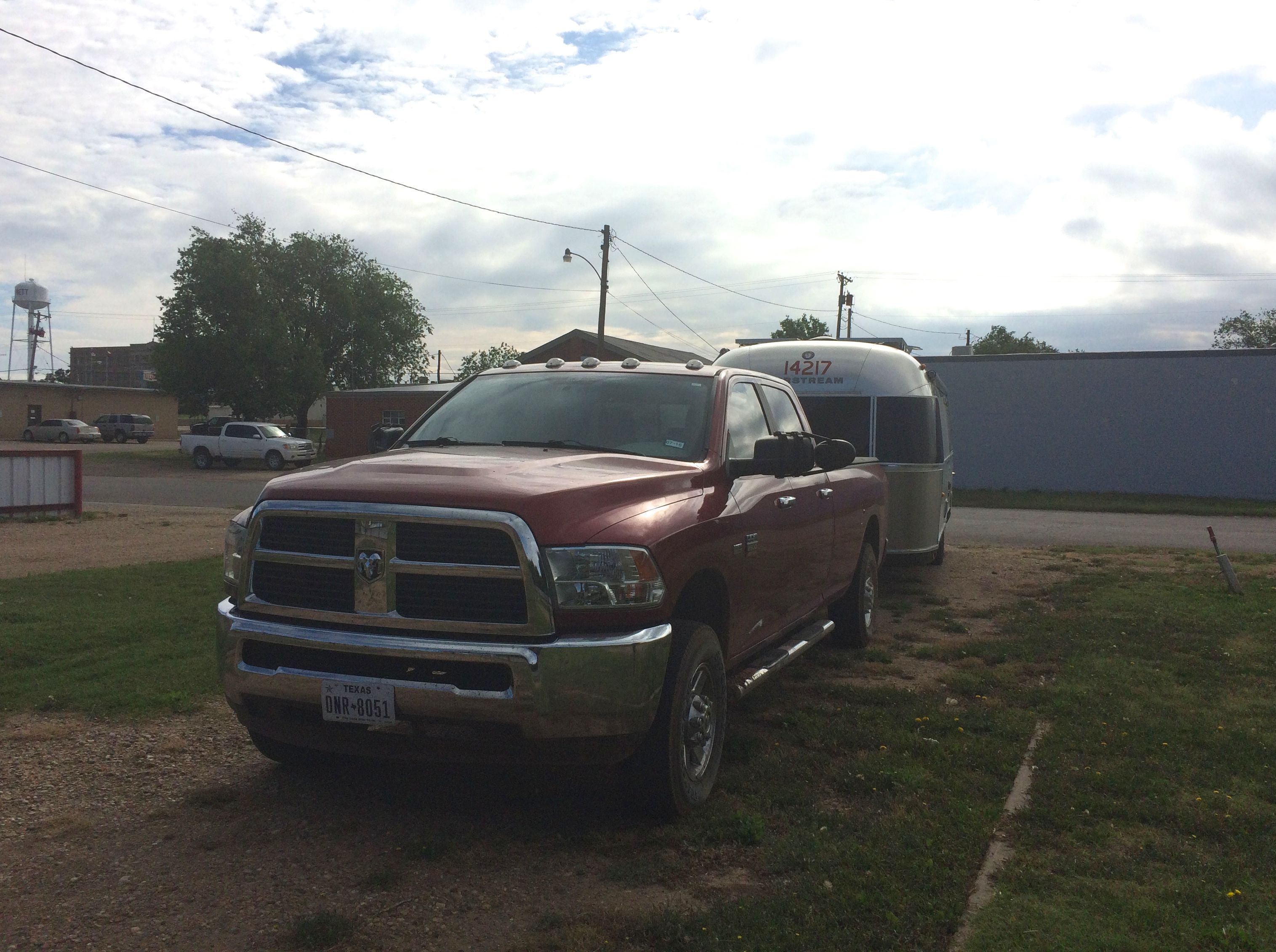
No one else was there and it was nice and quiet. It was so quiet that I slept in really late. Then I decided that I might as well just spend the day there and rest up from the drive.
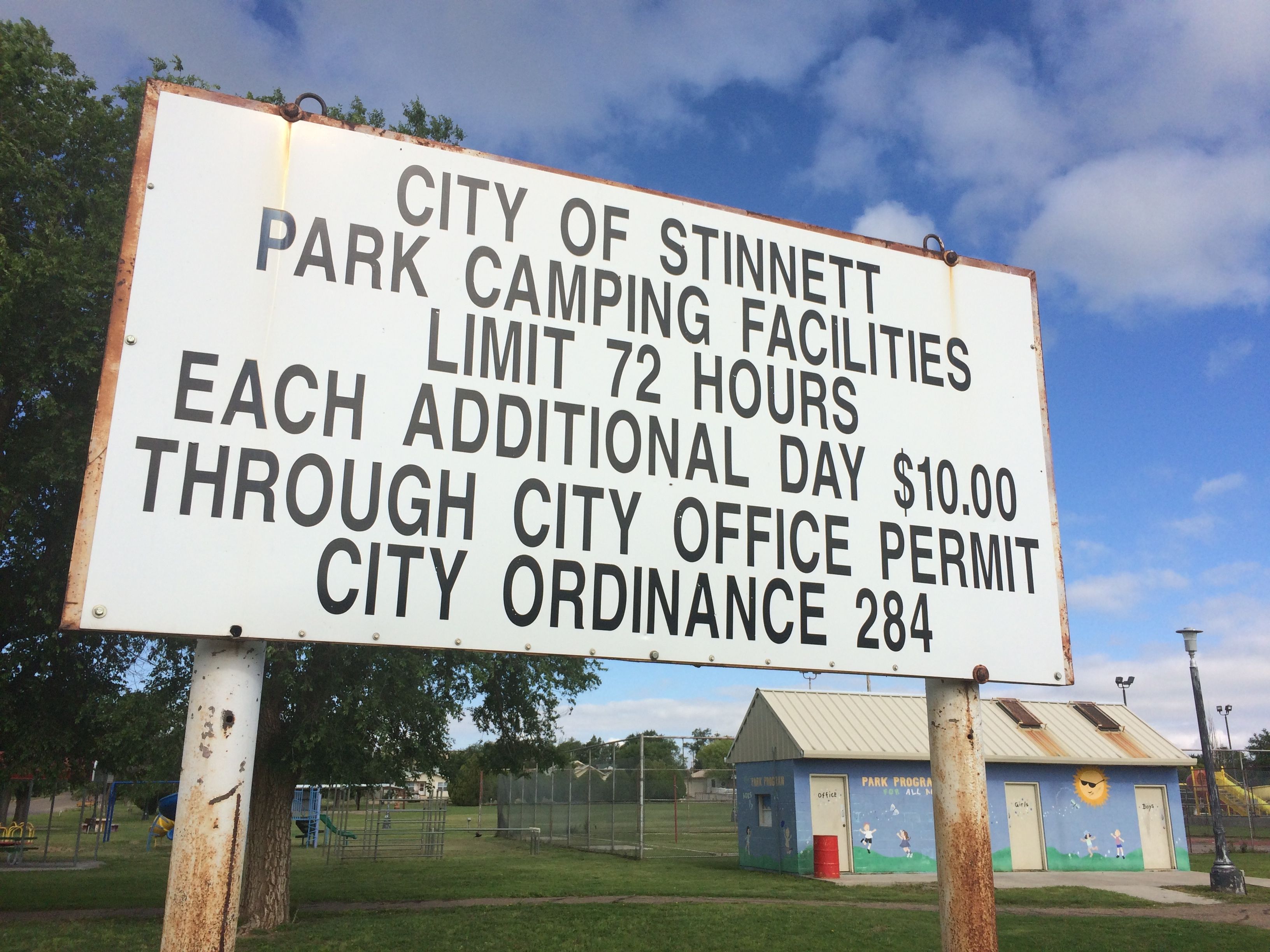
The good people of Stinnett were wonderfully hospitable. They allow people to camp there for three days for free. They even have water and electricity hookups, which I didn’t bother with. I think they have a waste tank dump, too. I had just dumped at Tetilla Peak, so I was all set in that department.
After a day of rest, I checked my connections and got backed out. They didn’t have much in town that I saw, but they did have two gas stations. I picked the one that was easier to pull into and filled up. While I was waiting for the person with the long, long trailer hauling a fork lift to finish up, I got to see an interesting garbage truck.
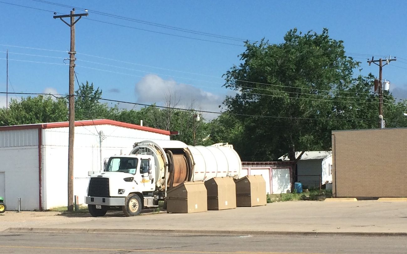
It was cylindrical!
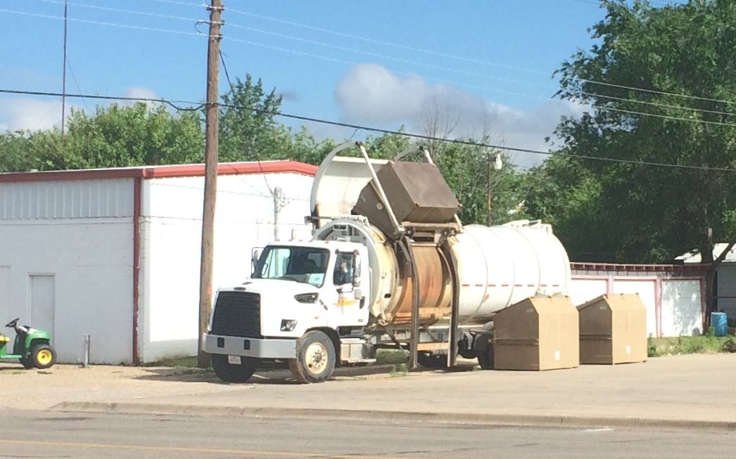
Up and in! It seems that this is how they handle trash – at least in this part of Texas. They have those dumpsters sitting out by the road in front of houses and businesses, rather than the “Herby Curbies” we had in Kalamazoo. Interesting. Or, maybe I am just easily amused.
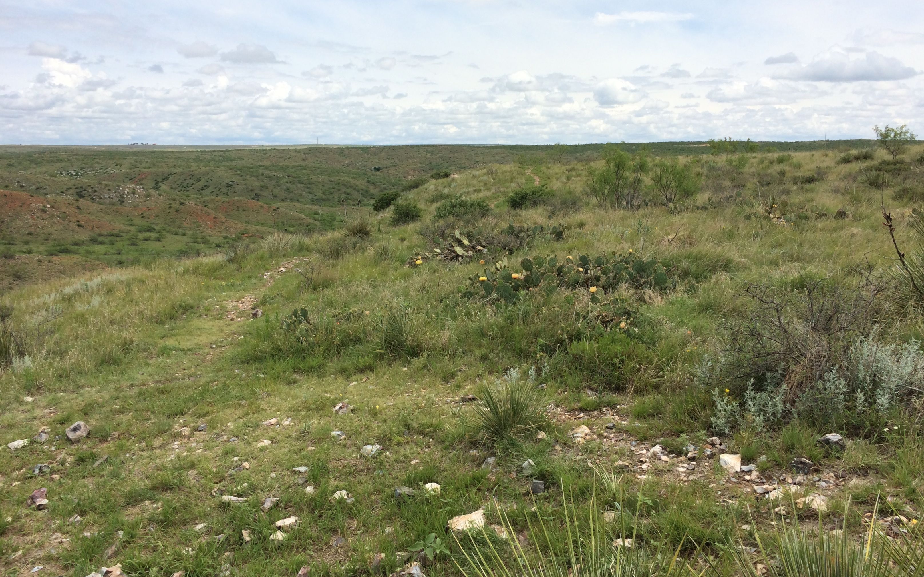
I had two touristic activities on my schedule for the day. The first was Alibates Flint Quarries National Monument.
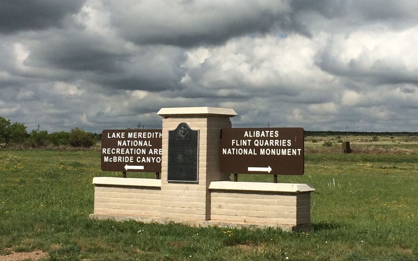
Incidentally, McBride Canyon was where I had tried to camp the day before. I took the road to the right and headed to the quarries.
I have always been attracted to “industrial” sites. To the Antelope Creek people, who called this place home from 1100 A.D. to 1500 A.D., this was an industrial site, at least in a sense. They quarried the Alibates flint into blanks that they used for trade.
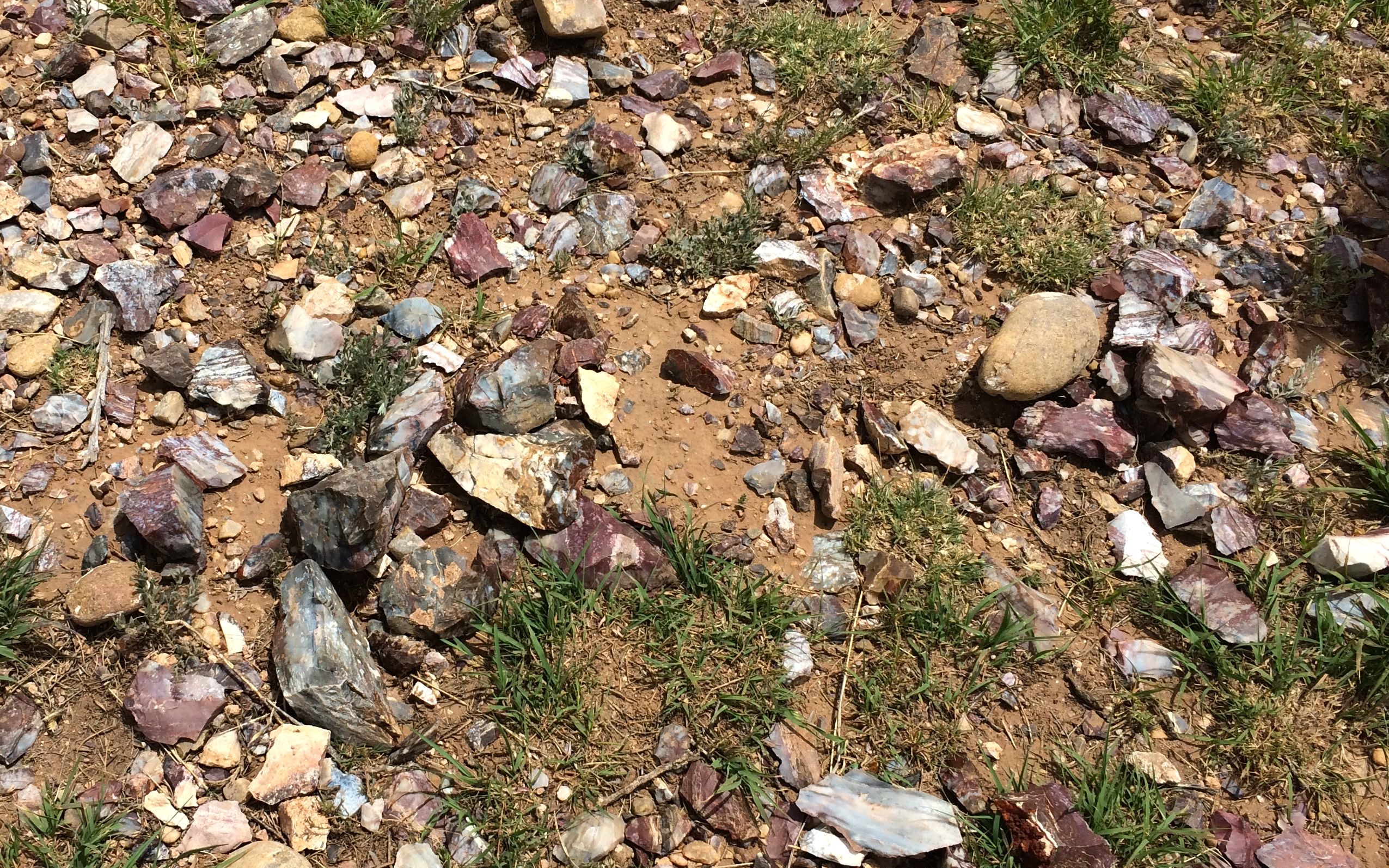
Alibates flint is actually an “agatized dolomite”. Dolomite is a calcium-based rock, and I have heard it referred to as limestone. In checking my facts for this post, I am not sure that dolomite is limestone, but it does share some of the same properties. For instance, it does dissolve in rain water. One of the theories about where the flint came from is that silica rich ash from volcanic eruptions in what is now Yellowstone County in Wyoming settled on top of the older dolomite. As rainwater percolated through the ash, the silica was dissolved into the rainwater and soaked in to the dolomite. The calcium carbonate in the dolomite washed out, leaving the silica dioxide behind.
To my way of thinking, this sounds a lot like how petrified wood was formed. However, a know-it-all named George, who was on the tour with me, told me that I was all wrong. But, he didn’t know how to pronounce “Canyon de Chelly”, which he proceeded to lecture me on, even though I told him that I had just been there and took the tour. Mansplaining. Gotta love it.
Anyway, I arrived too late for the morning tour, but I got to watch a wonderful flint knapping demonstration.
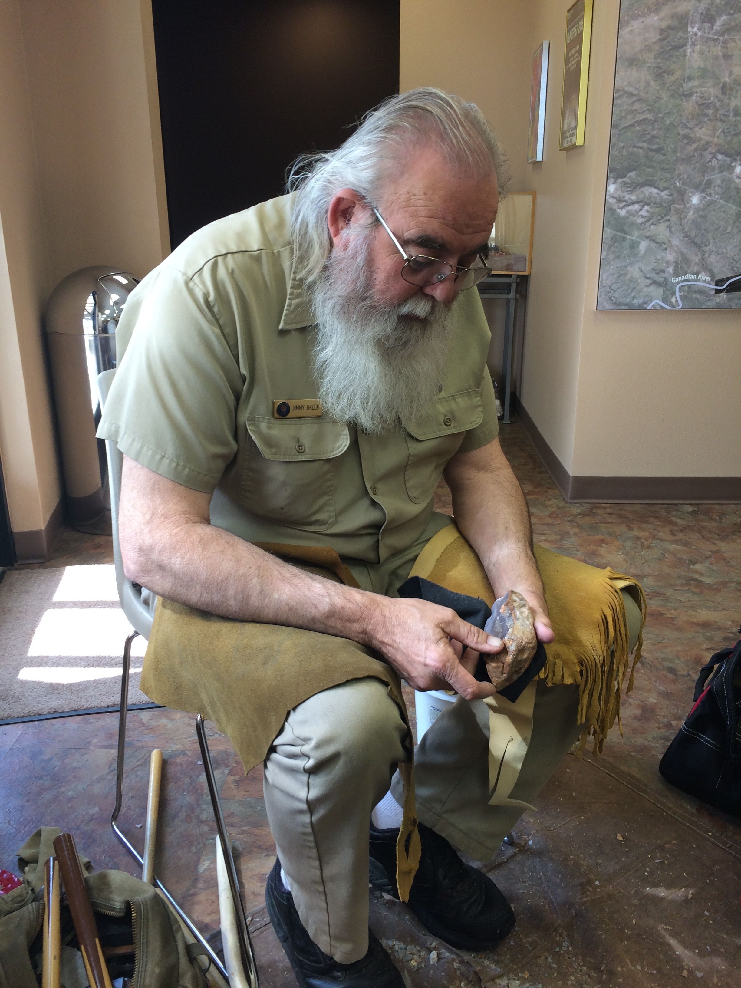
Jimmy Green, a volunteer, was knapping a nice piece of flint when he invited me to have a seat in one of the rockers and watch him work. He talked about his process and how he visualizes the shape he is going to make.
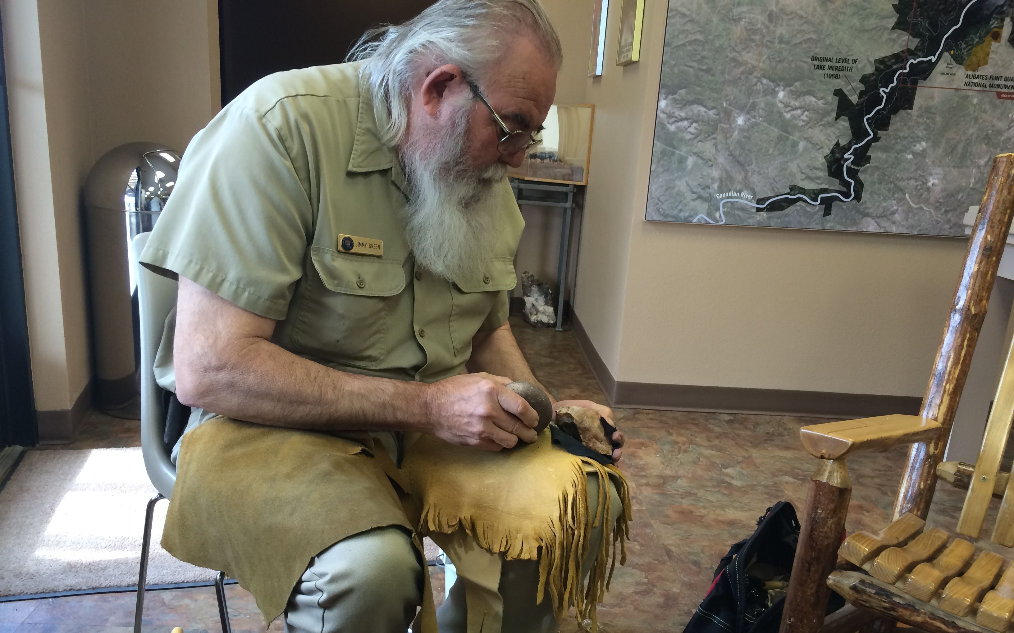
He used a cobble as a hammer. He said that his hammer was missing, so he just went outside and picked up one to use. I love that casual approach to working. The tools don’t matter as much as the knowledge of the worker.

He talked about making his tools. He made this copper-tipped tool himself by work-hardening the copper and then hammering it into the shape that he wanted. The wooden stick is looped through one of his belt loops to steady it, and then he hits the tool with a small copper hammer to get the flakes to split off.

At the end of the demonstration, he gifted me the arrowhead he made! I can’t wait to turn it into a necklace. I have to make sure that I figure out a way to dull the sharp edges, though. Flint can have an edge that is finer than steel or glass, according to the information in the exhibit in the museum. In fact, on the 10 point Mohs scale, flint is a 7.5. The softest mineral on the scale is talc at 1. The hardest is diamond at 10. Flint is between quartz at 7 and topaz at 8.
I was kind of excited to see the display on the Mohs scale, because we used to teach it in science a long time ago – before they “improved” the curriculum.
Jimmy said it was time for his lunch, so I thanked him for the great demonstration and toured the small museum and watched the video. I check to make sure that they were going to have an afternoon tour – they were – and then I went out to Flo and had a spot of lunch myself.
At the appointed time, I met the ranger and the only other member of the tour. Bob the ranger drove us up to the top of the mesa to begin our tour. Well, it wasn’t really the top of the mesa, as there was a steep trail with stairs cut into the side of the cliff. I think I read somewhere that it is like climbing a 10 story building.

I paused to take a shot looking at the red soil showing on the other side of the small canyon we were ascending.

The ranger told us we could pick up the flint – we just couldn’t take any with us. The Alibates flint is very colorful. The colors come from the trace mineral elements that were in the silica. The reds, oranges and yellow are caused by iron. Blues and deep greens are usually caused by manganese.

No wonder the flint was so highly prized! It was really beautiful. The boulders that lie on the surface are not useful for tools. The freeze/thaw cycle has created micro fractures that make them unsuitable for knapping.
We continued on the trail until we came to the top of the mesa, where the quarries were.
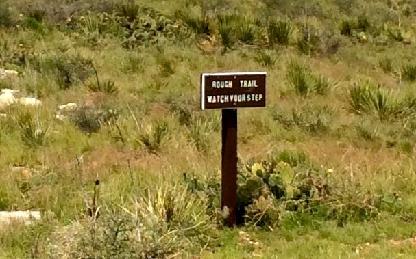
Rough trail…NOW they tell us!
According to the ranger, there are hundreds of quarries here. They aren’t much to look at right now, but when there was a fire a few decades back, he told us that the landscape looked like it was full of World War I foxholes.
We stopped at one quarry that had quite a few “cores” on the surface. Since the people were mining the flint and preparing blanks for trade, they would split off blanks until they couldn’t make anymore and then toss the smaller, leftover cores aside. One sign that this was a quarry for export and not just for their own use is that the smaller chips that are produced by knapping are not present here.
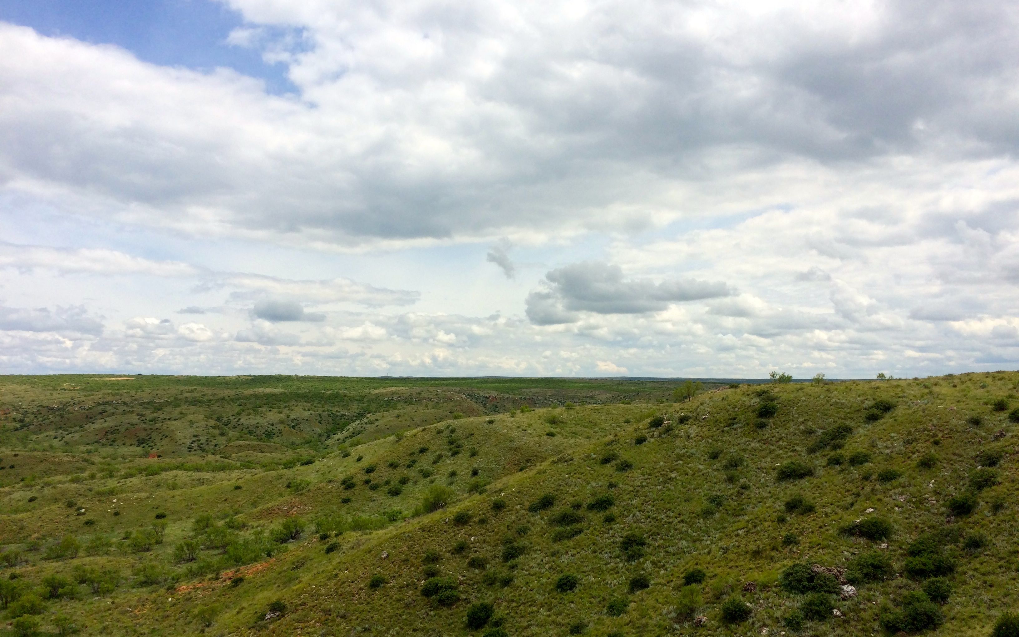
Across the valley, you can see a light colored line. That is the location of the village. The ranger told us that the site is part of the national monument, but accessing it involves crossing private land. He said that they give tours in October, which is Texas Archeology Month. So, I guess if I want to see the Antelope Creek site, I have to come back in October.
The descent to the van went faster that the climb to the top. We got in the van and headed back to the visitor center. I thanked the ranger, bid adieu to know-it-all George and headed to Cadillac Ranch.
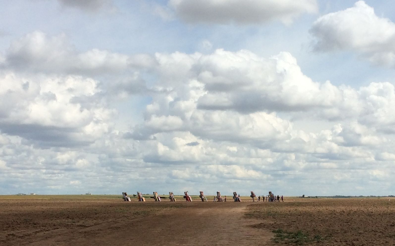
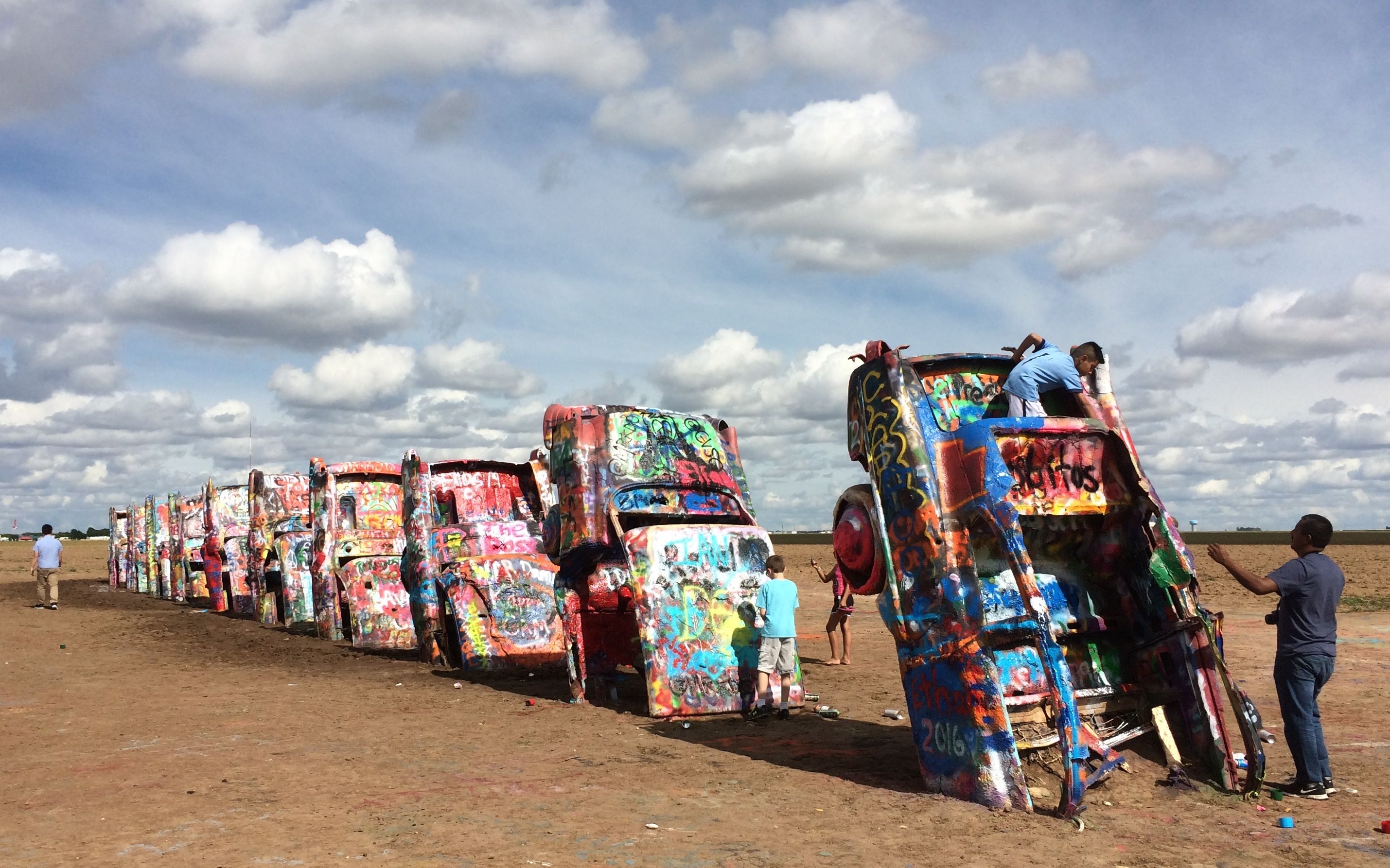
Believe it or not, this is another thing I learned about in Sister Jeanne’s art history classes. It was created in 1974, and was made of older Cadillacs representing the changes in design of the automobile. According to the information I looked up, they were chronicling the birth and death of the tailfin. The are half-buried nose-first in the found at an angle corresponding to that of the Great Pyramid of Giza in Egypt.
Nowadays, people are encouraged to add their own marks to the installation.
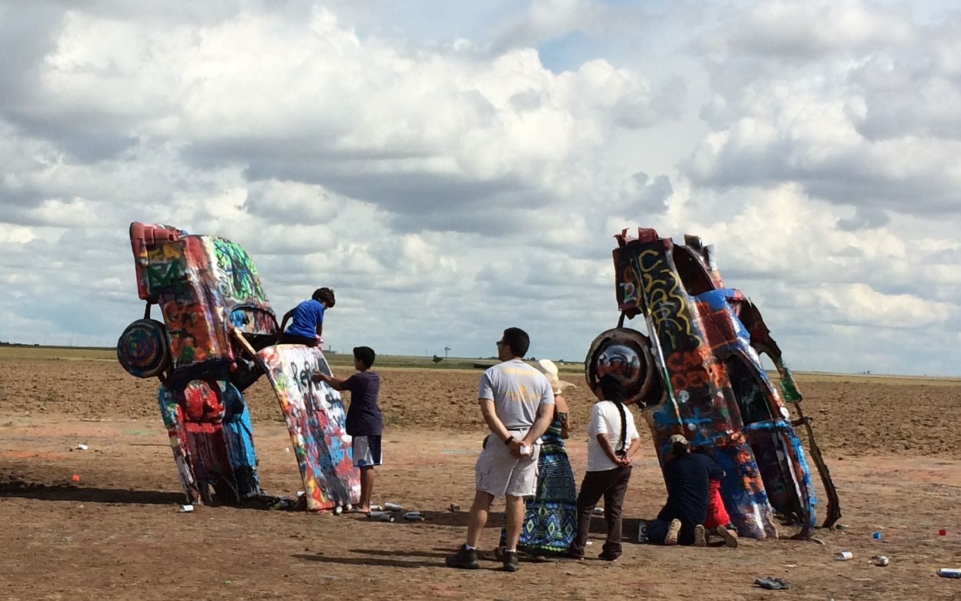
While I was there, I saw several families with bags of cans of spray paint. What fun!

I walked around the cars, looking for a place I could make my mark. The left lend of the installation was muddy and had puddles.
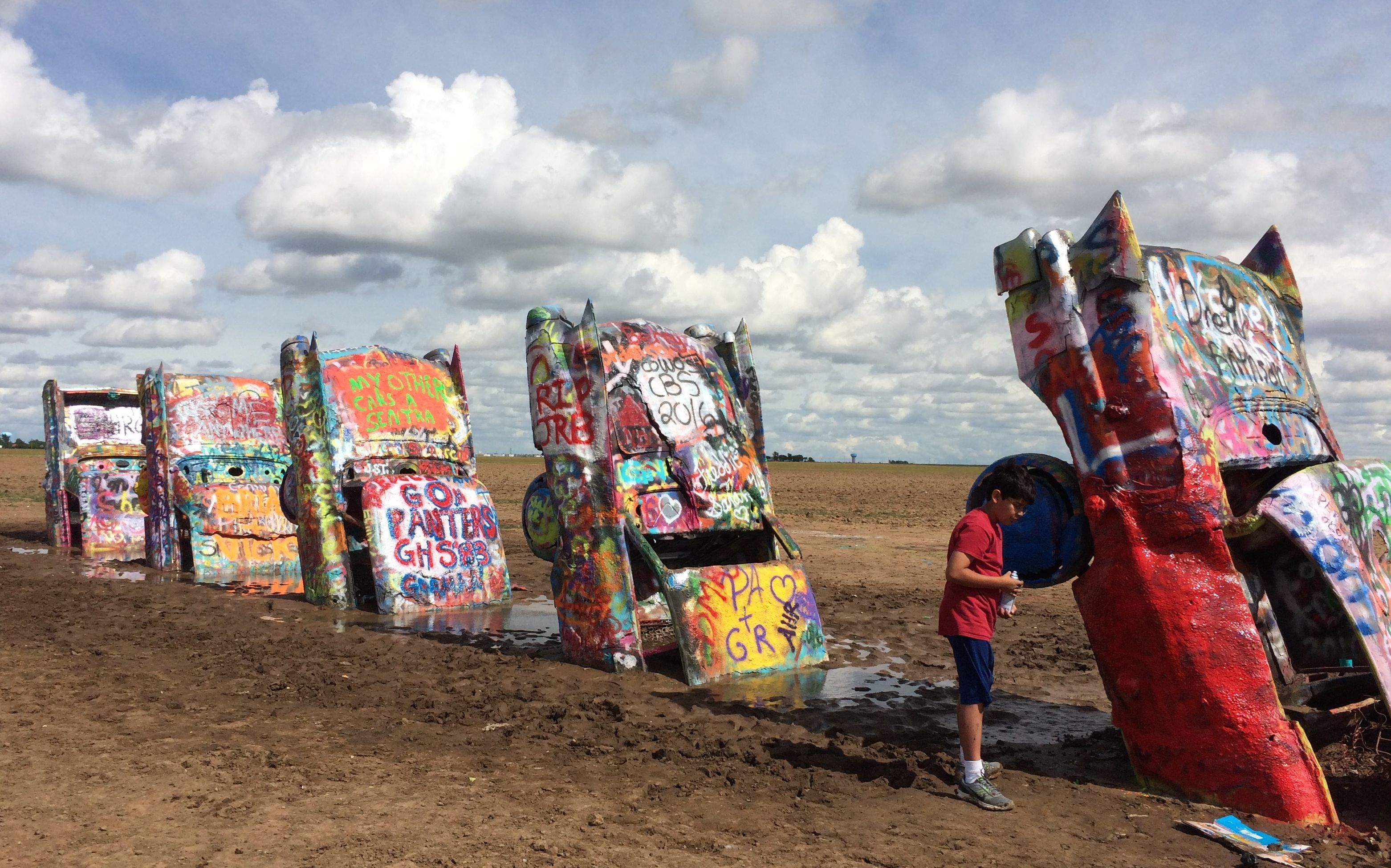
I finally found a spot where I could get close enough and not sink into the rich Texas farmland.

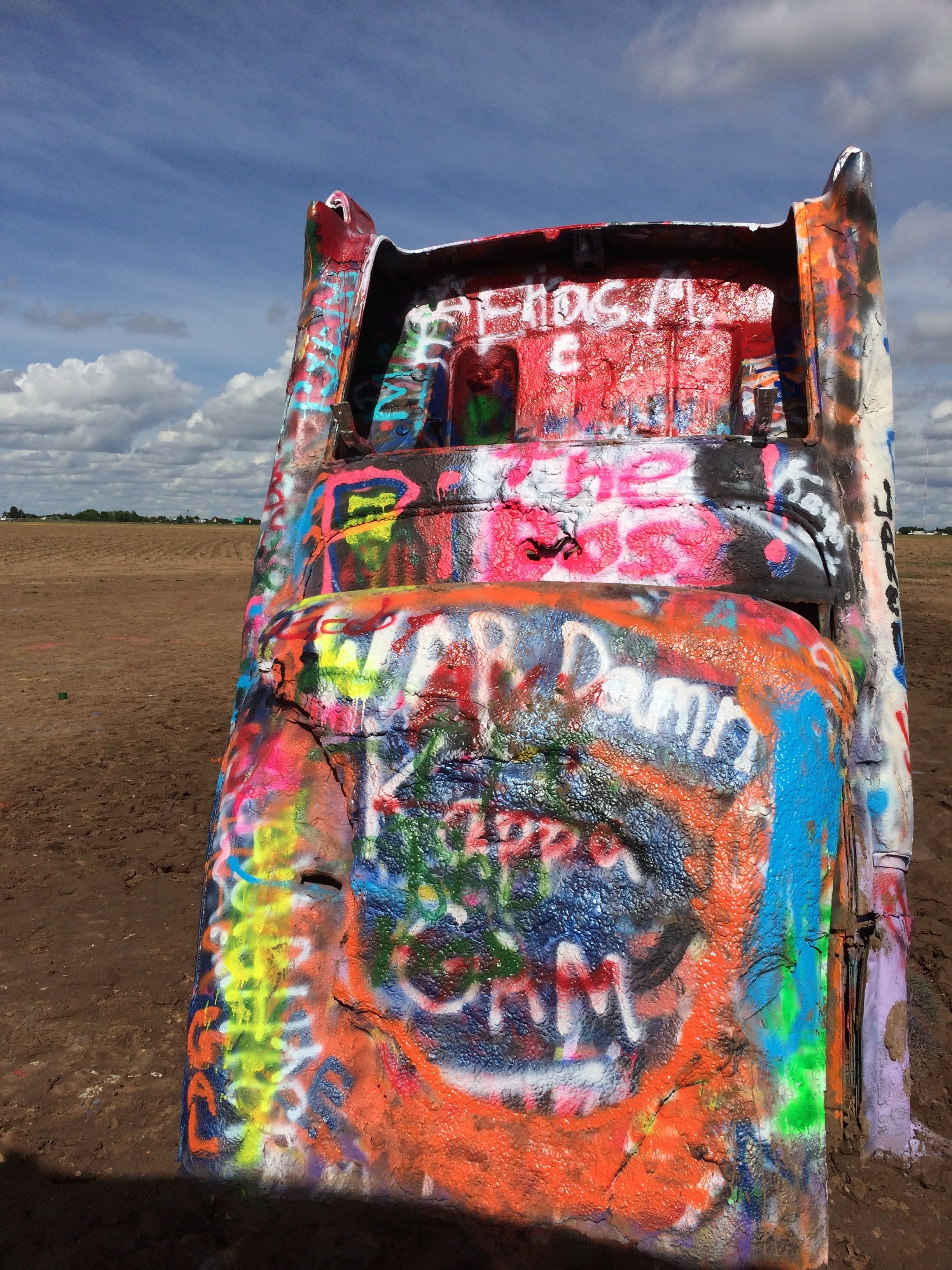
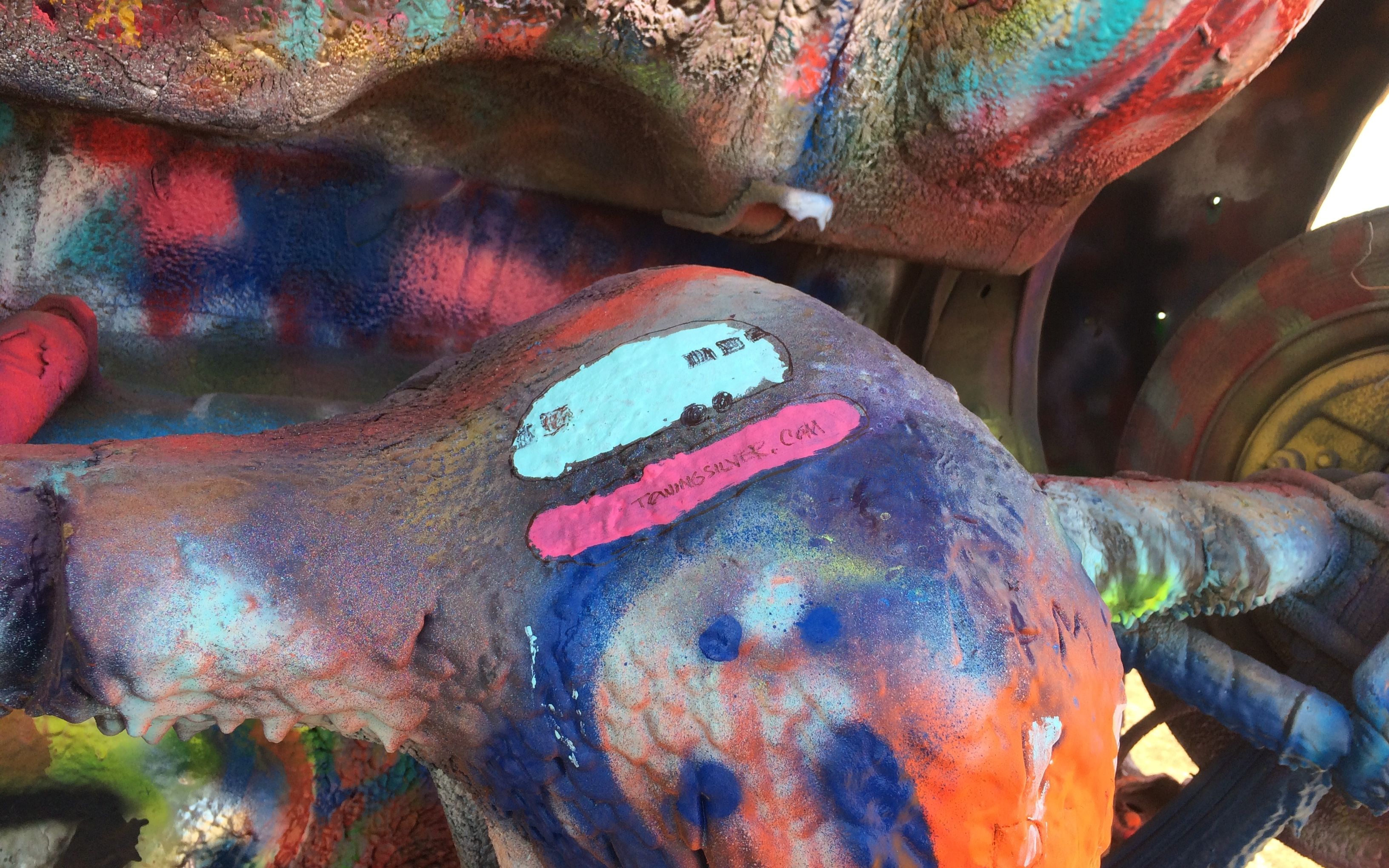
There were layers upon layers of paint on these cars.
I didn’t have spray paint but I had some left-over acrylic craft paint in the trailer, so I figured I’d find a place where that would work.
I painted a portrait of Flo and left my blog address. I have no doubt that it has been painted over by now.
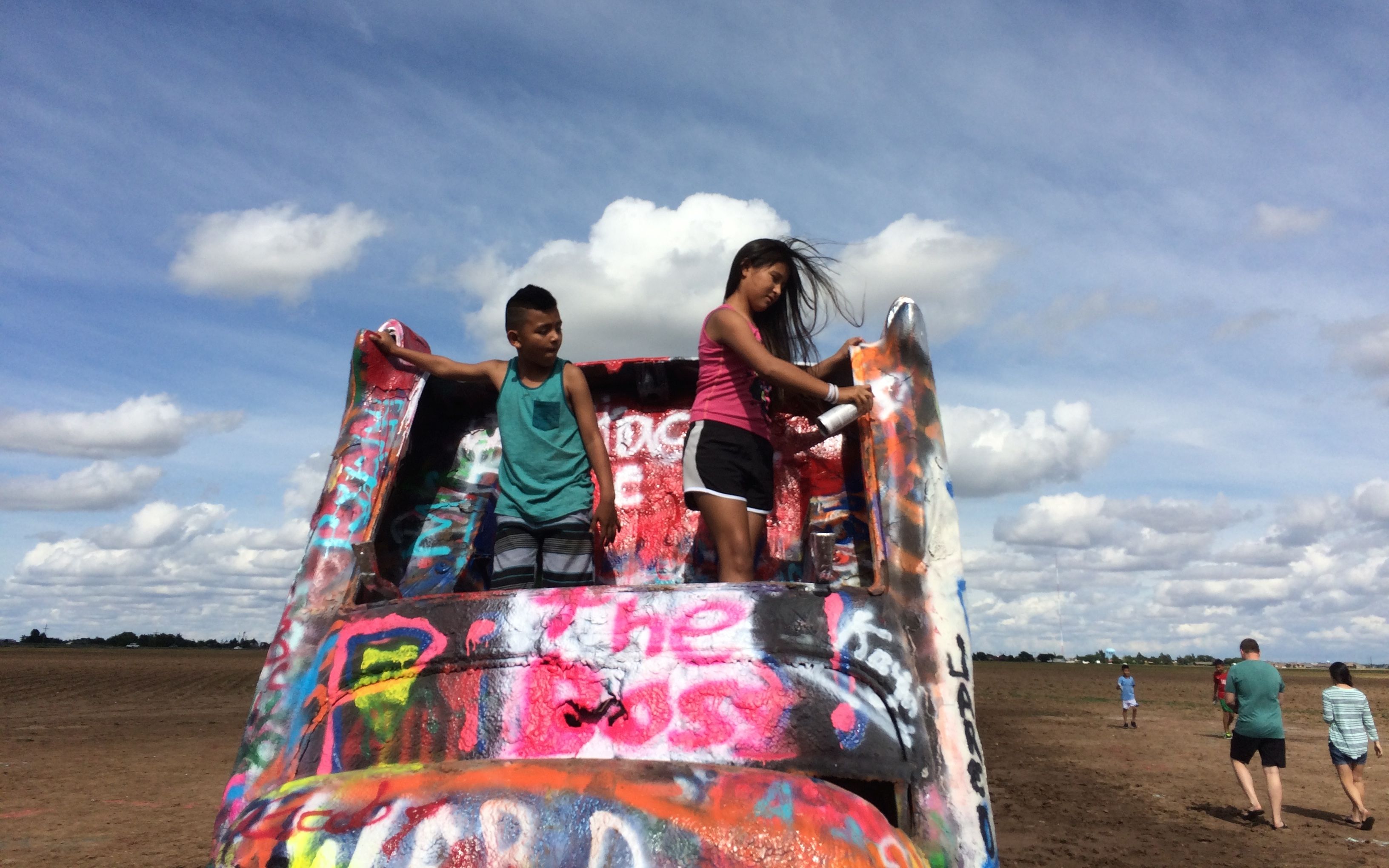
These kids were having so much fun!
I mean, really, doesn’t it make you want to add your own design?

If painting the cars wasn’t enough, some people also had to add their marks to the ground.
It was a long day – time to get to the campground in Canyon, Texas.