Downtown Petersburg

In the middle of my battlefield tourism, I started to feel a bit peckish and I headed into town for lunch.

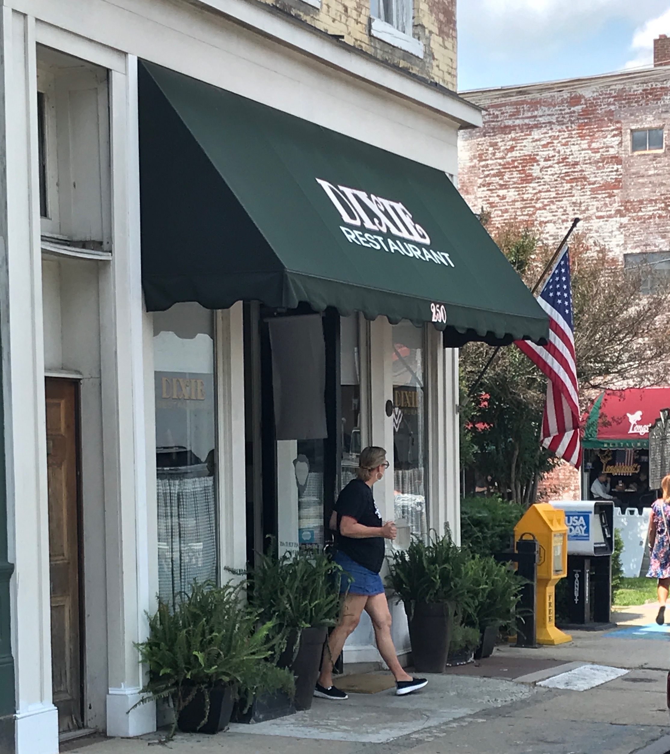
The Dixie Restaurant caught my eye, so I parked and went inside.

According to the information in the menu, The Dixie has been a Petersburg landmark since 1920, and has been in this location since 1939. The current owners, Charlie and Frannie Rawlings, spent three months renovating the restaurant, and reopened it in June 2011. They tried to keep as many of the old features as possible. They even managed to rehire some of the longtime employees, including Millie, a waitress, who has been serving for 25 years, and Mary, the cook, who has been whipping the southern delicacies for 15 years.

They value the history of the restaurant so much that they even listed the previous owners.

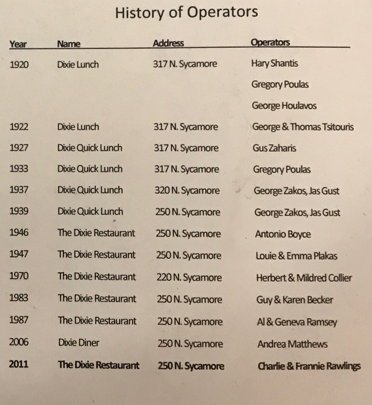
Hey! The Ramseys owned it in the ’80s! I wonder if we’re related? (On my mother’s side.)

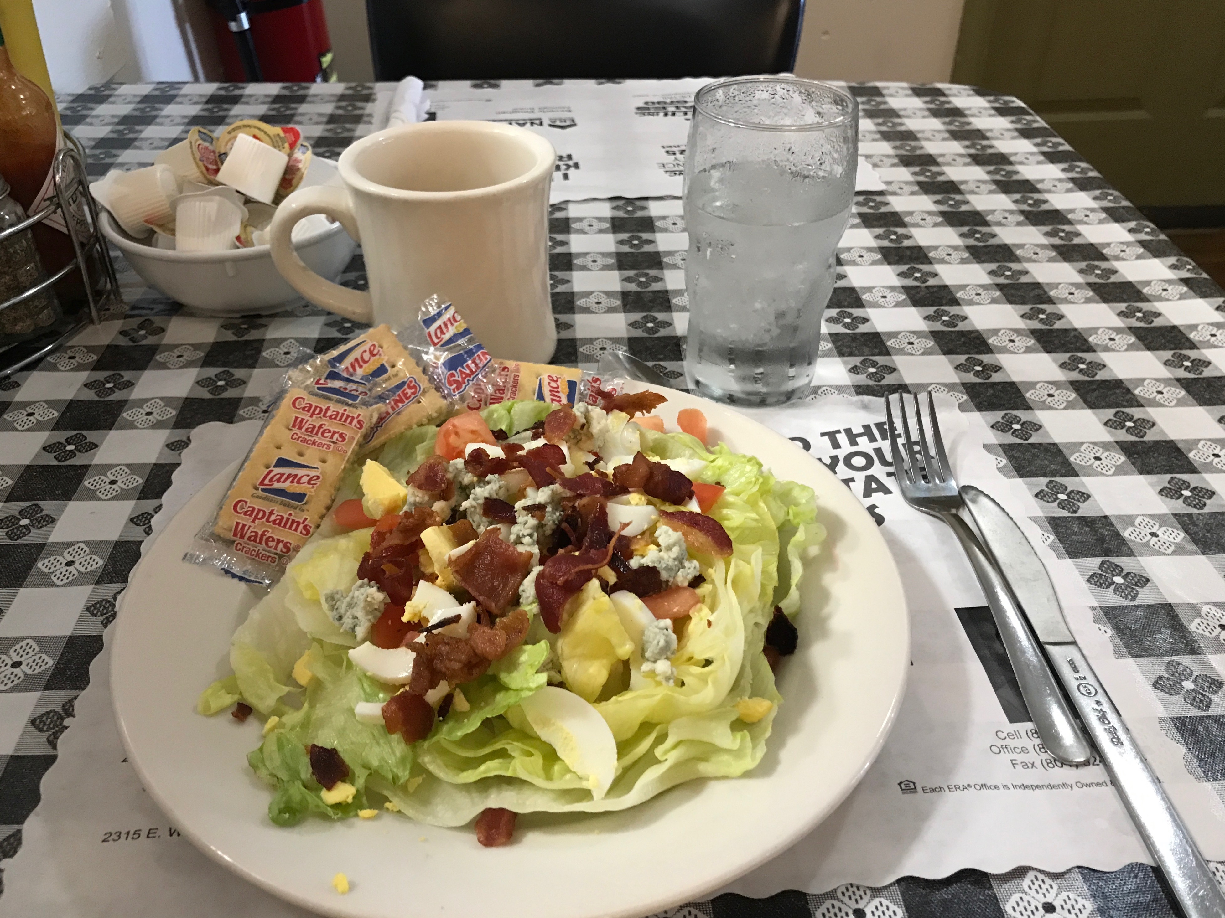
As I recall, this was a tasty Cobb Salad. It refreshed me and I was ready to explore a bit before heading back to finish my tour of the battlefield.

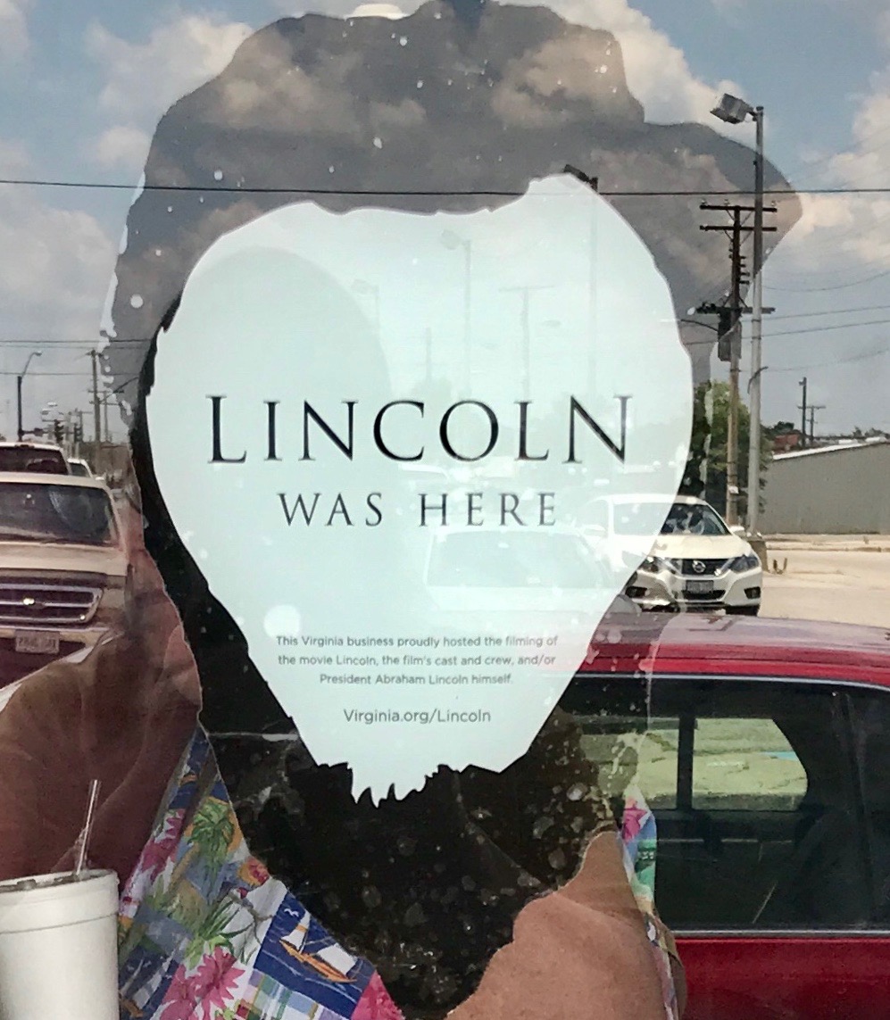
This decal was on the door. In case you are reading this on a small screen, allow me to share what it says.

Lincoln Was Here

This Virginia business proudly hosted the filming of
the movie Lincoln, the film’s cast and crew, and/or
President Abraham Lincoln himself.

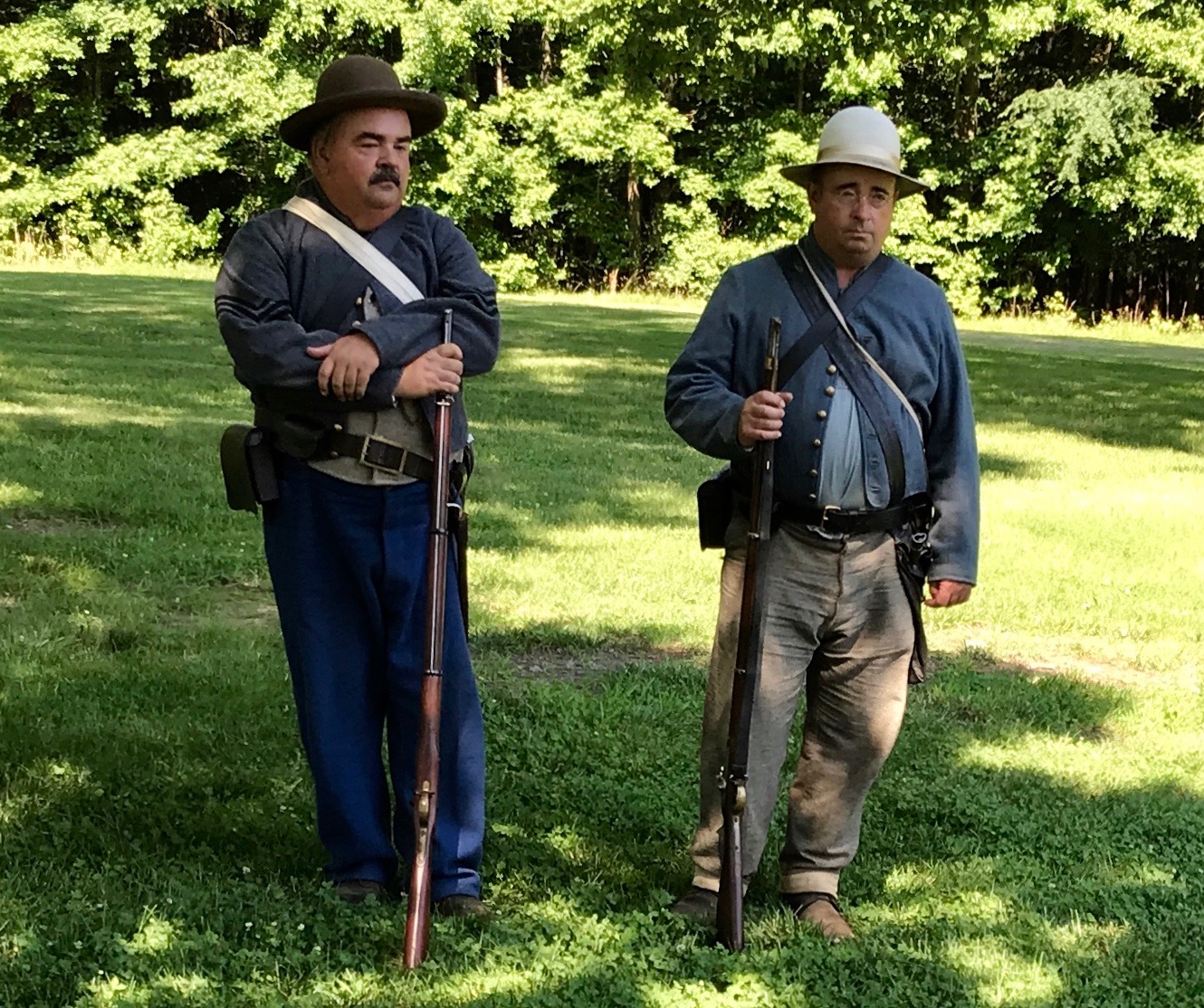
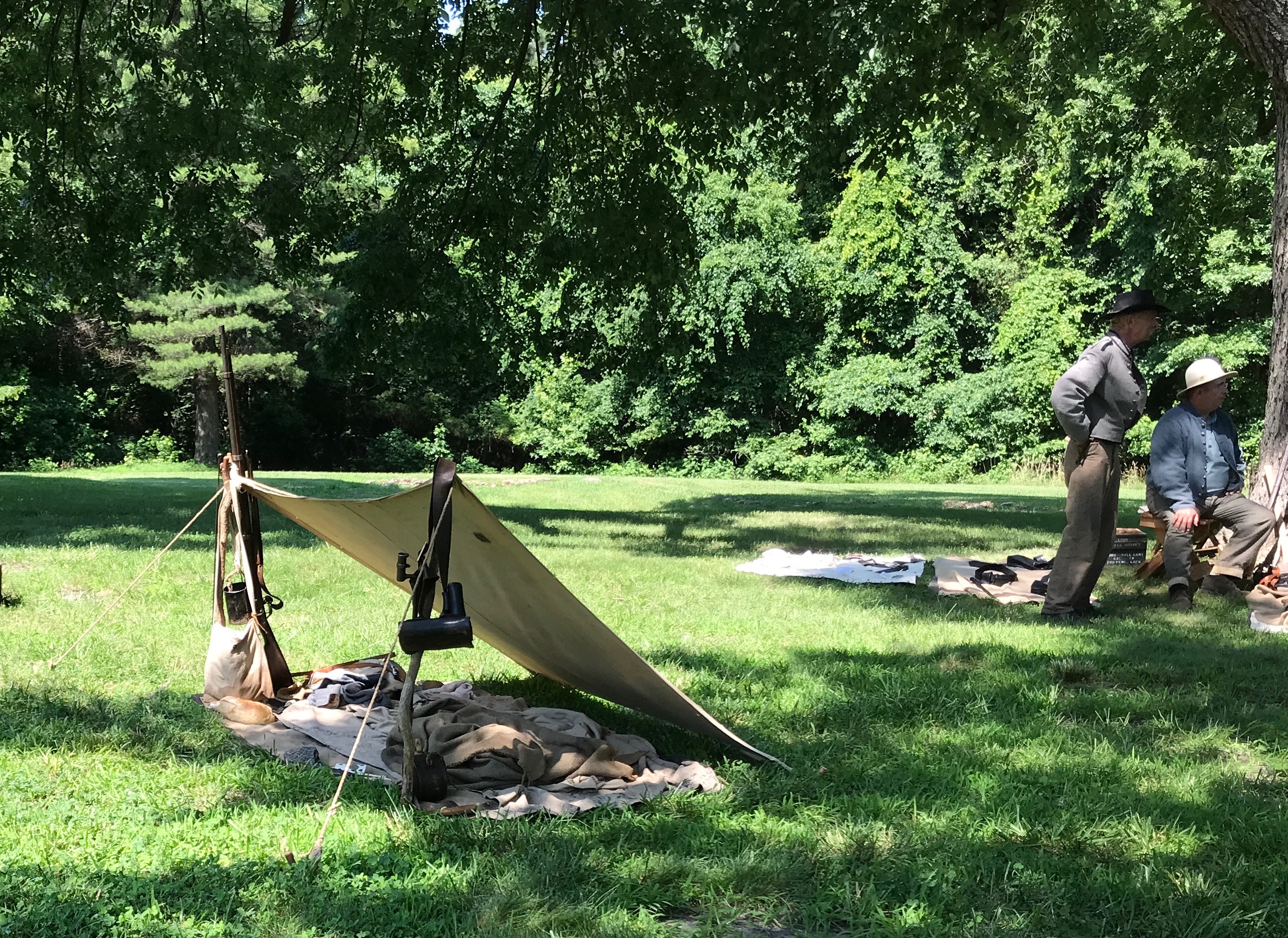
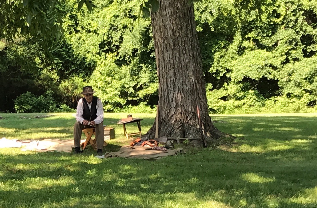
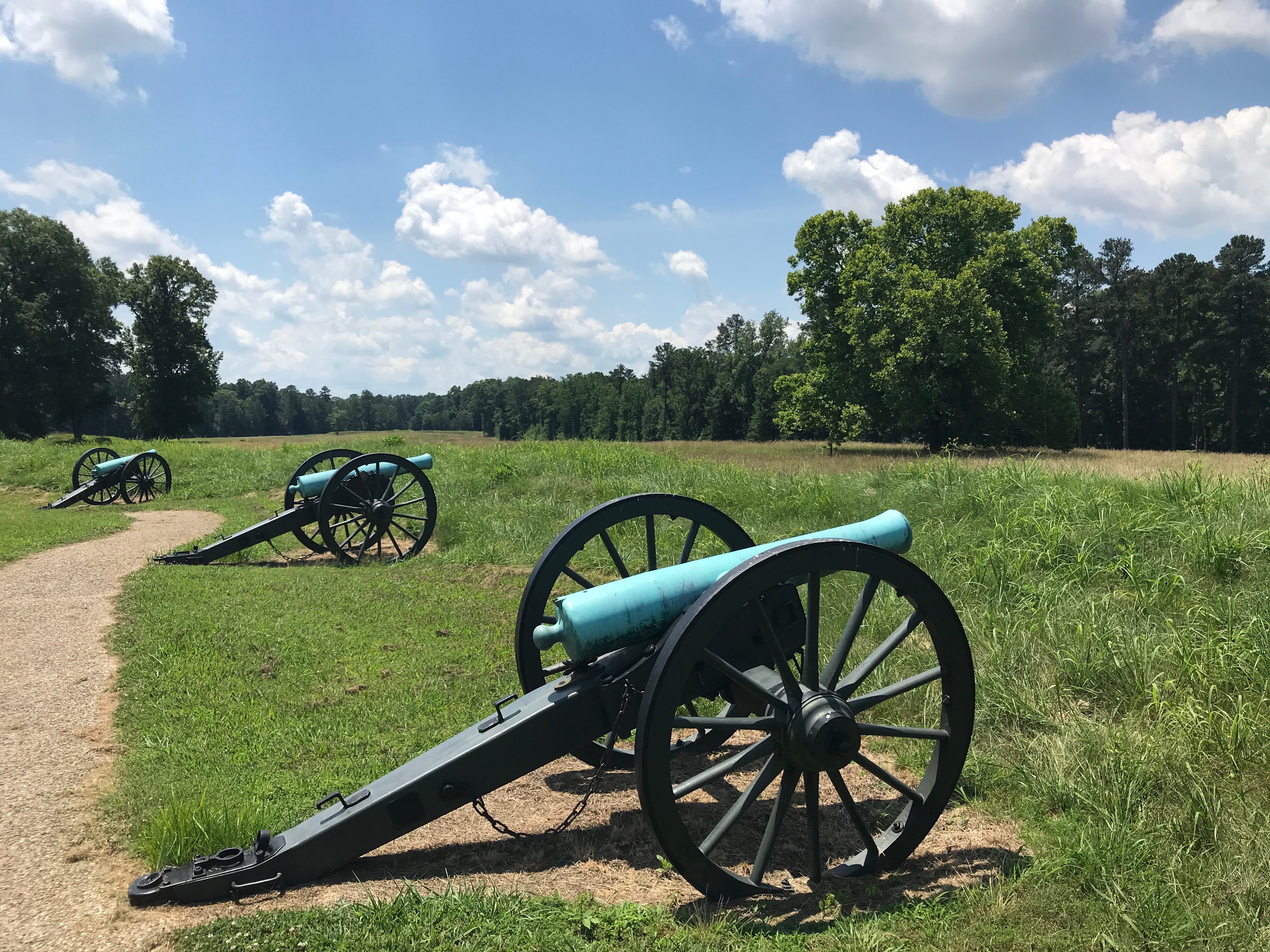
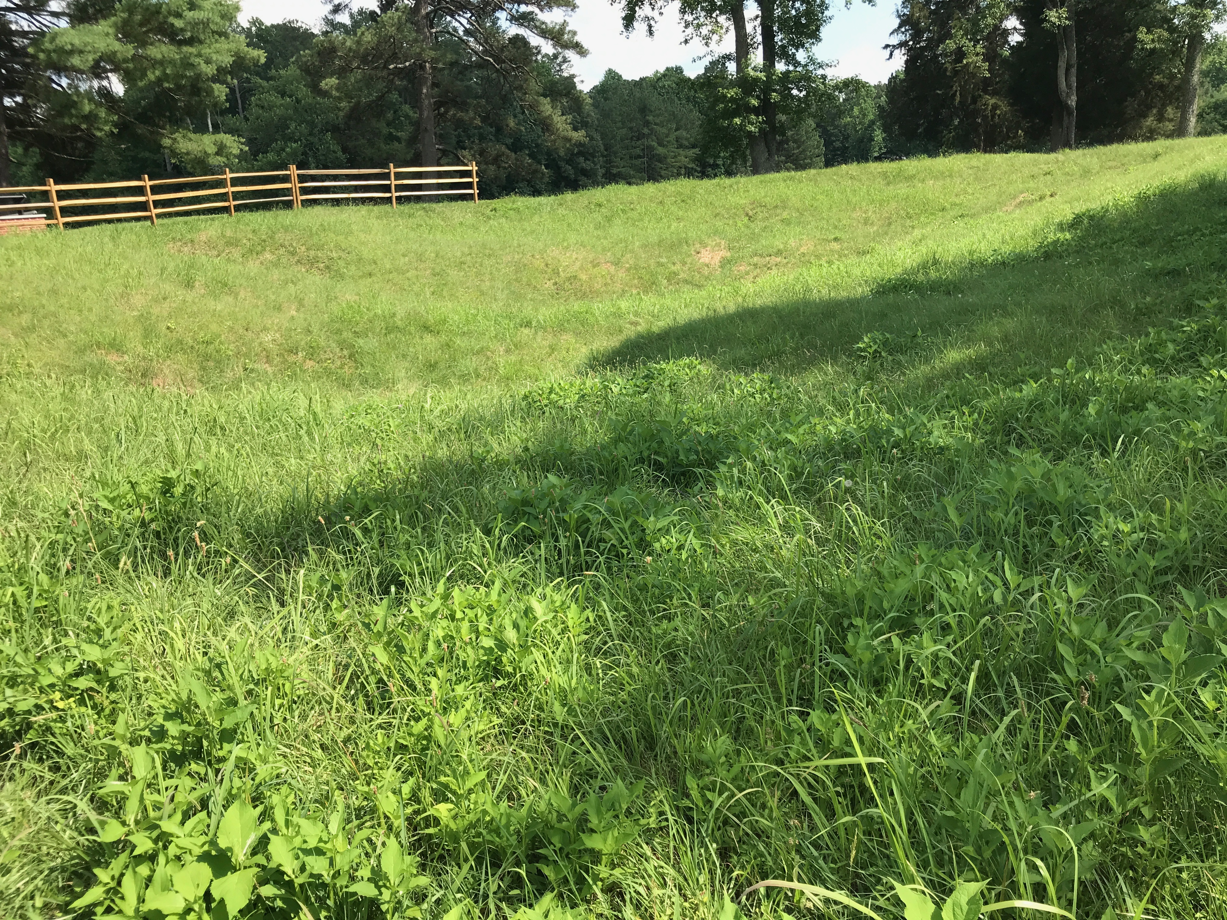
I can easily see how they could recreate the appearance of what it must have looked during the Civil War.

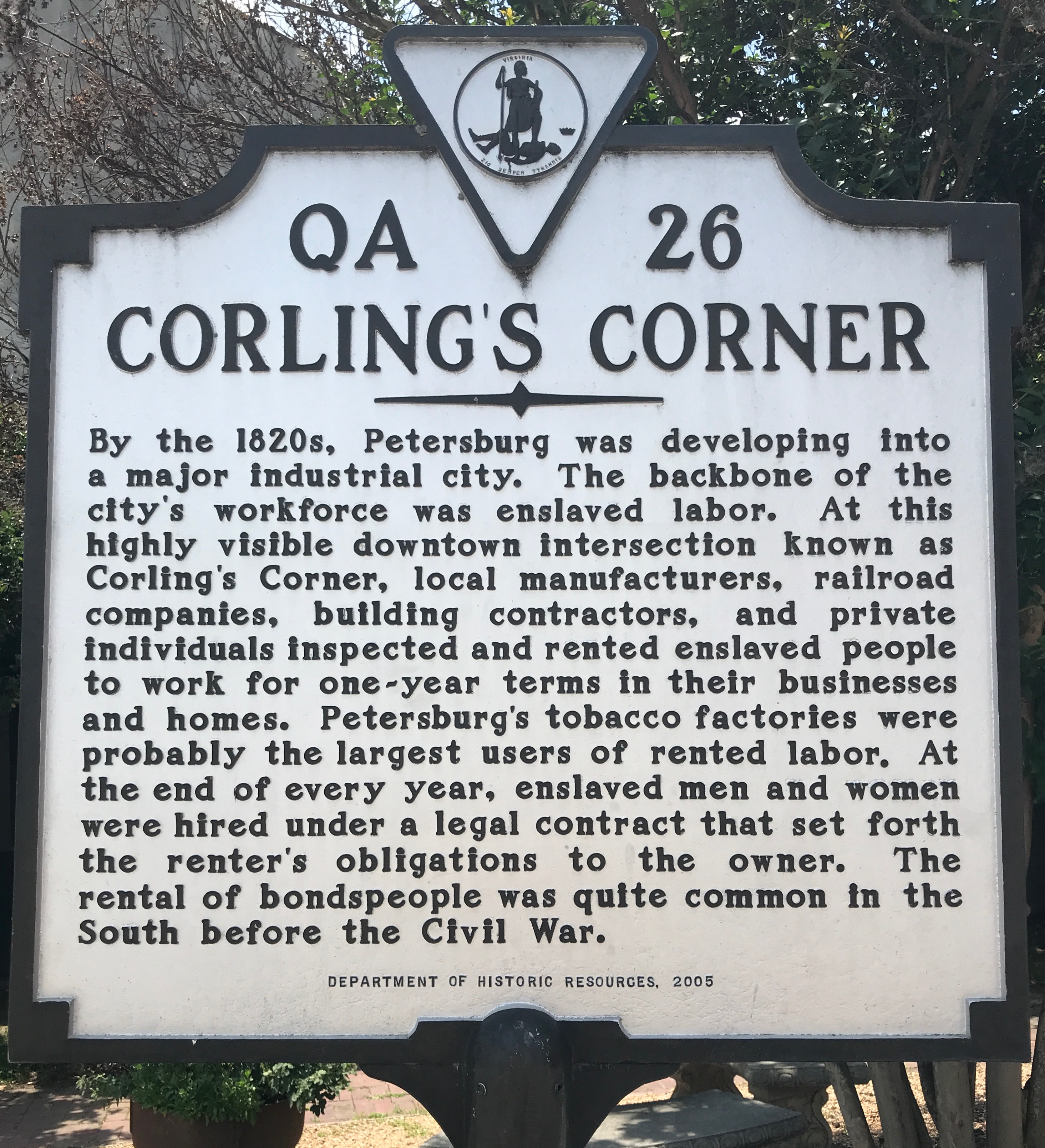
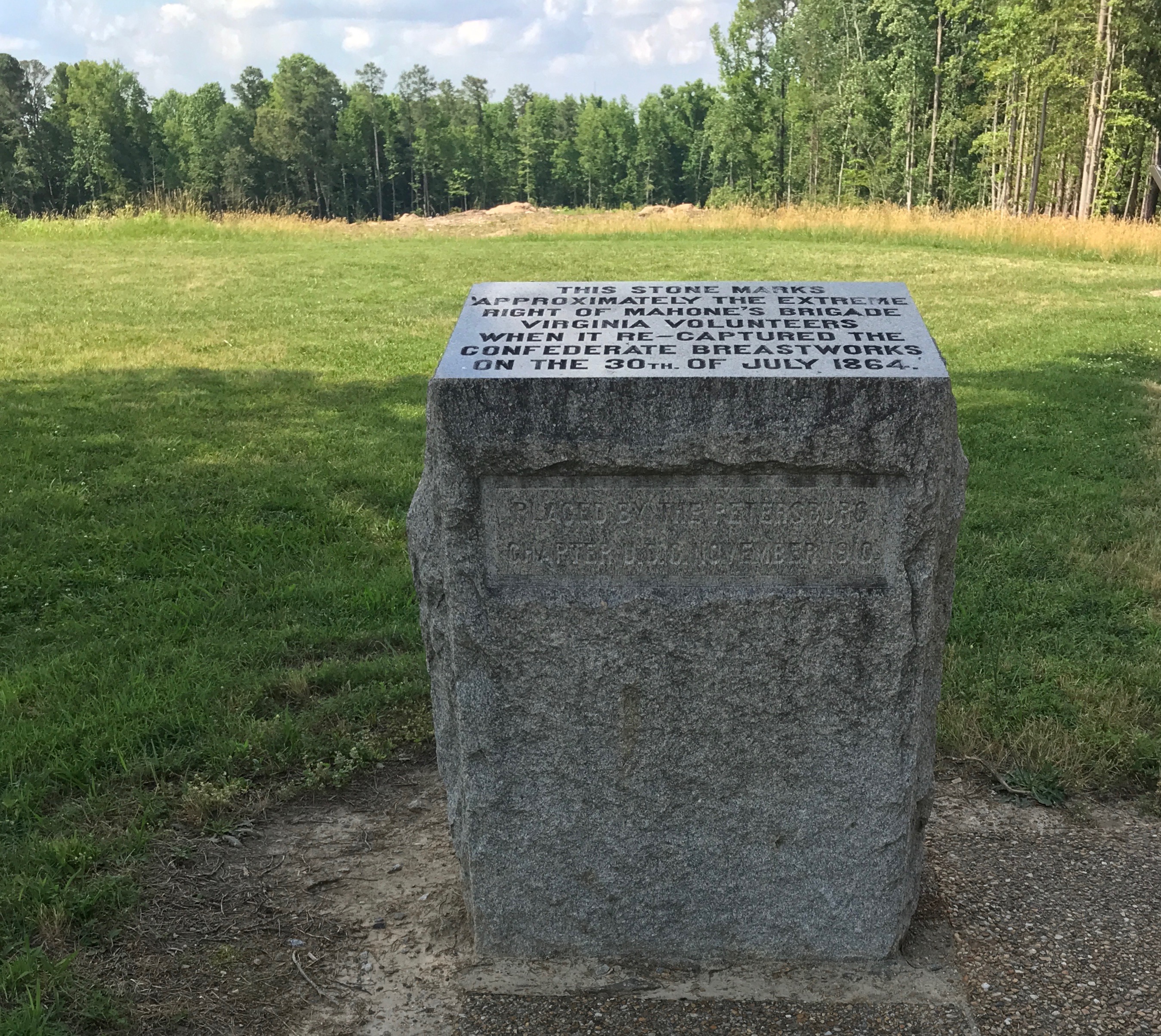
I found this interesting marker on a corner. It kind of reminds me of day laborers who gather in parking lots looking for work these days. Well, except that the day laborers are there by choice and they get to keep what they earn. But, other than that…

I saw a sign for a tourism office and went in to see what I could see. As an Information Specialist for Discover Kalamazoo, I find it interesting to check these things out and to see what the people on duty have to offer.

There were the usual brochures and such, but in the back they had an informative display of reproductions of photos from the 1860s.

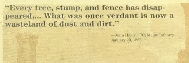
It’s interesting to see the effects of war on life in a city under siege. At the beginning of the Civil War, Petersburg was ranked the second largest city in Virginia and ranked eleventh in size among all Confederate cities. The 1860 U.S. Census listed 18,266 residents in the city. The five railroads that crossed through the city and its location on the Appomattox River contributed to the area’s economic growth in the years before the war.

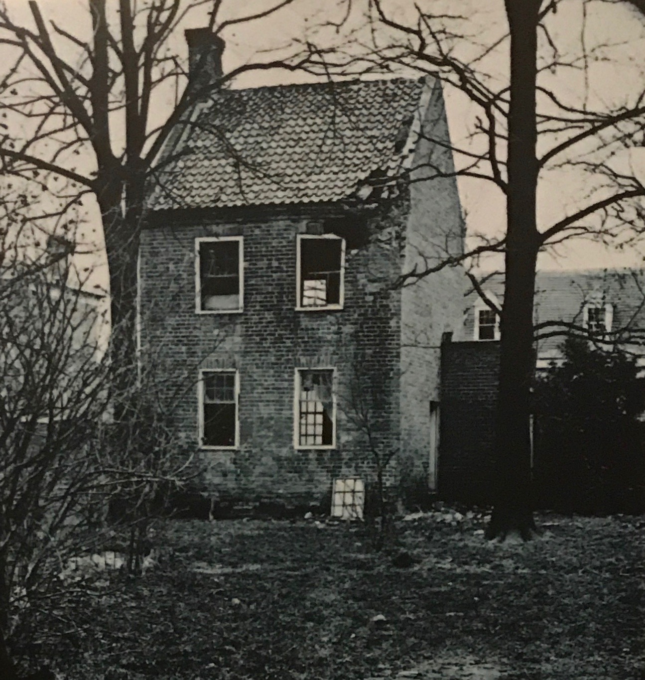
This photo was labeled “Damaged home in Petersburg.”

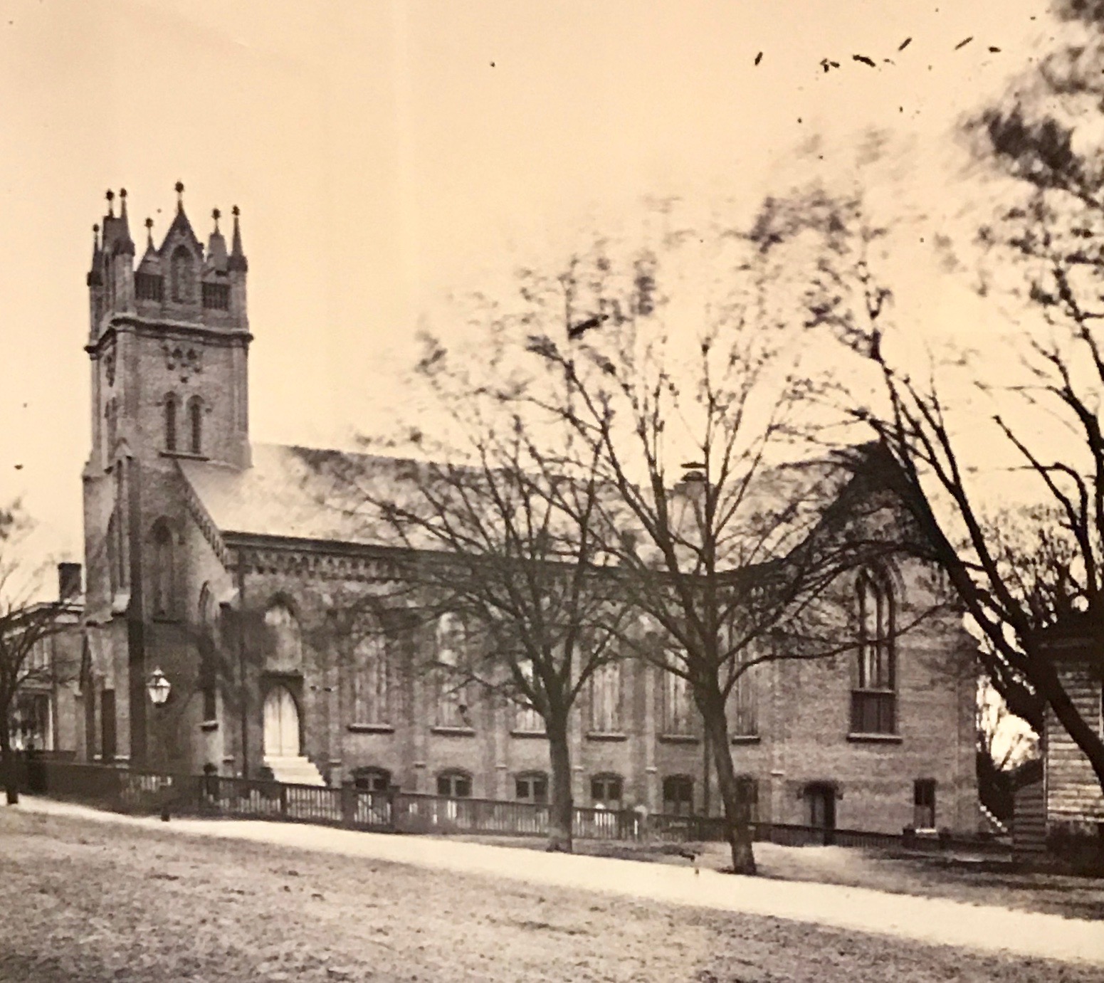
Reverend William Platt, the priest of Grace Episcopal Church, wrote a letter to Federal forces asking them to refrain from shelling on Sunday mornings, so that the citizens of Petersburg might be able to attend worship services. The Federal troops were ordered to comply with the request.

Grace Episcopal was one of the newer churches in Petersburg. Construction started around 1859, and at least the basement space was completed by the Siege. A Wednesday evening prayer service was held during the Siege, and General Lee was reported to have attended several of these services, although he frequently attended morning services at St. Paul’s Episcopal Church. The building the housed Grace Episcopal Church was demolished in 1959.

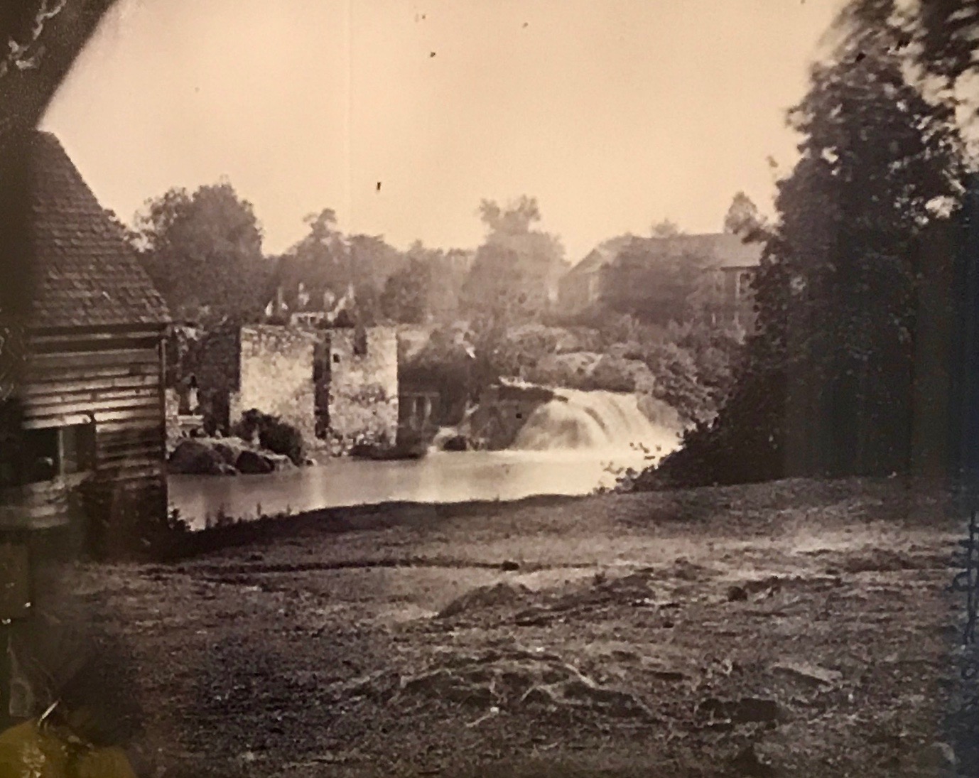
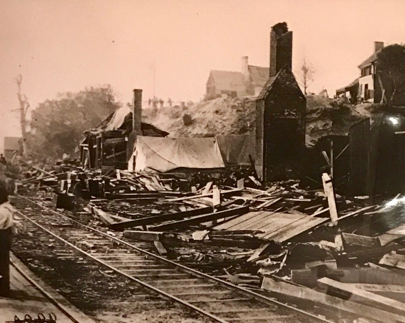
This is a photo of the ruins of a woolen mill.

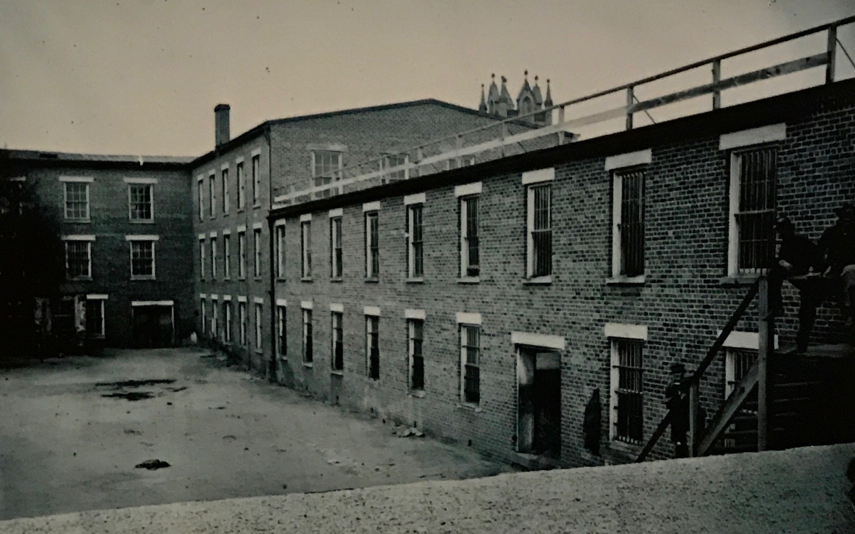
Buildings were commandeered for military purposes. This was a tobacco warehouse was used as a Confederate prison.

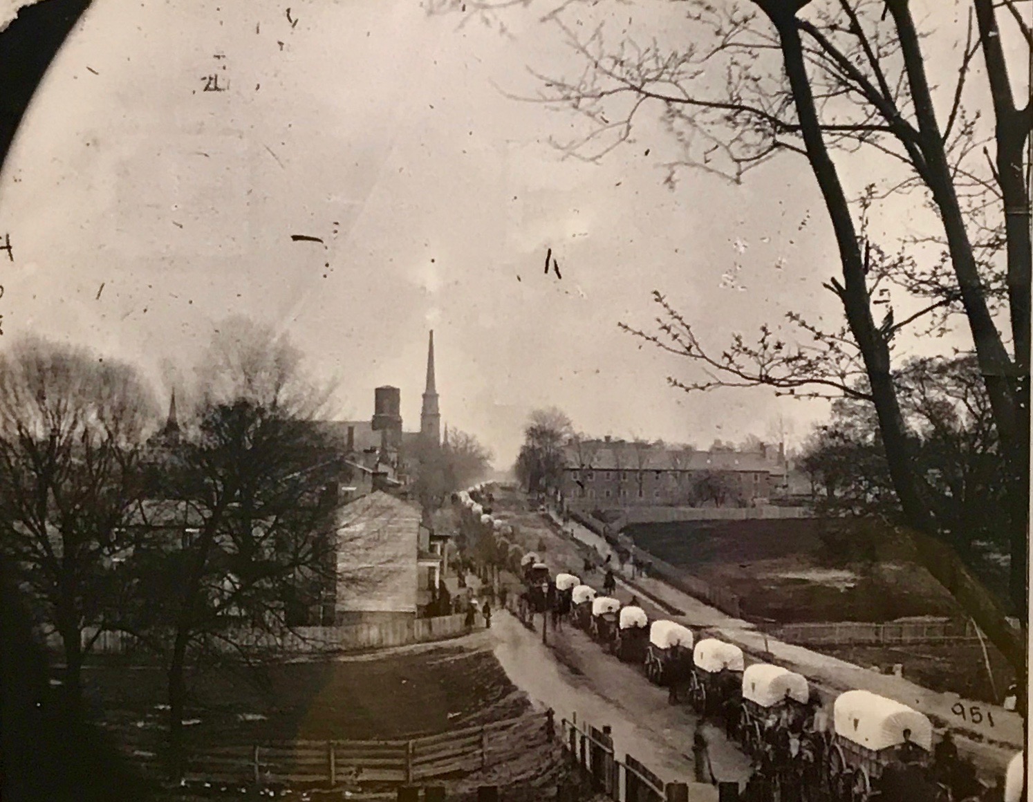
Here’s a Federal wagon train rolling through Petersburg.

City Point was at the mouth of the Appomattox River, where it emptied into the James River. It was about 10 miles away, but was important because boats couldn’t get through once the Union forces controlled the area. General Grant made his headquarters and base for supplies in City Point.

The damage in this photo wasn’t caused by the Union troops, however. This photograph depicts damage at City Point following an explosion set by Confederate troops on August 9, 1864.

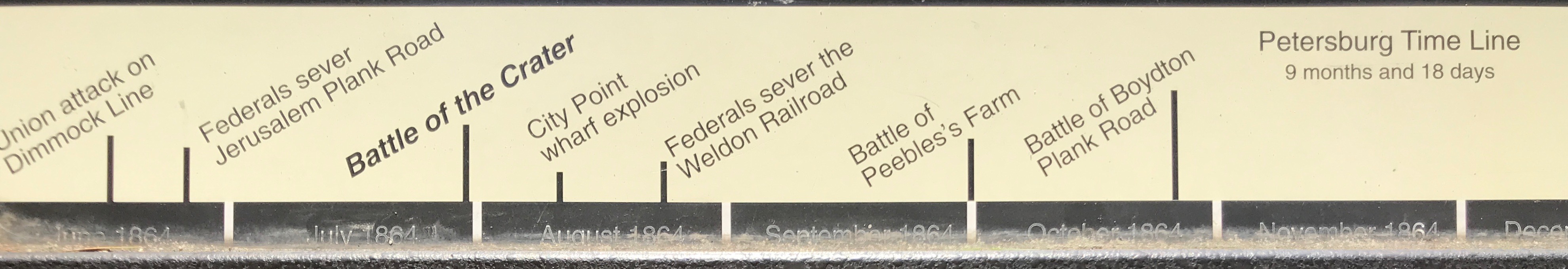
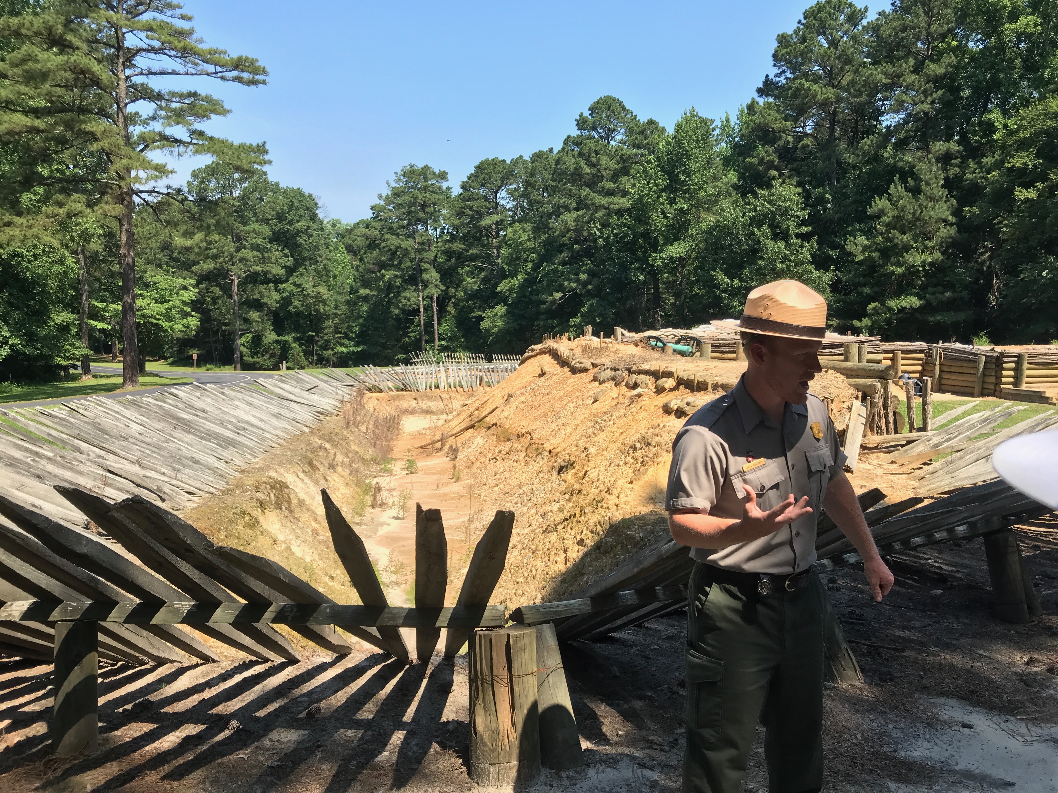
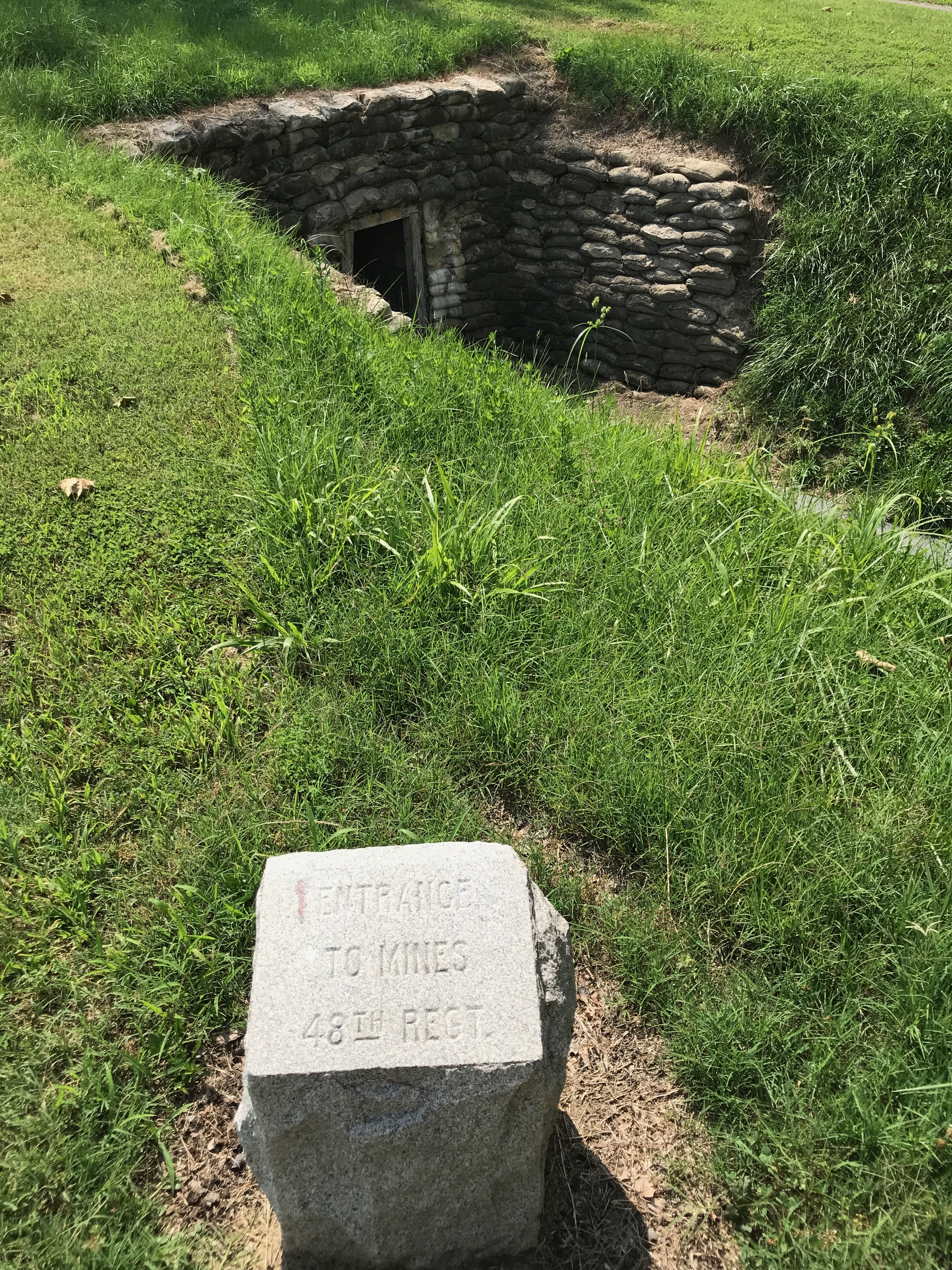
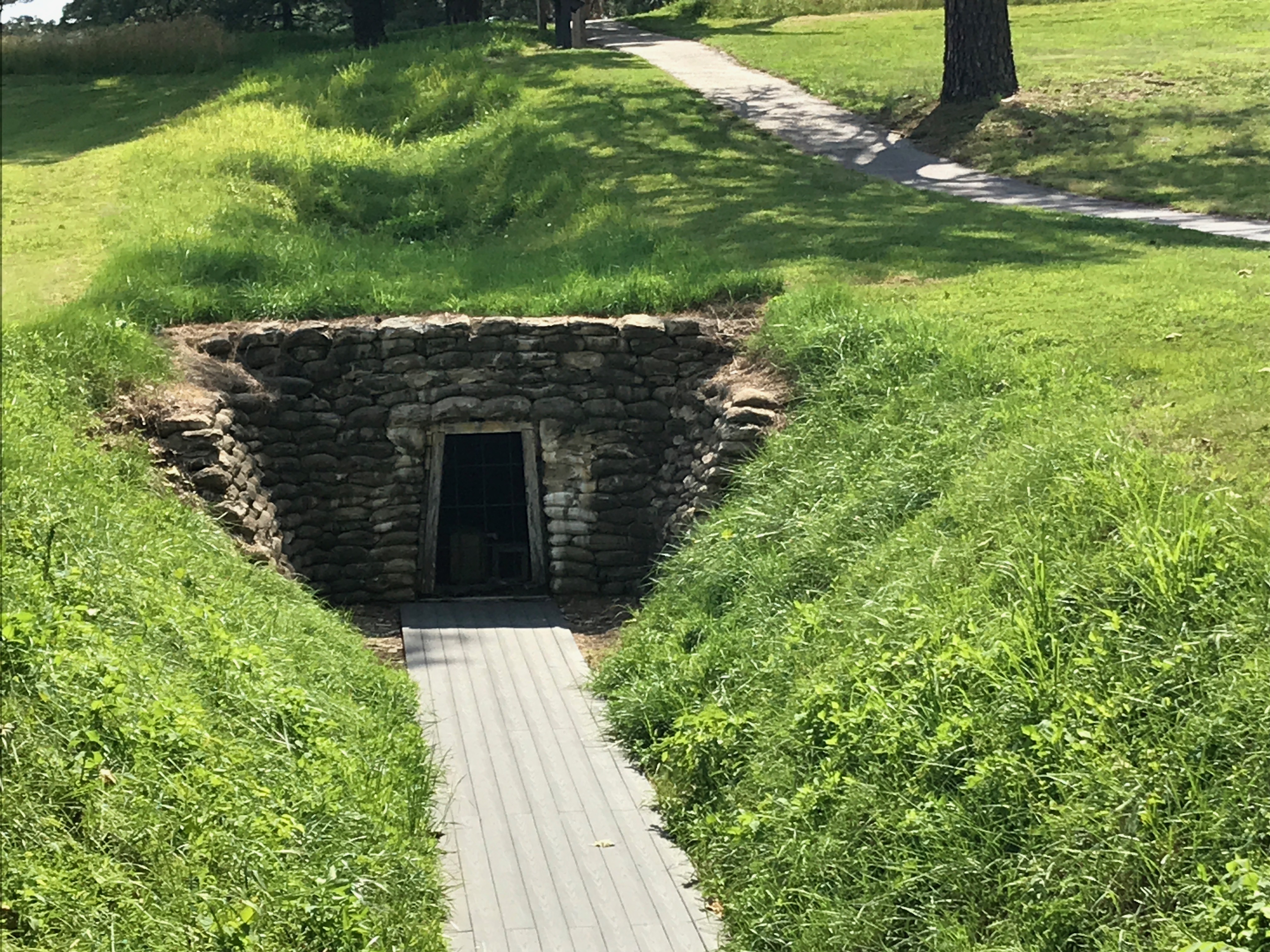
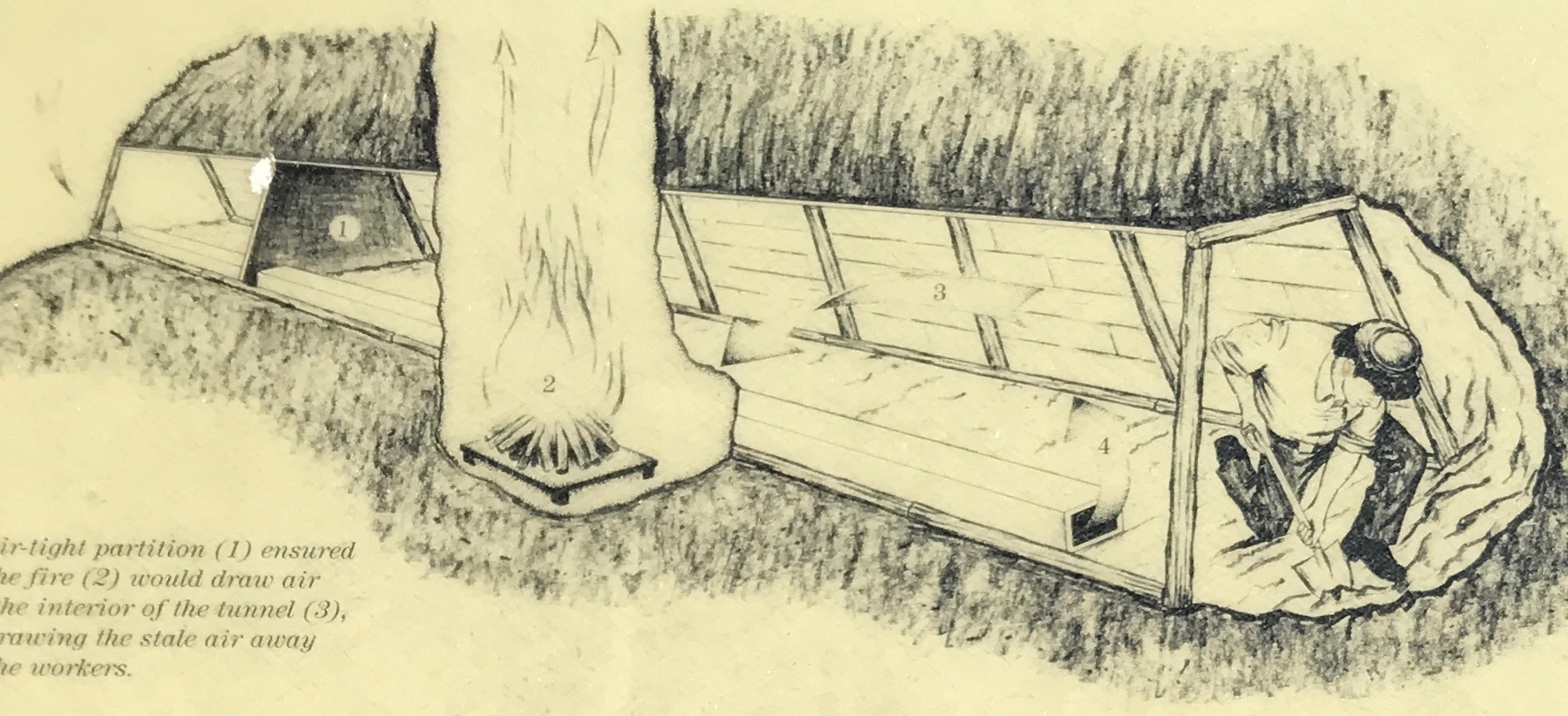
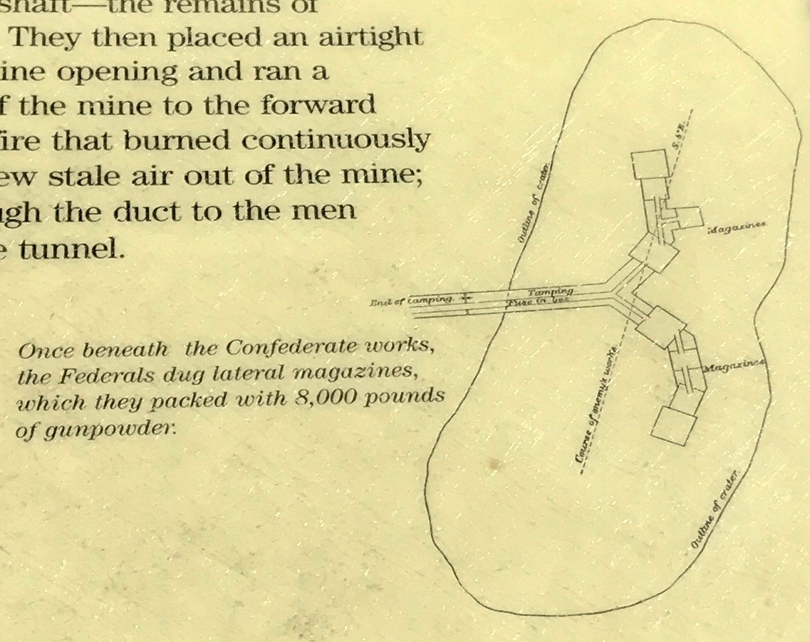
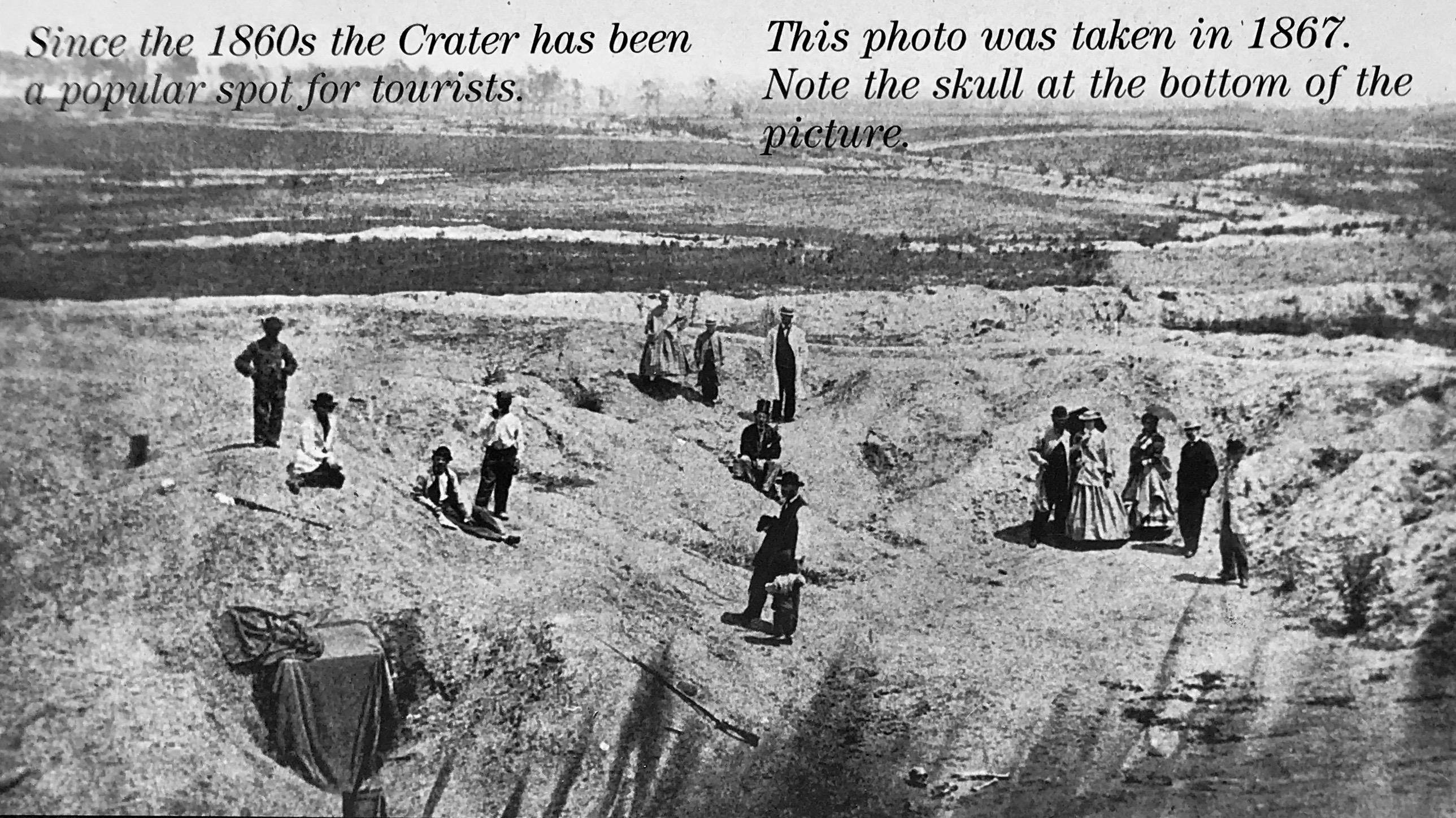
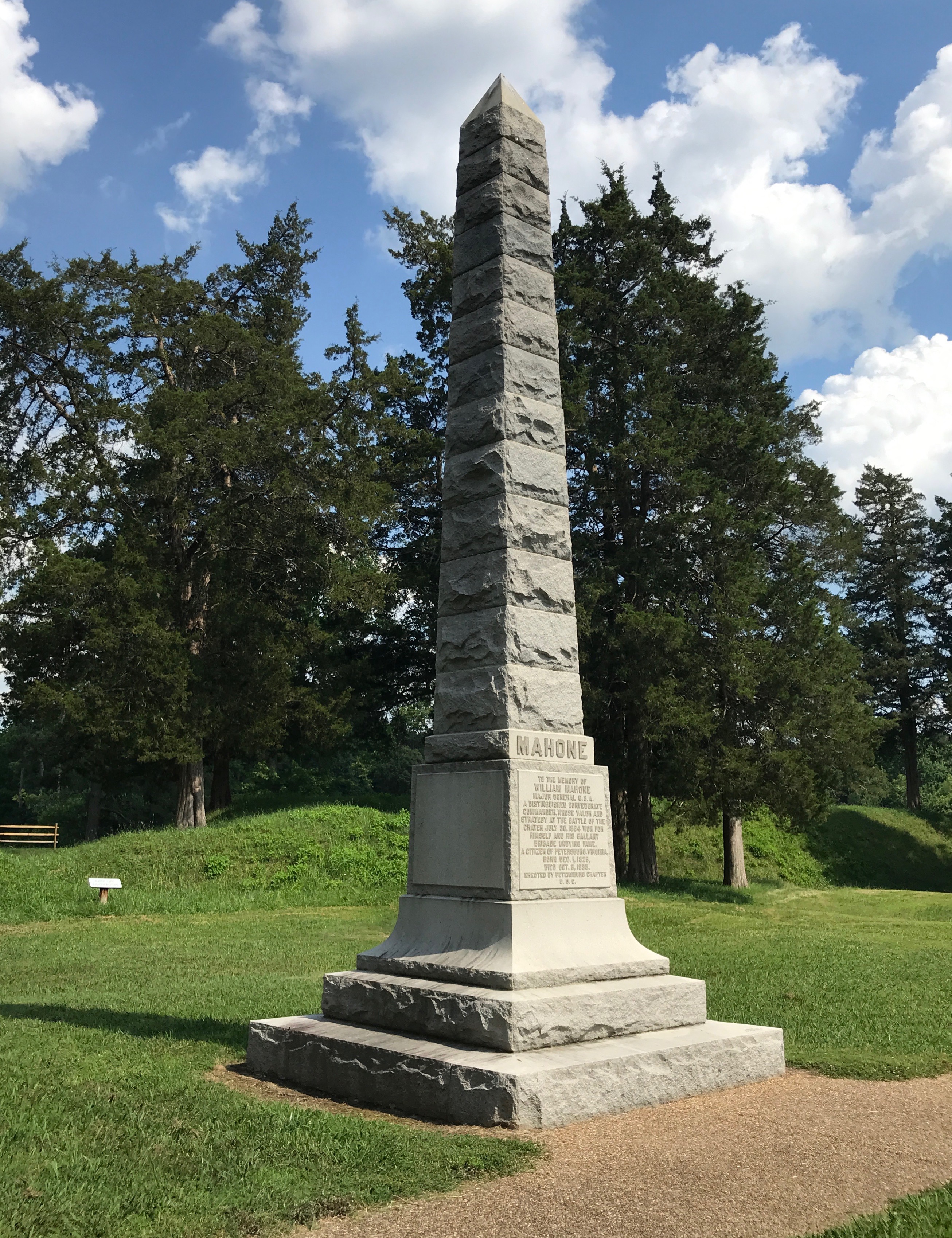
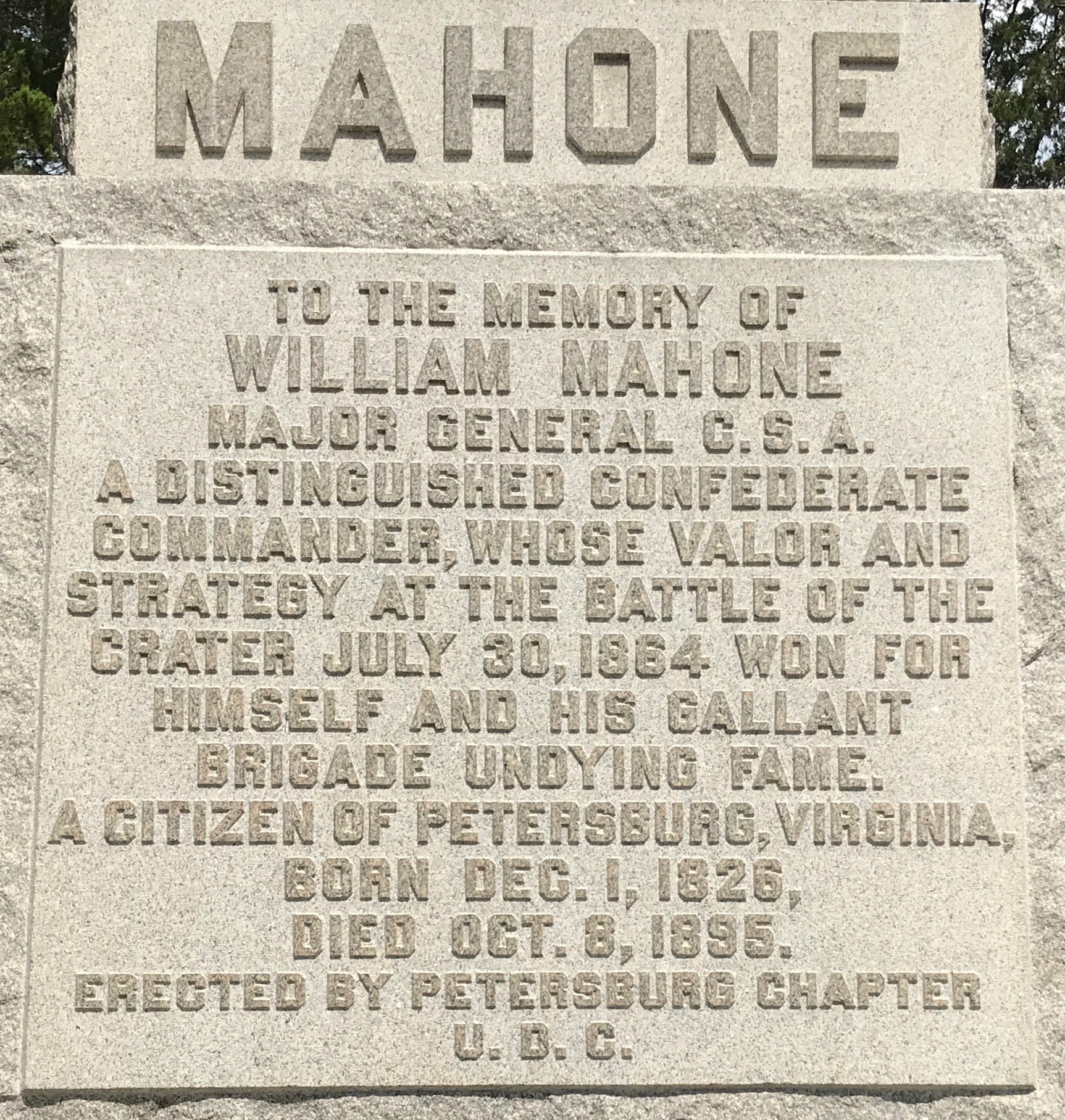
After the explosion at the Crater, the Confederates did what they could to prevent another mine explosion. They dug at twenty-seven foot ditch at the rear of fort Gilmer.

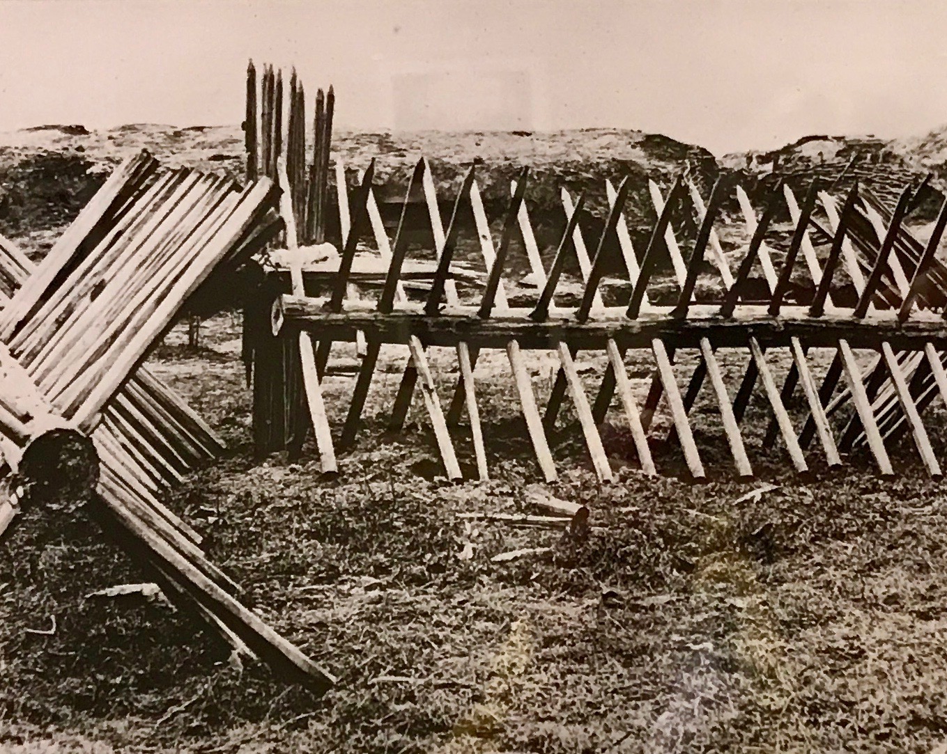
The twenty-seven foot ditch would slow down attackers, as would these structures known as “abates.”

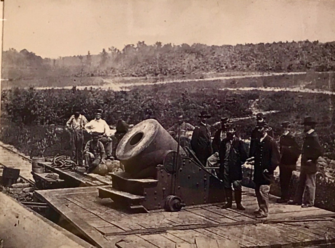
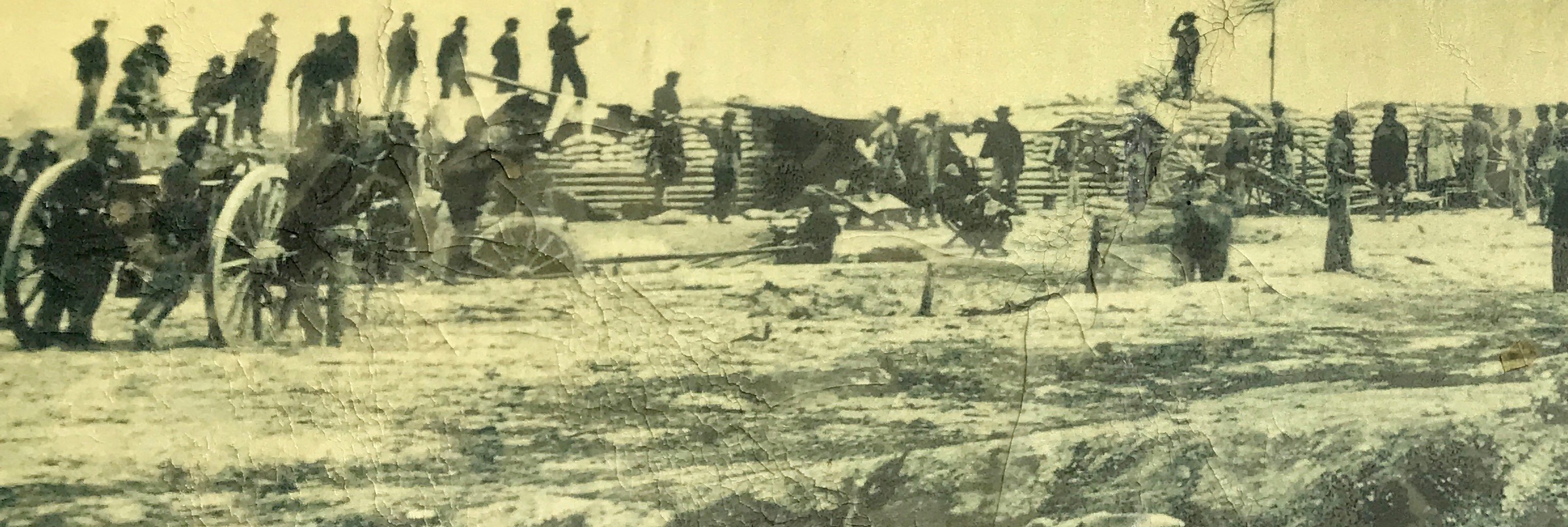
This Mortar was named “The Dictator.” It weighed in a 17,000 pounds and was mounted on a specially reinforced railroad car. It was transported to the Siege operations by rail from City Point. Th mortar could lob a 200 pound explosive shell about 2.5 miles. It was usually positioned in a curved sections of the Petersburg & City Point Railroad and it was used for about three months during the Siege. During the Siege, it was manned by Company G of the 1st Connecticut Heavy Artillery.

David Knox photographed this image of the mortar that Gardner later published in the Photographic Sketch Book of the Civil War.

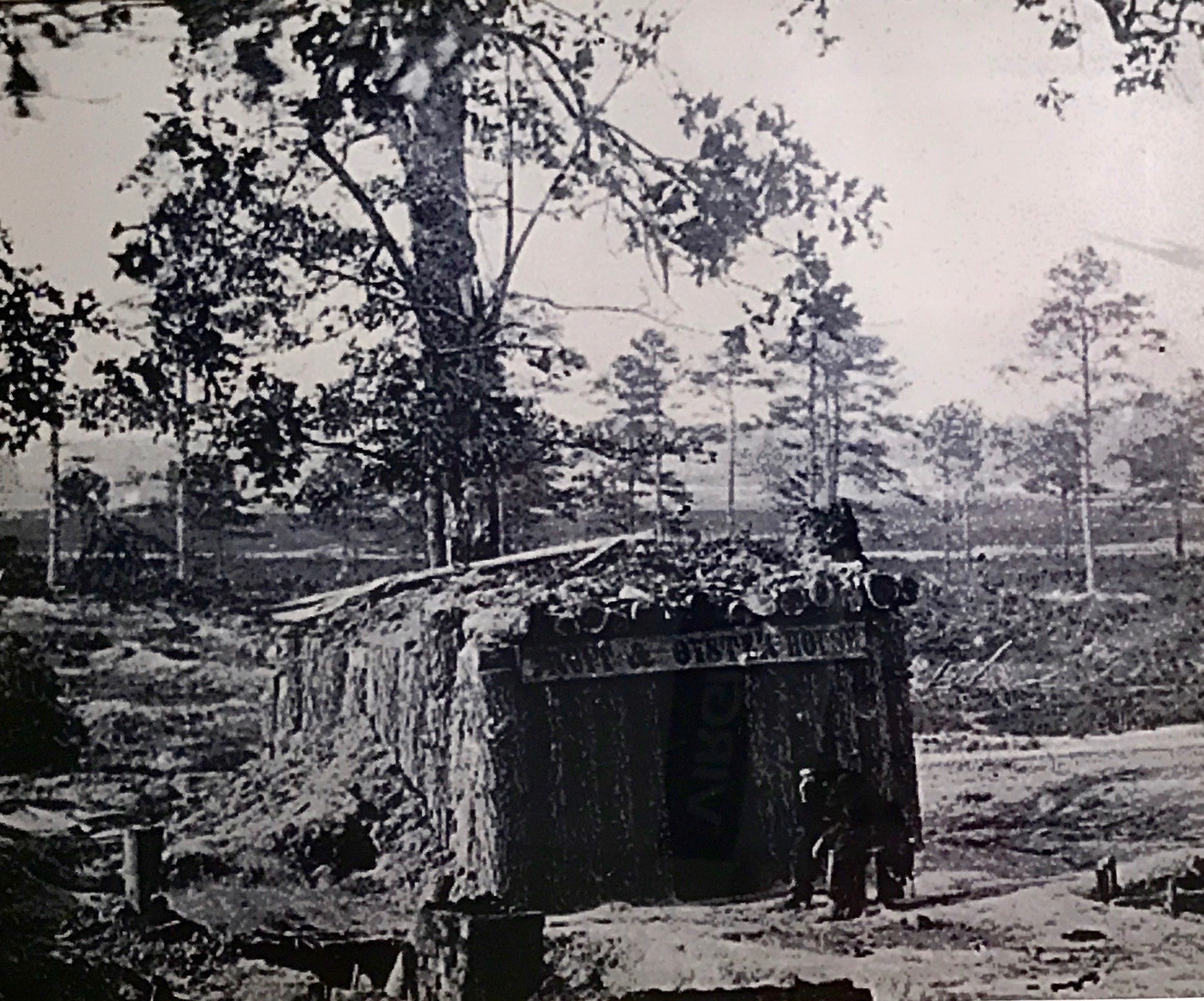
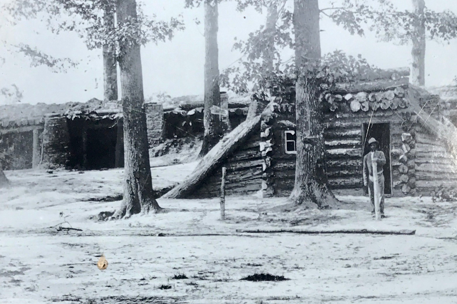
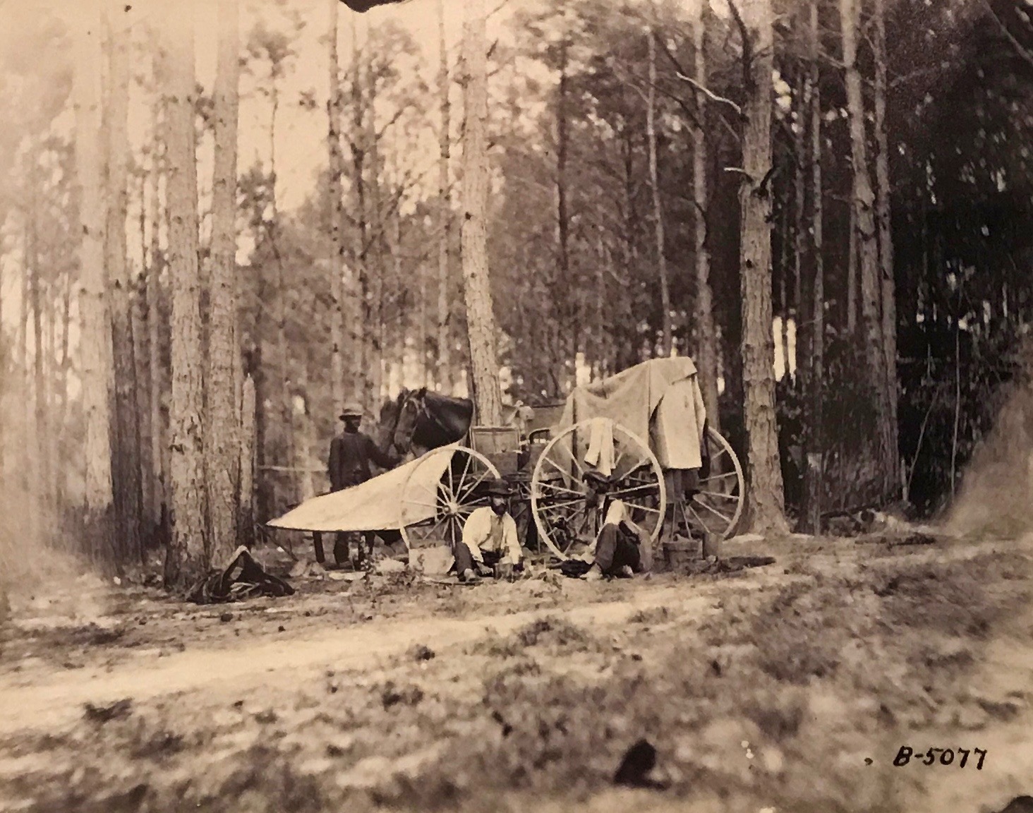
A soldier has to eat, and this is a restaurant. I don’t know if this was created by some enterprising individual or was created by the army.

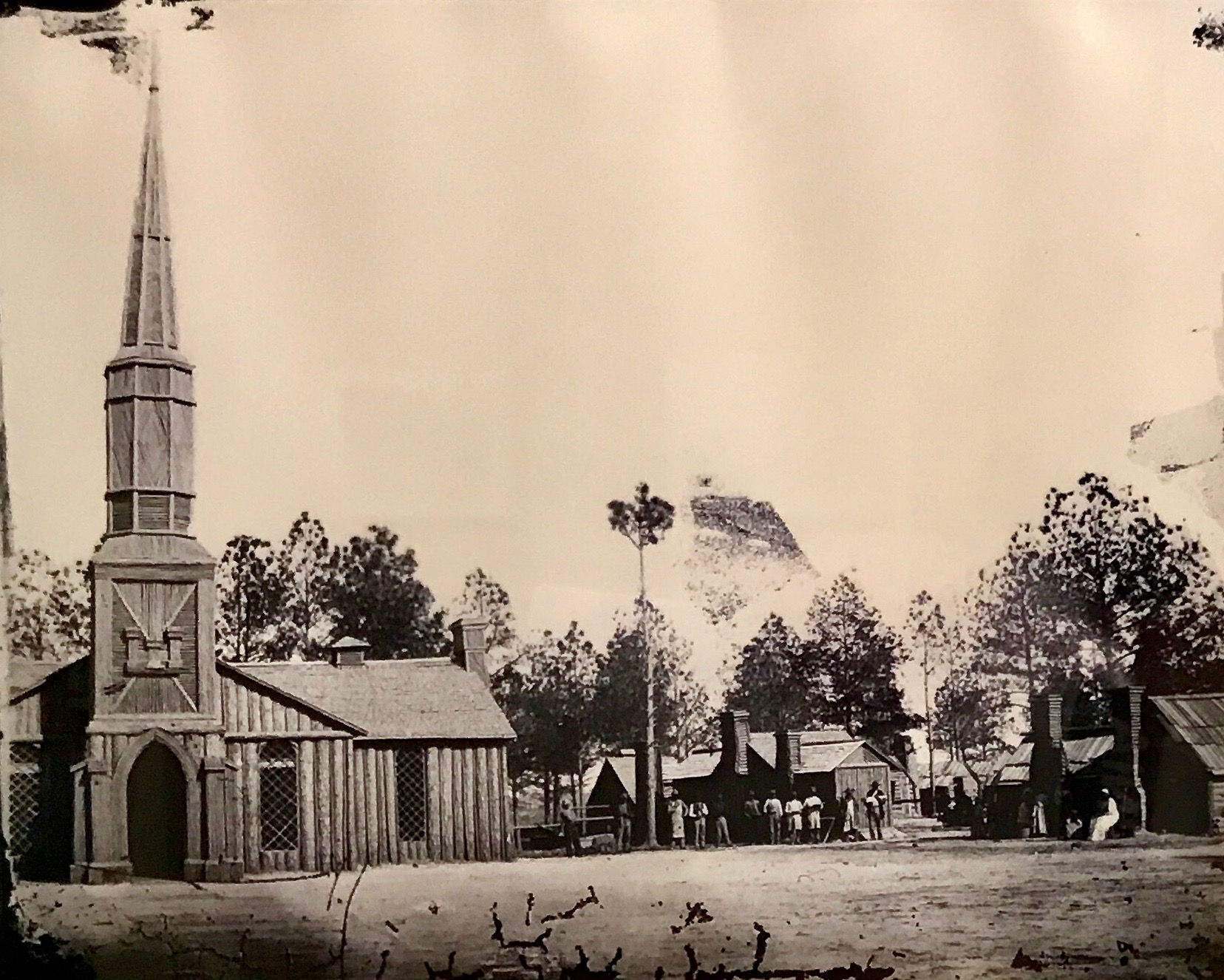
This structure was built by the army. Members of the 50th New York Engineers completed this church at their winter camp in February 1865. The church and the officers’ quarters to the right of the church were built from wood that had been cleared from the land. This church was built near the site of Poplar Springs Church, that had been destroyed during the Battle of Peebles Farm. The structure was demolished in 1868.

It tickled me to see that they managed to include the Army Corps of Engineers logo included over the door.

There was a photo of a place I hoped to get to before it closed for the day – Blandford Church.

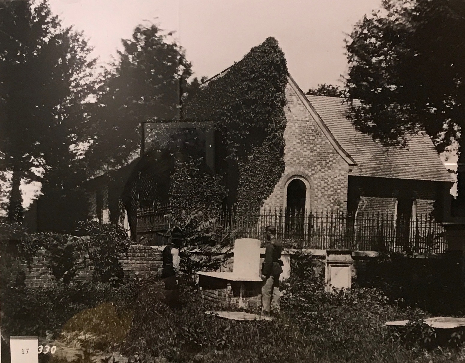
It had been built in 1735, as the seat of worship for the members of Bristol Parish. The church building was abandoned in 1806. This image was taken by Timothy O’Sullivan in April 1865 and included in Gardner’s Photographic Sketch Book of the Civil War. It is now used as a Confederate Memorial, and roughly 30,000 Confederate soldiers are buried Blandford Cemetery.

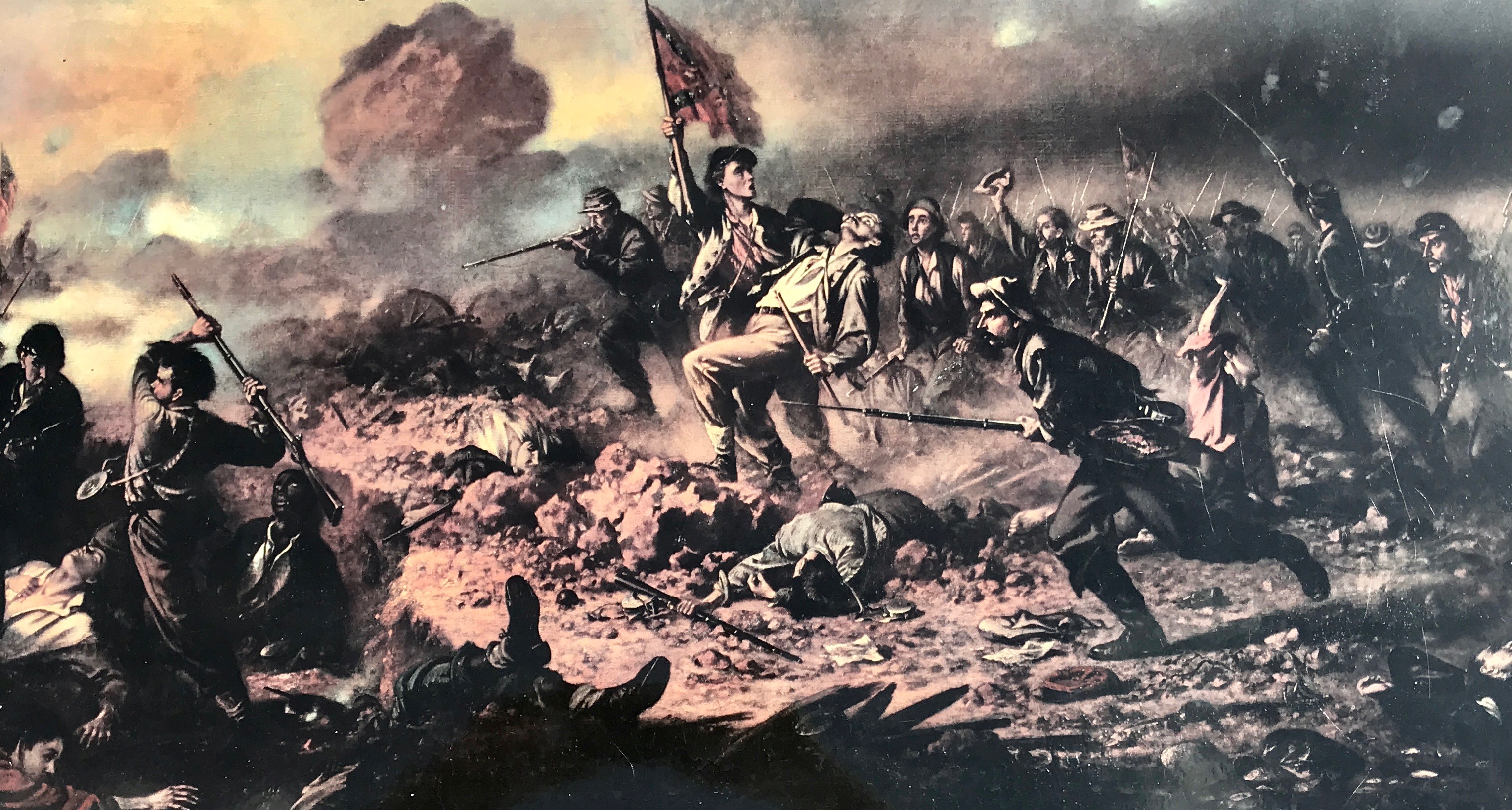
Some of the most prolific documentary photographers of the Civil War were Mathew Brady and his associates, Alexander Gardner, George Bernard, and Timothy O’Sullivan. They travels throughout the easter part of the country visually recording scenes of war and its aftermath. The result is a collection of some 12,000 images that form a rich visual document of the Civil War.

Not to mention, forming the basis for Ken Burns’ PBS miniseries. Cue Ashokan Farewell.

The Post Office and Customs House was built between 1856 and 1859. In July 1864, the postmaster moved the post office to Dunlop Street in the western portion of Petersburg because he felt that this location was too exposed to shelling.

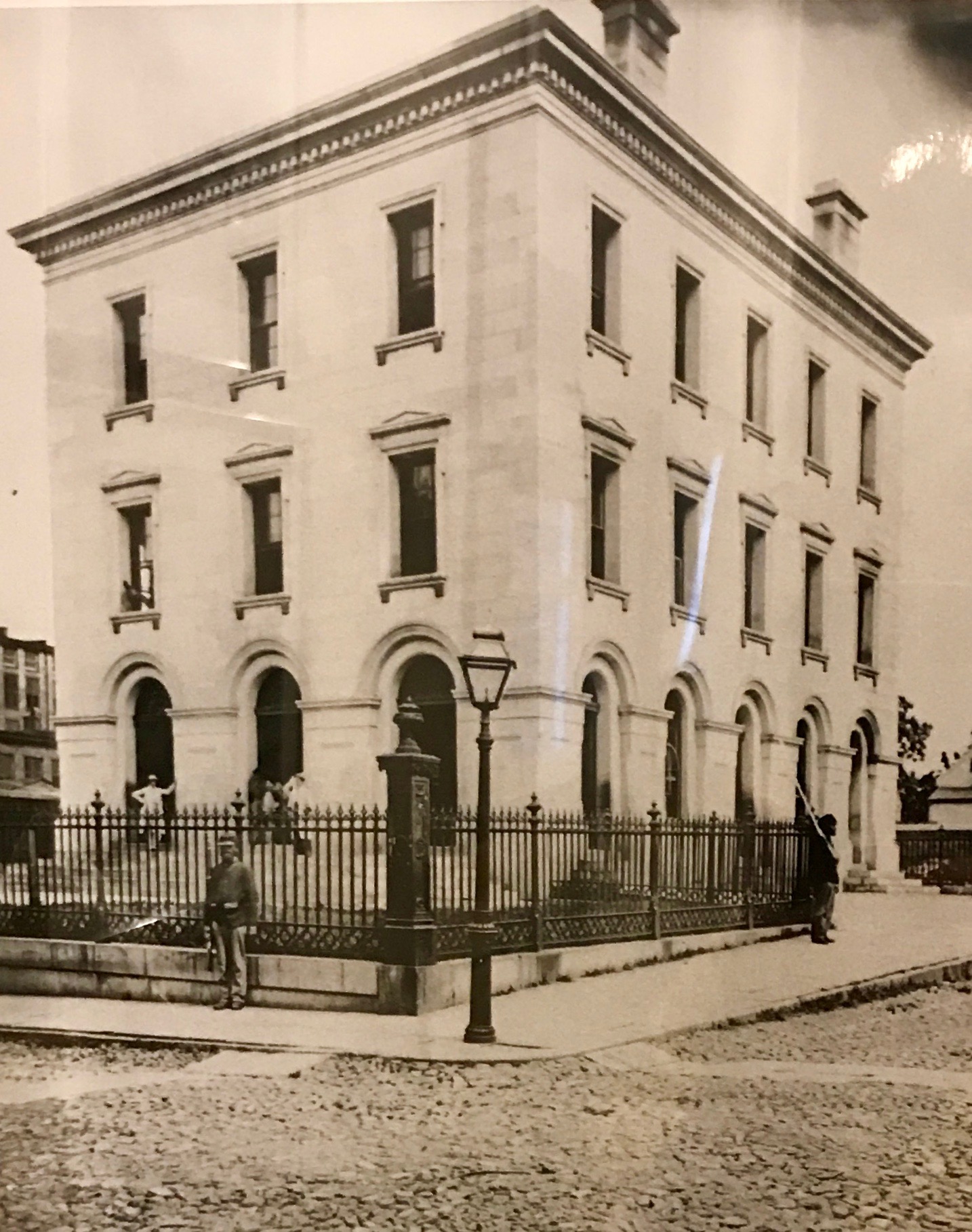
The building was used as a meeting place for Confederate officers during the Siege. General Lee and General Beauregard met here on at least one occasion. A Confederate signal Station was also located on the roof.

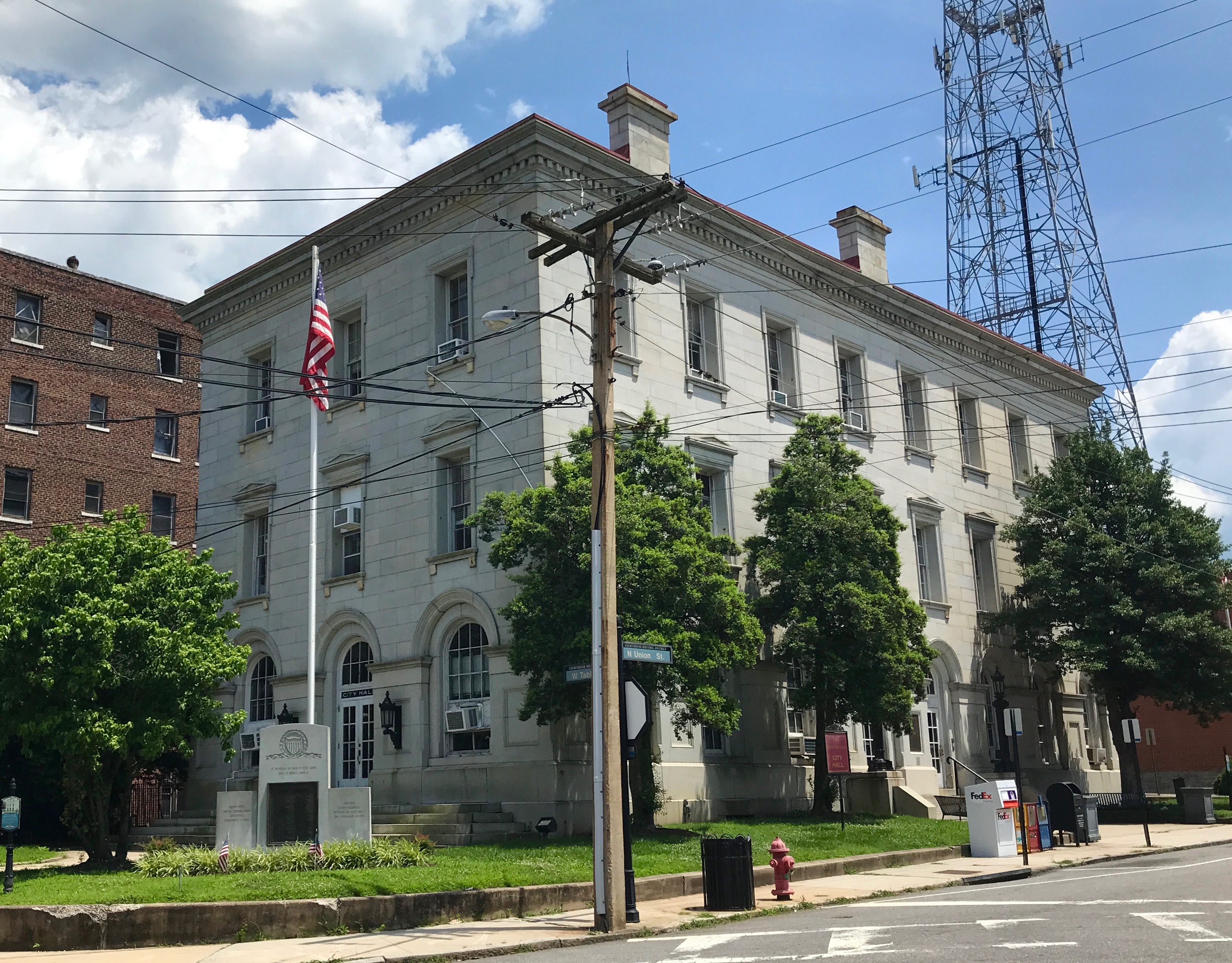
The building became Petersburg’s City Hall in 1938.

Yes, the same building is still in use.

And with that, it was time to find the truck and head back to the battlefield.


Petersburg National Battlefield, Petersburg, Virginia

Weekends are great as a seed courier.

For one thing, I don’t have to schlepp all my stuff in and out every day. If you are smart, you book for three nights – Friday, Saturday and Sunday. Or you do what I did, and forget about Sunday night. No bother! I got to visit another place that I had on The List on Sunday.

Permit me to digress from Petersburg for a moment and discuss lodging. Those of you who travel and stay in moderately priced hotels may be familiar with the concept of a “Hospitality Promise” that comes with toiletries and a threat.

For goodness sake! Their “guest room amenities” can’t possibly be that popular!

By this time, I was getting pretty familiar with the complimentary breakfast bar. This time, I got to see something I hadn’t seen in years.

A woman out in public with curlers in her hair. Perhaps she had some special event, like a wedding or some such thing, where she was going to get fixed up once she got there.

It’s fun to look at the people you see along the way and make up backstories for them.

The reason I had been looking forward to visiting Petersburg is that it is the site of was a major battle in the Civil War. When I was younger, I could have told you a lot about it. At this point, however, all I could remember were the words “siege” and “crater.”

Petersburg has been on “The List” forever.  I’ve been close several times, but just couldn’t work a visit in. Today was the day!

Upon my arrival, I learned that Petersburg was the longest battle of the Civil War, lasting 9 months and 18 days. I happened to arrive on June 17, on the 144th anniversary of the beginning of the battle, and there were people on hand to help explain the battle. I arrived just in time to join a tour with a ranger.

After talking to us for a bit about the scope of what happened here, including a total of about 70,000 casualties, he guided us to a spot where some reenactors were waiting to talk with us.

They had camp set up. Can you believe that this is a tent? Well, I am sure you can believe that it is a tent, it’s just tents have certainly progressed a lot through the years.

Since this was a nine-month siege, there must have been a lot of “hurry up and wait” time. I imagine that whittling, like this guy is doing, was a major source of entertainment.

Our reenactors told us about the problem of shoes wearing out and what they would do to try to make them last longer. I had never seen real hobnail boots before.

They even demonstrated what went into firing their rifles. I can’t even imagine firing and reloading with people an equal distance away firing and reloading at me. Yet, somehow they managed to do it.

By the end of the war, this is how John Haley of the 17th Maine Infantry described the battlefield:

It’s hard to reconcile the peaceful countryside with what must have been a Hell hole.

Somewhere is this photo is something that is described as a “gentle depression.” It is the only vestige remaining of the Josiah Jordan House. It was dismantled by Union troops in 1862. It was only yards from Battery 5 of the Dimmock Line that was built to defend Petersburg.

Our next stop on the tour was Battery 5.

As you can see, these batteries were not luxurious affairs. It looks like they started with the dirt. They dug ditches, piled up walls and then augmented the ditches and mounds with timbers they cut from the forests nearby.

Until late summer of 1862, Petersburg was an unfortified city, which is surprising to me in that it was in an important transportation hub. It was decided to encircle the town with a series of partially enclosed forts connected by trench lines. The project was overseen by Captain Charles Dimmock, although it was laid out by others, and came to be known as “The Dimmock Line.”

The finished line consisted of 55 numbered batteries. Over four thousand troops from three brigades helped with the initial construction, and as many as one thousand conscripted slaves from Virginia and North Carolina also worked on the line.

The defenses weren’t perfect, but the Union Army was breathing down their necks. They had already crossed the Appomattox River, so they used what they had and did what they could. Once the Army of the Potomac withdrew to northern Virginia, work slowed down on the construction of the line. Dimmock kept working on the line. As late as March 1863, Dimmock was still conscripting slaves and free blacks to work on the defenses.

The next stop on our ranger-lead tour was Harrison’s Creek.

This small stream played a large roll in the battle. Ranger Rowland told us that the summers here were particularly hot and dry, so the stream was an important source of water for the troops.

In June, 1864, the outnumbered Confederate defenders of Petersburg formed a new line on the heights just across the stream.

You probably can’t tell from this photo, but the “heights” were not all that high. The Confederates scrambled to the top of the rise and started digging in to augment the small advantage the rise gave them. Bear in mind that this was not a forest at the time. It was just bare ground.

The Confederates held their position for two days, weathering repeated Union attacks.

Our Ranger did a great job of describing the fighting. After the demonstration of what went into firing a rifle, and knowing that the soldiers advancing on this little rise had to fight up hill with no cover, I felt particularly somber. This quiet little patch of ground was the site of much death.

The horses coming down the trail helped to relieve the melancholy.

Harrison’s Creek also marks the farthest advance on General Lee’s last offensive on March 25, 1865.

After this stop we were on our own. My next stop was Fort Stedman.

There is not much left to see of the fort, although I suppose the area is rich in archeological evidence.

There are descriptive signs along the trail through the site. I took a photo of this one to show off the solar-powered multimedia efforts.

There are still the “old-fashioned” forms of information, though.

This plaque that was erected by the Commonwealth of Pennsylvania.

There were the usual displays with quotes from observers and participants.

There were photos, too.

Union engineers decided to leave Stedman’s trees standing, which was an uncommon luxury for the troops stationed here. With up to six cannons and 300 infantrymen, Fort Stedman was typical of the more than 30 forts that studded the Union siege lines. What set it apart from other similar forts was that the Confederate line lay only 300 yards away.

The dirt and logs gave shelter against Confederate shells and bullets. According to the display, life the fort was described as;

“Endurance without relief; sleeplessness without exhilaration; inactivity without rest; and constant apprehension requiring ceaseless watching.”

When I saw this photo in the display, it occurred to me that this might be an early selfie.

By the time I finished my tour of Fort Stedman, I was starting to get hungry. I went into town for sustenance and decided to save the Crater for after lunch. I will save my info about my visit to the city of Petersburg for another post.

So, the last thing I had on my list of things to see was the Crater itself.

I parked and walked along the trail. The scenery surely is more beautiful now that it was in 1864.

Lt. Col. Henry Pleasants, a mining engineer from Pennsylvania, proposed digging a long shaft under the Confederate lines and planting explosives directly under a fort know as Elliot’s Salient. His superiors – Burnside, Grant and Meade – saw this as a way to keep the men occupied, and eventually lost interest in the project. This left Pleasants scrounging for materials to complete the mines.

They came up with an ingenious way to provide ventilation as the men worked. This is from my Preferred Source:

“The miners had constructed a vertical exhaust shaft located well behind Union lines. At the vertical shaft’s base, a fire was kept continuously burning. A wooden duct ran the entire length of the tunnel and protruded into the outside air. The fire heated stale air inside of the tunnel, drawing it up the exhaust shaft and out of the mine by the chimney effect. The resulting vacuum then sucked fresh air in from the mine entrance via the wooden duct, which carried it down the length of the tunnel to the place in which the miners were working.[5] That avoided the need for additional ventilation shafts, which could have been observed by the enemy, and it also easily disguised the diggers’ progress.”

Work continued, in spite of the lack of materials. Earth was removed by hand and packed into improvised sledges made from cracker boxes fitted with handles.

To avoid a problem with moisture from the ground, the mine rose in elevation as it got closer to Elliot’s Salient.

At the end, the tunnel branched into two lateral magazines. The Union soldiers filled the mine with 320 kegs of gunpowder, totaling 8,000 pounds. The explosives were approximately 20 feet under the Confederate works, and the T-gap was packed shut with 11 feet of earth in the side galleries. A further 32 feet  of packed earth in the main gallery to prevent the explosion blasting out the mouth of the mine. On July 28, the powder charges were armed.

The plan was to detonate the charges between 3:30 and 3:45am on the morning of July 30. Since Pleasants had been given substandard materials all the way through, it should be no surprise that they had also been given poor quality fuse, which the men had to splice together. The fuse kept burning out.

Time was passing and dawn was not far off. This would create a threat to the men at the staging points, who were in view of the Confederate lines.

After more and more time passed and no explosion occurred (the impending dawn creating a threat to the men at the staging points, who were in view of the Confederate lines), two volunteers from the 48th Regiment (Lt. Jacob Douty and Sgt. Harry Reese) crawled into the tunnel. After discovering the fuse had burned out at a splice, they spliced on a length of new fuse and relit it. Finally, at 4:44 a.m., the charges exploded in a massive shower of earth, men, and guns. A crater was created that was 170 feet long, 100 to 120 feet wide, and at least 30 feet deep.

The ensuing battle was horrific. I would encourage those of you interested in more details to click on the video below or check out my Preferred Source.

I continued walking along the path and came across this plaque.

Apparently, the Confederates thought something might be up. They dug some tunnels of their own to see if they could hear anything.

A little further along, I came to the marker for The Crater.

It looks quite lovely today, but I’m sure it took years for it to recover.

Speaking of nature reclaiming the land, in this section, they are working on trying to “restore” part of the battlefield to the way it was on June 30, 1864.

There was a counterattack that took place on the site in the photo.

This little berm is the remnant of Confederate breastworks. I had to look the word up. I was curious to see if it meant what I thought it meant. Breastworks are temporary fortifications, typically made of earth, that reach up to a man’s breast to allow defenders to fire over it from a standing position.

In this war, a shovel appears to be as important a weapon as a firearm.

This memorial is to honor General Mahone, who lead the counterattack.

I wonder if the fact that this battle was in his hometown had any additional impact on him.

I always look to see if I can find any additional information on memorials, such as the date it was made or dedicated, who sponsored it, or who made it. Burns and Campbell were the craftsmen.

These are somber statistics. 780 men answered roll call on July 30, 1864. After the battle, just 288 men remained.

In front of the breastwork, there is a memorial commemorating the 100th anniversary of the Battle of the Crater. This was erected by the citizens of Petersburg.

If you visit, look for the picket lines cut into the grass. The Union and Confederate soldiers were incredibly close to each other. I don’t have a photo that does the proximity justice.

With that, it was time to head on to other things.

Close to the exit was this memorial to Massachusetts. When I saw it, I realized that there were very few pieces sponsored by states, unlike in Gettysburg.

I wonder why that is.

But, that is a question for another day.