Living on the road is great. I get to go home all the time – all the places I call home!
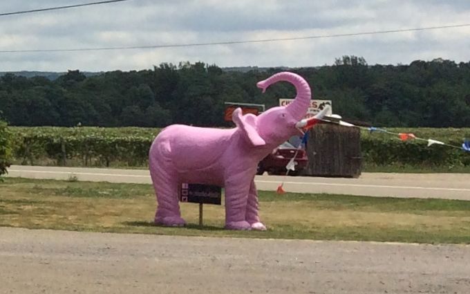
This time I decided to avoid the tolls on the Thruway in New York State and drive toward Buffalo on route 5. It glides along the shore of Lake Erie and through the vineyards. I stopped at one of the wineries, Brix 21, along the way to pick up a bottle for my sister
Unfortunately, I didn’t taste the wines. I figured that it wouldn’t be wise, towing Flo and all. So, I asked for a recommendation. I have got to get better at describing what I like. I can’t imagine that anyone would have liked the bottle I got. I didn’t like it and neither did Amy. I think we both emptied our glasses on the ground. But, it’s the thought that counts, right?
The winery’s mascot is a pink elephant. Kind of ironic, I think.
On the other side of the parking lot, is one of the million painted Buffaloes that populate the region.
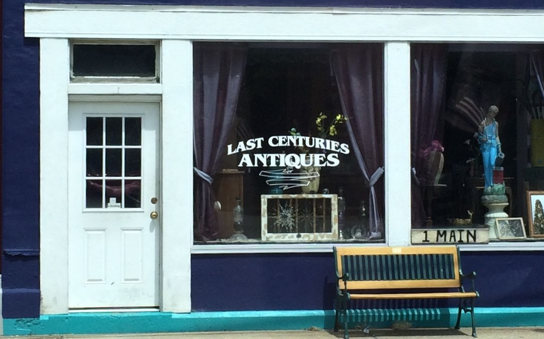
This little store caught my eye as I went though one of the little towns along the route 5. I felt an affinity with it as I am also a last century antique.
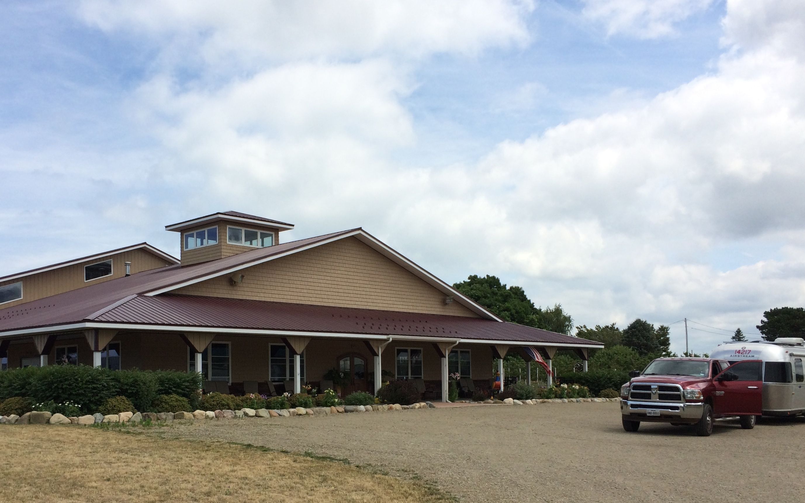
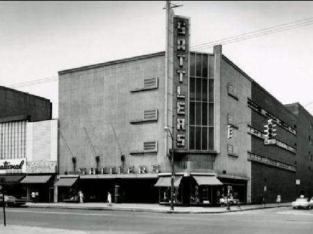
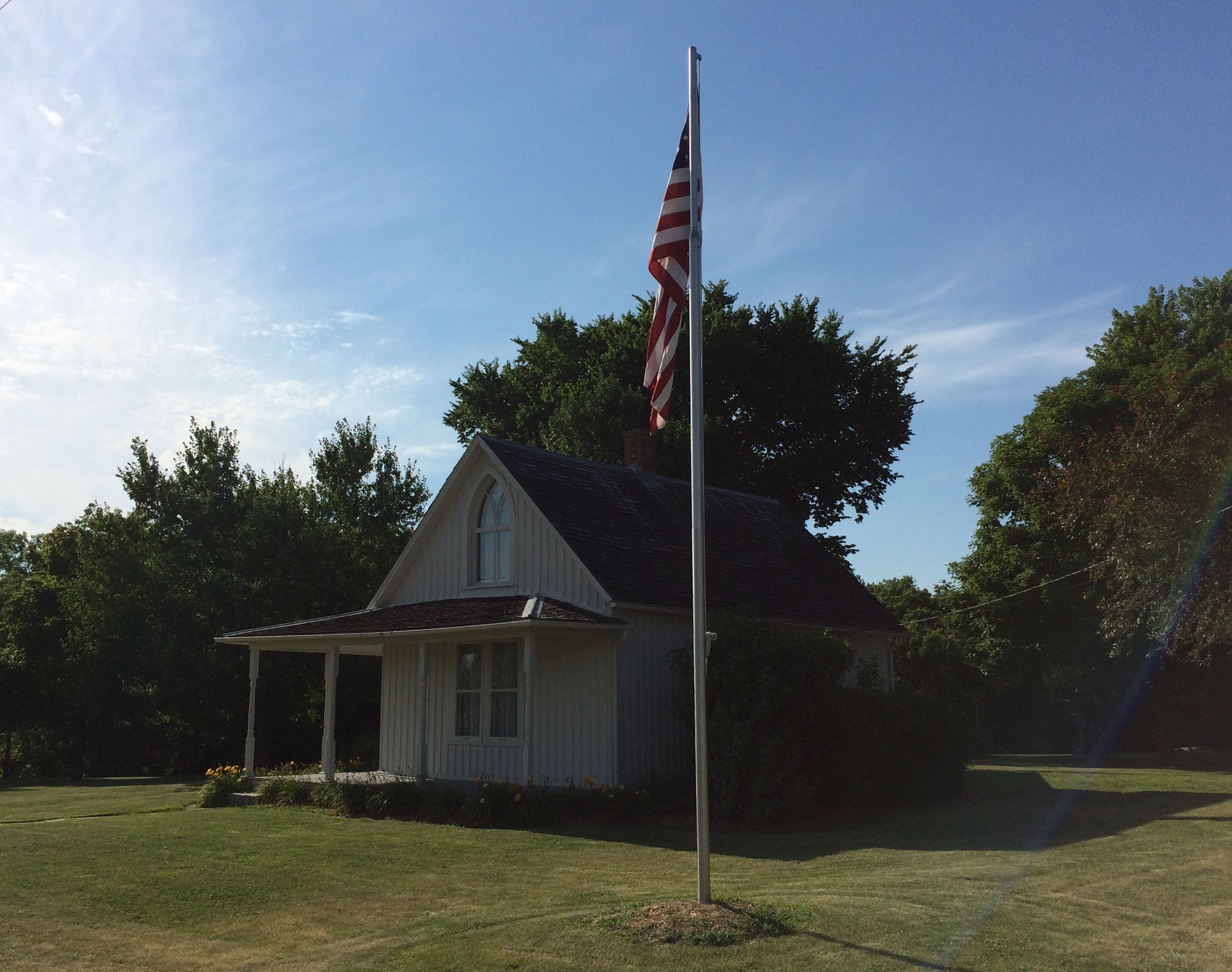
I made my way to Darien Lakes State Park, about 25 miles from my sister’s house and got settled in. Unfortunately, they were scheduled to have some work done at the house, so I had to find another place to park this visit. This seemed like a reasonable place. It was a straight shot from the city line. In fact, it was just off Broadway, a road that runs all the way from downtown Buffalo.
Sattler’s Department Store was famously known for being at 998 Broadway. And I was a mere 30 miles down the street!
Of course, Sattler’s has long since gone out of business. It was founded by 17-year-old John G. Sattler, who opened a one-room shoe store in his mother’s house in this block. The Sattler’s that I am familiar with was at the Boulevard Mall. According to the information I scrounged up on the internet, it sounds like they had about ten stores at their peak. Unfortunately, the chain was bought up by United Department Stores somewhere along the way and finally went out of business for good in 1982.
Thus ends our Buffalo history lesson for this trip.
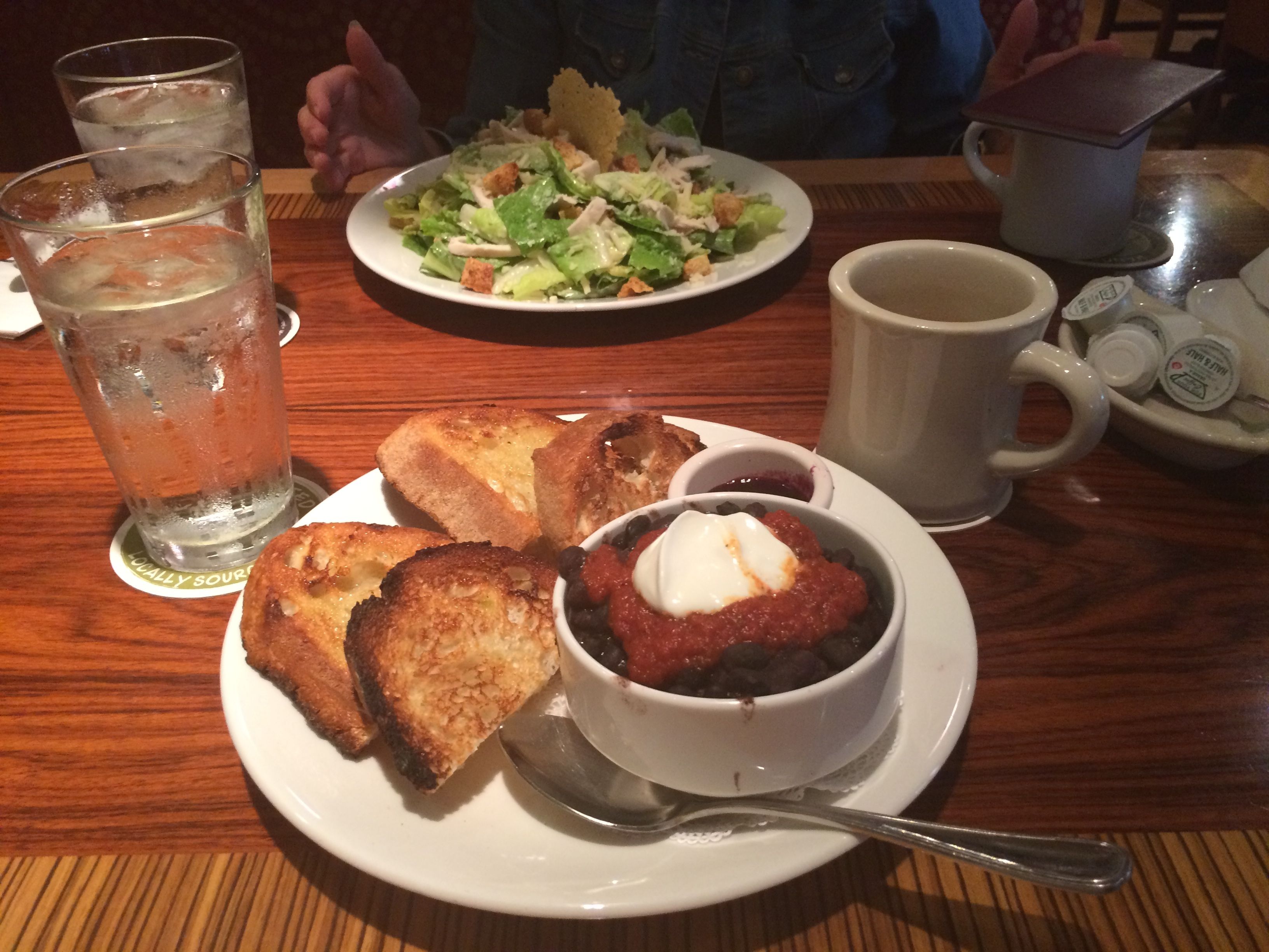
I was only in Western New York for a few days. I wanted to make sure I saw people. I didn’t even do a good job of taking pictures of the people, but I did get some shots of the food.
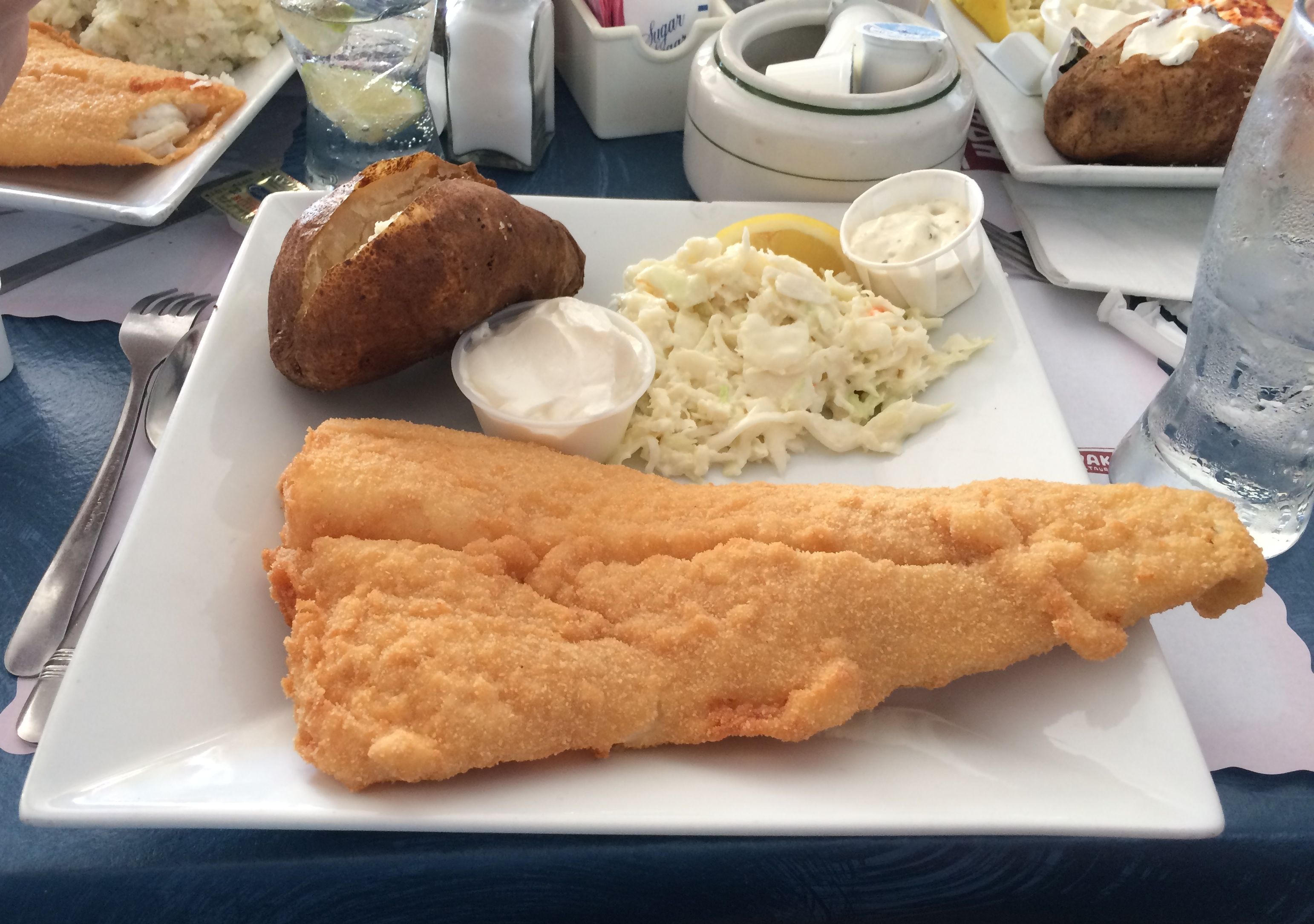
Kathy, Dennis and their son John took me out for a fish fry at Hoak’s on the Lake in Hamburg.
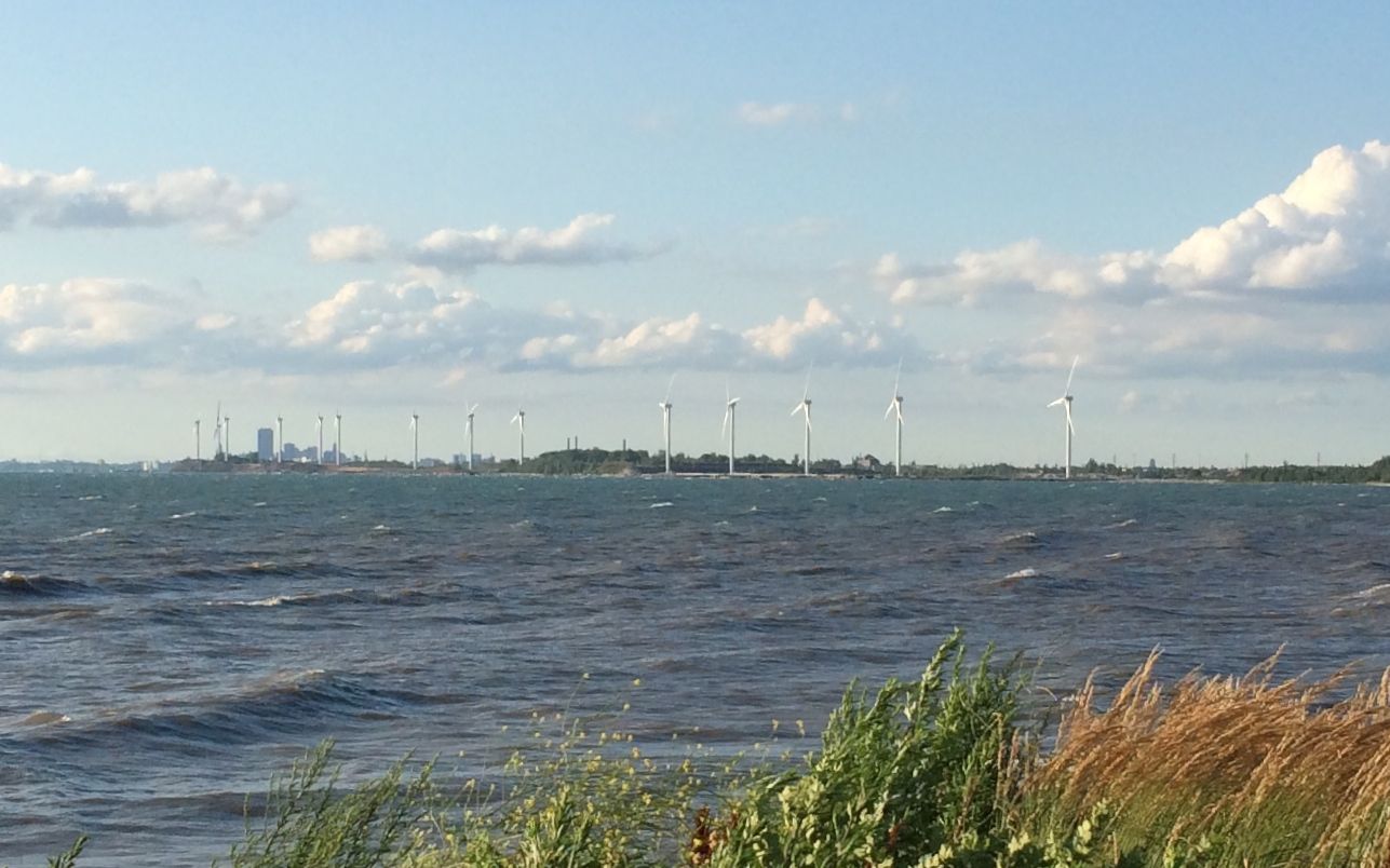
There was a lovely view of downtown Buffalo and the windmills from the restaurant.
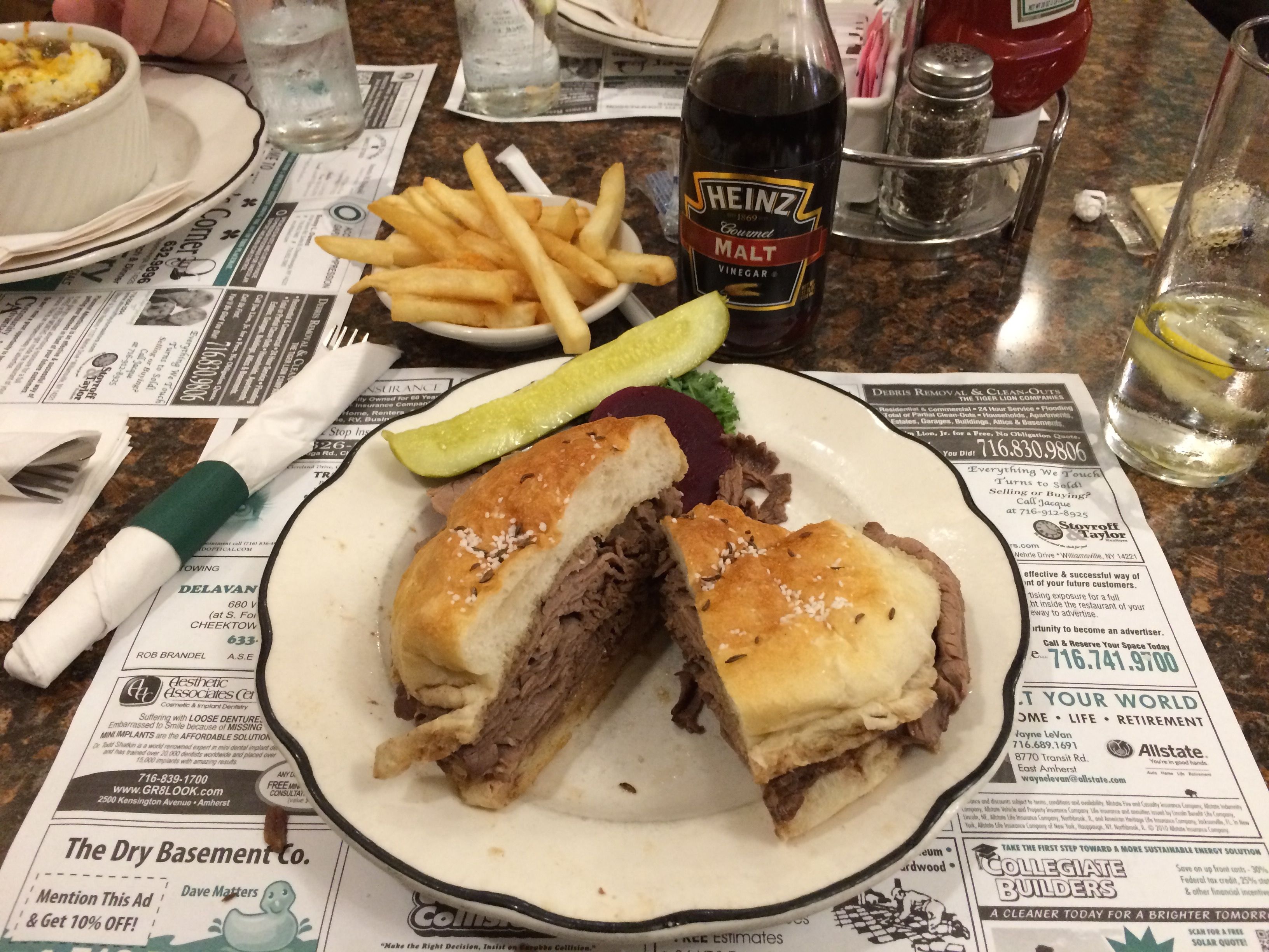
My brother, Craig, and his mother-in-law, Marilyn, took me out for dinner. Since I was in Buffalo, I had to have a beef-on-weck.
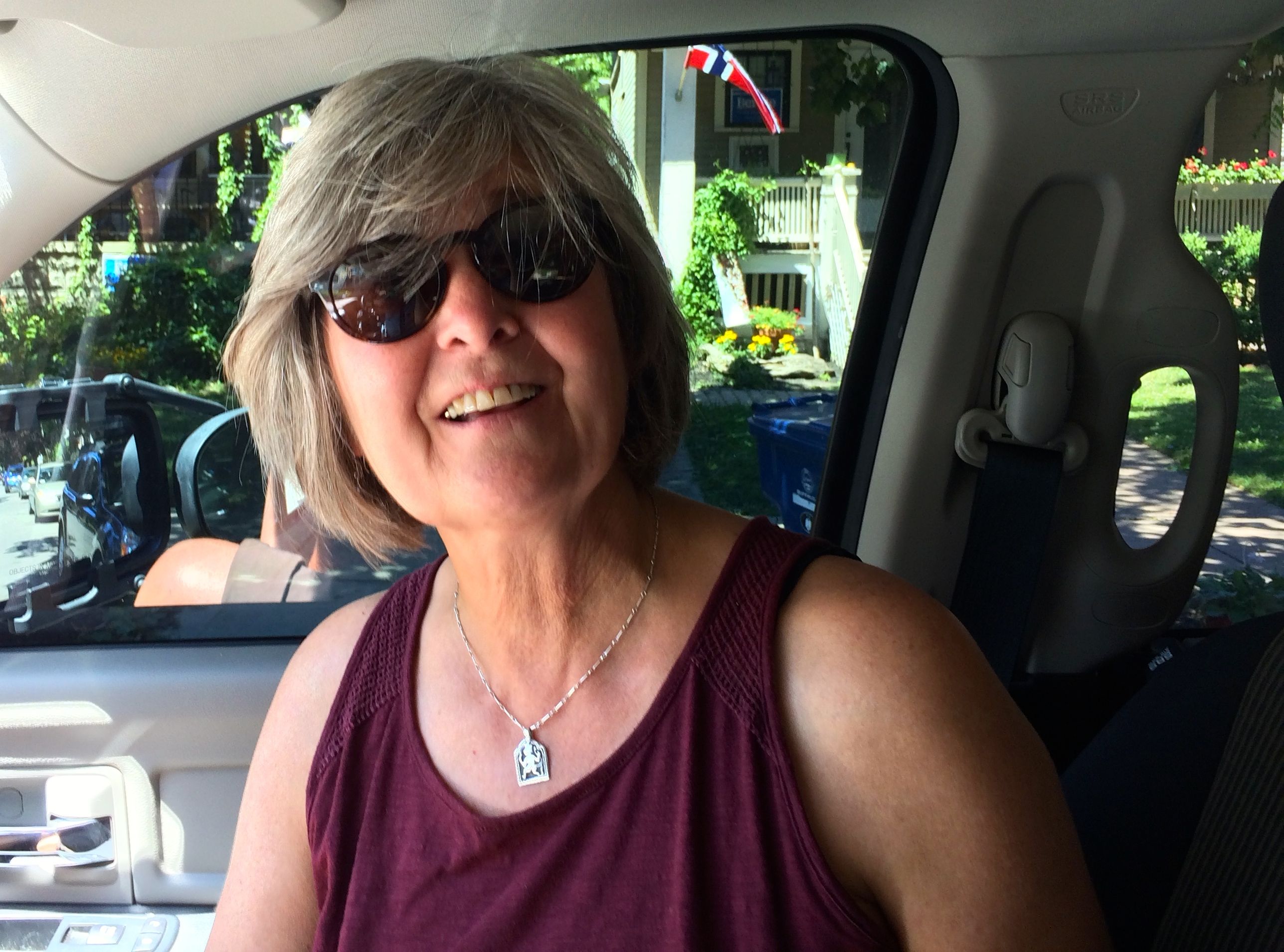
I also met up with Patricia, a fellow-Airstreamer. We met up in a campground in Texas last winter and we were thrilled to find that we both called Buffalo home.
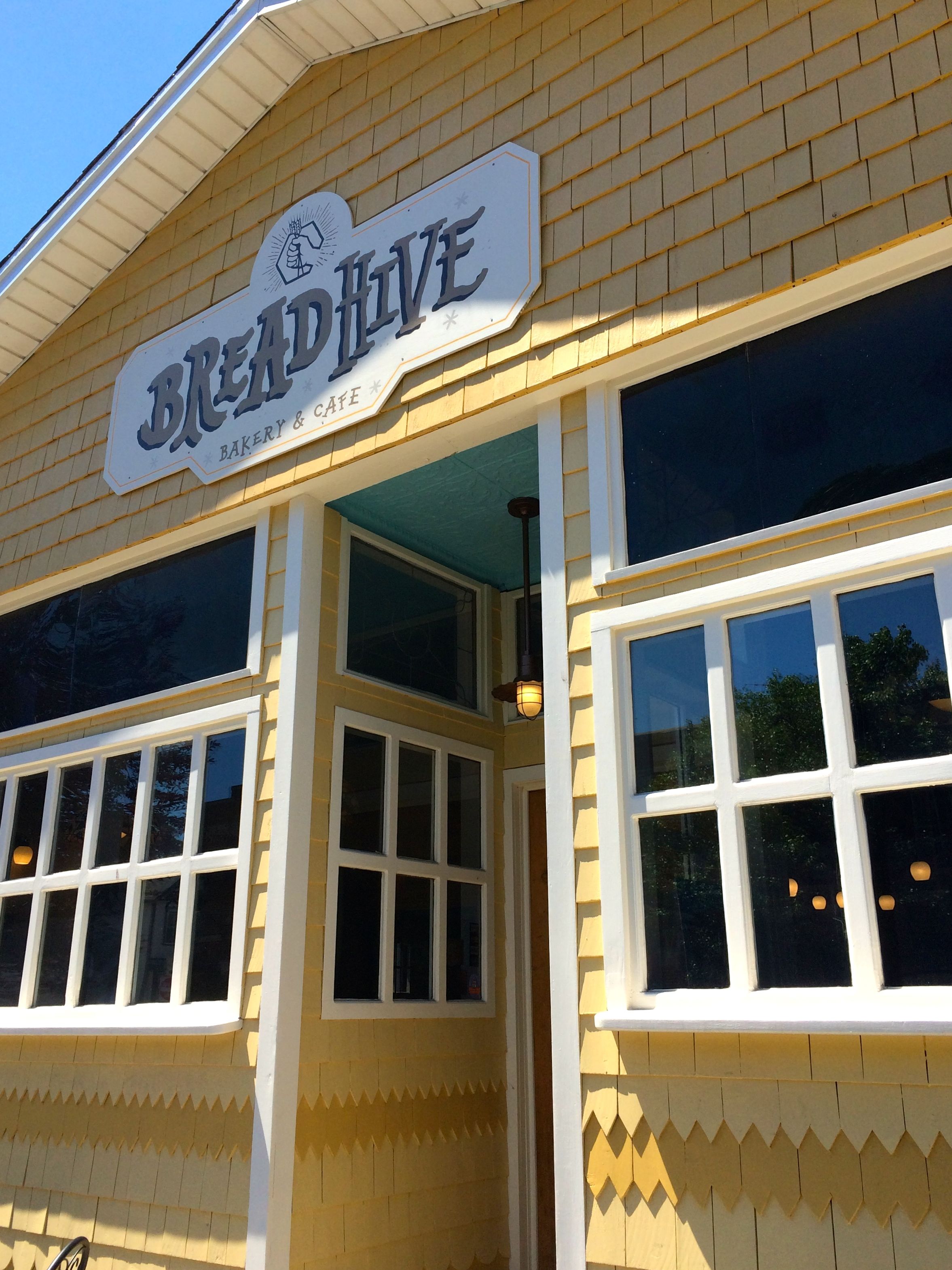
I asked if we could go to a new restaurant – well, at least new to me. She recommended a cool place called “Bread Hive”.
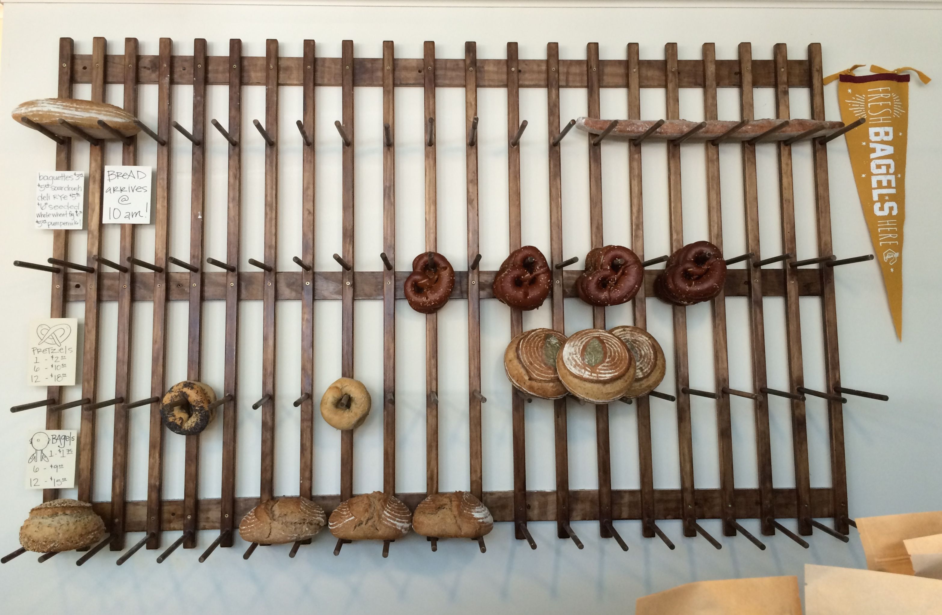
They had a really interesting rack for the bread they had for sale. We were there for a late lunch, so I imagine that they had a larger stock for sale earlier.
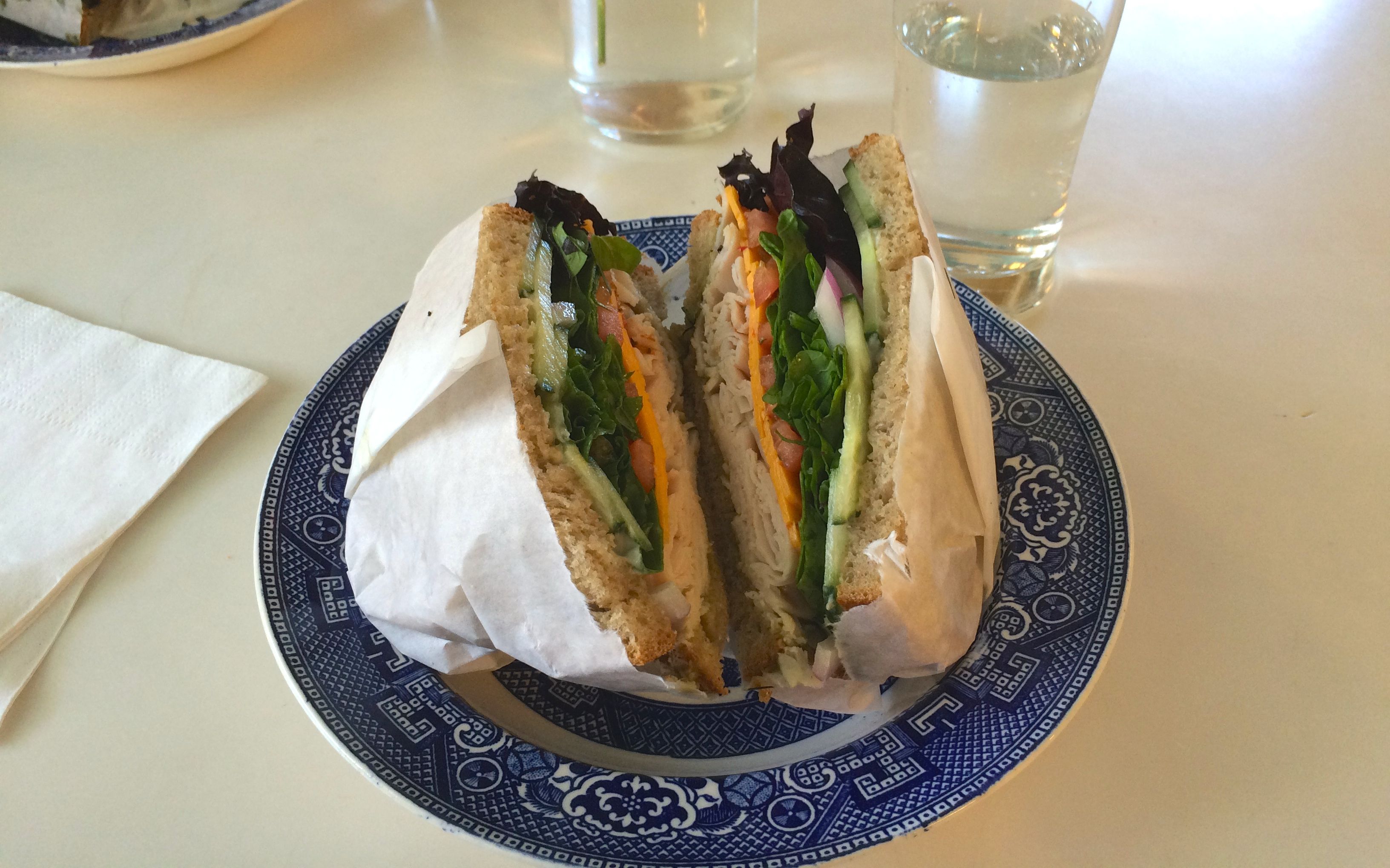
I had a beautiful sandwich on a beautiful plate. What a treat!
Patricia is now doing some Airstreaming of her own. She’s heading out west on a long, long trip.
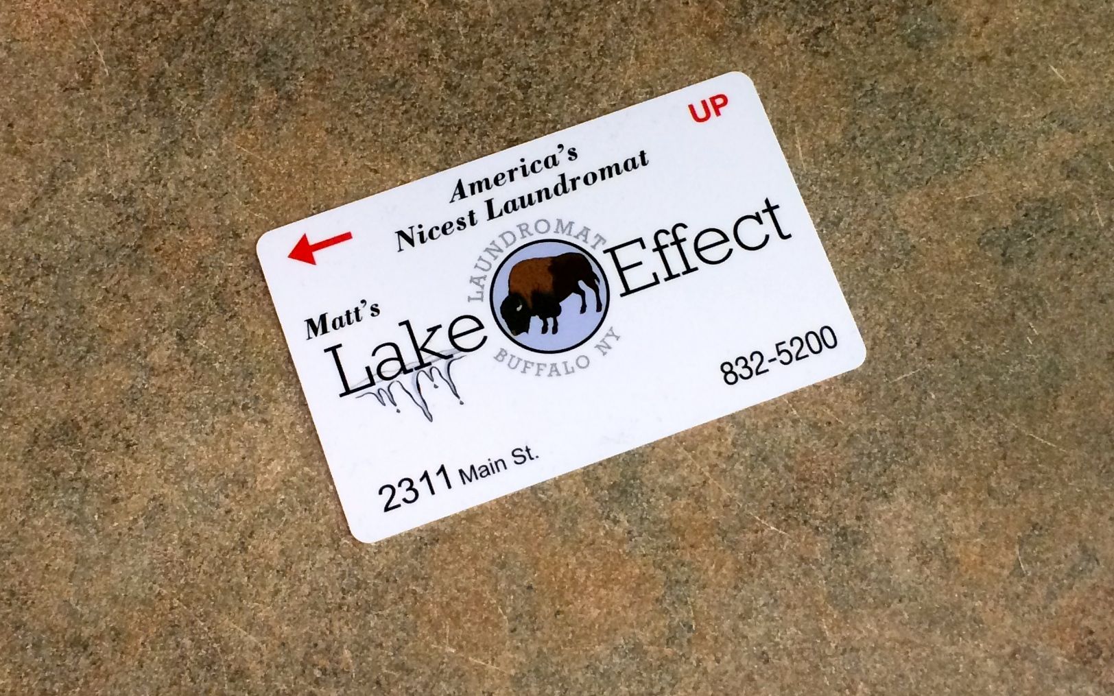
Of course, I also had the ordinary stuff to do. Laundry. I went to Matt’s Lake Effect Laundromat. I had to buy a card to work the machines. It was $1. I can’t believe all the ways people come up with to squeeze a little more money out of you. After I bought the card, I had to load it to pay for the machines. When I was done, I gave the card to the attendant and told her that she could pass it along to someone else who came in without a card.
It was a nice laundromat, though.
I stopped at Trader Joe’s, too. I love their Canadian White Bread, and I have only found it in the Buffalo store. Oddly enough, the Canadian White Bread is made in the U.S.A. They had one of their reusable bags framed and hung in the restroom. An Airstream! I looked through all the bags for sale in the store, but they didn’t have any. My guess is it was a bag from another year.
Craig also had me over for a movie night. We saw Michael Moore’s “Where to Invade Next.” If you haven’t had a chance to see it yet, I highly recommend it. It is a hopeful movie.
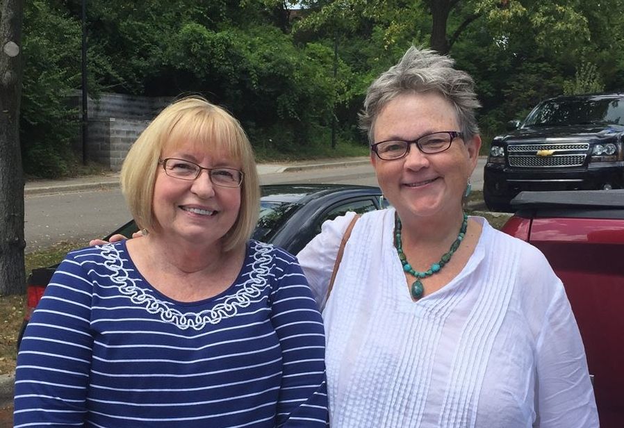
I got to hang with my sister, Amy. It was good to see her!
I got to see my nieces, Sarah and Katie. Katie was in the middle of a softball tournament, and I went to a game. She looked good to me, even if the team didn’t win the game I saw.
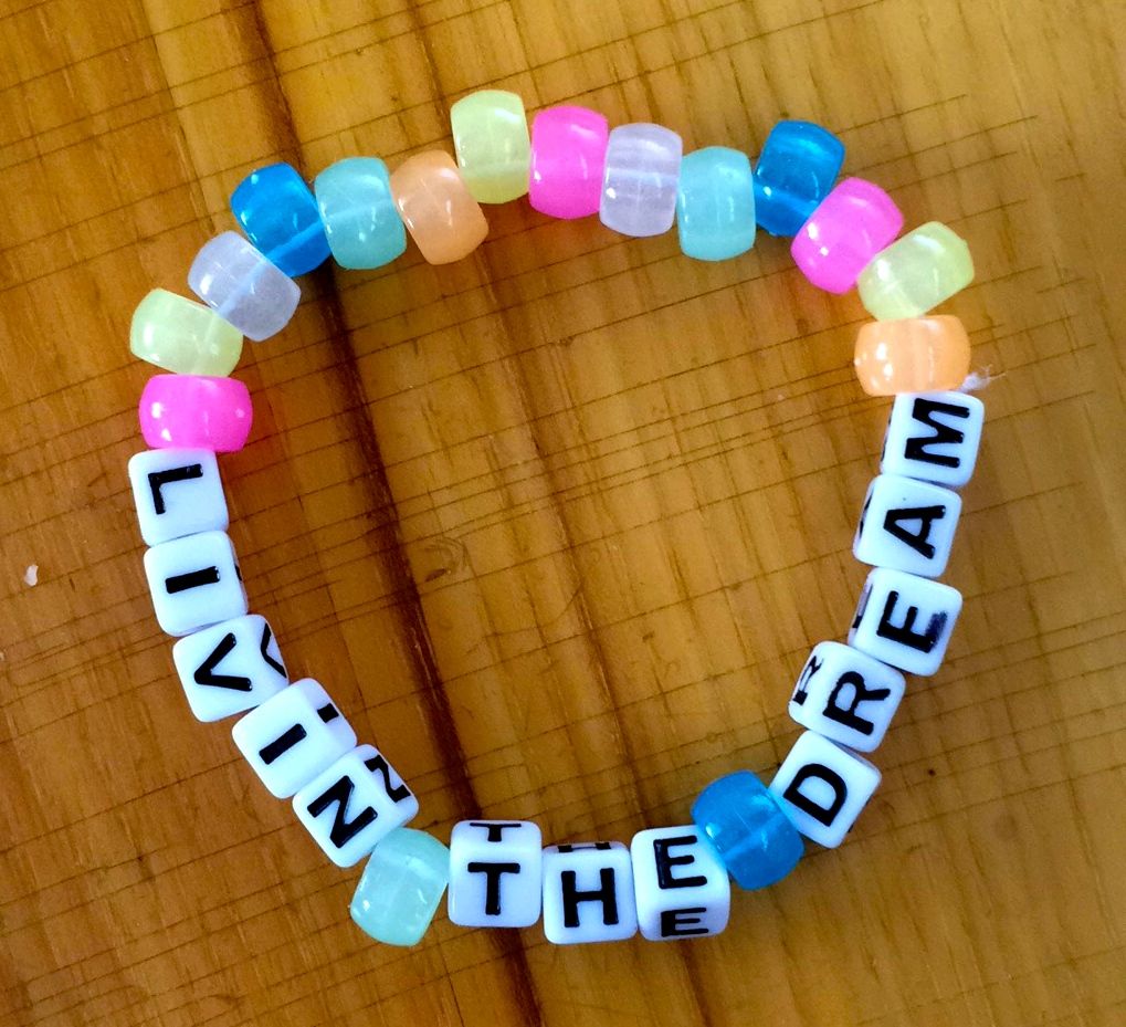
Sarah is an artist and was getting some crafts ready for a sale. She offered to make me a bracelet and asked me what I wanted it to say.
Well, what else could I say? I am truly livin’ the dream!
(Get it? The first and last letters are round and in the middle…oh, you get it? Just not funny…okay…)
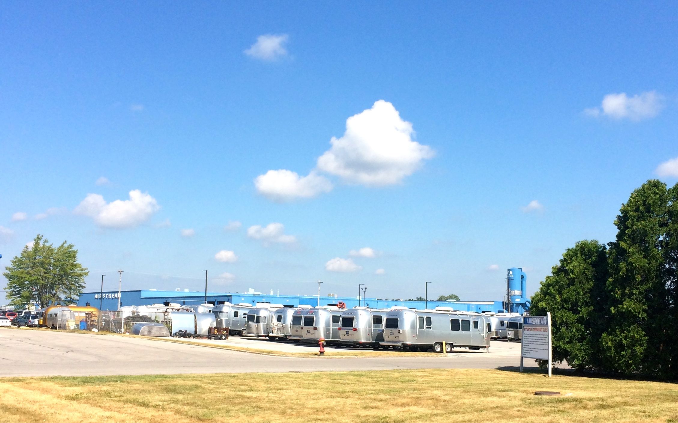
Anyway, I had noticed some things on Flo the Airstream that needed attention. There were some things the service center that took care of the hole I made in her side hadn’t done quite right. Luckily, I convinced the manager at the service department at the Airstream Factory in Jackson Center, Ohio, to work me in, even though they were tremendously busy.
Here’s a shot of the back lot with Airstreams awaiting service at the Mothership. I spent the night at the Terraport, which is their complementary parking for people waiting for service or after they pick up their Airstreams.
I checked in when I got to town and reminded Chris, the service manager, of what we had discussed via email. He told me to come back in the morning. Early in the morning – well, early for me – 8:00. He set me up with Artie who looked at what I needed done. He got his tools and supplies and had me fixed up in about 20 minutes. He told me to check in with the office around 10:00 for the bill. When I went back in, Chris told me that there would be no charge.
NO CHARGE?!
Wow! Airstream is certainly a classy organization!
I headed toward Lake Erie, using paper maps. I couldn’t get a signal to save me. Luckily, I have loads of maps! I skittered across the state on a variety of two-lane highways. My usual route to Buffalo was on I-90, which would have taken me right through downtown Cleveland. With the Republican National Convention getting ready to launch a few days later, I did not want to take any chances on having roads blocked or getting caught in the middle of some sort of demonstration.
I managed to get to I-90 somewhere east of Cleveland. I ended up spending two nights at Evergreen Lake Park in Ohio at the Conneaut exit. I was kind of tired after about ten hours of driving in two days.
One thing I found out was how to pronounce Conneaut. The first part seemed pretty straight-forward, but the last part was just too many vowels. From what I’ve been told, it should be pronounced “Con-ee-OT” with the emphasis on the last part. I was thinking it would have been something like “con-OIT”.
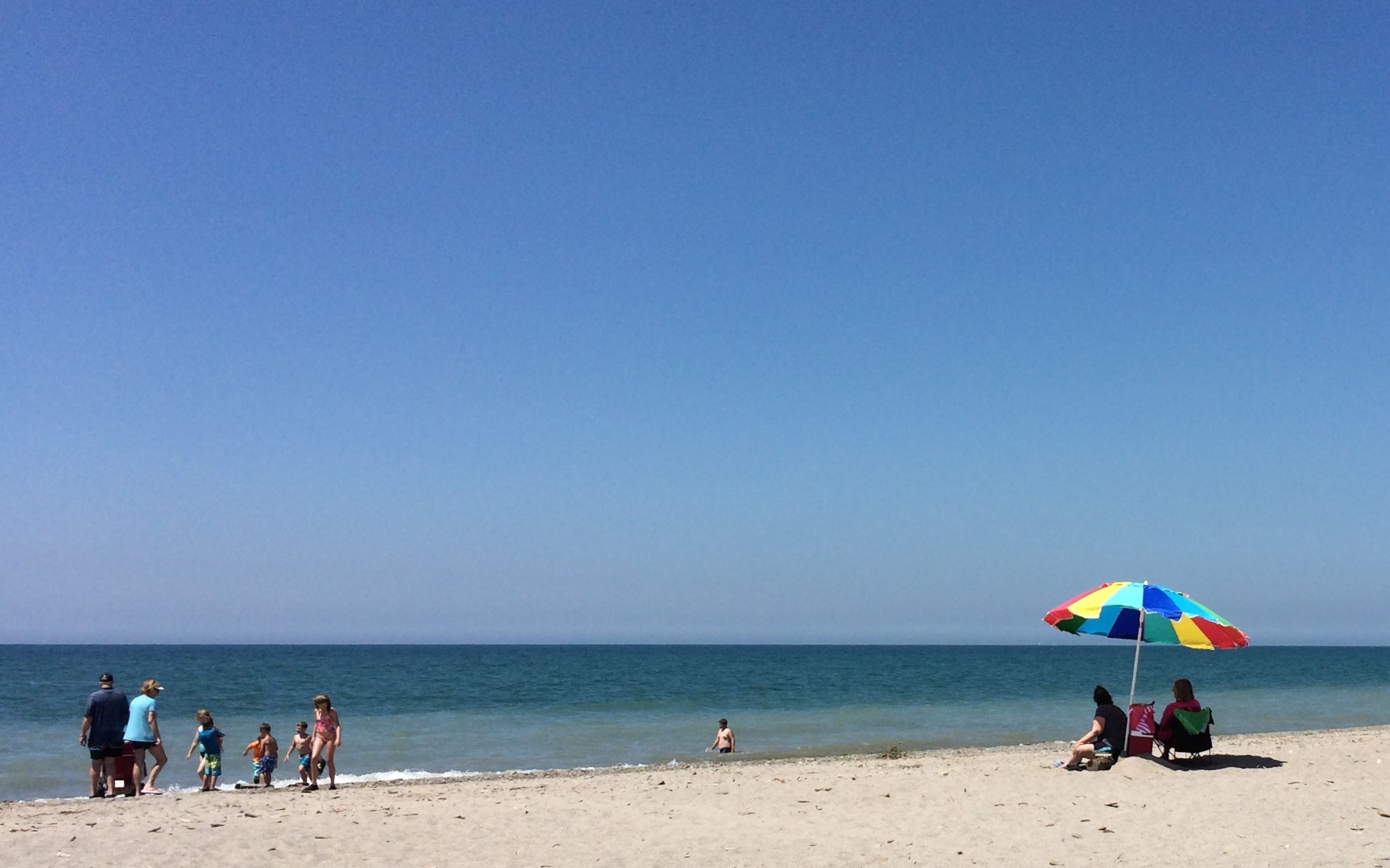
I went looking for something to do while I was in town, and I saw that they had a park right on the lake. Lake Erie – my lake! I set out to go enjoy it.
After growing up in the Buffalo, NY area and visiting family on the Canadian side of the lake, I guess you could say I’m just a Lake Erie sort of gal!
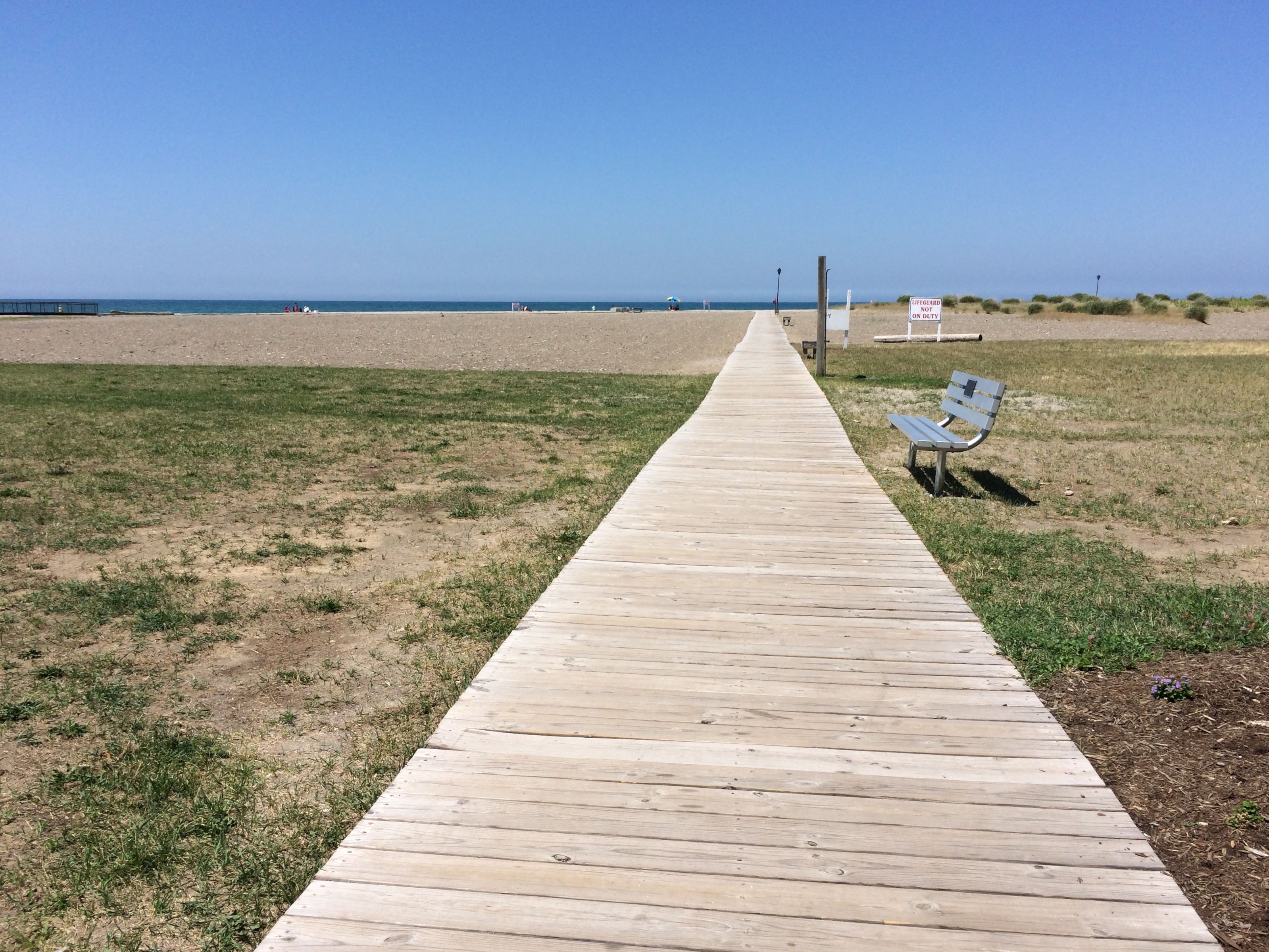
In the information about the park, it mentioned the boardwalk. I had in mind a boardwalk like in Atlantic City. I wondered how there could be that sort of development here with no advertising. It turns out that there is a boardwalk running from the parking area out to the beach.
When the boardwalk gets close to the water’s edge, it meets up with a boardwalk running the width of the park’s beach.
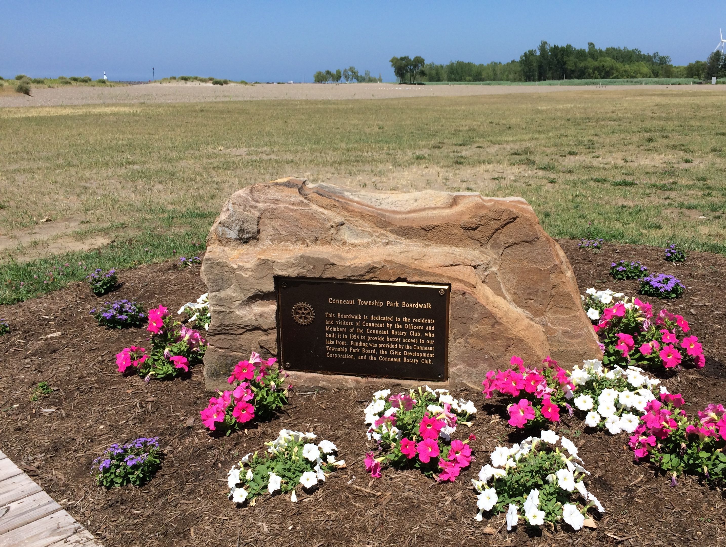
The plaque on the boulder at the beginning of the boardwalk lets us know that it was a 1994 project of the Conneaut Rotary Club, along with funding from the Conneaut Township Park and the Civic Development Corporation. We all do better when we work together.
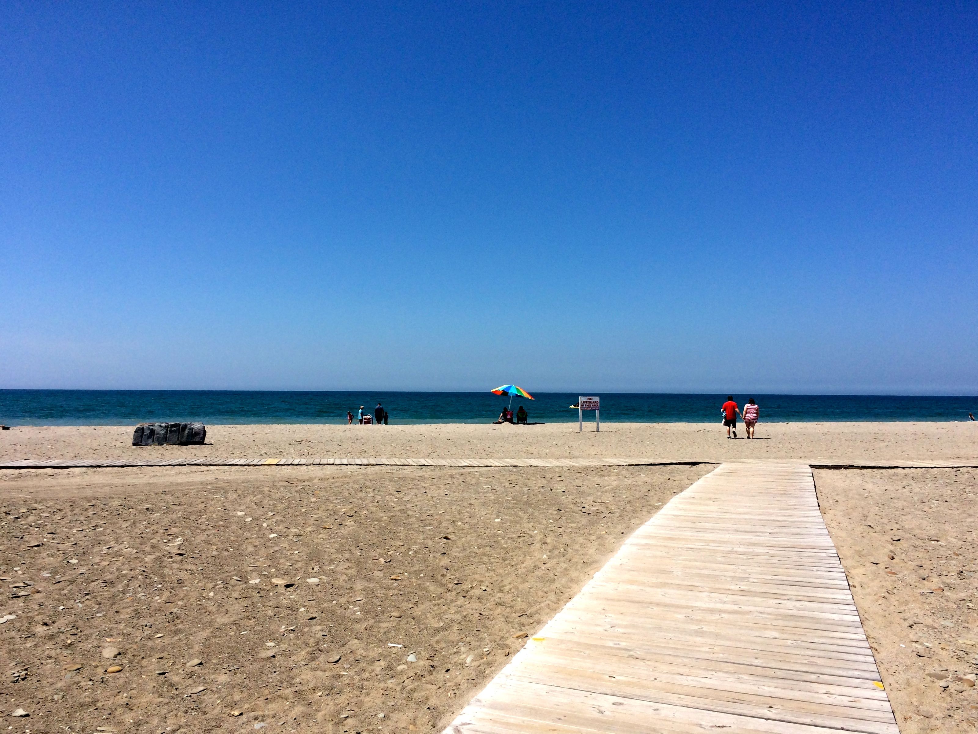
It was a lovely day, with all sorts of people enjoying the sand, sun and water.
I was captivated by this log being rolled about by the waves. It is estimated that there have been at least 8,000 shipwrecks in Lake Erie. Lake Erie is known for its seiches, which are enormous waves that occur especially when the wind blows from the southwest to the northeast, which is to say along the length of the lake. Who knows? Maybe this log is actually part of the mast of one of those 8,000 ships that have gone down in the storms.
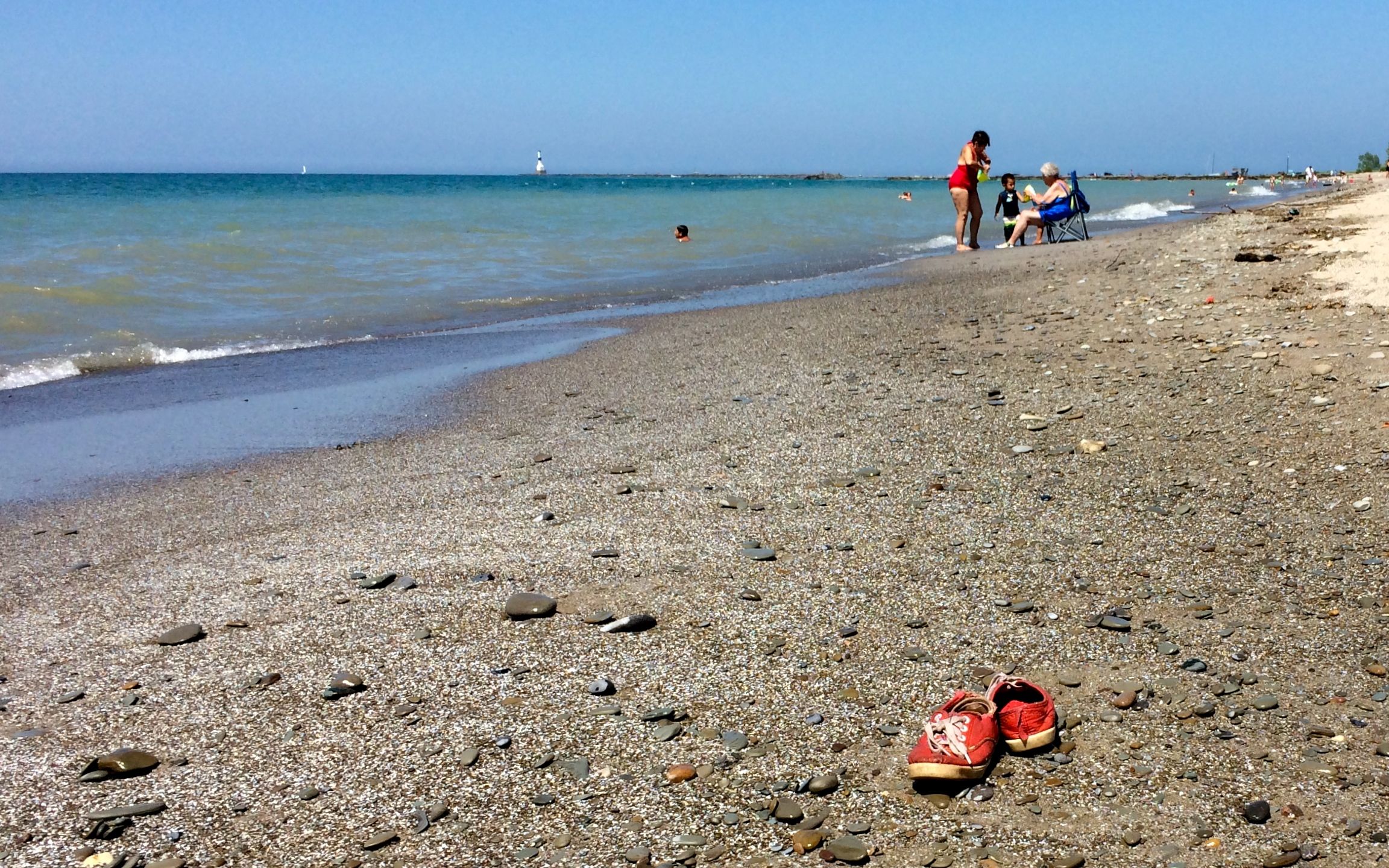
I enjoyed myself collecting rocks along the shore. These red sneakers seemed to be left so carefully. I hope the owner remembered to come back for them.
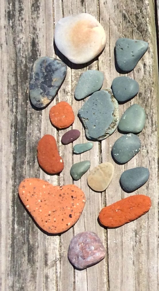
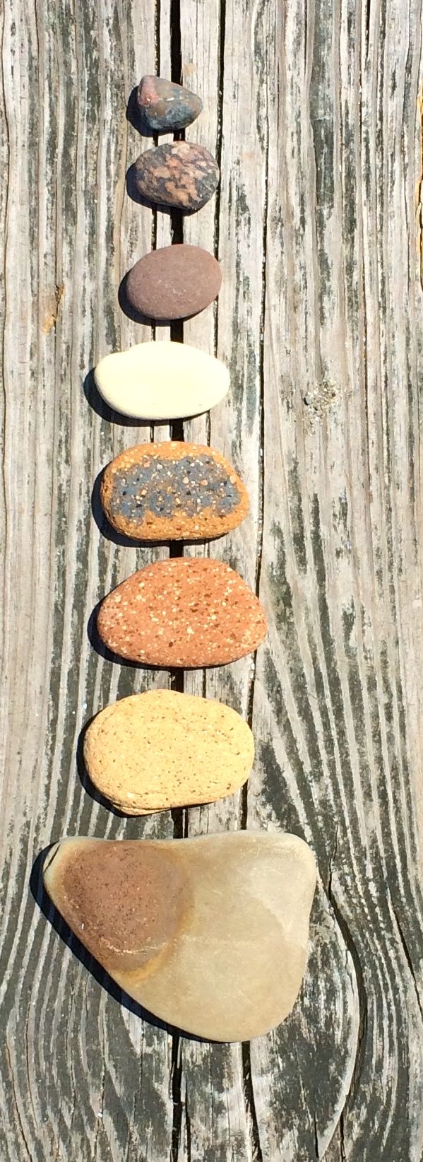
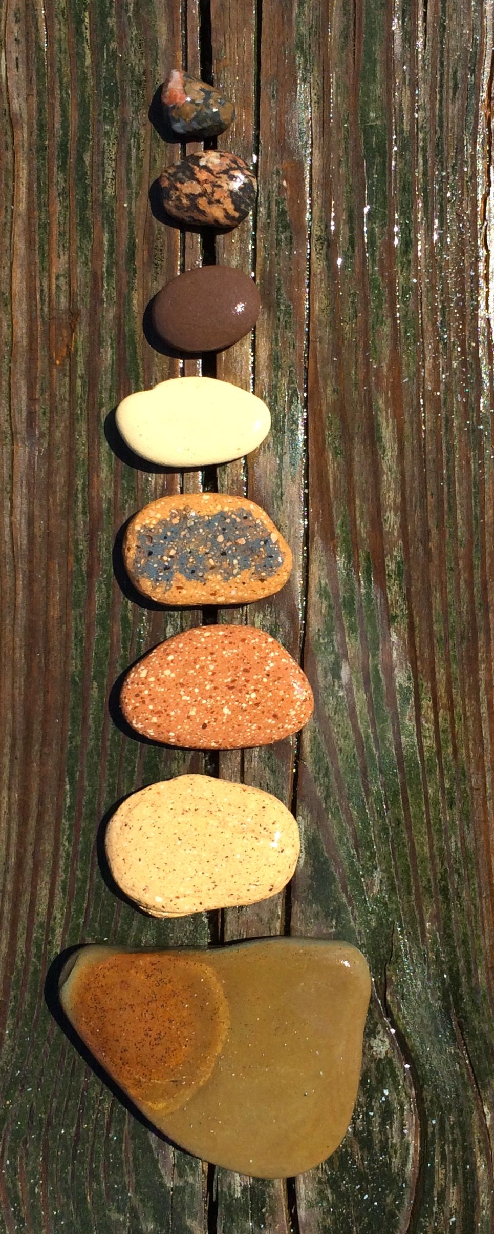
Of course, with my “catch and release” rock collecting, I had to document what I had found.
This was my red and green collection. After I arranged them and took the photo, I had to see if water enhanced the colors.
The greens really pop! Let’s see another collection.
Here are the dry brownish rocks.
And here they are doused with water.
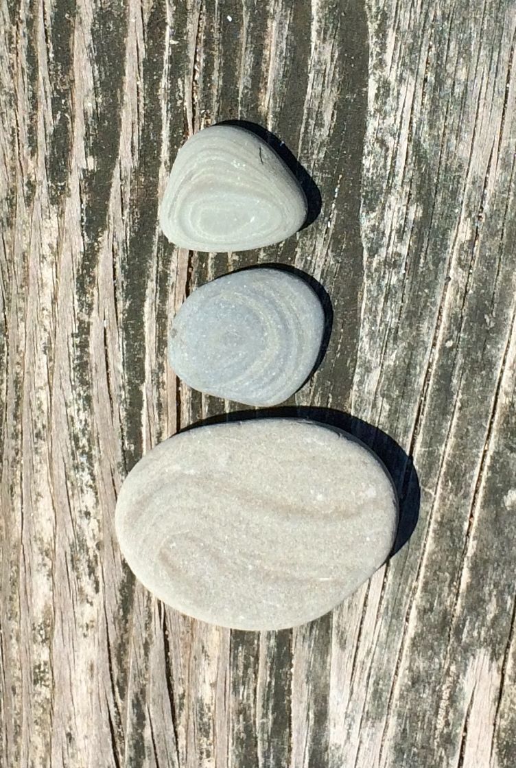
Here are the dry layered rocks.
And here they are wet. Okay, one more group of rocks…
Assort dry rocks.
And assorted wet rocks.
Okay, I’d had my fun – and I imagine I provided amusement for the people passing me on the boardwalk. How many 60 year old women collect rocks, and then take pictures of them dry and wet? Well, as I said, I’d had my fun. It was time to release them.
There they are – back in their natural habitat!
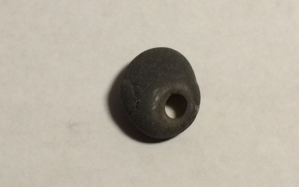
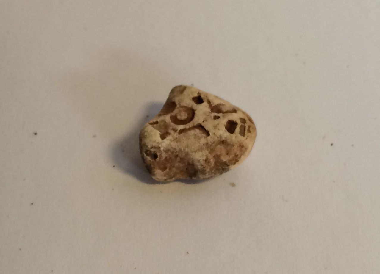
I did find one rock that I kept.
It was the most perfect smooth small rock with a lovely hole in it. It just may become a piece of jewelry some day!
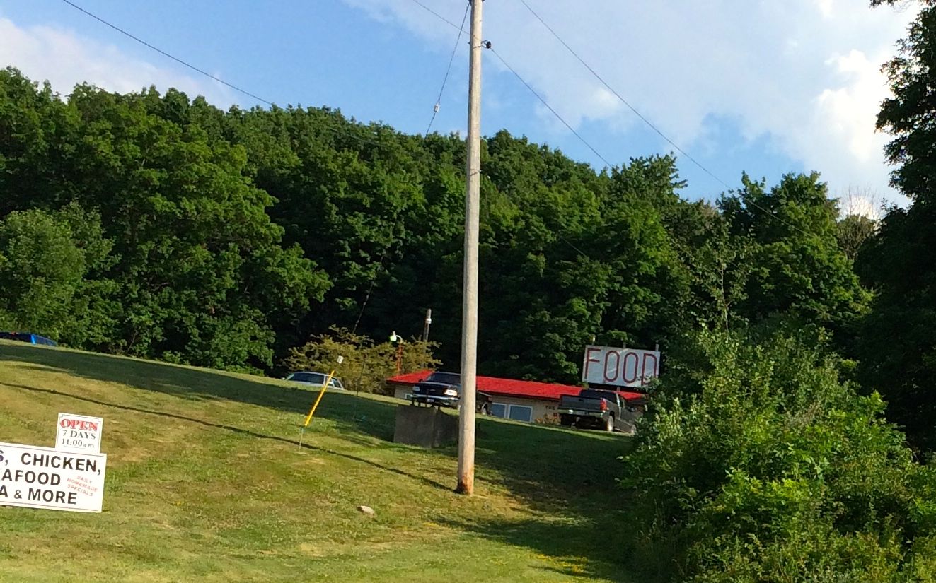
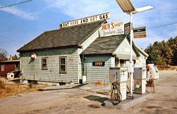
I went off to find dinner. Who can resist a sign proclaiming “FOOD”? Well, at least it didn’t say “Eat here and get gas.”
Photo borrowed from the Internet somewhere…
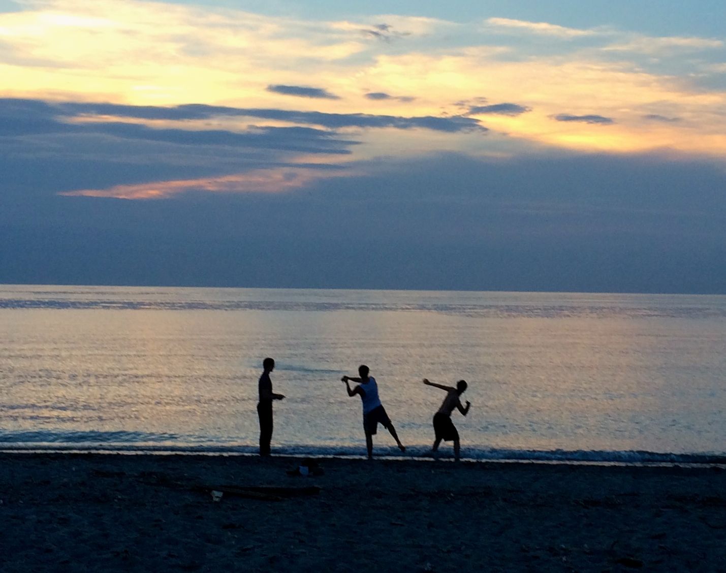
I stopped back at the trailer for a bit. There was a quiet tapping at my door. I opened it up and was greeted by the smiling face of a man I had met briefly while I was in Kalamazoo. His name was Francis and he was from Australia. I wish I had asked him how he got here and if he was returning, but I didn’t think to ask. I guess I didn’t want to be nosy. Also, it was time to head back to the beach for sunset!
The clouds were rolling in, but the sun kept peeking through. I enjoyed watching this young men skipping stones. There was a campfire with some people playing guitar and singing. You’ll just have to take my word for that, though, as I couldn’t get a decent photo.
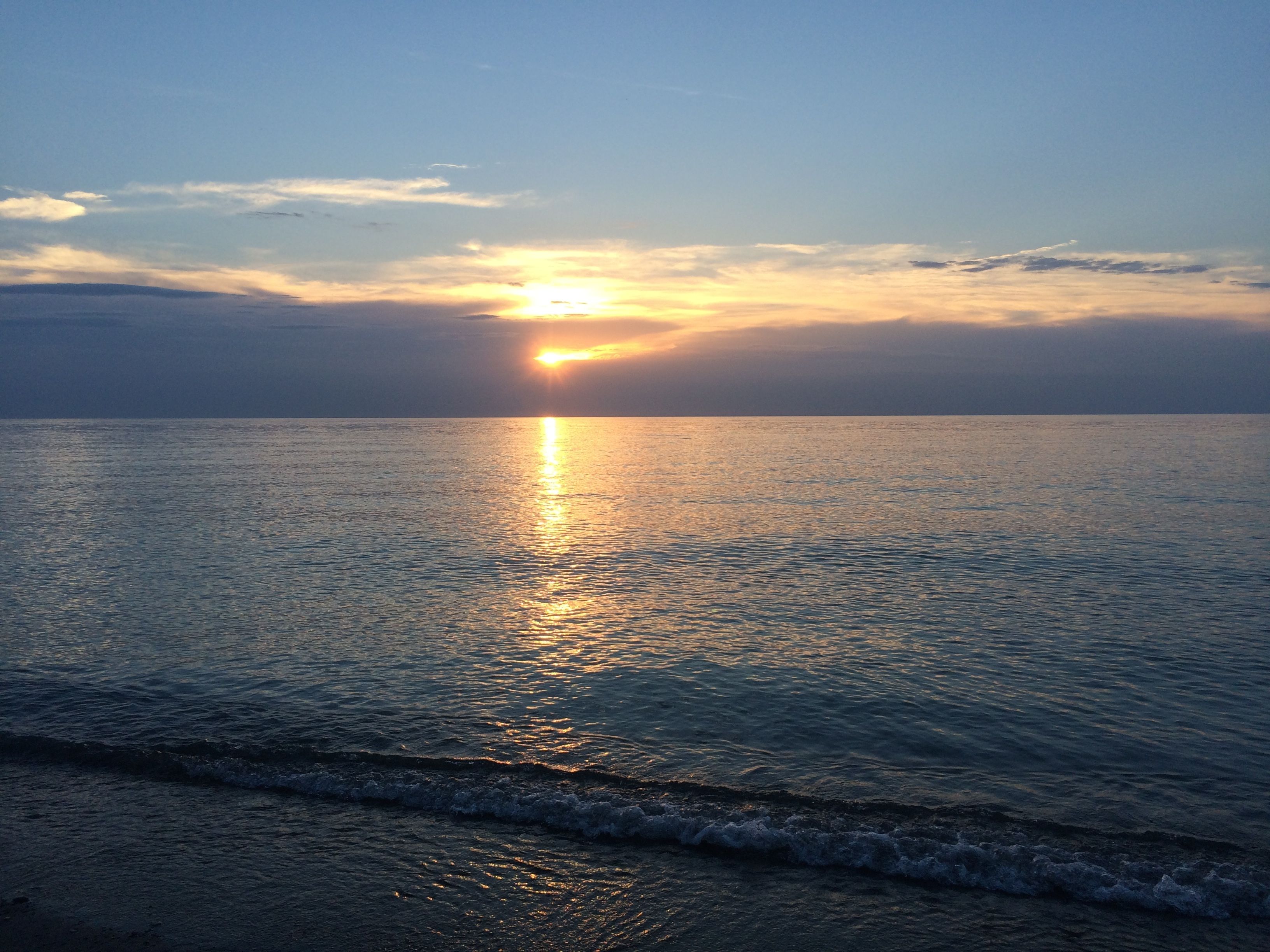
The sun came out for one last peek. I snapped a photo and decided to call it a night.
After my stop in Ottumwa, I was getting anxious to get to Kalamazoo. I had a jam-packed stay planned, full of taking care of business as well as seeing friends.
I left Ottumwa as early as I could and drove until I couldn’t drive no more, which took me to Ottawa, Illinois. I found a listing for a State Park, Ilini State Park. I entered, and the campground host told me that they did have a few sites left. I went to check them out, but decided that they were too small and too muddy. I decided that I needed to find something else.
I looked for other options. One place I called didn’t answer their phone, so I went with the second place I called, which did answer the phone. I have to say that it was an unusual park. I think it was one of those places that makes the majority of its money off long-term seasonal rentals. They have trailers tucked into the trees, and they are rigged up so that they will never move again. They take the V out of RV. They may be recreational, but they’re not vehicles anymore.
I was met at the gate by the woman I spoke to on the phone. Since I told her that I was less than five minutes away, she was waiting for me. She opened the security gate and told me to follow her. The first thing that gave me pause was the bridge over the creek. It was a slab of reinforced concrete that looked like it needed some shoring up.
The next thing that made me wonder if I had made a wise choice was when I had to shift into 4 wheel drive to get up the hill to the campsites. I was scattering gravel as BART struggled to get Flo up the hill. But, by the time I had gotten that far, it would have been harder to back out than to go forward, so, go forward I did.
I drove through the permanent sites and then through a very well-mowed field to a power station along the edge of the field. I wonder when they would ever fill up that enormous field. Maybe they rent it out for large gatherings. I did notice a gate to another road at the top of the hill.
Anyway, I paid the woman the $35 for the site. She told me that there would be some people arriving around 1:00 AM, after a concert. Wow! I couldn’t imagine navigating that route in the dark!
Before dark, I decided to head out and gas up for the last part of my trip to Kalamazoo. The route out and then in again wasn’t any less spooky. But, the campground had electricity, which was a necessity given the heat. The trailer cooled down nicely while I was gone. I rested up and was ready to hit the road early.
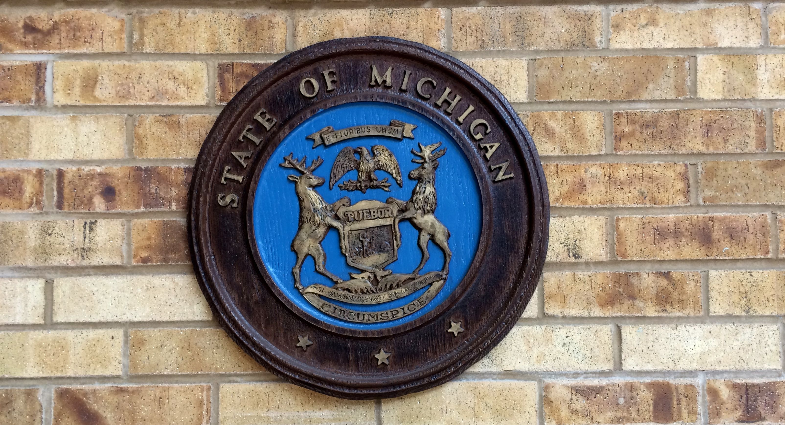
I left Illinois, drove through Indiana and stopped for a bathroom break at the rest stop just across the straight line. You know, I couldn’t figure out what was bothering me about this picture until I was preparing it for the blog. The seal of the State of Michigan is crooked! Really, guys…I think you can do better!
My reservation didn’t start at Markin Glen until the next day, so I spent one night at Cold Brook County Park.
I had a lovely, shaded campsite. It’s a little more rustic than Markin Glen, but they have electricity and water at the sites – although you might need a long hose – and they only charge $22 a night. If you have to make a reservation, they charge an additional $5. But, when I called the park and they told me that they had loads of sites and they encouraged me to hold on to the $5. I appreciated the advice.
The next day, I had two big tasks to accomplish: I needed to move to Markin Glen and I had a dentist appointment. I knew that I could park in a church parking lot near the office, but I thought I’d see if I could get into my site early. I gave them a call, and they told me to come on it – the site was empty. I was happy to be able to set up camp before I went to the dentist.
I think Cora was happy to be settled in for a while, too. I wonder if she recognized the campground? This is where I was when she joined me last year.
I had the maximum number of days booked at Markin Glen, which is fourteen. It’s not the least expensive public park I’ve stayed at. It’s $26 per night, and I had to pay the $5 booking fee. But, the sites include a concrete parking pad and full hook ups. It also has a small lake with an area for fishing and a decent bathhouse.
It’s also centrally located, if doing things in Kalamazoo is why you are staying there. In fact, if you bring a bike or are really into walking, you can easily make it to downtown from the park on the Kalamazoo Valley River Trail.
I had a few priorities on my list. Number one was medical appointments, for me and for Cora. Between doctor appointments and labs and such, I had seven “events” and Cora had two. When we left Kalamazoo, we had clean bills of health.
The other priority was having fun with friends. I have to admit that I didn’t do a very good job of documenting the people I saw. I did get some shots of the food, though.
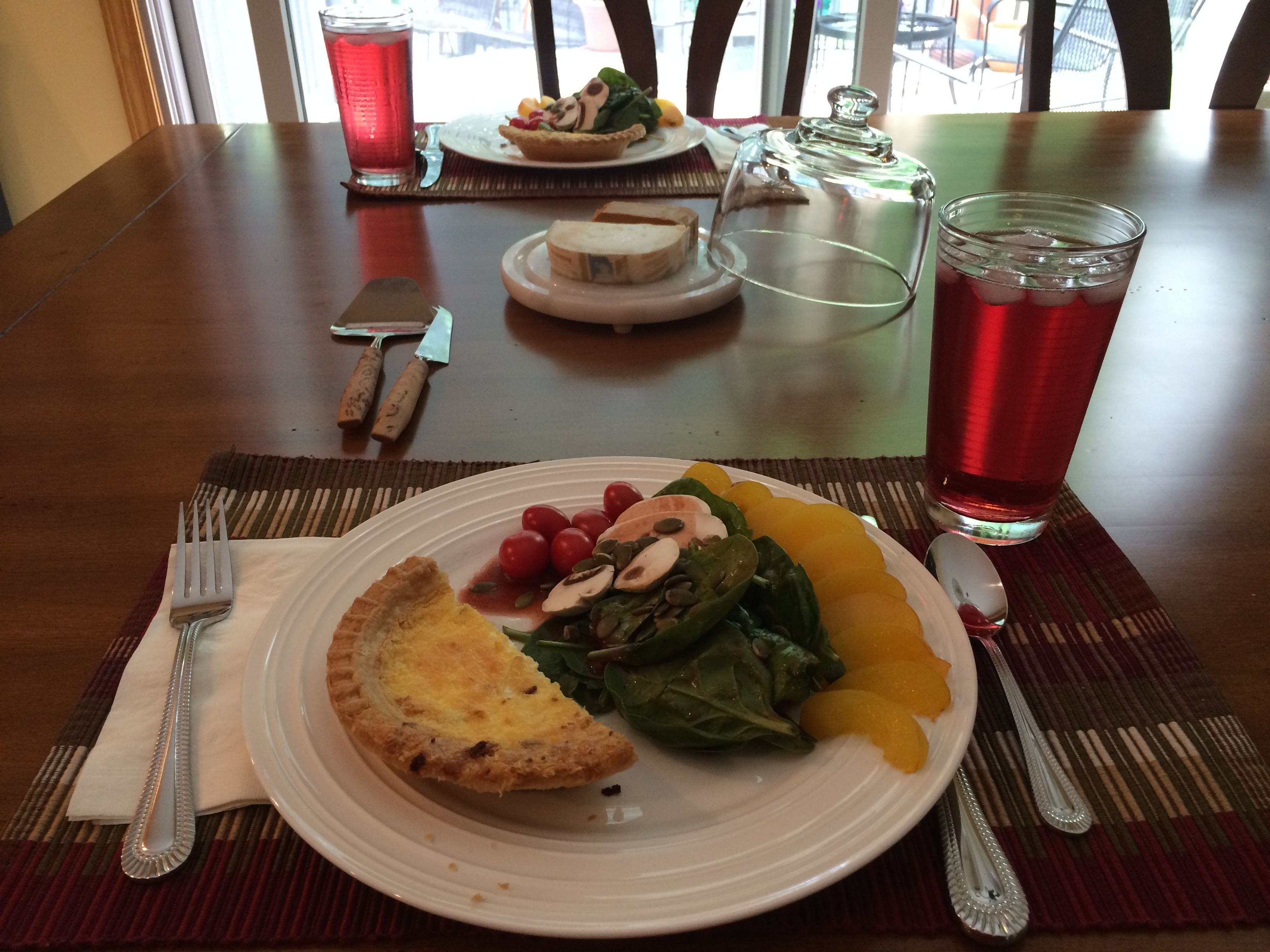
Here is the elegant lunch I had at Diane’s house. She also invited me over for an Independence Day cookout.
I met Linda at Food Dance in downtown Kalamazoo for lunch one day. It was good to catch up with her. I’m glad she was home when I passed through. This woman travels almost as much as I do – and she doesn’t have a trailer!
I also met up with a former co-worker, Narda, and her husband, Brian, and a friend, Cynthia. I forgot to take a picture of the food, but Brian snapped one of Narda and me before we got into our cars at the end of the meal.
I didn’t snap any photos of the delicious meals that I was invited to share with Ruth and Stu and LaRue and Paul in their homes. Nothing like a bit of home cooking with dear friends.
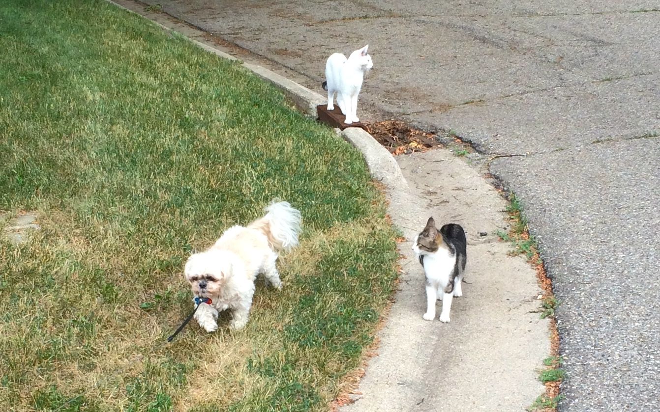
While we were LaRue and I were waiting for Paul to come home, we took the puppy for a walk, and the kitties came along. It reminded me of the Disney Movie, The Incredible Journey.
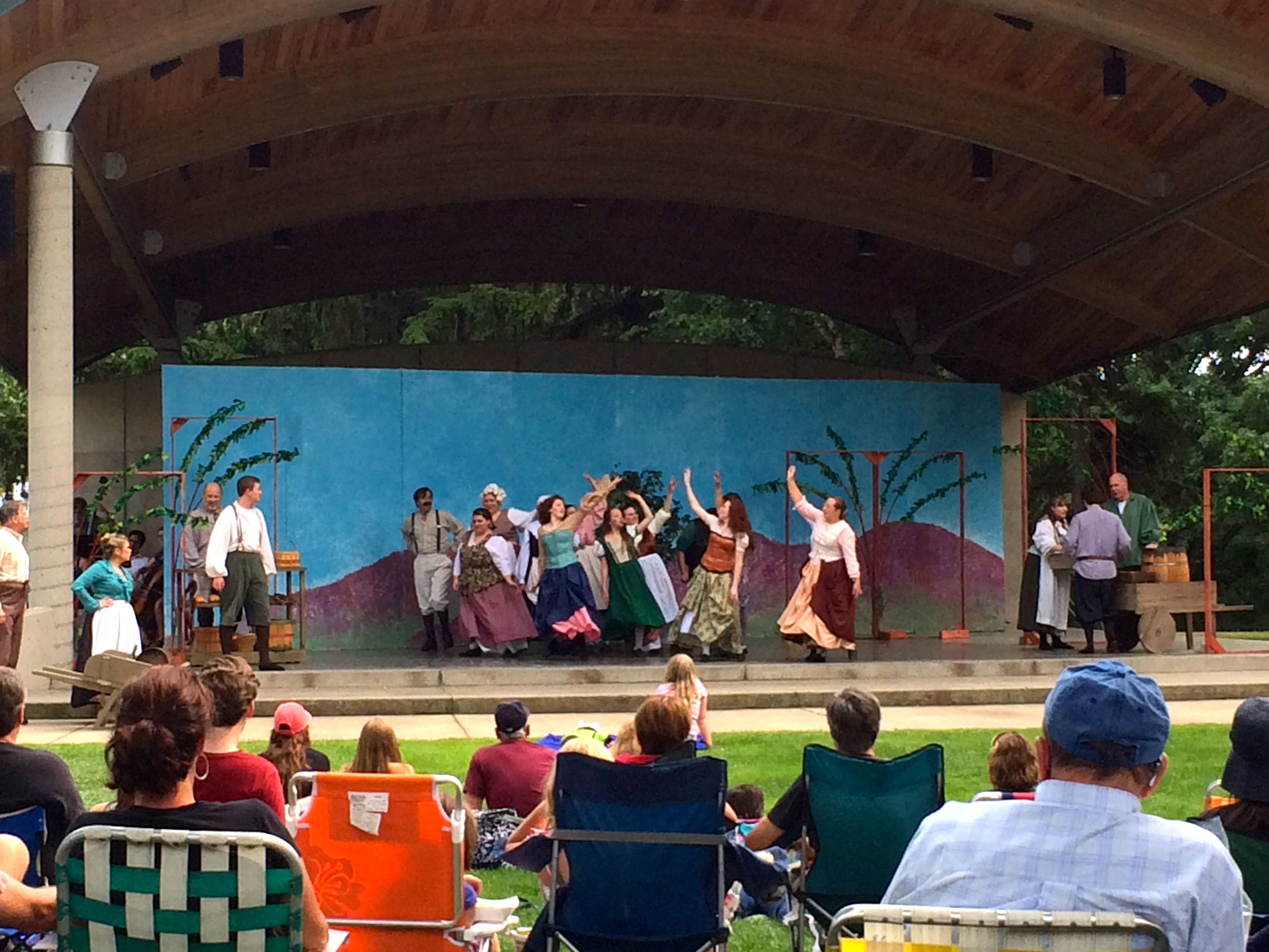
I also joined LaRue and Paul for a picnic dinner on the lawn at Kindleberger Park in Parchment while we waited to watch Brigadoon.
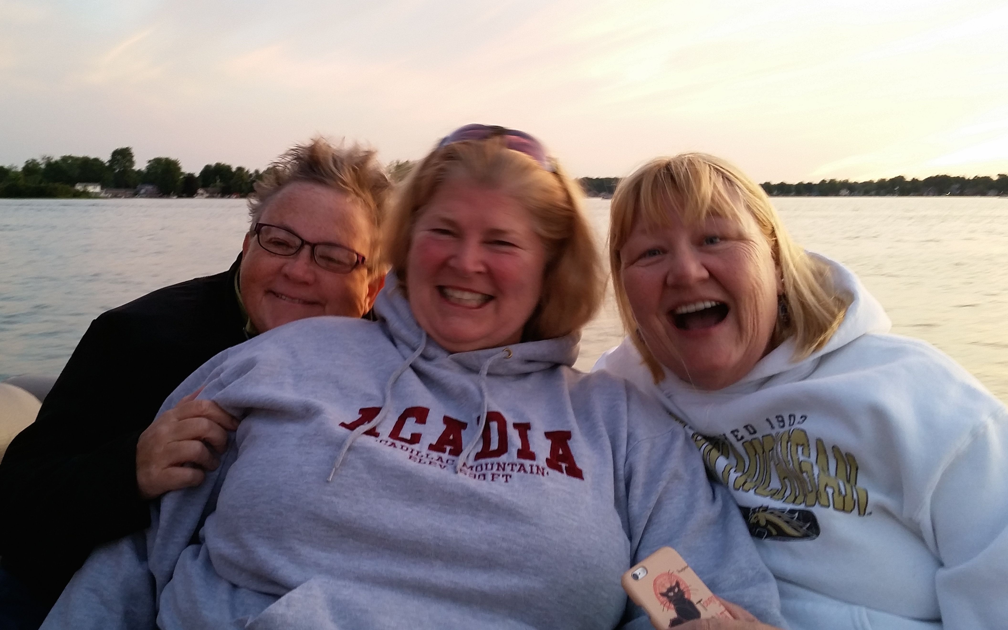
And then there was the Independence Day celebration at Gun Lake. What a great time I had at Amy and Tim’s cottage. First there was the community pot luck dinner. I brought cookies to add to the dessert table. Living in an Airstream has done nothing to improve my cooking skills, but I am great at shopping!
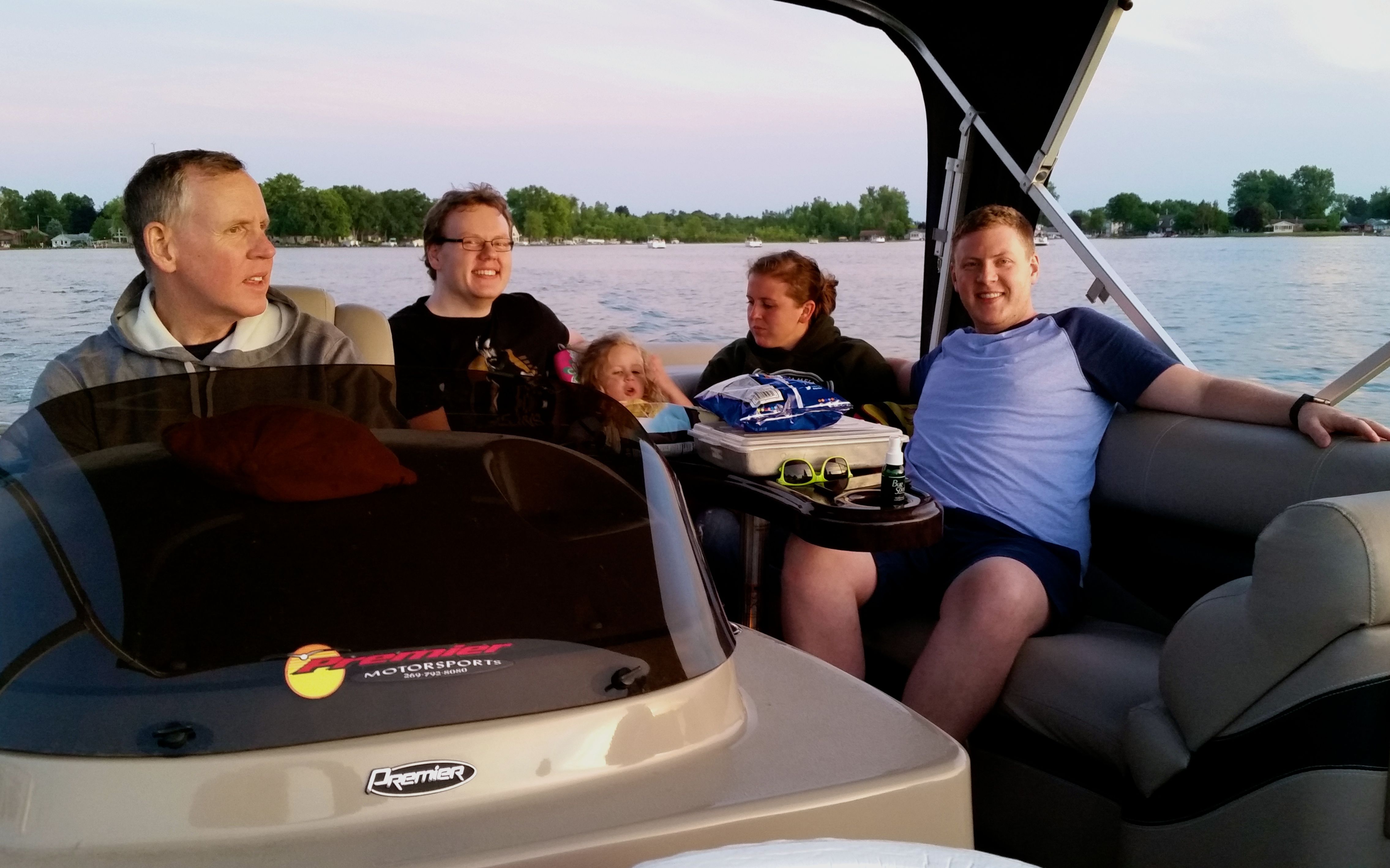
After dinner, we set out on the boat to get into place for the fireworks.
Here’s the crew in the bow.
And the stern folks.
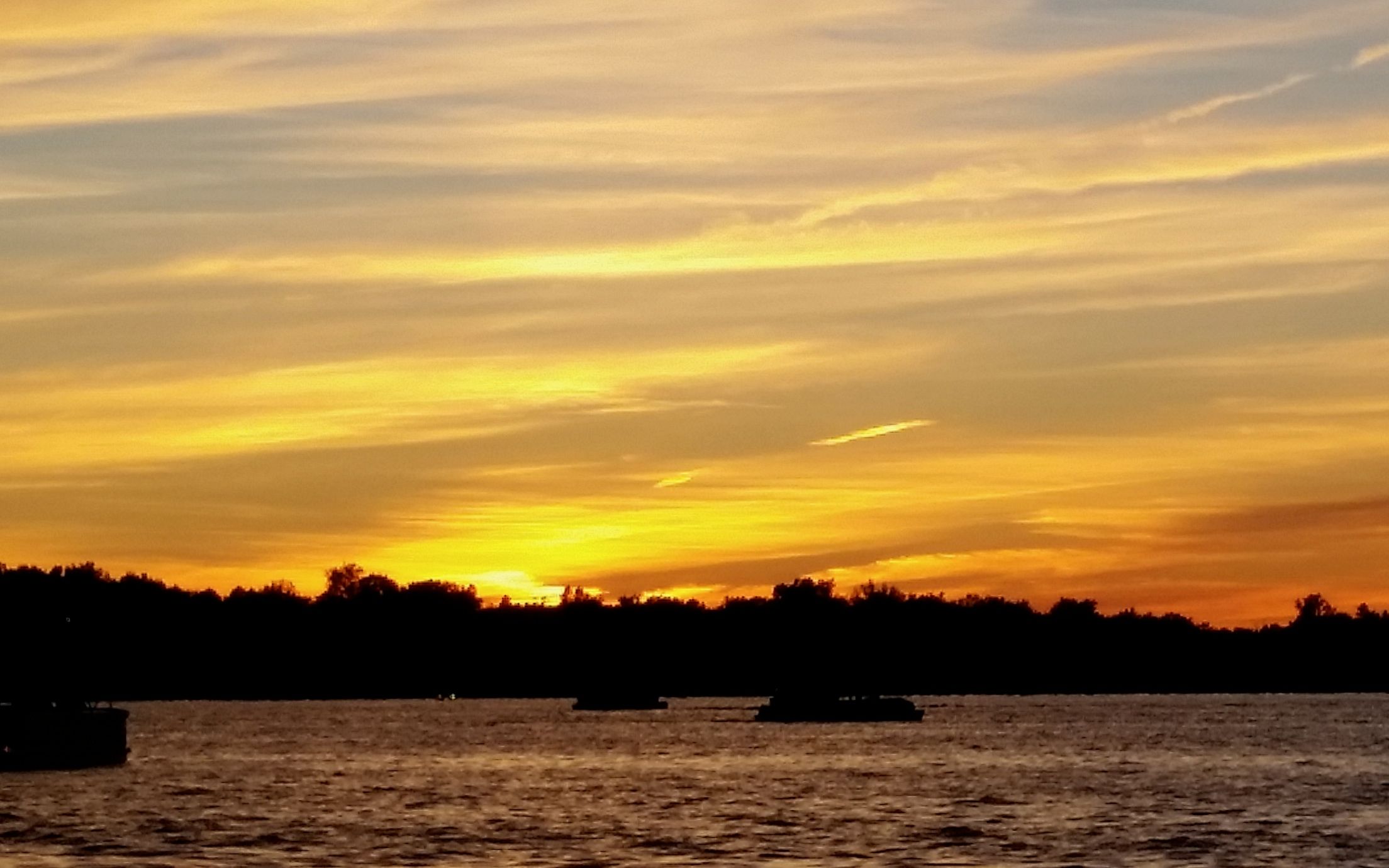
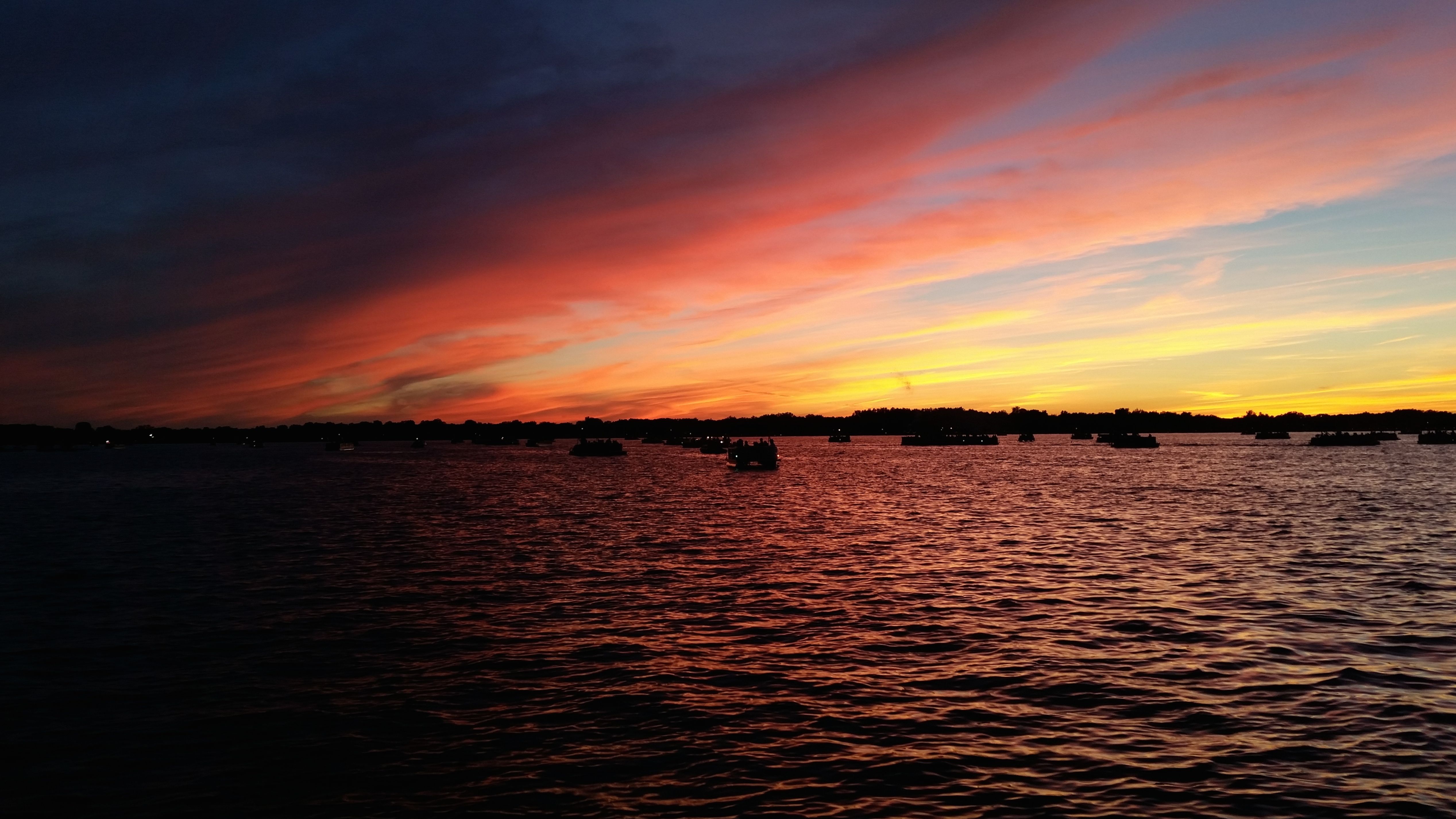
There was a glorious sunset.
It just kept getting more beautiful as night deepened.
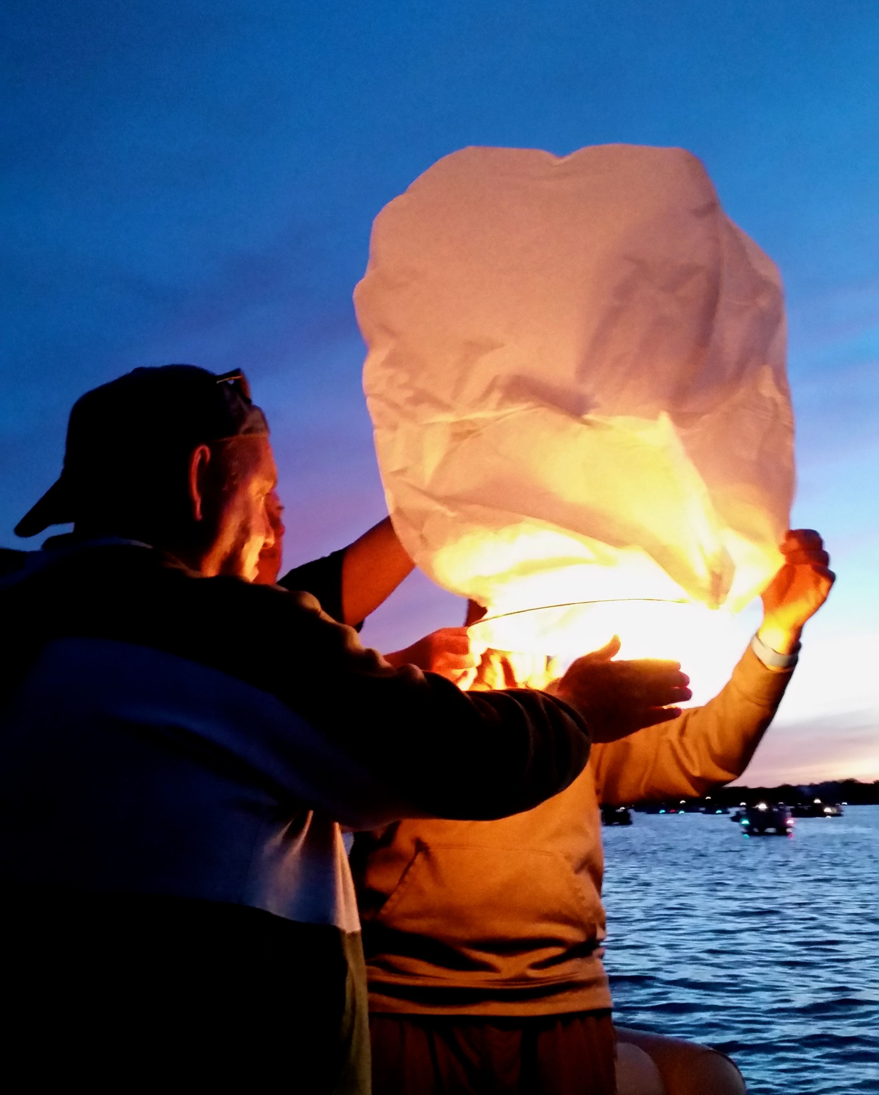
While we were waiting for the fireworks show to start, they tried to launch a Chinese lantern. The breeze was a little much at that time, though, and the lantern got blown back down into the lake.
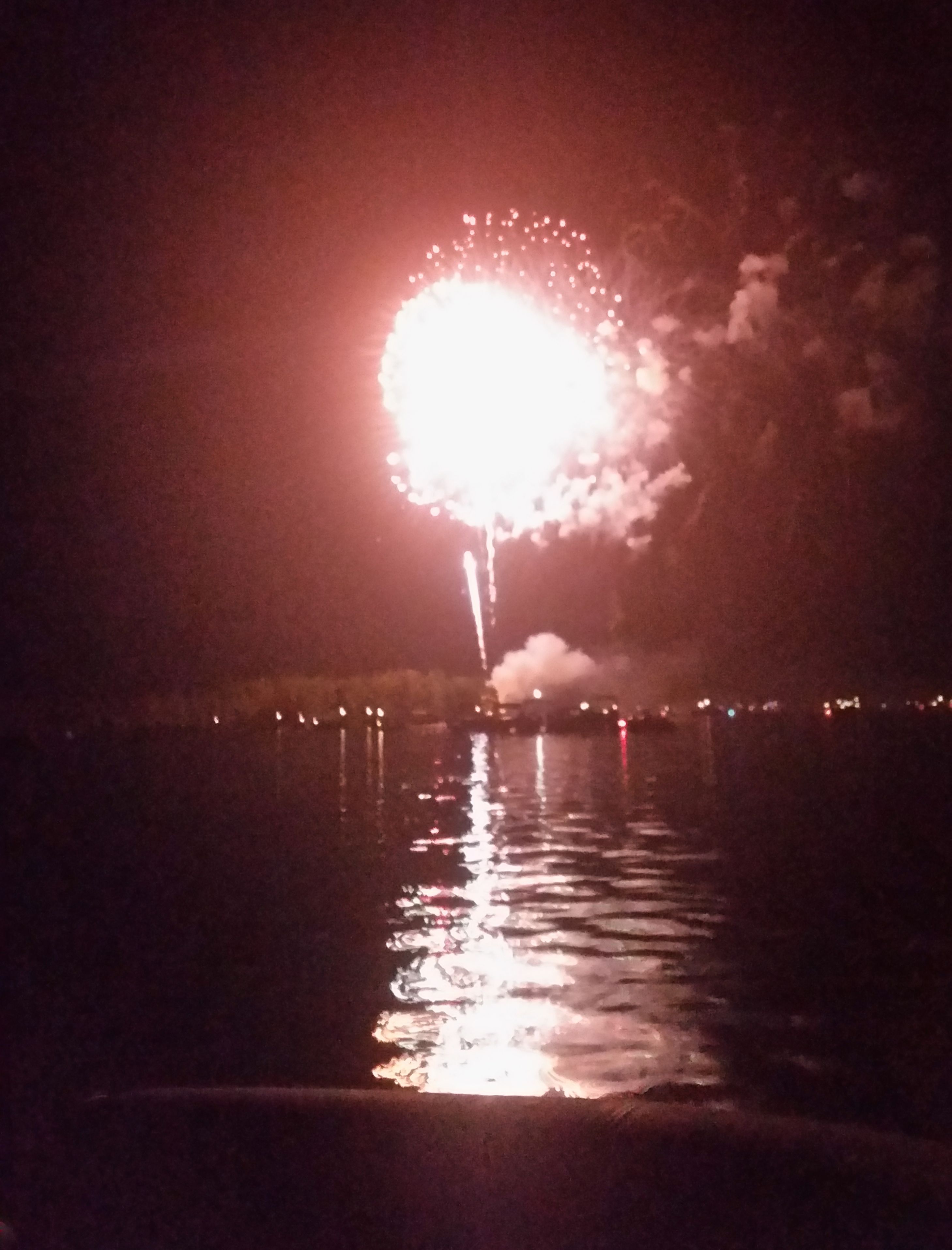
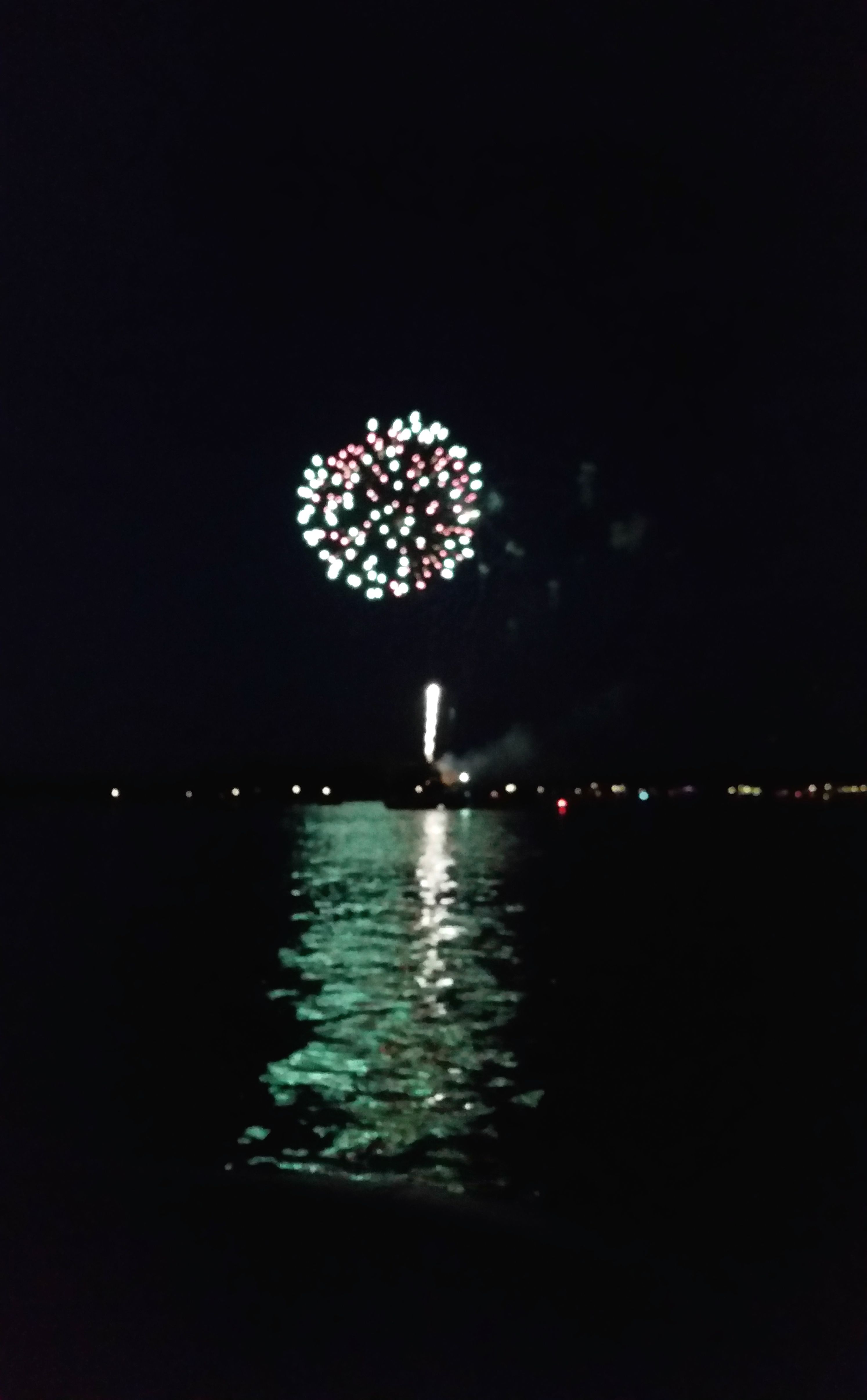
Finally, it was time for the big show!
It’s a little hard to get good fireworks photos with the camera on a phone, but take my word for it, it was a good show.
And viewing it from a boat in the middle of a lake was a wonderful experience!
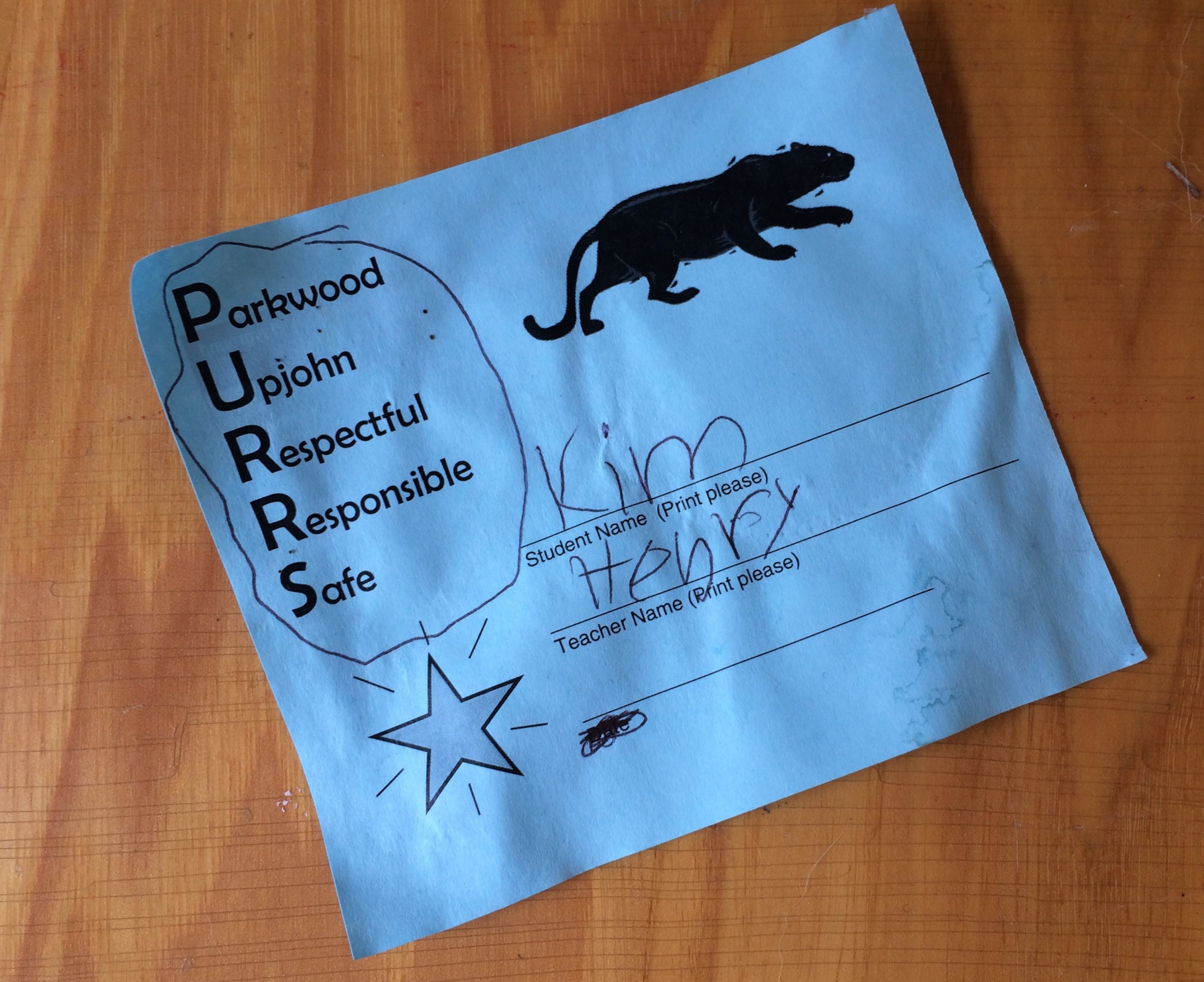
I also got together with a few other folks. Nancy, Glen and their son Henry came out to the park to see my trailer. Henry made me a little gift. I must have been out of the classroom too long, because I had forgotten all about these little slips we used to give out to recognize positive behavior! After a tour of the trailer and a little conversation, we headed out for ice cream at Plainwell Ice Cream. What a treat!
A former student, Sadie, wanted to get together while I was in town, and I was thrilled to see her again. She was in my class almost (almost, but not quite) 30 years ago! I hadn’t seen here since her high school graduation celebration, so we had a bit to get caught up with. I was happy to meet her daughter, too.
Leigh and I also got together for burgers and brew. After that, we went over to JoAnn Fabrics and Crafts to touch the fabric. Leigh bought some more cloth and I just looked.
I got together with Debora, a teacher-friend who is still in the trenches. I had some things that I picked up for her when I was in Neosho. I think she is an even bigger fan of Dr. George Washington Carver than I am!
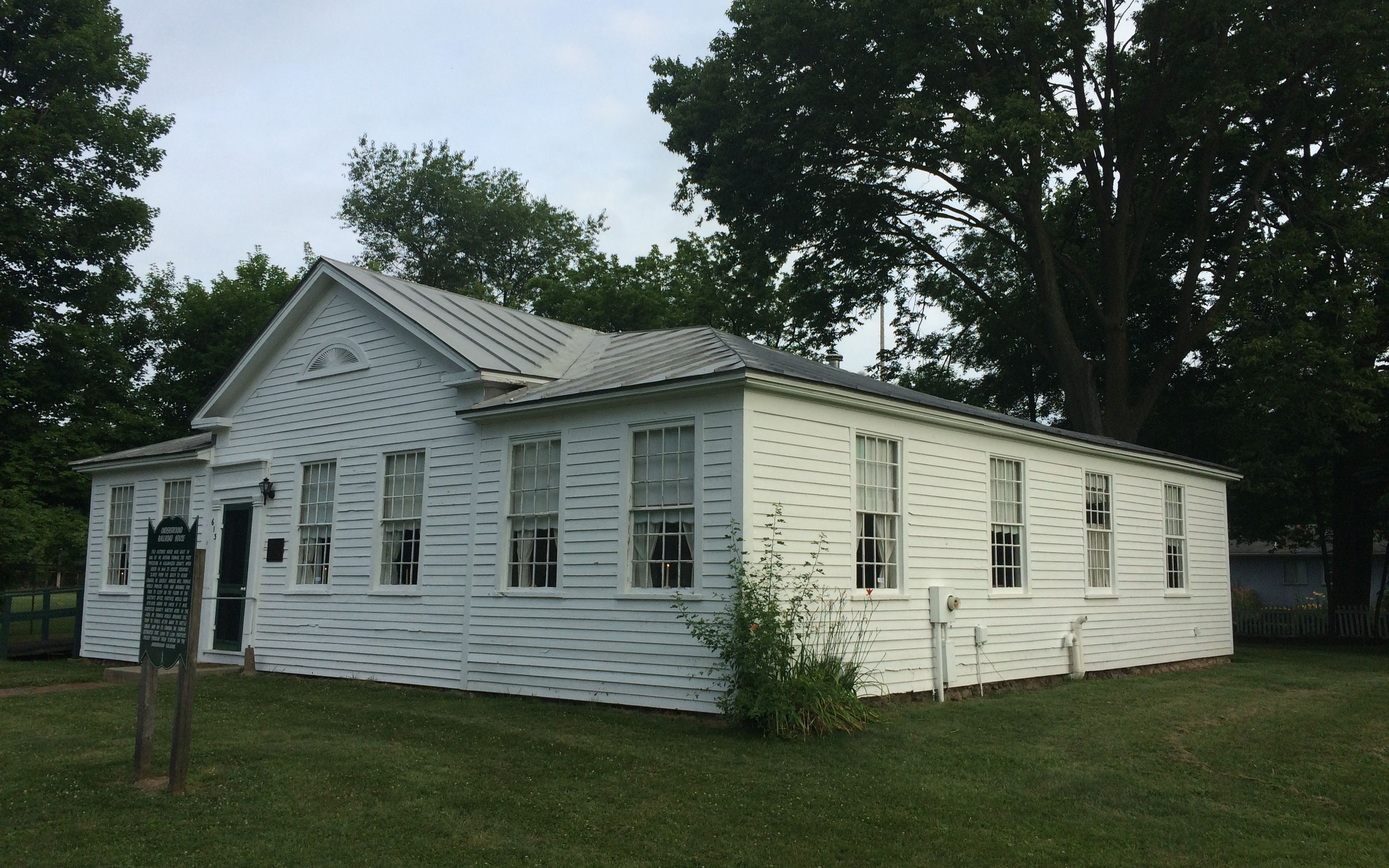
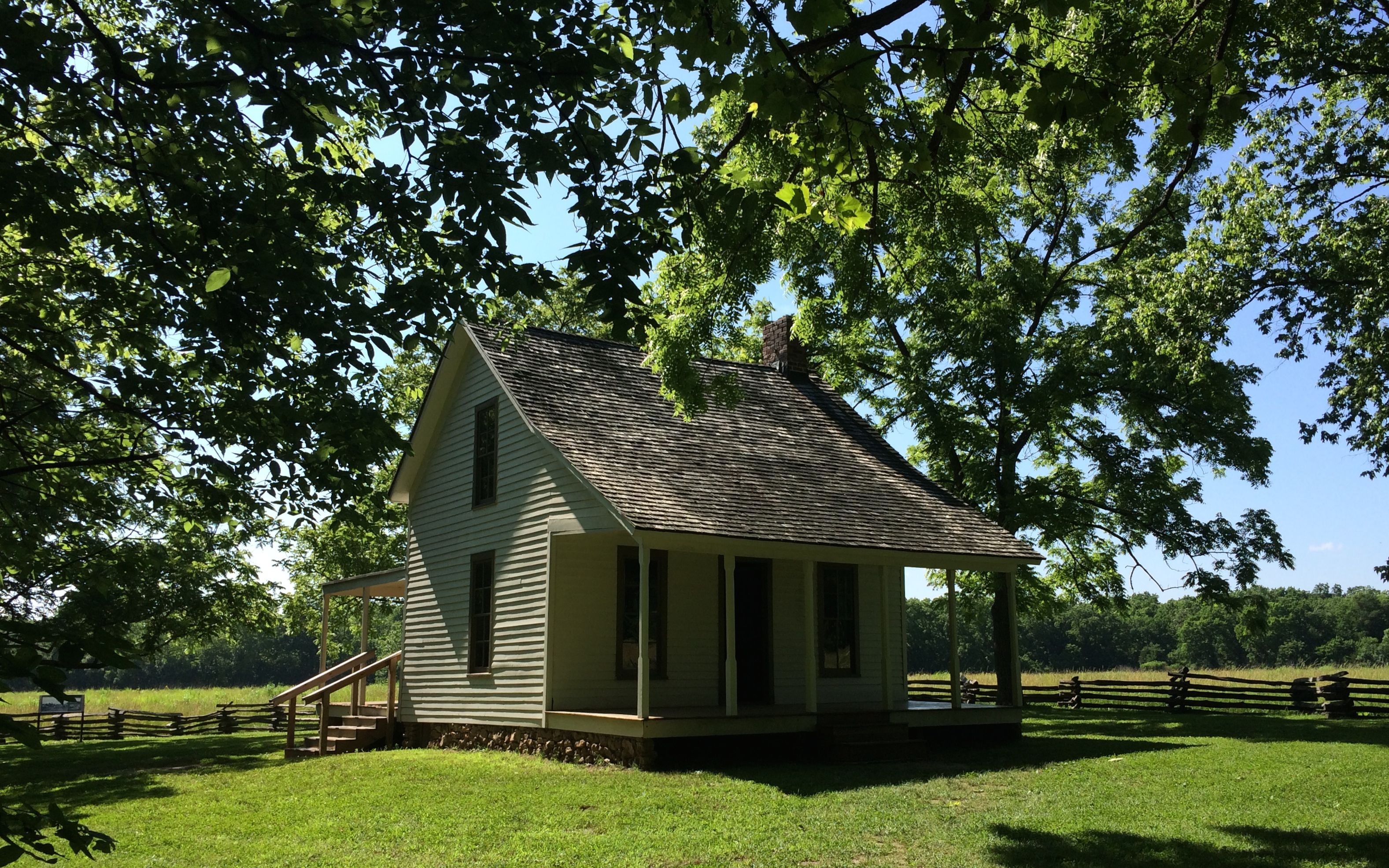
The one bit of historical tourism I did while I was in the area was to drive by the home of Dr. Nathan Thomas, who was the first physician in Kalamazoo County. The house was built in 1835, which means that it is a very old house – more than 170 years old. That alone would make it remarkable in this part of the world. The reason I wanted to visit was because this was a stop on the Underground Railroad.
In 1843, Dr. Thomas was asked to help escaping slaves reach Canada. Mrs. Thomas would feed than and arrange sleeping areas on the floor of the doctor’s office. If they thought that bounty hunters were in the area, they would have the fugitives hide up under the eaves of the house. The would travel on to Battle Creek after dark, and then continue on to Canada. Dr. Thomas estimated that 1,000 to 1,500 fugitives came though their house on their way to freedom.
I was disappointed that I couldn’t tour the house. You see, it seems that you need to arrange visits ahead of time. I just did a quick drive-by after dropping Cora off for her dental work. Luckily, they have a detailed sign in front of the house. If your travels take you to the area and you’re interested in arranging a tour, the contact information is at the bottom of this link.
This brings me to the end of my adventures in Kalamazoo. Next stop: Jackson Center, Ohio. On to the Mother Ship!
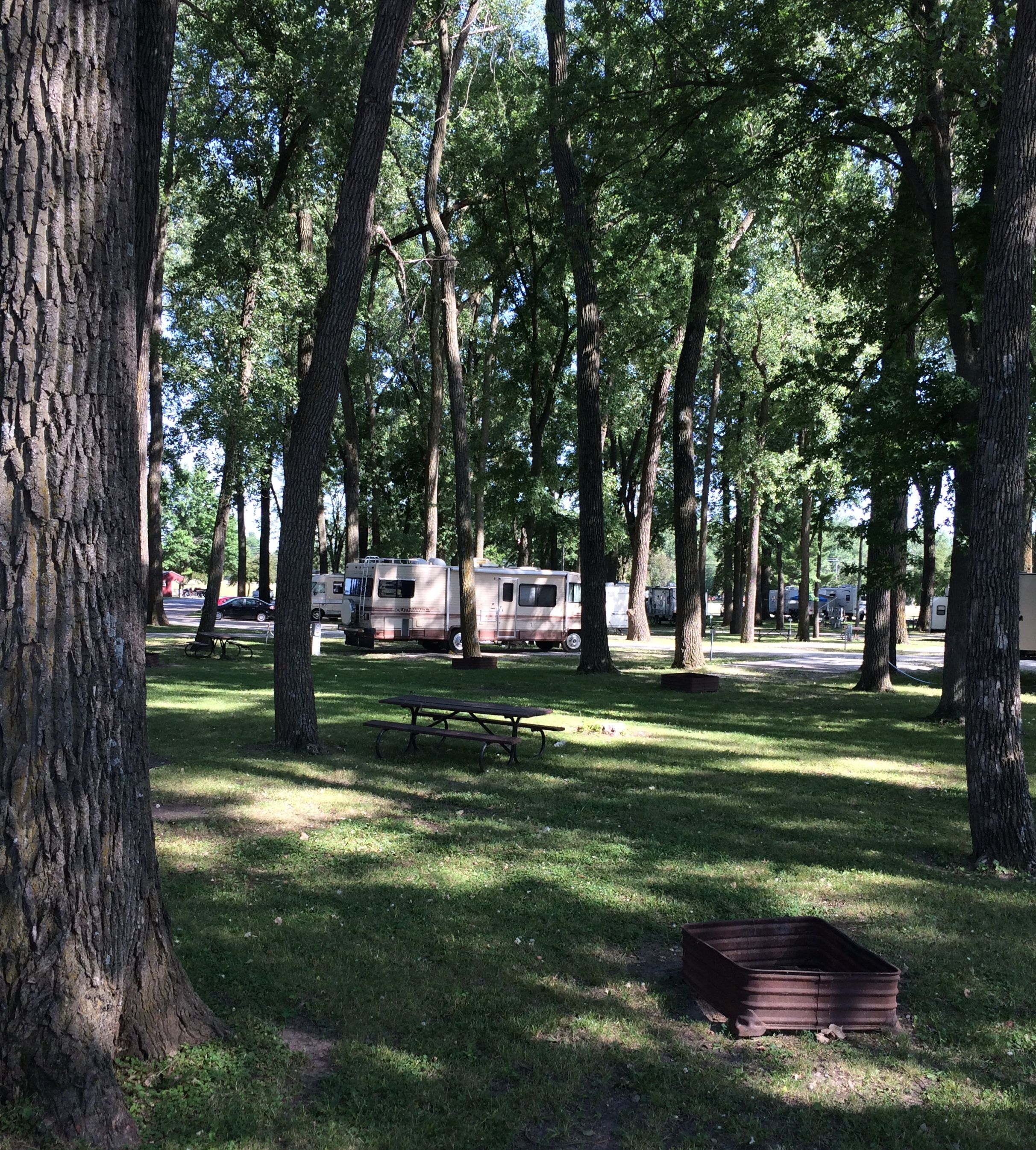
After a few hours on the road, I made it to Ottumwa, Iowa, the City of Bridges. The municipal park is on a large island in the Des Moines River, and the bridges are necessary to cross back and forth between north and south halves of the town.
Here’s the view from my site. The campground is nestled beneath the towering cottonwoods. Actually, this view was amazingly empty of campers. the campground was packed as there was a fair going on. But, it was easy enough to get slid in between the trees, especially with the help of the camp host.
Once unhooked from the truck and hooked up to the electricity, I set about trying to find something I could do with the few hours I was going to have in Ottumwa.
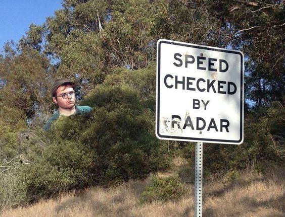
Of course, the main reason I wanted to visit Ottumwa was to see if I could find Radar O’Reilly. Since I never speed, I didn’t have occasion to see him.
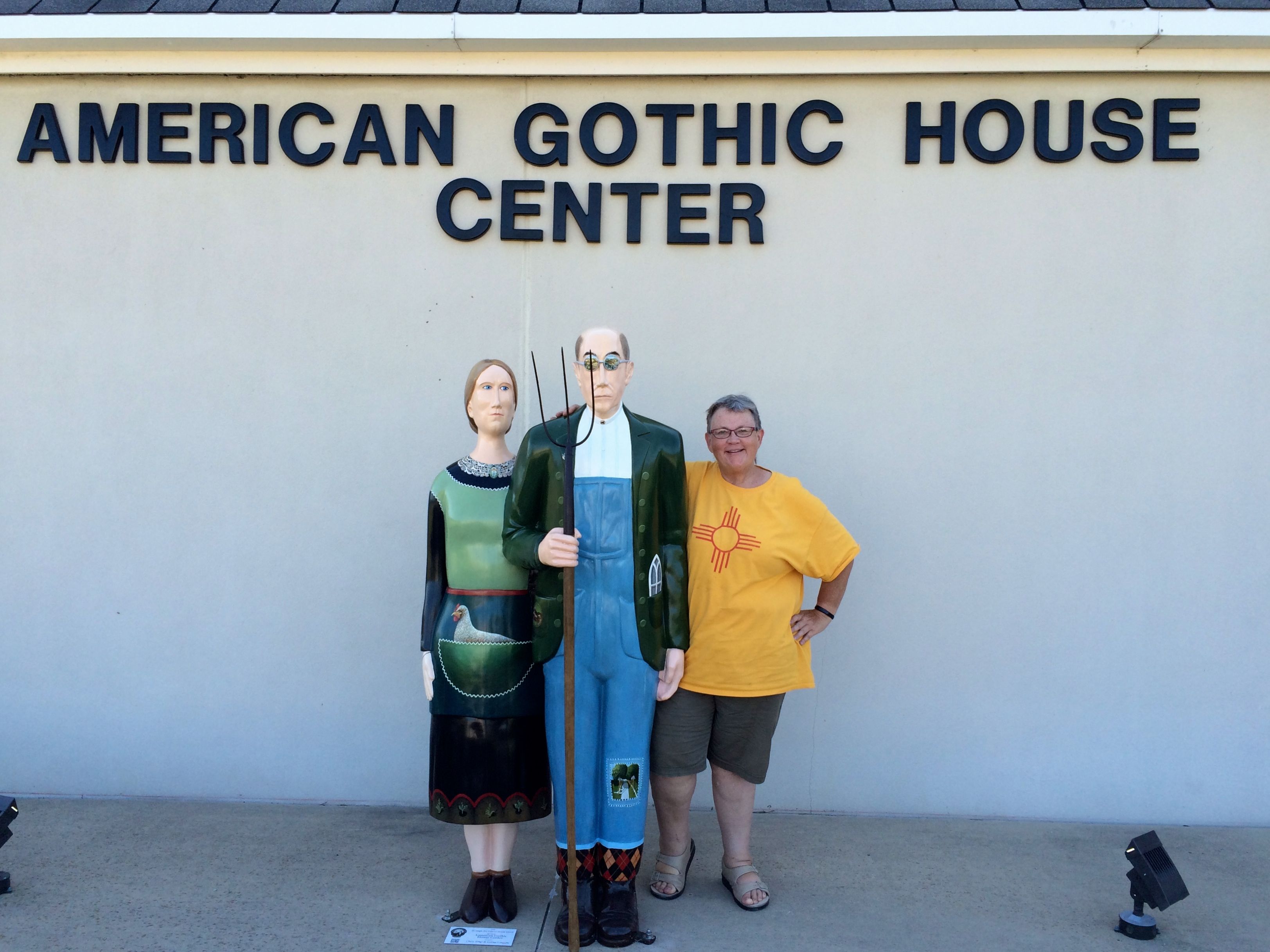
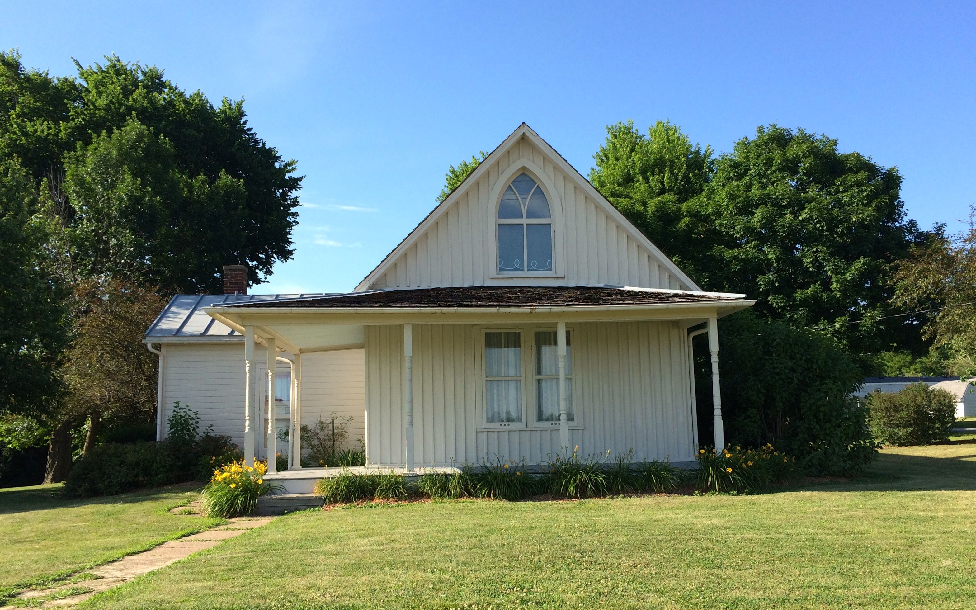
I checked in with my History Here app, and found that the American Gothic House was just a few miles away, in Eldon Iowa. I jumped in the truck and arrived just as the visitor center was closing. But, I still managed to enjoy myself.
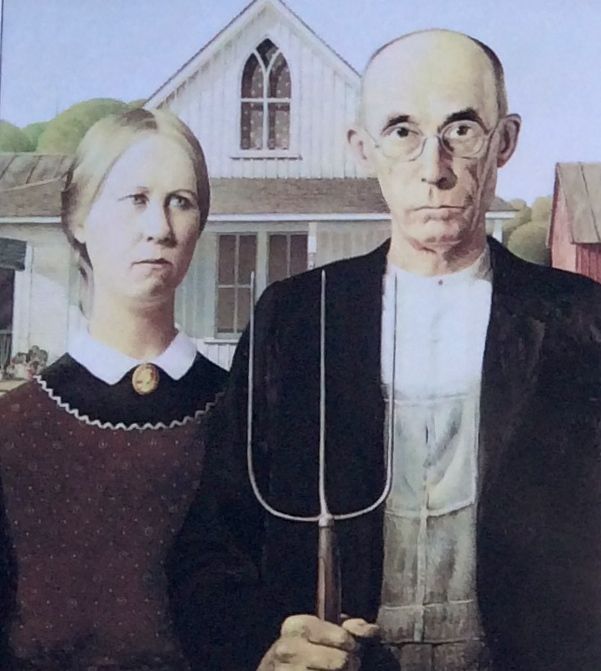
American Gothic is one of the most recognized and imitated paintings in the world.
I was too late to go into the visitor center, but the person who was just locking up was happy to take my picture with the statues in front of the building.
After that fortuitous photo op, I turned my attention to the house.
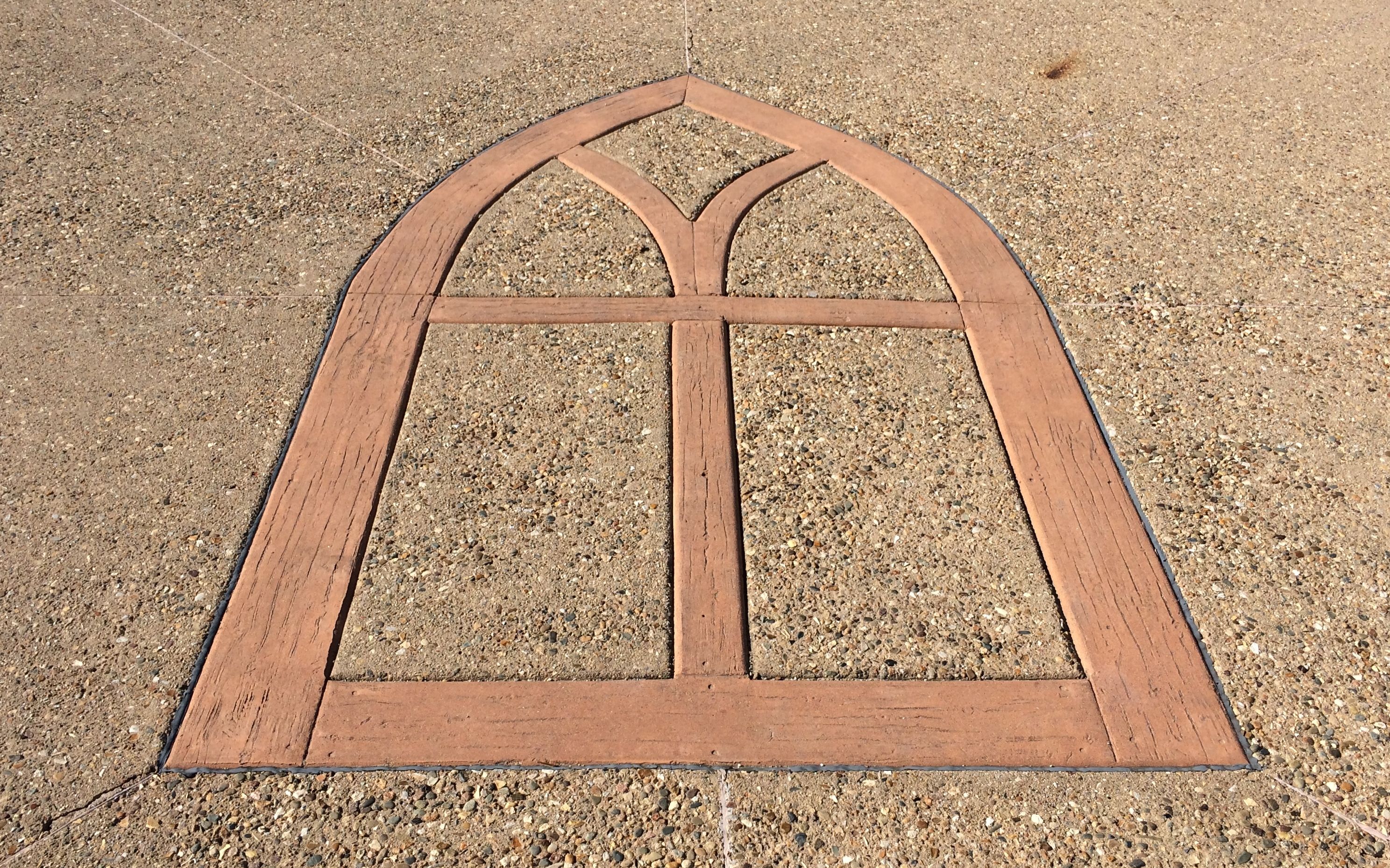
In front of the house is a circular area with informational plaques about the house, the artist and the models. They also have a marker to show you where to stand to take your own “American Gothic” portrait.
According to the information, the Visitor Center (when it is open) has costumes and props available for people to use to create interesting photos.
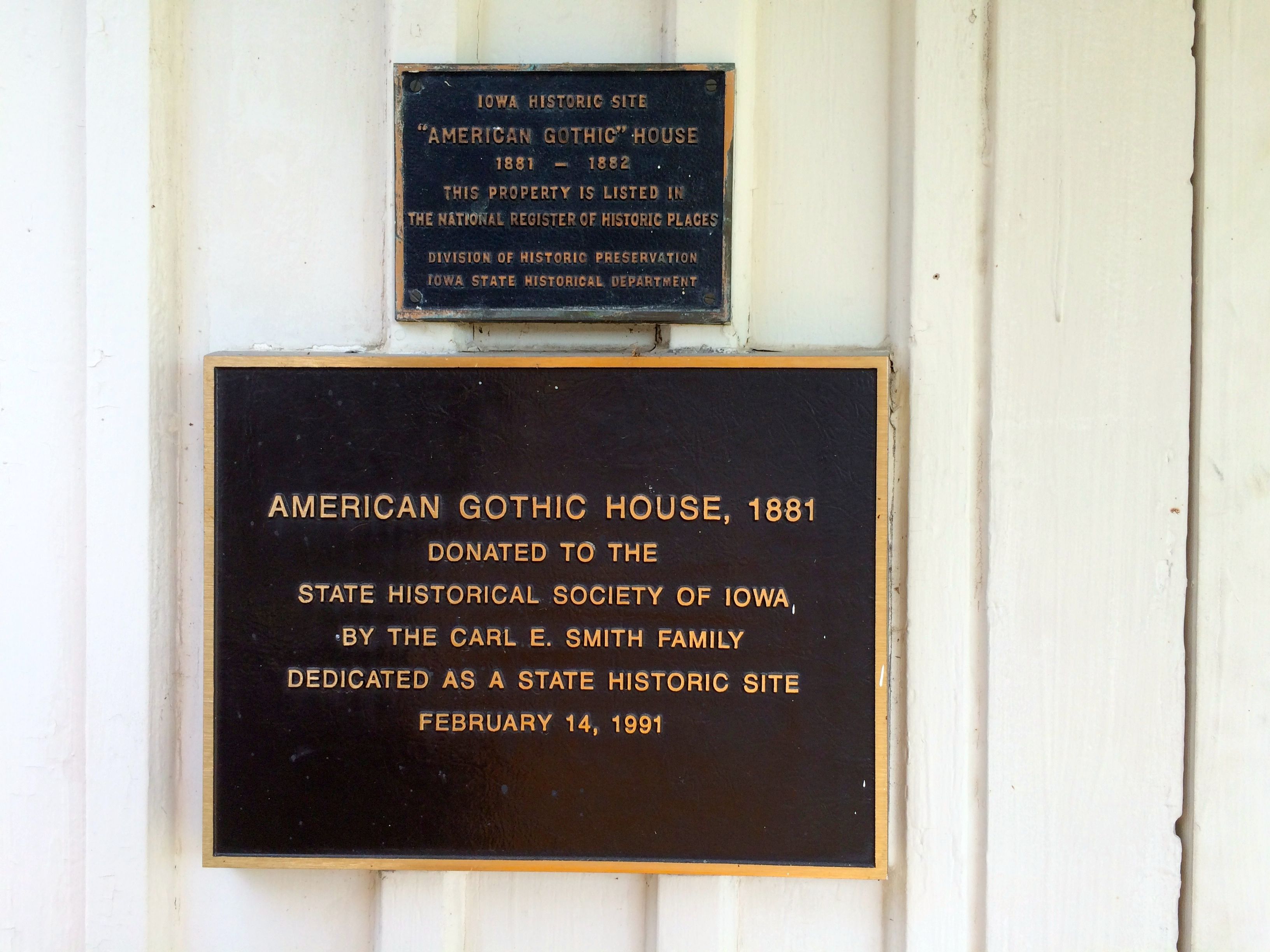
And here is the house. The original section of the house that contains the two gothic windows was built in the early 1880s by Catherine and Charles Dibble. Since they were the original owners, it is known in the National Register of Historic Places as the Dibble House.
Grant Wood was in town for an art exhibit at the Eldon Art Center. On a drive around the town, he saw the house and had the driver pull over so he could make a sketch. According to the information on the website, the only paper he had on hand was an envelope, so he made his sketch on the back of it. Envelopes sure have been handy. What do we do now that we do all our communication via email?
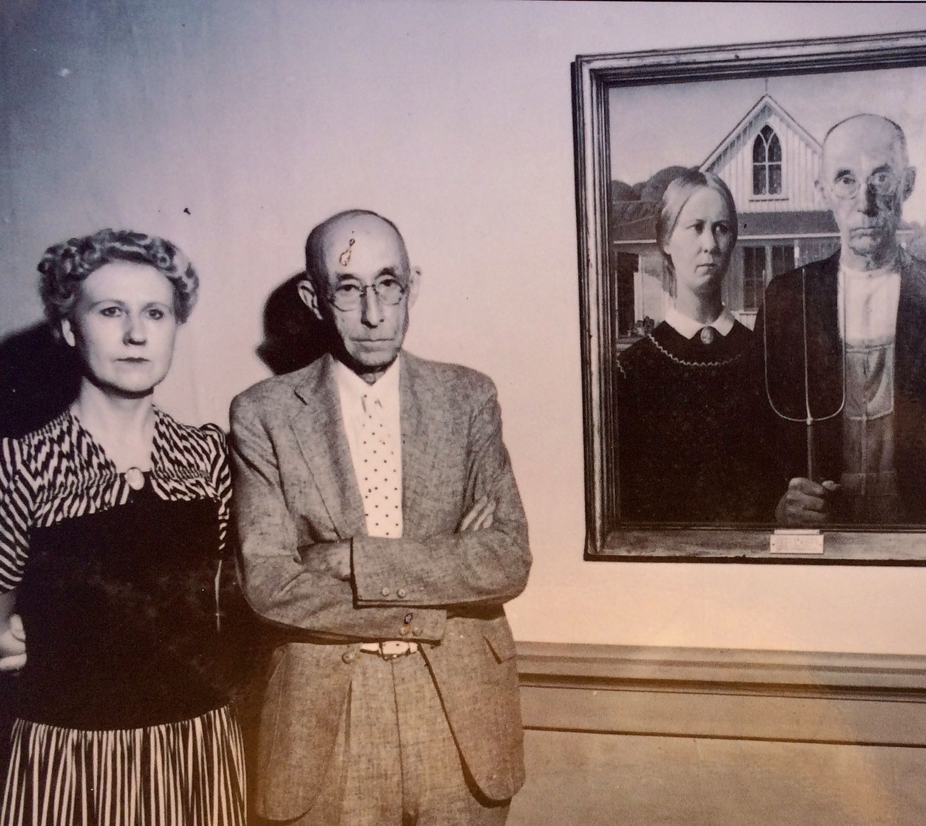
Wood took his sketch back to his studio in Cedar Rapids, where he combined the study with models. His sister and dentist were the models, and Wood only convinced his dentist that he would make sure that he wasn’t identifiable.
Here are the original models posing with the painting many years after the fact. Apparently, he wasn’t satisfied that Wood had protected his identity sufficiently and there was bad blood between them – especially when the painting became so well-known.
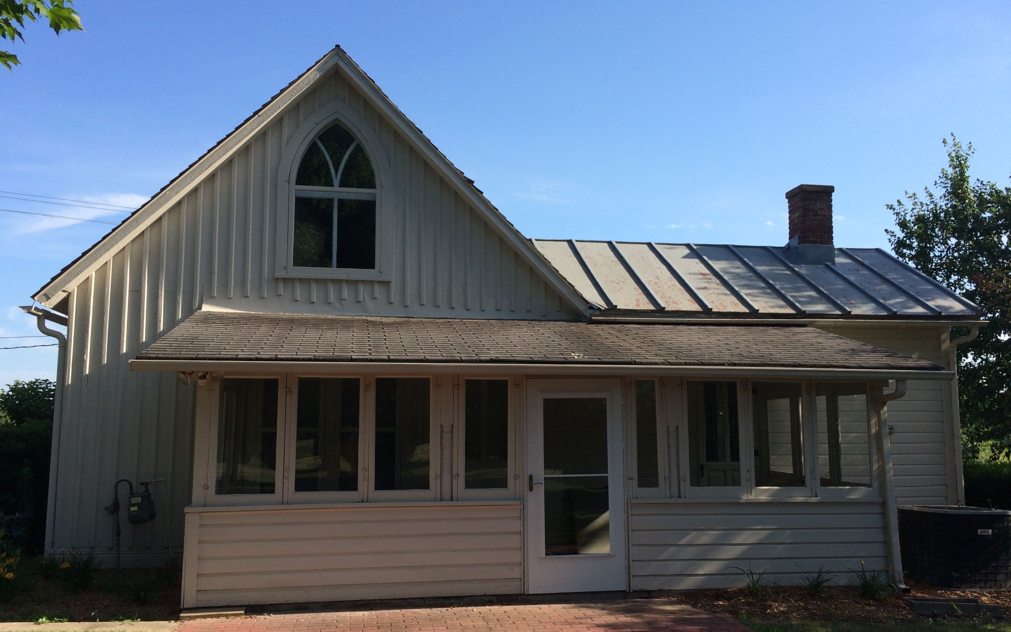
I walked around the house, just to see if there were any surprises to be found.
These are the plaques next to the front door.
I walked around to the back. You can see how the rear design echoes the front.
As I was heading back to the car, I turned to take one last look.
After that, it was time to continue with my examination of the town squares of the midwest. Next stop: downtown Ottumwa.
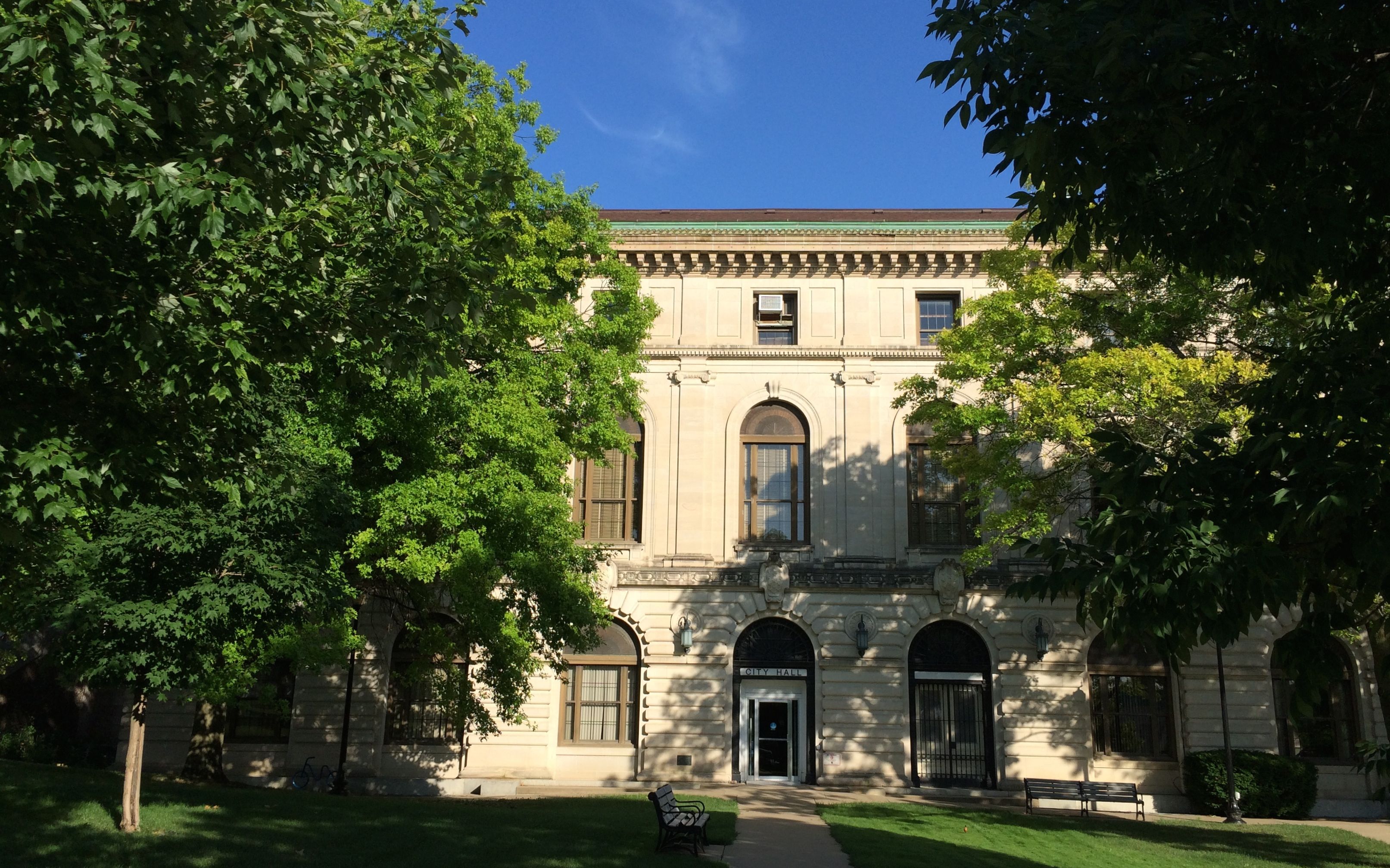
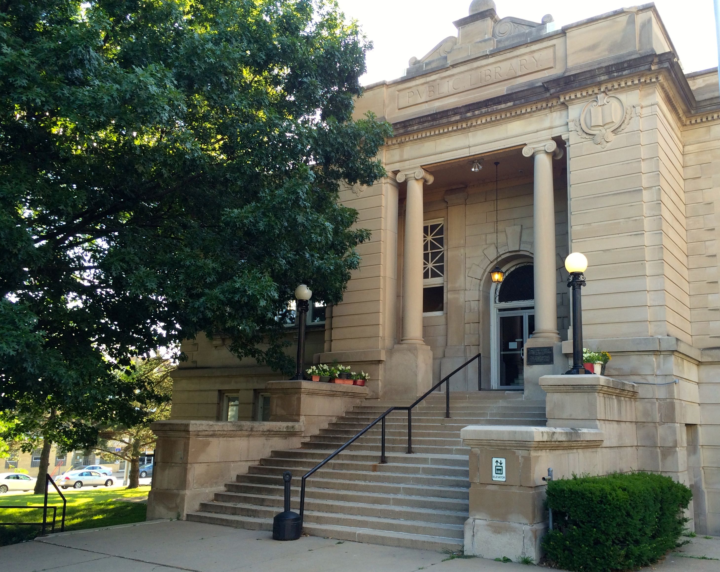
There was a lovely park, with the city hall on one side and the library on the other.
Here’s the city hall. I looked around, but I didn’t see a corner stone or plaque giving the date.
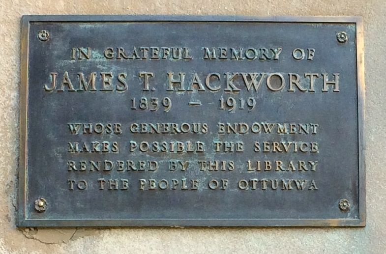
And here is the library. I didn’t see a date on this building, but there was a plaque.
What a wonderful gift to the community!
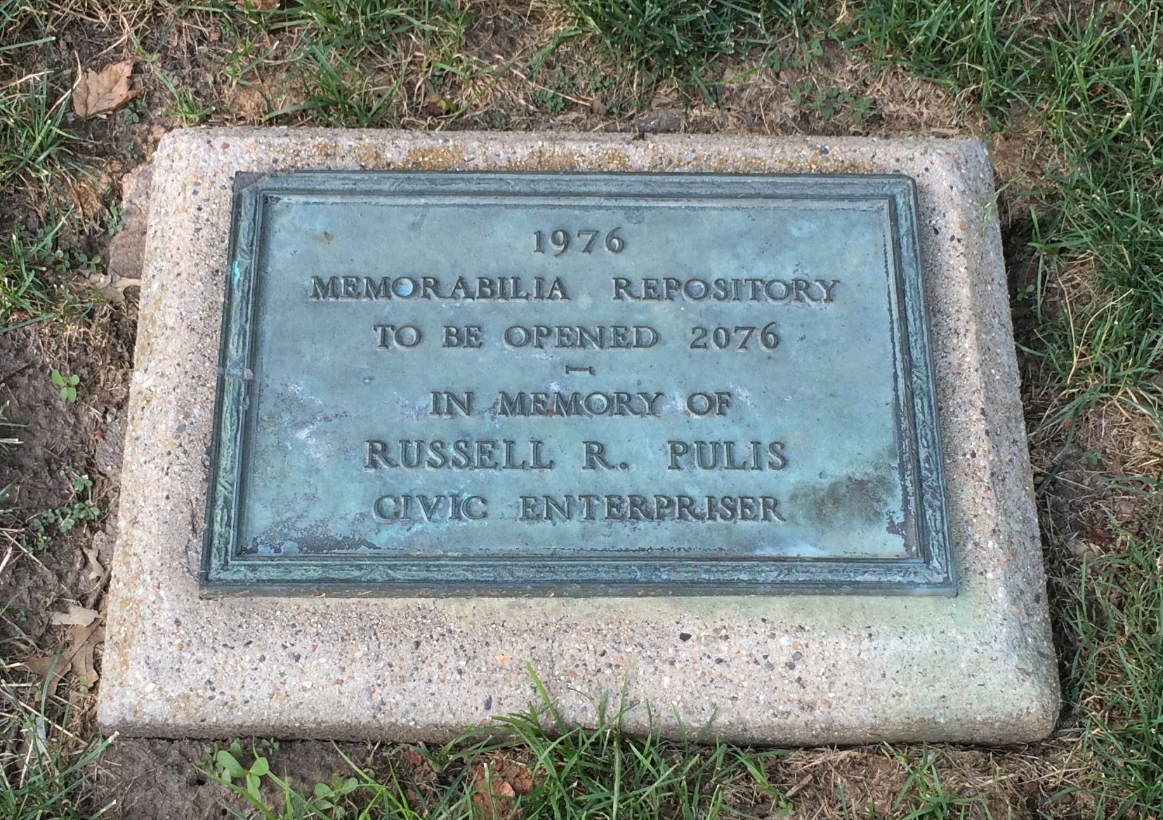
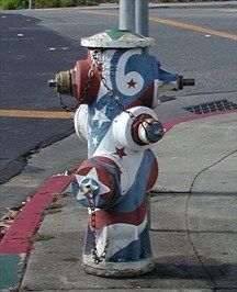
I did find a “memorabilia repository” buried flat in the ground. This is also a classier and more under-stated bicentennial memorial than Bicentennial Fire Hydrant.
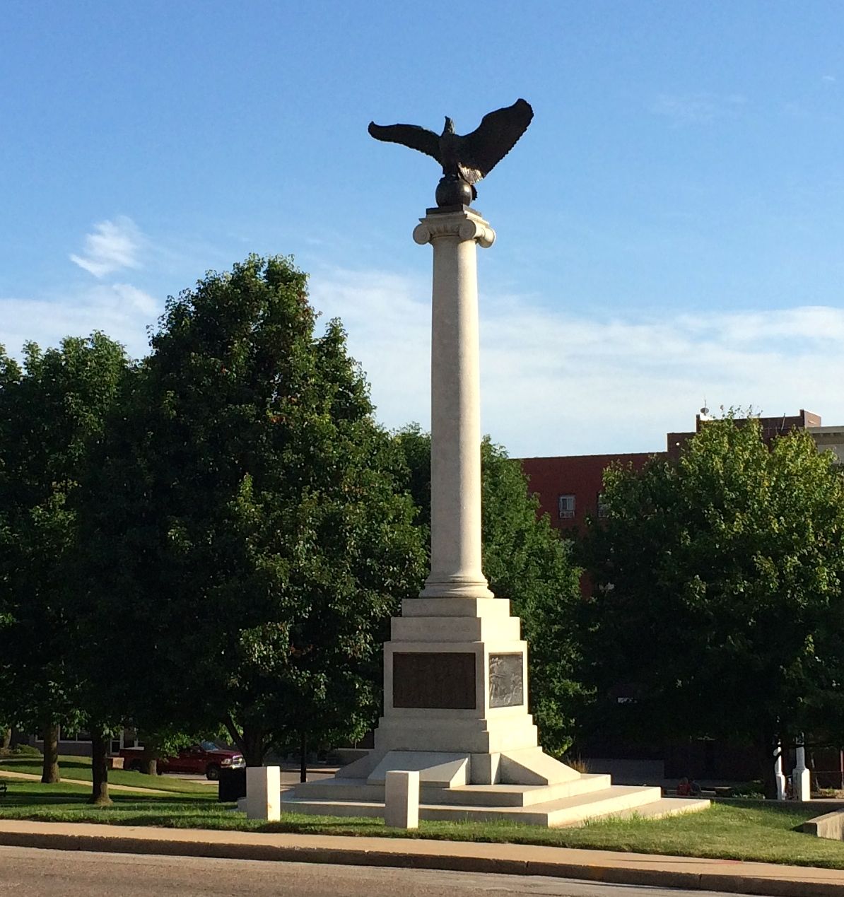
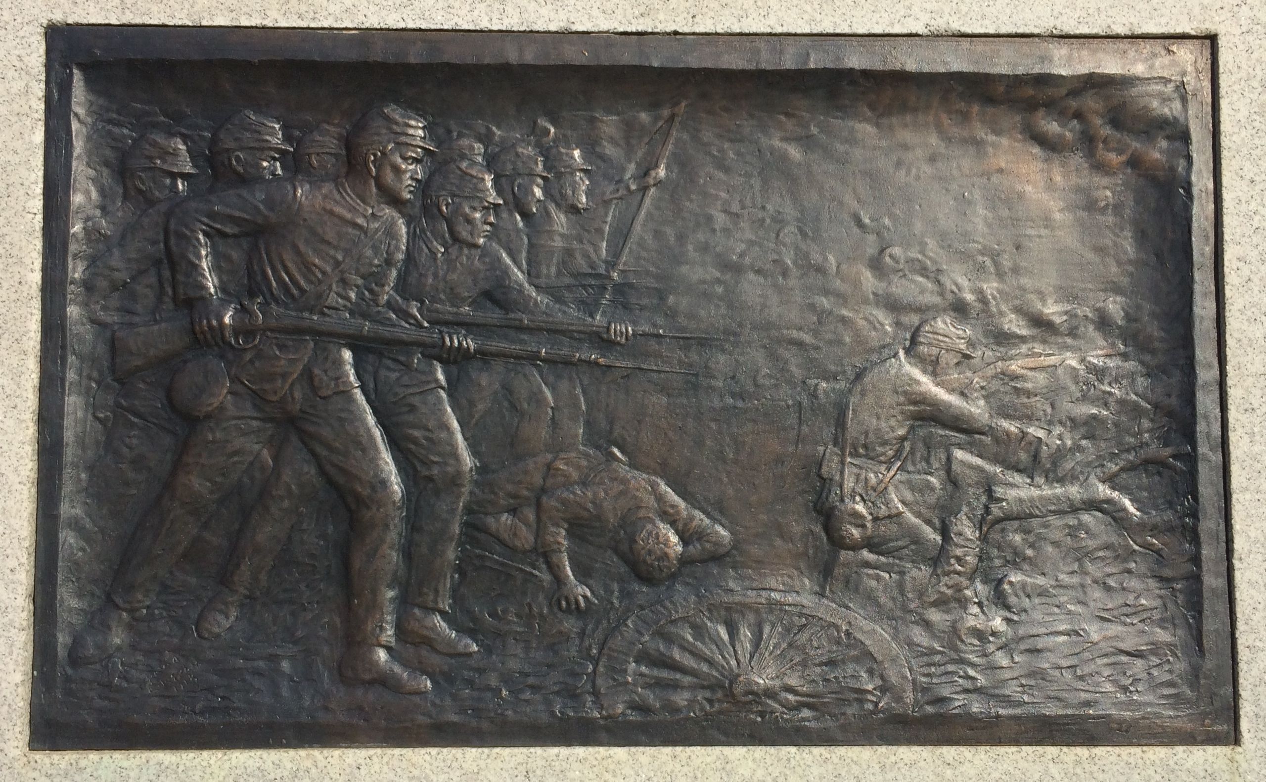
On the other side of the park, there is a memorial to the Civil War veterans. I couldn’t find a date as to the when it was put up. Judging by the style, it kind of made me think of the 1920s or ’30s.
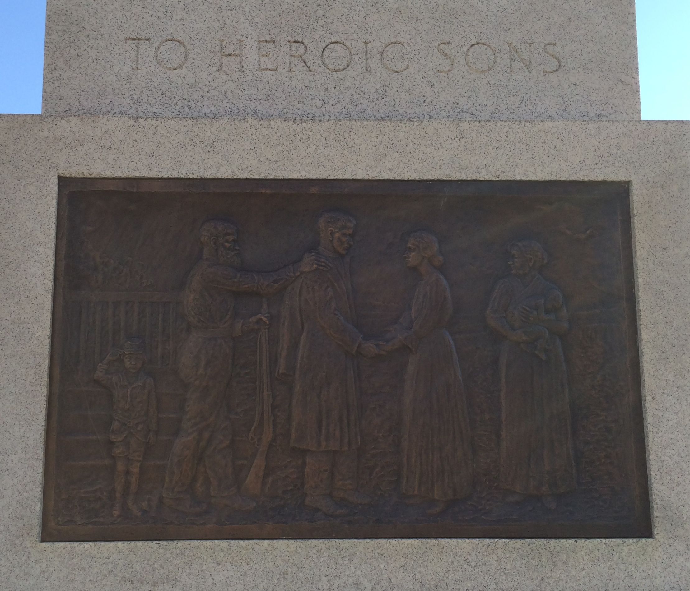
The bas relief panels around the base were quite striking and tell the story of the soldiers and their families.
Here they are, sending their son off to war.
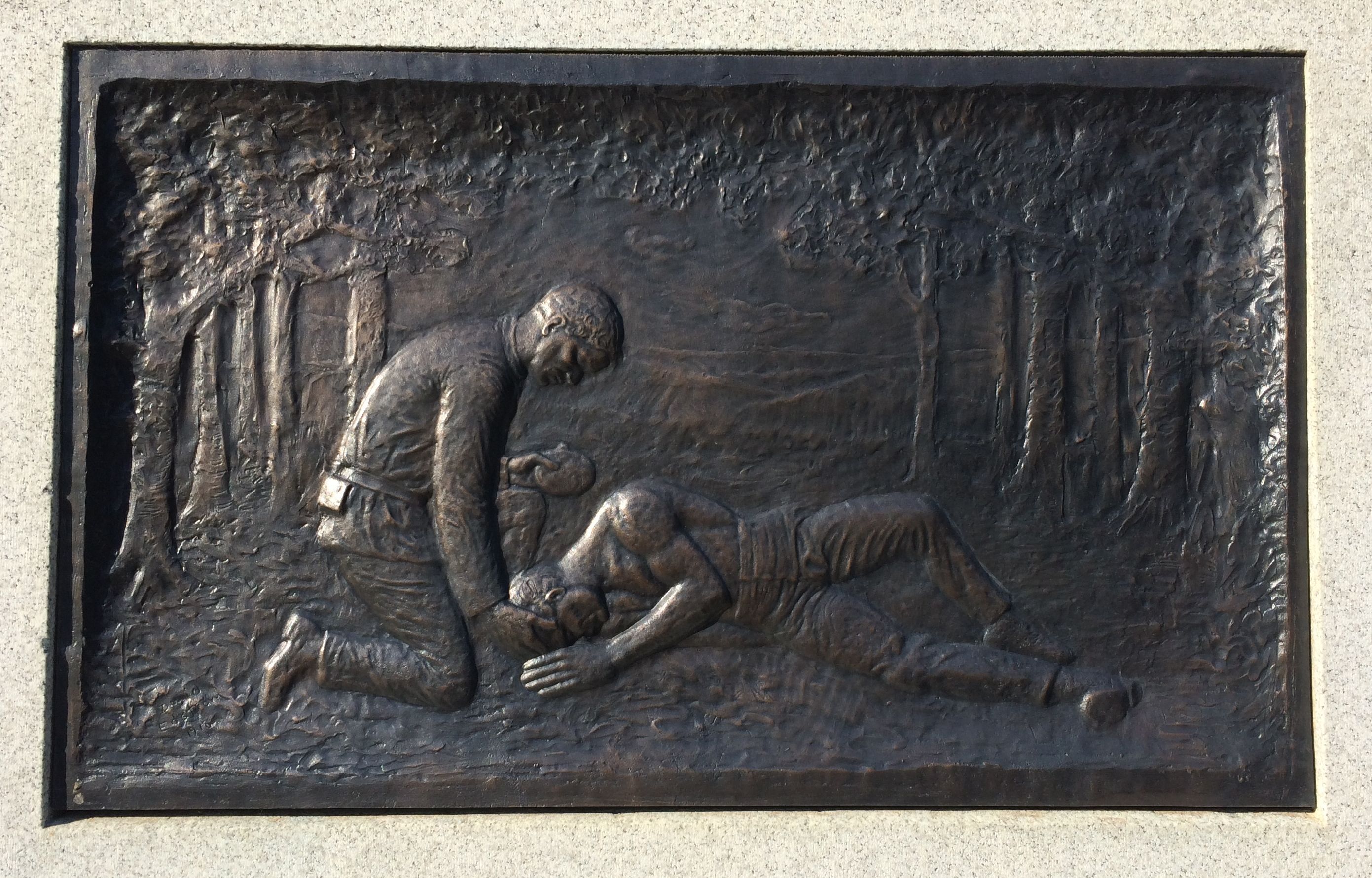
They fought.
They died.
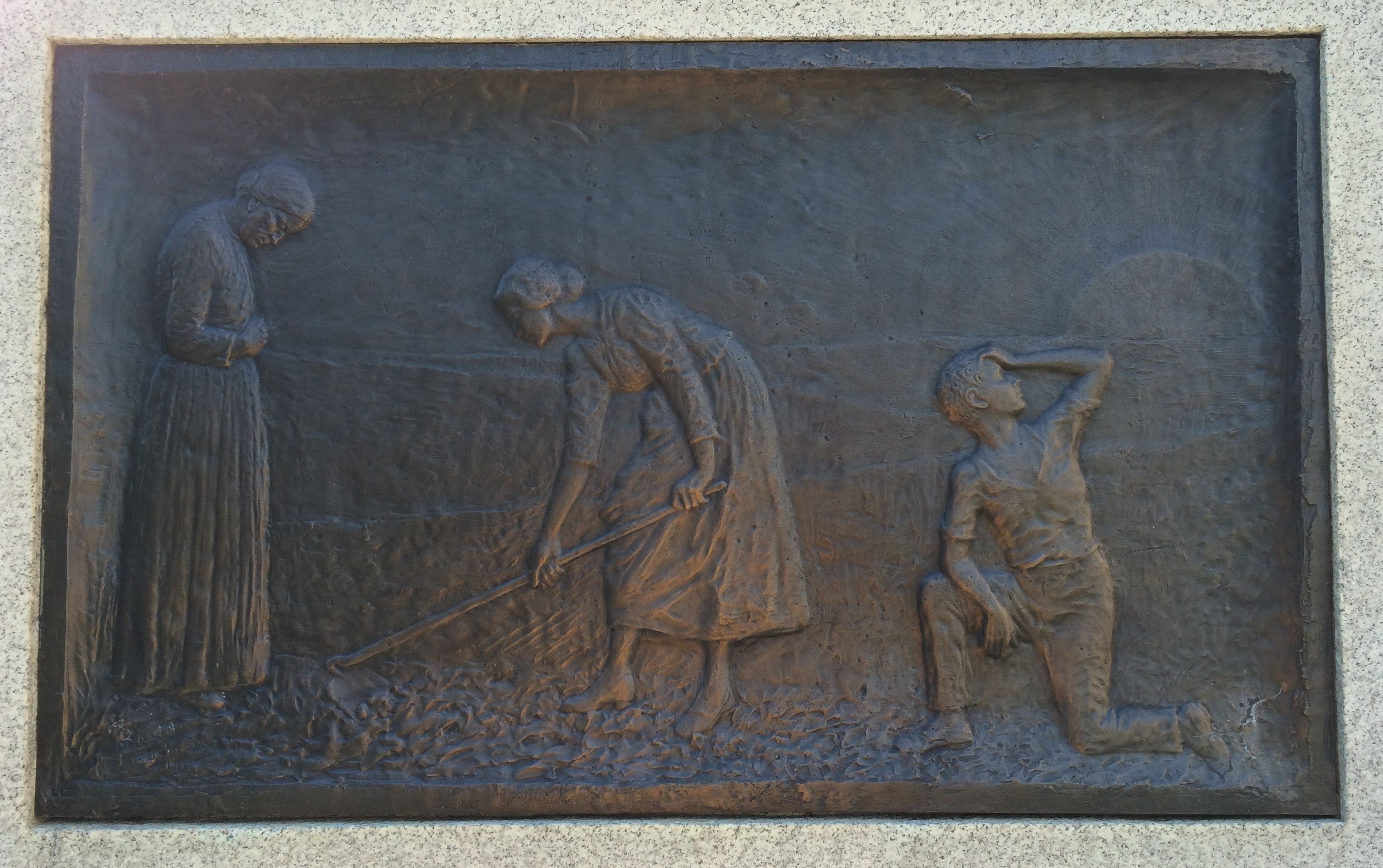
And the families had to take up the slack and fill in the holes left by the men who died.
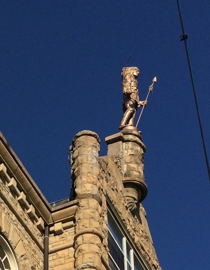
Across the street from the park was the Wapello County Courthouse. The county appears to be named after Chief Wapello. Born in 1787, he was originally from the part of the country that is now Wisconsin. In 1829, he lead his tribe to the Muscatine Slough on the west bank of the Mississippi River and later settled in Iowa. He died while on a hunting trip near Ottumwa, Iowa on March 15, 1842.
I imagine that the statue on the top of the building is Chief Wapello.
I think that is a lightning rod sticking up out of his back.
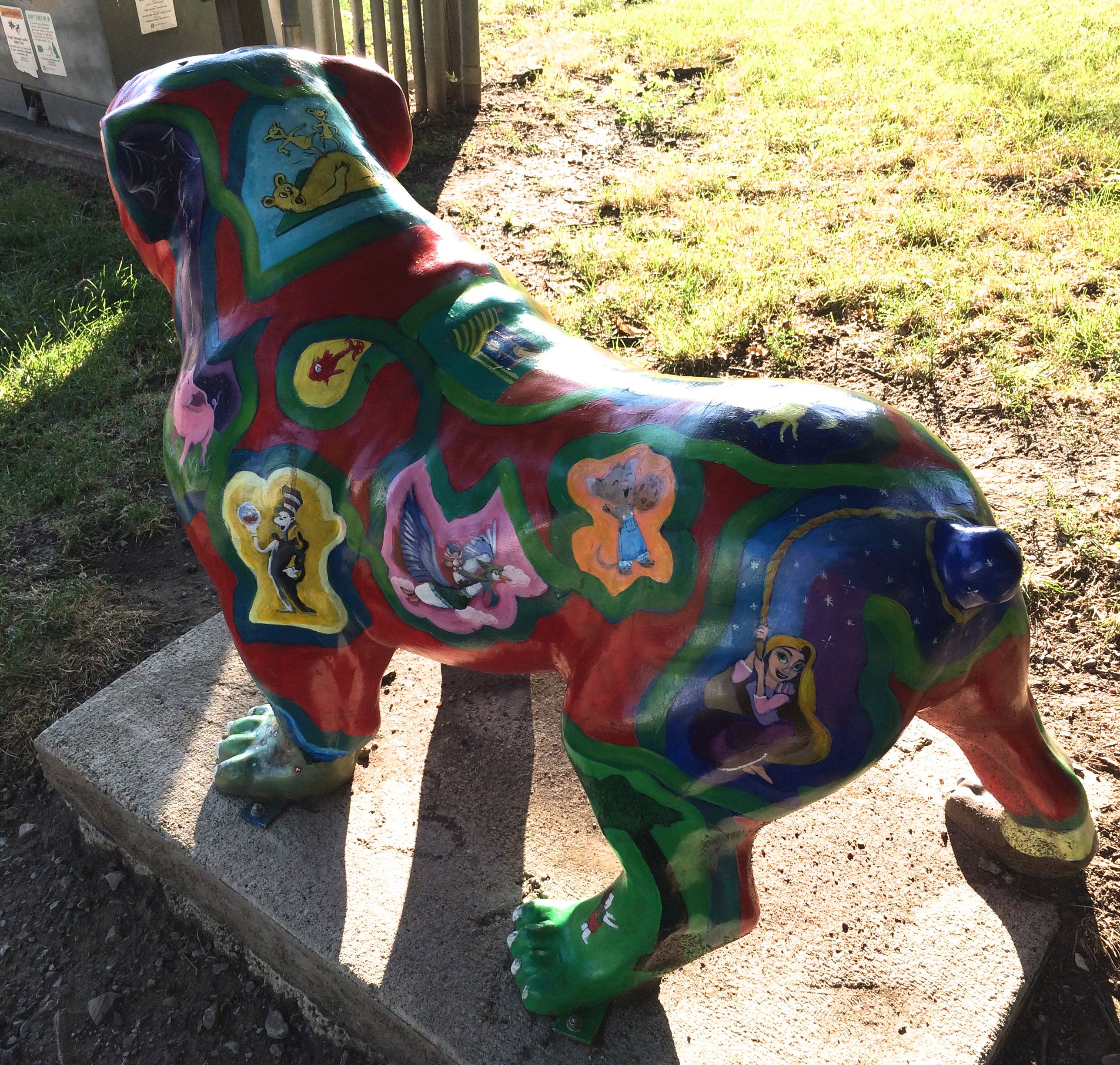
Just as I was about to leave the park and head back to the campground, I noticed this bulldog statue decorated with pictures from children’s books. As a reformed elementary school teacher, I thought this was adorable.
Back at the park I decided to go check things out at the carnival. I had a hot dog for dinner and strolled around to see what was going on.
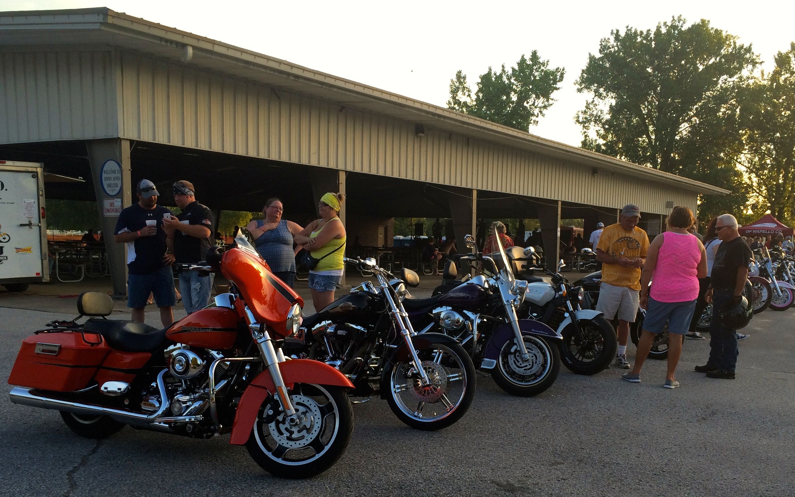
I passed the line up of motorcycles that belonged to the group “Hawgs for Dawgs.” People seemed to be enjoying looking at the bikes. I gave them a glance and went into the carnival.
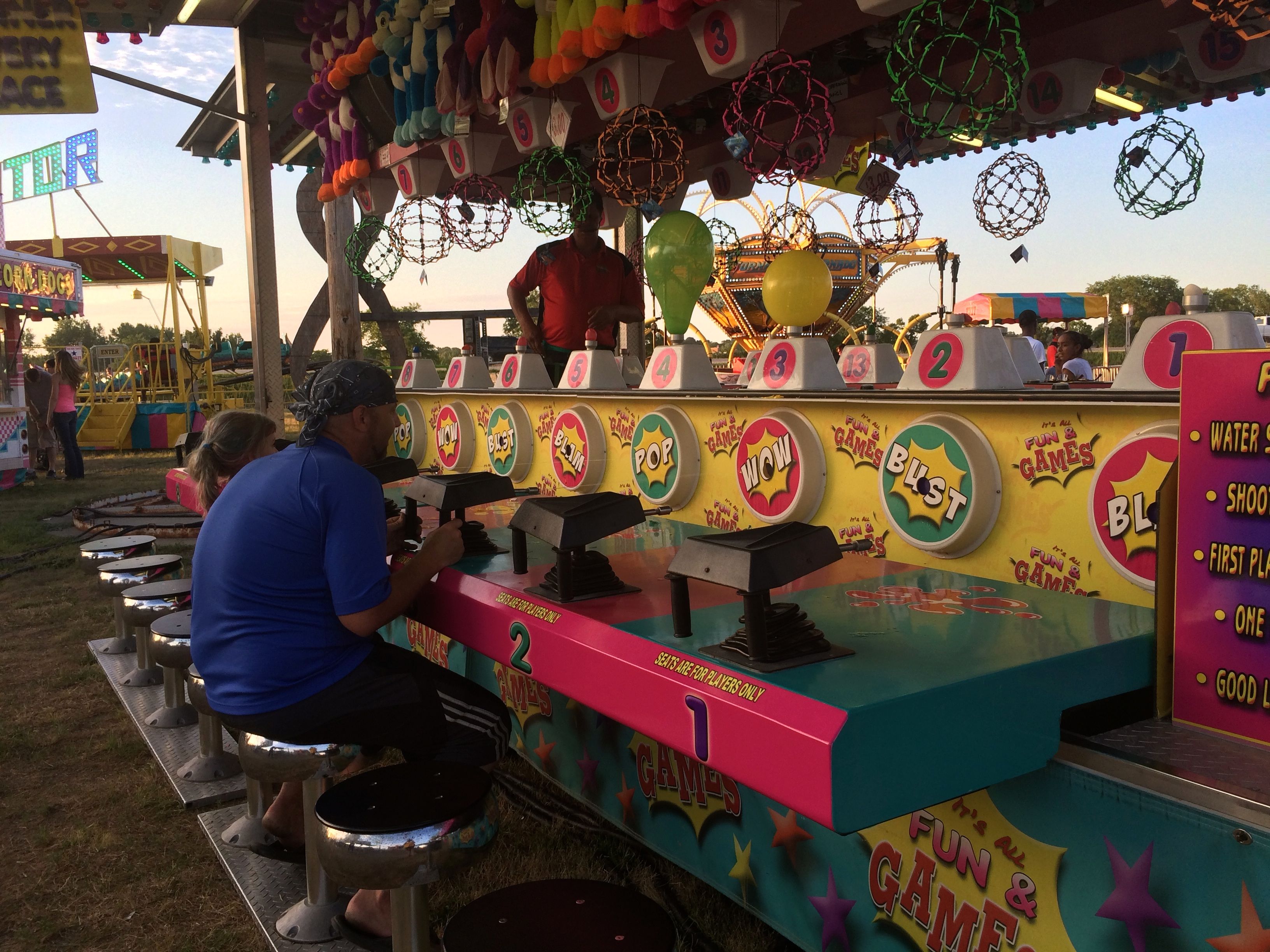
There were games of chance.
And games of relative skill.
The rides were kind of fun to look at. This one was called “Bear Affair”.
They went around the circle and spun around in circles.
It was fun to look at.
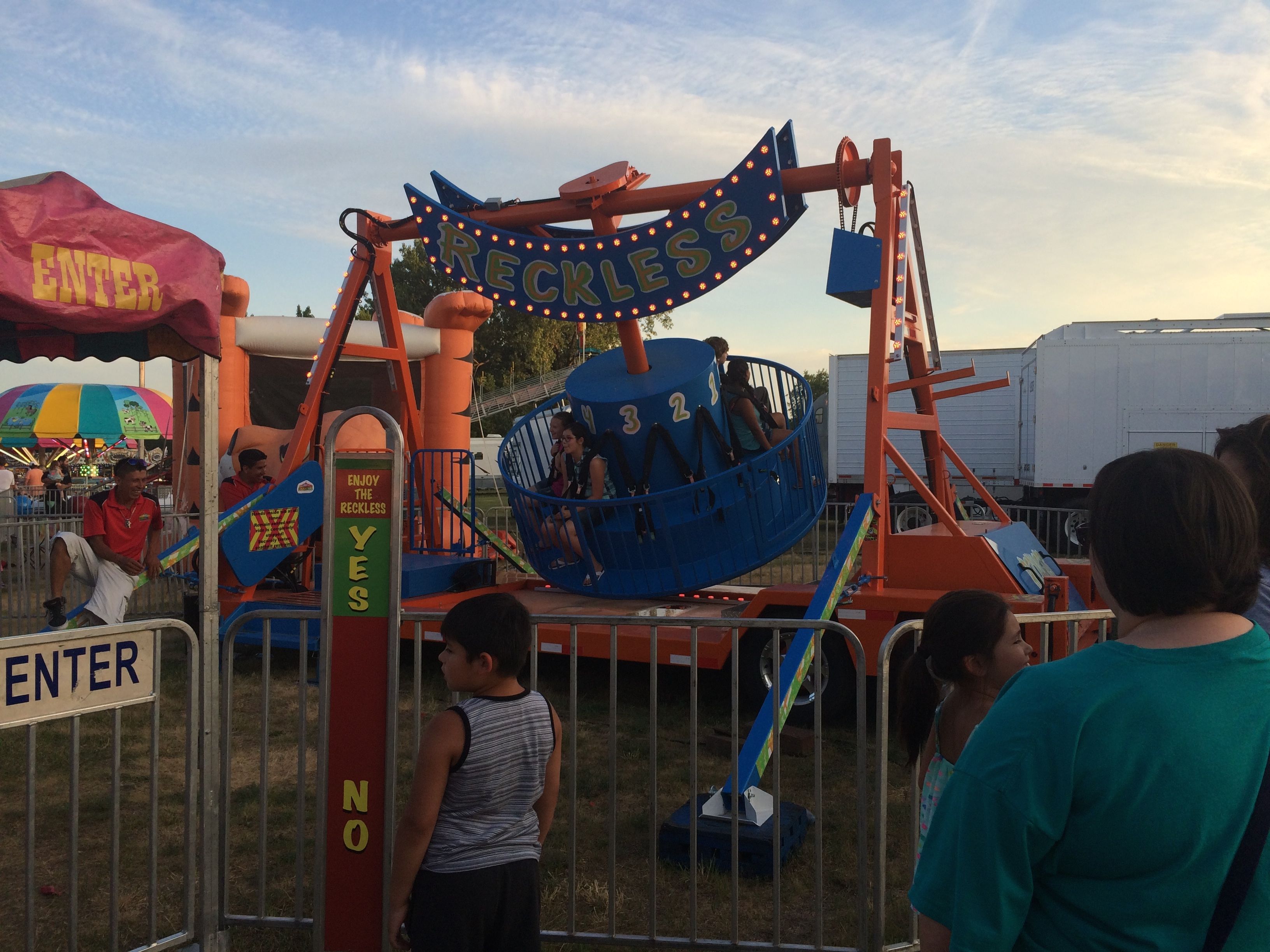
Then there’s the ride called “Reckless”, for people looking for a little more excitement that spinning bears.
It swung back and forth and spun around.
And then there was the Round Up ride. I wonder if that is a particularly popular ride here in the corn belt?
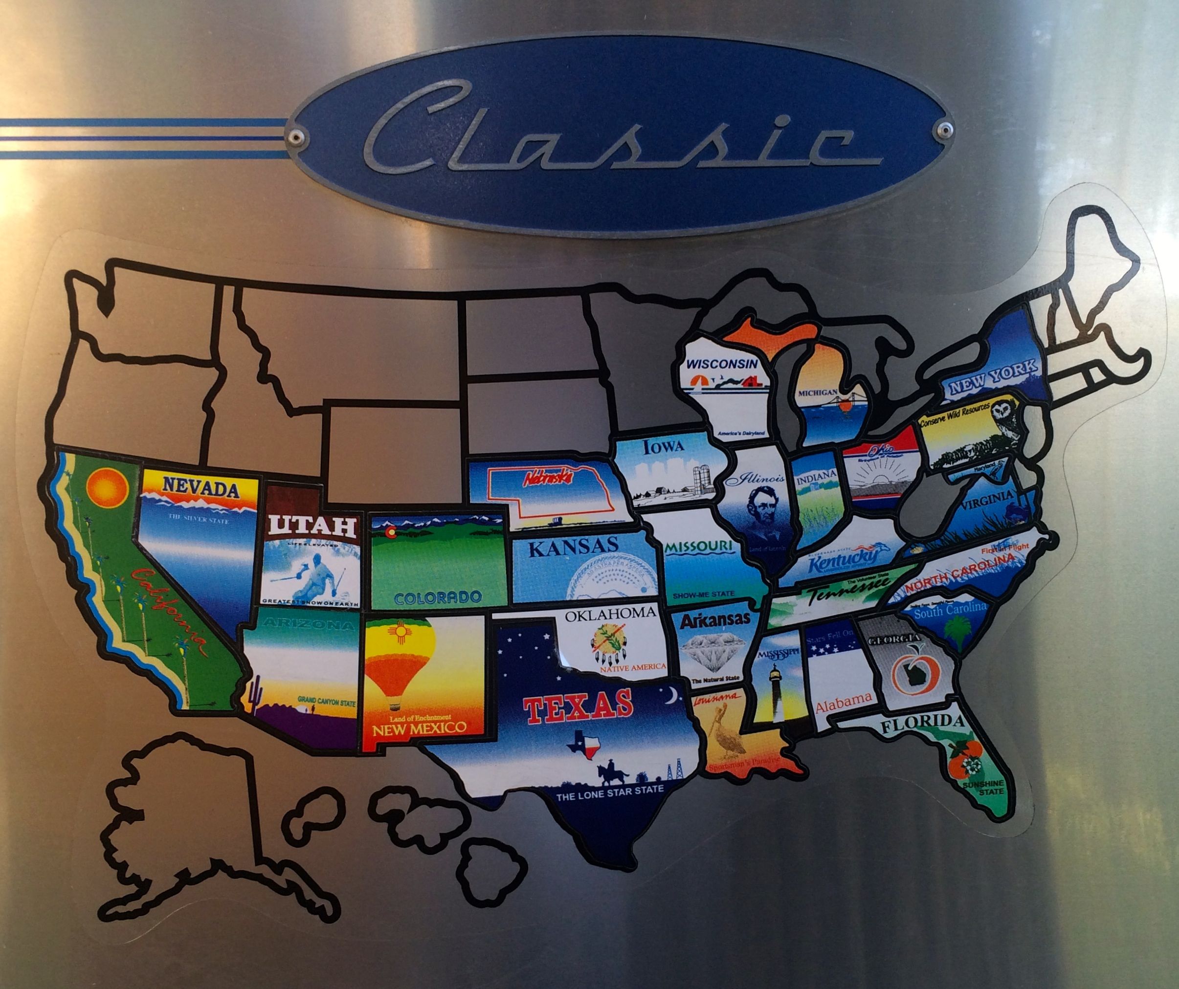
The next day, before heading out, I made sure to add Iowa to the map on Flo.
I’ll be rolling on, but there will be no new states added to the map for a while.
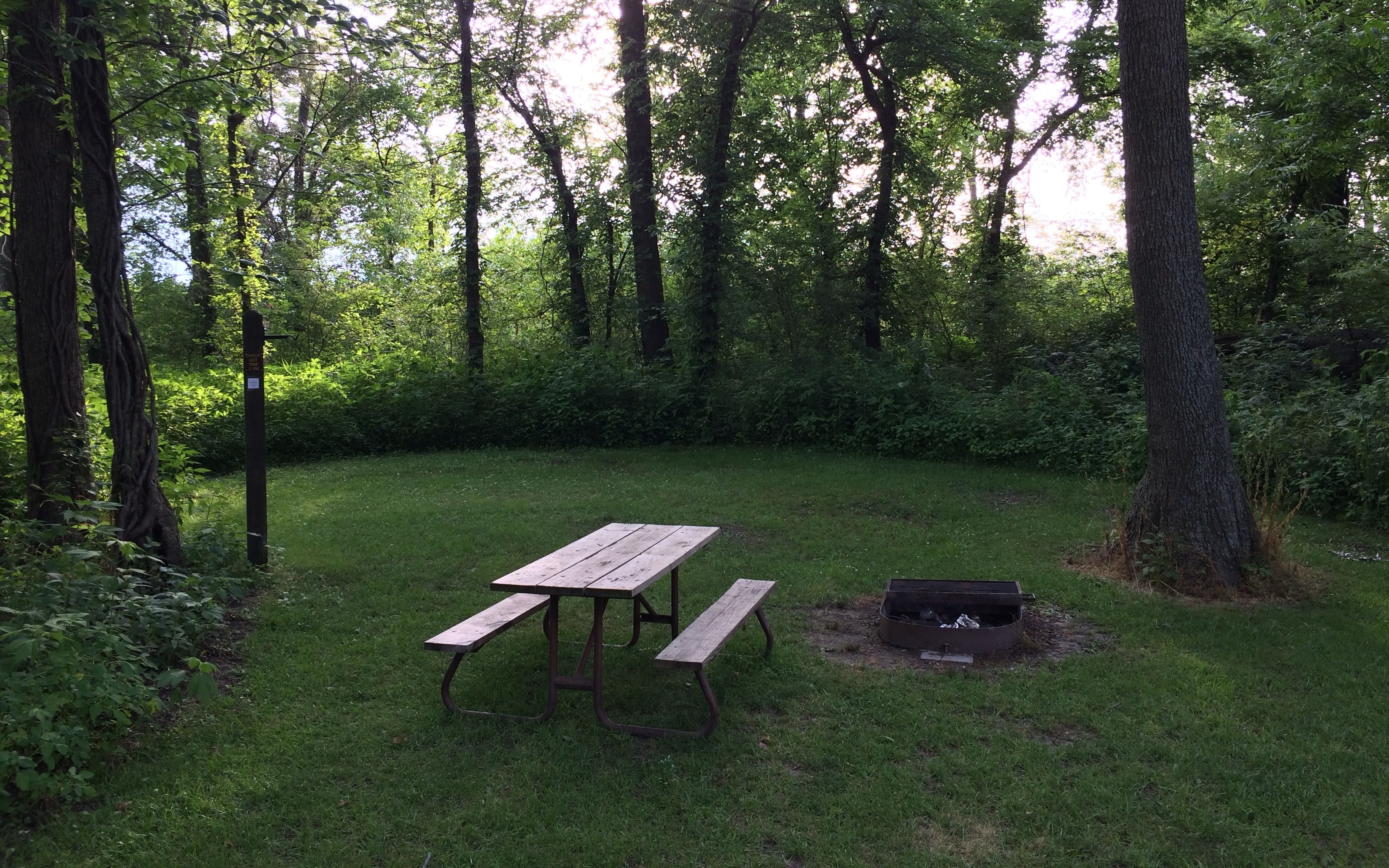
After four days at the camping “resort” in Branson, I was more than ready to head north. I had booked a night at Van Meter State Park, and was I glad I did. Rather than looking at the side of the RV next to me, this was my view. What an improvement!
Lush and green and well-tended. The restrooms were gorgeous! I almost got my camera and went back to take a photo after I took my shower, but I figured that would be a little much.
After I got set up, I went back into town to fill up my gas tank for the next day’s drive. The nearest town was Marshall.
Marshall was founded in 1839, after sixty-five acres of land was donated by Jeremiah O’Dell. It was named for the United States Supreme Court Chief Justice, who had died in 1835. Marshall is the county seat of Saline County.
In the center of town is the Saline County Courthouse. This building was constructed in 1882, after two previous courthouses were lost to fire. It was placed on the National Register of Historic Places in 1977 and renovated in 2010. The building looks marvelous!
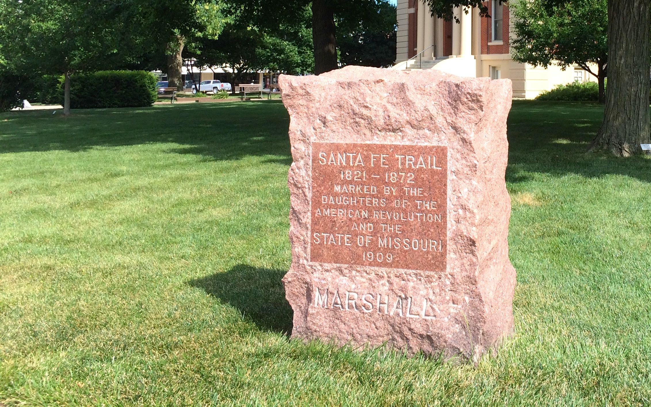
I parked my truck and got out to see what the people of Marshall chose to commemorate. The first monument that caught my eye was something that I wasn’t expecting.
I wouldn’t have thought that the Santa Fe Trail ran through here, but you learn something new every day. I find it interesting that they decided to commemorate it 37 years after the fact. I wonder if there is an average length of time it takes people to decide that they need to create a permanent memorial to something.
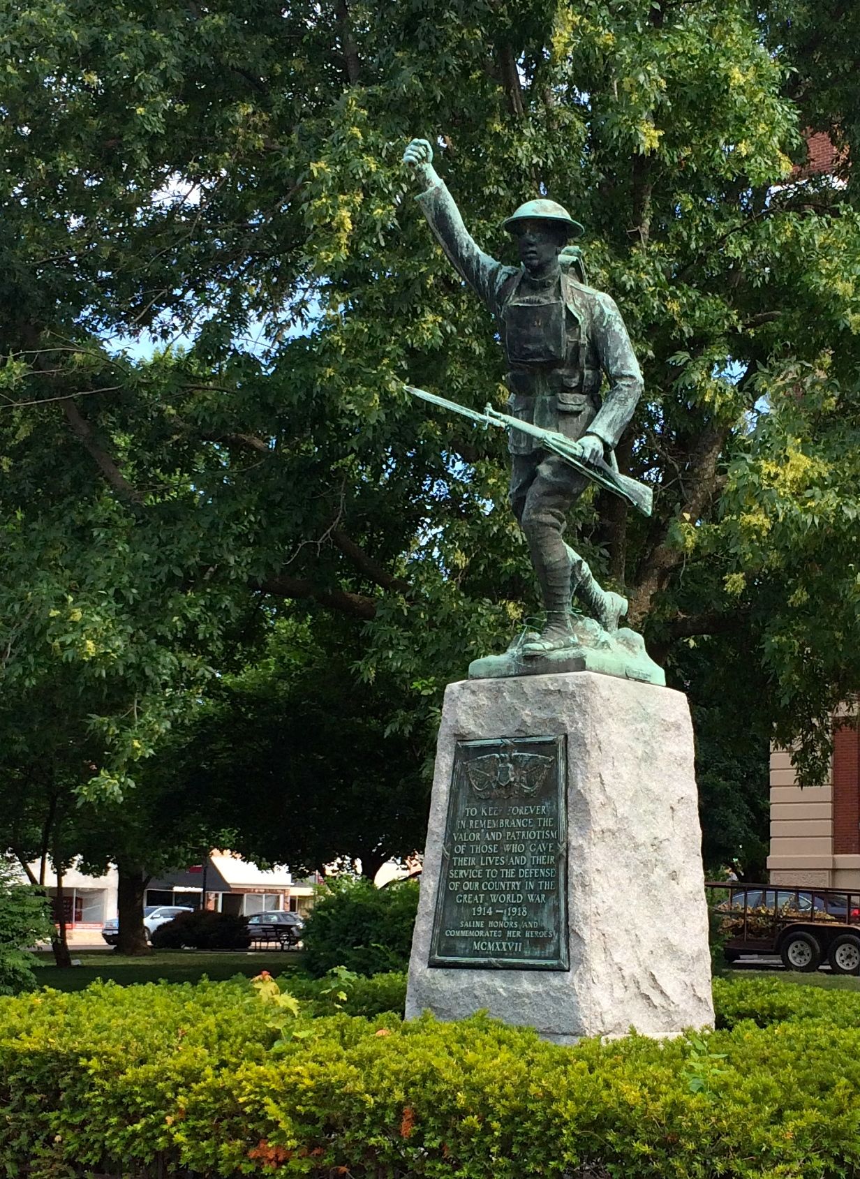
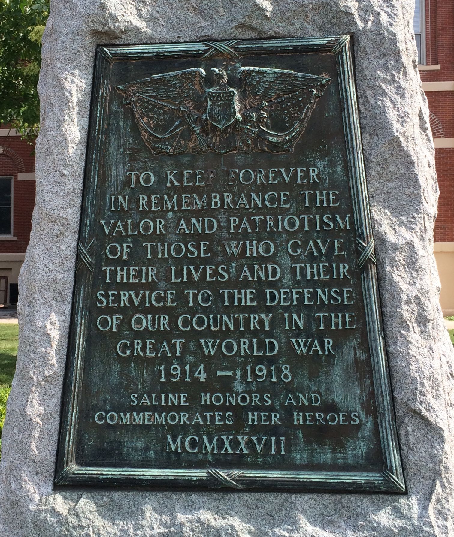
This action-filled bronze commemorates the soldiers of World War 1.
This time, it only took them 11 years to create the memorial.
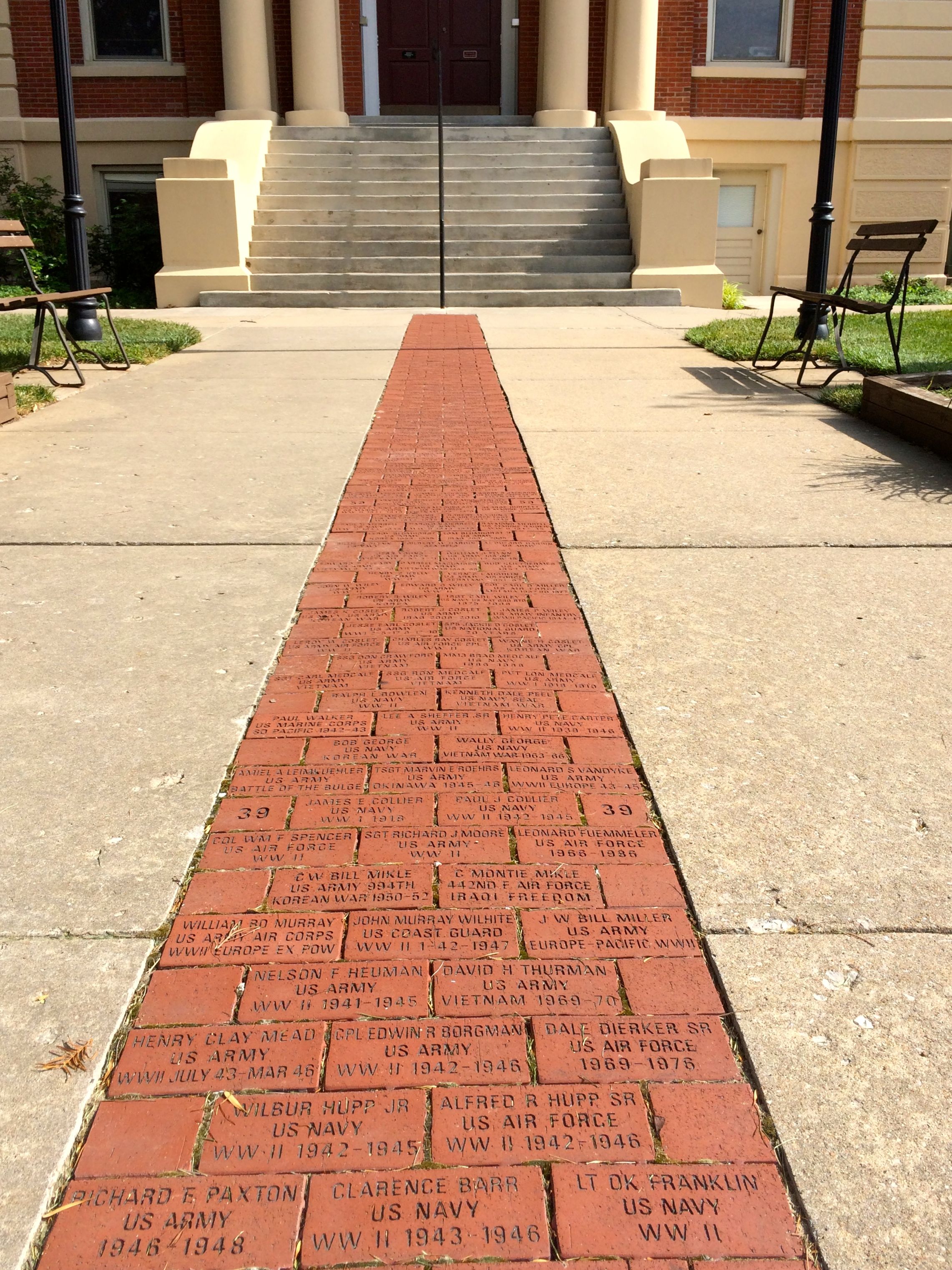
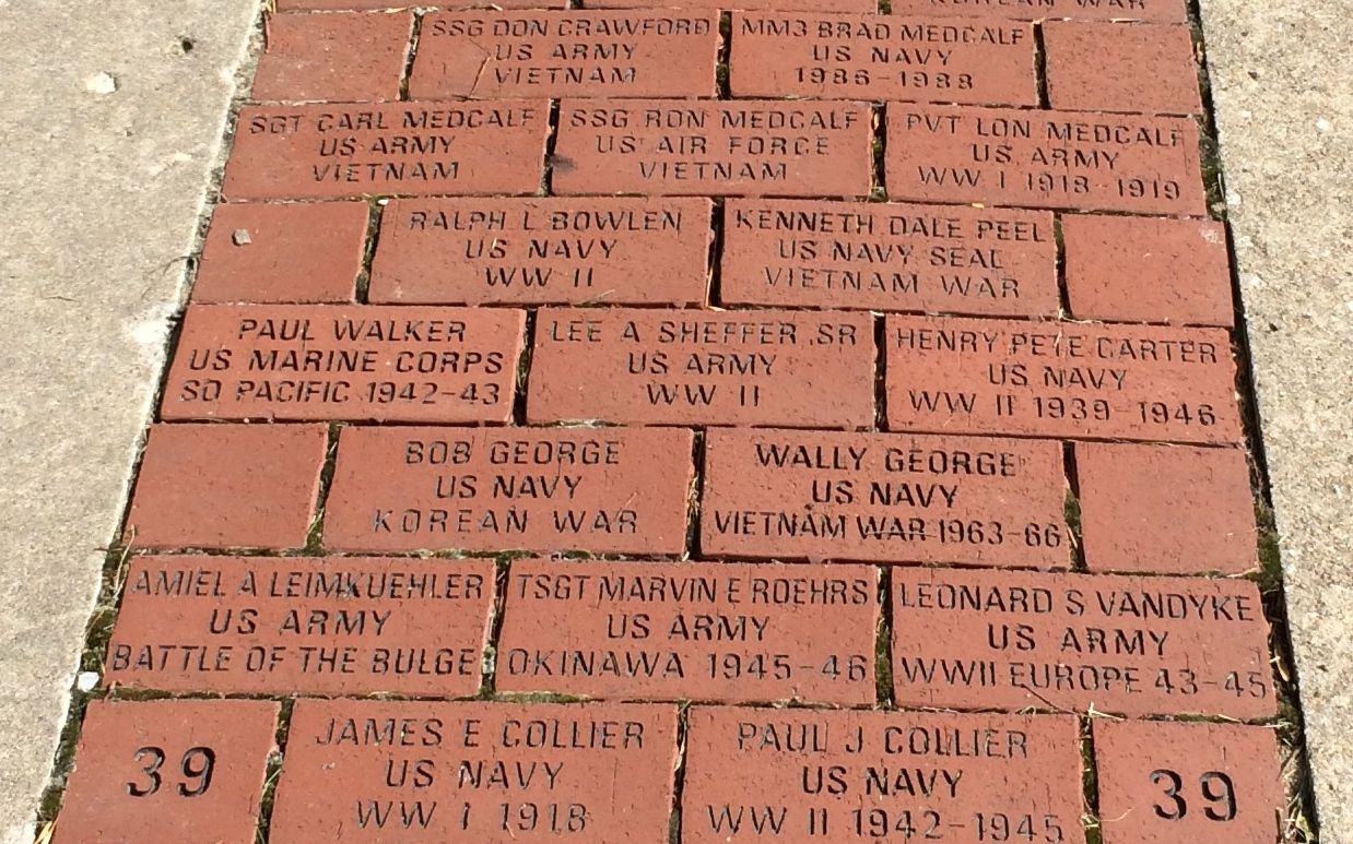
The walk leading up to the courthouse door is paved with the names of people who served in the wars starting with World War I. As the bricks look so new and the lettering is so crisp, I imagine that this was part of the renovations they did in 2010.
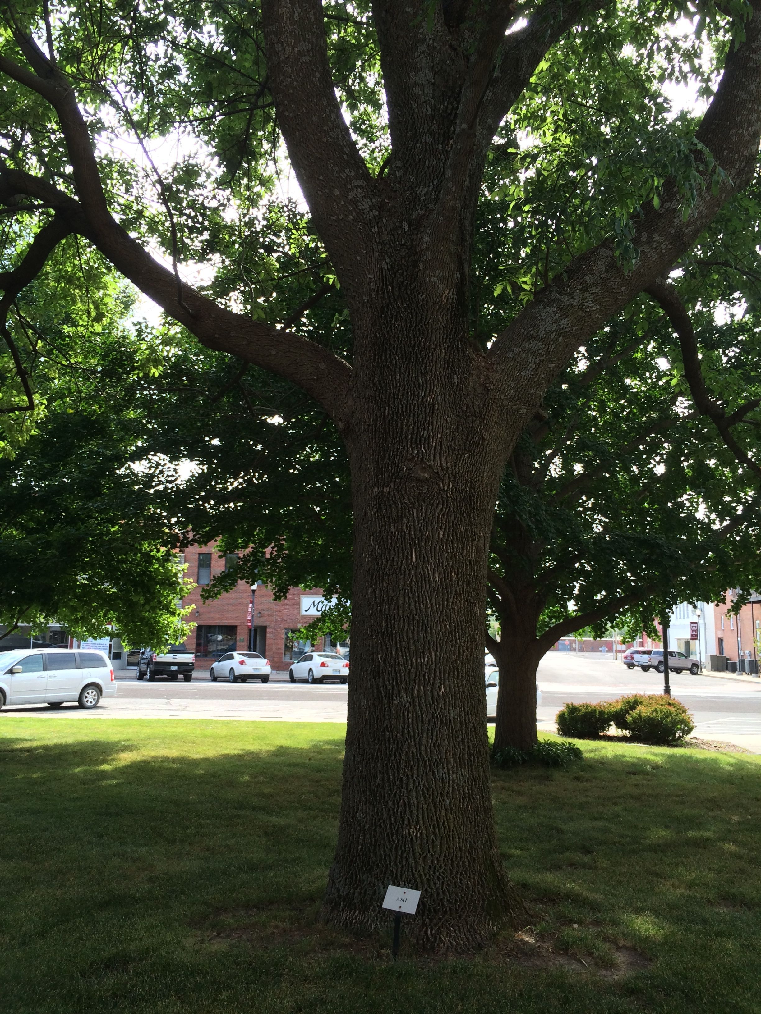
As I continued around the courthouse, I noticed the lush landscaping. They had the trees labeled, which I thought was a particularly lovely thing to do. I am always wondering what I am looking at. This is not to say that I am going to remember the names, but I appreciated their effort.
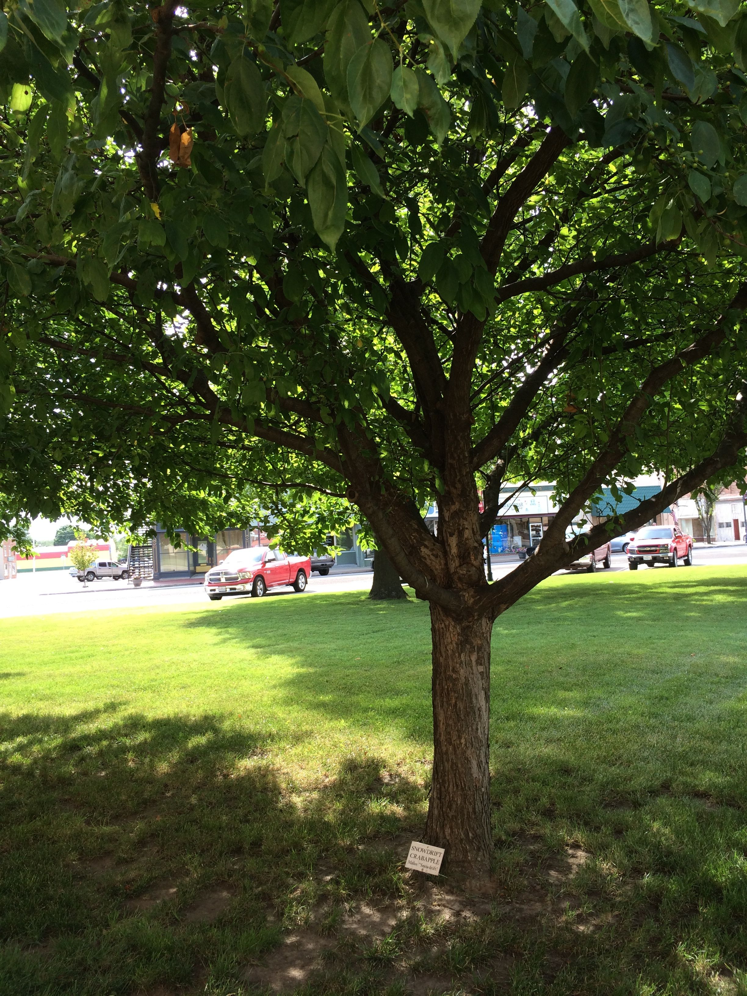
This is a snowdrift crabapple. The tree below is an ash.
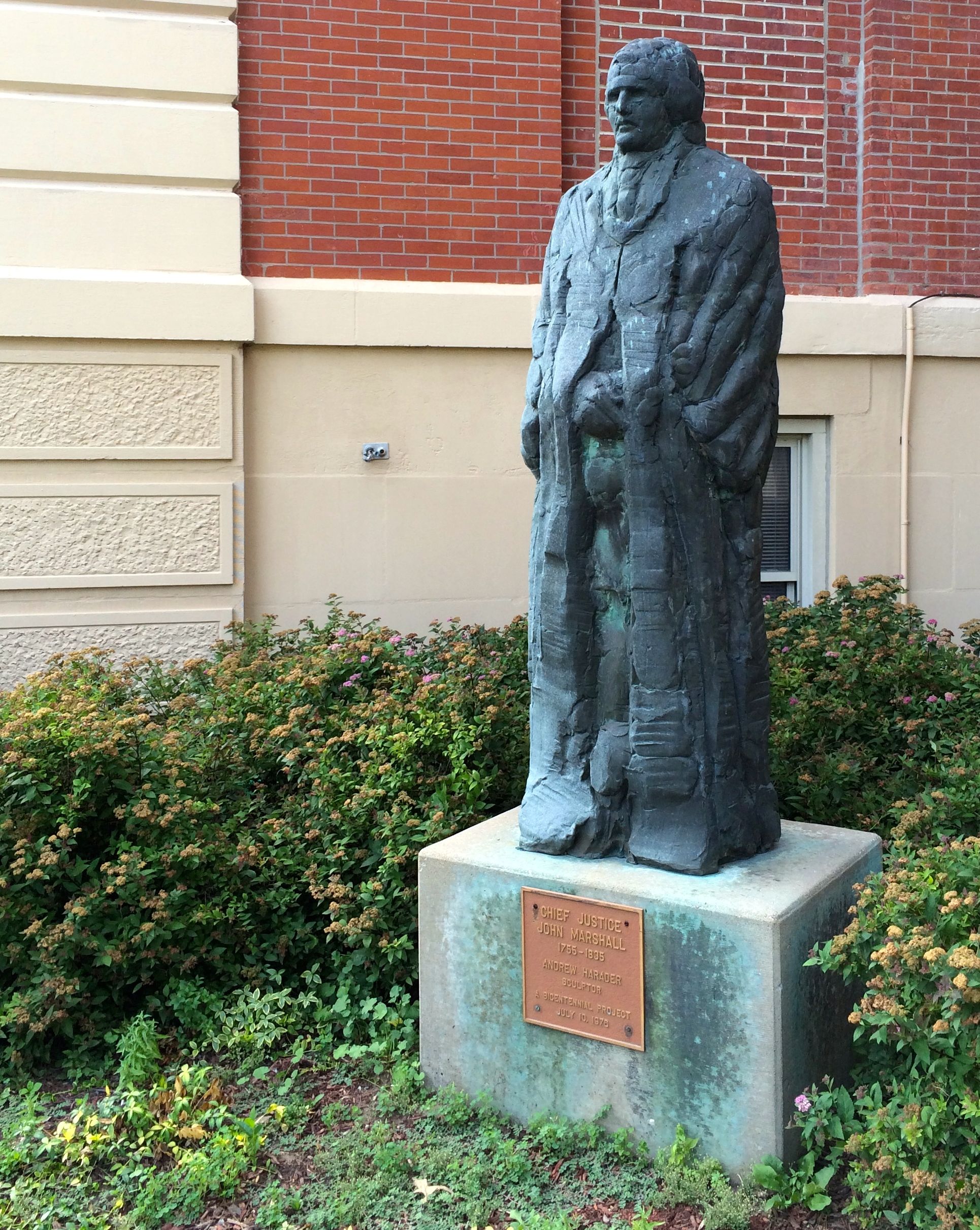
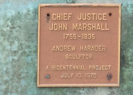
As I got around to the other side of the courthouse, I noticed a statue. It was Chief Justice John Marshall.
From the plaque on the base, you can see that this sculpture was part of the memorials created during the nation’s bicentennial in 1976.
That is a more permanent – and classier – way to commemorate the nation’s bicentennial than the formerly ubiquitous Bicentennial Fire Hydrant.
I got around to the far corner of the courthouse square and came upon the more memorials.
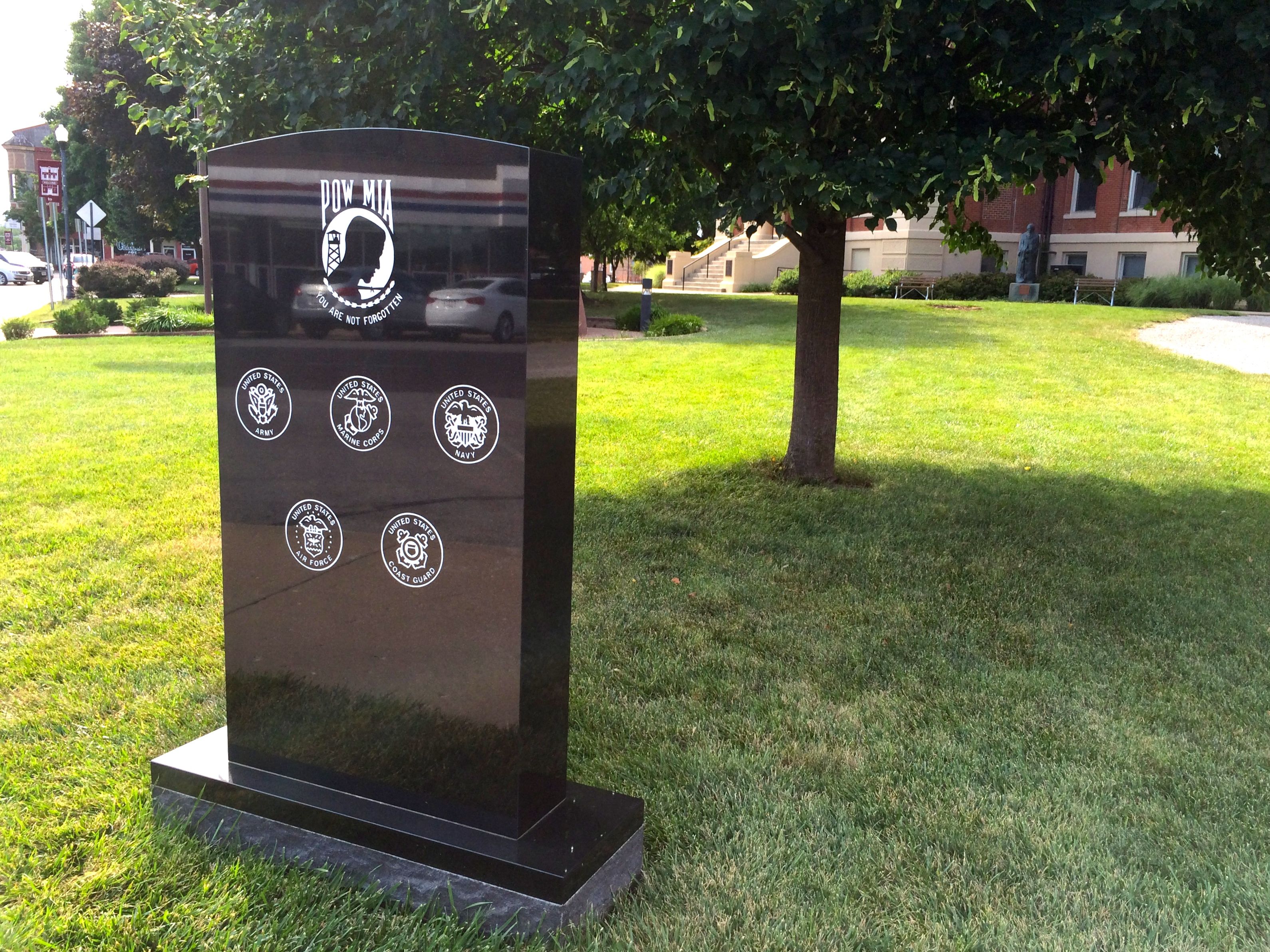
There was one for the POW/MIA. On the back are all the names that they are memorializing. The sun created glare, so I don’t have a photo of that side.
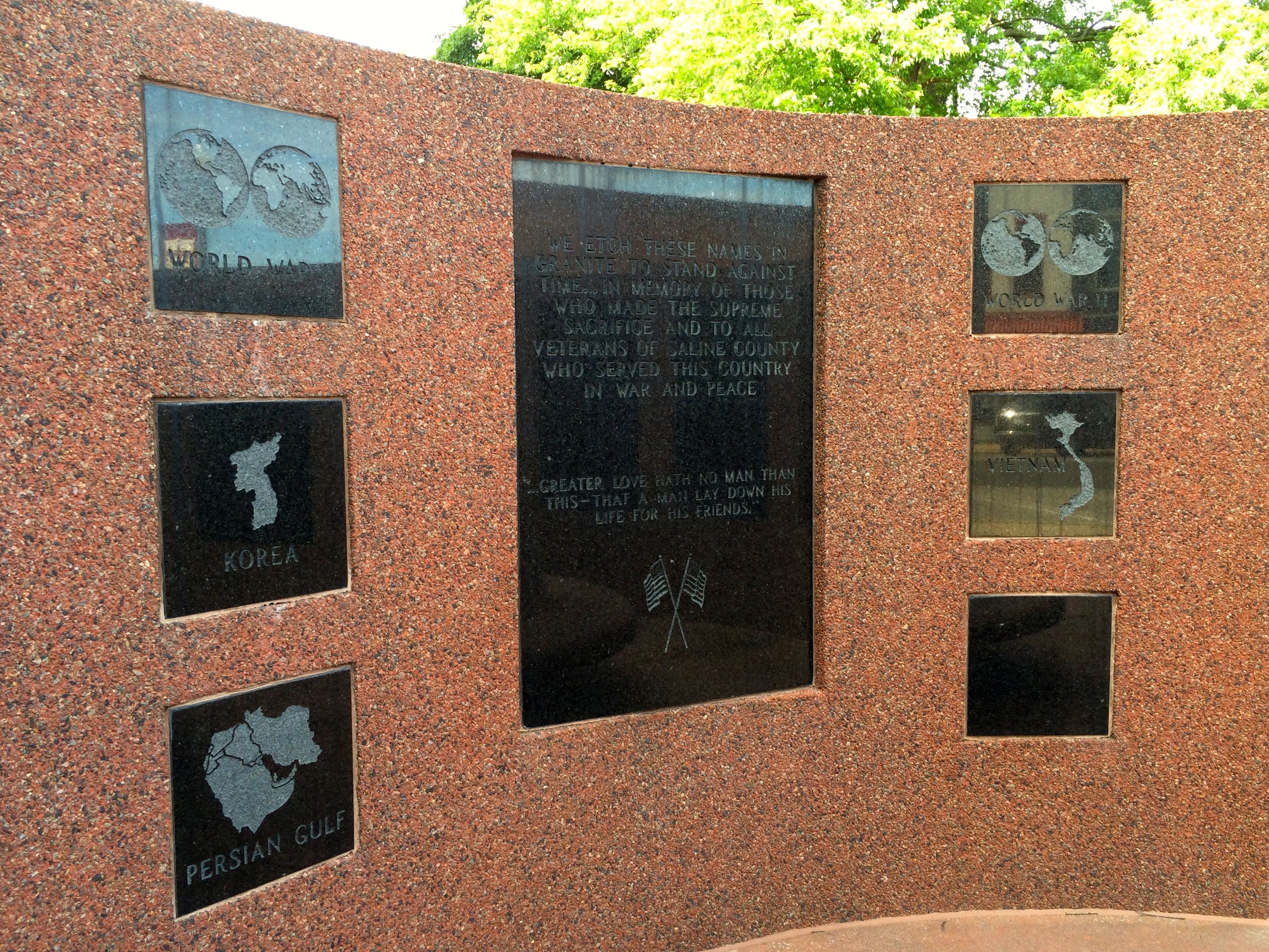
This memorial is dedicated to the wars and conflicts since World War I. While I am pleased that they are remembering the past, it saddens me that they have left a blank square for the next war.
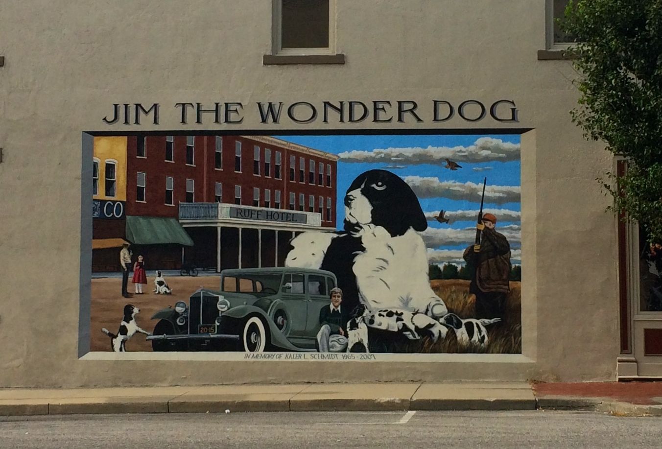
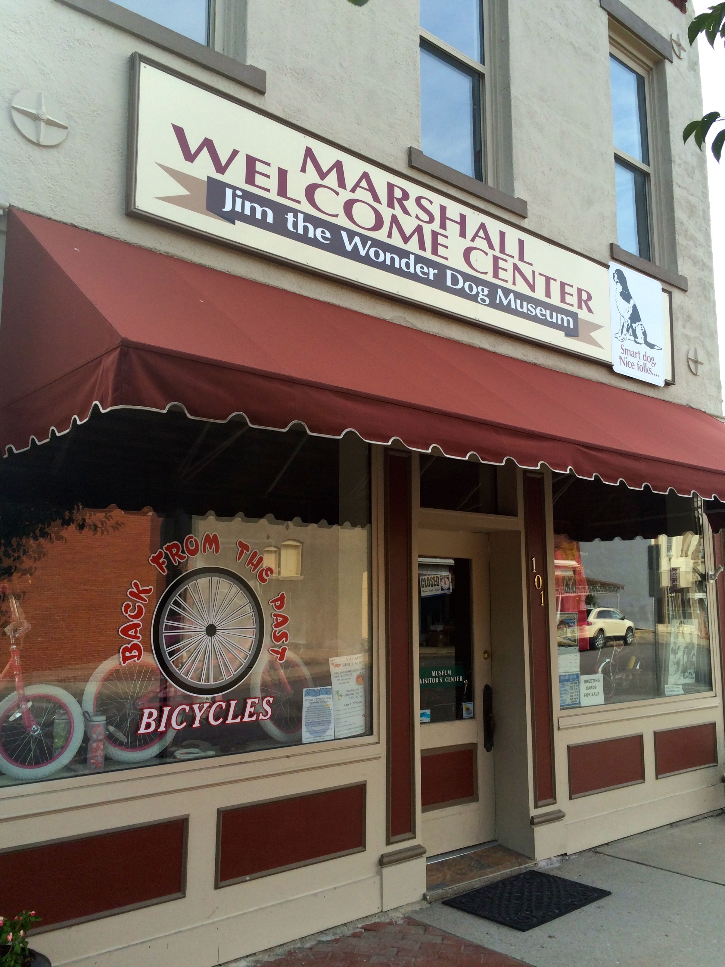
With this thought hanging on my heart, I headed back to the truck. On the way, a large mural caught my eye.
Jim the Wonder Dog?! This I had to check out!
The mural is on the side of a truly multi-purpose building. Marshall Welcome Center, Jim the Wonder Dog Museum AND Back from the Past Bicycles. Of course, it was closed, but I did look through the windows.
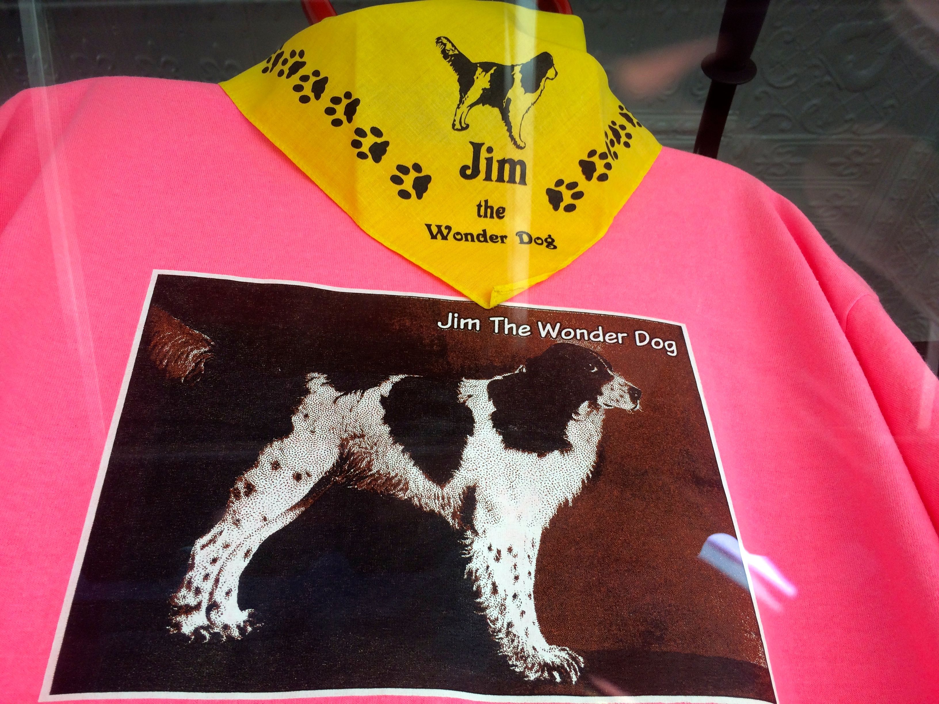
If it had been open, I could have bought a Jim the Wonder Dog tee shirt and a Jim the Wonder Dog Bandana.
They even had a new Jim shirt available!
Since the museum was closed, I had to resort to the Internet to learn more about Jim and find out what made him a Wonder Dog.
Jim was a Llewellin Setter that lived from 1925-1937. He reportedly predicted the sex of unborn babies, the winner of the Kentucky Derby seven year in a row, as well as the Yankee victory in 1936. He also could follow orders given to him in many differs languages, even though his owner only spoke English. So amazing were his talents that a joint session of the Missouri Legislature was called in order to witness Jim’s talents.
If you want to learn more about Jim the Wonder Dog, you can always make a visit to Marshall and see the museum. It might be open. After my experience with the Roger Miller Museum in Erick, Oklahoma, it might be worth a call to check before you head over. You could also check out the Jim the Wonder Dog website.
And then it was time to head back to camp. I had another day of driving ahead of me in the morning.
You know how they say that there is no such thing as a free lunch? (I’ve already established that there is no such thing as a free cat.) For some reason, I thought I had won a stay at a campground in Branson. Well, I didn’t have to pay for it, but I did have to sit through a 90 minute sales pitch. I guess it was worth the hectoring I experienced for four free nights in Branson. I also received $100 in gift certificates for Camping World. And, I have more nights of free camping at the locations in their chain, if I care to use them.
If I get in the neighborhood of one of their facilities, I might take advantage of the offer. I mean, I did sit through the sales pitch. And free is my favorite price.
This seems to be a membership camping club. The saleswoman made a point of telling me several times that it wasn’t a timeshare. I didn’t exactly know what a timeshare was, but I found out while I was in Branson!
After I got into the campground and got the trailer situated, I went to the grocery store. As I was checking out, I noticed that there was a booth selling tickets to the shows in Branson. I figured that I should probably try to catch a show – after all, that is what Branson is famous for.
The salesman told me that all the tickets were $15. That sounded good, so I picked out a couple of shows. Then, he did a bunch of figuring and then turned the paper around and asked me if I’d like to see them for free.
Again, that siren call…free!
He told me that if I went to an informational meeting at the timeshare, I could have the tickets for free and I’d get a $50 gift card, too.
Well, why not?
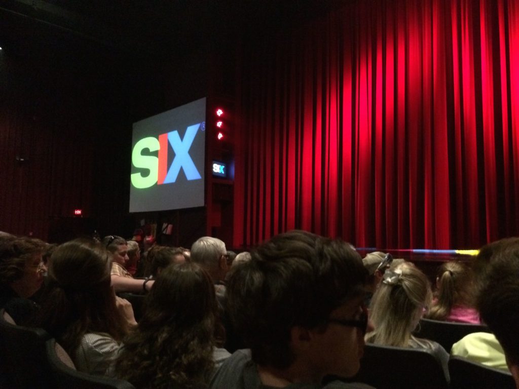
The meeting would be in the next day. I got my groceries home and went to see the first show – SIX.
It was an excellent show. If you ever find yourself in Branson, I’d recommend it. SIX refers to six brothers who perform a cappella. They have been doing the show in Branson for ten years. The music quality was consistent, they had a nice variety of pieces and the production values were high.
The next day, I went to the timeshare meeting. I really didn’t know much about what a timeshare was or how it worked. What I did find out was that they are very good at salesmanship and that I am not in the market for what they are selling.
The barrage of selling was orchestrated much like a fireworks display.
They had peaks and valleys of pressure and engagement. The very end was wild. It was like the closing display. I think there were three – maybe four – salesmen at my table within three minutes. I just kept saying no-no-no. Finally they let me leave. They gave me my gift card and the voucher for the other ticket.
There was one last attempt to pry money out of me. When I was leaving, they gave me a coupon for an extra gift. I turned it in, and it was a deck of cards. I don’t think they were playing cards, because the fellow at the desk told me that they were for discounts in Branson. I smiled and thanked him and handed the deck back.
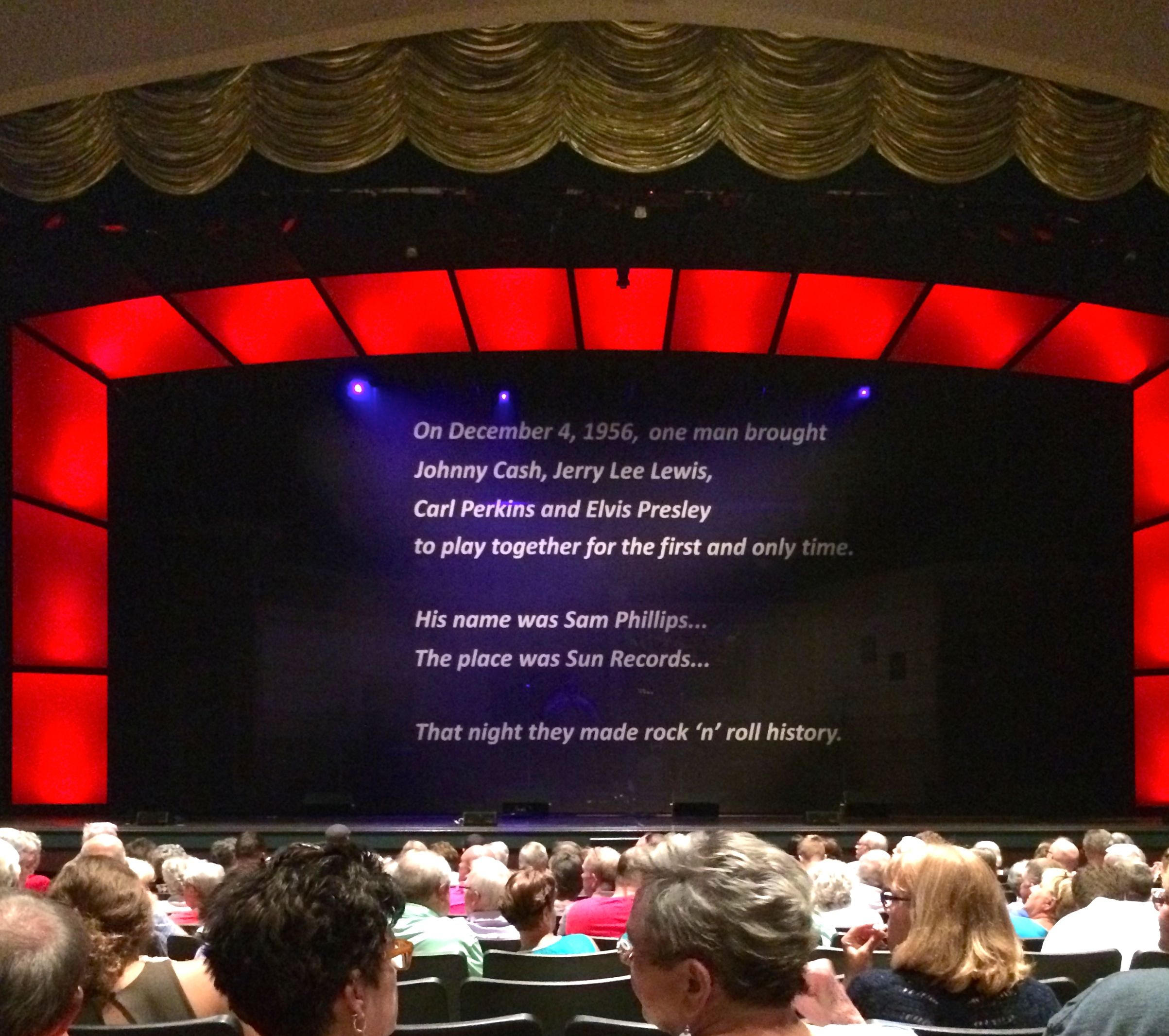
Now, it may have been a very good show. The audience was enjoying it. The thing is, I was never too into that era of music. I mean, I wasn’t even one year old when the event it is based on took place. But, I saw a show, it was well done, and it was FREE!
Now, I know, strictly speaking, the shows weren’t free. I paid for them with my time in the sales meeting. But, I count it as a win. I saw two shows, filled up my tank and bought some groceries and I found out that I am not interested in timeshares.
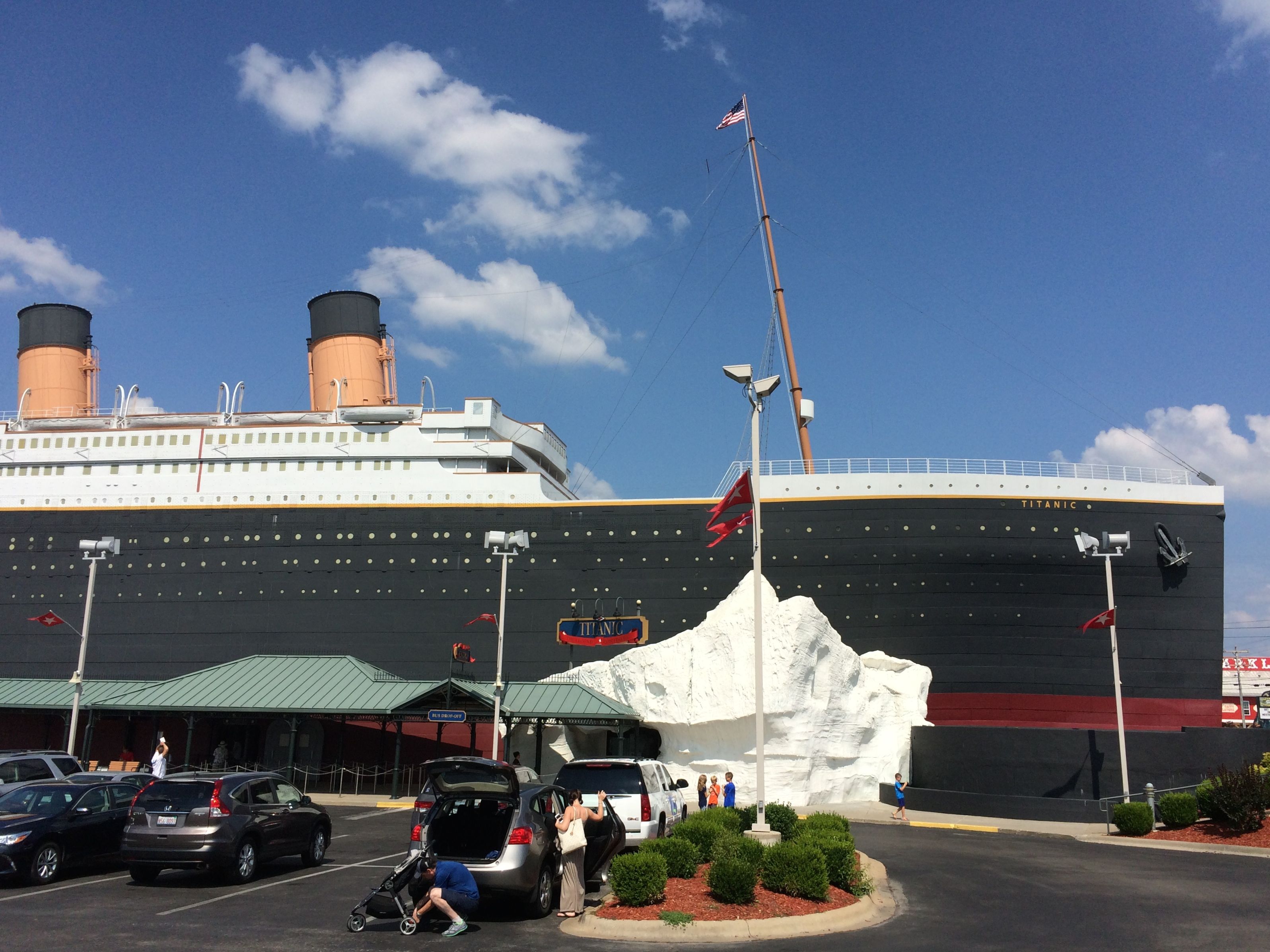
It’s not all about shows and timeshares in Branson. There are many other ways to spend money. Since I’m all about not spending money unless it is something I really want, I satisfied myself with looking.
Yes, that is a model of the Titanic sitting right there in the middle of the Ozarks. I am not sure why it is there, but there it is.
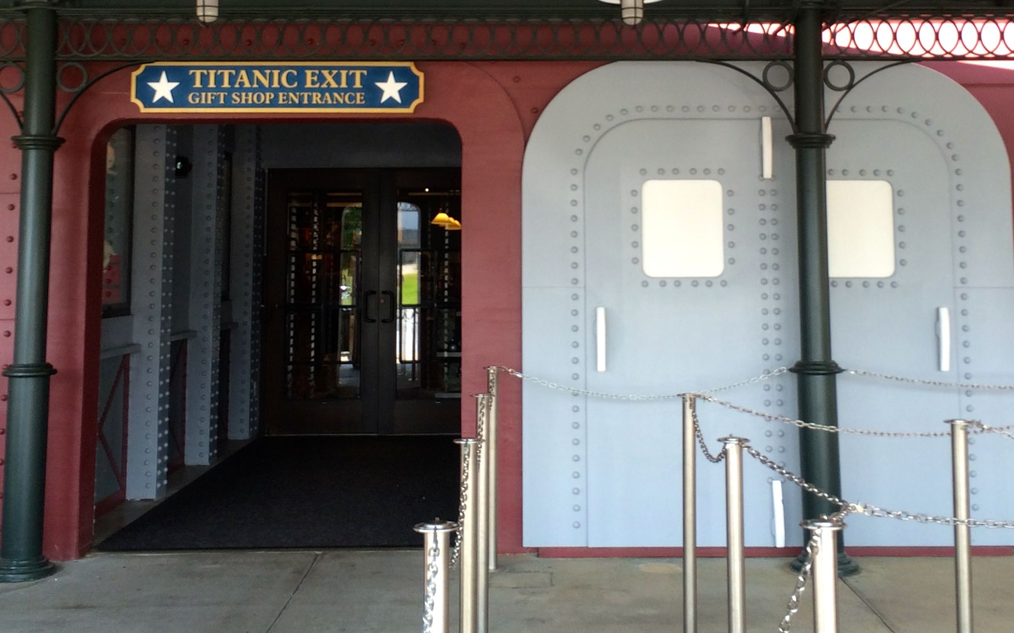
As always, you exit through the gift shop.
Would I go back to Branson? Well, probably not. For one thing, it’s not really on the way to anyplace I plan to go. Also, I hate the roads! Narrow, hilly, curvy and NO SHOULDERS! The driving was a nightmare. Also, I’ve been there – I get the picture, and there are so many more places I’d rather schedule a second visit.
My previous method of handling my money was to just keep an eye on my bank balances. I think this macro approach is more suited to my way of handling things. For instance, while my balances look fine, the amount of out-go during July has been a little scary. On the other hand, I spent less in July than I did in June or May.
But, I said I’d track my expenses for a year, and so I will persevere.
I suppose it is a bit unfair to blame the month’s high totals on poor Cora. When we got back to Kalamazoo, I took her to the vet for her shots and a checkup. It turned out that she had a tooth that needed to be removed, along with needing to have her teeth and ears cleaned. Cha-ching!
Other expenses $1085.94
Campsites 895.15
Gas 388.99
Groceries and such 314.61
Tourism 100.00
Truck expenses 81.55
Restaurants/Eating out 67.59
RV Maintenance 59.85
Food and Drink on the Go 17.17
Laundry 14.50
Tolls 0.75
Clothing 0.00
TOTAL 3026.10
I drove 1,946 miles. I stayed in three states – Michigan, Ohio and New York – and I drove through Pennsylvania along Lake Erie. Seven campgrounds were my home for at least one night.
I don’t think I have any big expenses coming up this month. I have my fingers crossed on that!
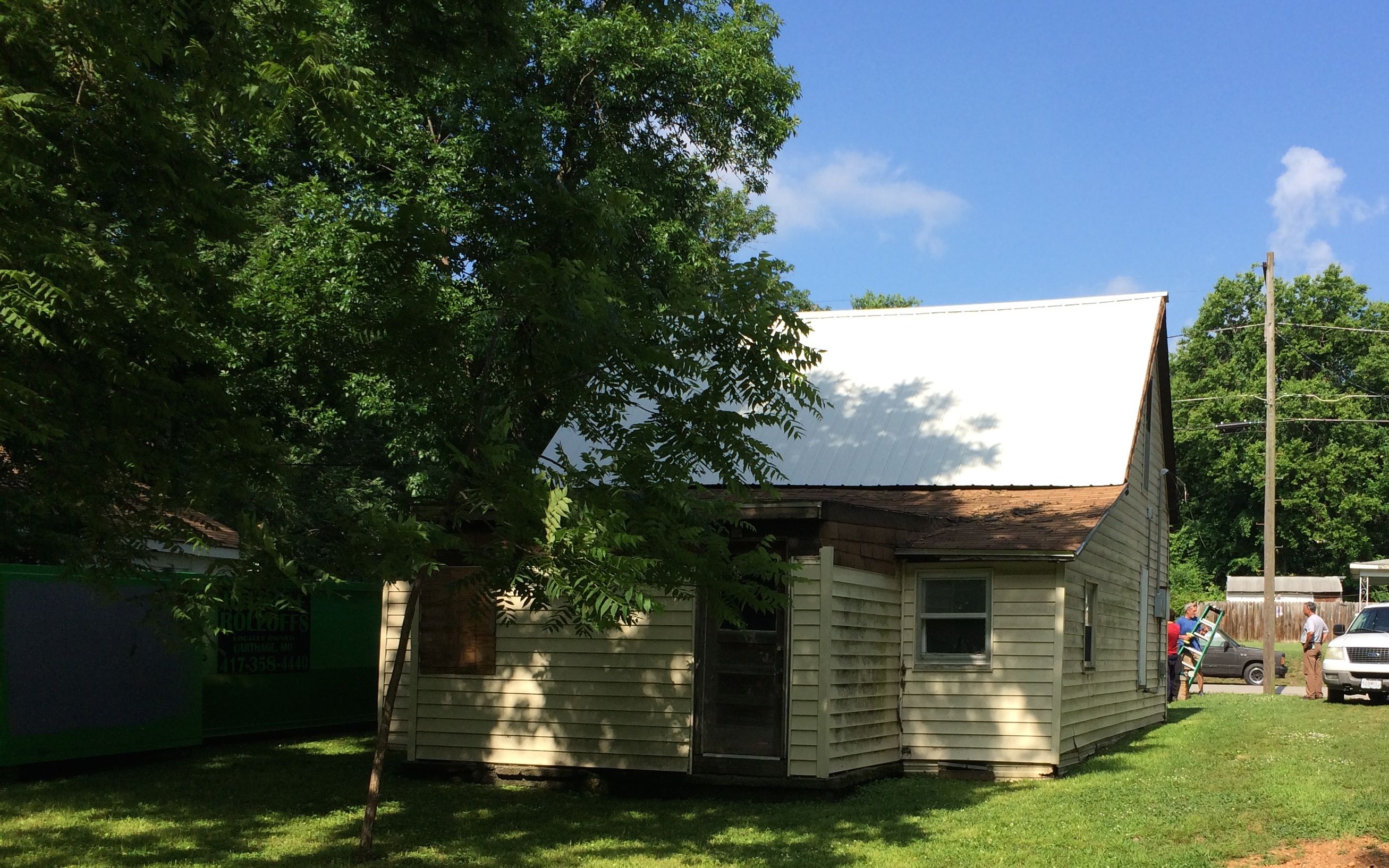
As a youngster, I read and re-read the books in the biography section in the children’s room in the basement of the Kenmore Public Library. That is where I first became acquainted with George Washington Carver. His life story really captivated my imagination. So, when HistoriCorps made available the opportunity to help preserve his first school, I couldn’t resist.
The school was started in 1872, and George Washington Carver referred to school as “the Golden Door of Freedom.” When Missouri was directed to provide for education of the former enslaved people, they bought a building that had been built on speculation. It was a two-room building built in the style called “hall and parlor“. It was intended to be a house, but it had not yet been lived in when the city bought it. It was used as a dwelling after it was no longer used as a school. HistoriCorps‘ task during the three weeks it scheduled to work was to take off the additions and stabilize it for future preservation.
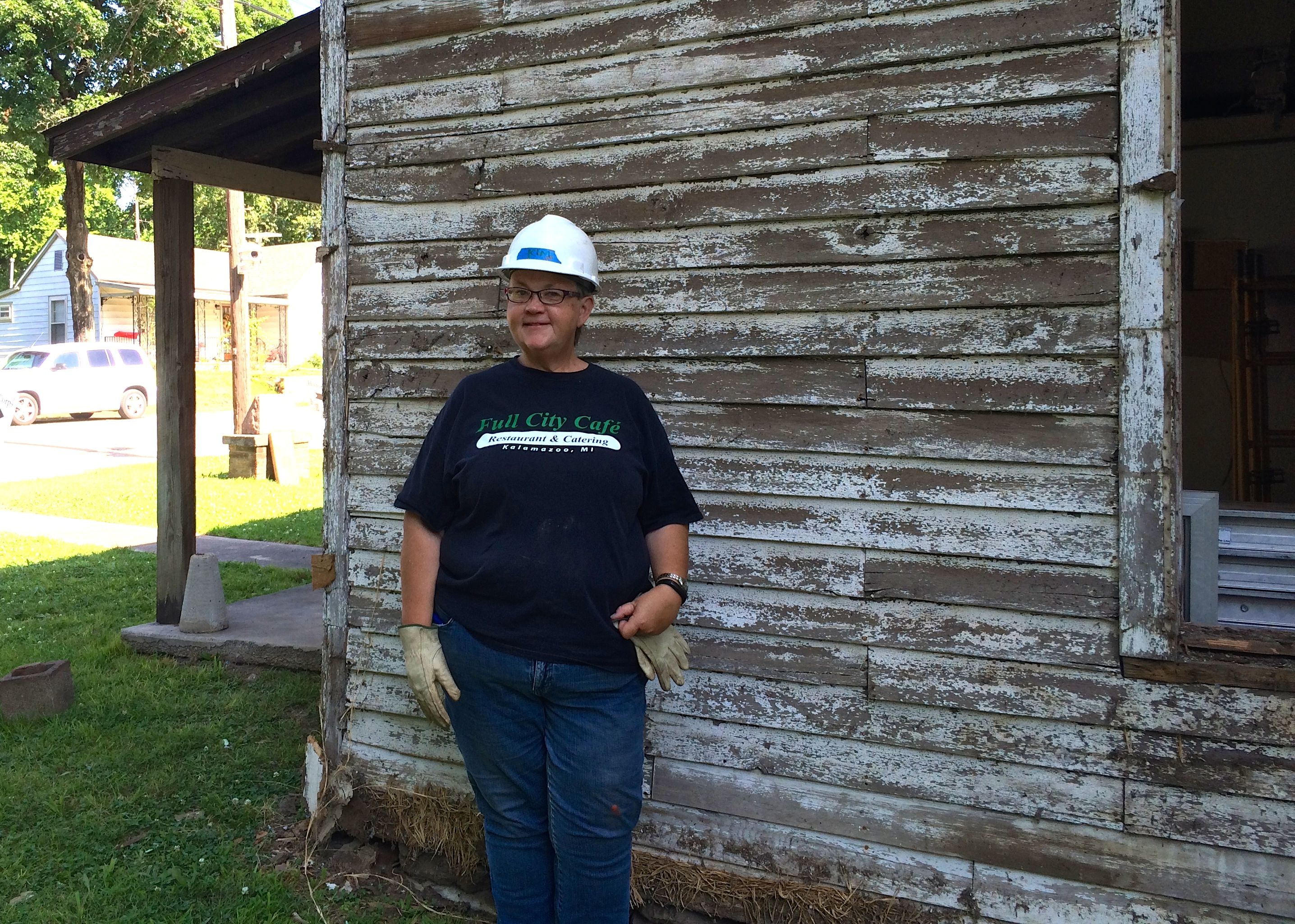
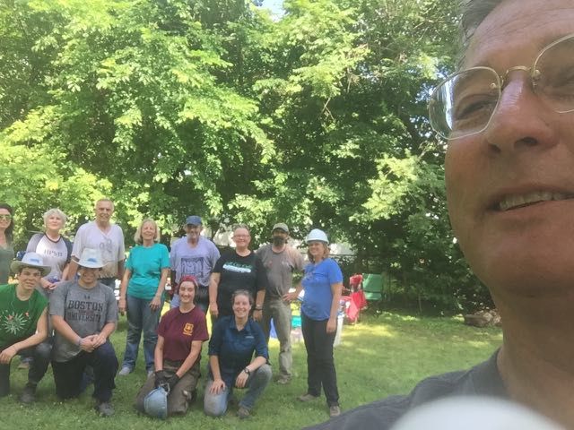
The first day of the project, we met at the school and posed for our team portrait.
You know, after counting the people in this photo, I think some folks are missing from the picture. It was a busy job site – someone was always working!
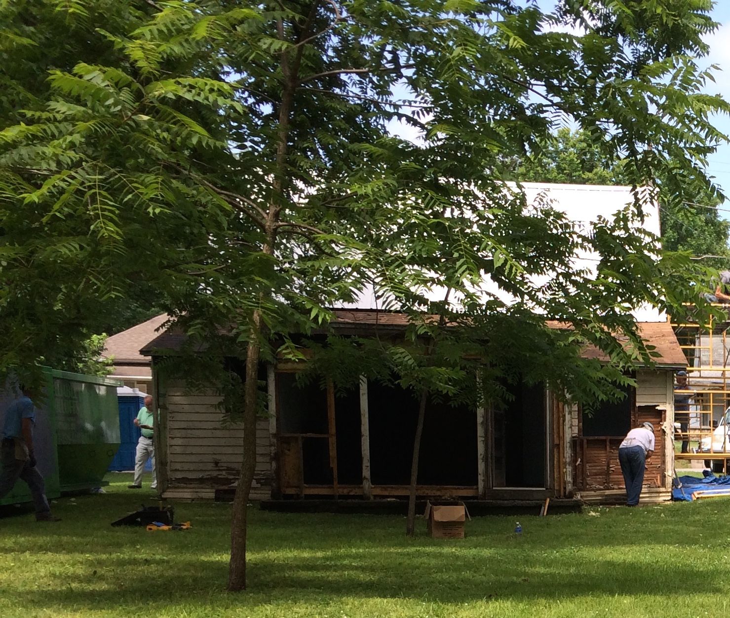
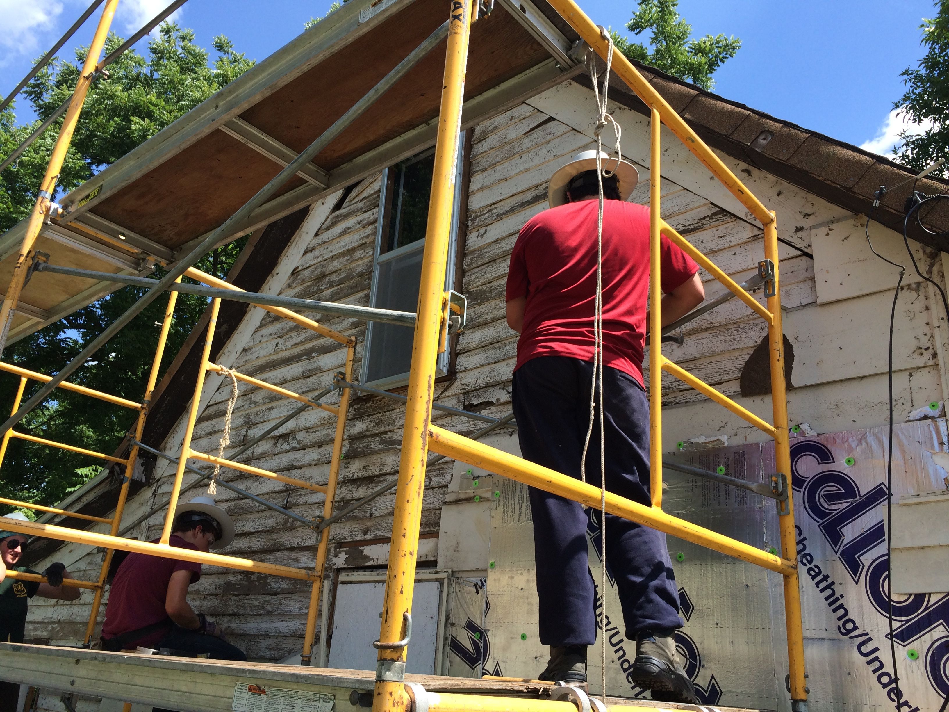
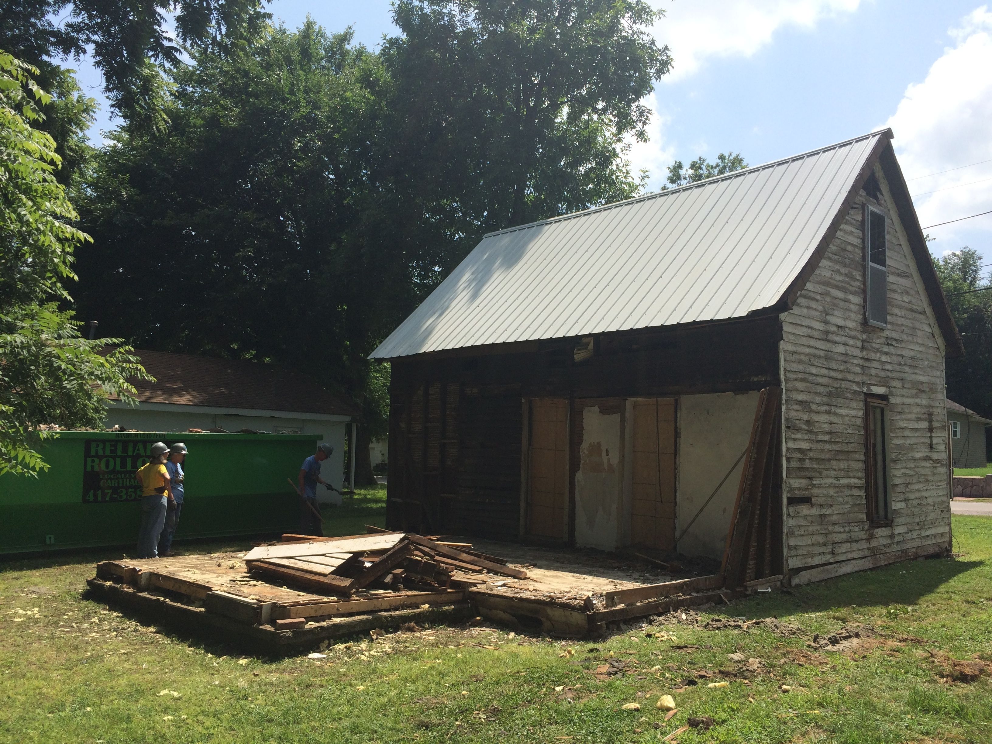
The our first project-related task was to walk around and check out the building and identify what we would be doing. Our job was to remove the additions that had been made to the back, as well as all the non-original siding. The porch would be removed by a later team.
Standing on the porch, which is one of the additions that needed to be removed, is a ranger from the George Washington Carver National Monument. The rangers came by often – sometimes as part of their workday and sometimes after hours in their civilian clothes.
This is the view of the back of the building, most of which we would be removing. Mature trees lent much appreciated shade in the steamy Missouri weather.
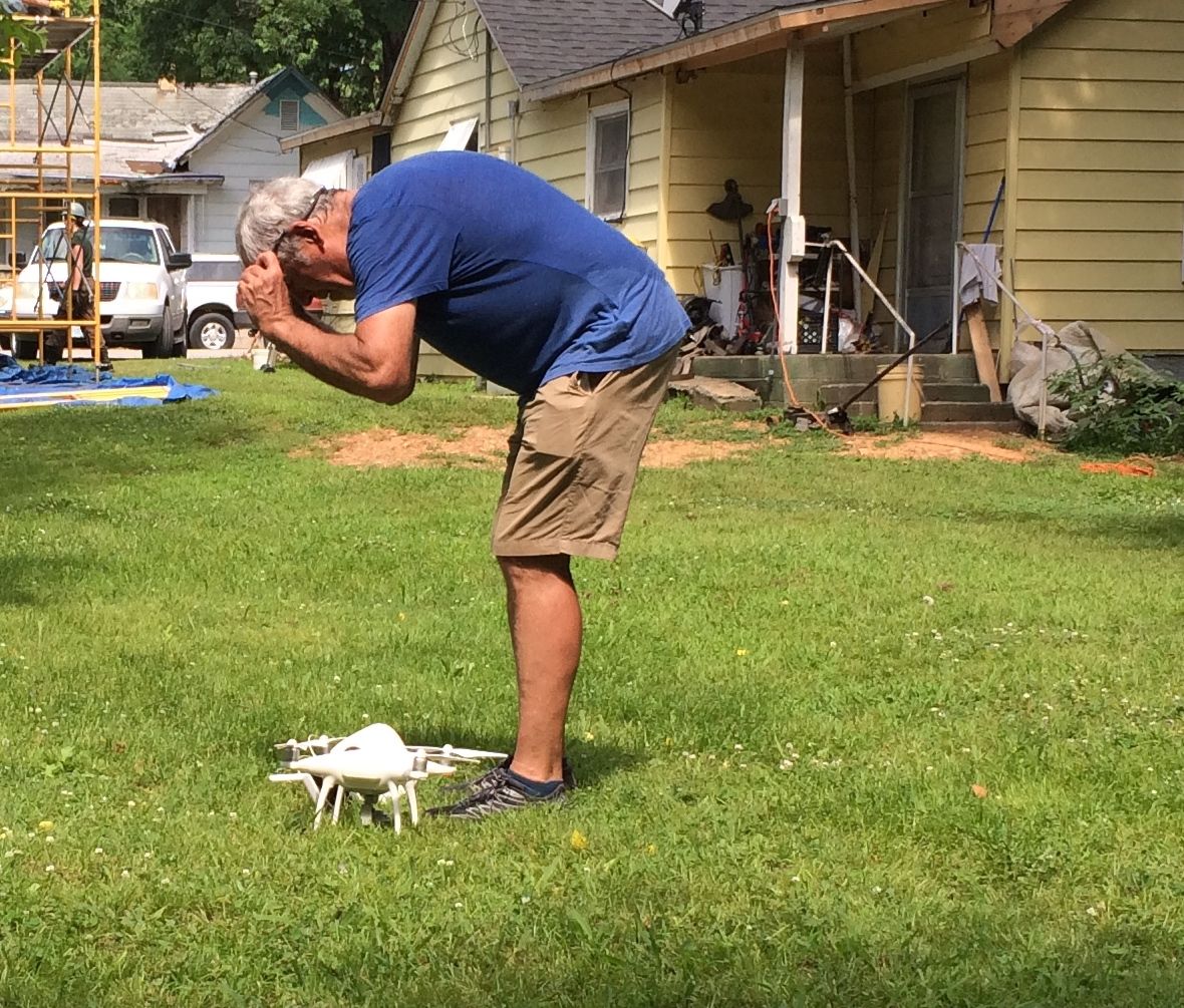
There was a lot of interest in our project. Here, you can see a photographer installing a time-lapse camera. It was set up to take a photo once every five minutes to document the changes taking place.
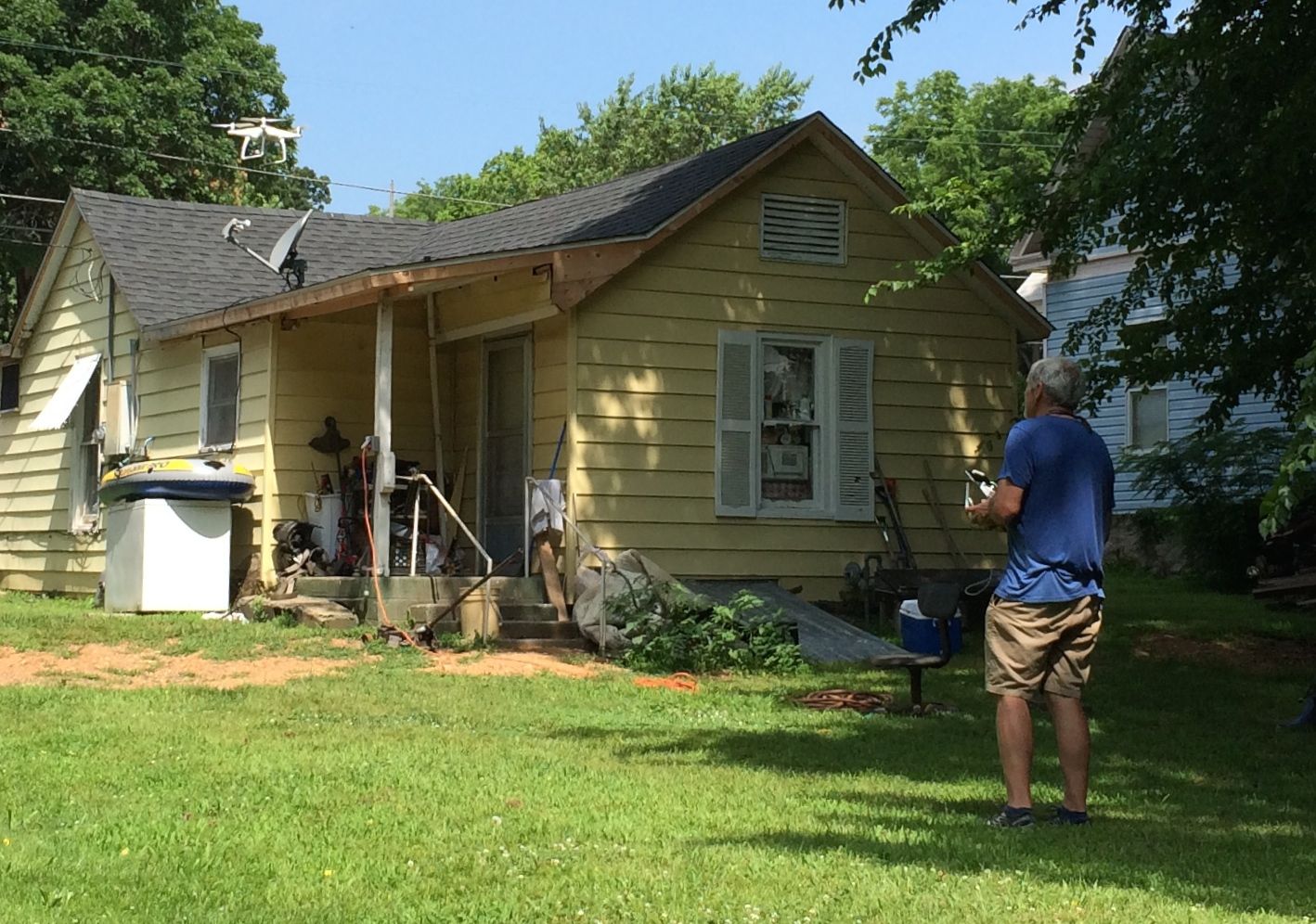
The photographer, whose name was Jim (I think) even captured our work with a drone.
And here it is – up in the air. I hope the show ends up being made – and that I get a chance to see it!
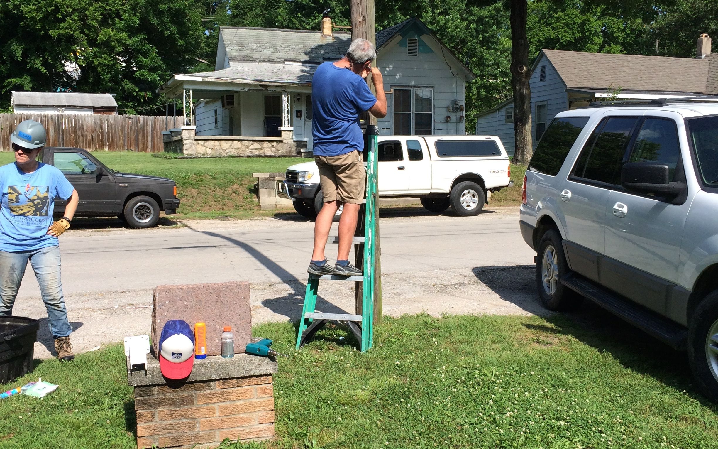
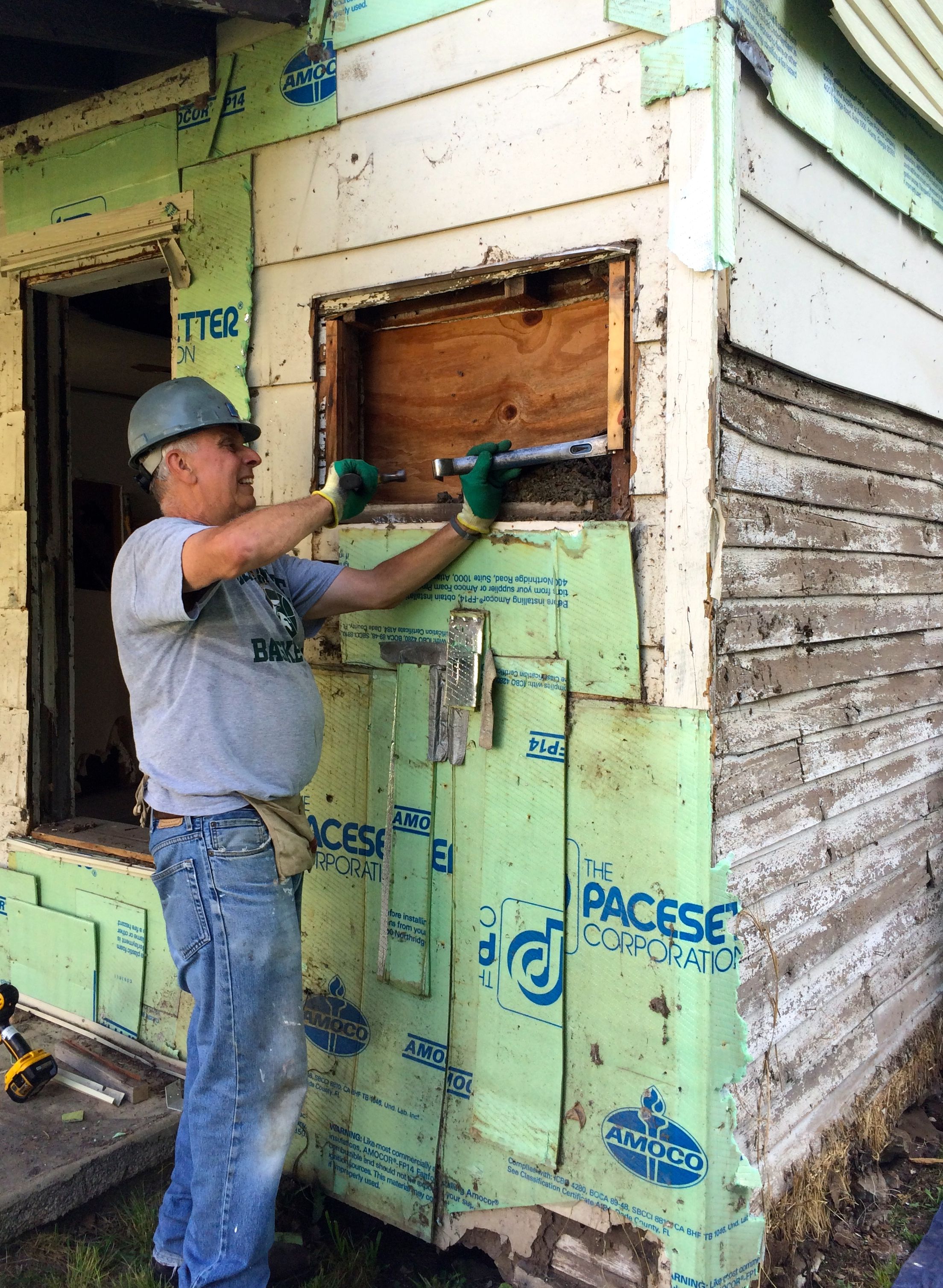
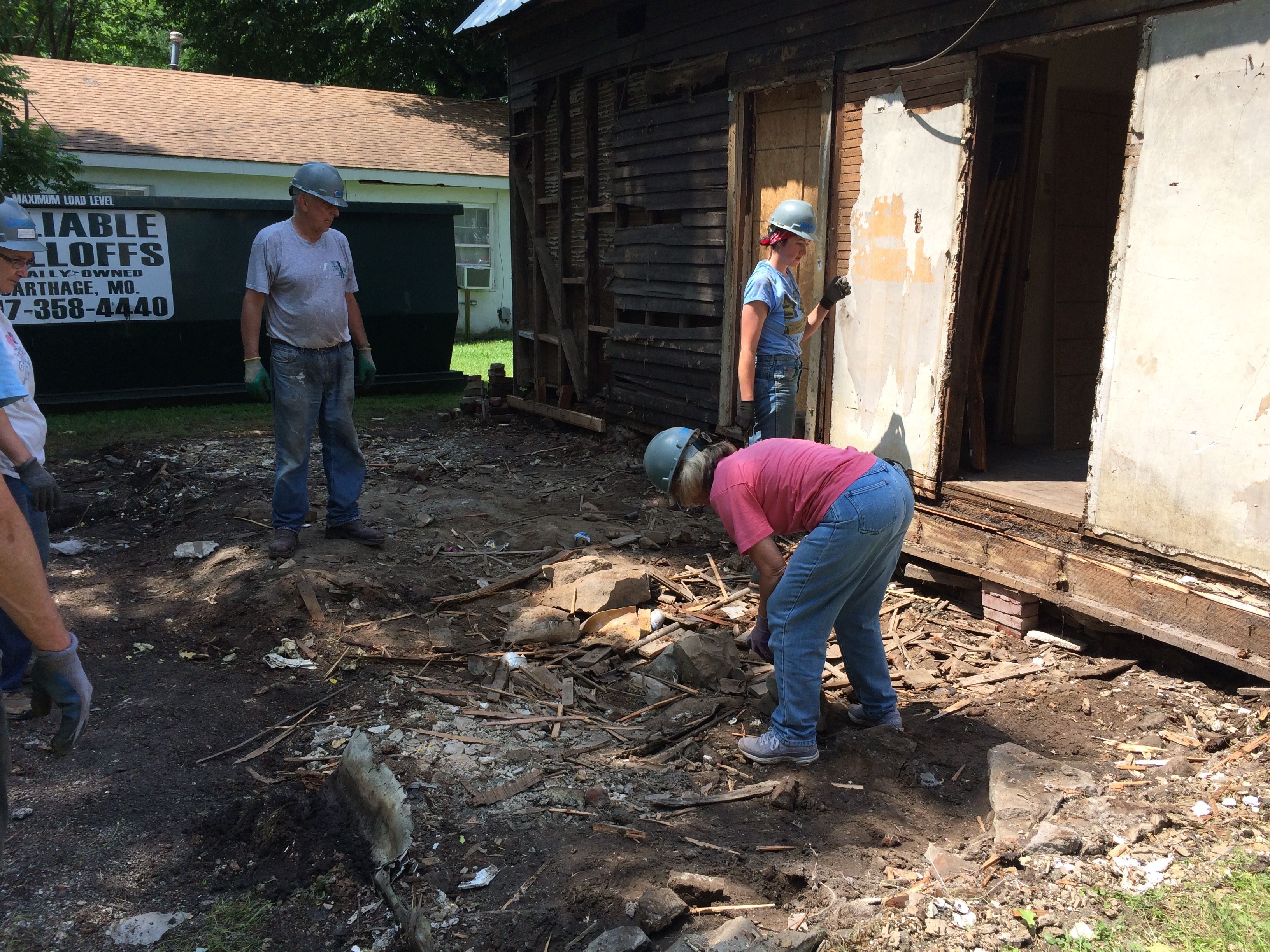
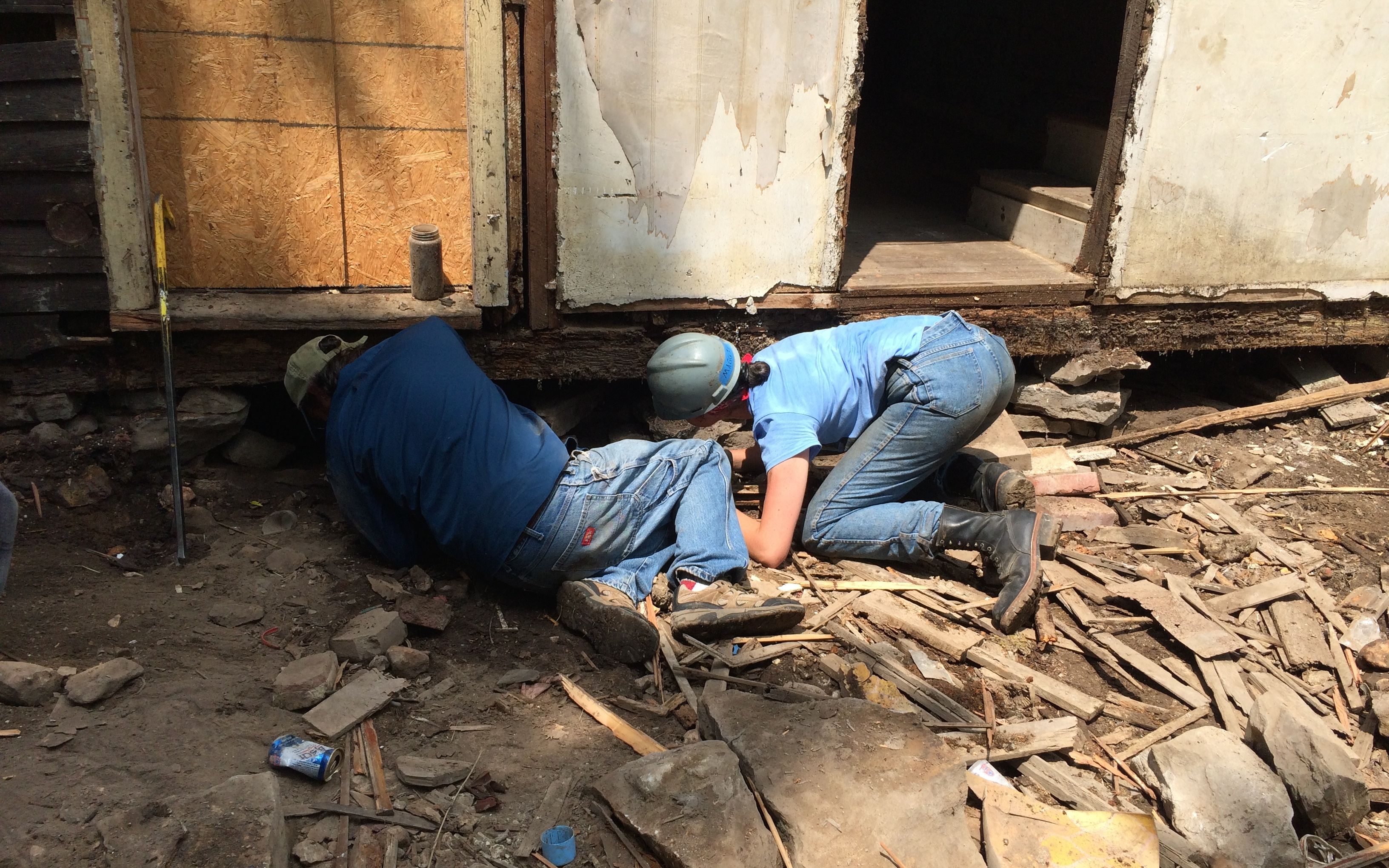
We were finally issued our hard hats and set to work. First job, remove the siding on the additions in the back.
We made good progress. By the time we broke for lunch, the back was pretty much stripped.
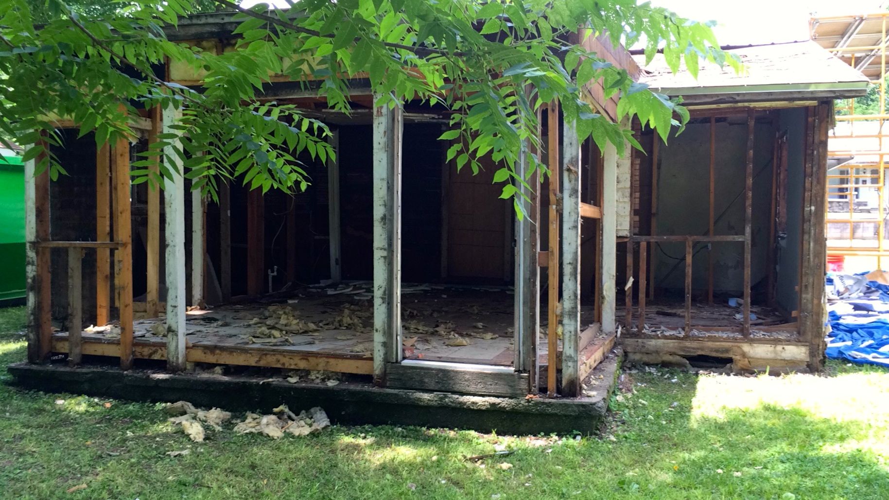
After lunch, we had the additions cleared off, right down to the studs.
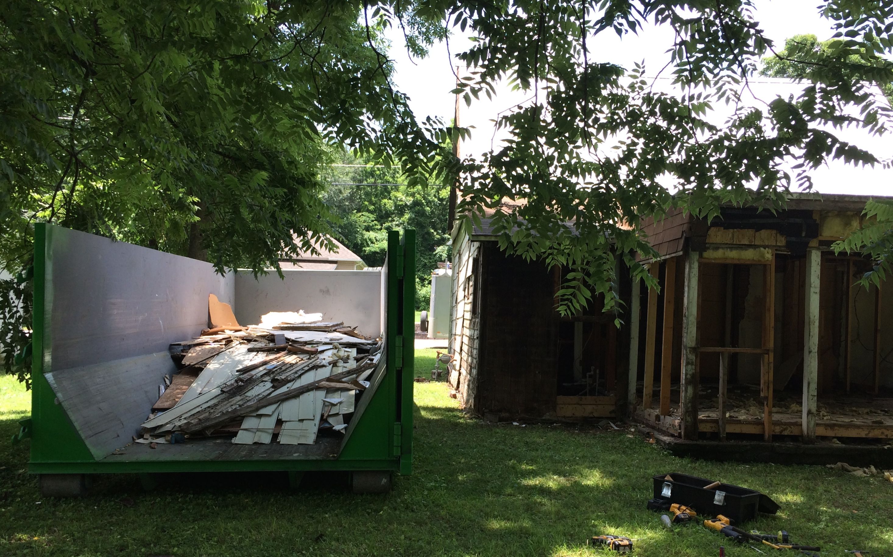
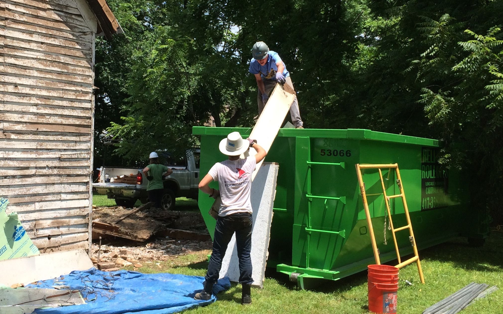
We were getting that dumpster filled up!
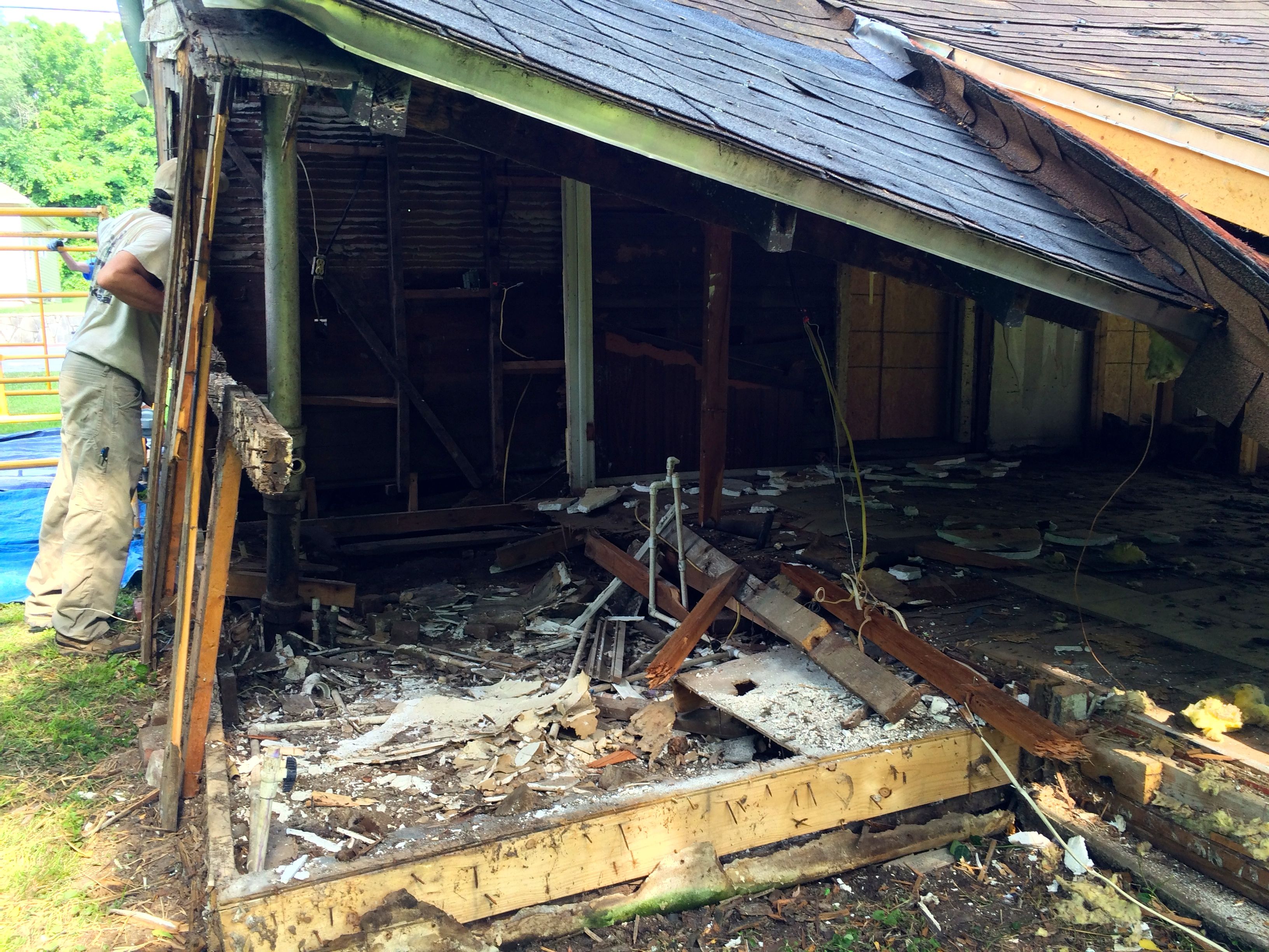
Talk about a room with a view! No walls – all windows!
The two young men from New Jersey made short work of the siding on the ends of the buildings. They got down to the original siding quickly.
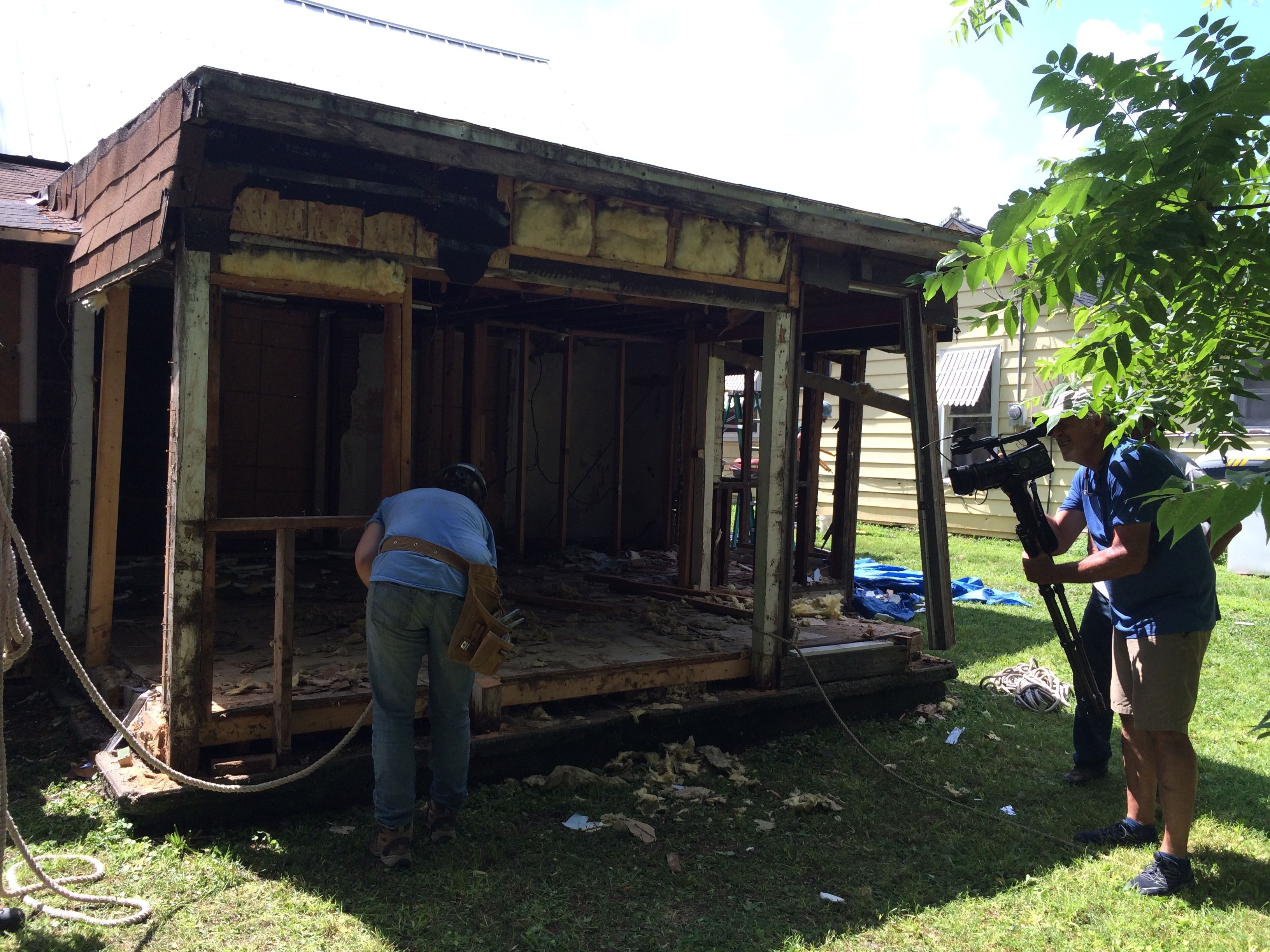
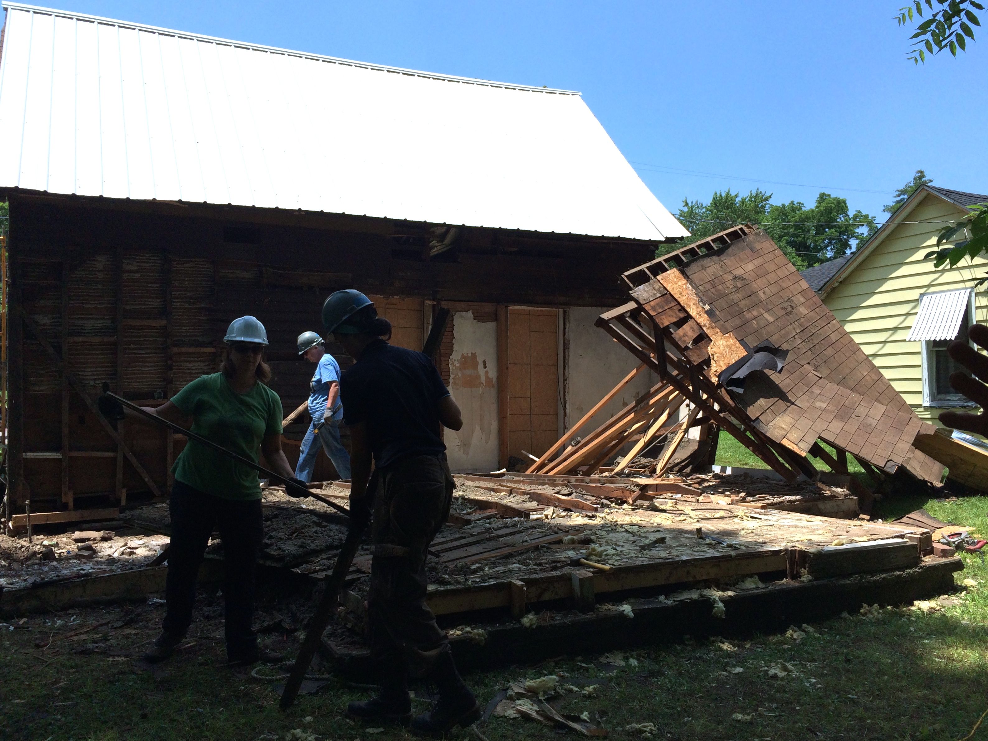
Our last task on day one was to collapse the additions. Here you can see the photographer documenting the job. The first thing we tried was pulling it down with ropes. Half of us got on a rope on the left side and the other half of us were on the right side. On the count of three, we pulled and we pulled. Nothing happened.
We repositioned the ropes and tried again. Nothing budged.
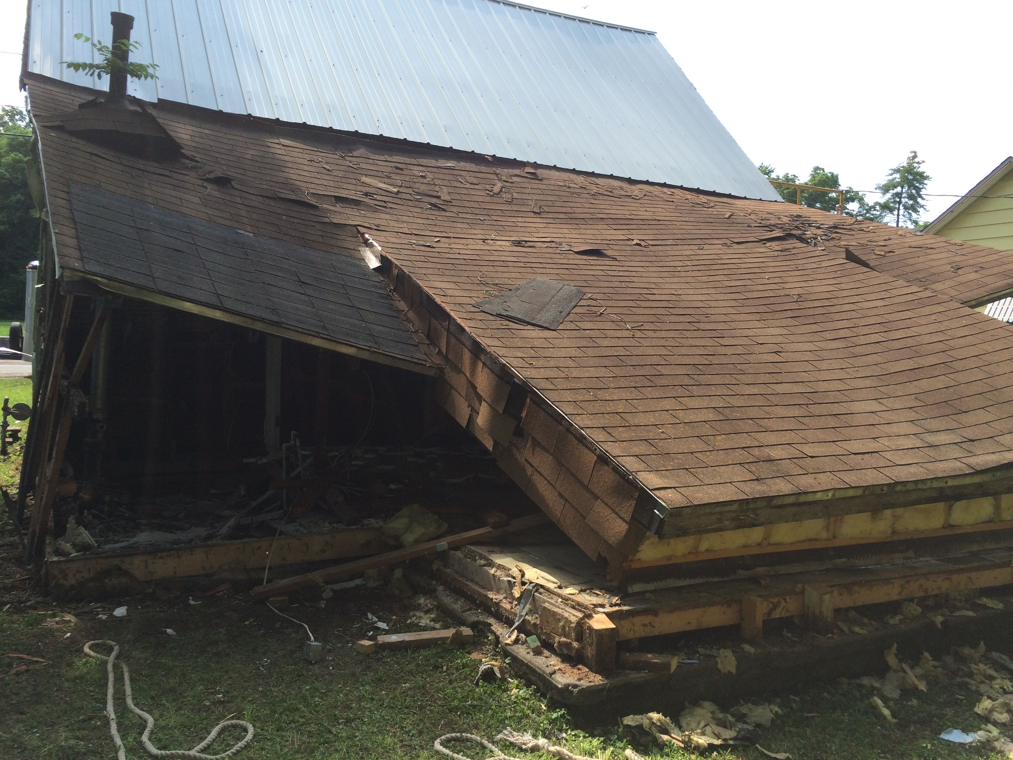
Kim Mailes, the Neosho local who had been spearheading this project for years, got his truck and pulled. One upright at a time was removed. That roof just did not want to come down. Eventually, however, gravity triumphed and the roof slowly sank to the floor.
The building was really cobbled together, but I guess if you double up enough substandard material, it gains structural integrity.
We made so much progress the first day, that John, the project leader, and Angie, the architect, had to get together and reorder the job list.
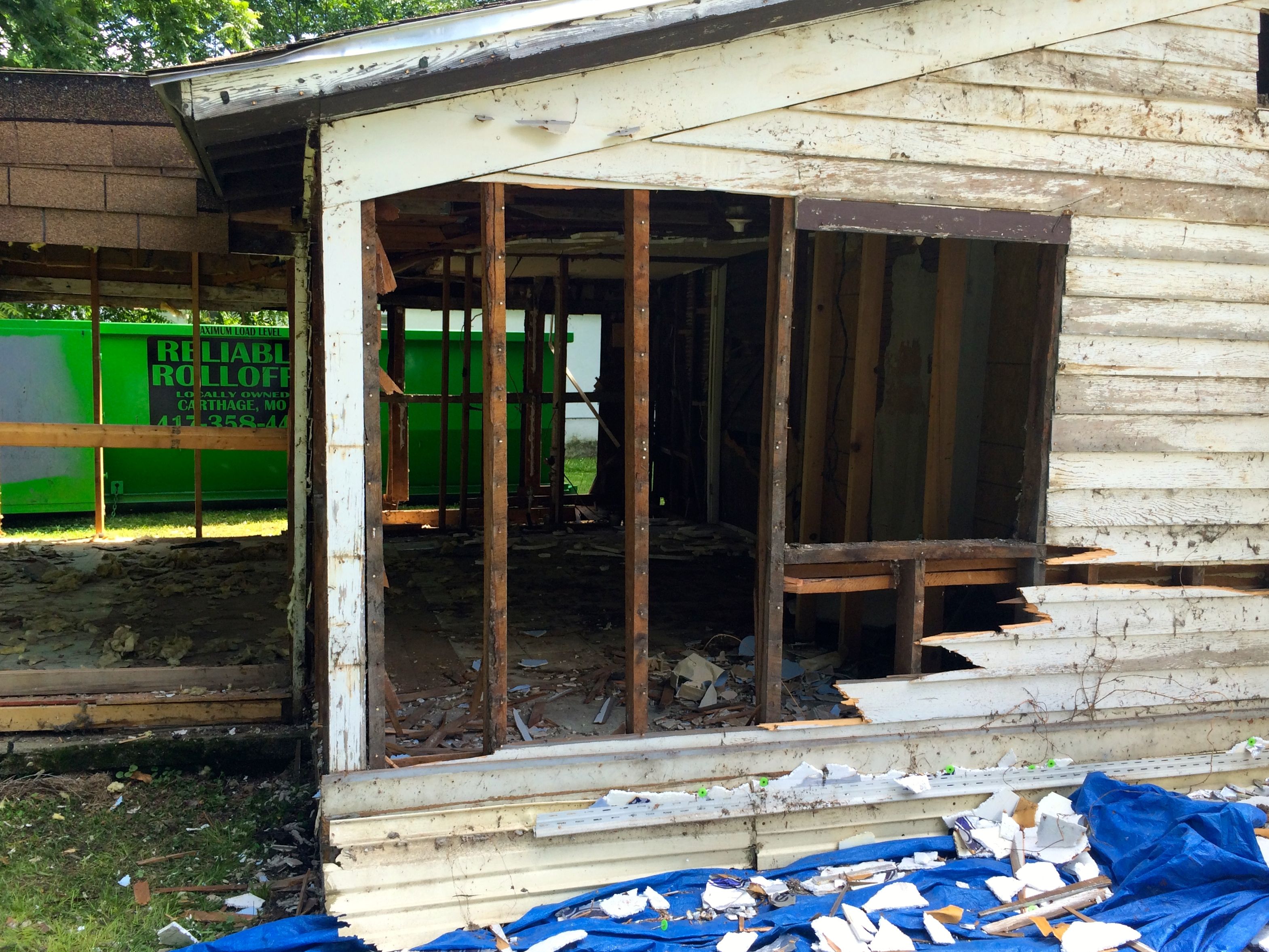
The building was covered with layer upon layer of materials, all of which needed to be removed.
Arvest Bank had acquired the property through foreclosure about twelve years ago and they offered it to the Carver Birthplace Association (CBA). It was known that this was the site of the Neosho Colored School, but no one knew for sure if this was the original building. In fact, most people thought that the original building had been torn down long ago. The CBA thought that they might tear the building down and create a memorial park, but they commissioned a study of the building to make sure that the original school wasn’t still there.
Angie, the architect, did the study. She estimated that the building was about 70% there.
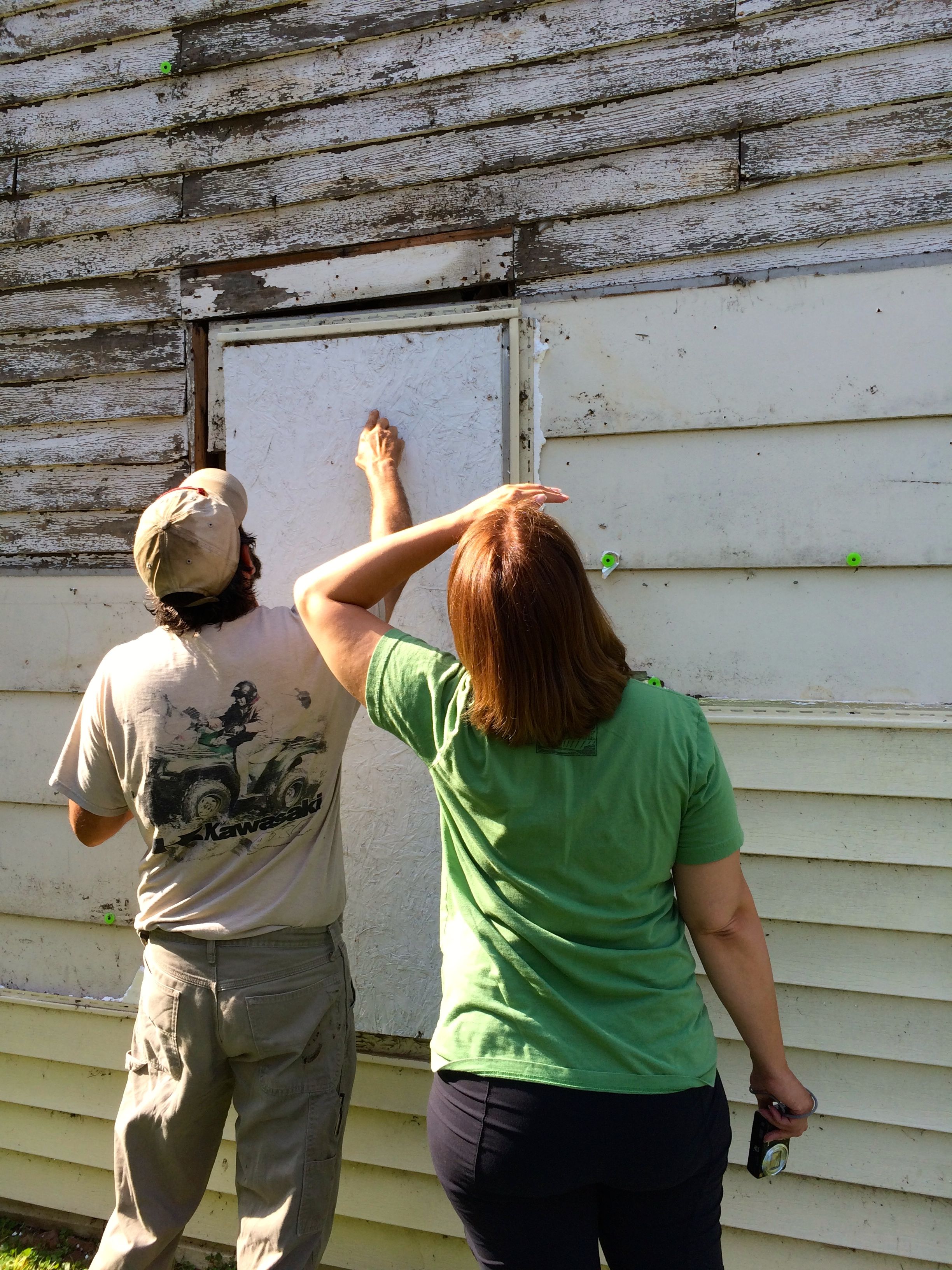
So, with every piece of siding that was removed, we got closer to the original structure.
We kept picking away at the additions on the back.
The roof is just about gone. We filled up one dumpster and almost filled up another.
Finally, all the addition walls and the rear roof was gone.
Man, it was hot work! The heat and humidity were off the charts, and the hard hats we had to wear while we were working didn’t help keep us cool.
Next step, remove the foundation and floors of the addition.
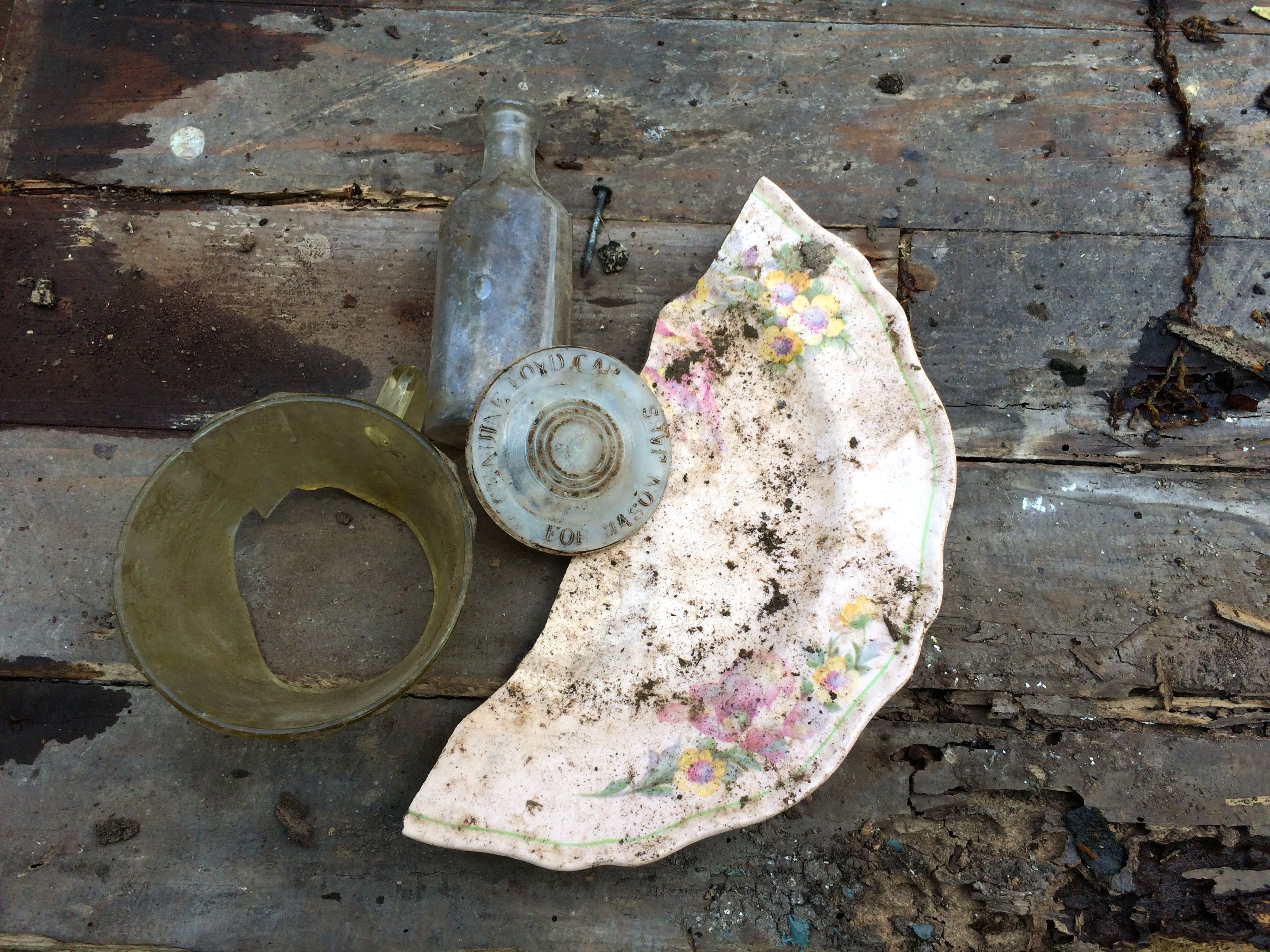
We found all sorts of “artifacts” under the additions.
An archeologist was on site most days. I don’t think we found anything that was particularly significant, but you never know.
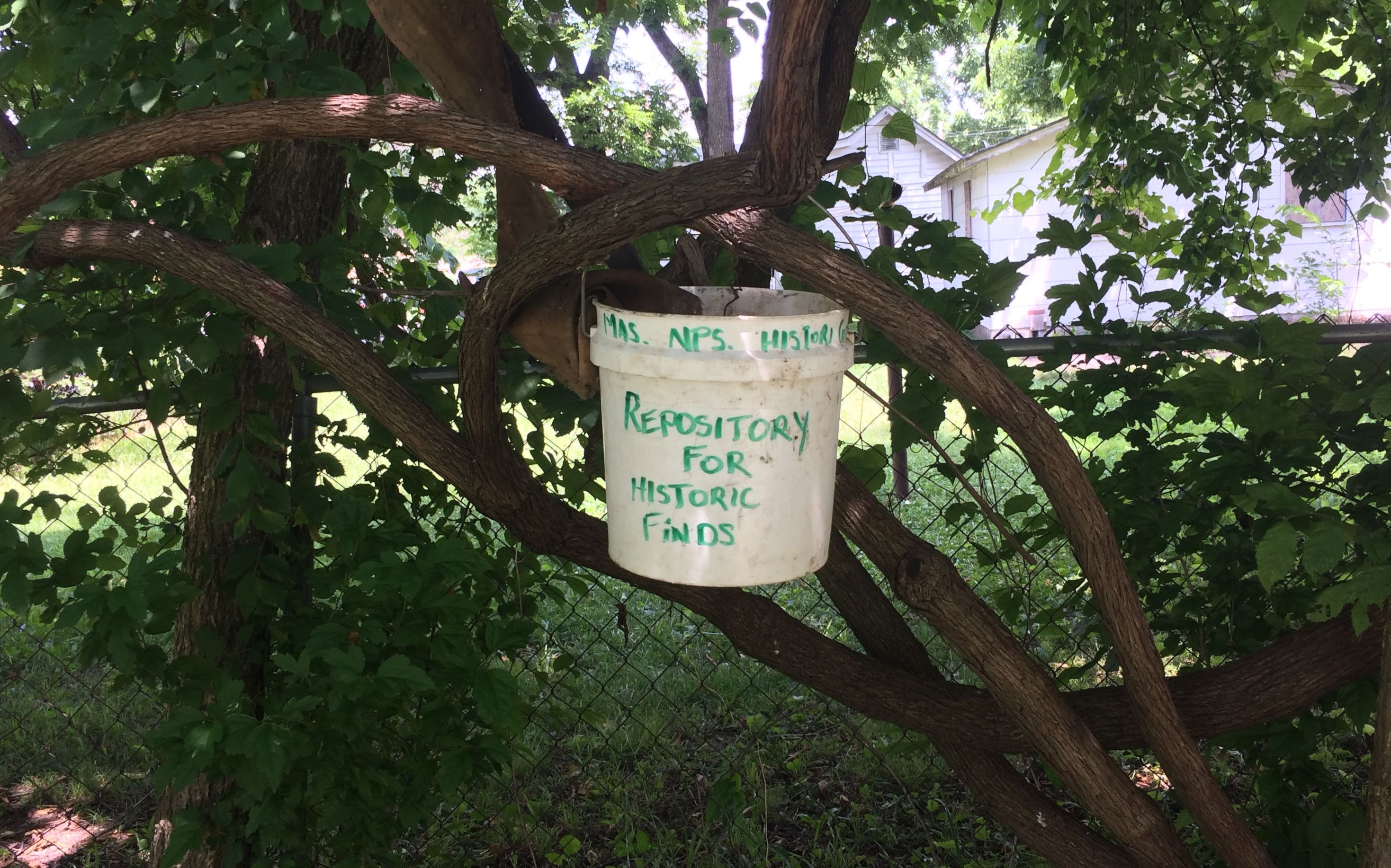
We even had a “Repository for Historic Finds” hanging in a shrub back where we took out breaks.
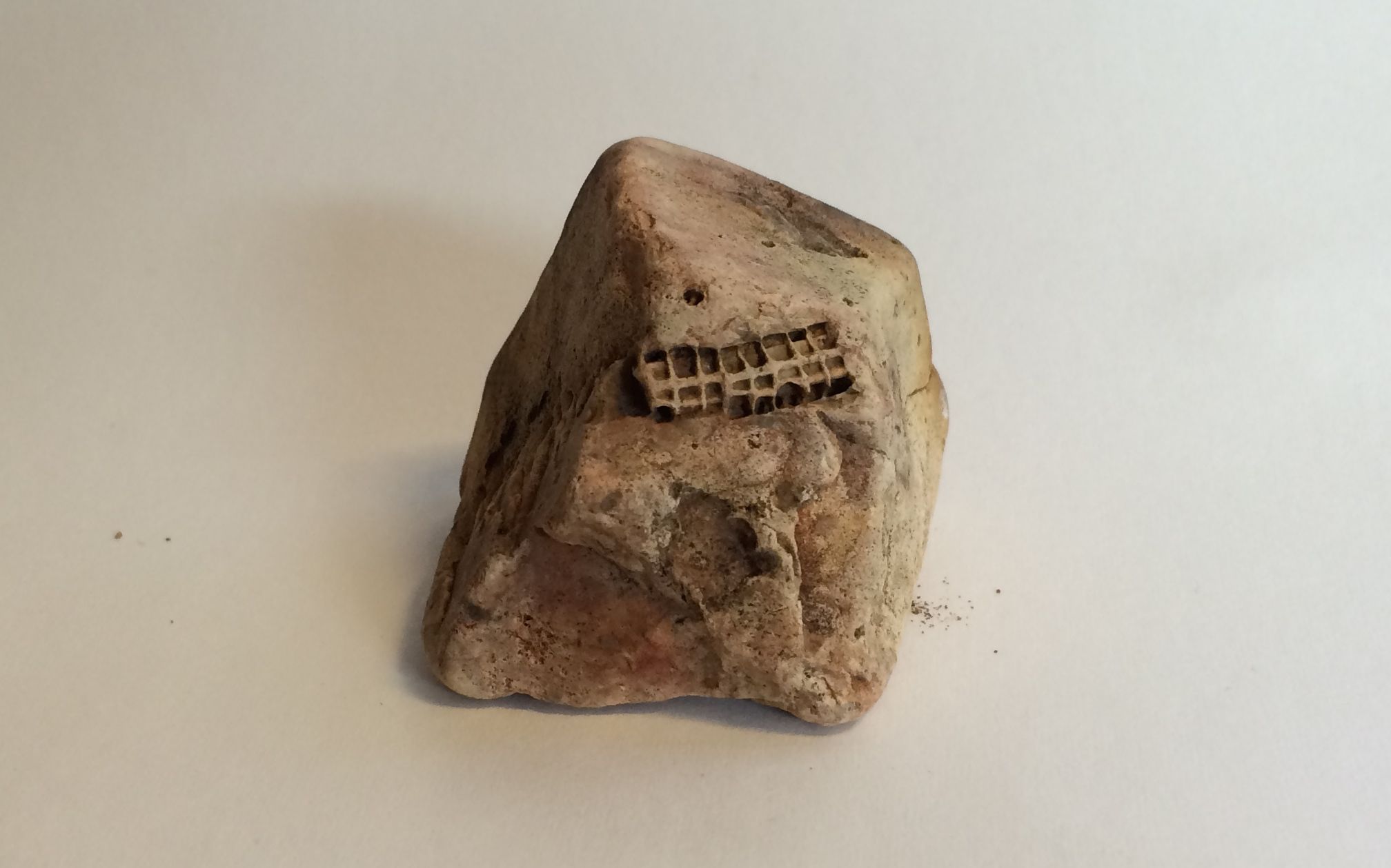
It wasn’t all hot, sweaty work. After the work ended for the day, we were free to cool down however we saw fit. One evening, I decided to explore Hickory Creek, which ran through our campground. I indulged in a little “catch and release” rock collecting.
I found some interesting fossils. (Interesting to me, that it!)
You could still see the shells sandwiched in with the other fossils in this piece. I saw a crack, so I snapped it apart.
These are fossils unlike any I’ve ever found.
It was fun looking.
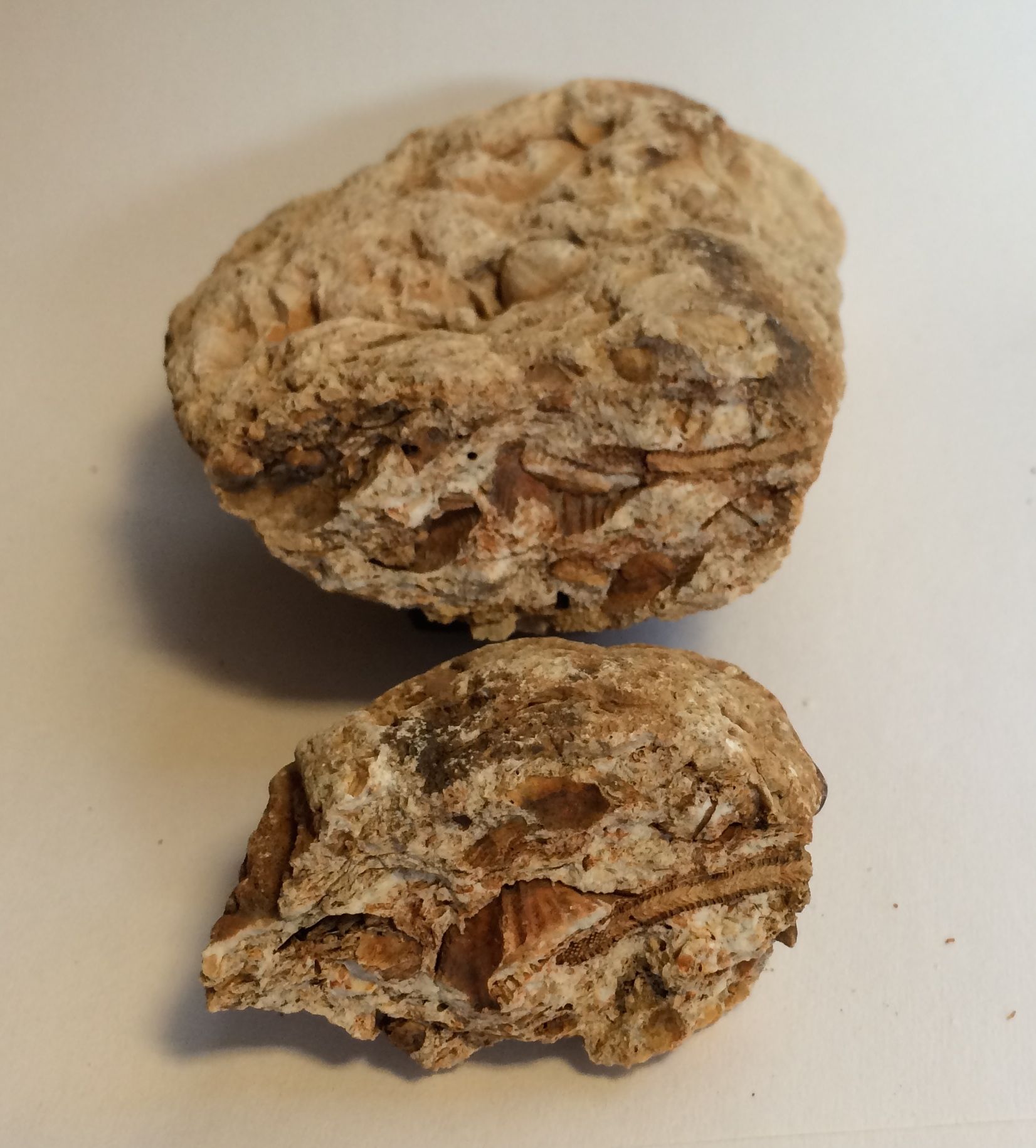
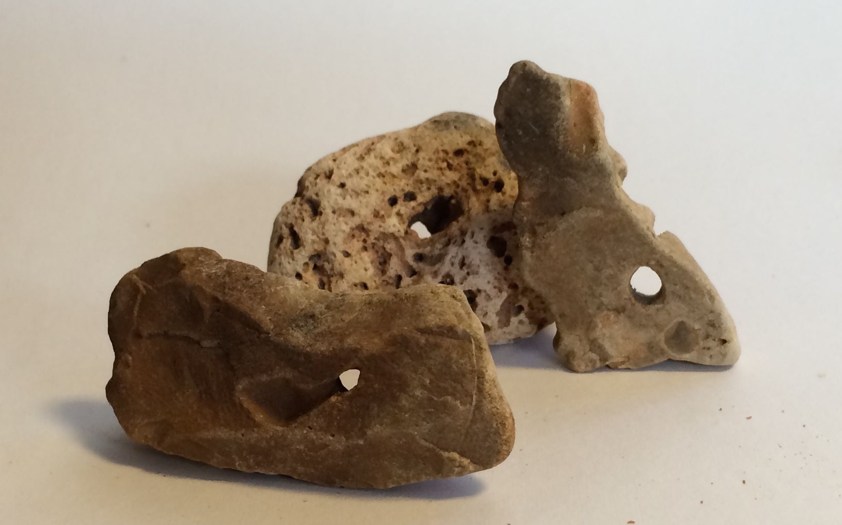
In addition to the fossils, I found some rocks with natural holes. I decided to hold on to these. Maybe I’ll string them together with other things some day.
The people of the town were very gracious. A group of anonymous donors had one meal a week catered for the project, and a church invited us to a dinner where they served up a mess of crappie along with an eye-popping array of pot luck dishes. Incidentally, “crappie” is pronounced more like “CRAW-pee”, not the way the spelling would lead you to believe. And, it was pretty good. Kim also had us out to his lovely home for dinner one night. We were well taken care of!
After we had the rear additions removed, they started planning for the next steps. Unfortunately, some of the projects for the coming weeks included replacing the rotted and termite-riddled sills and shoring up the foundations. Fortunately, this was not a project for our group.
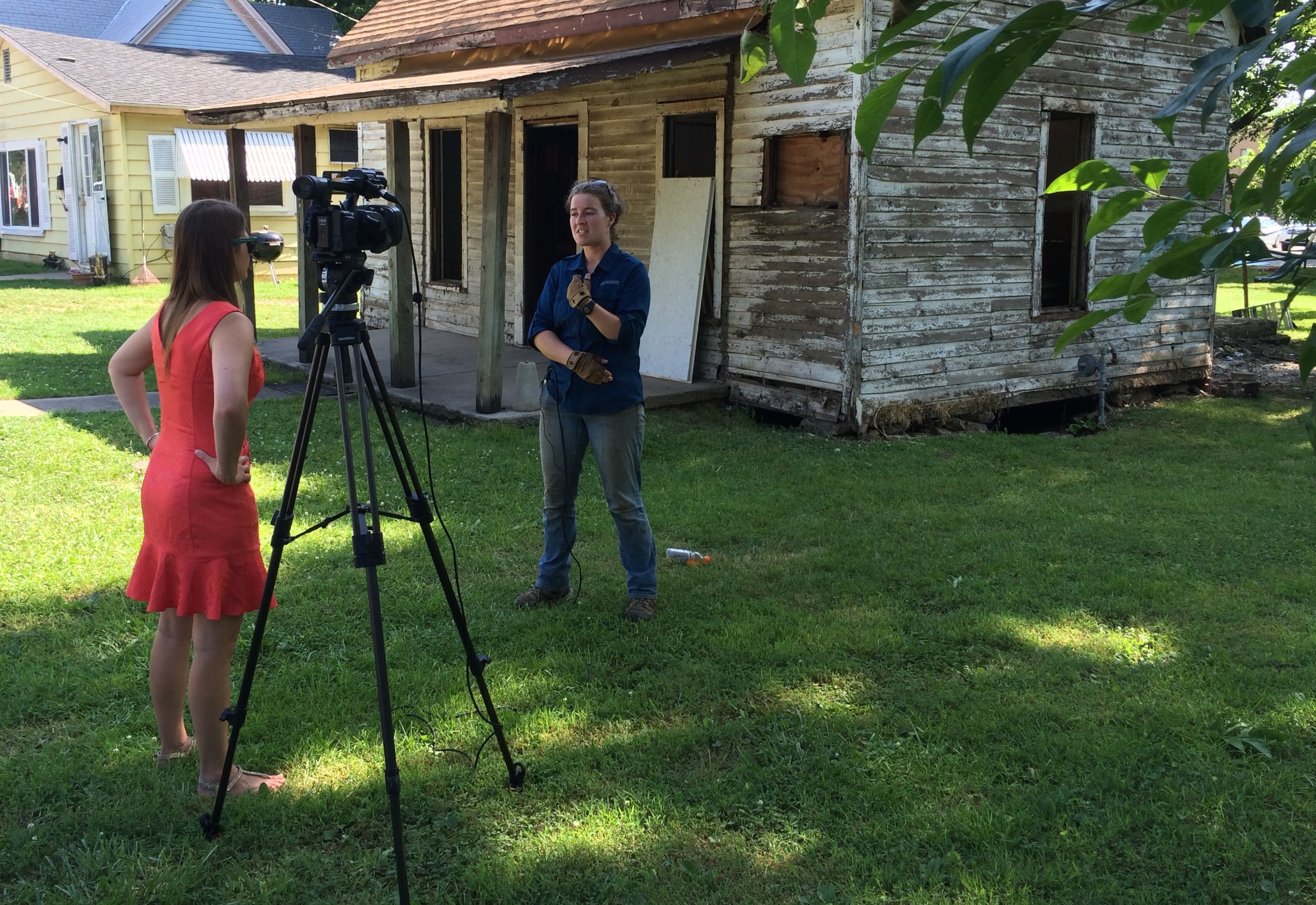
There was a lot of media interest in the project. It seems like there was either a newspaper article or TV segment each day of the week I was there. Some days, I think there might have been both!
If you are interested in the media coverage or the project as a whole, I suggest that you take the time to check out the blog that Kim Mailes kept.
The last day of the first session finally came, and here is the progress we made.
Here I am, posing in my hard hat.
And the gang, just before we all headed our separate ways.
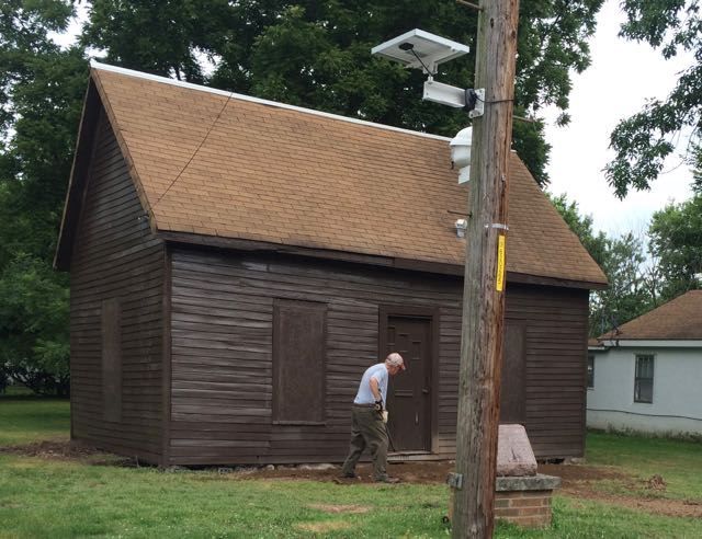
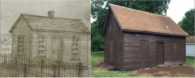
There were two more work sessions after us, and they made great progress. This is how the school looked after three weeks of work.
That’s pretty remarkable, by itself, but compare Dr. Carver’s sketch of how he remembered the school some fifty years after he attended it with how it was left at the end of the project.
Of all the things I’ve done on my travels, I think this is the most impressive.
My next stop was Neosho, Missouri. Not a big city, nor a well-known place. Nevertheless, it was a destination I had been looking forward to with great anticipation for months.
I was in Neosho to take part in another HistoriCorps project to help preserve George Washington Carver’s first school, the Neosho Colored School. I was there during the first week of the project, and our tasks consisted of demolishing and removing additions and “improvements” that had been made on the original 1872 structure.
I arrived a day ahead of schedule and got settled in at the city’s Hickory Creek RV Park. It is not uncommon to find municipal campgrounds in the heartland, complete with electricity, water and dump stations. There was plenty of room in the park. This was due to the fact the the town had set aside the whole park for our use during the three week time that HistoriCorps would be in town.
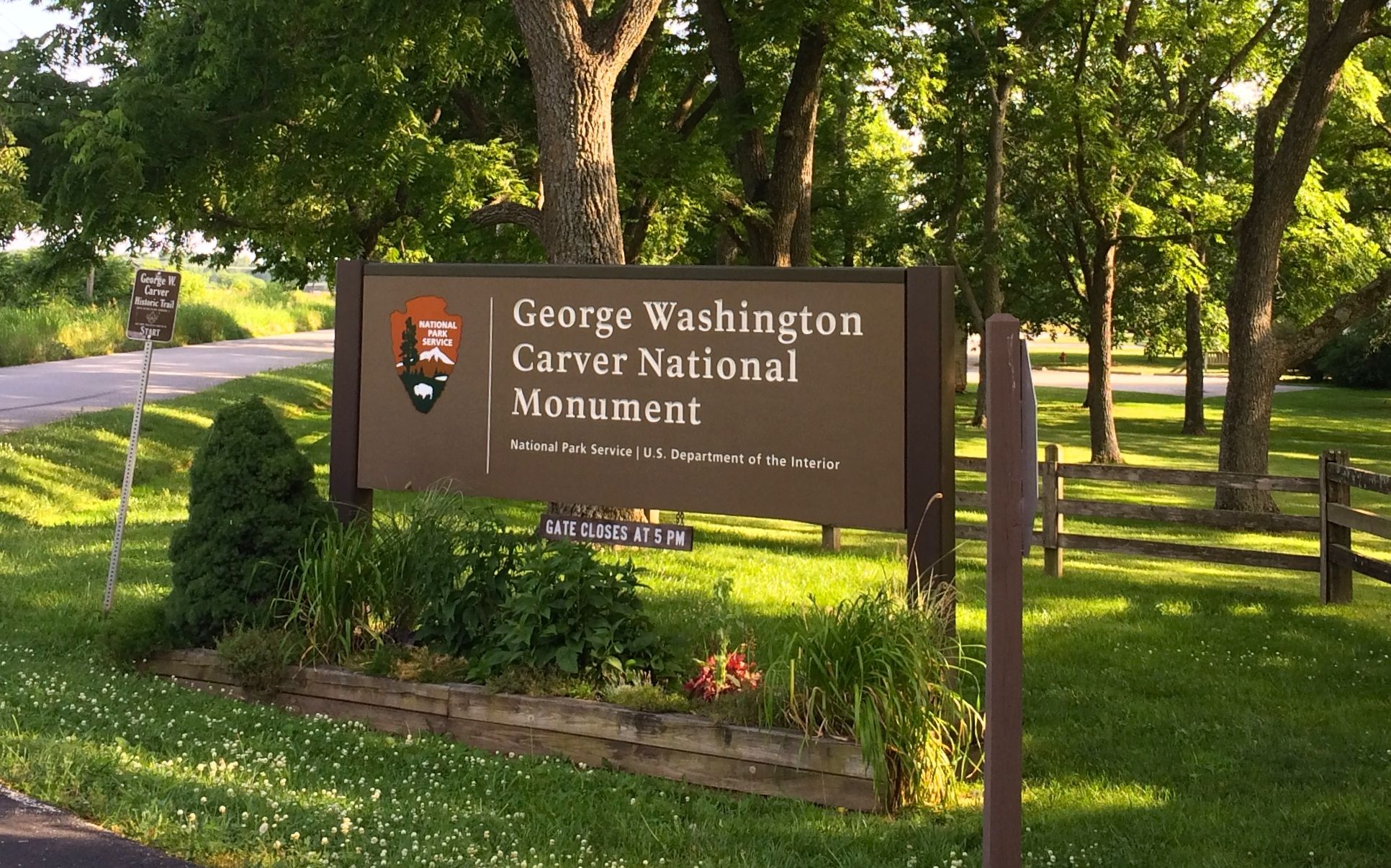
The day before the project kicked off, I decided to head over to the George Washington Carver National Monument in nearby Diamond, Missouri. He was born into slavery there in the waning years of the Civil War.
I was lucky that I got to visit the site twice. For my first visit, I opted to walk the Carver trail.
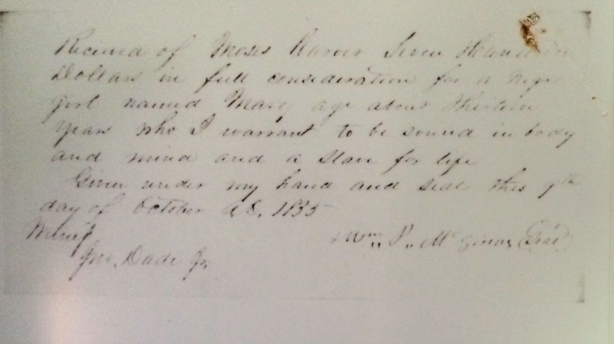
There was an outline of the site of the cabin where George was born that archeologists have identified. Moses Carver had purchased George’s mother, Mary, in 1855, when she was 13 years old. According to information I have read, George had 10 brothers and sisters, most of whom died prematurely. Record keeping was spotty, at best. Oh, Moses Carver did have the receipt for the purchase of Mary, but there is no record of the births.
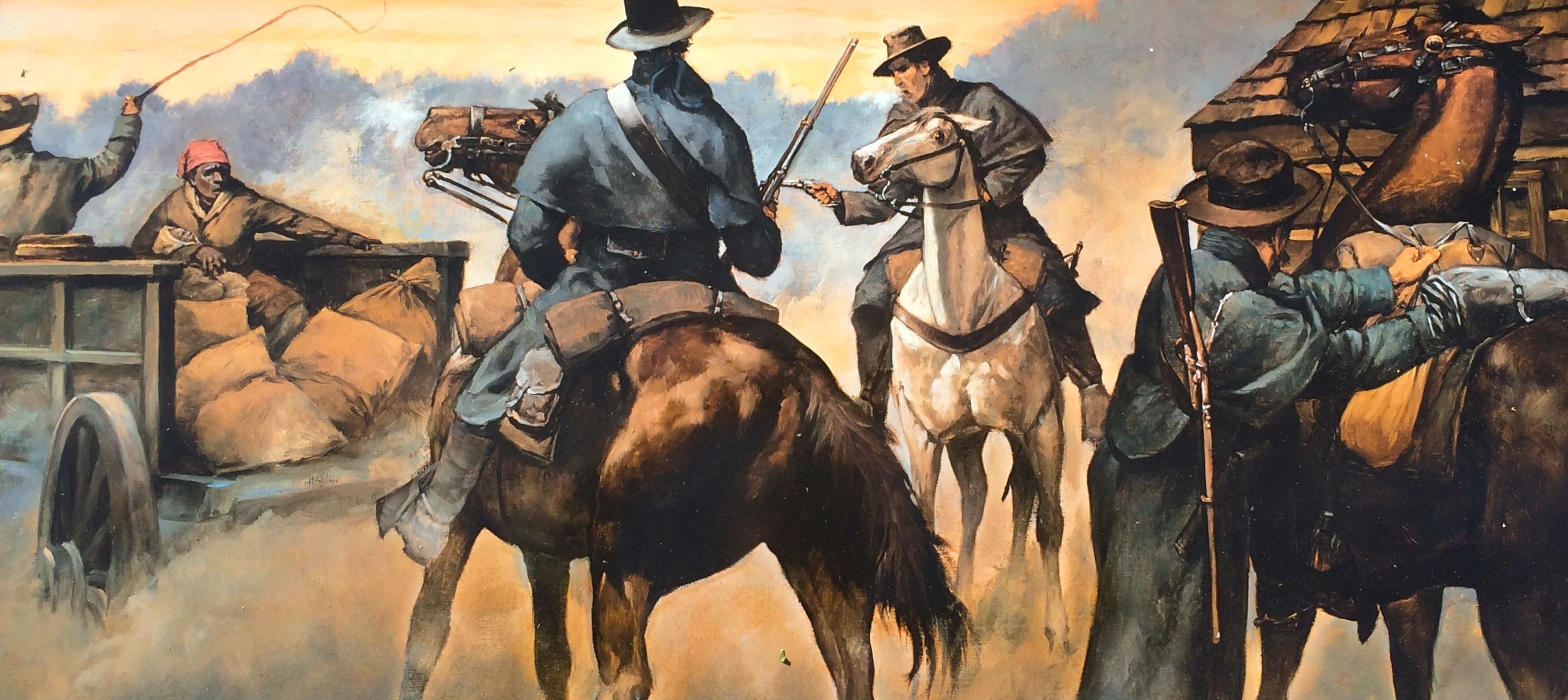
Sometime near the end of the Civil War, raiders came to steal what they could from the farm. According to Moses Carver, when the raiders found no cash, they carried off Mary and baby George, who was about a week or so old at the time. George’s brother, James, managed to hide when the raiders came.
Moses asked a local Union scout, John Bentley, to recover his stolen property. Bentley returned with a very sick George, but Mary had disappeared with the raiders. Carver rewarded Bentley with a $300 racehorse. According to the informational signage at the site, in George’s later memory of this story, he focused on how Moses had made a special effort to get him back. To George, this seemed the first tangible indication that he was a special person, destined to accomplish much with his life.
Susan Carver appears to have been particularly fond of him. George was not very strong, and was limited to lighter tasks. One of his duties was to fetch water, and this statue of him as a child is near the source of the water.
The water was flowing and the birds were singing. The typo in the title of the video irks me, but I don’t know how to fix it “post production.”
I continued along the trail. I imagine that the forest was much the same as George might have experienced it. The birds were singing and it was peaceful in the woods.
Owners who bought the farm later dammed one of the streams and created this pond in 1931. The changes to the landscape are also part of the history of the place.
Speaking of changes, this is Moses Carver’s cabin, but it wasn’t the one that was there when George knew the farm. The original cabin was destroyed by a storm – some accounts said it was a tornado – after George had moved on.
These are the fields around the cabin. It’s not to hard to imagine that this was a view that George might have seen when he lived here.
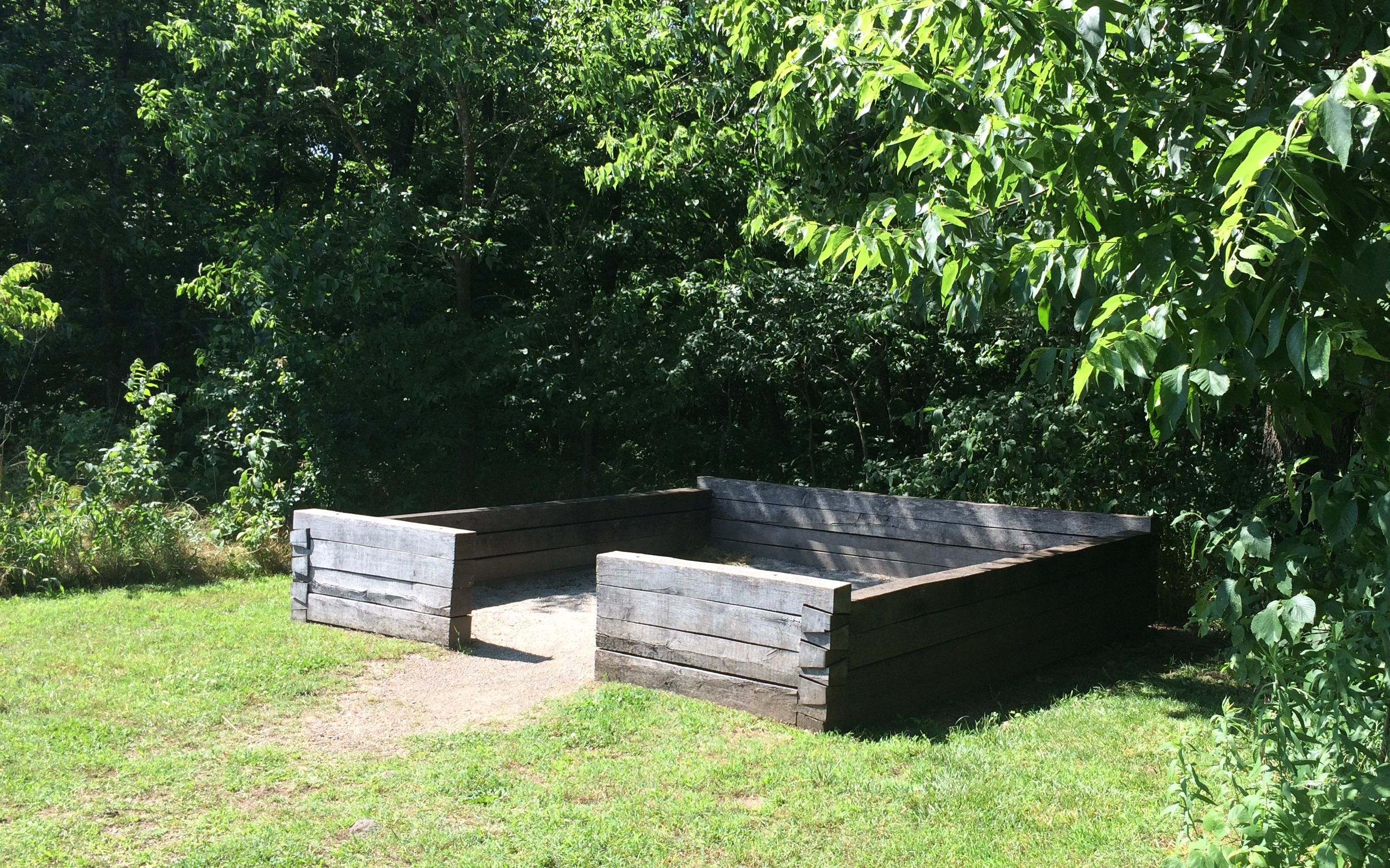
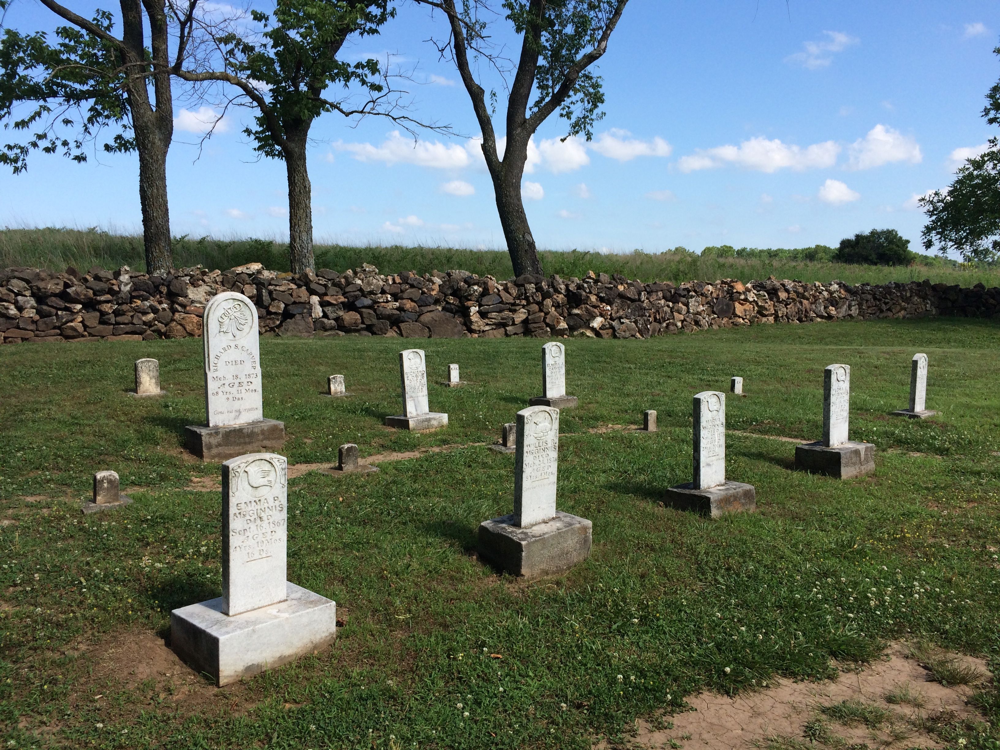
The next stop on the trail was the cemetery. These are the graves of Moses and Susan Carver.
The cemetery was surrounded by a dry stacked stone fence. Moses allowed neighbors to use his cemetery, too.
The smaller headstone are for children. Most of the graves that I saw were for children.
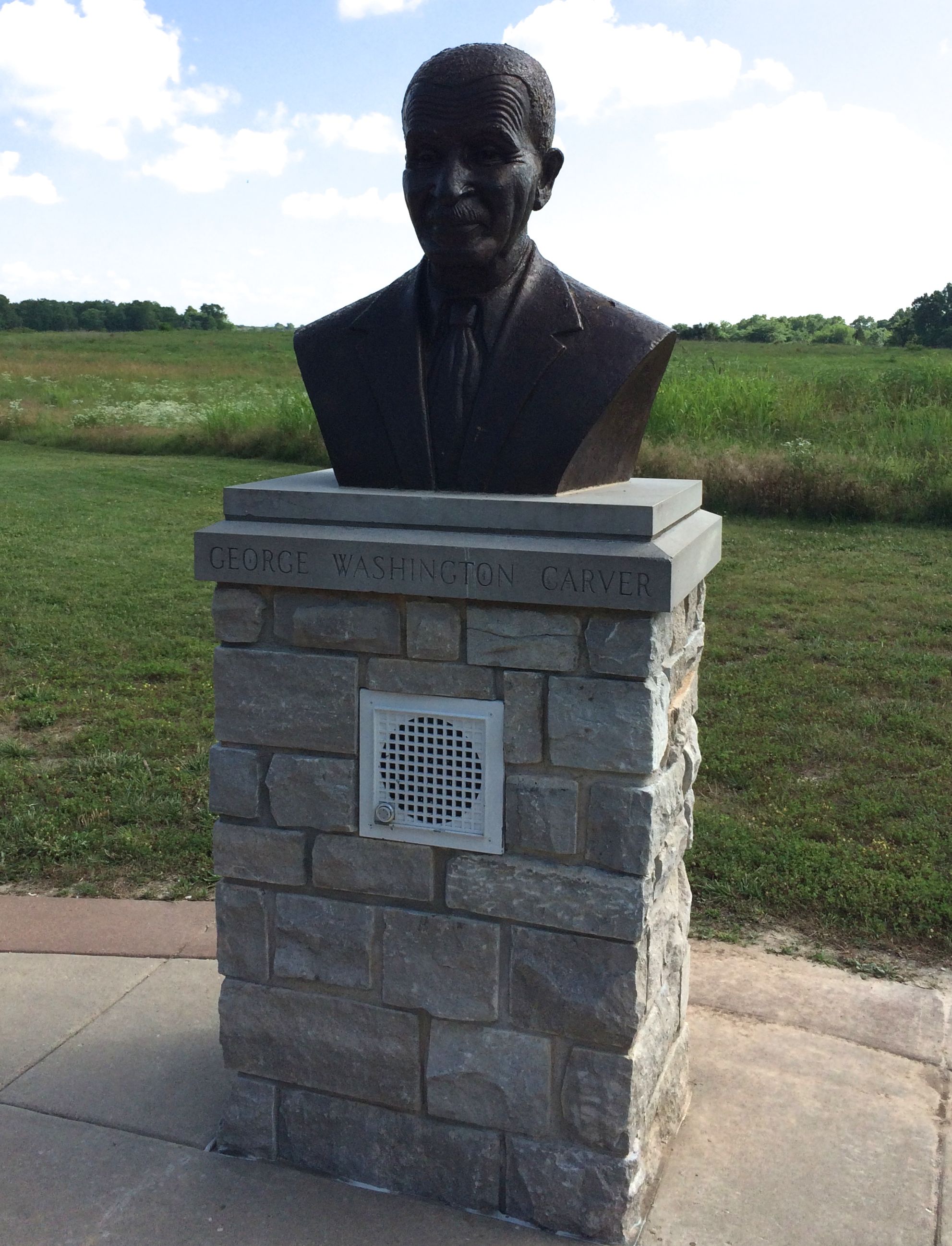
The last stop on the trail was a bust of George Washington Carver in his later years. You might notice a speaker in the pedestal. There is a button you can push to listen to a recording of a speech he gave at a commencement.
I don’t know why I should be surprised, but I am just amazed that we have recordings of people who were born of the 1860s.
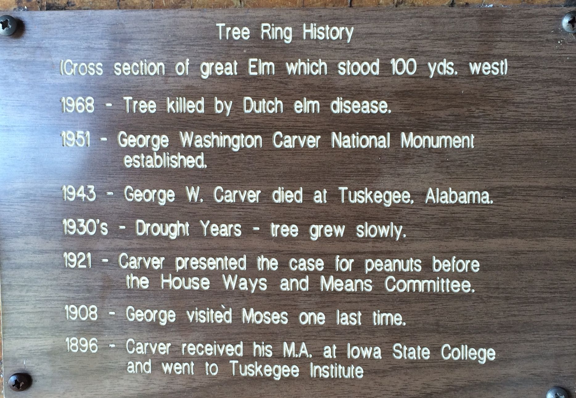
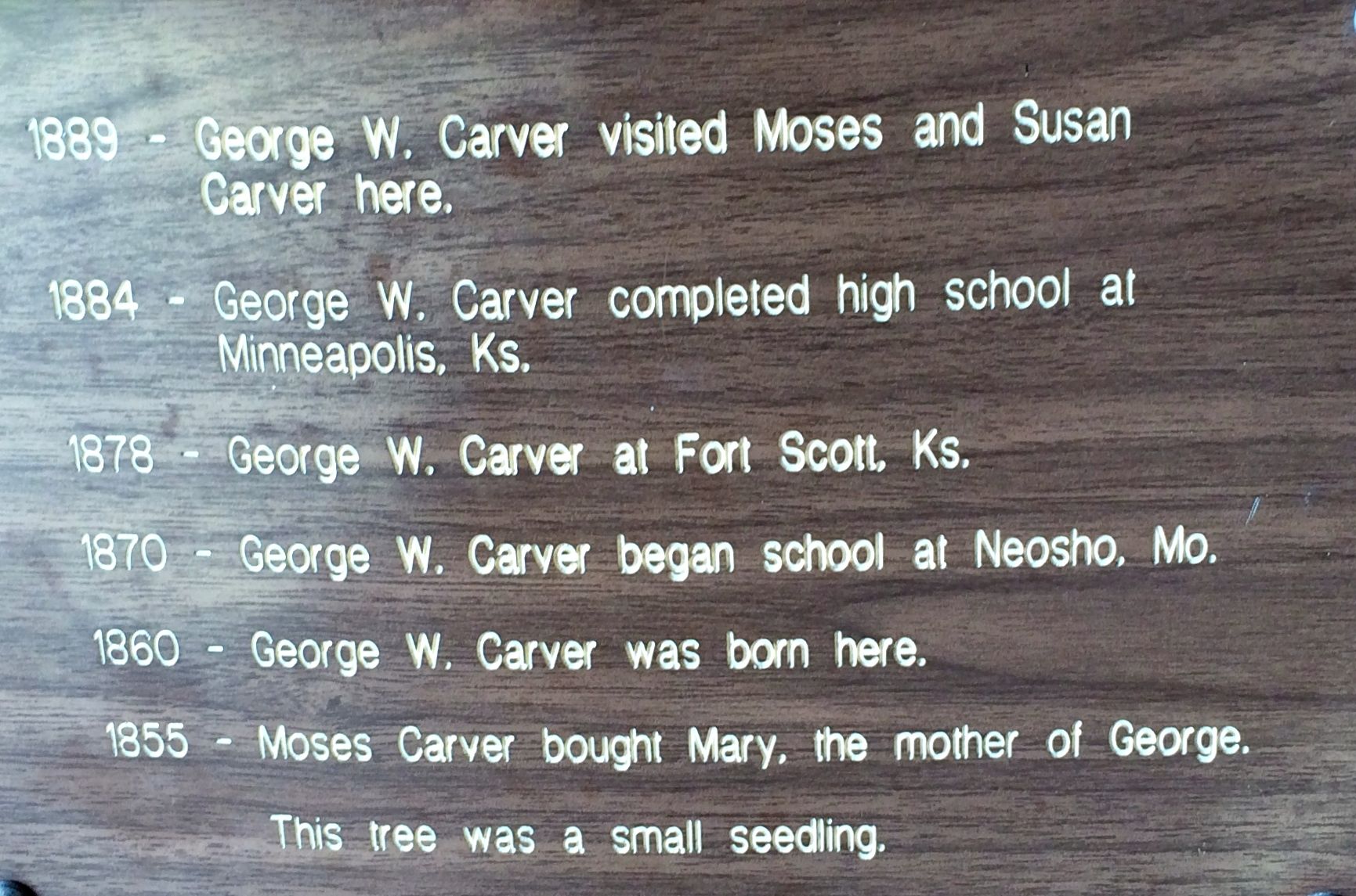
There is a slab of a tree that was cut down on the property. There were a number of markers on the tree – kind of like a dendochronological timeline.In 1855, when Moses Carver bought Mary, the mother of George, this tree was a small seedling. I find this mind boggling, too.
Rather than try to rewrite the details, let me just share the plaques that are posted on the slab.
Of course, you have to read the list backwards.
Now, I arrived at the National Monument too late to see the museum that day, but through the magic of the Internet, let me share just a few things I saw inside a few days later.
These are marbles that were found during an archeological search of the cabin George lived in. Do you suppose these were his marbles? Could be – or maybe they were someone else’s.
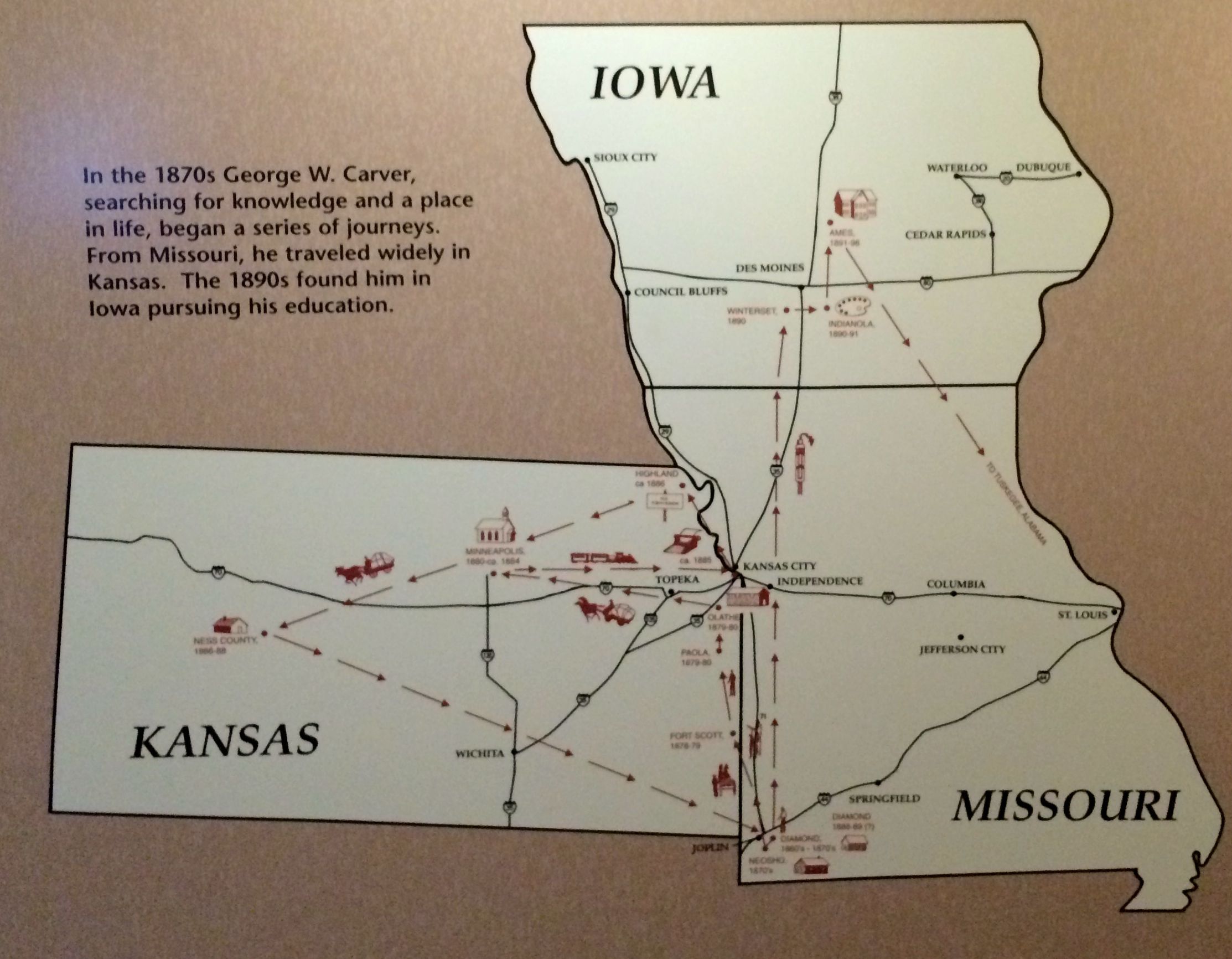
This map plots where George went to pursue his education. His first trip was an eight mile walk from Diamond to Neosho, where he went because the school in Diamond was for whites only.
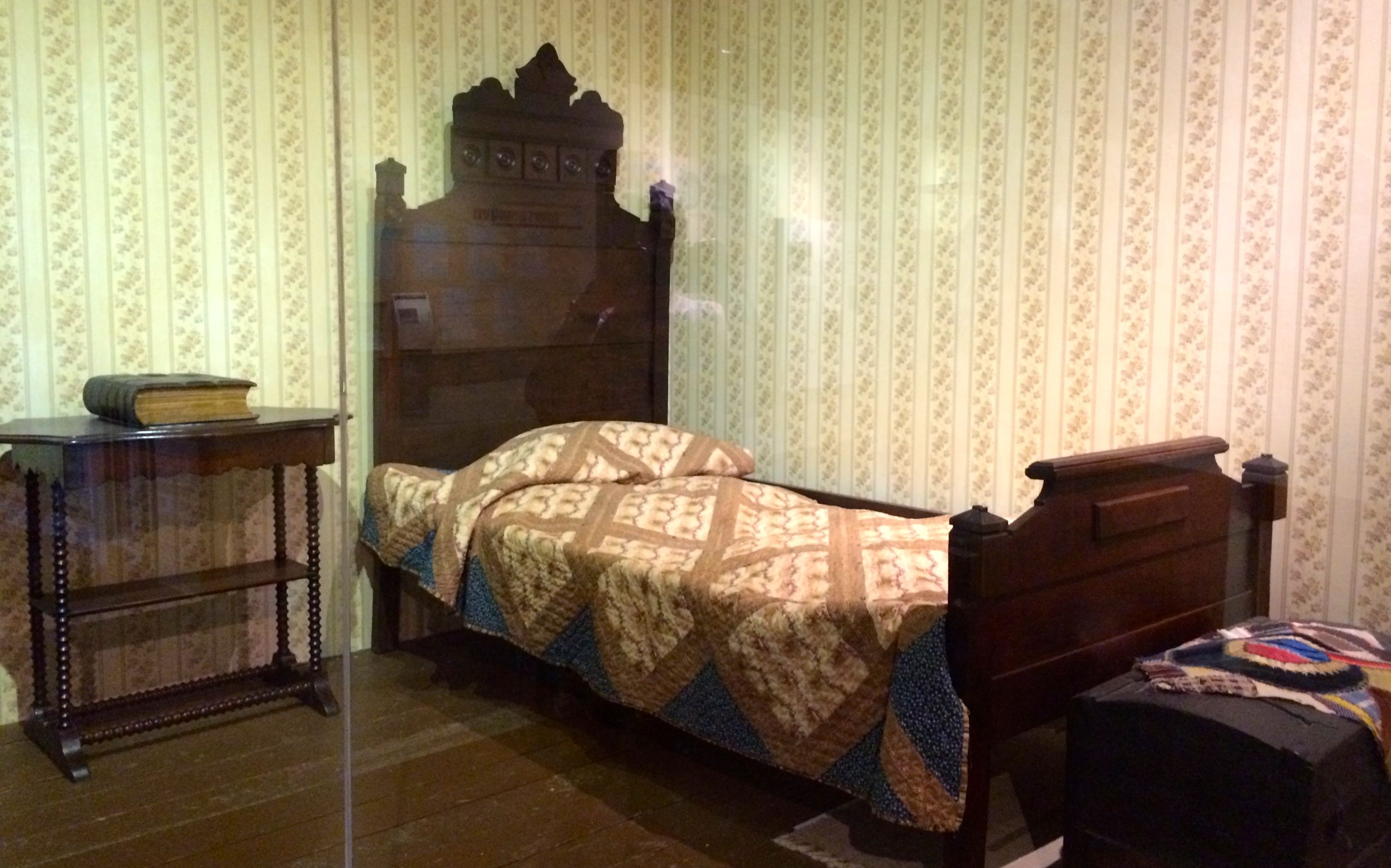
He was taken in by Aunt Mariah Watkins, who lived two doors down from the new Neosho Colored School. If I understood correctly, this was the furniture that was in his bedroom.
And, with that, I will leave you.
Stay turned for the story of helping to preserve the school.
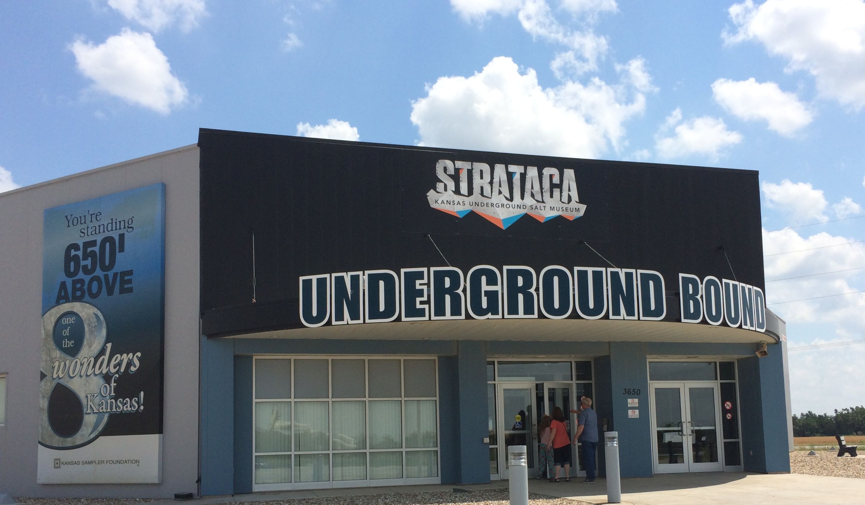
While I was sitting in the amphitheater at Palo Duro Canyon State Park waiting for TEXAS (the musical) to start, I got to chatting with the people sitting next to me. They were the Cabbages from Hutchinson, Kansas. Not only did they recommend that I visit the Panhandle-Plains Historical Museum in Canyon, Texas, they told me that I shouldn’t miss Strataca in their home town.
What is Strataca? It’s a salt mine! It sounded like something that would interest me, so I put it on my list of things to do.
I found a campsite at the Kansas State Fairgrounds. I’ll bet it is a teaming city during the state fair. It was kind of empty when I arrived, but it started filling up toward the end of my time there. A rally of deaf campers was beginning. It was interesting to watch them talking to each other. Overall, they were very quiet, as you would imagine, but a few of them had the loudest, rumbliest motorcycles I’d ever heard. I could feel the vibrations through the ground, which was probably the point. They sure did seem to be enjoying themselves.
I don’t have photos of the campground, because it was just one of those fields with hook ups. I did take a picture of my new state sticker, though.
Kansas is in the house!
I made my way to Strataca. Incidentally, the emphasis in on the first syllable. STRA-ta-ca. I kept wanting to call it stra-TA-ca.
Yep! I was right over one of the 8 wonders of Kansas.
What are the 8 wonders of Kansas? Click here to find out!
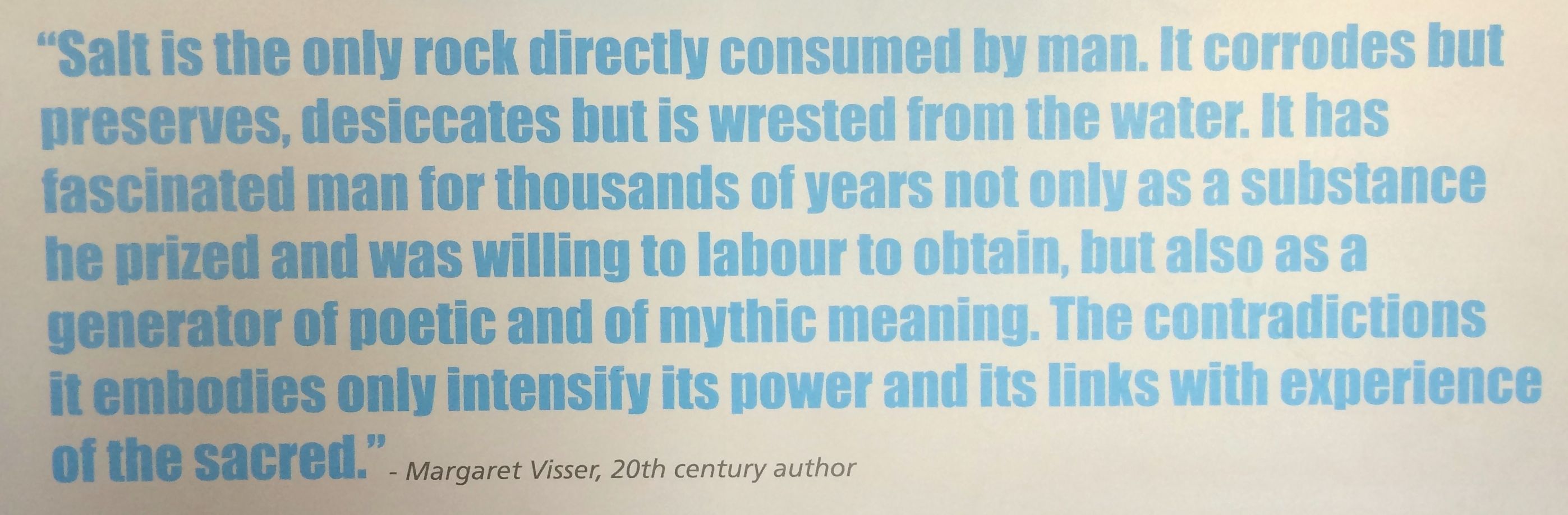
I entered and bought my ticket for the tour and waited for my group to be called. While I waited, I looked at some of the displays and a wall of quotes about salt.
Yep, as you might expect, they are really into salt here.
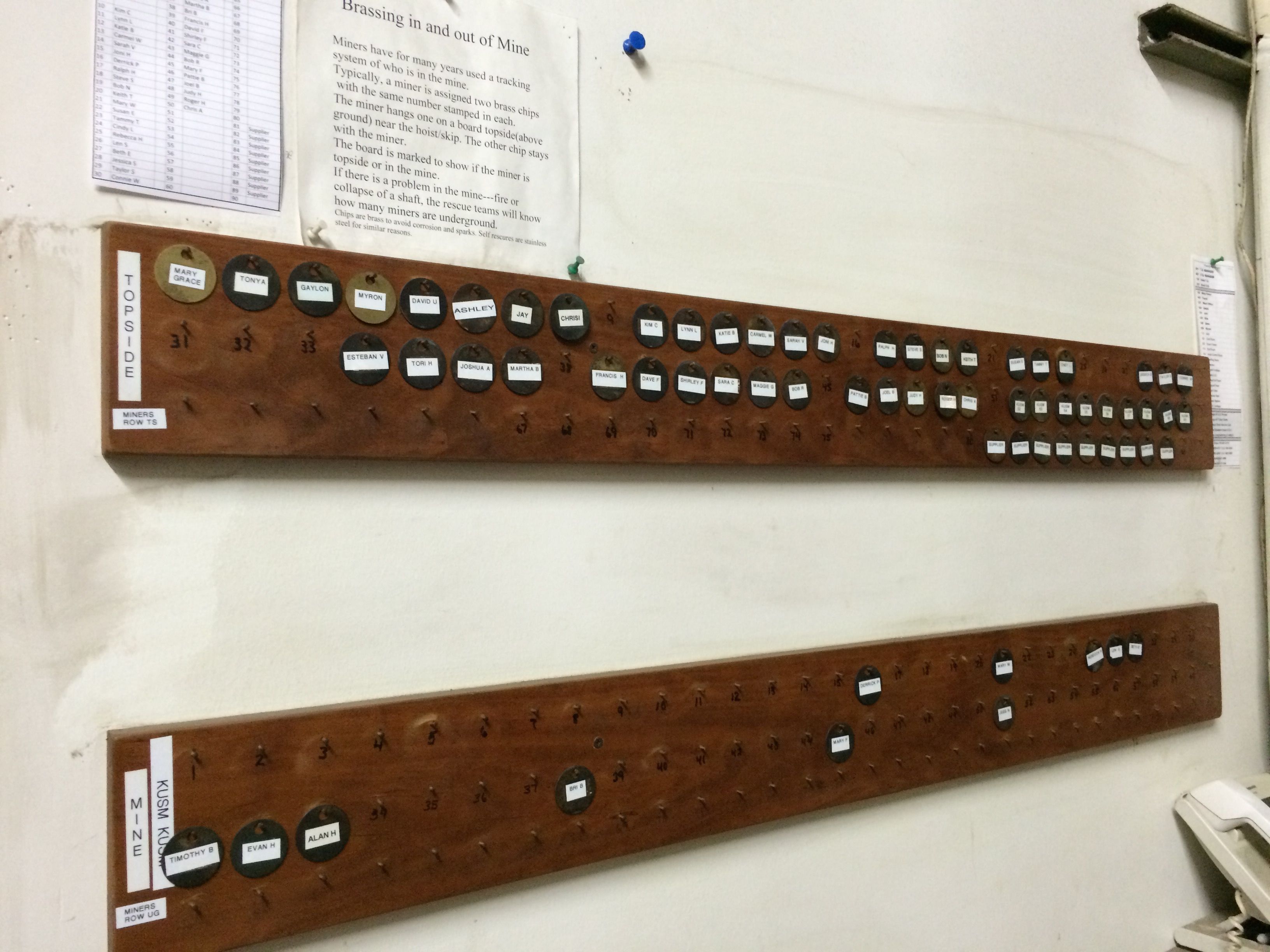
My group was called and we saw the introductory movie. On the way back to get our hard hats, I passed the tags where the workers “brass in” at the beginning of their shifts.
At the end of their shifts, they “brass out”. The brass refers to the tags that identify who is down in the mine. It kind of reminded me of the tags we used when we were swimming at the lake at Seven Hill Girls Scout Camp, back in the day.
Hard hats on, we got in the elevator for the trip 650 foot trip down to the salt mine. The elevator was unique in that it was a double decker elevator. They could load up one level, lower the elevator a bit and then load up the second level. The group I was in only needed one level, so I didn’t get to see the double decker feature of the elevator in operation.
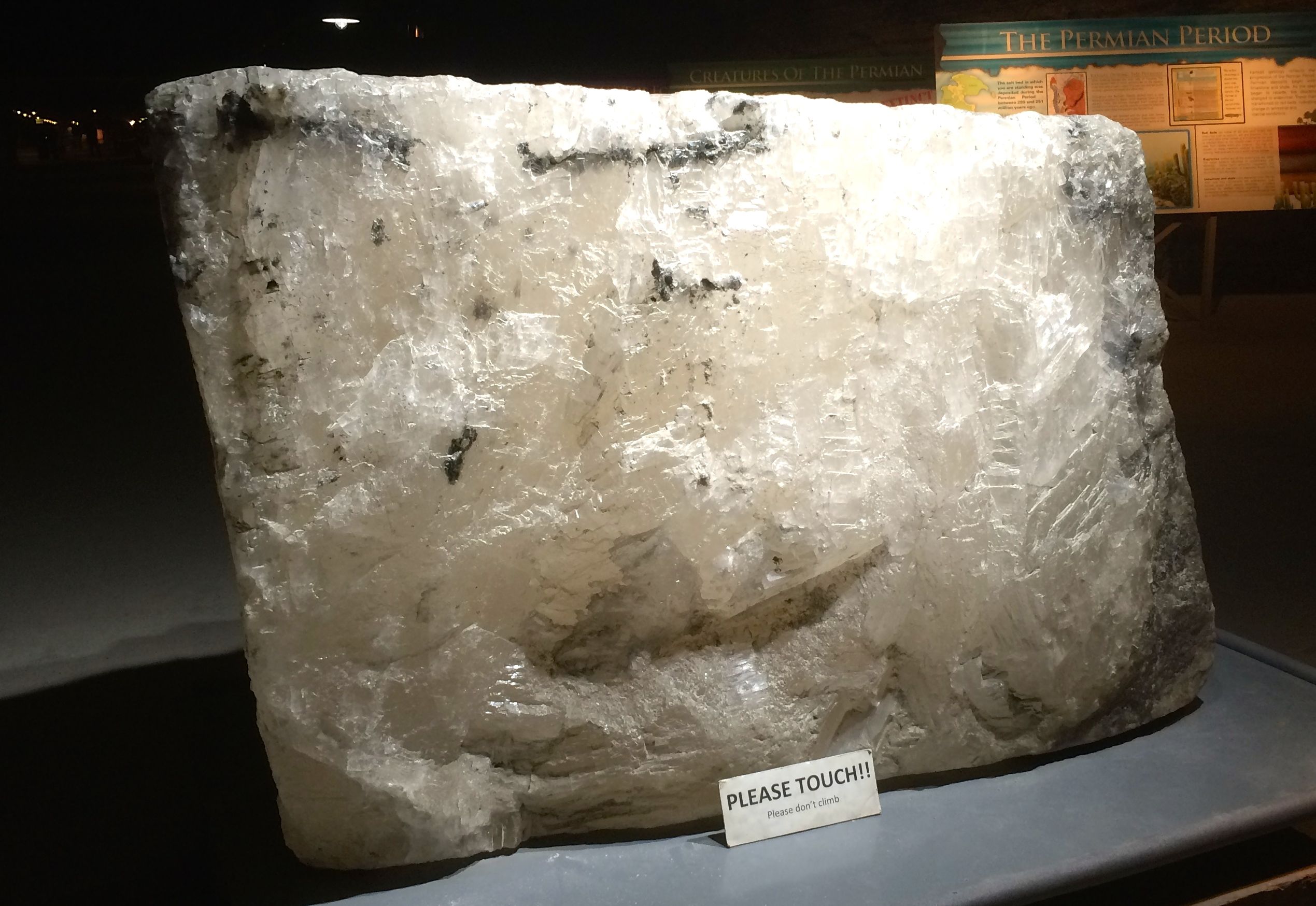
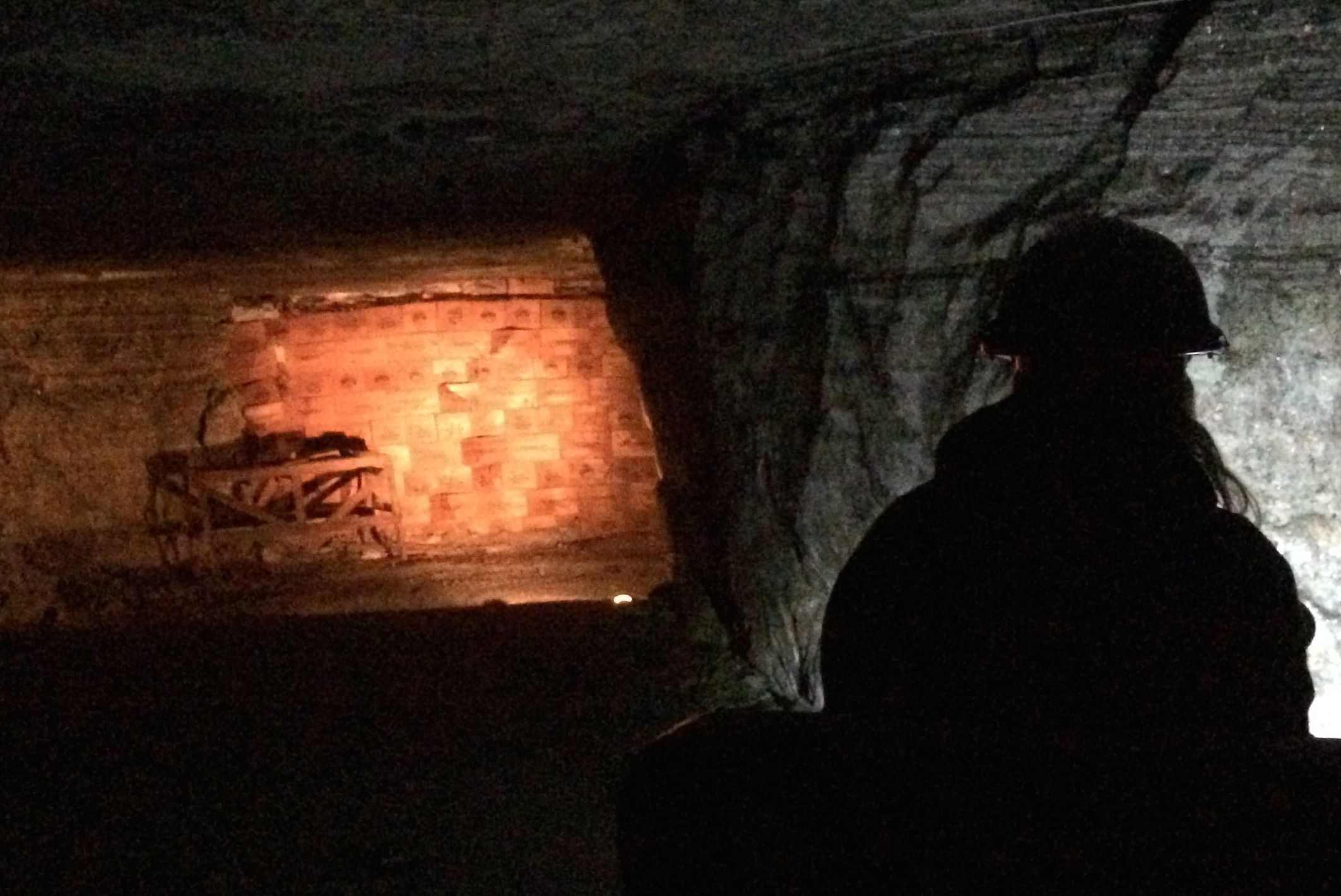
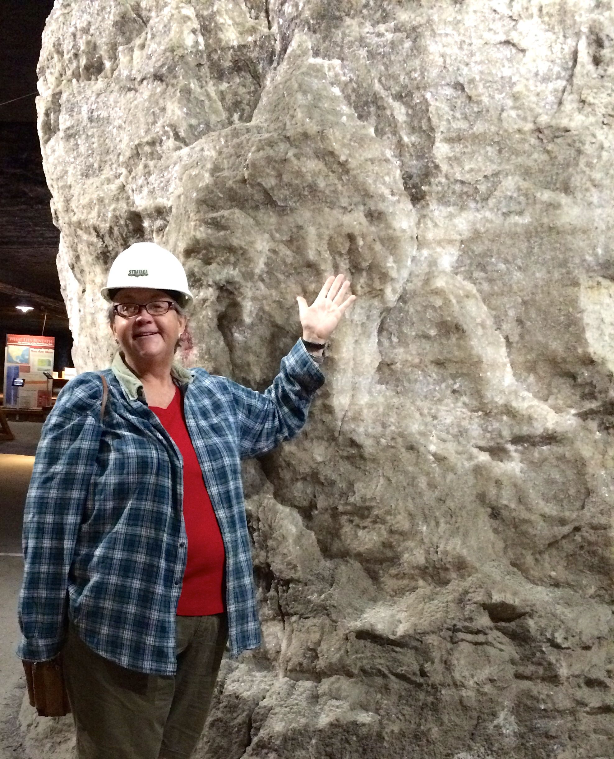
Once down at the 650 foot level, we entered the Permian Room, a long gallery that was mined out in the 1940s and 1950s. The name “Permian” refers to the Permian Sea that dried up around 275 million years ago.
On the walls, you can see the layers of salt and mud. Throughout the mine, you see the same banding. According to one of the attendants, this banding made it easy to keep the mine level. They could follow the bands as their guides.
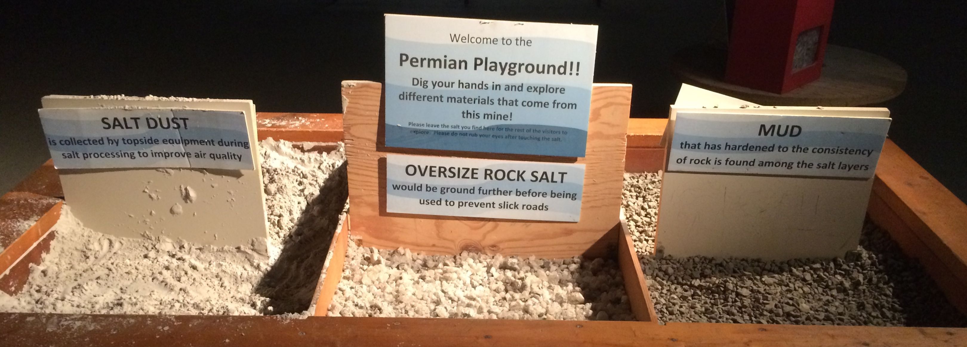
These boxes were there for visitors to experience the materials that came out of the mine – salt dust, which felt like sand, oversized rock salt and mud, which felt like gravel. Rock salt for de-icing roads was the product of this mine. One of the attendants told me that salt for eating is produced by other mines, but those are brining operations as opposed to mines. In those mines, water is pumped down into the salt layers, where it dissolves the salt. The resulting brine is then pumped back up and the water is evaporated and the pure salt is left behind.
Don’t you just love it when they invite you to touch the displays? I know I do!
A cubic foot of loose salt weight about 75 pounds; when it is a solid block, it weighs 135 pounds per cubic foot. This block weighs about 6,000 pounds! (That’s almost as much as my Airstream – but much denser!)
This graffiti was left behind when they blasted through this section to joint the Permian Room to the rest of the mine. They call this the section “the narrows” because it is a narrow(er) passage. The workers signed their accomplishment with their names, the date, and their motto “Get ‘er done.” Incidentally, they got it done on my birthday in 2004!
Rusty equipment. Hmm. It’s a mine – of course there’s rusty equipment. The equipment they use in this salt mine is adapted from coal mining machinery.
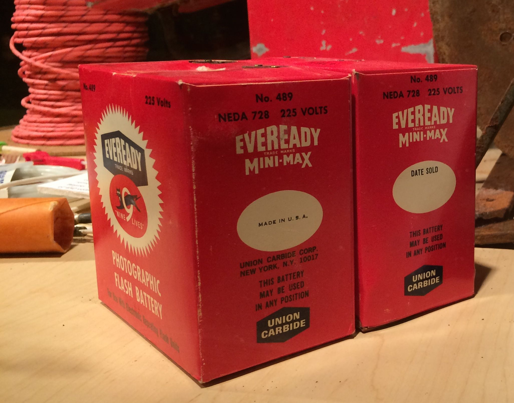
I had to snap a photo of the batteries used in the blasting. They were made by Union Carbide, where my father used to work. I owe a lot to Union Carbide. The paychecks my father earned through them kept us housed and fed.
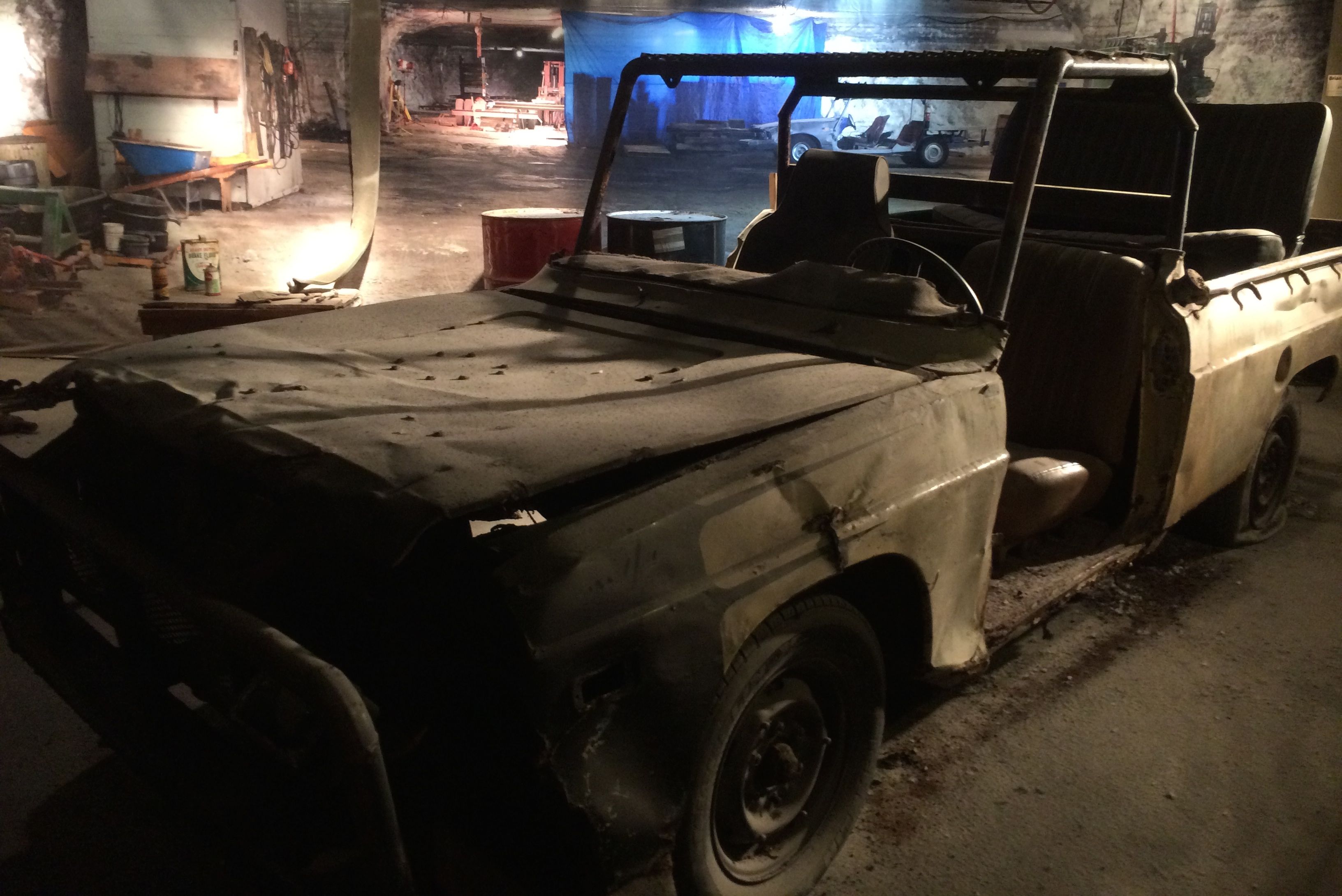
Not all the equipment was from coal mining, though. For a while they had a rail system to get around. After they discontinued that, they started buying used cars and trucks to get around. They would take off windows and doors topside and discard them. Everything that can be removed is taken off so that the vehicles will be small enough to fit into the shaft, which is about four feet by five feet.
Once they get them underground, the mechanics weld the pieces back together and ad what ever is missing, like seats and roll bars. The vehicles run on diesel fuel, and if they have to modify the engines, they take care of that, too.
This truck was abandoned in the mine when it was no longer useful. The maintenance workers removed the engine to use for parts or to install in some other vehicles. The workers painted the fleet regularly to protect them from the salt. Each vehicle is used for about ten years before it is taken out of service. For the most part, they seem to be just left where they are last used.
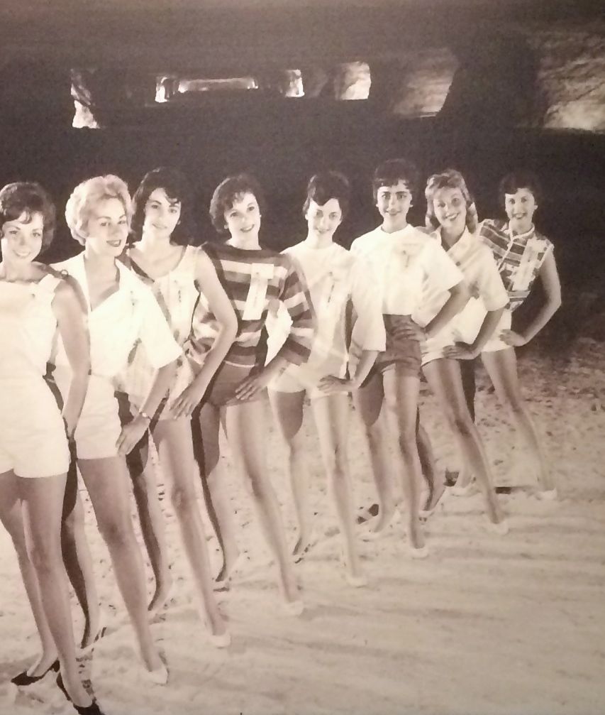
Ah, but the salt culture wasn’t all blasting and digging. There were also the Miss Salt Queen Contests.
The beauty pageants were started in 1959 by UV&A (Underground Vaults and Storage) when they were preparing the mined out salt mines to use for storage of important items.
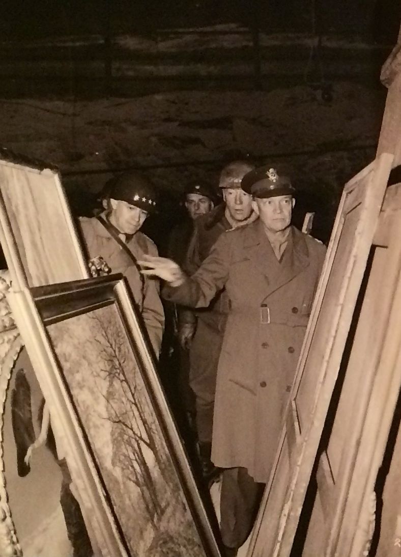
Storing important things in salt mines wasn’t a new idea. Nazis stored art they had plundered in salt mines. Here’s a shot of native Kansas son, General Eisenhower, examining the artwork they recovered at the end of the war.
In keeping with the Kansas theme, one of the displays said that the original print of the Wizard of Oz is stored here. I guess Dorothy is back in Kansas.
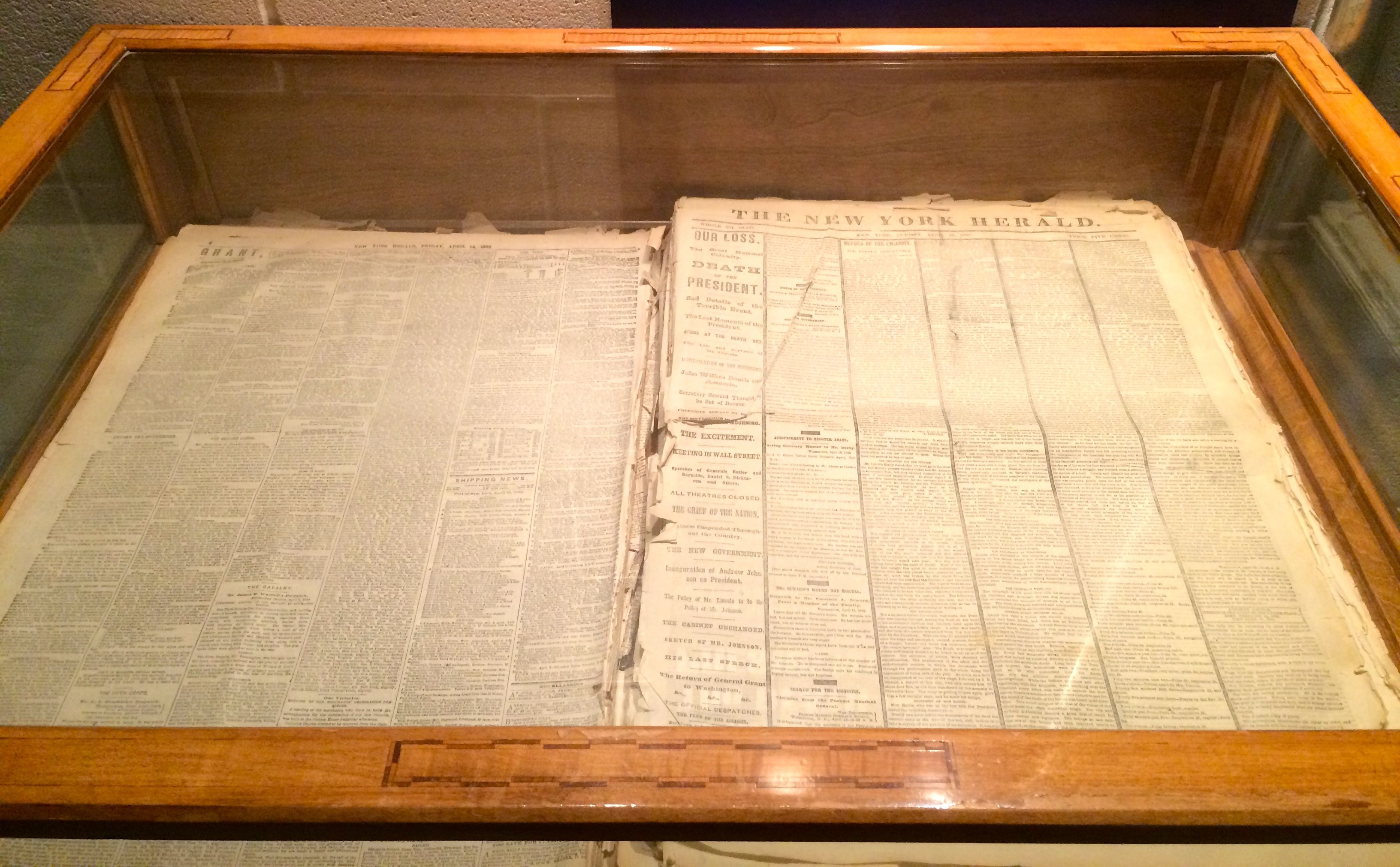
They had this newspaper on display that was published the day after the Lincoln assassination.
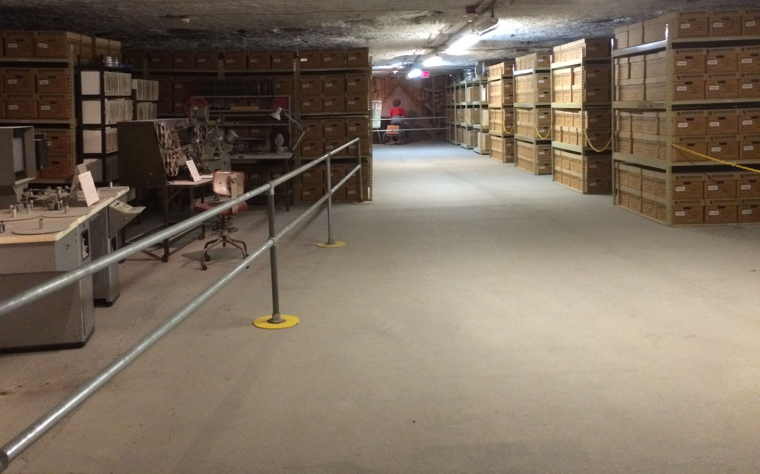
After passing through the display area that talked about the history of UV&A, the path went through a section of storage.
Actually, I don’t think this was necessarily real storage – or reel storage. I lifted the lid on one of the boxes, and it was empty.
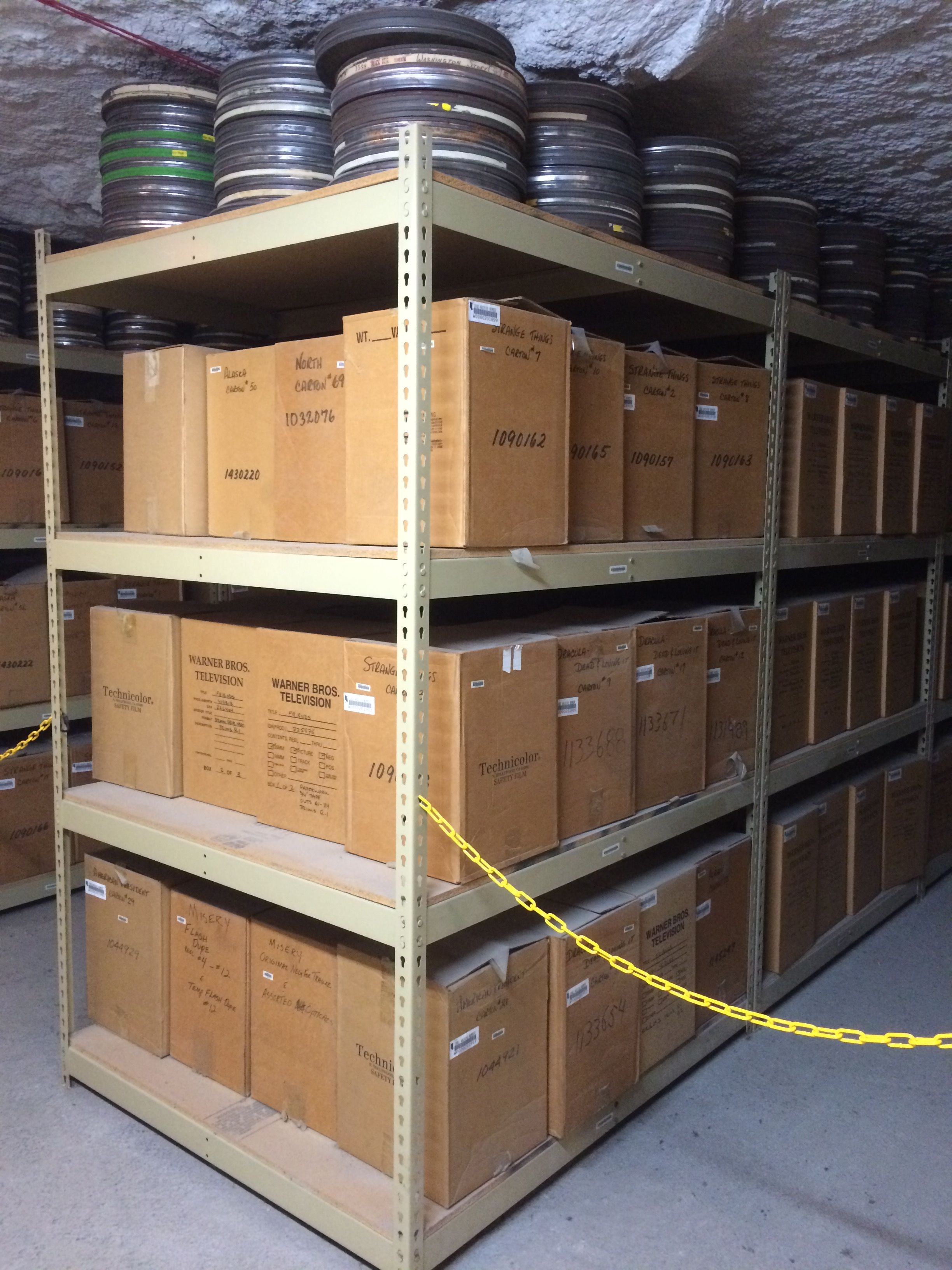
According to the labels, the Friends tapes are stored here. Maybe they are, maybe they aren’t.
These look a little more authentic, but who knows? If I were paying for storage, I don’t think I’d want it out where anyone who buys a ticket can walk up and see my stuff.
After the UV&A tour, it was time for the Dark Tour.
Actually, it wasn’t all that dark. The tram we were on had headlights. And lights would come one when needed.
As they ceased mining tunnels, they would but up what the called “gob walls”. This conserved resources, as they didn’t need to ventilate that part any more. They would fill up boxes from the blasting supplies with mining debris and then stack them up in the opening. This is an old gob wall. These days they block off the unneeded areas with curtains.
Not all salt is white or clear. There are also deposits of red salt. They are big on puns down here. In October, they hold an event called the hunt for Red ROCK-tober. The guide told us that participants get to walk all over and collect all the red salt crystals they can find.
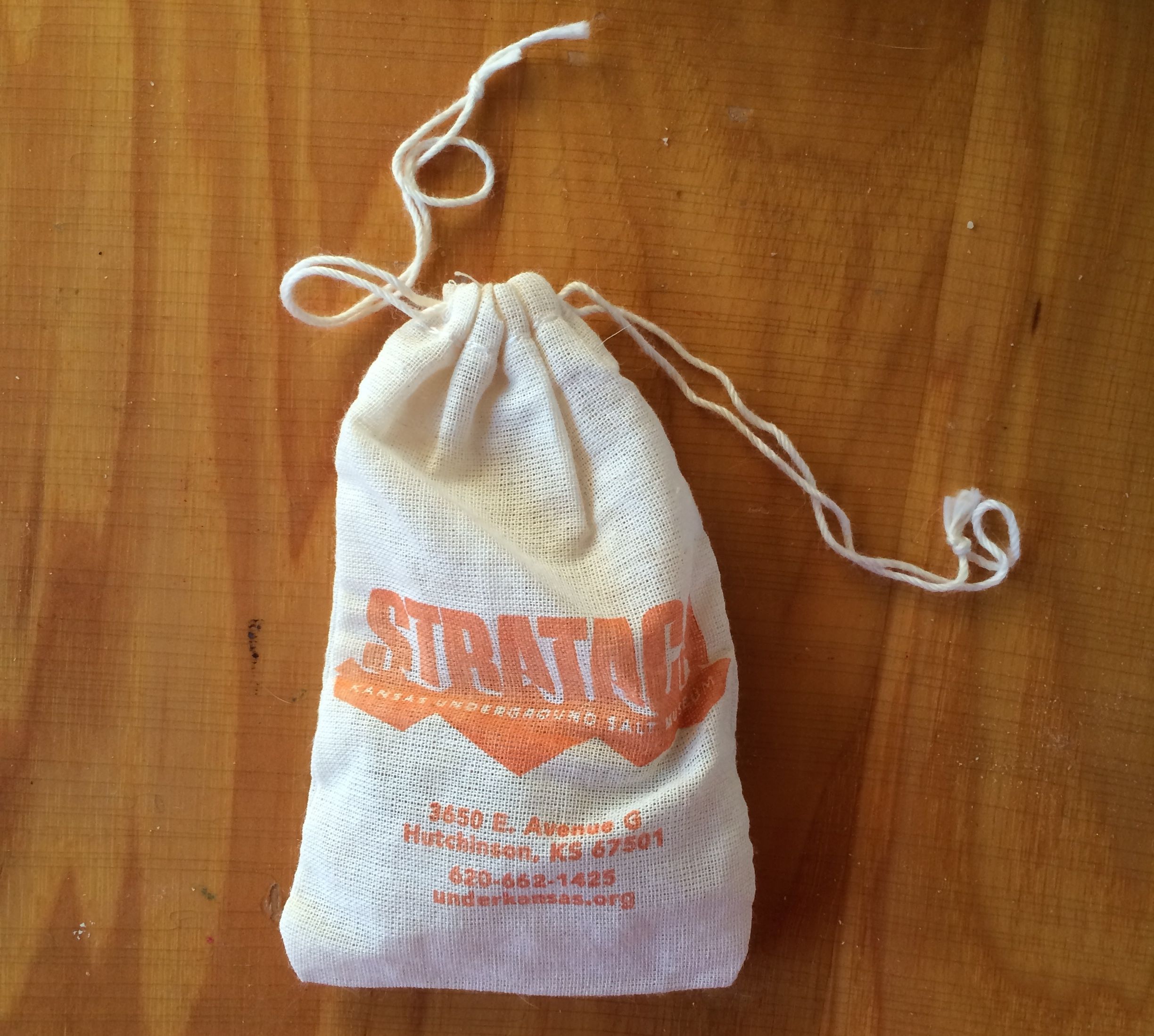
One of the stops on the tour was a spot where we got to select our own samples of salt to take home. We could take anything smaller than our palms from the piles. Since I am doing my best to not accumulate stuff, I only picked out a few.
They even gave us cute little bags to hold our prizes, along with warnings not to put it in fish tanks or gardens once we got home.
With all the parts of Strataca toured and explored (well, at least as much as I had paid for) it was time to take the double decker elevator back to the surface.
While I was waiting for the elevator to come back down with a fresh load of tourists, I had the guide snap a picture of me with the salt.
Once back on the surface, I noticed what looked like an engine.
This is Old Number 2. It was built in 1919 by General Electric. Carey Salt Company acquired it in 1928. There was a granite marker that outlined its chain of ownership in great detail. I didn’t find it particularly interesting or informative, so I will spare you a recitation. Given the size, I assume that it was used above ground to aid in getting the salt on the way to market.
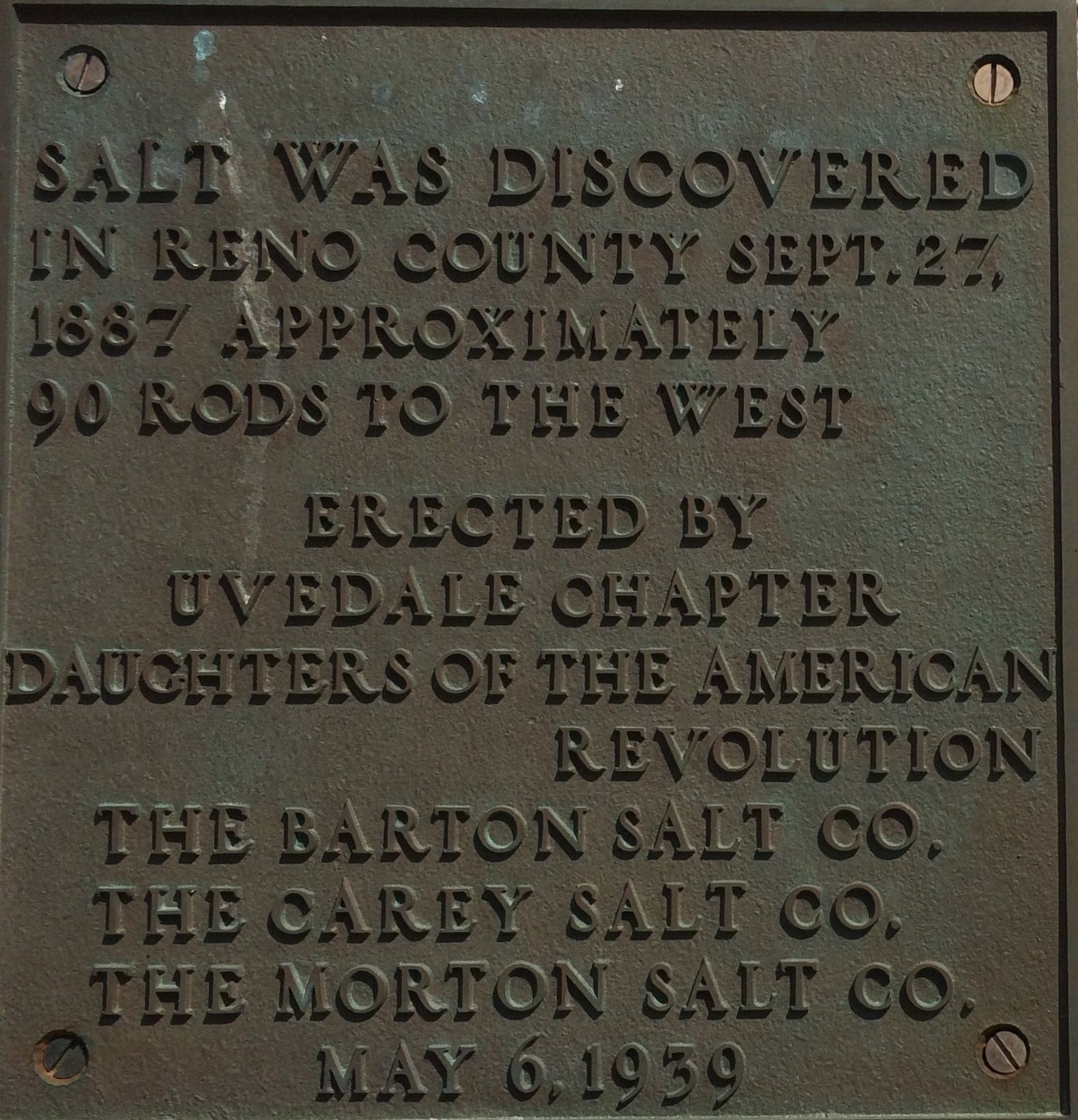
There was also a plaque commemorating the discovery of salt in Reno County. Oddly enough, this plaque isn’t at the actual site. It was put into storage during a road widening project. I tried to locate the site of the actual salt discovery, but my navigational skills weren’t up to the task. I didn’t bring my surveying tools with me, so I wouldn’t have been able to locate a site 90 yards from where the sign had originally been installed.
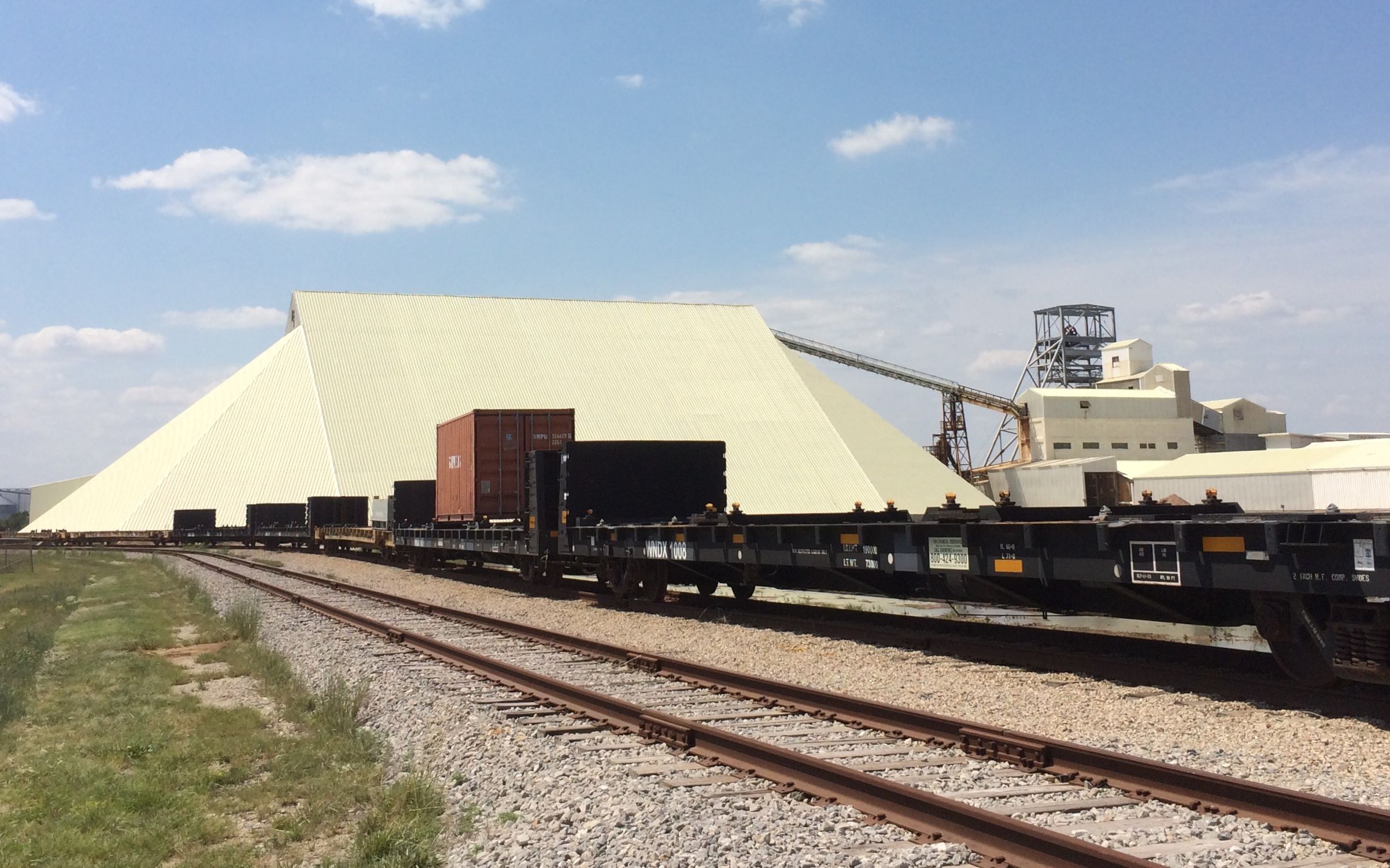
When I was in the mine, one of the guides mentioned that they had built a new shed for the road salt that followed the angle of repose. Just in case you are wondering, the angle of repose is the maximum angle at which loose material will come to rest when added to a pile of similar material. (And in case you are also wondering, I looked it up.)
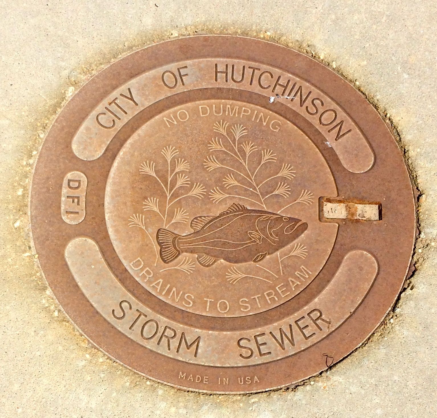
I didn’t come across any survey markers while touring Hutchinson, I did come across this interesting sewer cover. And, it was made in America.


