With a few more than 100,000 people, it is Alberta’s third largest city. Red Deer was my goal because of only one person, my cousin Kelly.
I had actually met Kelly a few years before, at a Ramsey reunion in when we both were visiting in Buffalo. Ramsey was my mother’s maiden name.
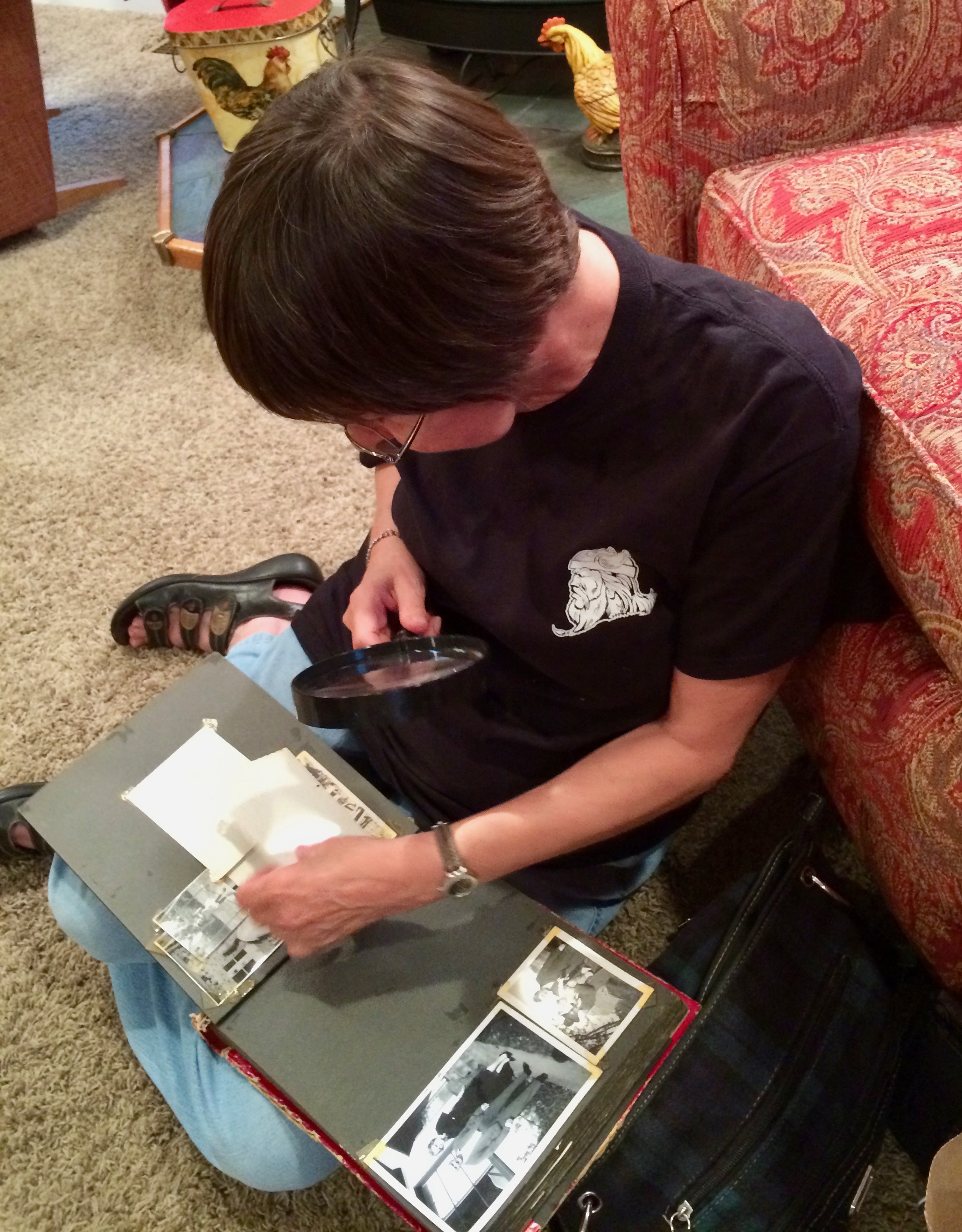
Kelly is a hard core genealogist, as is my cousin Bobbie, who was hosting the get together. When I looked back through my photos of the event, all the shots I had of Kelly were similar to this one. She was devouring information about our family.
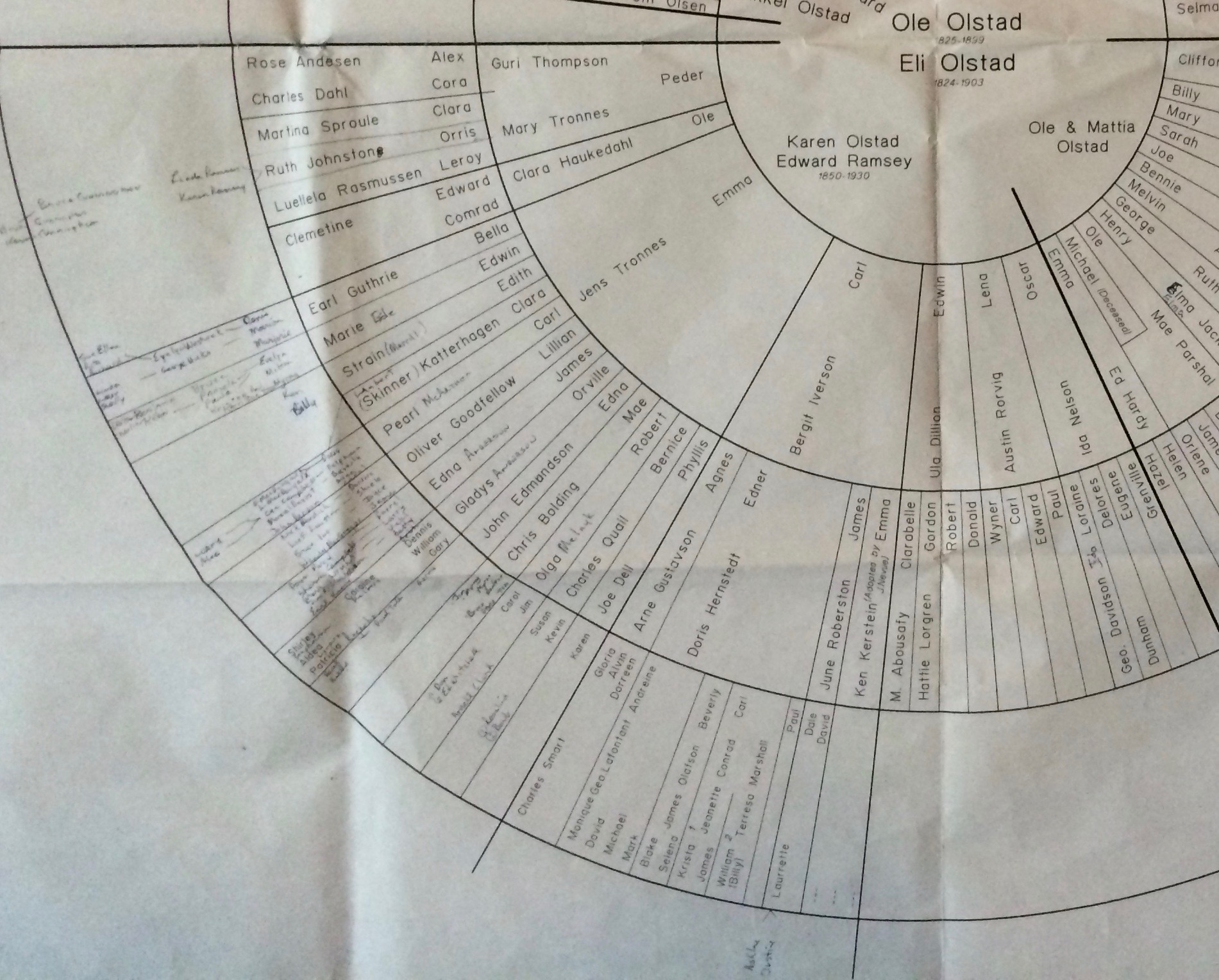
This was the coolest family tree I’d ever seen. It traces us back to the Olstads. I’d always wondered why Mom would talk about the Olstads. I guess I should have asked.
Kelly and I were both from this particular sector of the family. I think by the time we left the get together, the names of me and my sibs were on the wheel, and I HOPE someone corrected the spelling of my father’s last name.
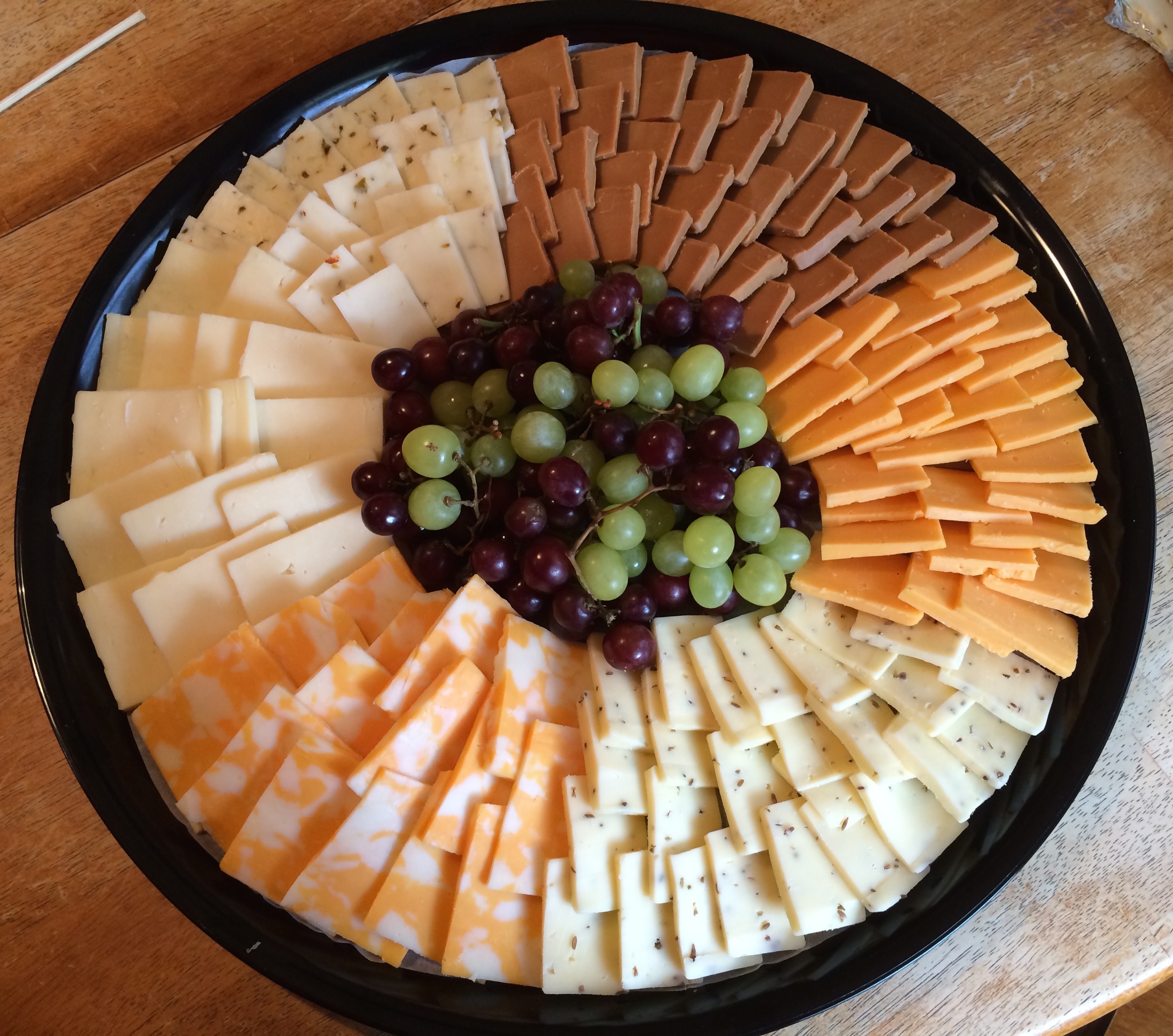
As much as I admire the people who get into family histories and can tell how people are related, this was my contribution to the gathering.
It kind of looks like that impressive family tree, doesn’t it?
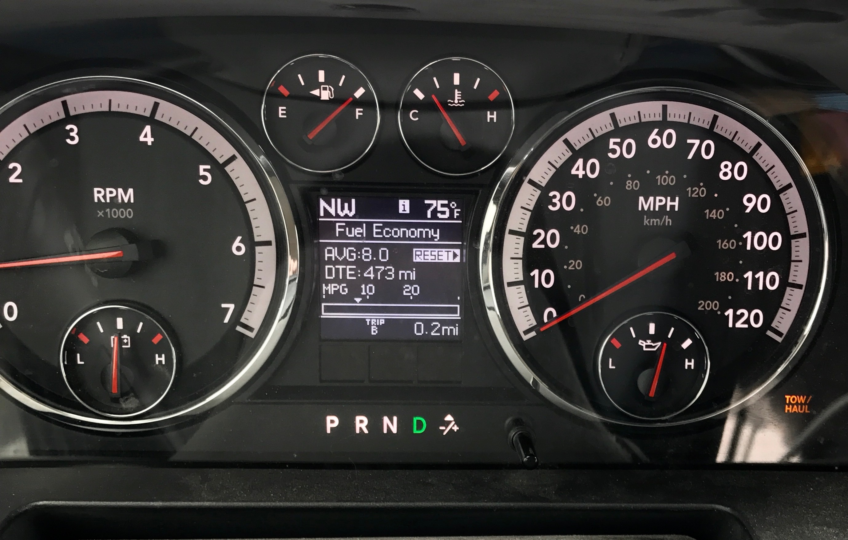
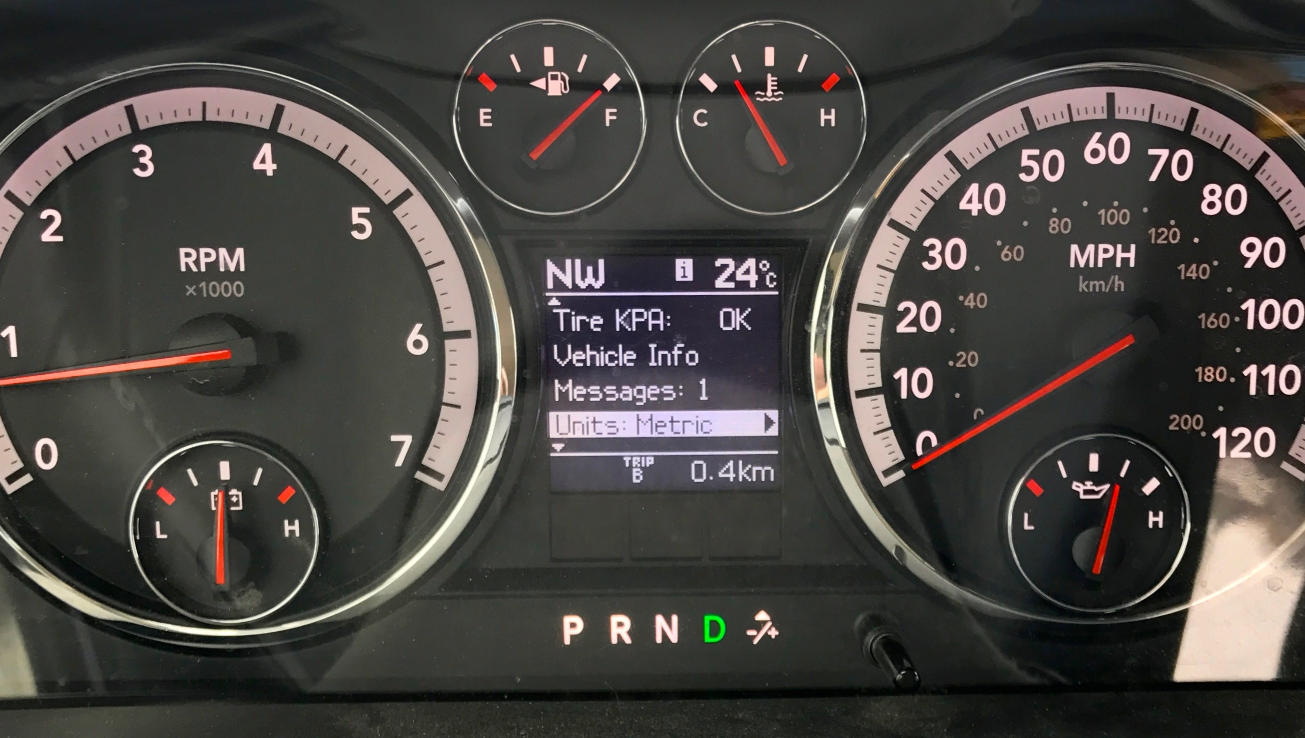
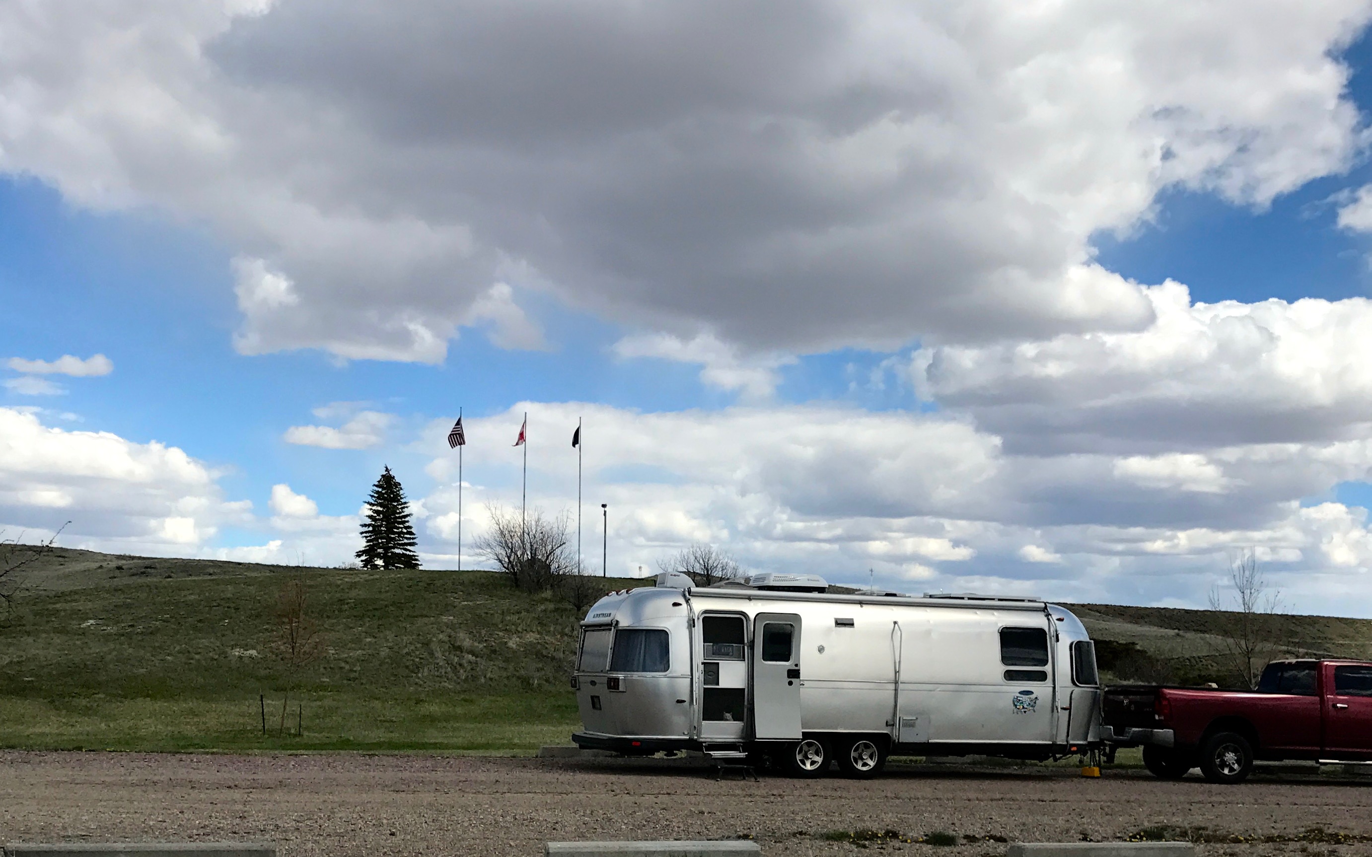
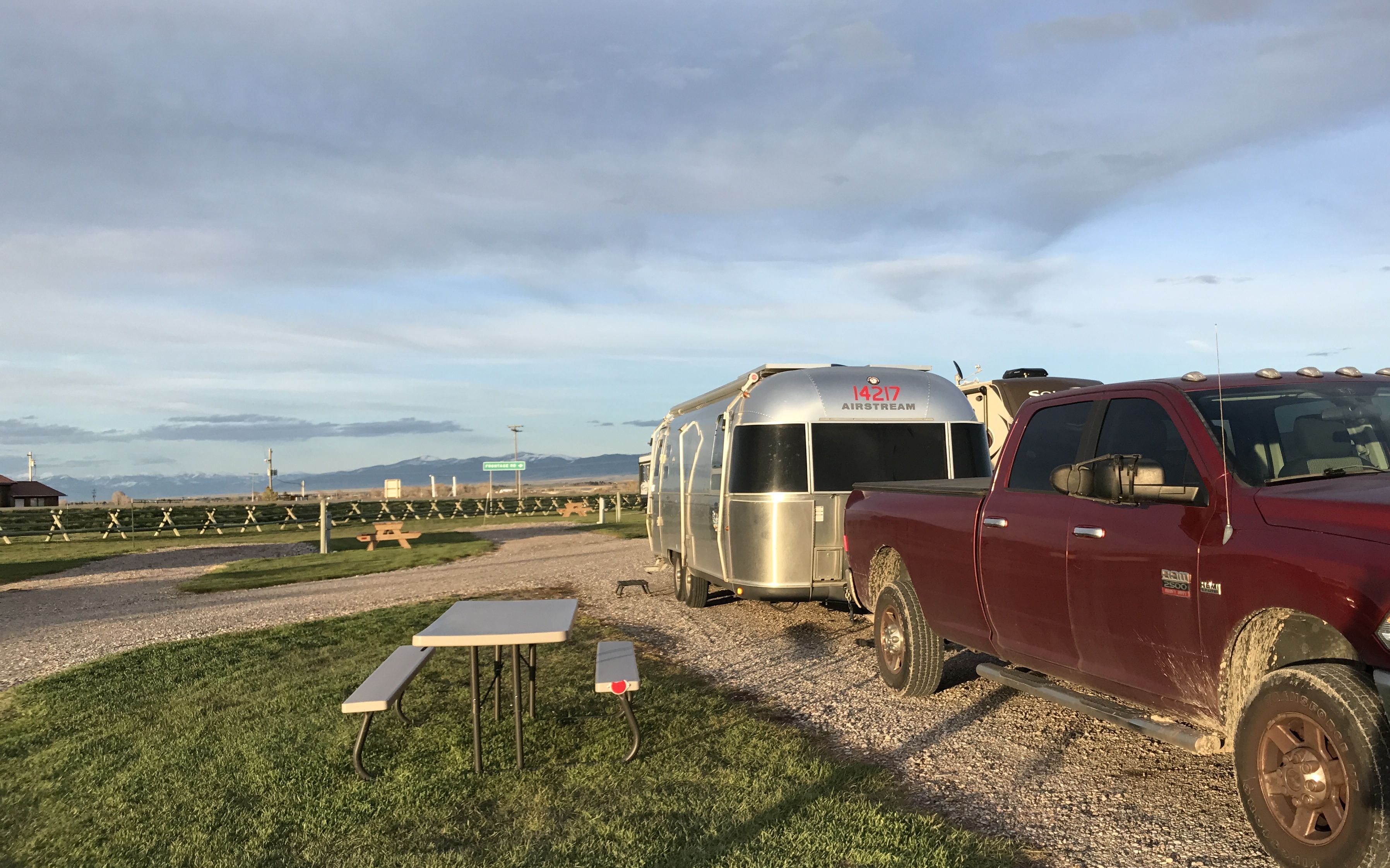
Anyway, I was all hitched up with a full tank of gas and ready to roll. I decided that I might as well change the settings in my data display to “metric.”
And, yes, when I was towing, eight miles to the gallon was common, especially when I was just getting rolling.
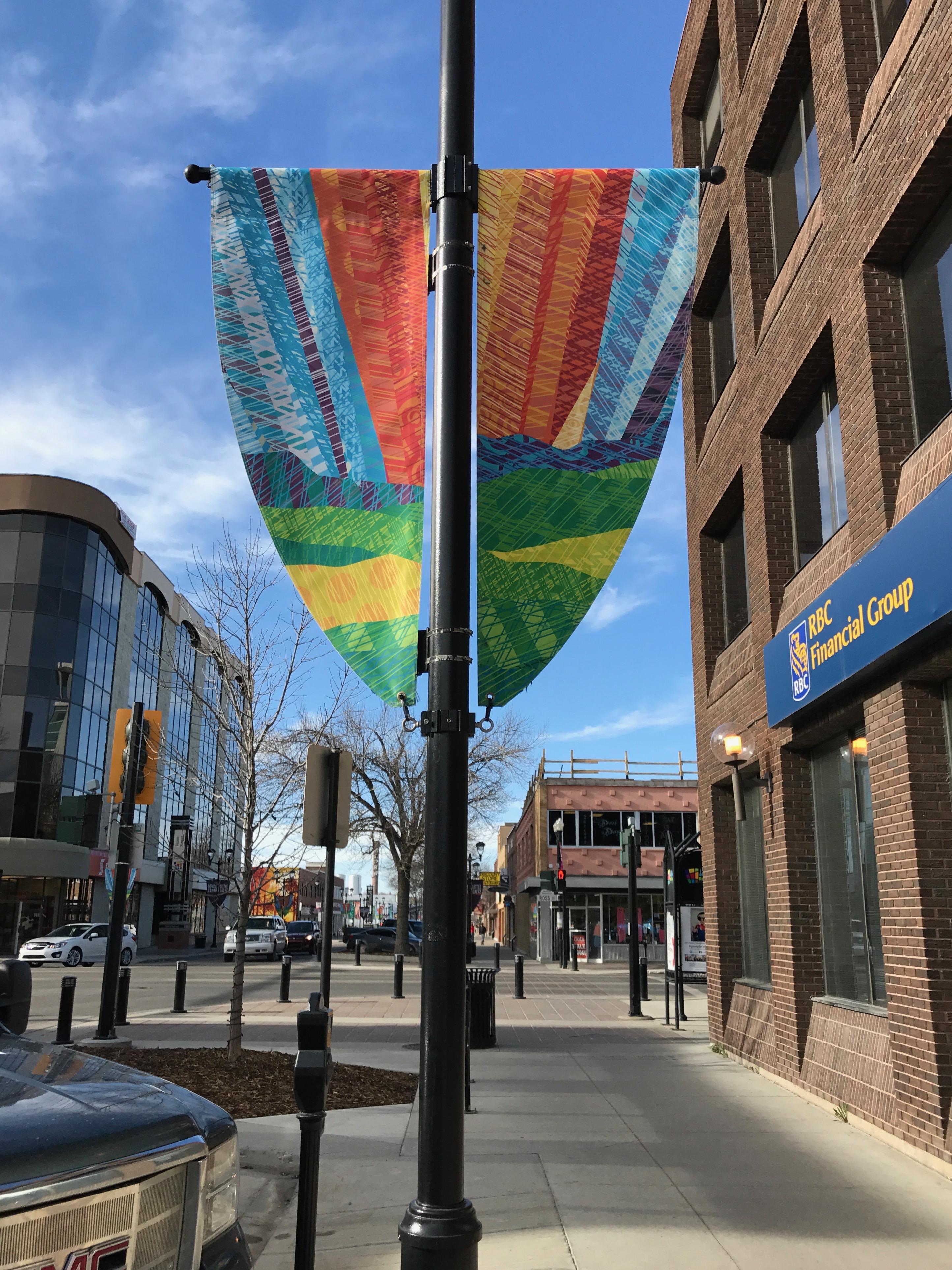
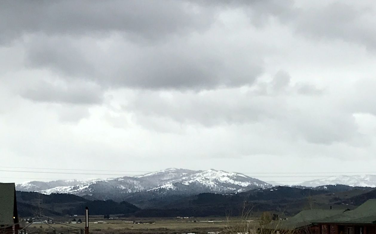
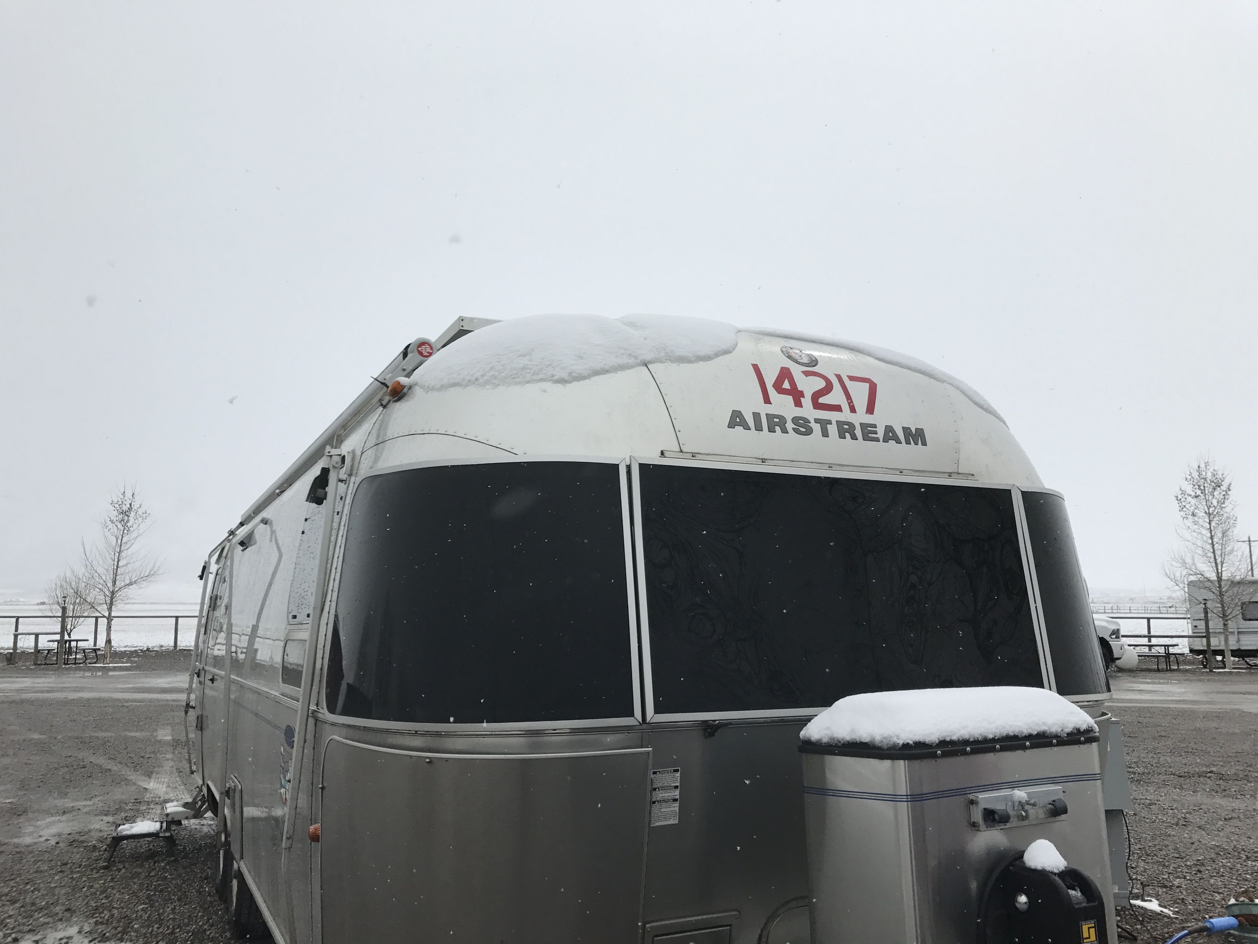
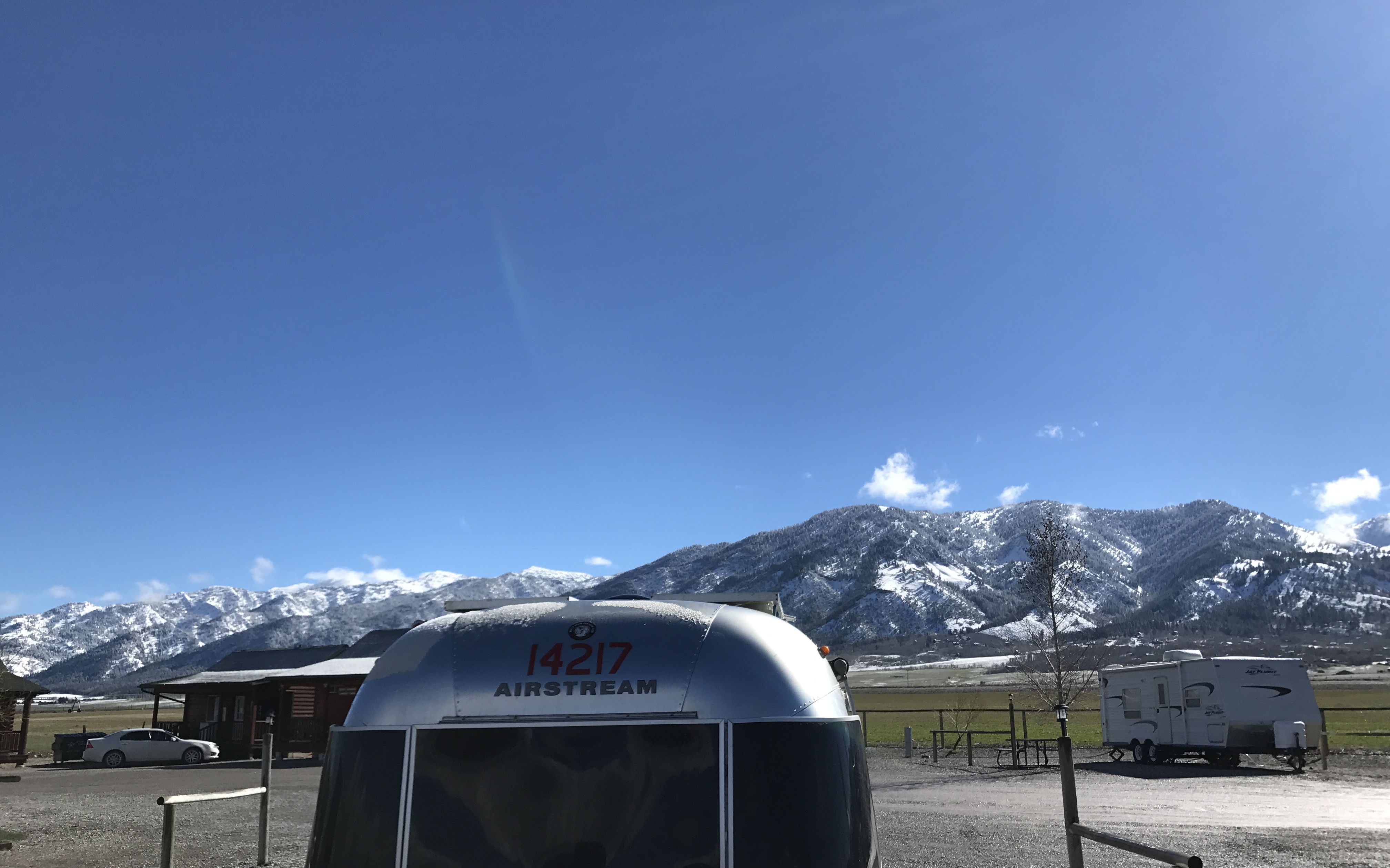
Red Deer was only about two hours up the highway. I got into the Westerner Campground, which was quite nice, early enough in the day to do some exploring in Red Deer before Kelly got off work.
When looking for things to do in Red Deer while I was waiting to check in, I saw something about the Ghosts of Red Deer, which are statues around the central business district. I took off to see what I could see.
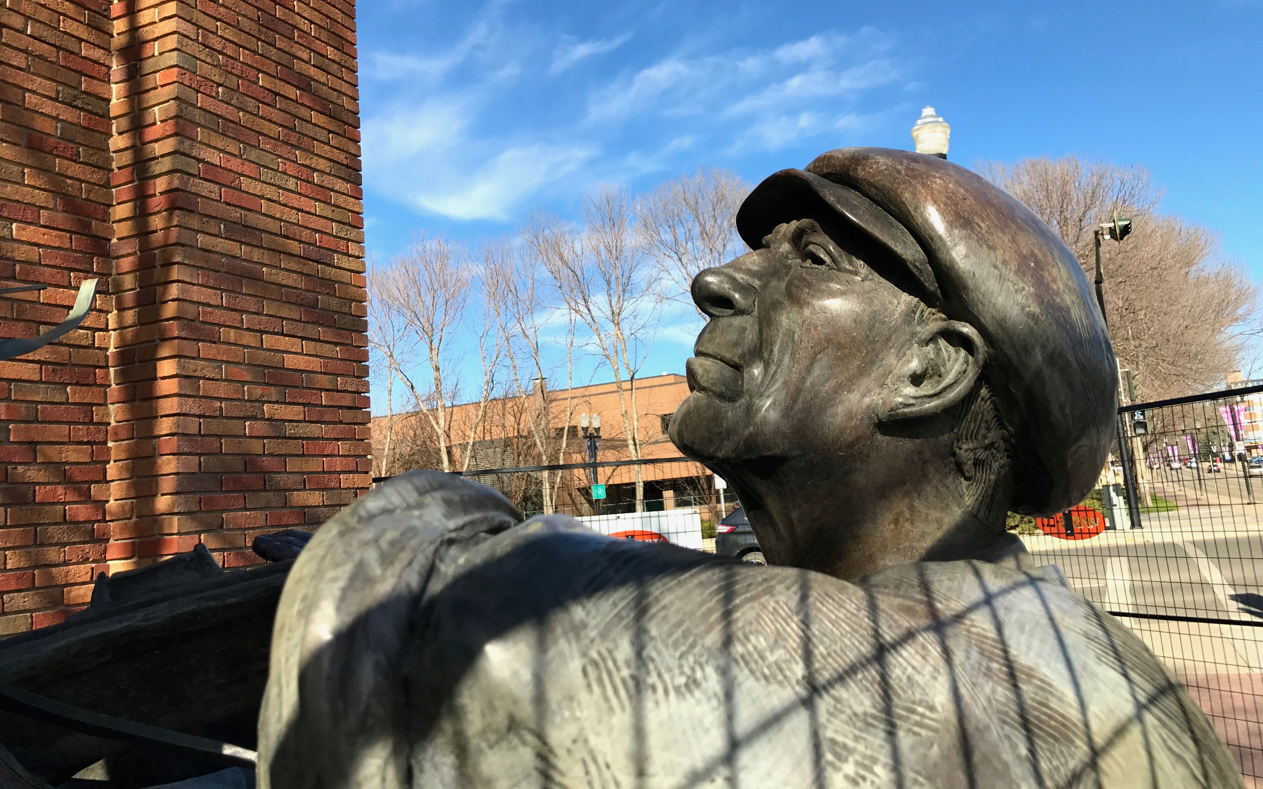
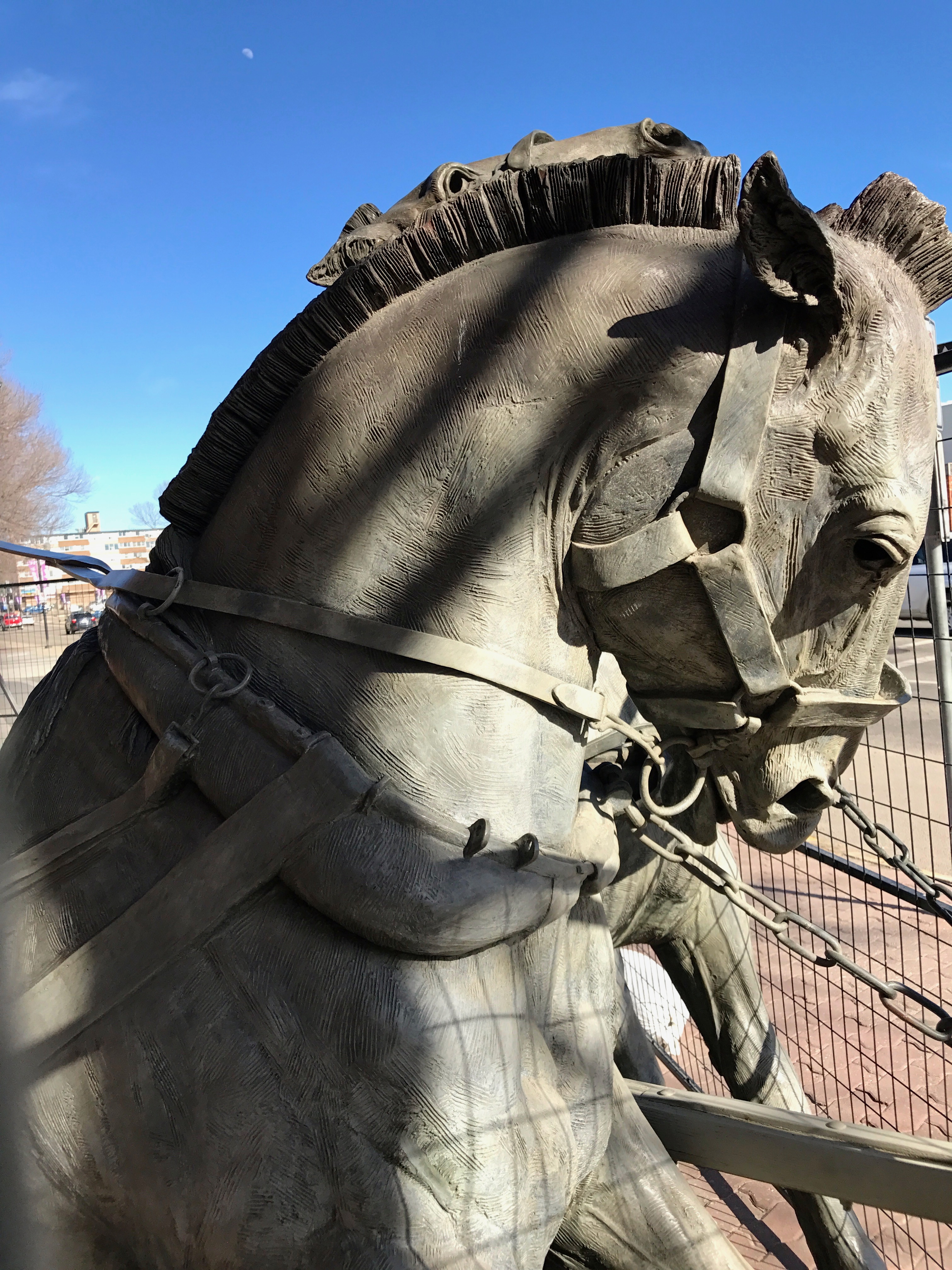
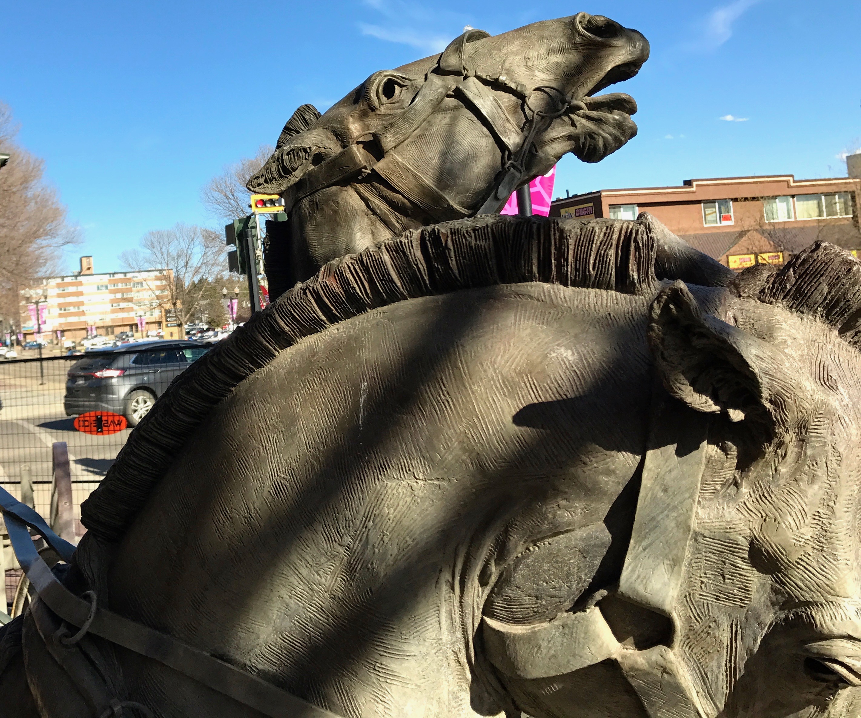
My first ghost I saw was dedicated to the volunteer fire brigade, which was placed in front of the former headquarters. It was undergoing some maintenance, so it was hard to get a clear shot of the whole sculpture.
There was a member of the brigade,
but the horses really stole the show.
They were awesome!
The old firehouse was right next to the library – in fact, I think it was part of the library. I decided to go in and see if they could give me any information about the Ghosts.
They were very hospitable and eager to help. They photocopied me some information about the sculptures and a map about where to find them. I set off on a scavenger hunt of sorts.
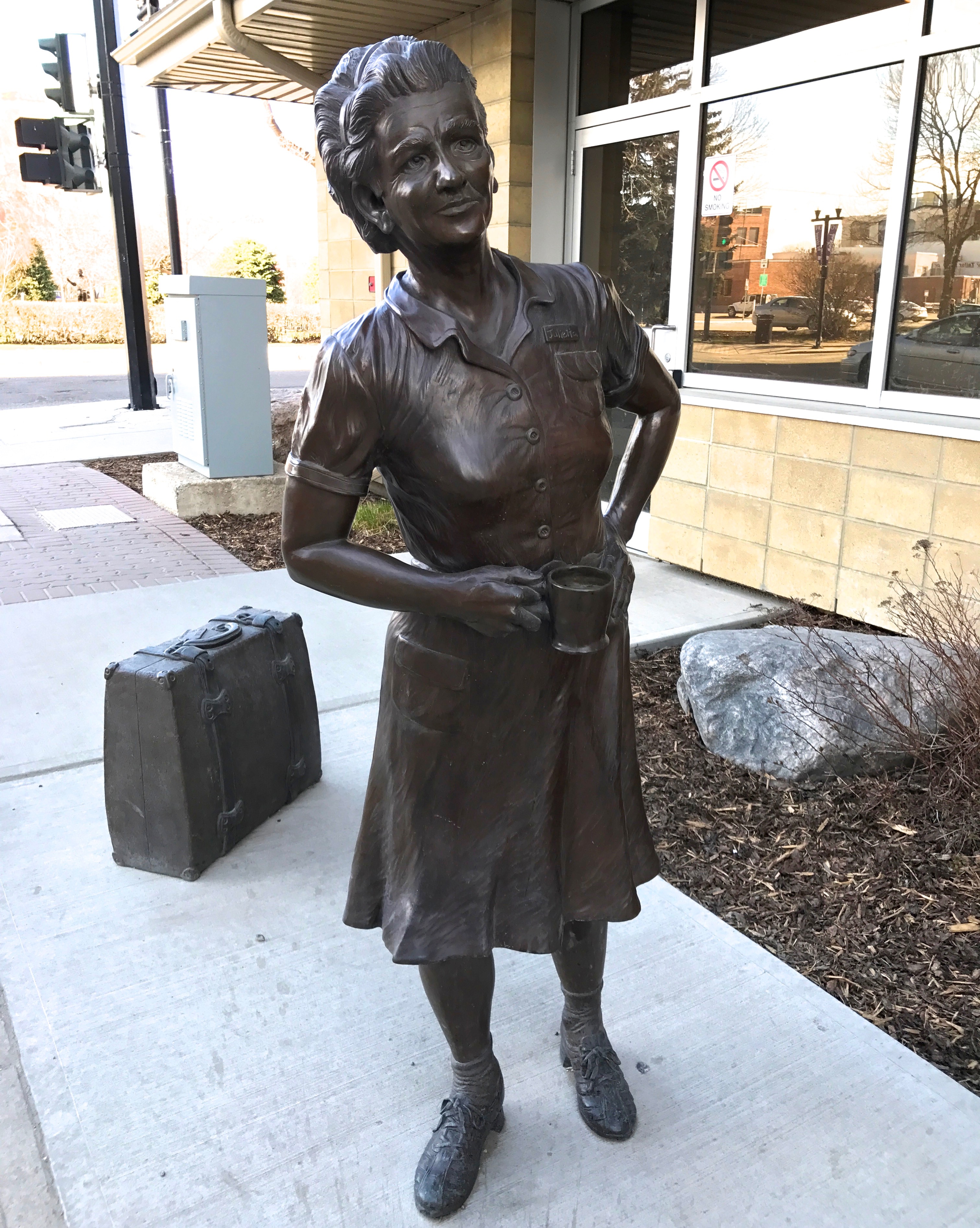
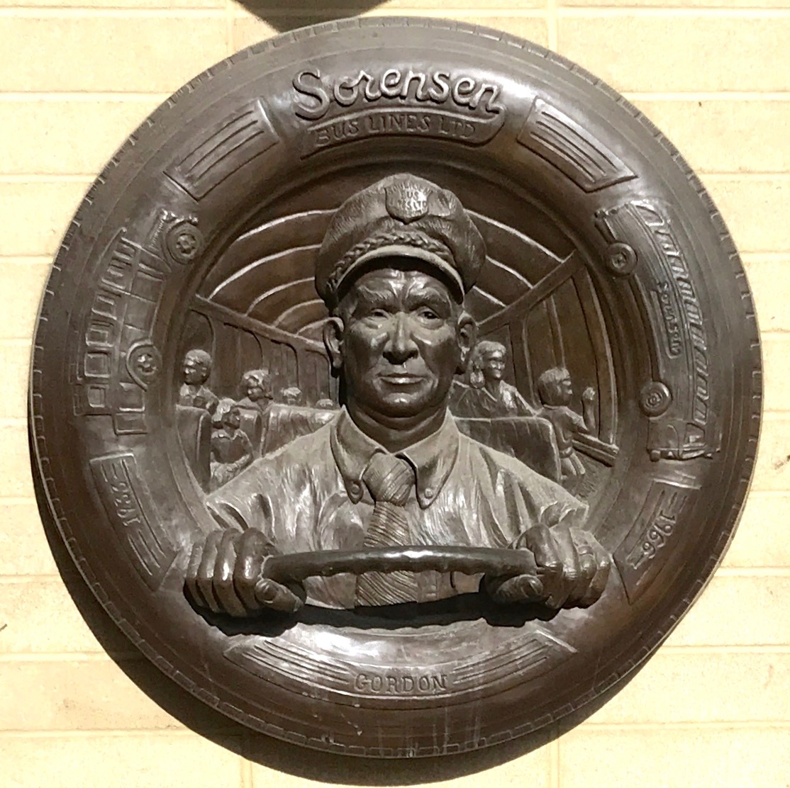
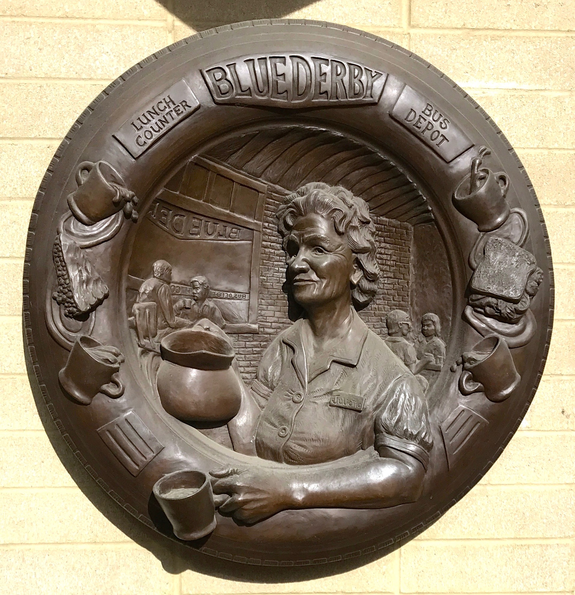
My next stop was the bus terminal, where Julietta Sorensen was waiting for her husband, Gordon, to arrive with the last bus of the day.
The Sorensens started a bus service in Red Deer and Red Deer County in 1933.
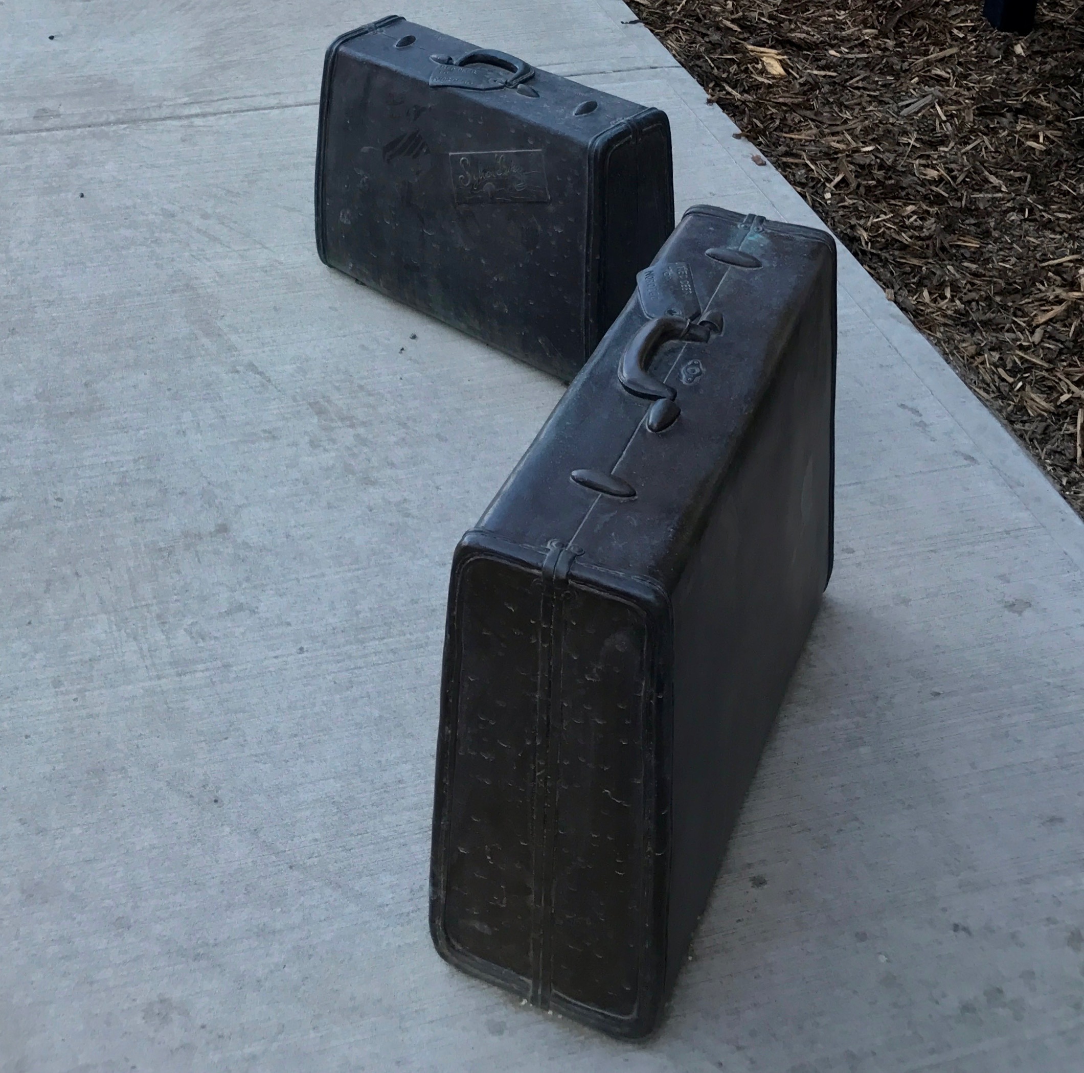
I like the detail of the suitcases waiting for their owners.
Gordon drove the bus and Julietta ran the lunch counter in the bus depot.
The Sorensens sold their bus service to the City of Red Deer in the 1960s, which is the basis of the city’s current public transit system.
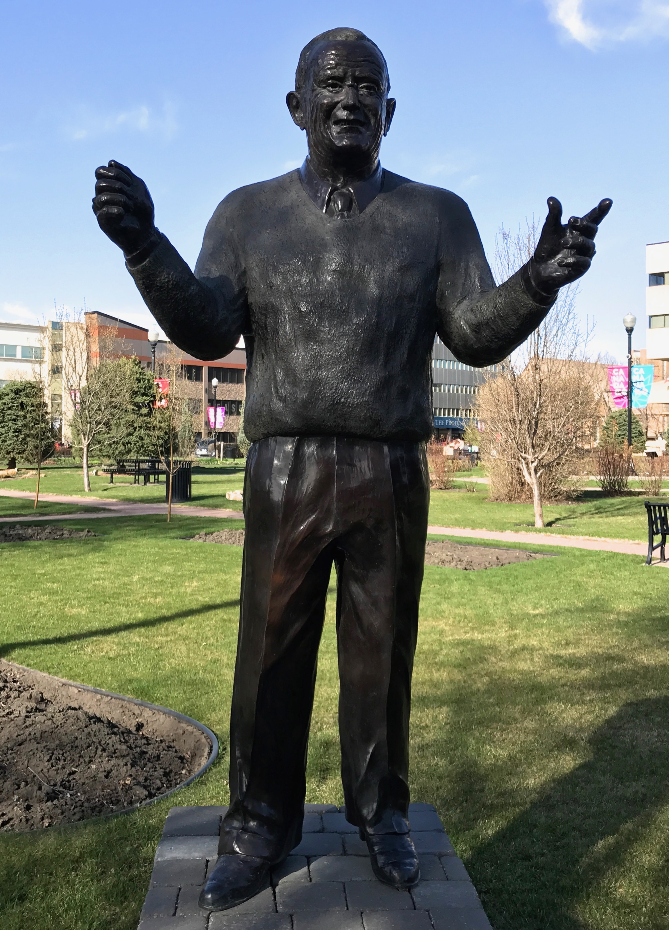
The next ghost I found was Keith Mann, who was an internationally acclaimed music director. According to the librarians, Mr. Mann once held a baton in his right hand.
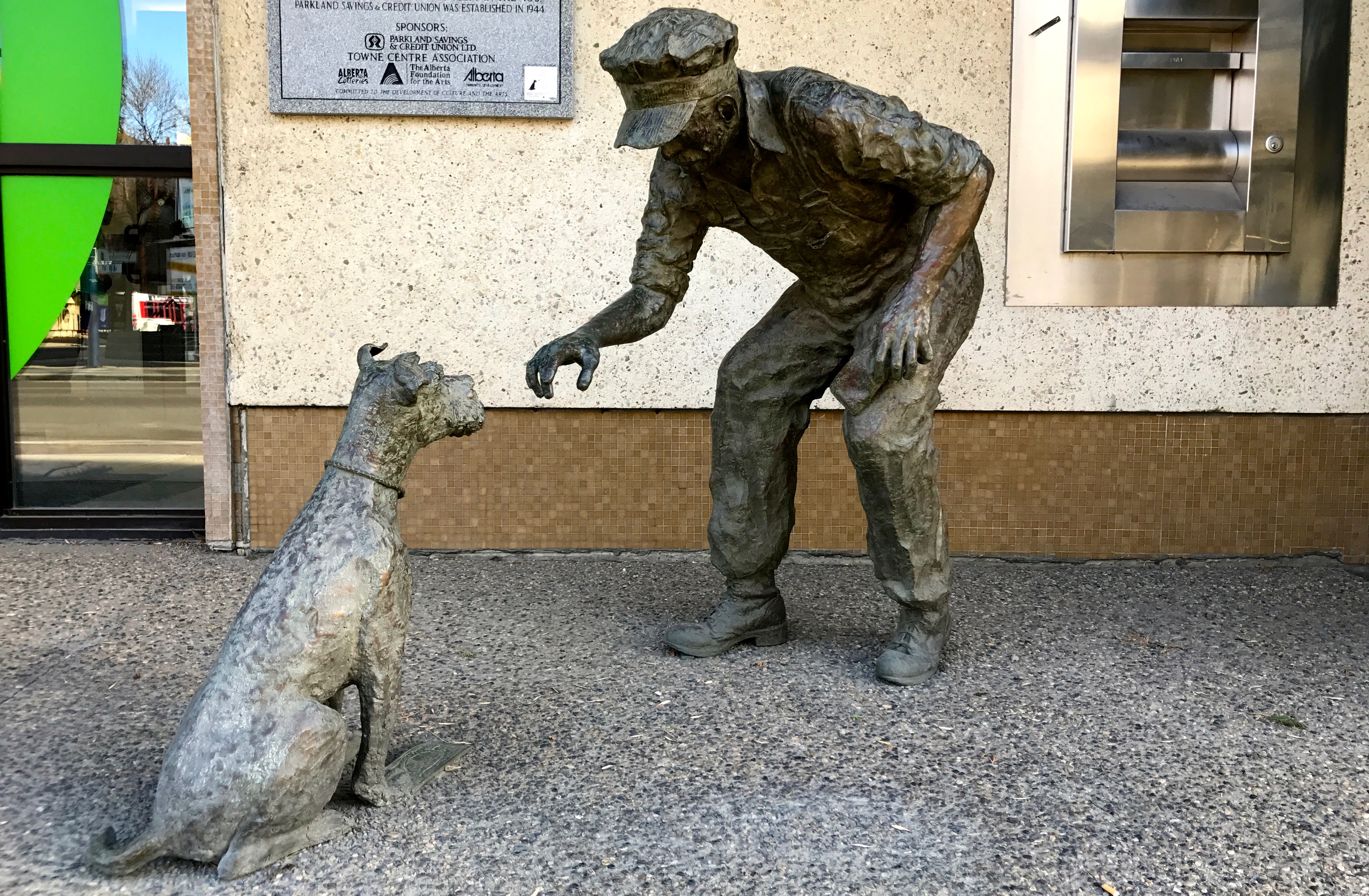
This ghost is called “Choices”. In the early 1900s, the railroad was central Alberta’s largest employer. As a result of the Depression, railroaders, who worked hard days for their money, had a certain distrust of “Eastern” banks. Their desire to take control of their own money lead to the credit union concept in the 1940s. The Parkland Savings and Credit Union sponsored this ghost that is positioned outside one of the branches.
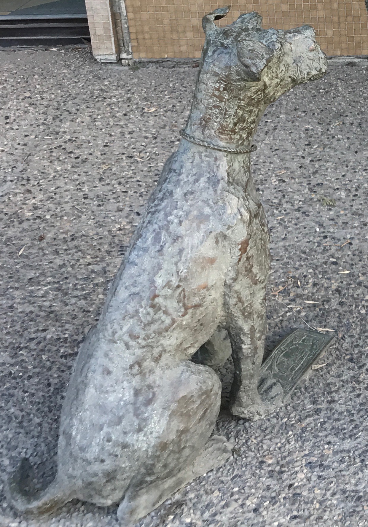
In case you missed it in the big shot, here is a close up of the money that is under the dog’s paw. I guess a credit union would be more convenient than trying to get it away from a protective dog.
I ambled along on my ghost hunt and came upon the Reverend Dr. Leonard Gaetz. He was one of the first settlers of the area and is regarded as the founder of Red Deer.
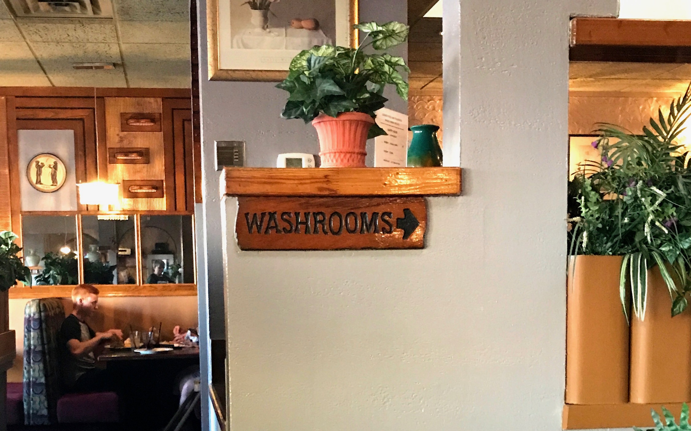
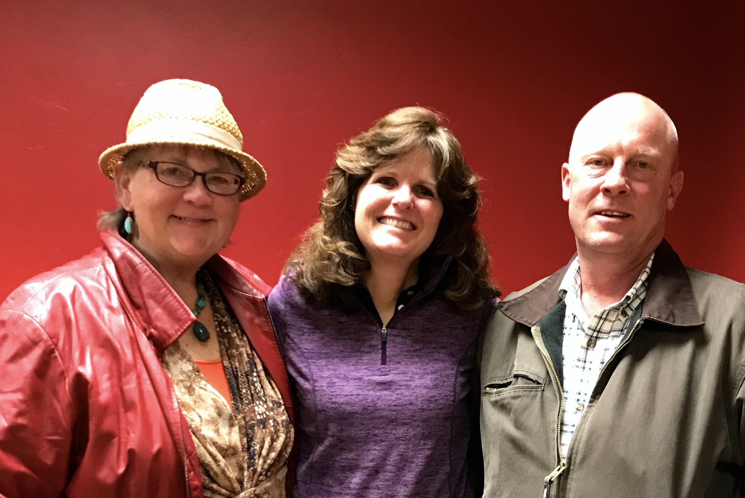
I enjoyed sauntering abound the downtown, but it was time to head back to the campground to meet my cousin, Kelly for dinner.
You know how they say, “If there’s not photo, then it didn’t happen?” For some reason, I didn’t get a picture of the two of us together.
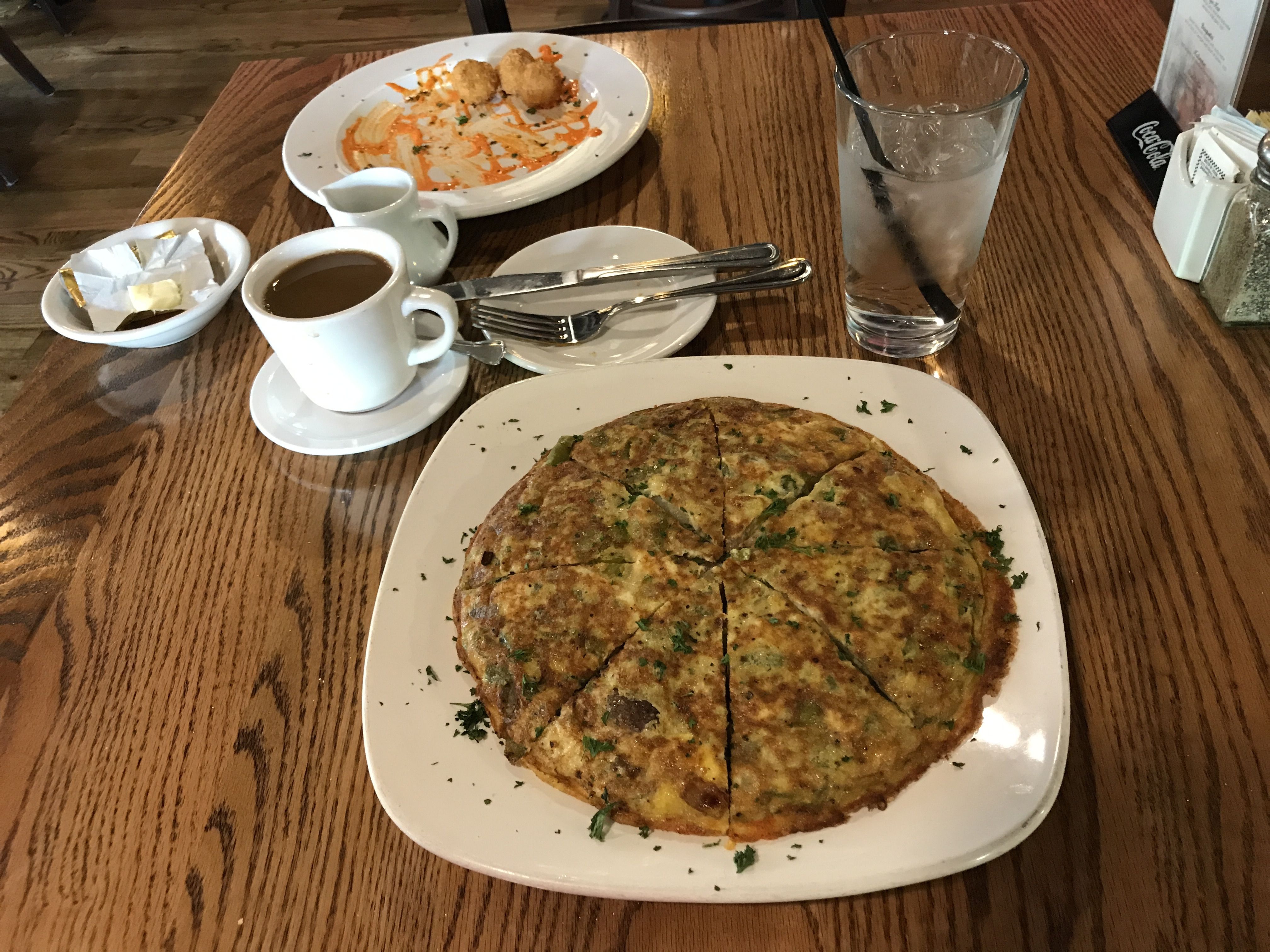
But I did take a shot in the restaurant that proves I was in Canada.
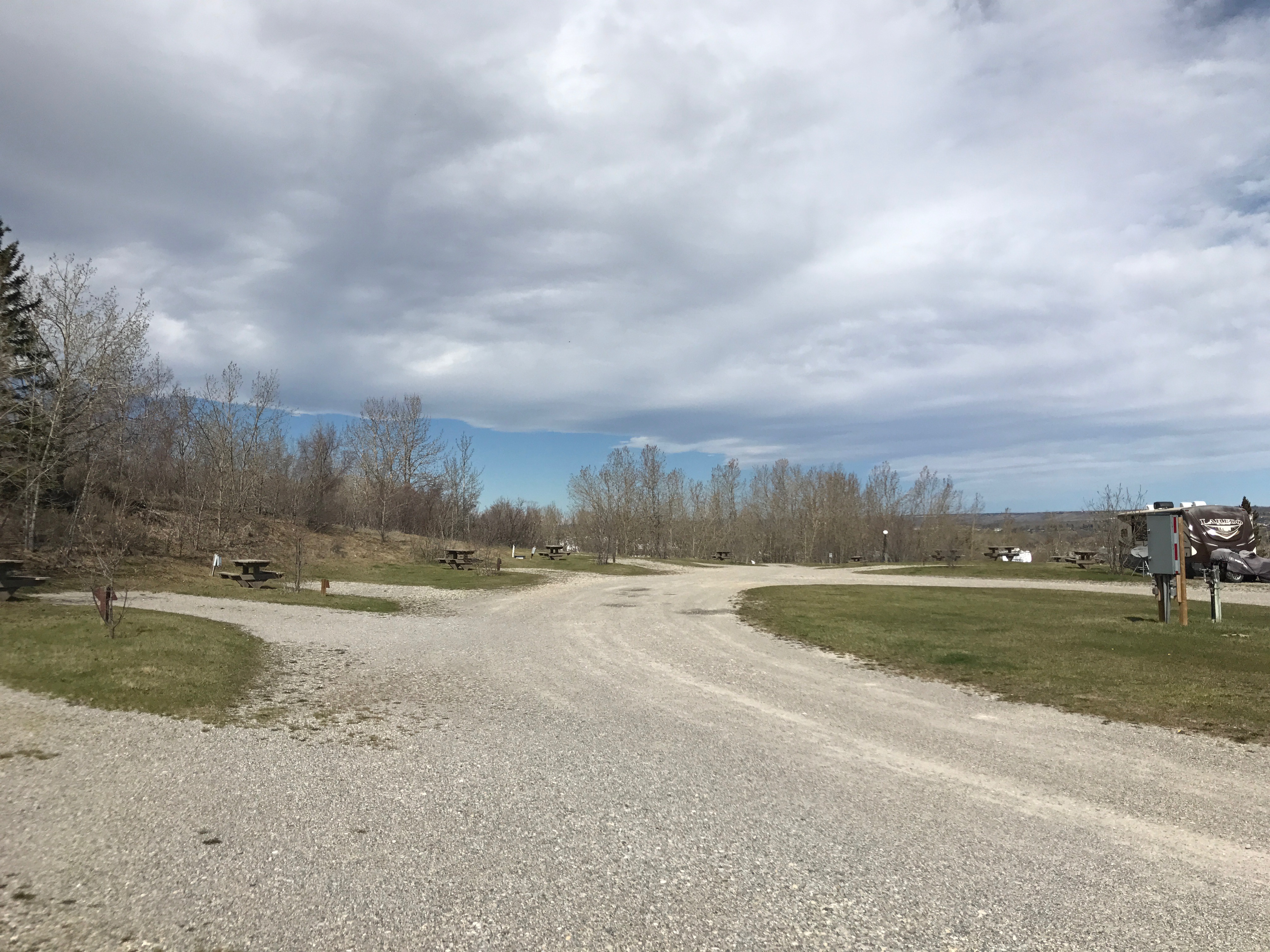
This was one of those campgrounds. But it did had location going for it.
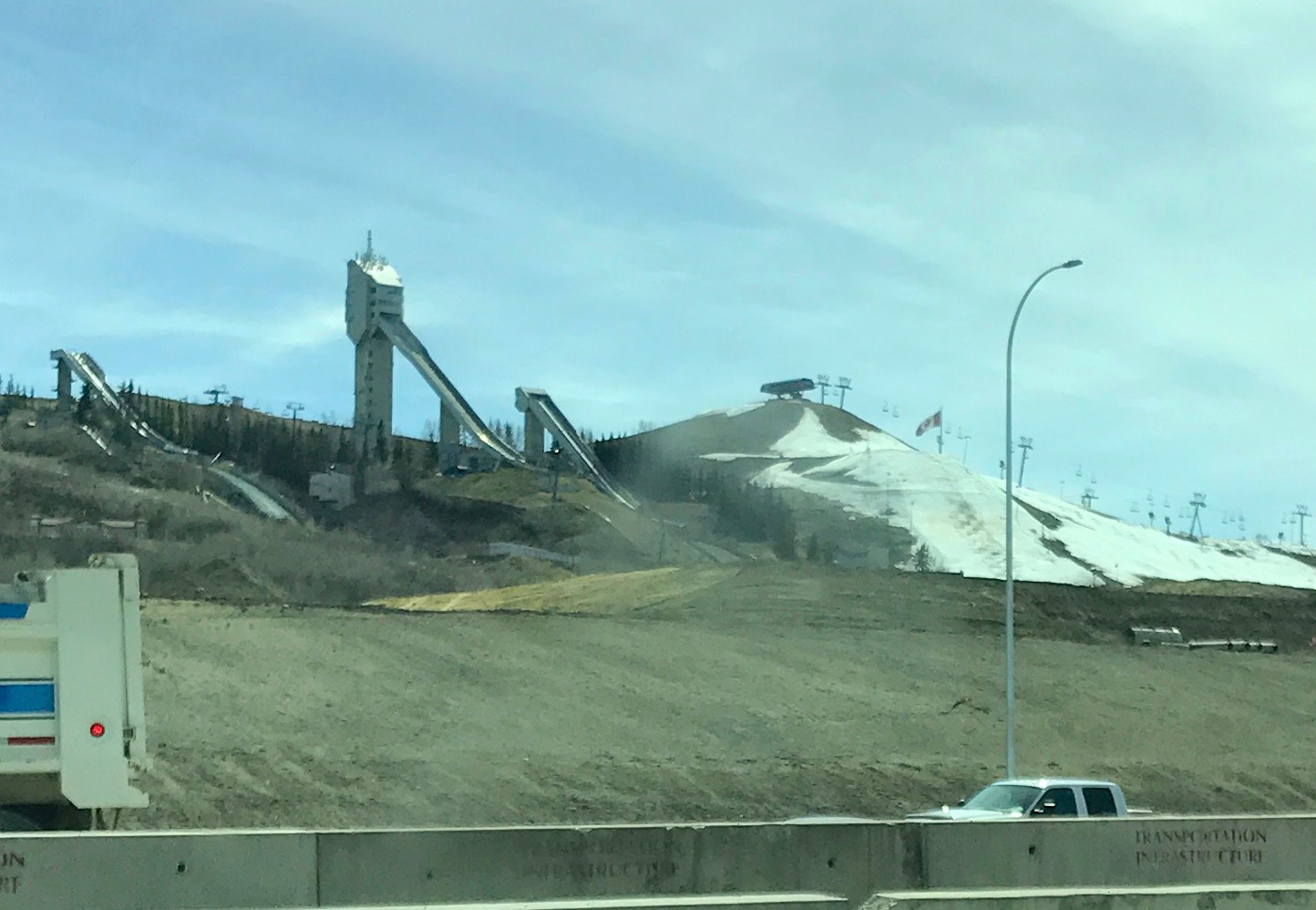
It was really close to the some of the venues from the 1988 Olympics. I passed the ski jumps every time I went to or from the campground.
In all fairness, maybe it was more appealing in the warm months. I was there in April and it was still pretty cool at times.
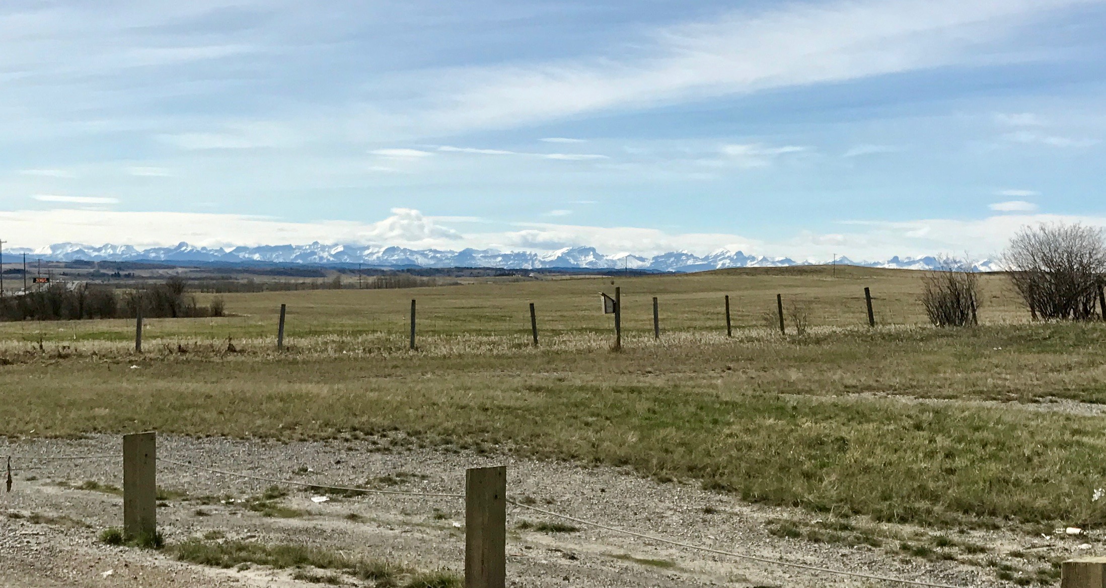
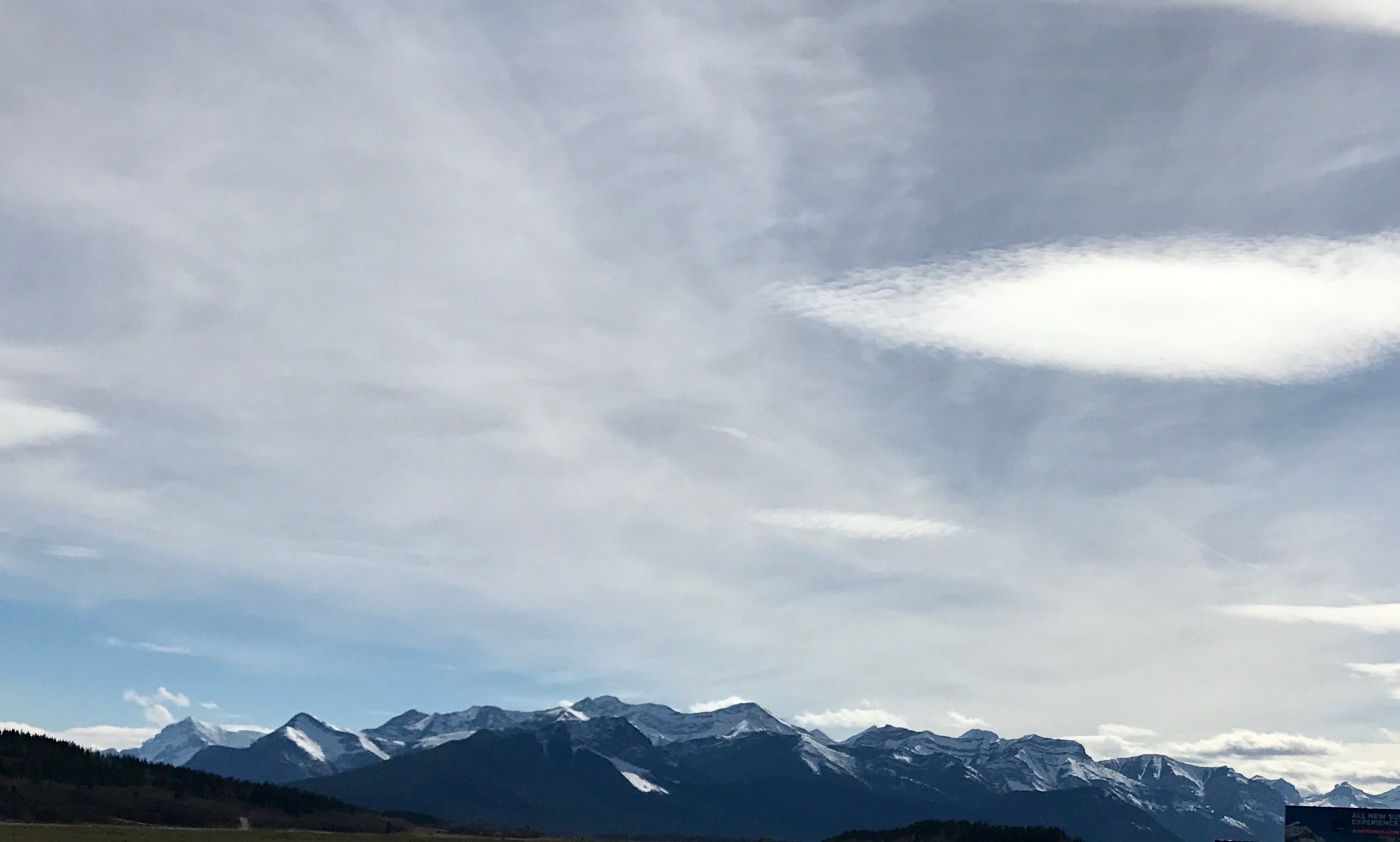
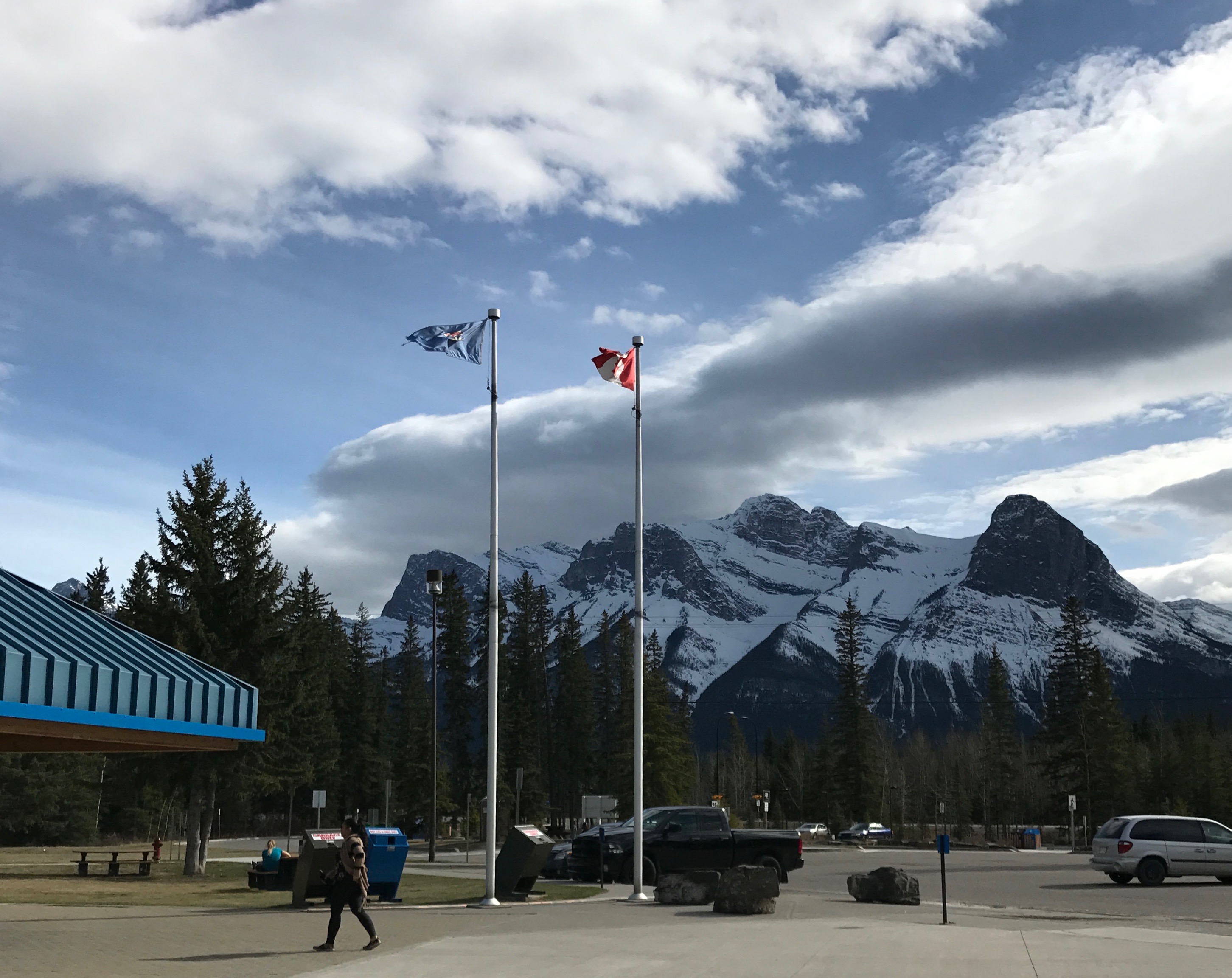
Since I was so close, I decided that I should head toward Banff. I didn’t know how far I’d get, but I headed Bart down the road.
I could see the Rockies rising up the closer I got.
I was getting closer.
And closer.
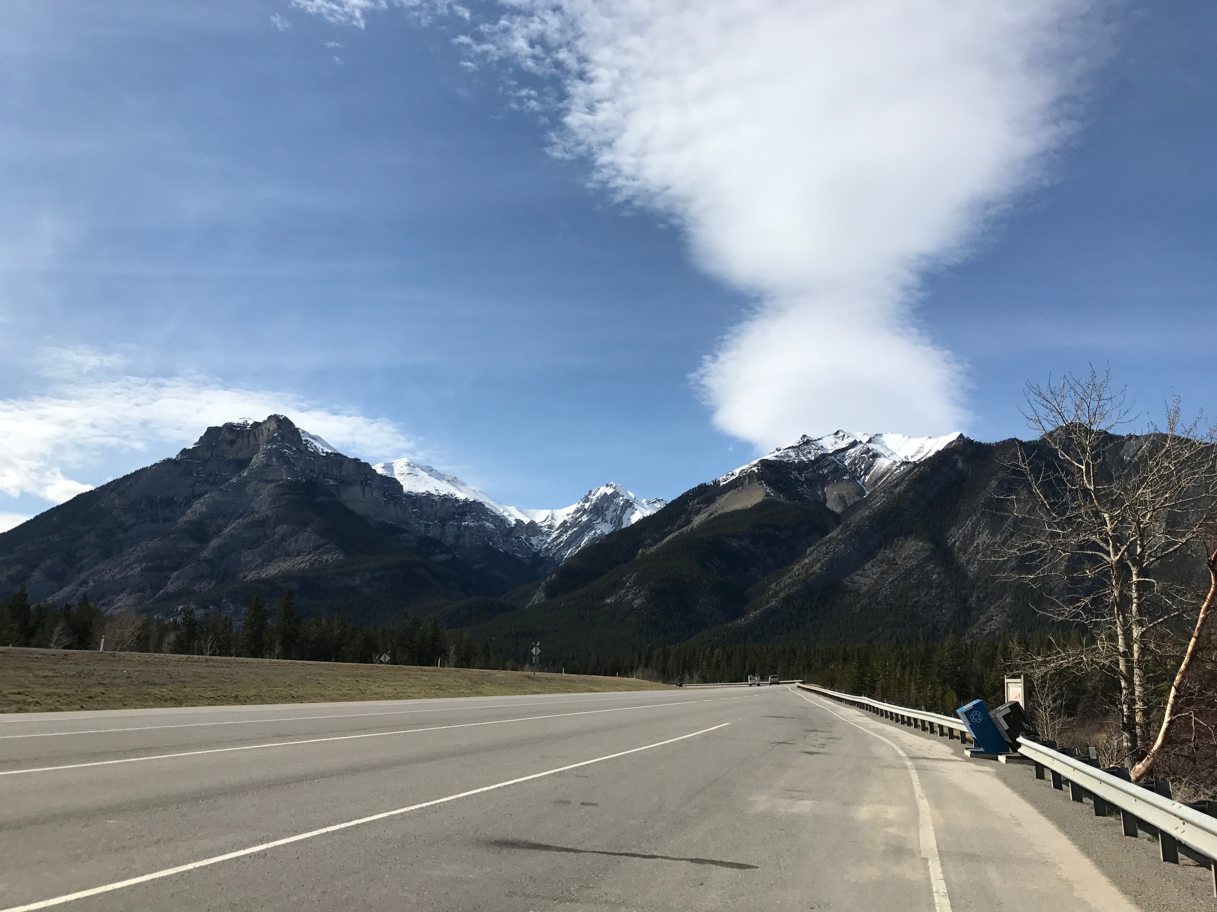
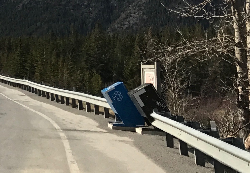
I was captivated by the trash cans I saw along the roads. They angled so that the passenger would be able to easily put the trash into the can. Not only were there trash cans, there were recycling bins right next to them! What a great design.
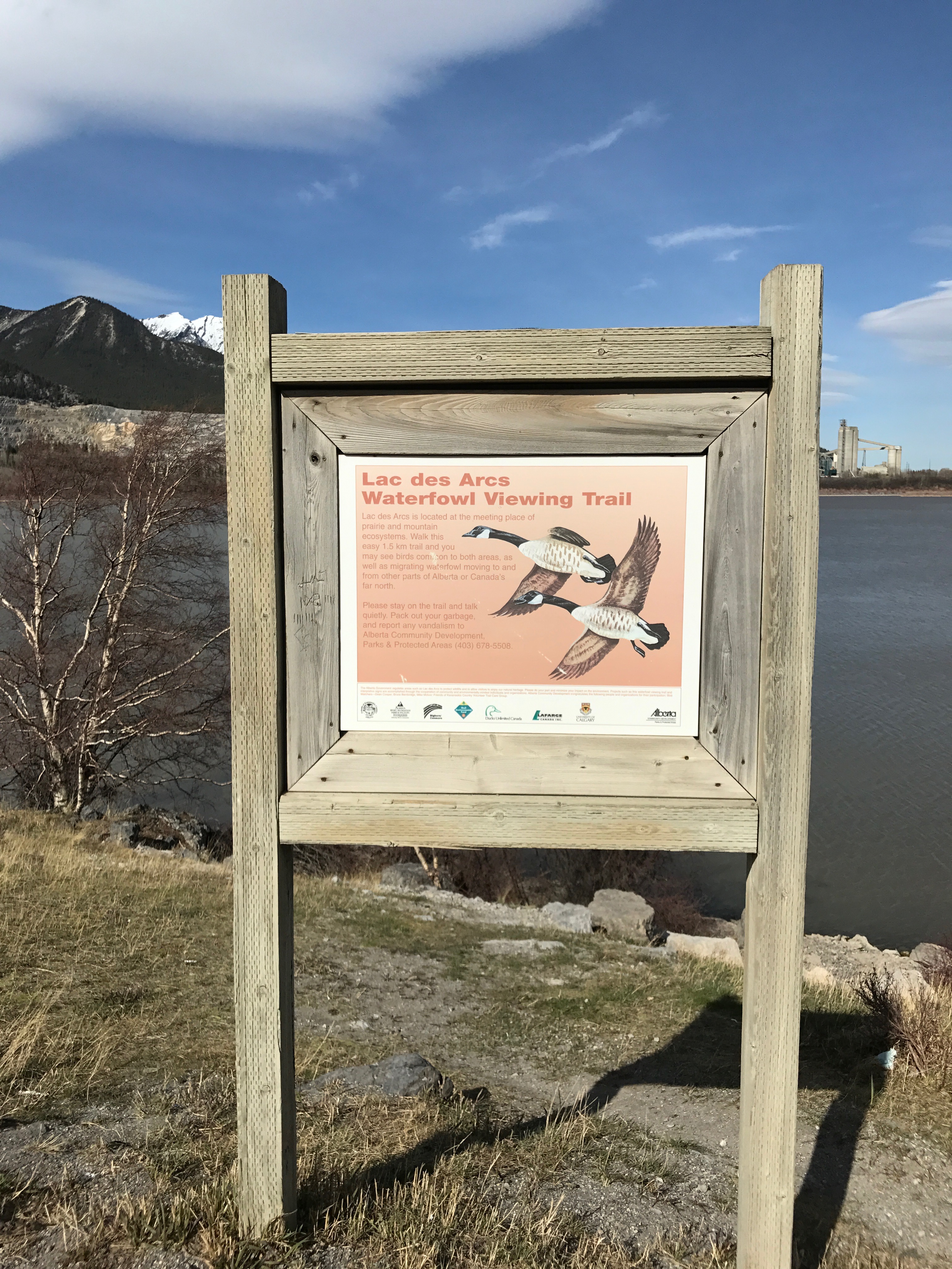
I pulled over to the Lac des Arcs Waterfowl Viewing Area. I didn’t see any waterfowl.
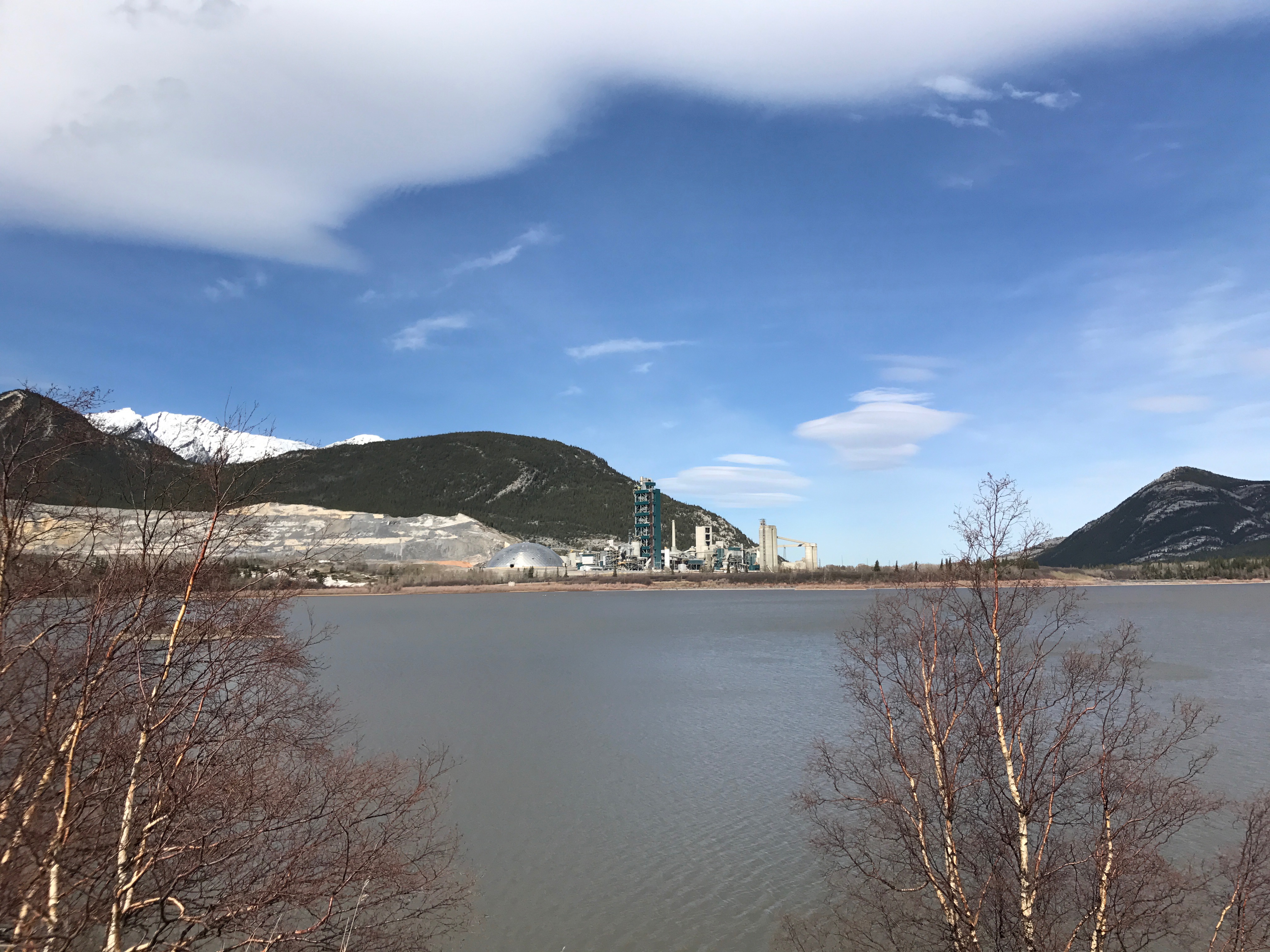
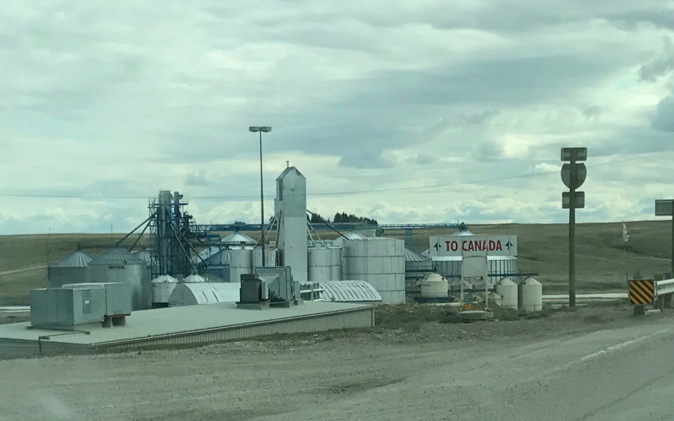
I did see some sort of factory. I wonder what they were producing. Cement, perhaps?
I imagine that they were doing something with the rock mined right next door.
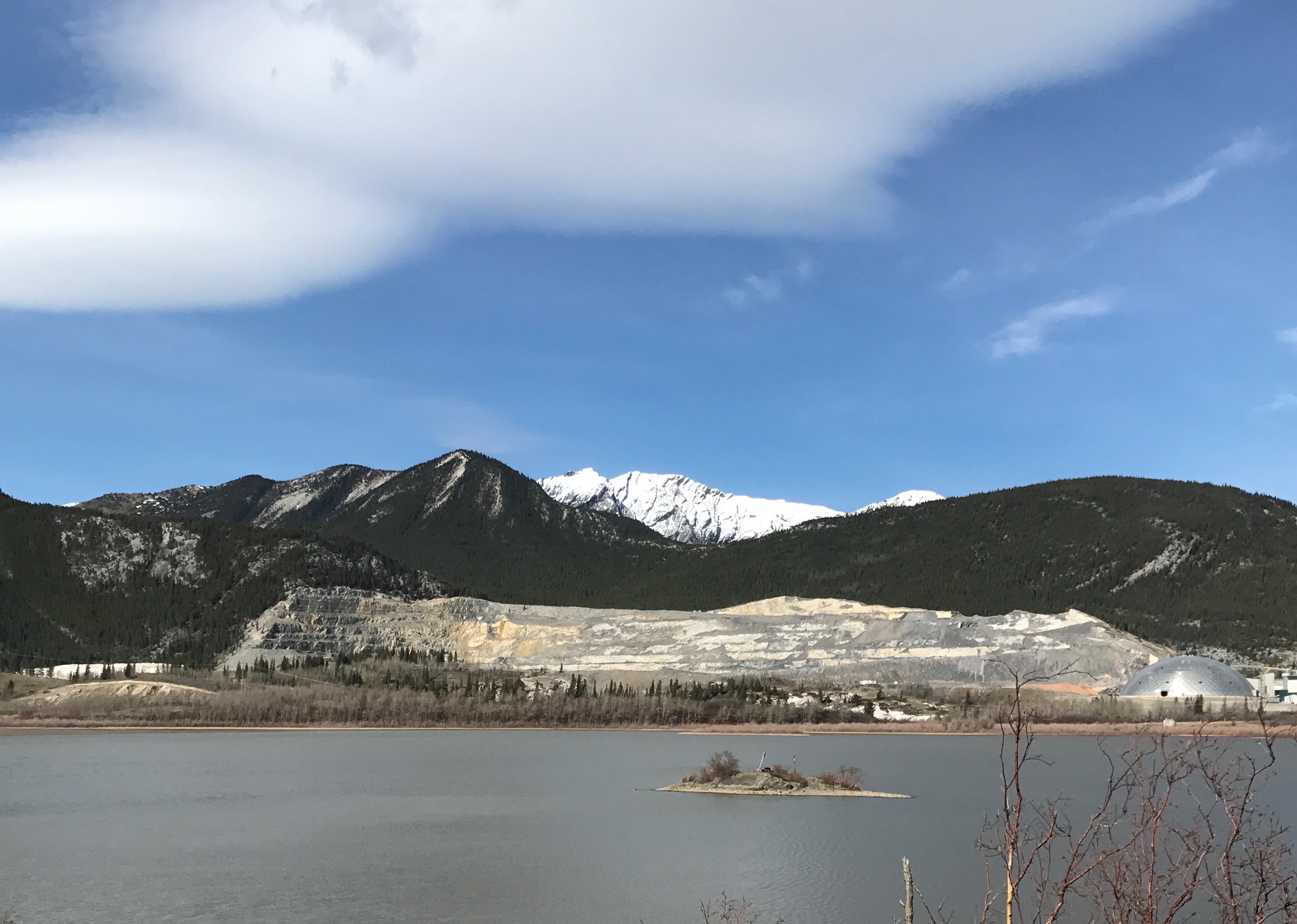
There were mountains all around by this time.
I got to Canmore and saw a sign for a tourism office. Unfortunately, the office was closed, so I couldn’t get any information, but the rest rooms were open.
Hallelujah!
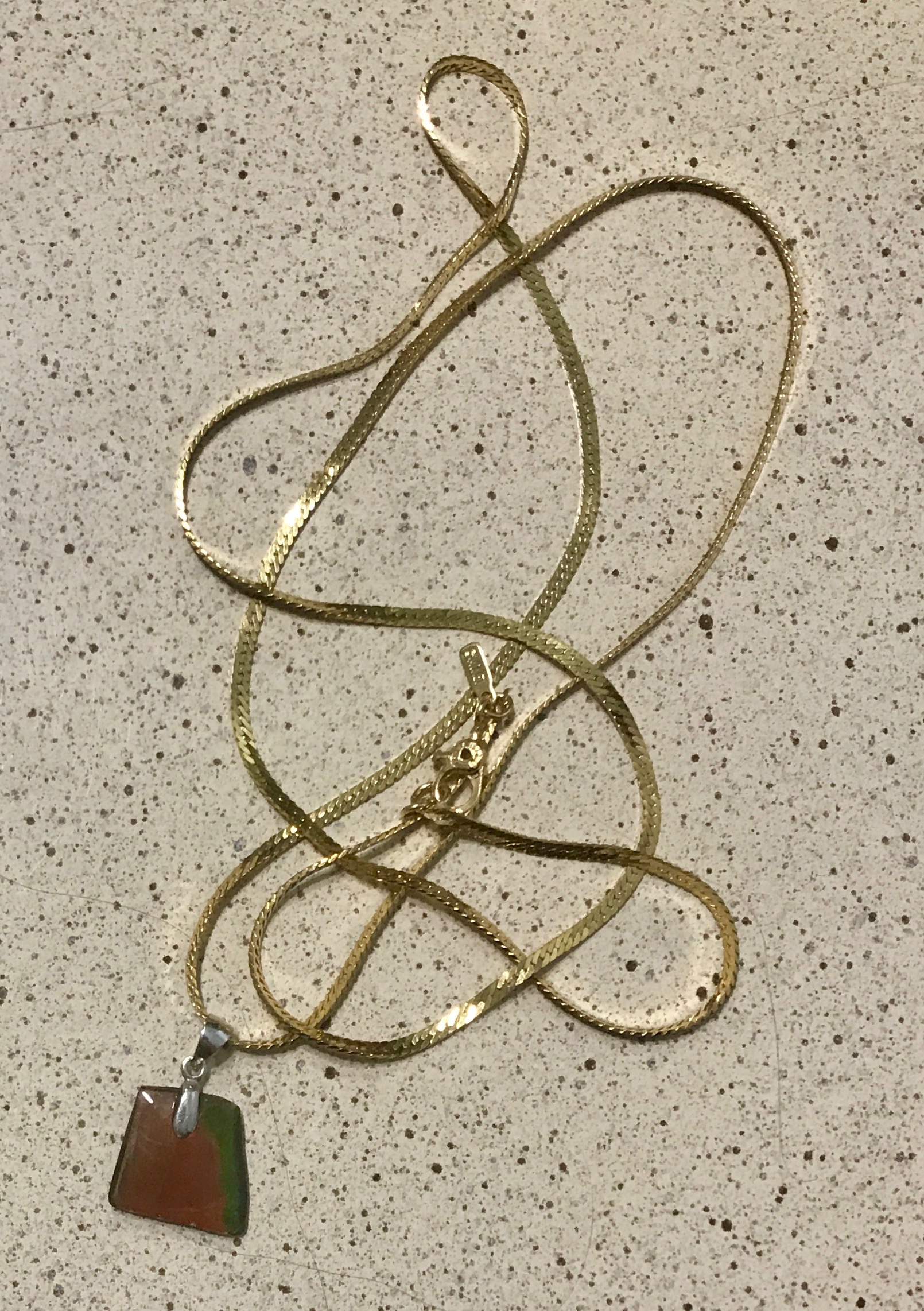
I saw a sign for an ammolite jewelry factory and showroom in town, so I decided to check it out. The prices were a little mind-boggling – especially for a dyed in the wool cheapskate like me. But, I pried open my wallet and bought myself a necklace.
Actually, I just bought the pendant. I had an old chain from my mother that I put it on.
It has some iridescence when you move it in the light. It’s a nice souvenir from Alberta, my mother’s birthplace.
I was a little tired of sightseeing and driving, so I decided to head back. I stopped for gas, and came across a Texas gate.
Interesting. I always called these “cattle guards”. Do you suppose they call them “Alberta Gates” in Texas?
Nah…
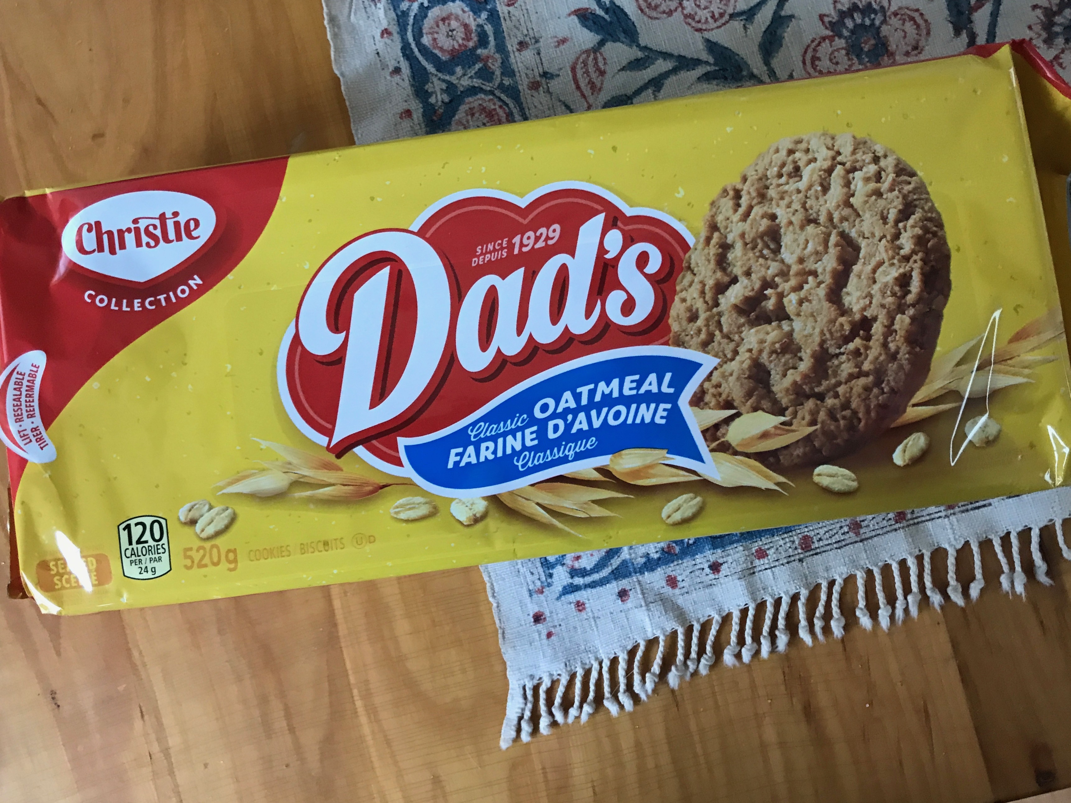
I decided to pick up some groceries and came across my favorite cookies.
Dad’s Oatmeal Cookies!
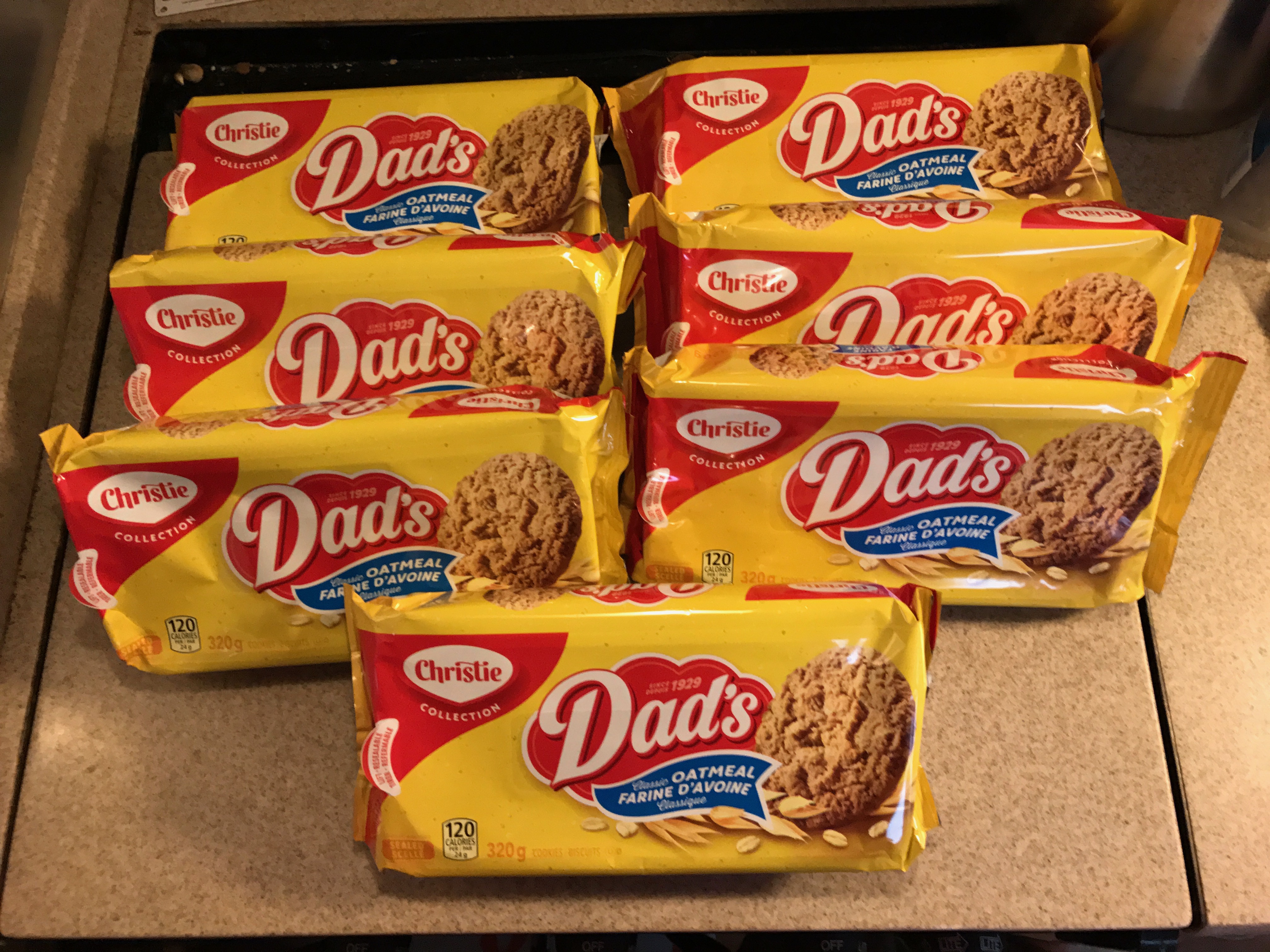
When I was a little girl and I would go to visit my grandmother in Crystal Beach, Ontario, she had a little carrier for me to put my Dad’s cookies in.
The cookies were on sale. If I remember correctly, they were about $1.65.
But, I was only in town for a short stay; I would do my best.
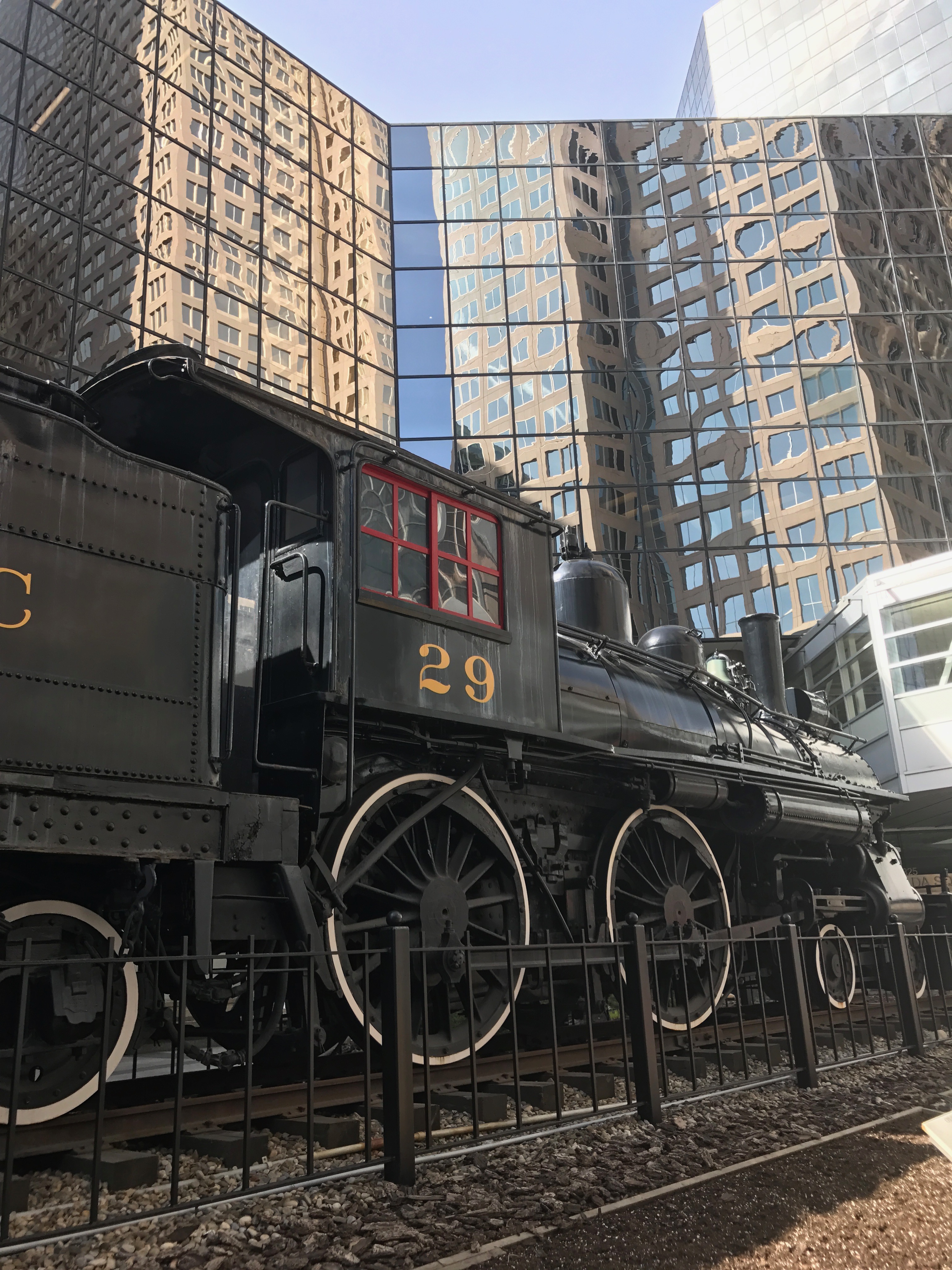
I headed into Calgary. I am partial to cities, and I wanted to get a glimpse of Alberta’s largest city. I do forget that cities are not hospitable environments for large pick up trucks. Even though I was under the height limit as stated at the entrance, I still scraped the roof of the cab on a beam in the parking structure. Luckily, no damage was done to the structure, although there were some noticeable scrapes on the roof of the cab.
I parked and left to stroll the streets and to see what I could see.
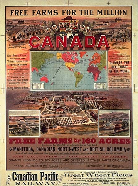
The Canadian Pacific Railway is headquartered in Calgary. It was incorporated in 1881.
But, I imagine the demise of the bonanza ranches contributed greatly to their success, as this poster from 1883 encourages settlers to head west.
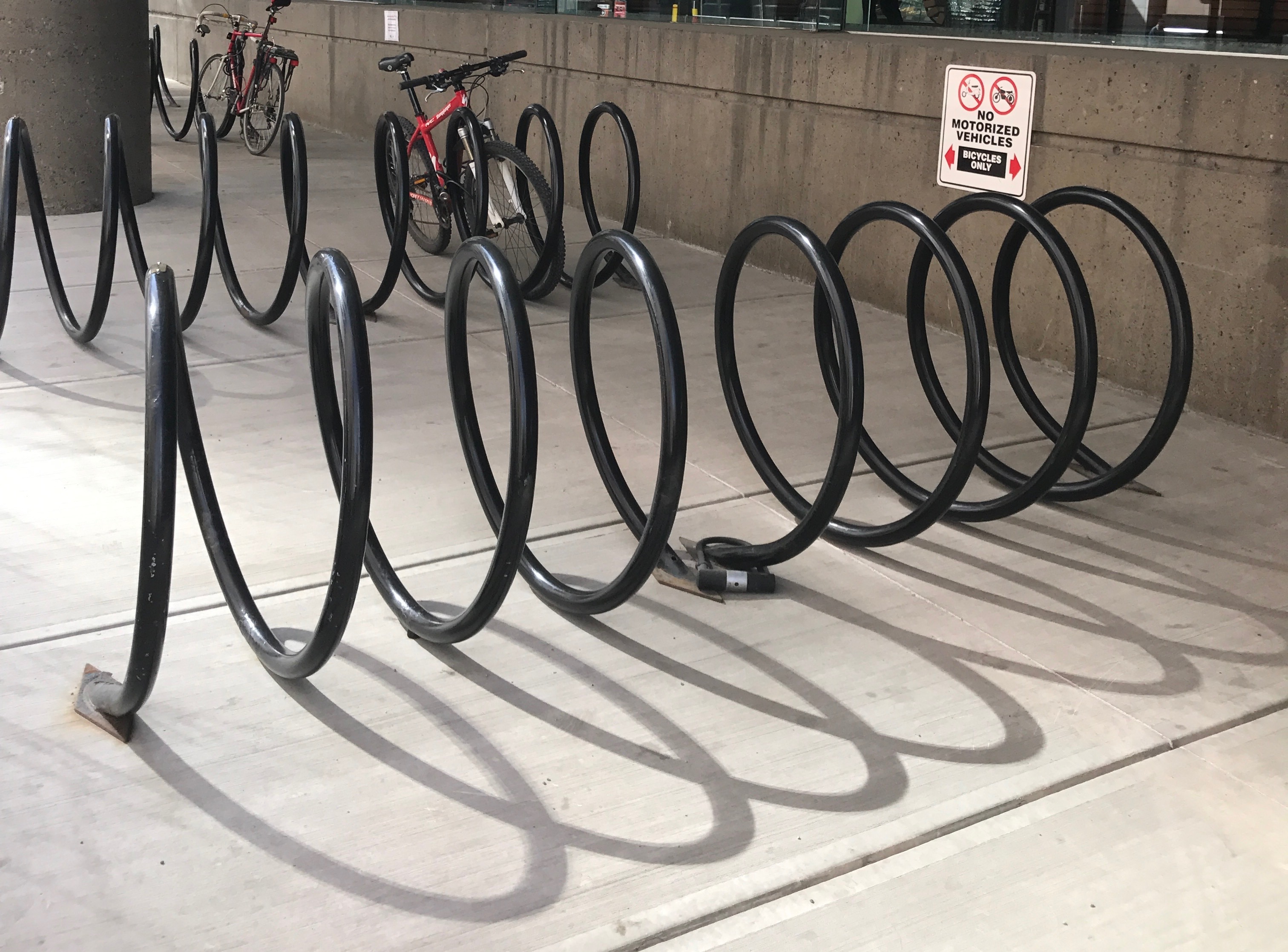
They make it easy for people to ride their bikes into the center of the city. I thought these bike racks were clever.
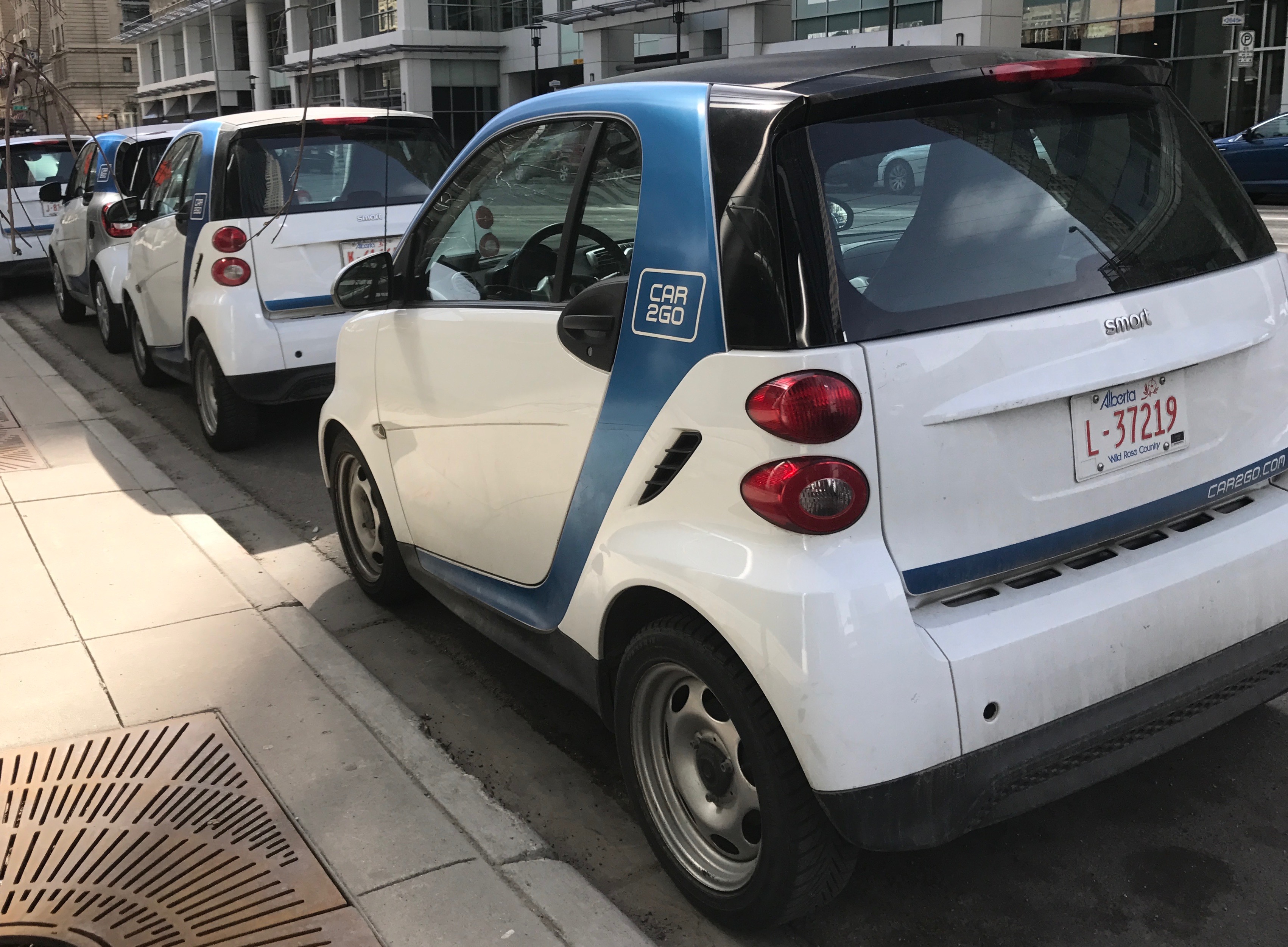
This was the first time I’d ever seen a car sharing service in use. It sounds wonderful. Find a car, open it with an app on your phone, drive away and then just leave it when you are done. If you are interested in knowing more, Wikipedia has an article about this German company, and Car2go has a website.
Let’s see…Trains, bikes, cars…What am I leaving out?
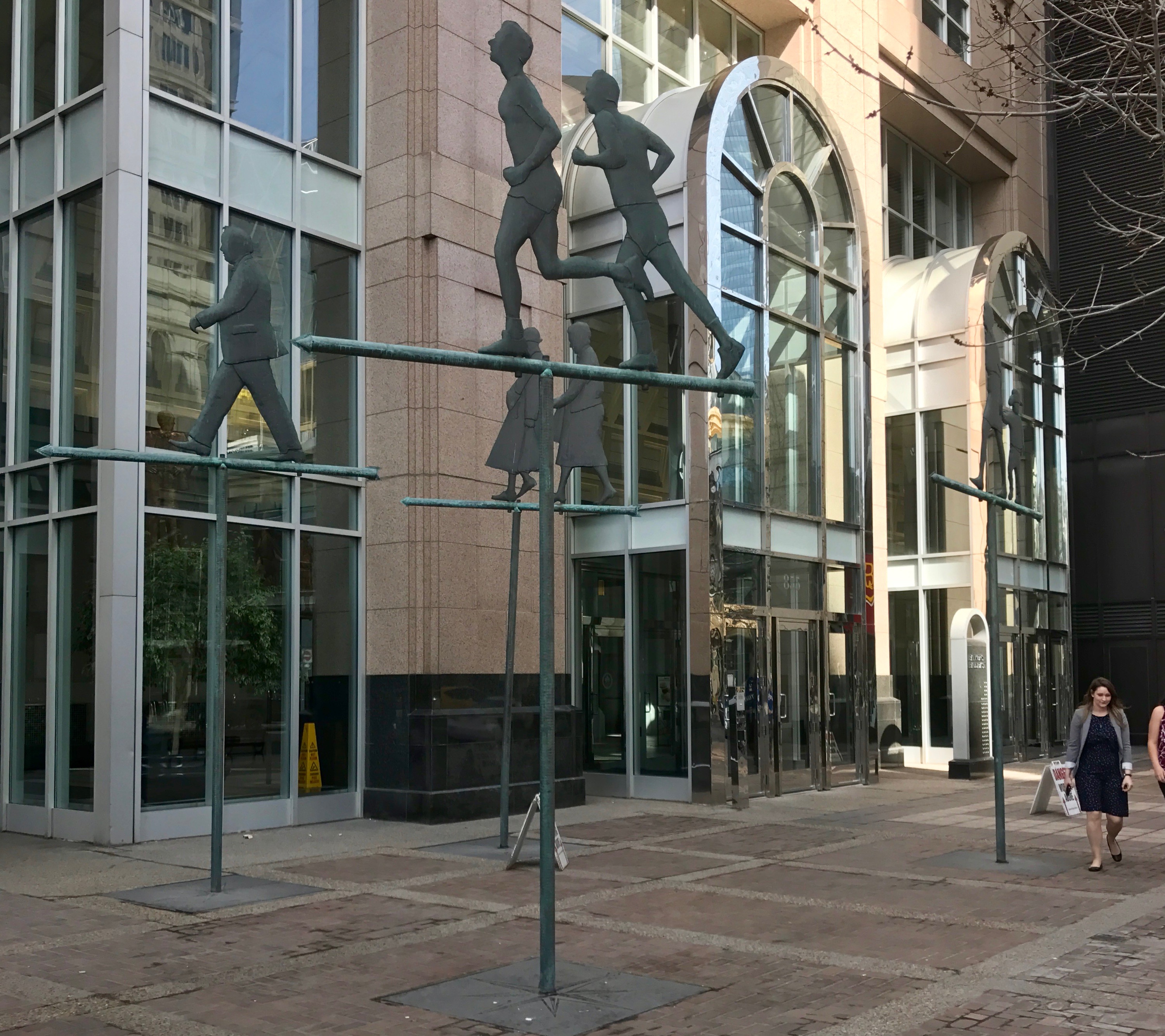
Oh, yeah! Pedestrians!
I think it’s quite clever that these statues of pedestrians don’t get in the way of the real pedestrians.
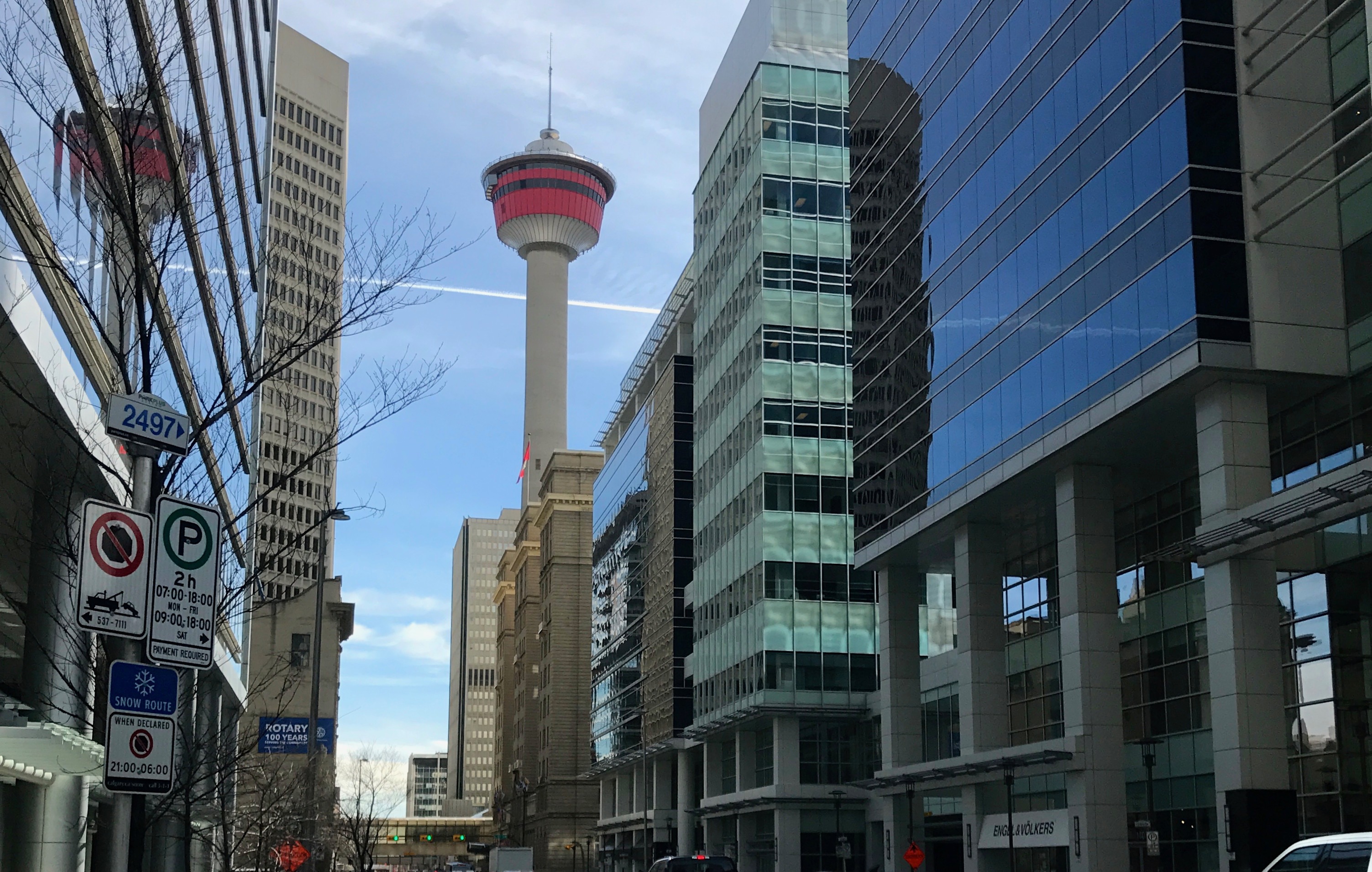
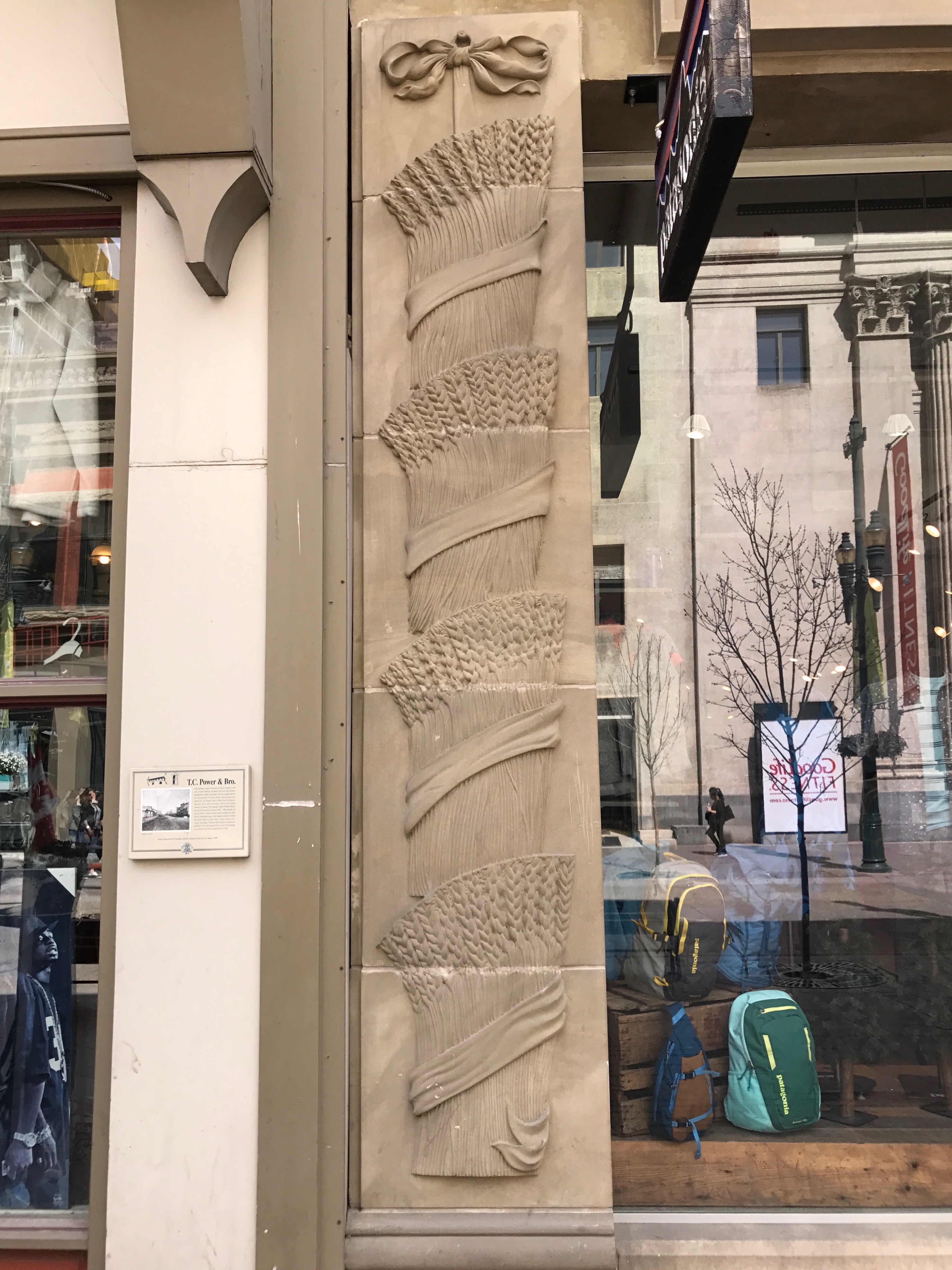
There is just such a vibrance to cities. I do enjoy them. The new and the old blending together.
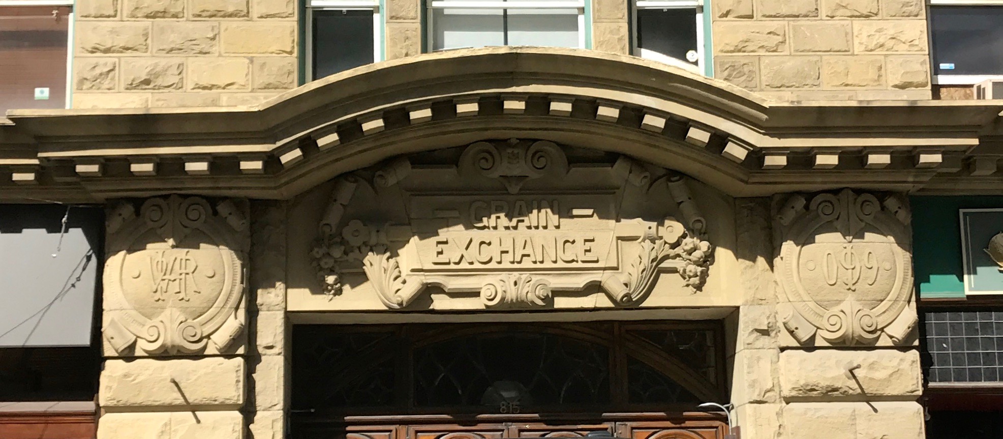
The Grain Exchange building seems to have been repurposed, but I’m glad they left their lovely carvings.
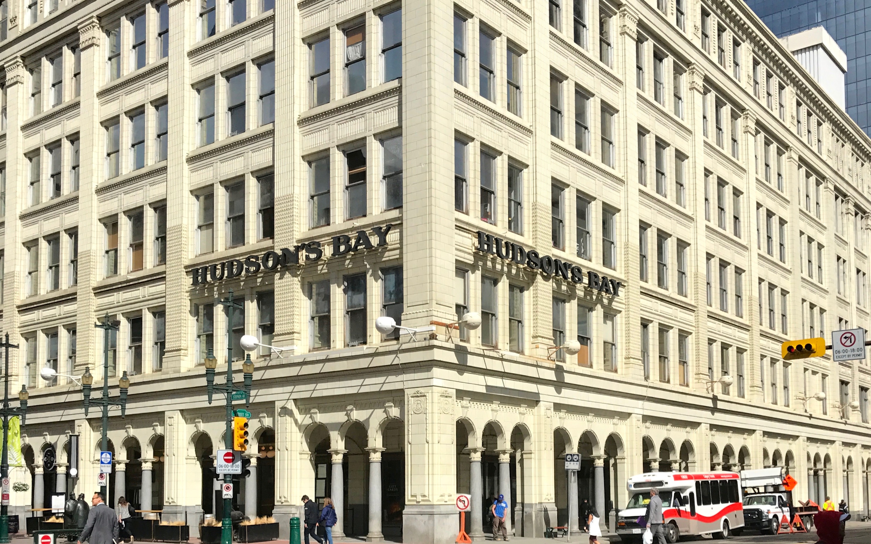
And of course any decent Canadian city would have a Hudson’s Bay.
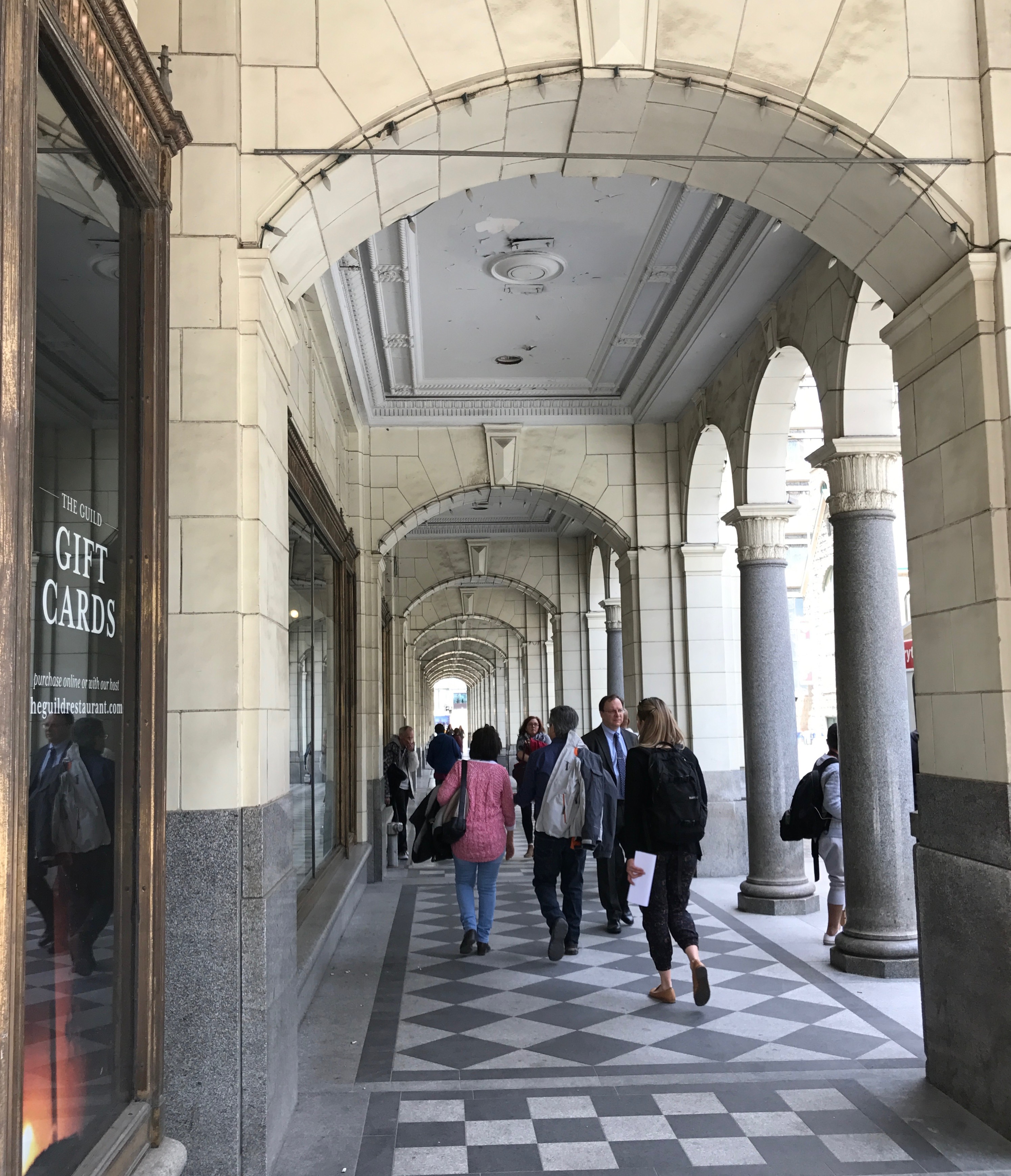
I loved the arcades over the sidewalks.
I am sure it makes keeping the sidewalks cleared in the winter. But, since Calgary only receives and average of 51 inches of snow in a season and 13 inches of rain, it makes me wonder if the purpose of having an arcade over the sidewalks is mainly to increase the footprint of the building.
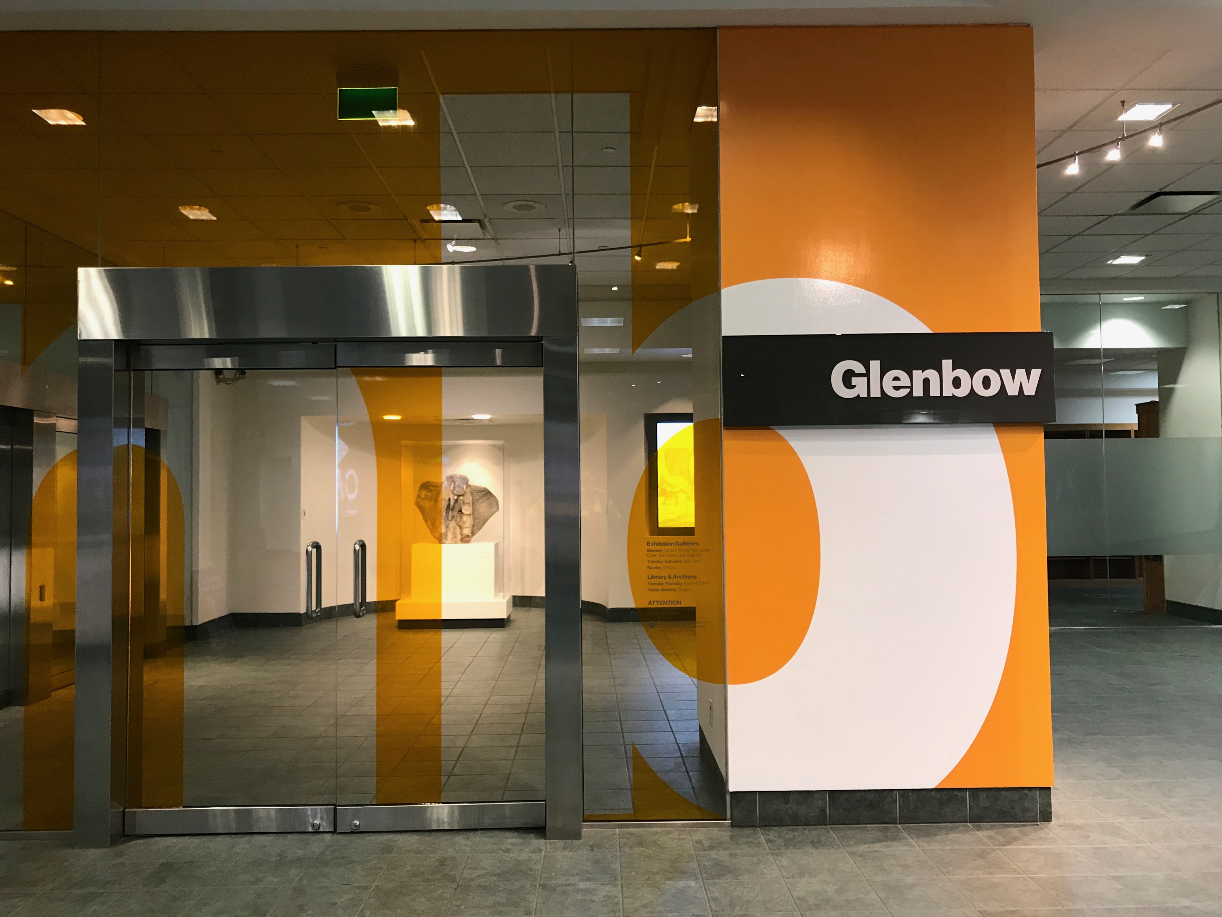
My destination was the Glenbow Museum, which had been recommended to me. It is an art and history museum – two of my favorite subjects! I took the elevator to the fourth floor to start my explorations.
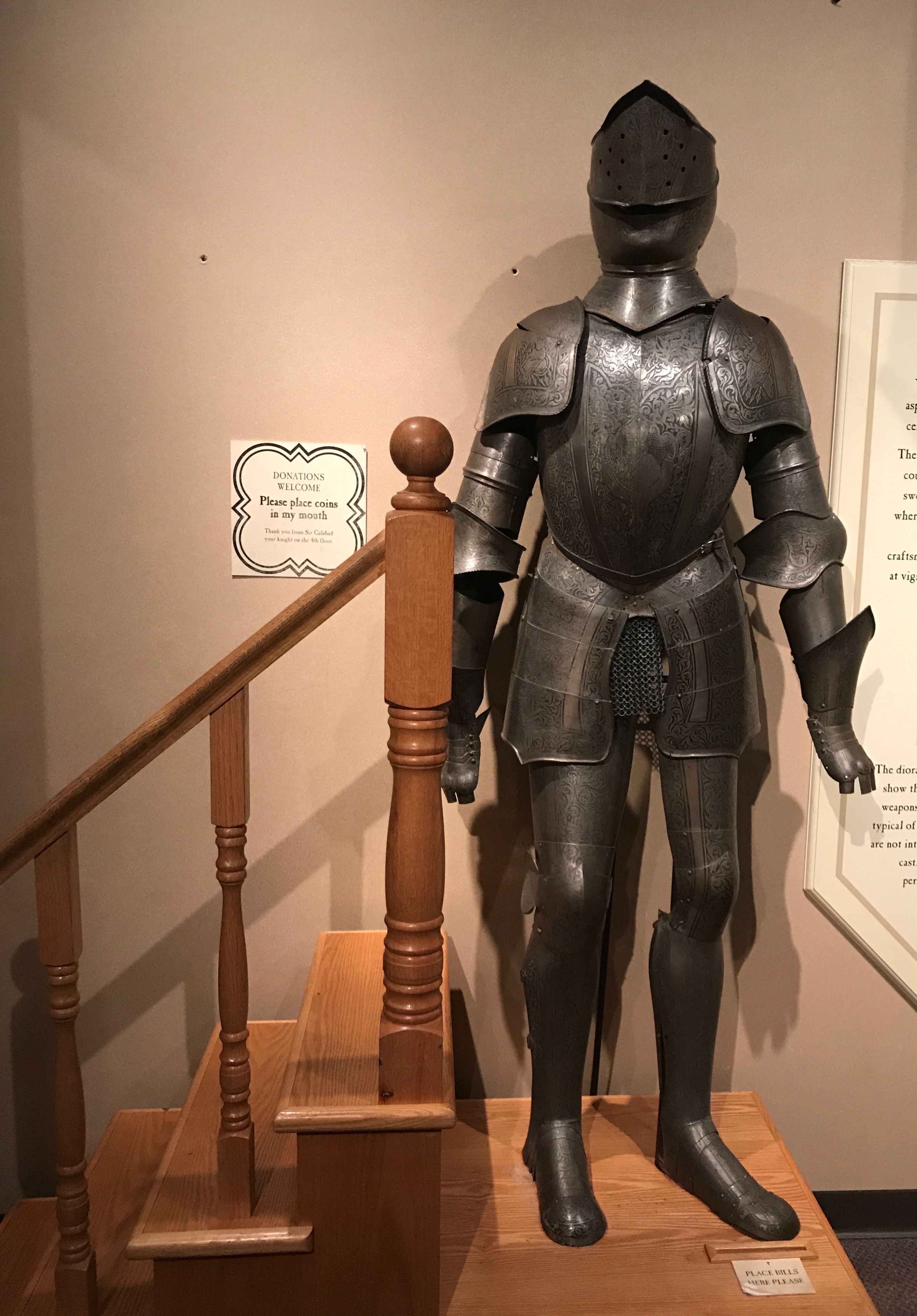
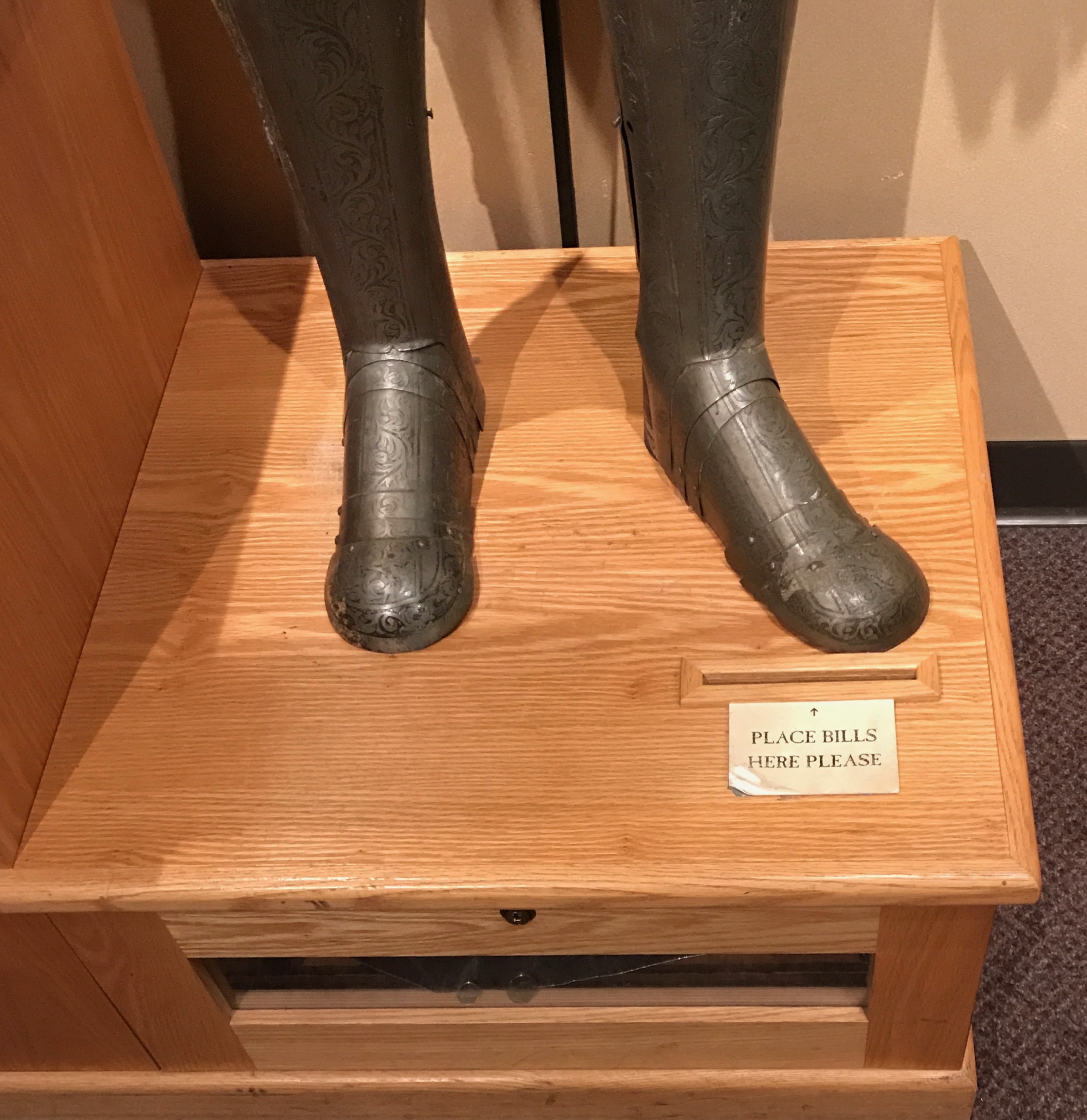
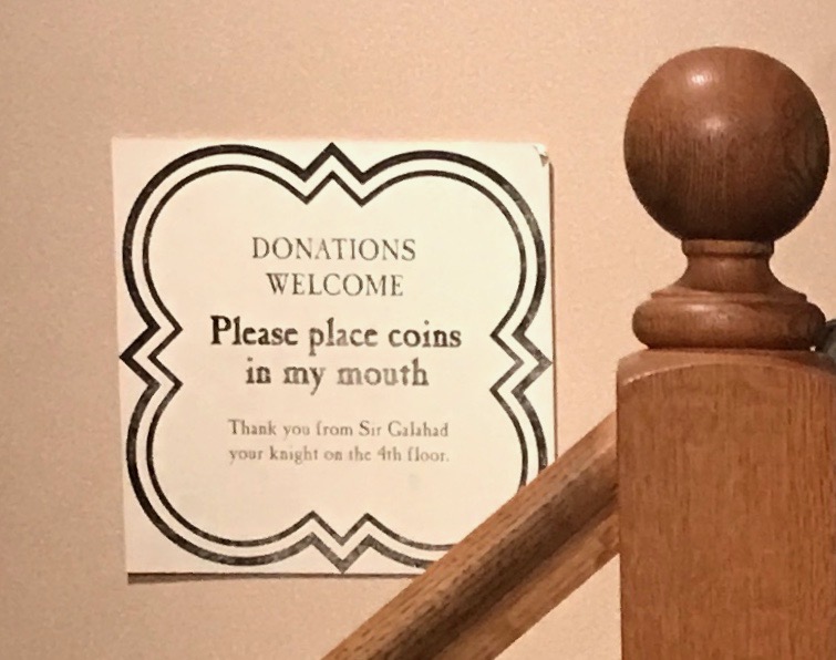
They had quite the collection of military artifacts. I particularly enjoyed this suit of armor that was repurposed as a way to solicit donations.
There is a slot for inserting folding money.
But, I think this was the coolest feature. If I were a kid, I would have been begging my folks for some coins to place in Sir Galahad’s mouth.
But, I am a retiree and always watching my pennies, so they had to make do with my $16 entrance fee. I take some solace that $16 Canadian was only about $12.50 American.
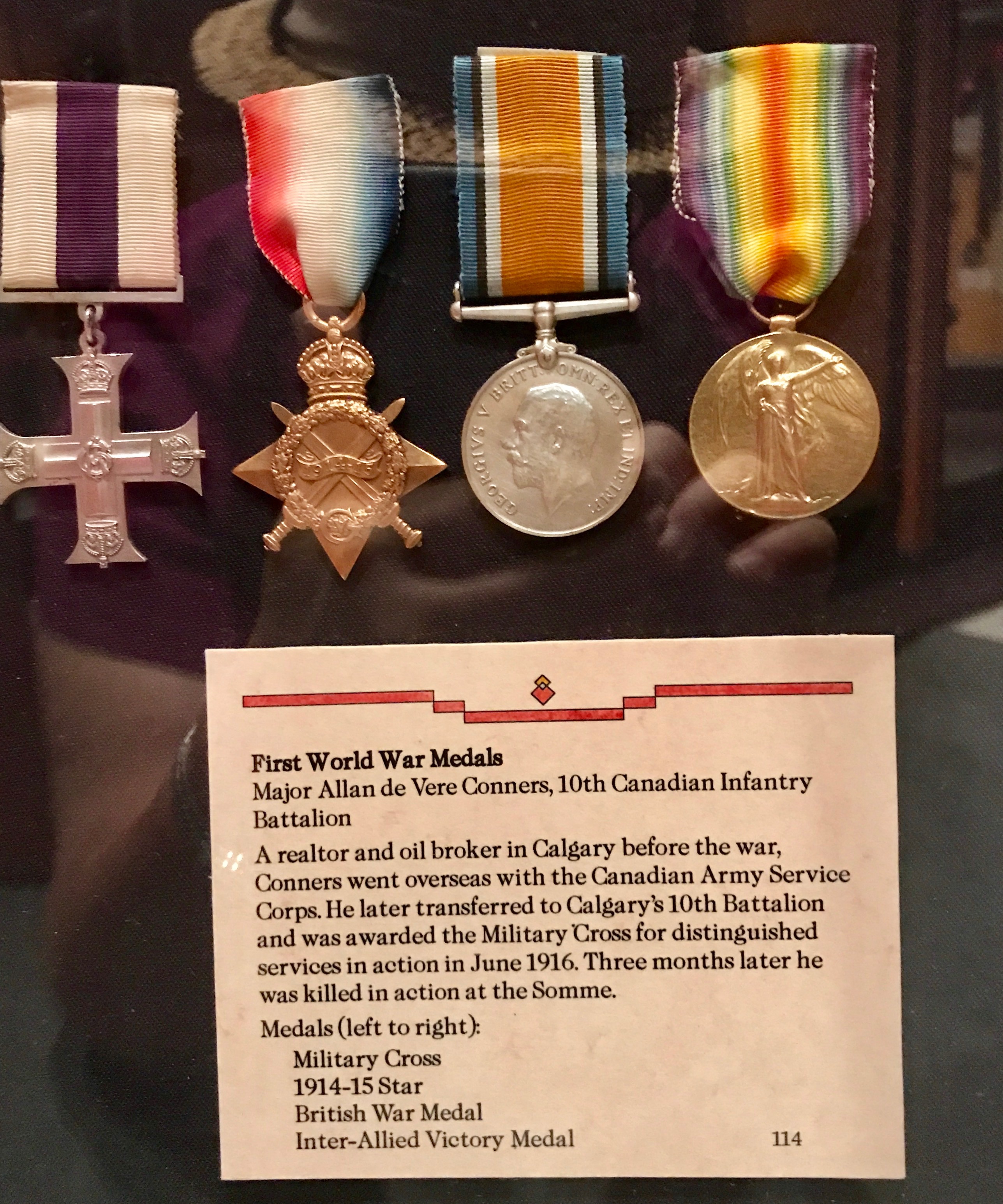
I have seen my fair share of weaponry in all of my travels, so I didn’t spend a lot of time on the guns, sabers, cutlasses and so on. These medals did capture my attention, though.
My grandfather served in the Canadian armed forces in World War I, and he received the medal on the far right, the Inter-Allied Victory Medal. In fact, I ended up with it. When I emptied out my house to set forth on this journey, I gave it to my brother, Craig, who also knew our grandfather. Our grandfather died before my two younger siblings were born.
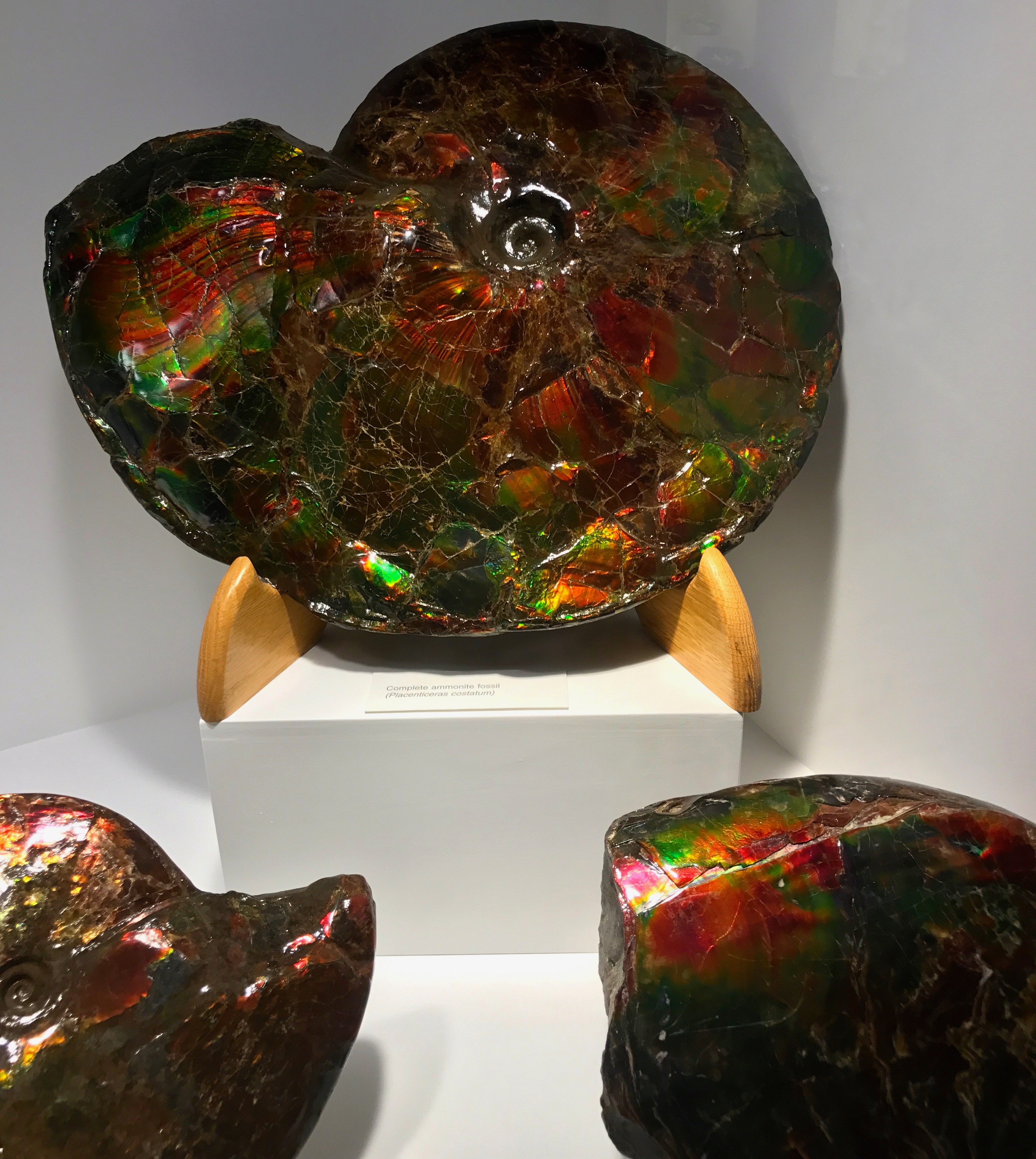
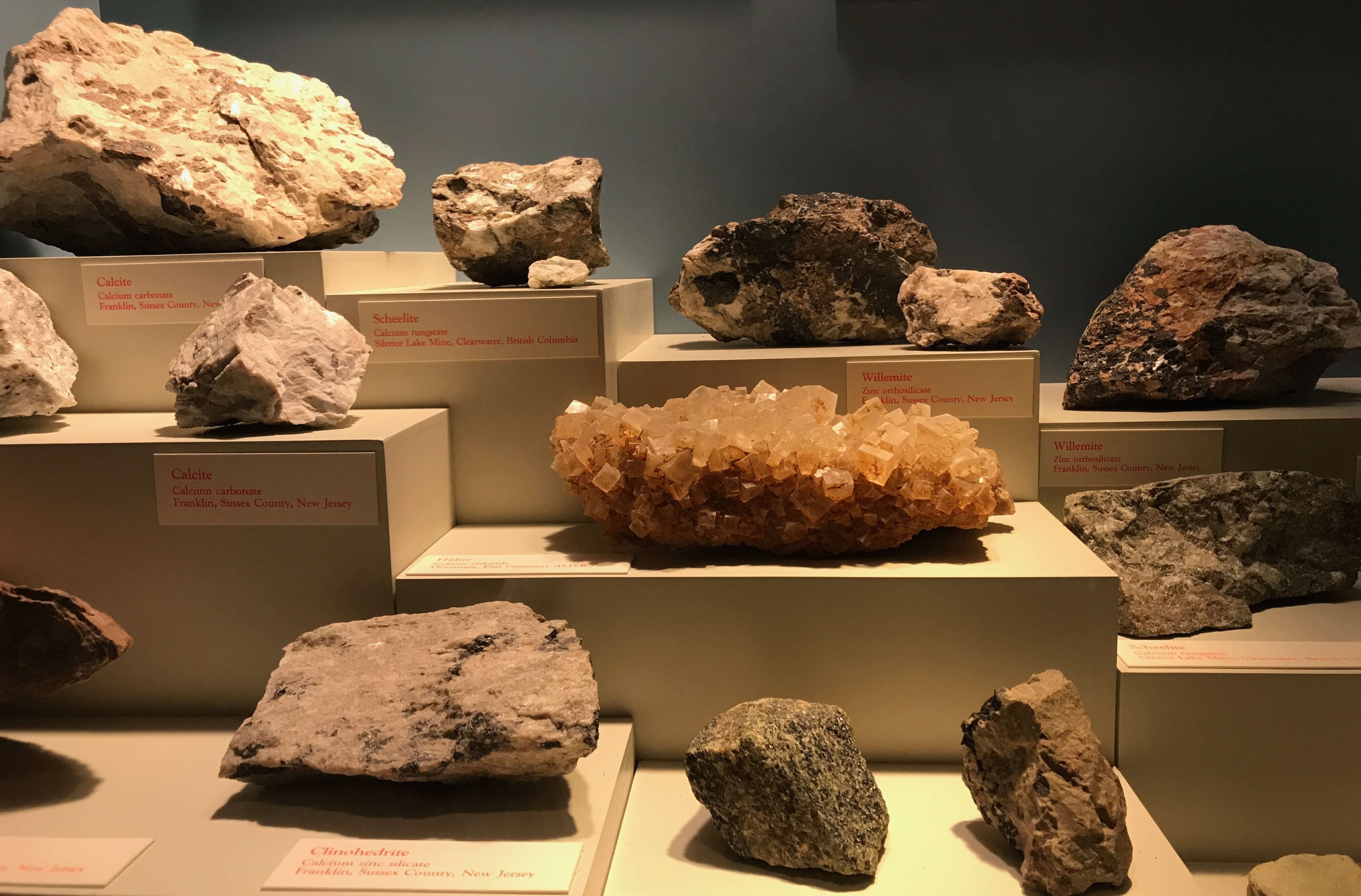
Further down in the museum, there were some splendid geological exhibits.
These iridescent specimens are ammolite, otherwise known as Canada’s gemstone.
It is formed form the mineralized remains of an upper Cretaceous fossil, the ammonite Placenticeras. They were hard shelled, squid-like marine animals that existed from the Devonian to the end of the Cretaceous period. They disappeared during the mass extinction 65 million years ago. Although ammonite fossils are found all over the world, only in Southern Alberta do they display the wide array and intensity of color, which is typical of the best quality ammolite gemstone. In 1981, ammolite was given the official gemstone status by the International Commission of Colored Gemstones.
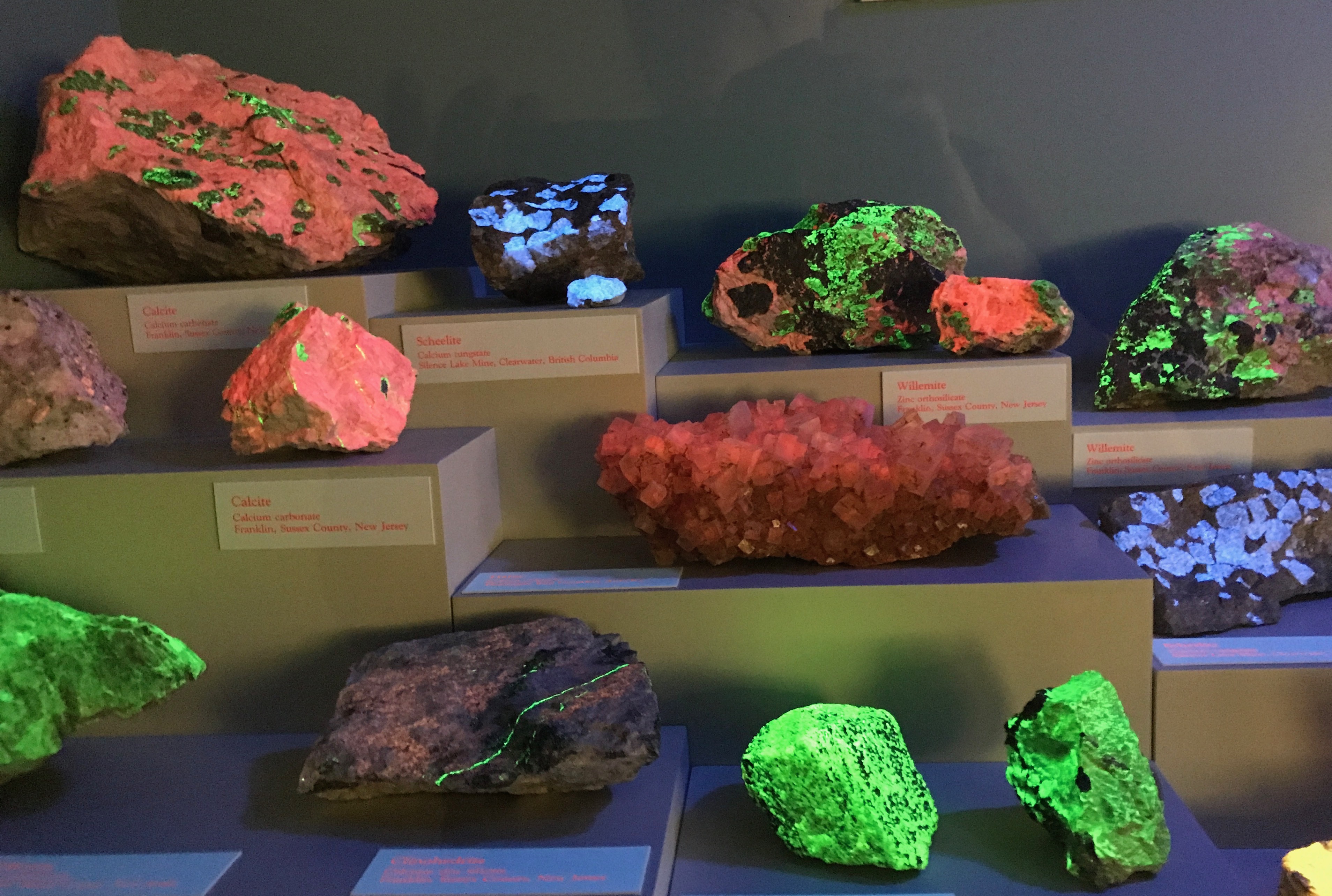
I was particularly captivated by this collection of rocks. I stood there and watched them for a while.
Huh? They look kind of dull.
Just wait until the black light turns on.
Isn’t that something?
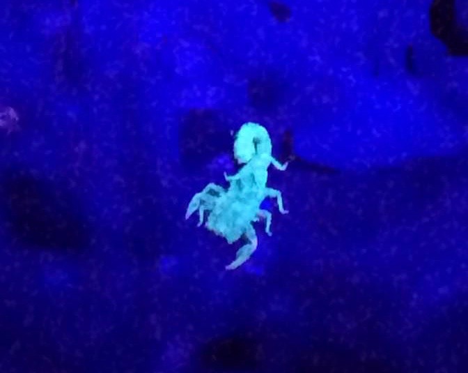
It kind of reminds me of when Konnie and I went night time scorpion hunting in Phoenix back in 2016.
Who knew that scorpions would glow like that?
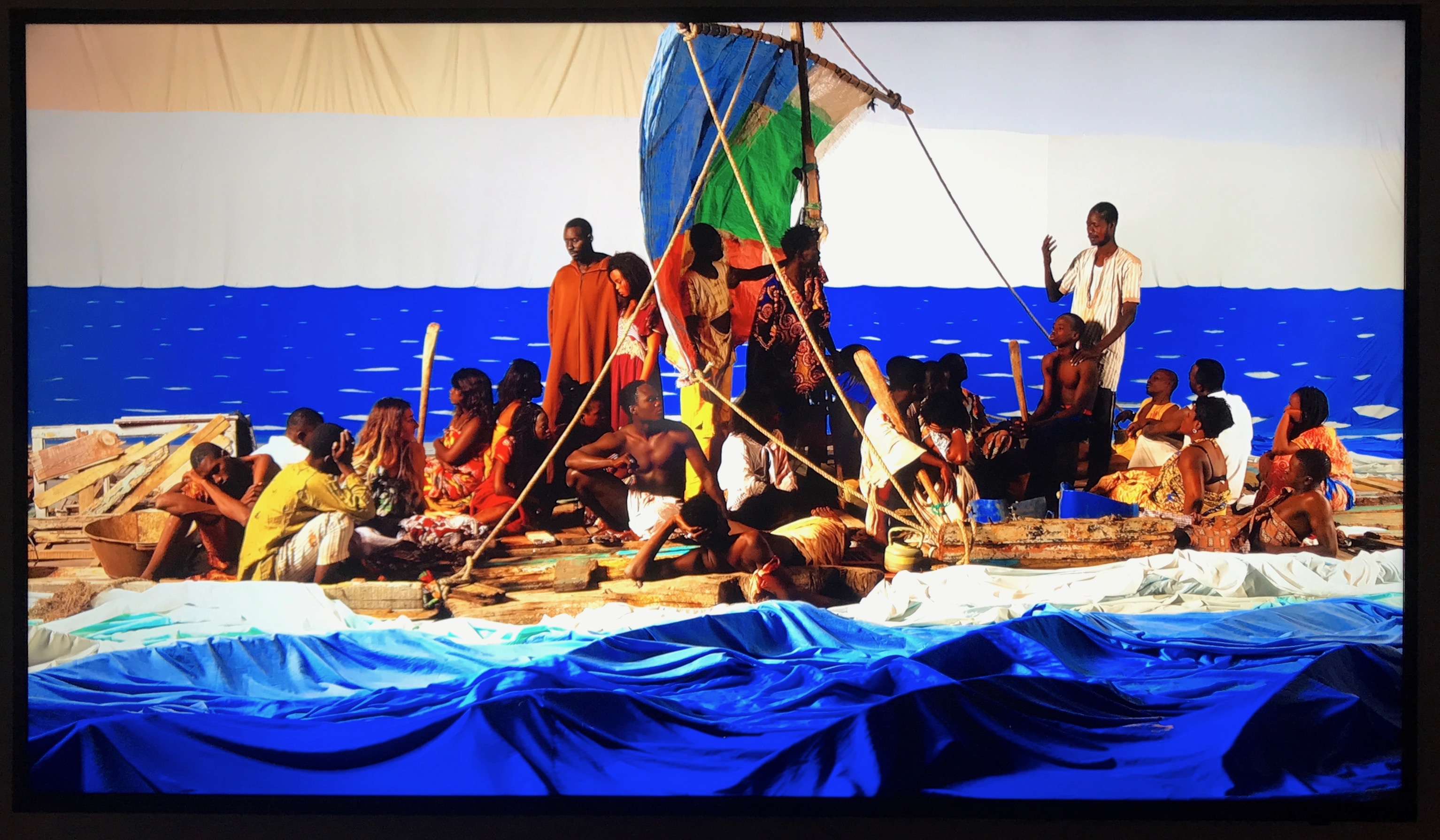
I went on to the art area. The first work of art that grabbed my attention was this piece by Vancouver-based artist Adad Hannah. It was created in Saint-Louis, Senegal in 2015-2016 to commemorate the 200th anniversary of the wreck of Medusa, which was a French frigate.
It was based on The Raft of the Medusa, which hangs in the Louvre. It is by the French painter and lithographer Theodore Gericault.
The Medusa, which was en route from Rochefort, France to Saint-Louis, Senegal, ran aground off the coast of Mauritania on July 2, 1816. On July 5, at least 147 were set adrift on a hastily constructed raft. All but 15 died in the 13 days before their rescue. Those who survived endured dehydration, starvation and practiced cannibalism.
In order to create his modern representation, Hannah spent five weeks in Saint-Louis. He spent his time researching, building, rehearsing and recording the “tableau vivants,” or living pictures. The set was created locally in Saint-Louis using salvaged, dismantled pirogues, architectural detritus and other elements found while roaming around the island of Saint-Louis and the adjacent fishing village of Guest N’Dar. He had a cast of over 50 locals from Saint-Louis who took part in staging the work of art.
I could say more about this work of art, and more about Senegal. I spent five weeks there in 2003 as part of a Fulbright program. In fact, I even spent time Saint-Louis. But, there is more to talk about. I shall continue.
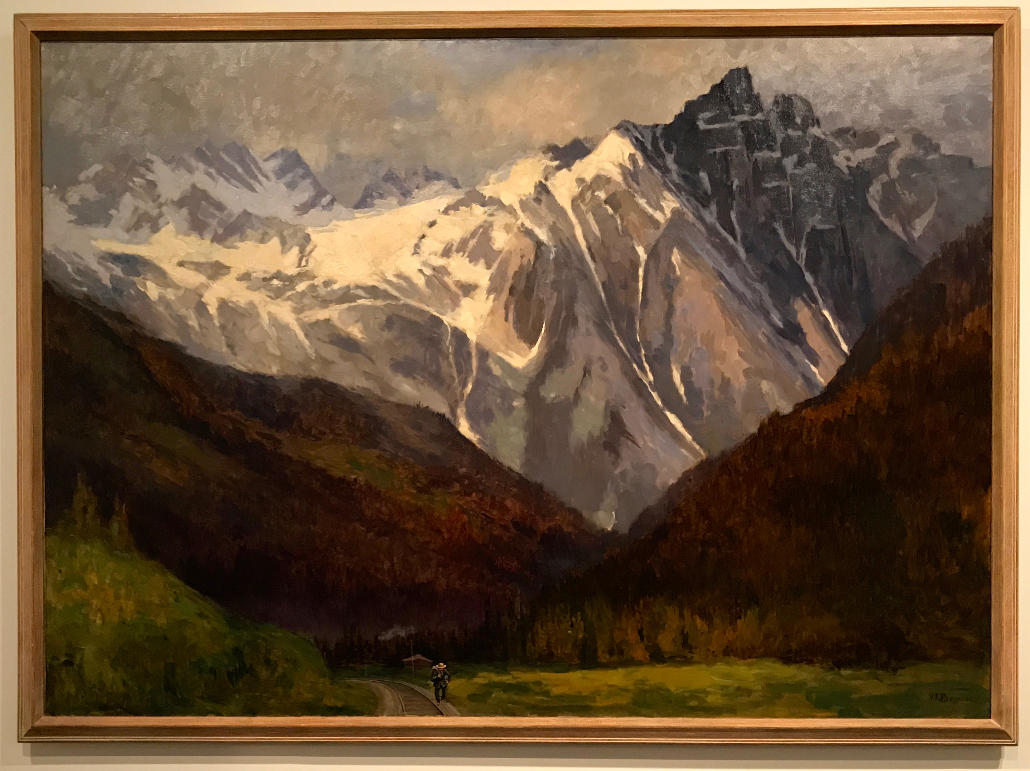
This painting is titled “Hermit Mountain, Rogers Pass, Selkirk Range”. In 1886, William Brymer (1855-1925) was given a pass by the Canadian Pacific Railway as part of their artist’s pass program. The railway was completed in 1885, and connected eastern Canada to British Columbia.
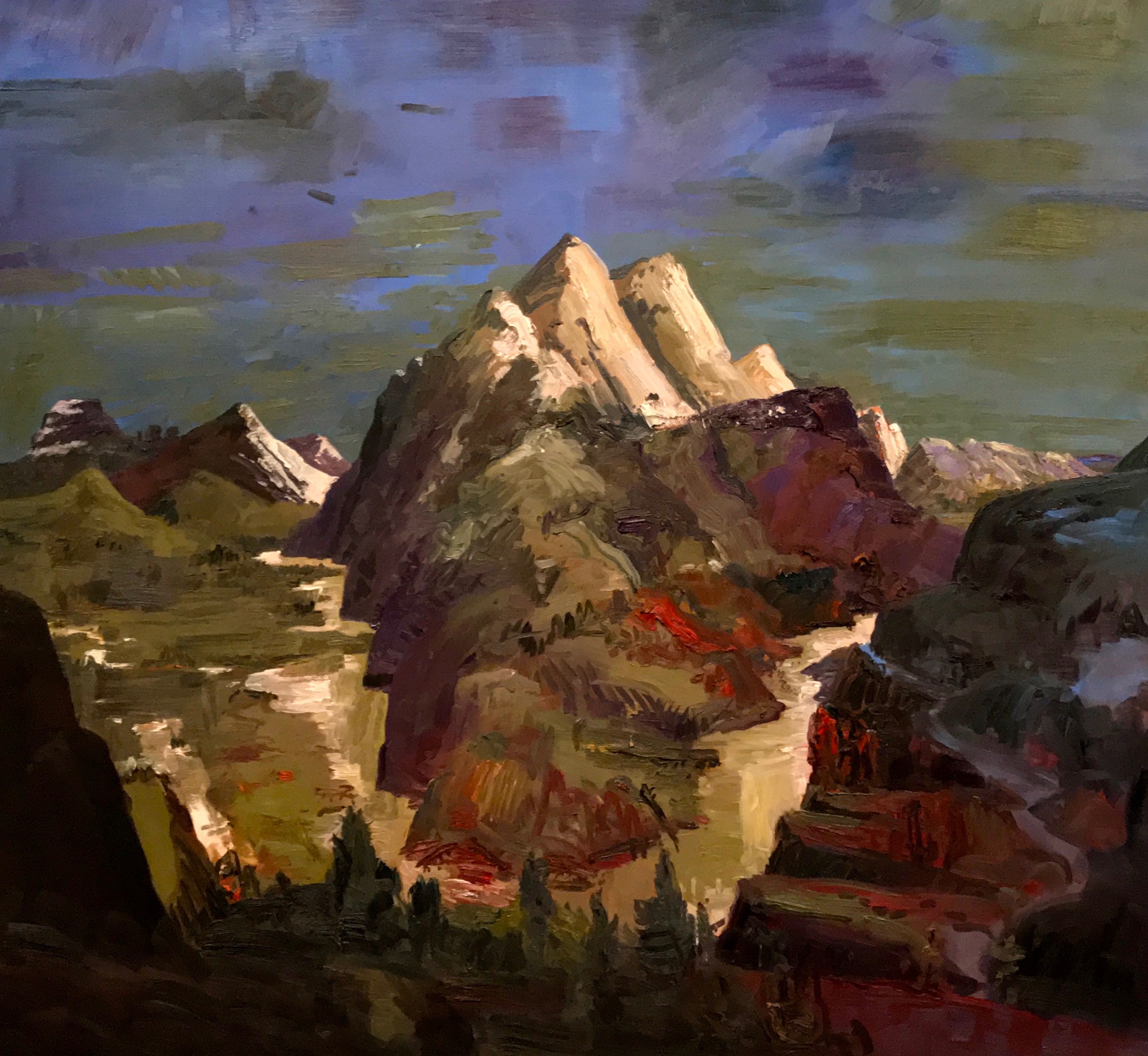
John Hartman, a landscape painter from Ontario, painted “The Gap at Night” in 2003. In the information about the painting, they say that he “paints more than he sees. His energetic, impressionistic style adds depth and color to what might other be a conventional representation.” He gifted it to the museum in 2008.
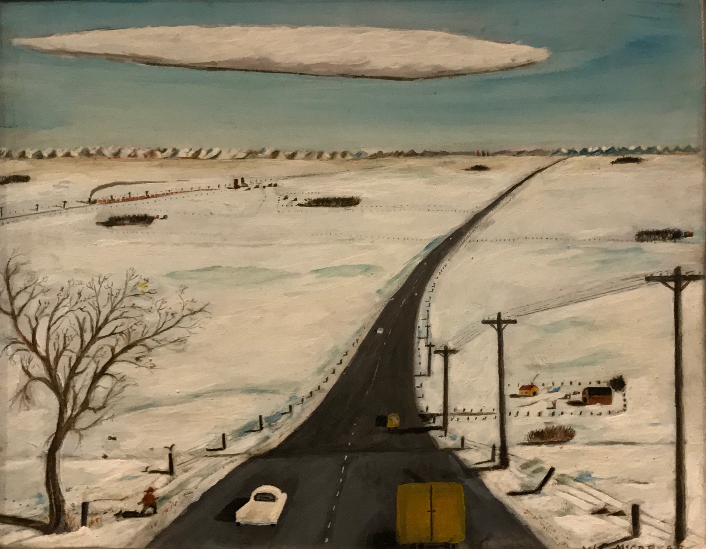
This painting has the beguiling title of “Untitled [prairie highway]”. It is also undated. It was painted by self-taught Canadian artist William McCargar (1906-1980). It was donated in 2000 by Murray and Mari-Anna McCargar, who I presume were his children. William McCargar began his painting hobby with paint-by-number kits until his neighbor, artist Ken Lochhead, encouraged him to throw away his kits and develop his own style.
I like this painting because I imagine it was much like what my mother saw around her hometown of New Norway when she was growing up.
This 1999 work of art is called “Banff Globe”. Bill Vazan (b. 1933) created this photo of the Sulfur Mountain gondola observation tower. It’s a chromogenic photograph on paper. Just in case “chromogenic” isn’t in your vocabulary, this is what I came up with as a definition as it pertains to photography: “denoting a modern process of film developing that uses couplers to produce black-and-white or color images of very high definition.”
Sulphur Mountain is significant as it is the beginning of the Canadian National Parks system. An area on the northern slope of Sulphur Mountain was set aside for public use in 1885. This area, the Cave and Basin Hot Springs was the beginning of what is now Banff National Park.
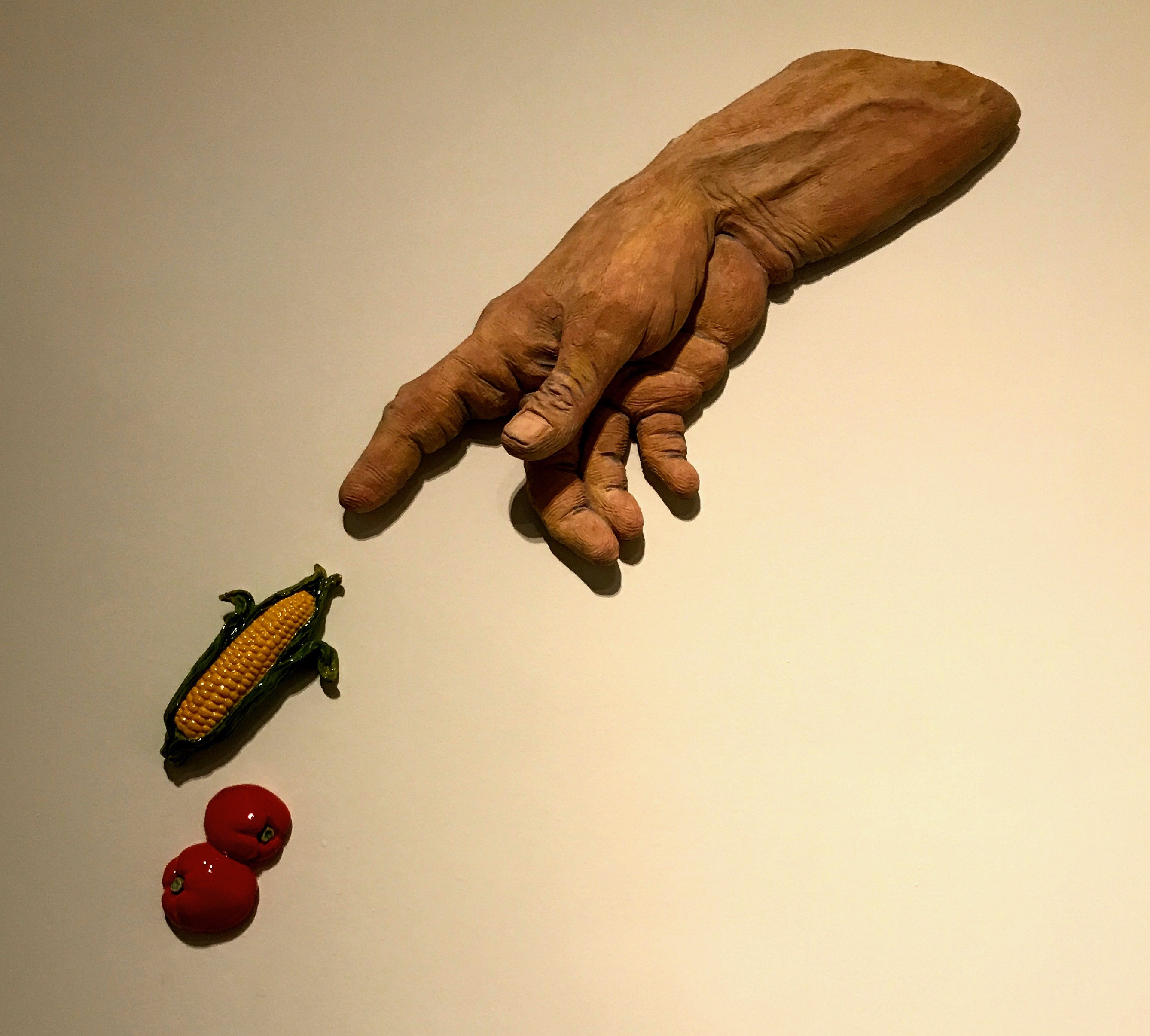
Saskatchewan sculptor Victor Cicansky (b.1935) is an enthusiastic gardener and much of his work features gardens and garden produce. “The Creation of Corn and Tomatoes, 1993” is a work in fired clay and glaze that is described as a “gently humorous work, with a pointing muscular arm reminiscent of the arm of God in Michelangelo’s painting on the ceiling of the Sistine Chapel.”
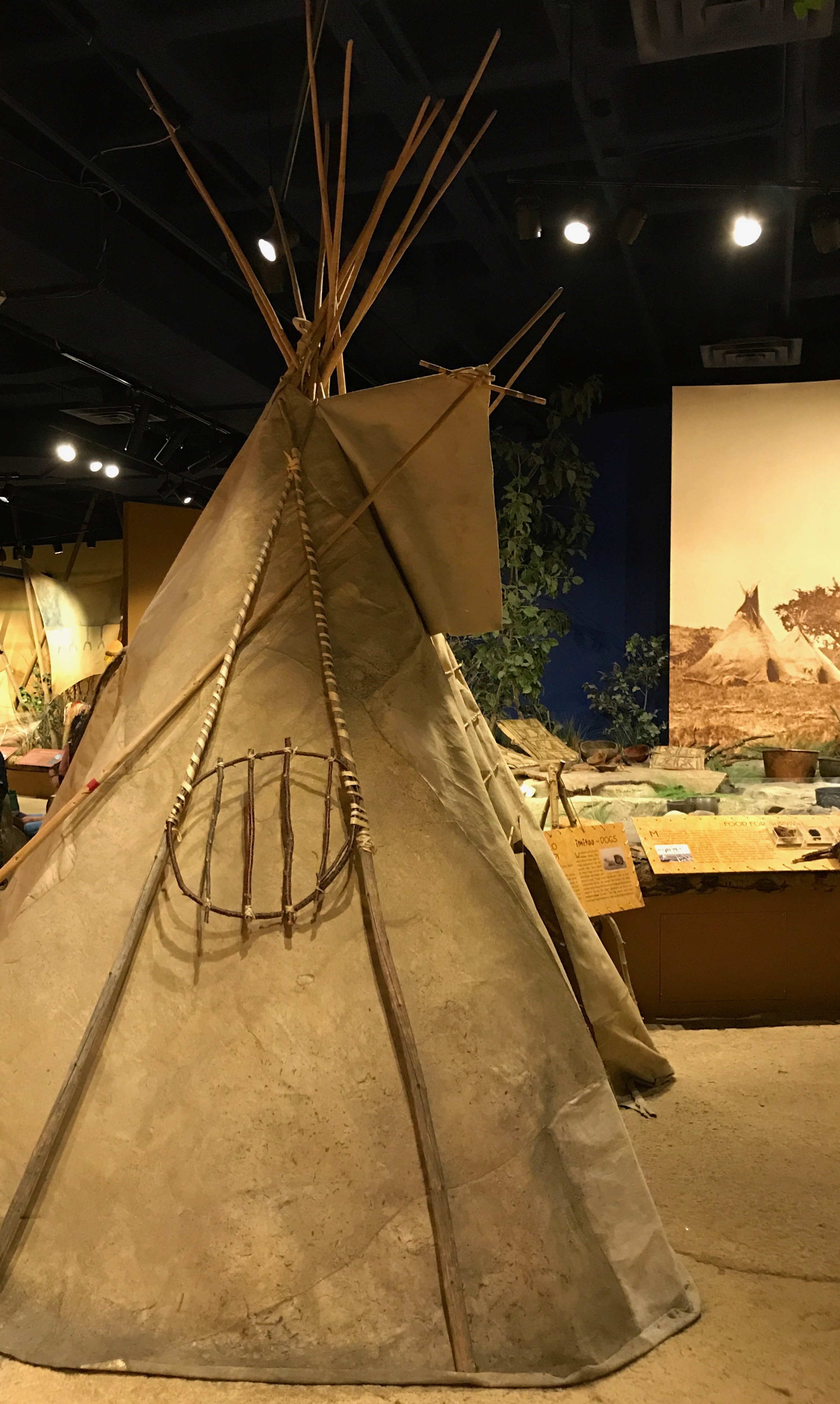
I continued my trip down and came upon the section devoted to the First Nations. I looked through the exhibits, but I was getting a little museum-weary.
And I started running into field trips!
The students were well-behaved, but, well, field trips – been there, done that. I poked around a bit more and then headed out.
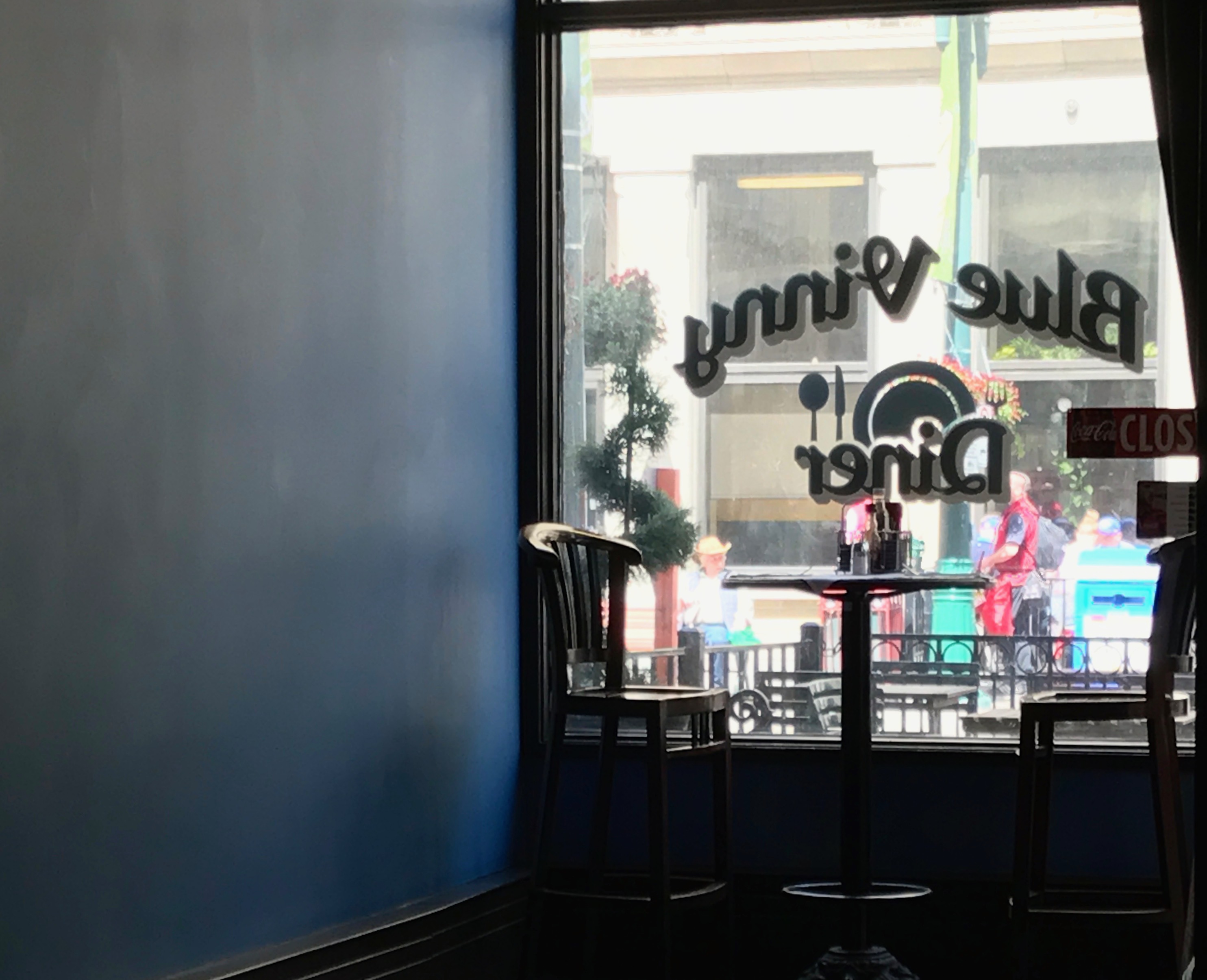
I stopped for a bit of refreshment. I was the only person in the diner. I think it’s a good thing that I only had something to drink. I worry when no one else is in a restaurant. Does everyone else know something I don’t? Is the food fresh? How long has that ham sandwich been sitting there?
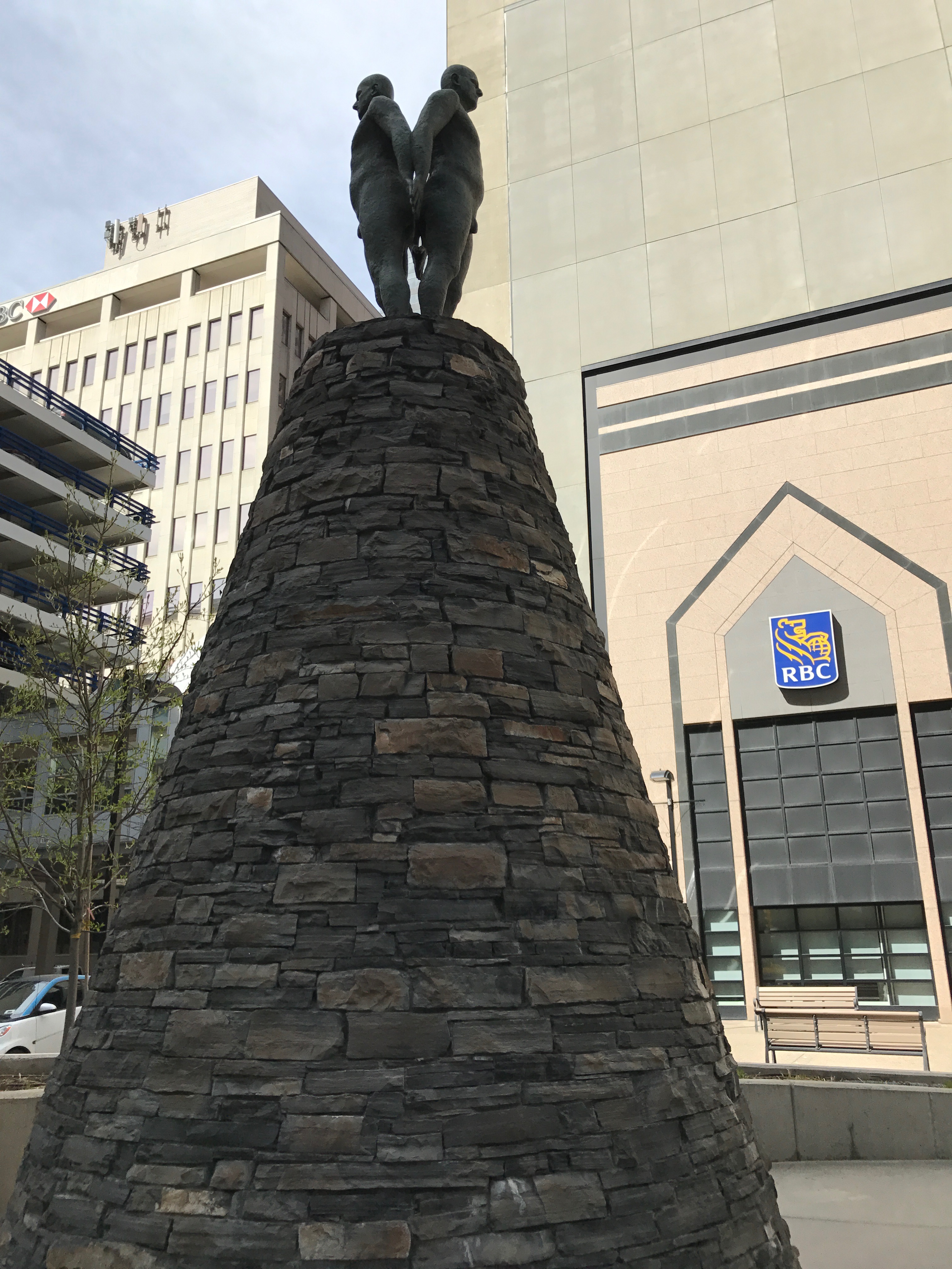
I came across this 2004 sculpture by Jacqueline Metz and Nancy Chew. The title is “between the earth & sky/measuring the Immeasurable”.
It is describes as a “mythic landscape”. A cone of local rundle stone, which they describe as minimal yet sensuous, is a reference to the mountains. It took a little digging for me to find out what rundle stone is. It turns out that it is stone quarried from Mount Rundel in Banff National Park, and it is a fine-grained sandstone that is used in southern Alberta for landscaping and building.
So, on top of this “minimal yet sensual” cone of rundel stone, two bronze figures stand, back to back, looking forwards and backwards through space and time.
Uh, okay…
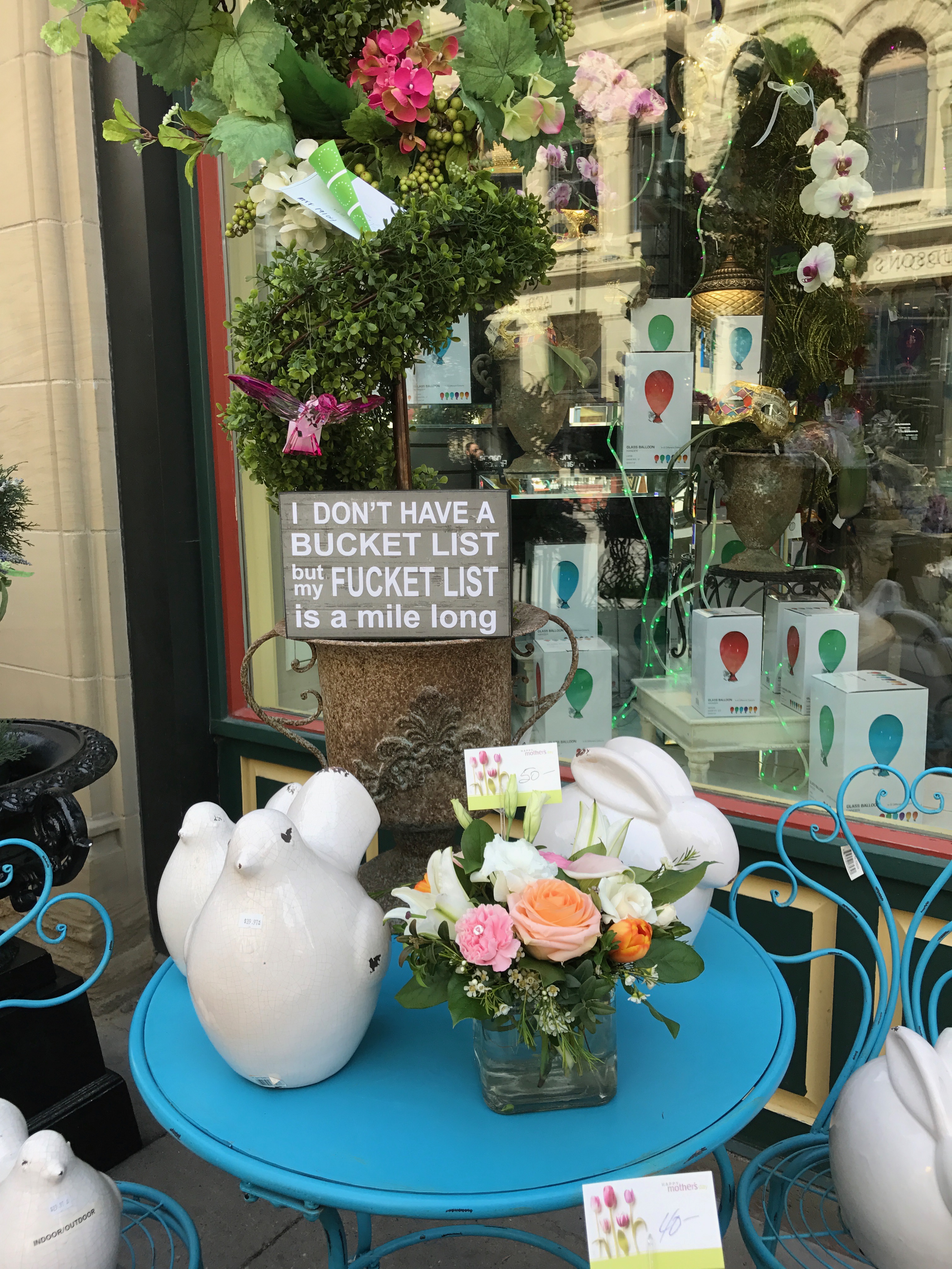
It’s always fun to see what stores set out in front of them. Actually “shopping” can be fun and economical, if you approach stores as if they were museums. They are there for you to enjoy, but don’t touch. (Or buy anything.)
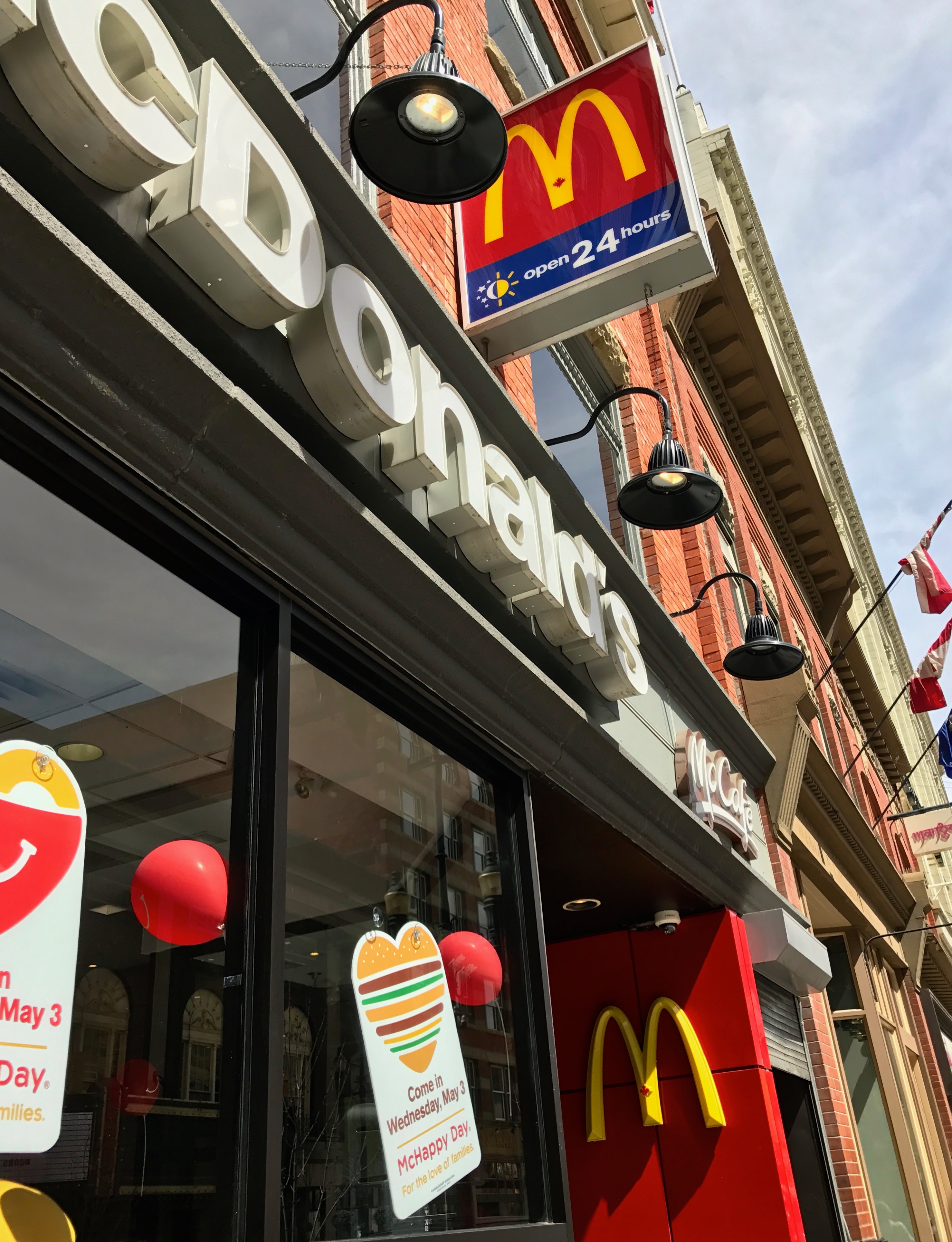
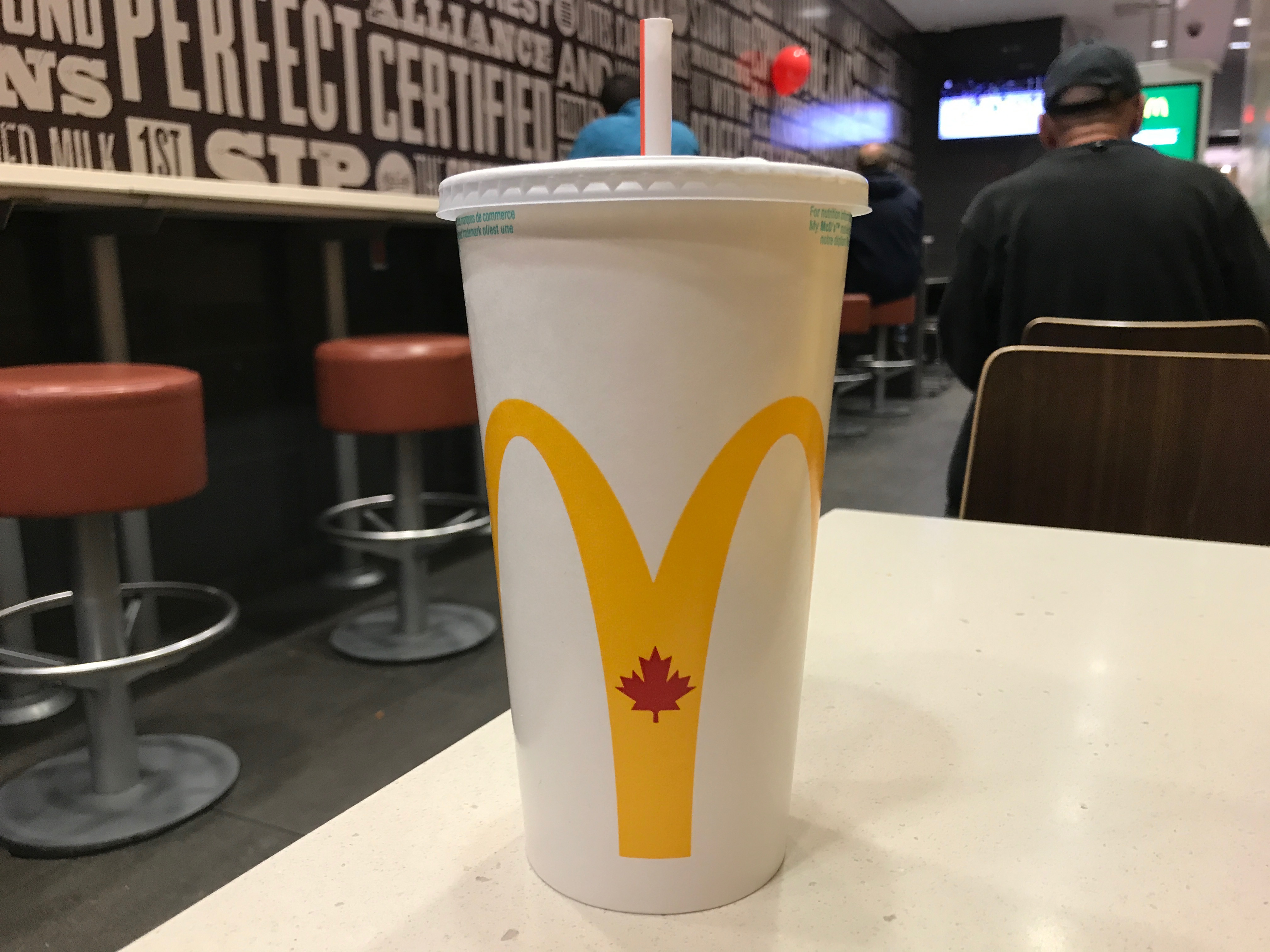
McDonalds!
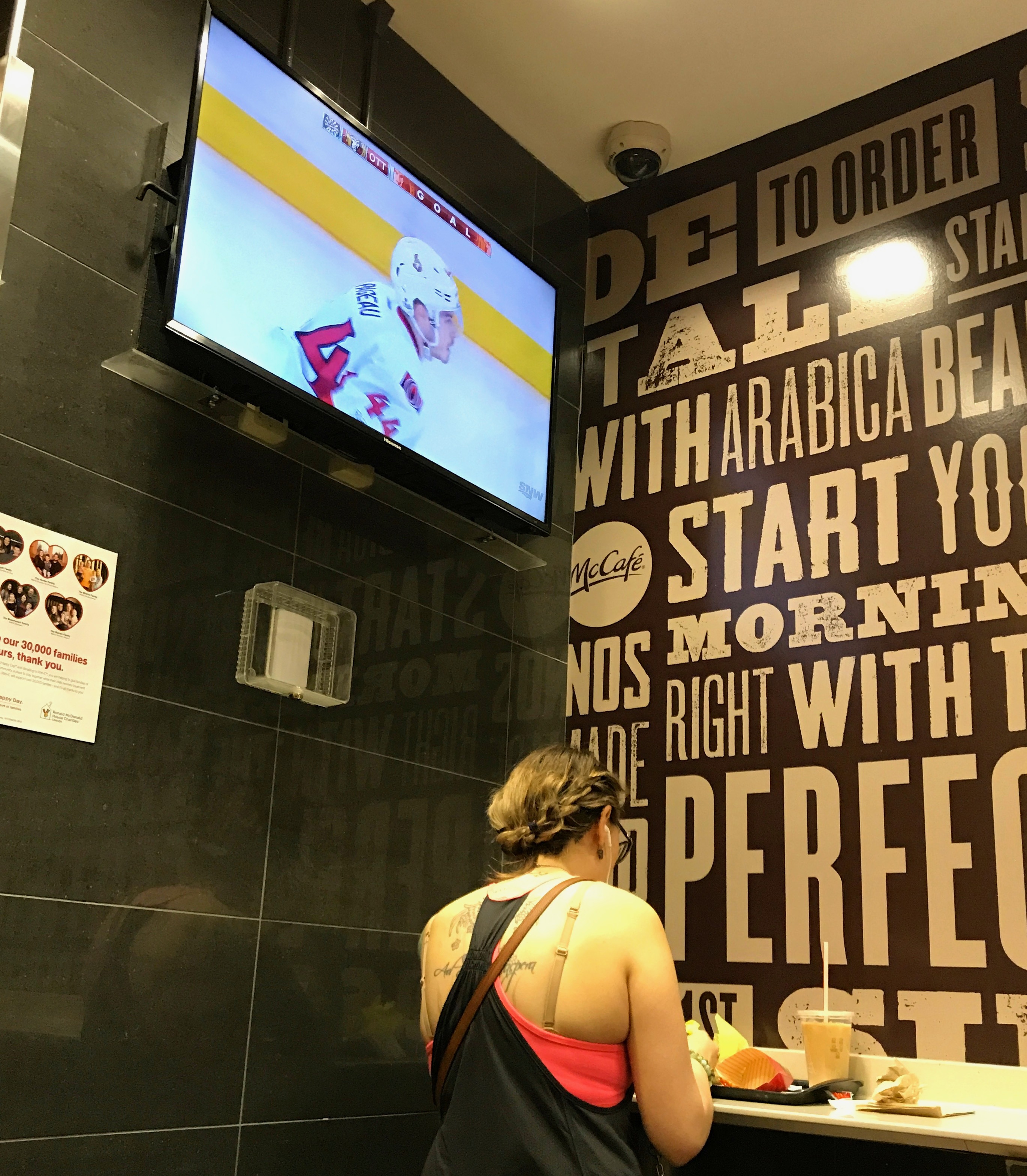
What would be on a TV in a McDonalds in Canada?
Hockey, of course!
I enjoyed my burger and beverage and got ready to head back to the campground.
After my visit to Helena, It was a direct shot up I-15 to the border.
It wasn’t exactly a straight shot, but if you keep the round tires on the pavement and your eyes on the road, with an Interstate, you eventually get where you are going.
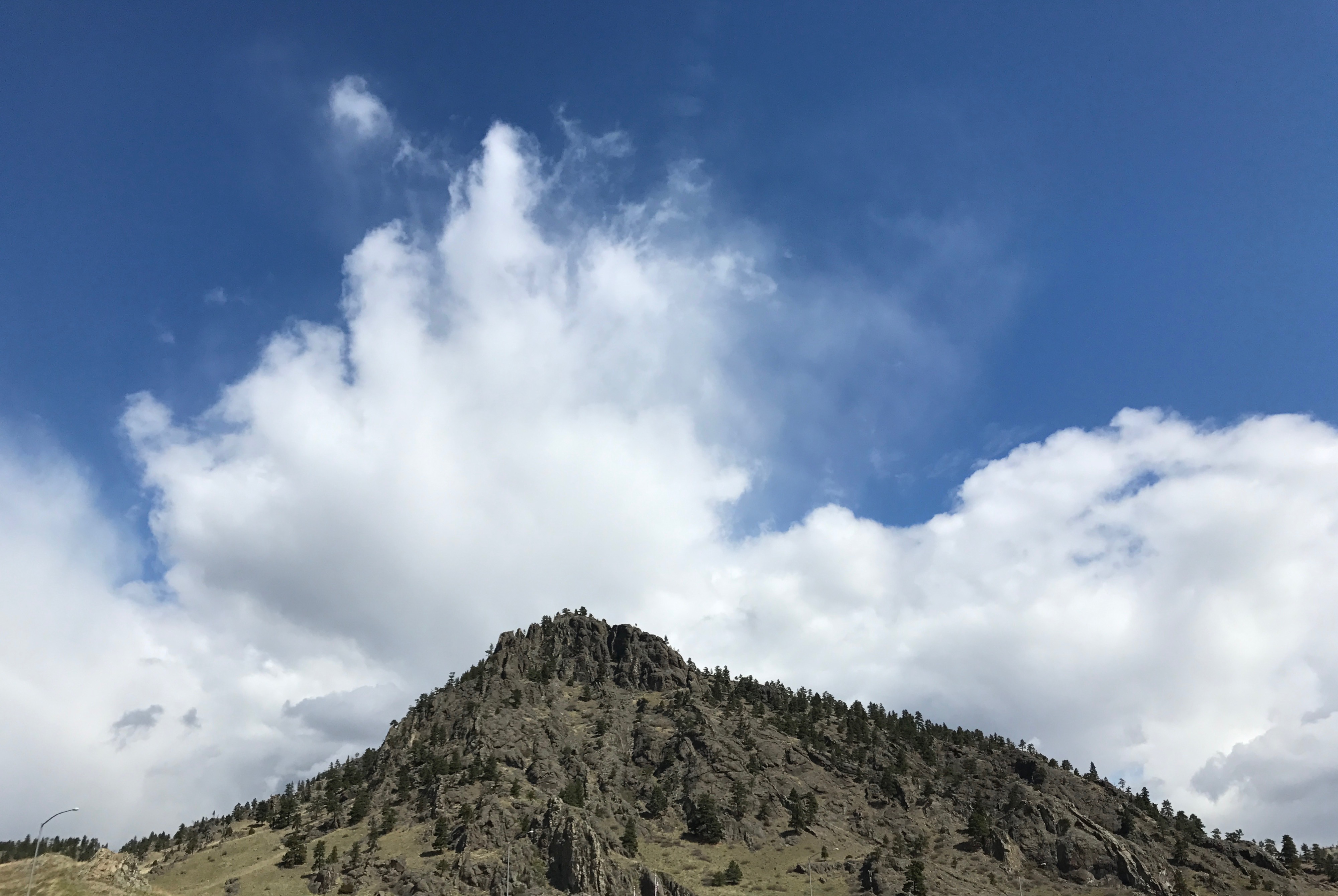
There is some amazing scenery out there in this great land of ours. I snapped this shot at a rest stop. The clouds kind of reminded me of waves crashing.
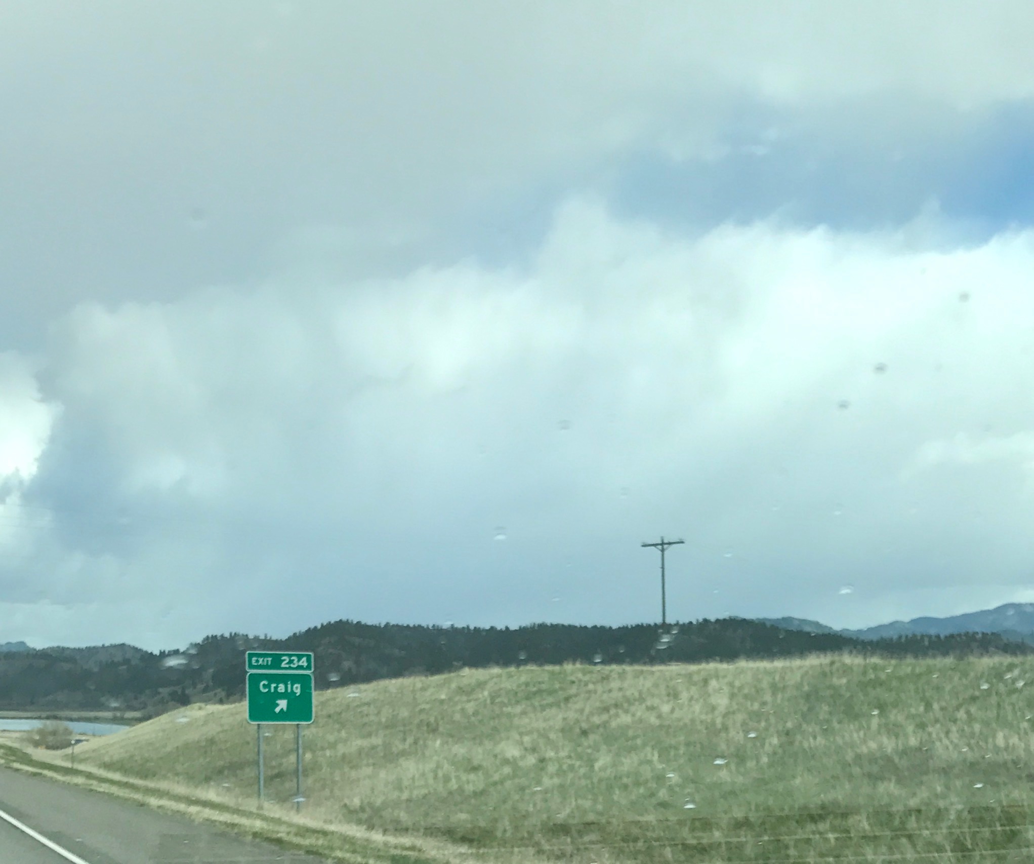
And, I had to snap this shot through my windshield for two reasons:
The name of one of my brothers is Craig.
I consider numbers that are in order, like Exit 234, to be a sign that my father is looking out for me. The story of that little game Dad and I would play is somewhere in my blog.
You can tell the clouds are moving in. They move in, they move out. Oh, and there’s rain on my windshield. I “love” rain.
I spent the night at a local campground in Shelby, so that I would be ready to cross the border at Sweet Grass in the morning.
I’ll bet that this park is well-used in season. I was passing through during the week at the beginning of May, so I pretty much had the place to myself. I paid my fee at the “Iron Ranger”, which is just a tube where you drop your money, and spent a quiet night at the park. I didn’t even unhitch.
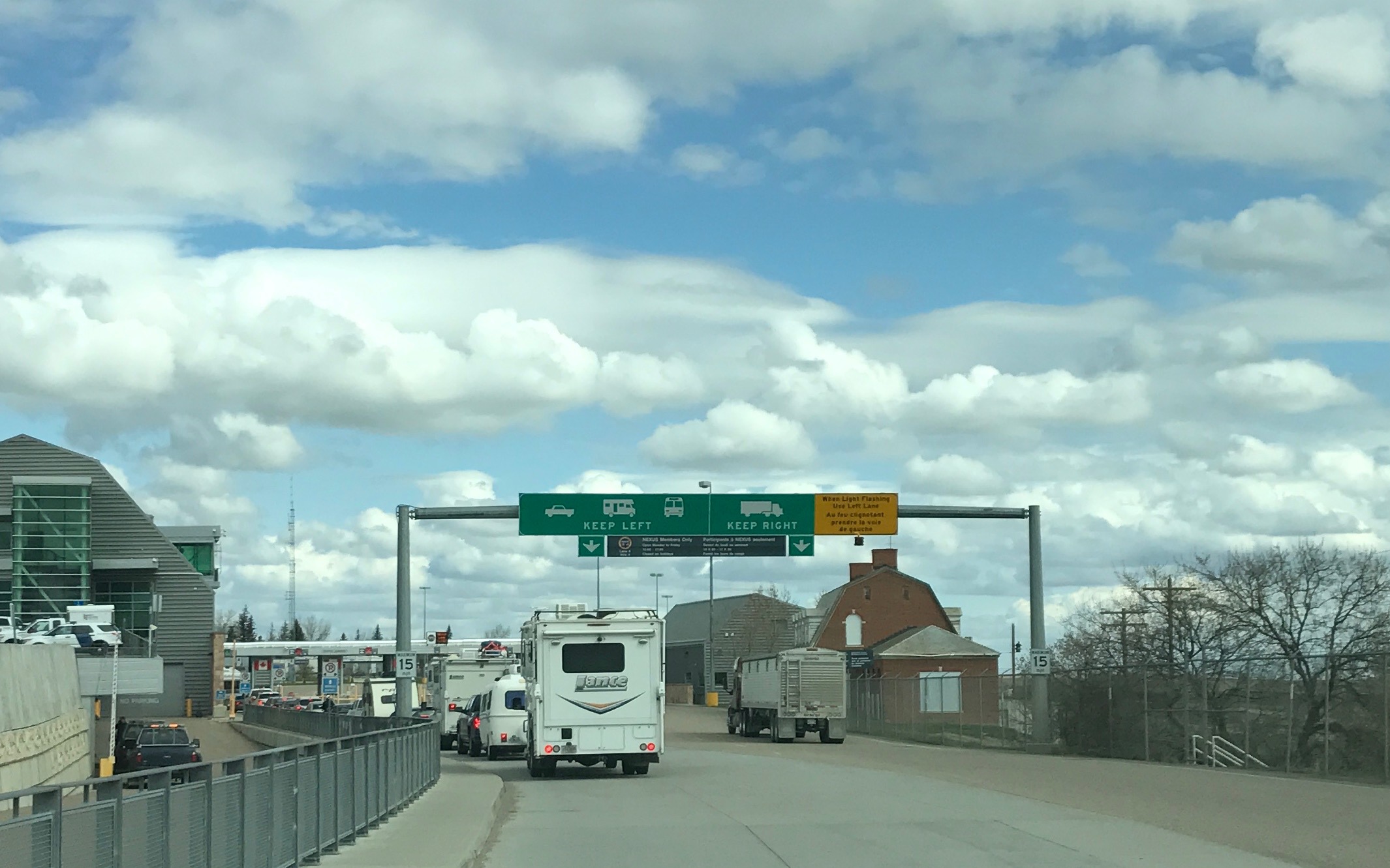
The next morning, I gassed up and found my way to Canada.
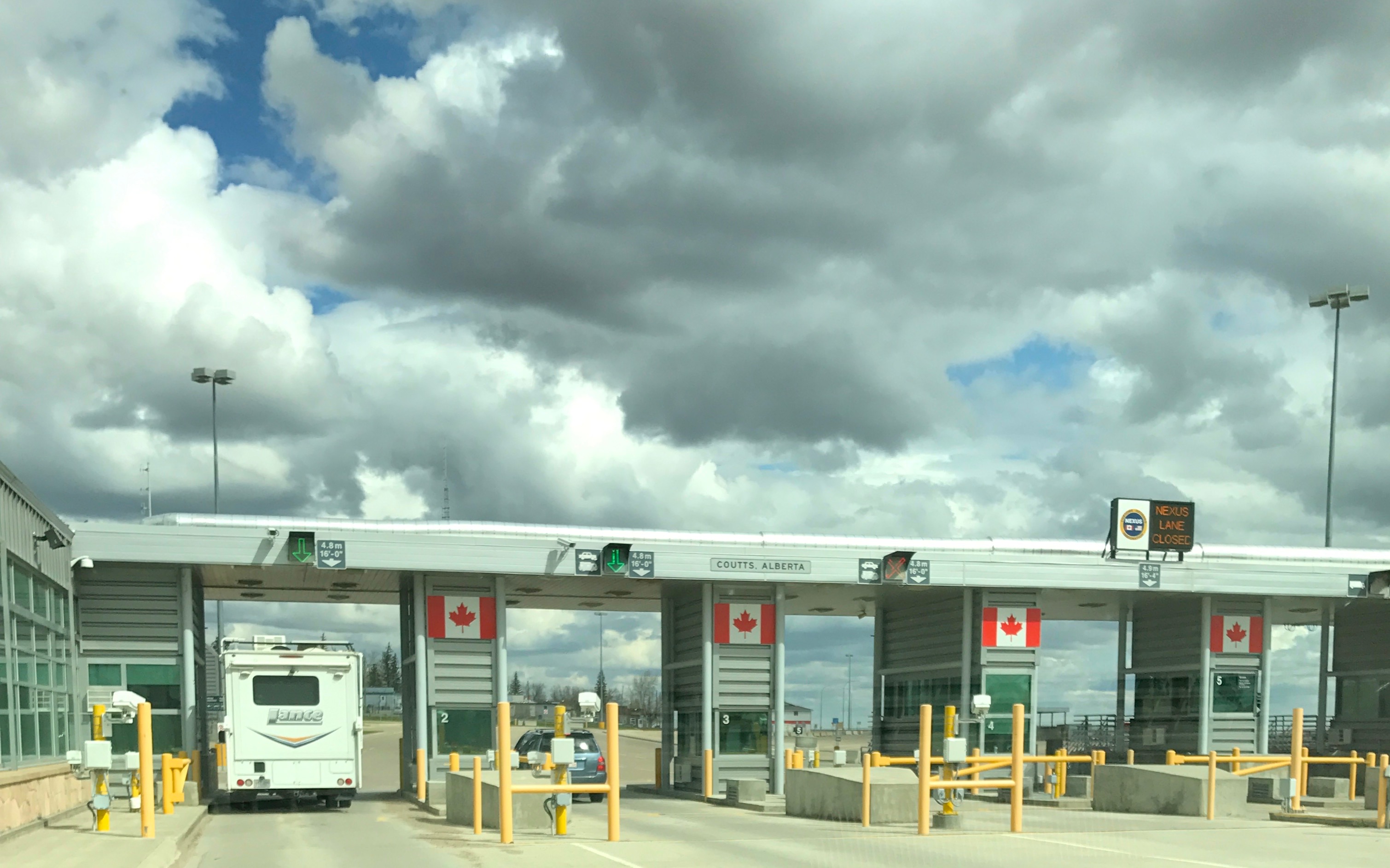
I was full of trepidation when I got in line. This would be my first border crossing with my trailer, although it was hardly my first border crossing.
I had been crossing the border my whole life. My first crossing was when I was about four days old. I was born in Buffalo, but we were living in Canada at the time.
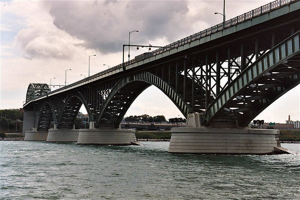
I still can’t get over the idea that you can enter Canada without crossing water. But, that’s just because I’m a Great Lakes sort of person. The photo above is of the Peace Bridge, otherwise known as “The Bridge”. It connects Buffalo, New York with Fort Erie, Canada.
Anyway, we inched up to the barrier and then it was my turn. Would they send me over to secondary inspection? Would they go through my truck and trailer? Was my paperwork adequate for bringing Cora the Travel Cat into the country?
I handed the agent my passport, Cora’s papers, my truck and trailer info. We discussed what I was bringing into the country. I had no firearms, fruits, vegetables, alcohol, or tobacco, so I was good to go. Oh, I did declare the four cans of Bud Light I had in the fridge, but he probably didn’t count that as beer. (Most of my beer loving friends don’t.)
He welcomed me to Canada and I was in!
I pulled over and captured the requisite “Welcome to Alberta” sign photo. I didn’t know Alberta was known for its wild roses.
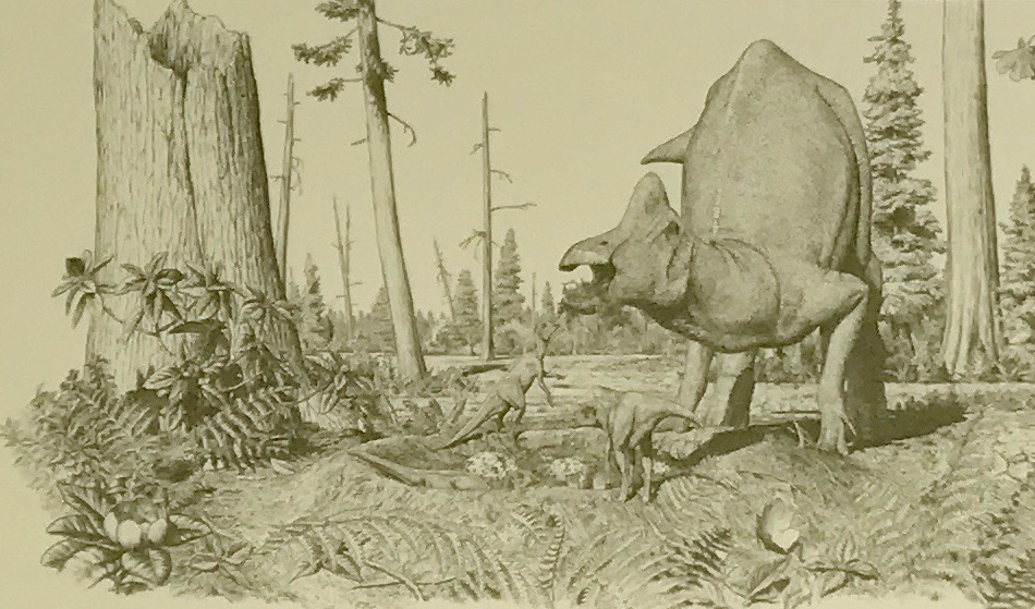
I was aware that it was known for its petroleum deposits, so it wasn’t a surprise that they would also welcome me with some information about the dinosaurs.
I’ll let you read the information they posted, if you are so inclined.
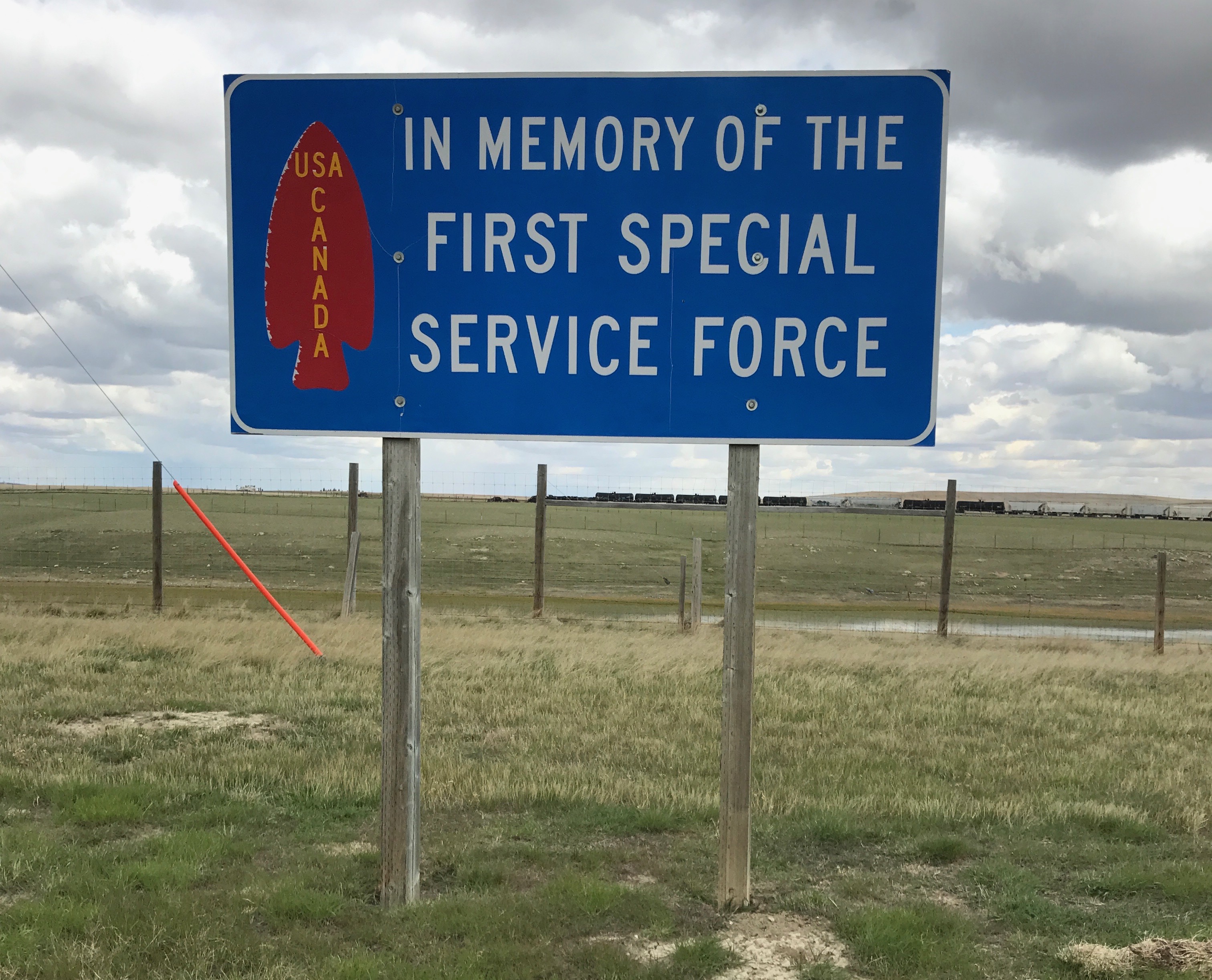
The next sign I noticed was a sign honoring the First Special Service Force.
It turns out that the road from Lethbridge, Alberta, to the border at Coutts and Sweet Grass and on to Helena was dedicated in 1999 as a memorial to the First Special Service Group, an elite WW II unit known as “The Devil’s Brigade.”
In 1942, 700 volunteer Canadian officers and soldiers took this route to join 1100 United State soldiers for intensive training at Fort William Henry Harrison, west of Helena. Although combat casualties were high, but the force never failed a mission. According to the information at the roadside, this small unit received a disproportionately large number of medals, over 5,100.
They were named “The Black Devils” by the Germans for their legendary nighttime fighting ability.
In 2013, the unit received the USA House of Representatives’ highest honor, The Congressional Gold Medal of Honor.
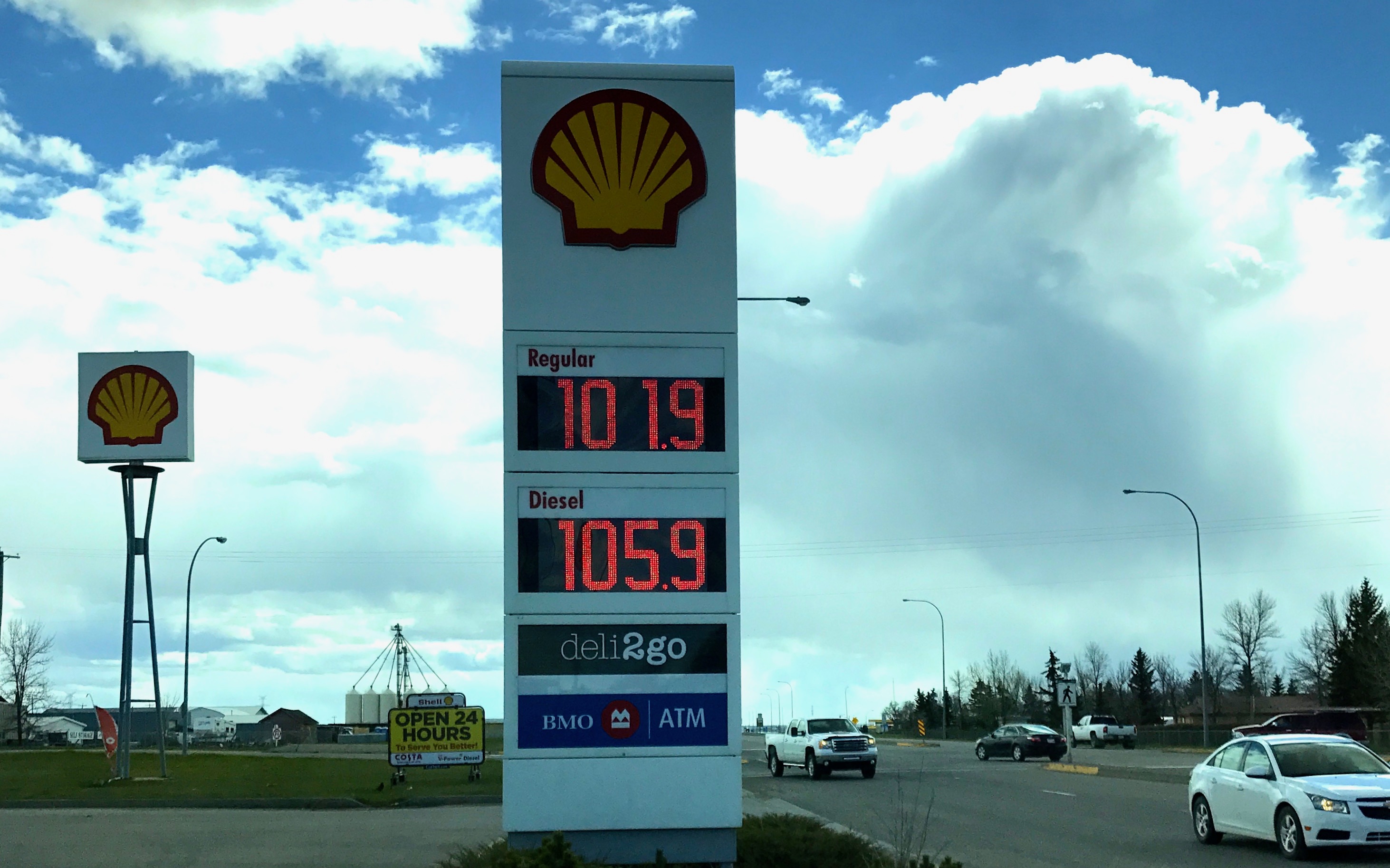
I drove on until I got to Stavely, when it was time for a fill up.
Don’t you just love having your mind boggled? If I wanted to know what the price would be in US dollars, I’d first have to figure out how many litres were in a US gallon, multiply that times the cost per litre and then figured out the exchange rate.
So, what did gas cost in Alberta?
Who cares? It cost whatever it cost. It wasn’t like I was going to head back across the border to fill up.
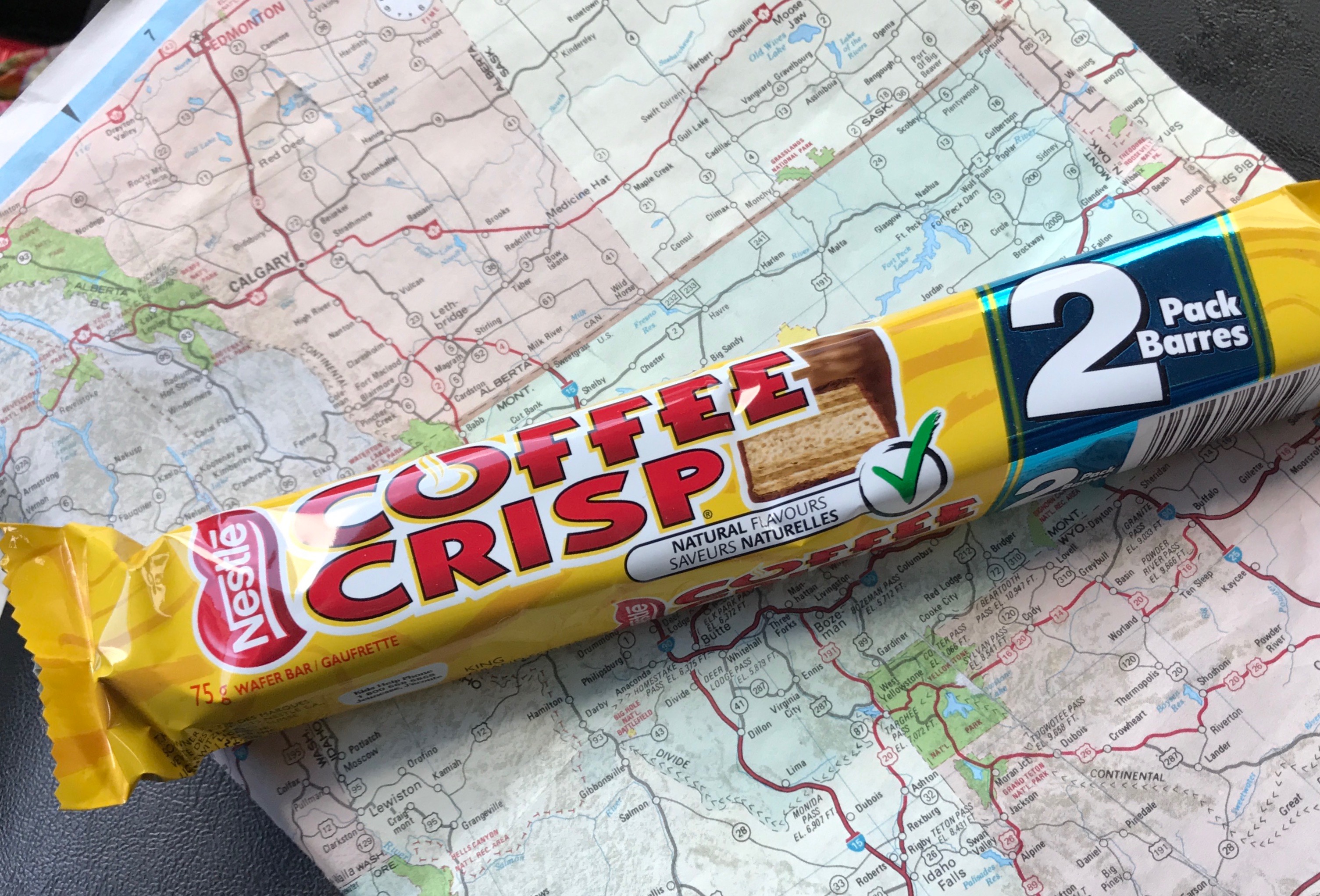
And, as long as I was filling up the truck, I might as well have a little snack myself.
How do you like your coffee?
I like my coffee crisp.
I was rolling through the prairies and the productive-looking farmland.
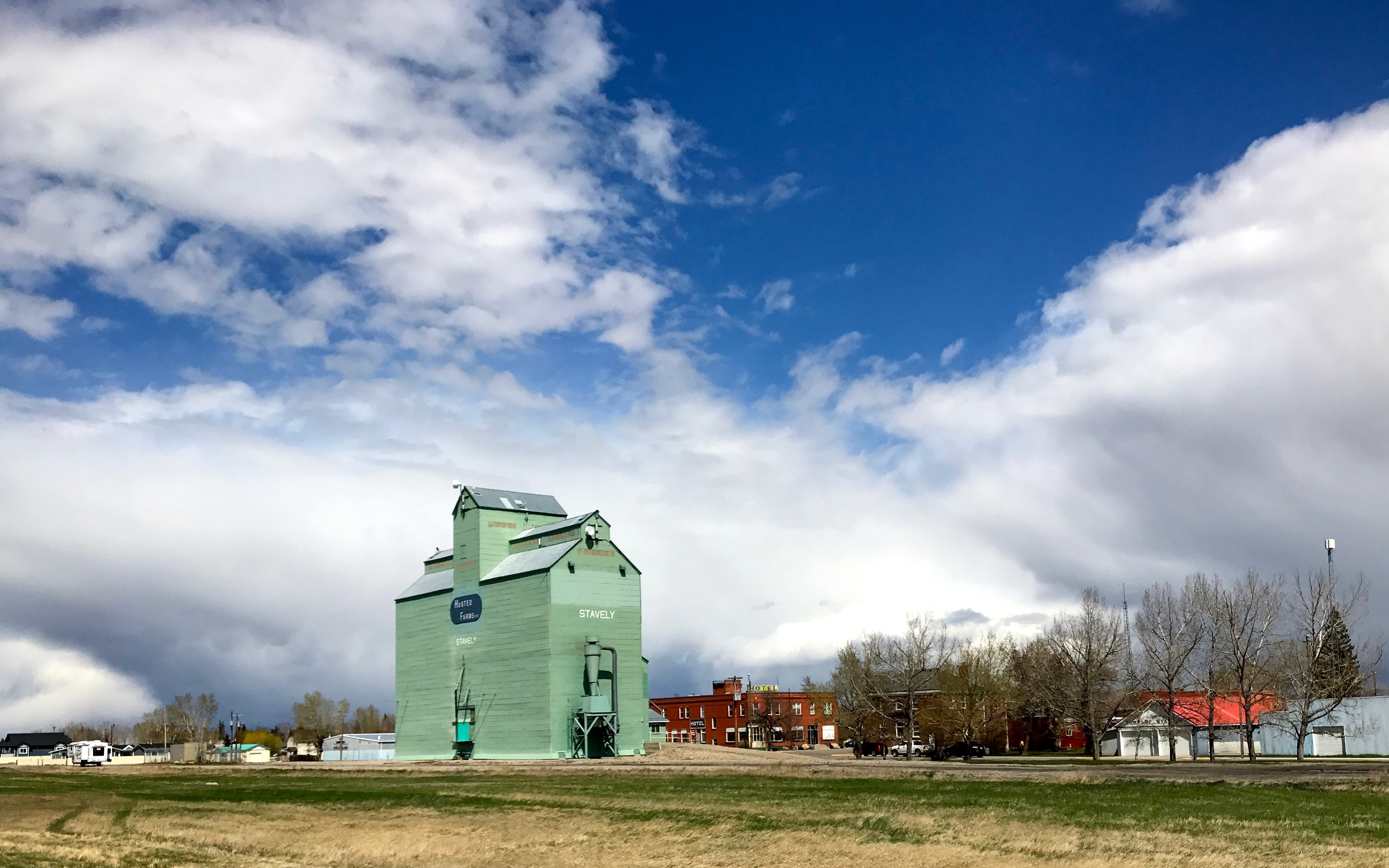
This grain elevator is in Stavely, which was named after the chairman of the Oxley Ranching Company, Alexander Stavely Hill. Oxley Ranch was one of the bonanza ranches.
What is a bonanza ranch? I did a big of digging, because I was wondering, too. In 1881, an Order-in-Council was passed that allowed individuals or corporations to lease ranches not to exceed 100,000 acres for 21 years at the annual rental of one cent per acre.
Just in case you need some help visualizing the size of 100,000 acres, that is equal to about 155 square miles. That is about the size of South Bend, Indiana.
The era of the bonanza ranches didn’t last long. About ten years later, the Government canceled the the ranch leases, which made way for homesteaders.
As cattle gave way to grain, the population grew. Stavely was incorporated in 1912. The Alberta Farmers’ Cooperative built a grain elevator in 1910, which was the largest of its kind between Winnipeg and Vancouver.
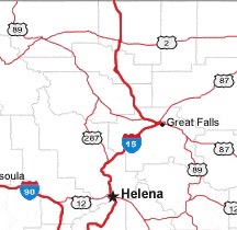
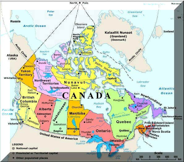
For those of you not up on your Canadian geography, here’s a map to help you.
I resumed my trip toward Calgary. I arrived at the campground I had selected – Calgary West Campground. It took me a couple tries to get backed into my site. Since it was so early in the season, I don’t know why they couldn’t have given me something easier to get into. It was the first time I’d had to shift into four wheel drive to back the trailer up into the spot.
But, once I was in my spot, I was set for a few days. The next day I’d explore Calgary.
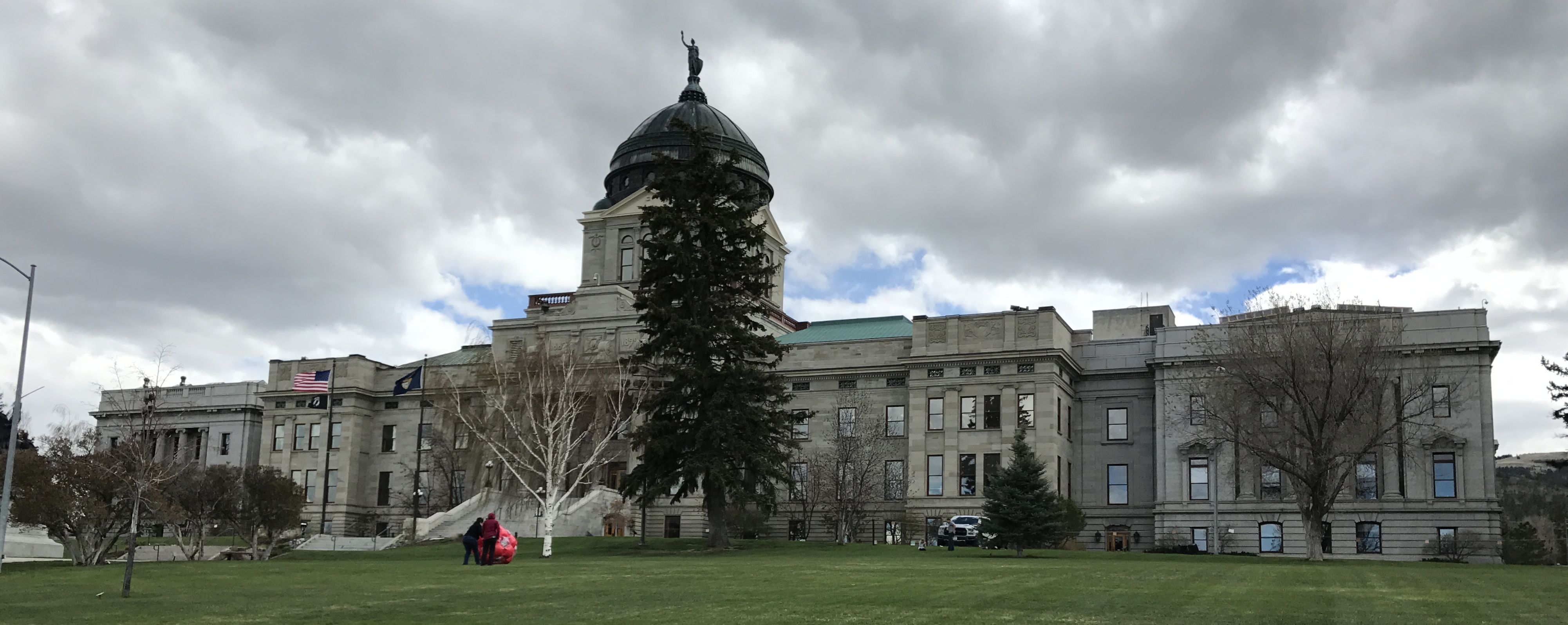
I rolled further north on I-15 and got to Helena, which is Montana’s state capitol. You know I had to go visit it.
The campground must have been nothing special. I didn’t make any notes about it, and it doesn’t seem like I even took a photo of it. Sometimes you find great scenic spots. Other times, you just find a spot. I love the variety.
I loaded the address into Google maps and easily found the capitol.
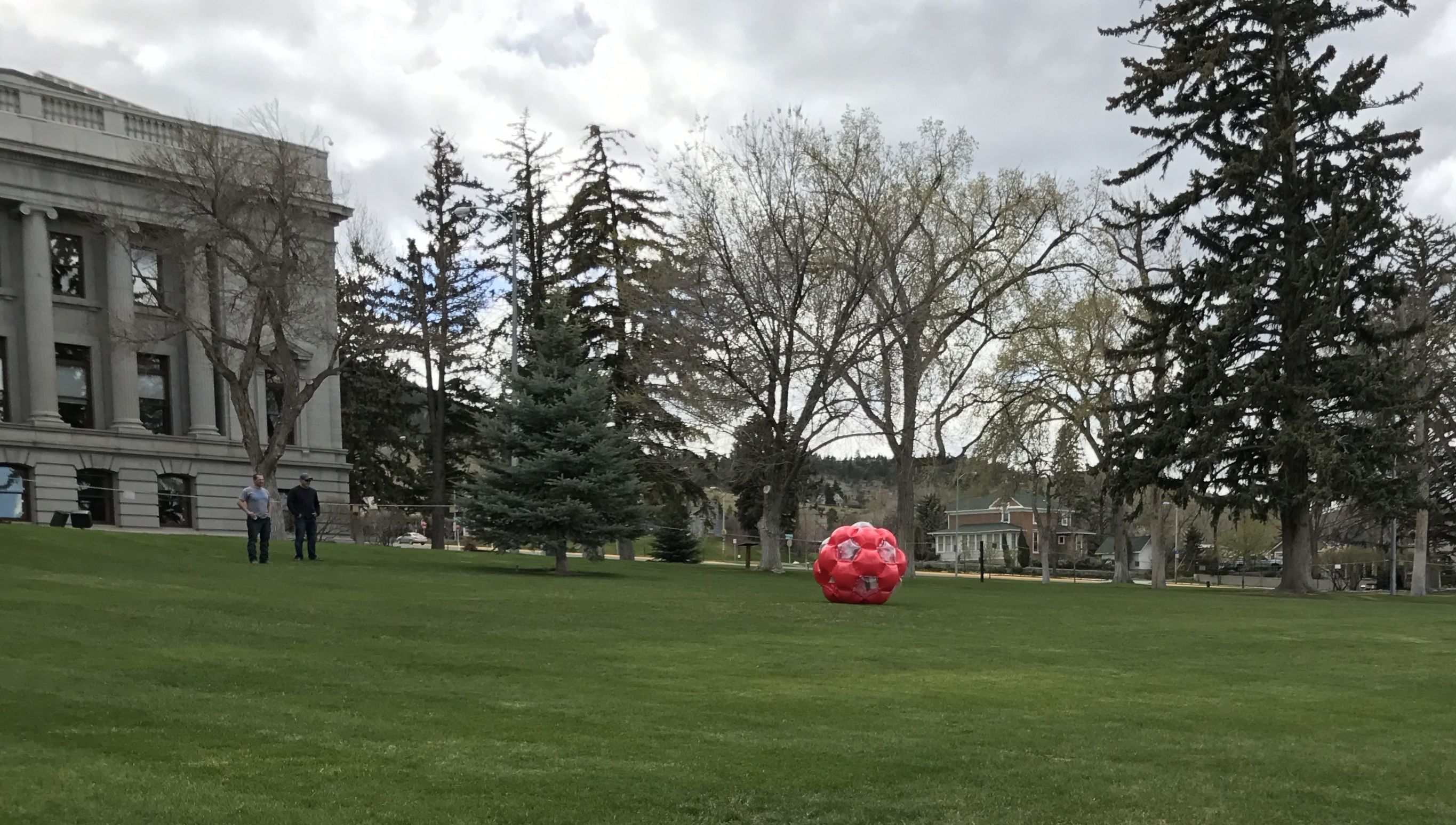
Do you see the red dot near the birch tree? There were several kids and their parents playing with a large red ball.
The kids would climb inside and roll down the capitol lawn! I watched them make several trips and then decided to head indoors.
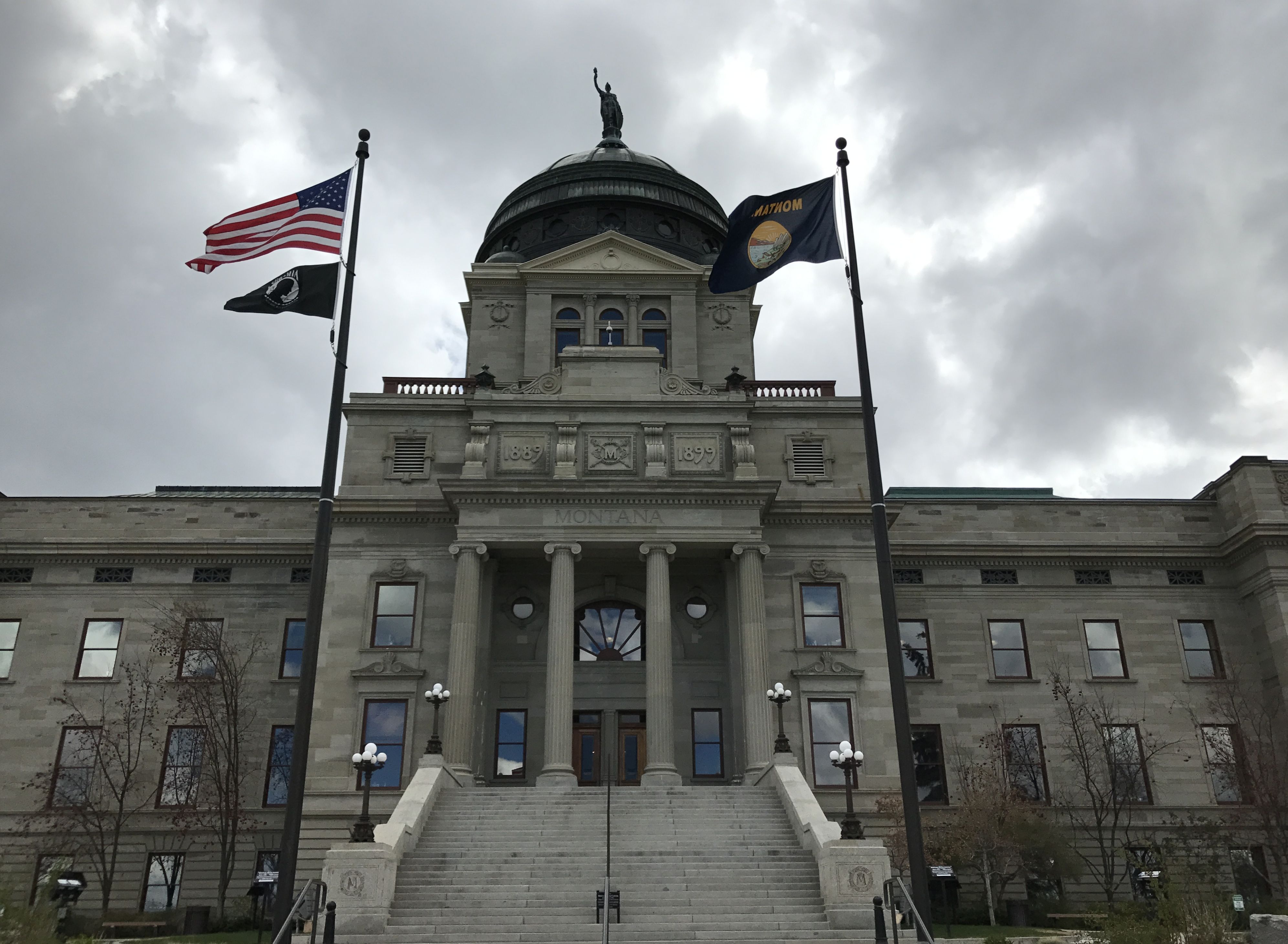
What a cold and blustery day. I approached the steps of the building that was constructed between 1896 and 1902. I love the optimism of the citizens of Montana. They began constructing the capitol seven years before they joined the Union.
It causes me to scratch my head when states that lean strongly in favor of protecting their second amendment rights prohibit weapons – also known as guns – from their government buildings. But then again, they do say that the pen is mightier than the sword, so I guess that everything is potentially a weapon.
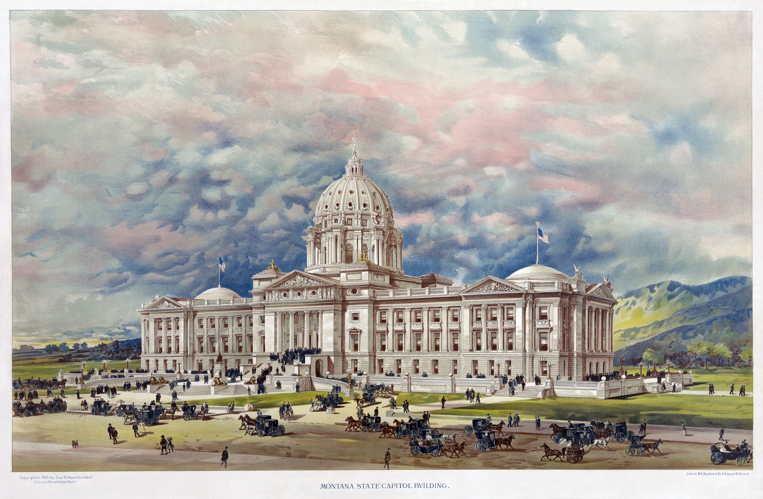
According to my preferred source, the capitol that stands here is the second building that was commissioned. The Capitol Commission selected a design by George R. Mann.
By Geo. R. Mann – Library of Congress [1], Public Domain, https://commons.wikimedia.org/w/index.php?curid=6066479In 1897, it was discovered that the Commission was planning to scam money from the building project. The first commission was disbanded and they convened a second Capitol Commission. The second Commission abandoned Mann’s design as being too costly and they held a second competition. Charles Emlen Bell and John Hackett Kent of Council Bluffs, Iowa won the competition and they relocated their office to Helena.
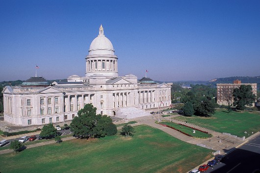
What became of Mann’s design? It didn’t go to waste. It was later selected as the basic design of the Arkansas state Capitol.
Here’s the Arkansas State Capitol in Little Rock, just in case you were curious.
This was another fantastic building that was open to the public to just wander around.
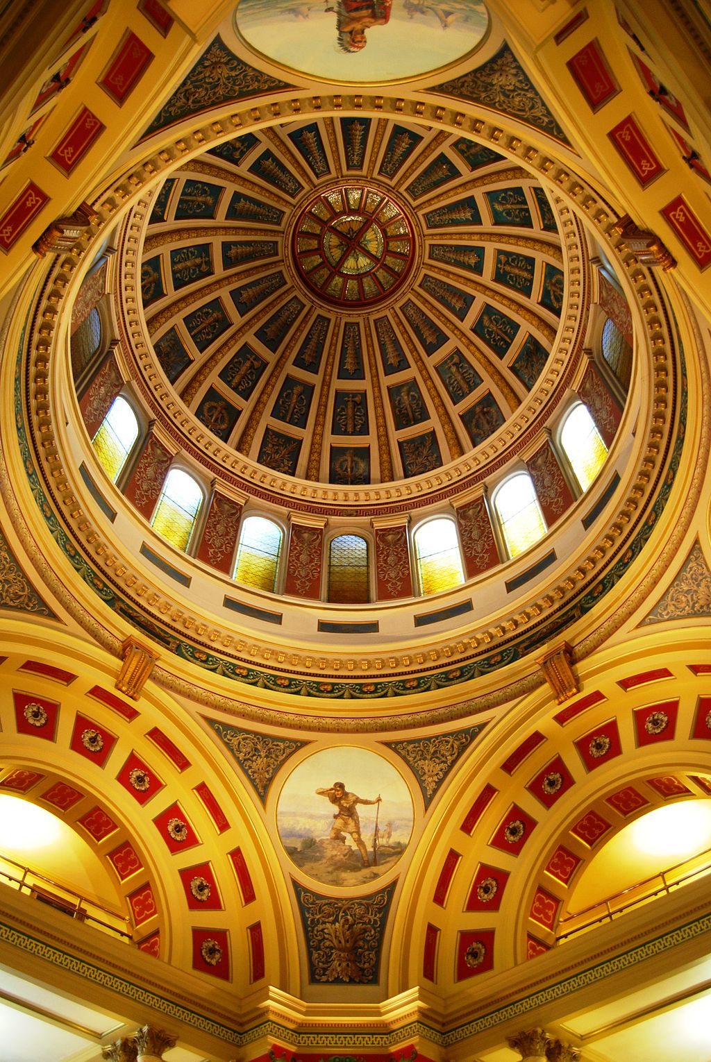
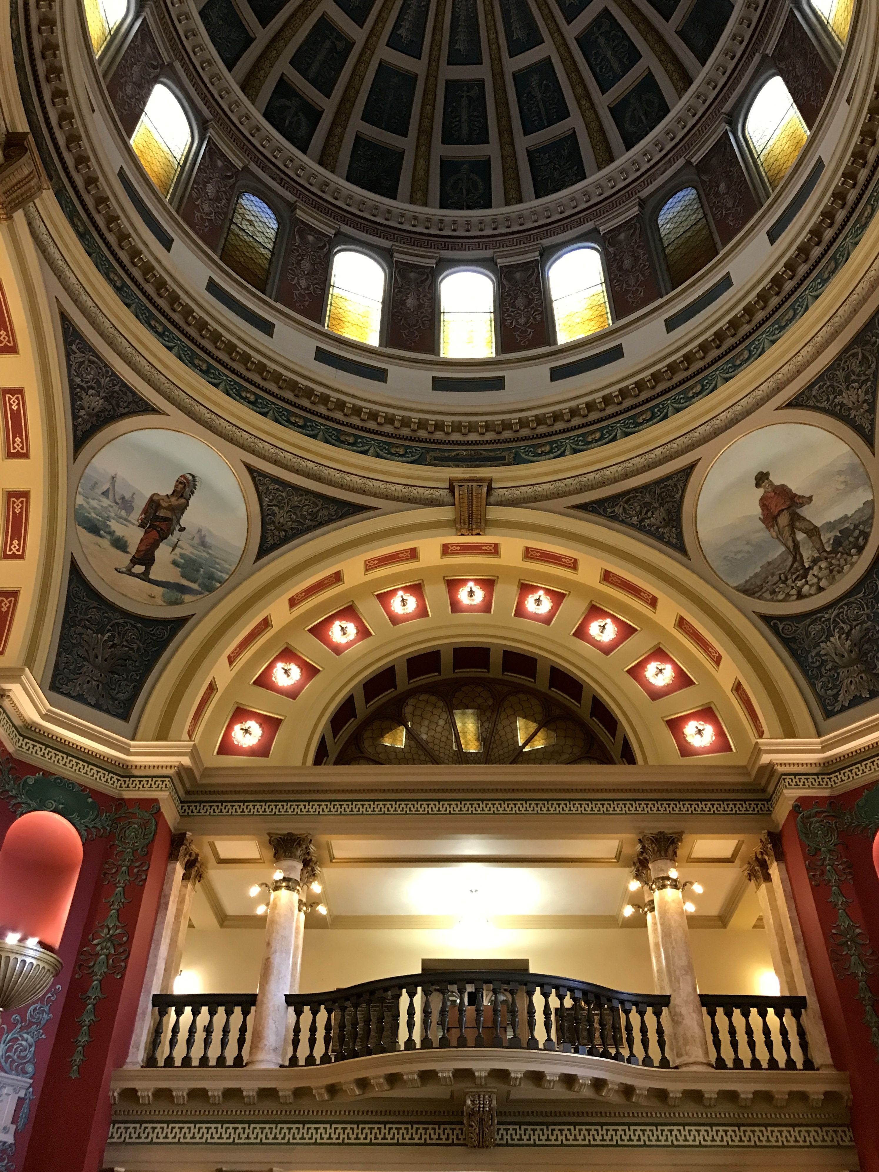
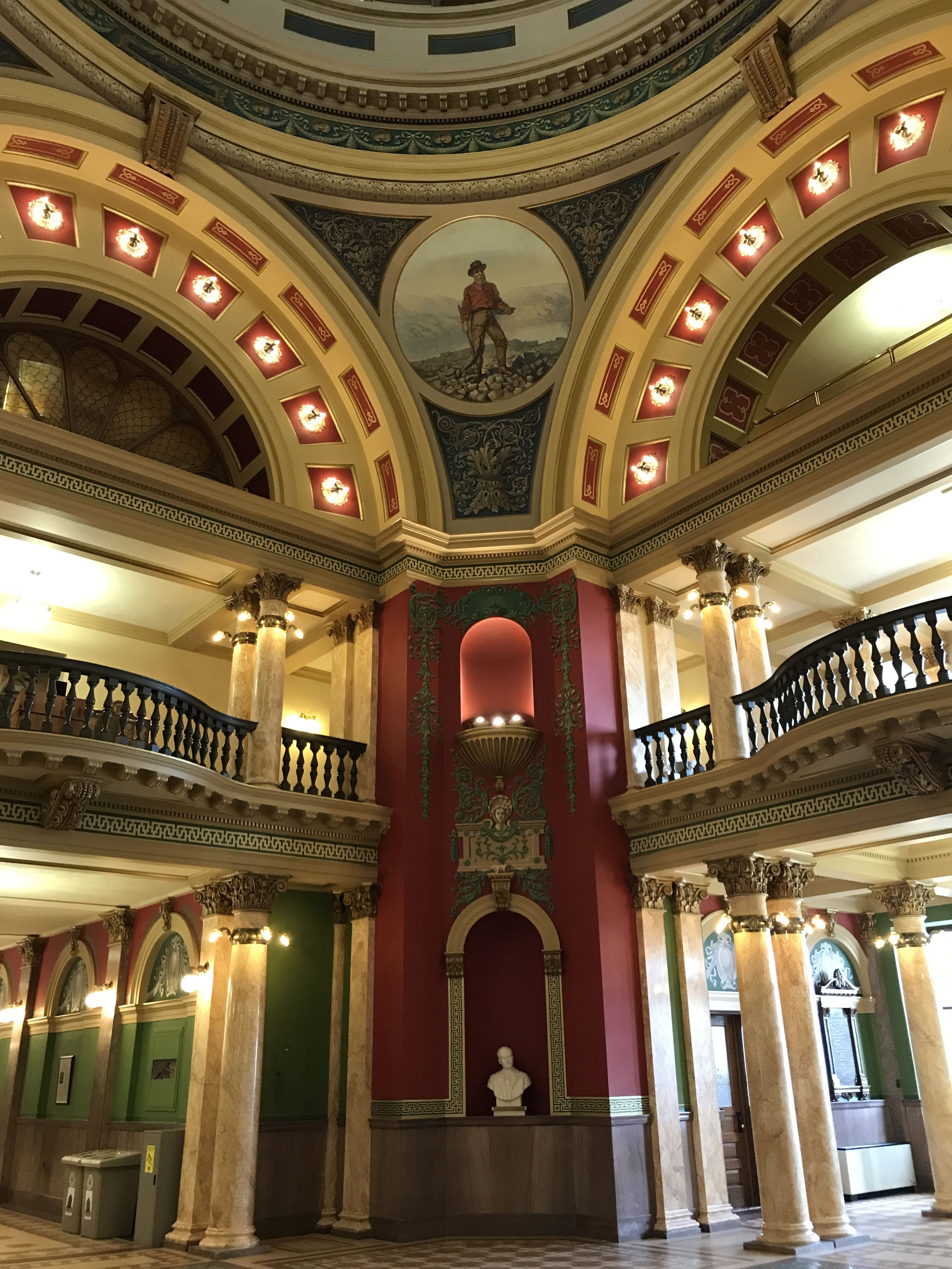
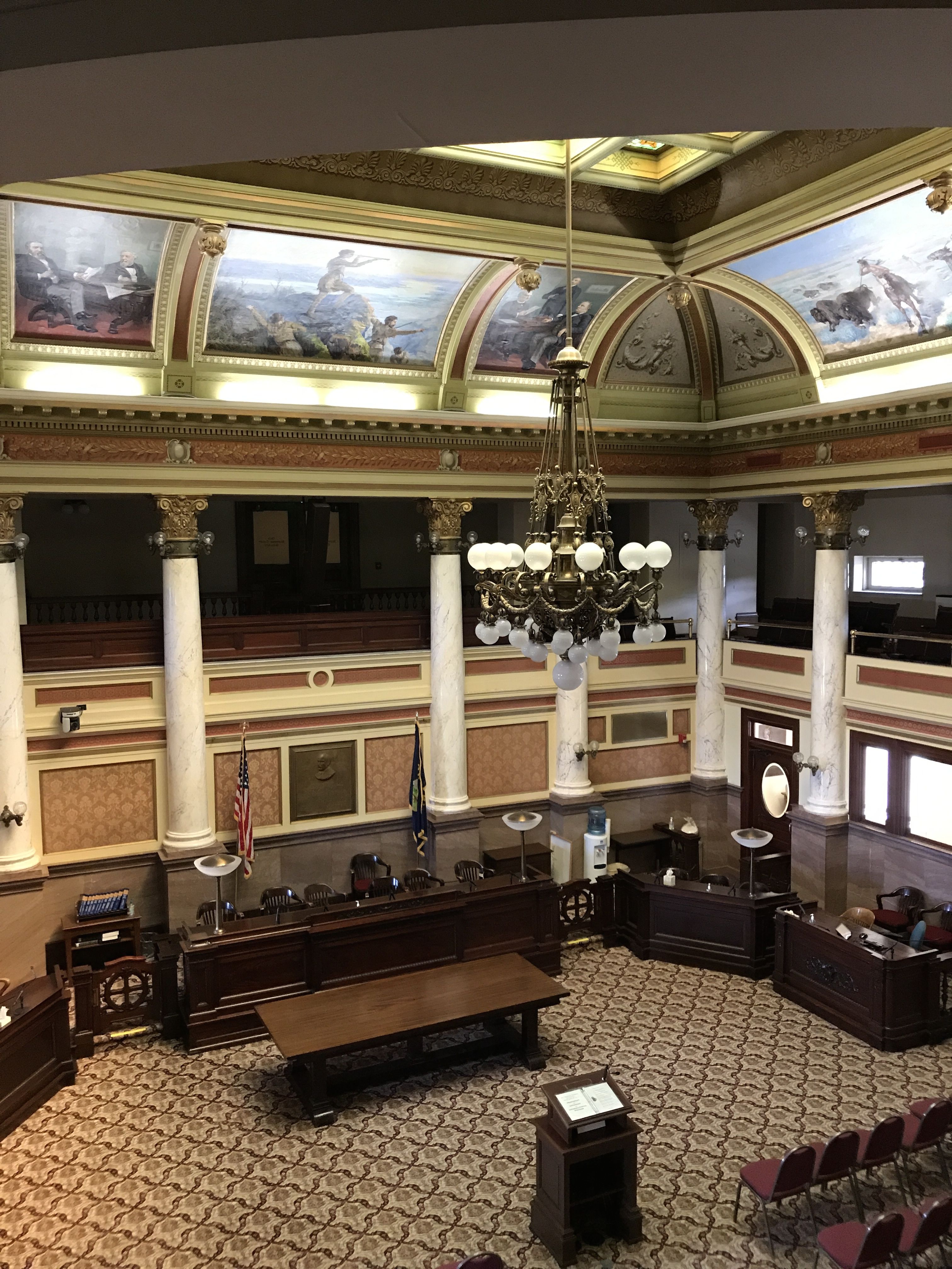
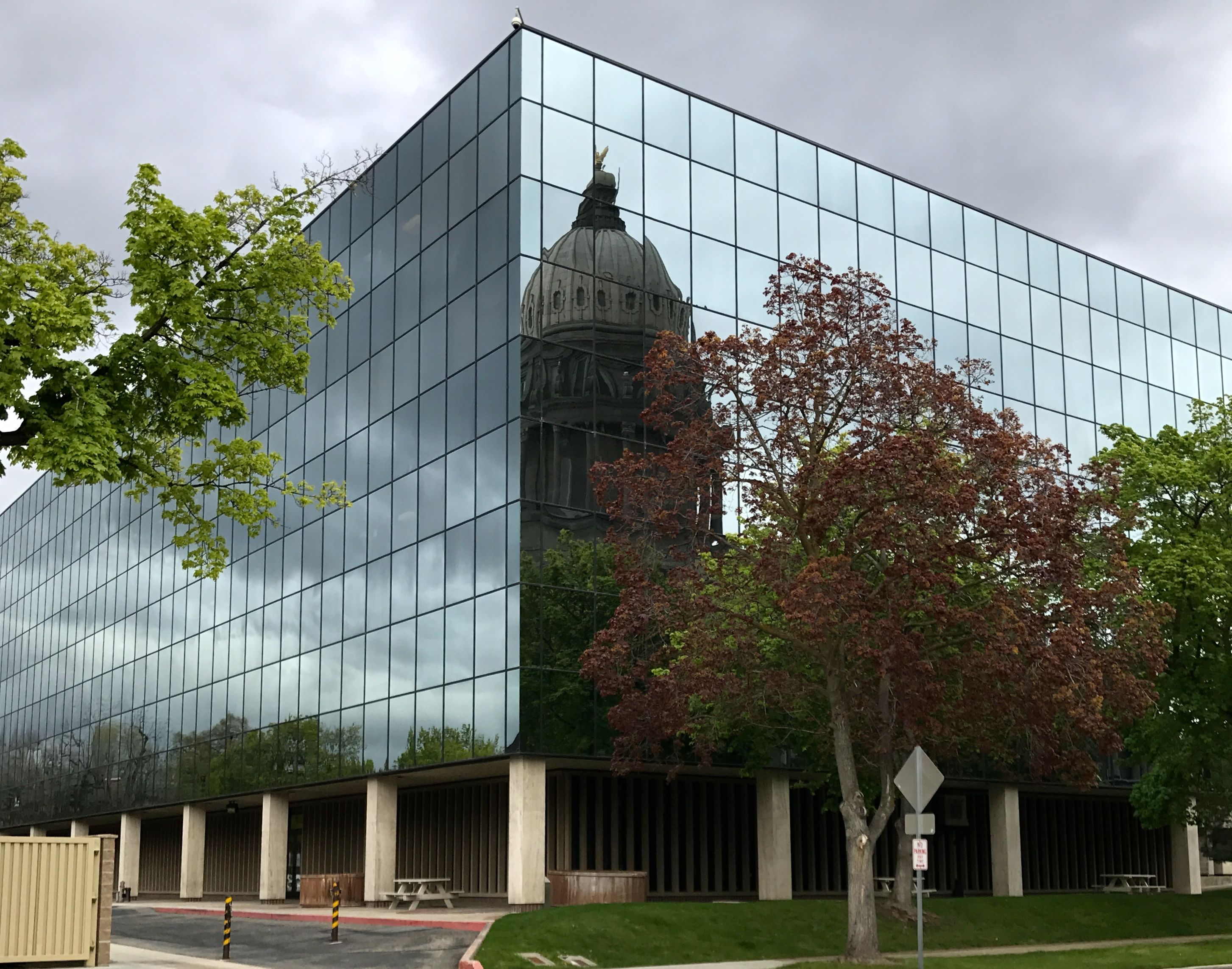
As pale and serene as the Idaho capitol was, Montana’s is exploding with color.
The circular paintings in the rotunda were painted for the Capitol opening in 1902 by the firm of F. Pedretti’s Sons.
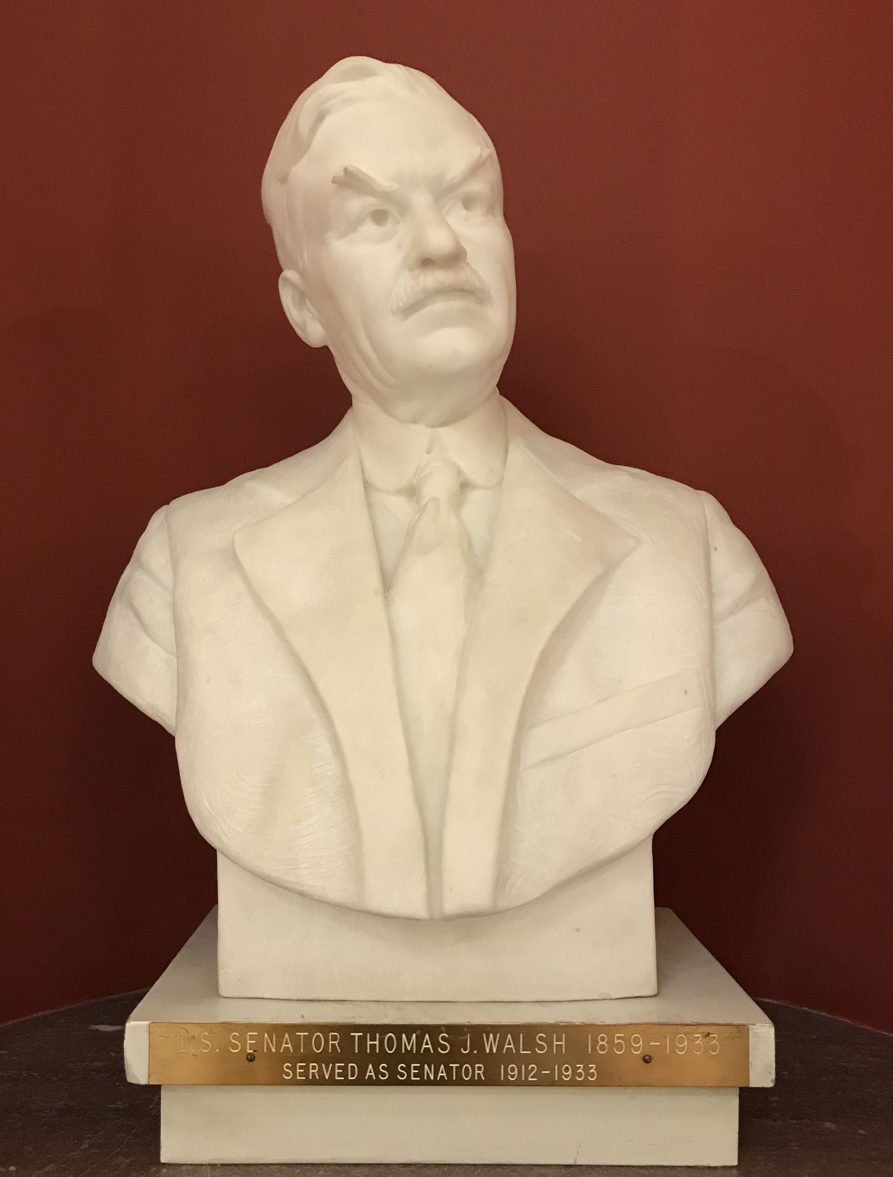
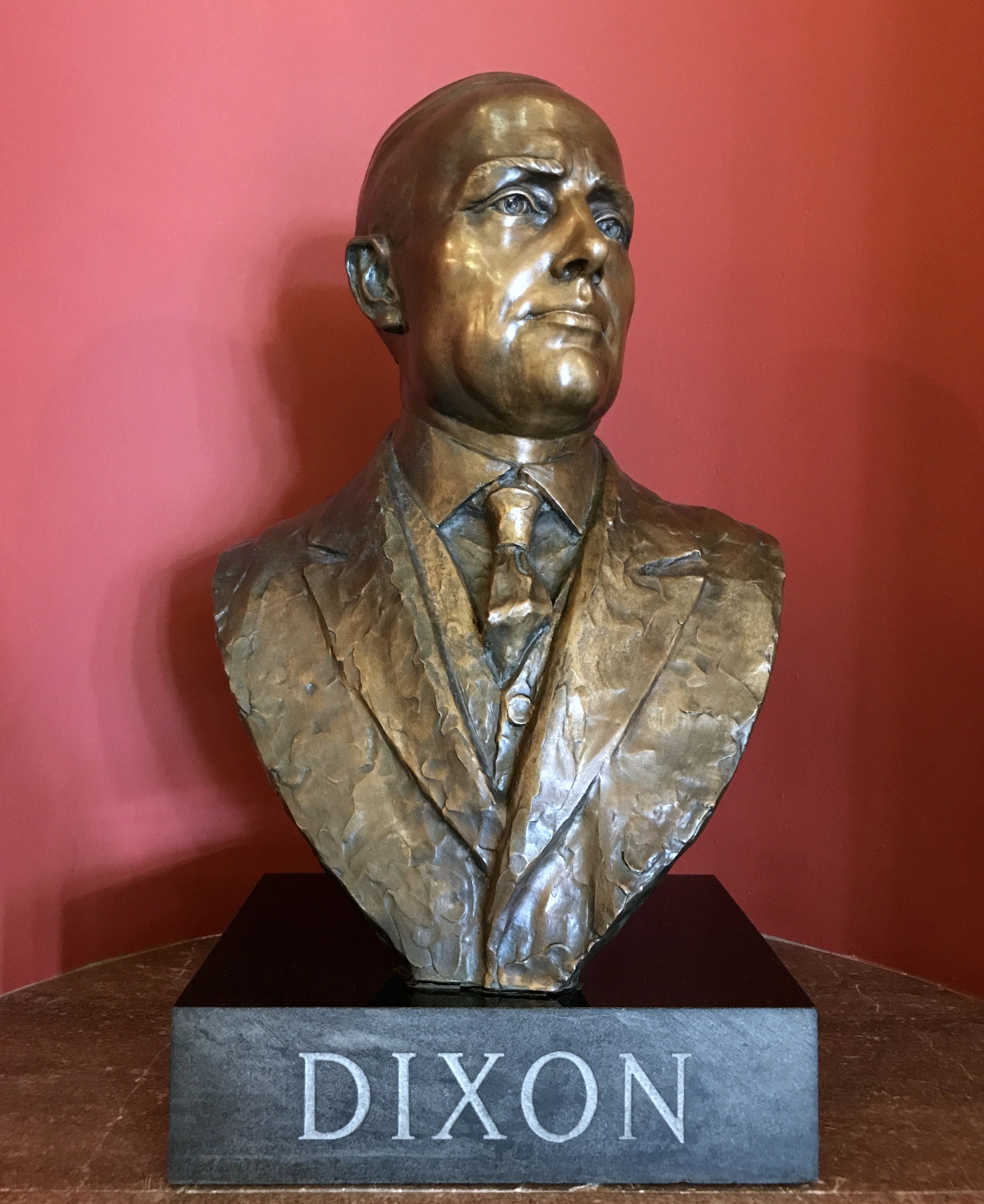
In the four corners of the rotunda, they have statuary niches.
There’s Senator Thomas J. Walsh, who served as a one of Montana’s state Senators for 1912 until his death in 1933. He belonged to the Democratic Party and had a national reputation as a liberal. He was President-elect Franklin D. Roosevelt’s choice for Attorney General when he died.
It took some digging to find out who Dixon was. A plaque next to the statue would’ve helped, but I guess that would be cheating. Even a first name would have been nice, but if you have to ask, maybe you don’t need to know.
It turns out the Dixon was Joseph M. Dixon, who was the seventh governor of Montana, from 1921 – 1925. Interestingly enough, he purchased a newspaper, The Missoulian, to further his political ambitions. Maybe he would have bought a television station if he were in politics today. He served in the Montana state legislature as well as a U.S. Senator.
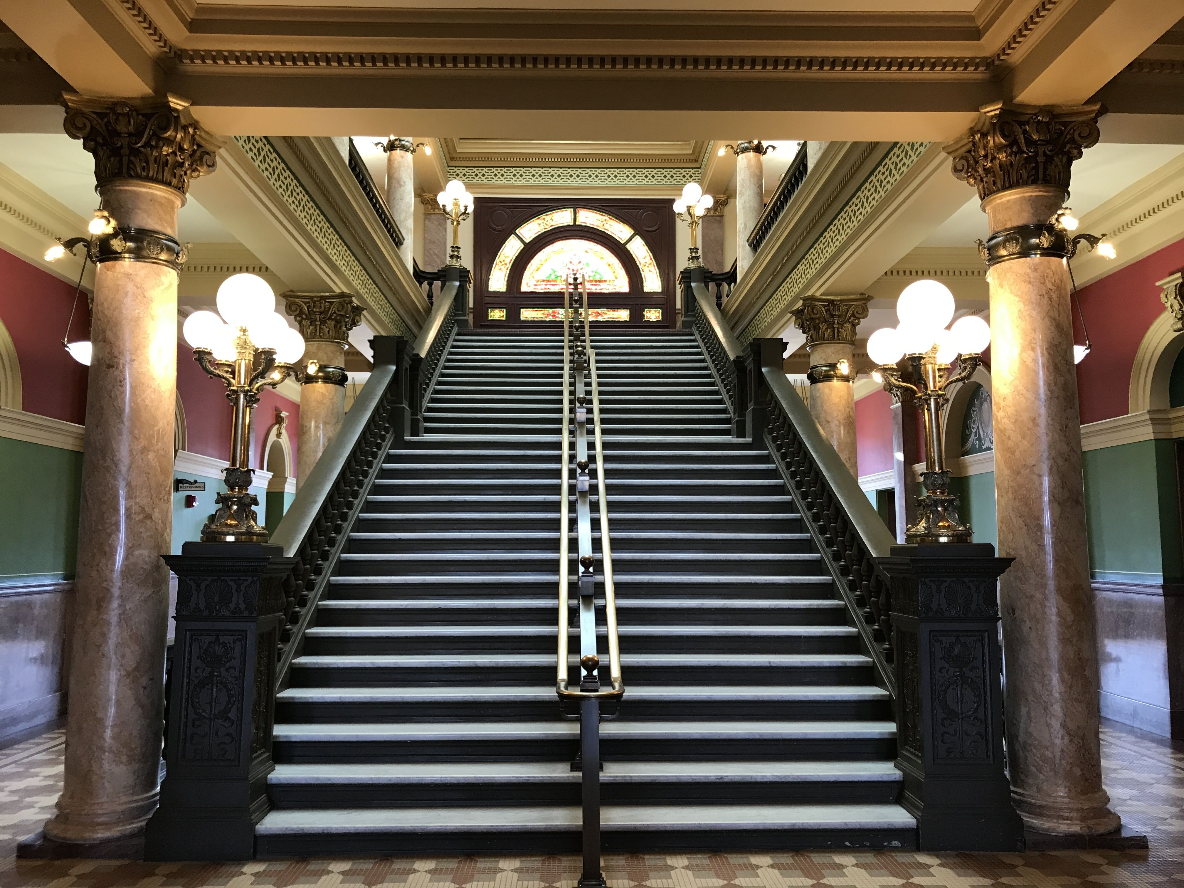
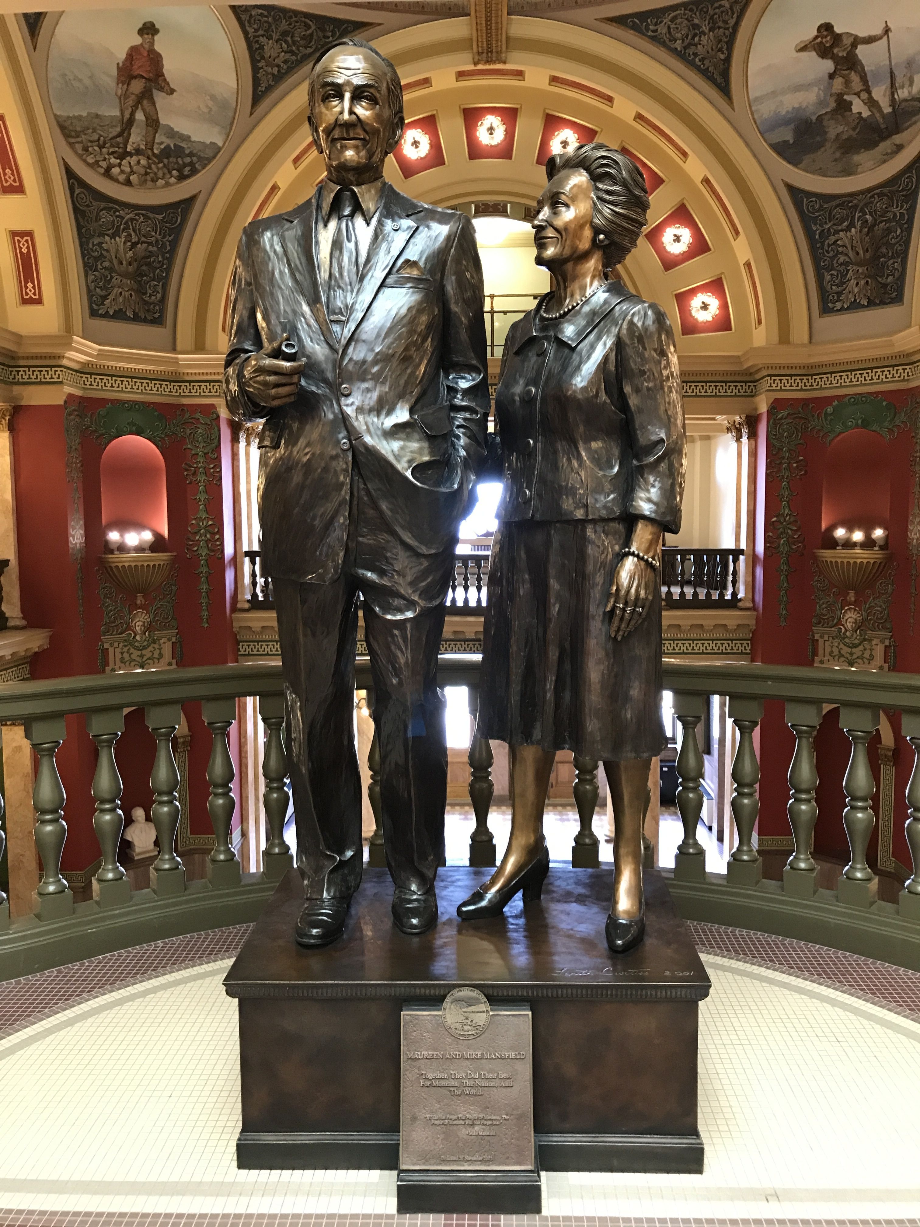
I climbed the Grand Staircase to the next floor,
and was greeted by Mike and Maureen Mansfield.
Mike Mansfield…I knew that name, but couldn’t quite place what he was known for. Is there anyone else out there in the same boat? Again, my preferred source came to the rescue.
Make Mansfield was a politician and diplomat. He served in the U.S. House of Representatives and in the U.S. Senate. He was the longest serving Senate Majority Leader, serving from 1961 – 1977. After he retired from the Senate, he served as the U.S. Ambassador to Japan from 1977 to 1988. He received the Presidential Medal of Freedom, in part for his role in the resignation of President Nixon.
No wonder his name rang a bell!
There was more artwork that honored the state’s history. There were the old times…
and more recent developments.
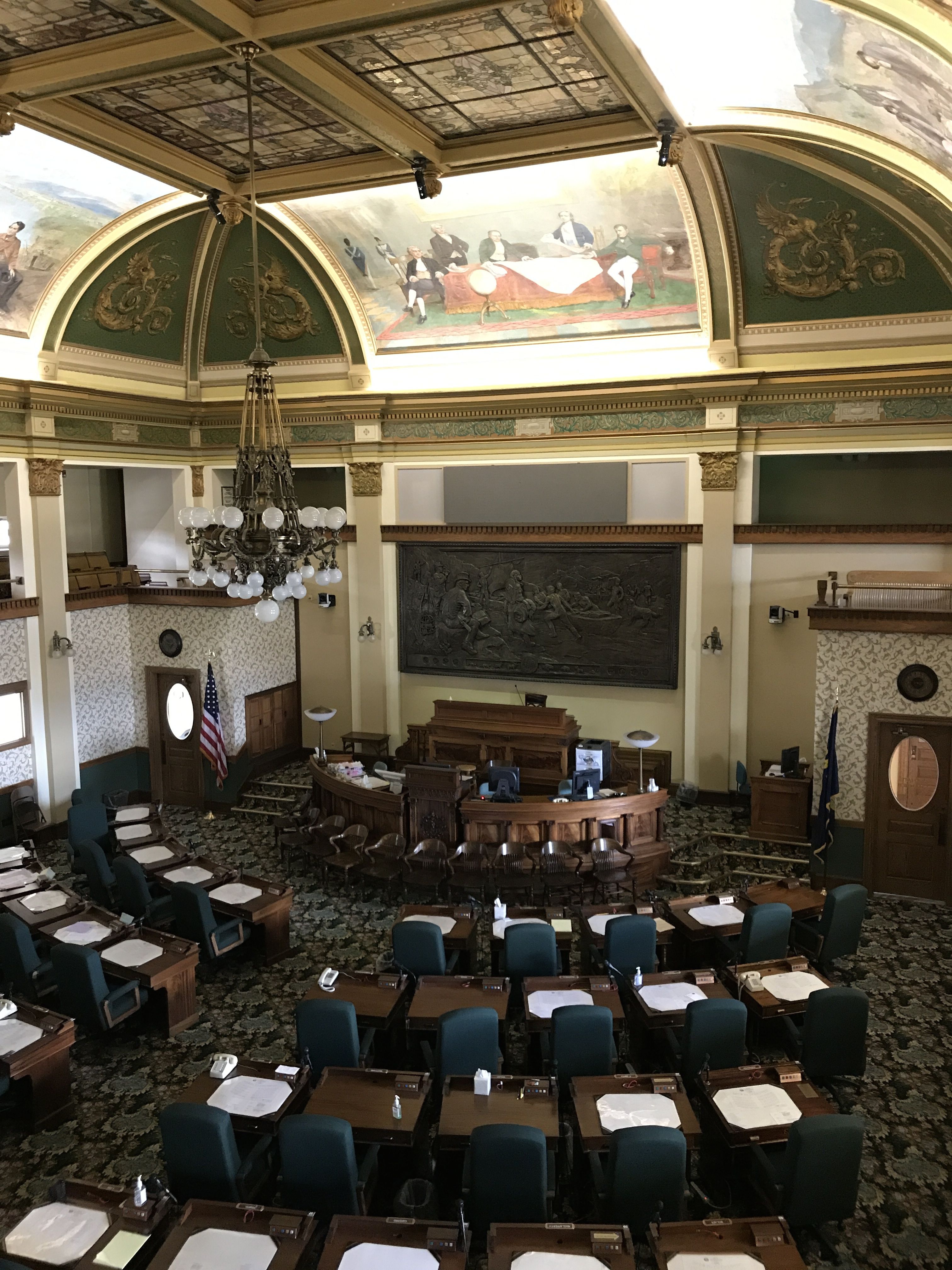
I peeked into the Senate Chamber.
Is anyone else amazed at the idea of four senators sharing one office?
This chamber was identified as the Old Supreme Court. I don’t have a photo of the Legislature Chamber in my files, but I imagine you get the general idea of what it is like. That’s what happens when you wander around capitol buildings by yourself. Sometimes you miss things.
I look out the window and spied Bart waiting for me in the street below.
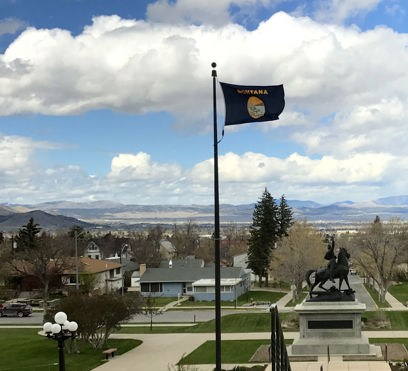
The weather improved while I was indoors. I always relish a blue sky. The wind was really whipping, though.
Incidentally, the equestrian statue in front of the flag depicts Civil War Union General Thomas Francis Meagher. According to several sources, he was a colorful character. In 1864, he took over as governor of the Montana Territory while the legitimate governor was away. He even wrote a constitution for Montana, in the hopes that it would be used if Montana became a state. He drowned under mysterious circumstances in 1867 while waiting for a shipment of guns on a riverboat at Fort Benton on the Missouri River.
Speaking of the Missouri River, I figured that I might as well go pay my respects. After all, the Missouri is the longest river in the United States. It measures 2341 miles, rising in the Rocky Mountains of western Montana before emptying into the Mississippi north of Saint Louis. The Mississippi River is a close second in length, measuring 2320 miles.
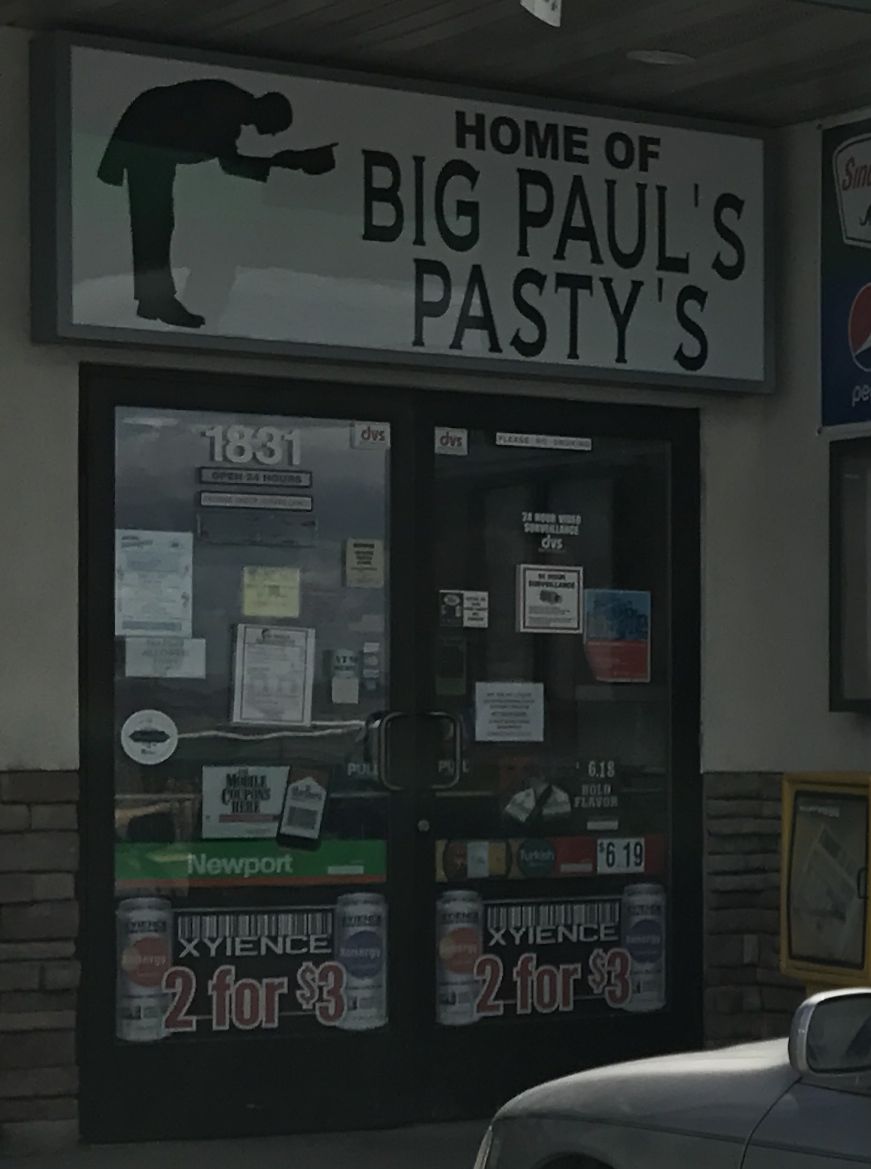
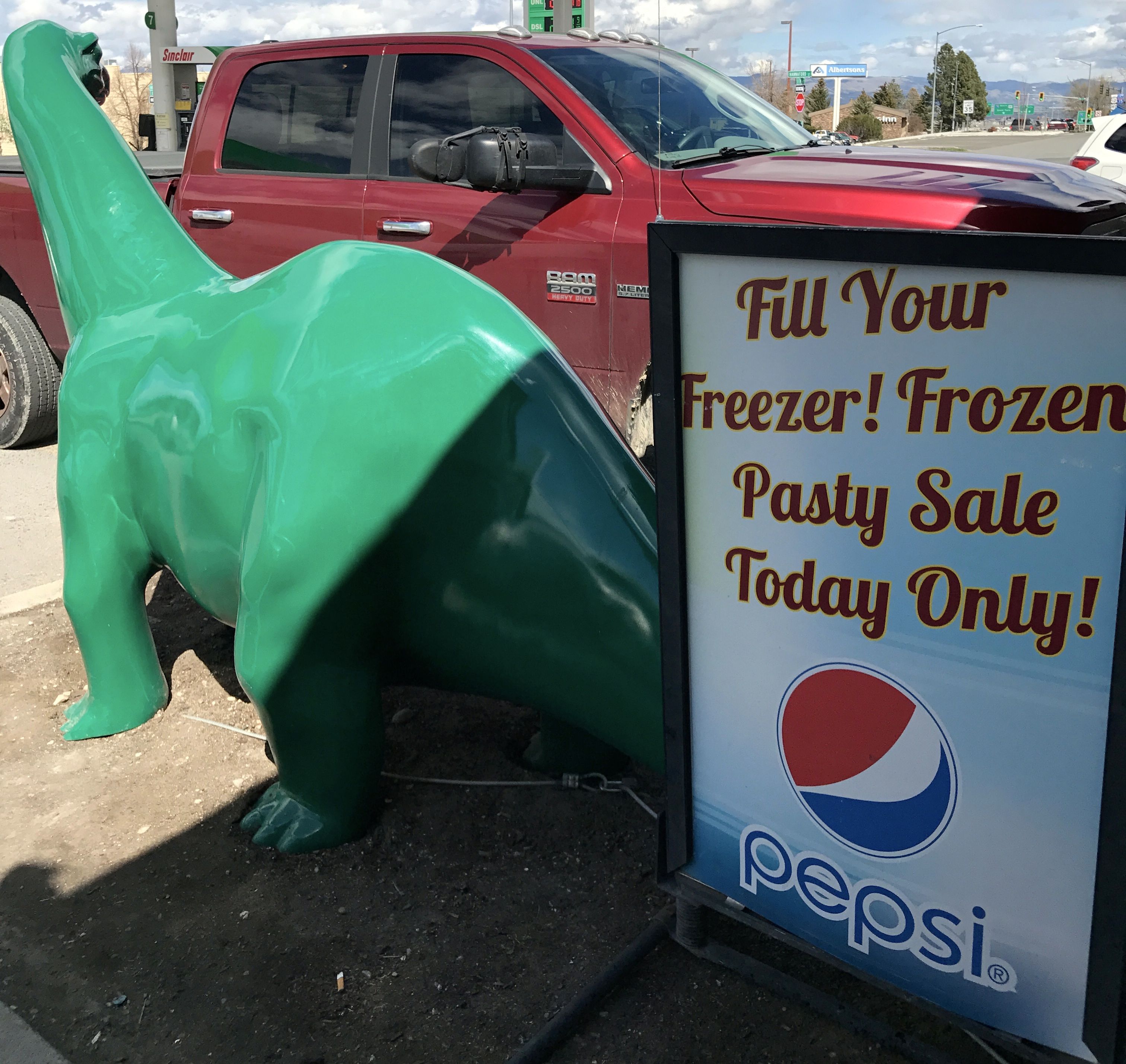
On my way to the river, I saw a sign for Big Paul’s Pasty’s. (ARGH! A misplaced apostrophe!)
Pastys are a food I am familiar with. Cornish miners who came to work in the mines of the Michigan’s Upper Peninsula brought this pastry filled with meat and vegetables with them. In checking to make sure I remembered things correctly, I found out that Cornish miners also settled in Butte, Montana. I guess finding pastys in Helena isn’t as much an oddity as I thought it was.
I circled back and got Bart into a parking spot. Big Paul apparently had a stand inside a gas station.
The signs looked promising. After all, the Frozen Pasty Sale was for Today Only.
Unfortunately, Big Paul didn’t come in to work today, and the clerk didn’t know anything about it. Oh, well. Back to the search for the river.
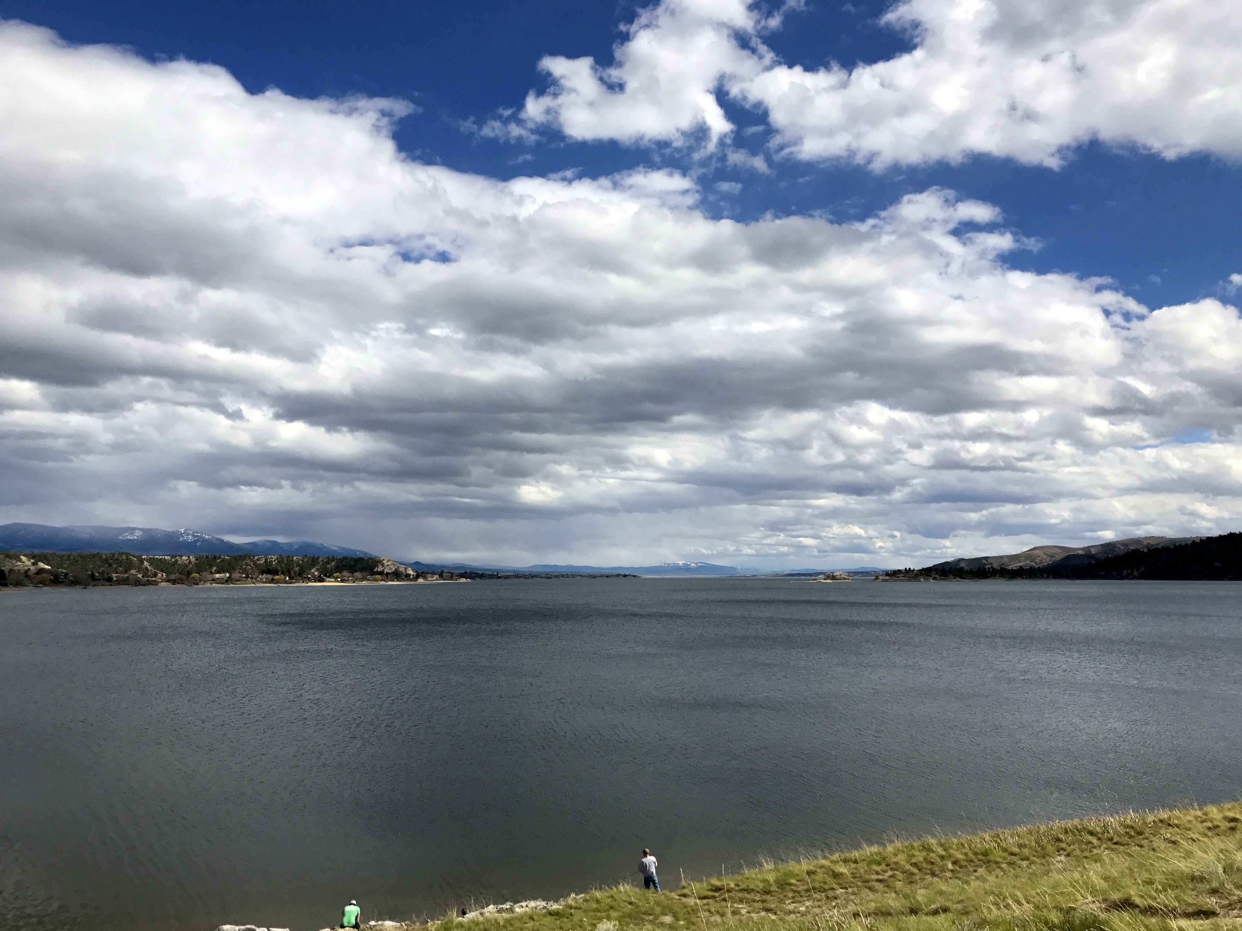
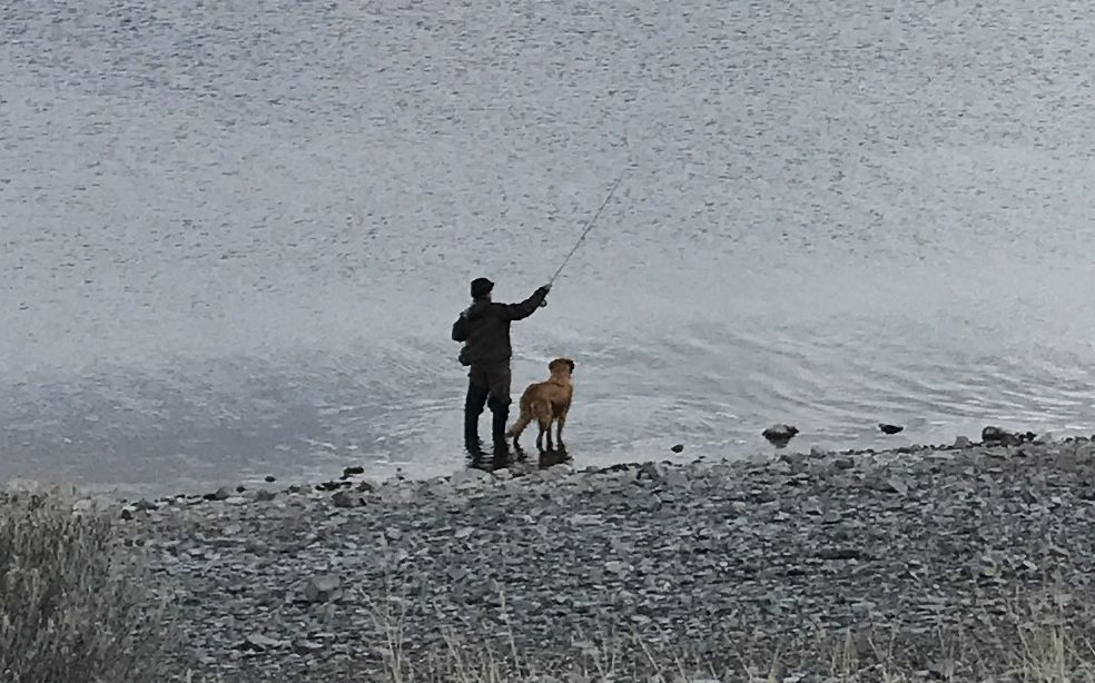
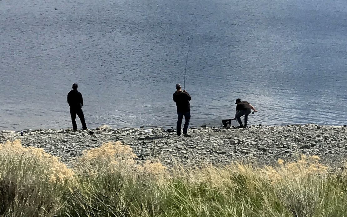
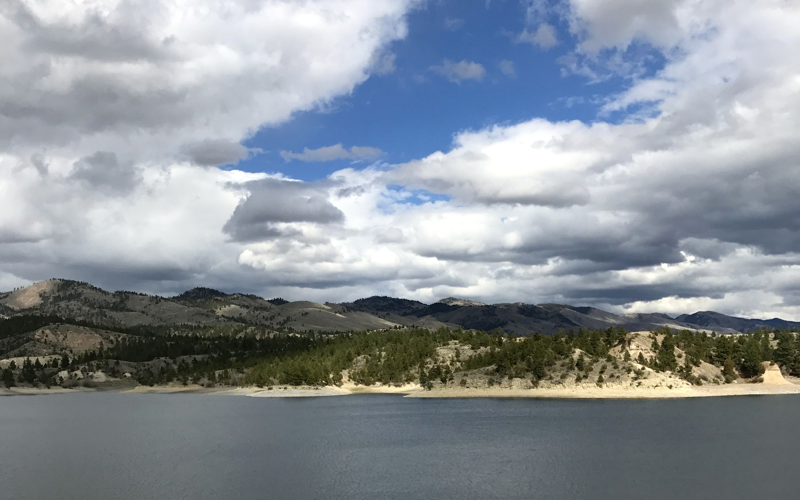
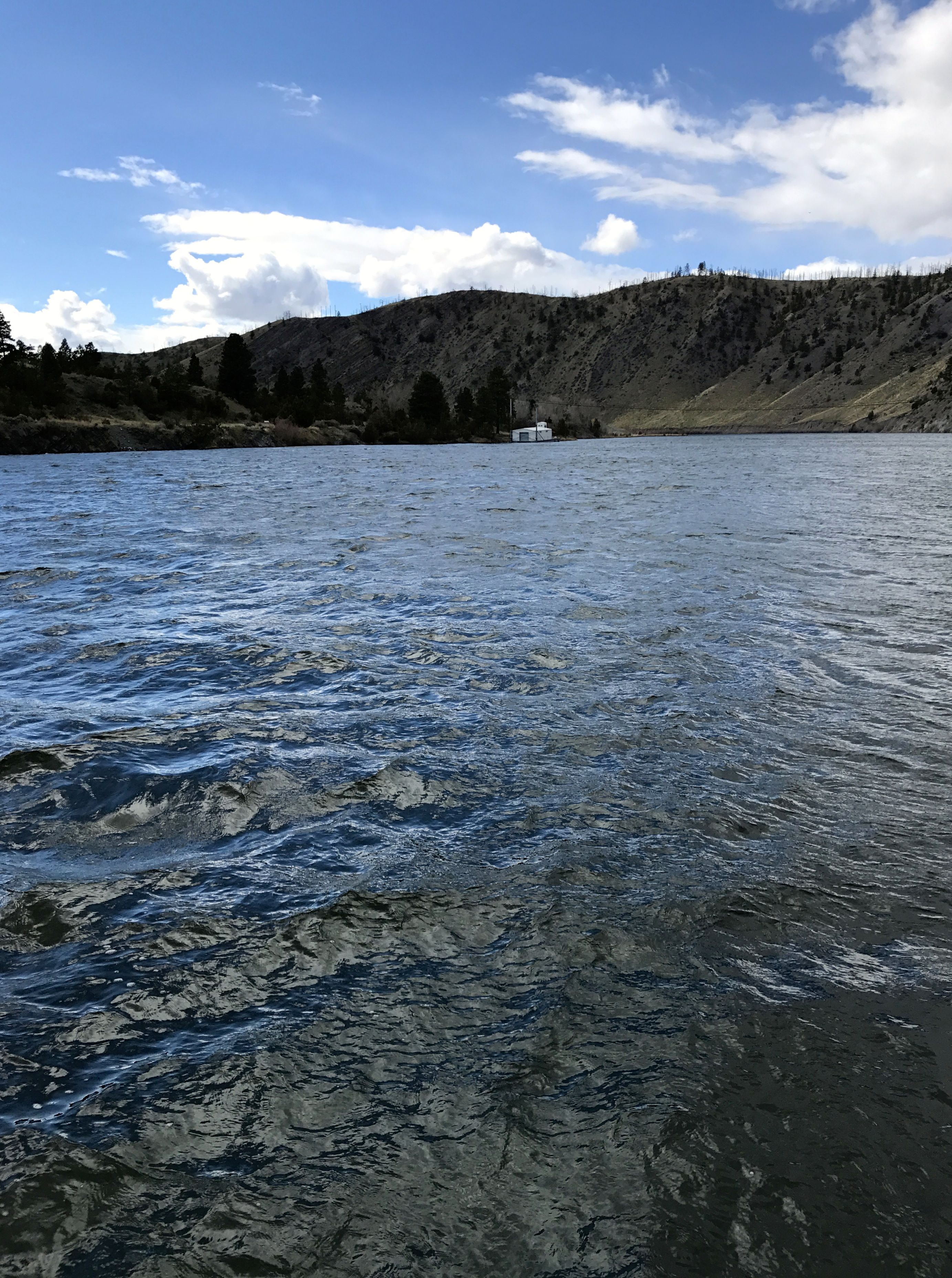
The Missouri River in this spot looks like a large lake. People were fishing and enjoying the day.
One guy was out with his dog.
These guys seemed to have caught something.
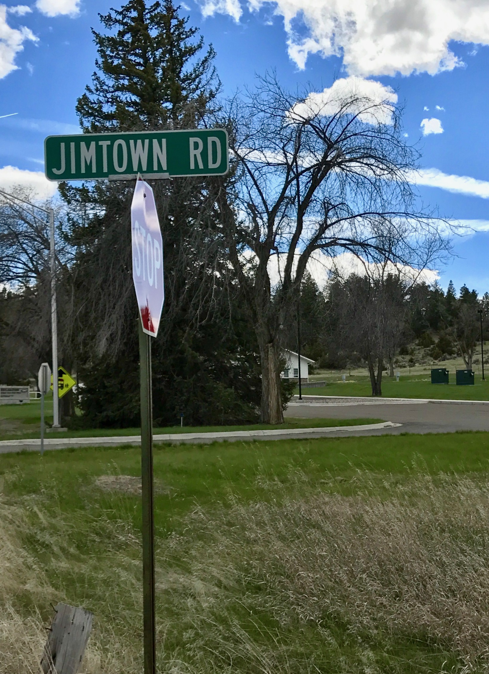
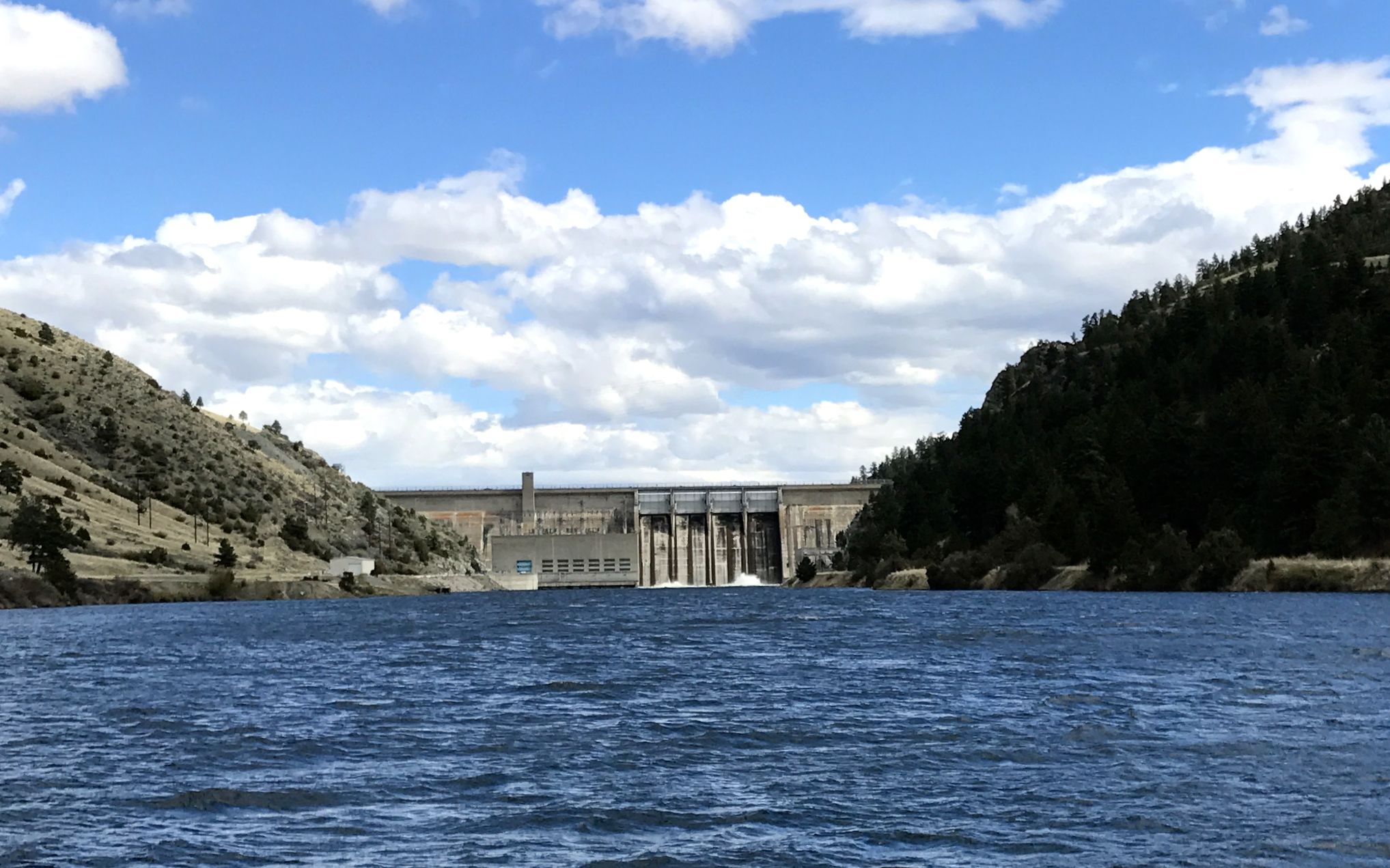
It was really a beautiful area. According to my map, there was a campground down below the Canyon Ferry Dam, so I made my way down Jimtown Road in search of it.
If I remember correctly, the campground was quite inexpensive. I just checked and it is $15 per night, but they don’t have much in the way of amenities. No electricity, but they do have water and vault toilets.
But, if you ever wanted to camp right on the banks of the Missouri River, do I have a spot for you!
What a view!
It was time to get back to the campground – wherever it was – and get ready to head out in the morning. It was time for my final push to the border!
After the scenic fill-up, it was time to head toward Montana.
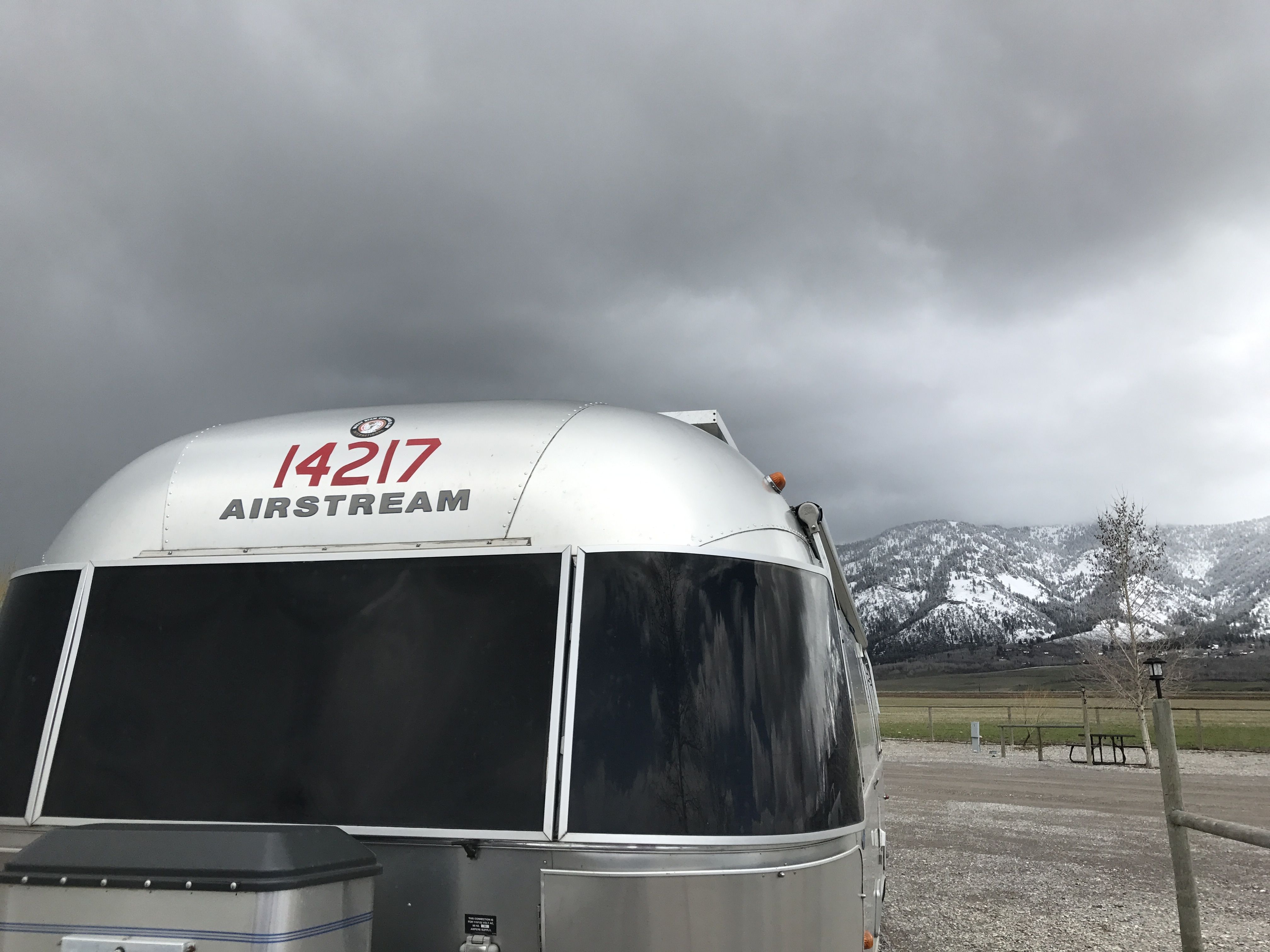
I figure it’s about time for that iconic “Airstream in the rearview mirror” shot.
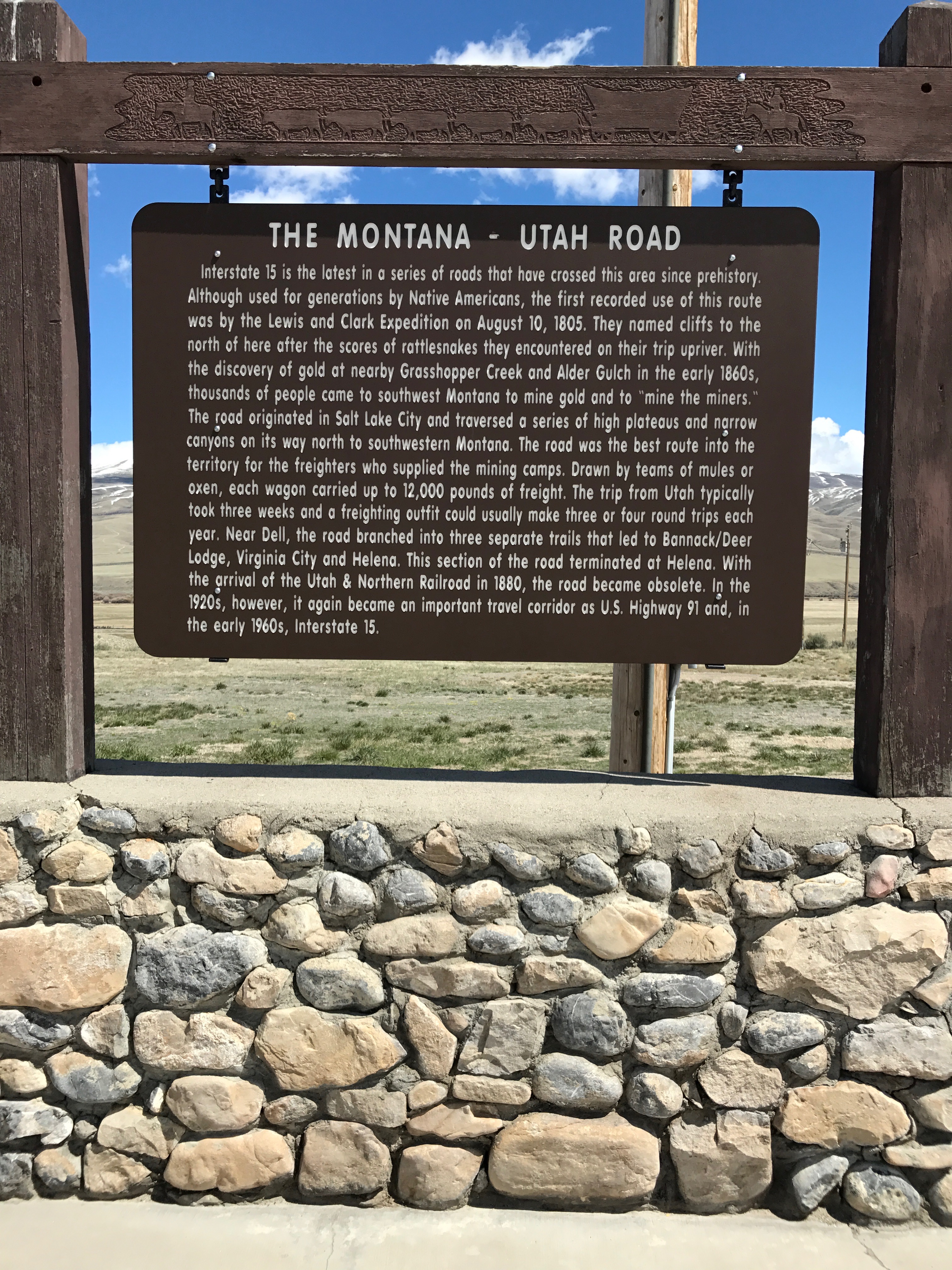
What a glorious day to drive! It was about a four hour drive to Dillon, Montana. I took a break at a rest stop. Of course I had to read the sign.
I was rolling down I-15, which was the latest in the series of routes that have crossed the area since prehistory. According to the sign, the Lewis and Clark Expedition made the first recorded use of this route on August 10, 1805.
Gold was discovered nearby in the early 1860s and thousands of people came to southwest Montana to mine gold and to make money off the miners – “mining the miners” as the signs puts it.
The road originated in Salt Lake City and was the best route into the territory for the freighters who supplied the mining camps. Now, freighters were not boats or trucks, but wagons drawn by teams of mules or oxen. Each wagon carried up to 12,000 pounds of freight, and the trip from Utah usually took three weeks. A freighting outfit could usually make three or four round trips each year.
This section of the road, which terminates in Helena, became obsolete with the arrival of the Utah & Northern Railroad in 1880. It became an important travel corridor again in the 1920s, as U.S. Highway 91 and, in the early 1960s, I-15.
Change is the only constant, I guess.
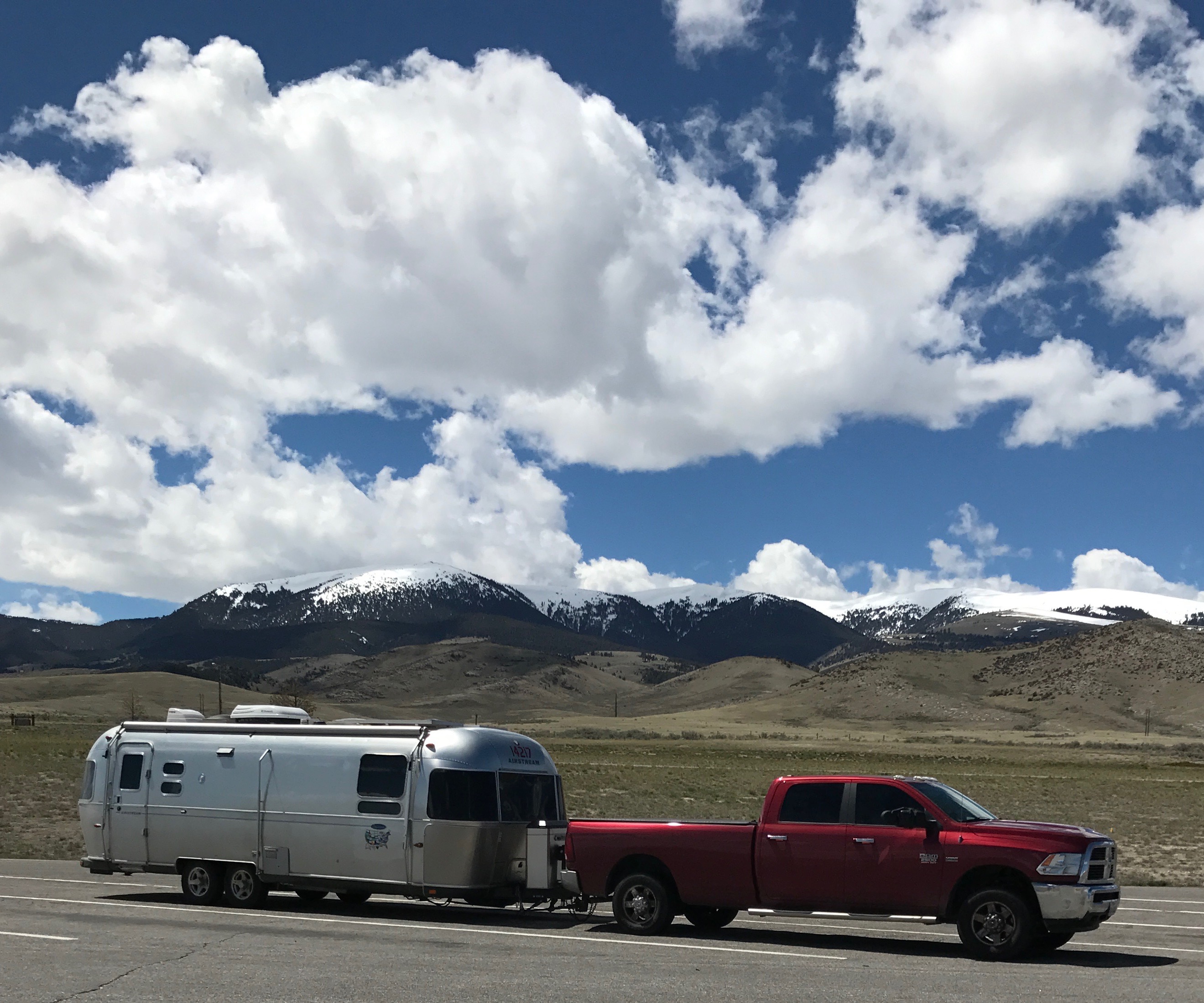
Since I was parked and the sun was shining, it was time for a glamor shot. For some reason, I didn’t take too many of them. Some Airstreamers have great shots of their rigs in the most scenic locations.
I pulled into the Countryside RV Park, just outside Dillon. As you can tell, it was early in the season. This park had a unique feature – they had a DVD library. And these DVDs were of fairly recent movies. I did check one out, but I don’t remember what is was or if I watched it.
The site was level and it was a pull-though site! I unhitched and got ready to go see what I could see.
HISTORY Here told me that there was a significant landmark I just head to see. This is Beaverhead Rock.
Can you imagine what an important landmark this must have been when the tribes would traverse the land?
The day after they arrived, Sacagawea’s brother, Chief Cameahwait, who lead lead a group of Shoshone warriors, met up with Sacagawea and Lewis and Clark. He told them of a river that ran near the village. According to tales from other tribes, it ran a long distance to the West and ended in a large body of water. This was the first indication of a route that could lead to the Pacific Ocean. Sacagawea’s brother, Chief Cameahwait, traded with the expedition and supplied them with the horses necessary to continue.
HISTORY HERE has lead me to some interesting places that I wouldn’t have found otherwise. Sometimes the information about these places is a bit inaccurate. This land formation was identified as Beaverhead Rock National Park and it gave an address. I put the address in Google maps and headed that way.
Now, Google maps identified the location as a state park. When I got there, there were no signs identifying it as anything.
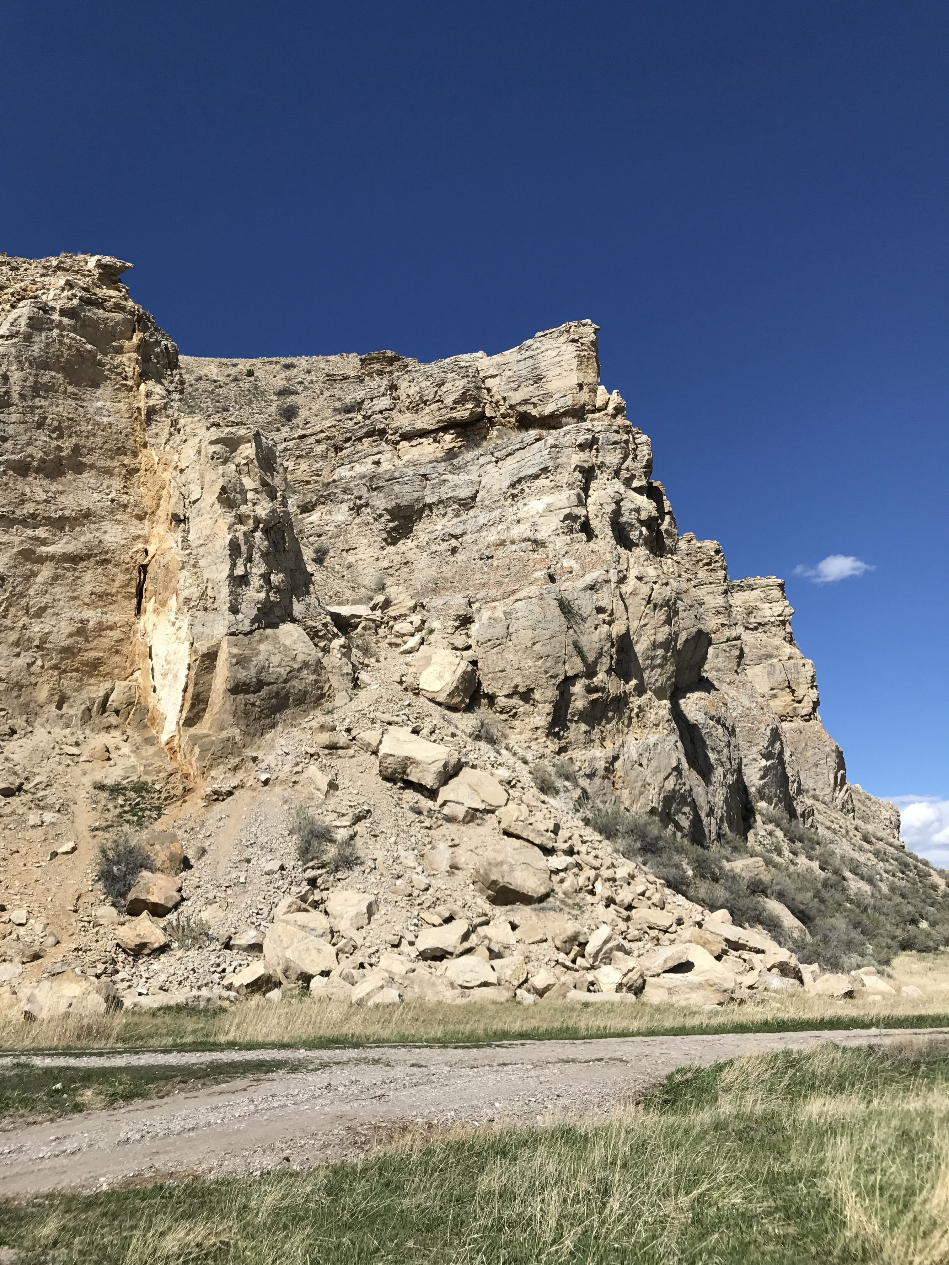
I drove in on the road around the base of the rock.
Can you believe how blue the sky is? After months of gloomy grey clouds, this was a most welcome sight! I drove over a small river, which was identified as Beaverhead River, but there was also a smaller creek near the base of the cliff.
According to some information I picked up, these lands have yielded some of the best North American discoveries of the fossils of small mammals that lived at least 37 to 38 million years ago. Some of the species that have been found here were new to science and still haven’t been found elsewhere.
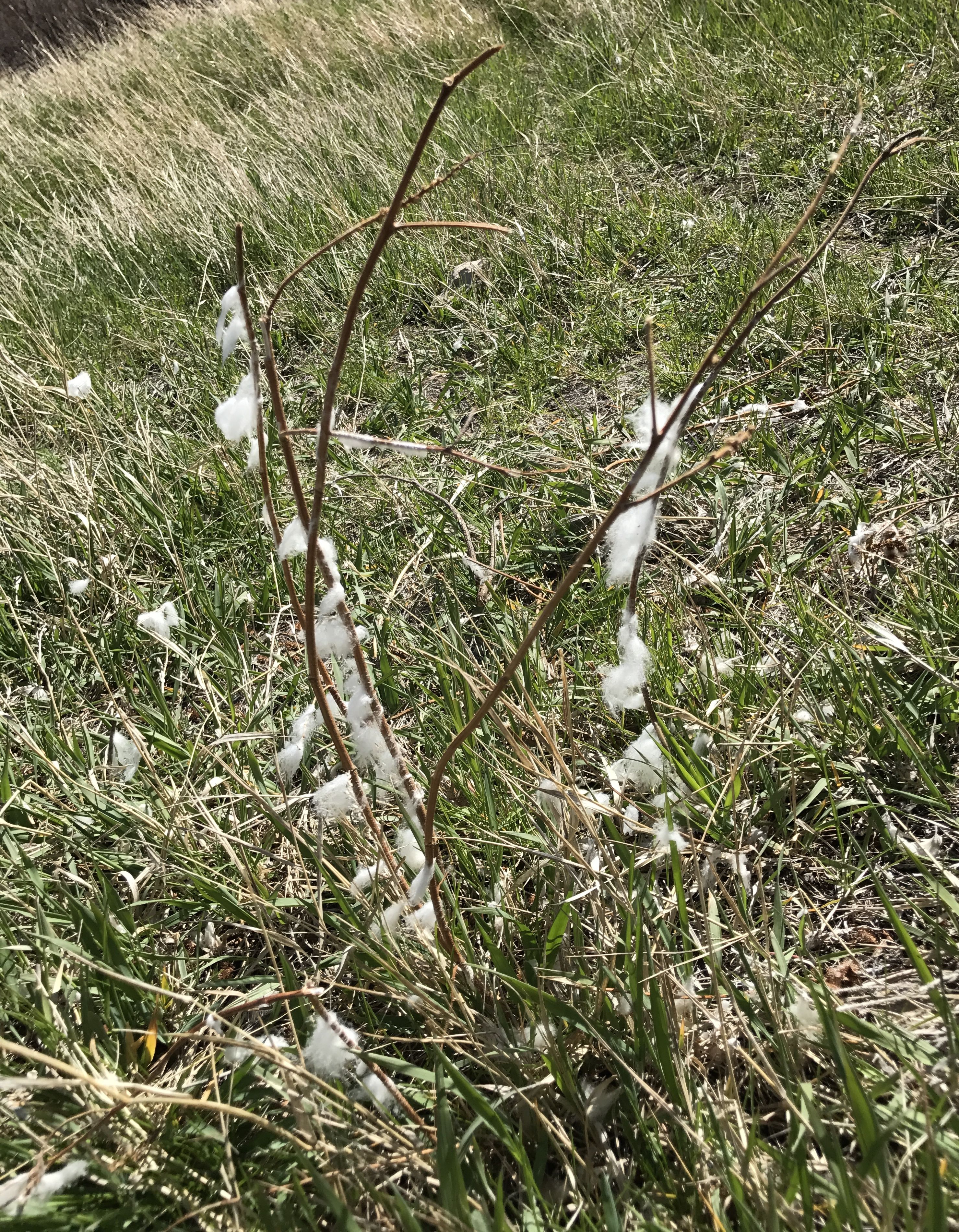
This land is used primarily for ranching. Judging by the wool on the grasses and shrubs, this area is used for sheep.
I could have driven in farther, but I could see that this wasn’t really a National Park or a State Park. I might have been trespassing, so I decided to head back to Dillon.
As I got to highway 41, I had a beautiful view of the snow-capped mountains. In the distance – I like that the snow is in the distance!
There was an overlook that honored the sandhill cranes that frequented the wetland.
I headed back to town to see what I could see.
It was a nice little town.
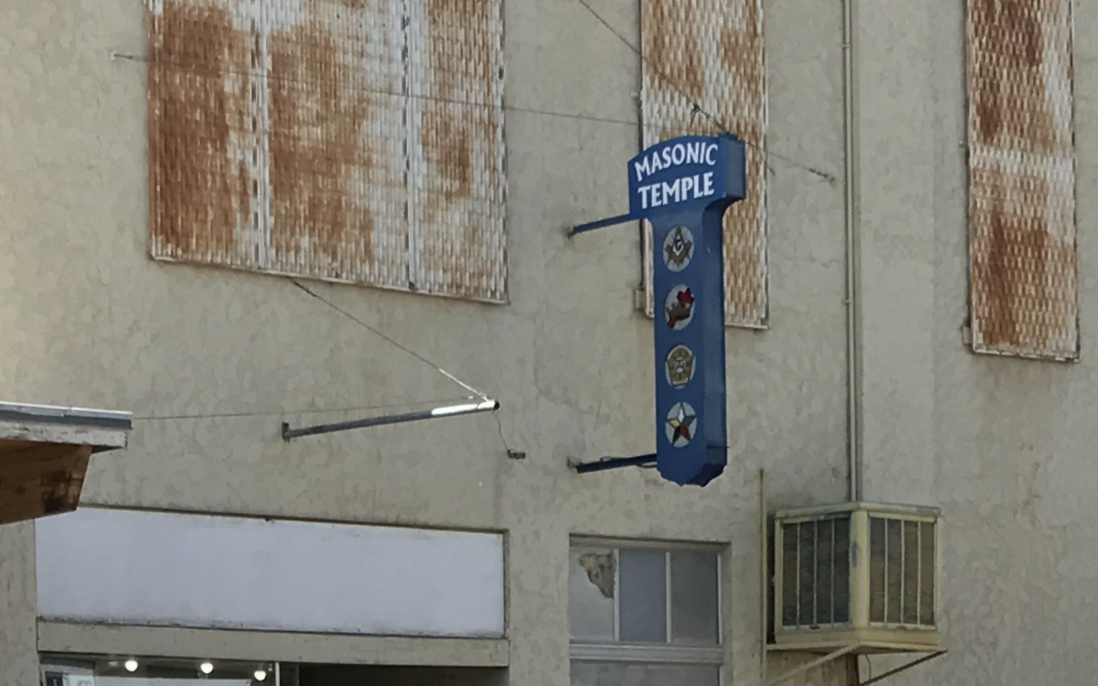
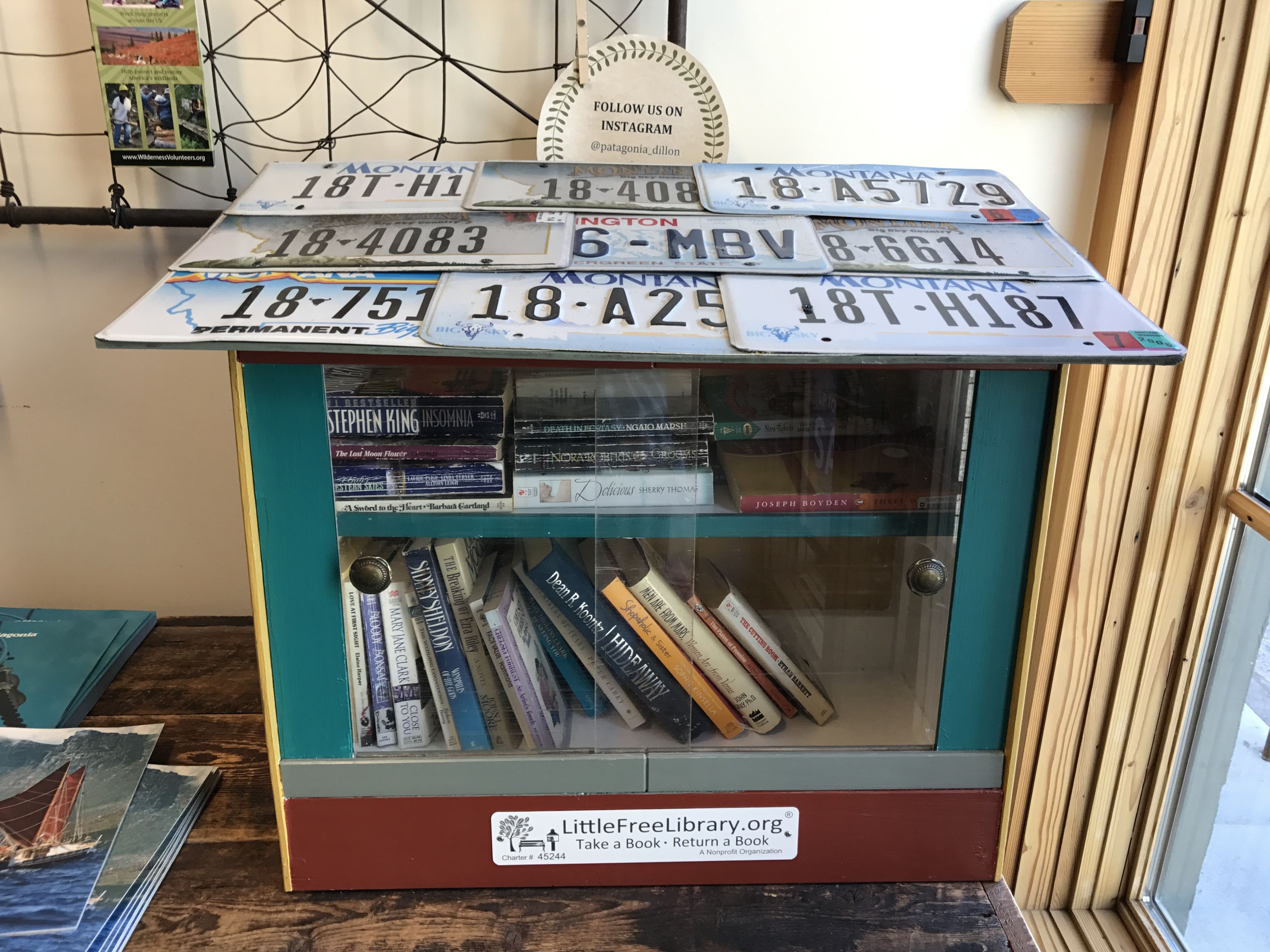
It had the requisite Masonic Temple. It also had a Patagonia Outlet store! It didn’t seem like the kind of place that would have that sort of merchandise. I mean, they were having a sale on the outlet prices – and the price tags still left me breathless.
I loved the fact that they had a Little Free Library right in the store.
I headed back to the RV park. How wonderful to look out the windows and not see rain!
I stuck Montana on the map, had a little dinner and got ready to roll again in the morning.
Or, should I say for a cold little minute? It was anything but hot while I was there.
In my quest to visit each of the lower 48, some states got short shrift. Wyoming was one of them. When I added my trip to Alberta and Saskatchewan to my itinerary, I needed to pass through some places rather quickly. The weather was on the cool side, so I wasn’t planning on many outdoor actives.
All right, the weather was actually cold. I had on the warmest clothes I owned.
I looked for the closest campground with hook ups that I could find and I called to make a reservation. Given the time of year, and judging by the number of empty sites – just about all of them – I don’t think I needed to call ahead.
Good bye, Idaho! See you later.
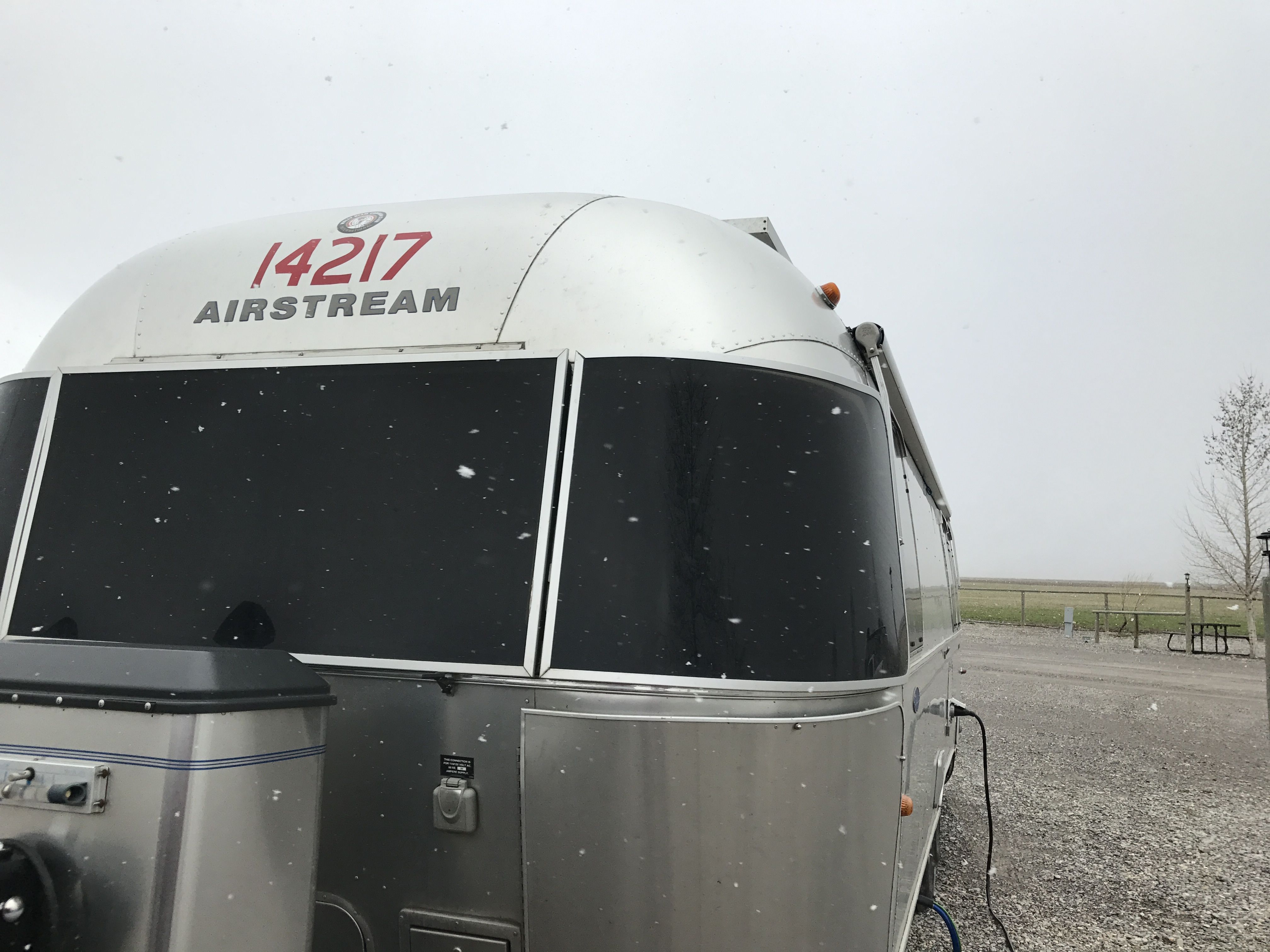
I made it to the campground and got settled in between squalls.
It was amazing watching the bands of snow sweet in over the mountains.
The snow would just sweep in and make things disappear. If you look at the photo carefully, you can see the flakes flying through the air. I was thankful that I had a heated water hose.
Not a lot fell, but still, that’s SNOW on Flo!
There wasn’t a lot in the area open. I settled in and made some chili, did some puttering around and took care of business.
I did my laundry.
I took a shower.
Good showers and an on-site laundry are amenities I like. You can keep your shuffleboard court and miniature golf.
The next day, the skies cleared.
What a difference a day can make!
I added Wyoming to the map and set out for Montana.
Along about now, my travel plans were solidifying, but they would require a lot of driving and not a lot of activities at each stop. I decided that since I was so “close” I really wanted to get to my mother’s hometown of New Norway, Alberta, which was more that 1000 miles from Boise. If you want to go metric, that’s more than 1600 kilometers.
I picked Idaho Falls as my next stop. I had a few contacts in Idaho, and I was able to meet up with two out of three of them. Oddly enough, I had never met any of them in person! These were all people I had met though Facebook groups or connected to other people I know.
My next stop was Idaho Falls, where I was going to meet Kelly and Todd for dinner.
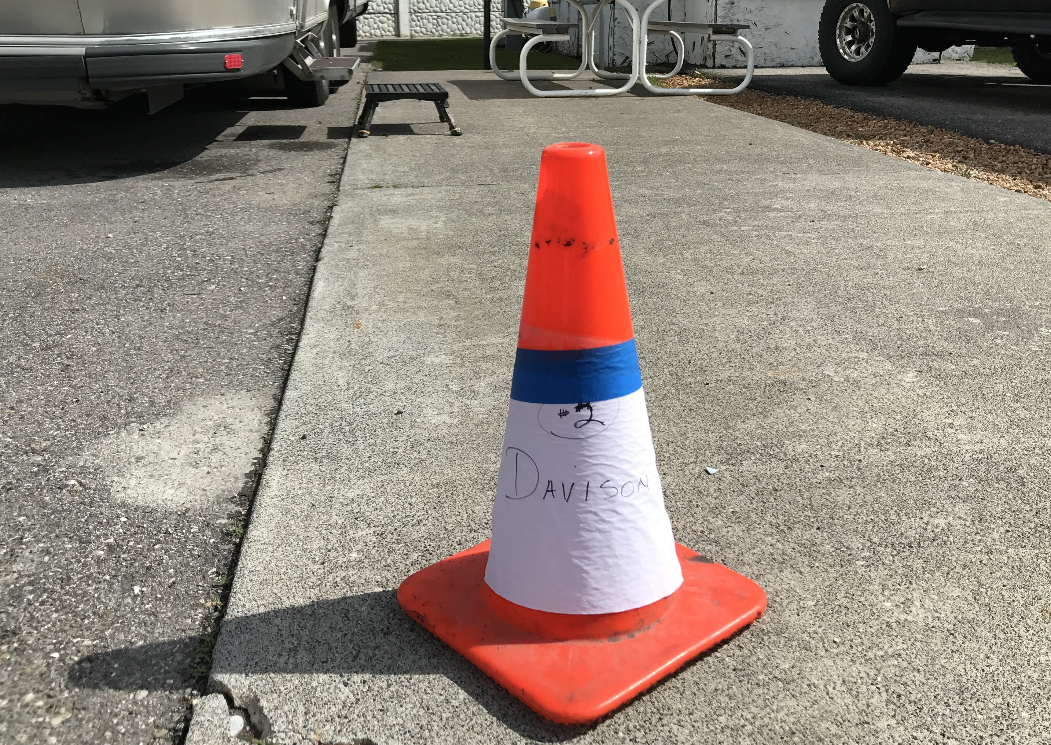
I hitched up and pulled out. I had managed to locate a nondescript RV park that seemed to cater to transient workers and permanent residents. It was the kind of place that wouldn’t likely have had shuffleboard courts and swimming pools, but it was a place to stop and it was good enough.
It was a friendly place. They even had a cone set out with my name on it so I could find my spot.
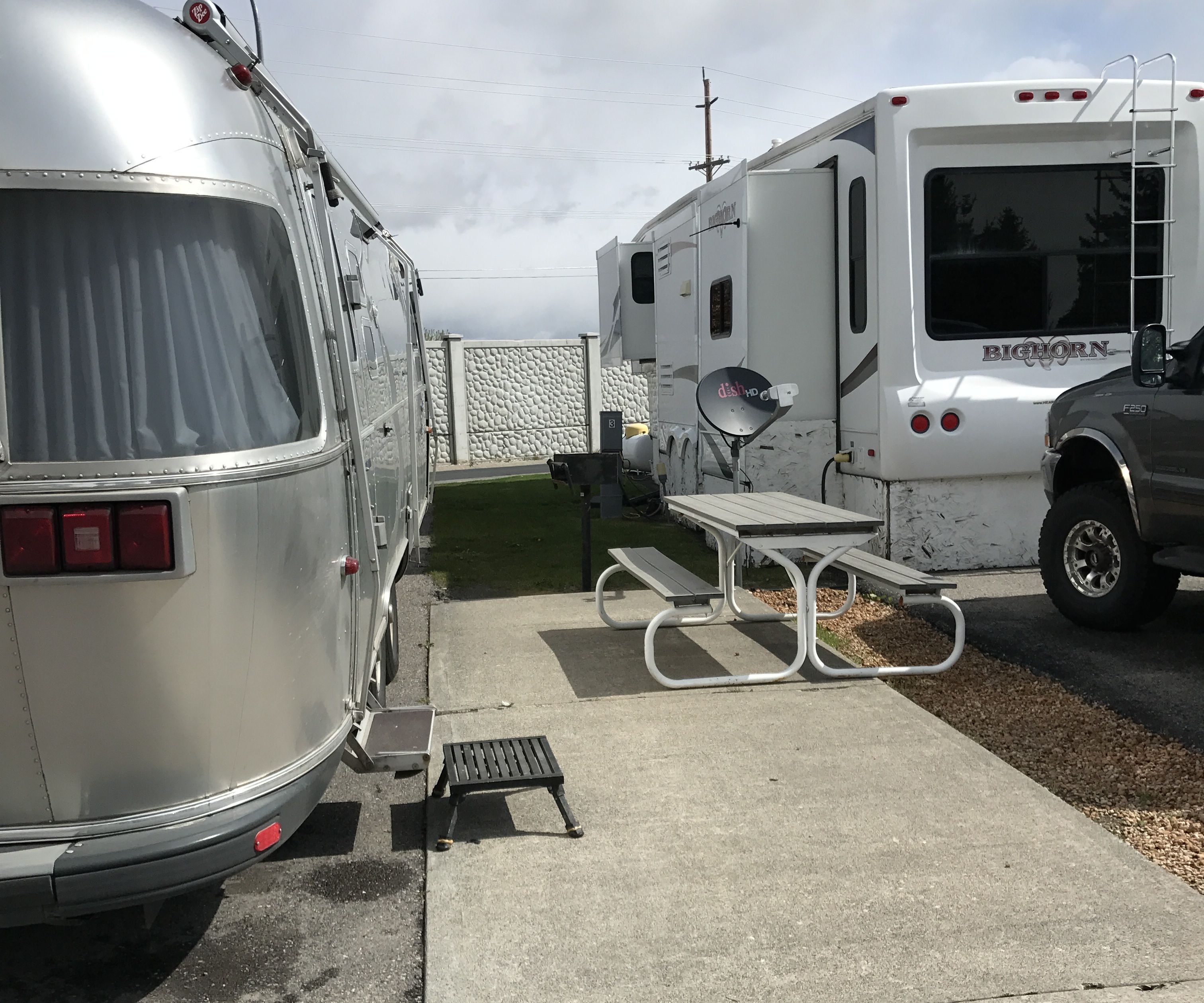
The sites were a bit close together, though.
I set out to see what I could see in Idaho Falls. First stop: the falls!
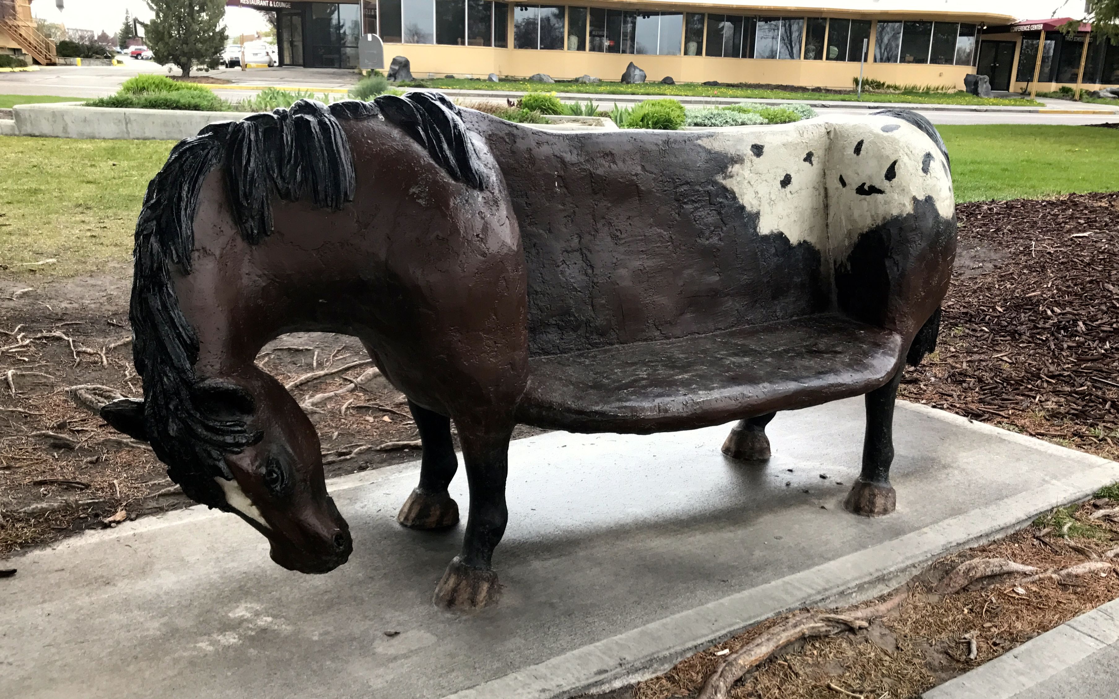
To get there, I drove over to the River Walk and strolled a bit. What captivated me were the interesting benches.
I particularly liked this horse bench. It looked like a great place to sit on a warm, sunny day. (This was not a warm sunny day.)
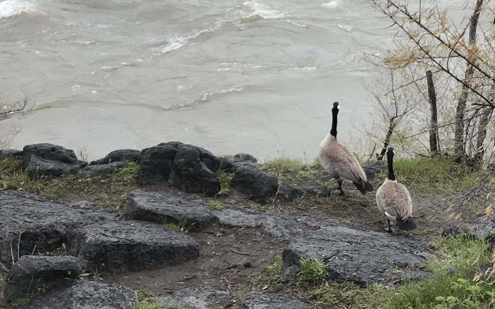
There was a goose bench.
In fact, there was a flock of them!
They kind of went along with the geese that lived in the area.
The fish bench probably reflected fish that lived in the Snake River.
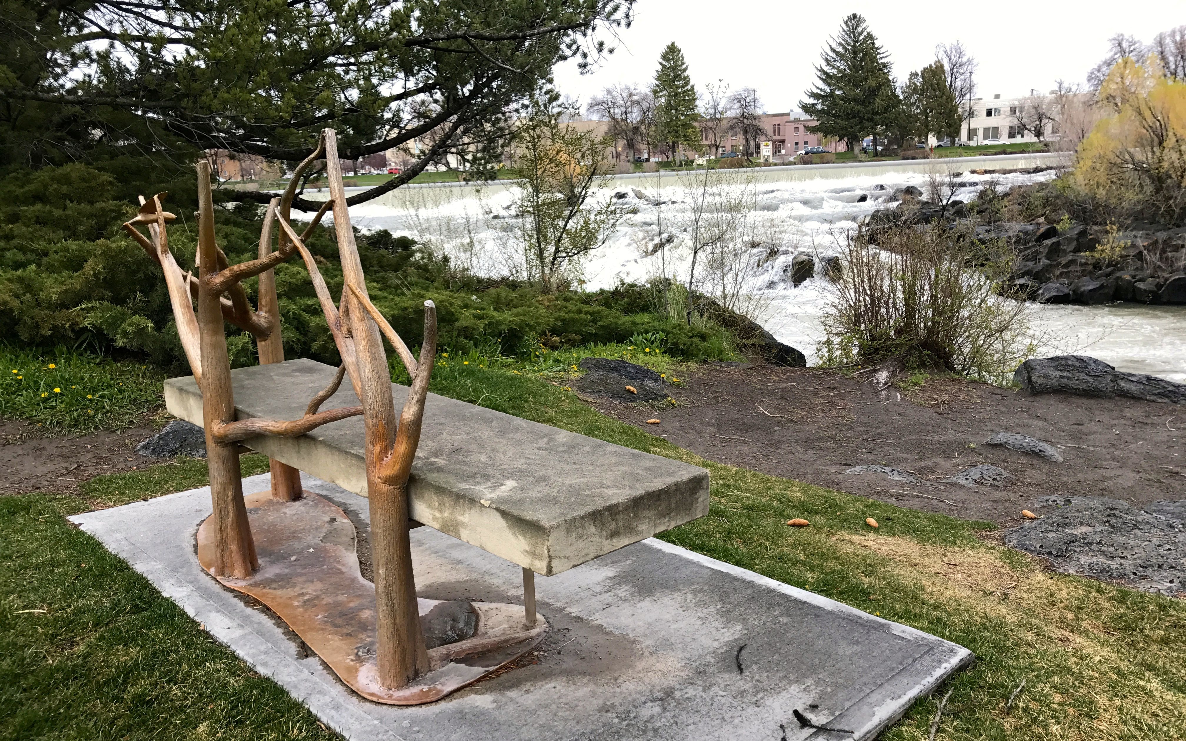
I liked the bench that honored the branches that get washed down river. With the extra flow in the river at this time, I imagine that there were many branches floating along.
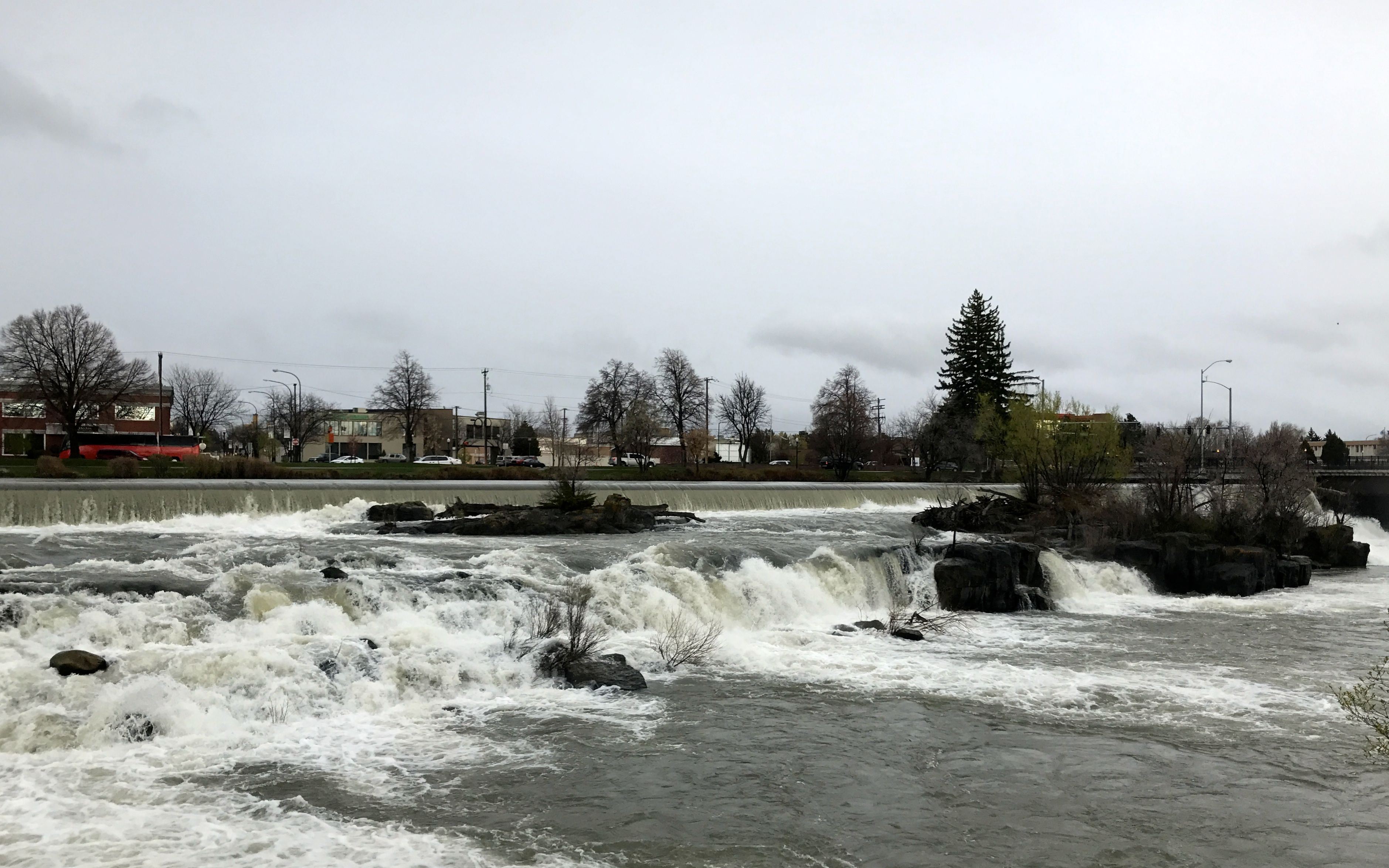
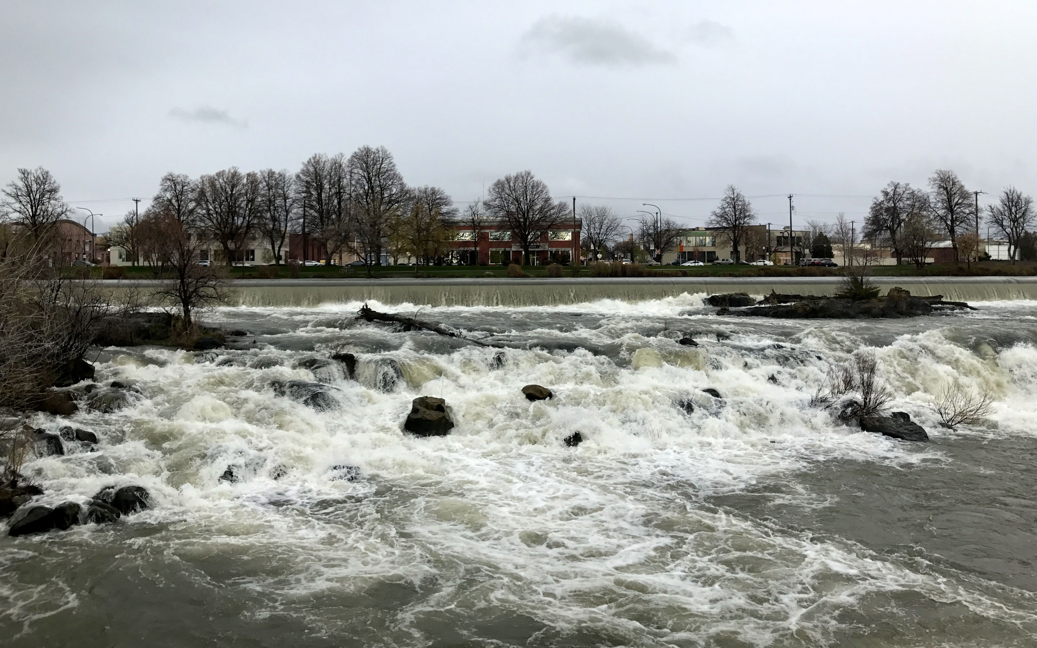
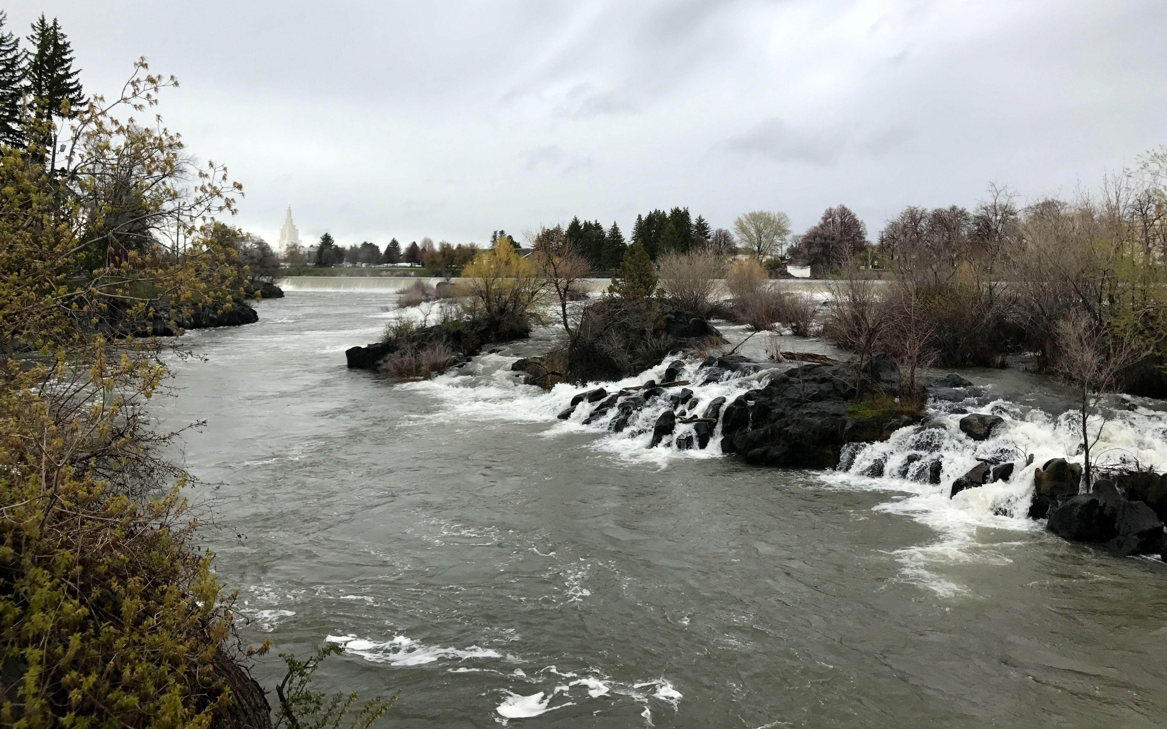
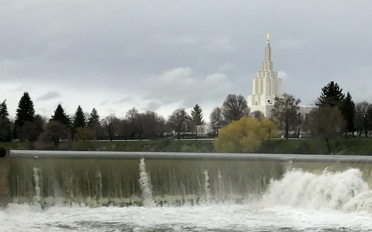
I came to the falls, which are really a series of small falls.
The power of the water is noticeable.
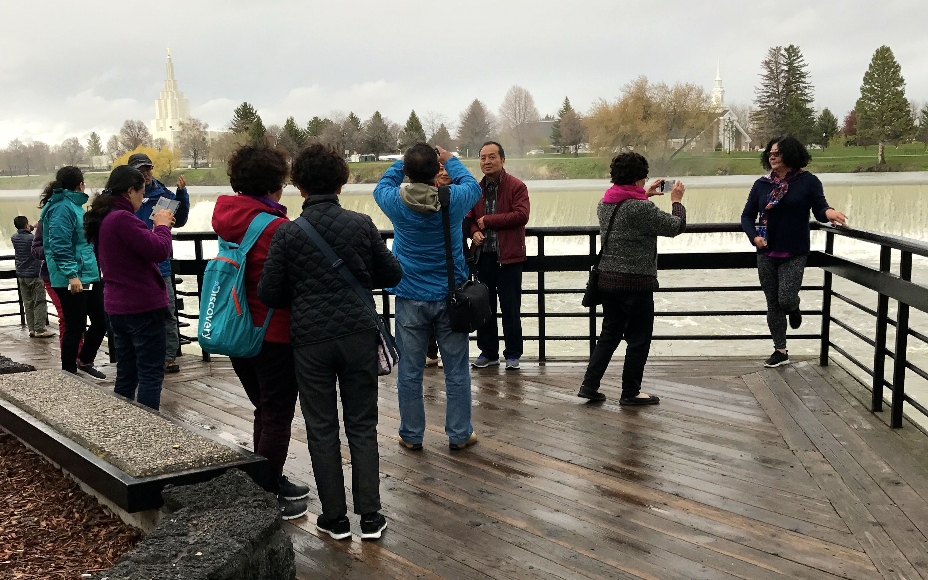
There was a tour group present when I was there, and they were all happily snapping photos of each other in front of the river.
Across the river, you can see the temple. There is a strong Mormon presence in Idaho.
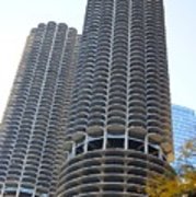
I wish I had had time to walk into the lobby of this hotel and check it out.
It sure did remind me of the Marina Towers in Chicago.
chicago-twin-corn-cob-building-sheela-ajith.jpg
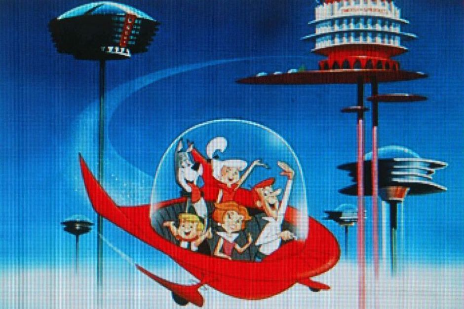
Which also reminded me of the Jetsons…
And with that, my tour of the River Walk was complete. It was time to head over to meet Kelly and Todd.
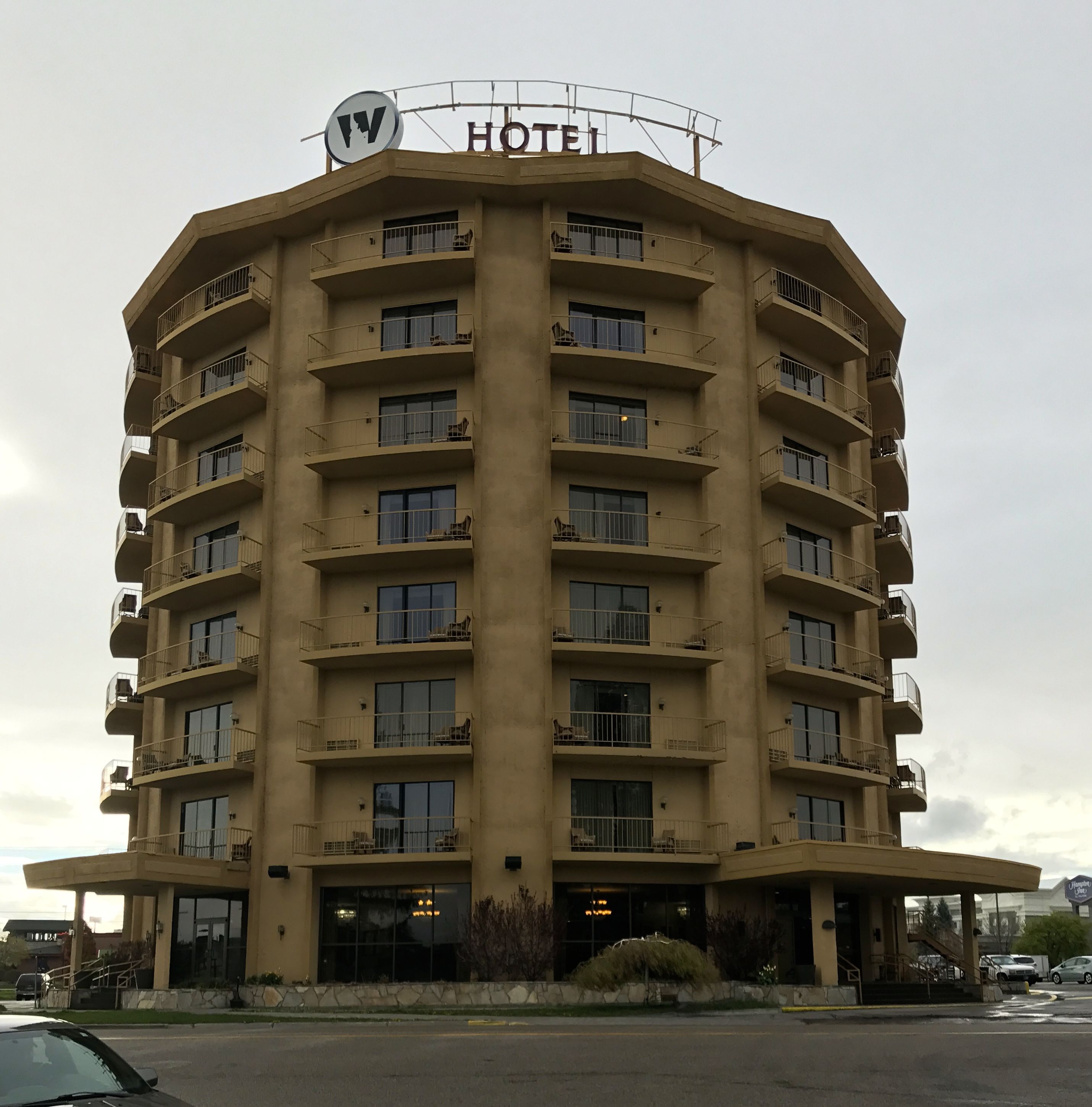
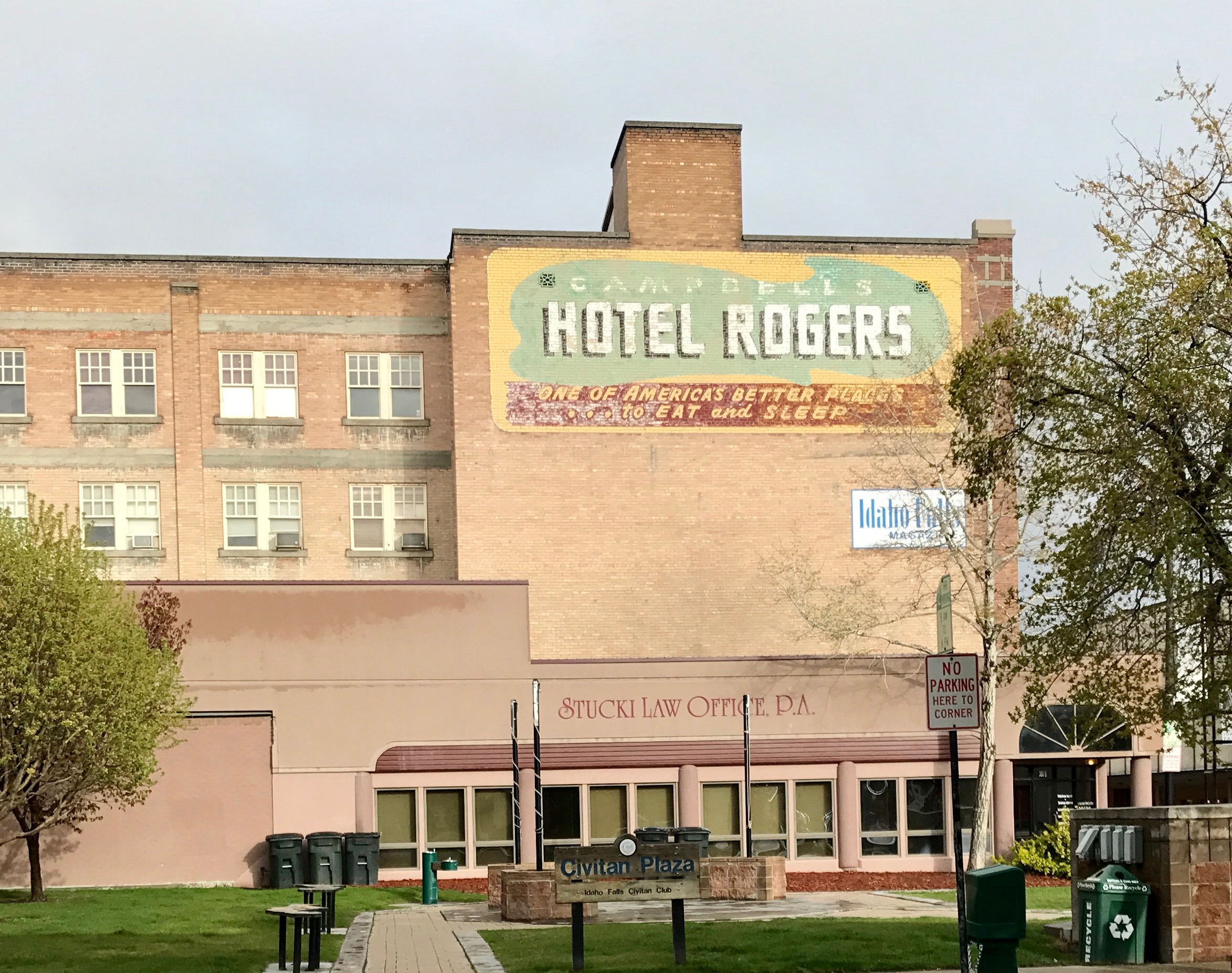
I parked near the former Hotel Rogers.
Incidentally, did you know that there is a term for these old, peeling signs for defunct businesses? They are called ghost signs . While on my travels, I read some article or other that talked about how much money preserving these old signs pumped into the local economy. Apparently, many people will come to take photos of these remnants of the past and spend money in the community while they are there.
But, I digress yet again.
The food was good, as I remember, but what was even better was conversation with these lovely people. Before I knew it, it was time to head back to the silver ranch and get ready for another day.
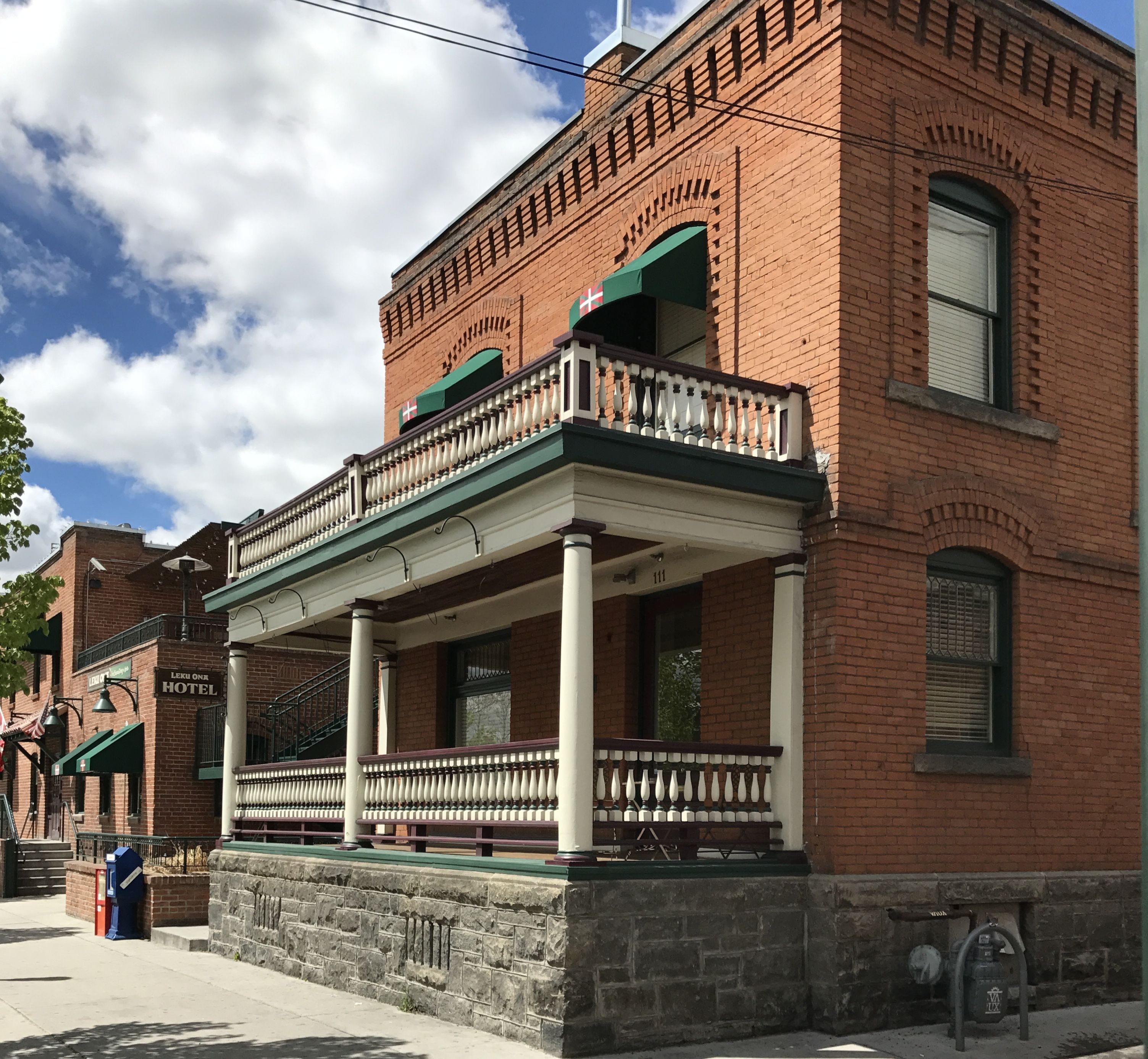
One of the unexpected things I found in Boise is that it had a lot of Basque settlers. Although there are larger populations of Basque-Americans in the United States, Boise’s is the most concentrated. There is a “Basque block” in downtown Boise, with a museum, cultural center, restaurants and a market.
I decided that I couldn’t be cultural on an empty stomach, so I put lunch at that top of my “to-do” list.
I located Hotel Leku Ona, and decided that it looked like it was worth a shot.
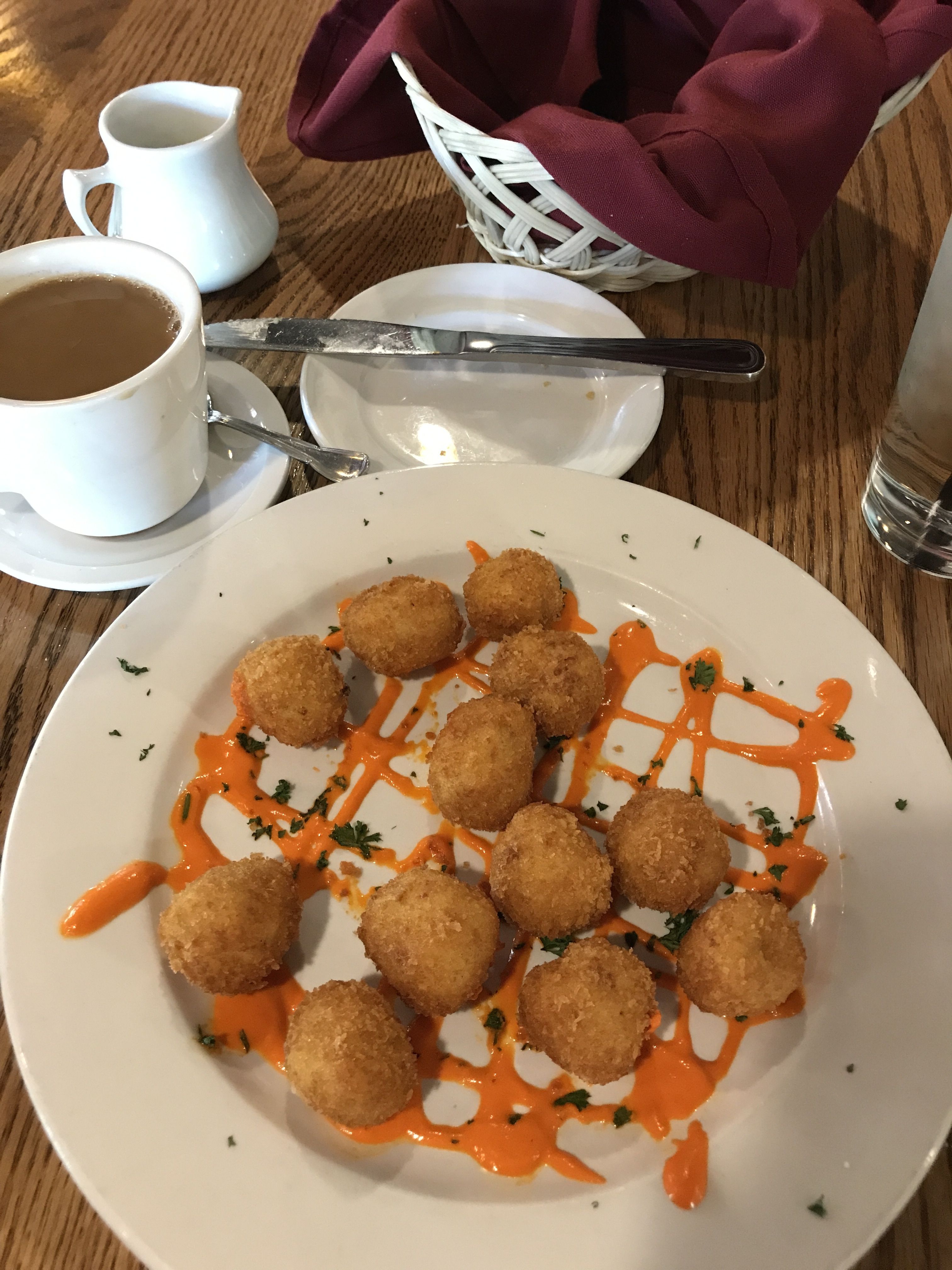
As an appetizer, I ordered croquetas, just like mamá used to make.
Seriously, when I did my Junior Year…uh, Semester…Abroad, the woman whose house we stayed in did make use croquetas for dinner. I hadn’t had them since 1976. (In case you have never heard of croquetas, here’s some information.)
It was kind of a lot of food, but I don’t get into restaurants that offer these two dishes all that often. I did pack up some of the tortilla and took it with me.
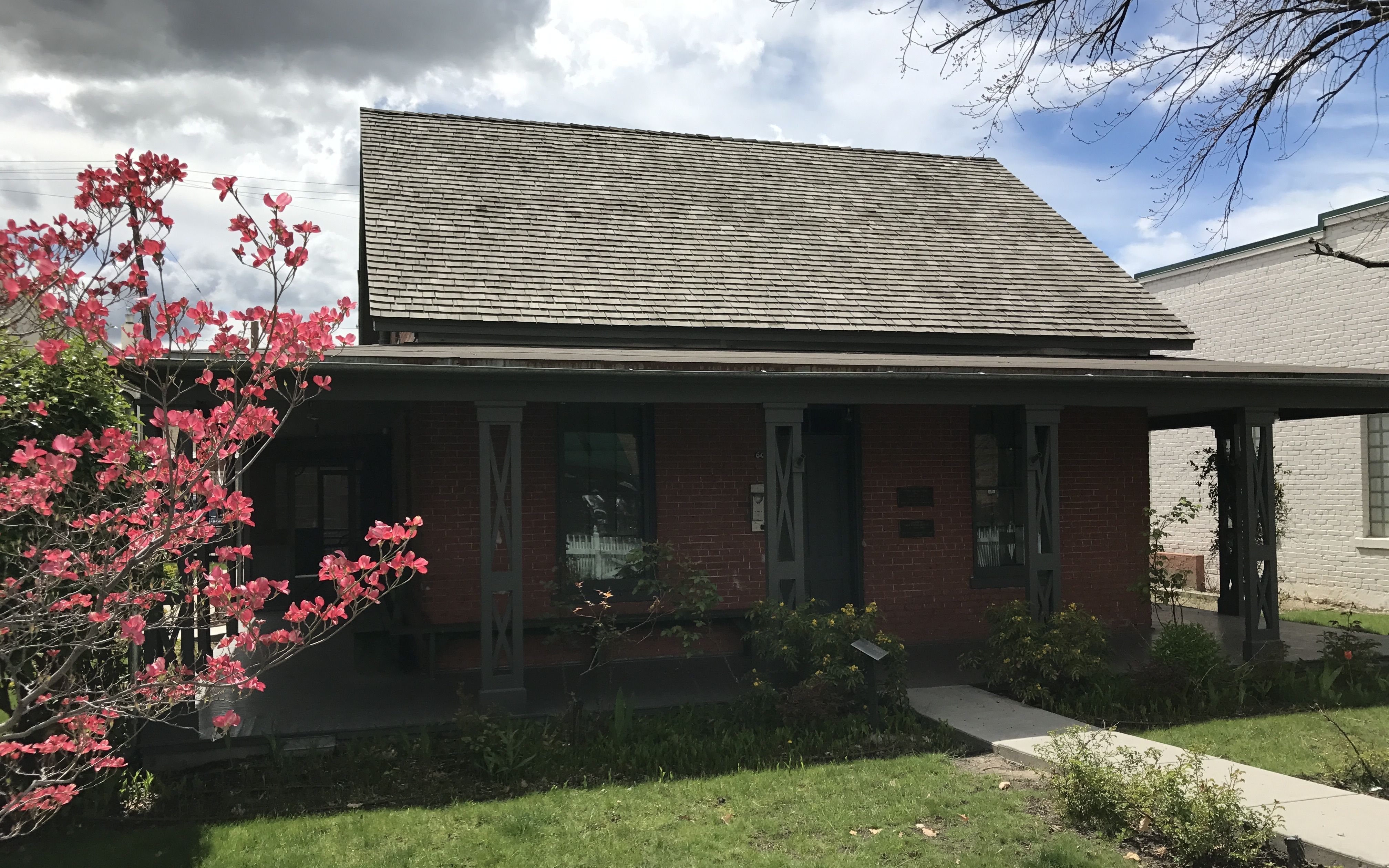
It was right next door to the Cyrus Jacobs Uberuaga House, which is the oldest surviving brick building in Boise. Cyrus Jacobs was a pioneer merchant and prominent citizen of Boise when the town was founded in 1863. Cyrus built his home in 1864. He lived there for almost 40. In the early 1900s, the house became the residence of Basque families. In 1917, Jose and Hermigilda Uberuaga moved in and it remained in the family until 1983, when Adelia Garro Simplot purchased the property to preserve the rich tapestry of the Idaho Euskaldunak history.
Incidentally, “euskaldunak” is the Basque word for Basque.
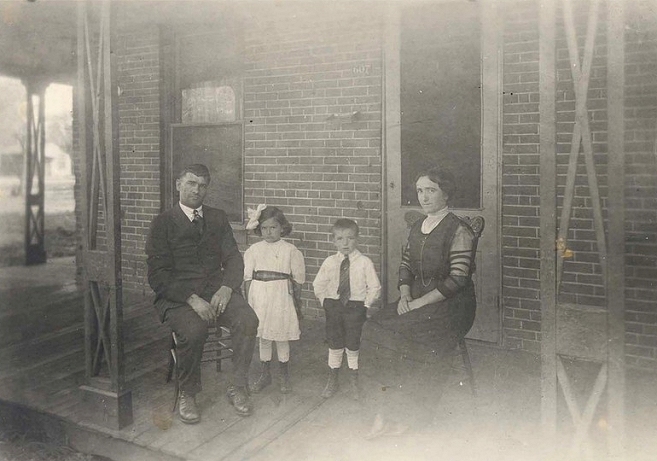
This is a 1921 photo of the Uberuaga family on their porch at 607 Grove. This house now stands as a tribute to the Basque boarding house life in America.
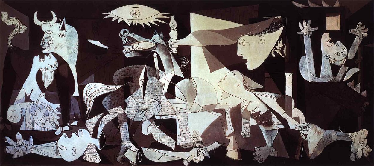
In case your Spanish geography needs a brush up, here is the part of the country that is the Basque region. Guernica is in the Basque region. On this map, it is in the province of Bizkaia.
For the art history/war buffs out there, Guernica is the site of an egregious bombing of civilians during the Spanish civil war in 1937. This work of art by Pablo Picasso was commissioned by Spanish government. It was exhibited at the 1937 World’s Fair in Paris and used to raise funds for war relief.
This bombing, which was carried out by Nazi Germany and Fascist Italian warplanes, helped them practice for their next planned escapades. It kind of reminds me of how we used chasing Pancho Villa after his raid on Columbus, New Mexico as a preparation for involvement in World War I.
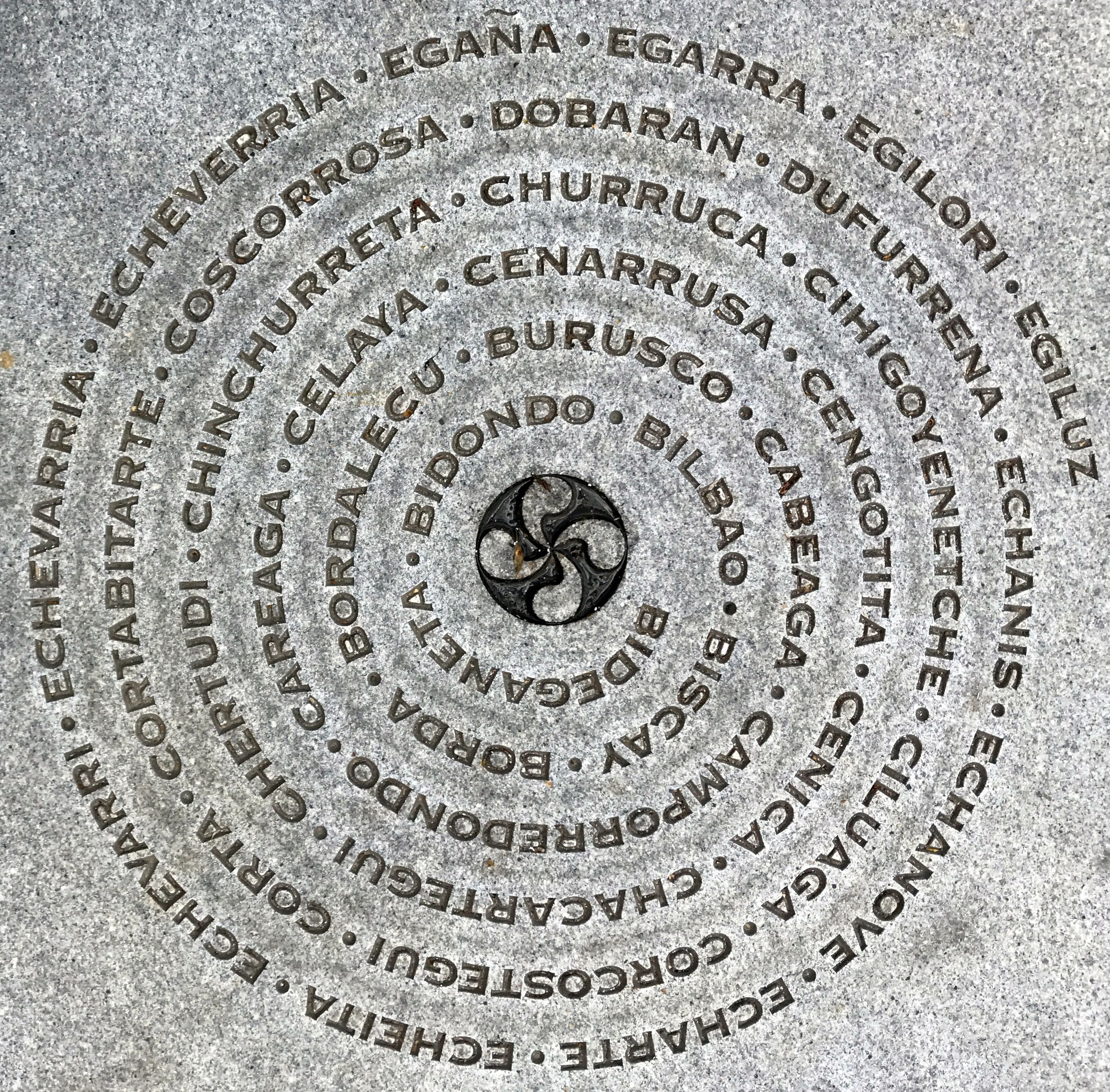
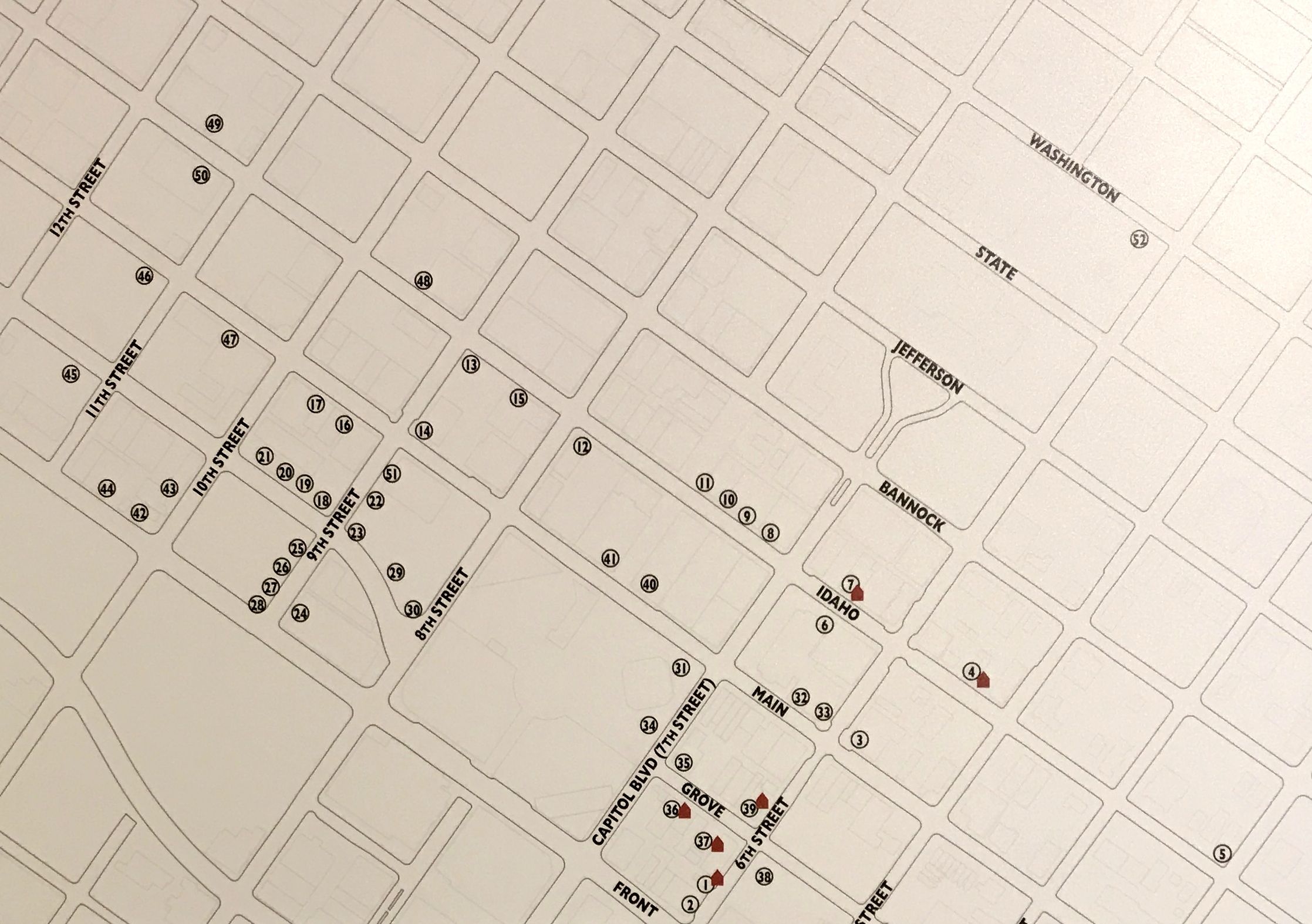
This graphic was stamped in the sidewalk in front of the museum. I think these are family names. I stepped inside the museum, paid my $5 entrance fee and started exploring.
I found this map interesting. This shows the distribution of Basque boarding houses in downtown Boise. I believe the Uberuaga house was at number 37.
Many of the Basques who settled in Idaho ended up as shepherds. According to what I read in the museum, this wasn’t because they were particularly interested in sheep or even had a background in herding sheep. It was one of those things where they were hard workers looking for an opportunity. Their language didn’t cause problems because their work didn’t require good English. One member of a family would come to America, find work, and then send for others as money permitted.
According to the museum, recently arrived immigrants had to show proof that they had at least $25 in hand to enter the United States.
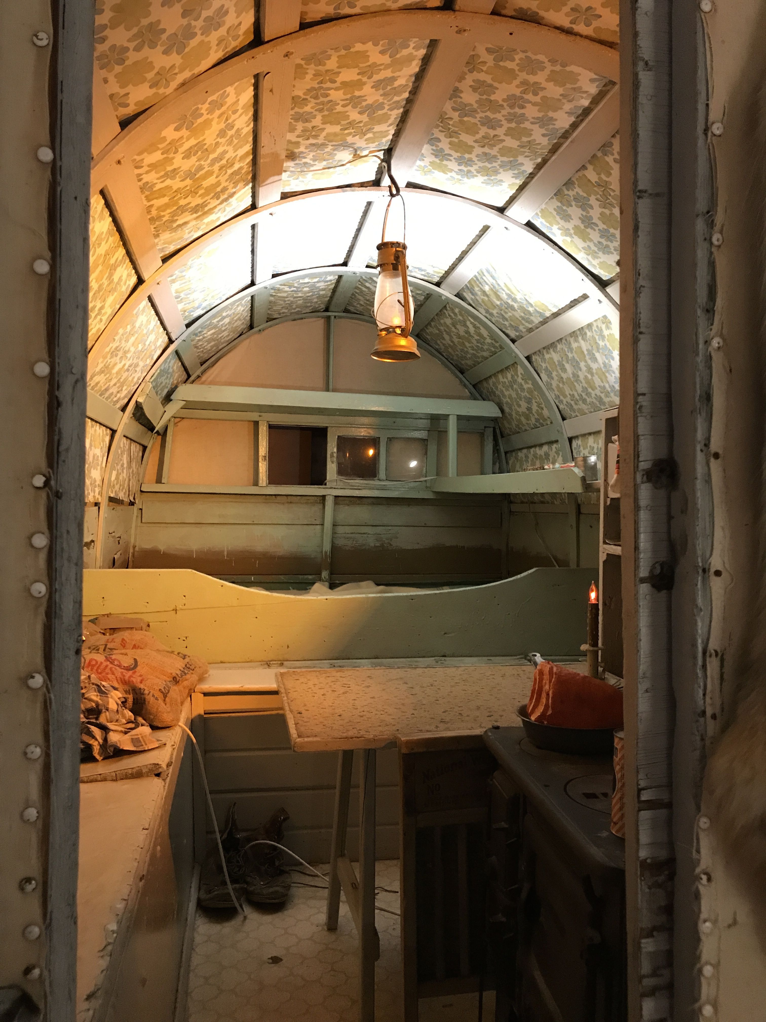
While out with the sheep, they would live in shepherds’ wagons.
They floor plan isn’t that much different from many of the smaller RVs on the road today.
They had a nice display of historic photos of the sheep industry.
This one was titled “Transporting to the lambing shed”. I imagine that this was a mother sheep getting ready to give birth. I do find it interesting that the horse seems to be taking the sheep there without direction. The shepherd’s crook sin the sledge, but I don’t see the shepherd.
They had a few artifacts from their daily life, as well.
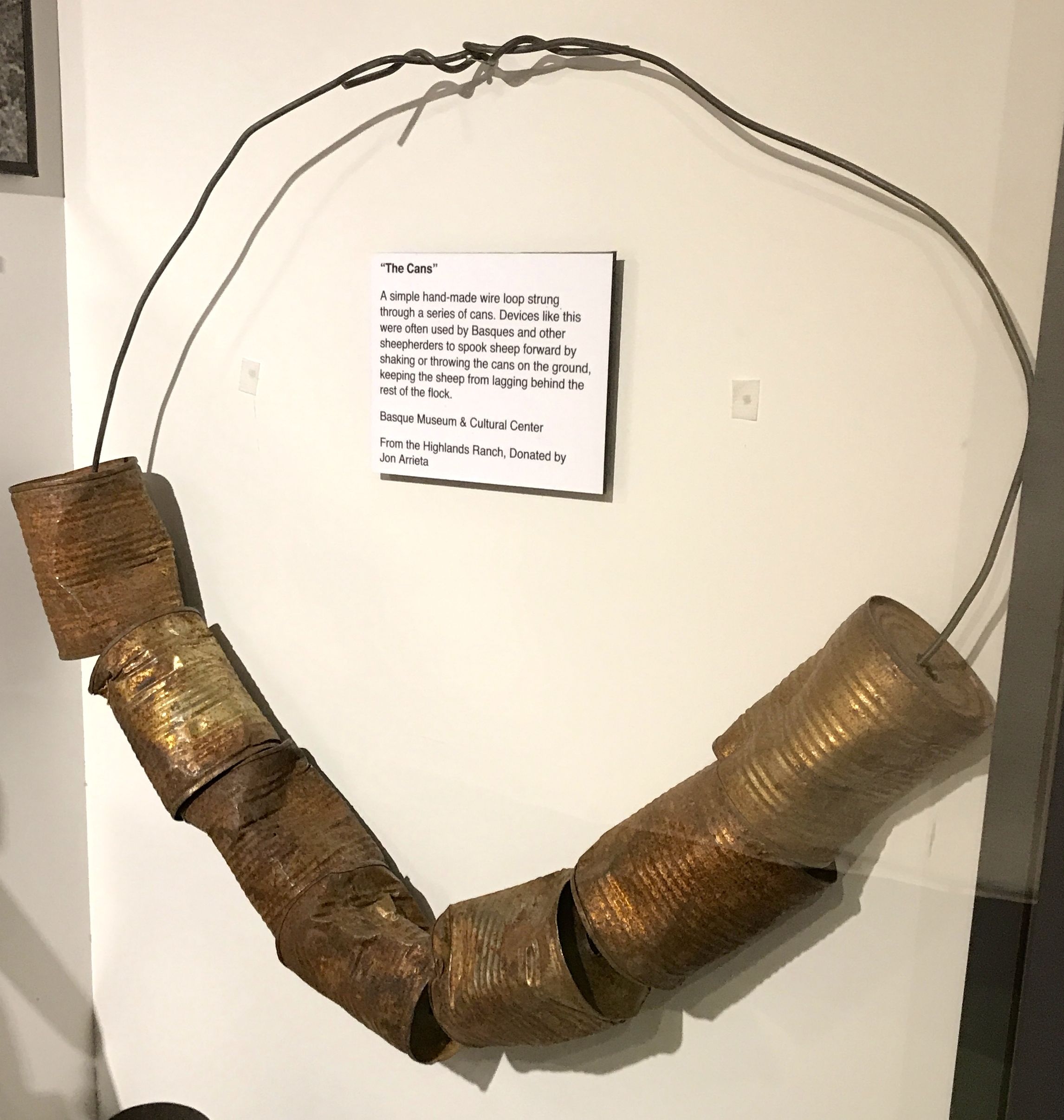
This artifact was called “The Cans.”
According to the information with the display, the Basques used devices like this to spook sheep forward. They would shake the noise the cans or throw them on the ground to keep the sheep from lagging behind the rest of the flock.
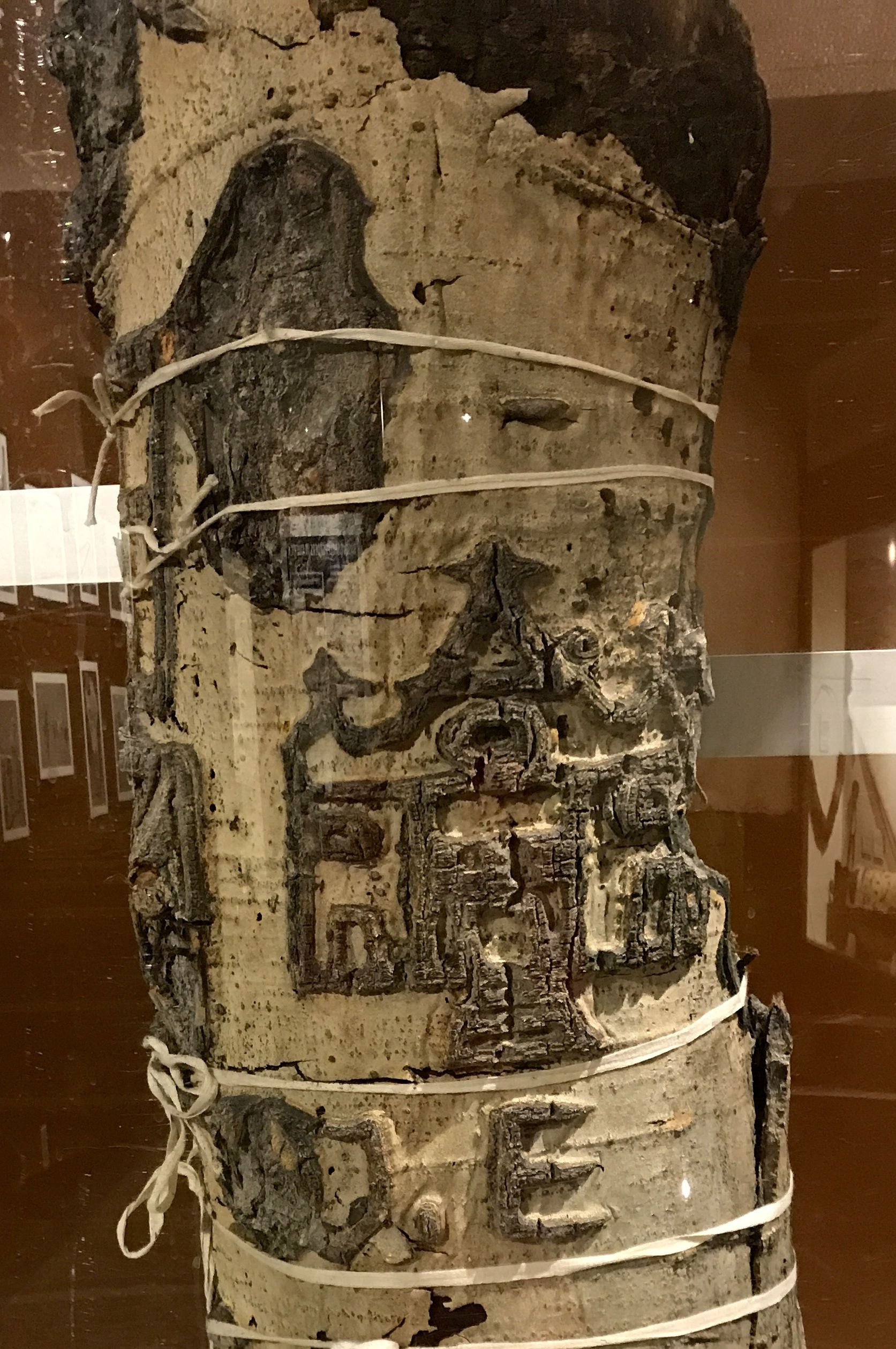
I like trees. I like them a lot. And, any regular reader of this blog knows I love petroglyphs. What do you get when you combine the two concepts?
Shepherds would carve images and text into trees. This is an aspen tree taken from the Fisher Creek area in the Sawtooth National Forest in Idaho. According to the information with the display, it took about 20 years for the tree to mature enough to reveal the carving. The tree had been dead for a number of years when this section was removed for preservation in 2004.
This was an interesting museum and introduced me to a segment of our American population about which I was unfamiliar. It was certainly worth the $5 admission fee.
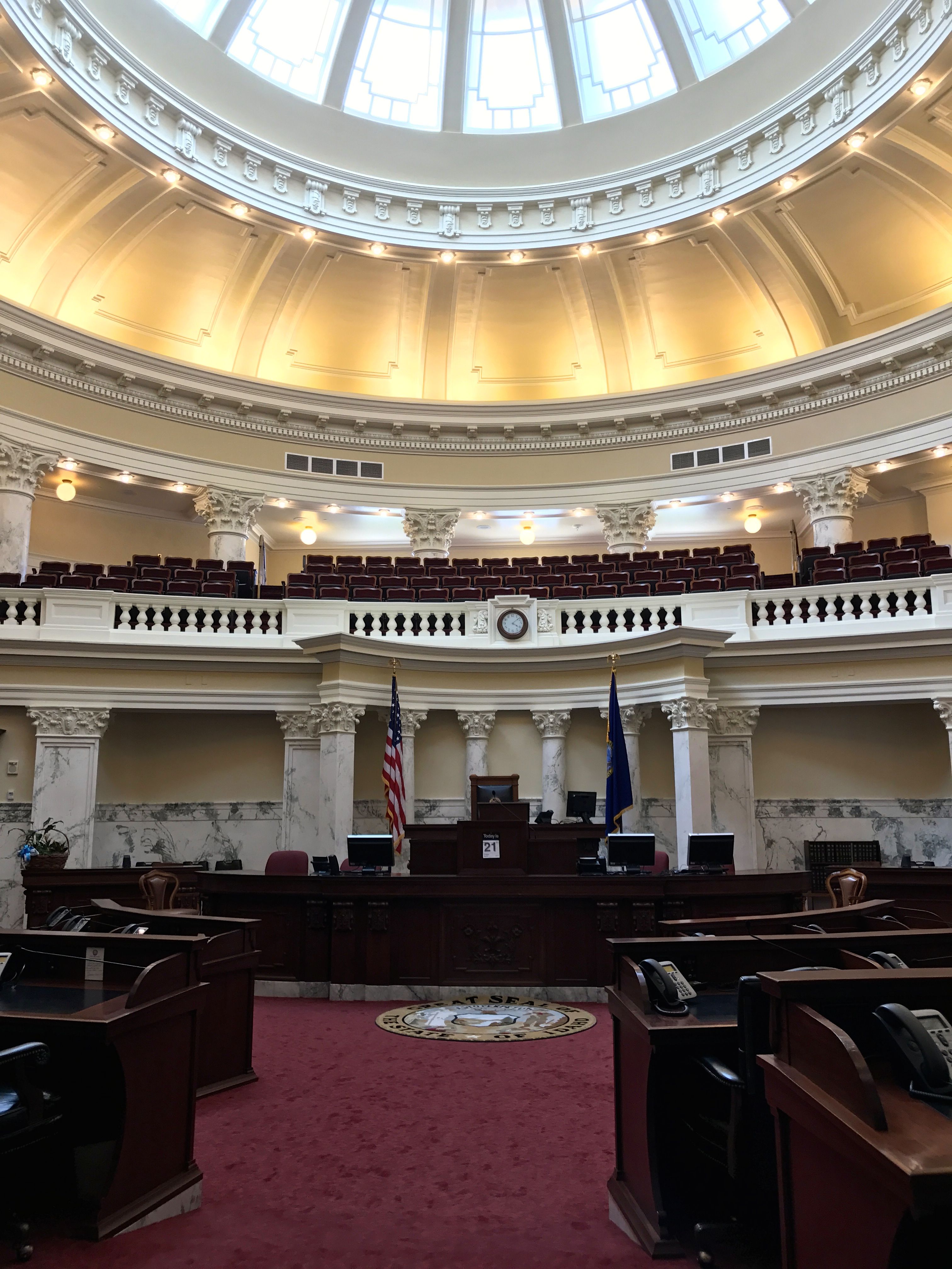
Boise is the capital of Idaho, so naturally I set out to see the capitol.
They weren’t offering tours while I was there, but they didn’t seem to mind that I just wandered around and looked at things.
Following some advice I heard about touring museums, I decided to go to the top and work my way down. This is the view from the fourth floor.
This is the gallery that runs around the rotunda on the fourth floor.
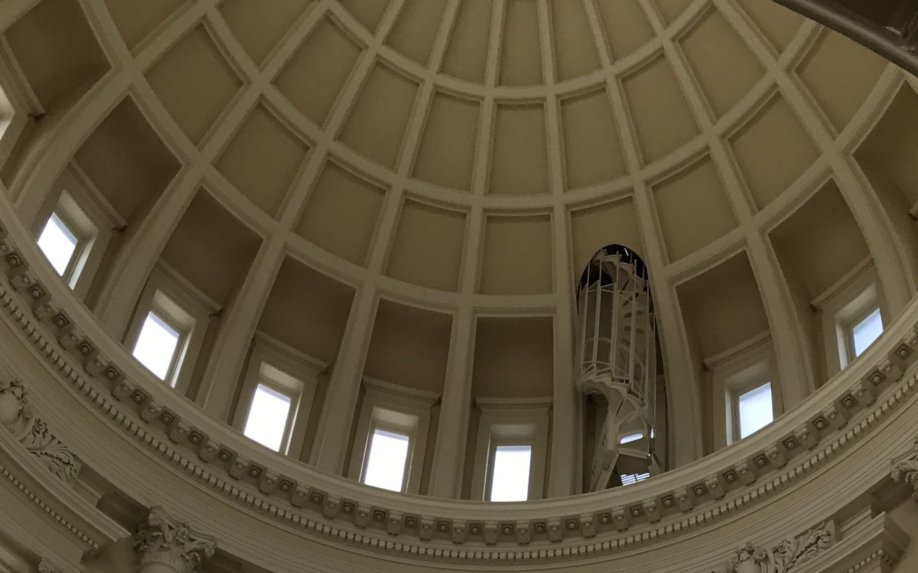
If there had been a tour, I imagine that I would have heard more about this circular stair up into the dome. It kind of makes me think of Brunelleschi’s dome in the Cattedrale di Santa Maria del Fiore in Florence. Or was that Saint Peter’s in Rome? Or maybe both! I have been blessed with so many travel opportunities.
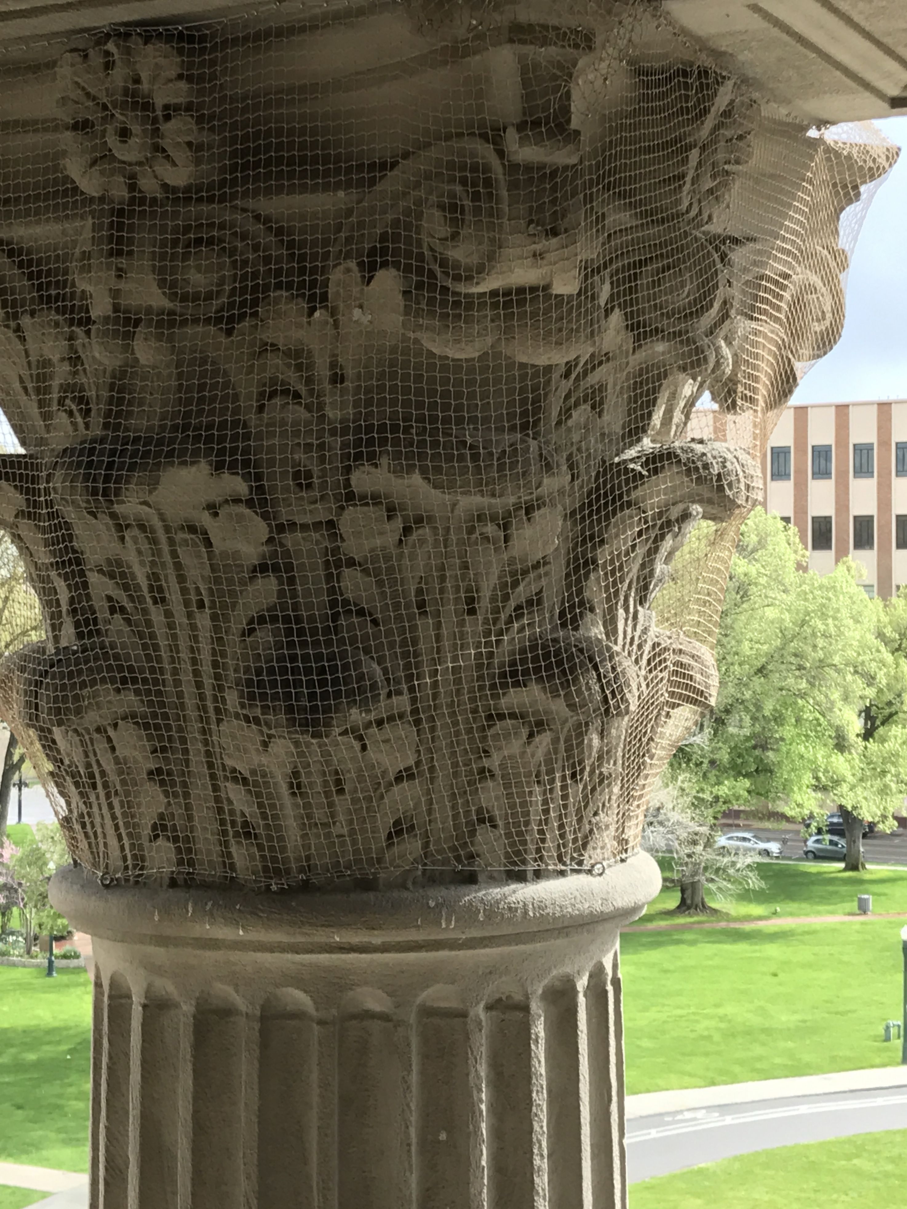
I found a window to look out of, and I spied this ingenious treatment of the Corinthian capital. That’s one way to keep the birds off them. I didn’t even notice the netting from the ground level.
There was a display about the historic trees that had been on the Capitol grounds until the Capitol Renovation Project in 2007.
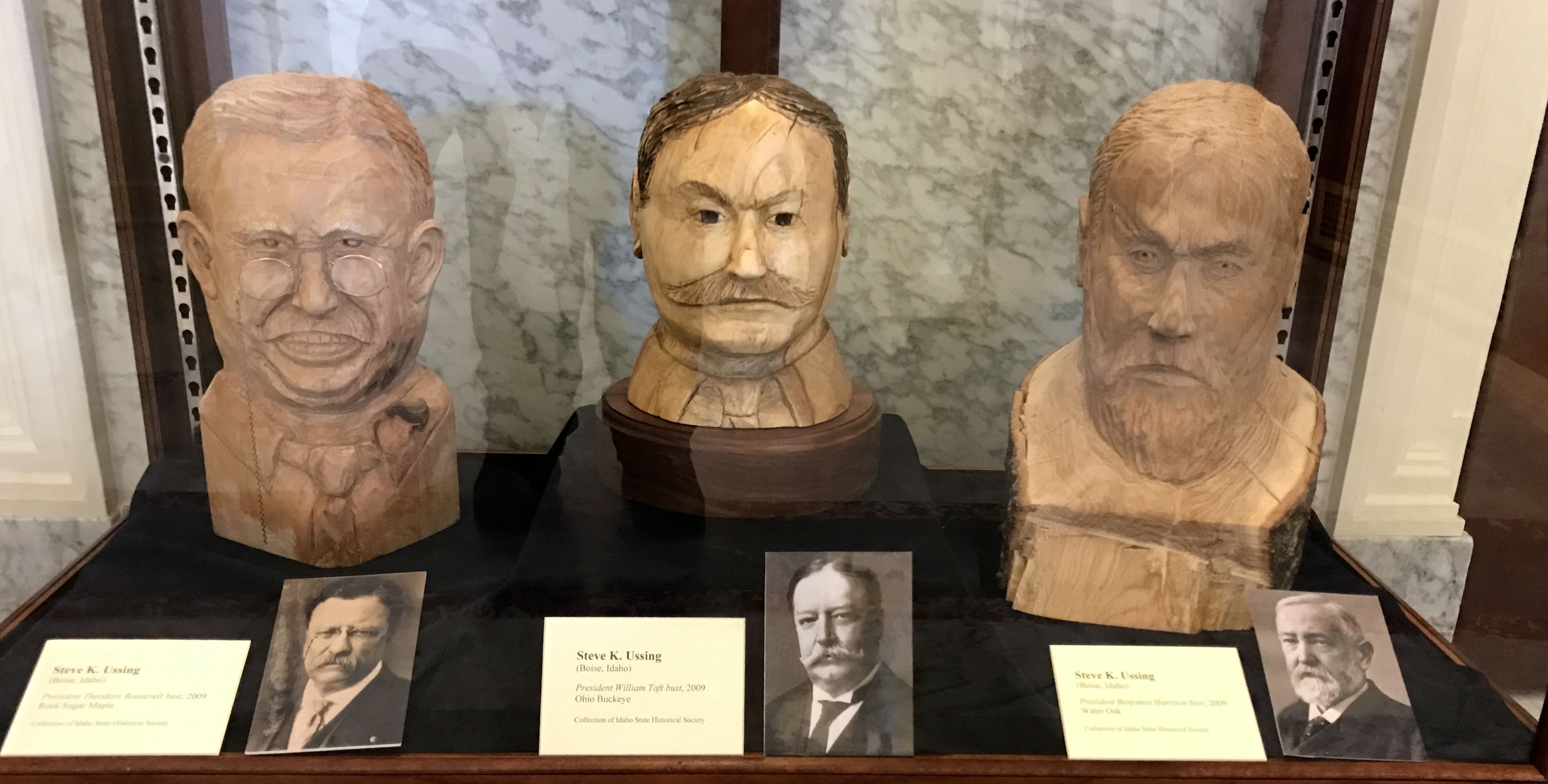
In 1891, a year after he signed Idaho into the union as the 43rd state, President Benjamin Harrison planted a Water Oak on the grounds. Twelve years later, in 1903, Theodore Roosevelt planted a Rock Sugar Maple. In 1911, William H. Taft planted an Ohio Buckeye.
An American Elm and an Ash, the first notable trees planted on the grounds, were planted in 1887. Apparently these folks were people of vision, as 1887 was three years before statehood.
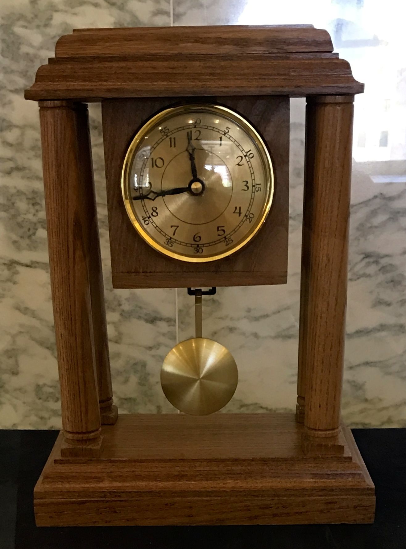
Representative Max Black didn’t want to see the timber from these trees disposed of and he organized the Historic Trees Project. Wood from these historic trees was used to create works of art by woodworkers, woodcrafters, and artists from around the state in order to preserve a part of the Capitol building’s history.
Some of the items were functional, like this pendulum clock fashioned out of American Elm by Jack Benson.
Kevin Schroeder made this Windsor Comb Back Writing Chair out of Maple, Red Oak, Sycamore, Ash and Elm. I like the drawers he built into the chair. The tag on the chair said that it was a replica, but I think it is pretty incredible.
This fiddle was made from the President Harrison Tree. In case you’ve already forgotten, President Harrison planted a Water Oak. Frank E. Daniels was the luthier who made the fiddle.
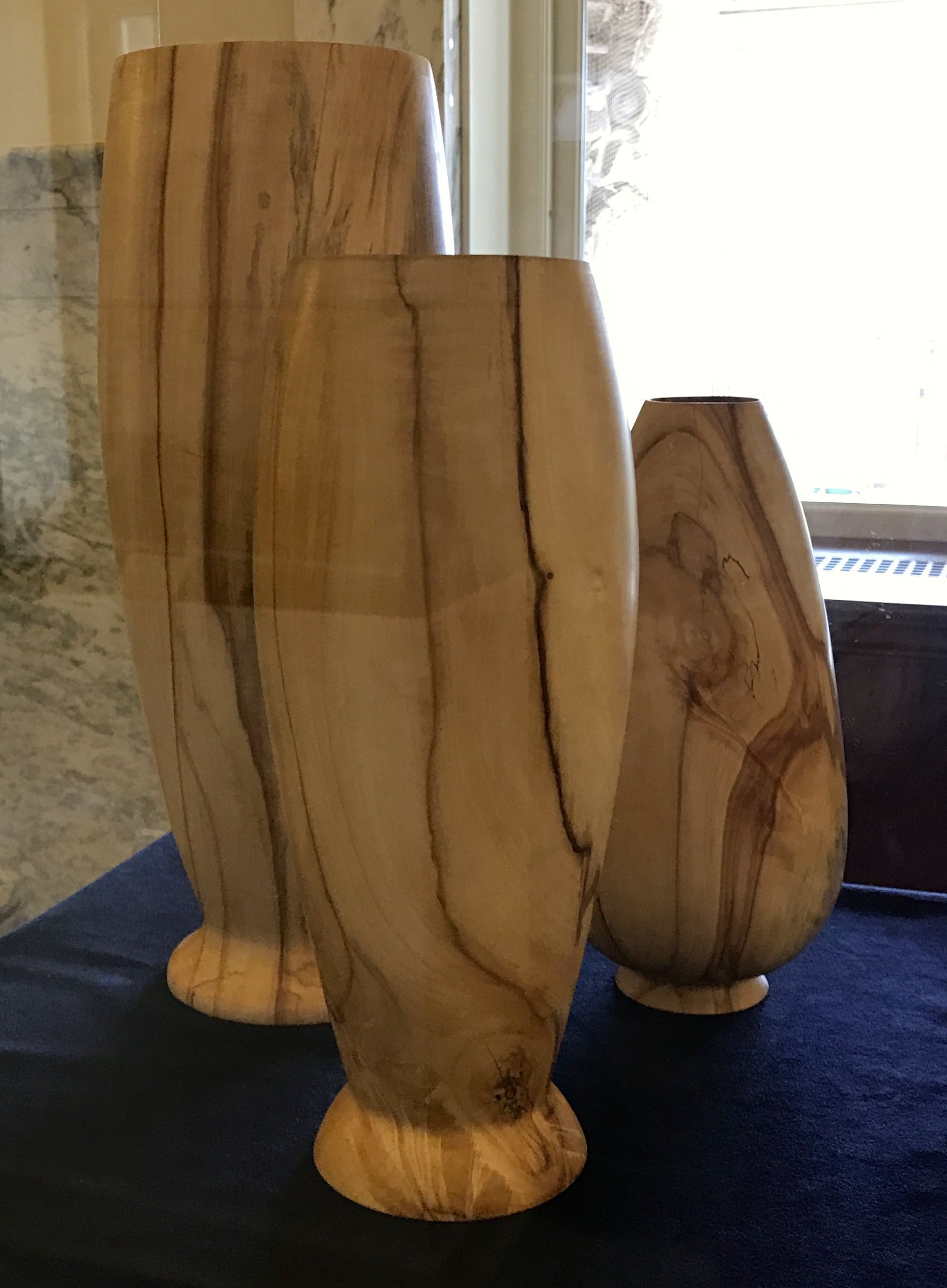
Burt Alcantara turned these vases out of American Elm.
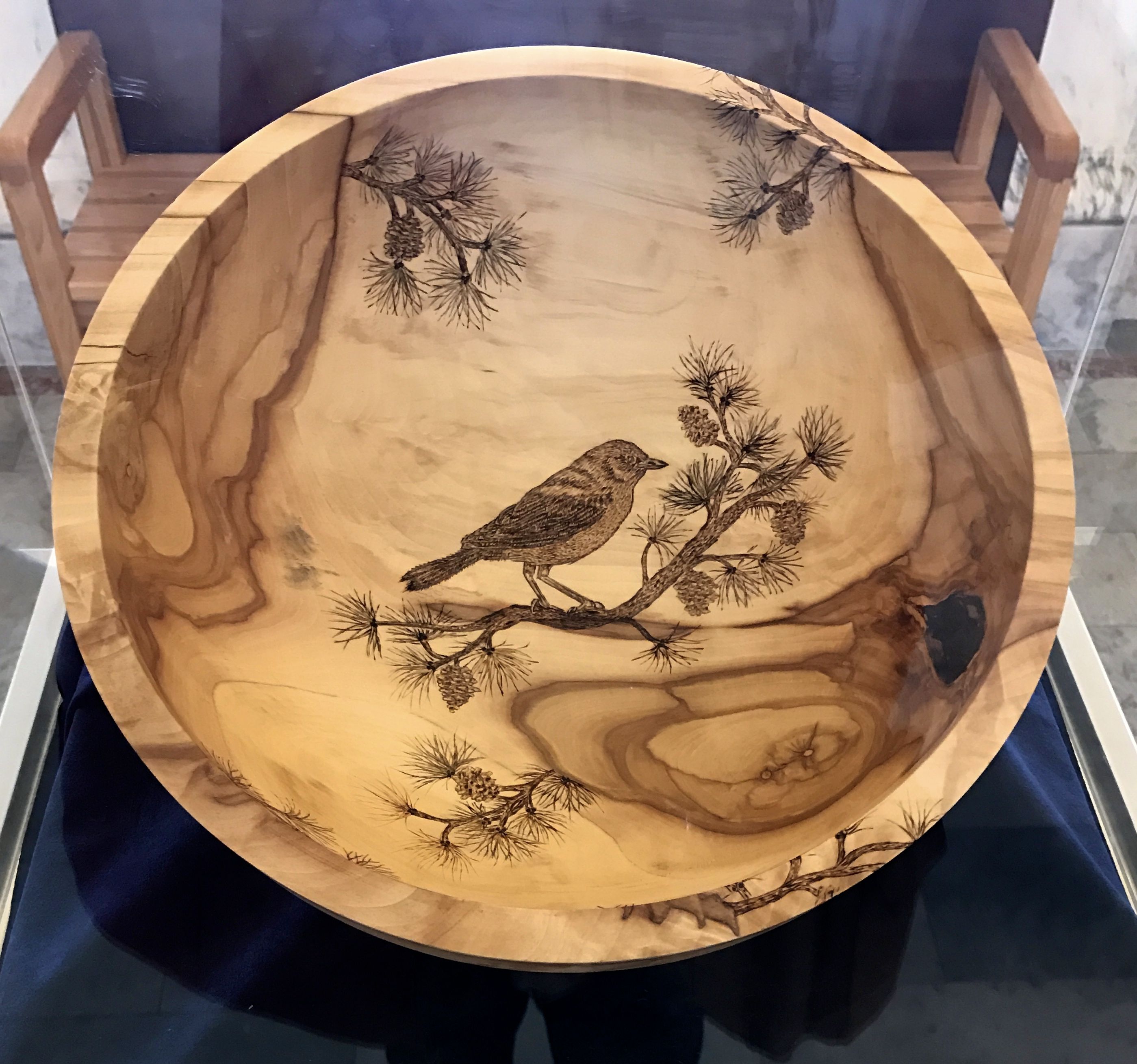
This bowl was a joint effort. Stephen H. Young turned the bowl out of Ohio Buckeye and the pyrography was done by Sharon Becker.
A series of presidential busts was there,
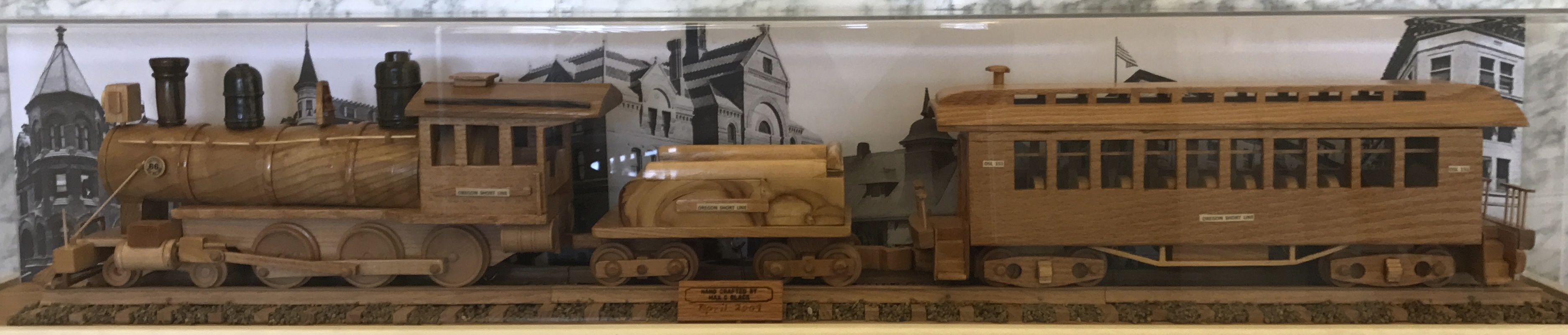
along with a model of a train.
Incidentally, the train was made by Representative Max Black, who thought up the project.
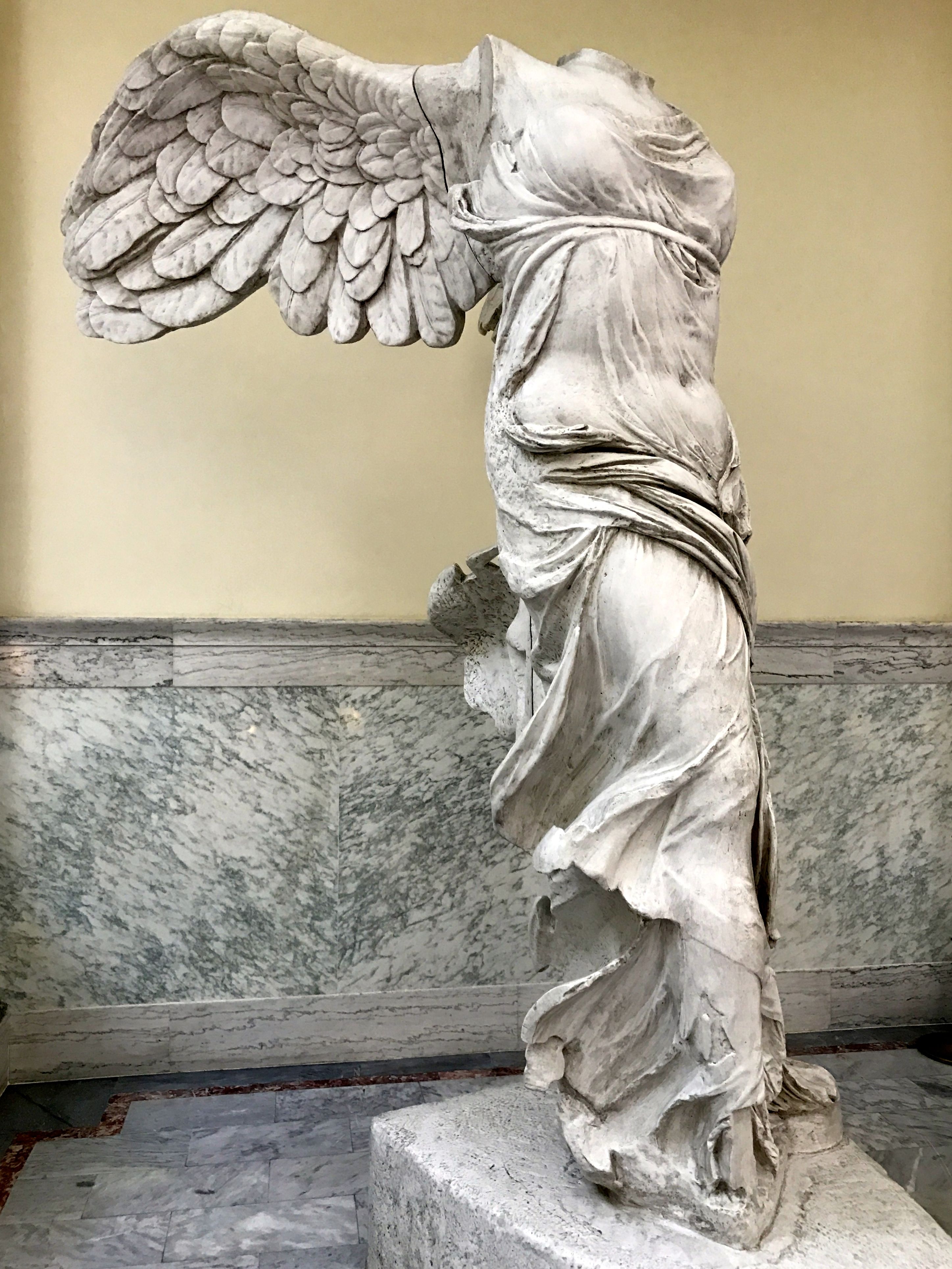
This copy of the Winged Victory – or Nike of Samothrace – was outside the gallery dedicated to the wooden art pieces. I thought it kind of odd, but it has an interesting story.
This hollow form plaster cast is a replica of the statue that is on display in the Louvre. The statue was part of a gift given to Idaho by the city of Paris as a though you to the United States for its aid in liberating France from Nazi Germany in World War II.
According to the sign by the statue, all the states received a train box car full of gifts from France. They called it the Merci Train. Winged Victory arrived on February 22, 1949.
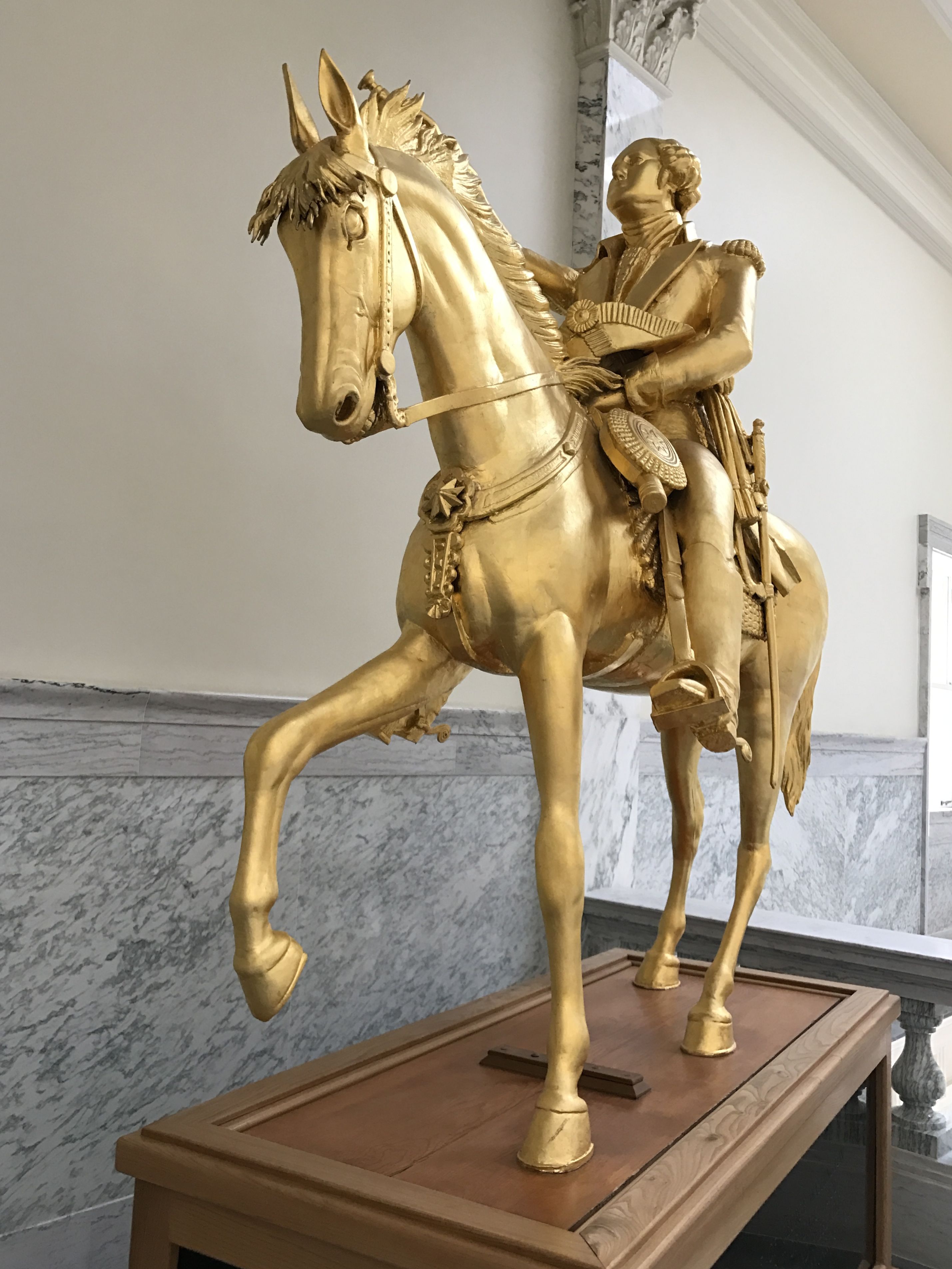
This statue of George Washington was carved by Charles L. Ostner for the Idaho territory and dedicated to its pioneers. He made it in 1869 and he carved it of yellow pine at night by torchlight. It took him four years to complete it and he used and the information next to it said that he used a postage stamp of George Washington as a model for the head.
I was wondering if there were postage stamps back in 1869. I knew that in the beginning, people would mail their letters without postage. The recipient was responsible for paying to collect their mail. But, after consulting my preferred source (Wikipedia) I found out that George Washington and Benjamin Franklin were the first stamps, and they were issued in 1847.
By Rawdon, Wright, Hatch & EdsonSee also:U.S. presidents on U.S. postage stampsU.S. Postage stamp locator – U.S. Post Office, CC0, https://commons.wikimedia.org/w/index.php?curid=29332201
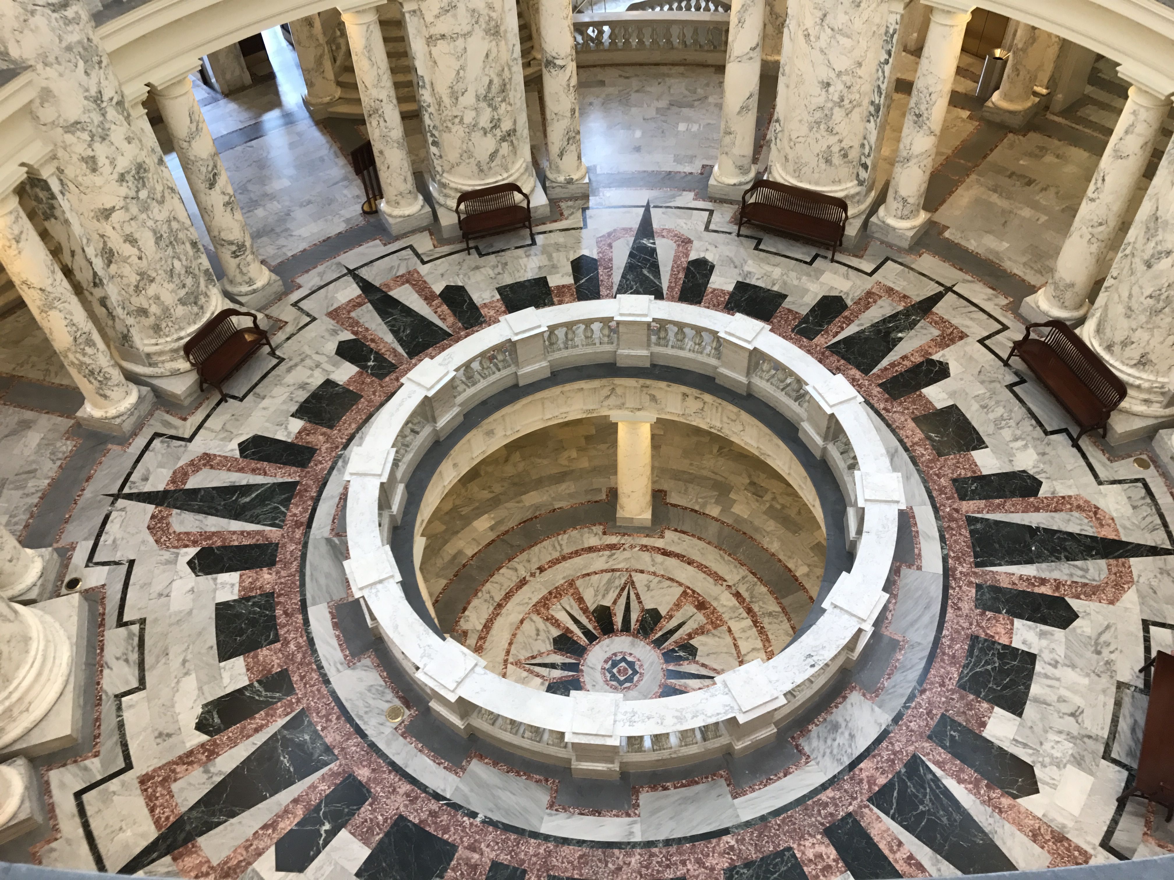
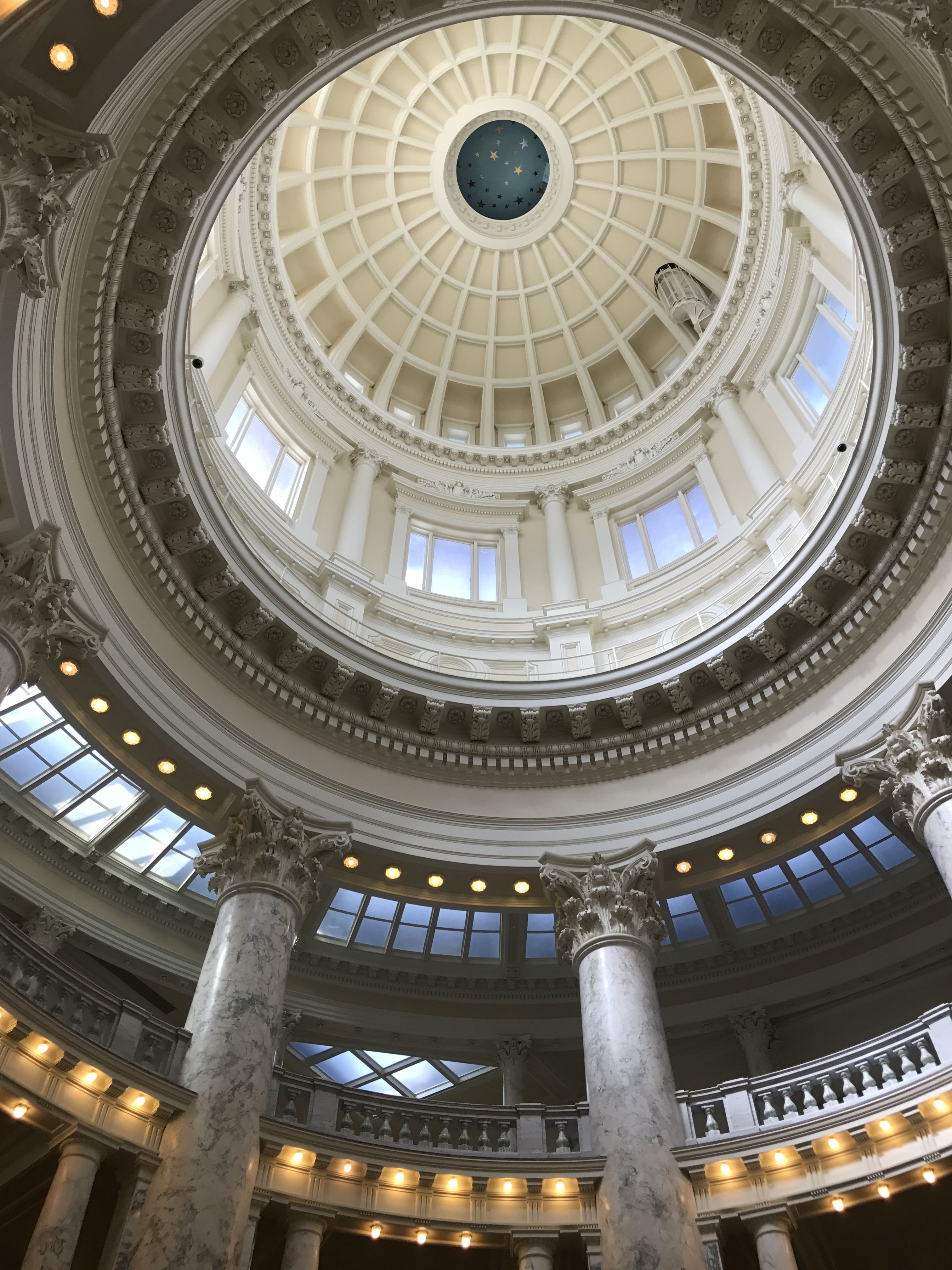
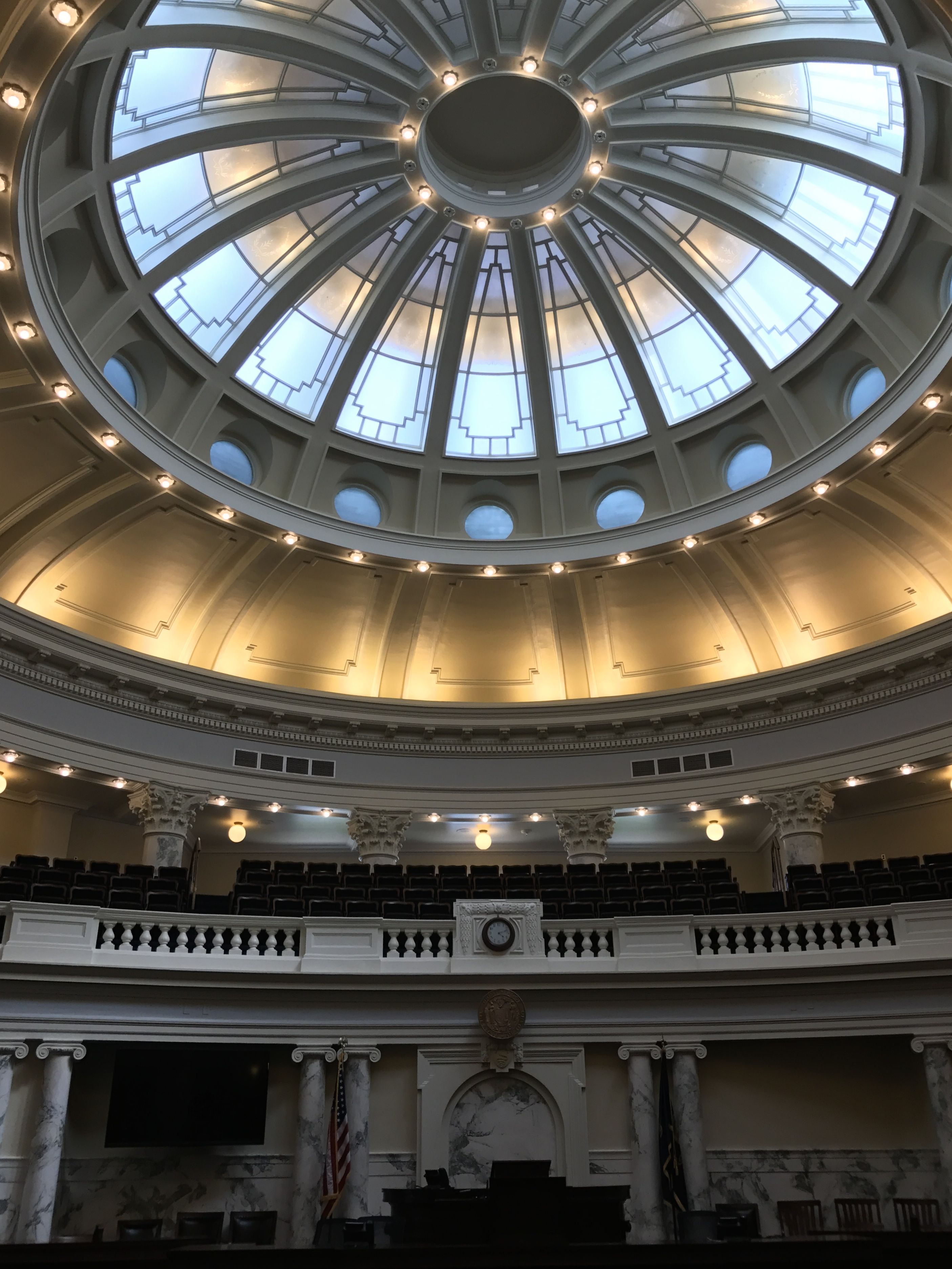
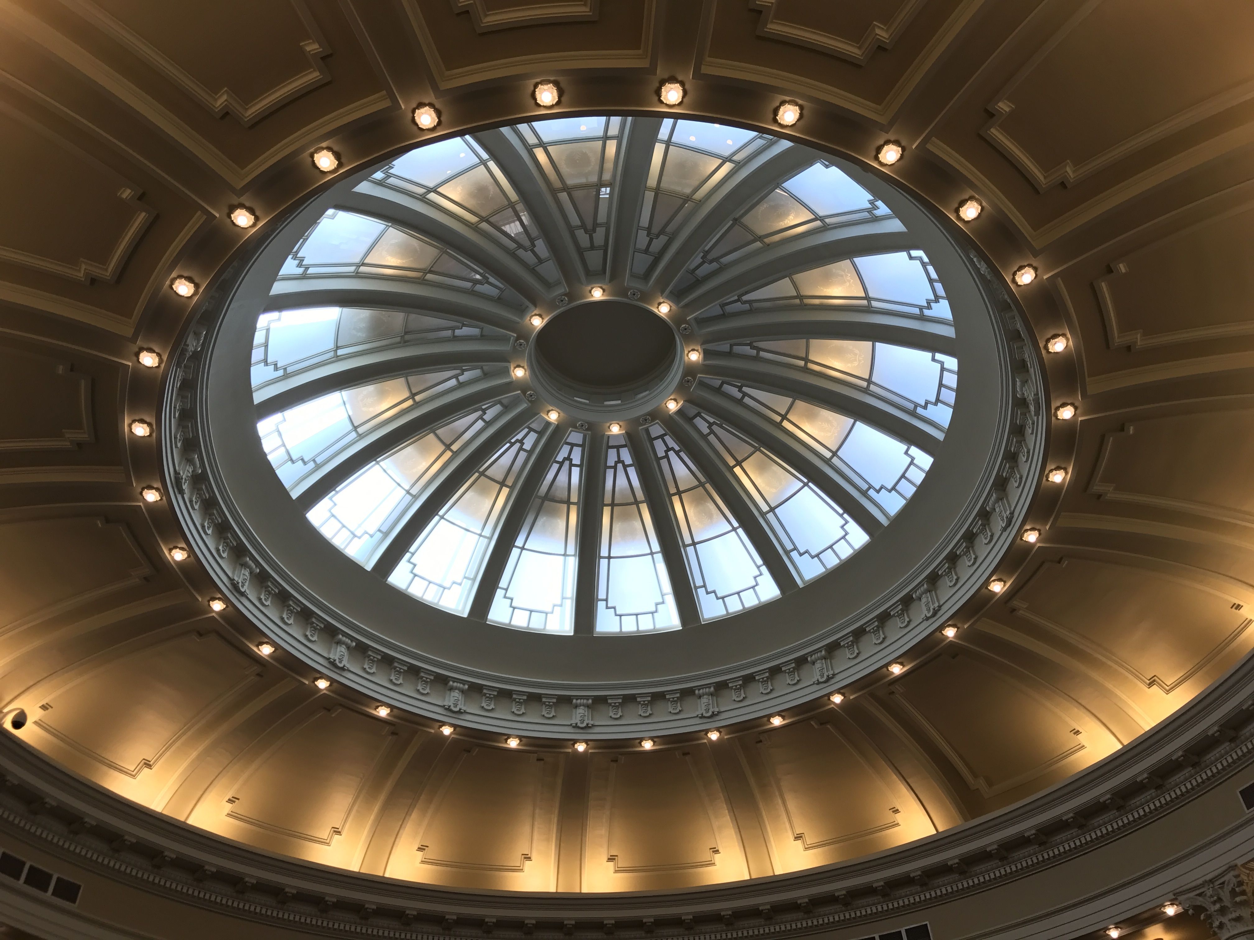
I worked my way down in the building. The rotunda is quite spectacular.
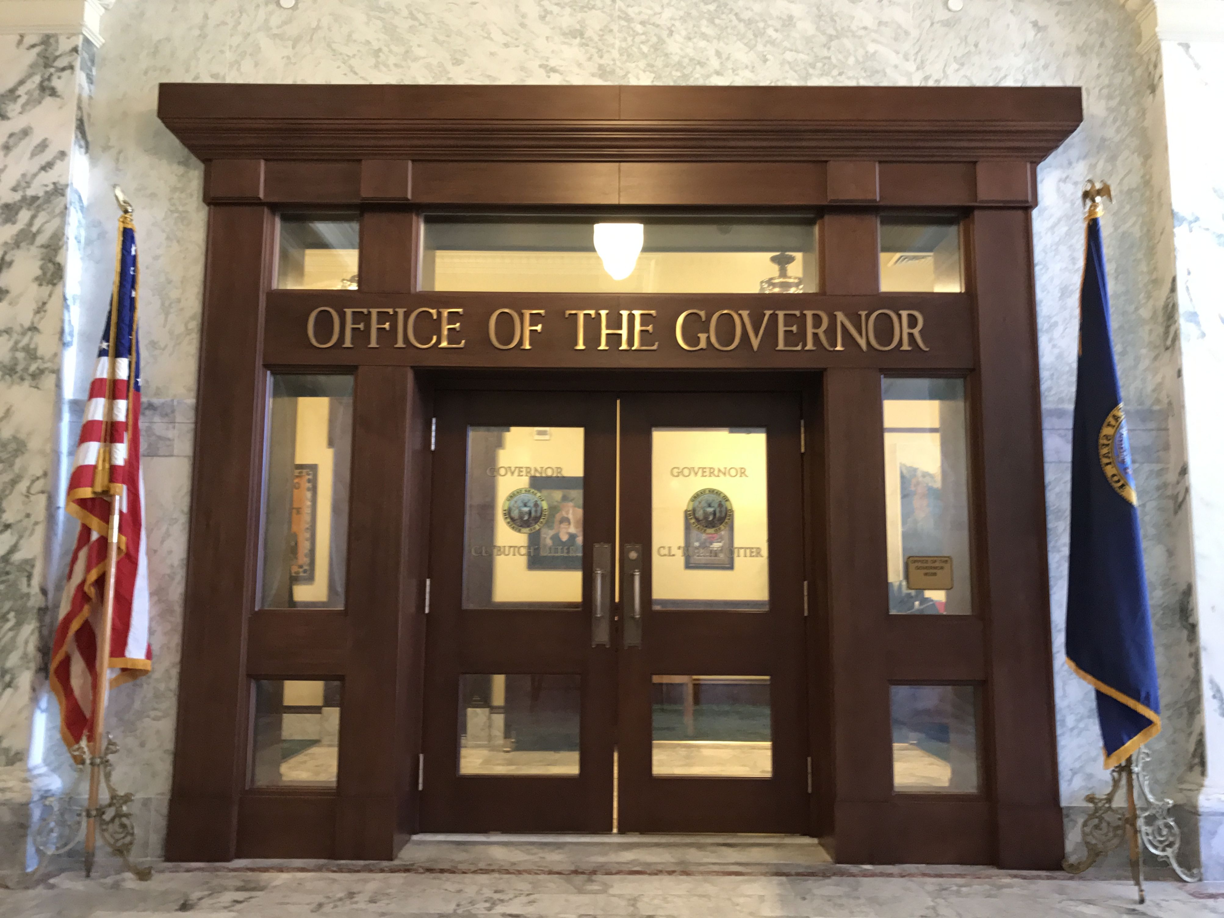
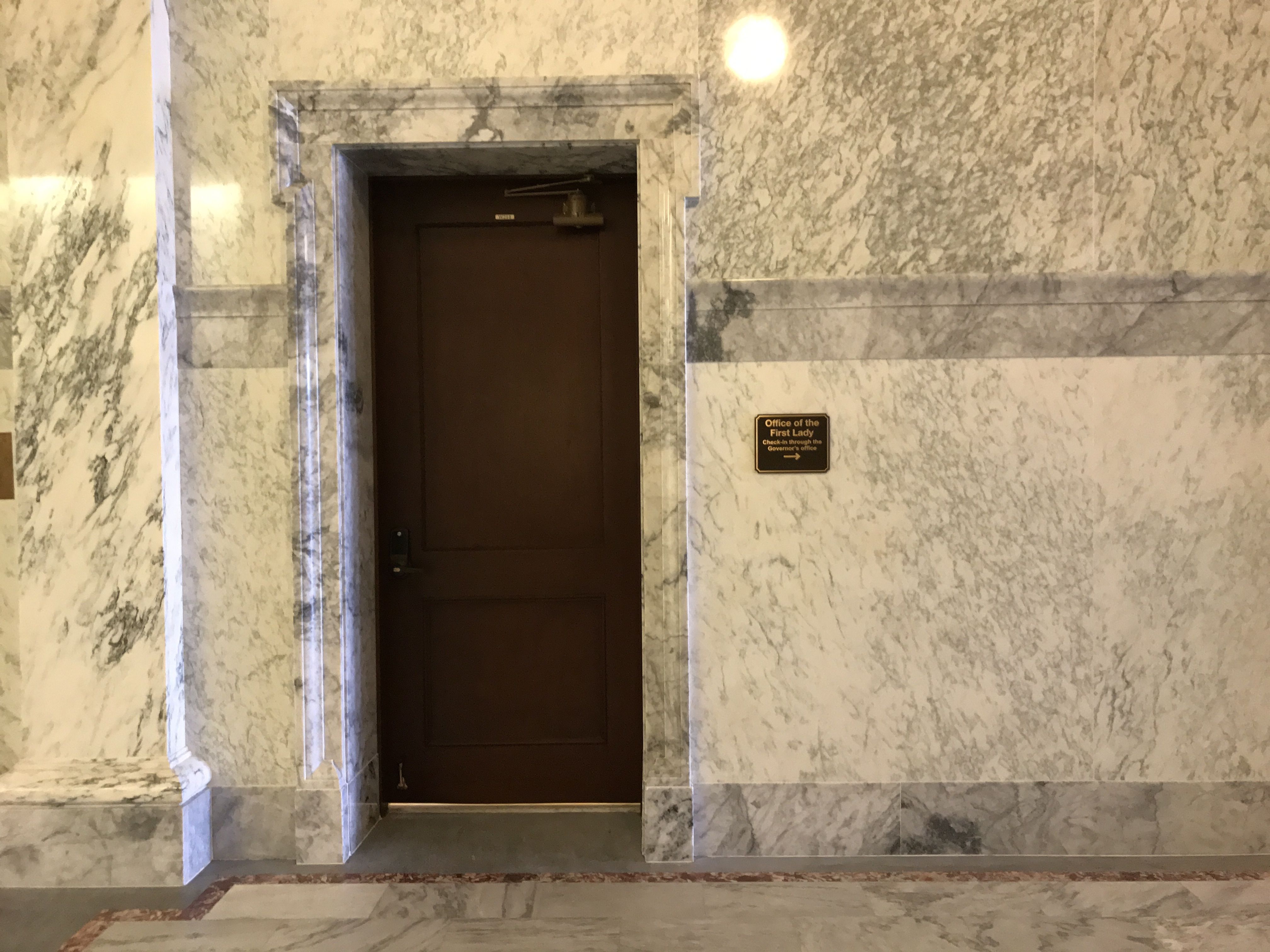
On the main floor, I came across the Office of the Governor.
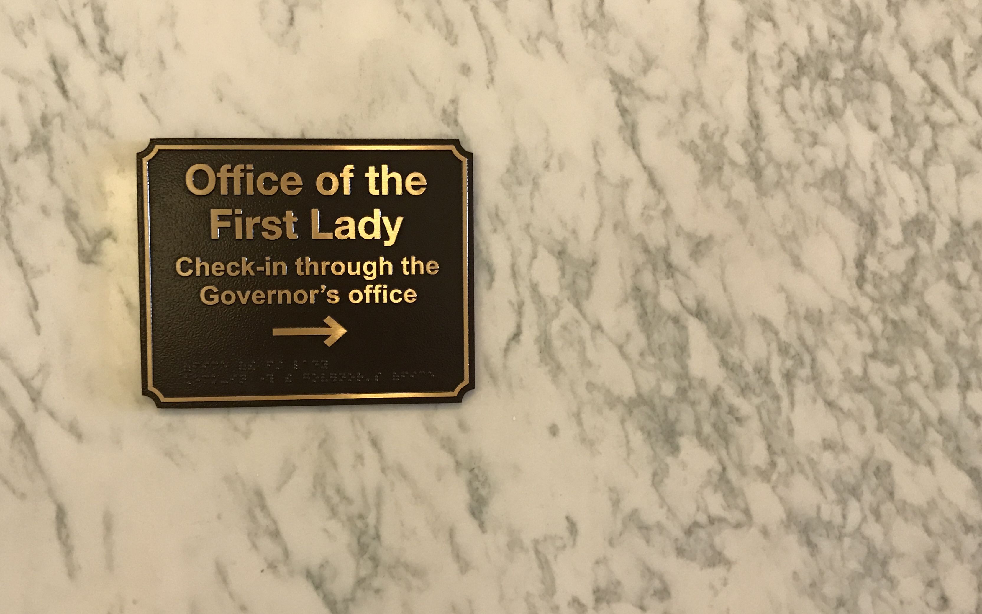
That is not in the least unexpected. I was surprised, however, by this sign in the hall.
I’d never see a First Lady’s office in any of the Capitols I’d visited so far.
It’s kind of a small office, but then again, the First Lady isn’t an elected position.
I found it amazing that they just let me roam the building all by myself. Of course, I am sure they must have had cameras rolling the whole time.
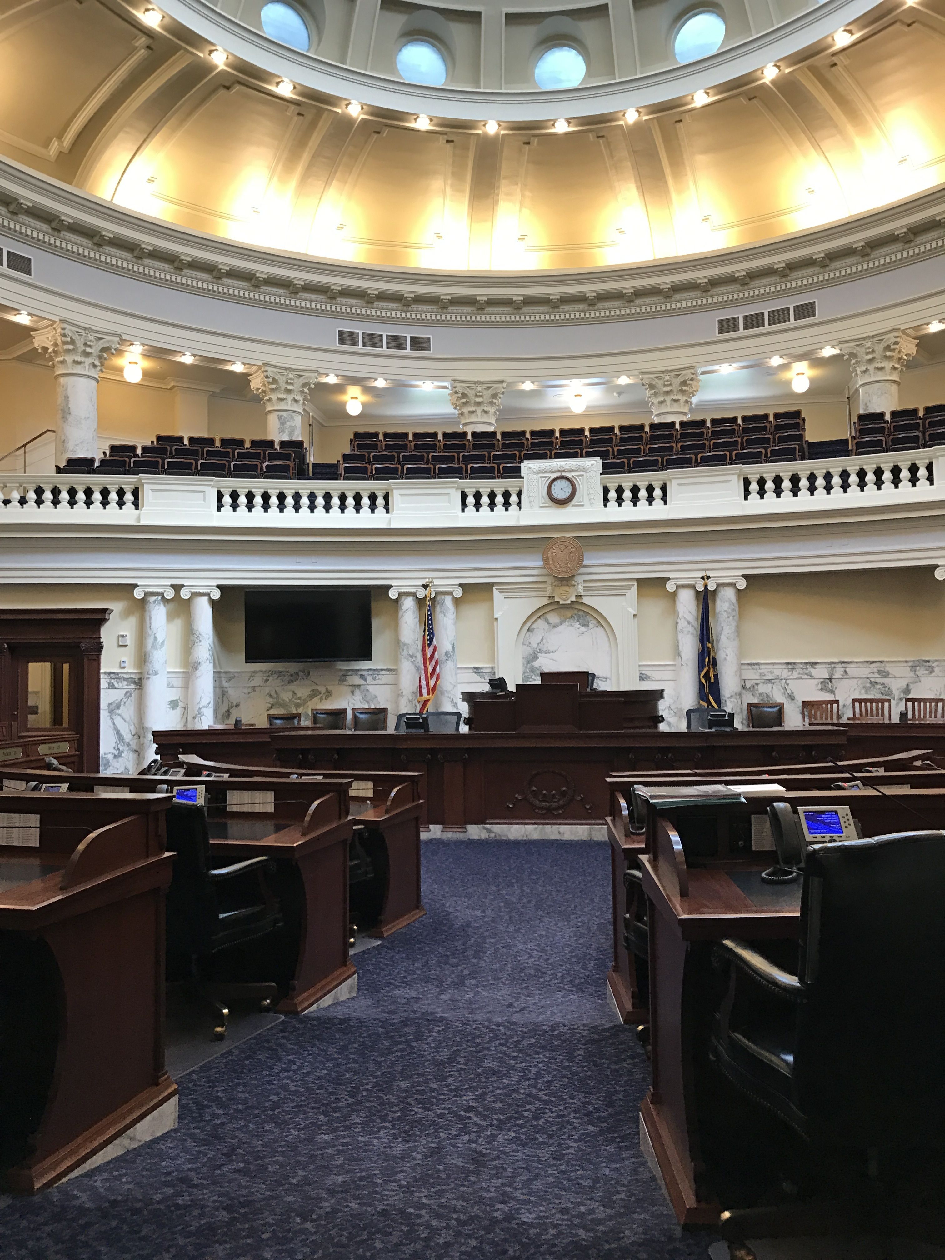
First stop was the House of Representatives, if my notes are accurate.
I liked the seating chart.
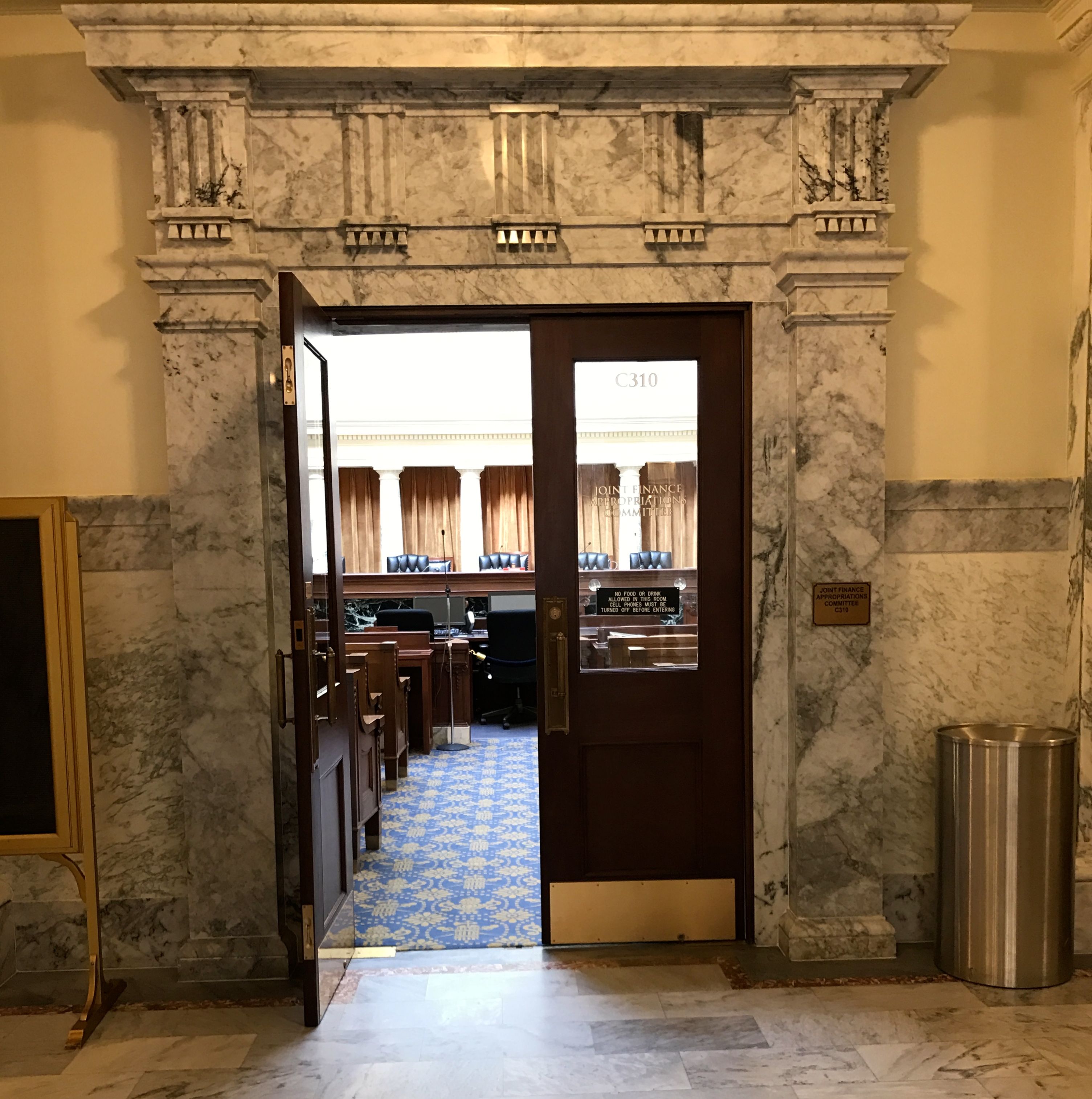
I strolled on and came to the Joint Finance Appropriations Committee room.
I wonder if the Finance Committee appropriated the funds for this rather grand room?
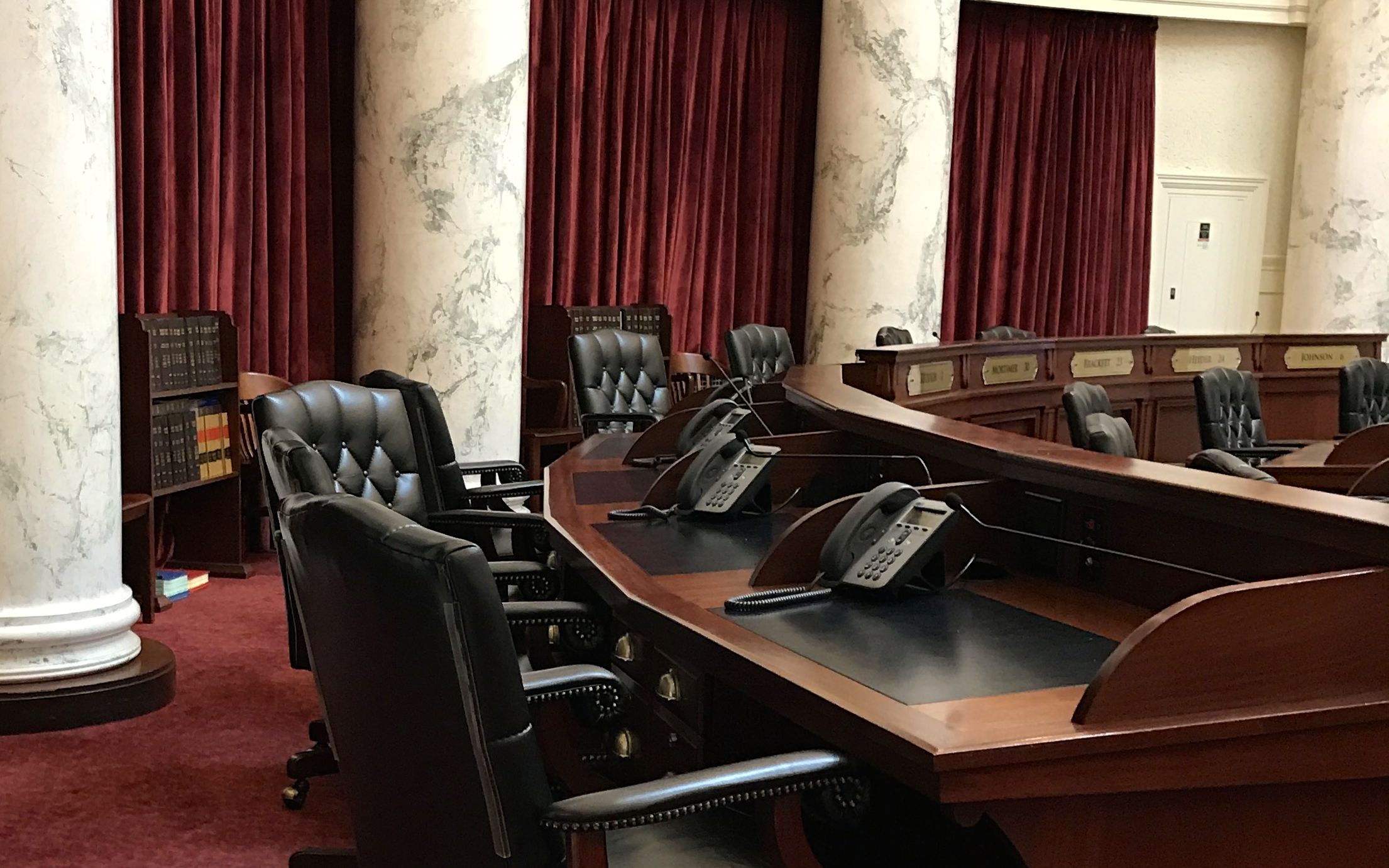
Next stop, the Senate.
Those look like comfortable chairs. I like the books on hand for their use during legislation. I didn’t look, but I imagine that they are Idaho law books.
The Senate chamber had a lovely dome as well.
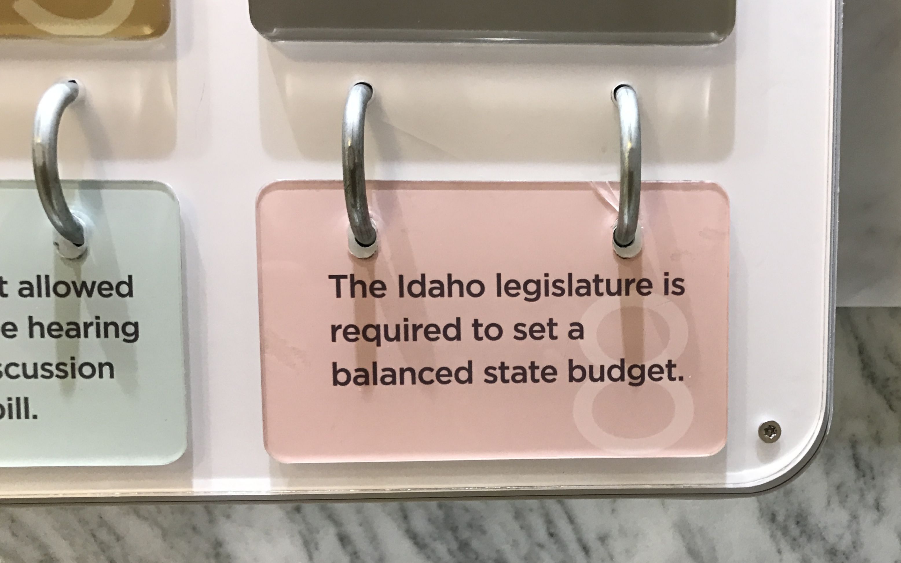
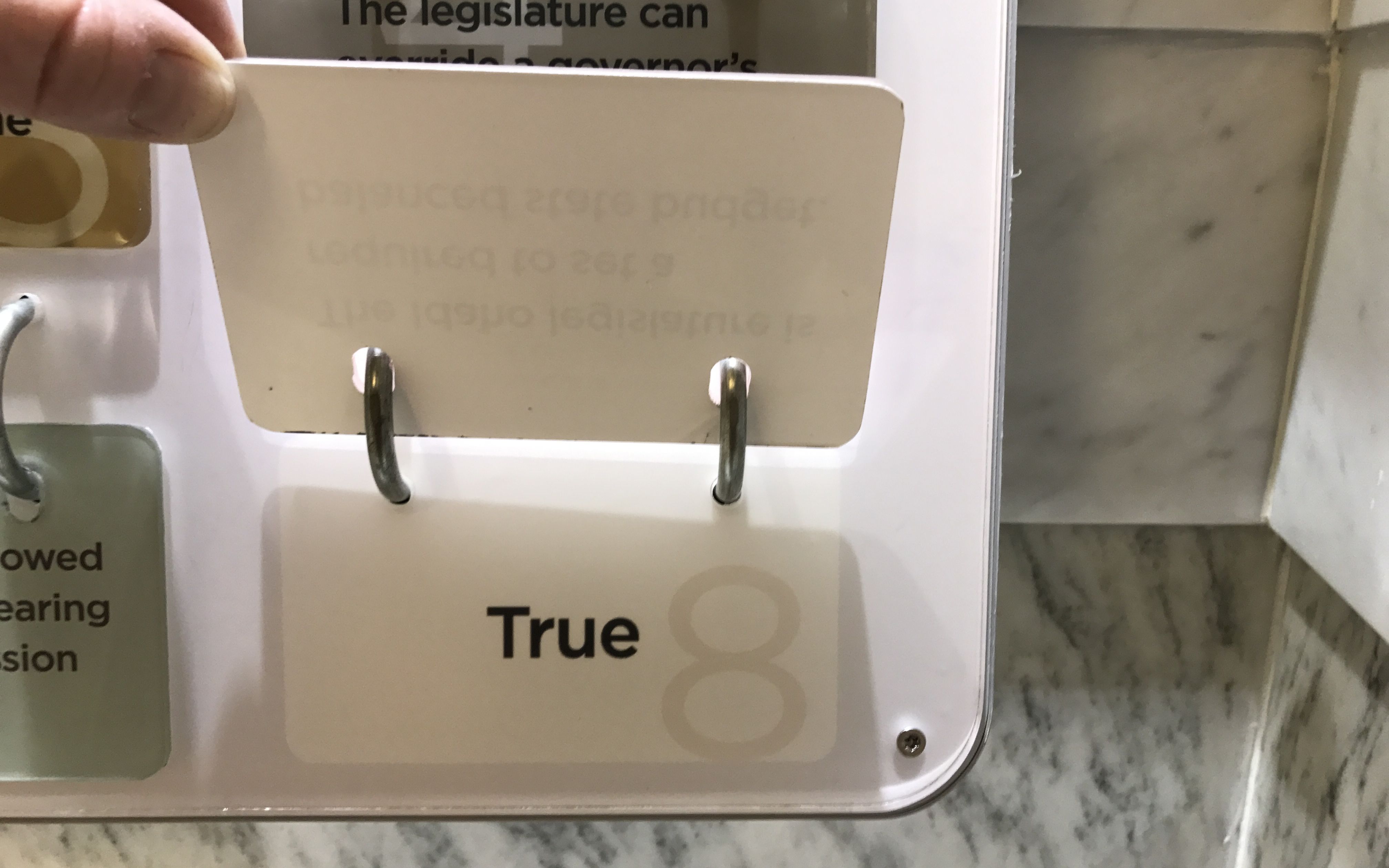
I kept working my way down, and came to a display in the lower level. I imagine that they had these things for the school tours, but you know me…they never let me advance past third grade.
They had rows of cards you could flip up to find the answers to questions.
What do you think the answer is?
And, with that, it was time to head out.
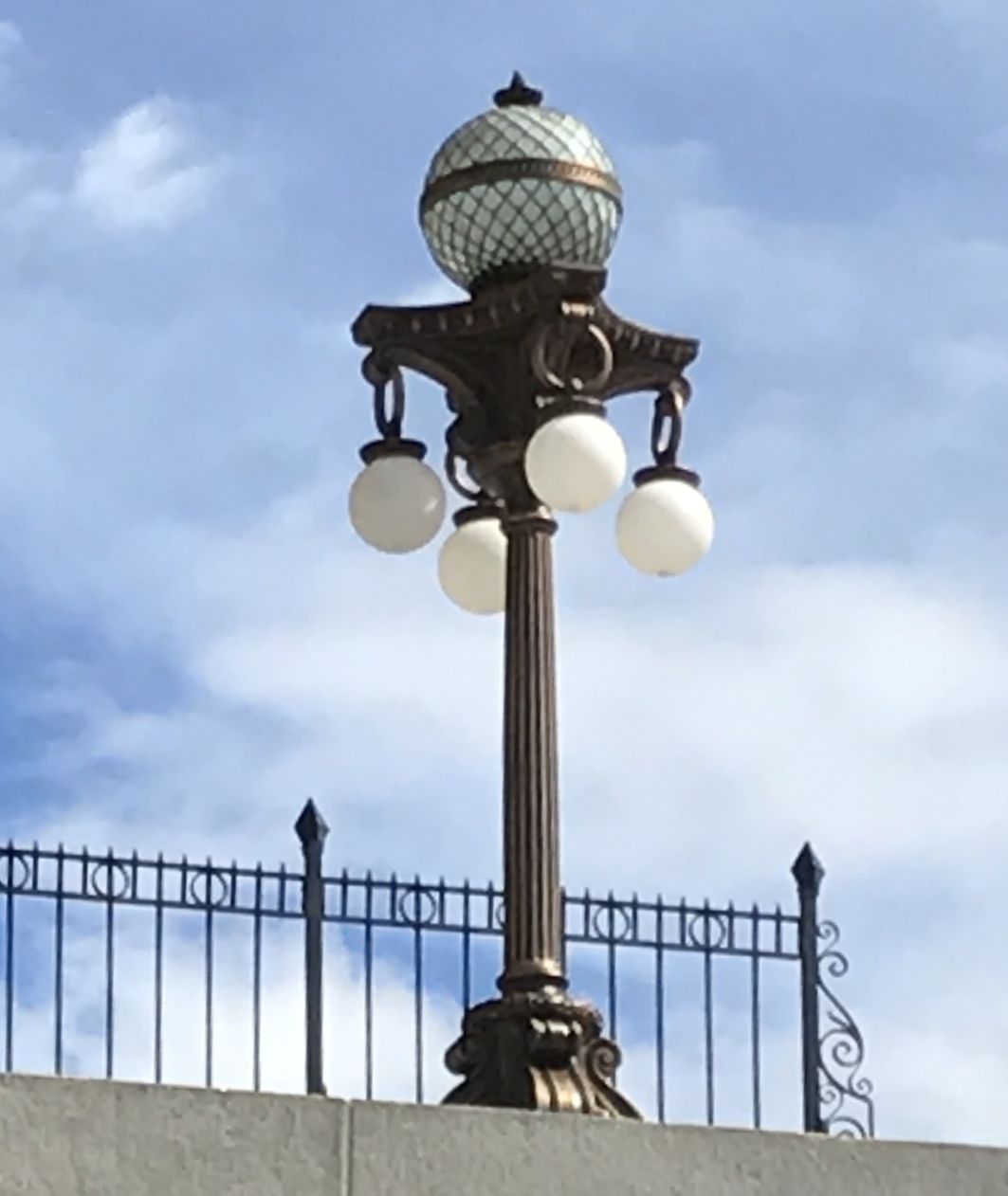
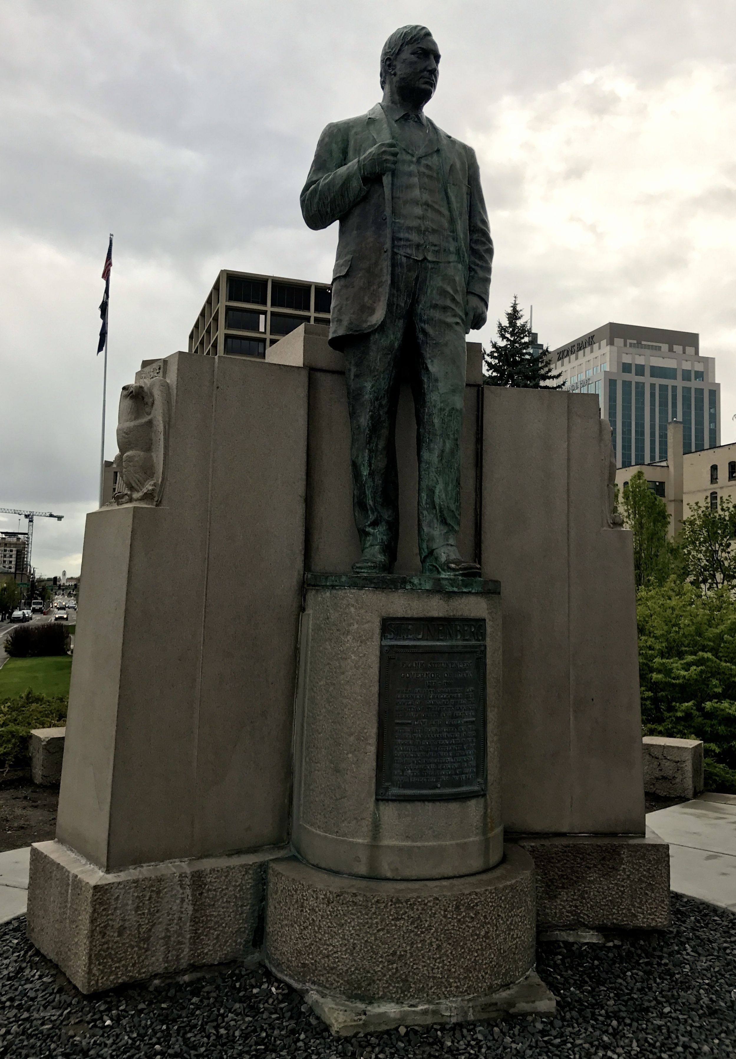
Judging by the cloud cover, I must have taken this photo when I went in.
In case the text is too difficult for you to read, it says:
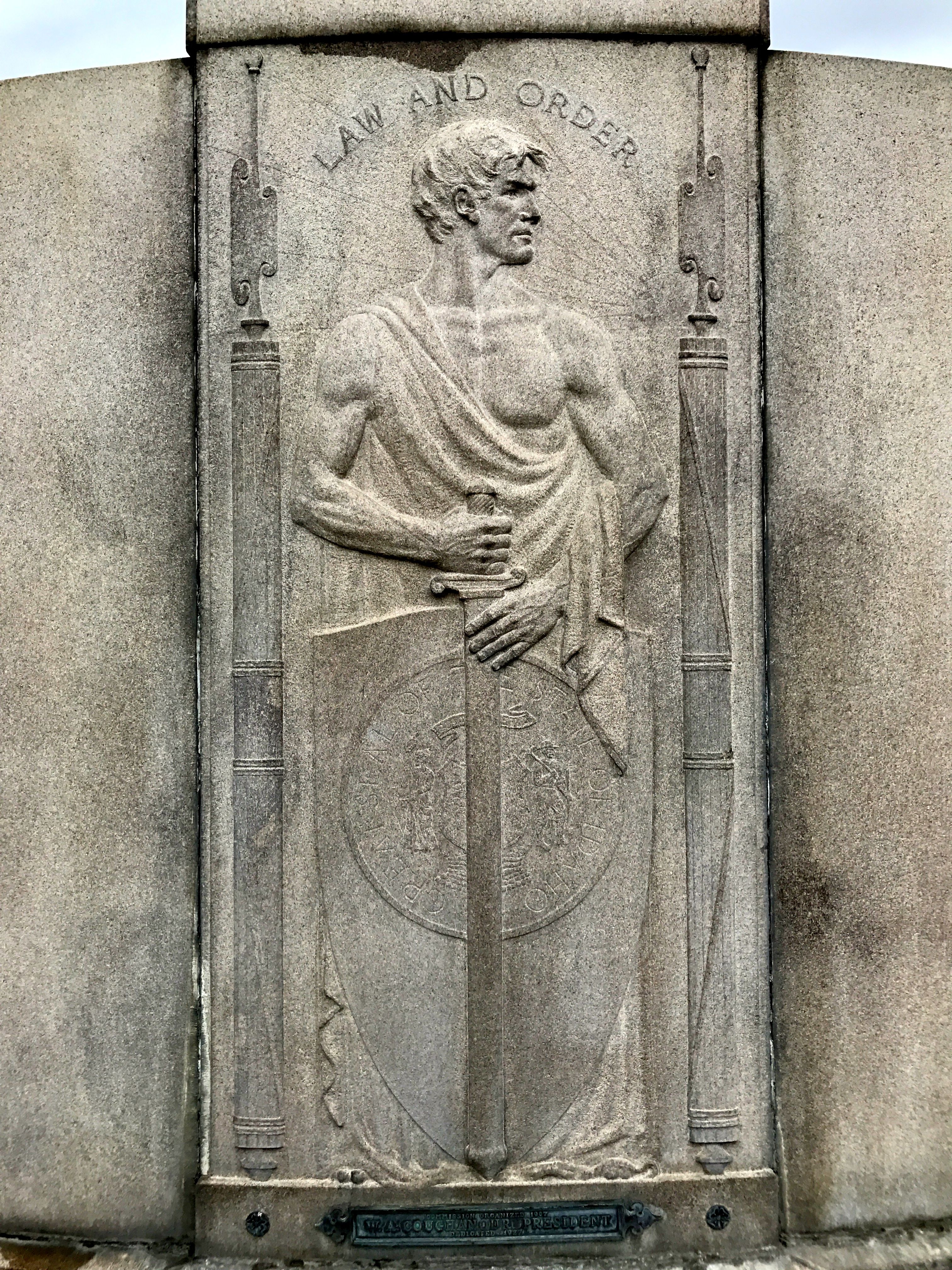
Frank Steunenberg
Governor of Idaho
1897 – 1900
When in 1899 organized lawlessness challenged the power of Idaho, he upheld the dignity of the state, enforced its authority and restored LAW AND ORDER within its boundaries, for which he was assassinated in 1905.
“Rugged in body, resolute in mind, massive in the strength of his convictions, he was of the granite hewn.”
In grateful memory of his courageous devotion to public duty, the people of Idaho have erected this monument
The quotation on the inscription is taken from the eulogy at his funeral given by U.S. Senator William Borah, who was the attorney for the prosecution at the trial of Harry Orchard , whose real name was Albert Horsley.
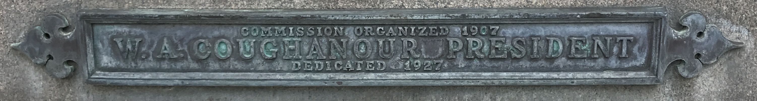
I always enjoy looking for information about when things were memorialized. This commission responsible for the statue was organized in 1907, and it was dedicated in 1927. W.A. Coughanour was the president – of the commission, I imagine.
Backsides can be informative.
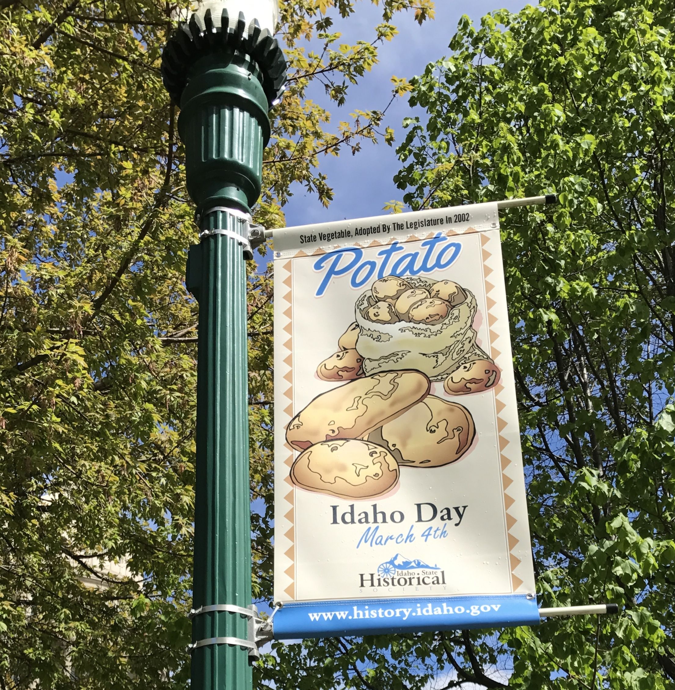
I walked around a bit. Mmm! Potatoes!
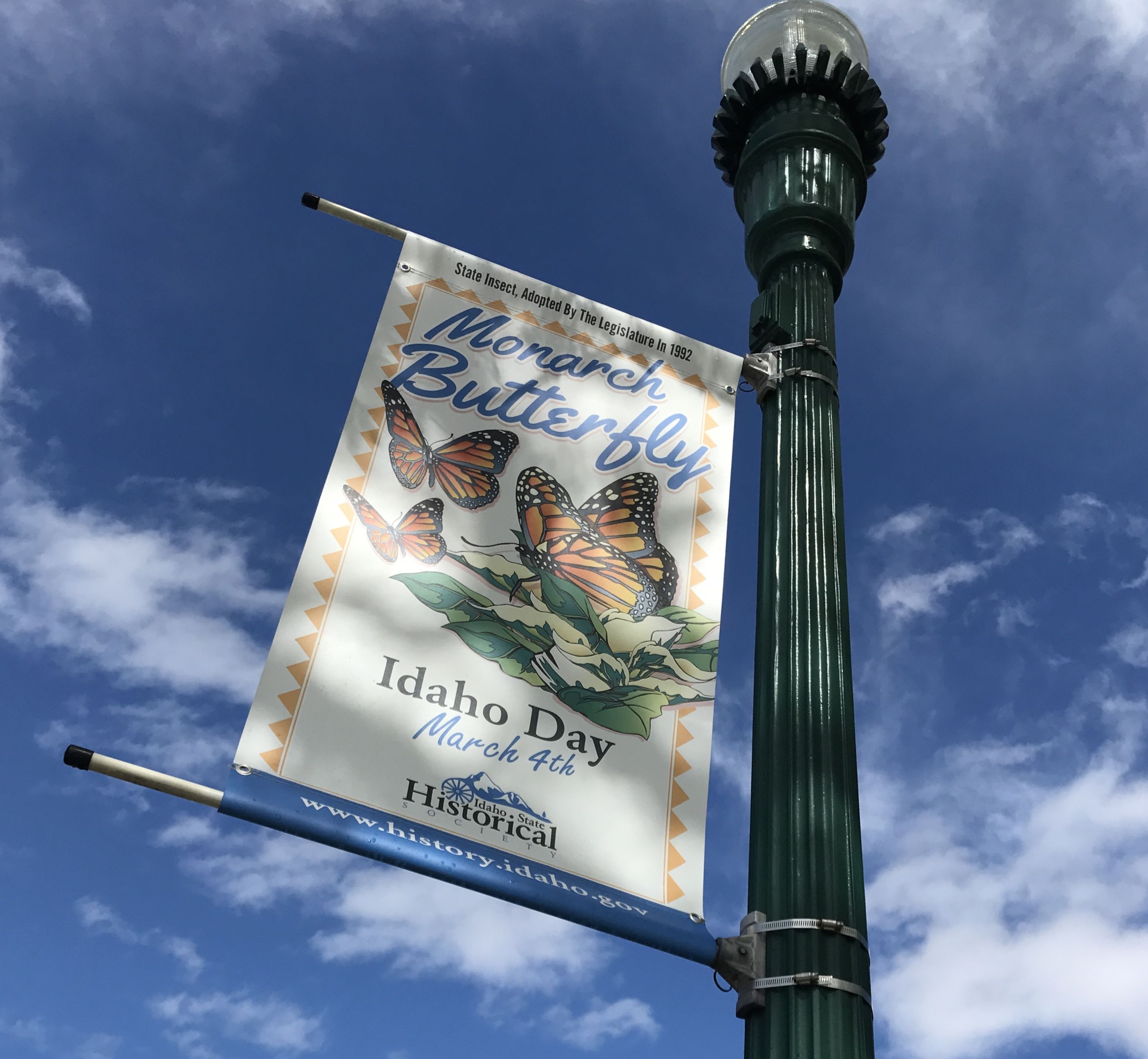
I didn’t associate Monarch Butterflies with Idaho, but they do get around.
This piece of modern architecture does reflect the capitol well.