Lake Champlain is a rather small lake – well, at least in comparison with Lake Michigan or even Lake Erie. It’s about 160 miles long by 15 miles wide at its largest dimensions – that’s about 500 square miles of surface area. It’s average depth is about 60 feet and its maximum depth is about 400 feet. It is drained to the north by the Richelieu River, which empties into the Saint Lawrence River. It’s also connected to the Hudson River by the Champlain Canal. Thank you, Wikipedia!
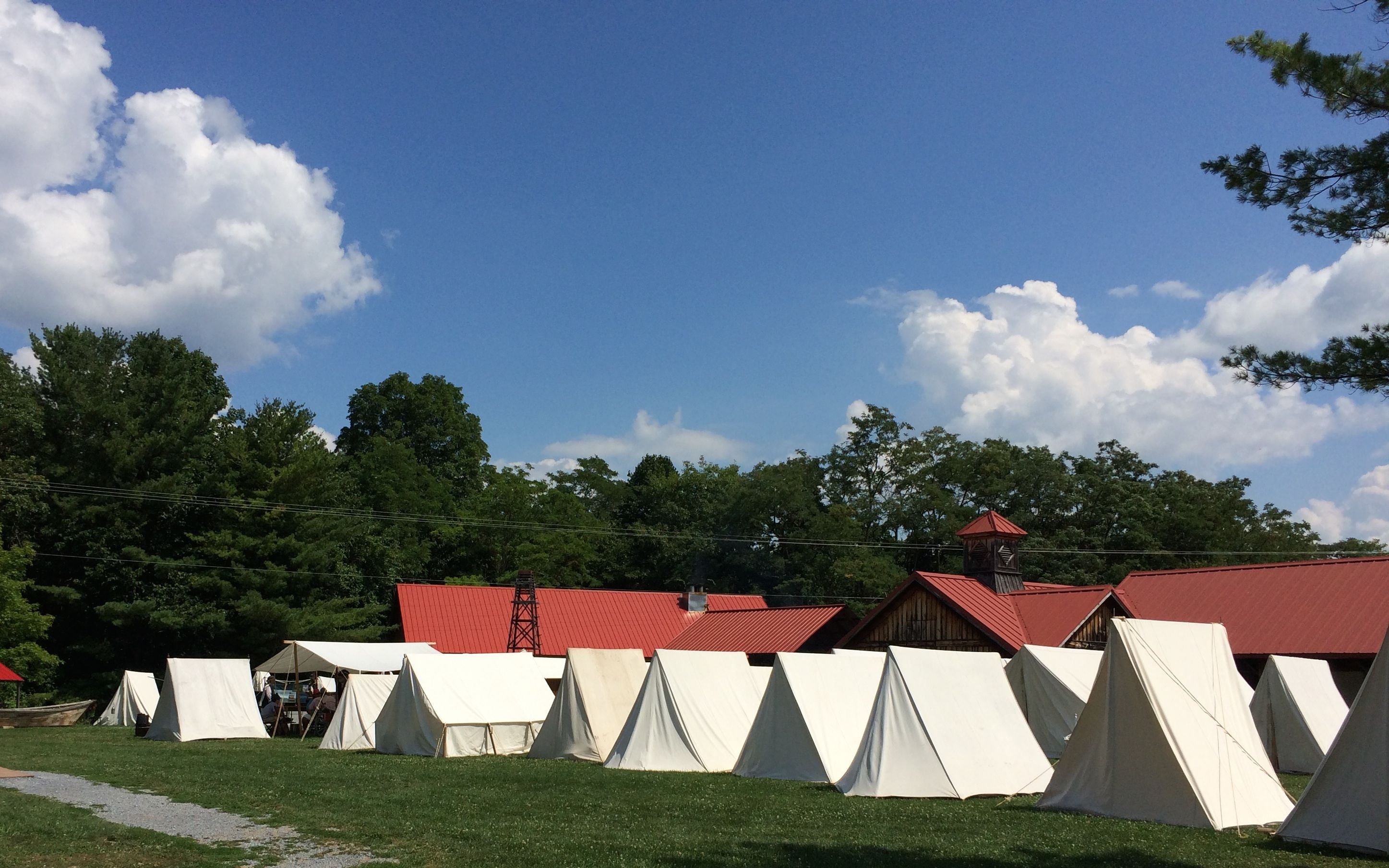
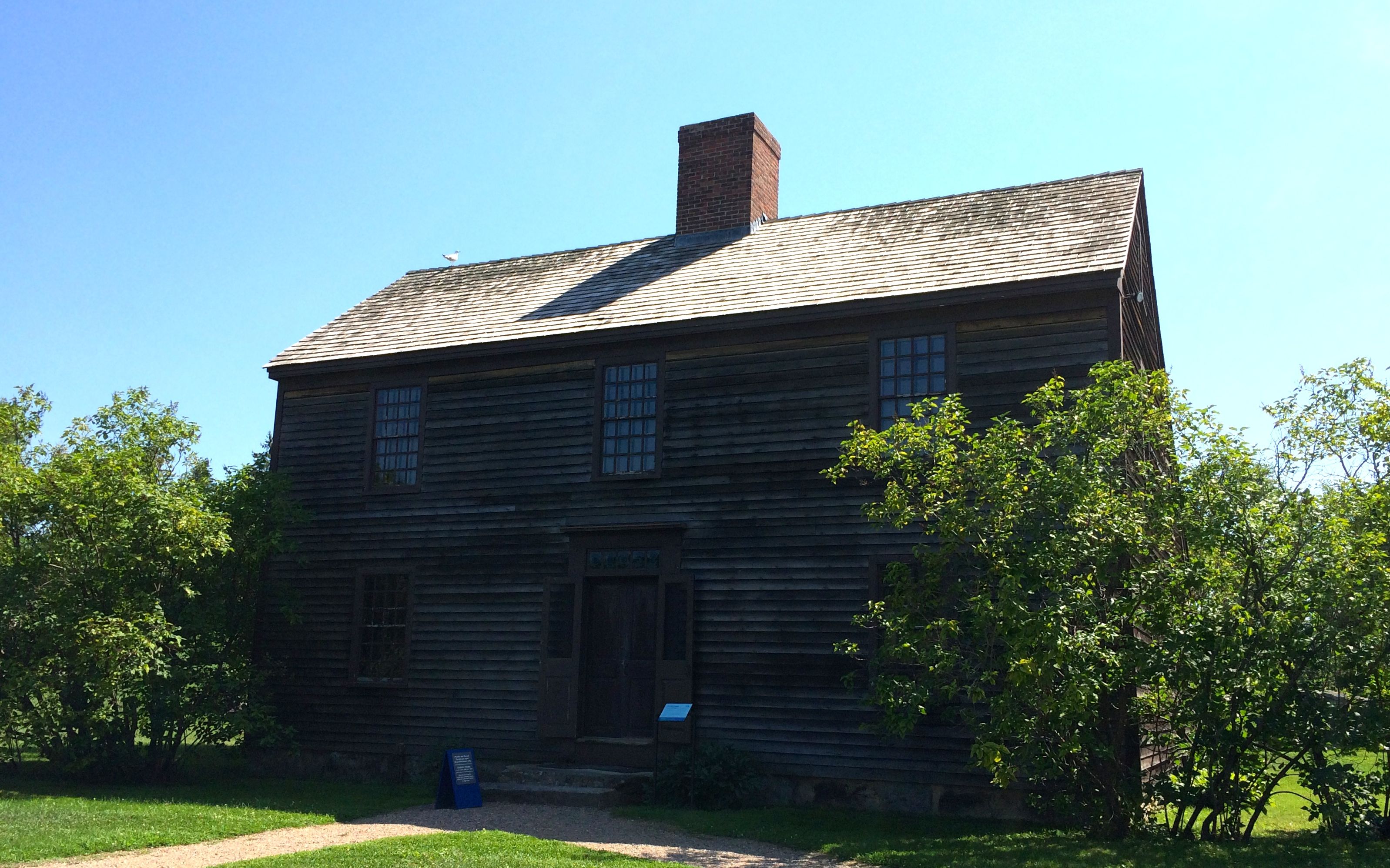
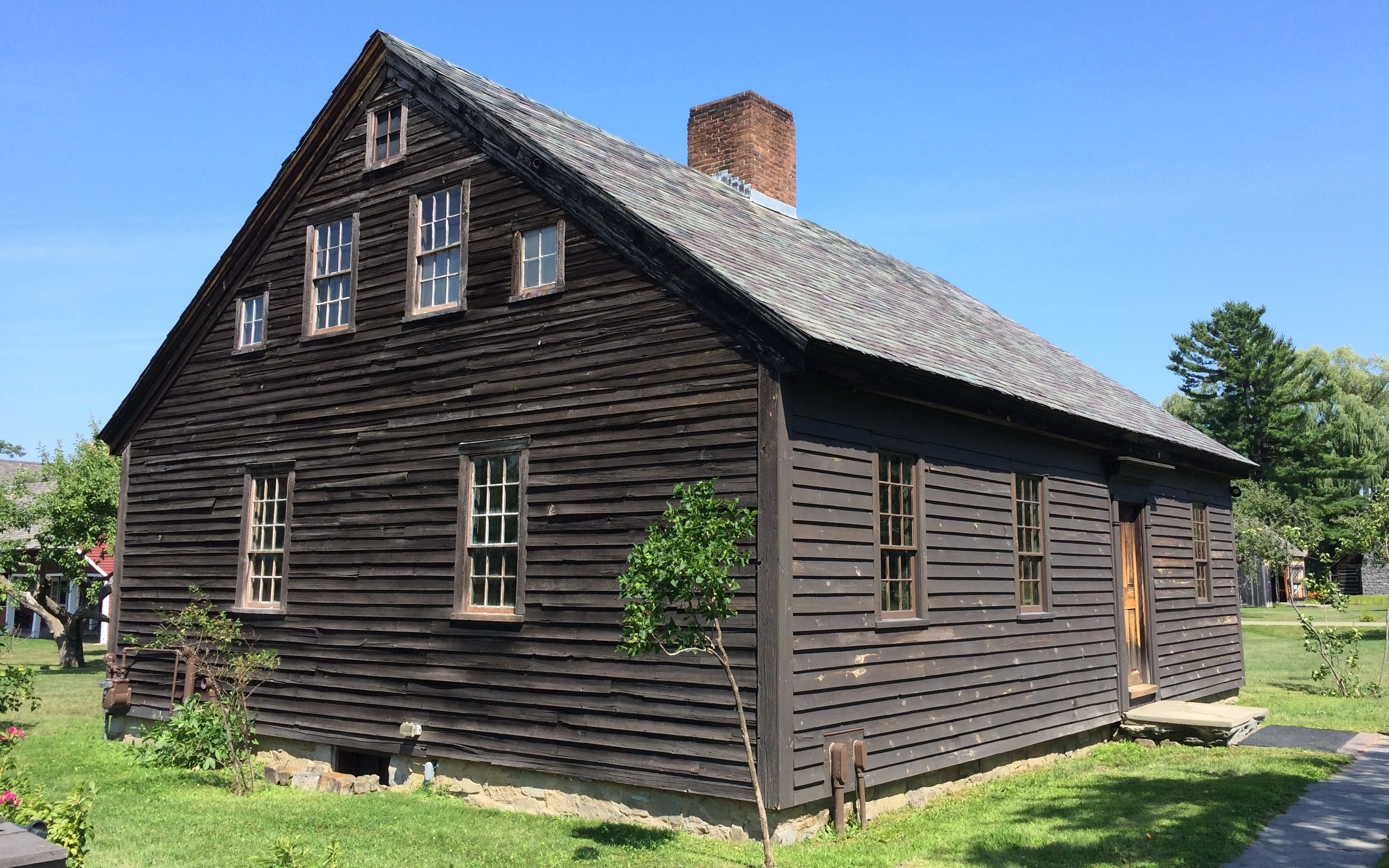
I happened to visit LCMM on their reenactment weekend, Rabble in Arms, so I was treated to something special. I got to see Revolutionary War re-enactors in their camp, as well a witness a mock battle with the Philadelphia II.
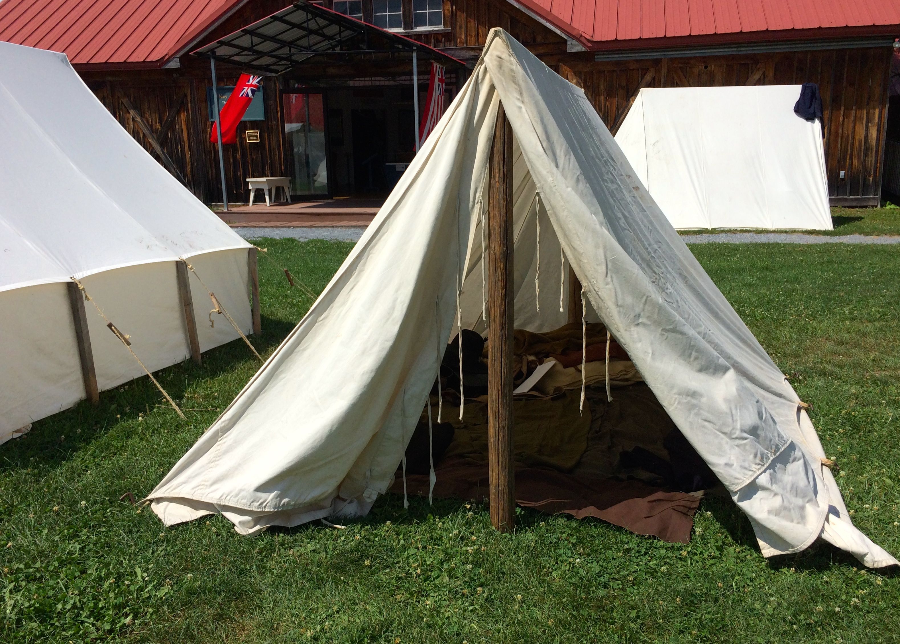
The tents were lined up like soldiers. Some were pup tents and some were wall tents.
I have to say – an Airstream looks a lot more comfortable.
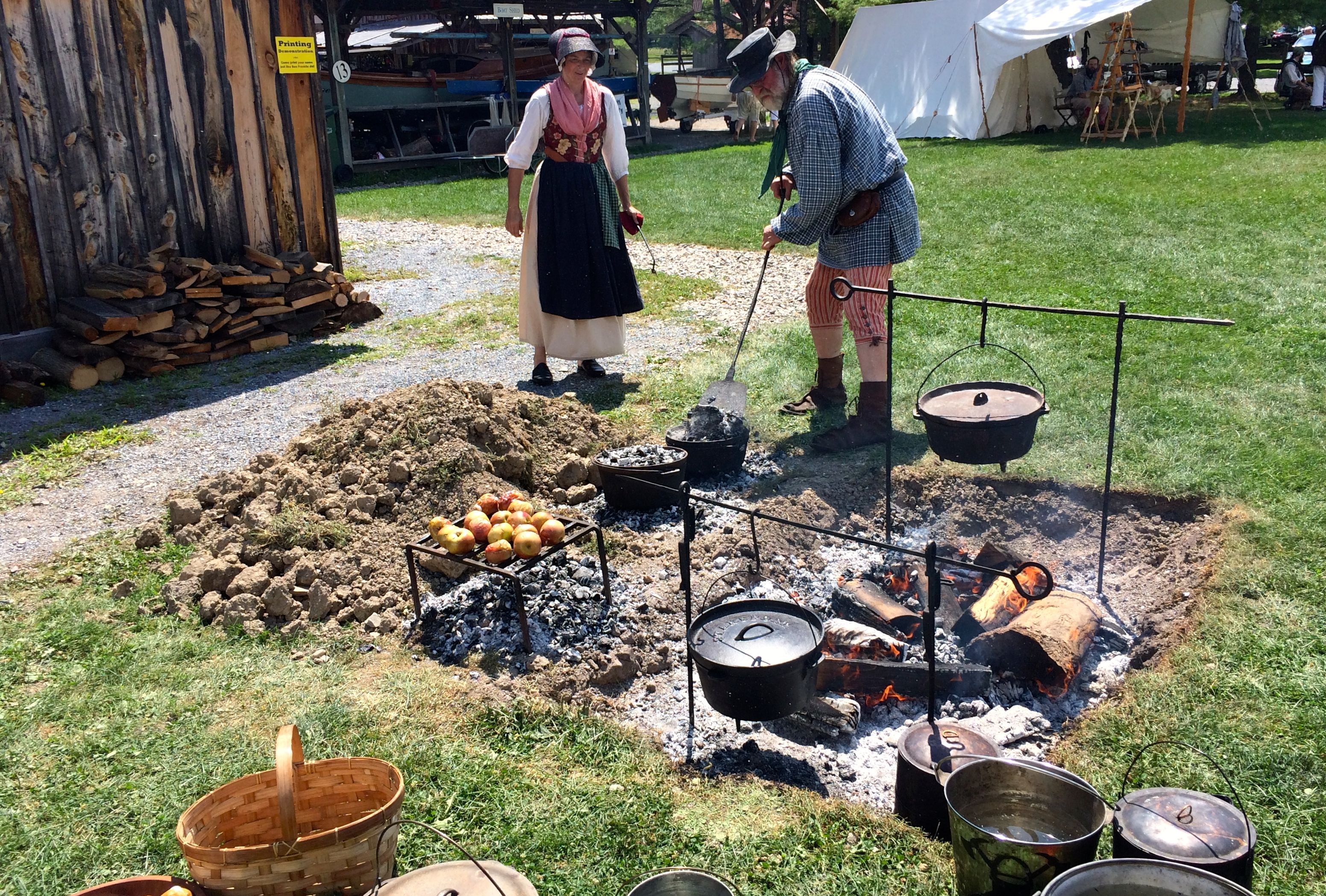
There were cooks making food for the meals. The apples roasting on the grill over coals were being prepared for the evening meal. The man was shoveling coals on top of the dutch oven to bake bread.
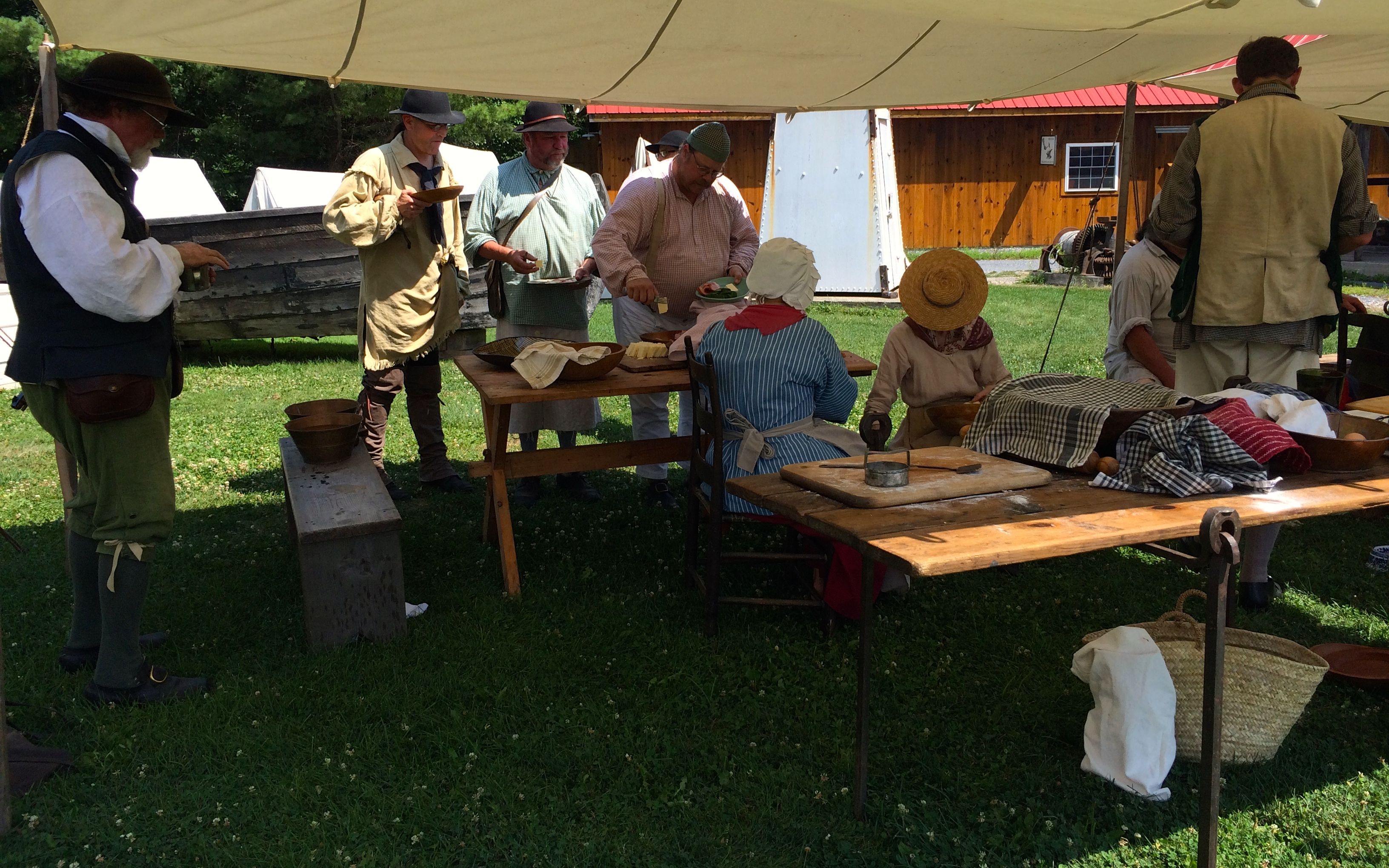
The re-enactors gathered for their mid-day meal. The food looked good. I wish I was dressed for the occasion. Maybe they would have invited me to join them.
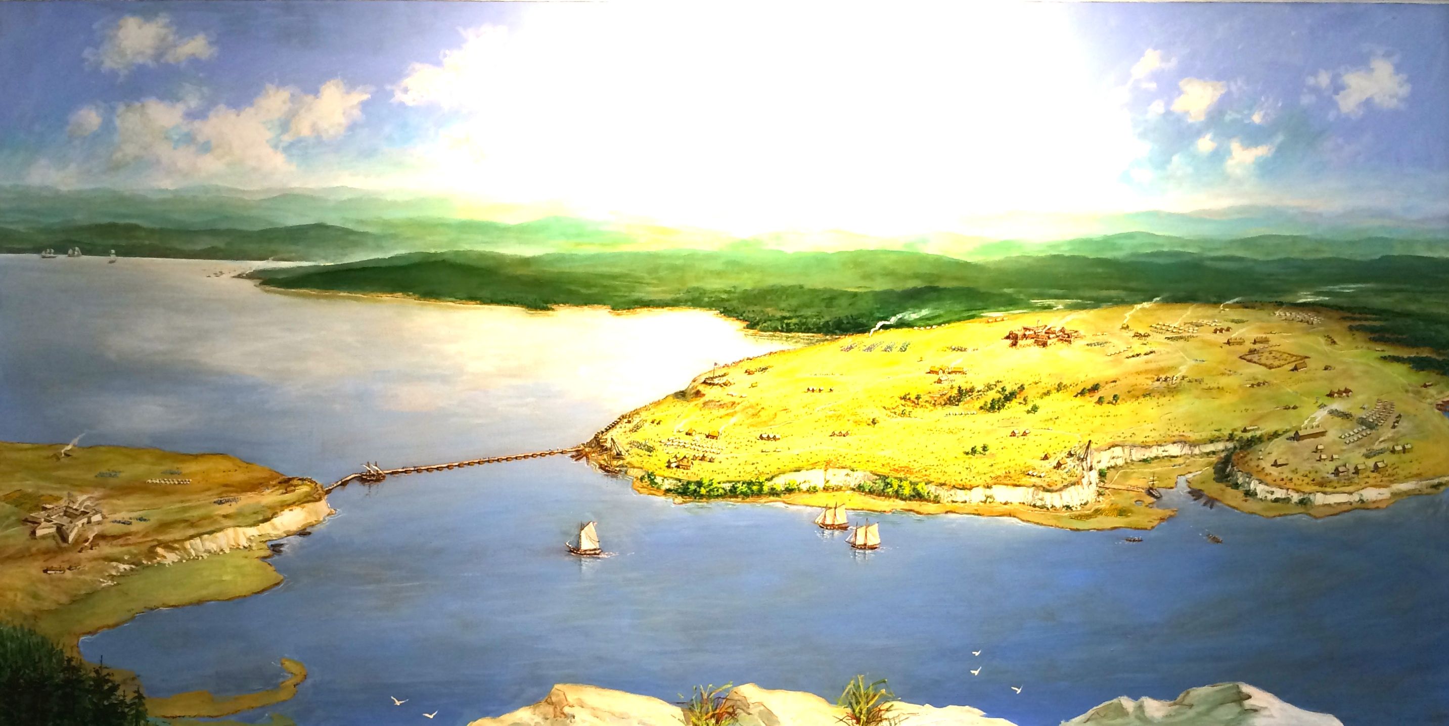
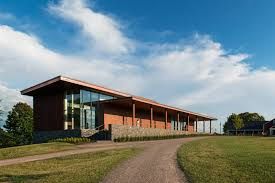
While they were eating, I decided to look at some of the exhibits. They had a good video that described the archeology of raising the Philadelphia. It was originally raised in 1935 by an amateur archeologist named Colonel Lorenzo F. Hagglund. He wasn’t an archeologist, but he was a an experienced salvage engineer. He located the Philadelphia midway between Valcour Island and the New York shore. She was lying upright in 60 feet of water, her mast still standing with its top barely 15 feet beneath the surface.
After Hagglund raised her from the bottom of the lake, he put her on a barge and toured the lake. After his death, Philadelphia was donated to the Smithsonian’s National Museum of American History. If you’d like to see more information on the original Philadelphia, click here.
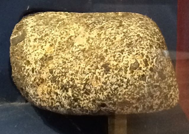
One thing I found interesting was this ballast stone that was used in the Philadelphia.
It was a cobble about the size of a fist that was used in the bottom of the Philadelphia to give it stability in the water. The ballast stones were given to volunteers who worked on raising the gunboat.
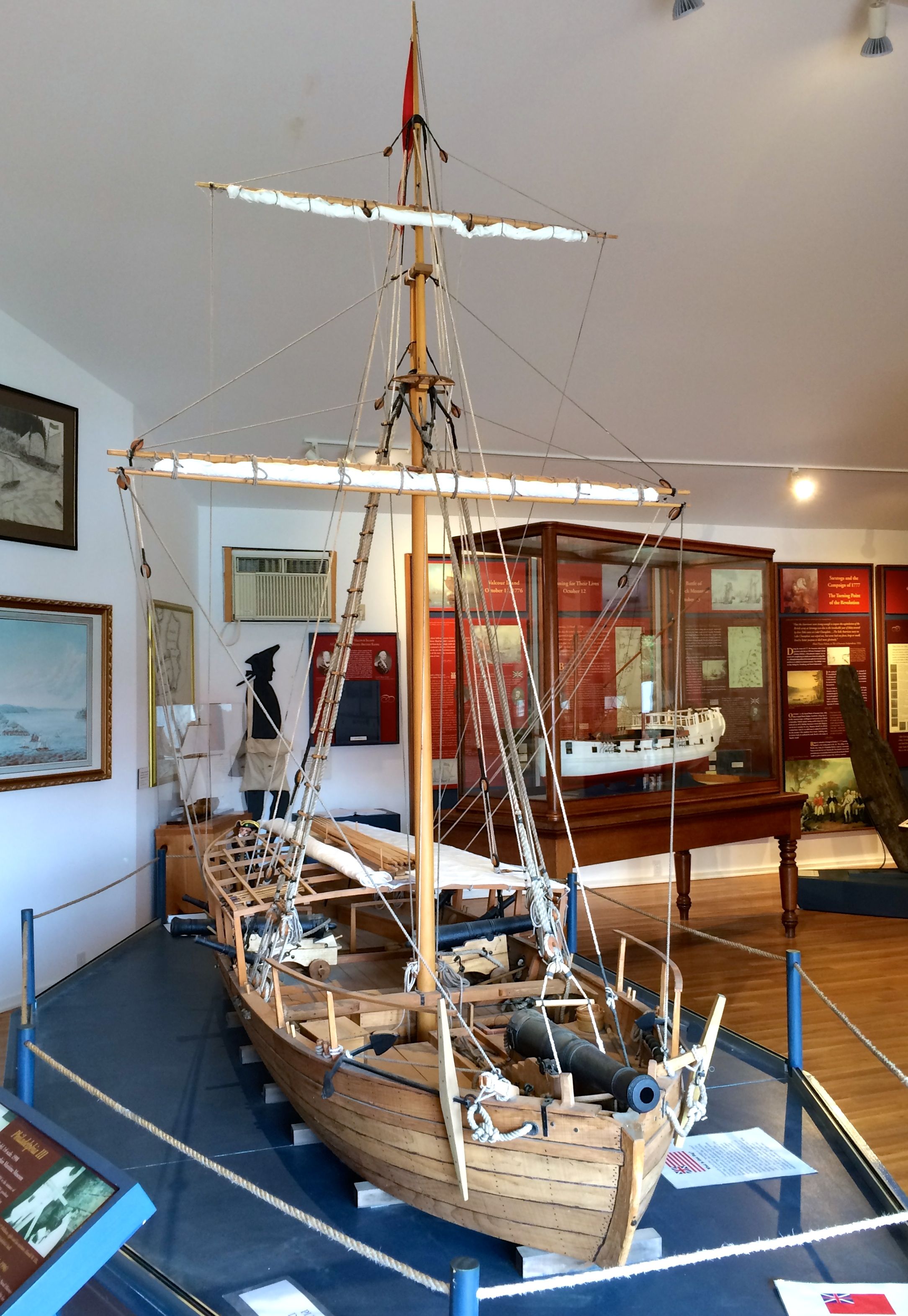
They had a model of the Philadelphia that was a nice preview of what was to come.
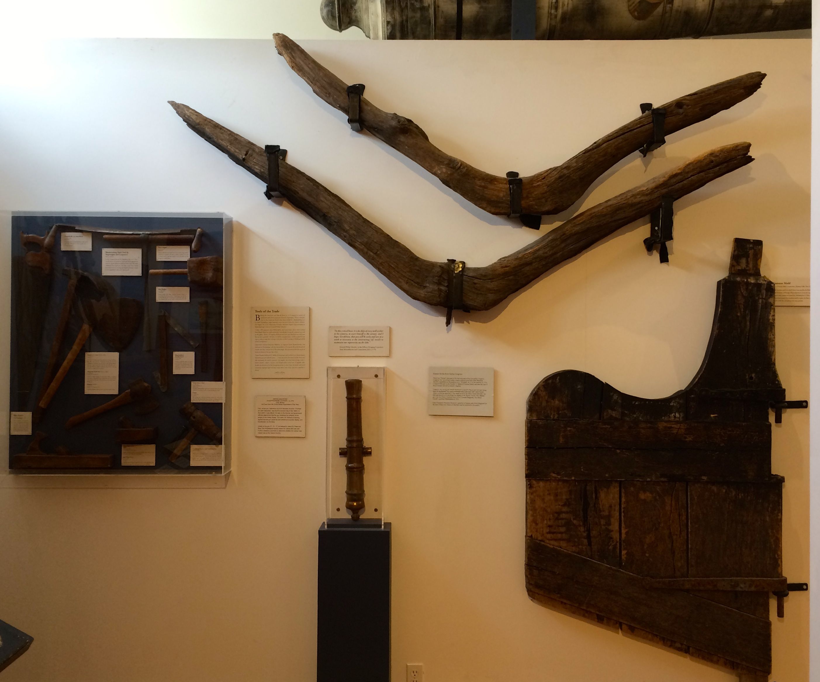
They also had other archeological odds and ends that were brought up from the bottom of the lake.
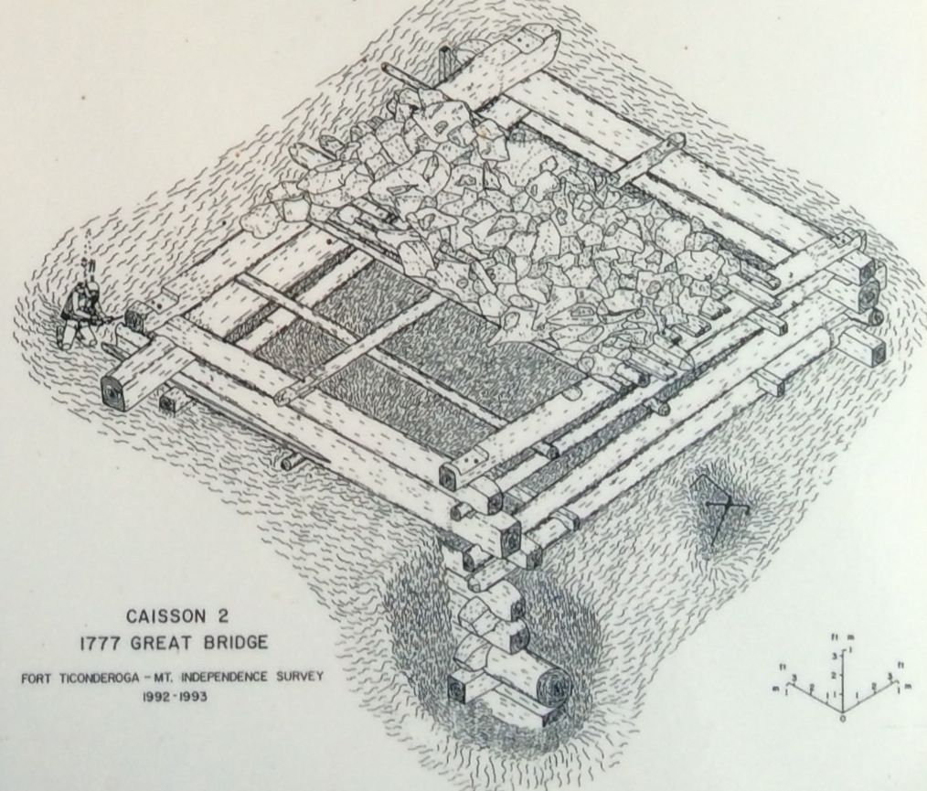
They also had information and an artifact from the caisson bridge that connected a fort on Mount Independence in Vermont with Fort Ticonderoga in New York.
According to the information, there were a series of 22 caissons that were built on the ice during the winter and then sunk with rocks. A floating footbridge was connected with chains to the caissons.
What I do find amazing is that all but one of the caissons are still in place, at least according to the signs.
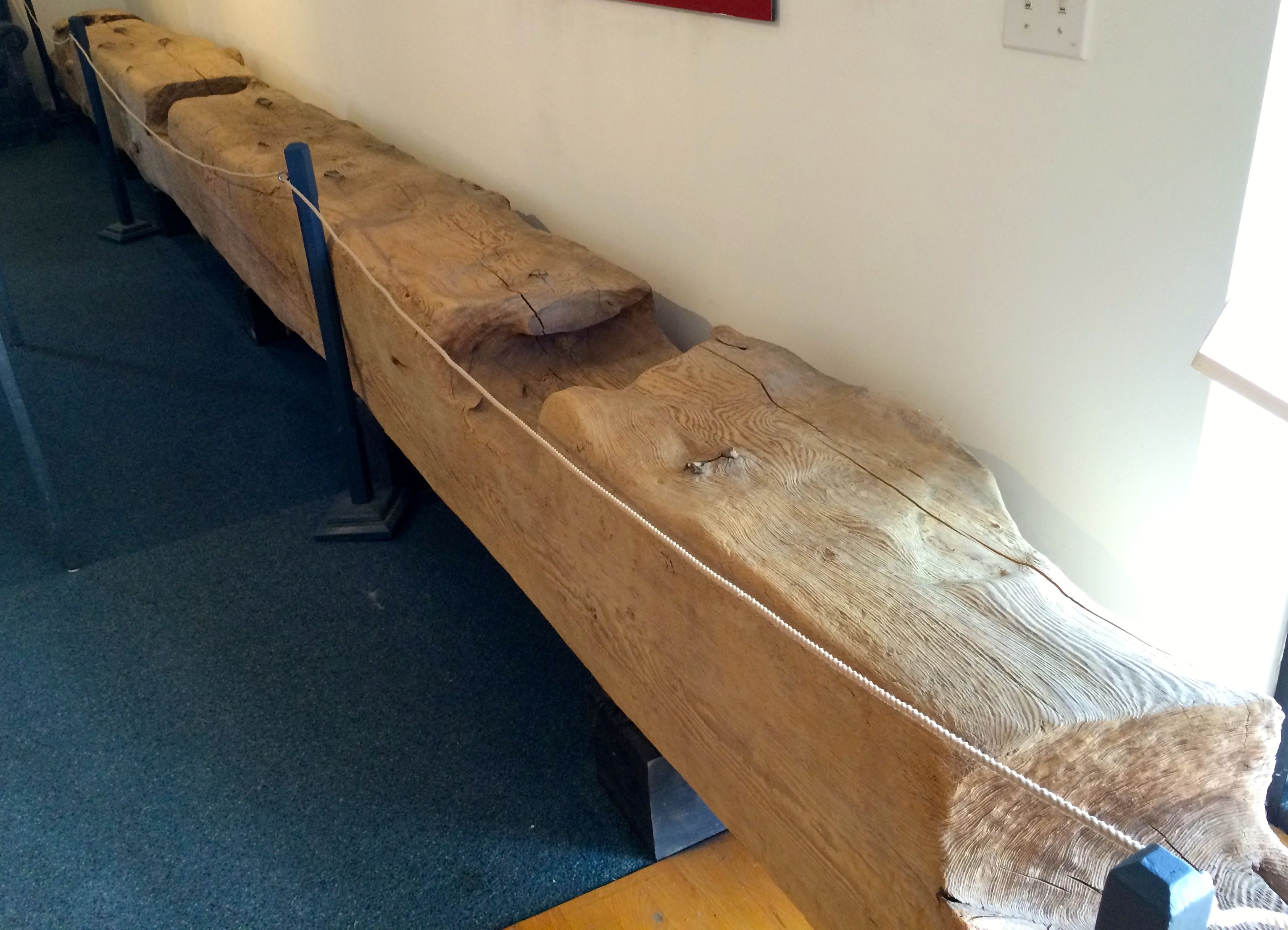
Here is one of the logs from the bridge. When I think of the Revolutionary War, it seems so long ago. Yet, here is a piece of the infrastructure that made it possible.
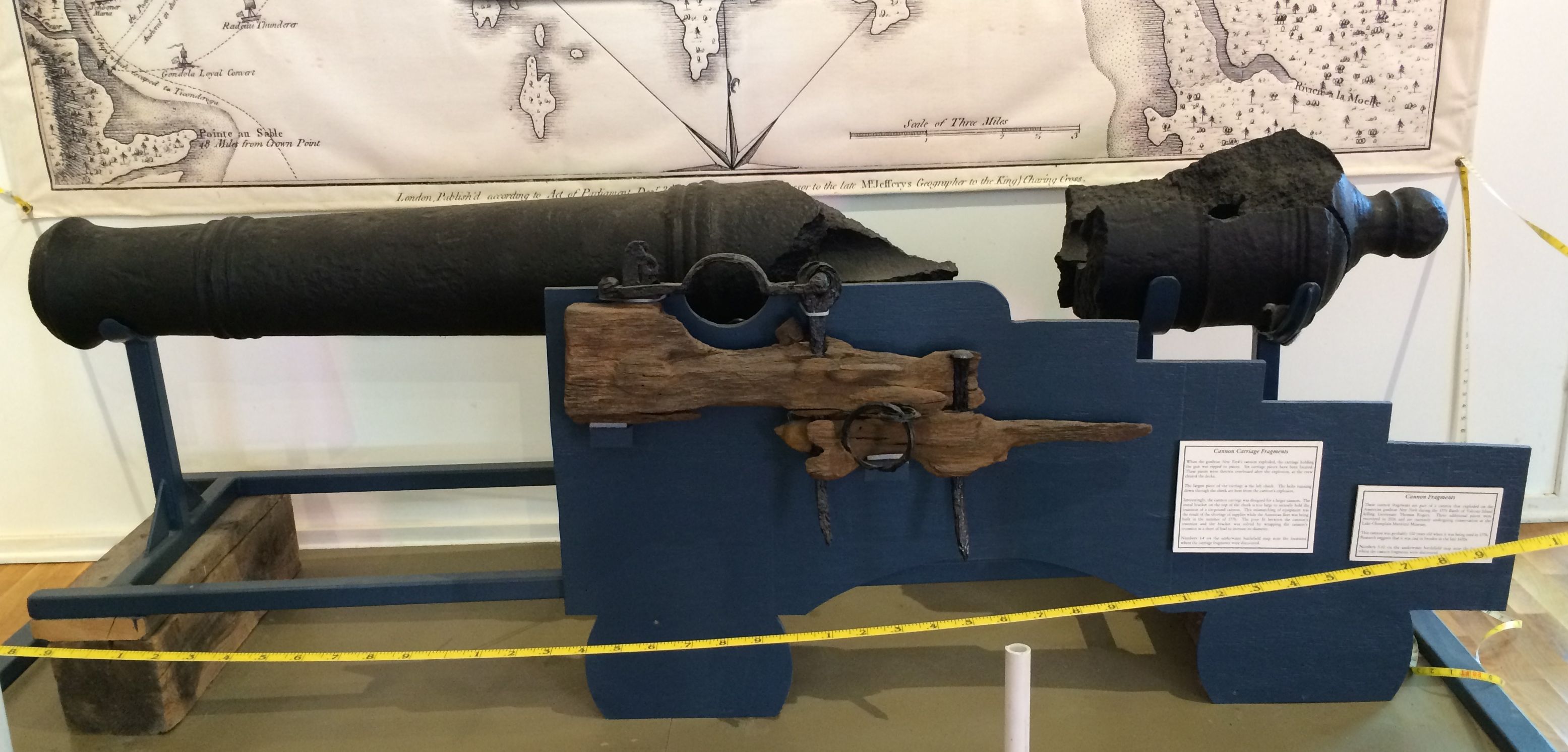
Ordnance was also found under the water. It looks like this one must have exploded.
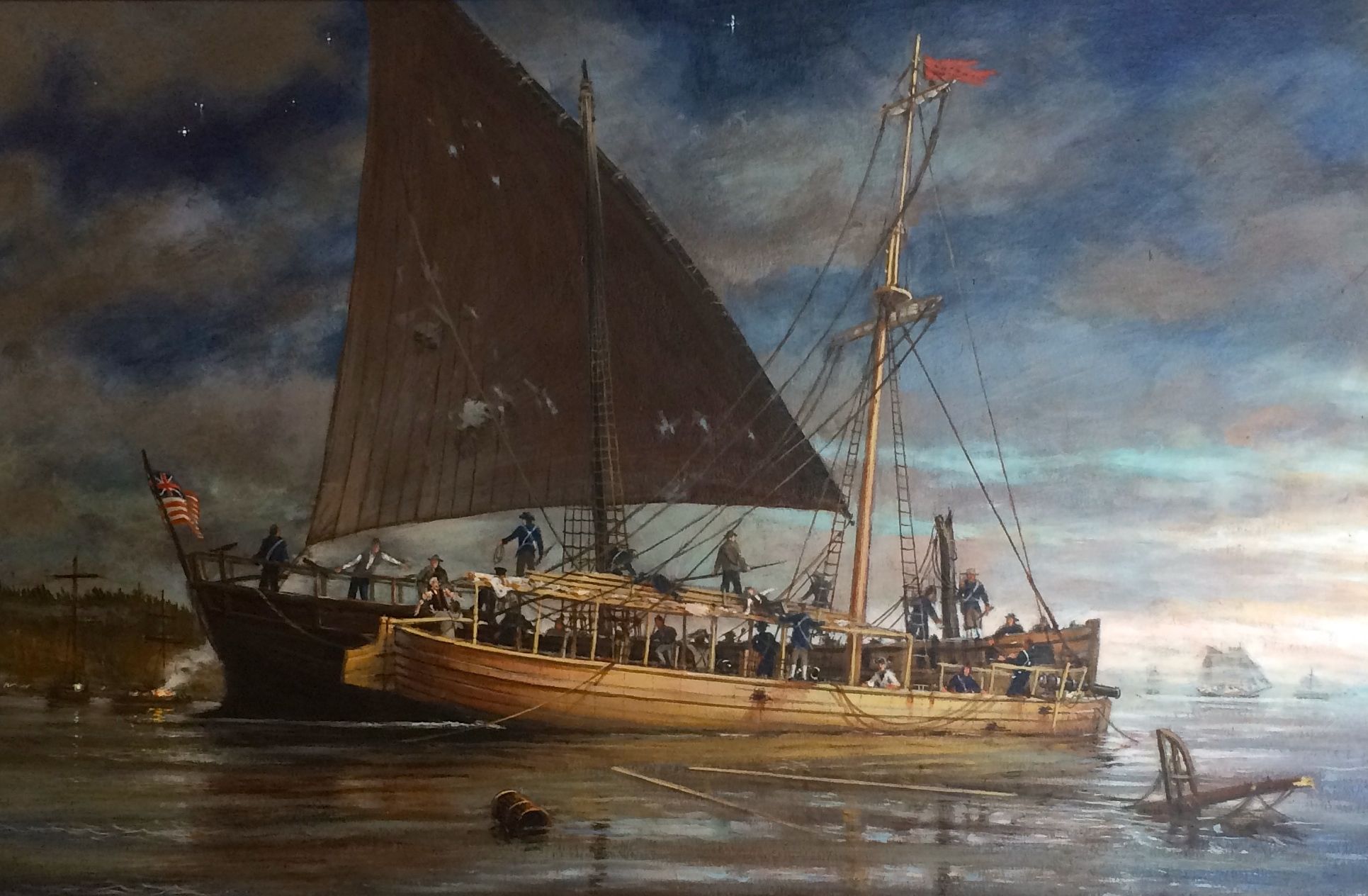
Speaking of things that sink, here is a painting of the Philadelphia as it was going down.
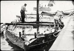
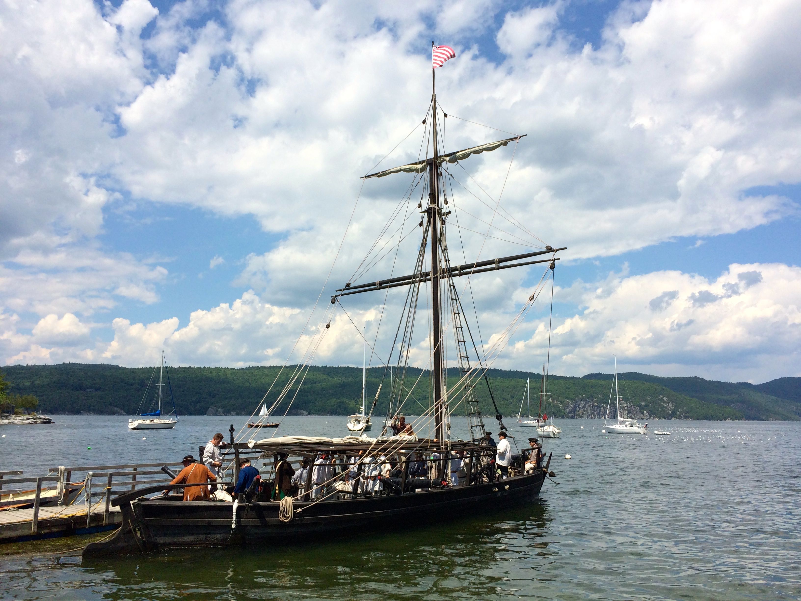
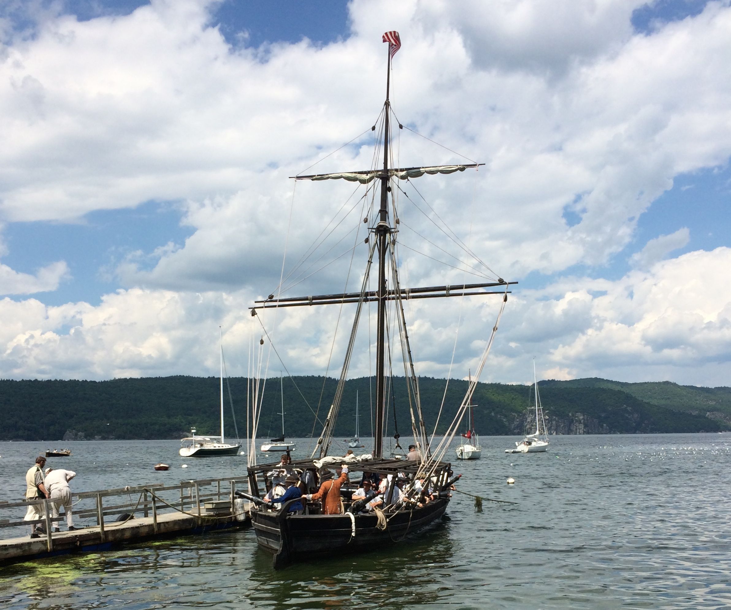
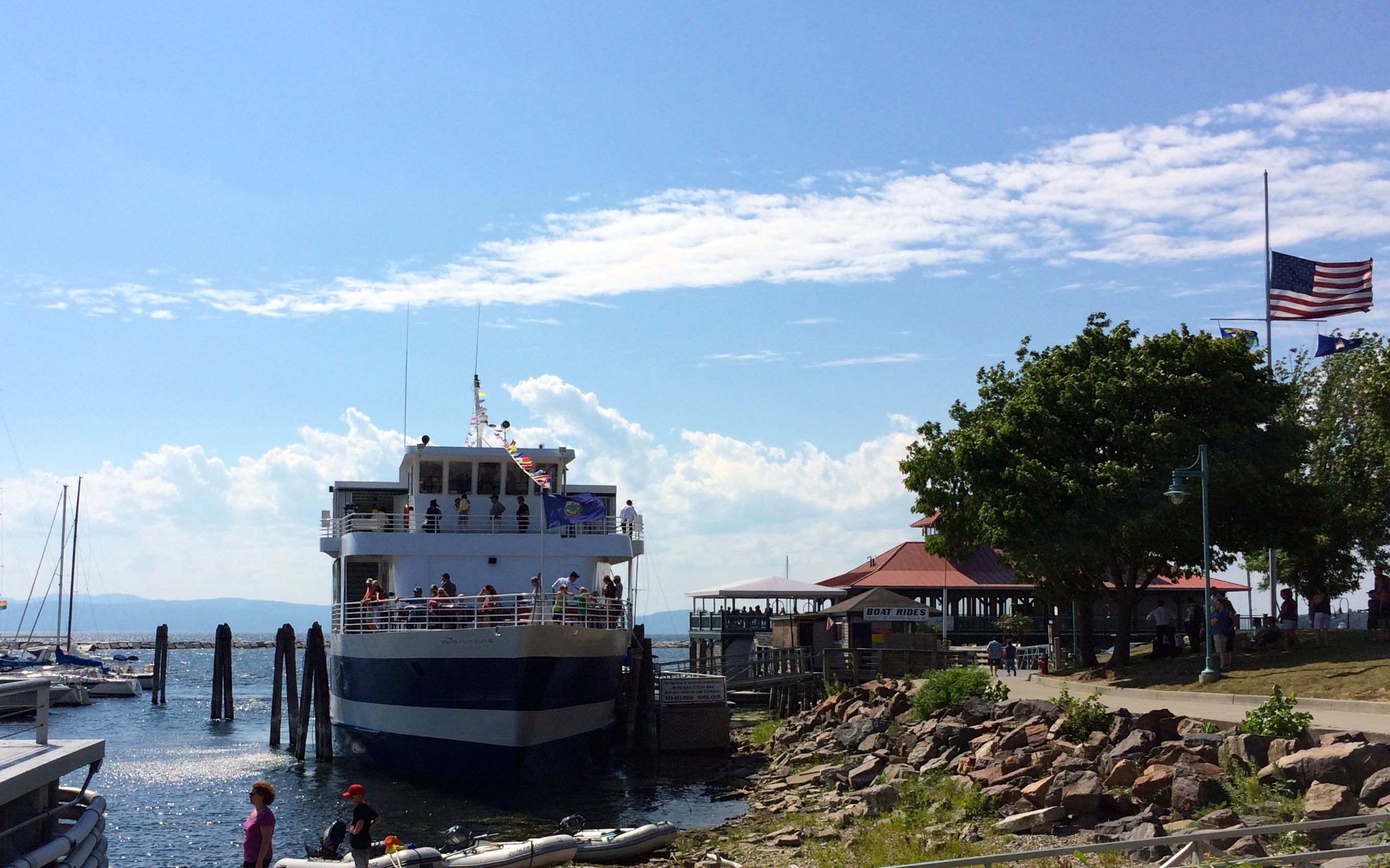
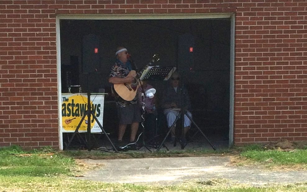
And here is Philadelphia II, at the dock. It was getting ready to reenact a battle.
The flag caught the breeze. I imagine that the ship would have really moved if the sails had been up. The used the oars for this exercise.
After the battle, which involved people on shore who lured them within gun range so that they could fire at the boat, They cam e back to dock and I headed up to see what else I could discover.
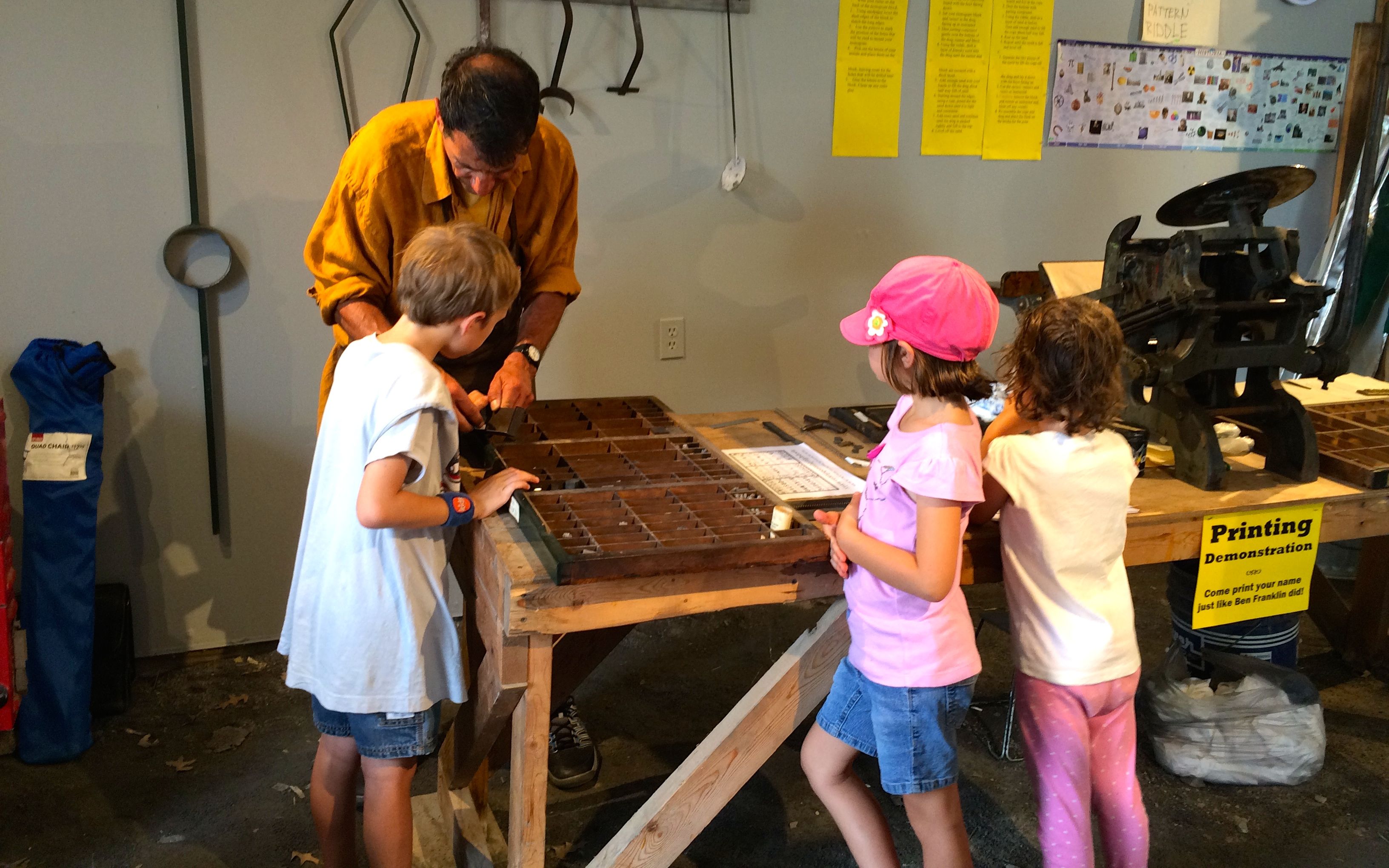
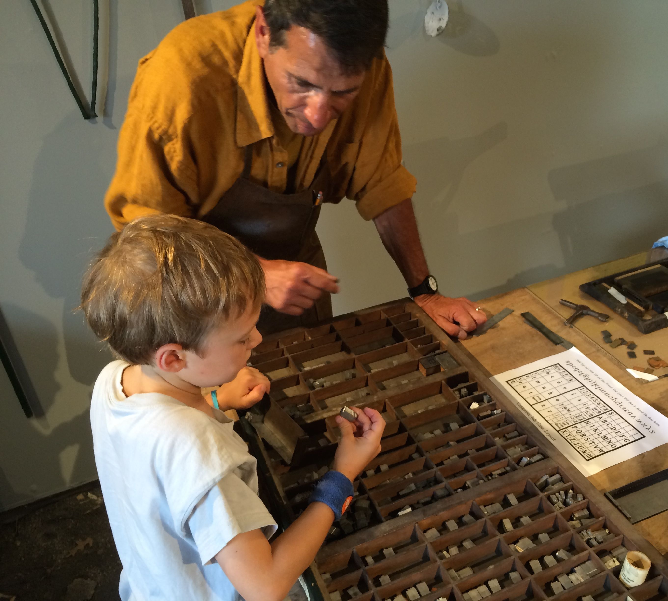
There was a typesetting demonstration after the battle reenactment. I took a course in typesetting back in the 1990’s, so it was fun to watch.
But, gee! the kids get to have all the fun!
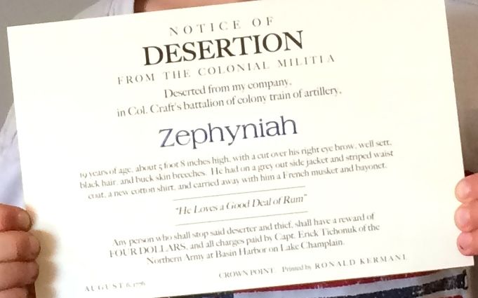
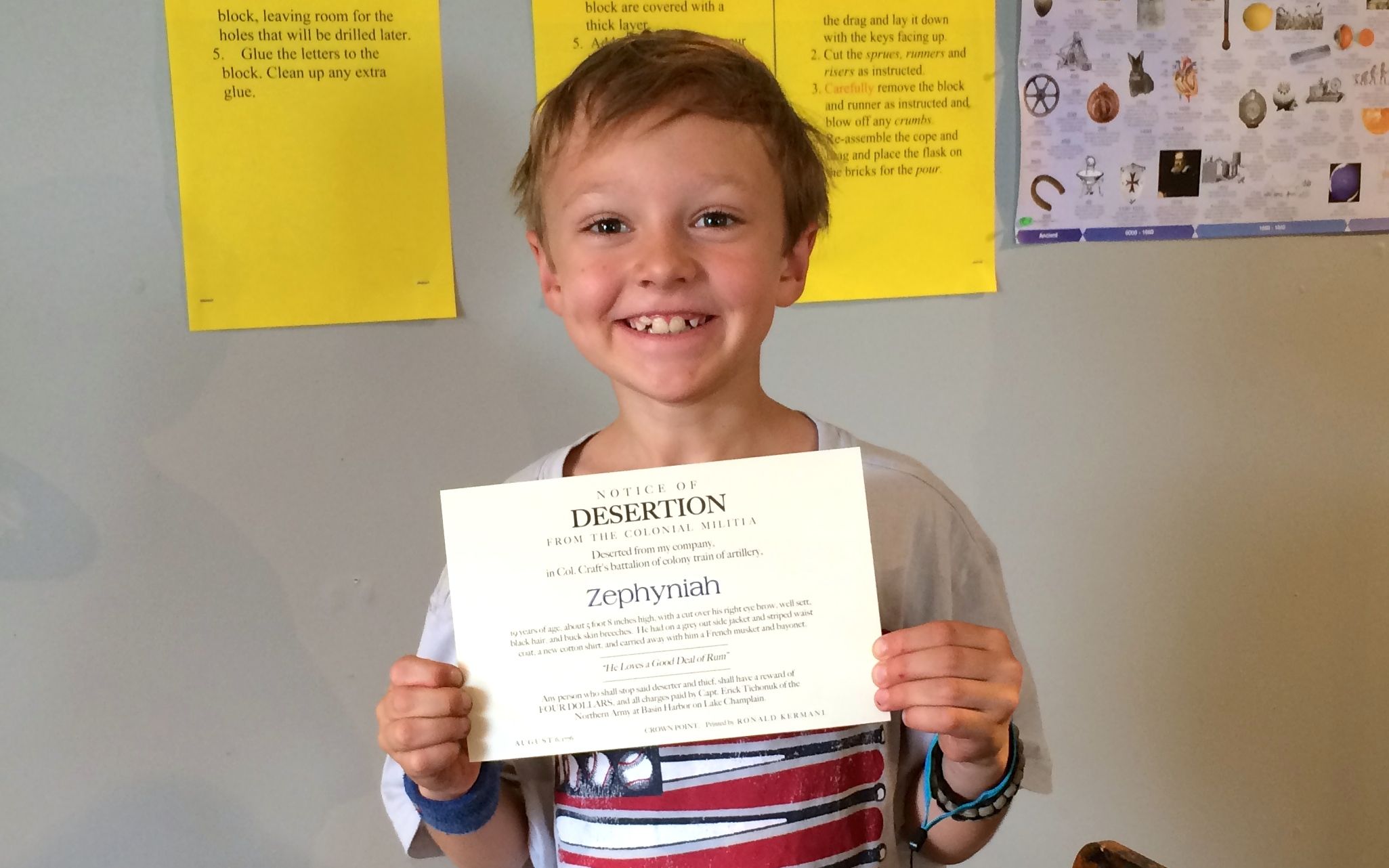
This lucky youngster got to print his own notice of desertion. With a name like “Zephyniah” he got a lot of practice finding letters.
He sure looks proud of his work!
There were many other interesting items.
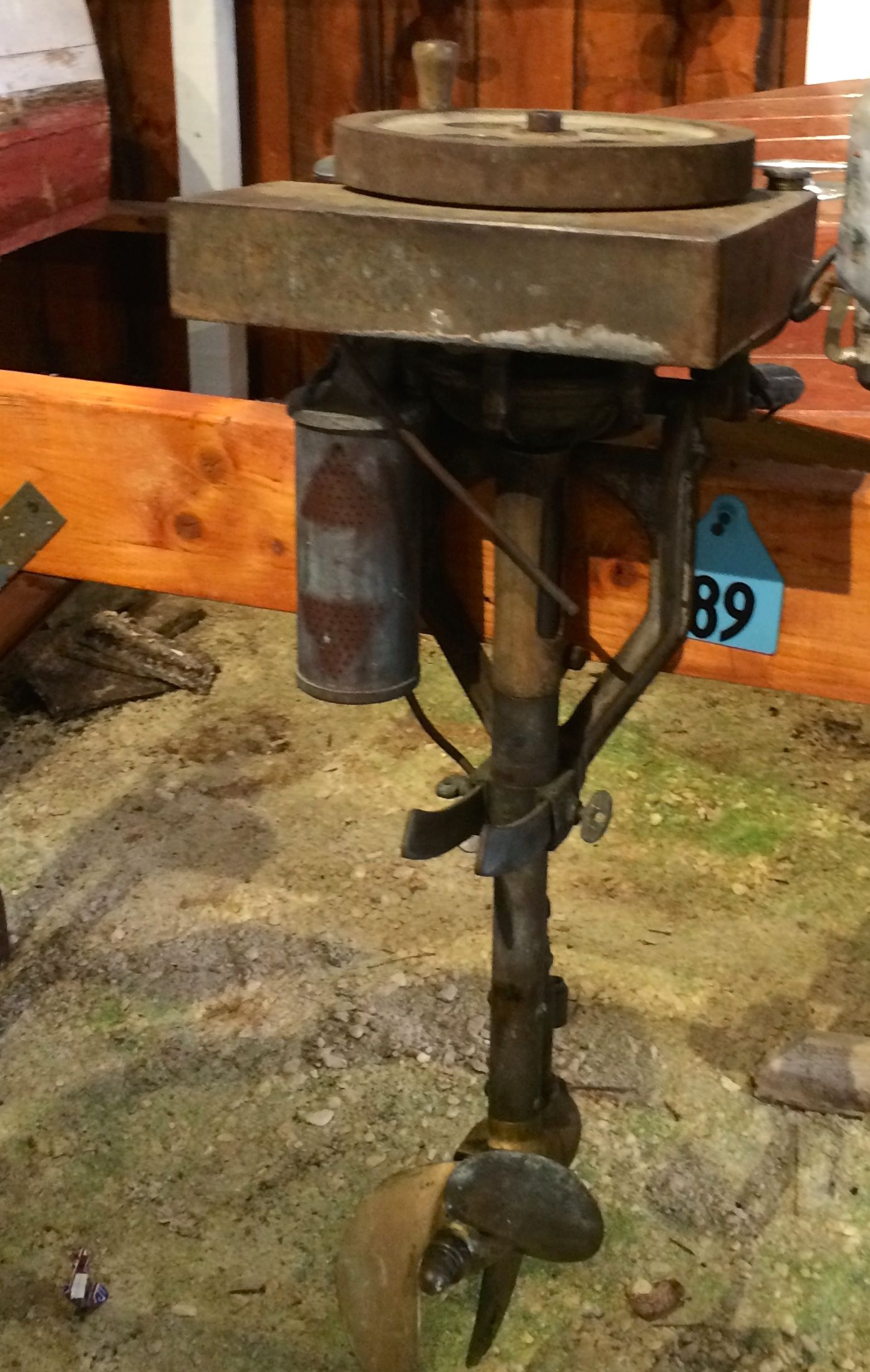
Like a display of the first hundred years of outboard motors. I was tempted to just walk out of that display, but there was a guy there who collected outboard motors. It was interesting to hear him speak with such enthusiasm about a collection that wasn’t something I didn’t know much about.
Incidentally, this is the oldest outboard motor in the collection. Things have changed a bit, but you can see the similarity.
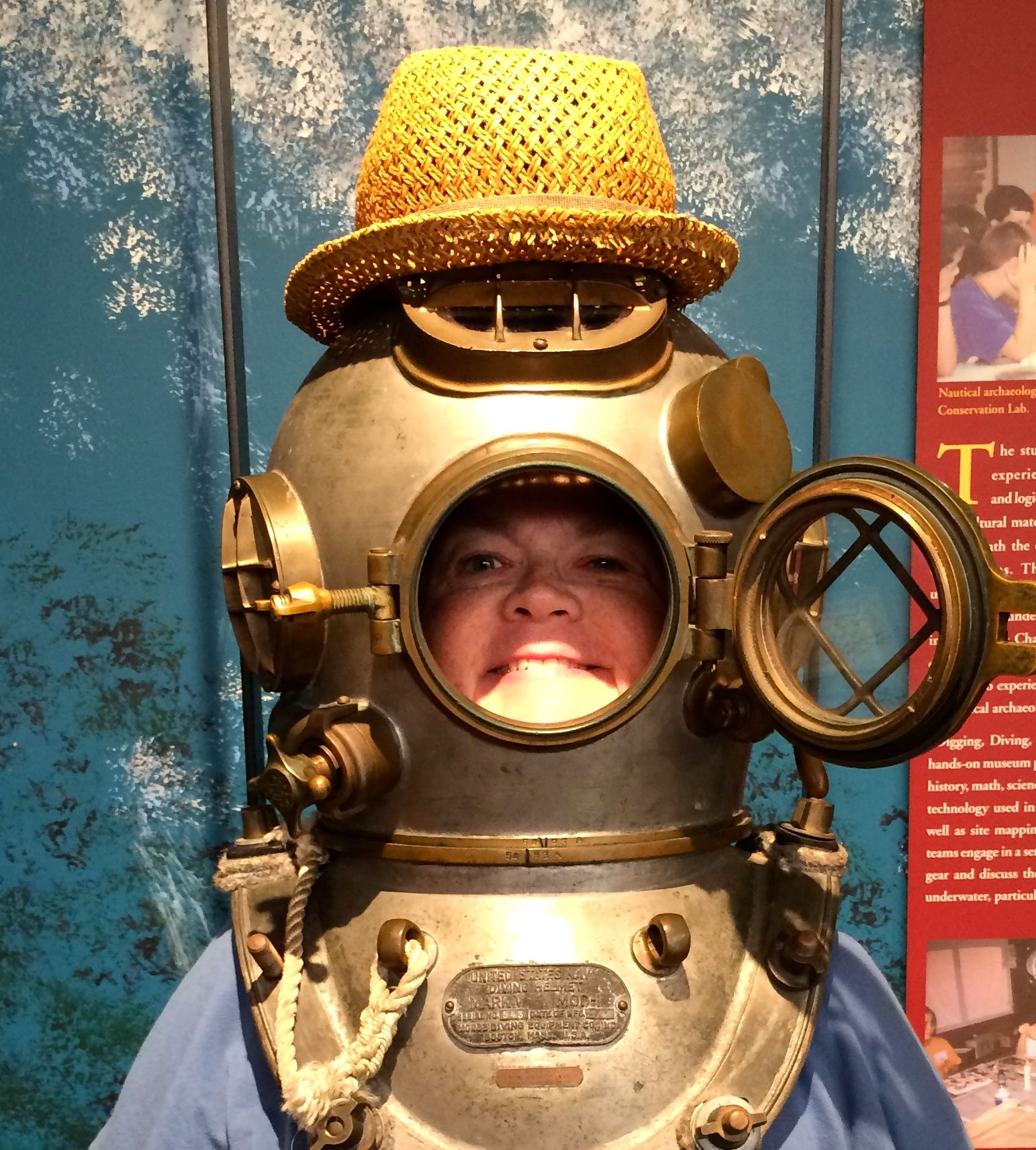
I got to try on a diving helmet. It sure was heavy! They had it on a system that helped you raise and lower it into position. The woman who took my photo came up with the idea of putting my hat on top of the helmet. The whole experience made me feel like Diver Dan!
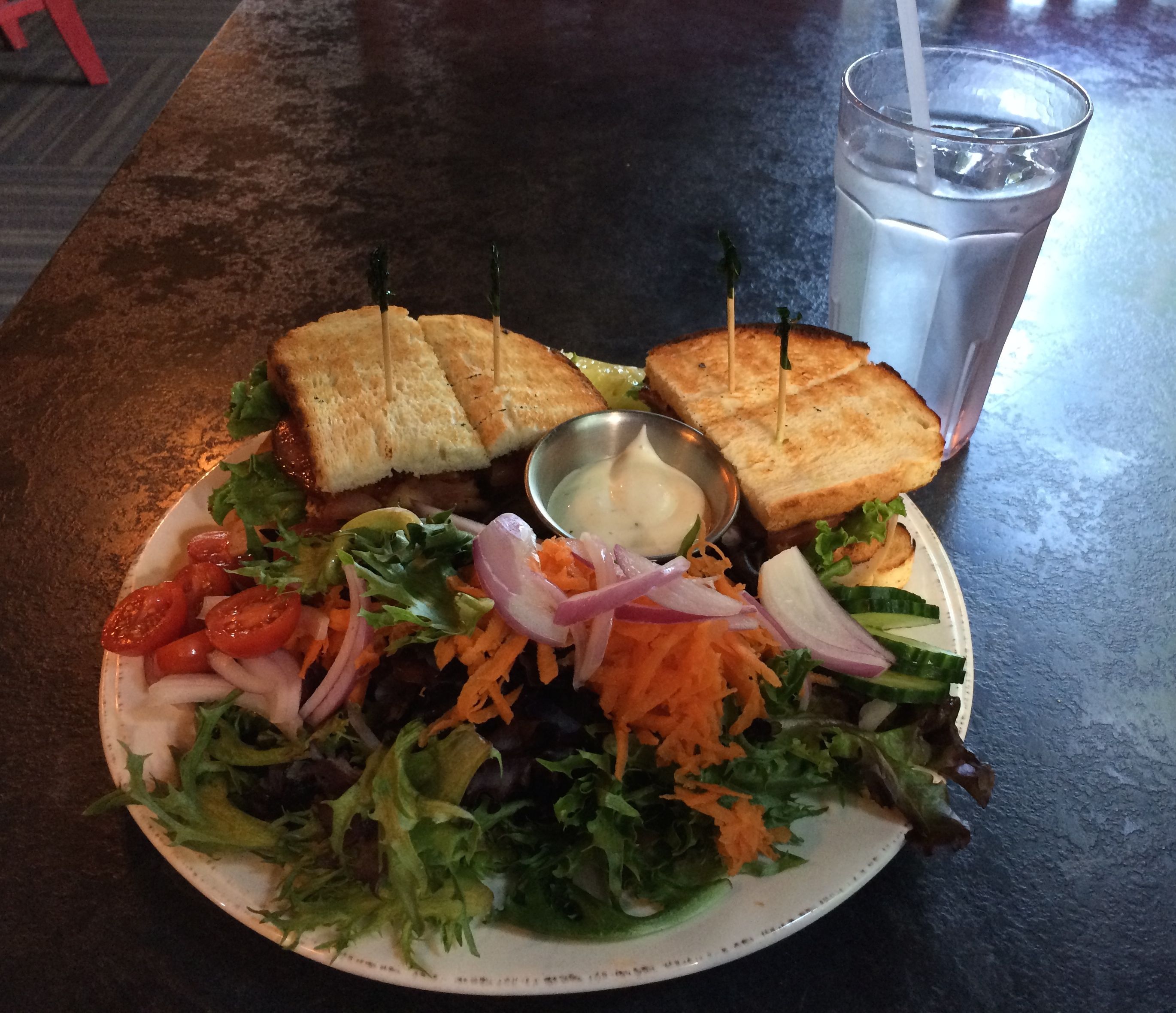
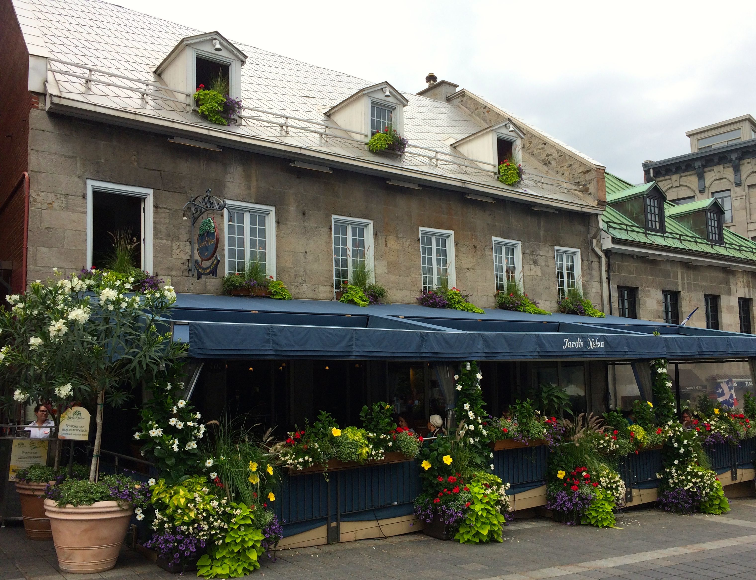
After checking out all the exhibits and attending a lecture by the printer, I was ready for dinner. Luckily, my entrance fee to the museum included a 10% discount at the Red Mill Restaurant across the way.
I had a very tasty sandwich in a lovely restaurant. They were just opening for dinner, so I had very attentive service.
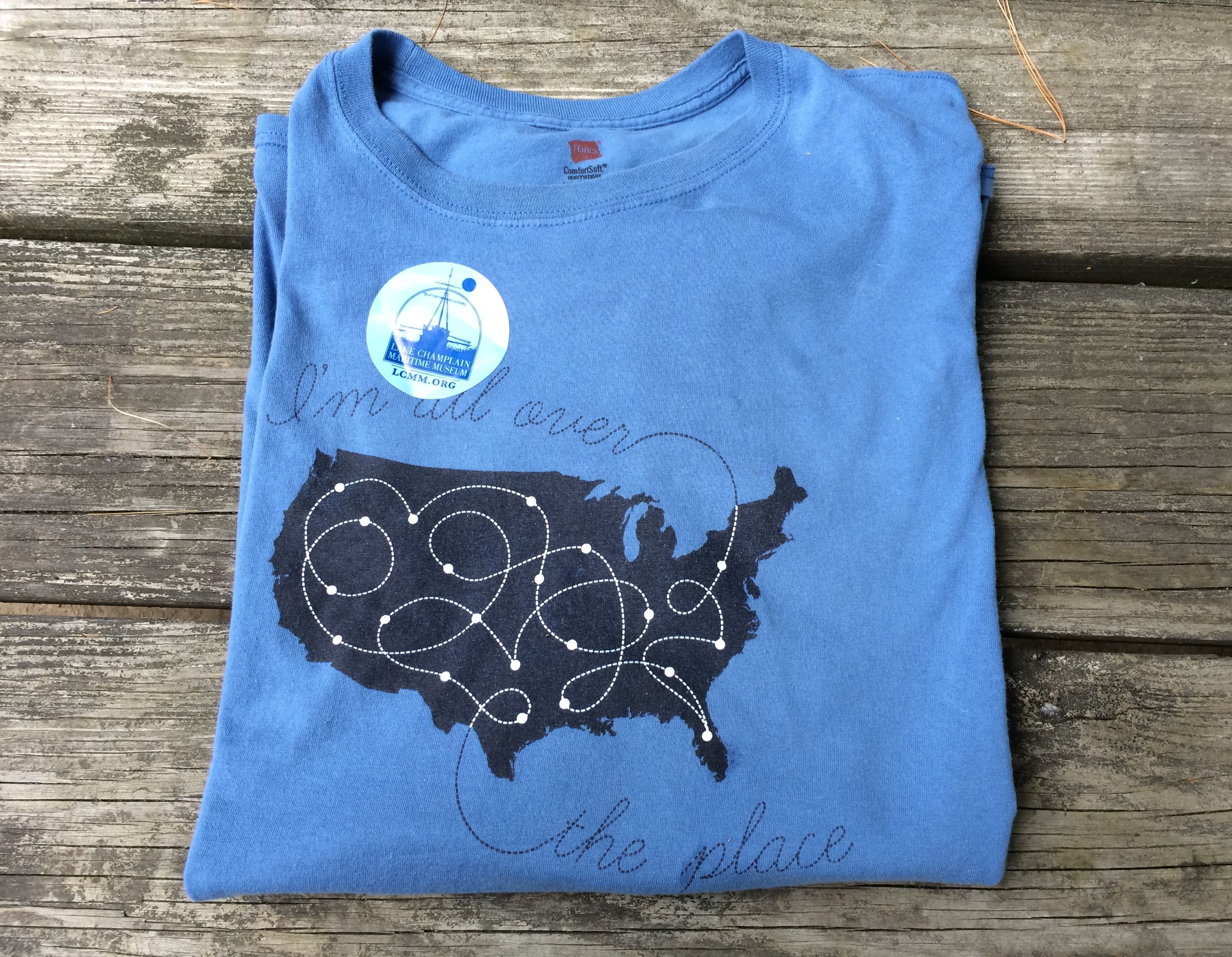
When I got back to the campground, I had to take a picture of the shirt I wore to the museum. Remember how the shirts I wore to the Shelburne Museum matched the the admission stickers? Well, it happened again!
After all my carping in the last post, do you want to know what I liked about the Shelburne Museum?
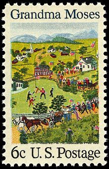
I liked the Pizzagalli Center for Art and Education. There were two exhibits up during my visit. The first exhibit I saw was much the same as the rest of the stuff at Shelburne Museum – a nostalgic Americana that was cobbled together from bits and pieces of memories. Grandma Moses: American Modern was on display on the first floor.
Now, before I am skewered for not liking her work, let me say that it wasn’t that I don’t like her art. It was more that I could see the a connection between her vision of America and Electra Havemeyer Webb’s vision. Both of them seemed to fabricate an America that really didn’t exist.
I have no photos of the exhibit, though, because that was not permitted. But, here is an image of a stamp that used one of her paintings. If you want to know more about Grandma Moses, you can check her out on the Internet.
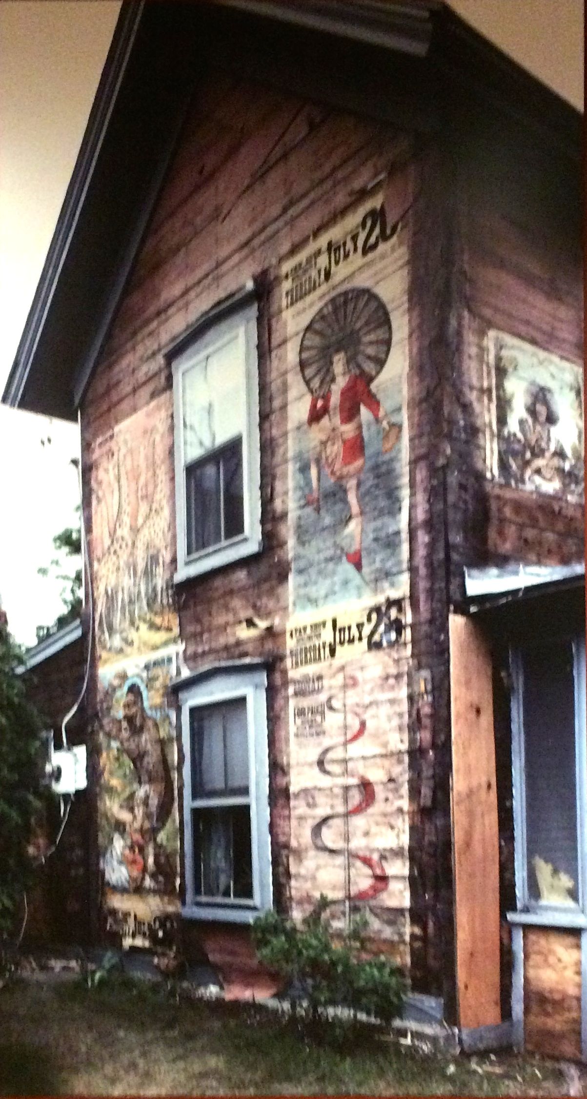
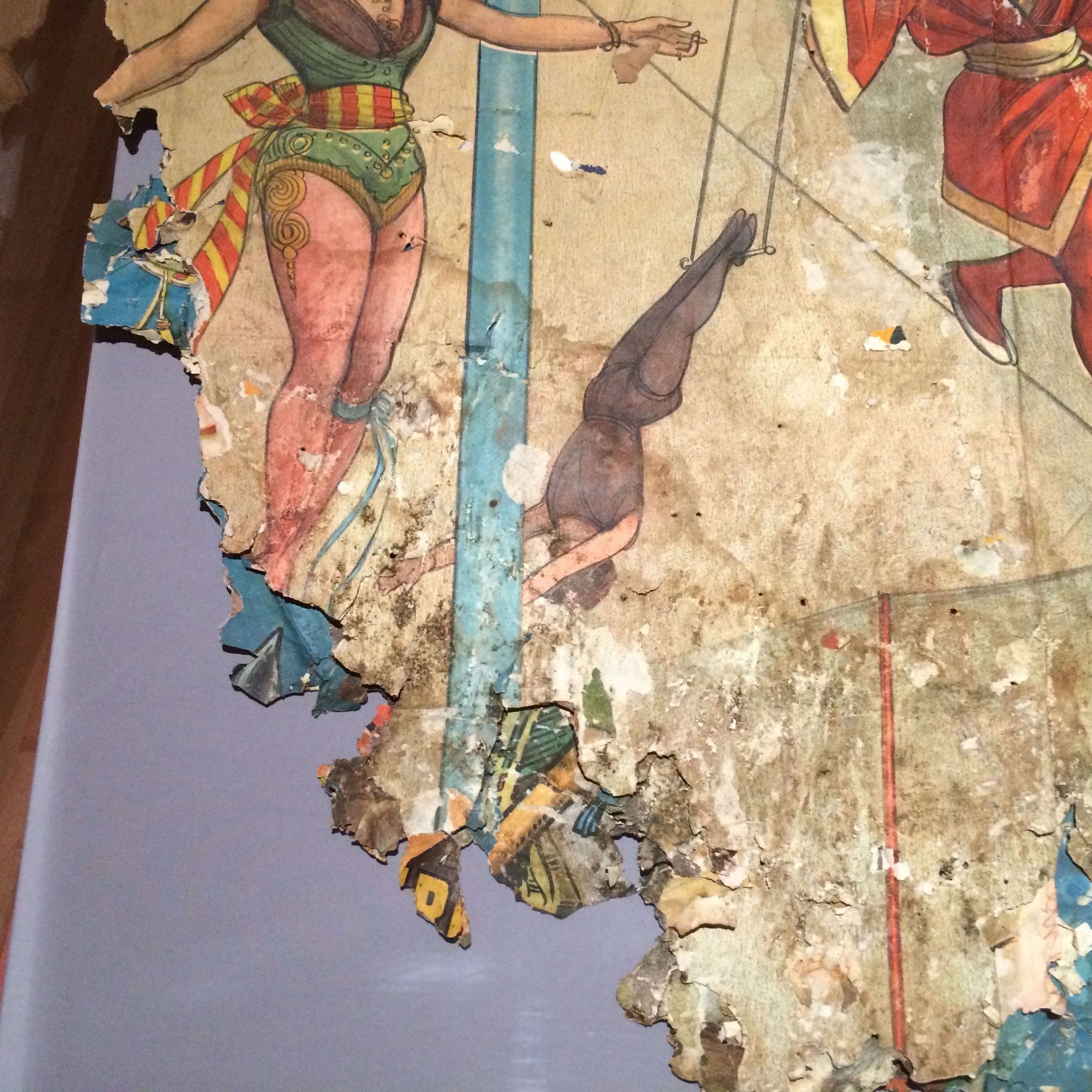
What I really found interesting was the exhibit that was in the lower gallery, Papering the Town: Circus Posters in America. Photography was permitted in that exhibit.
Photography was permitted, but selfie sticks were prohibited! Good thing I never got around to getting one.
When the circus would come to town, advance men would go ahead of the circus and plaster their posters wherever they could. They favored houses and buildings at busy intersections. Location, location, location!
In the spring of 1991, a large cache of posters was found under a layer of siding on Harold and Gladys Degree’s house in Colchester, Vermont. They donated the posters to the museum, on the condition that they be removed quickly so they could continue with their renovation project.
A team of conservators, curators and carpenters were dispatched to figure out the best way to proceed. Upon examination, they discovered two layers of posters and then decided that the best way to proceed was to cut out large sections of the wall with the posters still attached. I wonder if that is what the owners had in mind?
In any event, after many years of conservation work the posters are ready for exhibition.
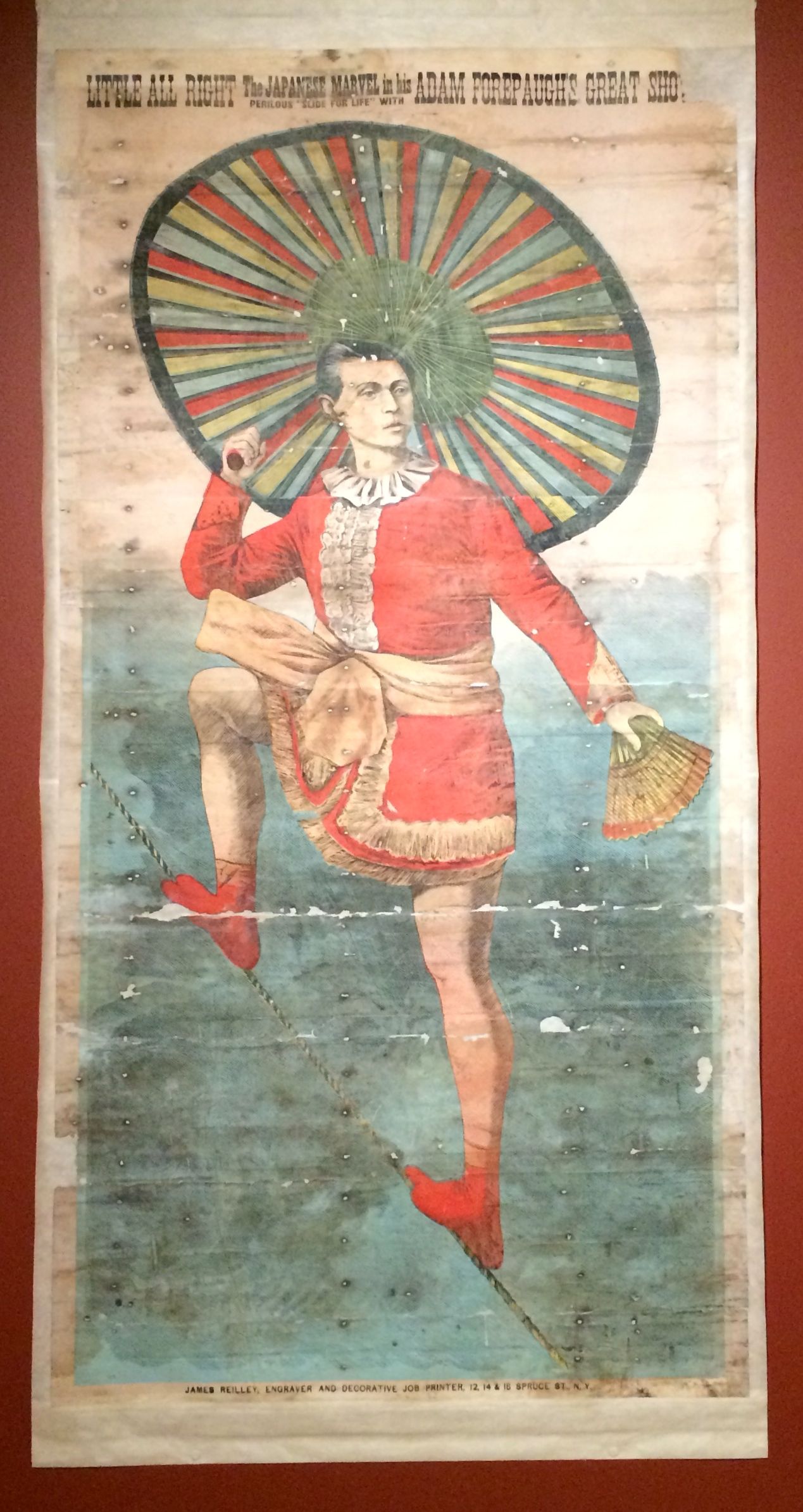
This poster promotes Little All Right The Japanese Marvel in His Perilous Slide for Life from 1883.
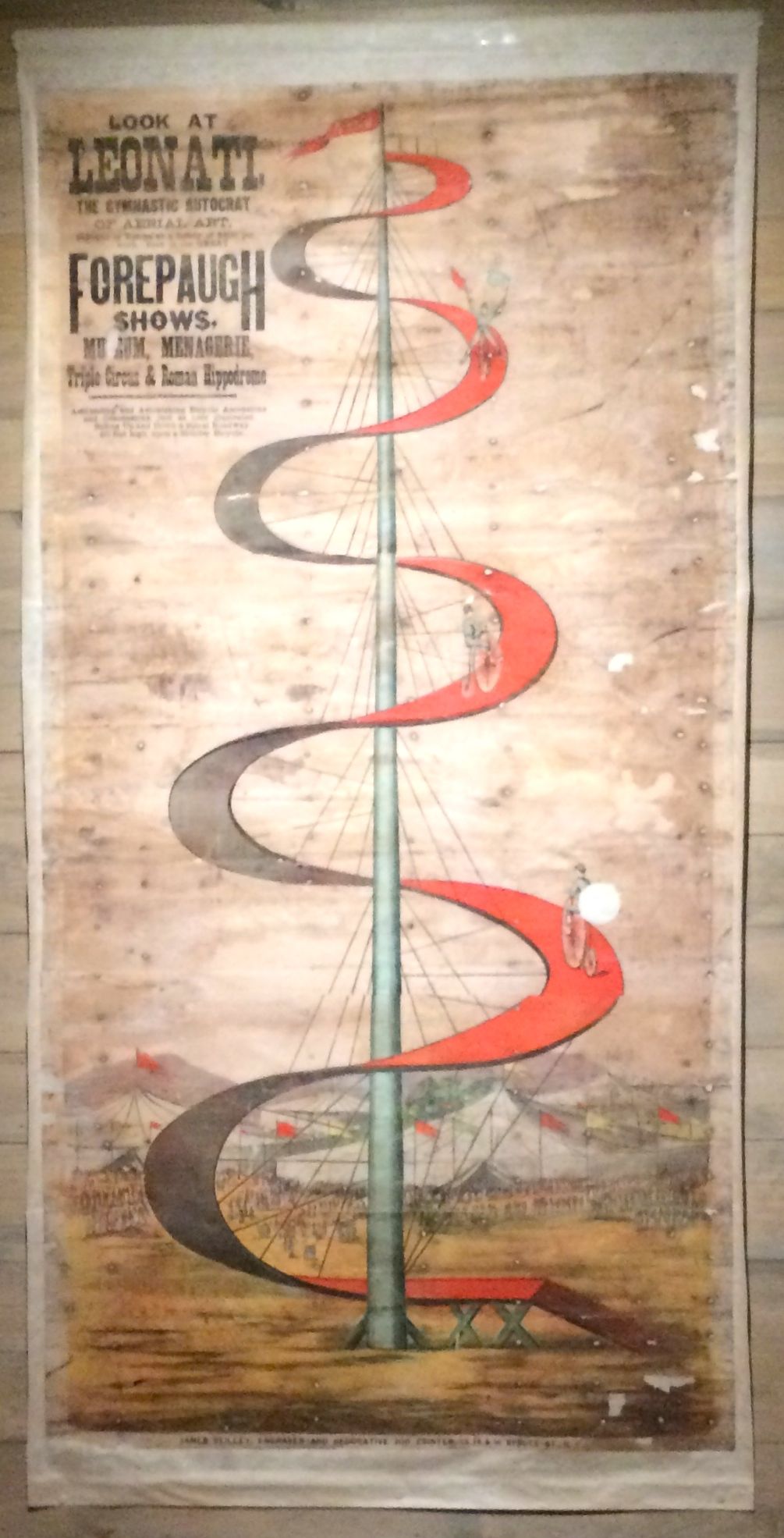
This poster proclaims, “Look at Leonati: The Gymnastic Autocrat of Aerial Art” This was a bicycle act from 1883.
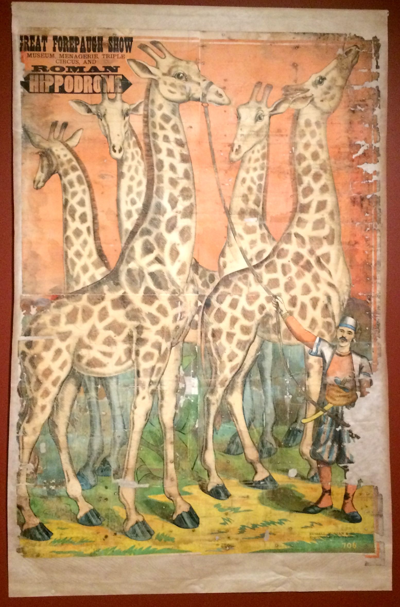
Wouldn’t you want to go see a circus with five giraffes? Such elegant creatures!
Here we have Nala Damajante: Snake Charmer.
Millie Christine: The Two-Headed Lady was also in the circus in 1883.
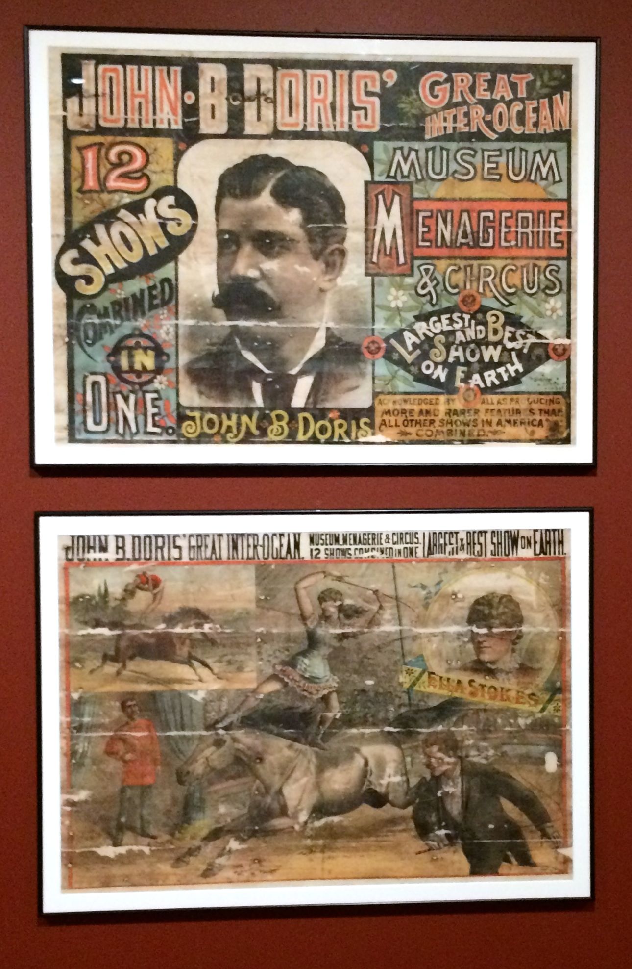
Of course, the people that brought the circus to you wanted you to know who they were. John B. Doris was the impresario.
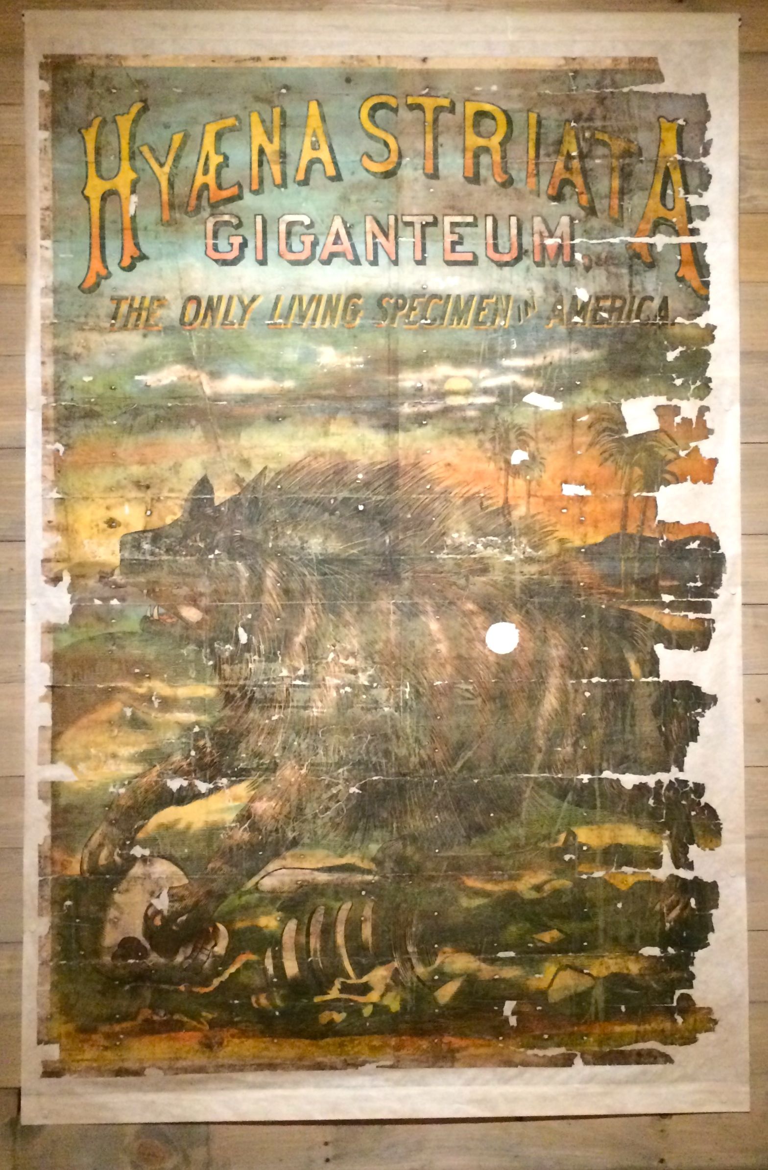
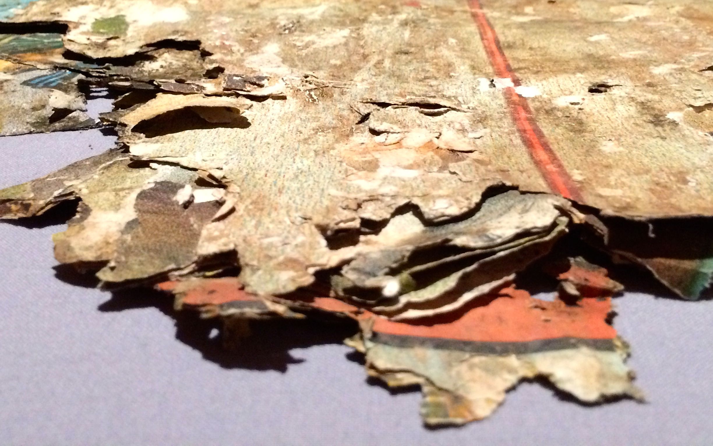
Hyaena Striata Gigateum: The Only Living Specimen in America. This poster is somewhat the worse for wear. It is mounted on cloth, as are the other posters.
You can see how fragile the posters were. They must have had to work very carefully.
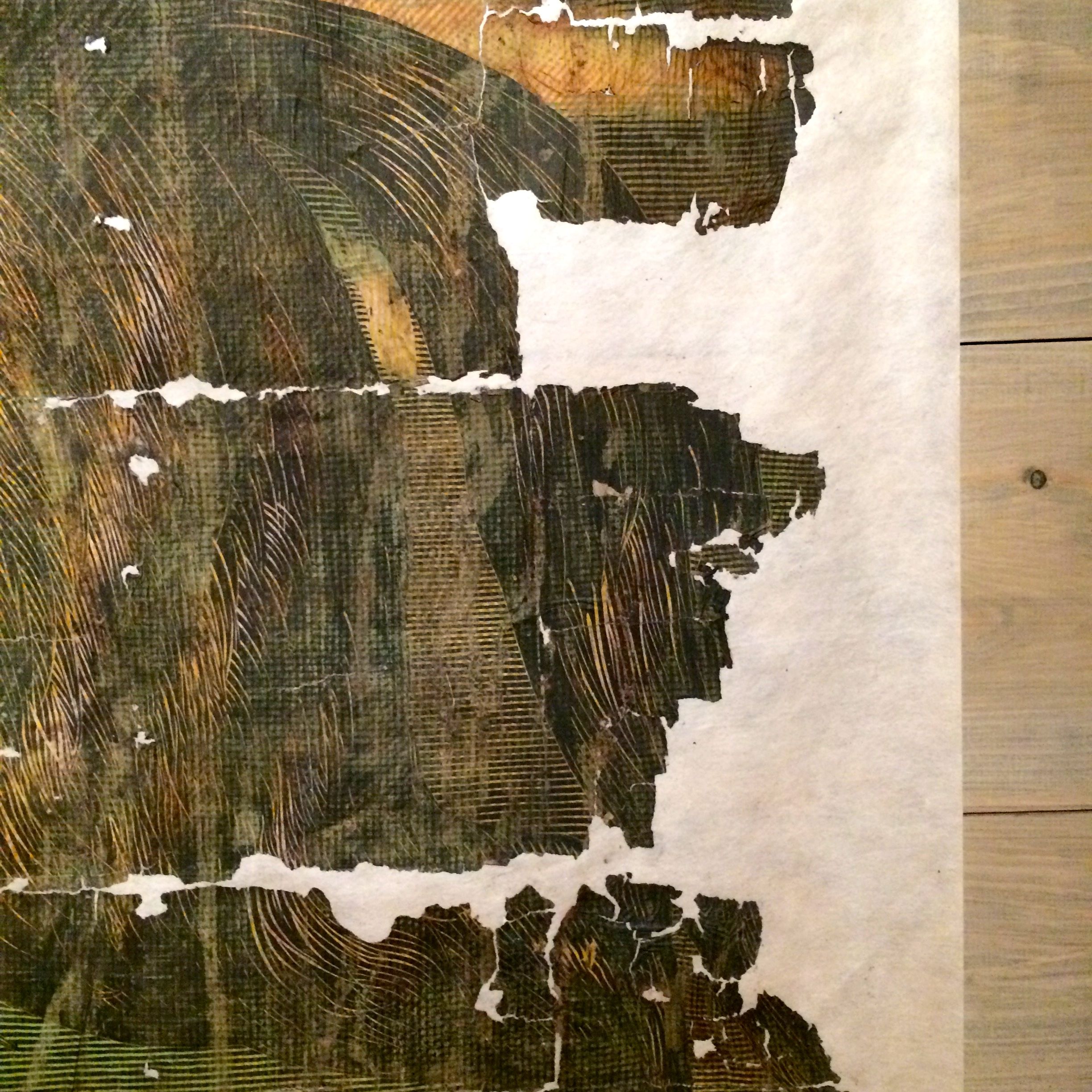
They had a display of poster fragments that were recovered by Nicholas Whitman in a barn in Hoosick, New York.
Examination of the twenty layers and the styles of the posters, they determined that the there were posters there from the late ninetieth century to the 1950’s
And that’s a whole lot of layers!
When I got done with the exhibit, I returned to the vestibule of the building. The guide who greeted me when I entered asked me how I liked the circus posters. We got to talking about the whole process and I asked her if she know where the house was. She went over to the computer to try to find the address.
We worked together and identified where the house probably stood. When I left the museum, I set out to find it.
I followed the directions on my phone to the location we identified. I got to the intersection and looked for some place to park so I could look around. I found…
the library!
I parked and went in to ask them if they knew anything about the house I was looking for. They pulled out a reference book and found the address. It was right where I thought it would be.
You can see right where the posters had been. I didn’t want to invade the owners’ privacy, so I snapped a few quick shots and went back over to see what I could see at the library.
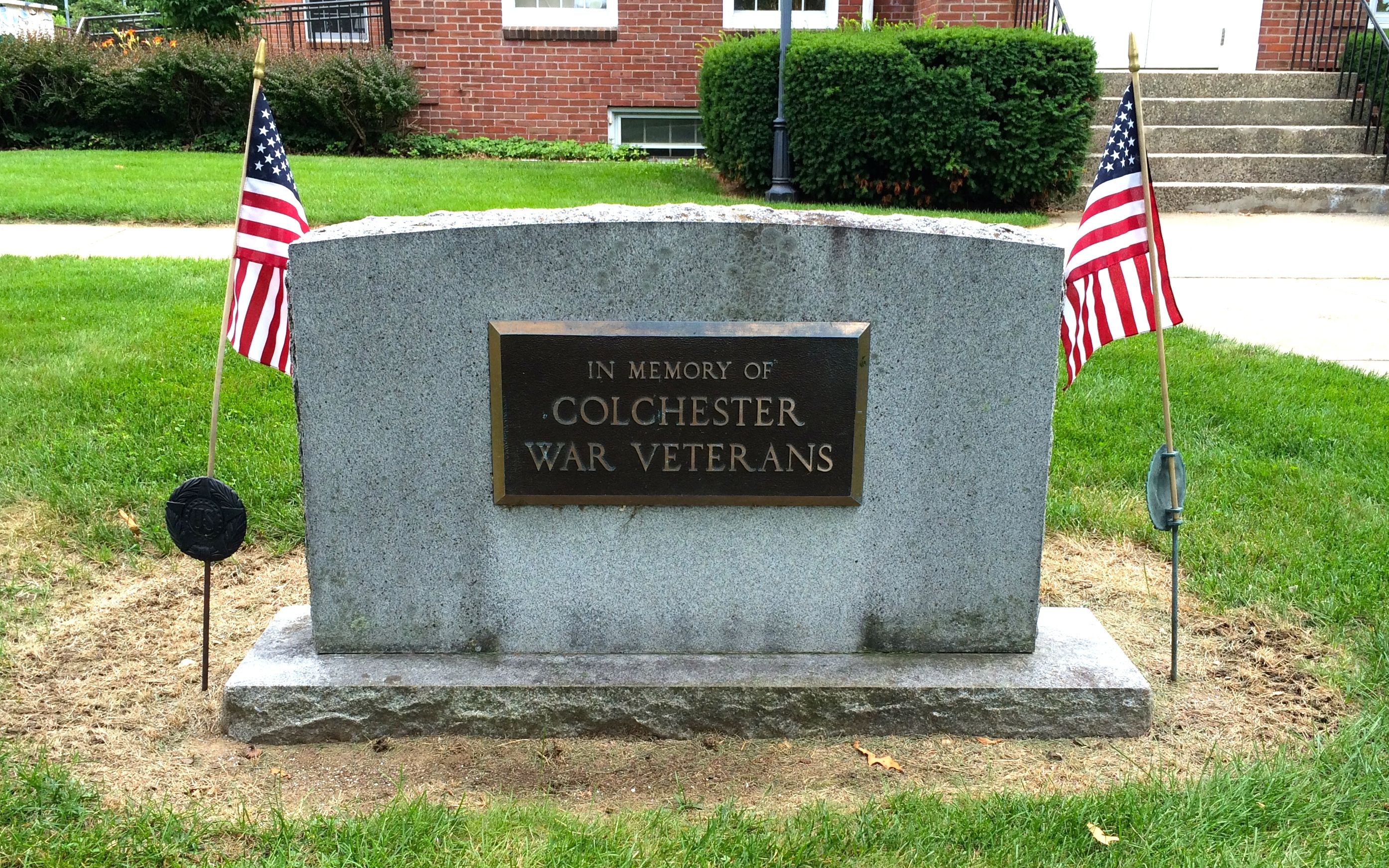
They had a war memorial. I found it relief that they didn’t have memorials to the individual wars that have taken place, with spaces for future wars, like I saw in Marshall, Missouri.
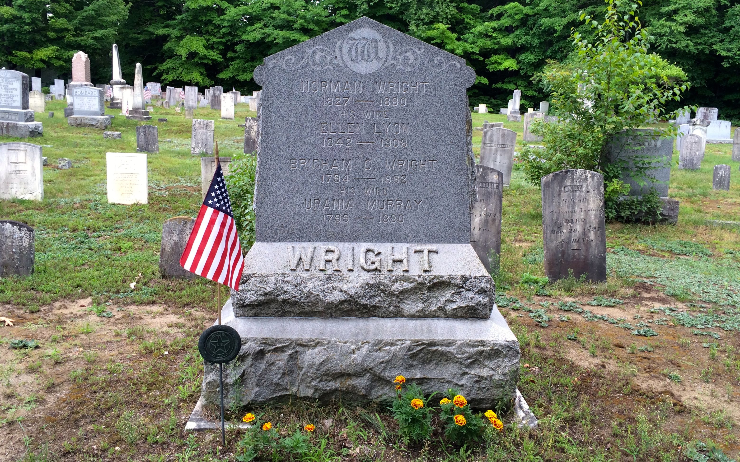
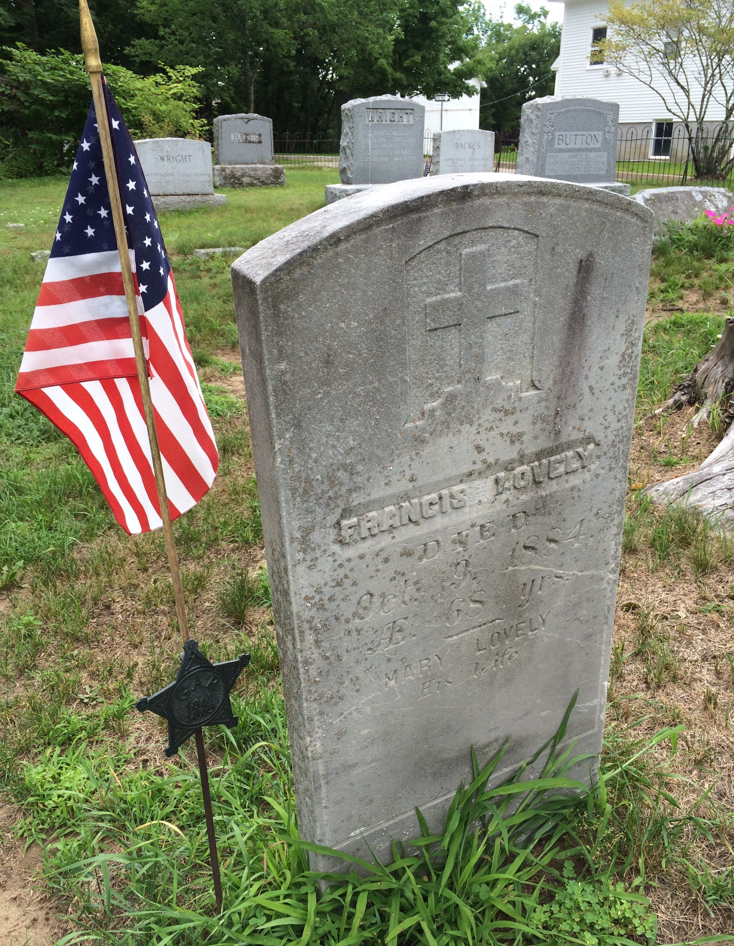
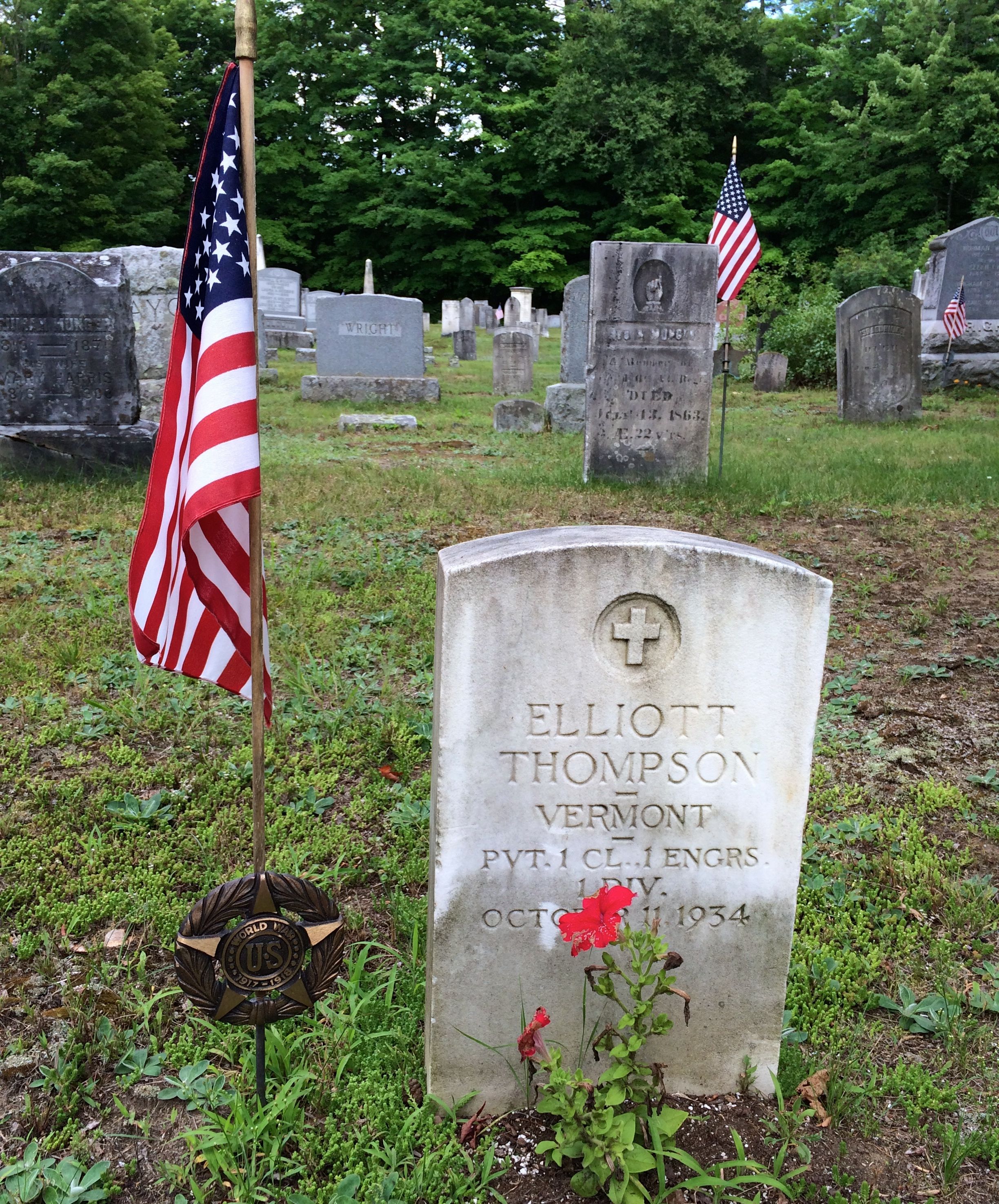
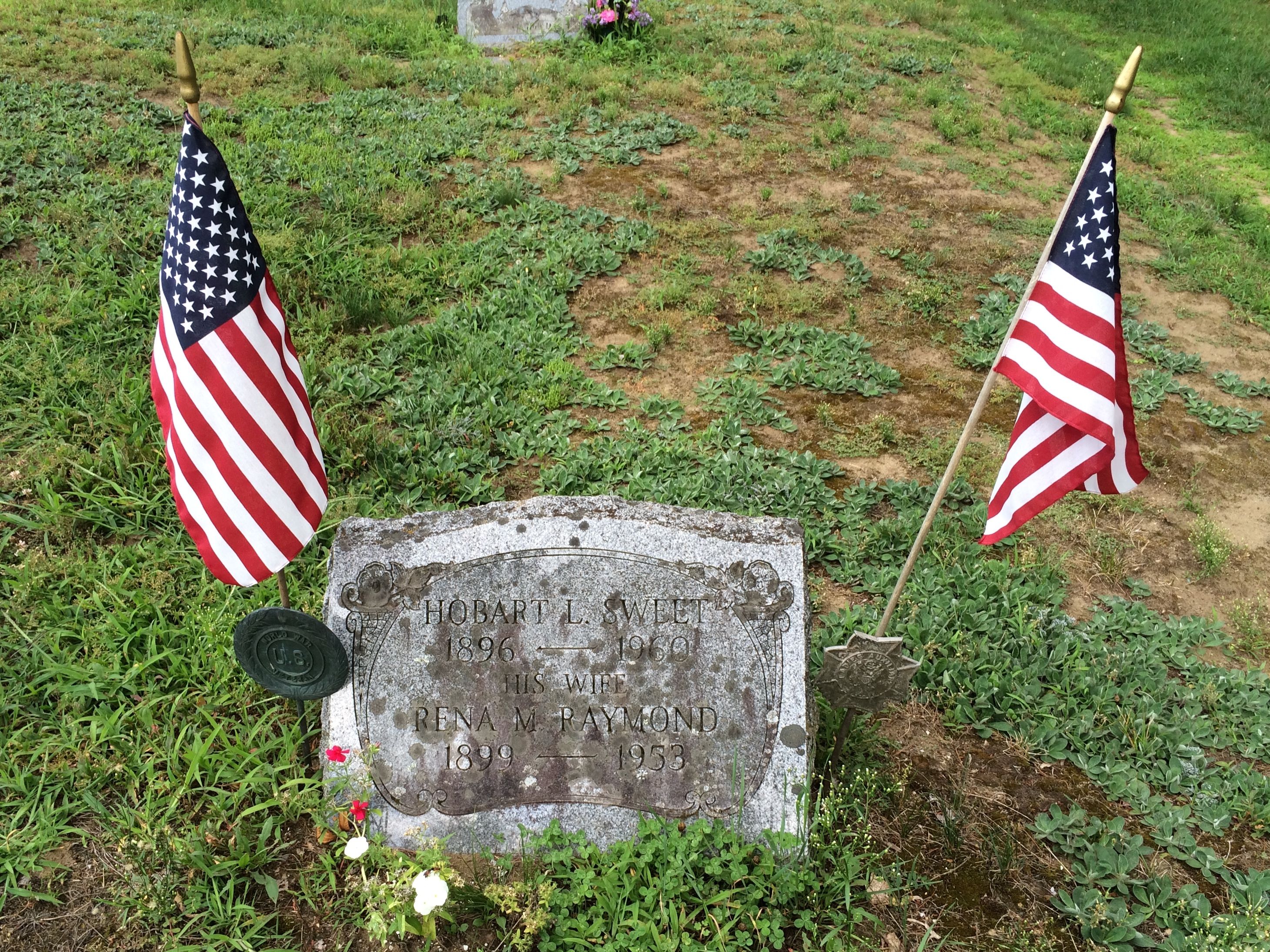
Behind the library was a cemetery. I decided to stroll through and see what I might see. I was amazed with all the history I could see in the small plot of land. For one thing, family names on the grave markers corresponded with road names I had been driving on for the last few days.
For another, I saw markers from almost all the wars our country has been involved in.
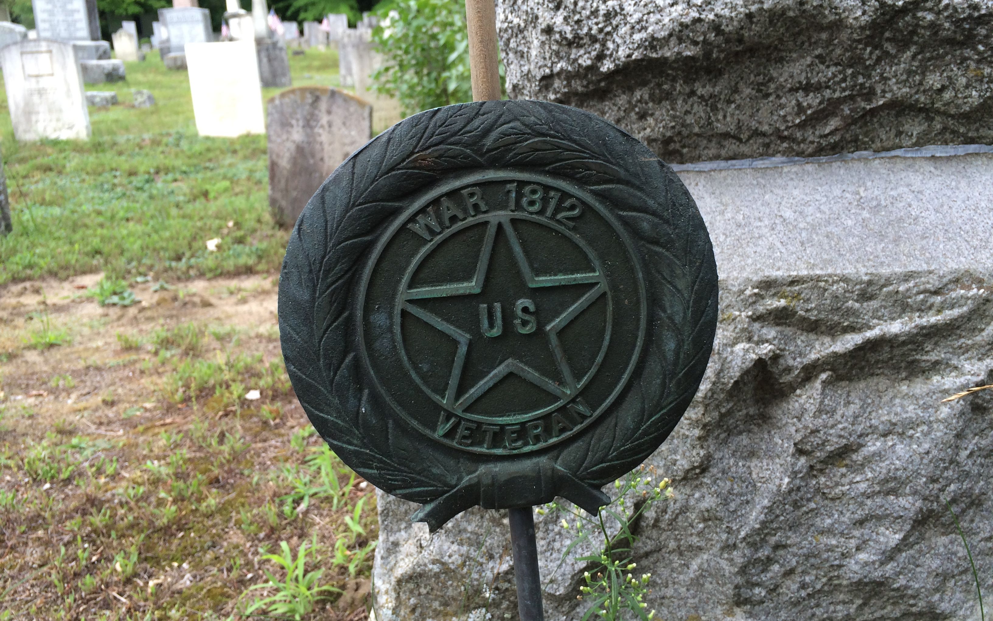
There was the War of 1812.
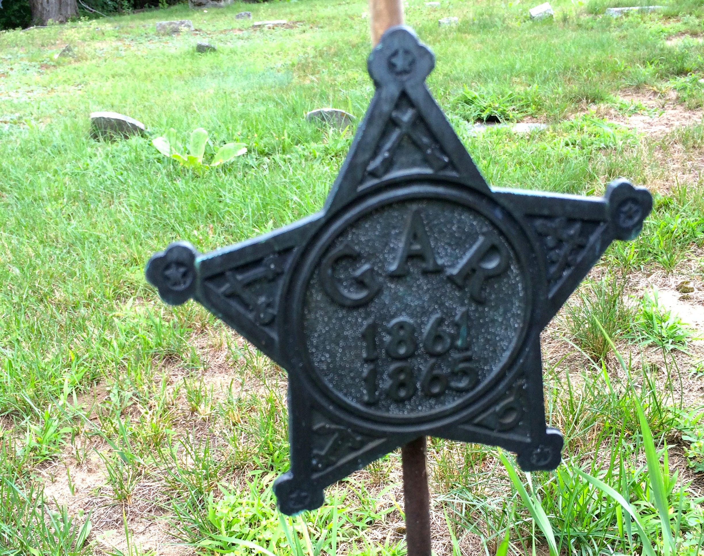
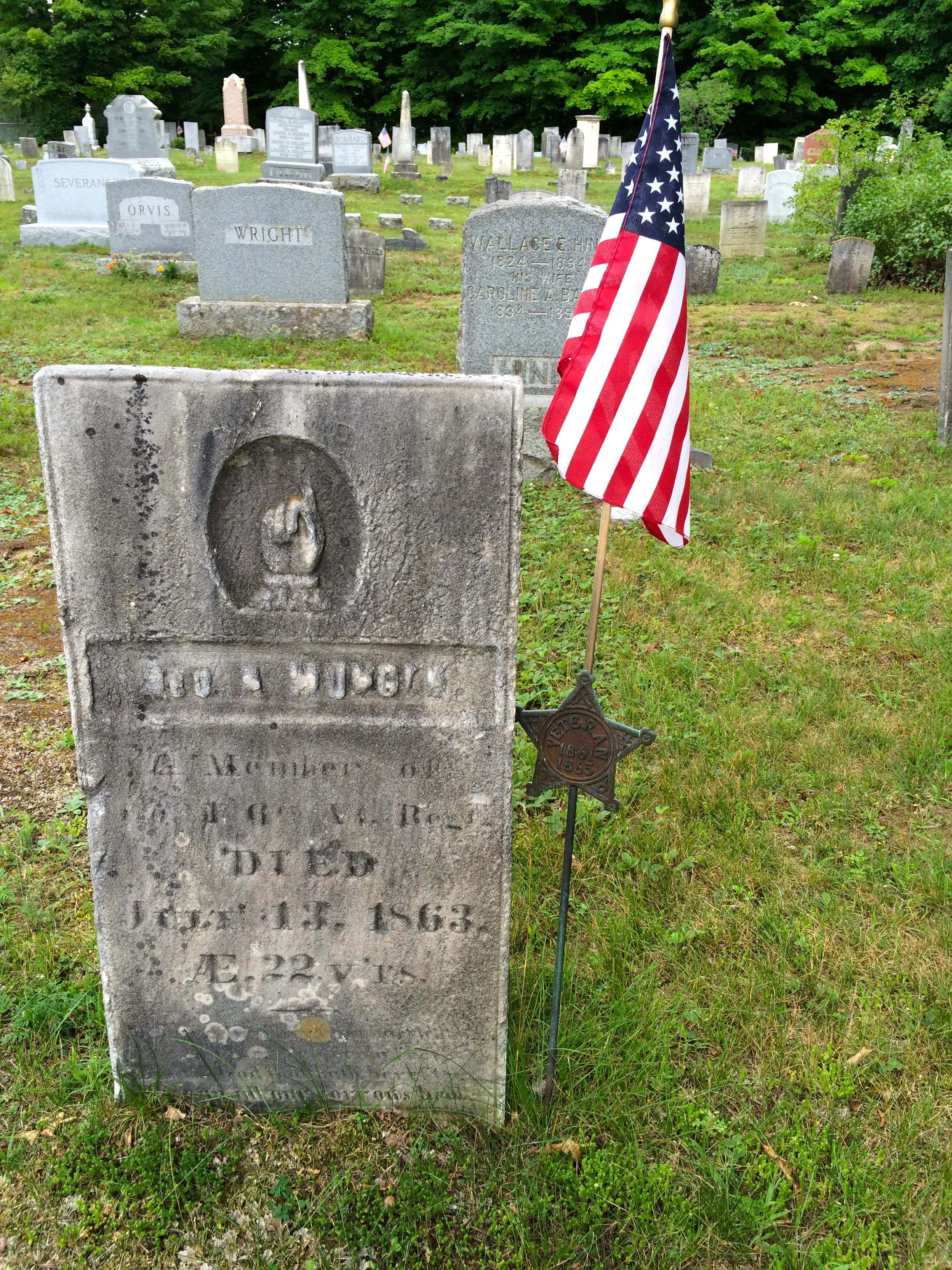
There was the Civil War.
For those that may have forgotten, G.A.R. stands for Grand Army of the Republic.
This vet died in 1863. I wonder if he died in a battle, as a prisoner of war or as a result of illness?
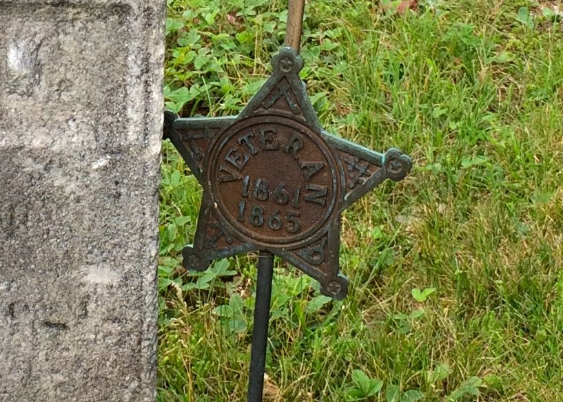
I wonder why there are different designs of flag holder badges? Do you suppose the people who selected them saw a distinction?
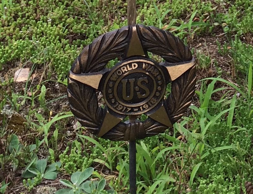
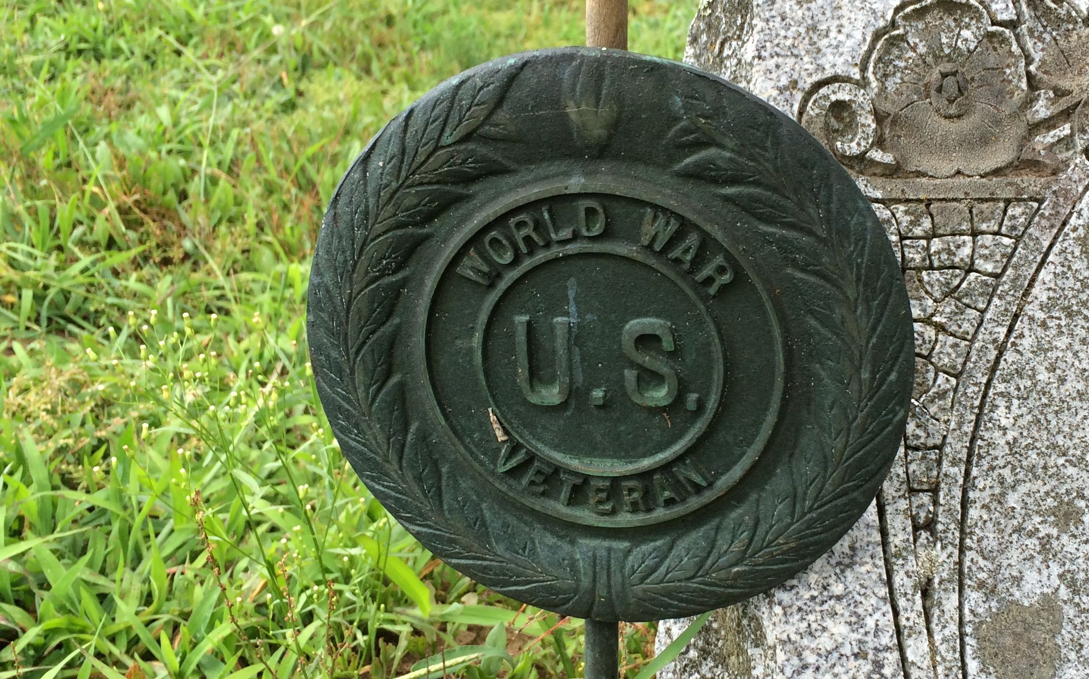
I didn’t see any mention of the Spanish American War, but next up was the World War.
Such a hopeful time. No, it wasn’t World War I. At that time, they thought it was the war to end all wars.
Now we know better.
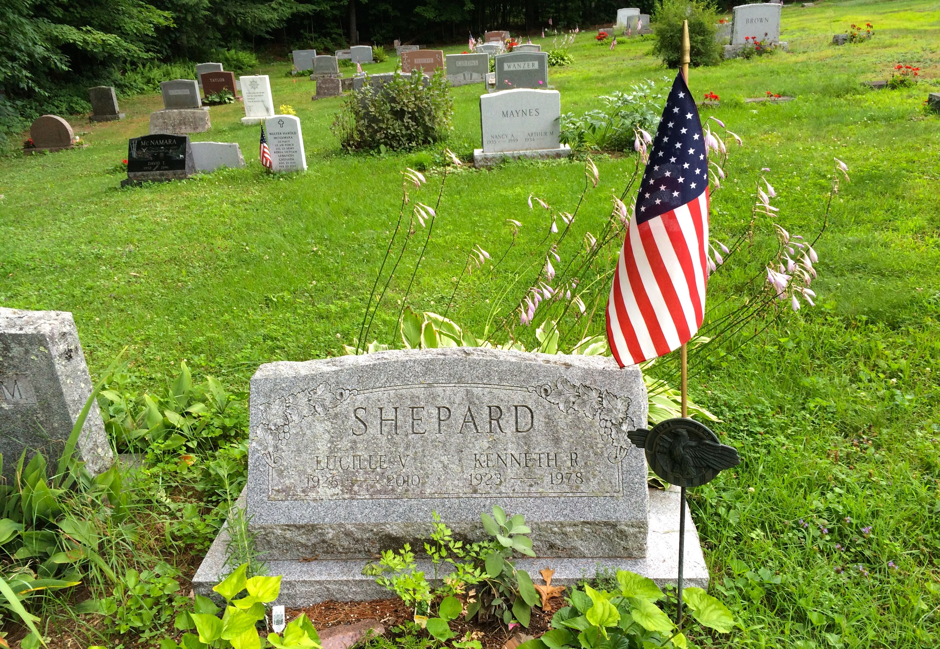
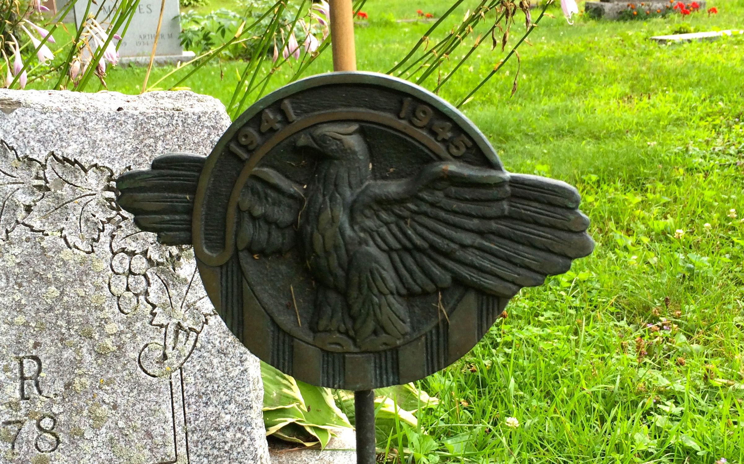
World War II came along before we had time to catch our breath.
Is it just me, or do wars seem to be happening more quickly?
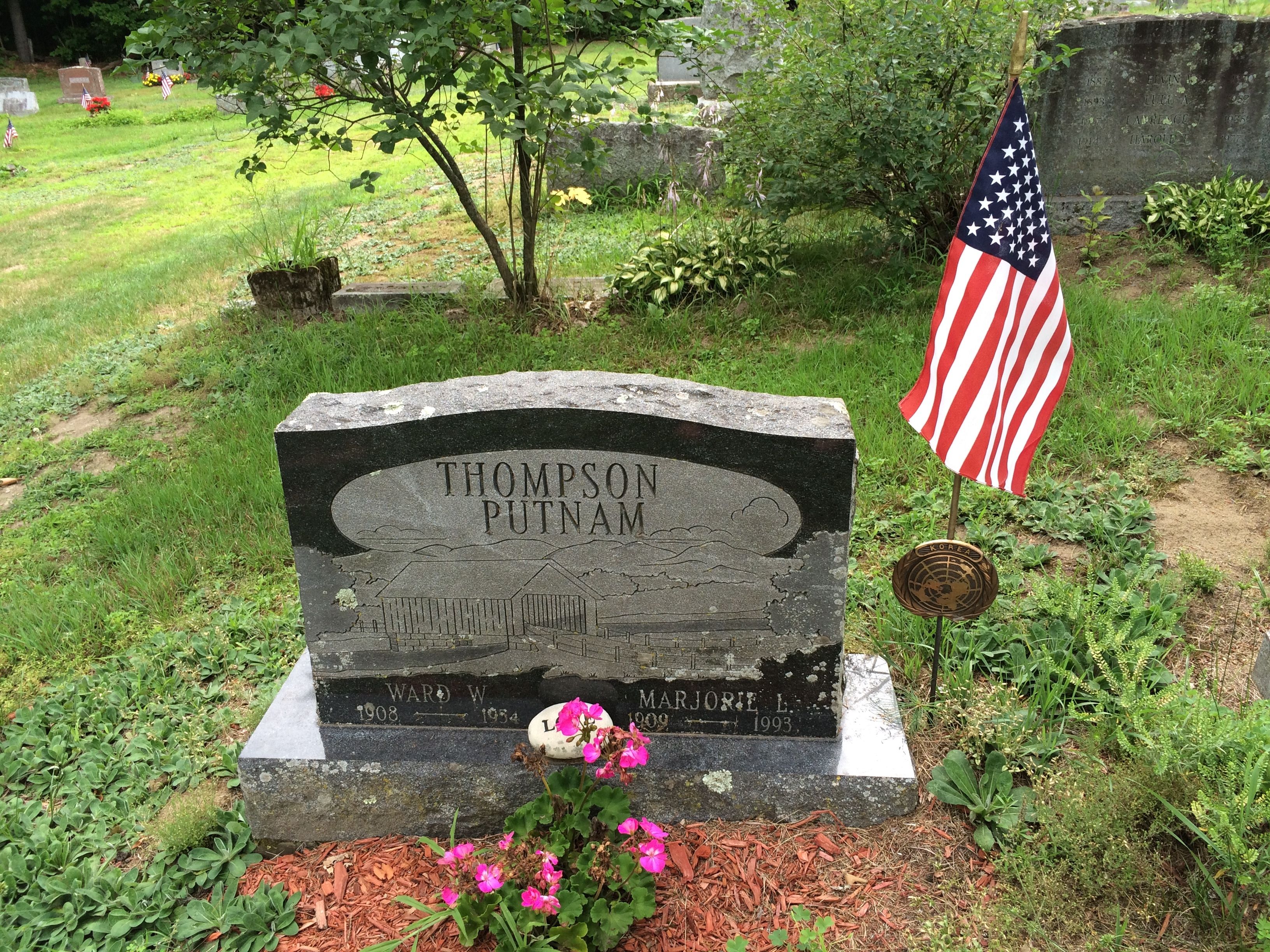
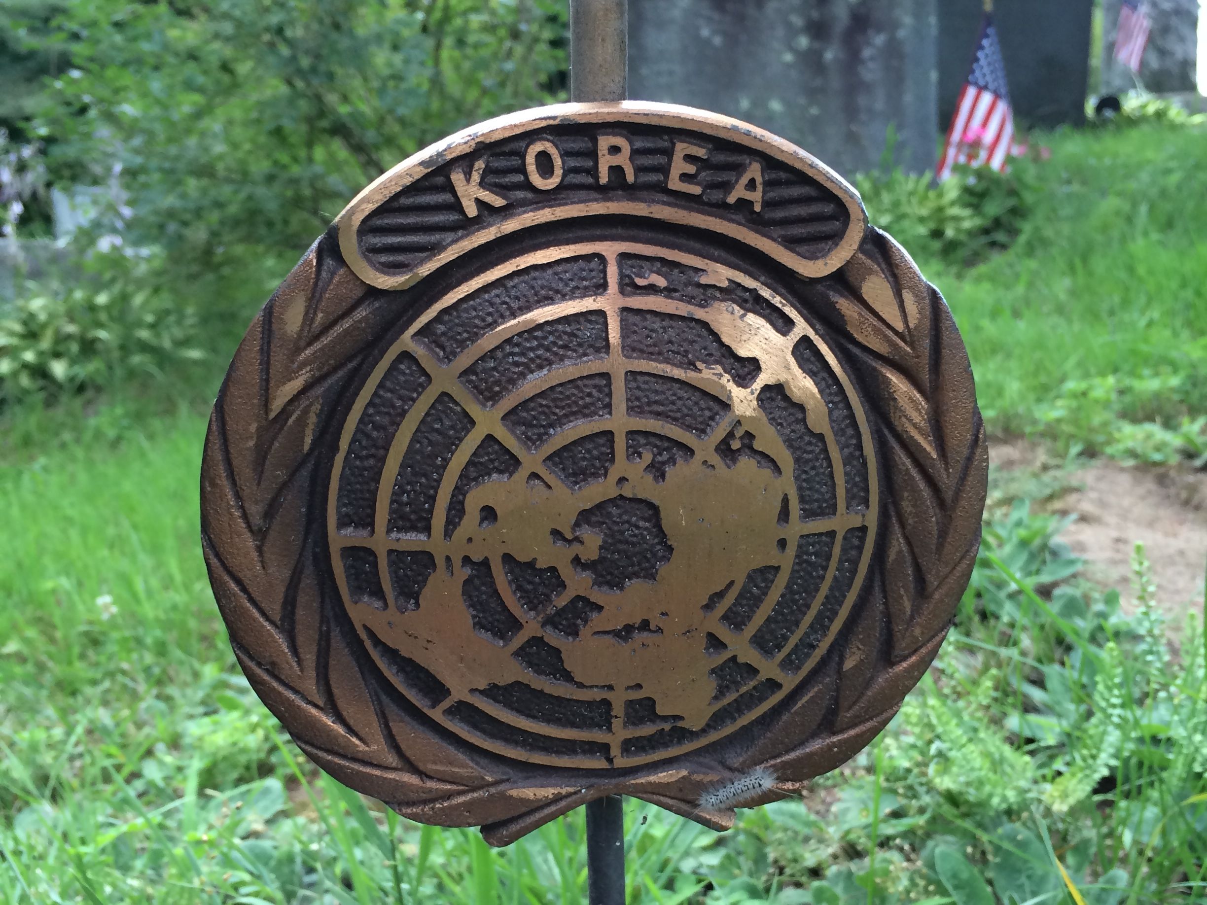
Next up, the Korean Conflict.
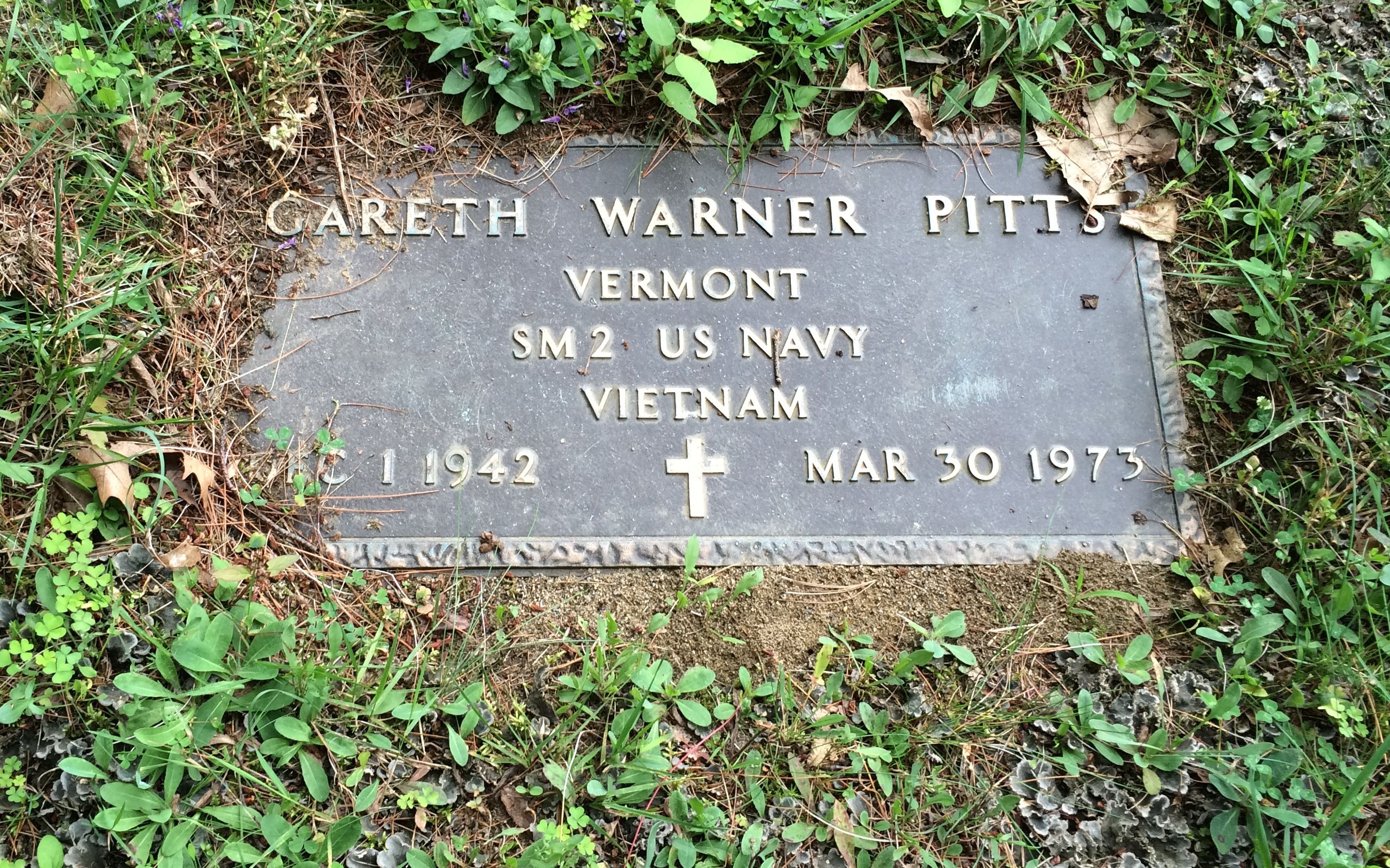
Next up: Vietnam.
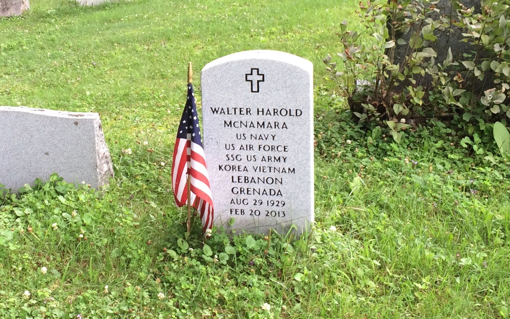
This man served in many conflicts.
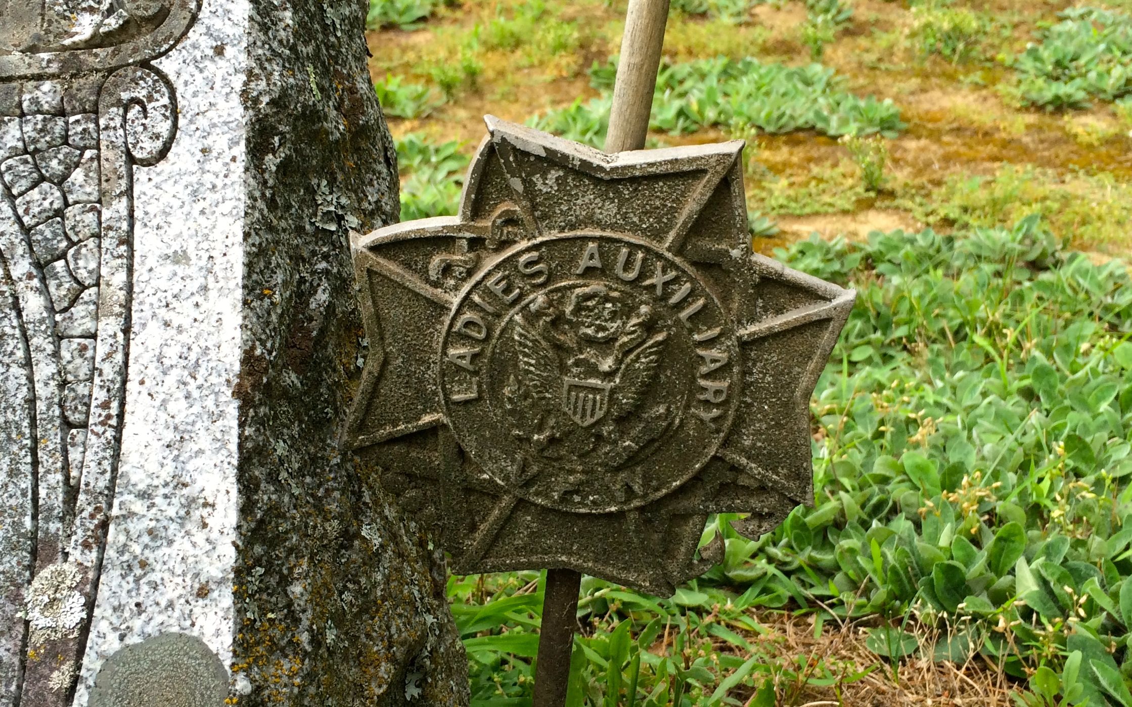
This couple each served in their own ways.
He was a veteran of the fighting.
She served in the Ladies Auxiliary of the VFW.
So many of these people must have seen the posters that were plastered on the house at the corner. I imagine they even might have seen the circus. Now this was real history, and much more satisfying than a cobbled together museum celebrating “Americana.”
And with that, it was time to head back to the campground.
Many people recommended the Shelburne Museum as a worthwhile visit when I was near Burlington. I wasn’t quite sure why people thought it was so great, but since I had received so many votes for it, I thought it was a safe bet that it was something special.
So, what it the Shelburne Museum? It is a collection of collections. They have over 150,000 items that are exhibited in 38 buildings spread across a 45 acre campus. 25 of the buildings are historic structures that have been moved there from different places in the area.
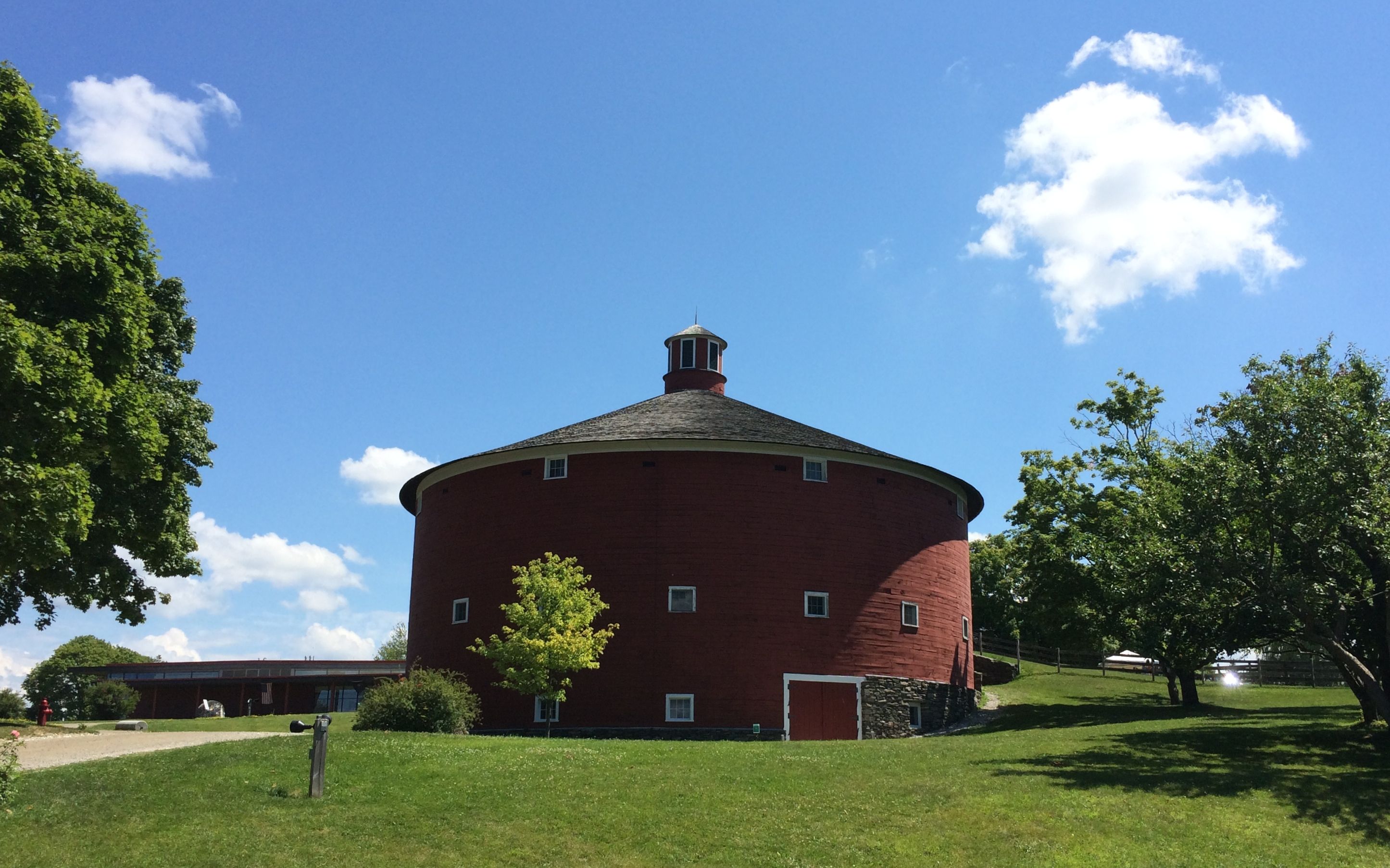
For instance, here is the Round Barn, which was built in 1901 in East Passumpsic, Vermont. The three-story round design was built to improve agricultural efficiency. Hay and feed dropped through chutes from the top floor to the middle floor where as many as sixty cows could be stanchioned for feeding and milking. Manure was then shoveled through trap doors to the lower level and hauled away by horse-drawn wagons.
It’s kind of like an assembly line for cow care.
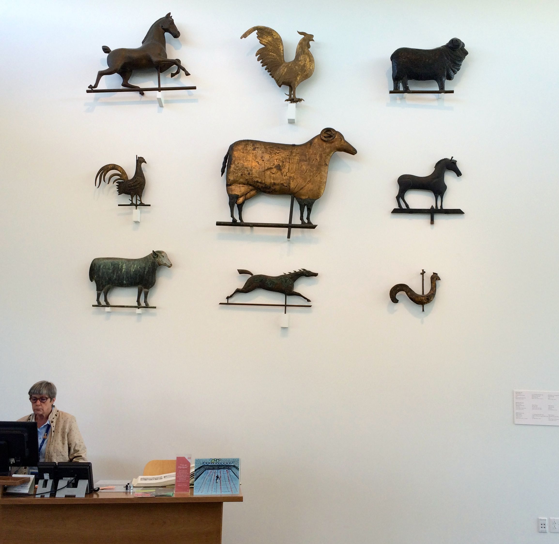
At the museum, it is used to display horse-drawn vehicles and contemporary automobiles.
I particularly liked this sled-like item that is called a traverse. It looks kind of like a horse-drawn toboggan.
The more I walked around the grounds, I started picking up clues about the founder. (I also did some research after my visit.) After all, who in the world would spend so much of her time and money collecting all this stuff?
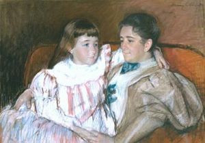
Electra Havemeyer Webb was the daughter of Henry Osborne Havemeyer. Wikipedia describes him as an industrialist, entrepreneur and sugar refiner who became president of the American Sugar Refining Company. Her mother, Louisine Waldron Elder Havemeyer, traveled extensively in Europe with her mother after the death of her father. While she and her mother were touring, they were collecting and getting to know all the artists. They got really chummy with some of them. Mary Cassatt made this pastel portrait of Louisine and her daughter, Electra, in 1895.
So, Electra came from money and then married into money. Her husband, James Watson Webb II, was a polo champion from the Vanderbilt family. I guess when you come from money like that, collecting is what you do.
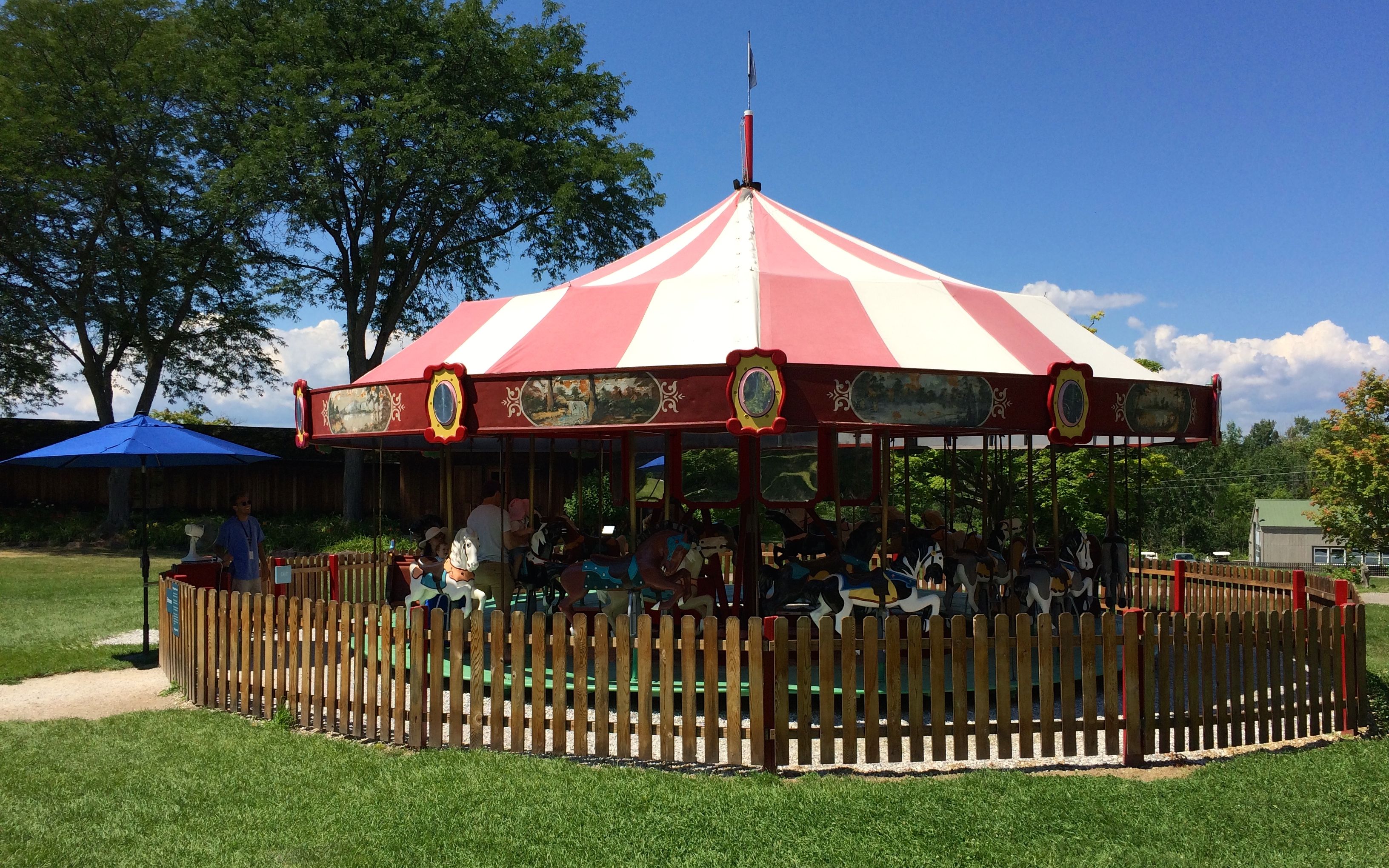
I wandered along and came to a carrousel. It was popular with the younger set. I have to say, though, after growing up with some wonderful carrousels, I was not wowed. I wondered why she didn’t buy something more eye-popping.
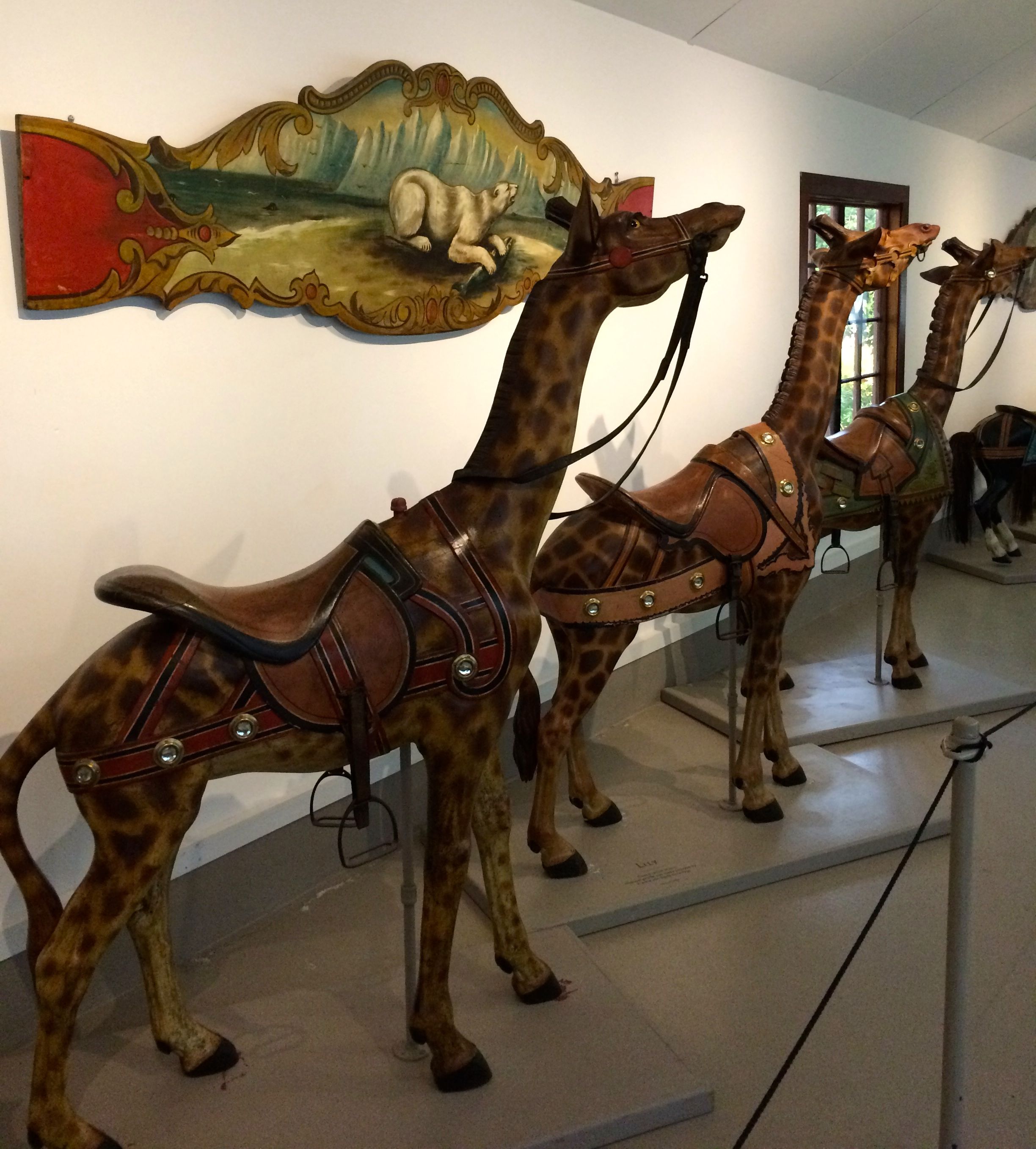
The answer is that she did buy an amazing carrousel, but the animals and parts were on display inside a horseshoe shaped building.
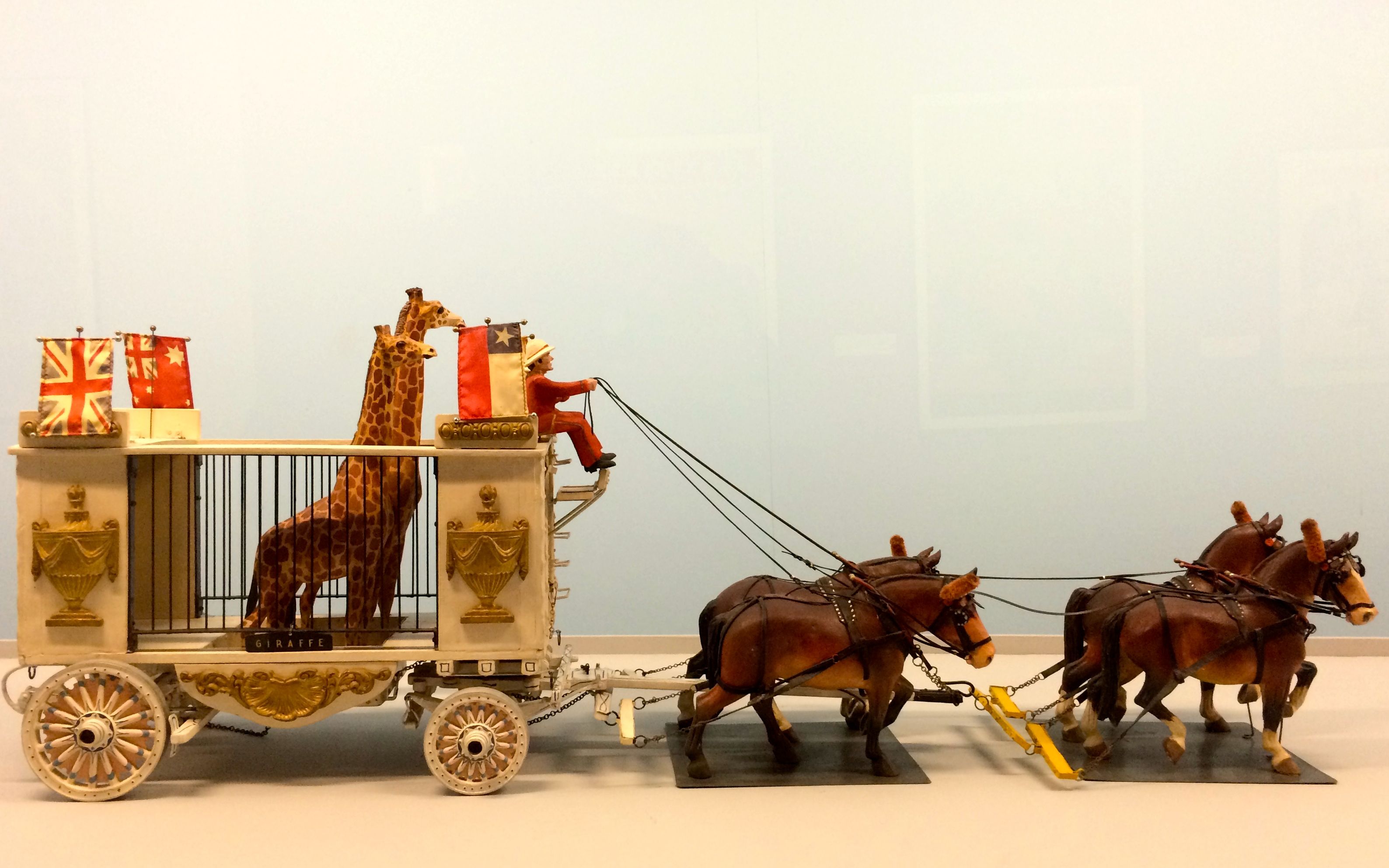
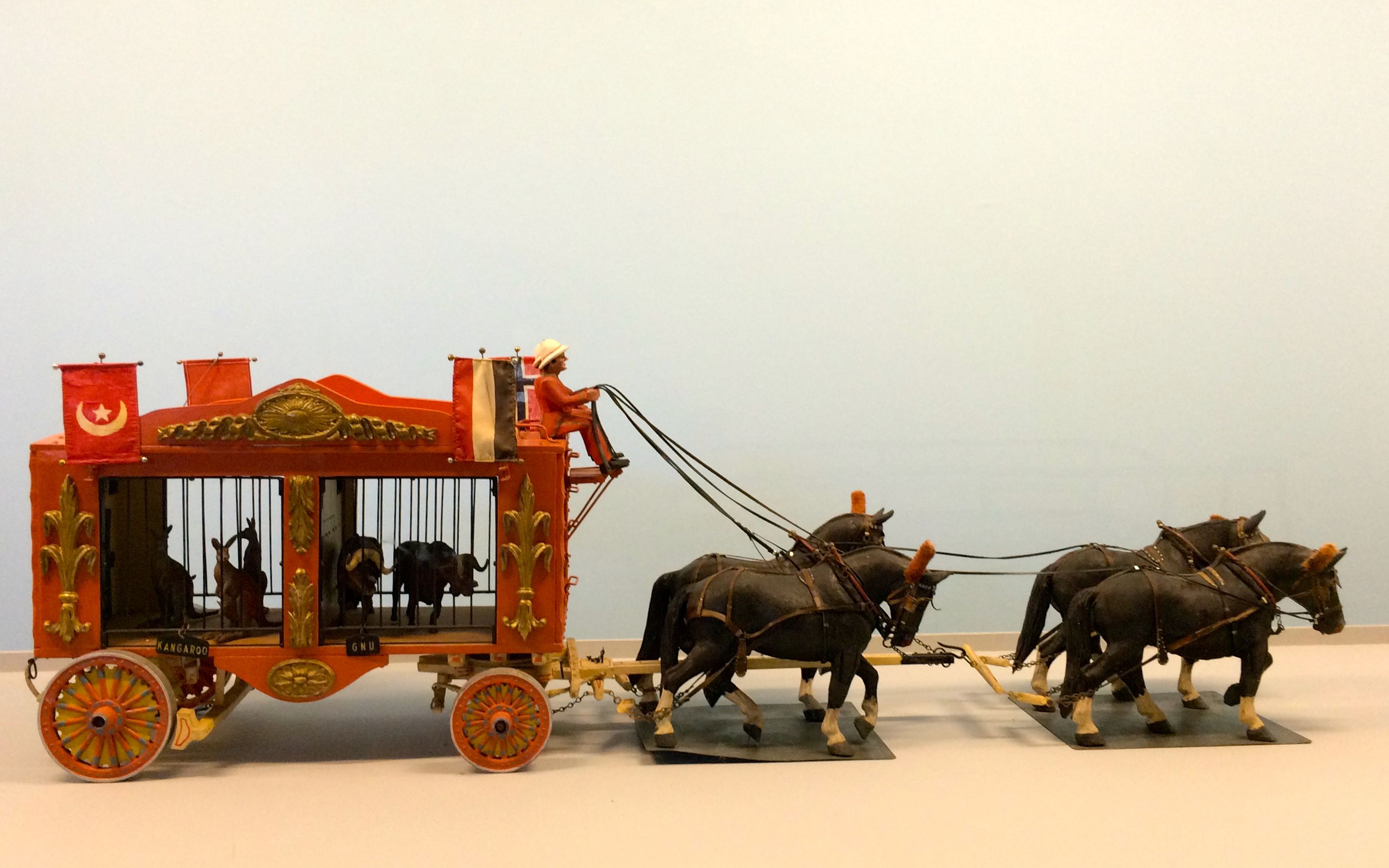
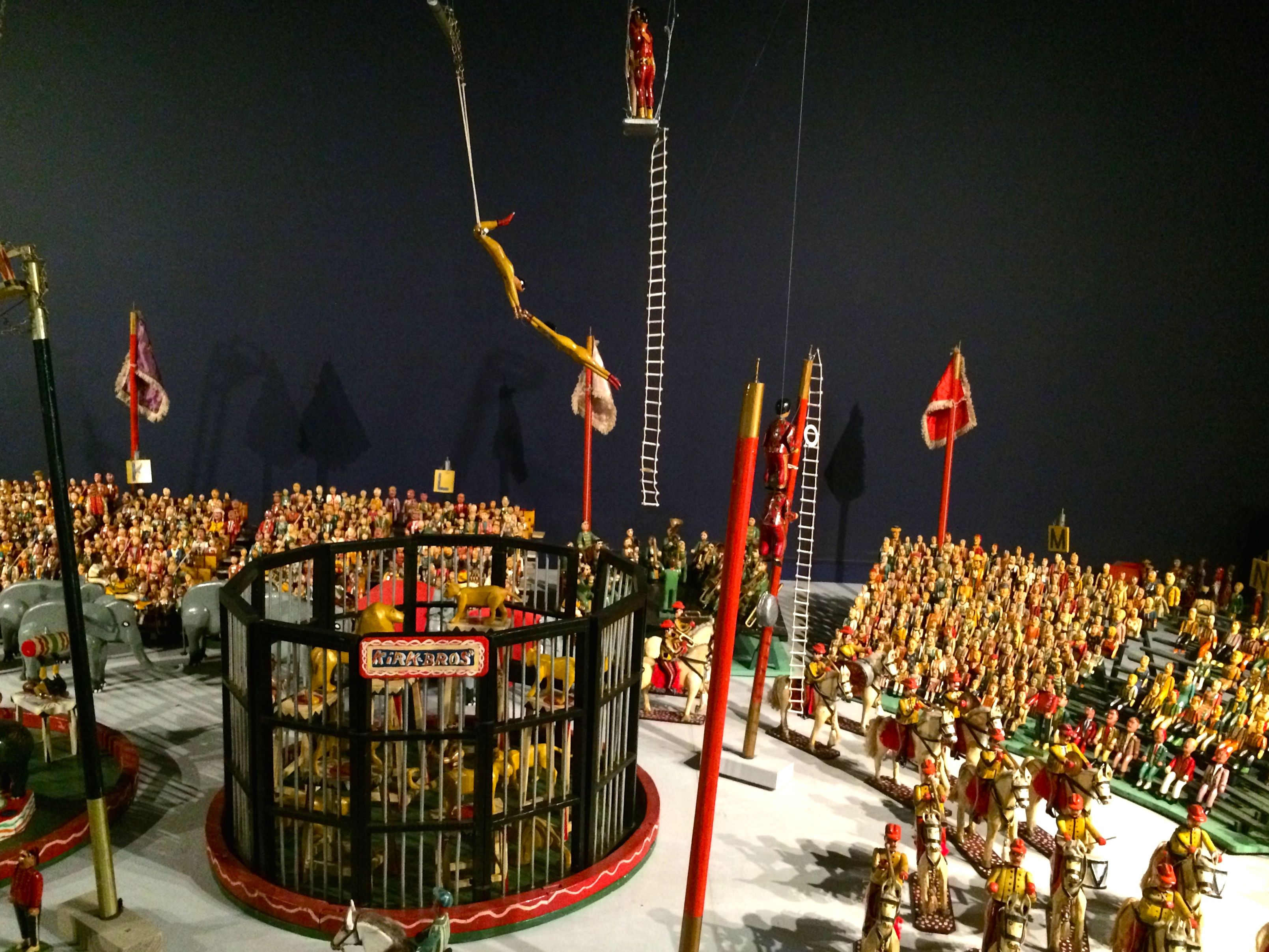
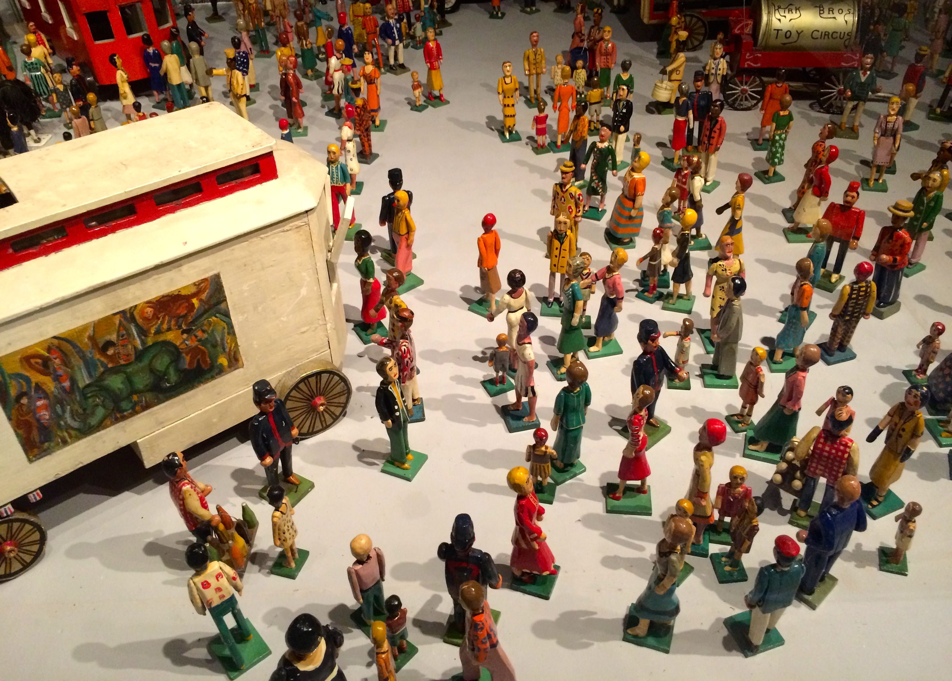
The carrousel animals were lined up on one side of the hallway. On the other side was a model of a circus parade, made by Roy Arnold from 1925-1955. It was carved on a scale of one-inch to one-foot. The parade measures 525 feet long, which would be equivalent to a two-mile parade.
I selected some of my favorite groupings to share with you.
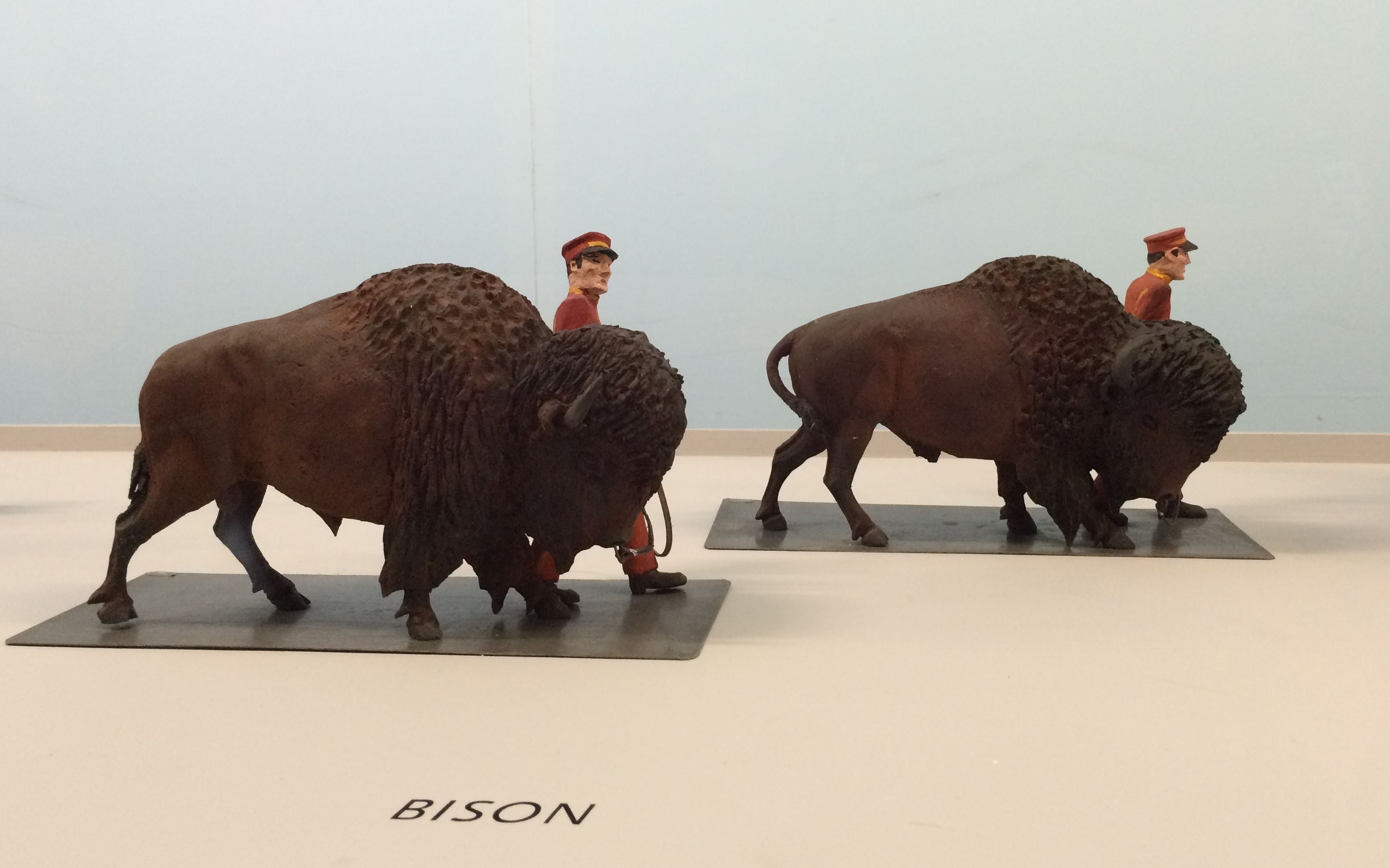
The Mounties, in honor of our neighbours to the north.
Yeah, they are labeled “bison”, but we all know they are buffalo. I snapped this photo in honor of my hometown.
I rather liked the wagon with the giraffes’ heads sticking out.
And this one reminded me of …
animal crackers!
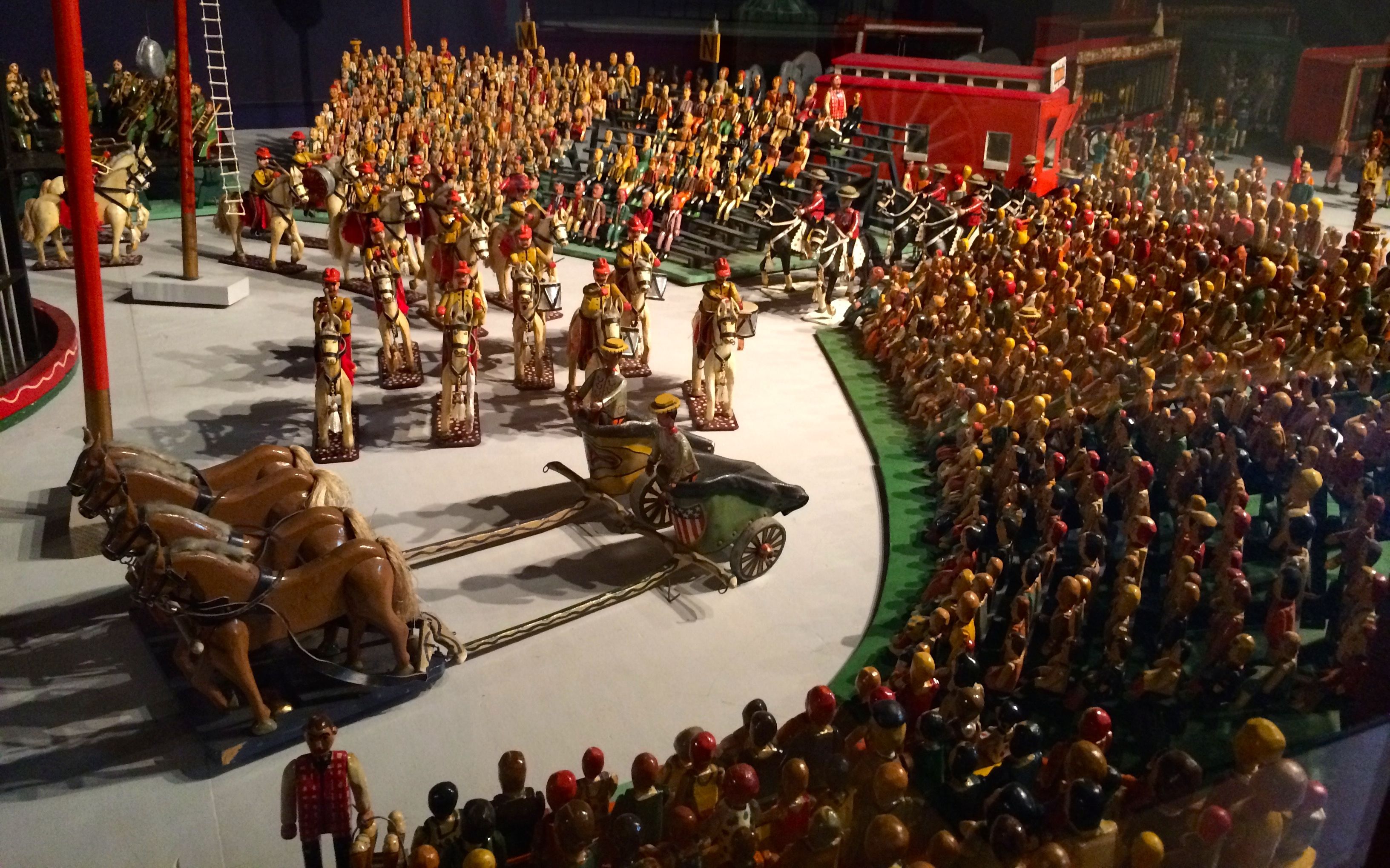
In addition to the 525 foot long circus parade that took 30 years to create, there was also a 3,500 piece circus that took 46 years to make.
Edgar Decker Kirk started making this circus set as a gift for his four children.
He was a brakeman for the Pennsylvania Railroad, and he worked on his carvings during his breaks using his penknife and a foot-powered jigsaw.
After his children outgrew playing with toys, he would occasionally set the entire three-ring circus in his backyard for the enjoyment of the neighborhood children.
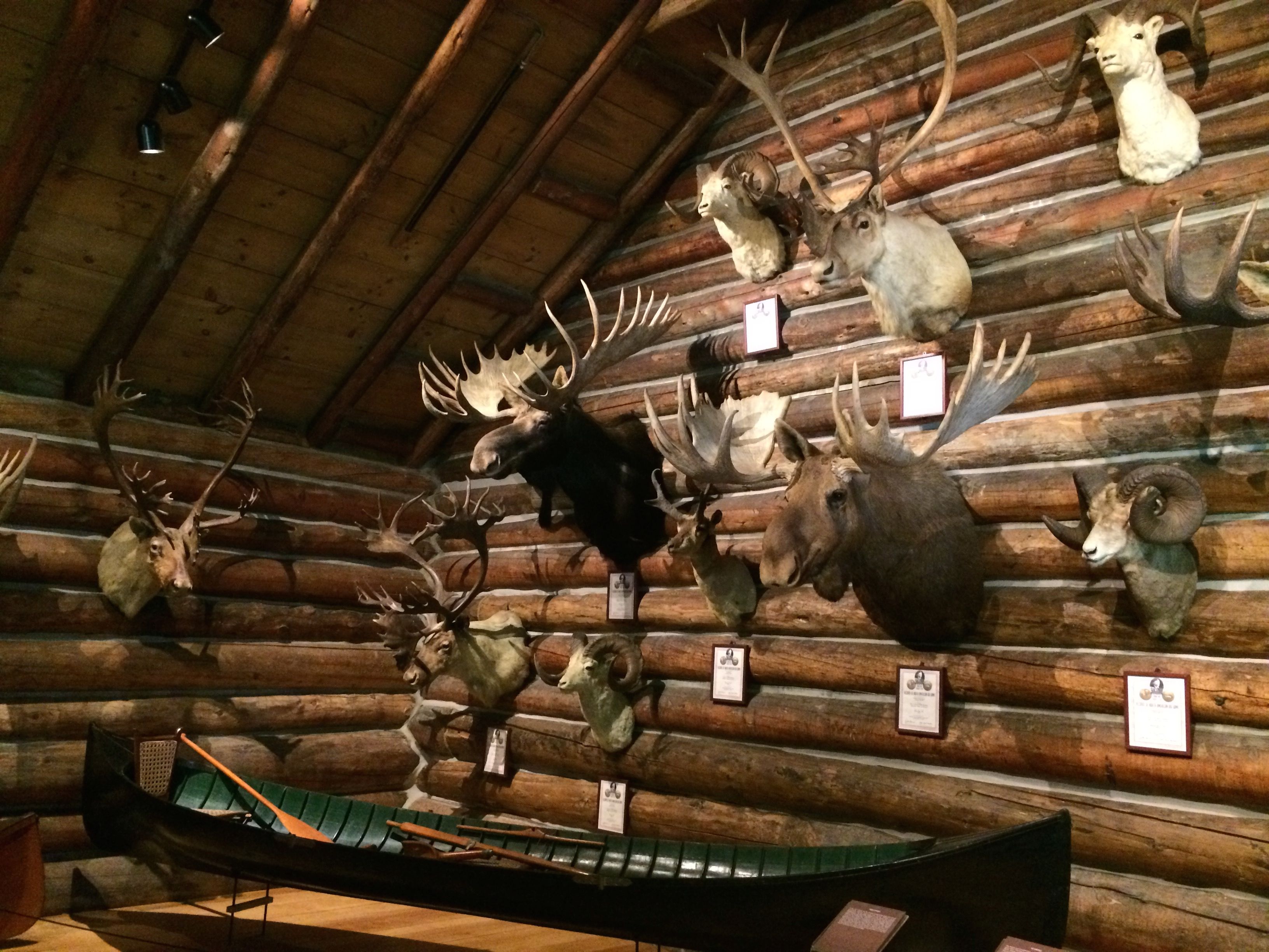
I left the circus building and headed out to see what else I could discover. I found two cabins that Electra Web had built to honor her hunting friends.
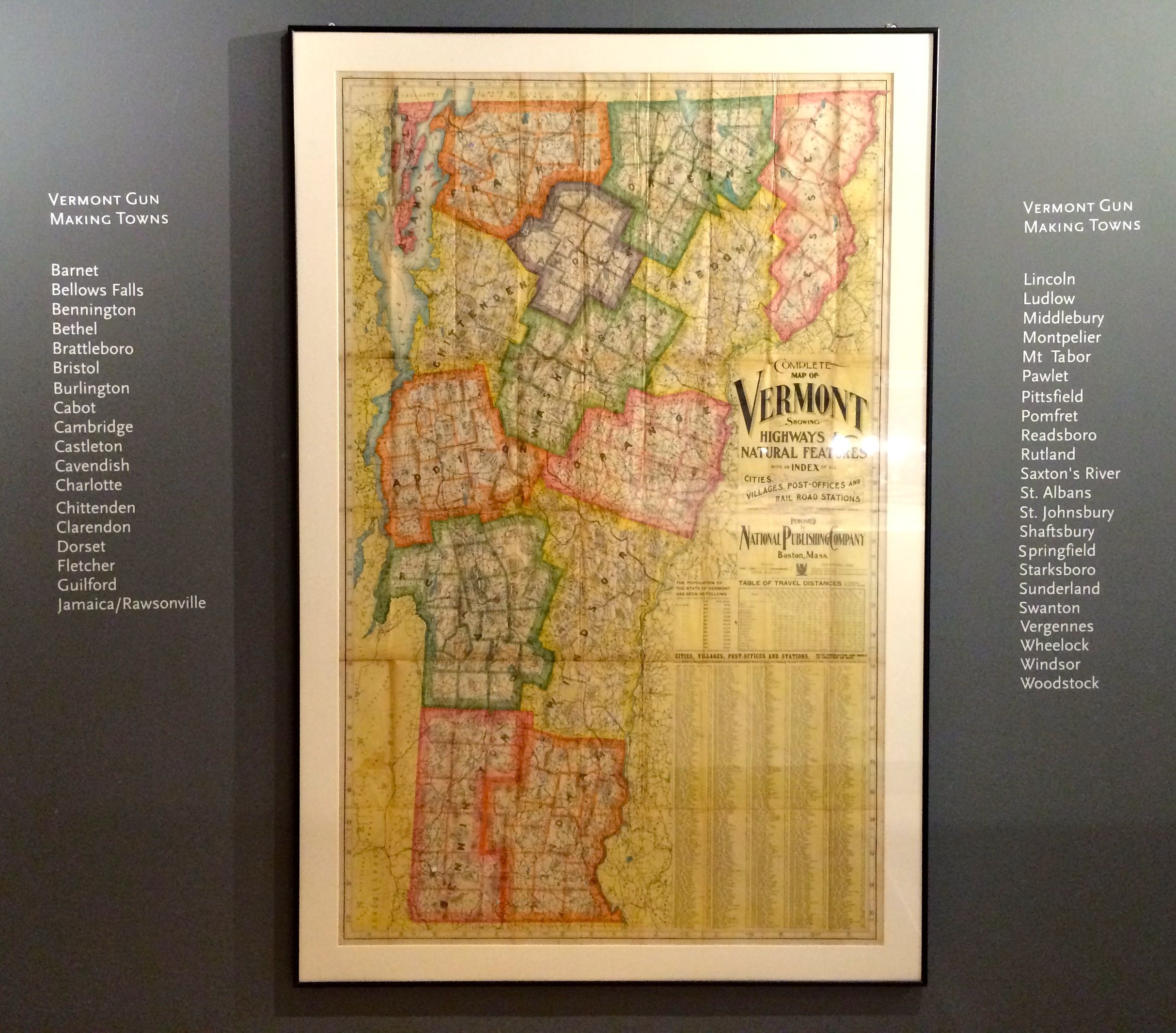
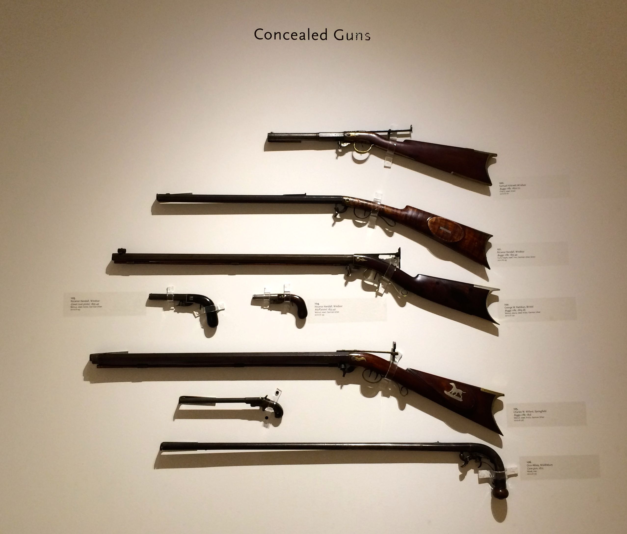
Inside one of the cabins was a collection of firearms that were made in Vermont.
There were quite a few places where guns were made back in the day. The docent told me that these were not necessarily large factories – many times they were just one-man shops. I asked her if she had any favorites among the collection. She pointed out this group.
She liked these because they were guns designed to be hidden. I’m not sure how the larger ones were able to be concealed, but I guess anything is possible.
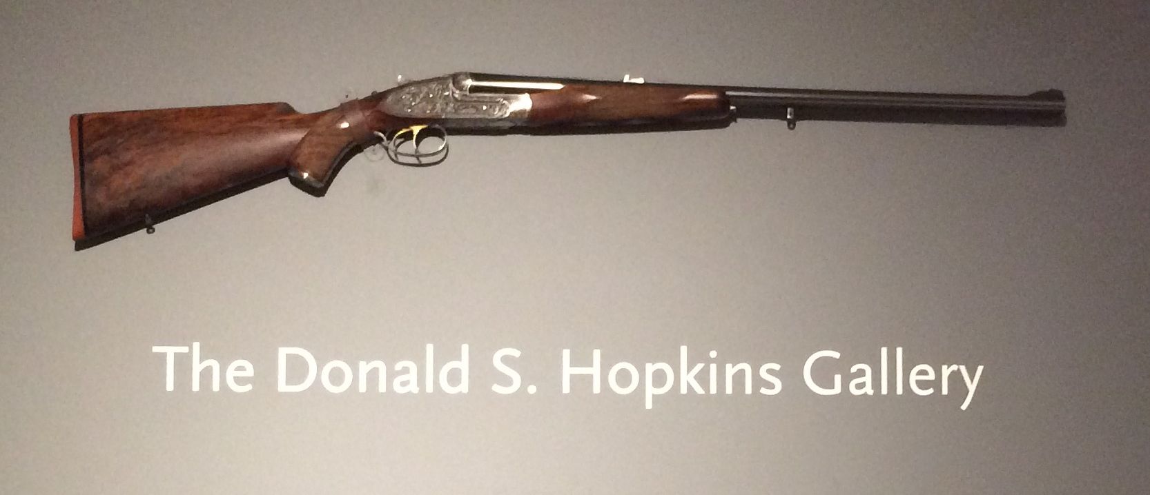
Speaking of rich people, here is a gun for the filthy rich.
This is a double-barreled .470 caliber rifle that was made for Donald, S. Hopkins in the 1950s. He was a sportsman and friend of the Webb family, and this rifle is known as the Nitro Express. According to the information in the museum, the high caliber of the rifle gives it tremendous firepower that is enough to bring down animals such as elephants, buffalo and rhinoceros. The animals in question have nothing to fear from this gun, however. It has never been fired.
Talk about rich! You buy a high-powered rifle with gold and silver work on it and then you don’t use it.
The next cabin over was dedicated to the animals that were not able to escape the sportsmen.
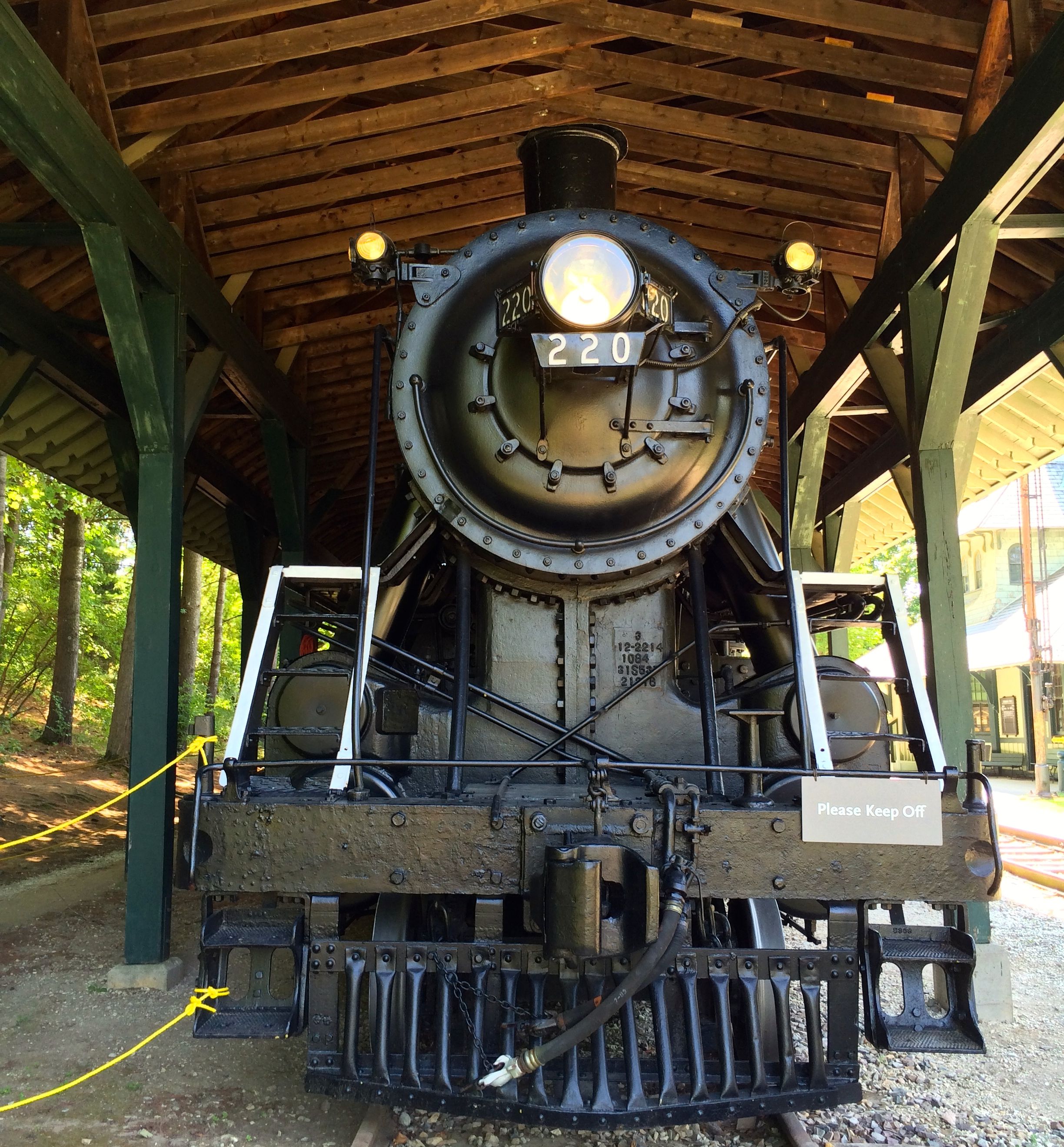
A little further along, is the homage to rail transportation.
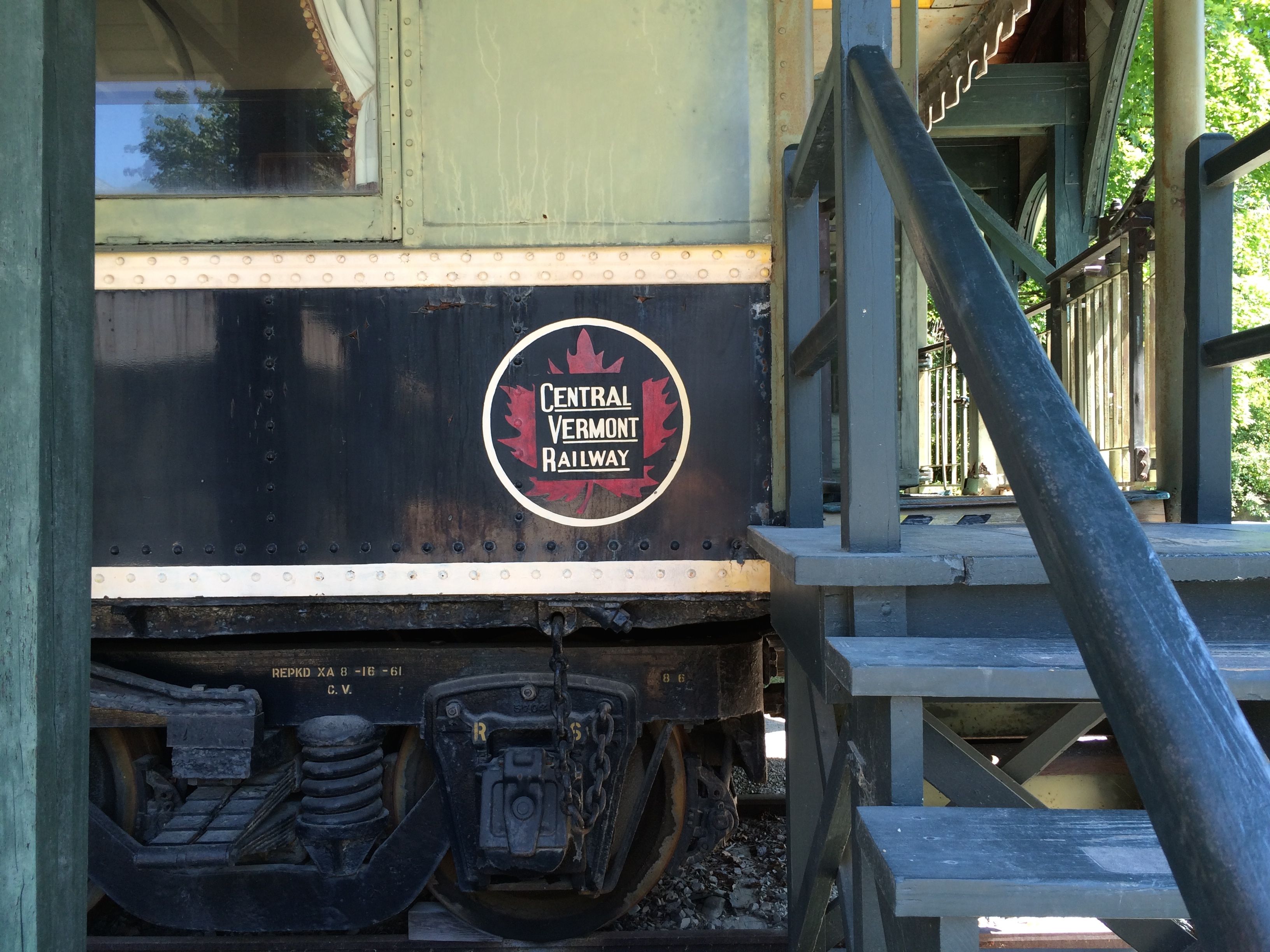
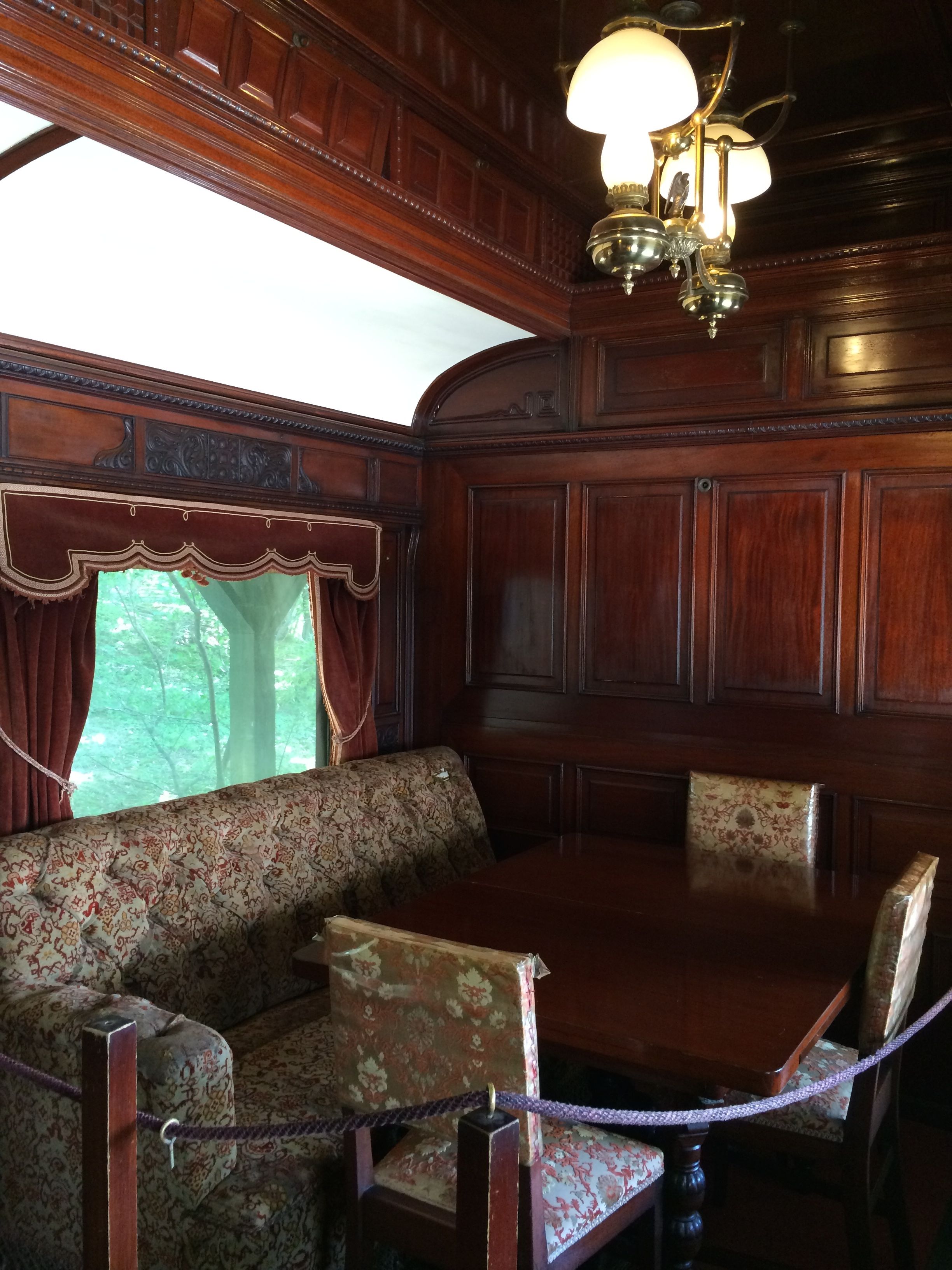
There is a locomotive and a railcar that was similar to the one that Electra Webb’s family used to shuttle back and forth from Shelburne to New York City to attend to business.
There is a wood-paneled room with a table and seating at the end of the car.
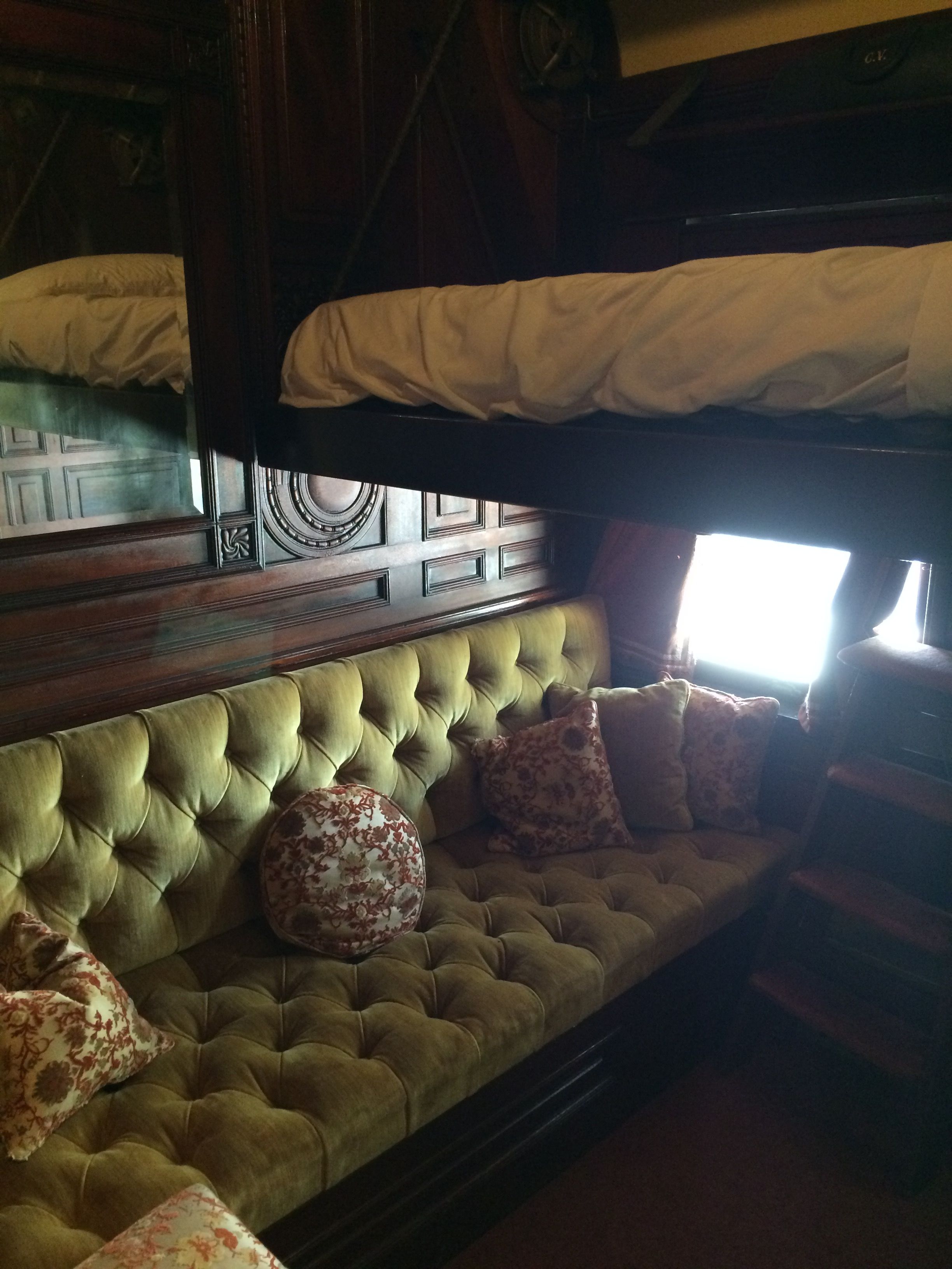
Down the hallway, you find the compartments.
There are couches as well a bunks that fold down. You can see the steps to ascend to the upper berth.
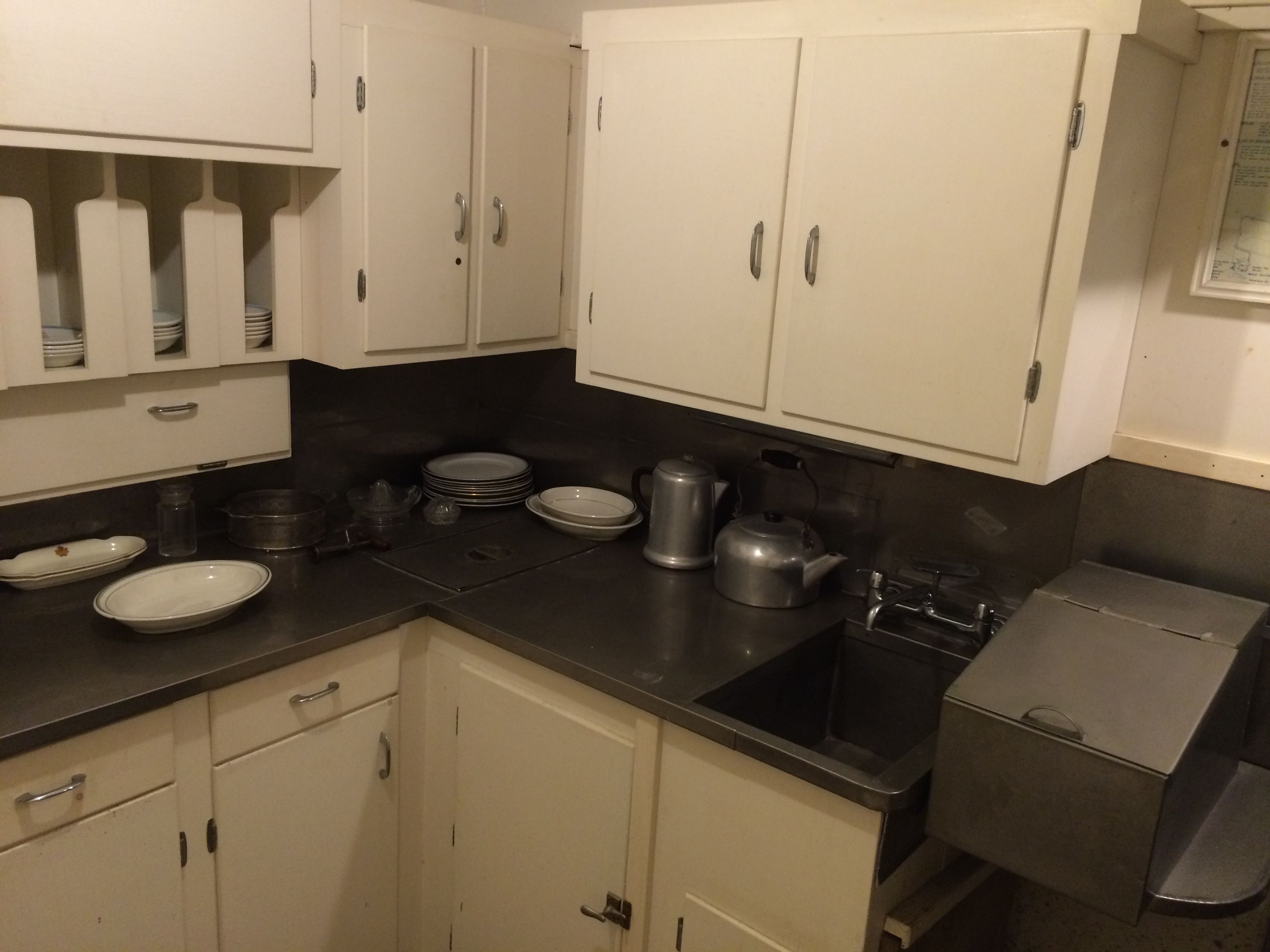
Of course, you wouldn’t want the passengers to travel hungry, so there is a kitchen in the railroad car, too.
And, at the end of the journey, there was the train station. Electra Webb bought the station and moved it here, too.
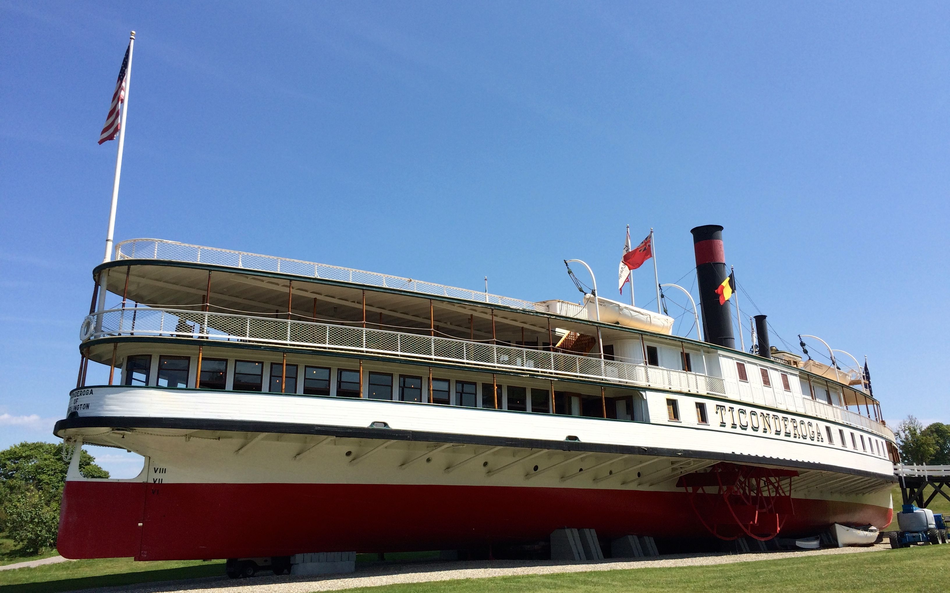
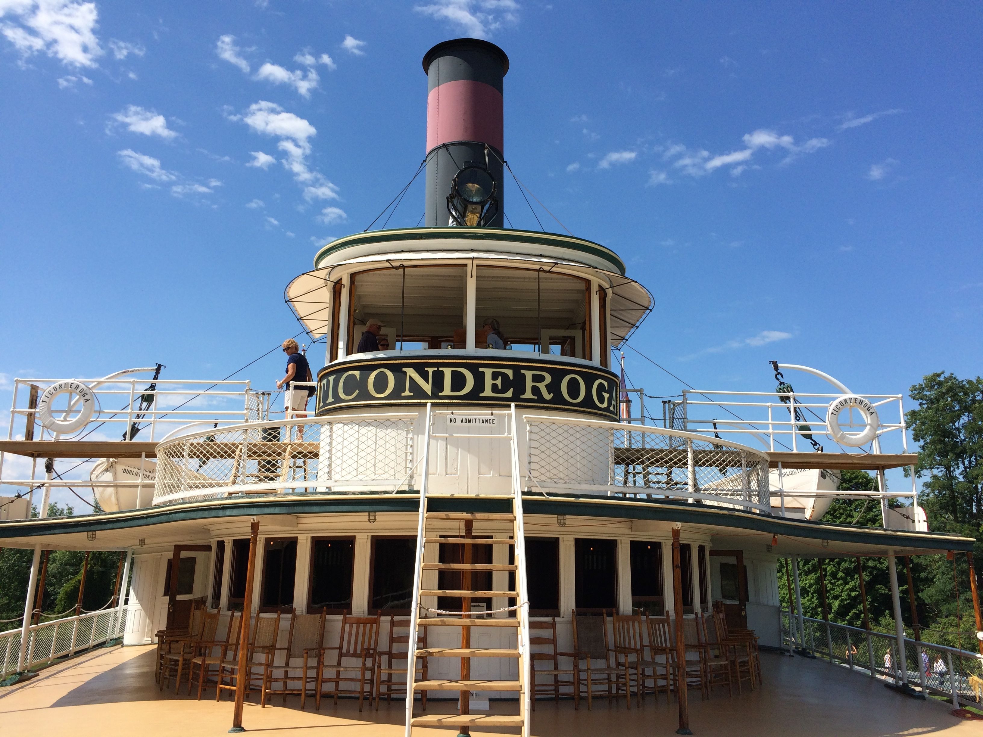
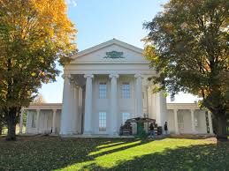
Next stop on the tour was the Ticonderoga, a 900 ton side-wheeler that plied the waters of Lake Champlain. It was built in 1906 and was in regular operation as a boat that connected to the railroad for many years. As more modern methods of transportation evolved, the Ticonderoga’s days were numbered. By 1950, she was saved from the scrap heap by Electra Webb. She tried to keep it in operation, but eventually, the lack of people who knew how to operate and maintain it finally made it impossible to continue using it in the water.
The decision was made to move the ship two miles inland to the museum. During the winter of 1955 Ticonderoga was moved on railroad tracks that were specially laid for the purpose. It was hauled across highways, over a swamp, through woods and fields, and across the tracks of the Rutland Railway to reach her permanent mooring on the Shelburne Museum grounds, where it was lovingly restored.
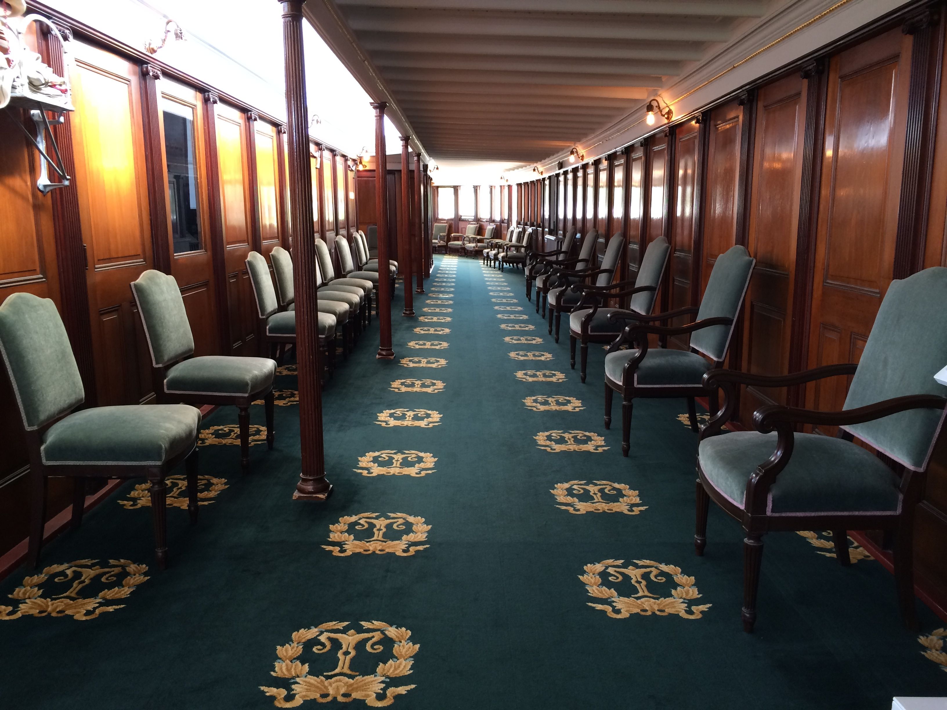
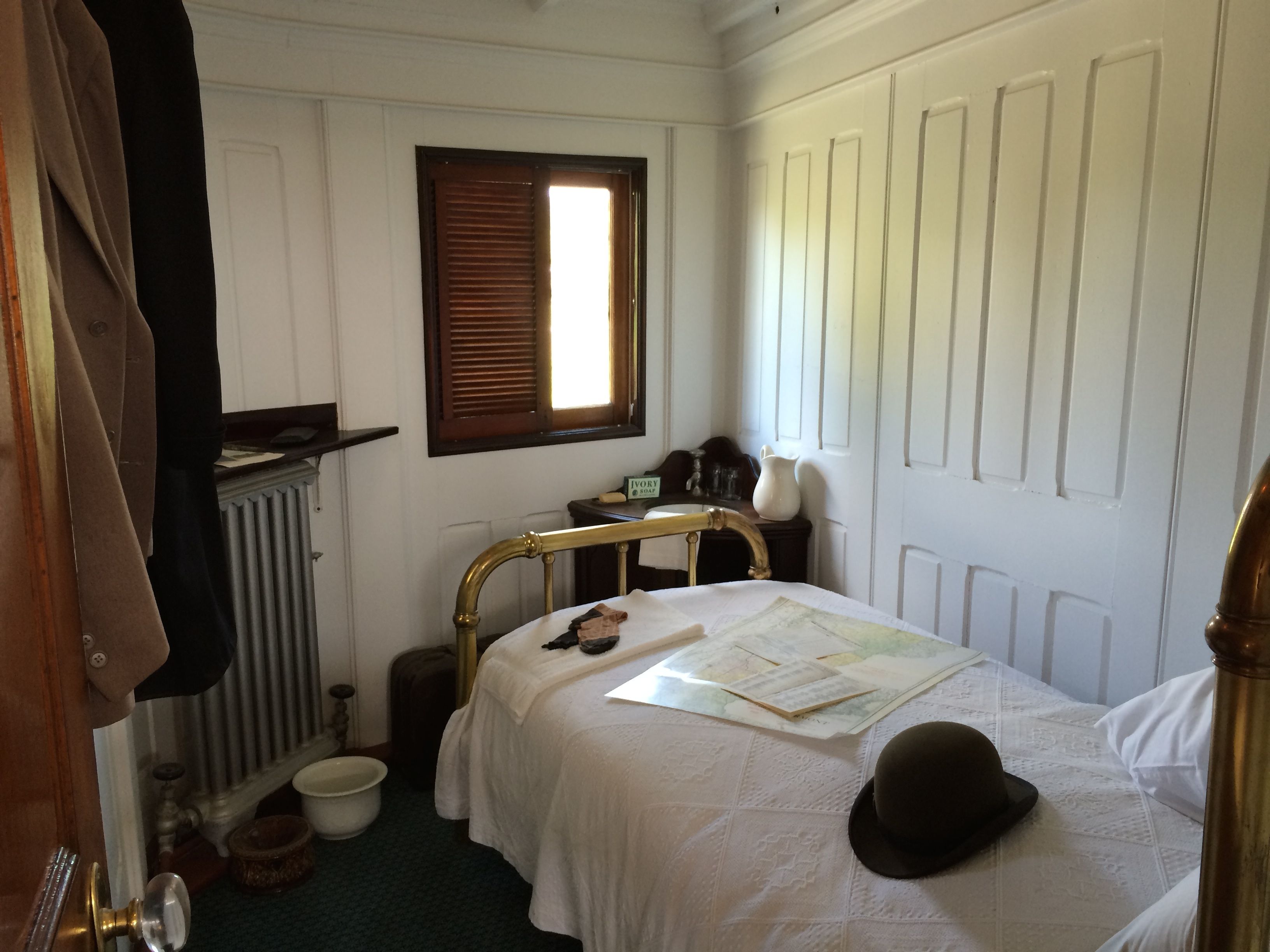
This is the area where people would sit during the passage. There was also a dining area, as well as several sleeping compartments.
This was a deluxe room, suitable for a honeymoon.
This was a smaller room, more suitable for a traveling businessman.
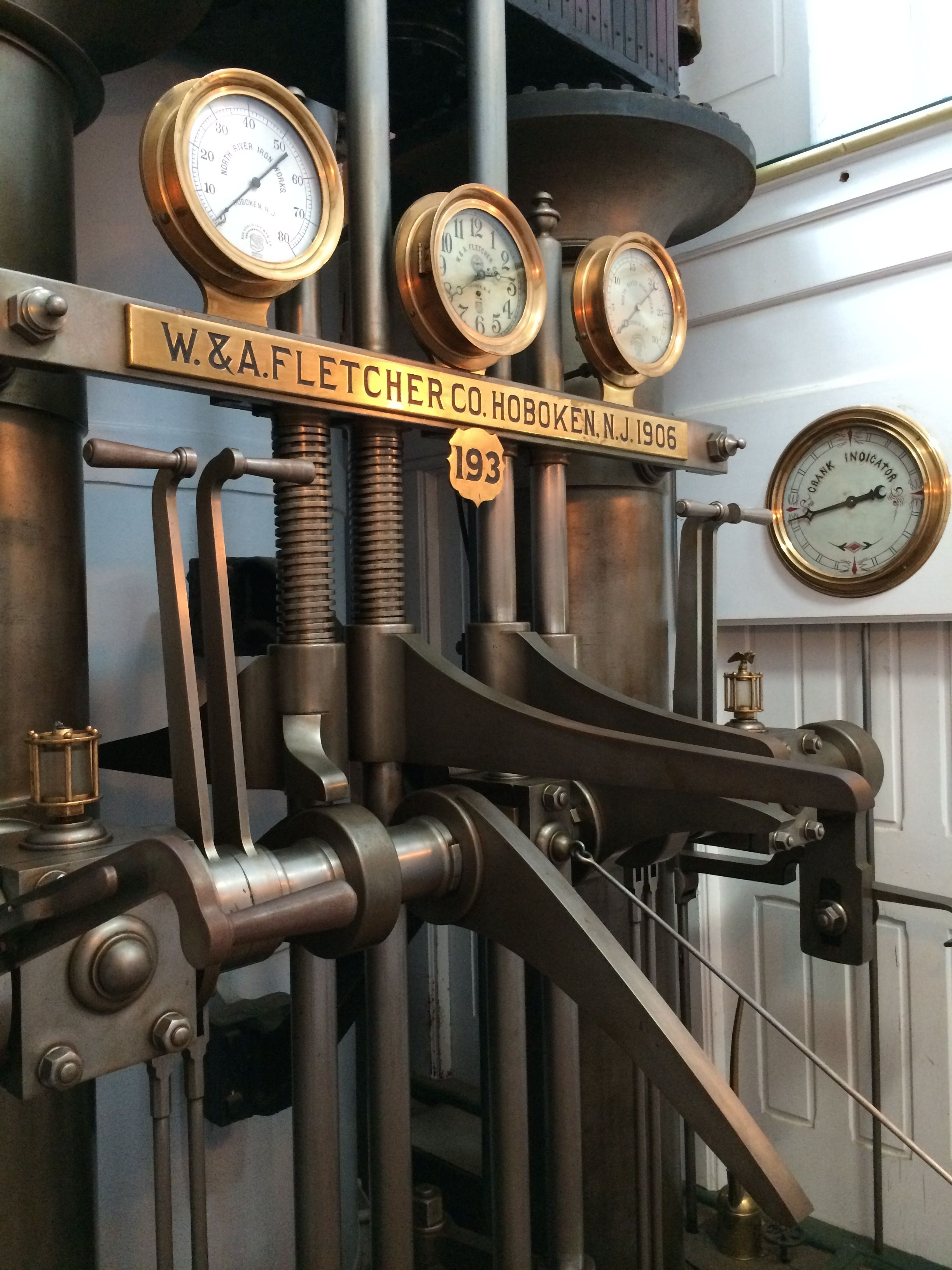
The mechanicals are also restored, although they are no longer functioning on a daily basis. If I remember correctly, they do fire it up on a yearly basis to keep things in good repair. (Of course, I might be conflating the Ticonderoga with something else with an engine that I have seen along the way.)
You can walk all over the ship, from the lower levels where there is freight and the ticket booth all the way up to the bridge.
One interesting bit of information that I picked up somewhere is that when they built the ship in 1906, it had a planned lifespan of about 25 years – maybe a little longer. After outliving its expected use by a couple decades, it has been completely fixed up and maintenance is ongoing.
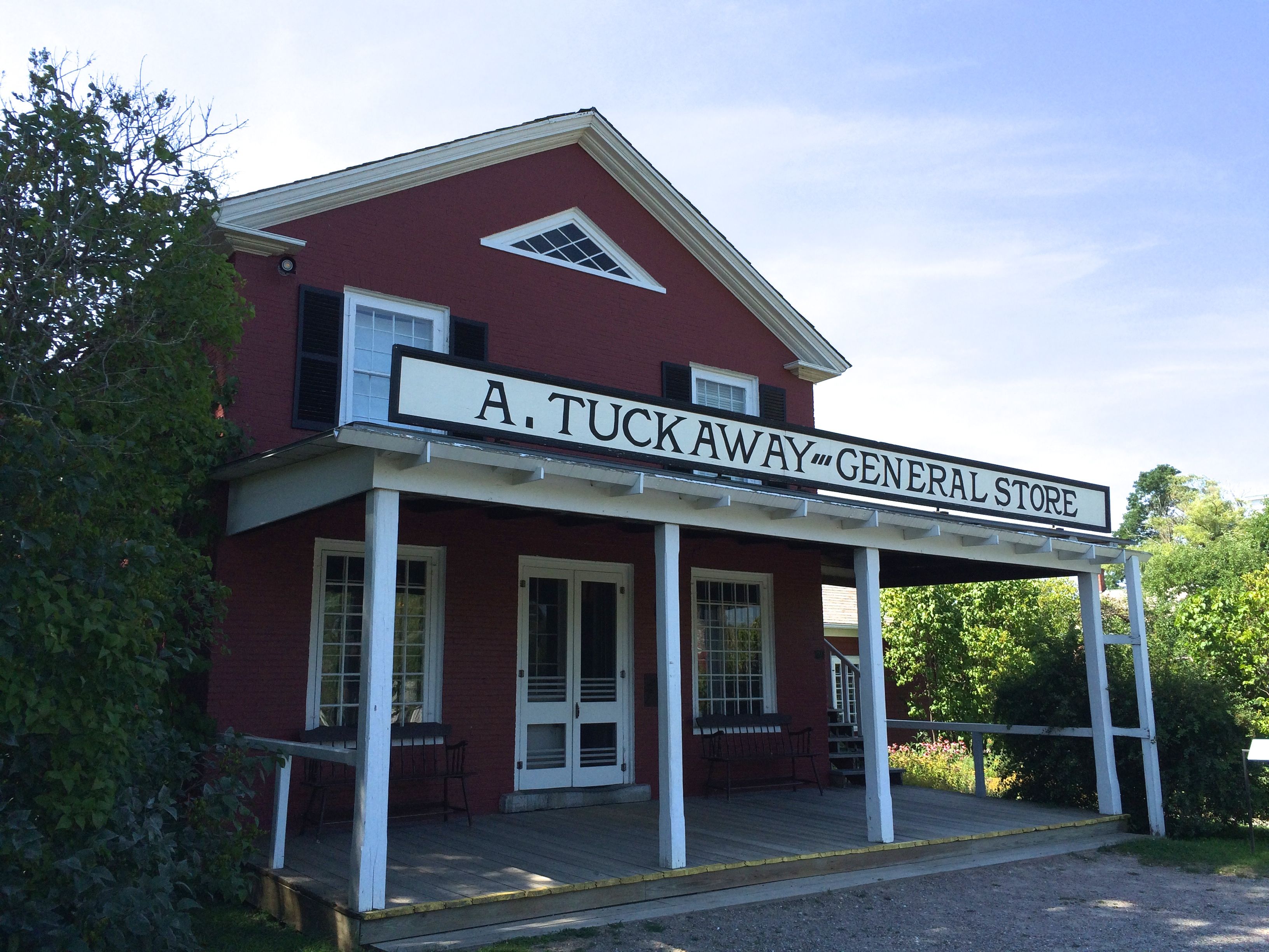
Not everything is a single historical item. This general store is cobbled together out of three buildings and stuffed full of items – some of which we had in our house.
The campus is studded with “Americana”.
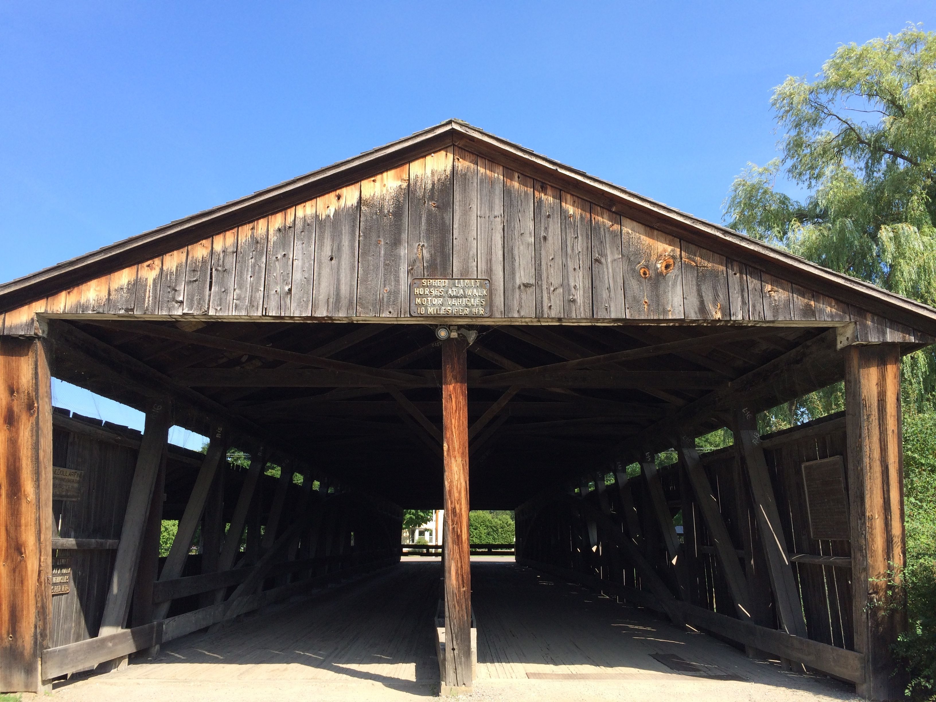
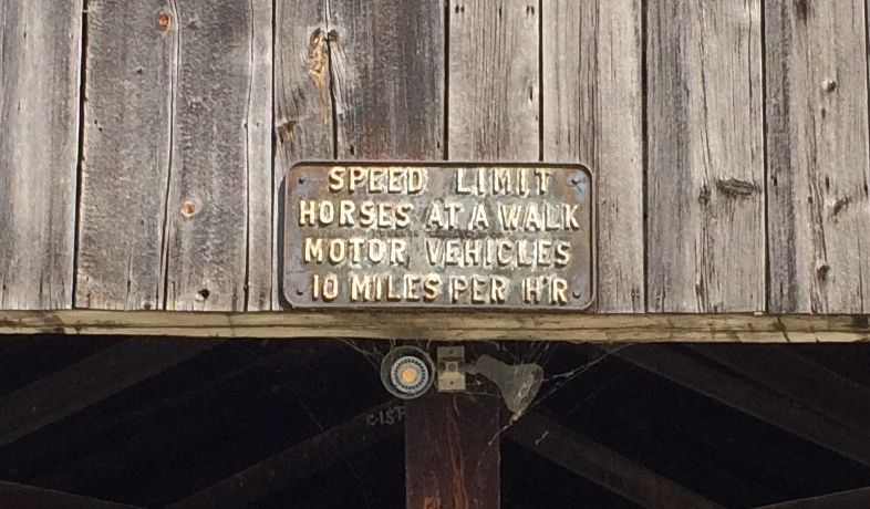
When the museum first opened, people entered by crossing this covered bridge.
In case you wondered, this is what the sign on the bridge says, here it is.
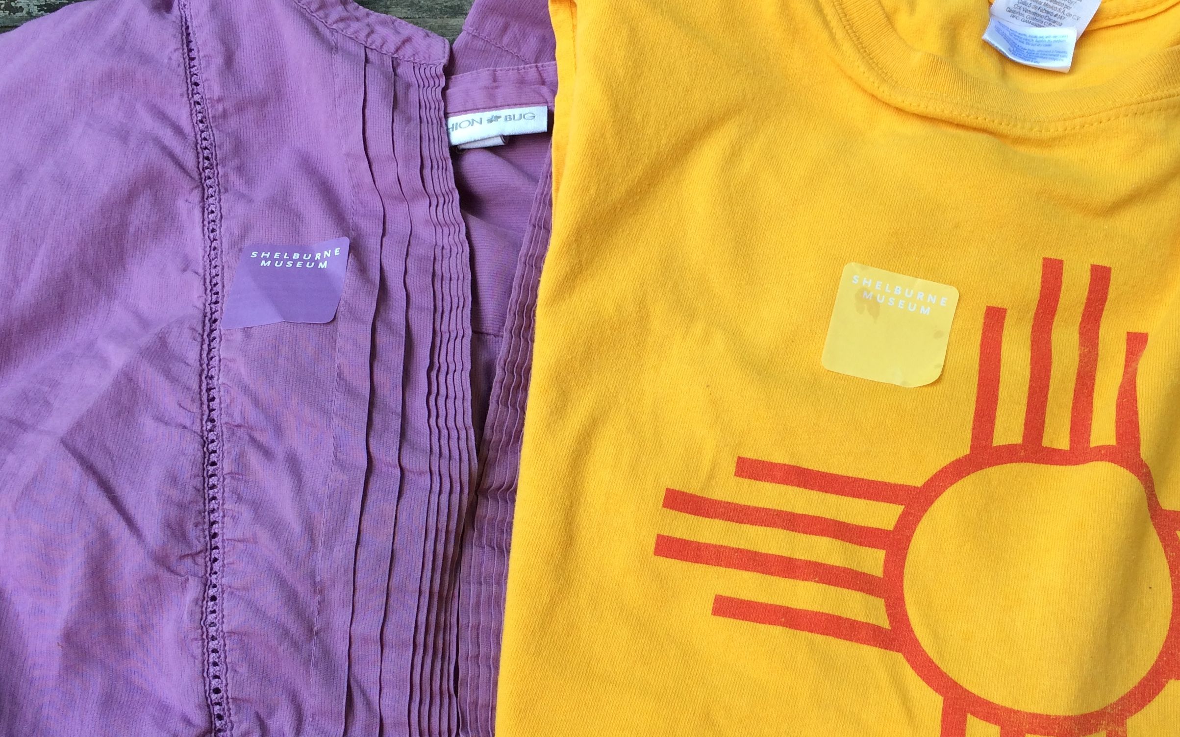
The admission fee to the museum entitles you to two days worth of entrance. The issue different colors of stickers each day of the week. I actually went back for a second day. Believe it or not, by complete coincidence, I wore shirts that matched the stickers ON BOTH DAYS!
The main reason I wanted to return for a second day was to take a tour of two houses that are only available with a guide.
The first house was the Prentis House.
Electra Webb originally bought the house so that she could use the wide pine floorboards for another project. According to the guide, she decided to let her friend, Mrs. Prentis, decorate the interior of the saltbox-style house. Now, she didn’t worry about being historically accurate; she just stuffed the interior full of all sorts of things that were more or less ‘of the era’. Then, out of respect for Electra Webb and her friendship with Mrs. Prentis, they decided to leave it as an example of the mid-fifties enthusiasm for colonial decor. I find that a bit mind boggling.
The Prentis House was originally built in 1773 by the Dickenson Family in Hadley, Massachusetts. Since houses are usually named for the original owners, it kind of annoyed me that it was named for the Electra’s friend who decorated it in a completely inappropriate manner.
The second house was the Stencil House, so named for the elaborate stencils on the walls.
It was built in 1804 on one hundred-acre farm in Columbus, New York. When the museum bought the building in 1953, the walls were covered with wallpaper. Before they moved the house, workers removed several layers of the peeling paper, revealing extensive painted decorations on the board walls. The work was probably done sometime between 1819 and 1830.
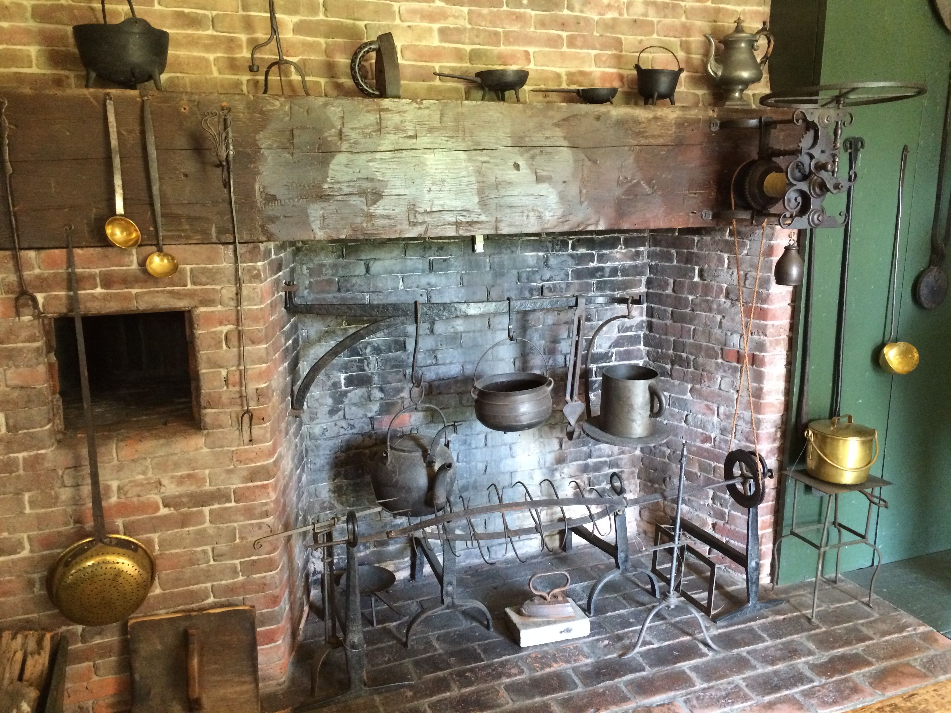
I managed to get a photo of the fireplace. Notice the bread oven to the left of the hearth. On the right side, you can see a clockwork mechanism for turning a spit for roasting over coals.
By the time I had finished touring these two houses, I was just about to my absolute limit of “Americana” – this fabricated version of a past that never really existed was really tiring me. I passed by a few more places.
A building that I assume was a church,
And the Dutton house.
I couldn’t bring myself to visit the Electra Havemeyer Webb Memorial Building which contained furnish rooms from the New York City home of the Museum founder.
You might be able to tell from my overall tone that I was less than impressed by Electra Havemeyer Webb and her compulsive shopping and acquisition. For me, context is everything. By buying up all these items that don’t really belong together and plopping them down cheek-by-jowl left me rather cold. I’ll agree that is is kind of amazing, and I can easily see that people might enjoy it. It certainly is an attraction.
There was one part that I found quite amazing, and I will share that in another post.
Thanks for sticking with me during my tour of the Shelburne Museum. Come back later to see the part of the museum I found interesting.
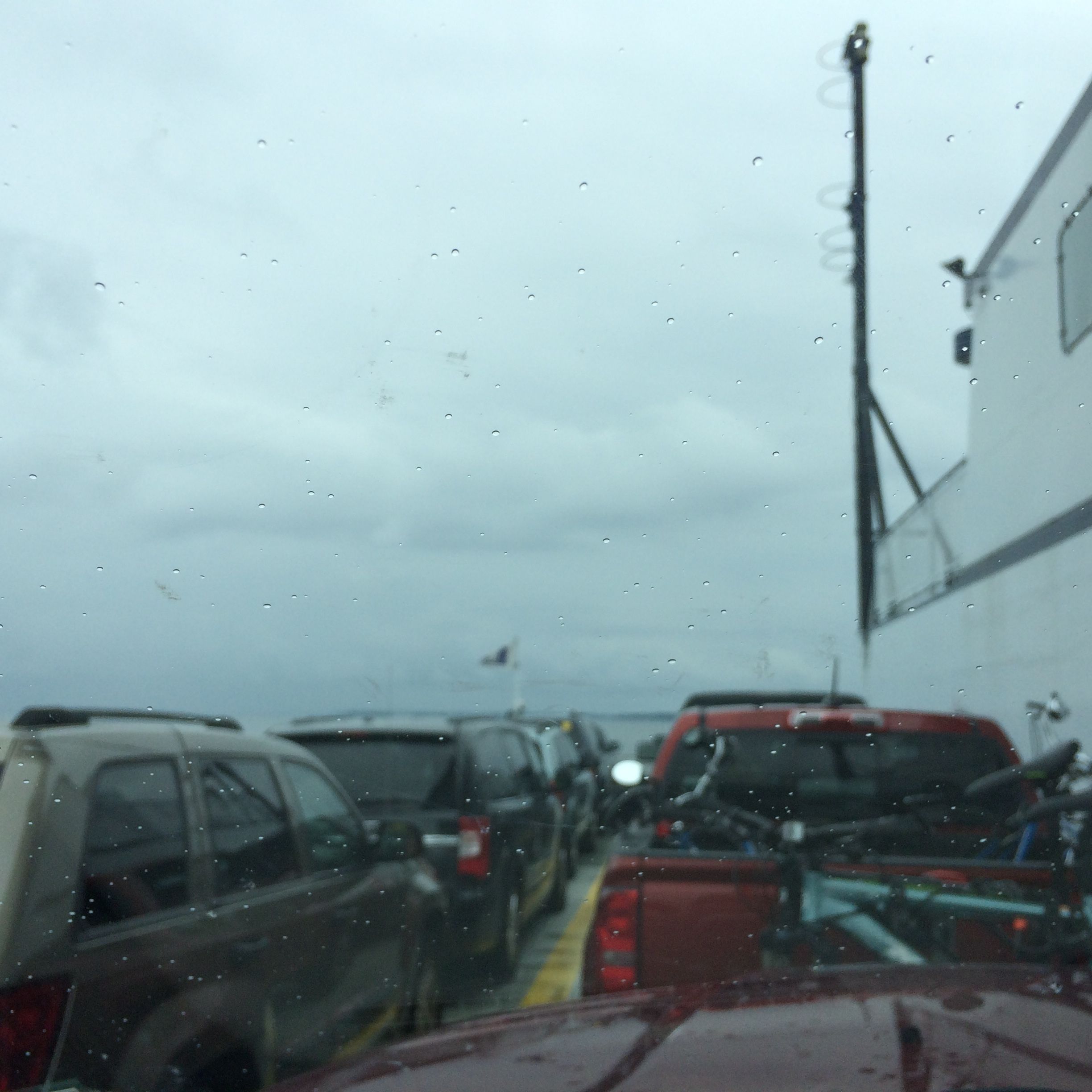
Finally! A new state to add to the map! After talking with a few people and consulting maps, I decided that the way to get to Vermont from Plattsburg, New York would be to take the ferry.
It was a drizzly day when they packed us on the ferry. Incidentally, the toll to ride the ferry with the truck and trailer is based on how long the rig is. I found out that Bart and Flo are about 48 feet long from the front bumper of the truck to the read bumper of the trailer. No wonder maneuvering into campsites is such a challenge at times! Oh, and the 15 minute trip cost $39.50.
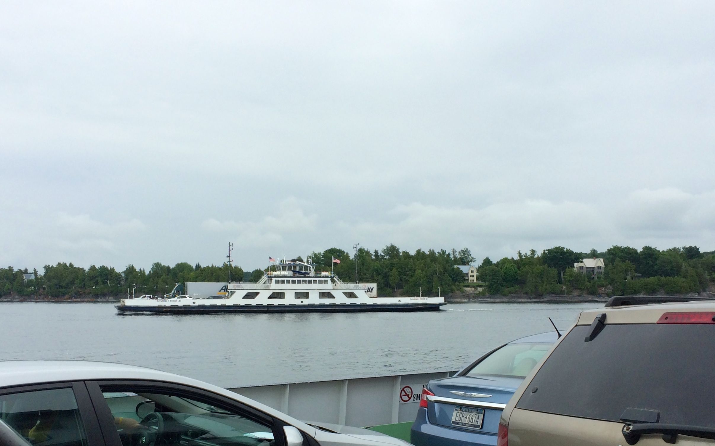
Just as we got to the other shore, a ferry set sail from Vermont.
I got settled in to my home for the next week or so – Malletts Bay Campground. Most of the campground was filled with seasonal campers and people in town to work on the oil pipeline. Those people are really packed in, and since they are there for a long period of time, they pack their spots full, from one side to the other and front to back. It was much nicer over in the short term area. People came and left, but it was never crowded.
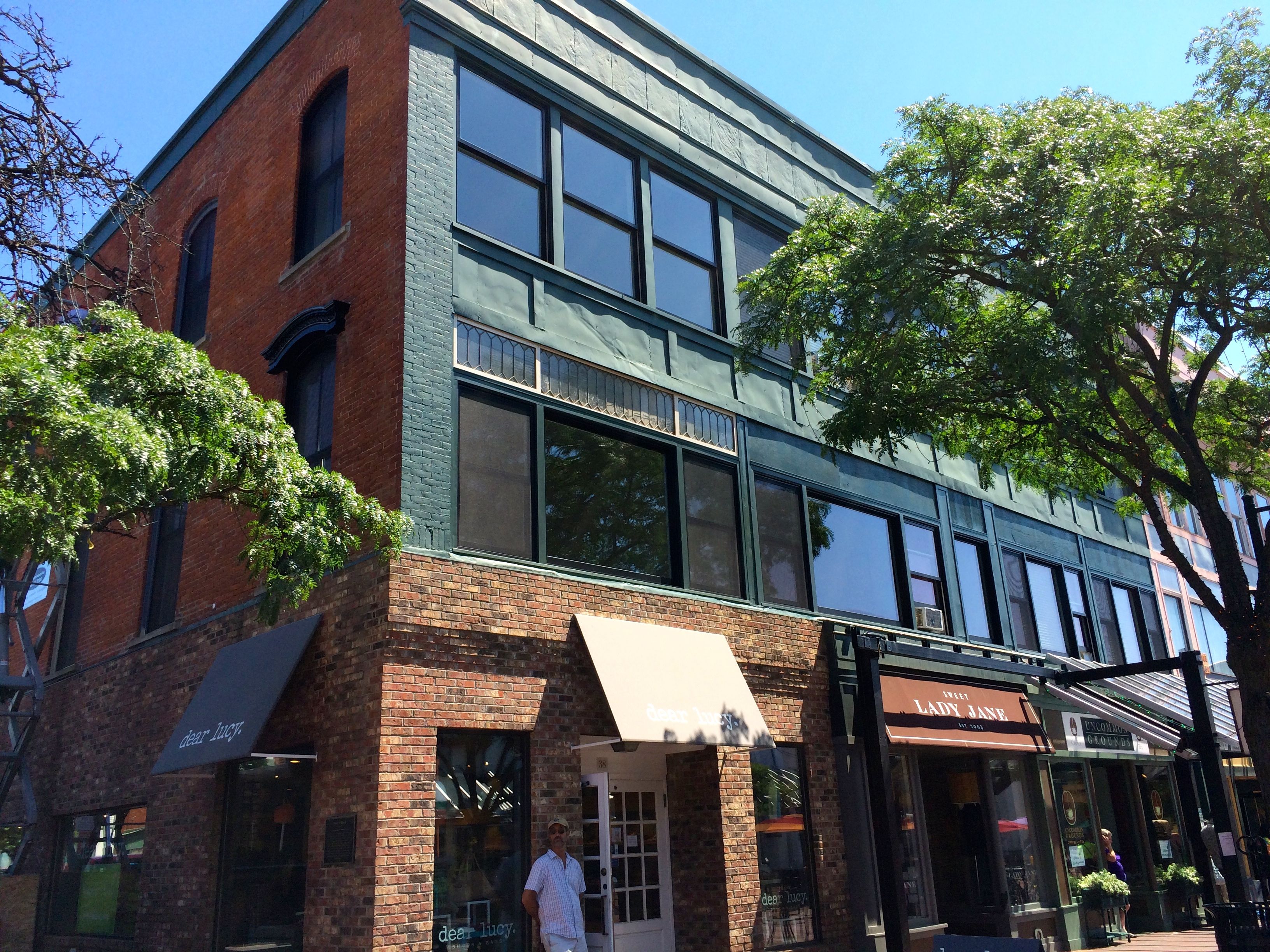
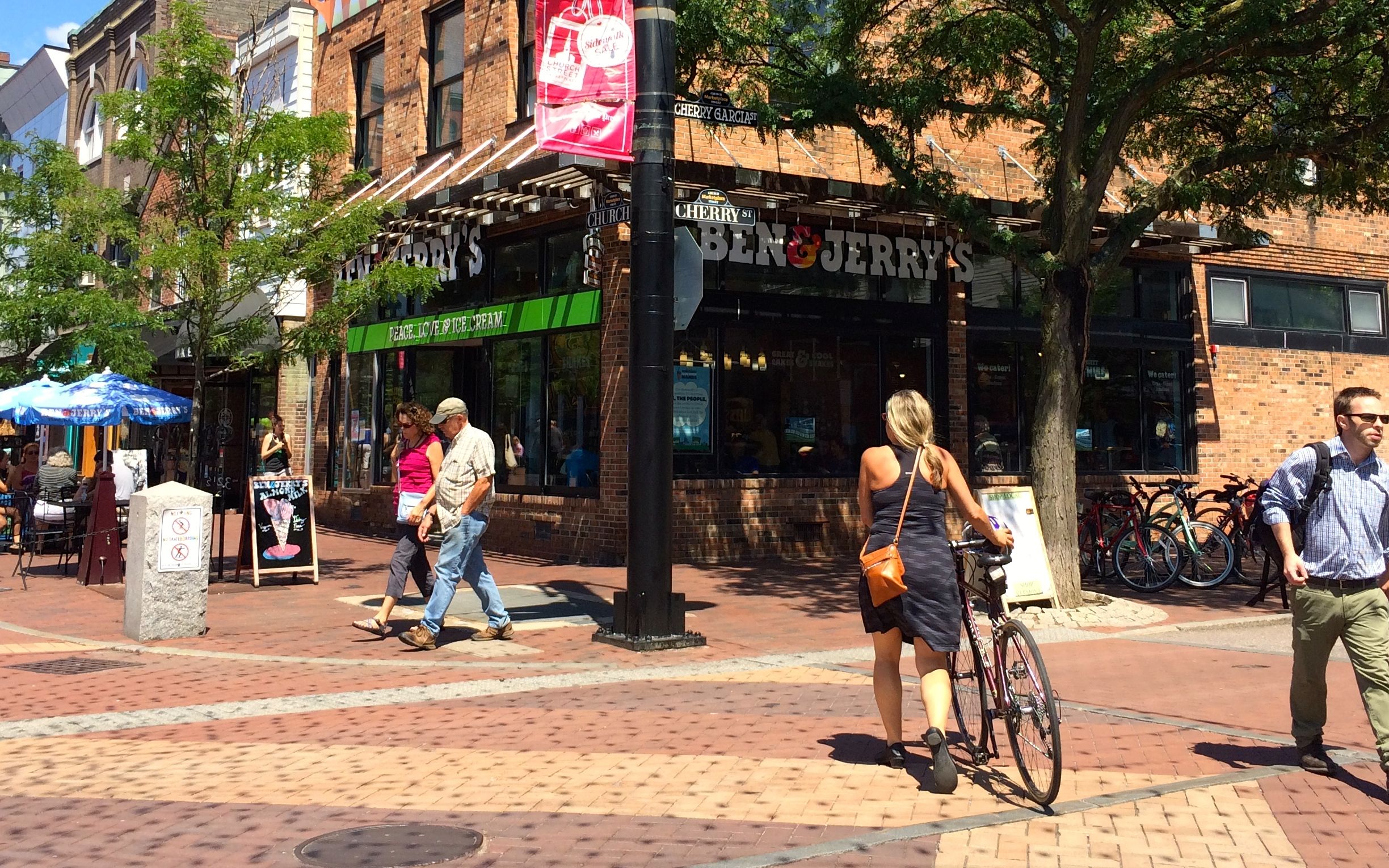
I went into Burlington a couple of times during my stay at Malletts Bay Campground. In my research about what to do in Burlington, I found that they had free two-hour parking in a garage downtown. Since the prince was right, I decided to start my explorations there. I parked and set off to explore the Church Street Marketplace.
It’s a lovely pedestrian mall with an assortment of building styles from the 19th and 20th centuries.
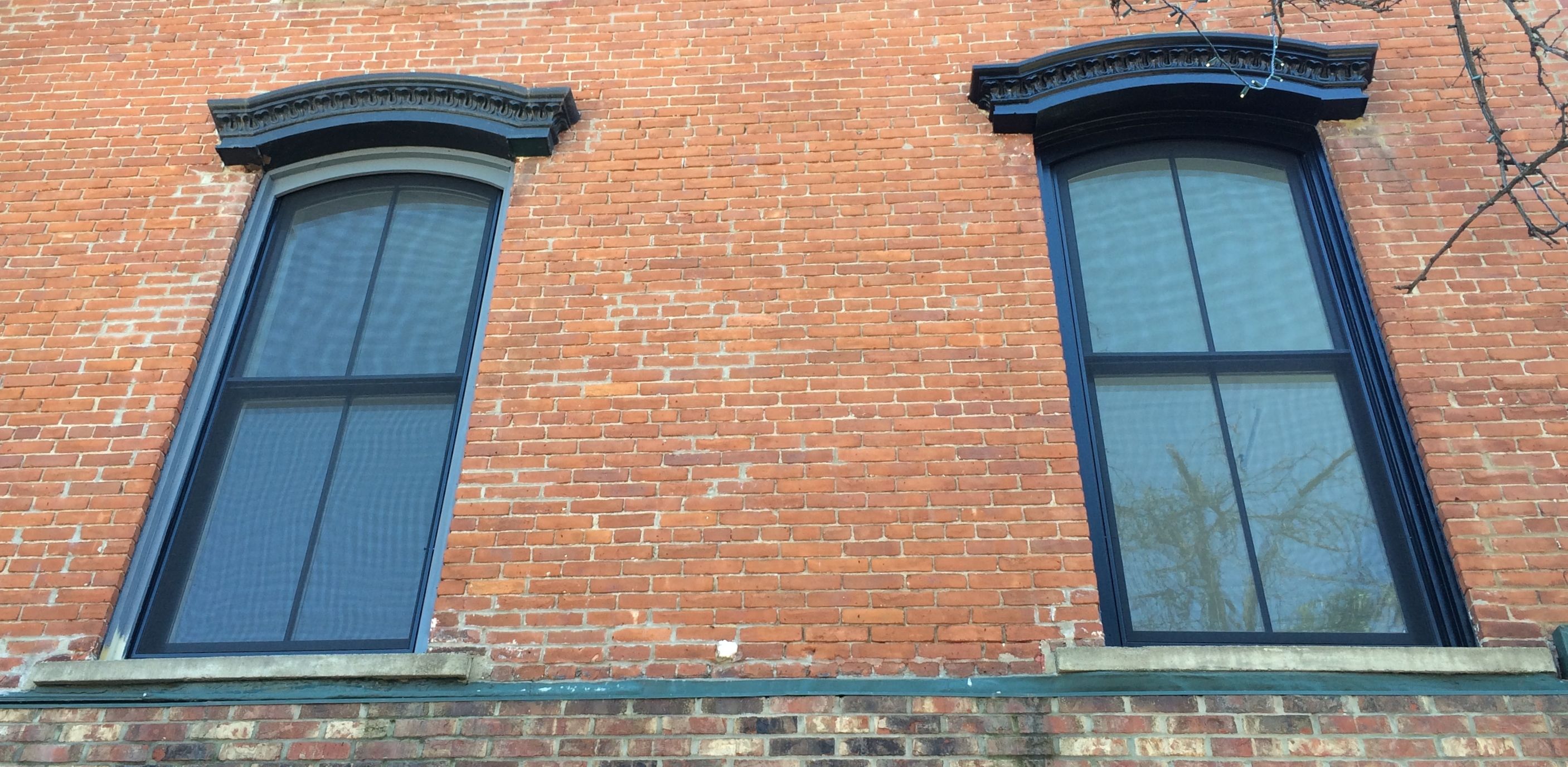
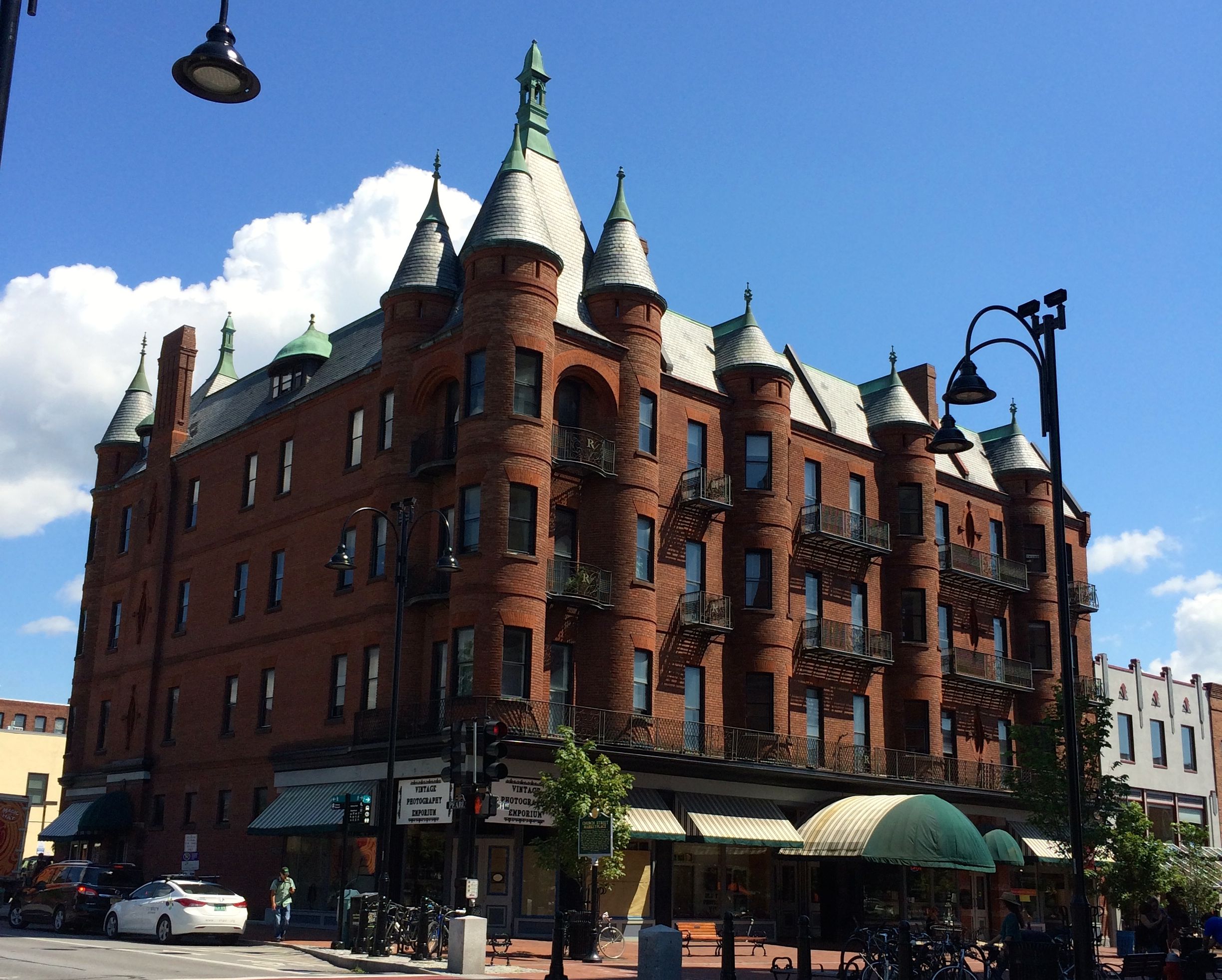
For instance, the building on the corner, Payn’s Block, was built around 1865 for a local metalsmith named Edgar Payn.
It was built in the Italianate style, which you can still see in the windows on the side of the building. A department store took over the building and the one next to it from the early 1900s through the 1930s. According to the plaque on the building, the Art Deco-style pressed metal facade was added in the 1920’s to visually unite the two buildings.
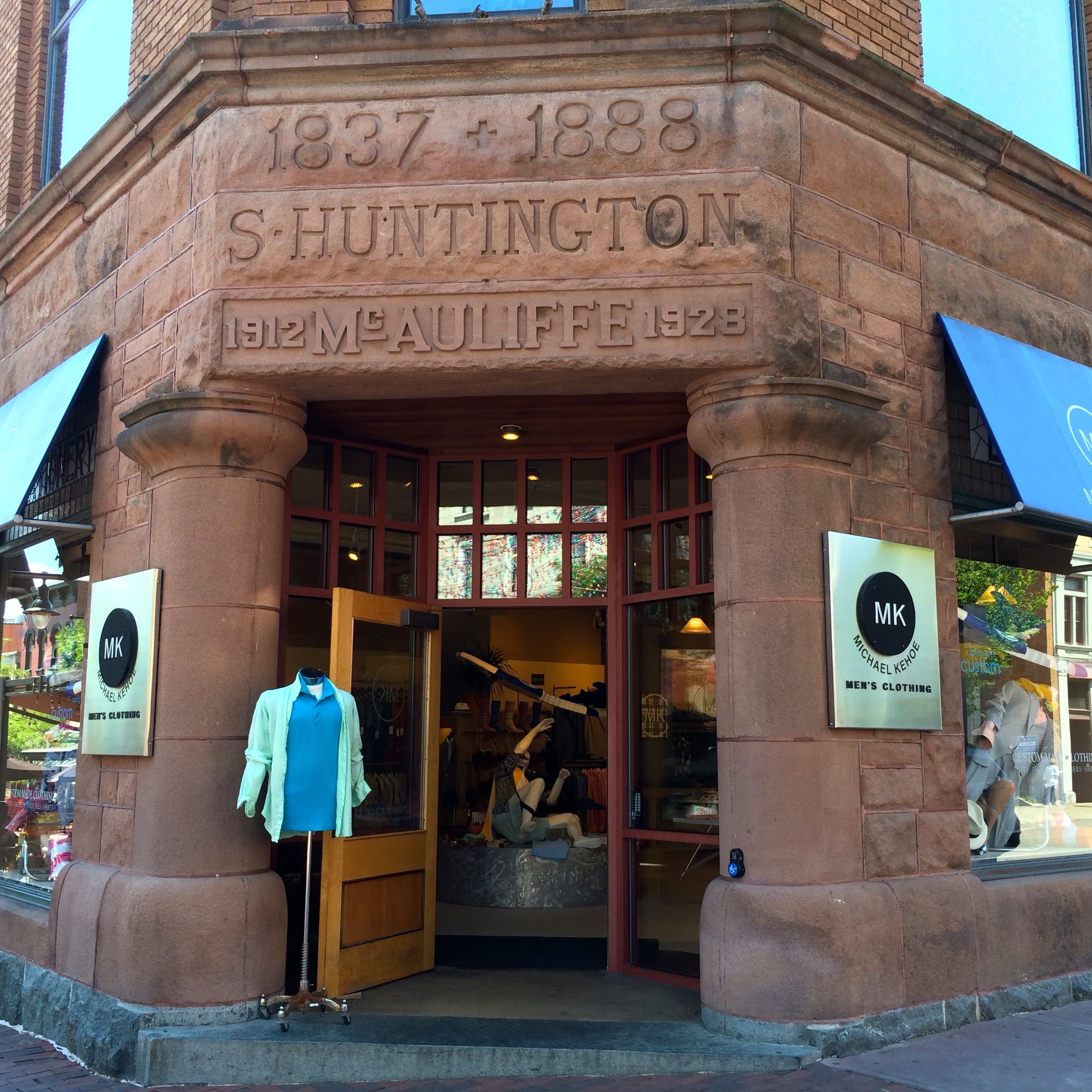
I particularly liked how some of the different owners engraved their names and dates over the entrance to this building, which is now a men’s clothing store.
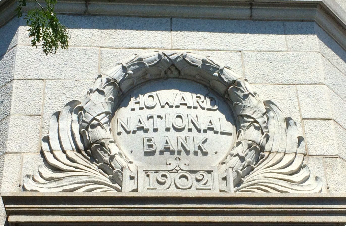
And, if you ever wondered where to store your Howards, the have a bank for that.
Moe and Curly are all set. Poor Larry would have to find his own bank.
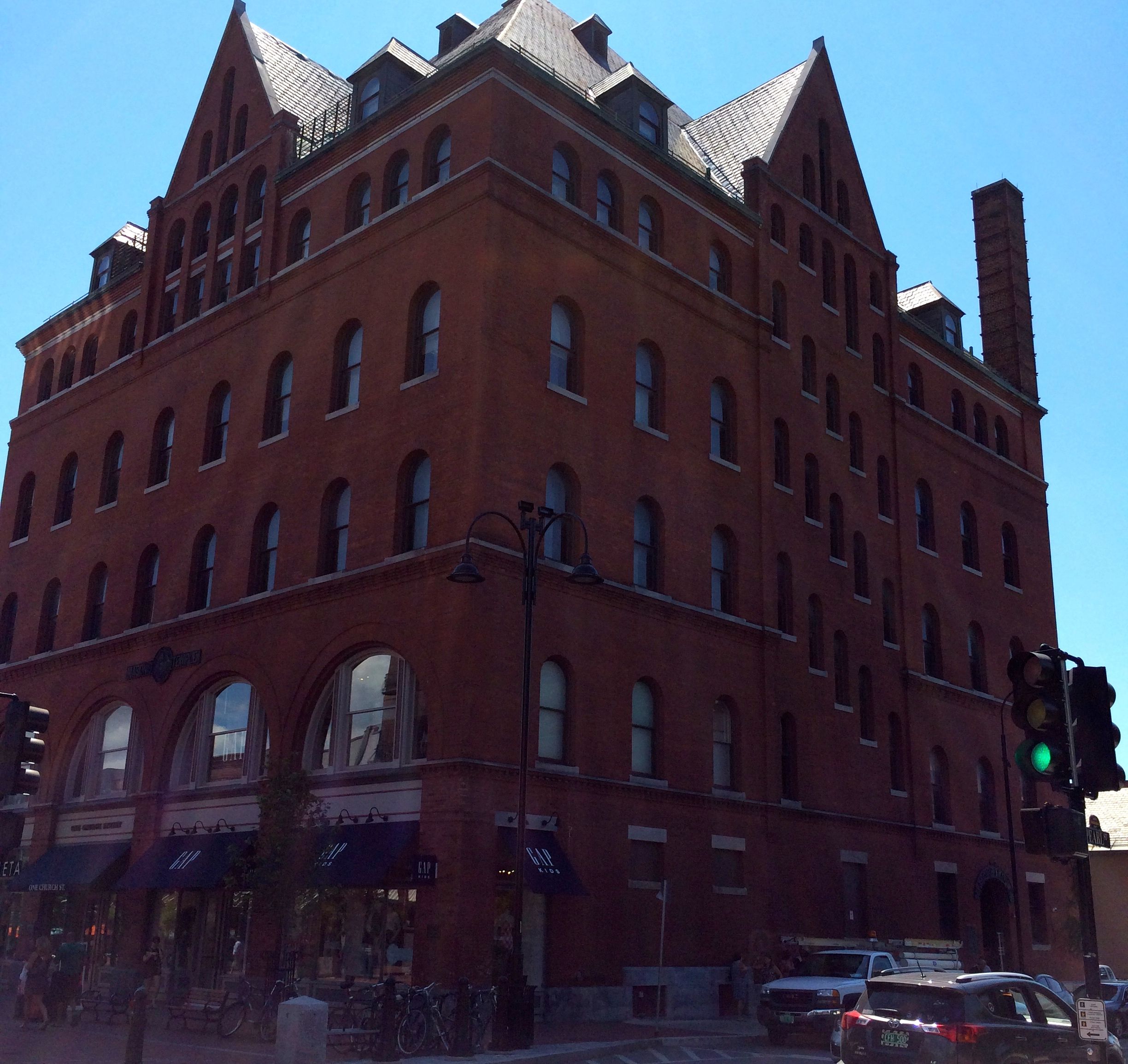
On the north end of Church Street, there was an elegant apartment building, Richardson Place, with commercial space at the street level.
On the opposite corner was the Masonic Temple. According to the information plaque, the cornerstone was laid in 1897 and was built at a cost of $80,000.
At the top of Church State is the First Unitarian Universalist Society Meeting House. It was built in 1816 for the First Congregational Society (Unitarian) and is the oldest surviving place of worship in Burlington. Following a merger of the Unitarians and Universalists in 1982, the congregation voted to become the First Unitarian Universalist Society of Burlington.
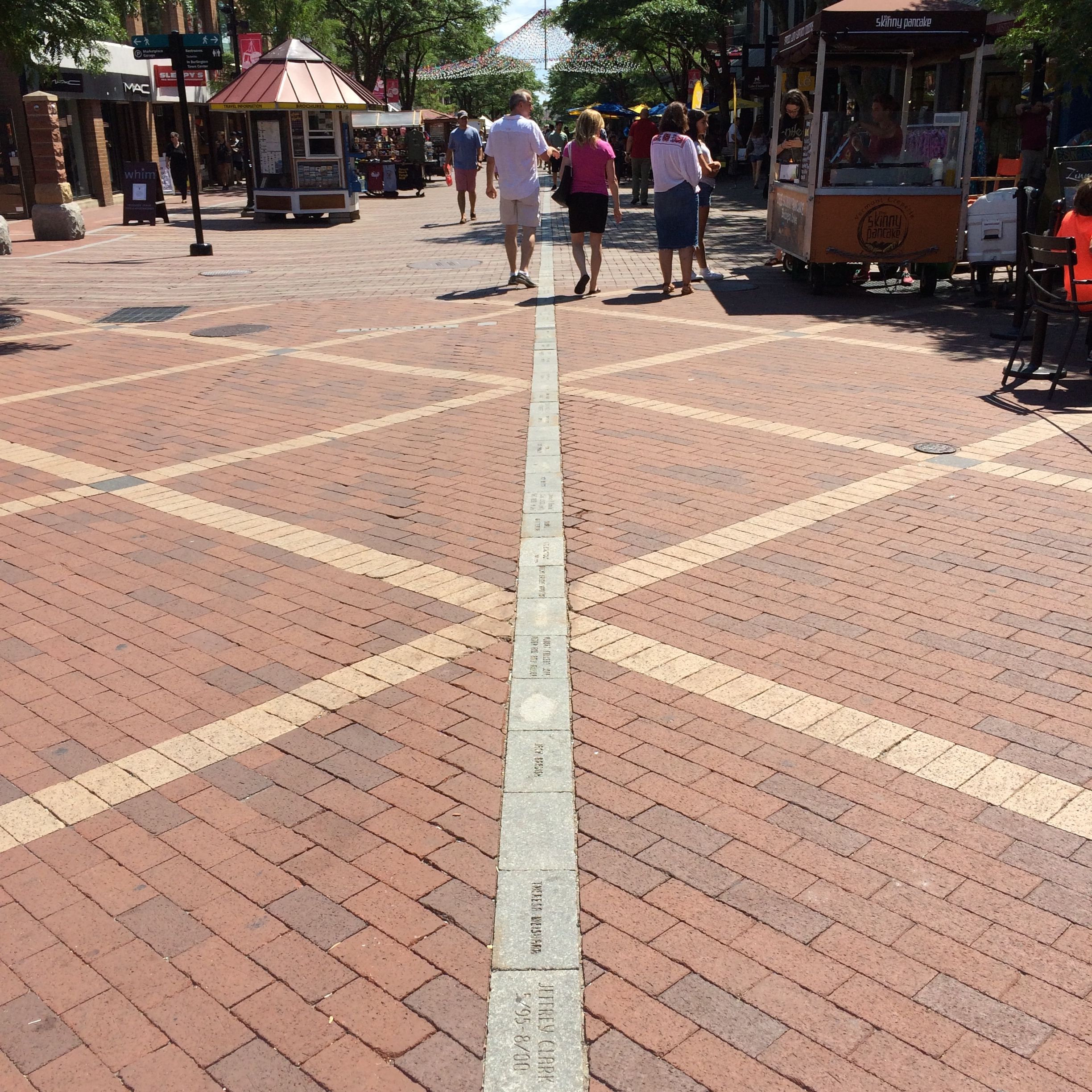
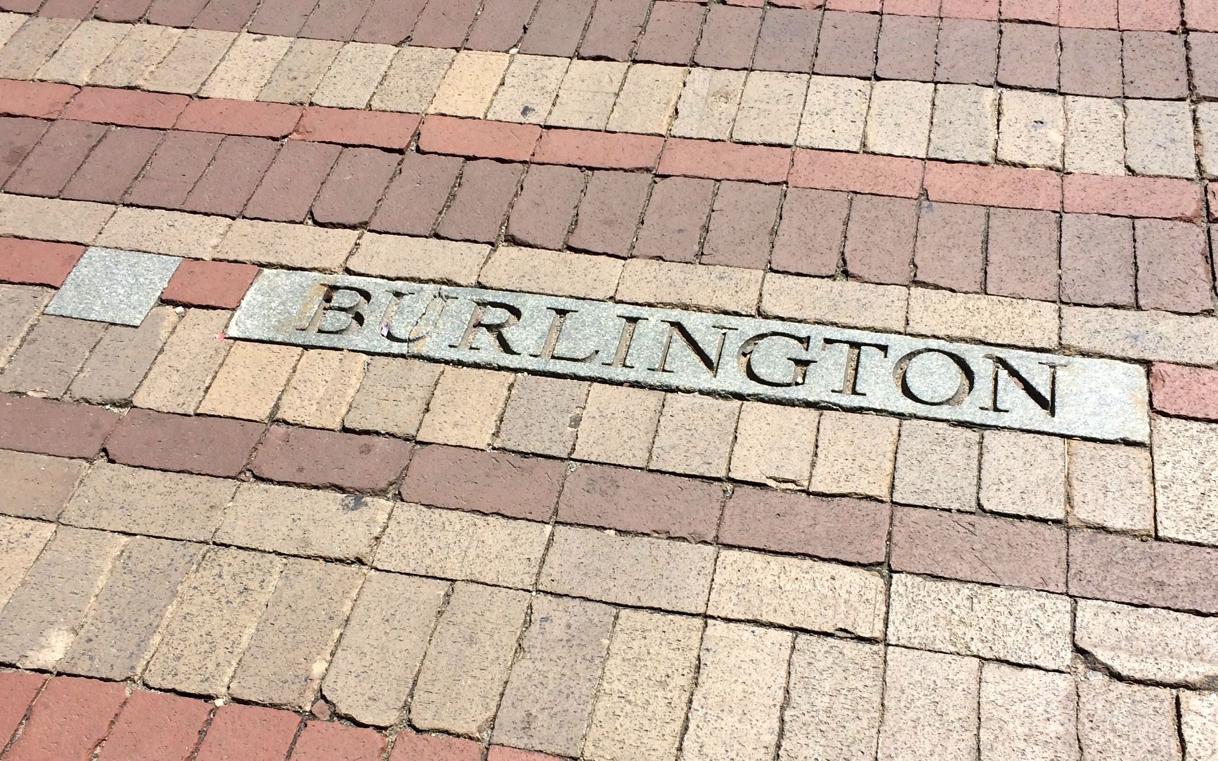
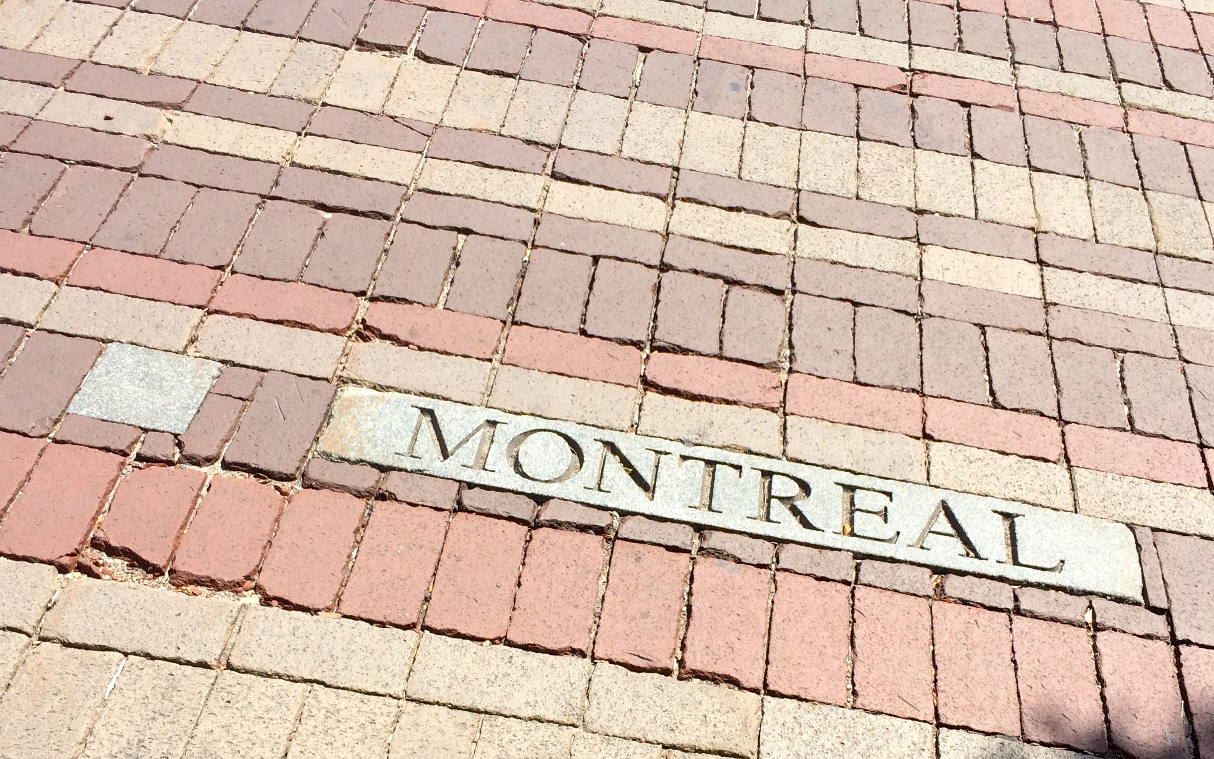
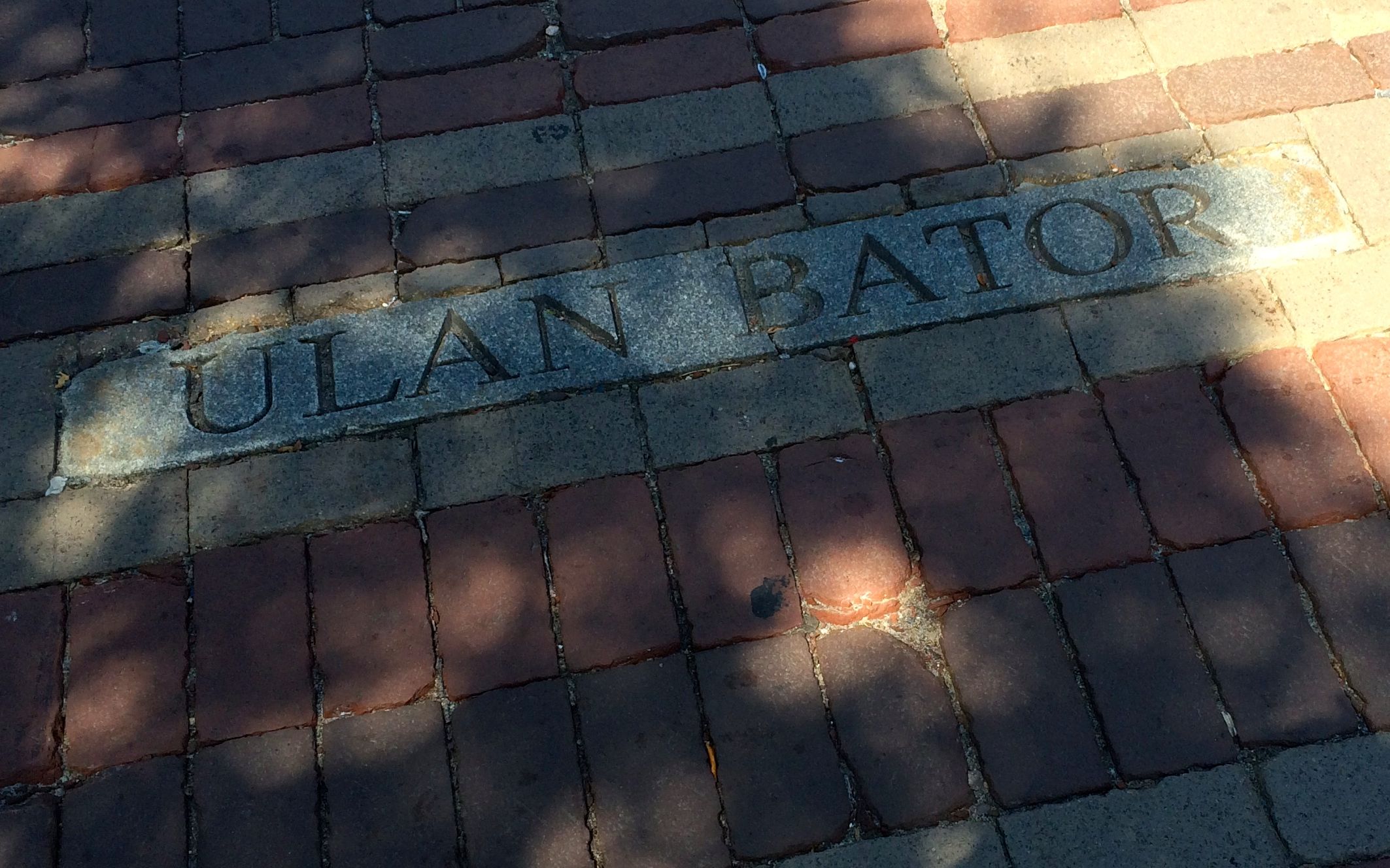
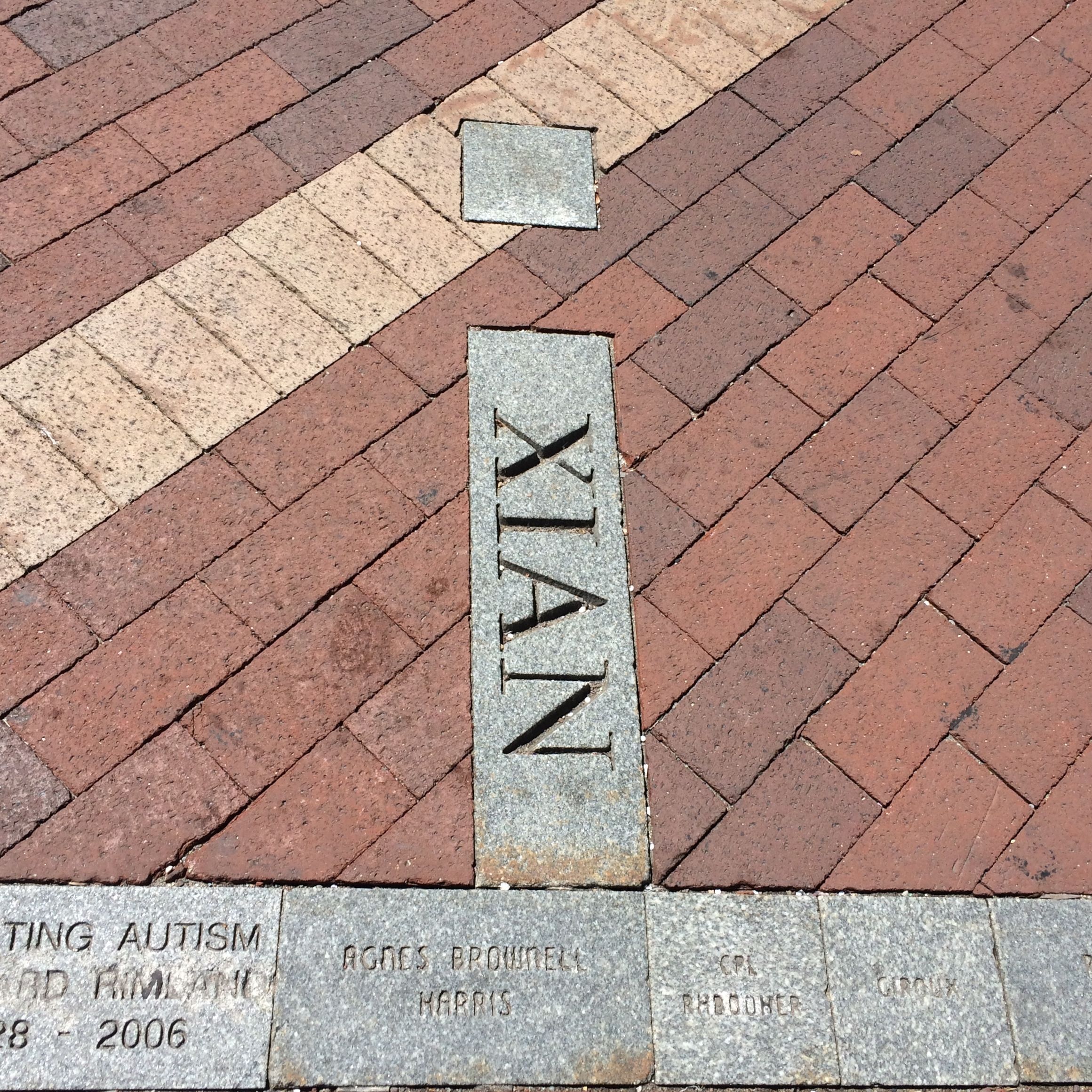
Walking back down the Church Street Marketplace, I was taken by the interesting designs in the pavement. I asked the guy working in the little tourist information kiosk at the top left side of the photo what it was, but he couldn’t help me.
I was determined to find some information about it. If they have plaque about all the buildings, they certainly have information about this. I looked and looked and finally found a plaque.
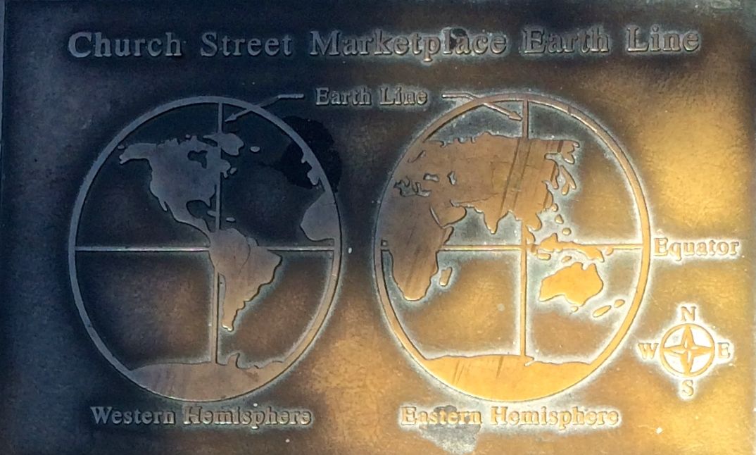
It turns out that the line down the center of the pedestrian mall is what they call an Earth Line. It’s a line of longitude that runs through Burlington.
Along the mall, they have identified cities that lie near the Earth Line.
On the Earth Line, you can see the names of people who have sponsored a block.
I was so pleased with myself for having figured out what the story of the pavement design was that I returned to the tourism kiosk to tell the guy where he could look to find the plaque.
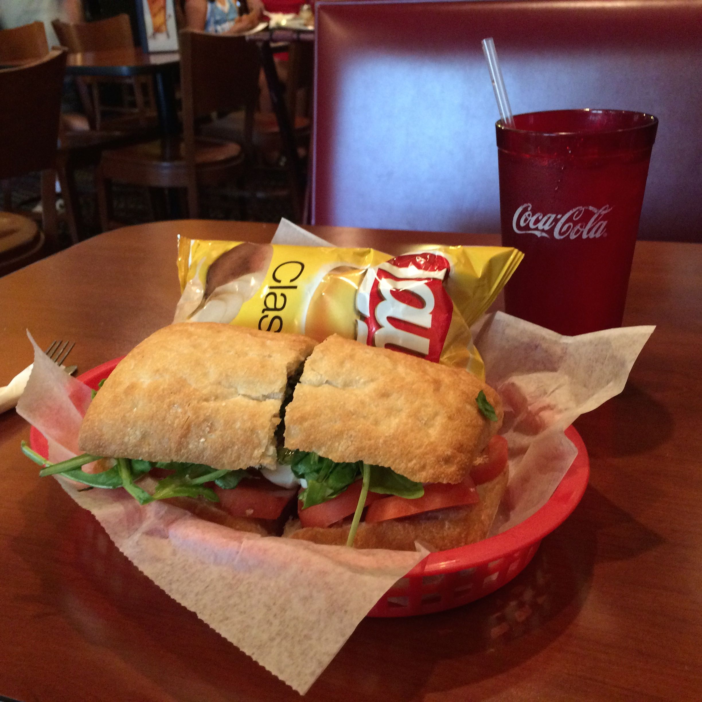
After that, I decided that I had to have some refreshment. There were any number of sidewalk cafes I could have stopped at, but I was getting so tired and thirsty that I finally said to myself that I would stop at the next one that had a seat. At that point, I didn’t even care that I wasn’t sitting on the sidewalk.
I had a Caprese Sandwich, which was delicious! The waiter must have noticed how eagerly I attacked the water he brought me, and he kept coming back to refill my glass.
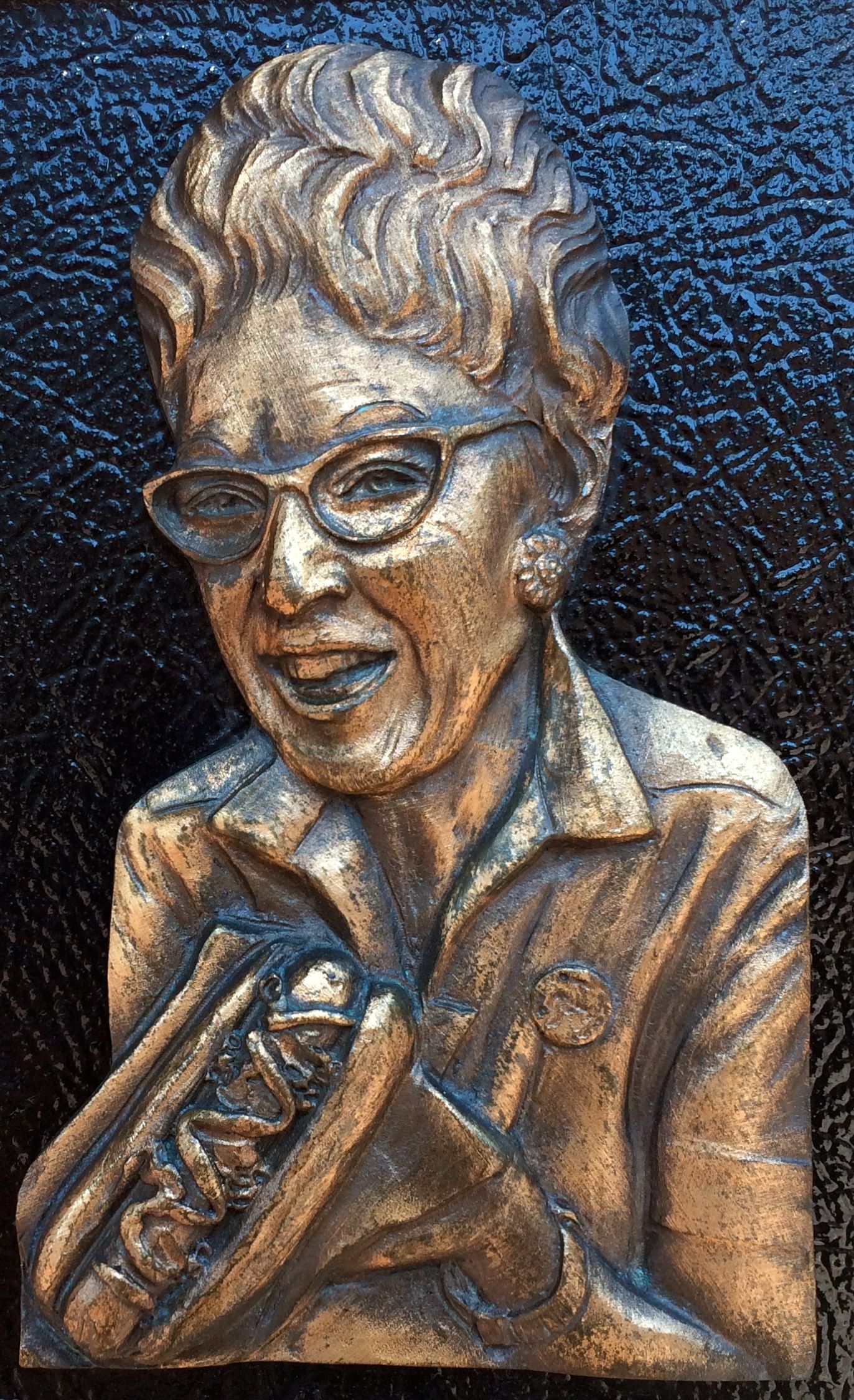
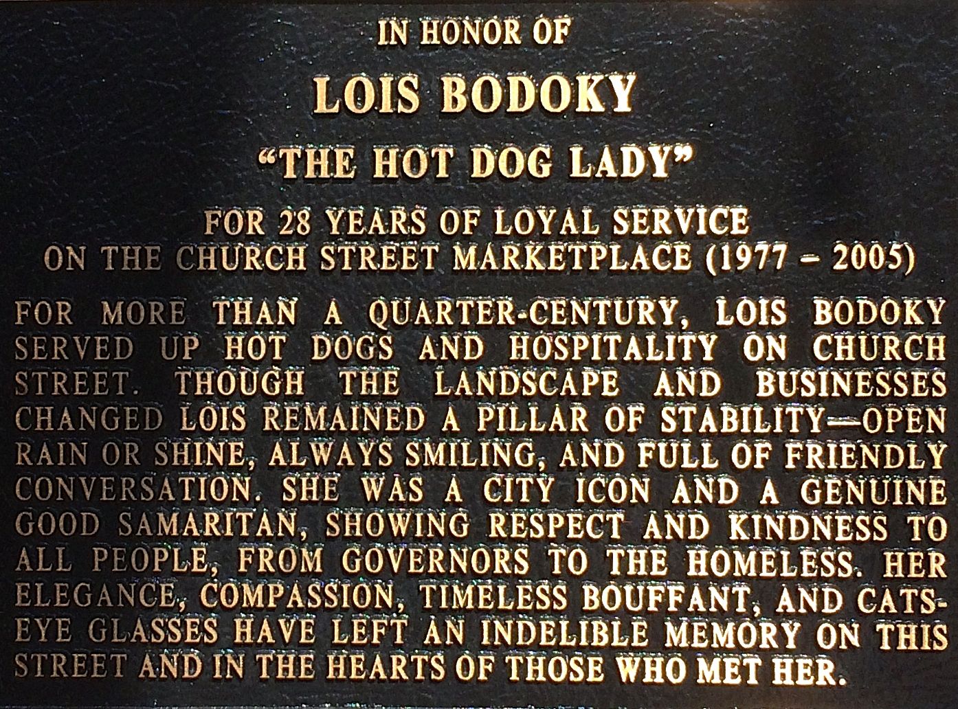
After my late lunch, I continued my strolling about. This plaque about Lois Bodoky, “The Hot Dog Lady”, caught my eye. I had to take a photo of her separate from the information about her because of the way the sun was shining, but take a moment to read about her.
May we all leave such a favorable impression on our communities with our work, no matter how large or small our missions.
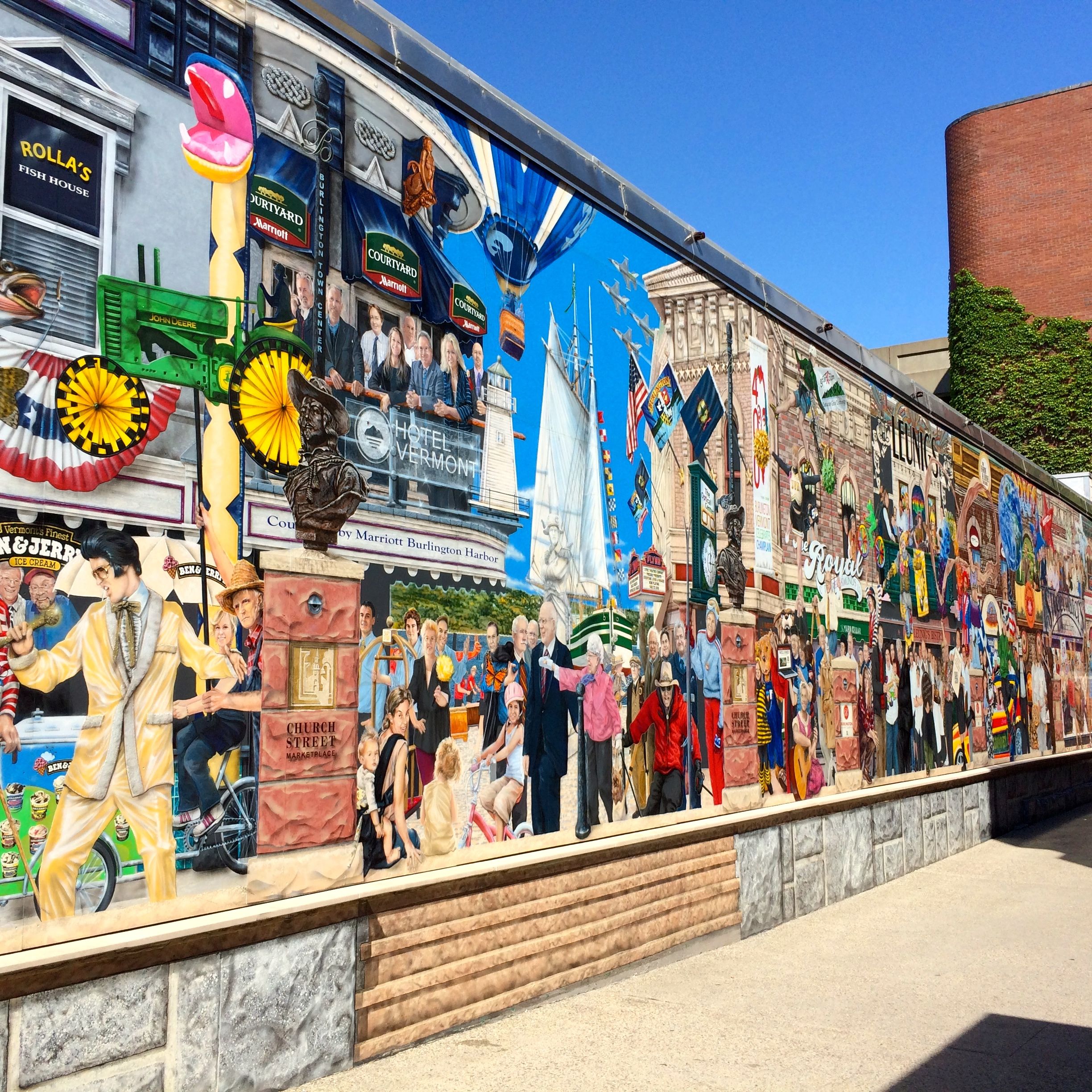
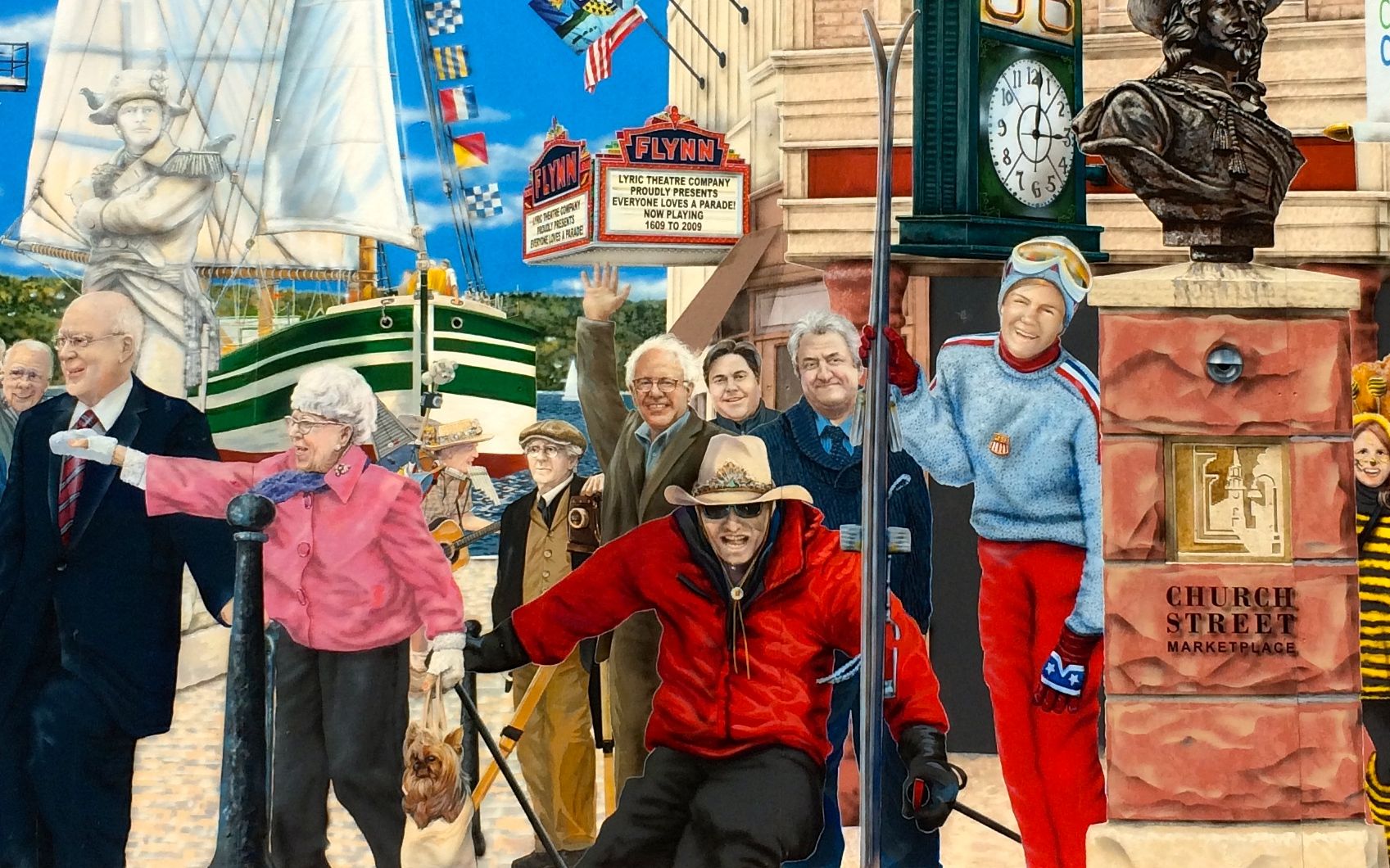
There is a long mural that is on Leahy Way, which leads off Church Street. Incidentally, Leahy Way is named for Senator Patrick Leahy, who has been in office since 1975. The mural was designed by a Canadian muralist named Pierre Hardy and is titled “Everyone Loves a Parade!” Grand Master Samuel de Champlain leads the parade, which depicts an evolution in time with images of the past 400 years.
It wasn’t too hard to find Bernie.
It was almost as easy to find Bernie as it was to find a Ben and Jerry’s. We are in Vermont, after all!
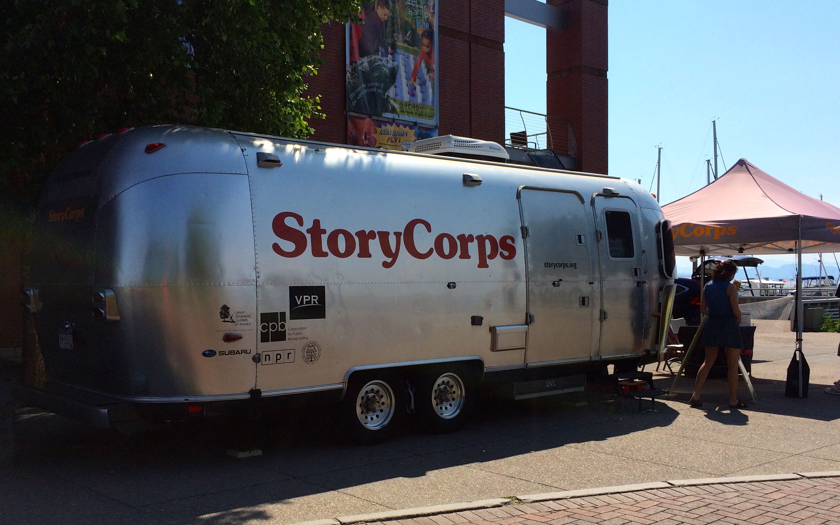
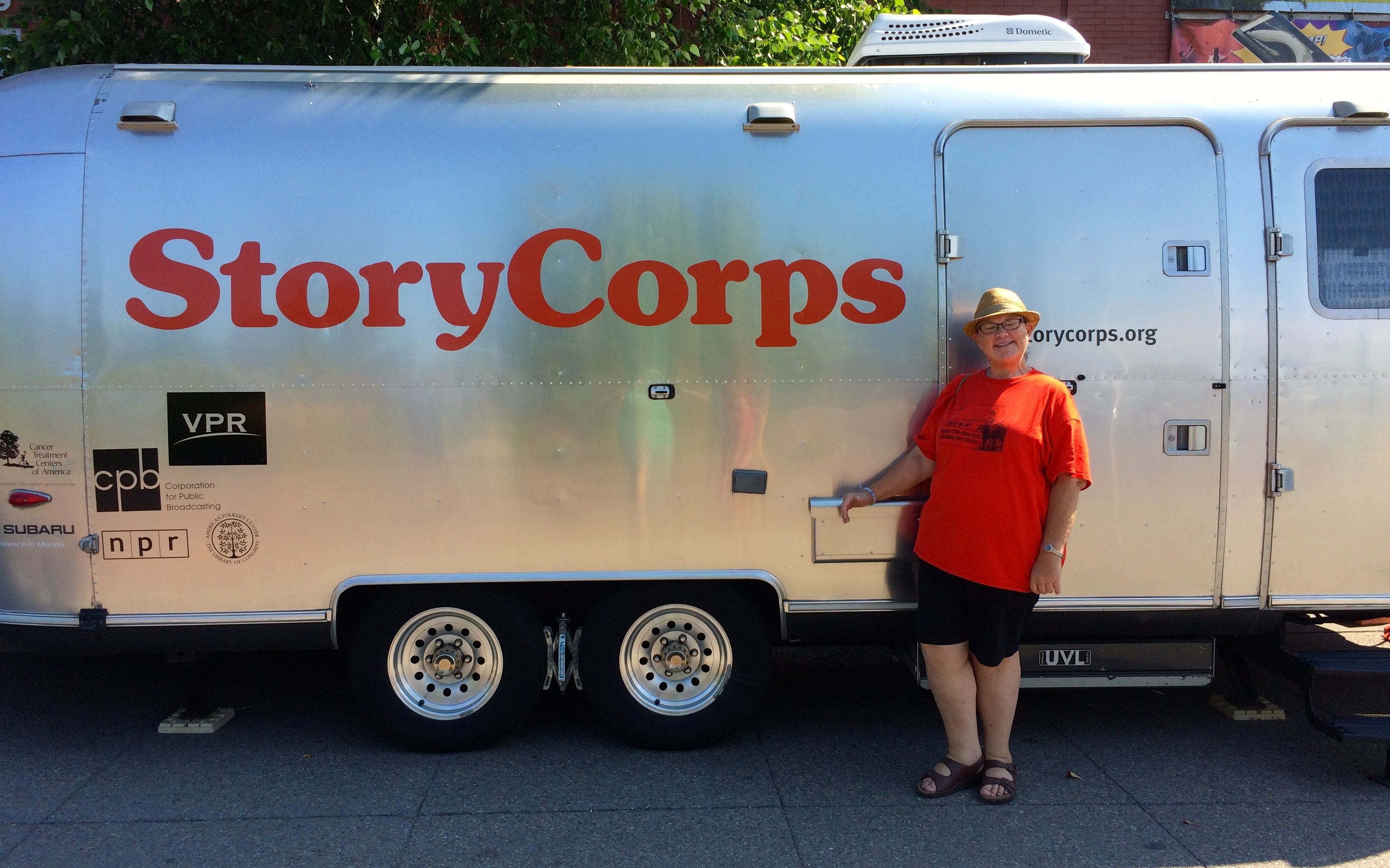
While driving around, I had heard that StoryCorps was in town recording interviews in their iconic Airstream. Another trip into Burlington, I decided to go find it.
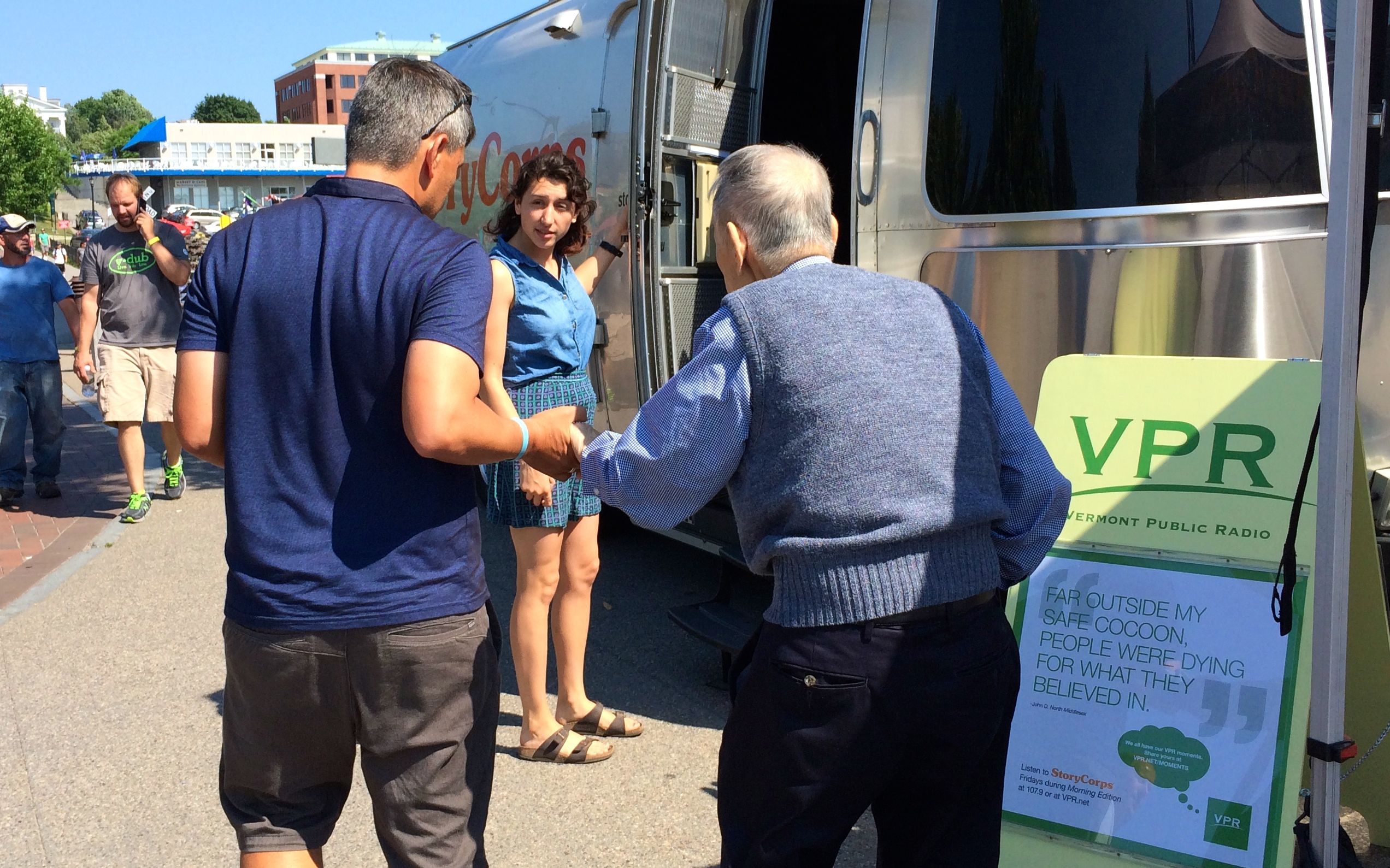
Just as I got there, two people arrived to record their stories. I waited around to see if I might look inside when they were finished.
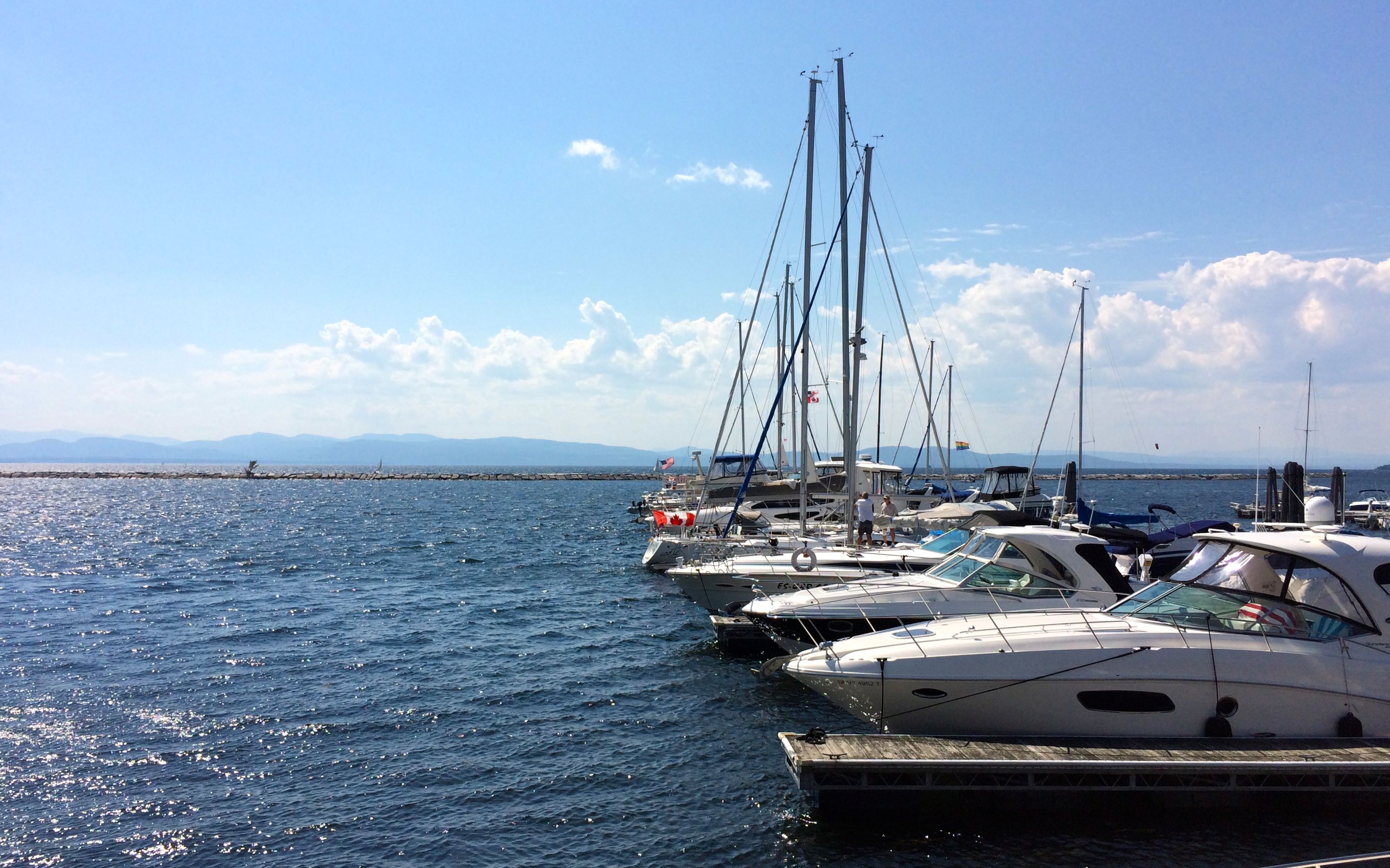
While I was waiting, I looked around the harbor.
A tour boat was coming in to port. One batch of tourists got off and another got on.
There was also a nice collection of boats at the docks. I think I caught a whiff of money while I was standing there.
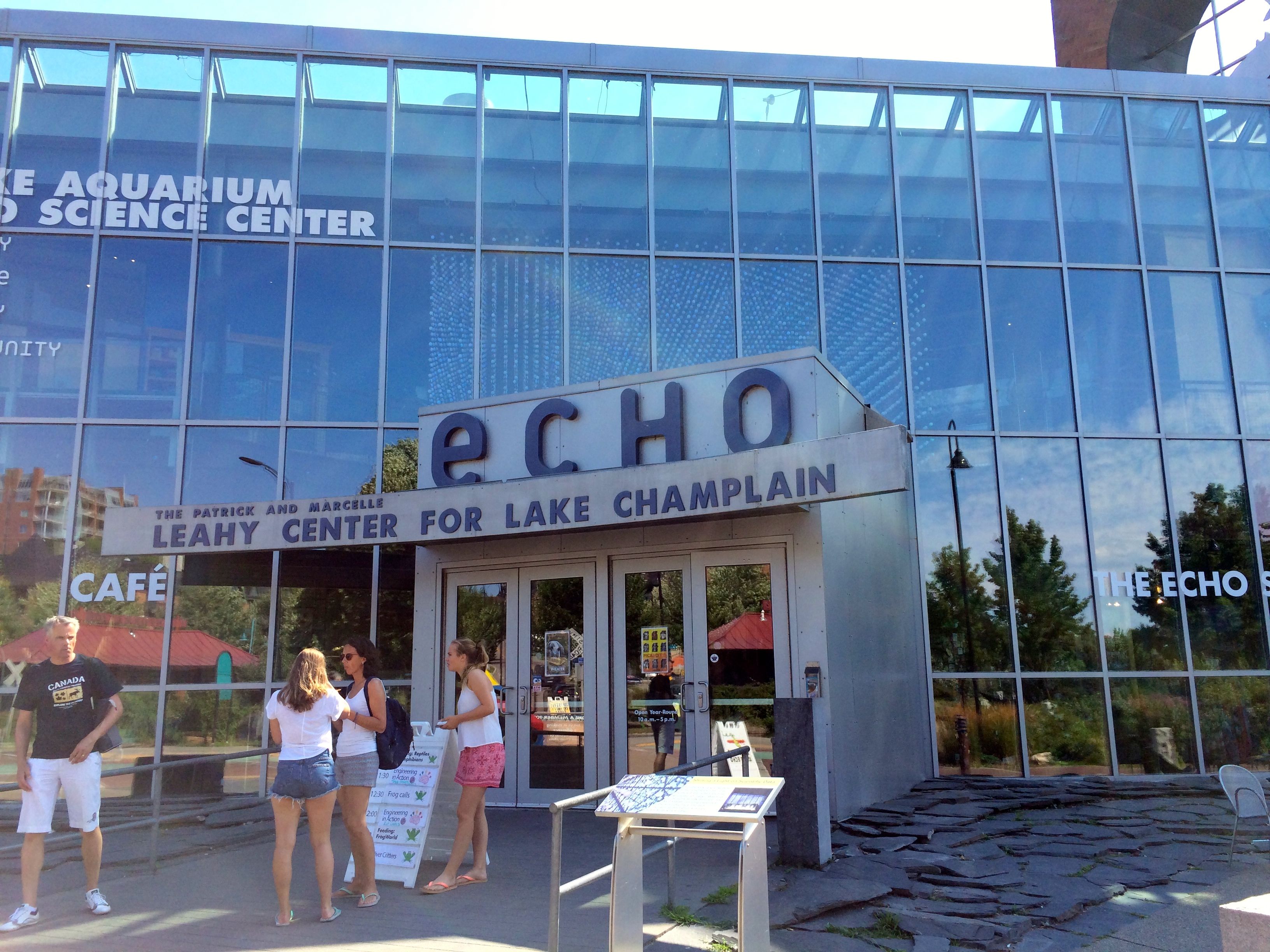
StoryCorps was parked in front of the ECHO Center. (ECHO stand for Ecology, Culture, History Opportunity, just in case you were wondering. I was.)
I thought about visiting, but there were a couple of drawbacks. One was that it was late in the day and the price was kind of high for a short visit. The other thing was that it was full of children. And, while children aren’t necessarily a deal-breaker, I could tell that the adults with them were tired and cranky. It didn’t sound like a great time to visit. Maybe next time.
Apparently, the interview was taking a really long time. I was concerned that the time I had paid for was going to expire, so I had a passer-by snap my photo and I headed back to MY Airstream.
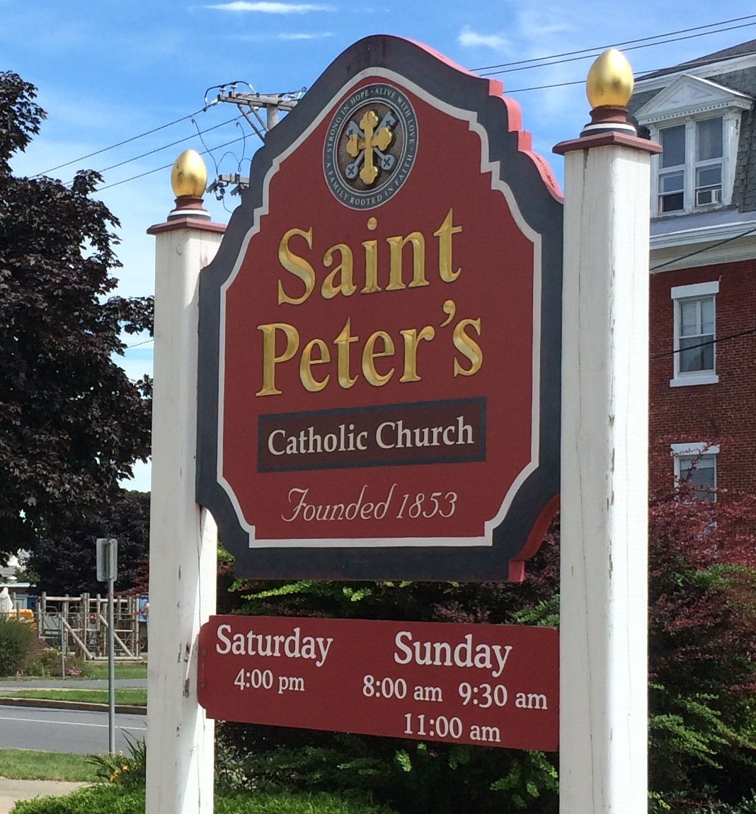
The first weekend I was near Plattsburgh, I had tried to attend mass at this church, St. Peter’s. Unfortunately, I got lost in the time/space continuum once again. I tried to attend on Sunday, but I looked at the schedule for Saturday. So, I was pleased when I actually showed up at the right time on the right day the following week.
I was only a few minutes late, but when you are on my schedule, that almost counts as early.
I came in a side door, and rushed up the stairs. I was kind of embarrassed that I had popped in right by the musicians. Rather than back out, I spied a seat and sat down.
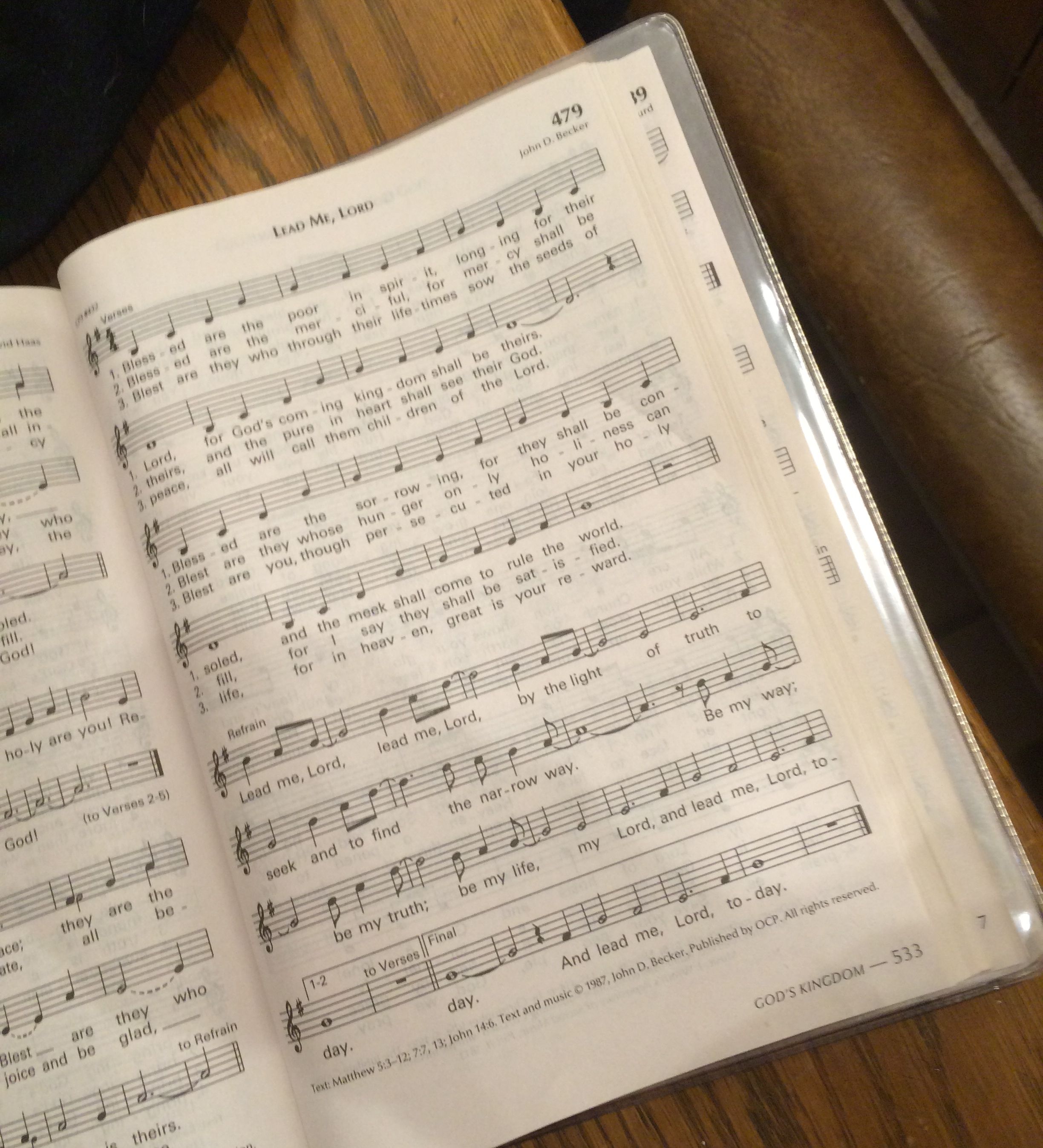
I was so happy that they were doing the sort of music we did back before the “unfortunate incident” in Kalamazoo. They even did one of my favorite pieces!
A lovely woman sitting in the pew behind me helped me out with information on how they proceed to communion.
At the end of mass, Monsignor Duprey invited us all to the church picnic. I wondered what the large tent was doing behind the church when I pulled up.
I joined the crowd in the back. I ended up sitting with a family that were long time members. I asked if this was the original church.
The sign said that it was founded in 1853, but I couldn’t find a cornerstone on the building anywhere. Rita told me that this was the original building, although it has been added on to and remodeled over the years.
I asked her about the French inscriptions in the stained glass windows. She told me that this is the French church in town, and that her family’s name, “Light”, was a translation of the real name of Lumiere.
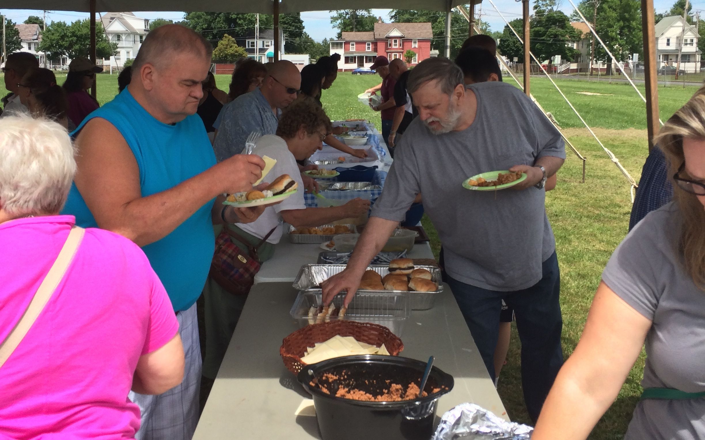
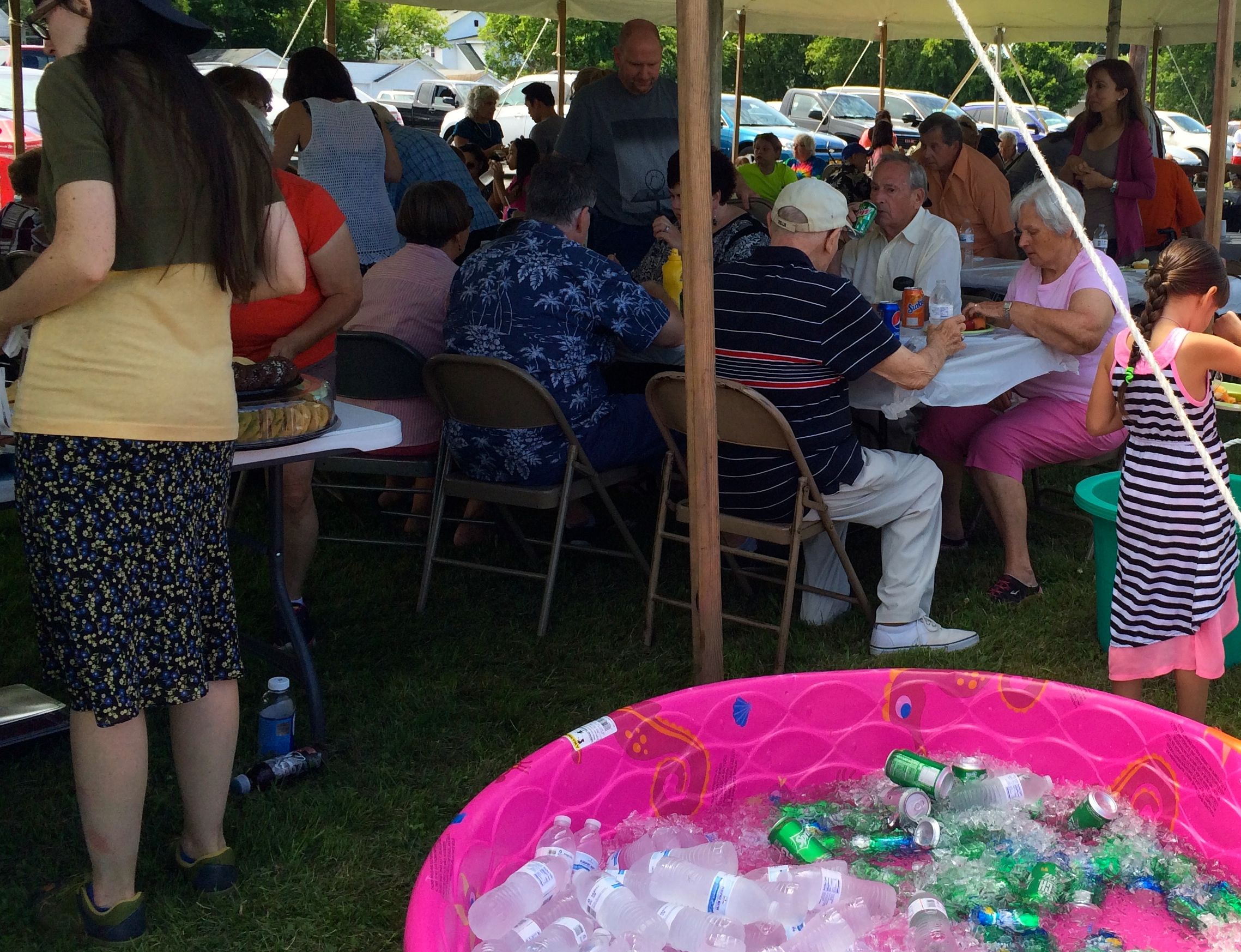
And then it was time to eat!
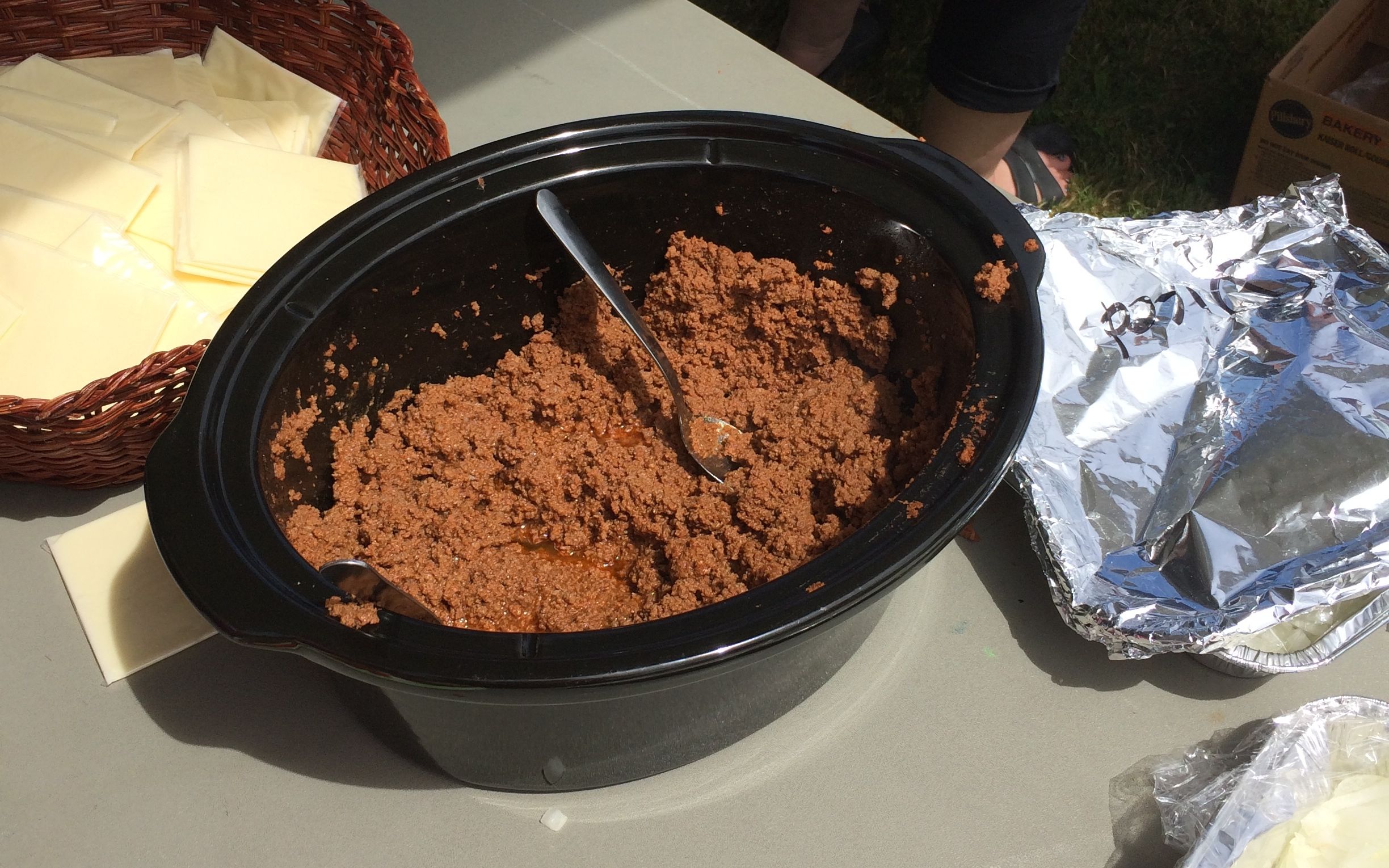
What a spread! In addition to all the dishes that people brought to share, they had hot dogs and hamburgs. The hot dogs were served Michigan style.
Actually, they call hot dogs topped with this meat mixture a “Michigan”, as in, “Did you get yourself a Michigan?” That was a questions someone actually asked me. After having lived in Michigan for 28 years, I was a little surprised to hear of such a concoction, but, it was good!
I liked the wading pools filled with ice and beverages. What a delightful meal!
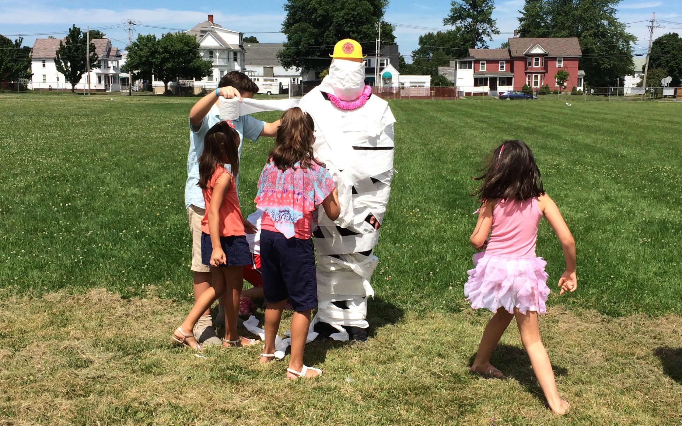
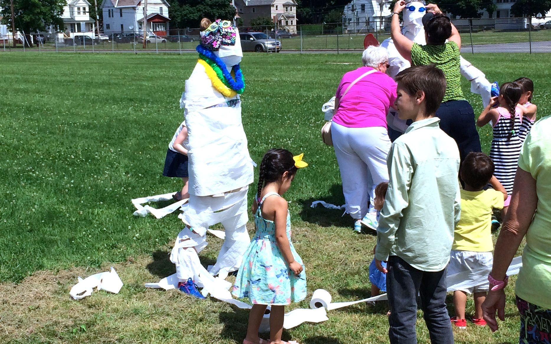
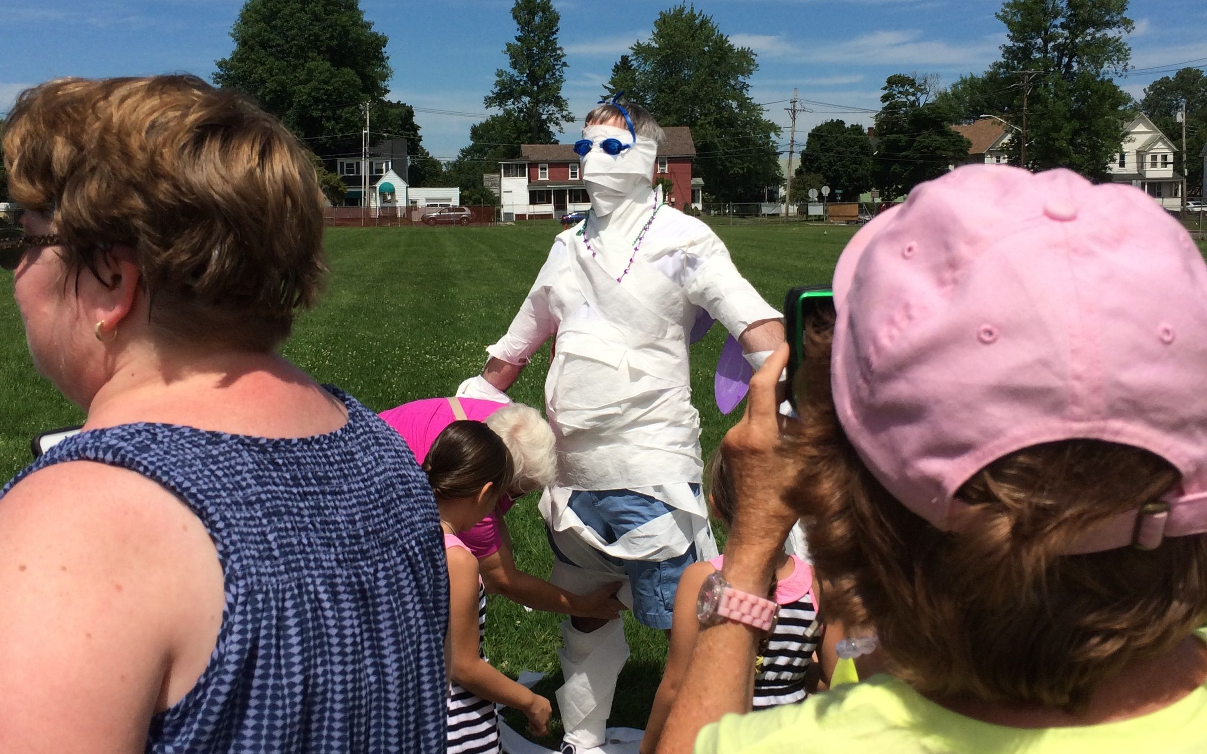
After the eating slowed down, they had a mummy contest. Teams of kids and adults wrapped up volunteers in toilet paper and accessorized them with beads, hats and so on. Then the crowd voted for the one they liked the best.
Mummy number one,
Mummy number two or
Mummy number three.
The crowd favorite was Mummy number one – who also happened to be Monsignor Duprey! What a wonderful example of service and involvement in his community. He was running around helping with the food and warmly greeting people. He even had an extended conversation with me.
There was also live music during the festivities. It turns out the the musician is the husband of the lovely lady I met during mass and had urged me to come to the picnic. I also got to talk to the leader of the music group that was at the mass.
I had a lovely time and I felt welcomed. What a beautiful model for other churches.
It was a great last day on the New York State side of Lake Champlain.
I had always wanted to visit Montreal. I was happy that my French friend, Mary, was visiting her son right when I was going to be nearby. We synchronized our watches – and calendars – and made plans to meet.
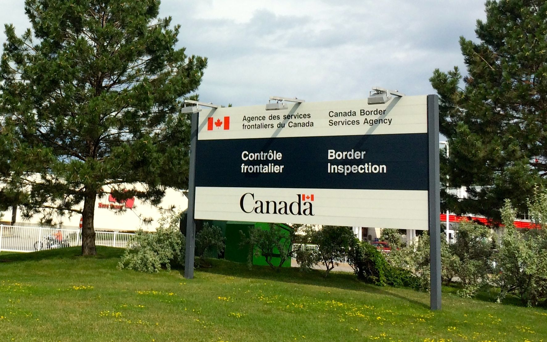
At the entrance to customs, I was met by the border control sign. I had to answer some questions about why I was all the way up there with my Texas license plates. Apparently my no-nonsense reply and passport satisfied the agent, and I was allowed to enter the country.
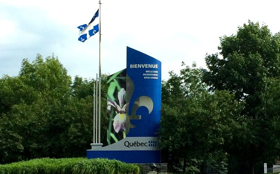
Once across the border, they let me know that I was in Quebec. This is only my second province – Ontario was always nearby growing up. I hope to visit a few more of them before my traveling days are done.
I had done some research on where to park and how to use the Metro. We agreed to meet at the Berri-UQAM metro station at 11:00. I parked, took the metro and made it to station right on time. It took us about half and hour or so to find each other. In spite of the fact that I had stopped by at Verizon to make sure my phone would work over there, it wasn’t of much use. Mary called and left a voice mail for me. Unfortunately, between her French accent and the fact that I didn’t know where I was in relationship to where she was, I needed help.
What to do? Well, I smiled brightly at a college student who was eating her lunch and said, “Hello! Do you speak English?” She smiled back, and said that she did. Then I asked her if she spoke French. She said that she did. So, I asked her to listen to Mary’s message and tell me where she was waiting for me. She listened, wrote it down and drew me a little map for how to get there. There are kind and helpful people all over!
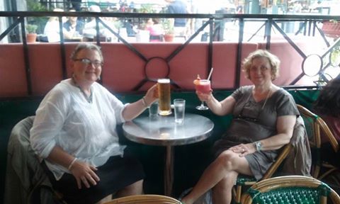
Mary and I finally met up and greeted each other with bises – both cheeks. Then we took off to explore Montreal.
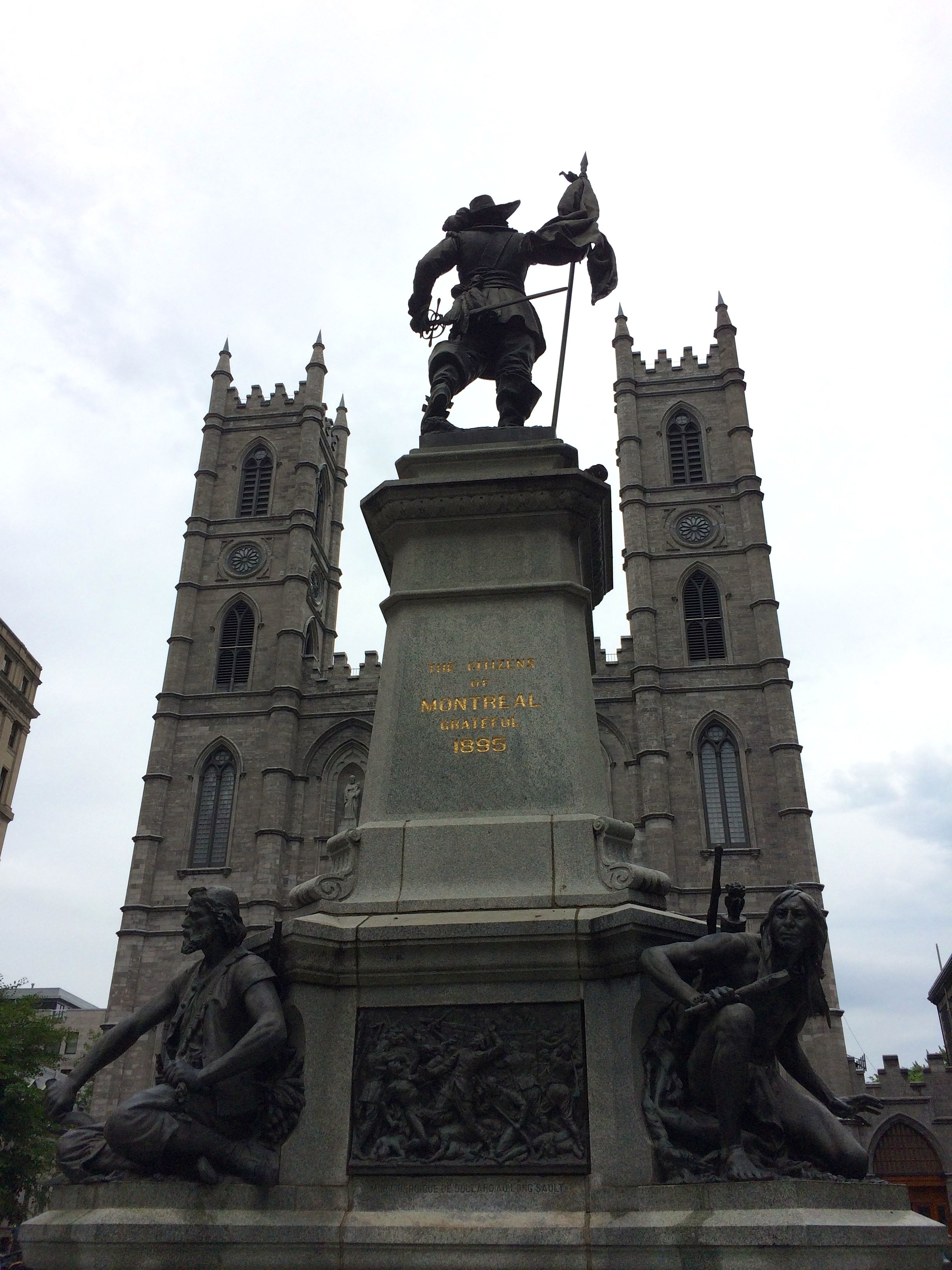
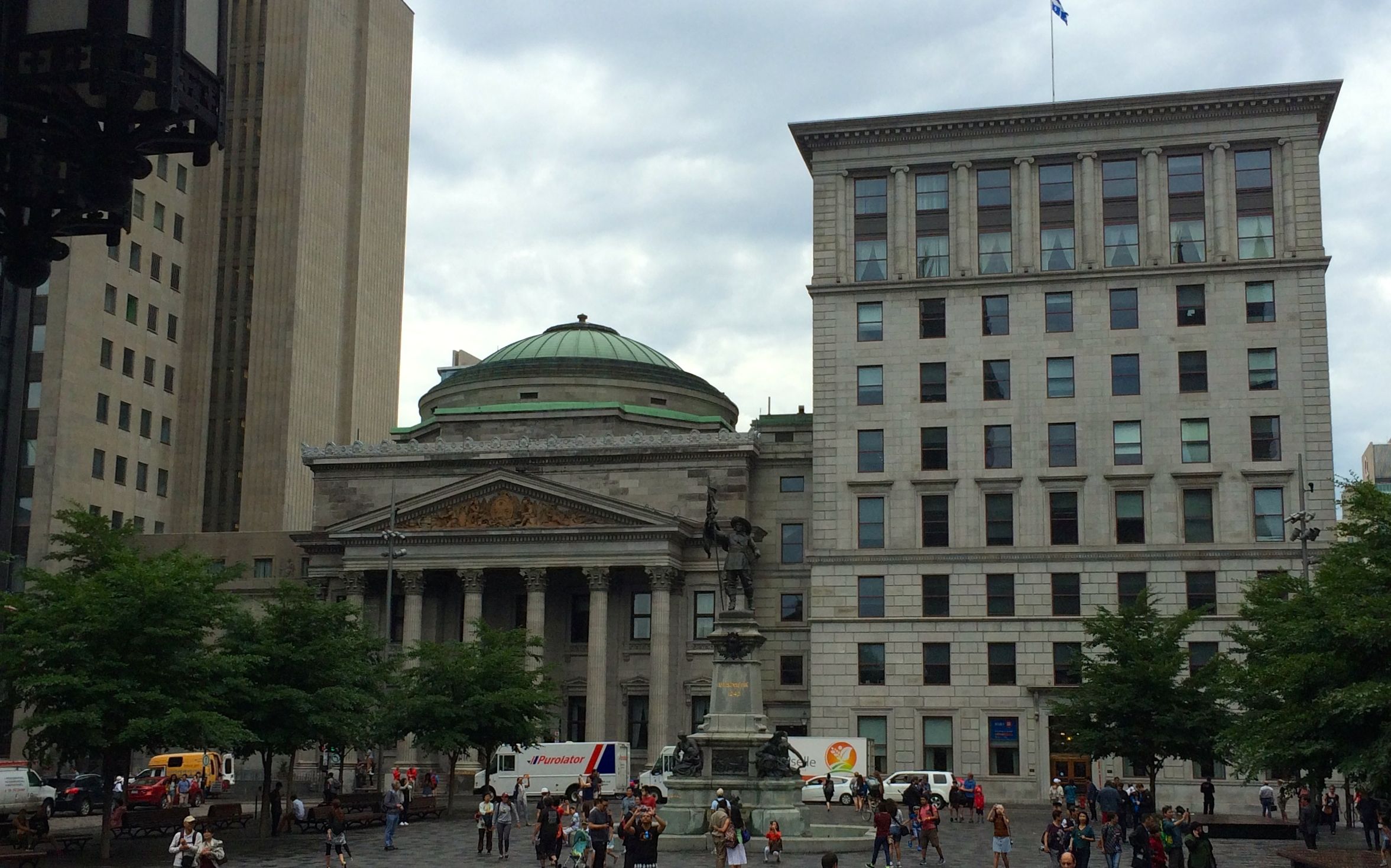
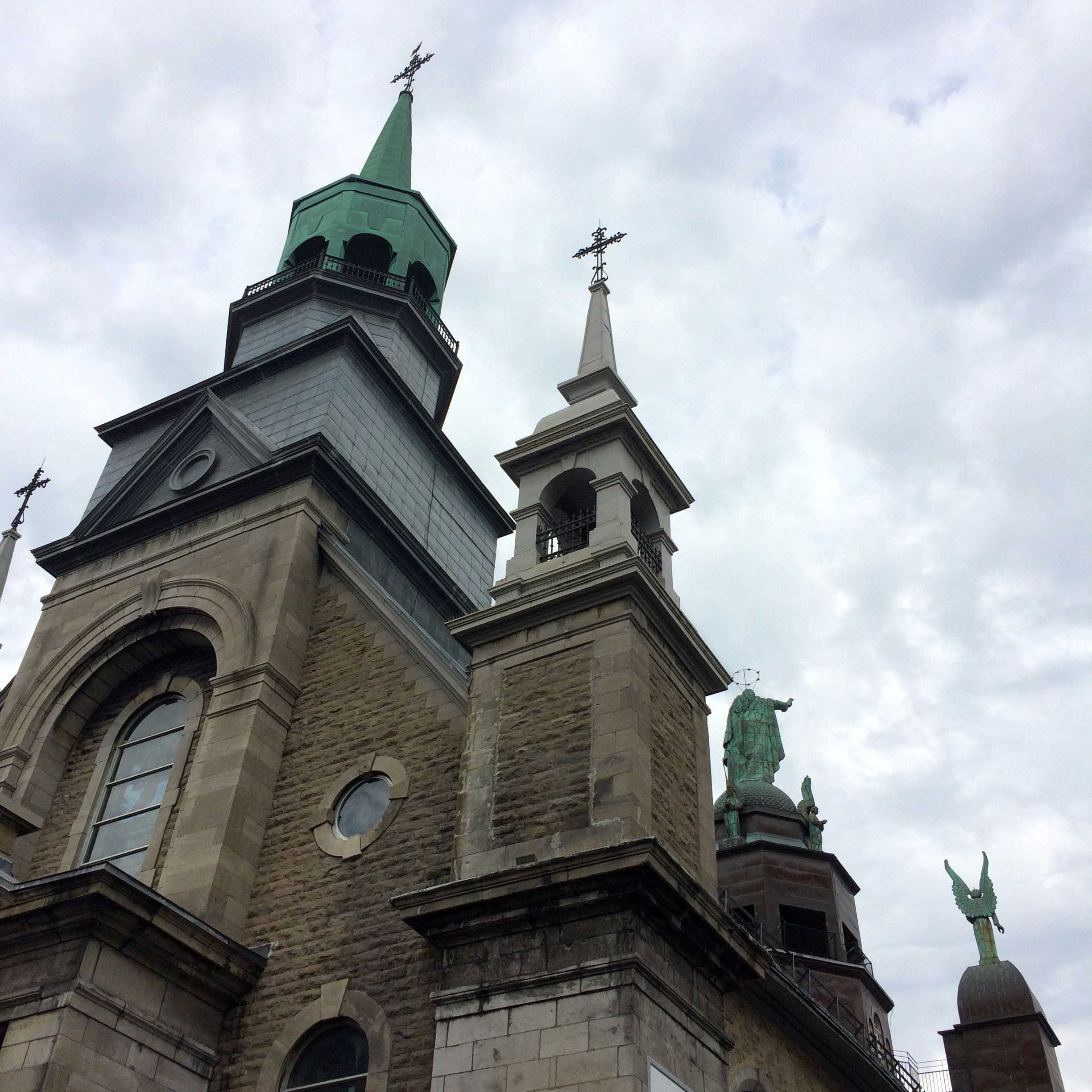
Our first stop was the Notre-Dame Basilica in the historic district of Old Montreal on the Place d’Armes. The fountain in the center is a monument to the memory of Paul de Chomedey, the founder of Montreal.
With the overcast skies, it was hard to capture details of the sculpture, but I was quite taken with the parts at the base spitting water into the pool at the base.
We lined up to enter the Basilica. Unfortunately, for my thrifty soul, they charge $5 to enter. I do realize that it does cost money to keep up buildings like this, but you all know my favorite word, right?
That’s right!
While waiting to go in, I snapped a shot of the square in front of basilica.
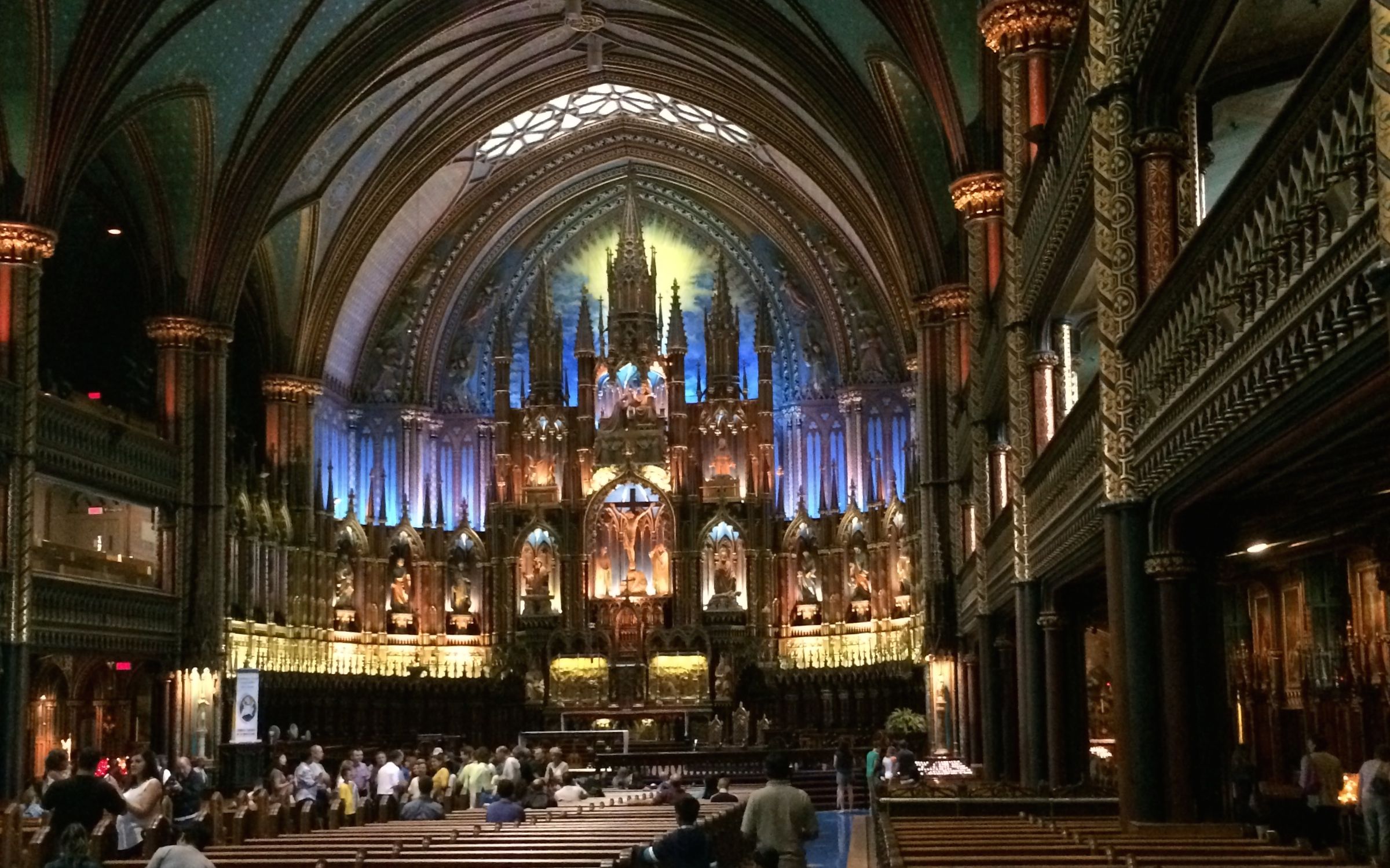
It was finally our turn and we went inside.
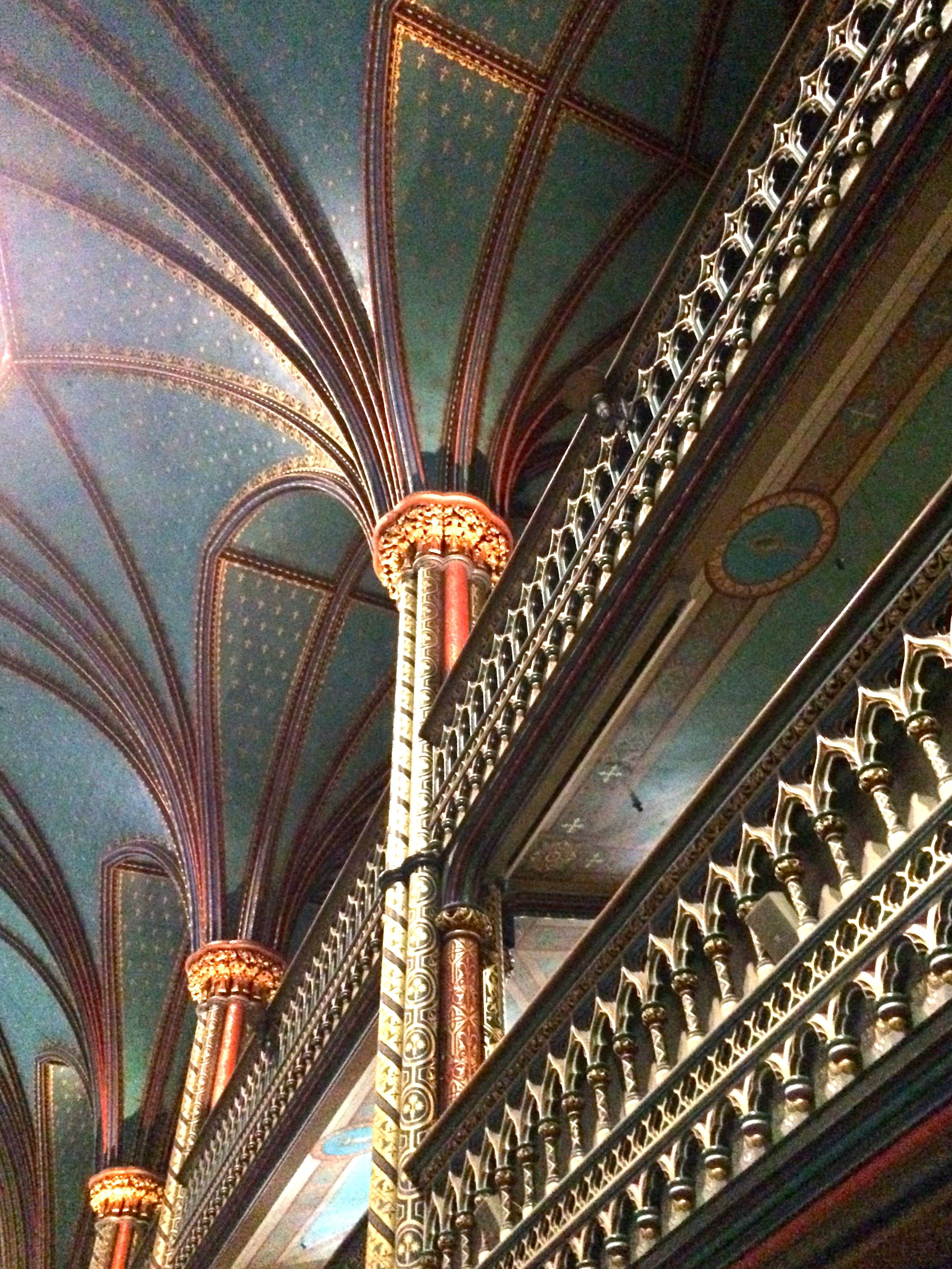
The interior is rather eye-popping.
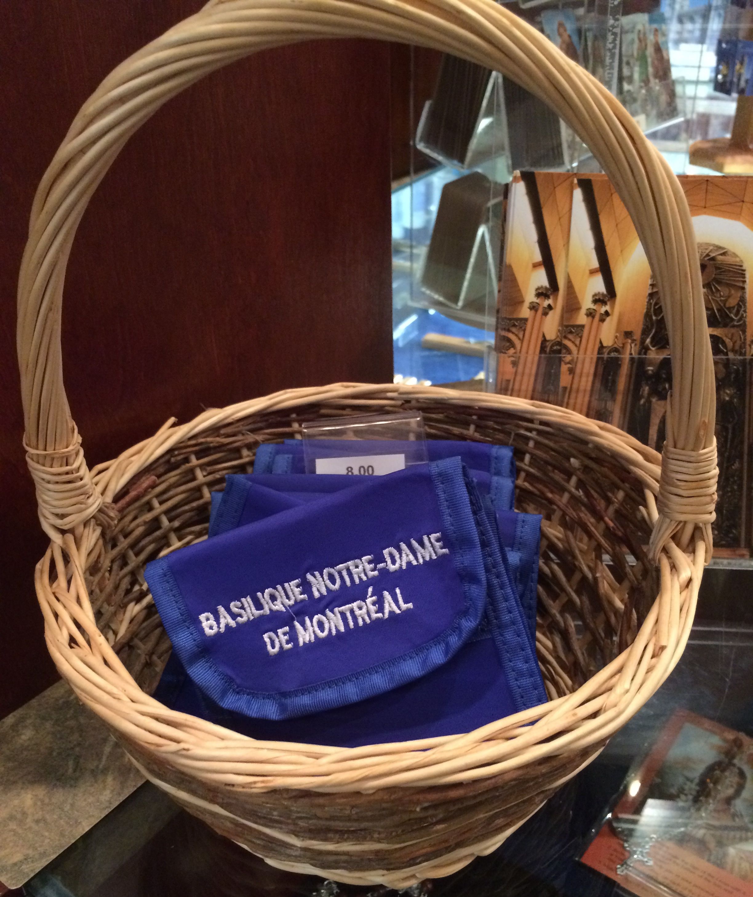
When we got up to the altar I looked for the symbols of a basilica – the crossed keys of Saint Peter on their coat of arms, the canopaeum and the tintinnabulum. I didn’t see them, but when I got to the stand for holy items for sale, I did see incontrovertible proof that this is, indeed, a basilica.
A rosary pouch embroidered with the name.
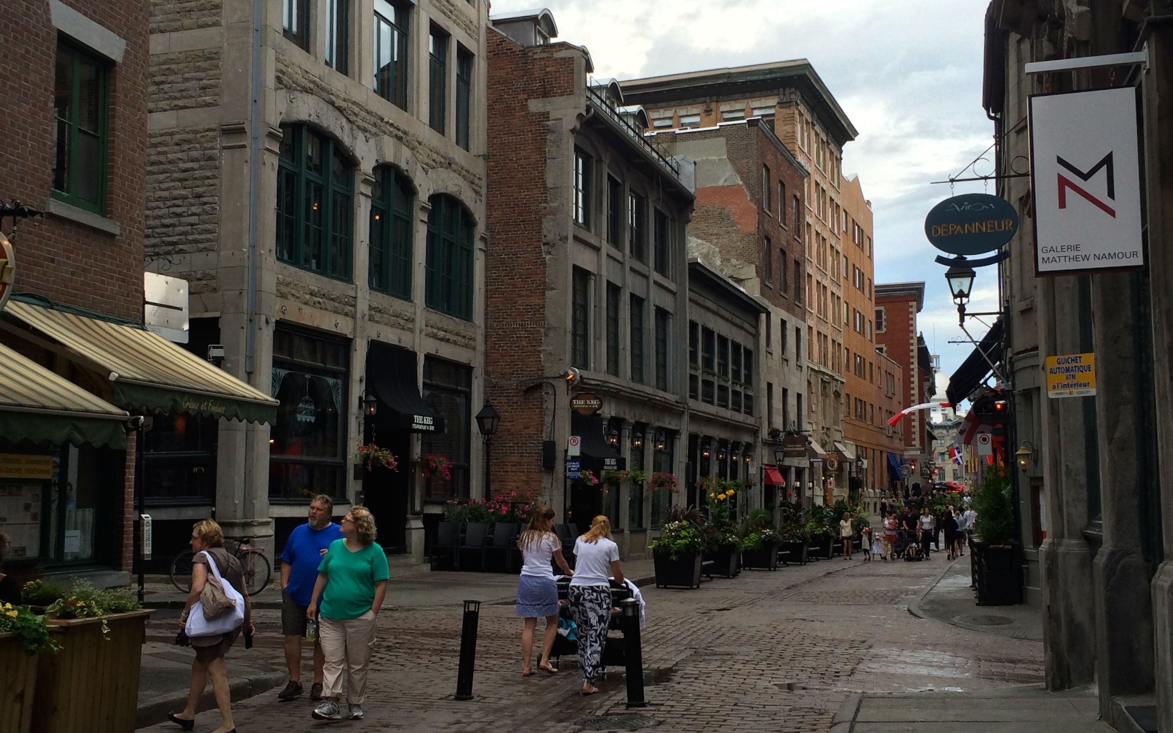
After our tour of the basilica, we set off to explore Old Montreal.
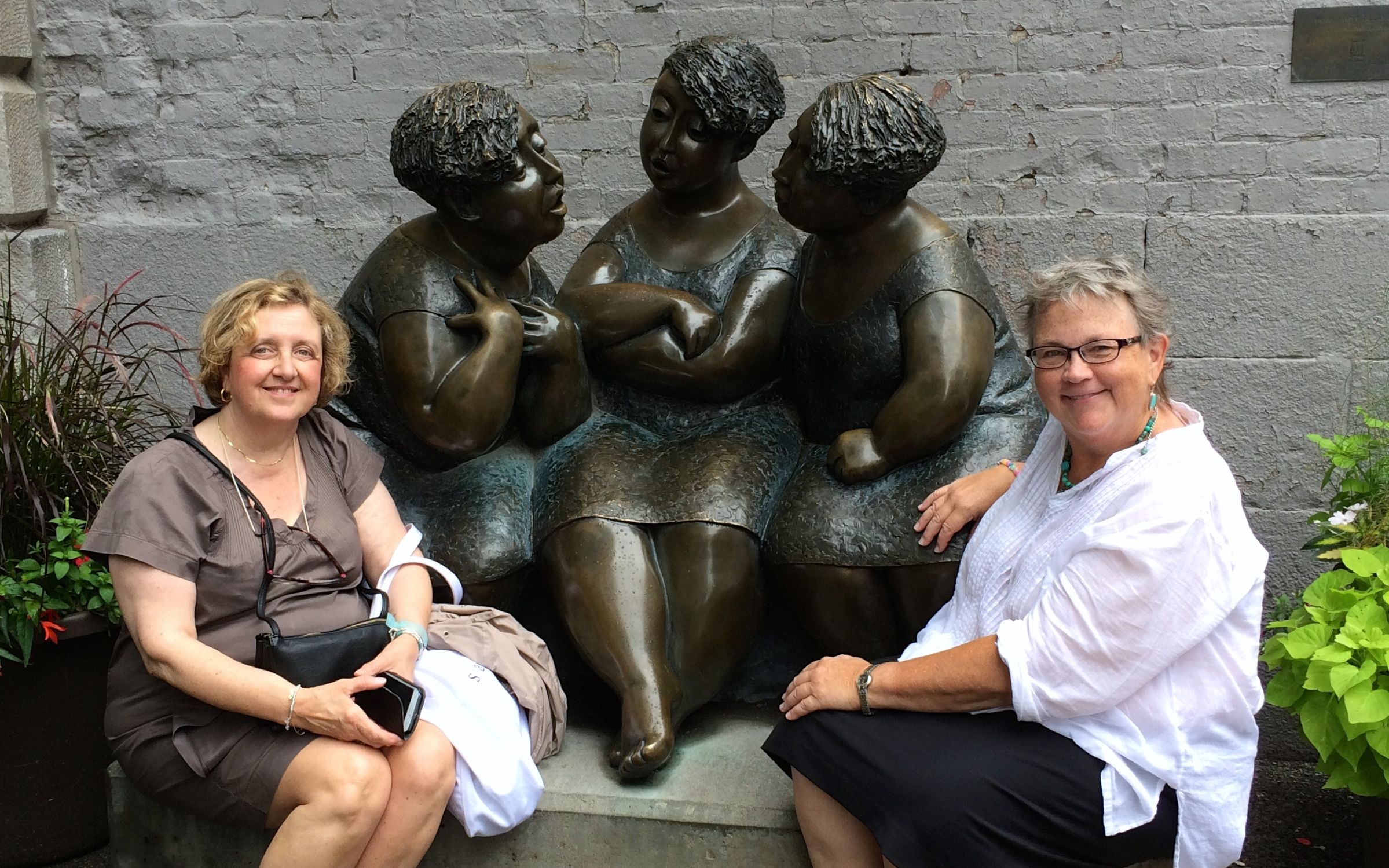
We came across this charming statue, and I asked a young man sitting on a nearby bench to snap our photo.
Just in case you are not sure, we are the pale ones on the ends.
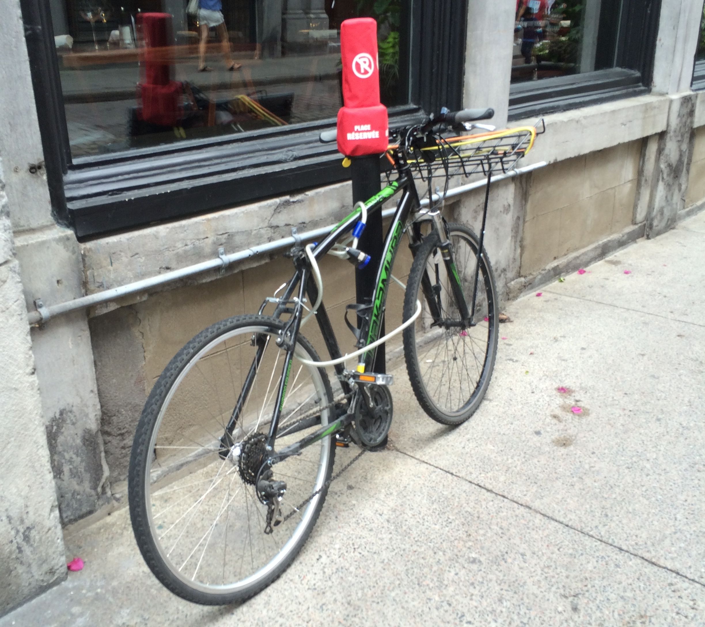
I love seeing things I have never seen before. In fact, I had never even considered that there might be such a thing as a parking meter for bicycles. Oddly enough, this one seems to be labeled a no parking zone.
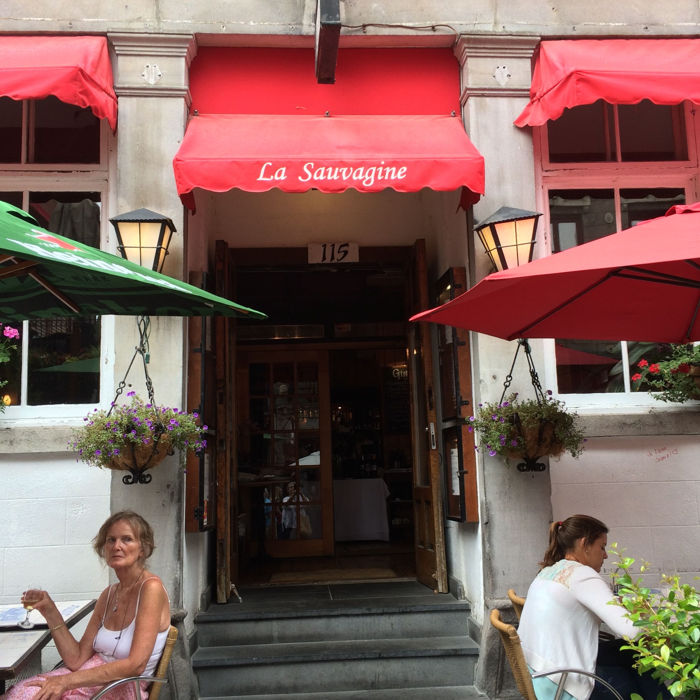
After strolling about, it was time for lunch.
We found pleasant seats on the sidewalk bistro at La Sauvagine. When it started to drizzle, we managed to find a slightly more sheltered table and we stayed outside for our meal.
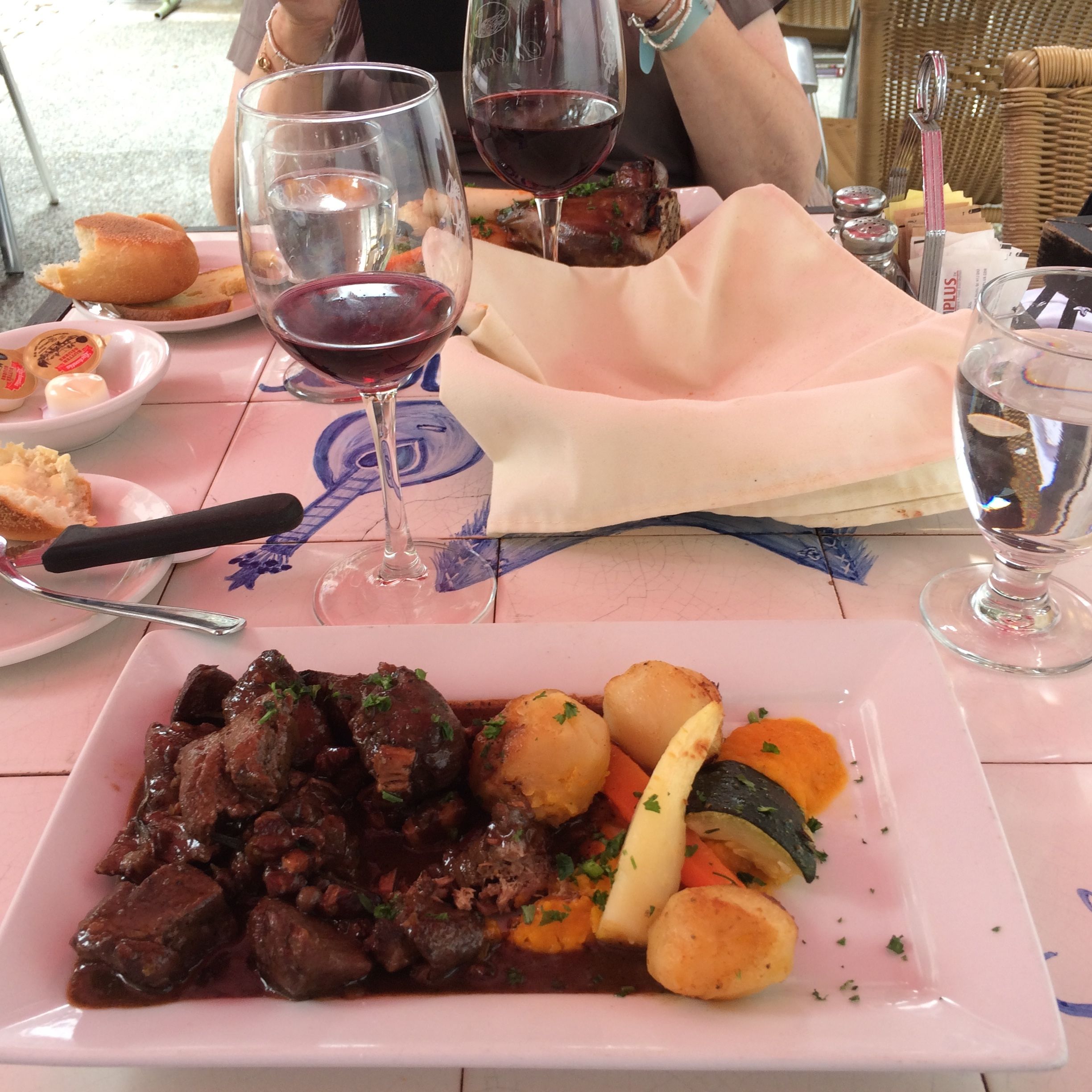
I decided to try something I hadn’t had before. I ordered the wild boar, and it was tasty. I had Mary select the wine, as that is not a skill I possess.
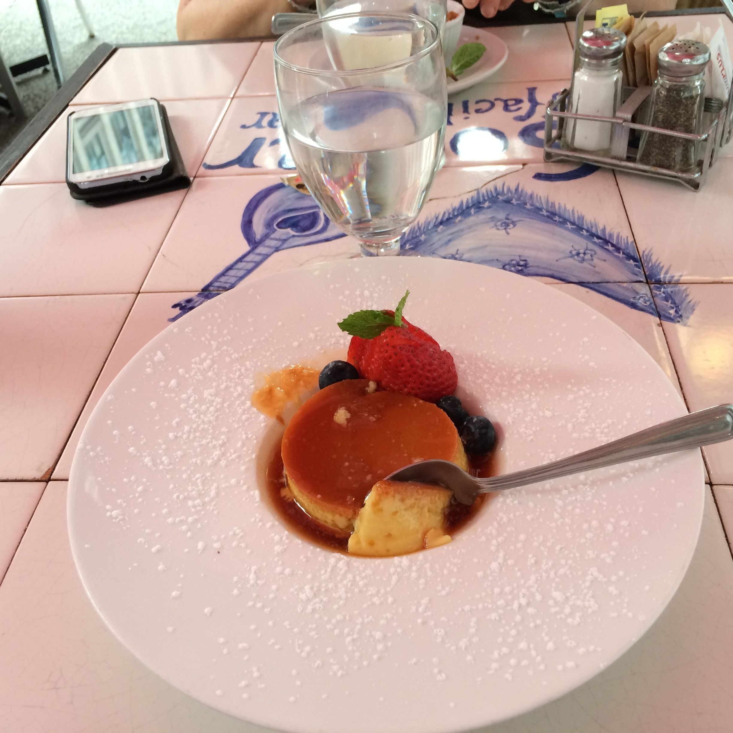
We even indulged in dessert. I ordered the flan. I have to admit that I was less than pleased. In fact, I even left it largely untouched.
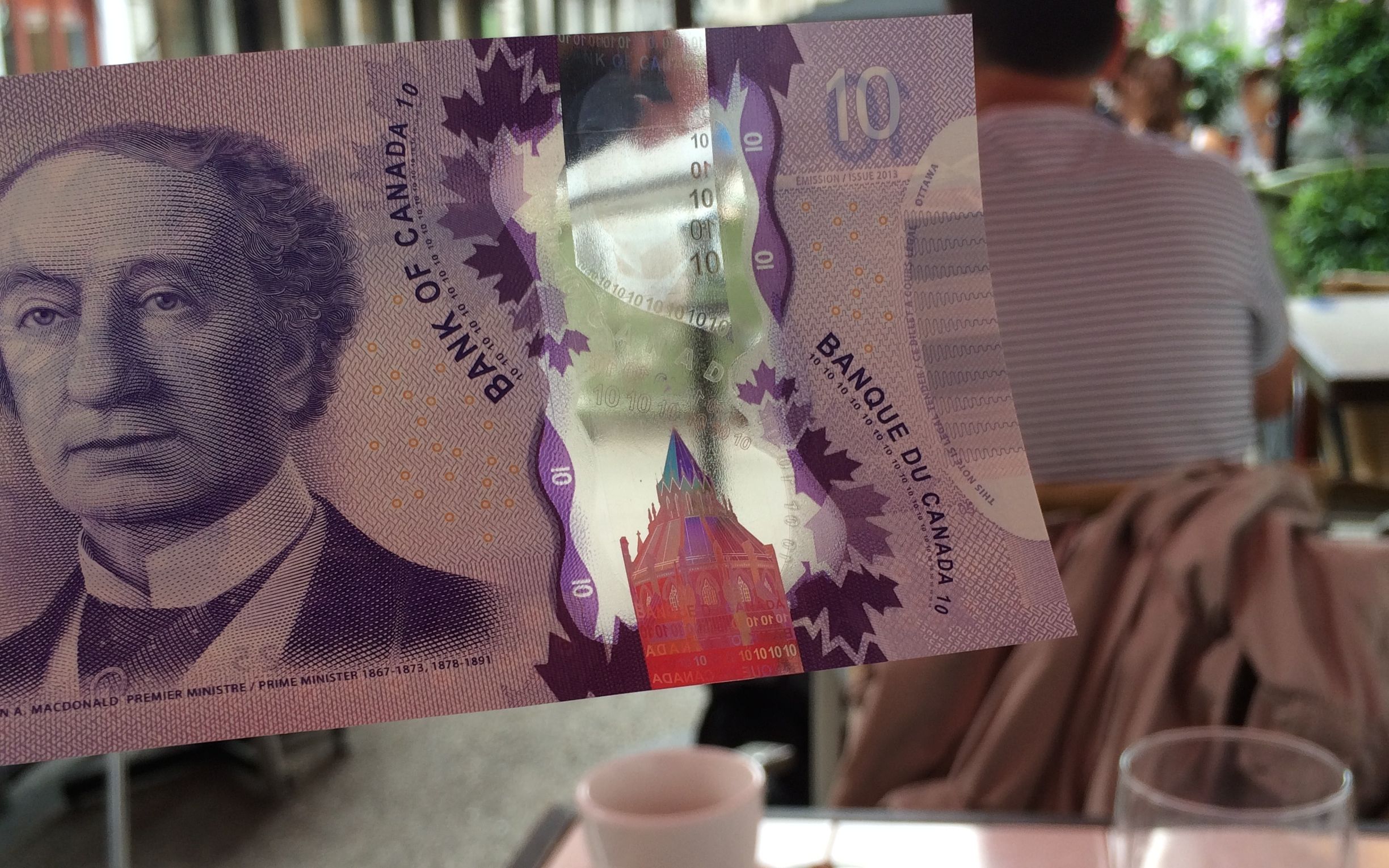
When it was time to pay, I paused to examine the money. The new money – well, new to me, at least – is largely plastic. In fact, there is a holographic section and you can see right through the money! I was amazed!
Suitably reinforced, we set out for Bonsecours Market. It was begun in 1844 and completed in 1860. It served as city hall from 1852 – even while it was under construction – until 1878. It was used for a variety of public functions (according to the plaque on the building) and was renovated and again became a public space in 1996. Now, it appears to be dedicated mostly to shops.
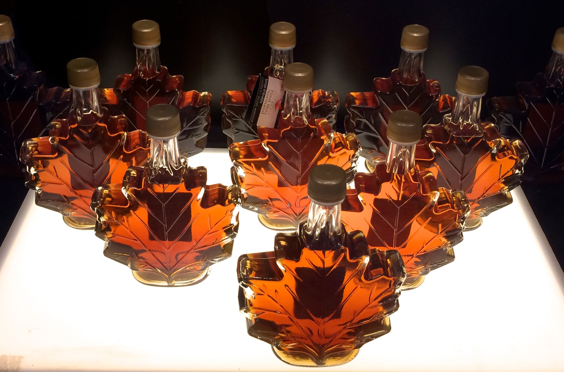
And, what would you expect them to sell? Well, I think I saw four different shops that specialized in maple products.
They even had tastings! Who knew that there were so many different flavors in maple syrup?
On the corner at the far end of the market, there was a church that we had hoped to visit, but it was Monday. Apparently, it is closed on Mondays.
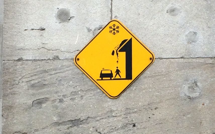
Posted on the side of the market was one of those signs I find hard to resist. No words are necessary.
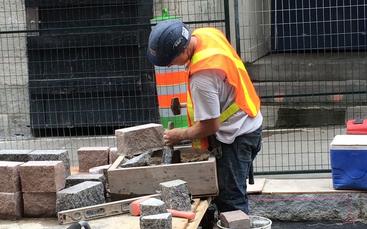
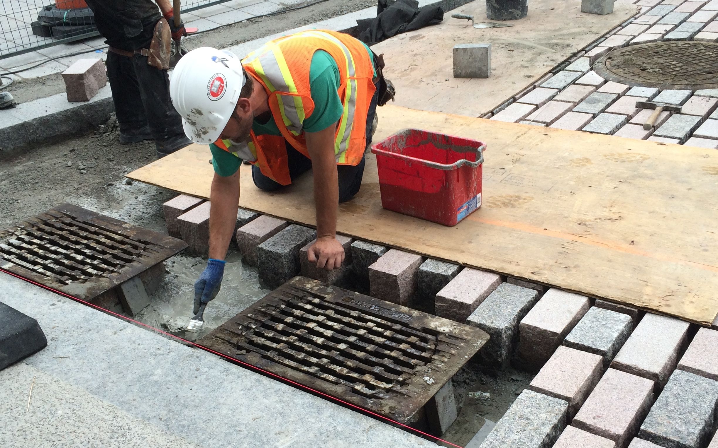
The street in front of the market was under construction – or, rather, reconstruction. I guess you need to do that from time to time when you are dealing with an old city. They were doing it right, though. They were prying up the old pavers and replacing them with new ones.
There were pallets filled with heavy granite blocks. The workers were busily doing the skilled work that goes into laying the pavers.
This guy used a box filled with sand as a work space. He shaped the blocks and then passed them along to another artisan who laid them in the road bed.
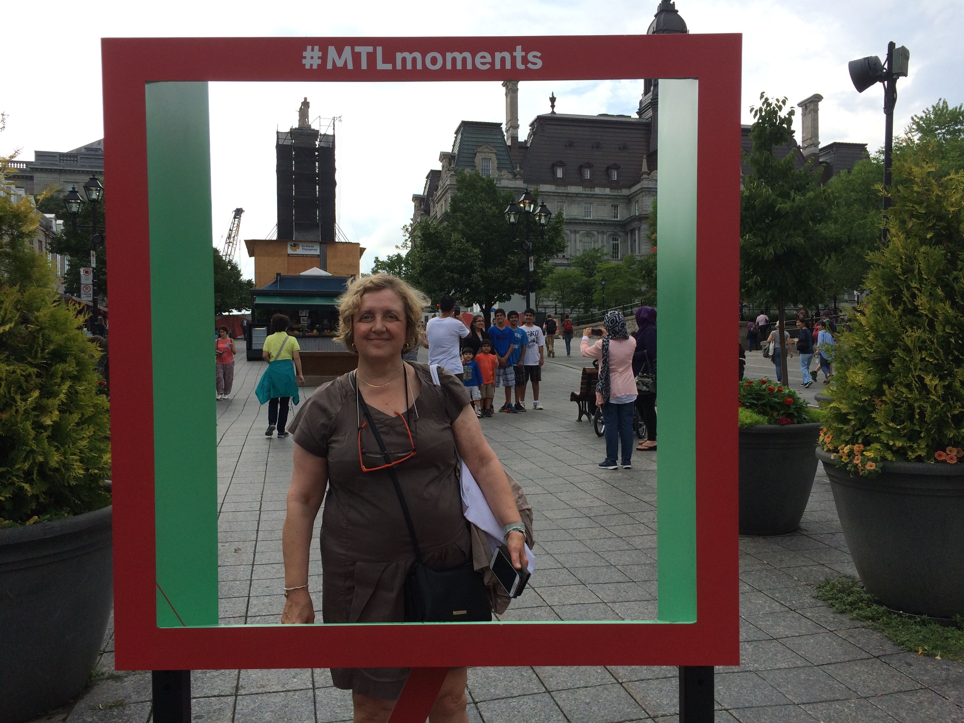
We continued along to Place Jaques Cartier and admired the architecture.
We took pictures of each other in the frame put there especially for tourists.
I think Mary sent me the photo she took of me, but it is somewhere in the digital slush pile.
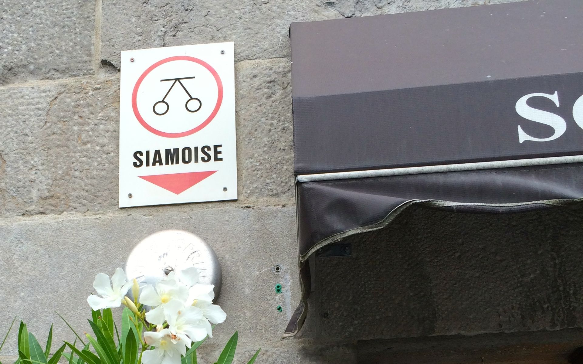
We kept encountering these signs while we strolled, but we couldn’t figure out what they might mean. Mary asked a shopkeeper and he walked us back out to show us what it meant.
A siamoise is a double-opening fire hydrant! I guess it got its name from the fact that they are joined like Siamese twins.
After all that strolling about, it was naturally time for a little refreshment. We go seated just in time! the skies opened up and it poured. Mary and I exchanged different expressions to describe a deluge. I wish I could remember them in French, but one translated to “raining ropes”. The rain was coming down in ropes, but luckily it didn’t last long.
After our refreshment, we walked past the current city hall. The construction began in 1872 and it was completed in 1878. Unfortunately, the building was gutted by fire in 1922. The outer wall remained and was used in the reconstruction. Architect Louis Parant decided to build an entirely new building with a self-supporting steel structure inside the shell of the ruins. It took six years to build the first structure. I don’t know how long it took to rebuild it, but it was renovated again in 1932.
Kitty-corner from the city hall is Chateau Ramezay, which was built in 1705 as the residence of the then-governor of Montreal, Claude de Ramezay. It was named by UNESCO as one of the 1001 sites you must see before you die. Unfortunately, it was late in the day, so we didn’t go inside. There was an arrow pointing to the gardens, so we decided to explore.
We strolled and chatted and chatted and strolled and eventually worked our way over to the metro station. We took the metro to the neighborhood where Mary’s son lived.
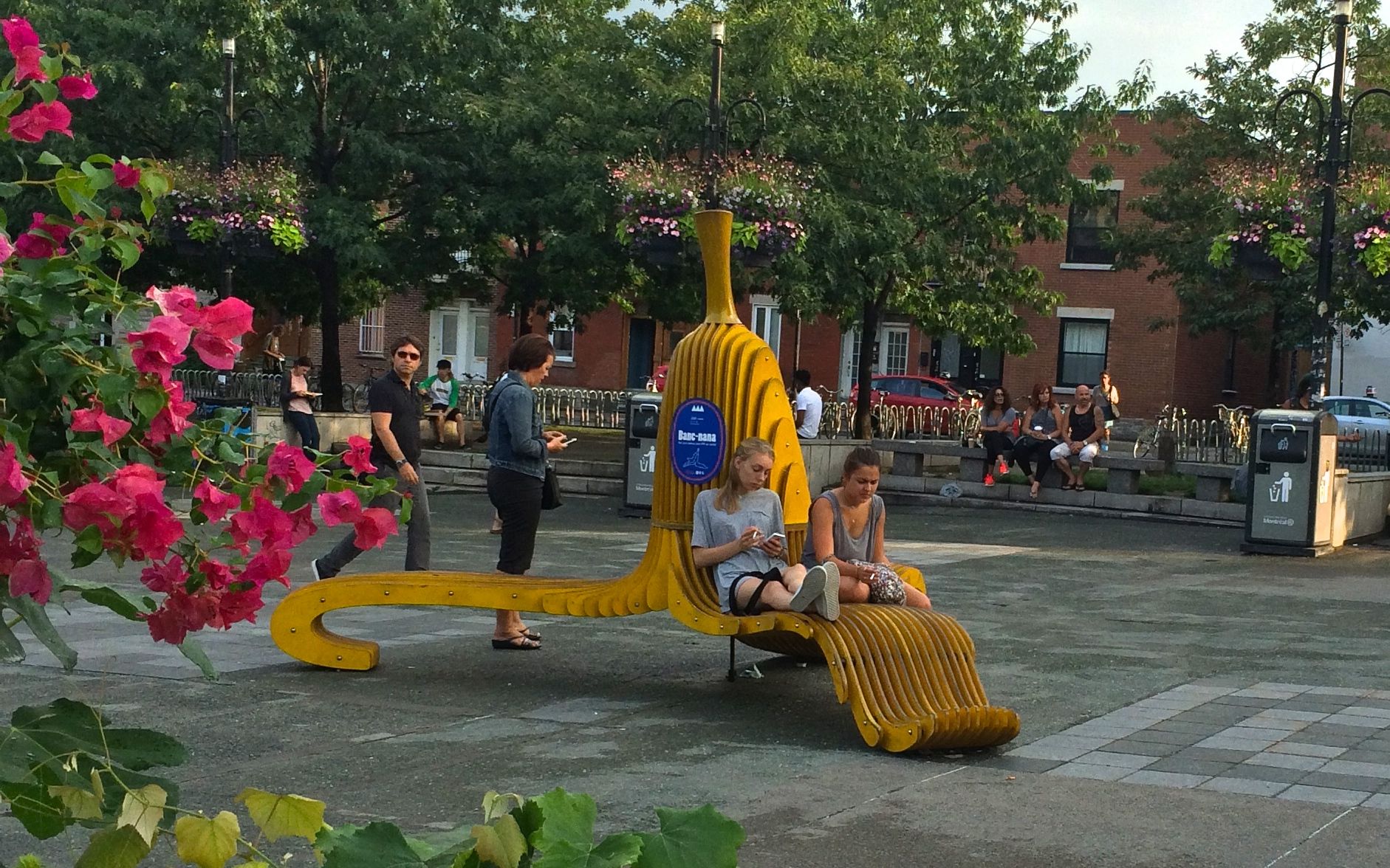
I was taken with the banana sculpture. What a fun addition to the area!
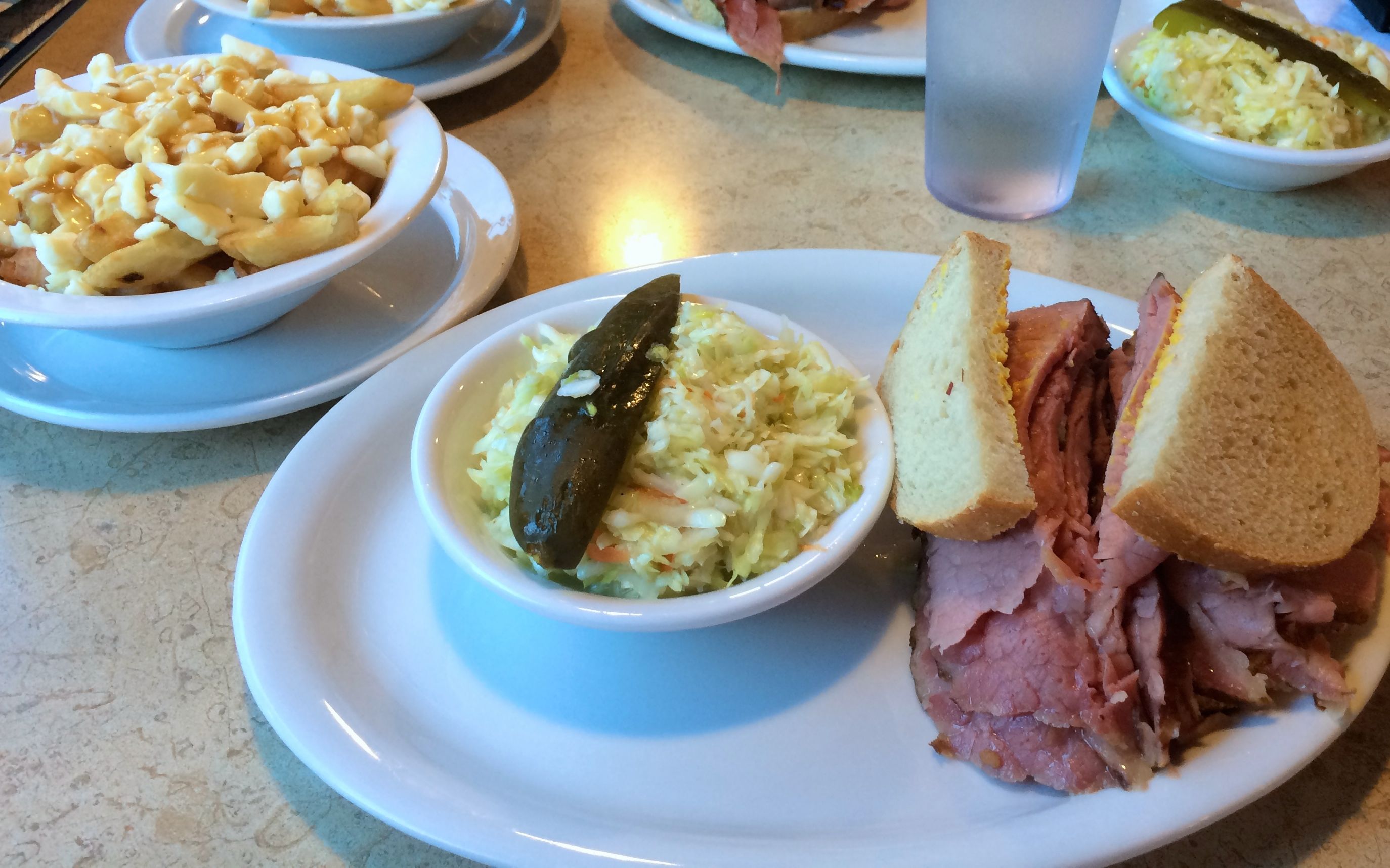
Mary had a guide book that recommended a restaurant in the area. We found it easily enough. Unfortunately, it was closed. However, we found another just down the street. We dropped in to the Restaurant Fameux for a light supper. If you look in the upper left corner of the photo below, you will see poutine. We both tried it for the first time. Neither one of us cared for it.
The smoked meat was more than enough for two meals, so I did take half of it back with me. I meant to ask what kind of meat was smoked, but I forgot. Mary told me that “Restaurant Fameux” means “Famous Restaurant”.
We walked back to the metro station, and Mary and I parted ways. I hope it won’t be another 16 or so years before we meet again!
Back to the truck, back across the border – and yes, I declared my leftover sandwich – and back to camp.
You know what I can’t figure out? Why my bank balances look so good when my record of spending seems so high. Maybe I made mistakes writing things down? I checked my addition. In any event, here are the numbers for last month.
Campsites $1447.42
Gas 586.38
Other Expenses 339.72
Restaurants/Eating Out 179.46
Groceries 166.80
Clothing 150.75
Tolls/Parking 59.25
Tourism/Entertainment 45.42
RV Maintenance 45.00
Laundry 10.50
Food/Drinks on the Go 4.22
Truck Expenses 0.00 TOTAL $3,034.96
The most astounding line this month is Campsites. The northeast is the most expensive area I’ve been in so far. Maybe I made a mistake writing down what I paid. Who knows?
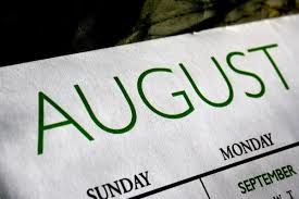
I was in three states in August – Vermont, New Hampshire and Maine. I drove 1,678 miles. The price per gallon has been hovering around $2.20, so I think the mountains I drove through must have affected my gas mileage.
I also bought new shoes while I was in Freeport, Maine at the LL Bean store. I’ve been working on breaking them in so that they will help me move quickly when I work peak at Amazon as part of their Camperforce starting in October.
What is up For September? More RV expenses. I have an appointment to have new tires put on Flo the Airstream tomorrow. Next week, the new air conditioner should be in and ready to be installed. Luckily, that is covered by my extended warrantee, so my out-of-pocket expenses should be $100.
I got out my maps and my apps and picked my next campground. I wanted to find a place to stay that was still a comfortable drive to Montreal. That was important for two reasons: 1) I had never been there and 2) a friend of long standing was visiting her son while I was in the area. I found a campground in a town near Plattsburgh, NY.
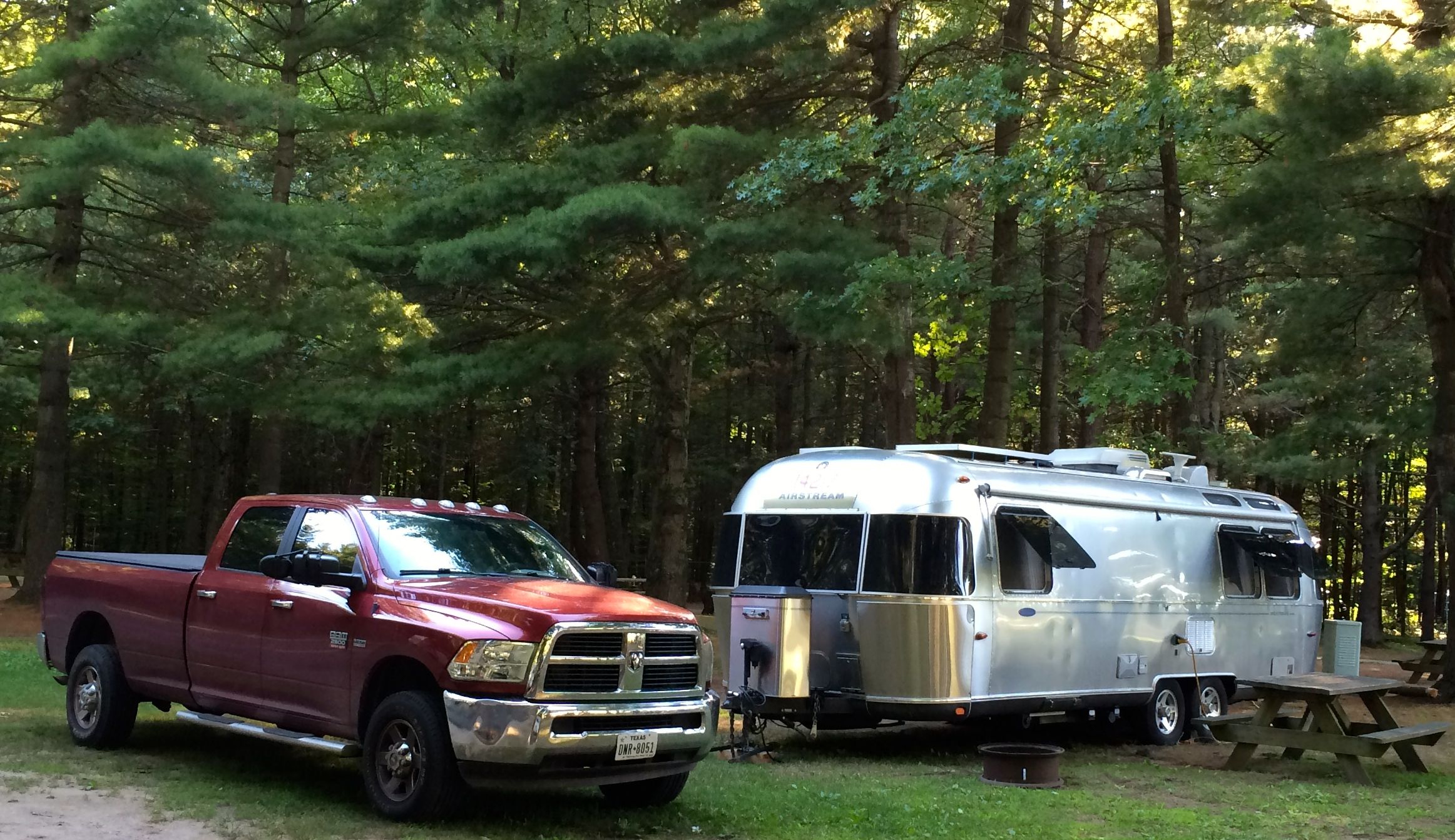
The campground I stayed in was a very pleasant place named Twin Ells Campsites. It is a family run business, and when I checked in, three of the family members jumped into the golf car to show me to the site and help me get backed in. With six extra eyes, it was easy to get into the tree-shaded site.
A tree-shaded site was important, as electricity isn’t included in the rate. This was the first time that I’d encountered this in a campground that rents by the day.
But, the site rental was reasonable, and the electricity only added $2 per day to the total cost. It was pretty cool for many of the days I was there. I wonder what it would have been if I had needed to run my air conditioner all the time?
As with most campgrounds, rules abound. The odd thing about this campground is that everyone follows the rules!
Yes, walking speed. Their website even emphasizes this by saying that the speed limit is not 5 MPH, it is walking speed. I am very thankful that my campsite was quite close to the exit. Do you know how hard it is to drive that slowly?
The pool was pleasant, and I did take a couple of dips while I was there. Rules abound there. I didn’t take photos, but I think there were four massive collections of rules. The most surprising was that there had two be two adults in the pool at all times. The first time I saw that sign, I thought it meant when children were present. No, they meant AT ALL TIMES! Luckily, the last time I showed up to swim, one of the full-season campers stayed with me so I could take a dip.
I had read about coin-operated showers before, but I had never seen one. I decided to skip their showers and make do with my own plumbing.
With good television reception, wifi that worked some of the time, and gloomy weather, I stayed in my lovely trailer more than usual. I did make a few forays into the area to see what I could find.
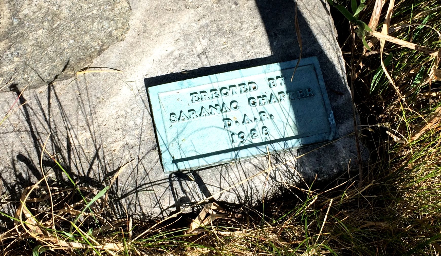
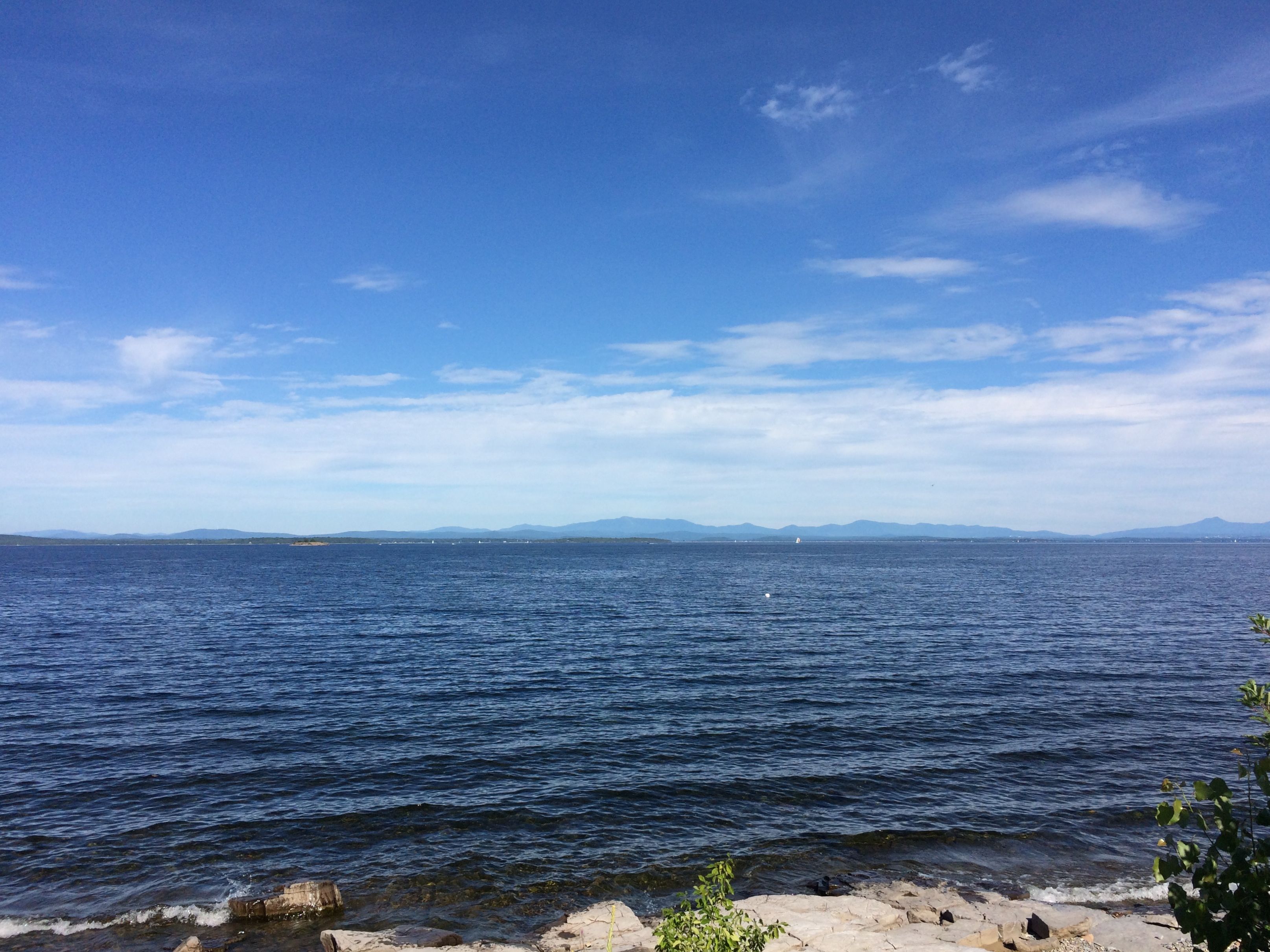
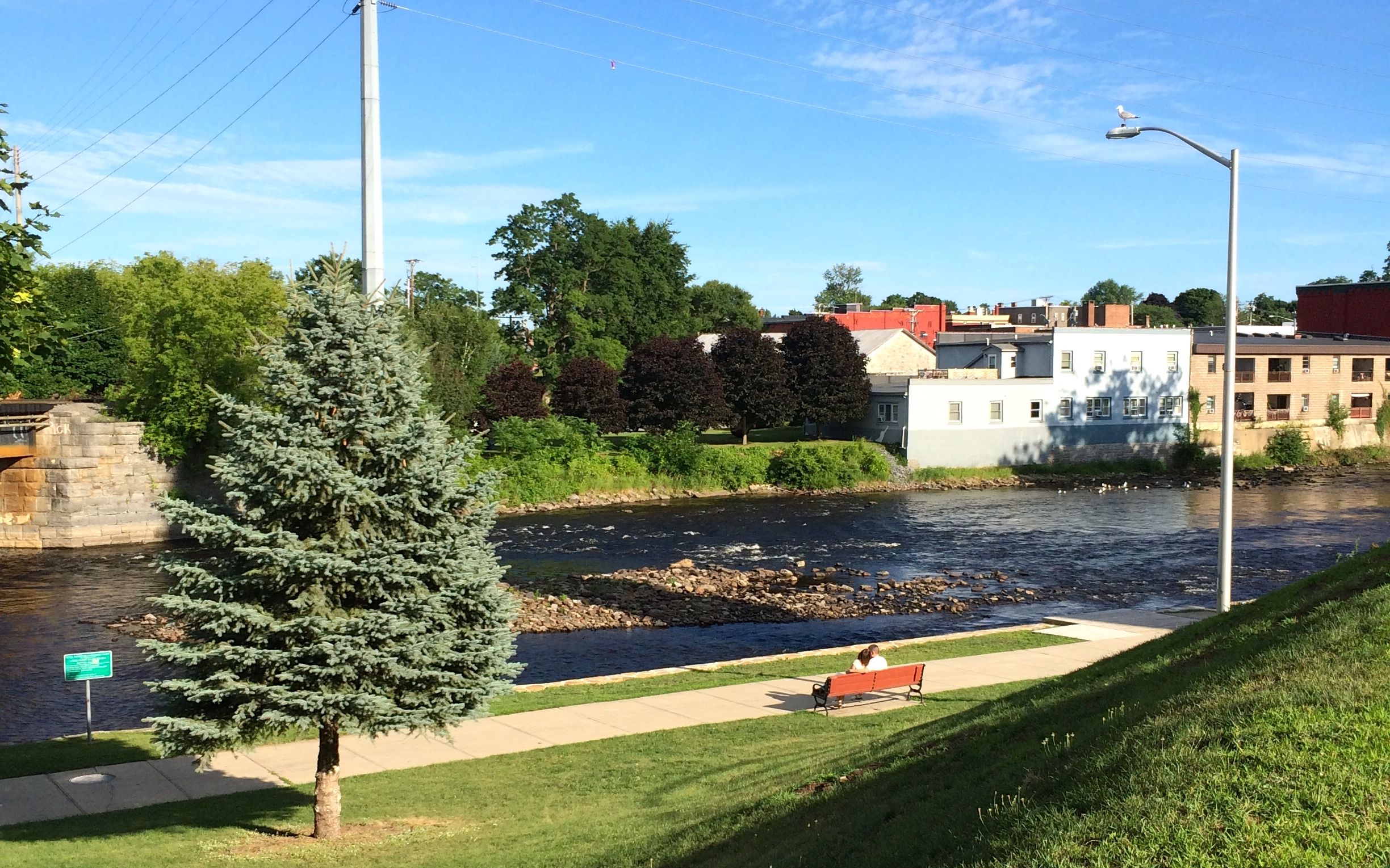
The first thing on my agenda was Lake Champlain. I figured I needed to see it, so I went out looking. I found it and pulled over to take a picture. Oddly enough, the place I stopped was right across from a monument commemorating Benedict Arnold.
Benedict Arnold?! Apparently, he was a hero in 1776, until he made a deal with the British in 1980 to hand over West Point.
So, how long did it take for his positive contributions to the history of the country to be honored? Well, I can’t give you a definitive answer,
but this monument was erected by the Daughters of the American Revolution in 1928. So, even a traitor’s reputation can be rehabilitated. In this case, it only took 148 years.
After I finished examining the Benedict Arnold memorial, I raised my eyes to the lake. That’s Vermont over there!
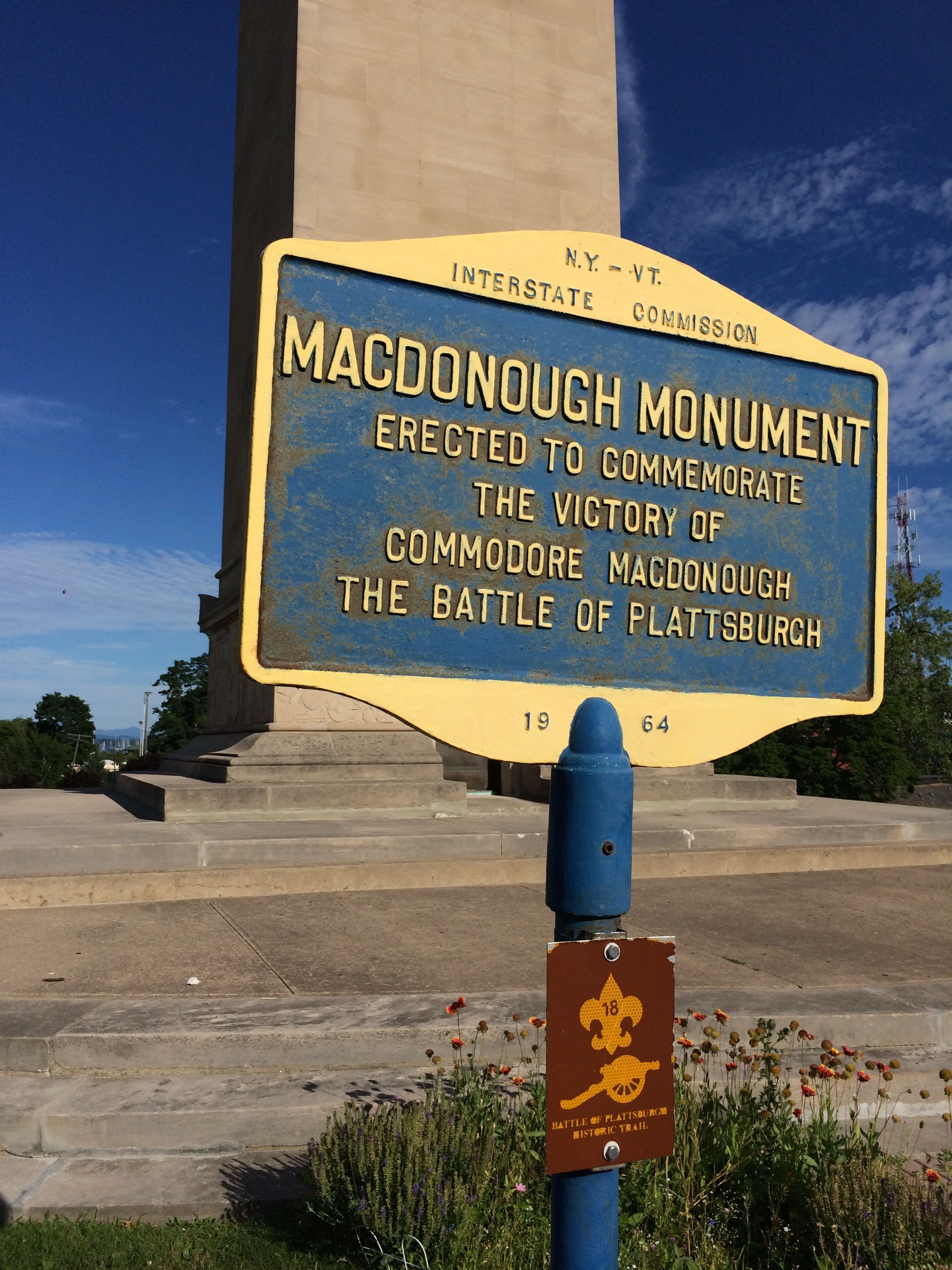
I consulted my History HERE app, and it directed me to a couple of different places that were significant to the region. However, I couldn’t seem to find them. I got out and was walking around looking for the place and chatted with a cyclist who was taking a break. She didn’t know what I was looking for, but recommended that I visit the Macdonough Monument.
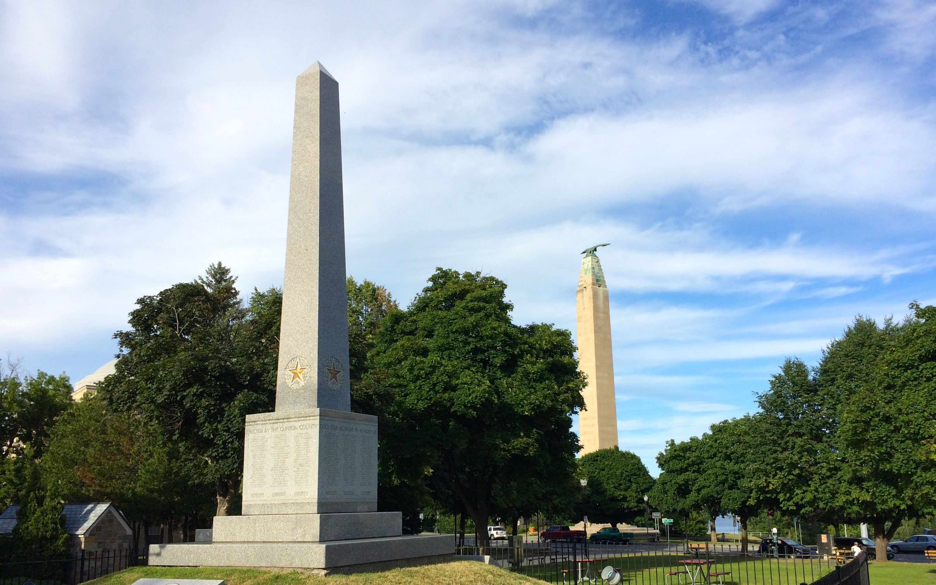
Commodore Thomas Macdonough lead the naval defense of Plattsburgh and maintained control of Lake Champlain. This ended the final invasion of the northern states of the United States during the War of 1812.
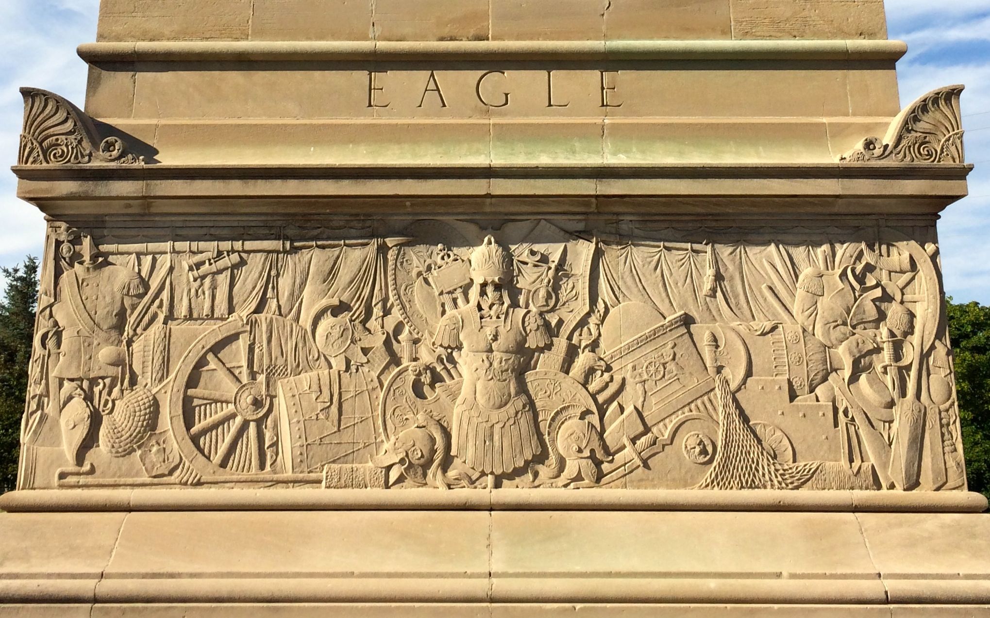
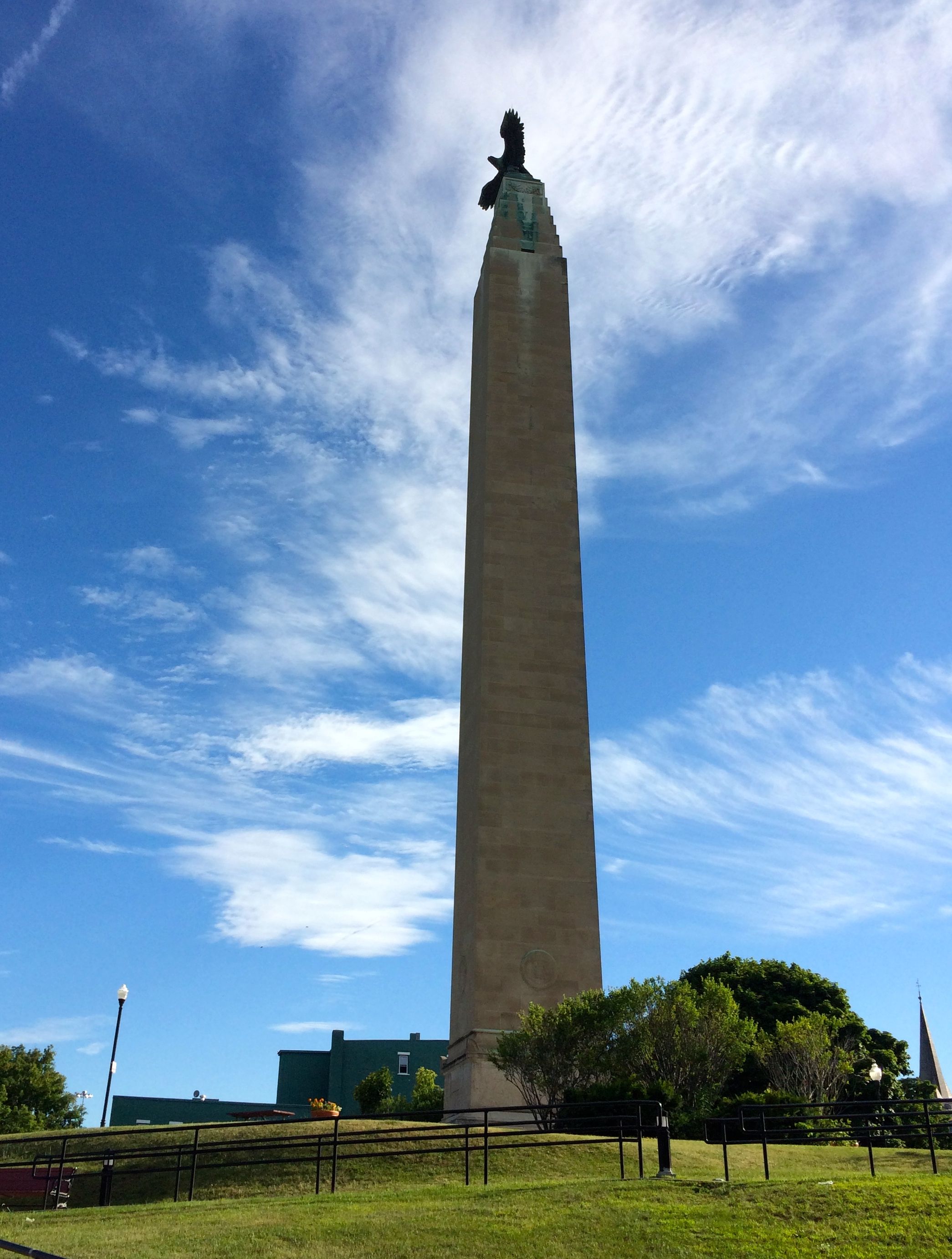
Around the 14 foot square base of the 135-foot monument are the names of the four primary vessels in the fleet: Eagle, Preble, Ticonderoga and Saratoga. I must admit that I am a bit perplexed by the Roman-style armor in the bas relief frieze. But, no one asked me.
The monument, which was dedicated in 1926, was designed by John Russell Pope. He also designed the National Archives and Records Administration building, the West Building of the National Gallery of Art and the Jefferson Memorial. Just in case you were wondering, the wing span of the bronze eagle on top is 22 feet.
Oh, and he also designed the Plattsburgh City Hall, across the street from the monument. The City Hall was built in 1917. I guess they liked his work.
I walked around to the back side of the monument and got a nice view of the Saranac River.
I noticed that a lot of the signs in town were bilingual. That’s a welcoming touch, as Montreal is only about 60 miles to the north.
In Trinity Park, just a few steps away from City Hall, is the city’s war memorial. The lighting and positioning of the lettering was such that I wasn’t able to make out much about it.
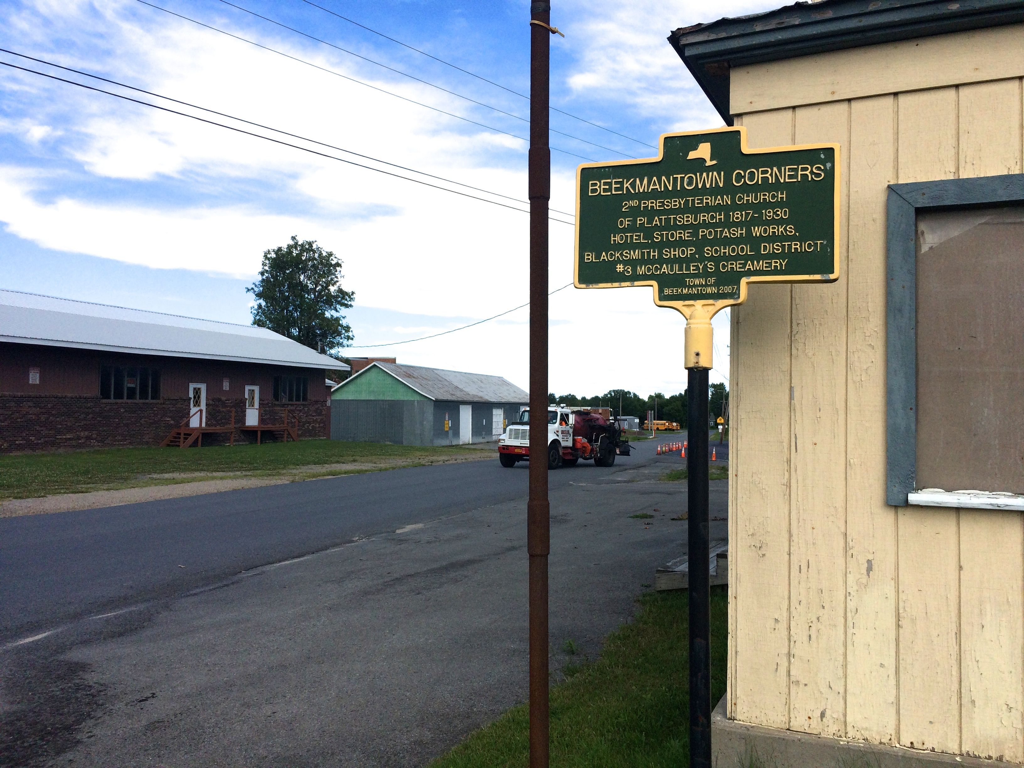
If only it were easier to park the truck and read the historical markers. They are everywhere in this part of the state. Well, when you have the Revolutionary War, the War of 1812 and then the regular historical happenings, there are lots of places to put markers.
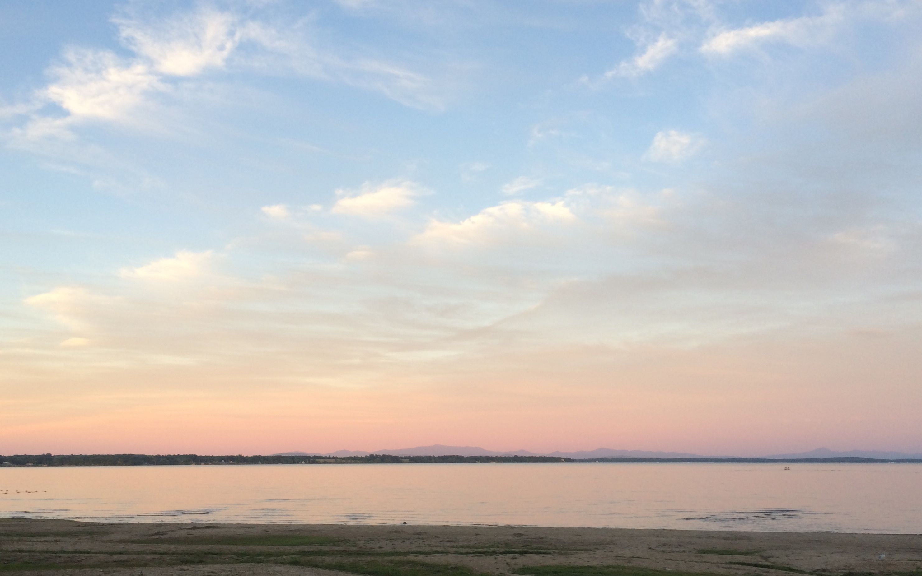
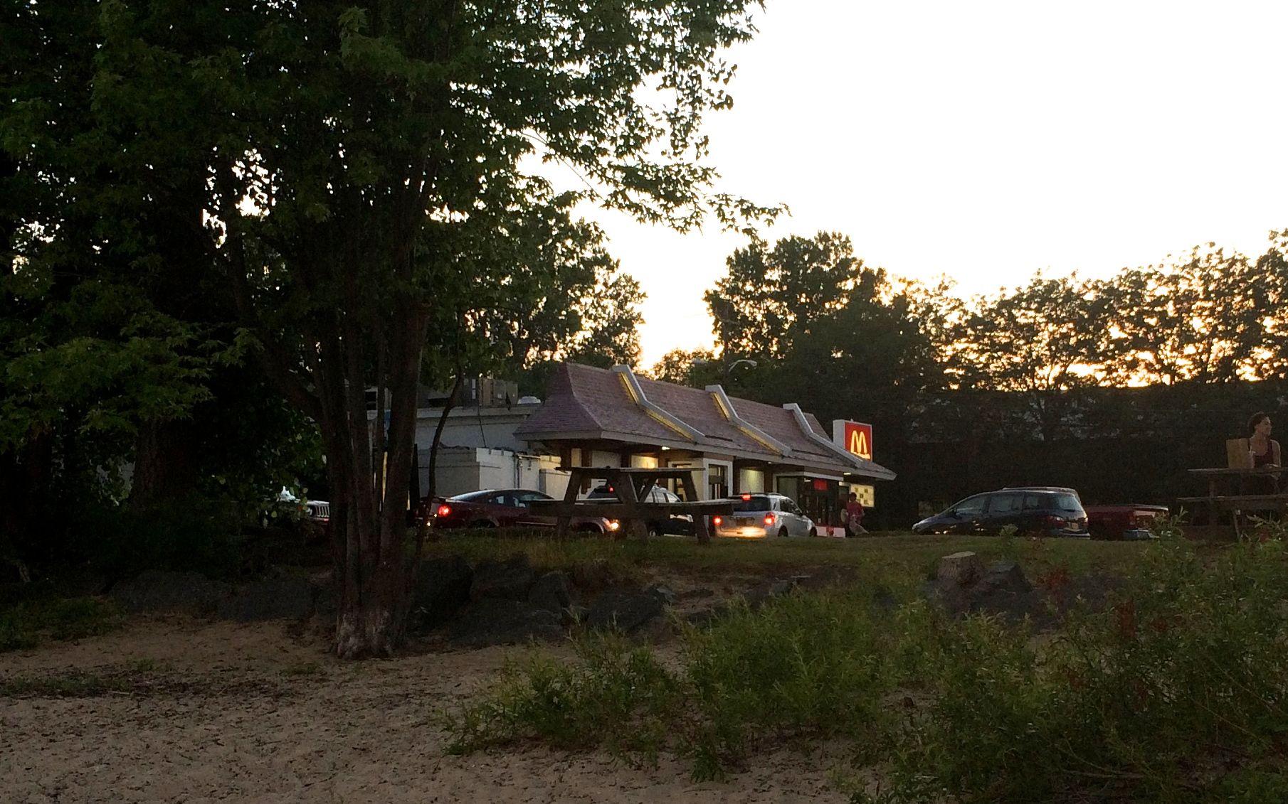
Another day, I managed to catch a delightful sunset over Lake Champlain. I wasn’t expecting to see this much color, as I was facing east. After all, I was in New York and I was facing Vermont.
Still, isn’t it lovely?
Oh, and an amazing part of this beach is that there is a McDonald’s right there. I had gone to take advantage of their reliable wifi and have a light supper.
The sunset was just a bonus.
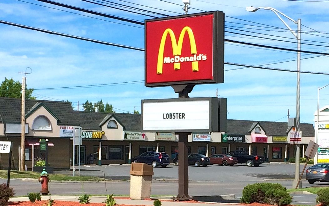
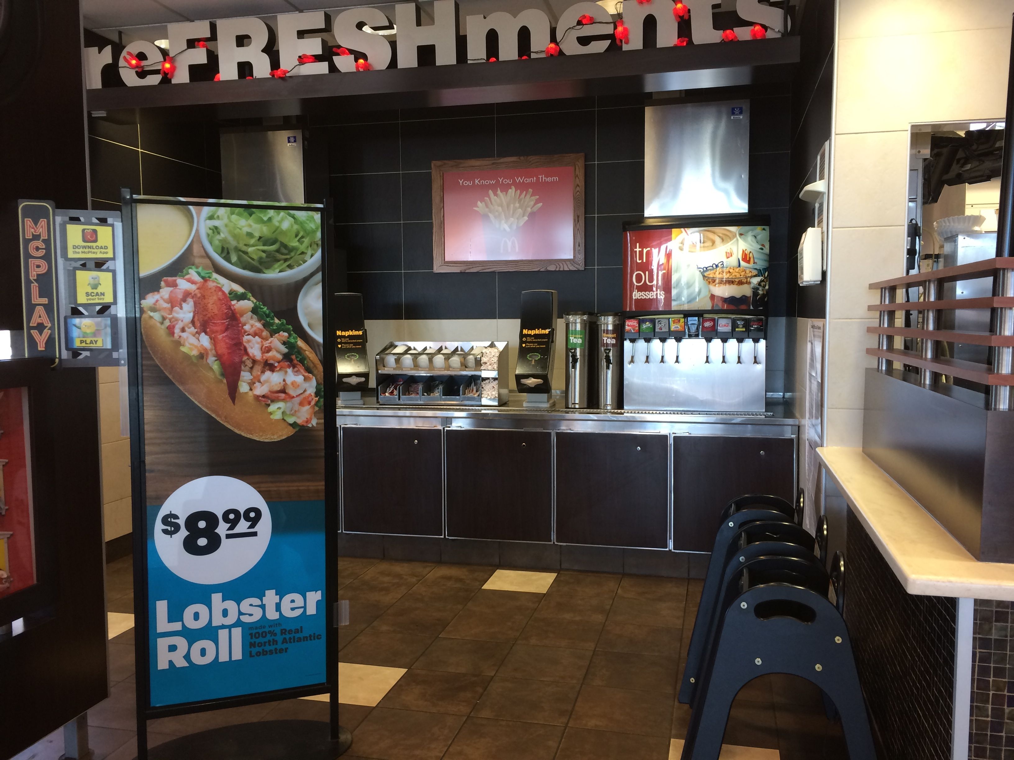
Speaking of McDonalds, when I first got into town, I stopped by for a beverage, the bathroom and some wifi. When I saw this sign, I said, “WTF?”
Lobster? At McDonald’s?!
I guess so. I’ve only had lobster once in my life, and I wasn’t overly thrilled with it. Since I am visiting New England this summer, I do plan on having lobster – whether I want to or not. However, I am NOT spending $9 on a sandwich at McDonald’s, no matter how much I like their drinks, bathrooms or wifi.
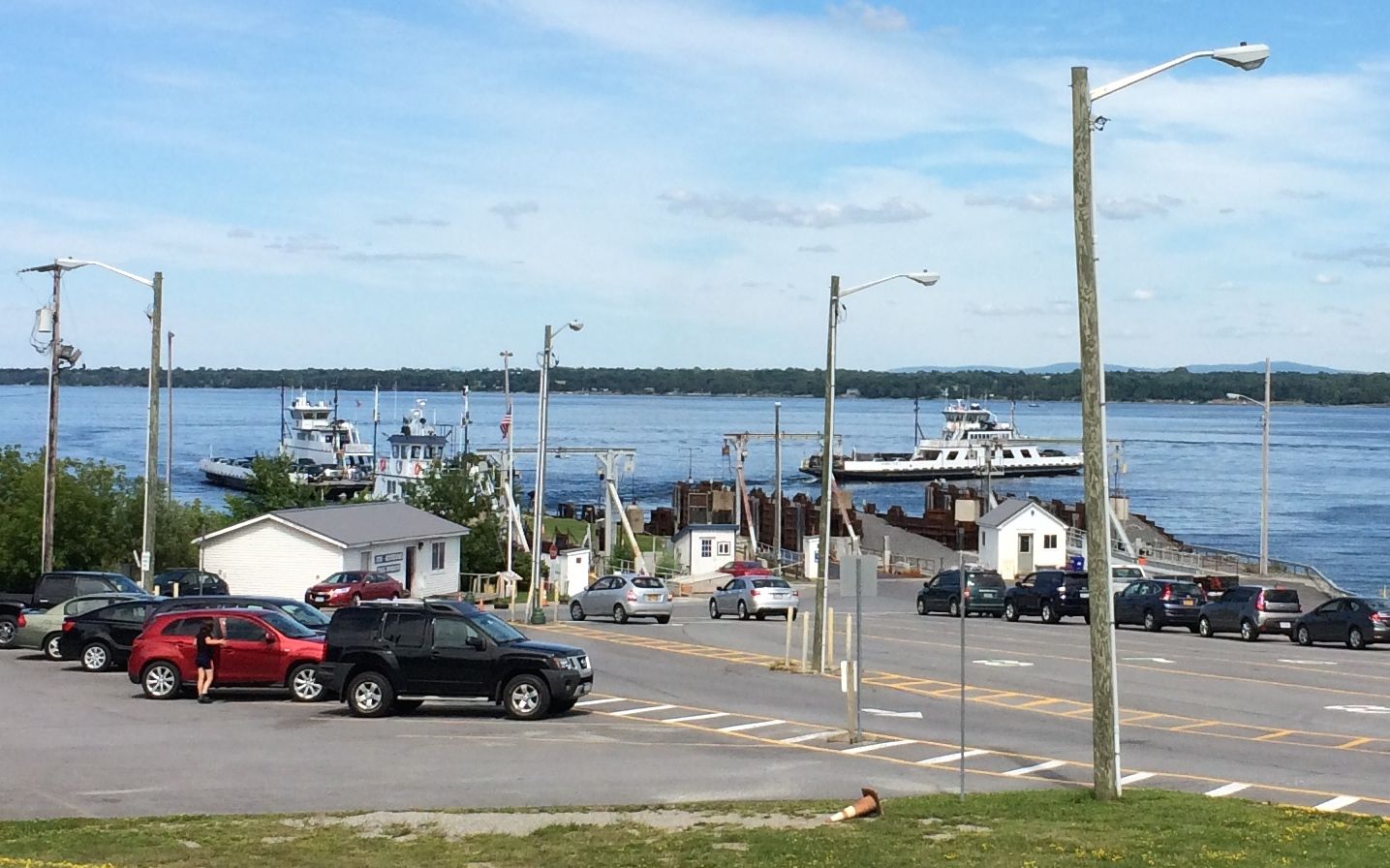
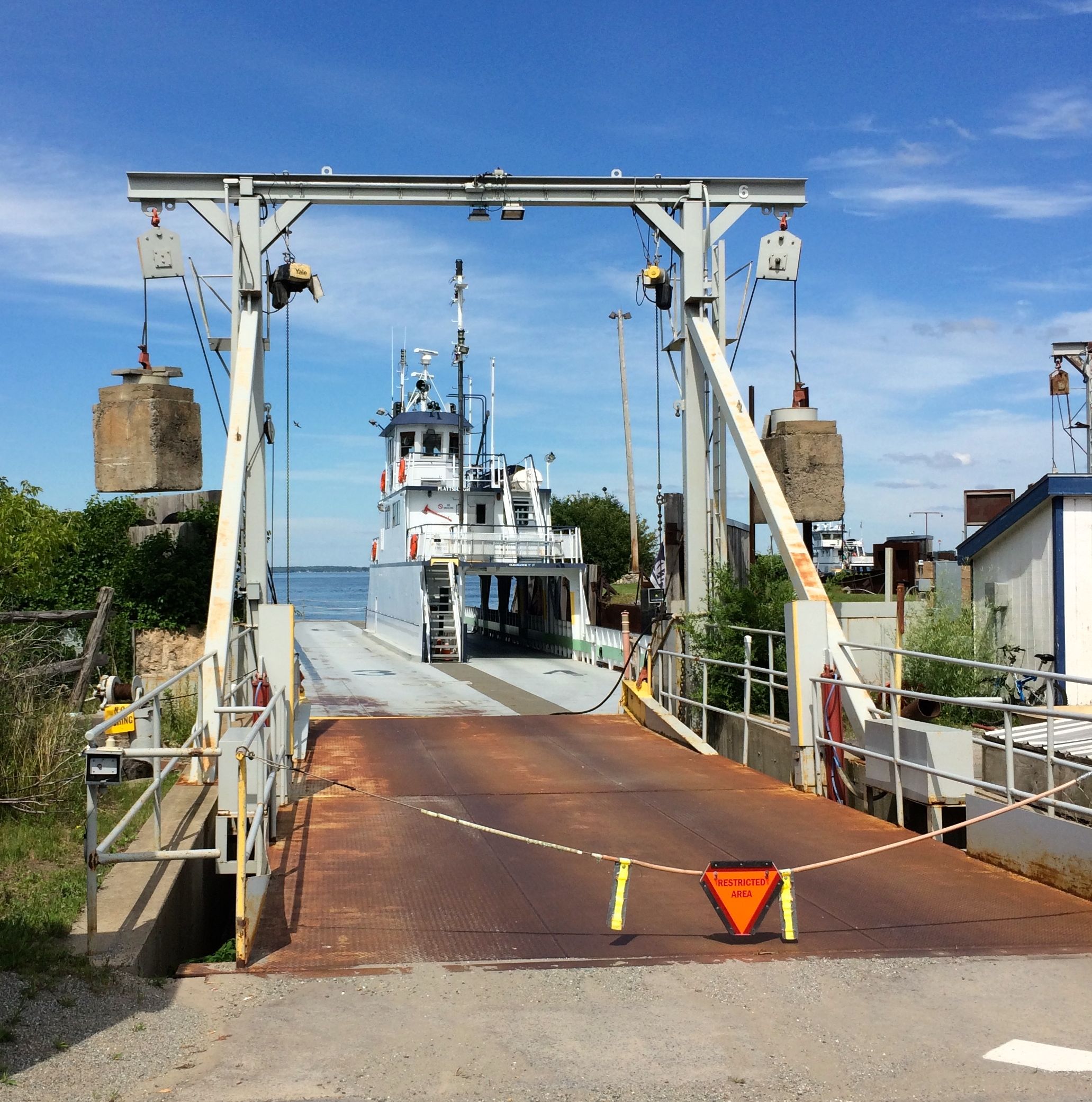
Another day, I went to check on the ferry to Vermont. I wanted to make sure that Bart and Flo would fit. I’ve seen all sorts of ferries, and I figured it would be easier to check it out ahead of time.
There’s a ferry coming in. It looks pretty large.
It looks like there will be plenty of room for Bart and Flo. So, when it’s time to go, I know I’ll be able to take the ferry.
Stay tuned for my adventure in Montreal with Mary! Coming soon!
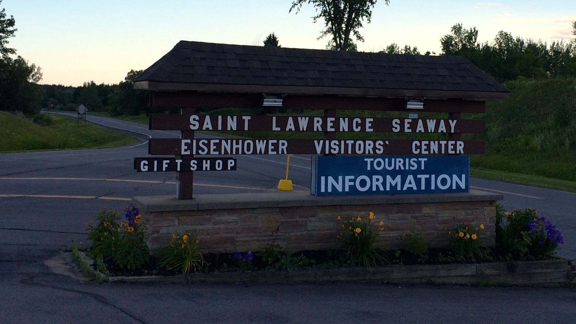
I am just about as far north as I can go in New York State. This is really upstate New York, and it is right on the Saint Lawrence Seaway.
I got to the park, and managed to find the office, which was in a different part of the park from the campground. I got registered and the pleasant worker gave me a map to help me find the campsite. Things were going fine, until I came to the end of a dead end road.
This was indeed puzzling. According to the paper map she gave me, I should have been heading in the right direction. I turned on Google maps and saw the turn that I missed. Now that I knew where to go, all I had to do was BACK UP A QUARTER MILE!
I took a deep breath or two and got ready to back myself out. I had to course-correct a few times, but I got back to where I should have turned. It would be nice if they had put a sign at the place were I should have turned. I can’t believe that I am the first person has had this problem.
I made the turn and got myself to the site. The person right behind me kindly offered to spot me while I maneuvered into the spot. It was a narrow road, and I was in front of him. I guess he didn’t have to help, but he couldn’t get to his site until I got out of the way.
I made use of the shower at the campground. I have to admit that I don’t have a clue as to what this sign on the women’s restroom meant.
So, if any of you out there in the blog-o-sphere has an idea, please let me know.
The first day, I just took care of business and got settled in. In addition to the shower, I tidied up the trailer a bit and did some grocery shopping. The next day it was time for fun!
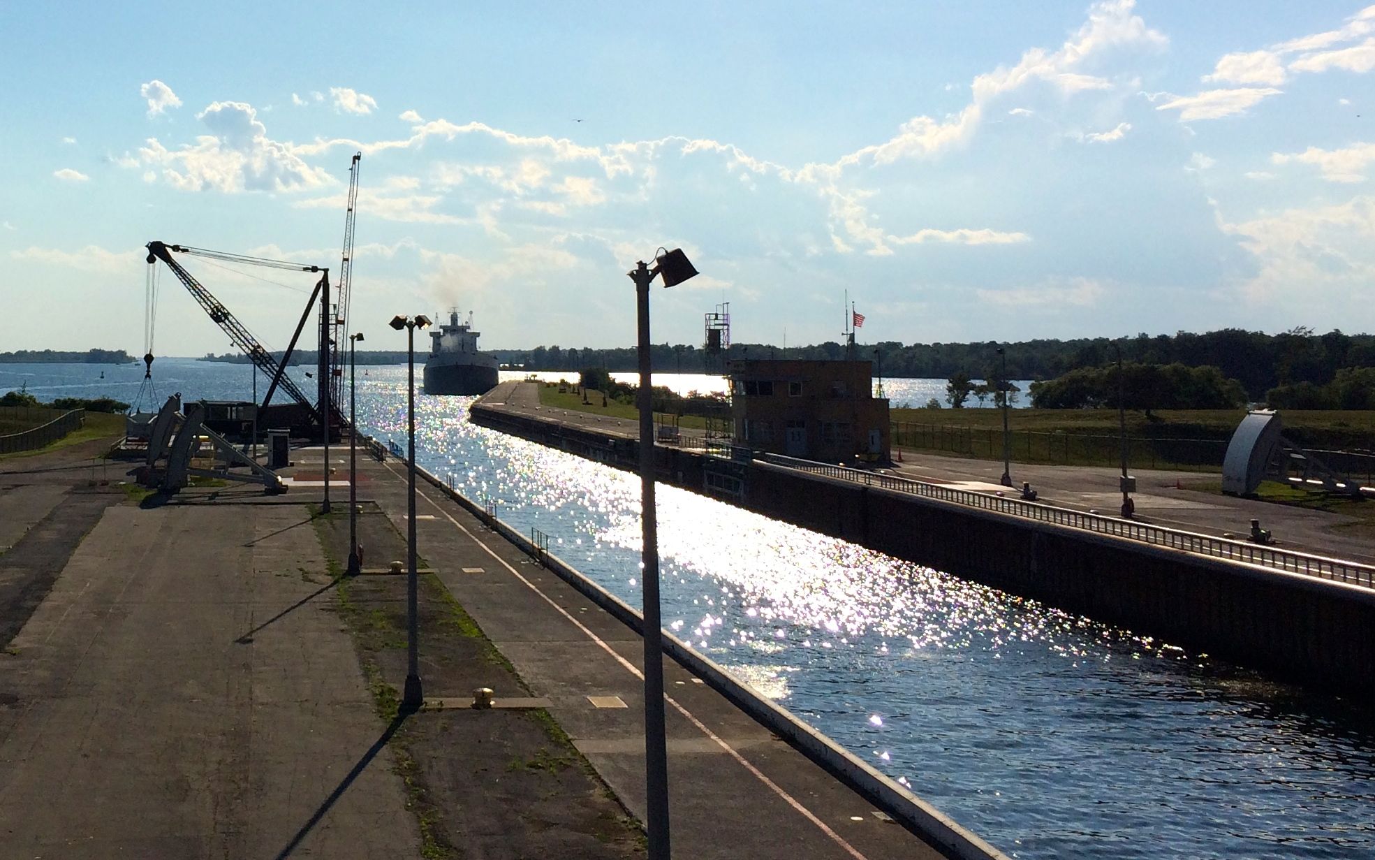
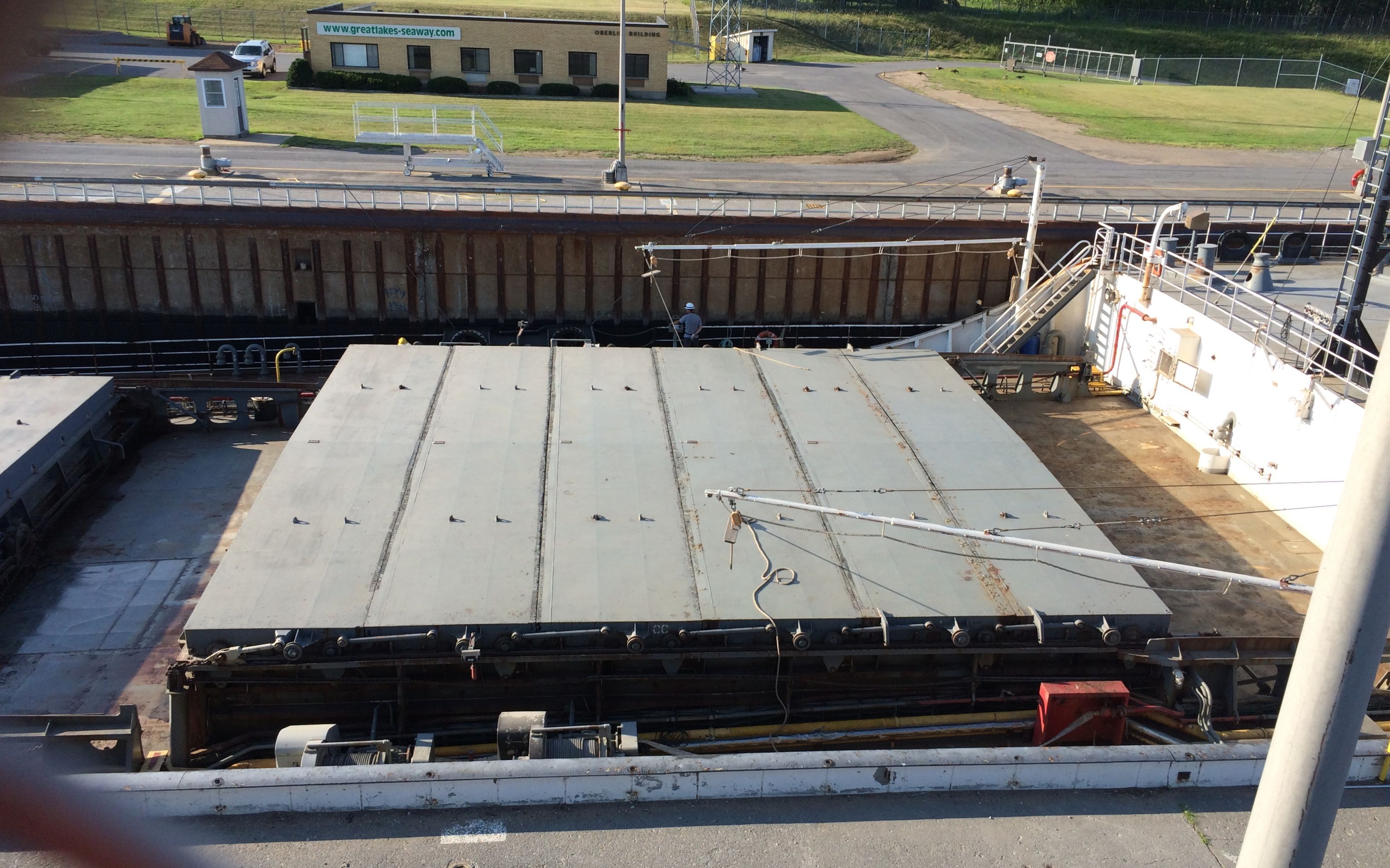
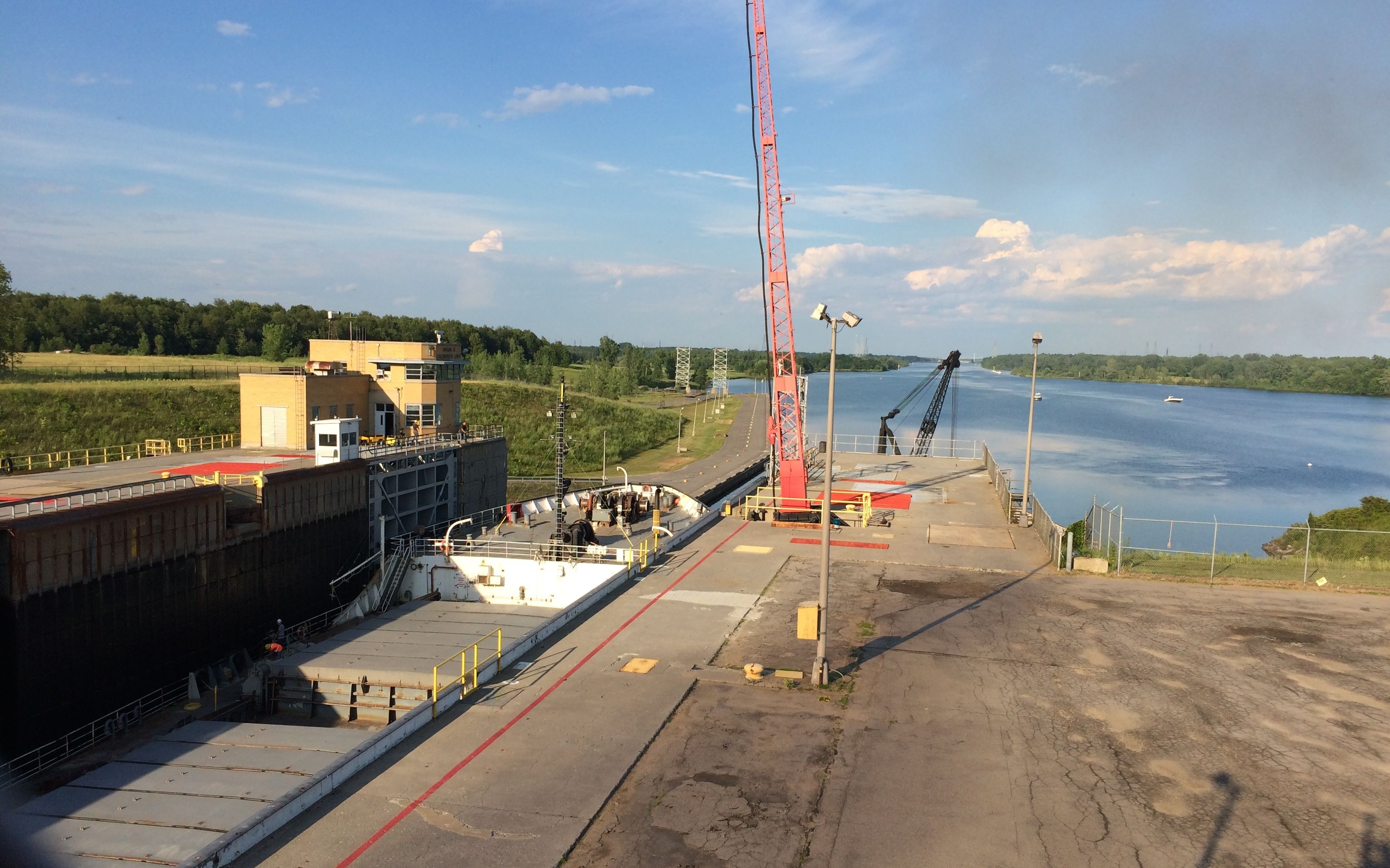
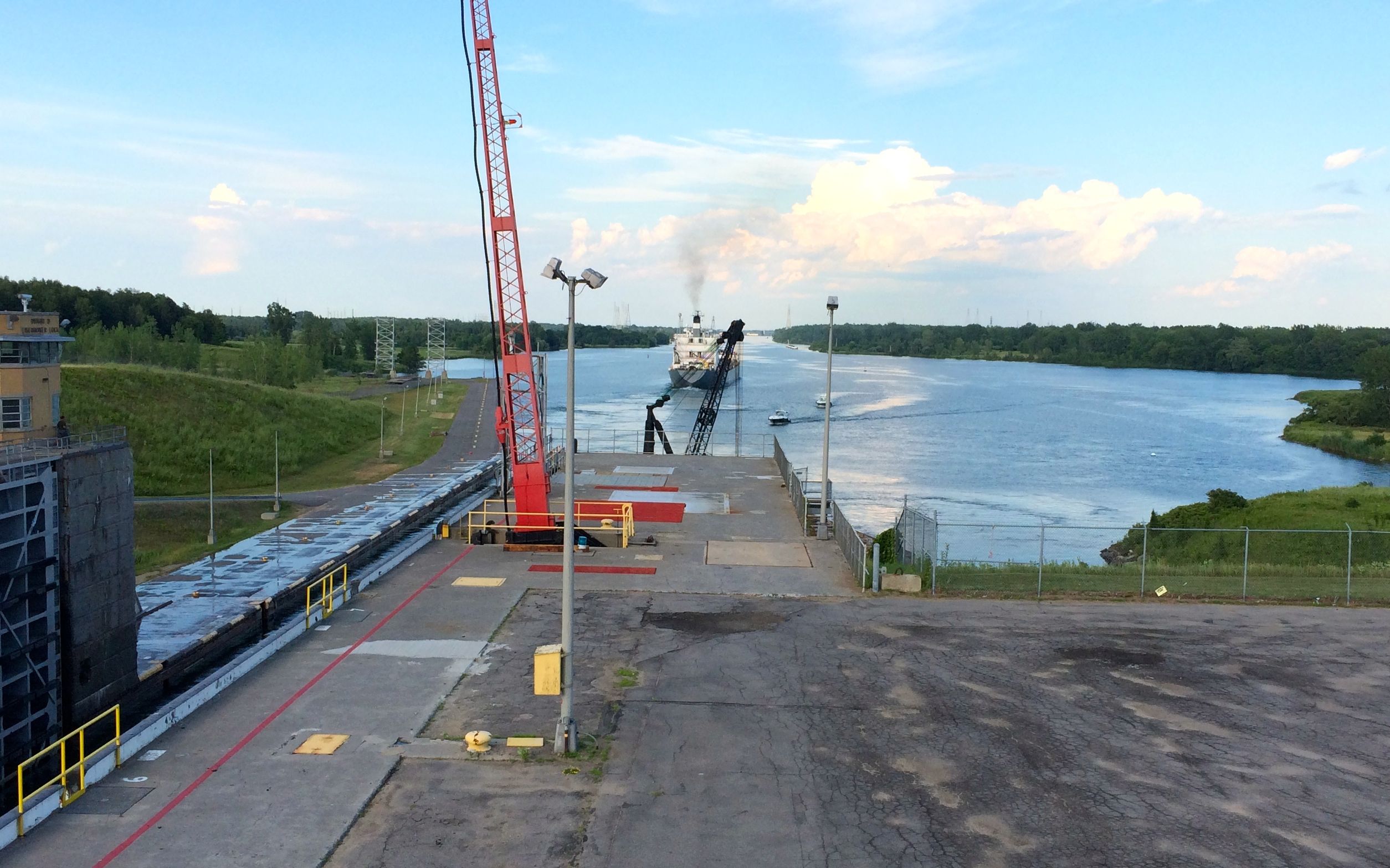
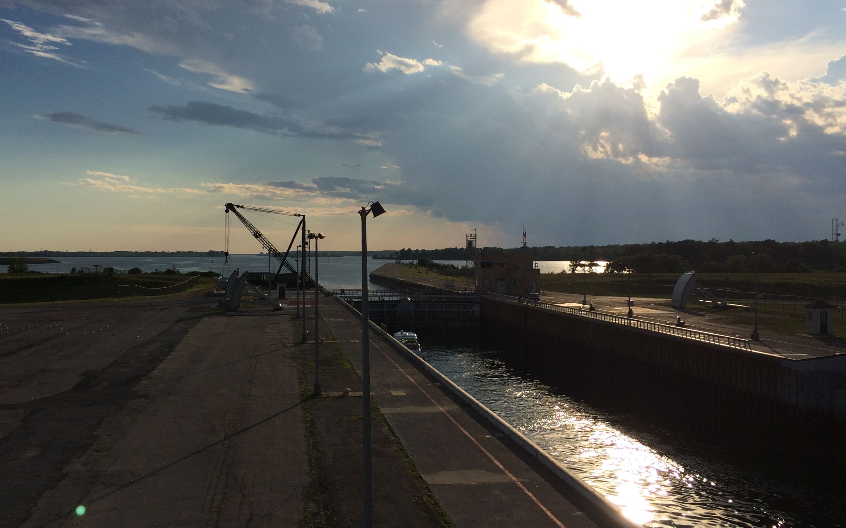
Yes! I got to watch a ship go through the Eisenhower Lock! Oh, the things that fascinate me. I wonder if there is somewhere I can go watch paint dry?
Actually, I went by early in the day and inquired about when the next ship would be coming through. The guard told me that they had one scheduled to come through around 5:30, so I went back to the trailer for a bit. When I returned, I brought the leftover Popsicles I had bought as part of my “liquid diet” that I was to follow before the colonoscopy while I was in Kalamazoo.
The funny thing is that I don’t much care for Popsicles. After all the years of teaching and using Popsicles as end of the year bribes uh, treats, any childhood fondness I had for them had long since disappeared.
You know I always like to read signs and plaques. This one at the park near the lock puzzled me.
Now, I know that the War of 1812 was fought all along this area. I don’t doubt that there might have been something significant that happened here. But, why is there a sign about the Treaty of Ghent? For the geographically disadvantaged, Ghent is in the Netherlands.
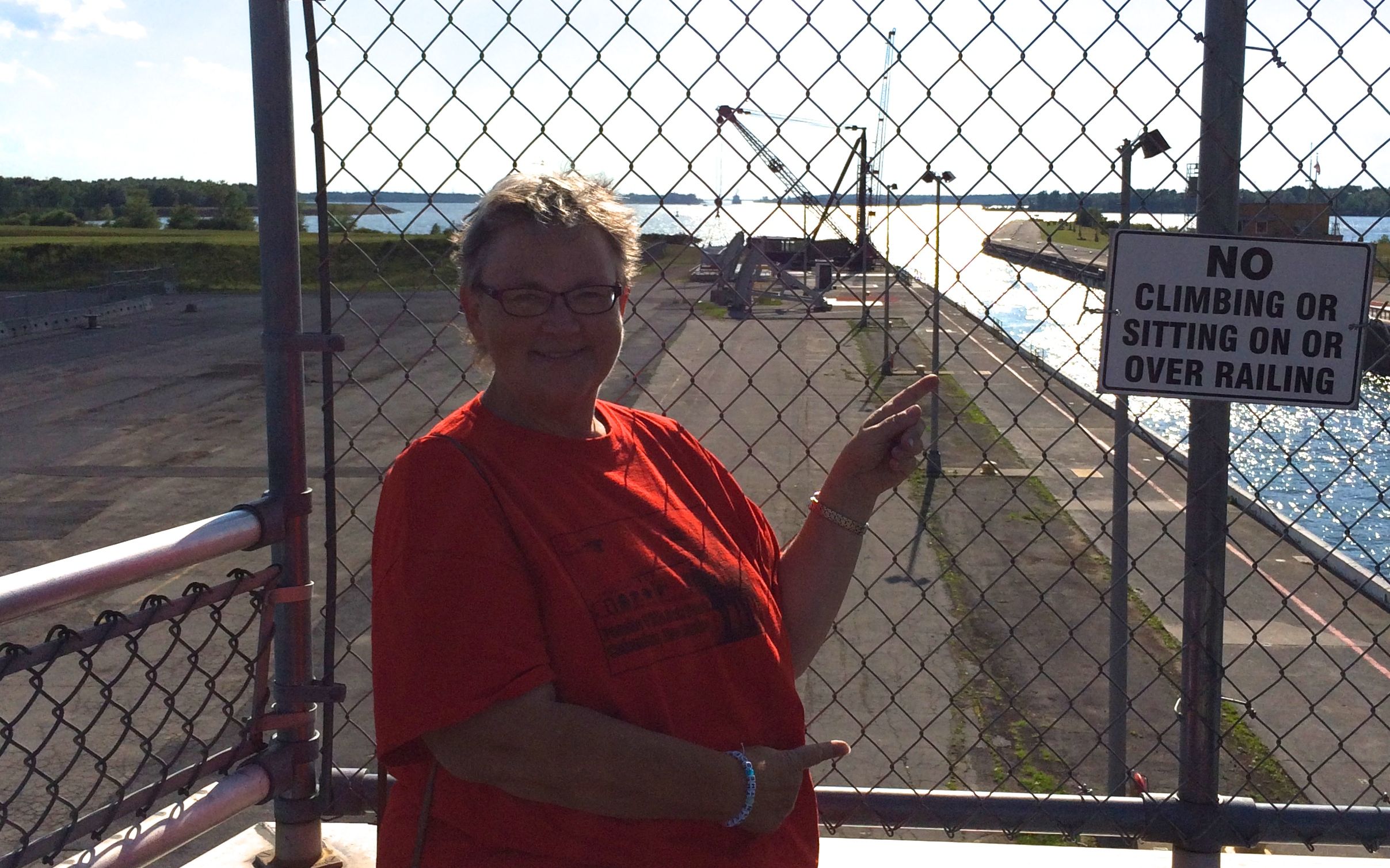
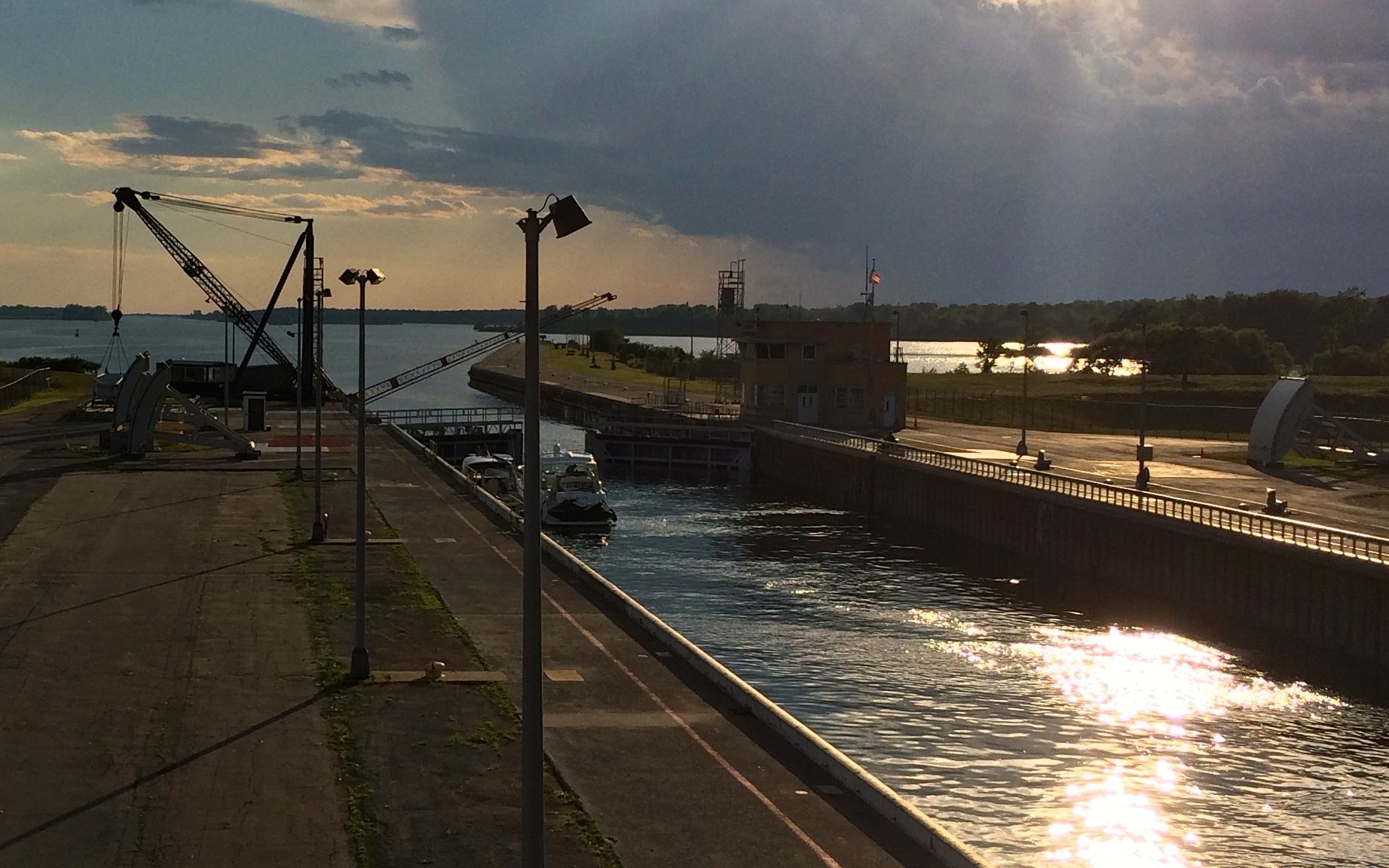
I returned at the proper time. While I was waiting, and after I handed out the Popsicles, I struck up a conversation with the folks on the deck. I had one of my fellow tourists snap a shot of me pointing at Canada while wearing the tee shirt I picked up at Pancho Villa State Park in New Mexico.
The most southern state park to the most northern state park – at least this year!
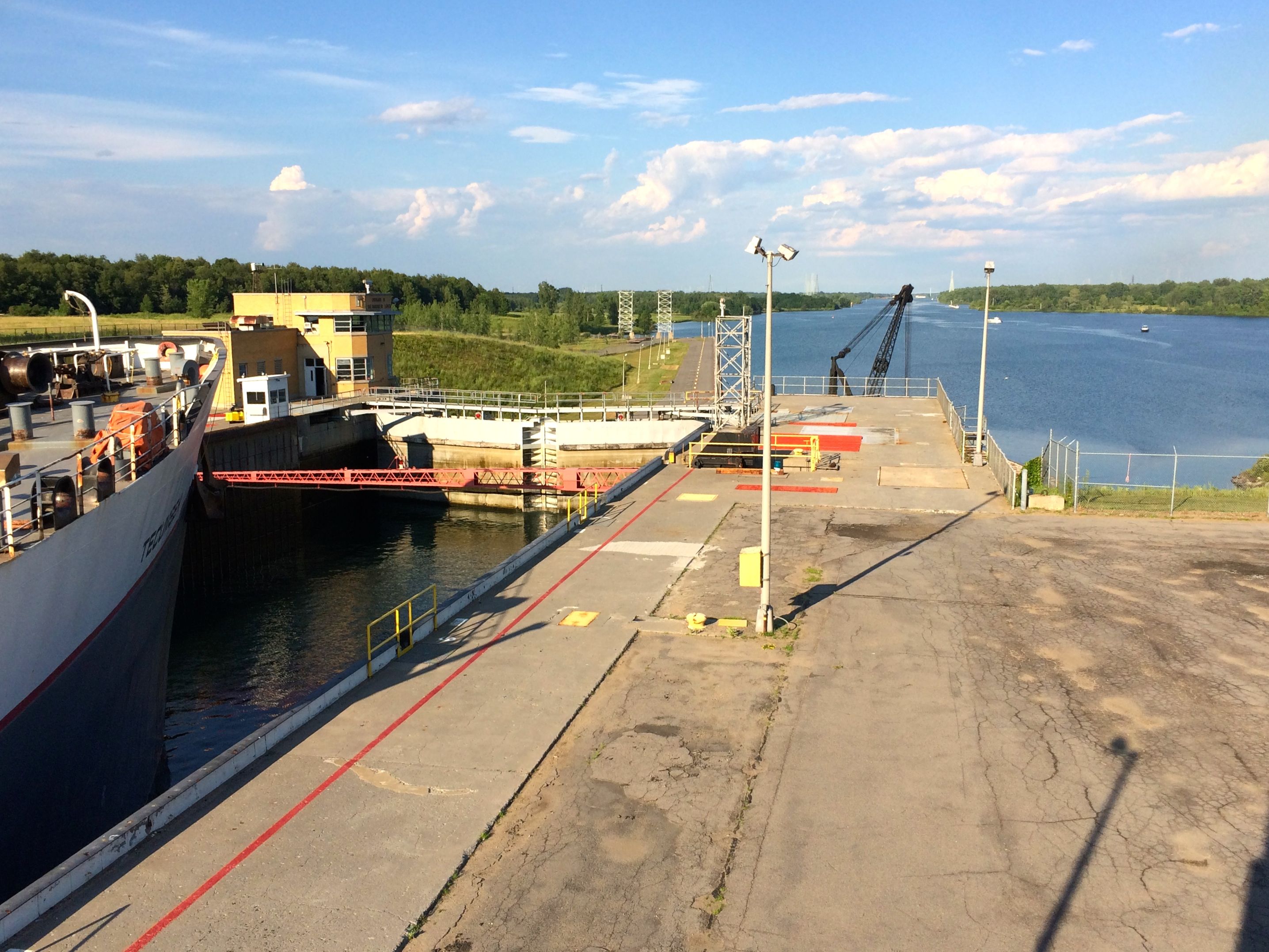
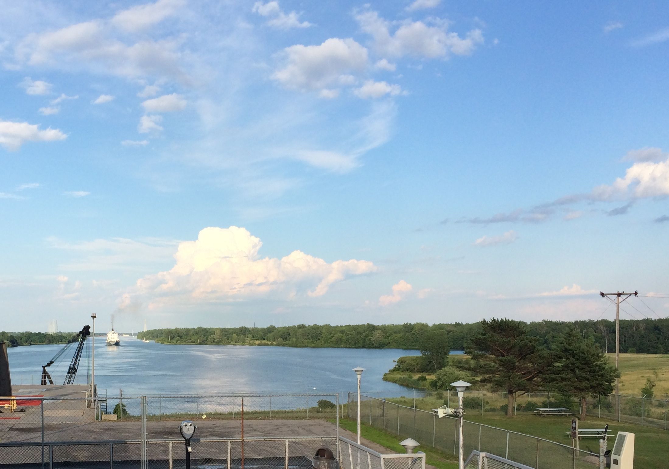
The ship was running a bit late, but it finally arrived at the lock.
It entered the lock and made its way in.
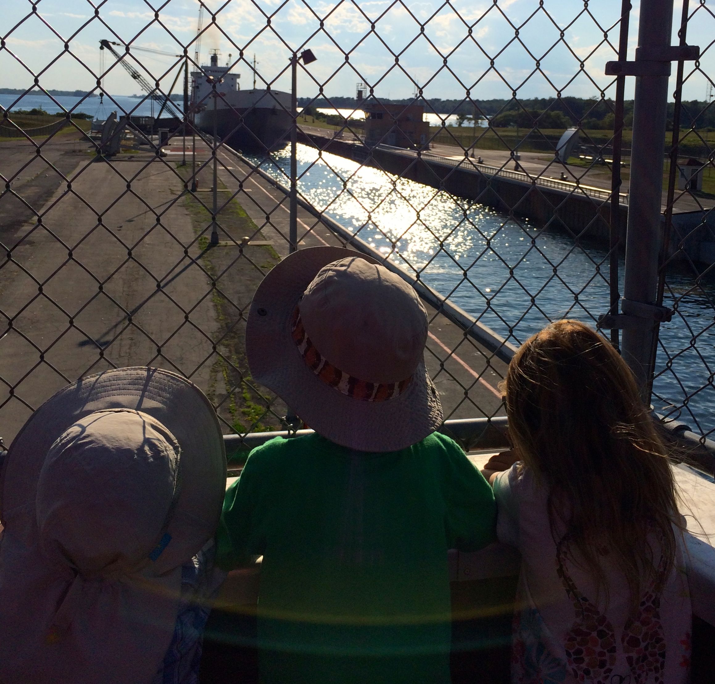
The children were watching in rapt attention. Well, at least until I snapped the photo.
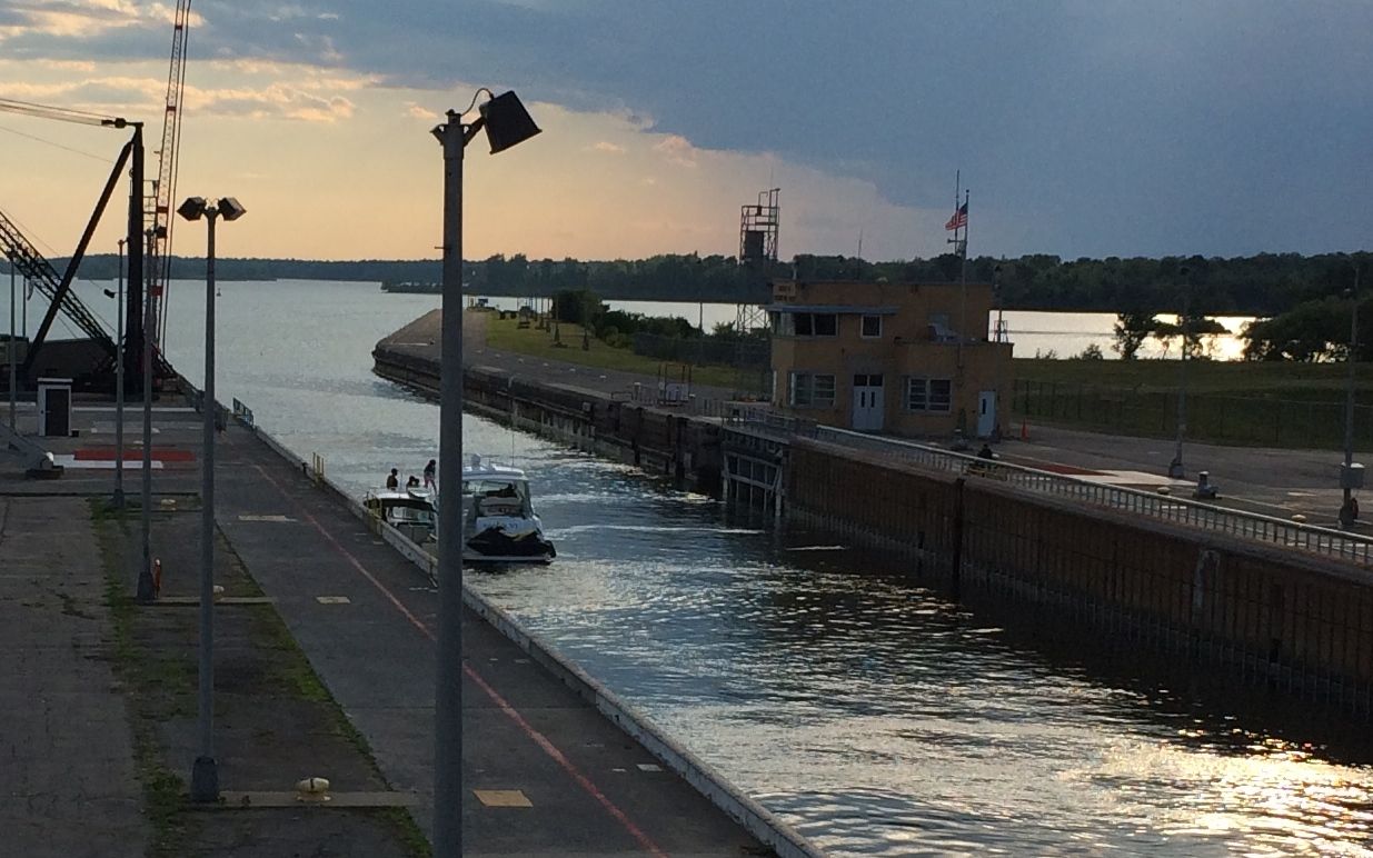
The ship kept coming.
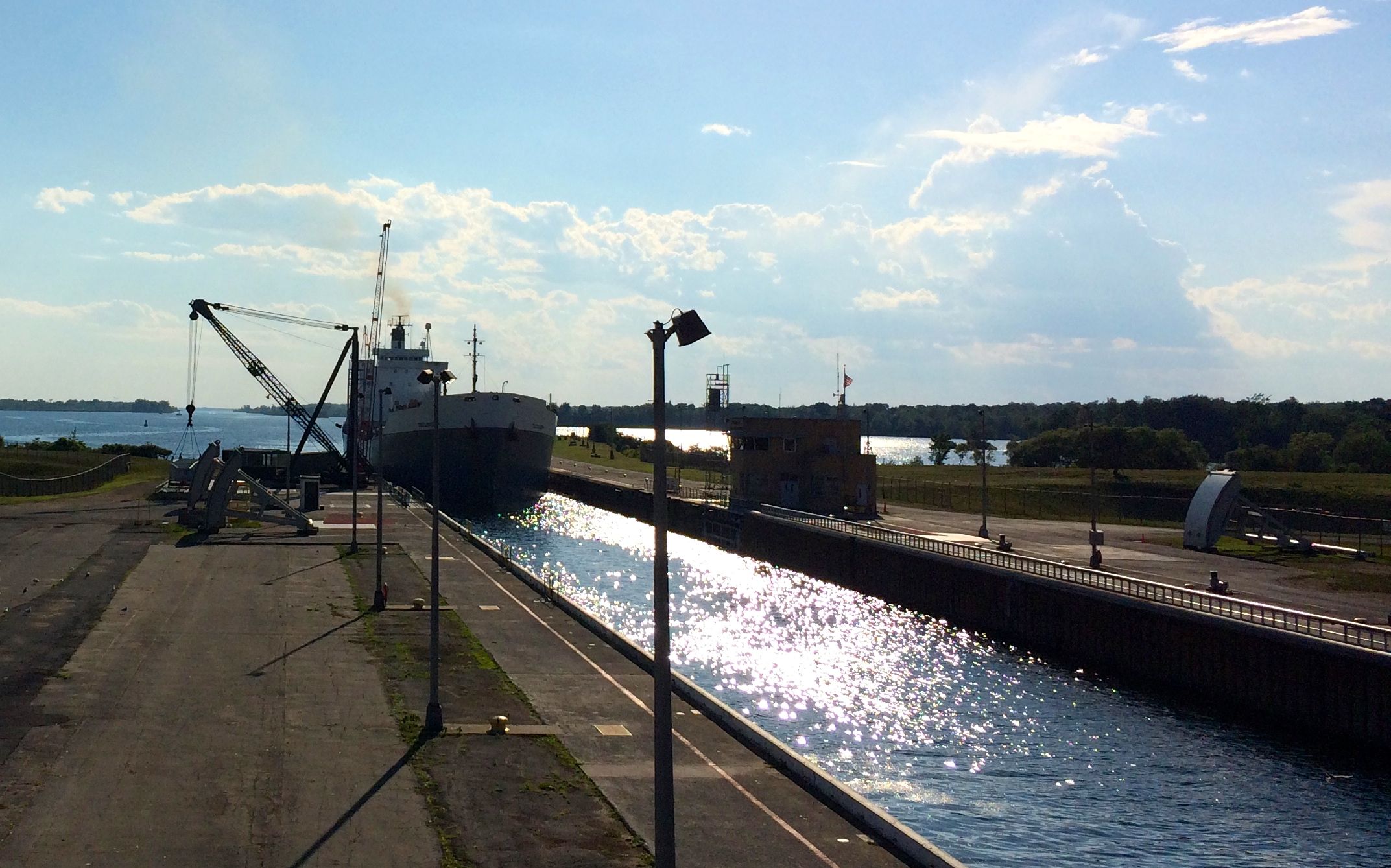
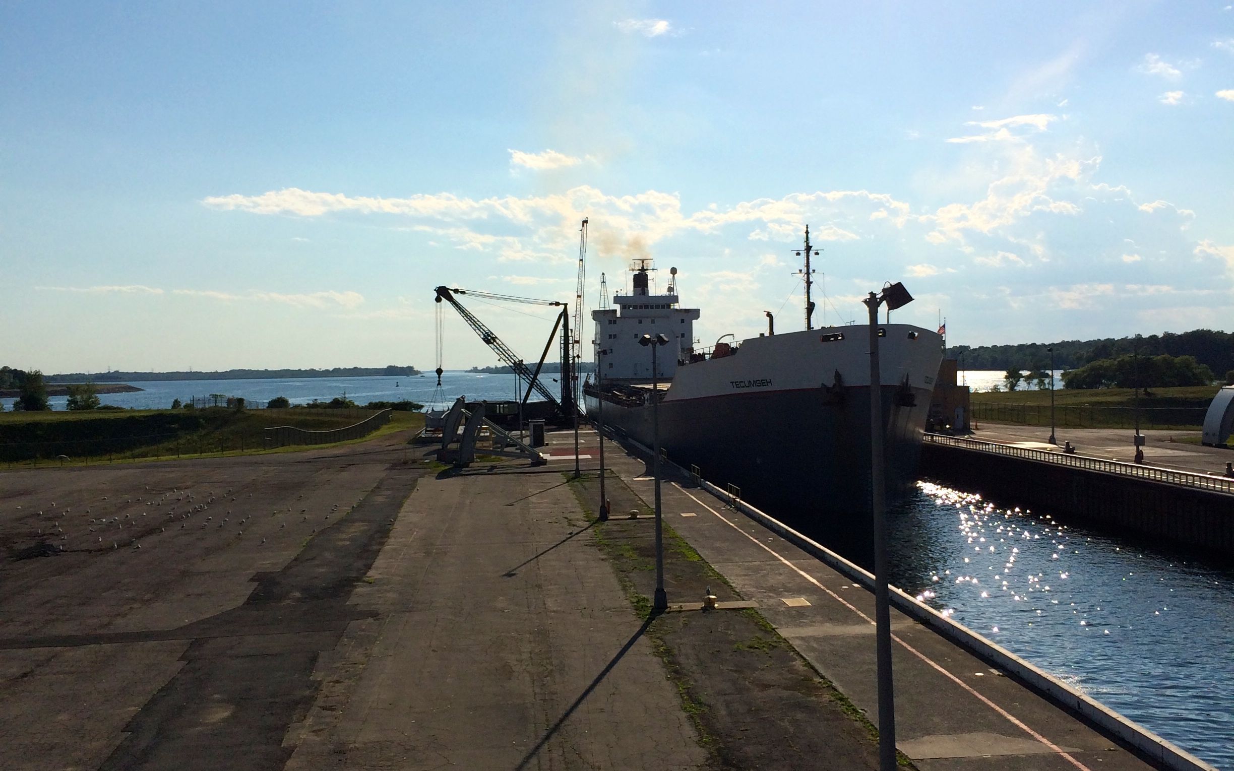
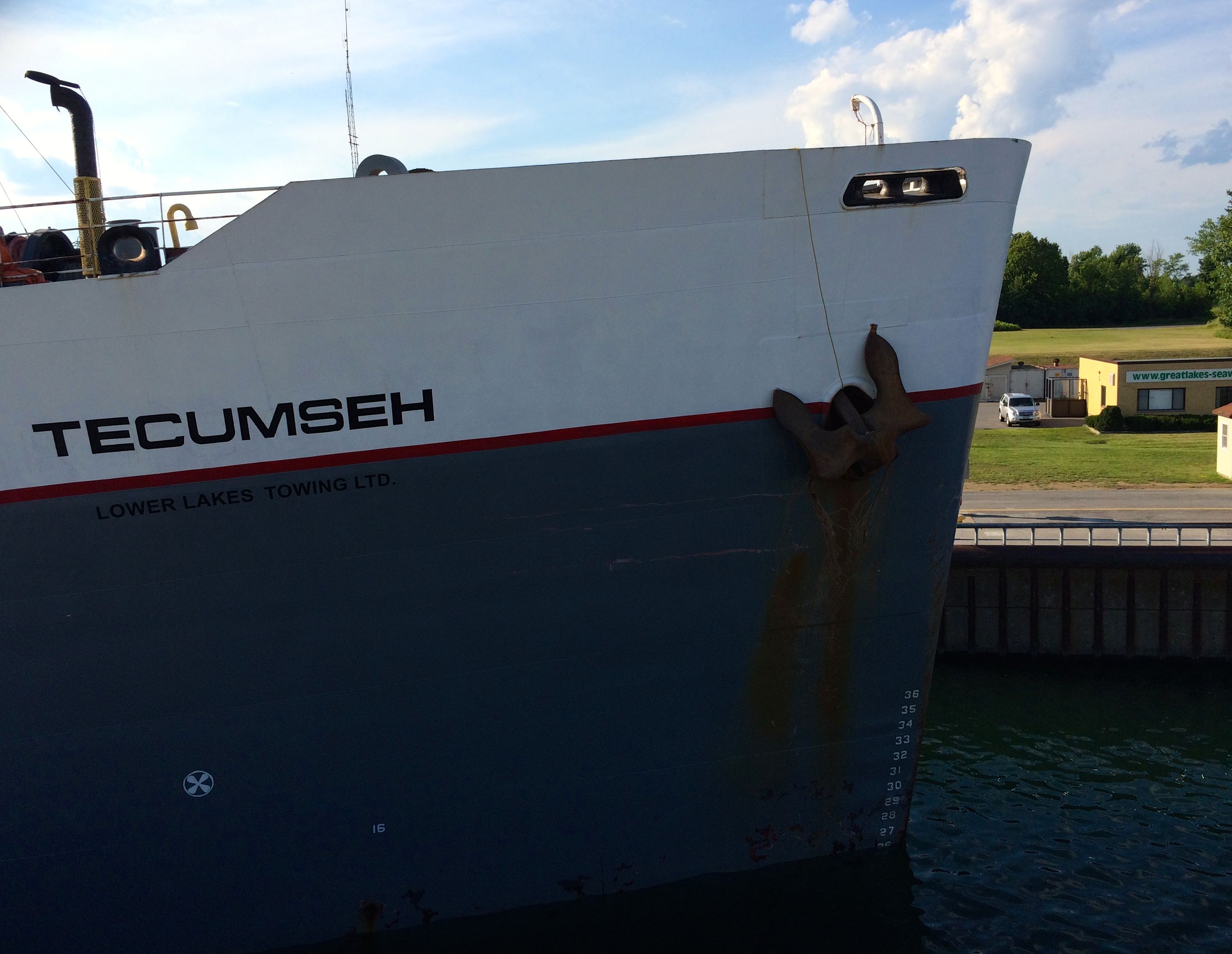
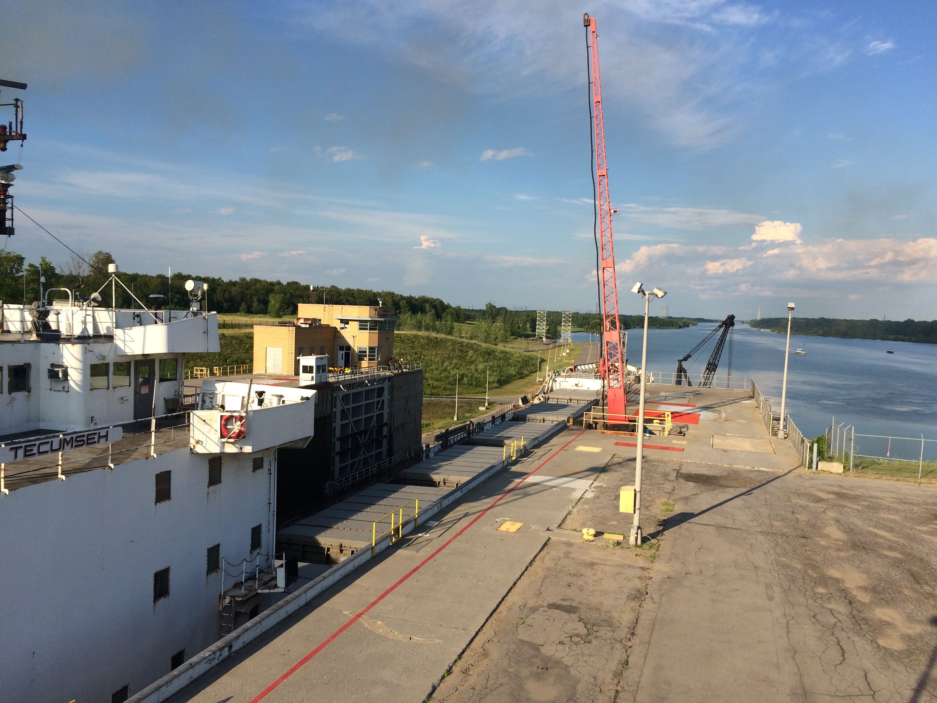
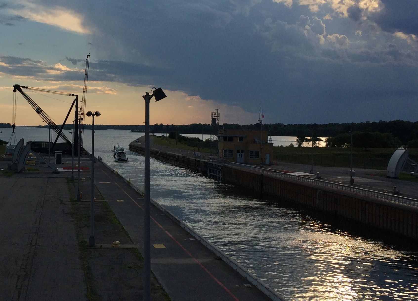
I can finally see the name on the bow – Tecumseh. If you’d like to know where the ship is now or where it has been, you can click here. The day I saw her, she was carrying wheat.
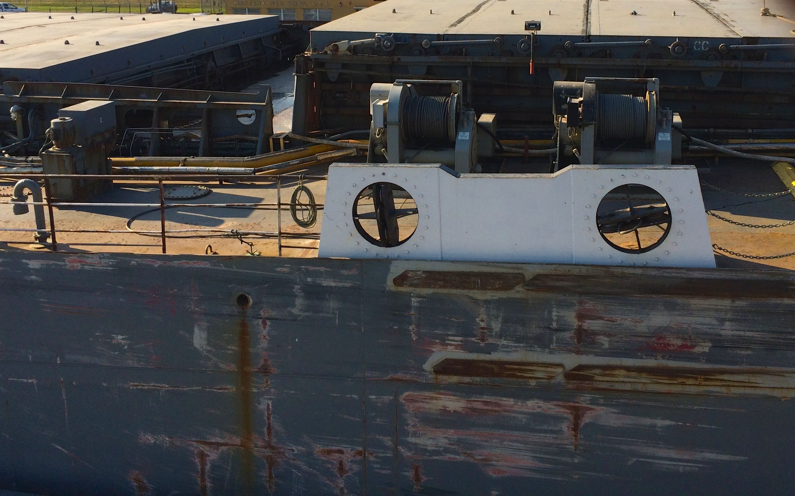
Those poor ships take a beating when they are going through the locks.
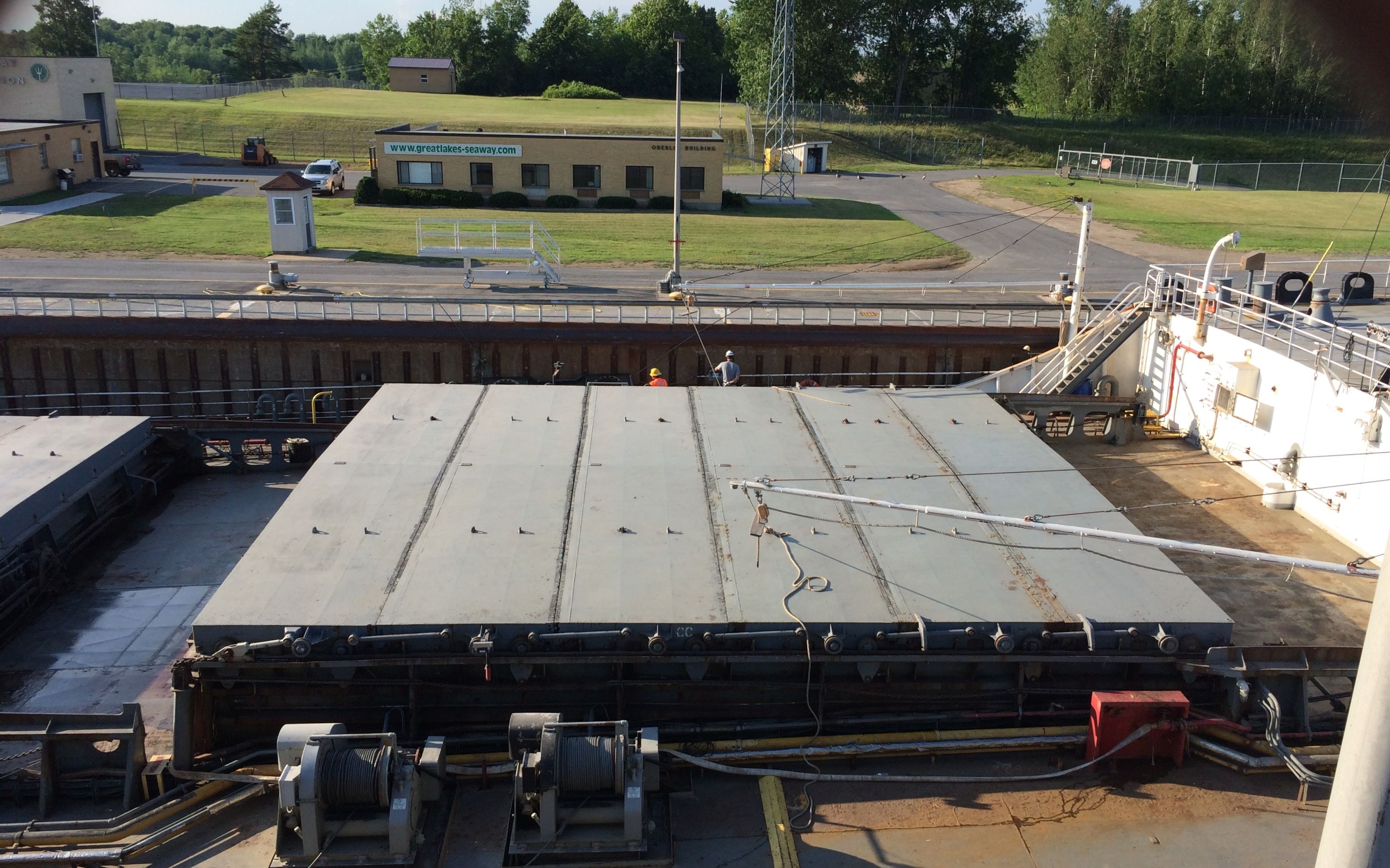
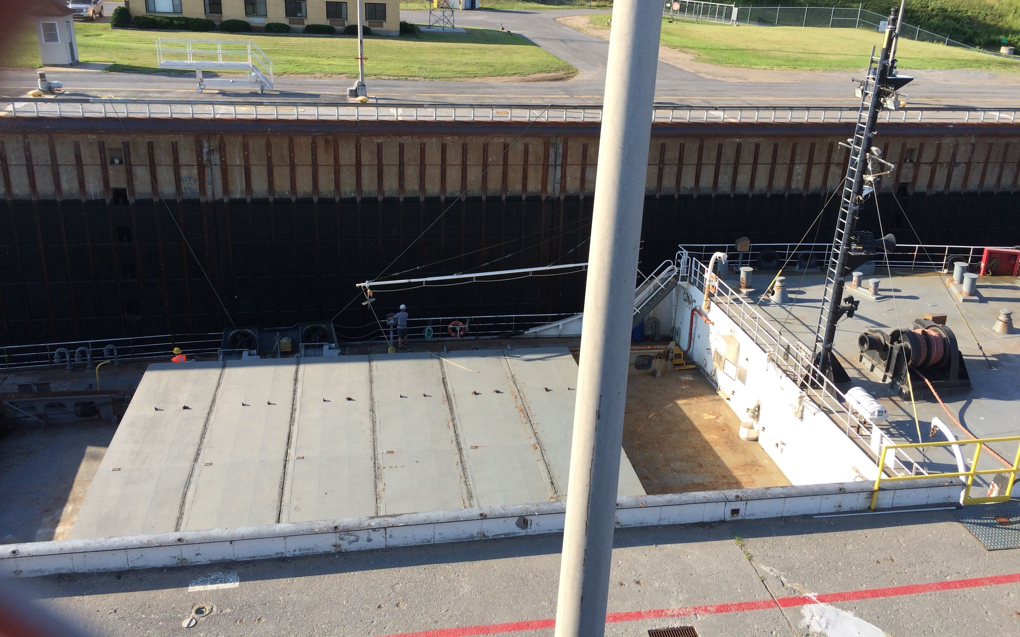
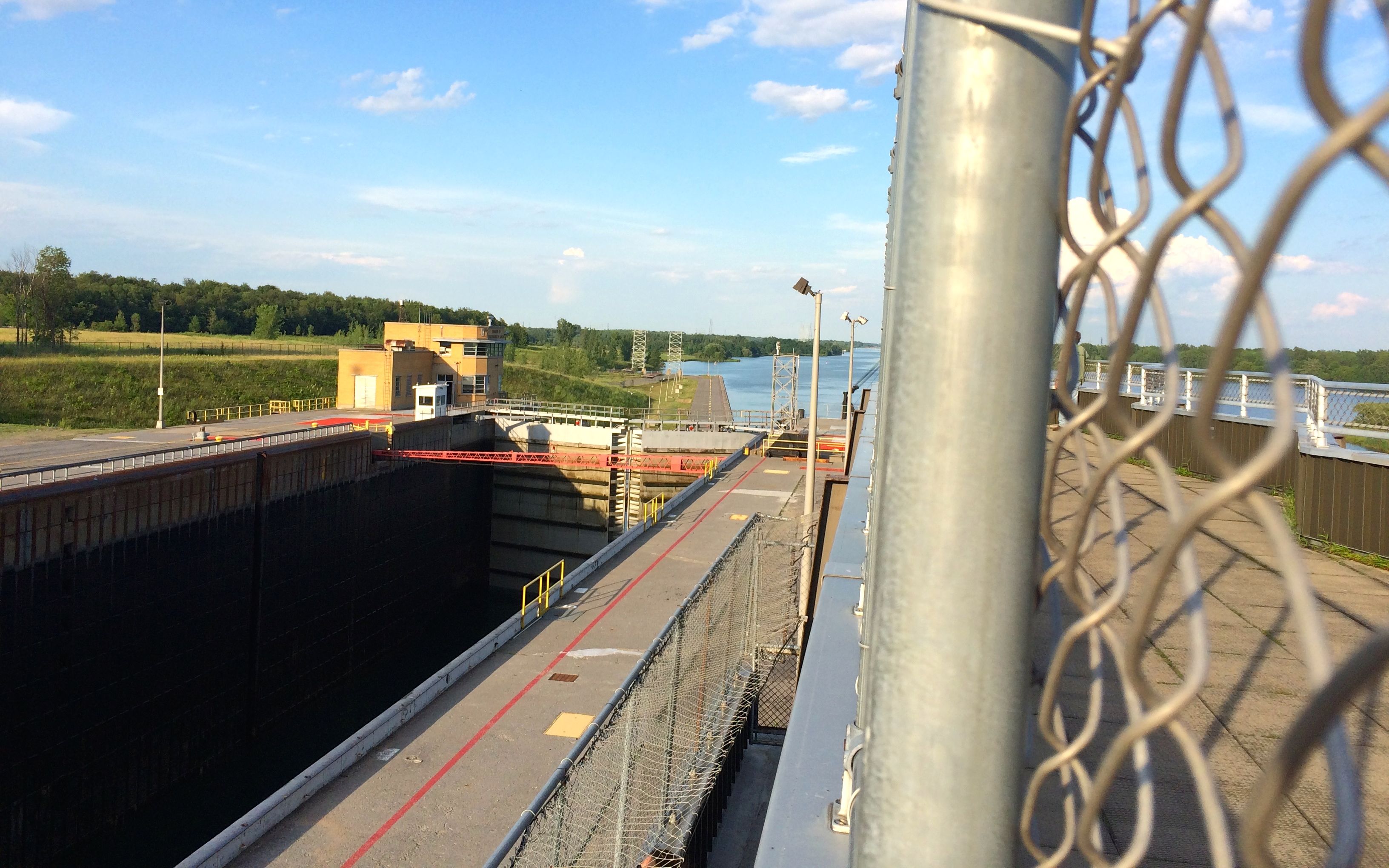
At long last, the ship is all the way in the lock. You can see the gates closed in front of it. I think that red beam must be there to let it know that this is as far as it can safely go in the lock. I don’t know if it is, but I can see no other purpose for it.
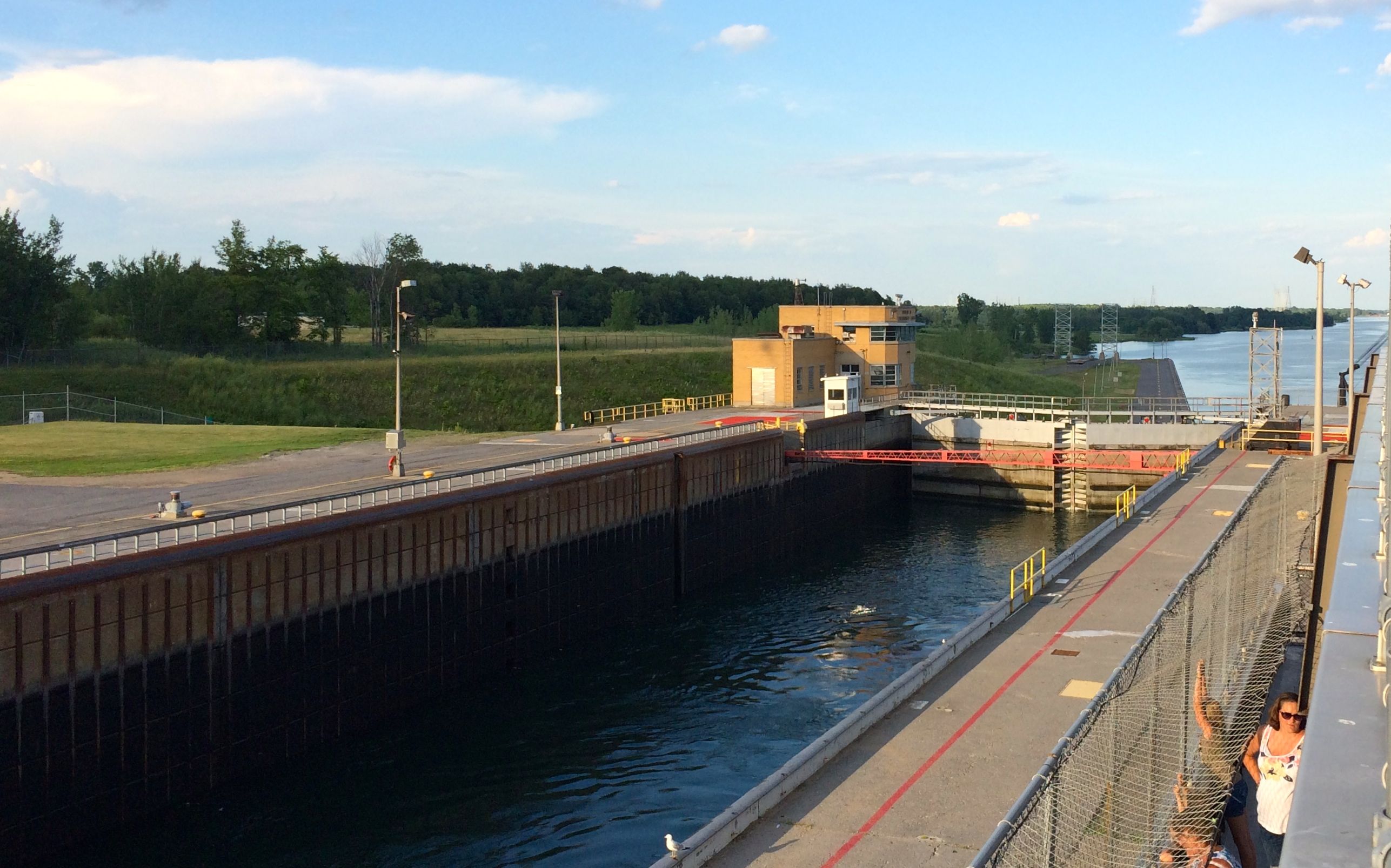
They start letting the water out of the lock and the ship starts to lower.
It keeps going down…
until it is as far as it can go.
They open the gates.
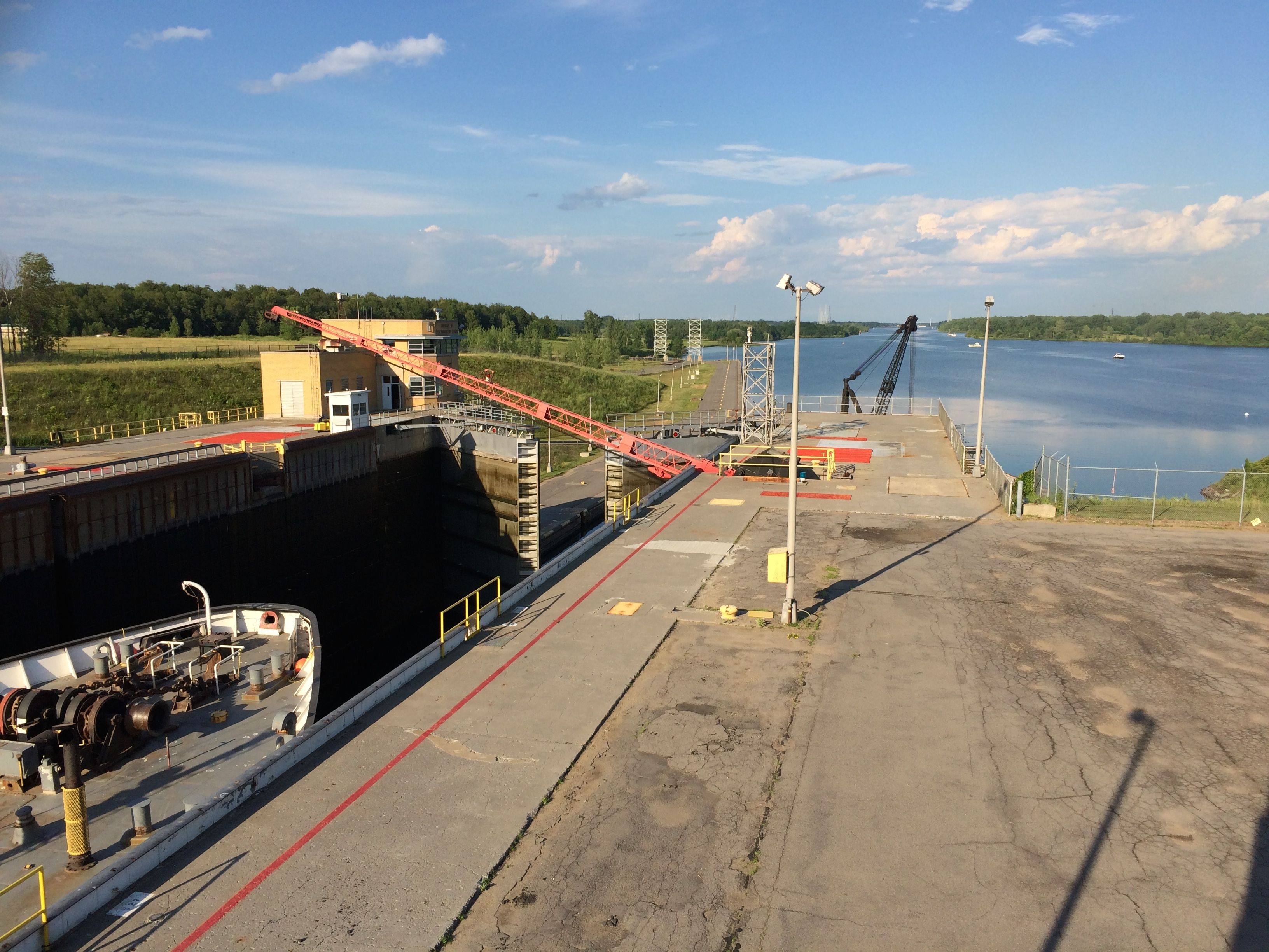
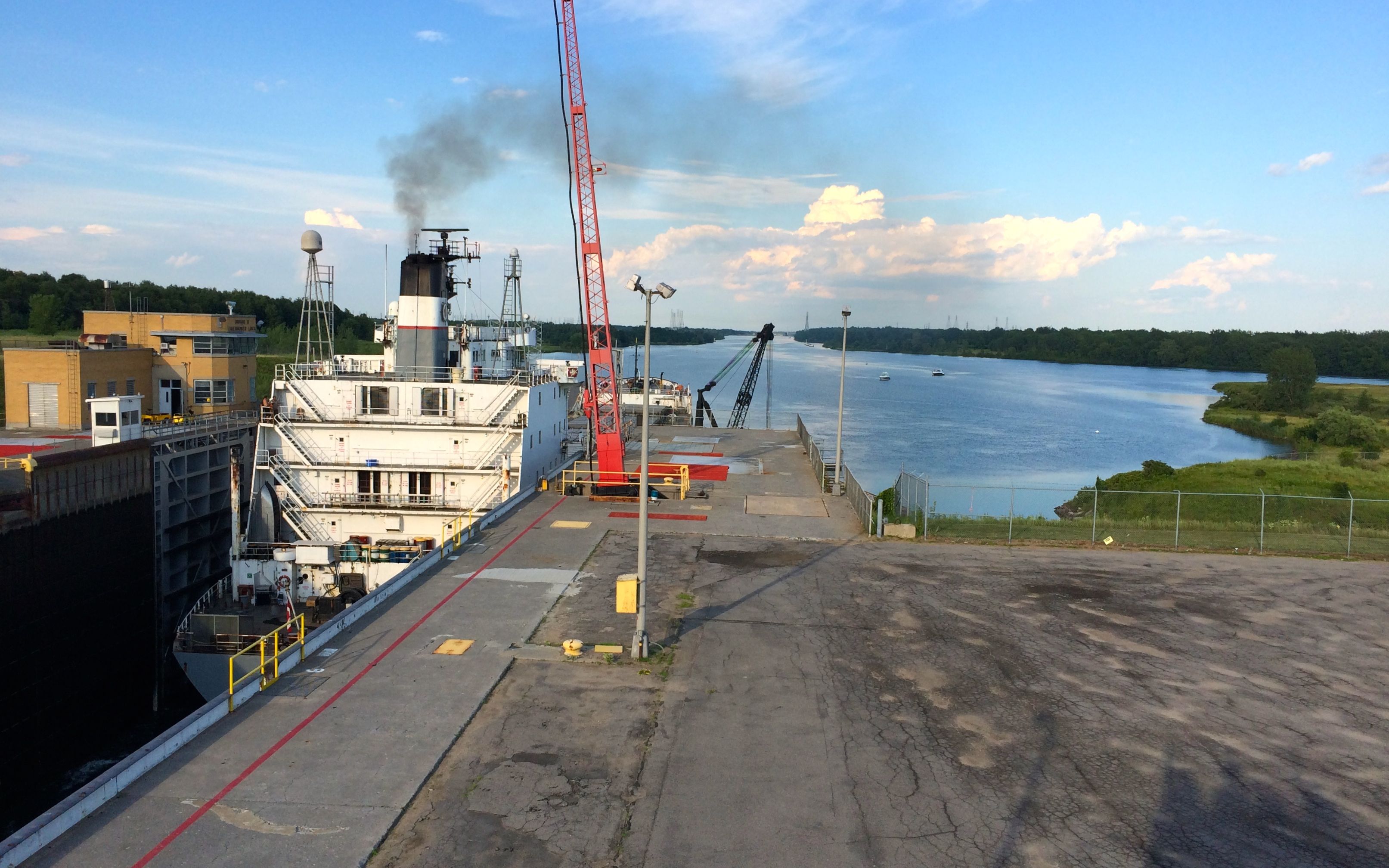
The ship starts to leave.
It steams out into the lower river.
The bow is out…
and there goes the stern.
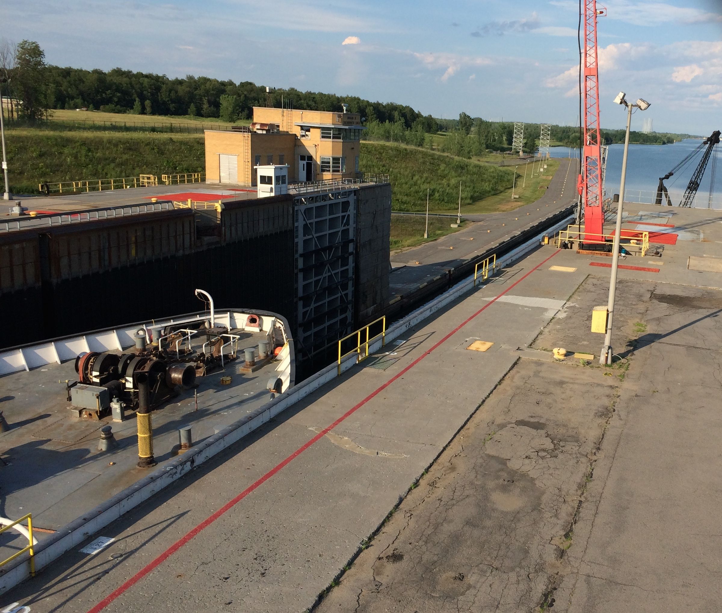
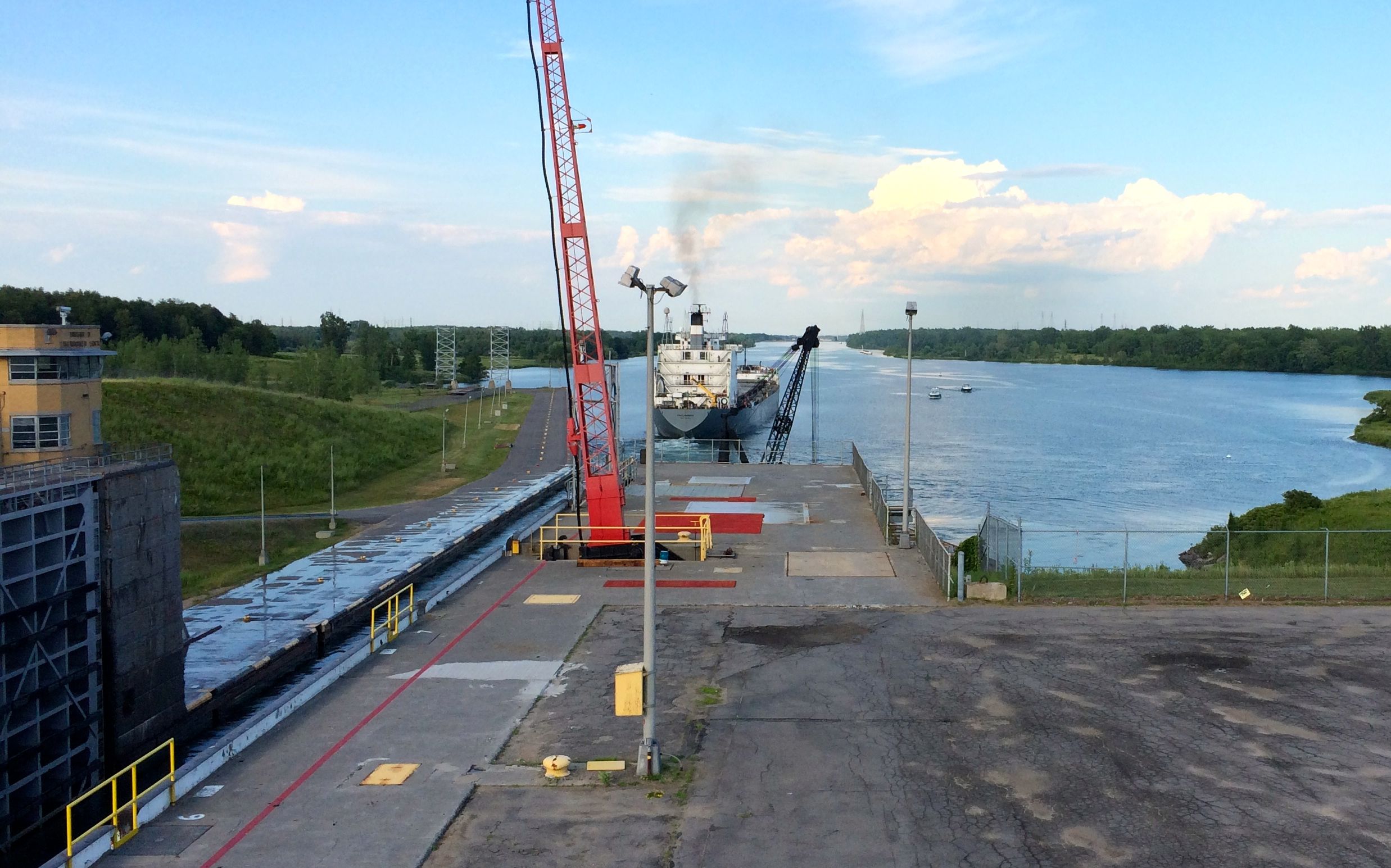
Do you see those two small boats to the right? They are about to enter the lock and proceed upstream.
There goes the Tecumseh and here come the boats!
The small boats are getting settled in the lock and the Tecumseh continues downstream toward Montreal.
The little boats are in the lock and the gates are closed. The boats are so small that you can’t see them at this point.
The lock is filled.
The little boats are getting ready to exit the lock.
(Kind of a play of words on the first line of the Air Force Hymn, “Off we go, into the wild blue yonder…)
Anyway, my next campsite on Lake Ontario in Selkirk Shores State Park, just east of Oswego, New York. As I was pulling into Oswego, I decided that I should visit the restroom, as well as pick up some milk.
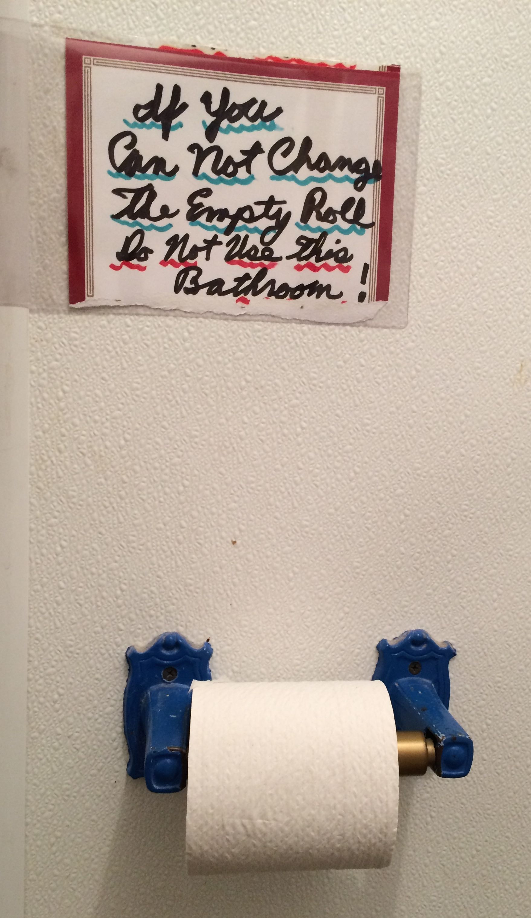
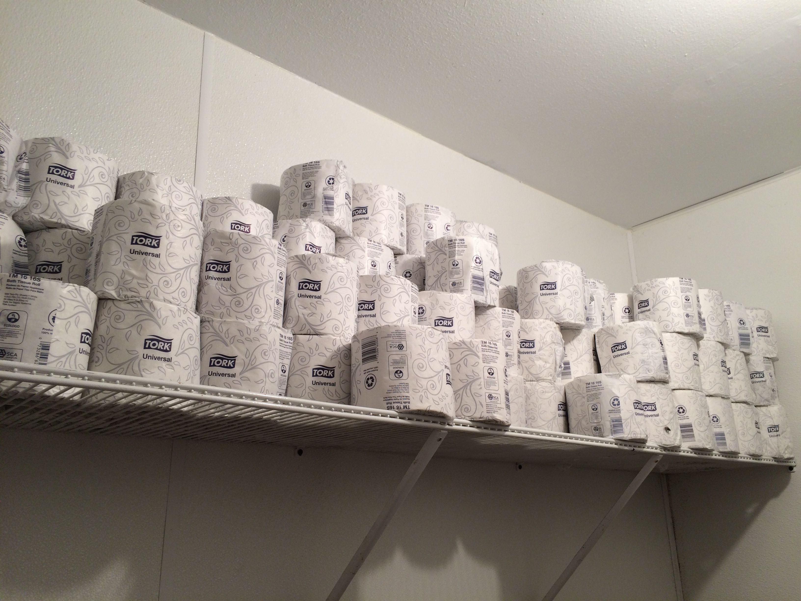
The workers helped me to locate the restroom. They were friendly, but the sign in the restroom caught my eye.
However, you can’t say they don’t make changing an empty roll easy. They are well-stocked!
I made it to the campground and got registered. The friendly ranger helped me select a good site. As usual, my first criteria was that the site be easy to get into. It wasn’t a pull-through, but there was lots of room to maneuver.
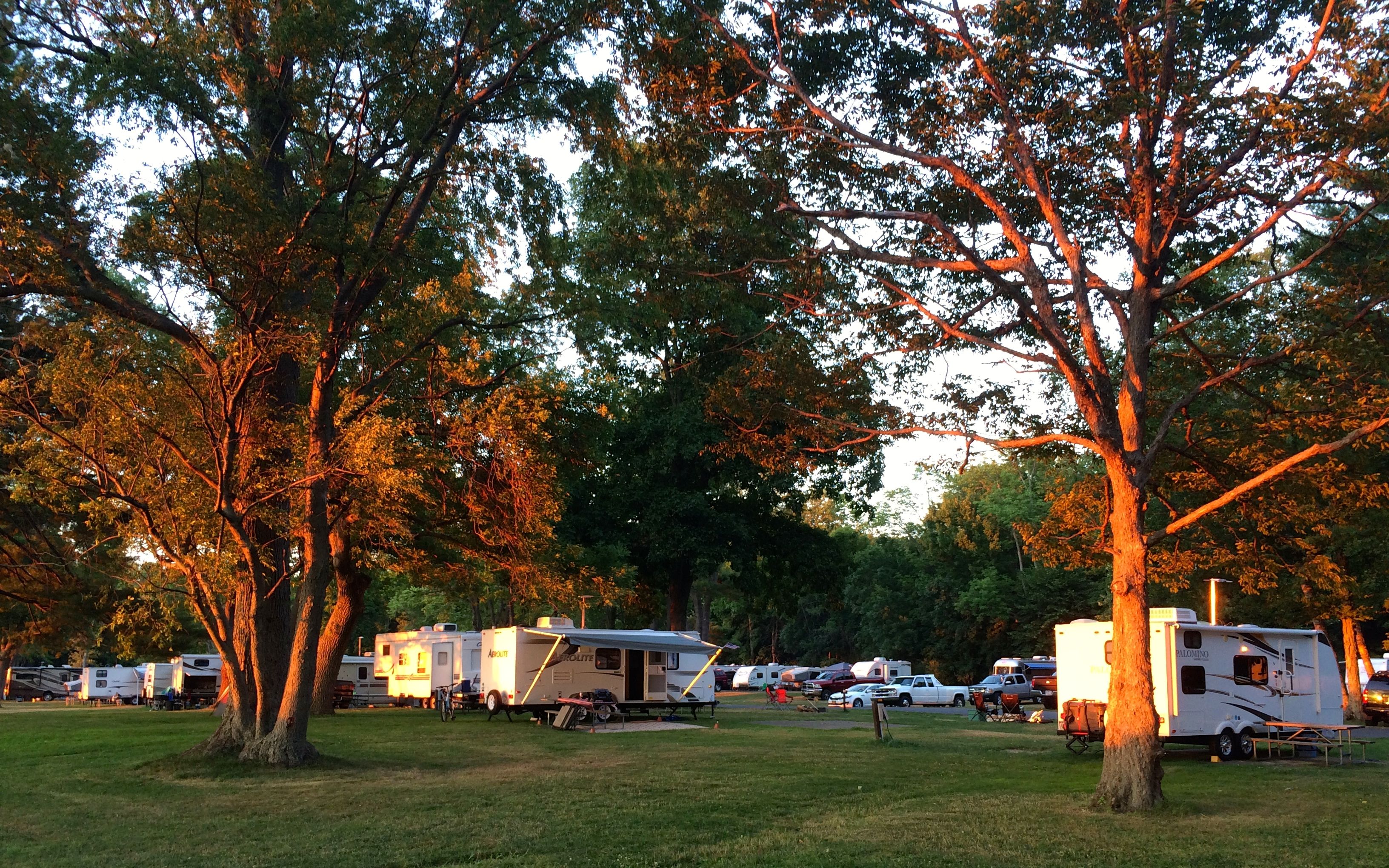
There were a couple loops at the park, but I think this one is the most popular as it is closest to the lake. The sites were quite close to each other. The smoke from the campfires was also pretty intense. I wish I had taken a shot of the stacks of firewood people brought in for their short stays. I’d walk around in the evening, and site after site had their own fires going.
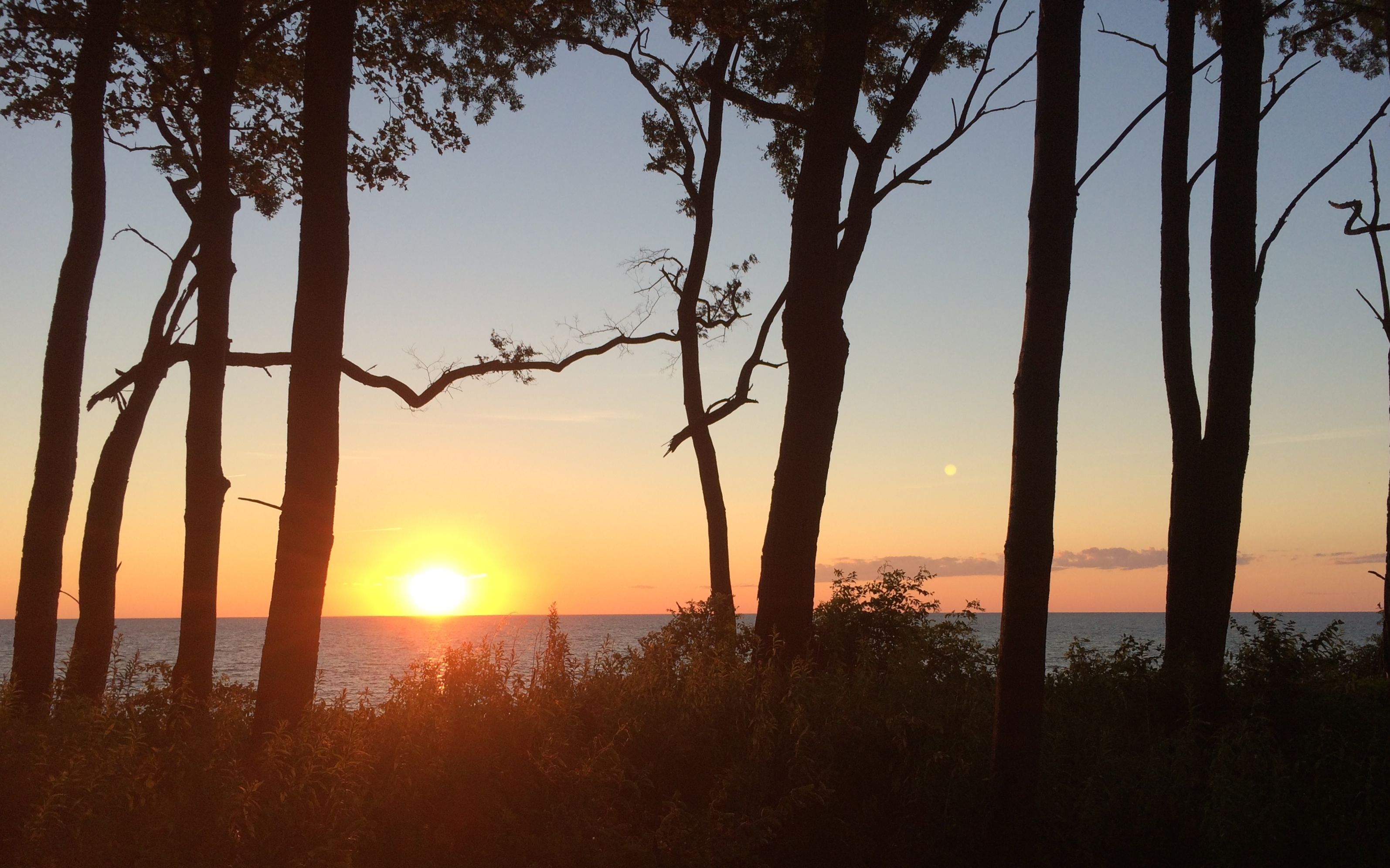
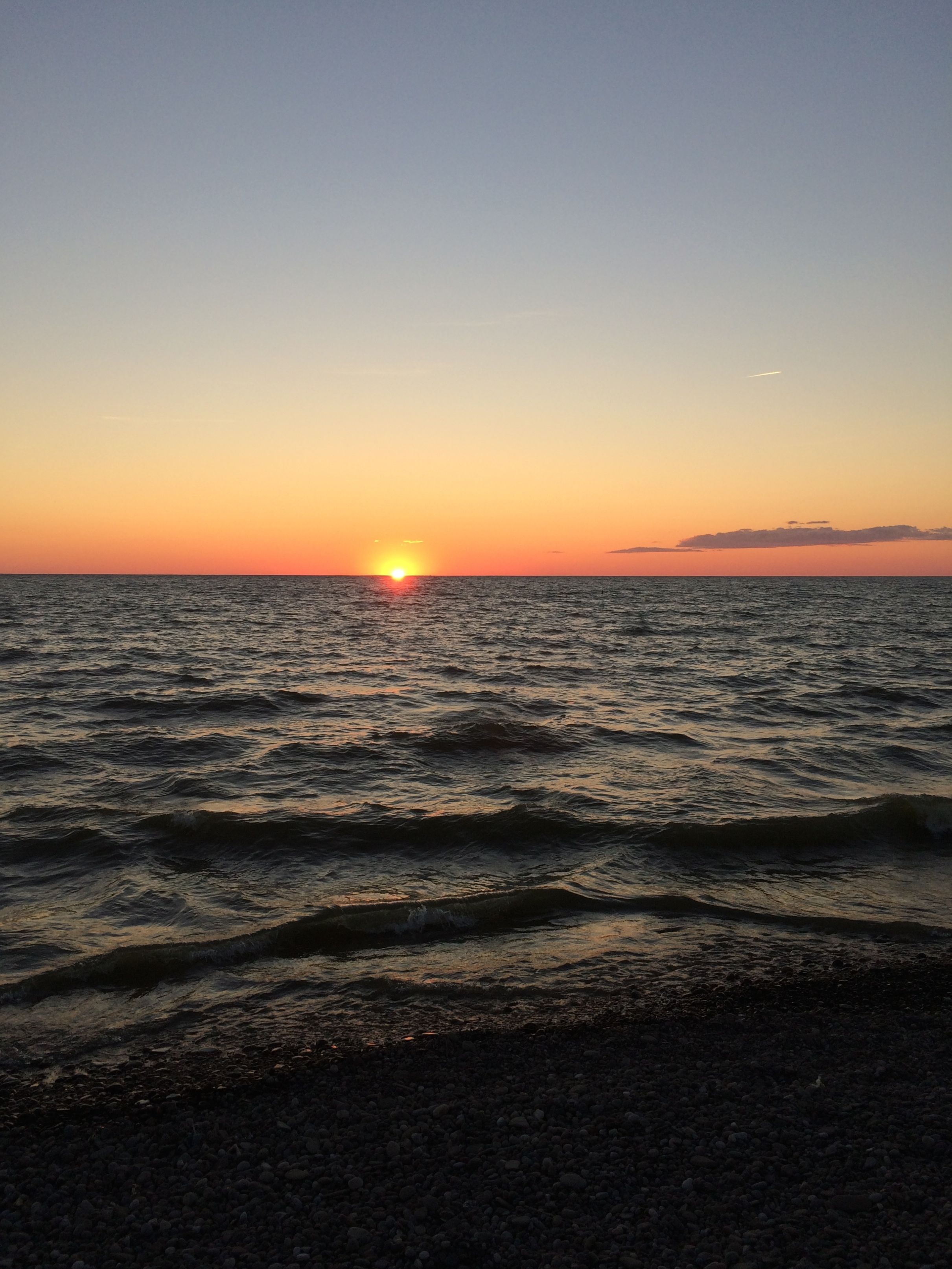
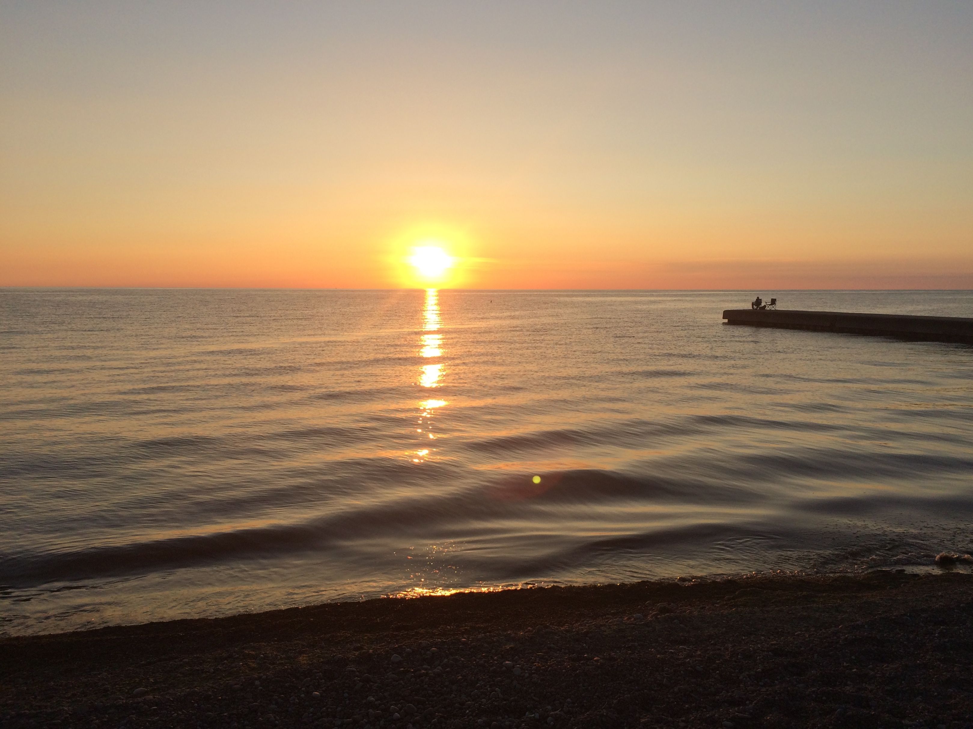
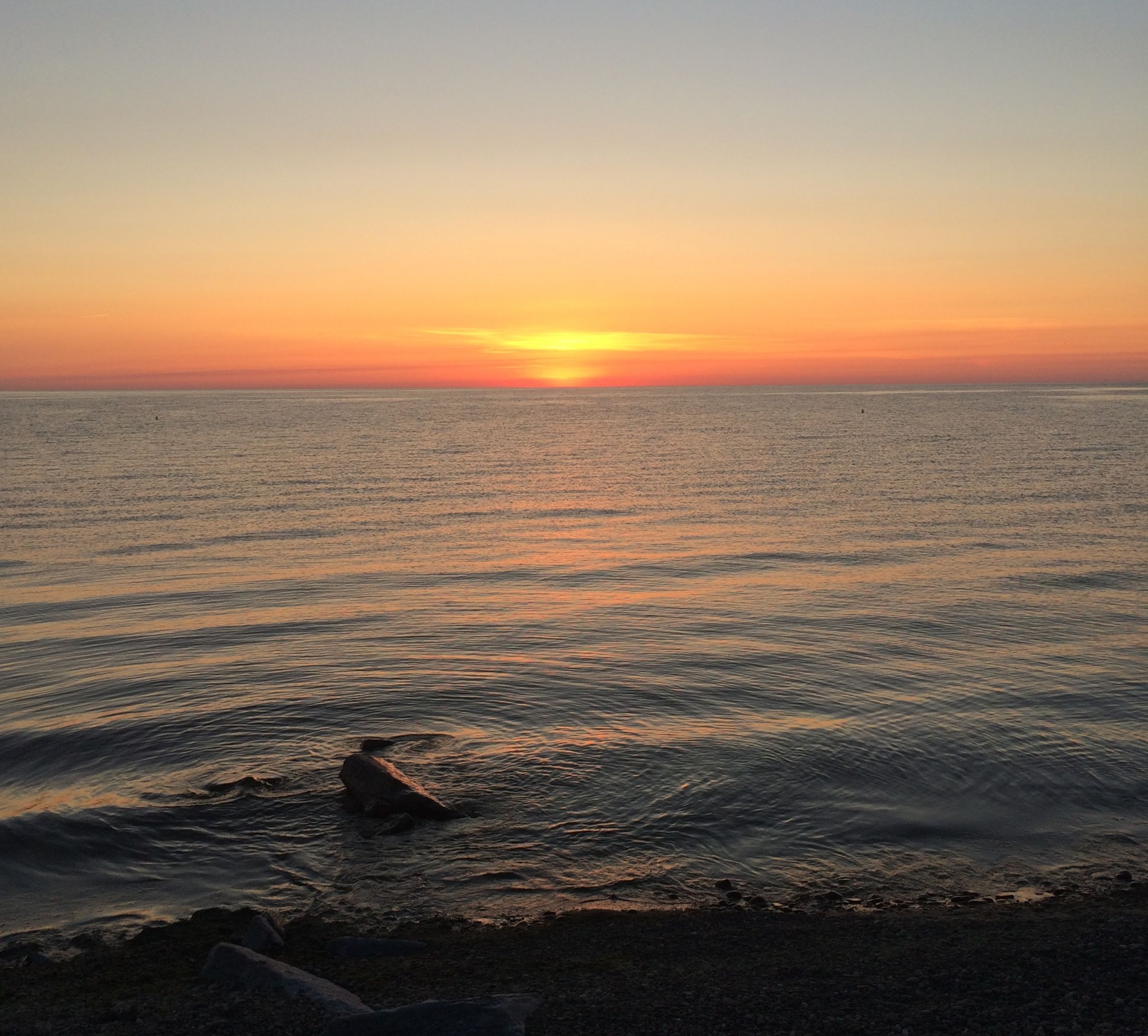
From the edge of the bluff, I noticed the sun setting. I jumped into my truck and headed for the beach. I love watching sunsets from water’s edge.
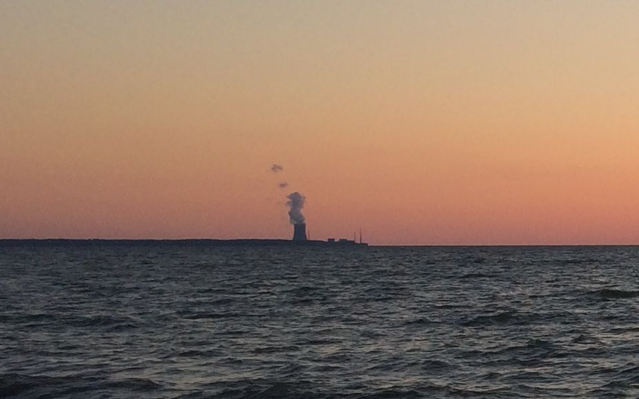
It did give me pause to look to the left and see the nuclear power plant lit up in the after glow.
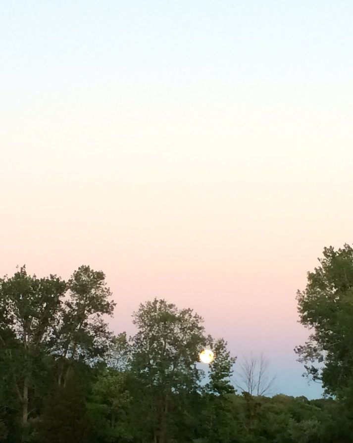
When I returned to my campsite, rising in the east was a full moon rising in the east.
One of these days, I am going to get myself a decent camera! I really was lovely.
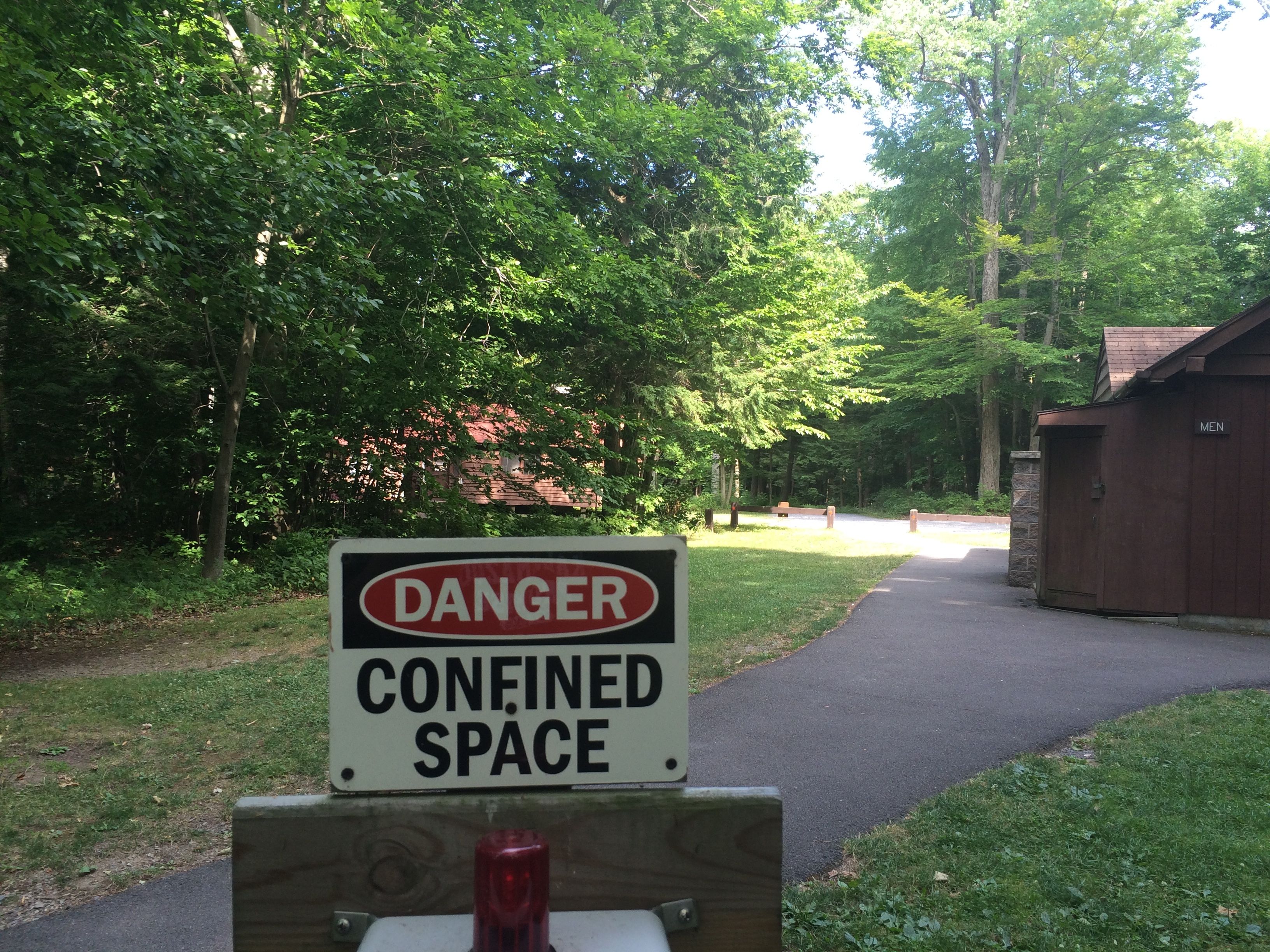
The next day, I decided to go for a hike. (“Hike” sounds so much more outdoorsy than “stroll”.) The first thing I cam across was a most puzzling sign.
Huh. It didn’t see all that confined to me.
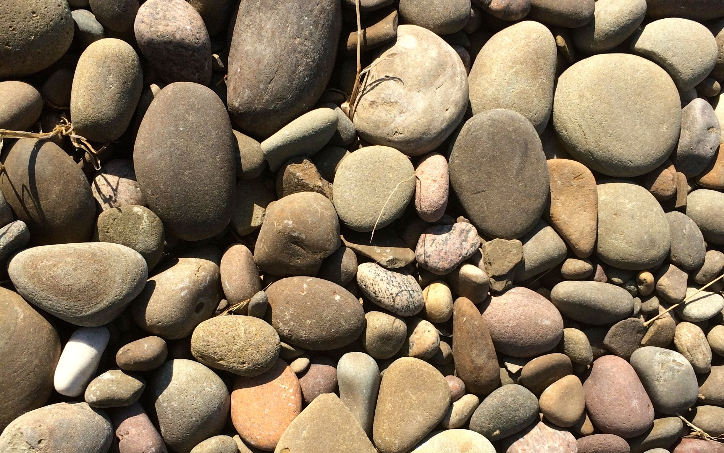
I decided to stroll uh, hike down to the beach. Last night, I noticed that there were rocks on the beach. Time for a little more “catch-and-release rock collecting”!
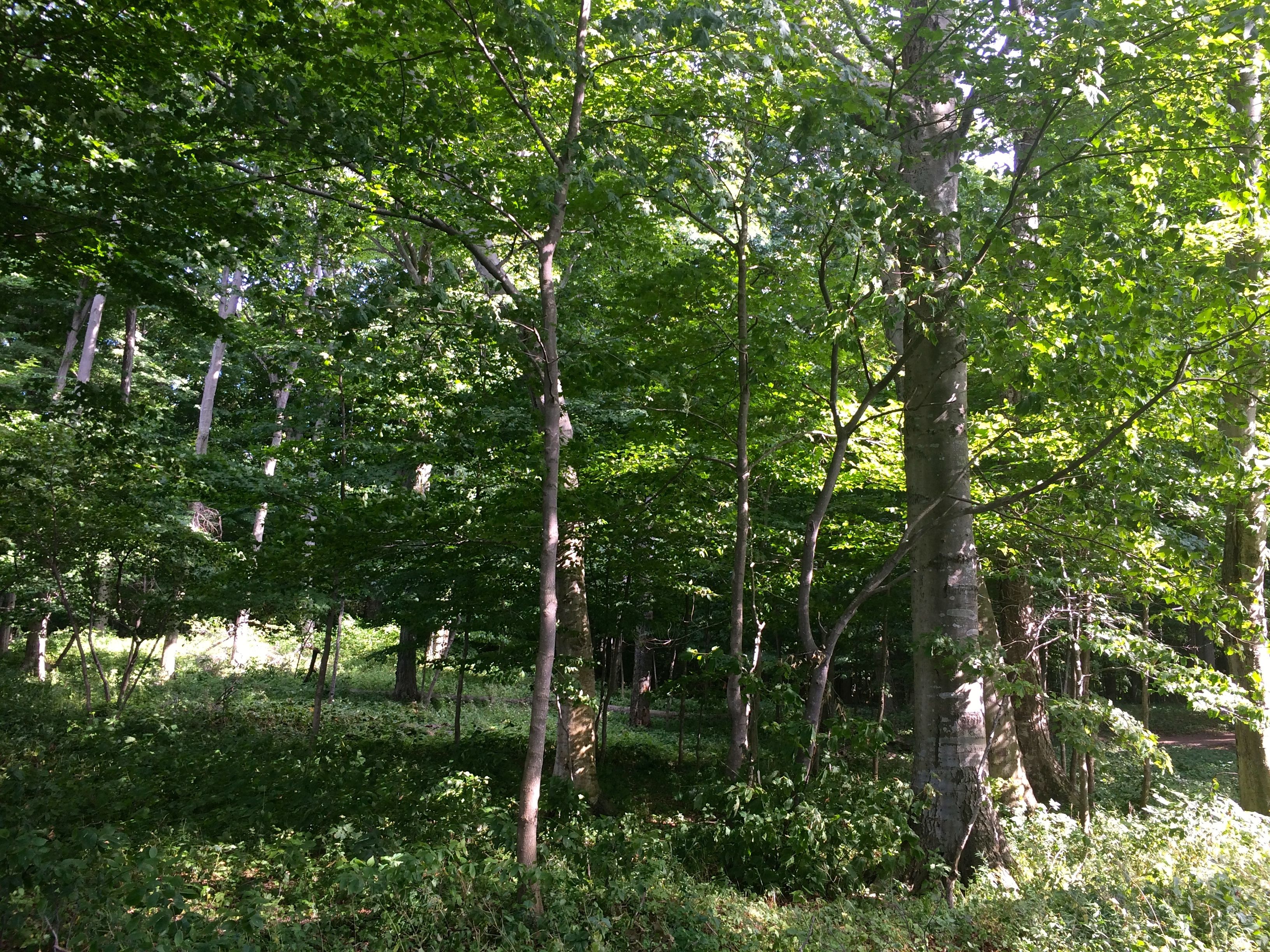
The trail lead through what they called “old growth forest”.
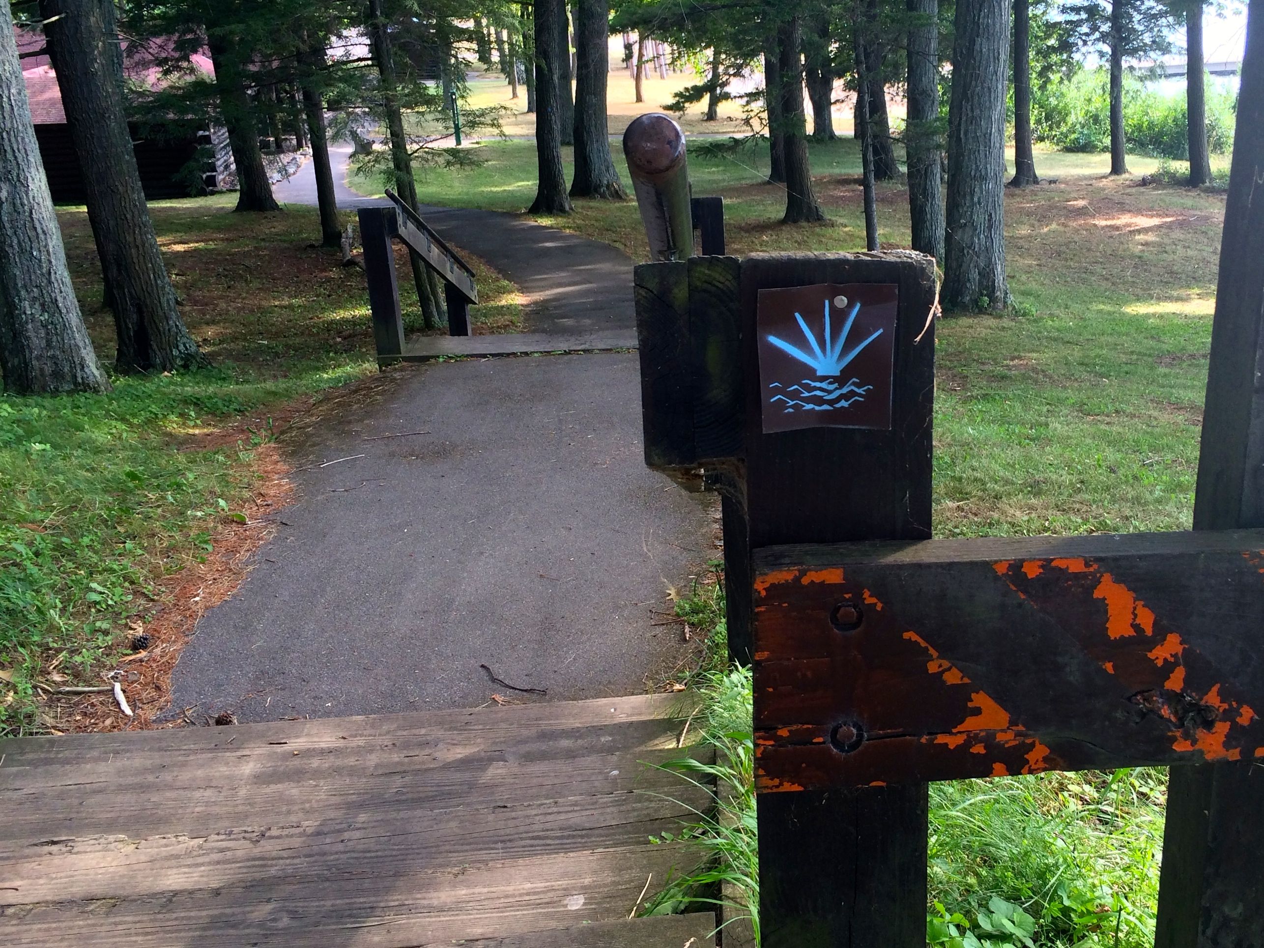
I came across this sign. I’m not sure, but it might be for the Seaway Trail. However, I checked the website and I didn’t see the symbol. In any event, there is a lot of good information about the trail on the website, which runs from Lake Erie, along to Lake Ontario and then along the Saint Lawrence Seaway to the New York State line at Hogansburg.
There were cabins and other structures dotting the area near the beach that reminded me of the Lincoln Logs we used to play with when we were kids.
I kept walking and got all the way out to the end of the pier. I turned around and looked at the beautiful green back on shore.
The water also reflected the green.
Ah, yes! Time to collect a few rocks.
Or maybe I should collect sticks?
No, I’ll collect rocks. I had to pick judiciously, though. I forgot to bring a bag or some other container to put them in. I had to depend on what I could stuff in my pockets. I filled my pockets and headed back to the trailer for the photo shoot.
Here’s the first group dry
And wet.
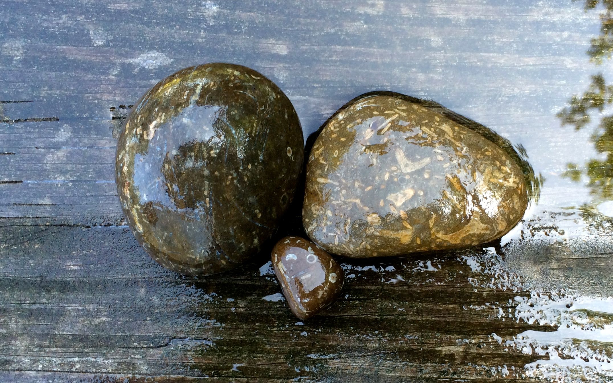
The second group of rocks look like they have fossils in them.
You can kind of make out the fossils a little differently when the rocks are wet.
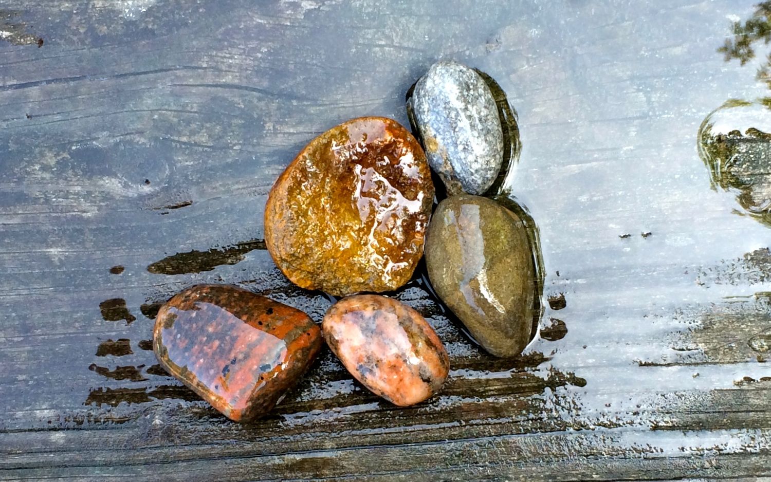
One more group of dry rocks
And here they are wet.
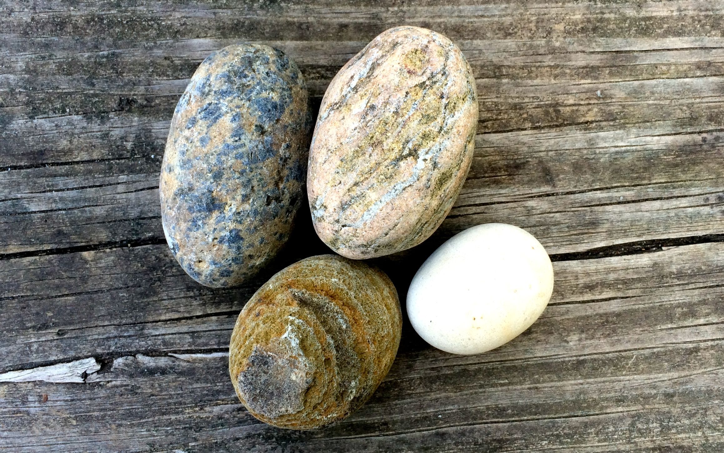
I even managed to find a couple of rocks with holes through them. I added them to my collection. The rest of them were released back into the wild.
After dinner and getting things put away for a travel day in the morning, I headed down to catch one more sunset.
What a calm evening!
And with that, it’s time to leave the Great Lakes.
My next stop will be along the Saint Lawrence Seaway.