The Petrified Forest and The Painted Desert

The next day, I got hitched up and headed toward the Petrified Forest and Painted Desert. It was only a two hour drive, so I planned to see the park the same day.

I had been there before, in 1987, after my first year teaching in Kalamazoo. I had my first brand-new car and I did what any sensible person who likes to travel and drive would do: I drove to California.

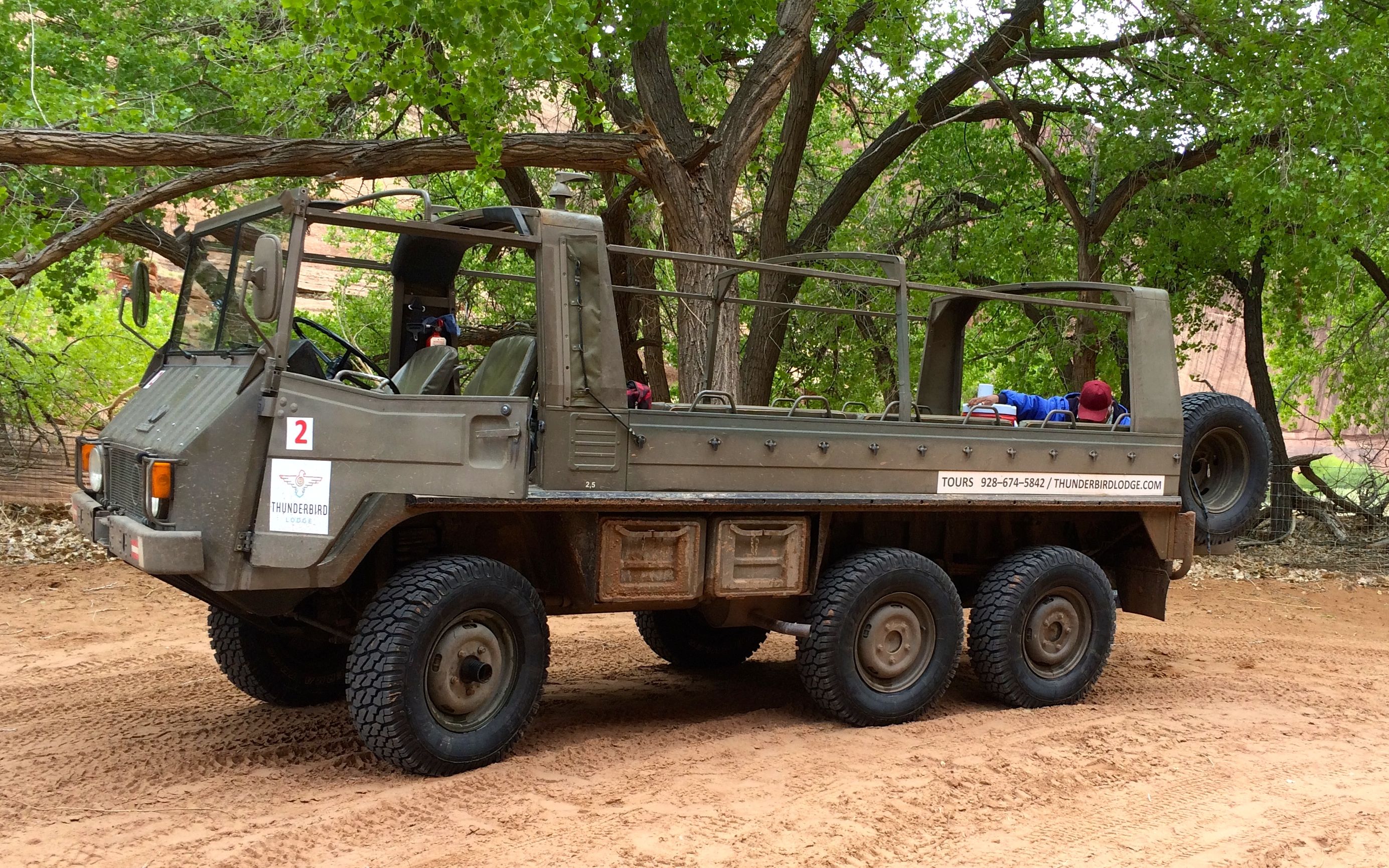
Ah, I loved my car! It was a Dodge Lancer, and it looked like this:

Lancer the Wondercar

In fact, it even had a theme song, sung to the tune of Popeye the Sailor Man.

Lancer, the Wonder Car,
Takes me places near and far.
I drive and drive ’til there we are,
In Lancer, the Wonder Car.

Hmm…Maybe I need to come up with a song for Bart.

Anyway, back to this trip. I got to the park and stopped in the Visitors Center to see what information I could collect.

Petrified Forest Nationa Park sign

Then, I set out to explore.

Painted Desert

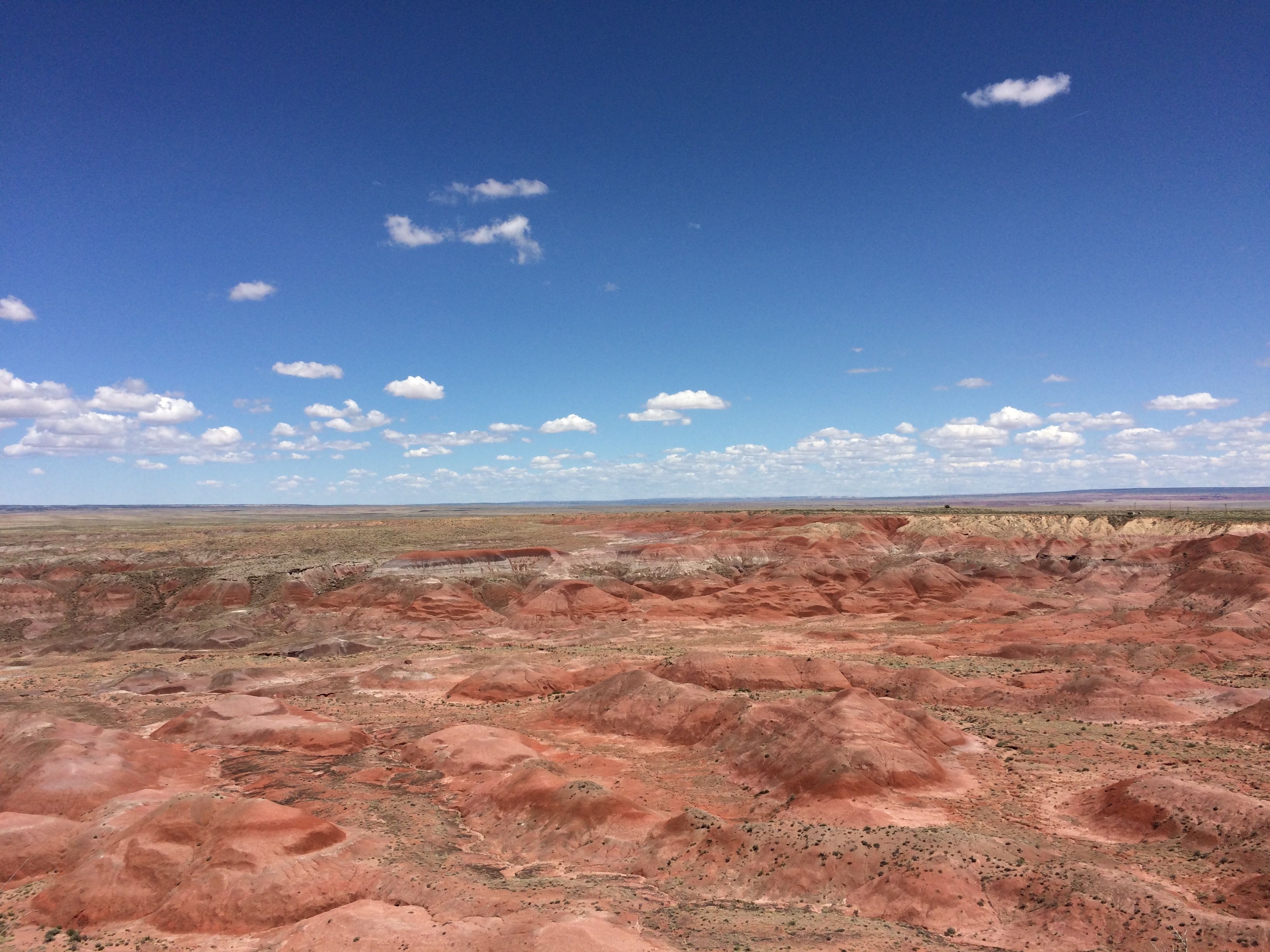
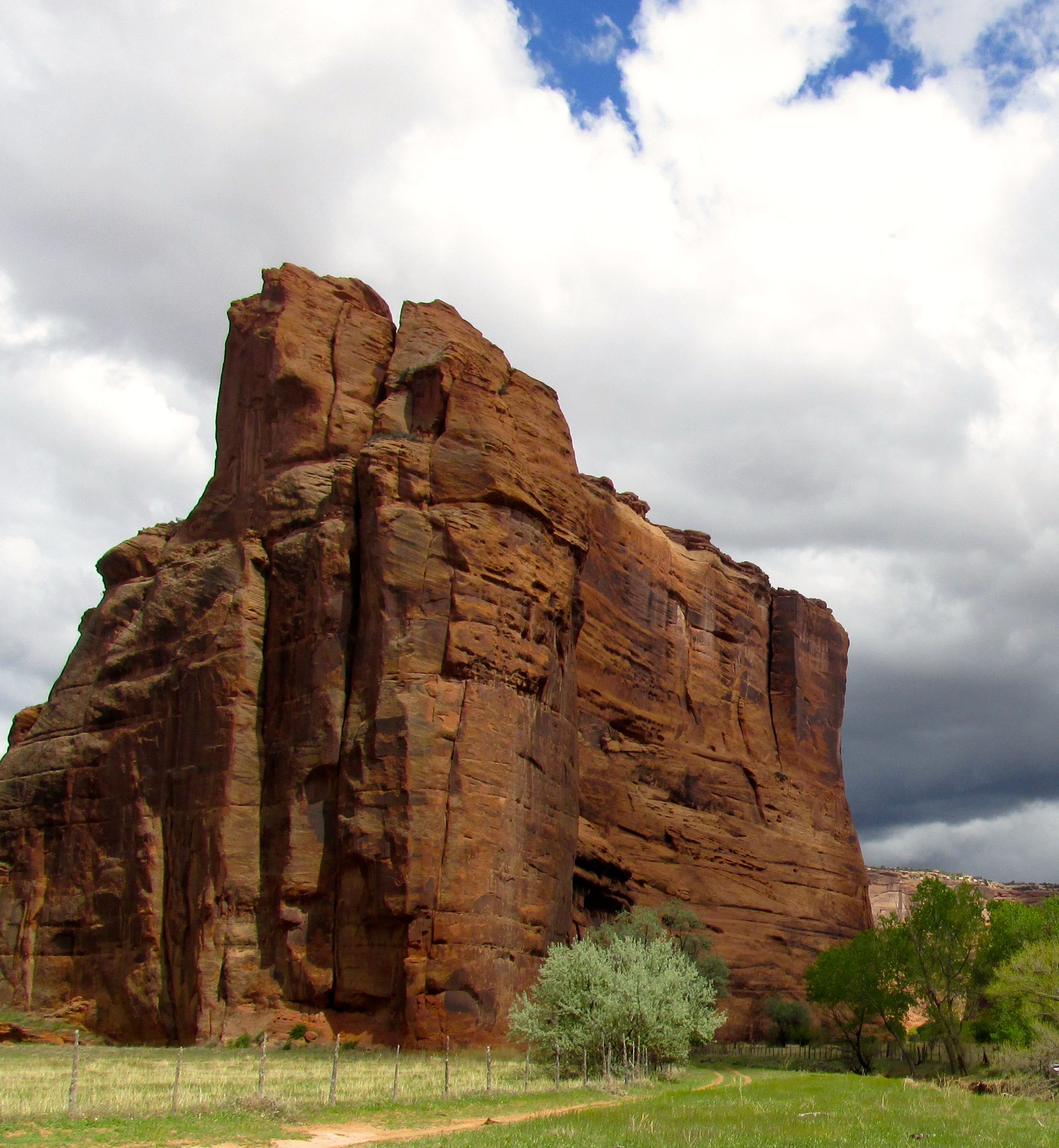
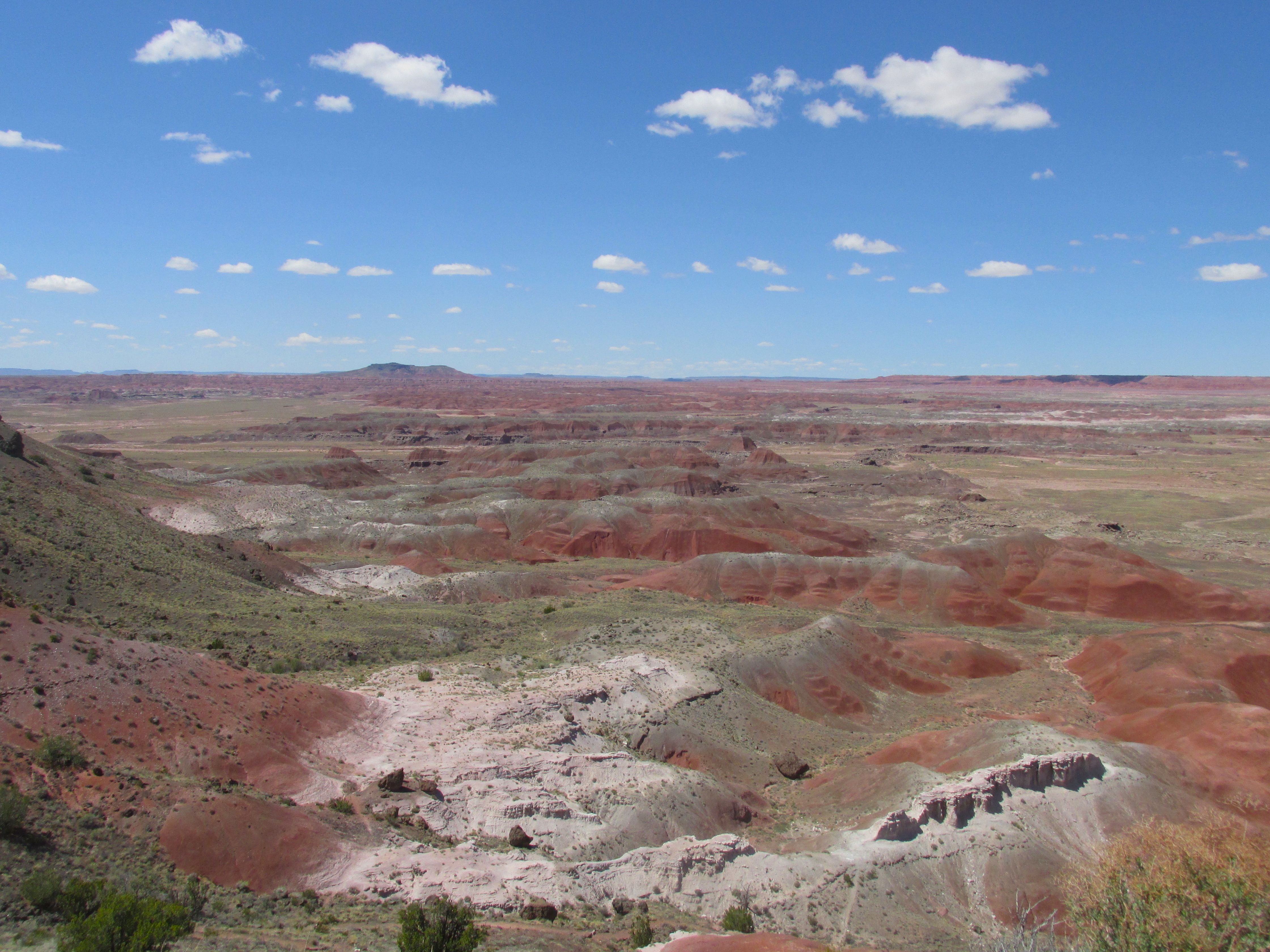
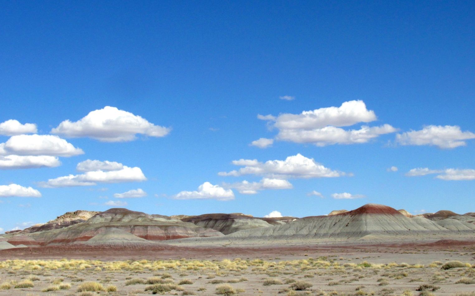
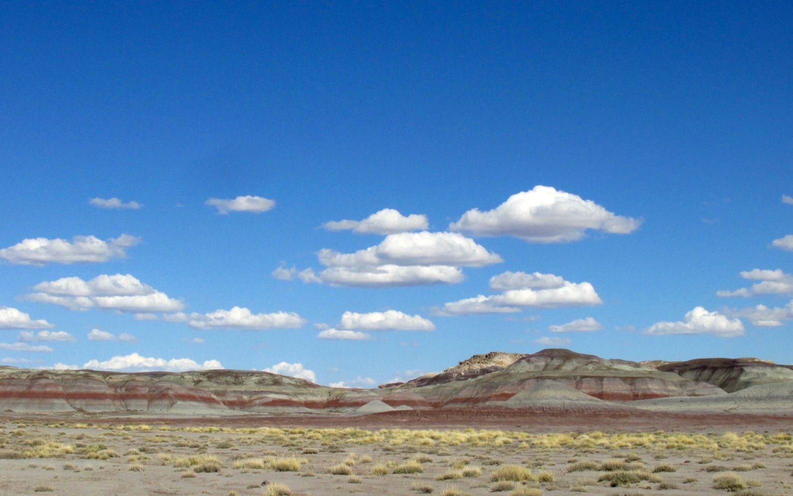
The Painted Desert was the first part I came to. When I was here before, I don’t remember the colors being so vivid. Perhaps the day was overcast.

Welcome to the Painted Desert Inn

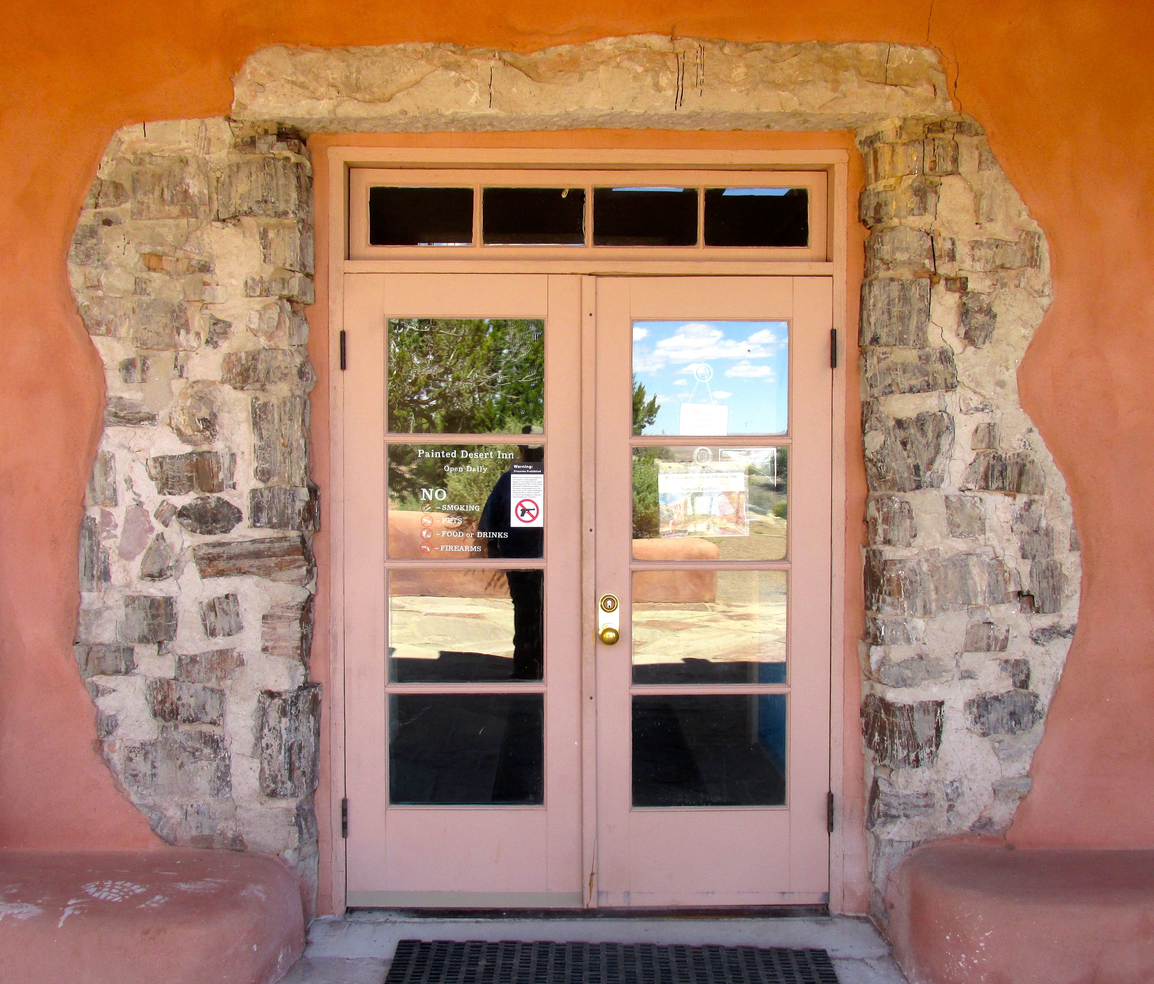
The next stop was the Painted Desert Inn. It has just undergone a restoration, so it was quite something to see.

The original Inn was built of petrified wood in the 1920s. The Civilian Conservation Corps reworked the building in an adobe style in the late 1930s. It never had more than guest six rooms, and it appears that its main function was as a place to eat and take refreshment.

Soda bar at the Painted Desert Inn Harvey HOuse

The building is now used as a museum.

Lower Entrance with exposed petrified wood

Around the lower entrance, some of the petrified wood was left exposed.

Cat Petroglyph

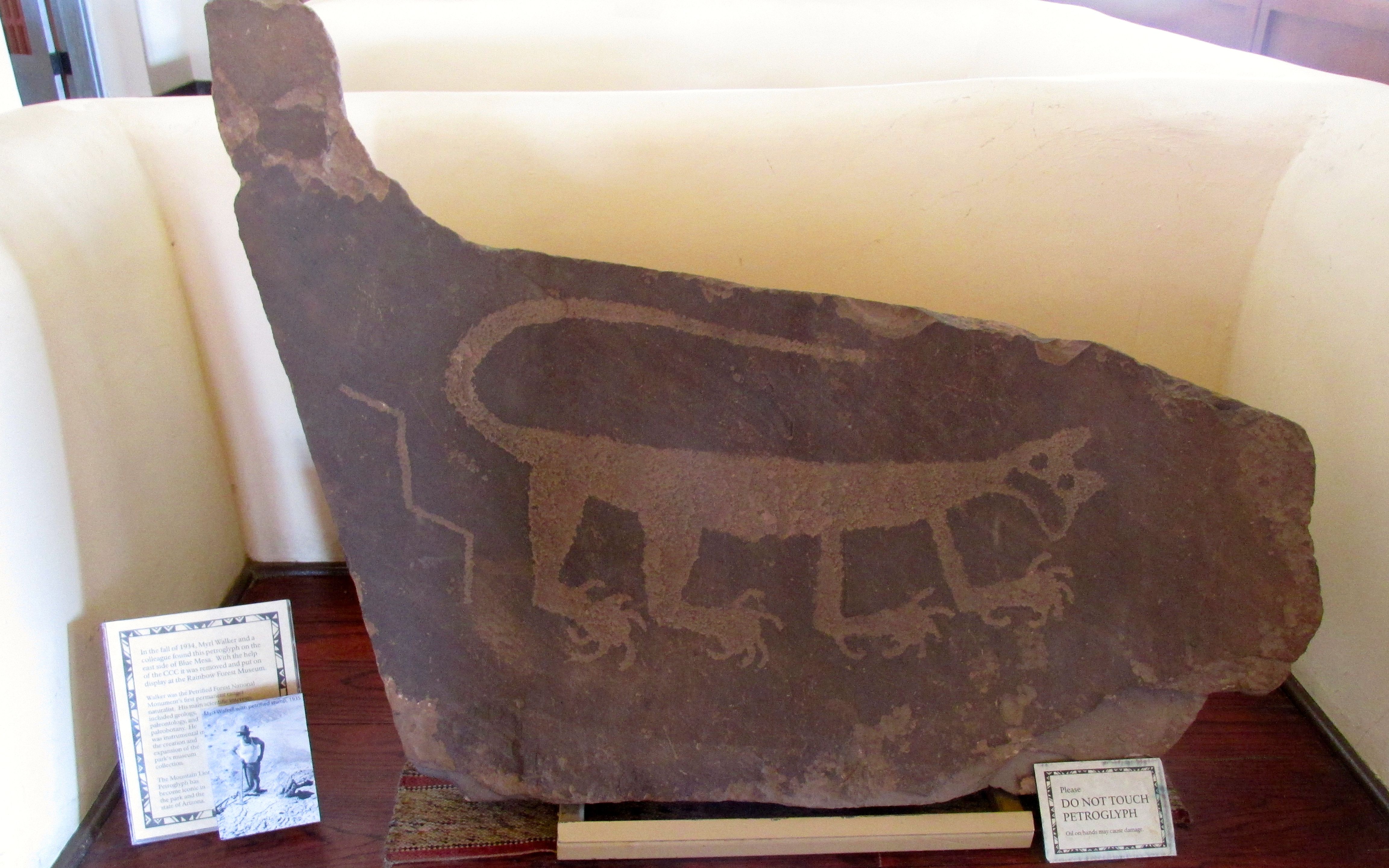
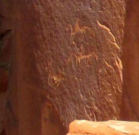
A very striking cat petroglyph is in the lobby. I’d never seen such a naturalistic petroglyph before.

Fred Kabotie, Hopi Artist

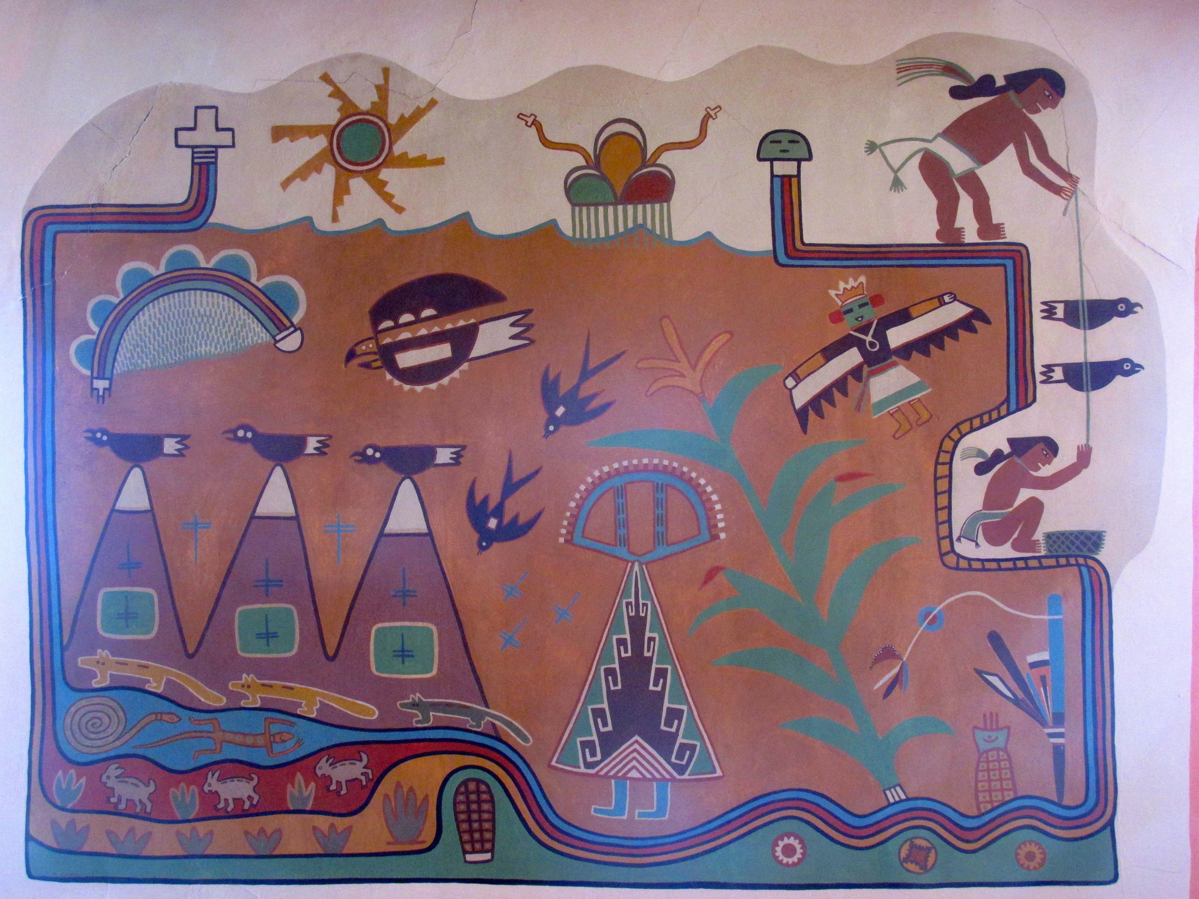
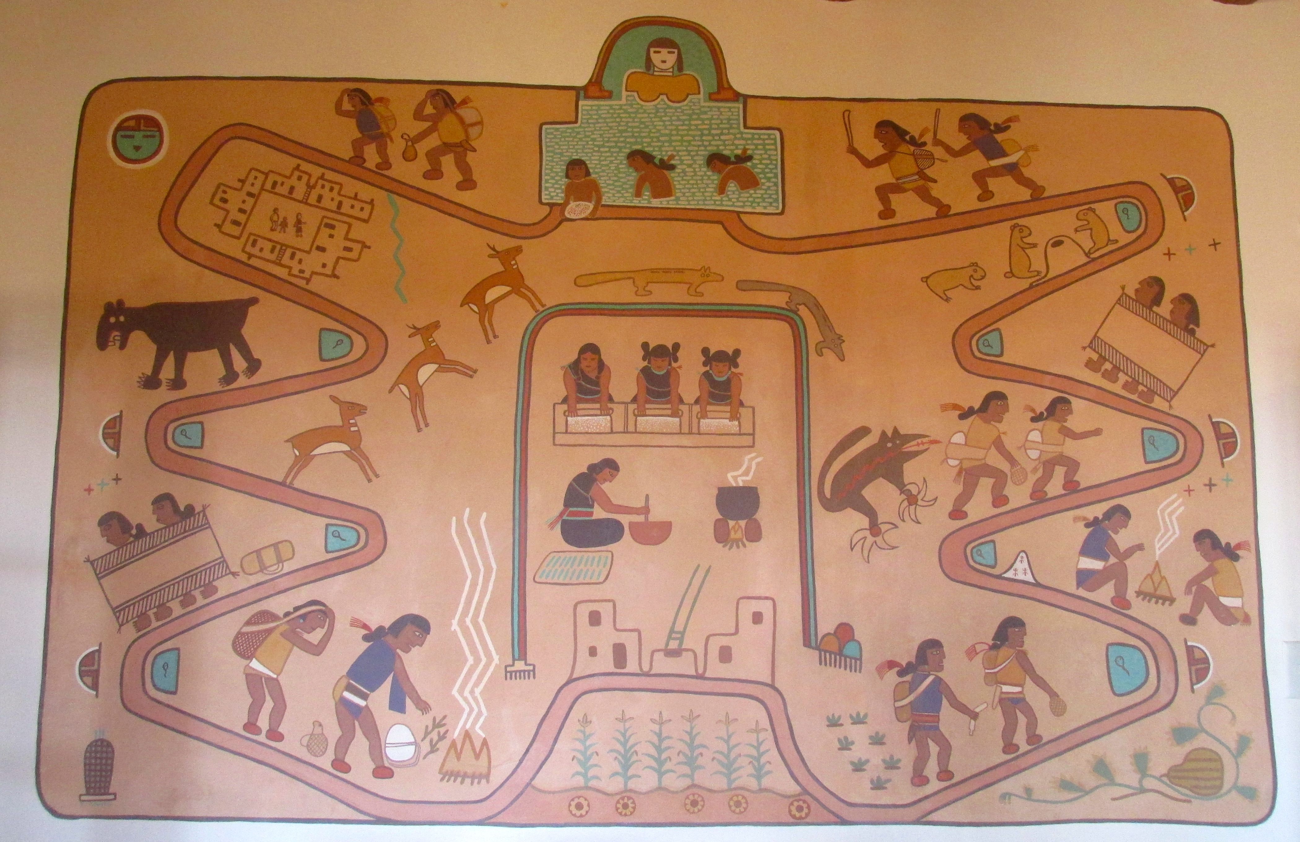
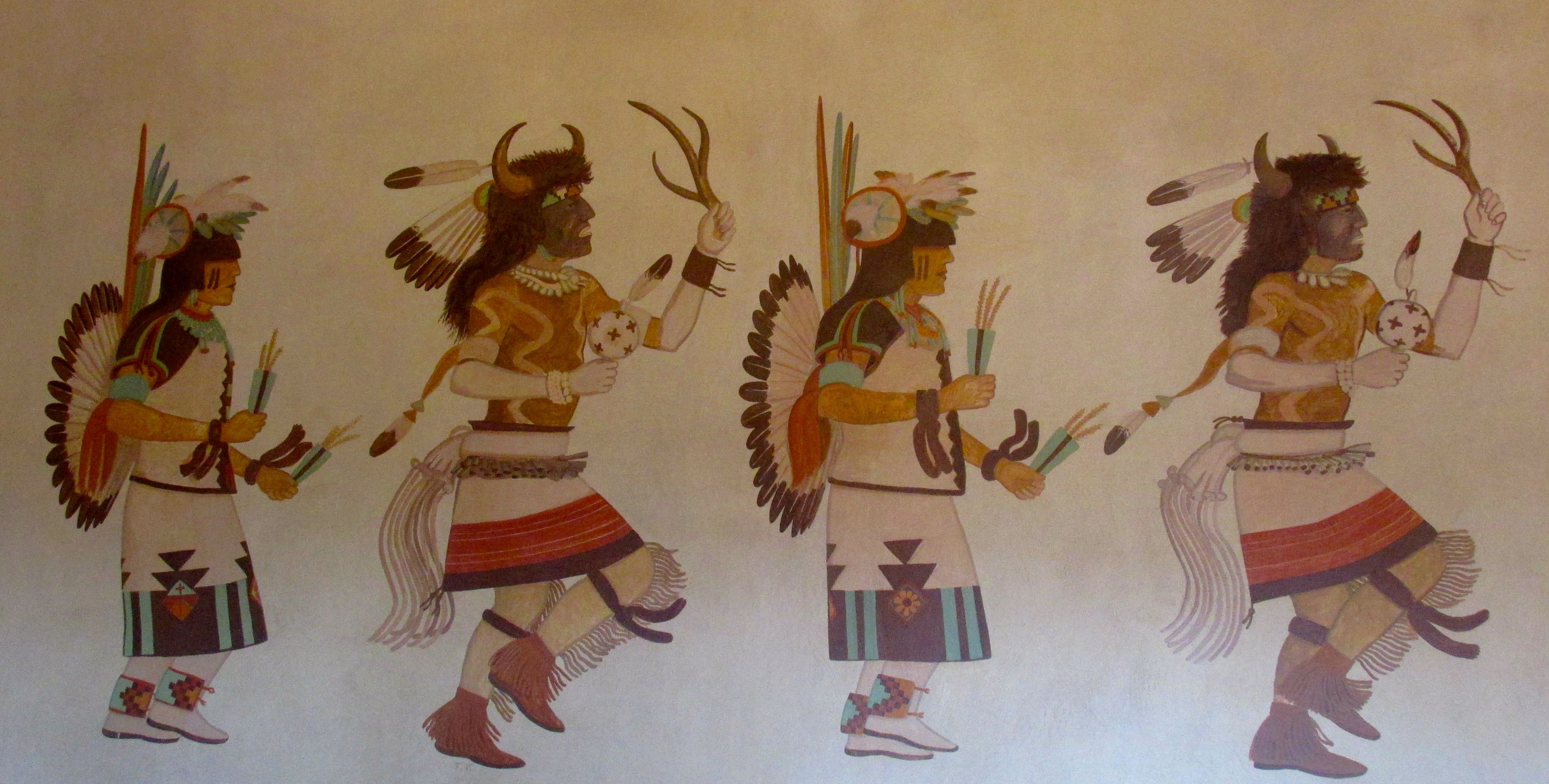
There are murals there by Fred Kabotie. They represent various aspects of the Hopi Culture.

Three Peaks and Corn Planting
Salt Lake Mural
Salt Lake Mural
Hopi Buffalo Dance
Hopi Buffalo Dance

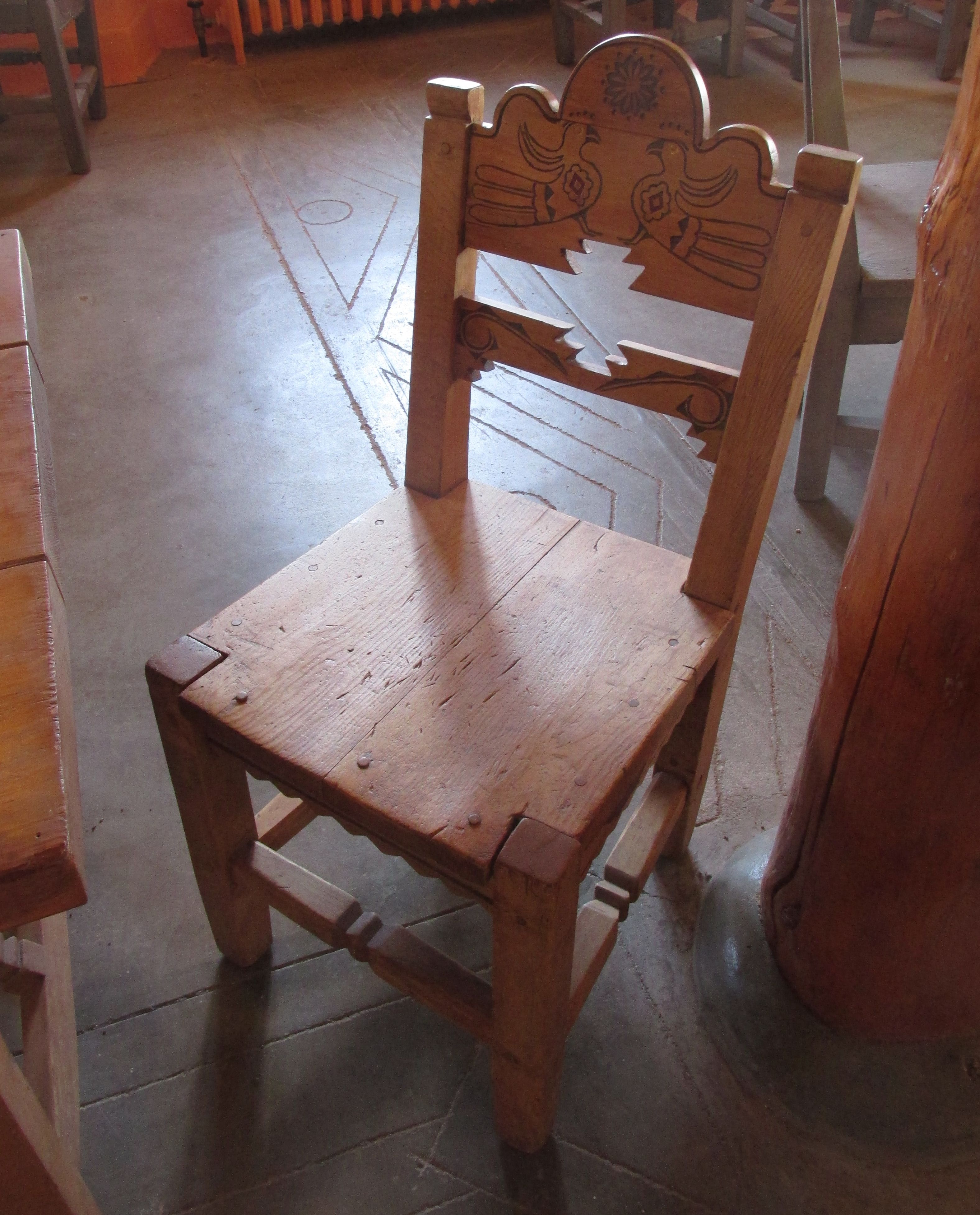
The furniture for the Inn had been built by the CCC. This chair had been restored to its former glory.

Original CCC chair

For an Inn with only six rooms, the building was fairly massive looking.

Painted Desert Inn from the back

I read in some of the literature there that there was a guest room that could be viewed. I asked the ranger about it, and he took me and several other visitors to see it.

Painted Desert Inn guest room door

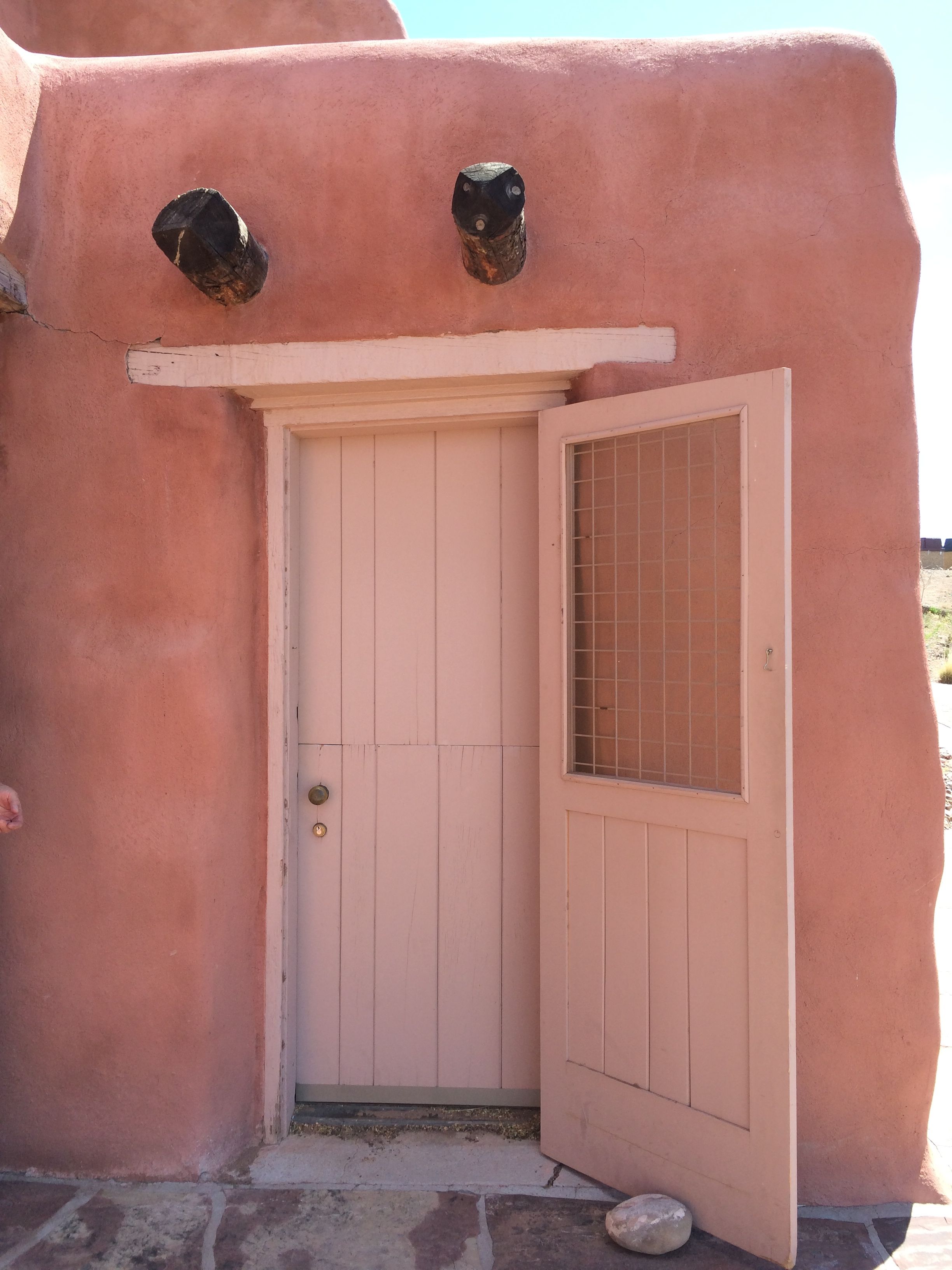
It looks like the door was what I always heard called a “Dutch door”. The bottom could remain closed and the top part opened for ventilation or light.

Fireplace in guest room

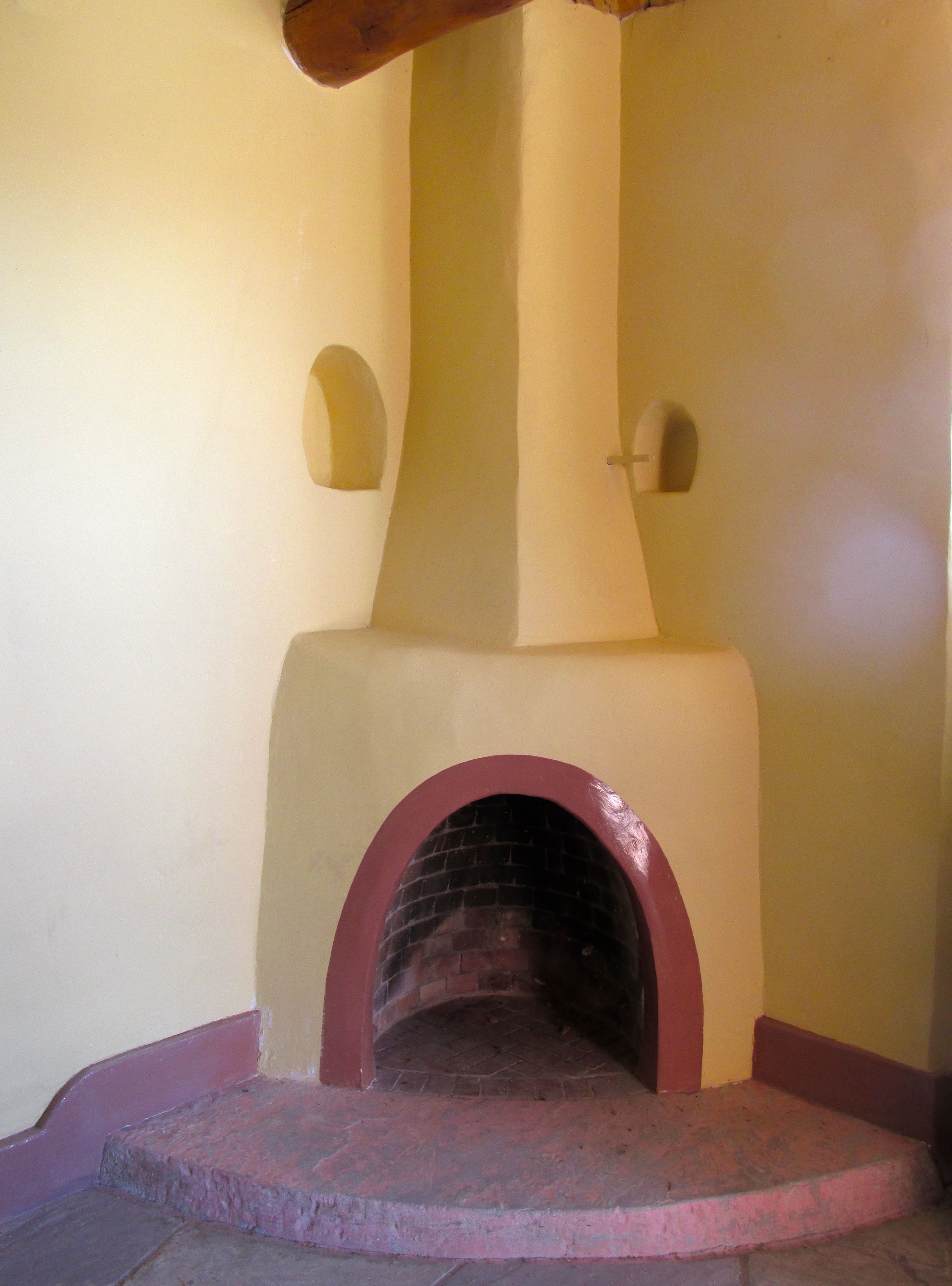
The rooms had their own fireplaces, although there was a radiator in the room.

Sink in guest room with mouse trap

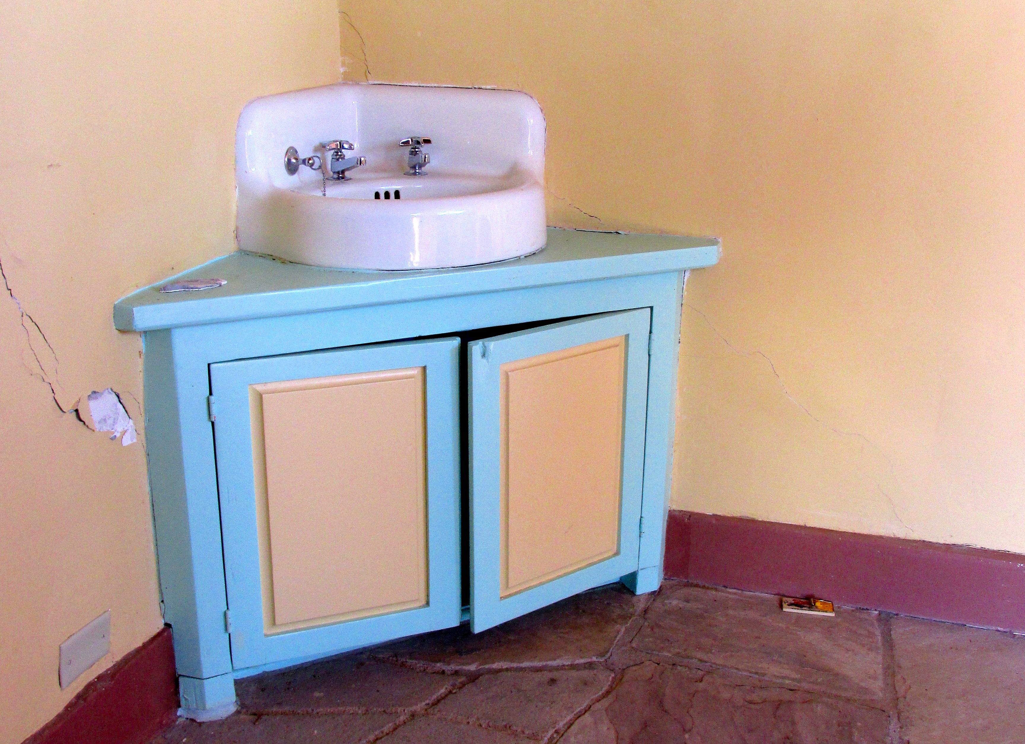
The rooms also had their own sinks.

Light fixture in Guest room

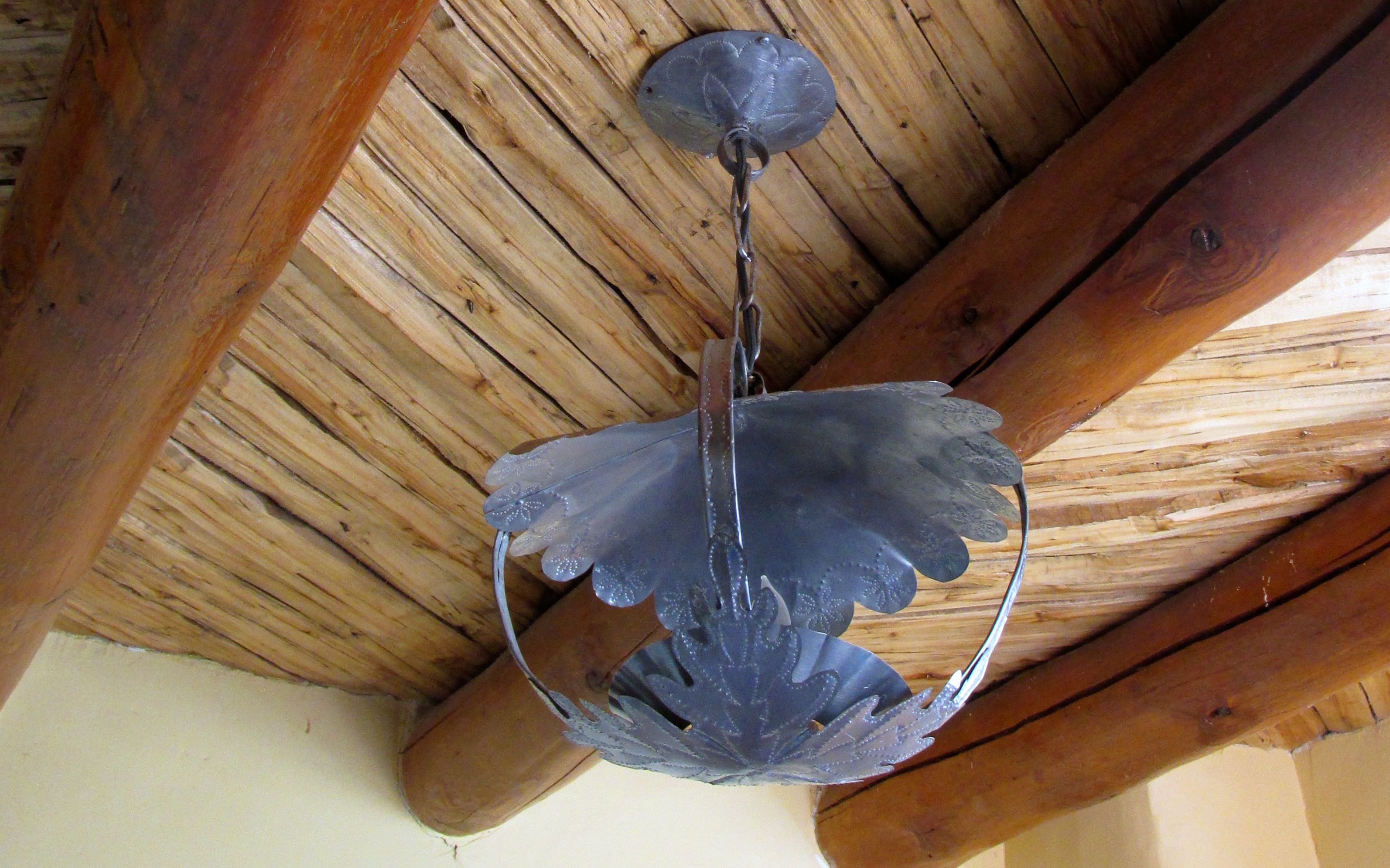
The light fixture was attractive, and the ceiling made use of the exposed wood and beams.

Other than that, there was barely enough room to change your mind. A bed, a chair and a nightstand or dresser would take up all the rest of the floorspace.

Painted Desert Inn west side detail

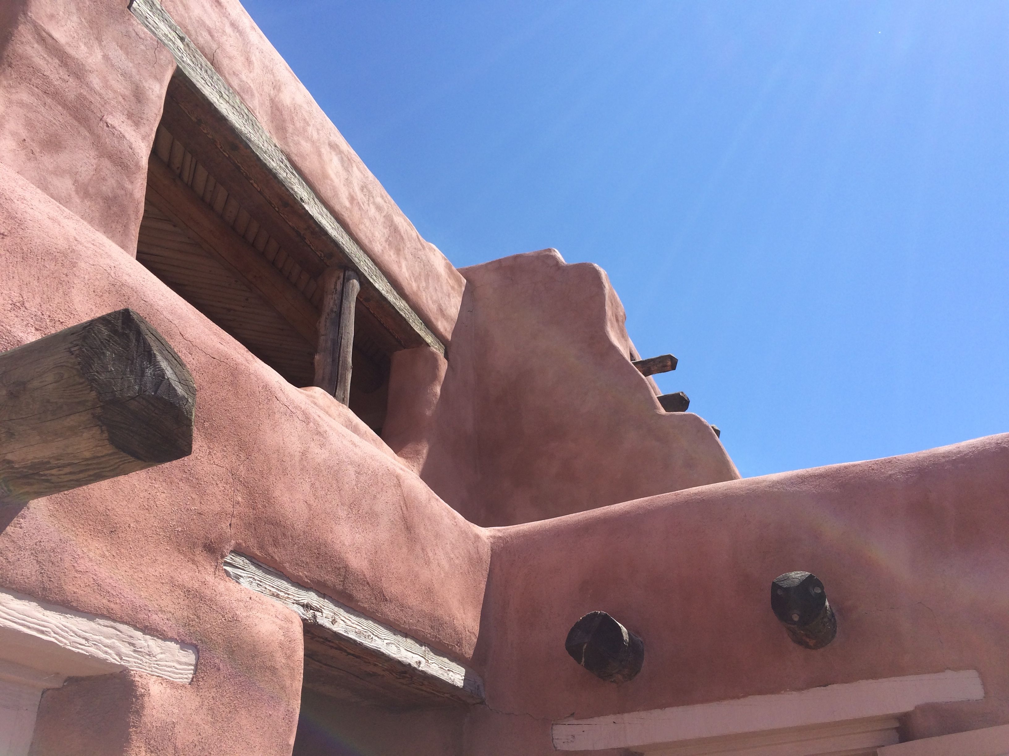
This is the view directly above the room. Those two vigas on the right side of the picture are right above the door.

US Geologic survey marker Painted Desert Inn

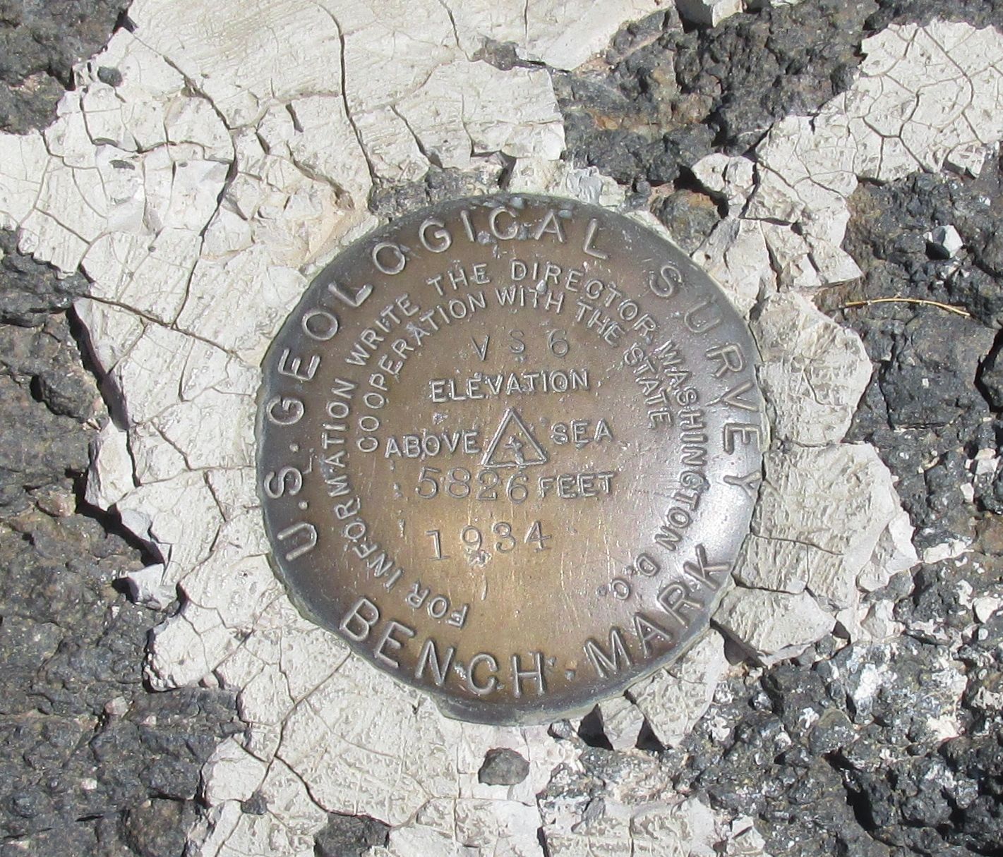
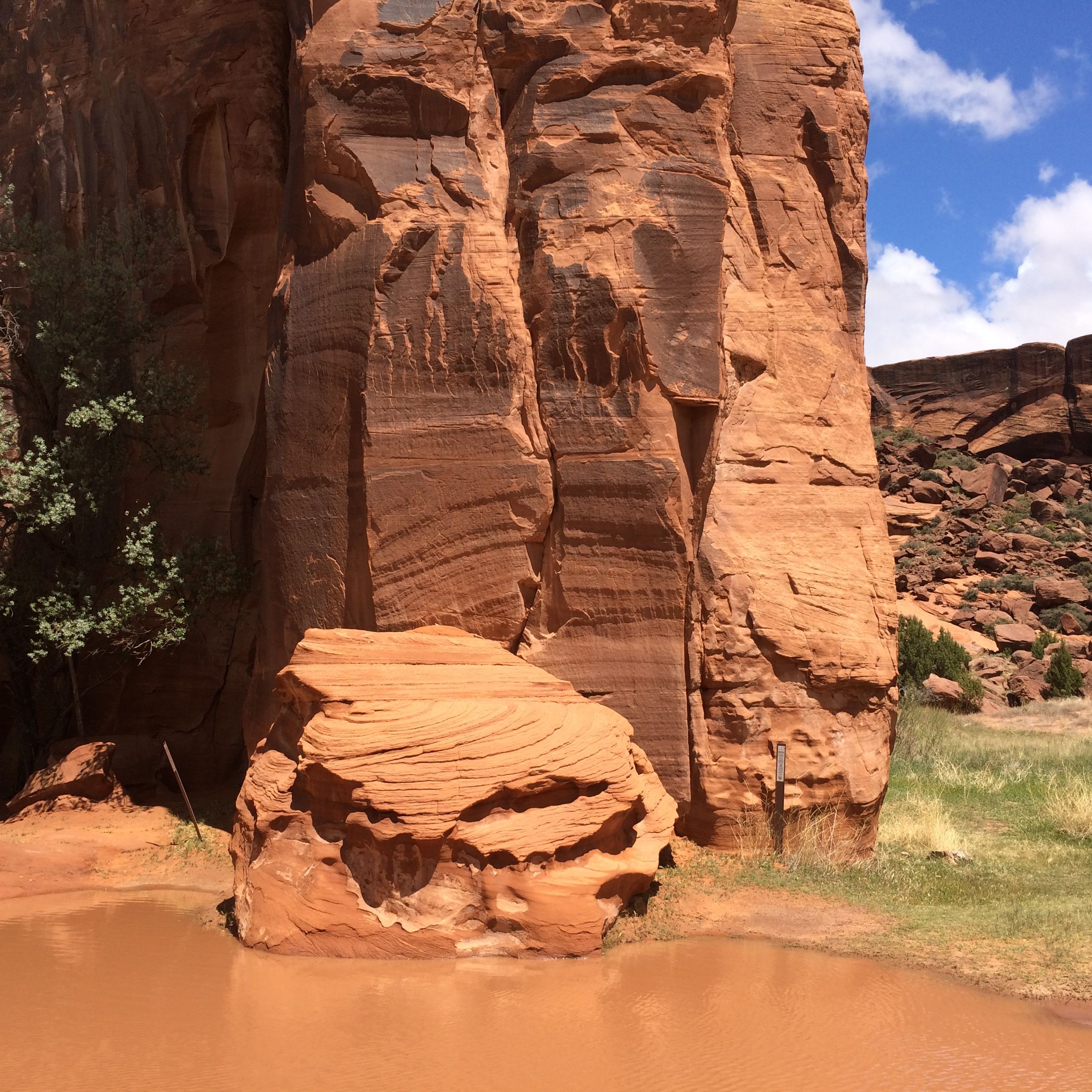
I found this benchmark for the U.S. Geological Survey in the gardens behind the Inn.

View from the Painted Desert Inn

This is the view from the patio. Quite attractive, don’t you think? Too bad it’s not possible to book a room there anymore.

Route 66 sign in cement

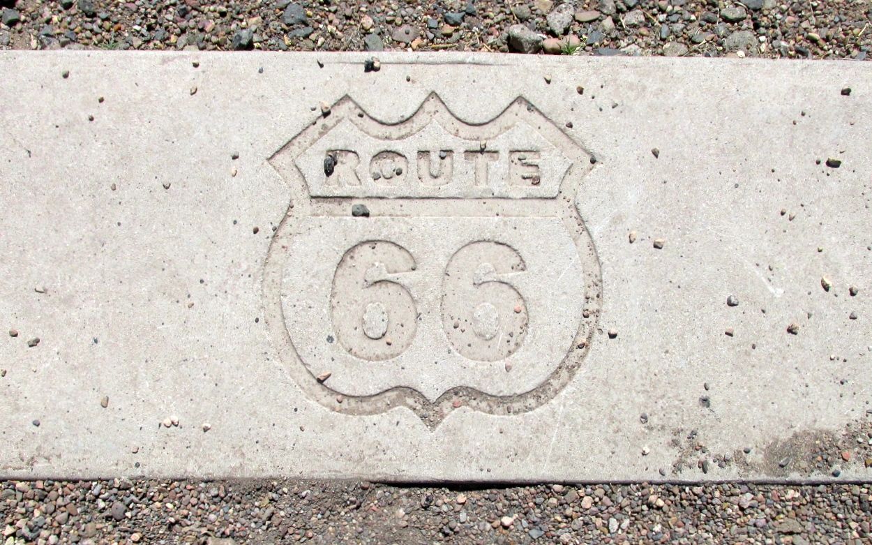
My next stop was Route 66.

Route 66 ran along side the phone poles

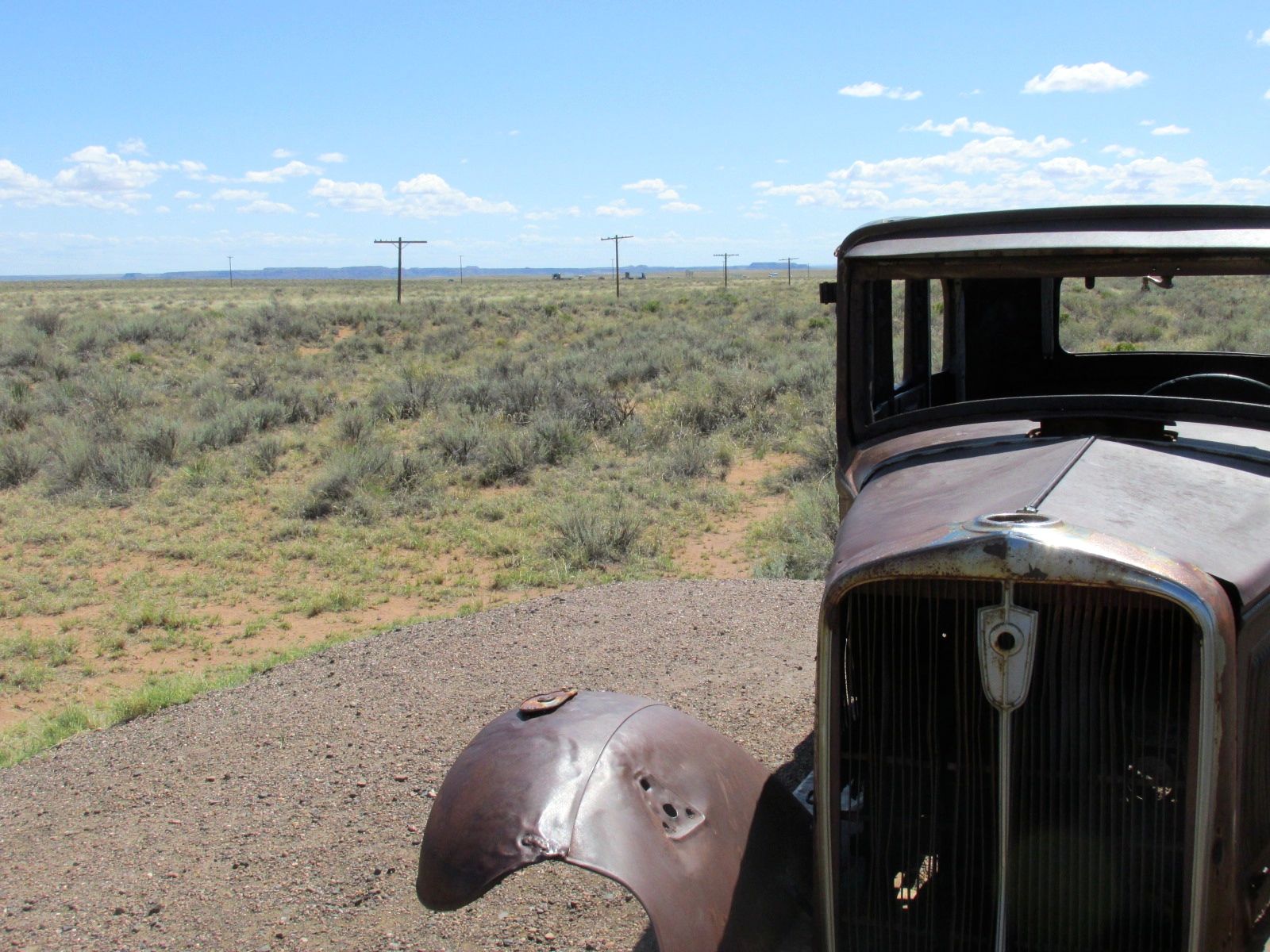
Route 66 ran right along the phone poles.

I found a tumble weed on Route 66

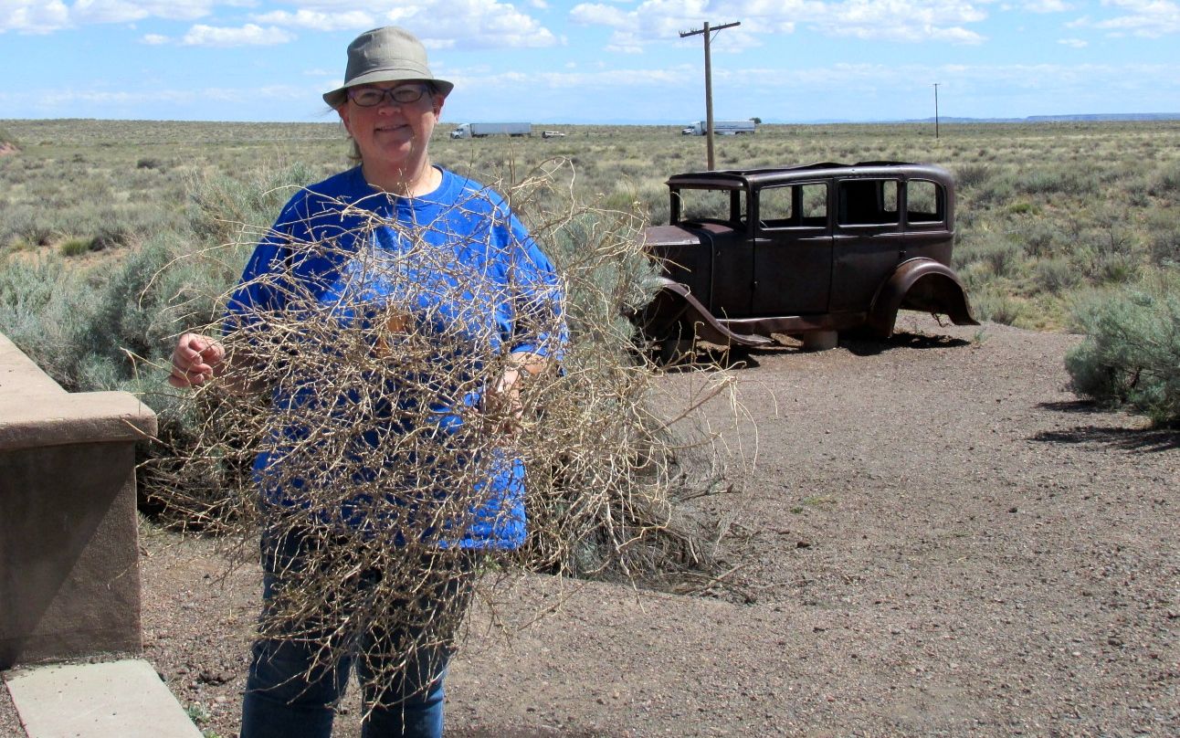
I found a tumble weed lodged against the fence. Luckily, another group of visitors came along just in time to snap my photo. I did leave the tumbleweed behind.

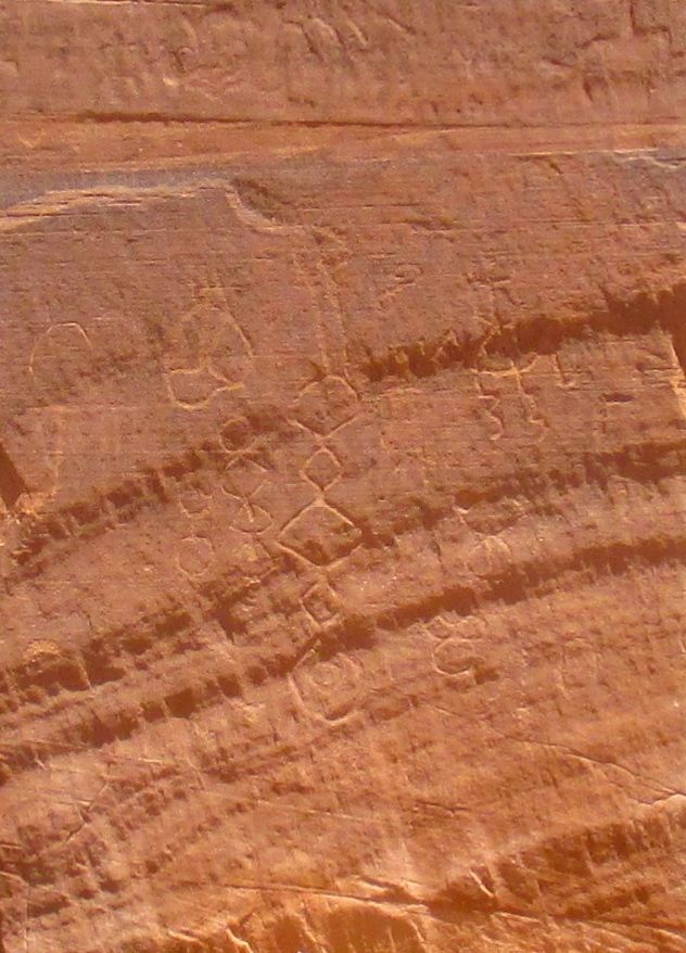
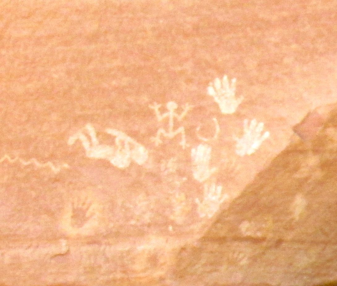
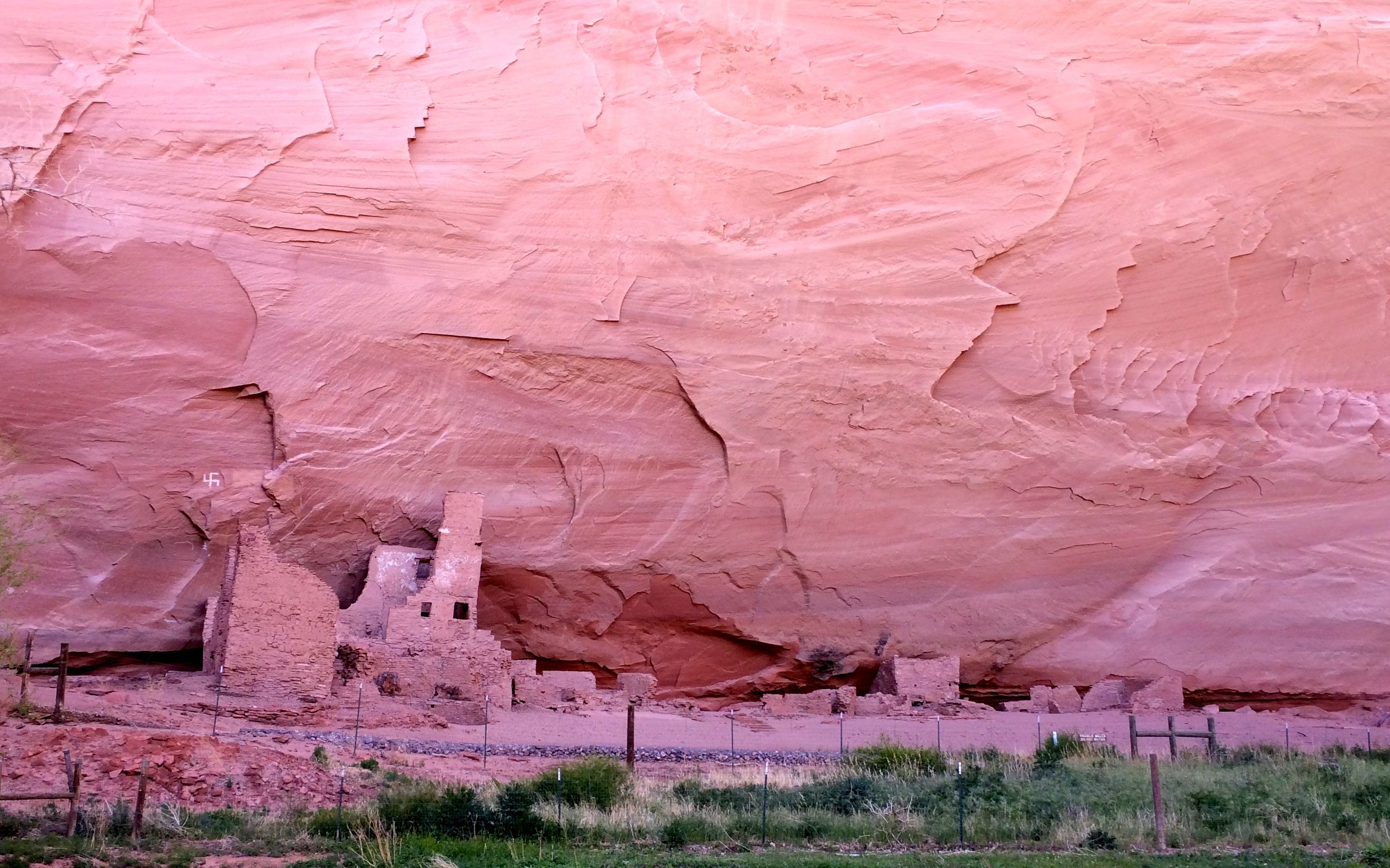
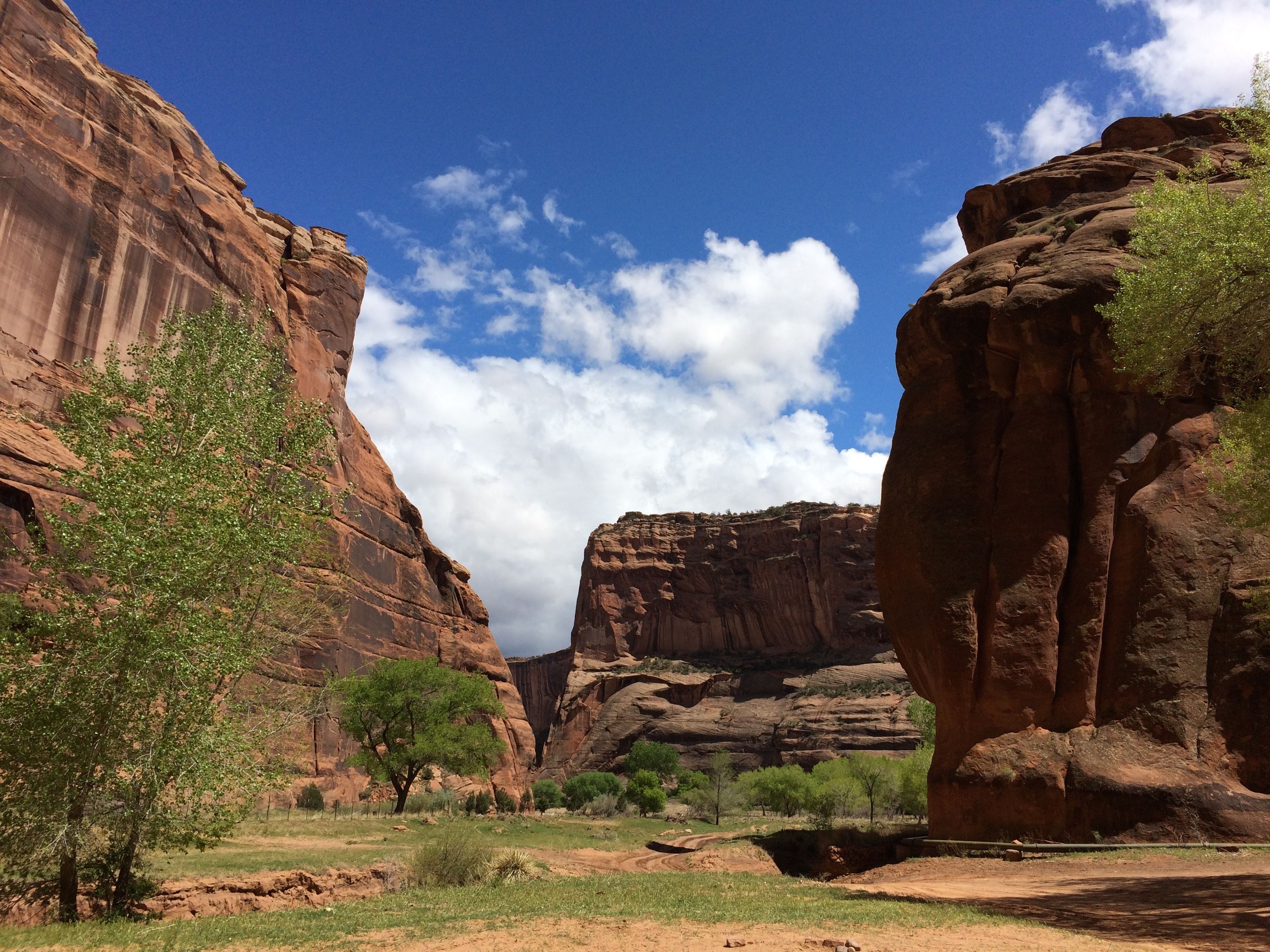
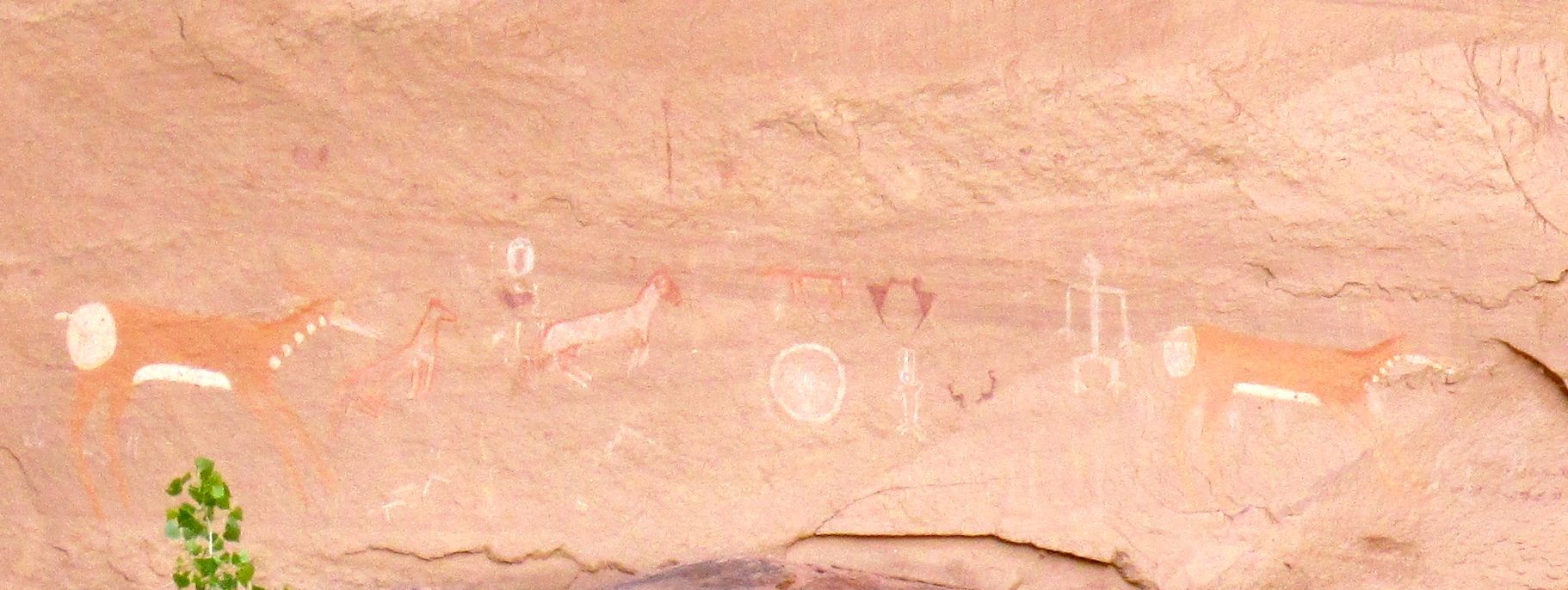
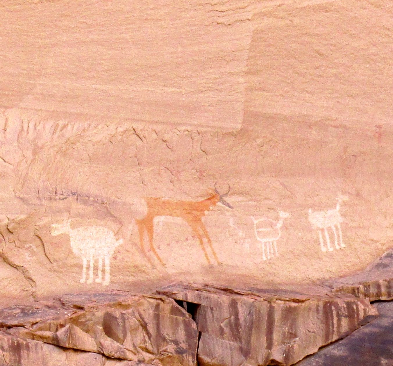
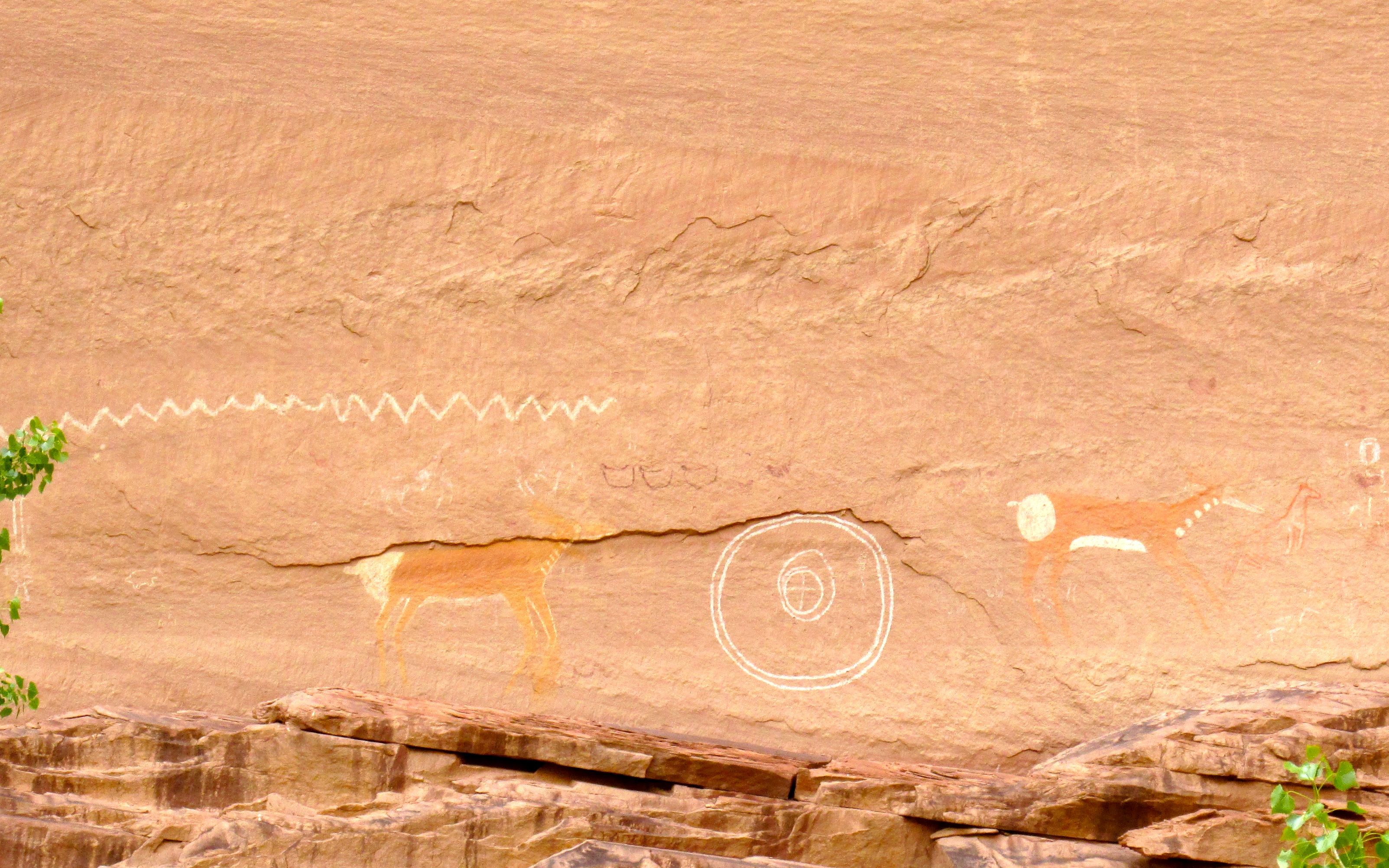
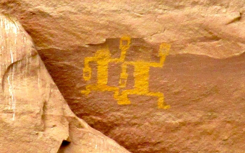
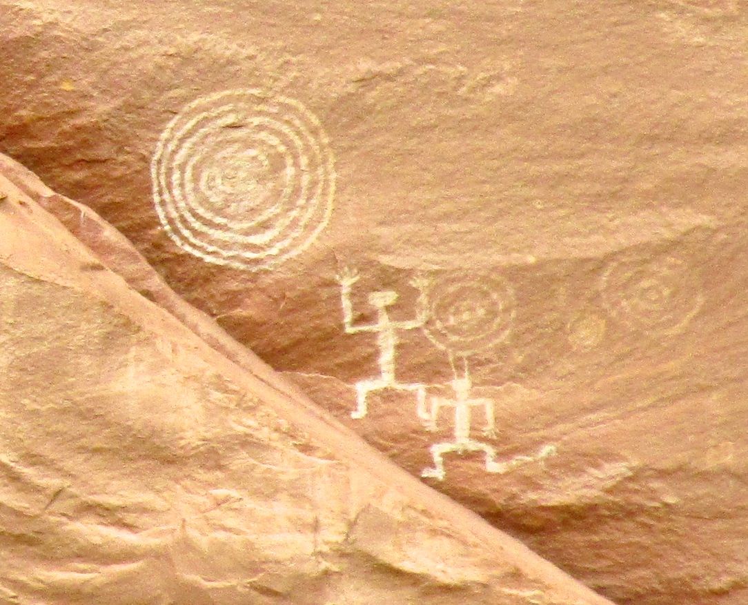
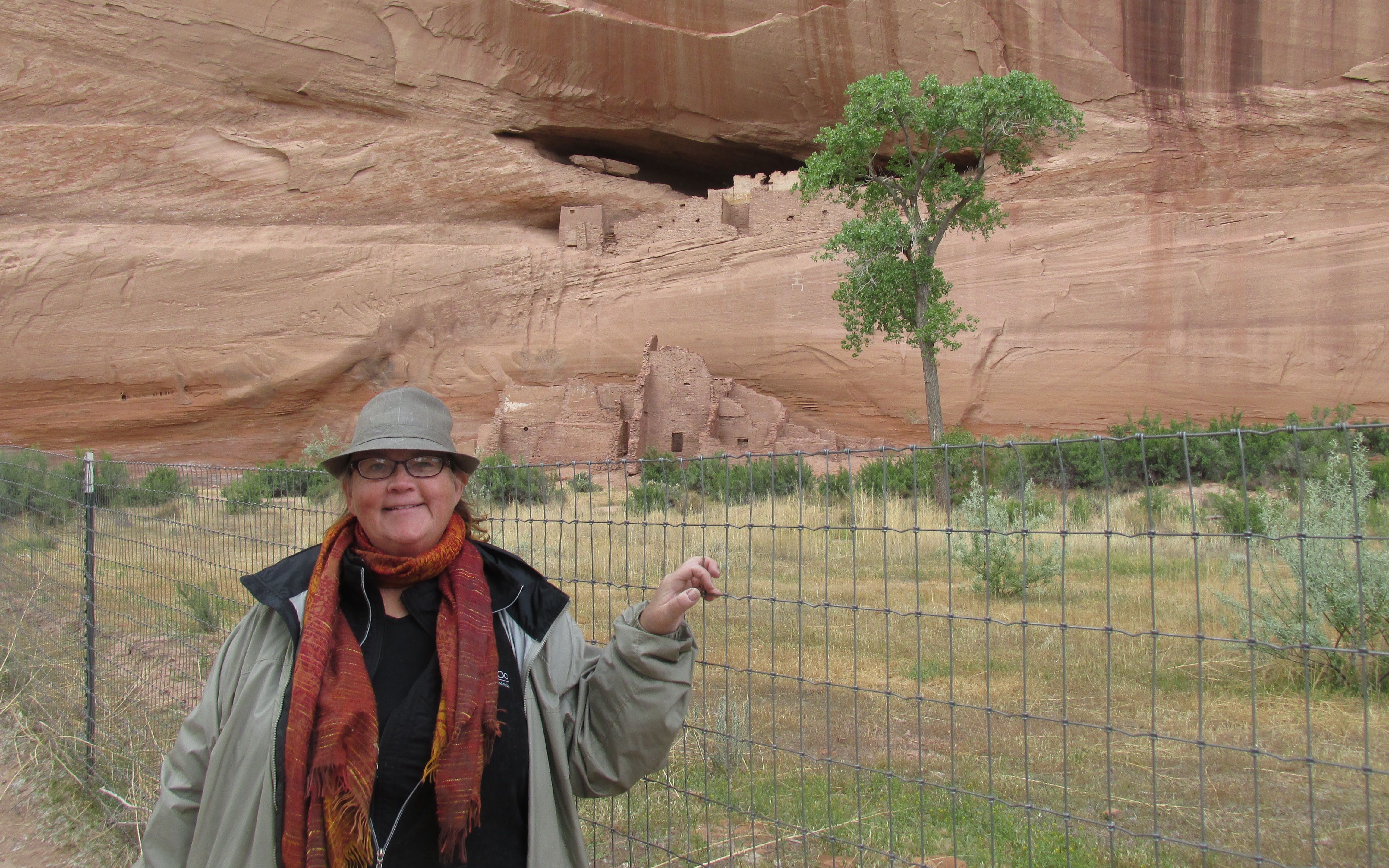
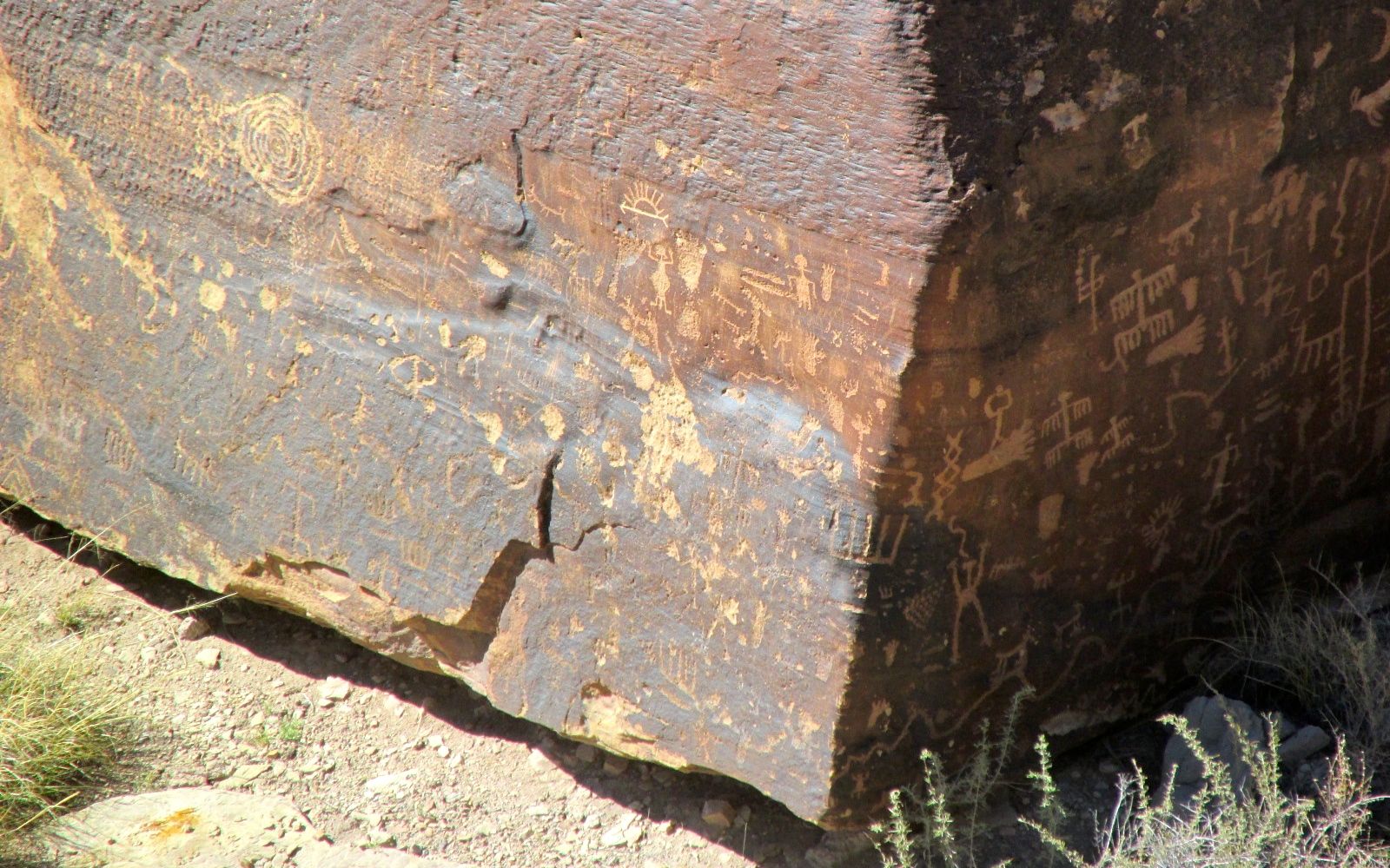
The next stop was Puerco Pueblo, which was right along near the banks of the Puerco River. There were petroglyphs!

Puerco Petroglyphs 1

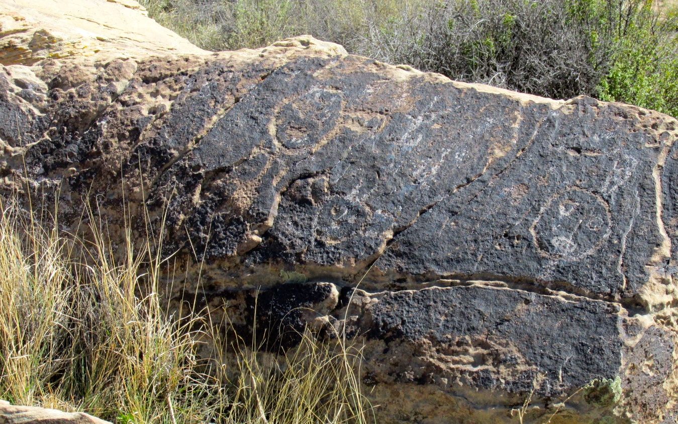
There was a variety of styles on the rocks.

Puerco Petroglyphs 2

You can see more geometric designs as well as representational shapes.

Puerco Petroglyphs 3

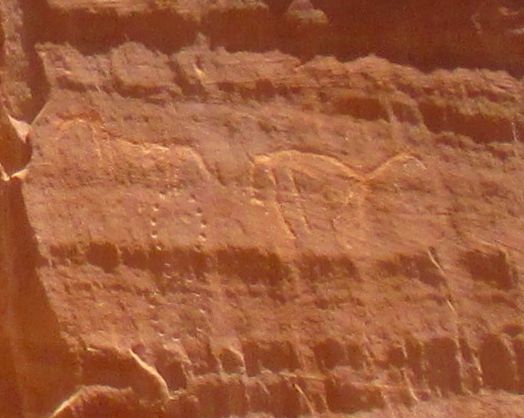
People were represented, as well.

Puerco Petroglyphs 4

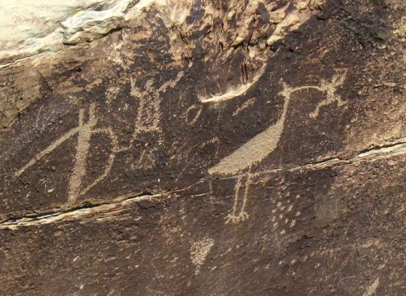
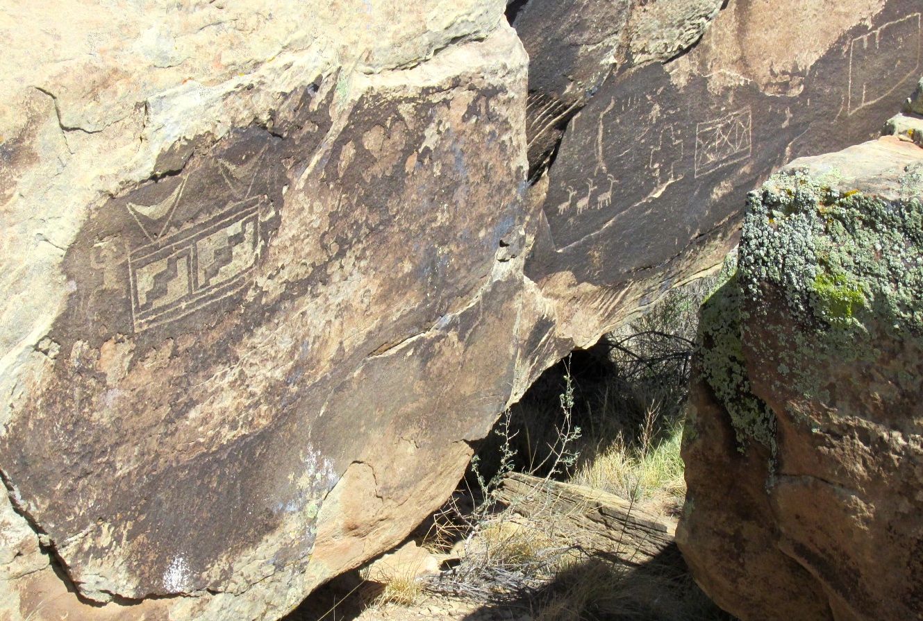
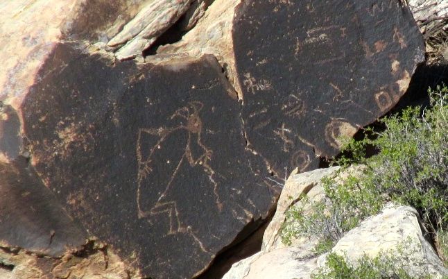
This bird looks like a fearsome creature.

Puerco Petroglyphs 5

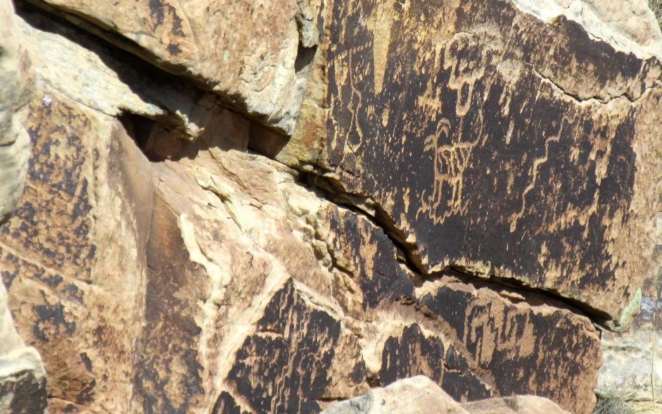
This is an interesting combination of abstract and representational petroglyphs.

Puerco Petroglyph solar calendar

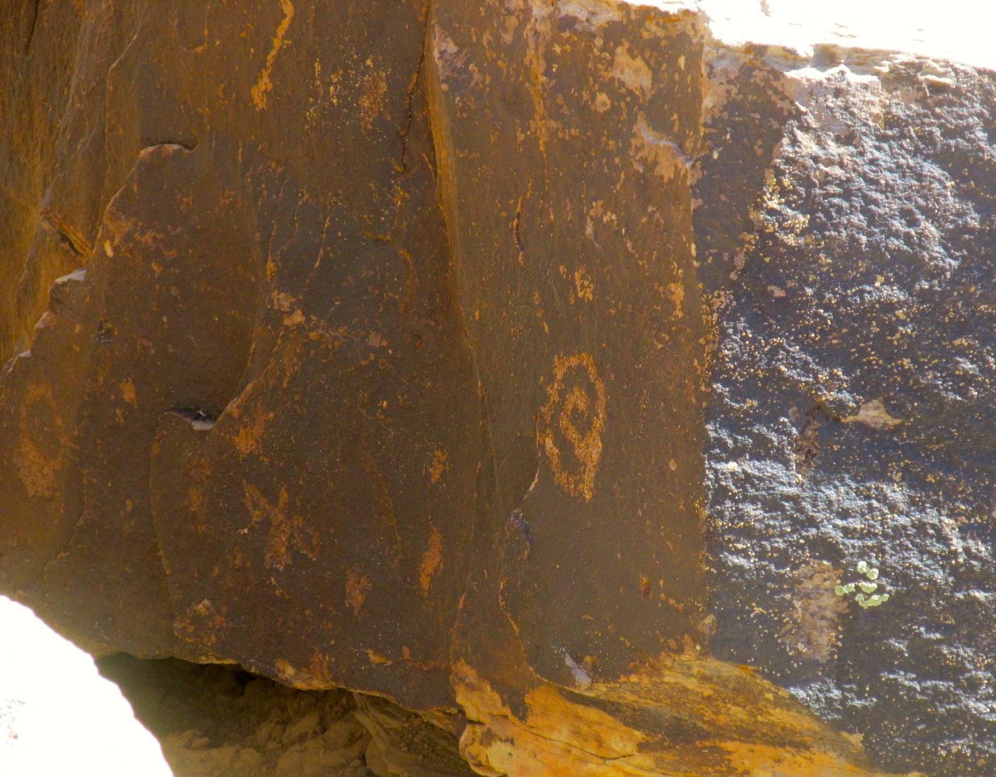
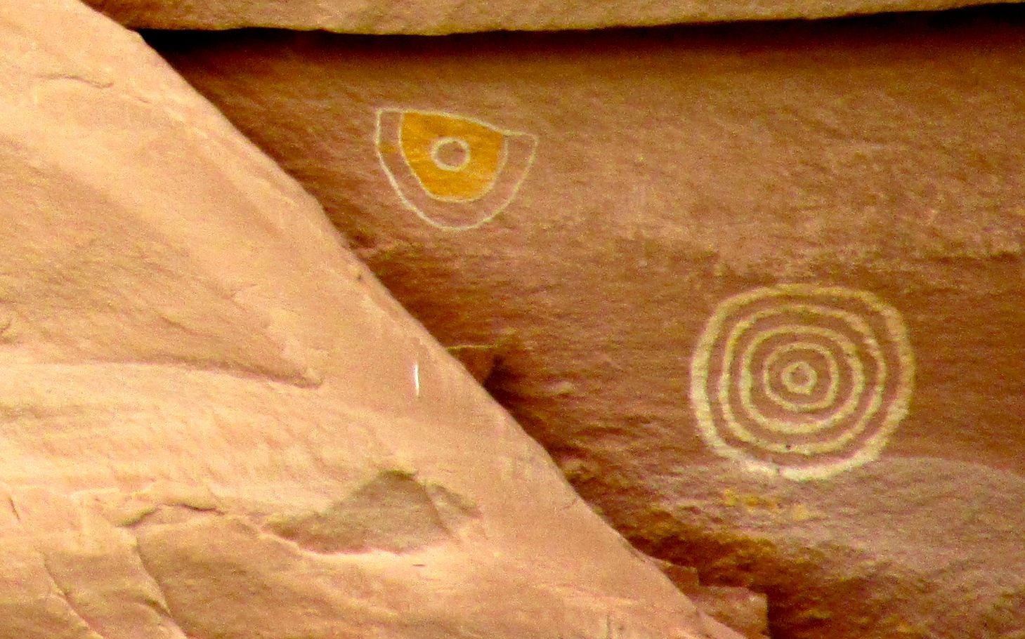
This little circular one is probably the most interesting, though. It’s actually a calendar. On the solstice, the sun shines on it through a space in the rocks. Then they knew it was time to plant.

Puerco Petroglyphs solar calendar photo showing light on the solstice

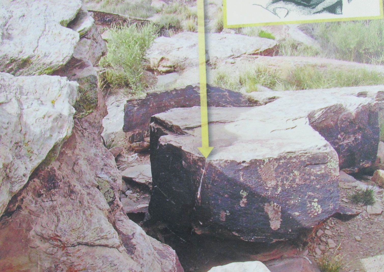
I snapped this photo from one of the signs. The arrow points to the sun shining on the calendar.

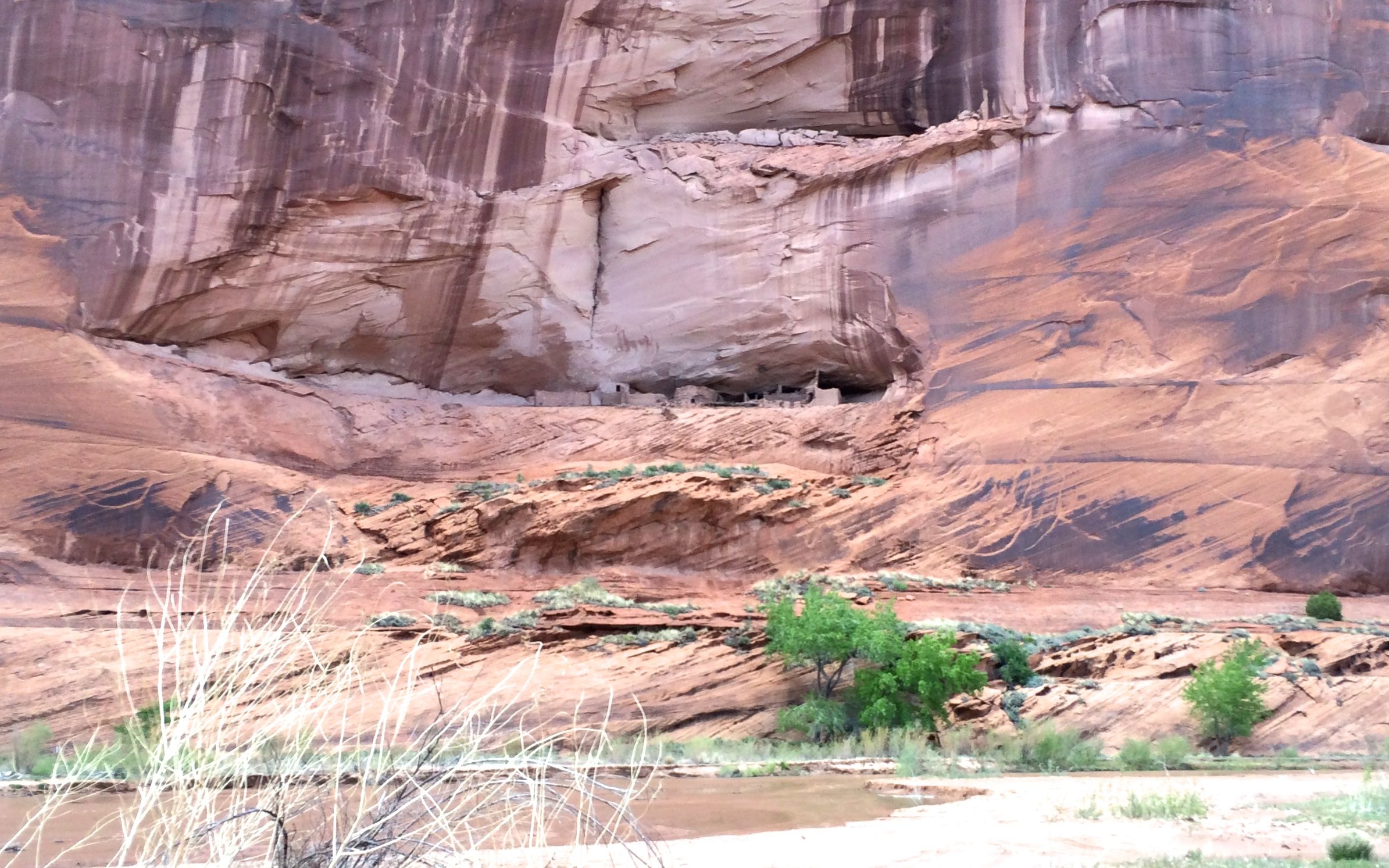
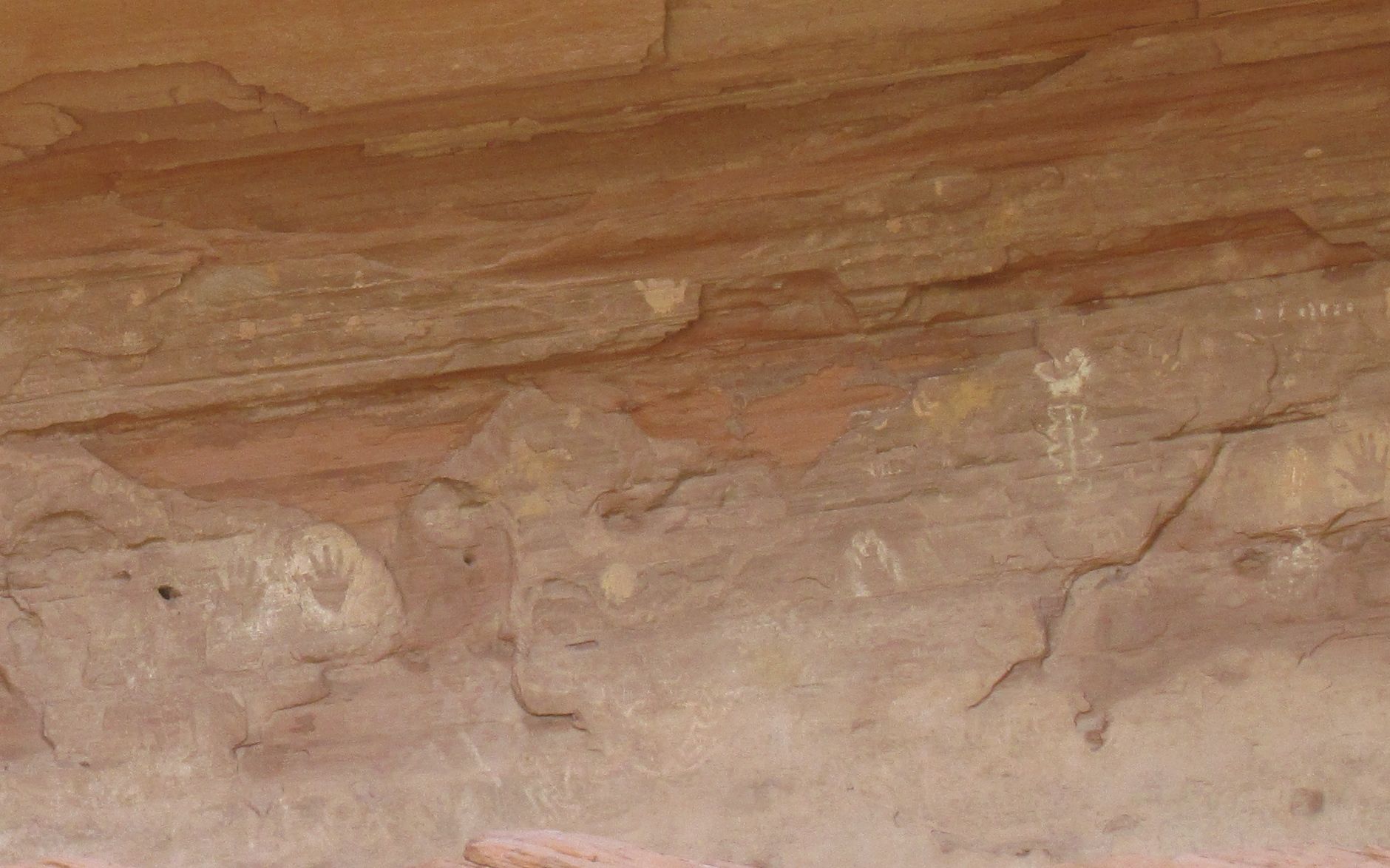
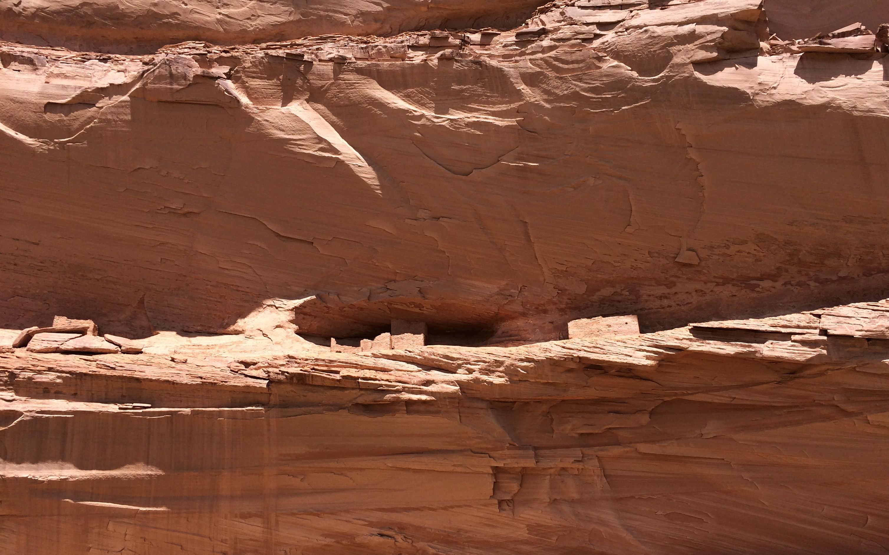
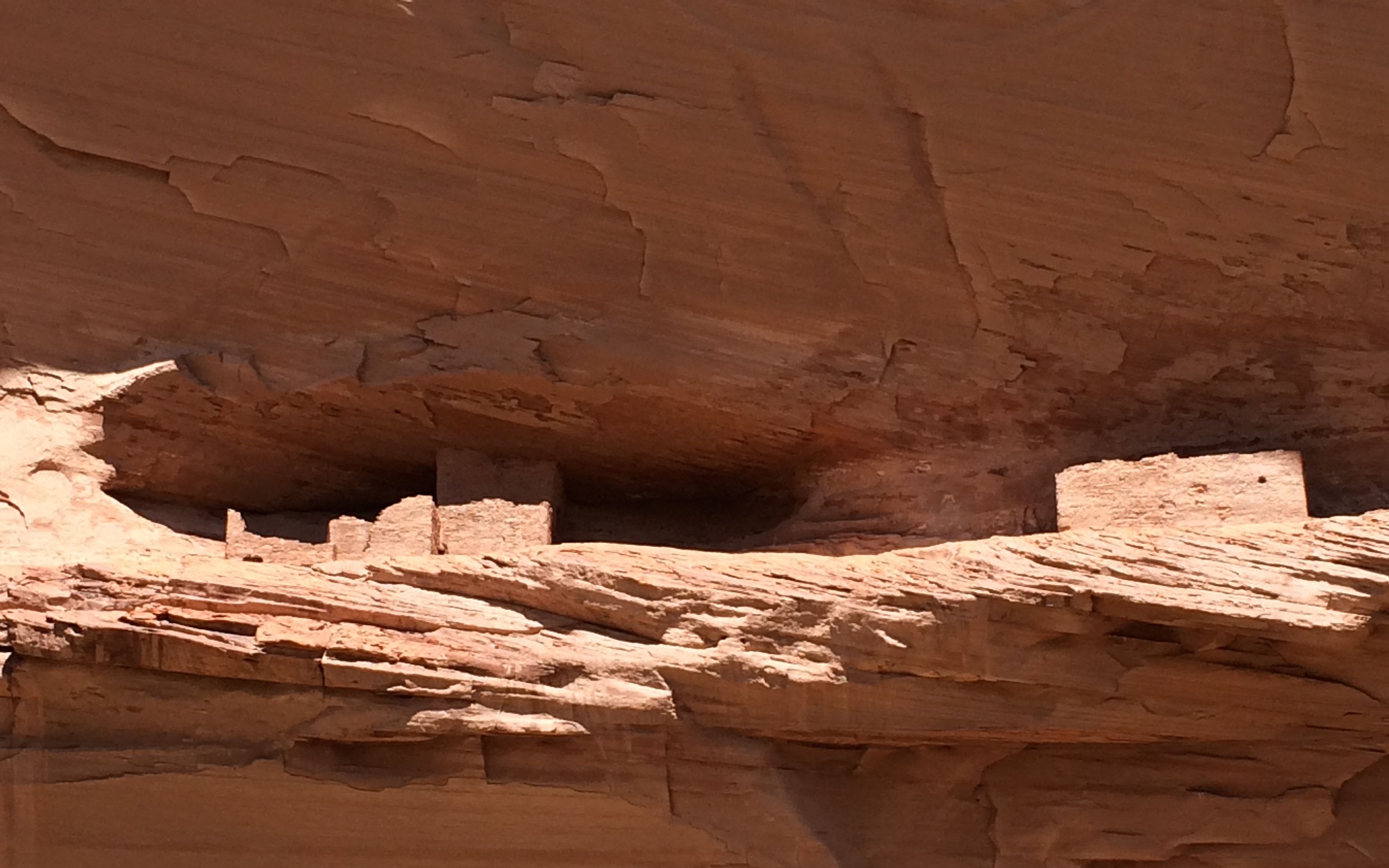
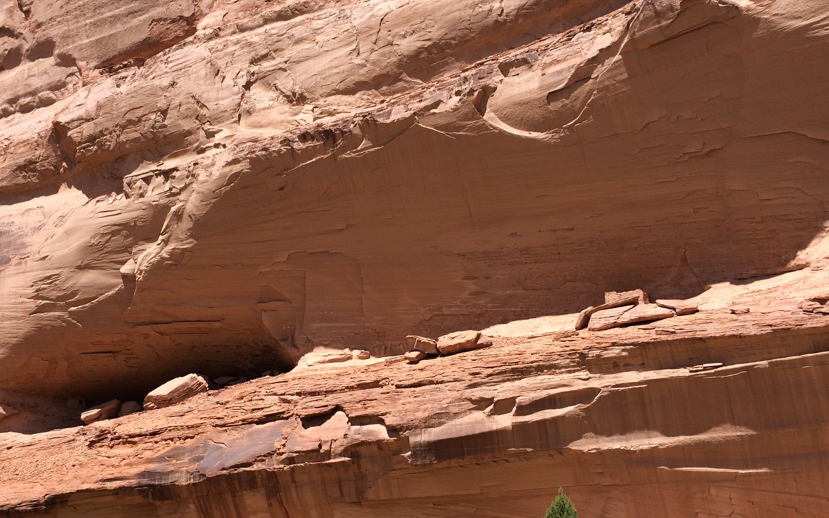
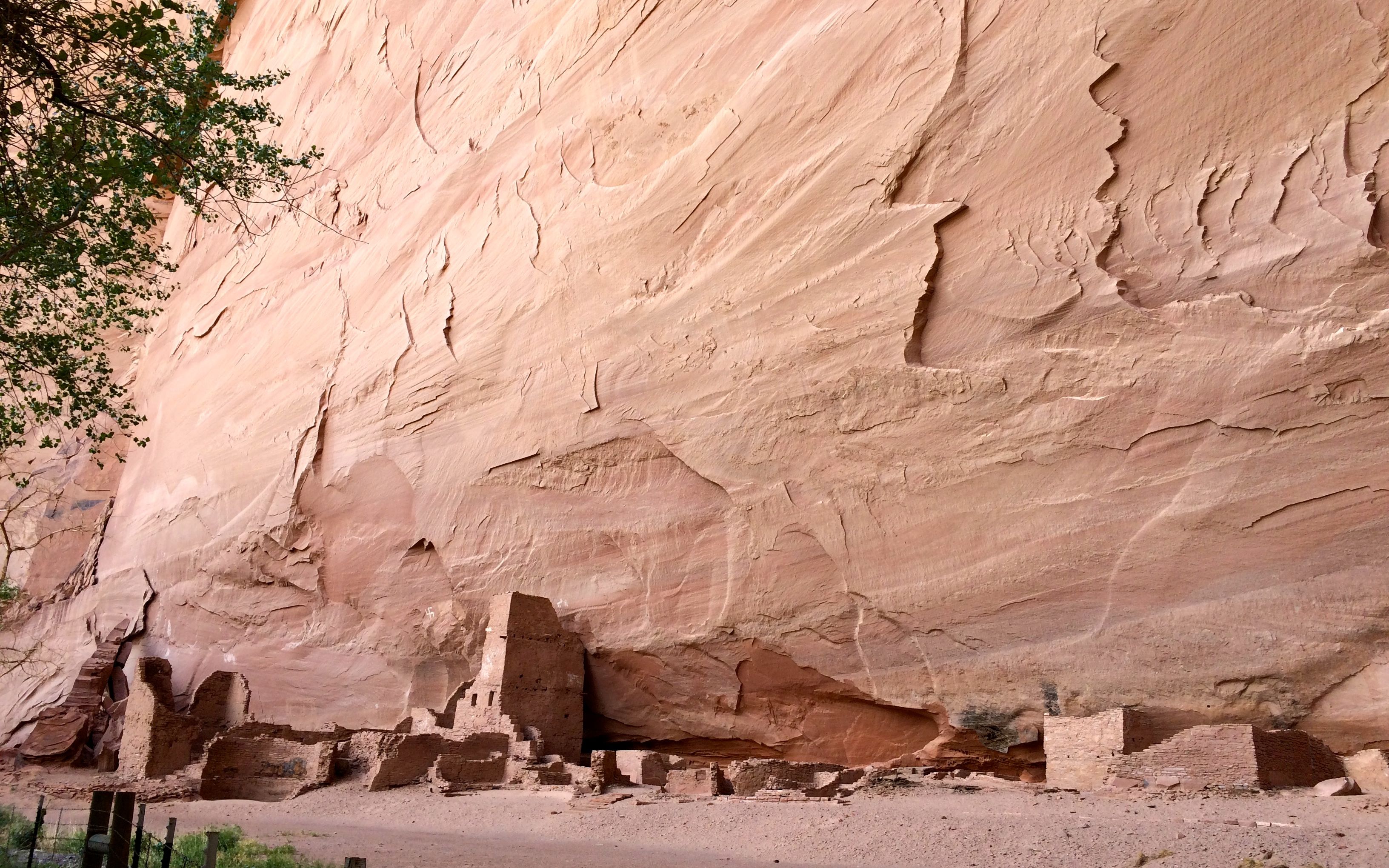
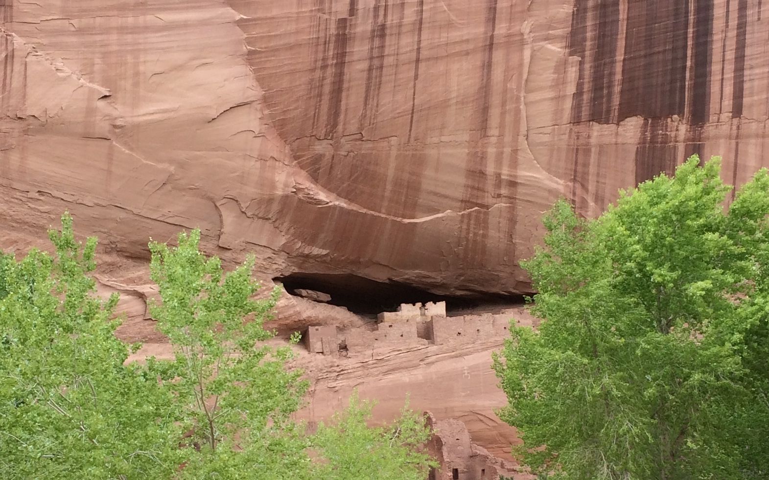
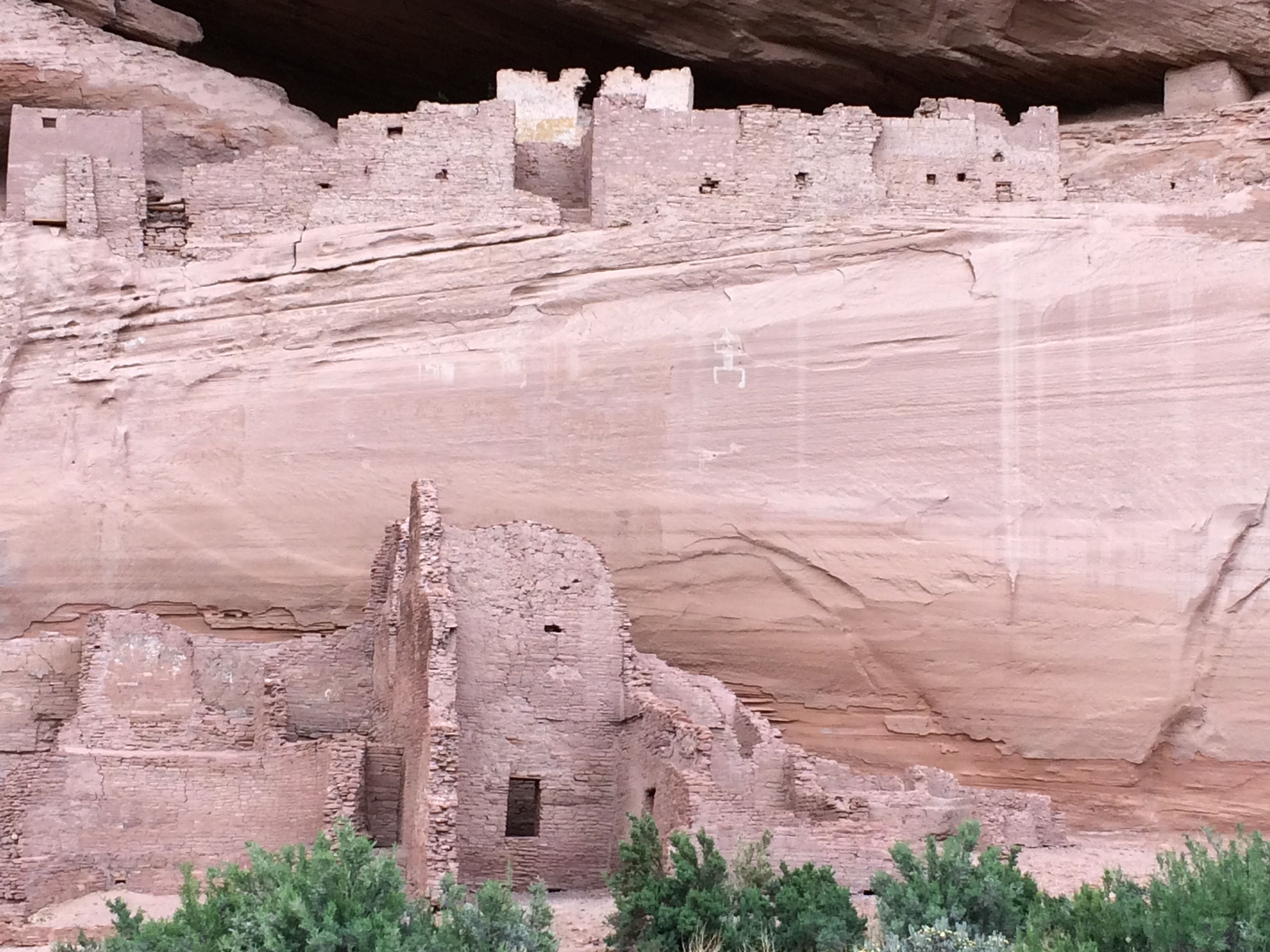
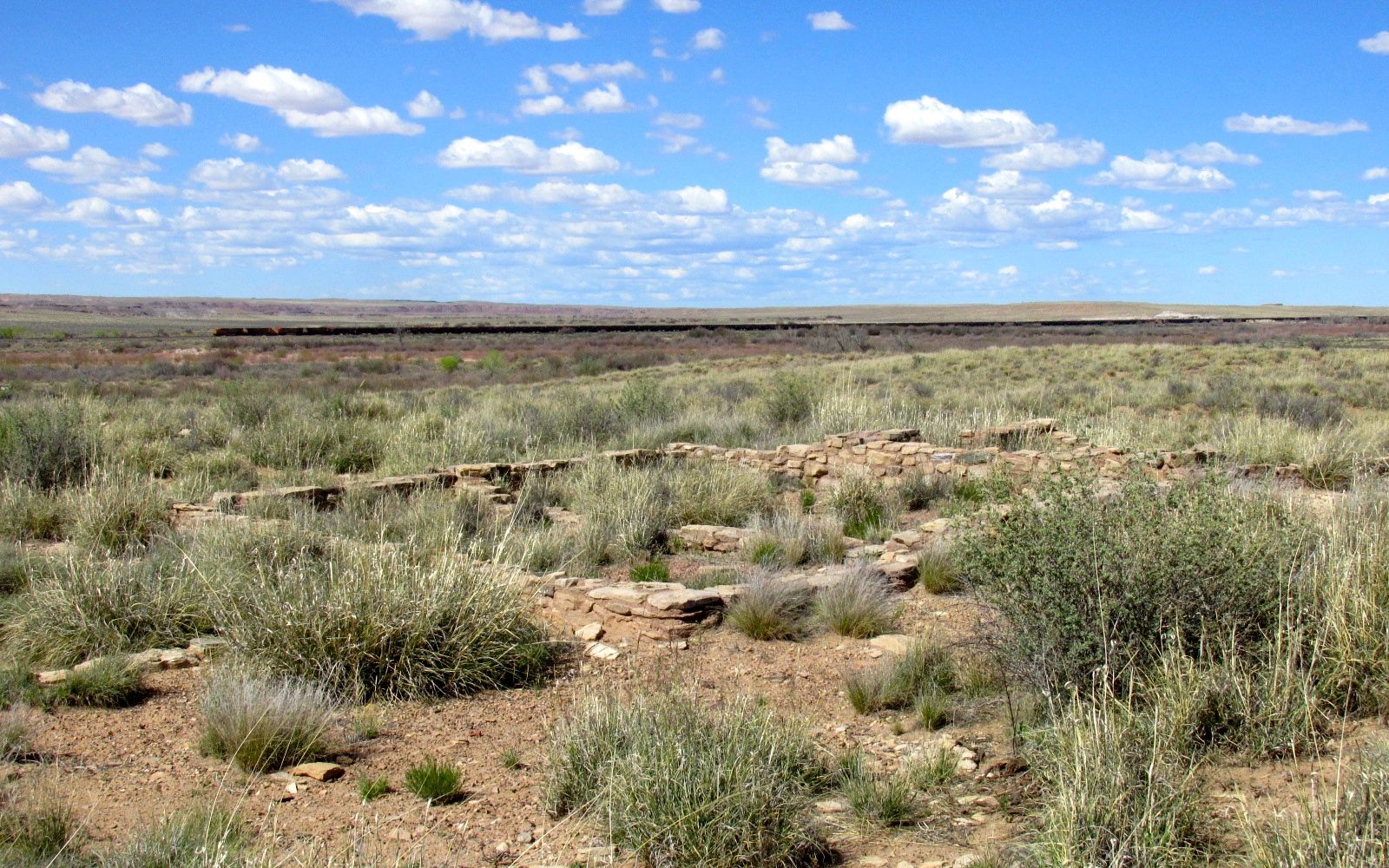
There were also ruins at this location.

Puerco ruins kiva

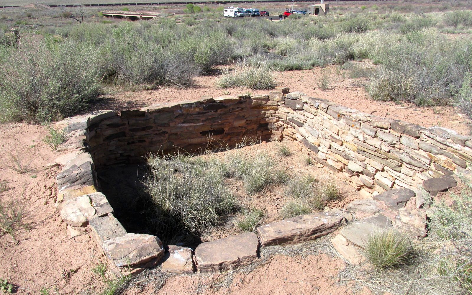
The sign said that this was a kiva. If you weren’t sure about what a kiva is, no worries! I looked up the definition for you: “An underground or partly underground chamber in a Pueblo village, used by the men especially for ceremonies or councils.”

Puerco ruins rooms 1

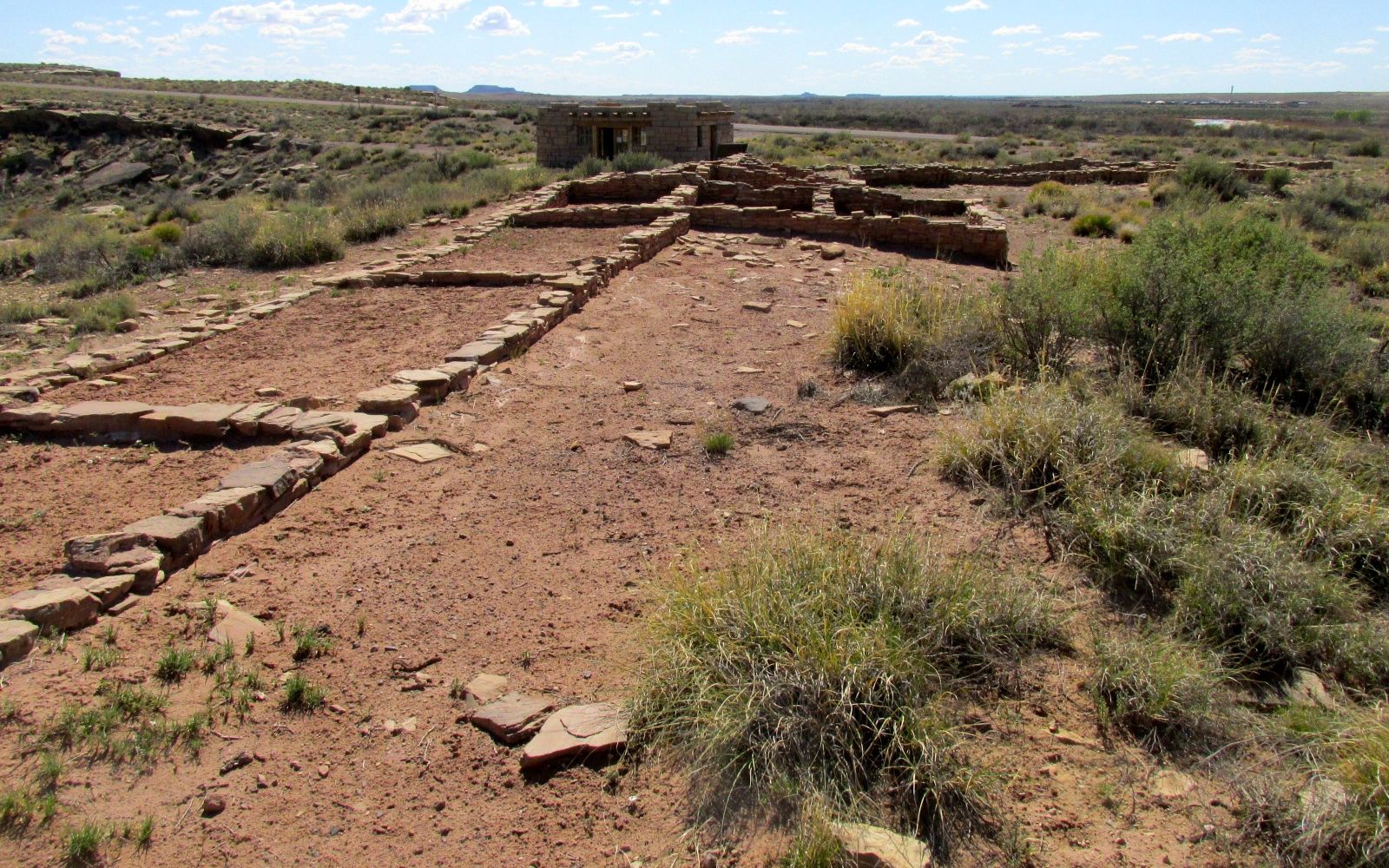
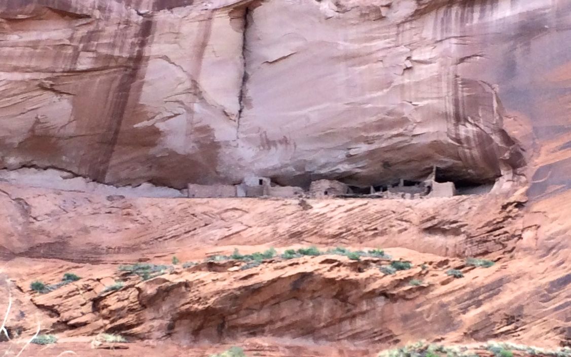
There were also rooms for living spaces.

Puerco ruins rooms 2

You can see more rooms here.

Puerco ruins rooms 4

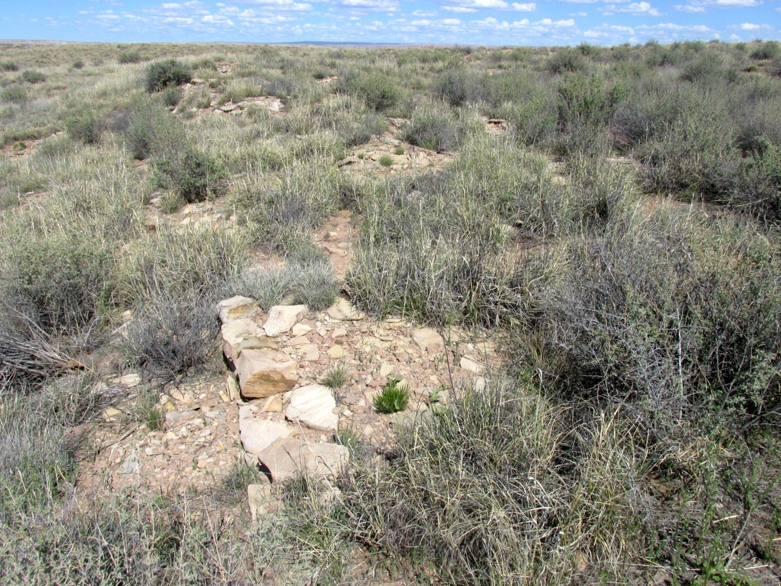
There were more rooms. The signs said that we were walking over the ruins. I imagine there are many more discoveries to be made.

When I returned to the parking area, I had a happy surprise.

side by side Airstreams

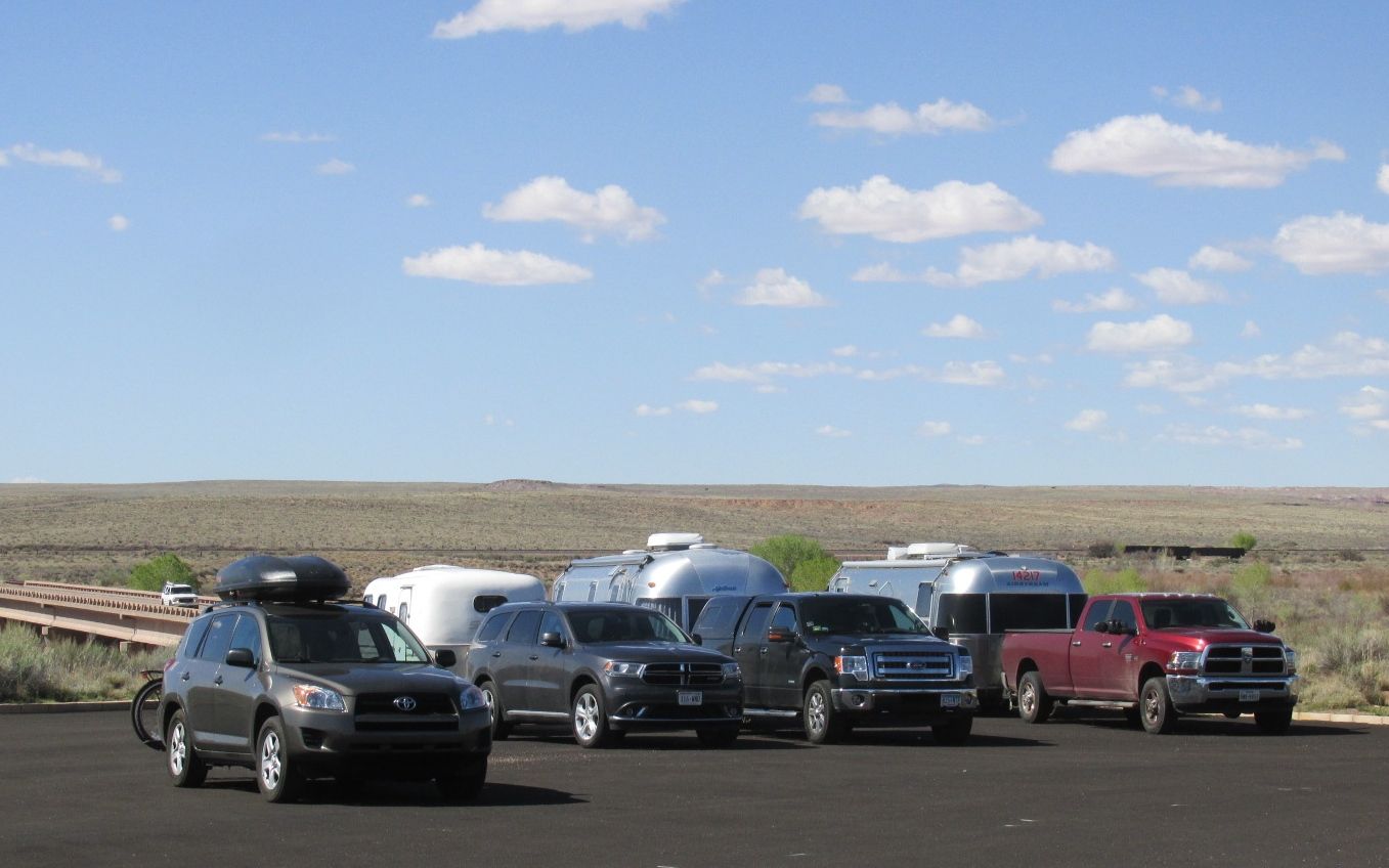
Another Airstream had parked right next to me! I left them a card with a greeting. When we passed each other later on, we gave each other the Airstream salute. We flashed our lights and waved. It’s always fun to see another Airstream.

Teepees

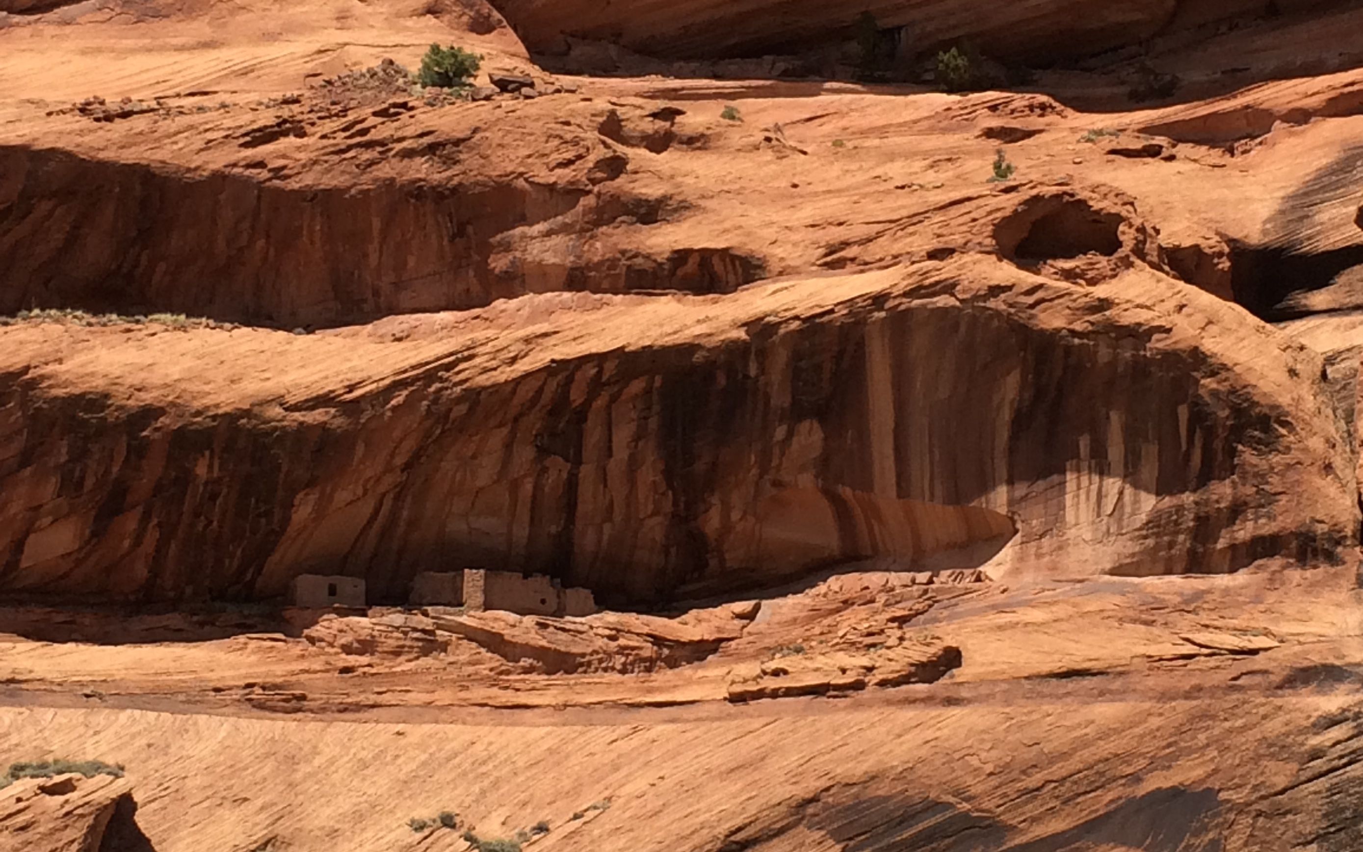
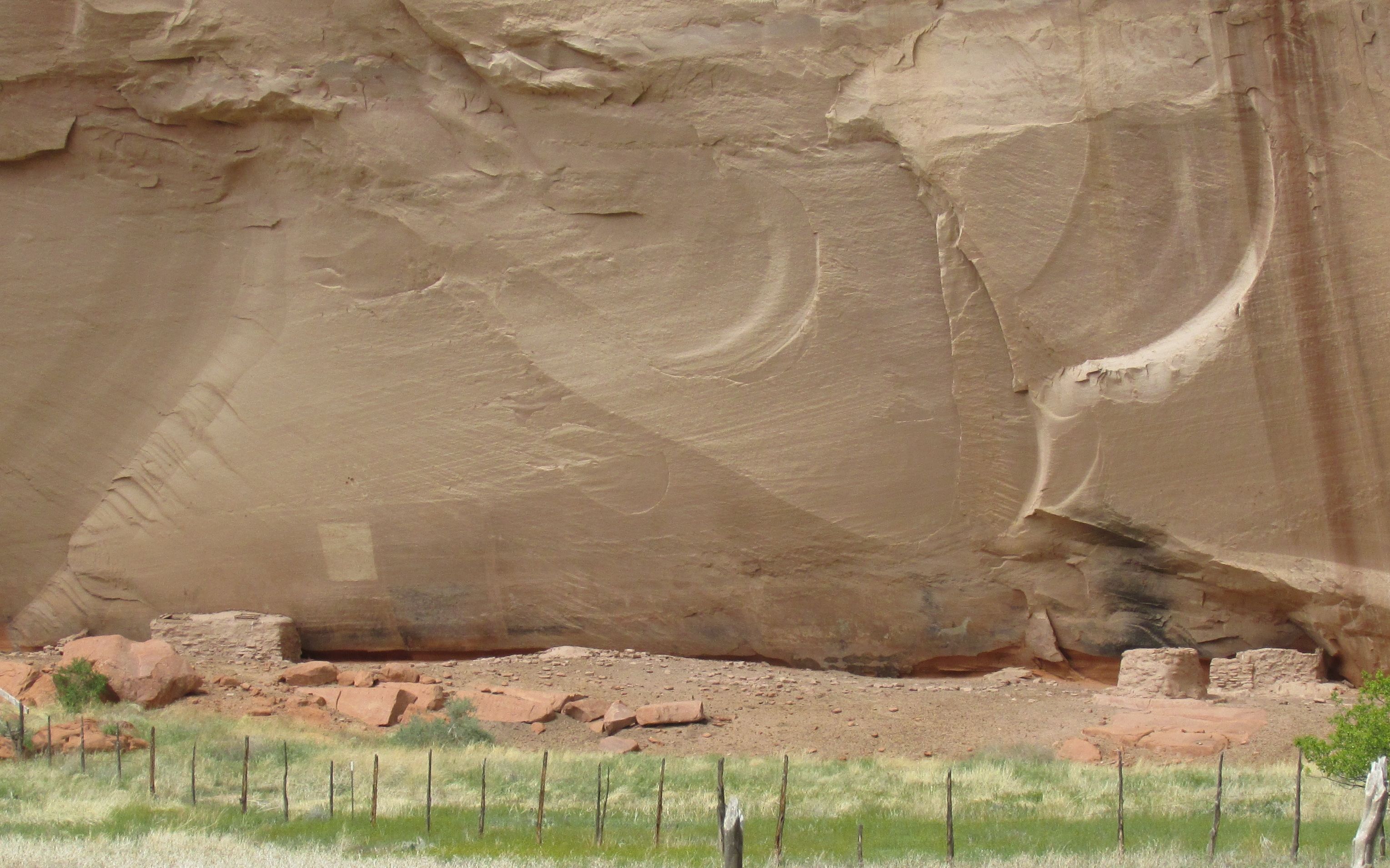
The next stop along the way was a site called the teepees. Some day I will get a camera that allows me to zoom in better, but it you use your imagination, you can see why they were called the teepees.

Teepees 2

I gave you the teepees at this point, just so you could rest your eyes a bit. Next up: Newspaper Rock!

Newspaper rock overview

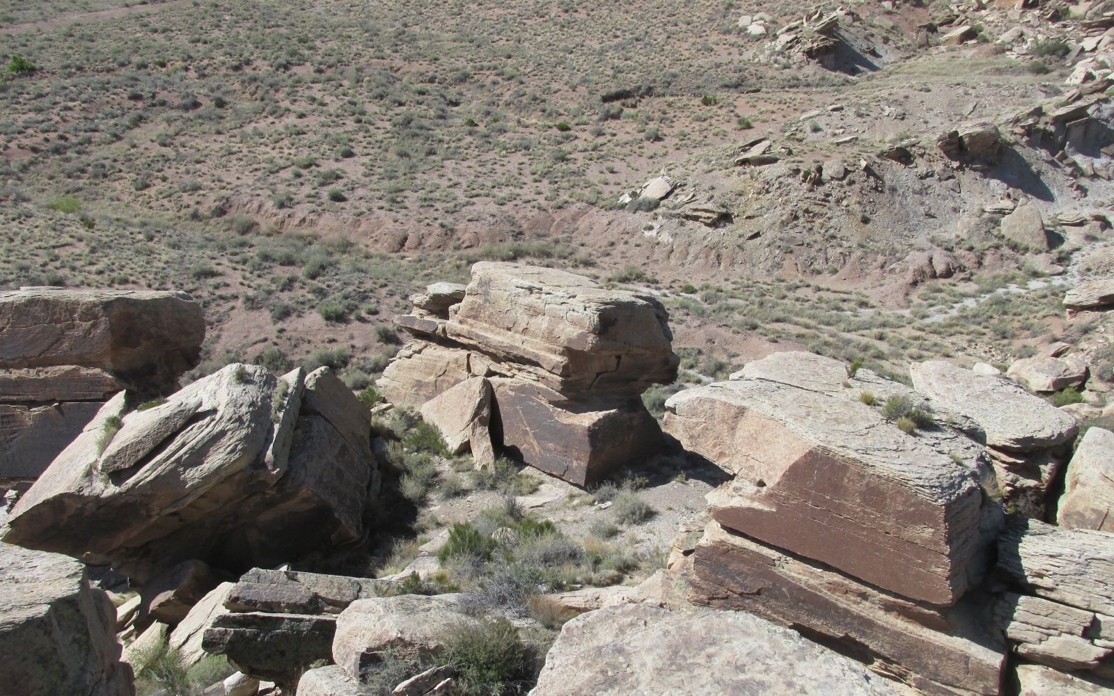
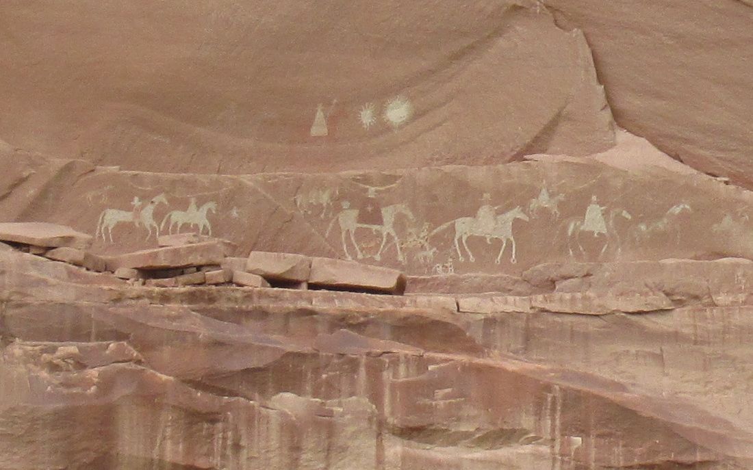
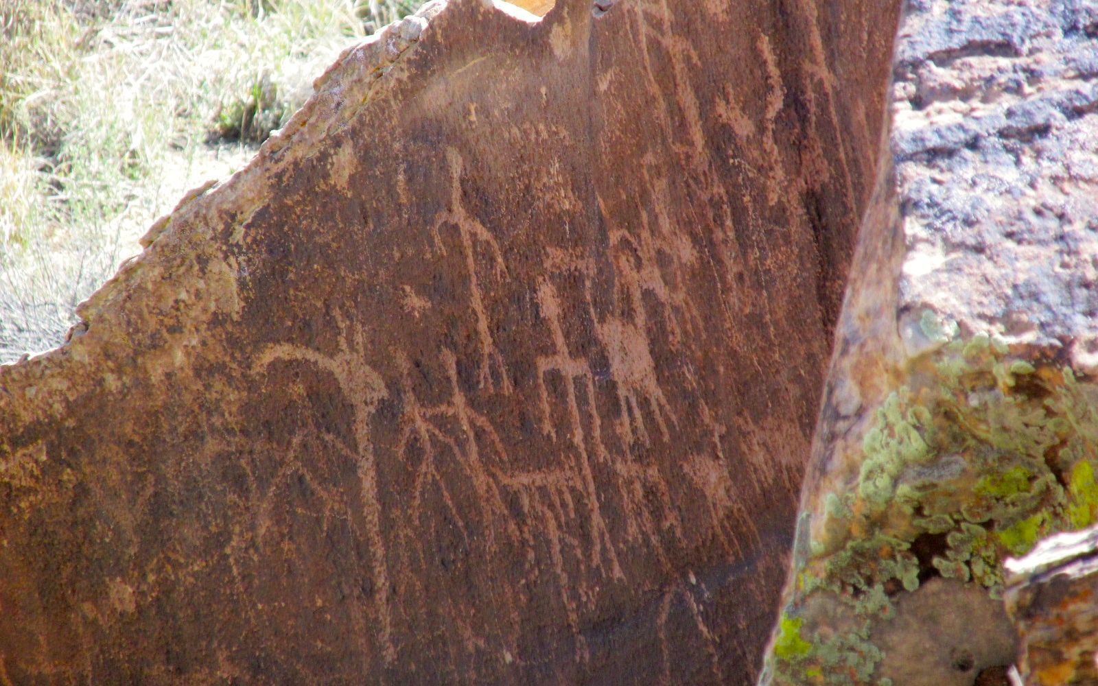
Newspaper Rock is actually a collection of rocks that tumbled down from the cliffs above. According to the information I have, the petroglyphs were created from 650 – 2000 years ago.

Oh, you can’t see them? Let’s see if I can zoom in a bit.

Newspaper rock close up

There are more than 650 designs pecked into the desert varnish exposing the lighter stone below.

Newspaper rock more

I haven’t stopped to count, but I don’t think I saw all 650 designs.

Newspaper rock again

On the other hand, maybe I did.

Newspaper Rock yet again Kokopelli?

Is that Kokopelli there? Might be!

Again, this was a location I originally learned about from Sister Jeanne in art history class. As far was I am concerned, that woman was a national treasure!

It’s time to move along. I’m at the Petrified Forest National Park, and so far the only petrified wood I’ve see has been in the gift shop and used in building the Painted Desert Inn. Where’s the forest?

Blue Mesa 1

Finally! Here’s some petrified wood at the Blue Mesa.

Blue Mesa 2

I wonder if all this petrified wood was lying here exposed when the Puebloans lived in the area?

Blue Mesa 3

If so, did they make use of it?

Blue Mesa 5

This one looks like it must have extended out from the earth for quite a while before it broke off.

yellow flower

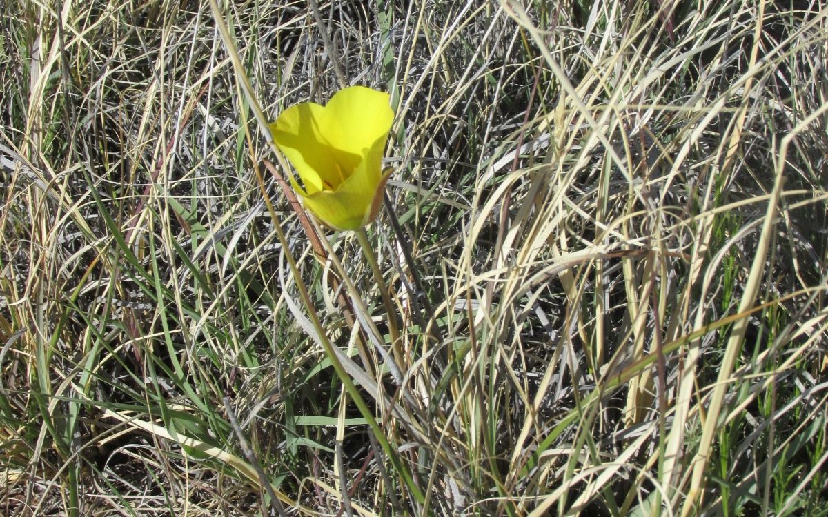
I love it when I find a flower growing that I haven’t seen before. I don’t know what it is, although it reminds me of a poppy.

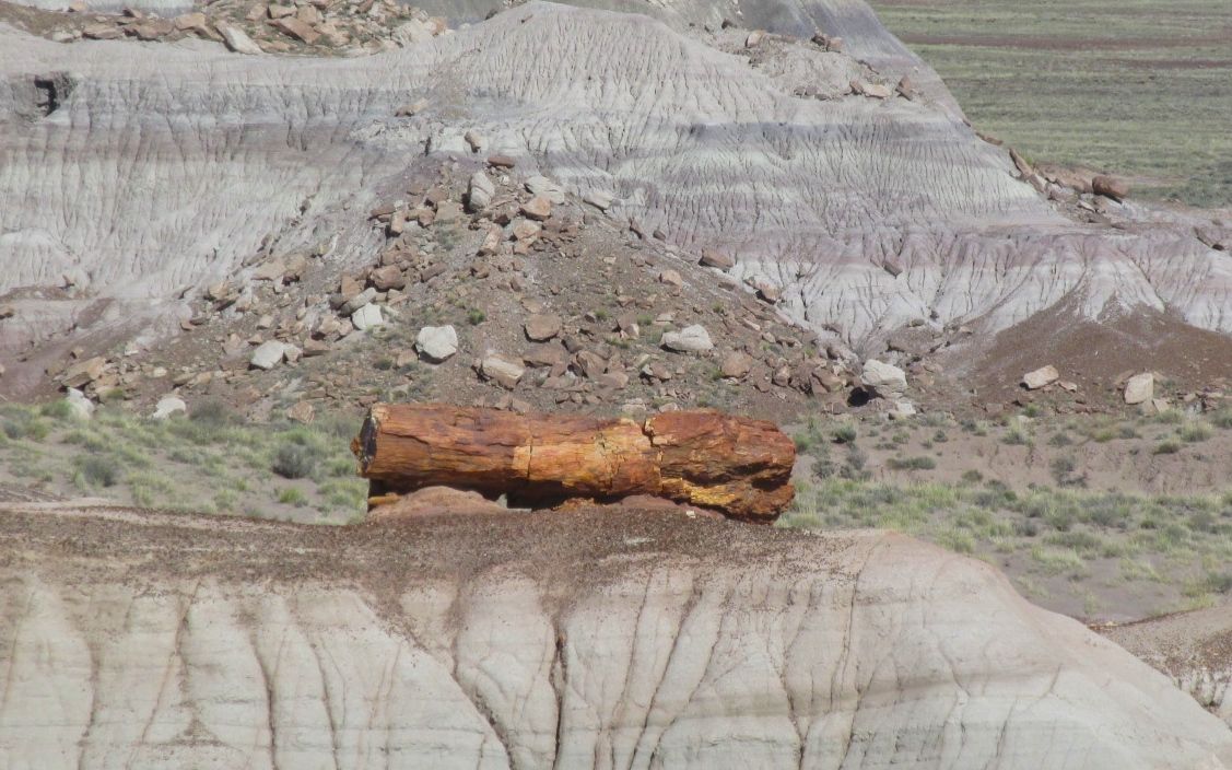
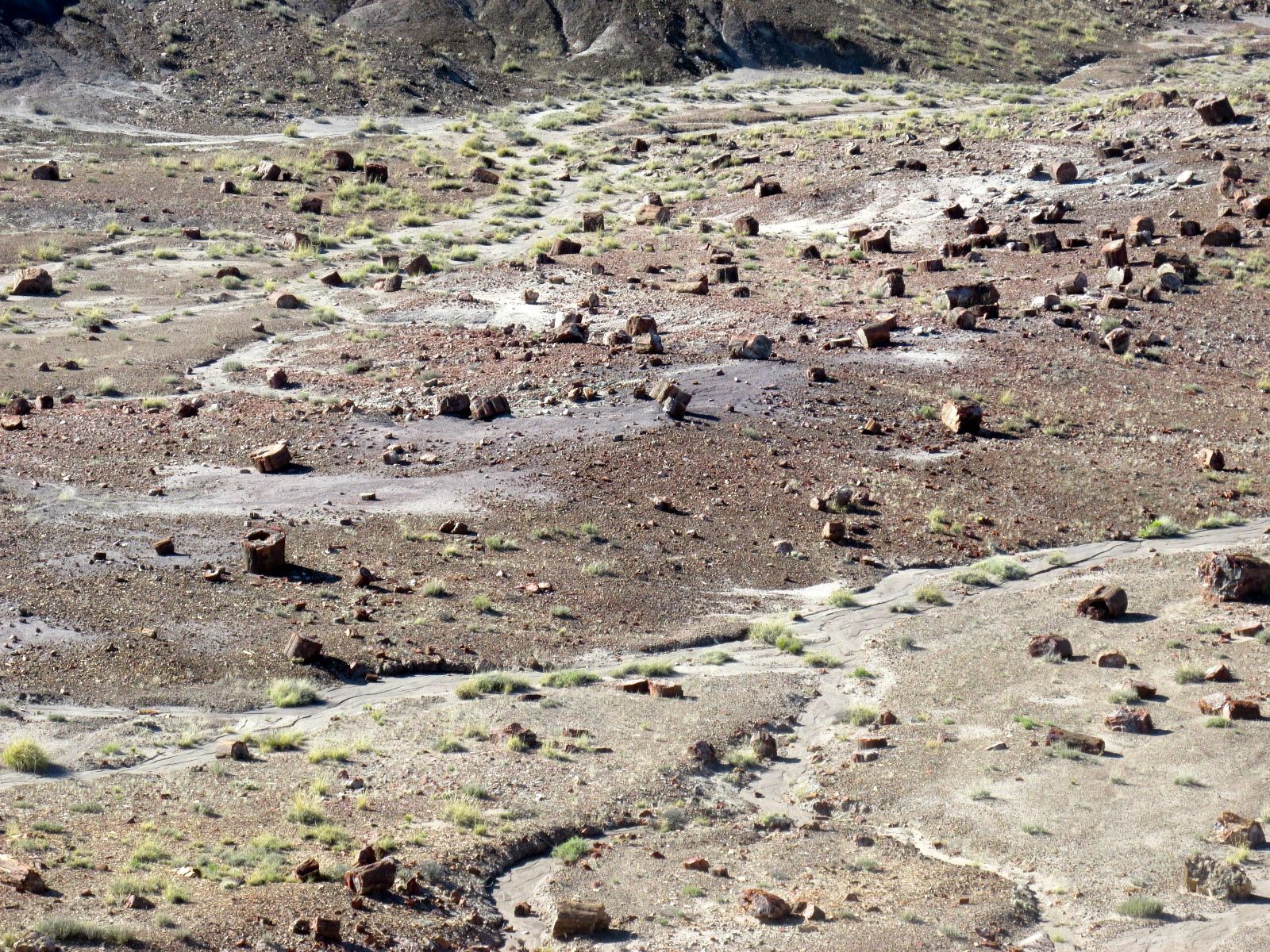
On to the Jasper Forest.

Jasper Forest 1

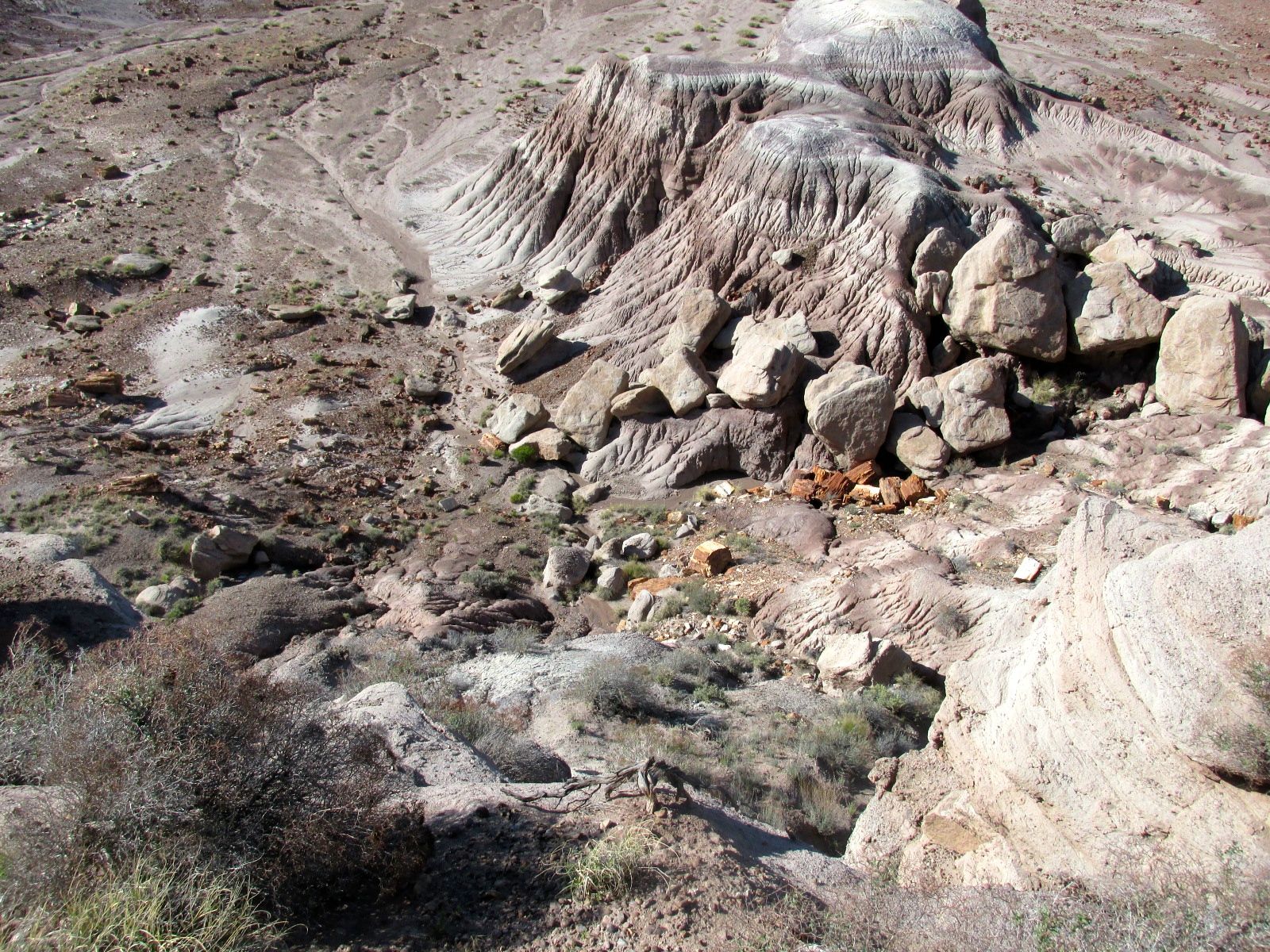
Do you see all the tree trunks lying about?

Jasper Forest 2

Since there are relatively small chunks of petrified wood here, I wonder if they were washed down by rain runoff. I wonder how long that would take in a desert?

Jasper Forest 3

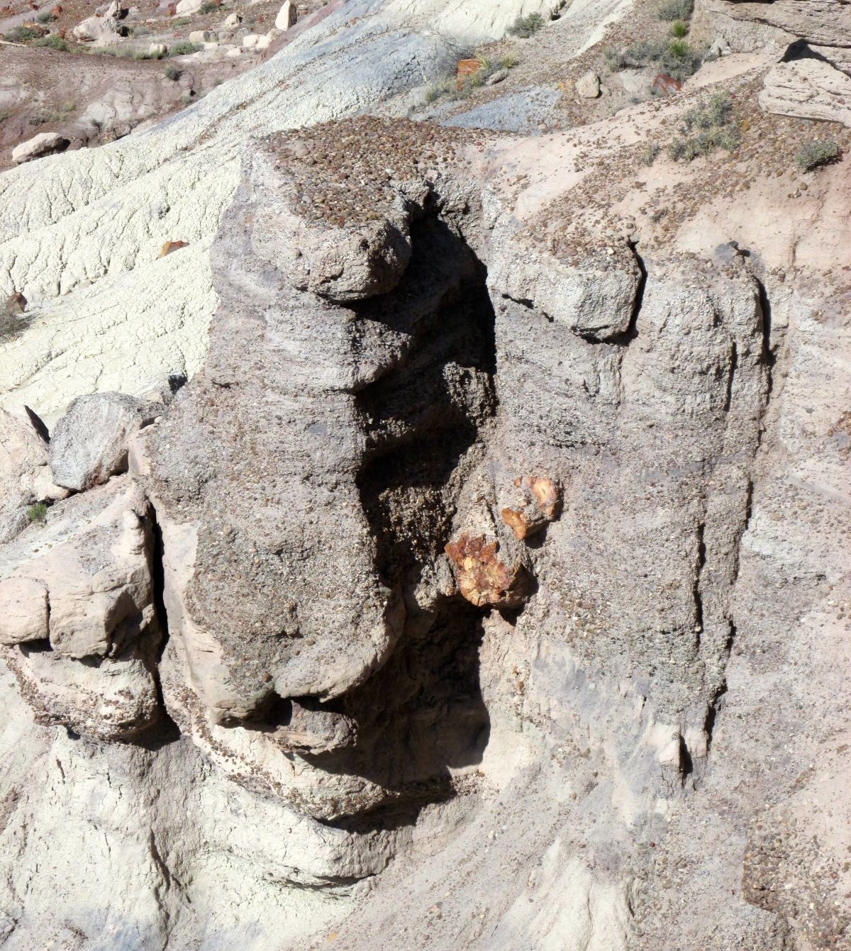
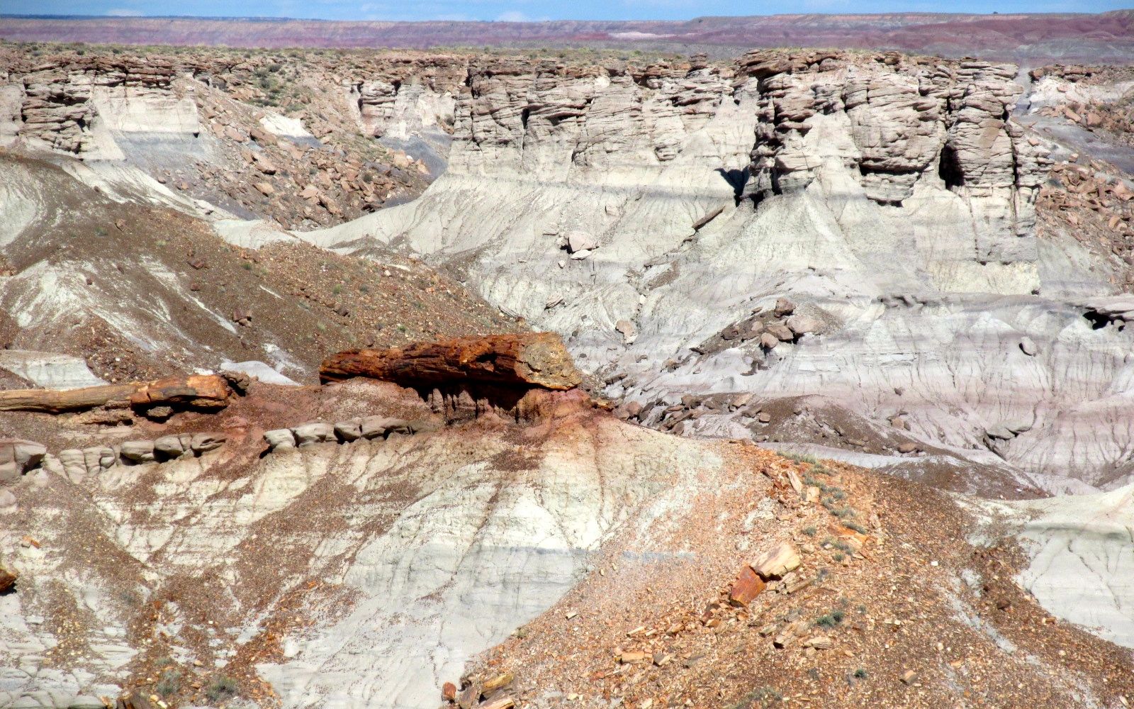
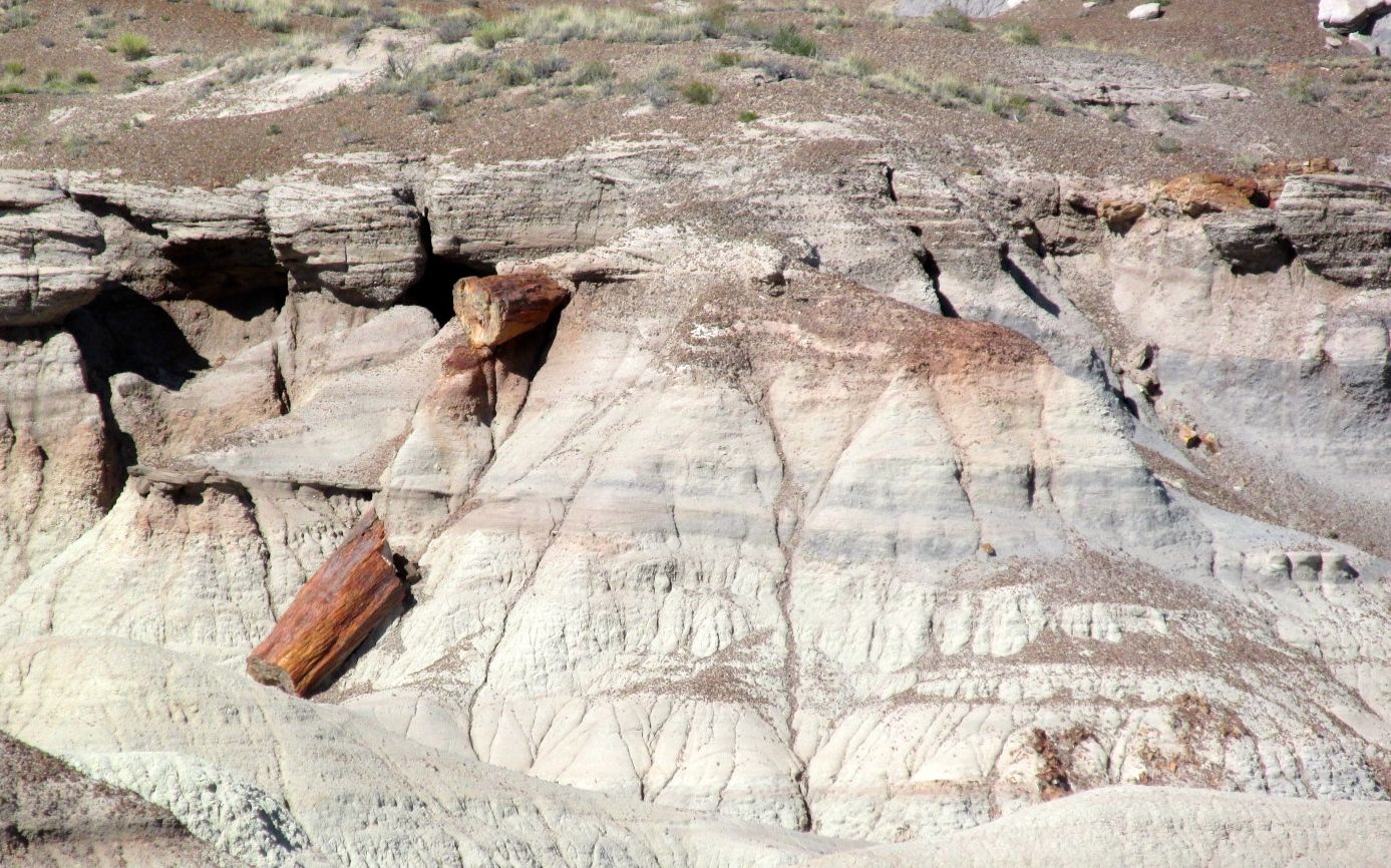
Here’s a log still embedded in a rock formation.

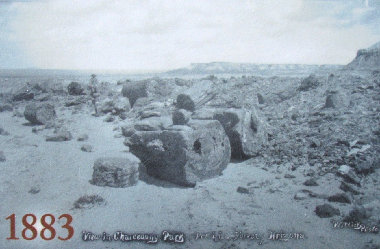
Change happens slowly. Here is a photo of some logs taken in 1883.

Jasper Forest 1883

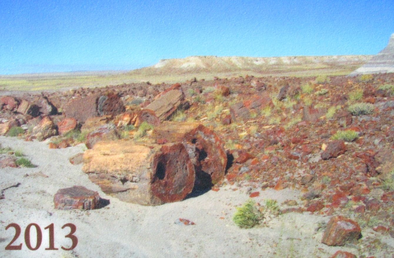
And the same logs in 2013.

Jasper Forest 2013

One last look at the Jasper Forest before moving on.

Jasper Forest 4

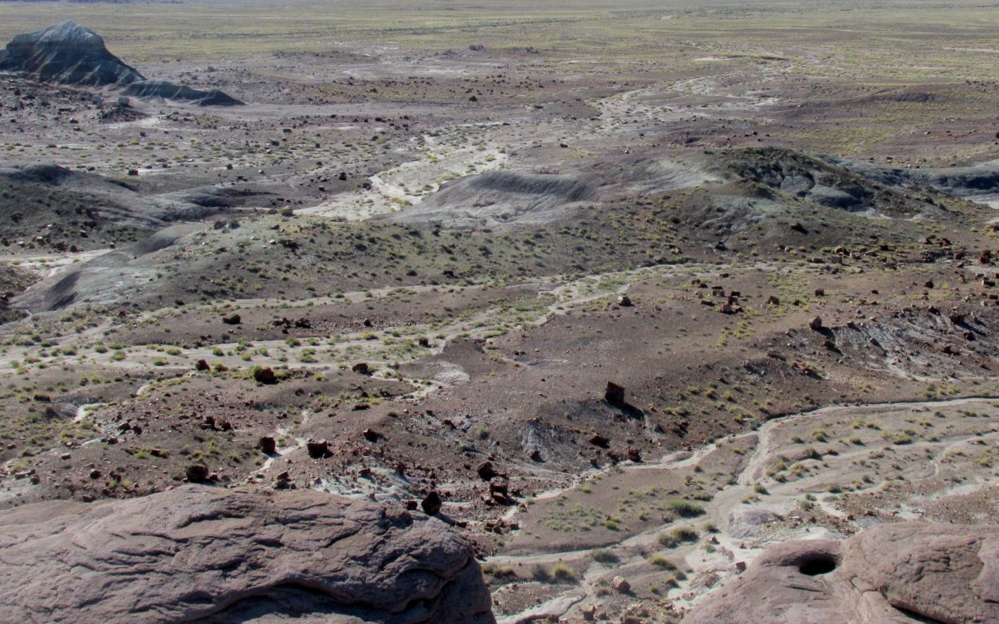
It would be a lot more impressive if we could actually walk up and touch all those logs, but I guess we have to preserve things for the future.

There were a few more stops in the park, but the parking areas were full. My eyes were also getting full, so I decided to see if the rumor was true. I read somewhere that there was free camping at the rock shops at the southern entrance to the park.

Free camping

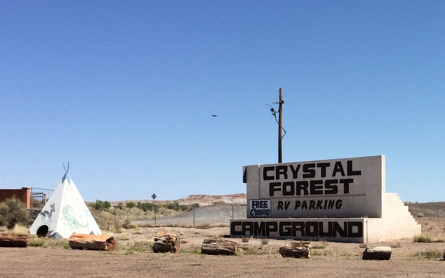
YES!!! Free camping! Not only was the camping free, but they had petrified wool you could actually walk right up to and touch.

Petrified wood by my free campsite

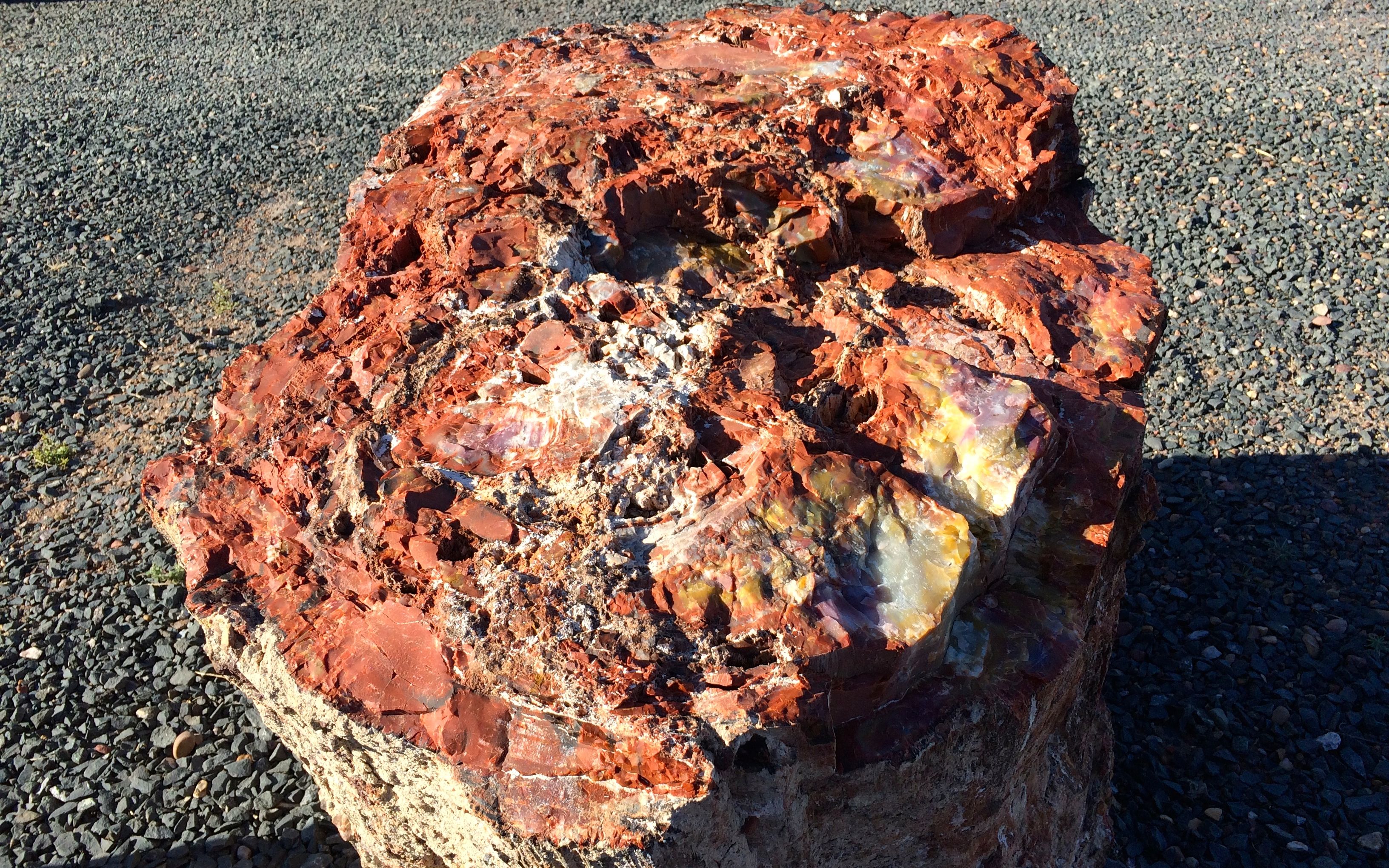
This piece was right by my door. Beautiful!

They had petrified wood all over the place. It is Arizona’s state rock, after all.

Petrified wood at the campsite

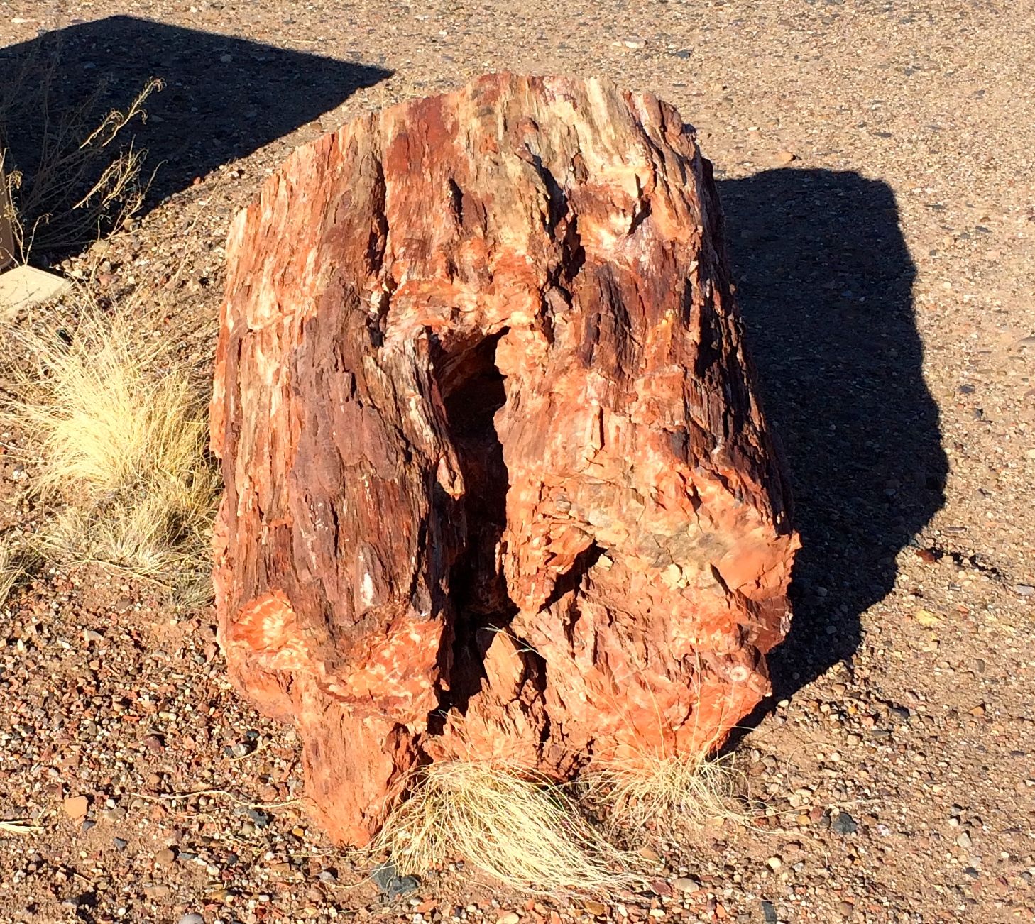
I wonder when these trees actually started growing?

Petrified wood at my campsit round

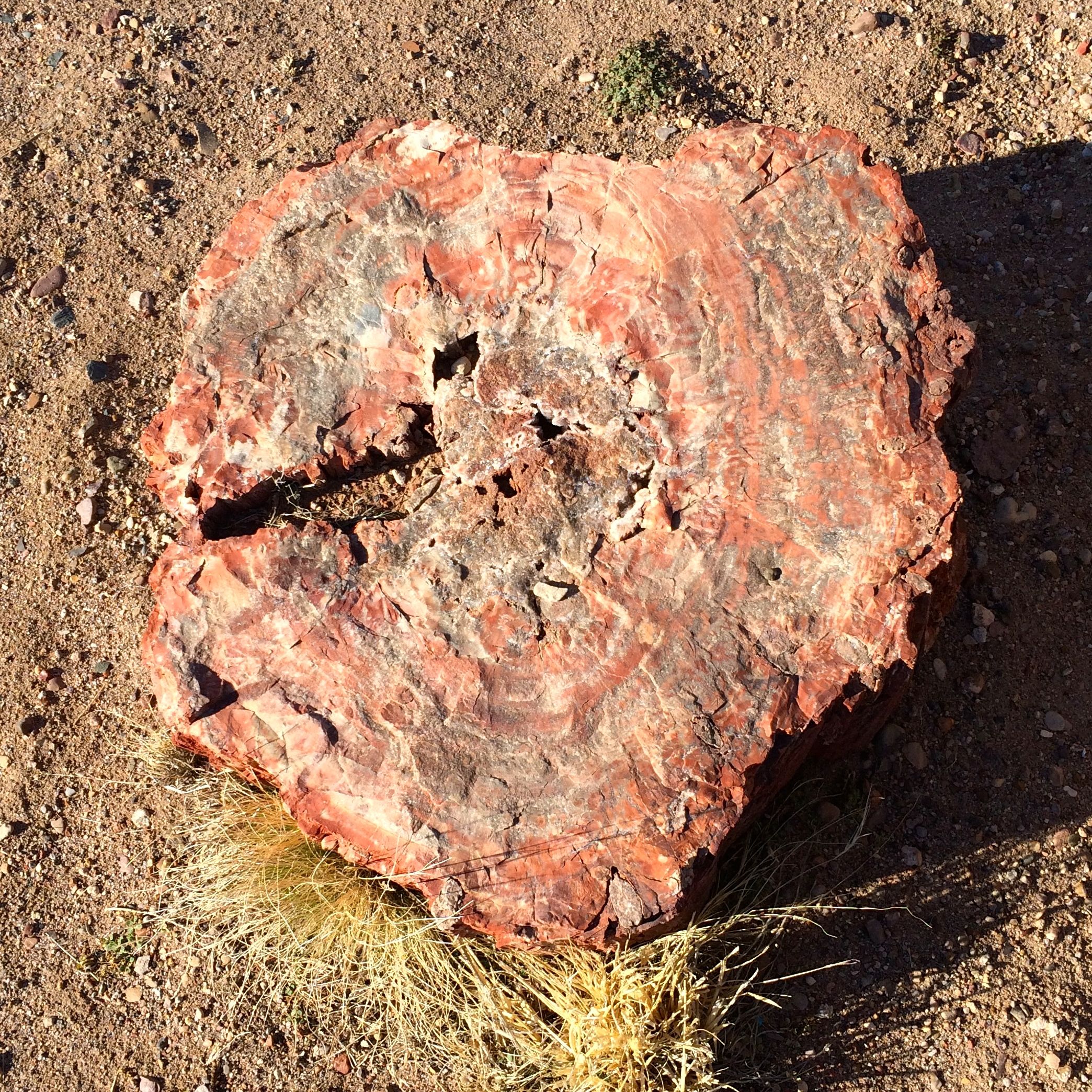
How long did it take for the minerals to replace the wood?

Wood

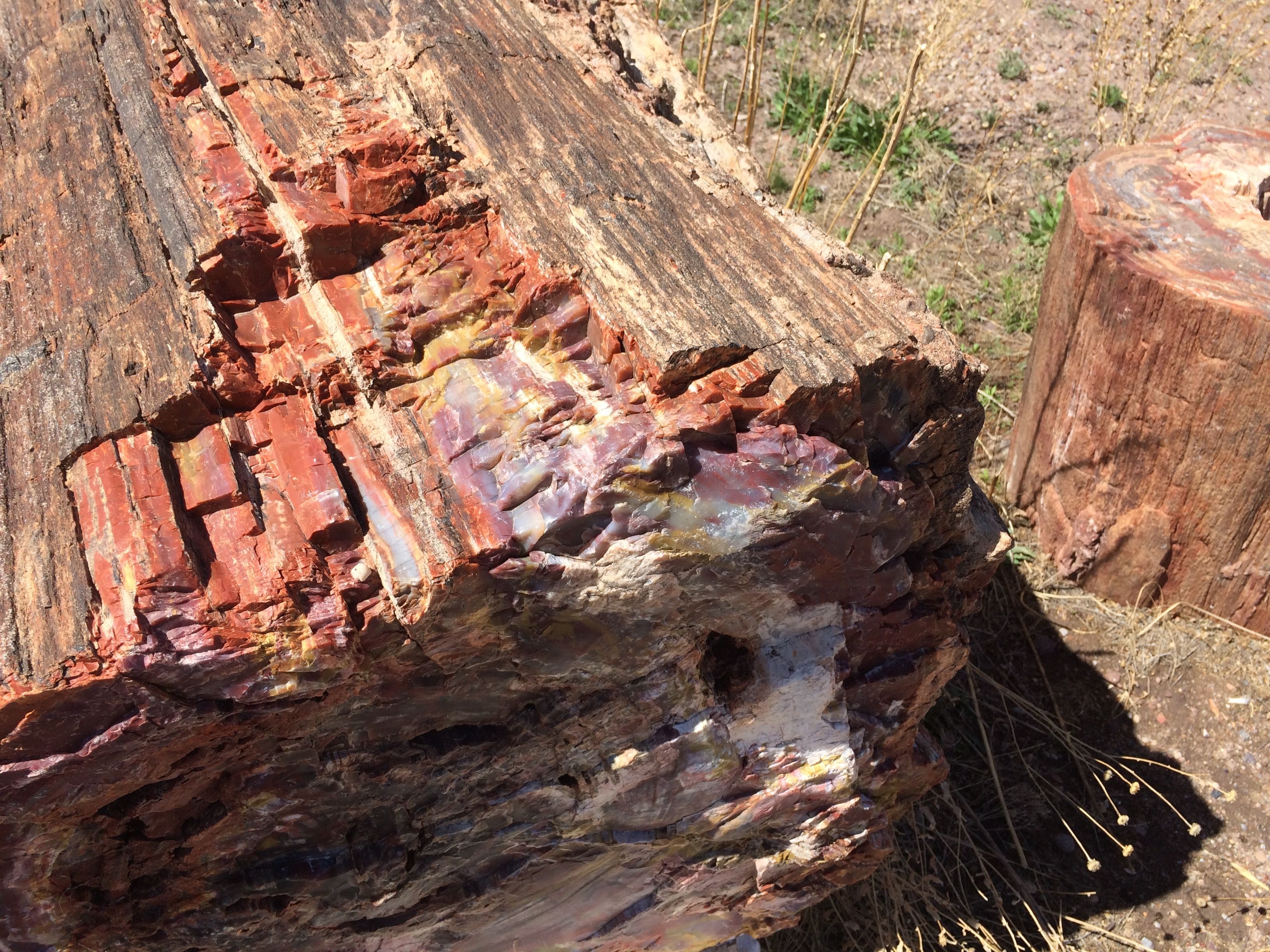
And just where did these incredible colors come from?

Cyrstal forest museum

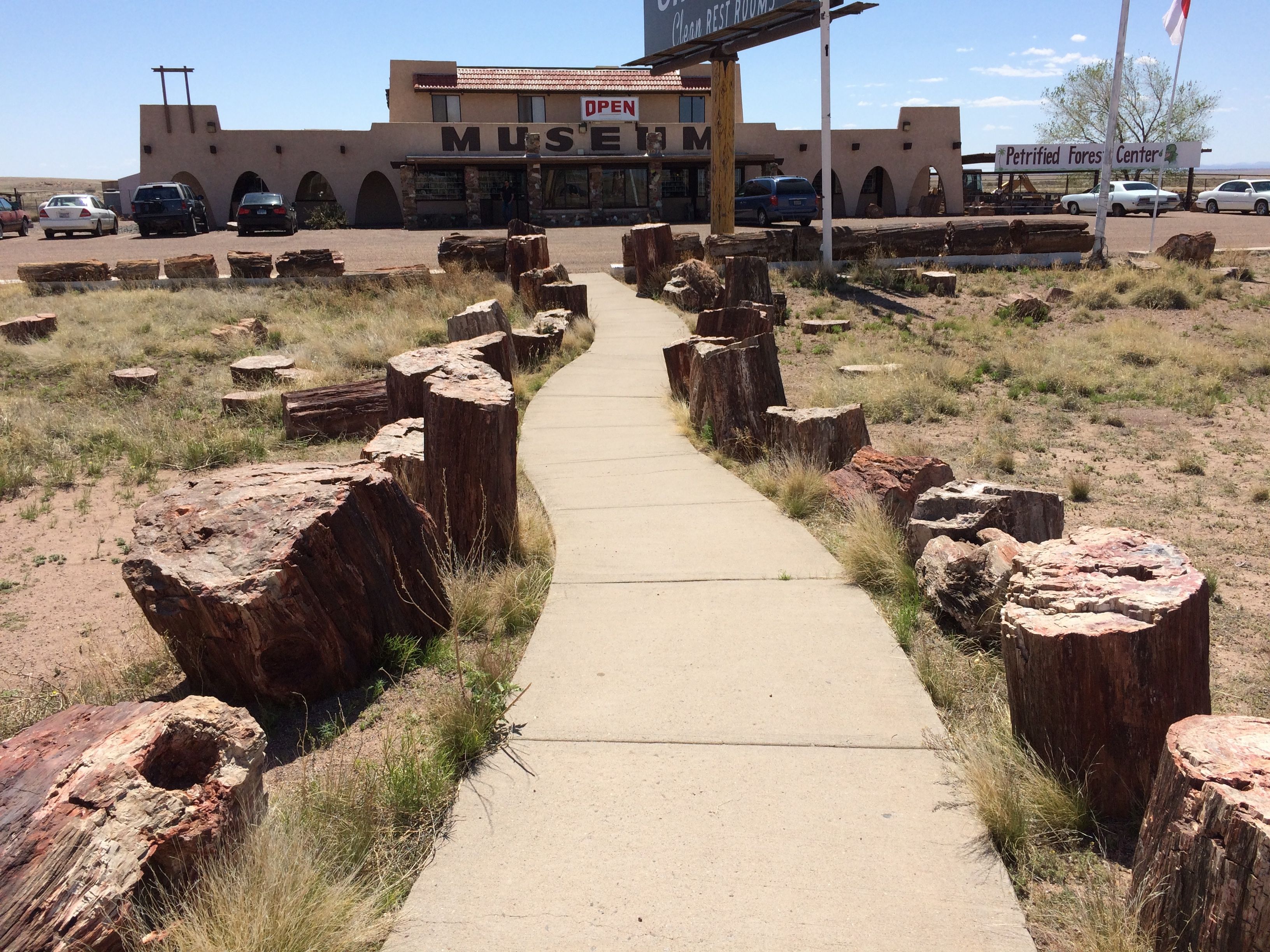
The sign says “OPEN” but the door said “CLOSED”.

Nevertheless, free camping, up close petrified wood, and kitsch abounding.
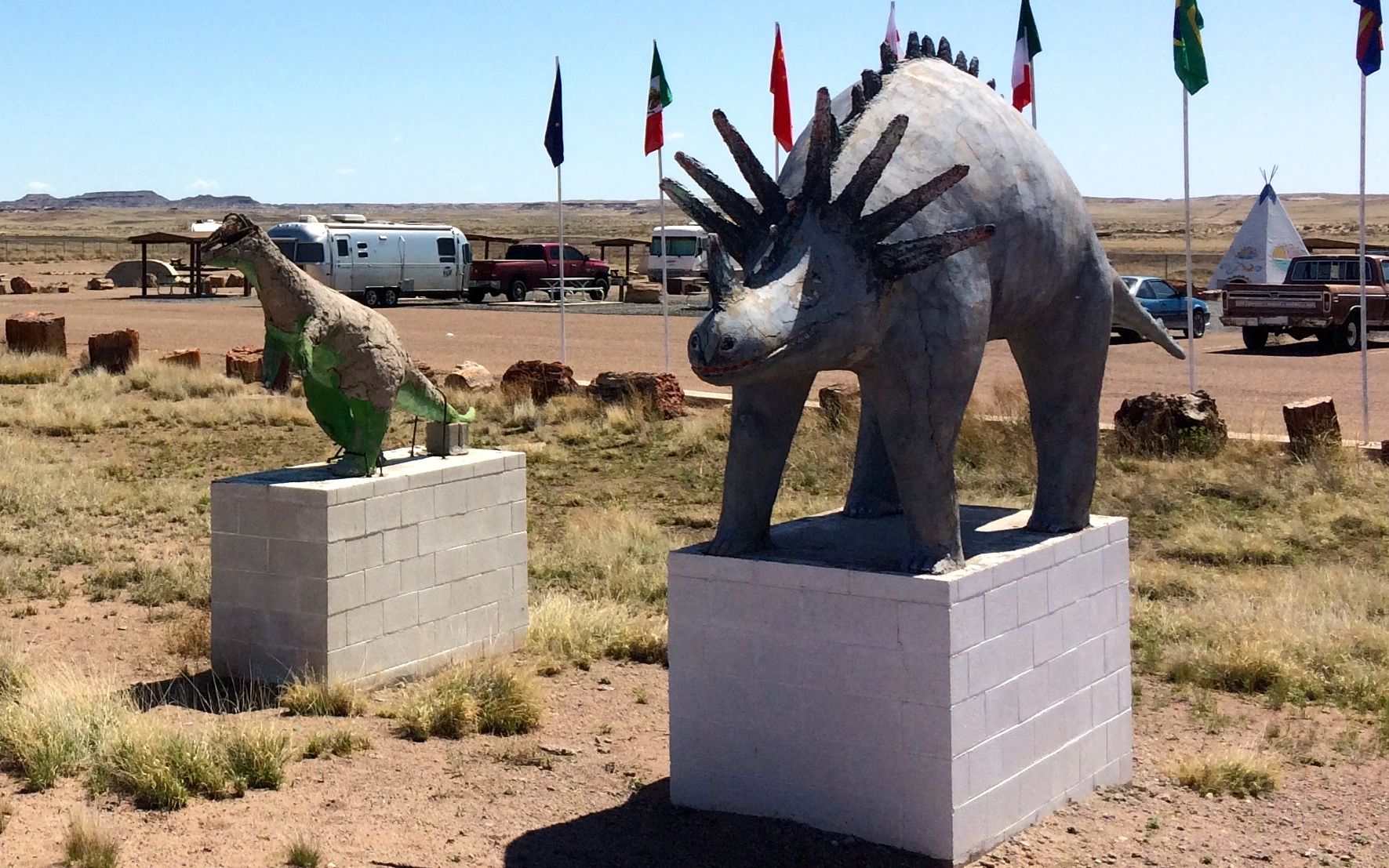
dinosaur statues

Who can beat that?

Teepee

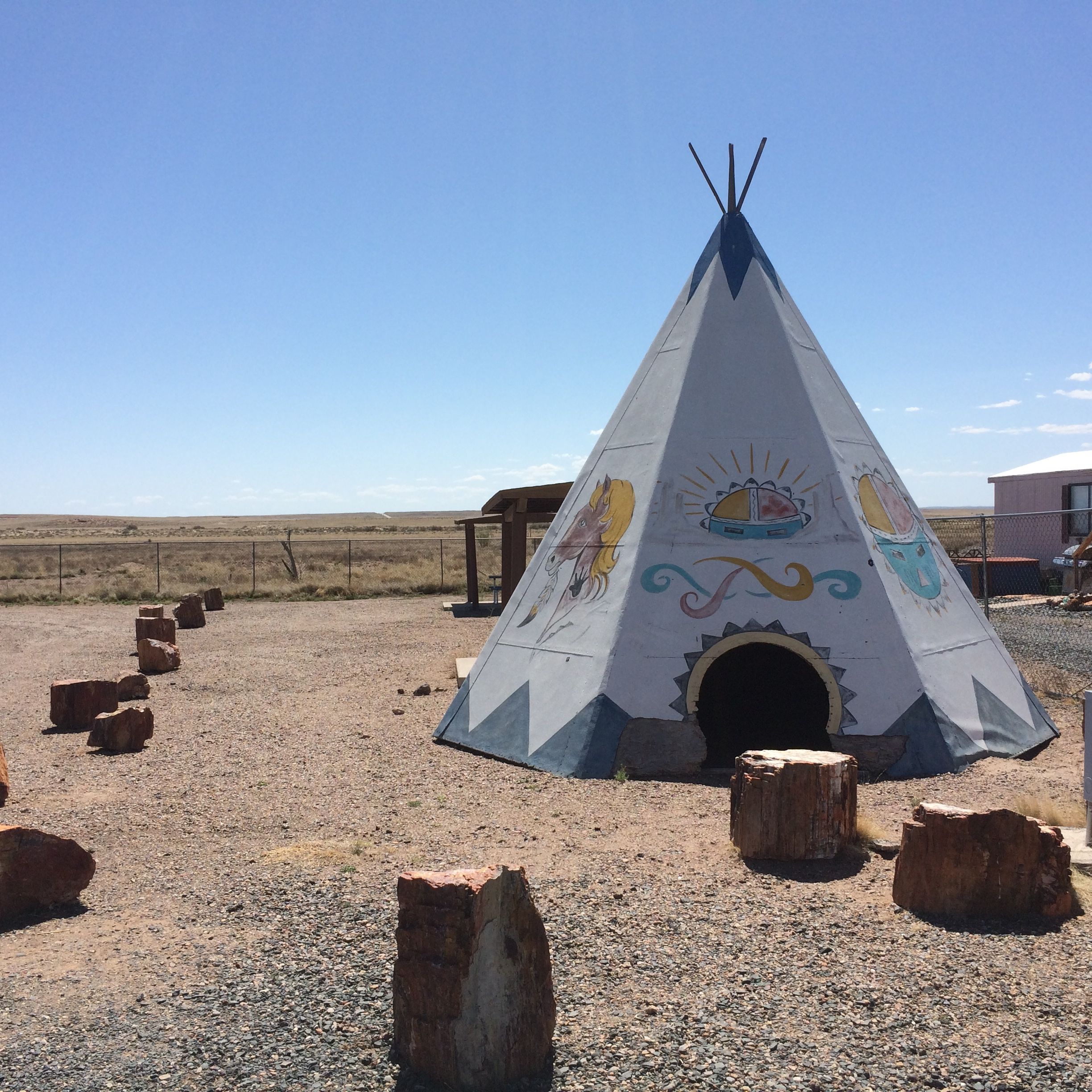
Maybe they even offer free accommodations. I don’t know, but there are doors into the teepees. I had my own bed, though, so it didn’t matter to me.

Next stop: Winslow, Arizona!

Canyon de Chelly from the Canyon Floor

I have to admit that I had to tamp down a bit of resentment that we had to take a tour if we wanted to enter the canyon. Of course, the Navajo have a right to make a living and if it I were in the same situation, I would not enjoy have hordes of visitors walking around in my back yard. However, that being said, when the vehicle you are riding in looks like this:

tour vehicle

and you needed all the power and wheels it had, I am just as glad I wasn’t allowed to drive my truck into the canyon.

For one thing, this is what the roads looked like:

The road - stream

We drove right up the creek or river that was flowing down the canyon! Some places had more recognizable roads, but splashing through the water was the norm.

Going through the water

And I really appreciated the seat belts that were provided. It was not exactly smooth going.

David the guide

There were five of us on the tour and George was our guide. He did a good job of pointing out all of the main points along the way. The other people on the tour were from California, and they got to talking with him about the state. He told us that he was stationed in San Diego when he was in the Navy. Somehow it came up that his uncle had been one of the code talkers during World War II. We were all quite impressed.

We passed herds of horses from time to time. I asked George if they were wild horses. He said that they belonged to families and that they were branded so that they knew whose horse was whose.

horses1

I was really surprised at how many ruins there were in the canyon. We passed by so many that George didn’t identify. The first one we stopped at was called “First Ruin.”

The First Ruin

These are the ruins of the Anasazi. They were ruins when the Navajo arrived in the canyon.

The First Ruin close up

They would live up on the ledge and then farm the canyon floor below.

Petroglyphs first stop

I almost thought George was kidding us when he stopped at this rock to point out the petroglyphs. But, if you look long enough and carefully enough, you start to see them.

Petroglyps close up left

This panel is on the left side. George told us that these were carved by the Navajo. You can tell, because they have horses.

Petroglyphs close up center

This panel is in the center. If I remember correctly, he said that these were carved by the Hopi.

Petroglyphs close up right

These carvings were on the right. They look like more horses to me. The figure eight reminds me of the analemma – the path that the sun takes in the sky during the year.

analemma

In fact, have you see the Tom Hanks movie where he tracks time by plotting the sunlight that comes through a hole in a cave?

analemm-in-cast-away

I wonder if they were making some sort of a calendar?

Kokopelli Cave large

Our next stop was Kokopelli cave. It was filled with pictograms, including Kokopelli himself.

Kokopelli Cave kokopelli close up

You can see hunch-backed Kokopelli playing his flute.

Kokopelli cave with hand print glyphs

The inside of the cave was full of handprints that were created by taking the pigment in the mouth and spraying it around the hand.

Ruin

This is another ruin that we passed without explanation. I am surprised I managed to get a photo of it. The Anasazi located their building carefully, on the sides of the canyons that got the most sun.

I wish I had selected my seat in the vehicle with the same care. Every time we stopped to look at something, I had to unbuckle, stand up and turn to see what we were looking at.

The Navajo today are also taking advantage of the sun. Their farms are down in the canyon, and they move down from the rim once the growing season starts.

Summer home with solar power

You can see that this house, which appears to be based on the hogan, has solar panels and a dish antenna. I don’t know what they pick up down here, but it must be something – otherwise why would they have a dish antenna?

I asked George about how the land was allocated. Did the Navajo nation divide it up? Did they sell it to the families? He told me that after the Navajo were driven out of the canyon and forced to walk to the US Army’s Fort Sumner concentration camp on New Mexico’s Pesos river in 1863, they began to return in 1866. When they got there, they staked their claims to the land. Eventually, ownership was formalized and families now have title to the land. If you would like to read more about The Long Walk, click here.

Navajo fortress

This is the Navajo fortress, where many of them hid when Kit Carson was trying to drive them out.

Gallopping horses

We continued along the way. It was always delightful when bands of horses would gallop past us.

Foal in the road

It was foaling season, as some of the young ones hadn’t quite figured out that the road isn’t a great place for a nap. George slowed down so we could get a shot of him. He did get to his feet and saunter away.

Ruin

I tried to take notes on my phone, but that is hard to do that when you are bouncing all over the place. Forgive me if I can’t do some of these justice.

Channeling my best Jackie Kennedy from Vaughn Meader’s  “The First Family”,

Ruin tucked up on ledge

There’s this one,

Ruin tucked up on ledge 2

And that one,

Ruin tucked up on ledge 3

And that one over there.

Junction Ruin

I did get some of the information recorded, though. This is Junction Ruin, which is at the junction of two canyons.

Canyon view

I can easily see how the Navajo could hide in Canyon de Chelly. It is really a series of canyons.

If you didn’t want to ride in the six-wheeled vehicle we took, there were other options. I think the most interesting alternative was on horseback.

horseback tour

However, considering how tired and sore I was after my tour, I can’t imagine how I’d feel after a day-long horseback ride.

This is Antelope Ruin.

Antelope Ruin

It is named after the pictograms on the canyon walls.

Antelope pictogramsI believe George said that the Hopi made the white images first. When the Navajo took up residence, they added their own touches. Whenever you see horse, you know that it’s the work of the Navajo.

antelope ruin pictogram grouping

antelope ruins pictogram with circle and snake

You can see the older Hopi work here. George said that the zig zag represents a snake.

I am quite partial to pictograms and petroglyphs. I am not sure where in the canyon this one was from.

Navajo pictograms from the times of Spanish exploration

George said that it was from the time of the Spanish exploration.

summer house

George told us that this was an old-style summer house. It looks to me like they reused some of the stones from the tumbled down ruins to build it. In the foreground is an orchard. If you look to the right of the house, you can see a loom that is used in weaving rugs.

storage buildings

Over to the left are storage rooms.

The canyon walls behind the house are decorated with pictograms.

I am not sure if these pictograms were from this location or not.

circle pictograms

Just enjoy them.

dancing figures pictograms

I find this pair charming. I hope they are dancing for joy.

Raise the roof pictogram

This fellow seems to be saying, “Raise the roof!”

Our last stop on the tour was White House Ruin.

White hous ruins

We only had a little time at this stop. There were some vendors there. the other people checked out their wares. I scampered over to get a better look.

White hous ruins 2

I had one of the folks on the tour snap my photo.

Me at White House

If you don’t have a picture, how can you prove it happened?

Then we headed back. It was getting chilly – but at least it wasn’t raining or snowing while we were out.

Back at the campground, it was time to get things ready to roll in the morning.

Next stop: The Petrified Forest!