Pipestone National Monument

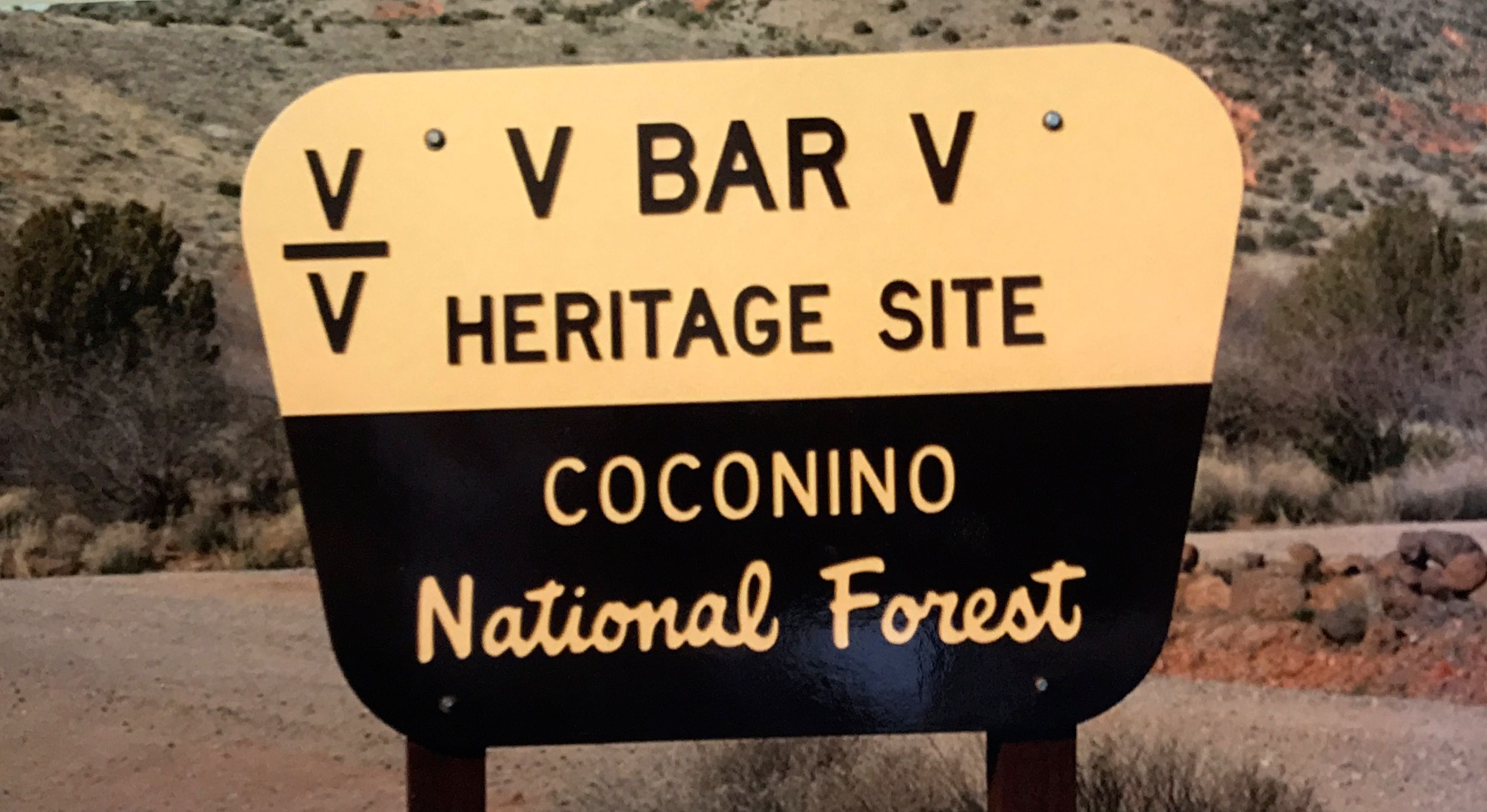
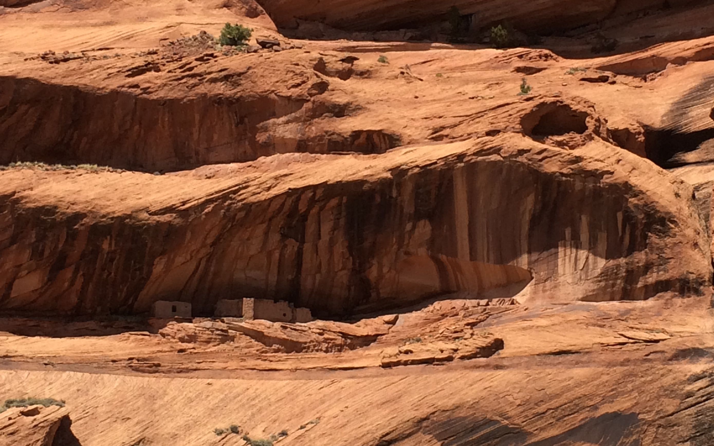
As long as I was in the Southwest corner of Minnesota, I decided to check out Pipestone National Monument. The only “Pipestone” I’d heard of before was a street in Benton Harbor, Michigan. But, I was in the neighborhood, so why not?

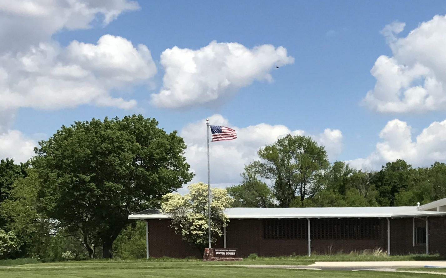
I got to the visitor center and tried to learn what I could about what pipestone was and why it was important.

It turns out that pipestone is another name for catlinite. It’s a metamorphosed mudstone that is found in formations of Sioux Quartzite. It’s fine-grained and easily worked and used in making ceremonial pipes for all of the Plains Indians. It was so important that to all the Plains Indians that this was neutral territory where all Nations could quarry stone for ceremonial pipes.

The Sioux tribes may have taken control of the quarries around 1700, but the Minnesota pipestone has been found inside North American burial mounds dating from long before that. I hope they are no longer excavating burial mounds. When you know better, you do better.

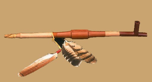
The name for the sacred pipe is “chanunpa”. If you are interested in more information, click here.

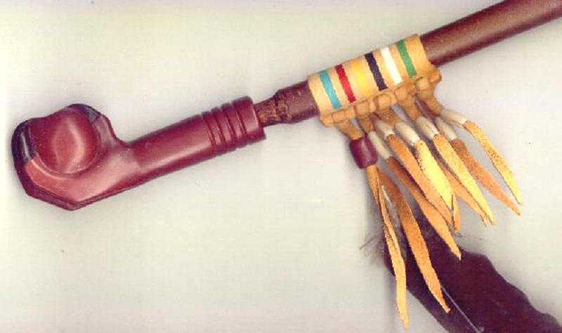
I imagine that there were any number of different styles. After all, there were numerous Nations and they produced them for many, many years.

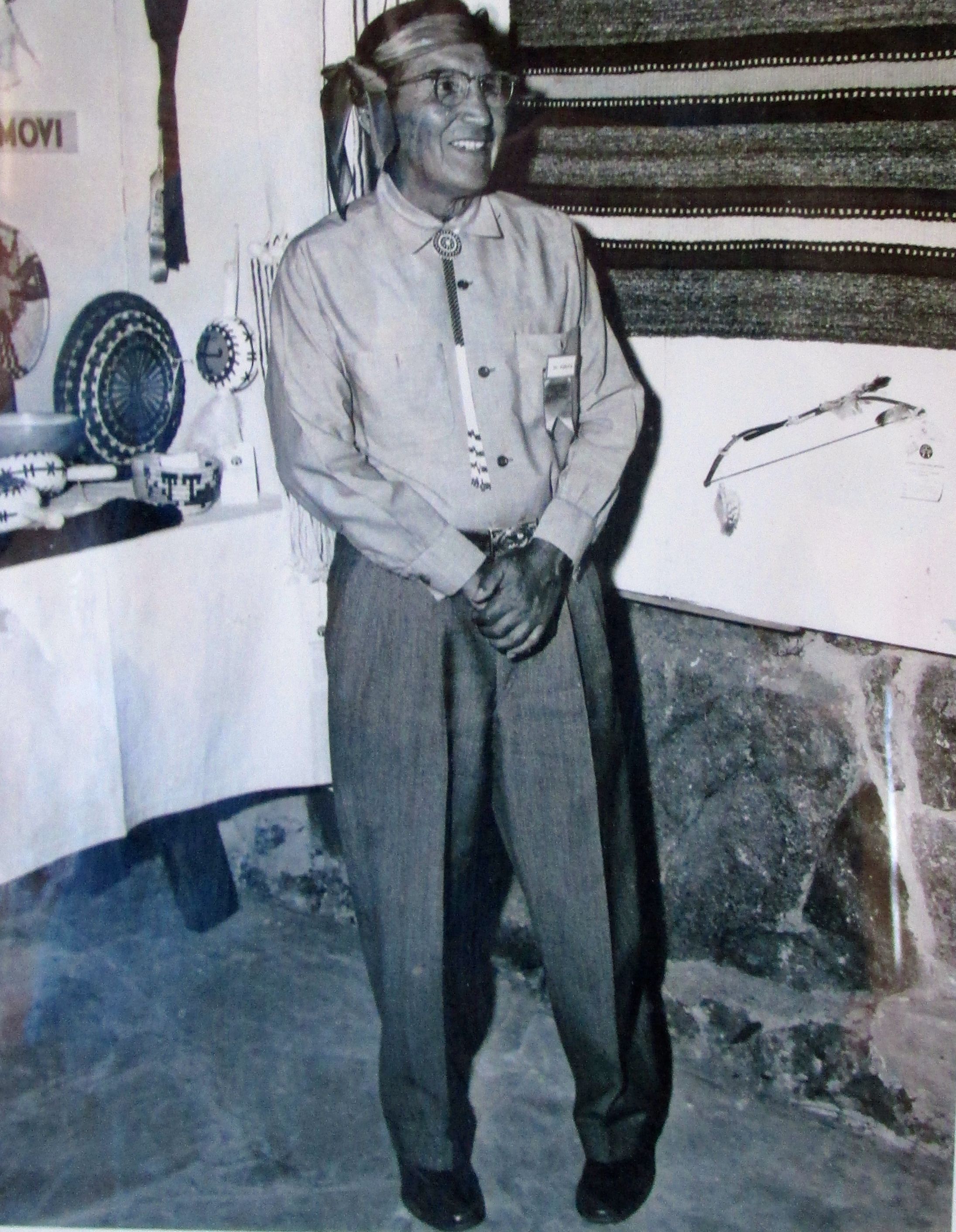
They had some artisans in the visitor center working the soft stone. The ones I saw seemed to be producing articles for the tourist trade.

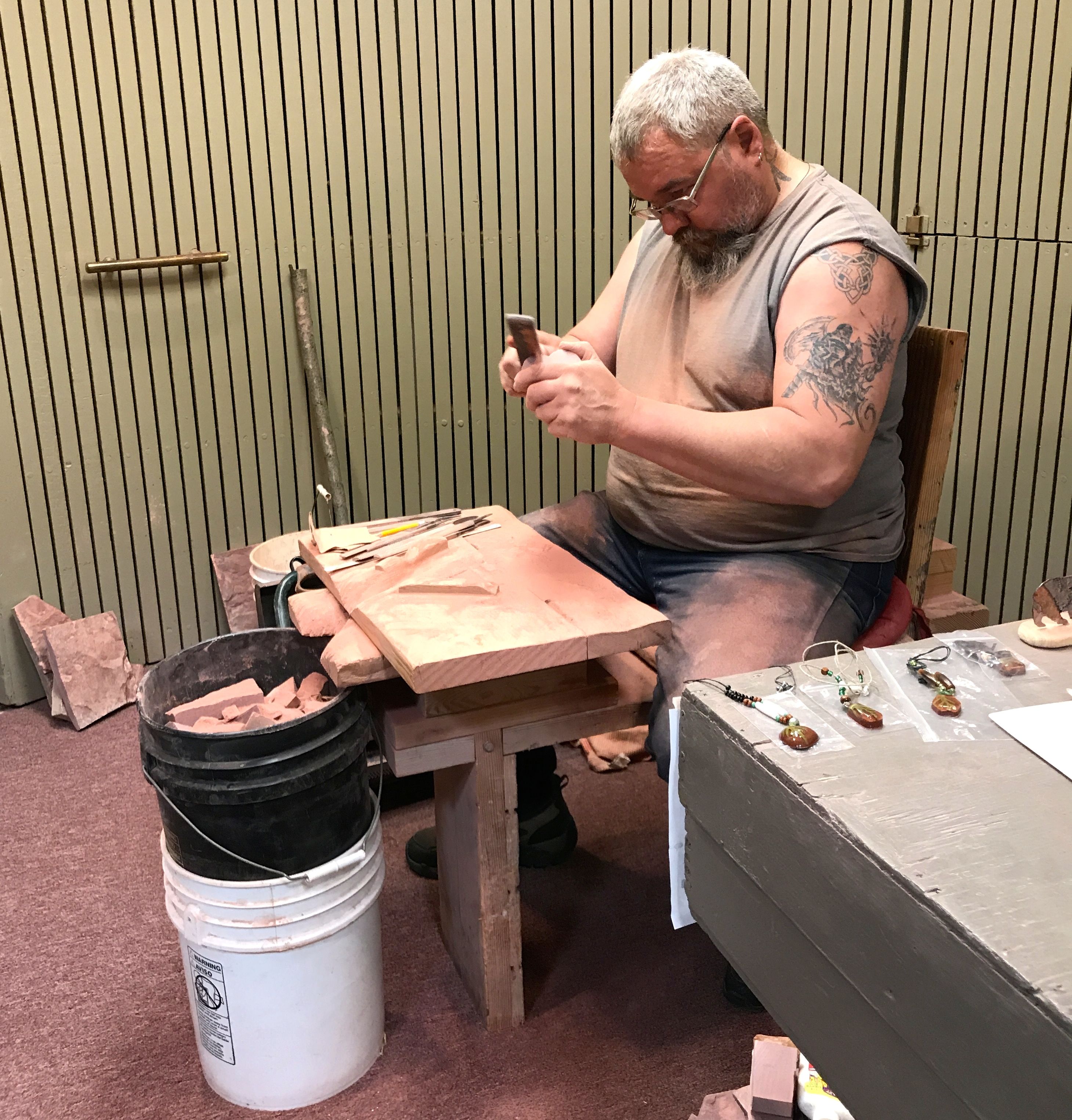
In spite of the fact that the stone was smooth and attractive, I decided against buying a souvenir. That’s just the way I roll.

There are still active quarries at the monument. In 1937, an act of Congress restored quarrying rights to the Indians. Today, only people of Native American ancestry are allowed to quarry the pipestone.

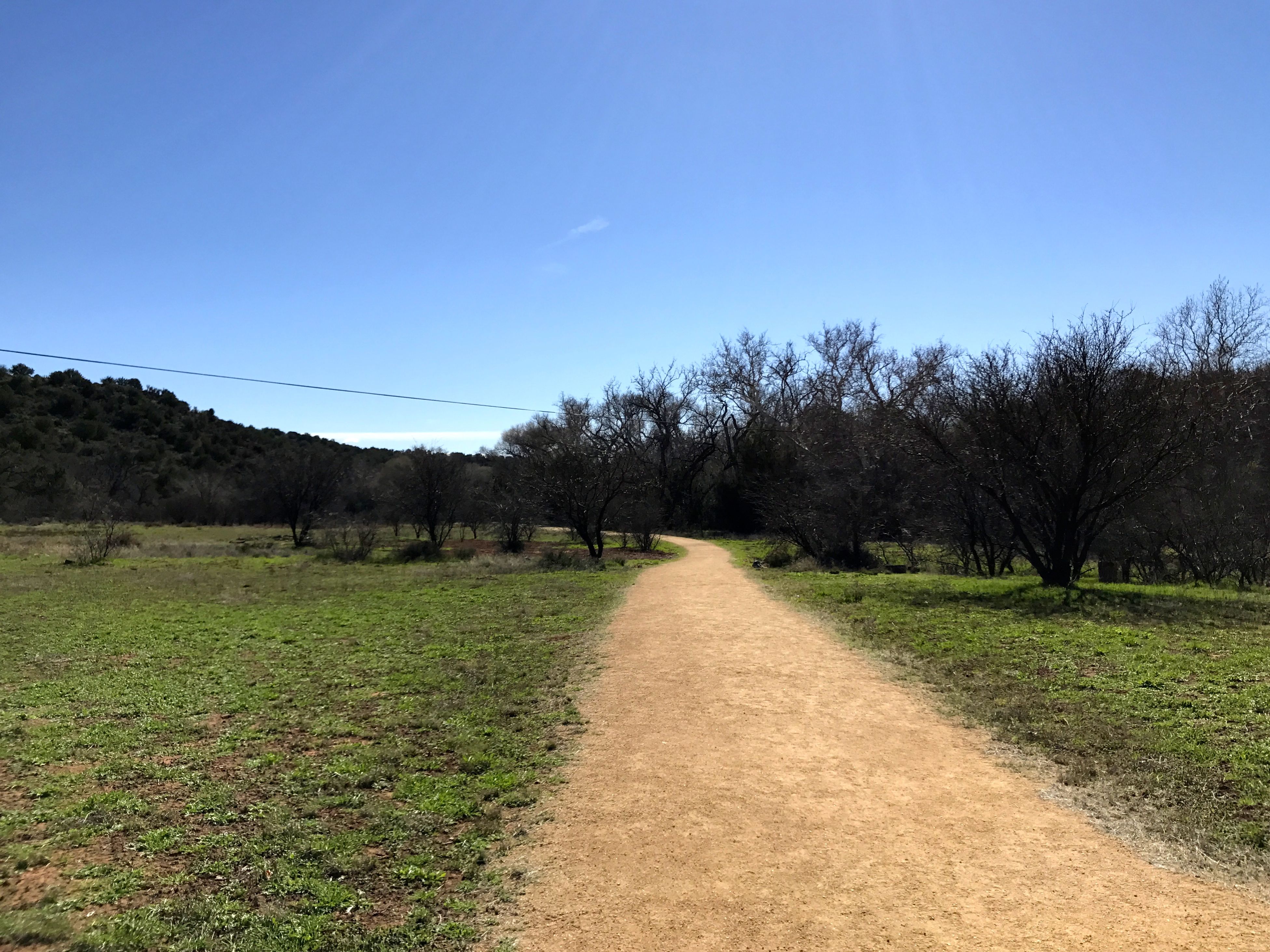
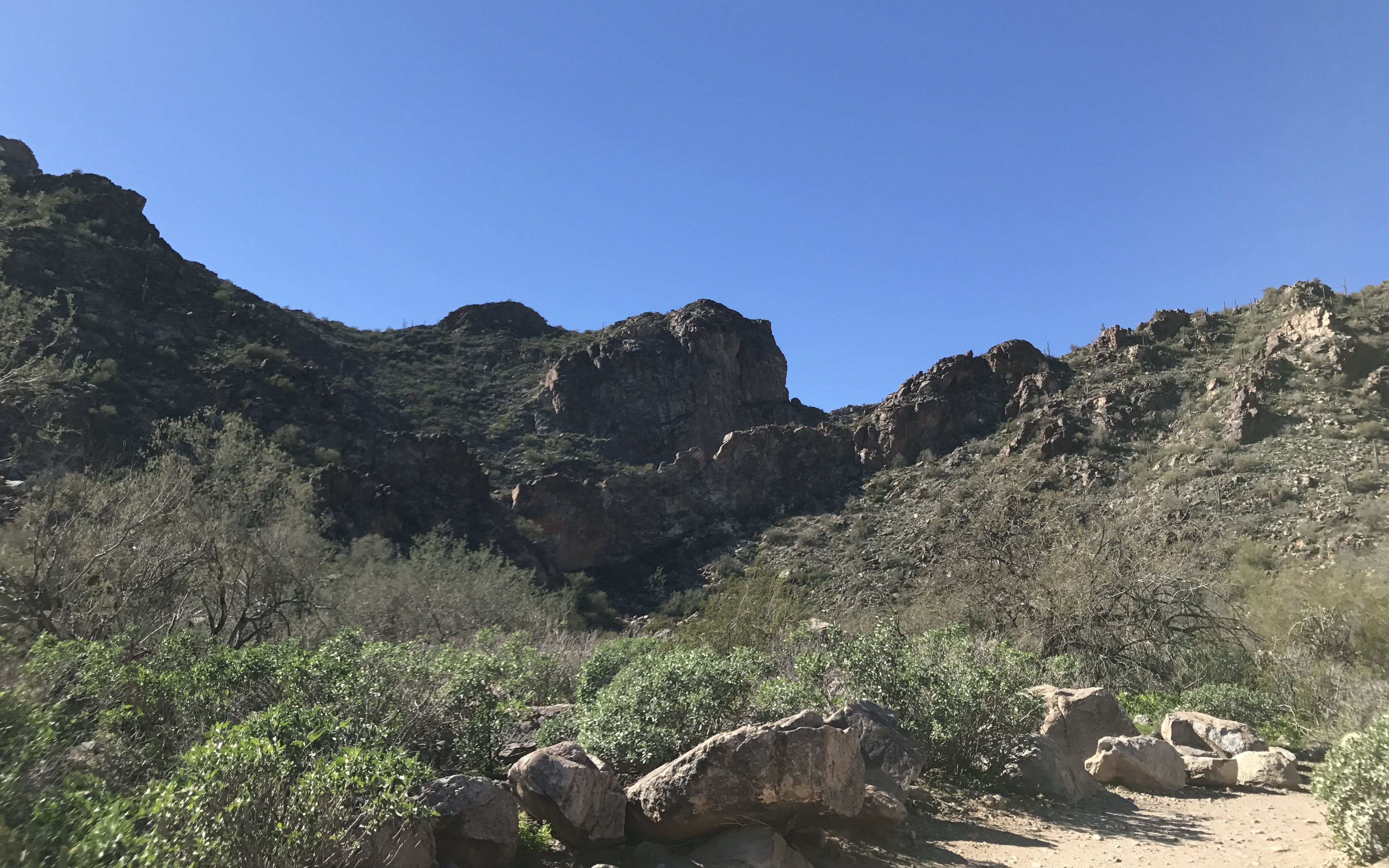
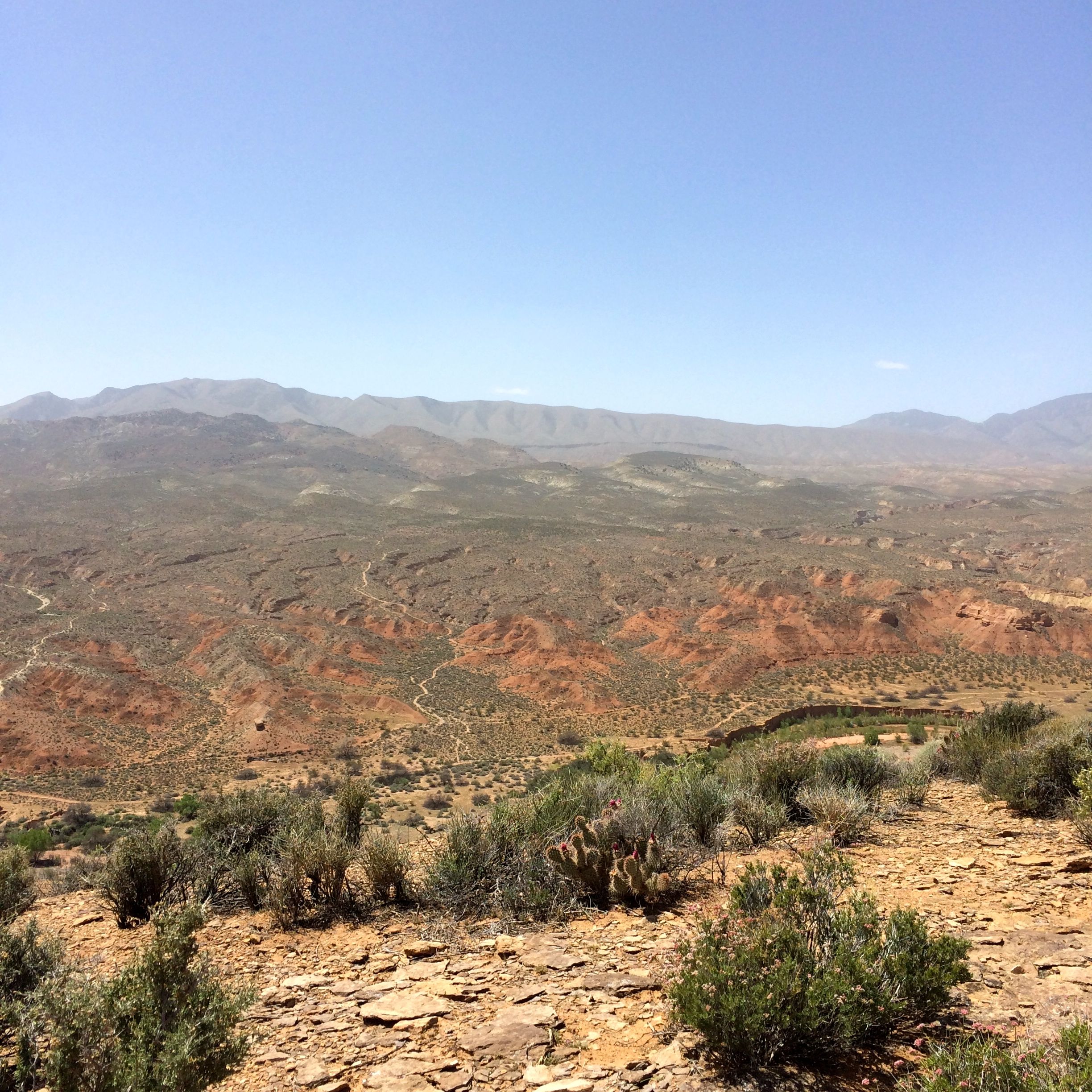
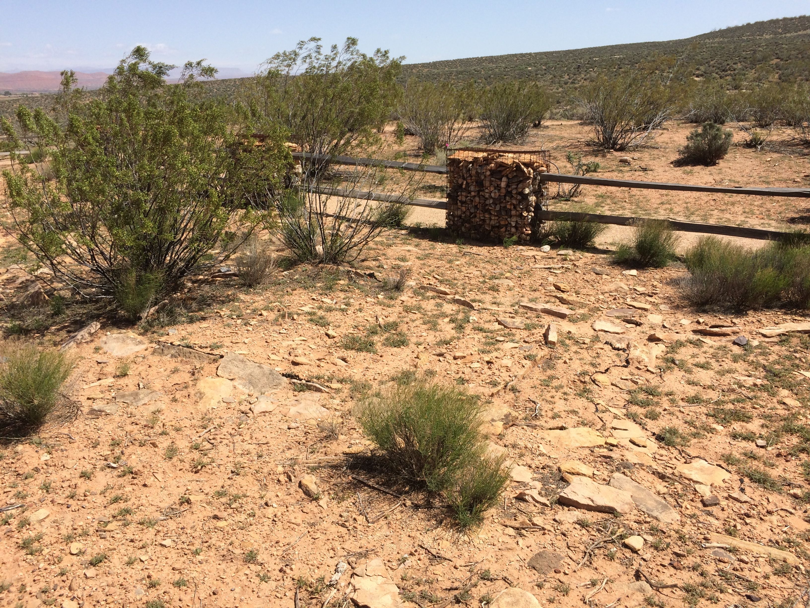
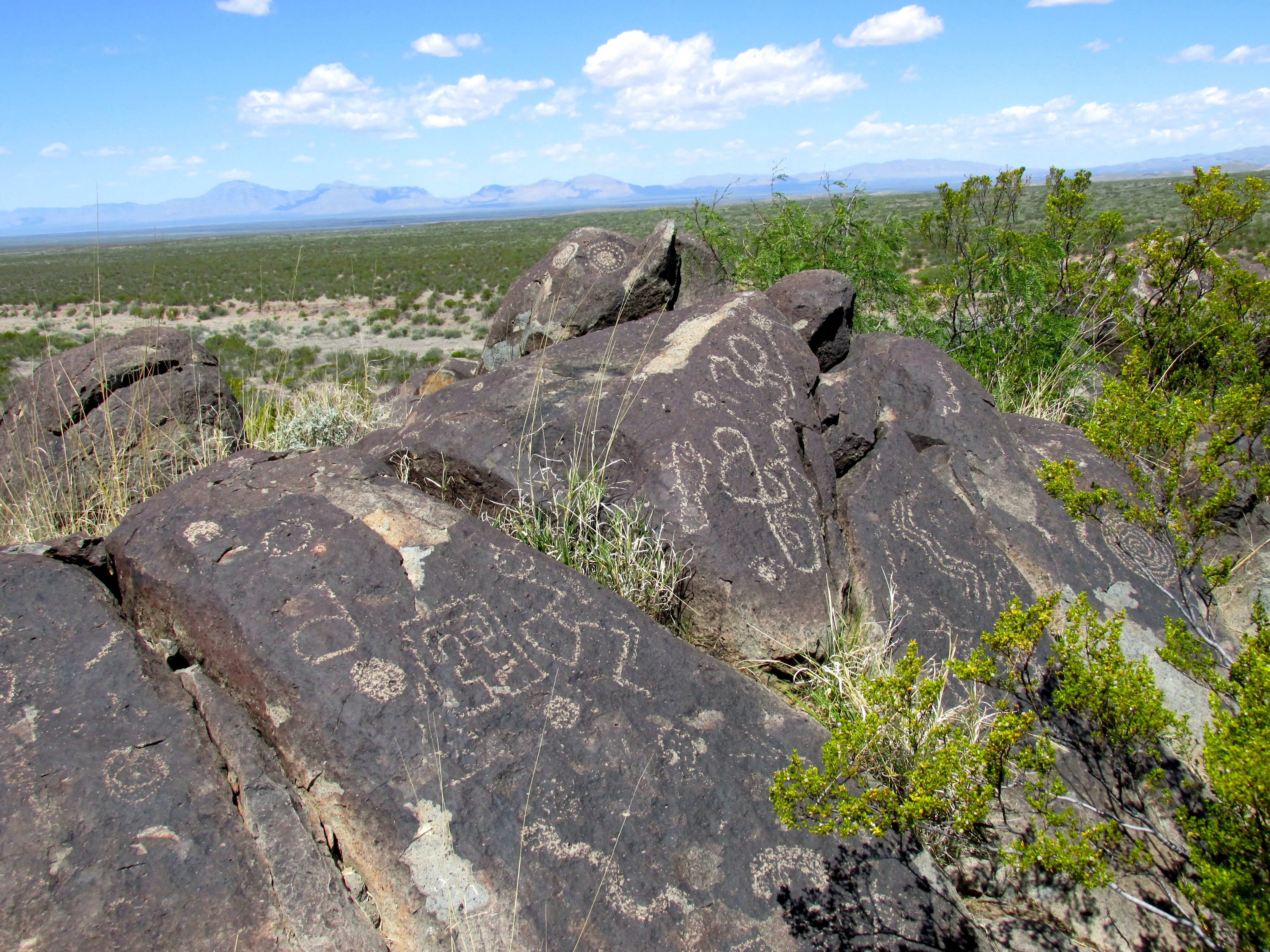
There was a trail that lead out from the visitor center that went by some of the quarries. I was eager to see what the quarries looked like.

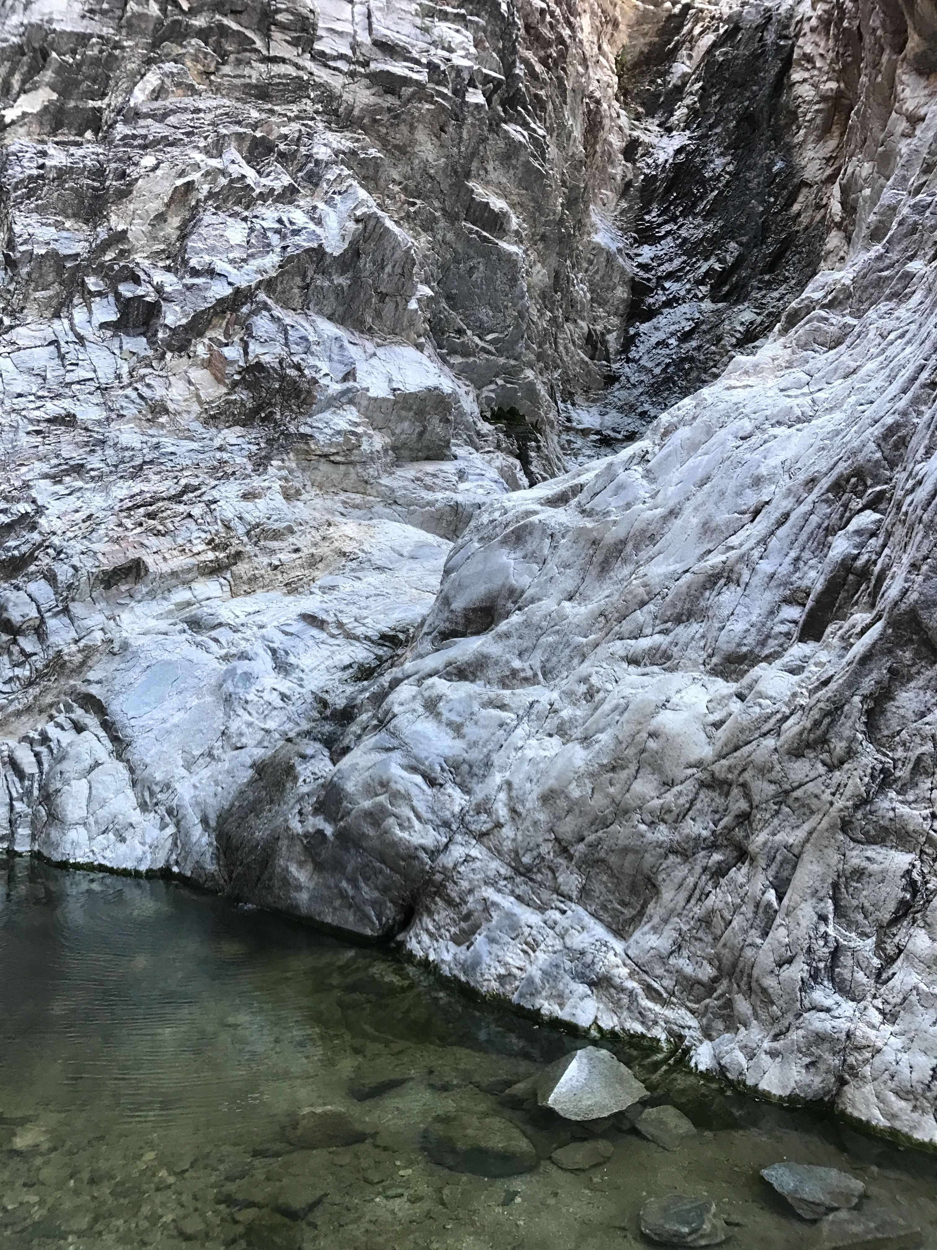
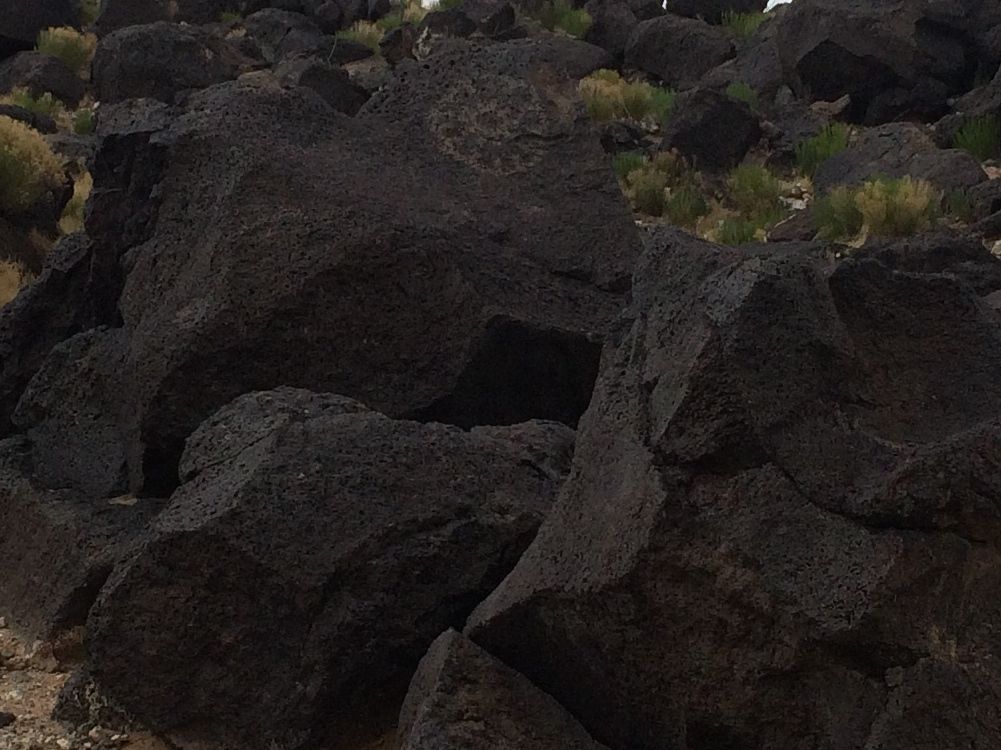
Right outside the visitor center was an exhibition quarry. I was curious about why it was flooded. Was it permanently flooded or was this was a temporary condition? As I write this report, more than a year later, I called the center and spoke with a ranger in the interpretive center. He told me that they do pump it out, but it does tend to fill with water in the spring. Since I was visiting in the spring, I guess that explains it.  In any event, there was nothing happening in that quarry when I visited.

I continued along the path toward the cliff.

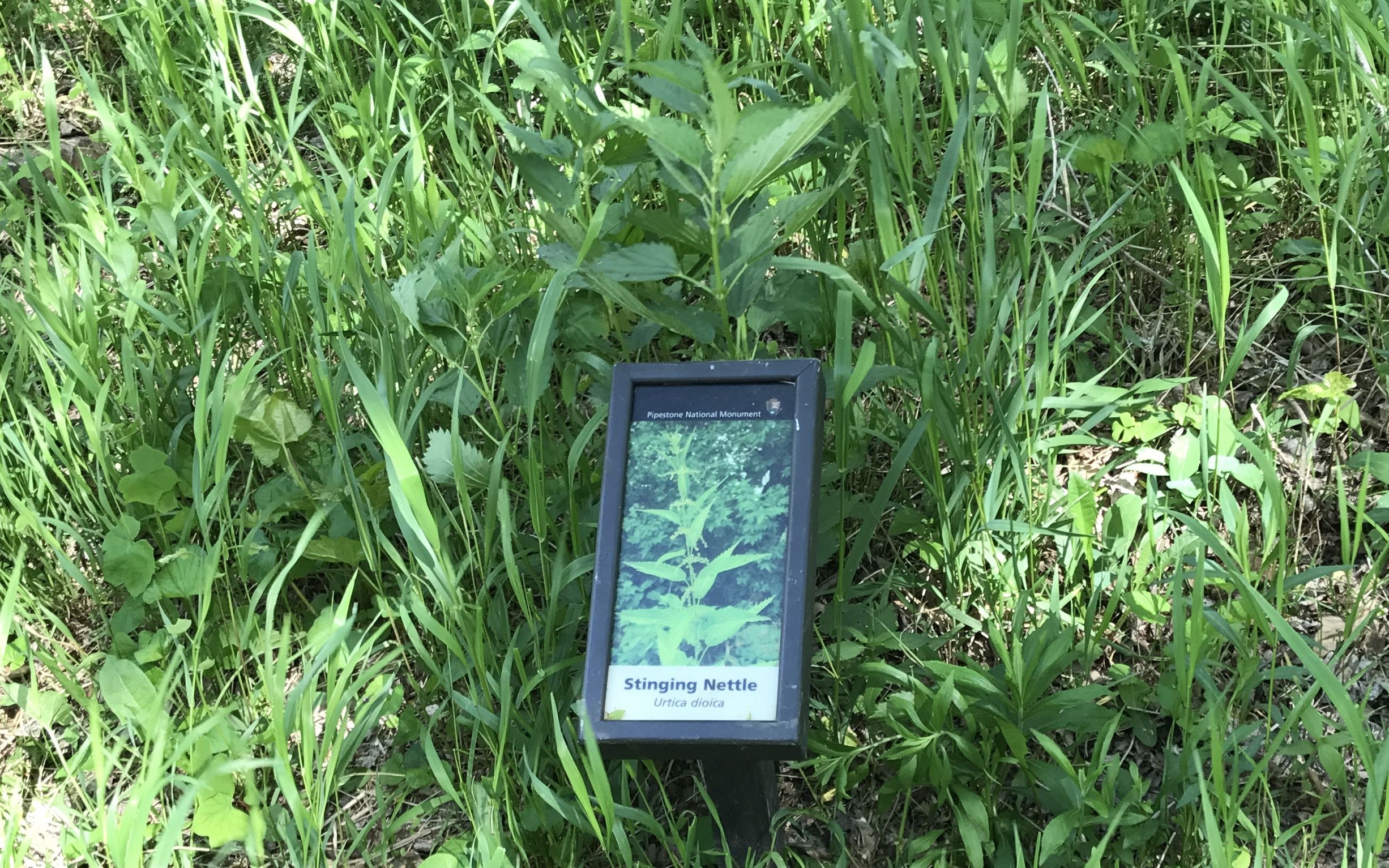
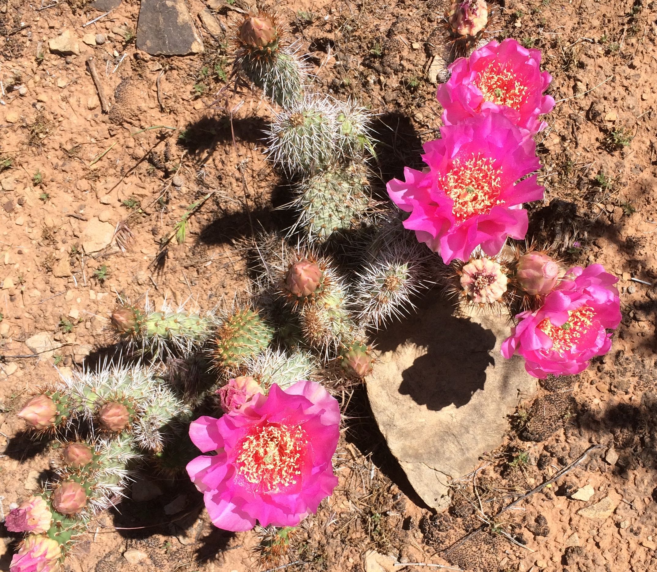
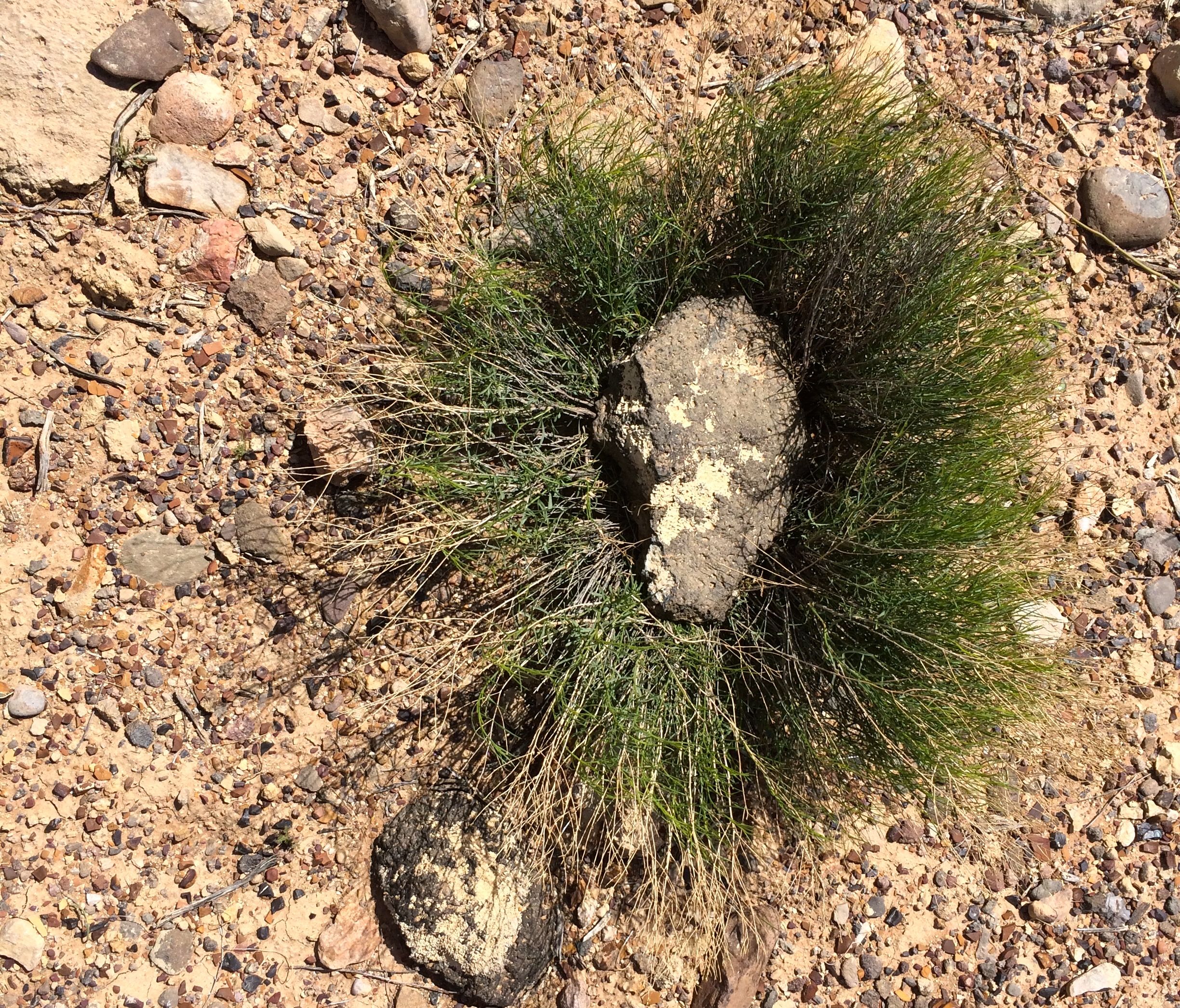
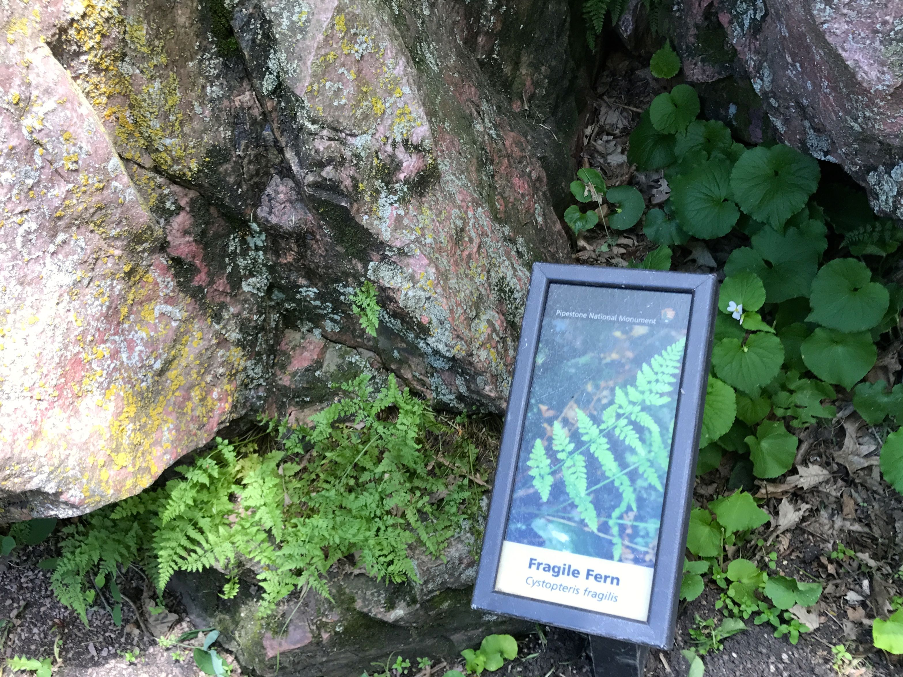
There were some interesting interpretive signs along the way identifying the plants. I always wonder what the plants are the I am looking at.

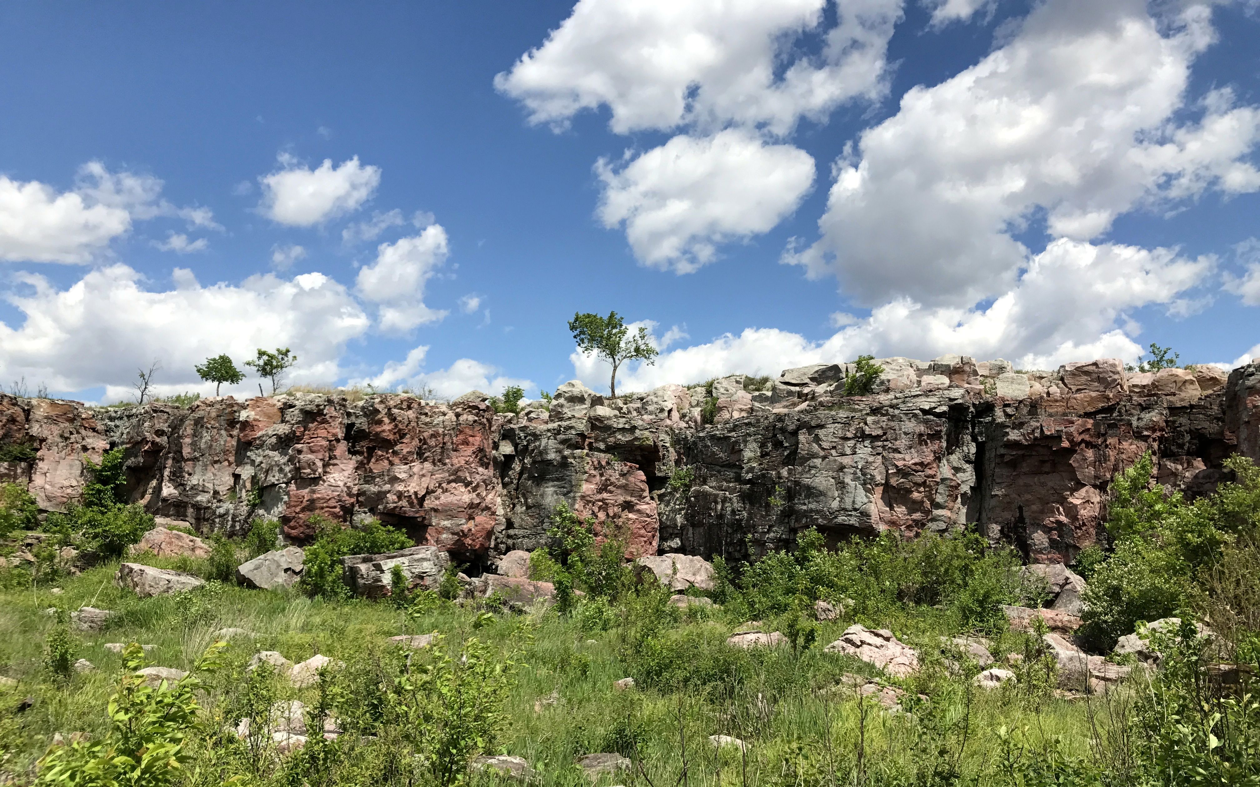
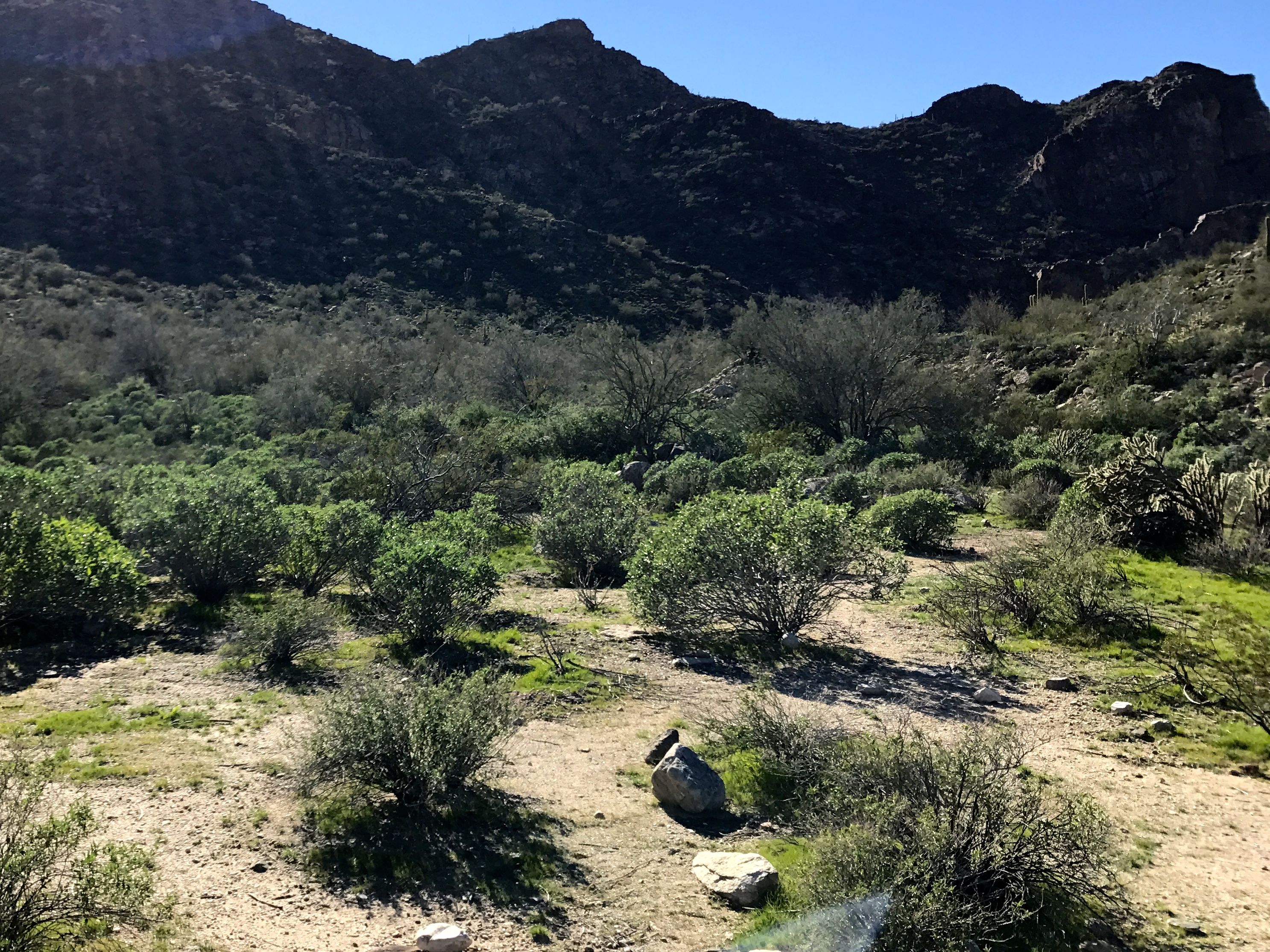
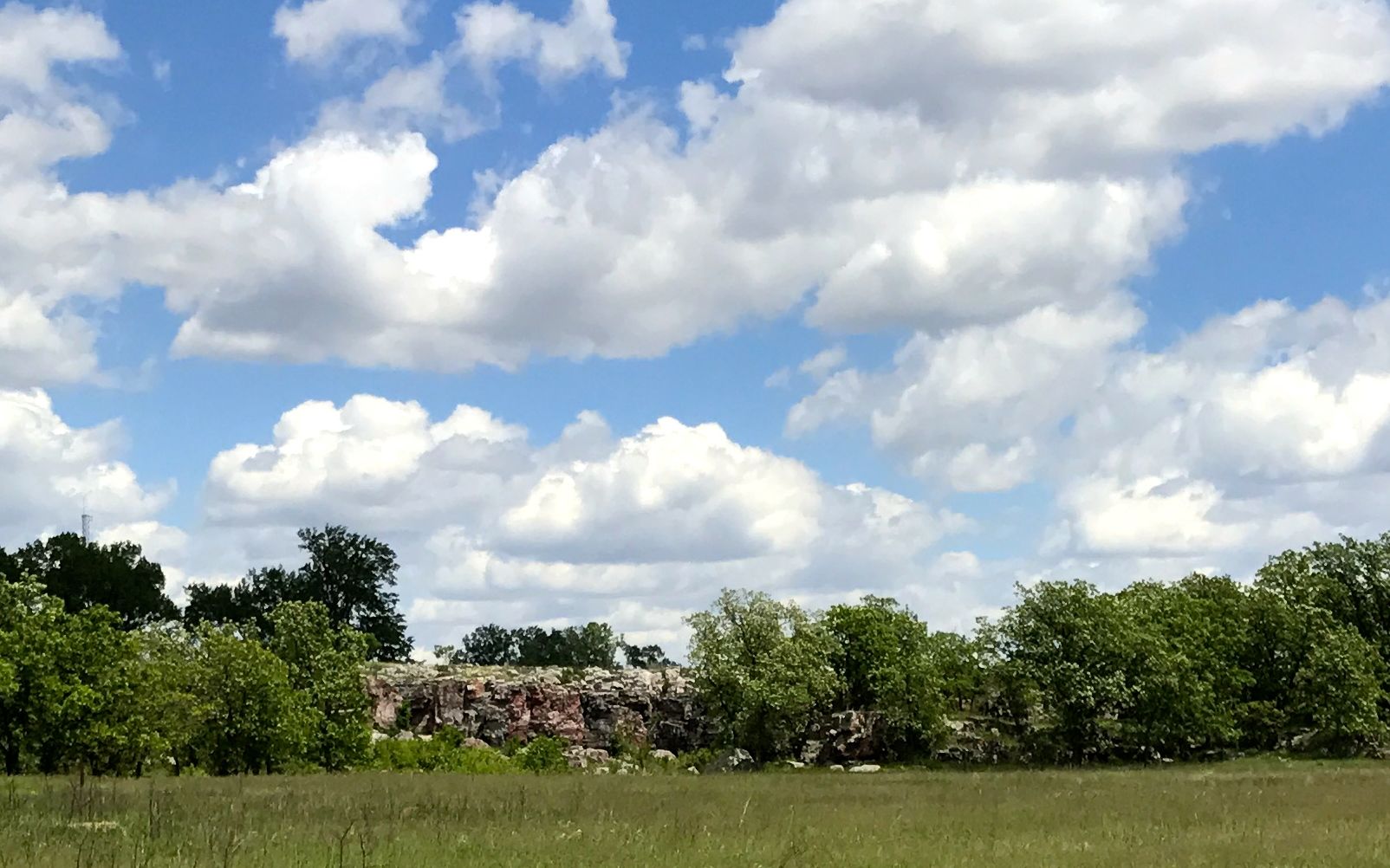
I kept walking and the cliff kept getting larger.

And finally, I was there.

The plant identification signs continued.

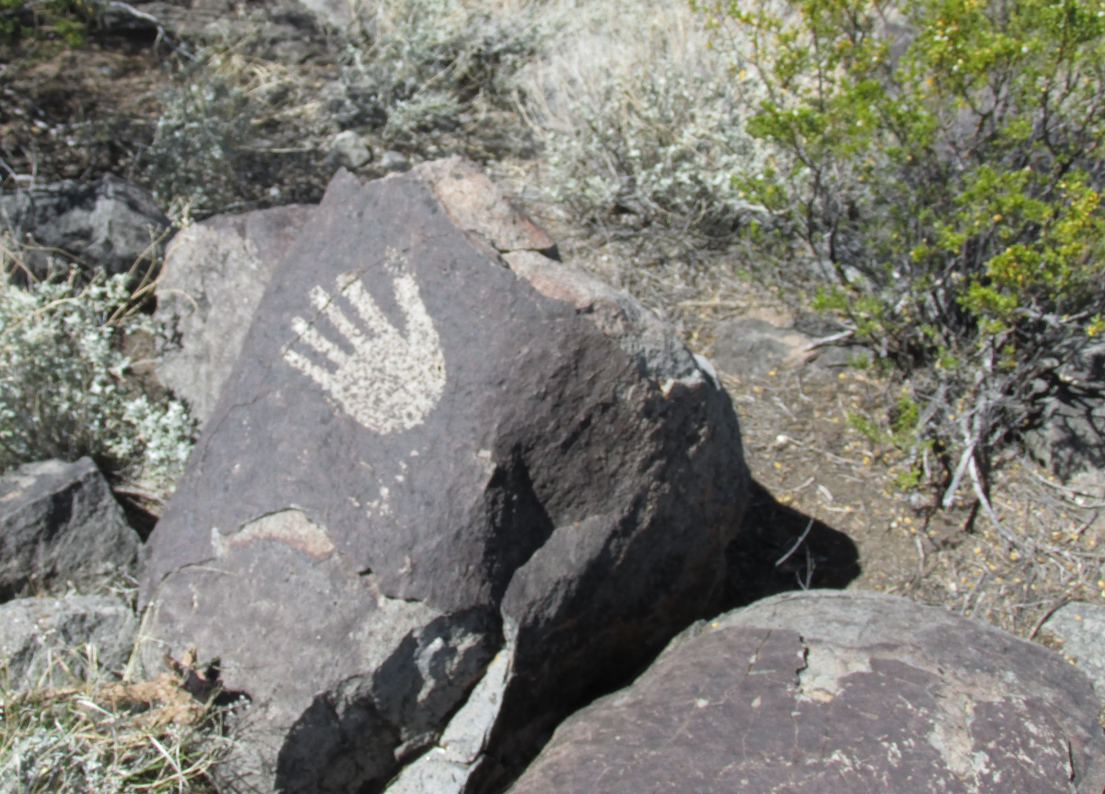
I walked up the path and came across this sign.

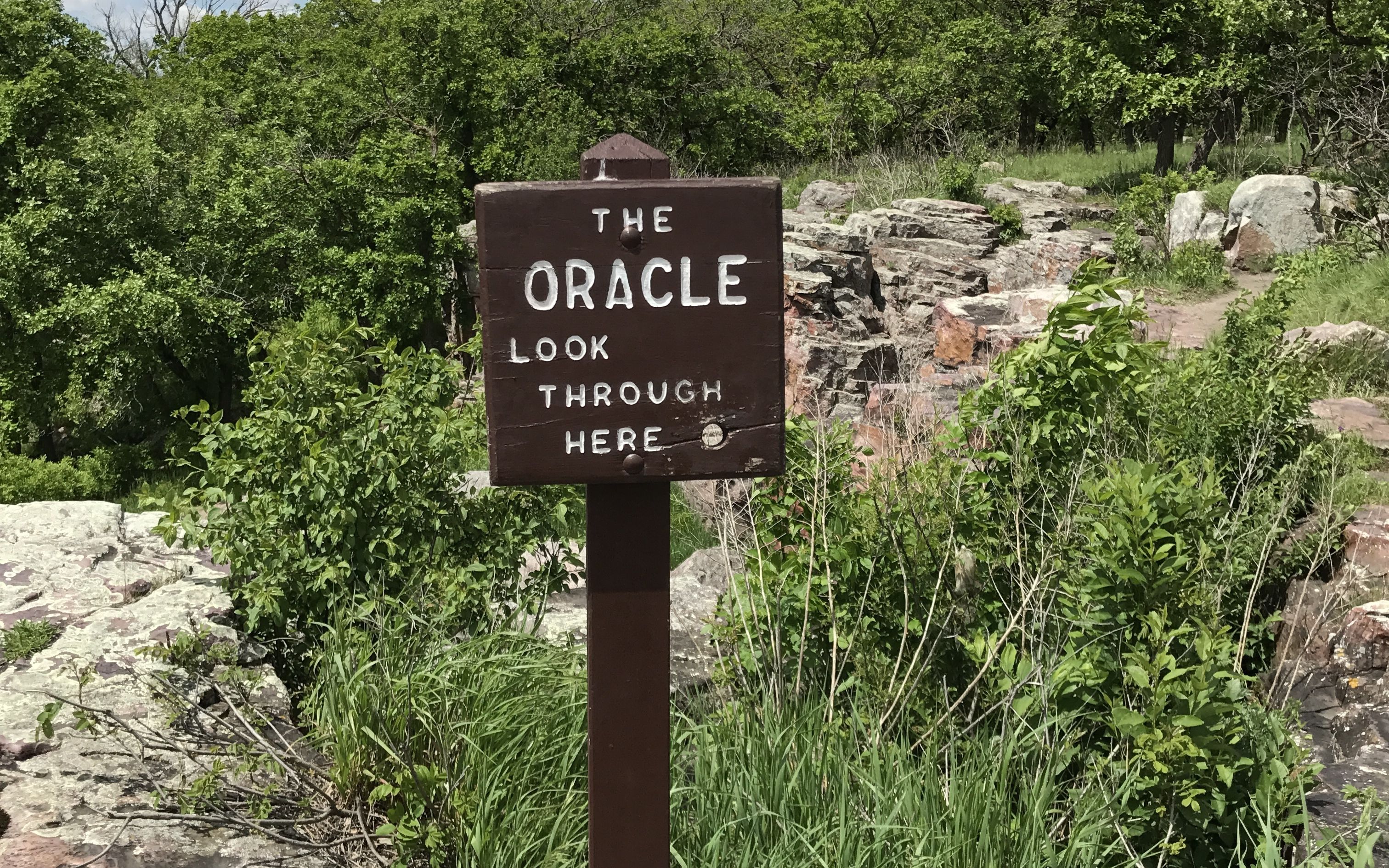
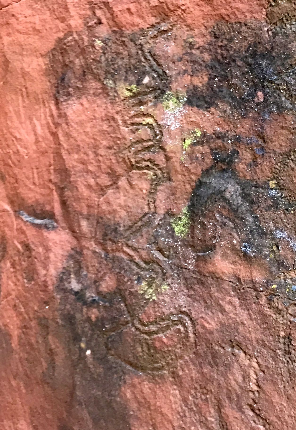
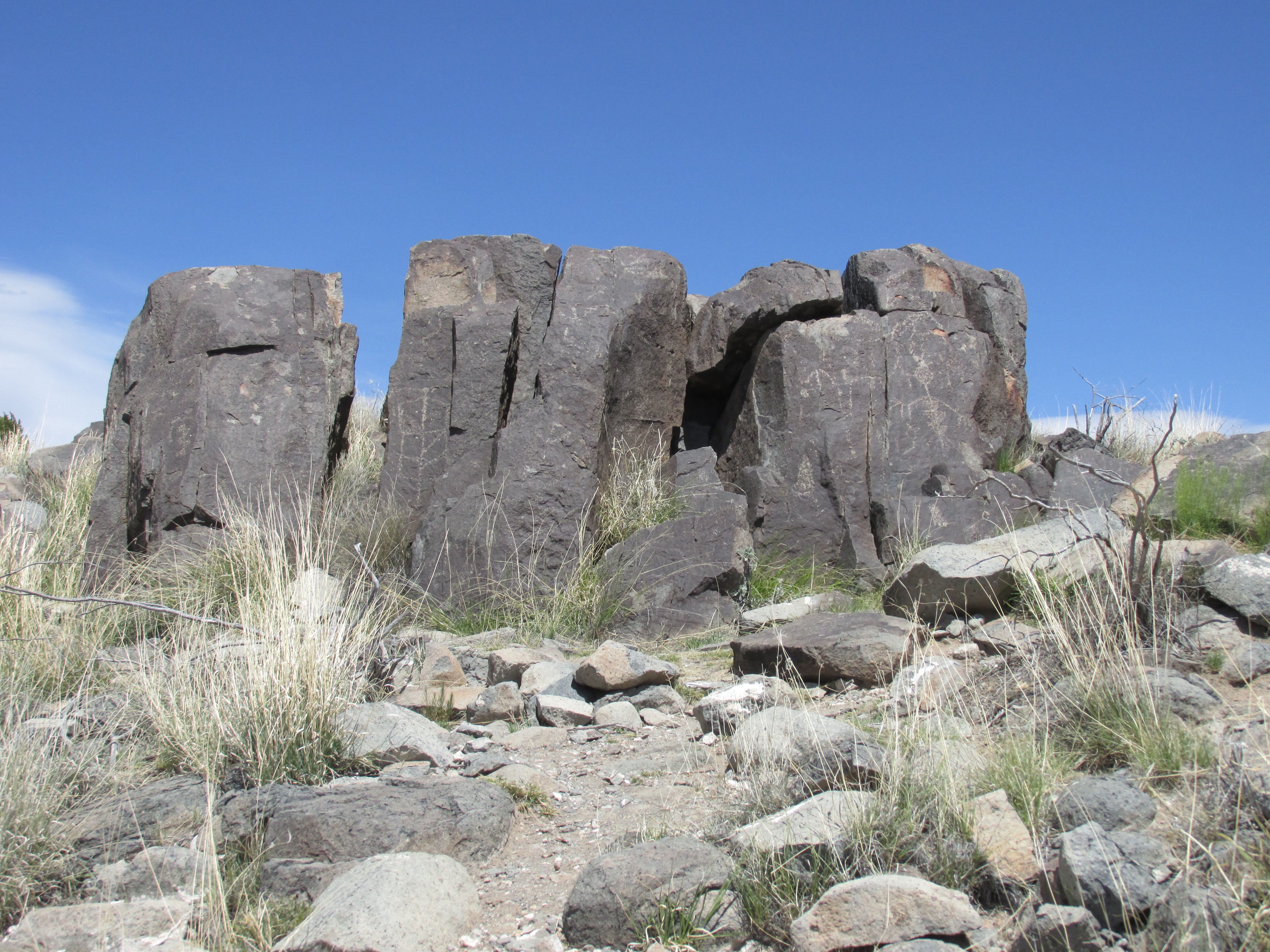
Of course I had to look.

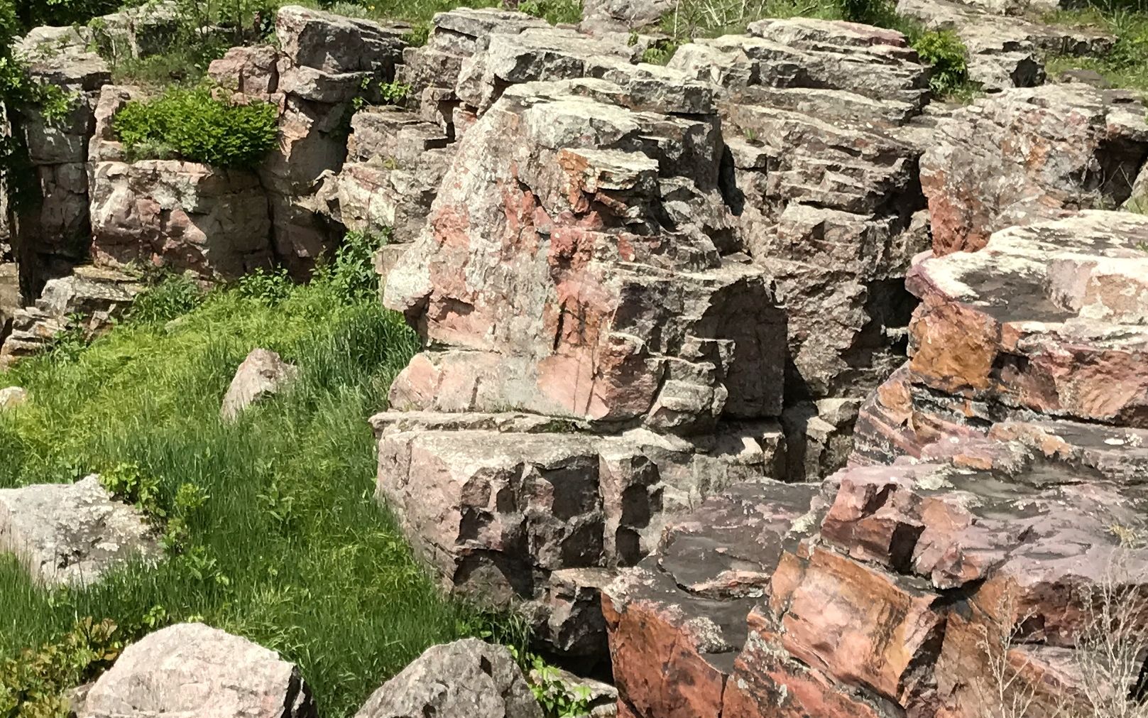
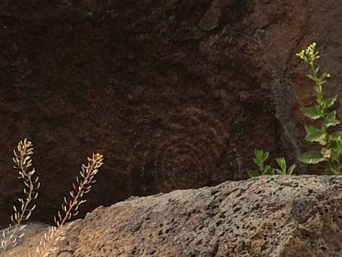
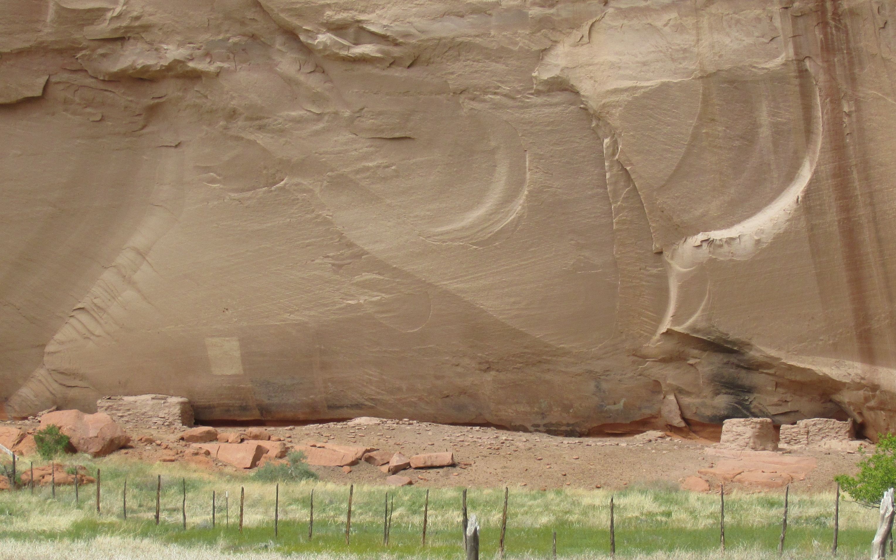
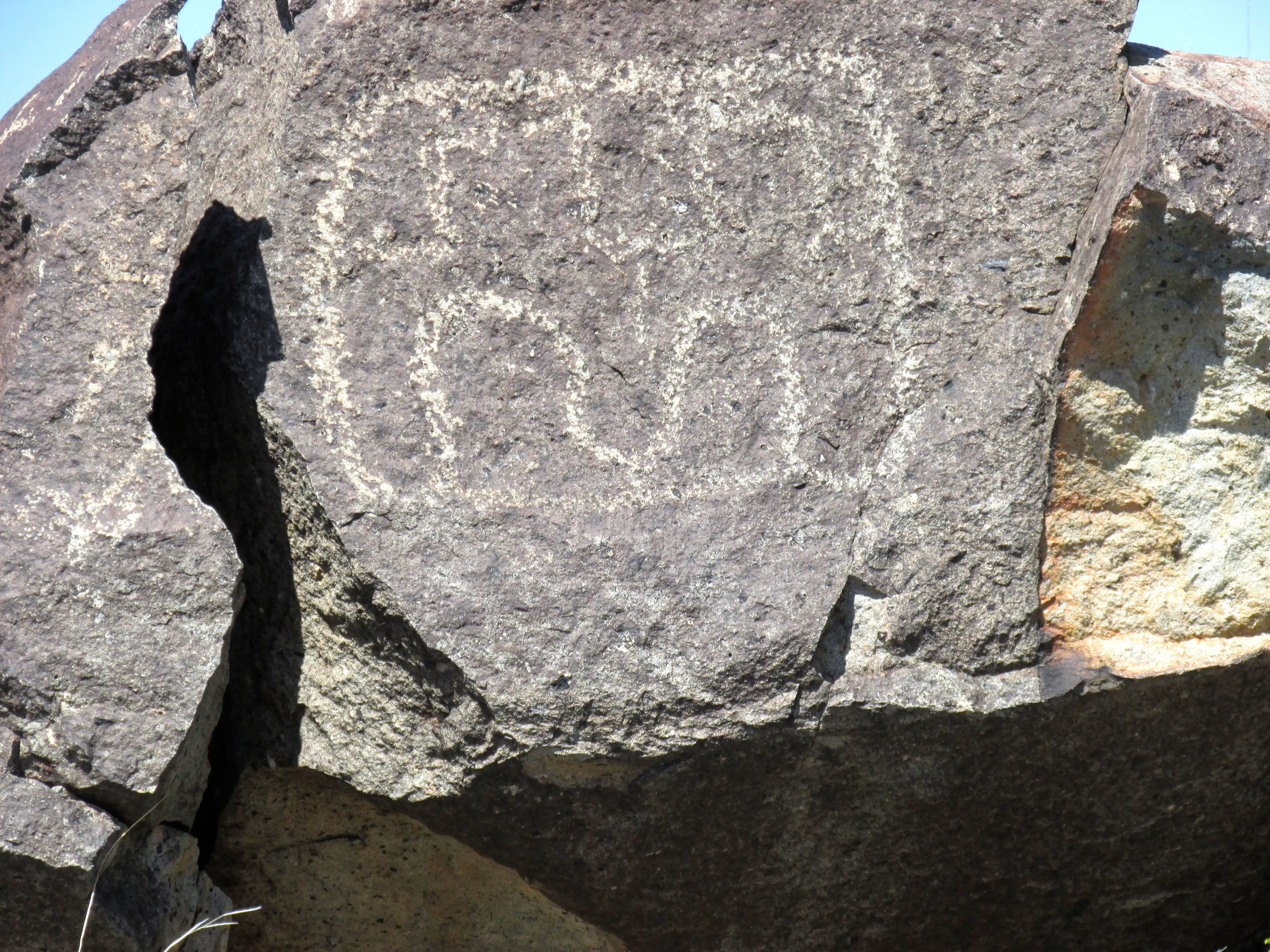
This is what I saw. Unfortunately, I didn’t know what I was looking at, so I reached out to the ranger again. This was his reply: “The Oracle is a natural stone face within the Sioux Quartzite cliff.  The face is looking to the left, with a lichen covered nose and a protruding chin. Some American Indians believe that The Oracle is a guardian of the quarries, and will impart wisdom to the quarriers in how to get down to the catlinite.  Offerings are sometimes left at The Oracle for this reason.”

Do you see it? I do!

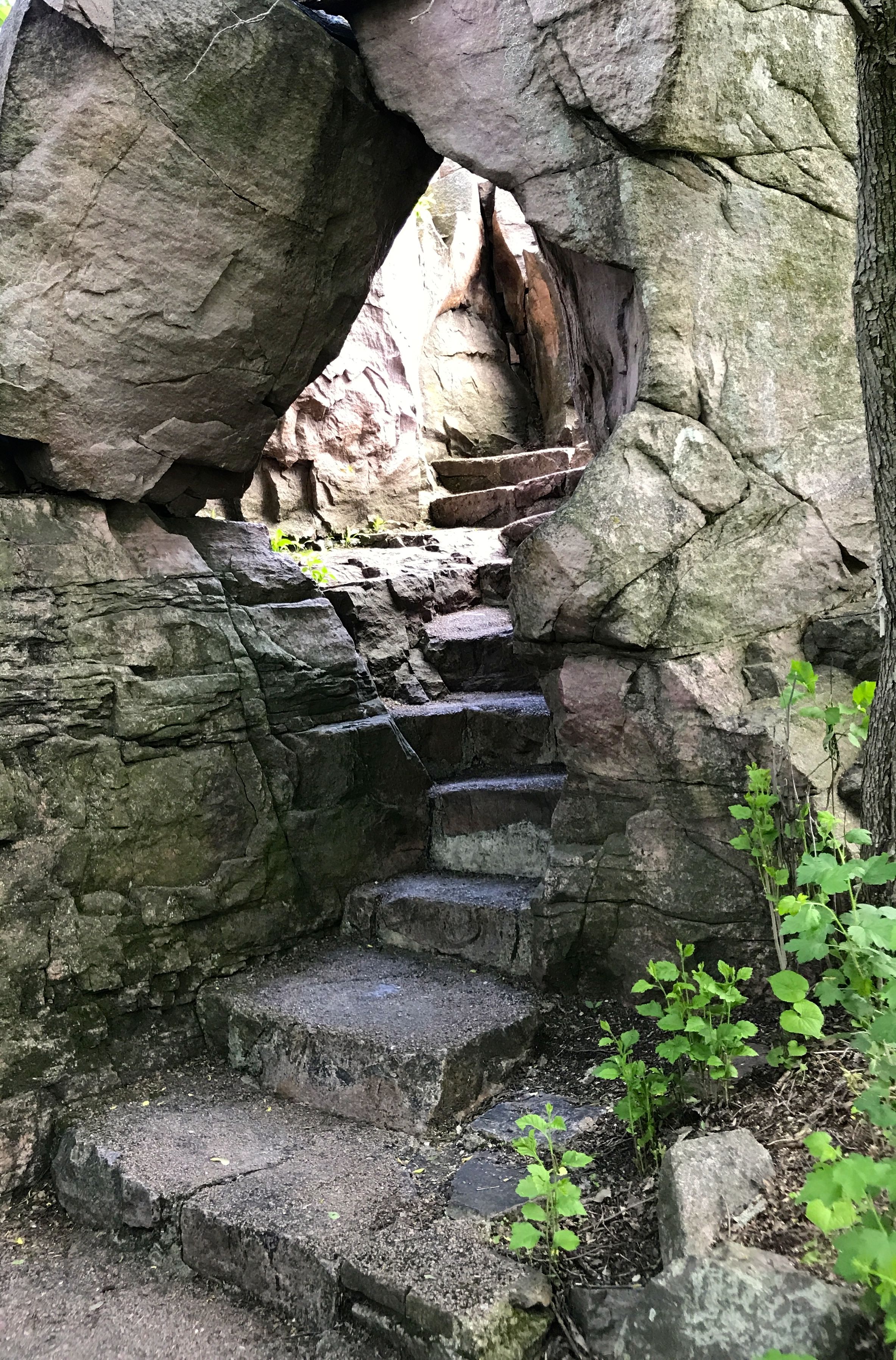
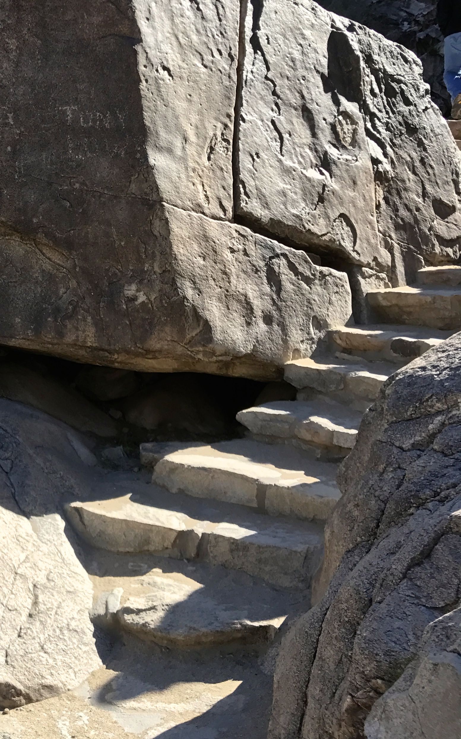
I continued along the trail. The trail went up and so did I.

In 1838, Joseph Nicollet led the first U.S. Government expedition to the pipestone quarries. He mapped the upper Mississippi River basin and his maps were the most accurate of the time.

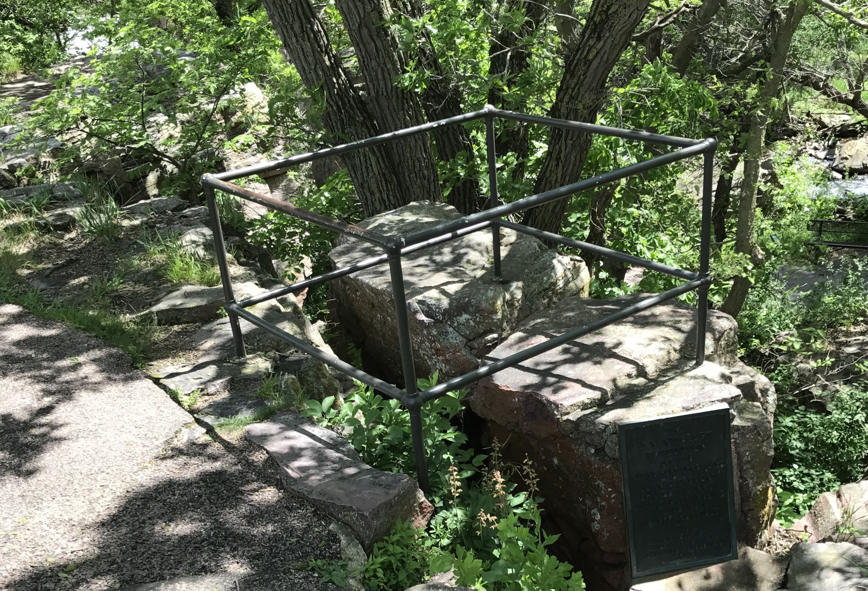
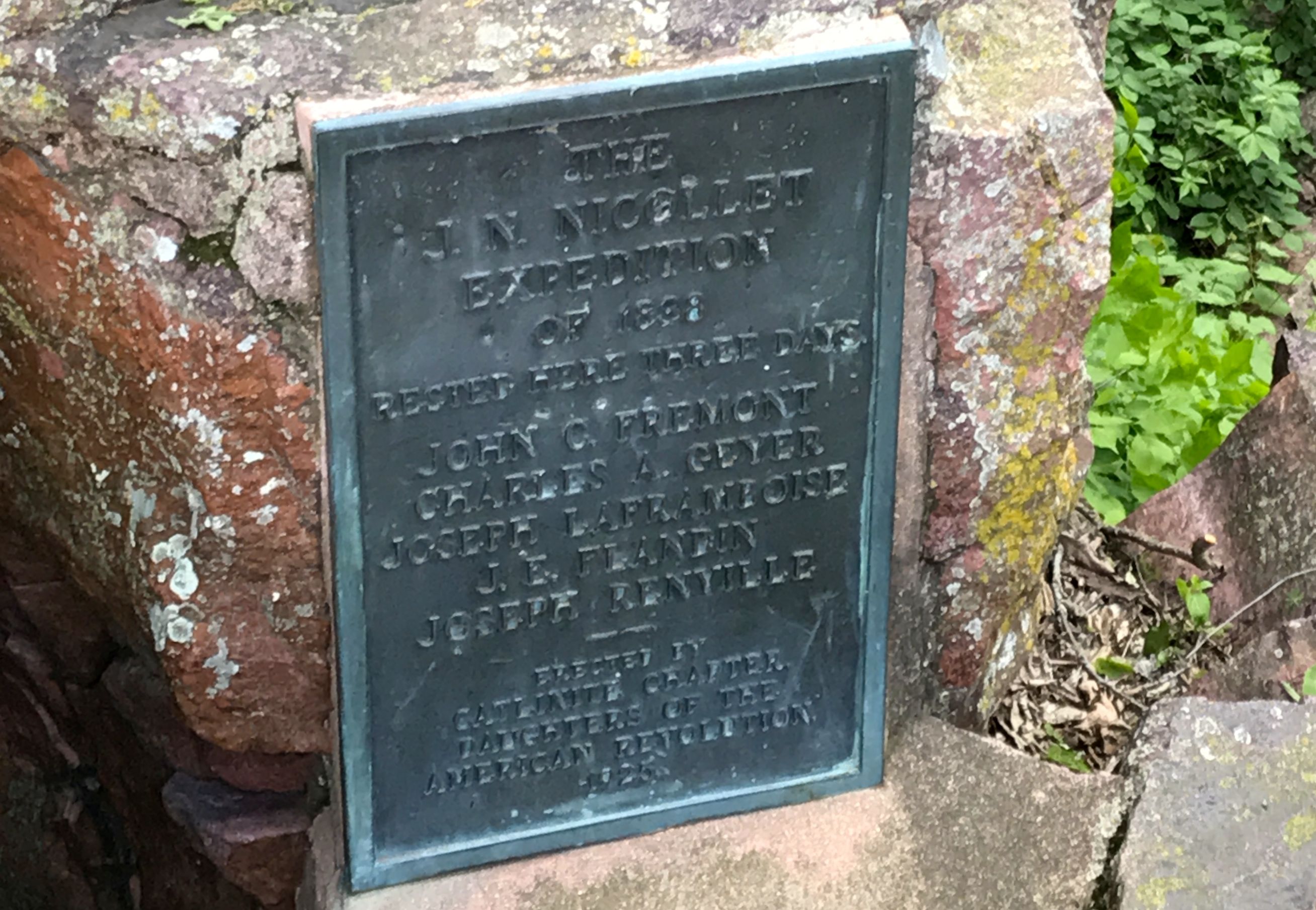
In case you can’t read this plaque memorializing the J.N, Nicollet Expedition of 1838, they rested here for three days. It lists the members of the party. I am always interested in when things were memorialized and who erected the memorial. This plaque was erected in 1925 by the Catlinite Chapter of the Daughters of the American Revolution.

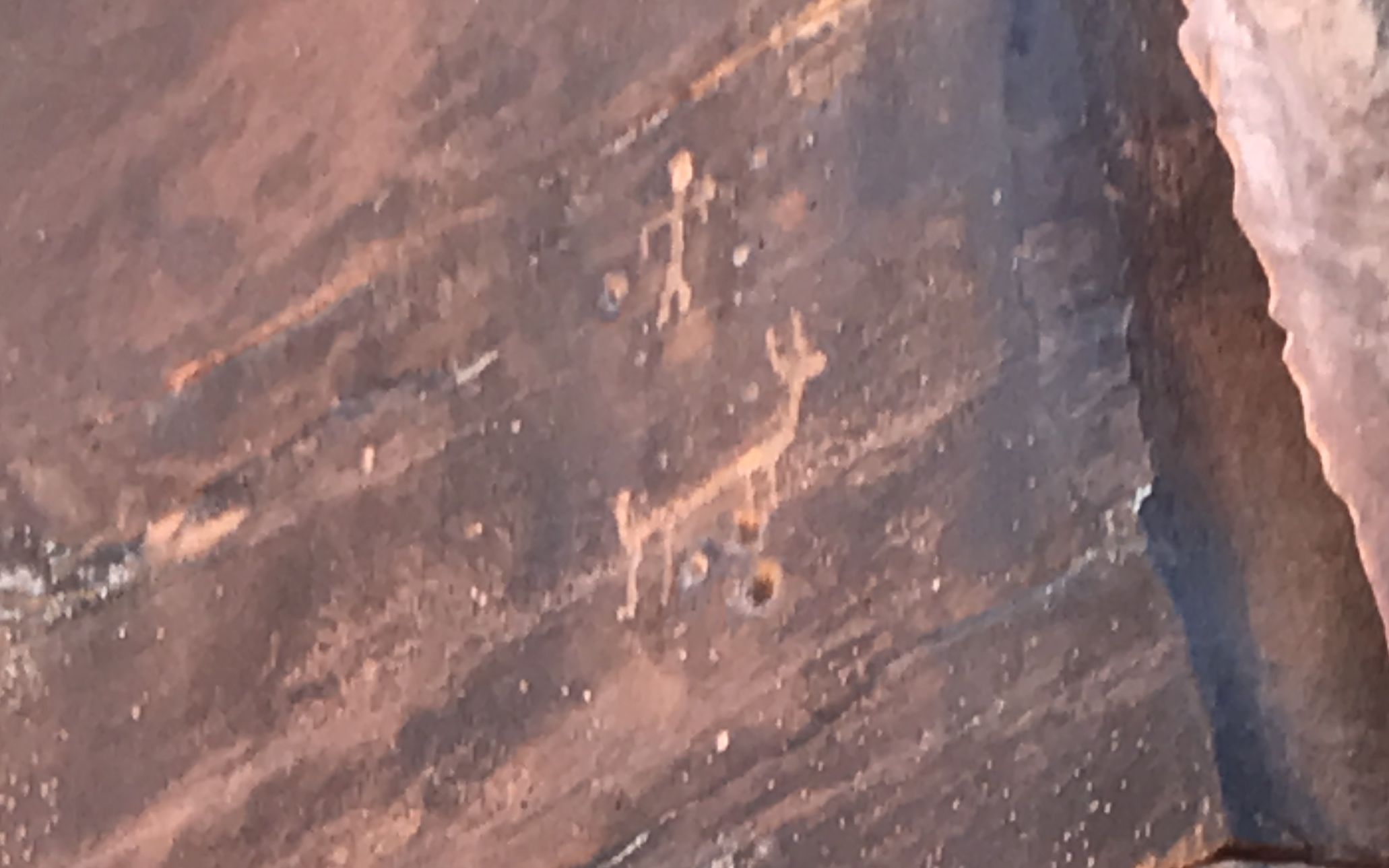
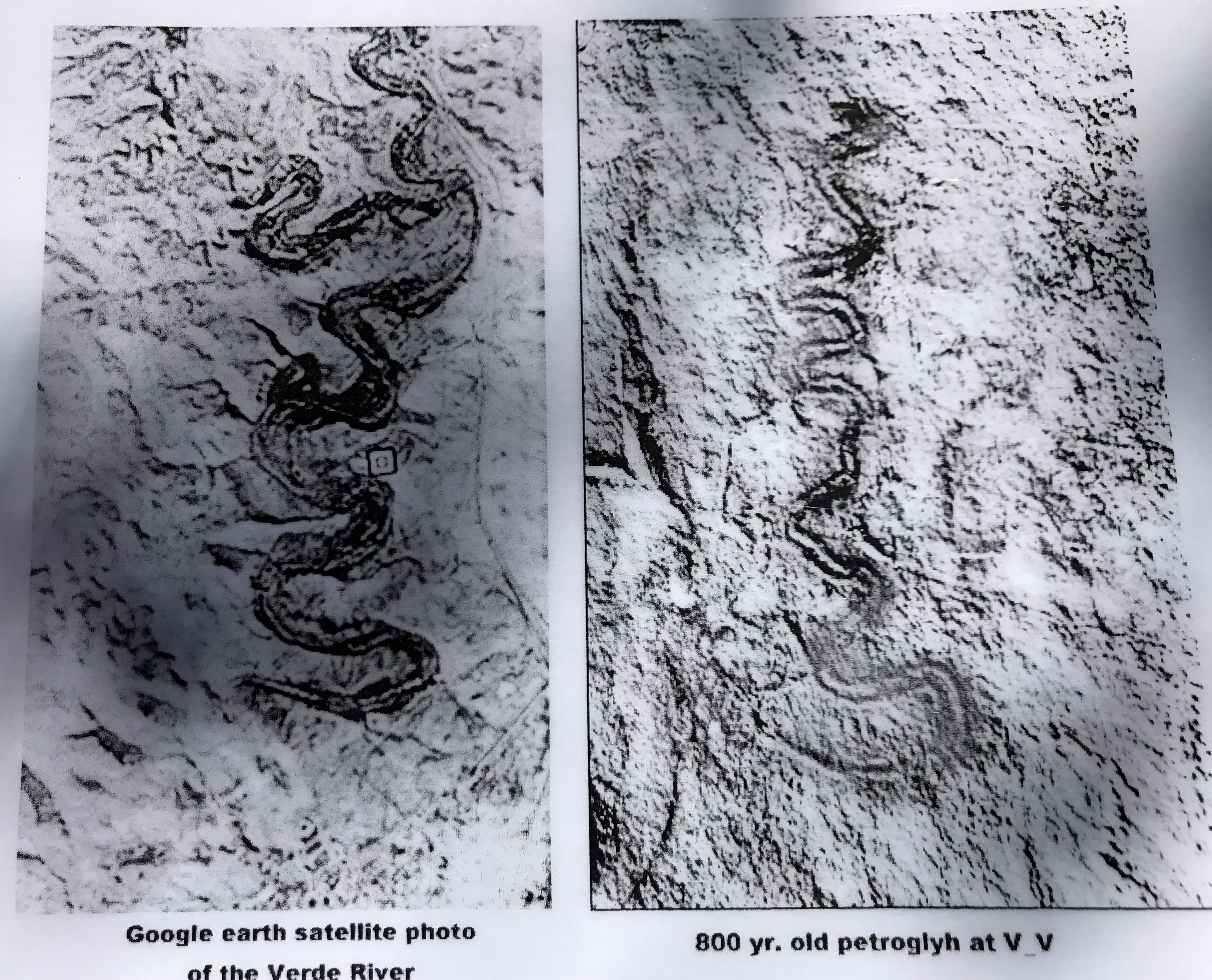
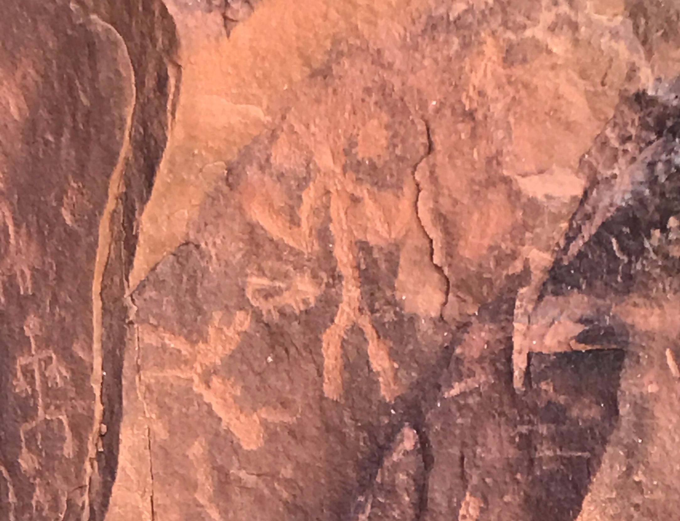
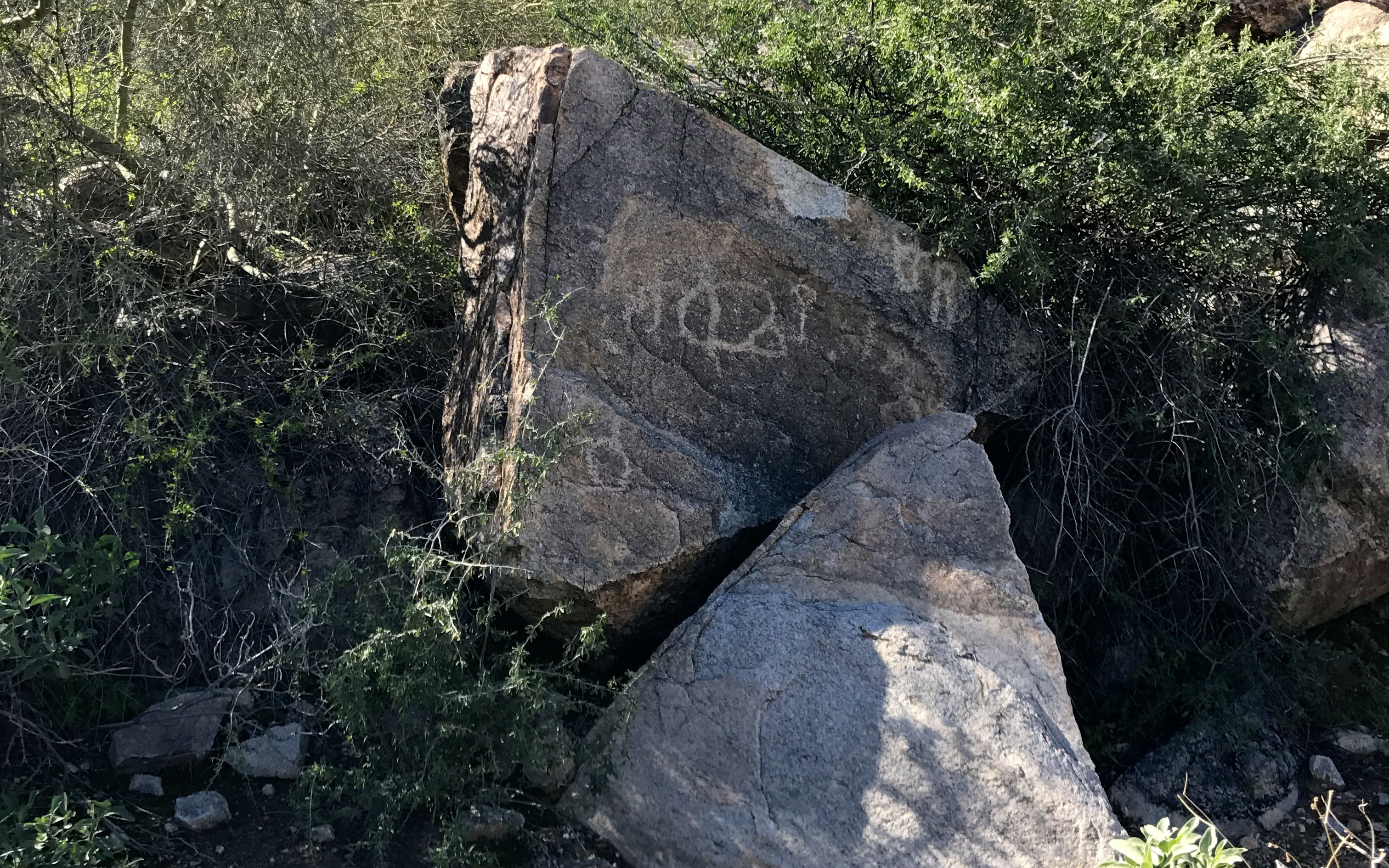
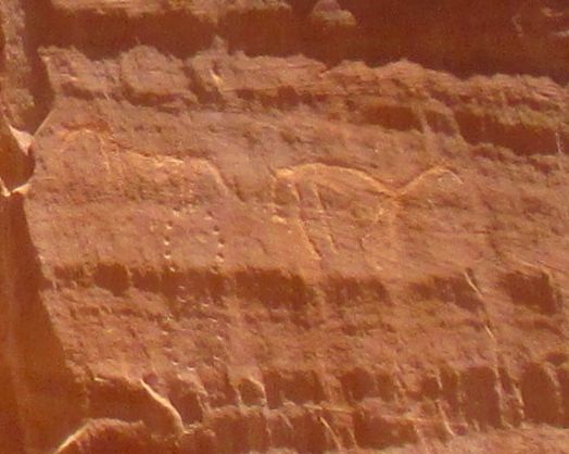
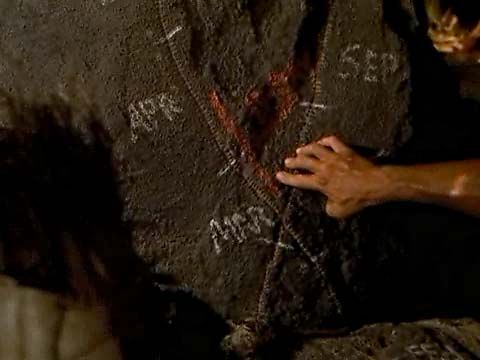
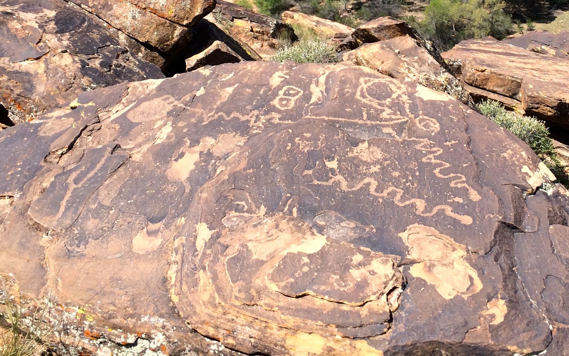
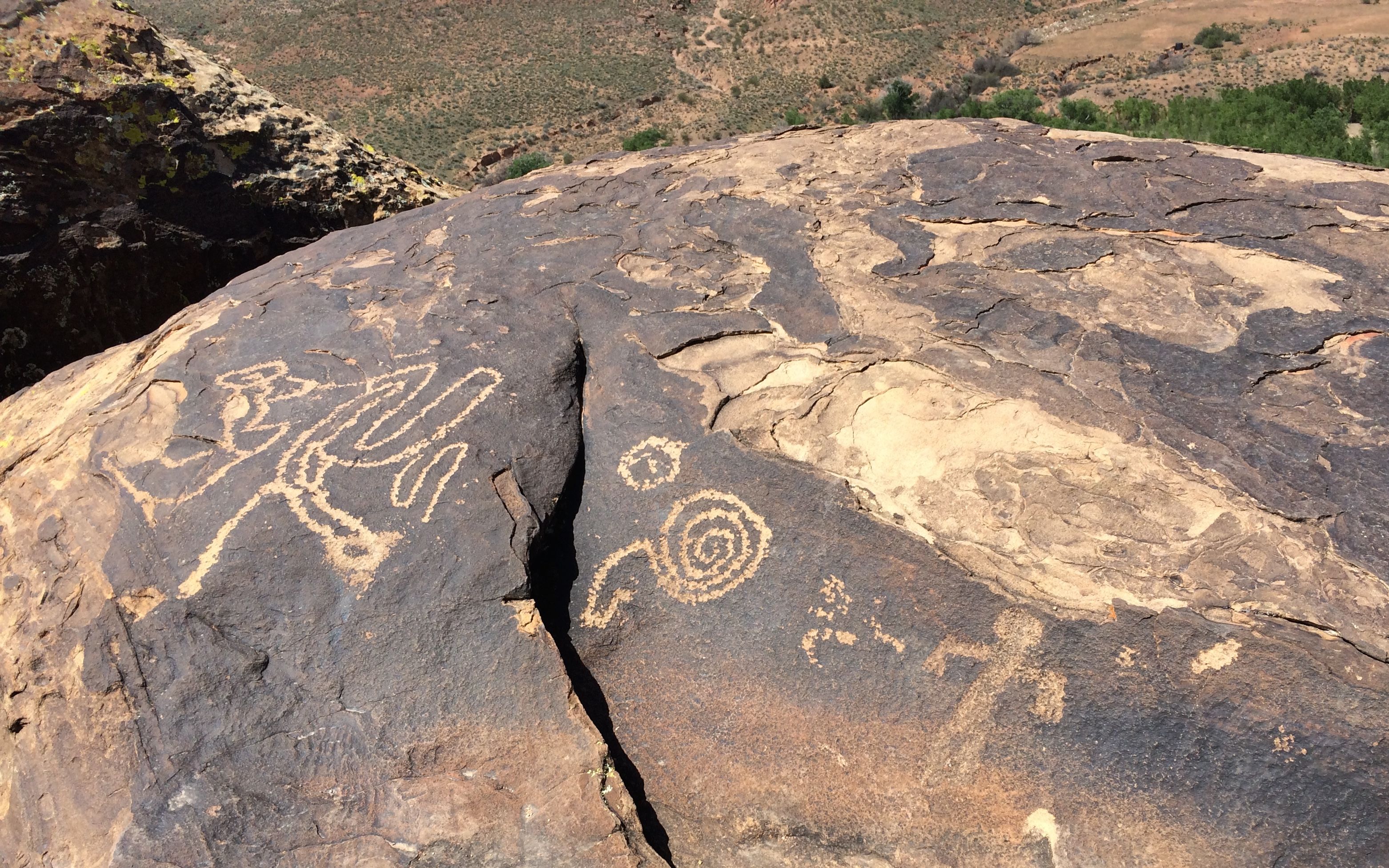
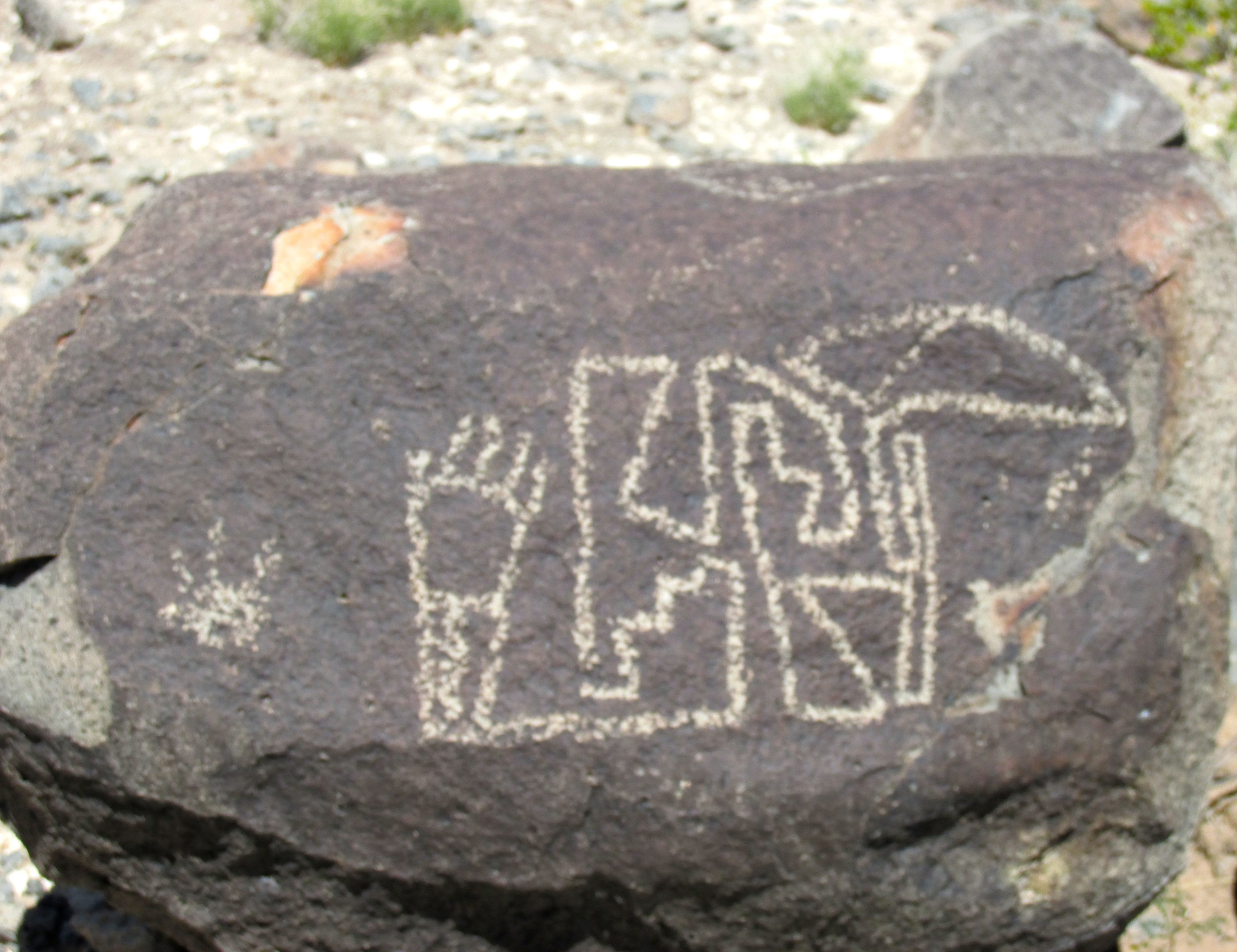
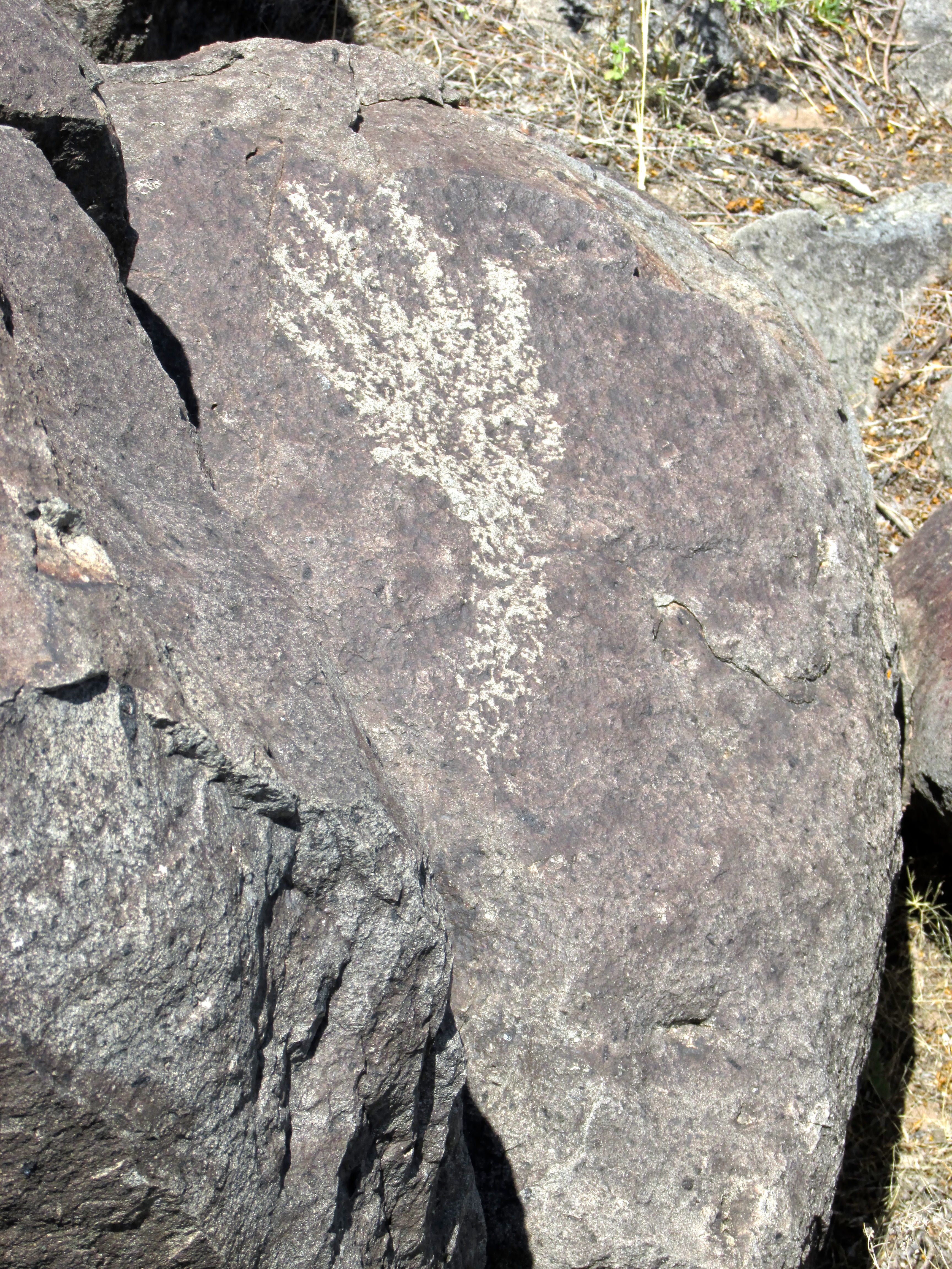
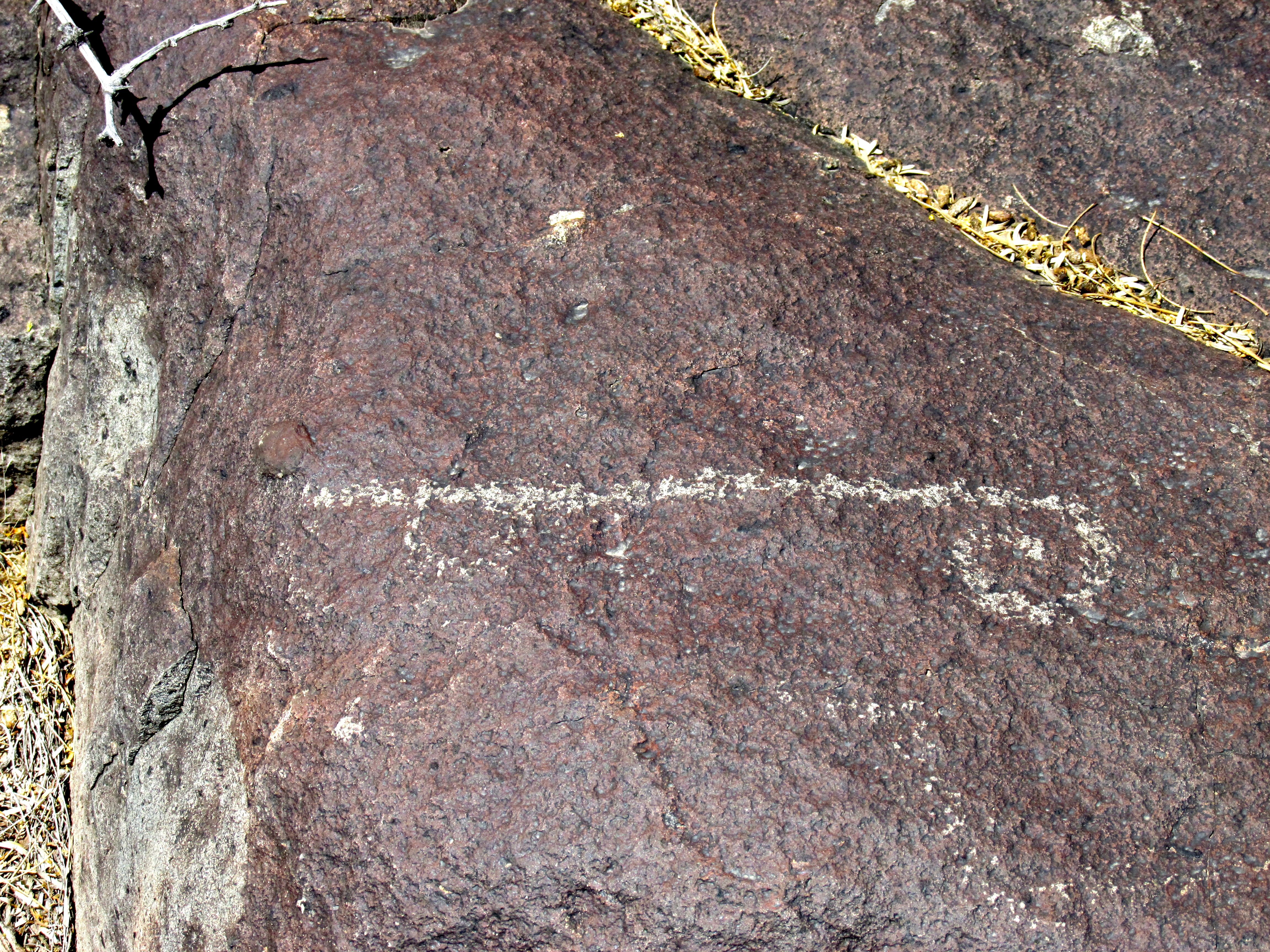
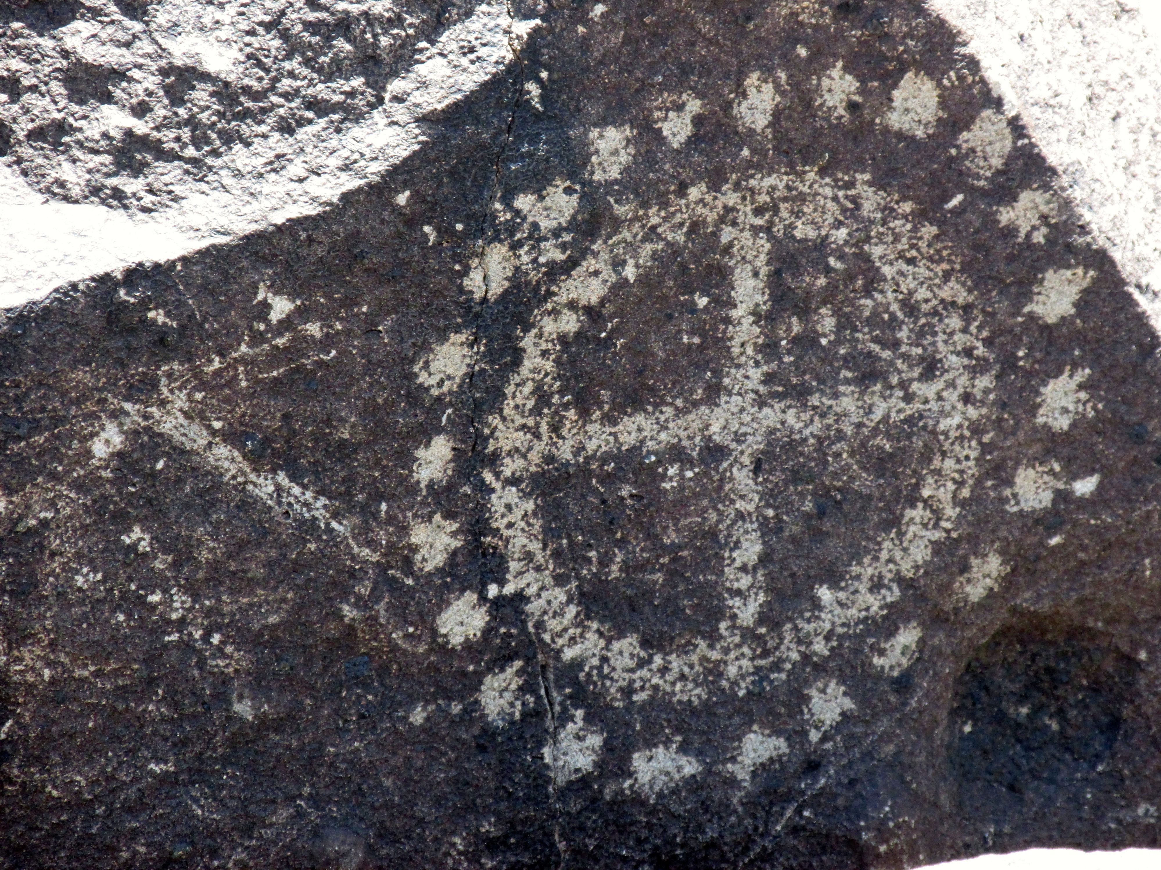
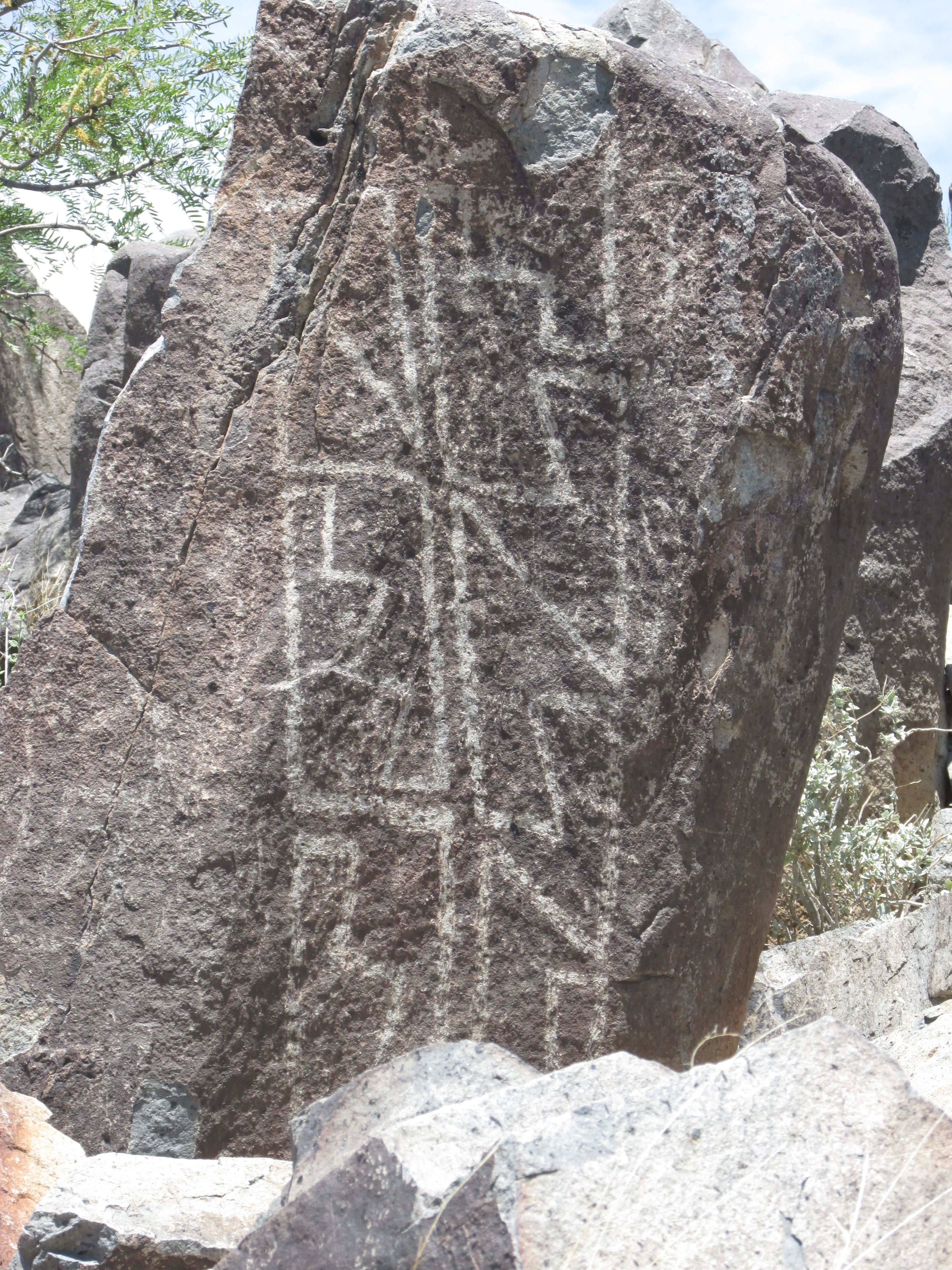
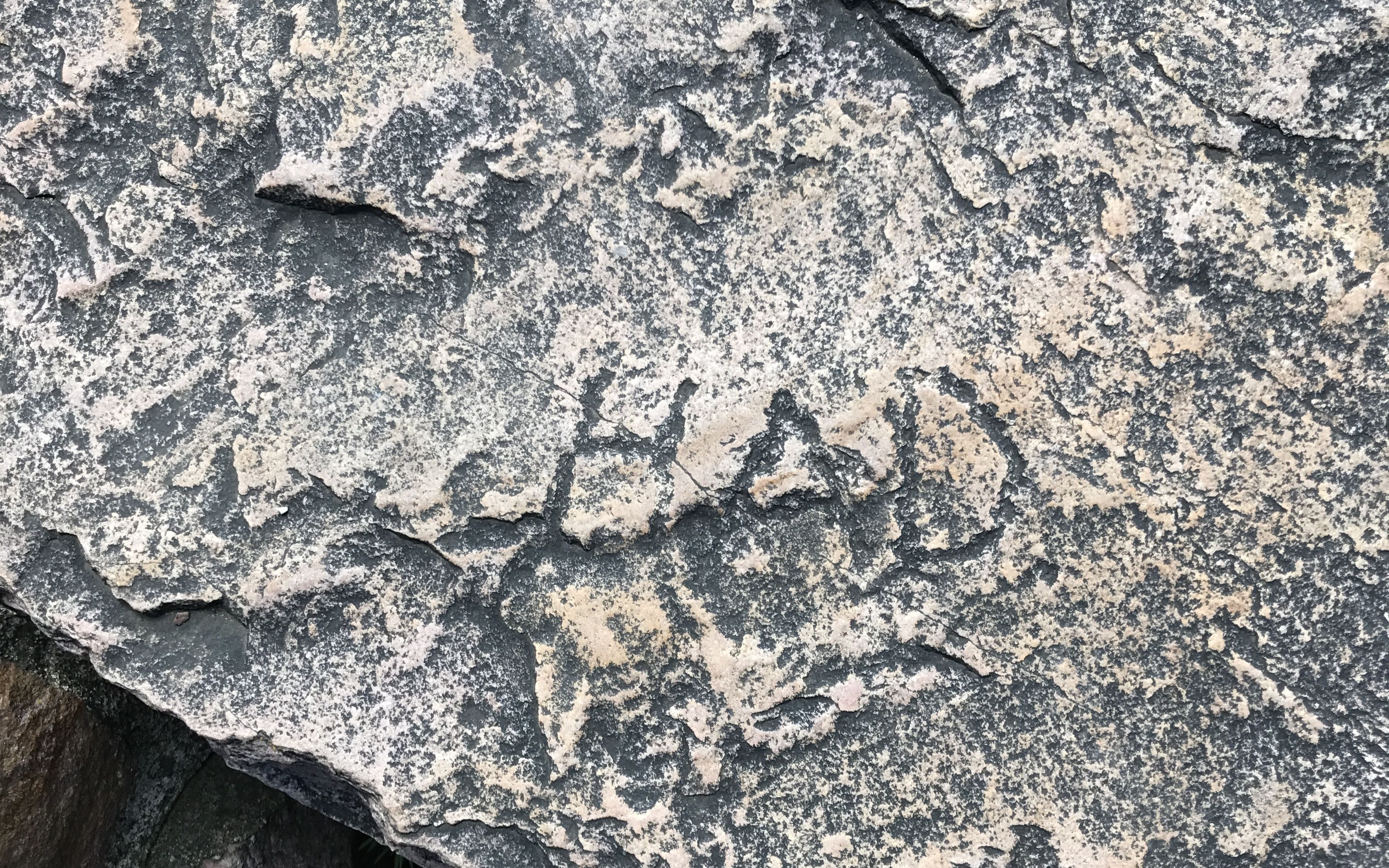
According to a sign nearby, this is what the members of the expedition carved.

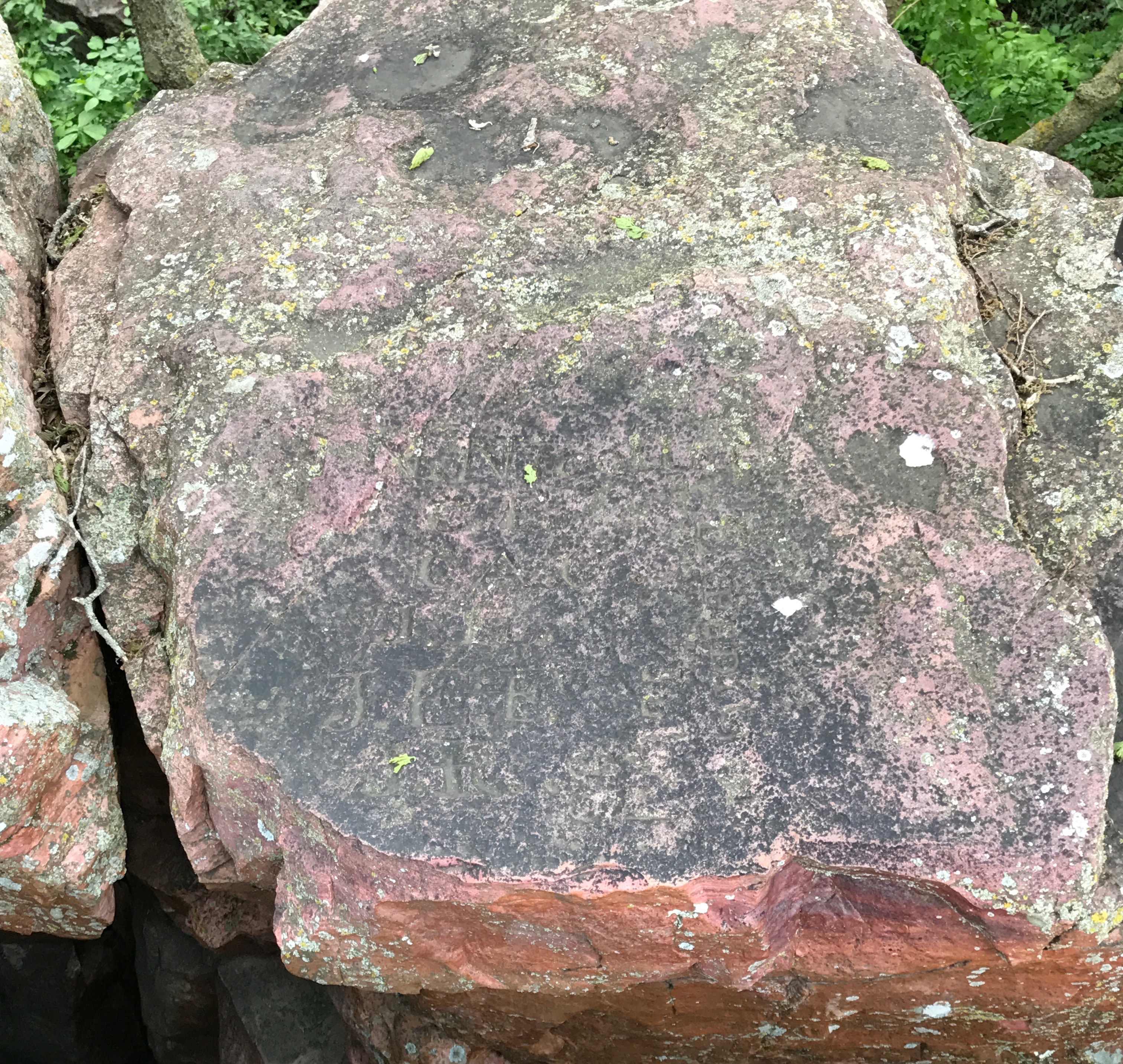
I am pretty sure that this is the stone they carved. When I enlarged it and fiddled with the settings in iPhoto, I could kind of make out the letters. The earth and its processes eventually reclaim everything. Just to be sure, I reached out to the ranger again. He said that this was the original stone.

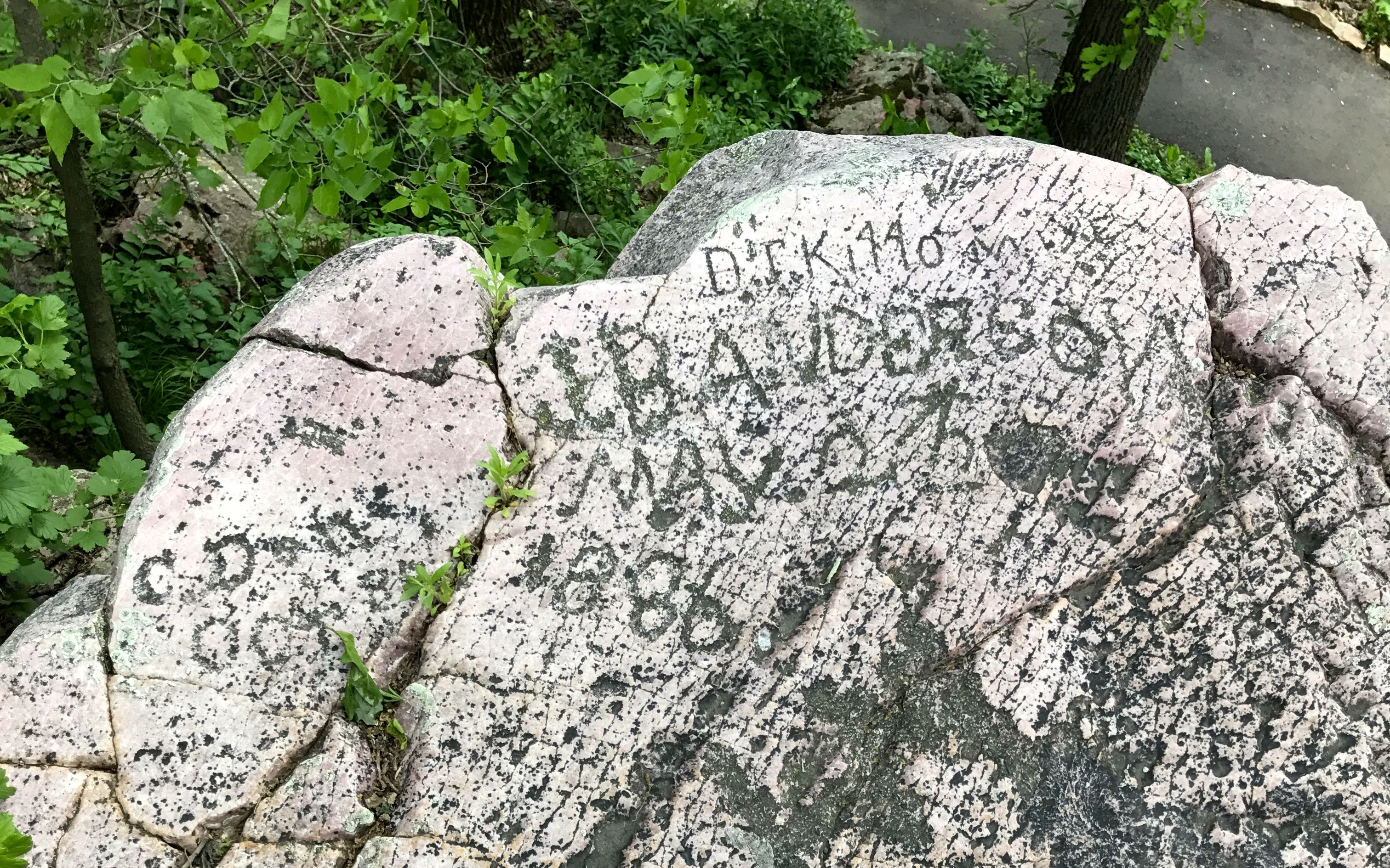
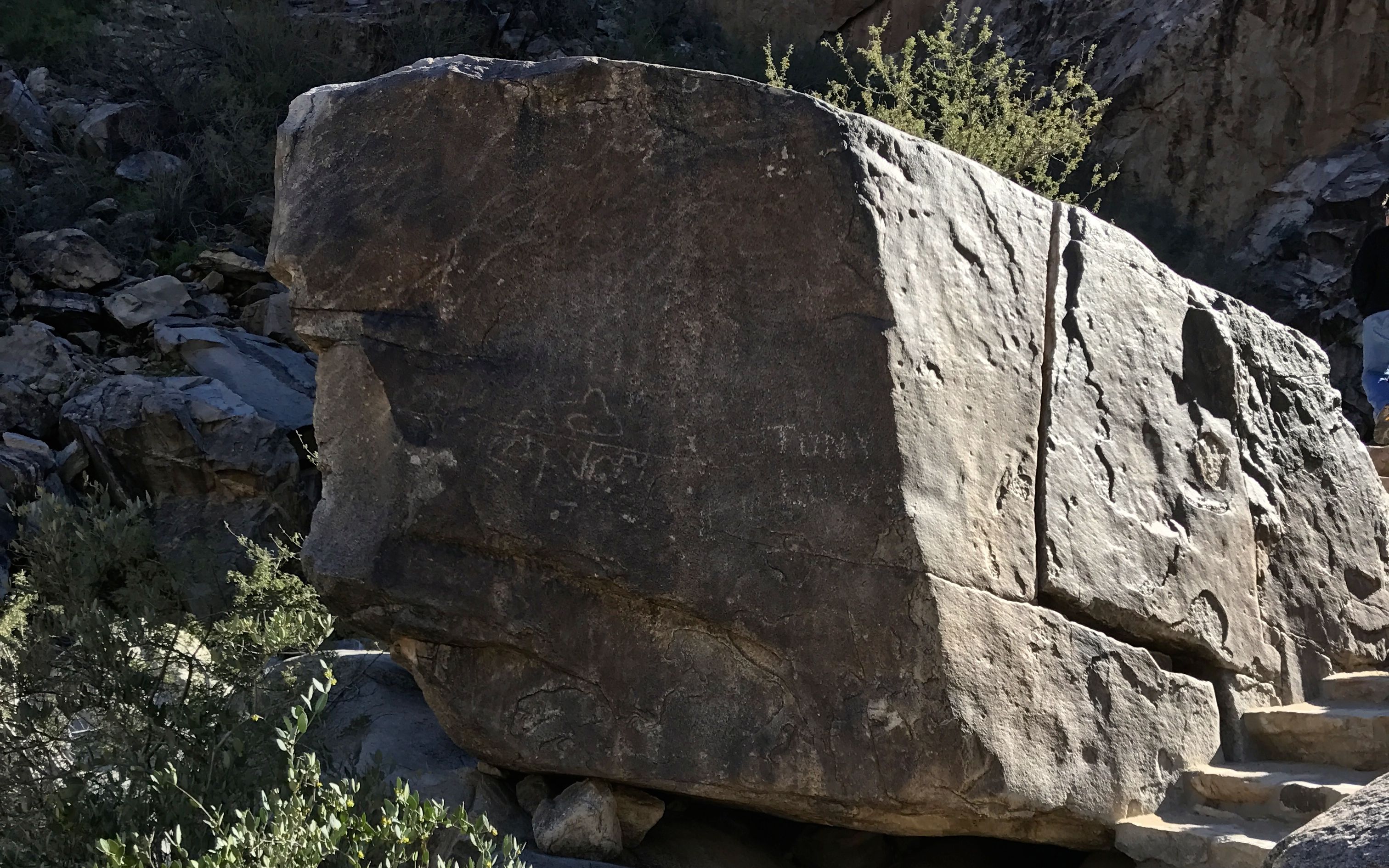
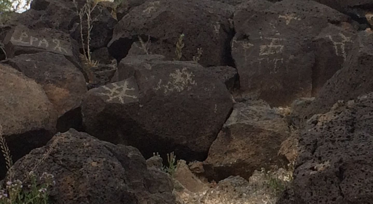
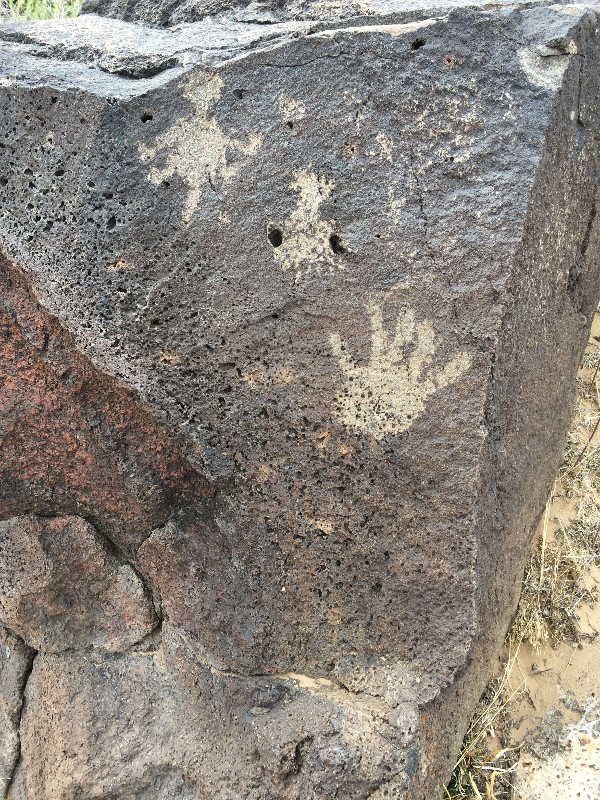
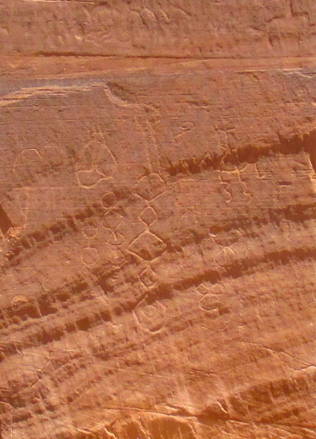
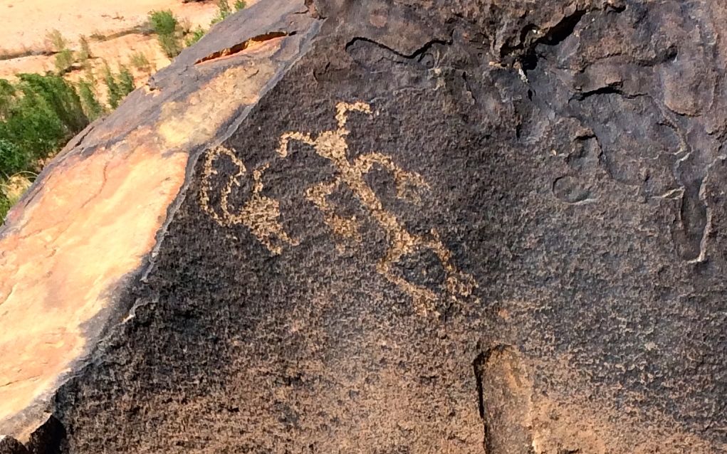
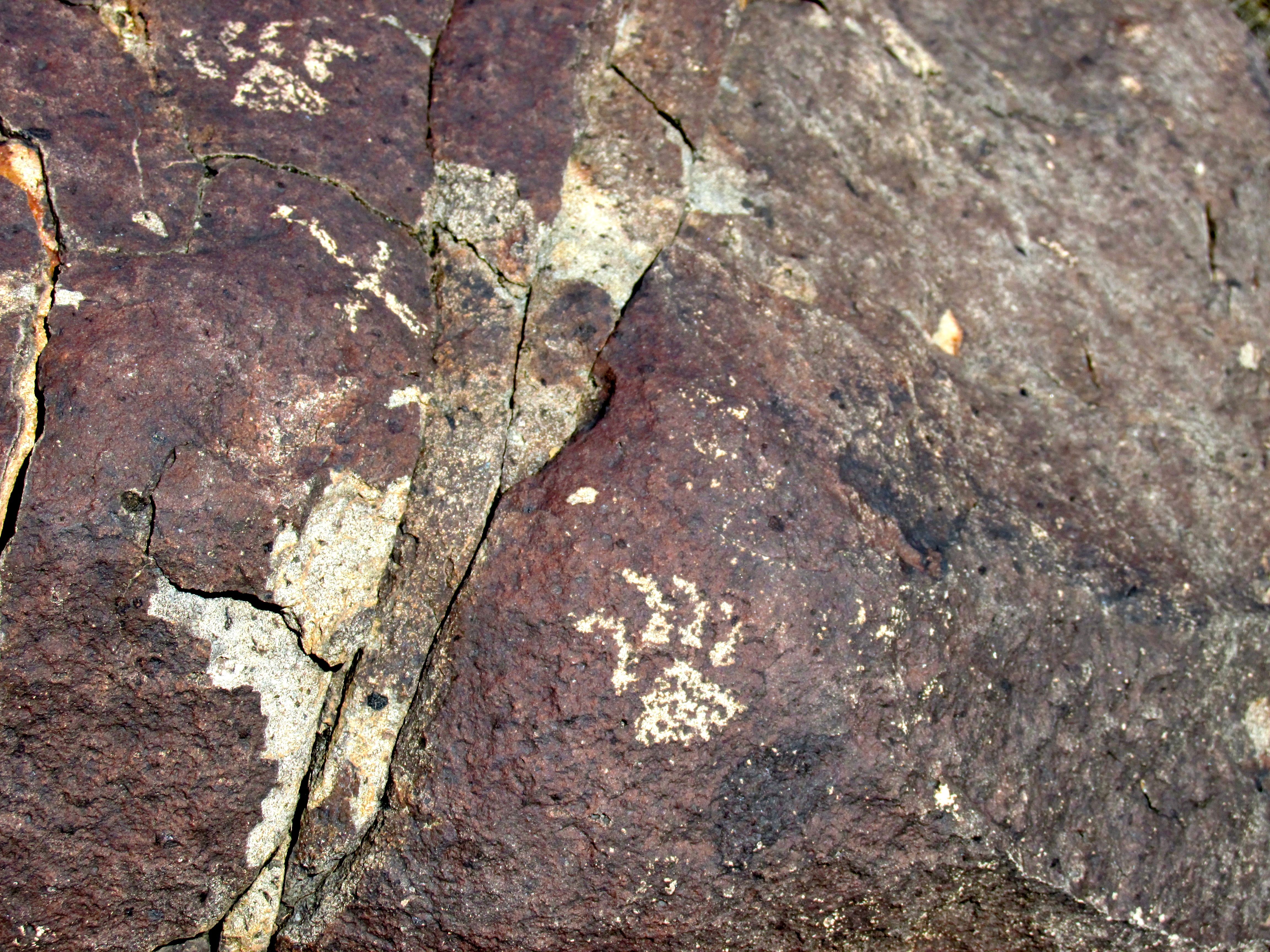
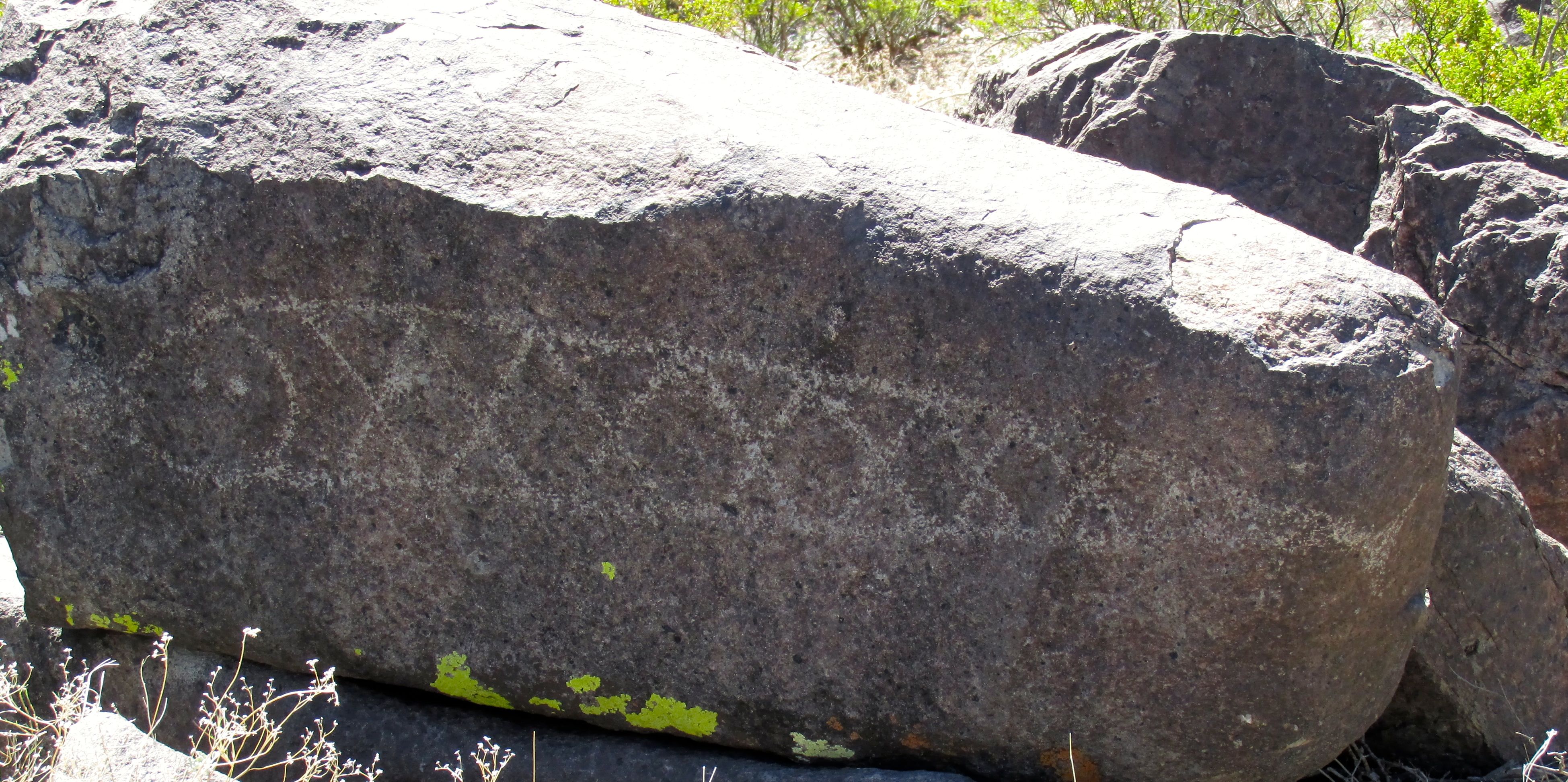
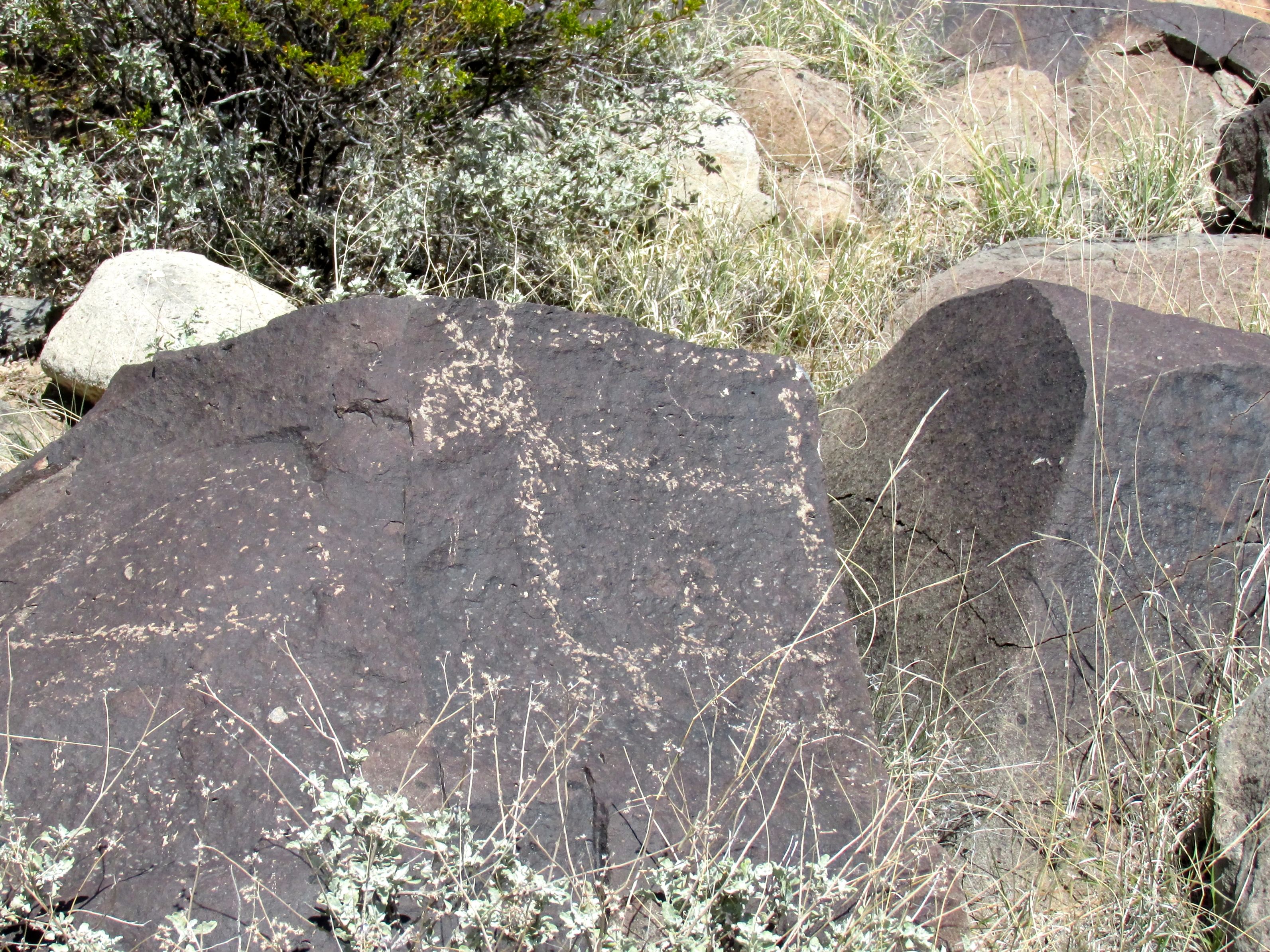
Apparently, people who came along after them left their marks as well.

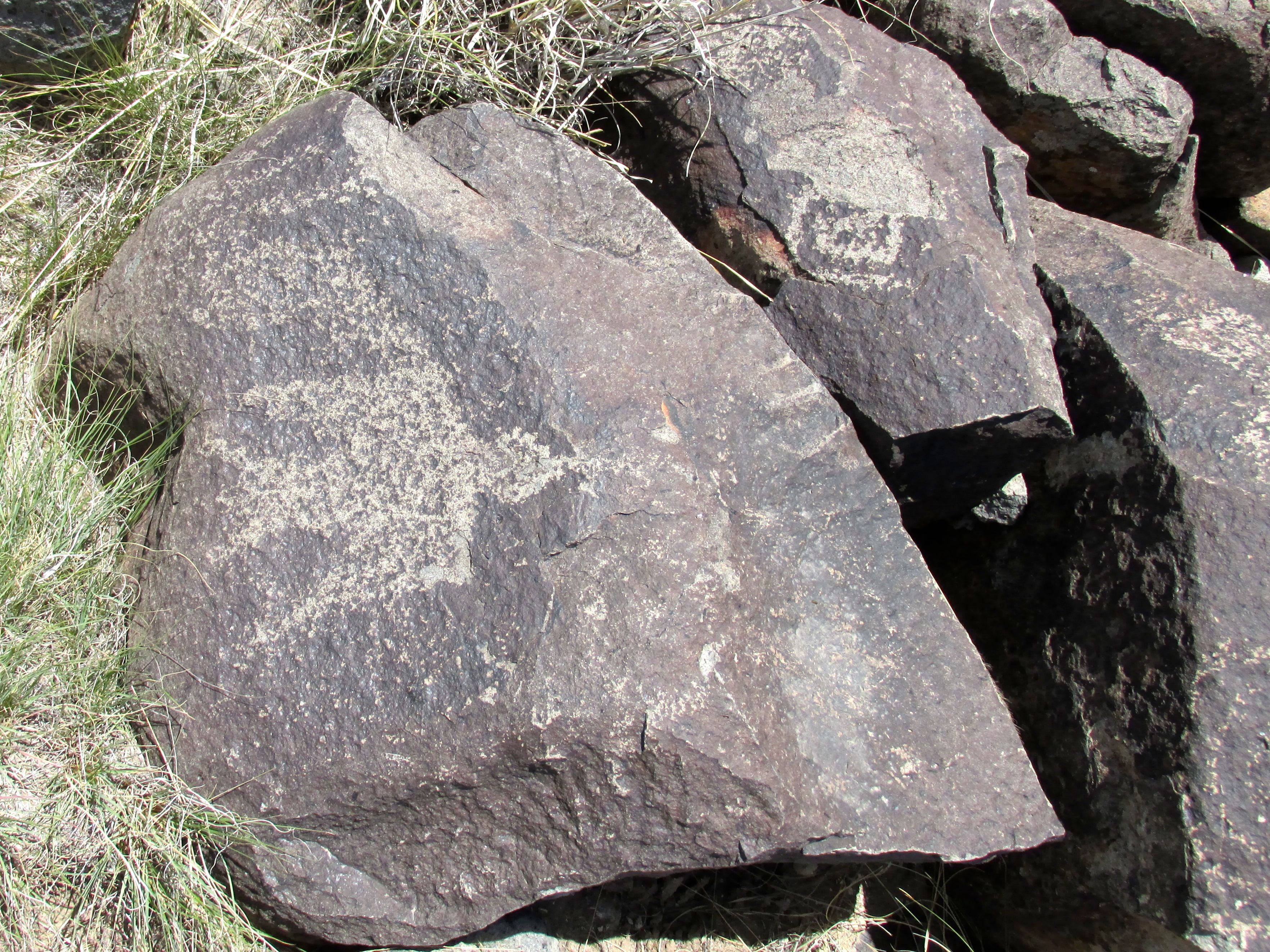
Given the hardness of the quartzite, it was no mean feat to leave your name behind.

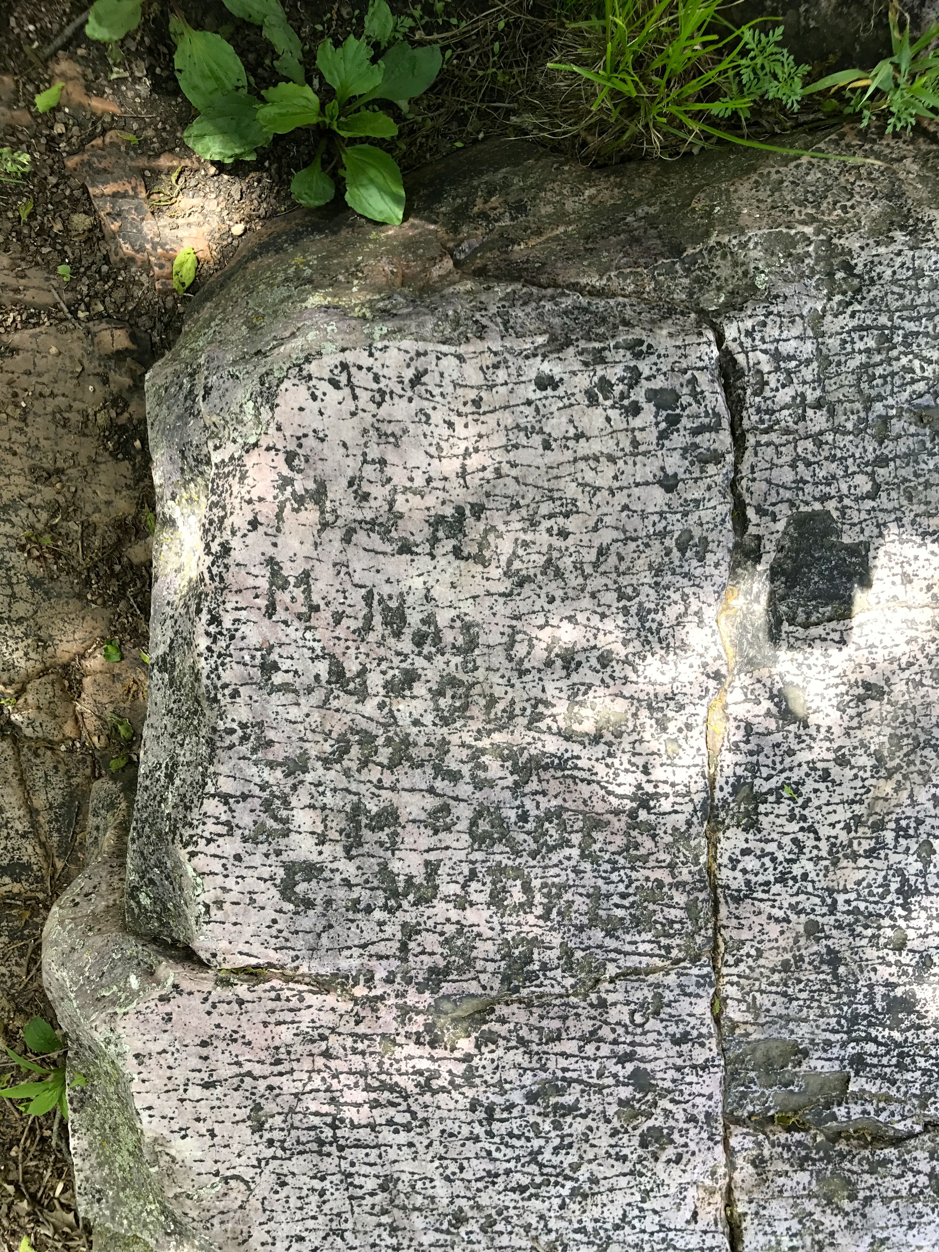
I wonder how long it took these folks?

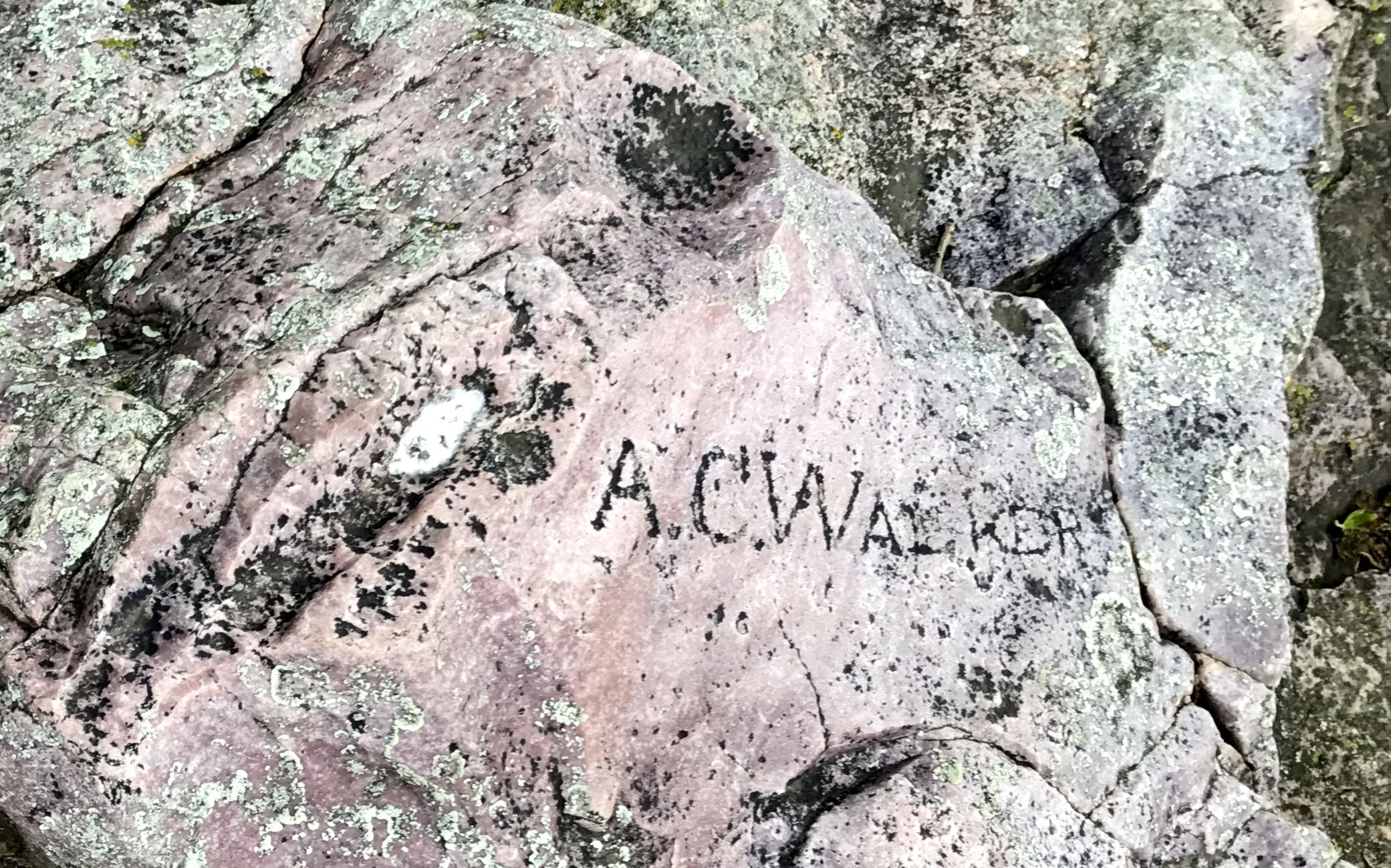
Some just settled for leaving their initials behind.

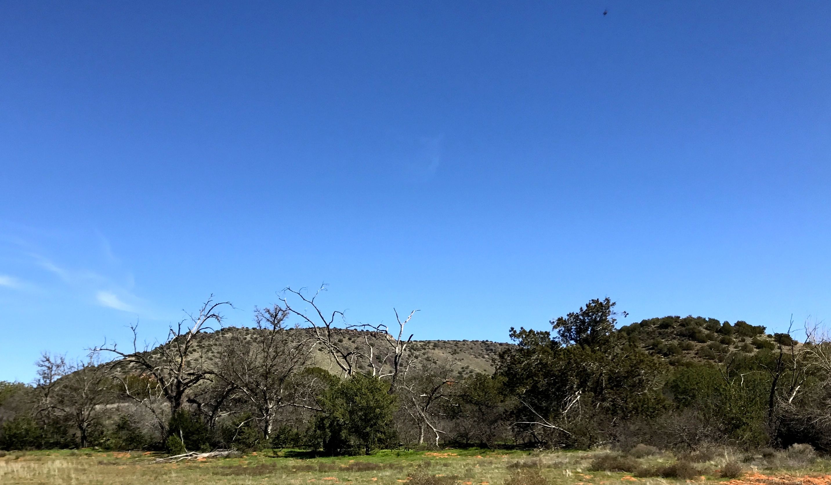
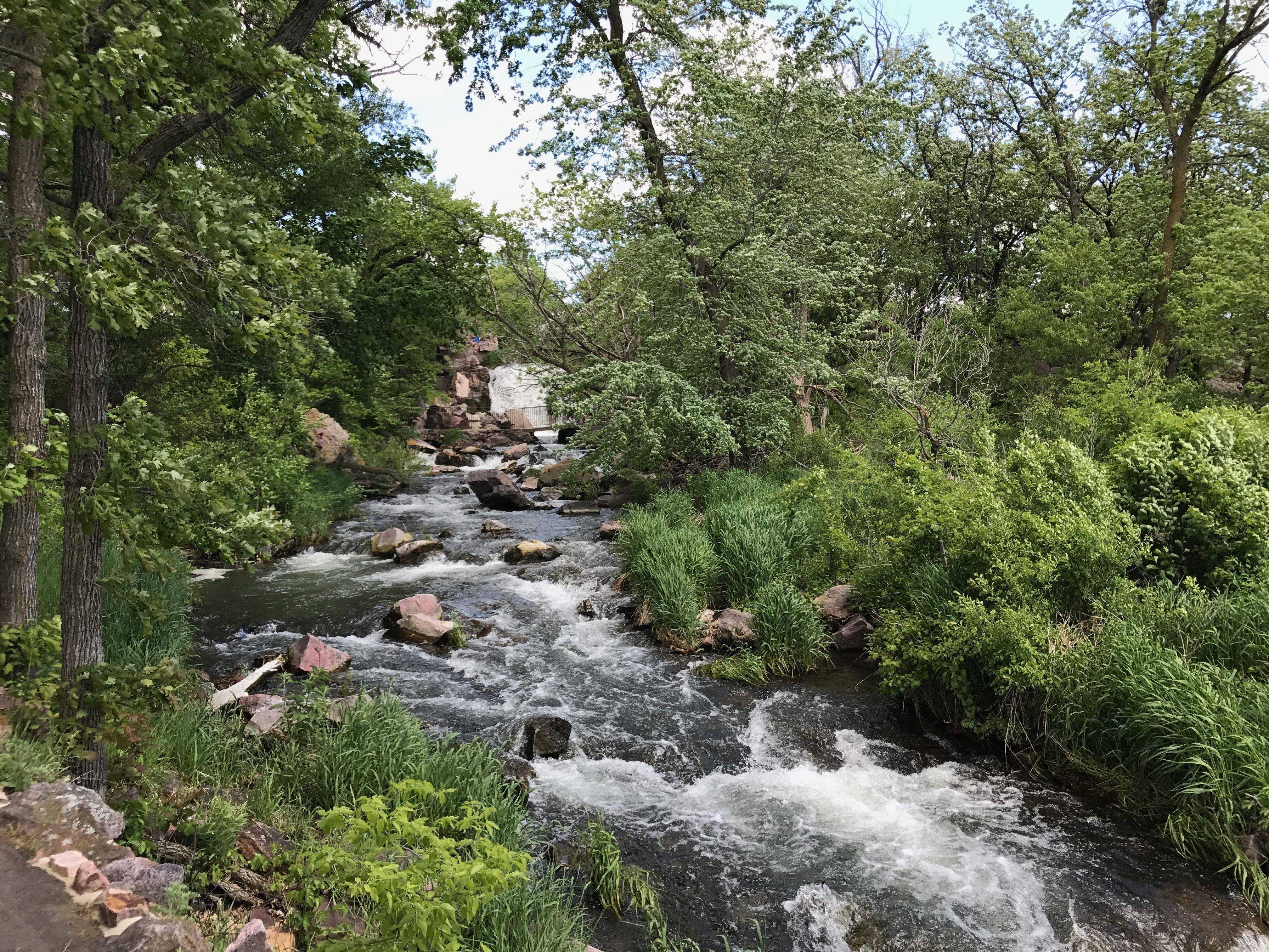
I continued along the trail and came to Winnewissa Falls.

Winnewissa Falls is part of Pipestone Creek.

According to one Native American story, “The Great Spirit called the warring nations together in the valley of the pipestone. There he pulled a piece of pipestone from the earth, formed a pipe, and told them that it was the flesh and blood of their ancestors. He smoked the pipe over them and admonished them to lay down their arms. Here is a place where different tribes can quarry side by side together in harmony. While he was speaking, a water fall poured from the rock nearby.”

I took this story from some of the excellent interpretive materials available at the site.

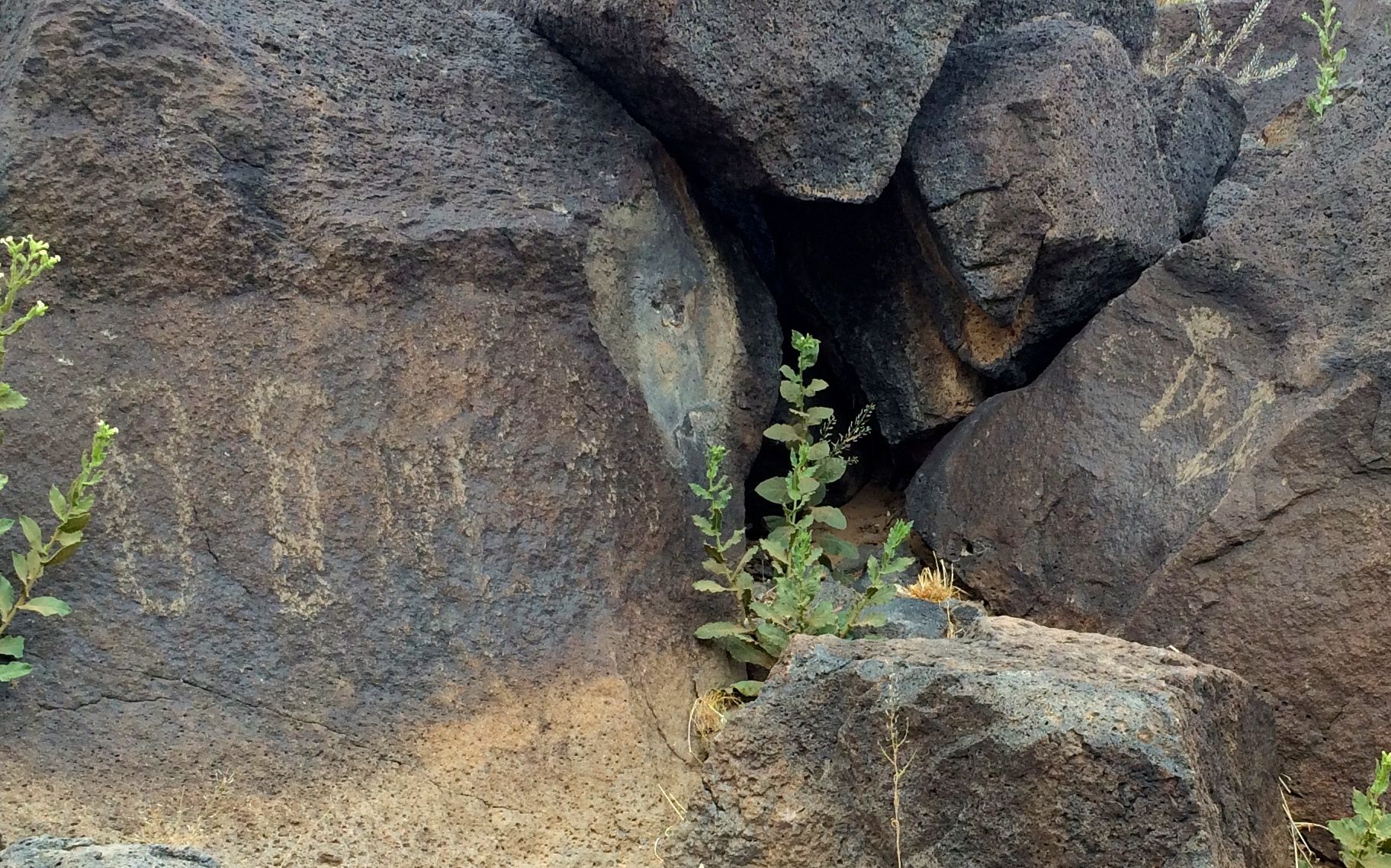
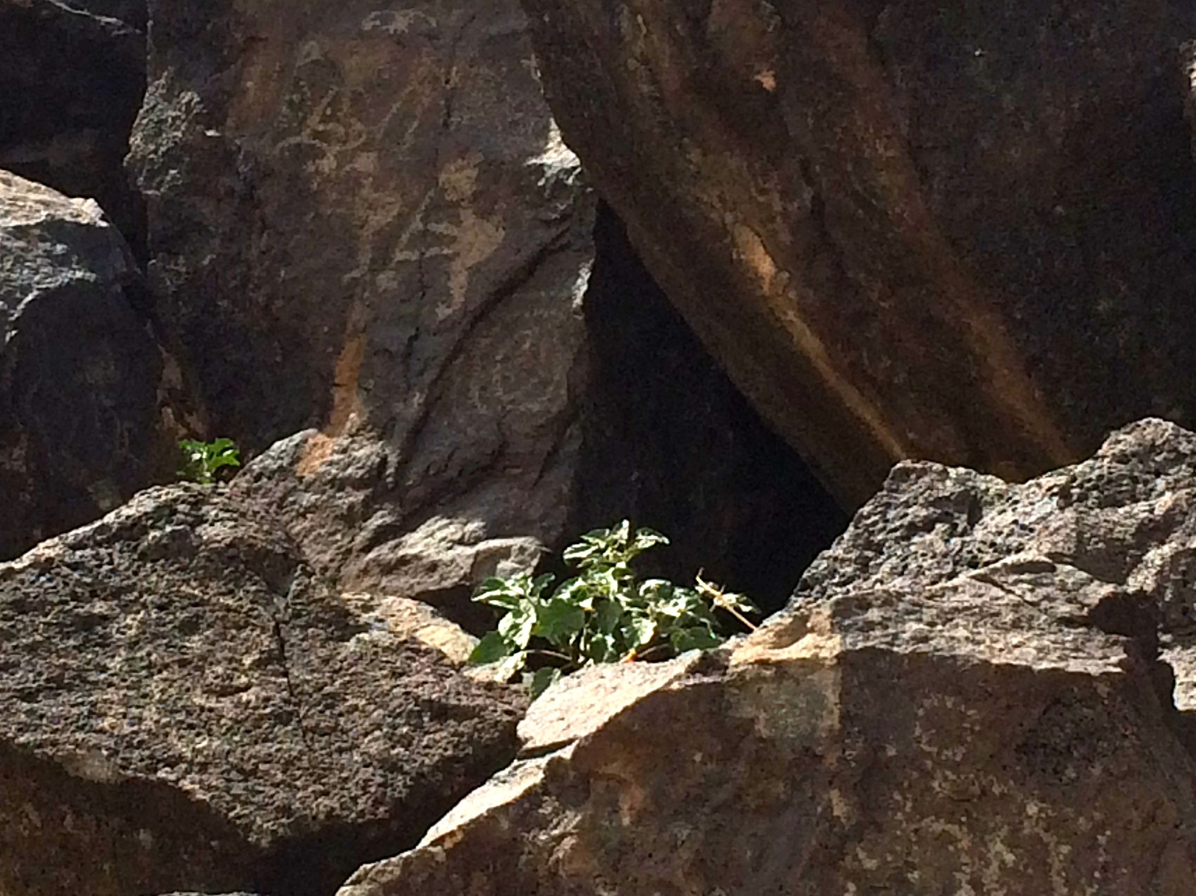
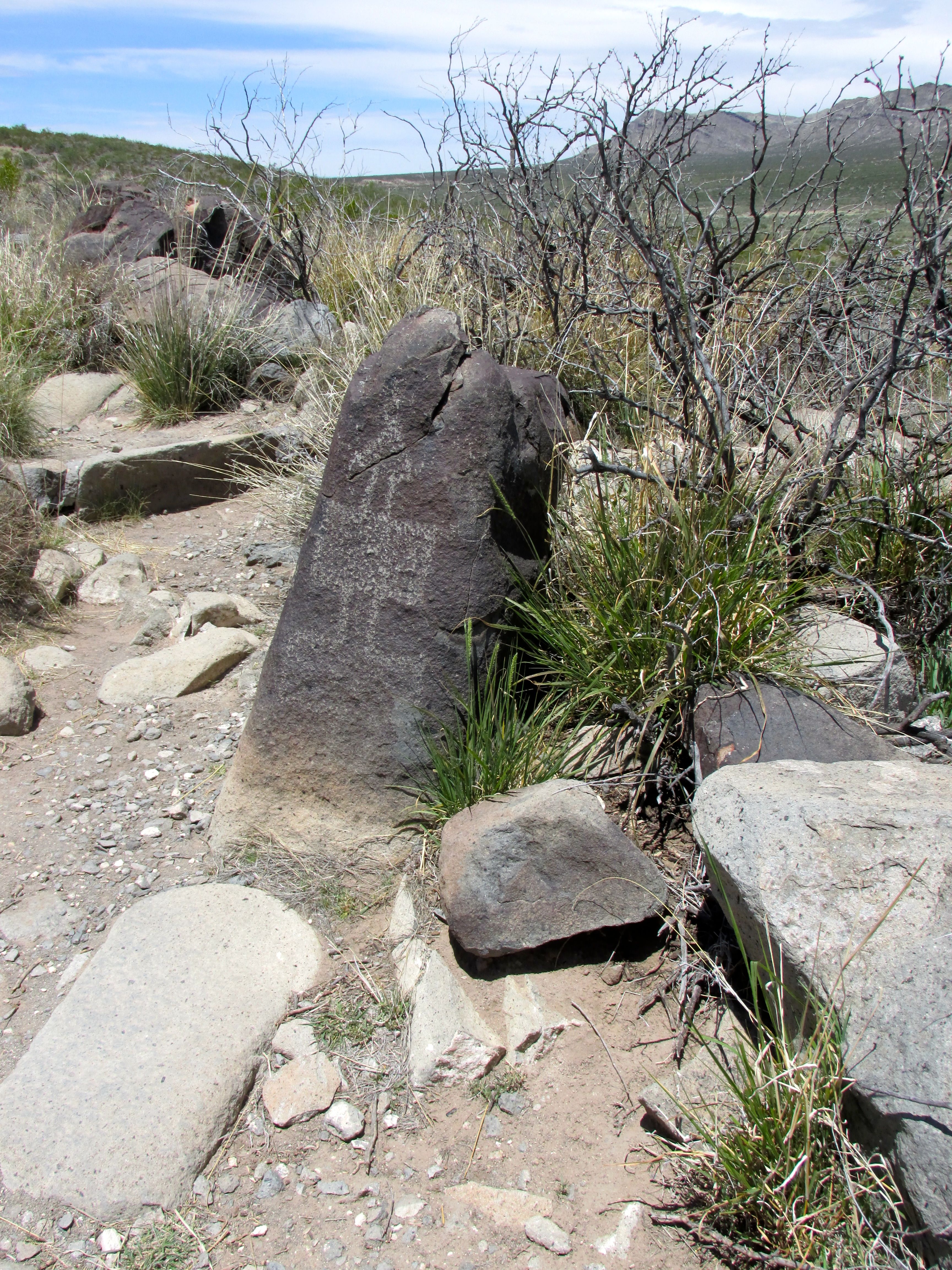
I continued on down the trail and came upon this sign.

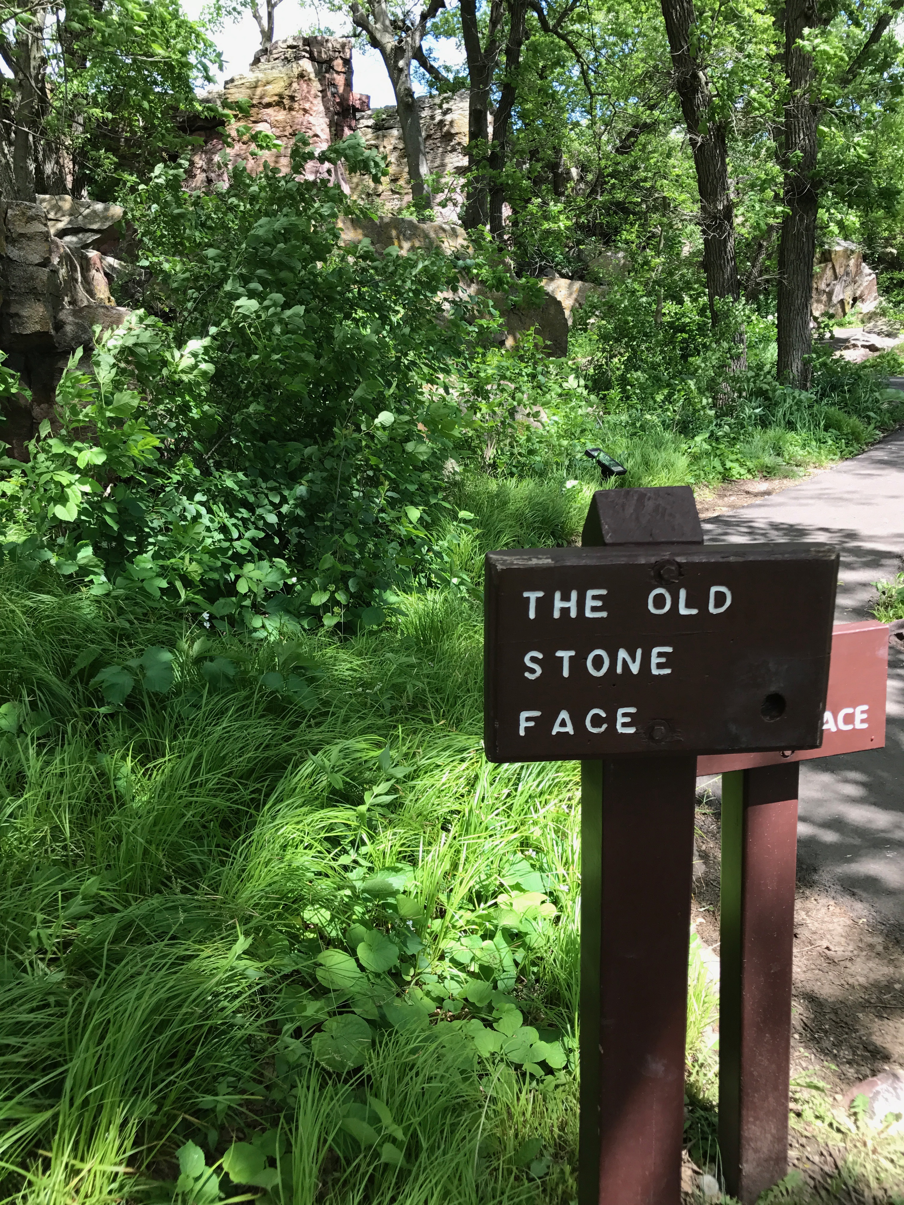
Wait! Buster Keaton is down there?

No, not Buster Keaton, but I see the Old Stone Face.
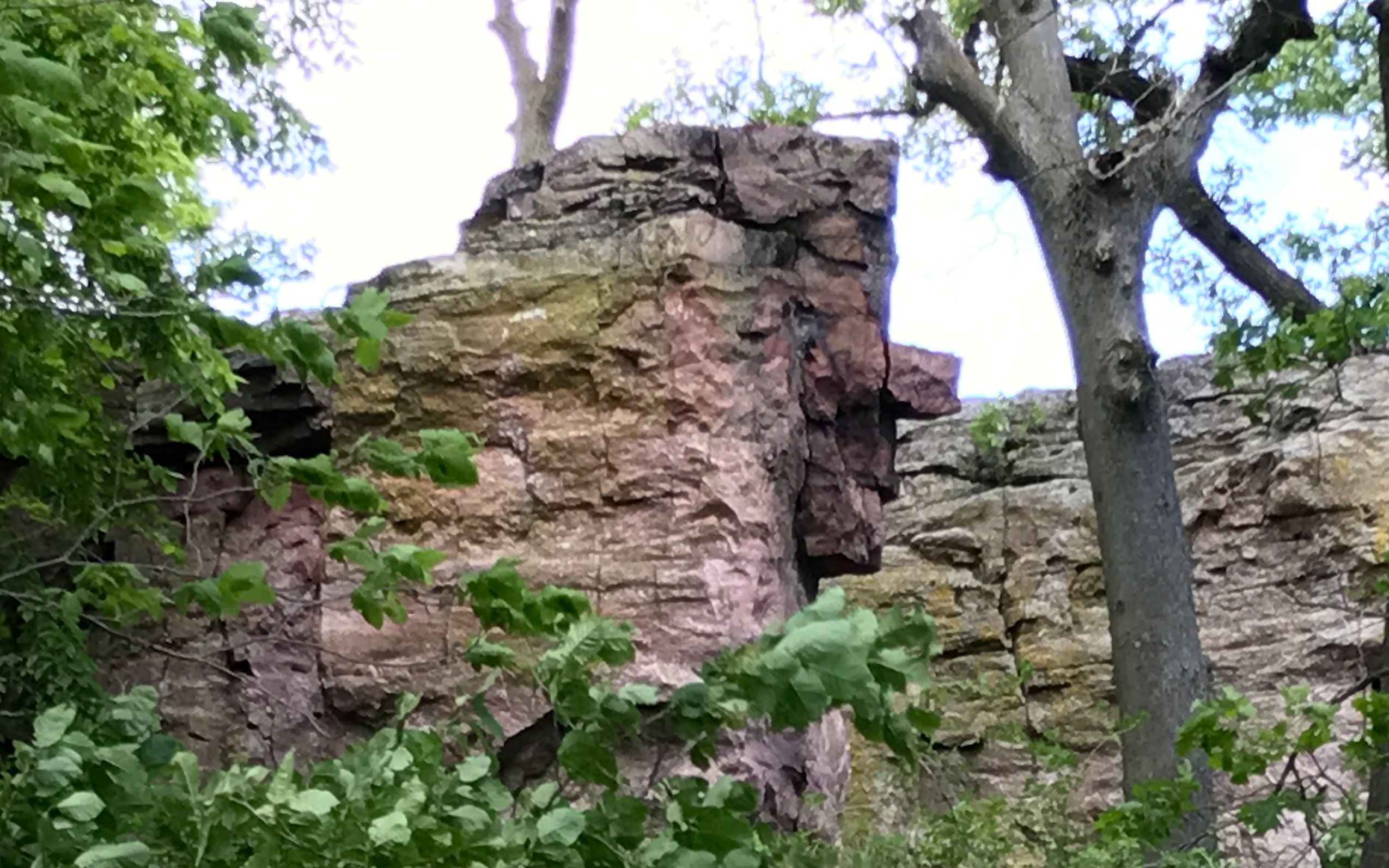
Do you?

I kept walking.

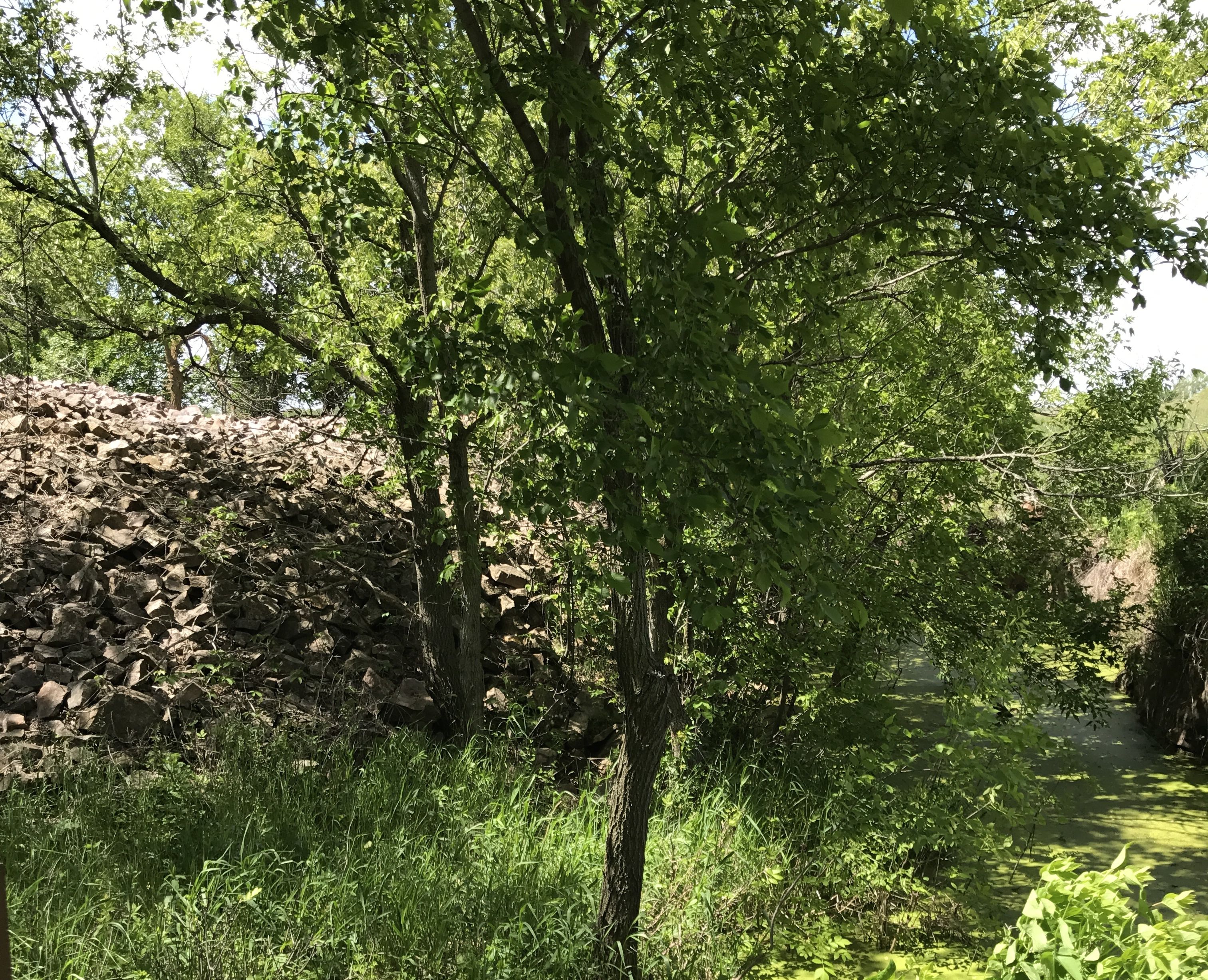
Pipestone Creek gurgled merrily along.

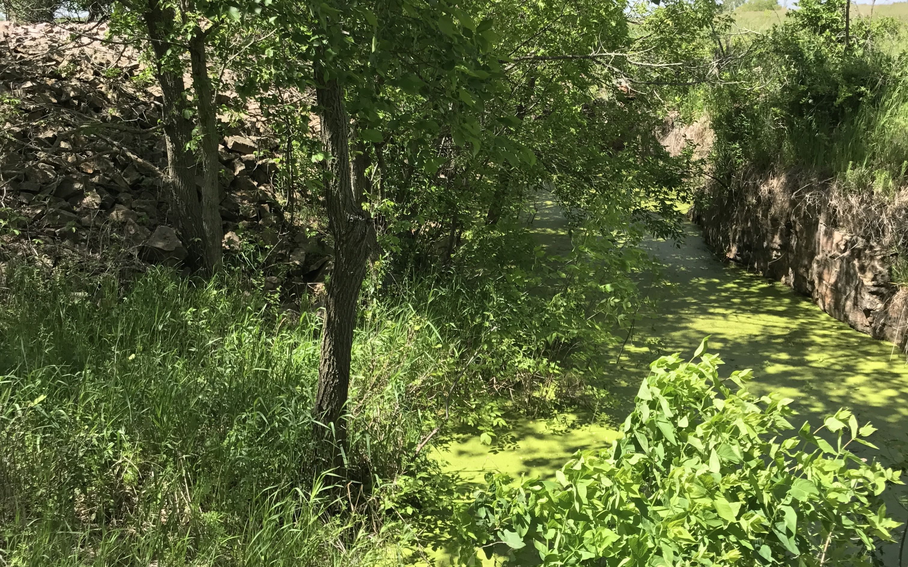
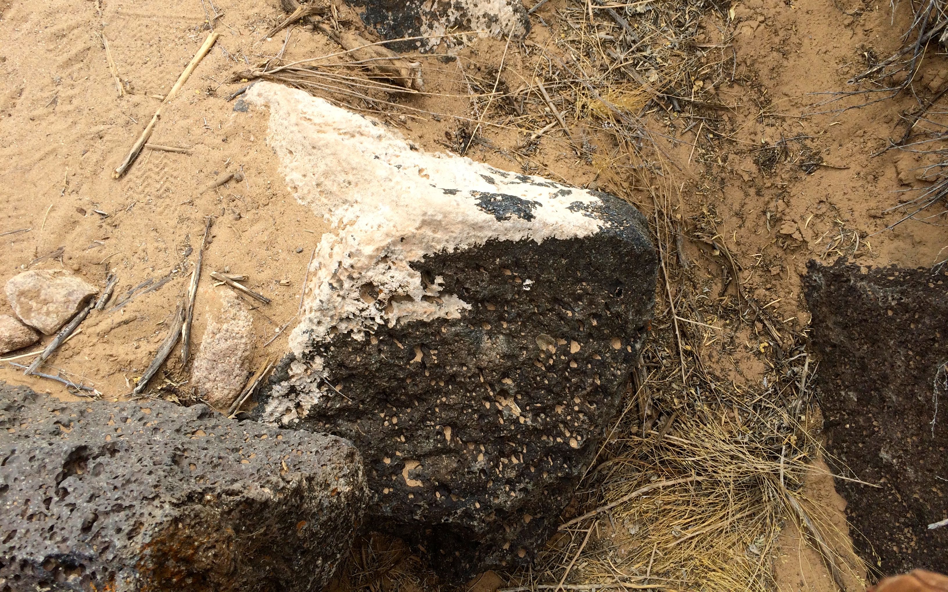
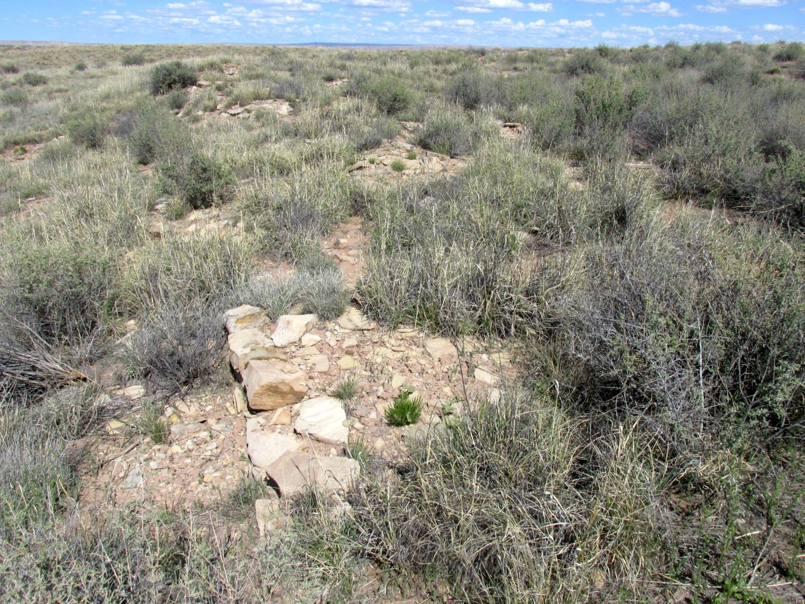
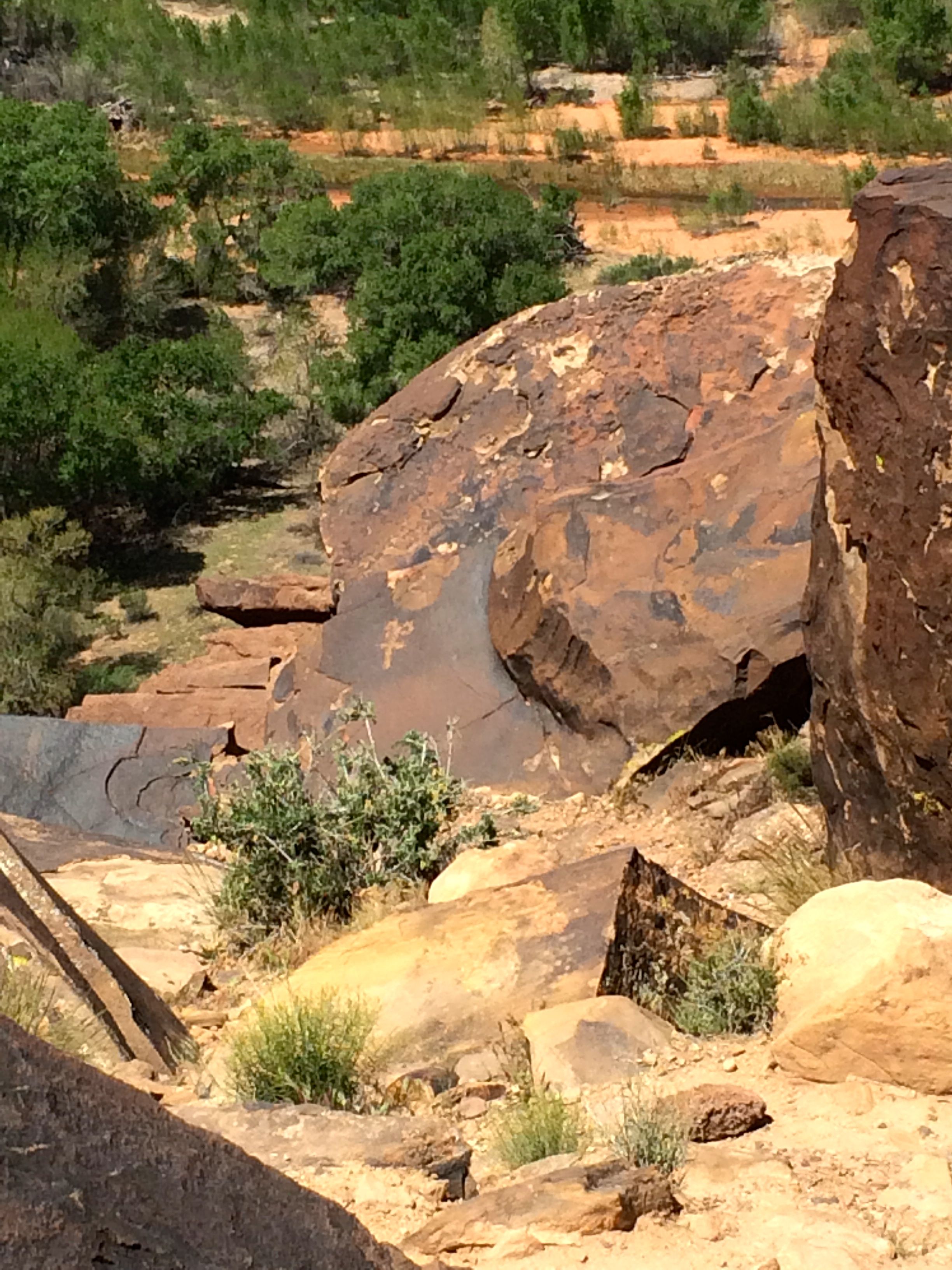
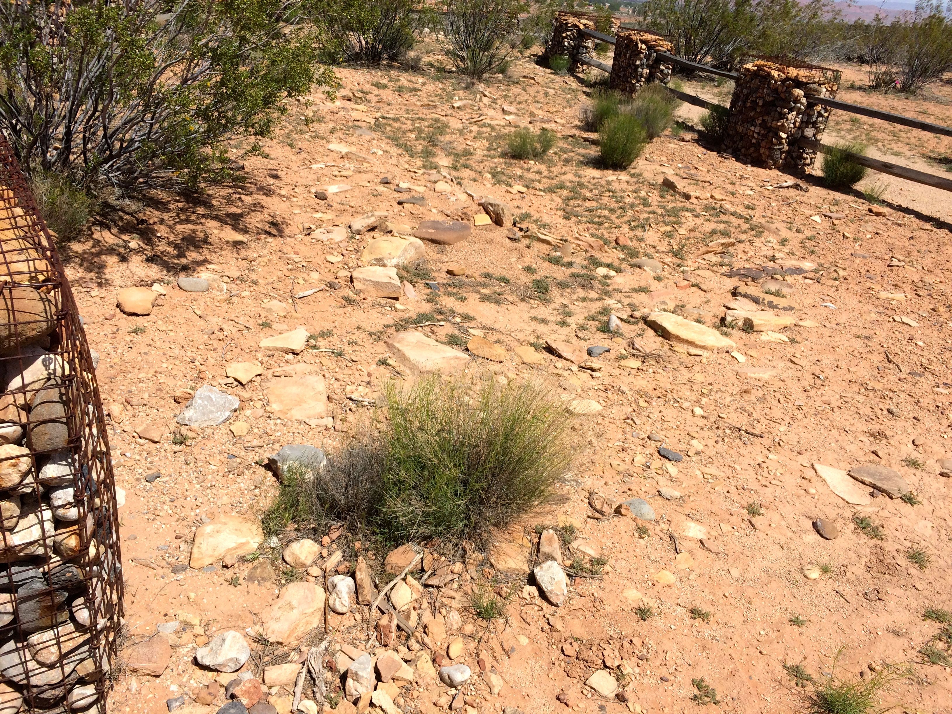
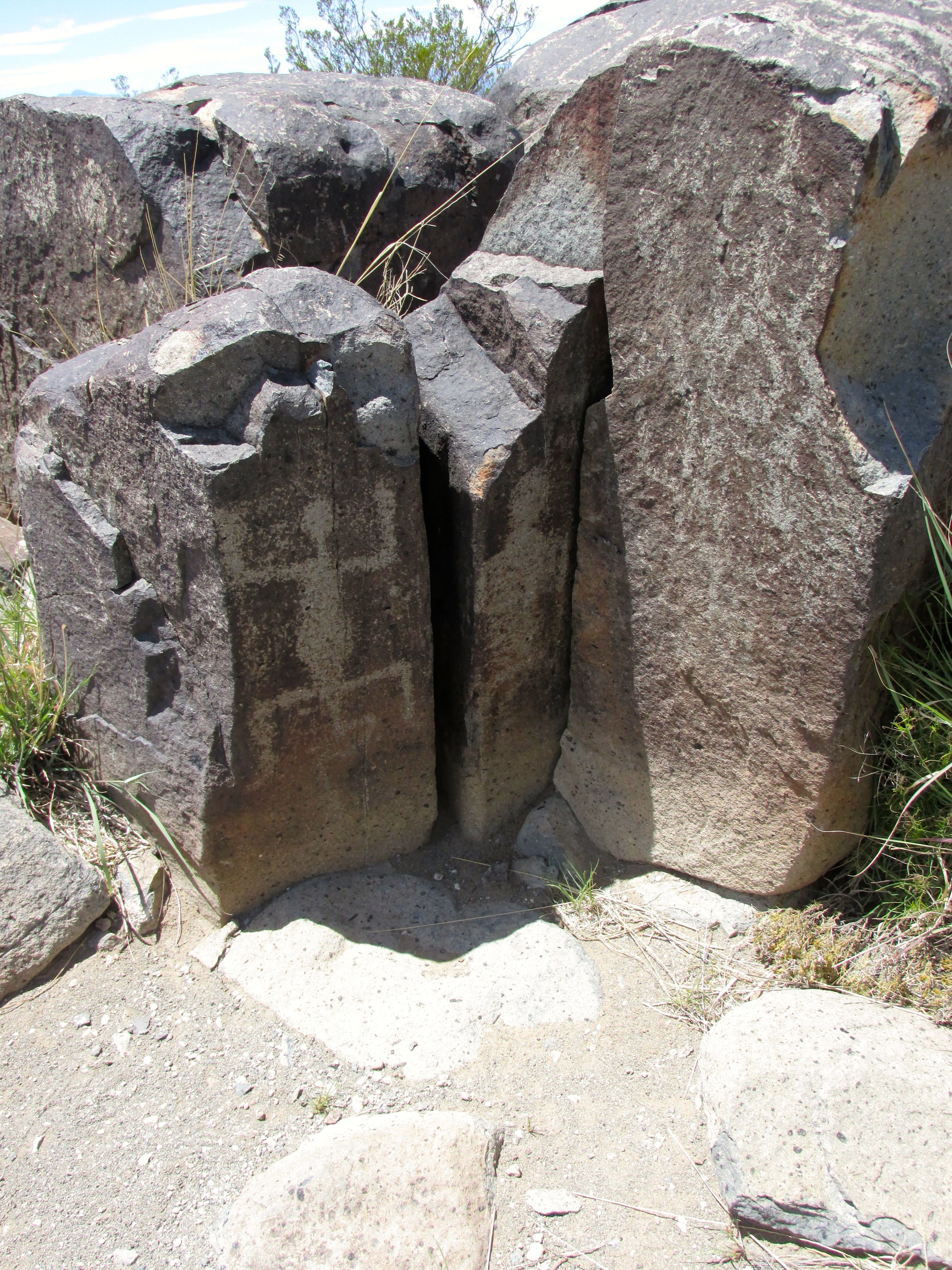
I passed at least one quarry I could identify. This one was filled with water and covered with duckweed. I wonder if it dries out in the summer?

You could tell it was a quarry because of the pile of tailings left from getting to the stone they were after.

I passed more plants with interpretive plaques. I was most impressed with the legibility of the interpretive plaques. Not only could your read them, but they contained relevant information.

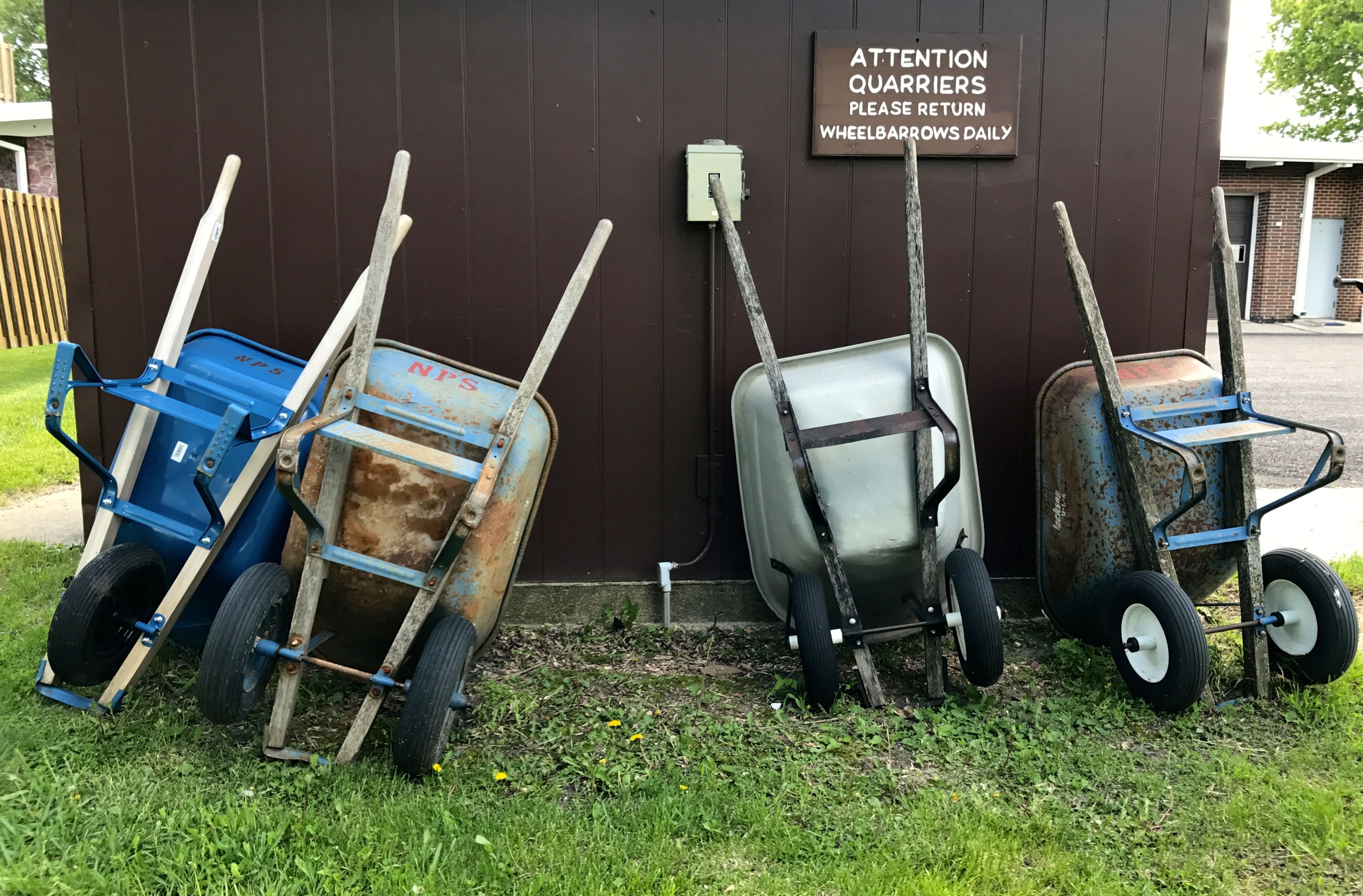
I thought it was nice that wheelbarrows were there for the quarriers to use.

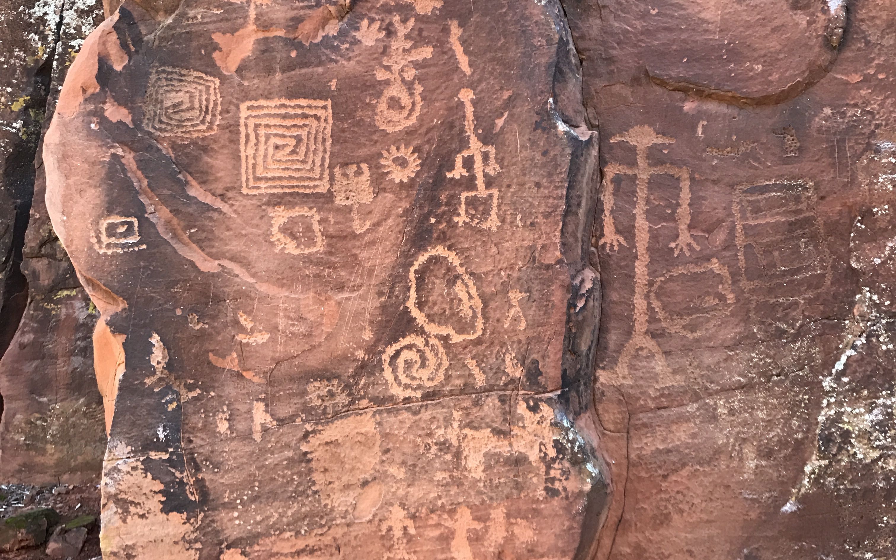
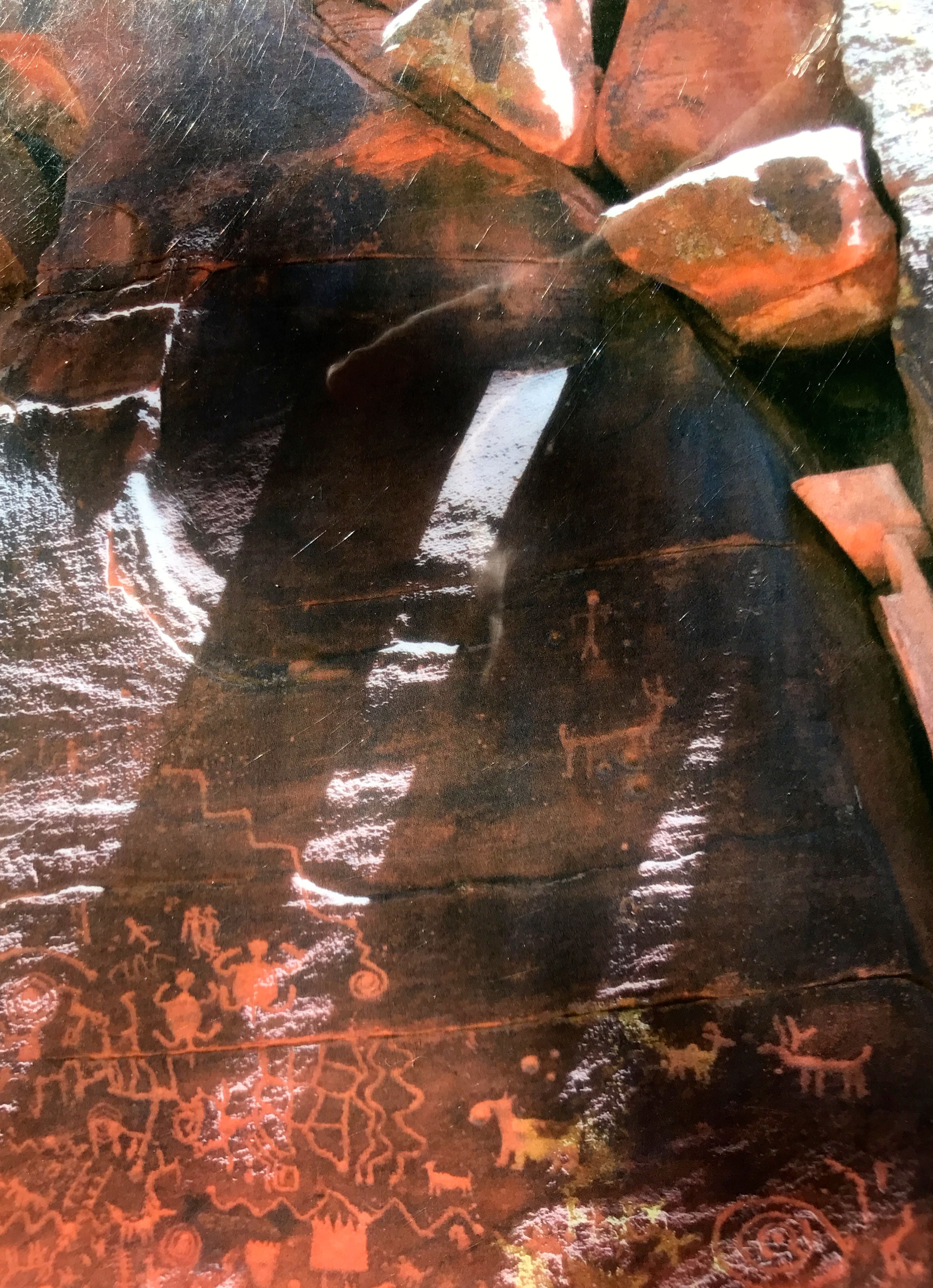
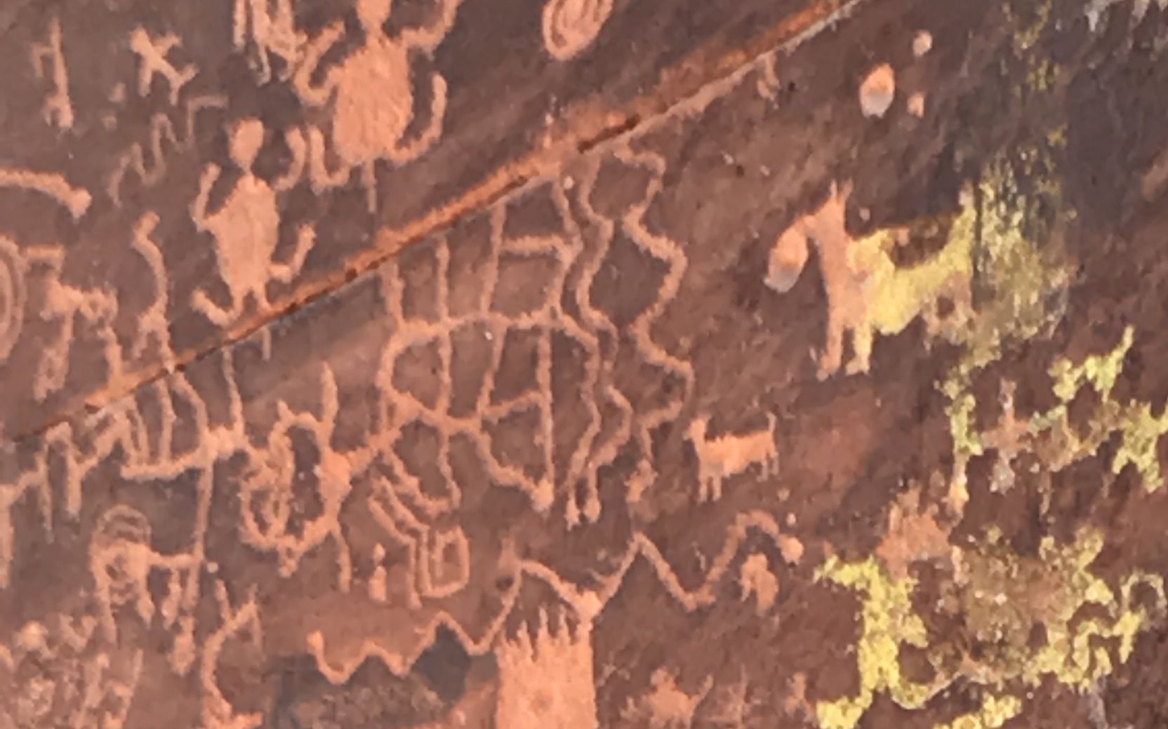
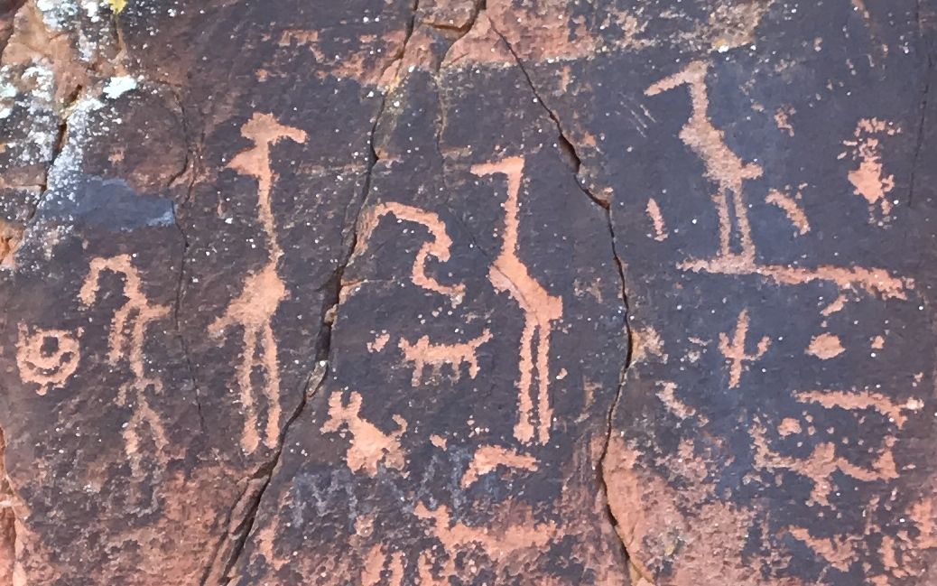
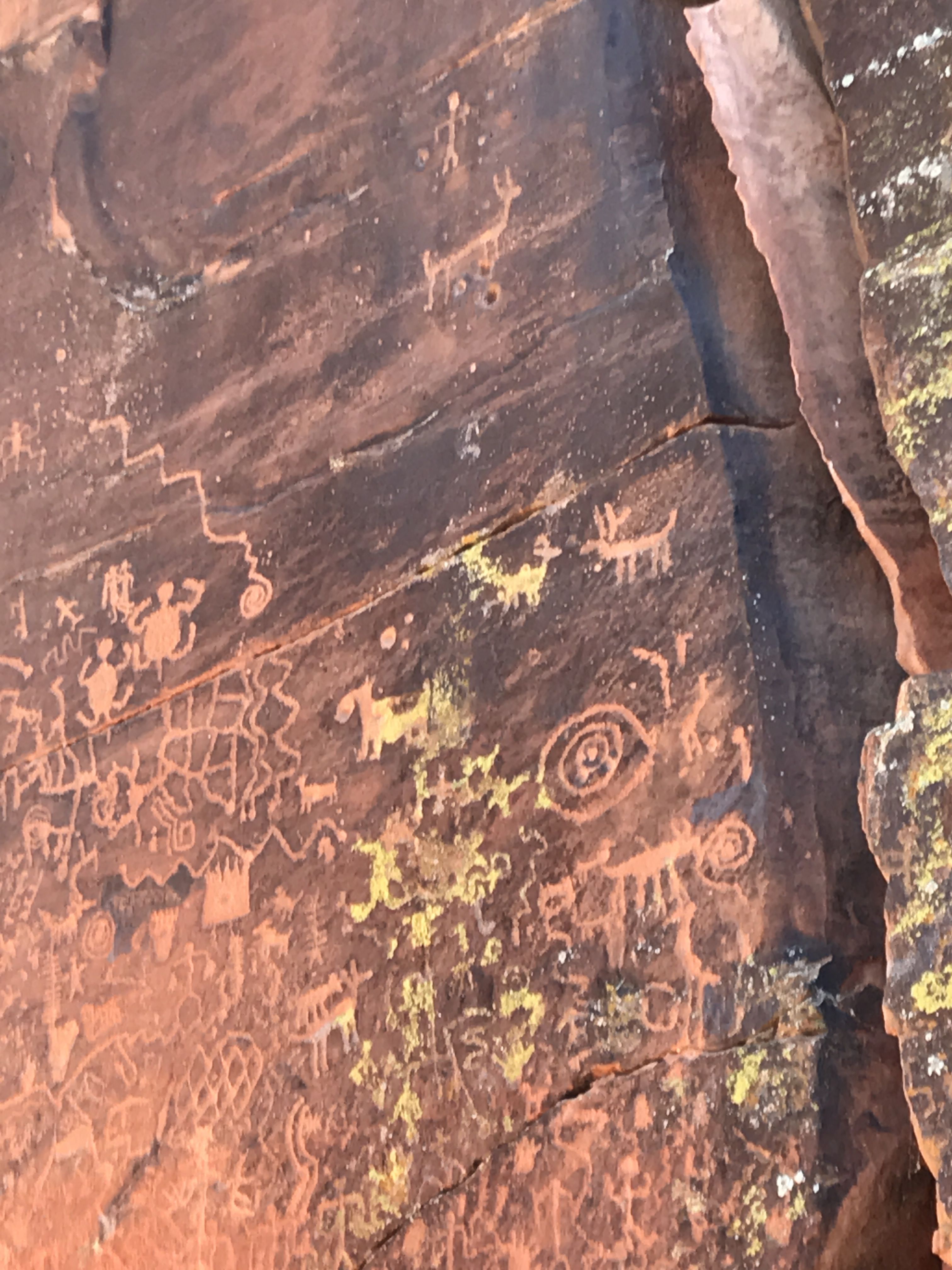
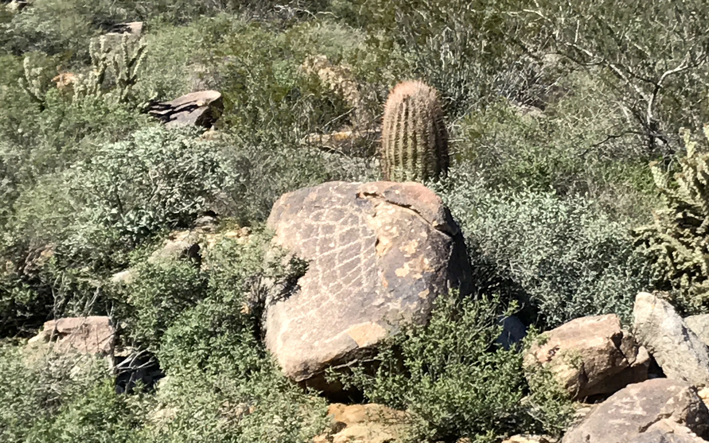
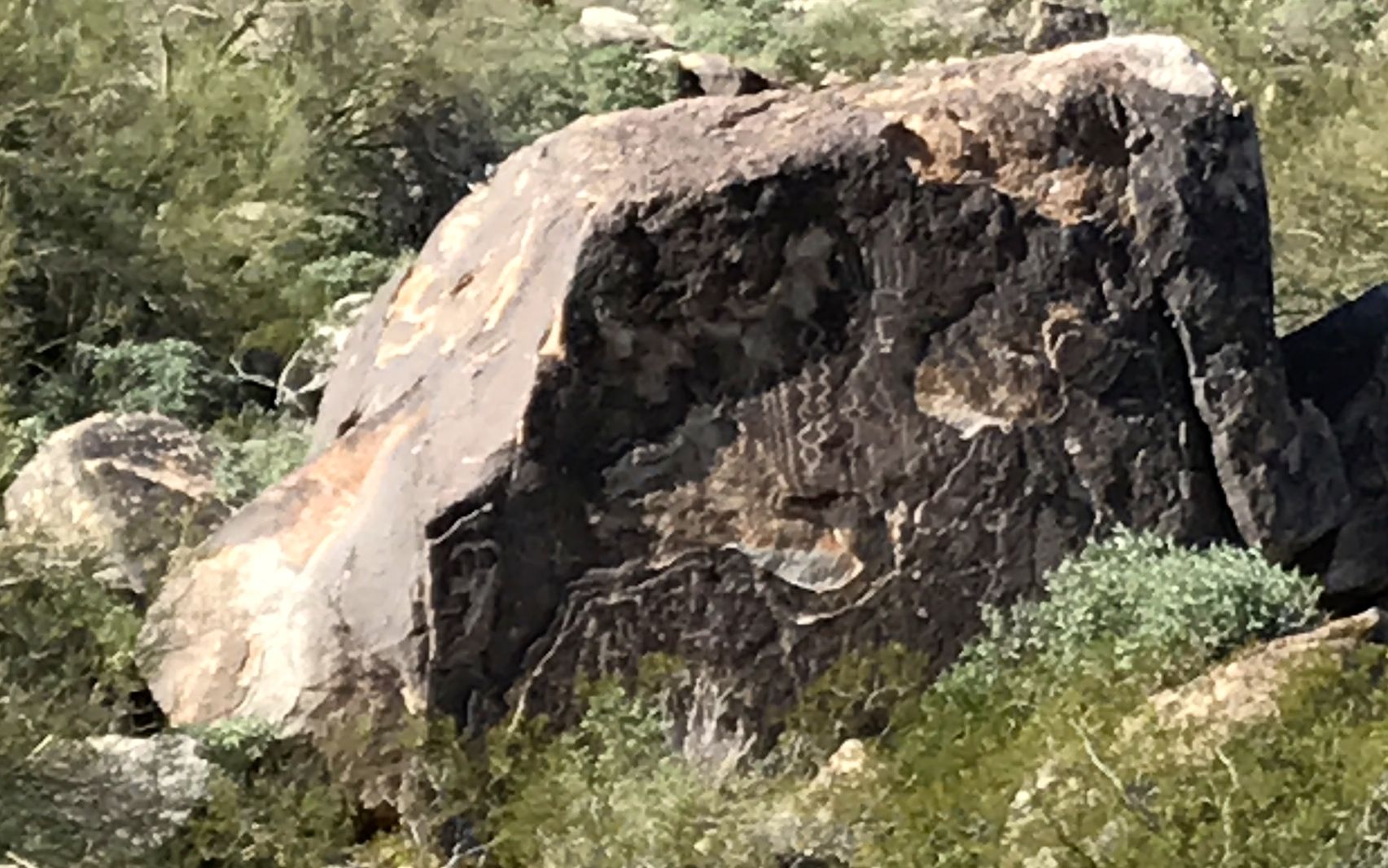
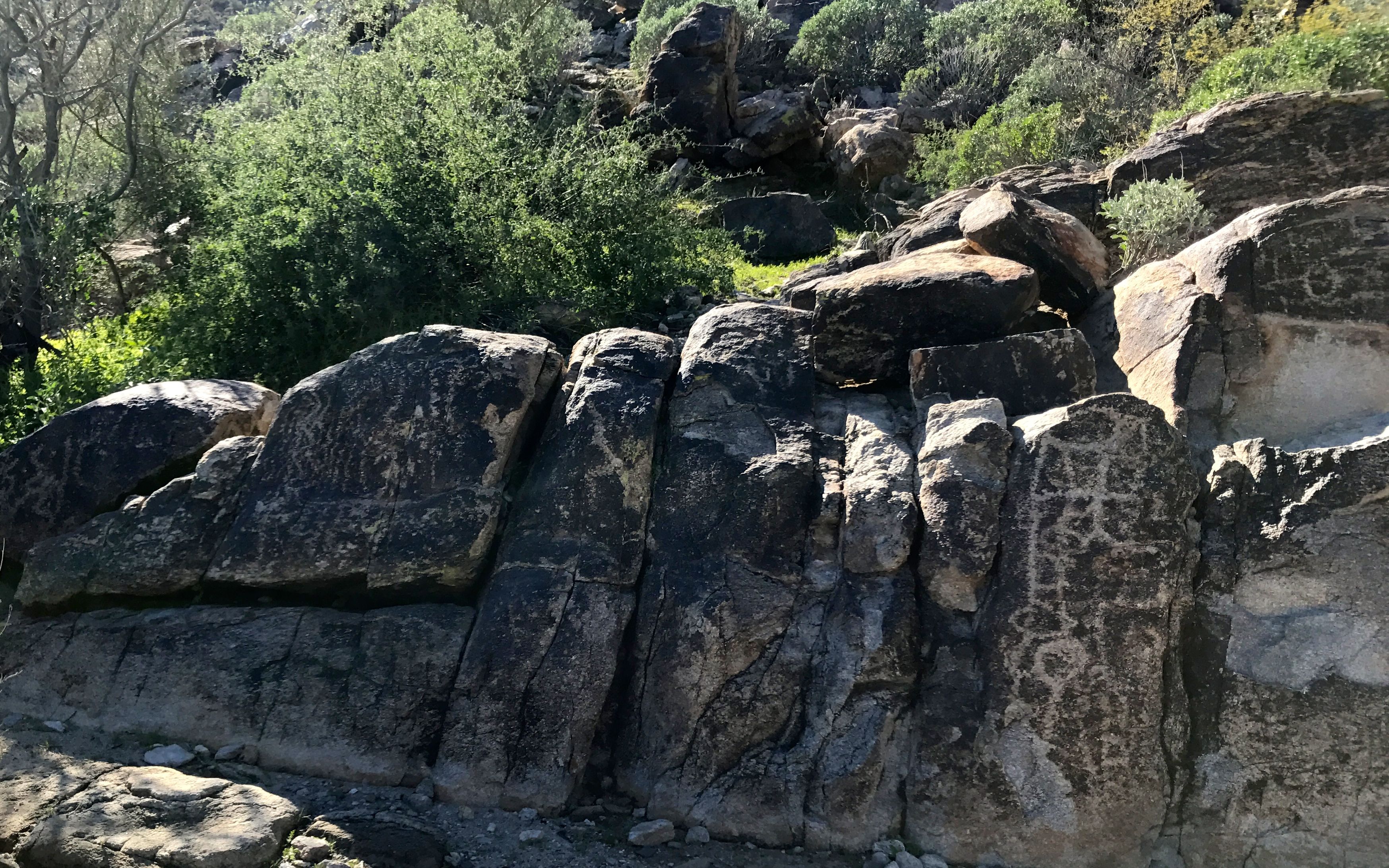
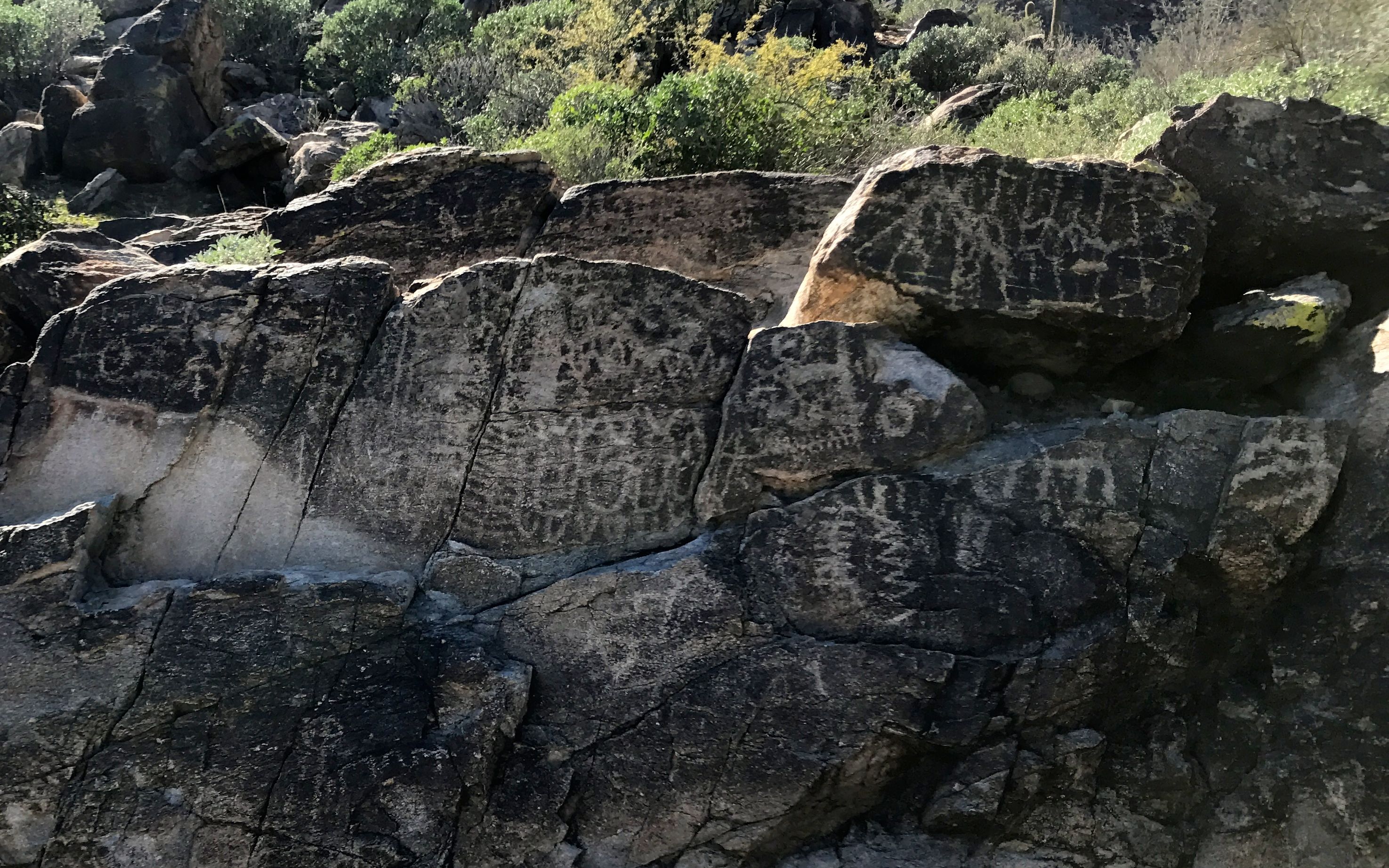
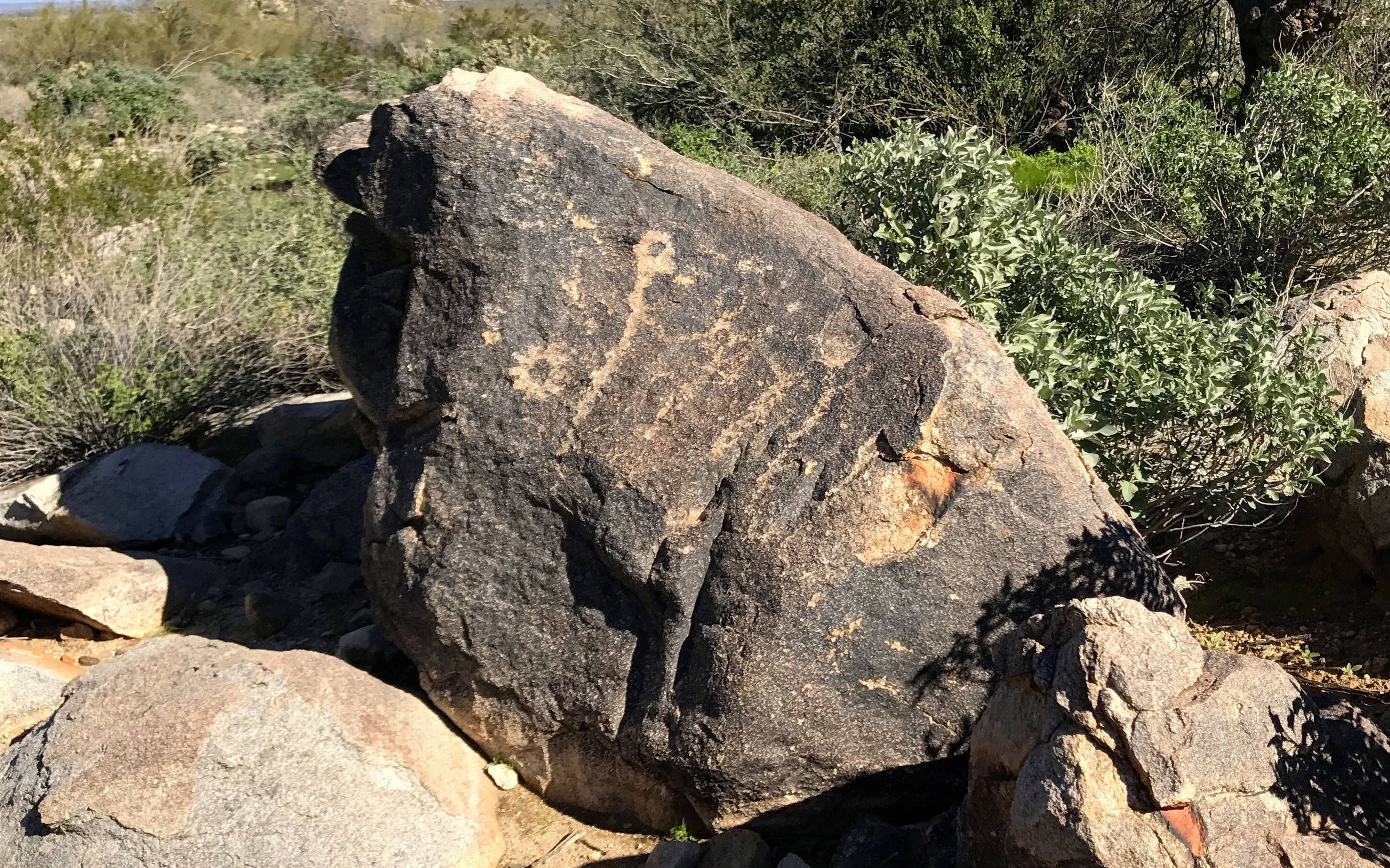
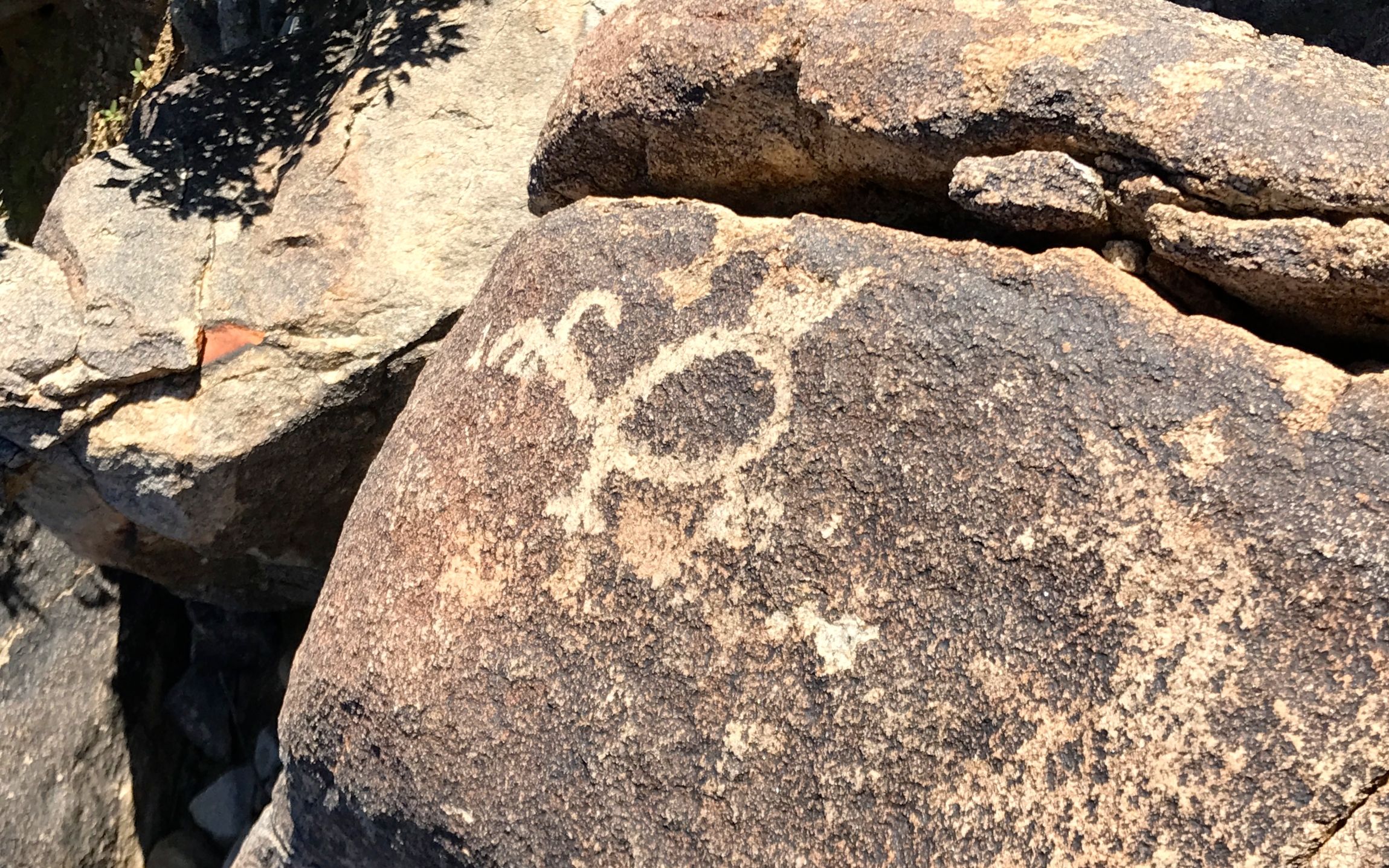
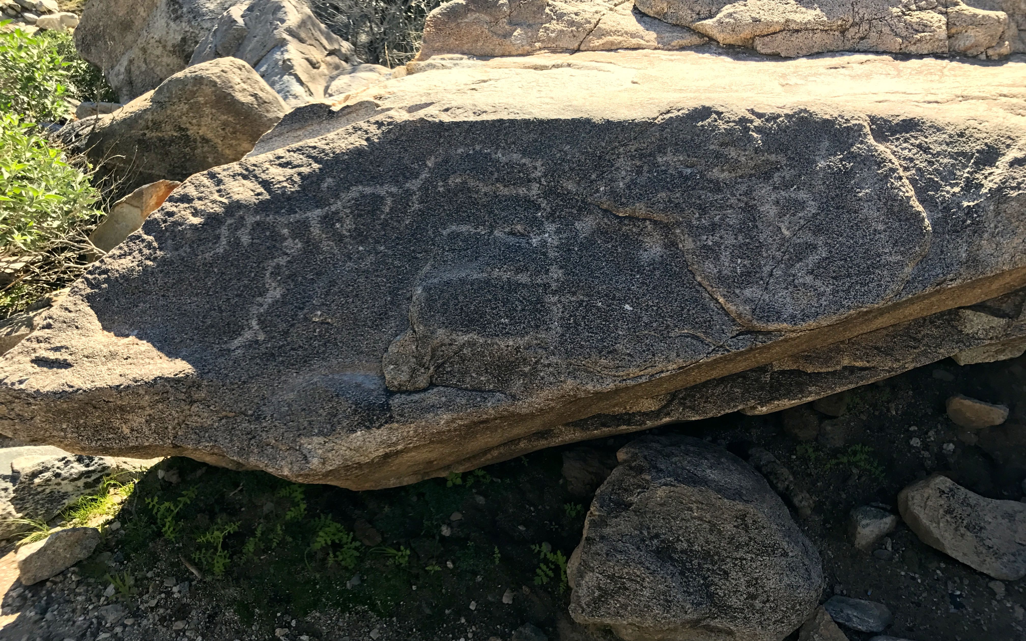
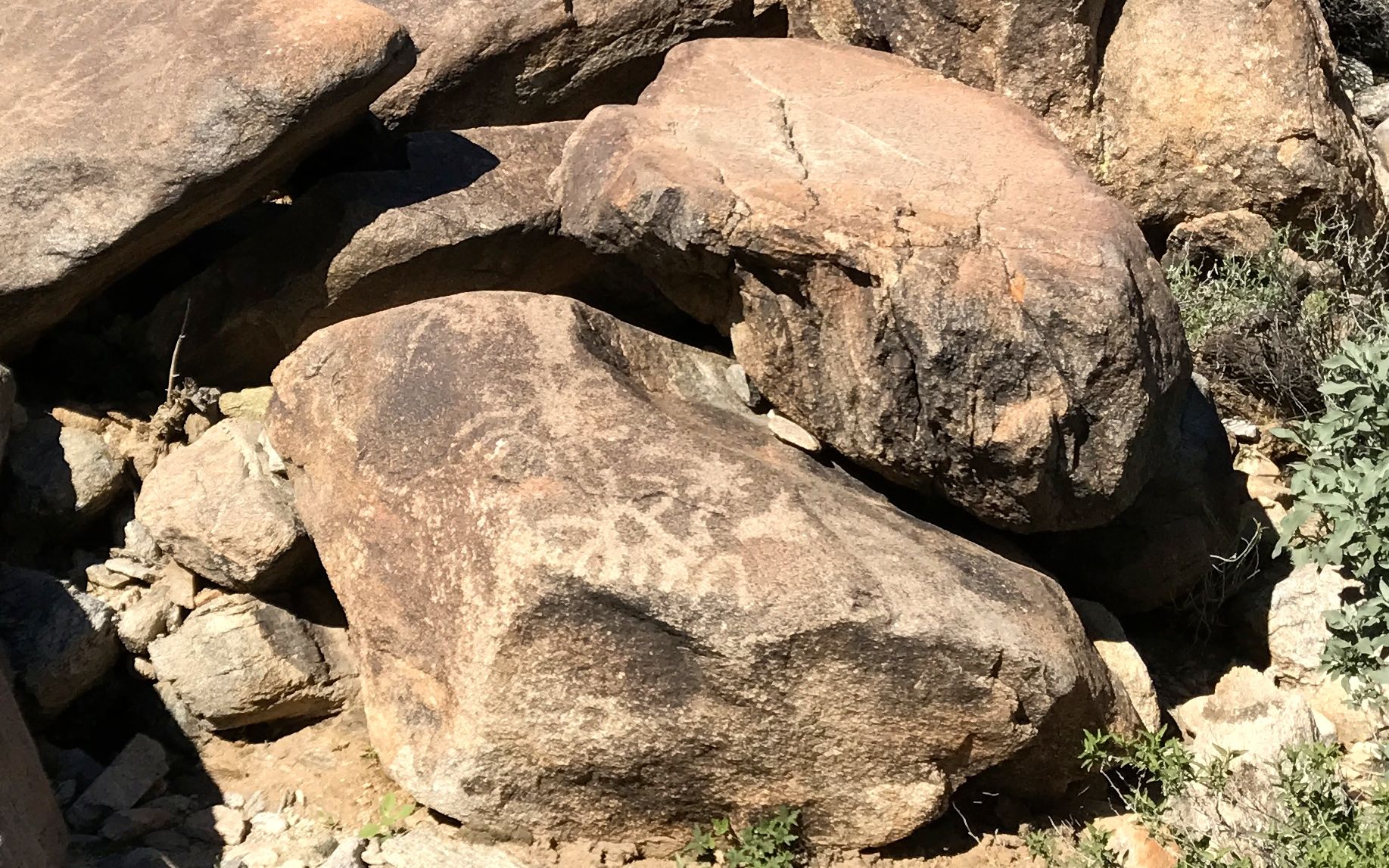
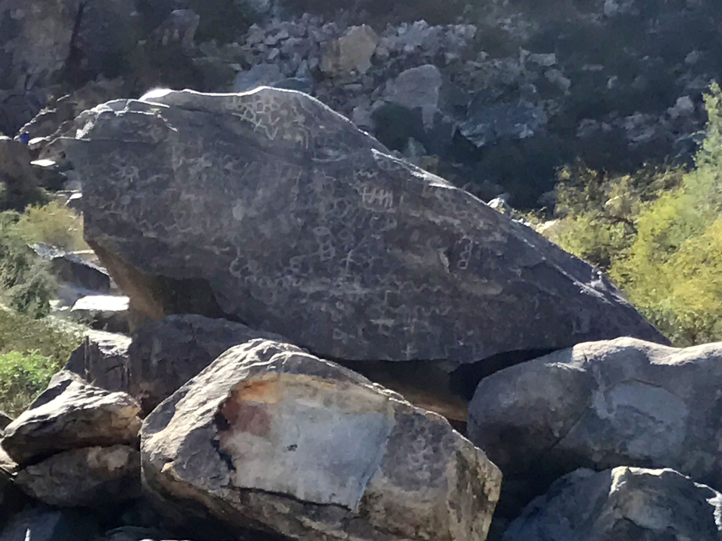
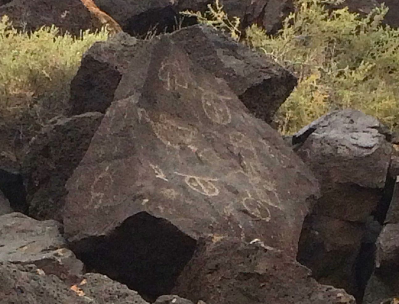
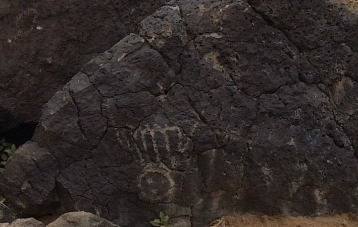
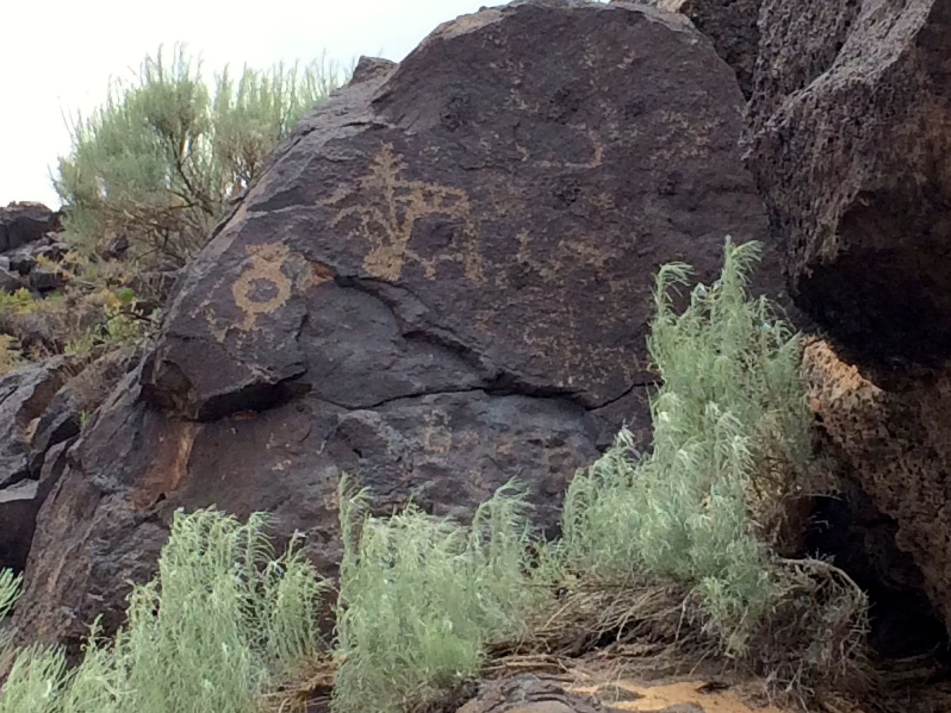
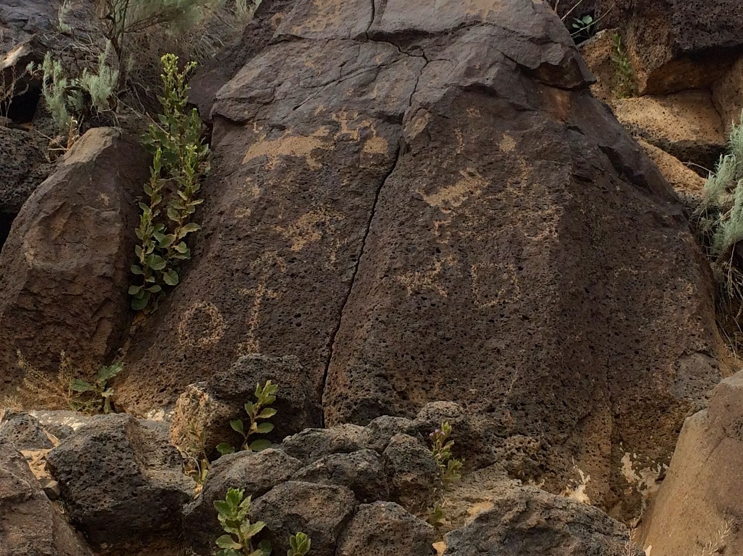
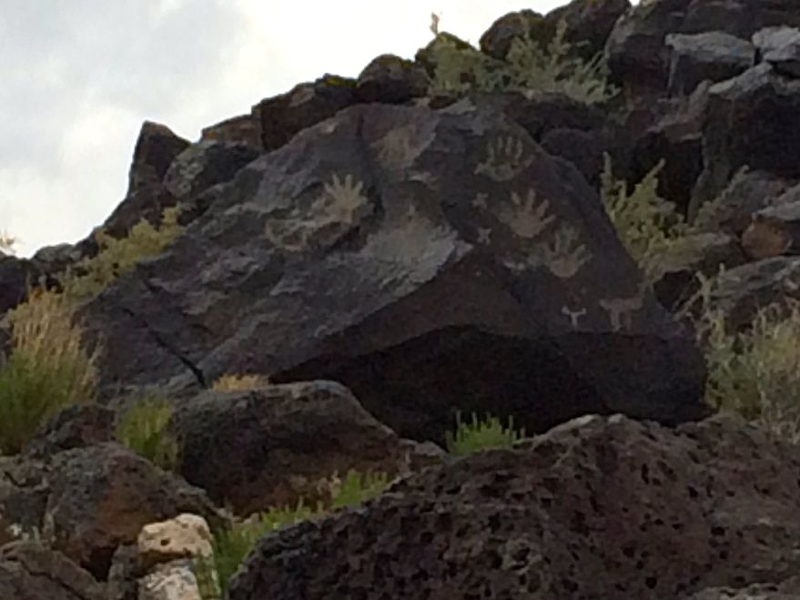
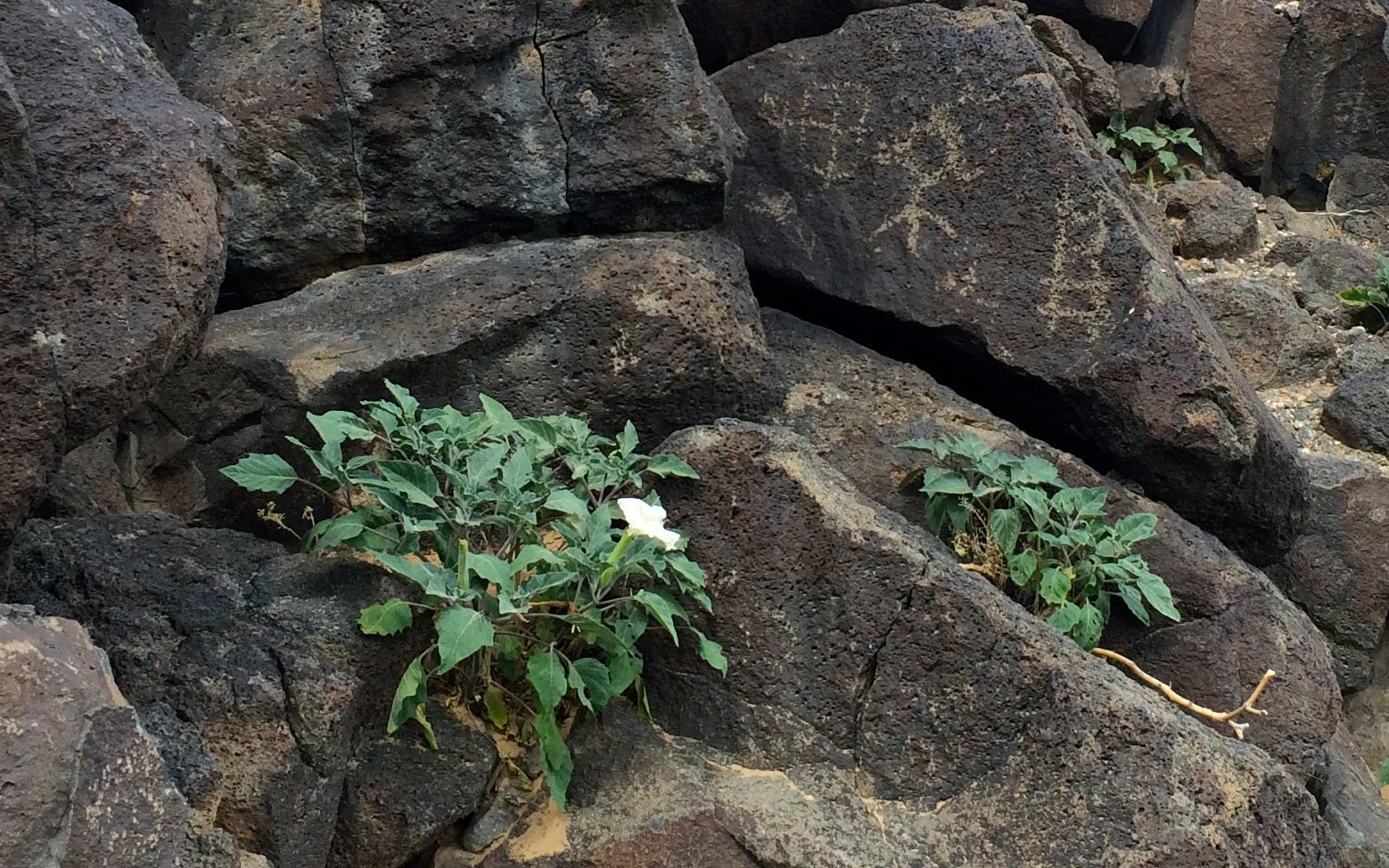
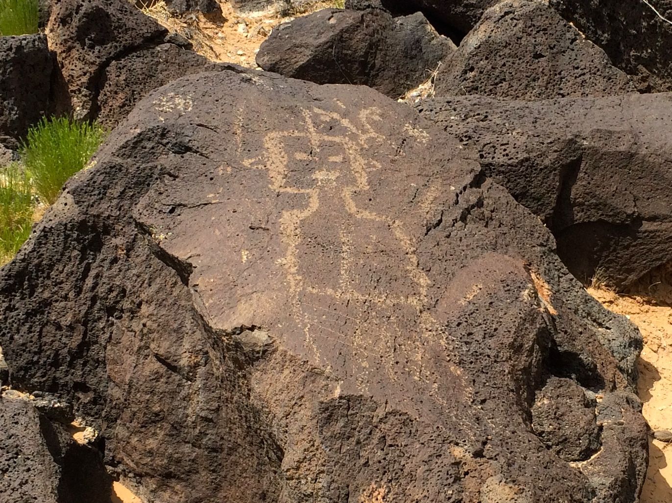
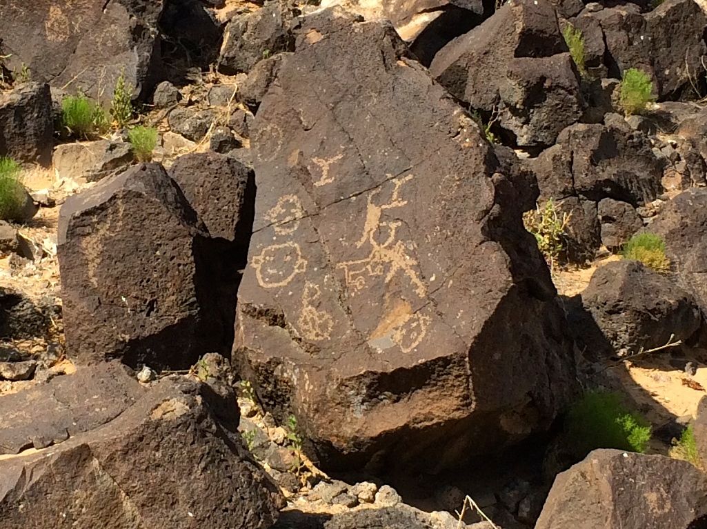
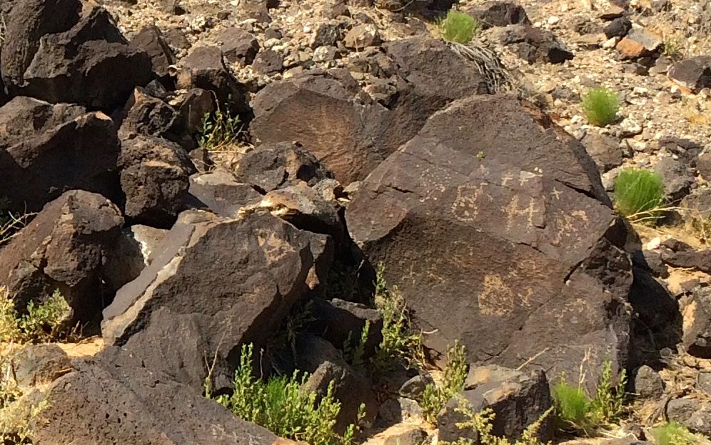
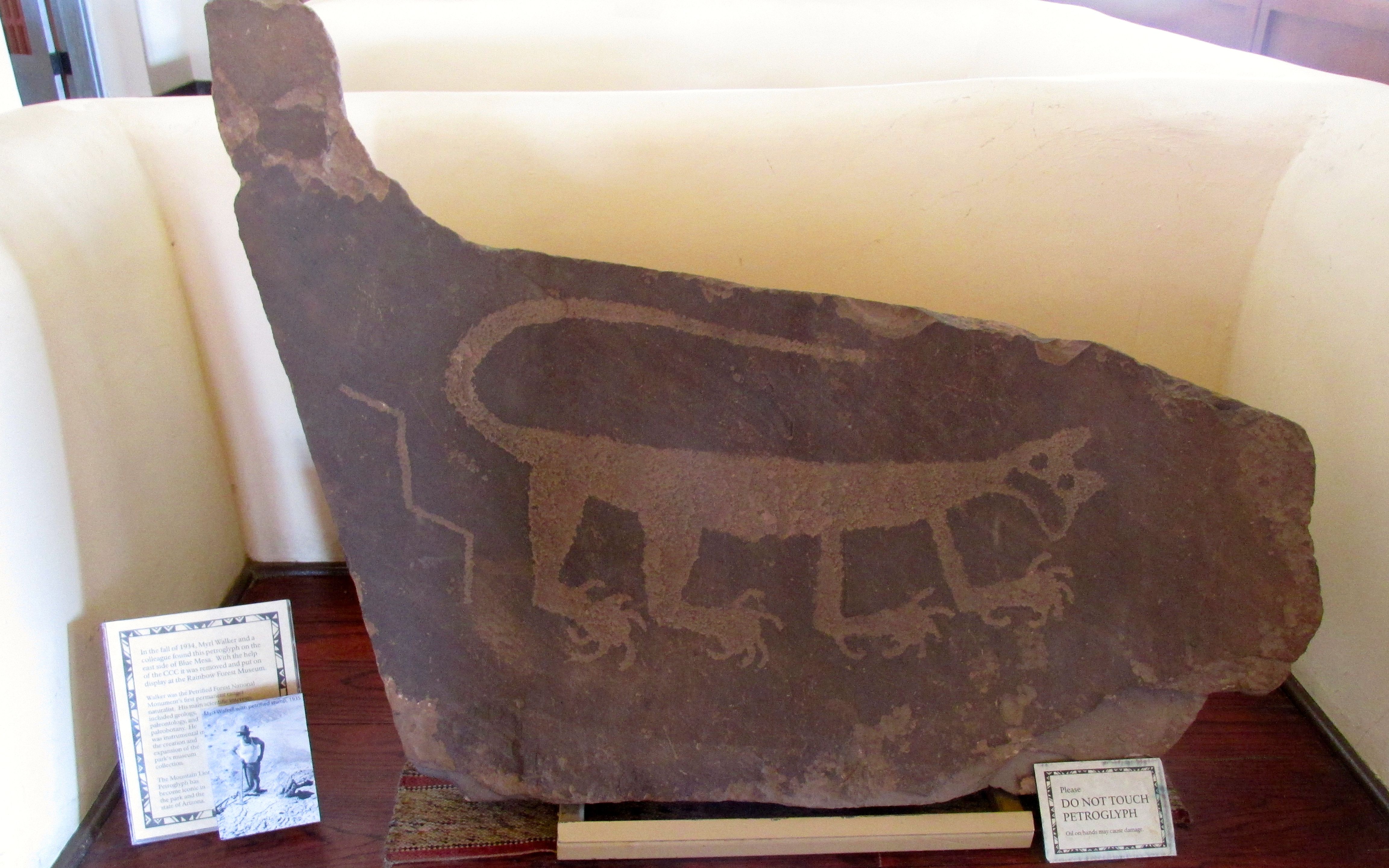
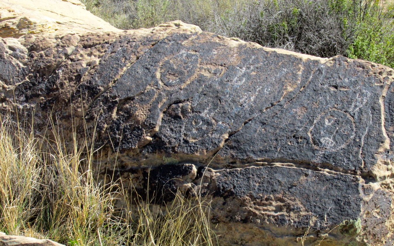
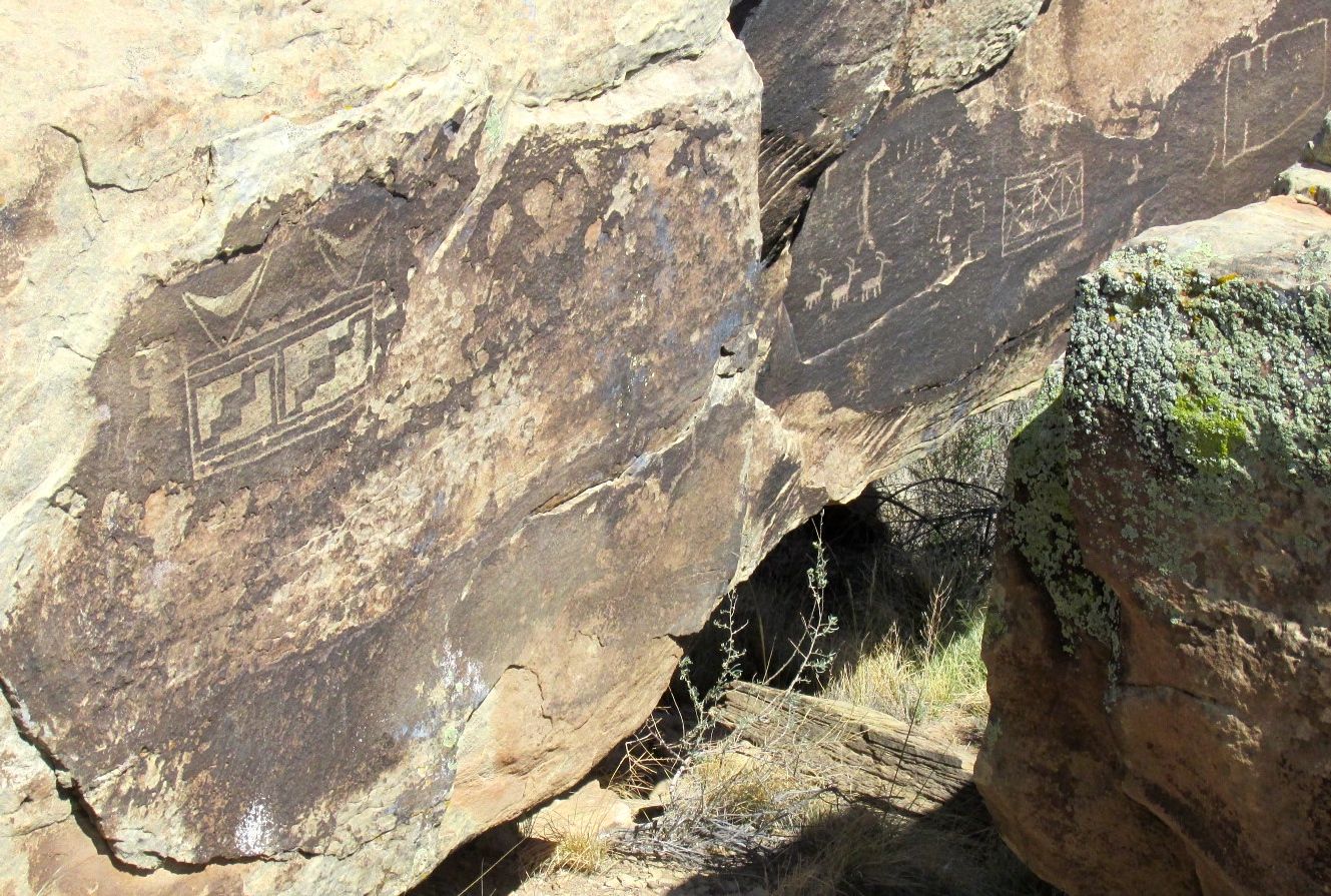
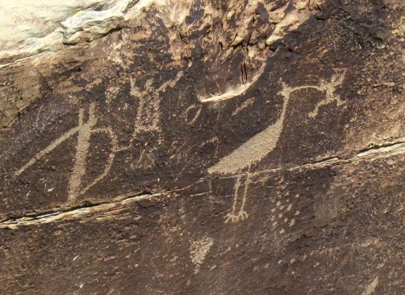
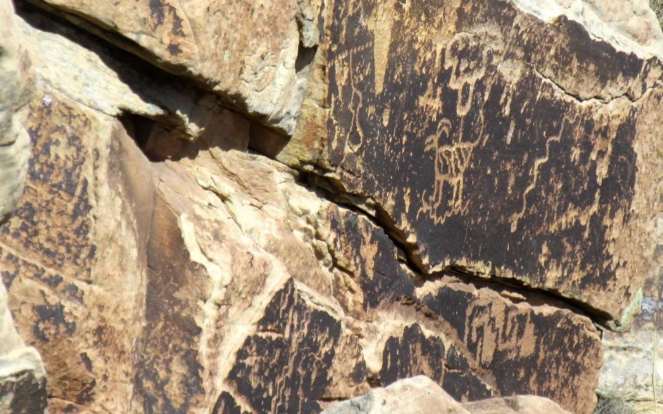
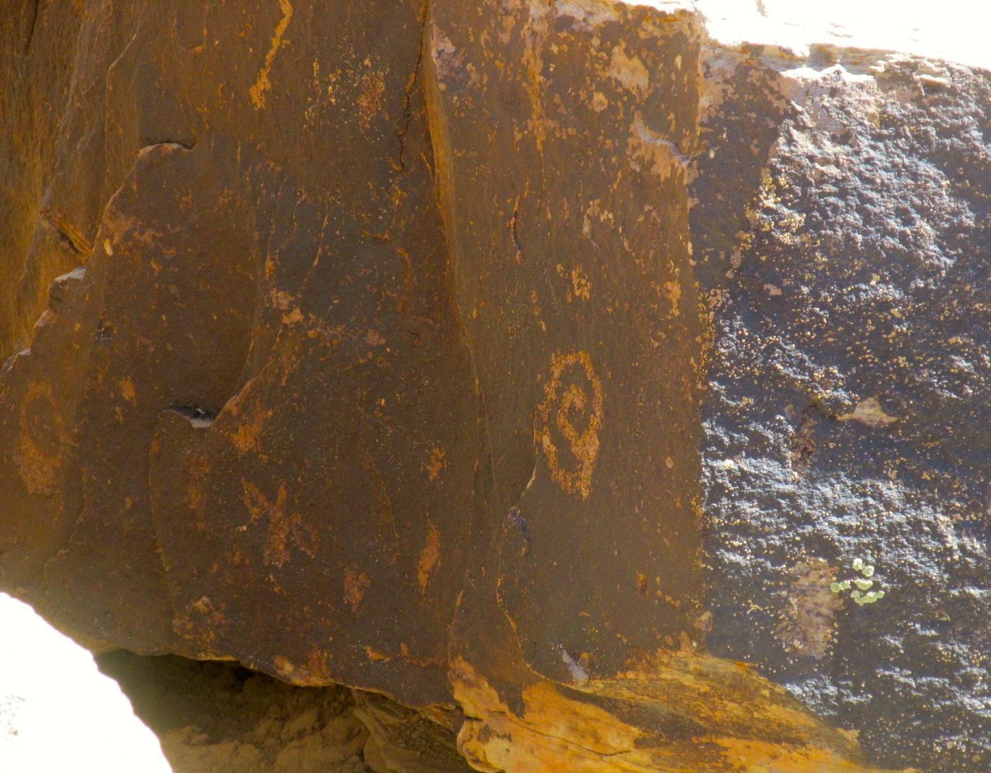
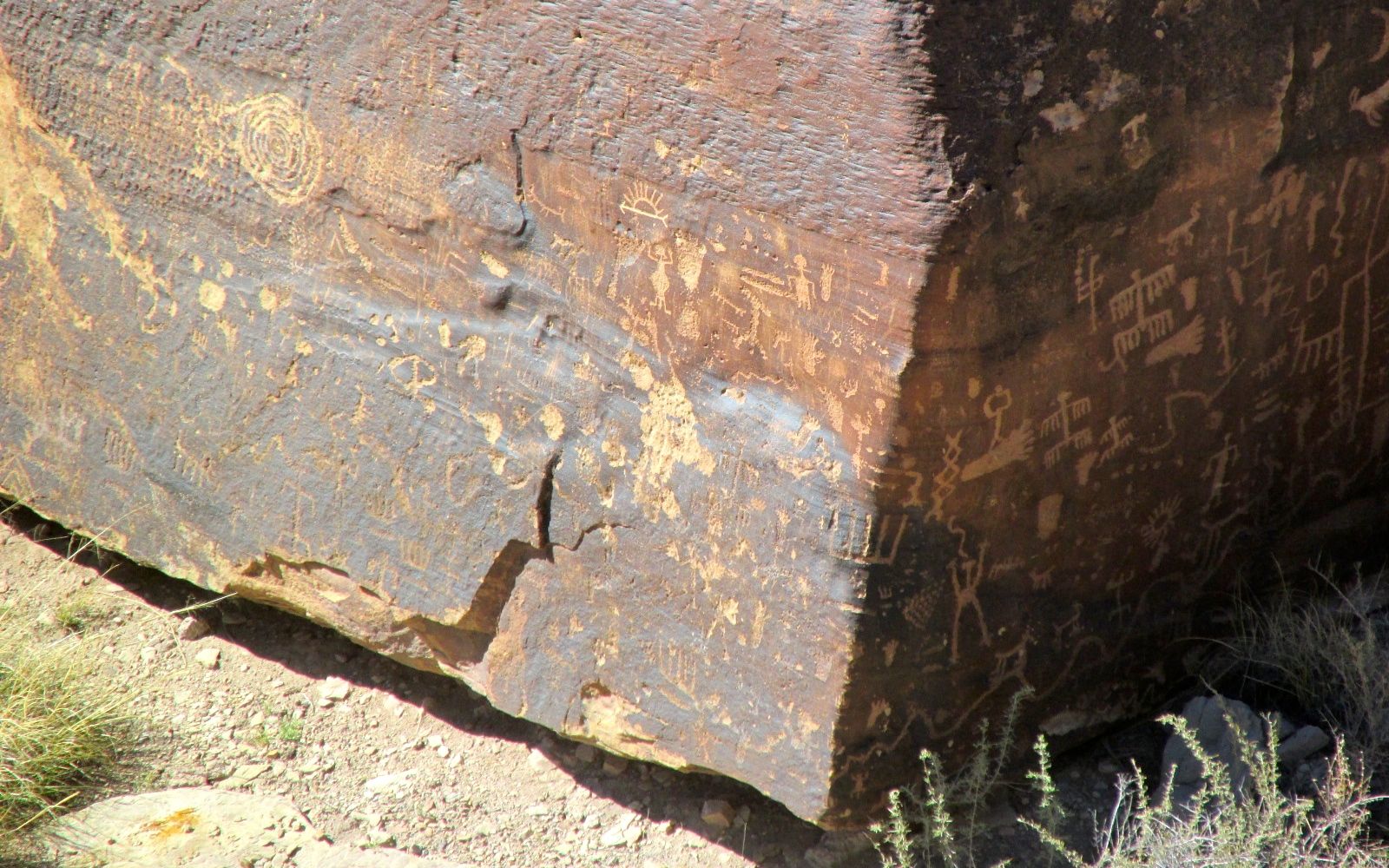
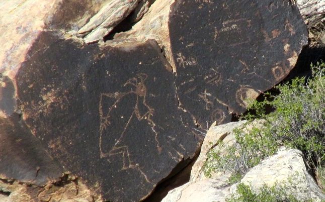
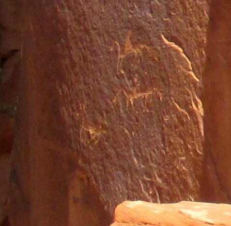
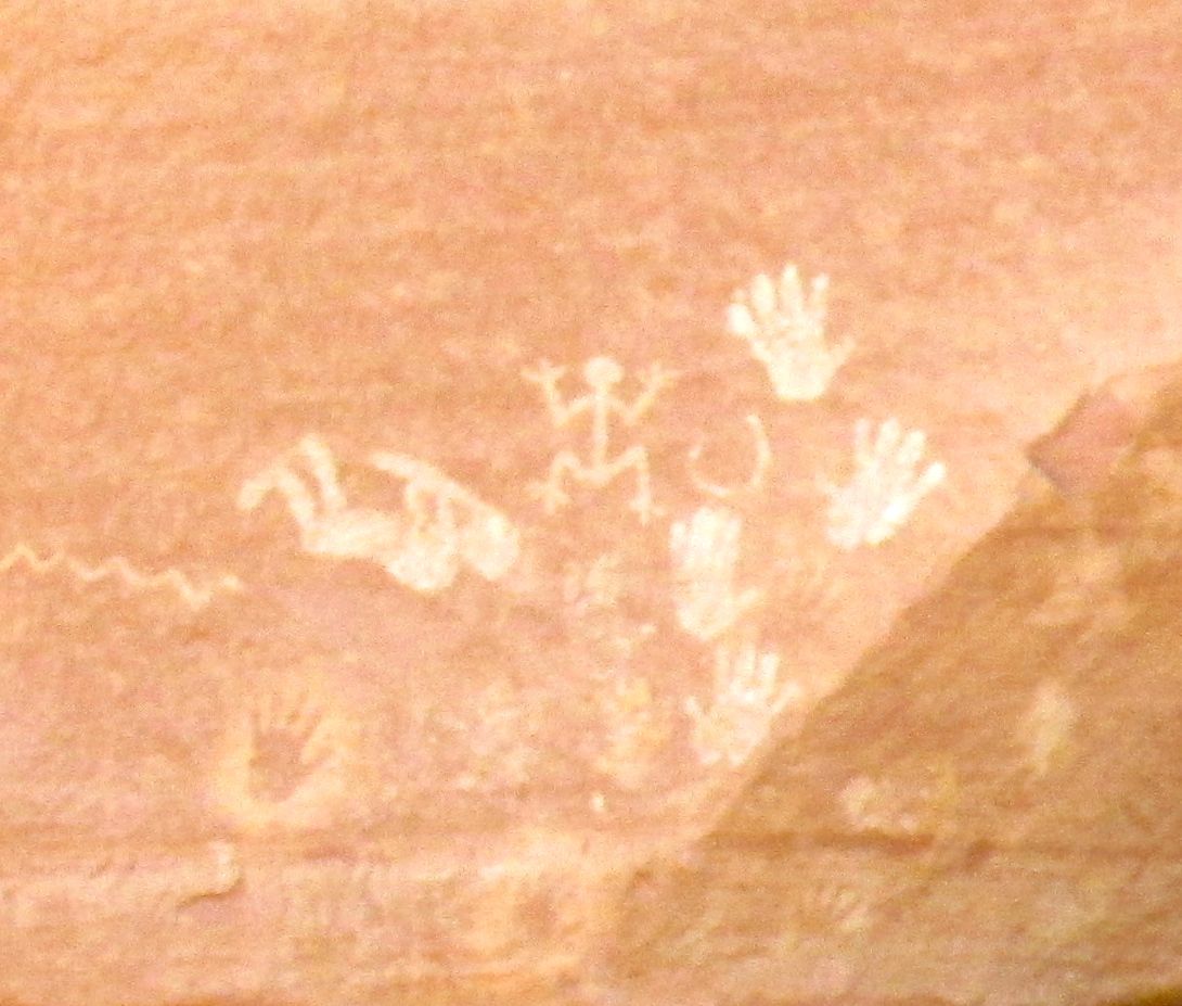
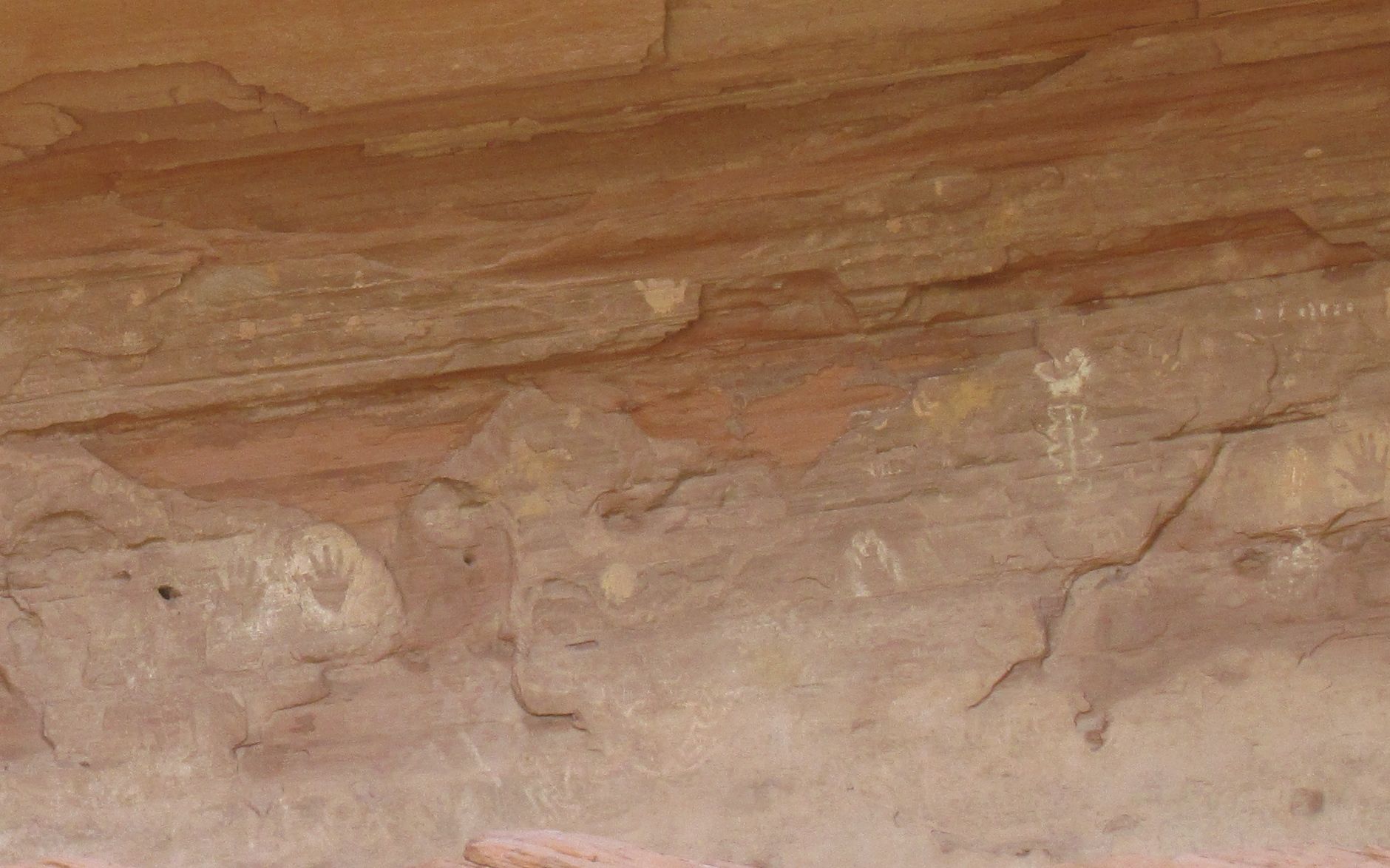
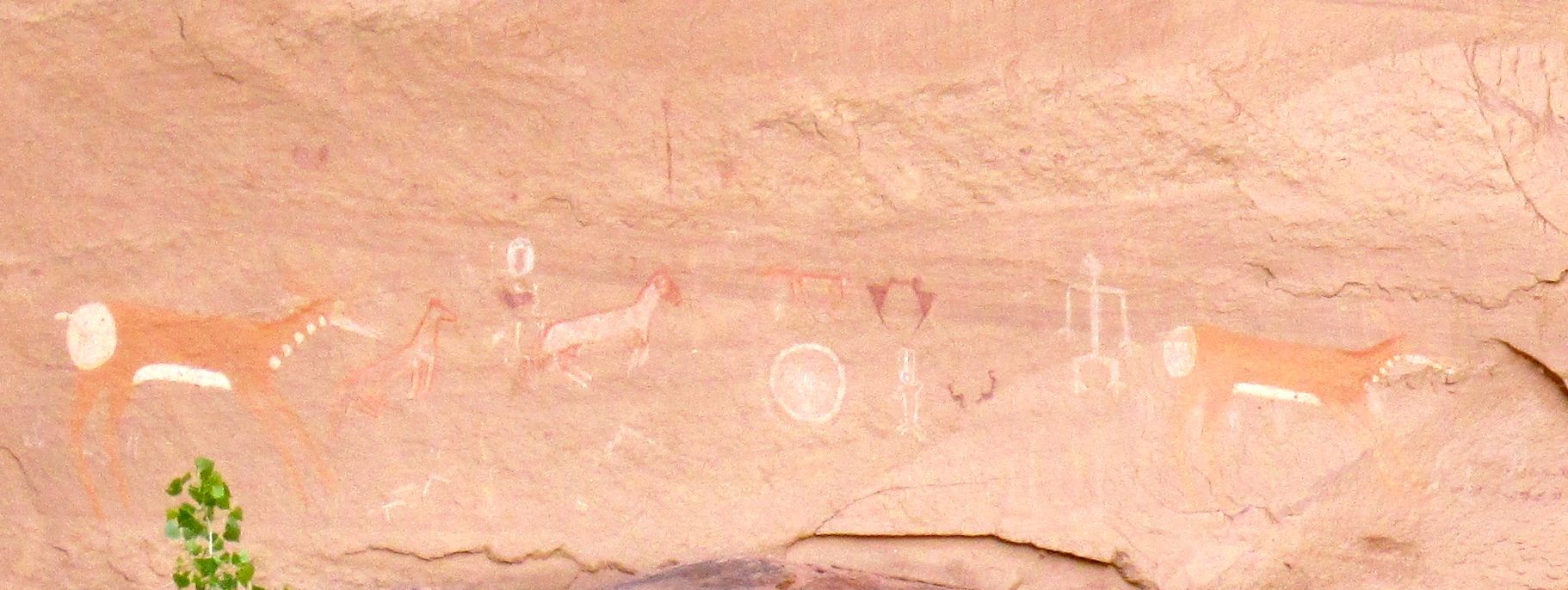
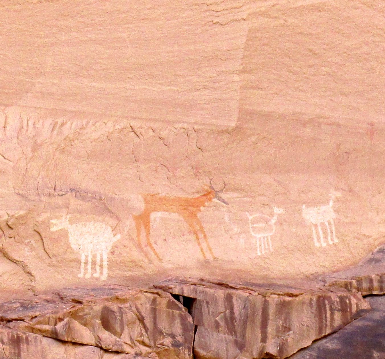
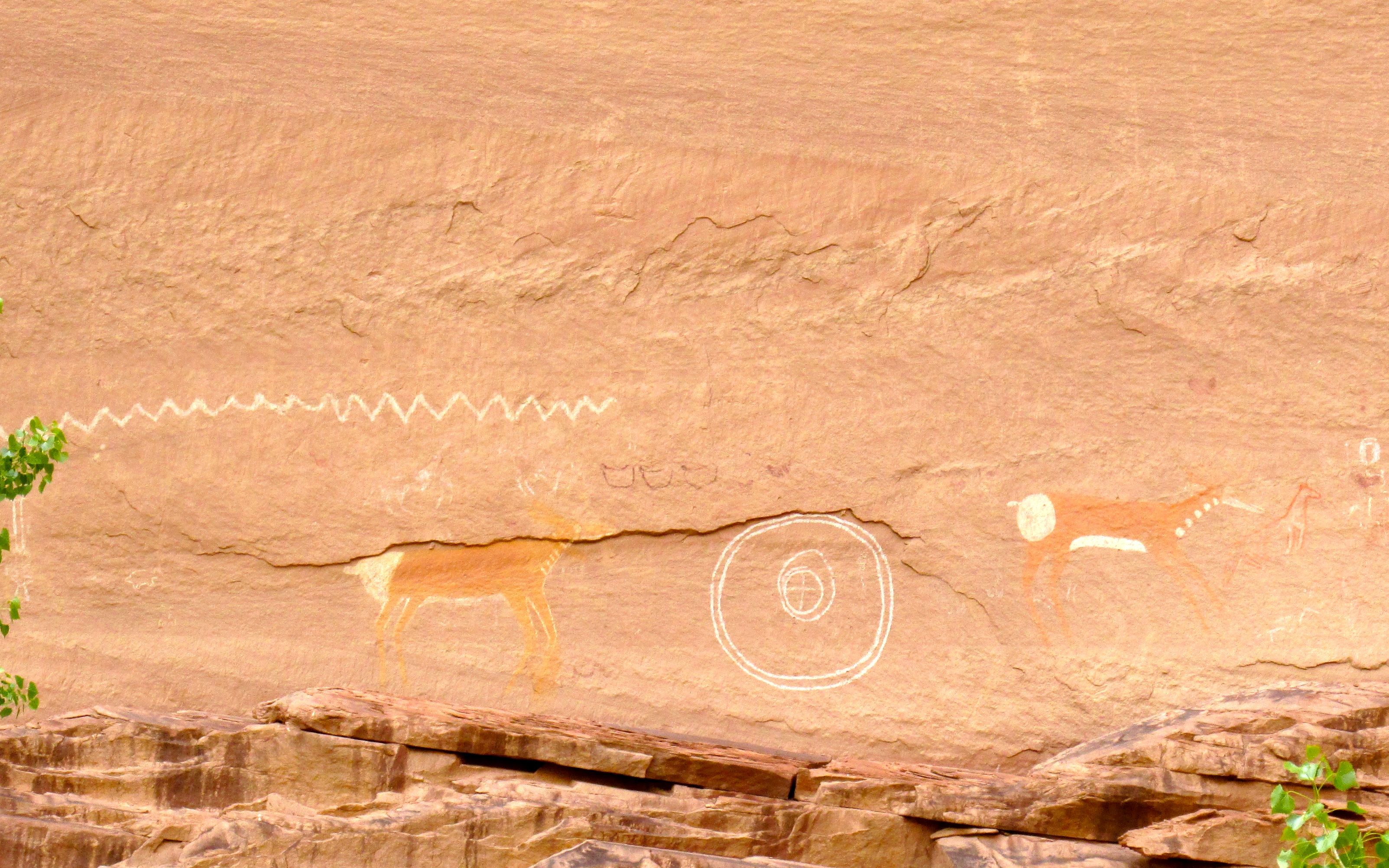
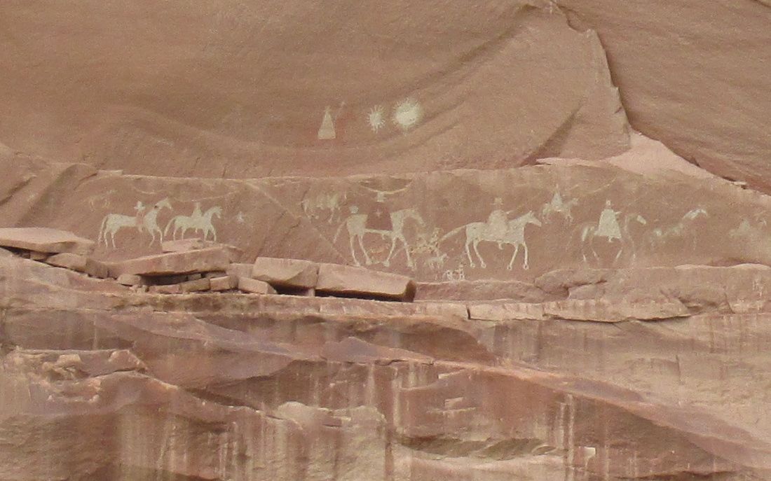
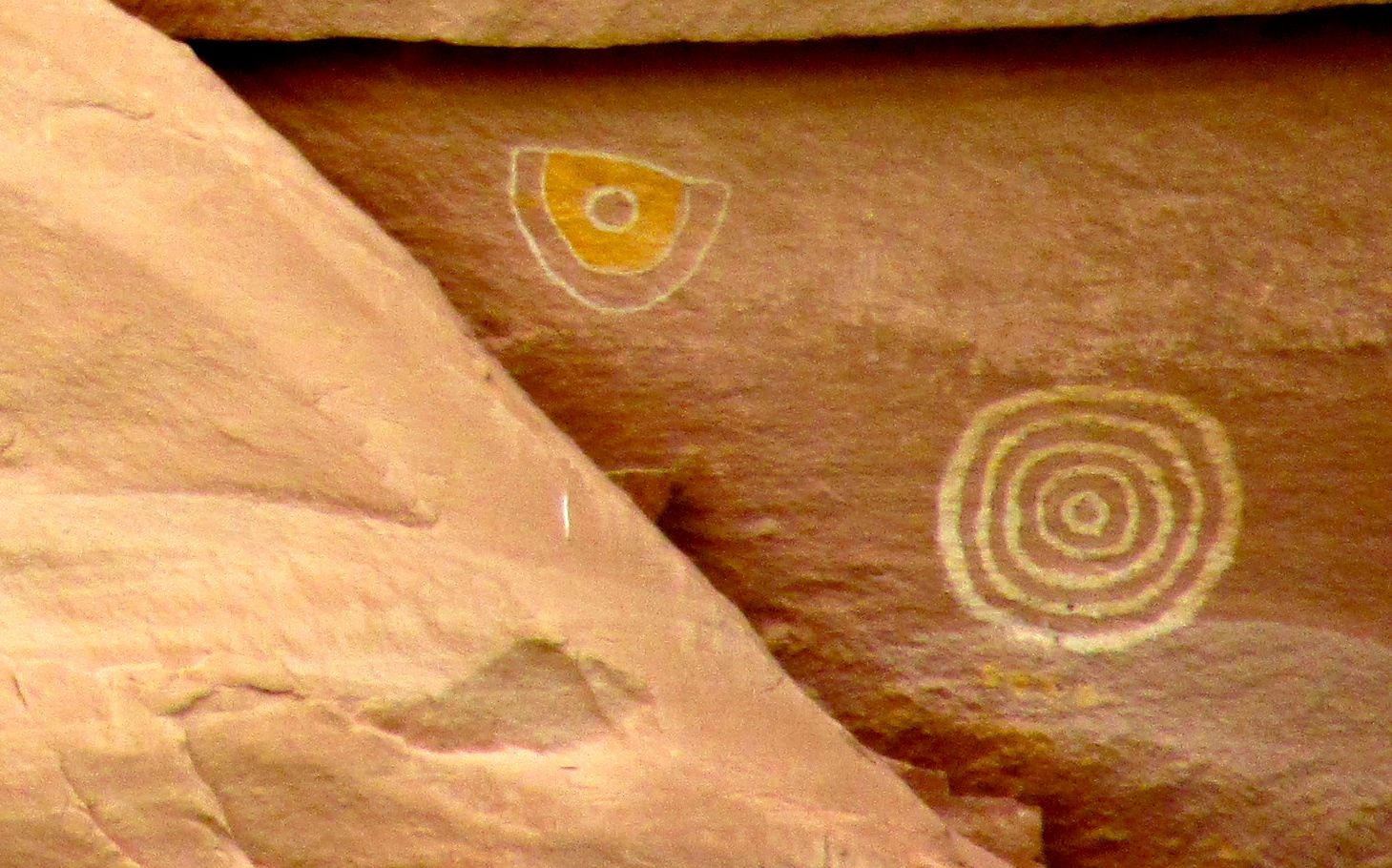
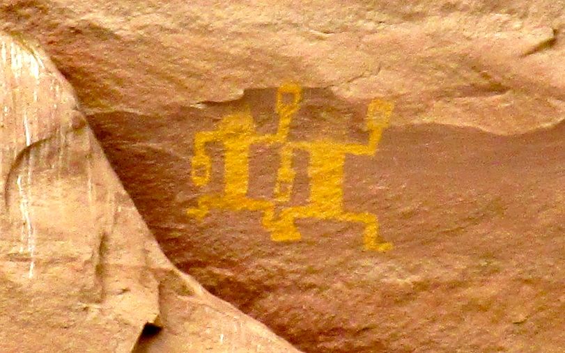
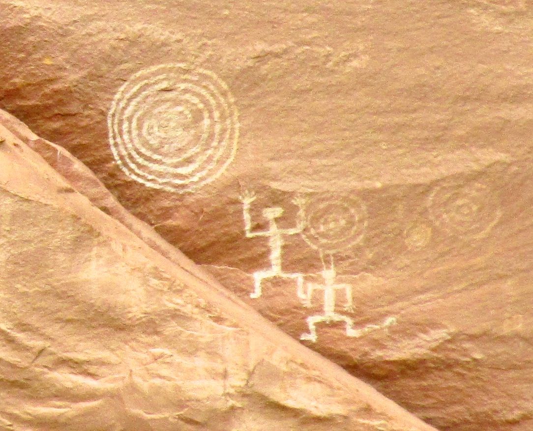
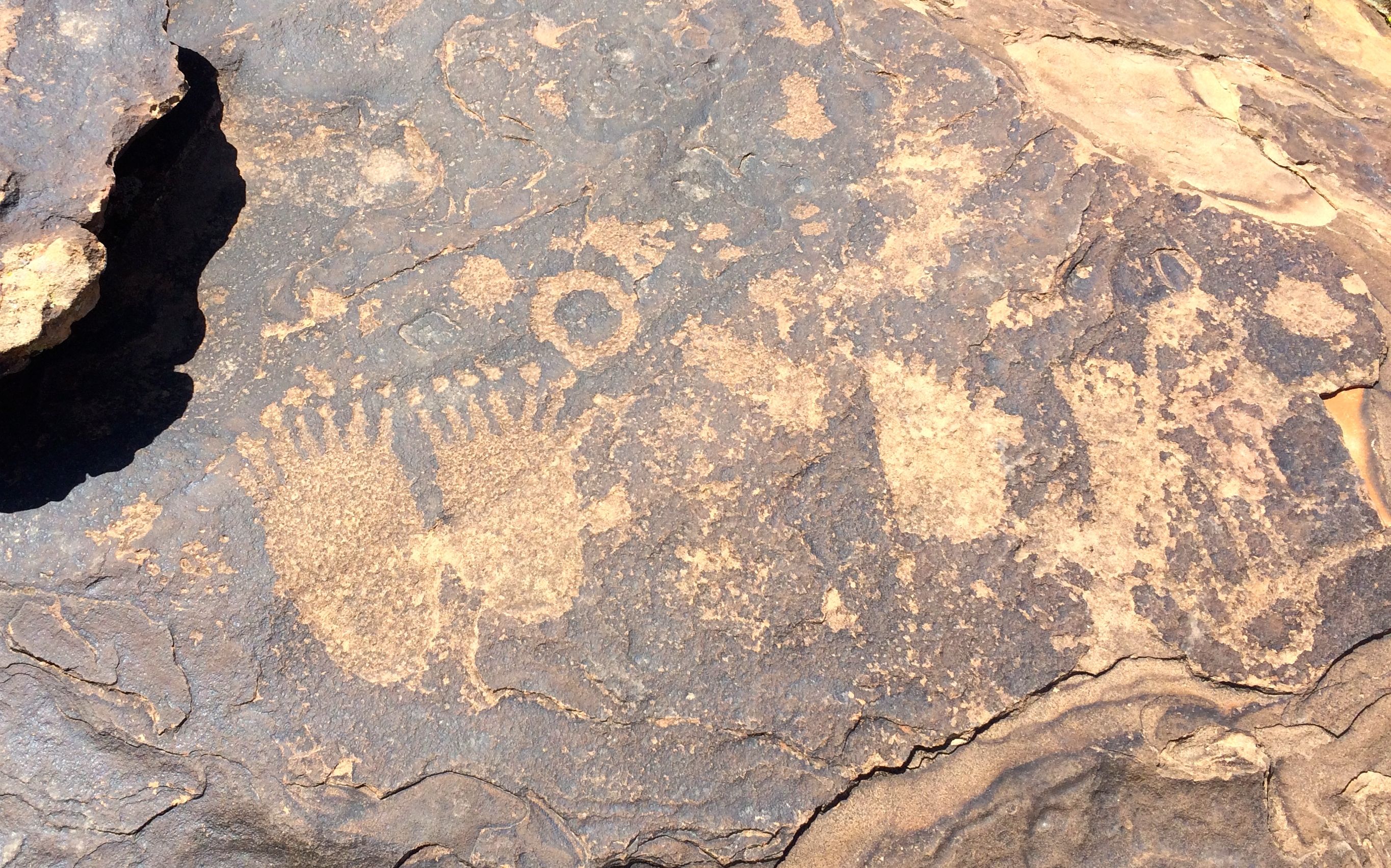
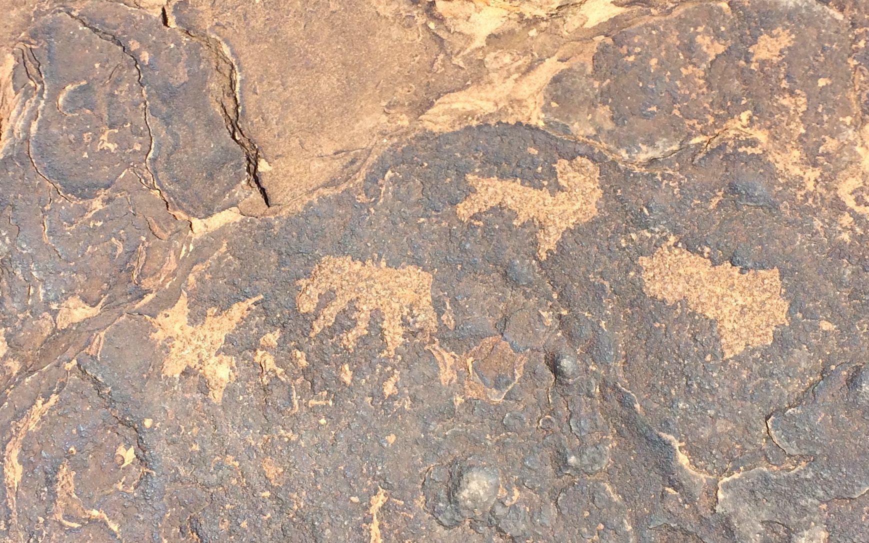
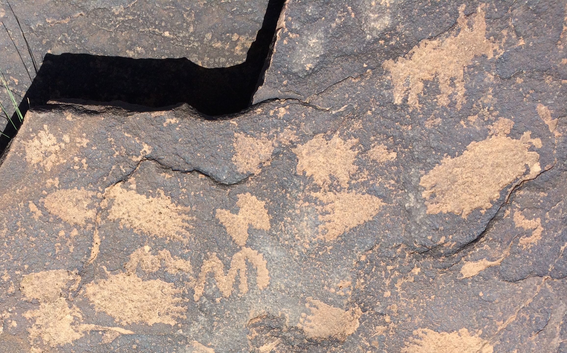
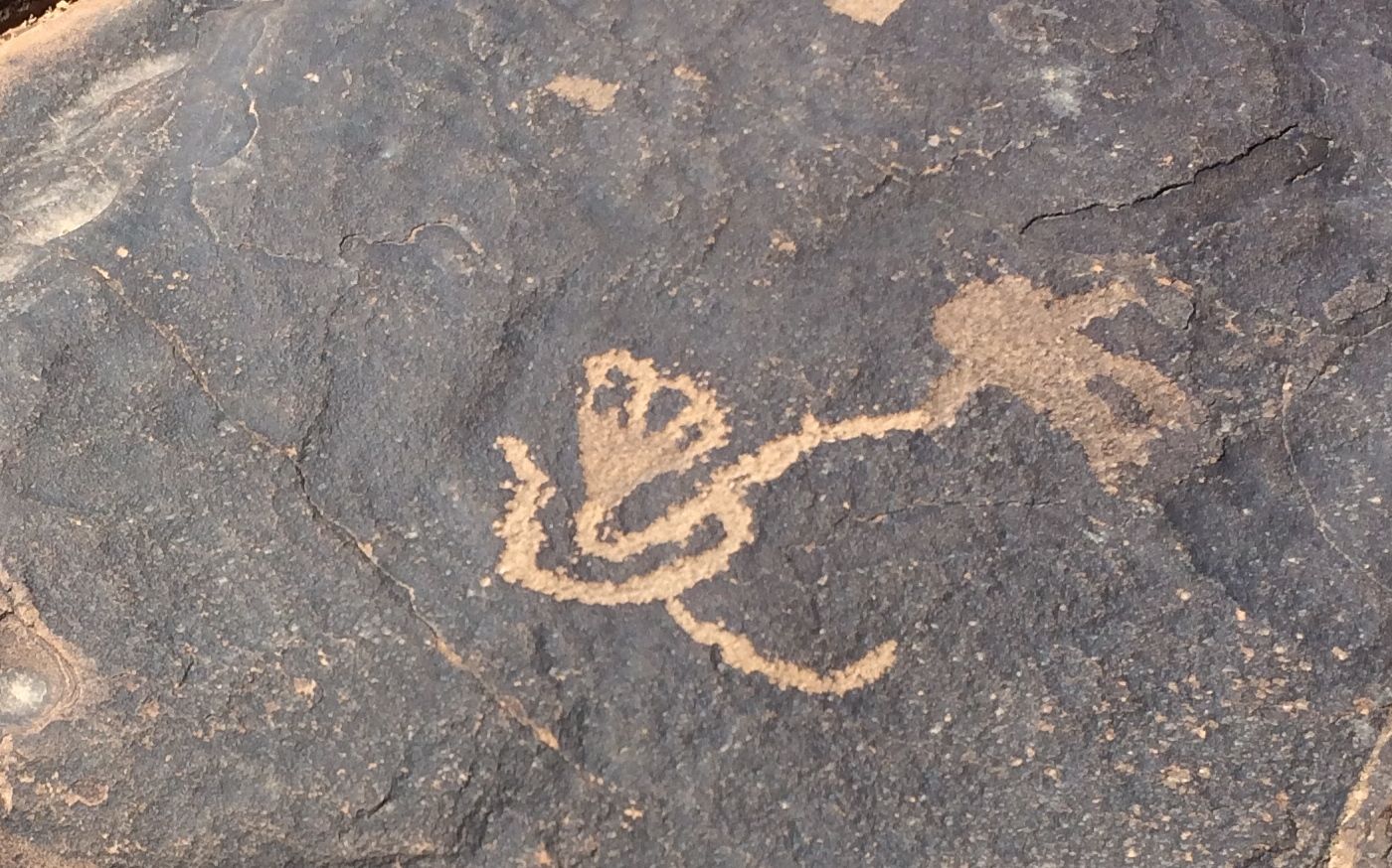
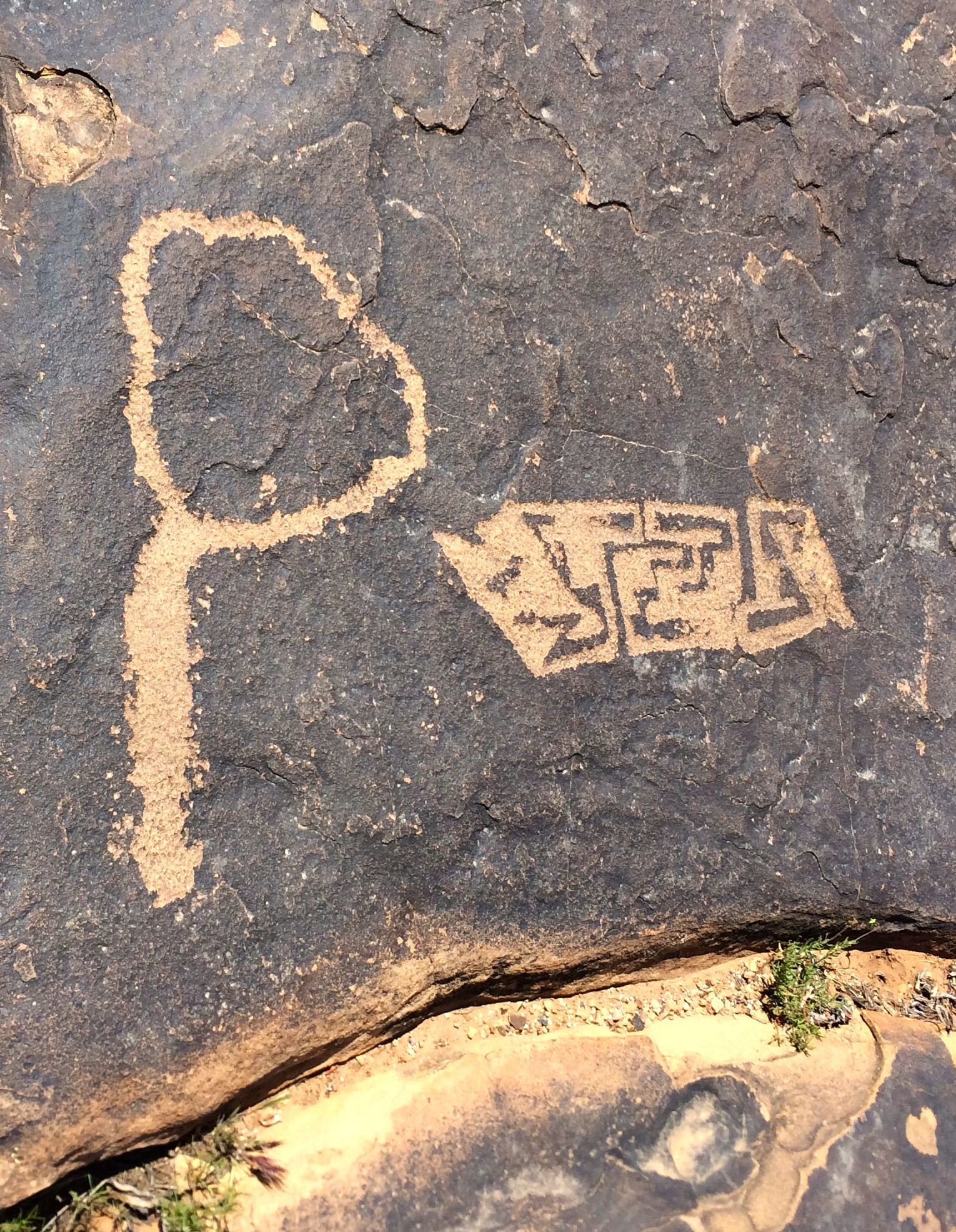
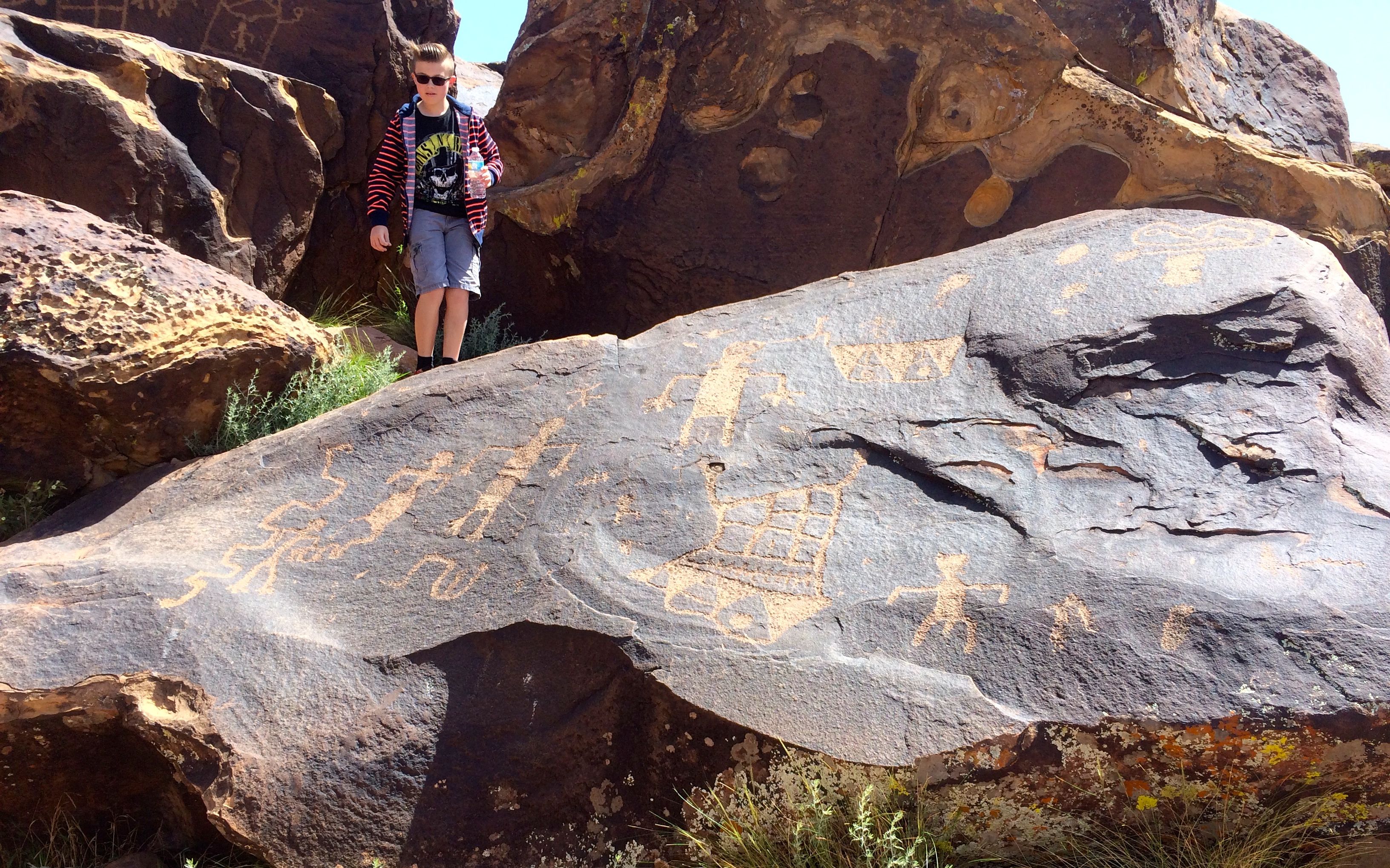
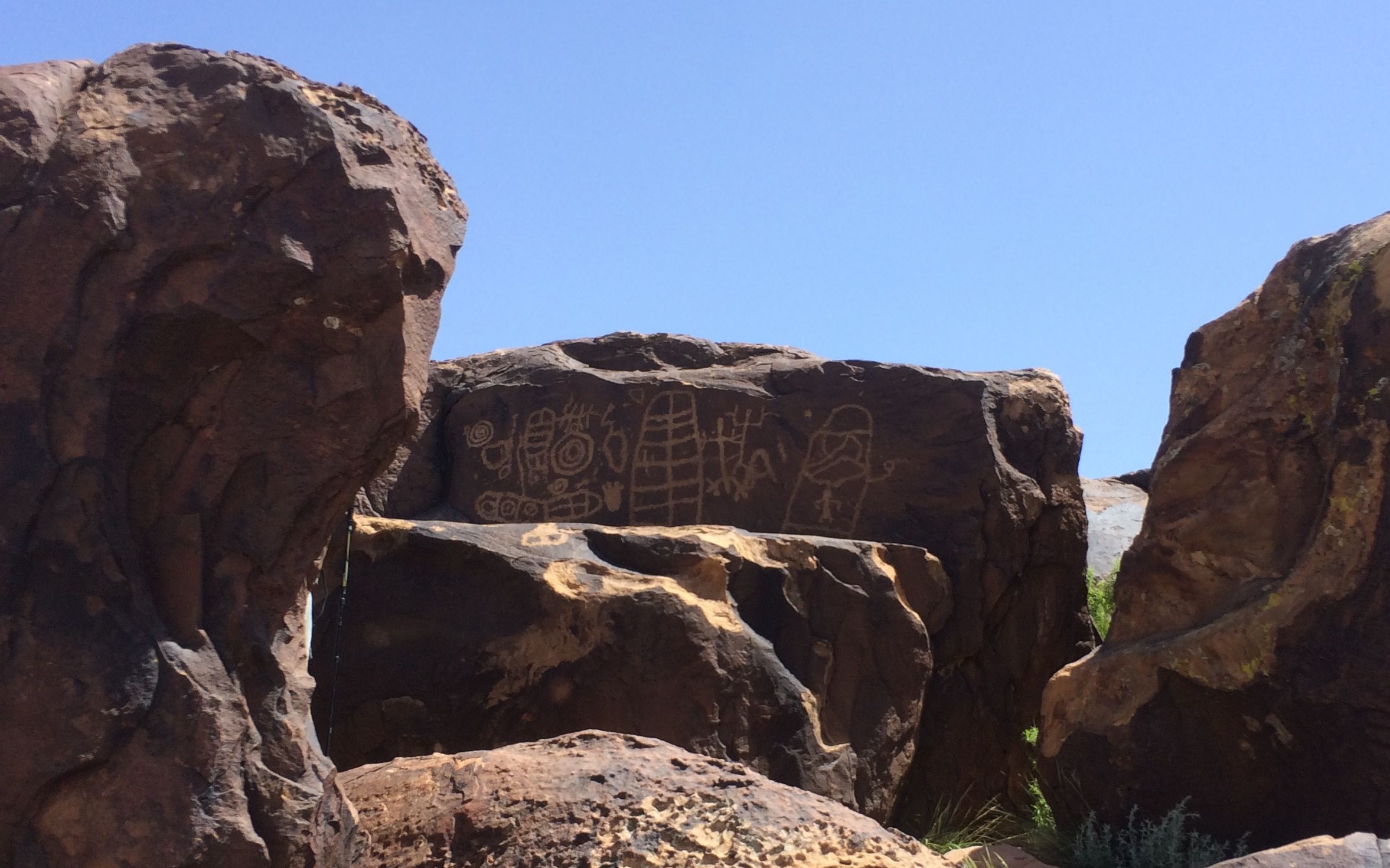
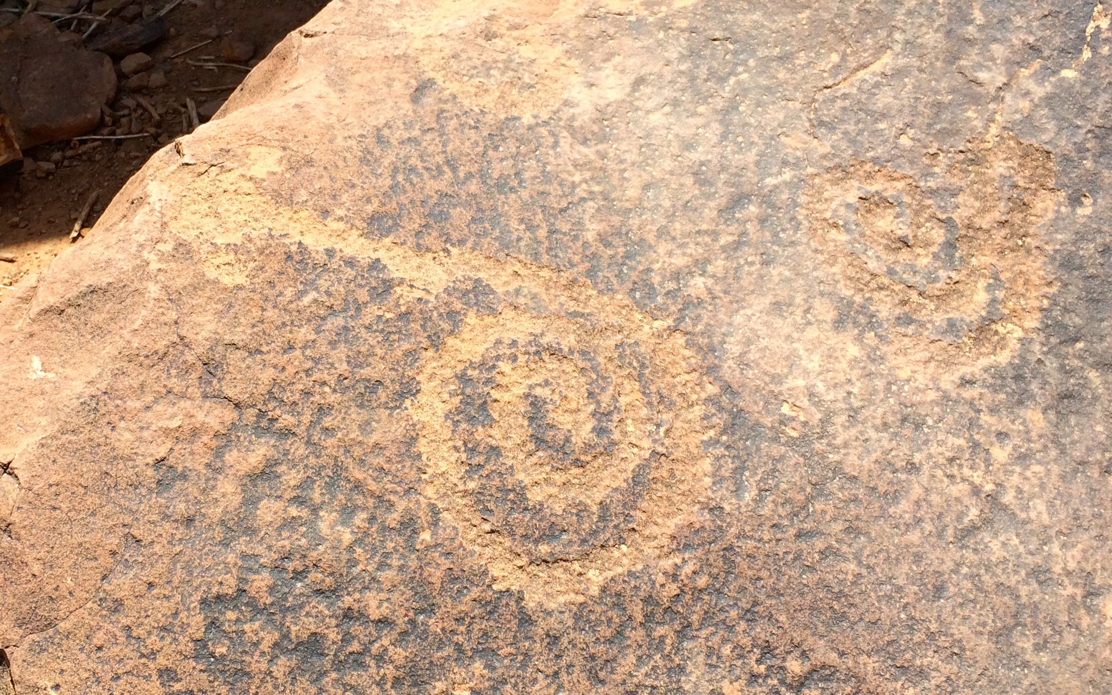
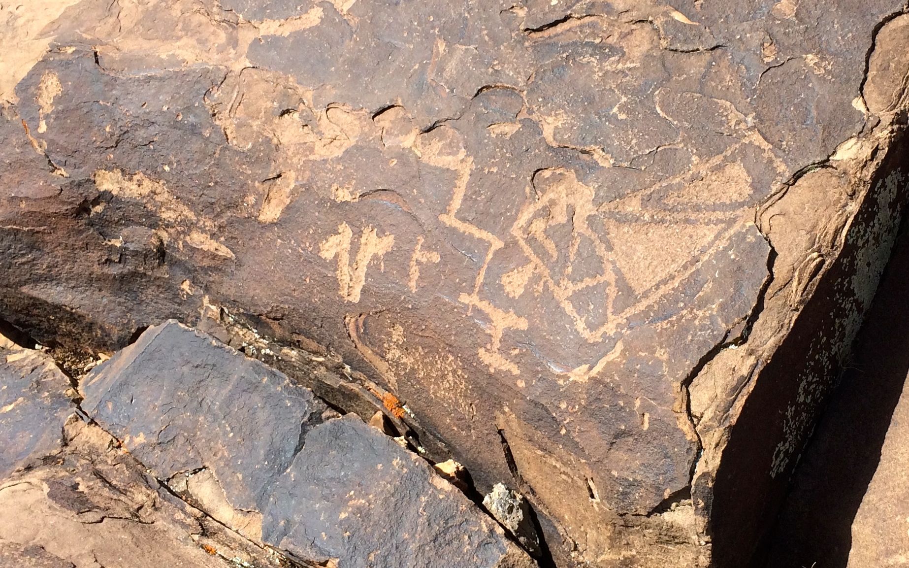
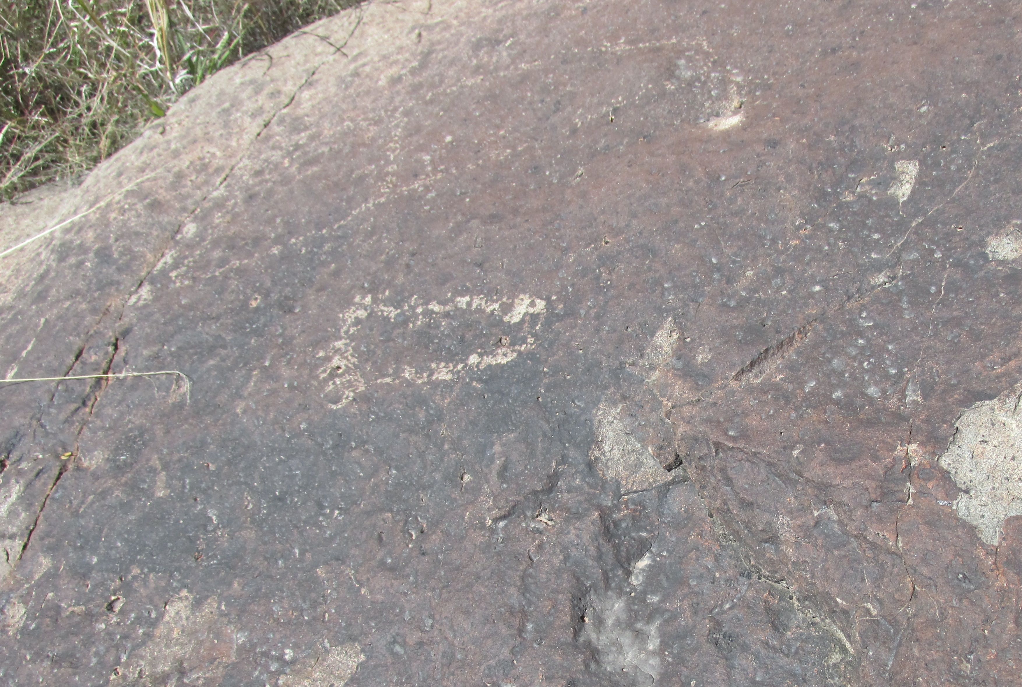
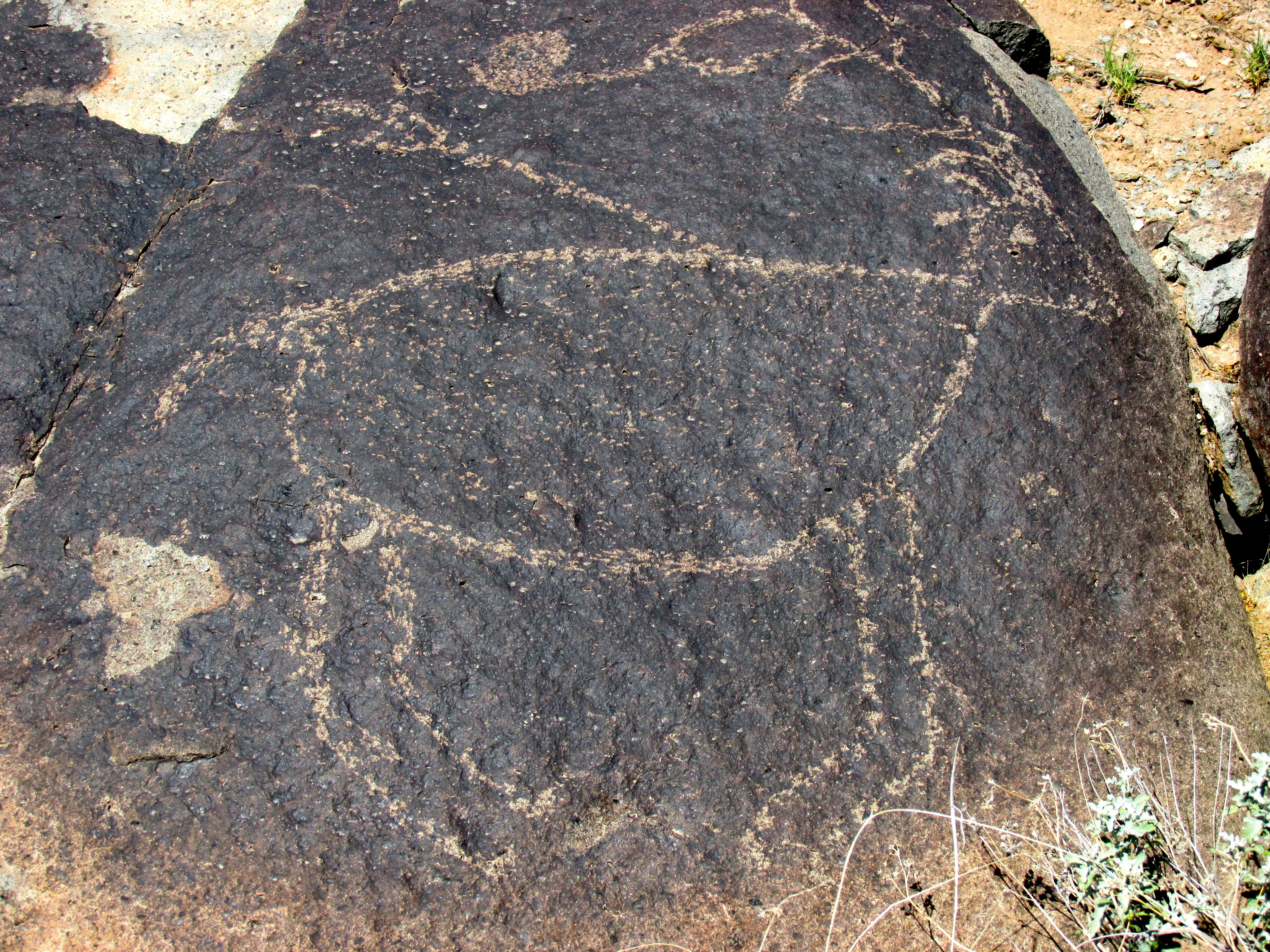
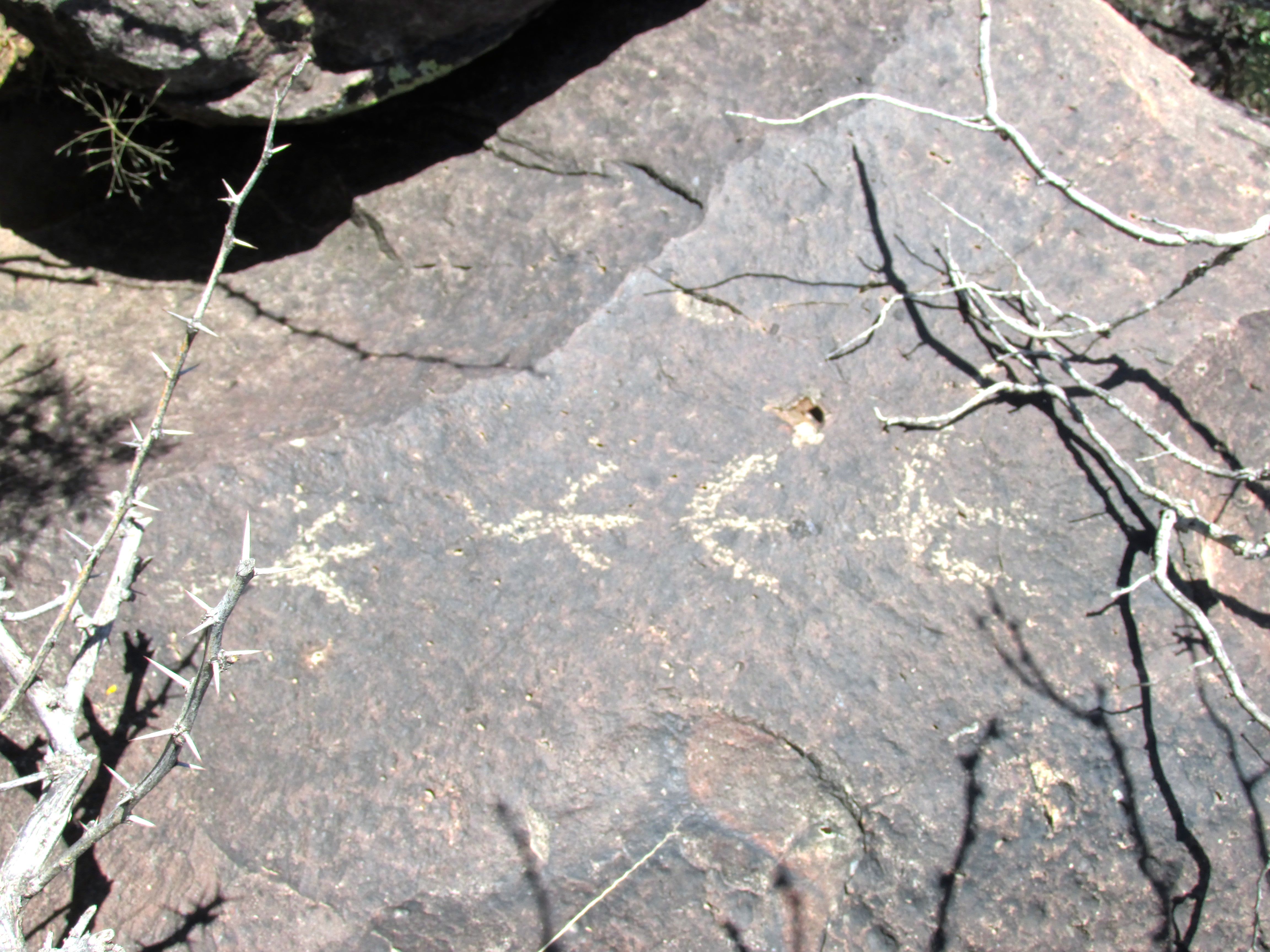
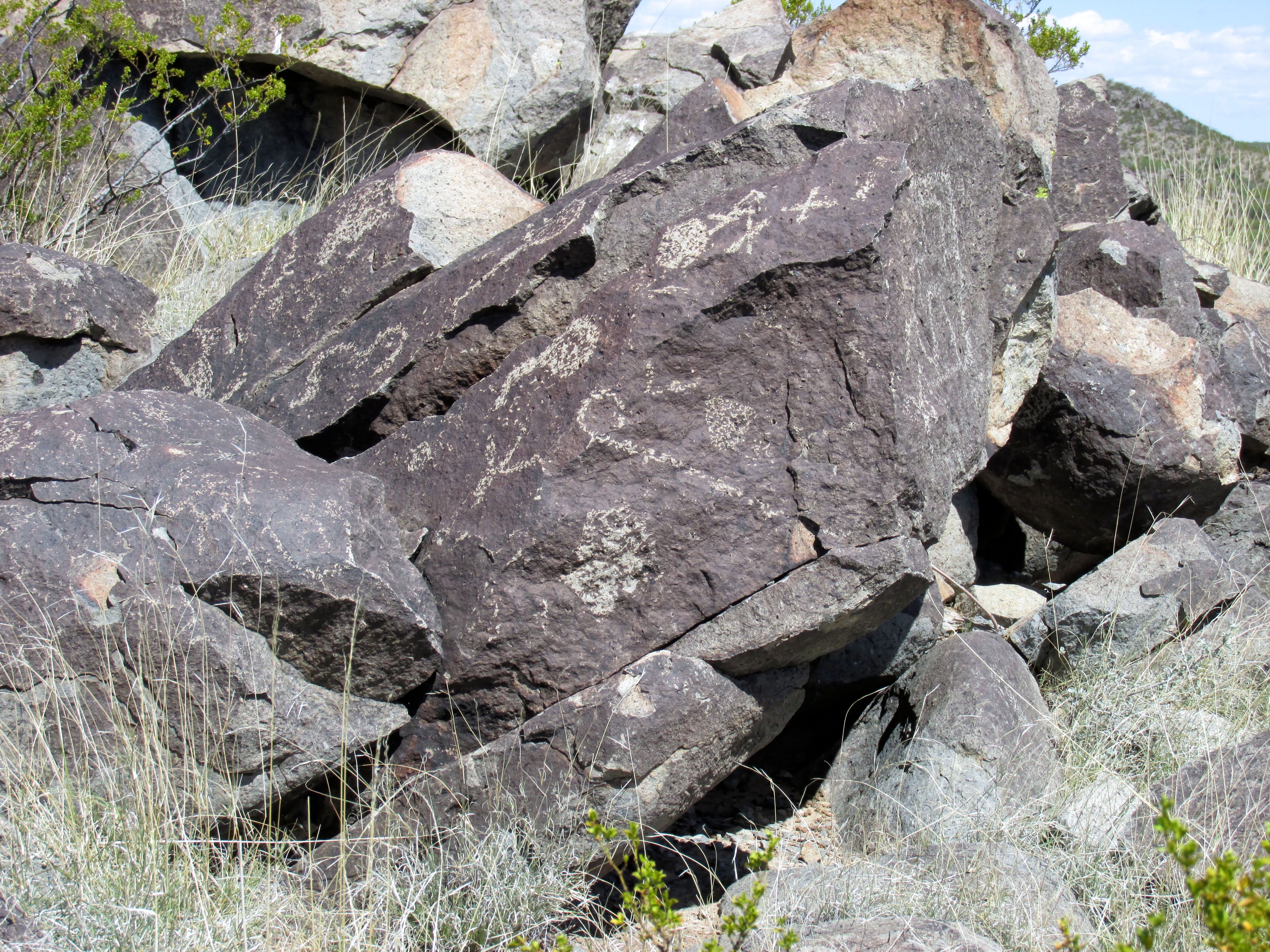
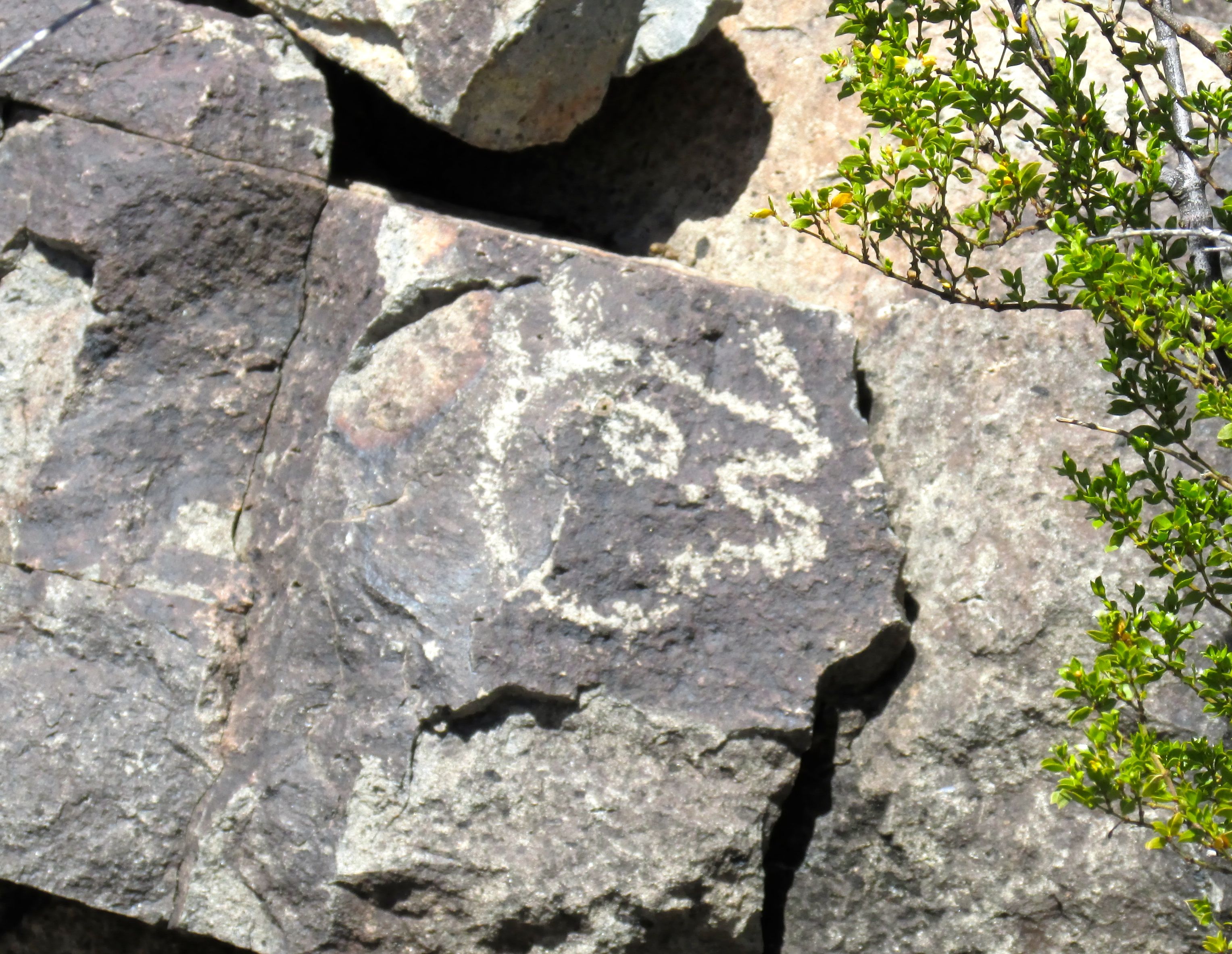
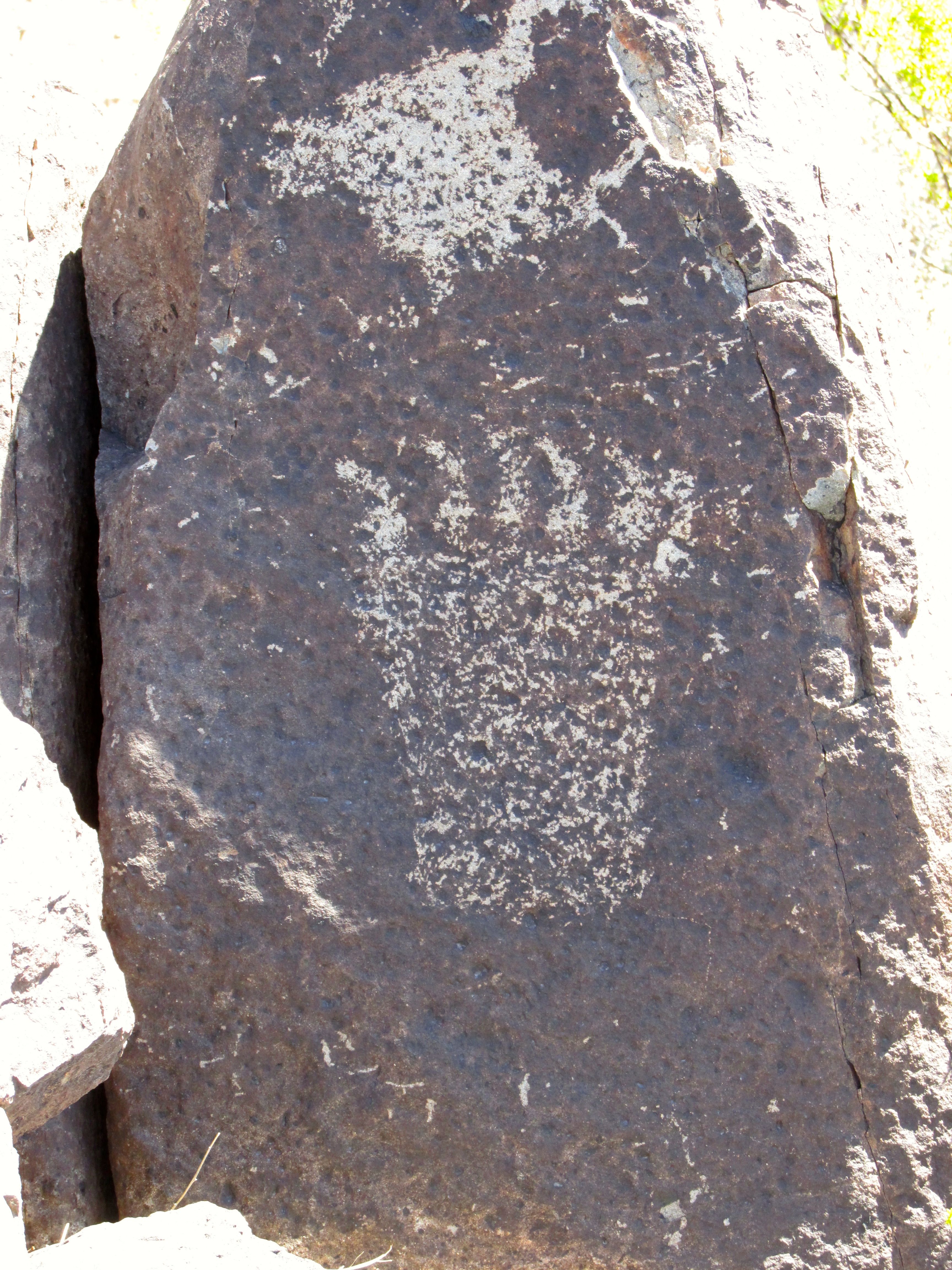
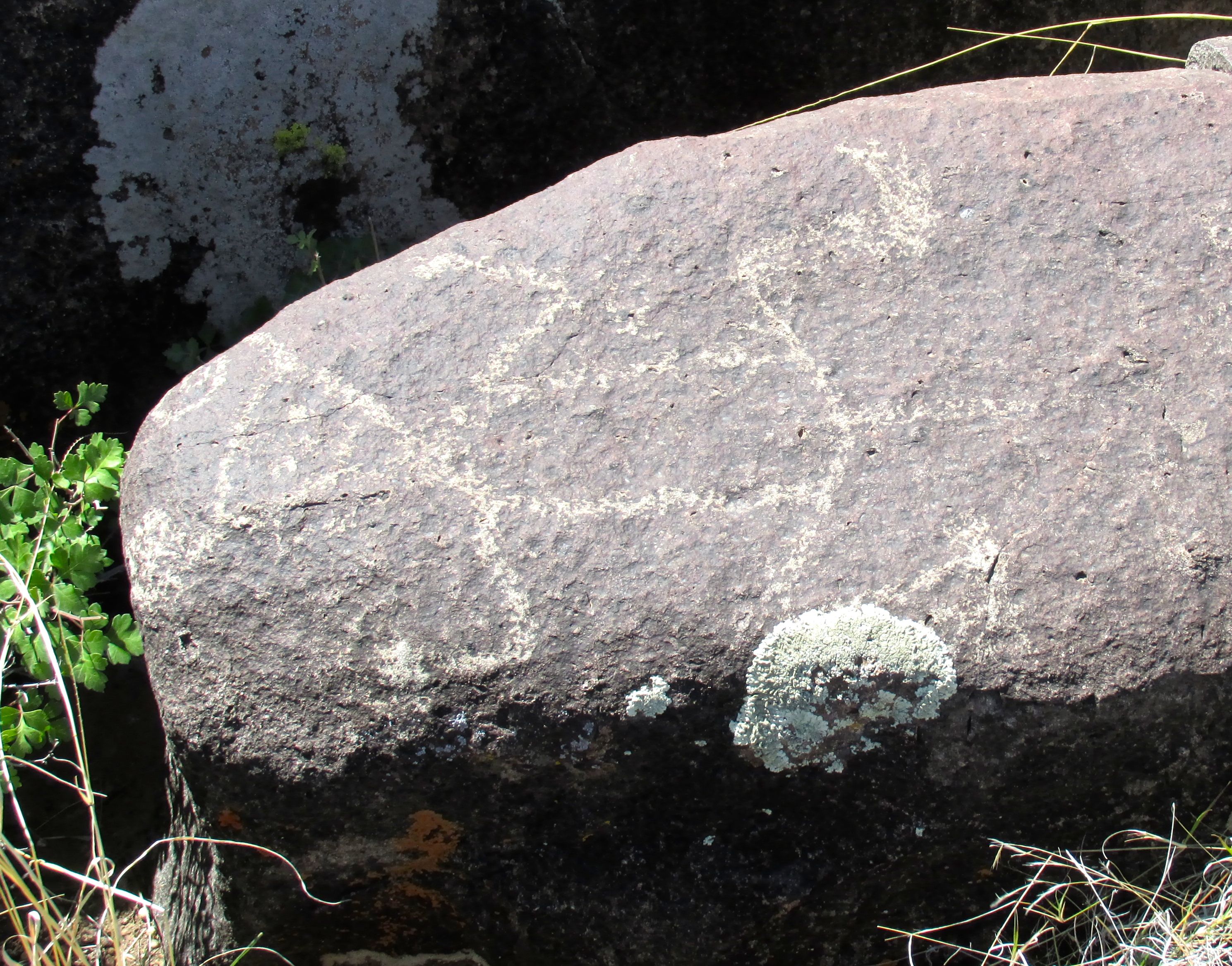
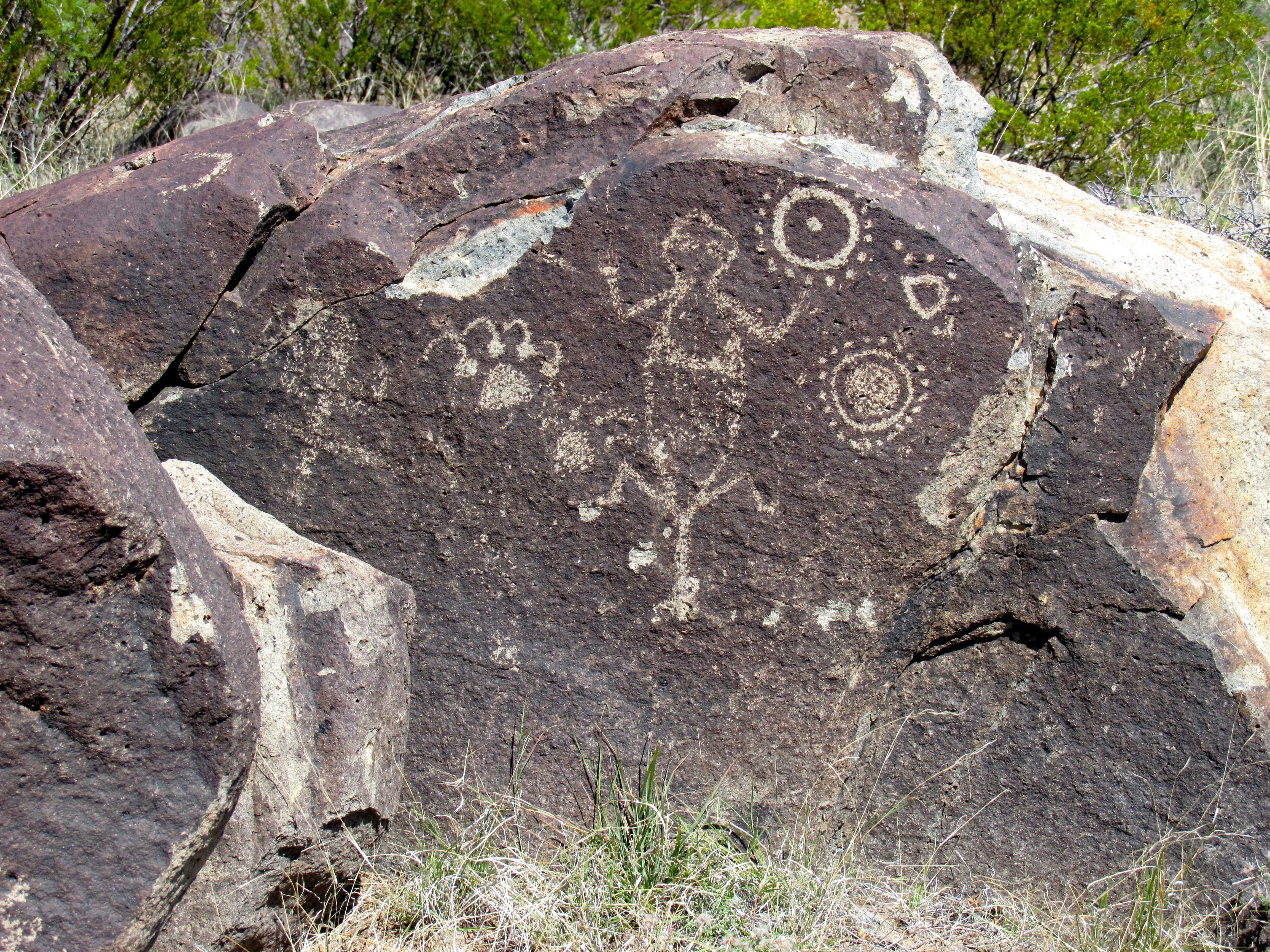
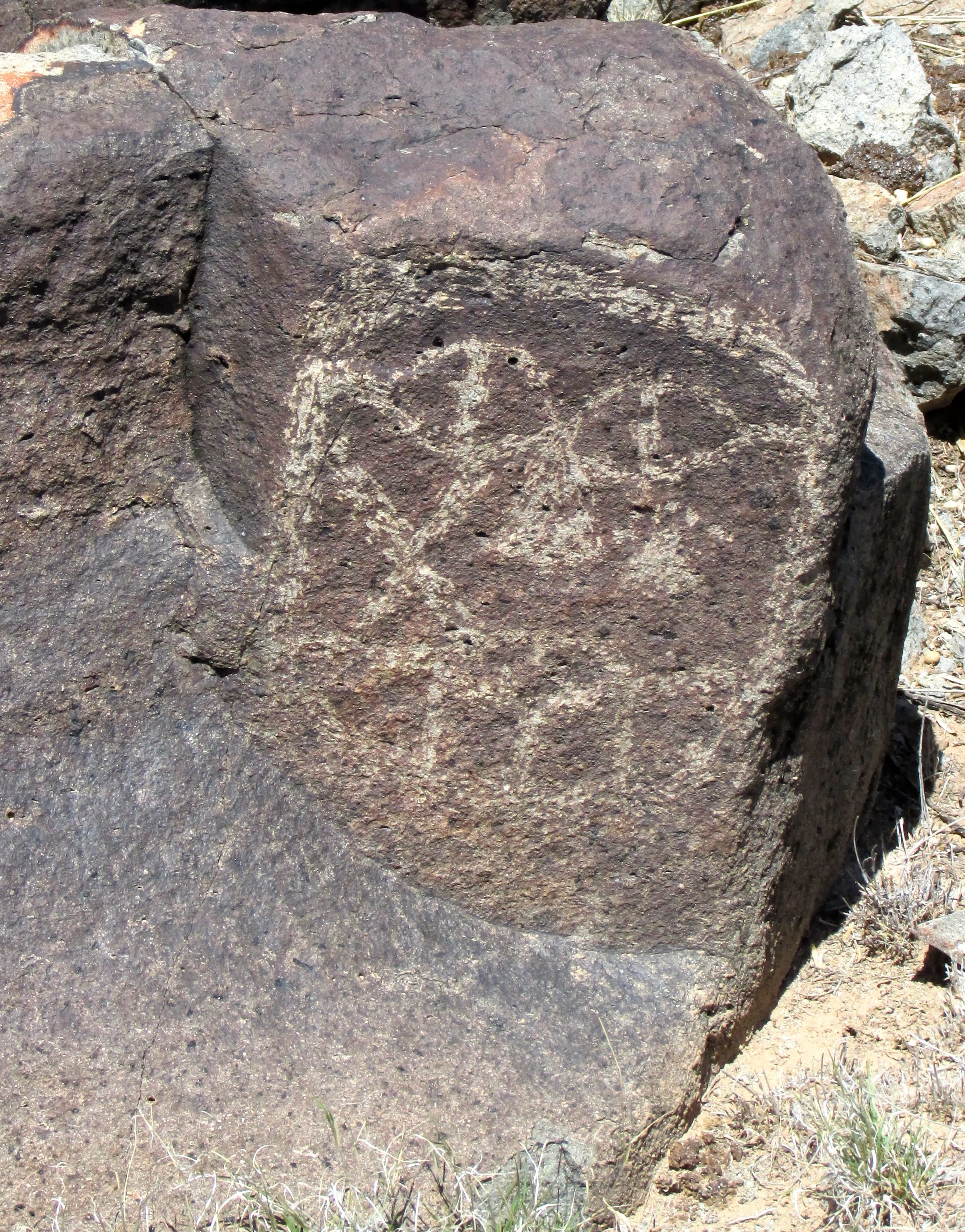
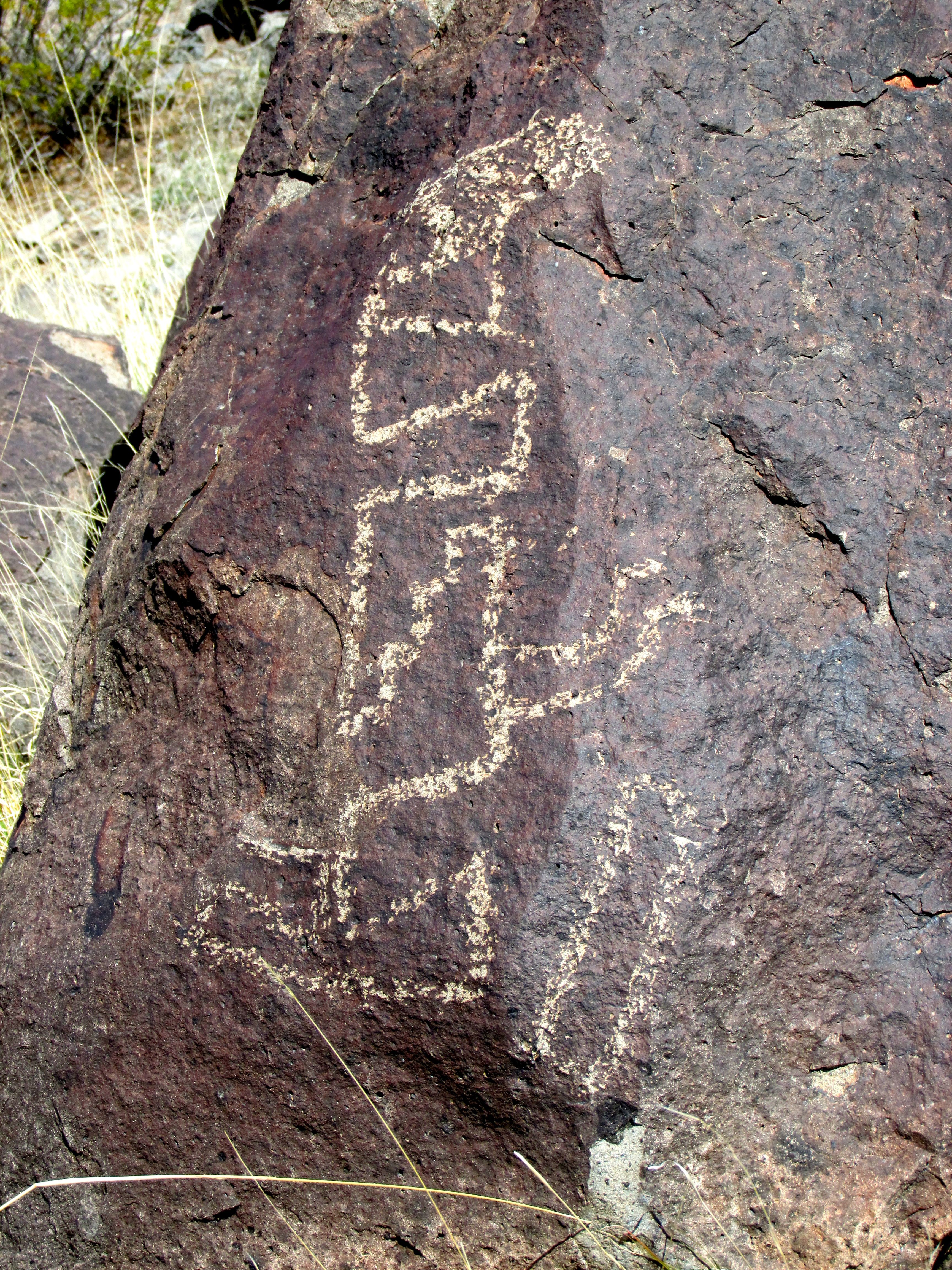
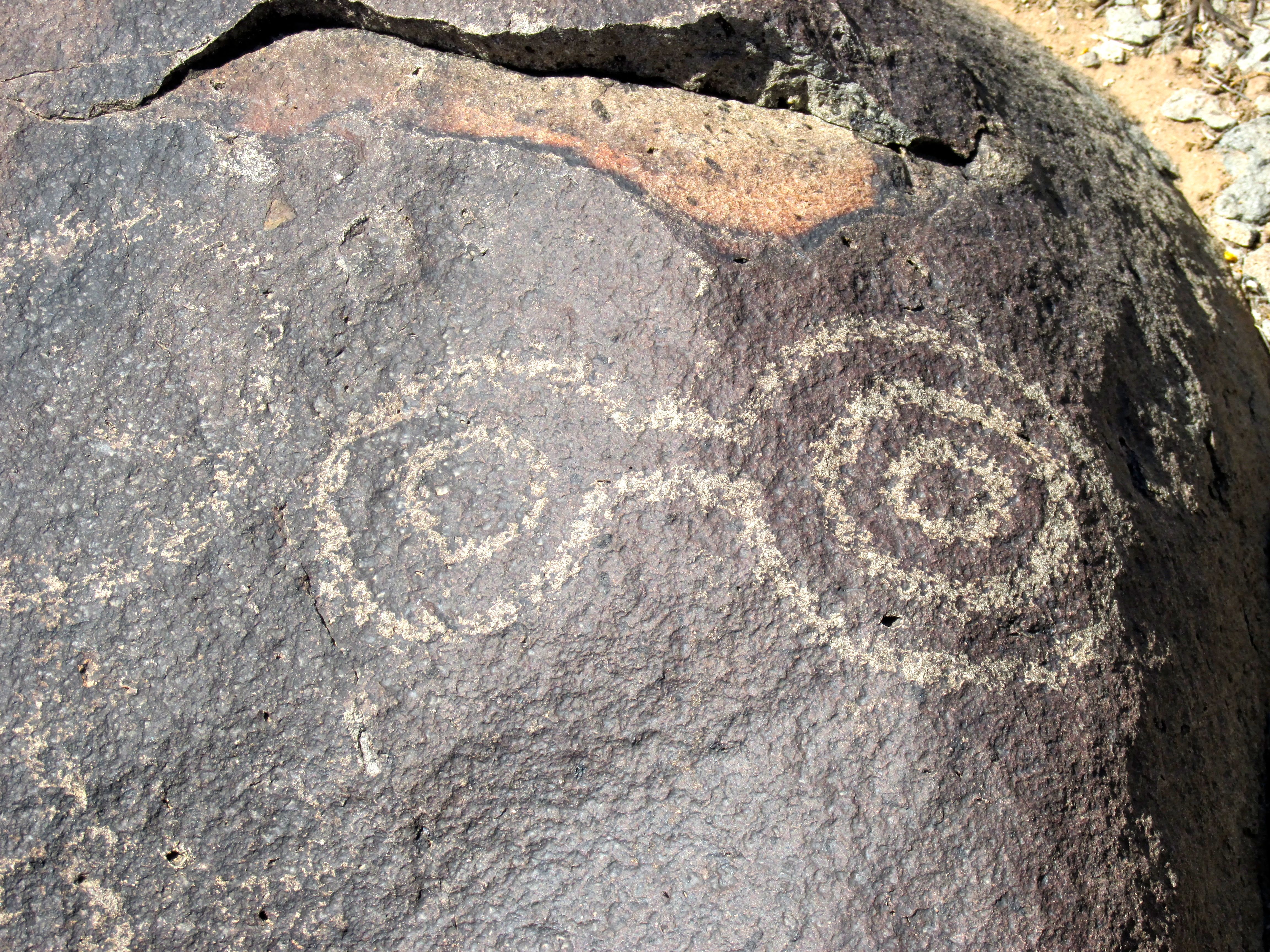
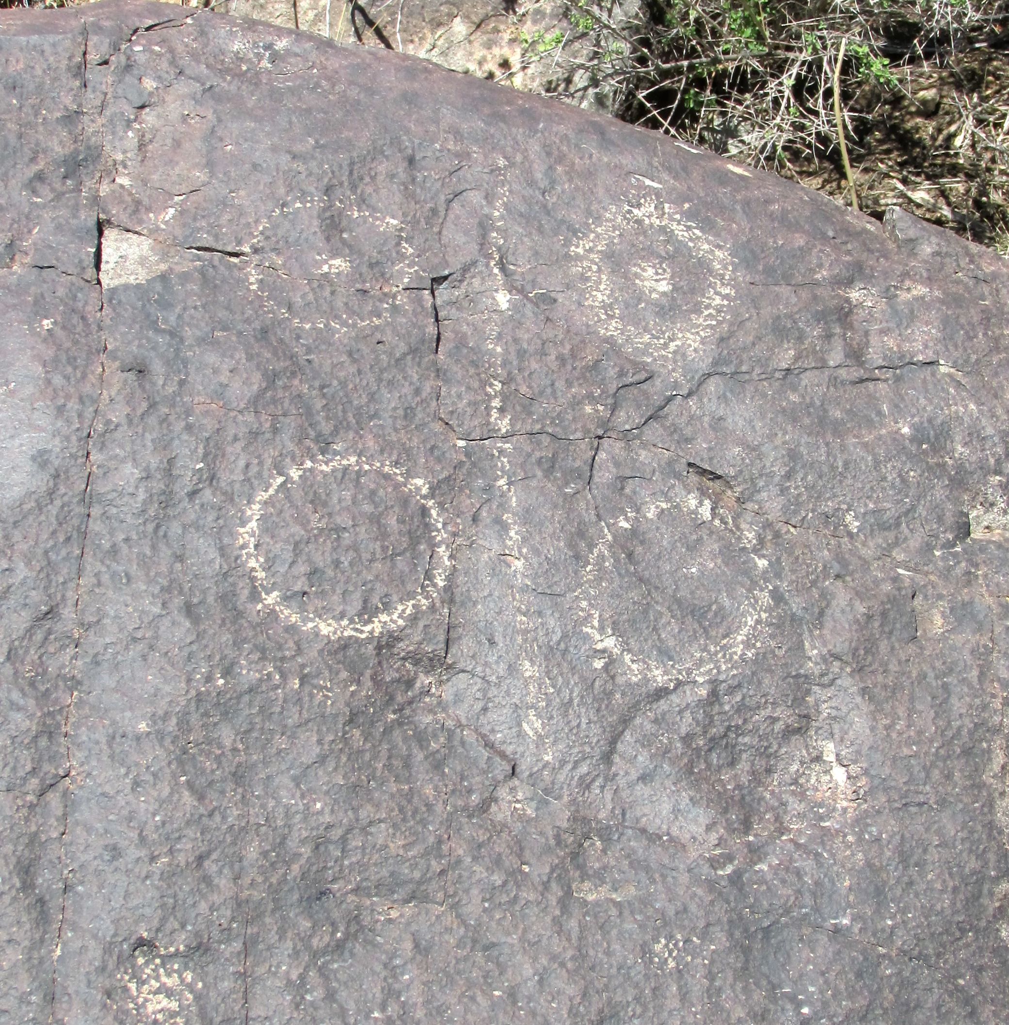
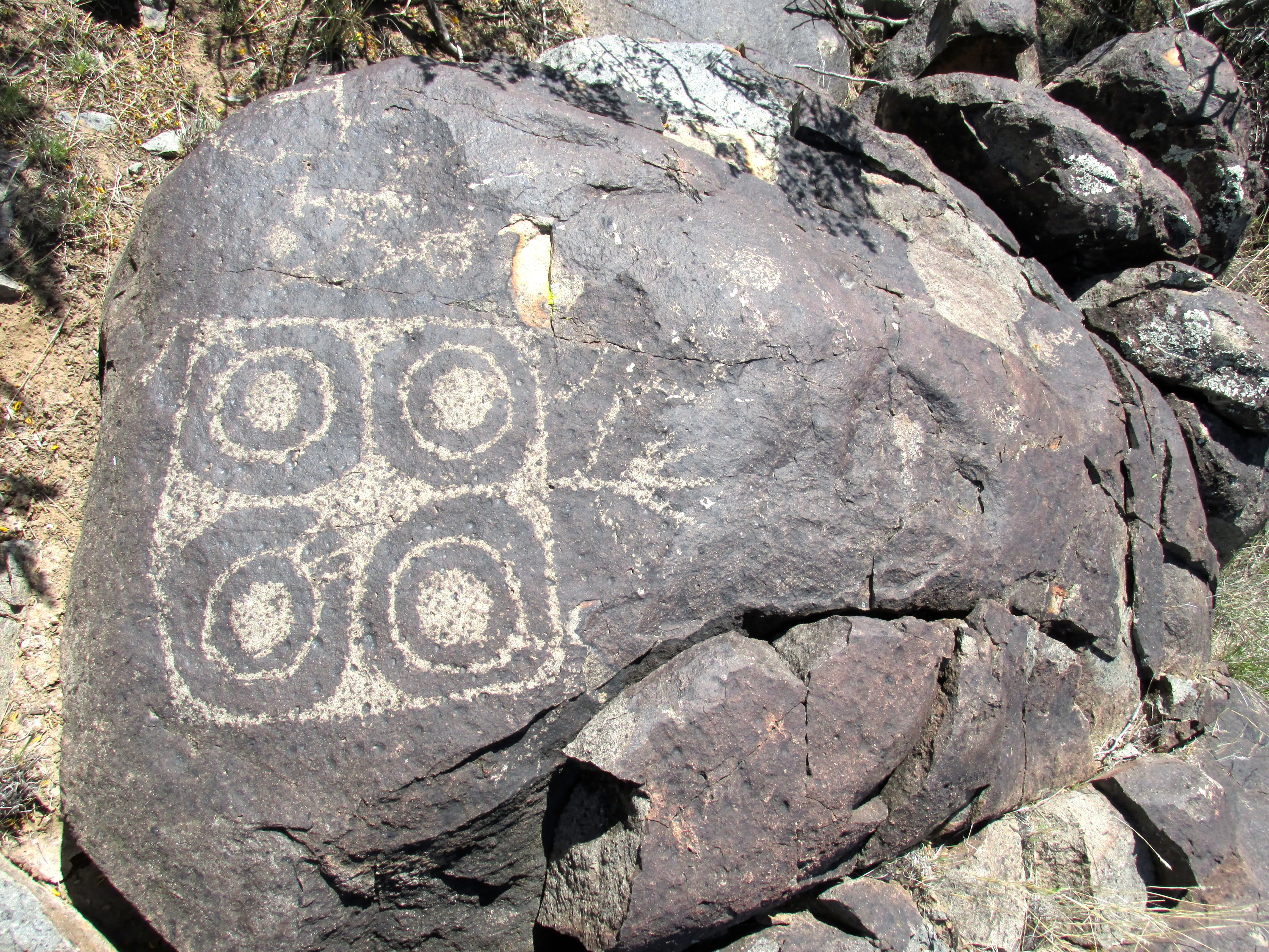
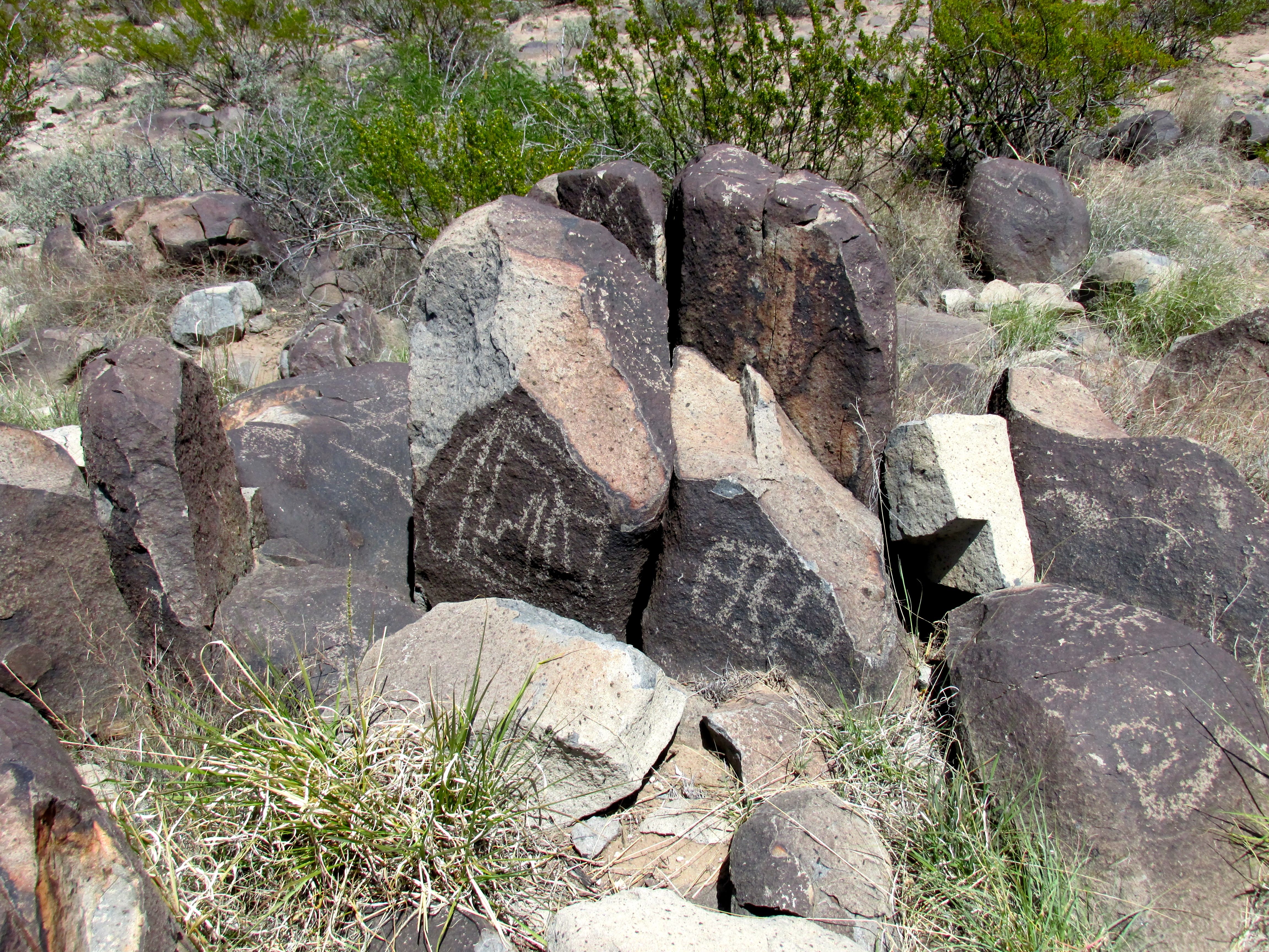
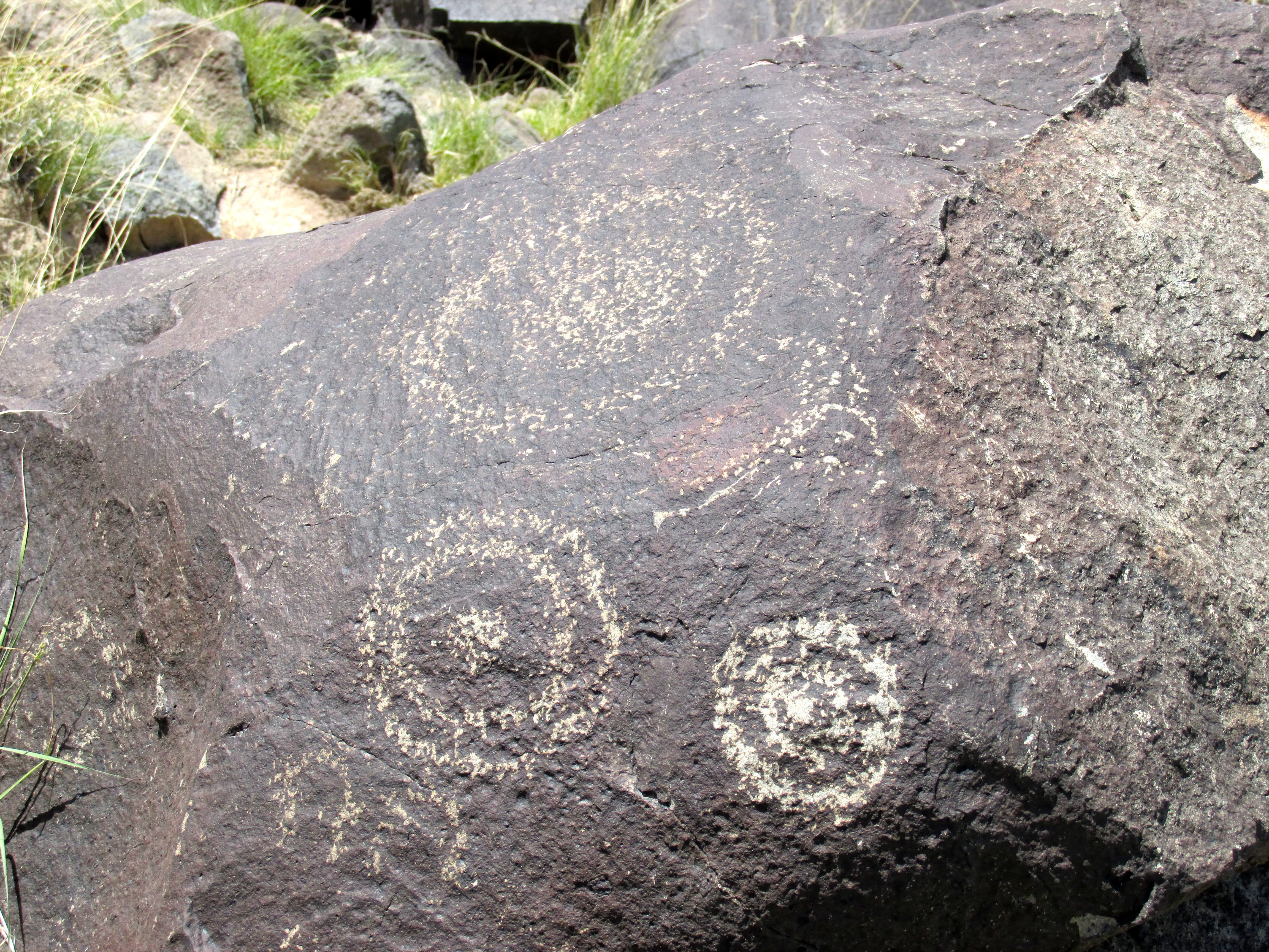
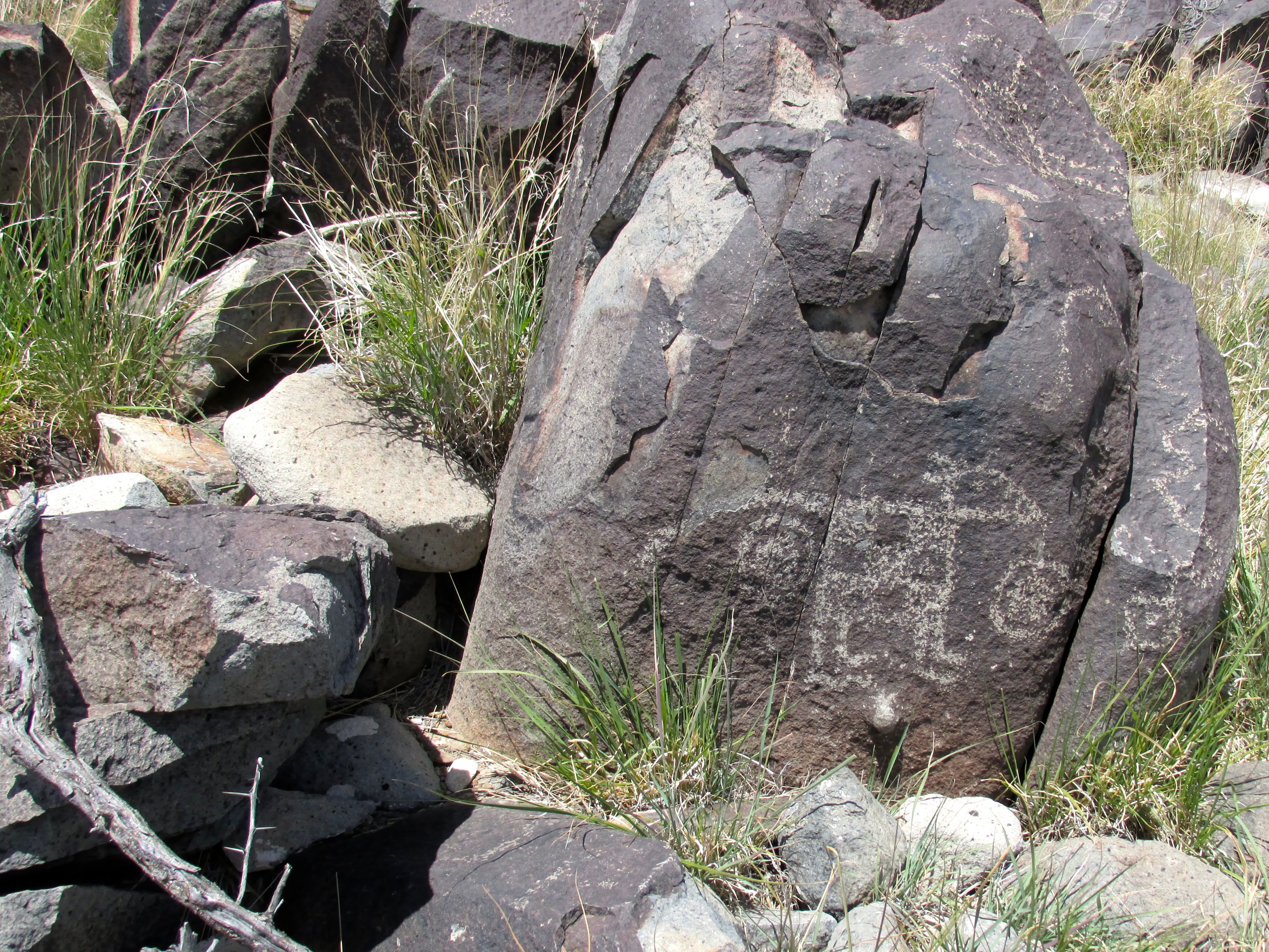
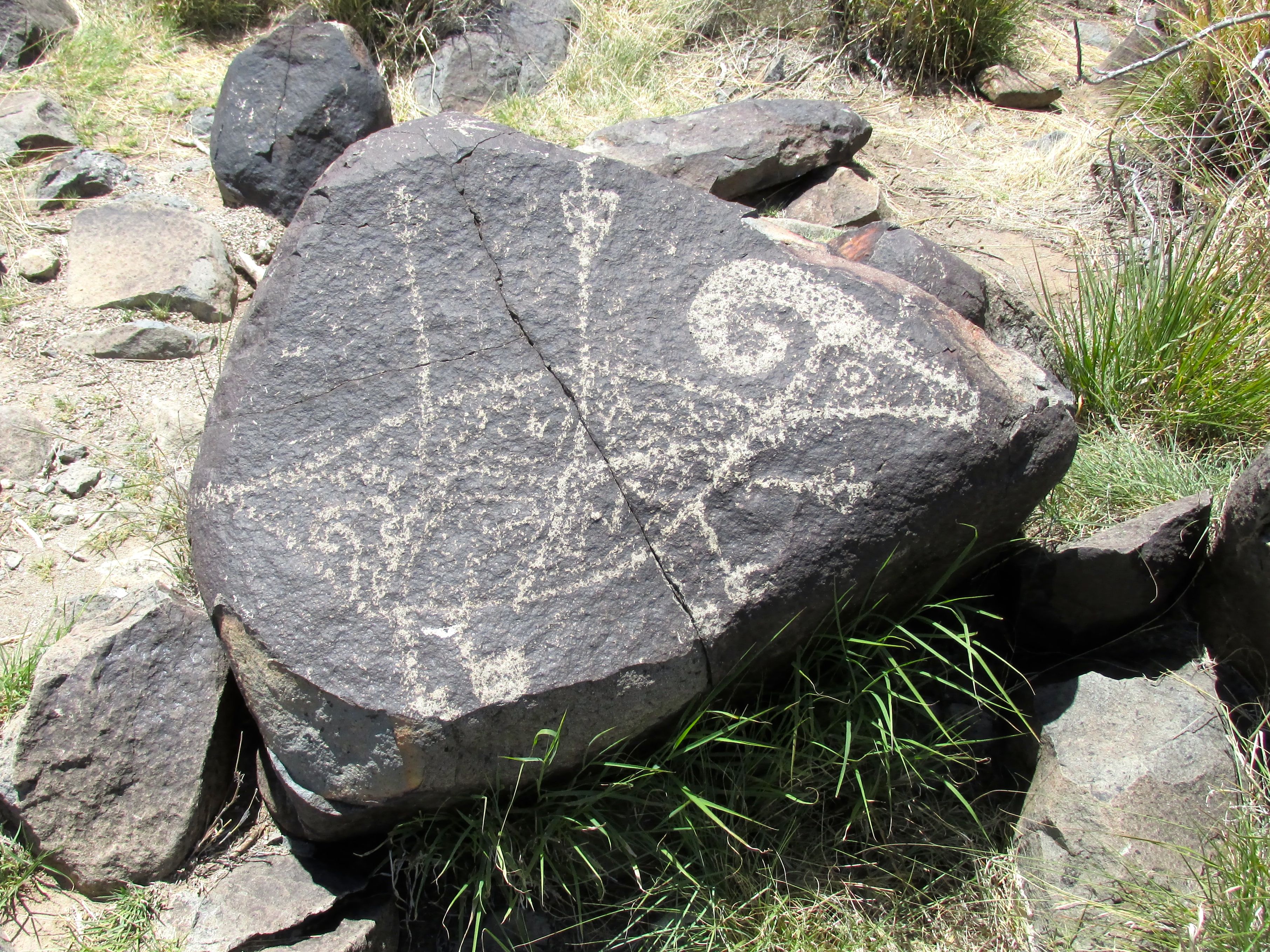
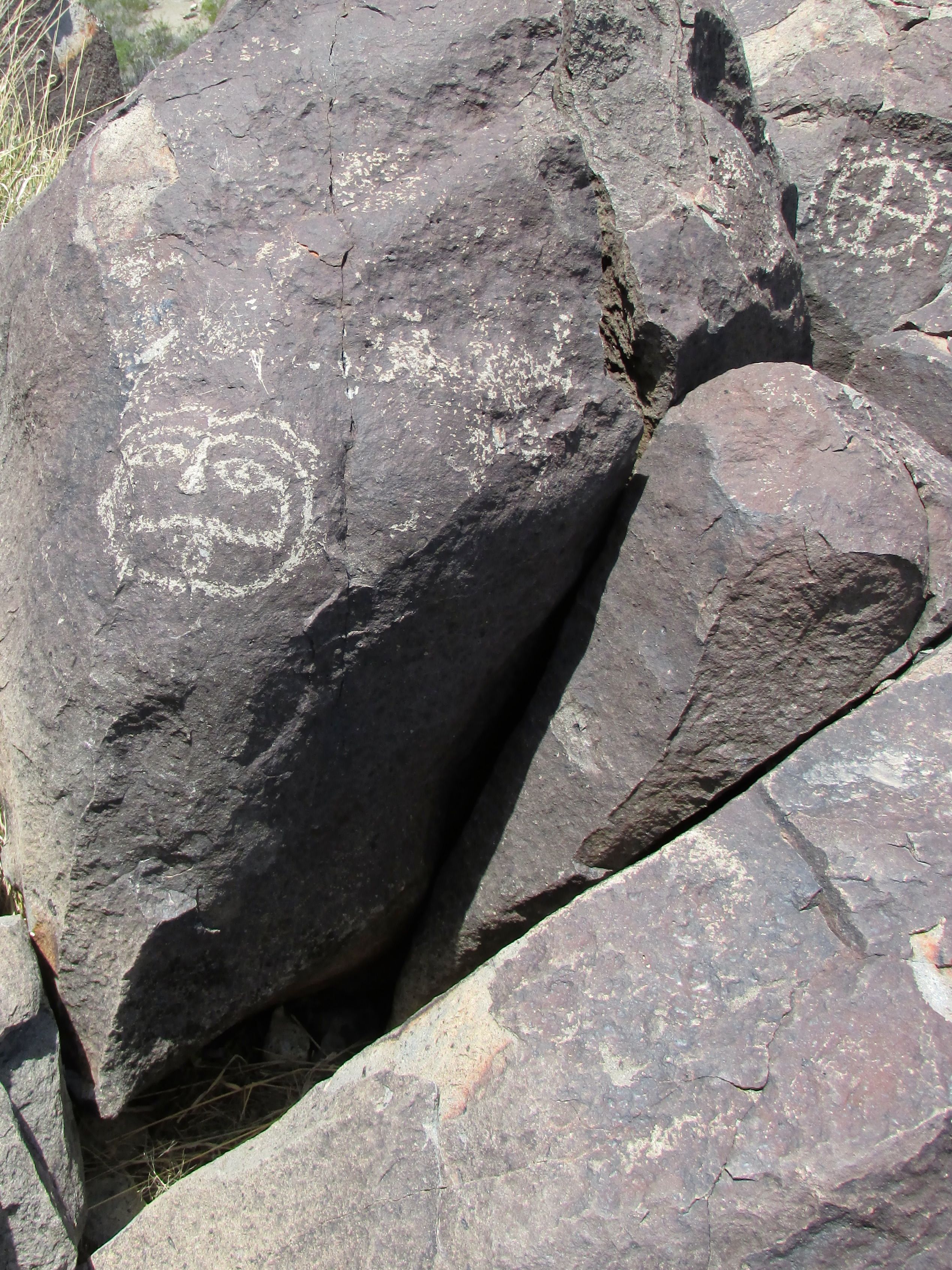
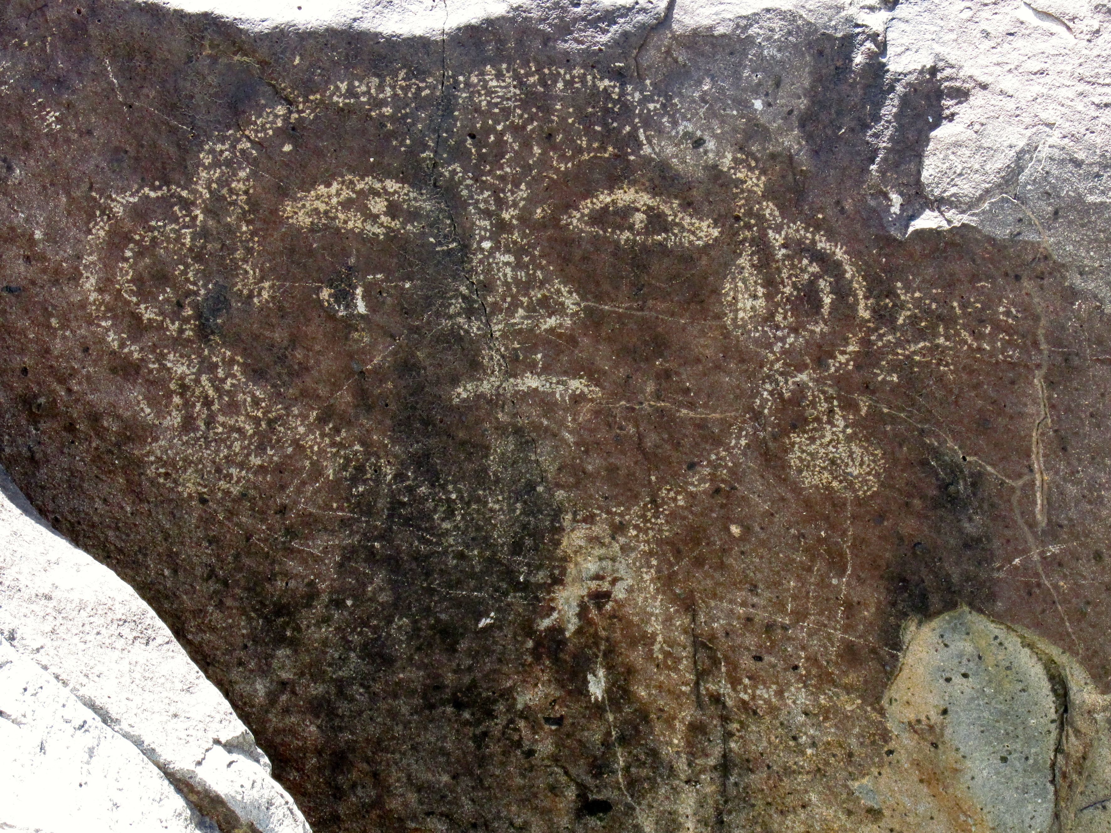
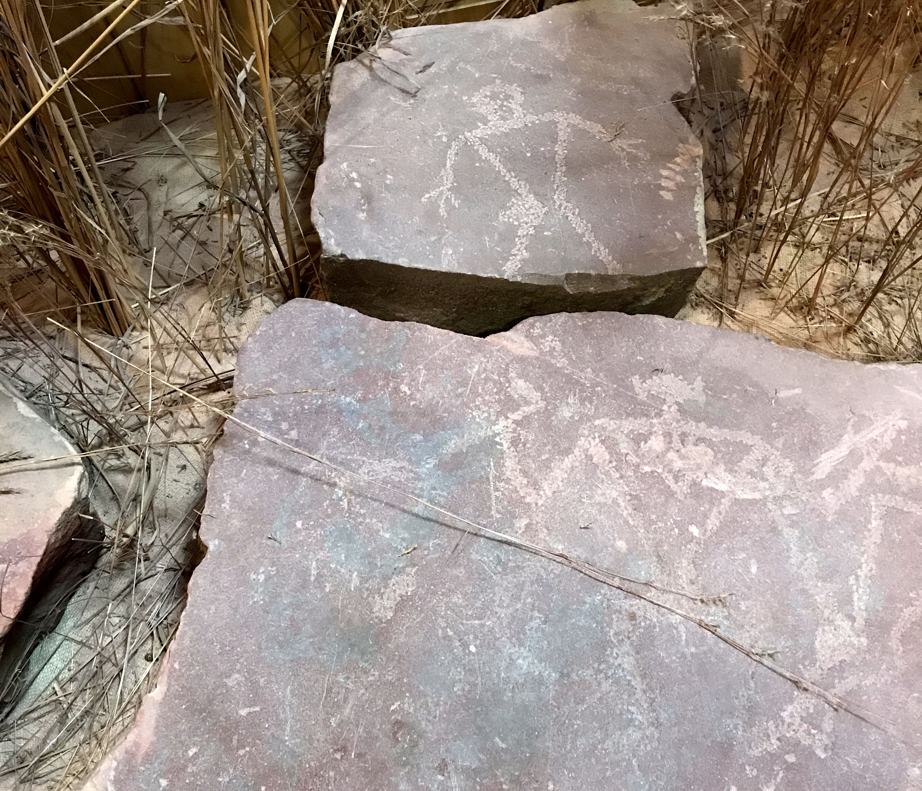
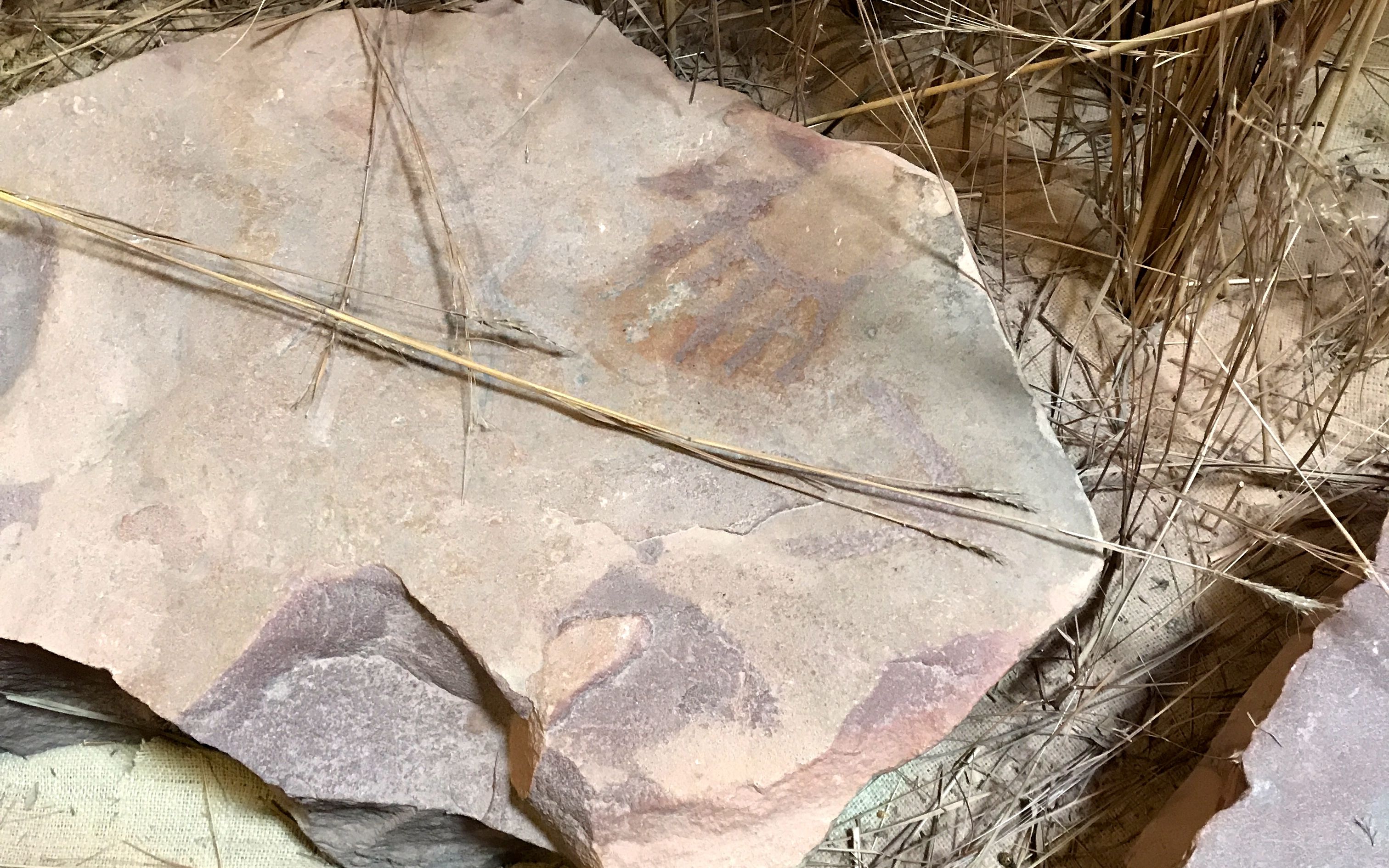
Back inside the visitor center, I spotted more petroglyphs. I love petroglyphs!

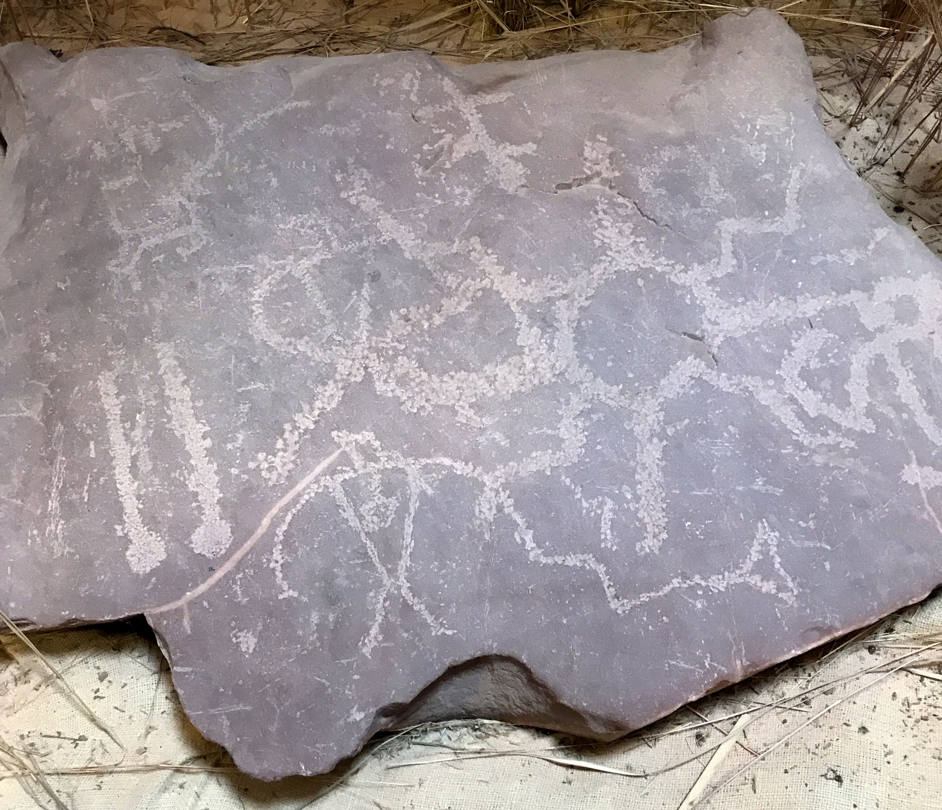
According to the information with them, in the late 1880s, the petroglyphs were removed form the quartzite bedrock surround the Three Maidens.

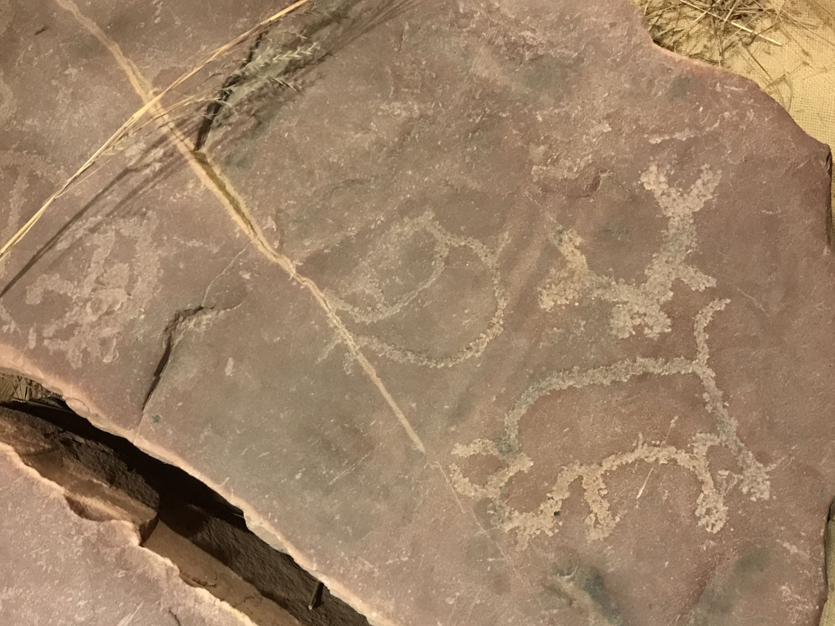
Pipestone businessman, Charles Bennett had them removed over concern that they were being defaced with names and other inscriptions chiseled over the original petroglyphs.

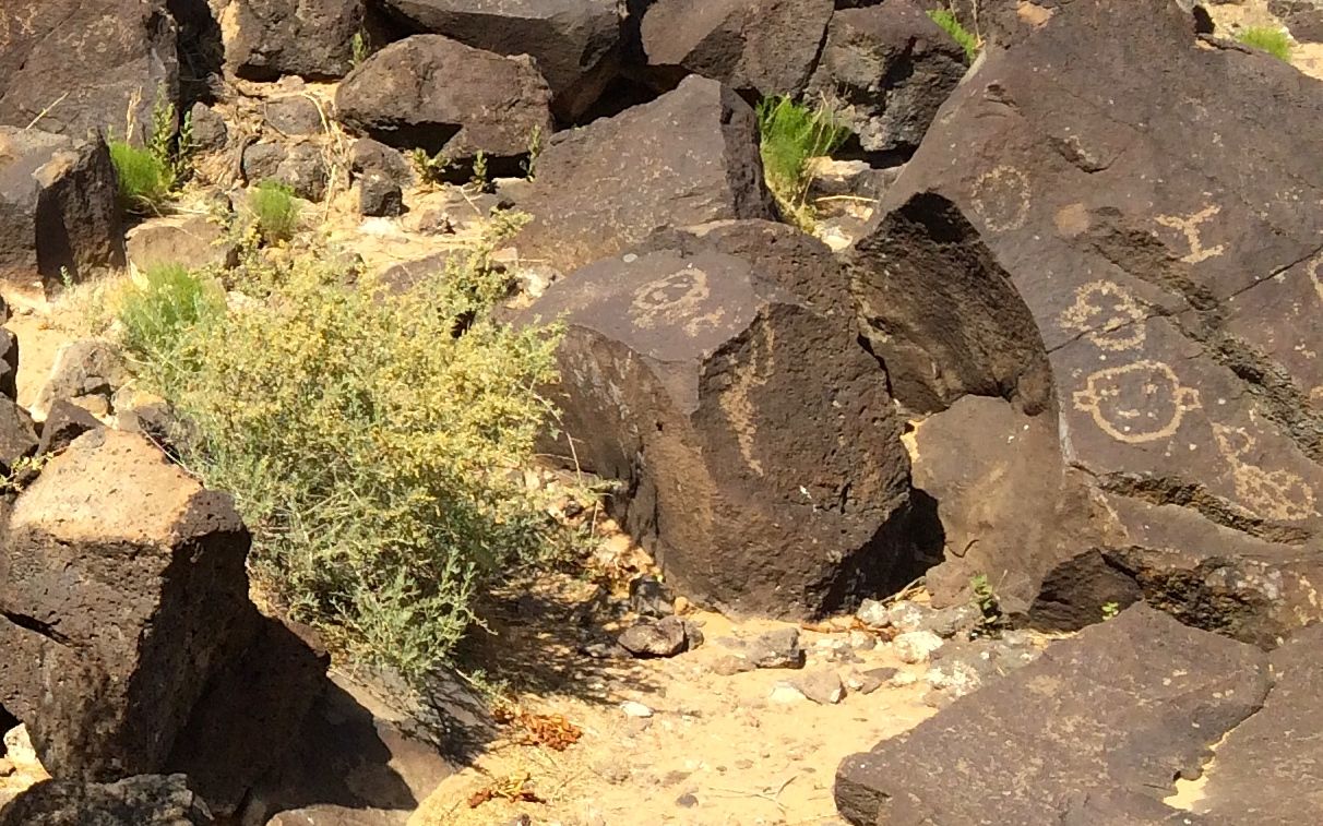
Mr. Bennett kept the collection in his side yard until his death in 1926. After that, they were kept at several places in Pipestone.

In 1946, 19 stones were donated to the National Park Service and were placed on exhibit at Pipestone National Monument.

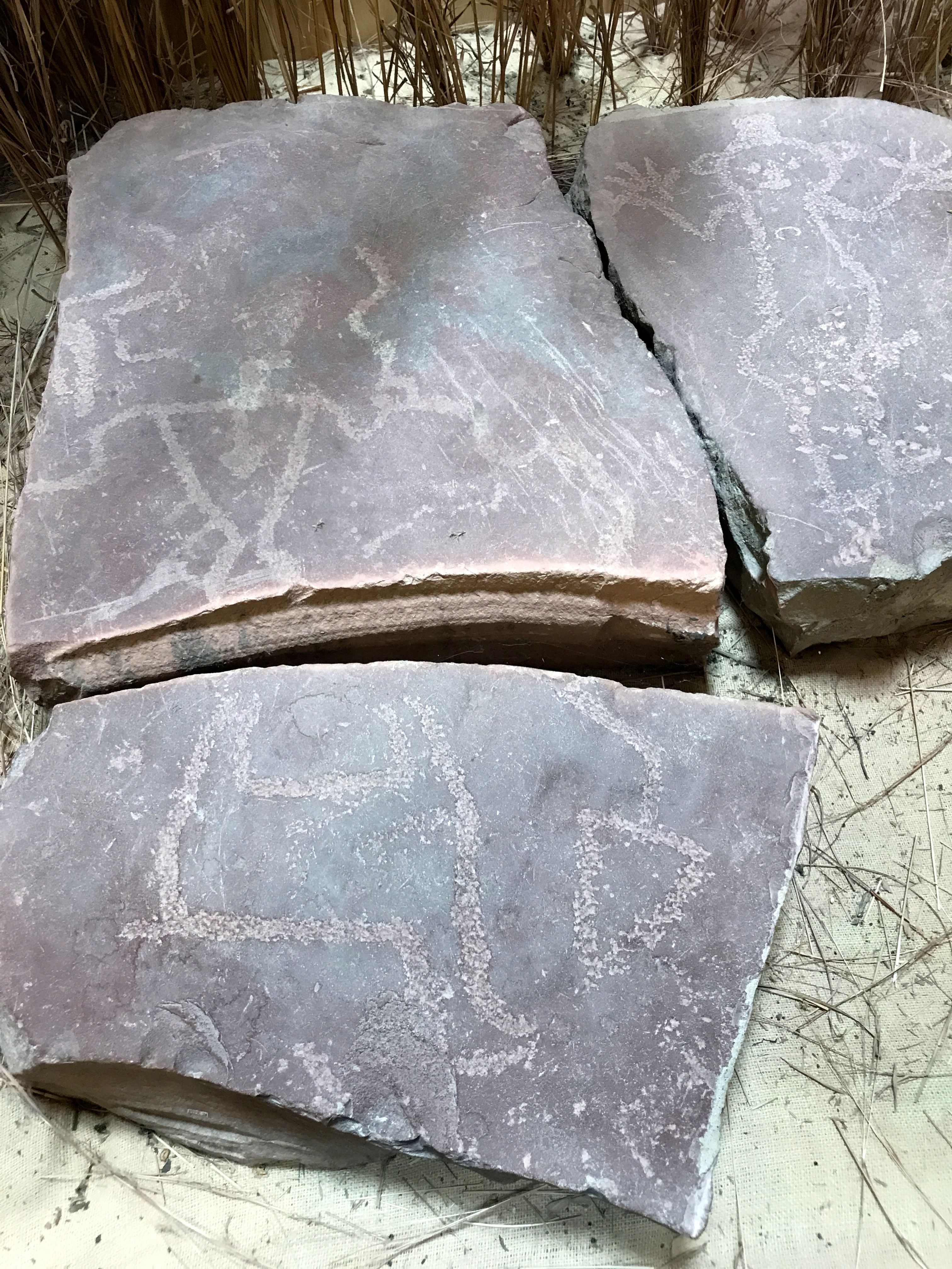
After being moved around to a number of locations, they were moved into the visitor center for security and interpretation. The current exhibition was developed with the input of many of the tribes affiliated with the quarries. The design was meant to reflect a respect for the spiritual nature of the petroglyphs.

And with that, it was time to head back to Blue Mounds Park.

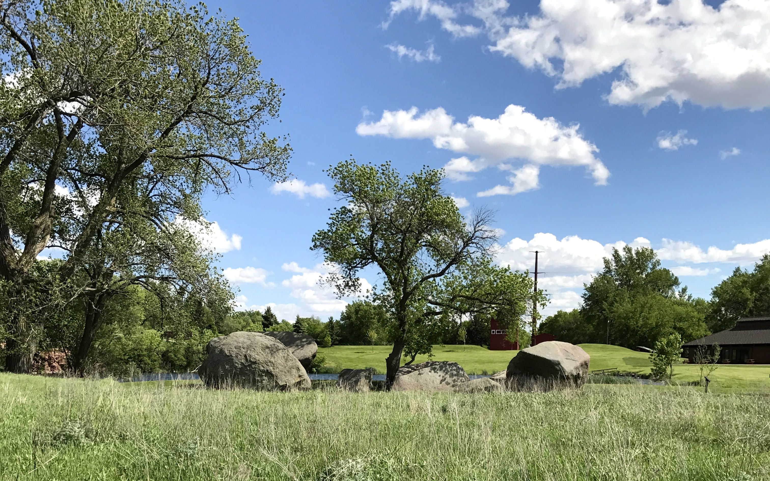
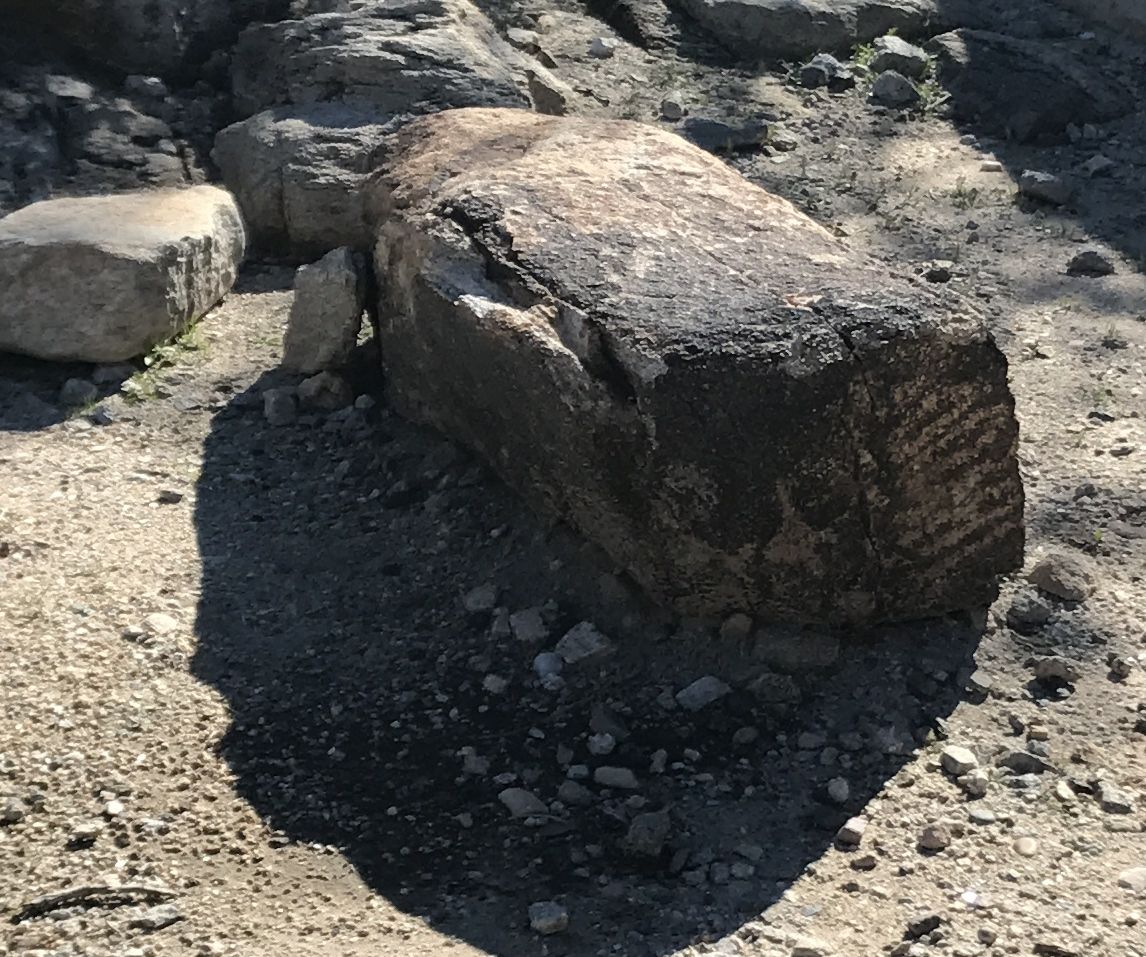
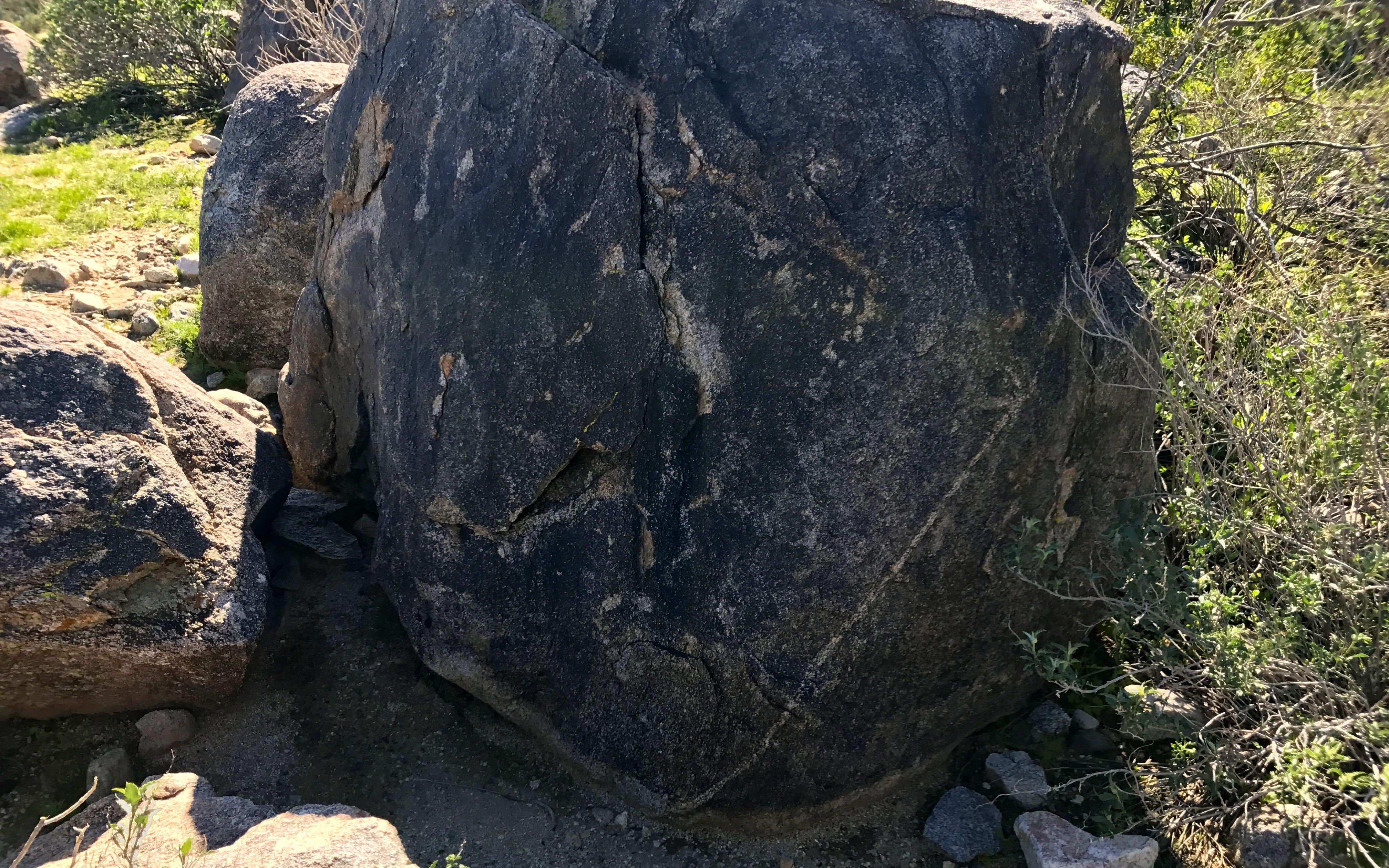
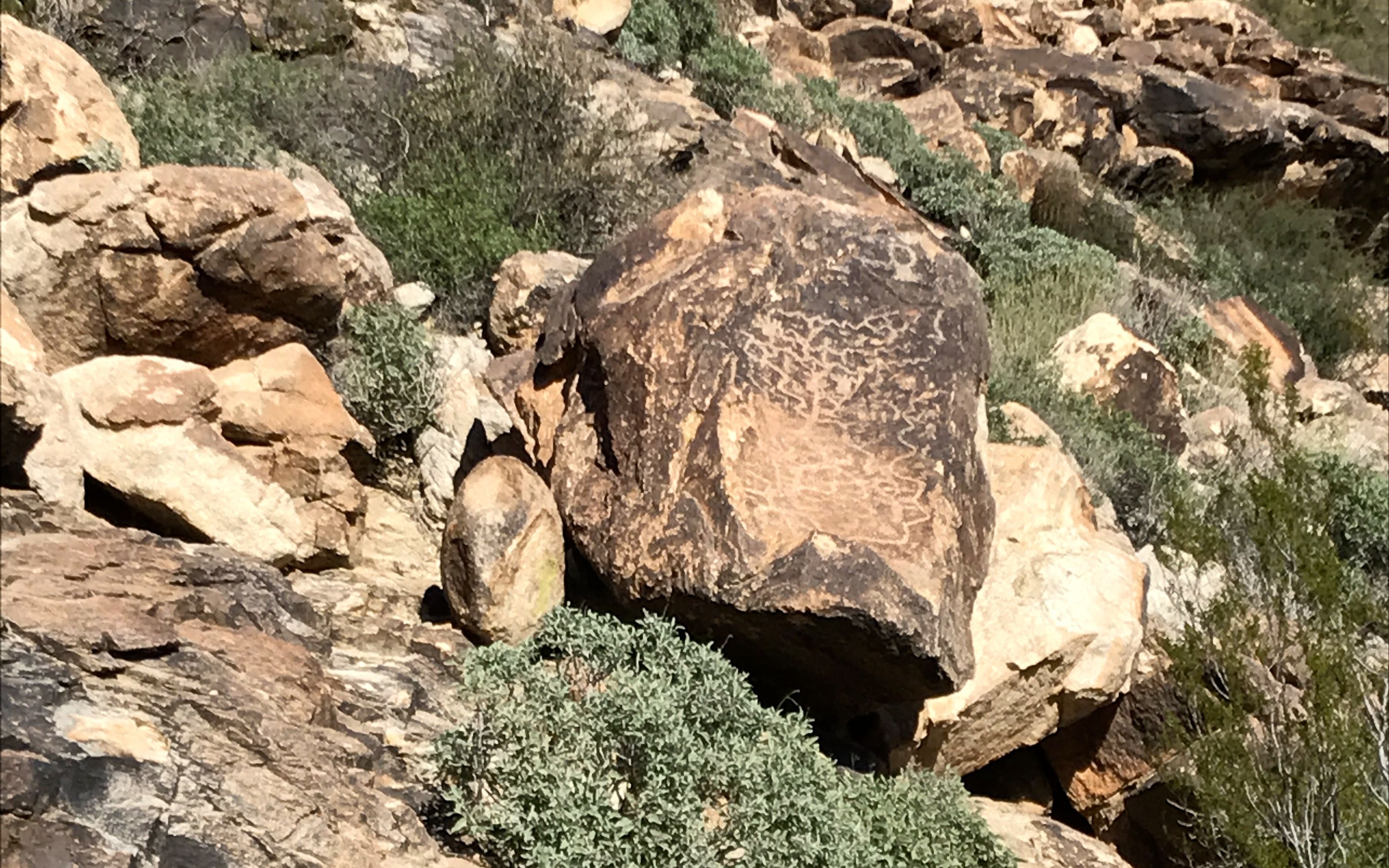
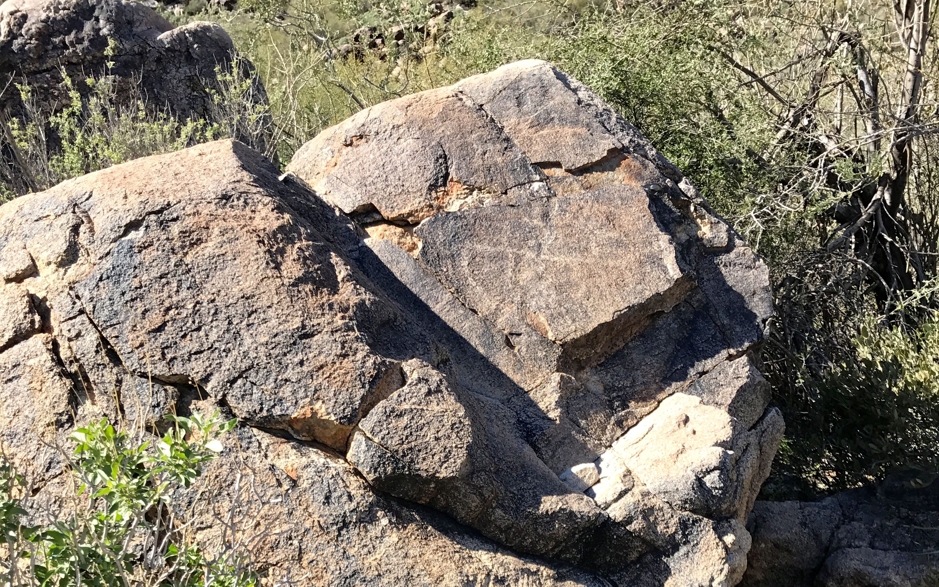
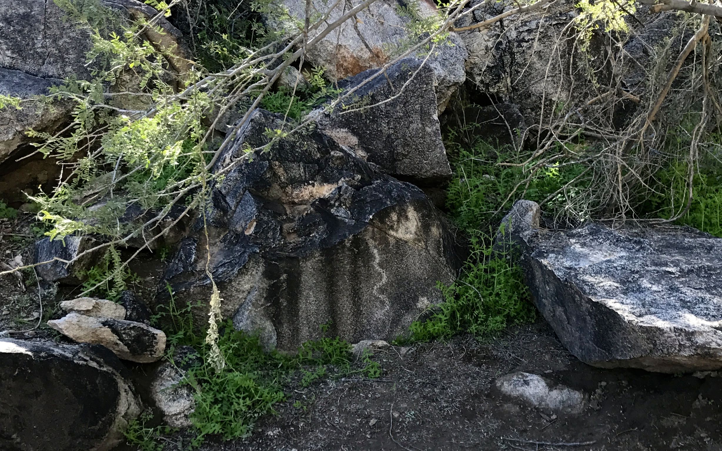
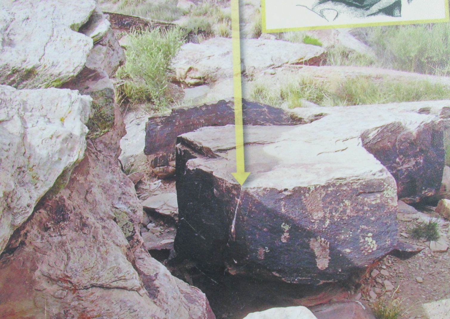
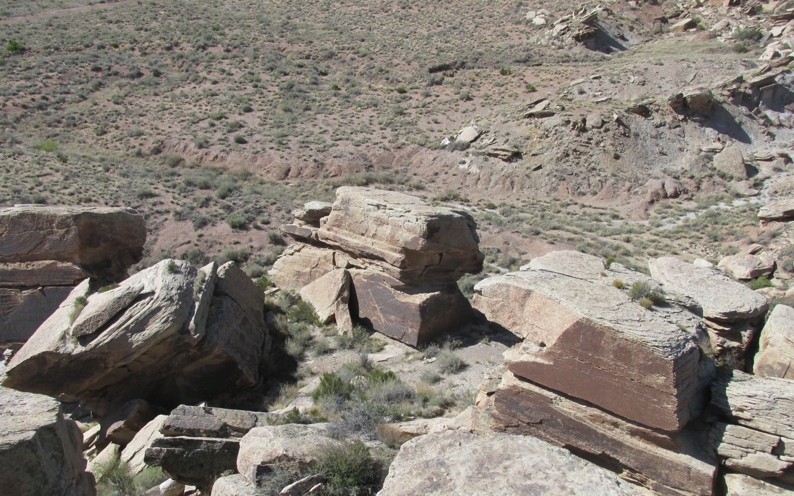
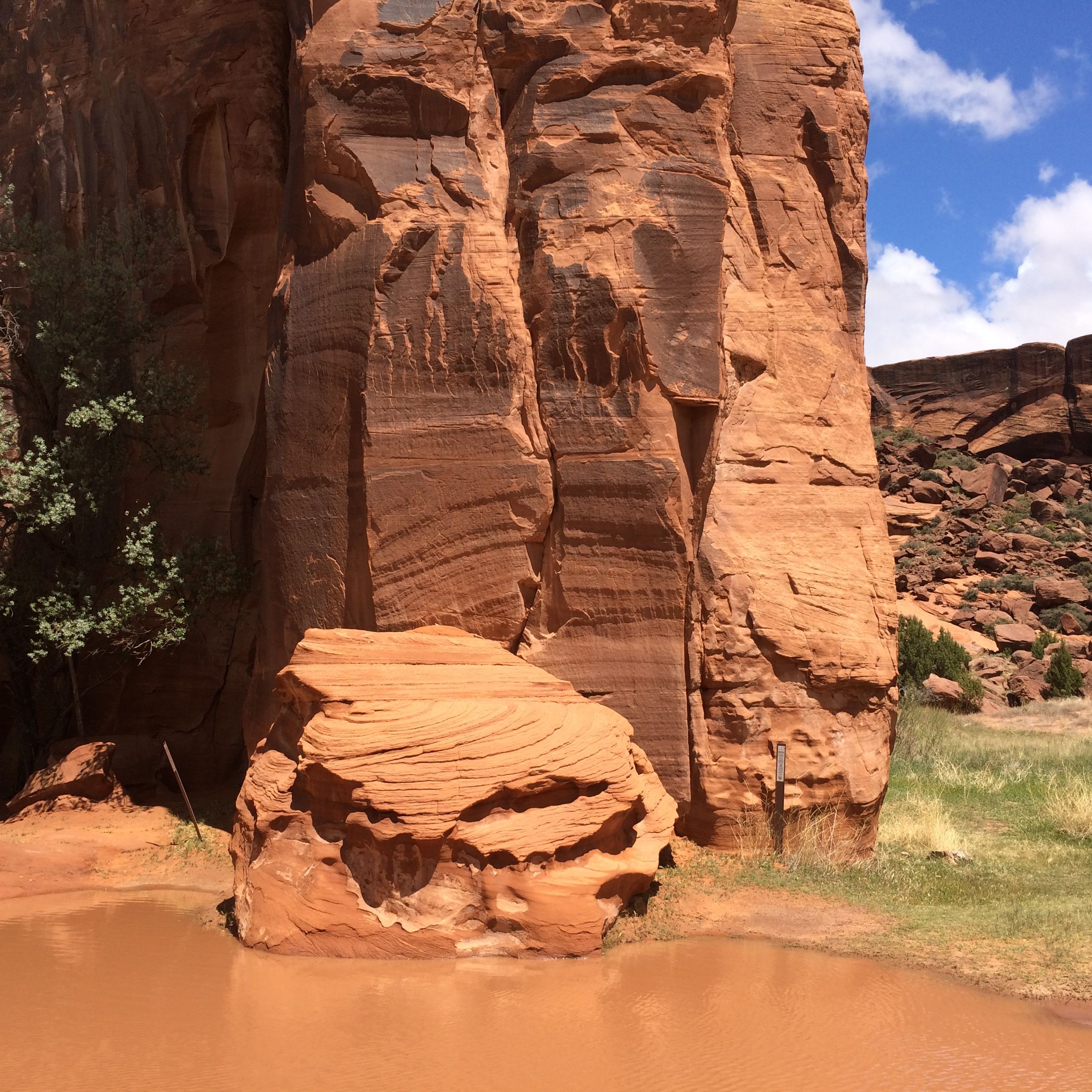
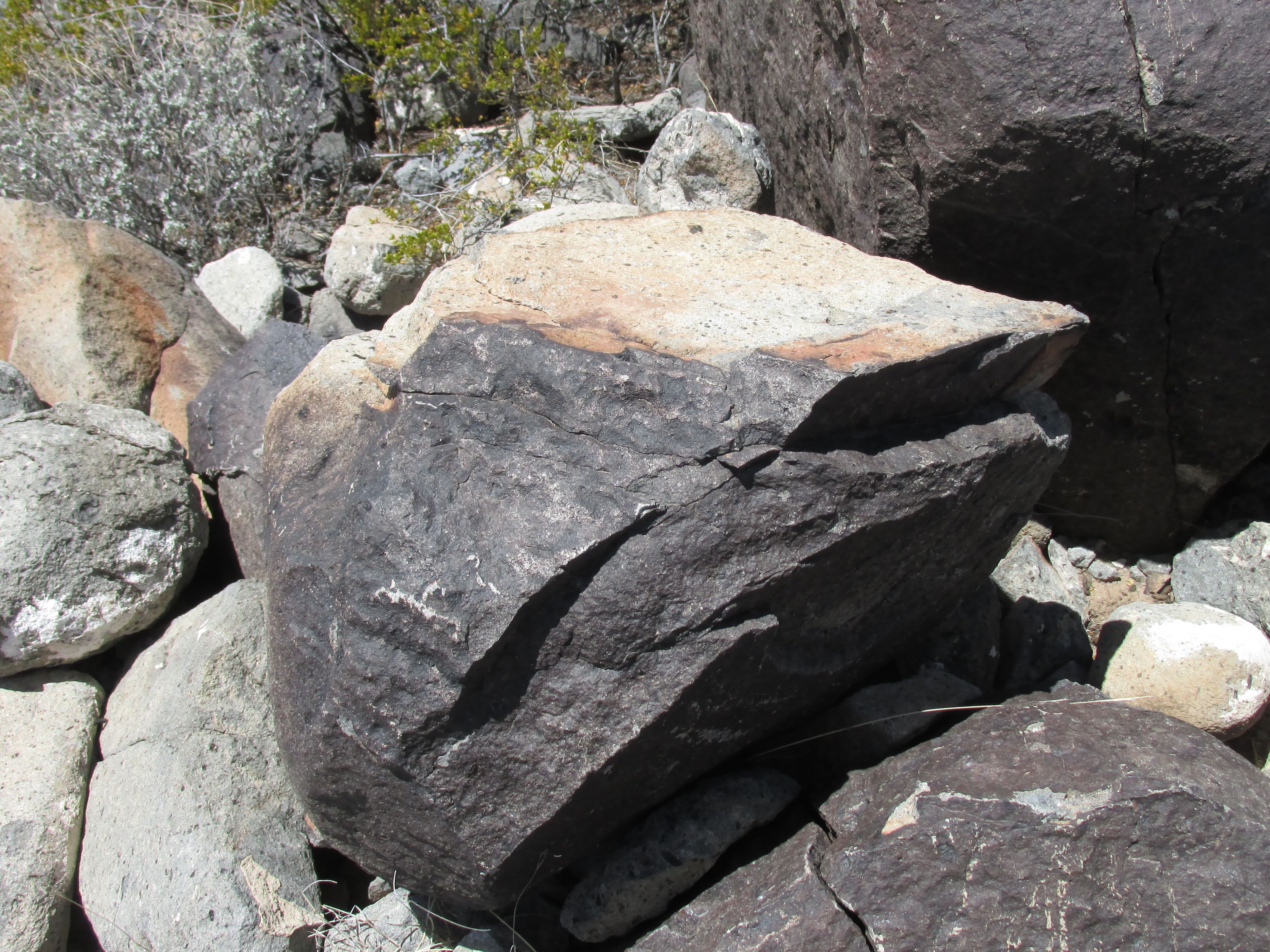
On my way back, I passed the Three Maidens. Many American Indians believe that the large boulder fragments shelter the spirits of maidens who require offerings from visiting Indians before permitting them to quarry pipestone.

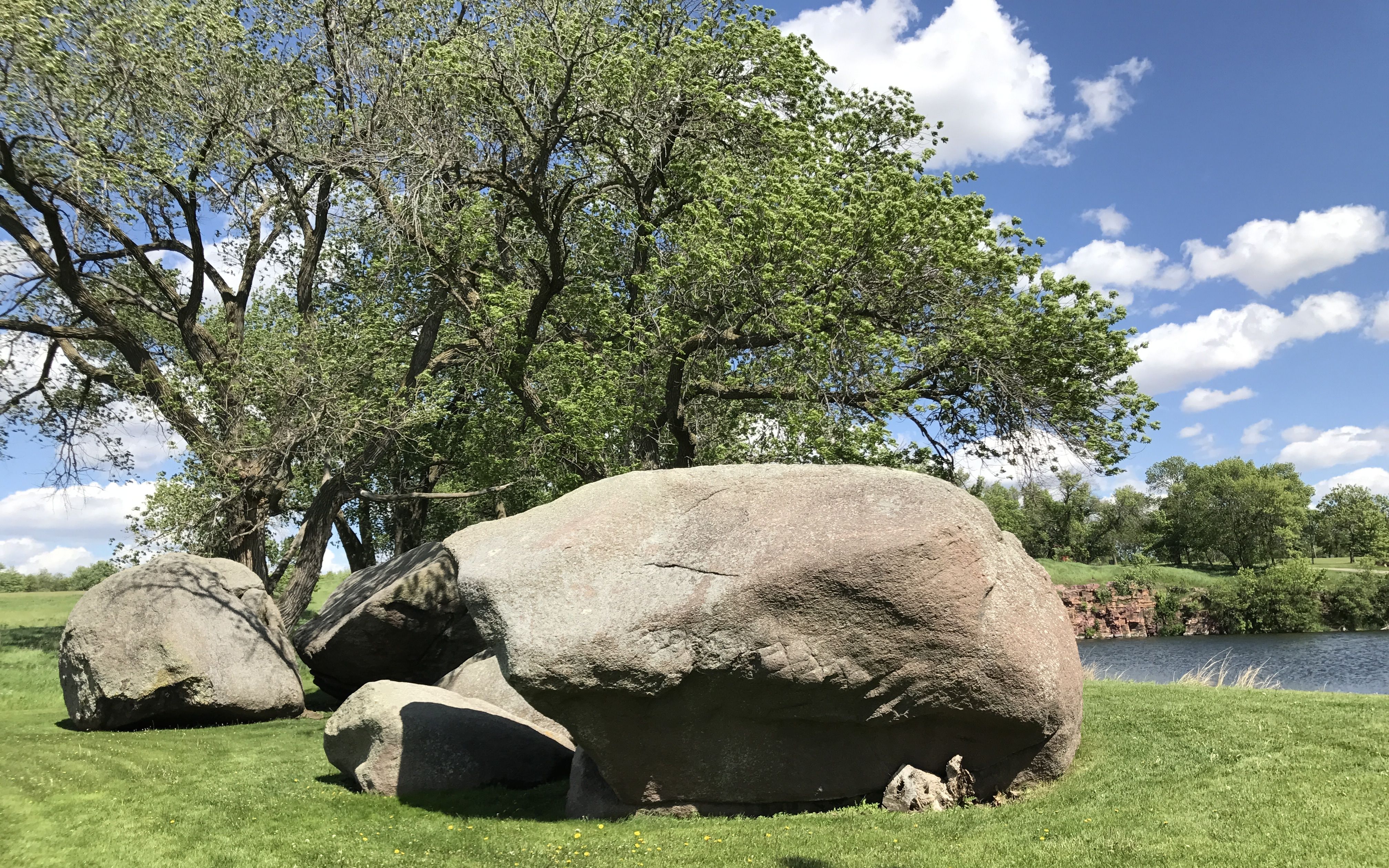
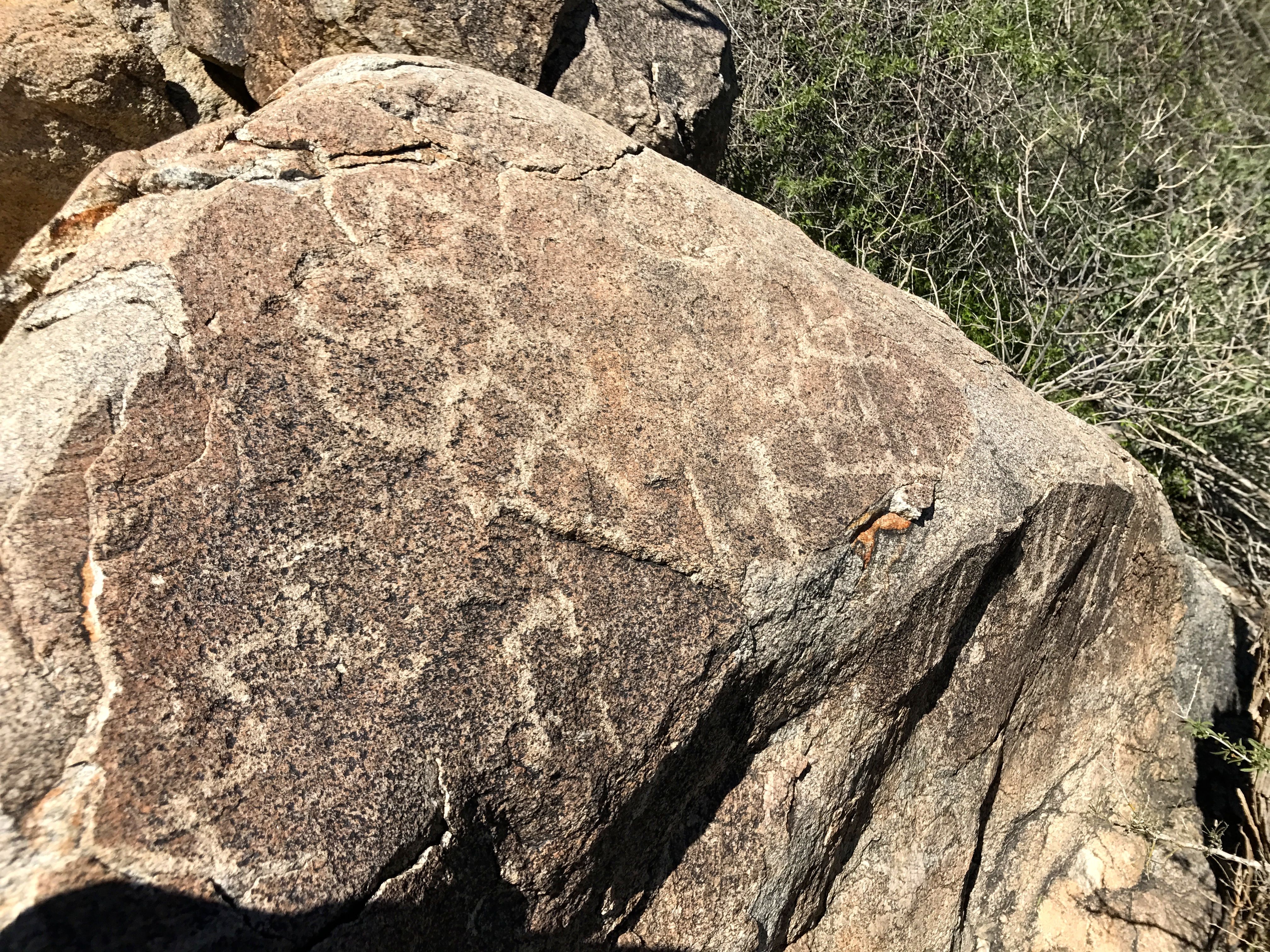
These huge granite rocks seem out of place in this landscape filled with quartzite, don’t they? According to the information at the site, they were carried down from present-day Canada during the last Ice Age. When the glacier receded, it left behind a huge boulder about 30 feet in diameter. The freeze/thaw cycle eventually split this glacial “erratic” into six pieces.

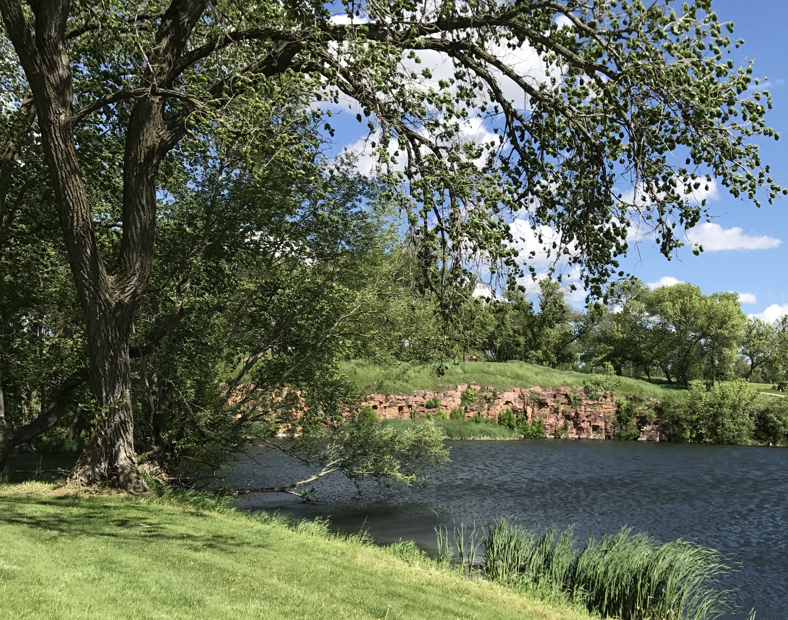
It was a peaceful setting.

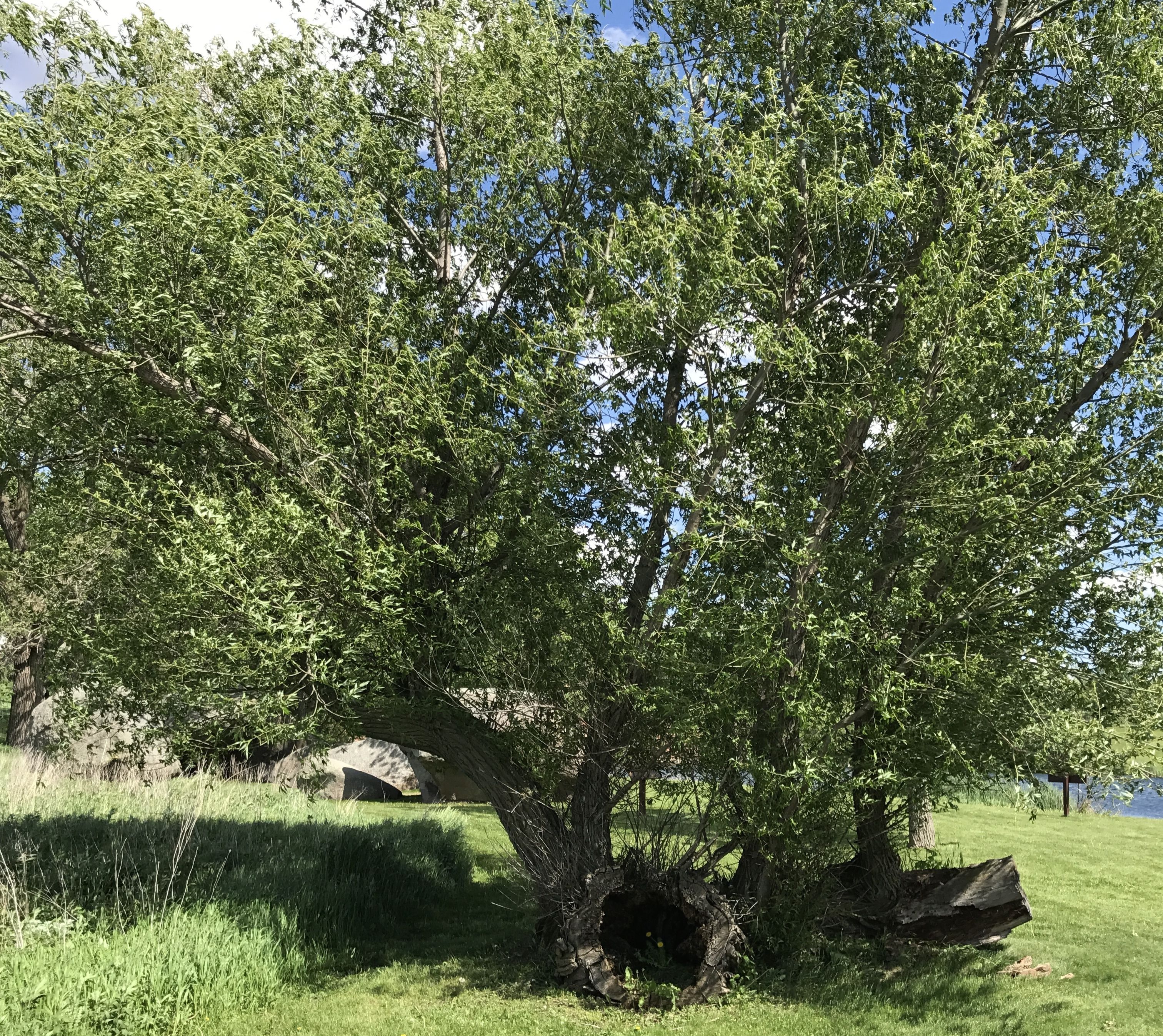
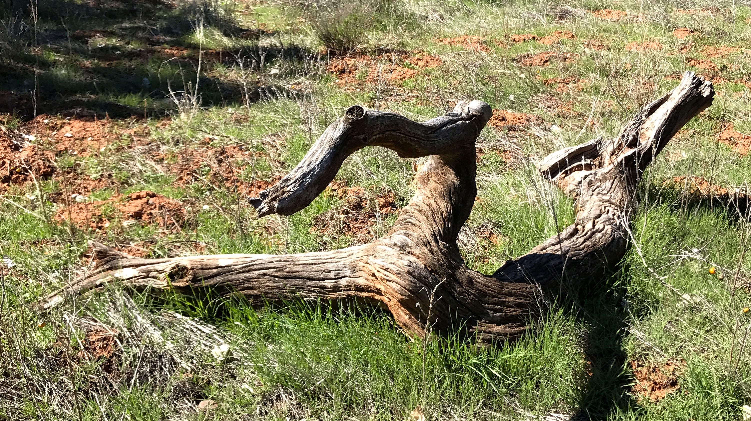
I walked around a bit. I had to admire this tough old tree. Down, but still sending out shoots and leaves.

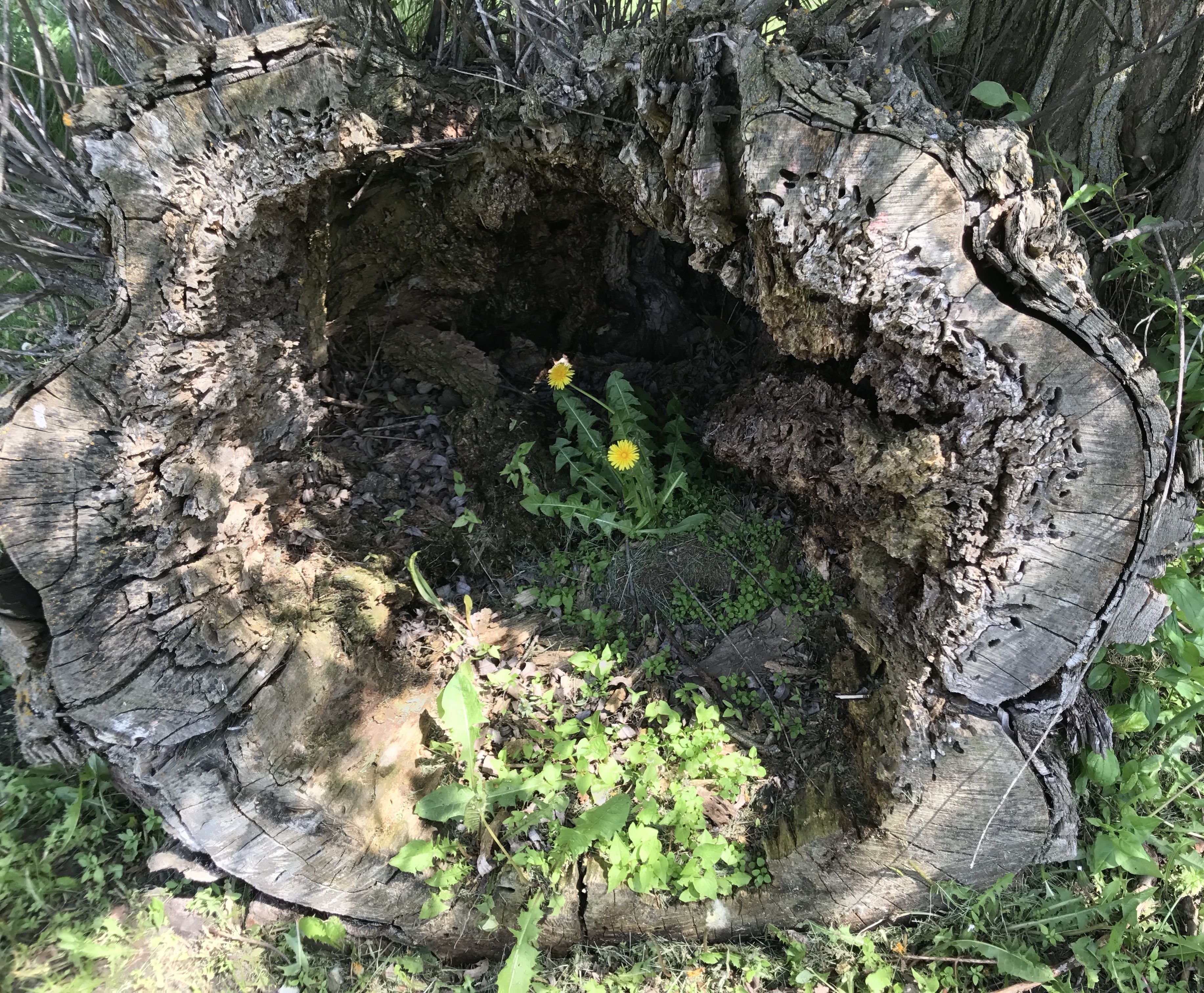
It’s the cycle of life.


V Bar V Ranch – More Petroglyphs

Konnie and I made plans to visit the V bar V Ranch, near Sedona, to see the petroglyphs that were on display there. Unfortunately, Konnie was unable to join me, so I went by myself.

I gassed up ol’ Bart and set out bright and early for the 90 mile drive. Along the way, I gained about 3000 feet in altitude. I followed the directions and was happy to see the sign.

I pulled in to the parking lot and proudly displayed my America the Beautiful Pass. I like it when I can make more use of my $80 annual investment.

I passed under the gate and headed toward the ranger station. I checked in and assured the ranger that I had my pass properly displayed and went in search of petroglyphs.

There is not much left of the cattle ranch that was here. They don’t talk much about the ranch, except to say that the fact that this was a working ranch is part of the reason that the petroglyphs were so well preserved. I guess the cattle helped to keep people away.

I didn’t know what to expect. My previous experience with petroglyph sites was that I should expect to walk among boulders. Walking down this level gravel path was unexpected.

There are always things to see. This cut off branch caught my eye. I am amazed at how dry and cracked it is. I wonder how old it is.

So many questions!

After a short stroll, I got to the petroglyph site. It was a cliff that was covered with 1,032 petroglyphs in 13 panels.

There was a marvelous docent there who took great pride in explaining what was known about the petroglyphs that were created by the Sinagua culture between A.D. 1150 and 1400. Actually, all that is known about this culture is what archeologists have put together by study of what has been left behind.

Jim, the docent, has his own methods, though. He takes advantage of every  opportunity to talk with Indians about what they think of the symbols. Here he is, picking the brain of a visitor who identified himself as Hopi.

Jim told us that these forms were important. He identified the top figure as the Creator and the bottom one as an antelope. The holes are part of a calendar.

I snapped this photo from his notebook. You can see the two figures and the holes I mentioned earlier. Supposedly, this is from the solstice. I am not sure how the holes play into the calendar. Maybe they do at a different time of year.

The archeologists felt that this site was used primarily by priests or healers. As such, being able to tell when it was time to plant was important.

Jim told us that they think that the shapes in the center might be maps of fields. They used terraced fields, and archeologists have found indications that they farmed the hills around the site.

This petroglyph appears to be a map of the Verde River.

Are you doubtful? Here is a photo I took of Jim’s resource notebook.

It sure looks like it could be a map of the river!

There were a lot of bird form glyphs as well as other zoomorphic forms.

There is one female form on the wall. You do kind of have to use your imagination, but you can make out her squash blossom hairdo.

Jim told us that there were actually more than 1,032 glyphs. The cliff went down more than five feet deeper. The soil had been deposited by the annual flooding of Wet Beaver Creek over the years. Archeologists have done exploratory trenches by the wall and found glyphs all the way down.

The thirteen panels of the site are quite tightly grouped.

In fact, this site so tightly grouped that the whole area is enclosed in a chain link fence. They are committed to preserving it for future generations.

And that is a good thing.

White Tank Mountain

Konnie, my adventure buddy, asked what I’d like to see while I was in the area. I told her that I was always up for petroglyphs. She came up with a hike to see petroglyphs and a waterfall at White Tank Mountain Regional Park in Waddell, Arizona.

We parked at the trailhead and followed the signs. It wasn’t too long before we came to the petroglyphs.

There is something so magical about seeing these works made by ancient hands.

There are interesting patterns hiding on the surfaces.

I wonder what they thought about while they were working?

I don’t know about you, but I tend to think of petroglyphs as precious and rare.

Yes, they are precious records of people who have gone before, but they are not all that rare.

When they found an area that was good for petroglyphs and close enough to where they were, the human spirit of creativity and, perhaps, spirituality, took over.

If you look closely, you can pick out shapes that seem whimsical. Did the creator intend to make a cute little bird or was it something else?

Really, petroglyphs are there in abundance.

I love looking for petroglyphs. It almost feels like hunting for Easter eggs – except that I never found any eggs when they would hold the annual Easter egg hunt at Crosby Field in Kenmore, NY when I was a kid.

We came to a fork in the trail – so we took it! (Apologies to Yogi Berra.)

We headed toward the falls.

However, the petroglyphs continued.

And continued.

And continued.

We walked past a water tank that was riddled with bullet holes.

More petroglyphs.

This little petroglyph reminds me of a polliwog – or maybe a sperm.

Really, this place is just a treasure trove!

Looking up the hillside, I’ll bet that there are more treasures to be found, but the waterfall was calling us on.

Just as we got close to the waterfall, I there was a boulder with modern “petroglyphs”. This makes me so angry.

Up the stairs to the waterfall.

I appreciated the stairs but getting close to the falls and the upper pools required some careful footwork.

Some people don’t have much sense, though. Do you see that guy up on the rocks? He was way past the limits of where people were allowed. At this point, he was coming back down after the marshall called him on it.

It was a busy day at the park. This bunch scrambled up on a boulder for a group photo.

The water is falling – even if you can’t really see it in this photo –

and it collects in this pool at the base of the falls.

After we got to the falls, it was time to retrace our steps. We strolled a bit down another path, but given the lengthening shadows, it was time to head back.

Another adventure in the books!


Petroglyph National Monument

I set up camp at Tetilla Peak on the shore of Cochiti Lake, north of Albuquerque and south of Santa Fe. It took a bit of doing to get backed in. The site was at a weird angle to the road and they had very sturdy posts ringing the sites. Luckily, Christopher, from the next site over helped me get in.

Once in, though, I had quite a view. The mountains in the back.

Lake Cochiti view 2

And the lake in the front.

Lake cochiti view 1

The lake is manmade, and the campground is maintained by the Army Corps of Engineers. The water actually comes from the Rio Grande.

I decided to head into Albuquerque to visit Petroglyph National Monument. I headed for the Ranger Station to get information. It turns out that there are three separate petroglyph areas. The ranger talked with me about my level of interest, and I told him about all the different sites I’d already visited. He suggested I take the Piedras Marcadas trail.

I drove over to the north end of the park, about six miles away to the parking area. The Piedras Marcadas Canyon was right in front of a residential area. Since the park is a day use area, those folks have really quiet neighbors.

trail

I set of on this sandy trail toward the basalt stones that contained the petroglyphs.

glyph 3

According to the ranger, these petroglyphs are more recent than the ones that I saw at Three Rivers Petroglyphs Site, about 200 miles south of the National Monument.

glyphs 2

They had a different variety of petroglyphs here.

glyph 4

Some I’d never seen before.

glyph 5

Some reminded me of squashed bugs.

glyph 6

These seemed more abstract but the one in the middle reminded me of growing corn.

glyph 7

These seemed like some sort of animal.

glyph 9

A circular design lurked behind a rock.

glyph 10

This canyon is known for its handprint glyphs,

glyph 11

and mask glyphs.

rabbit

Along the way, I passed a lot of rabbits. Some posed like chocolate Easter bunnies.  Others ran away with their ears out.

white on black rock

I still need to figure out what this white rock is on the black basalt.

glyph 12

More hands.

glyph 13

And here is Kokopelli.

glyph 15

There are plants growing on the rocks. I wonder how much longer these rocks will be here?

glyph 18

This circular design was very interesting. I wish I could have gotten closer. Or, maybe a better camera would be nice.

glyph 20

This is also an interesting glyph. It kind of reminds me of Promo the Robot from Rocketship 7.

promo the robot

Or maybe not.

glyph 22

There were more masks.

glyph 23

They almost remind me of pictures my students used to draw of people.

glyph 24

As I said, there were a lot of petroglyphs that were new to me.

The piles of basalt

The sun came out as I got to the end of the trail and got ready to head back. I wonder if the people who made these petroglyphs looked at these rocks and thought, “Wow! What a lot of rocks I could use!”

Sandia Mountain

And I headed back to my car.


The Petrified Forest and The Painted Desert

The next day, I got hitched up and headed toward the Petrified Forest and Painted Desert. It was only a two hour drive, so I planned to see the park the same day.

I had been there before, in 1987, after my first year teaching in Kalamazoo. I had my first brand-new car and I did what any sensible person who likes to travel and drive would do: I drove to California.

Ah, I loved my car! It was a Dodge Lancer, and it looked like this:

Lancer the Wondercar

In fact, it even had a theme song, sung to the tune of Popeye the Sailor Man.

Lancer, the Wonder Car,
Takes me places near and far.
I drive and drive ’til there we are,
In Lancer, the Wonder Car.

Hmm…Maybe I need to come up with a song for Bart.

Anyway, back to this trip. I got to the park and stopped in the Visitors Center to see what information I could collect.

Petrified Forest Nationa Park sign

Then, I set out to explore.

Painted Desert

The Painted Desert was the first part I came to. When I was here before, I don’t remember the colors being so vivid. Perhaps the day was overcast.

Welcome to the Painted Desert Inn

The next stop was the Painted Desert Inn. It has just undergone a restoration, so it was quite something to see.

The original Inn was built of petrified wood in the 1920s. The Civilian Conservation Corps reworked the building in an adobe style in the late 1930s. It never had more than guest six rooms, and it appears that its main function was as a place to eat and take refreshment.

Soda bar at the Painted Desert Inn Harvey HOuse

The building is now used as a museum.

Lower Entrance with exposed petrified wood

Around the lower entrance, some of the petrified wood was left exposed.

Cat Petroglyph

A very striking cat petroglyph is in the lobby. I’d never seen such a naturalistic petroglyph before.

Fred Kabotie, Hopi Artist

There are murals there by Fred Kabotie. They represent various aspects of the Hopi Culture.

Three Peaks and Corn Planting
Salt Lake Mural
Salt Lake Mural
Hopi Buffalo Dance
Hopi Buffalo Dance

The furniture for the Inn had been built by the CCC. This chair had been restored to its former glory.

Original CCC chair

For an Inn with only six rooms, the building was fairly massive looking.

Painted Desert Inn from the back

I read in some of the literature there that there was a guest room that could be viewed. I asked the ranger about it, and he took me and several other visitors to see it.

Painted Desert Inn guest room door

It looks like the door was what I always heard called a “Dutch door”. The bottom could remain closed and the top part opened for ventilation or light.

Fireplace in guest room

The rooms had their own fireplaces, although there was a radiator in the room.

Sink in guest room with mouse trap

The rooms also had their own sinks.

Light fixture in Guest room

The light fixture was attractive, and the ceiling made use of the exposed wood and beams.

Other than that, there was barely enough room to change your mind. A bed, a chair and a nightstand or dresser would take up all the rest of the floorspace.

Painted Desert Inn west side detail

This is the view directly above the room. Those two vigas on the right side of the picture are right above the door.

US Geologic survey marker Painted Desert Inn

I found this benchmark for the U.S. Geological Survey in the gardens behind the Inn.

View from the Painted Desert Inn

This is the view from the patio. Quite attractive, don’t you think? Too bad it’s not possible to book a room there anymore.

Route 66 sign in cement

My next stop was Route 66.

Route 66 ran along side the phone poles

Route 66 ran right along the phone poles.

I found a tumble weed on Route 66

I found a tumble weed lodged against the fence. Luckily, another group of visitors came along just in time to snap my photo. I did leave the tumbleweed behind.

The next stop was Puerco Pueblo, which was right along near the banks of the Puerco River. There were petroglyphs!

Puerco Petroglyphs 1

There was a variety of styles on the rocks.

Puerco Petroglyphs 2

You can see more geometric designs as well as representational shapes.

Puerco Petroglyphs 3

People were represented, as well.

Puerco Petroglyphs 4

This bird looks like a fearsome creature.

Puerco Petroglyphs 5

This is an interesting combination of abstract and representational petroglyphs.

Puerco Petroglyph solar calendar

This little circular one is probably the most interesting, though. It’s actually a calendar. On the solstice, the sun shines on it through a space in the rocks. Then they knew it was time to plant.

Puerco Petroglyphs solar calendar photo showing light on the solstice

I snapped this photo from one of the signs. The arrow points to the sun shining on the calendar.

There were also ruins at this location.

Puerco ruins kiva

The sign said that this was a kiva. If you weren’t sure about what a kiva is, no worries! I looked up the definition for you: “An underground or partly underground chamber in a Pueblo village, used by the men especially for ceremonies or councils.”

Puerco ruins rooms 1

There were also rooms for living spaces.

Puerco ruins rooms 2

You can see more rooms here.

Puerco ruins rooms 4

There were more rooms. The signs said that we were walking over the ruins. I imagine there are many more discoveries to be made.

When I returned to the parking area, I had a happy surprise.

side by side Airstreams

Another Airstream had parked right next to me! I left them a card with a greeting. When we passed each other later on, we gave each other the Airstream salute. We flashed our lights and waved. It’s always fun to see another Airstream.

Teepees

The next stop along the way was a site called the teepees. Some day I will get a camera that allows me to zoom in better, but it you use your imagination, you can see why they were called the teepees.

Teepees 2

I gave you the teepees at this point, just so you could rest your eyes a bit. Next up: Newspaper Rock!

Newspaper rock overview

Newspaper Rock is actually a collection of rocks that tumbled down from the cliffs above. According to the information I have, the petroglyphs were created from 650 – 2000 years ago.

Oh, you can’t see them? Let’s see if I can zoom in a bit.

Newspaper rock close up

There are more than 650 designs pecked into the desert varnish exposing the lighter stone below.

Newspaper rock more

I haven’t stopped to count, but I don’t think I saw all 650 designs.

Newspaper rock again

On the other hand, maybe I did.

Newspaper Rock yet again Kokopelli?

Is that Kokopelli there? Might be!

Again, this was a location I originally learned about from Sister Jeanne in art history class. As far was I am concerned, that woman was a national treasure!

It’s time to move along. I’m at the Petrified Forest National Park, and so far the only petrified wood I’ve see has been in the gift shop and used in building the Painted Desert Inn. Where’s the forest?

Blue Mesa 1

Finally! Here’s some petrified wood at the Blue Mesa.

Blue Mesa 2

I wonder if all this petrified wood was lying here exposed when the Puebloans lived in the area?

Blue Mesa 3

If so, did they make use of it?

Blue Mesa 5

This one looks like it must have extended out from the earth for quite a while before it broke off.

yellow flower

I love it when I find a flower growing that I haven’t seen before. I don’t know what it is, although it reminds me of a poppy.

On to the Jasper Forest.

Jasper Forest 1

Do you see all the tree trunks lying about?

Jasper Forest 2

Since there are relatively small chunks of petrified wood here, I wonder if they were washed down by rain runoff. I wonder how long that would take in a desert?

Jasper Forest 3

Here’s a log still embedded in a rock formation.

Change happens slowly. Here is a photo of some logs taken in 1883.

Jasper Forest 1883

And the same logs in 2013.

Jasper Forest 2013

One last look at the Jasper Forest before moving on.

Jasper Forest 4

It would be a lot more impressive if we could actually walk up and touch all those logs, but I guess we have to preserve things for the future.

There were a few more stops in the park, but the parking areas were full. My eyes were also getting full, so I decided to see if the rumor was true. I read somewhere that there was free camping at the rock shops at the southern entrance to the park.

Free camping

YES!!! Free camping! Not only was the camping free, but they had petrified wool you could actually walk right up to and touch.

Petrified wood by my free campsite

This piece was right by my door. Beautiful!

They had petrified wood all over the place. It is Arizona’s state rock, after all.

Petrified wood at the campsite

I wonder when these trees actually started growing?

Petrified wood at my campsit round

How long did it take for the minerals to replace the wood?

Wood

And just where did these incredible colors come from?

Cyrstal forest museum

The sign says “OPEN” but the door said “CLOSED”.

Nevertheless, free camping, up close petrified wood, and kitsch abounding.

dinosaur statues

Who can beat that?

Teepee

Maybe they even offer free accommodations. I don’t know, but there are doors into the teepees. I had my own bed, though, so it didn’t matter to me.

Next stop: Winslow, Arizona!

Canyon de Chelly from the Canyon Floor

I have to admit that I had to tamp down a bit of resentment that we had to take a tour if we wanted to enter the canyon. Of course, the Navajo have a right to make a living and if it I were in the same situation, I would not enjoy have hordes of visitors walking around in my back yard. However, that being said, when the vehicle you are riding in looks like this:

tour vehicle

and you needed all the power and wheels it had, I am just as glad I wasn’t allowed to drive my truck into the canyon.

For one thing, this is what the roads looked like:

The road - stream

We drove right up the creek or river that was flowing down the canyon! Some places had more recognizable roads, but splashing through the water was the norm.

Going through the water

And I really appreciated the seat belts that were provided. It was not exactly smooth going.

David the guide

There were five of us on the tour and George was our guide. He did a good job of pointing out all of the main points along the way. The other people on the tour were from California, and they got to talking with him about the state. He told us that he was stationed in San Diego when he was in the Navy. Somehow it came up that his uncle had been one of the code talkers during World War II. We were all quite impressed.

We passed herds of horses from time to time. I asked George if they were wild horses. He said that they belonged to families and that they were branded so that they knew whose horse was whose.

horses1

I was really surprised at how many ruins there were in the canyon. We passed by so many that George didn’t identify. The first one we stopped at was called “First Ruin.”

The First Ruin

These are the ruins of the Anasazi. They were ruins when the Navajo arrived in the canyon.

The First Ruin close up

They would live up on the ledge and then farm the canyon floor below.

Petroglyphs first stop

I almost thought George was kidding us when he stopped at this rock to point out the petroglyphs. But, if you look long enough and carefully enough, you start to see them.

Petroglyps close up left

This panel is on the left side. George told us that these were carved by the Navajo. You can tell, because they have horses.

Petroglyphs close up center

This panel is in the center. If I remember correctly, he said that these were carved by the Hopi.

Petroglyphs close up right

These carvings were on the right. They look like more horses to me. The figure eight reminds me of the analemma – the path that the sun takes in the sky during the year.

analemma

In fact, have you see the Tom Hanks movie where he tracks time by plotting the sunlight that comes through a hole in a cave?

analemm-in-cast-away

I wonder if they were making some sort of a calendar?

Kokopelli Cave large

Our next stop was Kokopelli cave. It was filled with pictograms, including Kokopelli himself.

Kokopelli Cave kokopelli close up

You can see hunch-backed Kokopelli playing his flute.

Kokopelli cave with hand print glyphs

The inside of the cave was full of handprints that were created by taking the pigment in the mouth and spraying it around the hand.

Ruin

This is another ruin that we passed without explanation. I am surprised I managed to get a photo of it. The Anasazi located their building carefully, on the sides of the canyons that got the most sun.

I wish I had selected my seat in the vehicle with the same care. Every time we stopped to look at something, I had to unbuckle, stand up and turn to see what we were looking at.

The Navajo today are also taking advantage of the sun. Their farms are down in the canyon, and they move down from the rim once the growing season starts.

Summer home with solar power

You can see that this house, which appears to be based on the hogan, has solar panels and a dish antenna. I don’t know what they pick up down here, but it must be something – otherwise why would they have a dish antenna?

I asked George about how the land was allocated. Did the Navajo nation divide it up? Did they sell it to the families? He told me that after the Navajo were driven out of the canyon and forced to walk to the US Army’s Fort Sumner concentration camp on New Mexico’s Pesos river in 1863, they began to return in 1866. When they got there, they staked their claims to the land. Eventually, ownership was formalized and families now have title to the land. If you would like to read more about The Long Walk, click here.

Navajo fortress

This is the Navajo fortress, where many of them hid when Kit Carson was trying to drive them out.

Gallopping horses

We continued along the way. It was always delightful when bands of horses would gallop past us.

Foal in the road

It was foaling season, as some of the young ones hadn’t quite figured out that the road isn’t a great place for a nap. George slowed down so we could get a shot of him. He did get to his feet and saunter away.

Ruin

I tried to take notes on my phone, but that is hard to do that when you are bouncing all over the place. Forgive me if I can’t do some of these justice.

Channeling my best Jackie Kennedy from Vaughn Meader’s  “The First Family”,

Ruin tucked up on ledge

There’s this one,

Ruin tucked up on ledge 2

And that one,

Ruin tucked up on ledge 3

And that one over there.

Junction Ruin

I did get some of the information recorded, though. This is Junction Ruin, which is at the junction of two canyons.

Canyon view

I can easily see how the Navajo could hide in Canyon de Chelly. It is really a series of canyons.

If you didn’t want to ride in the six-wheeled vehicle we took, there were other options. I think the most interesting alternative was on horseback.

horseback tour

However, considering how tired and sore I was after my tour, I can’t imagine how I’d feel after a day-long horseback ride.

This is Antelope Ruin.

Antelope Ruin

It is named after the pictograms on the canyon walls.

Antelope pictogramsI believe George said that the Hopi made the white images first. When the Navajo took up residence, they added their own touches. Whenever you see horse, you know that it’s the work of the Navajo.

antelope ruin pictogram grouping

antelope ruins pictogram with circle and snake

You can see the older Hopi work here. George said that the zig zag represents a snake.

I am quite partial to pictograms and petroglyphs. I am not sure where in the canyon this one was from.

Navajo pictograms from the times of Spanish exploration

George said that it was from the time of the Spanish exploration.

summer house

George told us that this was an old-style summer house. It looks to me like they reused some of the stones from the tumbled down ruins to build it. In the foreground is an orchard. If you look to the right of the house, you can see a loom that is used in weaving rugs.

storage buildings

Over to the left are storage rooms.

The canyon walls behind the house are decorated with pictograms.

I am not sure if these pictograms were from this location or not.

circle pictograms

Just enjoy them.

dancing figures pictograms

I find this pair charming. I hope they are dancing for joy.

Raise the roof pictogram

This fellow seems to be saying, “Raise the roof!”

Our last stop on the tour was White House Ruin.

White hous ruins

We only had a little time at this stop. There were some vendors there. the other people checked out their wares. I scampered over to get a better look.

White hous ruins 2

I had one of the folks on the tour snap my photo.

Me at White House

If you don’t have a picture, how can you prove it happened?

Then we headed back. It was getting chilly – but at least it wasn’t raining or snowing while we were out.

Back at the campground, it was time to get things ready to roll in the morning.

Next stop: The Petrified Forest!


Petroglyphs? Yes, Please!

I found some information about a hike that featured petroglyphs.

Be still my heart! I just love petroglyphs! This trail is part of the Santa Clara River Reserve and is managed by the Bureau of Land Management. If you are ever near St. George, Utah, and you want to see them, here is a link to the information about this trail as well as many others in the reserve. One of the trails is called “Suicidal Tendencies.”  Not exactly my idea of a good time.

The trail left the trailhead and wound its way back and forth across the face of a hill.

Cactus fruits

There were interesting plants along the way. This cactus looks like it had gone to seed. I imagine those red fruits would be really tempting to birds looking for dinner.

Pink caactus flowers

I wish some budding horticulturist would go around and label all these plants! I can identify about five desert plants. All I know is that this isn’t one of the ones I’m familiar with.

lines in stone

The rock was interesting, too. It had a rippled surface. I wonder if the ripples are from layers eroding irregularly or if they are the remains of rippled sand on the bottom of a lake.

It seemed like forever, but I finally got to the top of the hill and I found petroglyphs!

seven fingered hands or paws

I love it when you get to encounter these things in their natural environment. They are just sitting there. No one has defaced them. They are there, the way the Anasazi left them.

Me laughing by petroglyphs

Here I am, at the top, and happy with my discovery. And, do you notice how far down the valley is? That is one thing that caught my attention.

Animals - maybe horses

I crawled around the rocks, enjoying the pleasure of discovery.

Petroglyphs - a bunch

Some of these shapes I’ve seen before, like the snakes and the double circles with the dots in the centers.

Petroglyphs many

Person with squiggle - differnt ages?

This was a new one to me. In fact, they almost look like they were done at different times.

Circle with tail and geometric design

The one on the left reminded me of a mirror. The geometric designs on the right are interesting. It almost reminded me of a floor plan.

boulder with multiple designs vista in back

Of course there are spirals.

spiral

There always seem to be spirals.

Alien?

I wonder what the significance of the antenna-like protrusions are on this human-like figure?

sheep shape

This little one was identified to me by a fellow petroglyph fan as a sheep’s head.

Panel with kid

And here’s a shot with a person in it, just to give you a sense of scale.

Upper panel

It seemed like there were treasures to be found just about everywhere I looked. Whenever I was about to move on, I’d see another rock I needed to investigate.

pair of spirals

Oops! One more spiral!

stairsteps and designs

This one kind of reminded me of some advanced math scratch pad. But, finally it was time to move on.

I saw some people coming over the ridge and I asked them if there was anything to see further down the path. They told me that there were more petroglyphs.

MORE petroglyphs?! I’m there!

I walked along for maybe another twenty minutes or half an hour.

Rock on a plant

I saw this interesting rock, that reminded me of a monk’s tonsured pate. It made me giggle.

I didn’t see anyone else on the trail. The only place that petroglyphs might have been were on the side of the cliff. I was not about to scramble over the edge of the cliff – petroglyphs or no petroglyphs! Not by myself, at least.

Selfie

So I took a selfie to document my hike.

What I am looking at

This was what I was looking at. It was a long way down!

And then I started back to the trailhead.

fushia cactus flowers

Of course, I had to document some of the pretty blossoms.

When I got past the original petroglyph site, I saw a sign that indicated that there were ruins at the top of a small rise.

Farmstead site

Apparently this had been a community. A team from a university excavated some of the rooms.

Farmstead view 2

You can see the outline of a room fairly clearly in this photo. Unfortunately, before the site was secured, people on OHVs (which I used to call ATVs) had ridden over the site an created a great deal of damage.

After taking in what there was to see here, it was just a short, switchbacked trail back to my truck.

And then it was time to go have dinner.

More Petroglyphs? Yes, Please!

Just follow the path to the right.

The next morning, I decided to take the hike to the other petroglyph site that Lyn, the camp host told me about. “Just take the path too the right, and follow along the base of the hill and the fence. Go through the gate and keep going.”

That little line of rocks is the beginning of the trail. I walked toward where the gate was supposed to be.

Looking back at the camp site

I walked along the barbed wire fence until I came face-to-face with more barbed wire. For the uninitiated, this is a gate.

The gate
The gate

You lift the latch.

The latch
The latch

Drop the gate and walk through.

The open gate
The open gate

TRPS 3 gate latched again

Then, be sure to latch it up again.

Sometimes the trail was a little hard to see. In some places, there were rocks showing the way. In other places, there were just footprints in the dirt.

TRPS 3 people trail

But, human trails were easy to distinguish from the animal trails.

Animal trail
Animal trail

I wasn’t too certain that I was heading in the right direction, but I finally found a glyph.

First glyph sighting

It wasn’t an outstanding glyph, but at least I knew I was on the right path. The next glyph I found was amazing!

Second glyph - WOW!
Second glyph – WOW!

After that, I spotted them one after another.

Bird track glyphs
Bird track glyphs

TRPS 3 what is this

I loved this one. It reminded me of a Picasso work of art. I wonder what the creator intended?

TRPS 3 circles

There were more circles.

TRPS 3 hand print

A handprint. A universal way of leaving one’s mark from the caves at Lascaux and Chauvet in France around 30,000 years ago to Grauman’s Chinese Theatre in Hollywood.

TRPS 3 hand 2

TRPS 3 claw

Could this have been a mountain lion’s paw?

TRPS 3 circle cross

Another circle motif.

TRPS 3 wind glyph

I like to think of this as a symbol for wind. There certainly is enough of it here in the desert

TRPS 3 bird circles etc

What a nice collection of glyphs!

TRPS 3 fish

A fish?

TRPS 3 game controller

This looks like a video game controller to me.

TRPS 3 lots

This boulder had them on just about every surface.  I was having so much fun exploring and seeing what I could find. Of course, I know I wasn’t really discovering them. Countless people before me had been there, as well as many cows.

TRPS 3 laughin animal

I love this little laughing animal.

TRPS 3 large bear claw

This one looks like a bear claw.

TRPS 3 lizard

A lizard.

TRPS 3 collection of glyphs

Another lizard, claw and more circles.

TRPS 3 face

This one looks like a face or mask.

TRPS 3 abstract animal

Interesting geometric designs.

TRPS 3 double circles

Double circles.

TRPS 3 four circles 2

Quadruple circles.

TRPS 3 four cirlces

And more quadruples.

The end of my trail
The end of my trail

And finally, my exploration was over. I reached the end of my trail. There may have been  more, but I would save them for another visit.

Next up: Valley of Fires near Carrizozo, New Mexico.


Three Rivers Petroglyph Site, Tularosa, NM

If there is anything I like more than rocks, it’s rocks with  ancient art on them. I also just love surprises.

Tree Rivers Petroglyph Site was full of surprises. And rocks.

I’ve been to places that say they have petroglyphs. Maybe they do, but they are kind of remote, or not too visually exciting or covered over with more recent “petroglyphs.” (Also known as graffiti.)

The view from my campsite.

This site is run by the Bureau of Land Management. In addition to managing the trails, they have camping and picnic facilities. The campsite I had was first rate. It had electric and water hook ups and it was as level as could be. I just pulled in and set up – no jockeying about was required. And it was a pull-through site! No backing up required. The site even had a table with a shelter, a trash can and a grill. All this for $9 a night, with my America the Beautiful Interagency Pass.

I set up camp.  The winds were vigorous, but Lyn, the site host told me that the forecast was better for the next day, so I decided to wait to hike the trail.

This was the home of the Jornada Mogollon, a prehistoric indigenous culture, of which there are no known descendants. They made the petroglyphs over 600 years ago, and, according to the brochure I was given, over 21,000 petroglyphs were found  here and were documented by the Archeological Society of New Mexico’s Rock Art Recording School.

The Jornada Mogollon created these pictographs by pecking away the patina on the surface of the rock with another rock.

TRPS rock with patina chipped off

This rock has a surface broken off; you can see the difference between the patina and the rest of the rock.

TRPS 3 over all shot

There are all sorts of petroglyphs and you can walk right up to them. The website for this place says that the trail is rough and boulder-strewn. You can see that it is.

This way to the petroglyphs!

There are geometric shapes.

TRPS 6 circle close up

TRPS 18 glyphs all over

TRPS 16 circles

TRPS 2

There are animals, lizards and birds.

TRPS alpaca

TRPS 21 animal with blanket

TRPS 19 lizard

TRPS animal with spears

TRPS 20 bird

And faces and masks.

TRPS 14 face and symbol

TRPS 15 face

Speaking of faces, I met some lovely smiling people at.  the top of the trail. We sat in the shade of the shelter and chatted for a bit. Mari and Chris were just up for the day from Las Cruces. They were going to continue a little further, and I was heading back down. When we parted ways, Mari gave me her walking stick!

TRPS Madi and me walking stick

Now I match the hiker guy on the sign!

TRPS hiker sign

It’s easy to believe that there are more than 21,000 petroglyphs here! I wonder if there are more on those other rocks over there?

TRPS 11 More over there?

Incidentally, of all the things I saw on the trail, nothing could compare with what I saw in the parking lot.

TRPS keys

Yes, I dropped my keys. I did the trail again, and even called a locksmith. He was on his way when I found them.  I texted him and let him know that I was all set. He congratulated me on the find and wished me a good stay.

As exciting as this day was, the next day allowed me to cross something off my bucket list.