Oh, My! The Capitol Building of Missouri!

The capital of Missouri is Jefferson City – that’s Jeff City to its friends. It’s a surprisingly small city for a state capital. The 2010 census pegged it at about 43,000. According to my Preferred Source, it is the 15th largest city in Missouri. The largest city in the state is Kansas City, at about 460,000, and the populations continue down from there. In fact, the smallest place listed as a city in this source is Triplett with a population of 41 in 2010. What is at the bottom of the list? Well, it’s Goss, with a population of 0, according to the 2010 census. (But it’s only identified as a town.)

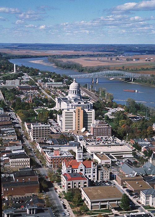
While the city is on the small side, the capitol building is not. It is built on a bluff on the south side of the Missouri River. Lewis and Clark paddled past this very spot on their 1804-1806 Corps of Discovery Expedition. Of course, none of these buildings were here.

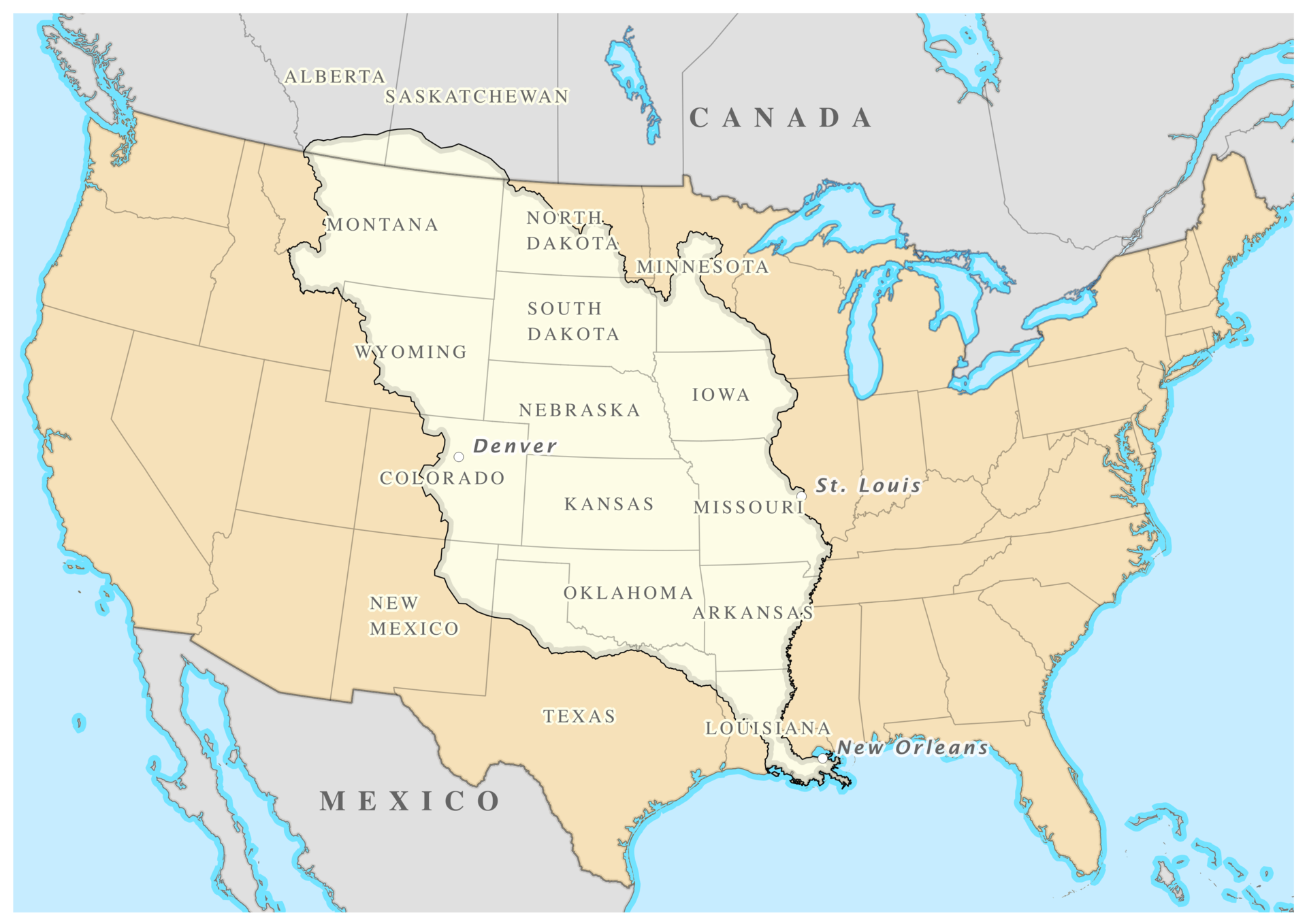
I was tempted to say that Missouri wasn’t even part of the United States at that time, but it was acquired from the French in 1803 as part of the Louisiana Purchase. The USA paid the French fifteen million dollars, or approximately $18 per square mile. That works out to about three cents an acre. They acquired a total of 530,000,000 acres – or about 830,000 square miles.

The Missouri Territory was organized in 1812. St. Louis, on the Mississippi River, was the seat of government. St. Charles, located on the Missouri River, became the second seat of government. Jefferson City was chosen as the new capital in 1821. The village was first called “Lohman’s Landing.” When the legislature decided to relocate there, they proposed changing the name to “Missouriopolis.”

I don’t know about you, but I prefer the name Jefferson City.

The settlement was incorporated as a city in 1825 and the Missouri legislature met there for the first time a year later.

I spent a lot of time trying to figure out how to present this capitol building. The building itself is mammoth, but it is filled with the more amazing works of art that I have seen in most state capitols. So, I have decided to break this up in to two posts. The first one will focus mainly on the building. If you’re not so much into the building, the post with the artwork should be along in a few days.

If you are not a fan of my state capitol posts, well, something else will be along in a eventually.

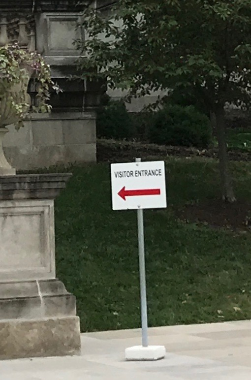
It was still a soggy day when I got up, but not quite as bad as what I had driven through the day before. I got myself ready and headed to the Capitol Building. I parked and found a sign directing me to the visitor’s entrance.

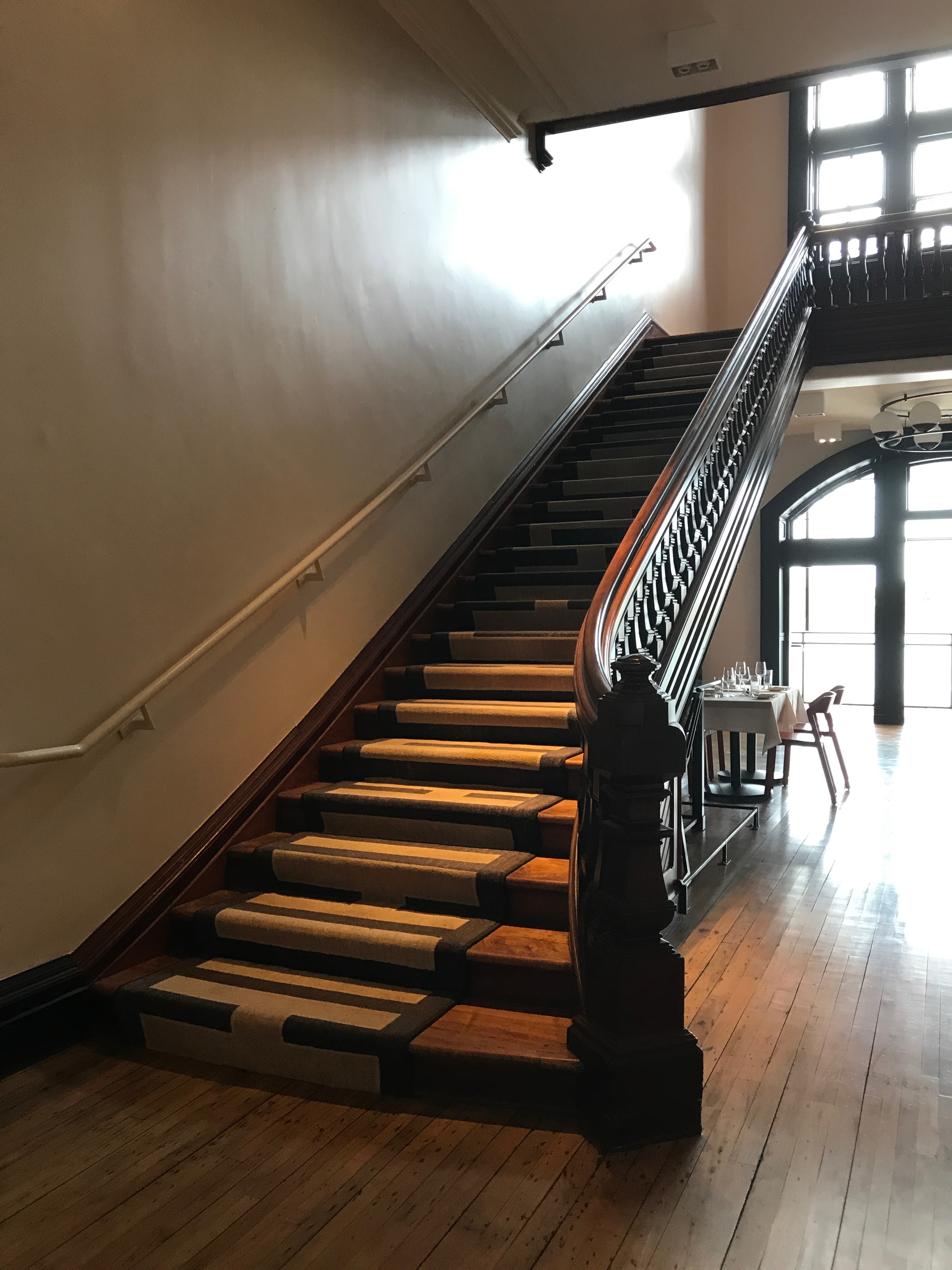
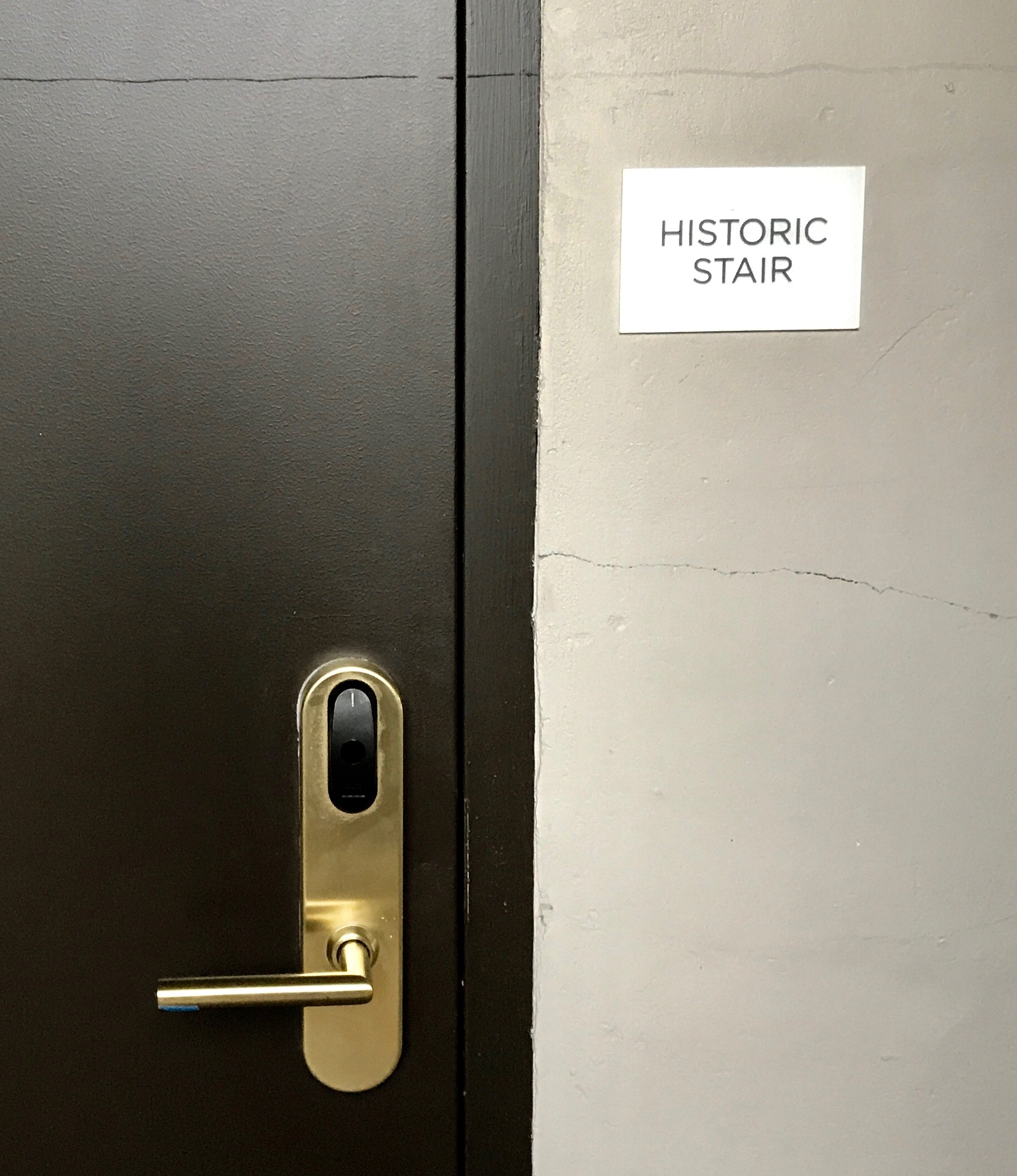
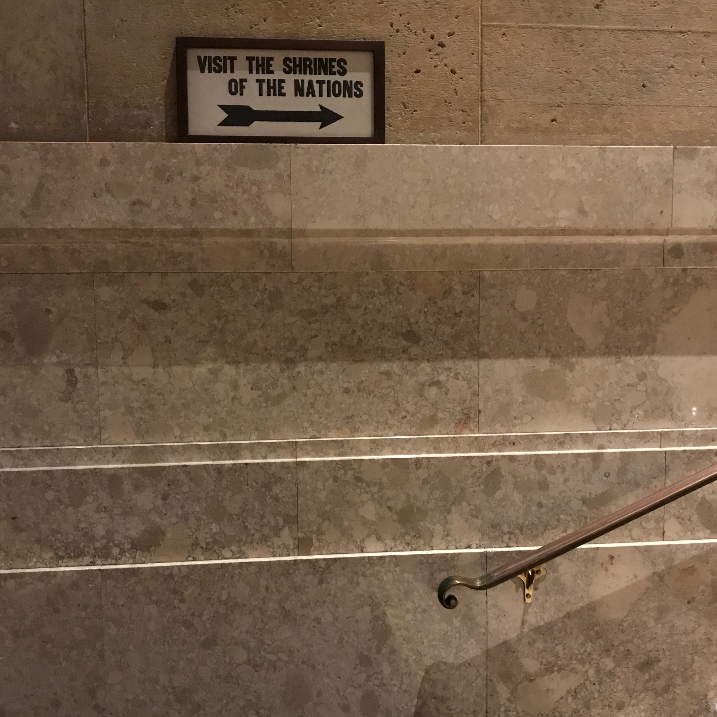
I started climbing. At one landing, there was an entrance. It wasn’t my entrance, however.

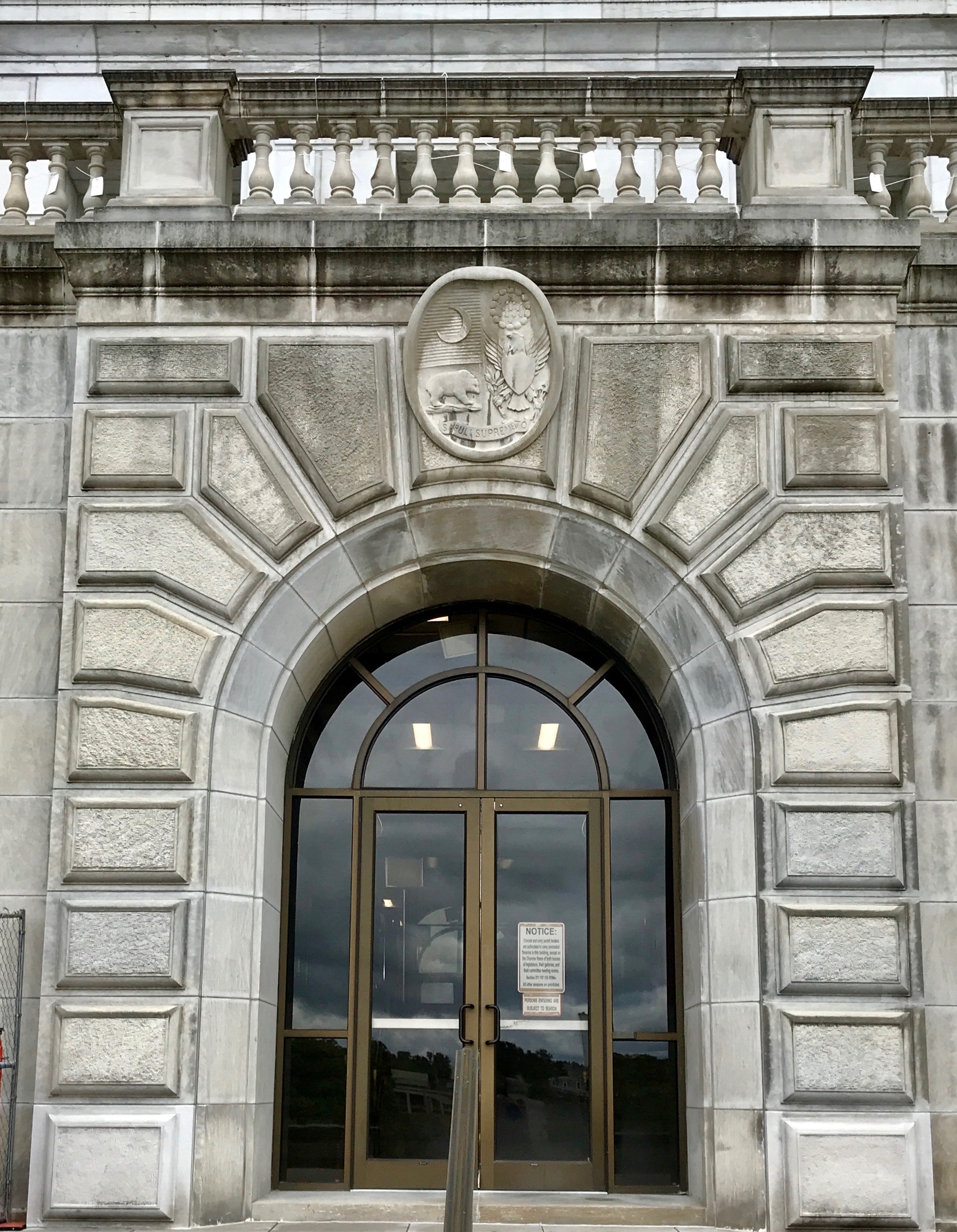
Of course, I had to go up and read the signs on the door.

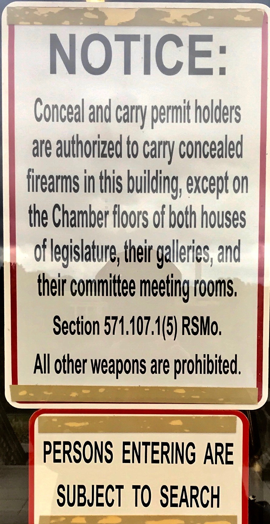
And, if you wanted to know what the signs said, now you do. I continued on up the stairs.

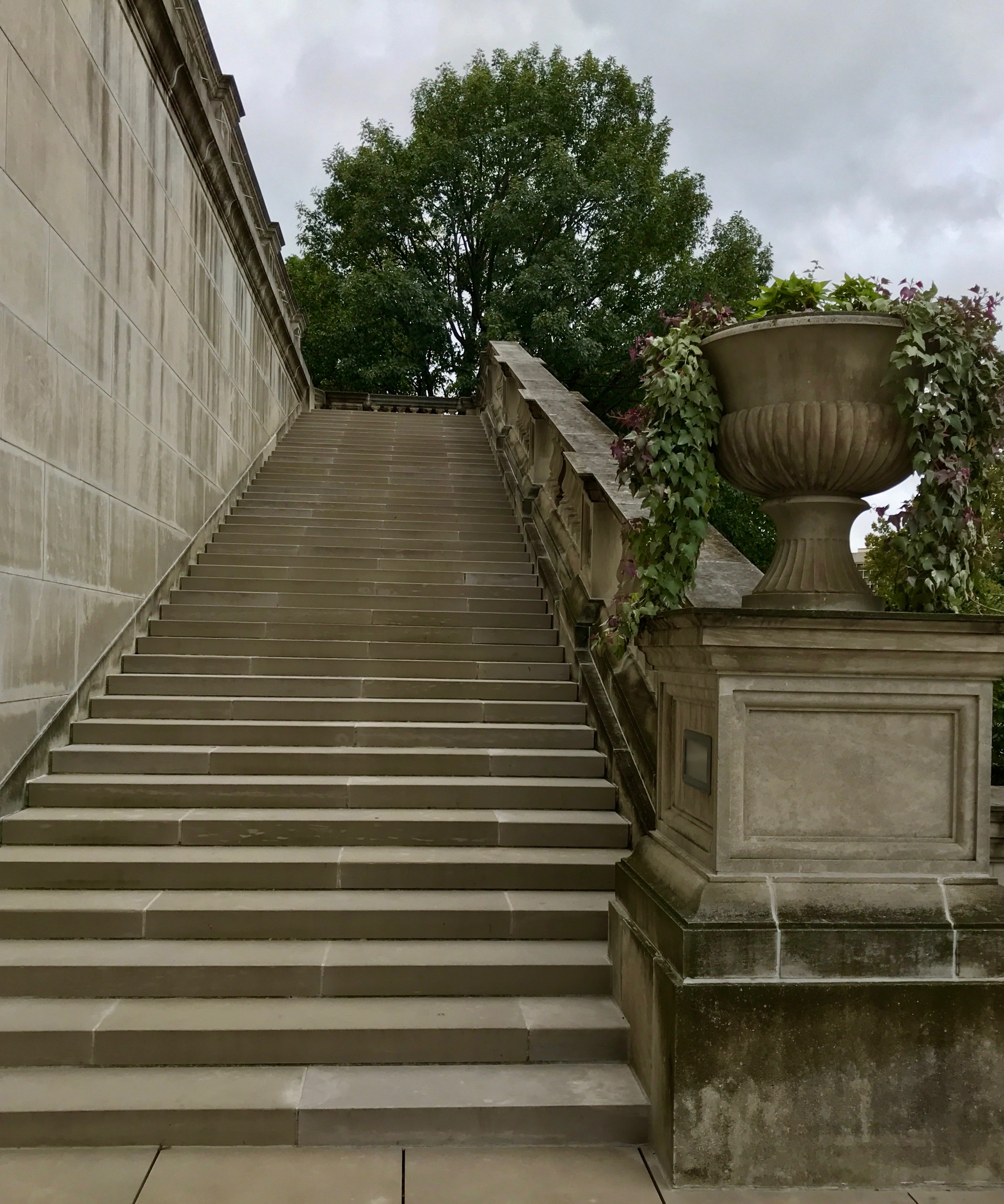
I wish I had been counting the number of stairs! They seemed to go on for ever.

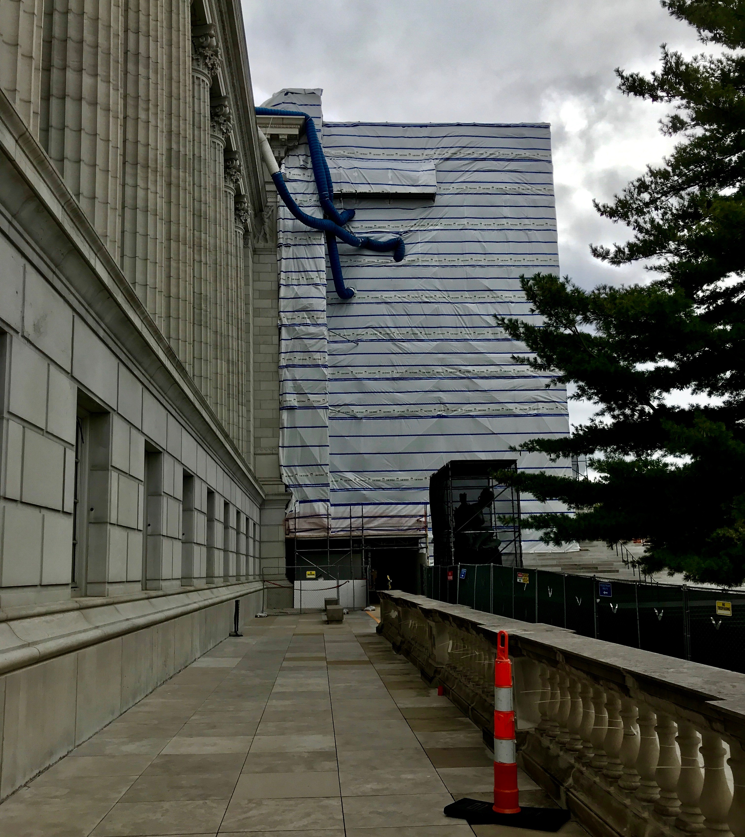
I followed the arrows around to the visitor’s entrance. I guess they must be doing some renovations. It kind of reminds me of one of Christo’s wrapped buildings.

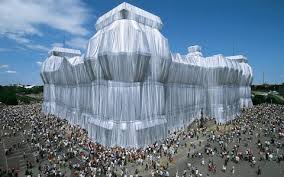
Here’s a photo of the Reichstad in Berlin in 1995.

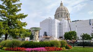
You can see the similarities, although Christo’s wrapping was only up for fourteen days. I wonder how long the wrapping on the capitol will be up? Incidentally, while Christo didn’t wrap the Reichstad until 1995, I first heard about it in art history class with Sister Jeanne when I was in college. Christo started planning that temporary work of art in the sevenities.

Thank you, Sister Jeanne!

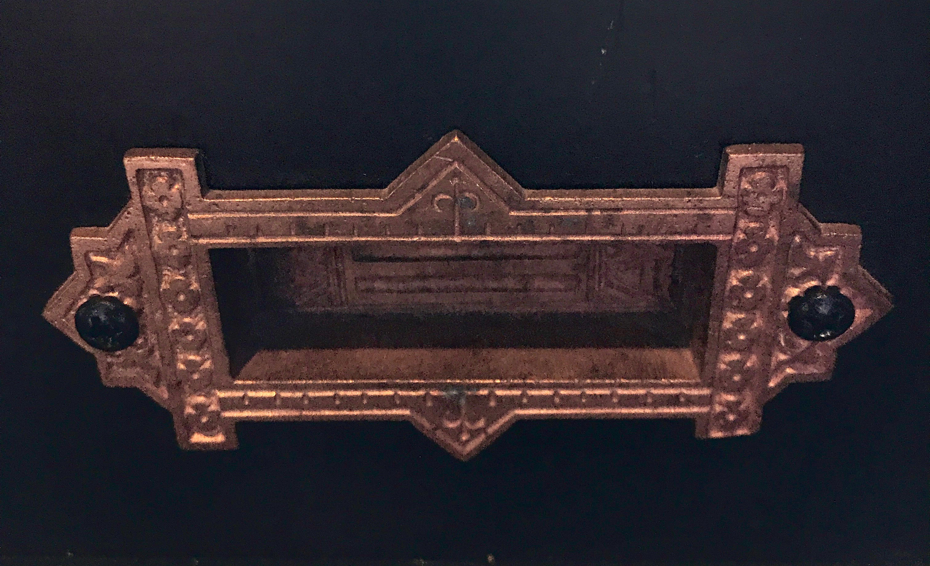
Anyway, I entered the building and looked around for a restroom. The tour wasn’t going to start for a bit, and I figured that I might as well make myself comfortable.

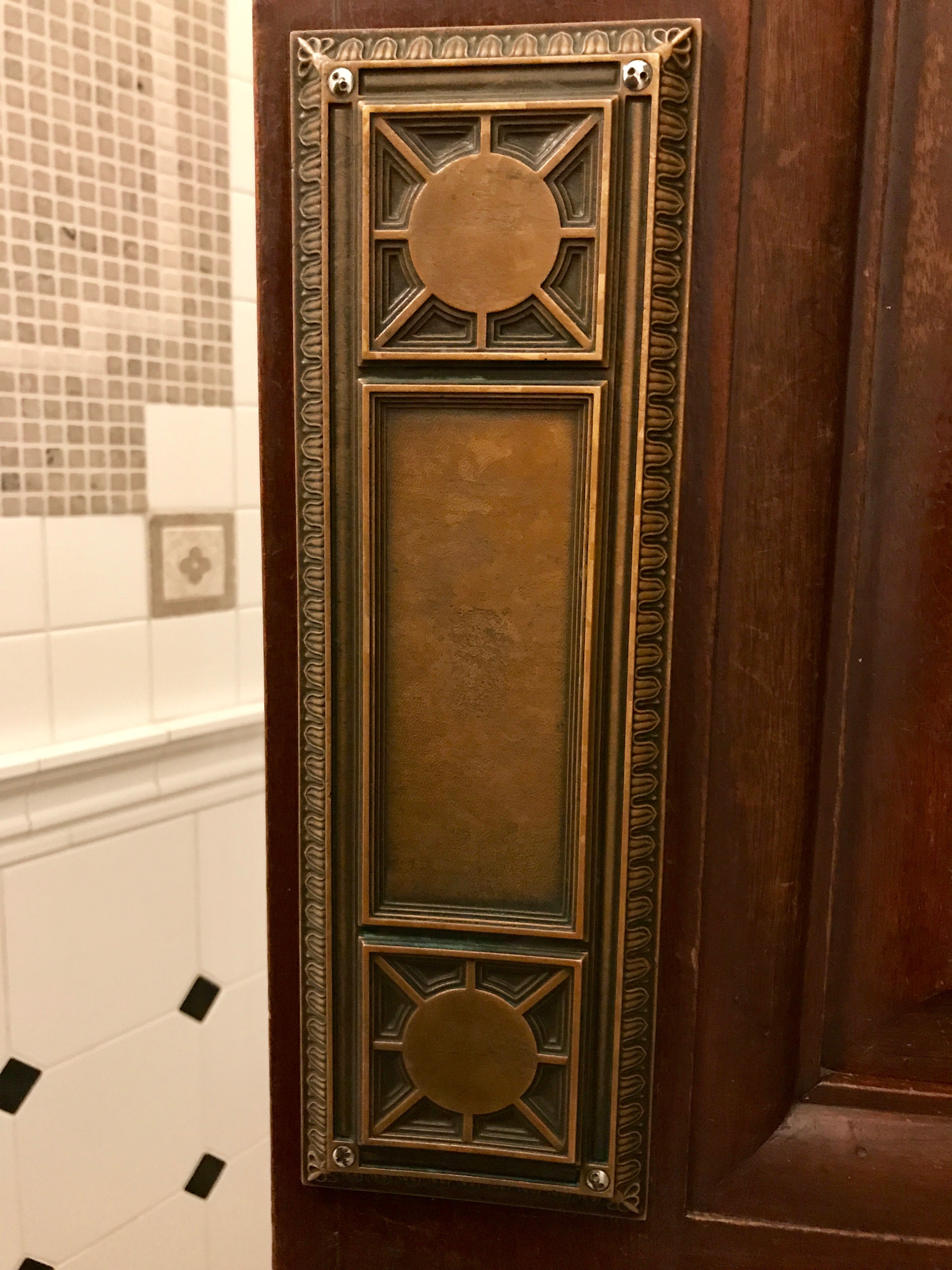
The push plate on the door was quite lovely.

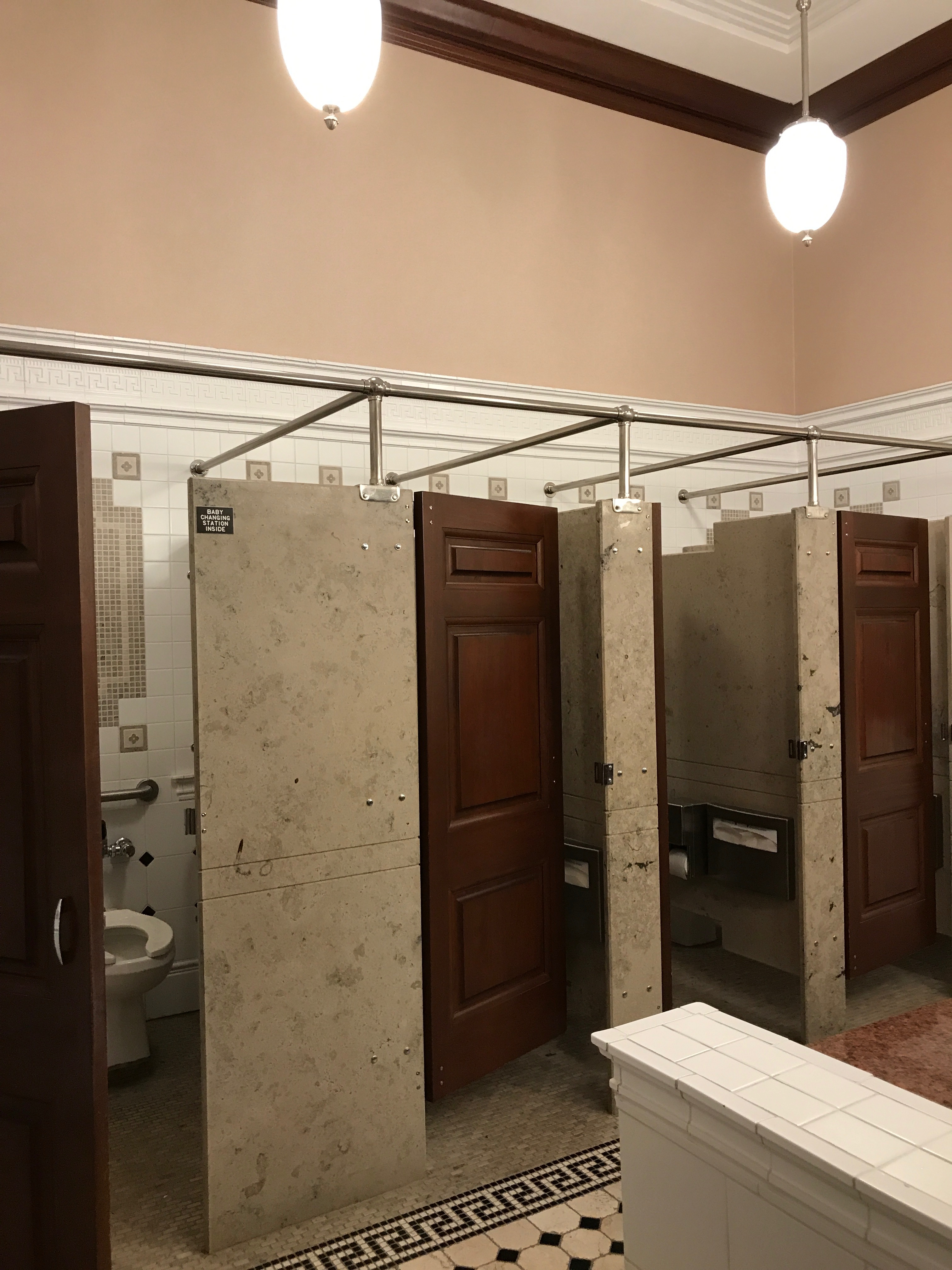
The restroom was also elegantly appointed with marble and tile work.

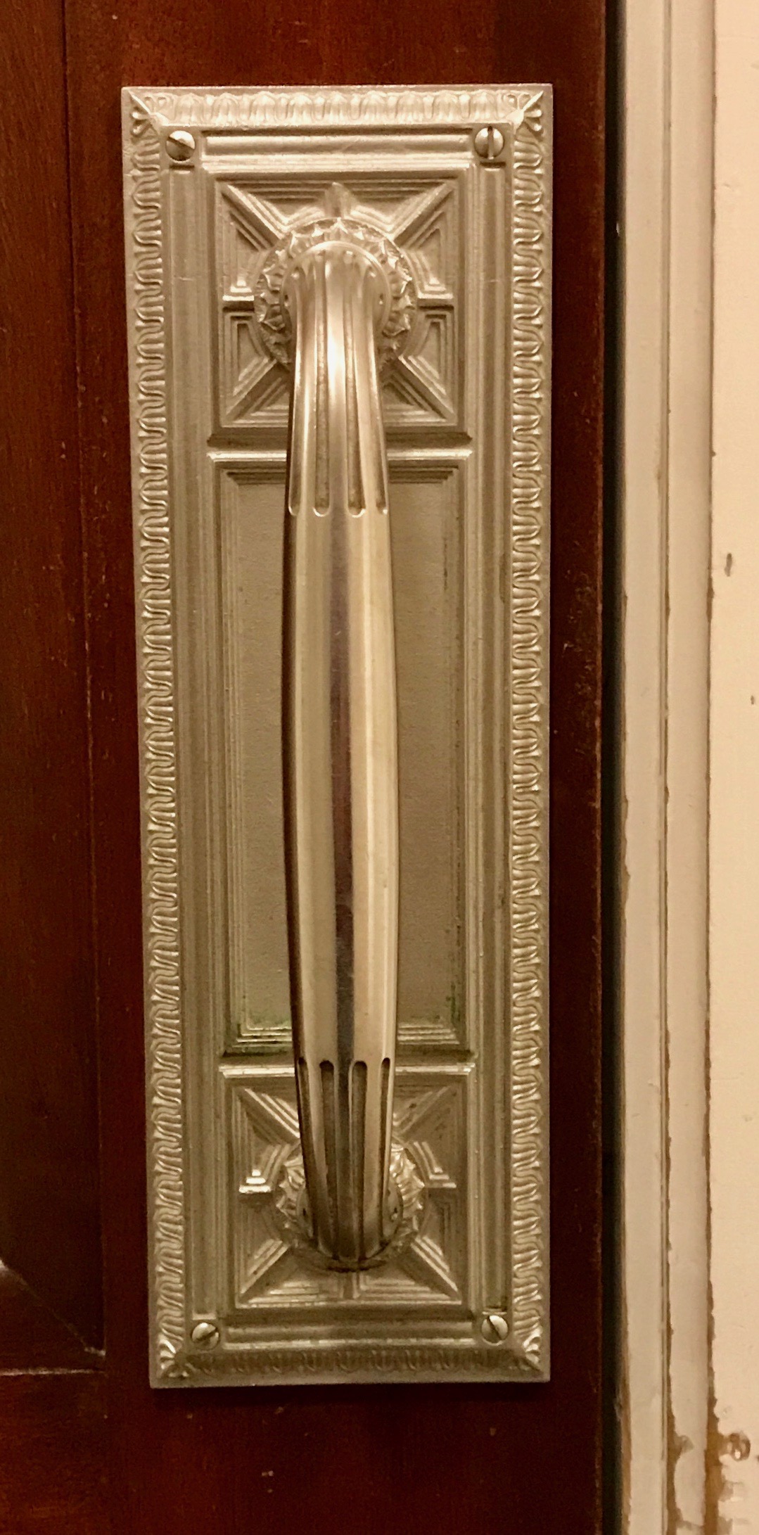
As I left, I was struck by the quality of the pull plate. At this point, I was starting to think that this building might really be something out of the ordinary.

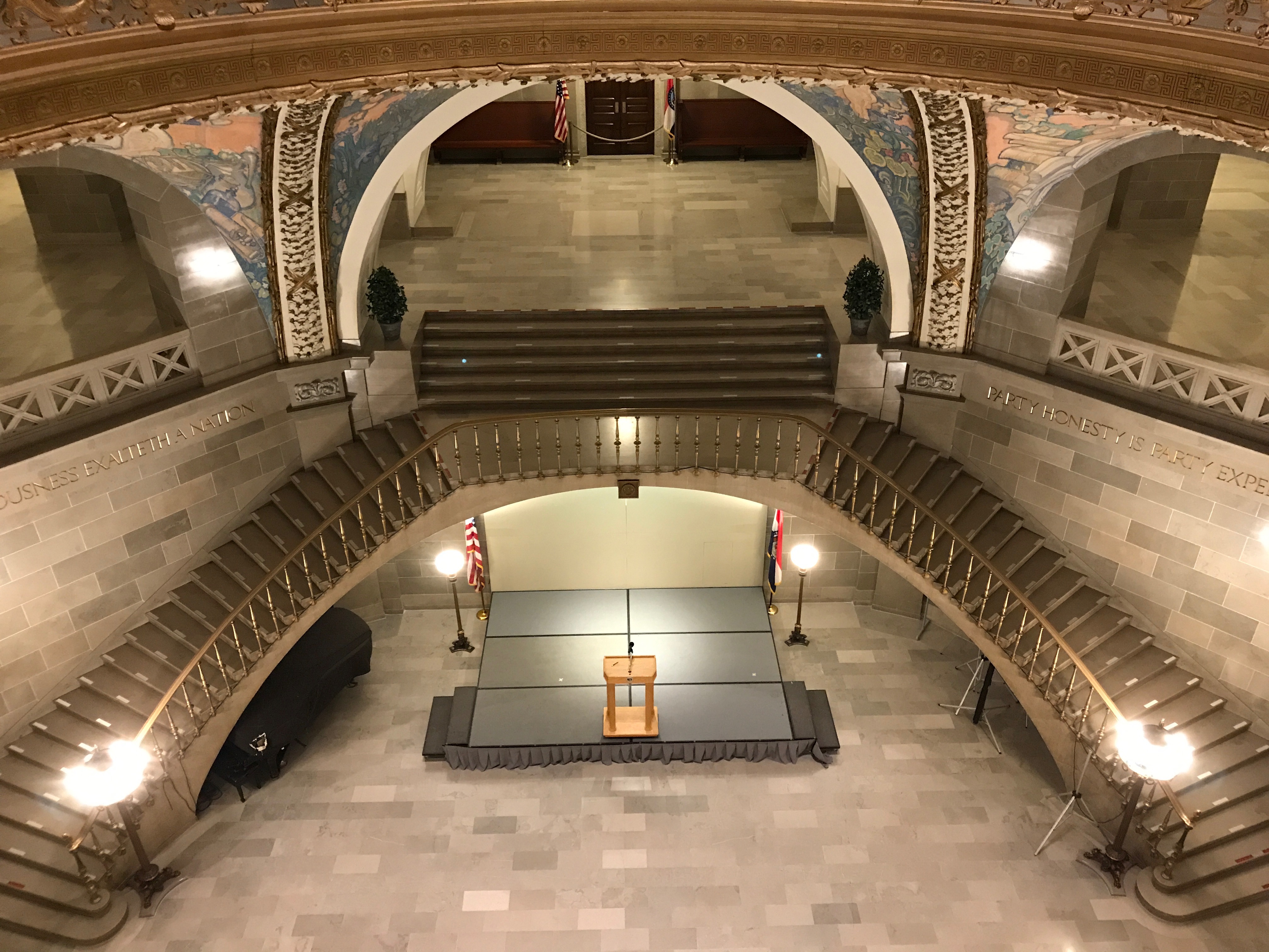
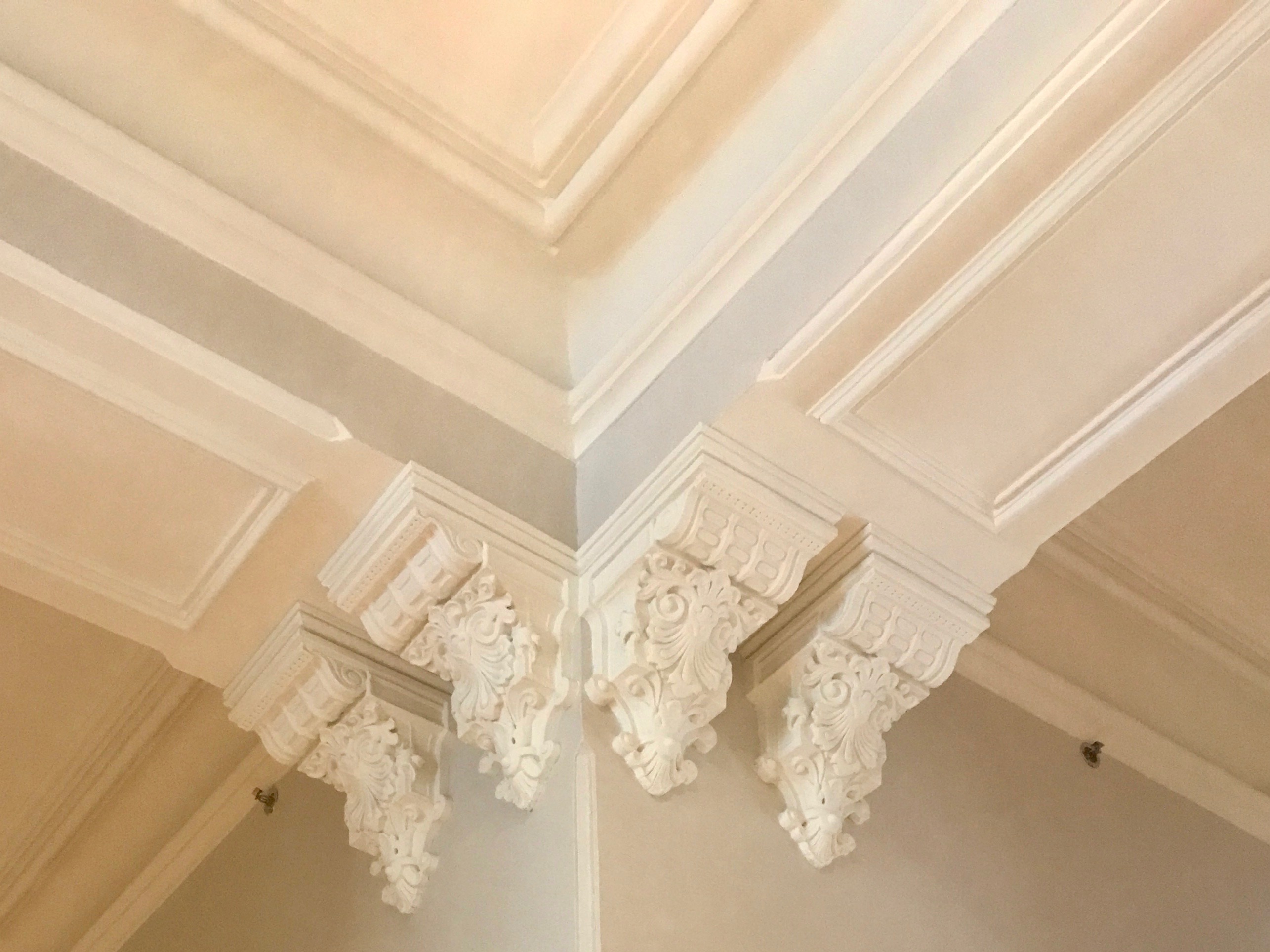
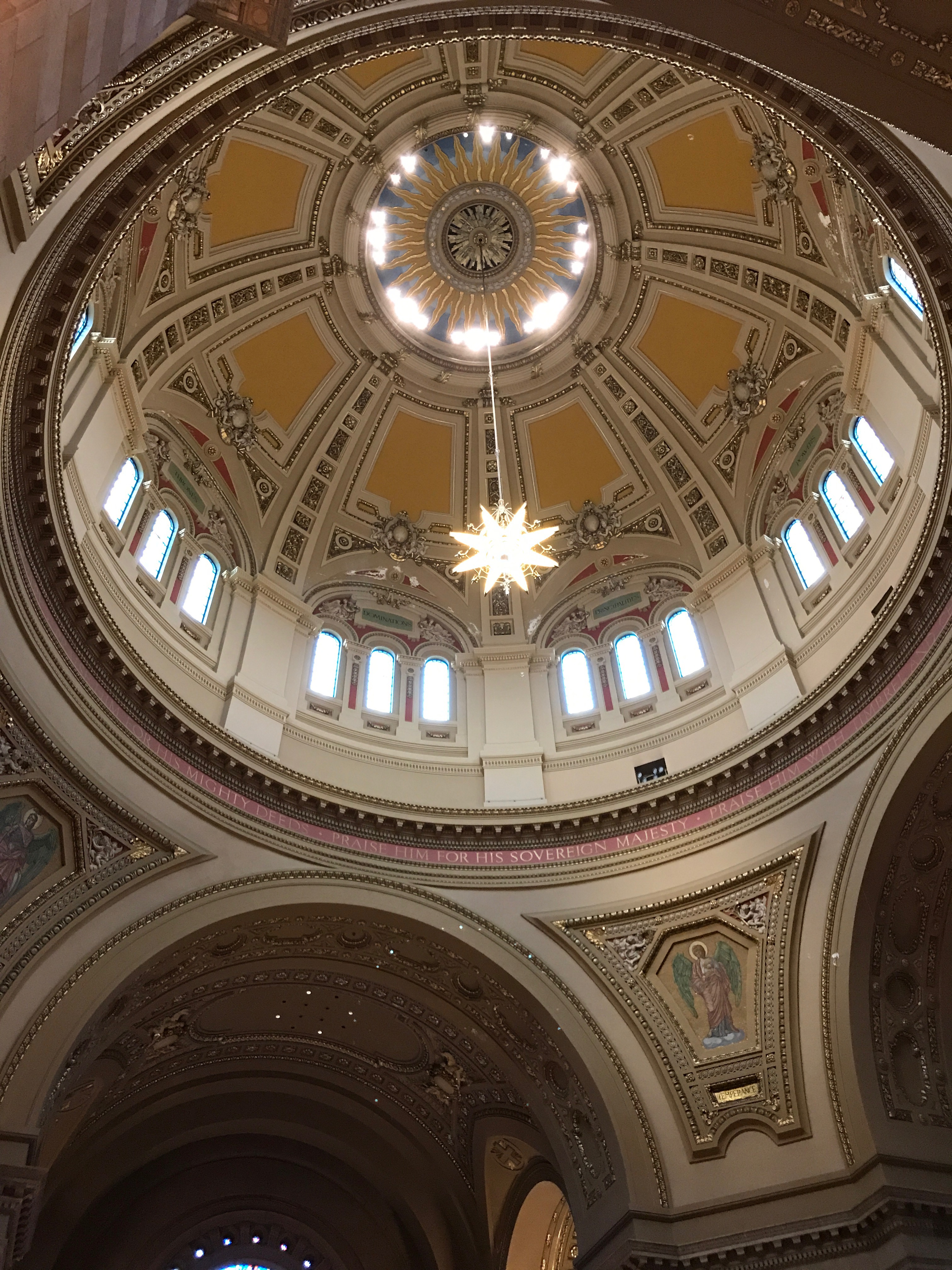
Oh, my! I do believe this building is designed to be inspirational as well as elegant.

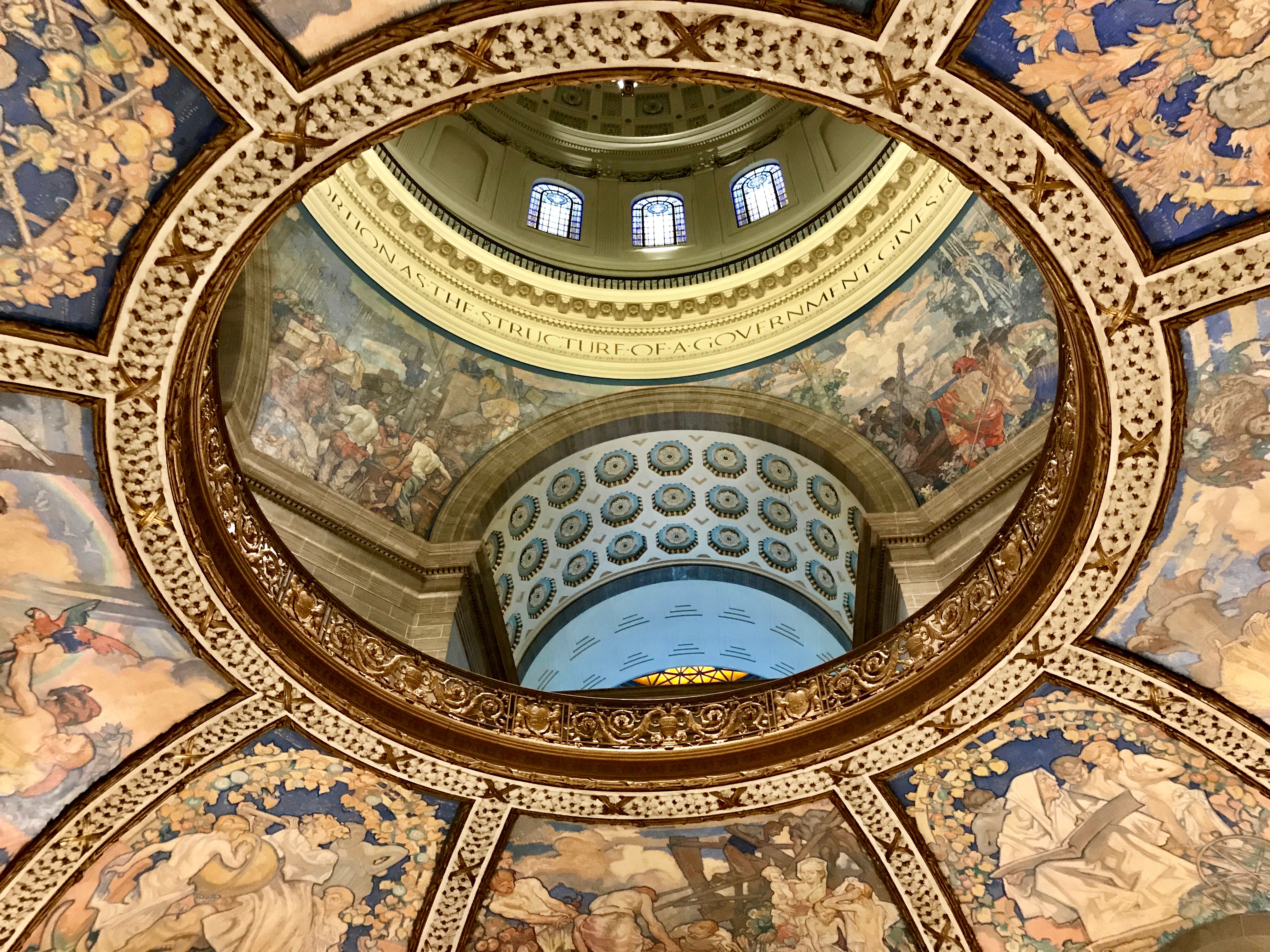
This is one of the views looking up into the dome.

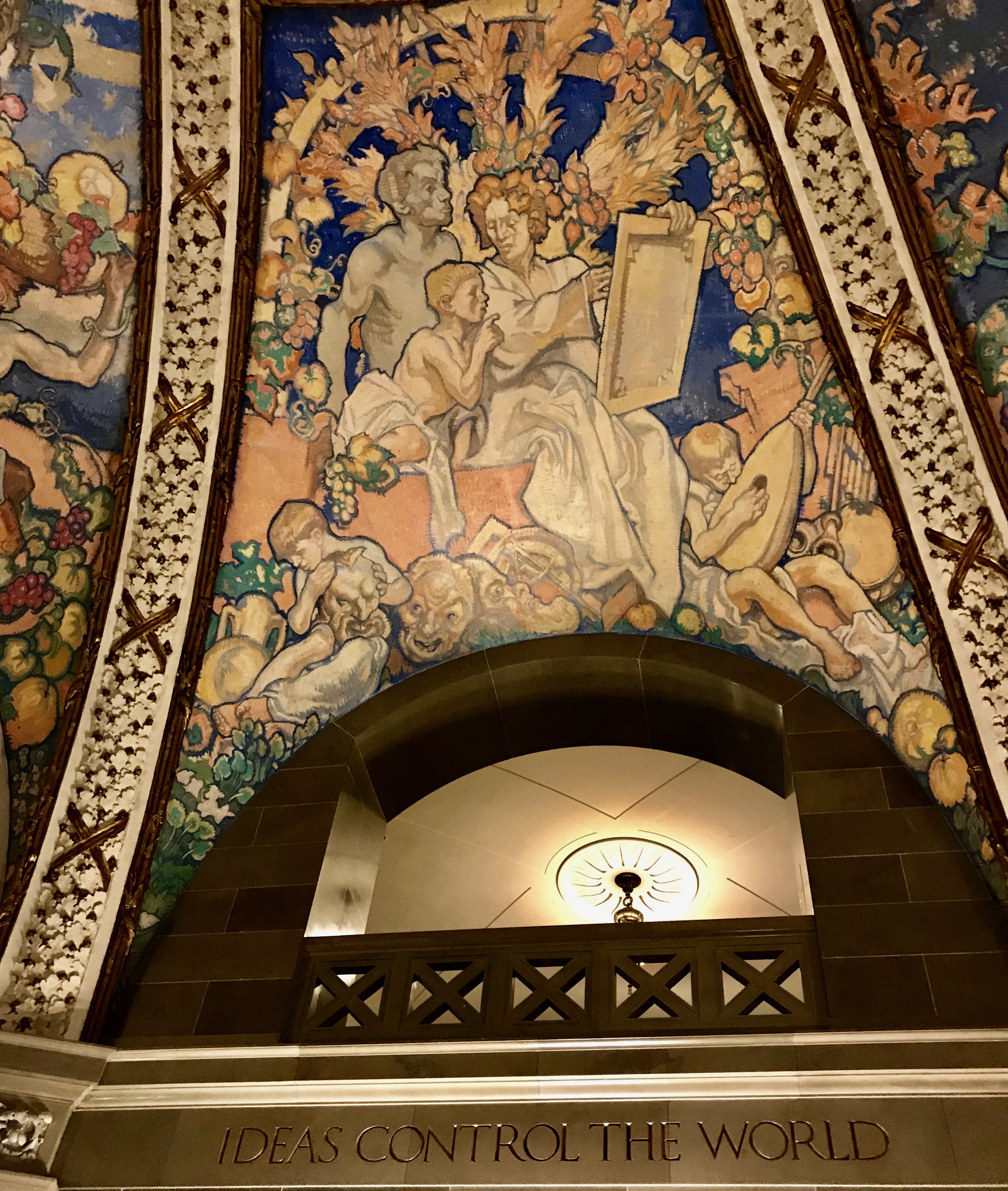
All the areas of the dome are covered with artwork and inscriptions designed to inspire. I particularly liked with panel. I think of it as a pro-education, pro-teacher segment. But, even if it is just “pro-get-a-clue,” I like it.

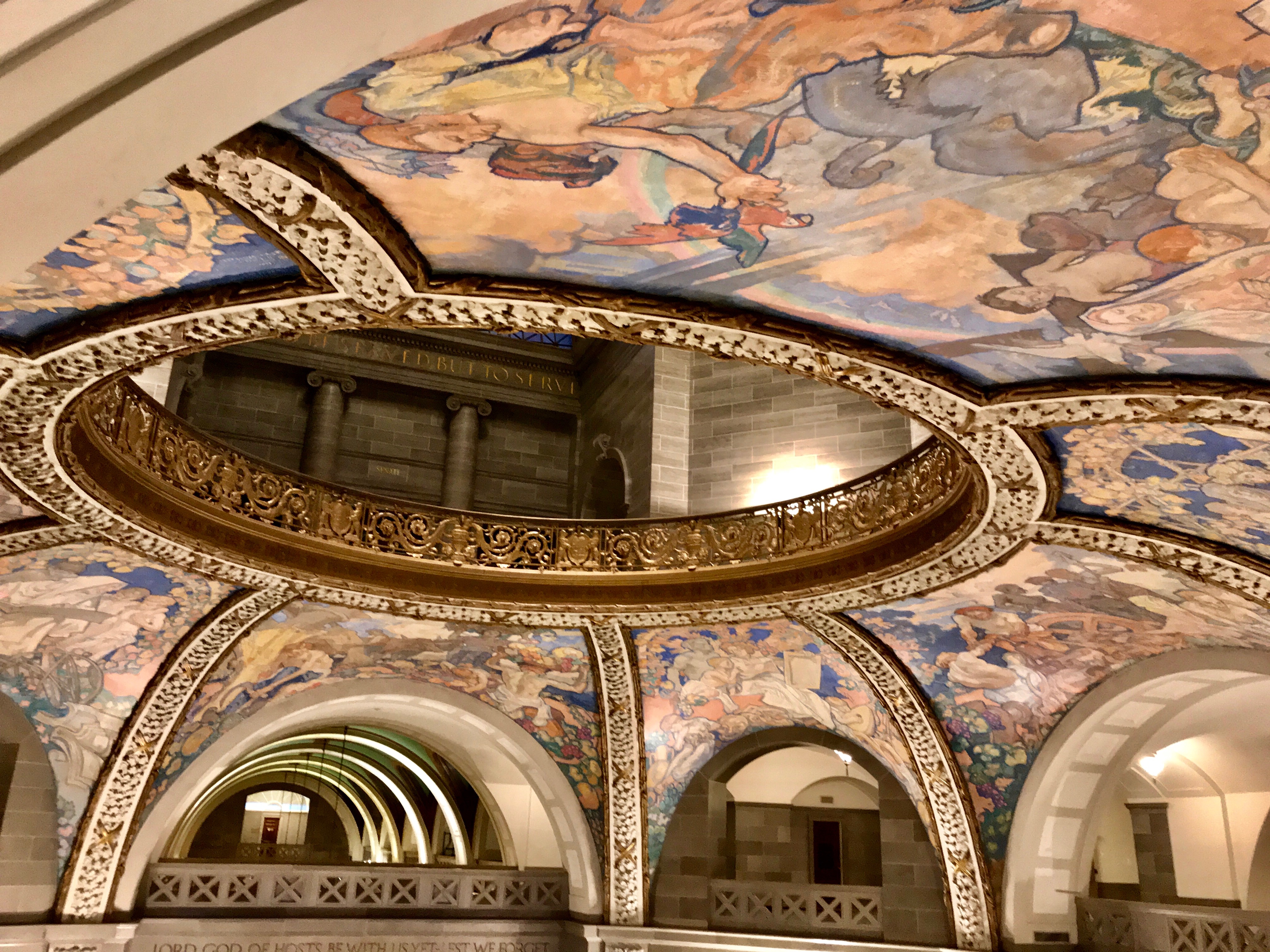
The views change depending on which floor you are standing on and where exactly you are standing.

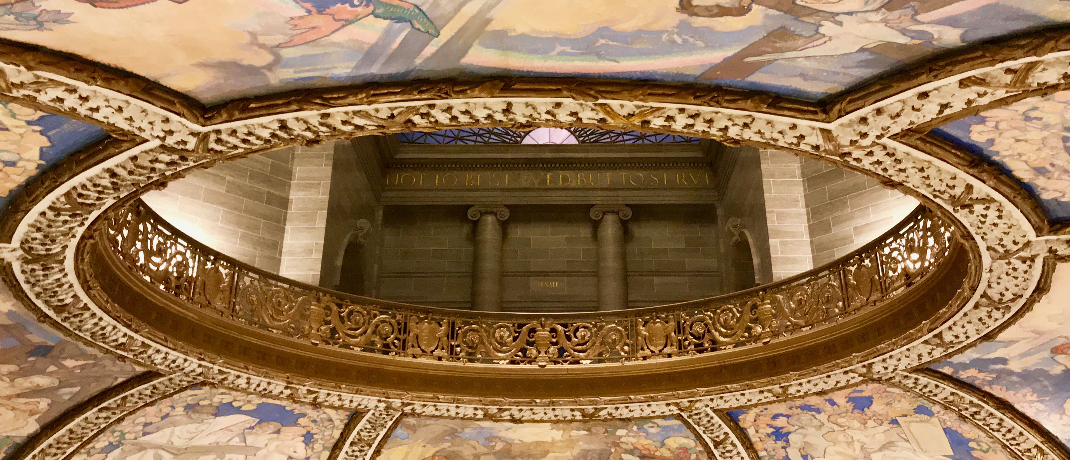
These are noble words, as well. In case you can’t read the inscription seen through the circle, it says, “Not to be served but to serve.” I hope that is over the entrance to one of the legislative chambers – and I hope they look up and read it from time to time. Maybe they could even think about it. (Incidentally, this is not a critique of the Missouri legislators. I am not familiar with the workings of Missouri politics.)

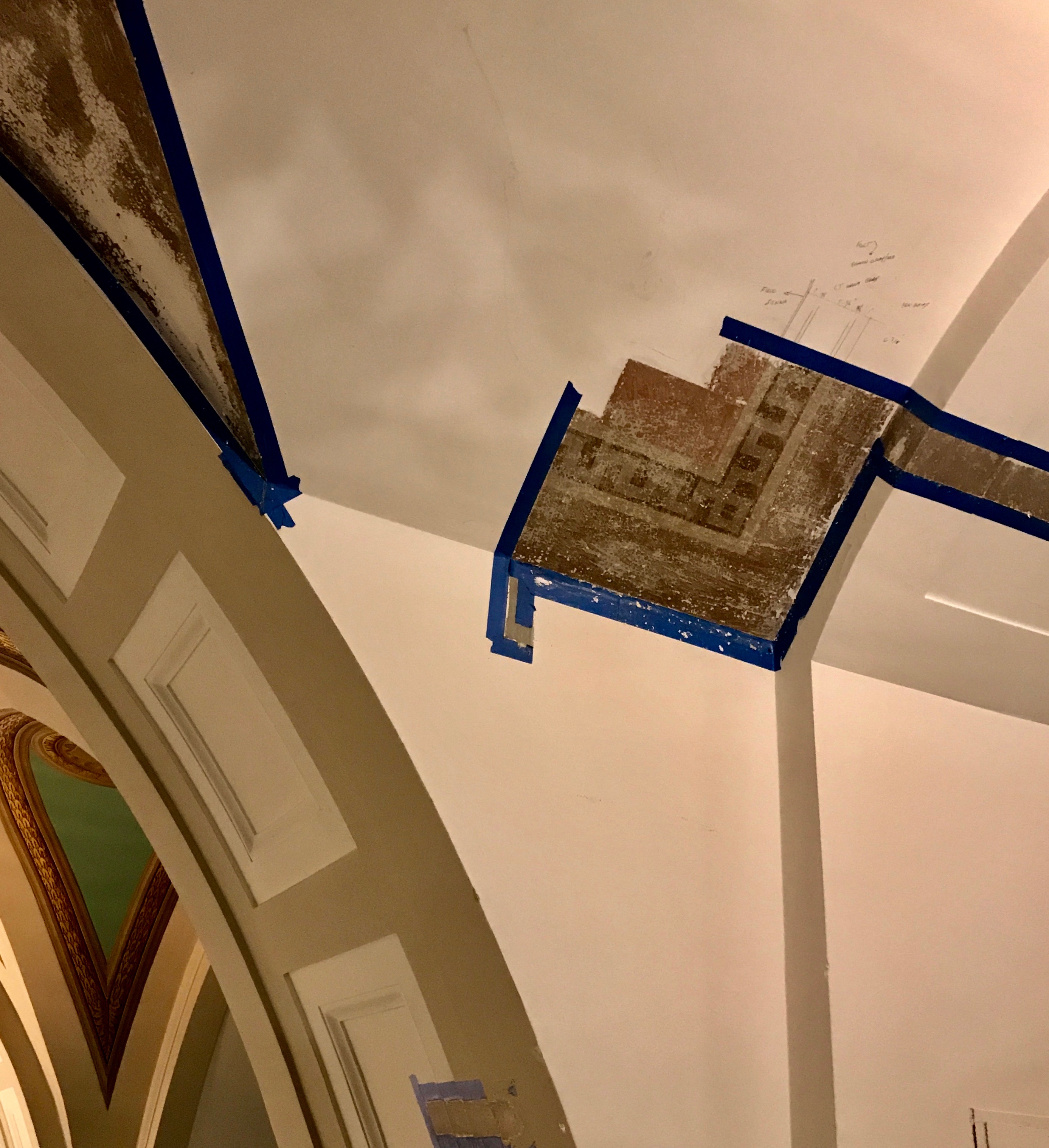
This is a building under renovation. This is the third building to serve as the capitol in Jefferson City. It was completed in 1917. You can see a remnant of some of the original paint in this fragment.

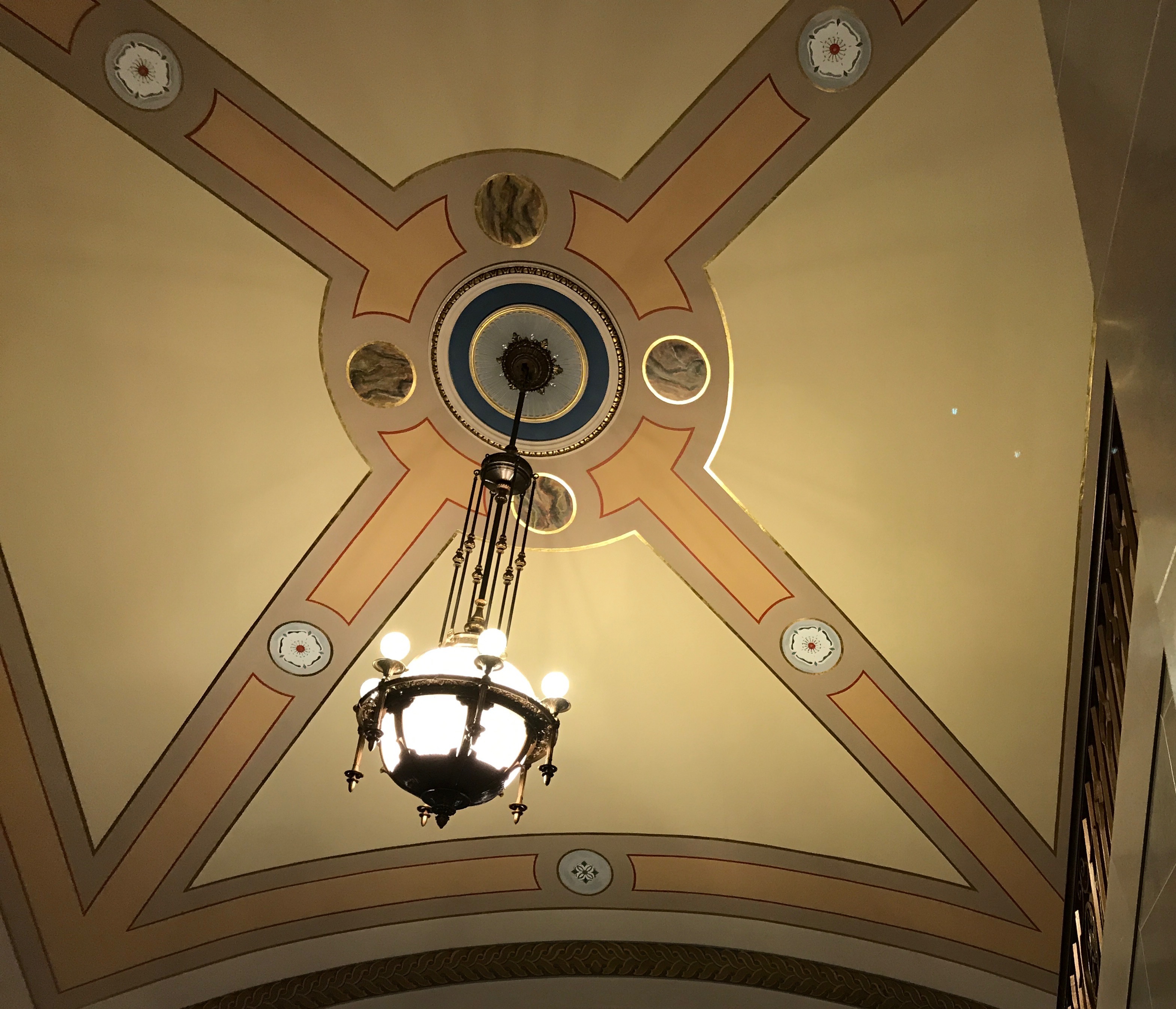
The colors and the sensibilities have been used in some of the restorations that are already complete. This was in the area that visitors pass through when they enter.

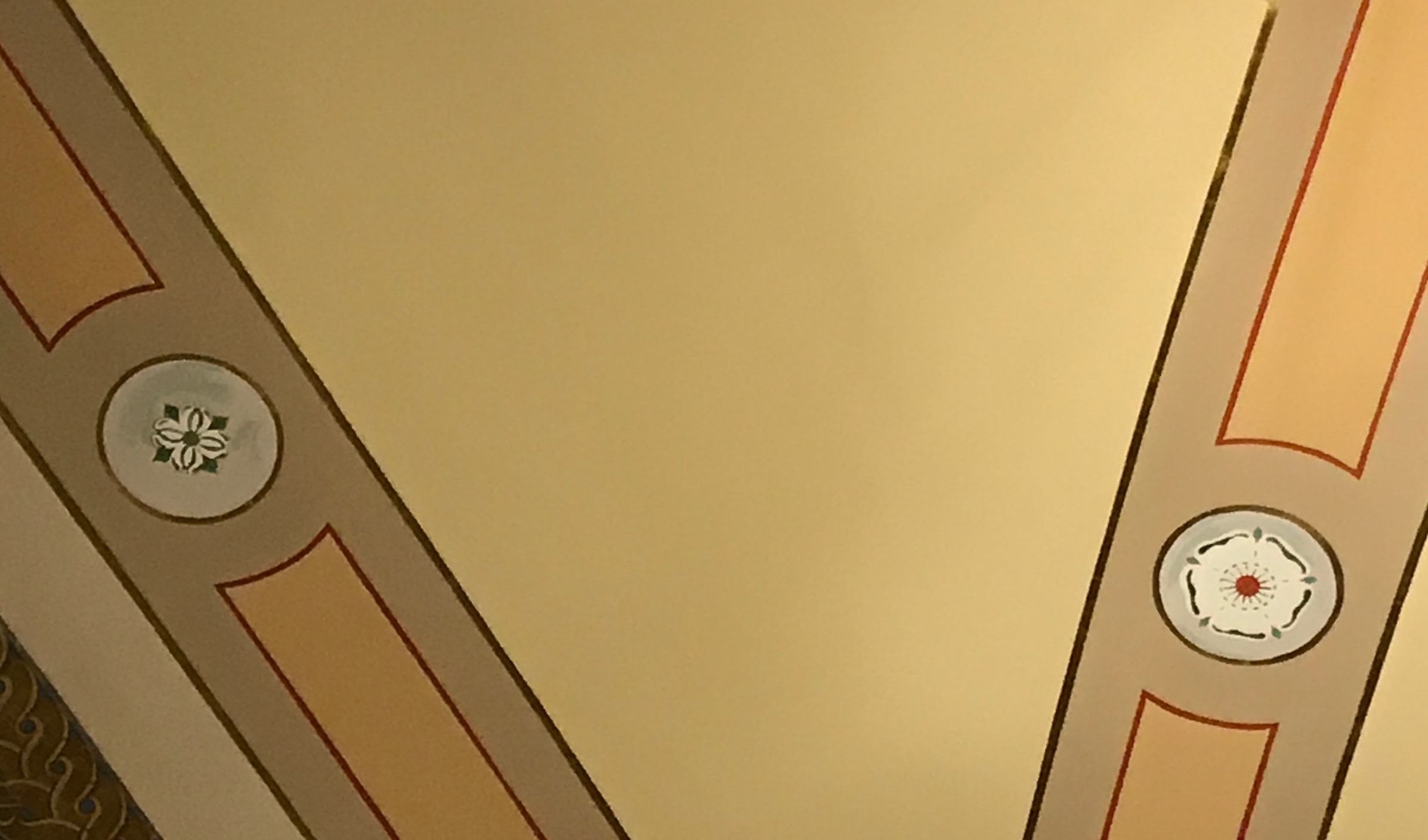
Incidentally, the state flower and the state tree are included in the designs. The state flower is Crataegus punctata, which is a kind of hawthorn. The state tree is the Cornus florida, or the flowering dogwood.

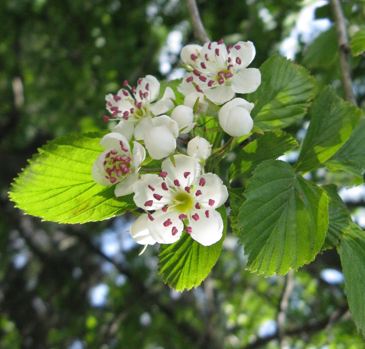
This is the state flower, which looks almost like a tree.

This is the flowering dogwood, which is a tree.

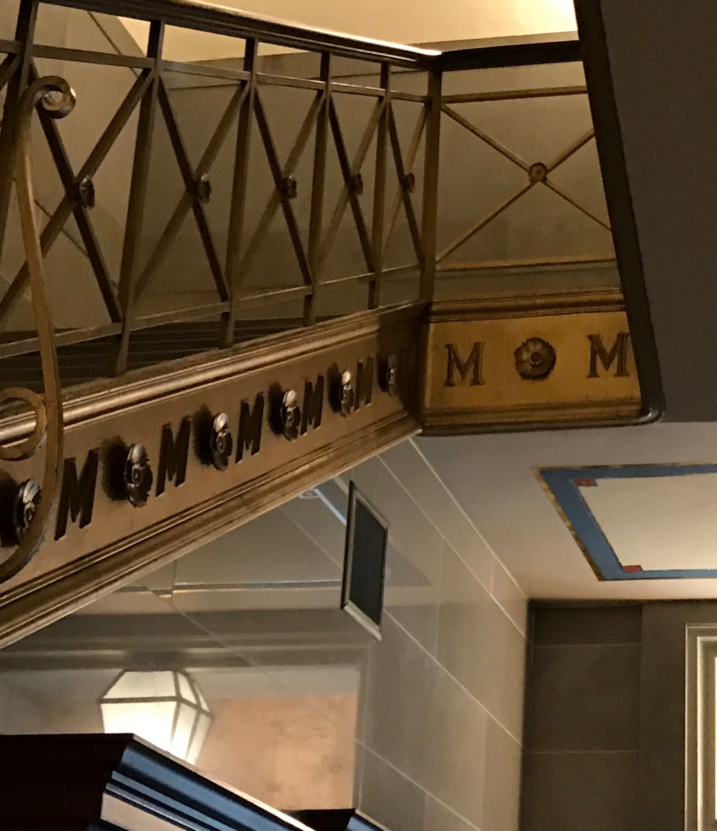
This stairway in the same area had the hawthorn as a repeating motif.

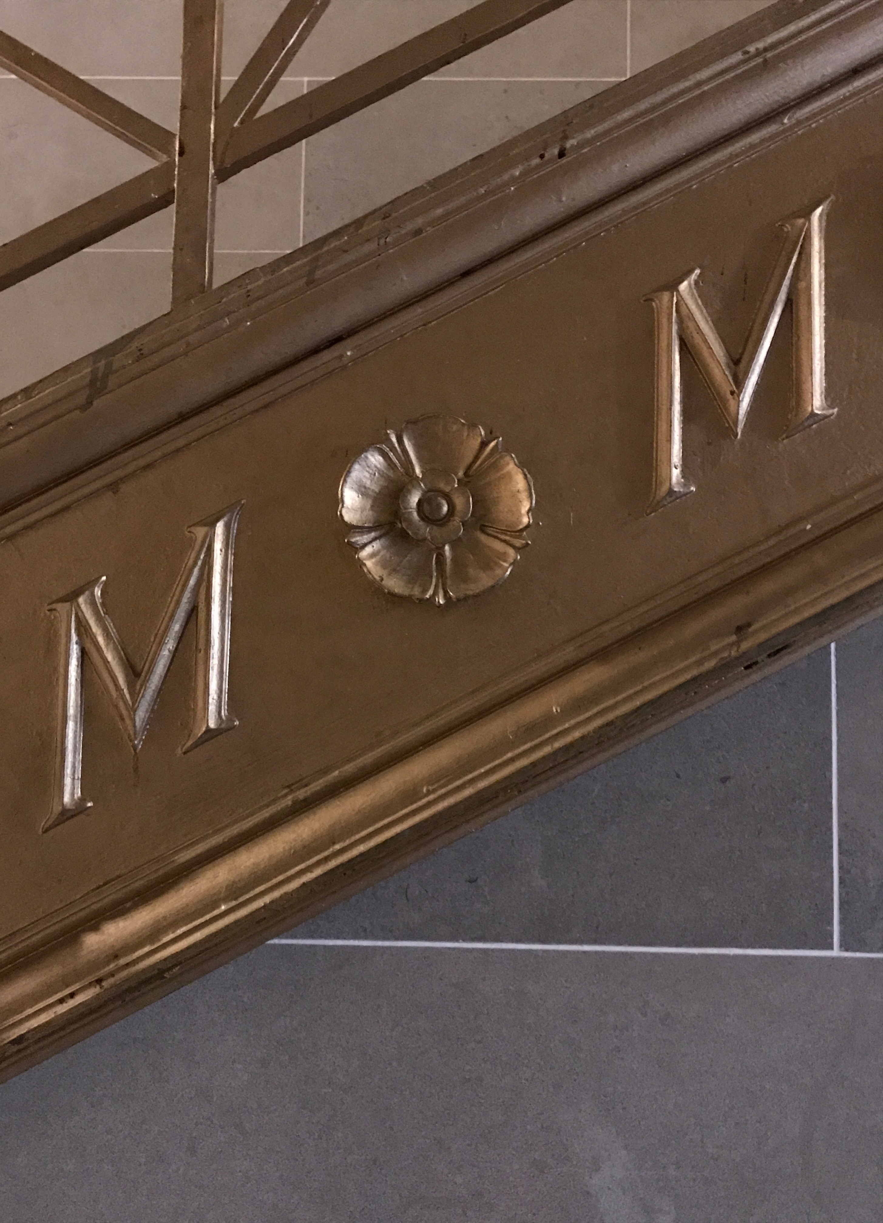
It also tickled me the way it looked like it spelled out “MOM.”

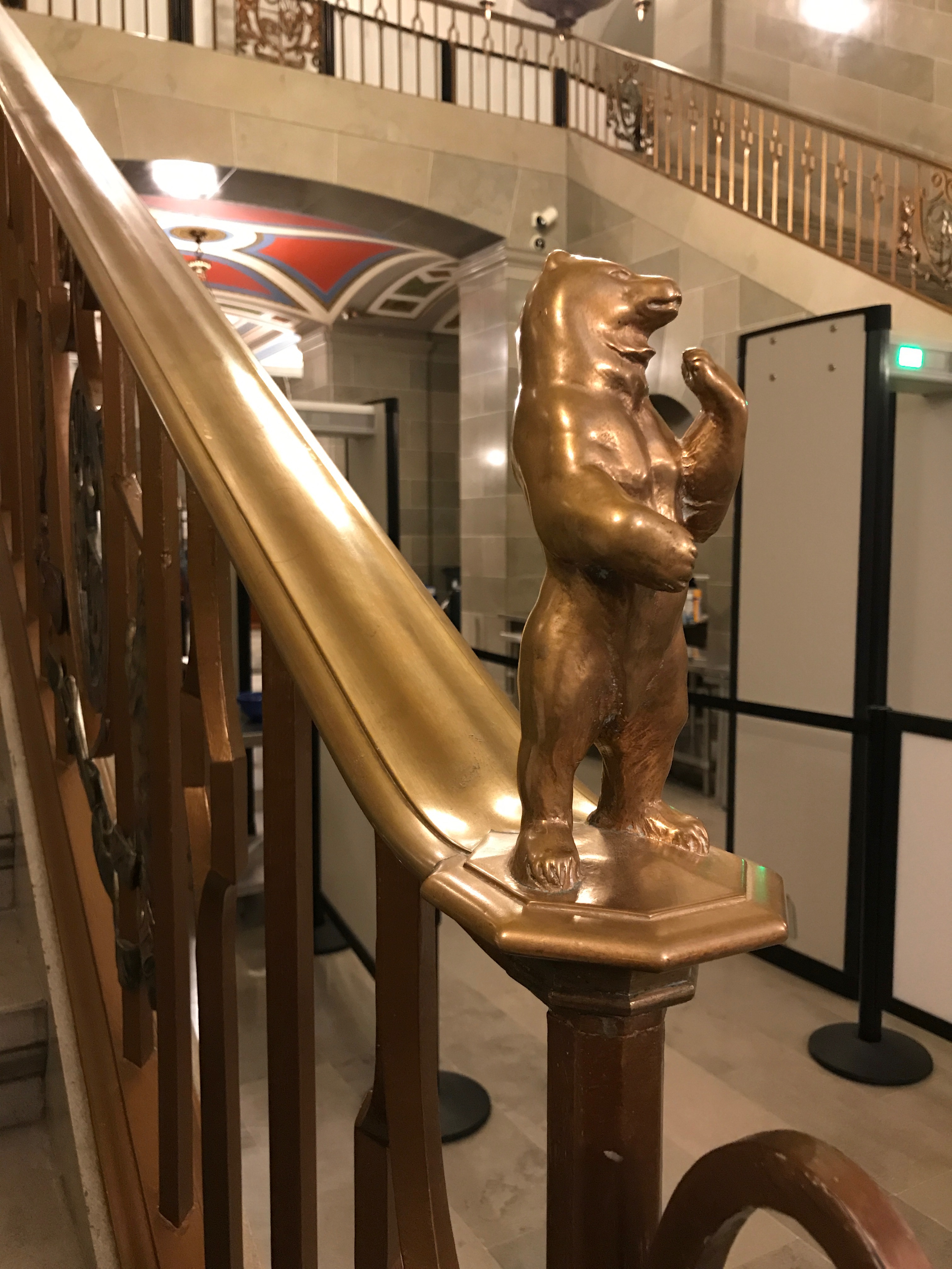
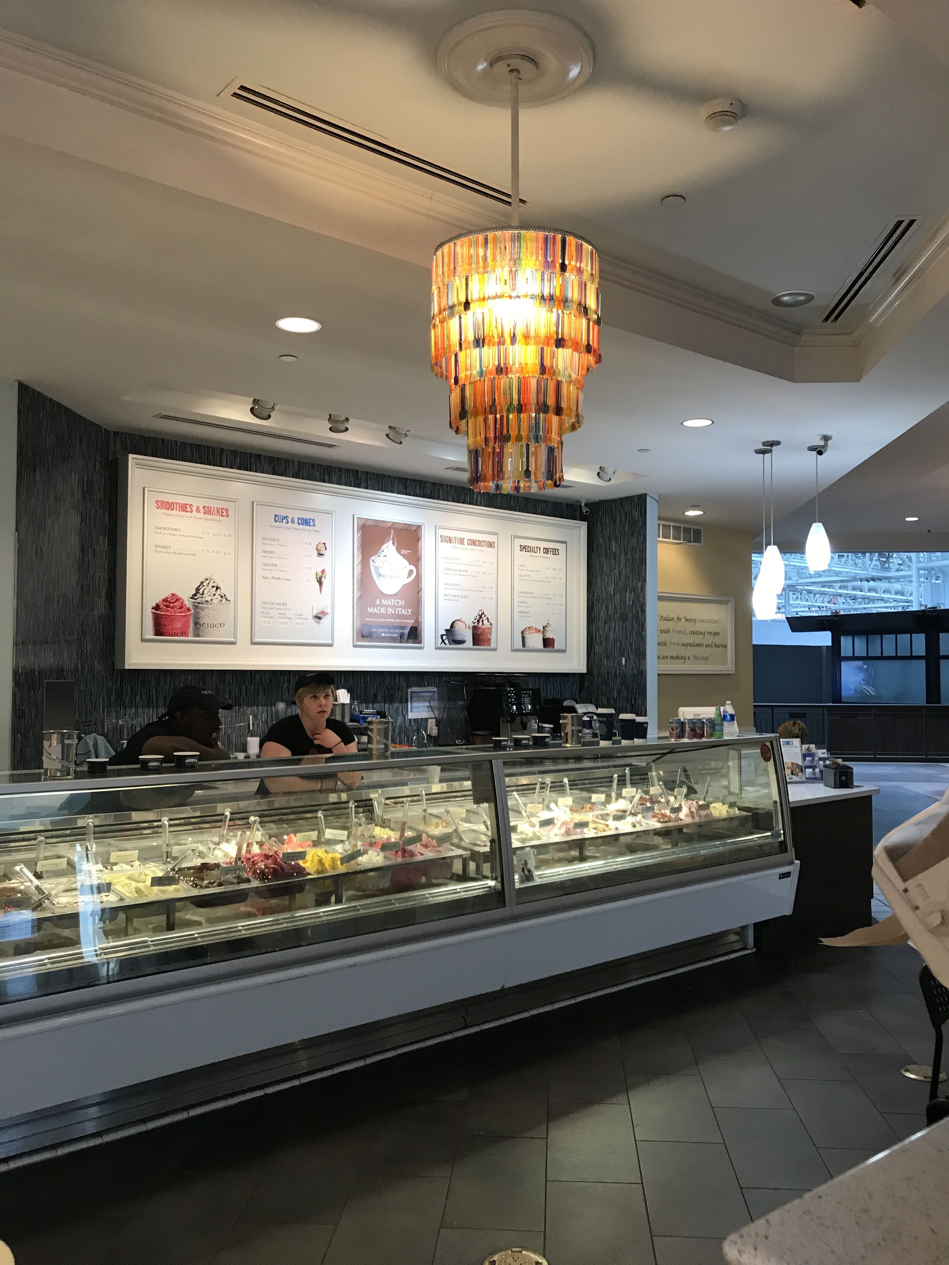
Incidentally, at the end of the balustrade, was this amazing finial. I figured that the bear must be the state animal. I asked our guide if it was, but, no, it turns out that the state animal is the mule. Incidentally, the state bird is the bluebird, the state dessert is the ice cream cone and the state dance is the square dance. The factoids you can find if you look!

You might be wondering why the ice cream cone is Missouri’s state dessert. I had an idea about that, so I did a little research. According to my Preferred Source, the ice cram cone became mainstream in the USA at the St. Louis World’s Fair in 1904. Arnold Fornachou ran out of the paper cups he was using to serve the ice cream he was selling. Next door to him as a waffle vendor named Ernest Hamwi. He sold Arnold some of his waffles. Arnold rolled the waffles into cones to hold the ice cream. The rest is history.

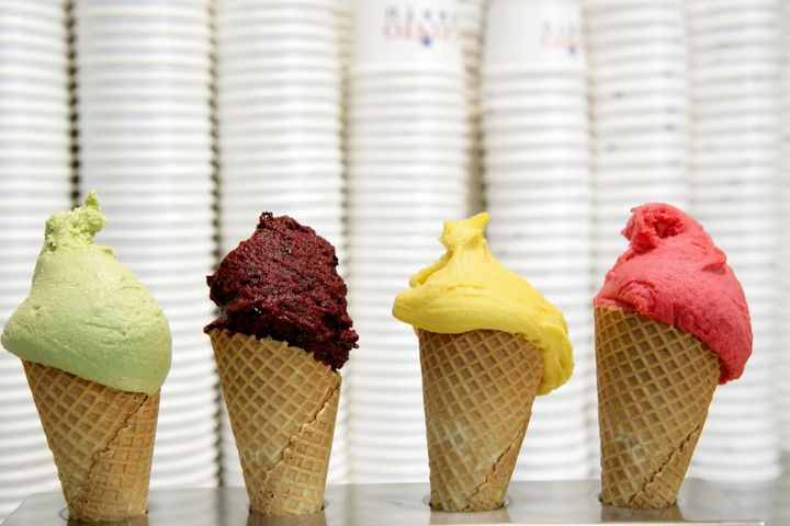
And mighty delicious history, at that!

Speaking of our guide, he spent a lot of the tour talking about the artwork. Really, this building is so rich in art, that it’s hard to separate the art from the building. You do notice that I haven’t completely avoided the art. The reason that there is so much art in the building is that they ended up with too much money.

The original budget allotted $3 million for the building and and additional $500,000 allocated for the site and furnishings. The state miscalculated on the revenue projections and ended up collecting $4,215,000.  I whipped out my calculator, and figured that they collected $715,000 more than they thought they would need. If I remember correctly what the guide told us, by law they could only spend the money they raised on the capitol. That is why there is so much artwork and why it is of such high calibre. I will talk more about the artwork in the next post.

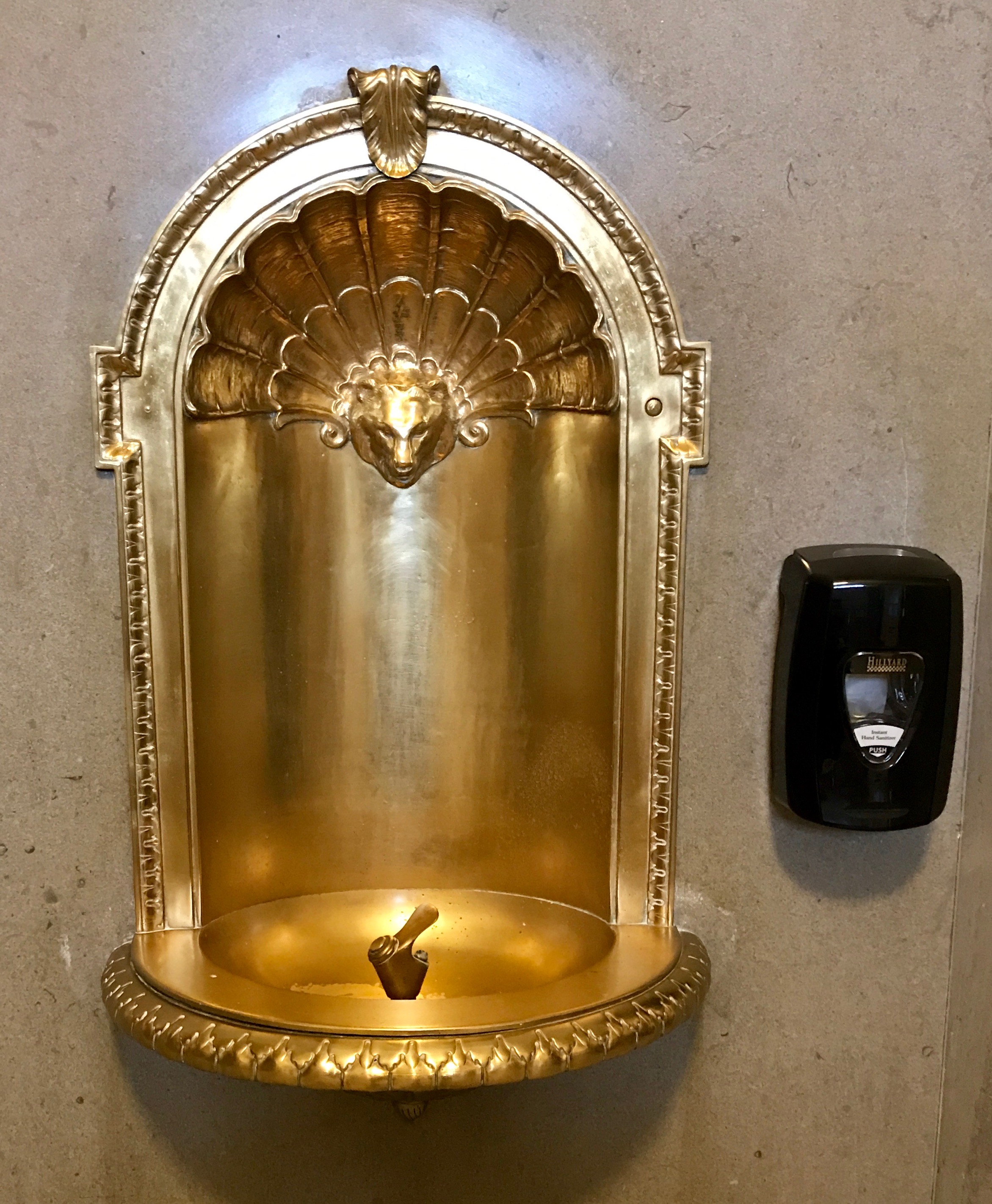
But, as long as I’ve paused to talk about funding, compare and contrast this original drinking fountain with the hand sanitizer dispenser. (Go ahead, I’ll wait.)

In my opinion, they ought to fling that ugly piece of plastic far away. I doesn’t belong next to that glorious drinking fountain.

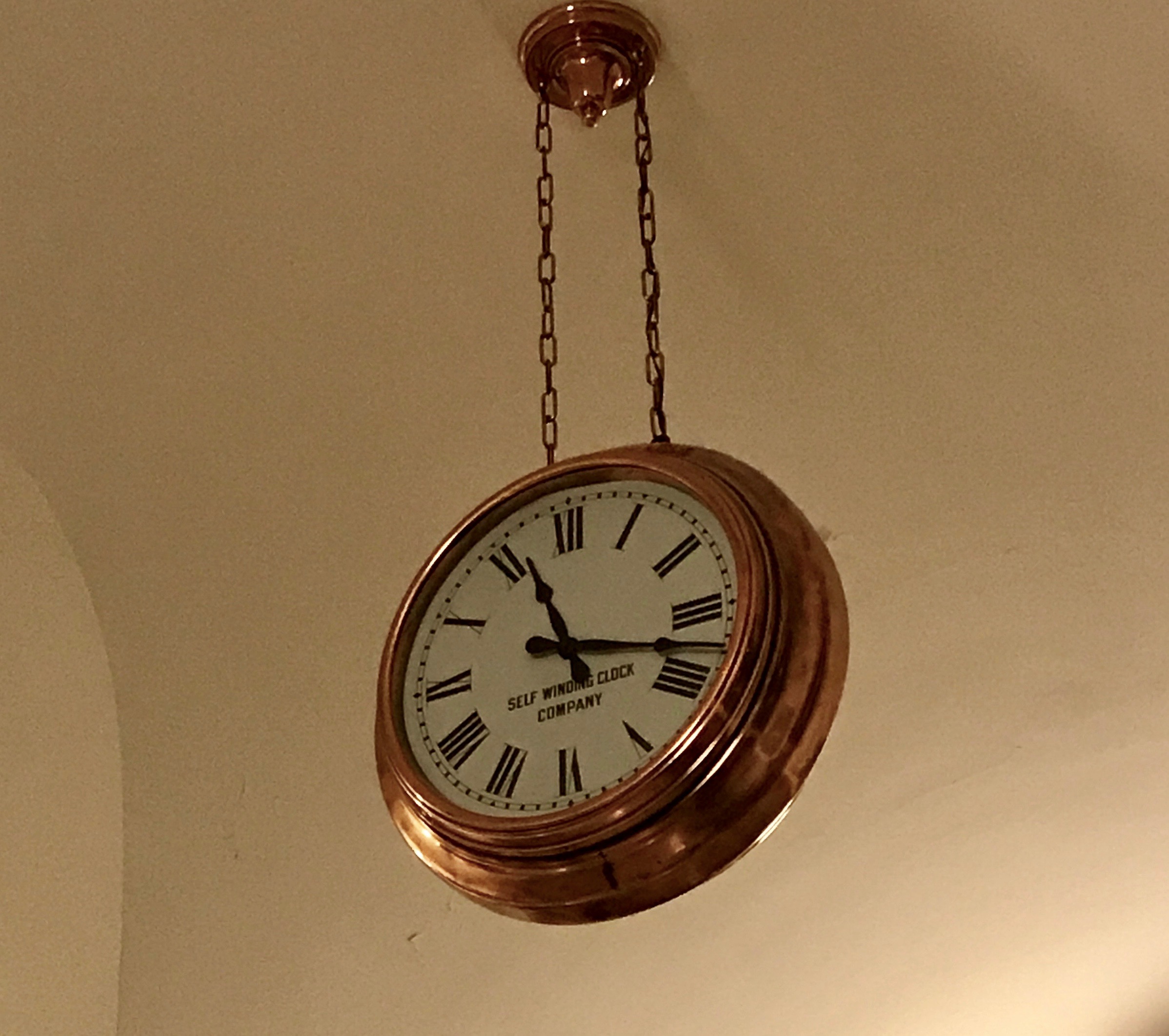
And how about that elegant clock hanging in the hallway? The dial proclaims it to be “self winding.” I wonder how that works? Do you think the wire woven into the chain on the right side has something to do with it how it operates?

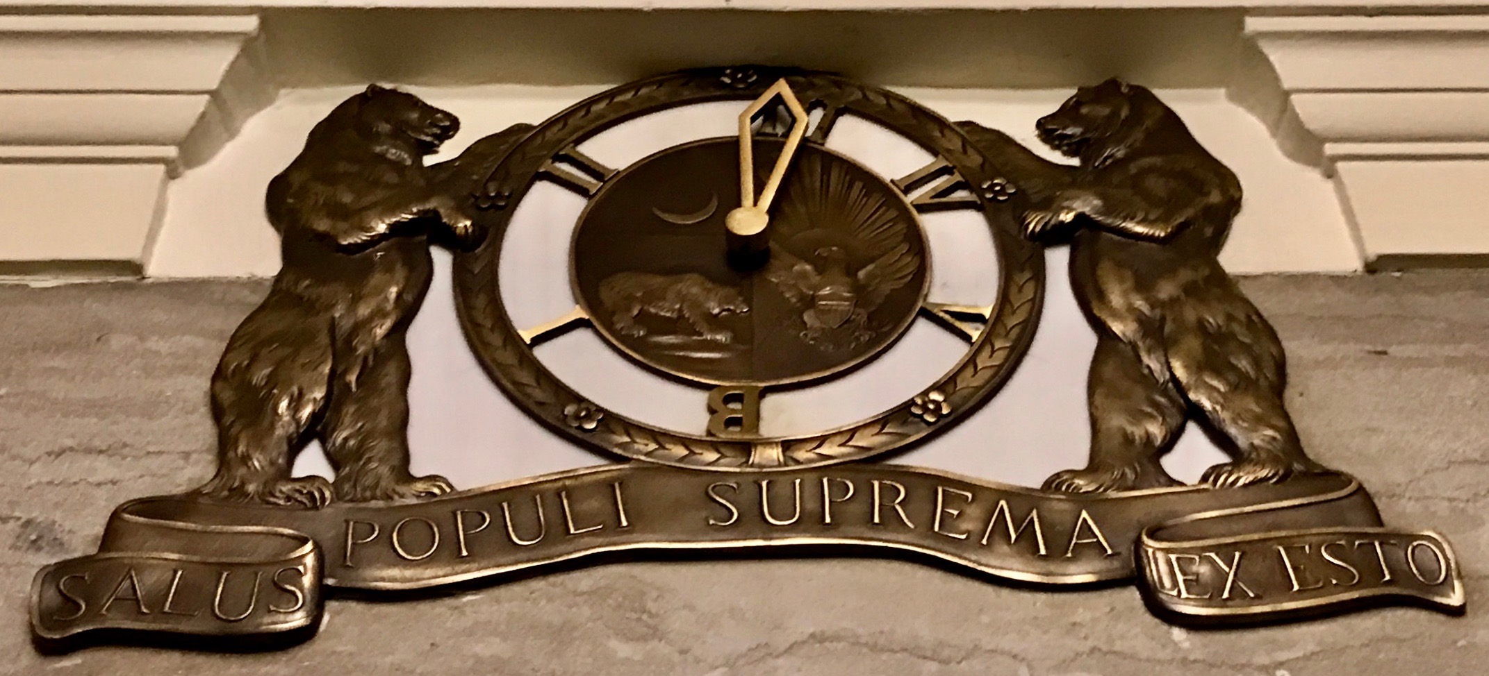
Take a look at this elevator dial! I am sure someone wanted a bear as the state animal. The state’s motto is “Salus populi suprema lex esto” which means “Let the good of the people be the supreme law.”

The elevator dial is based on the Great Seal of the State of Missouri. The bears represent strength and bravery. The crescent moon represents the newness of statehood and the potential for growth. MDCCCXX is Roman numerals for 1820, although Missouri wasn’t admitted to the union until 1821. They must have been into the power of positive thinking. Incidentally, take a look at the yellow belt with the words “United we stand divided we fall” in the enter of the seal. Do you see the buckle? The buckle signifies the State’s ability to secede from the Union if they deemed it necessary. The belt can be unbuckled.

So, did Missouri unbuckle during the Civil War? According to my Preferred Source, it was a “hotly contested border state, populated by both Union and Confederate sympathizers.” Both the Union and the Confederacy claimed the state. It sent armies, generals and supplies to both sides and maintained dual governments. They carried on a bloody neighbor-against-neighbor intrastate war within the larger national war.

By the end of the war in 1865, nearly 110,000 Missourians had served in the Union Army, and at least 30,000 had served in the Confederate Army. The war in Missouri was continuous between 1861 and 1865. There were battles and skirmishes in all areas of the state. The largest battle west of the Mississippi River  was the Battle of Westport in Kansas City. If you count all the military actions, from the large ones to the minor skirmishes, Missouri saw more than 1.200 distinct engagements within its boundaries. Only Virginia and Tennessee had exceeded that number.

I guess the belt buckle stayed fastened.

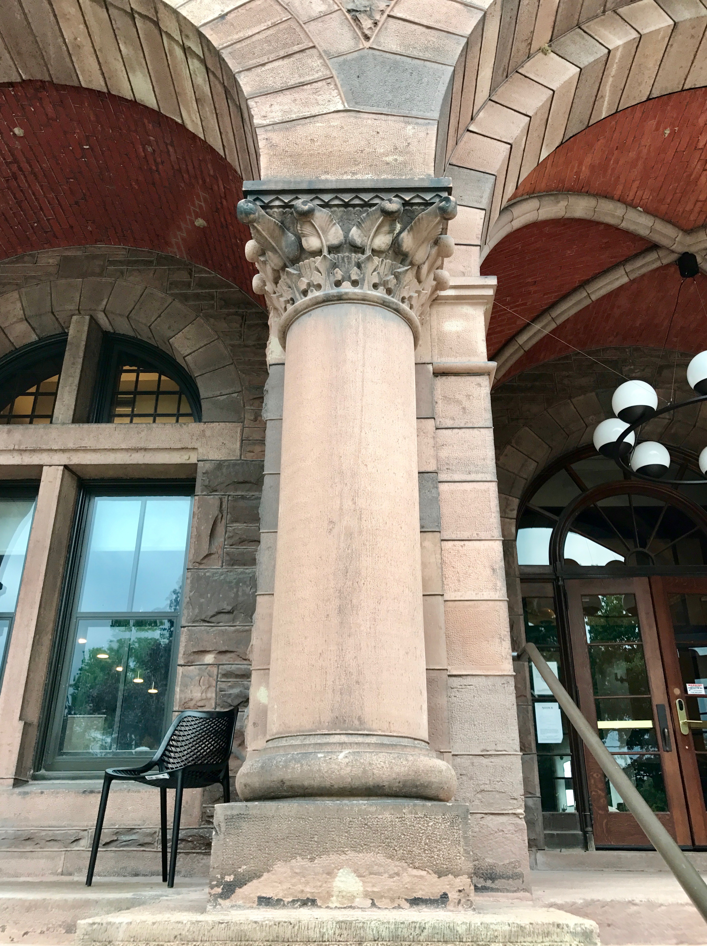
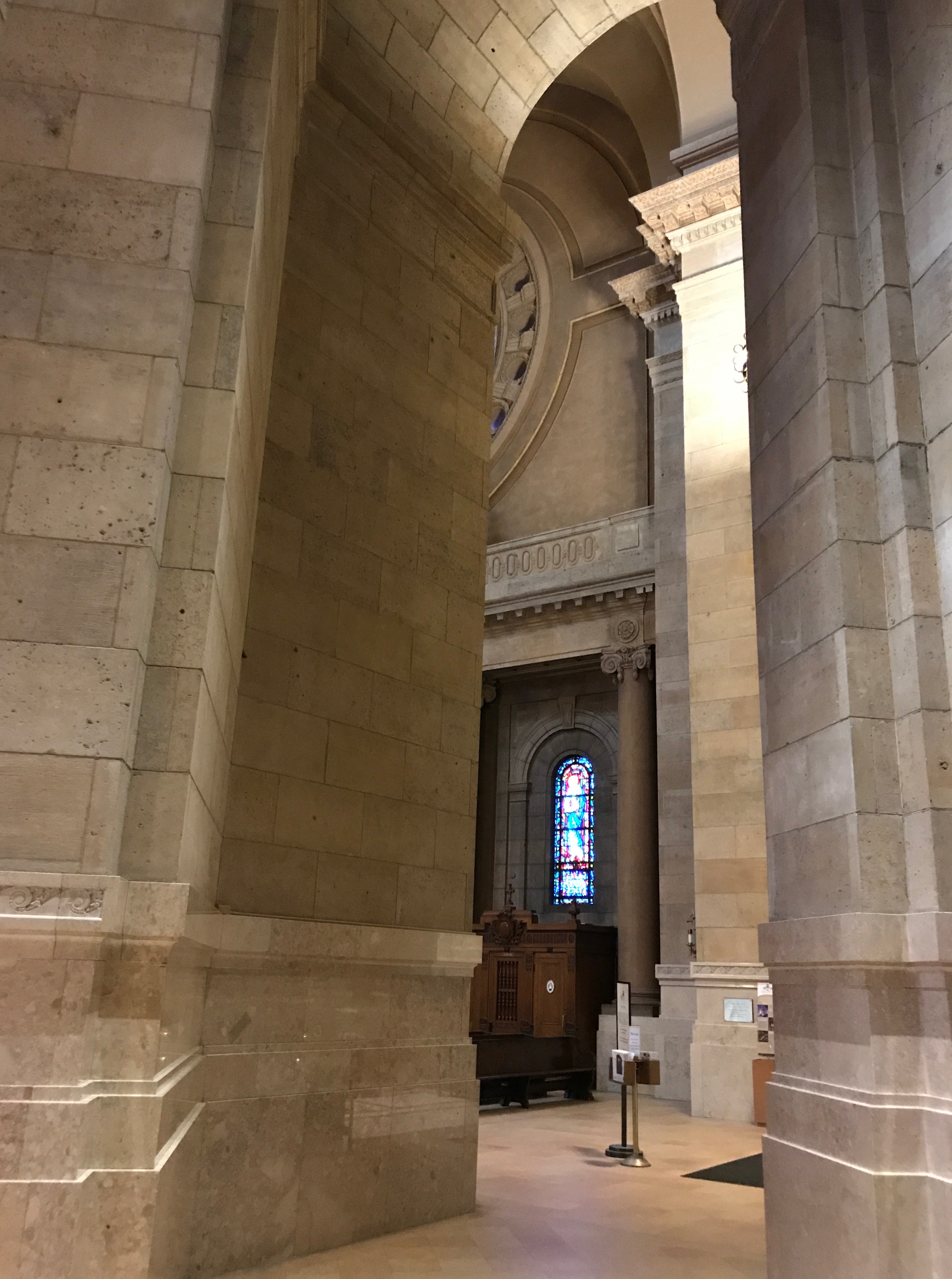
I wandered around a bit more. You can really see the money that was spent on the building.

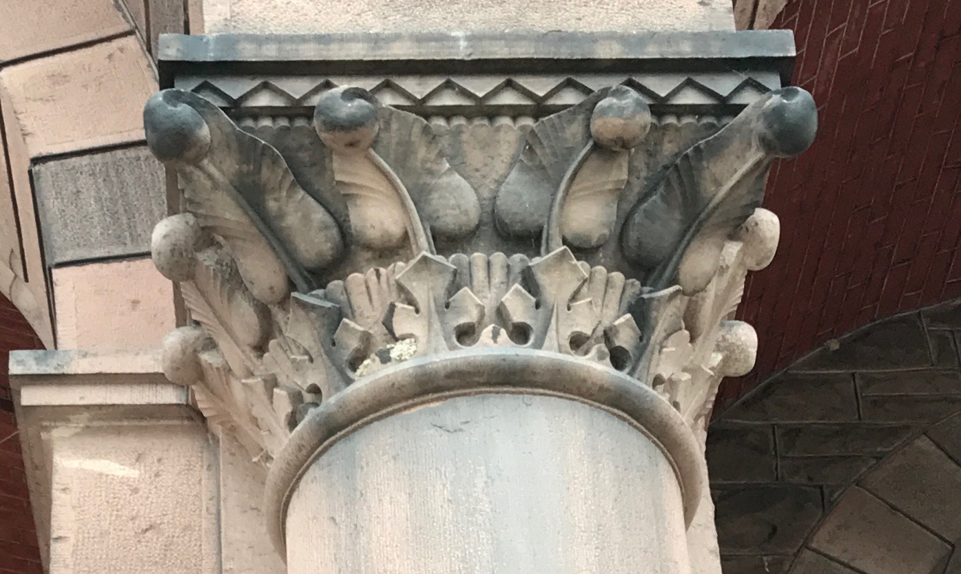
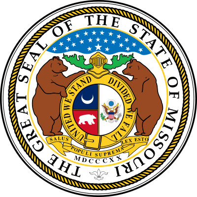
The stonework is so well done.

I wonder if there are even enough skilled artisans left in the world if we wanted to recreated these structures?

Everywhere you look, there is a little vignette waiting to be appreciated.

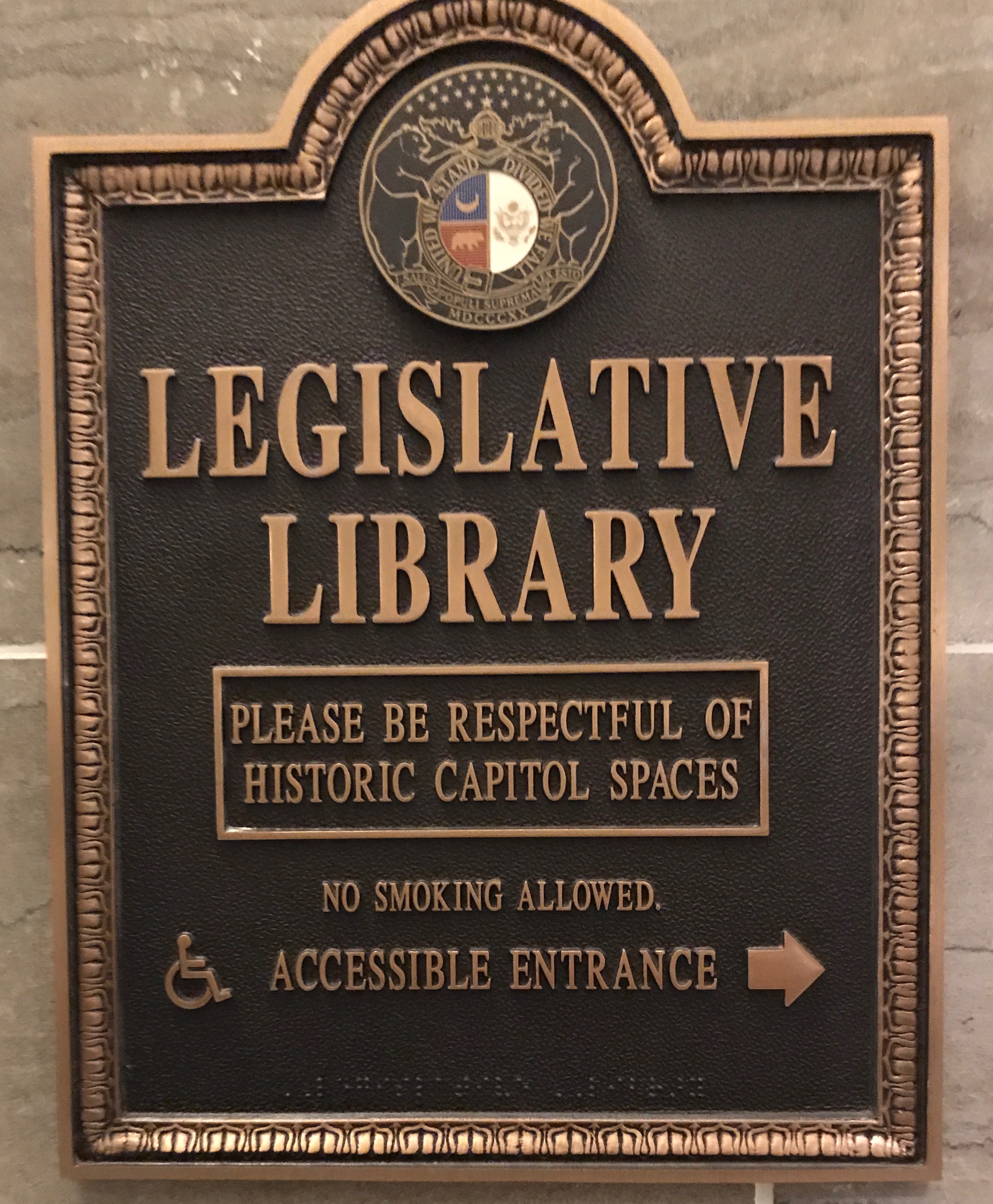
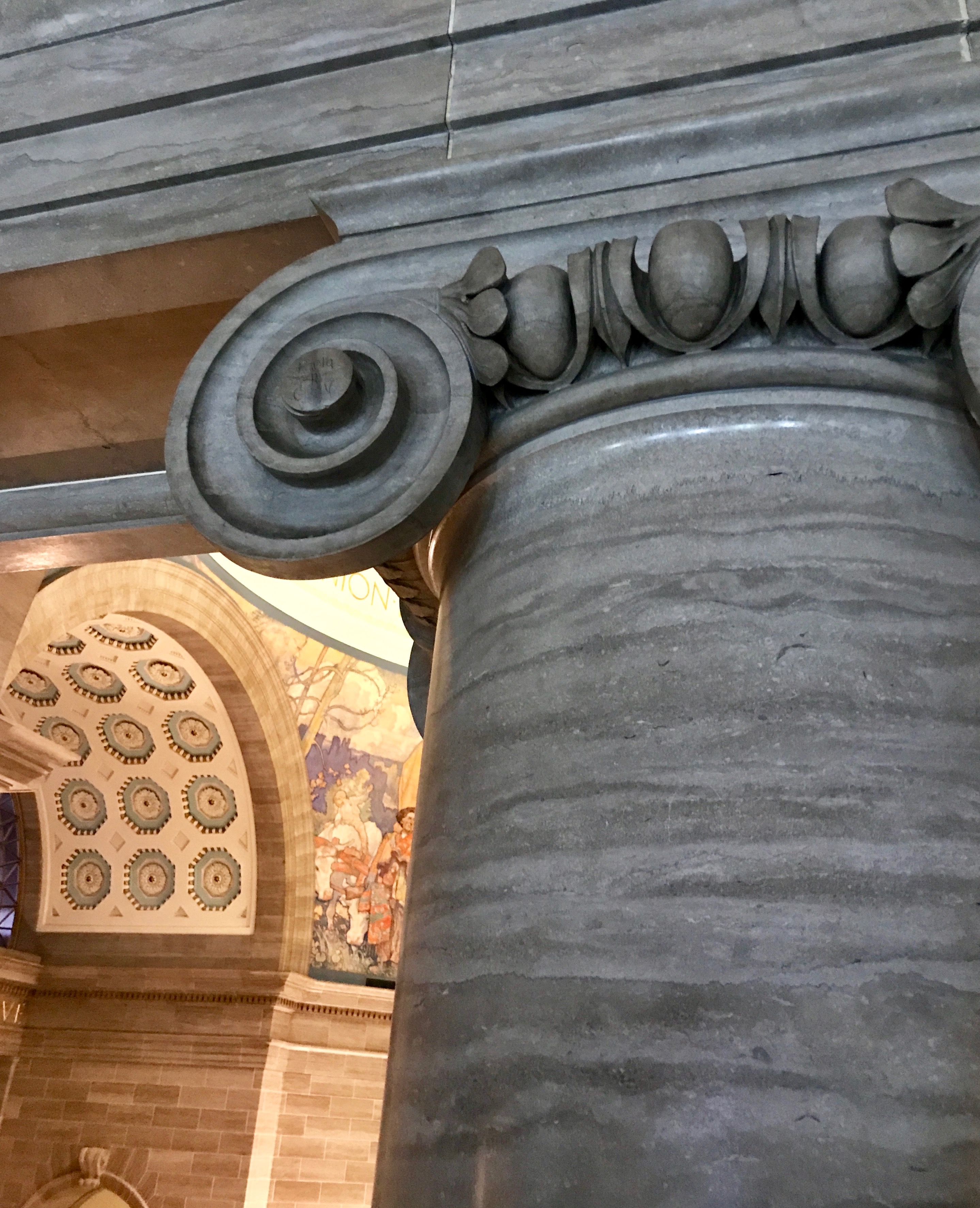
The Legislative Library was open to be viewed.

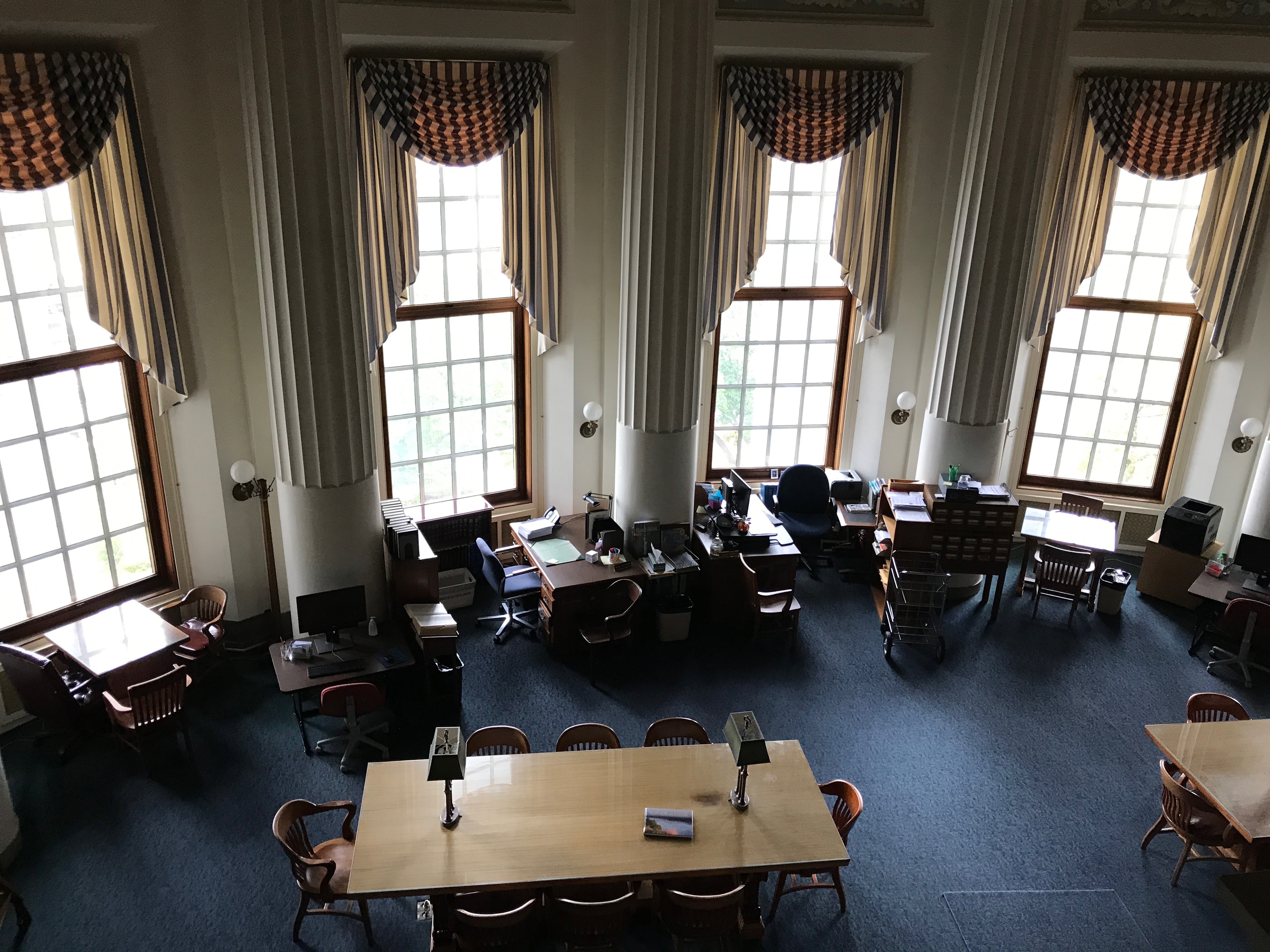
You had to look at it from above, but that makes it easier of take a photo, anyway.

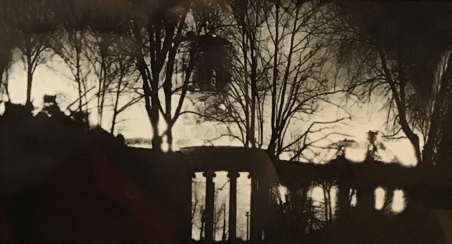
In the basement was a display about the fire that took down the previous capitol. It was struck by lightning in 1911 and burned throughout the night.

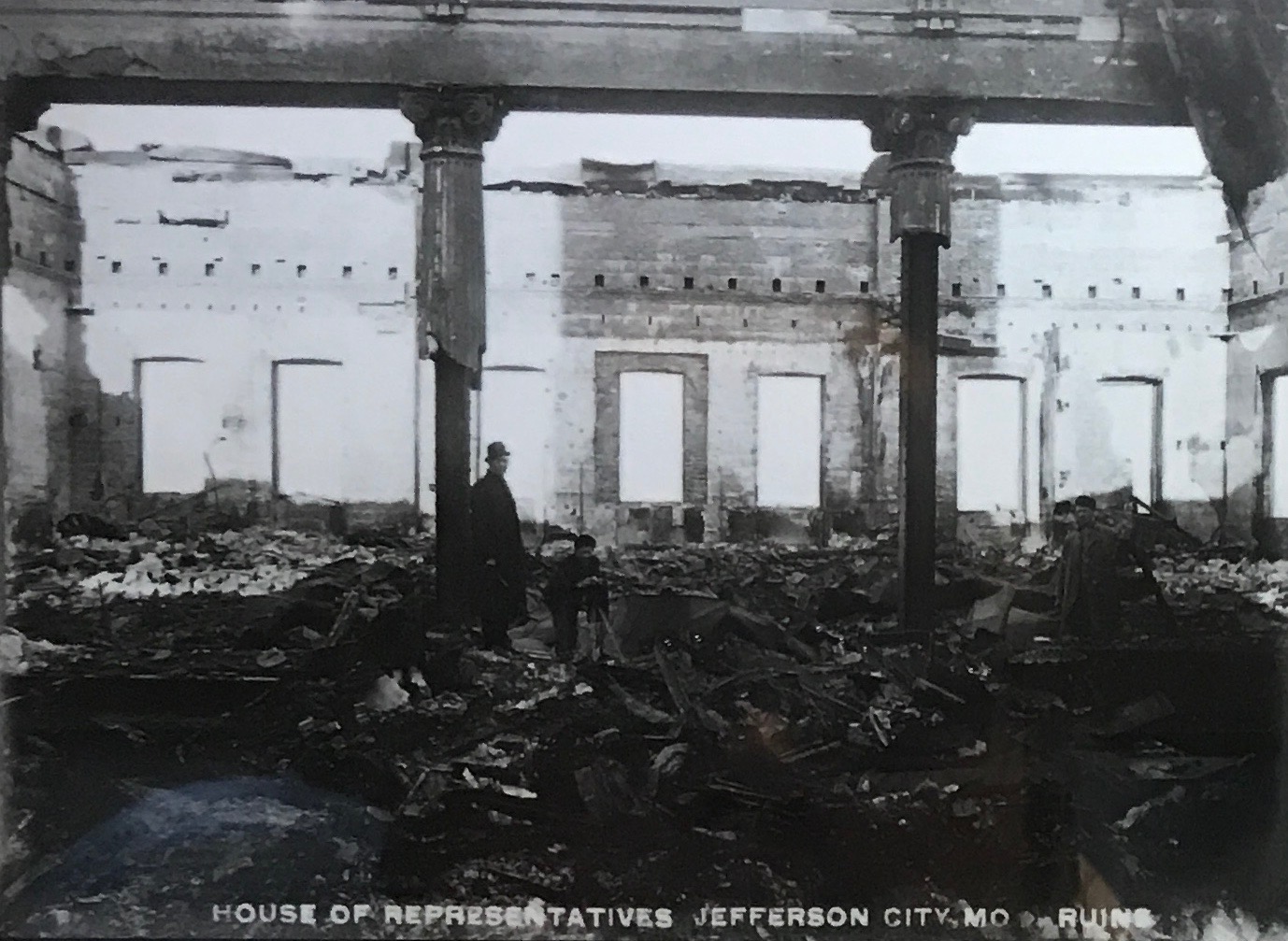
The House of Representatives lay in ruins – along with the rest of the building.

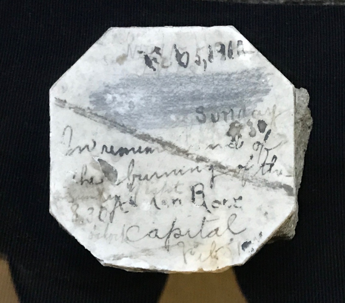
According to the sign with this artifact, “A curiosity seeker pulled this floor tile from the rubble of the 1911 fire. It reads, “Feb. 5, 1911…Sunday…In remembrance of the burning of the Capitol…8:30 A[M]” the rest of the inscription may be names.

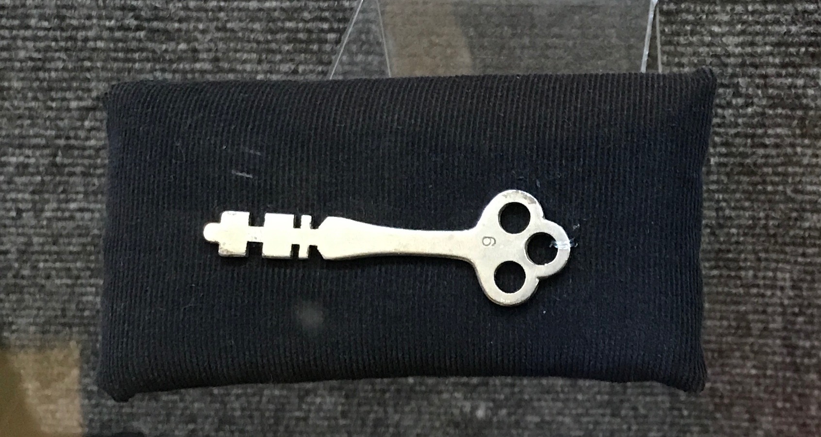
This is the key to the dome of the capitol that burned in 1911. If I remember correctly what the guide said, someone had taken it home. Since it wasn’t at the capitol, it hampered the fire fighting. This key may be the reason why the building burned to the ground. But, maybe I am not remembering this correctly.

I will tell you more about the artwork in my next installment. At this point, I wound my way out.

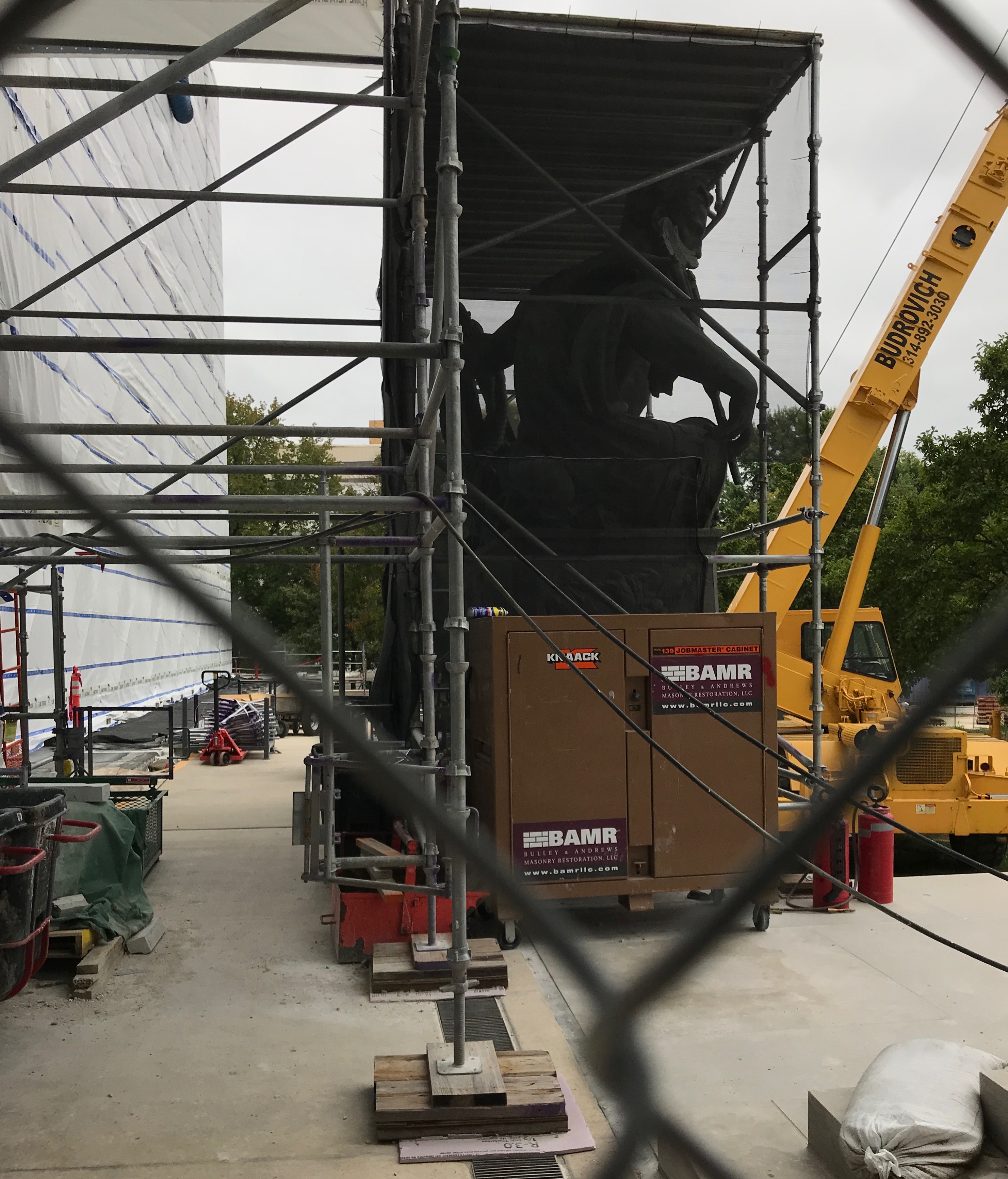
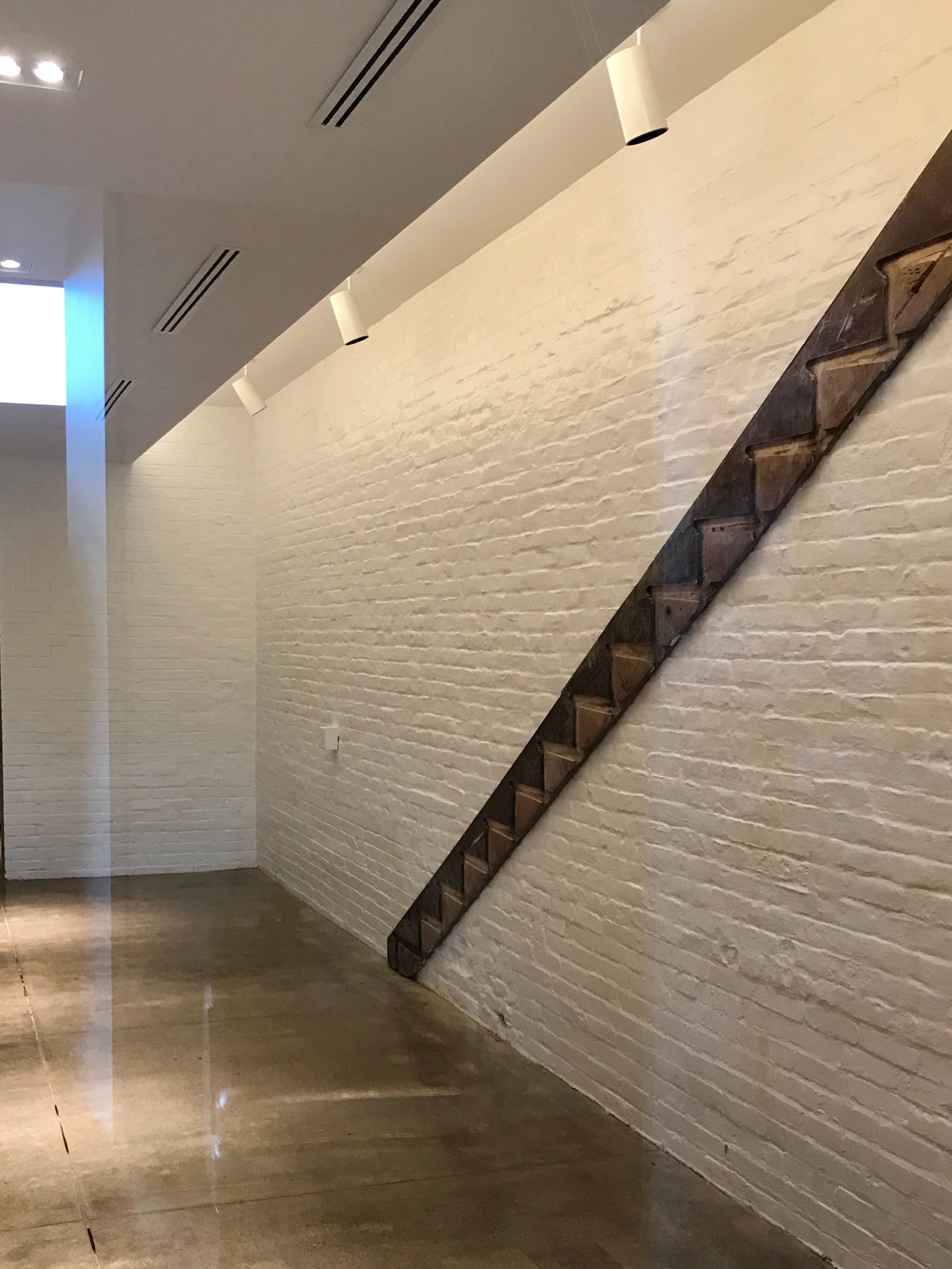
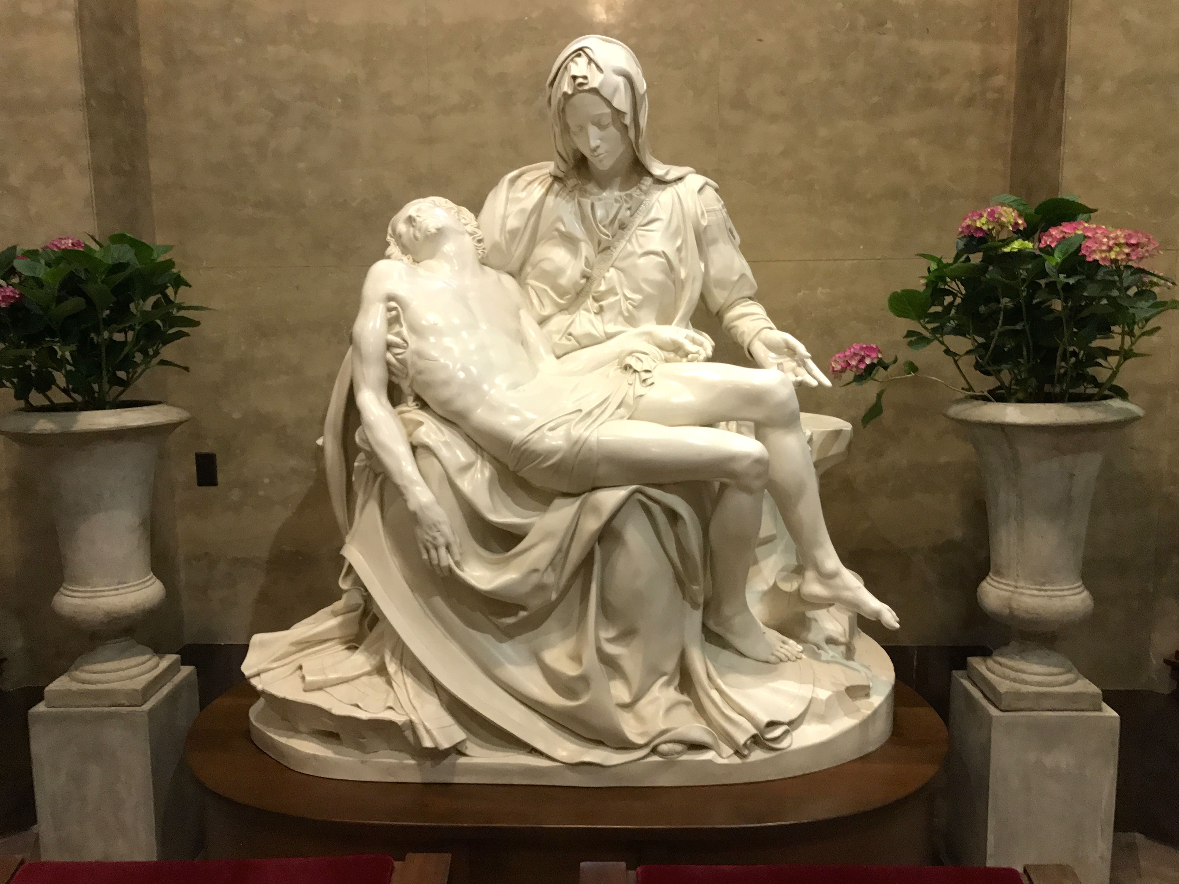
I passed the statuary that was protected by mesh during the reconstruction.

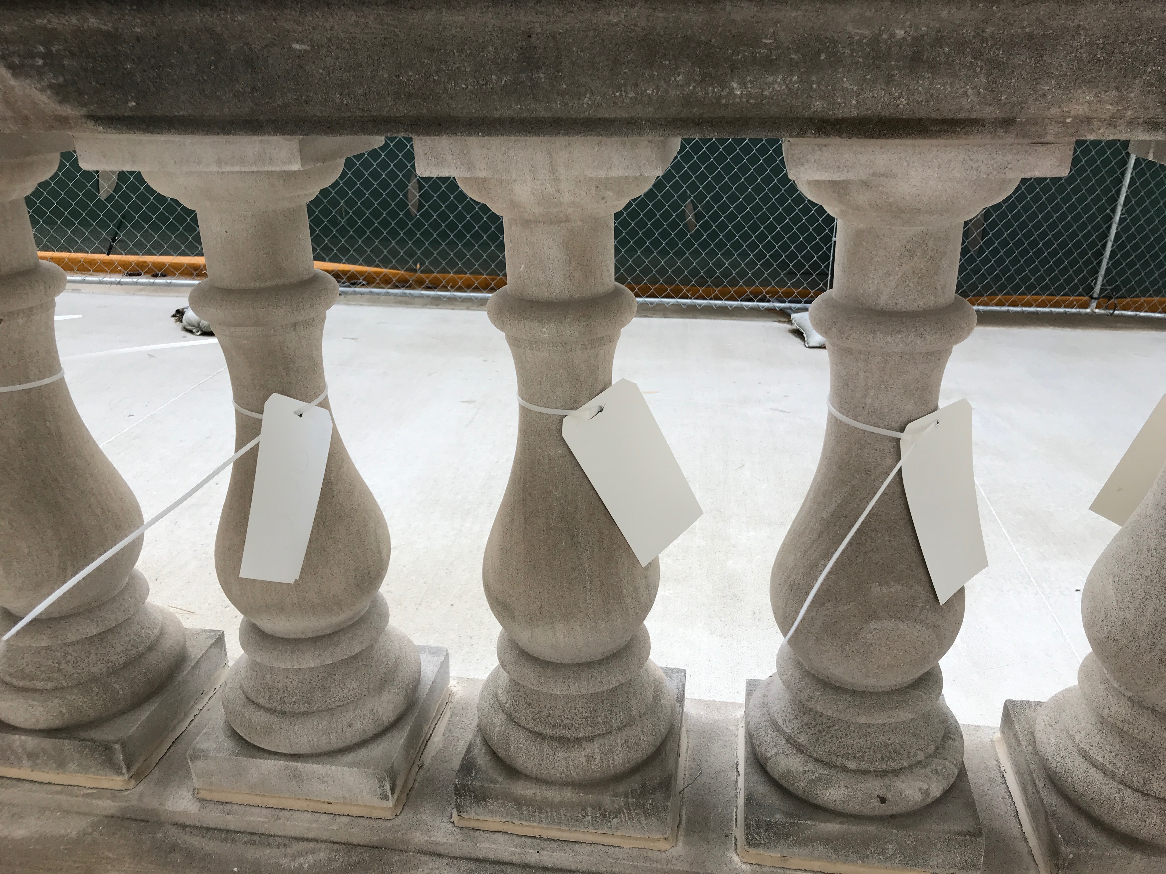
I passed the tagged balustrade. I imagine they are going to remove these and then return them when the work is complete. You want to make sure you put things in the right spots!

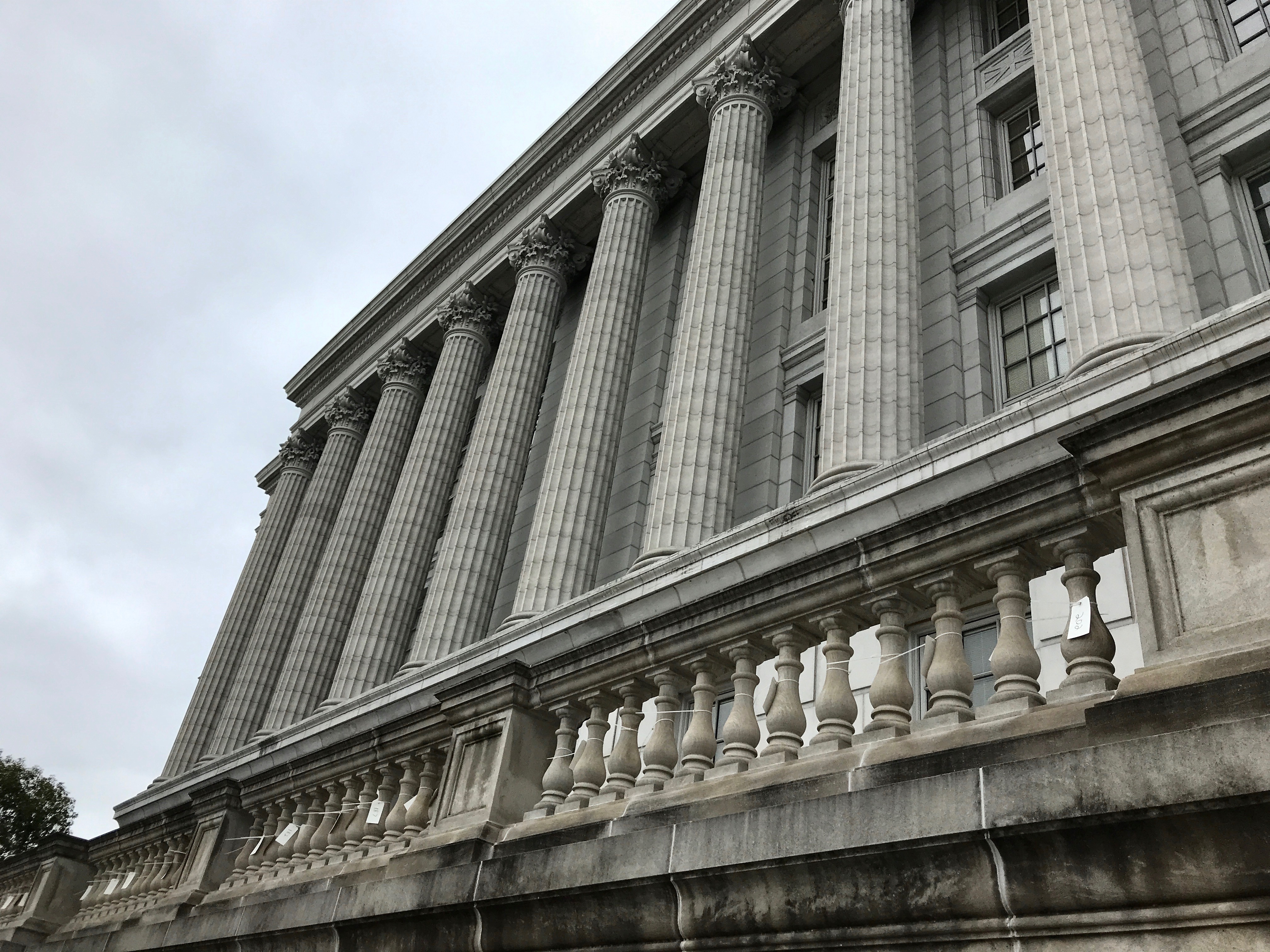
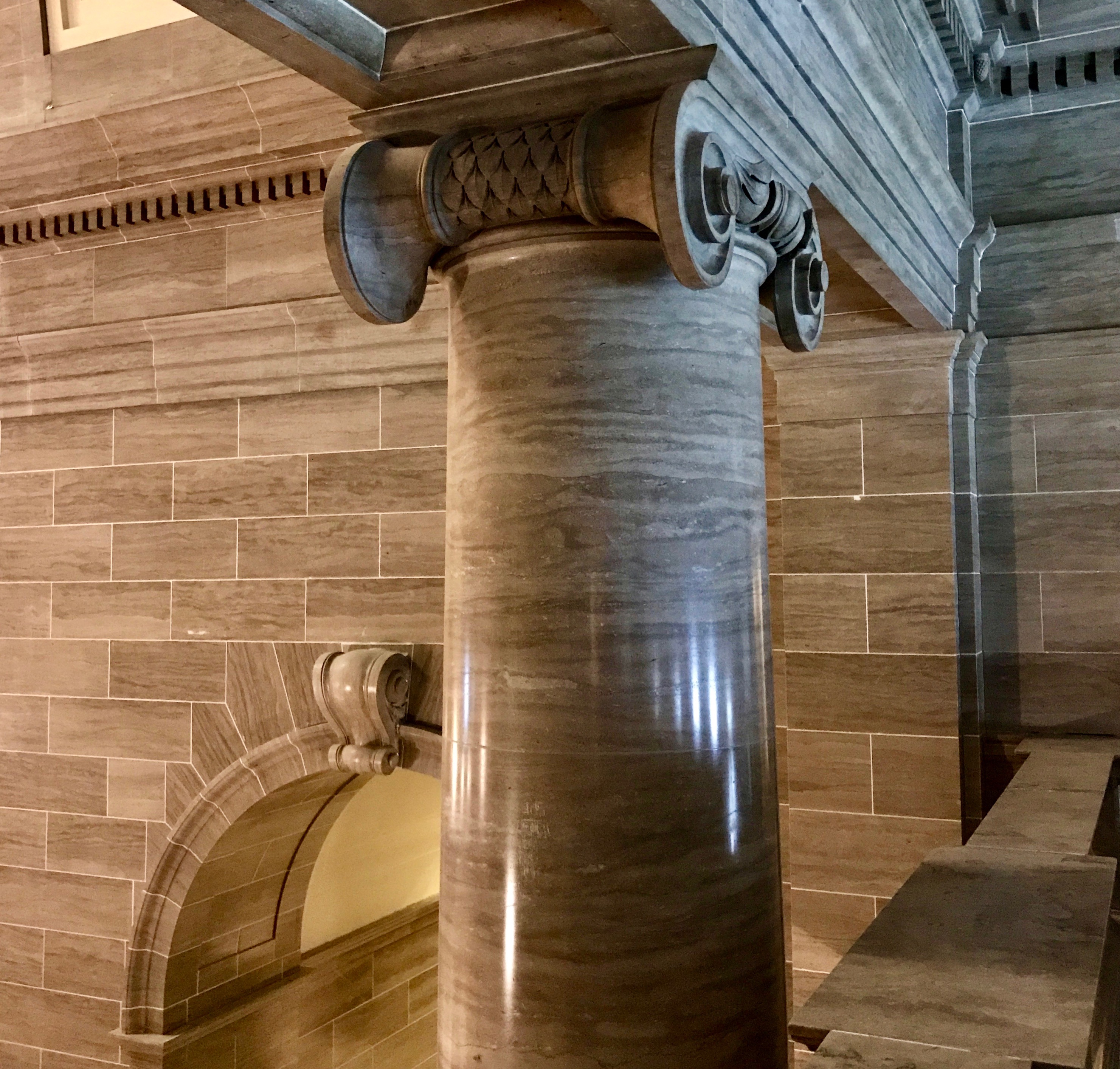
I looked up at the columns.

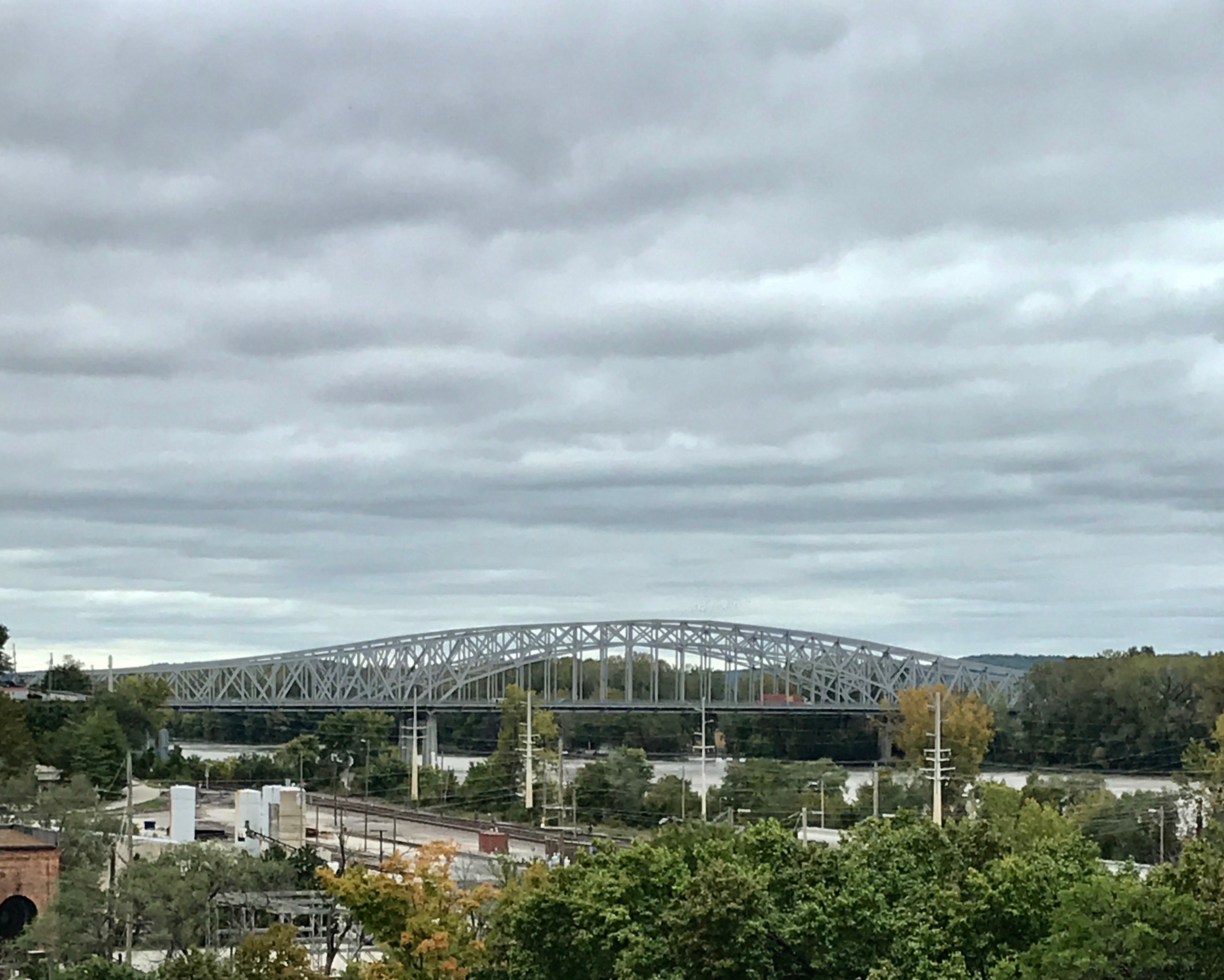
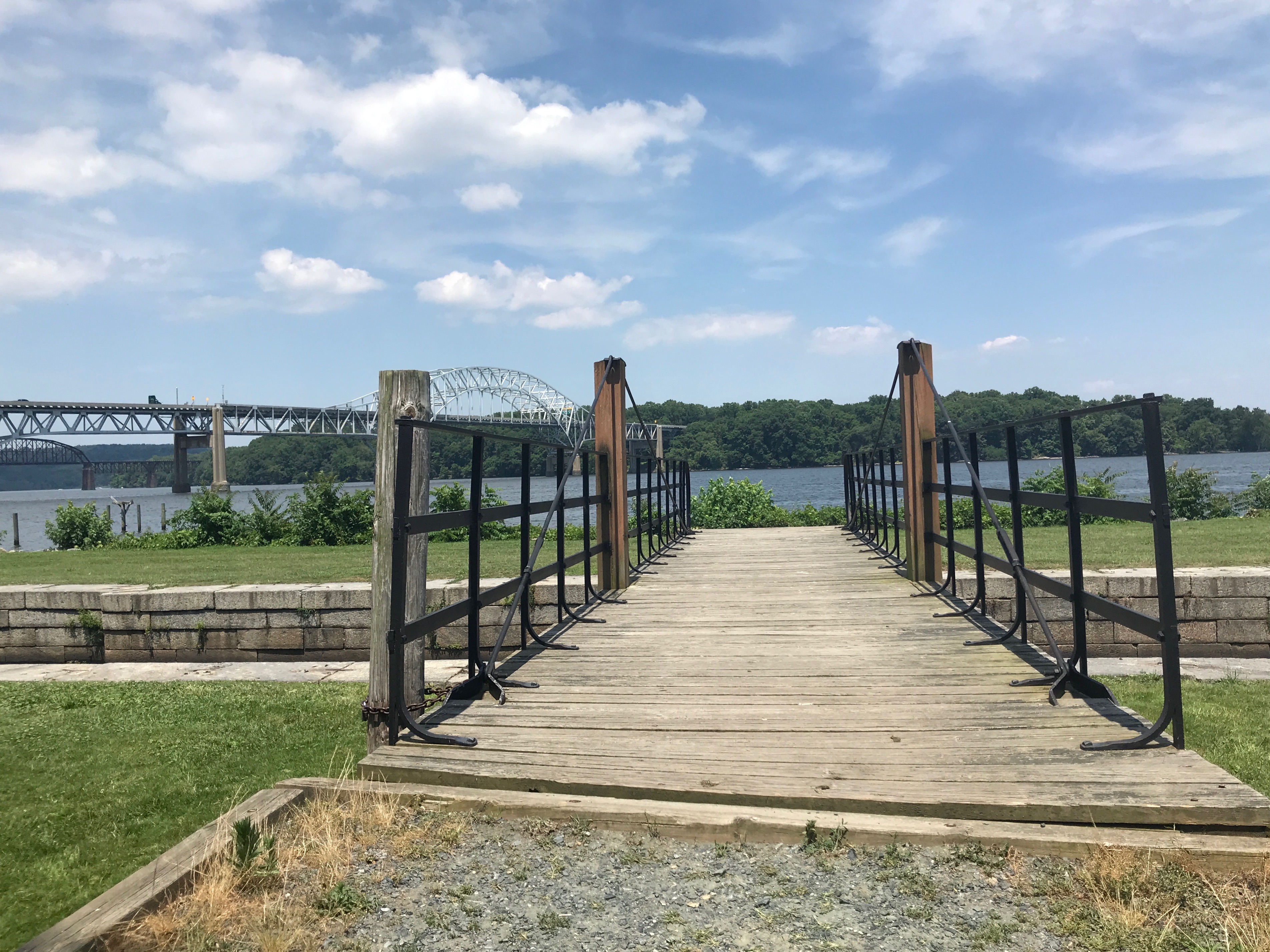
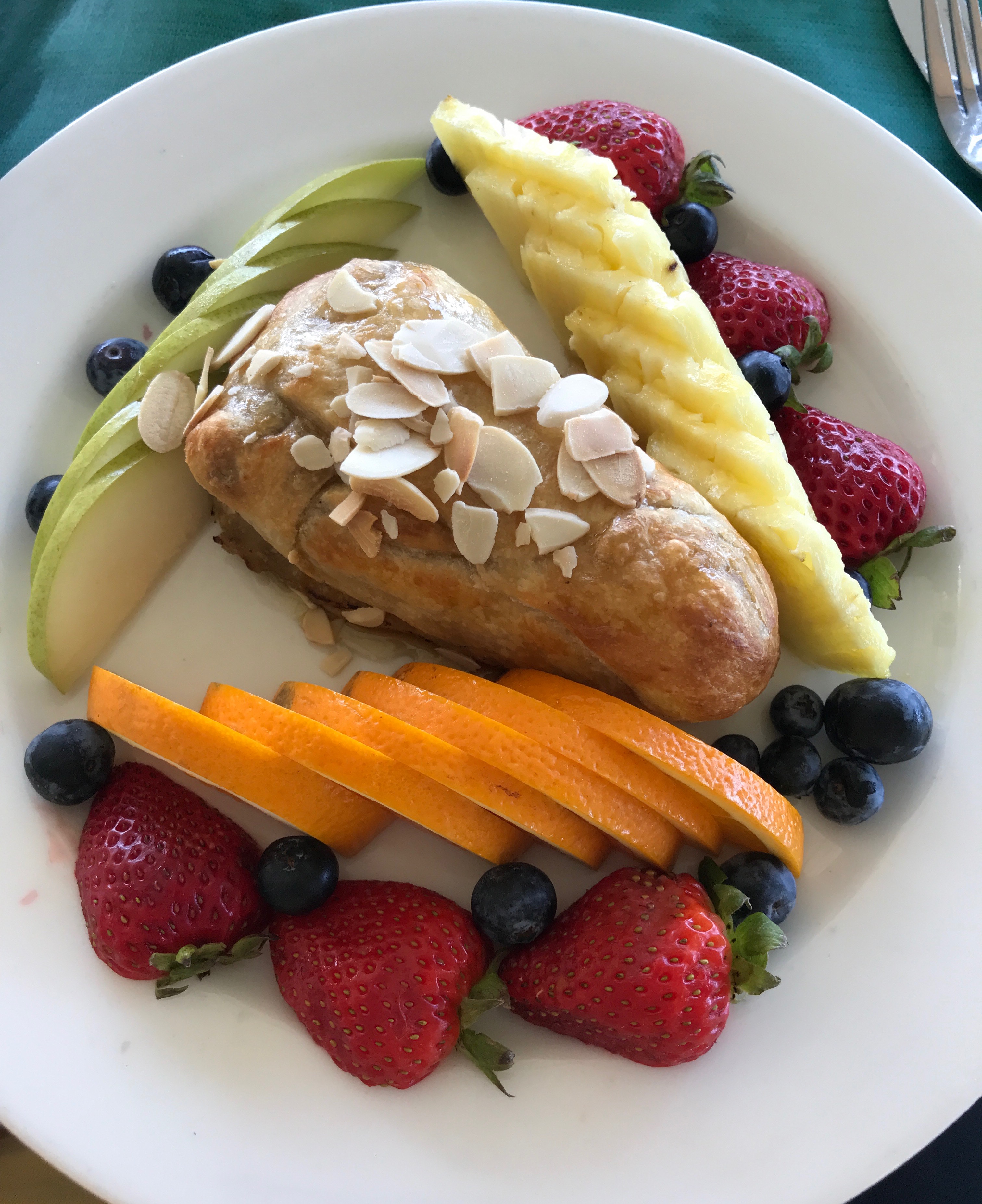
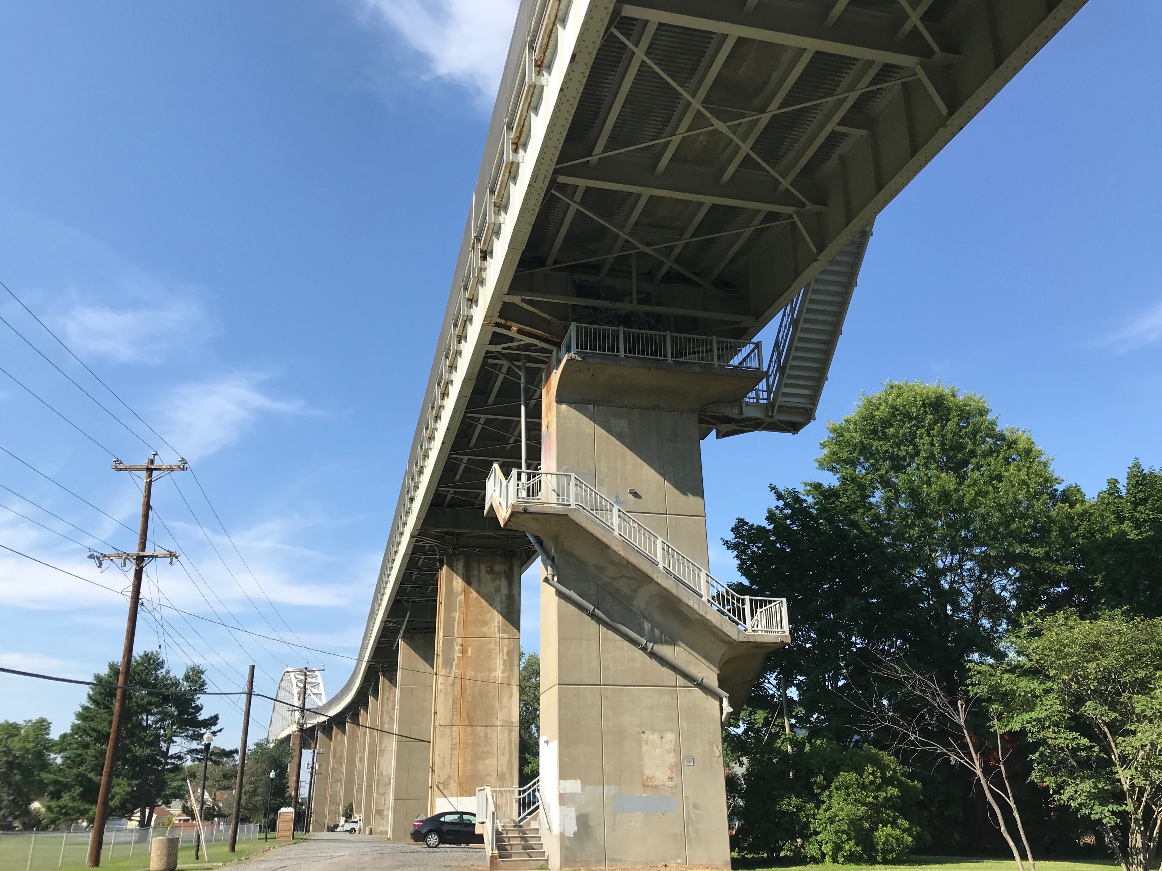
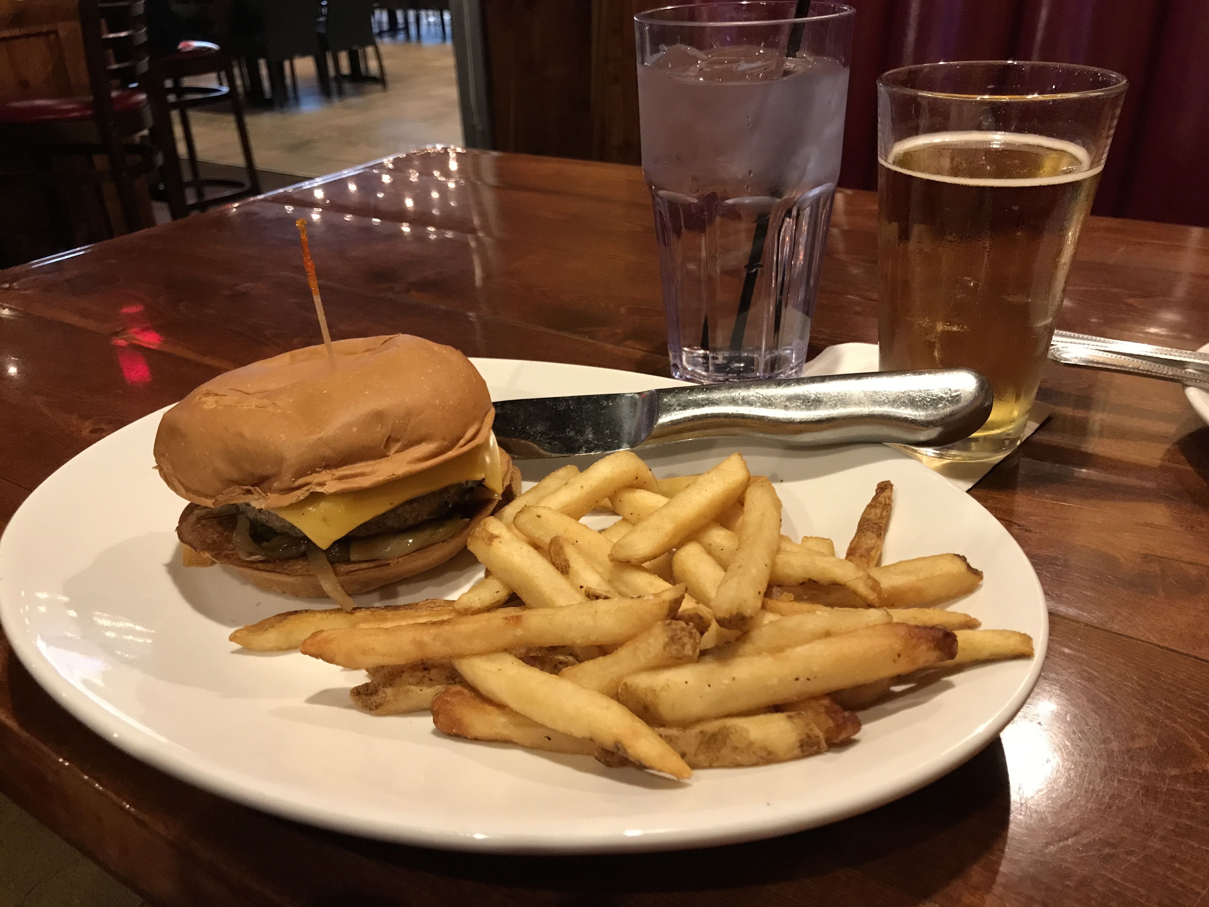
I paused to snap a photo of the bridge across the Missouri, and then I went to find my car. It was time to go find something to eat!


Havre de Grace

Another weekend rolled around and I found myself in Maryland, somewhere northeast of Baltimore. I found a chain hotel at an interchange and settled in there for a few days of rest and relaxation.

Of course, you know how I relax. After a week of driving in circles, I jump in the car and drive somewhere. This time, I headed to Havre de Grace.

Havre de Grace is an old town – or, should that be Ye Olde Towne? According to my Preferred Source, General Lafayette visited the small hamlet known as Harmer’s Town several times during the Revolutionary War. He is reputed to have said that it area reminded him of the European seaport of Le Havre, which was originally named Le Havre-de-Grâce. Inspired by Lafayette’s comments, there residents incorporated the town as Havre de Grace in 1785. Washington stayed overnight in the town in 1789 on the journey to New York City for his first inauguration in 1789.

Fun fact: During the First Congress in 1789, Havre de Grace missed by only one vote being named the capital of the United States. I wonder how the votes fell in the voting? It seems like there were a number of cities that lost out on the honor by only one vote, although I can’t name them at the moment.

The bit of history that surprised me about Havre de Grace was the attack by the British during the War of 1812.

Rear Admiral George Cockburn burned and plundered the city. According to an interpretive sign I saw along the way, first person accounts of the devastation at Havre de Grace fueled newspaper reports of “wanton barbarity among civilized people.” Cockburn, portrayed as a villainous “violator of all laws, human [and] divine,” struck terror as he made an example of Havre de Grace for other towns.

The American Lieutenant John O’Neill single-handedly manned a cannon to help defend the town. O’Neill was wounded and captured by the British, although he was soon released.

CC BY-SA 2.5, https://commons.wikimedia.org/w/index.php?curid=227854

In gratitude for his bravery, Havre de Grace made O’Neill and his descendants hereditary keepers of the Concord Light House, which overlooks the point where the Susquehanna River flows into the Chesapeake Bay.

Kind of makes me wish I had dug a little deeper when I visited the tourist information office. I might have seen some information about the lighthouse. I definitely would have gone to visit it. According to my Preferred Source, it was built in 1827 by John Donahoo, a prolific lighthouse builder who is responsible for many lighthouses in Maryland.

What I did notice was a walking tour, called the Lafayette Trail.

The helpful man in the tourism office gave me a map and I set out to see what I could see. My first stop was number eighteen.

Saint John’s Episcopal Church

St. John’s is Havre de Grace’s oldest church. Financing for the church was through a lottery commissioned in 1802. It was built in 1809, and the church was damaged by the British during the War of 1812. It was gutted by fire in 1832, and changes to the original rectangular building were made in the early 1860s.

A slate roof and belfry were added in the 1880s.

Notice the Flemish bond brick walls.

After admiring the exterior, I headed off in search of my next stop. Coming up: number nineteen.

This quietly elegant house is Carver-Craig House, built in 1855.

It is a combination of Greek revival and Italianate styles. It has a slate-covered hip roof with overhanding eaves and a bracketed cornice. A one-bay porch supported by square pillars protects the front entrance. The open porch on the west side and the enclosed porch on the east were added later.

Just in case you were curious, The windows are six feet tall with six-over-six lights. I wonder how much Windex they go through in a year?

On to stop number twenty.

This is the Maslin House. It was built in 1860, and Maslin family members have lived in this home since its construction. Dick Maslin, the great-grandfather of the current owner, was a Chesapeake Bay boat pilot. Another Maslin ancestor was a lock house tender who resided the Lock House.

The facade of this frame cottage is unusual because it is built in the shape of a Greek cross. The four-over-four double-hung windows are original, in service for over 150 years.

I spotted this sign on the house.

This car was parked in front of it.

I particularly enjoyed the license plate. “CRAB CAR”

By this time, my enthusiasm for this walking tour was flagging. It was hot and sunny. Sitting here, in cold, dreary Michigan, it seems odd to be complaining about a hot day – but there you have it. I’m sure it’ll be warm again here before you know it. (Knock on wood.)

But, after all, it was summer! It was supposed to be hot. I grabbed something to drink at one of the little shops and headed back to the car. I figured I’d drive to the farthest point on Lafayette Trail and check that out.

(Just in case you might be entertaining the idea that I actually remembered all that information about the buildings, I managed to find a copy of the walking tour on line. No memory cells were harmed in the writing of this post. At least not to this point.)

I set off in the direction of the Lock House, which was the farthest point on the trail, but got distracted by this view of the bridges.

Luckily, there was a nice parking area to stop and look at them.

While looking through the branches, I saw this riverboat, named The Black-Eyed Susan. For those of you not familiar with the name, it is a common name for the flower, Rudbeckia hirta.

Black-eyed Susan

I continued along and eventually reached the Lock House.

Hmm. There’s a sign. I wonder where the Lock House is? Well, it wouldn’t be the first time there was a sign for something that wasn’t there. But, I looked around and found a driveway that lead to The Lock House Museum.

And it was OPEN!

I walked up to the building and paused a moment to look at the signs that were by the door. I went inside and was met by Bill, who was a most able guide. He really had a passion for the canal, the lock and the Lock House.

The Lock House was built in 1840 and is situated on the western bank of the Susquehanna River, by the outlet lock for the Susquehanna and Tidewater Canal. The canal connected Wrightsville, Pennsylvania, 45 miles upstream, with the markets on the coast. Although the Susquehanna connected the two places, north of Havre de Grace it was too shallow and had too many boulders to navigate. I thought they might have dredged a channel along the shore, but Bill told me they dug a canal alongside the river. He took me into another room to demonstrate how the lock worked.

There were holding areas for boats waiting to go through the lock. There was only one lock, so they had to take turns coming and going.

I was fascinated with this model of the gates. I always wondered how they managed to let the water out to lower the boats. There are little doors at the bottom of the gates that are opened with the handles on the tops. I wonder if people had to walk out on the top of the gates to operate them or did they use long poles or some other means to move the levers? I was just so amazed at the model that I didn’t ask enough questions.

I tried to take a photo of the photos of the canal boats in the museum, but they were framed under glass. Try as I might, I couldn’t find an angle without glare. I am including this photo to illustrate what the boats looked like.

The boats on this canal were freighters and they carried primarily coal. They were typically 60 to 70 feet long and 15 to 16 feet wide. Each boat could carry up to 150 tons of raw materials and they were pulled by mules.

The mules were often stabled on the boats, as the narrow Susquehanna Valley provided few pastures. The mules lived forward and the canal boat captain and his family lived in small quarters in the rear of the boat.

Good shoes are important for doing good work.

There were a number of items in the museum that were included to show what life was like for the lock tenders.

This bicycle is said to have been owned by Carville Maslin’s son and is reputed to have been riden to Baltimore from Havre de Grace. Patented in in 1866, this model had inflatable tires and wooden wheels. That sounds pretty modern, but the only braking power came from the feet being pressed on the ground or on the font wheel. According to the informational sign, the bicycle cost $100 at a time when the Lock Tender made less than $1000 per year.

When the Lock House was restored in 1981, they left this “truth window” so you could see the construction of the original building. After more than 140 years and  close to 100 years after the canal ceased operation, I imagine it was due for restoration.

We continued upstairs for a few more exhibits.

This is a replica of one of the stones placed along the Mason Dixon Line. The line was established to resolve a border dispute involving Maryland, Pennsylvania and Delaware.

This side is Maryland.

This side is Pennsylvania.

The work was directed by Charles Mason and Jeremiah Dixon, and they surveyed the line between 1763 and 1767. My tour guide, Bill, had an ancestor that worked on the project as a laborer. Bill said that the bosses – presumably Mason or Dixon or one of their underlings – would come by and indicate the direction the axmen were to go, and the workers would commence felling trees. They had to clear a “visto” 8 – 9 yards wide. Every now and then, the bosses would come by to course correct, and then they might have to recut the line a little further one way or the other.

I was amazed to meet a descendant of one of the people who helped create one of the more evocative and provocative borders in America’s history. When I shook his hand, it was like I was holding hands with history.

This “birds eye view” of Havre de Grace was made in 1909. Look at all the modes of transportation! You can still see the Lock House and the final lock of the canal, even though it ceased operation in 1894.

I took a look out of the upstairs window and decided it was time to go see the lock itself. I thanked Bill and headed outside.

In the late 1980s, the lock was de-silted and the remnants of the original gates were removed. The granite walls were stabilized and straightened.

The bridge across the canal could pivot. This made it possible for people, wagons and mules to cross to the towpath and wharves on the riverside.

When the bridge wasn’t being used, it was swung away so that the boats could pass through the locks.

It’s amazing to look down the canal lock toward the automobile bridge and the rail bridge. Transportation is so interesting.

People have the need to put their names on things. 

Which reminds me of Michelangelo’s Pieta.  The story is that after he had finished the Pieta, he overheard some men from Milan saying that it was the work of another sculptor. Well, he wasn’t having any of that! He thought it was one of the best statues ever carved and he wanted credit for it. So that night he went into the church with his hammer and chisels and candles and carved his name in big letters on the Virgin.

It reads: Michaelangelus Bonarotus Florent(inus) Facieba. (Michaelangelo Buonarroti made this.)

Once again, thank you, Sister Jeanne!

I turned to head back to the car. What a lovely front porch! I think this must have been a very pleasant place to live in the summer.

Walking back to the parking area, I noticed this LittleFreeLibrary.

I love how they made it look like the Lock House!

I bid adieu to Havre de Grace and headed across the bridge to Chesapeake City. I heard there was a canal museum there.

There was! It is the C & D Canal Museum run by the Army Corps of Engineers. My goodness, there were a lot of canals back in the day! This one is different in that the water was lifted to a higher level by steam operated waterwheels.

You see, in this canal, they had to go over something, so you couldn’t rely on natural water flow to do the trick.

The machinery on display was impressive.

Notice the esthetic details. Can you imagine that manufacturers went to the effort to make their work so attractive? Maybe fluted cast iron columns are stronger than plain columns. Hmm…something to look into some other time.

In any event, no wonder they wanted to put their names on their products in such a prominent position.

The Chesapeake and Delaware Canal – the C & D Canal – was first conceived in the mid 1600s by Augustine Herman. He was a mapmaker and he observed that the two great bodies of water – the Delaware River and Chesapeake Bay – were separated only by a narrow strip of land. Herman proposed that a waterway be built to connect the two. Unfortunately, this was an idea whose time had not yet come.

More than a century passed before anyone acted on the idea. In 1764, a survey of possible war routes across the Delmarva Peninsula was made. Again, no action was taken. In 1788, regional business leaders raised the idea again. The canal would reduce the trip from Philadelphia to Baltimore by nearly 300 miles.

Digging the canal was begun in 1802, but the project was halted two years later because of a lack of funds. The canal company was reorganized in 1822, and new surveys determined that more than $2 million in capital was needed to resume construction. Pennsylvania purchased $100,000 in stock, Maryland kicked in $50,000, and Delaware threw in $25,000. The federal government invested $450,000, with the remainder subscribed by the public.

Canal construction resumed in 1824, and within several years some 2,600 men were digging and hauling dirt from the ditch.

I have included a close up of the sign on the barrel.

In addition to the slides, the swampy marshlands along the canal’s planned route was an impediment to progress. Laborers told with pick, shovel and barrel at the immense construction task for the princely sum of 75¢ a day.

The canal was finally open for business in 1829, and its construction cost of $3.5 million made it one of the most expensive canal projects of its time. Of course, the Erie Canal, which opened in 1825, cost $7 million. But, it you want to look at cost per mile, the 363 mile-long Erie Canal cost about $19,300 per mile. The 14 mile-long C&D cost $250,000 per mile.

This canal is still in operation. At the beginning, the focus was on moving products. Coal was branded with the seal of the company it belonged to. If I understood the label with the display correctly, Old Companies was the local supplier of coal for the boilers that pumped the water in the canal. The mine was in Lehigh, Pennsylvania, and they had an office in Chesapeake City.

By this time, I was reaching the end of my tolerance for tourism for the day. I headed out in search of sustenance.

Hmm…which way should I go? To the nearest restaurant, of course! I found one sitting on the water’s edge.

Bless the waitress who took me seriously when I told her I was really thirsty.

What’s that I smell? Oh, yeah…money!

There were some might fine boats in the canal.

There were also smaller vessels.

You don’t need to be a millionaire to enjoy the water!

You know how sometimes when you are tired, hungry, and thirsty and you just can’t decide what to eat? Well, I solved that problem by going with two appetizers.

I started off with a refreshing wedge salad.

The baked brie rounded out the meal perfectly.

Sufficiently nourished, I headed back to whatever hotel I had holed up in for the weekend.

En route to the bridge, I spied these stairs. Amazing! And, no, I didn’t climb them. I wonder if the local residents use them.

After my big adventure, I spent the rest of the weekend holed up. I rested, relaxed, handled laundry and took care of business so I’d be ready to roll on Monday.

I even found a Wegmans! What a great grocery store!

The Old Buffalo Psych Hospital

I have always enjoyed Buffalo’s architecture. I’ve written about it in earlier posts. This time, I visited a gem that I was sure was going to be lost, due to lack of maintenance, neglect and obsolescence.

During this trip to the area, I was able to visit the old Buffalo Psych Center. The official name when it was built was the Buffalo State Asylum for the Insane.

Sister Jeanne taught us about this building during my art history classes at Rosary Hill – now Daemen College. Back in the 1970s, when I was studying with her, the buildings were in rough shape and its future was in doubt. Every now and then over the years, I’d drive by and look, and it seemed less and less viable each visit. The visit before this, the complex was even fenced in. I was sure that it was in the process of demolition.

Why does this building matter? It was designed by H.H. Richardson, who was one of the “recognized trinity of American architecture”, along with Louis Sullivan and Frank Lloyd Wright. He had his own design style, which was referred to as “Richardsonian Romanesque”.

H.H. Richardson must have been quite a character. (Incidentally, H.H. stands for Henry Hobson.)

And, not only is the building a work of a prominent American architect, it was done with Frederick Law Olmsted, the famed landscape architect who gave us New York City’s Central Park.

(To be fair, Olmsted was the junior partner with Calvert Vaux, but I don’t recall ever hearing that name before. Maybe people just like saying the names of people who use their middle names.)

During this visit, I heard something about a renovation at the old hospital and that it had been repurposed as a hotel – Hotel Henry.  I decided to see what was going on. I followed the signs and pulled into the parking area at the back.

They did a good job of designing an entrance with an atrium that blended in with the original design.

I passed through the atrium to see what I could see.

It’s not much to look at now, but this sign was hanging nearby.

In an effort to keep things as current as possible (even though I am writing this fifteen months after the fact) I called the hotel to see if the center did open as planned. As with many things in this world, they didn’t get it open last year, but are on schedule for a spring 2019 opening. Maybe I can check it out next summer.

I wandered on. I thought this was an interesting view.

I made my way upstairs and came across this elegant dining room. It turns out that there is a restaurant in the new Hotel Henry called 100 Acres: The Kitchens at Hotel Henry. According to the information I could glean, it offered a selectively sourced, seasonal New American menu.

This installation was in a bar I came across. From one of the people I spoke with, the name “100 Acres” refers to the amount of farmland that was set aside for the purpose of creating the Buffalo State Asylum for the Insane. According to the Kirkbride Plan, much of the farmland remained productive and provided healing, rehabilitation and meaningful work for the patients.

There were the elegant touches that one expects in a grand building, like this dramatic staircase.

These elaborate corbels were set off by the subtle choices of paint.

Elaborate tile inserts made it look like corridors had rugs in them.

Even the edges of the curving corridor that connected the main building with the wings had decorative tile work,

There were ample windows that kept the place bright. Bear in mind that this structure was designed in the 1870s, before electrification.

Even the smallest details had a special touch. I love the window latch.

The window pull also received design attention.

The register cover was also elegantly designed. Bear in mind that this was a state mental facility.

I came across this door with the tantalizing sign, “historic stair”. You know I had to try the door. It opened – and no alarm sounded.

Here’s the view going down.

And then there’s the view going up. Is this “up the down staircase“?

And if you knew what I was referring to, you are officially old. I decided not to go up or down. I was a bit concerned that the door would lock behind me and I would be trapped.

I wandered into the ballroom. They were in the midst of cleaning it after a reception. I liked these stacks of chairs.

I stopped by the registration desk to inquire about the rooms. I wondered what they cost. I was surprised that they only cost in the neighborhood of $150.

The clerk offered to let me see one, and I leapt at the chance.

I could see myself in that chair. The rooms are small, so they combined functionality. This is a chair, side table and desk. The coat rack next to it doubles as a work of art.

This is a luggage rack and bench.

It also doubles as a dresser.

The bathroom was sleek and modern, but given the small space, I couldn’t get a good angle to take a photo.

I wandered around a bit more. I just love hotels – especially unique ones.

What a gracious setting for a casual meal! With that, I decided to look around outside.

This is from the front of the back looking back at the curved corridor that connects the main building to the wings.

These windows were on the wing to the right as I looked at the front of the building.

Looking up at the towers as I walked toward the front of the building.

The front entrance to the main floor.

I find it a little surprising that it wasn’t put on the National Historic Landmark list until 1987. After all, Sister Jeanne told us about it in the first half of the 1970s.

I walked across the front of the building and looked back at it. I needed to investigate the columns more closely.

I suppose those are Corinthian capitals.

However, they are not your typical Corinthian capitals. It looks like Richardson chose to go with feathers instead of acanthus leaves.

There is ribbed groin vaulting in this area. I remember my art history classmates tittering when Sister Jeanne talked about ribbed groin vaults. The tile work on the outside compliments the tile work inside.

I started back toward the parking lot where I had left Bart, when I noticed the cornerstone with the Masonic inscription. It does rather make sense that masons would have had a hand in creating this building.

On my way back to the parking lot, I passed this door. I wondered what the label said?

I guess the historic stair does go somewhere. I tried the door, but it was locked.

Back in the parking lot, you can see some of the other buildings that were part of the hospital at one time. Some parts have been torn down, and others appear to be in transition.

And with that, I left. I had things to do and people to see.

Once again, thank you, Sister Jeanne!

St. Paul’s Cathedral

I headed over to what I presumed was the cathedral. It turns out the this diocese has two cathedrals. This one, which is the Cathedral of Saint Paul, and the Basilica of St. Mary in Minneapolis.

The copper-clad dome 76 feet in diameter and 186 feet high. It is the third largest completed church in the United States, as well as the fourth tallest, at least according to my preferred source. I guess my preferred source wasn’t considering mega-churches.

It was, however, the tallest building in St. Paul from when it opened in 1915 until 1931, when the First National Bank Building opened.

By Michael Hicks from Saint Paul, MN, USA – img_3137-lomoUploaded by xnatedawgx, CC BY 2.0, https://commons.wikimedia.org/w/index.php?curid=10402511

The Beaux-Arts era was definitely over when they designed this building. I include this picture of the First National Bank Building merely for reference. I was curious about the building that unseated the Cathedral as the Tallest Building in Saint Paul list and I had to look.

There was a parking lot nearby, and there was plenty of room for Bart on this weekday afternoon.

I walked past what I presumed were chapels off the apse.

I entered through the front doors into the Cathedral, which became the National Shrine of the Apostle Paul in 2009.

It looked like people were waiting to go to confession, which is one of the seven sacraments of the Catholic church. I tried to be as unobtrusive as possible as I took in the beauty of the building.

I came up on this statue of Mary. She is wearing a crown in this statue as recognition of one of her epithets, “Queen of Heaven.” (I love it when I learn a new word – or at least a new use of the word.

The life of St. Paul is commemorated in the baldachin over the altar. In case you didn’t know, a baldachin is a structure over high altars in cathedrals. Its more proper name is a ciborium, when it is architectural rather than a cloth canopy. I guess they like the idea of recalling the “good old days” when they actually used cloth canopies. Could it be that it is related to the chuppah that they use in Jewish wedding ceremonies?

Again, thanks to Sister Jeanne for all the art history lessons. Sure, I looked things up just to verify that I was remembering correctly, but my last art history course was in 1977. Wow! 41 years ago!

The dome of the cathedral is over the crossing, in front of the altar.. According to my preferred source, warm-colored paint and gold leaf were added during a major renovation of the dome in the 1950s.

The windows were rather magnificent. The light conditions made it hard to get good photos, but they were quite lovely. If you like stained glass windows, it would be worth a trip.

There was this small sign directing us to the Shrines of the Nations. I have no photos of these chapels, but the cathedral has six chapels dedicated to the parton saints of European ethnic groups that settled the area around the city: St. Anthony for the Italians, St. John the Baptist for the French Canadians, St. Patrick for the Irish, St. Boniface for the Germans, and Saints Cyril and Methods for the Slavs. There are also chapels dedicated to the Sacred Heart, to Mary, the Mother of Jesus,  to St. Joseph, to St. Peter as well as St. Therese of  Lisieux for the missionaries.

I spent a few minutes admiring the cathedral’s copy of Michelangelo’s PietàThe original is in St. Peter’s Basilica in Vatican City. I remember the first time I saw it back in 1976. I stood there with my mouth hanging open for the longest time. It was breath taking. This one was nice, but it was much smaller than the original, which was 68.5 in × 76.8 in.

There were lovely details to be found.

As I walked around, I noticed this banner that directed people to their Giving Kiosk.

They make giving easy. I know I do most of my transactions electronically these days.

I was about to leave when I noticed a sign that directed us to the lower level for more information. There was even an elevator! How could I turn that down?

There was a drawing of the first church in what became the Diocese of St. Paul. It was built in 1841 and became the cathedral when Joseph Crétin was appointed as bishop of the newly established diocese in 1851. While this bears little resemblance to what we think of as a cathedral these days, a cathedral is the principal church of a diocese that contains the bishop’s seat, which is called a cathedra.

Bishop Crétin started immediately to build a larger church to serve the fast-growing population of St. Paul. The school was on the first floor, the church was on the second and the offices and living quarters for the bishop and his staff on the third floor.

The second building was still too small for the needs of the diocese, so the bishop began plans for a third cathedral.  It was started in 1853 and completed in 1858. Its construction was delayed by the Panic of 1857 and Bishop Crétin’s death.

Incidentally, the Panic of 1857 was the first worldwide economic crisis and it started in Britain. In the United States, it was caused by the declining international economy and the over-expansion of the domestic economy.  It was a fairly short-lived financial downturn. However, a proper recovery from the downturn didn’t happen until the Civil War in 1861. The banks didn’t recover until after the Civil War.

The Panic of 1857 is significant regarding the third cathedral for two reasons. The first reason is that it delayed its construction. The second reason that the cathedral had practically no ornamentation in an effort to cut costs.

I would be remiss in my report if I didn’t include the last thing I saw in the display.

There was also a nifty model of the fourth cathedral made of Legos.

And with that it was about time for me to head out.

I drove around a bit. While stopped at an intersection, I spied this billboard for South Dakota. Too late! I’ve already done that state.

I was rather thrilled to see the Fitzgerald Theater. That was the home theater for  A Prairie Home Companion hosted by Garrison Keillor from 1974 until 2016.

With that I was ready for dinner. I headed out to Mall of America.

Really, malls aren’t my thing, and ENORMOUS malls are even less appealing, but I figured it was one of those “while I’m in the area” places. Besides, I was hungry, and I figured that they had to have restaurants.

I parked and took this picture to help me find my car again. This is one place I didn’t want to have to wander around aimlessly when it was time to leave.

I wandered around for a bit, just looking at what there was to see. In addition to the usual assortment of stores, there was an amusement park.

I stood and looked for a while, but I didn’t find anything tempting enough to make me get any closer. Besides, I was getting hungry.

I found a kiosk that I could use to select a restaurant and then help me plan how to get there.

I chose Cadillac Ranch, not because I knew anything about the food, but because I had visited Cadillac Ranch when I visited Amarillo, Texas.

I had asked people what I should eat while I was in the area. They recommended a Juicy Lucy.

It was quite the burger.

Actually, it was kind of like a double cheeseburger with the cheese on the inside. I managed to eat my dinner. Sufficiently nourished, I head back to find Bart on the P2 floor of Georgia.

On the way out, I spied this gelato shop.

Actually, what caught my attention was the chandelier made of gelato spoons.

And with that, I called it a night.