Before I leave Manassas, I just want to finish up with a few things I didn’t get in other posts.
One of the delightful features of my stay in Manassas was visiting with friends I hadn’t seen in a while.
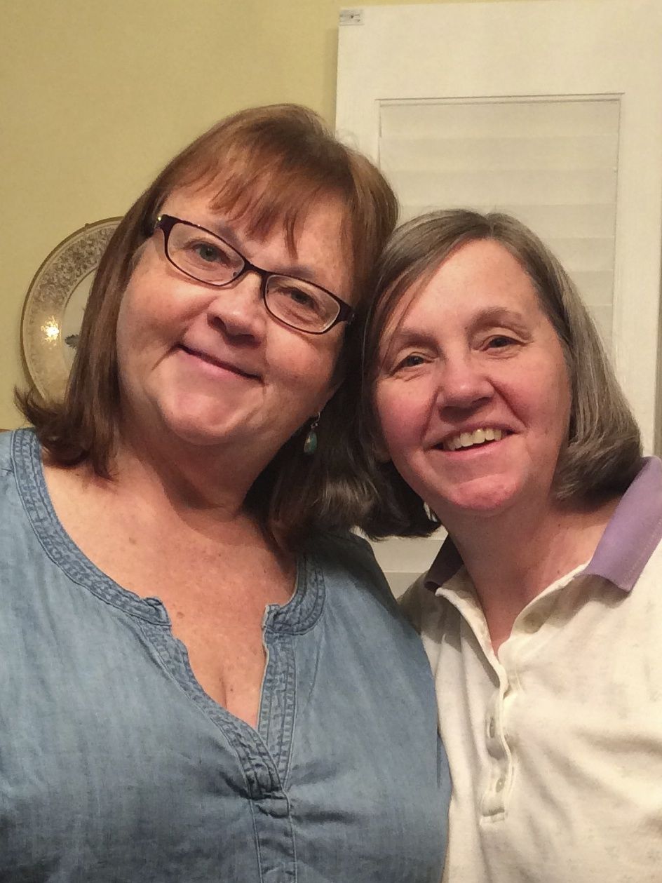
Susan, a friend I met on a forum for lovers of words, invited me over. I spent the day with her and her mother, Grace.
Grace took the photo for us, but declined my request to take one of her with Susan.
We ate breakfast, lunch and dinner and watched High Society on TV. We also played Susan and Grace’s version of Scrabble. They play with the goal of using all the tiles and they don’t bother with keeping score. That was a fun way to play, and they even have one of those deluxe spinning Scrabble boards.
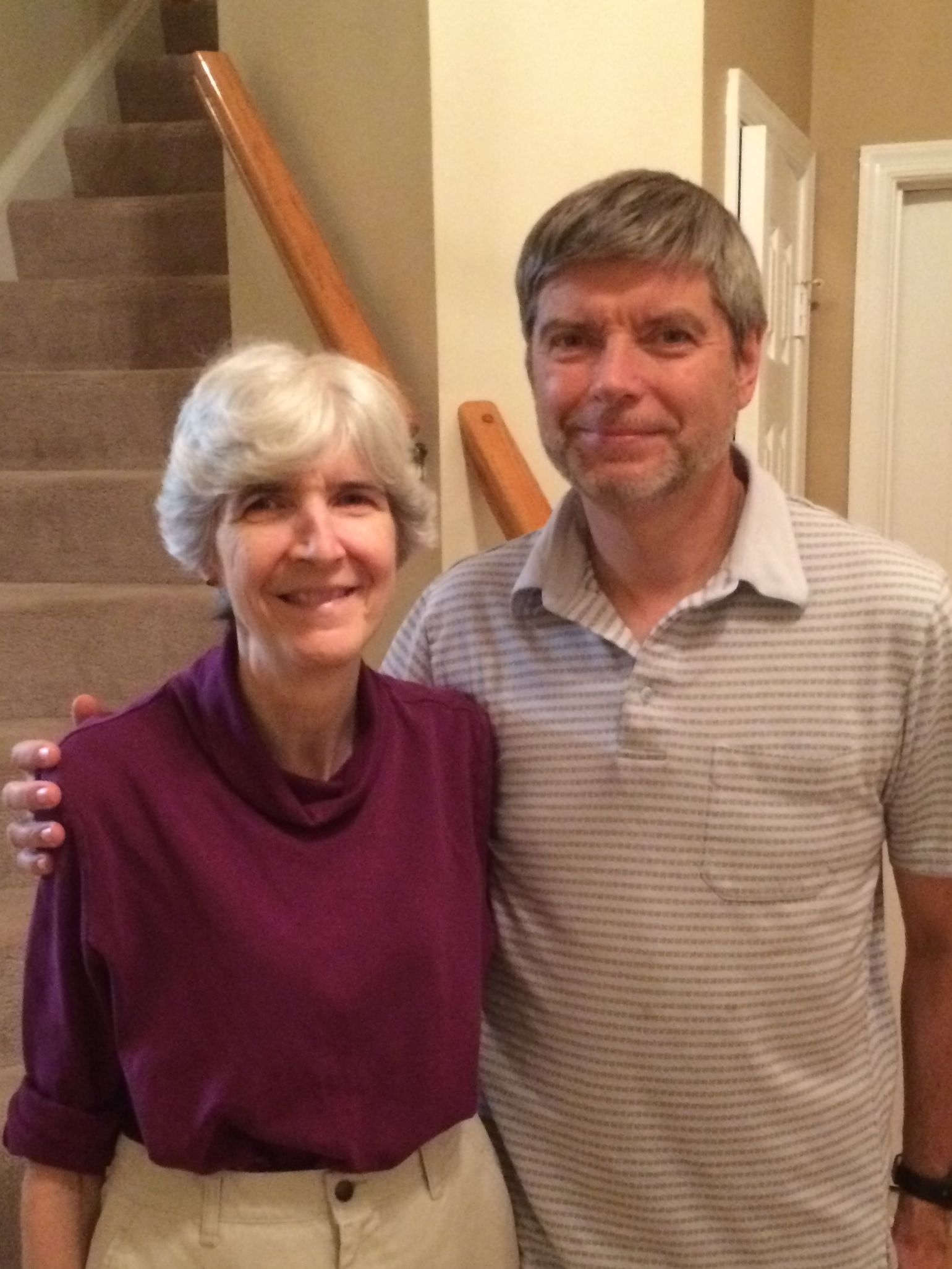
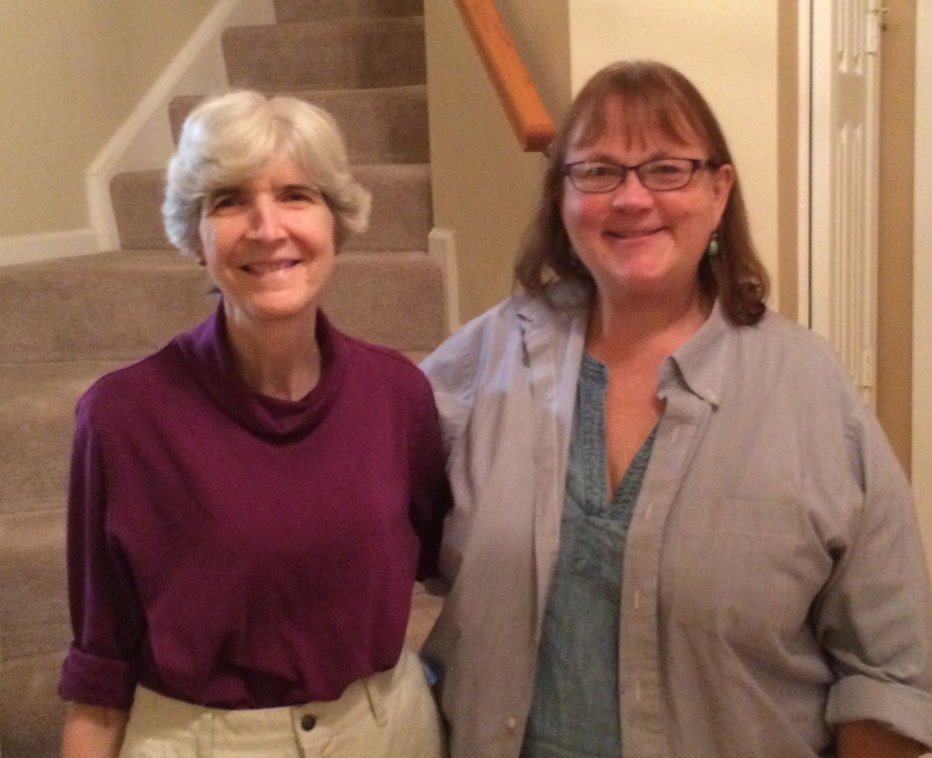
I also spent an evening with Linda and Tom. Linda and I went to Daemen College in Buffalo, New York.
Linda and TomLinda and me
It was fun catching up a little. Since we graduated about 35 years ago, (gulp!) I am sure we didn’t catch up on everything! Where does the time go?
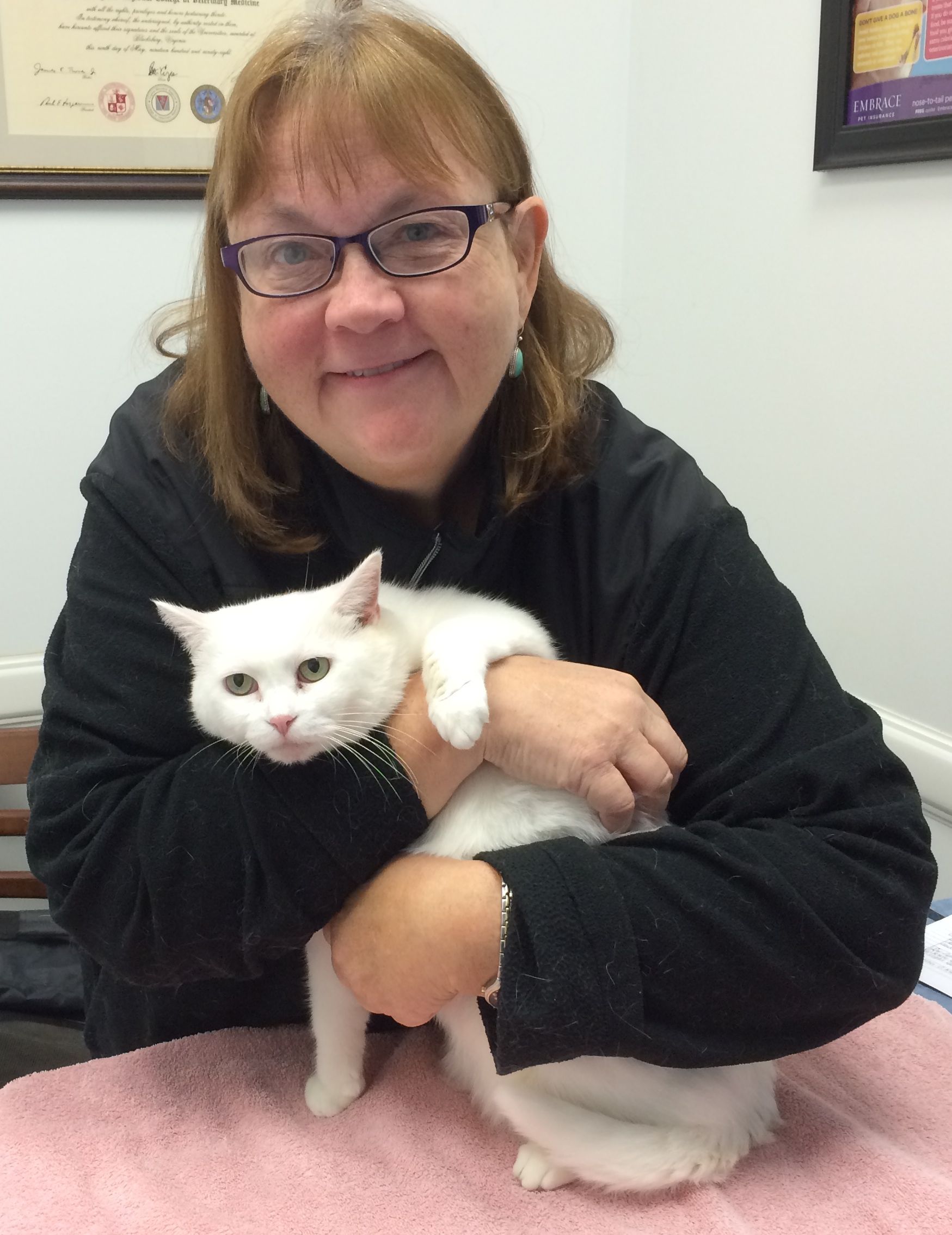
Visit to the vet
I took Cora to the vet for a follow-up on her ears. One ear was all cleared up. The other one needed another course of treatment. I have to find one here in North Carolina for yet another follow-up. Her ears seem like they are doing better, so the next visit may be this will be the last visit for a while.
There is no such thing as a free cat!
One day, while driving around, I told Siri that I was hungry. (Siri is the voice on the phone that helps me with research and things.) She said, “Well, we can’t have that.” And the first restaurant on her list was right around the corner.
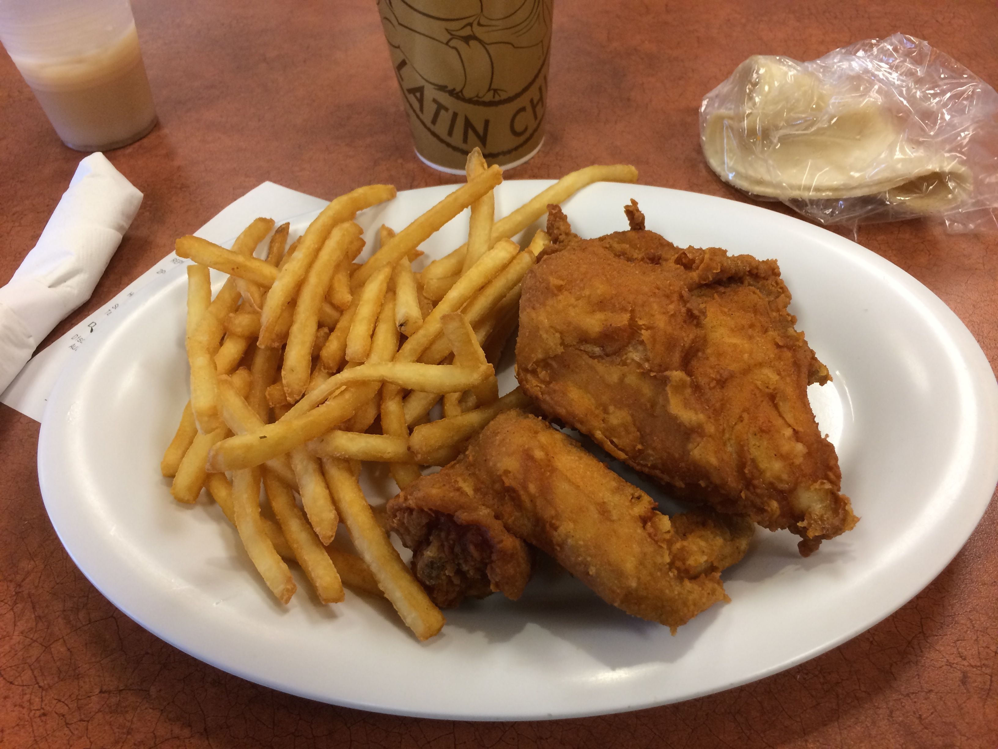
Pollo Campero
This is the same Pollo Campero that I enjoyed when I lived in Guatemala. Oh, the memories! I parked and ordered my food.
Delicious fried chicken and fries served on a real plate!
The woman who took my order confirmed that it was the same chain from Guatemala. I told her that I loved Guatemala. She thanked me and told me that it was her country.
It was delicious!
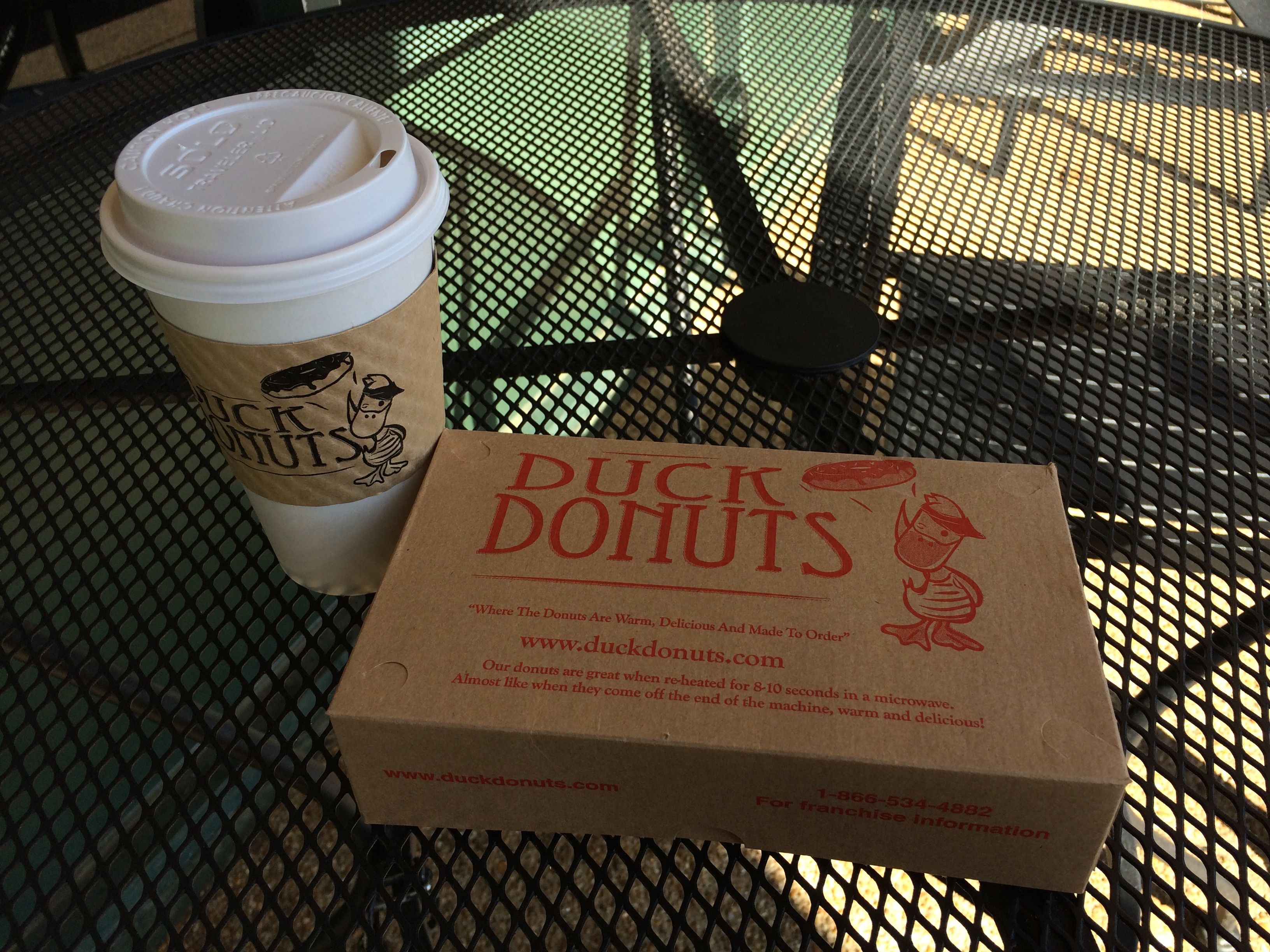
Another day, I happened upon a Duck Donuts store. I had heard the name, but had never seen it before.
The unique thing is that they are served hot and topped when you order them. You need a fork to eat them.
I’m glad I tried one, but once was enough. Hot donuts are just not my thing, I guess.
The Manassas area is really multicultural. When I went to the laundromat, the instructions were in English, Spanish and Korean. Next door was this huge and interesting grocery store. I just went in for a couple mundane things – milk, toilet paper. I could have spent an hour just looking at all the exotic items for sale.
Spanish and Korean books
I went to the library to use their wifi, and I found these books on the shelf.
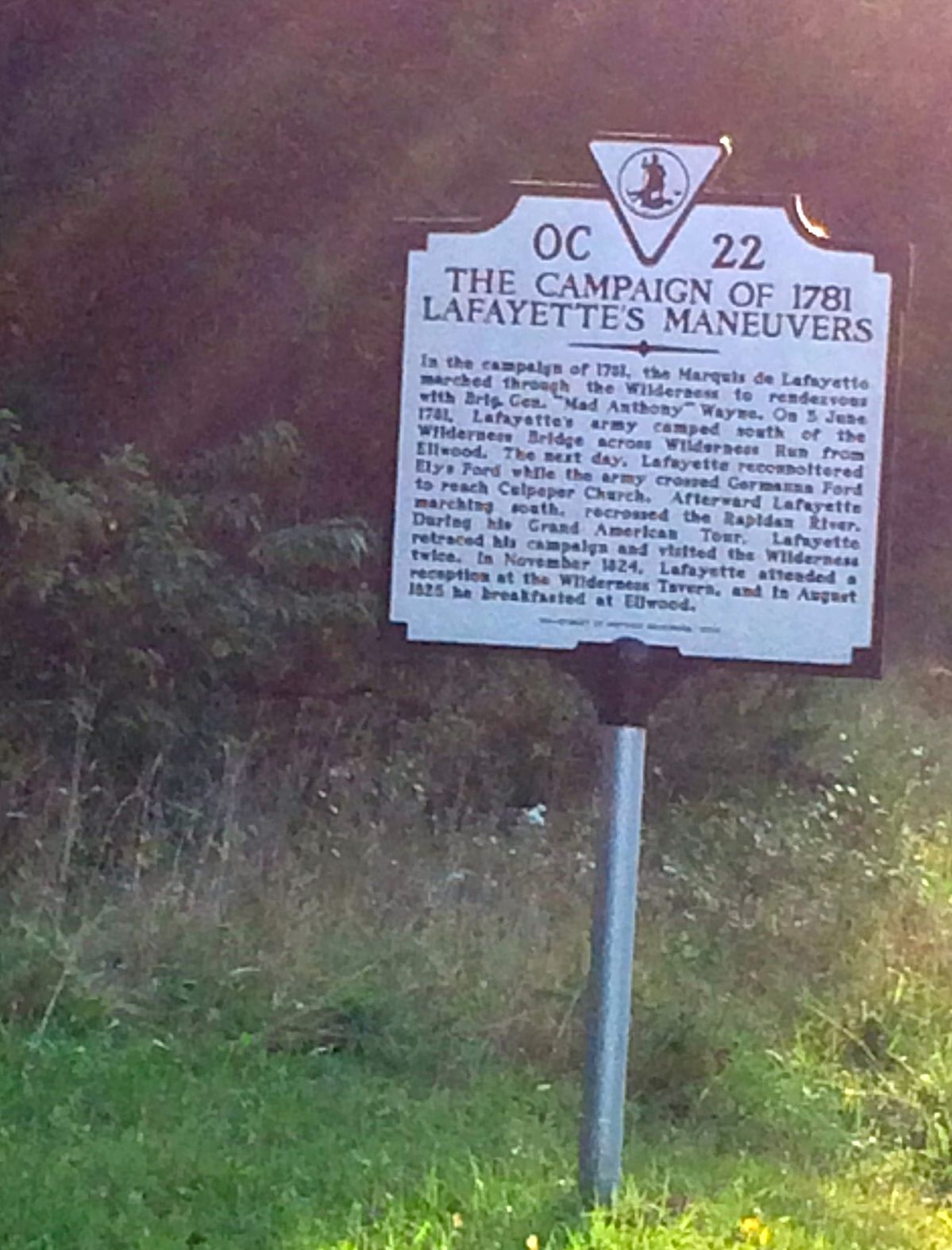
Another mini-adventure I had was looking for the grave of Stonewall Jackson’s left arm. I followed the directions provided by HISTORY Here when I left the Marine Corps Museum in Triangle, VA. I passed the sign for the place where Jackson was shot. I passed the sign for the place where his arm was amputated. I turned at the corner, and then the voice in my phone told me to turn again. I saw a gravel road and one of those familiar white signs by the road, so I turned in.
About a hundred feet in, I saw a graveyard, and I figured that I had found it. I parked and started looking around. I examined all the stones, and it wasn’t there. I had just found one of the ubiquitous southern graveyards that you see all over.
On the way out, I stopped an looked at the sign by the road.
Whoop! Wrong war!
I did find the entrance to Ellwood, the estate where the arm is buried. However, I arrived after hours. I could have parked and walked in, but I didn’t exactly know where I was going and my Spidey Sense was telling me to move along. And so I did.
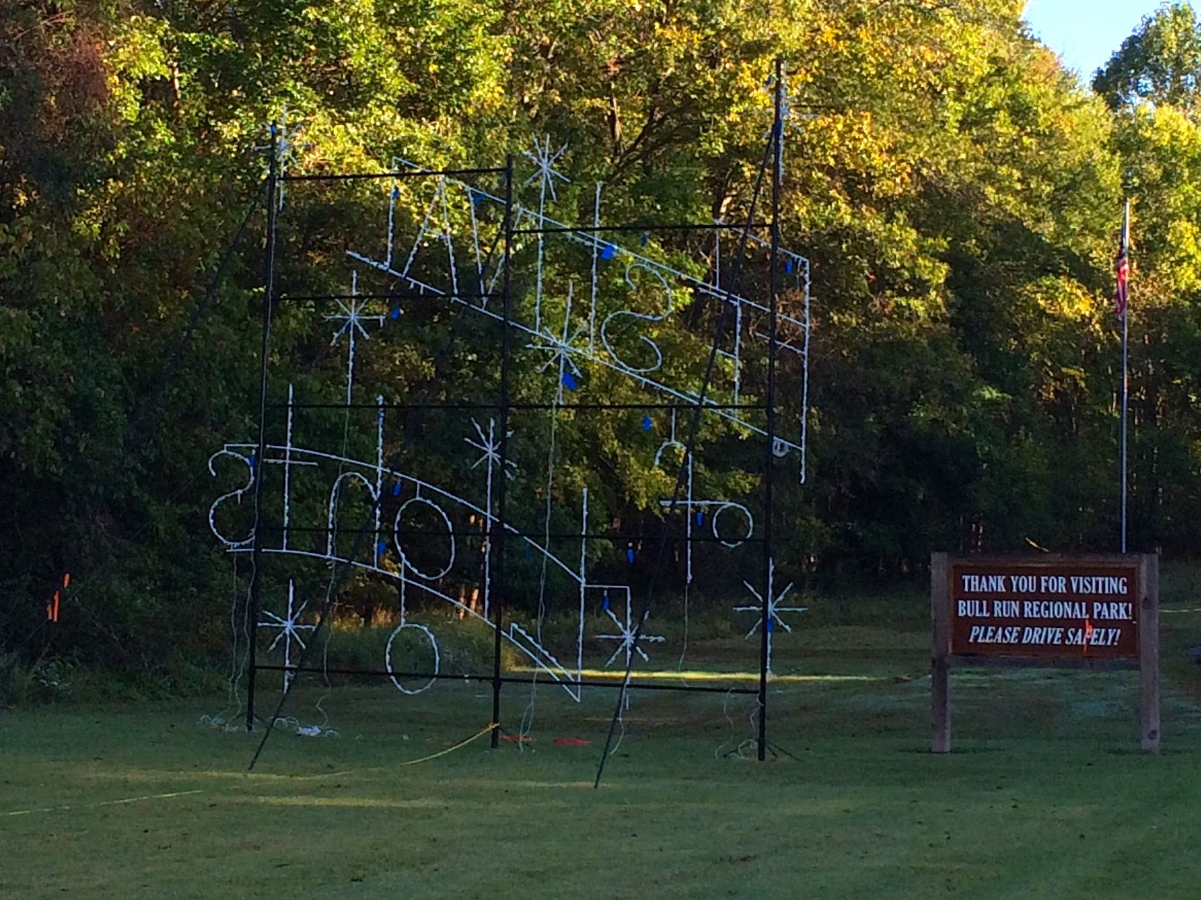
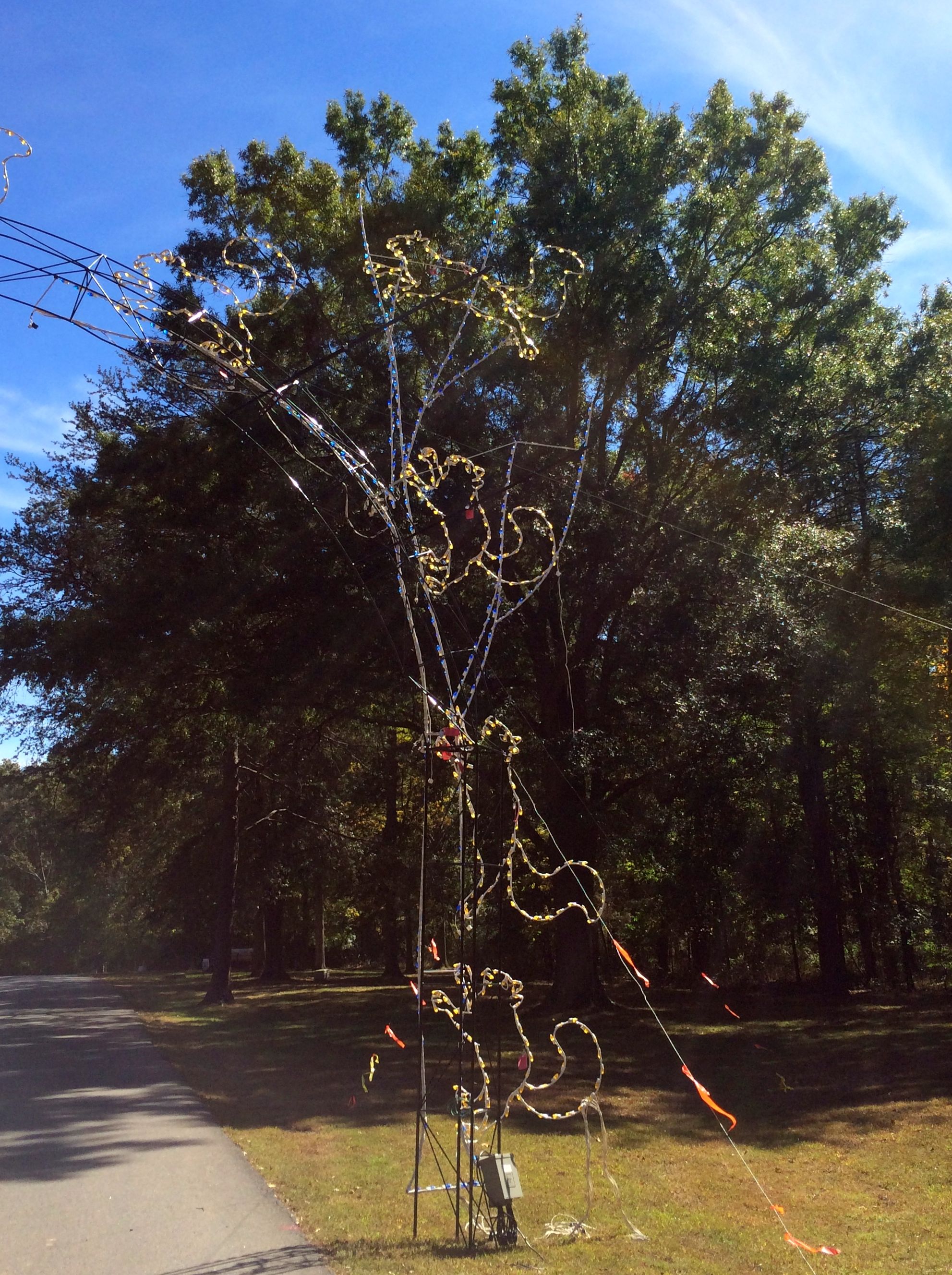
Bull Run Regional Park has Christmas lights. The display must be stunning! I never saw them turned on, as they were only working on installing them during my stay.
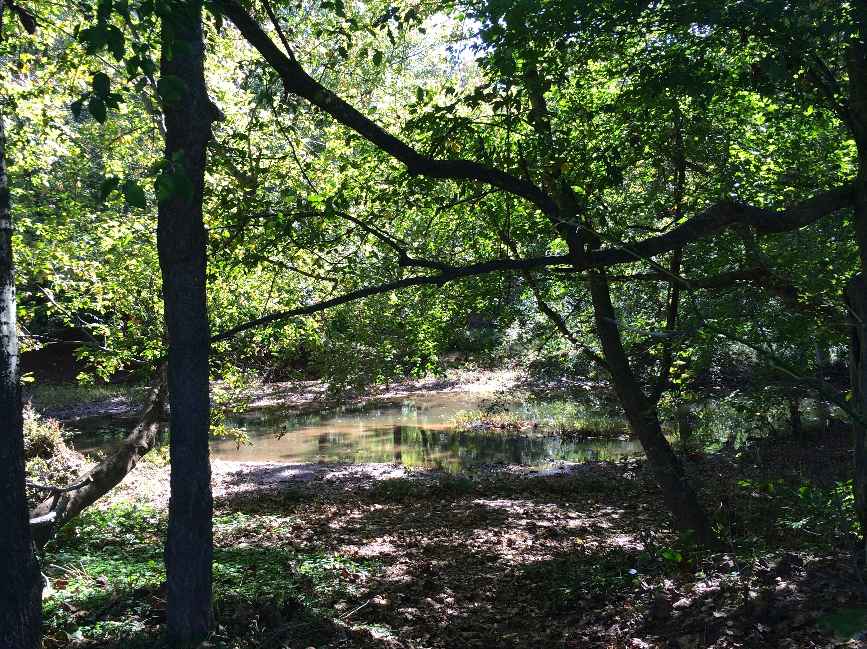
Since I was staying right by Bull Run, I decided that I ought to get a picture of the actual stream – a “run” is a stream. I parked and walked over to the edge of the the trees lining the stream.
I figured I could get closer, so I started down the bank. I slipped and fell and landed hard.
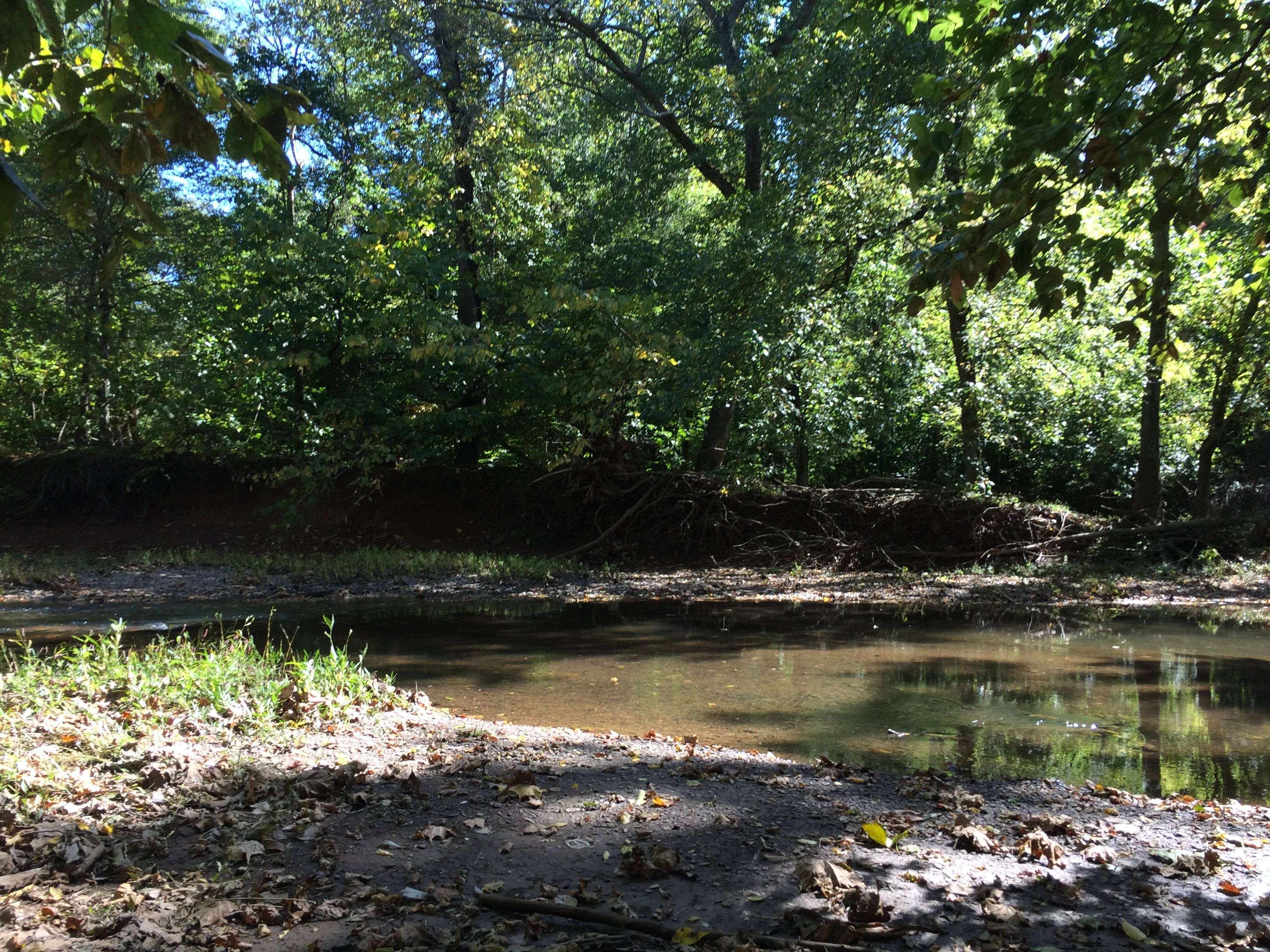
As long as I was down, I thought I might as well get that close-up photo I was came for.
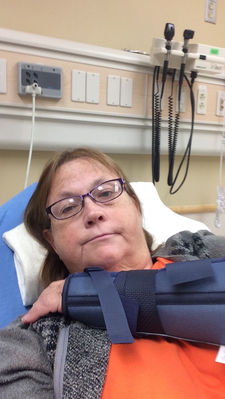
I landed really hard on my right wrist. After crawling on my hands and knees up the slippery slope, I was covered in slimy stinky mud. I got a shower, changed and took myself to the hospital. Just a sprain.
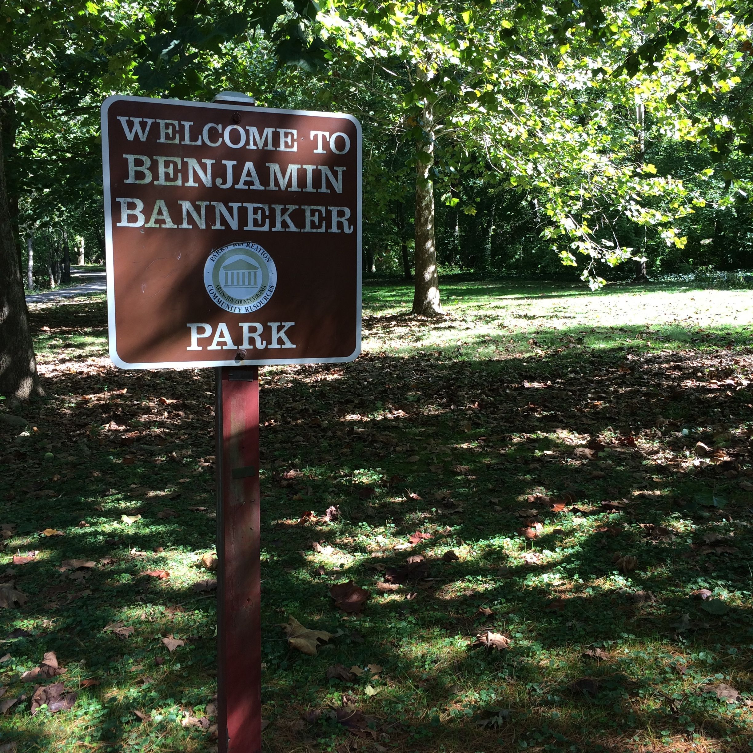
After my effort to get to Benjamin Banneker Historical Park and Museum in Ellicott City, Maryland – it was closed the day I went – I decided to try to find SW-9 Intermediate Boundary Stone, which is located in Benjamin Banneker Park in Arlington, Virginia.
It was no easy task. Oh, my HISTORY Here app sent me right to the park.
It was a lovely park and a great day for a stroll.
Good thing. I strolled and strolled and strolled. No luck. After more than an hour, I gave up and got into BART. I still thought that I might find it, so I kept my eyes peeled.
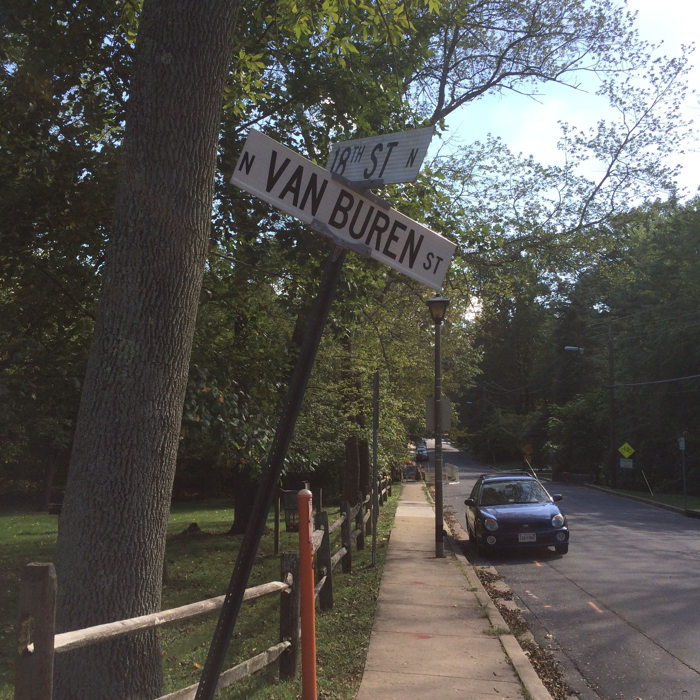
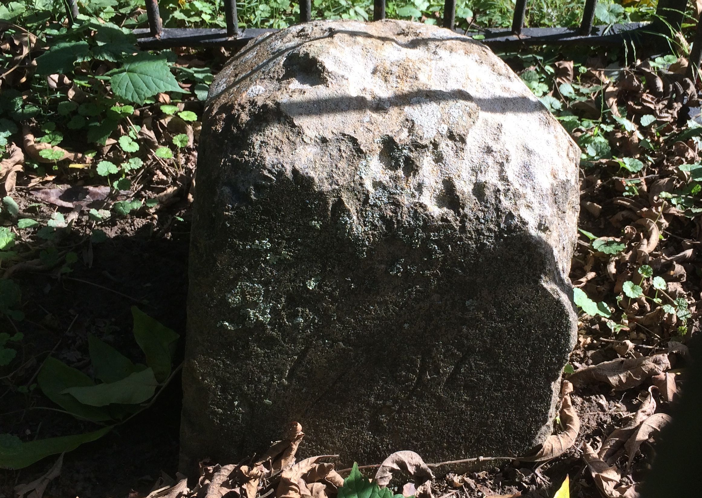
And I found it!
It was near the corner of N. Van Buren and N. 18th Streets.
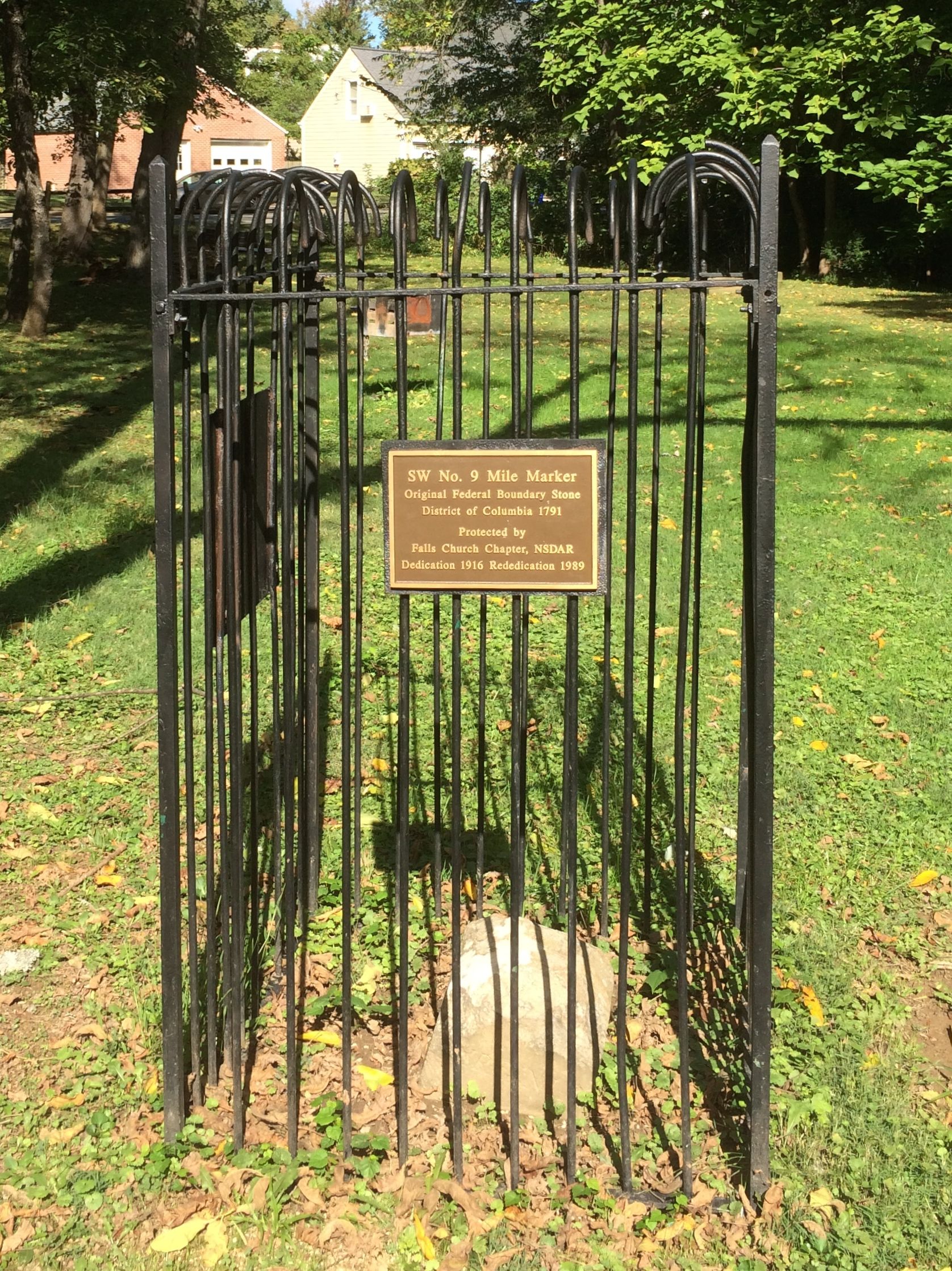
This is one of 40 boundary stones laid in 1791 to mark the boundaries of the newly created District of Columbia. Benjamin Banneker was part of the team that surveyed the land. This was especially important after the initial designer, Pierre Charles L’Enfant left the project. Well, actually, L’Enfant was dismissed for refusing to cooperate with the commissioners, but that is another story.
This was declared a National Historic Landmark in 1980. The plaque states, “This site possesses national significance in commemorating the history of the United States of America.”
With that mission accomplished, I set out for Steven F. Udvar-Hazy Center.
What is the Steven F. Udvar-Hazy Center, you ask. It is a part of the the Smithsonian Air and Space Museum. It is a home for historic aircraft that are too large for the main museum in Washington. It is located at the Dulles International Airport.
It is open every day, 10:00 – 5:30. Admission is free. Parking is $15, but, if you come in after 4:00, parking is free. As everyone knows, free is my favorite word. I figured that an hour and a half of free is great.
I parked and went to the information desk. I asked if there was a map to the highlights of the collection. He gave me a guide and I set off to see what I could see.
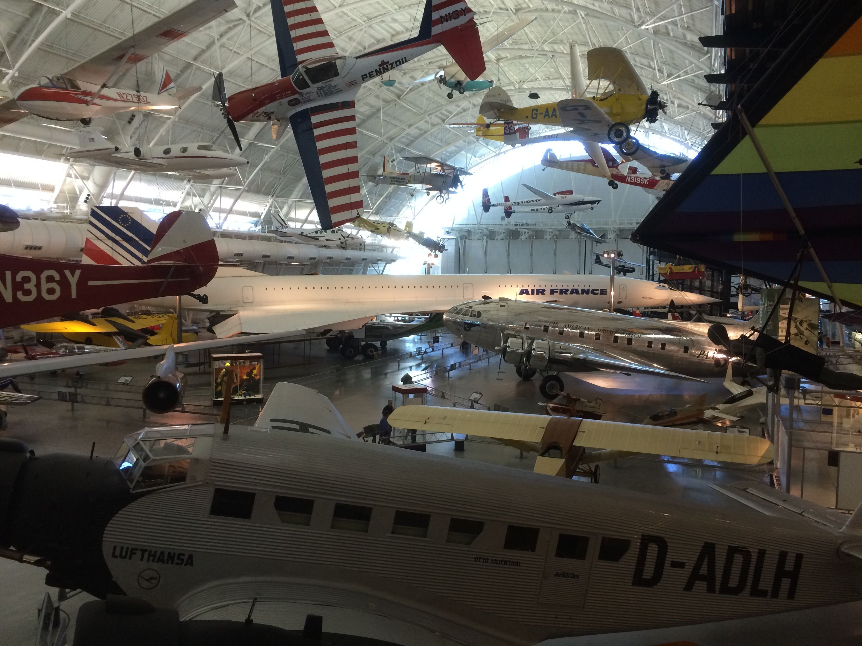
What I saw were planes, planes and more planes!
Yes, that is the Concorde in the back. There were 20 built. It was introduced in 1976 and was retired in 2003.
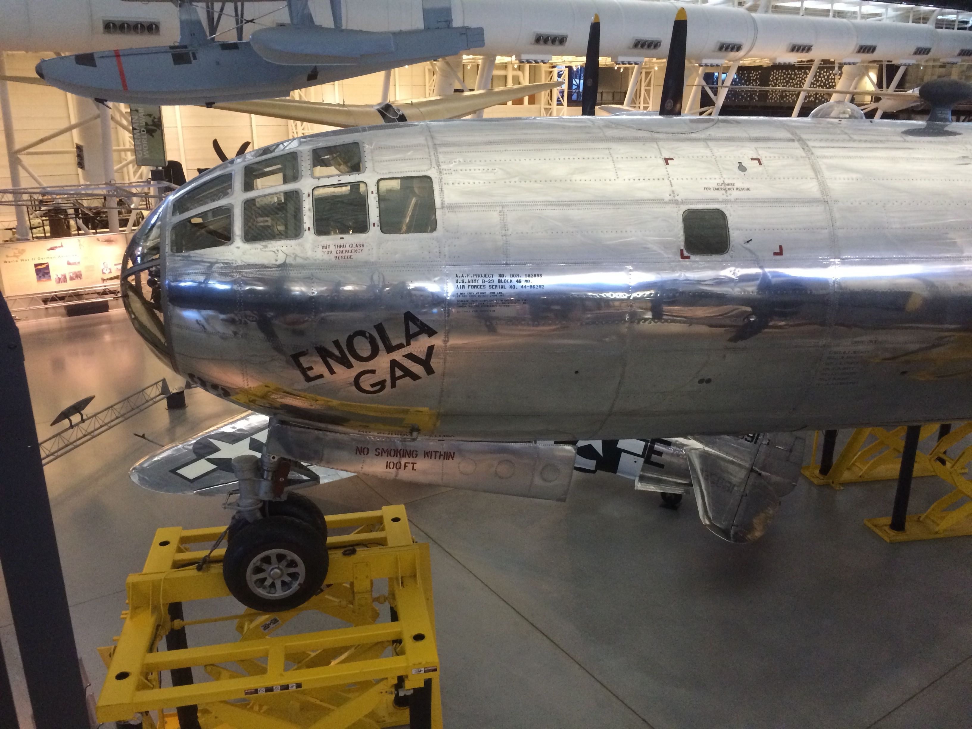
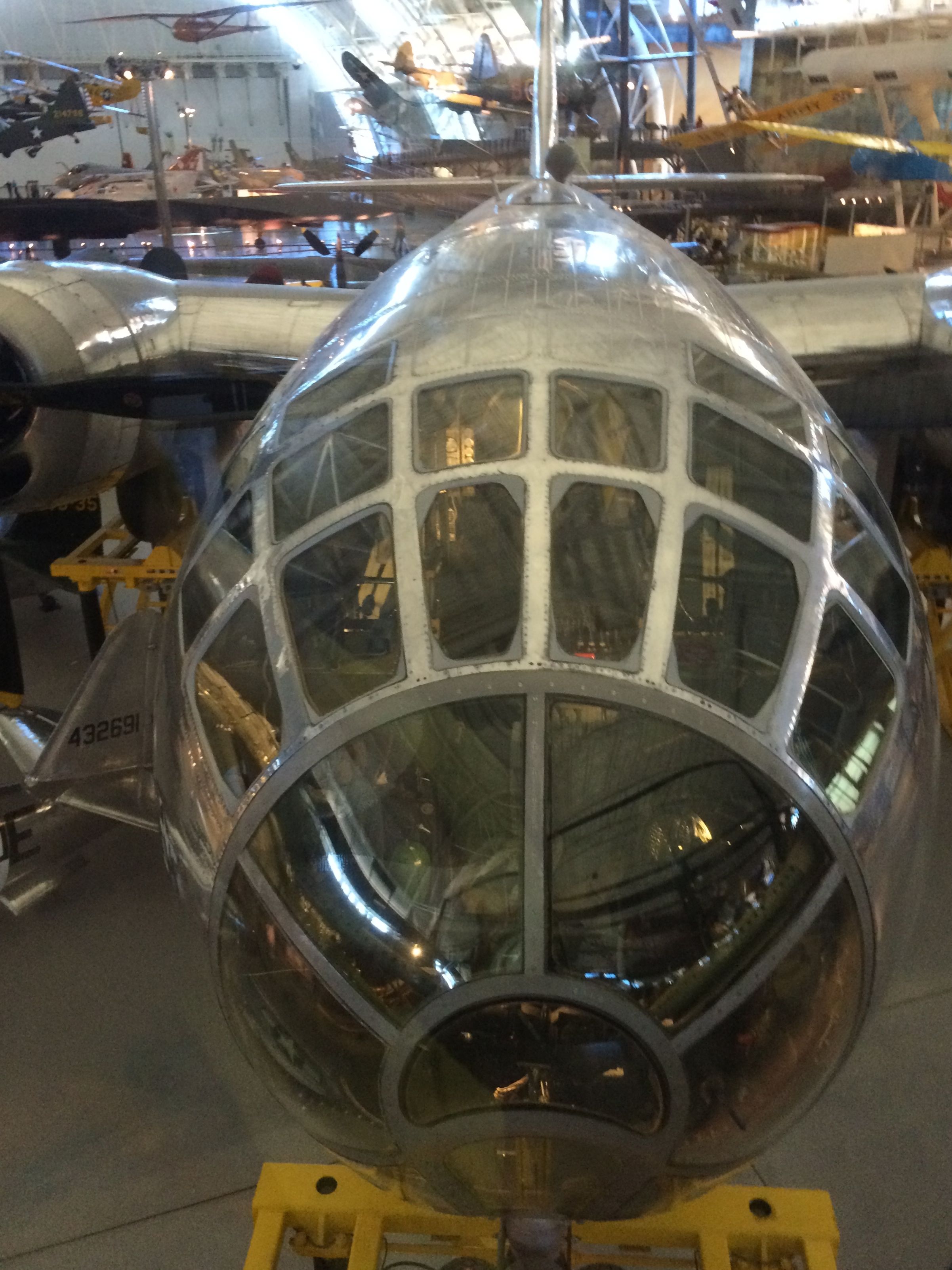
I was stopped in my tracks when I turned to the right and there was the Enola Gay, which was the plane used in the bombing of Hiroshima. It dropped the first atom bomb.
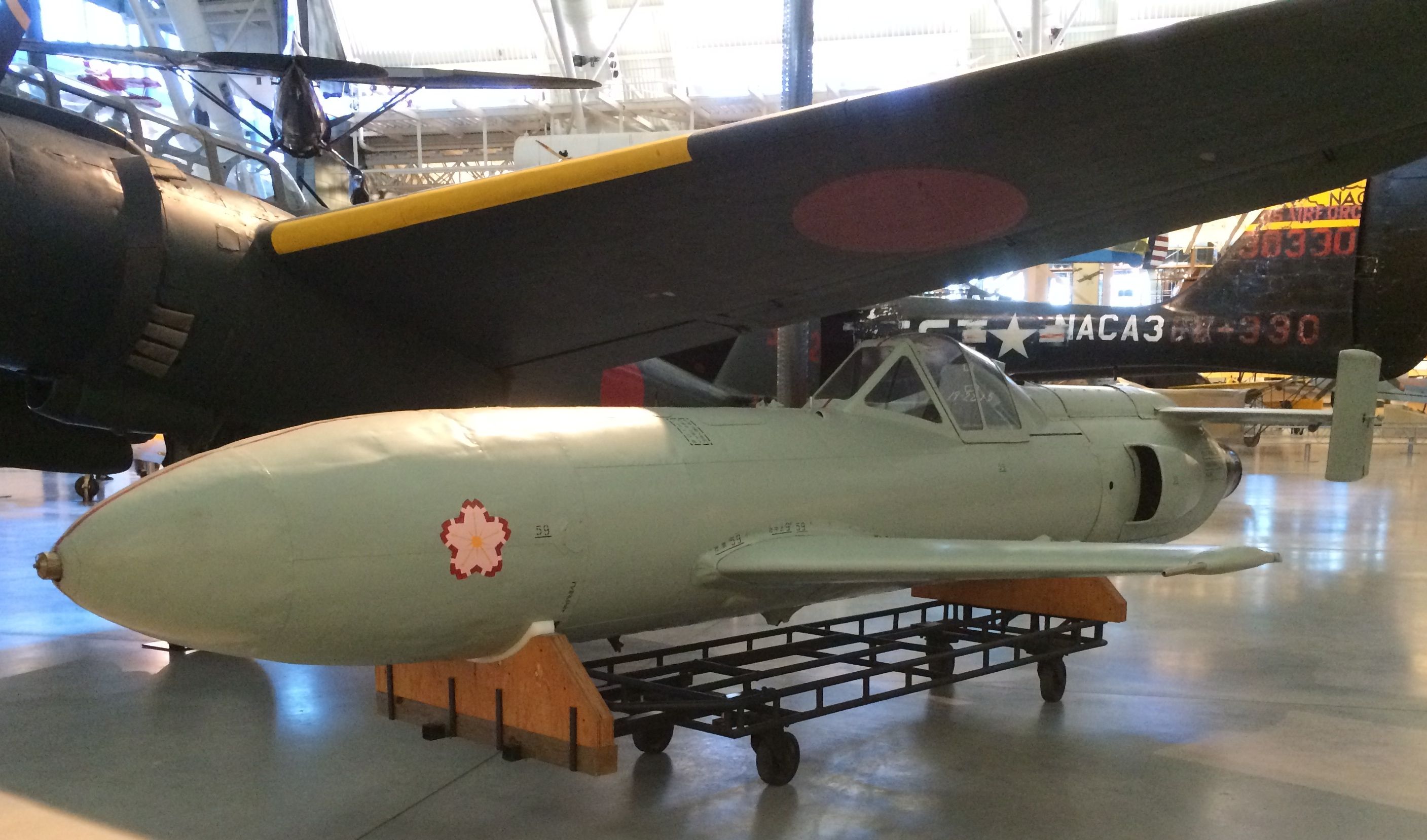
In addition to the Enola Gay, there was also a Kugisho MXY7 Ohka. Ohka is Japanese for cherry blossom. It was the aircraft that was used by the kamikaze pilots. This one was still in development. They were trying a new engine, but they never got it operational.
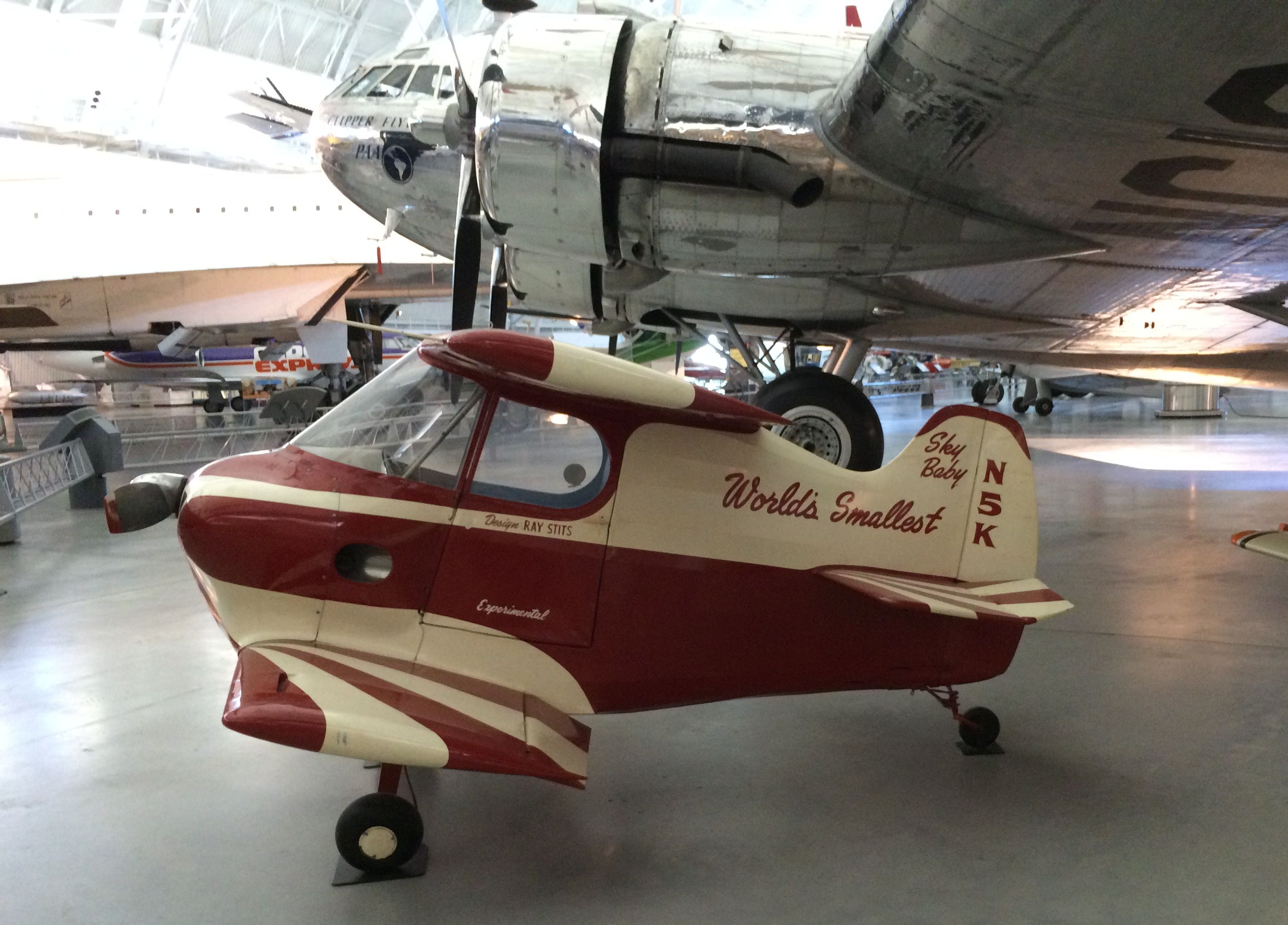
I was captivated by another small aircraft with no connection to death and destruction. Sky Baby – the World’s Smallest Airplane.
It is 9 ft 10 in long, has a wingspan of 7 ft 2 in and is 5 ft tall. It was built in 1952. No one challenged the builder Ray Stilt’s claim until 1980s when Robert Starr announced that his biplane, Bumble Bee II was smaller. Ray’s son Donald restored the family honor in 2002 by designing and building Baby Bird. The Guinness Book of Records crowned Bumble Bee II the world’s smallest biplane and Baby Bird the smalls monoplane.
So, I guess that Sky Baby isn’t the World’s Smallest, but it sure is cute!
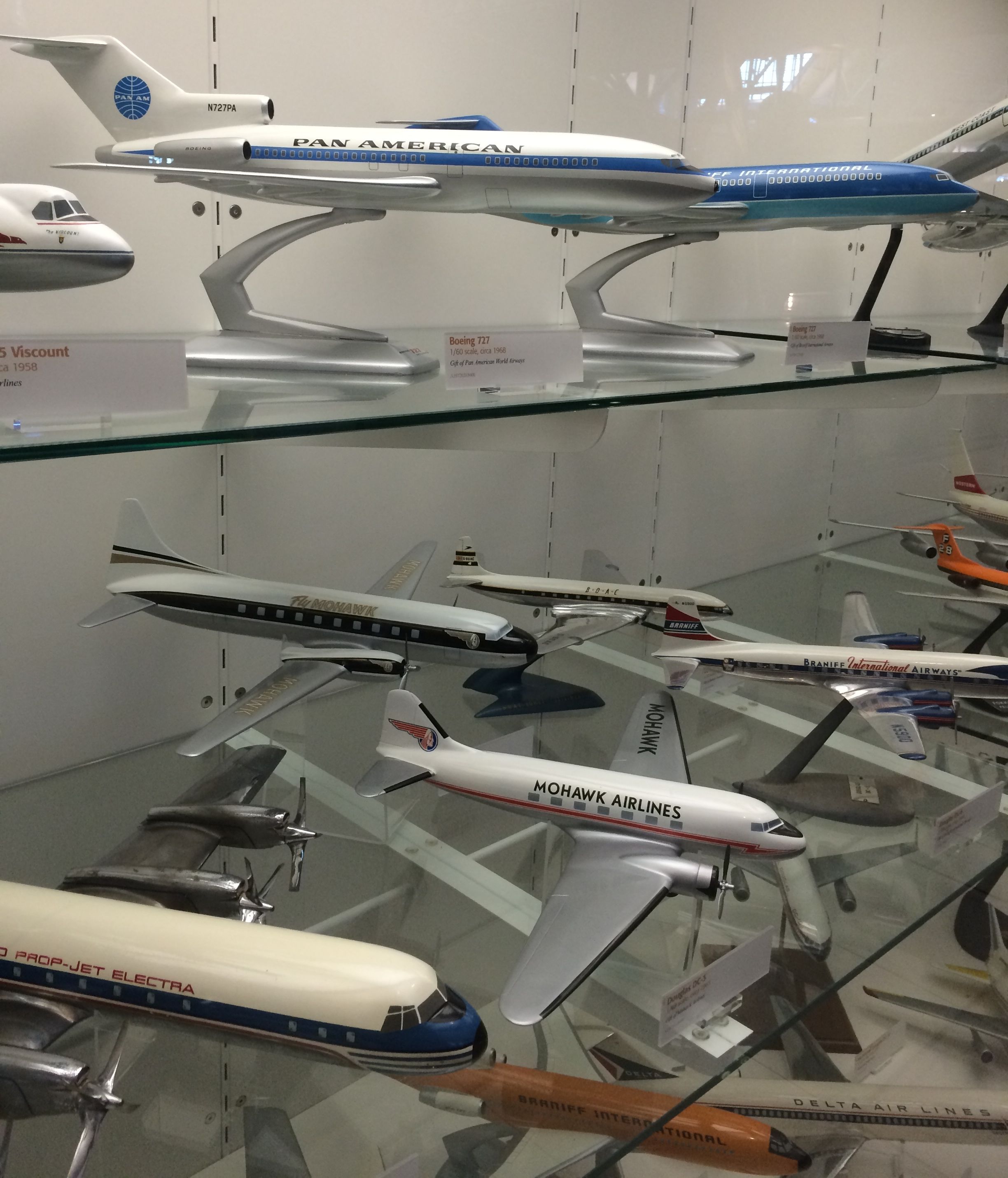
There were cases and cases of models of airline planes.
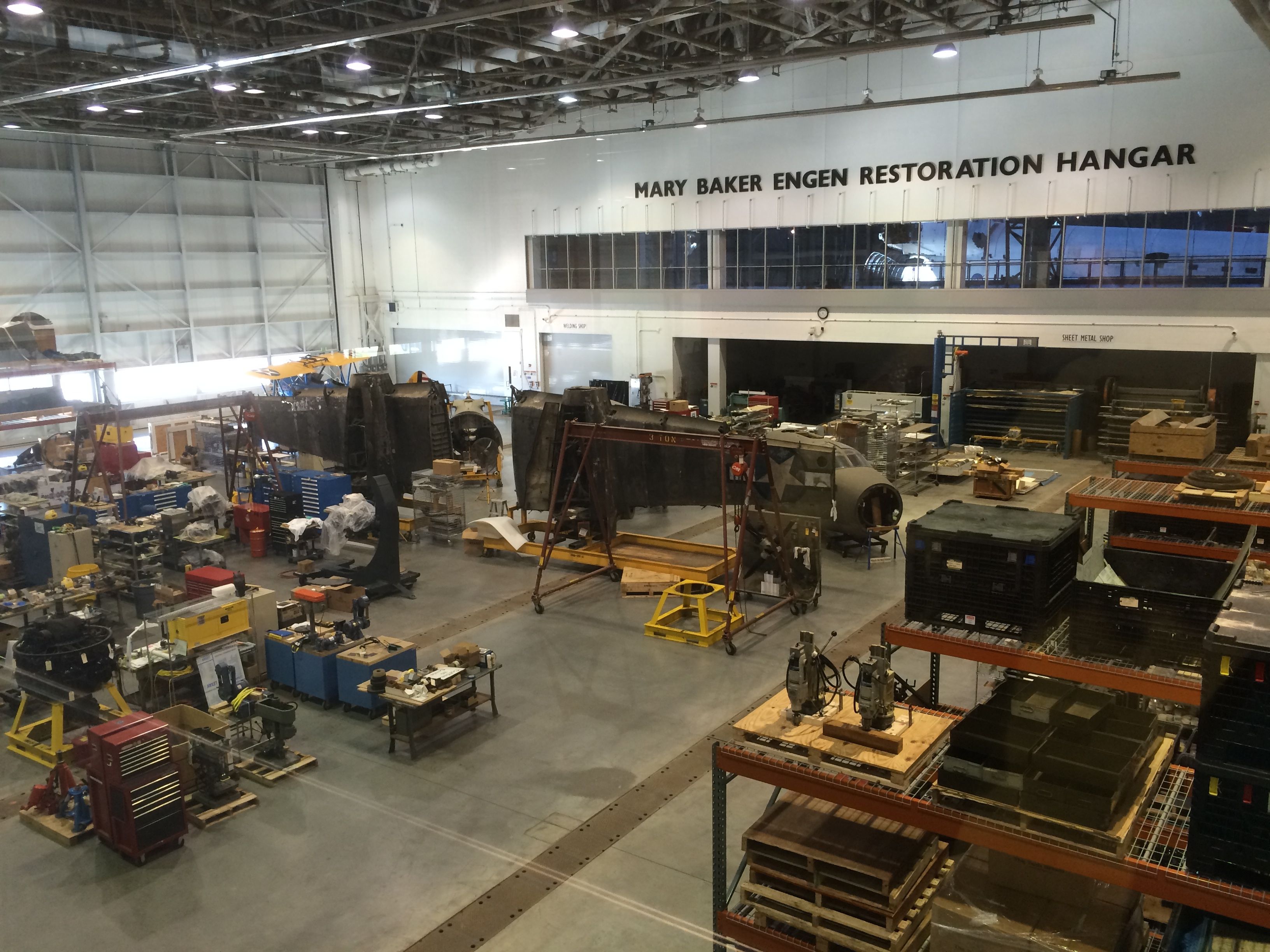
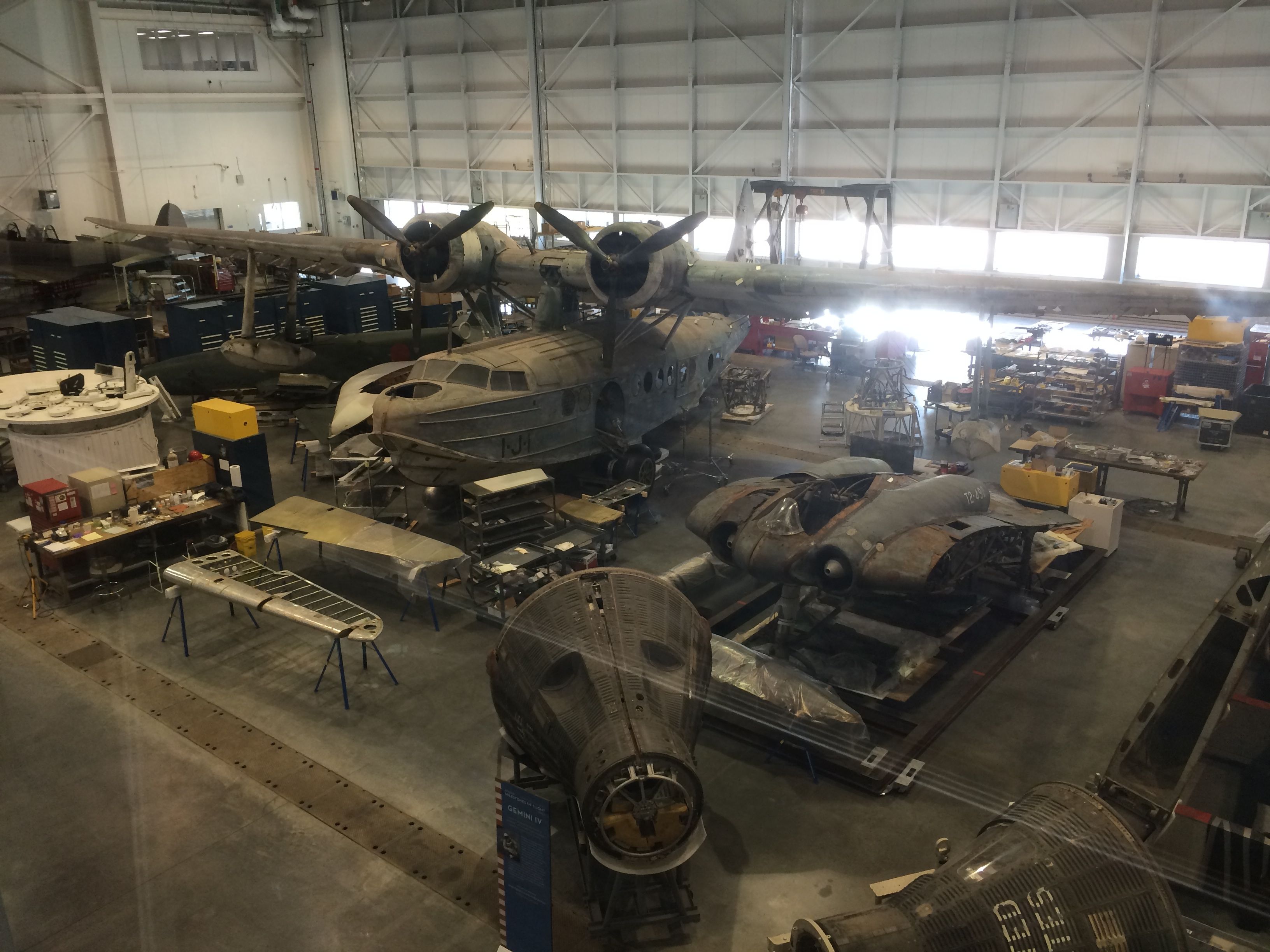
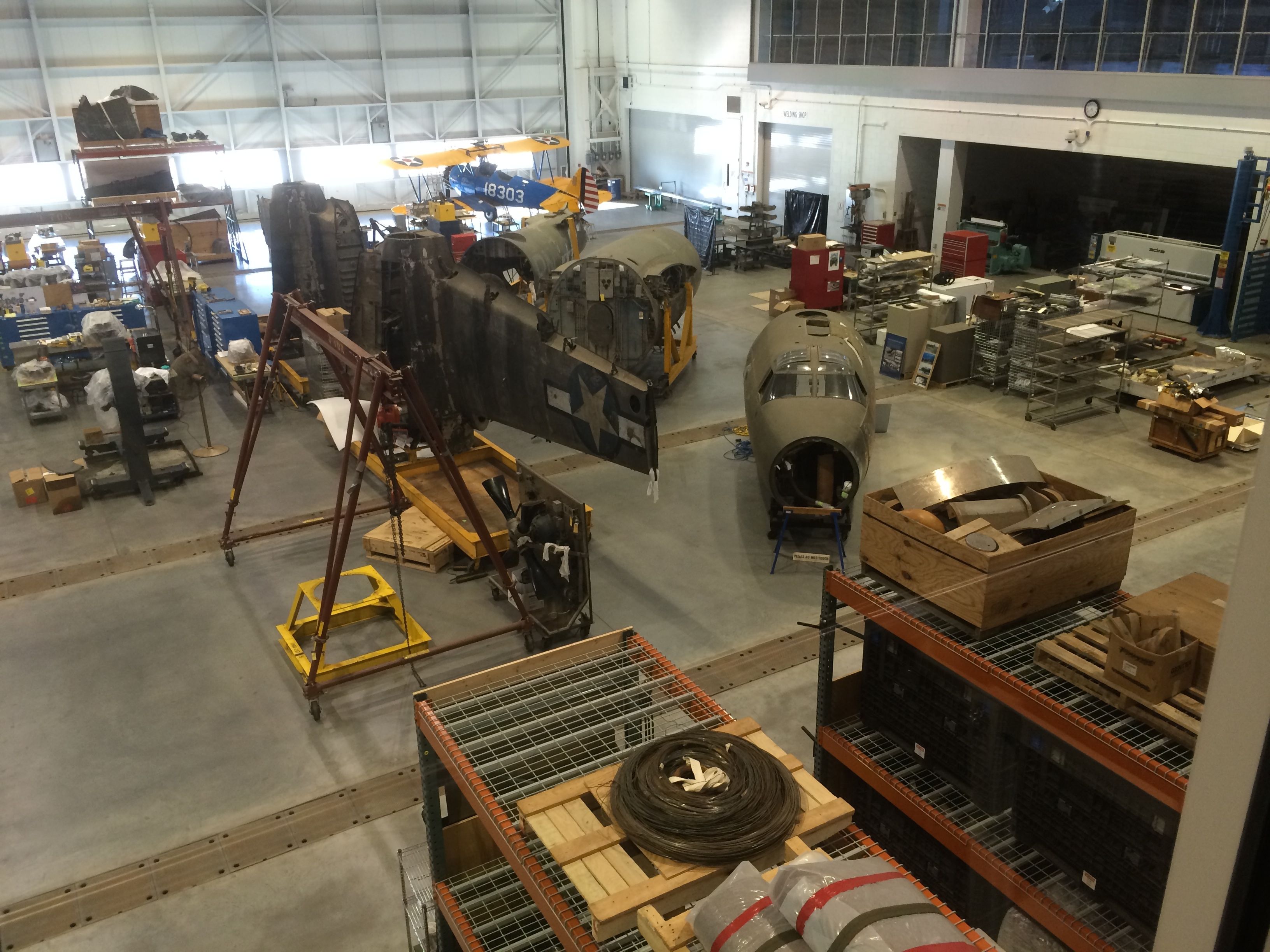
And a hangar for working on restoring historic crafts.
And off into the era of space exploration.
Space Shuttle Discovery. Its first flight was in 1984 and its last flight was in 2011. It flew a total of 39 missions.
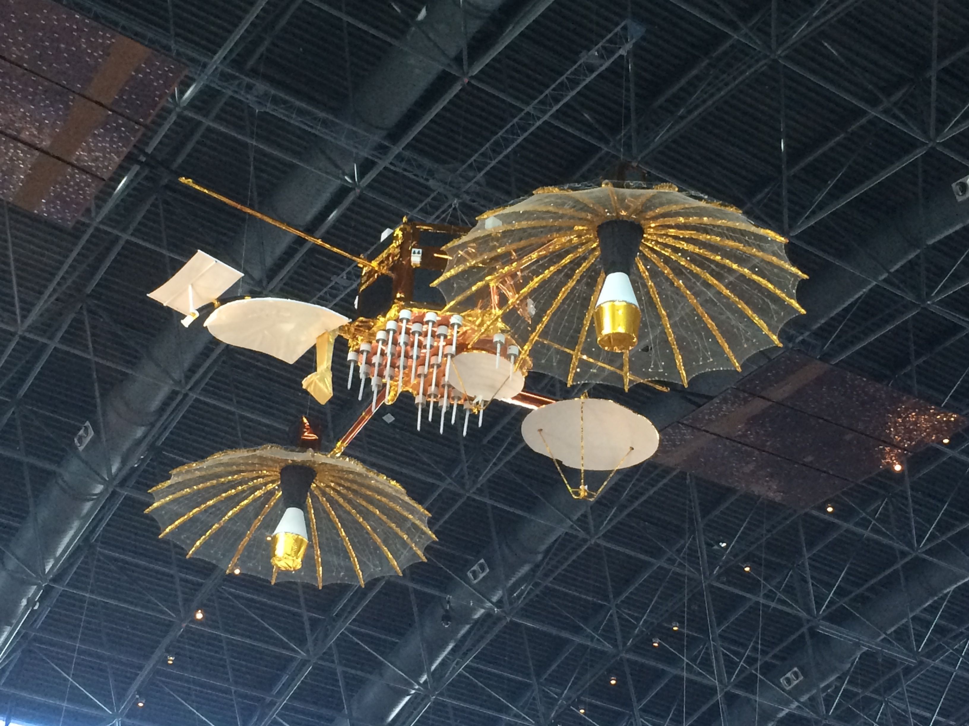
Satellites and space probes.
I really liked this one, but I don’t know what it is.
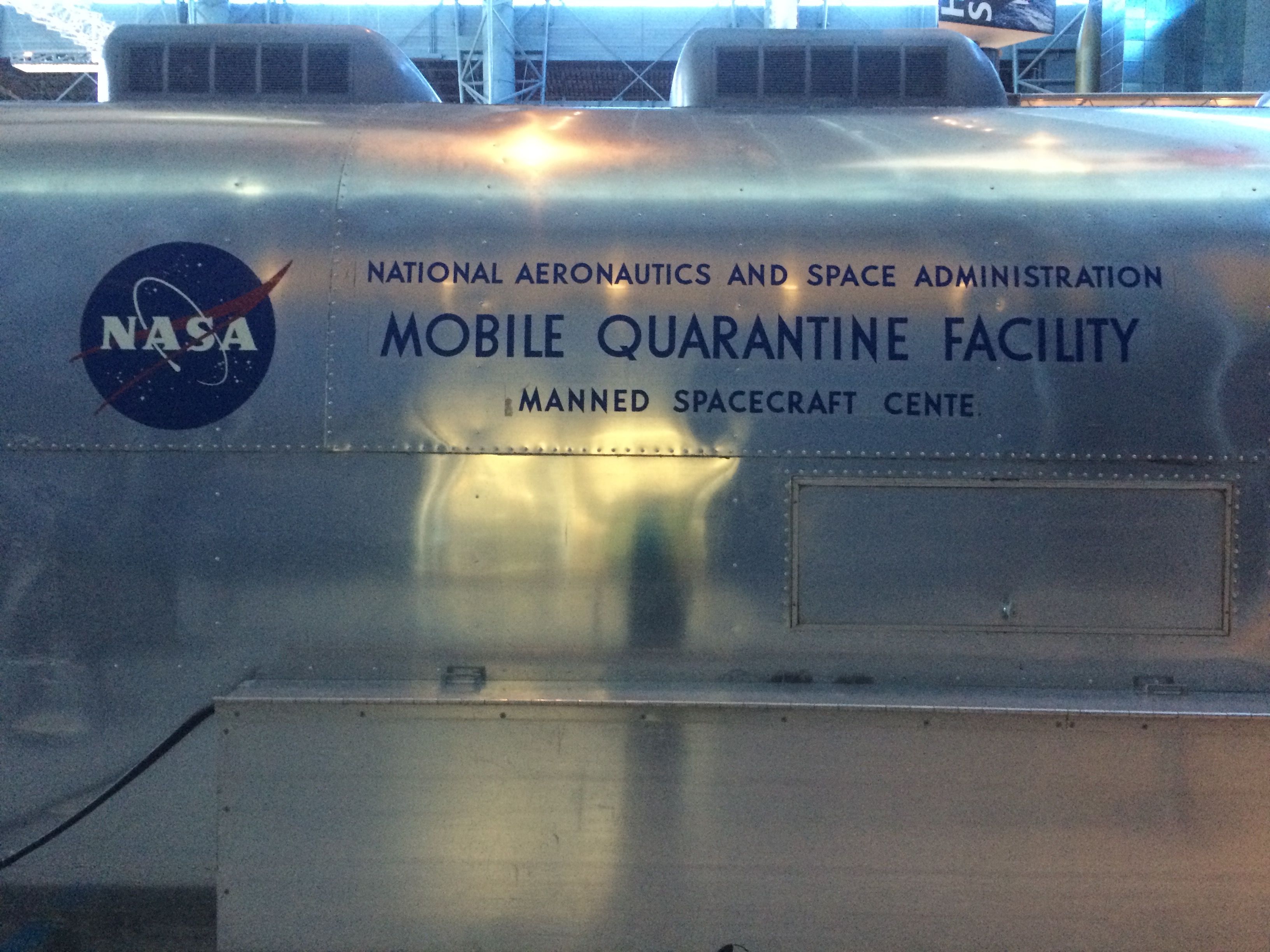
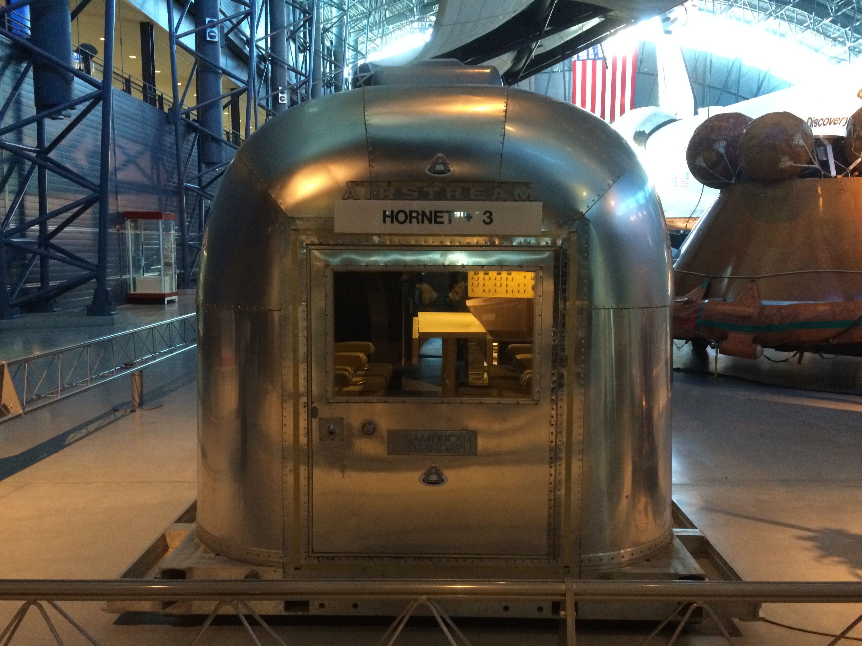
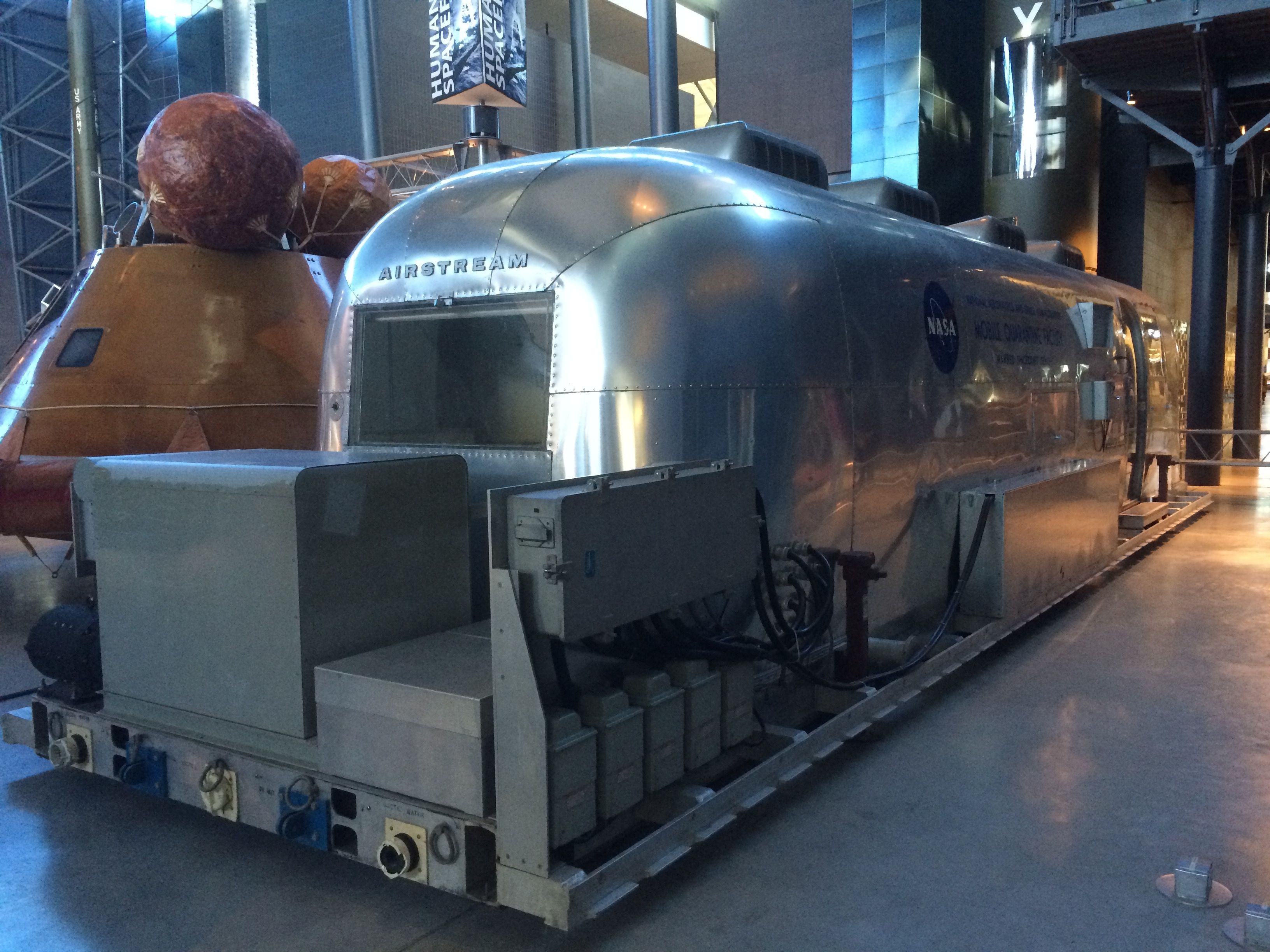
And, I have to admit that I was particularly drawn to Mobile Quarantine Facility.
It’s Flo’s cousin! (Flo is the name of my Airstream, in case you are a recent reader of this blog.)
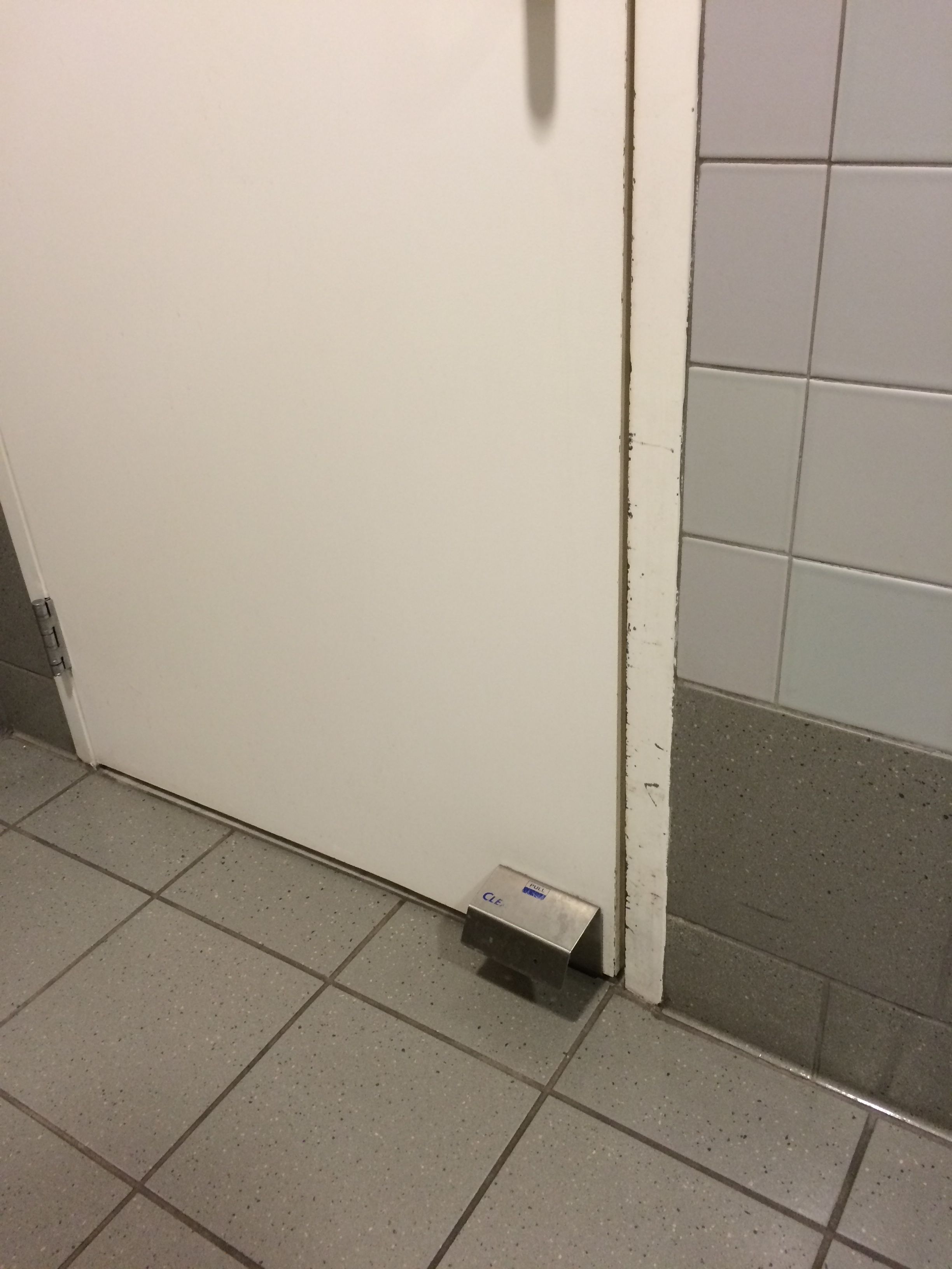
Just one more stop, and then my whirlwind visit would be finished. The ladies’ room.
I was impressed with the Clean Escape.
What a great idea! You can open the door with your toe after you have washed your hands!
I think I have seen all the aircraft I need to see for a while, but it was worth the time.
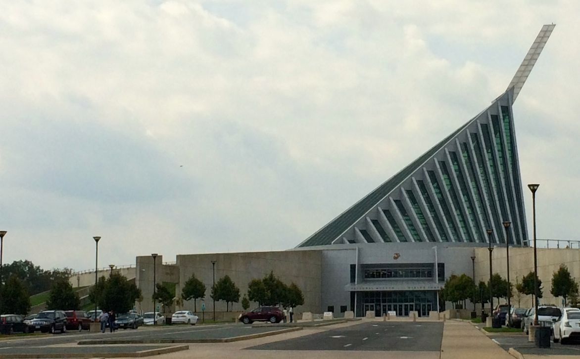
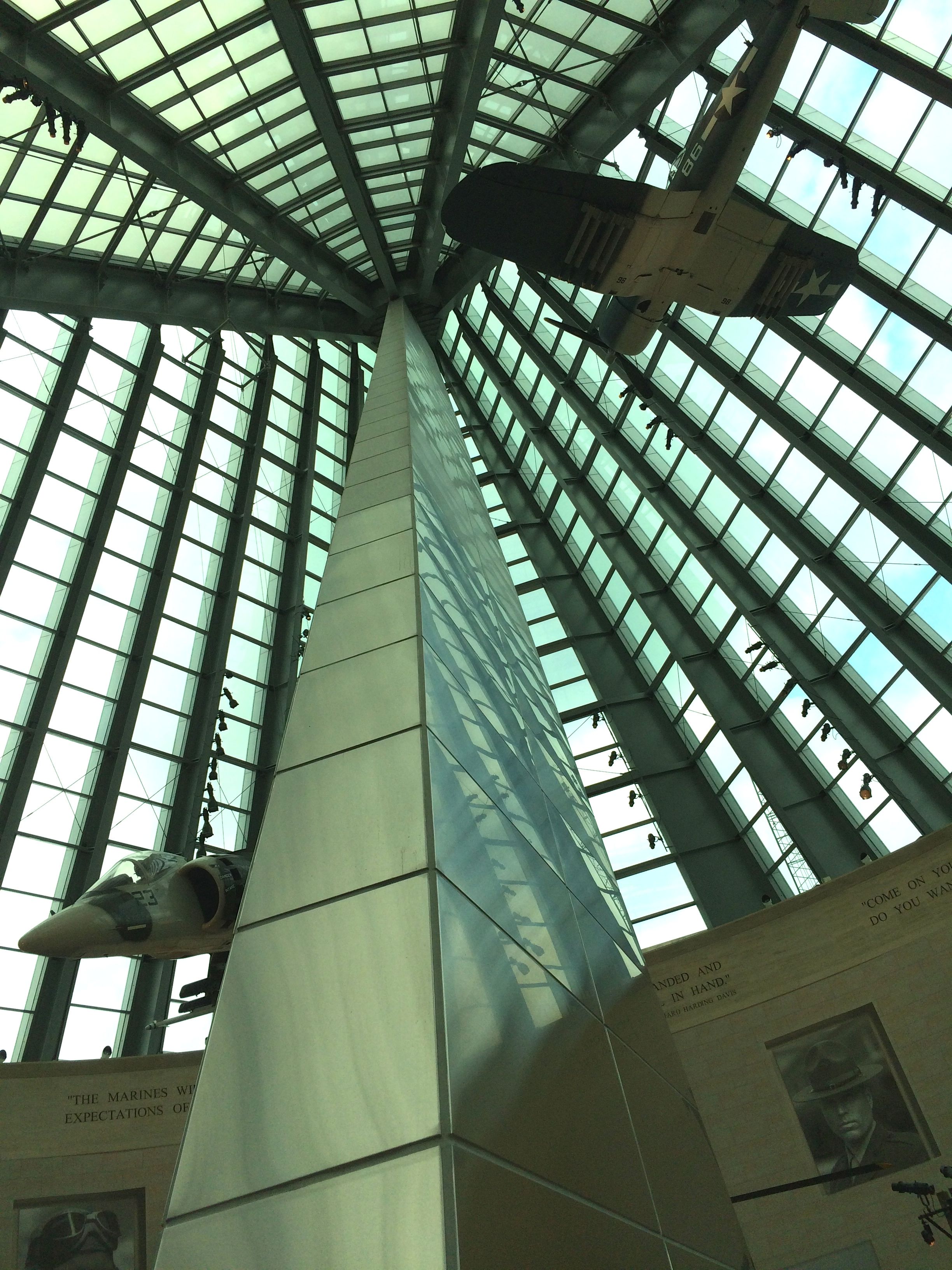
When I looked up the name of the museum, to be sure that I got it right, I found out that the architectural style of the building is deconstructionism. That was a new one for me.
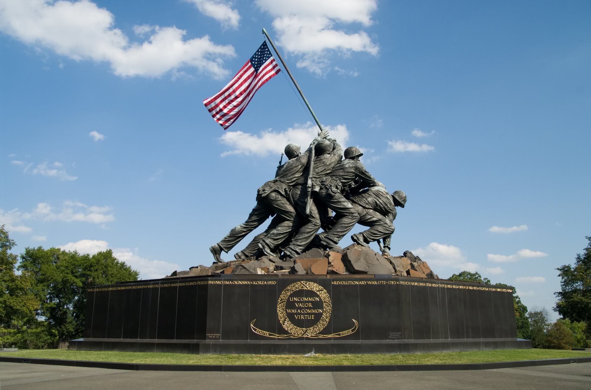
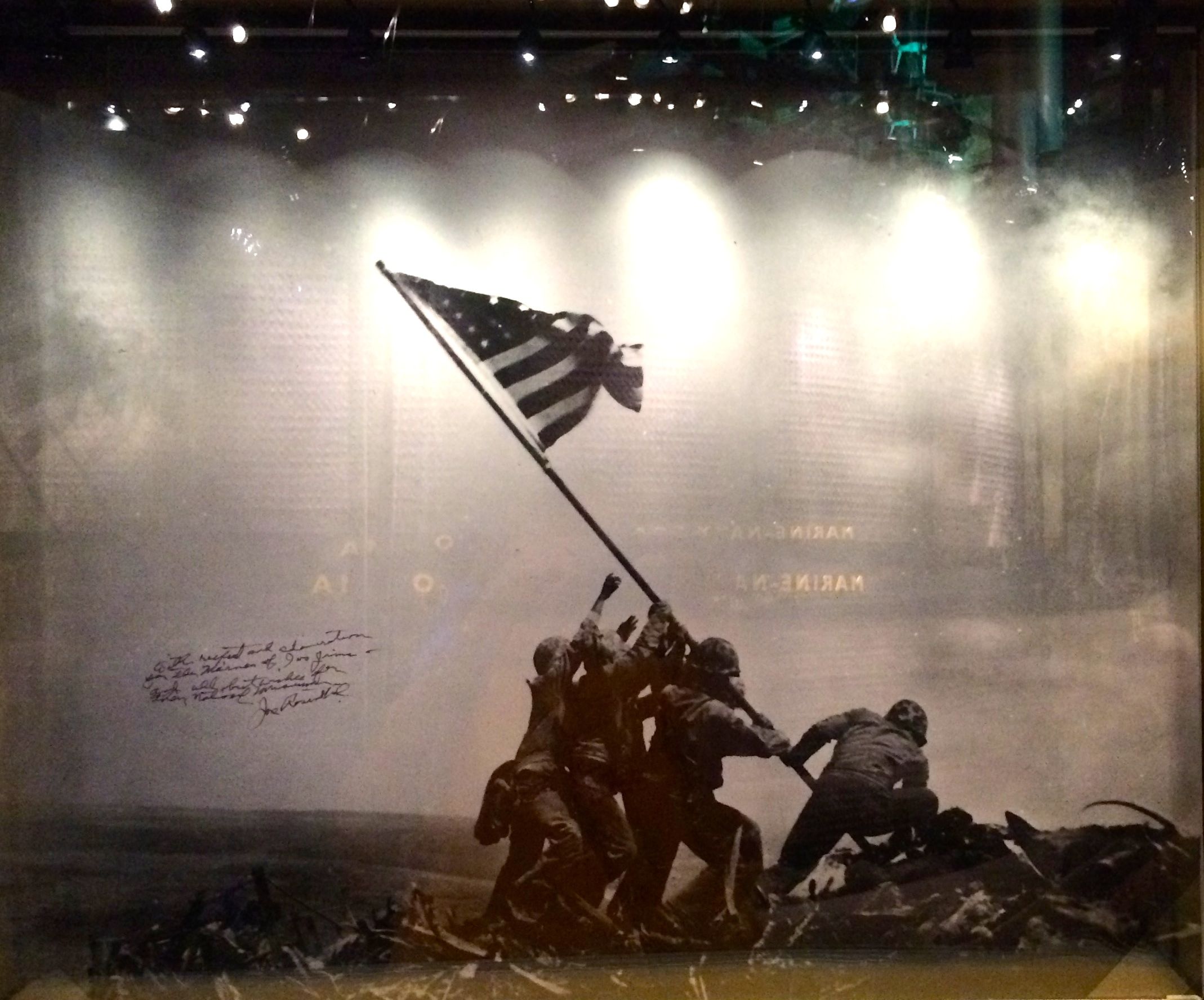
However, anyone familiar with the iconic photo and statue of the flag being raised on Iwo Jima during World War II can probably see the inspiration for this building.
Well, you have to be able to mentally flip the statue to see it. Go ahead. I’ll give you a moment.
The museum opened in Triangle, Virginia on November 10, 2006, after being in the works since the late 1980s. It is still growing, though, and will be closed from January – March 2016 to hang an SBD Dauntless aircraft in Leatherneck Gallery and to continue to expand and improve displays.
This is the Leatherneck Gallery.
For those that may not have heard the term “Leatherneck” before, this term refers to Marines. It comes from the 3.5 inch high stiff leather collar that they wore from 1798 until 1872. It served two purposes: it held the Marine’s neck erect while on parade, giving him a great military bearing by forcing the wearer to hold his chin high, and it protected the neck from cutlass attacks when boarding pirate ships during the Barbary Wars.
It wasn’t exactly a practical piece of equipment, as it restricted movement. I guess that is why it was abandoned long ago.
The museum is absolutely filled with artifacts and information from the Corps’ long history. In fact, the Corps is older than the USA, as it was formed on November 10, 1775.
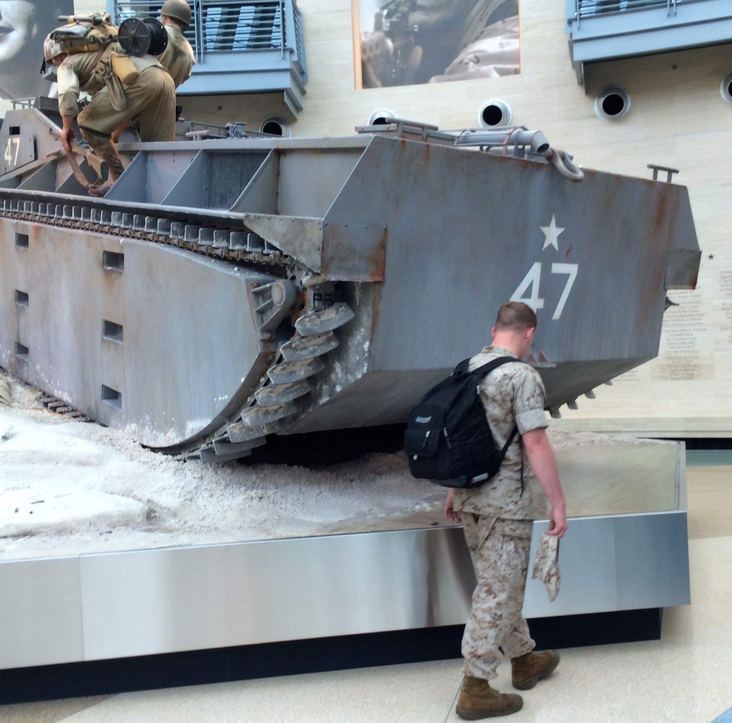
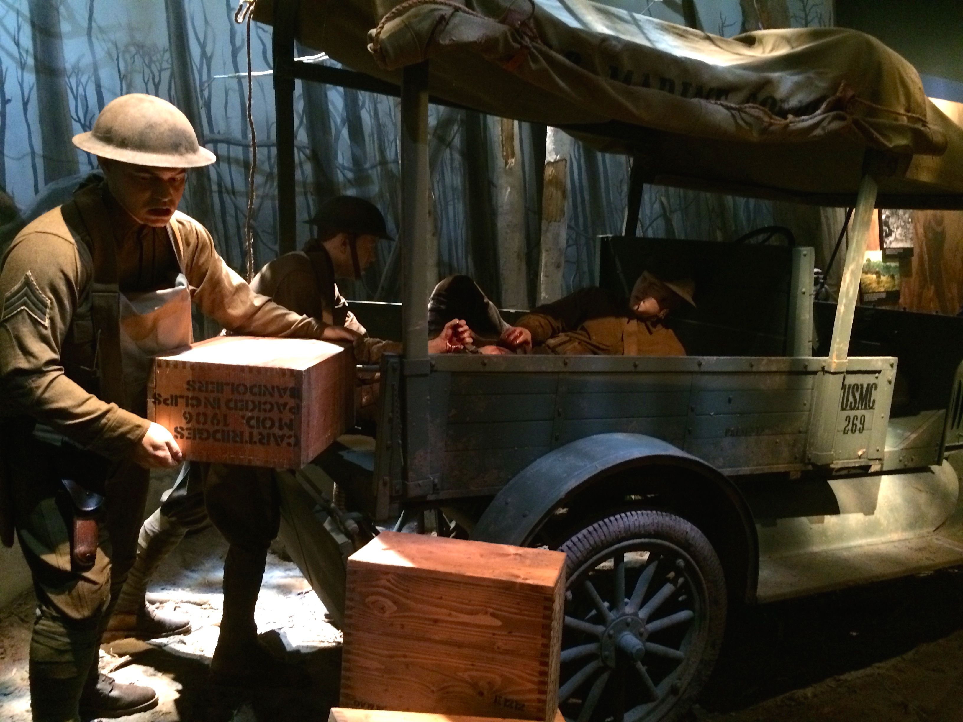
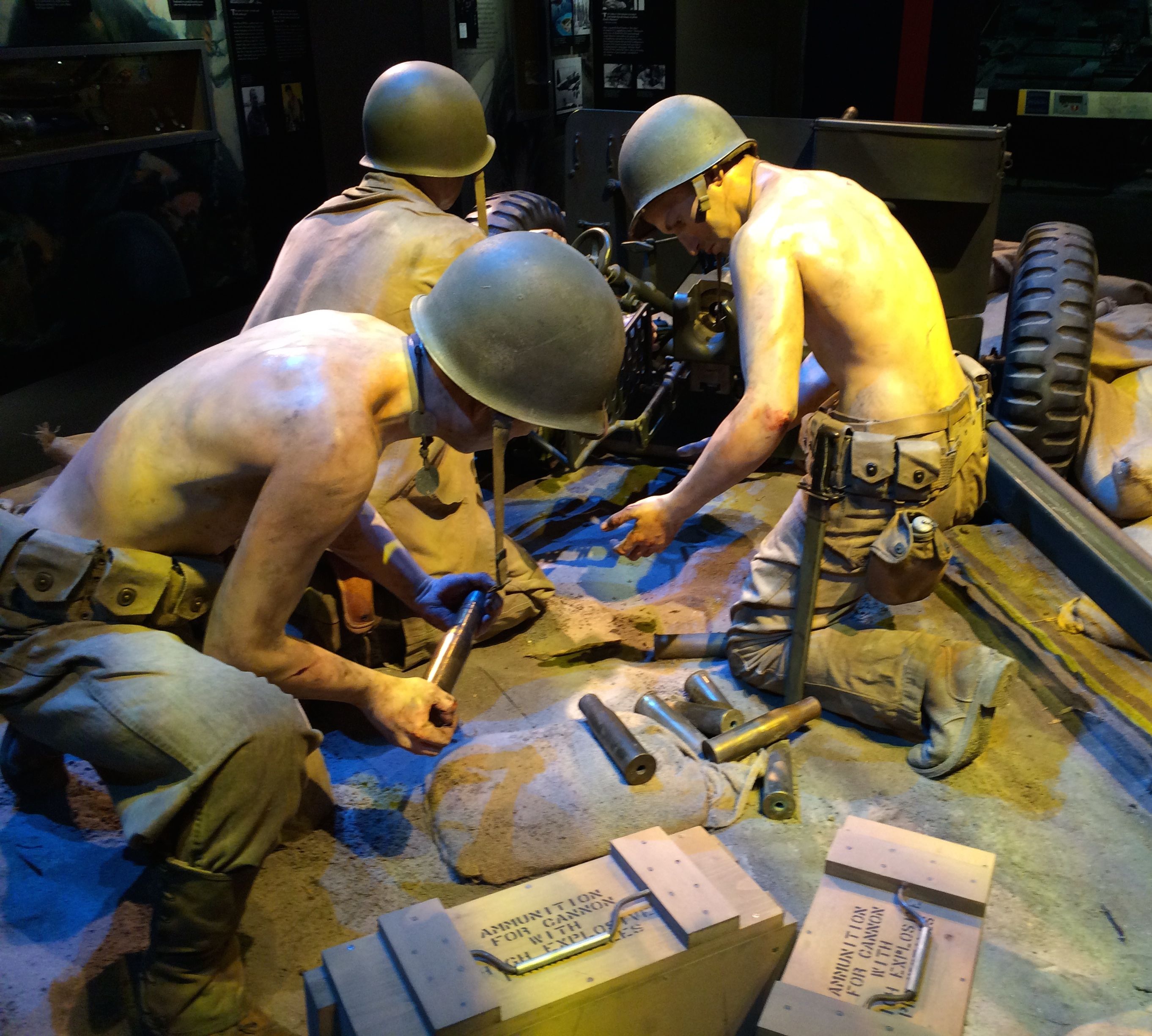
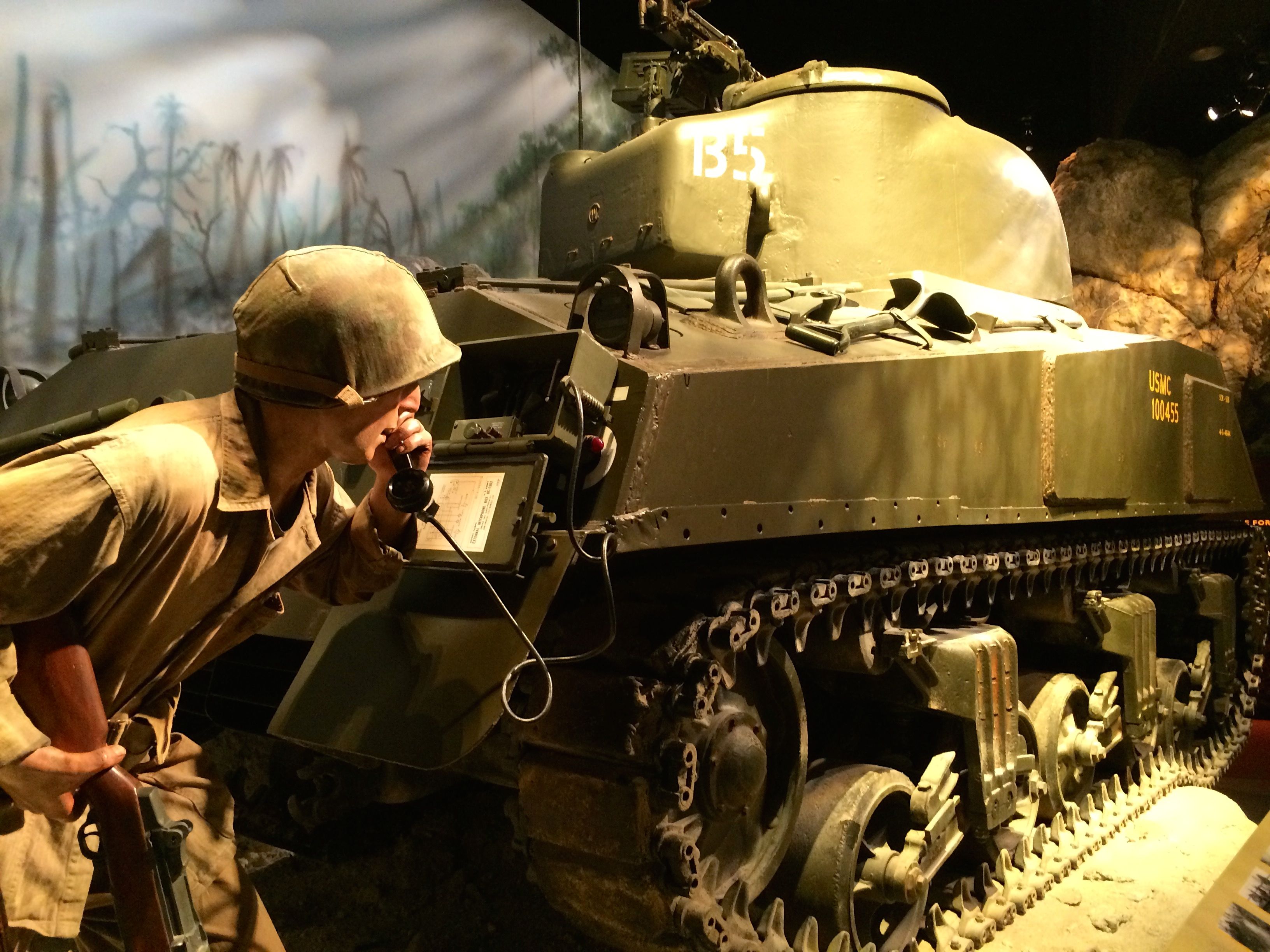
In addition to artifacts, there are three dimensional displays that involve life-sized models of Marines in action with their equipment.
Who would be interested in a museum of the history of the Marine Corps? Well, would you be surprised to hear that there were many Marines visiting on the day I was there?
For the record, the live Marine is the one closer to the camera.
There were also people of all ages. Young families with children as well as retirees of my age and much older. After an introductory movie, it was on to the exhibits.
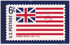
In early 1776, Captain Samuel Nicholas boarded hastily converted merchant ships. bound for the Bahamas, a British Colony. Any able-bodied man willing to volunteer was accepted. John Martin, of Wilmington, DE, was the first black Marine. It was a short battle, and the Grand Union flag – which was the predecessor of the Stars and Stripes – was raised over the island.
Grand Union Flag
Marines have been involved in just about every part of American history that involved other countries, and helped promote American interests around the globe.
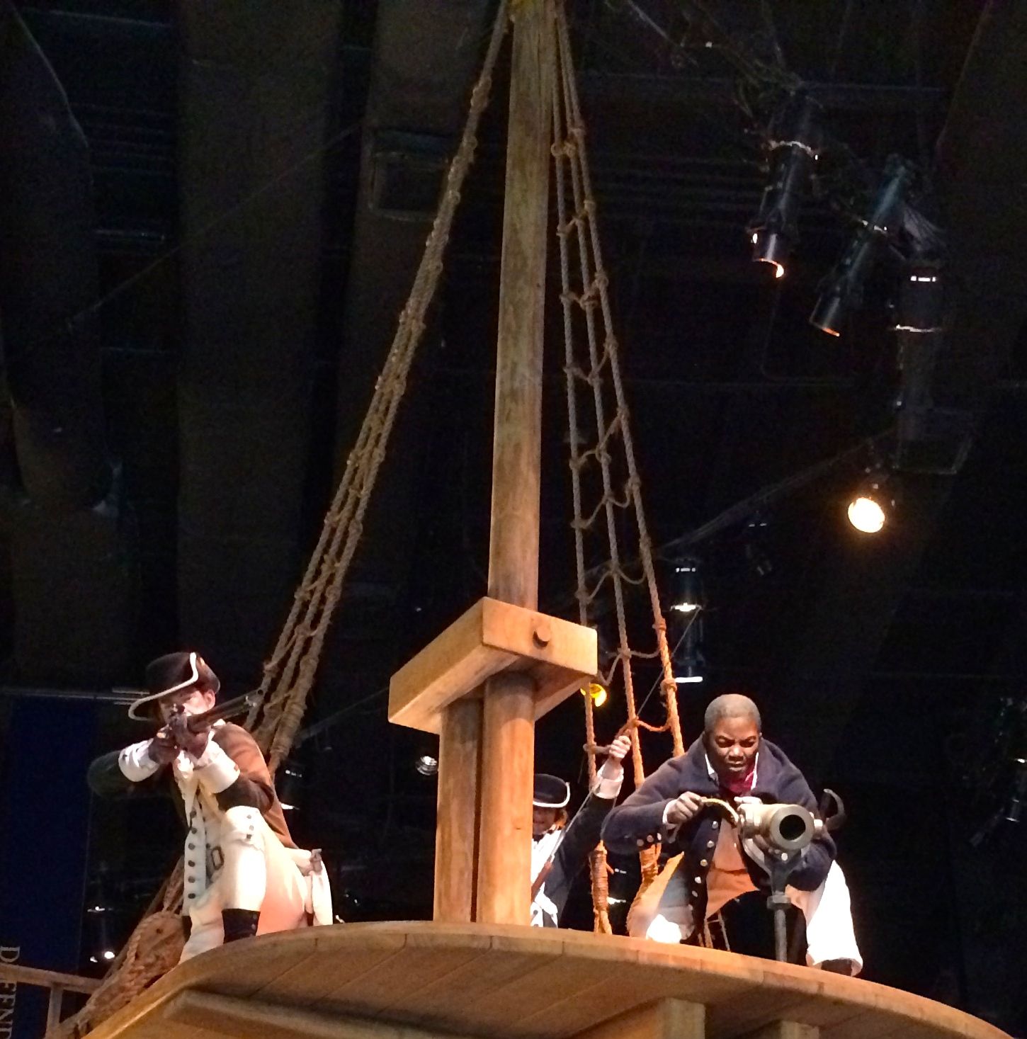
Marines and sailors serving on board Navy warships in the early 19th century slept in hammocks slung between hooks on bulkheads. At reveille, they they secured the hammocks for the day. When they died at sea, they were sewn into their hammocks, wrapped in a flag and committed to the deep.
From the halls of Montezuma, to the shores of Tripoli…
Bombardment of Tripoli Harbor
The northern coast of Africa is called the Barbary Coast. Barbary pirates seized American ships repeatedly, commencing with the end of the Revolutionary War in 1783 and leading to the Barbary Wars in 1800 – 1805. European practice had been to pay ransom for hostages. Sometimes the Europeans would even pay protection in advance.
Thomas Jefferson sent a message to the ruler of Tripoli, May 21, 1801.
“We mean to rest the safety of our commerce on…our own strength and bravery in every sea.”
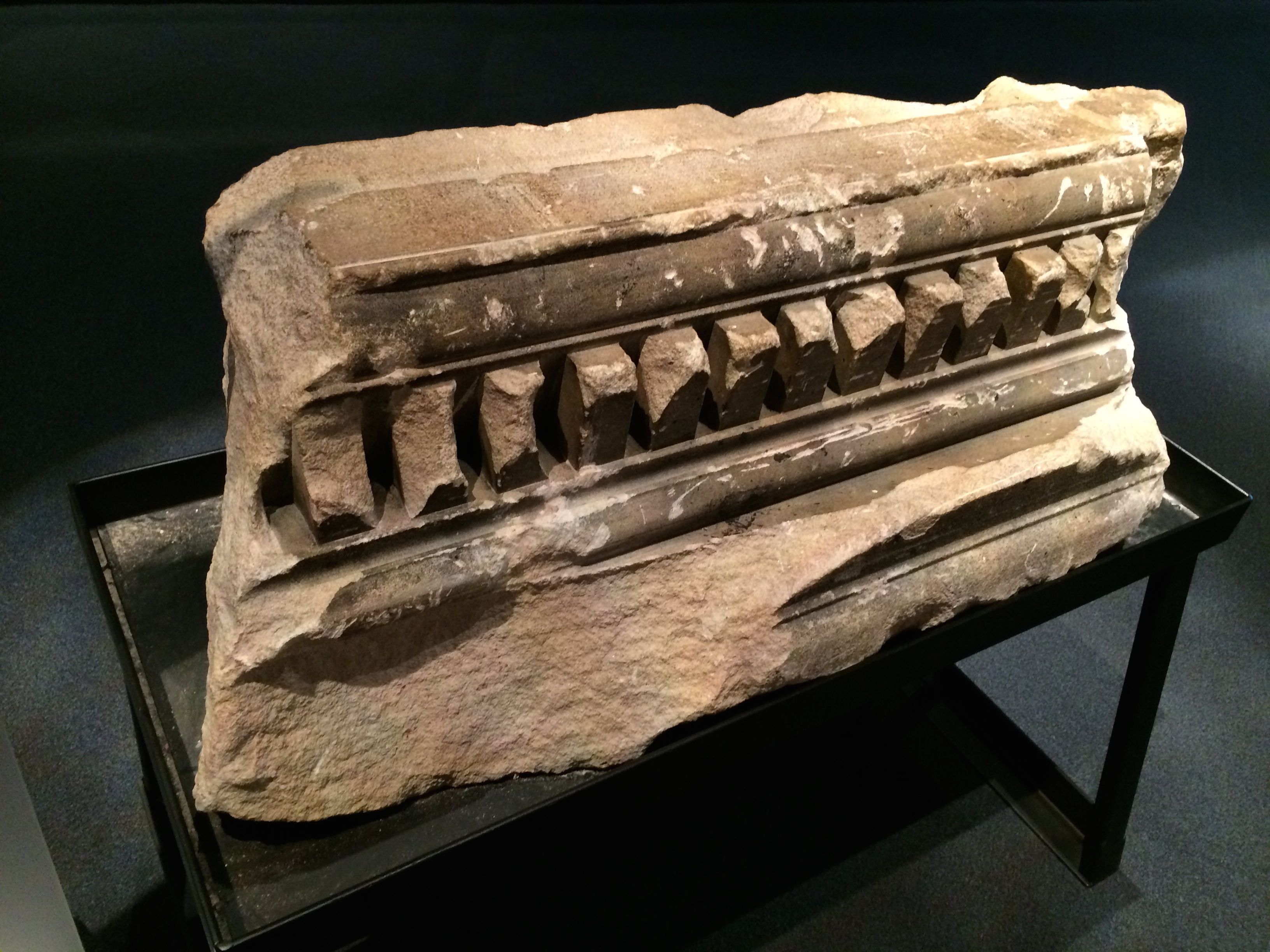
Derna Plaque
This marble plaque, inscribed in English and Arabic, marked the location of the fort in Derna, Libya, that was captured by U.S. Marines on April 27, 1805. It was placed there in the 1940’s by the British. It was found broken and partially buried in the garden of the former American Embassy residence in Tripoli.
19th century hat and sword
Did you know that these hats were called “chapeau de bras”? They were worn by officers in the late 18th and early 19th centuries. The hat was designed to be easily folded and stored under the arm. Formal uniform orders from April 1810 directed that the end was to be worn over the right eye with the hat tilted at a rakish angle.
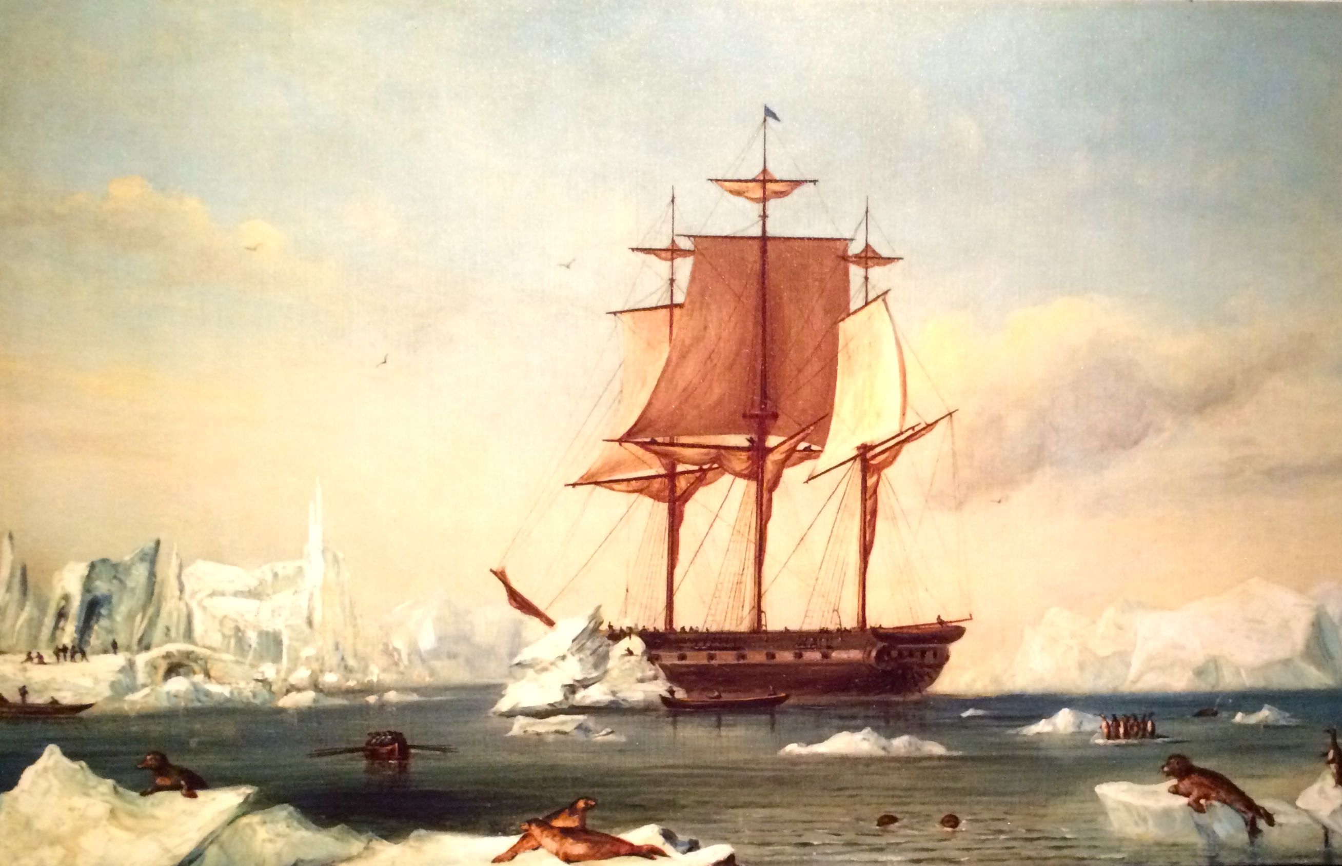
The USS Vincennes, commissioned in 1826, became the first U.S. naval vessel to circumnavigate the globe. She was decommissioned after that venture, refitted and named the flagship of the Wilkes Expedition in 1836. Although lead by LT Charles Wilkes USN, Marines also took part in the expedition, which surveyed South America, Antarctica, the Far East and North Pacific.
There were many other expeditionary activities, intended to advance American interests in the early 1800s, but I will leave those for you to discover when you visit.
(You might properly infer that I am finding it difficult to decode my notes from that era. Besides, I want to get on to some other artifacts and displays that caught my attention.)
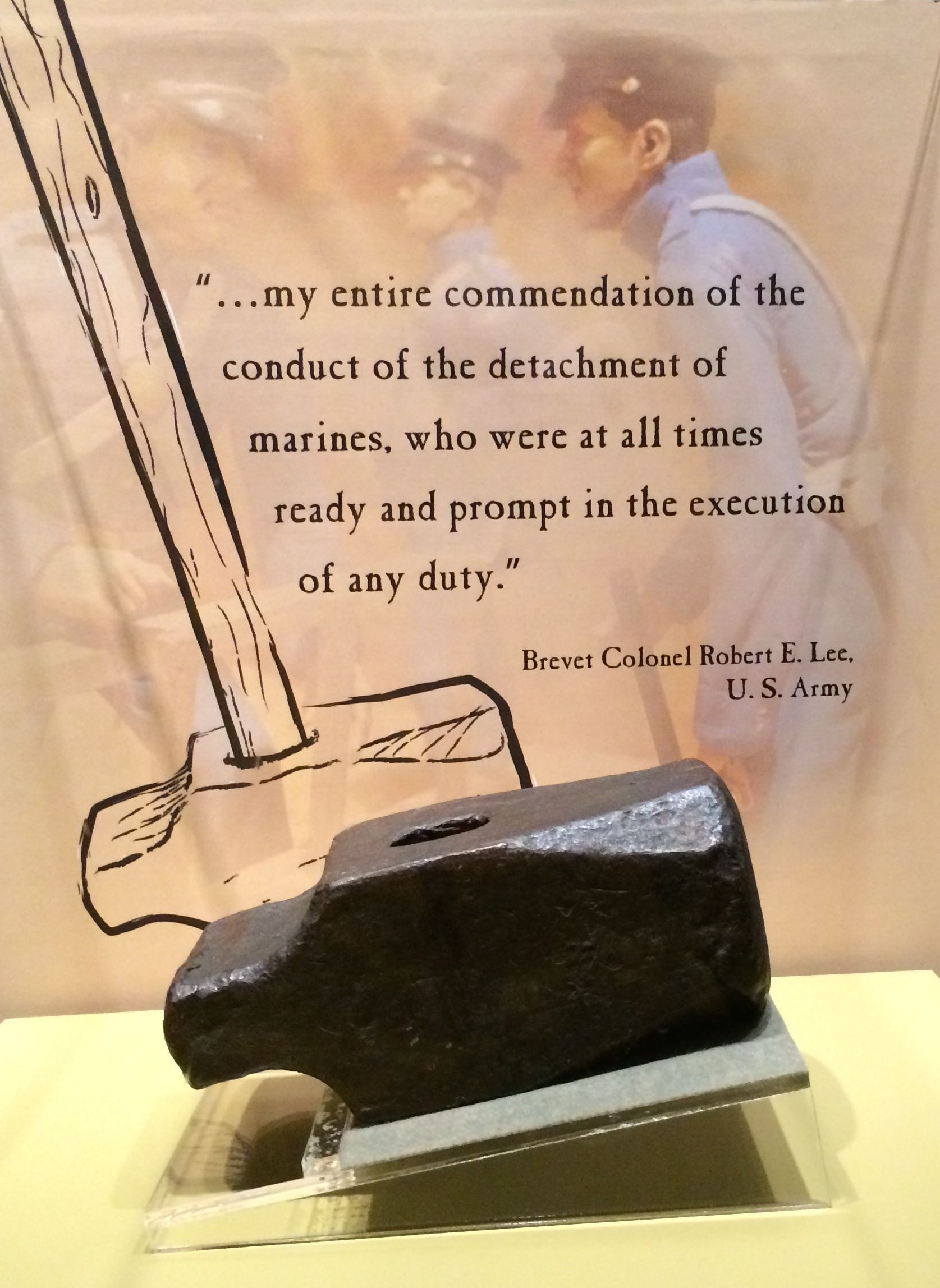
Harpers Ferry sledge hammer
Yes, the Marines were involved in apprehending John Brown in Harpers Ferry. Here is the sledge hammer used to break down the door.
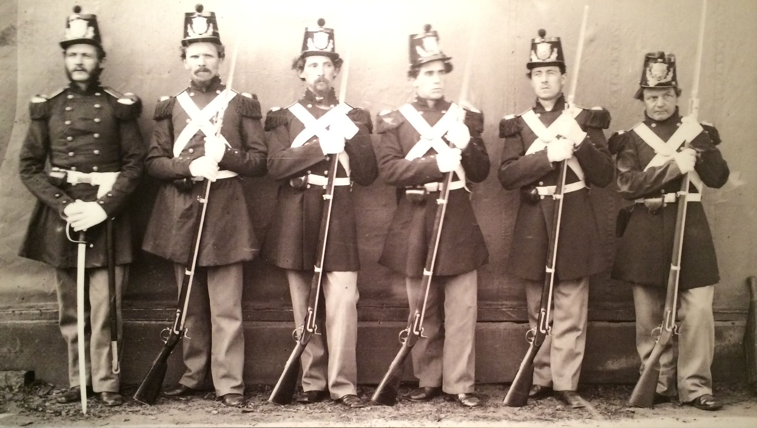
Officer and his men in drew uniform 1864
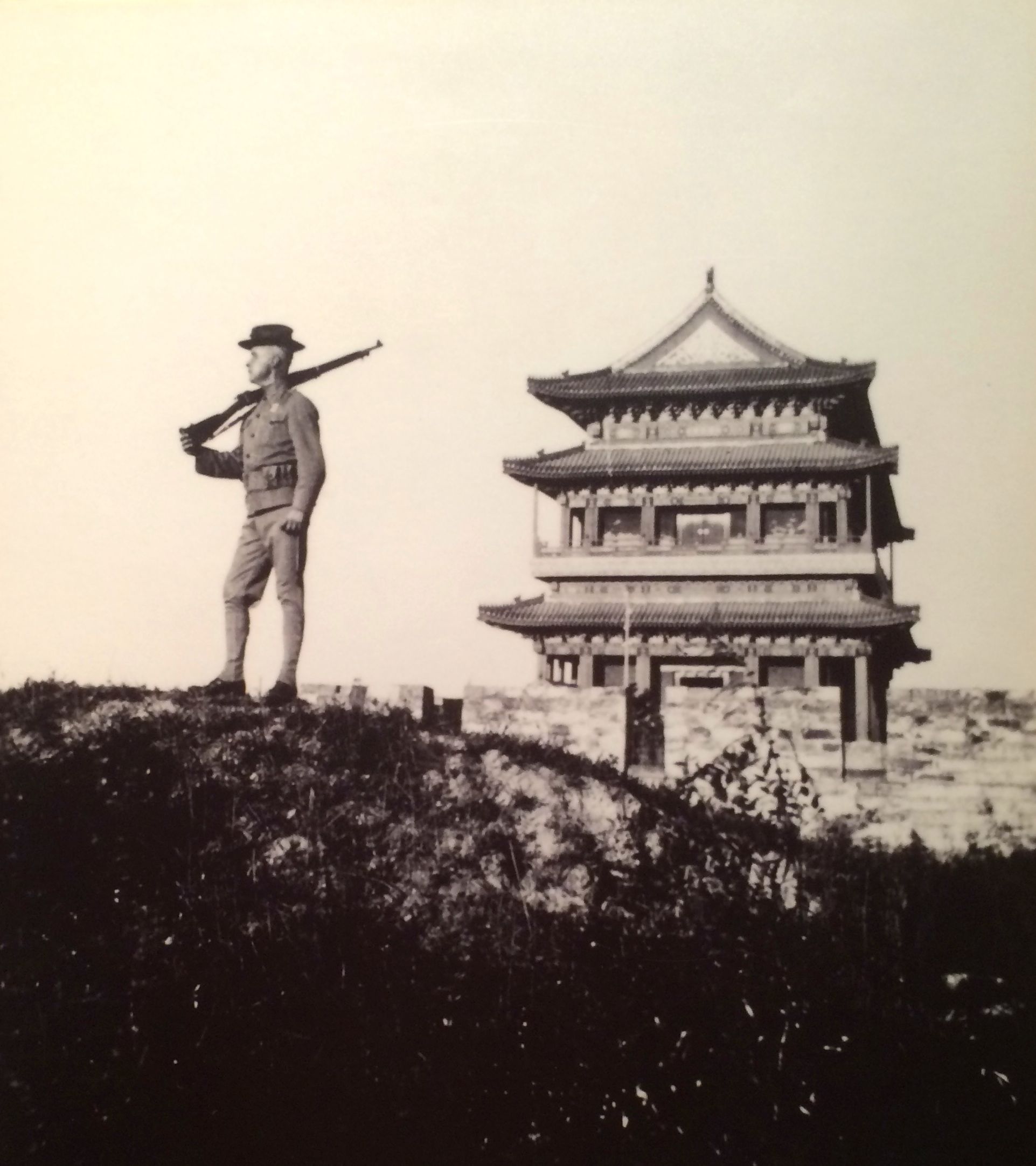
In 1900, Marines landed in China to help protect western diplomats and their families from an anti-foreign and anti-Christian uprising by the “Society of the Righteous Harmonious Fists” also known as the “Boxers”. I always wondered why this was called the Boxer Rebellion. Marines took part in scaling the walls that surrounded the central governmental offices, including the foreign legations in Peking. This was no ordinary wall, though. It was 60 feet high, 40 feet wide and extended 25 miles.
Marine on guard in China 1915. They were there until 1941.
And World War I was just around the corner.
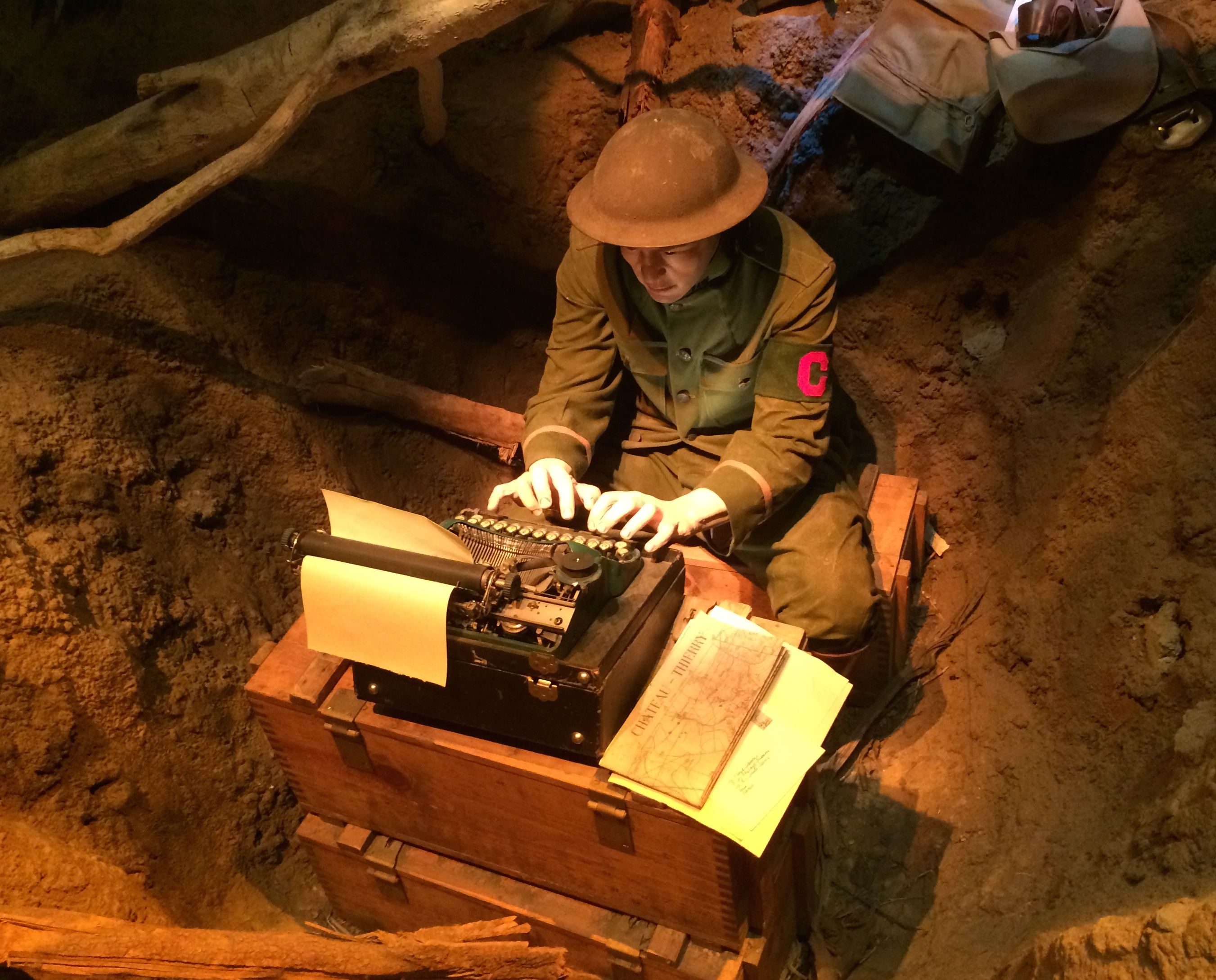
World War I was the first war with newspaper correspondents right in the midst of the battle.
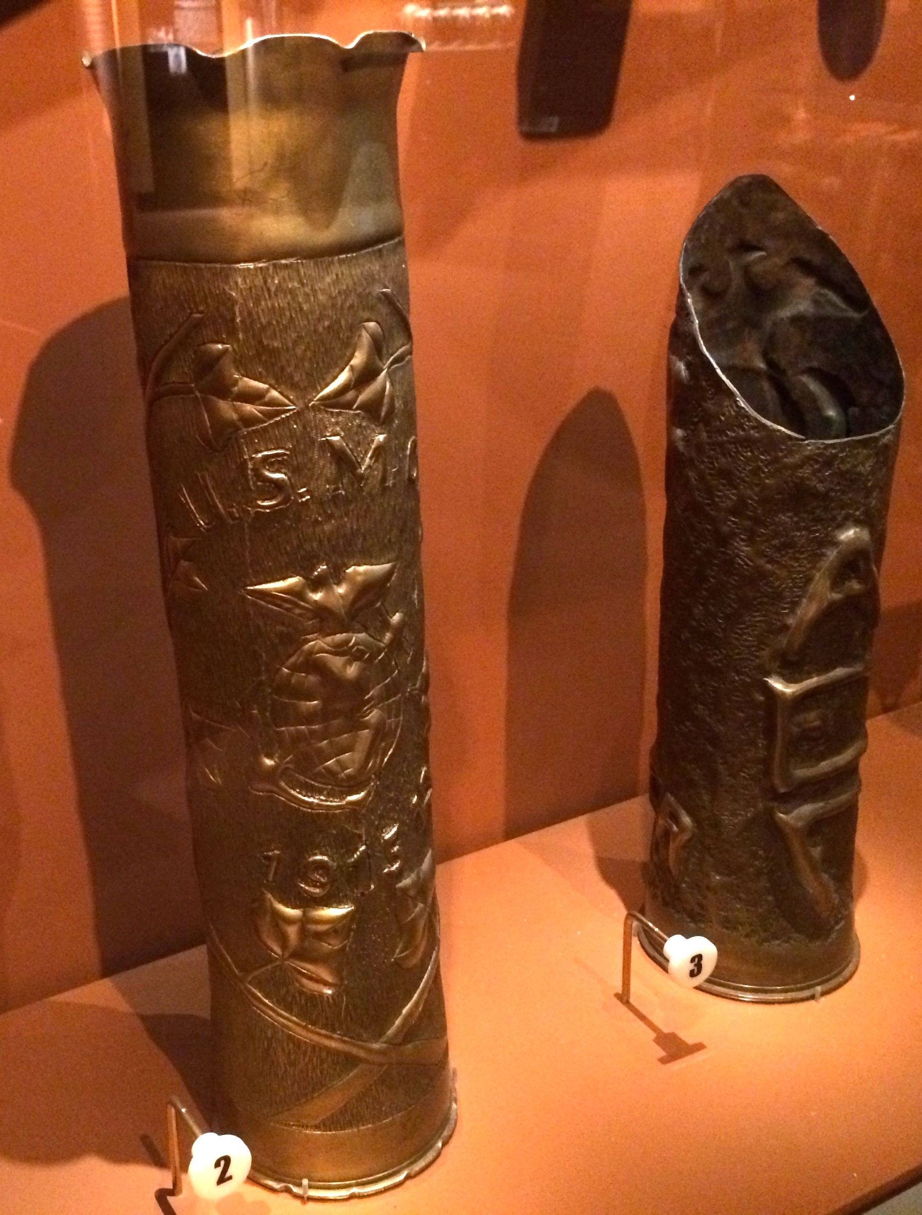
Combat correspondent WW ITrench Art
Marines took advantage of extra time by using an almost inexhaustible supply of shell casings to create “trench art”. These works were made by Marines out of 75mm brass casings.
Of course, the war to end all wars didn’t live up to its name.
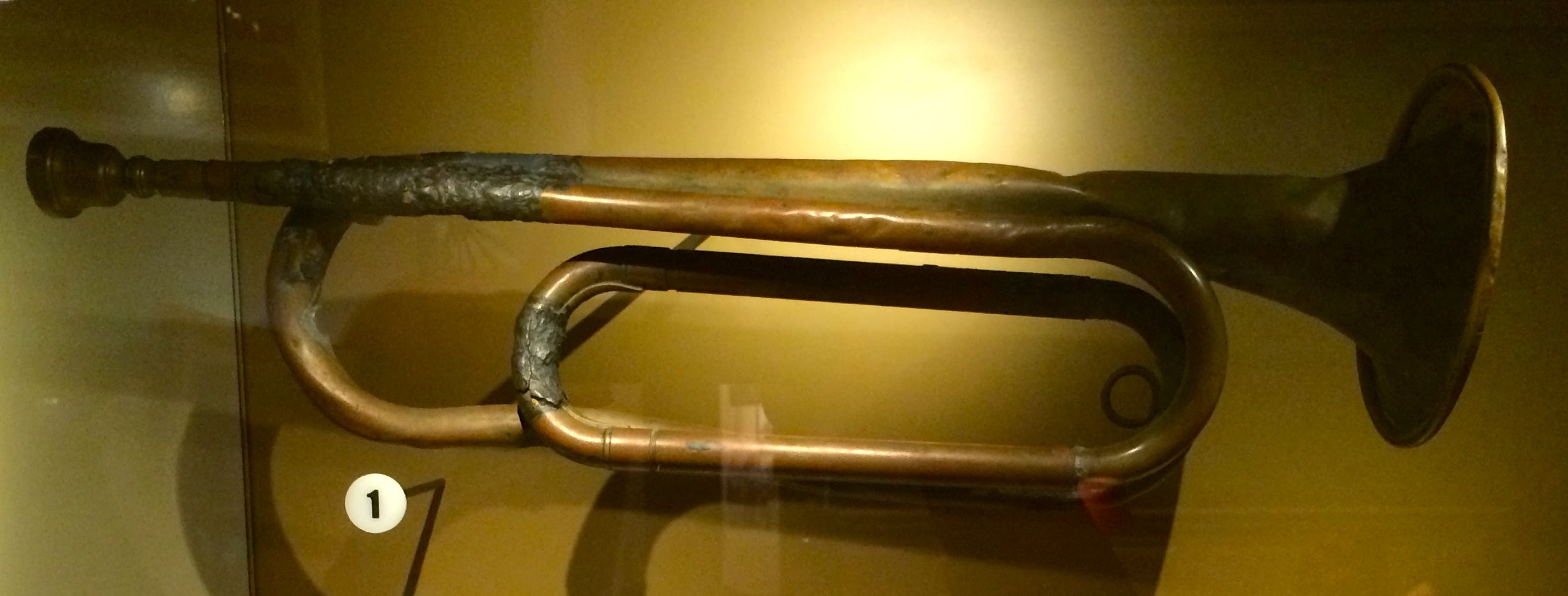
Pearl Harbor bugle
During the attack on Pearl Harbor, Private Roy F.W. Rieck, a Marine bugler, sounded the call to arms as Japanese planes flew overhead. Later, he used the same bugle at funeral services for the dead.
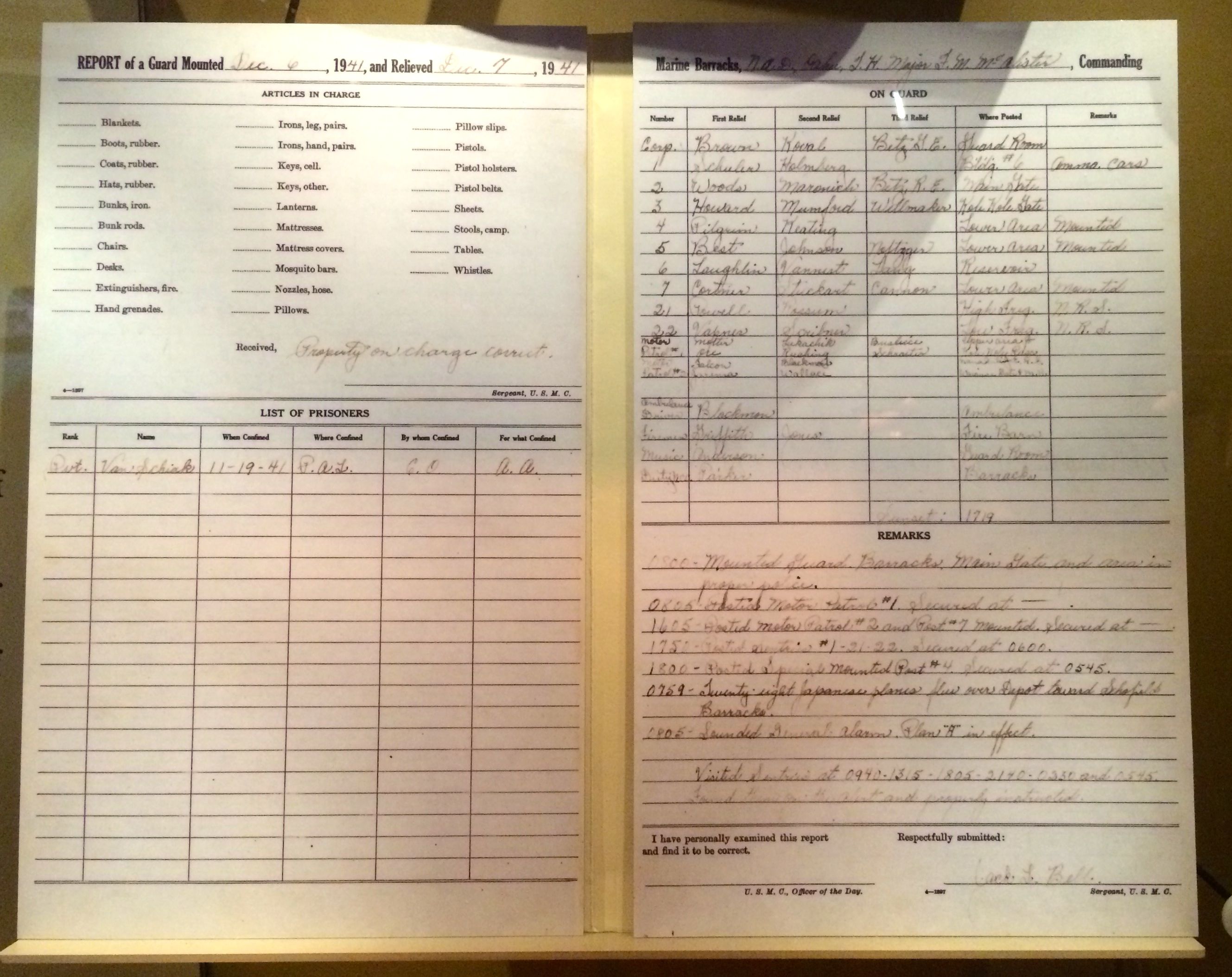
Pearl Harbor log
In this logbook, Naval Ammunition Depot personnel recorded the start of the Japanese attack with the words, “Twenty-eight Japanese planes flew over Depot toward Schofield Barracks at 0759.”
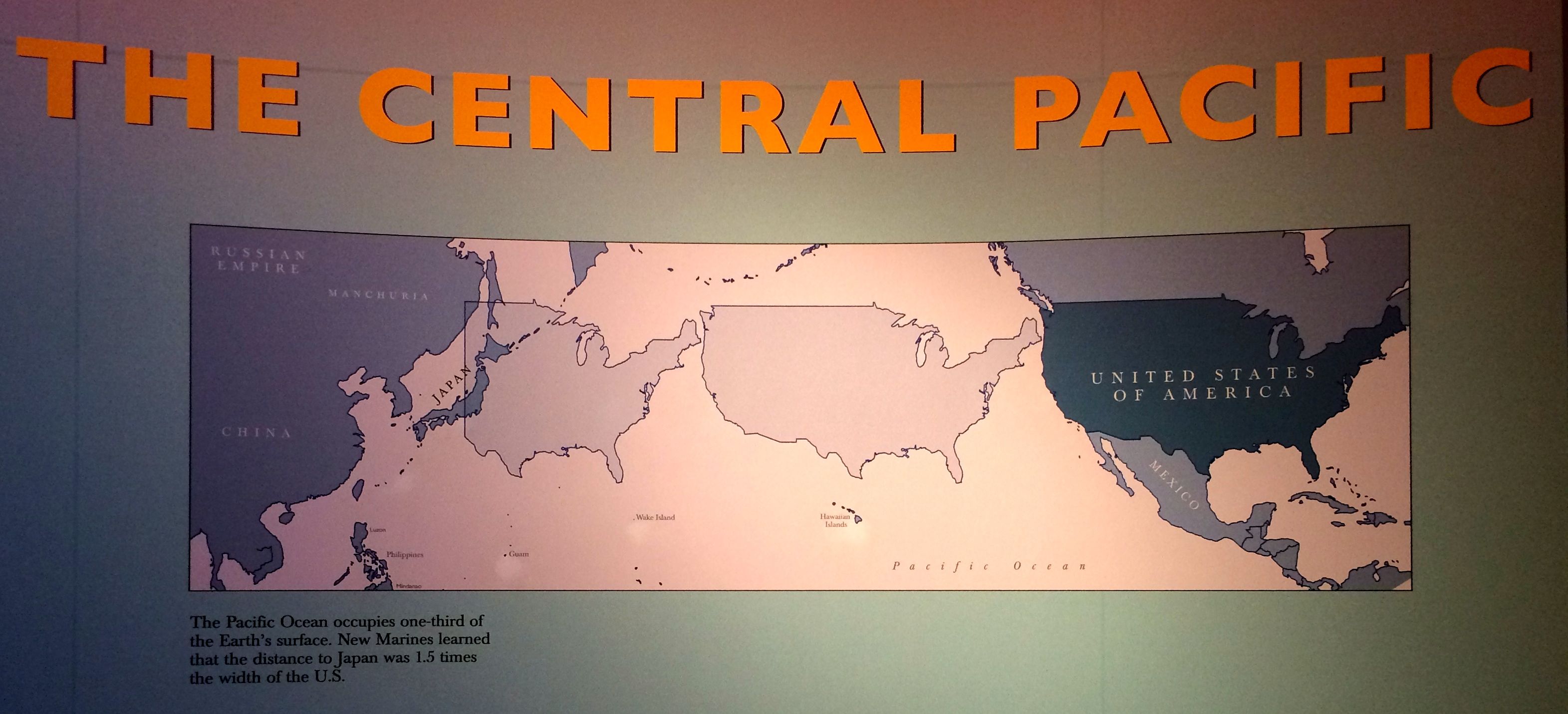
War in the South PacificMap showing the relative size of the Central Pacific
It was quite a feat to manage to conduct a war with so much water to deal with. However, deal with it they did. Which brings us back to raising the flag over Iwo Jima.
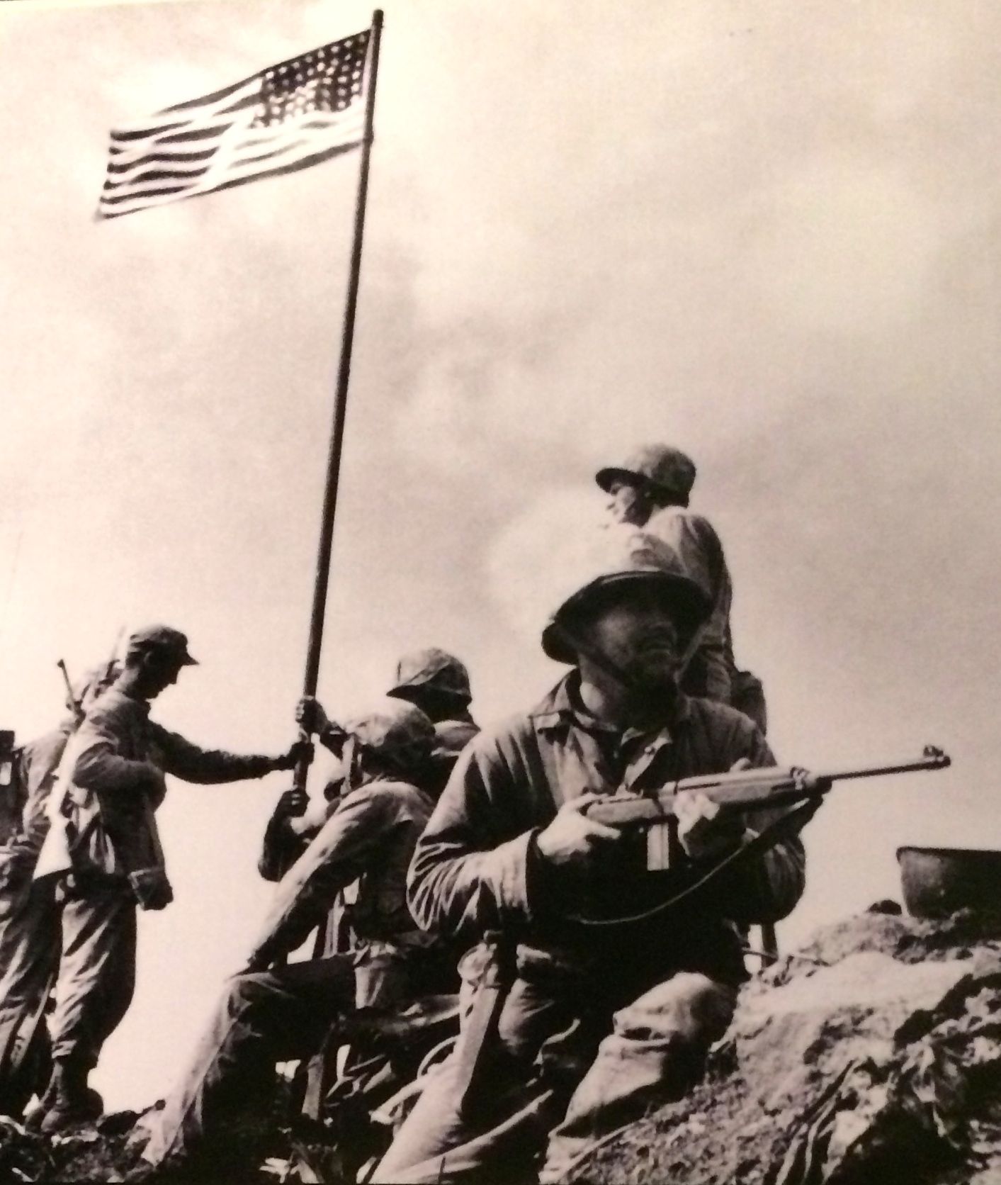
This is the first raising of the flag on Mount Suribachi, on Iwo Jima, February 28, 1945. They put it up quickly, so the next day, they did it again so they could get better photos.
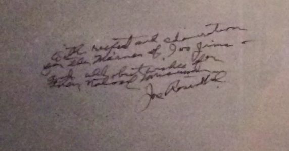
As might be expected, they have a good display in the museum about this image. Below is a close up of the inscription from the photo in the display.
Photographer’s inscription
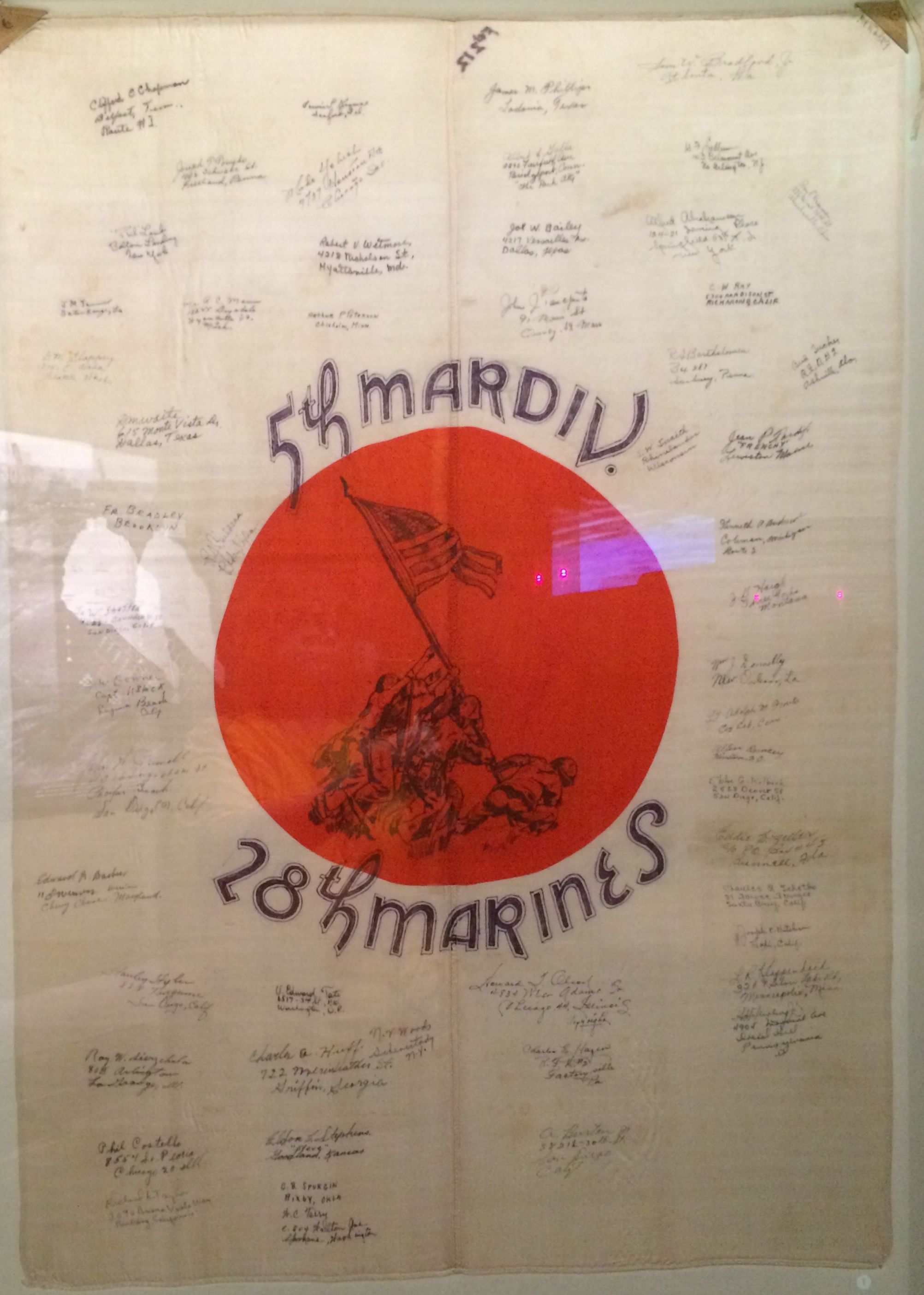
This is a flag that was captured on Iwo Jima. It bears the names and addresses of the men who served with the 28th Marines.
The war was taking place in Europe, as well.
M1 Sherman Tank
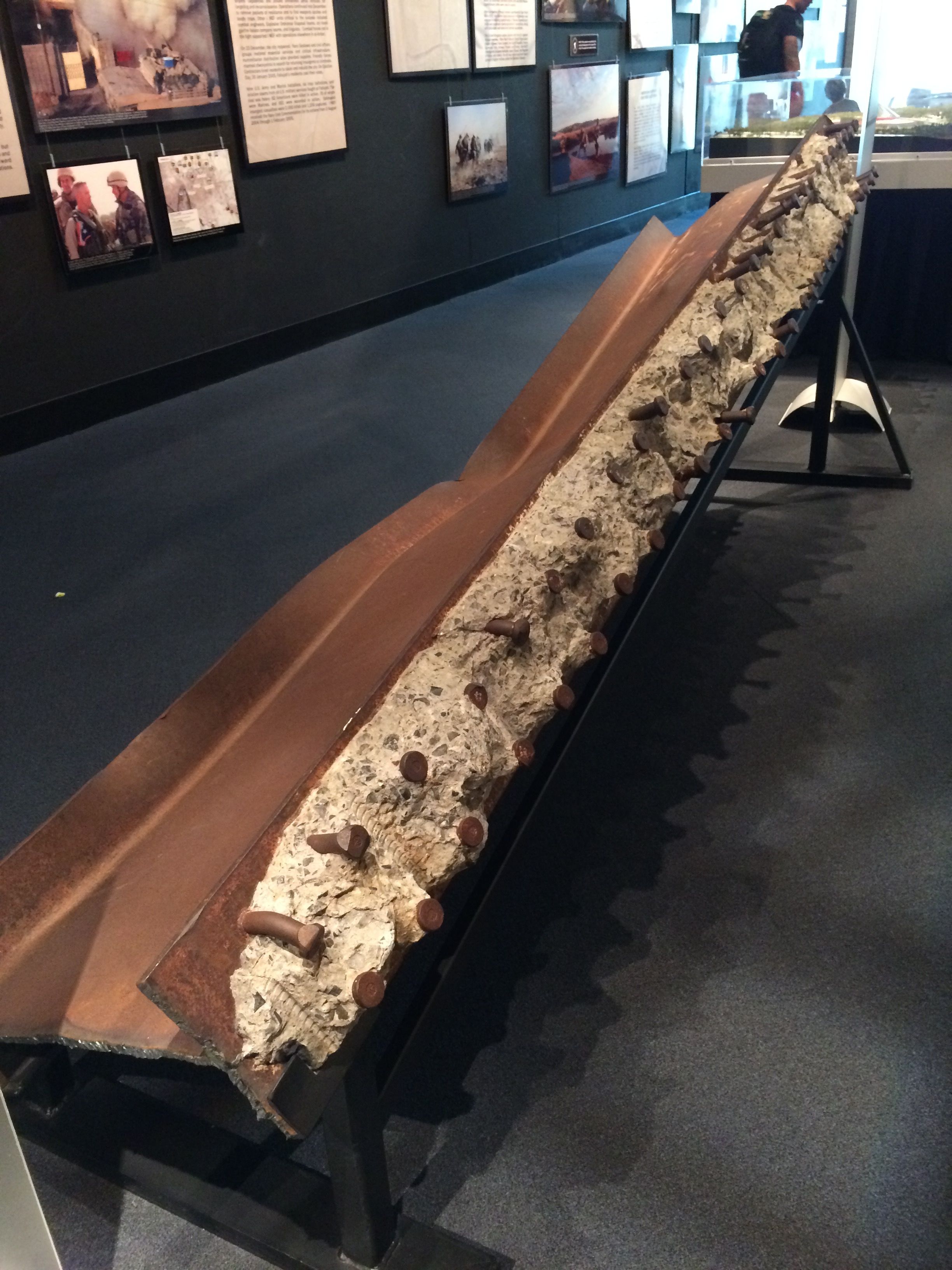
My time in the museum was growing short, so after I left the World War II gallery, I headed for the exit. In the hallway that lead back to the Leatherneck Gallery, there were mementos from September 11, 2001.
From the PentagonFrom the World Trade Center
Of course, I had to take a look in the gift shop before I left.
Legos
That was quite a display!
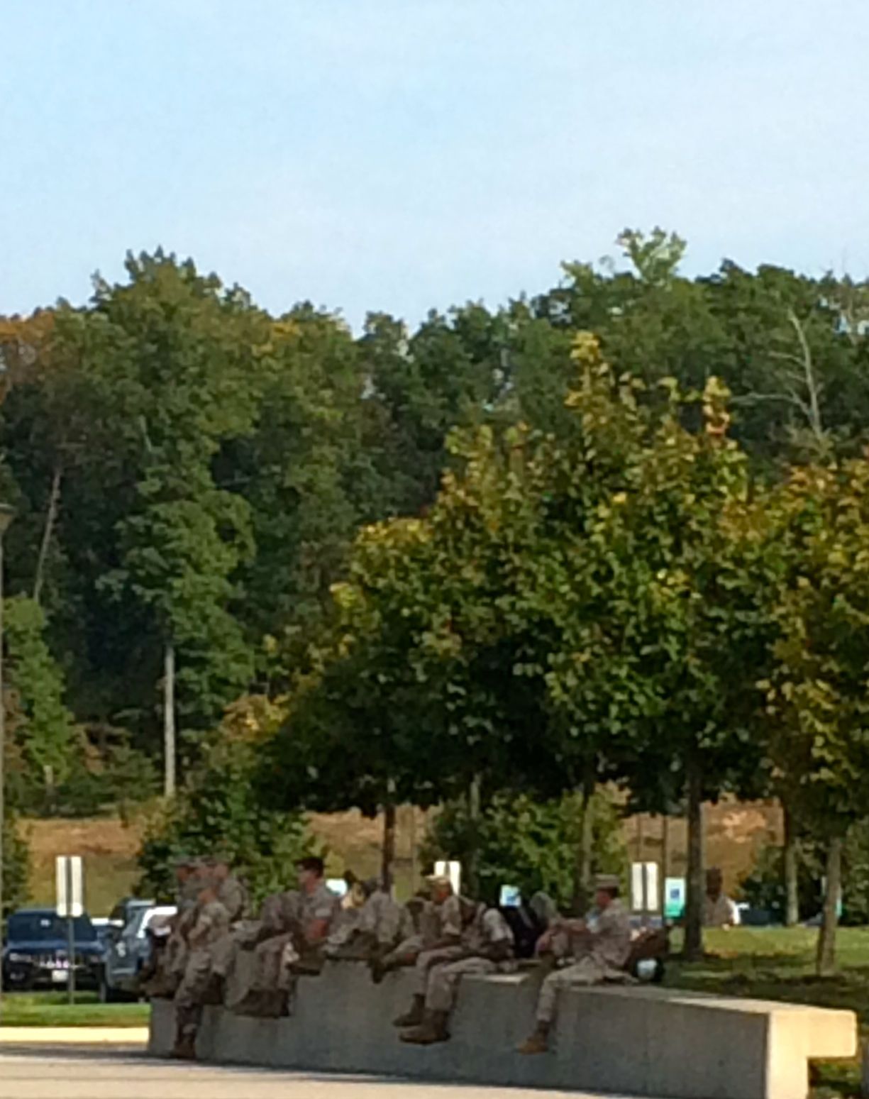
As I walked back to BART, I passed a group of Marines that had been touring the museum.
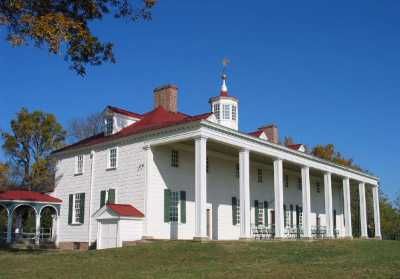
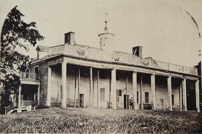
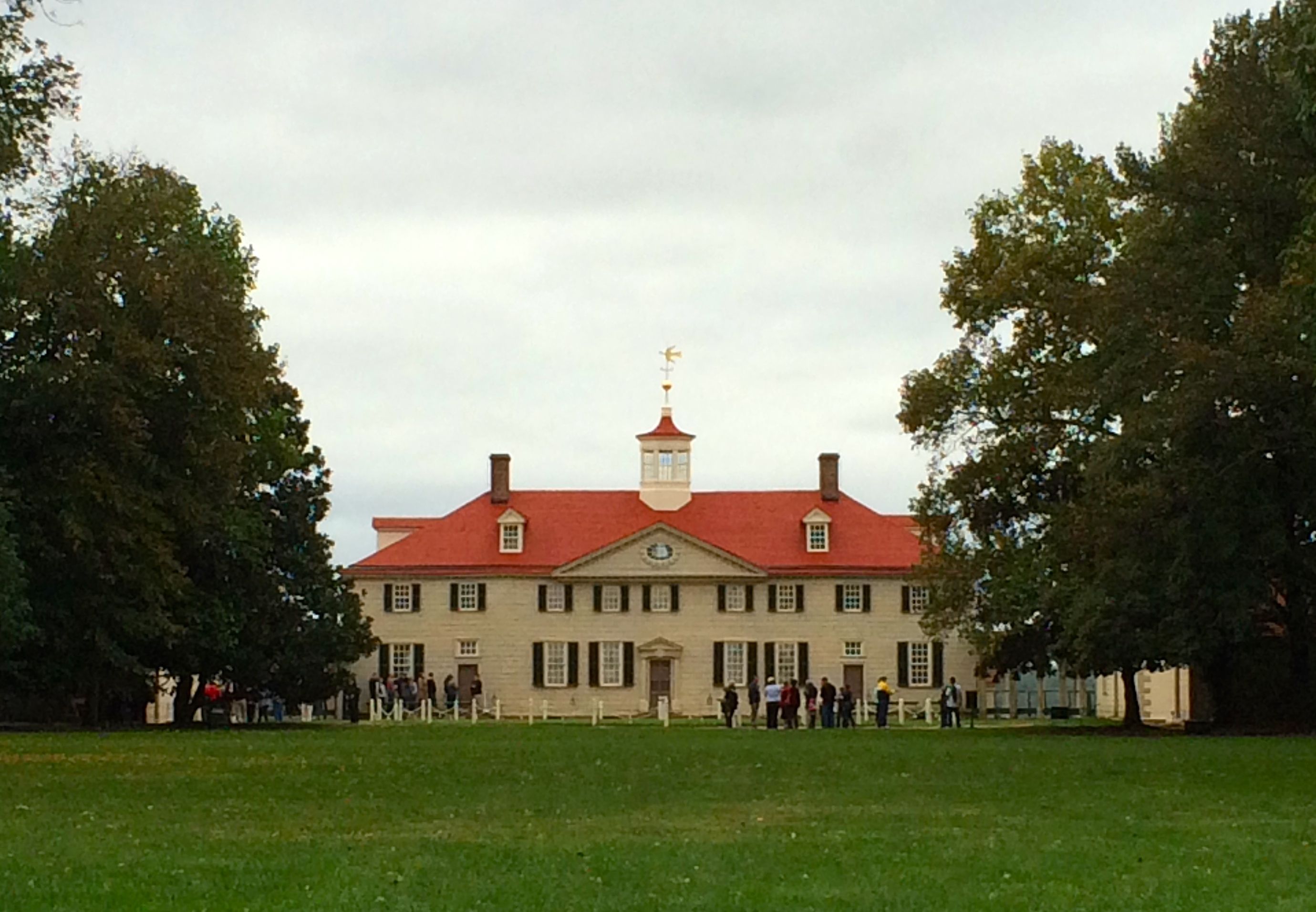
Ah, yes. The classic view of Mount Vernon. (Actually, I had to borrow this shot. I didn’t get a good photo from this side.)
Actually, it’s pretty much a miracle that the house is still standing. This is the way it looked around 1860,
c. 1860
Those spindly looking things between the columns are ships’ masts, being repurposed to hold up the roof.
After Washington died in 1799, the estate passed through a few relatives, and they apparently didn’t have the will or the money to maintain the property. Part of the problem was that everyone wanted to visit Washington, and after his death, the visitors kept coming.
The visitors came and the stayed and stayed and stayed. They were a real drain on the household budget.
John A. Washington, Jr, Washington’s great-grandnephew, was the last owner in the family. He offered it for sale. Both the Commonwealth of Virginia and United States governments declined to buy the house.
In 1858, Ann Pamela Cunningham saw the house from board a ship in the Potomac. She thought it was terrible that the George Washington’s home had fallen in such disrepair. She formed the Mount Vernon Ladies’ Association of the Union, and they bought the house for $200,000 and took possession on February 22, 1860.
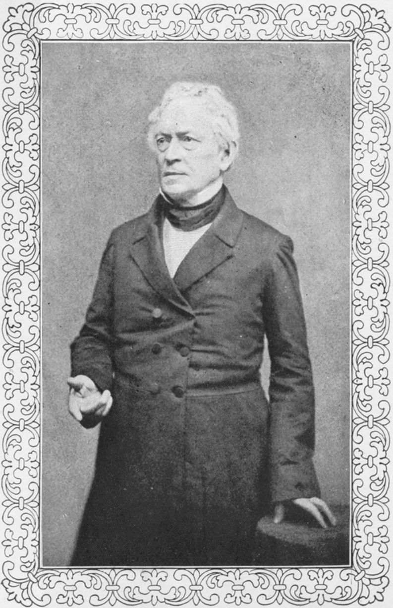
A good chunk of the money was raised by Edward Everett, who traveled around, delivered speeches and donated the proceeds to the cause.
Edward Everett
Remember Edward Everett? The man who spoke for two hours before Abraham Lincoln delivered the 272-word-long Gettysburg Address? THAT Edward Everett.
Whenever I hear of a date anywhere in the 1860s, I always stop to think of the relationship to the Civil War. Lincoln was sworn in on March 4, 1861 and the war began on April 12, 1861. Ann Pamela Cunningham managed to obtain pledges from generals on the Union and Confederate sides, and, although fighting raged across the nearby countryside, the estate served as neutral ground for both sides.
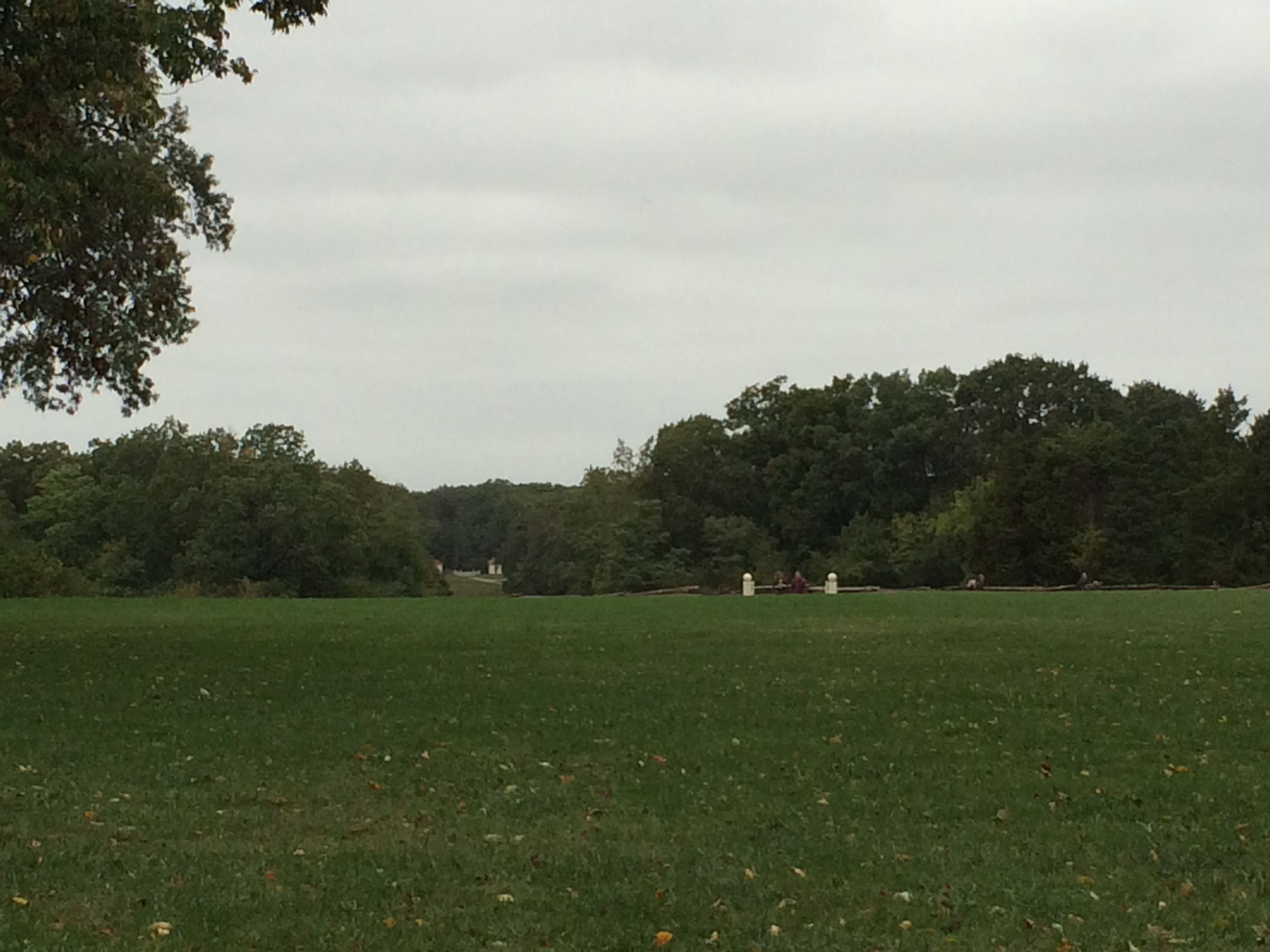
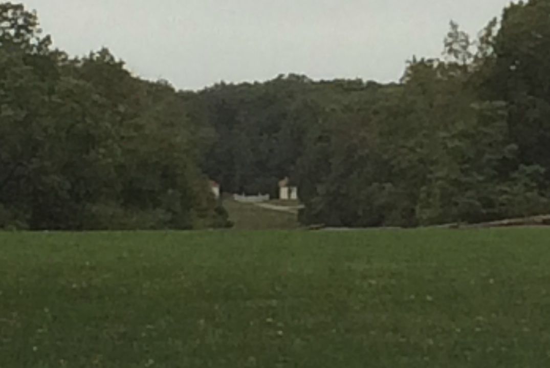
Soldiers from both sides had to leave their guns by the gate houses. See the gate houses?
Gate houses
Well, they are a mile away from the main house.
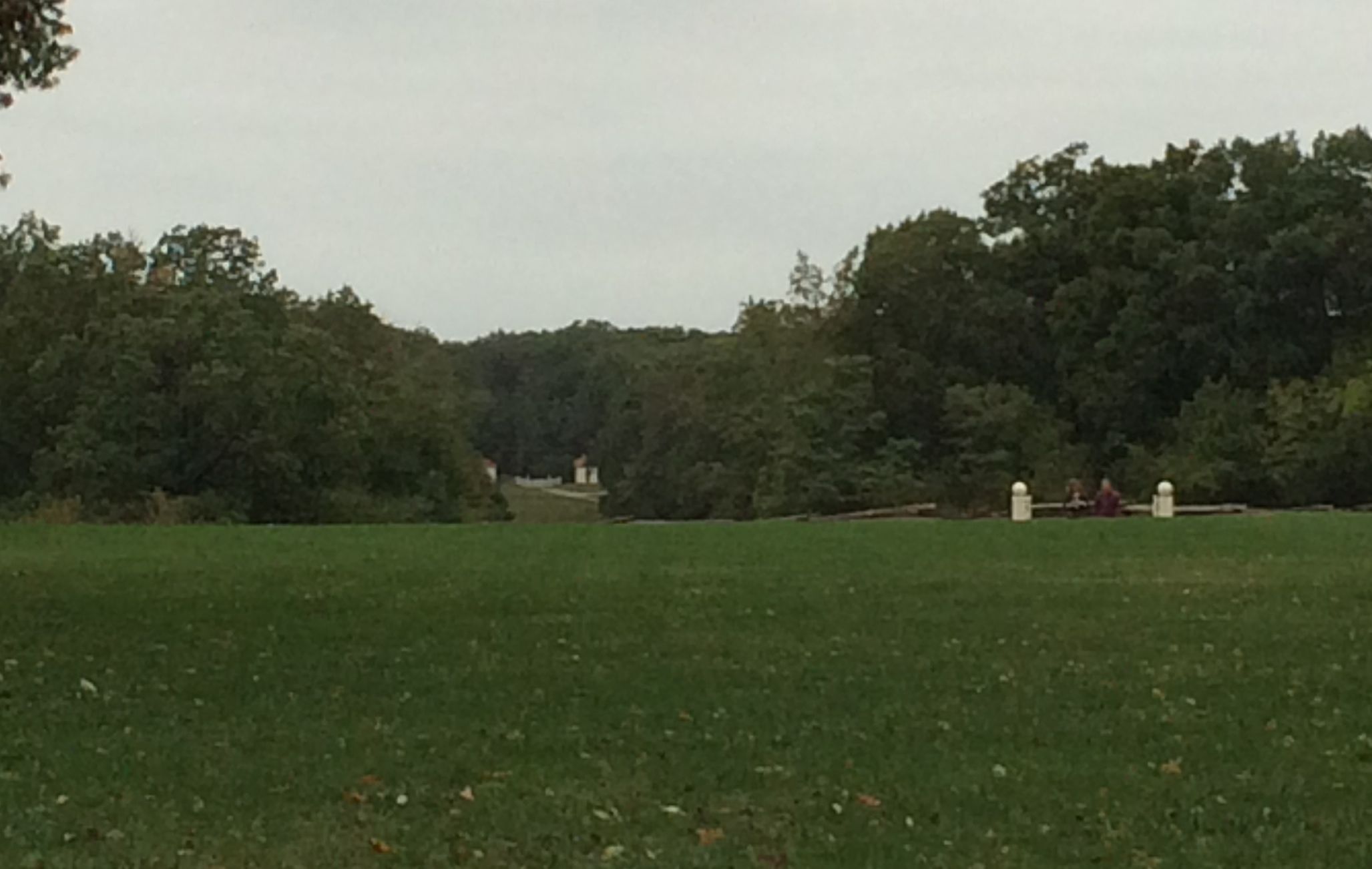
A little closer
Let’s see if I can get just a little closer.
See them now?
Do you see them now? Those little white houses in the center of the frame.
I learned these tidbits of information from this marvelous private tour I took with Bill on the preservation efforts at Mount Vernon. It wasn’t supposed to be a private tour, but no one else ponied up the extra $5 for the extra tour.
He also took me through the basement. It was really interesting to see the things that are still there from when the house was built. Unfortunately, I couldn’t take any pictures inside – not even in the basement!
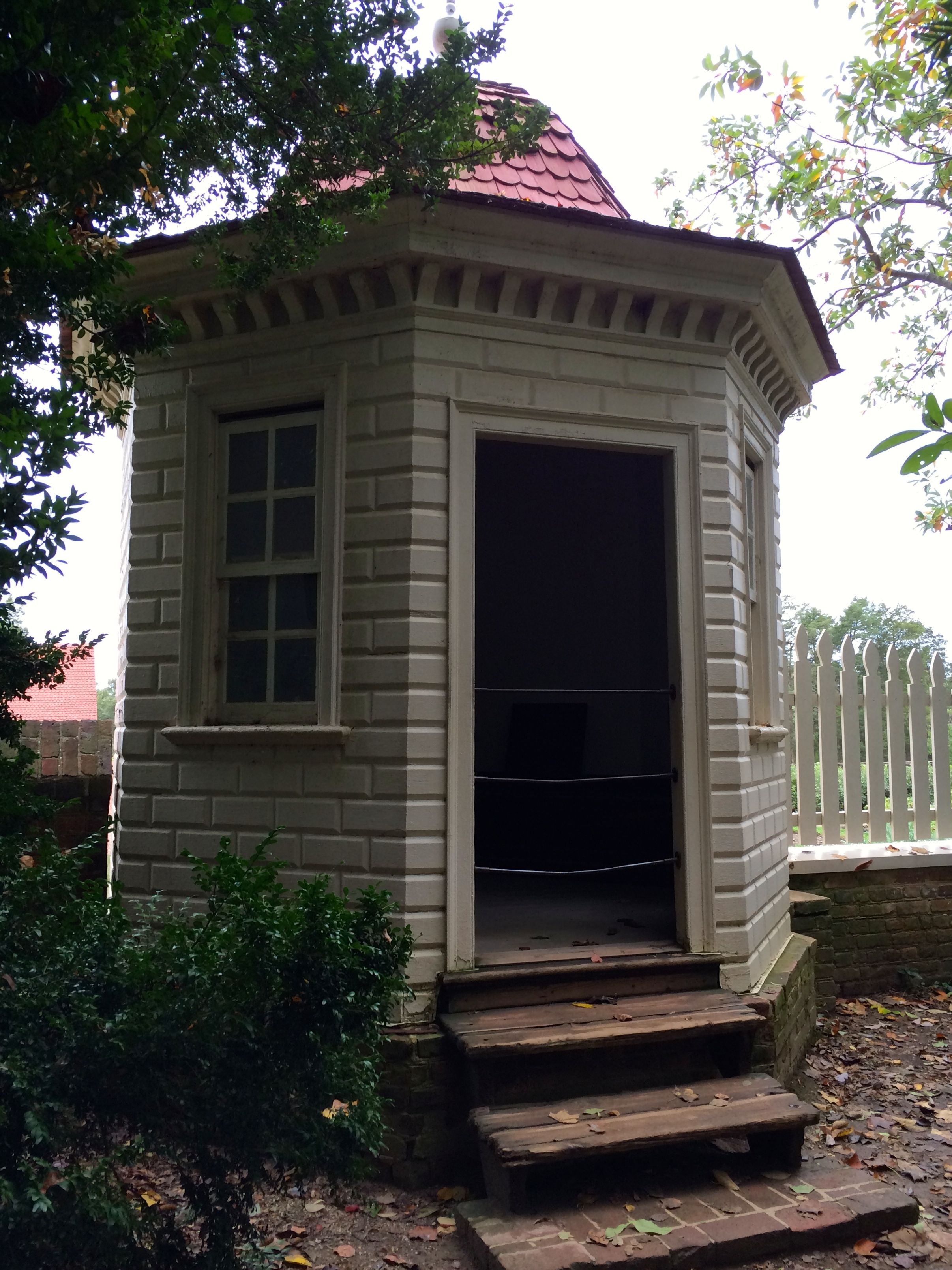
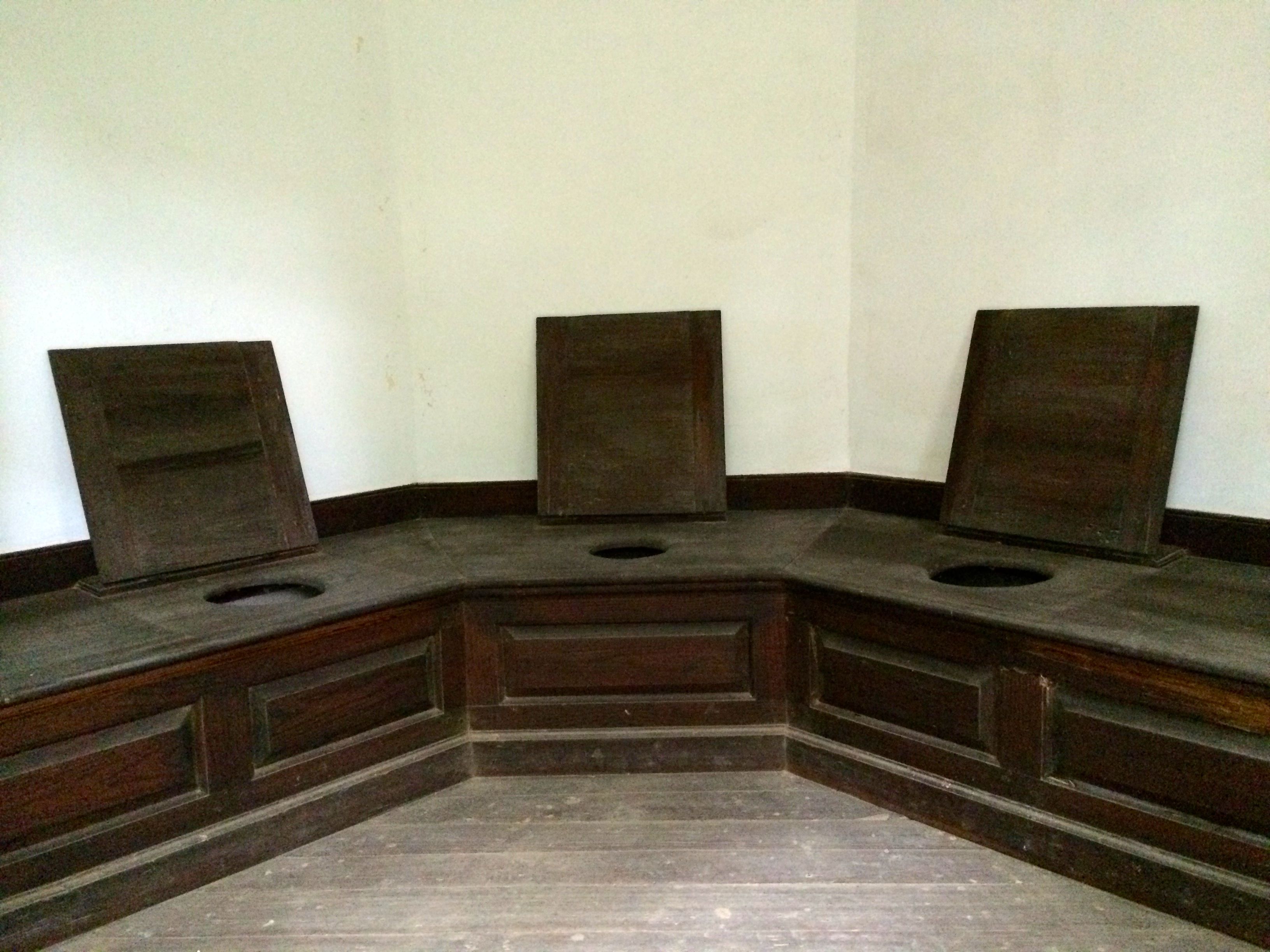
He did urge me to take a look at Washington’s “Necessary.”
Yes, another Presidential loo.
This one seems set up for a meeting.
This structure was rebuilt on the original site.
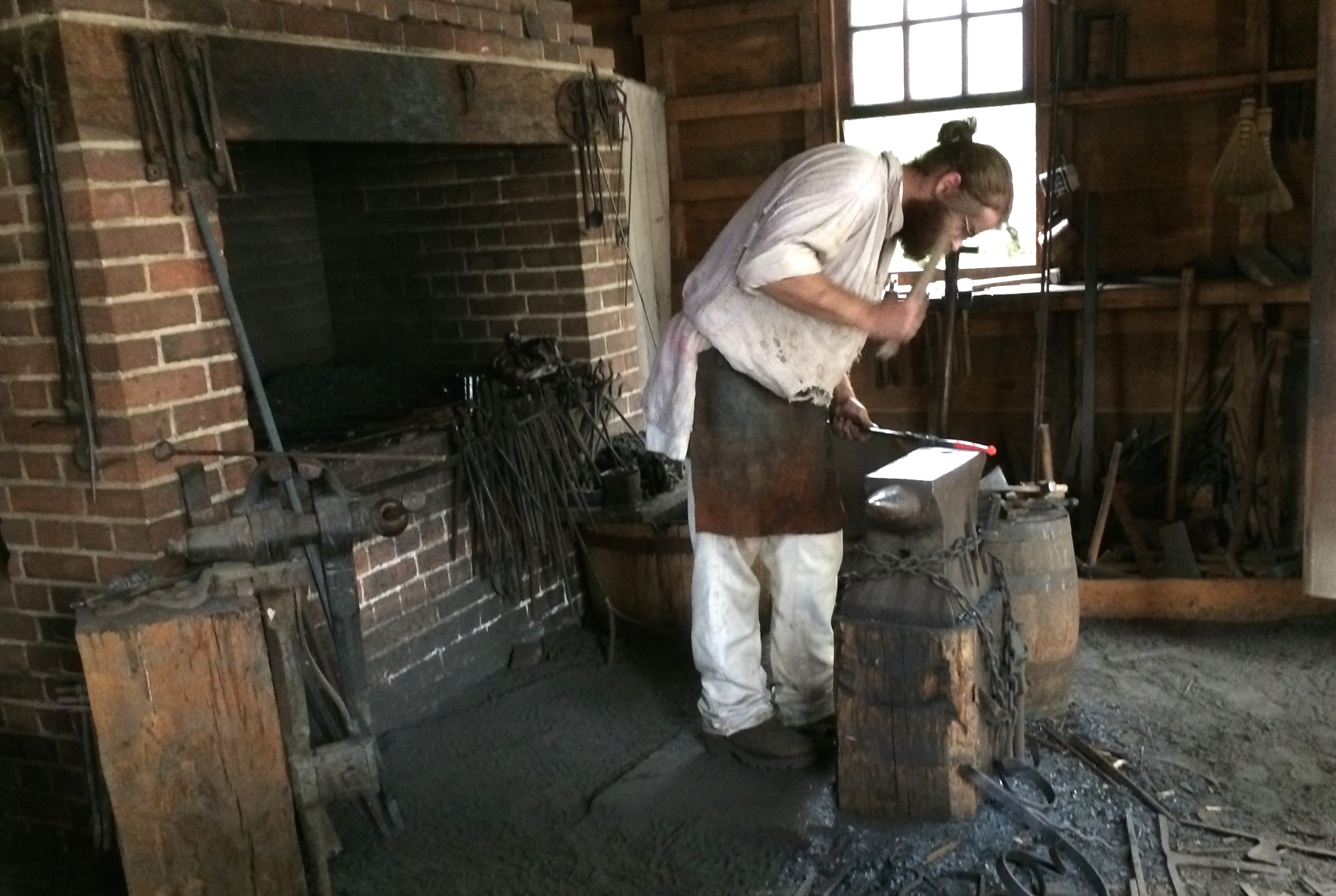
Archeology is on-going, and they recently discovered the site of a blacksmith site. Previously, they thought it was an icehouse.
Blacksmith
This wasn’t my first visit to Mount Vernon. Mom and Dad took us here on the vacation we took with Uncle Norm’s trailer in 1966. I only remembered three things from that trip.
I remember the bedroom where Washington died. Unfortunately, he died inside the house, so I don’t have a photo of it.
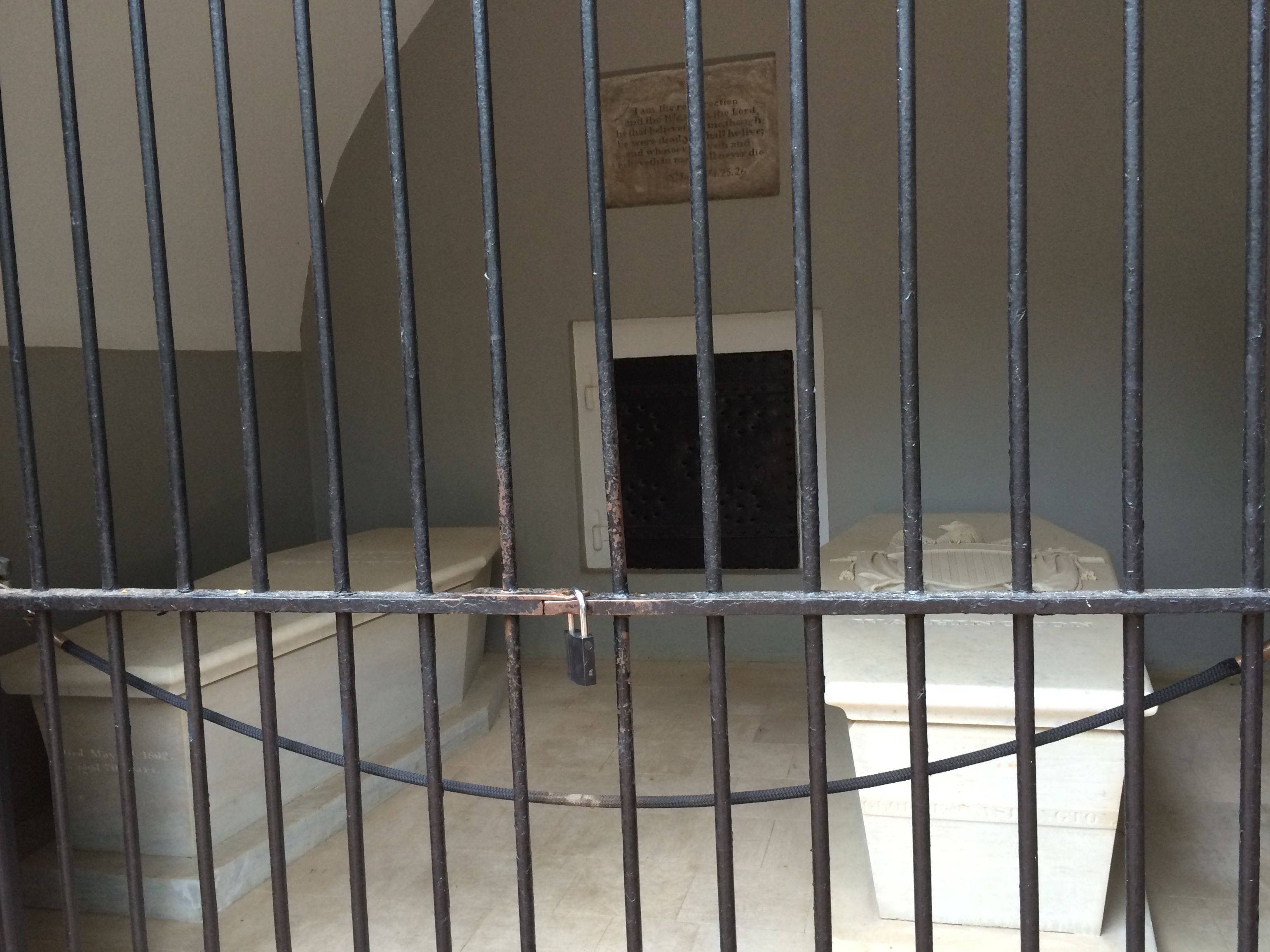
The Washington’s Crypt
I remember this tomb. I also remember being rather perplexed with why the coffins were above ground.
And I remember boxwood. Specifically, I remember the SMELL of boxwood.
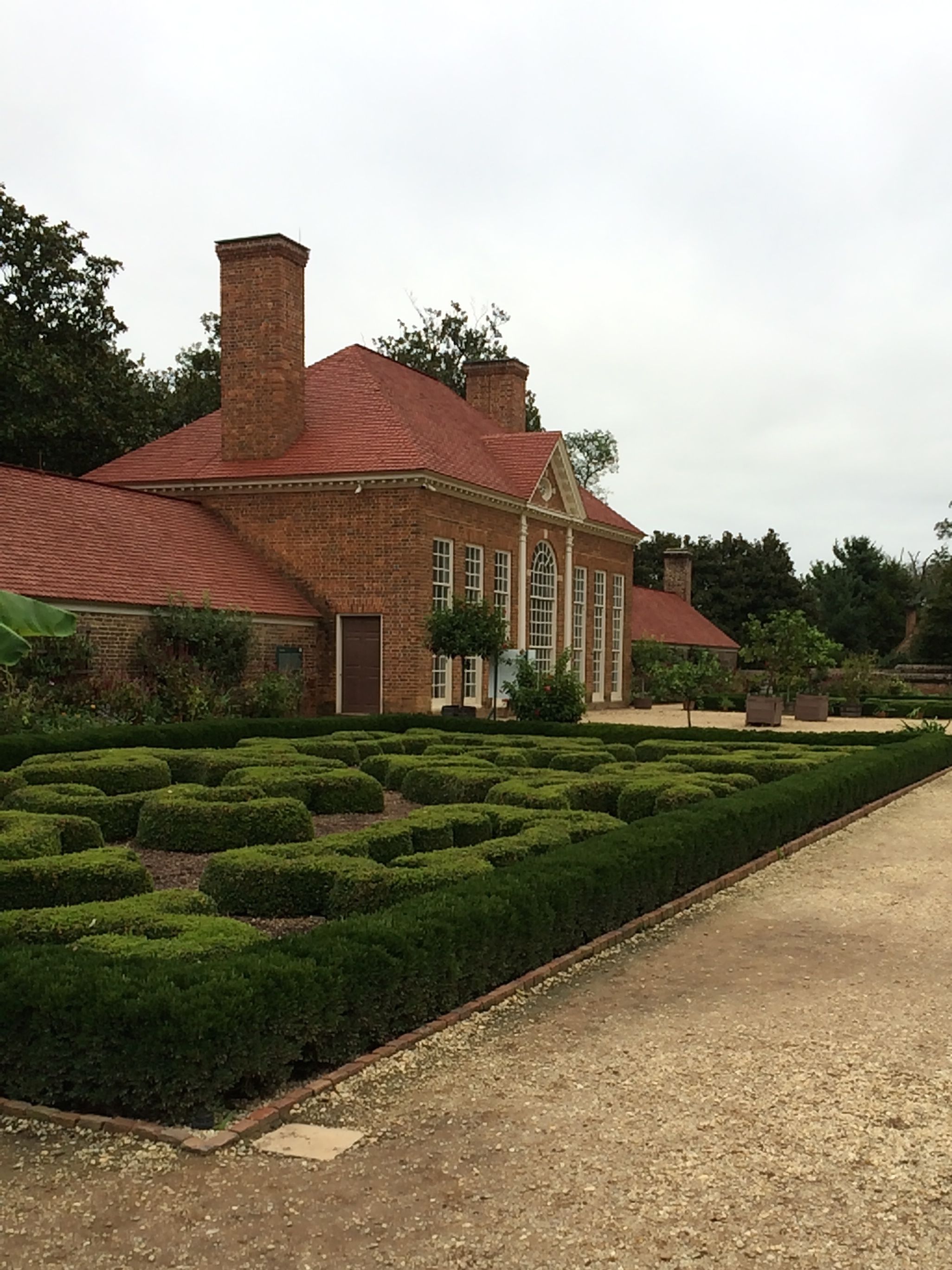
The Parterre
I hated the smell of boxwood! It nauseated me at the time, and I still don’t like it.
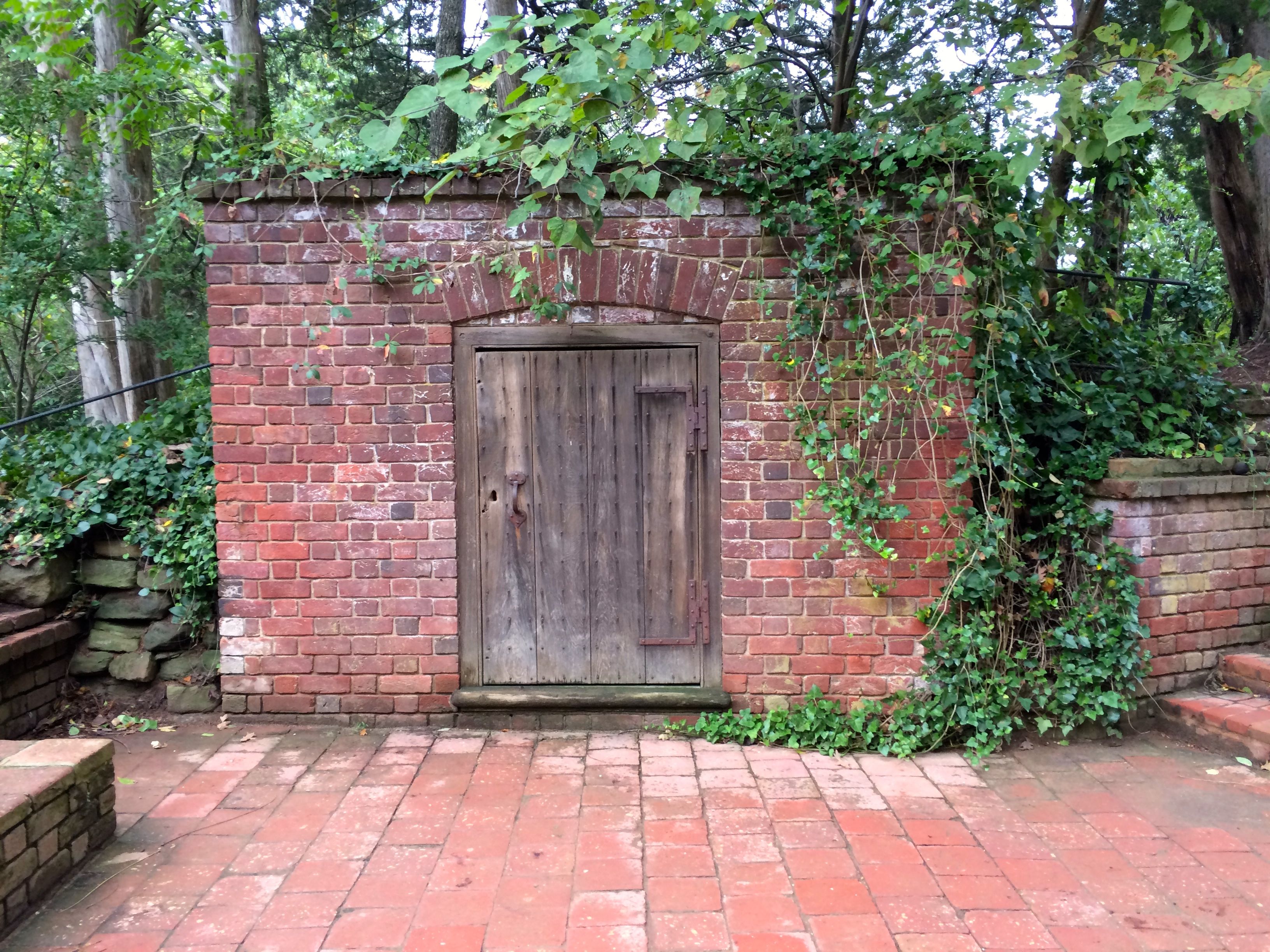
While walking around the grounds, I discovered the Old Burial Vault. Originally, George and Martha and twenty other family members were interred in this vault.
Old Burial Vault
George left directions in his will that a new vault be built on the property. He wanted it built on a larger scale and made of brick. In the end, he got his way, but only because his great nephew, John A. Washington, stood his ground in 1832, on the centenary of Washington’s birth. That was the last time Congress tried to move Washington’s remains.
In spite of Washington’s specific directions in his will about his burial, Congress asked Martha if they could move his remains to the Capitol. She agreed, but the various parties and houses couldn’t come to an agreement. I guess governmental gridlock isn’t a strictly modern phenomena. At one time, they even had plans drawn up to bury him outside the Capitol in a larger, Egyptian-style mausoleum.
In any event, his tomb is right where he intended it to be. They only finished the New Tomb and got the remains moved in 1831. I guess John A. Washington figured that there was no point in moving them again so soon.
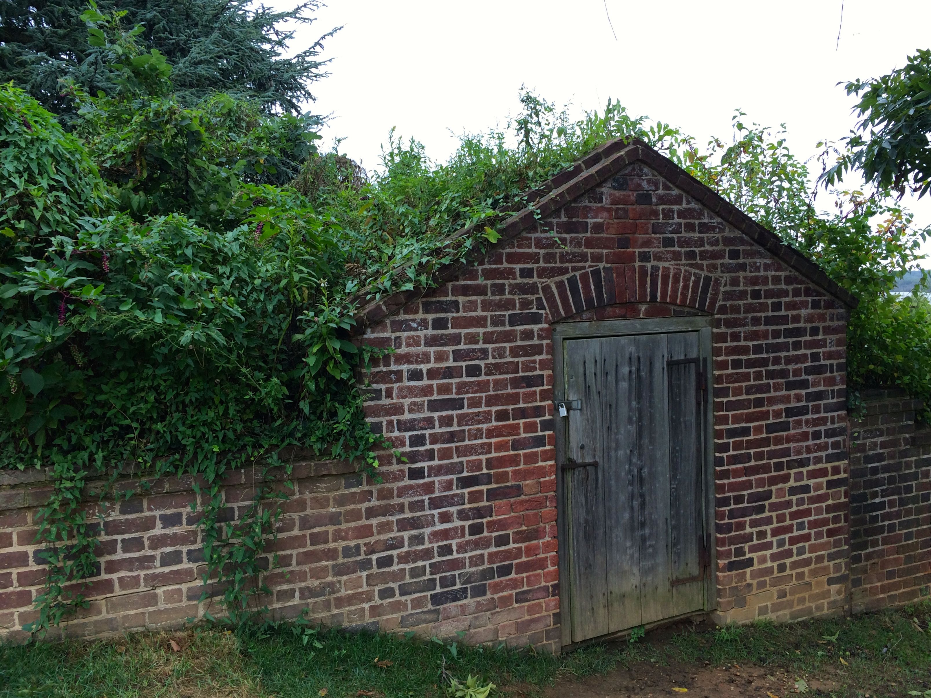
Icehouse
Not too far away from the Old Burial Vault is the Icehouse. It looks an awful lot like the Old Burial Vault. Actually, the above-ground portion is a restoration that was completed in 1938. The 22-foot-deep brick chamber, which was a dry well, is original. Layers of ice from the river were harvested and packed into the chamber with layers of straw and sawdust to insulate it. According to the sign at the site, further restoration is planned for 2015.
Since 2015 is winding down, I think the only restoration that might be taking place this year will be on the sign.
Dung Repository
Another restoration is the Dung Repository. Washington designed this repository for composting animal manure and other organic materials to improve the soil in the gardens and orchards, which was a progressive farming technique at the time. In fact, this was the first known structure dedicated to composting in the United States.
First in war, first in peace, first in organic gardening.
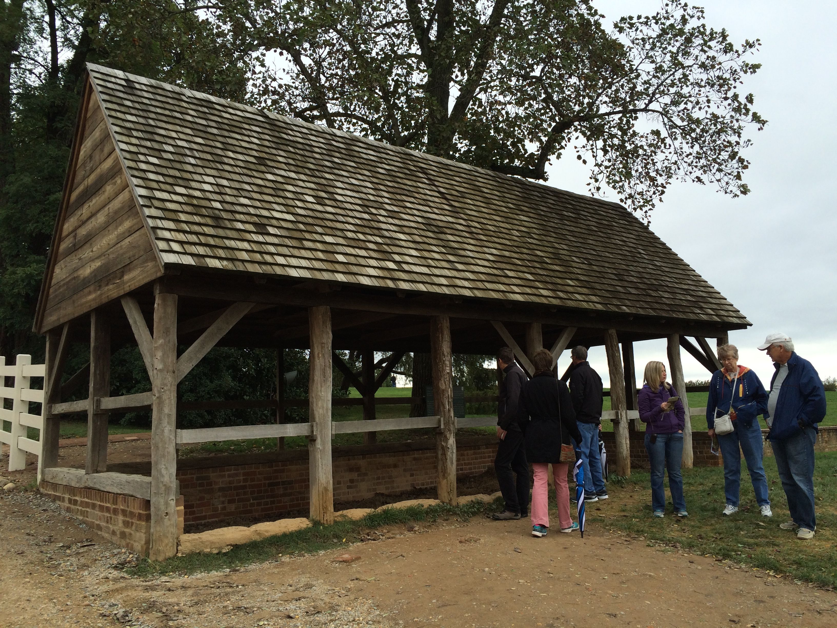
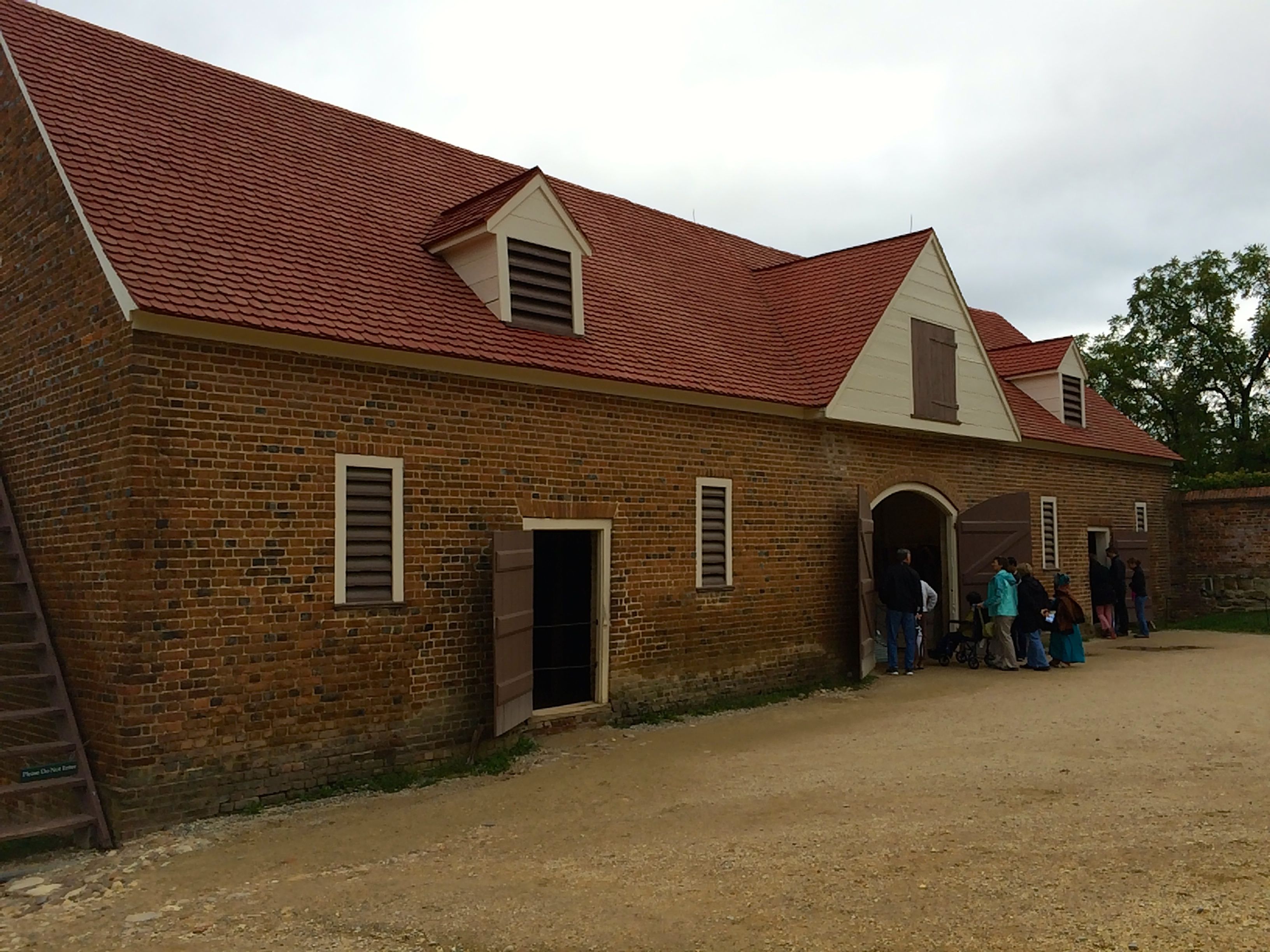
Stables
Where did the manure come from? Well, the stables were nearby. Washington was known as a horseman.
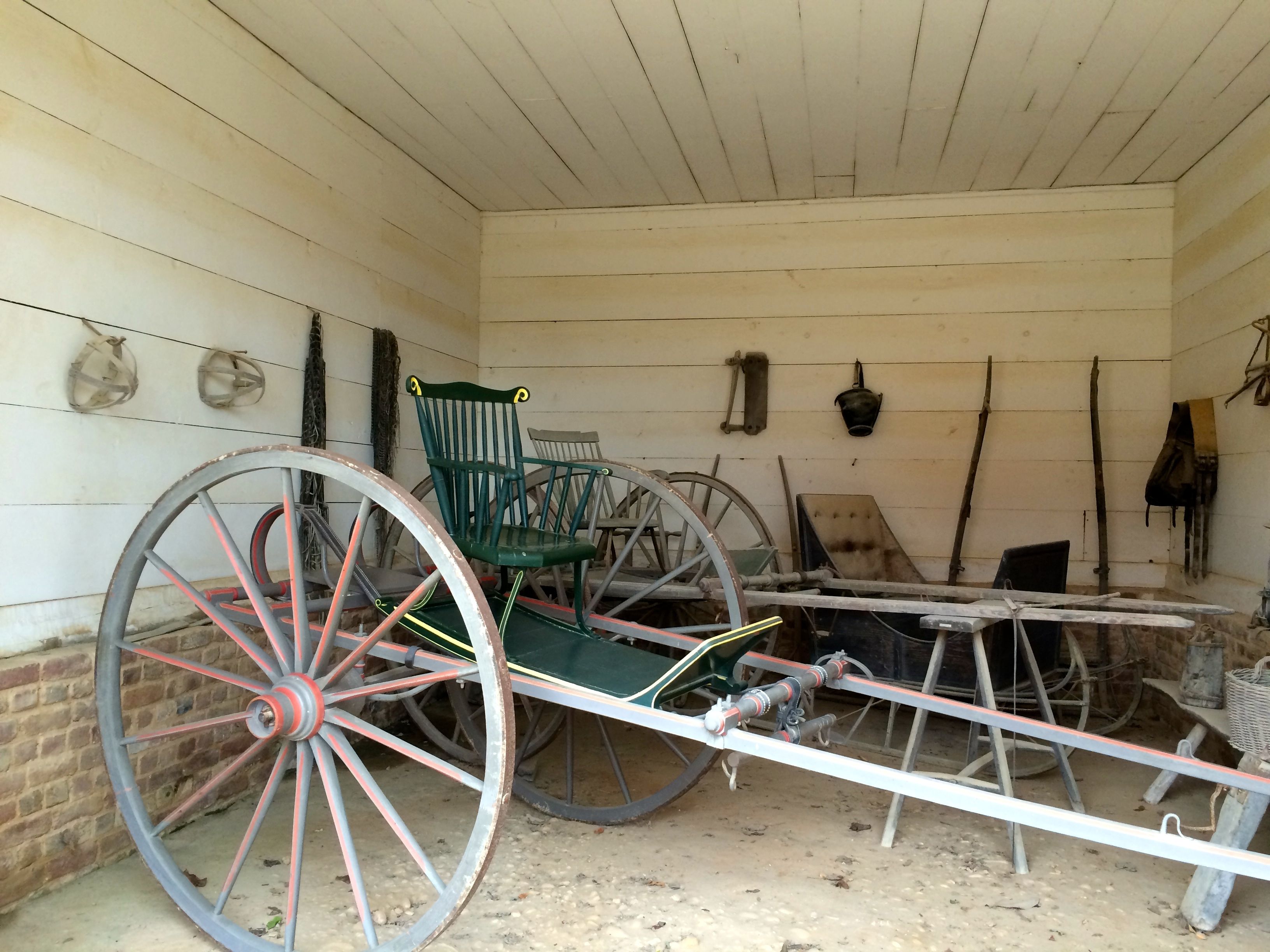
He also had vehicles like these, known as “riding chairs”. They were relatively inexpensive, in comparison with other wheeled vehicles, and they were well-suited to the rough roads and hilly terrain of Virginia.
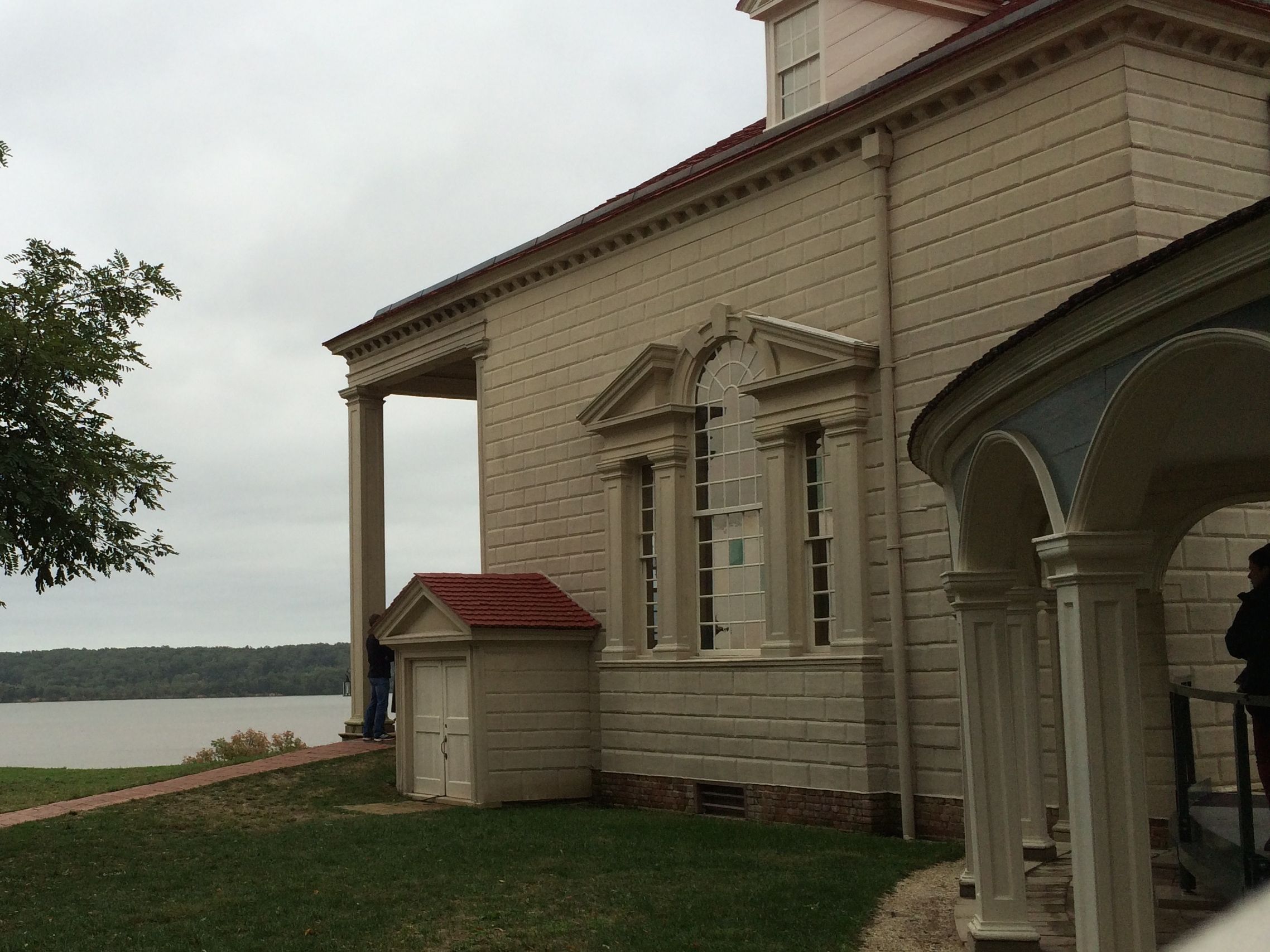
See that little structure with a door at the end of the mansion? That is one of the doors to the basement. There’s another one on the other end of the house.
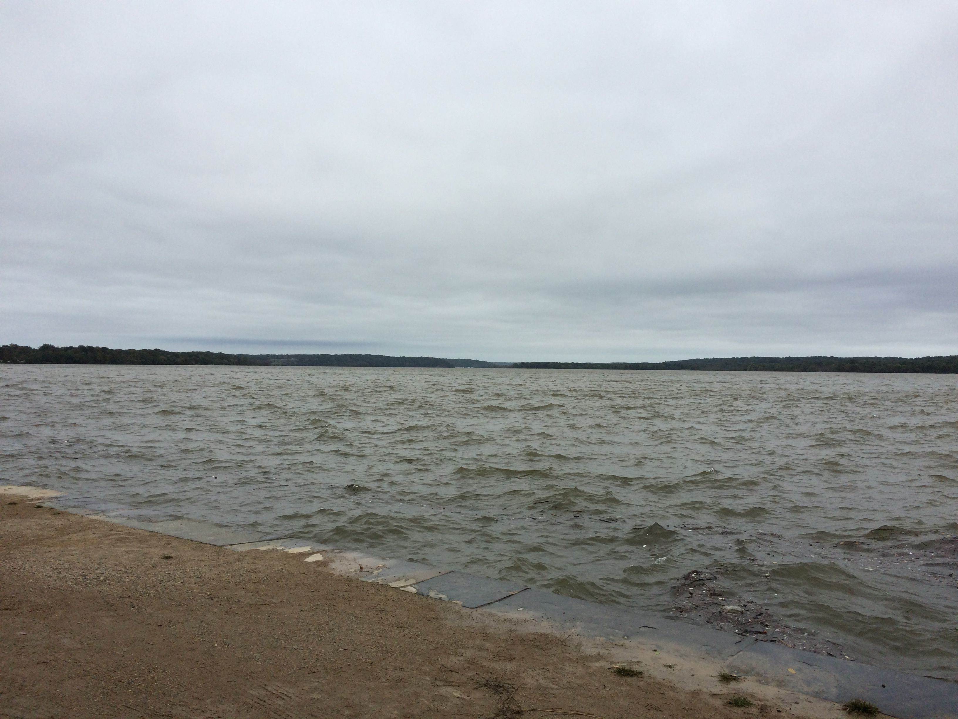
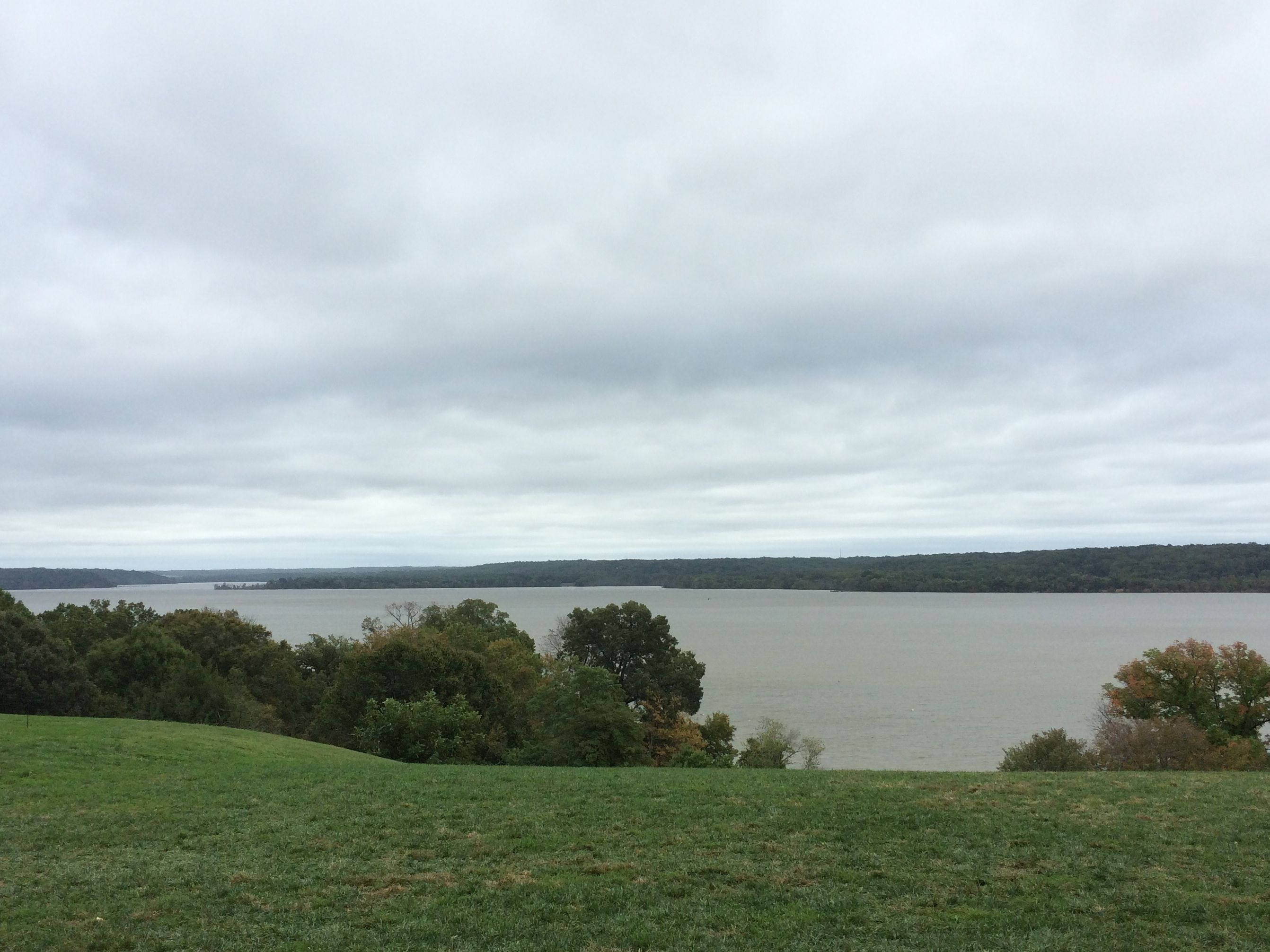
In front of the house, you can see the Potomac River. With a wharf on the river, Washington had direct – if slow – access to Europe, where he could sell his goods receive products in exchange.
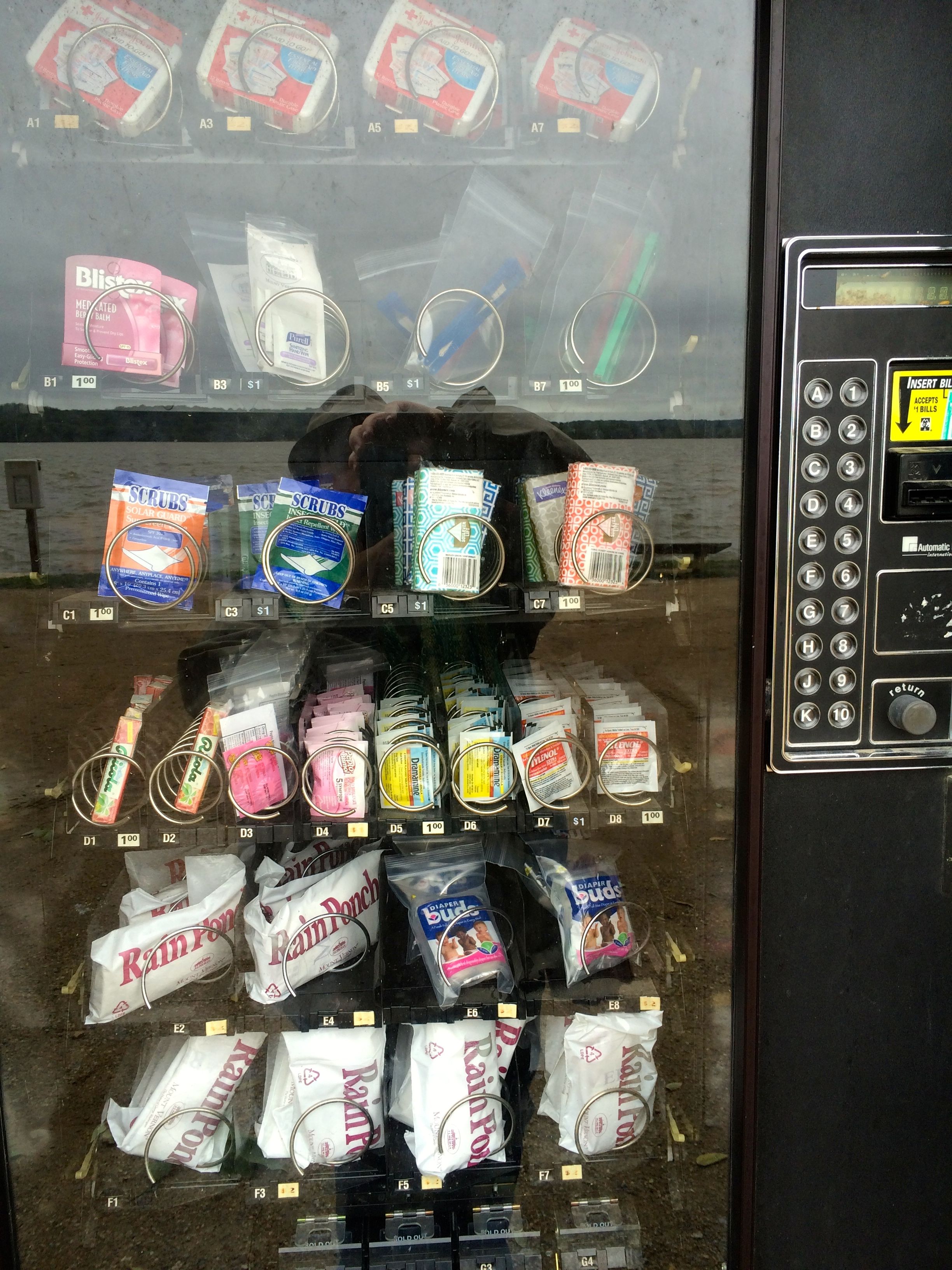
The view of the Potomac from the wharfModern products available at the wharf
I found it interesting that products still come in by the wharf. This machine was there to meet the needs of the visiting hordes. Luckily, I didn’t need the poncho, first aid supplies or cough drops.
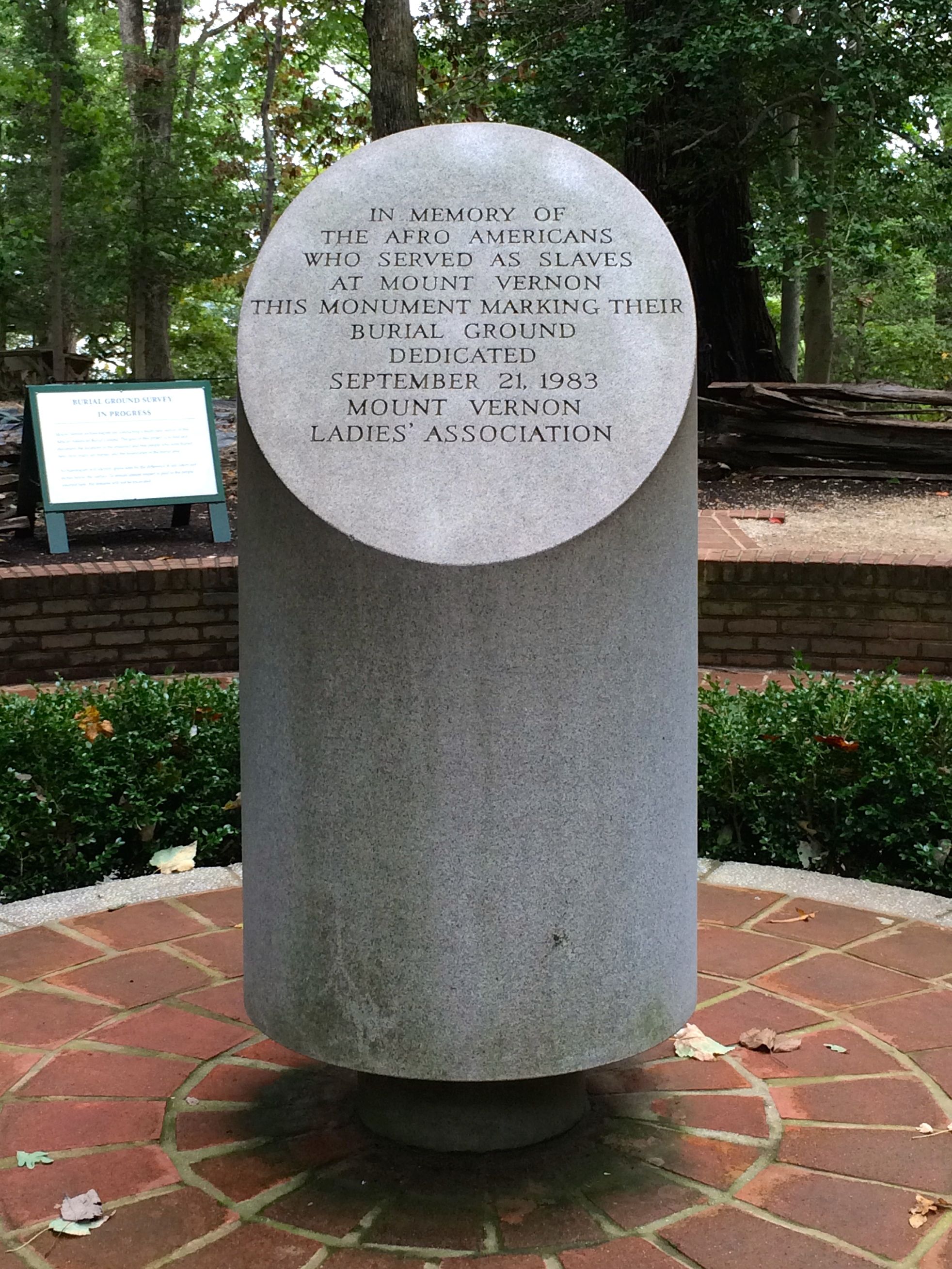
George, Martha and other family members aren’t the only ones buried at Mount Vernon.
Slave Burial Ground Marker
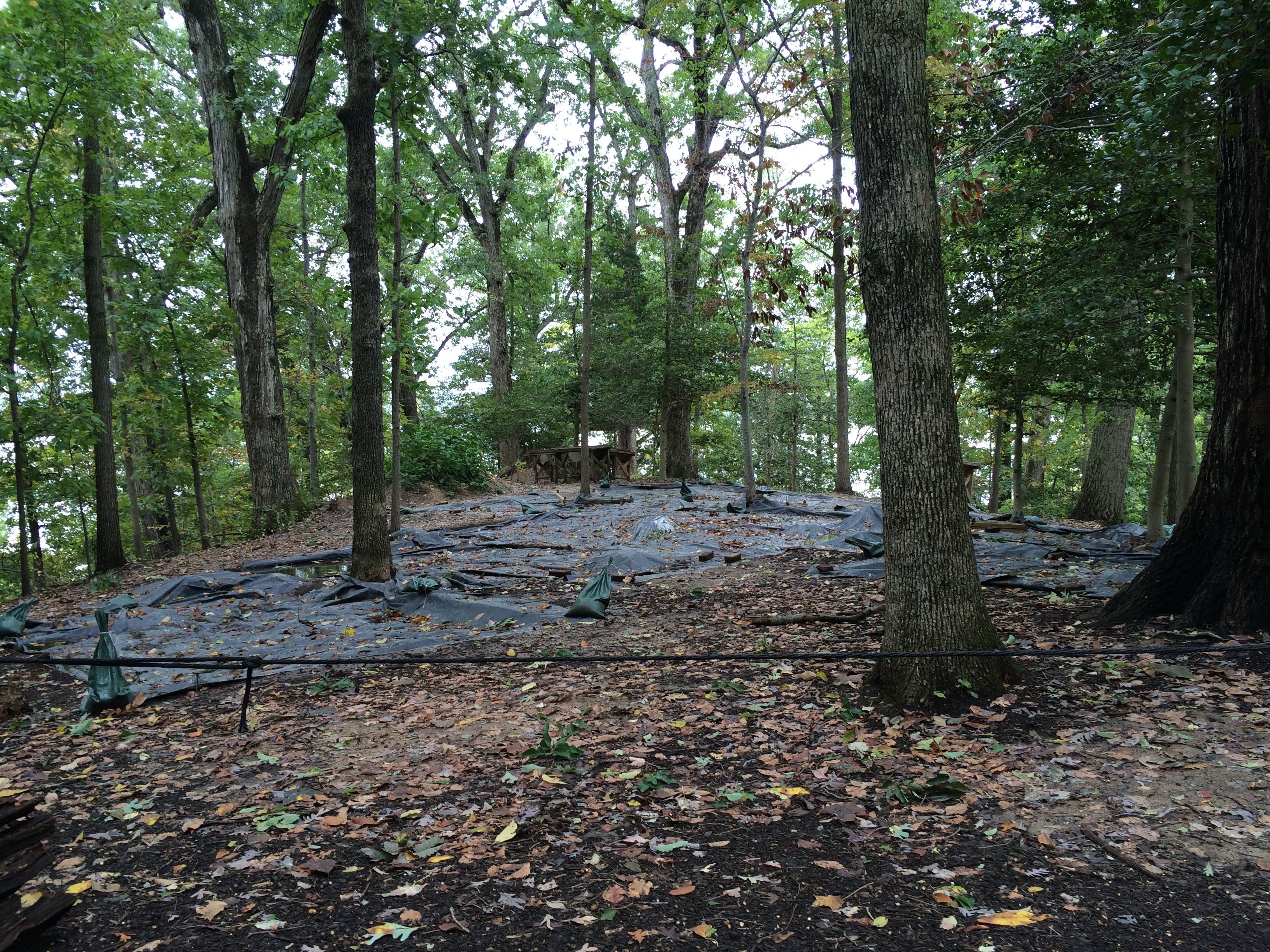
Archeology is on-going at the burial ground. There was no one available to to talk to about it, but a sign stated that the methods used were non-invasive.
In addition to preserving the buildings, the members of the Mount Vernon’s Ladies’ Association is working hard to preserve Mount Vernon exactly as it was in Washington’s day. That includes the view. At one point, a tank farm was proposed for a spot directly opposite, as well as housing developments. The Ladies’ Association, working with the Federal Government has worked together to purchase the land necessary to preserve the view. In fact, airplanes don’t even fly over. The whole time I was there, I never heard one. I didn’t notice the absence until it was pointed out by my guide, Bill.
After doing a fairly thorough job of checking out the estate, it was time to head in to see what the museum had to offer.
But first, one more look back at the mansion.
Another classic shot with hordes of tourists
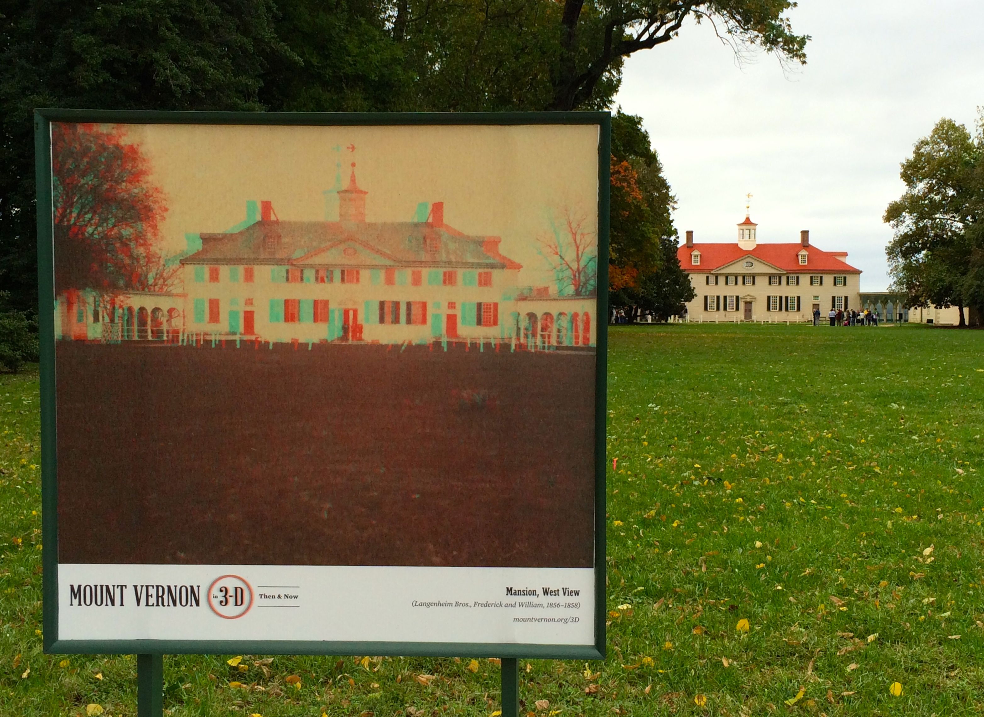
And a shot of another method for prying a few more dollars out of the hands of visitors.
Buy a pair of 3-D glasses and you can look at historic photos with them. It’s almost like being there.
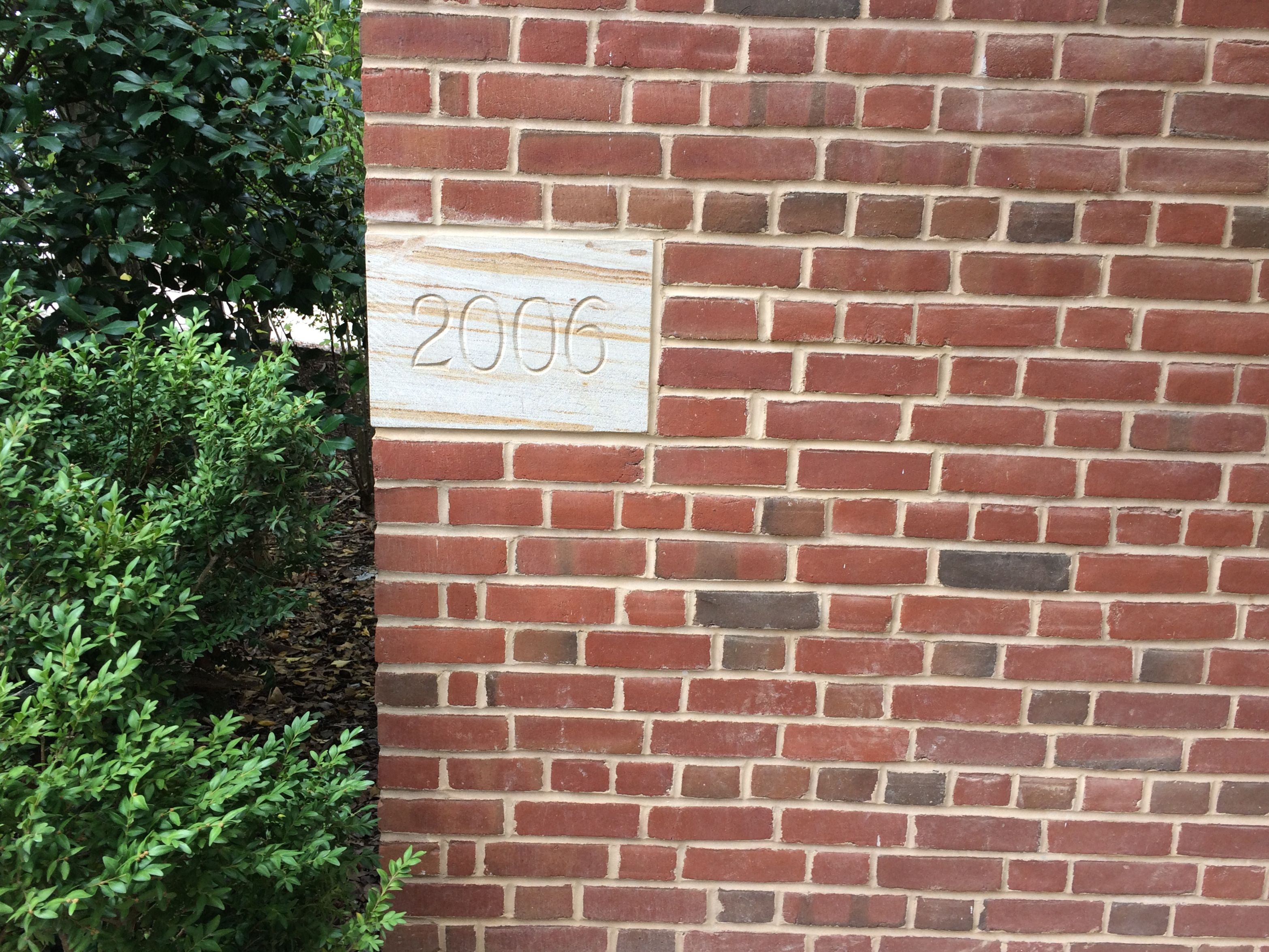
Museum cornerstone
We are always reinterpreting the past. This museum is new since my last visit.
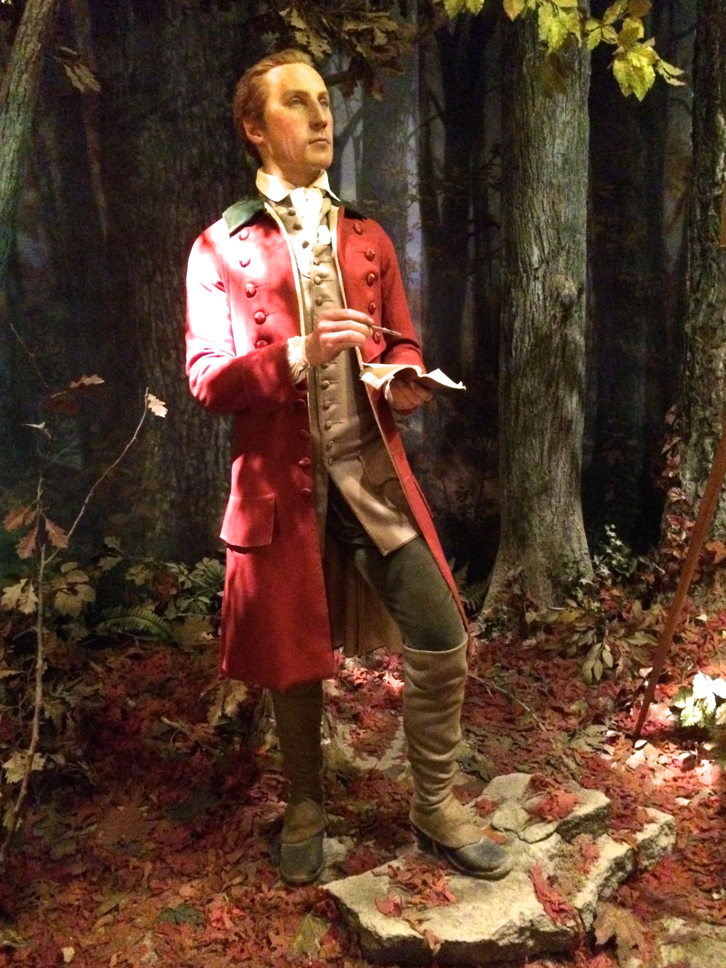
I was running short on time, so I had to move fairly quickly through the exhibits. My favorites were the series of forensic reconstructions of George though his life time.
Young George
It looks like he is surveying here.
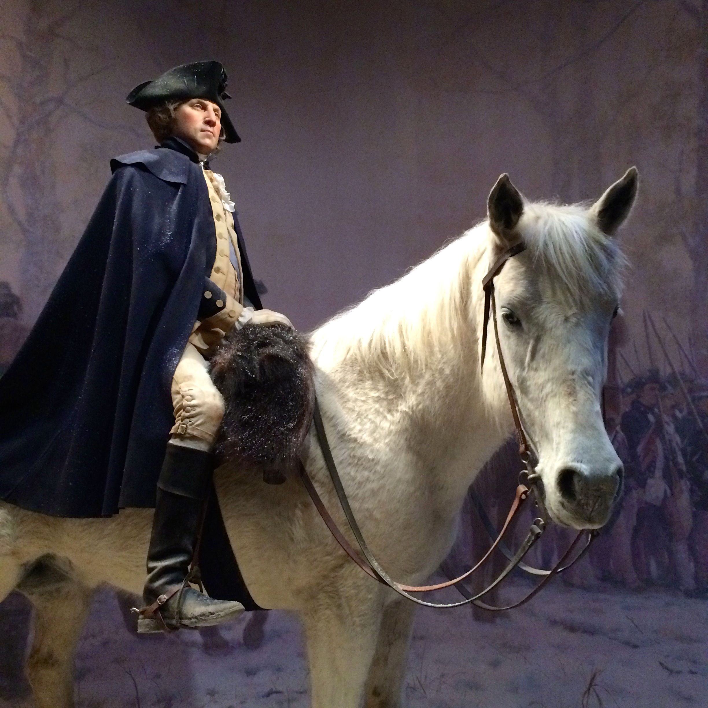
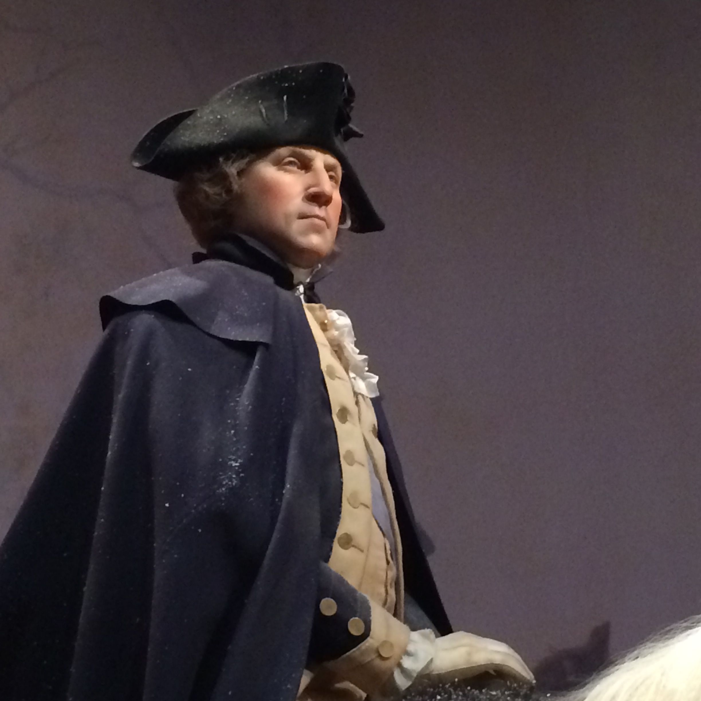
Middle-aged GeorgeClose-up, age 45
This figure is from 1777, when he was a revolutionary war general. The forensic experts studied his uniform’s waistcoat and breeches, which are now located in the Smithsonian, to be able to determine the exact proportion and density of his torso and limbs. They based the hair color on samples of Washington’s own hair, that is found in Mount Vernon’s collections.
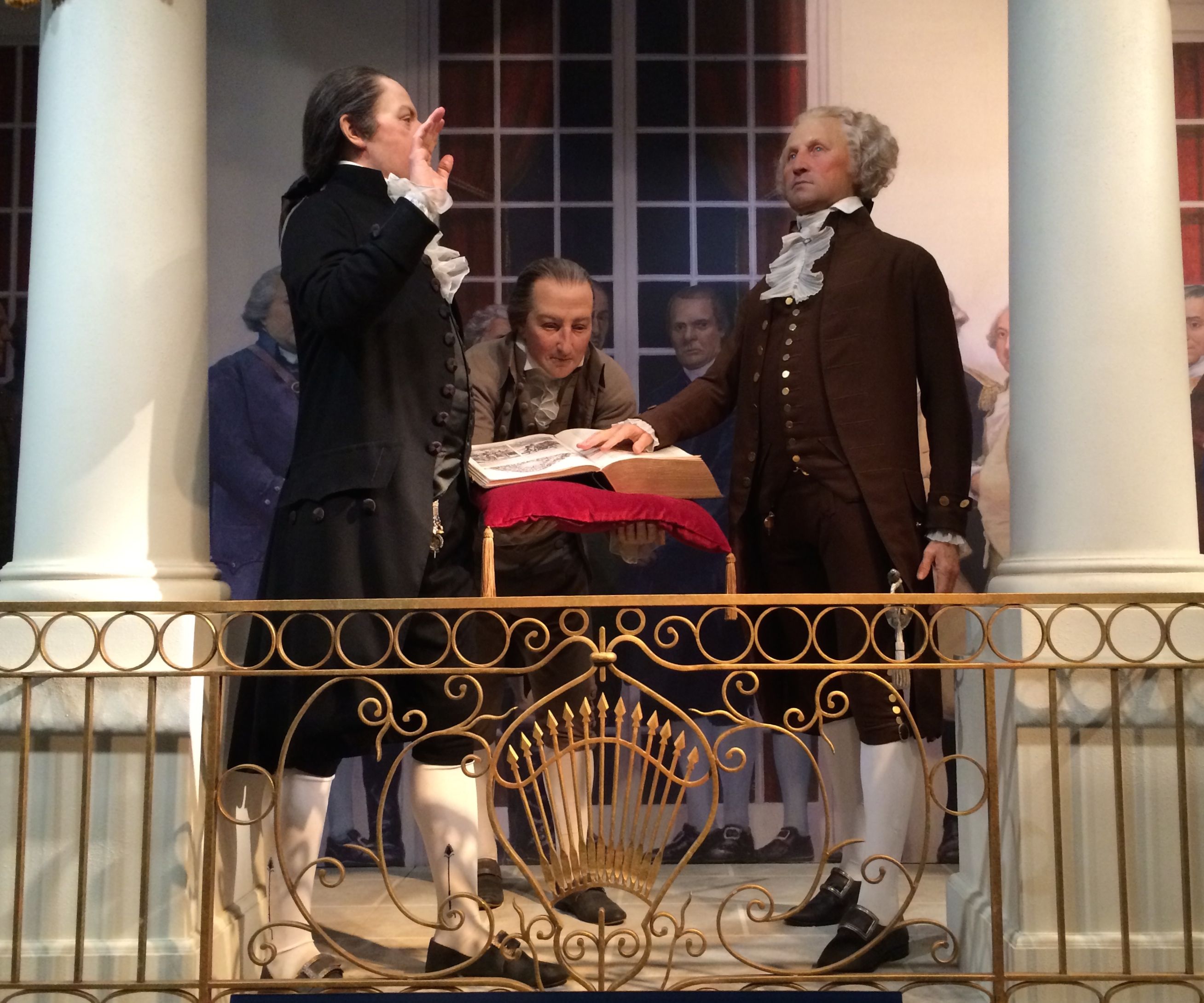
George being sworn in, age 57
The forensic experts paid close attention to the roll that tooth loss played in shaping his face. A lifetime of tooth decay had lead to bone loss around the jaw, creating hollowness around the cheeks. At the time he was sworn into office, he had only one tooth left in his mouth.
And, while there are so many more things that could be said about George Washington, his life, the building of Mount Vernon and the struggle to preserve it, I would like to close with something that George wrote in a notebook as a young man. He copied it from another source, I do believe, but may these words guide all our actions.
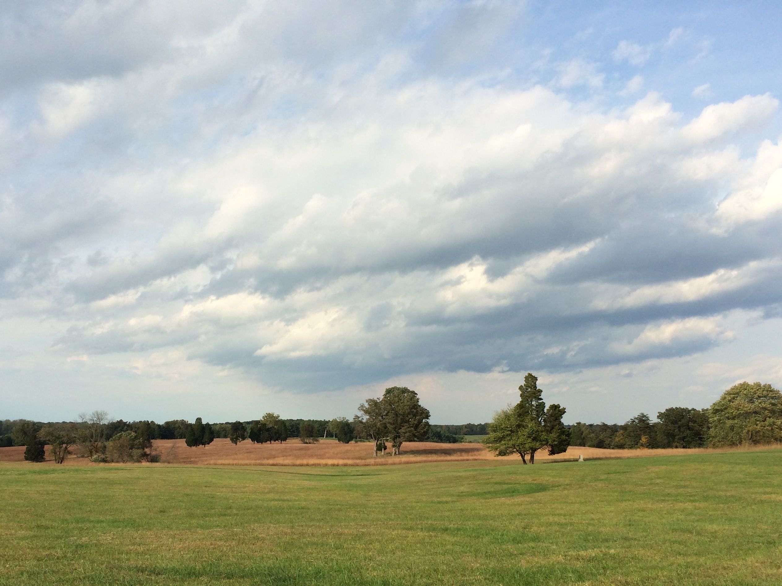
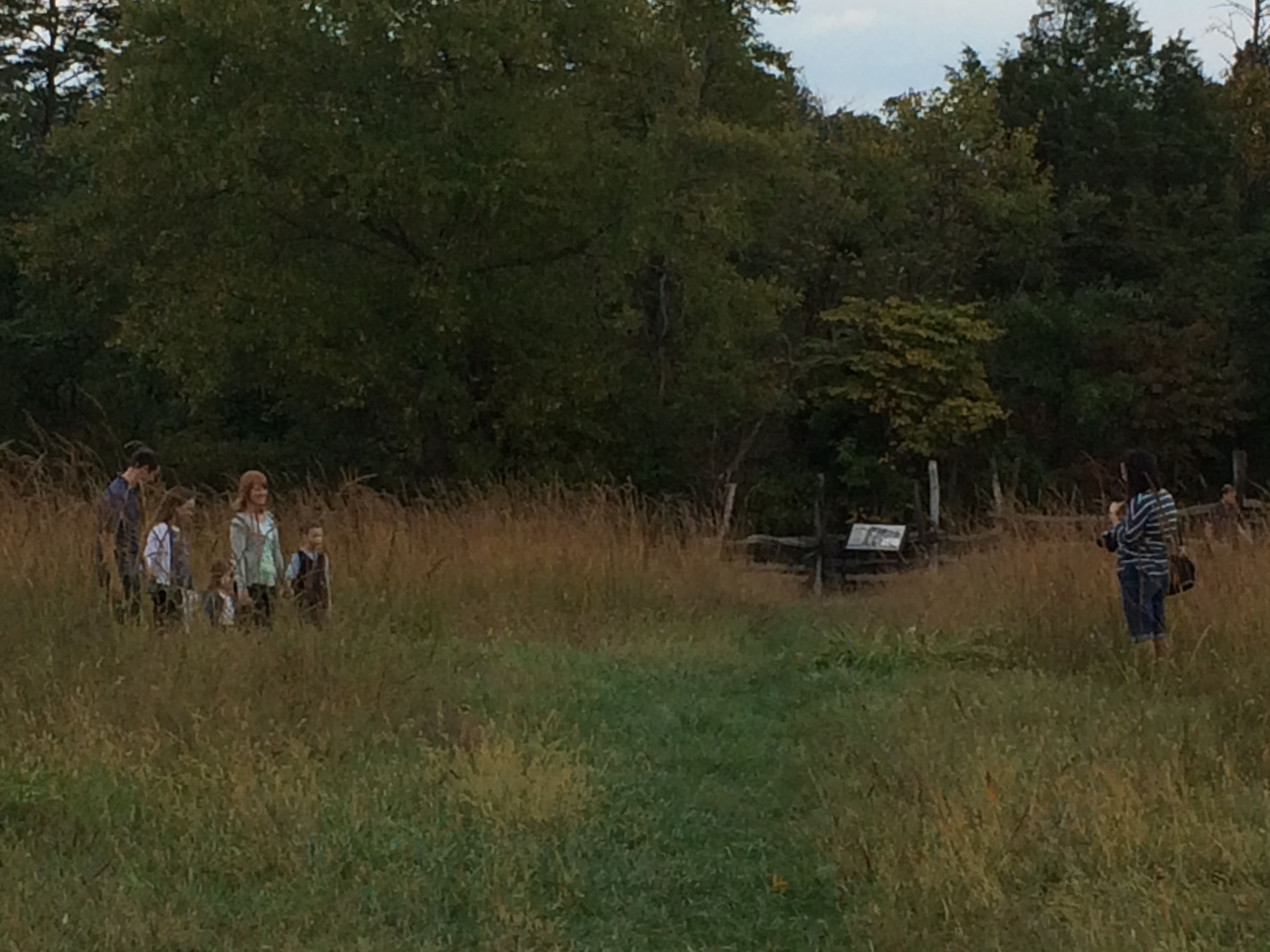
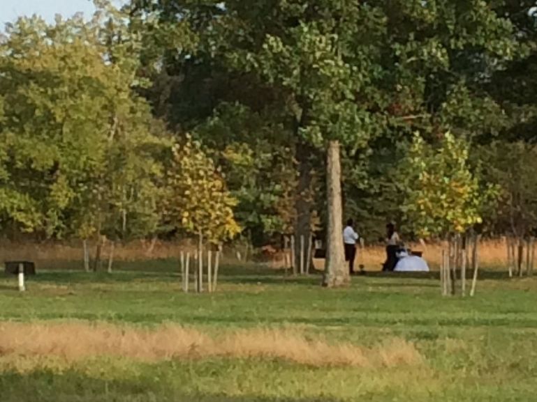
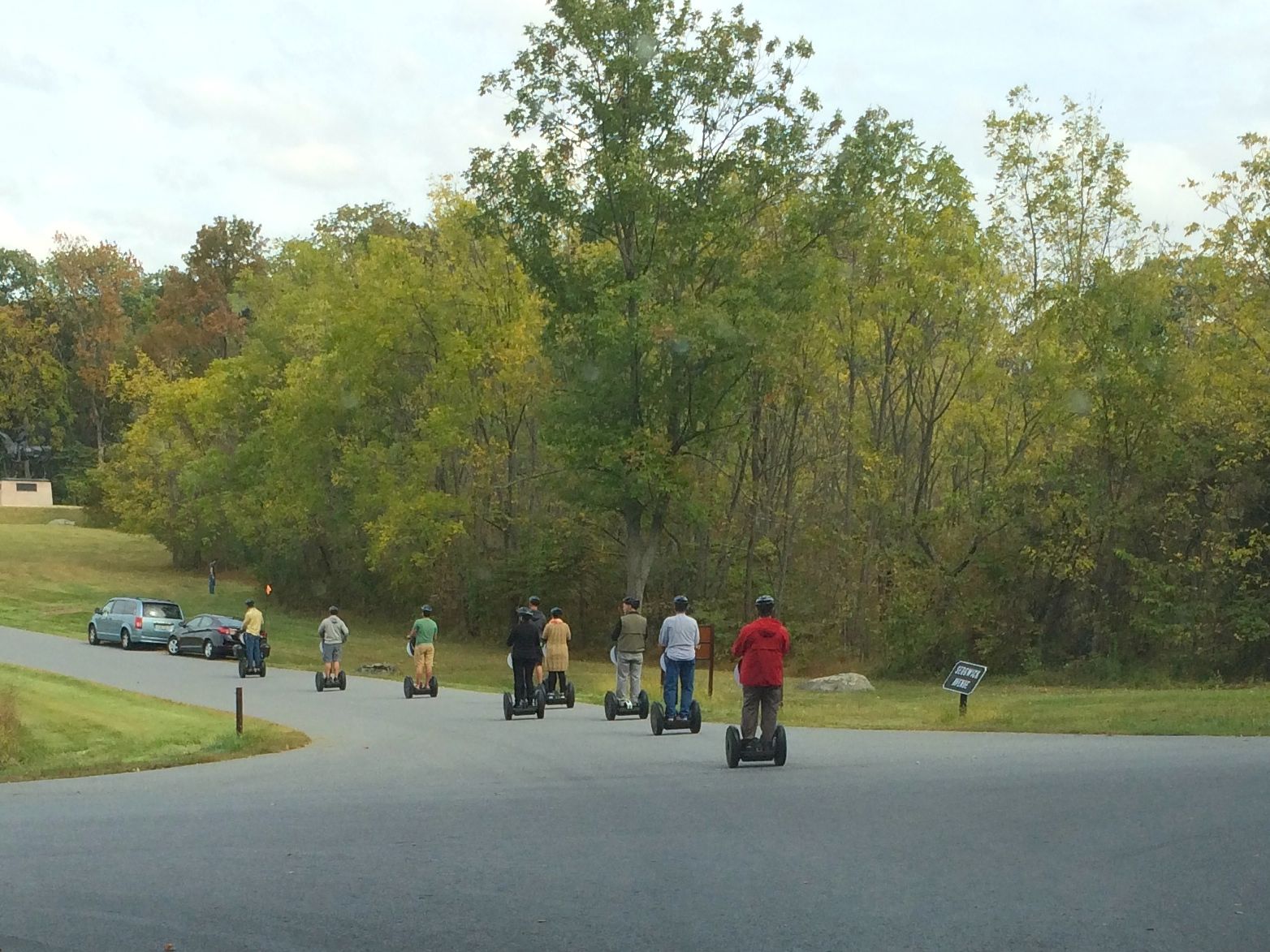
The rolling fields are turning golden and the trees are starting to show signs of fall. People are taking advantage of the sun and the weather to make photos that will mark their places in time.
Taking a family portraitWedding Portrait
Yet, a little more than 150 years ago, this land was awash in blood.
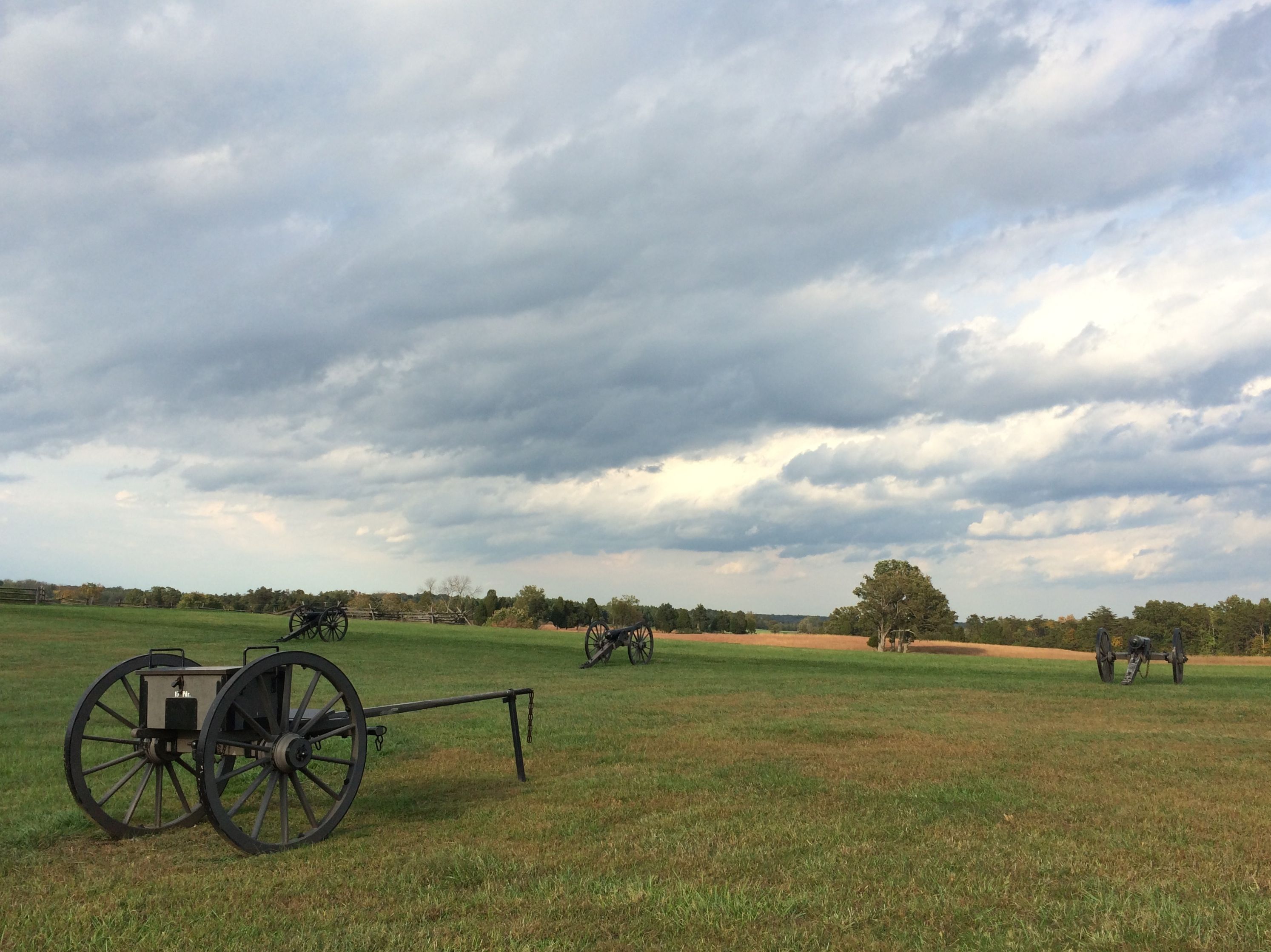
Henry Hill was the site of fighting in the first and second battles of Bull Run, as we say in the North, or Manassas, as the Southerners refer to it. The first battle raged around the Henry House on July 21, 1861.
Rebuilt Henry House
The Artillery from both sides formed up less than 1000 feet apart from each other. The Henry House was in the middle. Judith Henry, and 85 year-old widow was bedridden and unable to leave her bed. Her sons attempted to carry her out to a safer location, but she begged to be taken back inside. She died in her bed.
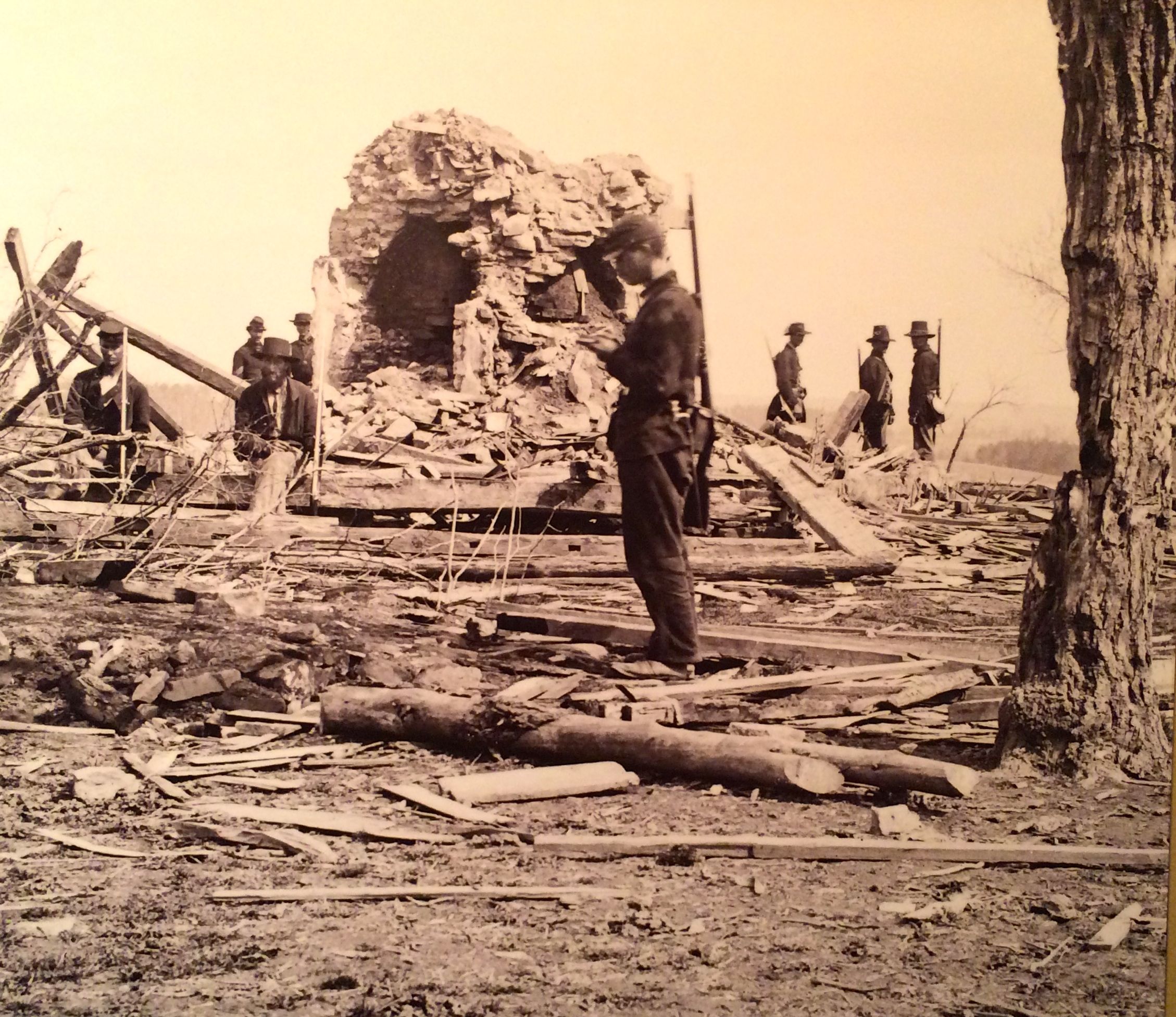
Henry House after the battle
This is what was left of her house after the battle and after wood was pulled off the splintered house to be used as firewood.
From the various sources at the battlefield and museums, I got the idea that this battle was particularly gruesome due to the inexperience of the troops. This was the first battle of the war. The Union soldiers had only been called up for three months. Both sides thought that it would be over quickly.
Limber and cannon
The supplies a cannon needs are carried in a two-wheeled cart called a limber. The limber is usually hitched to the horse or horses, and the cannon is towed behind the limber. If you have ever heard (or used) the word “unlimber” – meaning to prepare for action – this is where the term comes from. The lines of cannon were less than 1000 feet apart, judging by the map and the map scale. Actually, considerably less, in some instances. For my friends in Kalamazoo, this is about from one side of the Westnedge Meijer parking lot to the other.
While the battle raged, General Thomas Jackson, road back and forth on his horse. in an effort to rally his men, General Bee said, “There stands Jackson like a stone wall! Rally behind the Virginians!”
Stonewall jackson’s statueGeneral Bee Monument
Civilians on both sides gathered on hill tops to experience what there was to be seen and heard. In fact, the Union retreat from the first battle was hampered by congressmen and others who had come out from Washington to watch. Panic ensued and the retreat became a overwhelming defeat.
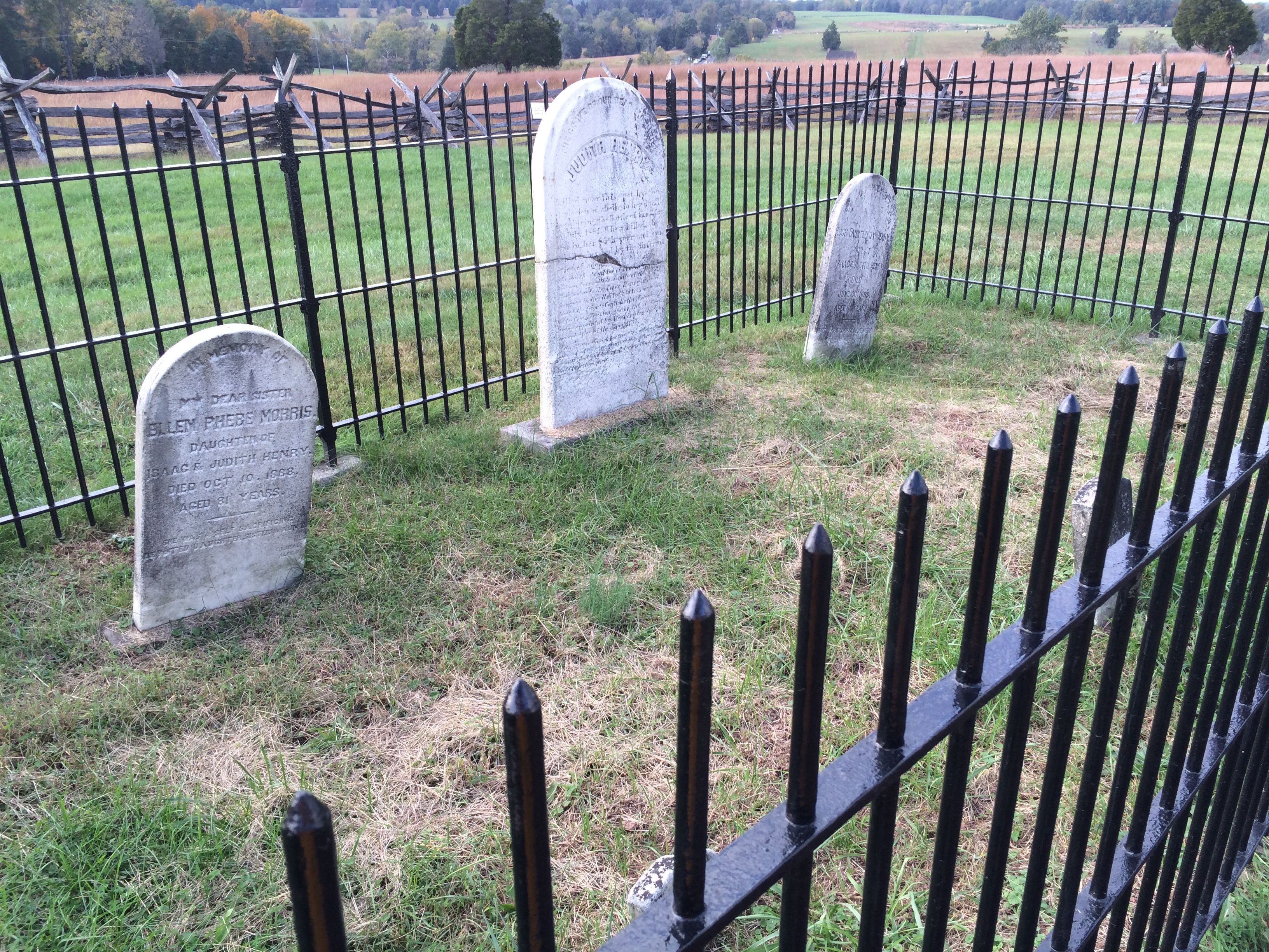
Hill Family Graveyard
Fewer than 5,000 were killed or wounded in the first battle of Bull Run and 1,325 were captured or missing out of the 36,000 troops involved. It was a bloody, ugly affair that set the stage for the long, brutal war that would follow.
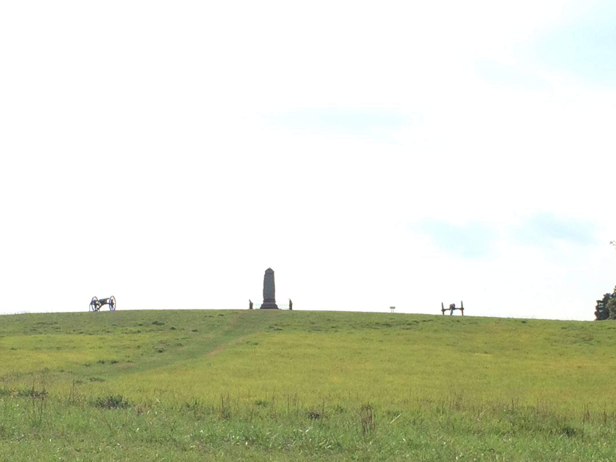
The second battle in this area took place a little more than a year later, on August 28–30, 1862. This time, about 112,000 troops took part. This time, 18,300 were killed or wounded.
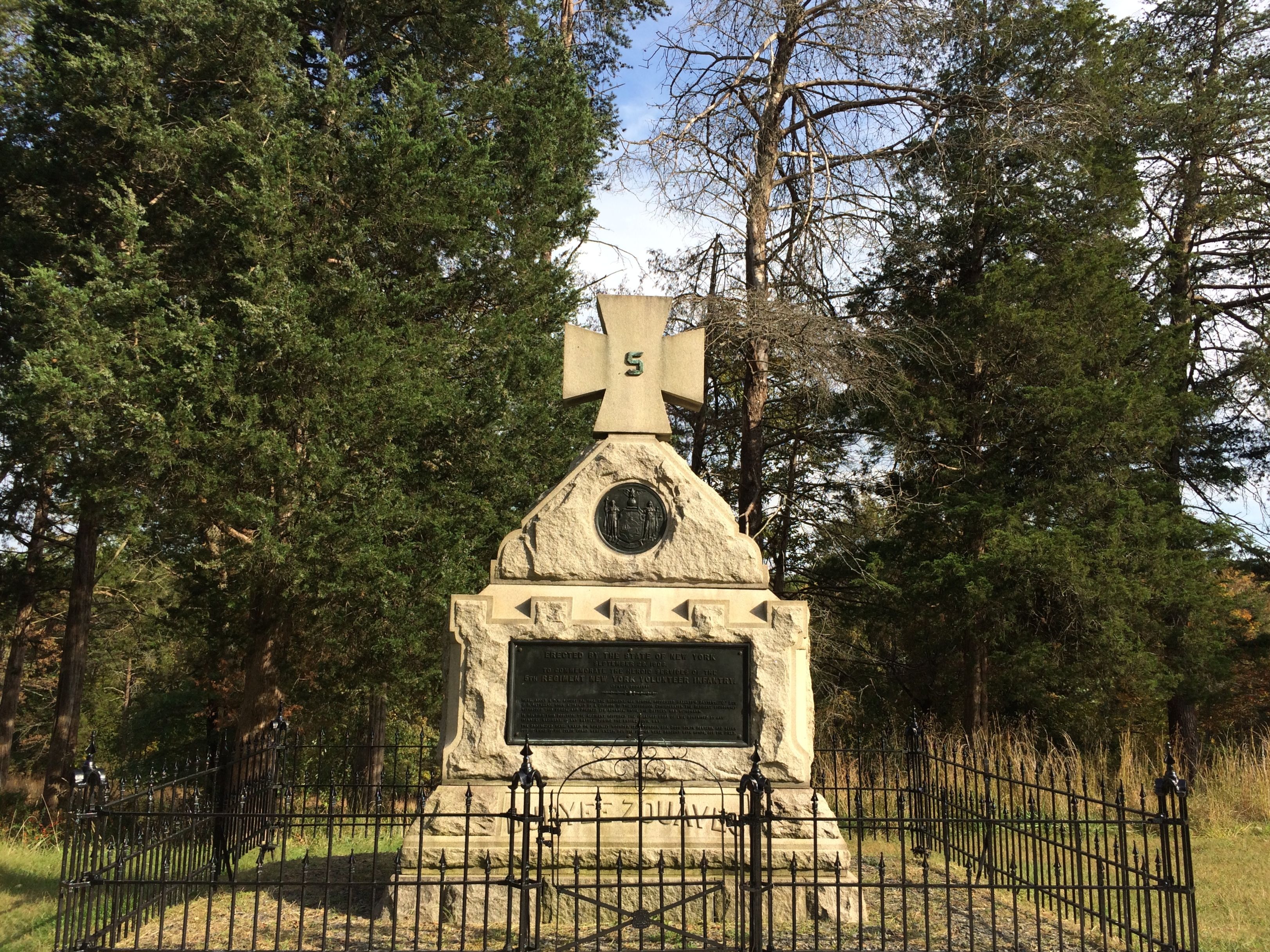
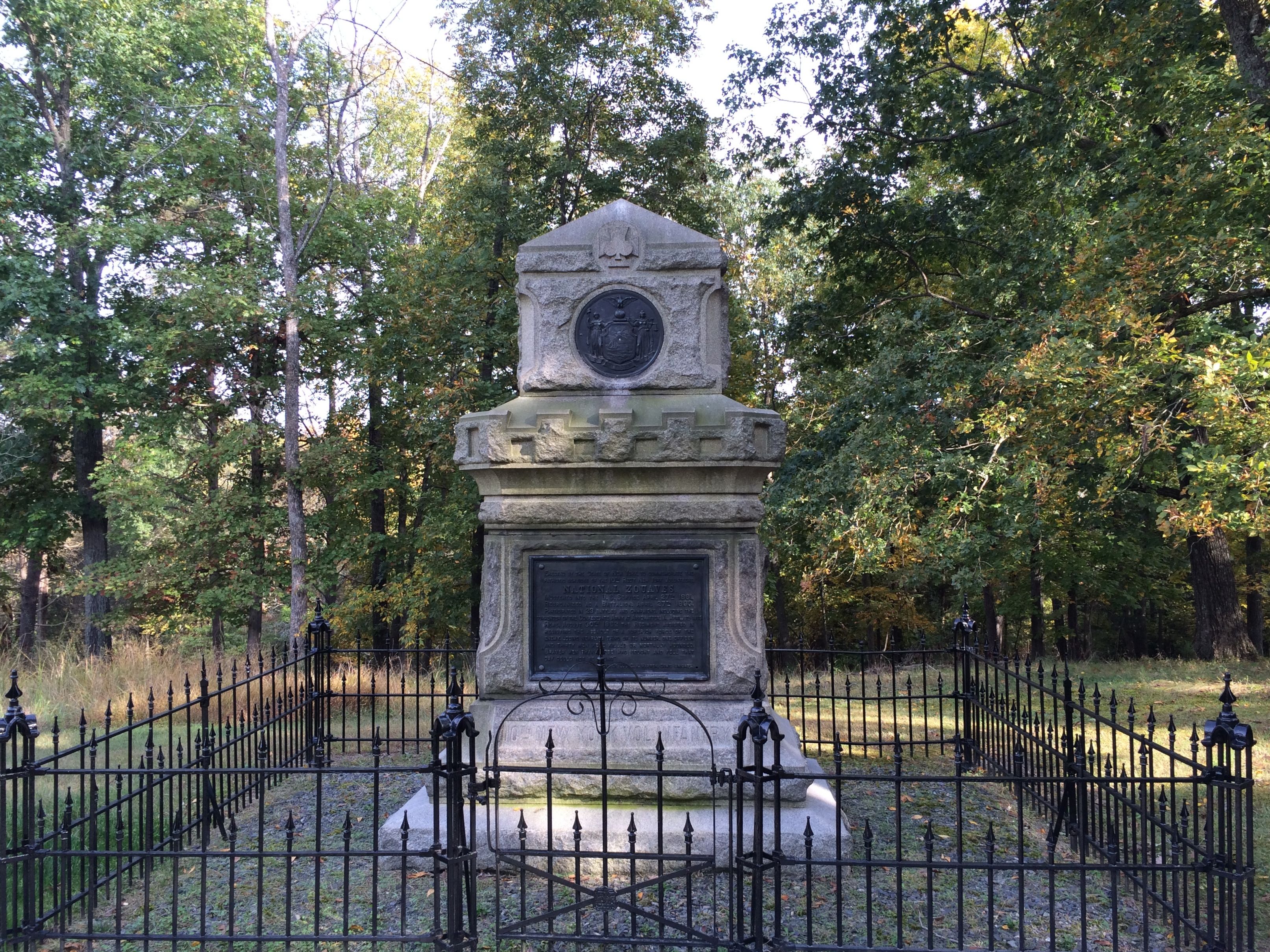
Some of the fighting was particularly deadly. In 1906, New York State was given permission to erect three monuments to honor the sacrifices of the Fifth New York Volunteers, the Tenth New York Volunteers and the Fourteenth Brooklyn.
It appeared to this regiment that they had escaped combat that day. Suddenly, the Confederates crashed through the brush and leaves. The unit was overrun within ten minutes. 123 men were killed or mortally wounded, which was the greatest loss of life in any Union infantry regiment in any single action of the war.
A veteran, remembering the one-sided slaughter compared it to “the very vortex of Hell.”
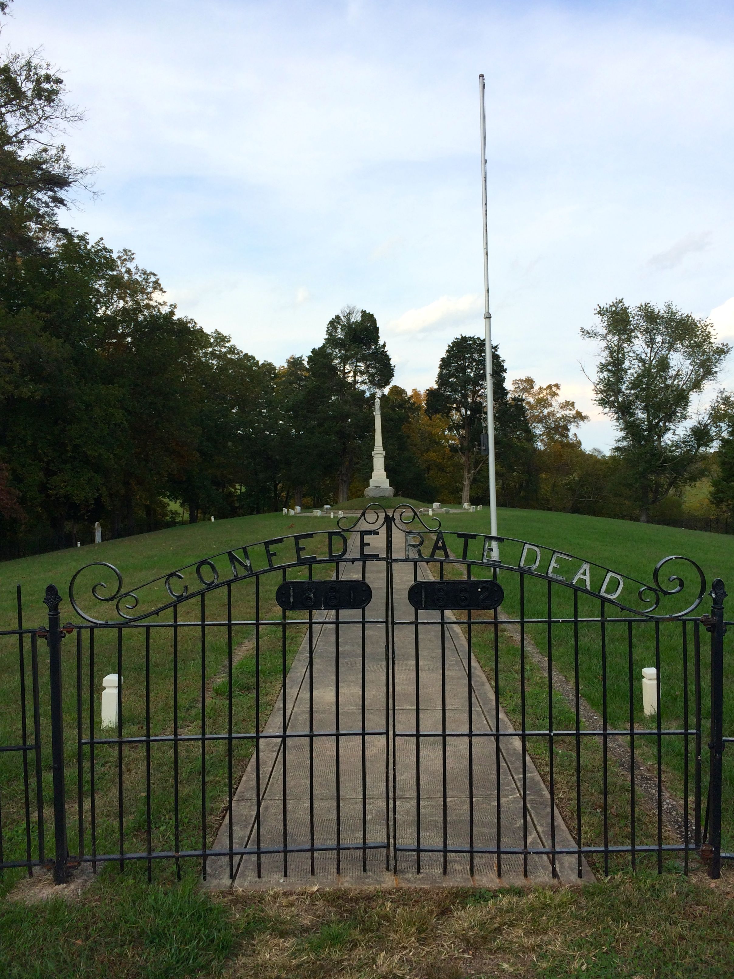
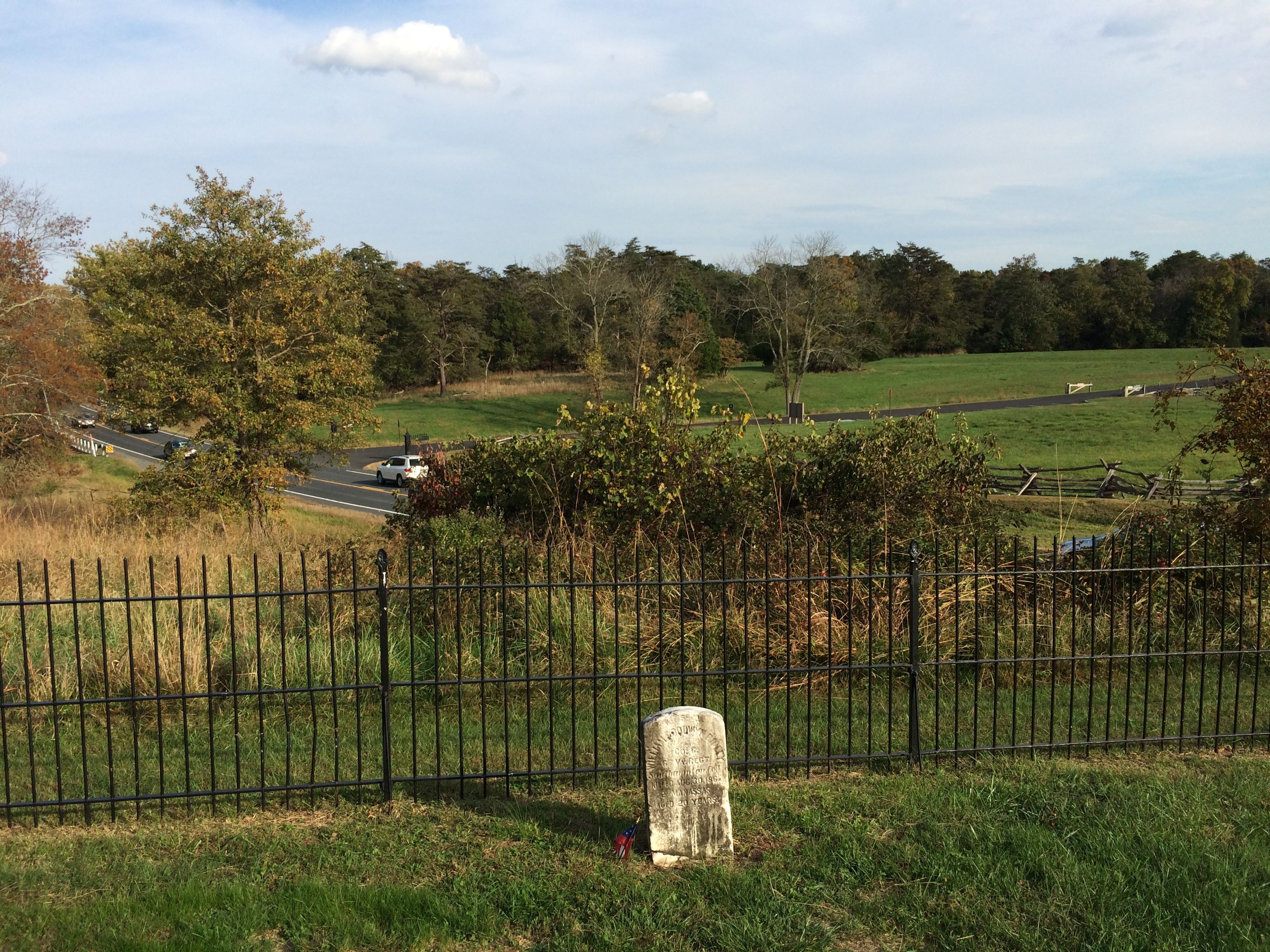
Just across the road from this grouping of memorials is the Groveton Confederate Cemetery.
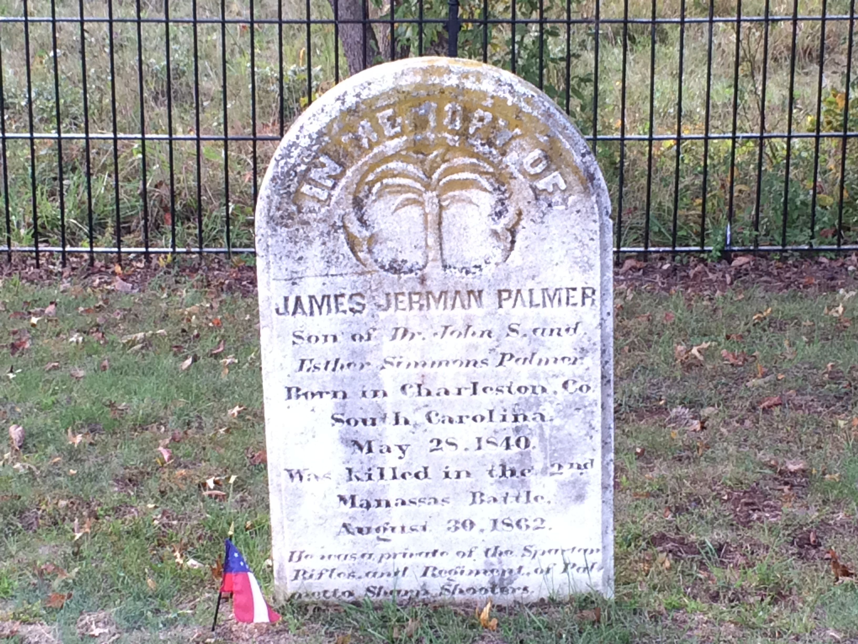
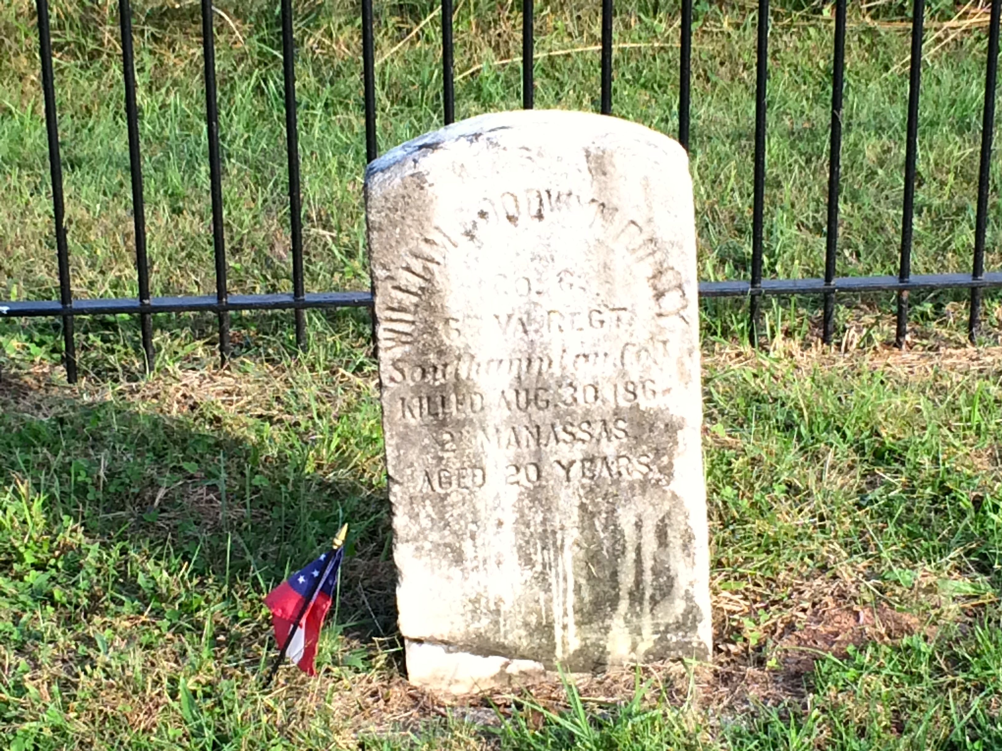
With so many dead, soldiers were buried in shallow graves where they fell. In 1867 The Bull Run and Groveton Ladies Association launched a campaign to re-inter around 500 Confederate fallen in this cemetery. Few could be identified, and there are only two individual headstones.
And so life goes on.
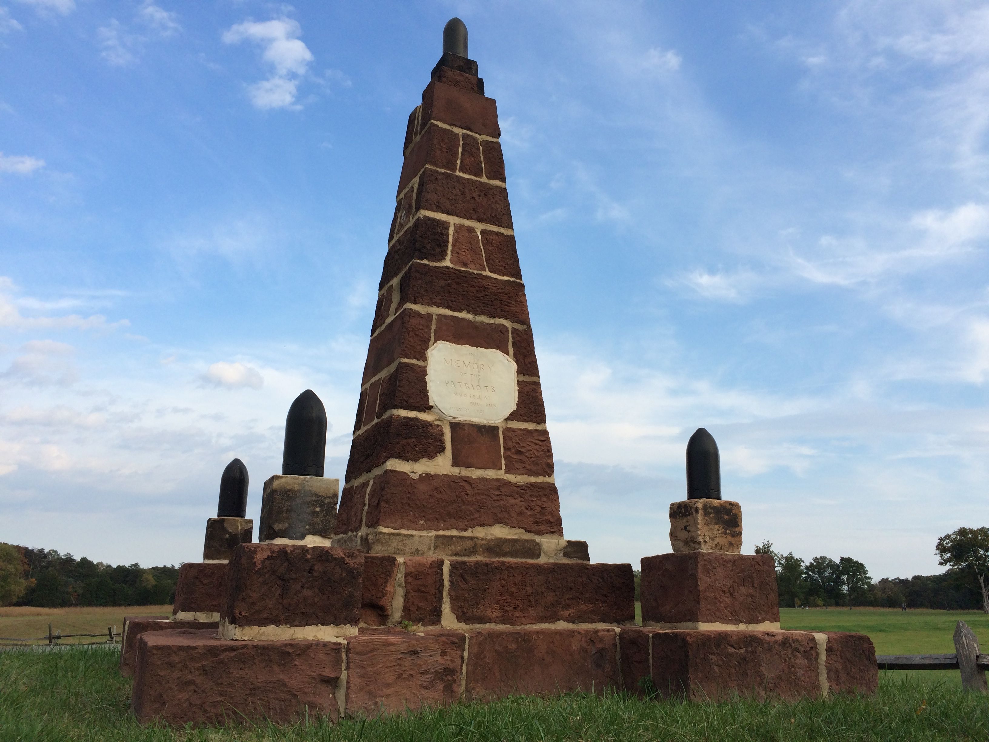
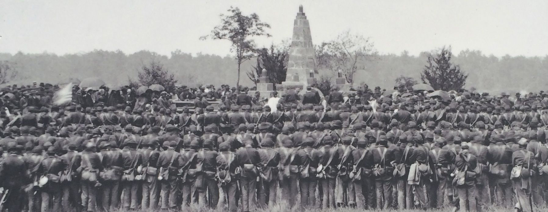
At the end of the war, Union soldiers stationed at nearby Fairfax Courthouse erected this monument by the Henry House. It is one of the oldest extant memorials on any Civil War battle field.
Henry Hill Monument 1865
And we continue to honor their sacrifices. If only these issues had been able to be worked out in a civil manner instead of resorting to Civil War.
Susan, a friend of long standing, joined me on the trip to Harpers Ferry, West Virginia. What fun to be touring through a part of the country where I have friends to join me on adventures in real life!
Harpers Ferry. You say those words and you think John Brown. You think of the Civil War. I was amazed to find that the history of the location goes back further than that.
The reason for this town existing is water. It is located at confluence of the Potomac and Shenandoah Rivers and was founded by Robert Harper who recognized the tremendous potential of water for transportation as well as for powering industry.
Actually, according to my research, the Iroquois nations lived in this area before George Washington surveyed the land and Robert Harper established his ferry in 1734, but the information given at the park didn’t go back that far.
In 1794, Congress passed a bill calling for establishing national arsenals. President George Washing chose Harpers Ferry, which was part of Virginia at the time. In 1796, the United States purchased 125-acre parcel of land from the heirs of Robert Harper, and construction began on the national armory in 1799. This was the beginning of the Military-Industrial Complex that President Eisenhower warned us of – 155 years too late.
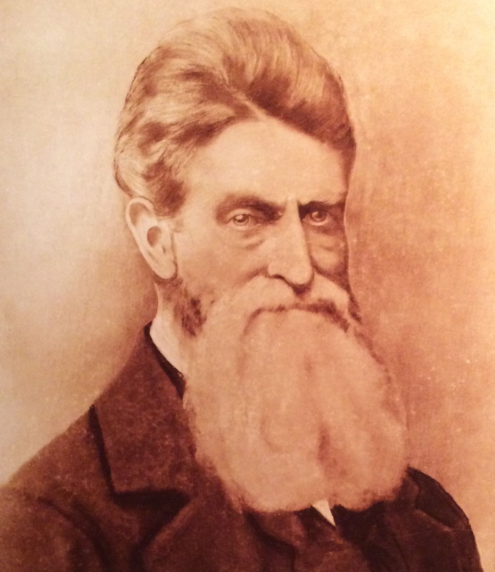
But the first incident that put Harpers Ferry on the map for the majority of us was John Brown’s raid in October 1859.
John Brown was a fervent Abolitionist. As early as 1848, he was actively planning on fomenting insurrection to eradicate slavery.
Brown and his band of 22, which included five black men and three of his sons, overran the arsenal at Harpers Ferry on the night of October 16, 1859. The U.S. Marines, led by Colonel Robert E. Lee and Lieutenant J.E.B. Stuart cornered Brown, and ten of his band were killed. Brown would have been killed as well, except that the Marine who captured him left in such a hurry that he brought his dress sword with him instead of a sword suited for battle. The sword buckled and Brown lived to go to trial.
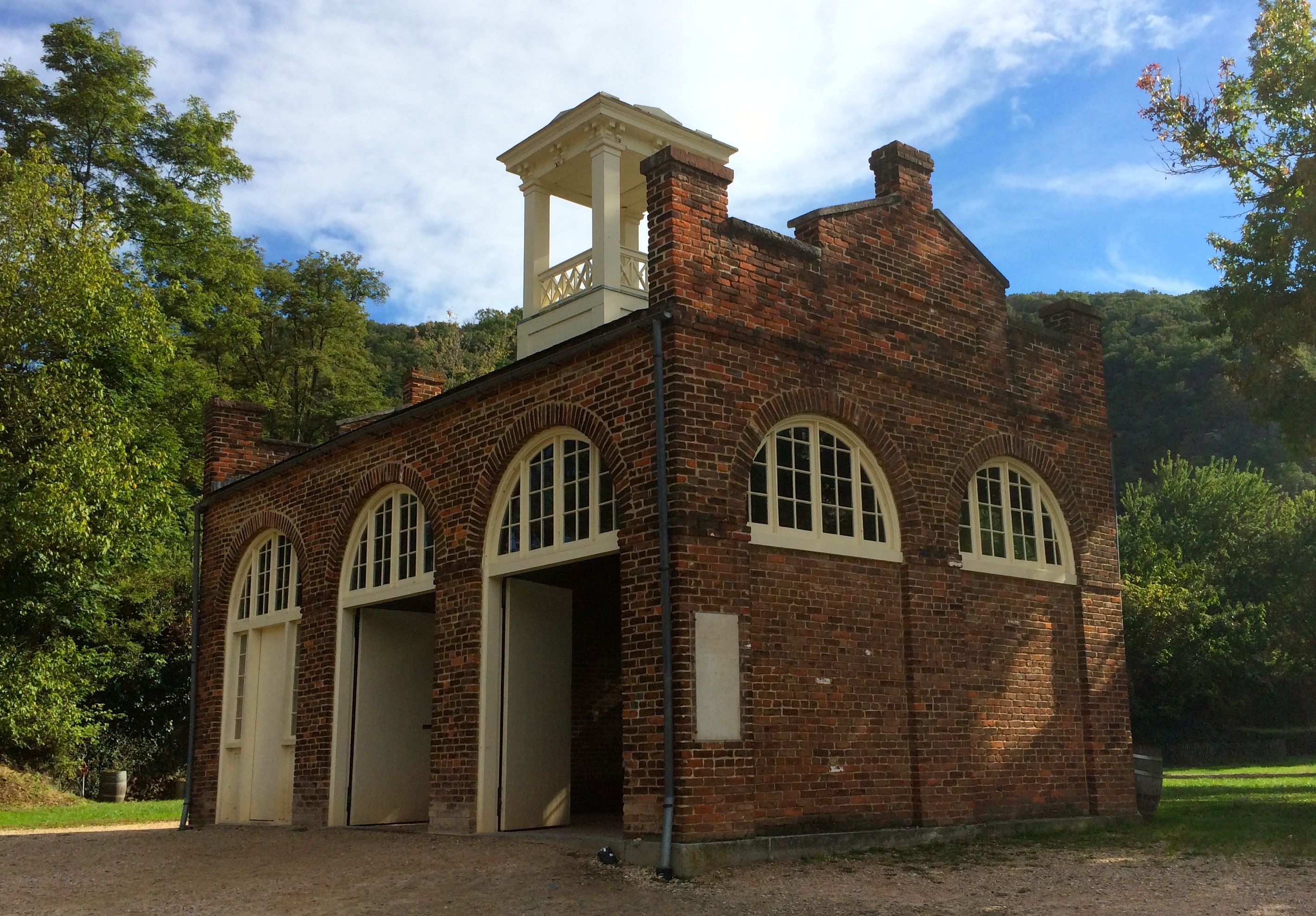
John Brown Fort
Brown’s band took shelter in the firehouse. Ironically, the firehouse survived the battles that were to come.
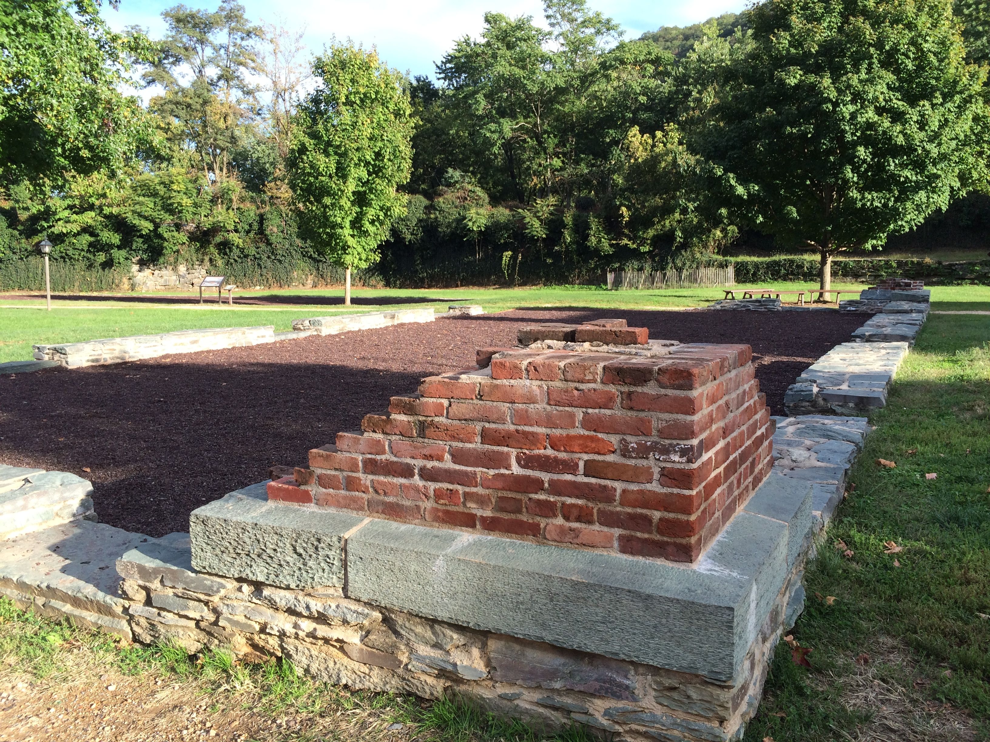
We had a great talk by Ranger Jeff. He walked us over to the remains of the arsenal.
There really wasn’t much left. It was destroyed at the beginning of the Civil War. The perimeter of this building was reconstructed with bricks and stones that archeologists found when they excavated the site.
Lieutenant Roger Jones of the U.S. Army defended the arsenal on April 18, 1861 with 50 untrained regulars and 15 volunteers from the area. The war had just begun April 12, with the attack on Fort Sumter, South Carolina. Everyone was waiting to see what would happen next.
In nearby Charles Town, about 360 members of the Virginia militia were assembled and heading toward Harpers Ferry. Lt. Jones was severely out-numbered and unable to get reinforcements. He set fire to the arsenal and retreated across the Potomac.
Southern forces confiscated the stock, machinery and tools that survived the fire and then burned many of the remaining buildings.
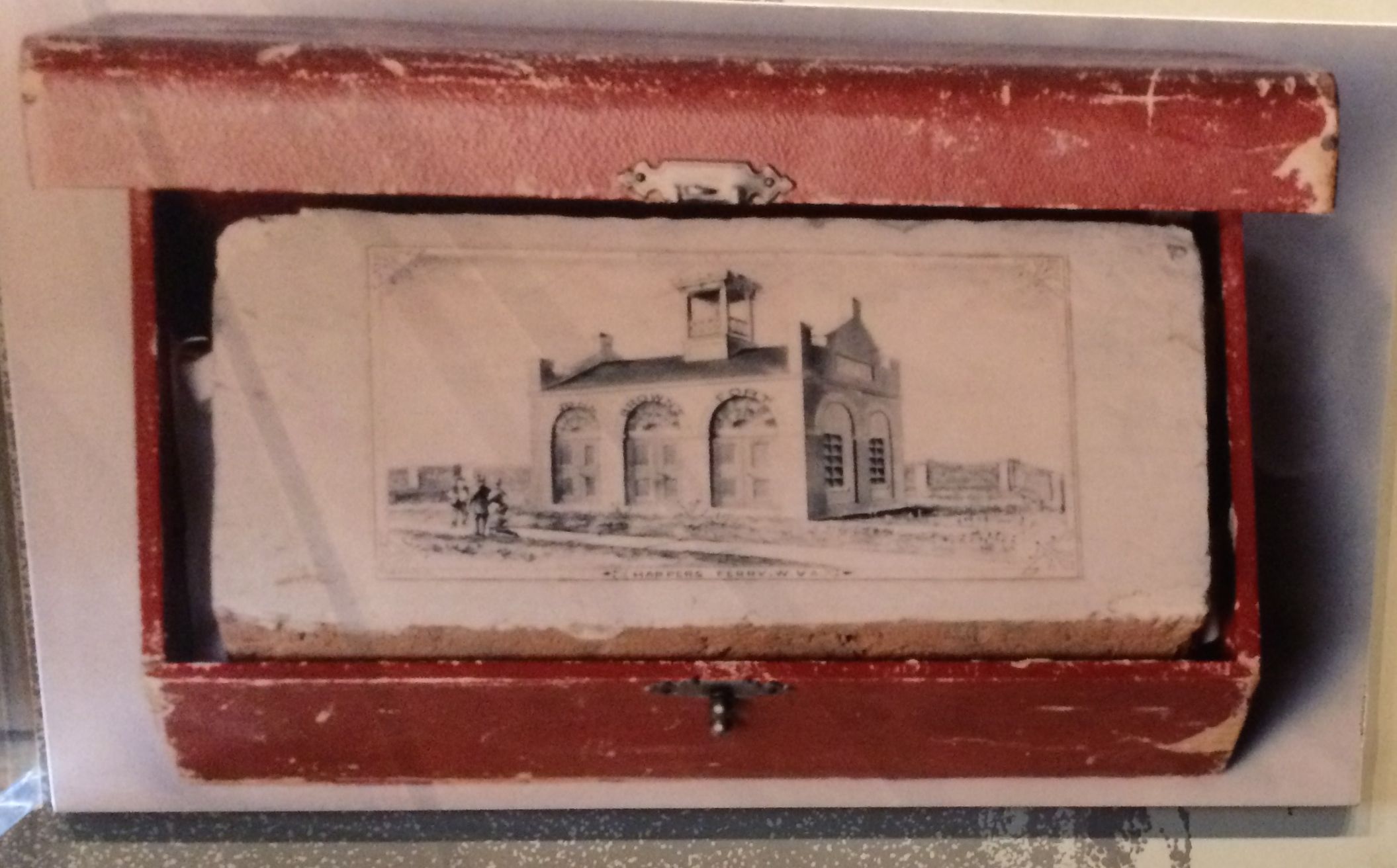
Actually, it is amazing that John Brown Fort survived. Entrepreneurial folks took bricks and sold them as souvenirs.
Commemorative BrickThe really good bricks got their own wooden boxes
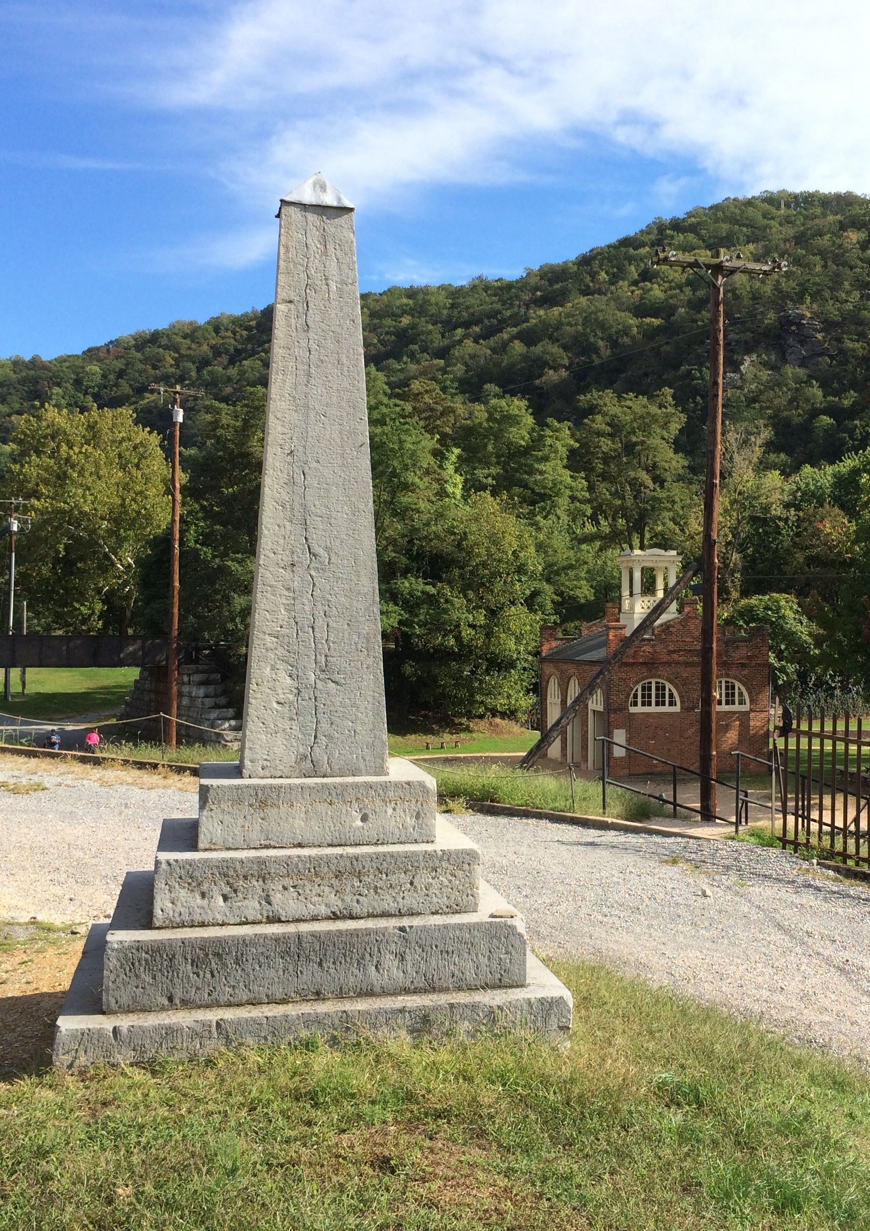
And, if prying bricks out wasn’t enough to cause stress to the integrity of the building, the building was moved four times. In 1891, it was taken to Chicago to the World’s Columbian Exposition. In 1895, it was moved to the Murphy Farm near Harpers Ferry. In 1909, it was moved to Storer College Campus in Harpers Ferry. In 1968, it was moved to its present location, which isn’t too far from it’s original spot.
John Brown monument marking the original site with John Brown Fort in the background
Harpers Ferry changed hands eight times during the Civil War. It’s a wonder that anything is left of the town.
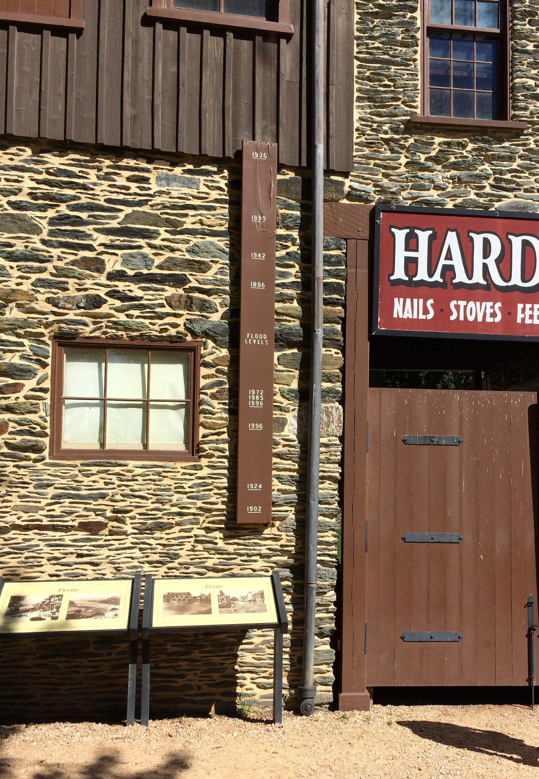
If war the war wasn’t hard enough on the town, there is no arguing with geography. The location at the confluence of two mighty rivers is prone to flooding.
High water marks for some of the notable floods
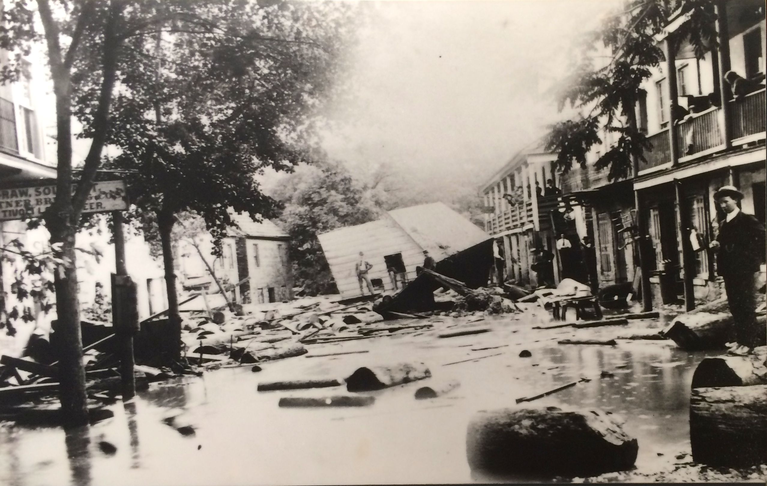
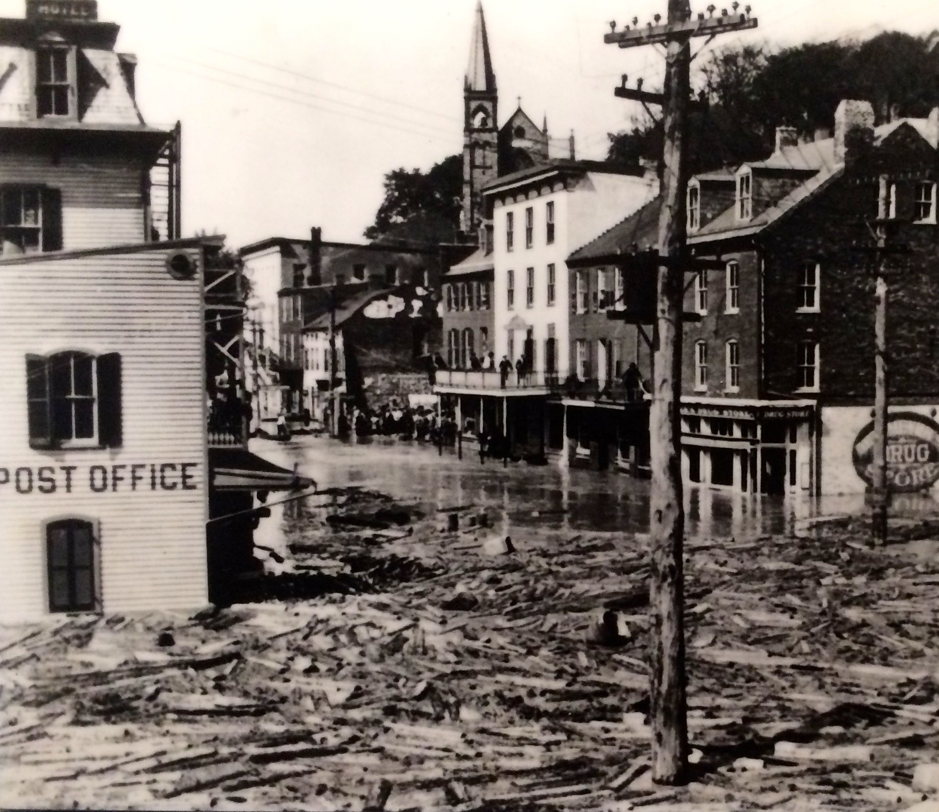
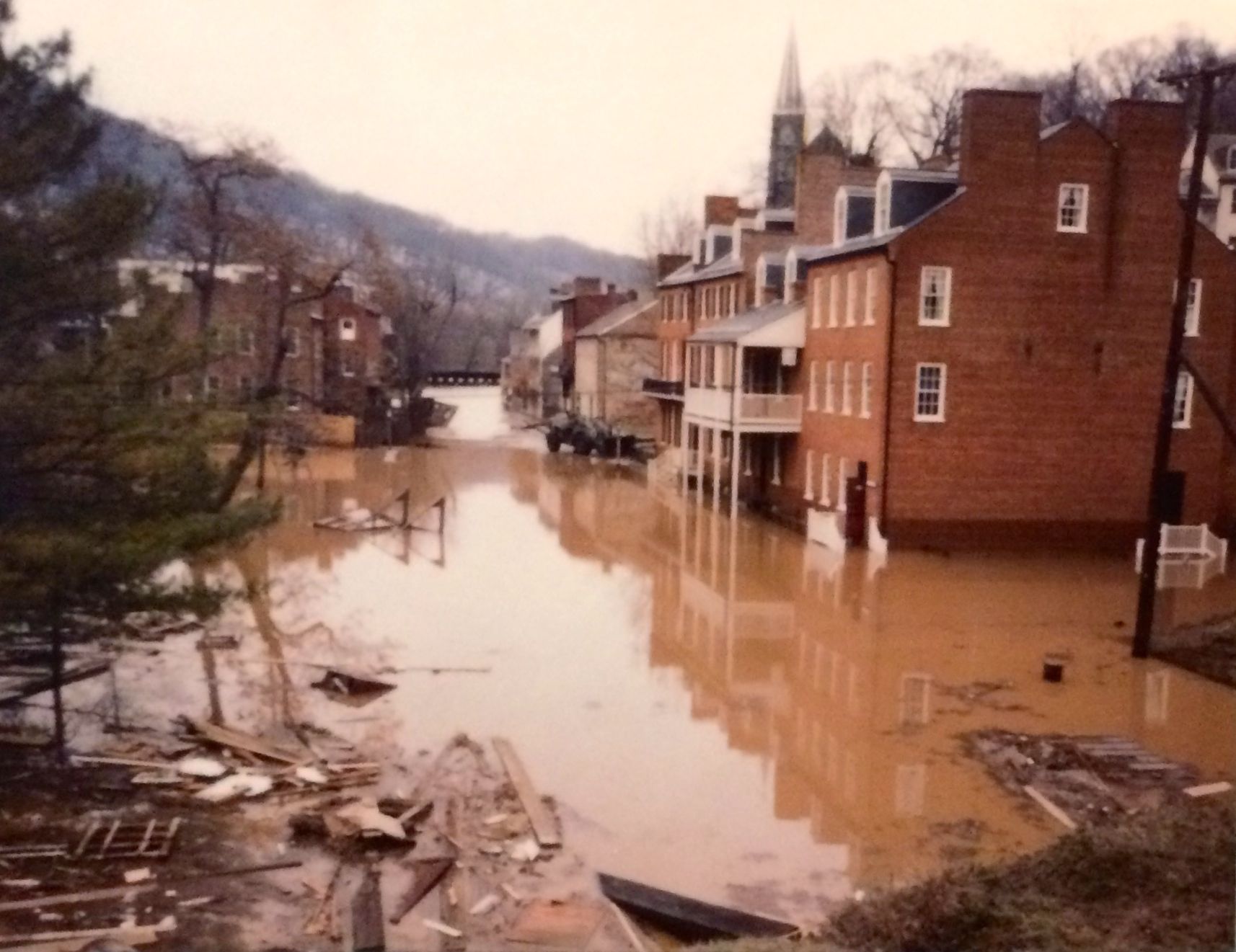
And, here are some photos of the destruction.
The flood of 1889The flood of 1924The flood of 1996
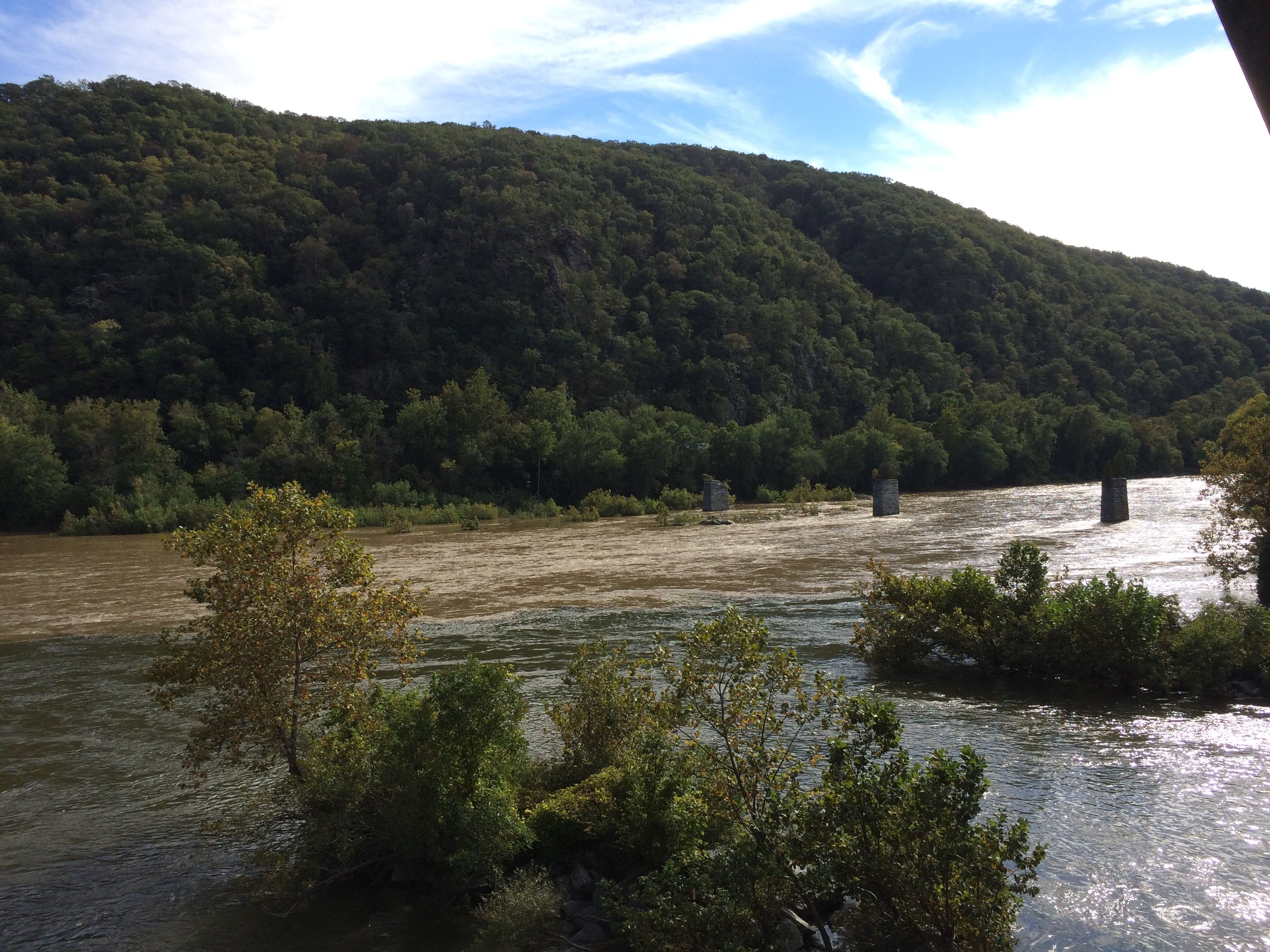
Even on the day of our visit, the water was high.
The river was high
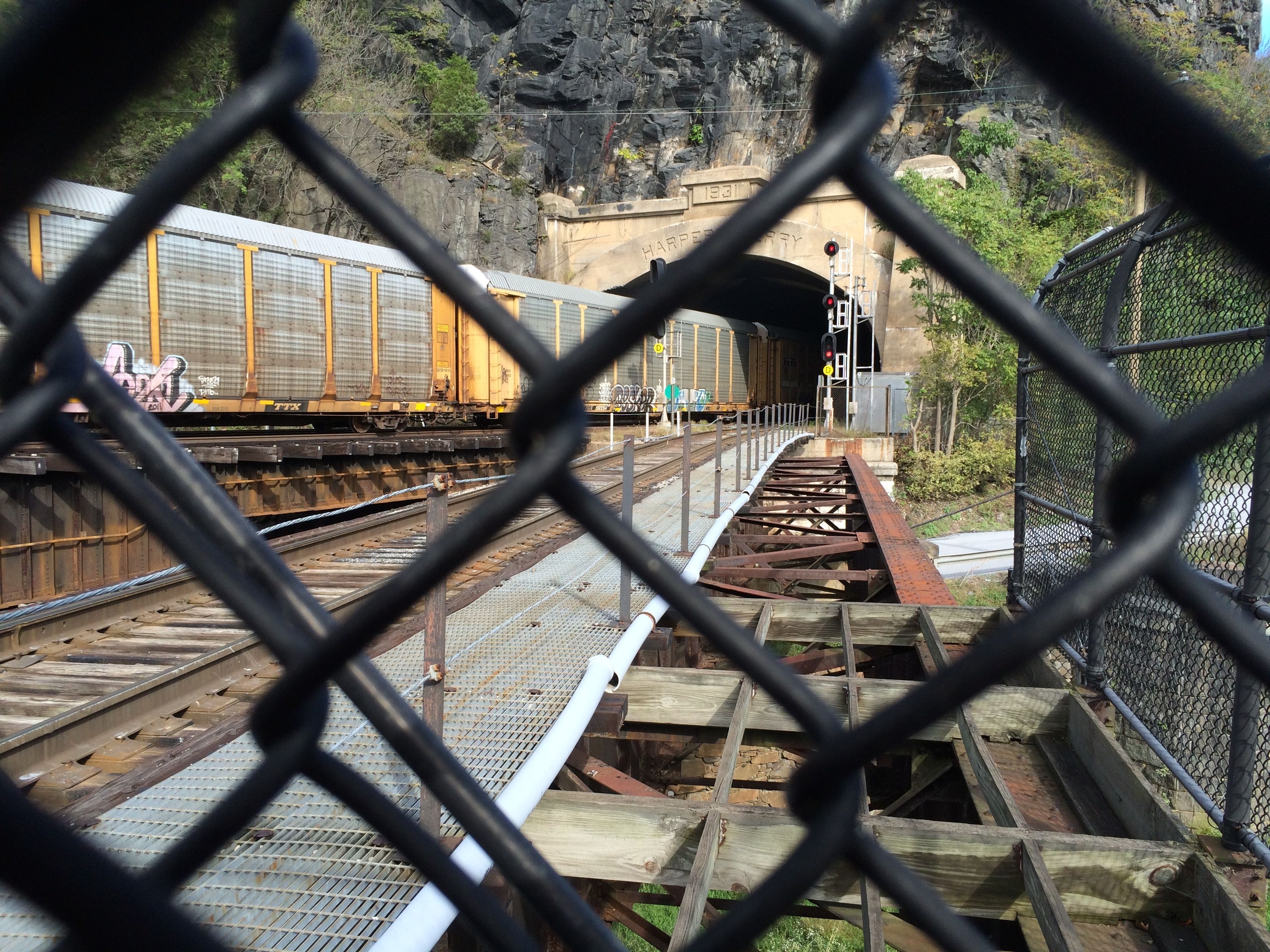
The river is a good route, though. The train tracks run along the river. Several passed through while were were there.
Railroad trestleTrain coming out of the tunnel
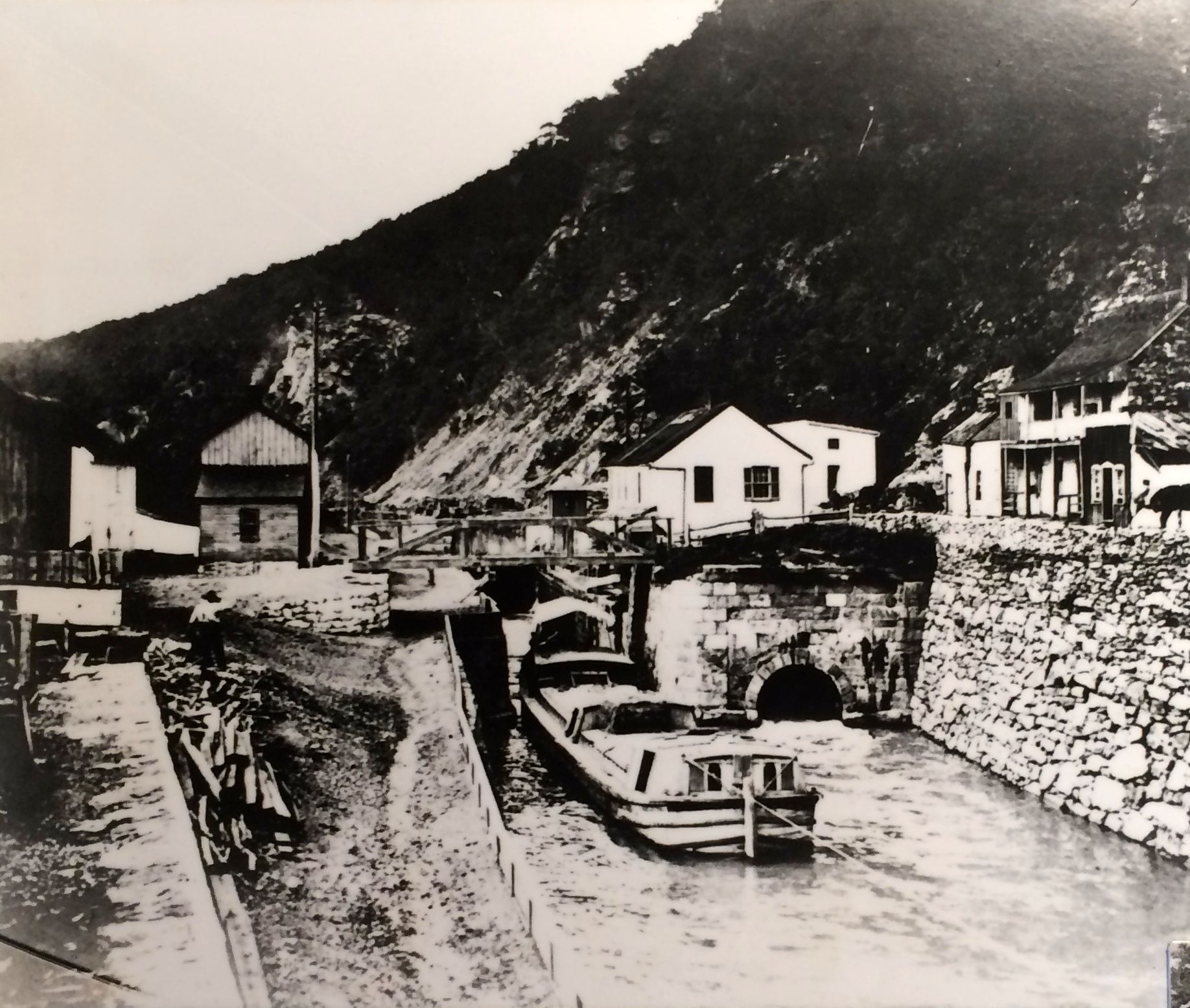
The C & 0 Canal made use of the river, too.
C&O CanalC&O Canal lock 33
This photo was taken around 1876. According to the text on the plaque, mule-drawn barges carried coal, corn, wheat and flour on the canal, which followed the north bank of the Potomac between Washington D.C. and Cumberland, Maryland. Winter water, flood damage and competition from the railroad kept the canal from becoming really profitable.
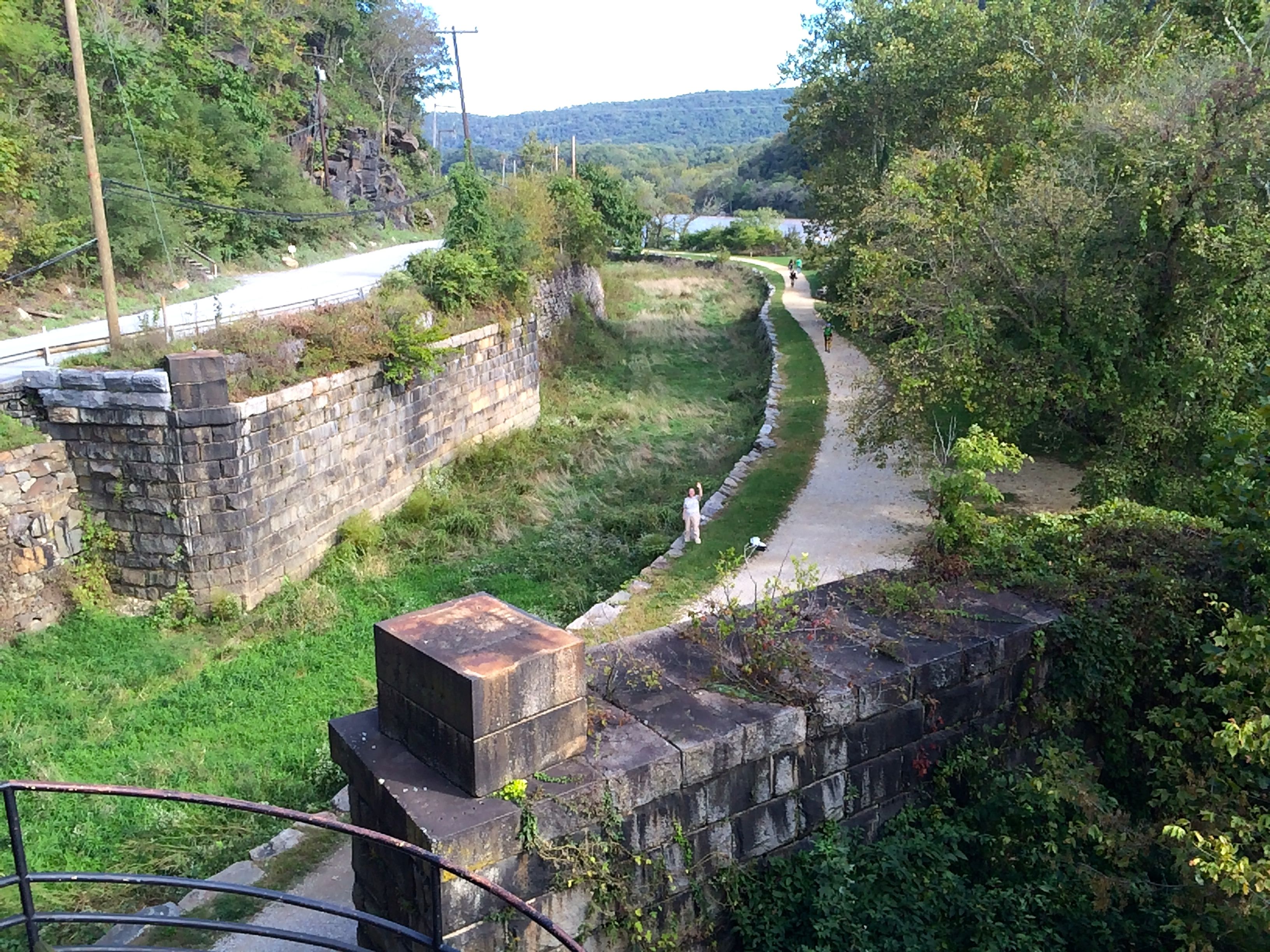
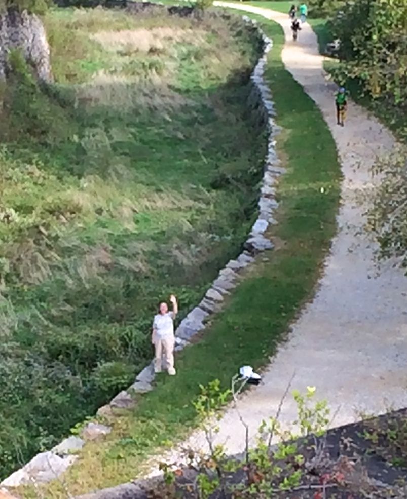
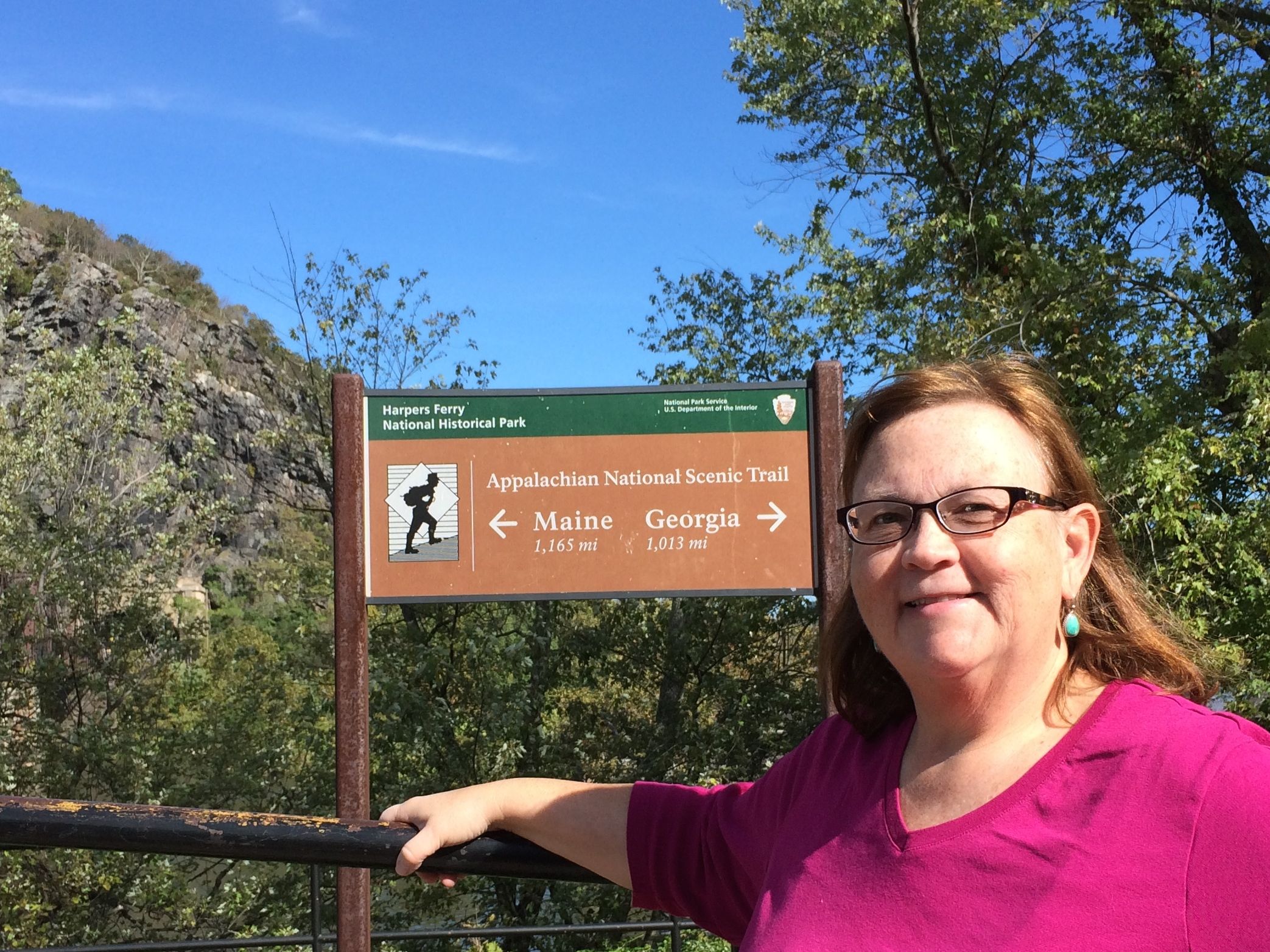
But, now, even though the canal doesn’t carry freight, the towpath is still in use. It is part of the several hiking and biking trails, including the Appalachian Trail.
Susan on the Appalachian Trail
Just walking into the frame, you can see some Appalachian Trail hikers coming along behind Susan waving at me. They are really moving! I tried to get a photo of them as they passed by me, and I couldn’t get the shot lined up because they were walking so quickly.
Me on the Appalachian Trail
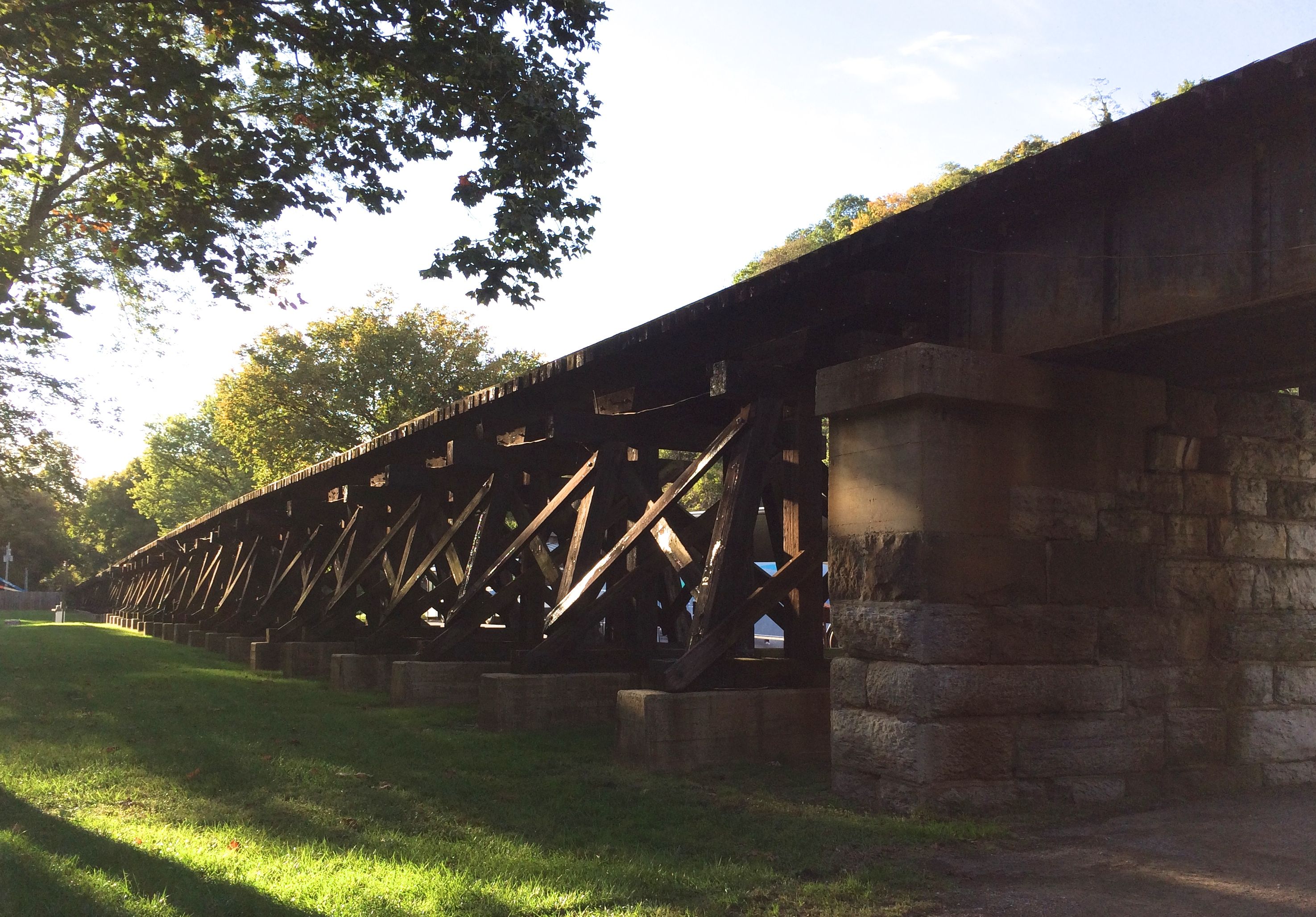
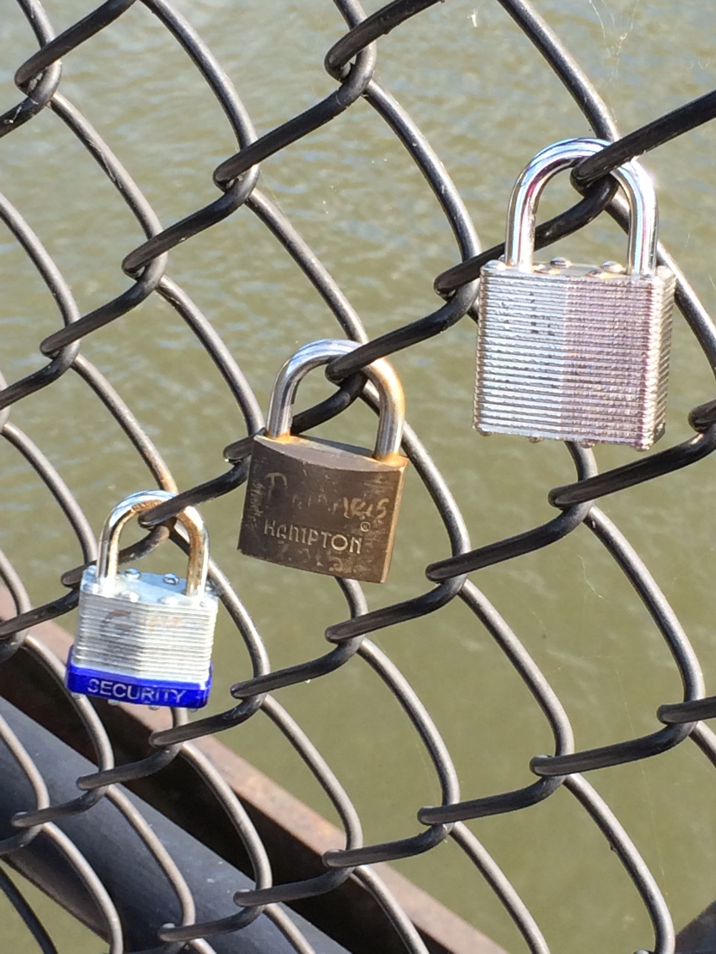
I walked across an old railroad bridge that has been repurposed as a part of the trail system. This is my idea of hiking!
And, if you remember my post about the Erie Canal, there are some locks on this bridge, too.
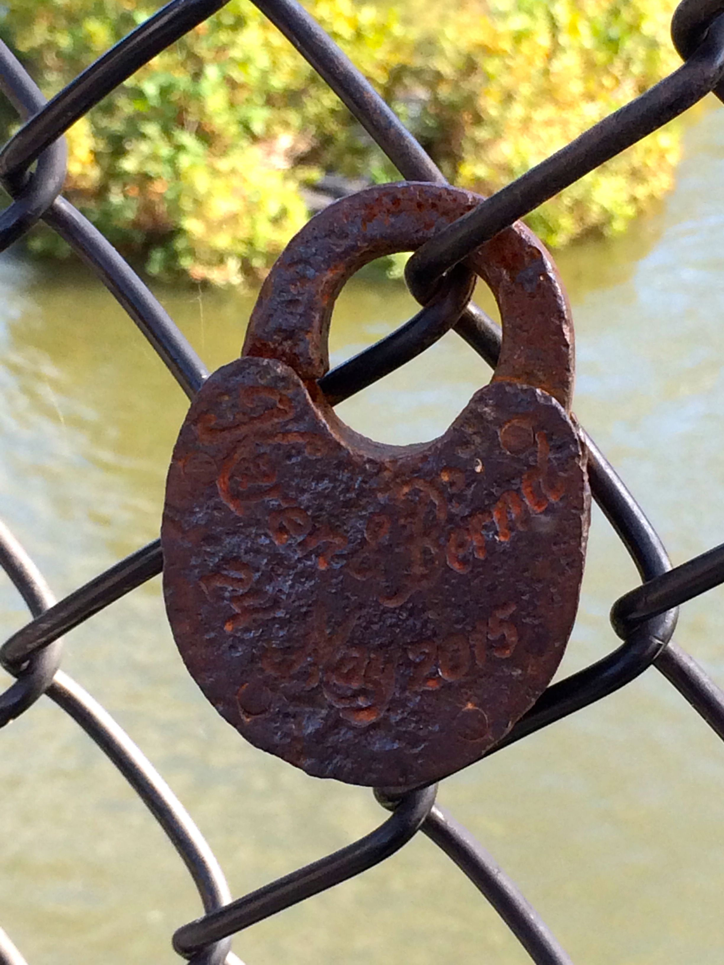
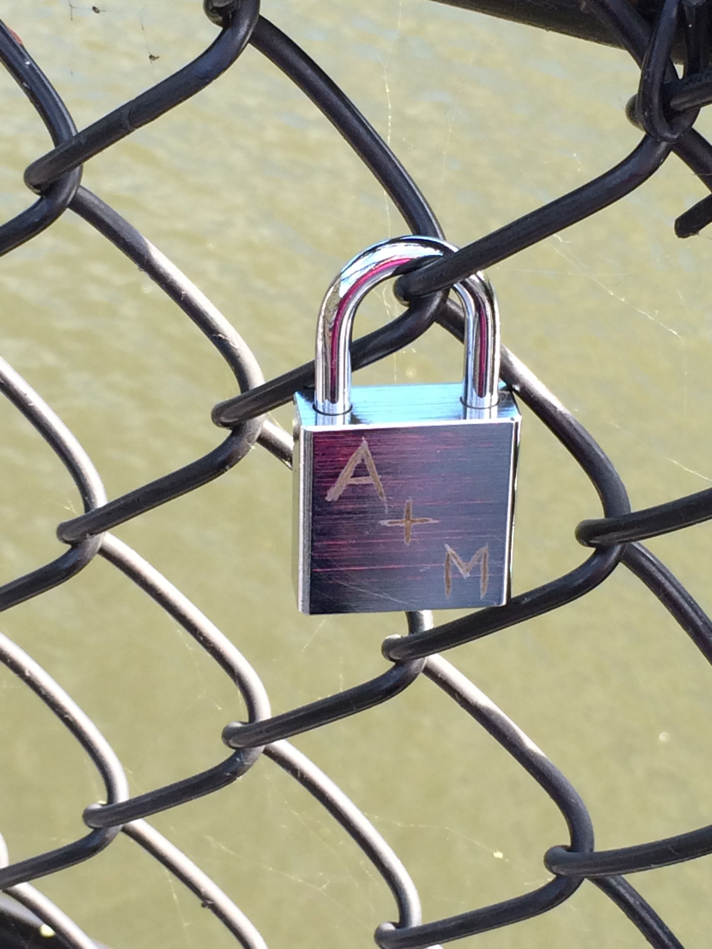
People declare their love, attach the lock to the bridge and throw the key in the water.
I thought this lock was particularly interesting.
Some people put combination locks on the bridge. I wonder if they threw the paper with the combination into the water?
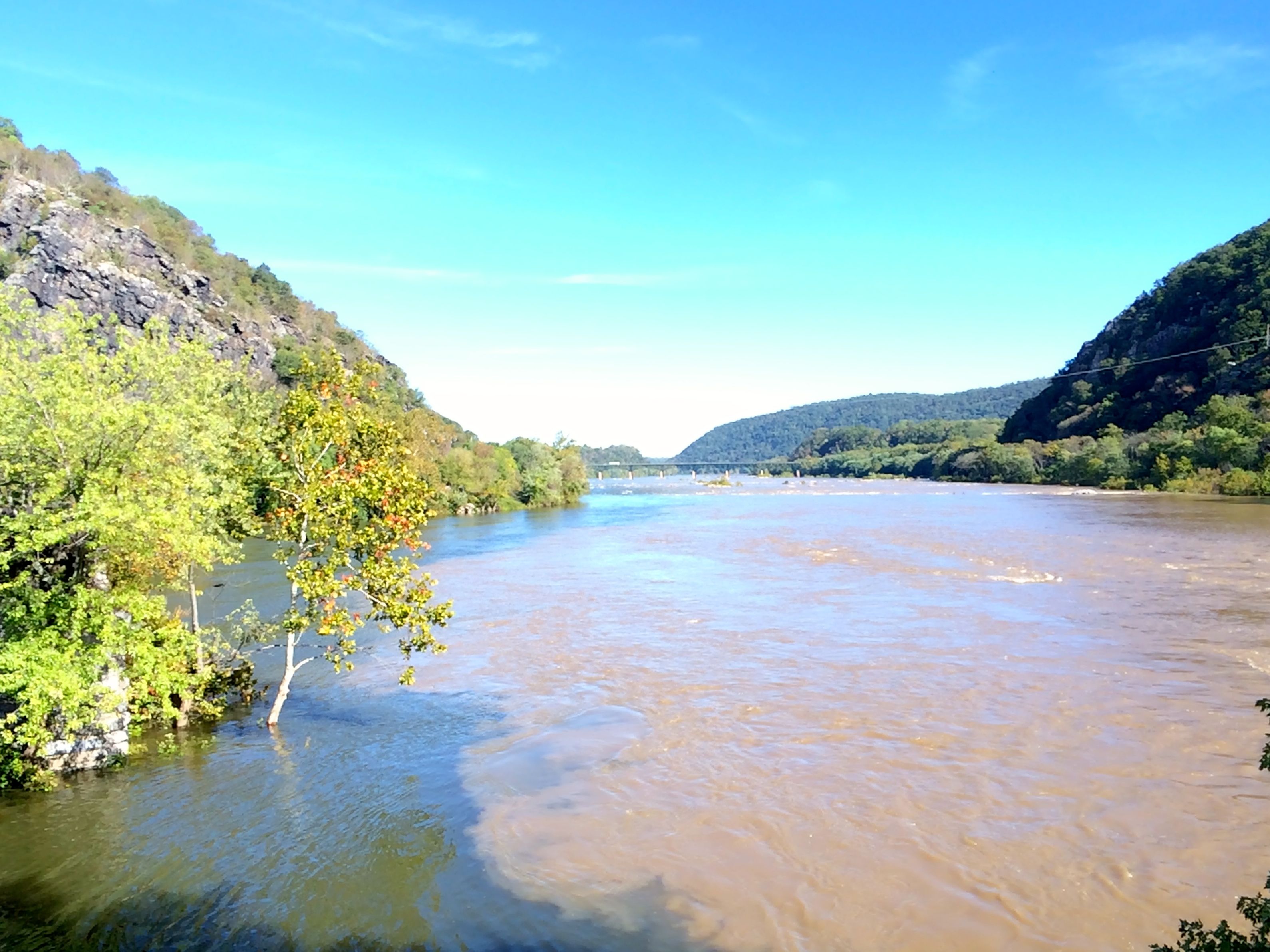
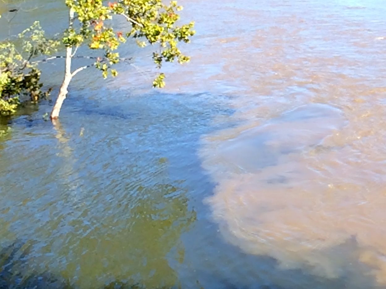
The water of the two different rivers is quite distinctive. You can see where the waters come together.
The Potomac and Shenandoah Rivers merging
Just for a little clarification, examine the interface between the two rivers.
Also, notice how high the water level is.
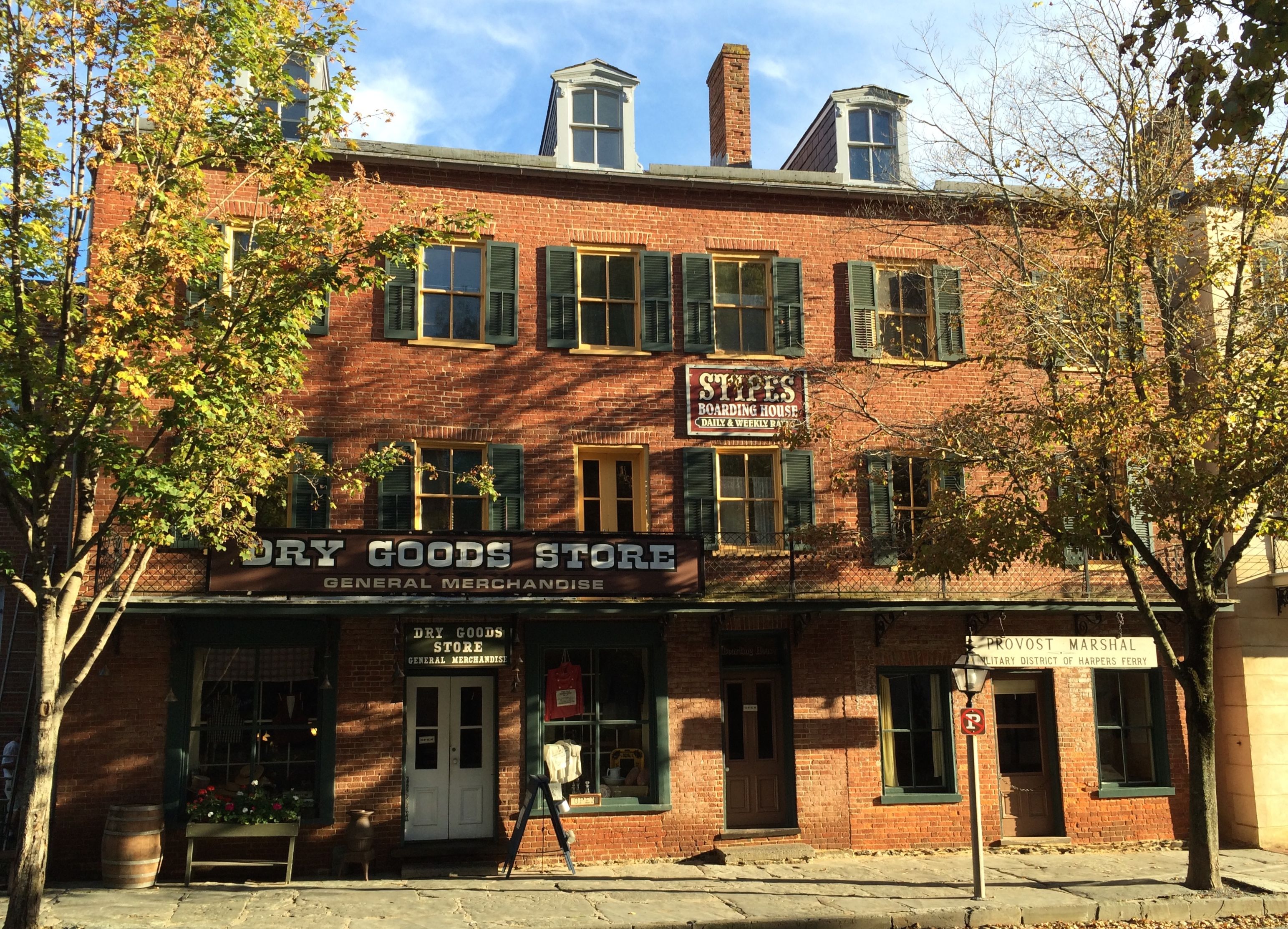
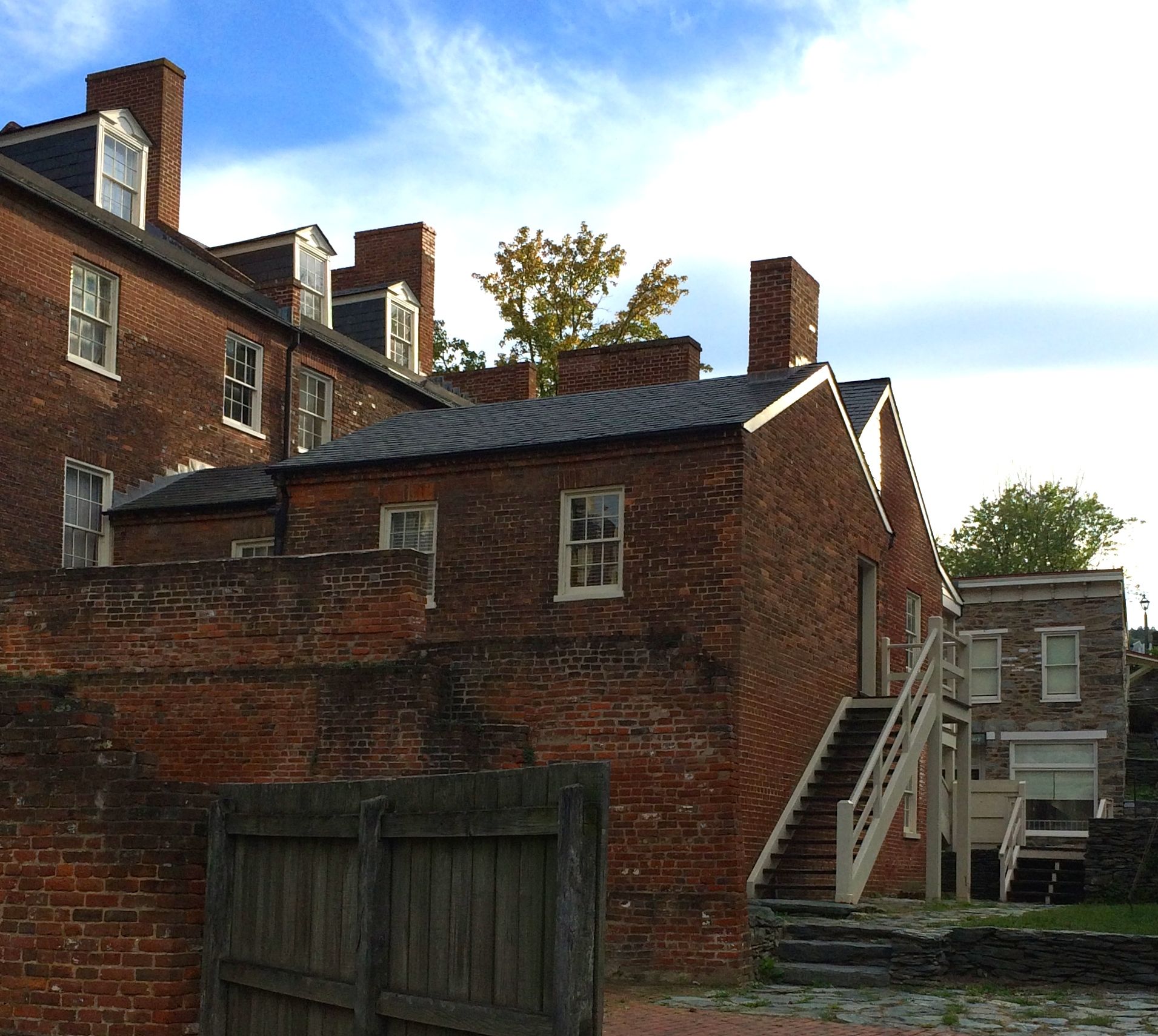
It is amazing that anything is left in the town as it is. Between floods and battles and fires, this area has had its share of devastation. I suspect that the National Park Service is responsible for most of the historic buildings remaining standing.
Cross another state off the list! I spent two nights at Patapsco State Park, just outside Ellicott City, Maryland. It’s located on 14,000 acres along the Patapsco River to the west of Baltimore and northwest of Baltimore/Washington International Airport. Despite being directly under the flightpath of BWI – the busiest of the three airports serving the Washington metro area – it was a relatively tranquil place to spend a couple days.
I did a fantastic job of backing in to my campsite, if I do say so myself. At first, I was a bit nervous. The campsite was located on a curve and the driveway was narrow. There was a nice sitting and campfire area, once you got parked, but it was kind of like threading a needle to get in.
Of course, I was doing my usual hopping in and out to check my progress. I was just thankful that the rain had stopped. All of a sudden, I heard a loud commotion coming from the campsite two down from me. I jumped out to see what was going on. The woman yelling was so loudly and angrily. I thought she was yelling at me; I couldn’t imagine that she would treat someone traveling with her so rudely. But, no, her angry words were directed at the man she was trying to guide into the campsite.
If it were me, I think I would have run her down. If she screams like that in public, what can their private life be like?
Anyway, I continued working my way into my site. I was just about in, and they called over, “Would you like some help?”
Uh…
I thanked them and said that I was just about in. And then I slipped it in. Success! I was in the site so straight that I decided to see if I could aim for level, too. I got out my spirit level and the boards, and got it perfectly level! I was so proud of myself!
After unhitching and such, I checked the broadcast television channel available. WOW! I had everything I could imagine available. I almost wished I had booked more time there so I could catch up on my programs.
After a night of rest and relaxation – and television and popcorn – I decided that I had to do some exploring. Ellicott City seemed a likely goal.
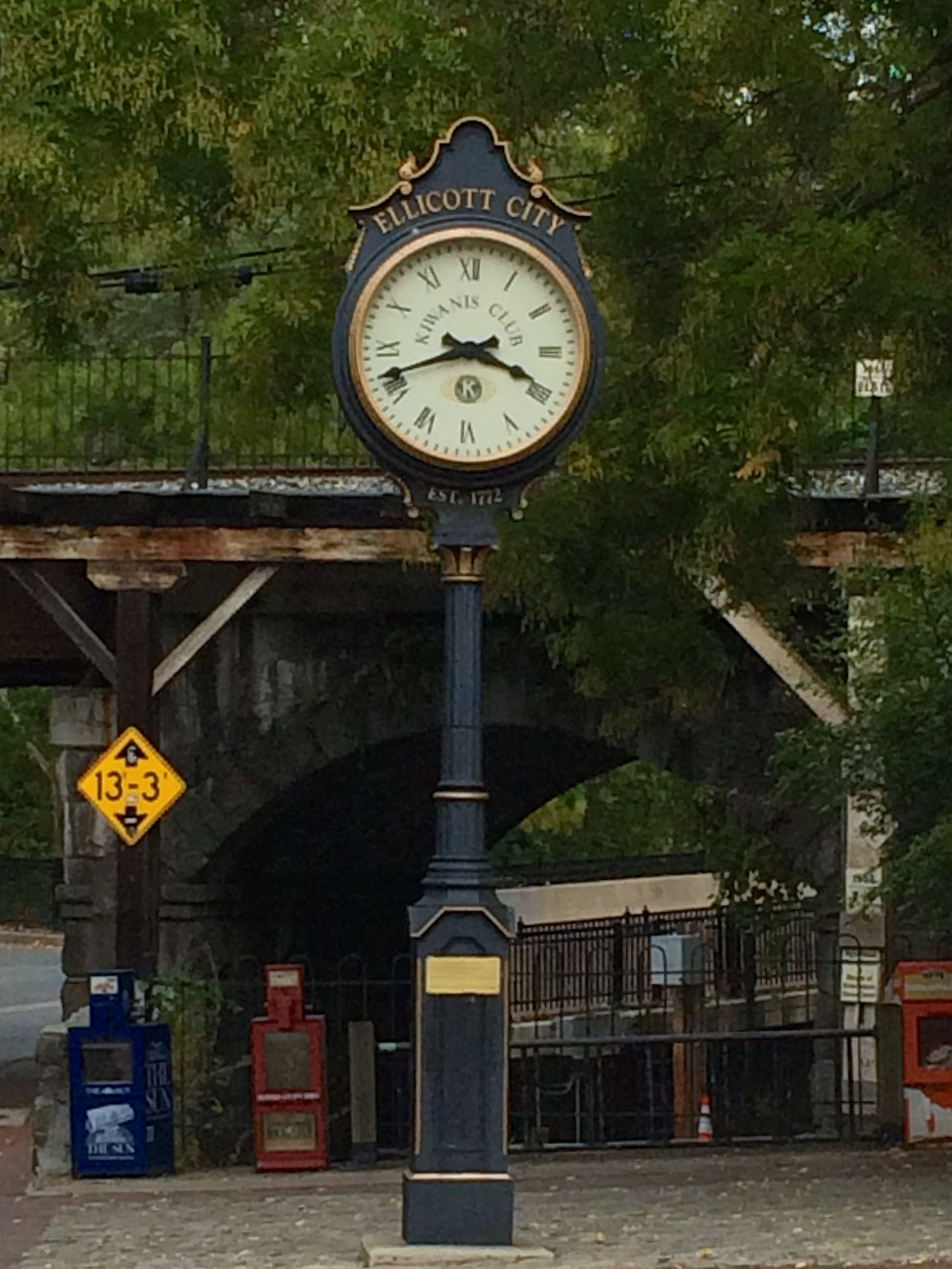
Ellicott City Clock
Ellicott City was founded in 1772, and is named for four Quaker brothers by the name of Ellicott from Bucks County, Pennsylvania. It was originally known as Ellicott Mills, which reflected the industry they established at the falls line.They established flour mills, sawmills, a grain distillery, smithies and stables.
According to resources I’ve read, they helped to revolutionize farming in the area by persuading farmers to plant wheat instead of tobacco. I also read that they introduced using Plaster of Paris as fertilizer to improve depleted soil. I guess that makes sense, as Plaster of Paris is essentially gypsum that has been heated.
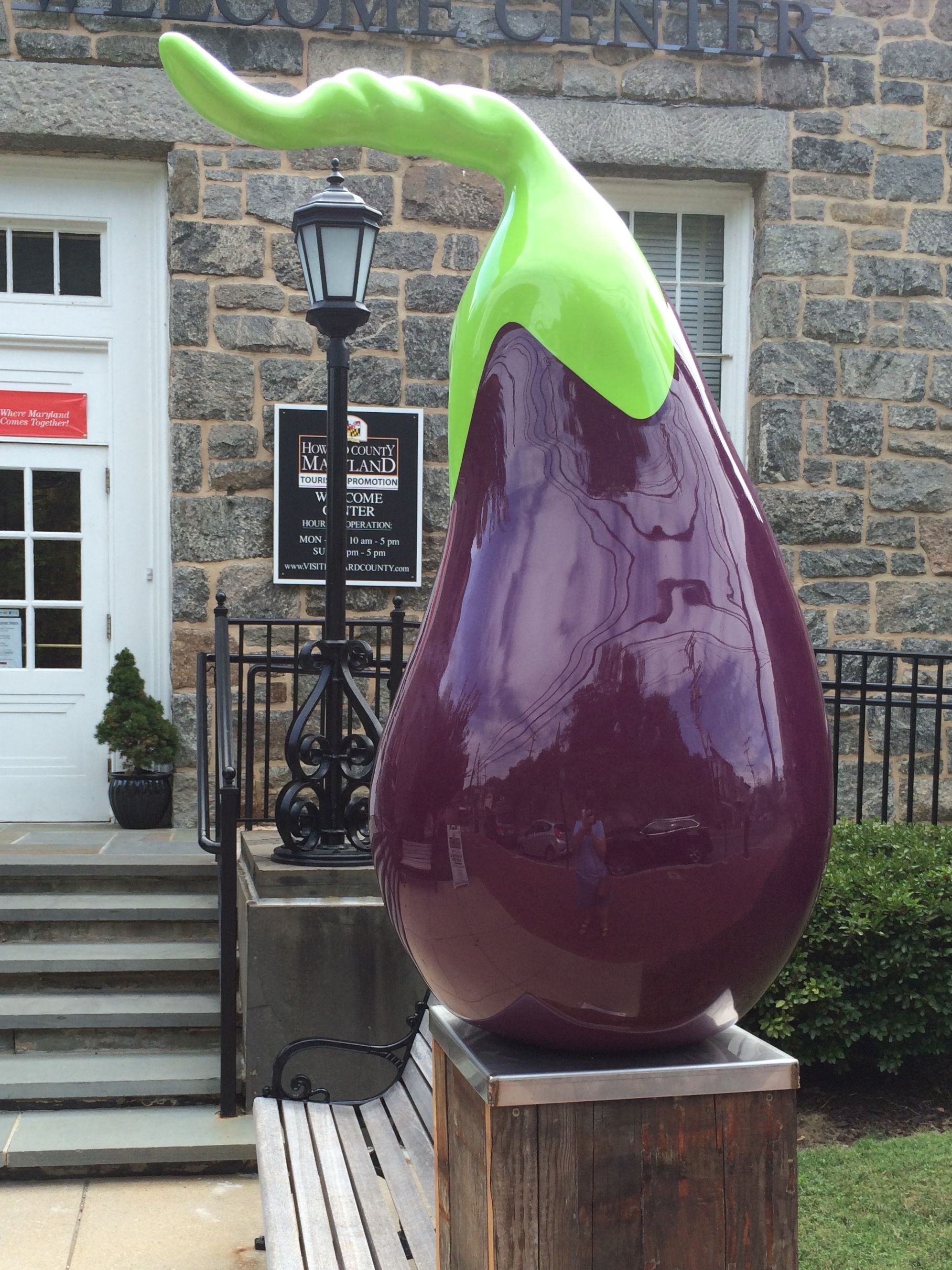
I stopped off at the tourist information center. I just had to find out about the large eggplant on a pedestal outside. I wondered if the area were particularly known for eggplants. Well, the tourist information specialist laughed and told me that it was a sculpture on display for their version of “Art Hop”, like they have on the first Fridays of the month in Kalamazoo.
Wouldn’t it be cool if Kalamazoo had a large celery sculpture somewhere downtown?
If you want to save money when you visit Ellicott City, plan your visit for a Monday. Everything is closed!
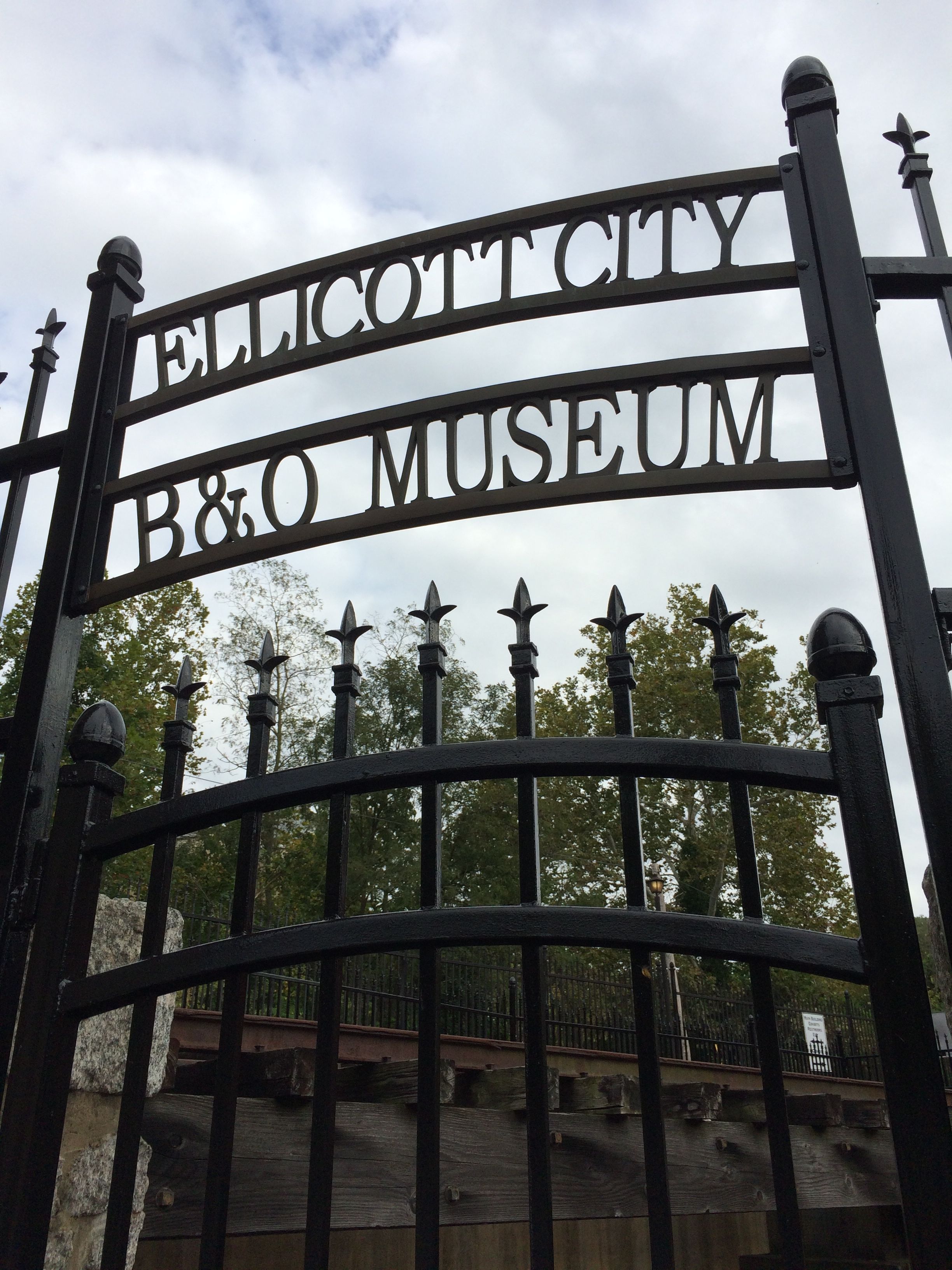
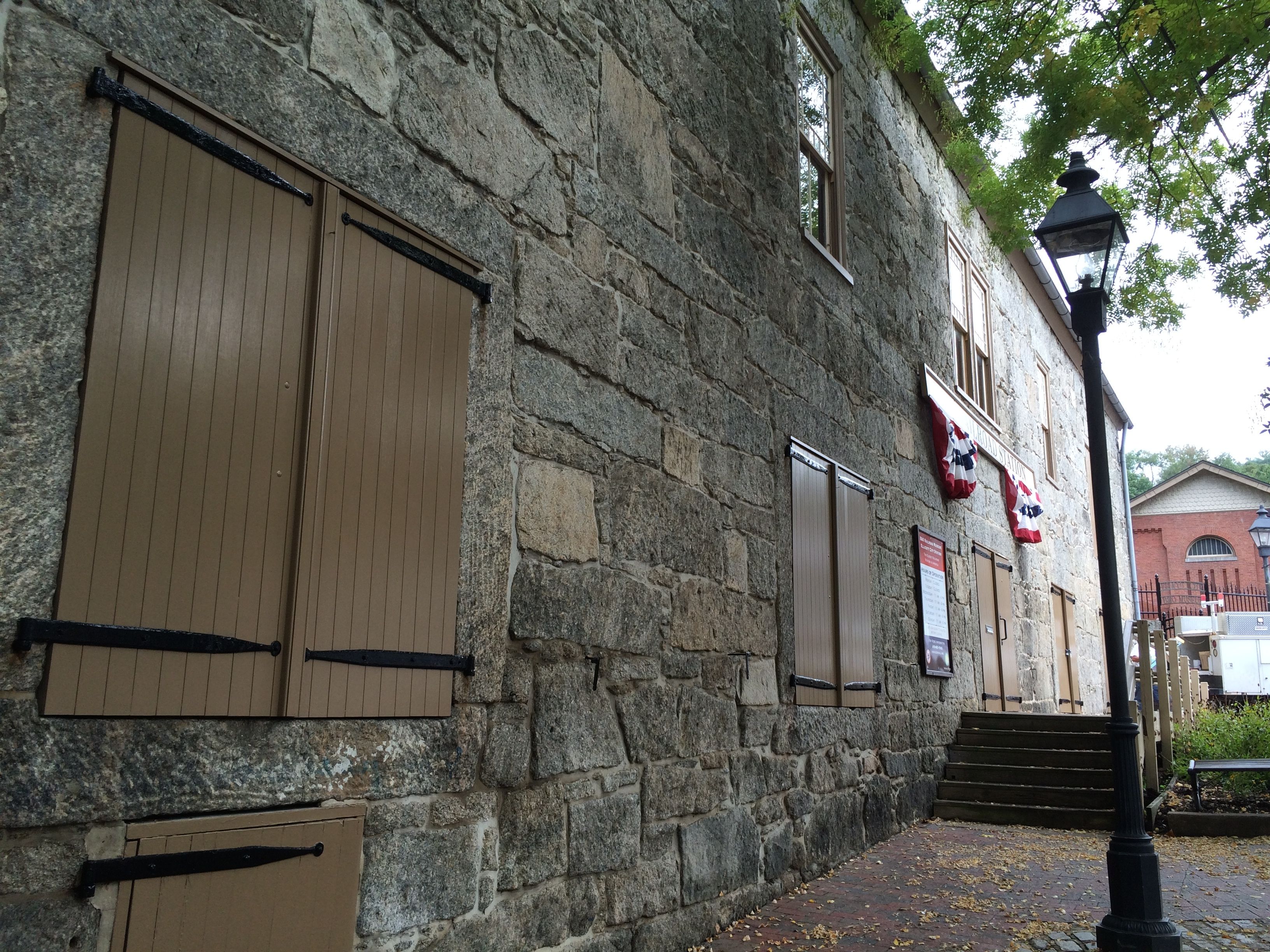
I had hoped to visit the railroad museum.
Closed.
Ellicott City is home to the oldest extant railroad station in the United States, according to my HISTORY Here app. It was the first terminus of the Baltimore and Ohio Railroad, just in case you were wondering what B&O stood for. It opened in 1831.
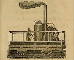
It was also the site of the famous race between a horse-drawn car and the early locomotive, “Tom Thumb.” According to my research, Tom Thumb pulled ahead of the horse until a belt slipped off and caused the engine to lose power. The horse won that round, but they soon improved the design, and the iron horse won in the end.
Tom Thumb
The railroad was so successful that it extended its line to Harpers Ferry in 1834. More about that in a later post.
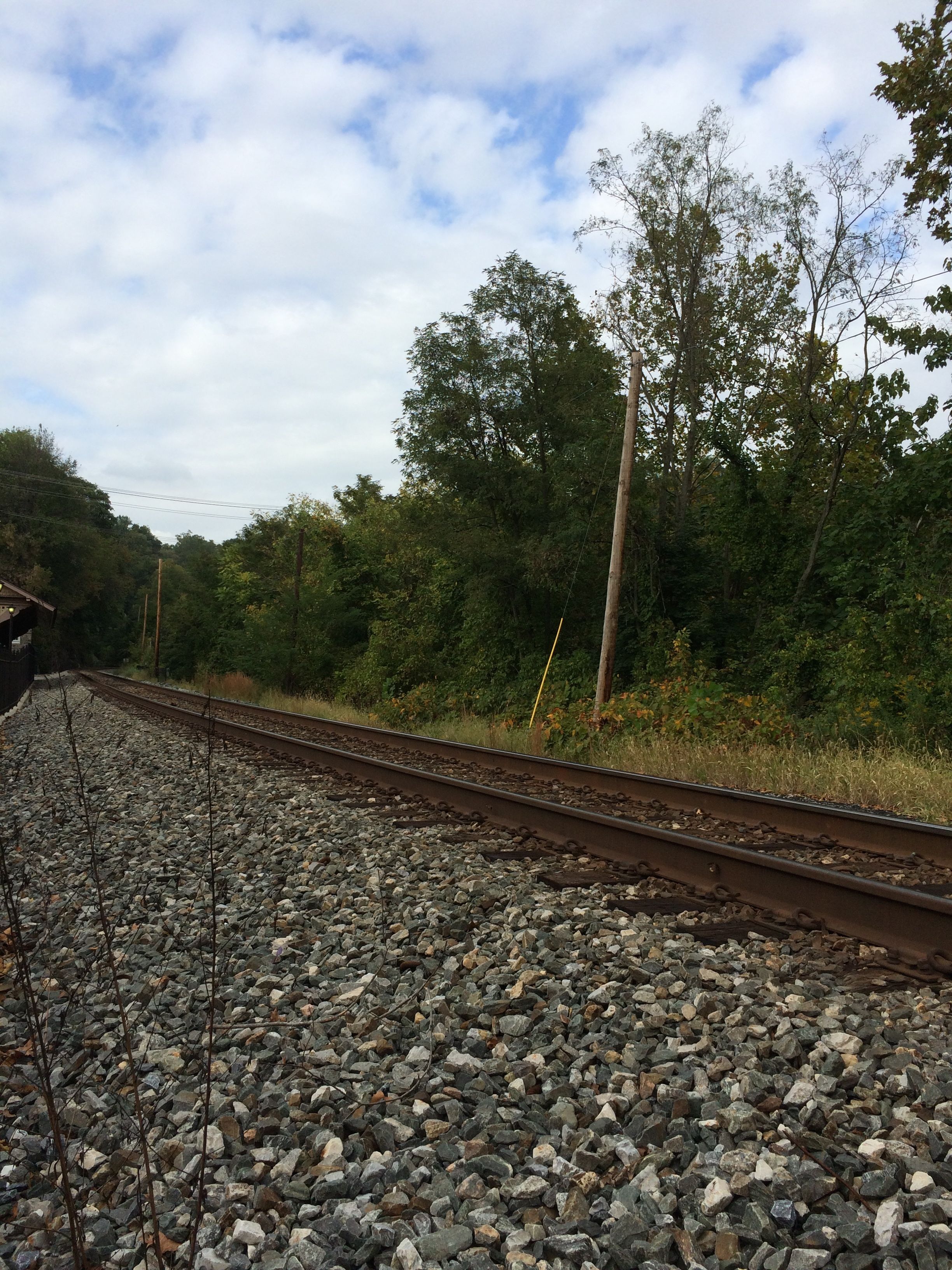
The bands of steel that connect the county
While I was in town, several freight trains roared through at quite a clip.
Ellicott City is has a unique kind of granite. The truly nerdy may wish to click on the link. I found this information when I was trying to track down the claim that this granite indeed was found only in this area. It was a bit beyond my interest and/or my comprehension level.
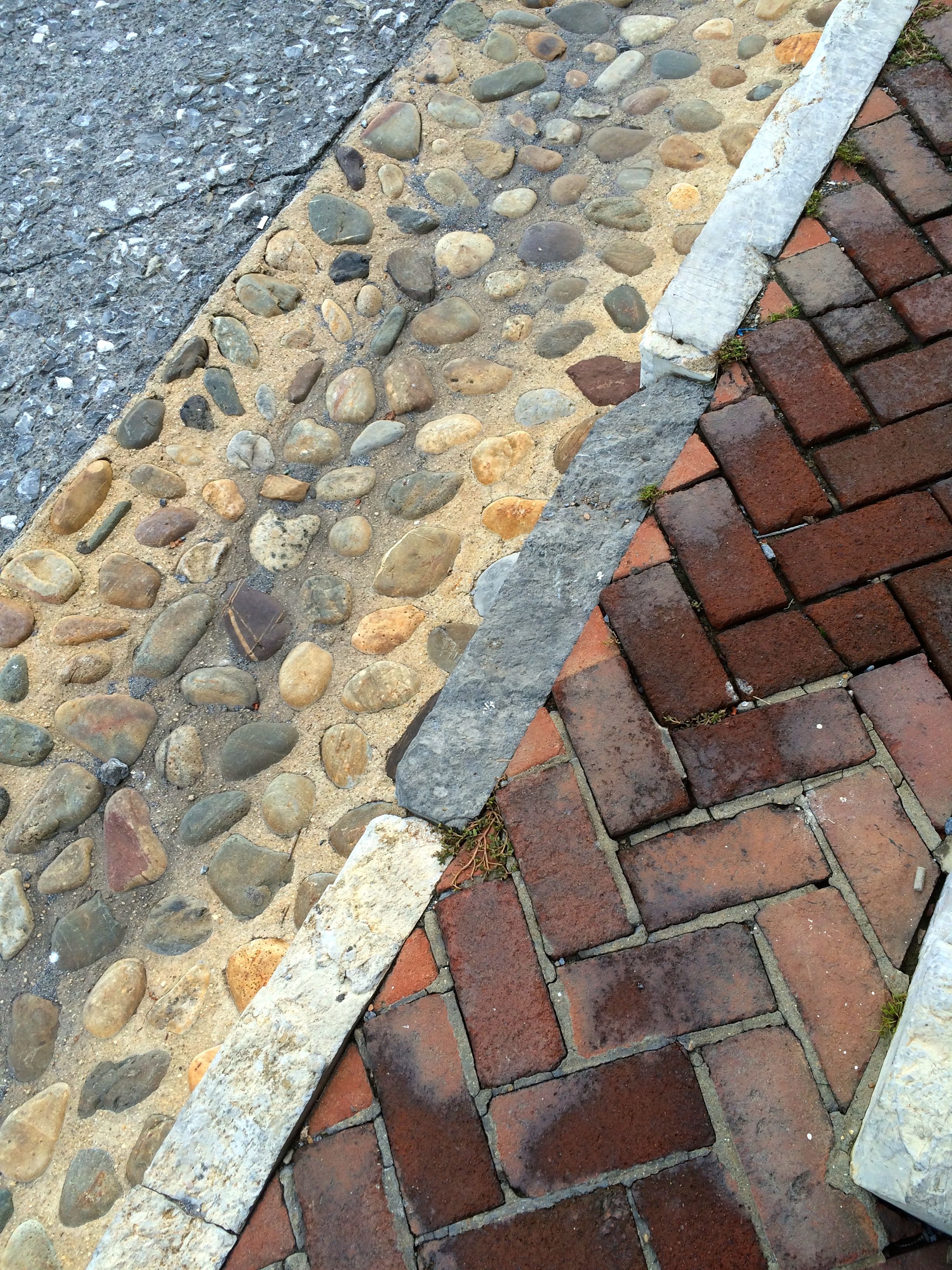
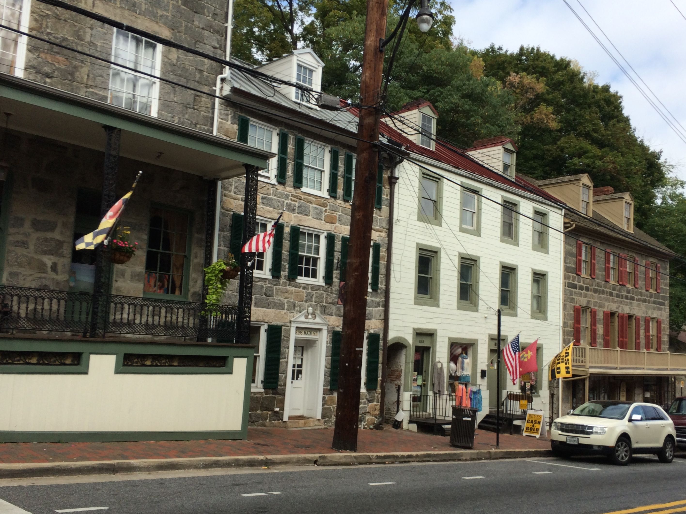
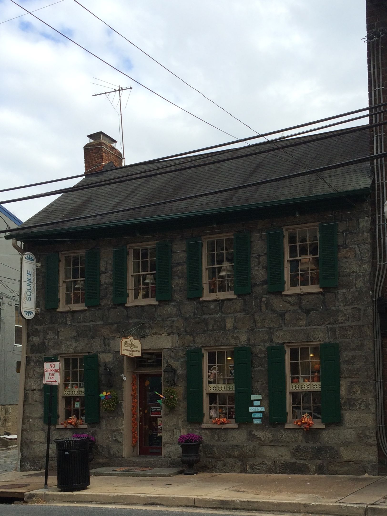
In any event, many of the buildings in the old historic district are built from it.
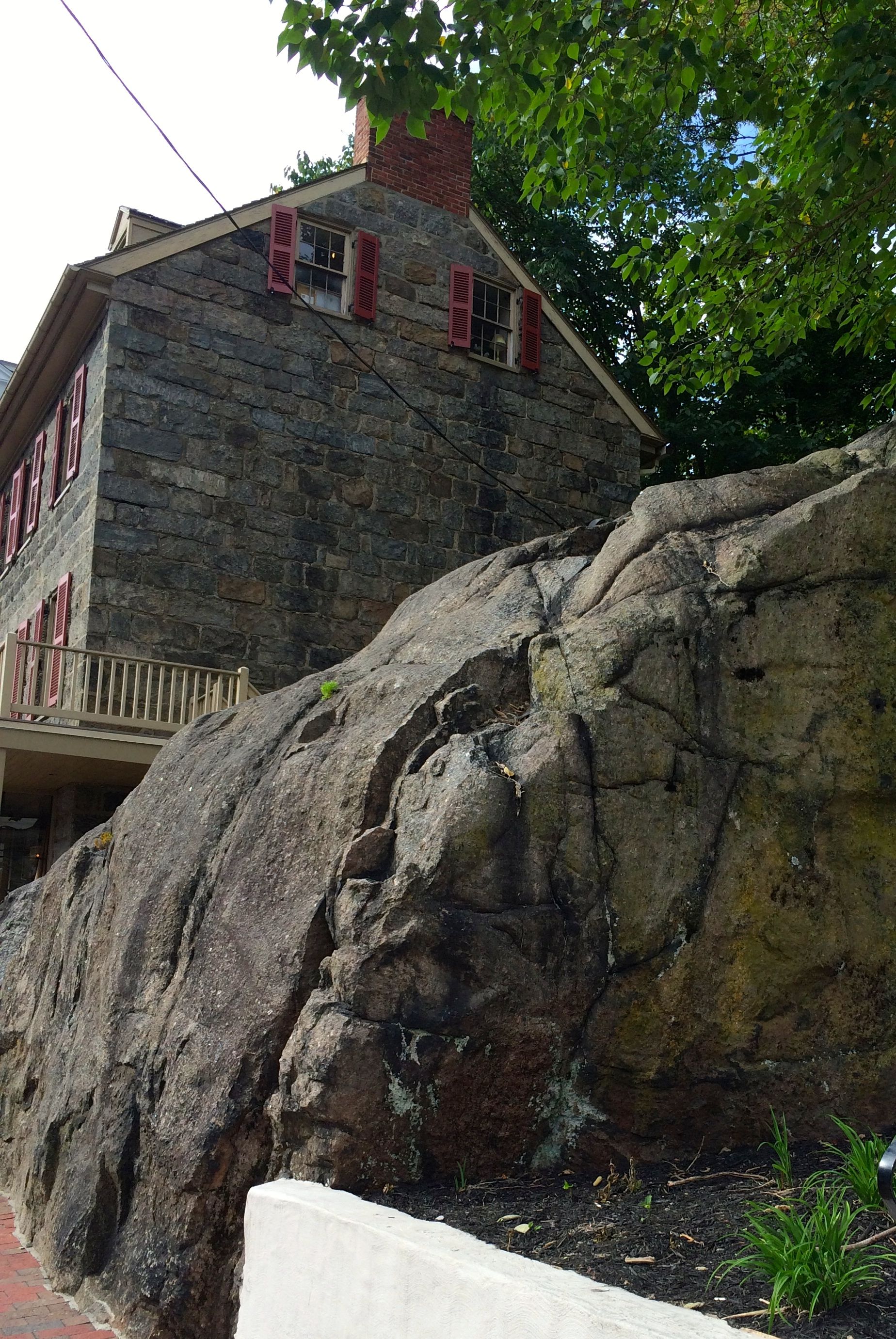
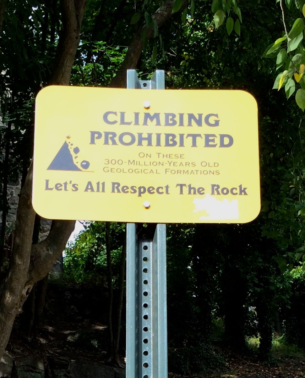
This one is even built right on top of it.
Respect the Rock
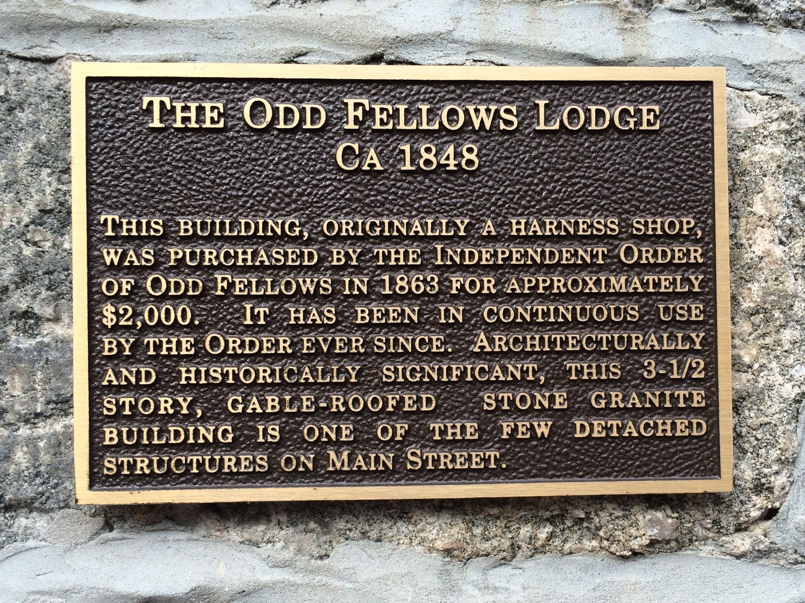
The Odd Fellows Lodge, right down the street, is also built from it.
Now, I have always wanted to know what was so odd about the Odd Fellows. Of course I looked it up.
The International Order of Odd Fellows is a global altruistic and benevolent fraternal organization. It is based in the British Oddfellows service organizations of the 18th century. The name, Odd Fellows, comes from the notion that it was odd to find people organized for the purpose of giving aid to people in need and doing things that benefited all mankind.
Bear in mind that this was not long before the publishing of Dickens’ “A Christmas Carol”. It’s not hard to believe that people who looked out for the good of others would be seen as “odd fellows” indeed.
Back to the tour.
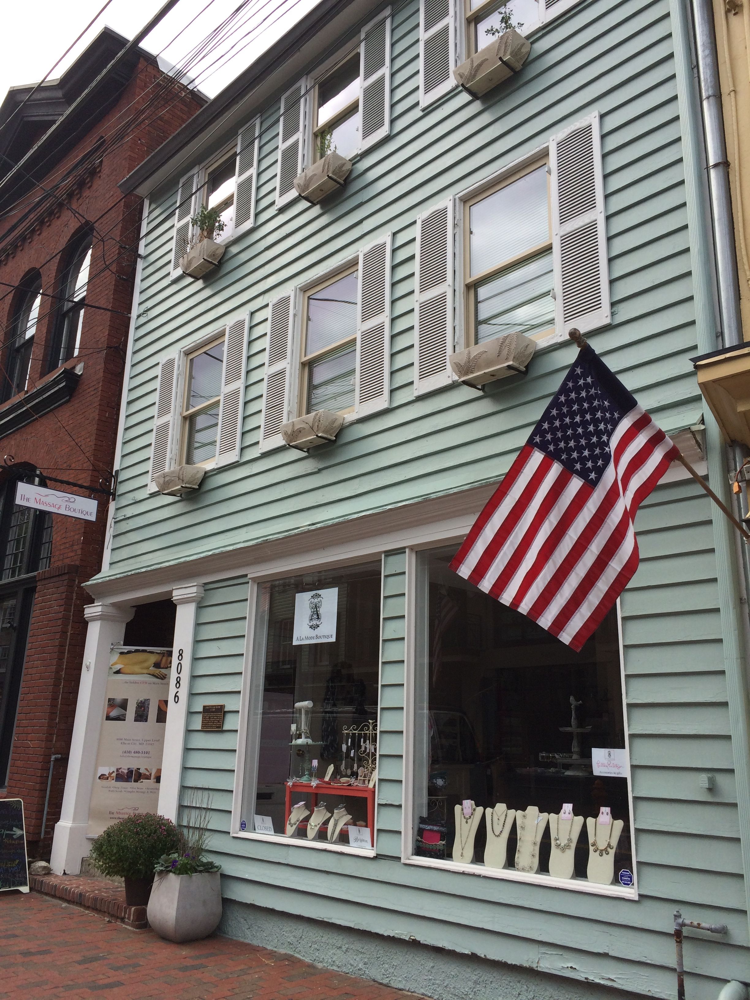
Not all the houses are stone, however.
This is the John Williams house, which was built after he won the lot in the 1834 land lottery. It was extensively damaged by Hurricane Agnes in the 1970, but was remodeled and it is still in use.
Many of the buildings lining Main Street have been converted to commercial use. However did I mention that most businesses are closed on Monday?
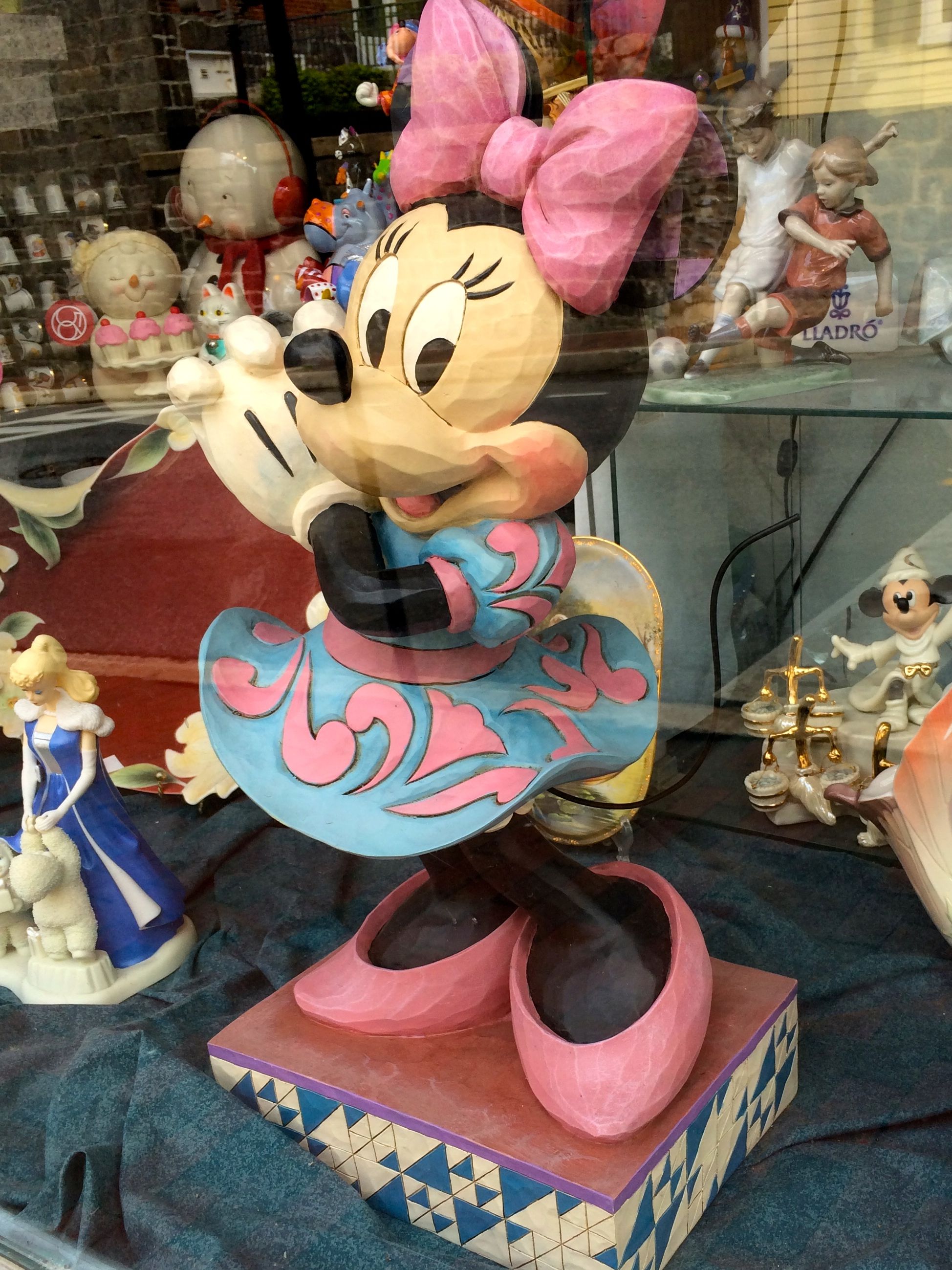
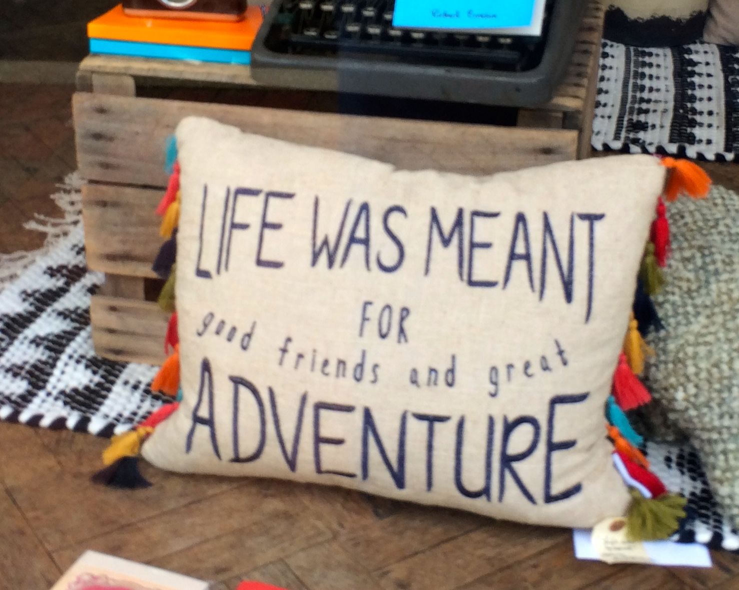
That’s right. I saved a lot of money and settled for window shopping.
Minnie Mouse has shoes that might fit my big ol’ feet.
I couldn’t agree more!
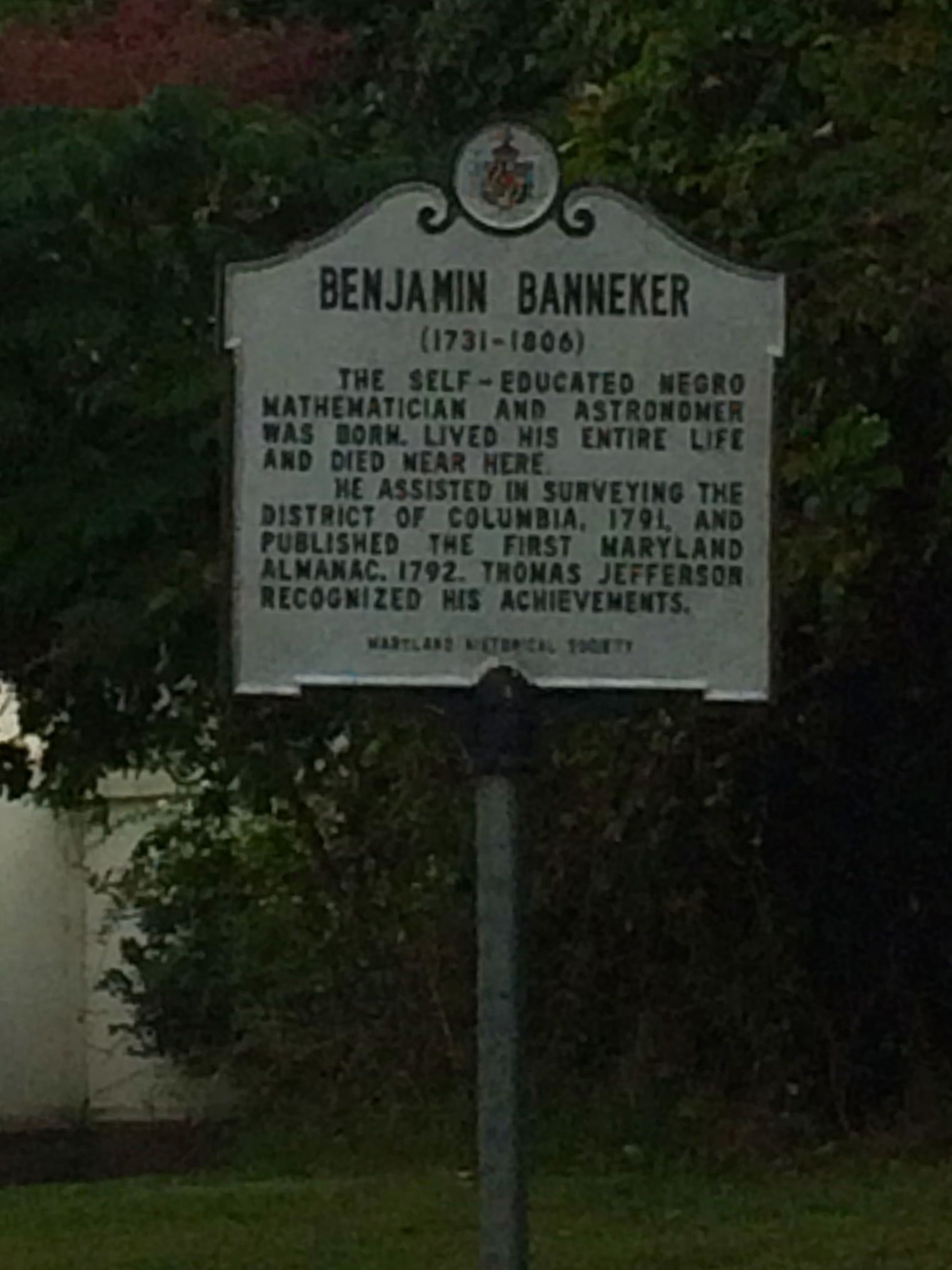
I had one more stop I wanted to make before I headed home. I climbed up-up-up the twisty turny narrow roads – that people actually live on, I might add – to the Benjamin Banneker Historical Park and Museum.
According to the HISTORY Here app, this museum preserves the legacy of Benjamin Banneker, a respected African-American scientist born in 1731 to free black parents. They purchased this land in 1734.
Banneker is often described as a polymath. Isn’t that a great word? In case it’s not in your everyday vocabulary, it means “a person of wide knowledge and learning.” He had little formal education and was largely self-taught. He was an almanac author, surveyor, naturalist and farmer and is known for being part of a group led by Andrew Ellicott that surveyed the borders of the original District of Columbia.
Imagine that! He helped establish the capitol of the United States of America.
And, would you believe it? The museum was closed. It was Monday, after all.
As I mentioned in the previous post, the movement to memorialize the battle began almost immediately.
In the first place, there was the practical need to provide for the burial of the massive number of dead soldiers that covered the fields and forests. This need lead to the establishment of our first national cemetery.
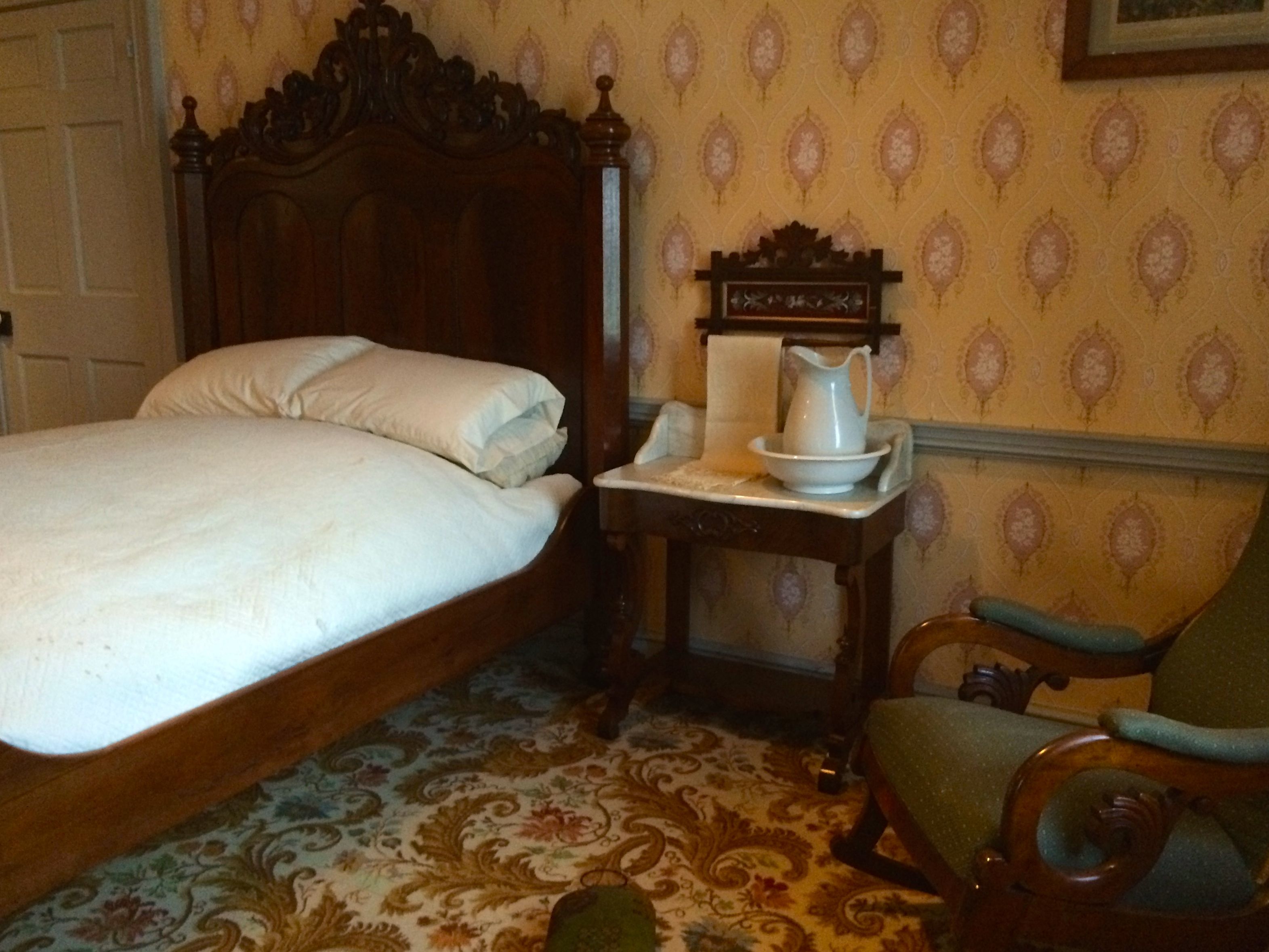
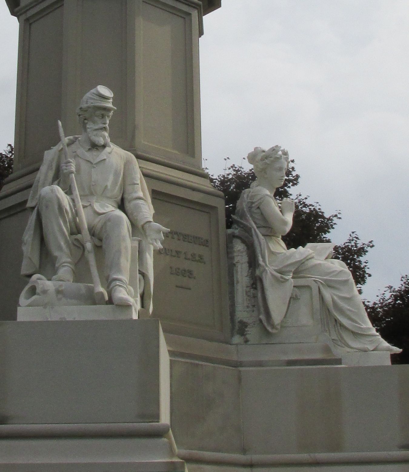
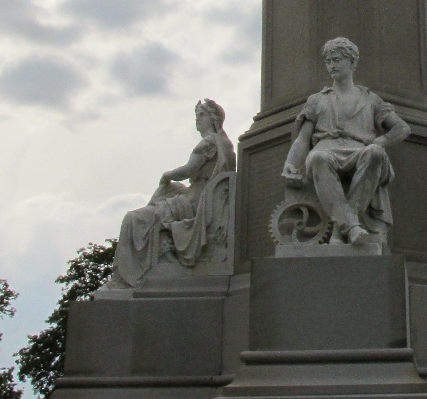
Soldiers National Monument Dedicated July 1, 1869
According to The Association of Licensed Battlefield Guides, the actual witnesses, local residents, began guiding curiosity seekers and grieving family members around the battlefield as soon as the warring parties cleared off the fields. I get the impression that the preservation of the battlefield and the information presented by guides was not held to any particular standard.
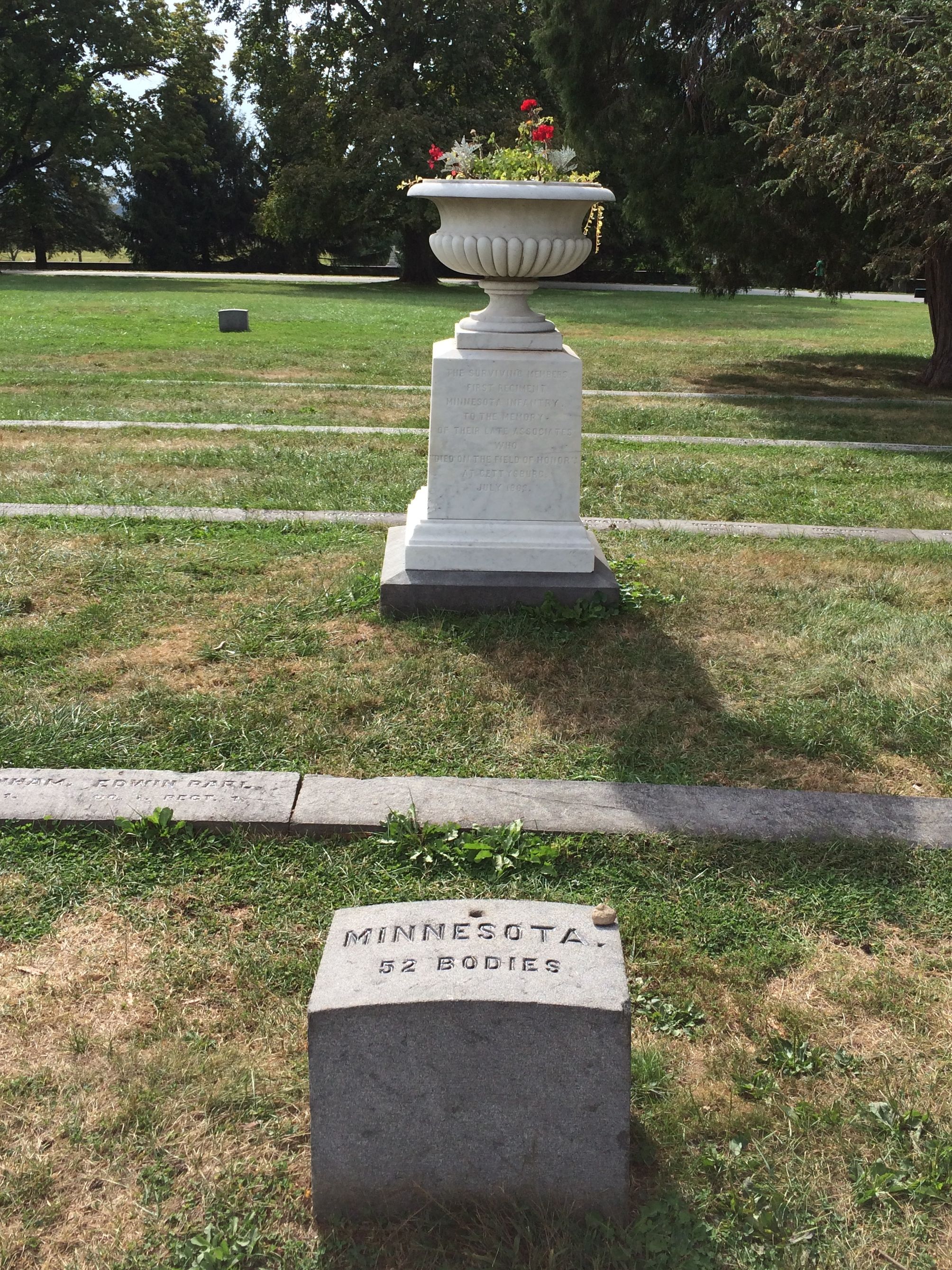
For instance, this is the first state memorial:
Urn placed by the veterans of the 1st Minnesota Infantry 1867
It took twelve years for another memorial to be placed. Veterans of the 2nd Massachusetts Infantry placed a tablet at the edge of Spangler’s Meadow to honor the soldiers who died at this site. The next year, the 91st Pennsylvania placed a monument On Little Round Top. I didn’t even see these memorials. Of course, there are more than 1,300 memorials, according to a book I am consulting, Gettysburg: Stories of Men and Monuments as told by Battlefield Guides. I couldn’t be expected to see all of them. Besides, would you want a report on all of them?
Around the 25th anniversary of the battle, in 1888, interest in commemorating the battle increased, and states began appropriating money to assist in placing memorials on the battlefield. Some states allocated smaller amounts. Indiana and Wisconsin set aside $3,000. Pennsylvania must have had deep pockets. They pitched in $400,000.
Pennsylvania State Memorial Dedicated September 27, 1910 Cost $182,000
Now, in the introduction of the book I am consulting for some facts and figures said they set aside $400,000. In the section about this memorial, the same book said the memorial cost $182,000. I don’t know what happened to the rest of the money. Put your ideas in the comments.
Incidentally, this photo is from a website, Gettysburg: Stone Sentinels, as are several others that I didn’t track down in person. This monument was so large and people were all over that I couldn’t get a decent photo of it.
I did try to find some of the monuments of states that have some relationship to me. First of all, my the state of my birth, New York.
New York State Monument Dedicated: July 2, 1893 Located in the National Cemetery Cost $59,059
Then, my state of long-time residence, Michigan.
24th Michigan Infantry Reynold’s Woods June 12, 1889 Cost $1350
And finally, my adopted state of Texas.
Texas State Memorial Location: South Confederate Avenue Dedicated: September 1964 Cost $1000
I was surprised that Texas took so long to place a monument, but this was a result of a Civil War centennial effort to place identical monuments on the eleven battlefields where Texas troops fought. A smaller marker by a private citizens had been placed nearby in 1913.
In addition to state markers, there are memorials to generals. Of course, the Virginia State Memorial would have to be topped with General Lee.
Virginia State Memorial Located: West Confederate Avenue Dedicated June 8, 1917Detail of Virginia Memorial
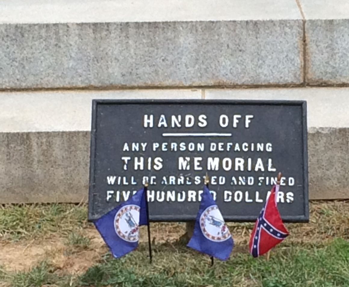
And, just in case you had any ideas of making mischief:
Confederate veterans were initially not as interested in participating in marking their participation in the battle. The first memorial was put up by the veterans of the 2nd Maryland Infantry.
2nd Maryland Infantry Culp’s Hill Dedicated November 19, 1886 Cost $1000
After the fiftieth anniversary of the battle in 1913, southern states became more interested in honoring their citizens who had participated in this battle. Given the age of the surviving veterans and some opposition from their former enemies, their focus was on erecting memorials that honored all the participants from the state.
North Carolina State Memorial Location: West Confederate Avenue Dedicated: July 3, 1929 Cost: $50,000
According to the interpretive sign at the memorial, Gutson Borglum, who is known for his work on Mount Rushmore, is standing at the center with his arms folded. I’m not sure which one he is, but it’s interesting to know.
Additional information on the sign said that North Carolina contributed more soldiers than any other state in the Confederacy. 14,000 participated and 6,100 were killed, wounded or missing.
Eternal Flame Dedicated July 3, 1938 Cost: $60,000
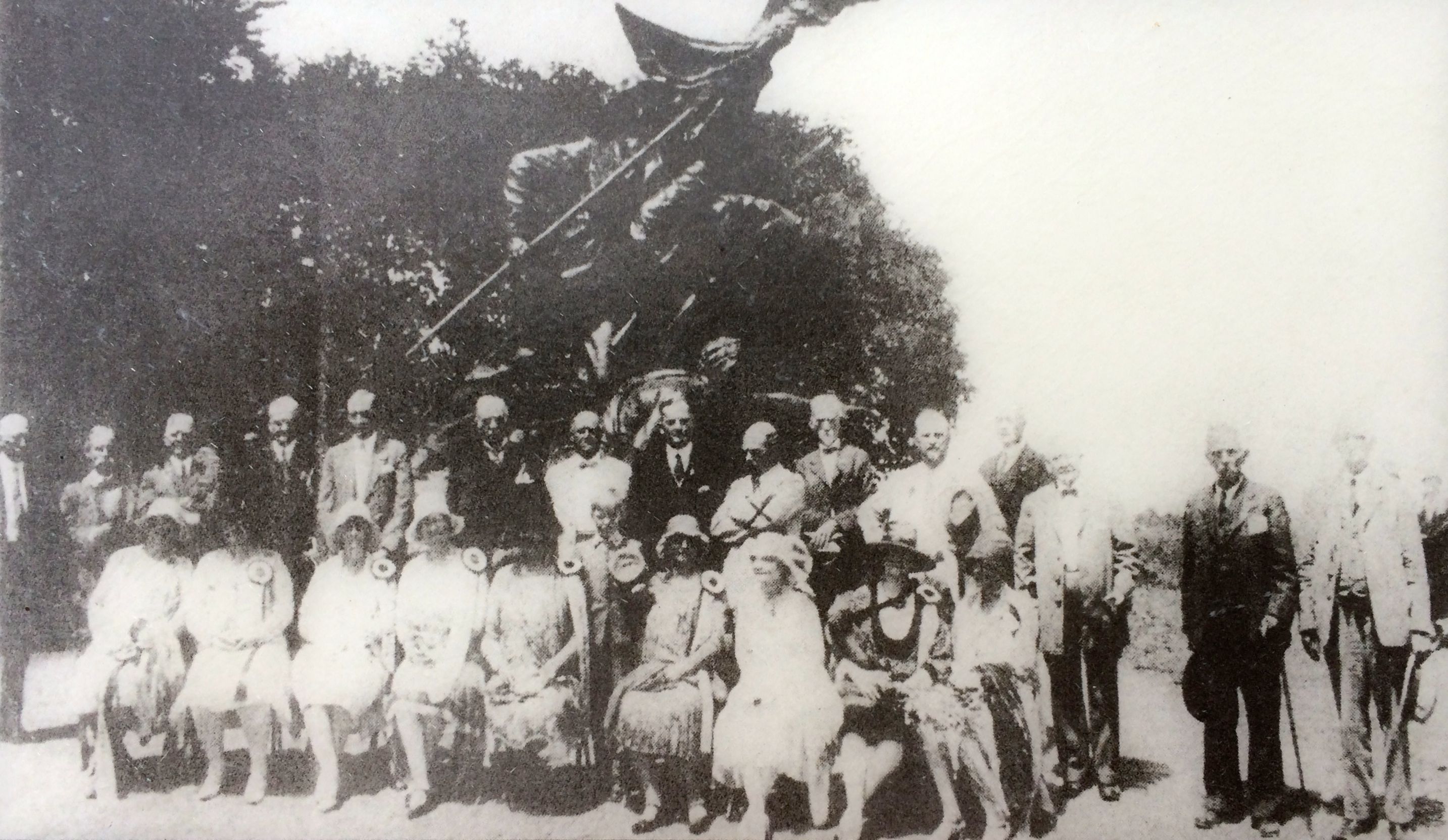
Interest in commemorating the battle seems to peak every twenty five years. The Eternal Light Peace Memorial was dedicated by President Franklin Roosevelt on the seventy-fifth anniversary. It was erected near the site of the encampment held for the fiftieth anniversary.
The Fiftieth Reunion 1913
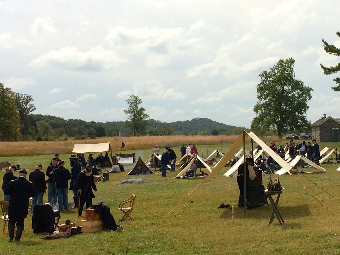
Encampments are still going on, although they are no longer reunions of the participants. This one was taking place around the Pennsylvania State Memorial. No wonder there were so many people around it!
My first trip to Gettysburg was probably as a result of interest generated by the hundredth anniversary.
And, now it’s the one hundred and fifty years later. Things keep changing.
The visitor center has been really redone. Even compared with my second visit in 2001. The Cyclorama is still there, but the building is really new.
The New Visitor Center
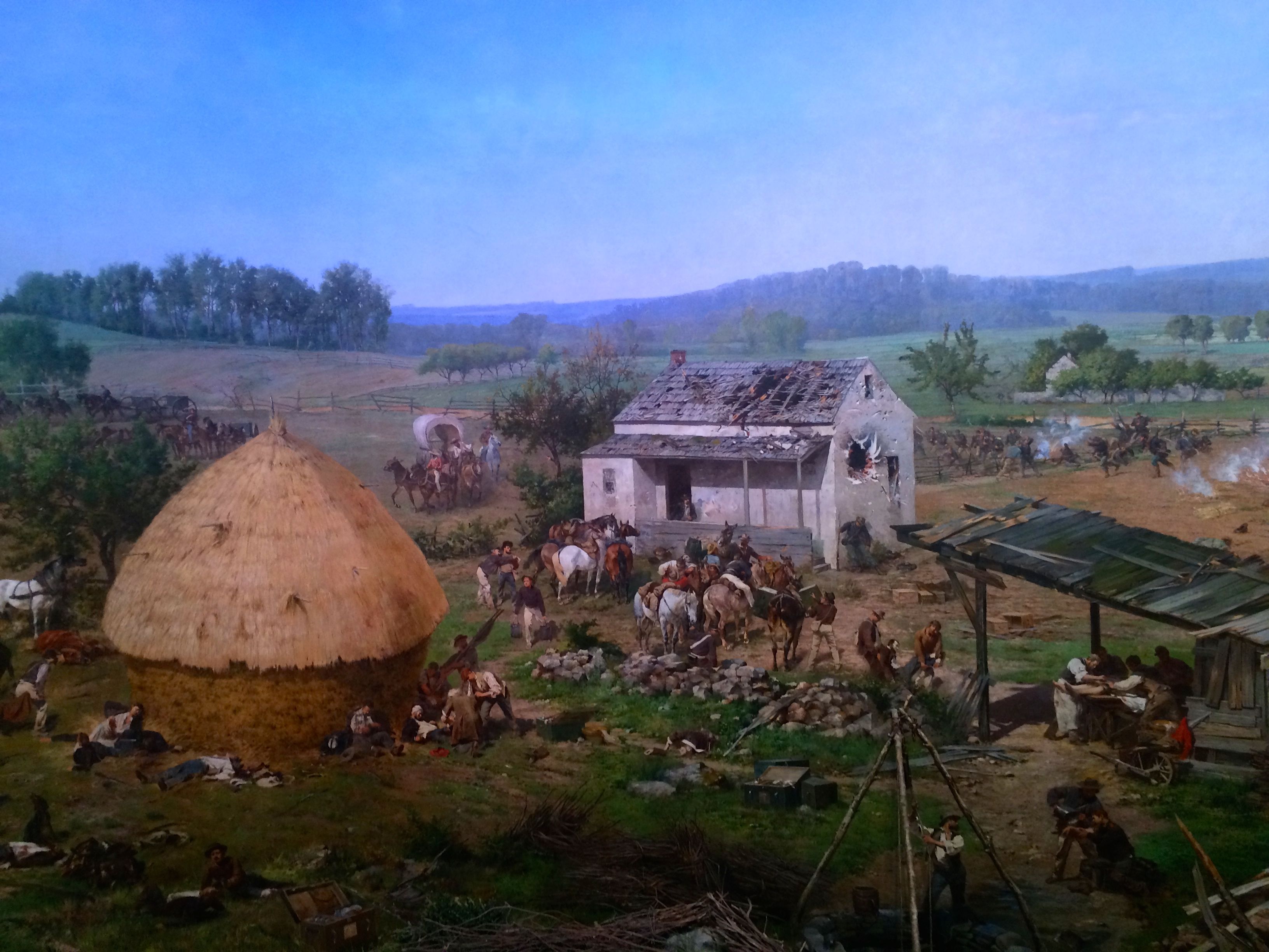
The Cyclorama is still pretty spectacular. It was painted in 1884 by French artist Paul Philippoteaux. He was a premier cyclorama painter, which was a popular form of entertainment – until motion pictures hit the scene. There used to be many of these that would tour the country, and most major citied had cylindrical or hexagonal buildings for displaying them.
This painting had been in Boston, but the theater that housed it went bankrupt at a fortuitous time. A Gettysburg business man bought it, repaired it an had it installing Gettysburg in 1913, in time for the fiftieth anniversary of the battle.
It is 377 feet long, 42 feet high and weighs 12.5 tons.It is 377 feet long, 42 feet high and weighs 12.5 tons.
The National Parks Service bought the cyclorama in the 1940s, and they have been working hard to keep it in good conditions ever since. The last restoration cost $13,000,000.
Outside the building, is a statue of Abraham Lincoln. It is convenient for a souvenir portrait.
Abe and me
But, now I have one more item to put on my “to do” list. I might just have to swing back through Gettysburg next year.
When I was a youngster, I was a real Civil War buff. I could recite battles, dates, generals- you name it. These days, the details are not as sharp, and when I visited Gettysburg this time, I was not as taken with the battle itself as with how people responded to it.
No doubt about it, the battle was horrific. It lasted for three days – July 1-3, 1863. By this point in the war, the armies had gotten extremely efficient at killing and maiming their opponents.
Of the more than 160,000 soldiers from both sides taking part in the battle, almost 8,000 were killed, 17,000 wounded and 11,000 captured or missing. To put that in some sense of perspective, Gettysburg itself had only about 2,400 residents living there at the time.
After the battle, they had to take action. The had to get their town back in order and they had to do something with all the dead. At first the dead were buried in shallow graves, with names written in pencil on wooden boards. Wind and rain began eroding the temporary graves and the townspeople began calling for a cemetery to provide for a more proper burial for the Union soldiers. Governor Curtin worked with a committee headed local lawyer David Wills to get the dead buried. The reburial process started at the end of October, four months after the battle.
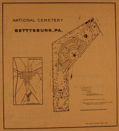
This was the first national cemetery. Our country was still so young that such things were still being established.
National Cemetery Gettysburg, PA
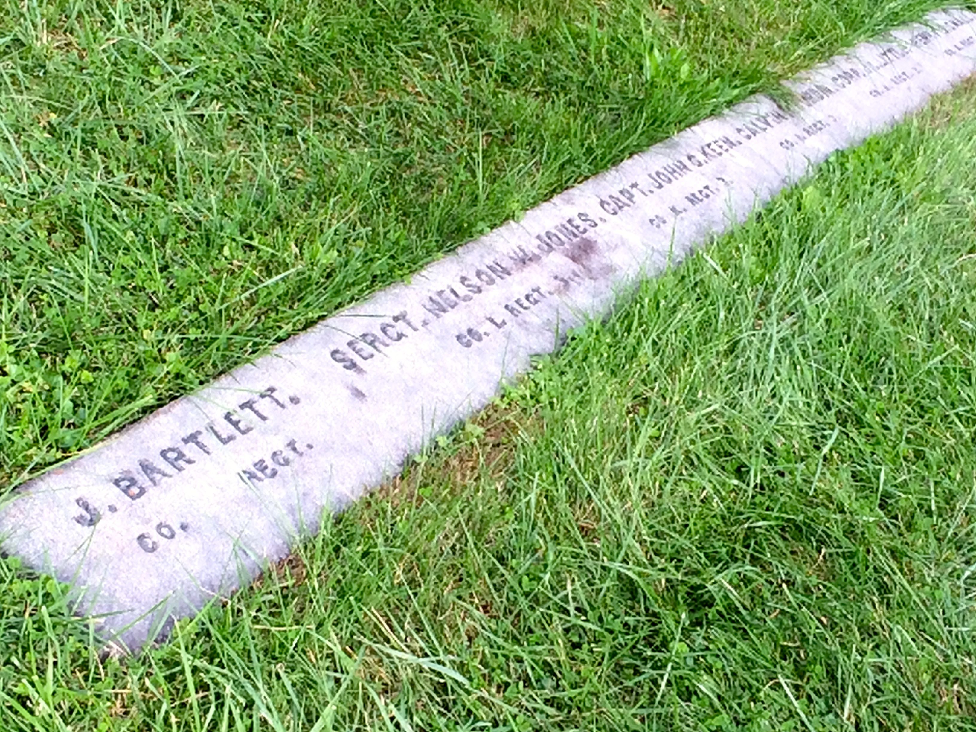
Rather than the rows of white markers that we are familiar with in Arlington National Cemetery, these markers were laid flush with the ground, and were arranged in a semi-circle.
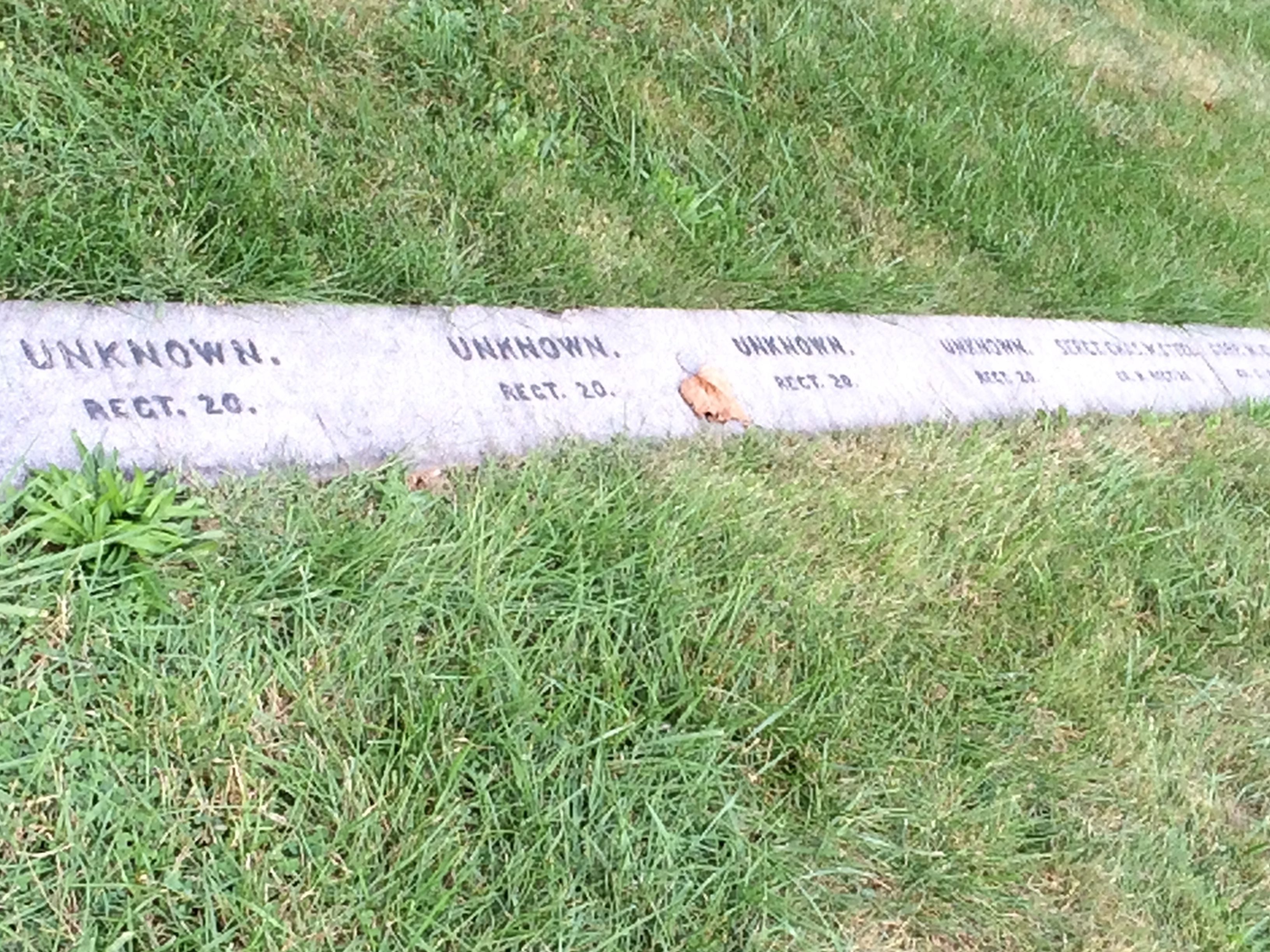
Enlisted men were buried next to officers.
Unknown soldiers were buried as well.
The reburials had only been going on for about three weeks when the dedication ceremony took place. The reinterments continued until March of 1864.
Probably the most eloquent speech ever given was Lincoln’s Gettysburg Address, and it was made here on November 19, 1863.
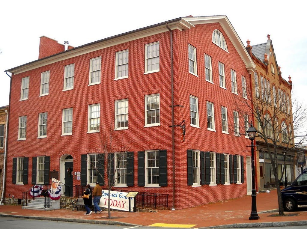
That day, Gettysburg was invaded again. An estimated 20,000 people came to town for the dedication. Lincoln stayed at David Wills’ house, located on the town square. According to the guide at the Wills House, there were 38 people staying there for the dedication.
Wills House
However, Lincoln was allowed his own room. The furnishings are believed to be the ones he used during his visit. Even the linens belonged to the Wills family, even if they are not the exact ones he used.
He made his final revisions on his remarks while he was in this room.
The big draw for the ceremonies was the keynote speaker, Edward Everett. He spoke for two hours before Abraham Lincoln got up and spoke for two minutes.
Now, I always had the feeling that the committee that put together the ceremony had sort of slighted Lincoln by inviting this nobody Edward Everett to be the main speaker.
I thought that history rather laughed at Edward Everett. After all, he delivered a long, flowery speech, but Lincoln’s short dedication is the one that is remembered. However, Edward Everett really was somebody back then.
Edward Everett
In addition to being a pastor and educator, he served as U.S. Representative, U.S. Senator and governor for the state of Massachusetts. He was also an Ambassador to Great Britain and president of Harvard. So, asking him to deliver the main speech probably wasn’t the slight to Abraham Lincoln that I imagined it to be. Besides, Lincoln had a war to run.
The reinterments had only been taking place for about three weeks when the dedication of the cemetery happened. It must have been a raw, muddy place. In spite of all the death and destruction of the battle, which had raged back and forth across this piece of land, there was a tree that survived.
Witness tree
That tree survives to this day. It is the honey locust that is in the center of the photo.
At the center of the cemetery, near where the speeches were given, is now a memorial to the soldiers.
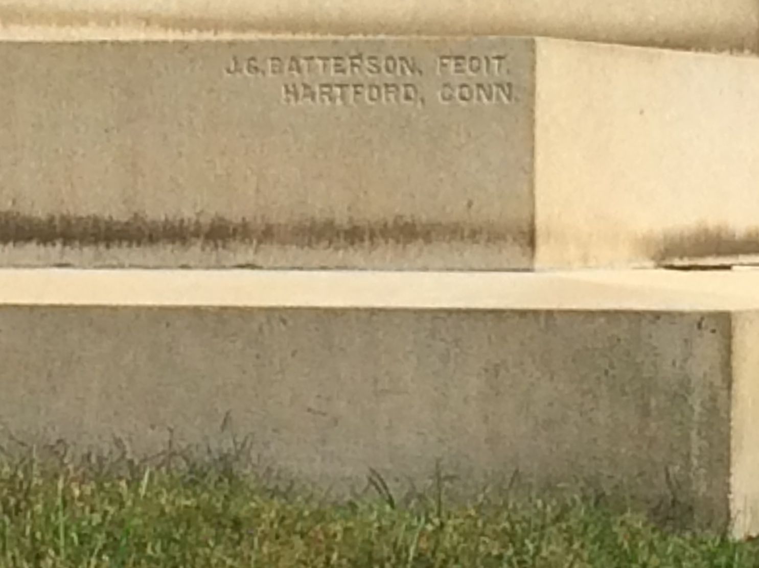
Signature
I particularly like how J. G. Batterson signed his work on the base.
The state memorials started coming in. The first one was a modest urn on a pedestal from Minnesota in 1867.
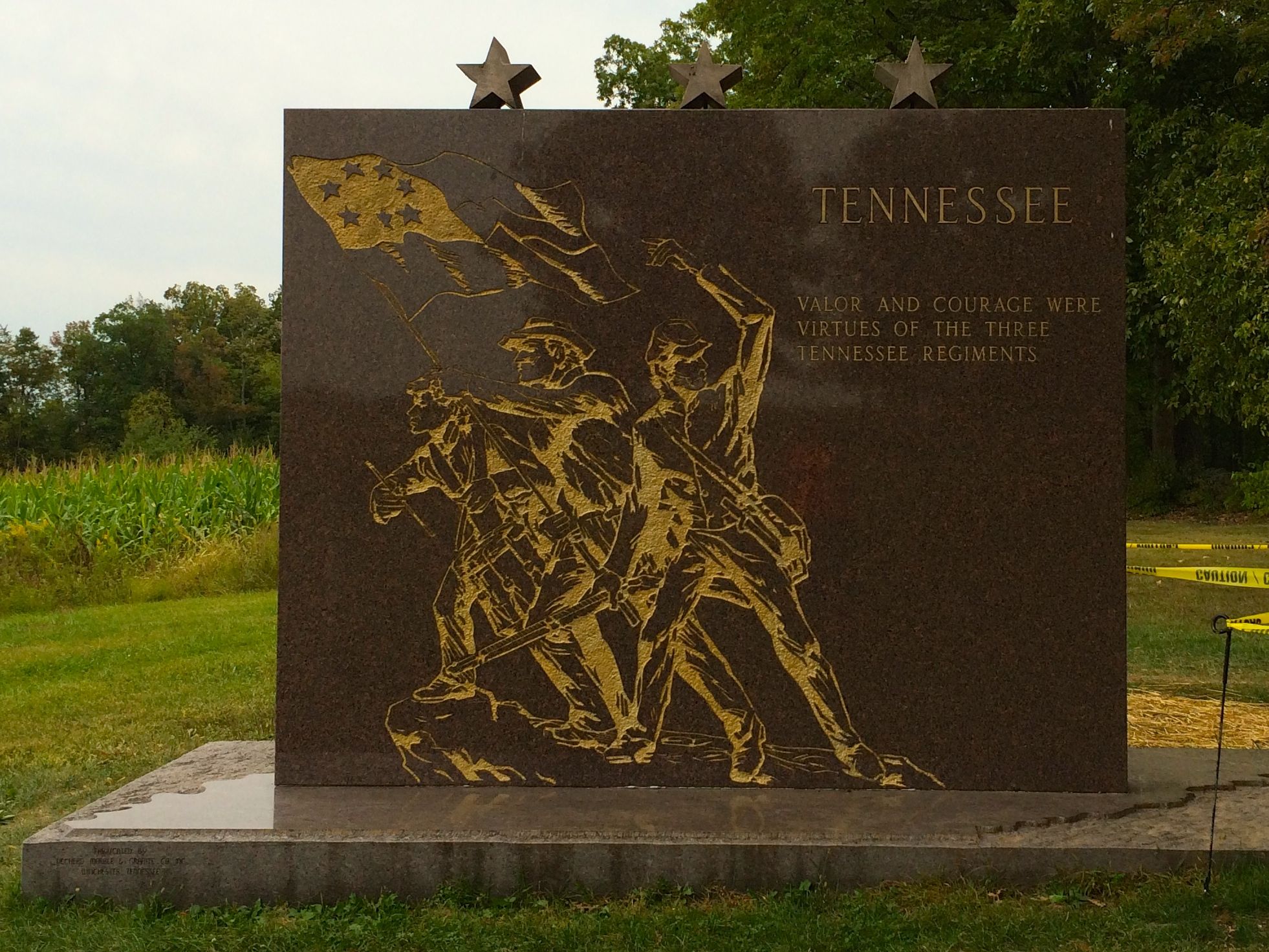
The last one was from Tennessee in 1982.
It has the distinction, I am told, of being the only one paid for entirely with private donations.
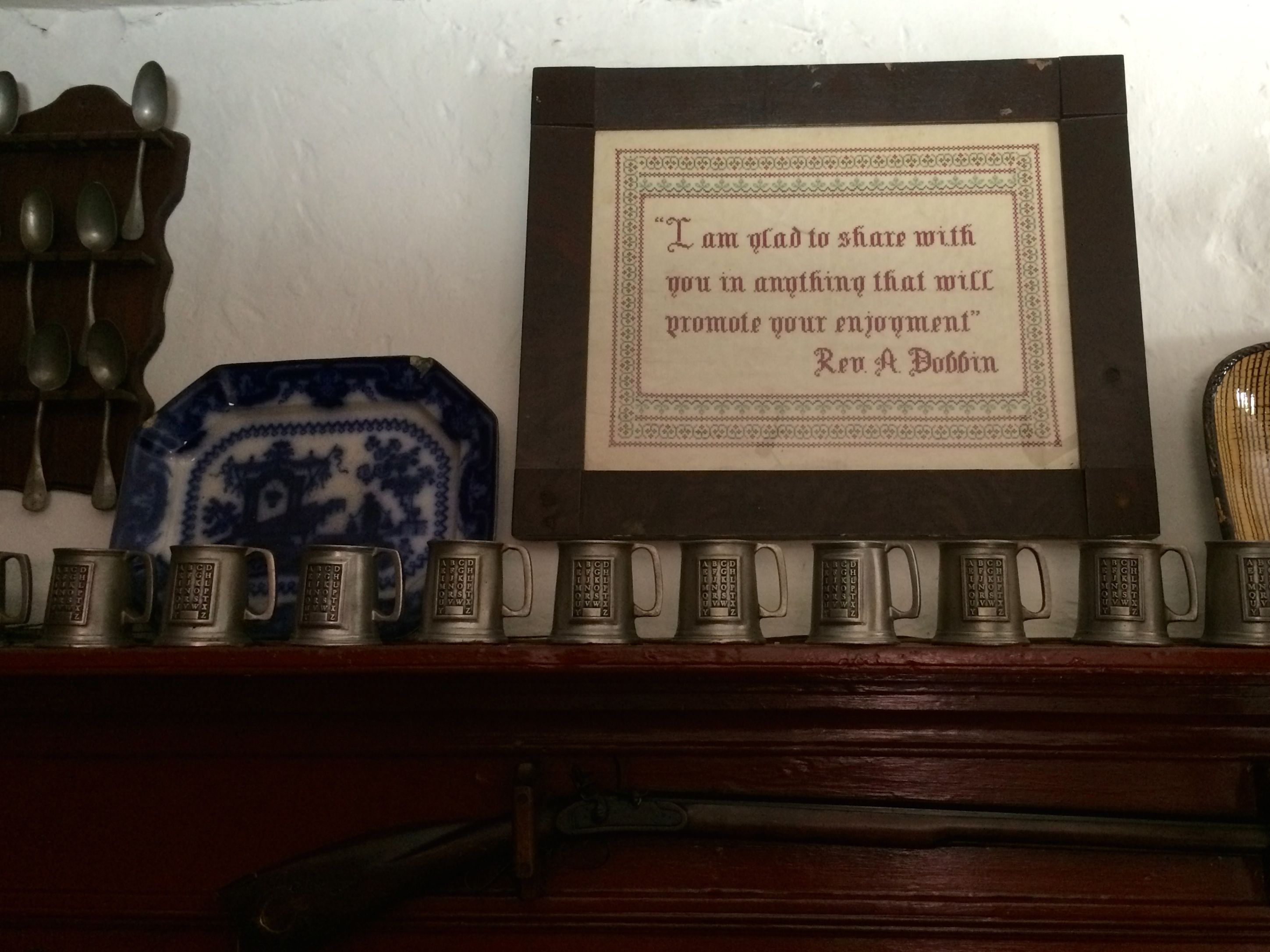
I was thrilled to be able to get in on a tour of the Dobbin House with an excellent tour guide.
This house was build in 1776 by Reverend Alexander Dobbin. He was born in Ireland in 1742. He set sail for the Colonies with his wife, Isabella Gamble. They could each bring one trunk. Isabella filled hers with their clothes and the things they would need to start a new life. Reverend Dobbin filled his with books. Each were practical, in their own way.
He became pastor of the Rock Creek Presbyterian Church, just a little north of Gettysburg. He was a man who believed in multiple income streams.In addition to being a minister, he acquired 300 acres which were farmed. He also had a Classical School, which we would today call a combination theological seminary and liberal arts college. It was the first institution of it’s kind west of the Susquehanna River. His large collections of books was integral to its success. See? A trunkful of books is a good thing.
I do wonder if Isabella shared his vision.
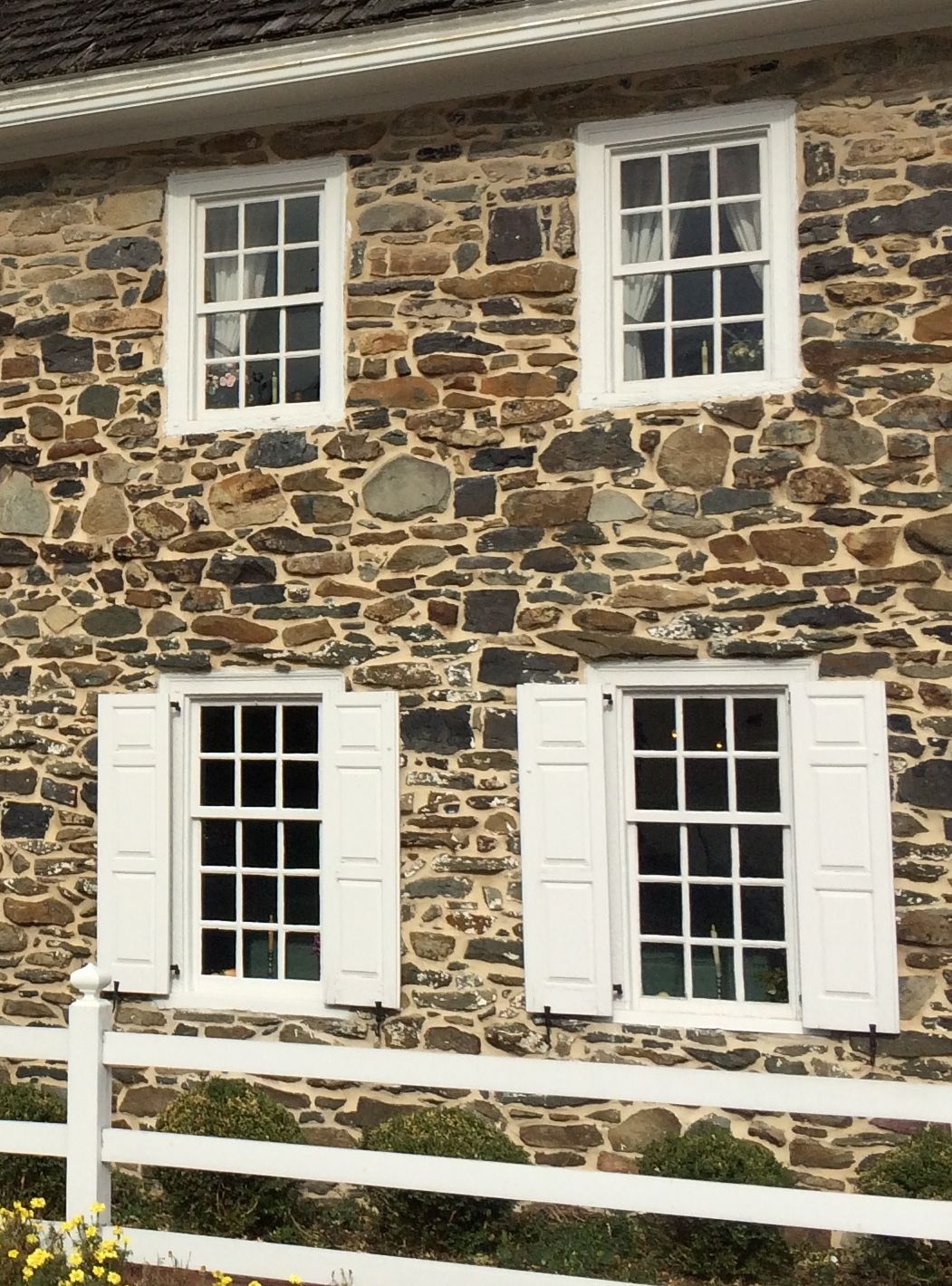
Our guide pointed out that there were shutters only on the lower windows. They chose to do that as a safety measure against possible Indian attack. It turns out that the last attack was by a Shawnee and French raiding party in 1758, years before. She told us that the woman kidnapped in the raid was a 15 year-old named Mary Jemison. Conveniently, they had a copy of the book, A Narrative of the Life of Mrs. Mary Jemison, for sale in the gift shop. I did buy it, and I look forward to reading it.
Anyway, the Dobbins needed that large house, which had six fireplaces when it was constructed. Some of the students stayed at the house, as borders, and Isabella had ten children before her death.
As if ten children wasn’t enough, Reverend Dobbin remarried. Mary Agnew brought nine children of her own into the union!
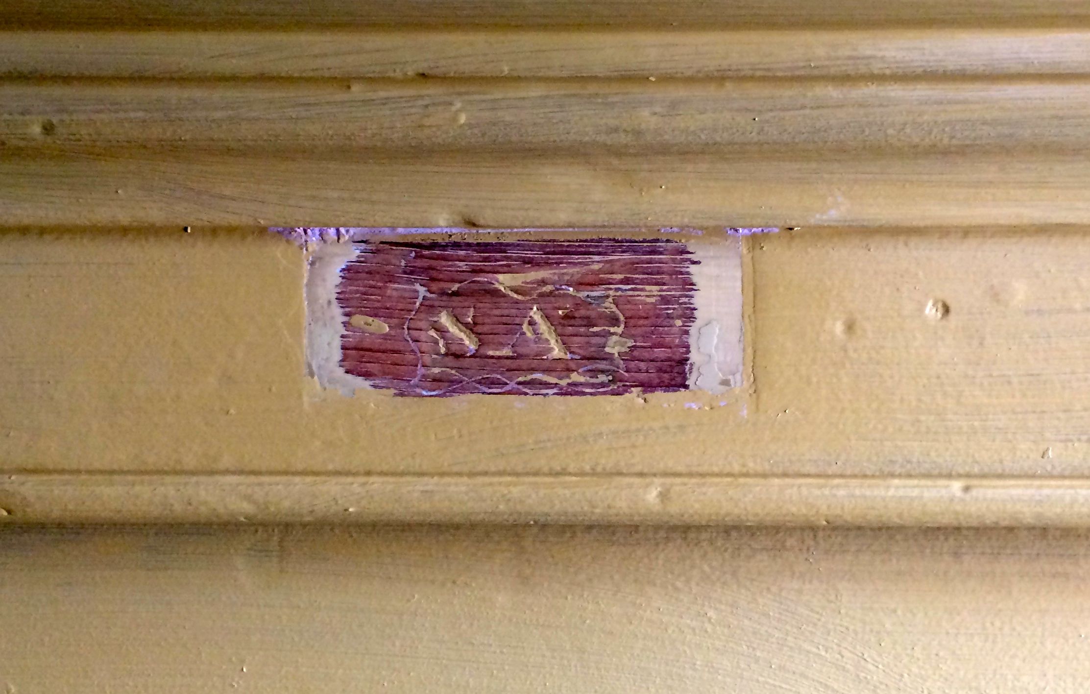
The guide told us that these initials were found carved into the mantel when the house was being restored. They are the colonial era style of lettering of the initials “S.A.” She told us that they had decided that Reverend Dobbin had permitted the eldest son of Mary Agnew to carve his initials into the mantel so that he would know that this was his home, too.
Perhaps so. It’s a nice story, but I am sure that wouldn’t have been acceptable in my house.
Dobbin House addition
After Reverend Dobbin’s death in 1807, his eldest son, Matthew, inherited the property. His widow was provided for, though. According to the will, she was to be given a room and have access to the kitchen for as long as she lived.
Matthew added on to the house. He added a kitchen, a room above the kitchen and an attic. I think the guide told us that the attic portion was for spinning. He also added a secret room that was used as a stop on the Underground Railroad.
The room was situated under the eaves behind a cabinet. The shelves slide to the side on tracks and the escapees could hide behind the shelves.
The cabinet was just at the top of this photo frame. There were too many people on the tour to get a good shot of the hiding place.
The building changed hands several times over the course of its existence. The last owner before the current owner used the upstairs as a tourist attraction. They had removed the walls that separated the space into bedroom and installed a diorama of the battlefield. That is the space that became the main dining room of the restaurant.
A a nod to the former use of the space, some of the tables are set up as if they are in four-poster canopy beds.
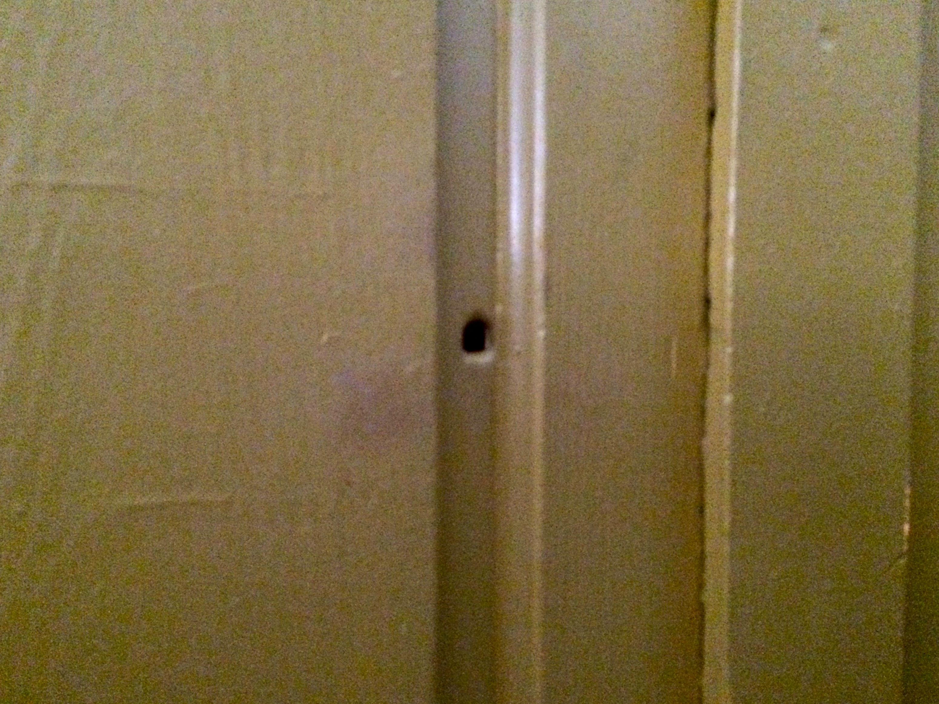
On our way back downstairs, the tour guide pointed out the only bullet hole from the battle.
At least, that’s what she said.
The current owner dug out the cellar of the house and put in a tavern. Reverend Dobbin would never have allowed a tavern in his house.
She pointed out the ledge and said that was how much they had to excavate to put the tavern in. They also put in a steel beam to support the weight of the house.
This plaque was on the bar. The current owner had an antique dealer looking for a bar for the tavern. Her great-grandfather, who was in his 90s at the time, was able to identify the bar because of some unique dovetail joinery that, unfortunately, I didn’t get a photo that. It is a nice touch that this family heirloom made it back to the fold.
Incidentally, our word, “bar” meaning a place that sold alcohol came from this device.
Since legal tender was rare, alcohol was used as a form of money. The bars were lowered and locked when they weren’t open for business. The bars swung up and hooked to the ceiling when they were open.
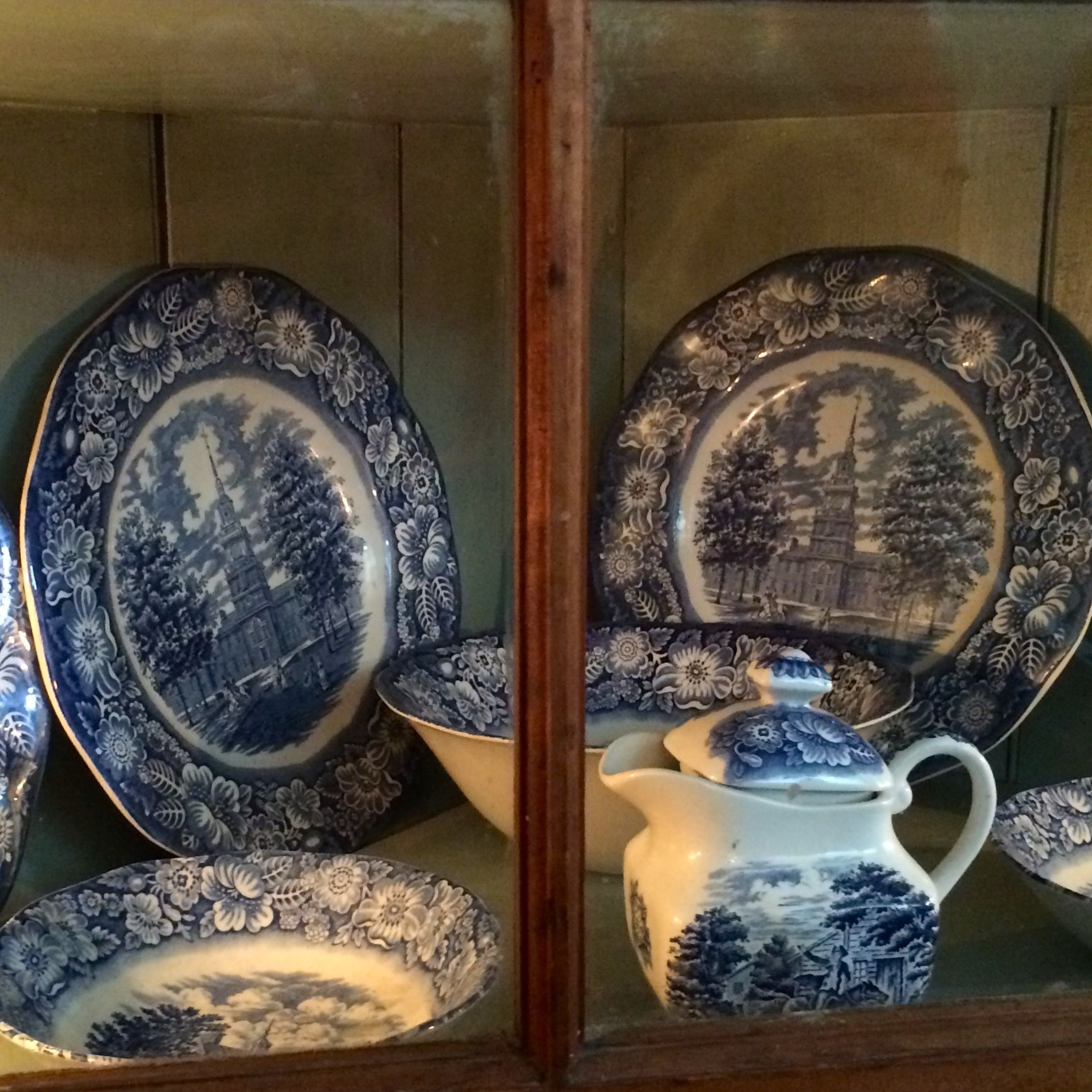
When they excavated the cellar and the midden piles (fancy term for “trash heap”) they uncovered many artifacts. These are not among the artifacts they discovered, but, based on the pottery pieces they found, they were able to buy the exact dishes that Reverend Dobbins used.
Now, the guide was very firm in telling us that the pattern used in the restaurant was Liberty Blue made in Staffordshire, England and that it was the same that the Dobbins used. I find it a little hard to believe that they would be producing dishes with pictures of Independence Hall and calling it Liberty Blue right around the time of the War for Independence.
But, that’s what she said.
It was a lovely tour, and amazing to think that this building was standing on its original foundations nearly 240 years after it was built.