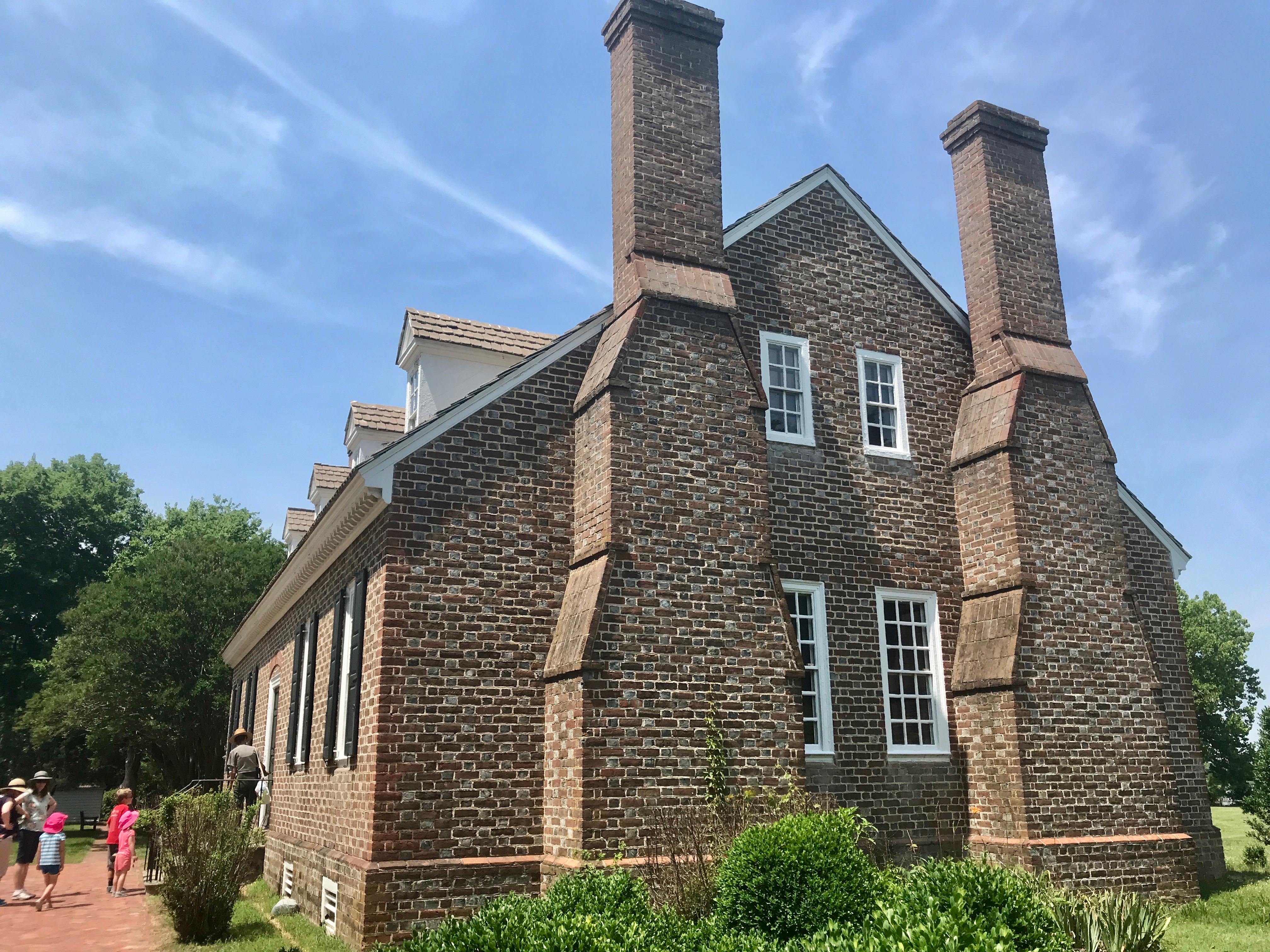
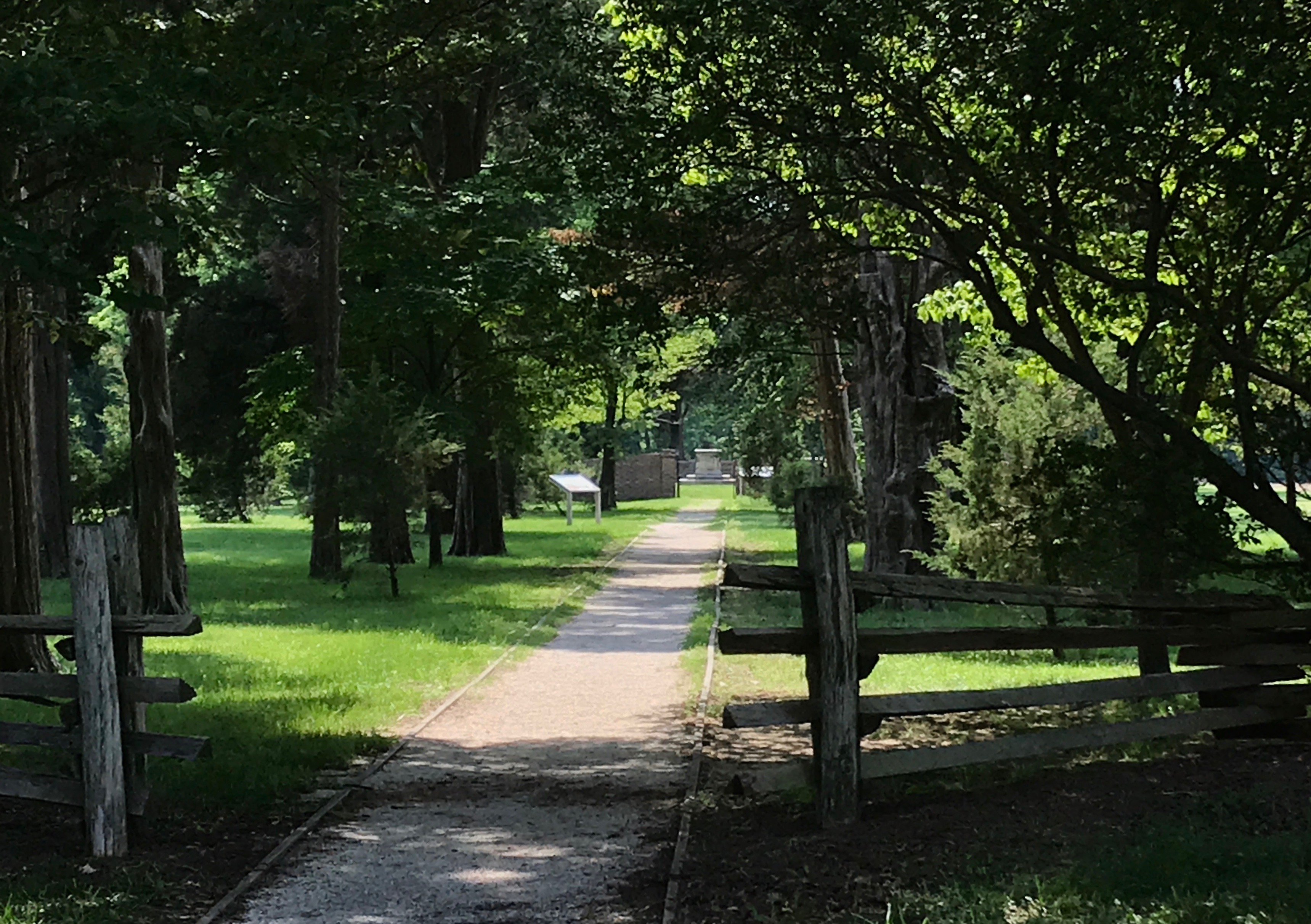
My route took me near Charleston. Since Charleston is the capital of West Virginia, I figured it was worth taking a quick trip to see the capitol. (See what I did there? Capital is the city, capitol is the building. If I keep repeating these two words, I may one day remember the distinctions.)
I had seen it many times, as I would drive south over the years. That golden dome is really eye-catching.
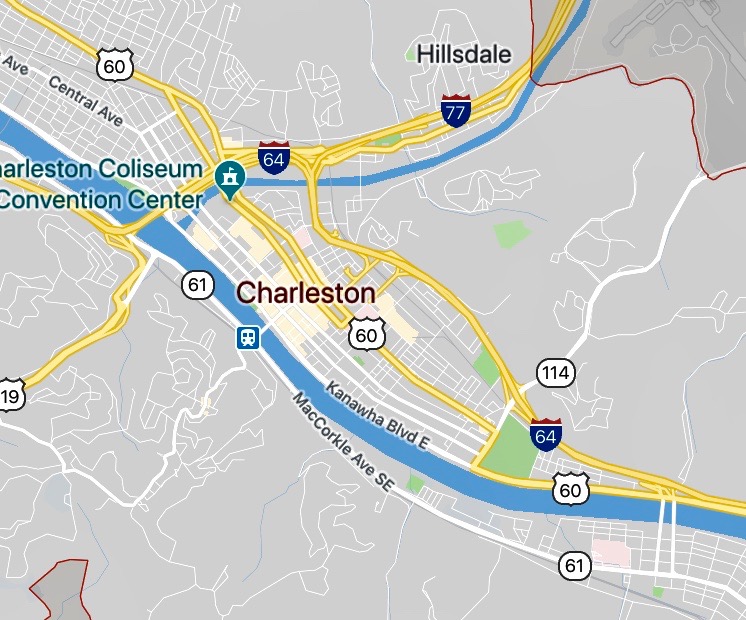
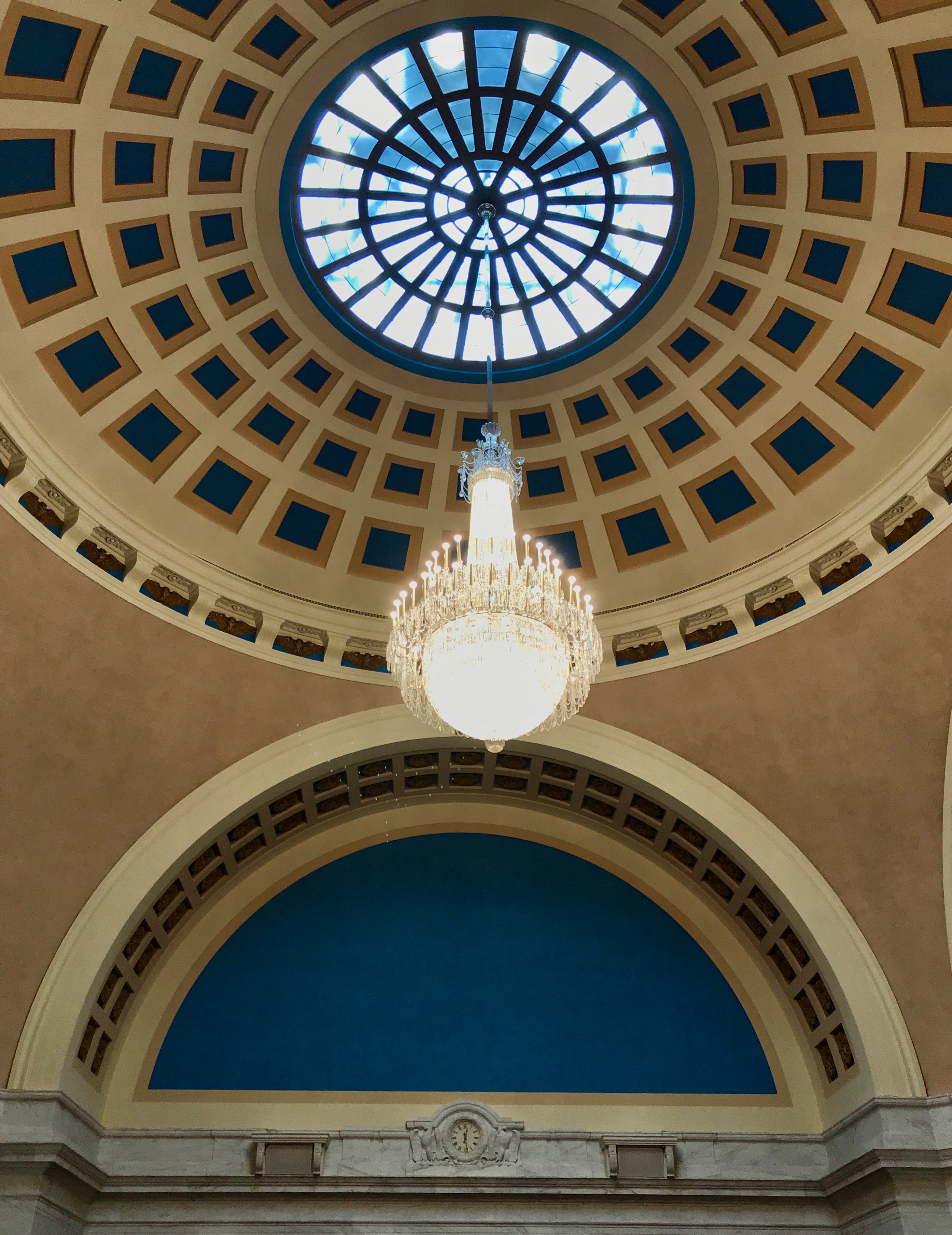
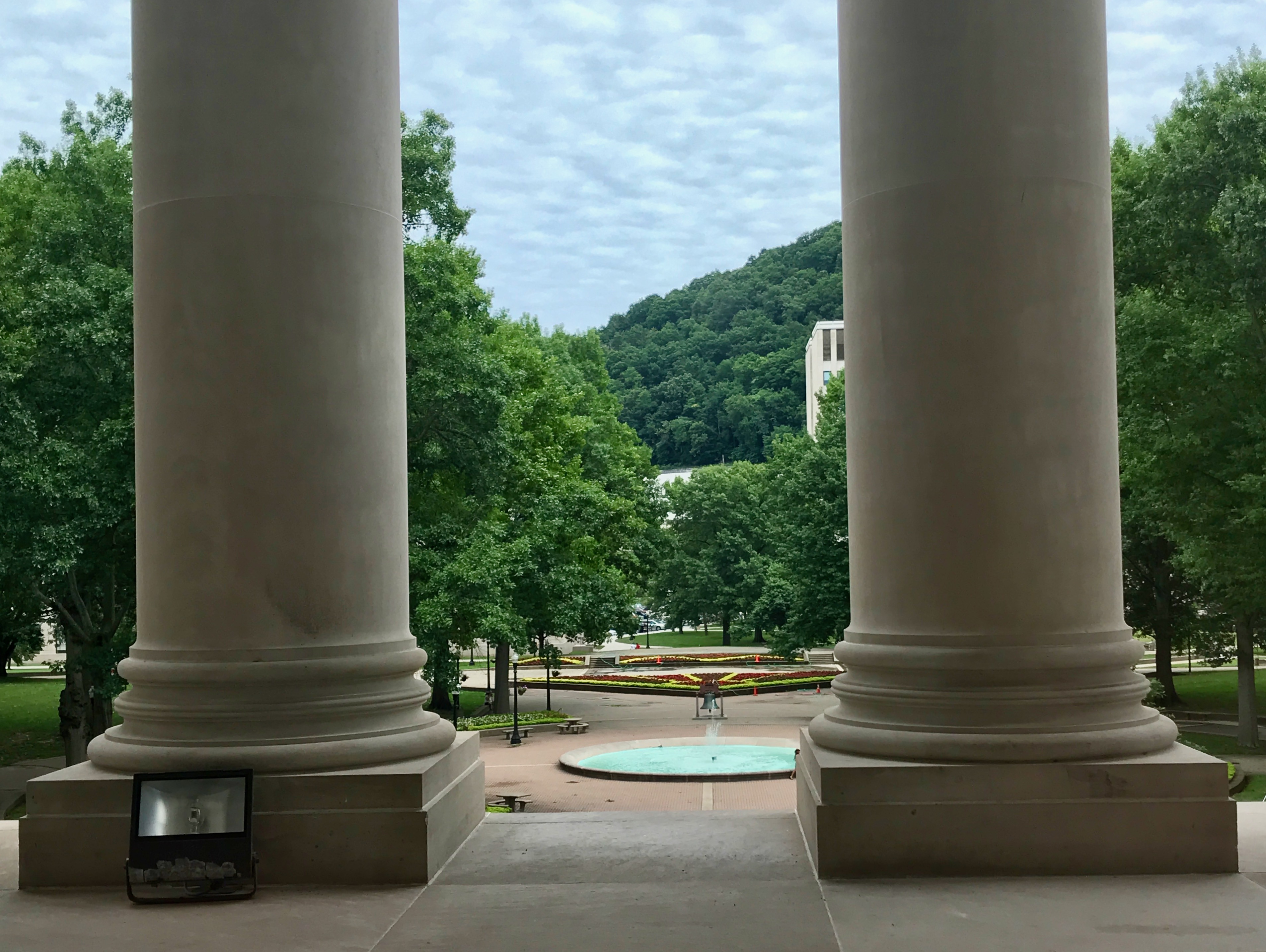
And, it had a great riverside location. The capitol is on the Kanawha River in the green area right by the I-64 symbol. And, no wonder the dome was so remarkable. The gold-leafed dome is larger than the dome on the United States Capitol!
The state capital moved around between Wheeling and Charleston, Charleston became the capital of West Virginia in 1877.
Interesting facts about West Virginia’s statehood: according to my Preferred Source, it was originally part of Virginia and when Virginia succeeded from the Union during the Civil War, it was occupied by the Union forces. The military units were dispatched from Ohio to western Virginia early in the war to secure access to the coal mines and transportation resources.
It officially became a state by Presidential Proclamation. Abraham Lincoln declared the northwestern portion the northwestern portion of Virginia to be returned to the Union. On June 20, 1863, West Virginia became the 35th state.
From what I could glean from the internet, this capitol is the third building. The first one burned in 1921. A hastily built replacement burned in 1927. Architect Cass Gilbert designed the buff Indiana limestone structure in the Italian Renaissance style. It was completed in 1932.
Cass Gilbert has designed at least three state capitols: West Virginia, Minnesota, and Arkansas. If my loyal readers remember, when I visited Helena, Montana, I found out that he had designed their capitol. They ended up not using his design, so he sold it to Arkansas.
Anyway, I parked and went inside. There was going to be a tour in a bit, so I poked around for a few minutes to see what I could see.
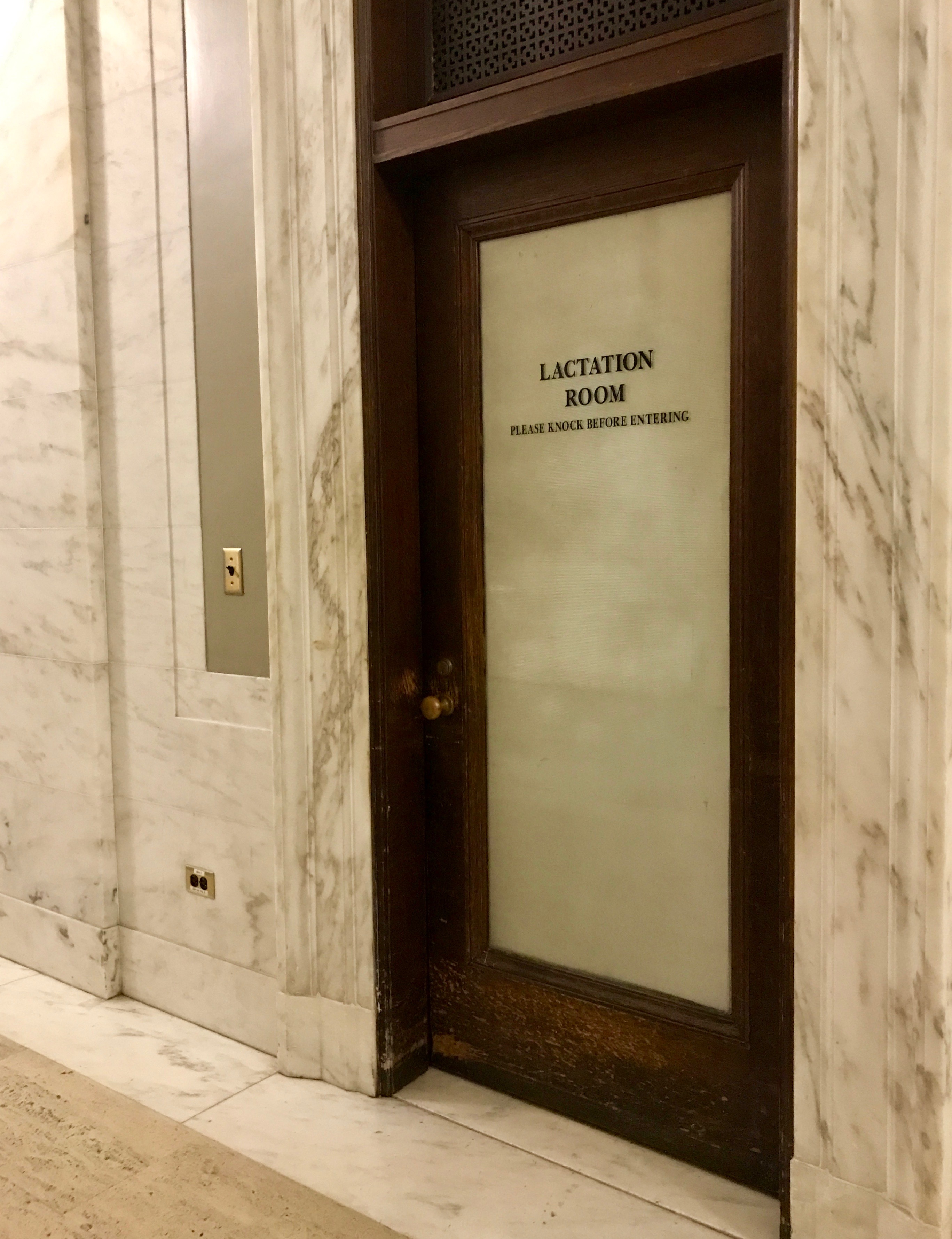
I was impressed that they had a lactation room. Nursing mothers don’t need to hide in the bathroom.
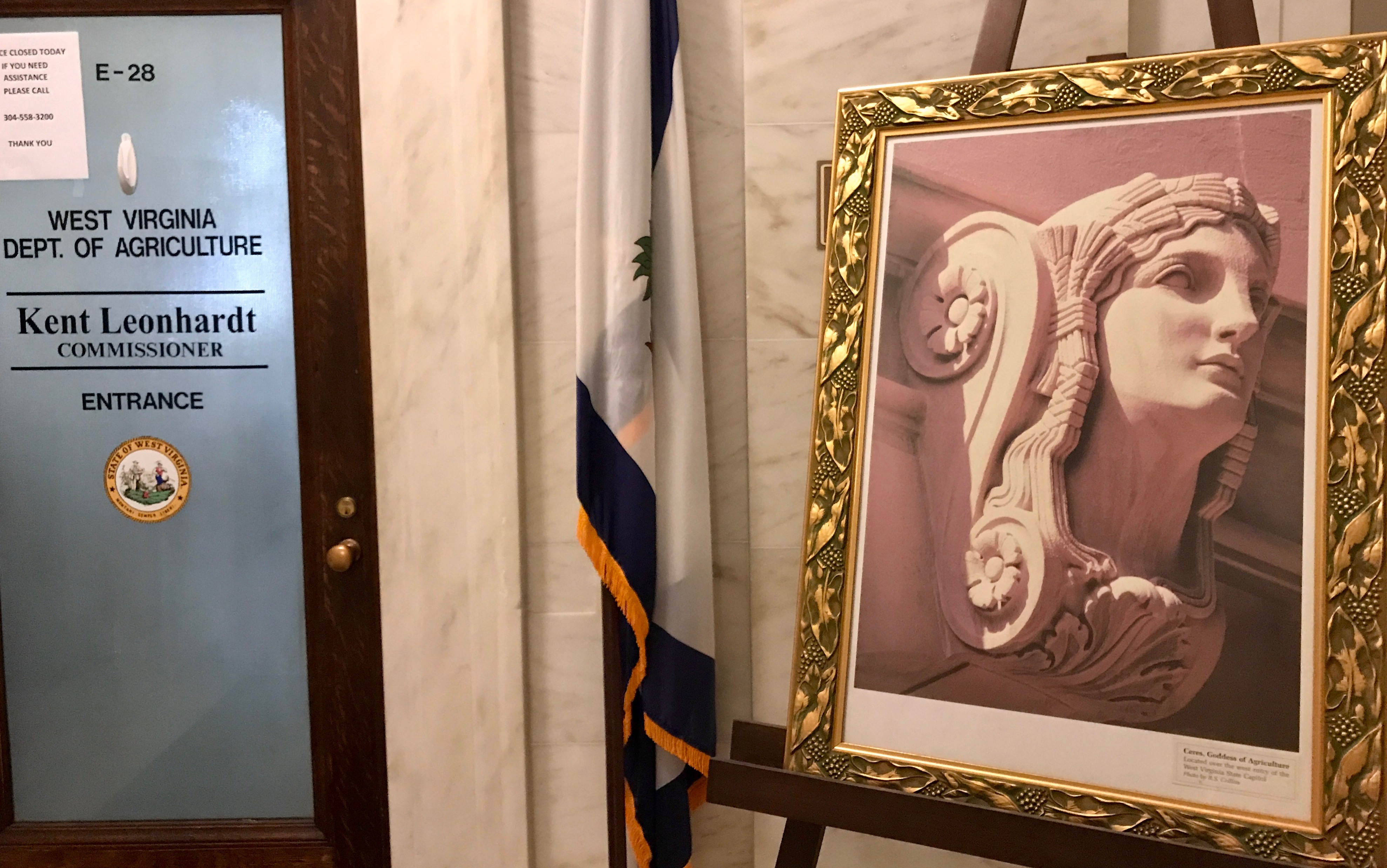
Ceres, the Goddess of Agriculture sits outside the door of the Department of Agriculture. The bust is located over the west entry of the capitol.
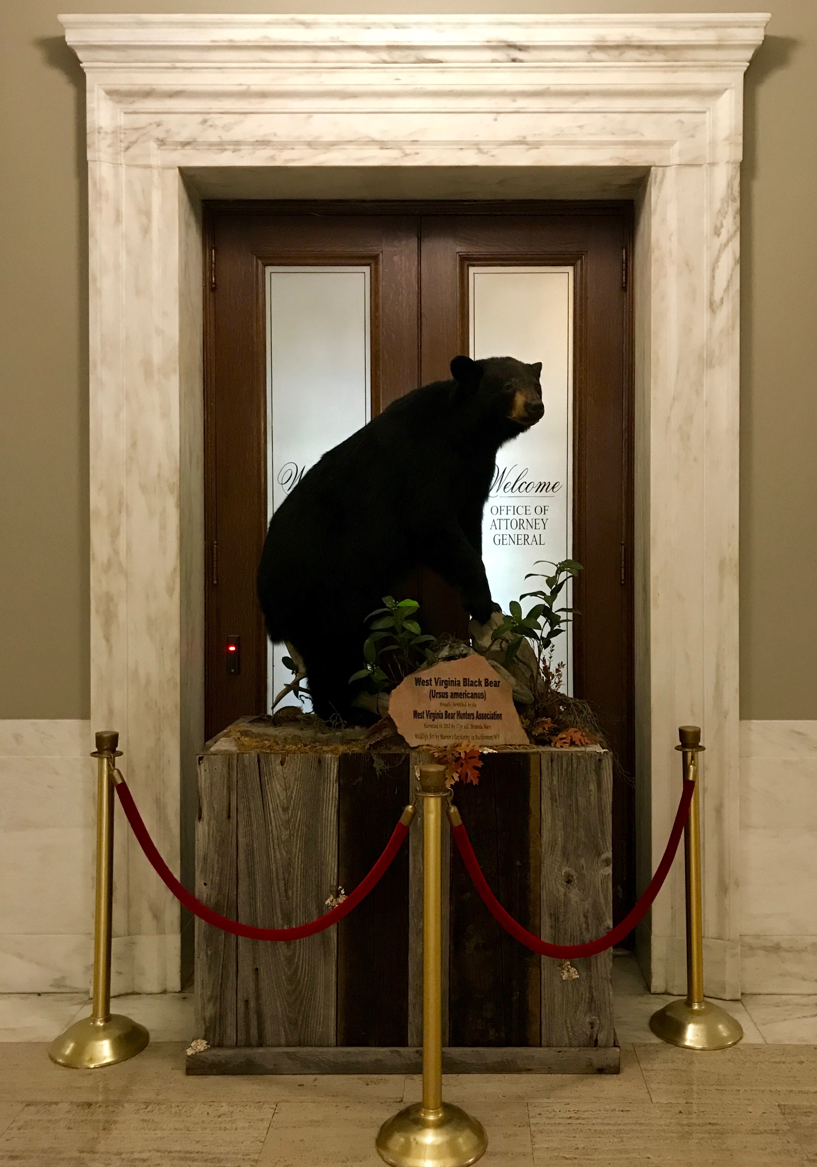
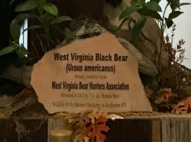
This large bear was guarding the door to the Attorney General’s office. I don’t know that a large black bear in front of the door goes with the sign that says “Welcome to the office of the Attorney General.” The red velvet ropes don’t help, either.
I guess they have associations for everything!
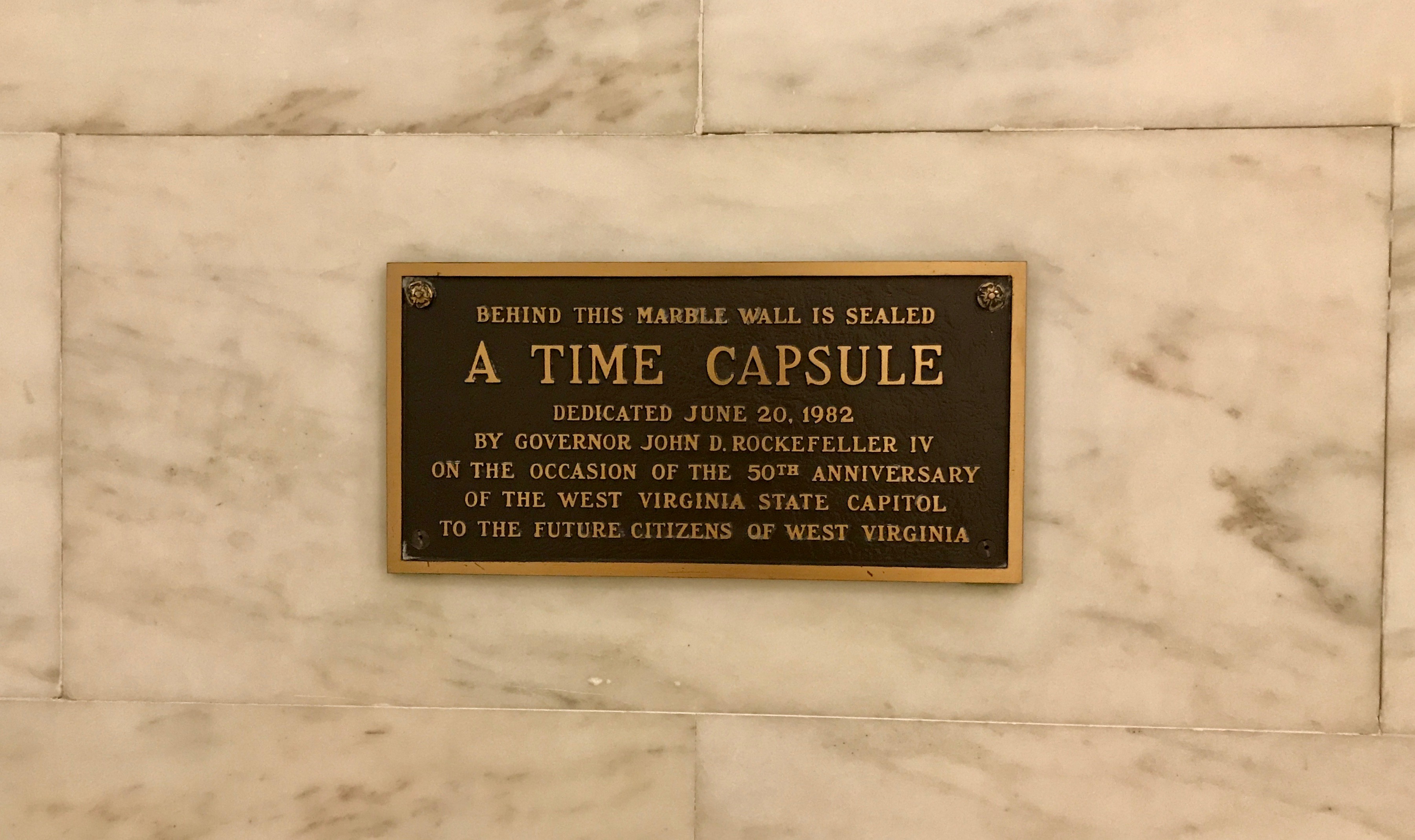
This is an interesting approach to a time capsule. In the first place, it’s in an obvious place that is clearly labeled. In the second place, it looks like they have left the date of its opening to TBD.
The tour finally began, and we walked through the hallowed halls.
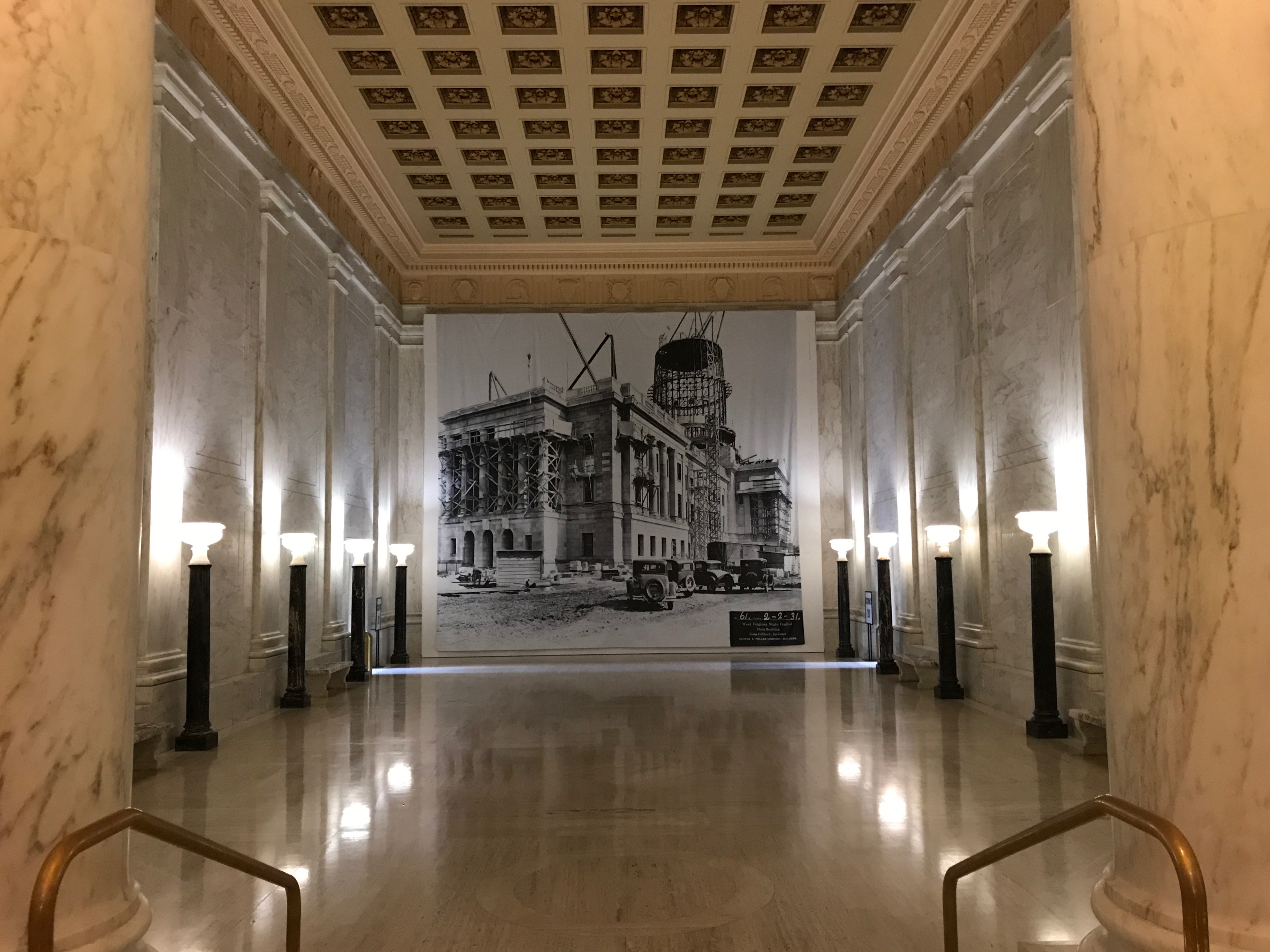
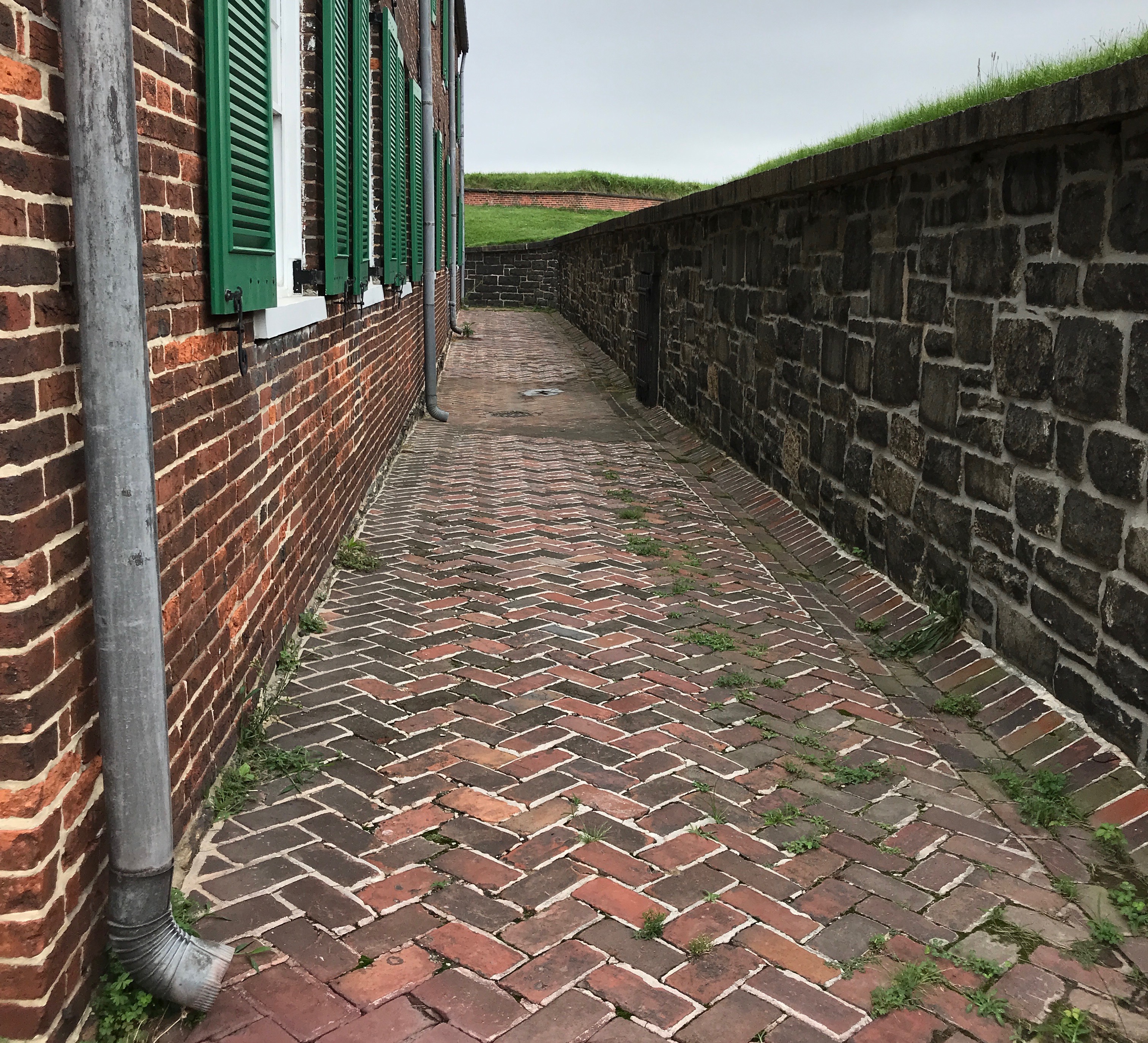
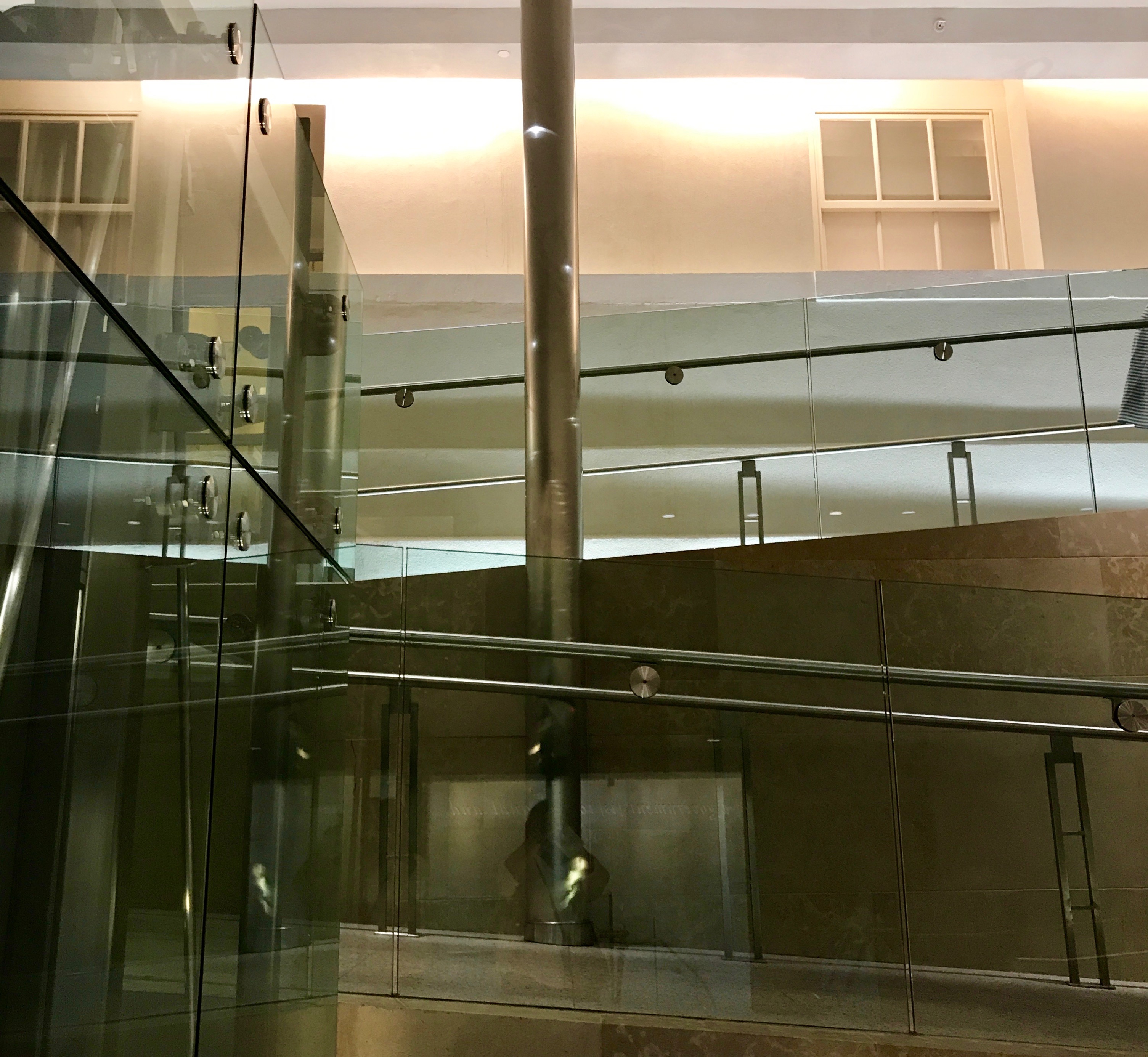
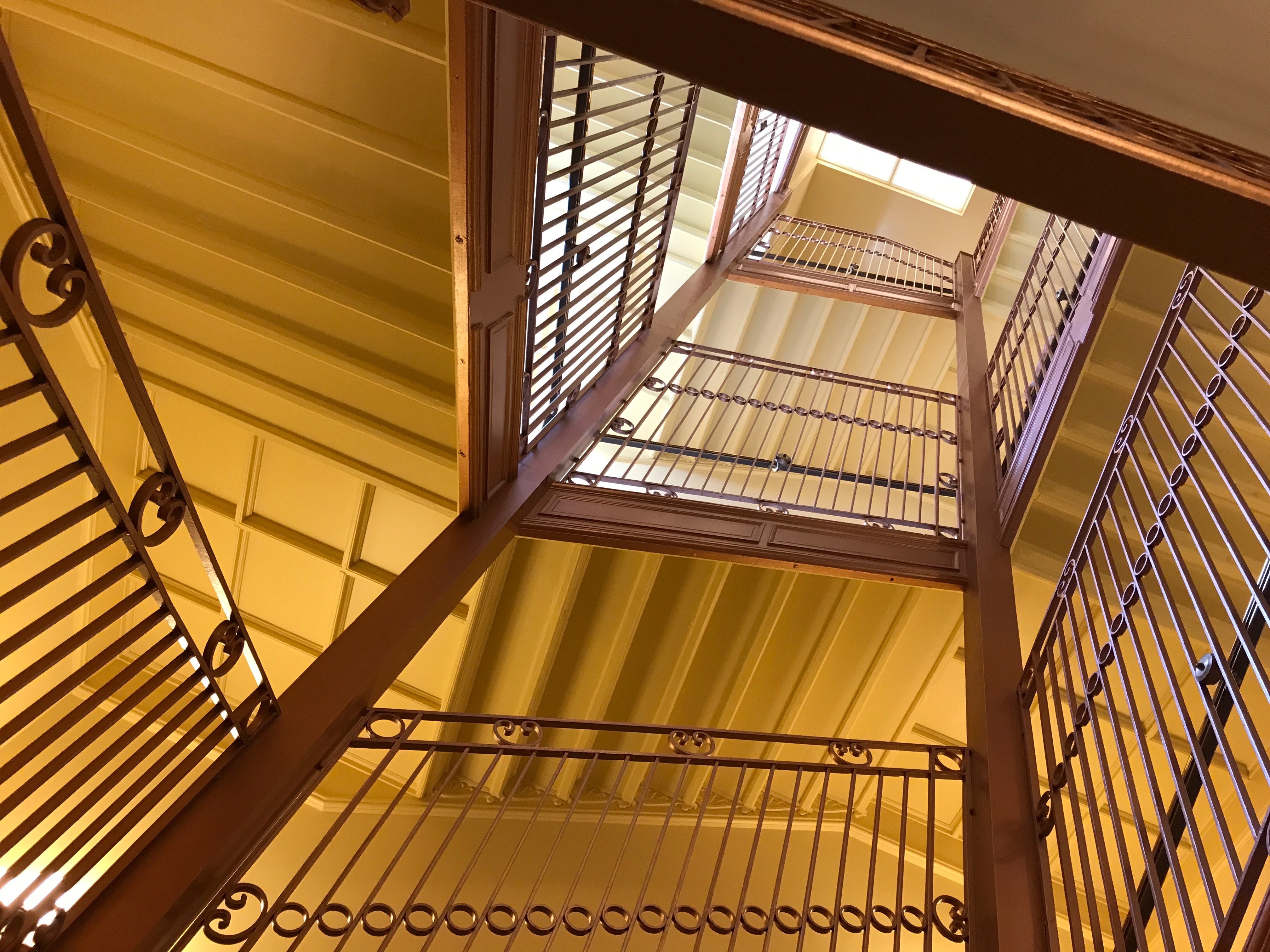
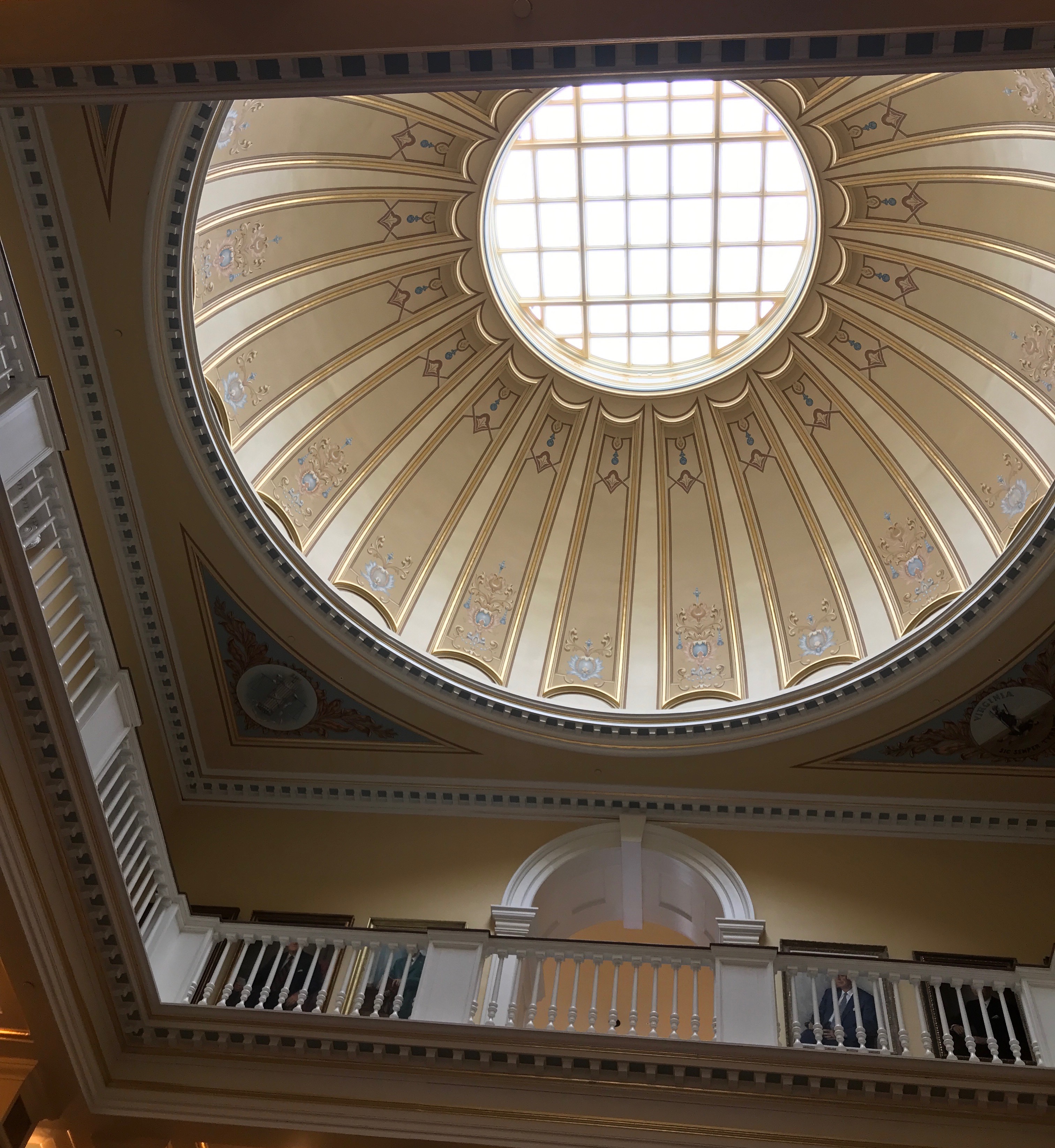
I don’t mean to be pessimistic, but if there is something I would like to see there seems to be at least a 50/50 chance that something will impede the visit. Places are usually closed, but in this case, the building seemed to be undergoing extensive renovations. I must say that they did a marvelous job of enclosing the rotunda area. If you weren’t hoping to gaze up into the dome, you might think it was supposed to look like this.
Dimensions and facts for West Virginia Capitol building[14]
Measurements
Height of dome
292 ft (89.0 m)
Diameter of dome
75 ft (22.9 m)
Floor Space
525,000 sq ft (48,774.1 m2)
Weight of chandelier in dome
4,000 lb (1,810 kg)
Weight of individual bronze doors on each porticoe
2,800 lb (1,270 kg)
Height of eagle on top of dome
5 ft (1.5 m)
I mean, according to this chart of fun facts from my Preferred Source about the capitol, the chandelier in the dome weighs two tons. That must be some lighting fixture!
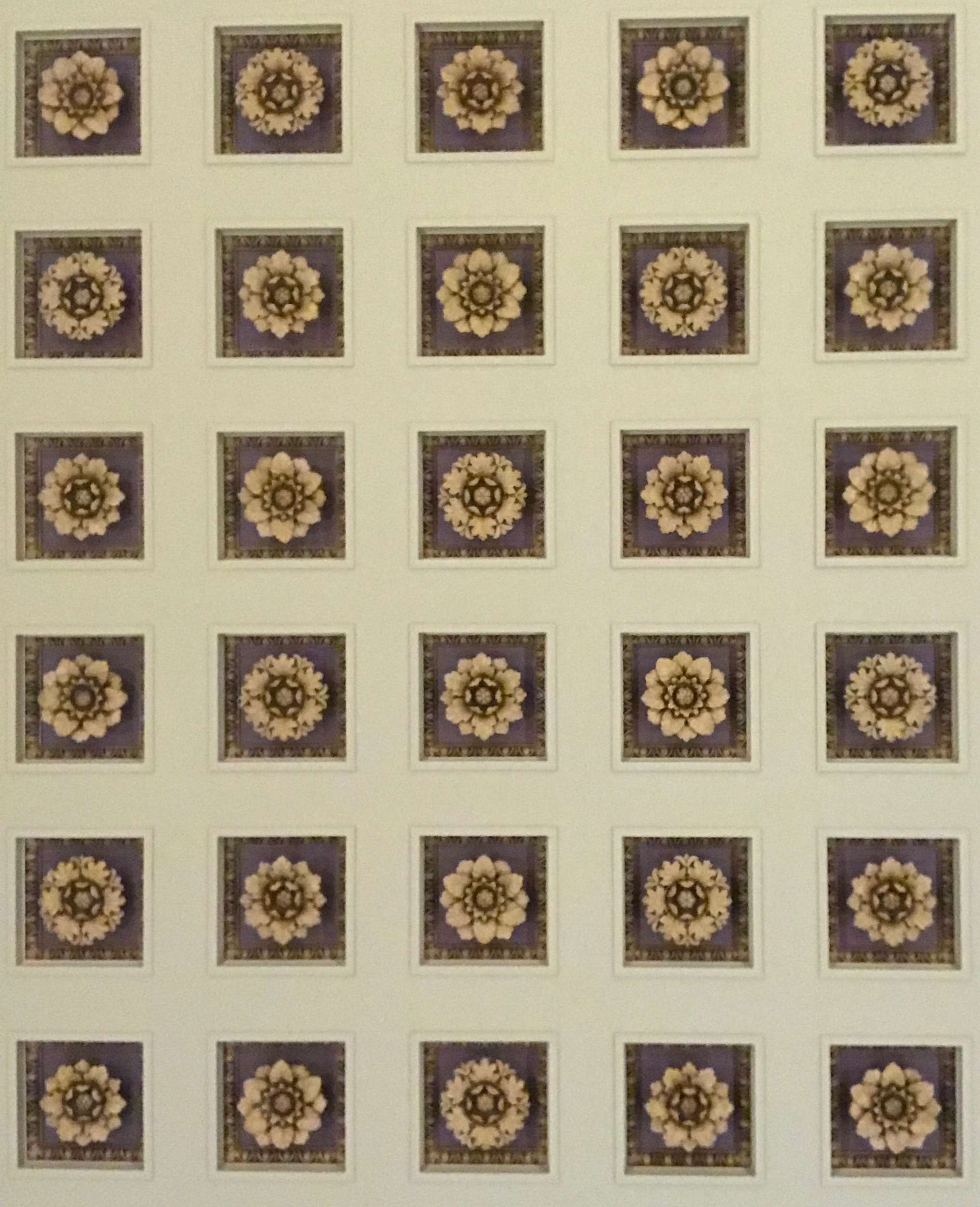
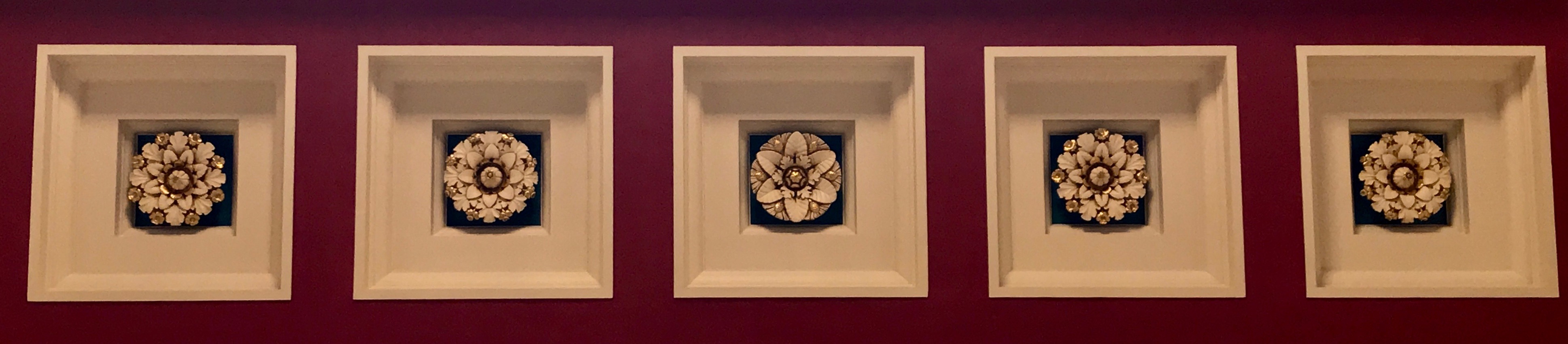
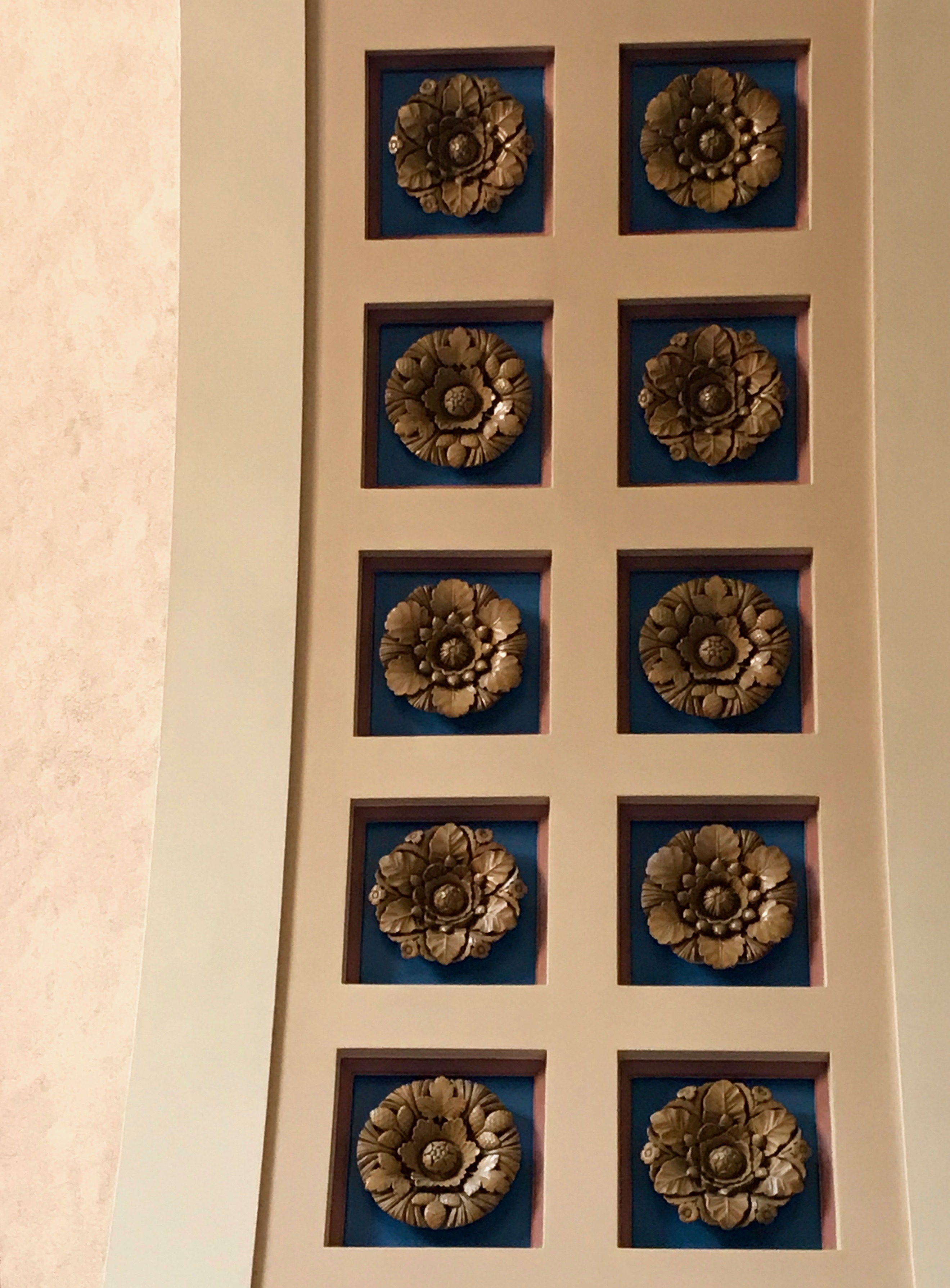
I have seen a good number of state capitols by this point, so I may be wrong on some of the details, but I could swear that these flowers that are used as a repeating motif in the building are stylized renditions of each county’s official flower. However, there is a good chance that I am conflating this capitol with another one.
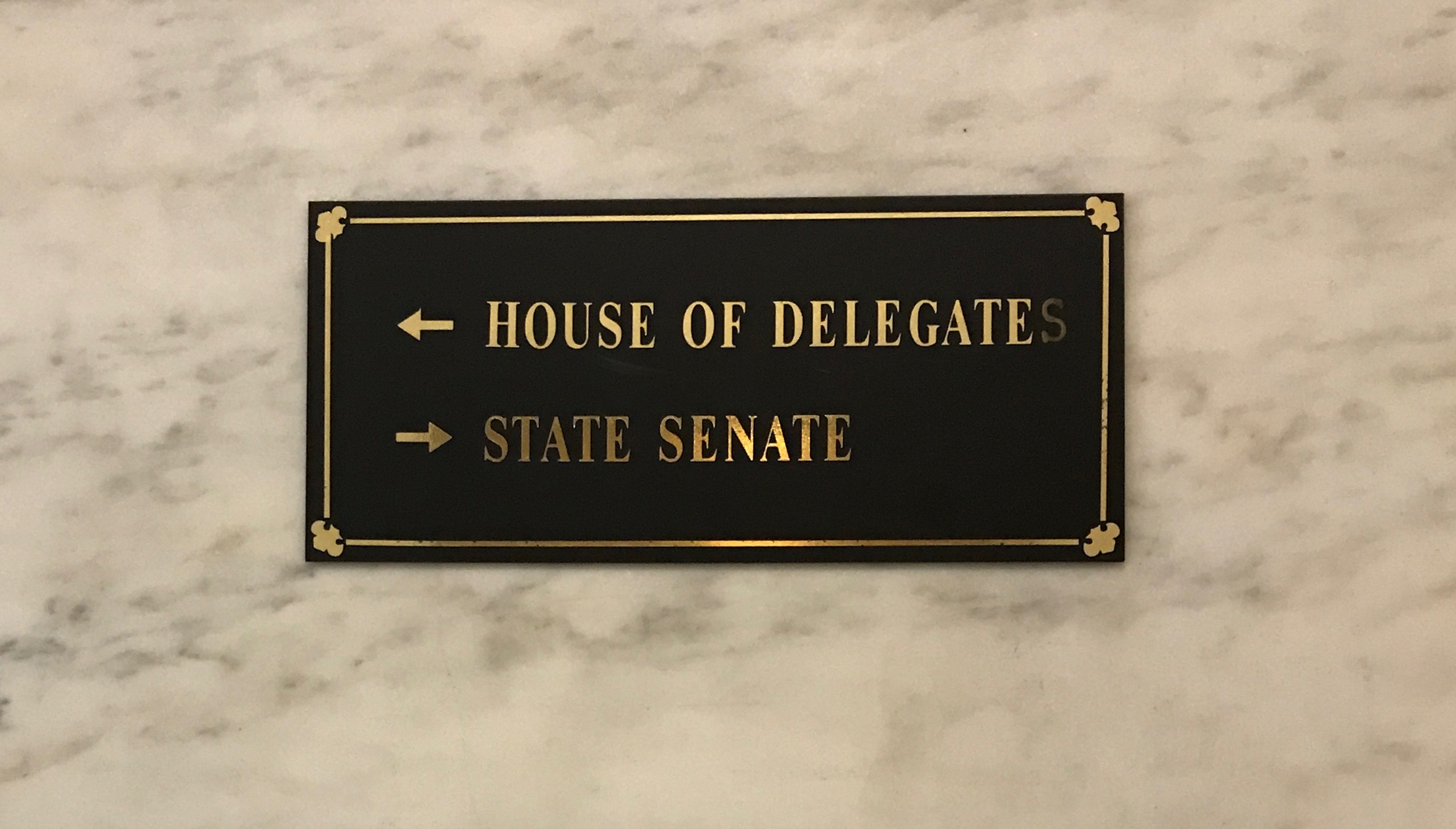
Hmm…which way should we go?
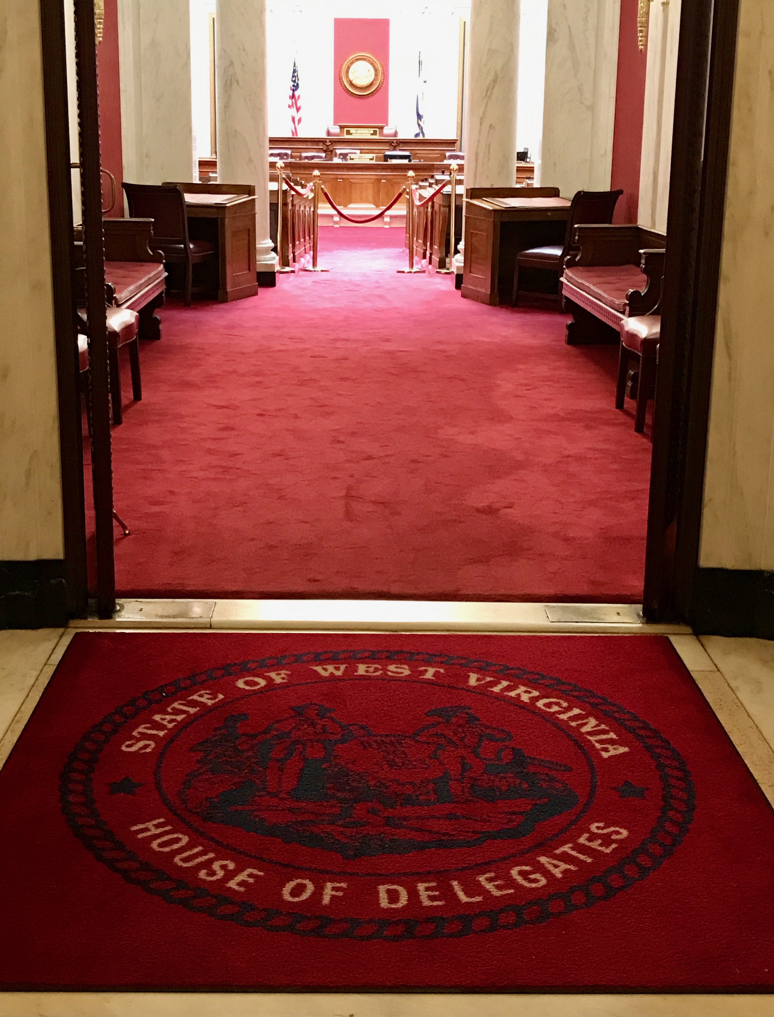
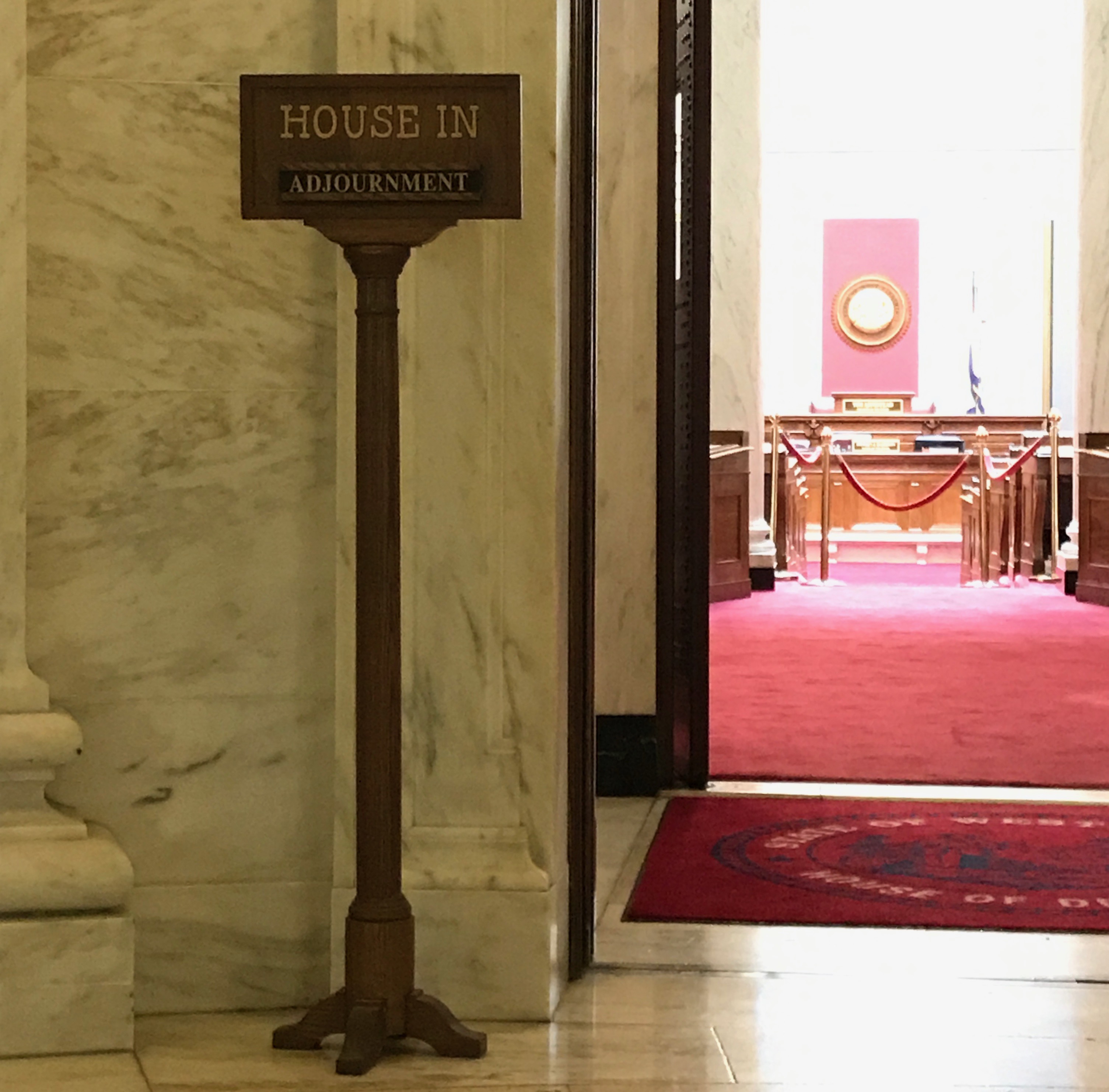
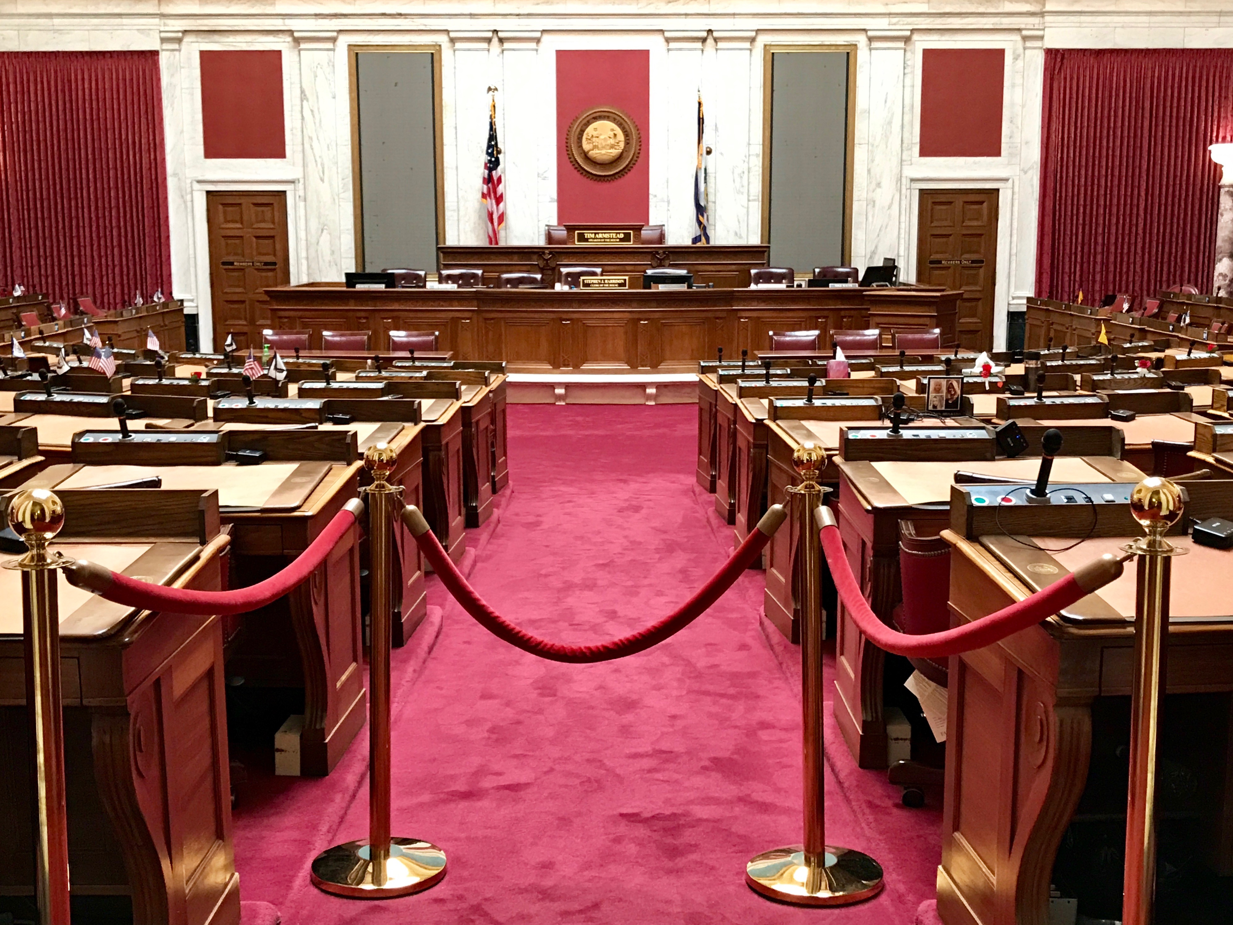
I guess we’ll go to the House of Delegates.
They are in adjournment. I don’t suppose they will mind us peeking in.
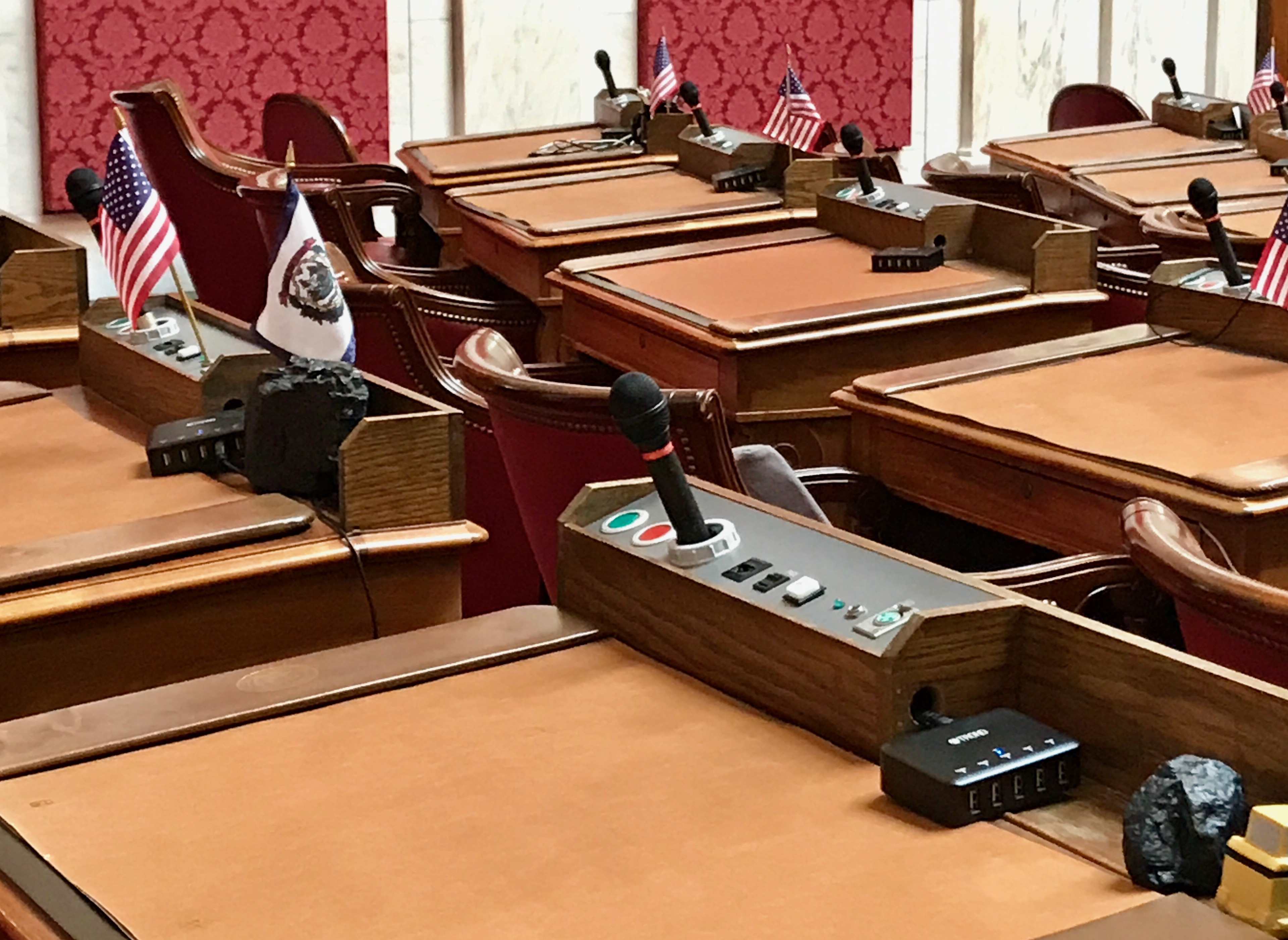
The desks seem rather high tech, as would befit our modern age.
Did you happen to notice the lumps of coal on some of the members’ desks? They need to remember who their sponsors are, I suppose.
Here are some more of those repeated floral motifs.
If I ordered my photos correctly when I put them in the folder, this hall or reception area is outside the chamber. That enormous photo isn’t usually there. It is hiding some of the renovation work being done. I am really impressed with the quality of their enclosures.
I mean, this even adds to the experience. This is what is being worked on. From the old vehicles and the date on the photo, you can almost cut them some slack. 80 years later, the building is bound to need some updating.
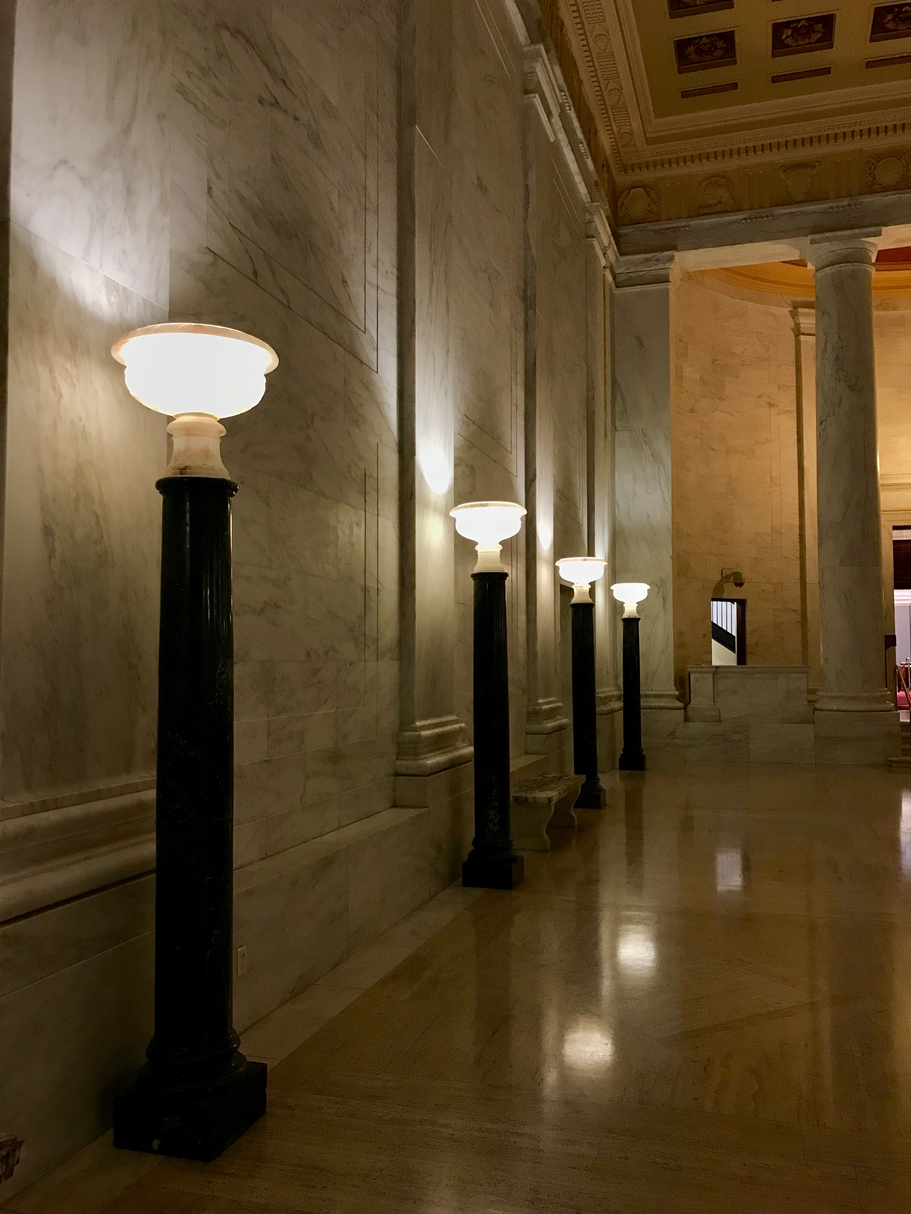
The row of torchieres lining the hall lends an elegant air to the building.
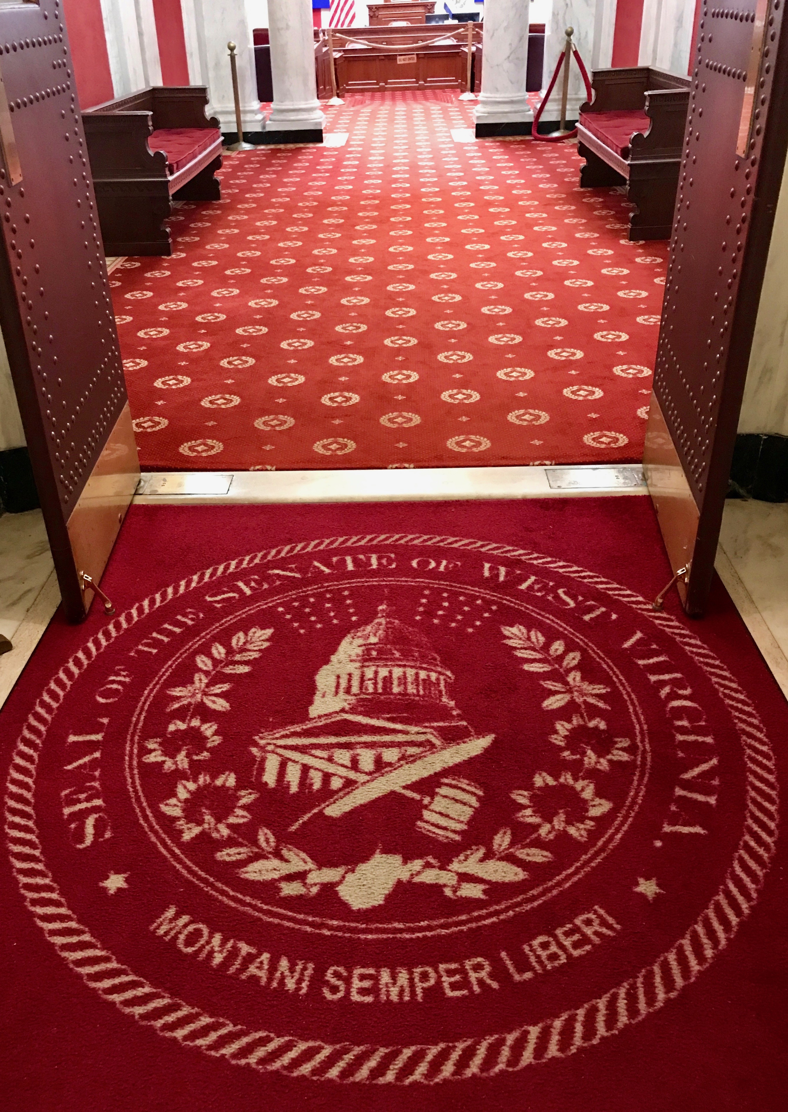
On to the Senate.
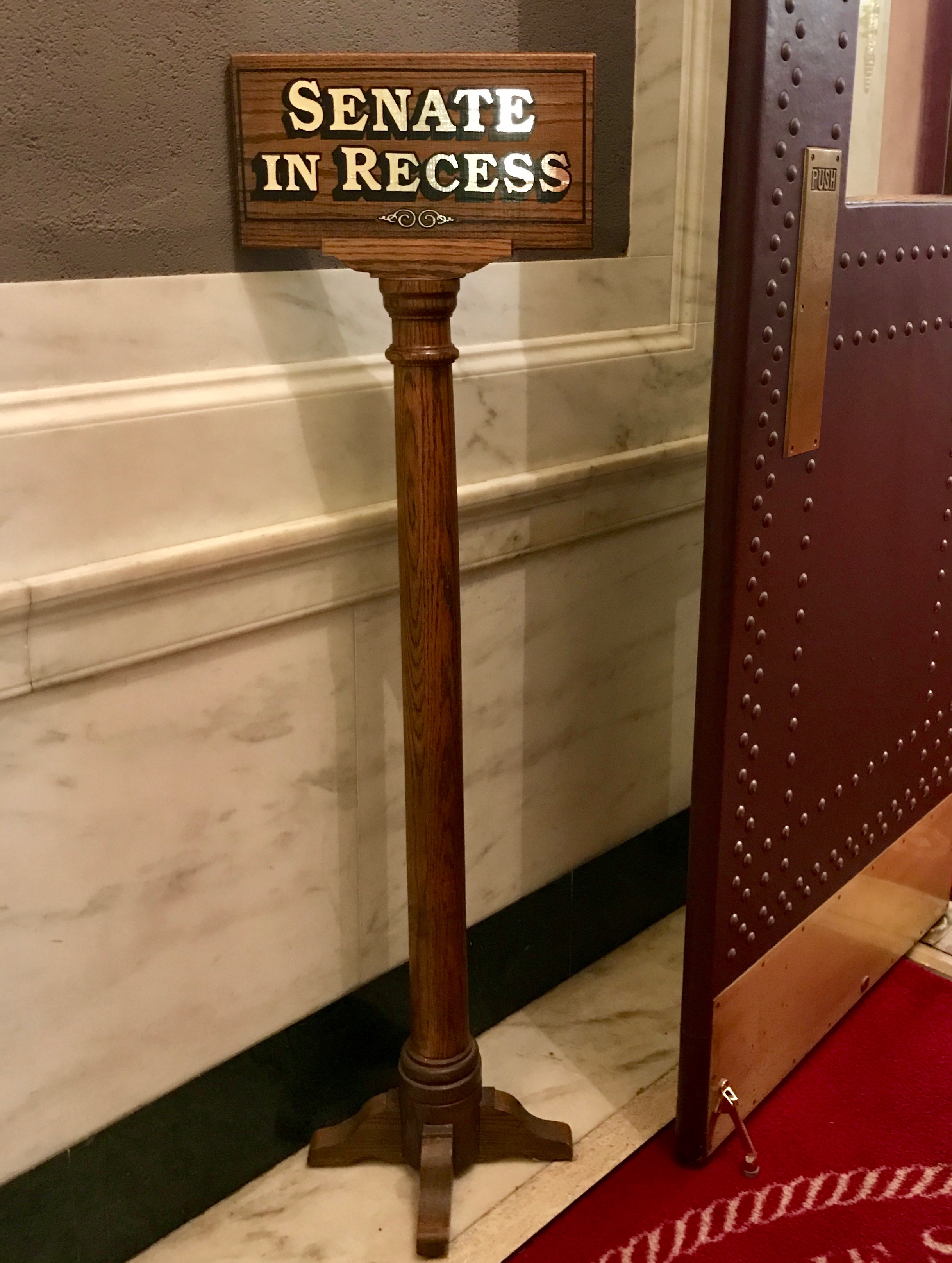
The Senate is in Recess. How odd…I didn’t notice any playgrounds on the campus. (A bit of retired schoolmarm humor, there.)
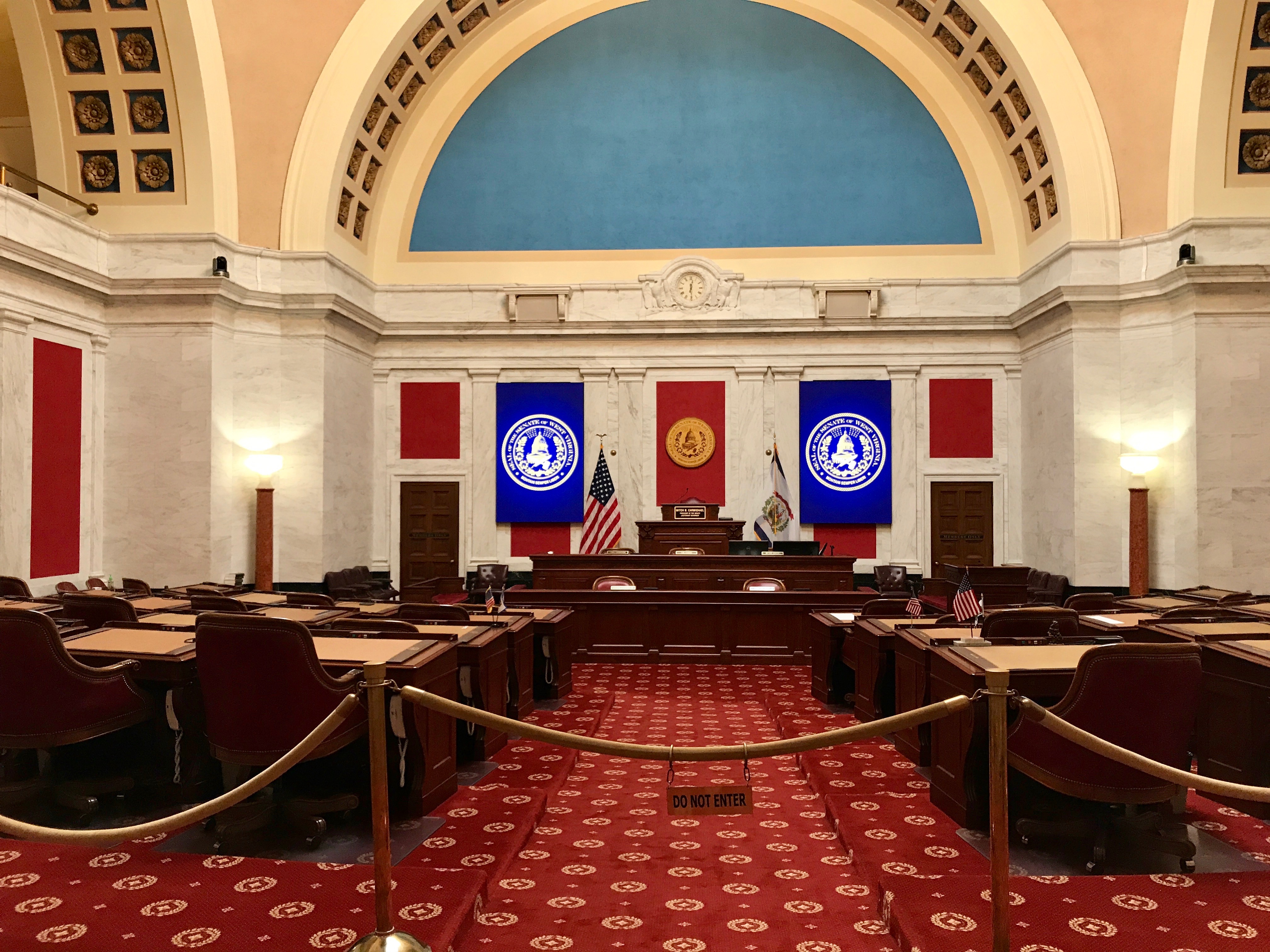
When they are in session, this is where they sit.
They had an elegant dome in their chamber. (If the House of Delegates had a dome, I missed taking a photo of it.)
Here are some more of those stylized flowers.
With that, the tour was complete. I had places to go, so I bid adieu to Charleston, West Virginia and continued on my way to Cincinnati.
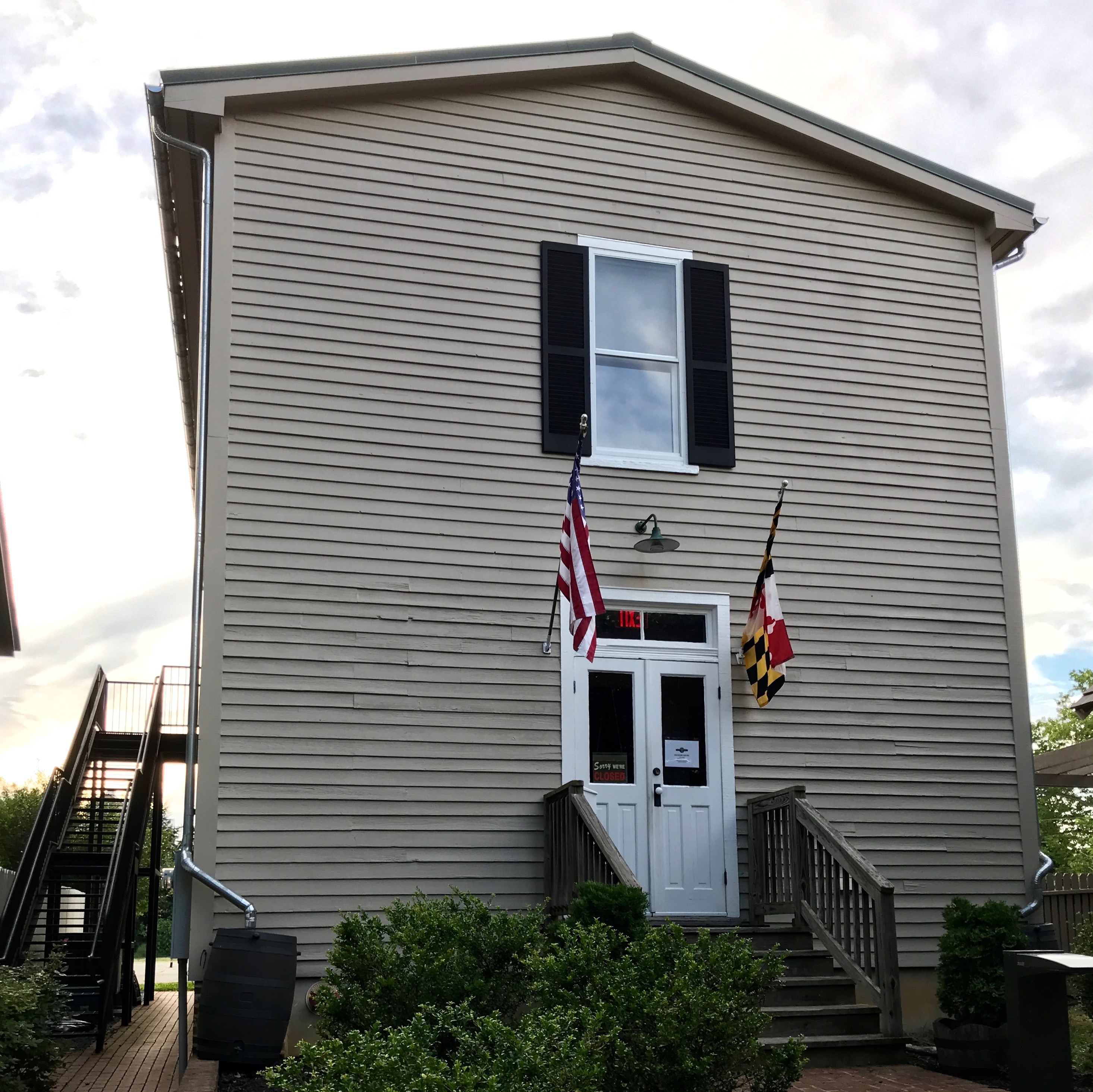
Another weekend rolled around and I found myself in Maryland, somewhere northeast of Baltimore. I found a chain hotel at an interchange and settled in there for a few days of rest and relaxation.
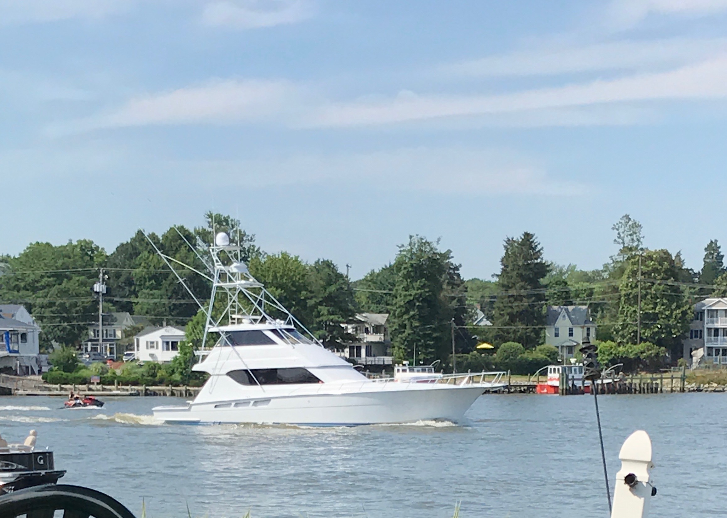
Of course, you know how I relax. After a week of driving in circles, I jump in the car and drive somewhere. This time, I headed to Havre de Grace.
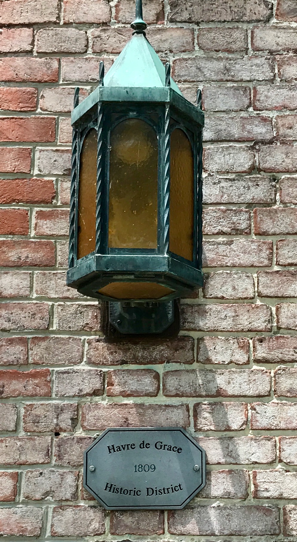
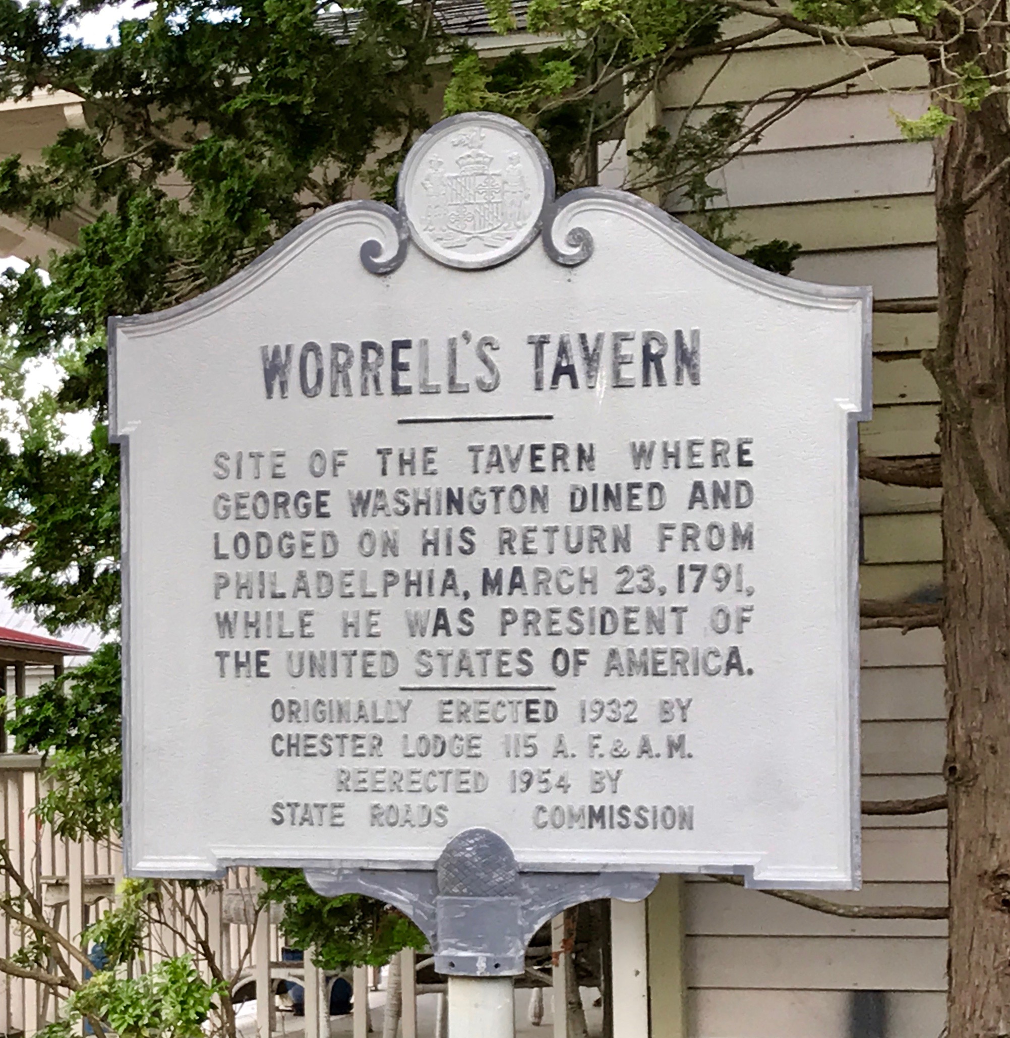
Havre de Grace is an old town – or, should that be Ye Olde Towne? According to my Preferred Source, General Lafayette visited the small hamlet known as Harmer’s Town several times during the Revolutionary War. He is reputed to have said that it area reminded him of the European seaport of Le Havre, which was originally named Le Havre-de-Grâce. Inspired by Lafayette’s comments, there residents incorporated the town as Havre de Grace in 1785. Washington stayed overnight in the town in 1789 on the journey to New York City for his first inauguration in 1789.
Fun fact: During the First Congress in 1789, Havre de Grace missed by only one vote being named the capital of the United States. I wonder how the votes fell in the voting? It seems like there were a number of cities that lost out on the honor by only one vote, although I can’t name them at the moment.
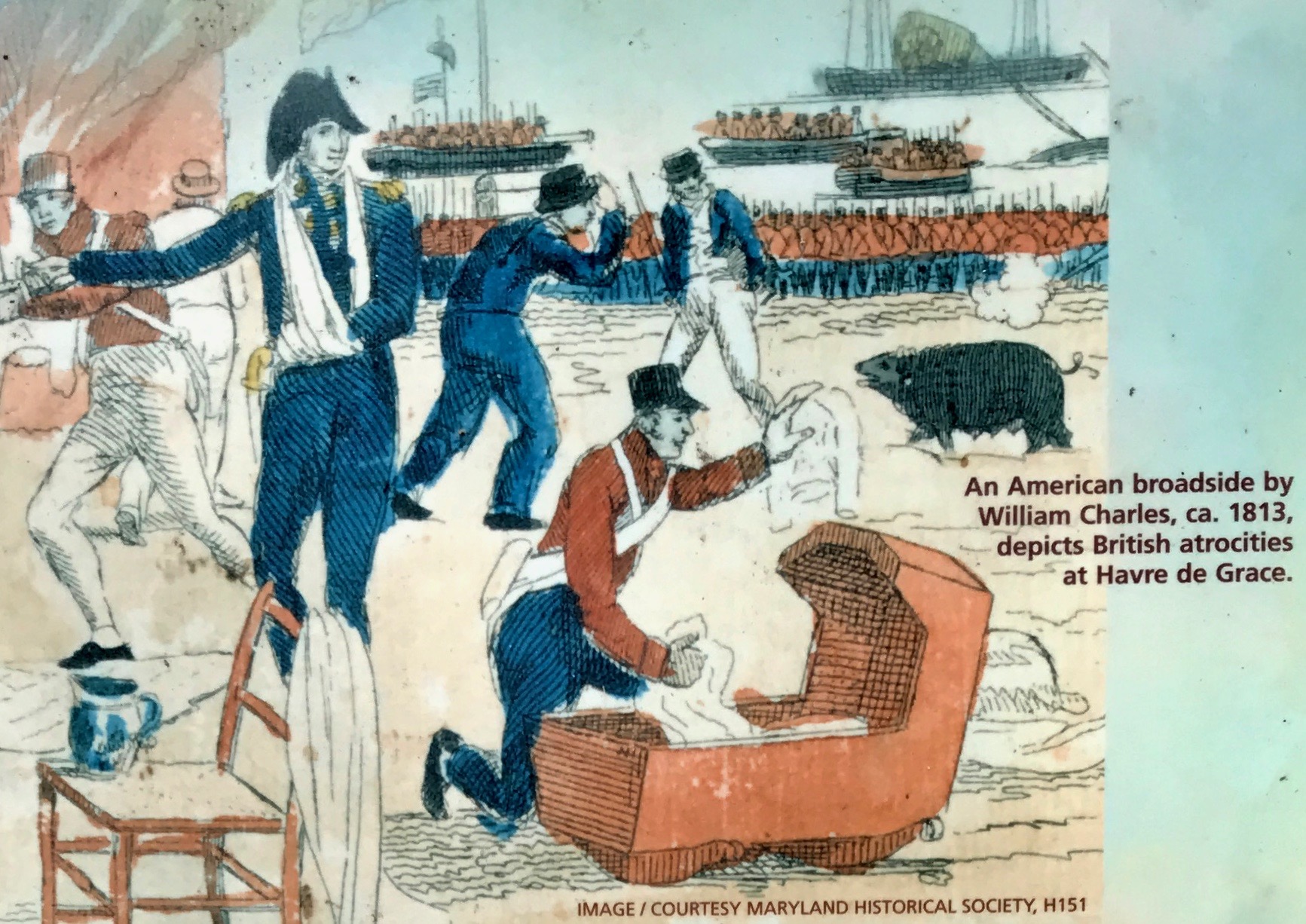
The bit of history that surprised me about Havre de Grace was the attack by the British during the War of 1812.
Rear Admiral George Cockburn burned and plundered the city. According to an interpretive sign I saw along the way, first person accounts of the devastation at Havre de Grace fueled newspaper reports of “wanton barbarity among civilized people.” Cockburn, portrayed as a villainous “violator of all laws, human [and] divine,” struck terror as he made an example of Havre de Grace for other towns.
The American Lieutenant John O’Neill single-handedly manned a cannon to help defend the town. O’Neill was wounded and captured by the British, although he was soon released.
CC BY-SA 2.5, https://commons.wikimedia.org/w/index.php?curid=227854
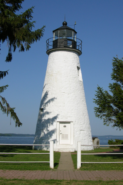
In gratitude for his bravery, Havre de Grace made O’Neill and his descendants hereditary keepers of the Concord Light House, which overlooks the point where the Susquehanna River flows into the Chesapeake Bay.
Kind of makes me wish I had dug a little deeper when I visited the tourist information office. I might have seen some information about the lighthouse. I definitely would have gone to visit it. According to my Preferred Source, it was built in 1827 by John Donahoo, a prolific lighthouse builder who is responsible for many lighthouses in Maryland.
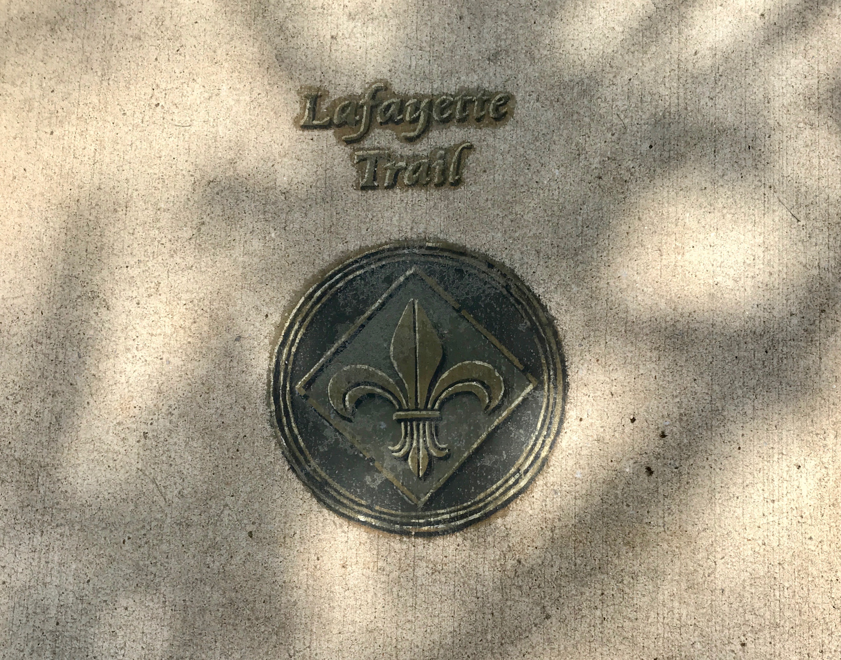
What I did notice was a walking tour, called the Lafayette Trail.
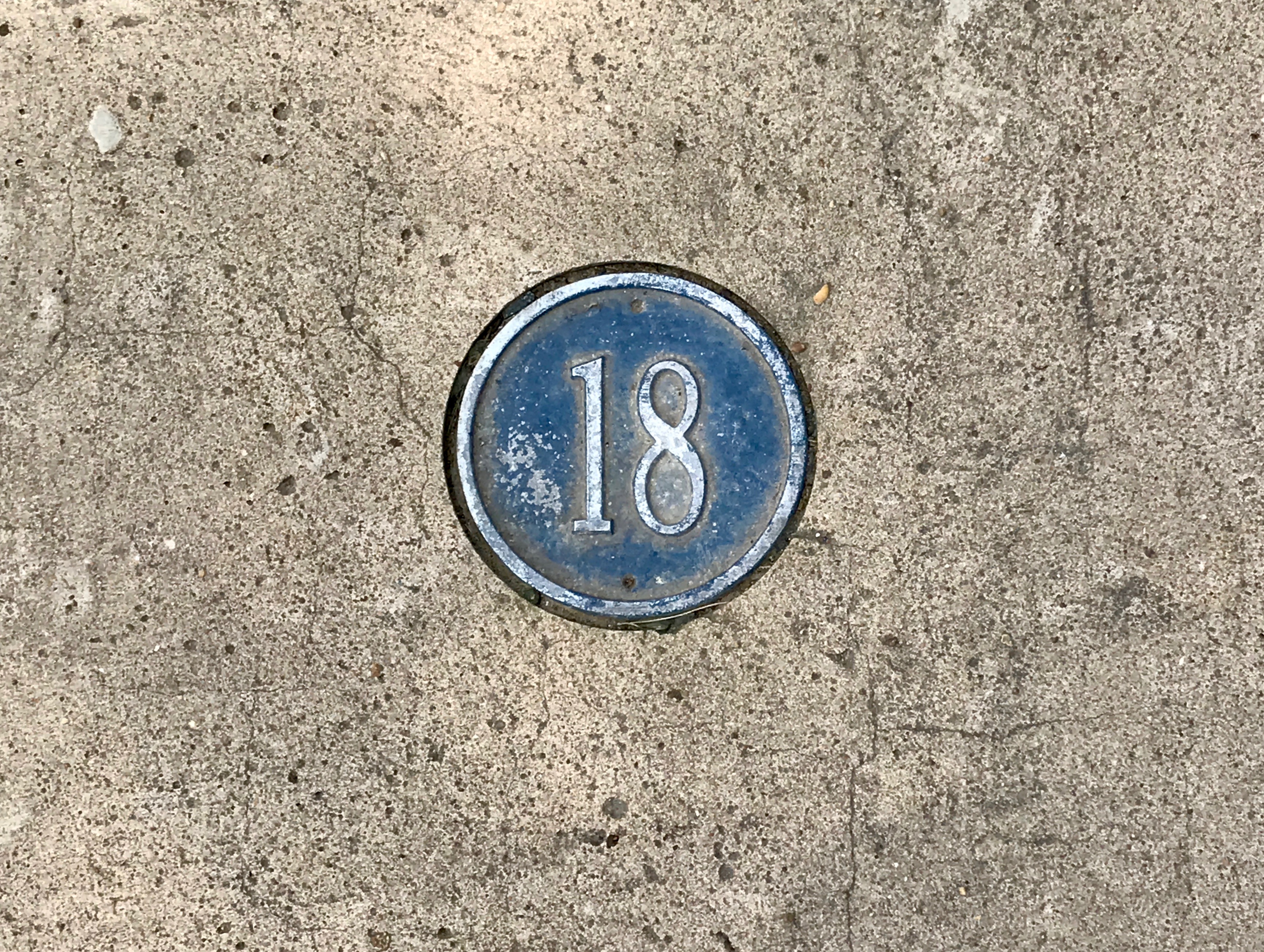
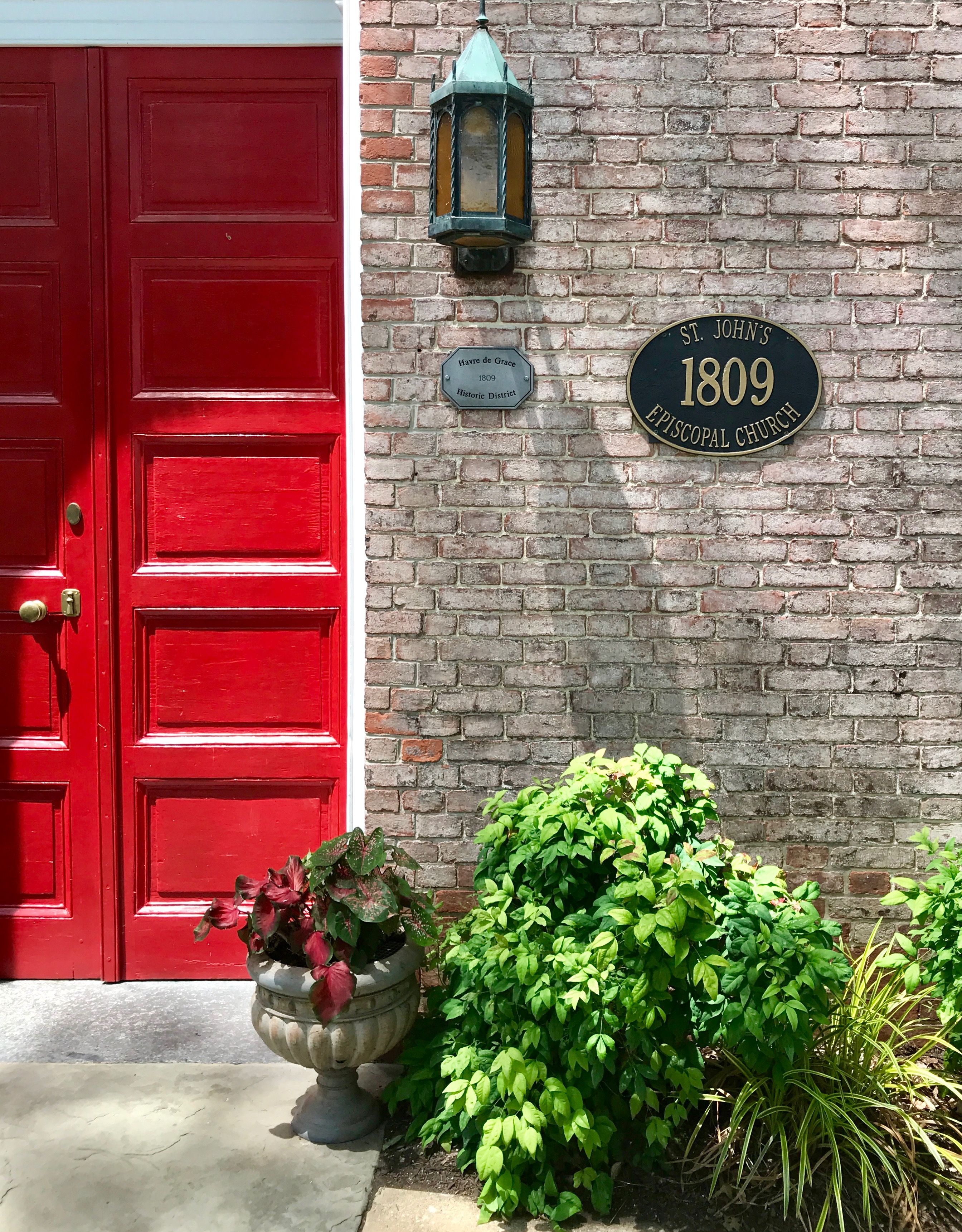
The helpful man in the tourism office gave me a map and I set out to see what I could see. My first stop was number eighteen.
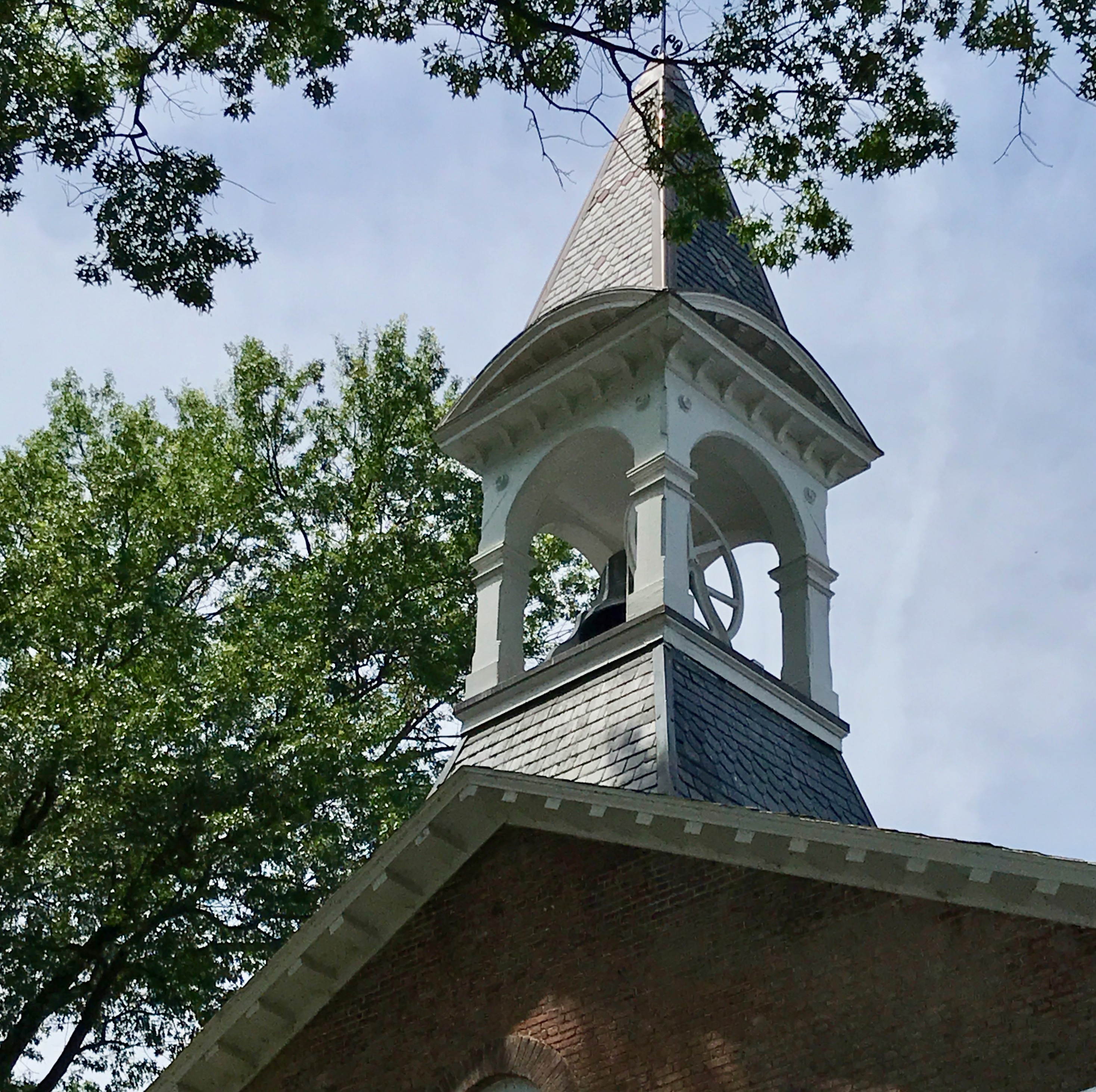
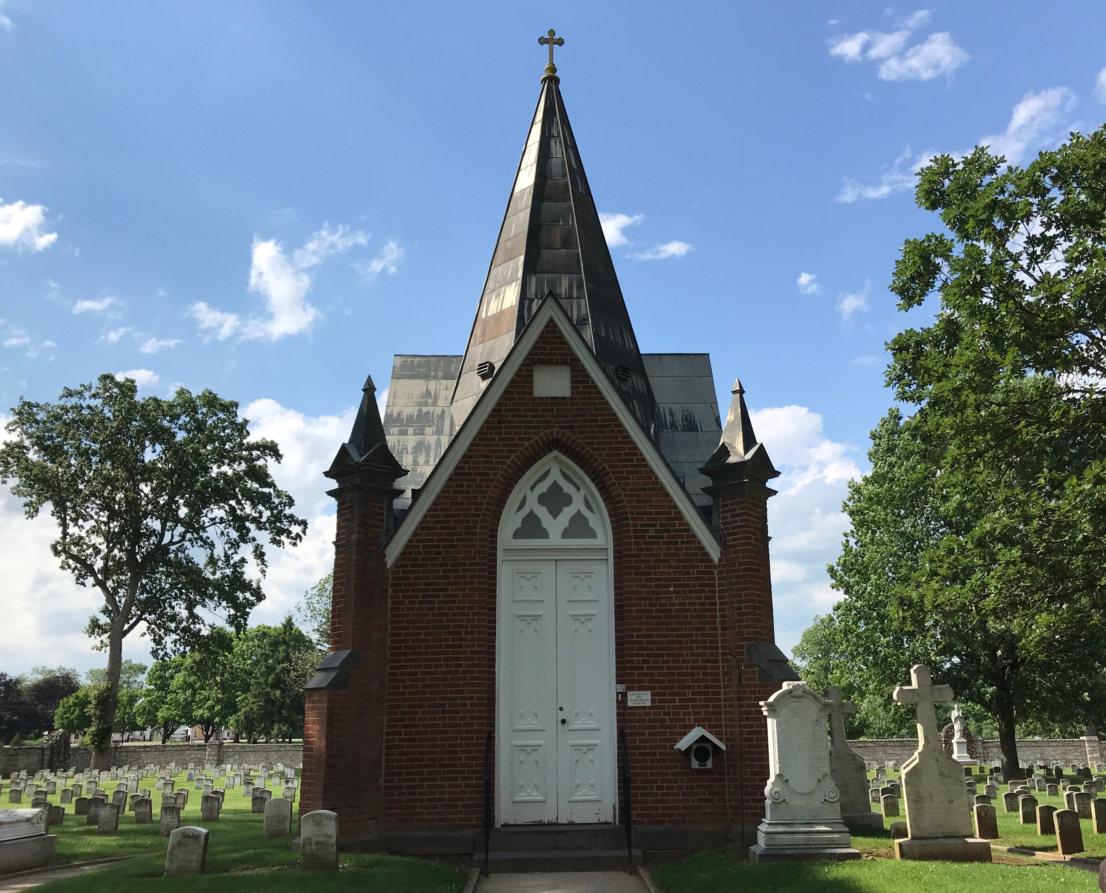
Saint John’s Episcopal Church
St. John’s is Havre de Grace’s oldest church. Financing for the church was through a lottery commissioned in 1802. It was built in 1809, and the church was damaged by the British during the War of 1812. It was gutted by fire in 1832, and changes to the original rectangular building were made in the early 1860s.
A slate roof and belfry were added in the 1880s.
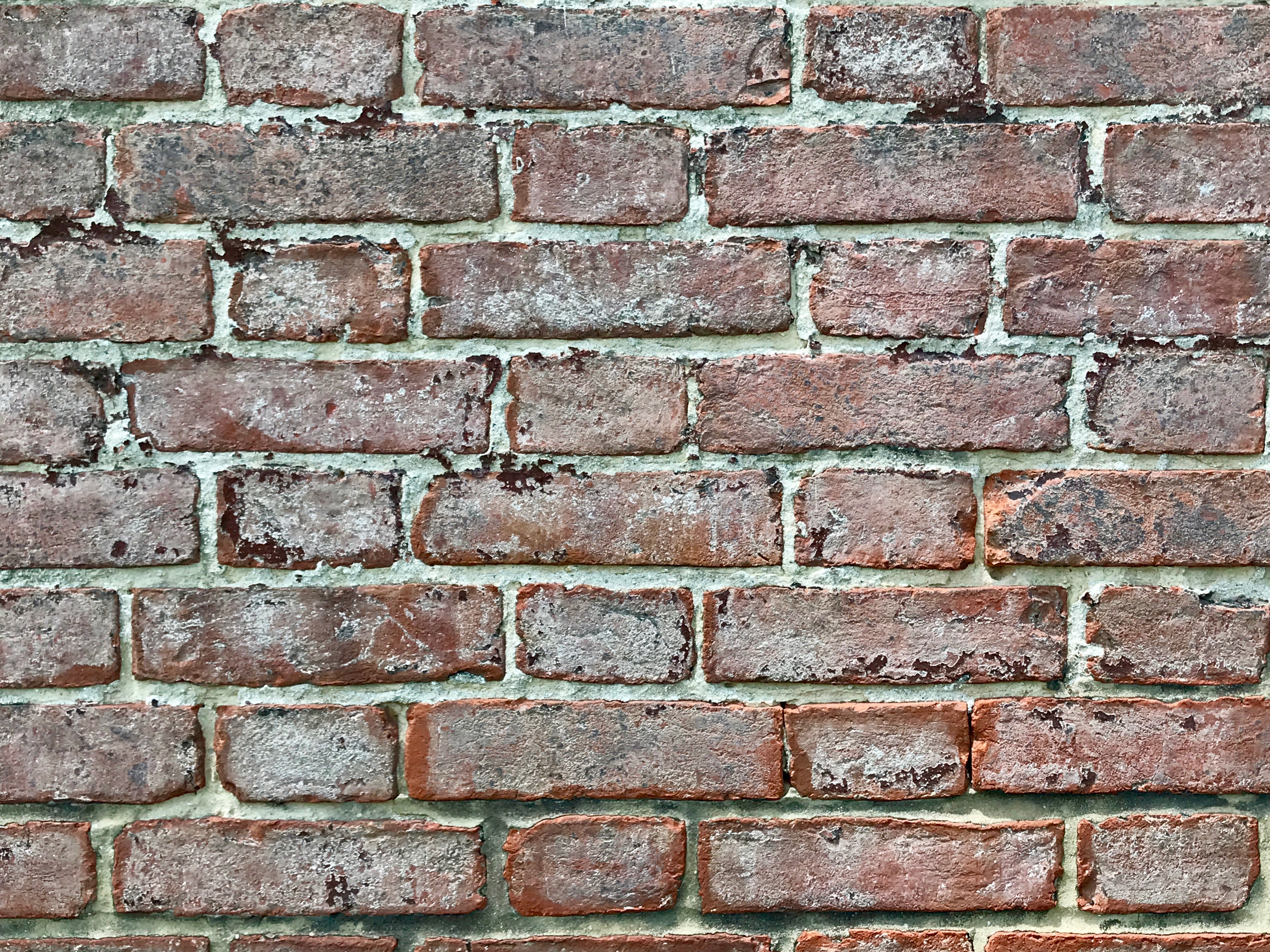
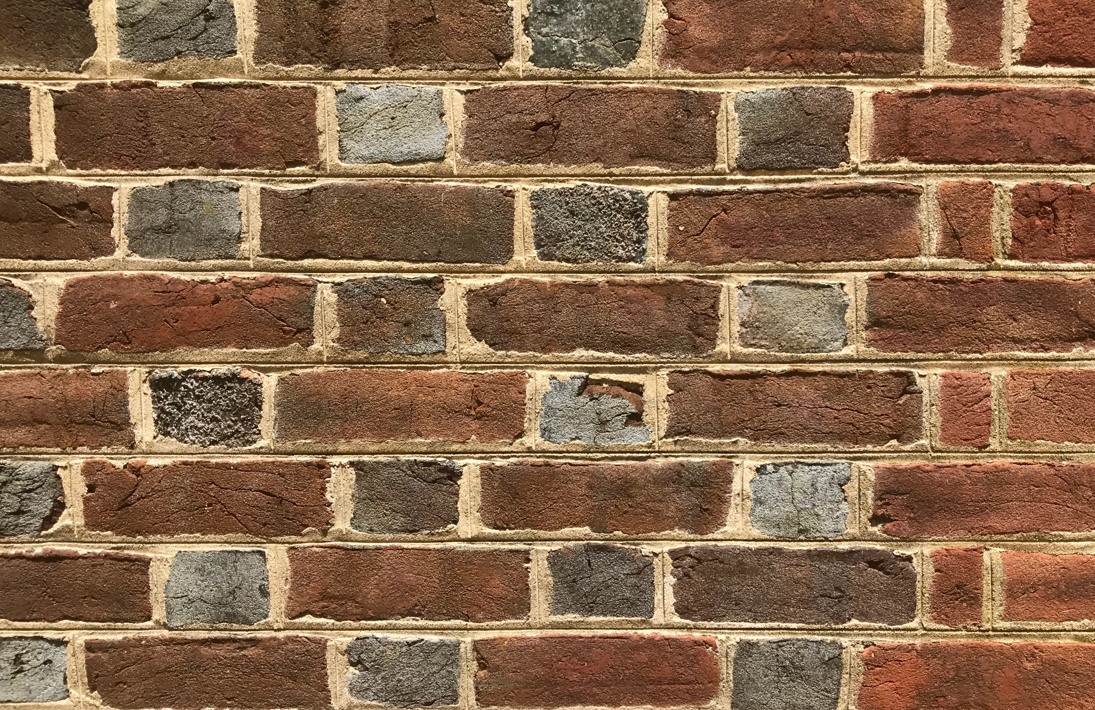
Notice the Flemish bond brick walls.
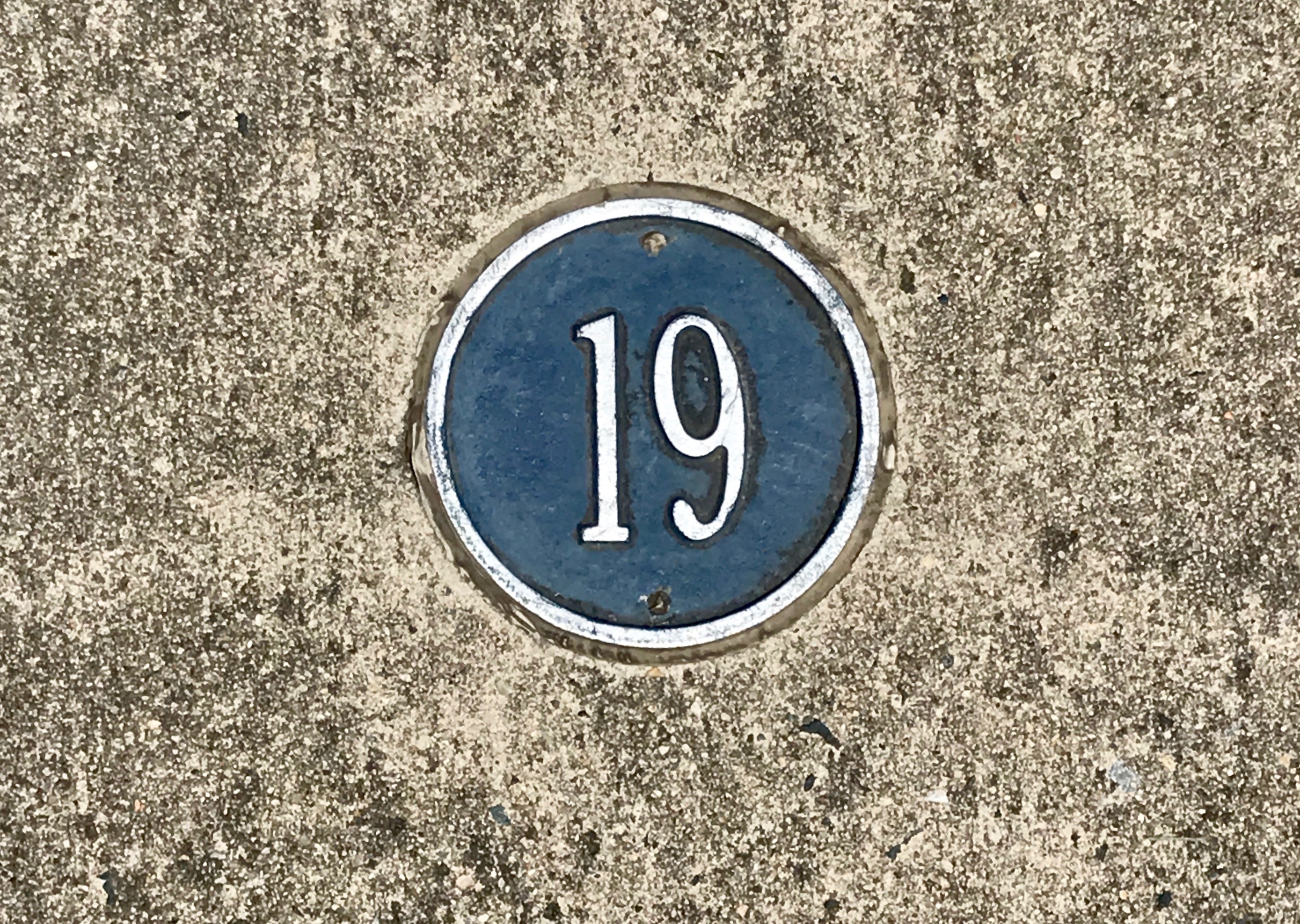
After admiring the exterior, I headed off in search of my next stop. Coming up: number nineteen.
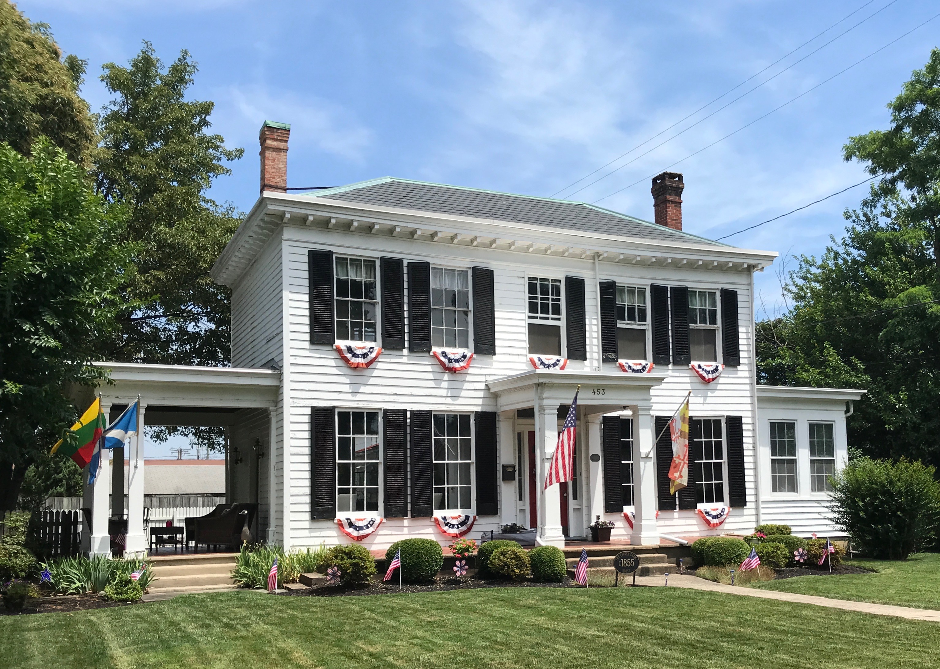
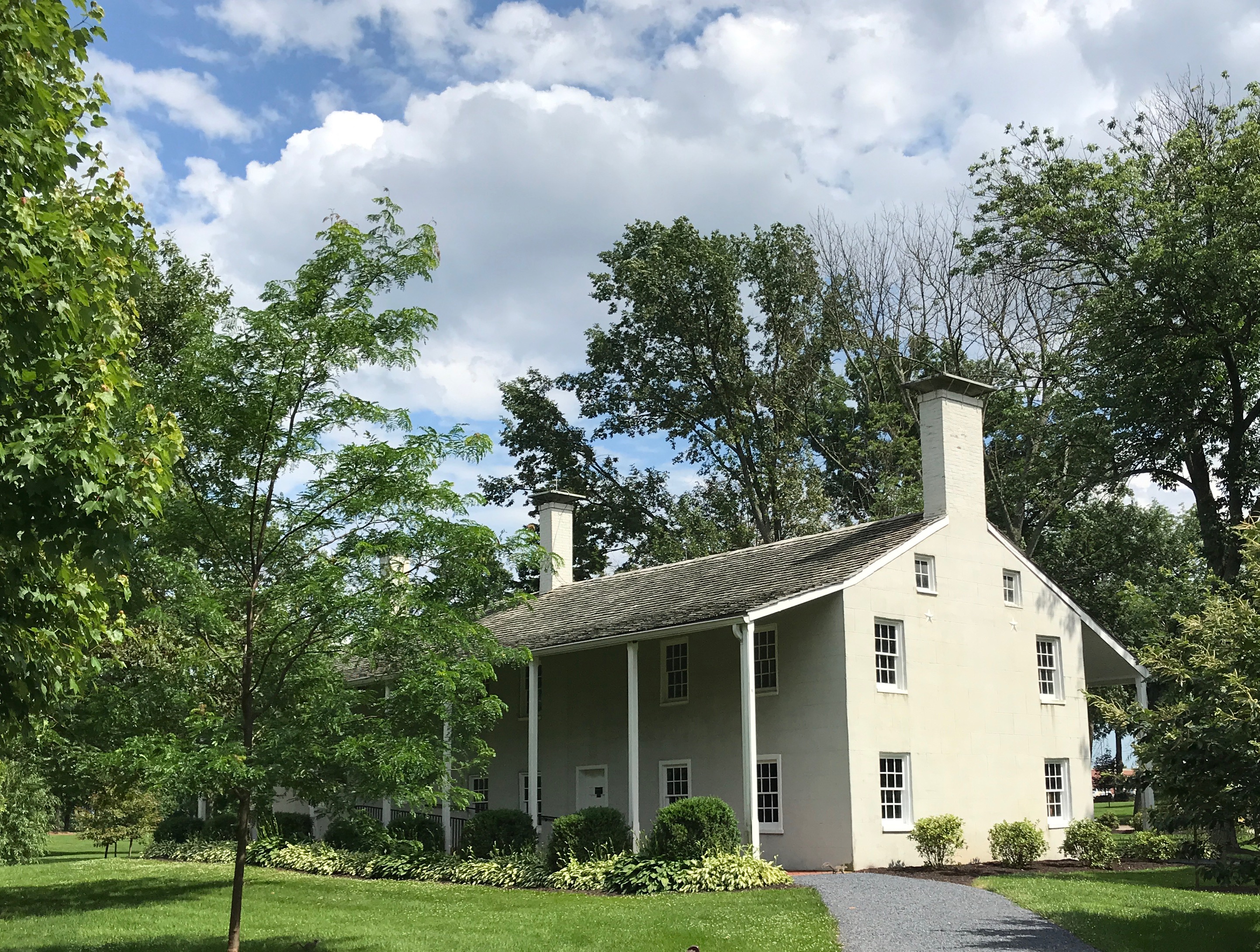
This quietly elegant house is Carver-Craig House, built in 1855.
It is a combination of Greek revival and Italianate styles. It has a slate-covered hip roof with overhanding eaves and a bracketed cornice. A one-bay porch supported by square pillars protects the front entrance. The open porch on the west side and the enclosed porch on the east were added later.
Just in case you were curious, The windows are six feet tall with six-over-six lights. I wonder how much Windex they go through in a year?
On to stop number twenty.
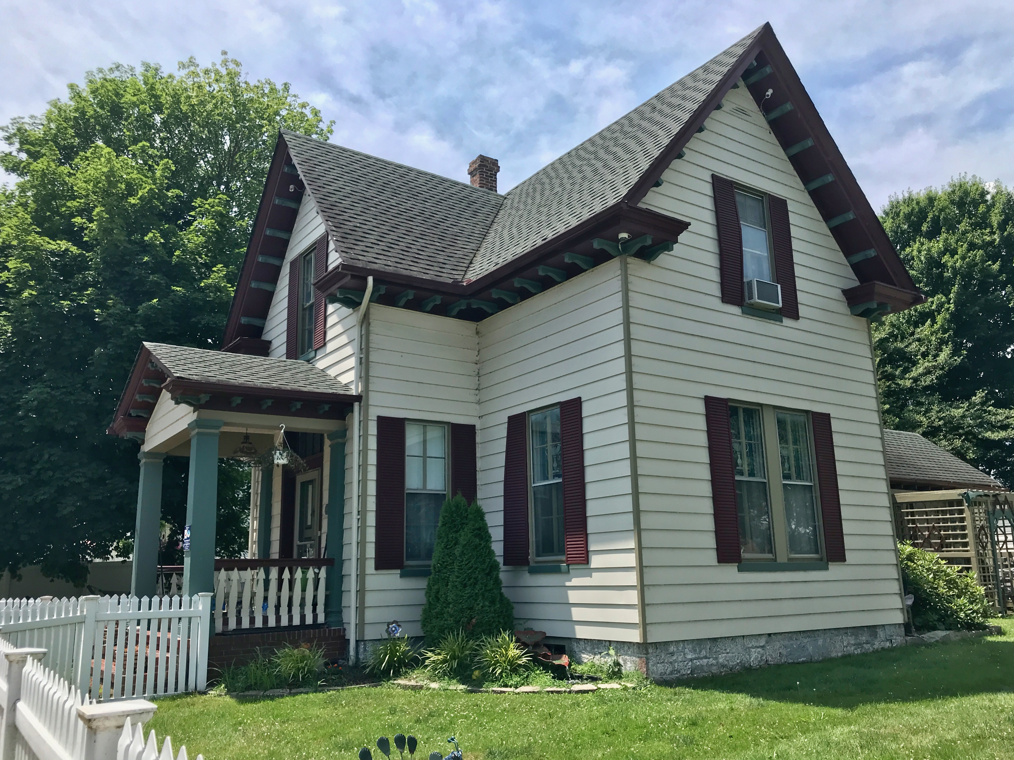
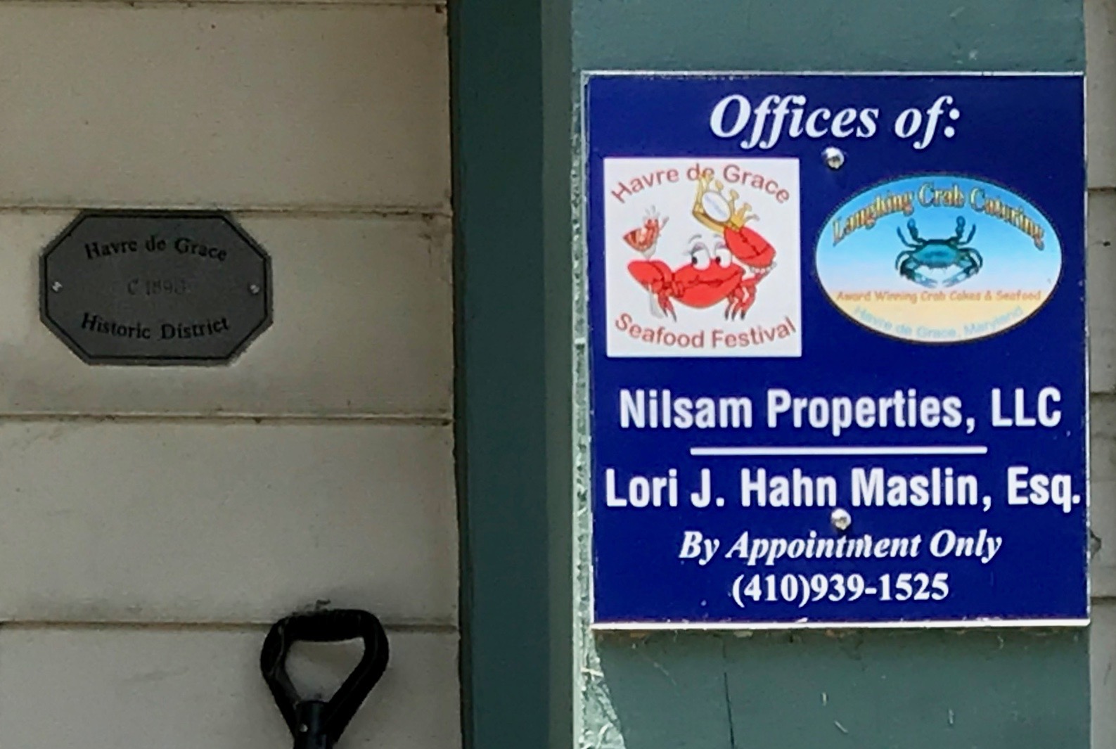
This is the Maslin House. It was built in 1860, and Maslin family members have lived in this home since its construction. Dick Maslin, the great-grandfather of the current owner, was a Chesapeake Bay boat pilot. Another Maslin ancestor was a lock house tender who resided the Lock House.
The facade of this frame cottage is unusual because it is built in the shape of a Greek cross. The four-over-four double-hung windows are original, in service for over 150 years.
I spotted this sign on the house.
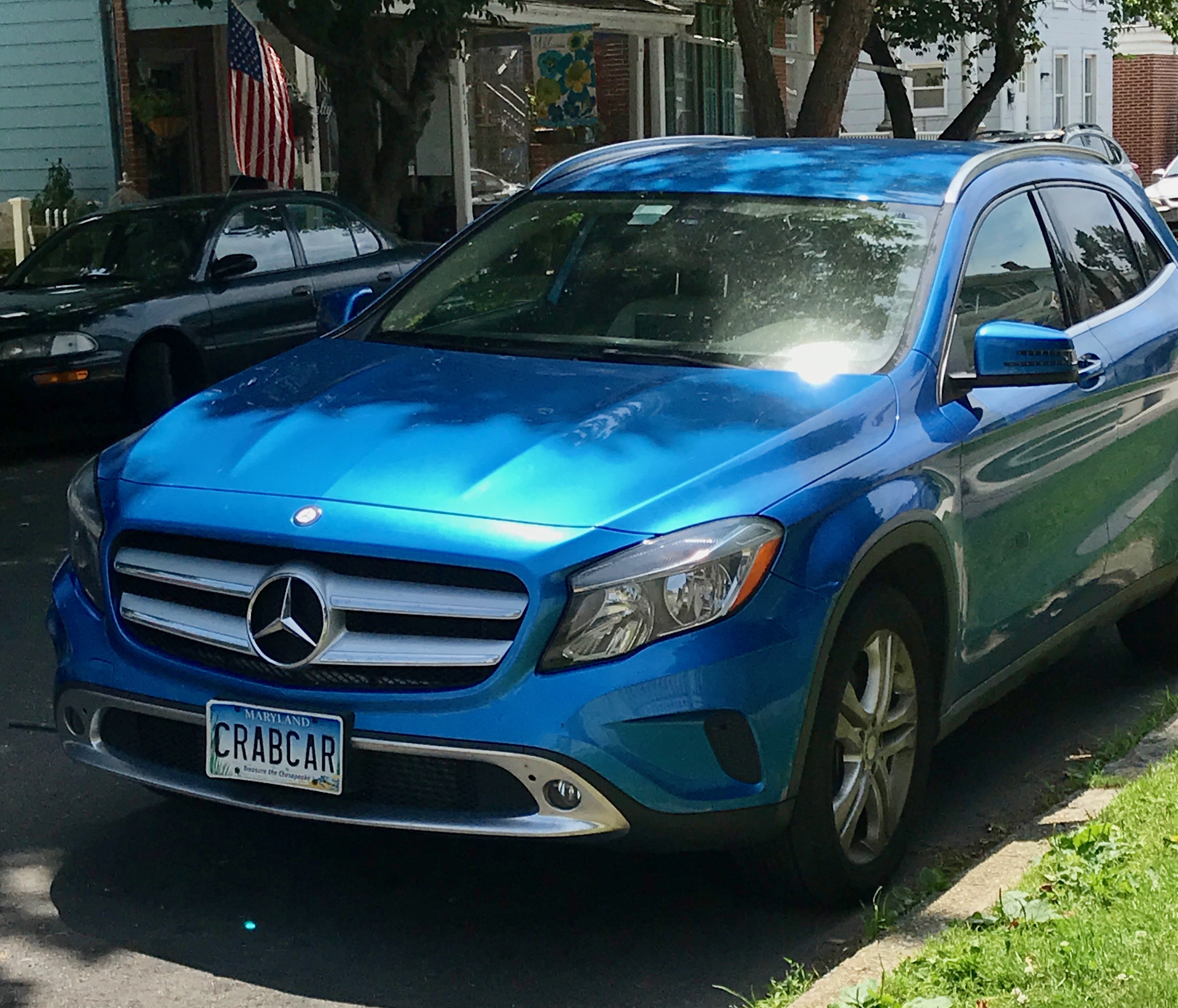
This car was parked in front of it.
I particularly enjoyed the license plate. “CRAB CAR”
By this time, my enthusiasm for this walking tour was flagging. It was hot and sunny. Sitting here, in cold, dreary Michigan, it seems odd to be complaining about a hot day – but there you have it. I’m sure it’ll be warm again here before you know it. (Knock on wood.)
But, after all, it was summer! It was supposed to be hot. I grabbed something to drink at one of the little shops and headed back to the car. I figured I’d drive to the farthest point on Lafayette Trail and check that out.
(Just in case you might be entertaining the idea that I actually remembered all that information about the buildings, I managed to find a copy of the walking tour on line. No memory cells were harmed in the writing of this post. At least not to this point.)
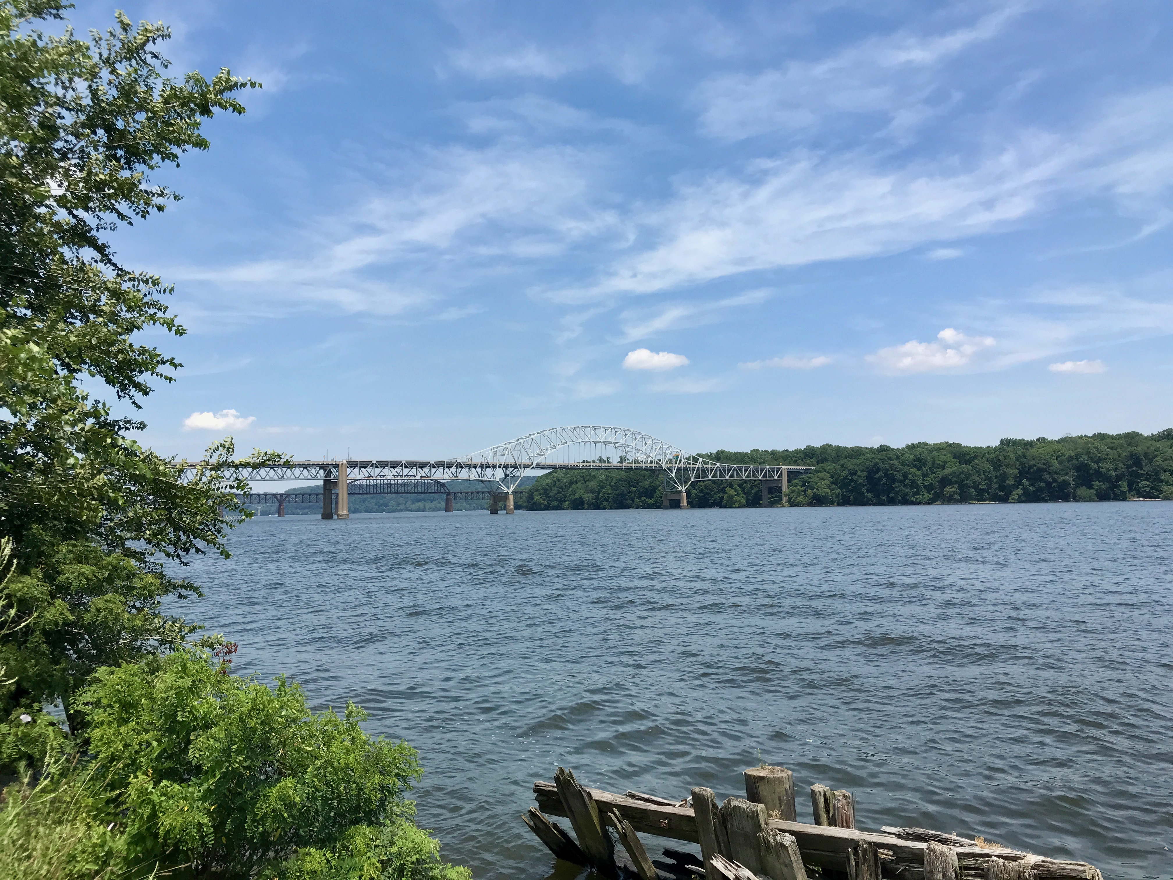
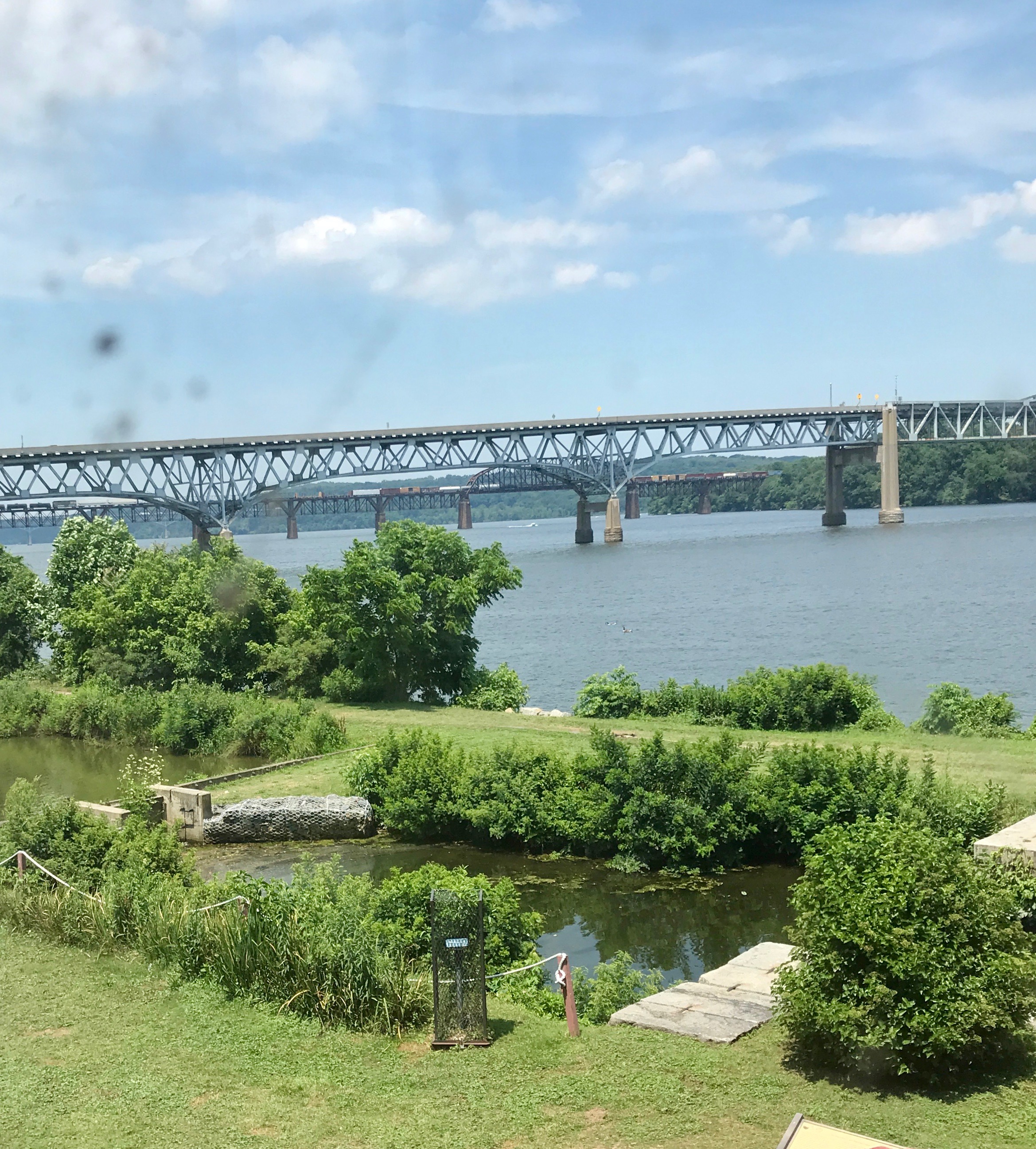
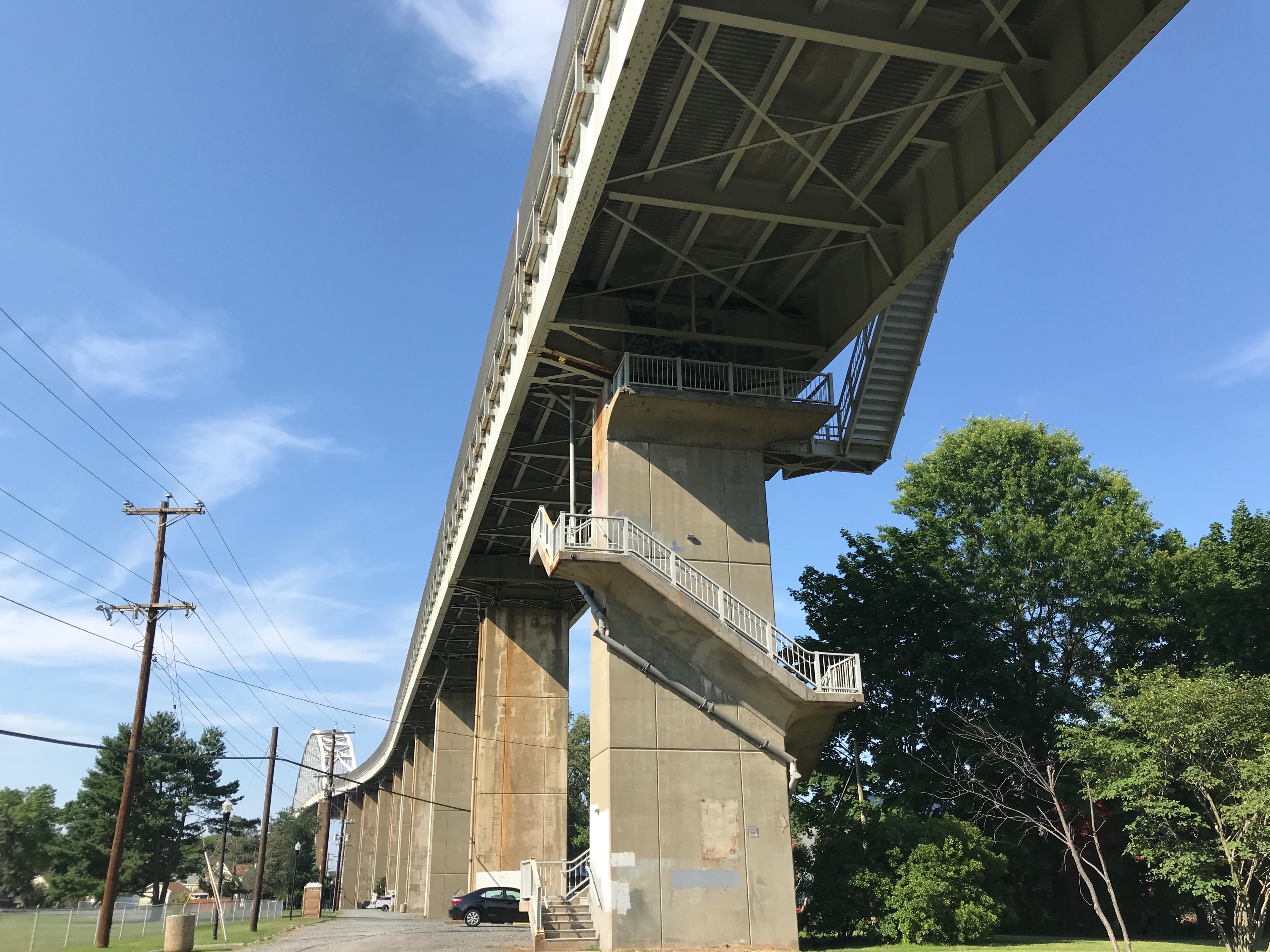
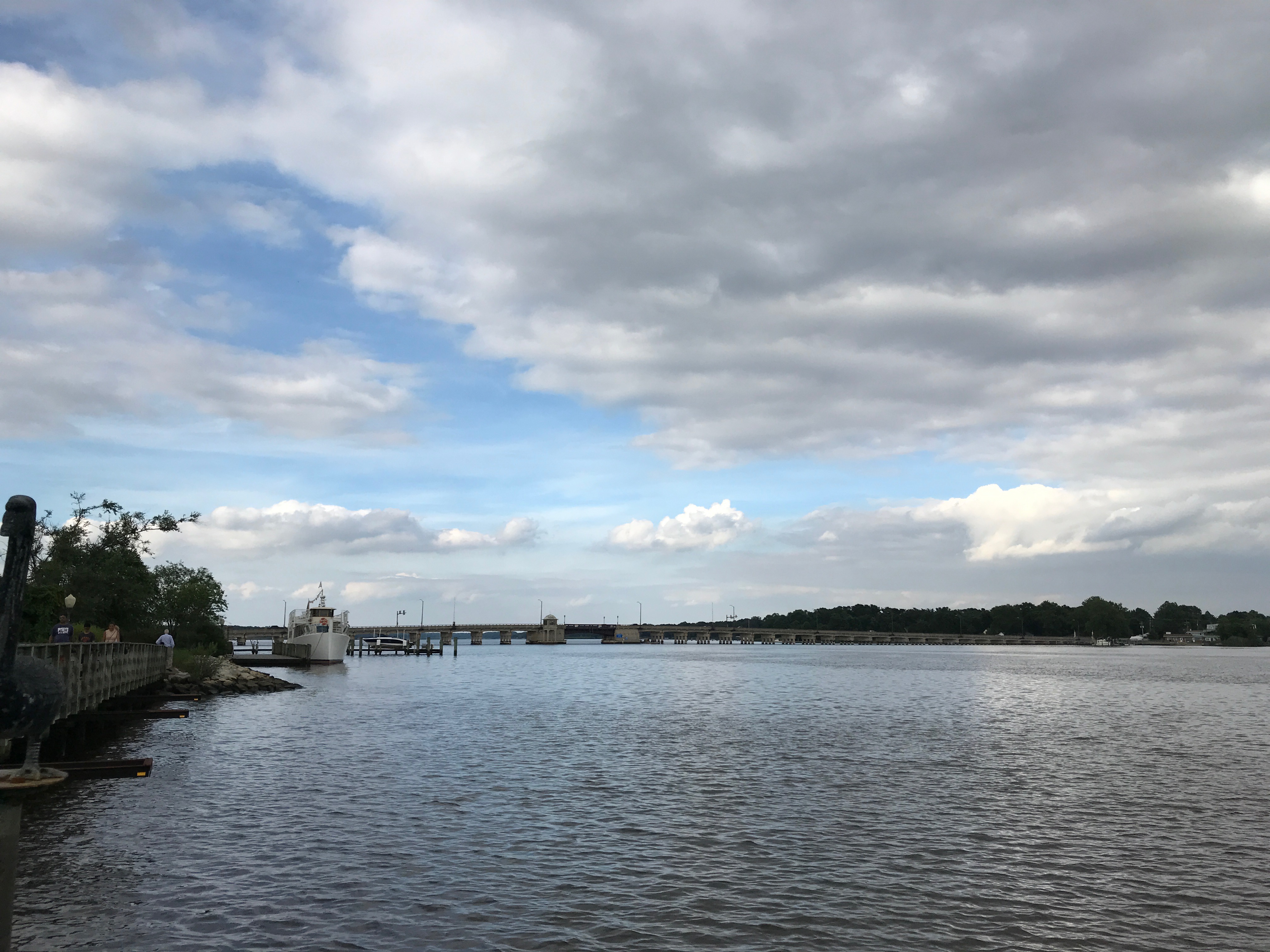
I set off in the direction of the Lock House, which was the farthest point on the trail, but got distracted by this view of the bridges.
Luckily, there was a nice parking area to stop and look at them.
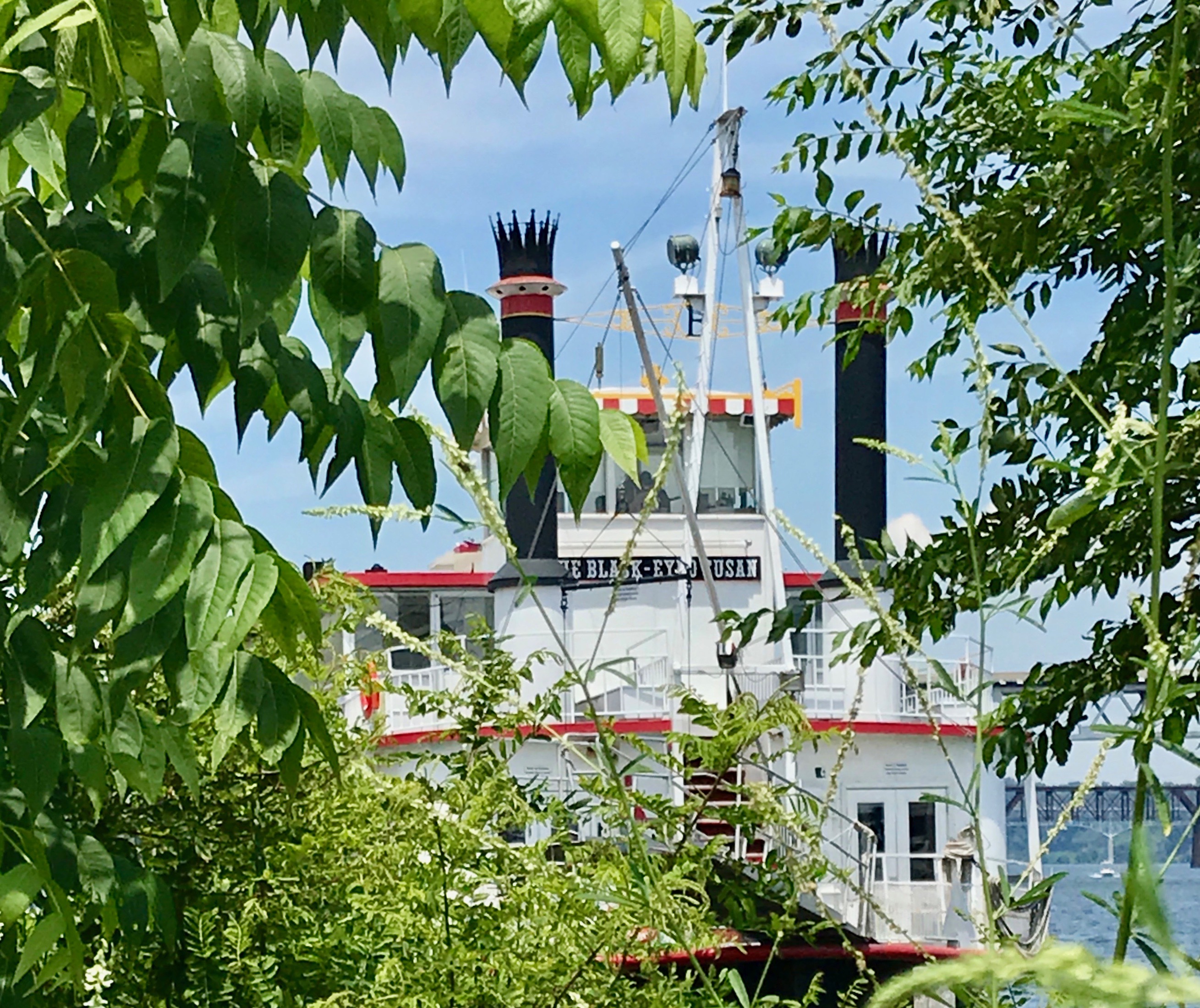
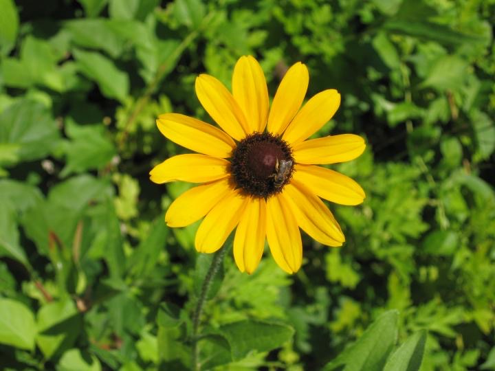
While looking through the branches, I saw this riverboat, named The Black-Eyed Susan. For those of you not familiar with the name, it is a common name for the flower, Rudbeckia hirta.
Black-eyed Susan
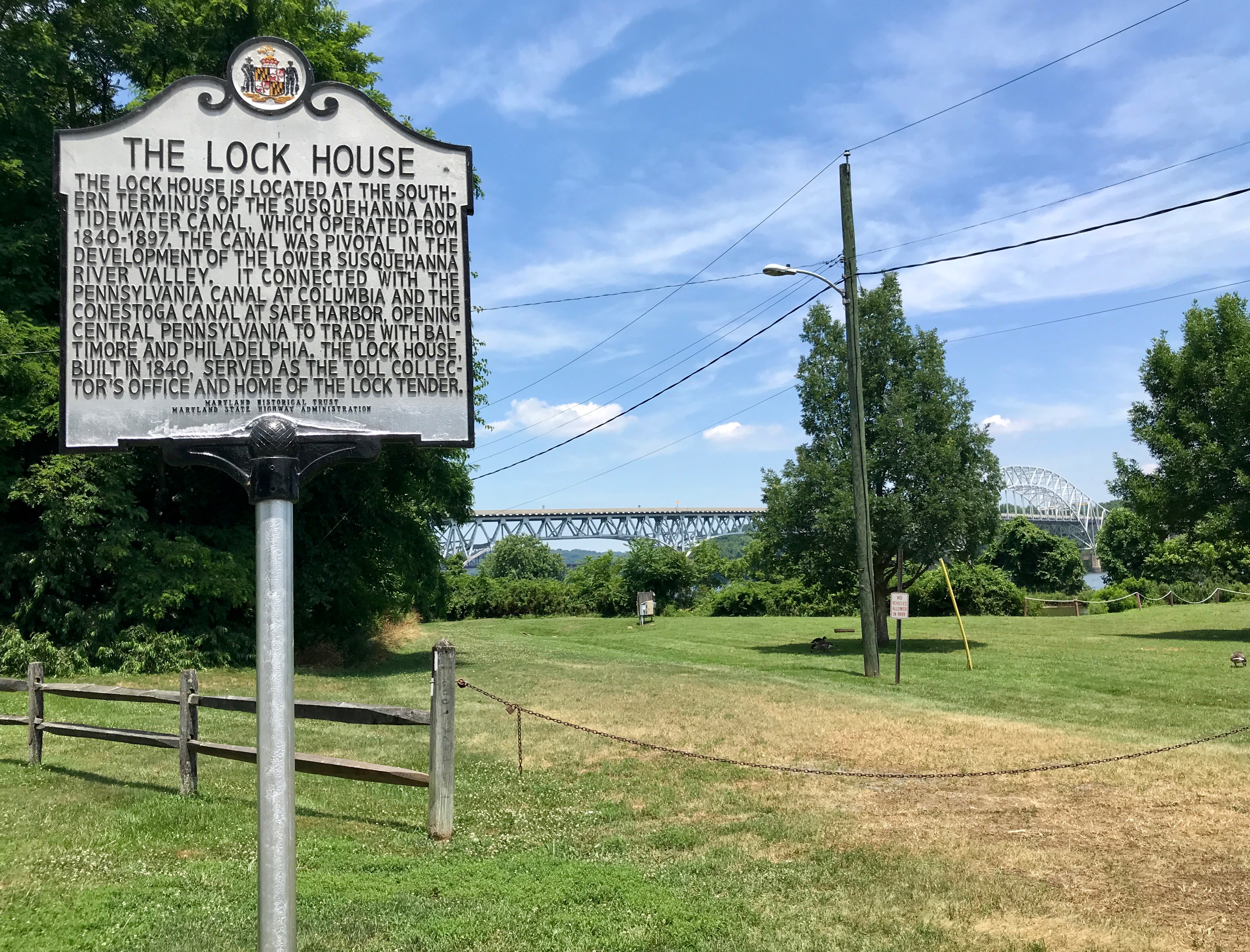
I continued along and eventually reached the Lock House.
Hmm. There’s a sign. I wonder where the Lock House is? Well, it wouldn’t be the first time there was a sign for something that wasn’t there. But, I looked around and found a driveway that lead to The Lock House Museum.
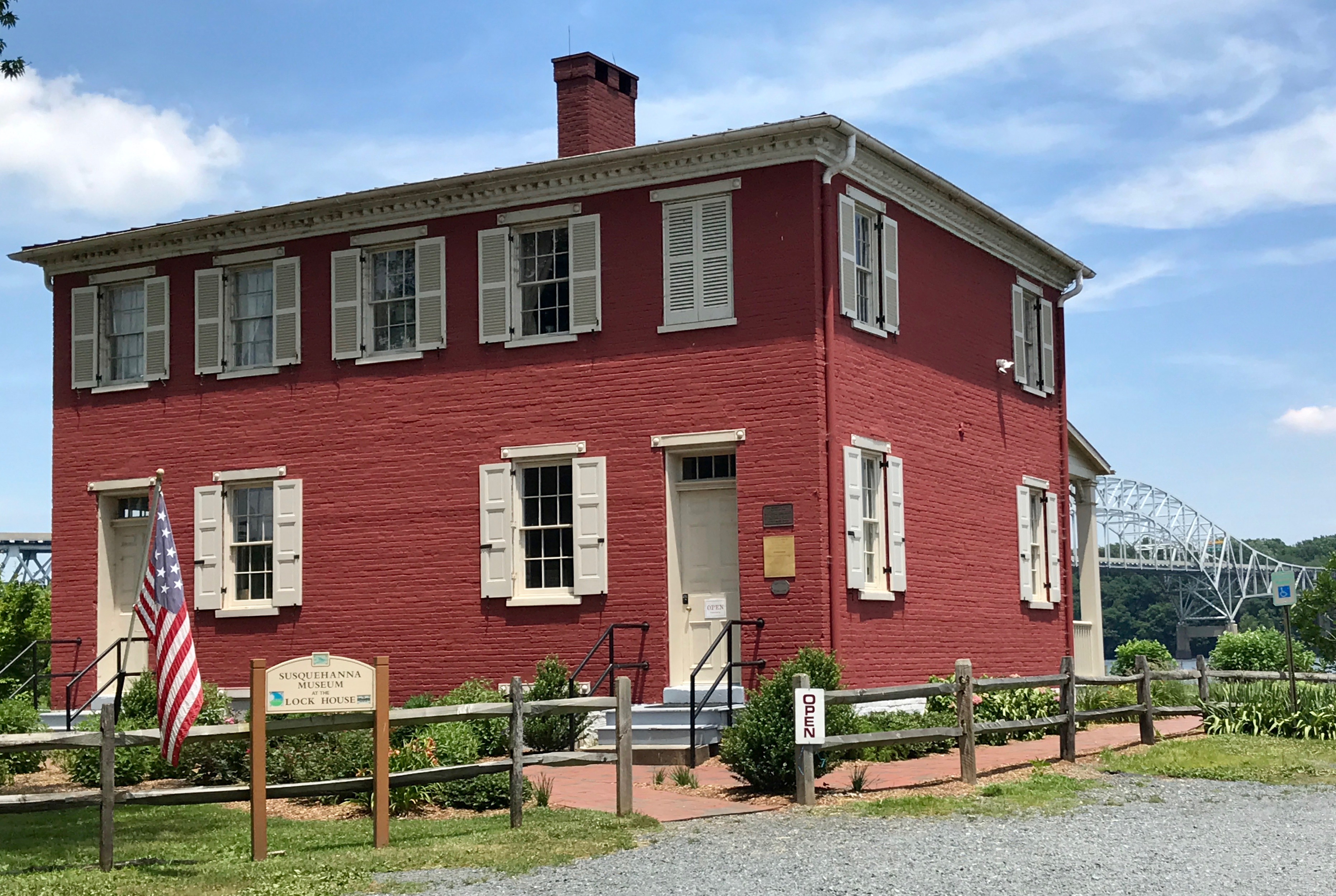
And it was OPEN!
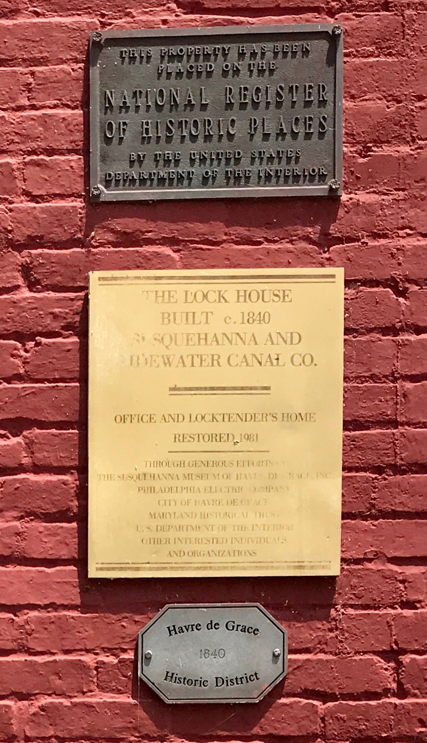
I walked up to the building and paused a moment to look at the signs that were by the door. I went inside and was met by Bill, who was a most able guide. He really had a passion for the canal, the lock and the Lock House.
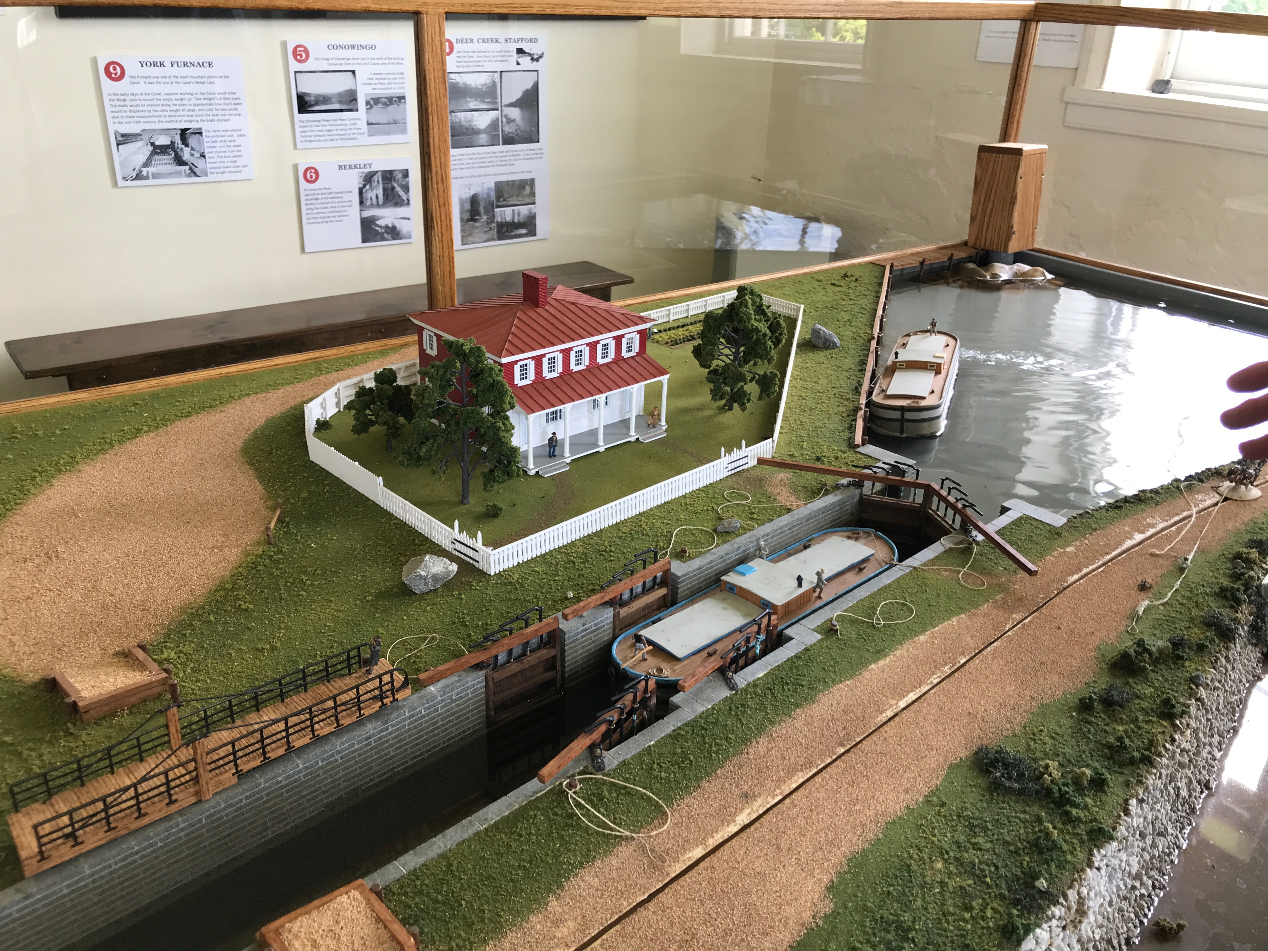
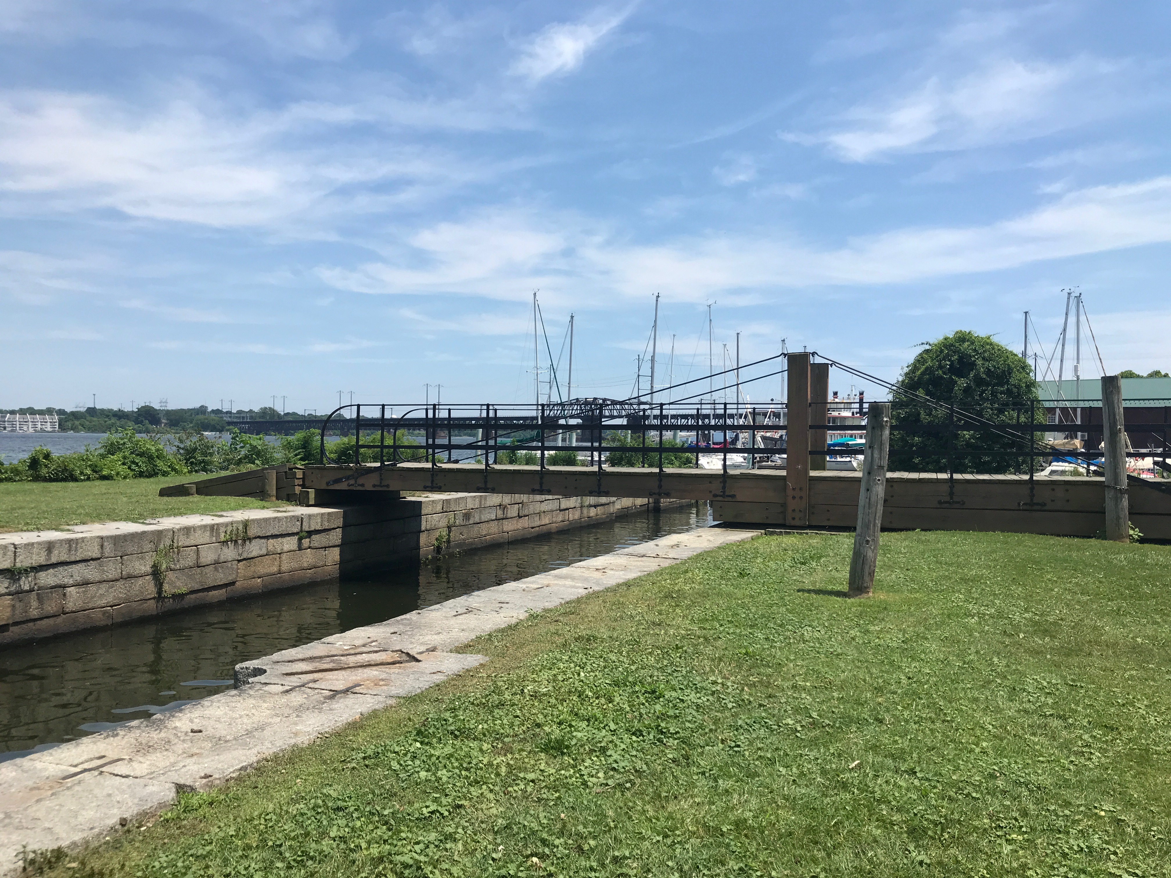
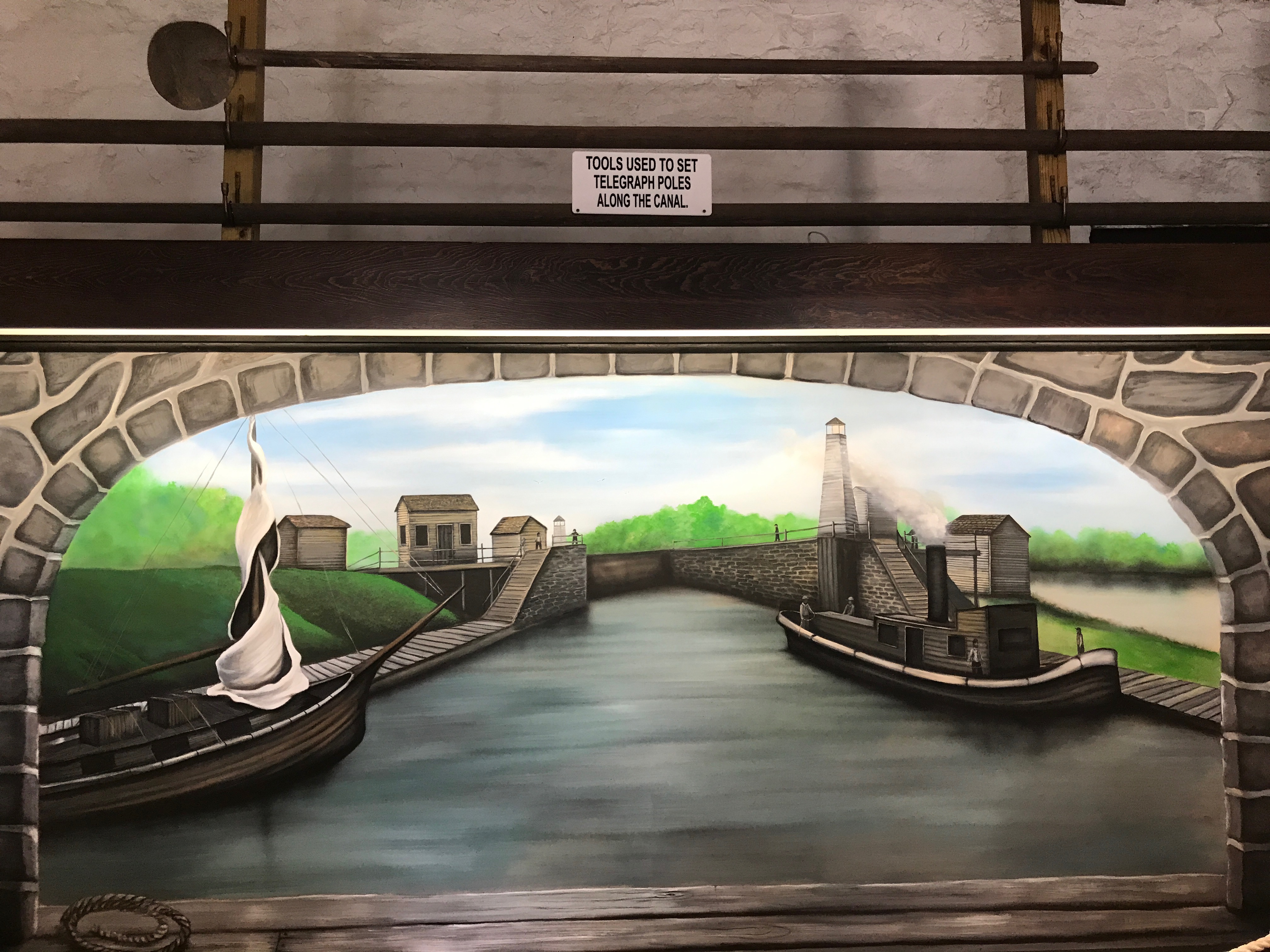
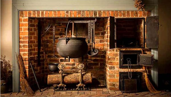
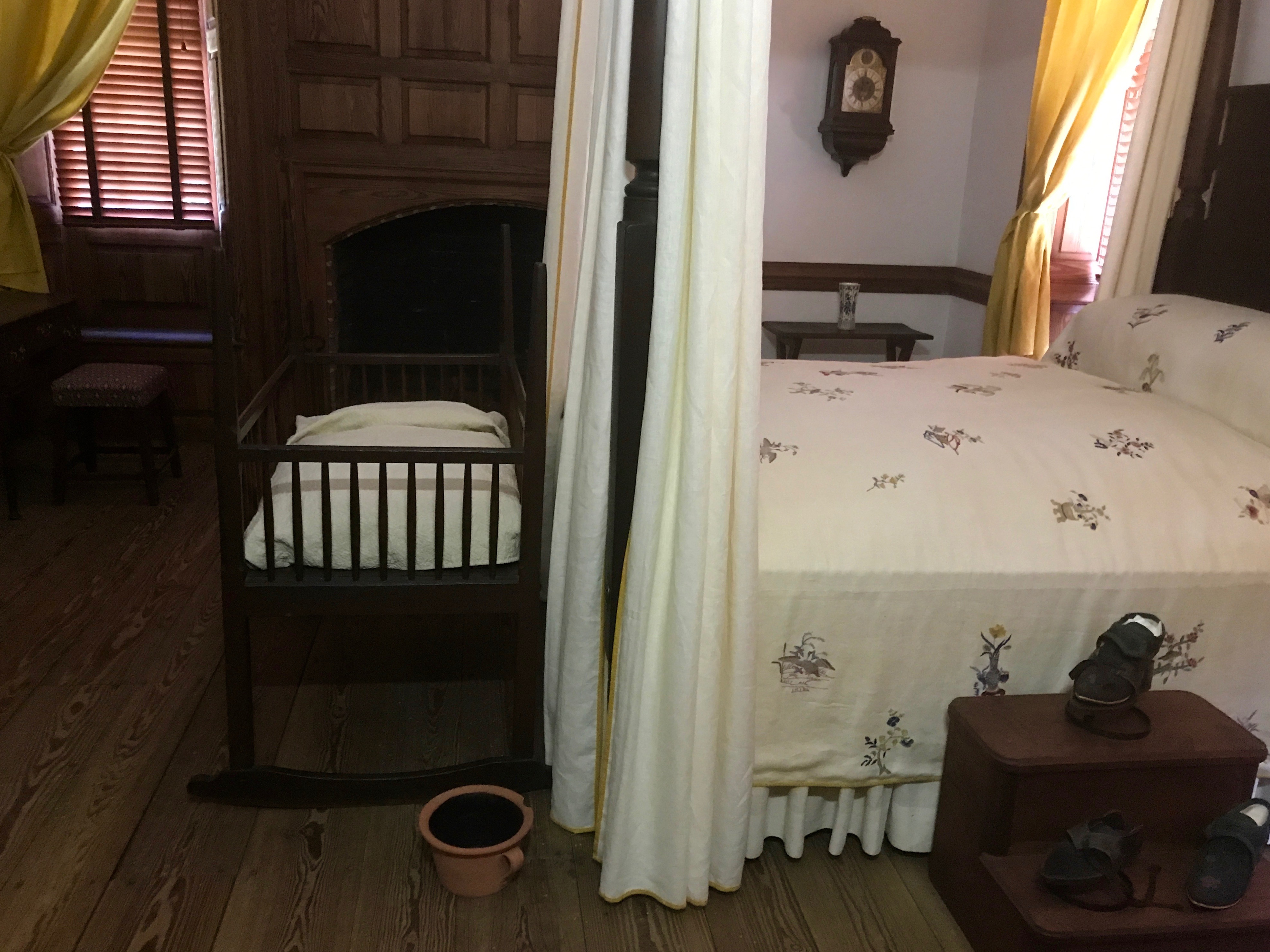
The Lock House was built in 1840 and is situated on the western bank of the Susquehanna River, by the outlet lock for the Susquehanna and Tidewater Canal. The canal connected Wrightsville, Pennsylvania, 45 miles upstream, with the markets on the coast. Although the Susquehanna connected the two places, north of Havre de Grace it was too shallow and had too many boulders to navigate. I thought they might have dredged a channel along the shore, but Bill told me they dug a canal alongside the river. He took me into another room to demonstrate how the lock worked.
There were holding areas for boats waiting to go through the lock. There was only one lock, so they had to take turns coming and going.
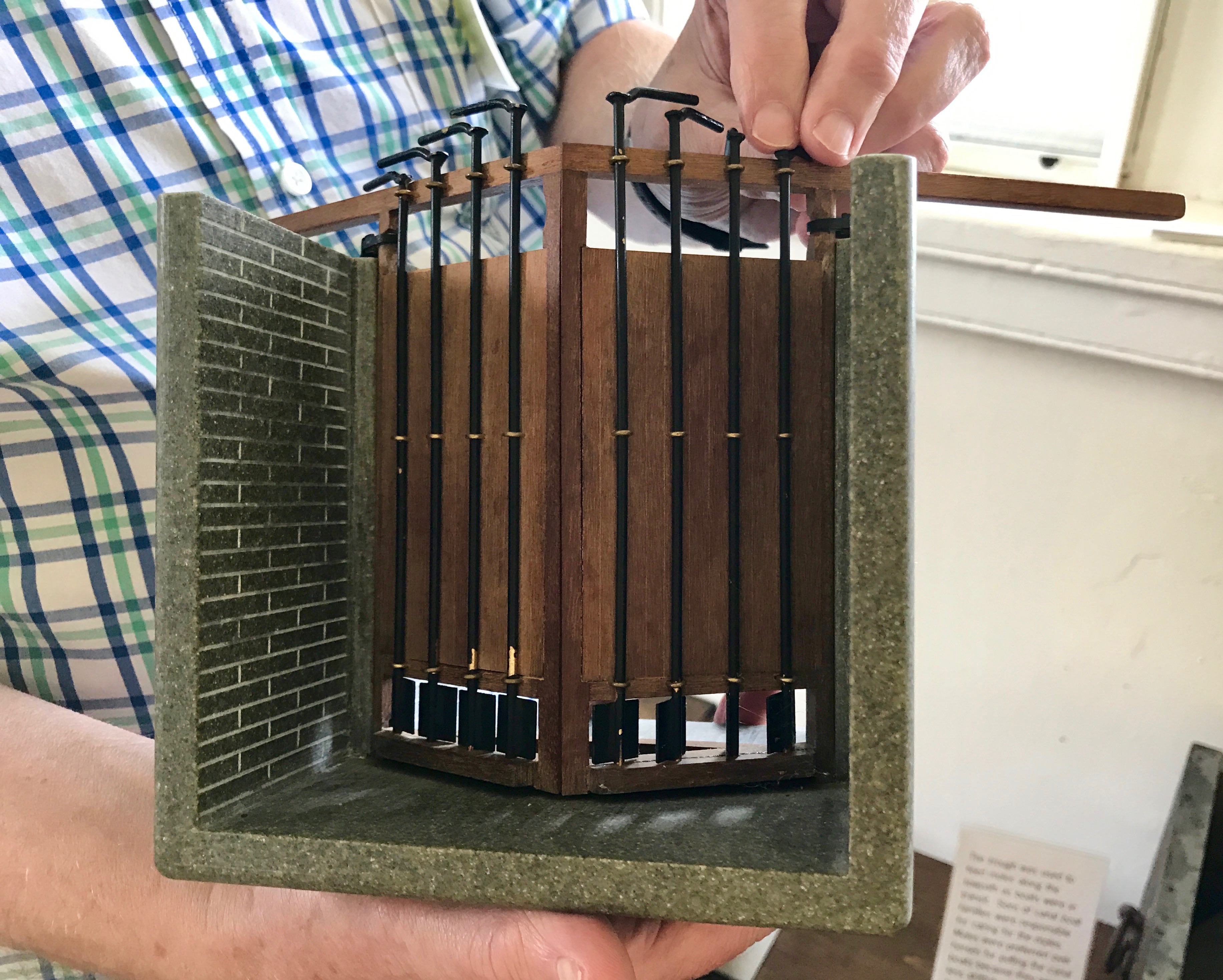
I was fascinated with this model of the gates. I always wondered how they managed to let the water out to lower the boats. There are little doors at the bottom of the gates that are opened with the handles on the tops. I wonder if people had to walk out on the top of the gates to operate them or did they use long poles or some other means to move the levers? I was just so amazed at the model that I didn’t ask enough questions.
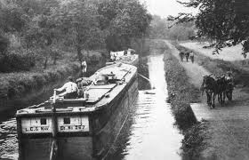
I tried to take a photo of the photos of the canal boats in the museum, but they were framed under glass. Try as I might, I couldn’t find an angle without glare. I am including this photo to illustrate what the boats looked like.
The boats on this canal were freighters and they carried primarily coal. They were typically 60 to 70 feet long and 15 to 16 feet wide. Each boat could carry up to 150 tons of raw materials and they were pulled by mules.
The mules were often stabled on the boats, as the narrow Susquehanna Valley provided few pastures. The mules lived forward and the canal boat captain and his family lived in small quarters in the rear of the boat.
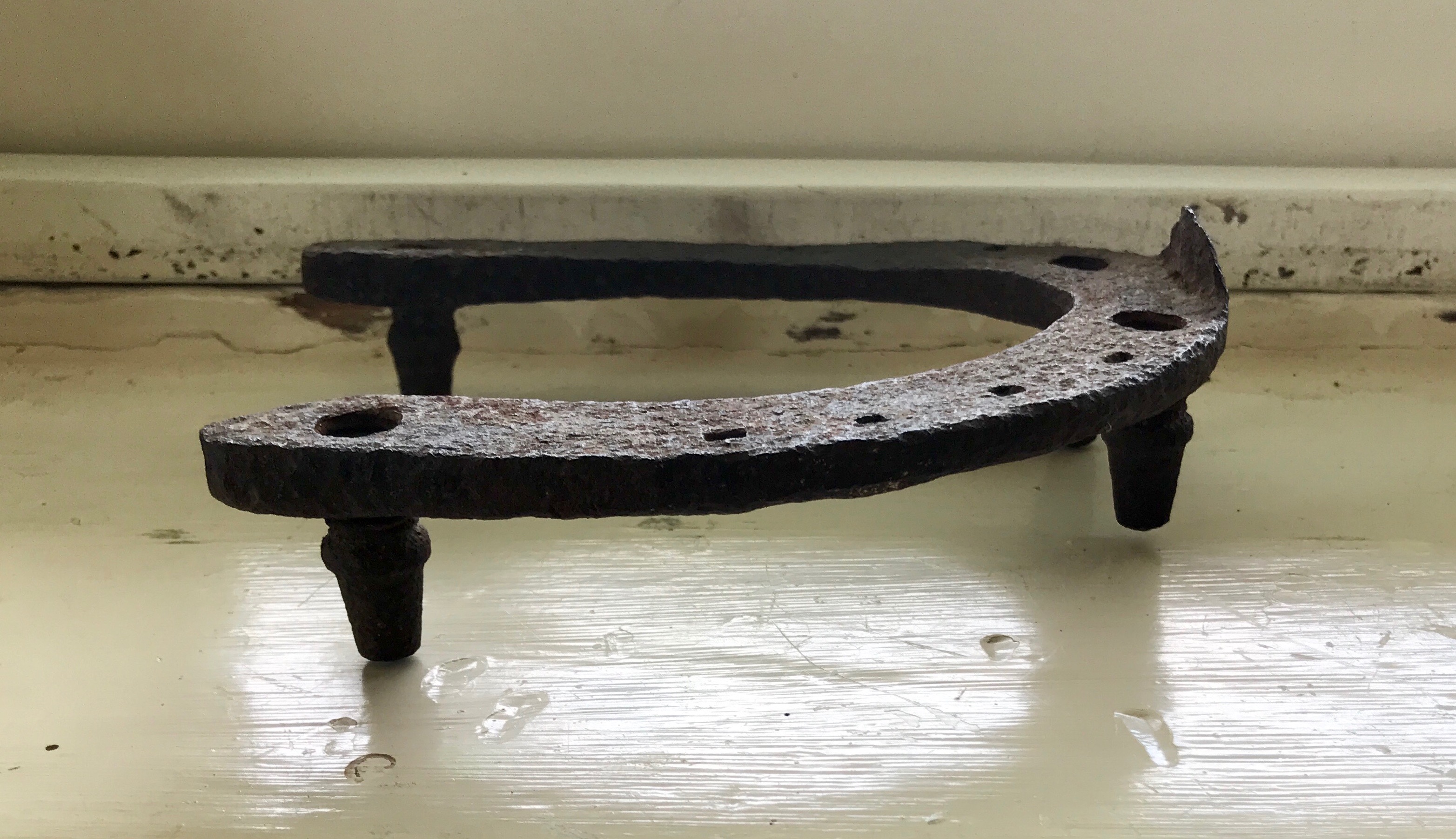
Good shoes are important for doing good work.
There were a number of items in the museum that were included to show what life was like for the lock tenders.
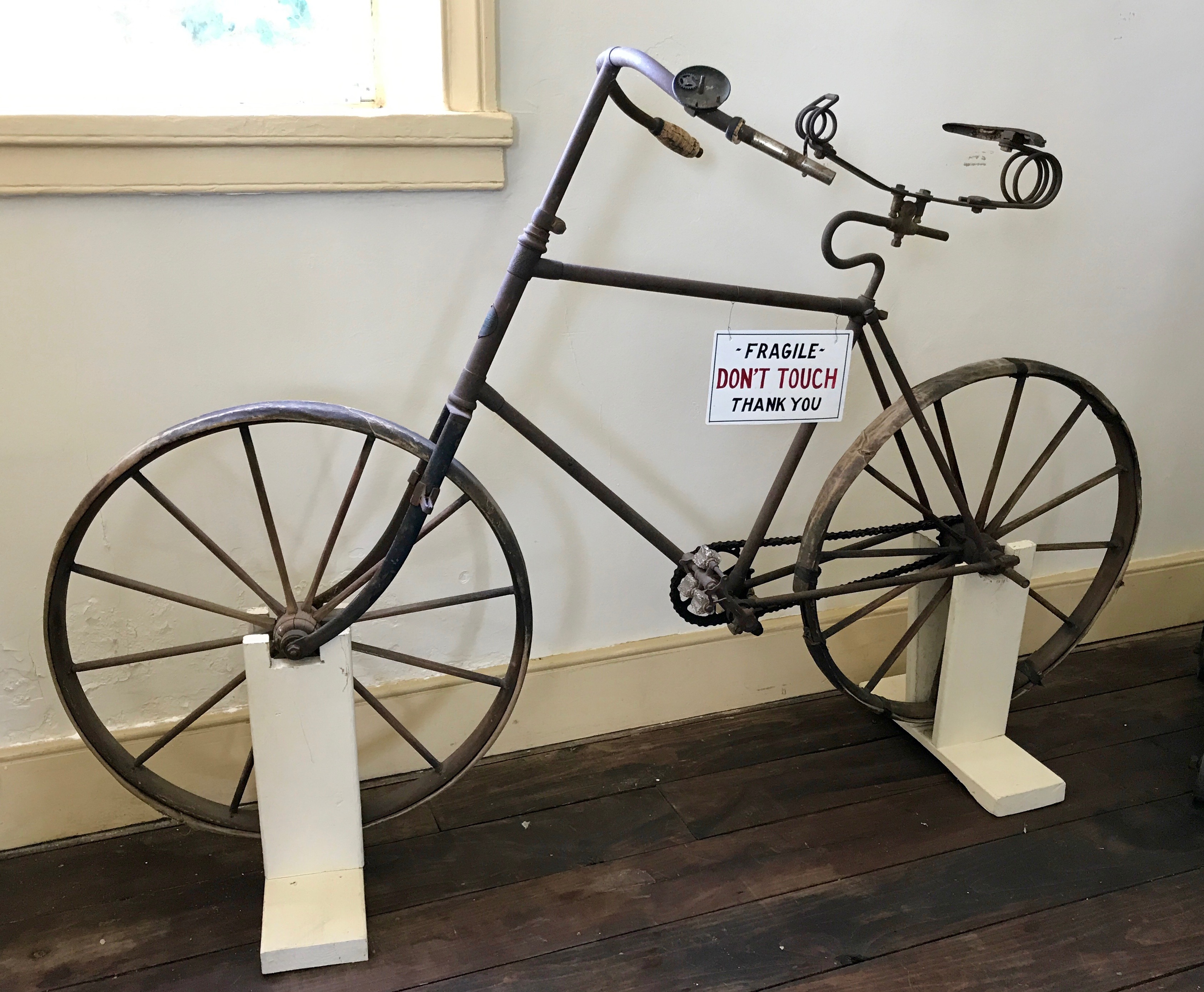
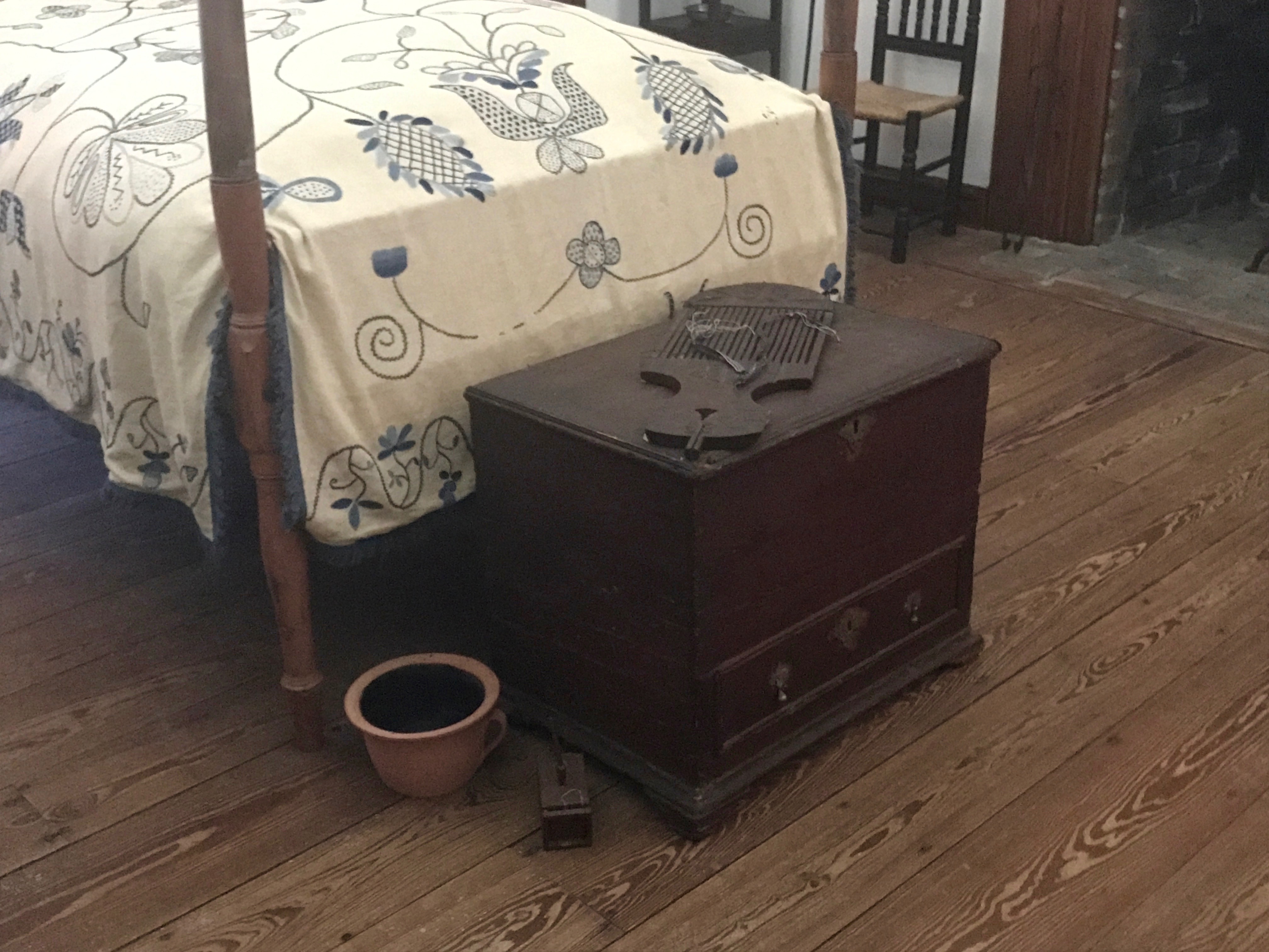
This bicycle is said to have been owned by Carville Maslin’s son and is reputed to have been riden to Baltimore from Havre de Grace. Patented in in 1866, this model had inflatable tires and wooden wheels. That sounds pretty modern, but the only braking power came from the feet being pressed on the ground or on the font wheel. According to the informational sign, the bicycle cost $100 at a time when the Lock Tender made less than $1000 per year.
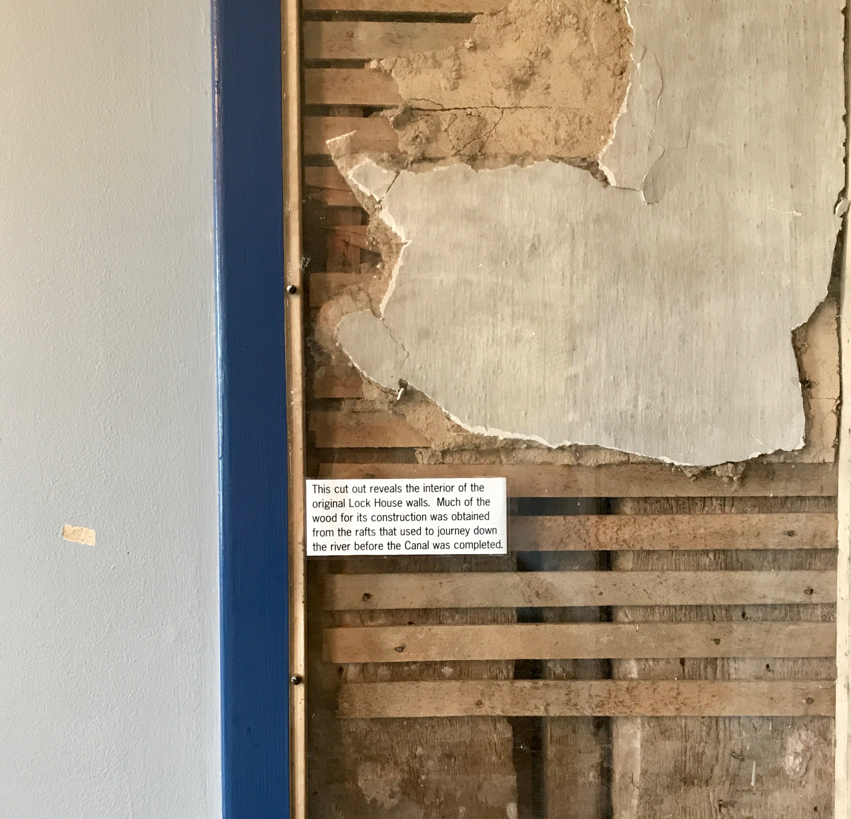
When the Lock House was restored in 1981, they left this “truth window” so you could see the construction of the original building. After more than 140 years and close to 100 years after the canal ceased operation, I imagine it was due for restoration.
We continued upstairs for a few more exhibits.
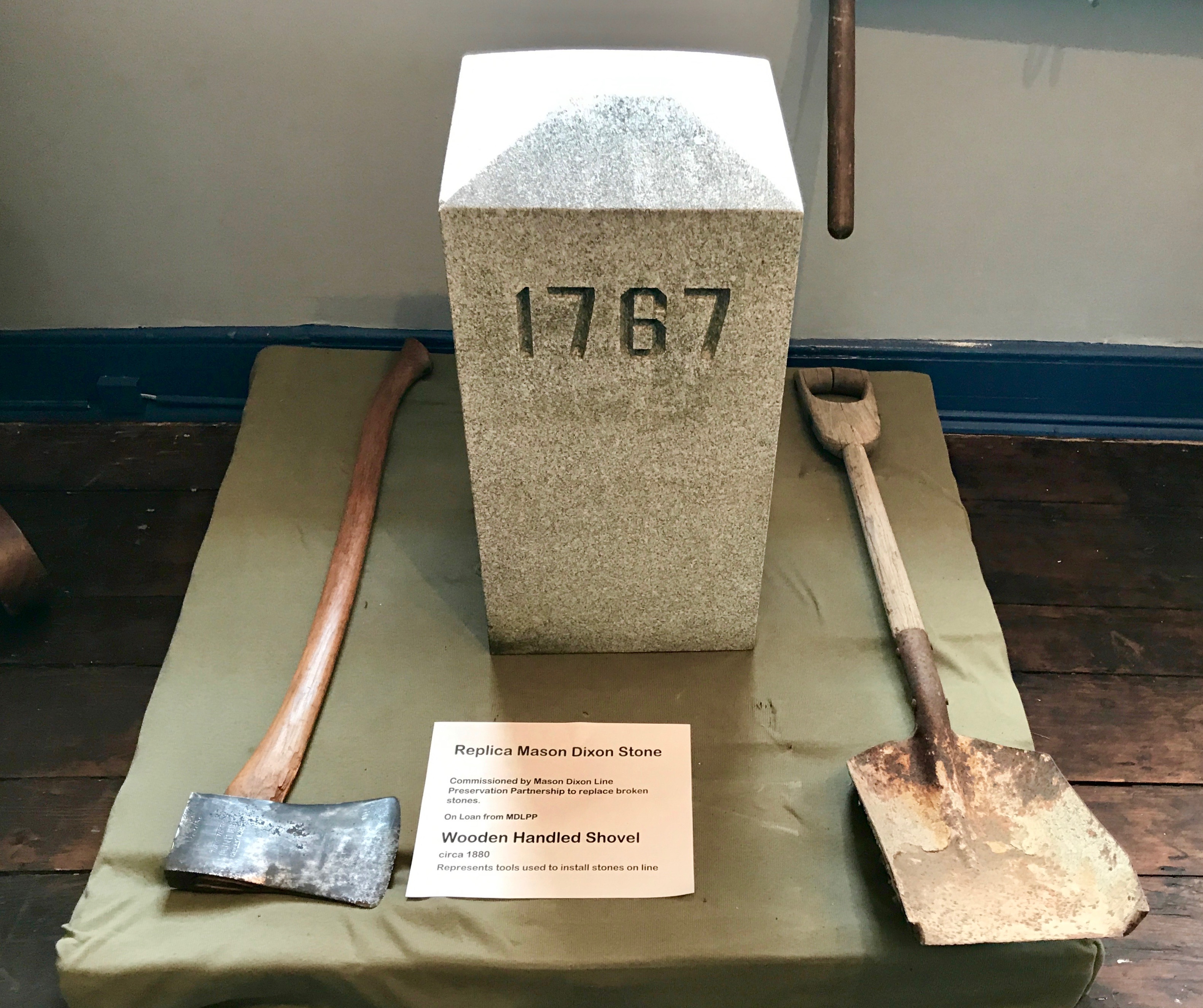
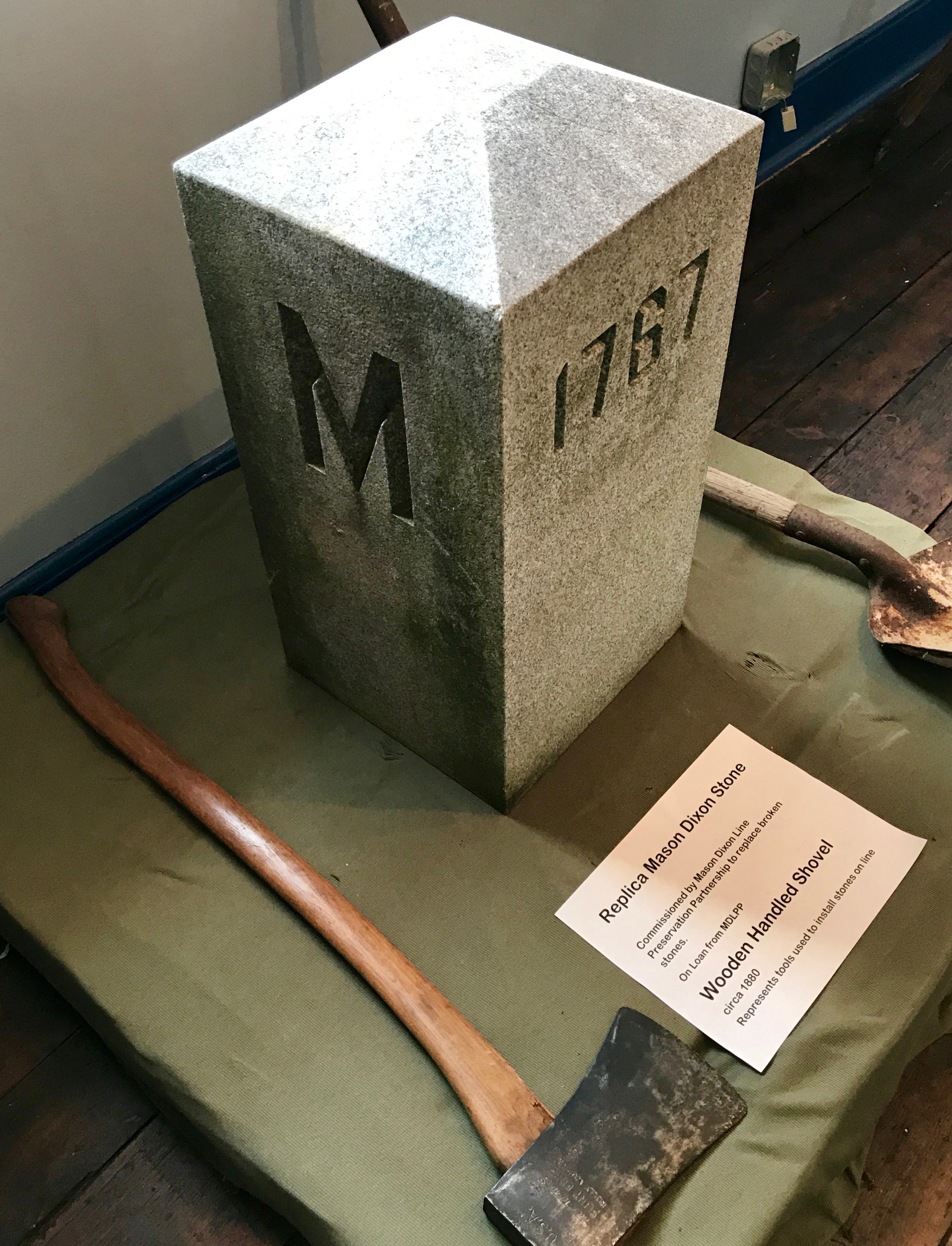
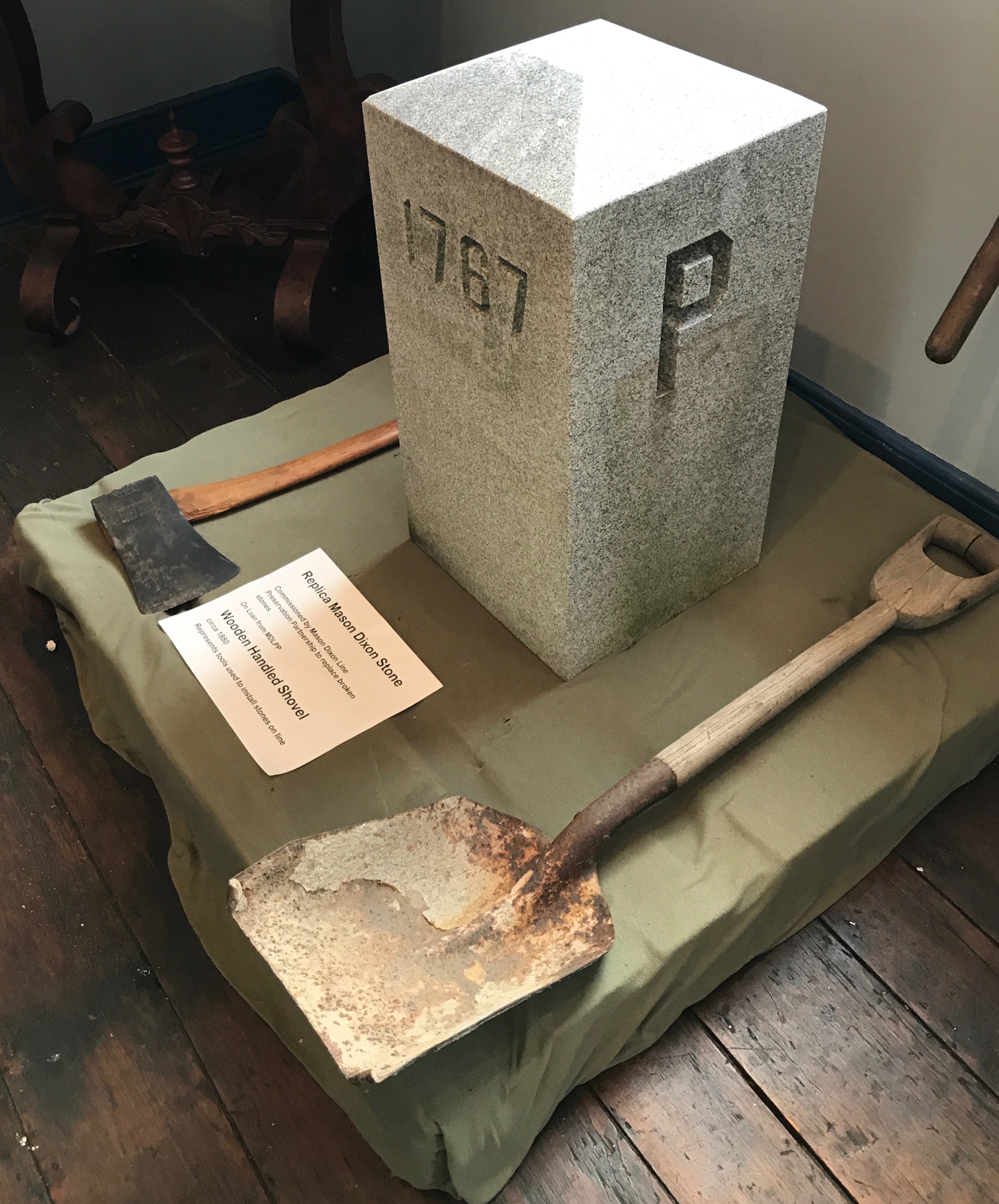
This is a replica of one of the stones placed along the Mason Dixon Line. The line was established to resolve a border dispute involving Maryland, Pennsylvania and Delaware.
This side is Maryland.
This side is Pennsylvania.
The work was directed by Charles Mason and Jeremiah Dixon, and they surveyed the line between 1763 and 1767. My tour guide, Bill, had an ancestor that worked on the project as a laborer. Bill said that the bosses – presumably Mason or Dixon or one of their underlings – would come by and indicate the direction the axmen were to go, and the workers would commence felling trees. They had to clear a “visto” 8 – 9 yards wide. Every now and then, the bosses would come by to course correct, and then they might have to recut the line a little further one way or the other.
I was amazed to meet a descendant of one of the people who helped create one of the more evocative and provocative borders in America’s history. When I shook his hand, it was like I was holding hands with history.
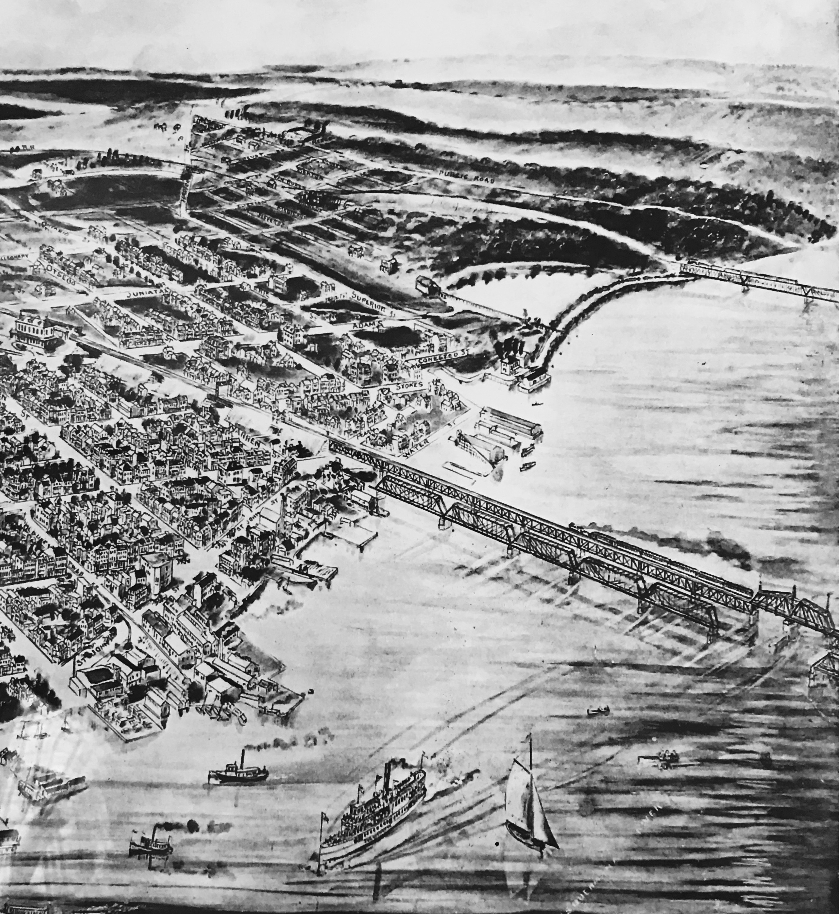
This “birds eye view” of Havre de Grace was made in 1909. Look at all the modes of transportation! You can still see the Lock House and the final lock of the canal, even though it ceased operation in 1894.
I took a look out of the upstairs window and decided it was time to go see the lock itself. I thanked Bill and headed outside.
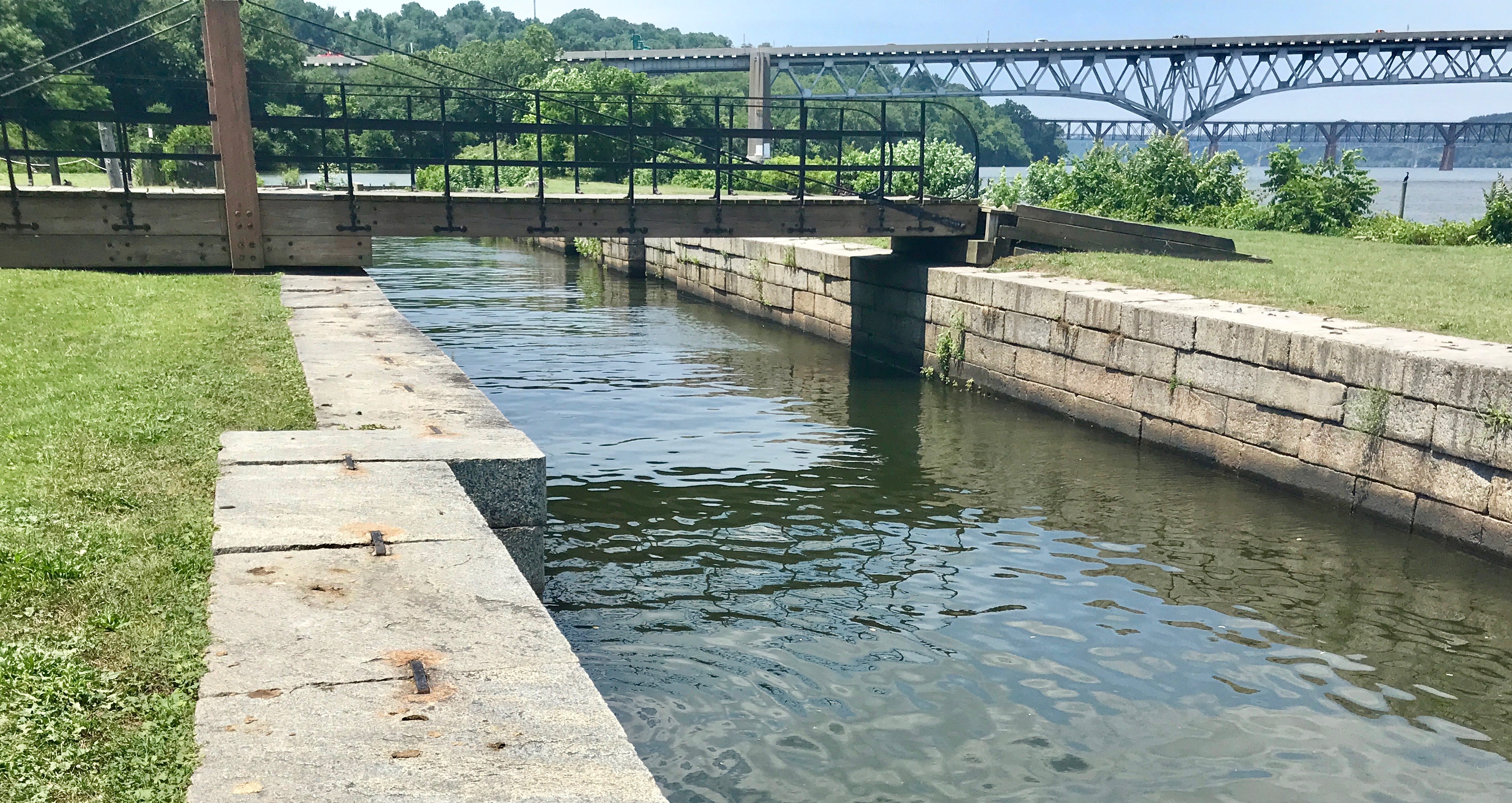
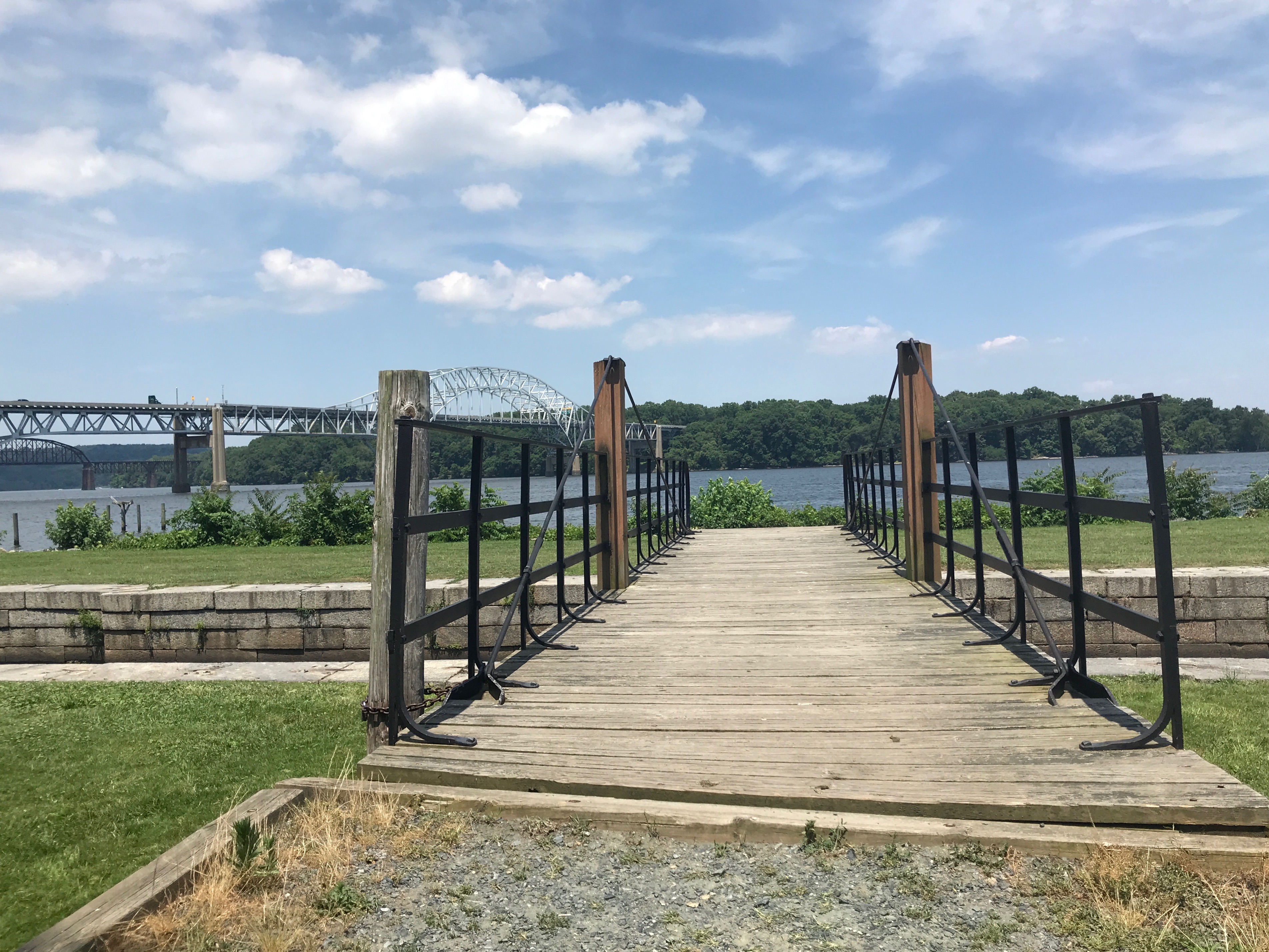
In the late 1980s, the lock was de-silted and the remnants of the original gates were removed. The granite walls were stabilized and straightened.
The bridge across the canal could pivot. This made it possible for people, wagons and mules to cross to the towpath and wharves on the riverside.
When the bridge wasn’t being used, it was swung away so that the boats could pass through the locks.
It’s amazing to look down the canal lock toward the automobile bridge and the rail bridge. Transportation is so interesting.
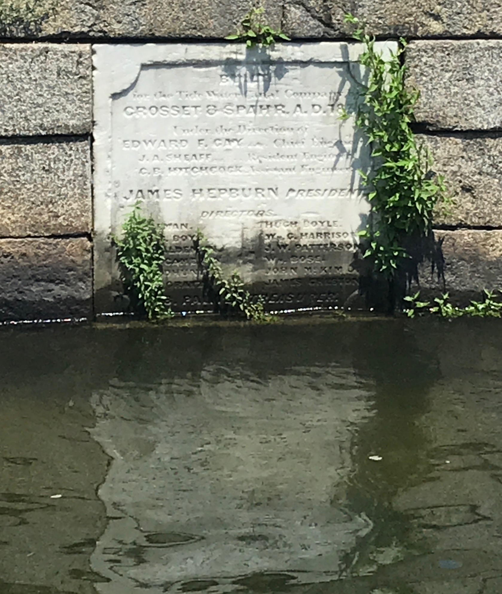
People have the need to put their names on things.
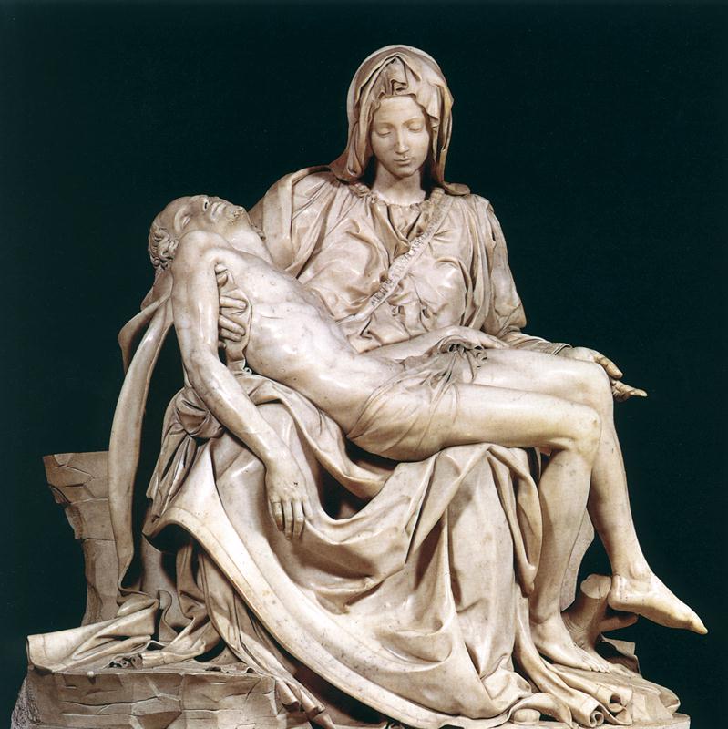
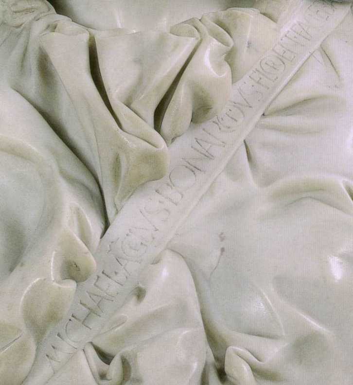
Which reminds me of Michelangelo’s Pieta. The story is that after he had finished the Pieta, he overheard some men from Milan saying that it was the work of another sculptor. Well, he wasn’t having any of that! He thought it was one of the best statues ever carved and he wanted credit for it. So that night he went into the church with his hammer and chisels and candles and carved his name in big letters on the Virgin.
It reads: Michaelangelus Bonarotus Florent(inus) Facieba. (Michaelangelo Buonarroti made this.)
Once again, thank you, Sister Jeanne!
I turned to head back to the car. What a lovely front porch! I think this must have been a very pleasant place to live in the summer.
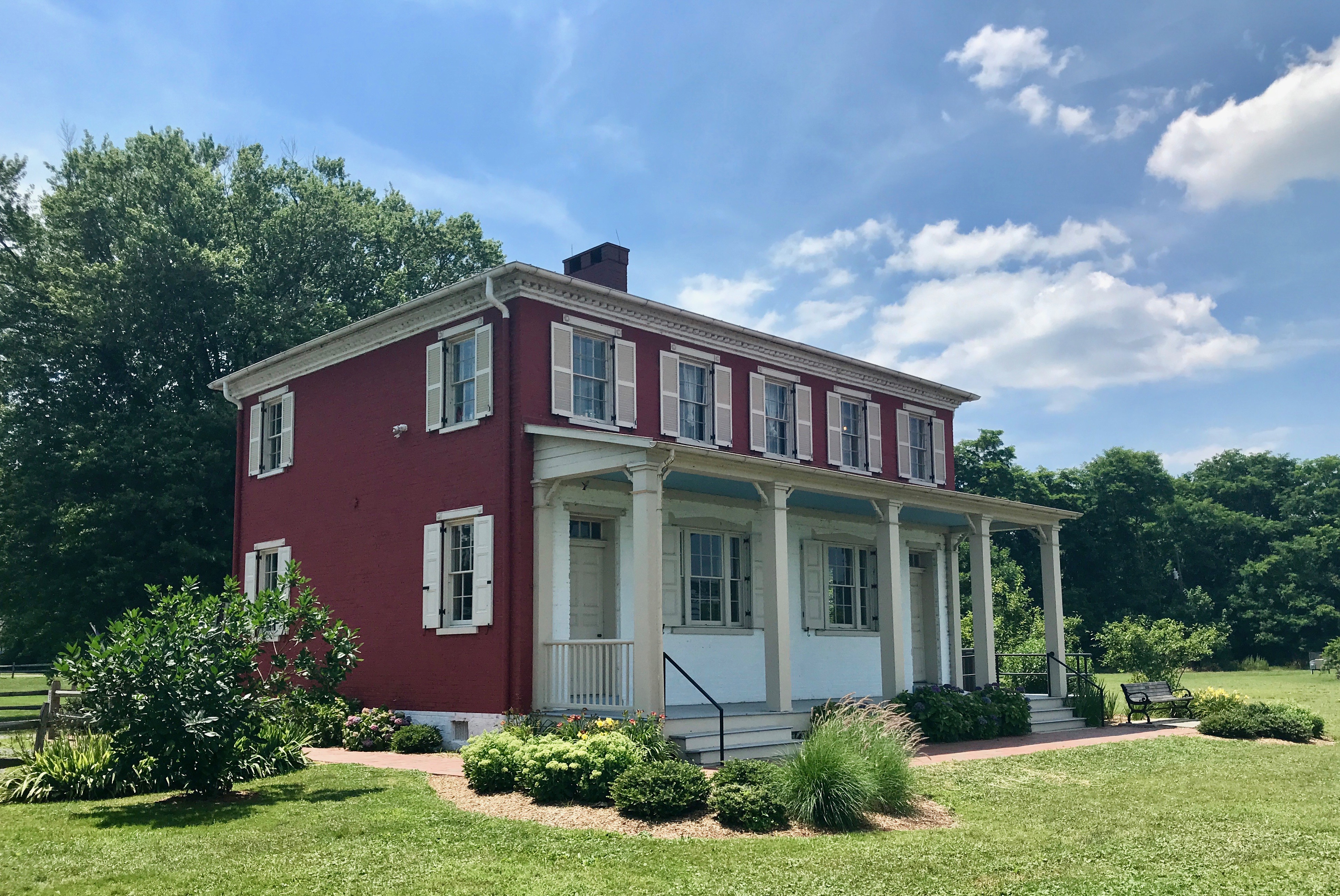
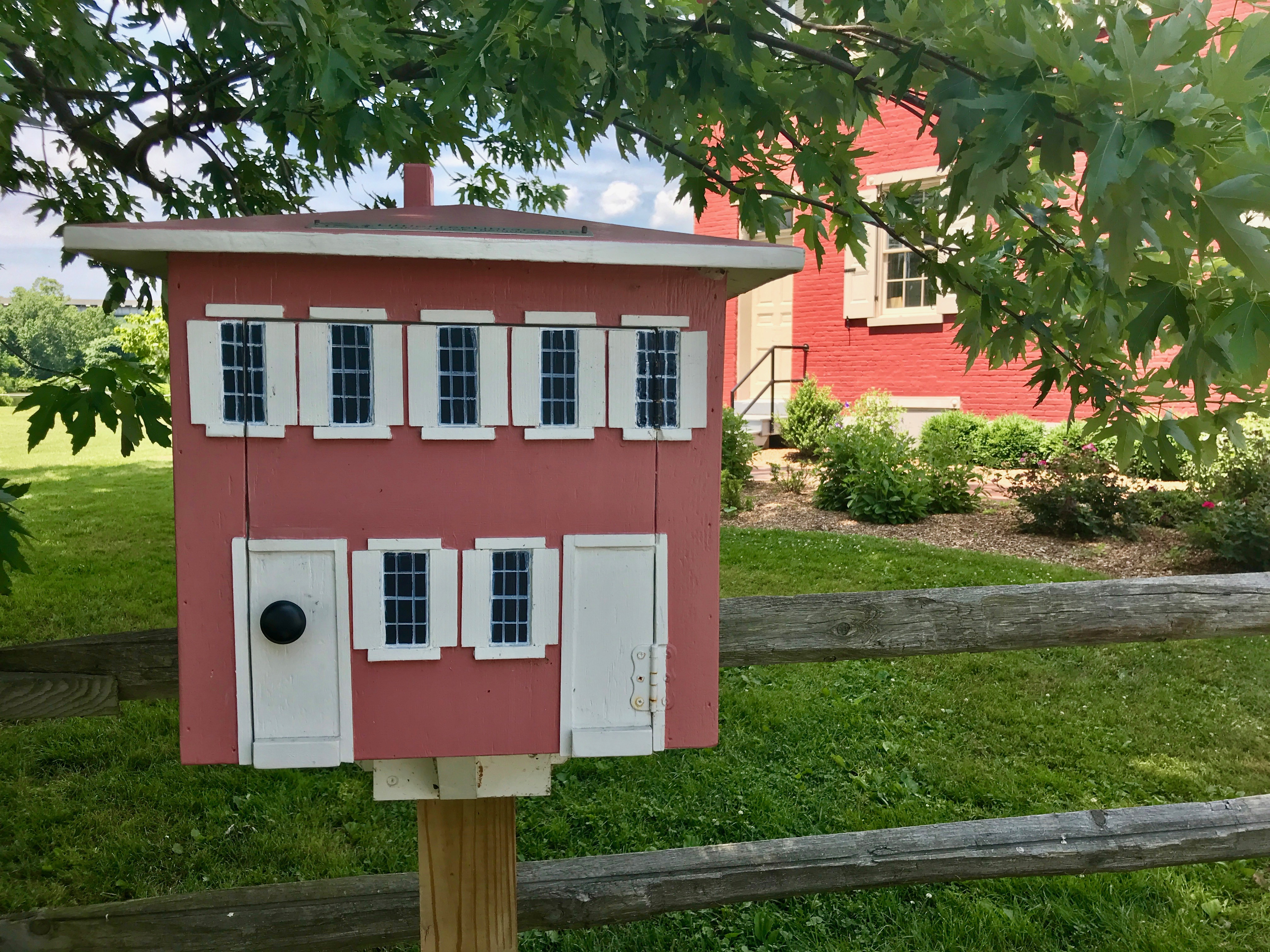
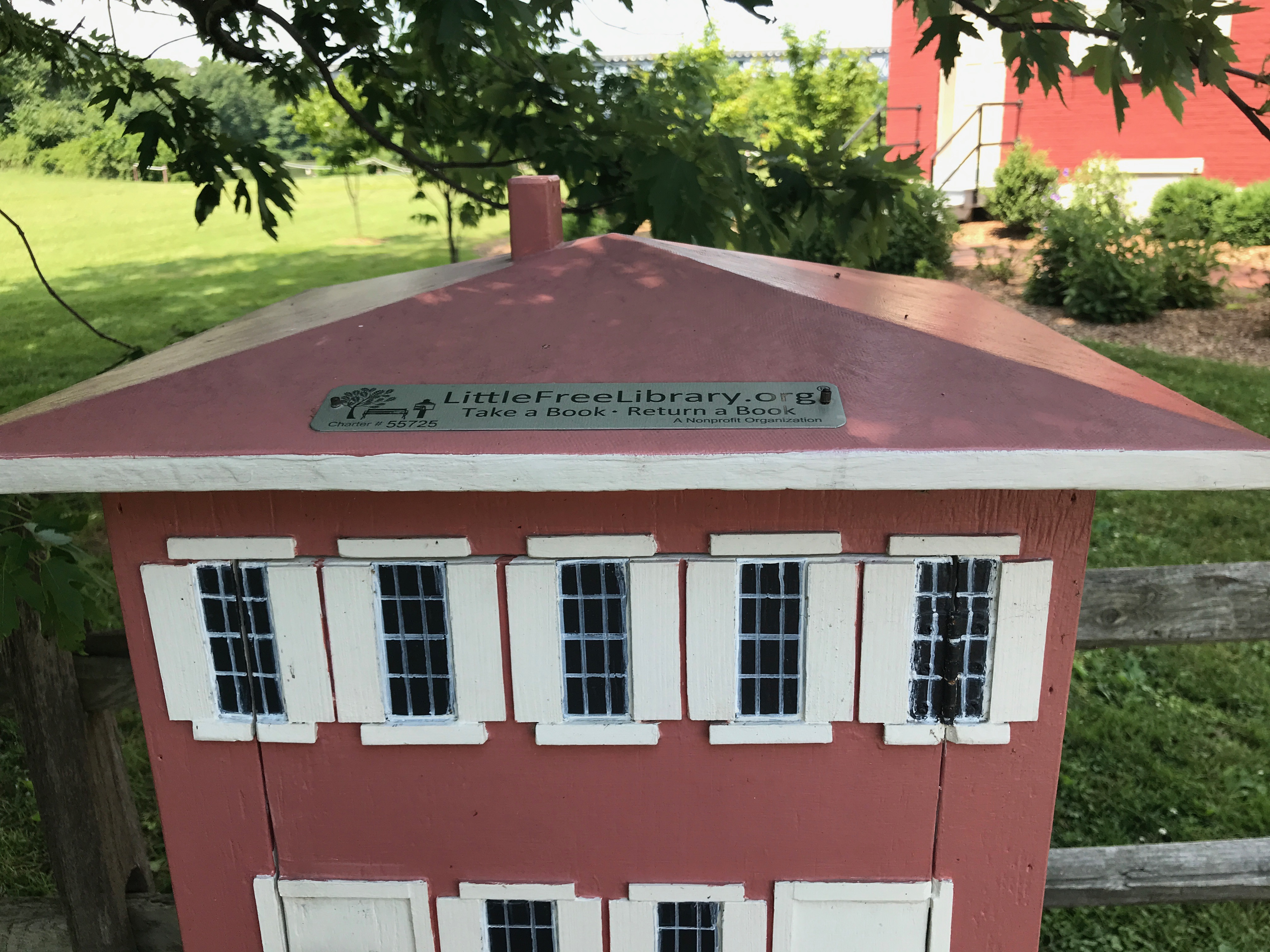
Walking back to the parking area, I noticed this LittleFreeLibrary.
I love how they made it look like the Lock House!
I bid adieu to Havre de Grace and headed across the bridge to Chesapeake City. I heard there was a canal museum there.
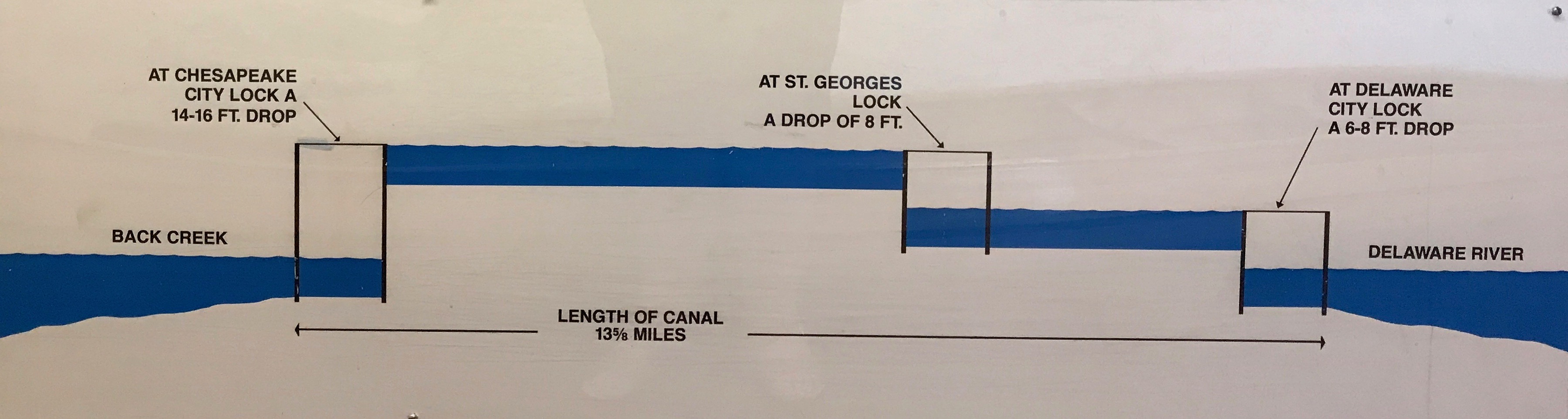
There was! It is the C & D Canal Museum run by the Army Corps of Engineers. My goodness, there were a lot of canals back in the day! This one is different in that the water was lifted to a higher level by steam operated waterwheels.
You see, in this canal, they had to go over something, so you couldn’t rely on natural water flow to do the trick.
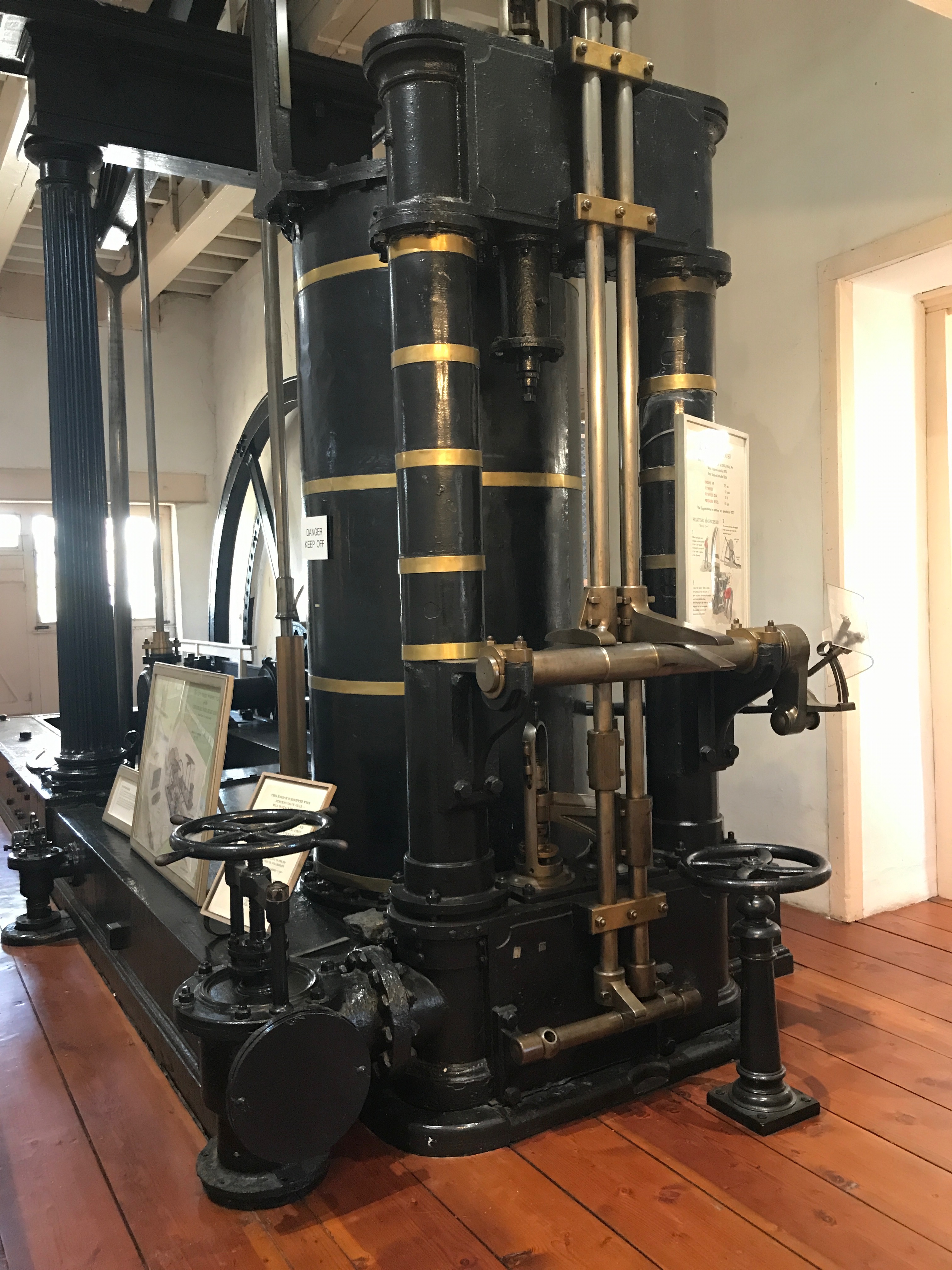
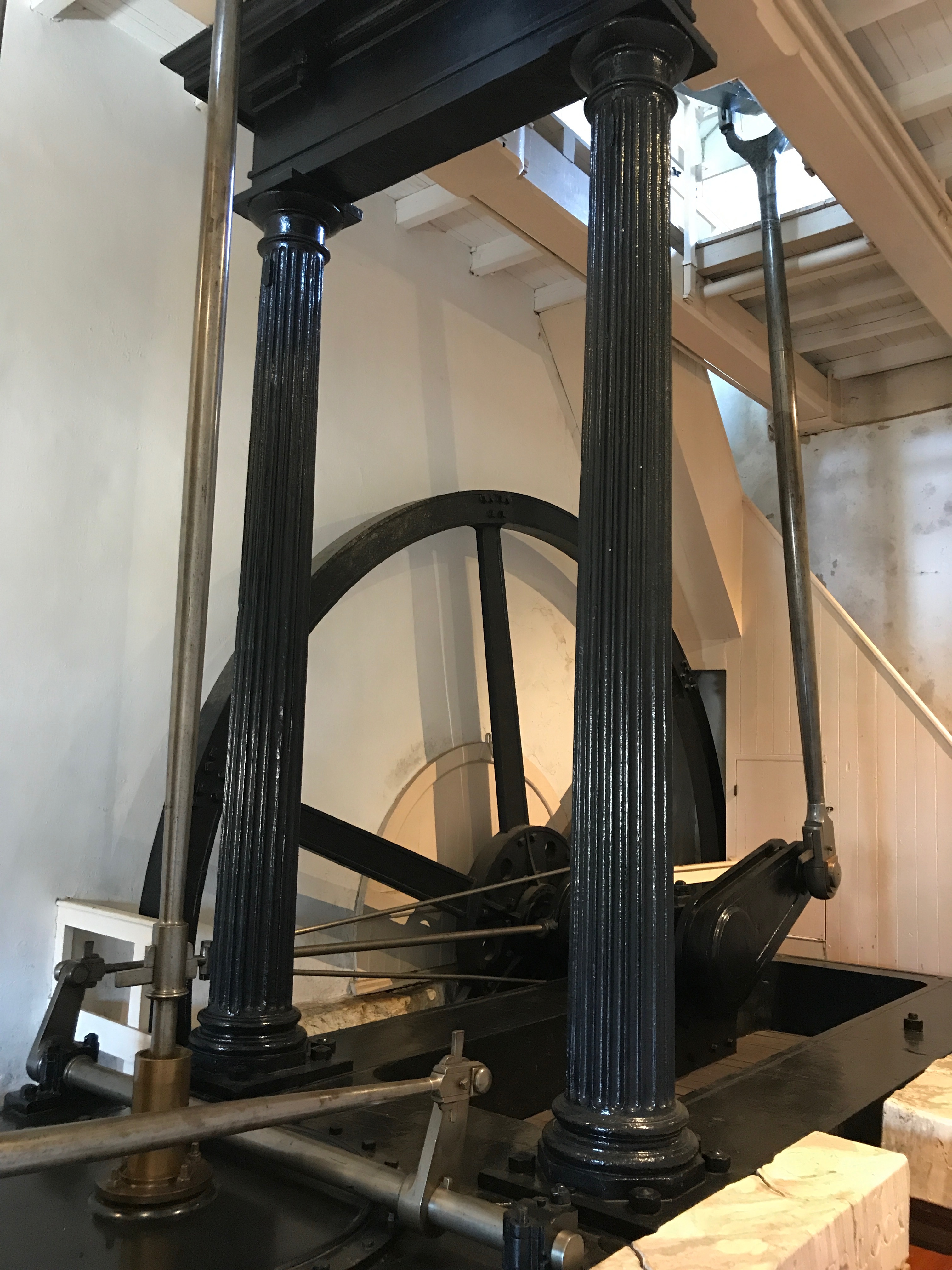
The machinery on display was impressive.
Notice the esthetic details. Can you imagine that manufacturers went to the effort to make their work so attractive? Maybe fluted cast iron columns are stronger than plain columns. Hmm…something to look into some other time.
In any event, no wonder they wanted to put their names on their products in such a prominent position.
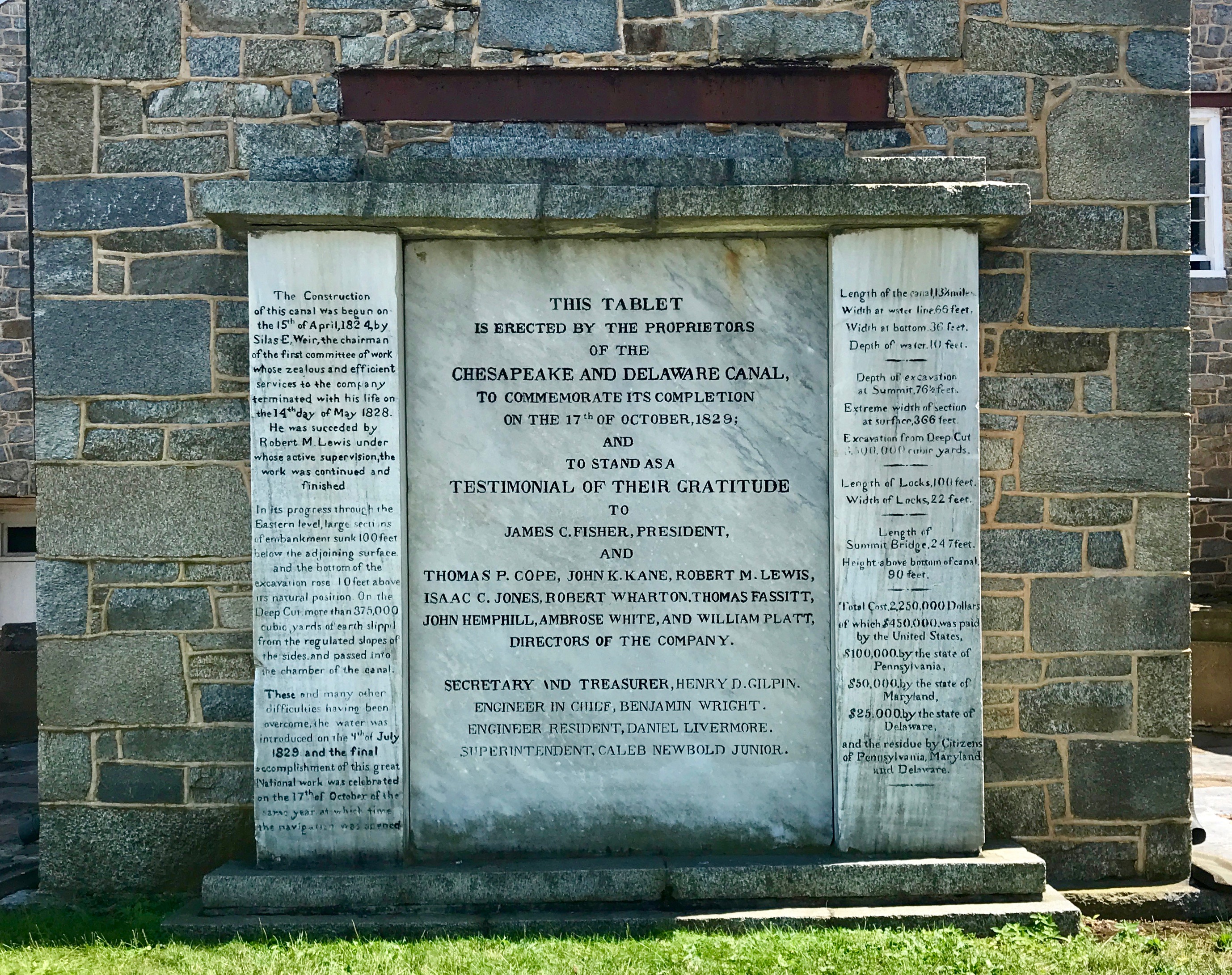
The Chesapeake and Delaware Canal – the C & D Canal – was first conceived in the mid 1600s by Augustine Herman. He was a mapmaker and he observed that the two great bodies of water – the Delaware River and Chesapeake Bay – were separated only by a narrow strip of land. Herman proposed that a waterway be built to connect the two. Unfortunately, this was an idea whose time had not yet come.
More than a century passed before anyone acted on the idea. In 1764, a survey of possible war routes across the Delmarva Peninsula was made. Again, no action was taken. In 1788, regional business leaders raised the idea again. The canal would reduce the trip from Philadelphia to Baltimore by nearly 300 miles.
Digging the canal was begun in 1802, but the project was halted two years later because of a lack of funds. The canal company was reorganized in 1822, and new surveys determined that more than $2 million in capital was needed to resume construction. Pennsylvania purchased $100,000 in stock, Maryland kicked in $50,000, and Delaware threw in $25,000. The federal government invested $450,000, with the remainder subscribed by the public.
Canal construction resumed in 1824, and within several years some 2,600 men were digging and hauling dirt from the ditch.
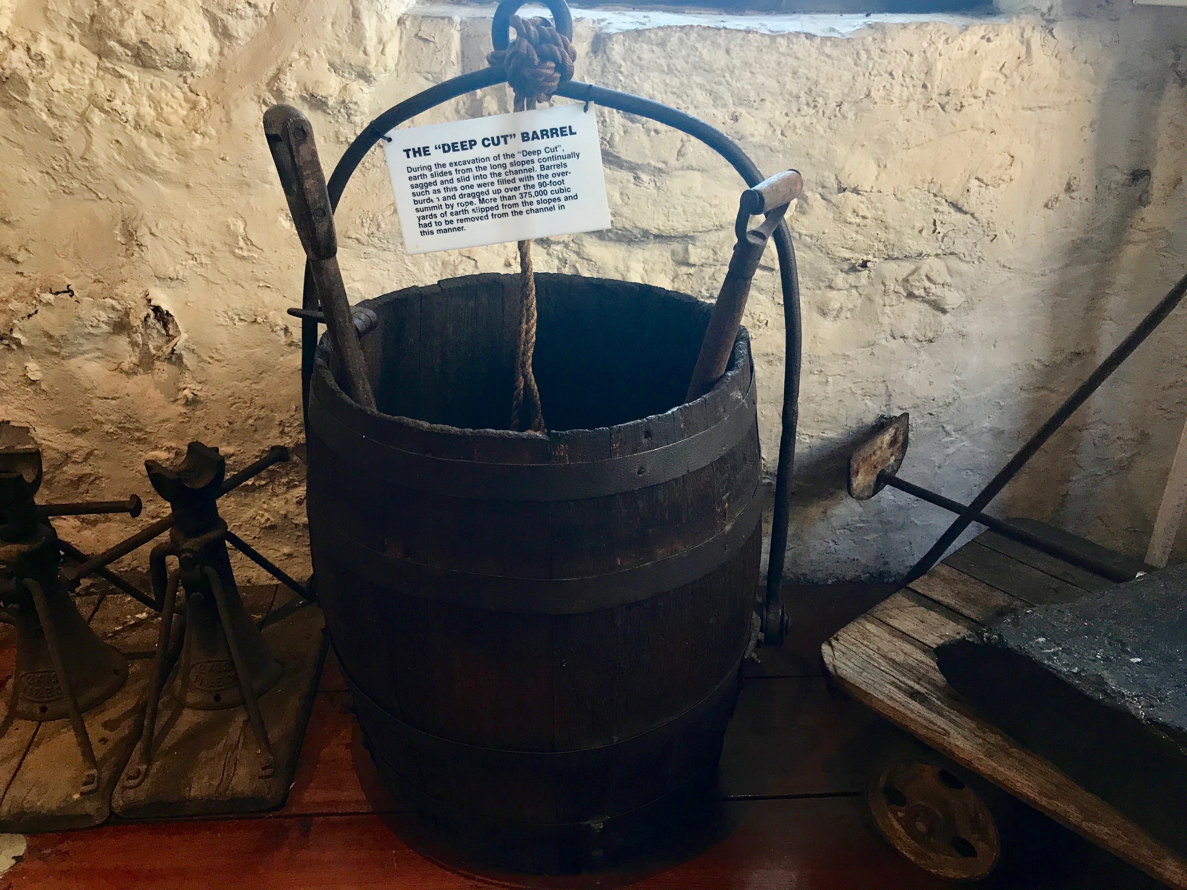
I have included a close up of the sign on the barrel.
In addition to the slides, the swampy marshlands along the canal’s planned route was an impediment to progress. Laborers told with pick, shovel and barrel at the immense construction task for the princely sum of 75¢ a day.
The canal was finally open for business in 1829, and its construction cost of $3.5 million made it one of the most expensive canal projects of its time. Of course, the Erie Canal, which opened in 1825, cost $7 million. But, it you want to look at cost per mile, the 363 mile-long Erie Canal cost about $19,300 per mile. The 14 mile-long C&D cost $250,000 per mile.
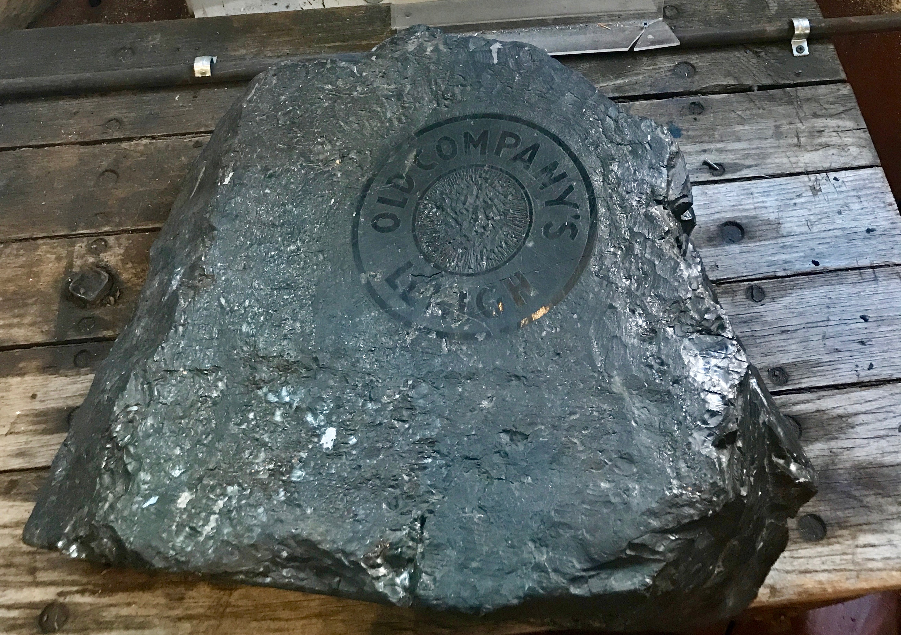
This canal is still in operation. At the beginning, the focus was on moving products. Coal was branded with the seal of the company it belonged to. If I understood the label with the display correctly, Old Companies was the local supplier of coal for the boilers that pumped the water in the canal. The mine was in Lehigh, Pennsylvania, and they had an office in Chesapeake City.
By this time, I was reaching the end of my tolerance for tourism for the day. I headed out in search of sustenance.
Hmm…which way should I go? To the nearest restaurant, of course! I found one sitting on the water’s edge.
Bless the waitress who took me seriously when I told her I was really thirsty.
What’s that I smell? Oh, yeah…money!
There were some might fine boats in the canal.
There were also smaller vessels.
You don’t need to be a millionaire to enjoy the water!
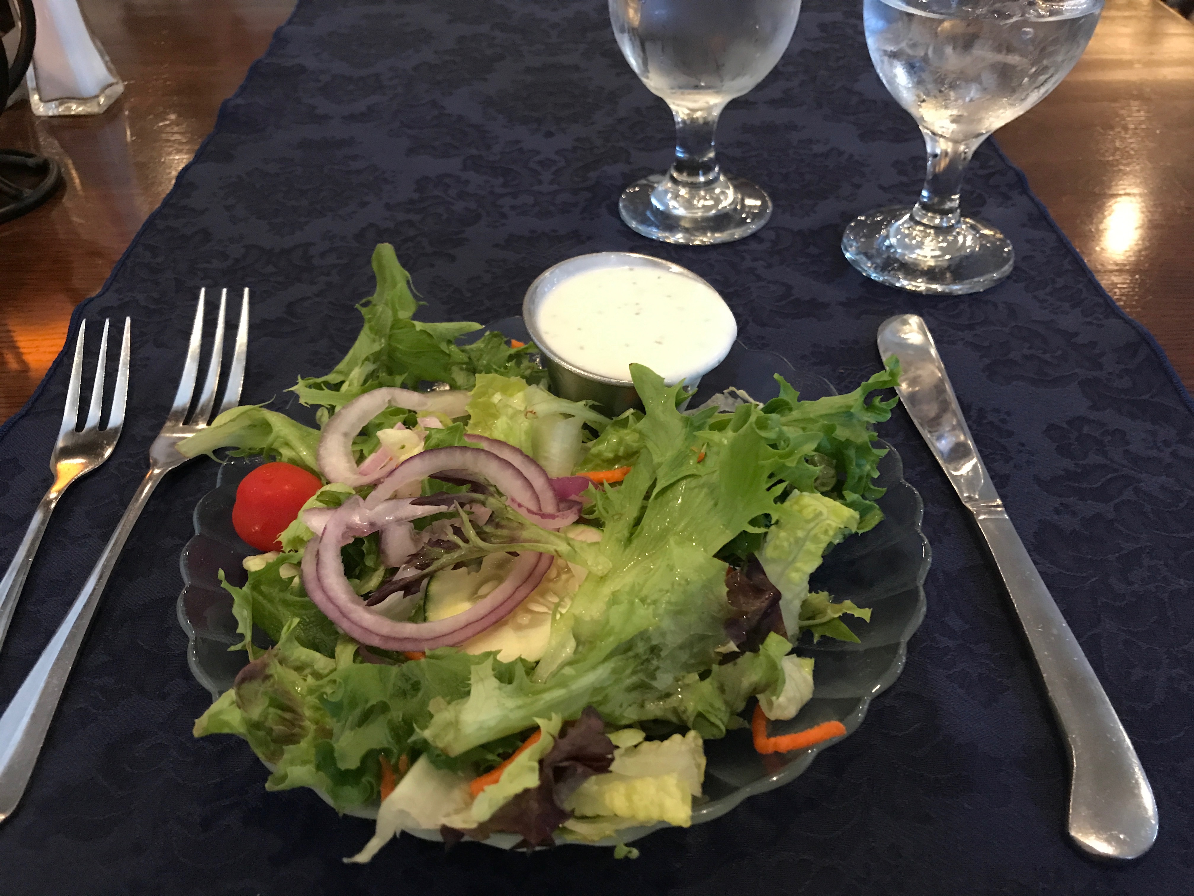
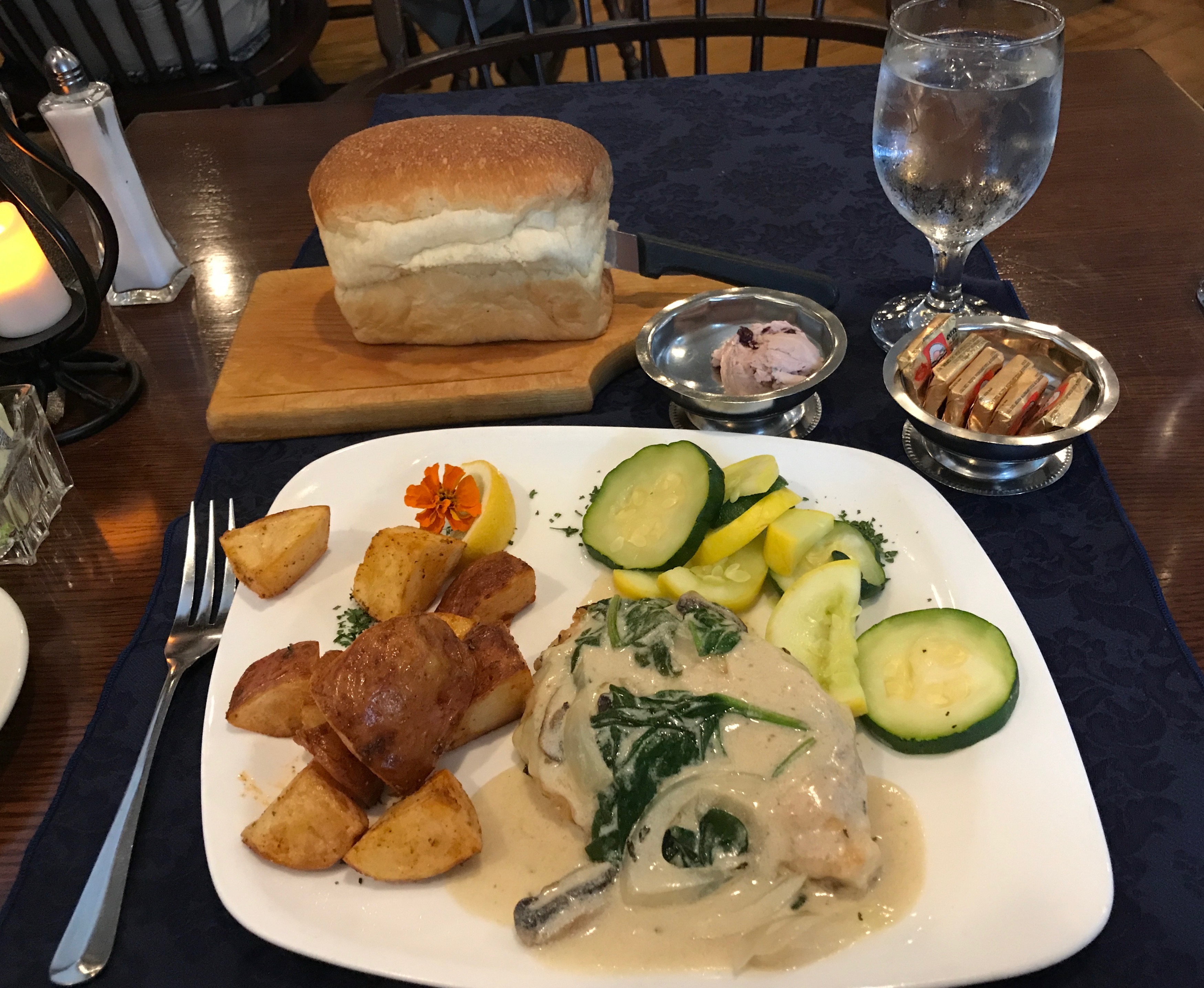
You know how sometimes when you are tired, hungry, and thirsty and you just can’t decide what to eat? Well, I solved that problem by going with two appetizers.
I started off with a refreshing wedge salad.
The baked brie rounded out the meal perfectly.
Sufficiently nourished, I headed back to whatever hotel I had holed up in for the weekend.
En route to the bridge, I spied these stairs. Amazing! And, no, I didn’t climb them. I wonder if the local residents use them.
After my big adventure, I spent the rest of the weekend holed up. I rested, relaxed, handled laundry and took care of business so I’d be ready to roll on Monday.
I even found a Wegmans! What a great grocery store!
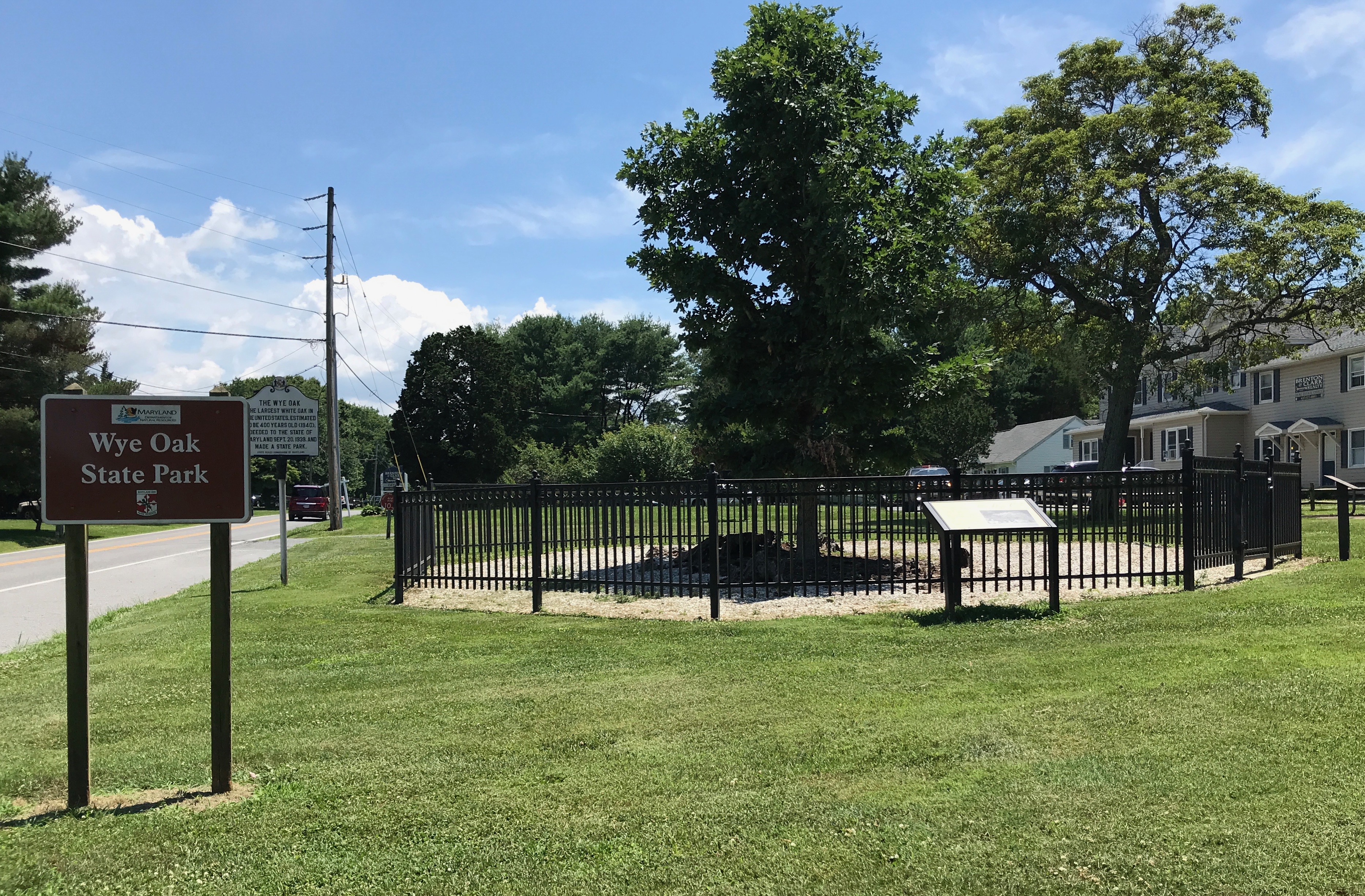
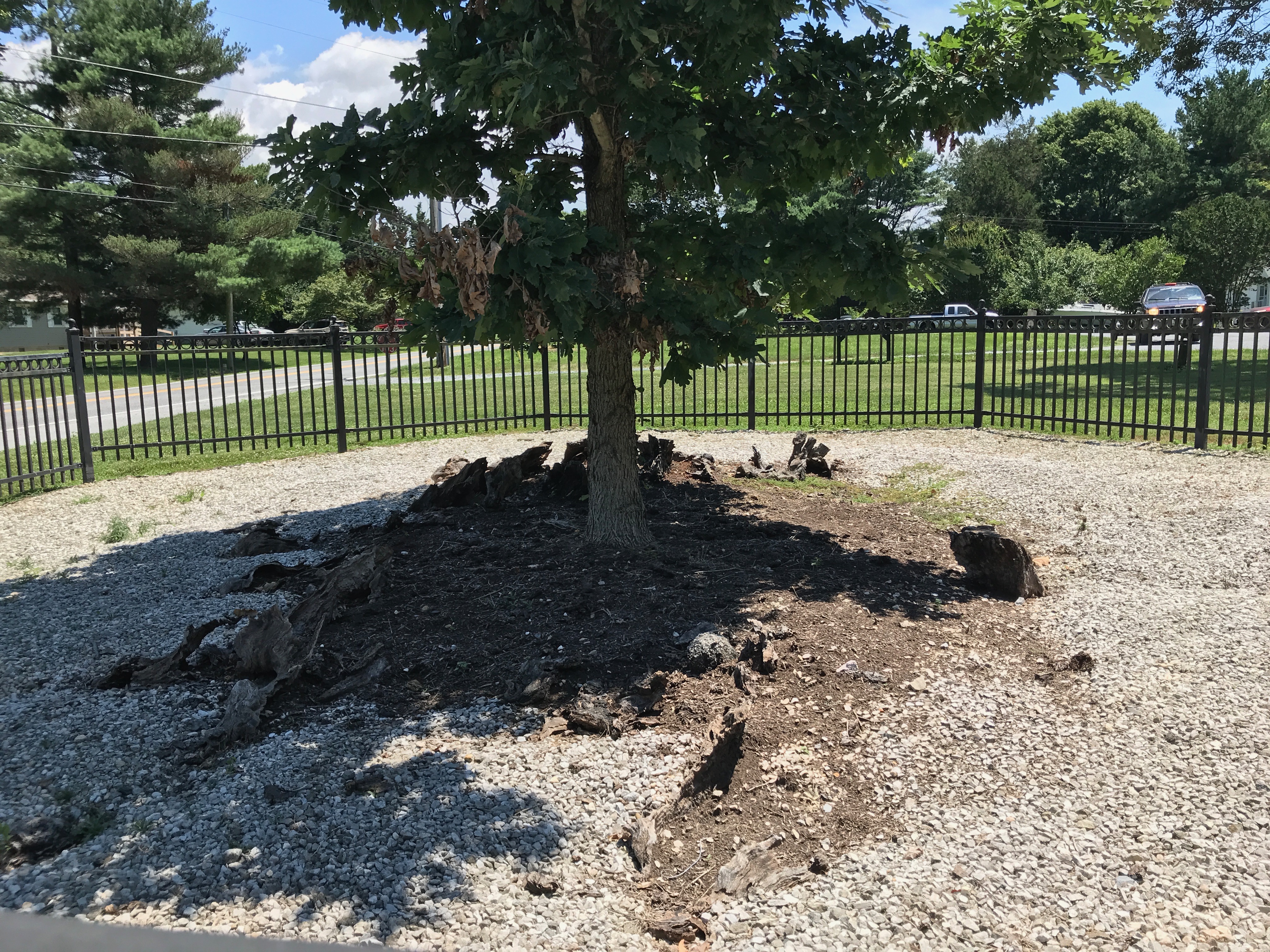
I had been in the area earlier, but the wheat harvest wasn’t in yet. I dropped off bags and told them that I would be back. I had noticed a sign for Wye Oak across from one of the elevators on my first loop, but it wasn’t a good time to stop.
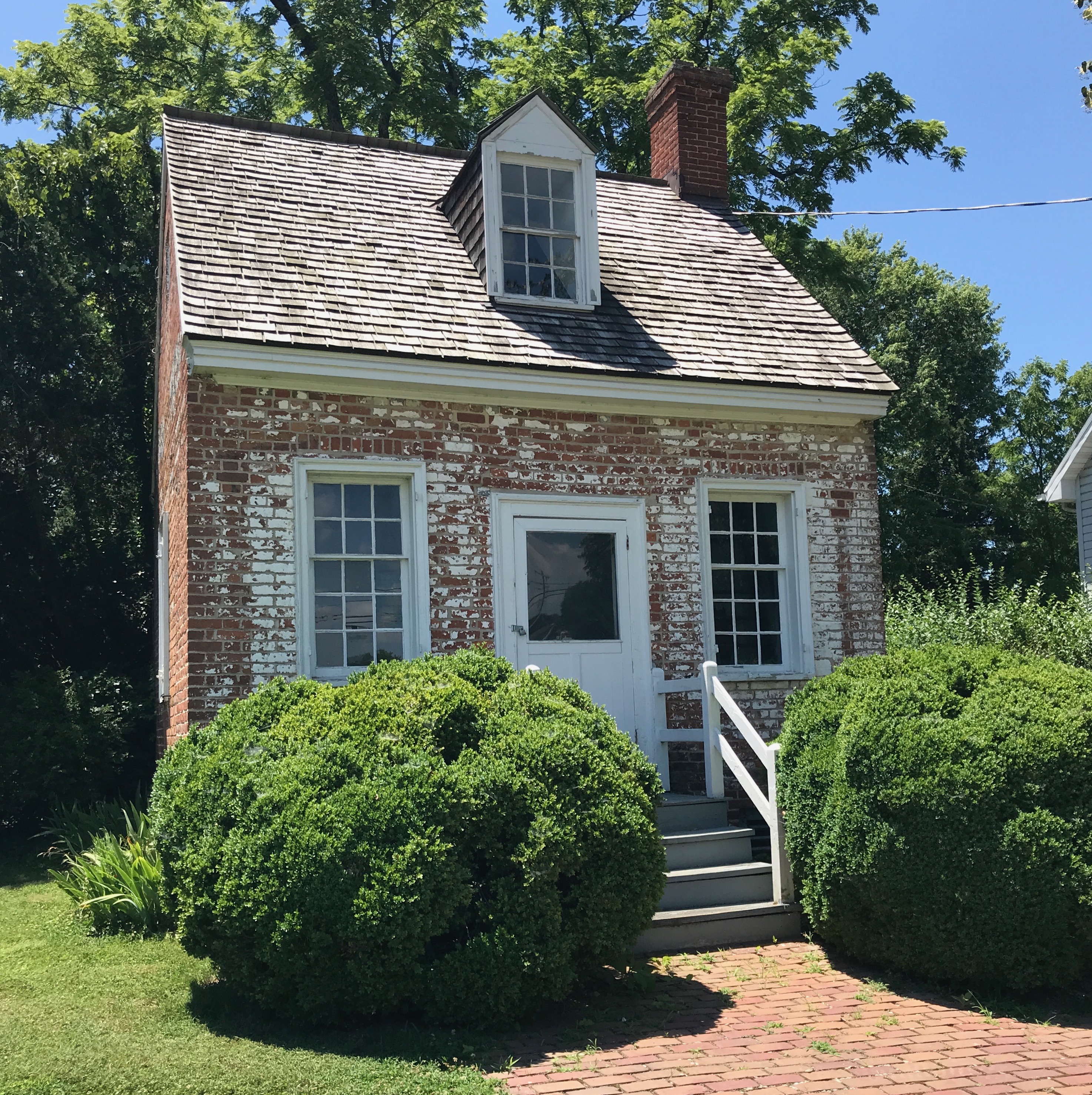
I mean, doesn’t this make you curious? The sign “Wye Oak State Park” on a lot that would make a nice playground and a rather juvenile tree inside a fence? I had to know more!
First of all, according to the Maryland Department of Natural Resources website, the park is actually 29 acres, not the acre or so out by the road. I don’t know where the rest of the park is. Maybe it’s down behind the housing development you can see in the background.
And, while the tree is rather young, if you look closely, you can see that it is growing where the original Wye Oak once stood.
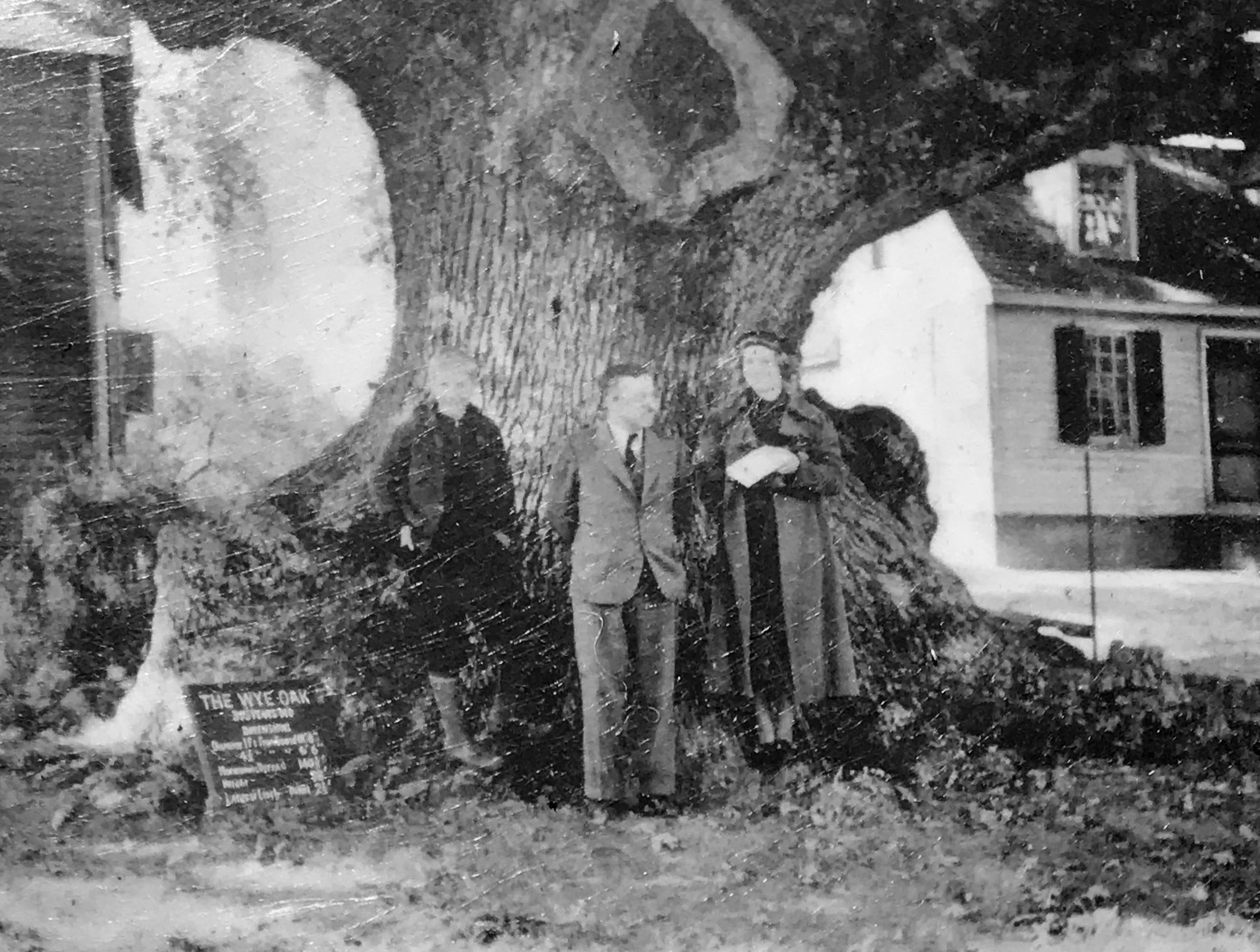
The tree growing now is a clone of the original Wye Oak, that was believed to be about 460 years old at the time of its destruction during a severe thunderstorm in 2002. The clone was planted in 2006, four years to the day of when the original tree fell in the storm. Two other clones were planted at Mount Vernon.
According to my Preferred Source, it measured 31 feet 10 inches in circumference at breast height. It was 96 feet high and had a crown spread of 119 feet. It is believed that the acorn that became the oak germinated around the year 1540. The Wye Oak was still bearing a maturing crop of acorns when it toppled in the thunderstorm.
This was the State Tree of Maryland State Tree and largest white oak tree in the United States from 1941 until its demise in 2002.
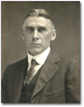
Incidentally, this tree was the inspiration for the American Forestry Association’s National Registry of Big Trees. Maryland State Forester Fred W. Besley made the first official measurement of the tree in 1909.
Fred W. Besley
In 1919, it was featured in American Forestry magazine as the first tree in the American Forestry Association’s “Tree Hall of Fame.” Besley founded the Big Tree Champion Program in 1925. As a result, the American Forests Association named the Wye Oak one of its first National Champion Trees.
The scientific name for the white oak is Quercus alba, and the current National Champion Tree for the Quercus alba is in Brunswick County, Virginia.
The Current Champion
The current Champion Tree has a score of 451. They Wye Oak had a score of 518.
The score is determined by applying this formula to the measurements of the tree:
Trunk Circumference (in inches) + Height (In feet) + 1/4 Average Crown Spread (in feet) = Total Points
The Wye Oak was one BIG tree!
But, all living things have a life span. The tree lost a large limb in 1956, which sparked concerns. Another large limb fell in 1984. That one weighed 70,280 pounds!
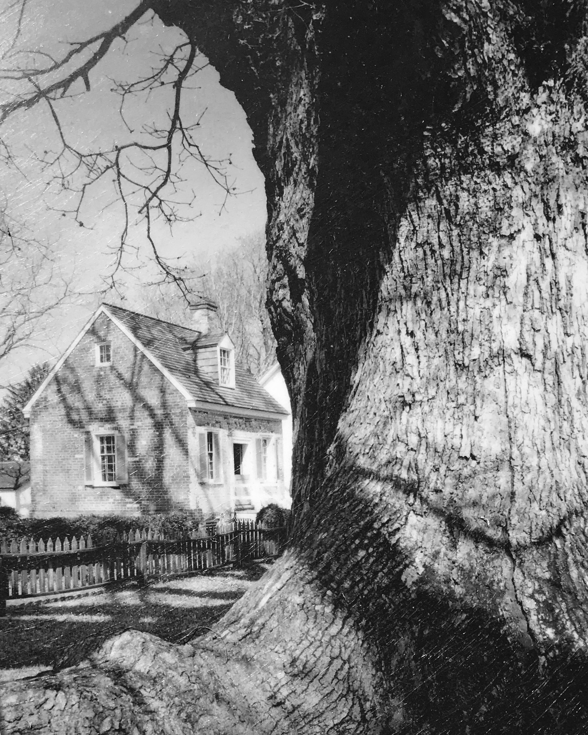
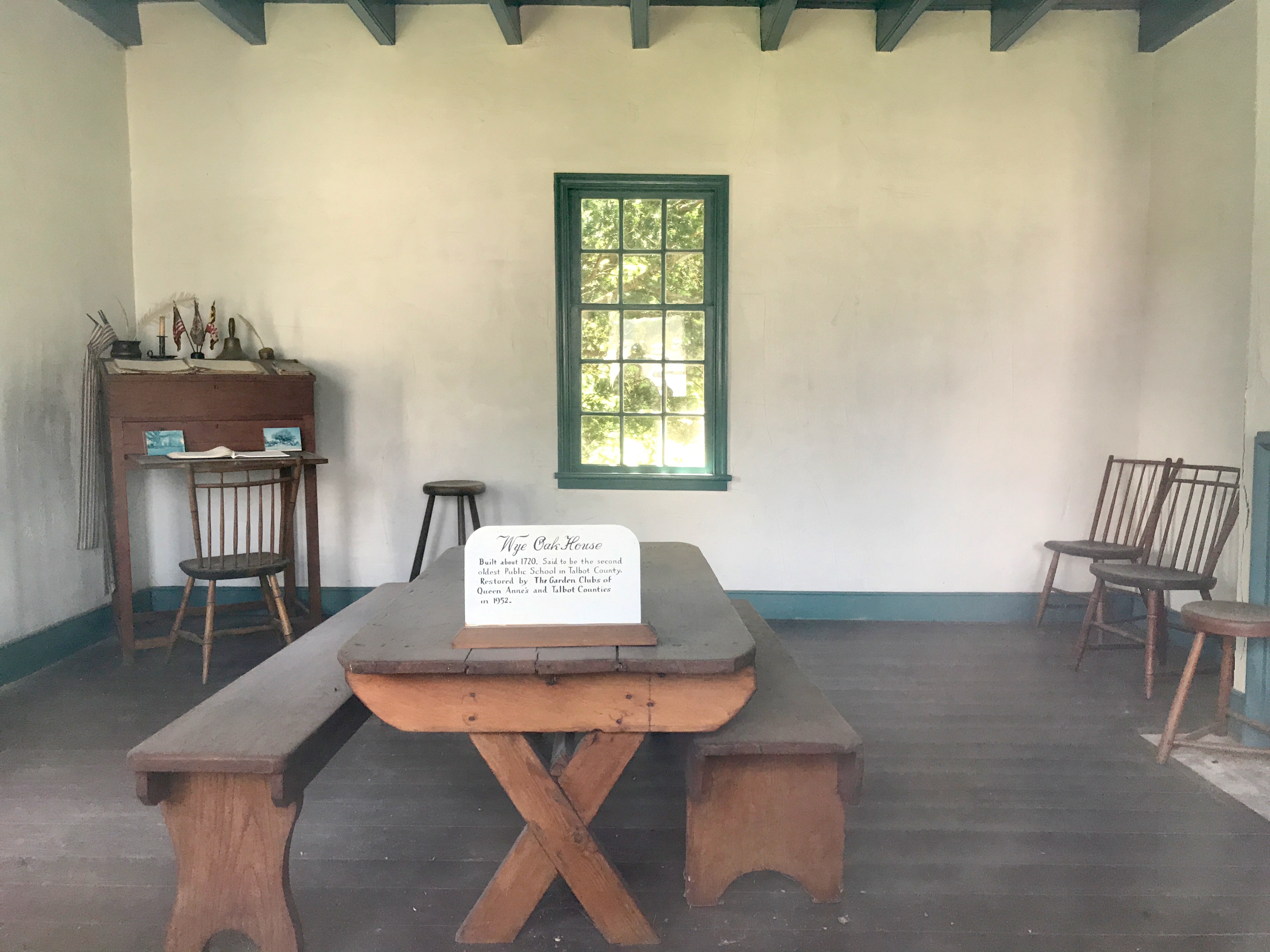
The little building you can see in the background is still standing. It is called the “Little House” in the shade. It dates back to about 1800, and local lore holds that it once served as a one-room schoolhouse.
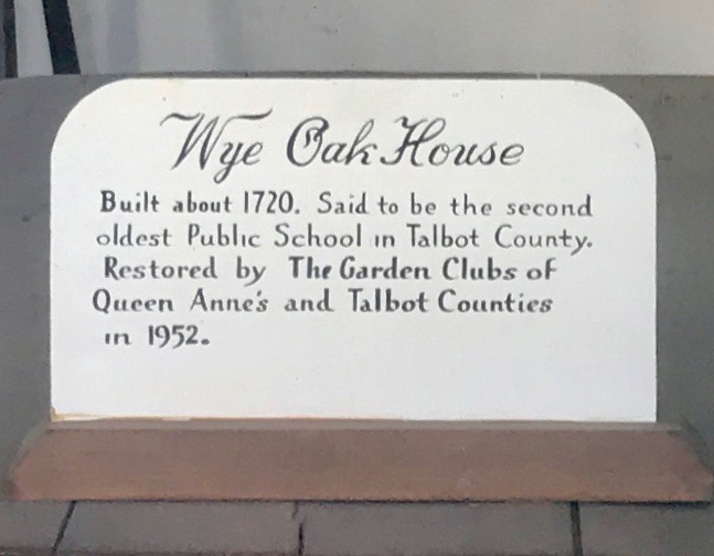
The Queen Anne Garden Club restored the “Little House” in 1952. The foundation was strengthened, windowpanes repaired and a walkway was laid. They furnished the house as a classic American one-room schoolhouse, although it may have been a dwelling.
And while on of the interpretive plaques says that it was built around 1800, I’ll let you read the sign on the table for yourself.
I guess there are alternative facts.
My tour completed, I got back in the Ford Transit and got ready to rack up more miles on the odometer.
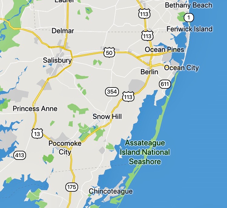
If you look at the map, faithful readers may notice that I am back in an area I’ve been before.
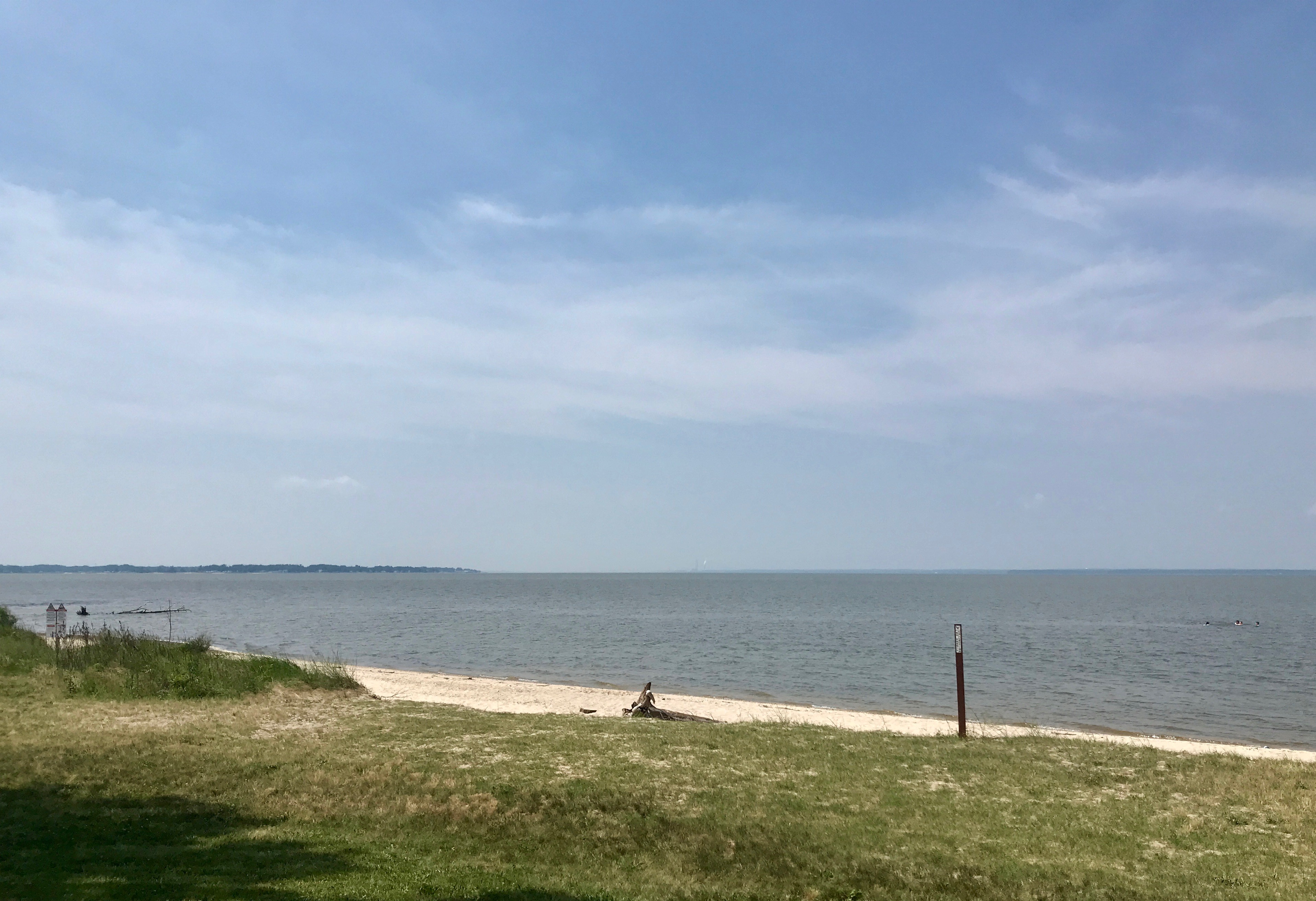
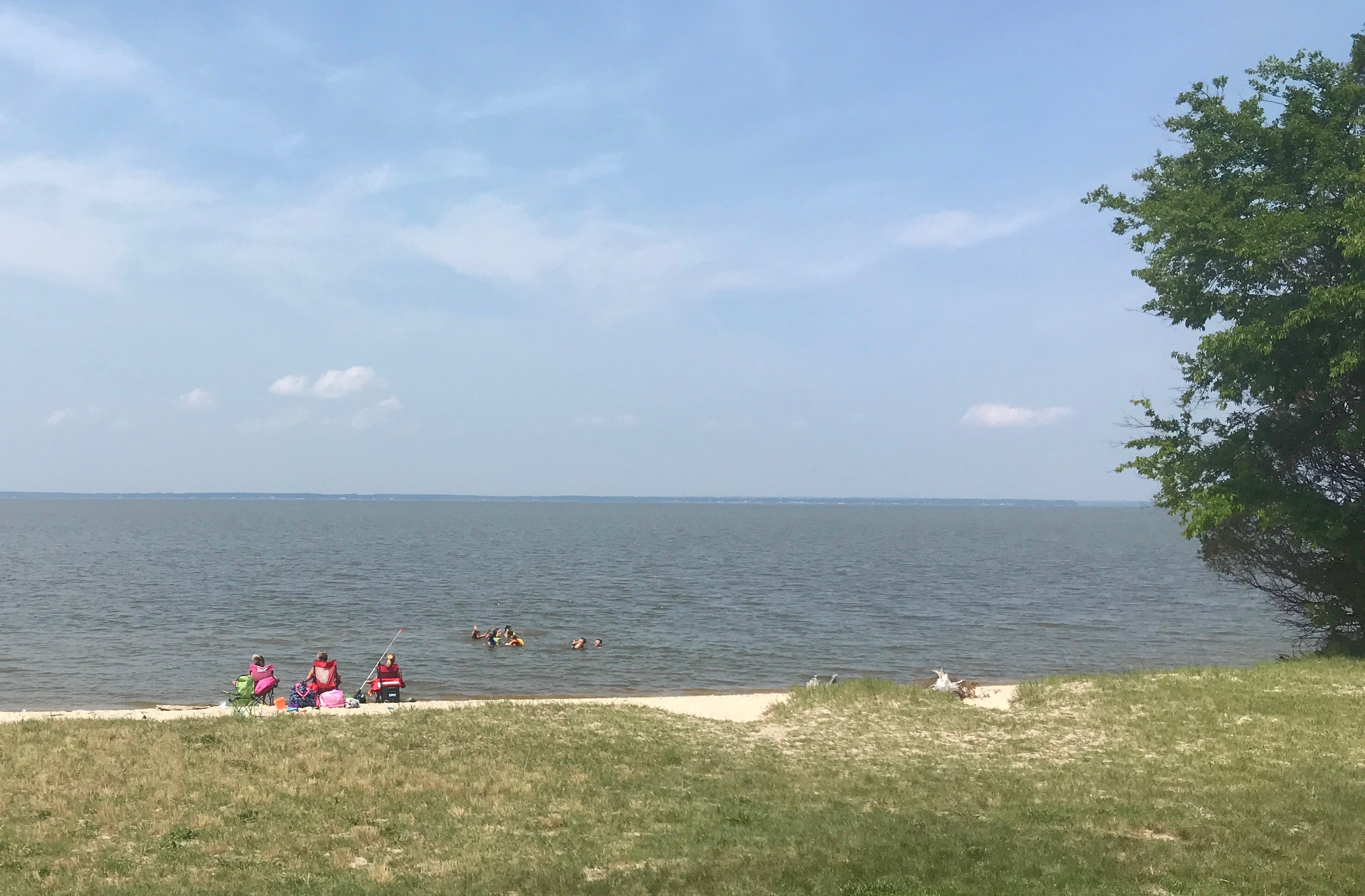
There’s Chincoteague and Assateague down there in the South. My last stop of the day was just east of Salisbury, so I figured that I might as well head over to the shore for the night.
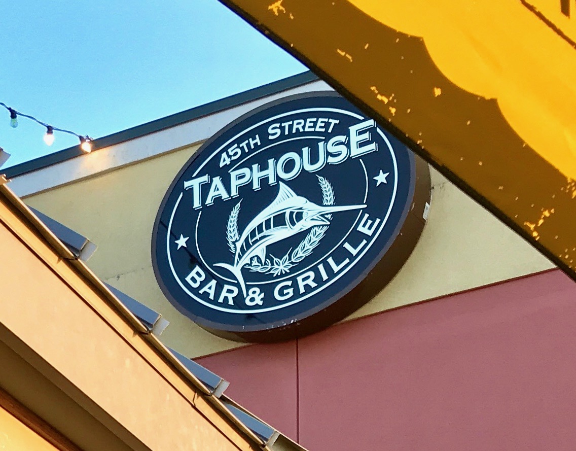
I used one of those booking apps and found a hotel that was probably an elegant location back in the day. It was going to be fine for the night. After getting settled in room #2 – the first room they put me in didn’t have functioning air conditioning – I set out in search of dinner.
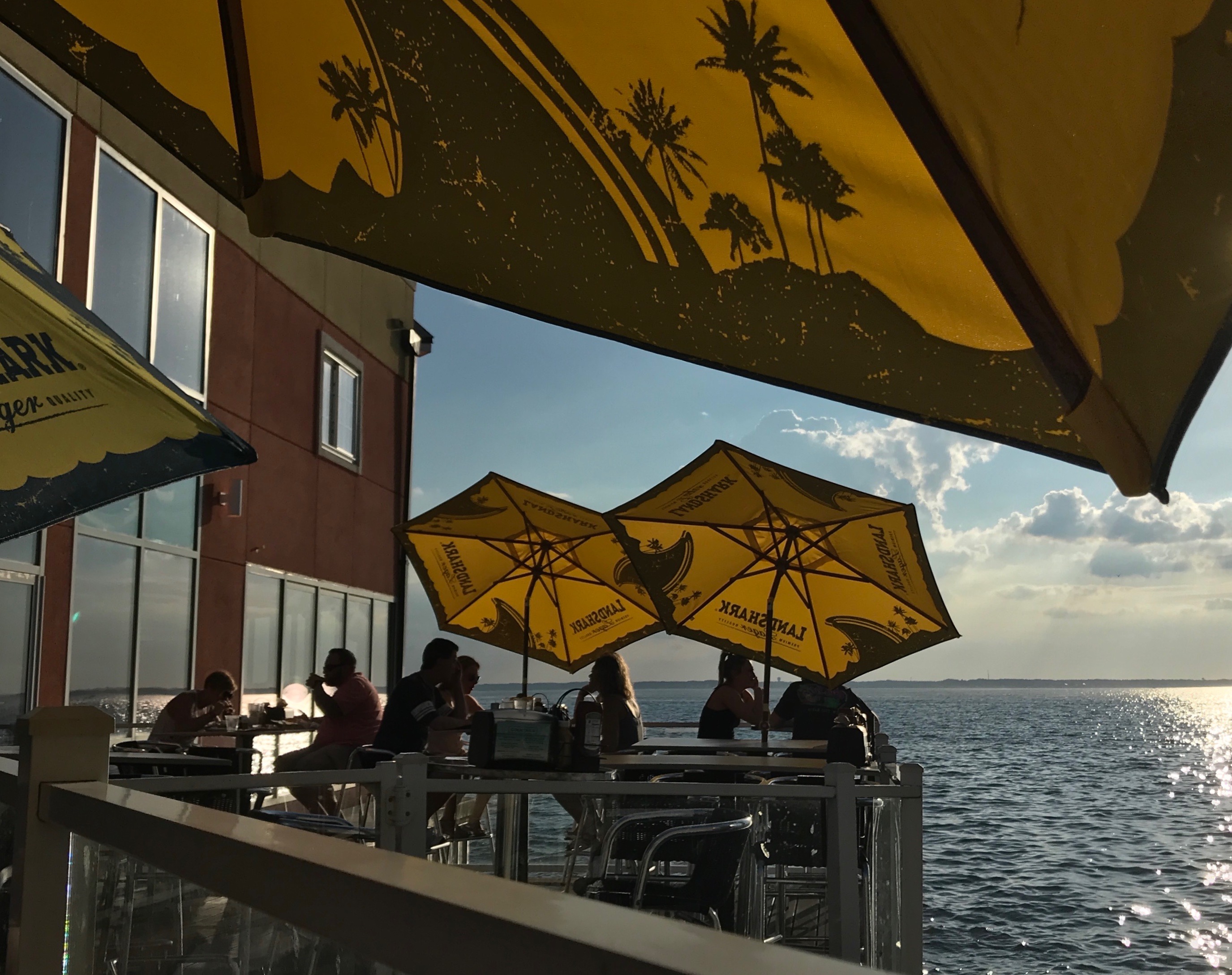
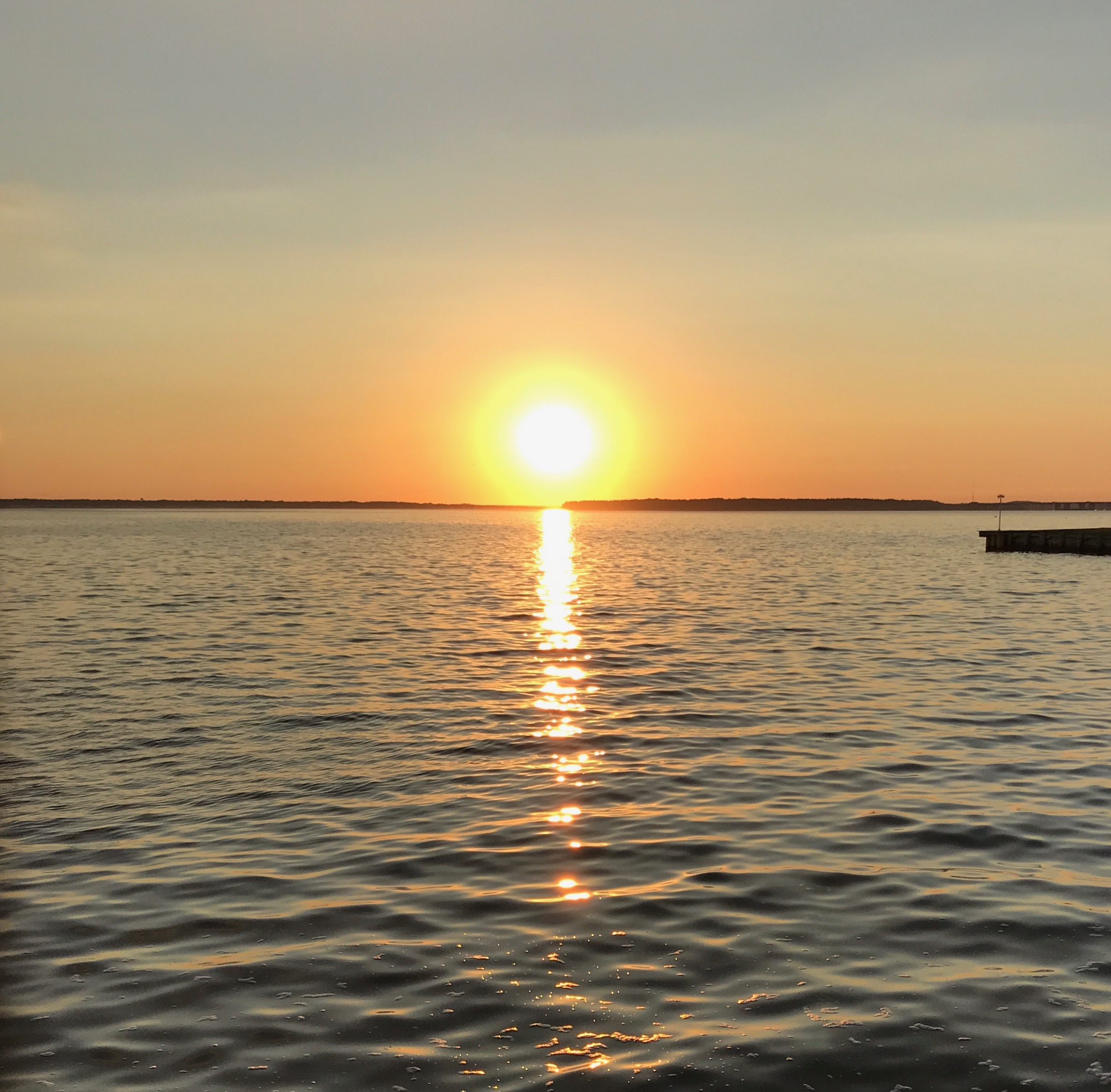
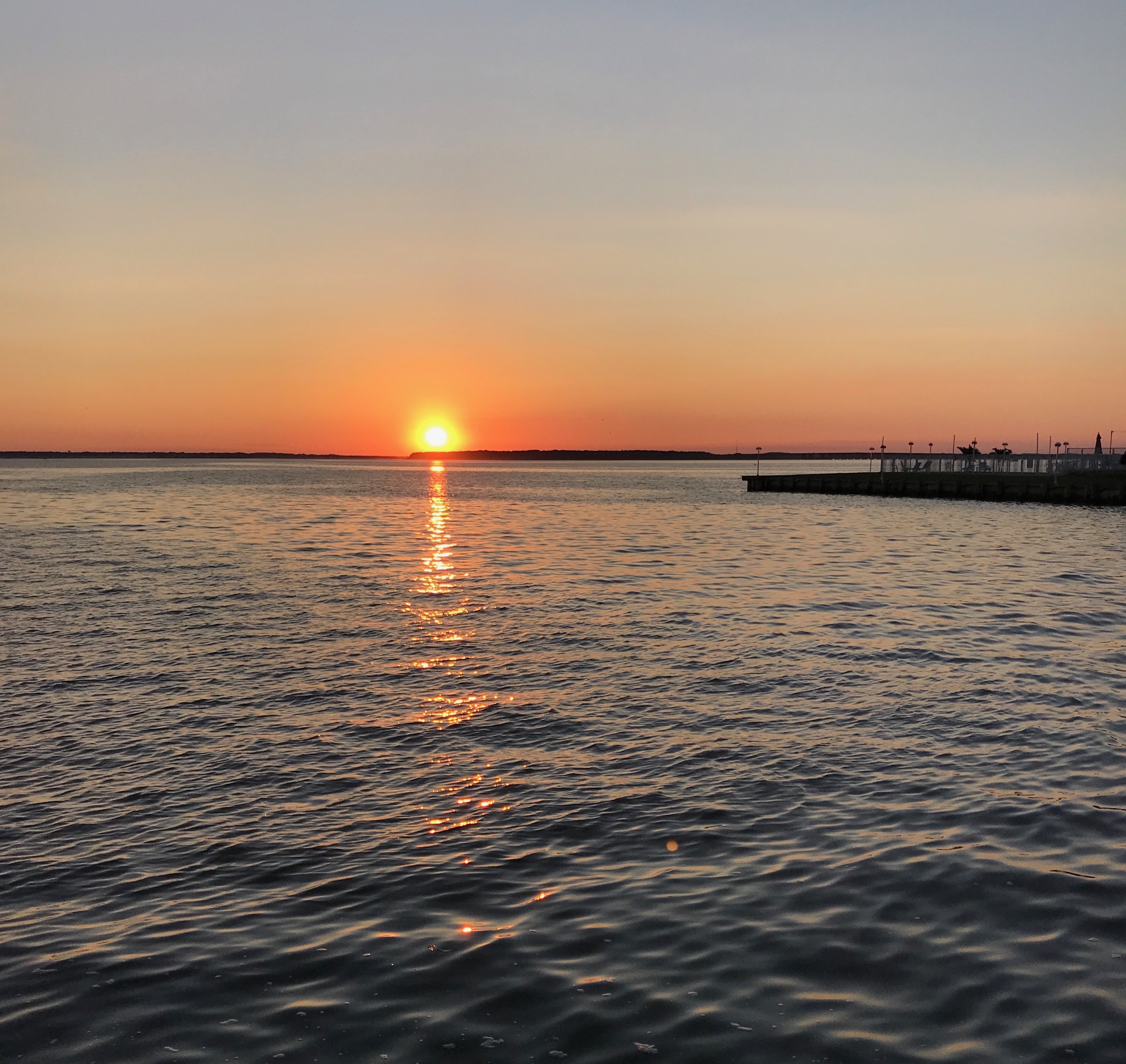
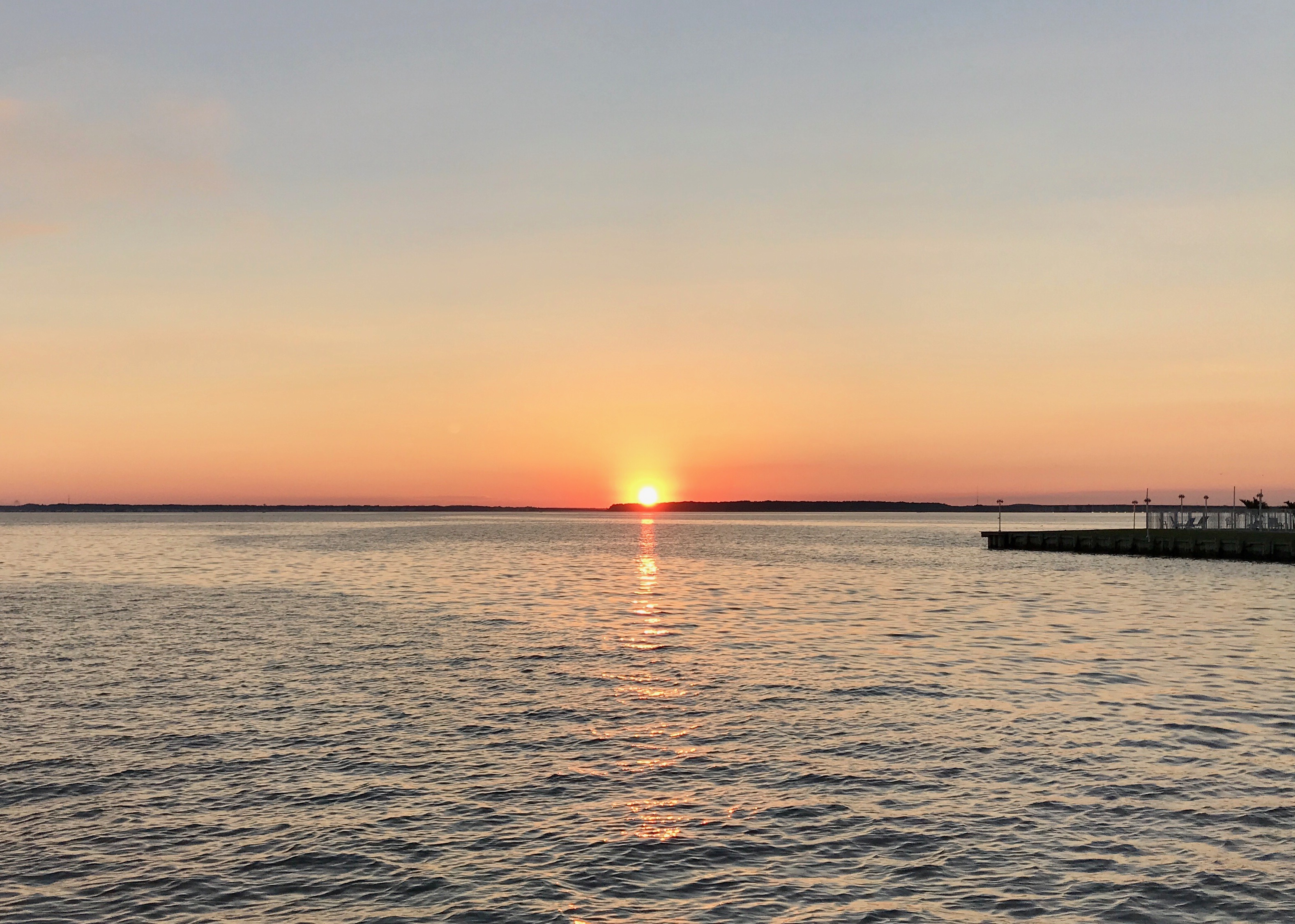
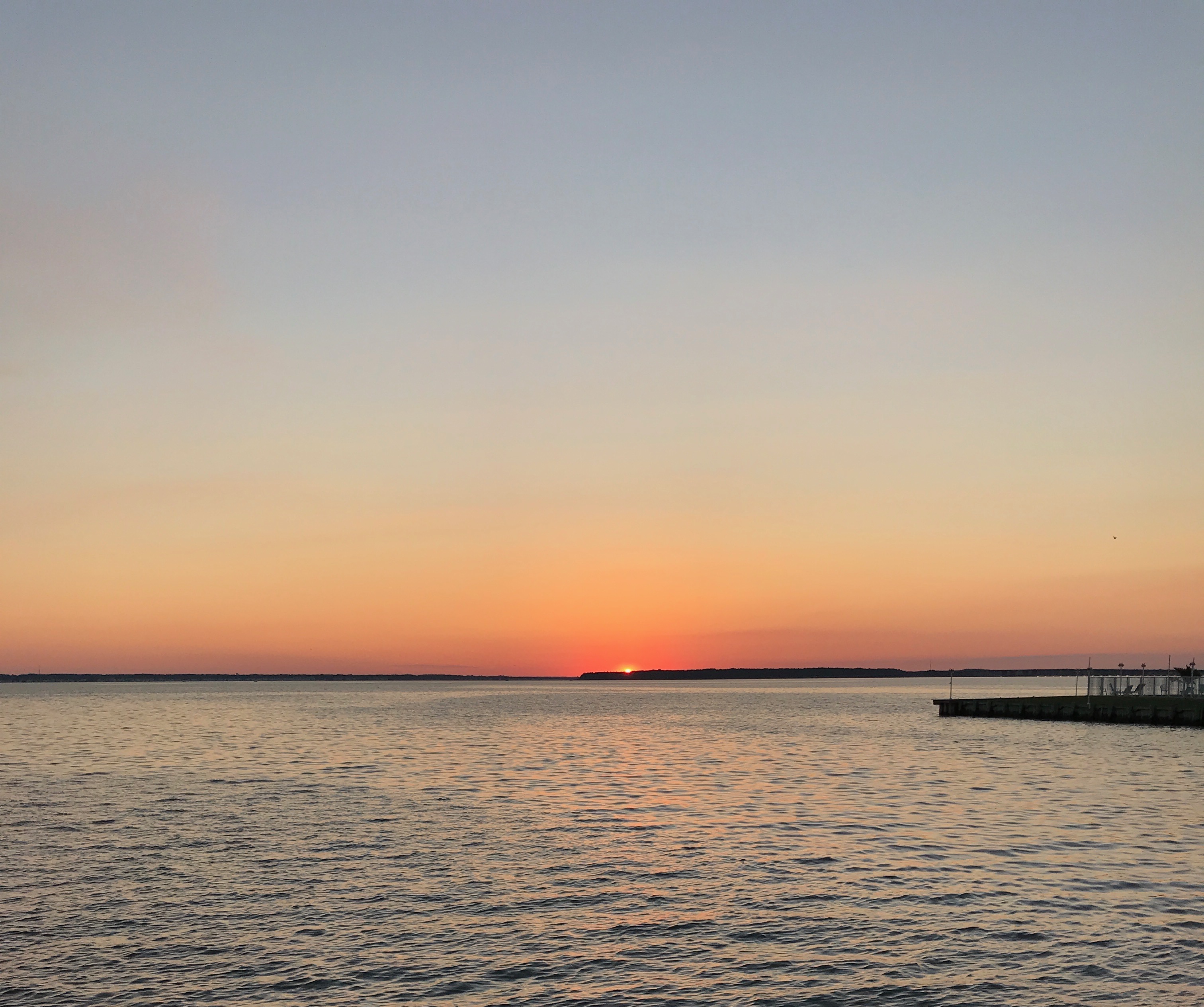
Just down the road, I found the 45th Street Taphouse Bar & Grill. The big attraction for me was that they had a patio facing the bayside, and I would be able to watch the sunset.
What a lovely evening!
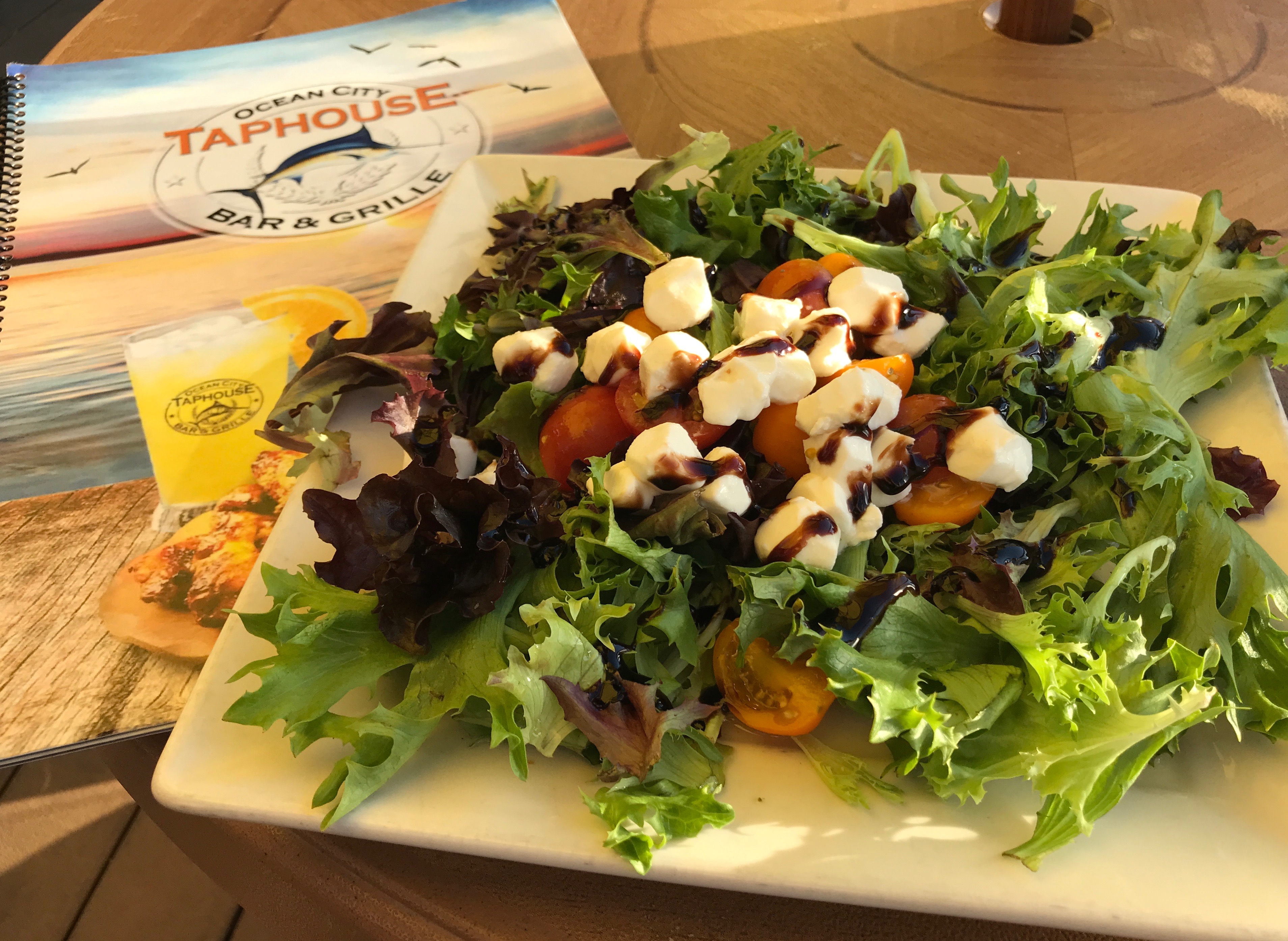
I perused the menu and settled on the Caprese Salad. This is what I had in mind, photo courtesy of The Food Network:
Doesn’t that look refreshing and delicious?
Unfortunately, this is what I was served:
Oh, well… it was edible and it would keep body and soul together. I considered sending it back, but who knows if anything on their menu was better. Besides, I was there for the sunset.
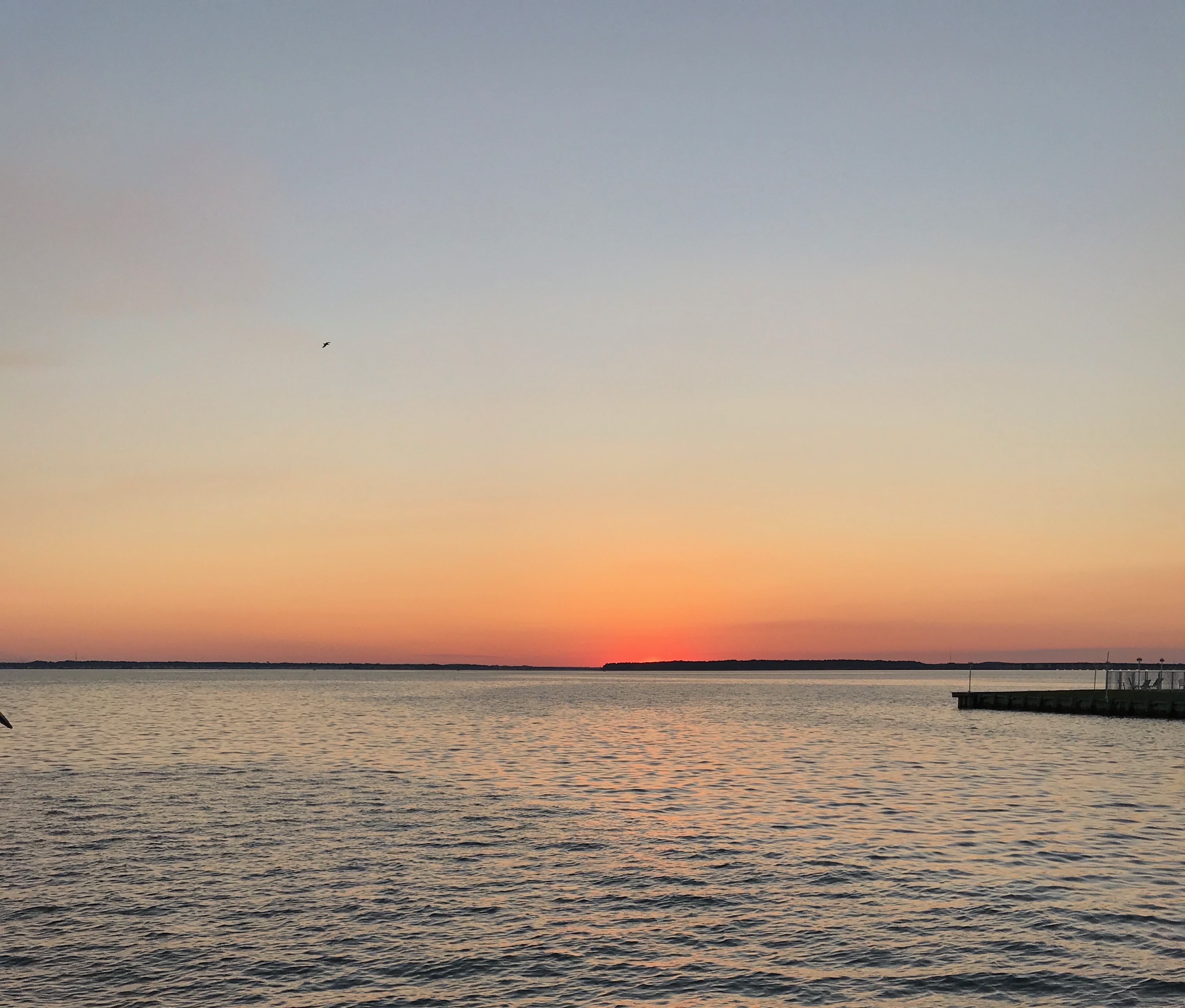
After nibbling on my salad and nursing my water for a long time, the sun finally started going down.
And down…
and down…
sill going…
Just the tiniest sliver left above the horizon.
Finally, it was gone.
And so was I. Back to my room to get rested up for another day on the road.
With the weekend over, it was time to get rolling. I looked at the map, and realized one of the routes I could choose would take me through Manassas, Virginia.
I had been there in 2015 for quite a few days, so I didn’t really need to tour the battlefield again. However, old friends live there, so I stopped off for a quick visit.
Linda went to college with me. She met Tom after college. I knew Tom was planning to marry her when he made her a piece of furniture. For some reason, that didn’t even dawn on her – or so she said.
And, in the “no photo or it didn’t happen” category, here is the proof that I visited.
With that technicality out of the way, I had to keep rolling. This wasn’t my final destination of the day. I had to get a little further down the road to be positioned for the next round of collections.
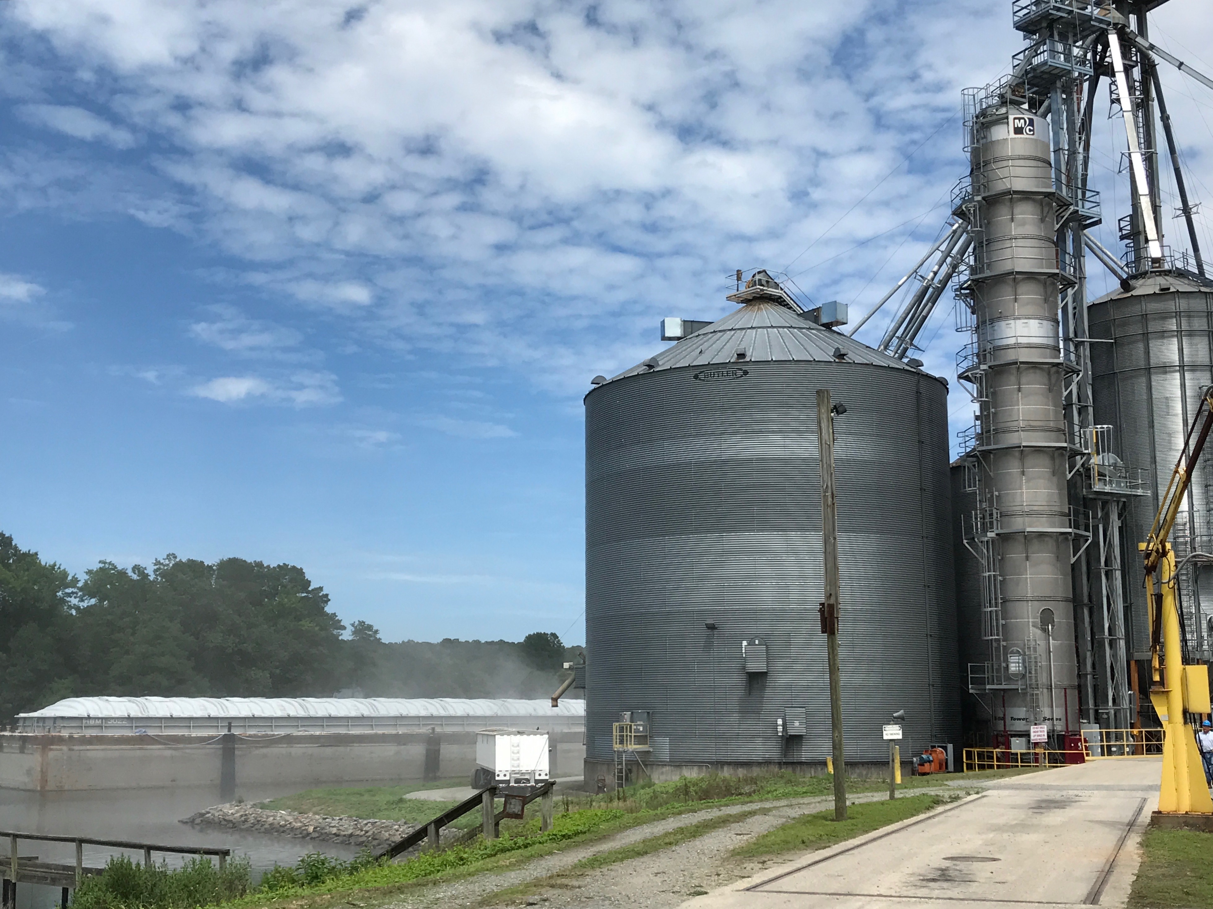
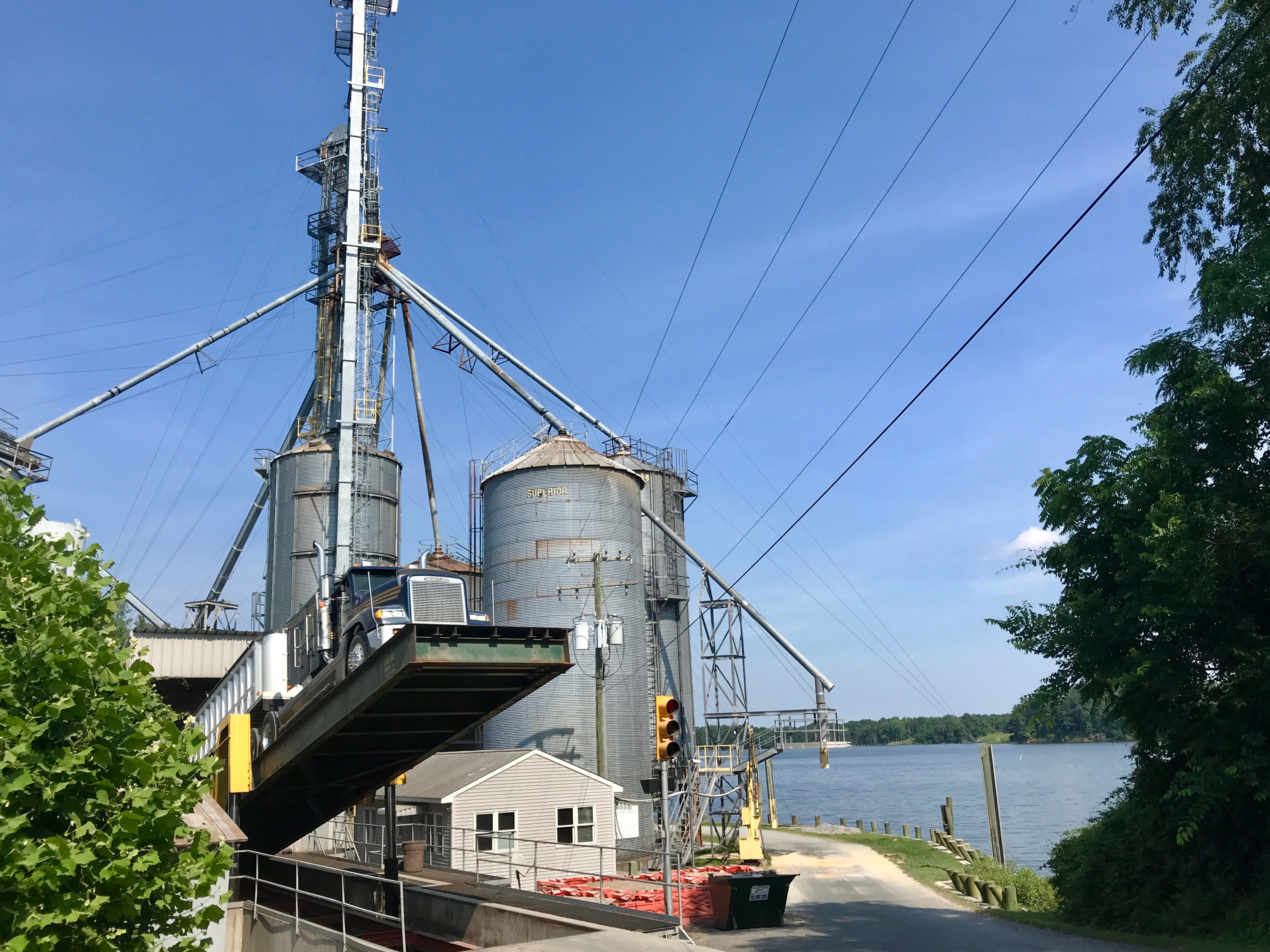
This was really an interesting gig! This facility loads the grain right on to the barge. It’s not much to look at, but that’s the barge on the left side of the photo.
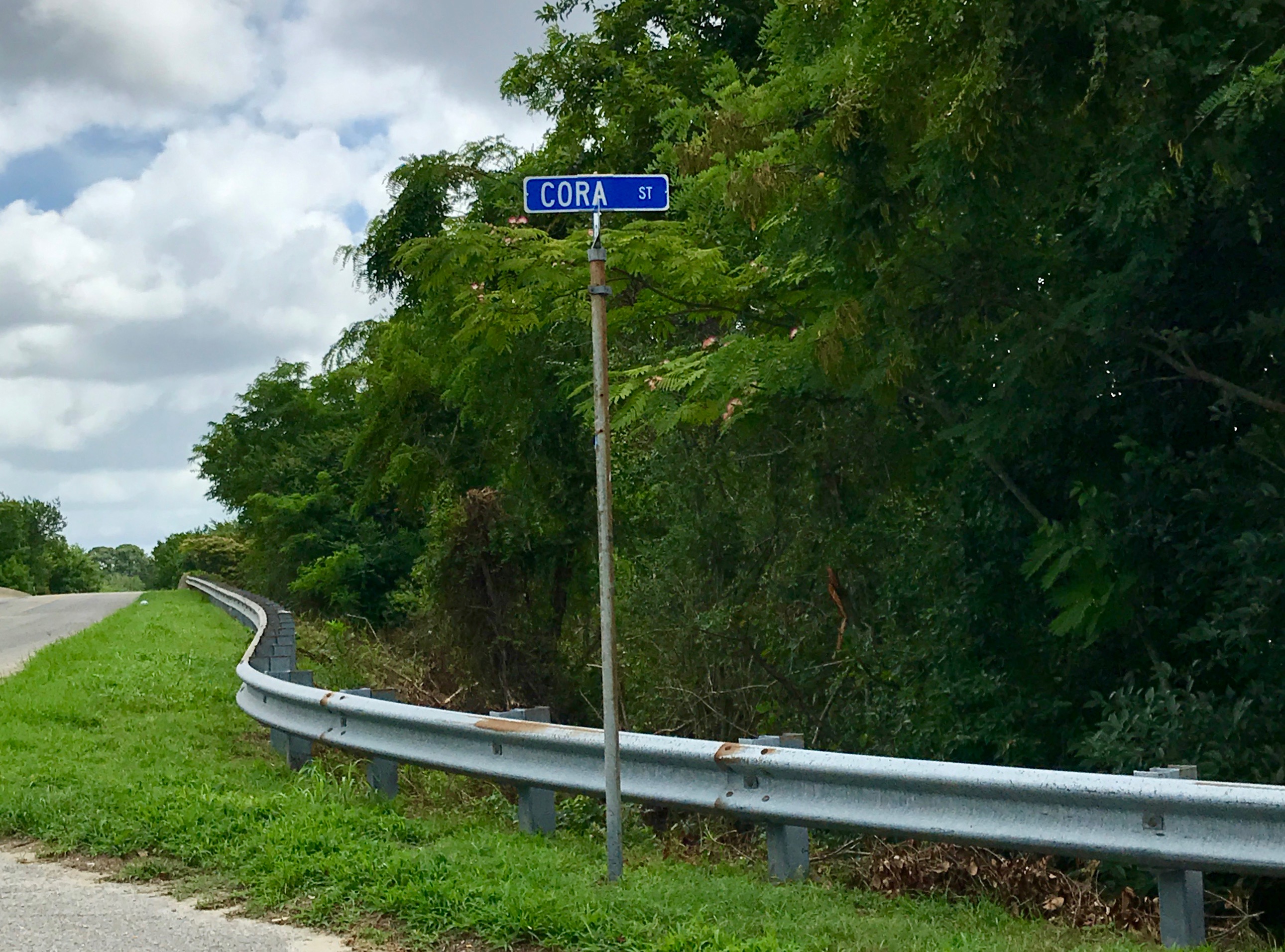
This street sign made me think of my dear kitty, Cora. I hope she remembers me when I get home.
I came across a lot of interesting road signs on my travels. I imagine there is an interesting story about why this thoroughfare is named “Prison Camp Road.” But, there was no one to ask, and I had places to go. In fact, I don’t even know where I was!
When my work day was done, I found a room for the night in some roadside hotel near Elizabeth City, North Carolina and then headed out to eat.
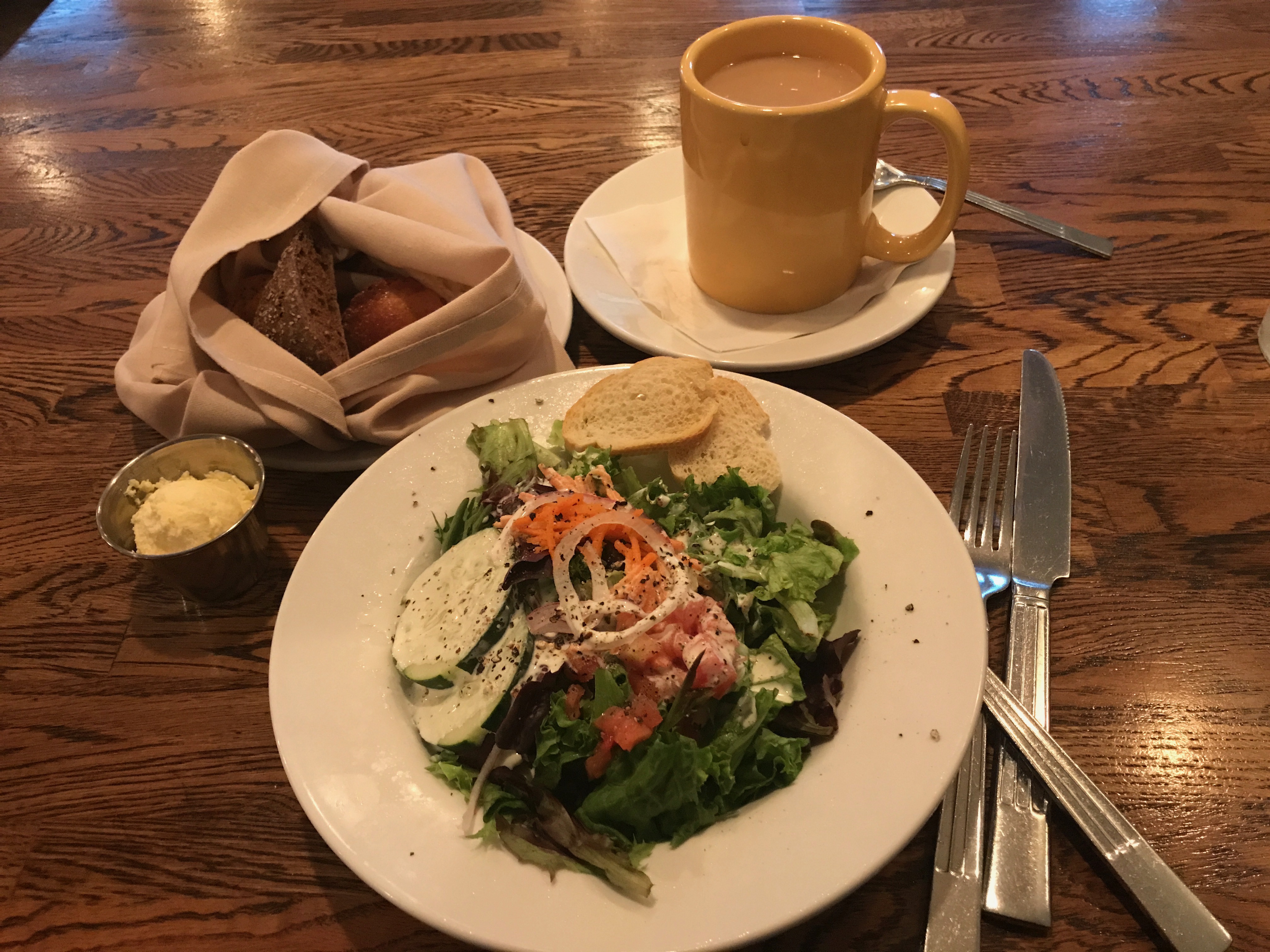
First, a salad.
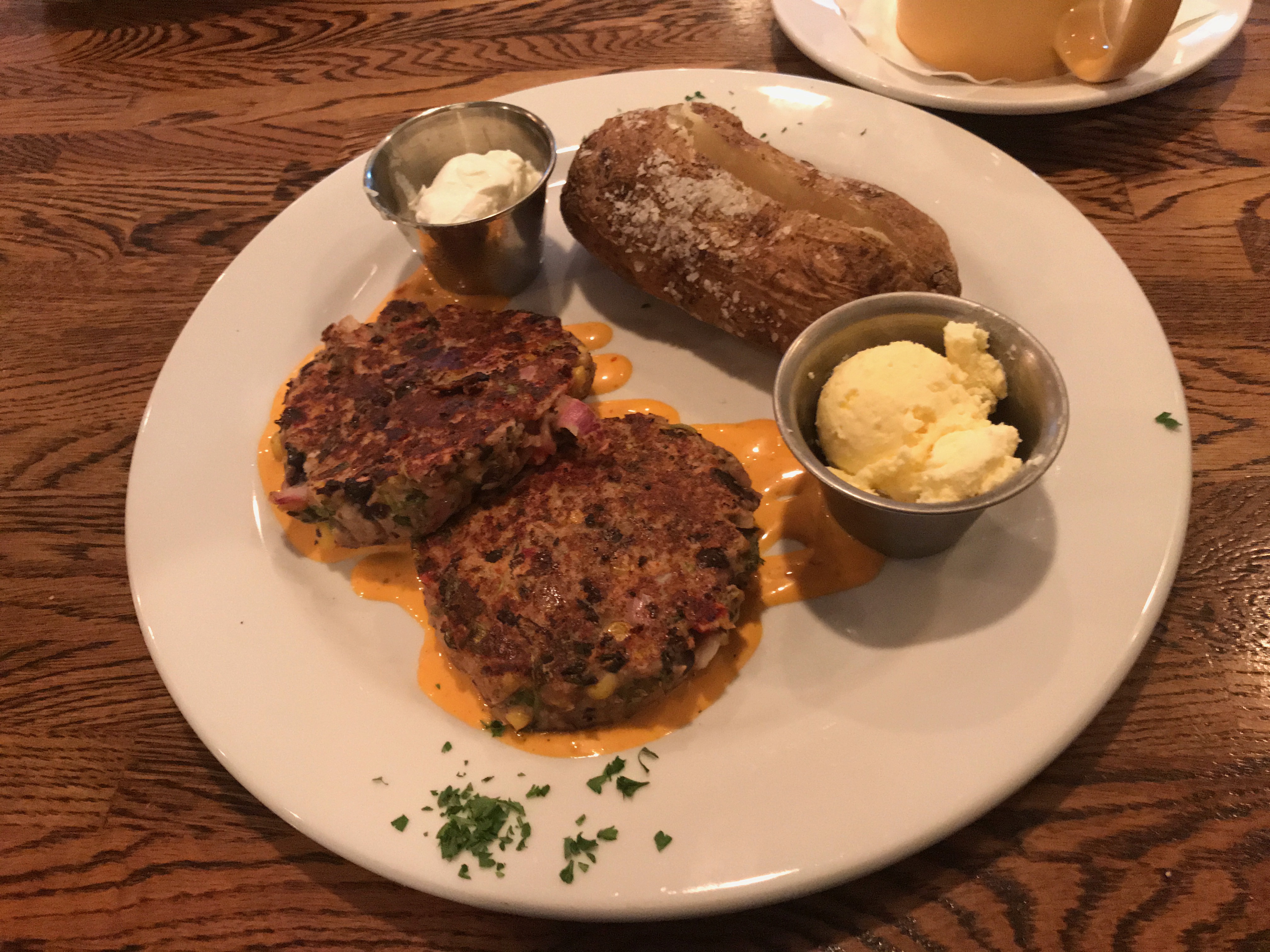
Then , the entree. I wish I remembered what the protein was, but I can identify the baked potato. I was really enjoying the baked potatoes I was getting with my meals. I love them, and I don’t make them for myself. I know you can do them in the microwave, but you don’t end up with the crispy skin. Yum!
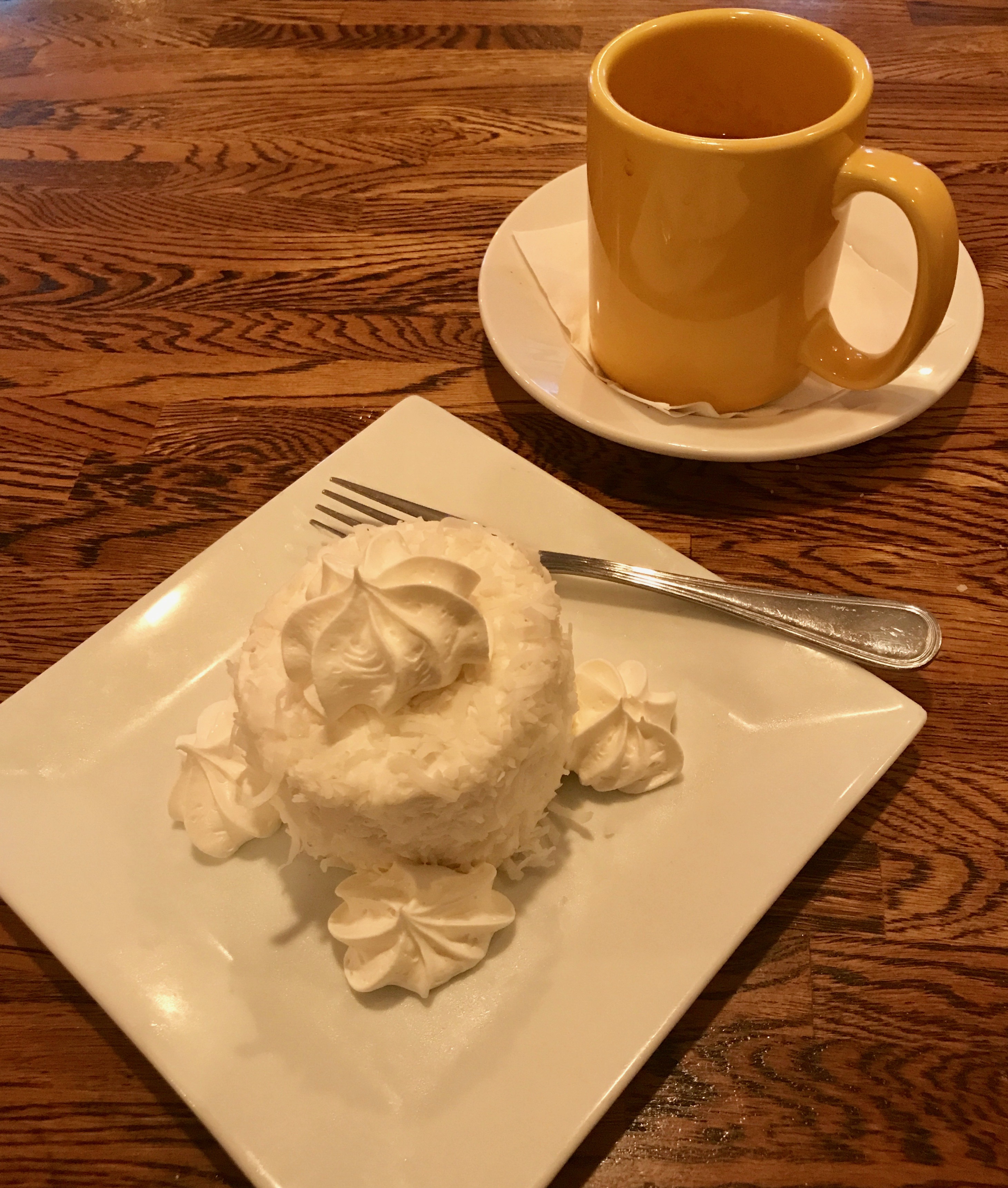
I don’t remember what the dessert was, either. But, I am sure it was tasty, and it had coconut on it!
After dinner, I decided to explore Elizabeth City.
I wound my way down to the harbor, which is on the Pasquotank River. They have a lovely waterfront.
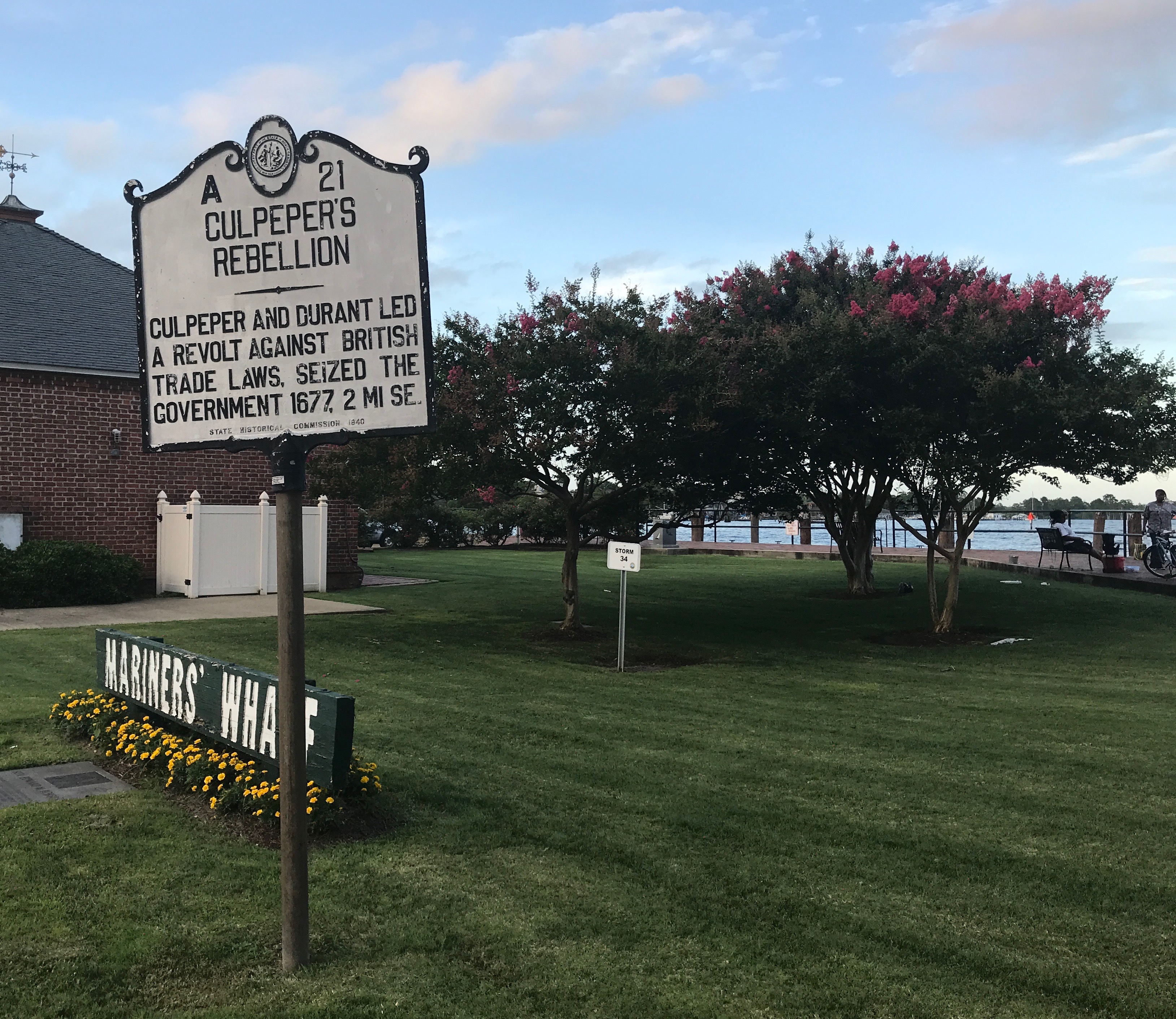
I parked and walked over to investigate. I am always tickled by signs that tell you about places that aren’t where you are. Culpepper’s Rebellion took place two miles away. At least I had a direction to head, if I had a mind to. Southeast.
They call themselves the “Harbor of Hospitality” and offer 48 hours of complimentary dockage. That sure is hospitable!
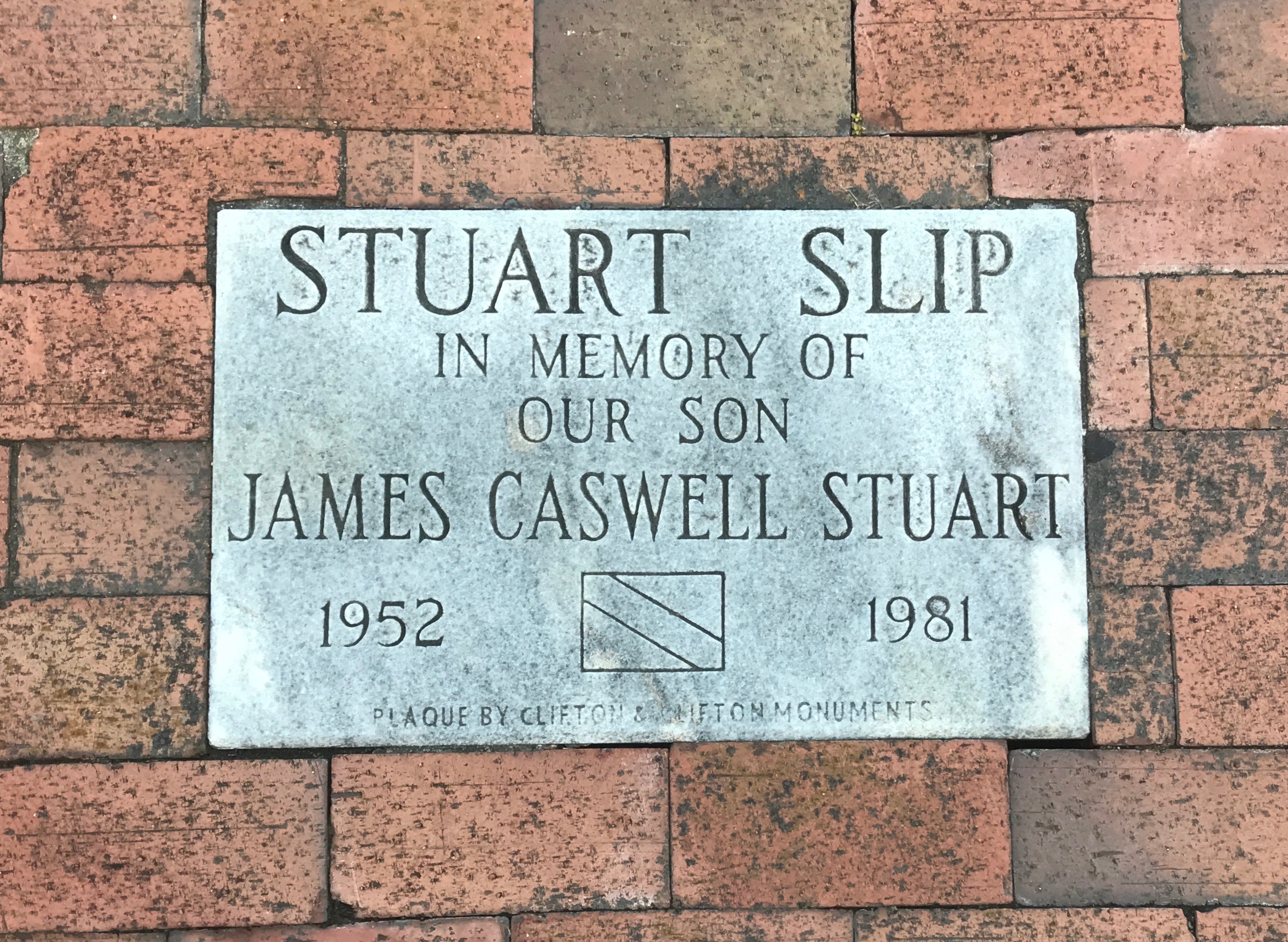
I thought this was a thoughtful way to honor their son, who died all too young. I am sure all who stay in the slip think of him and them.
The park around the harbor is quite lovely, and I love the idea of transplanting someone’s beloved rose bushes to a place where they can continue to be enjoyed.
In case you can’t read the writing on the monument, back in 1983, two friends, Fred and Joe, hosted a gathering for “the mariners” – I assume that means people with ships in the harbor. Joe brought roses from his own bushes to give to the “first mates” – I assume that means the wives of the “captains.”
When Joe died in 1987, his rose bushes were transplanted to the park by the wharf. Fred continued to care for his friend’s rose bushes even as he reached his 90s. He was assisted by local businesses and organizations. The care for the roses have continued after Fred died in 2007.
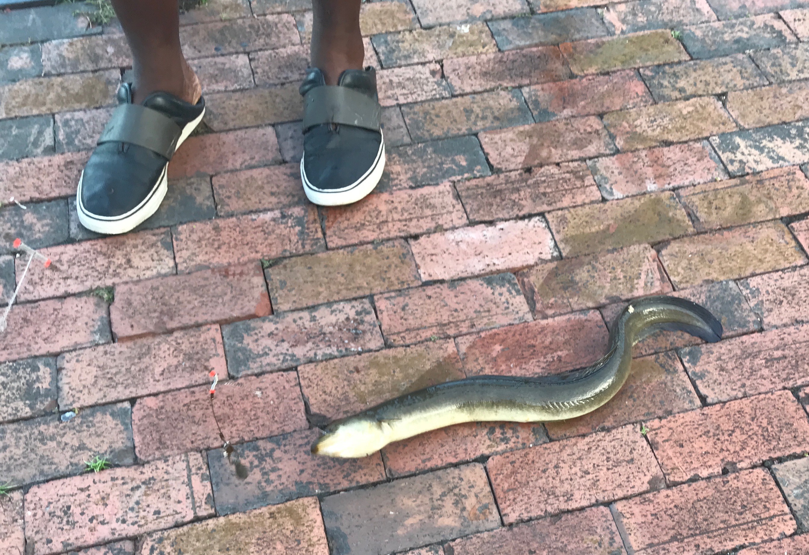
Some people were fishing off the wharf. They were all gathered around something, so I walked down to see what they were looking at. Eww! An eel!
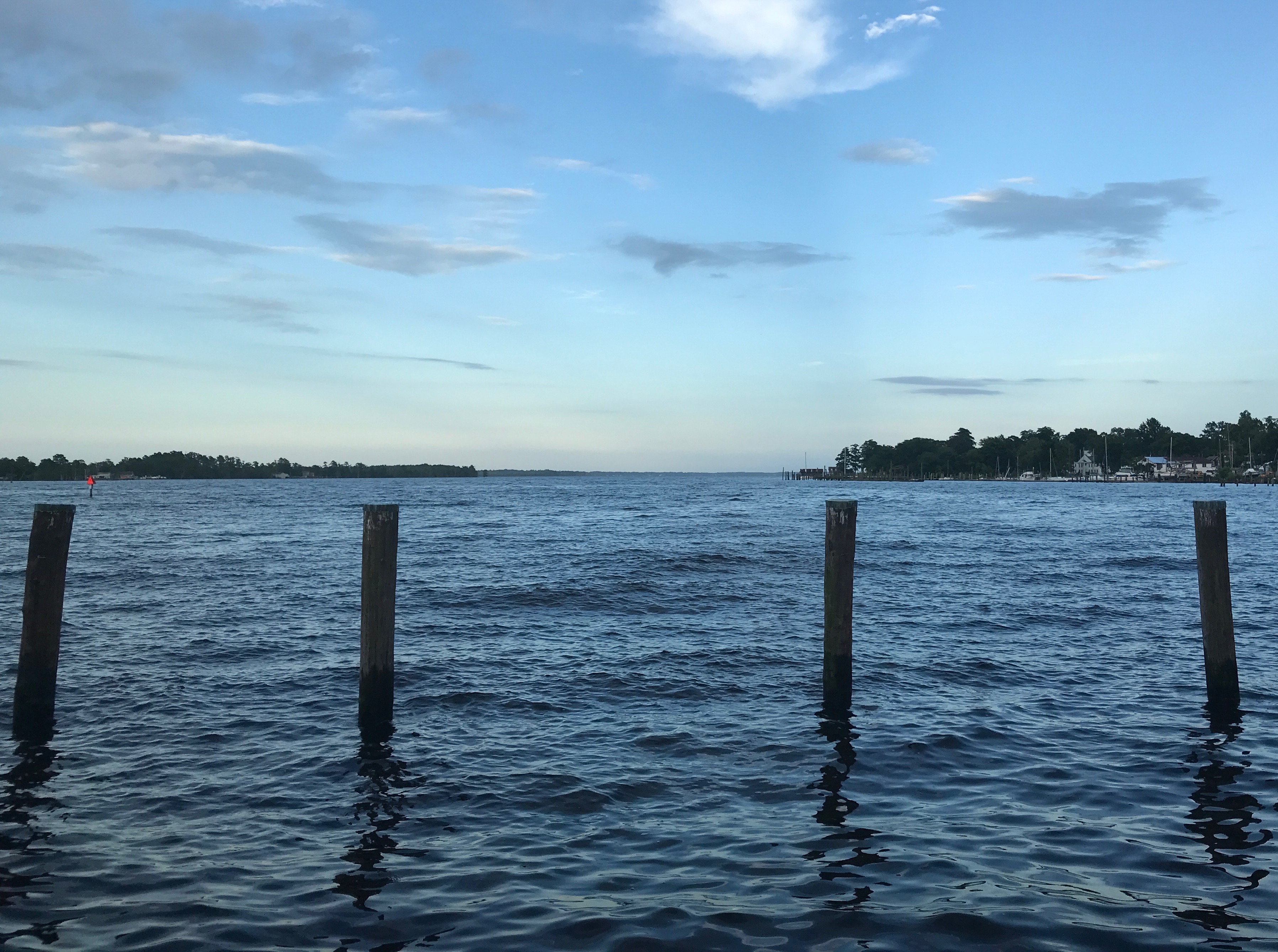
I took a last look out into the harbor. We surely do live in a beautiful world! Back to the hotel for a solid night’s sleep. The morning would be here soon enough and I would be on the road again.
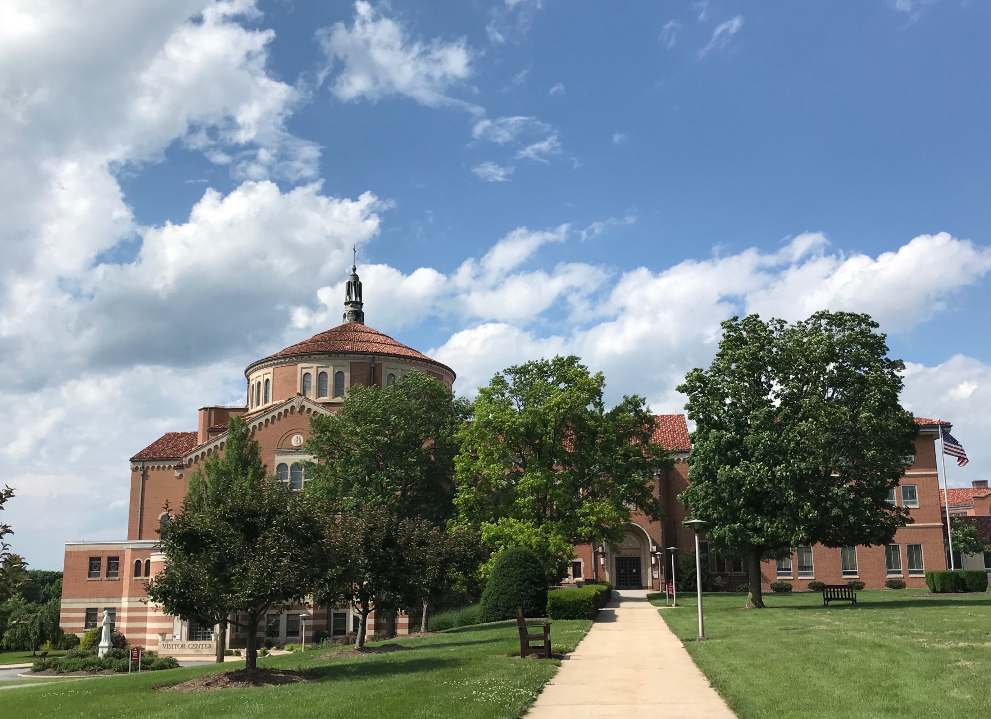
After driving around in circles the past week, I managed to find a room for the weekend in Frederick, Maryland. I somehow snagged a room with a jacuzzi tub, and the hotel had above average breakfasts. I did a lot of resting that weekend, but I did make one field trip.
I have to admit that I didn’t know as much as I probably should have about her, although I was aware that she was the first native-born citizen of the United States to be canonized by the Catholic Church. I knew little else about her, and what I thought I knew about her I had conflated with Mother Frances Cabrini, who was the first naturalized American citizen to be canonized.
Both women did incredible things and founded religious orders that improved the lives of the poor. For this post, I will try to give some information on Saint Elizabeth Ann Seton. If you want to know more about Mother Frances Cabrini, you are on your own.
I made it in time for mass. I was in such a rush, that I didn’t notice that the shrine was also a basilica, so I didn’t take the time to look for the symbols that go with being a basilica – you know, the umbraculum, the tintinnabulum, and the crossed keys, which are the papal symbol. I guess I’ll have to go back and check for them, next time I’m in the neighborhood.
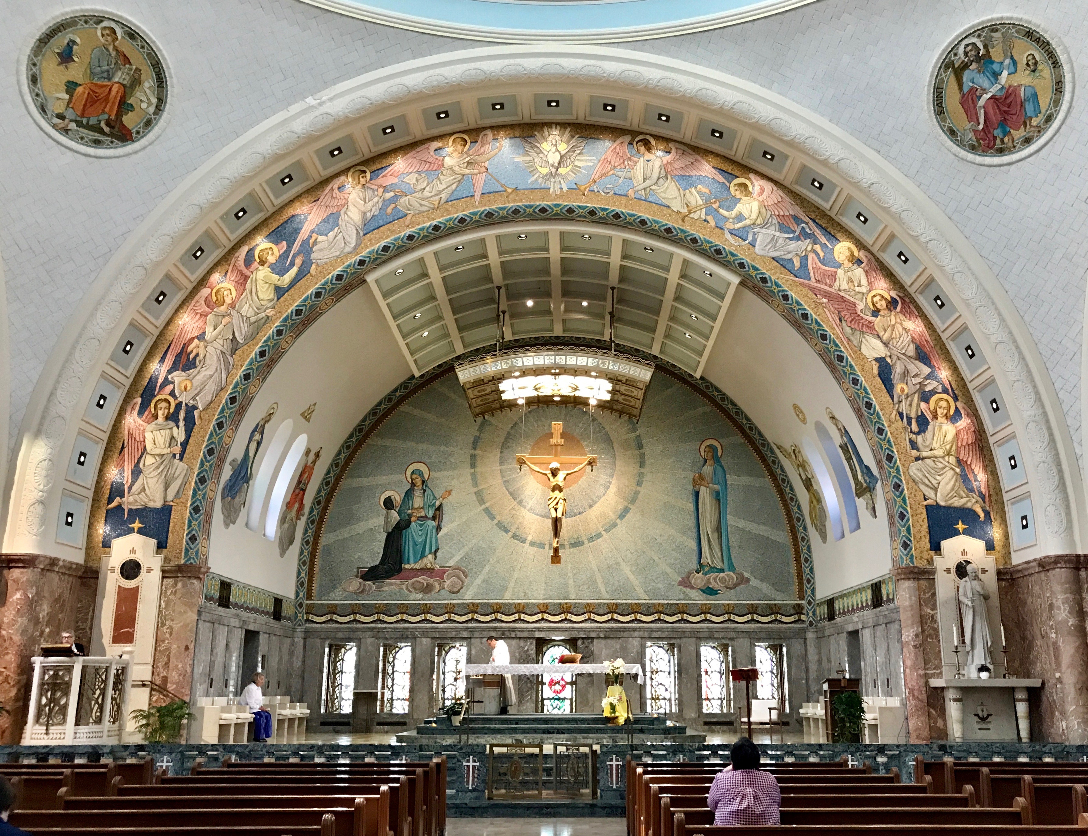
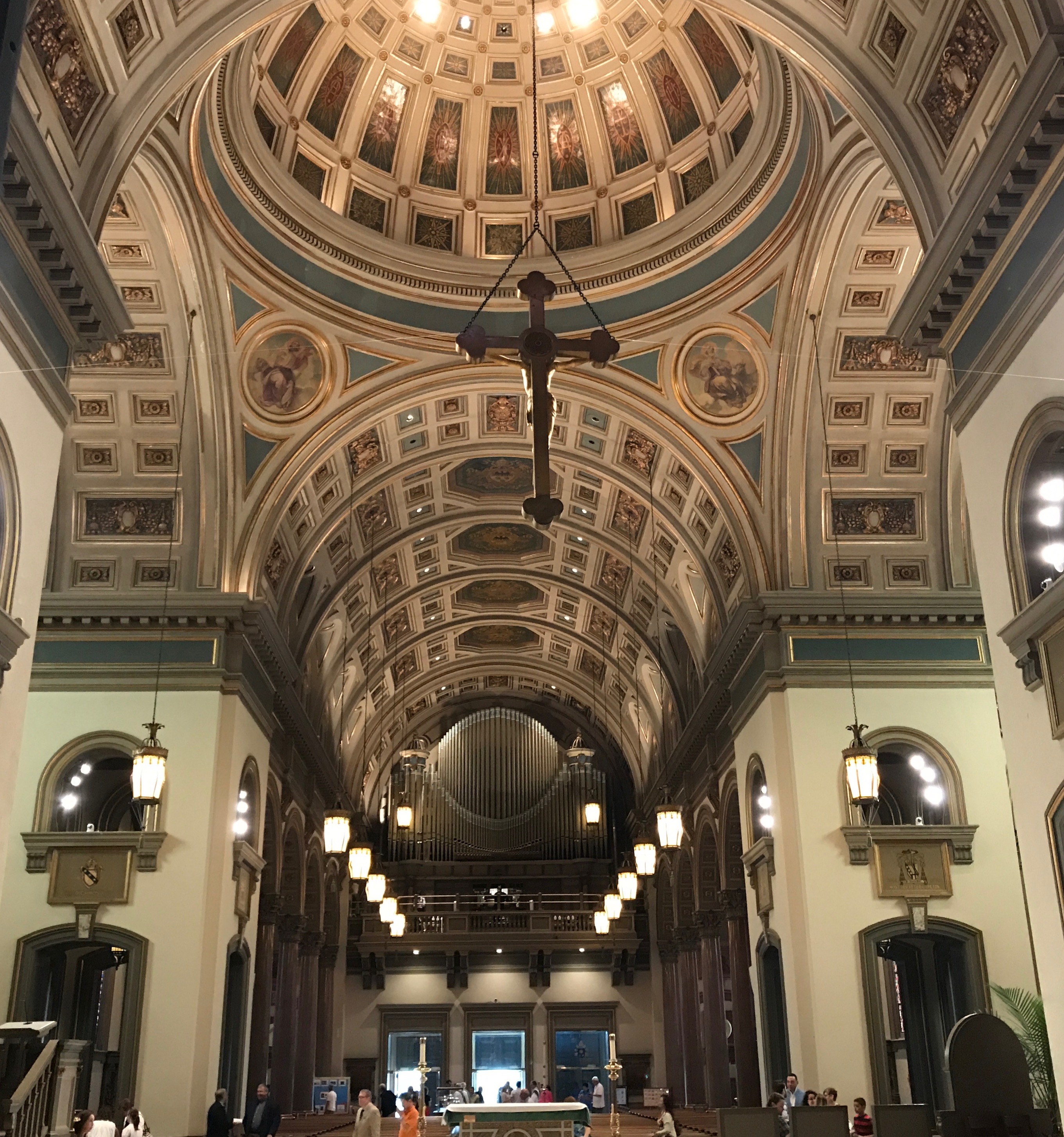
The Basilica was bright and airy. This is the view toward the main altar.
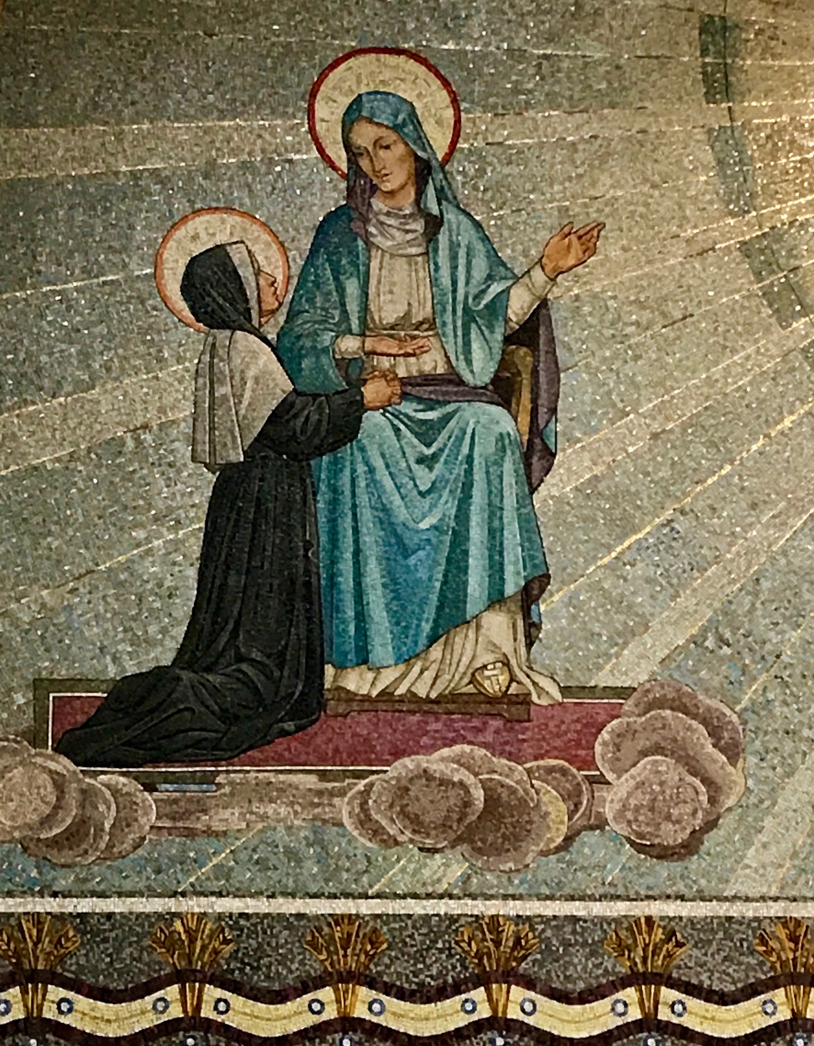
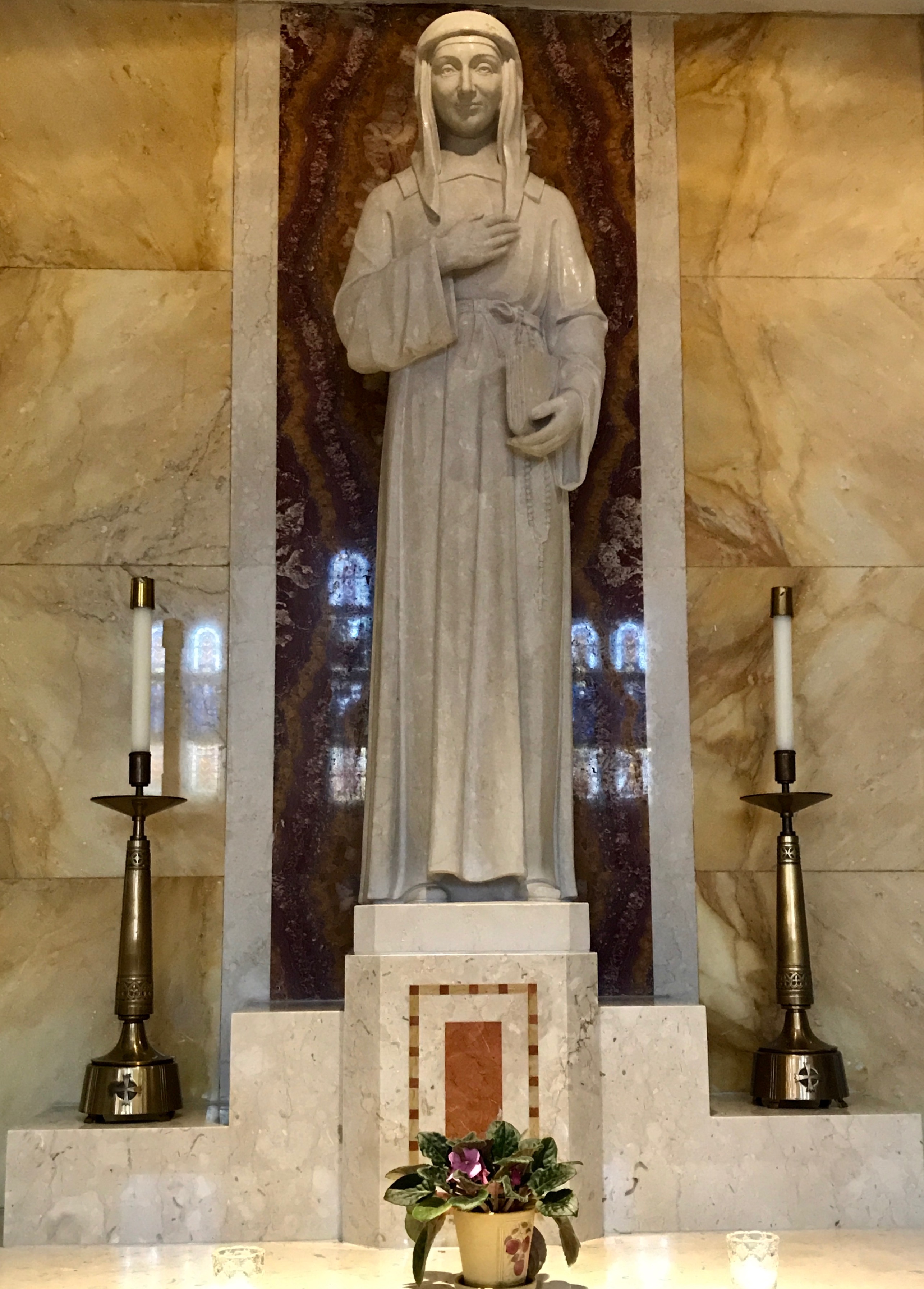
There was no one to ask at the time, but I assume that this was Mother Seton. Incidentally, one of her symbols is wheat, which you see in the border.
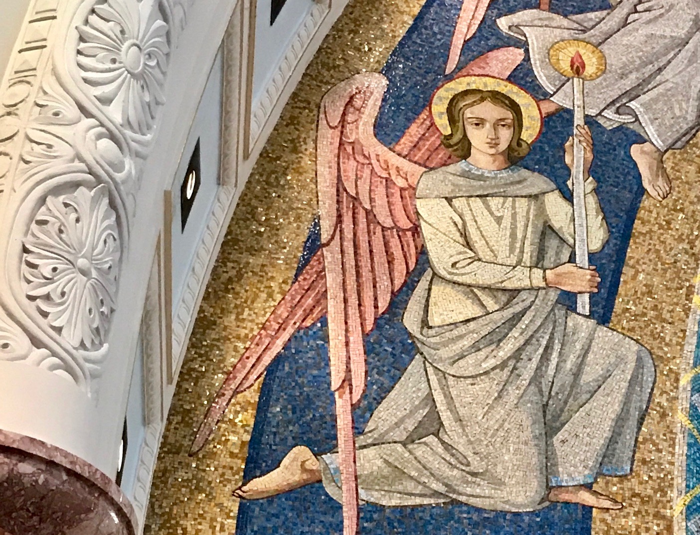
This angel was striking. I always appreciate mosaic art.
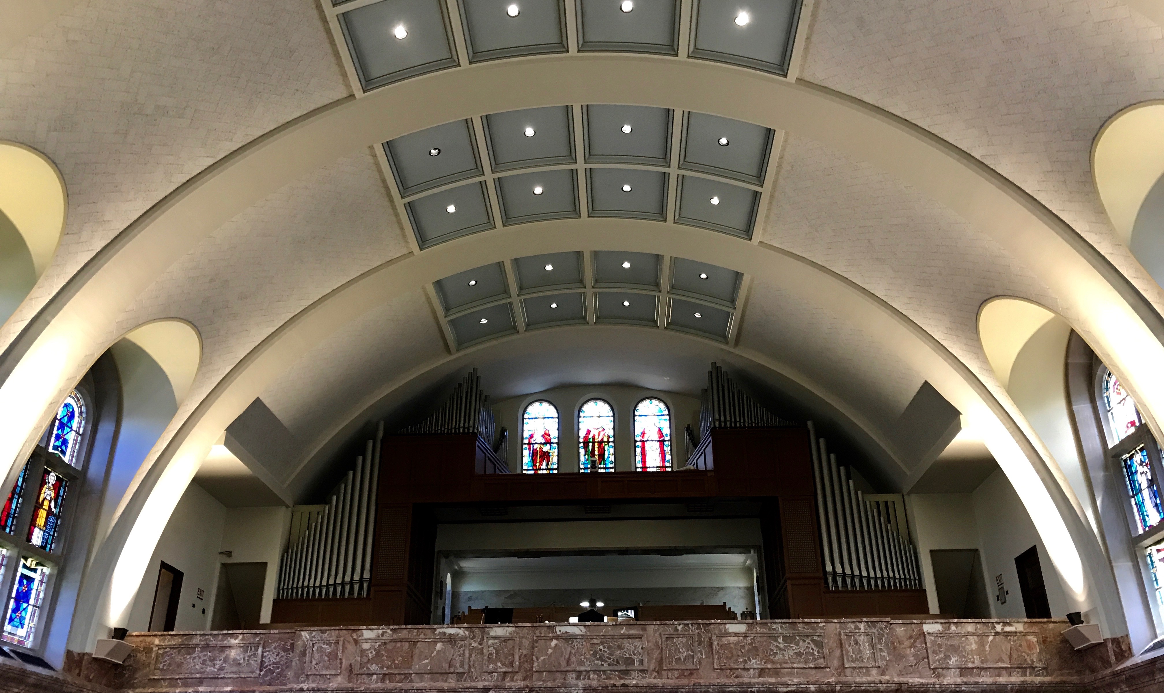
Opposite the main altar was the choir loft and organ – a relatively small organ, praises be!
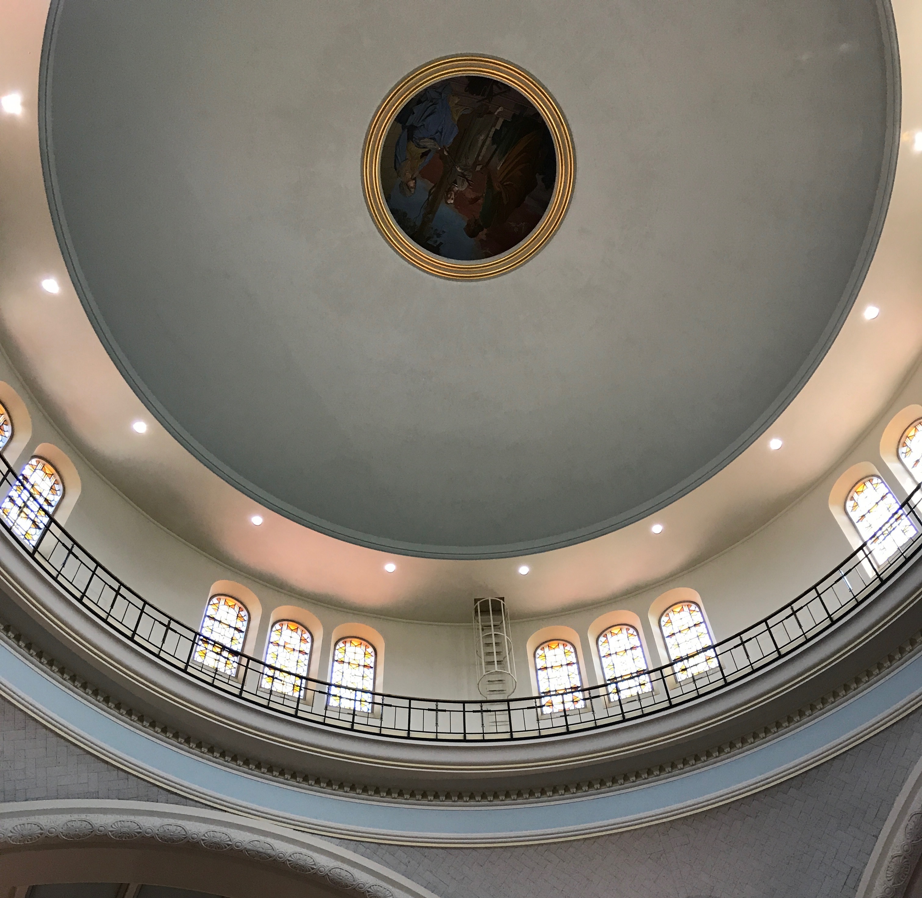
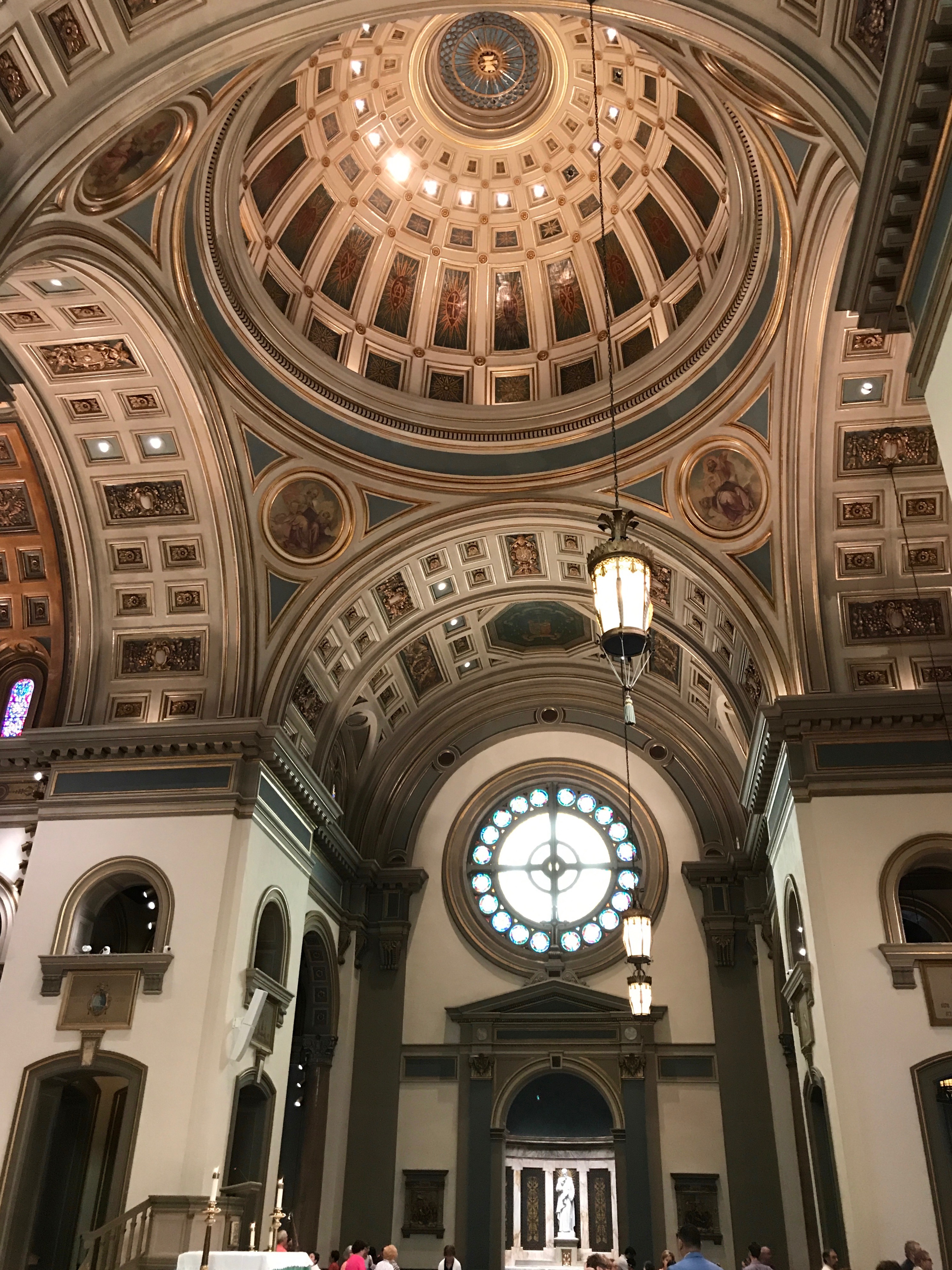
Above the crossing was the dome.
Through a little fiddling with my photo program, I was able to bring the medallion in the dome into better focus.
I was taken with this statue of Saint Louise de Marillac. She was born in Paris in 1591. She married in 1613, but was widowed in 1625. Did you know women could take a vow of widowhood? I didn’t know that, but that’s what she did.
She collaborated with St. Vincent de Paul in founding the Community of the Daughter of Charity in Paris in 1633. She died in Paris in 1660. She was canonized in 1920 and is the patron saint of all Christian social workers.
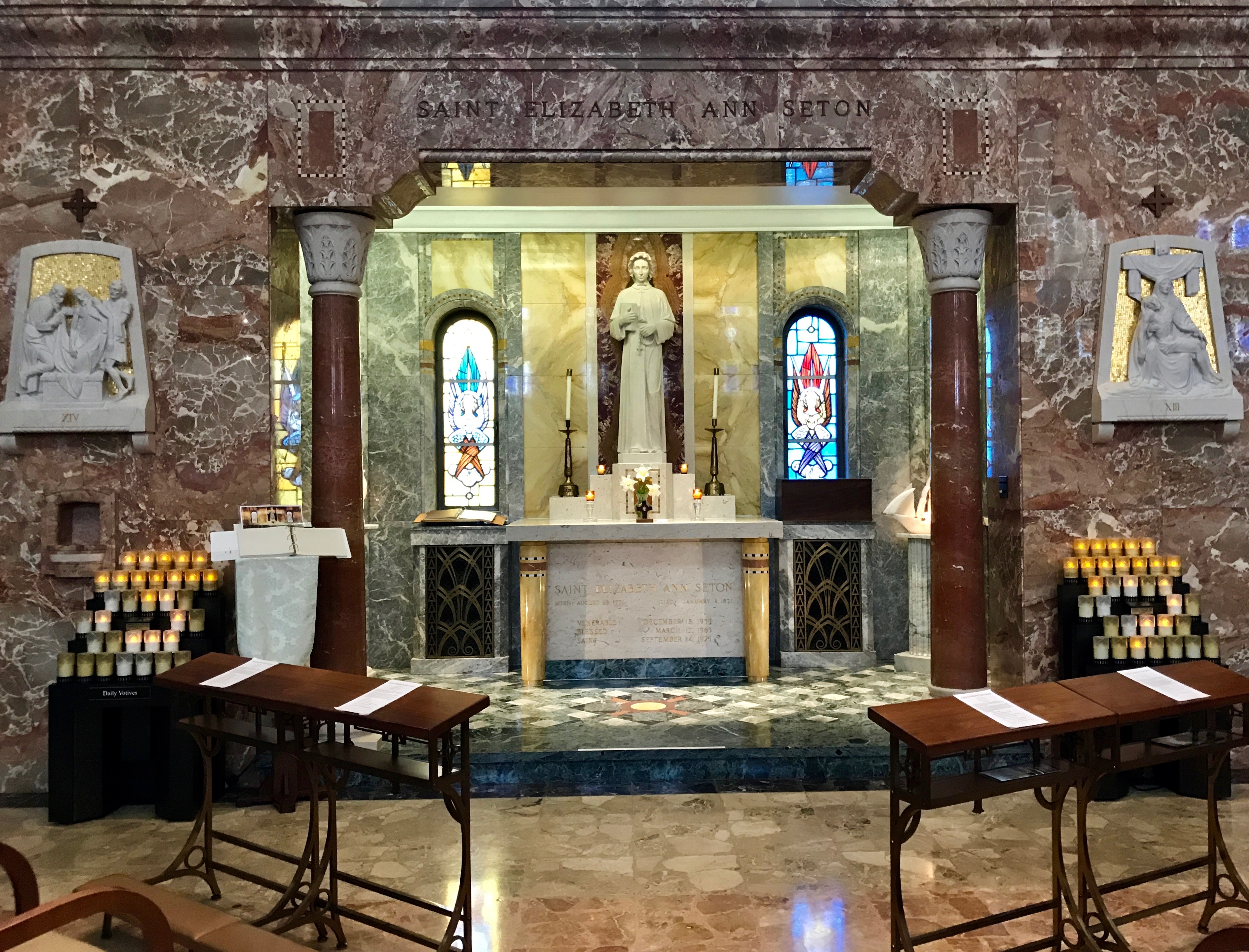
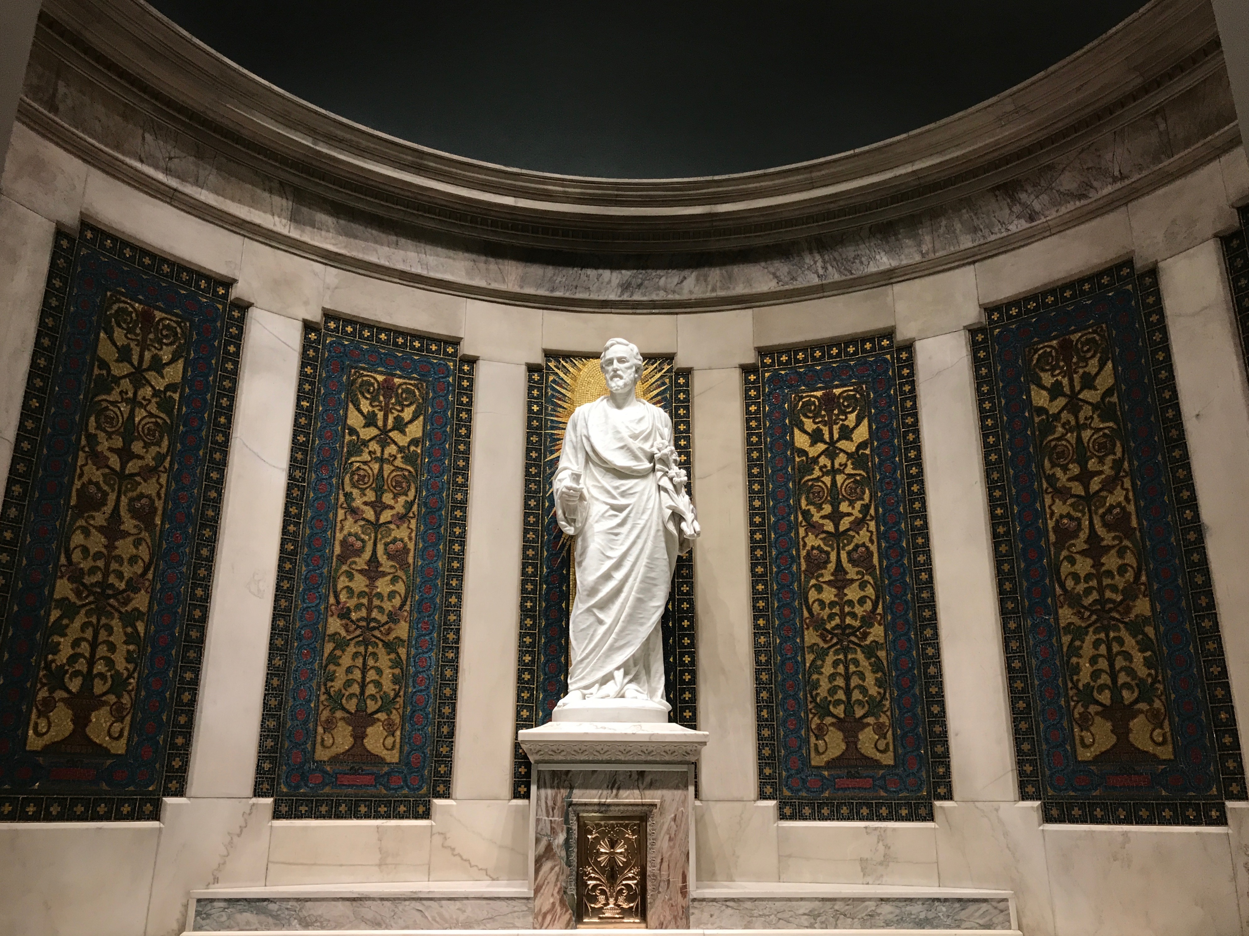
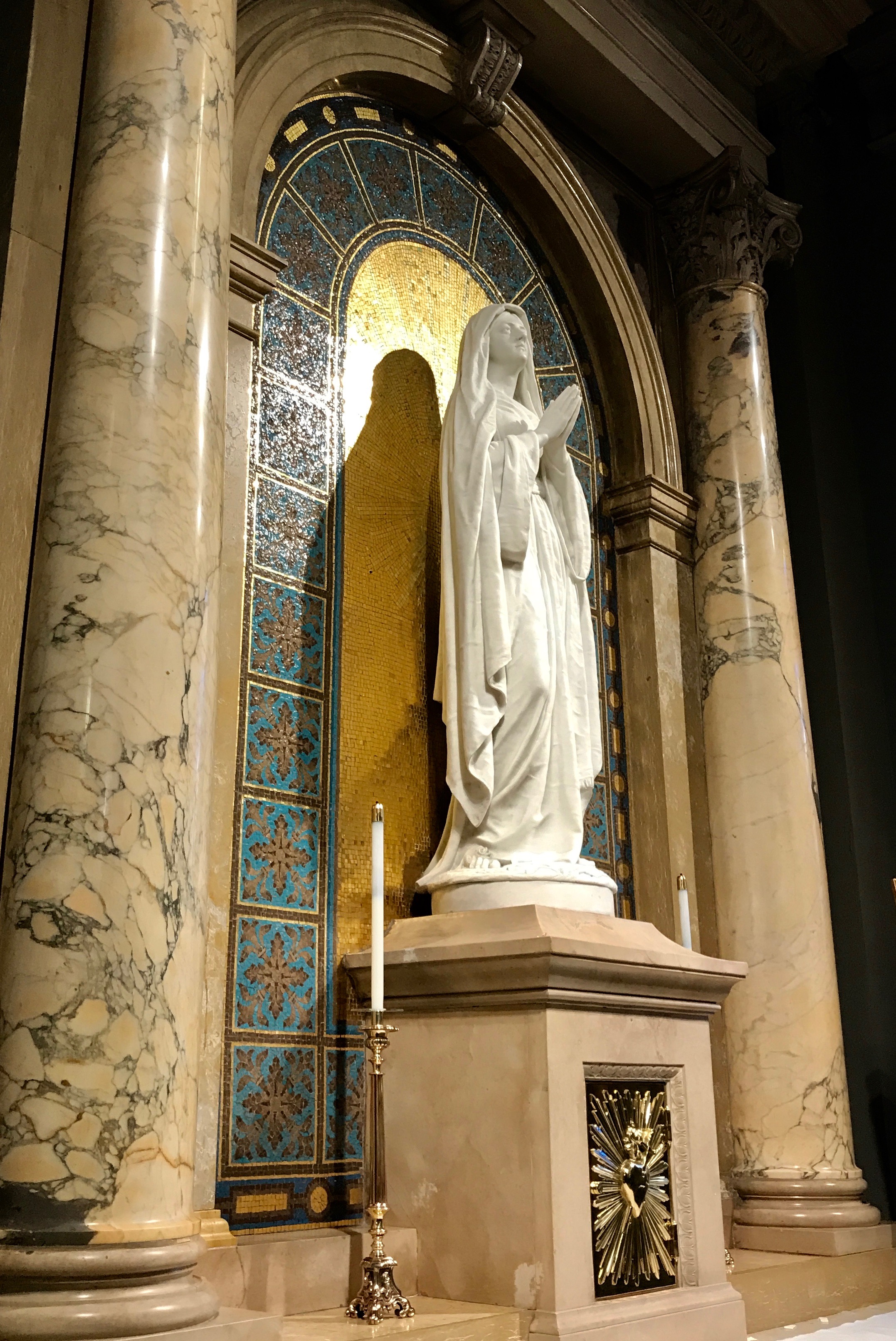
The reason for the Shrine is Saint Elizabeth Ann Seton. This is her final resting place. The basilica was completed in 1965 and her remains were transferred here in 1968. Beneath the altar and enclosed in marble, her remains rest in a small copper casket.
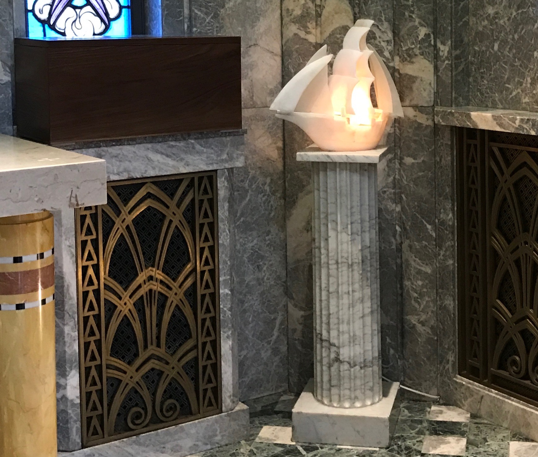
In the shrine is a lamp in the shape of a boat. Saint Elizabeth Ann is the patron saint of seafarers. You can also see the wheat motif repeated in the brass grate between the altar and the pillar.
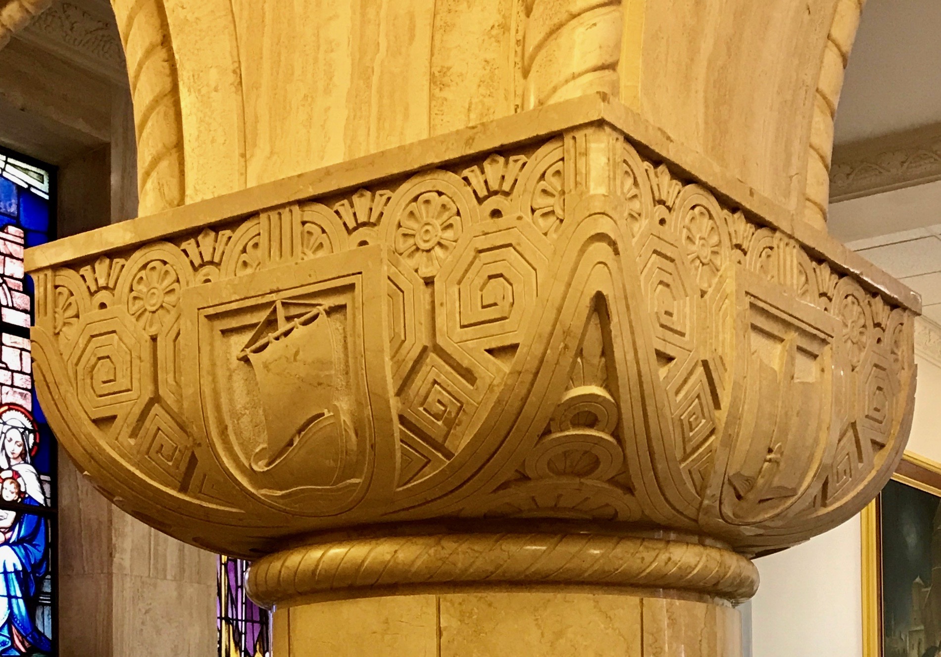
There was a sign directing me to a museum in the lower level. I passed by this pillar with the interesting capital. You see the ship, and, if you use your imagination, there is stylized wheat at the top edge. According to one source I found (but can’t locate to give it to you) a pink flower and a book are also her symbols. You can see flowers repeated along the top edge and an open book on the right side.
Once downstairs, I saw that there was a tour leaving shortly. I took a quick look through the museum while I was waiting.
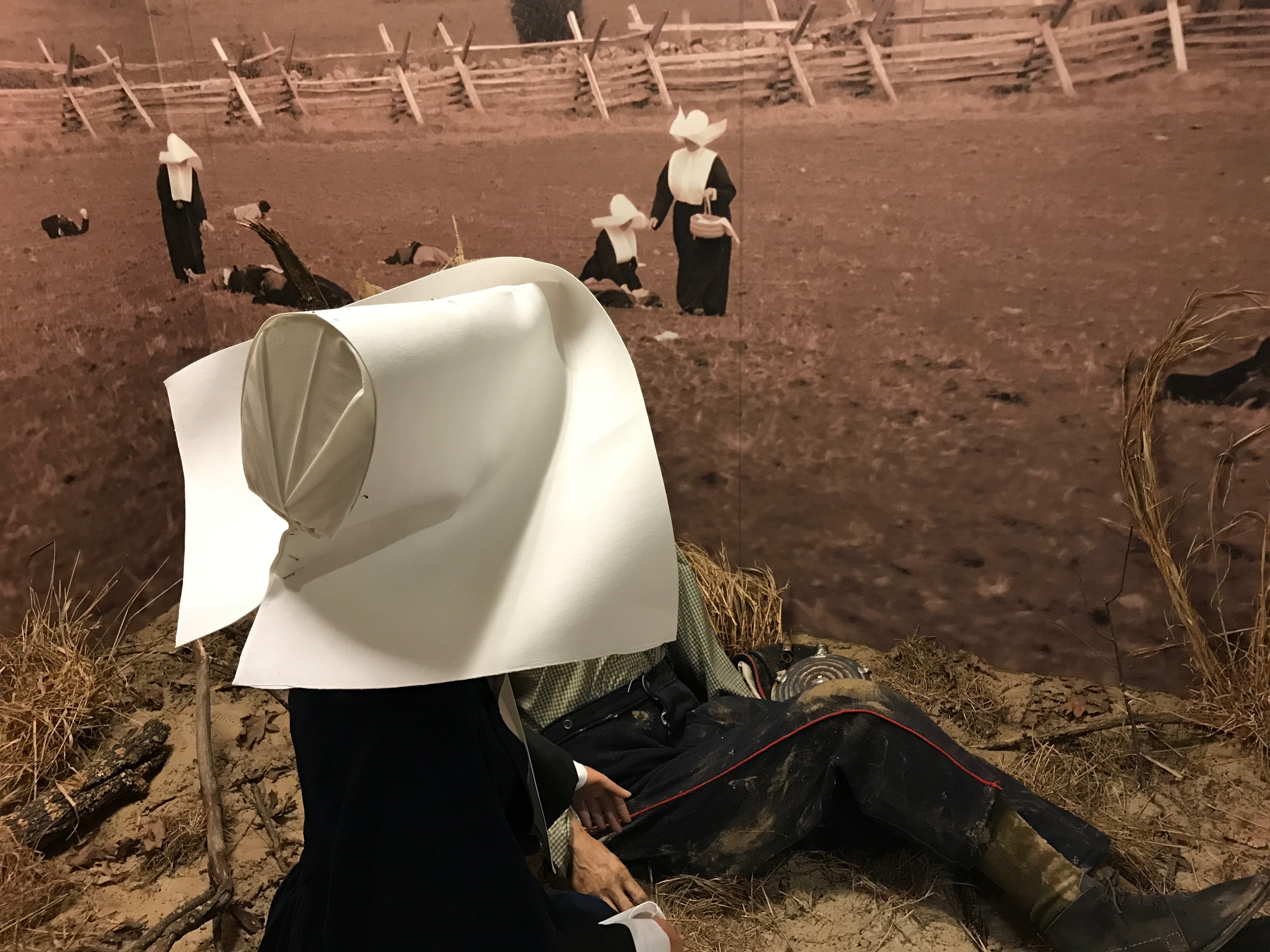
The sisters served as nurses during the Civil War. They were at the Battle of Shiloh in Tennessee and the Battle of Antietam in Maryland. More that 100,000 fought and more that 22,000 died in each battle.
The photo above shows a mannequin posed in front of a photo from an reenactment. Can you imagine being able to maneuver in a battlefield in the habits those sisters wore? I can’t.
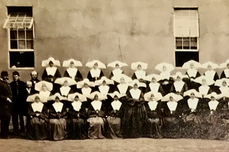
Even in the more controlled environment of Satterlee Hospital in Philadelphia, wearing those habits definitely required faith.
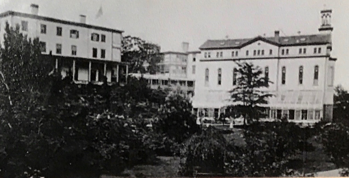
Saint Joseph Military Hospital was staffed by the Sisters of Charity, and Saint Elizabeth Ann Seton’s grandson, Captain William Seton III received treatment there. As he recovered and began to converse with this nurse, Sister Mary Ulrica O’Reilly, Was amazed to discover that she was caring for the Foundress of her order.
William Seton III
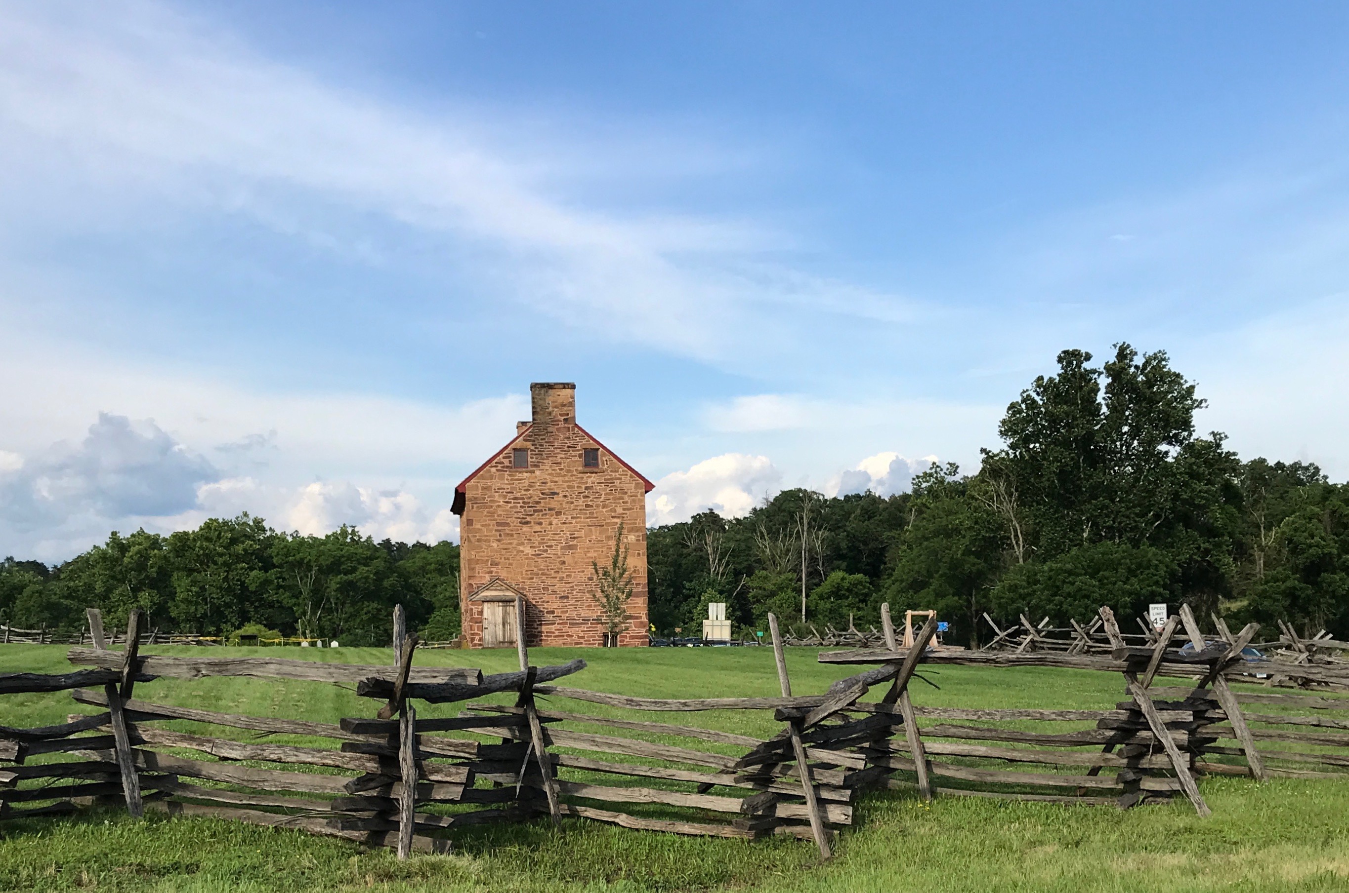
Soon it was time to set out on the tour. My group met our guide, and he walked with us over to the Stone House, which was originally built in 1750.
This was originally a four room building, with one of the rooms devoted to use as a chapel. There were sixteen people in the house at that time.
I’m not sure if one of the original rooms was also a kitchen. There is an early 1800s-style kitchen there now. Eventually they added on to the building through the years.
The house was moved to where it is now. That must have been some feat!
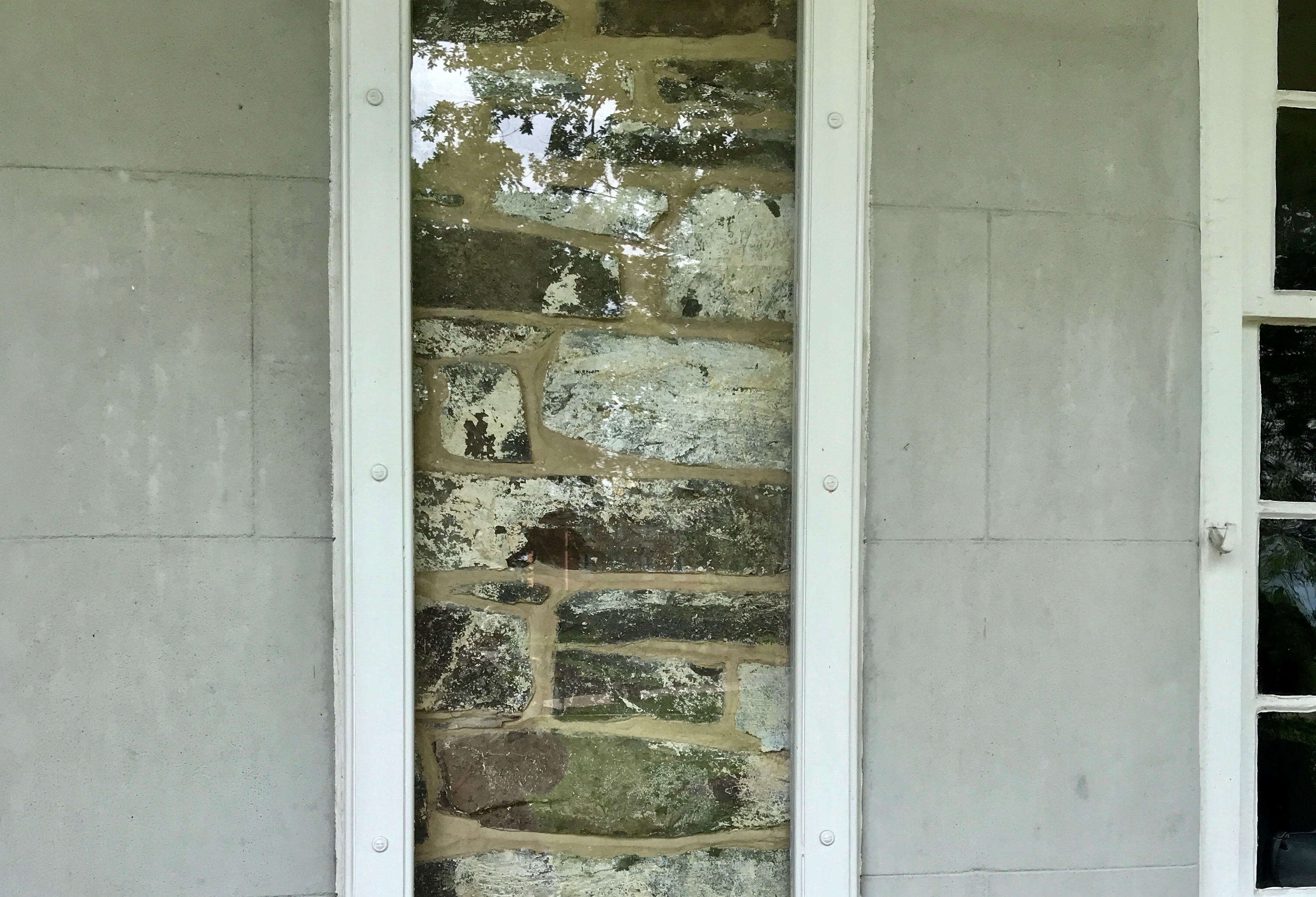
Although the house had the appearance of fine stone, that illusion was maintained by a fine layer of some sort or another. I was please that they left us a “truth window” so we could see what how the house was really constructed.
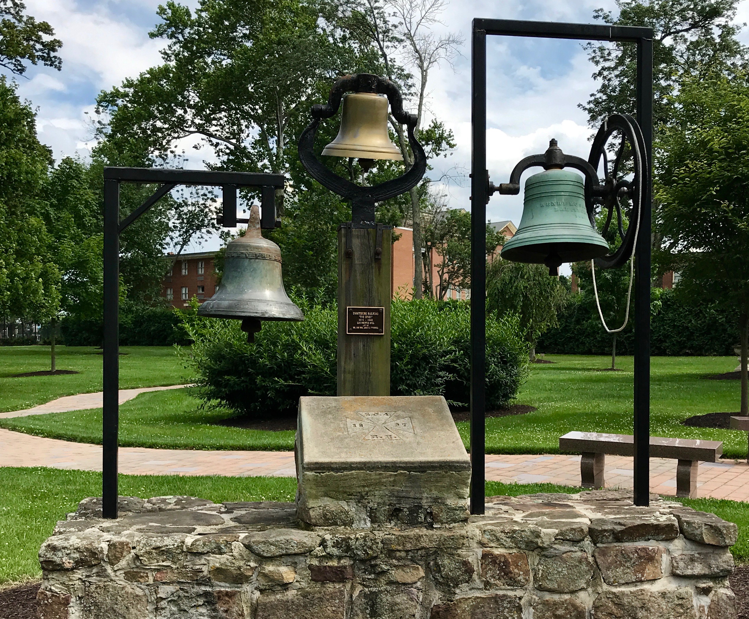
On the way to The White House we passed by the bells of St. Joseph’s Valley. The bells pealed throughout Saint Joseph’s valley when they received the news of Mother Seton’s beatification in 1963.
According to the plaque, one of the bells was the Academy bell, that summoned the boarding and day pupils of Saint Joseph’s Academy to classes, worship and recreation for 1875 until 1940.
One of the bells was referred to as the “Dinky” bell, which announced the arrival of the Emmitsburg train form 1875 until 1940. The “Dinky” transported pupils, visitors and sisters along with livestock and freight. The Sisters of Charity of Saint Joseph were the major stockholders of the Emmitsburg Railroad. I think that was a wise investment.
The third bell was the Seminary bell, which called new members of the Daughters of Charity to prayer, study and community gatherings until 1964 – nearly a century.
The cornerstone of a building of Saint Joseph’s Academy that was in use from 1897 until 1965 is in the center of this heritage monument.
I’m sure you see the rope hanging from the bell on the far right. You know who had to pull it, don’t you? Well, there weren’t any children on this tour, so I had to fill in. (It wasn’t much of a stretch for me)
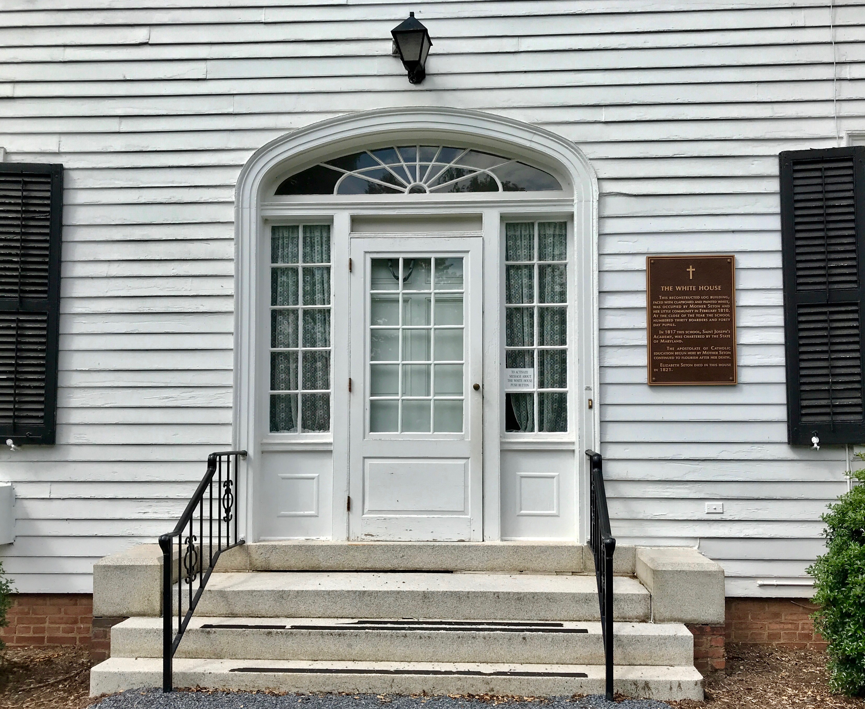
Our next stop was The White House.
No, not that White House.
This White House, which was built in 1810, when Mother Seton realized that more space was needed
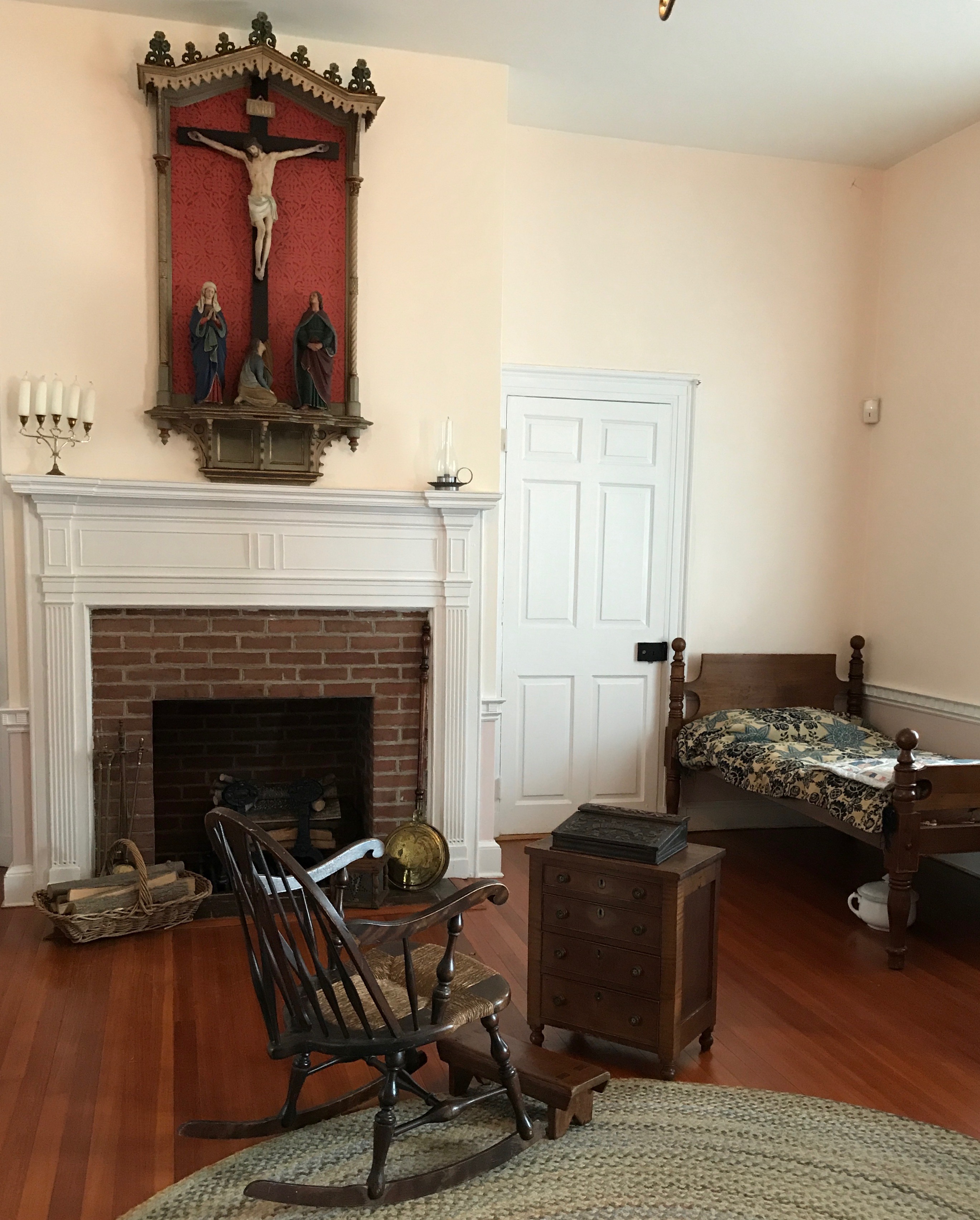
I didn’t take very good notes and I can’t find a reference about this after several Google searches, but I think this was Mother Seton’s room.
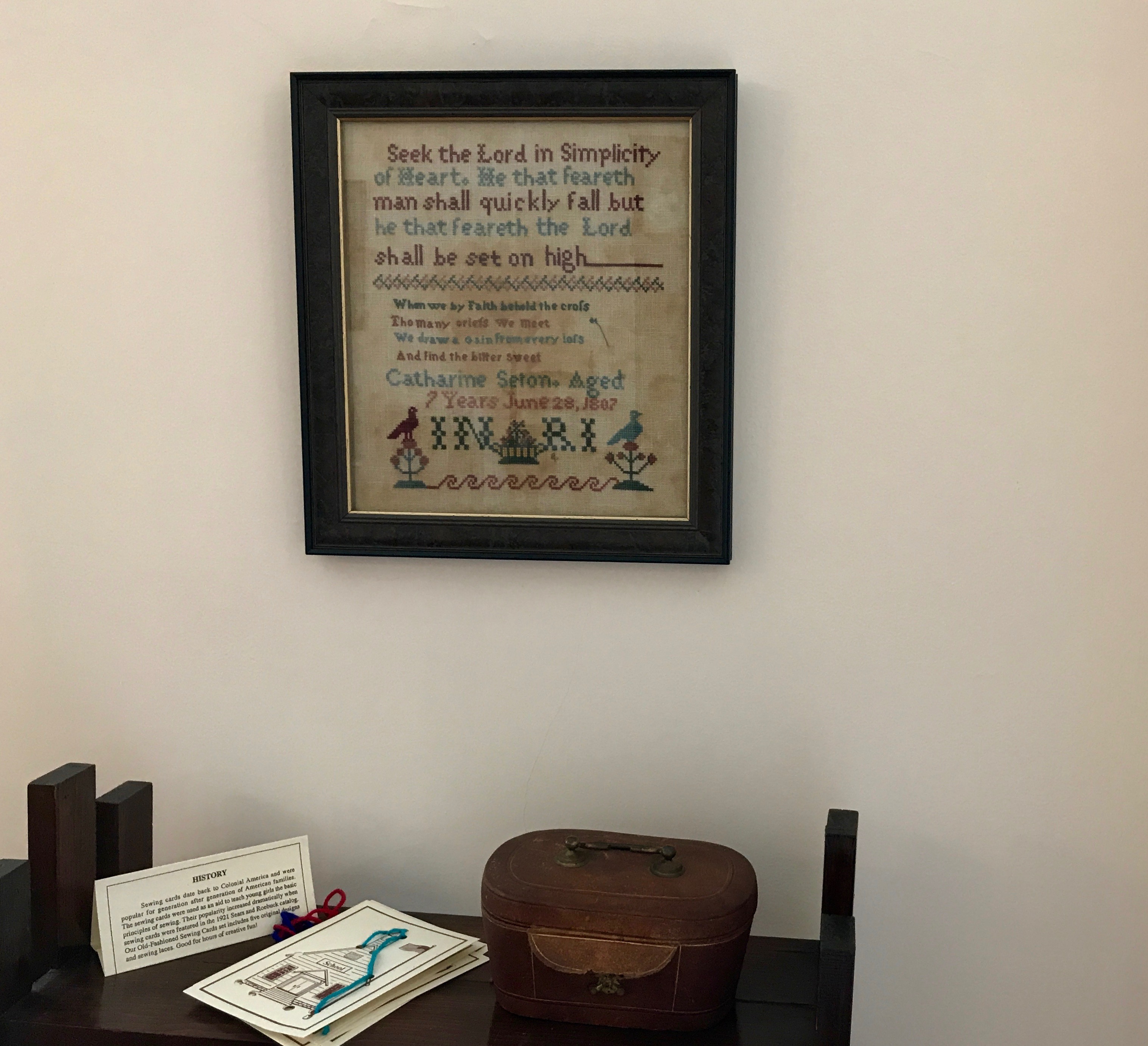
A sampler made by her daughter, Catherine, in 1807 at age 7 is hanging in the room.
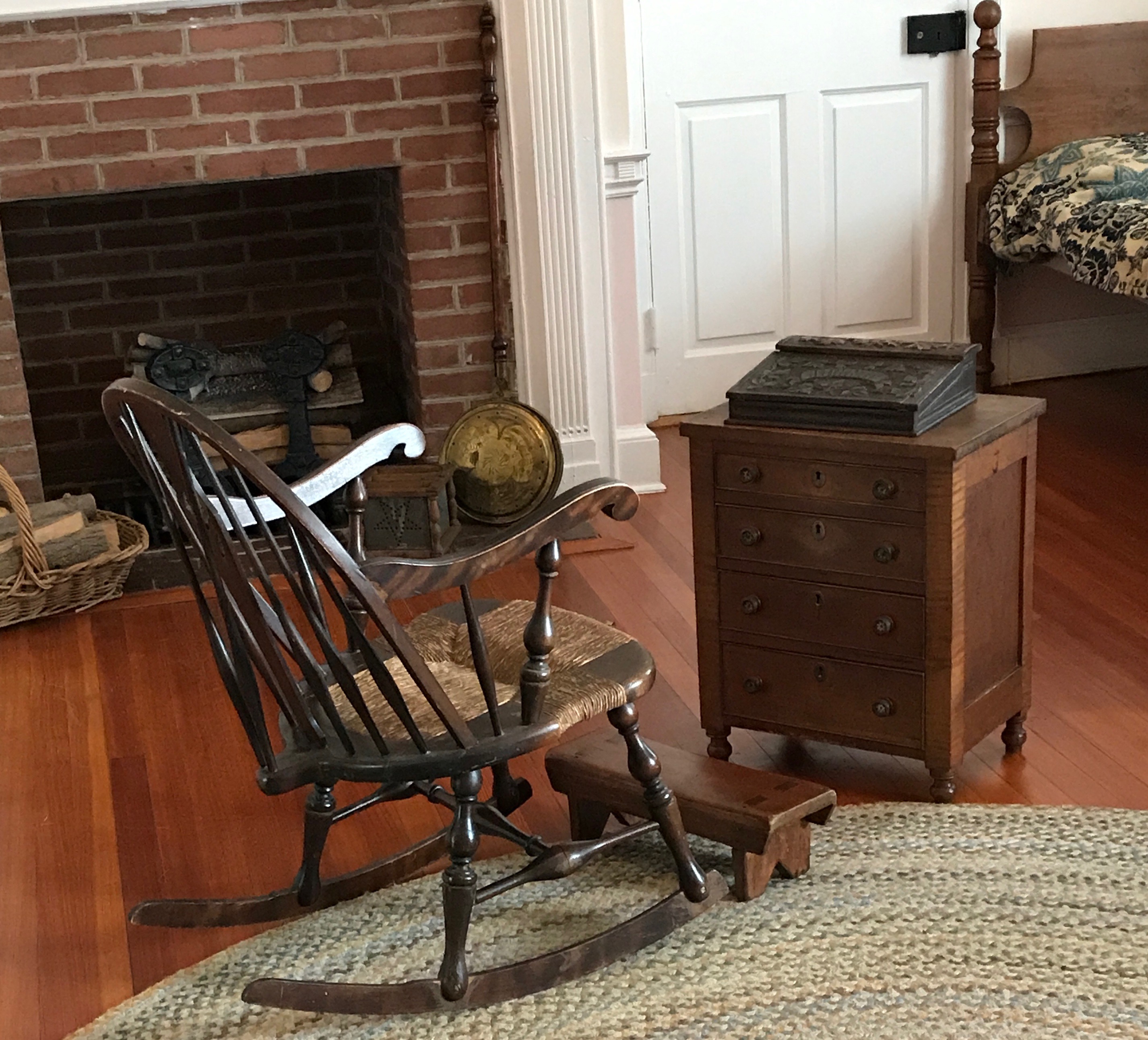
I like the idea of a rocker to help her get on and off her kneeler. Or, maybe I am reading too much into the placement of the furniture.
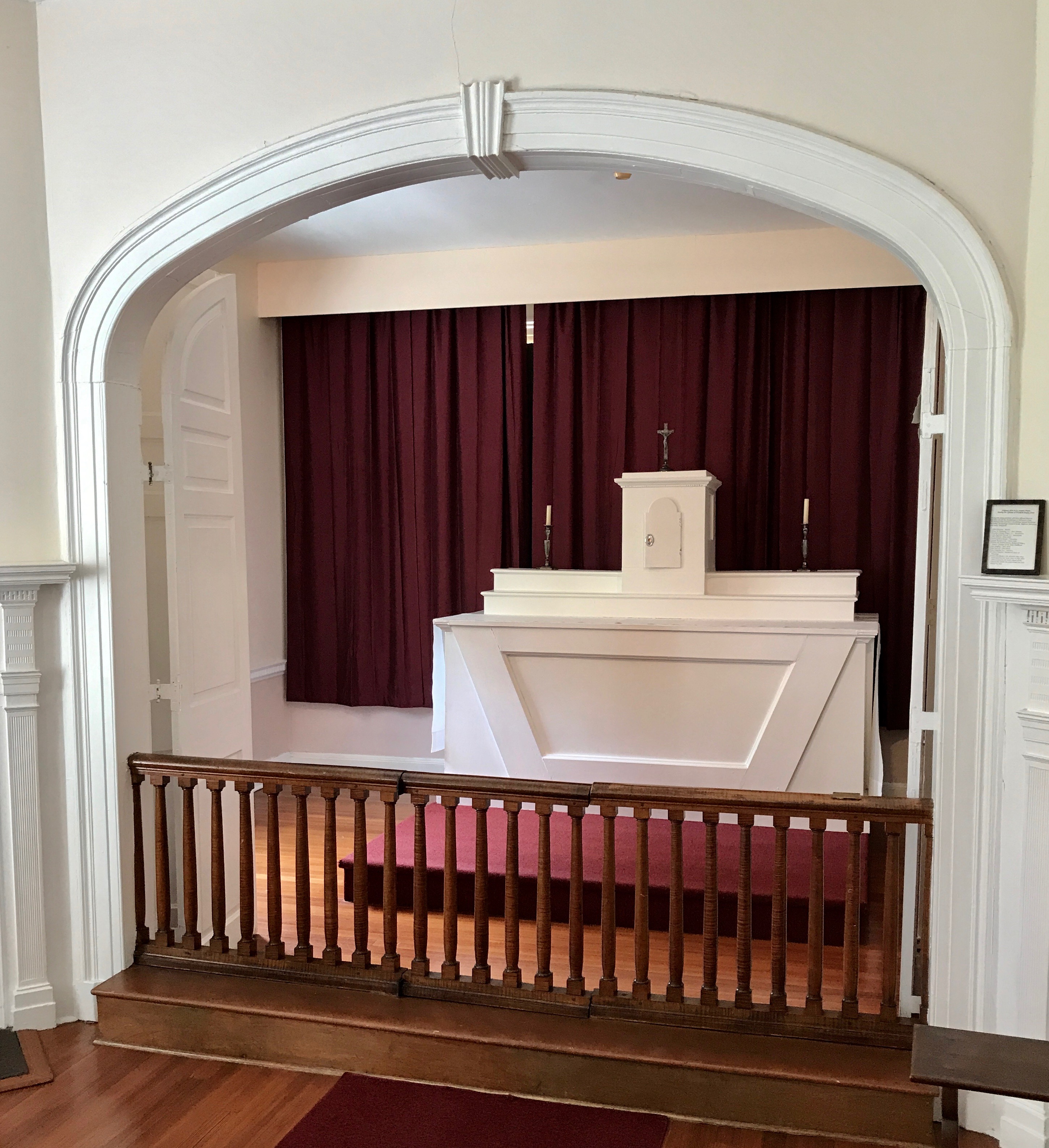
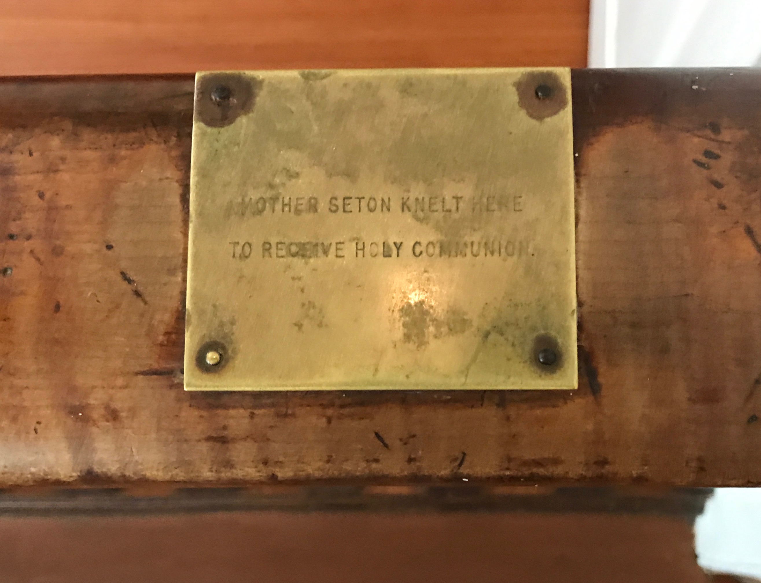
There is also a chapel in The White House. The guide pointed out that Mother Seton knelt to receive communion at the right end of the altar rail.
There is a brass plaque there to mark the spot.
After our tour of The White House, there was one stop left.
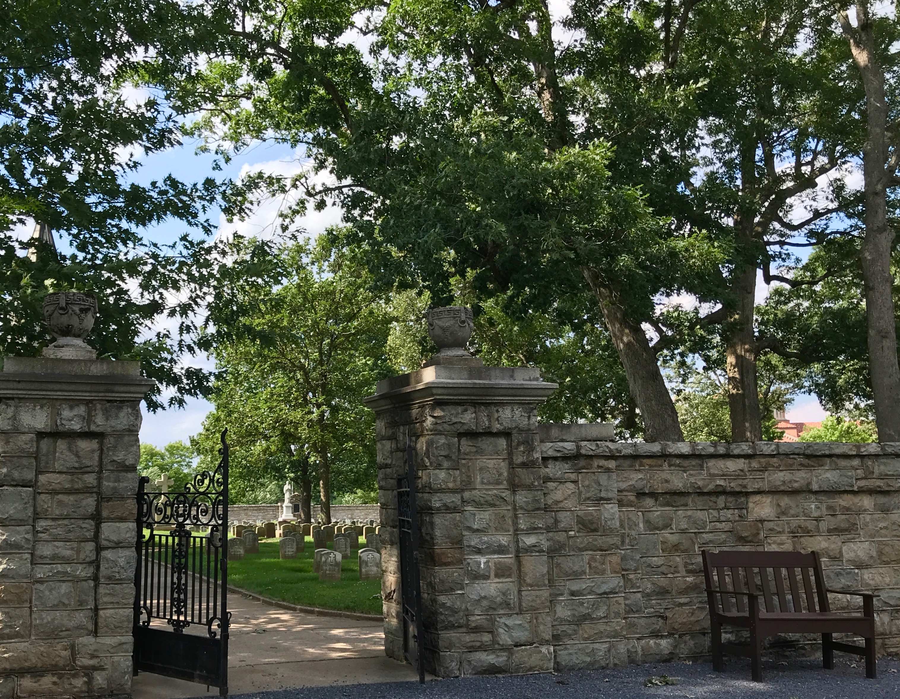
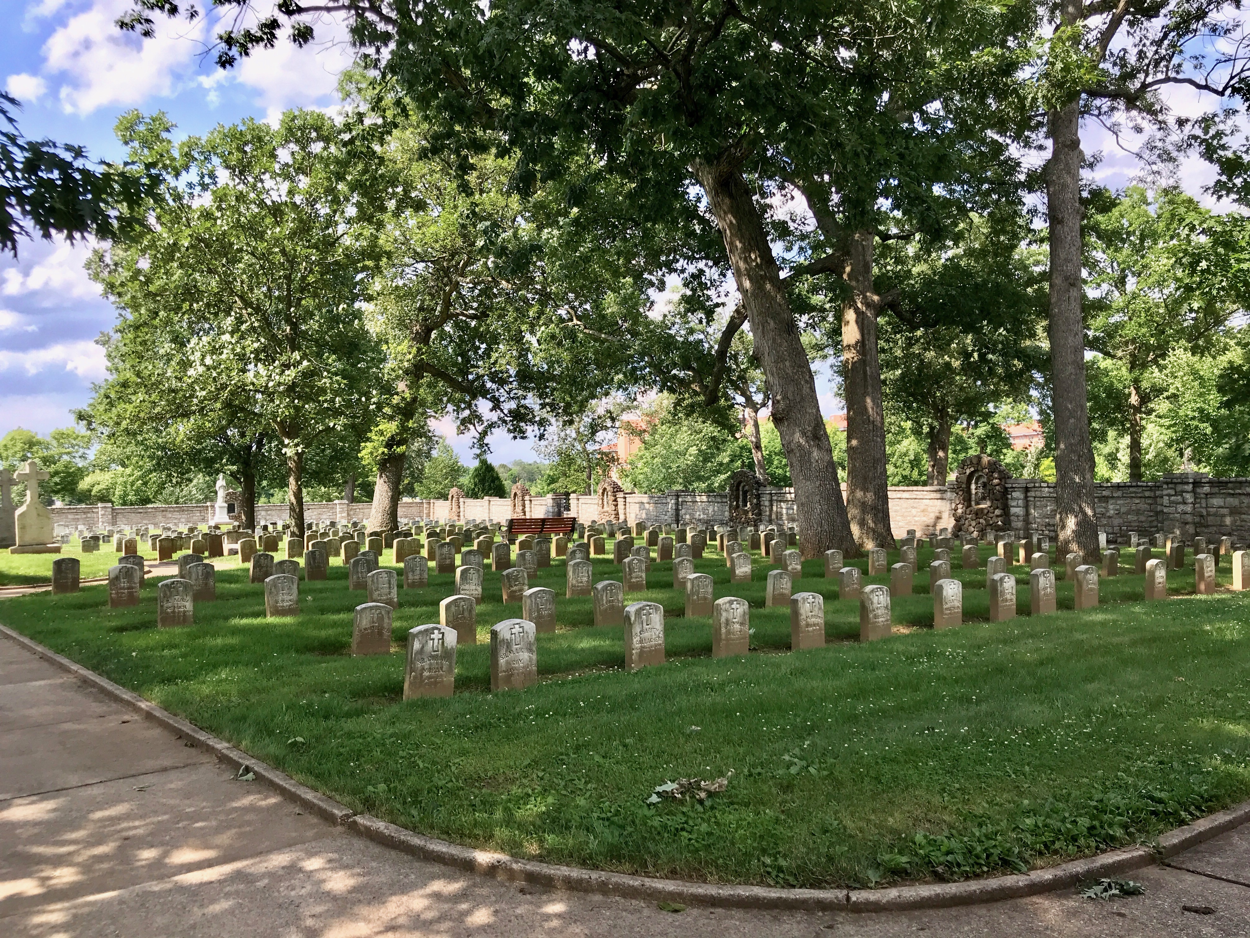
The cemetery
Many sisters over the years were buried here. Mother Seton’s sister-in-law, Harriet, was the first person buried in the cemetery. According to oral tradition, when they were out walking through the forest looking for a location for the cemetery, Harriet rested against a large, old oak tree. She playfully threw and apple core against its trunk and declared, “This is my spot!”
Sadly, Harriet died later that year and was buried beneath the oak and her grave was the first of many graves of Sisters and Daughters of Charity in the cemetery.
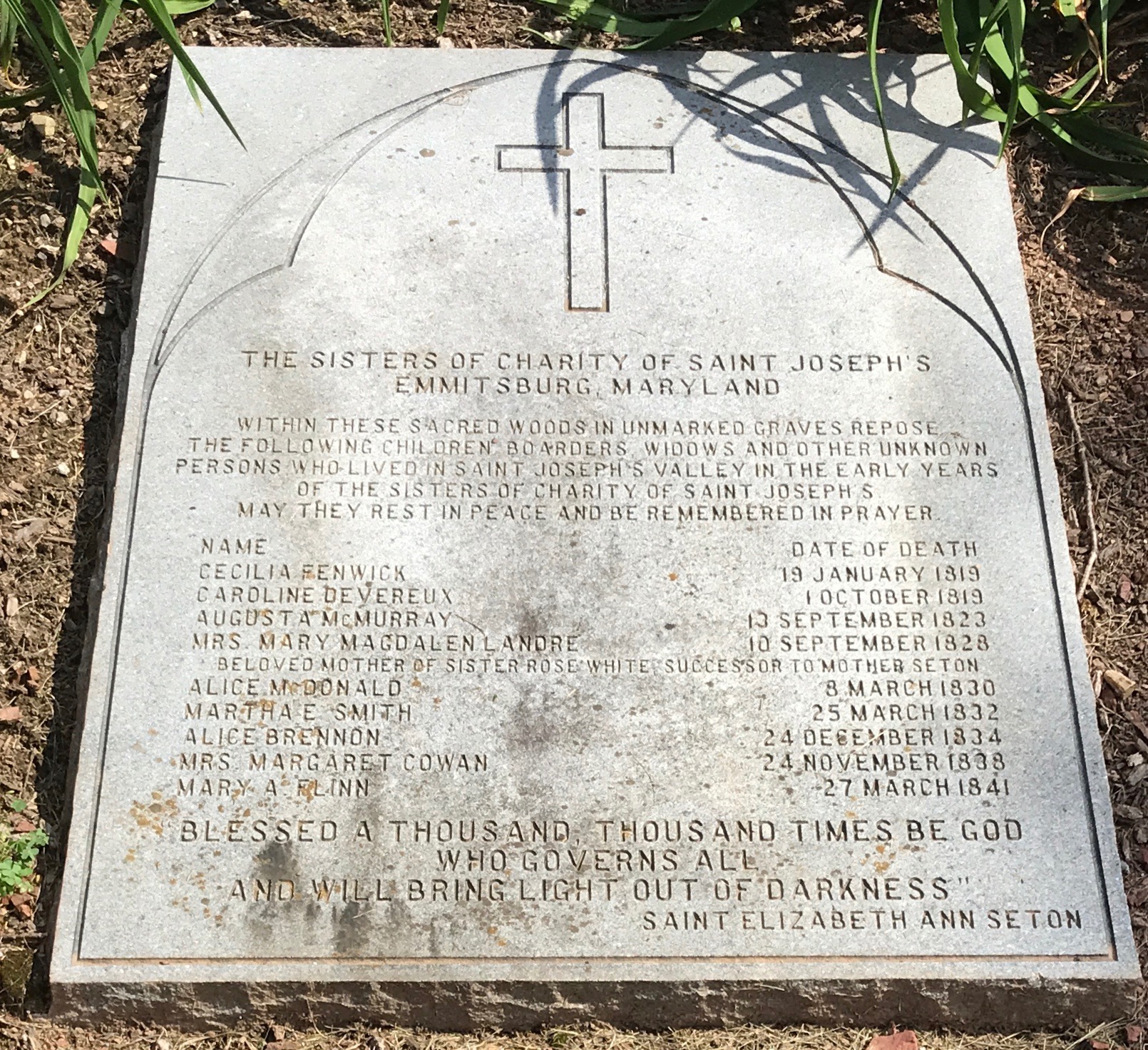
They also memorialized those who lie in unmarked graves.
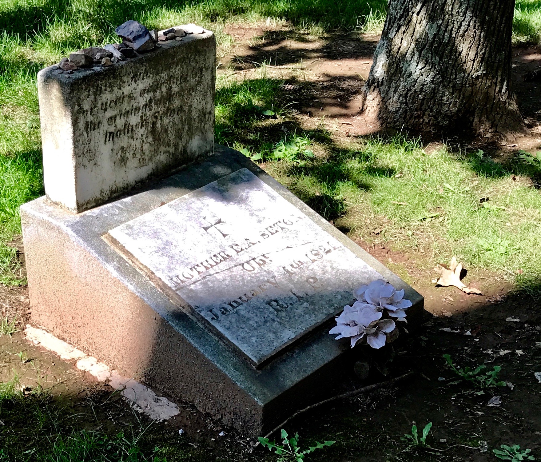
Mother Seton was buried here first. I think the small stones left by visitors are touching.
Mother Seton’s son, William, had the Mortuary Chapel built to honor his mother. In 1846, her remains were transferred to the chapel’s vault.
And now her remains are in the Shrine.
After feeding my soul, there was one more thing I needed to do. I needed to feed my body.
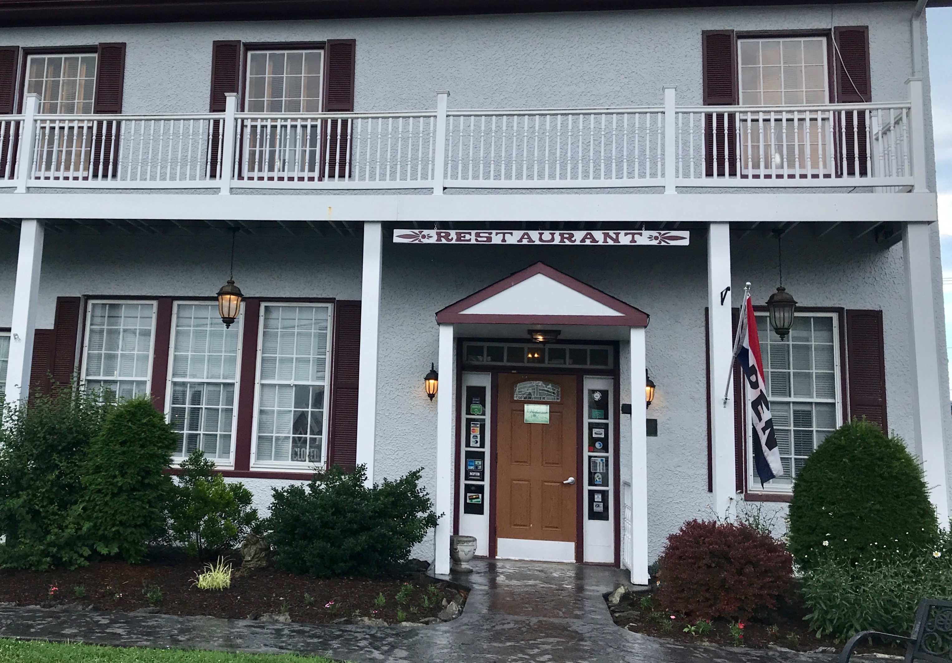
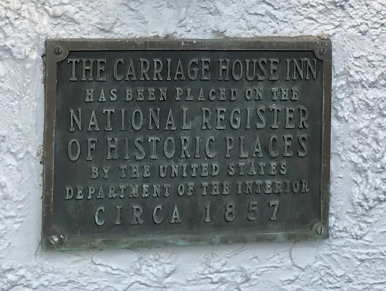
I consulted my iPhone and found The Carriage House Inn Restaurant.
According to their website, the building was built in 1857, and it became the Zimmerman and Maxwell Feed and Grain Warehouse in 1877. After the turn of the century, it served as a broom factory and later as a bus depot. The building first became a restaurant named “The White House” in 1953. Three decades later, it was purchased by the Hance family and The Carriage House Inn was born.
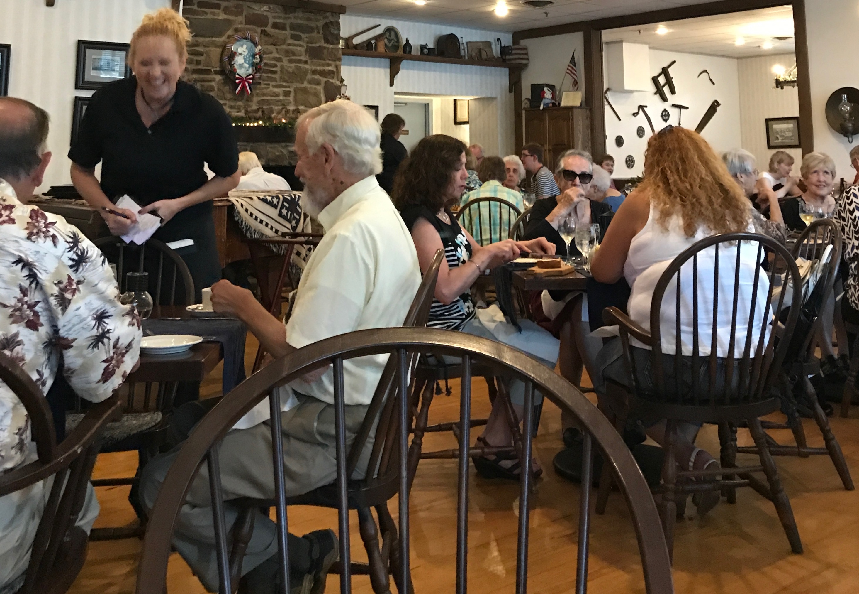
It was a very popular place to dine.
I started with a salad.
Worked my way through the delicious entree. I can’t remember what it was, except that everything was marvelous. Even the butter that went with the little loaf of bread had a unique touch.
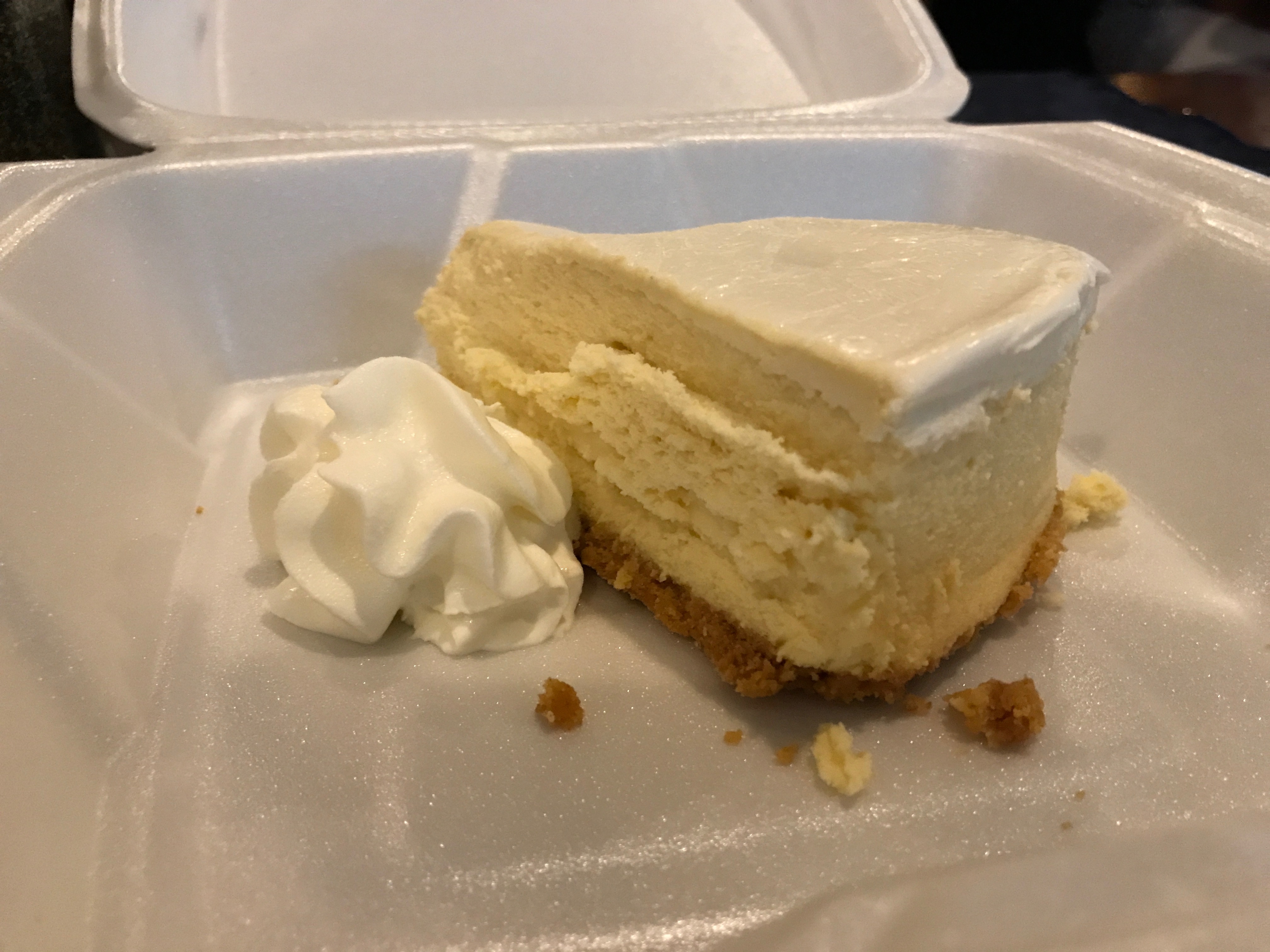
Now, I don’t usually do dessert. I just can’t eat that much at one sitting. The waitress tempted me to get one to go. It was every bit as good as the rest of the meal.
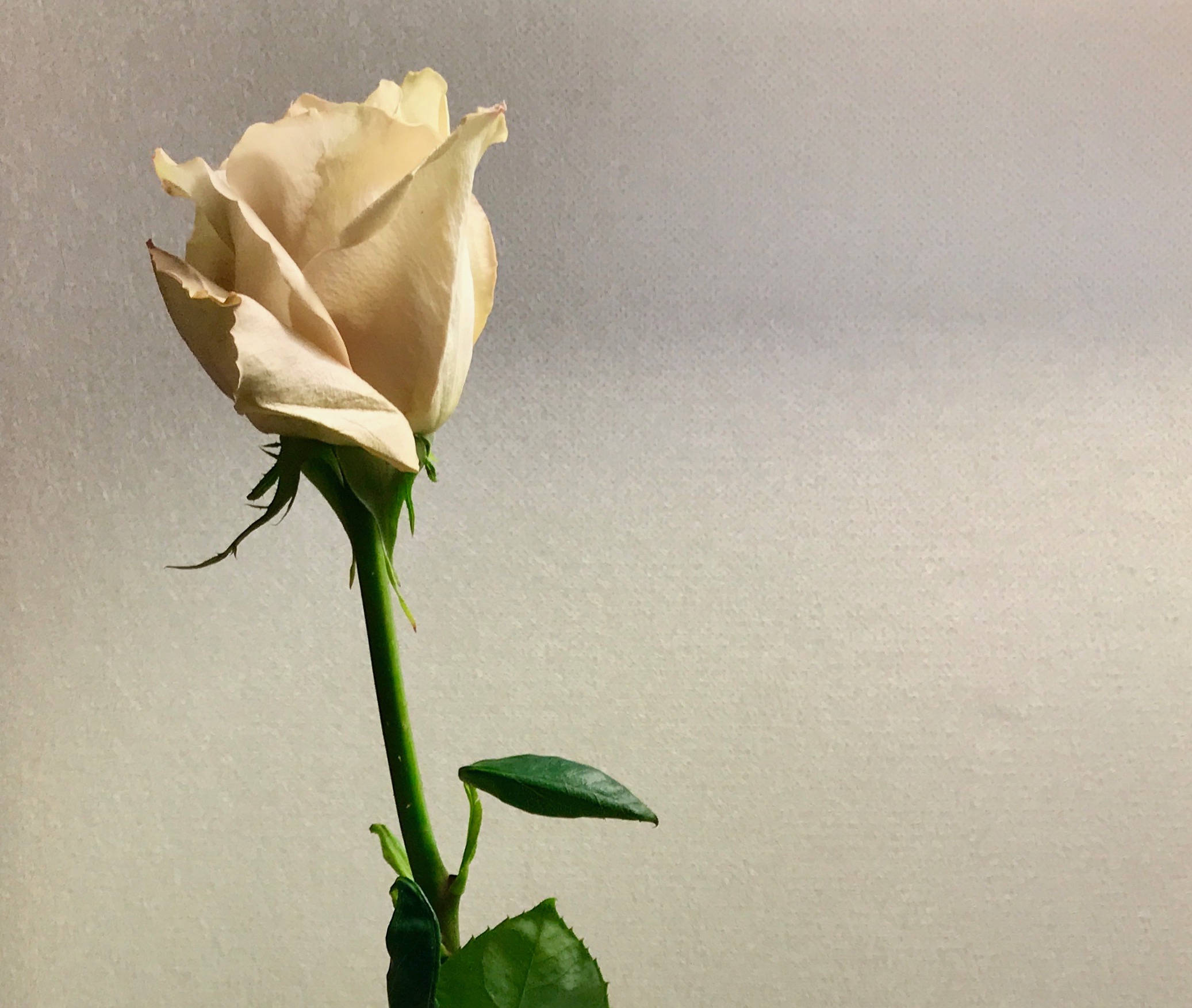
When the waitress brought me my dessert, she also brought me a rose. I appreciated the gesture, but I didn’t know what I as going to do with it.
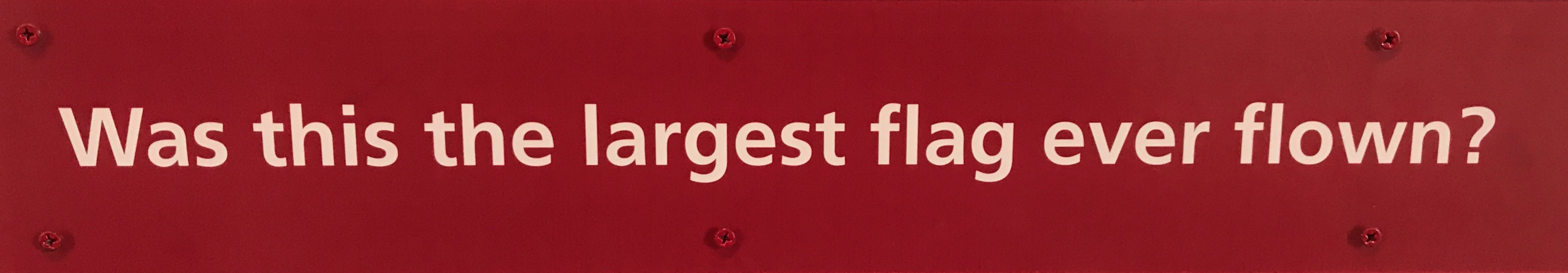
My next stop of touristic importance was Fort McHenry in Baltimore, Maryland – you know – Francis Scott Key and the bombs bursting in air and all that.
I made my way there with the help of Google maps and the signs pointing the way to the port of Baltimore.
I passed through the gate and headed toward the visitor center. Since I had an America the Beautiful pass, I didn’t have to pay the entrance fee. I’d say it was free, but the pass cost $80. However, the pass is good for the rest of my life, as long as I don’t loose it.
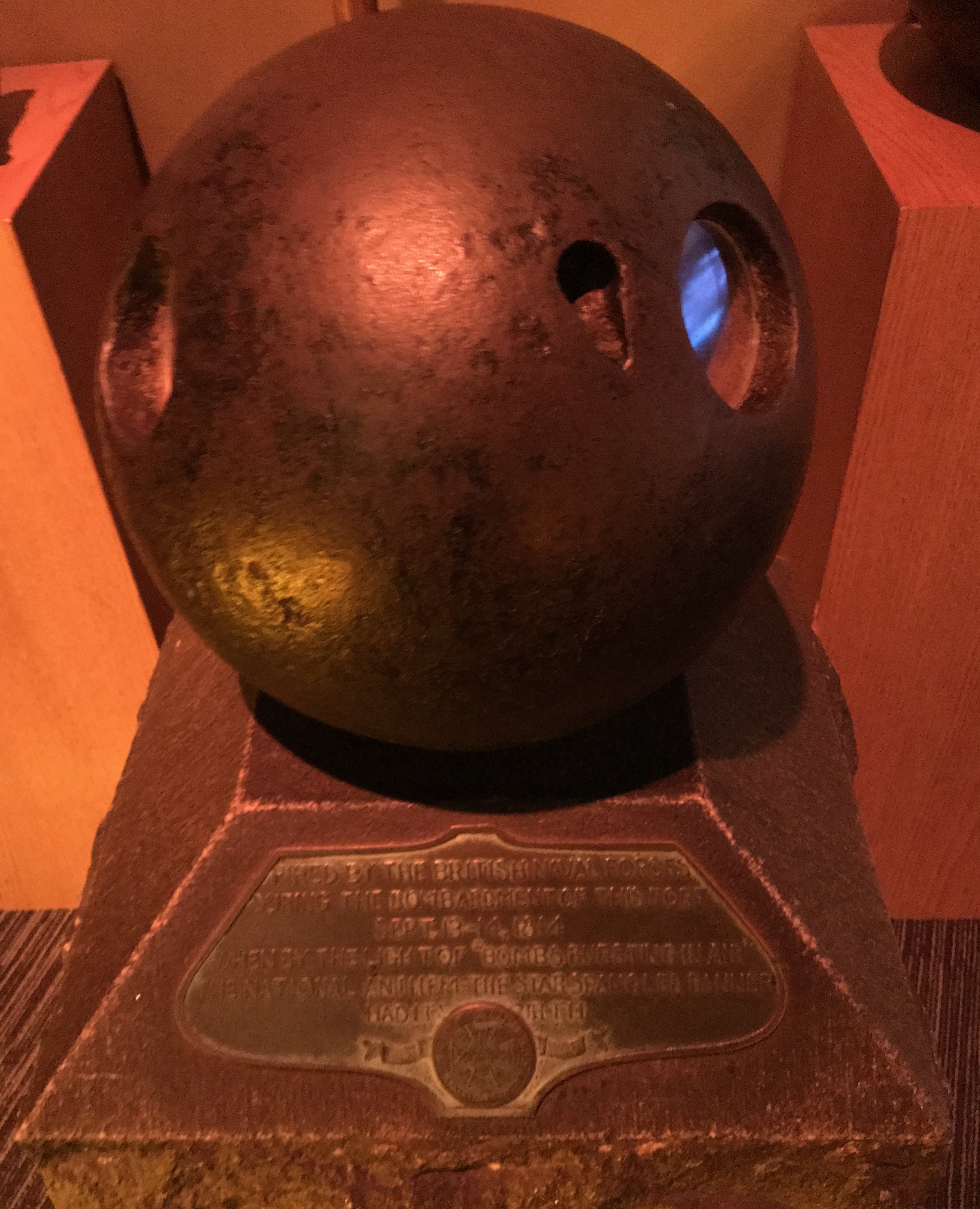
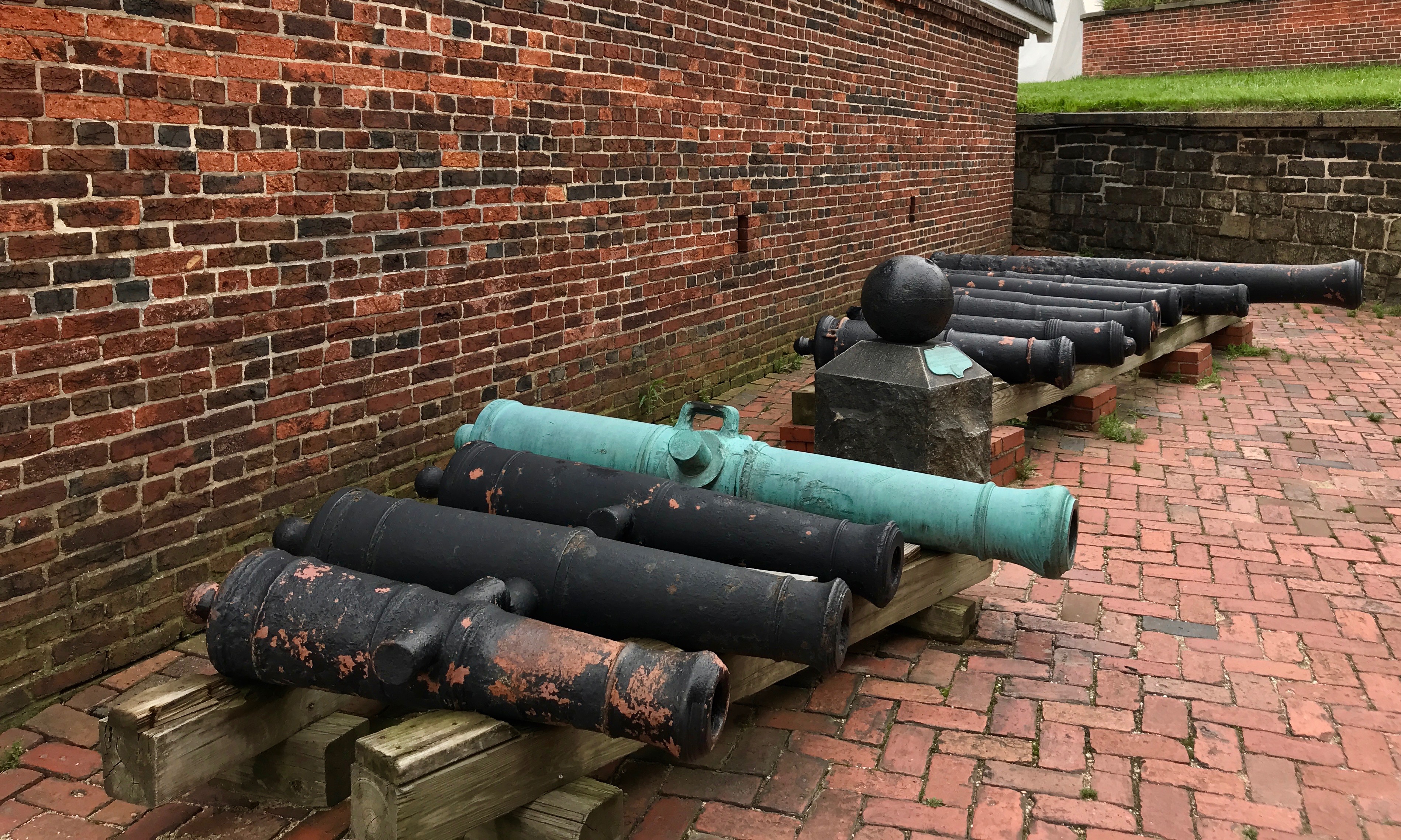
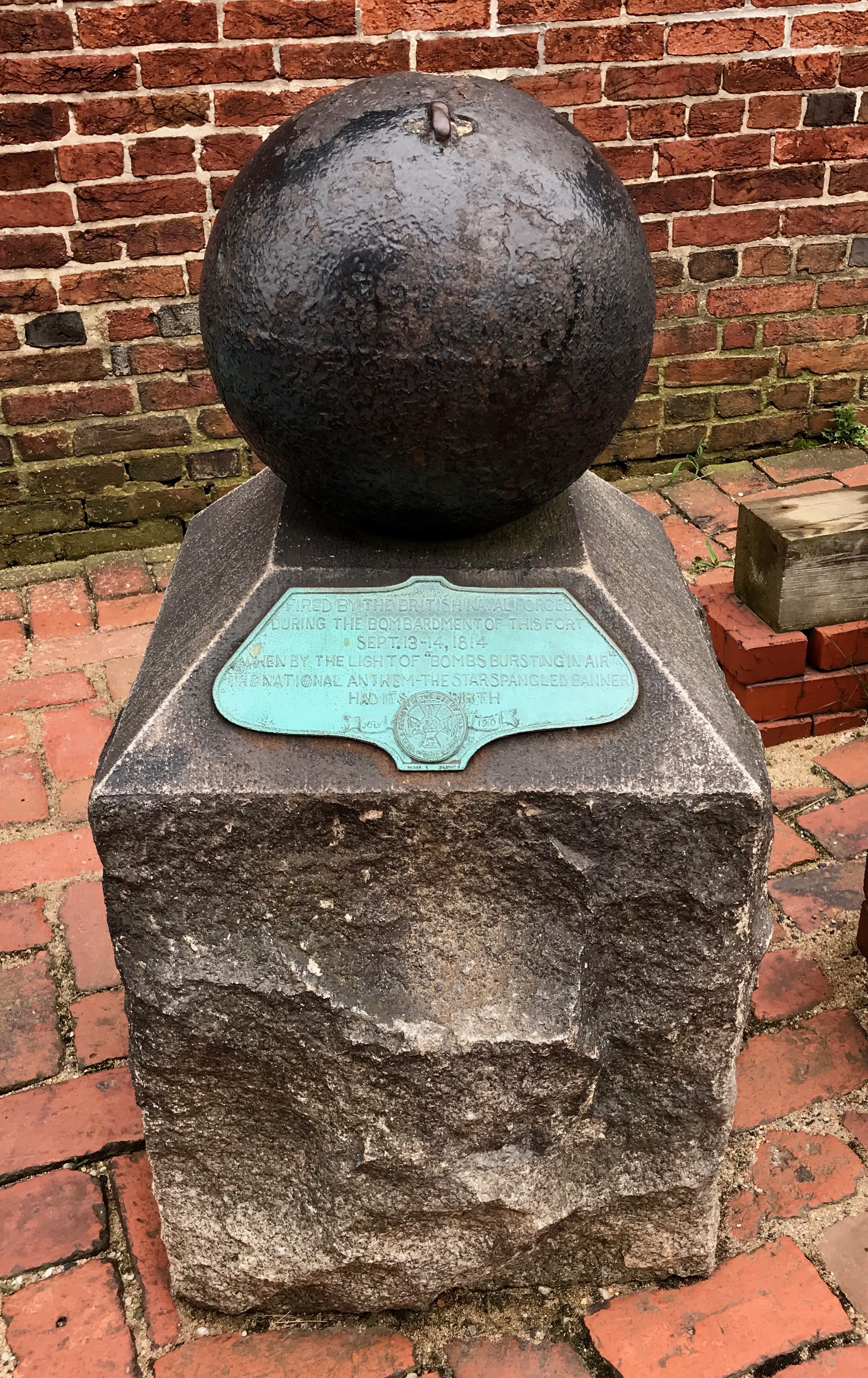
I wandered about and looked at the various displays while I wait for my turn to watch the video presentation. The plaque on this reads:
Fired by the British Naval Forces
during the bombardment of this port
September 13-14, 1814
when by the light of “bombs bursting in air”
the national anthem – The Star Spangled Banner”
had its birth.
It was time for my group to enter. It was actually quite a good film, but what I remember most vividly was the end. They played The Star Spangled Banner and raised the curtain to show us Fort McHenry, with the flag waving in the breeze. This was during one of the semi-frequent arguments about showing respect for the flag. I noticed that no one stood, so I decided to lead the crowd. Eventually, all got to their feet. Was it out of respect or because the movie was over? I guess we’ll never know.
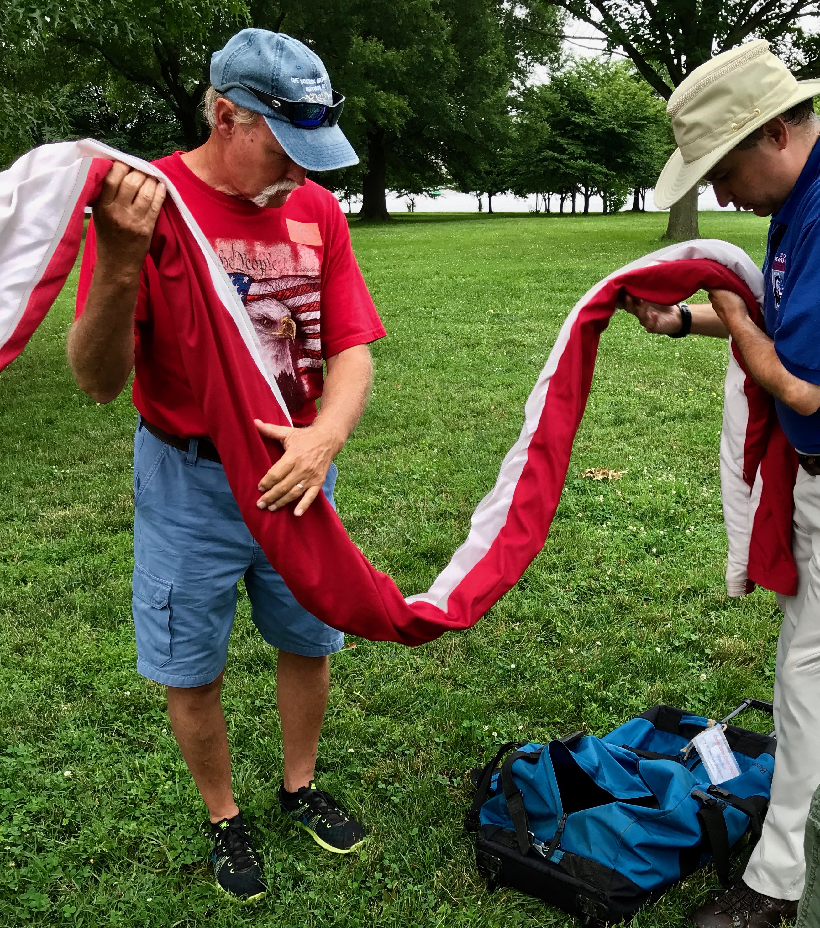
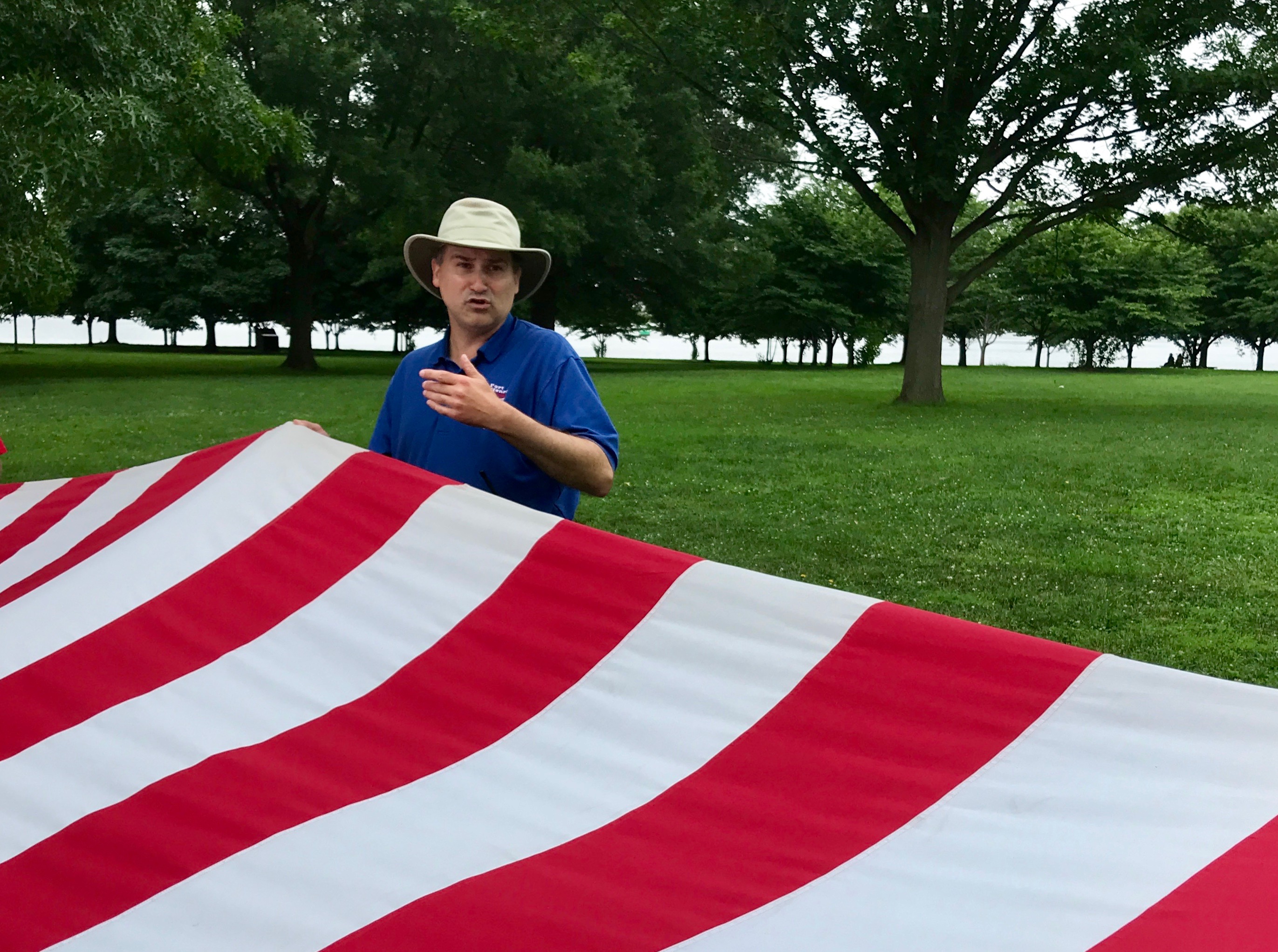
We had the opportunity to meet with a volunteer who would talk with us about the flags that are in use at Fort McHenry. For instance, larger flags are typically rolled and stored in bags, rather than the triangle fold that we are more familiar with.
Those of us taking part helped him remove it from the bag.
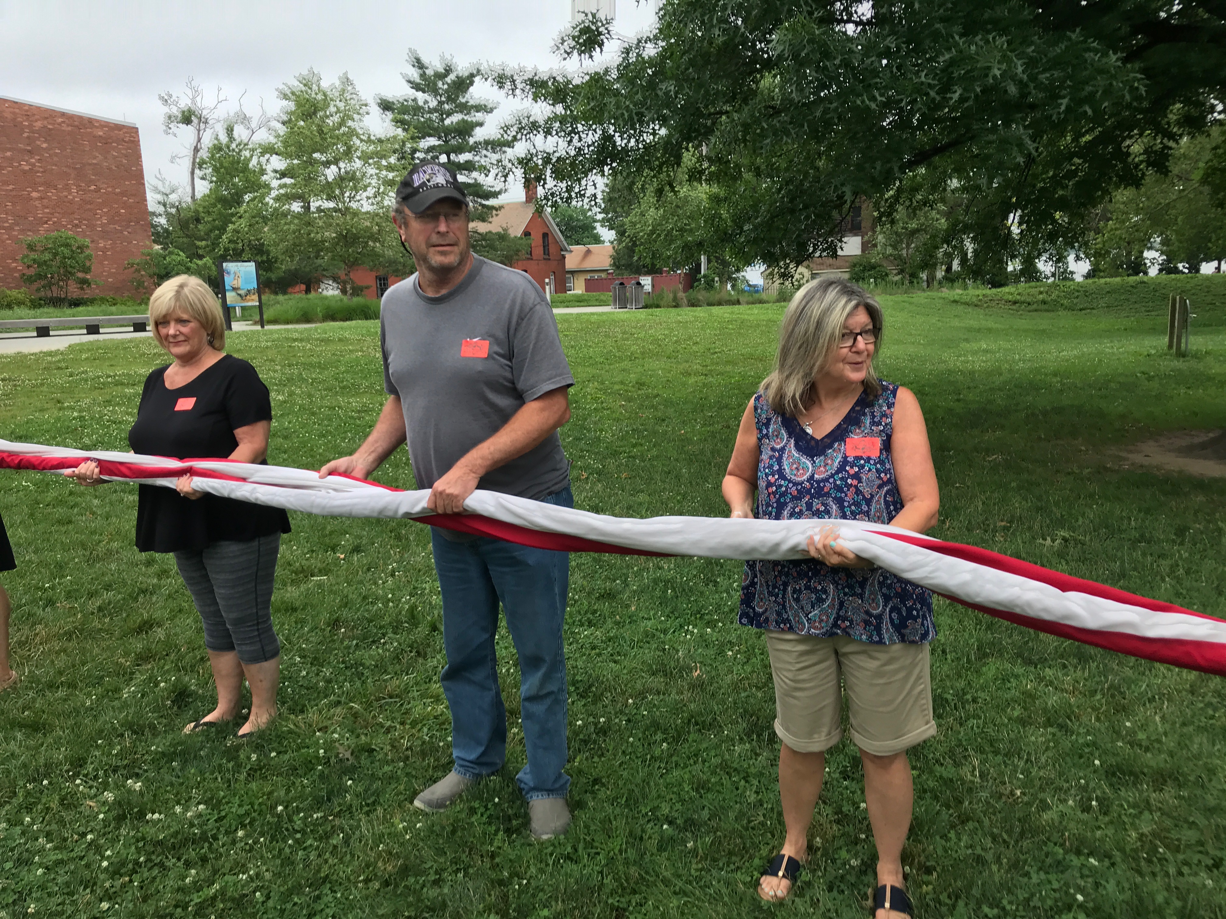
Half of us were on one side, holding the rolled flag.
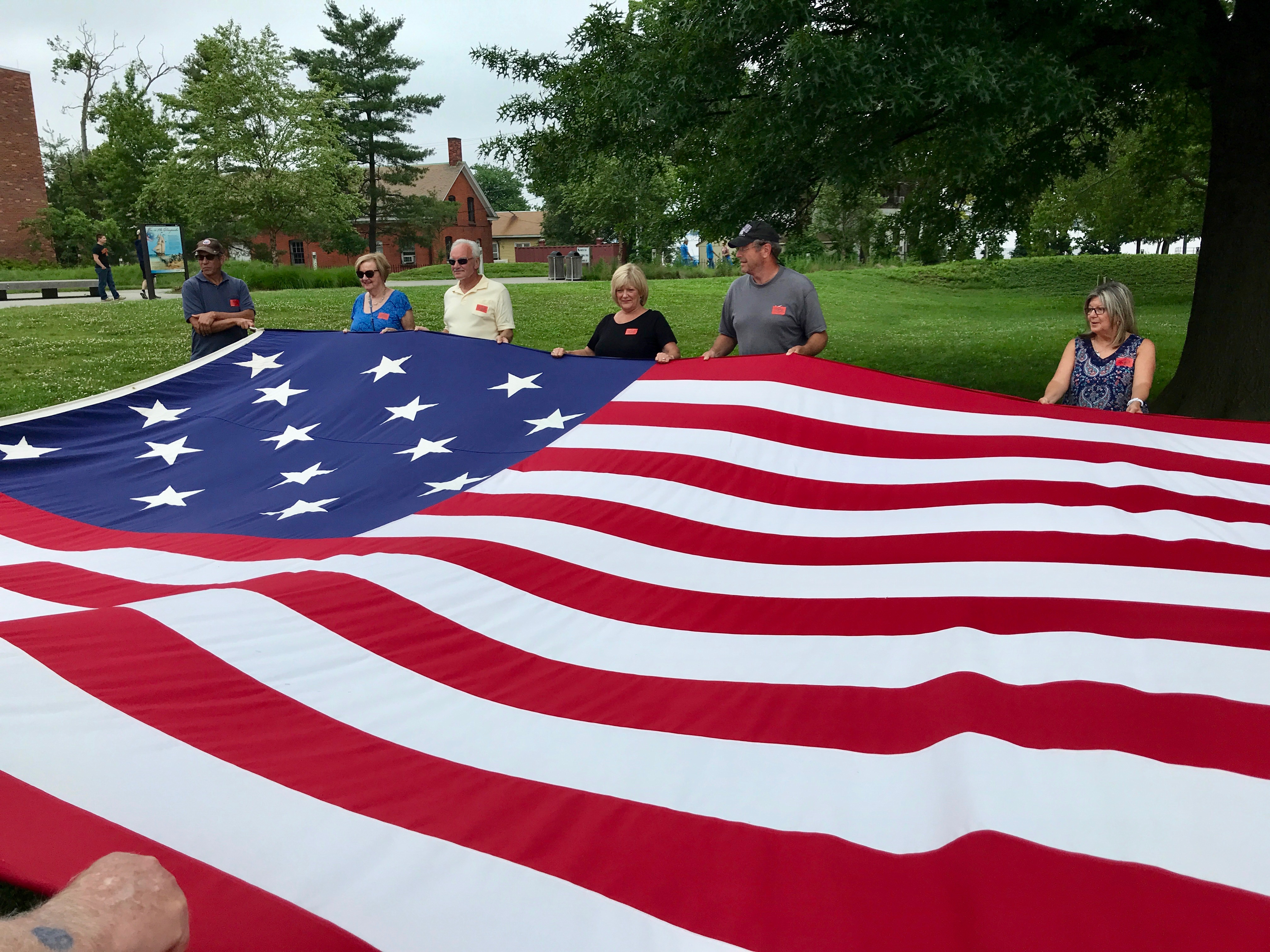
The other half joined in and helped unfurl the flag.
The volunteer shared some information about the flag.
For instance, this is a copy of the flag that would have been flying in 1814. You might not have noticed it, but there are 15 stripes as opposed to the 13 stripes we have today. This became the official flag of the United States on May 1st, 1795. Two stars and two stripes were added for the admission of Vermont and Kentucky.
This flag was the nation’s flag for 23 years, and five presidents served under it:
George Washington (1789-1797)
John Adams (1797-1801)
Thomas Jefferson (1801-1809)
James Madison (1809-1817)
James Monroe (1817-1825)
By the time James Monroe left the White House, it looks like there were 24 states in the Union. Can you imagine what the flag would have looked like if they had continued adding a stripe for each state? It would be a very different looking flag!
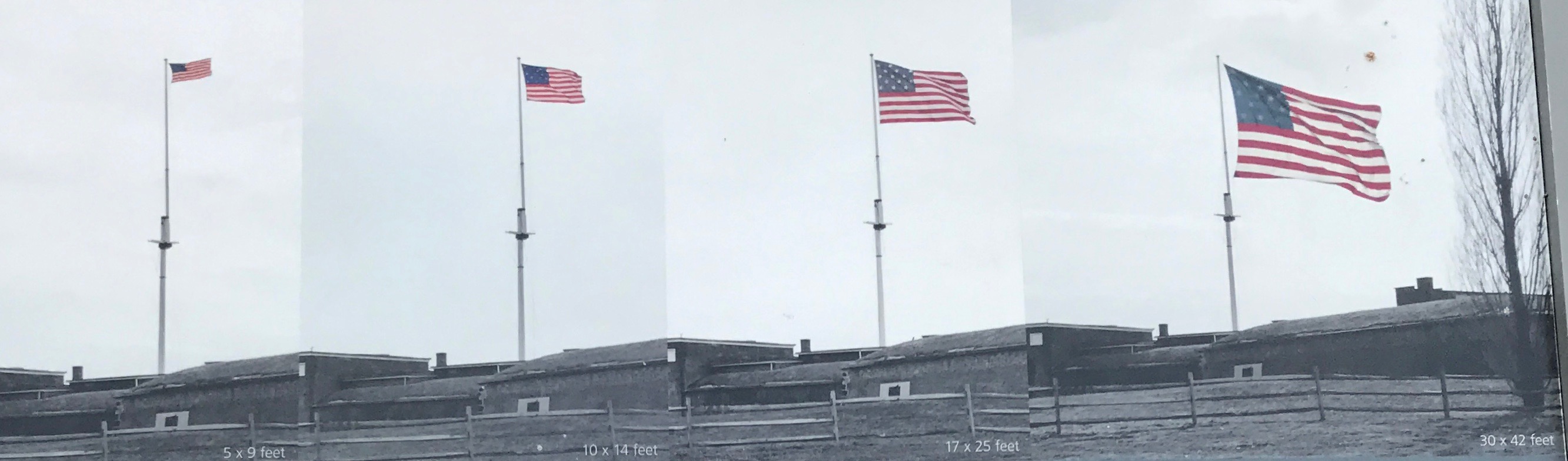
There are four different styles of flags flown at Fort McHenry. On clear days with the right amount of wind, a full-sized replica of the Star-Spangled Banner, measuring 30×42 feet with fifteen stars and strips waves. The fort also flies smaller versions of this flag. On rainy days and at night, a small, modern 50-star American flag is flown. At night, the flag is illuminated by lights powered by solar panels.
We furled the flag and returned it to its bag and set off for the fort.
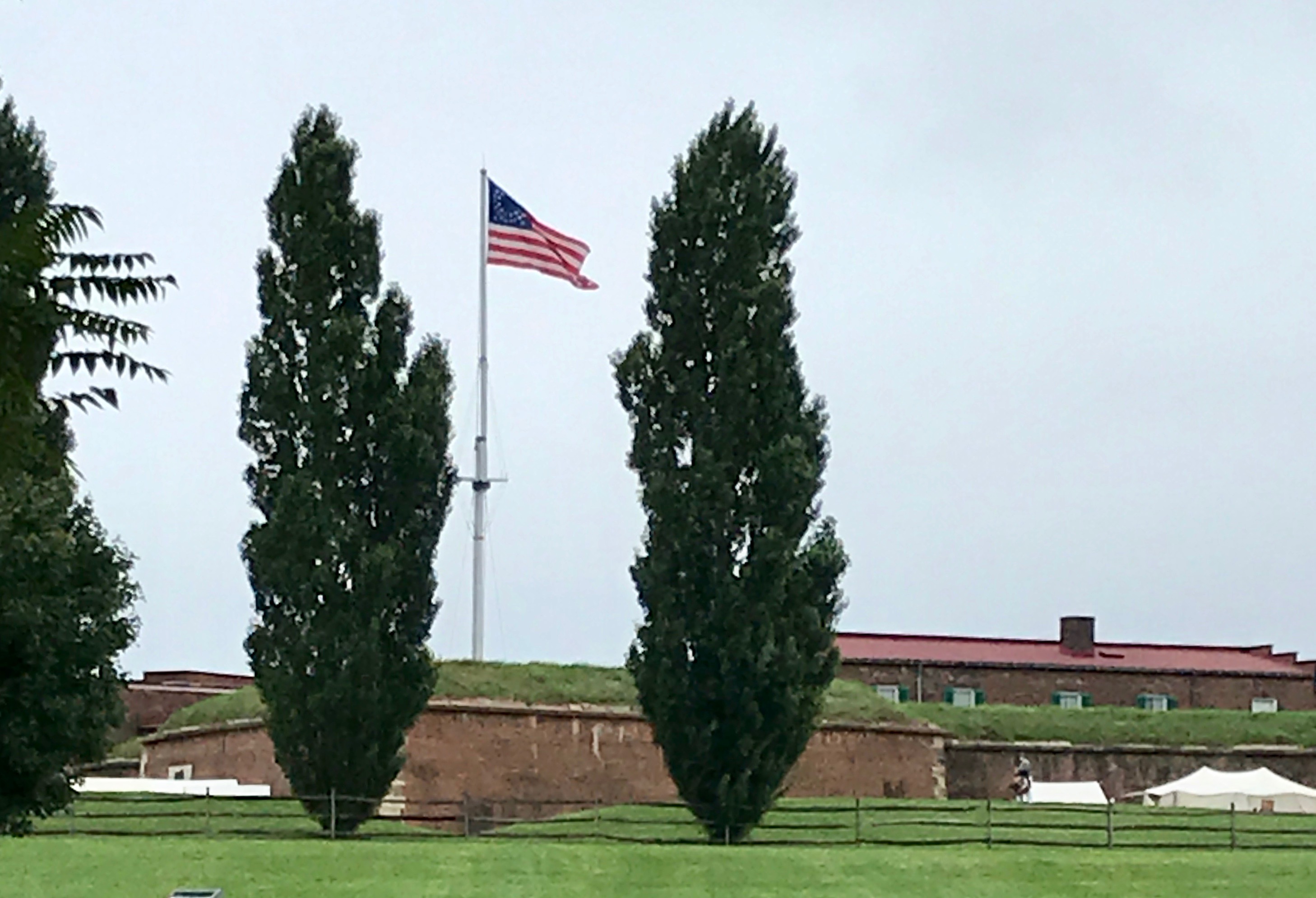
Hmm…
This flag doesn’t look quite like any in the chart. Oh, well.
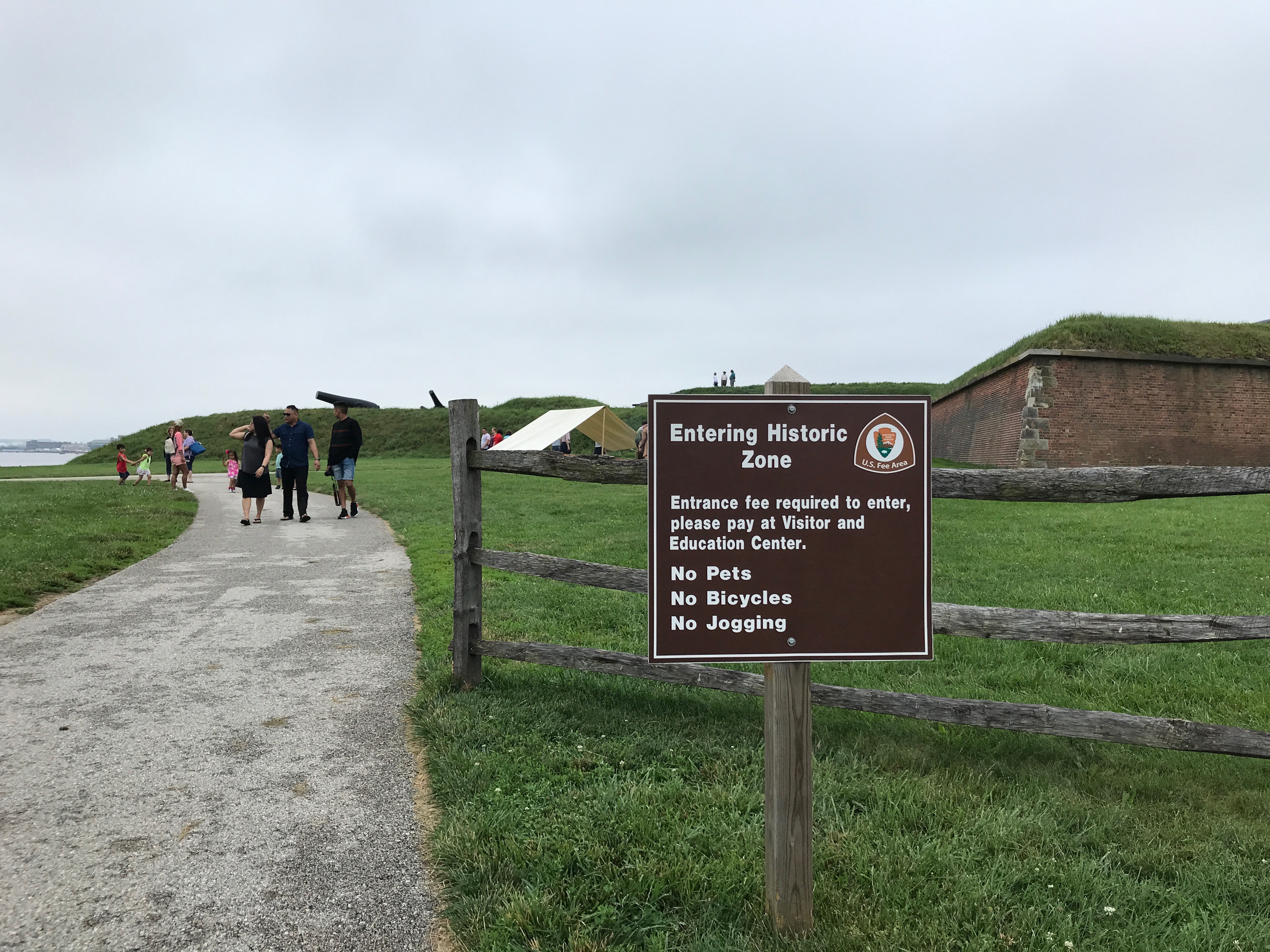
Hah! I laugh at your fees! I had my sticker on and I strode in with confidence.
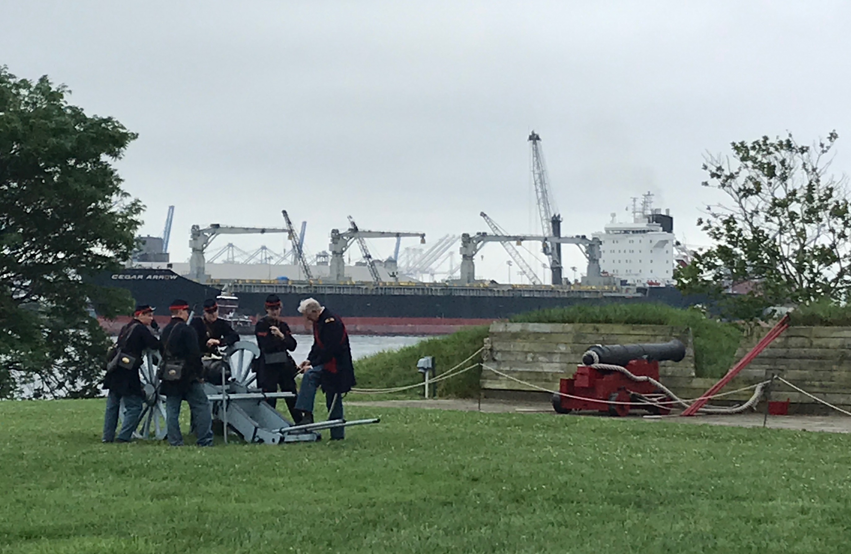
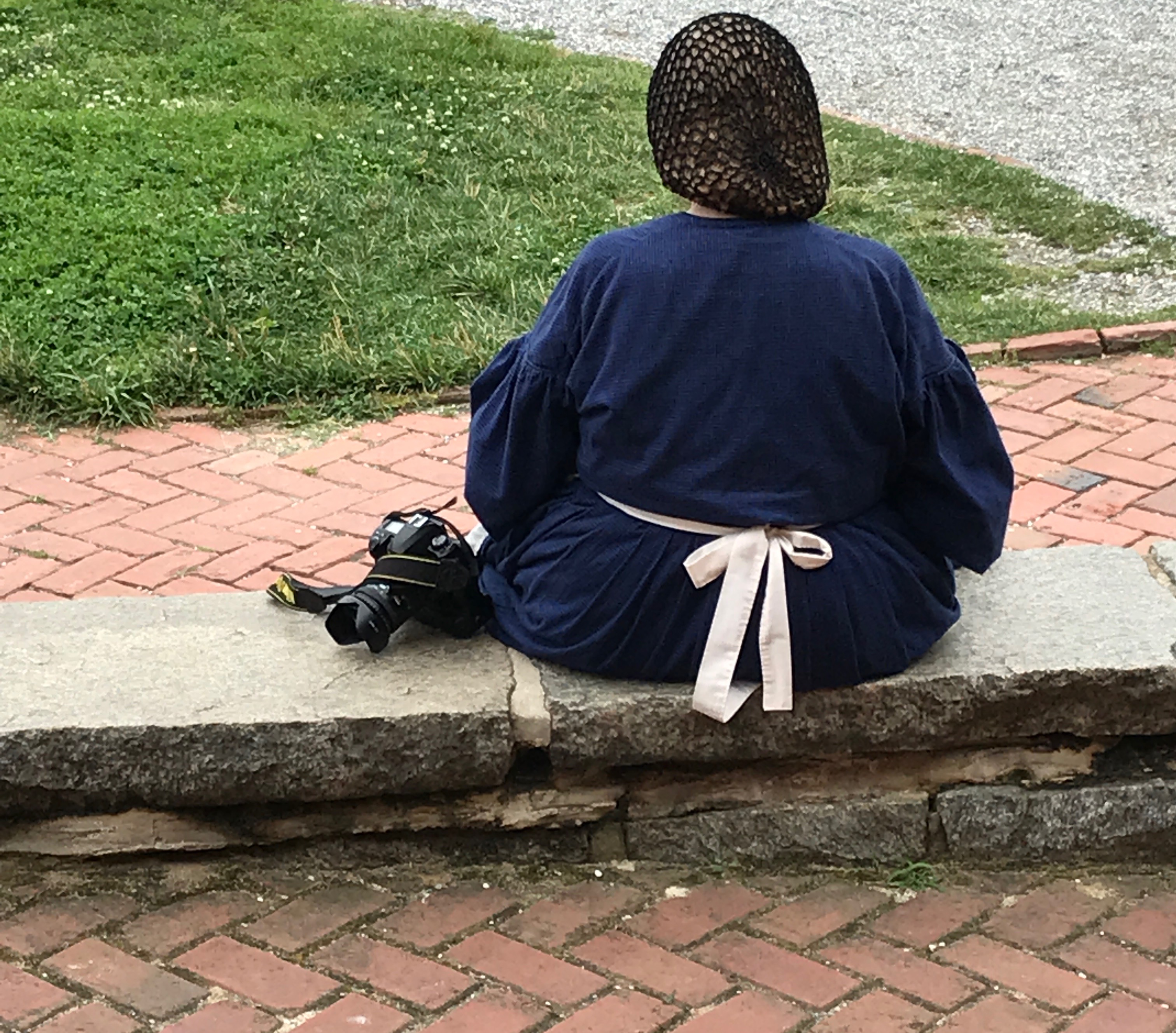
There was some sort of historic reenactment going on when I visited. It looks like there might be an artillery demonstration at some point.
Women were also taking part. I wonder what is for lunch?
For some reason, I didn’t take as many photos as I might have, so I am resorting to my old friend Google to help me flesh things out a bit. This aerial view is from my Preferred Source. (I couldn’t have gotten that angle anyway, as I kept both feet on the ground.)
Fort McHenry wasn’t always a National Monument and Historic Shrine. It was made a national park in 1925; on August 11, 1939, it was redesignated a “National Monument and Historic Shrine.” It’s the only such doubly designated place in the United States.
During World War I, the U.S. Army built over 100 buildings around the fort. It was one of the largest military hospitals in the country and it housed 3,000 wounded soldiers from the battlefield of France.
From 1917 until 1923, the fort also served as a surgical center. Great advances were made in neurosurgery and reconstructive surgery. It was one of the country’s first schools to reintigrate disabled soldiers into civilian life by offering special classes in typing, knitting, metal work, automobile repair and other trades, according to the informational signs at the fort.
When World War II came, it was pressed into service again. The Coast Guard used it as a training base, although historic portions remained open to the public.
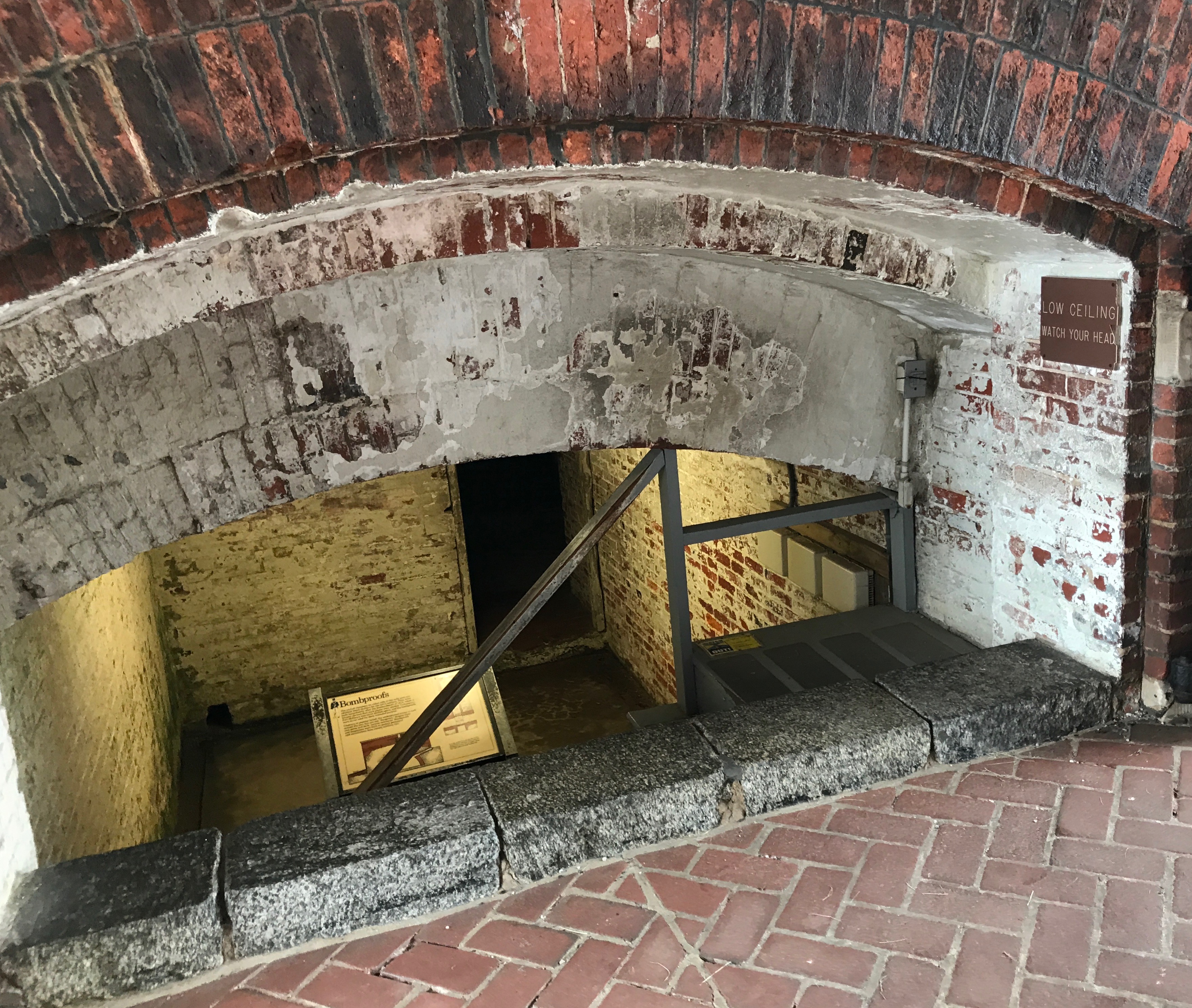
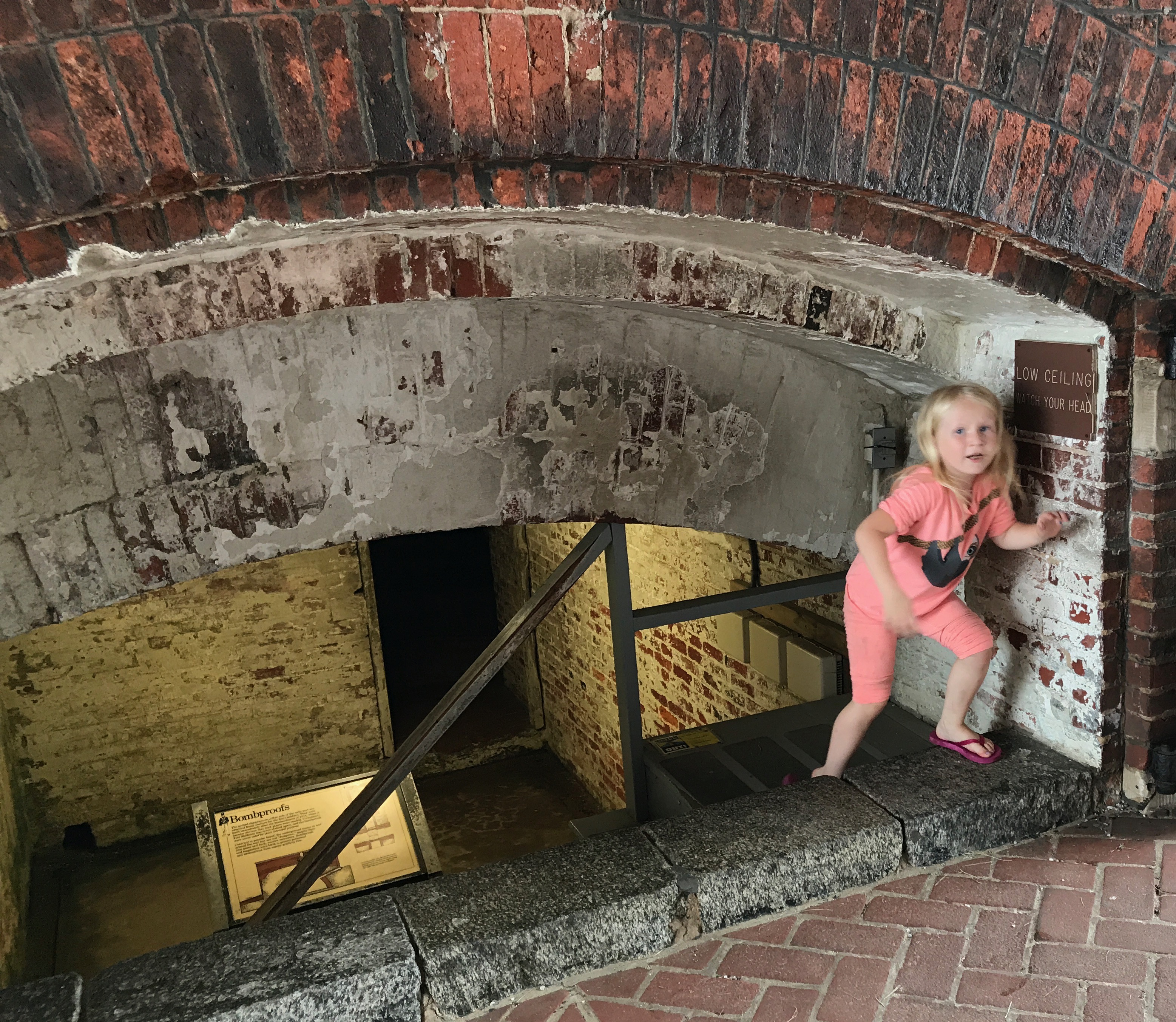
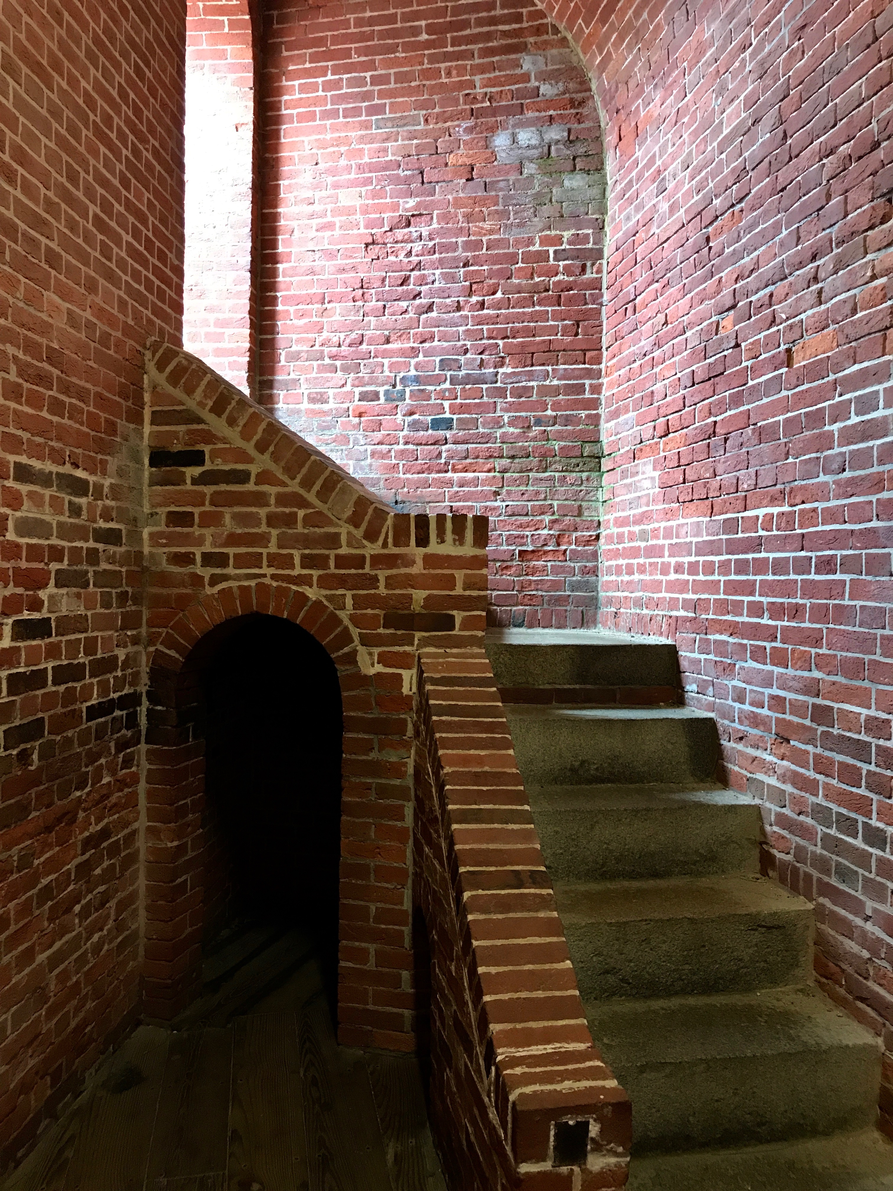
But, enough of the background information. It was time to enter and see what there was to see. I entered through the sally port and encountered this odd structure.
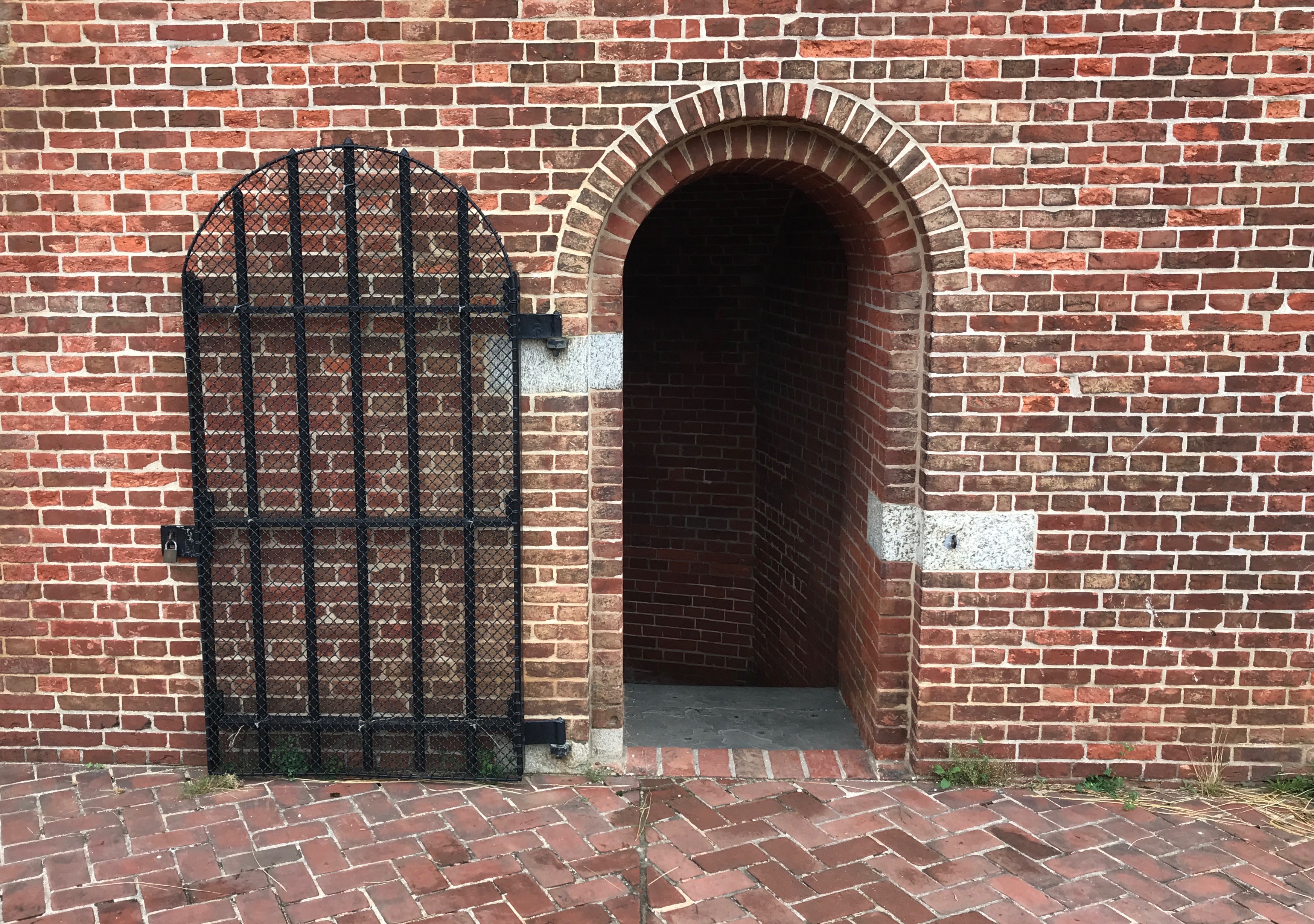
This room with the low ceiling is what is known as a “bombproof.” There are arched chambers on either side of the sally port that were built immediately after the bombardment of 1814, when it became obvious that such places were needed. Fortunately, Fort McHenry was never shelled again, and the bombproof were never used for their intended purpose.
Although they look kind of like dungeons, what with their iron gates and dark, narrow entrances, bombproofs and magazines were built to protect personnel and ammunition from enemy artillery fire.
This wee Miss doesn’t seem to be bothered in the least by the low ceiling. On the other hand, I had to take pains not to bump my head when I squeezed my way down to read the sign, which is where I got the information about the bombproofs.
If I remember correctly, this is the entrance to one of the bombproofs.
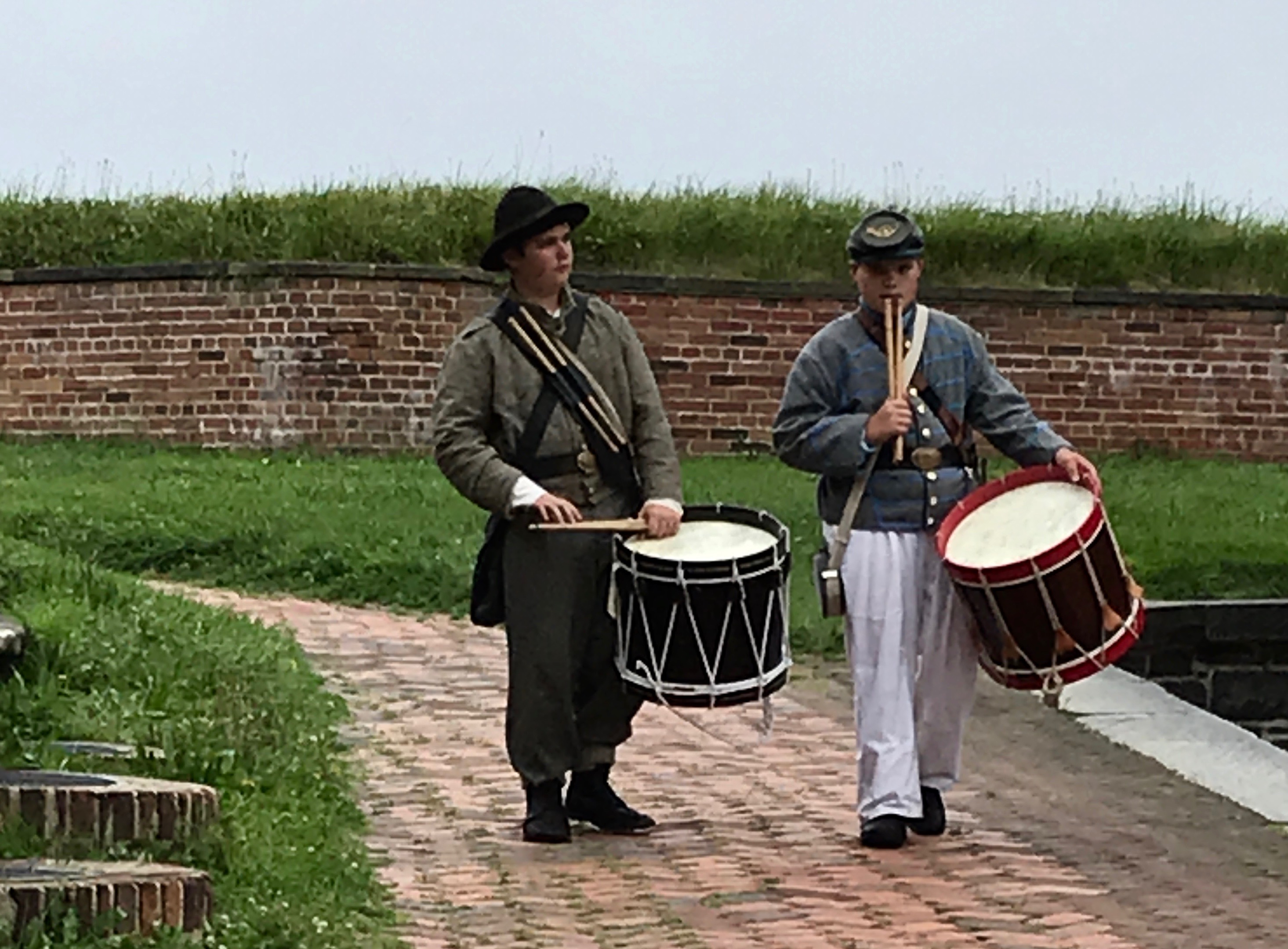
This image of one of the reenactors taking a break made me smile. That camera is a little anachronistic.
The drummers seemed more into the time period.
As I am wont to do, I took a few moments to look behind the buildings ringing the central parade ground. So many bricks went into these buildings!
There was no interpretive signage about the ordnance behind this building, but there was another one of those cannon balls.
Its plaque said the same thing as the one inside the visitor’s center.
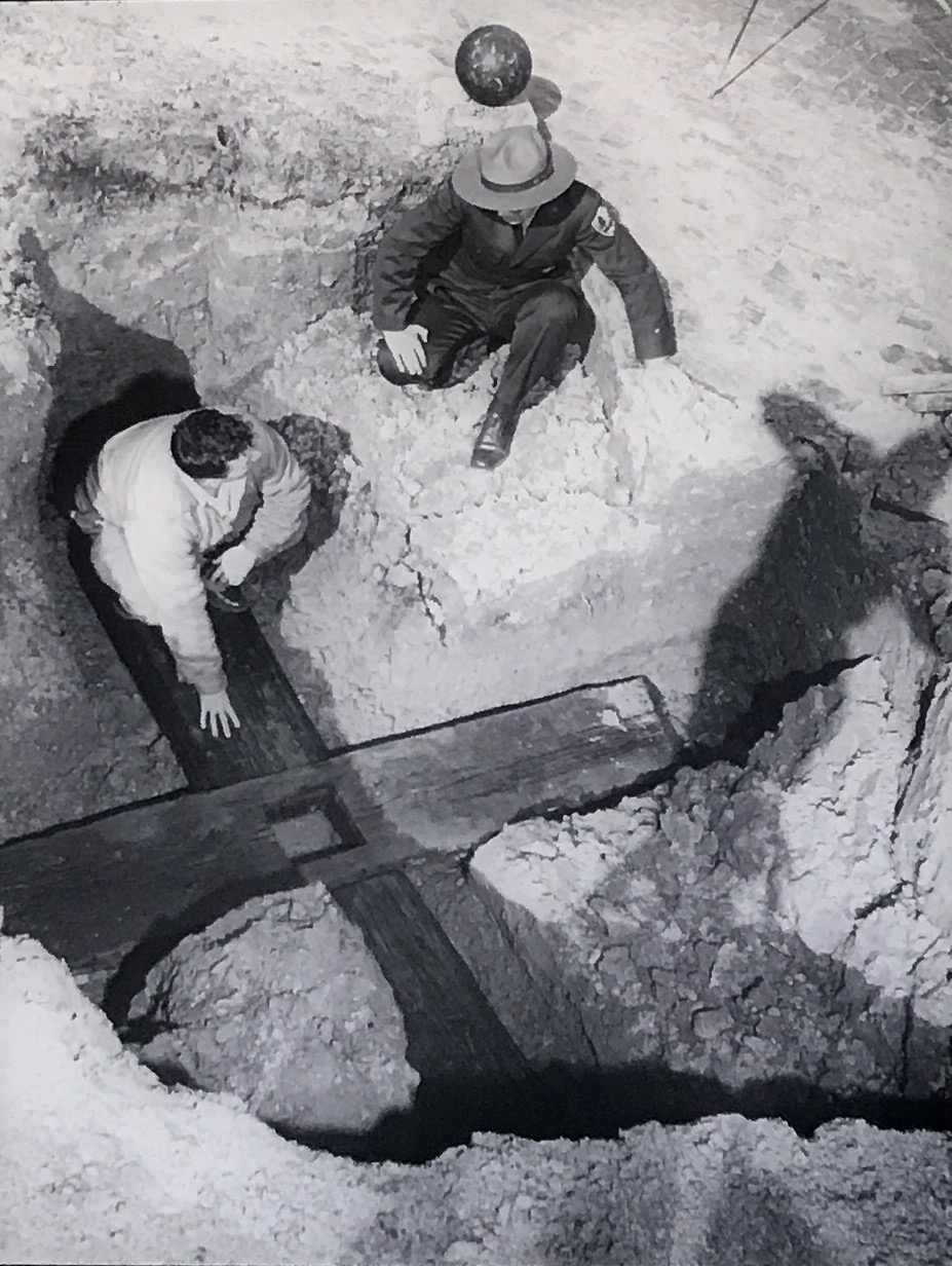
The buildings ringing the parade ground had many interesting displays. The one I found most interesting was information about finding the location of the original flagpole that flew the flag that Francis Scott Key wrote about.
According to the interpretive information, these oak timbers are the last pieces of the 1814 flagpole that remained here at the fort. For a long time, no one knew exactly where the flagpole was. An 1803 map shows the flagpole near the sally port, but an 1839 map places it on one of the points or “bastions” overlooking the water.
Archeologists explored the area around the sally port in 1958, using the 1803 maps for guidance. The discovered two large timbers several feet under ground. They were fitted into the shape of a cross with a large rectangular hole in the center. This cross brace was designed to keep the flagpole from tipping over in the wind. All surface evidence of the flagpole had long since been lost.
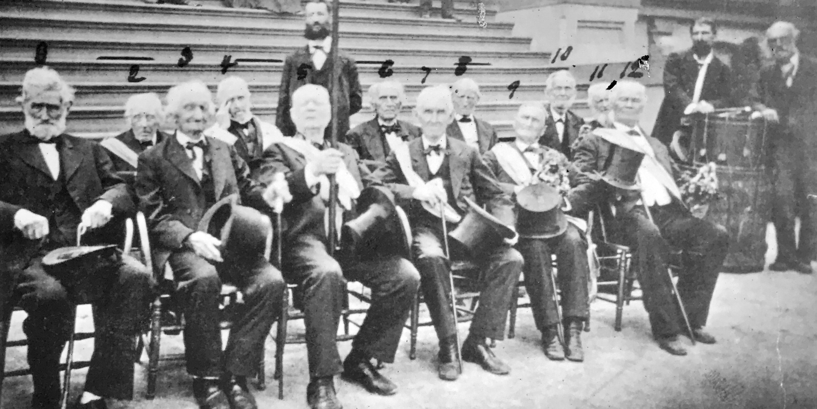
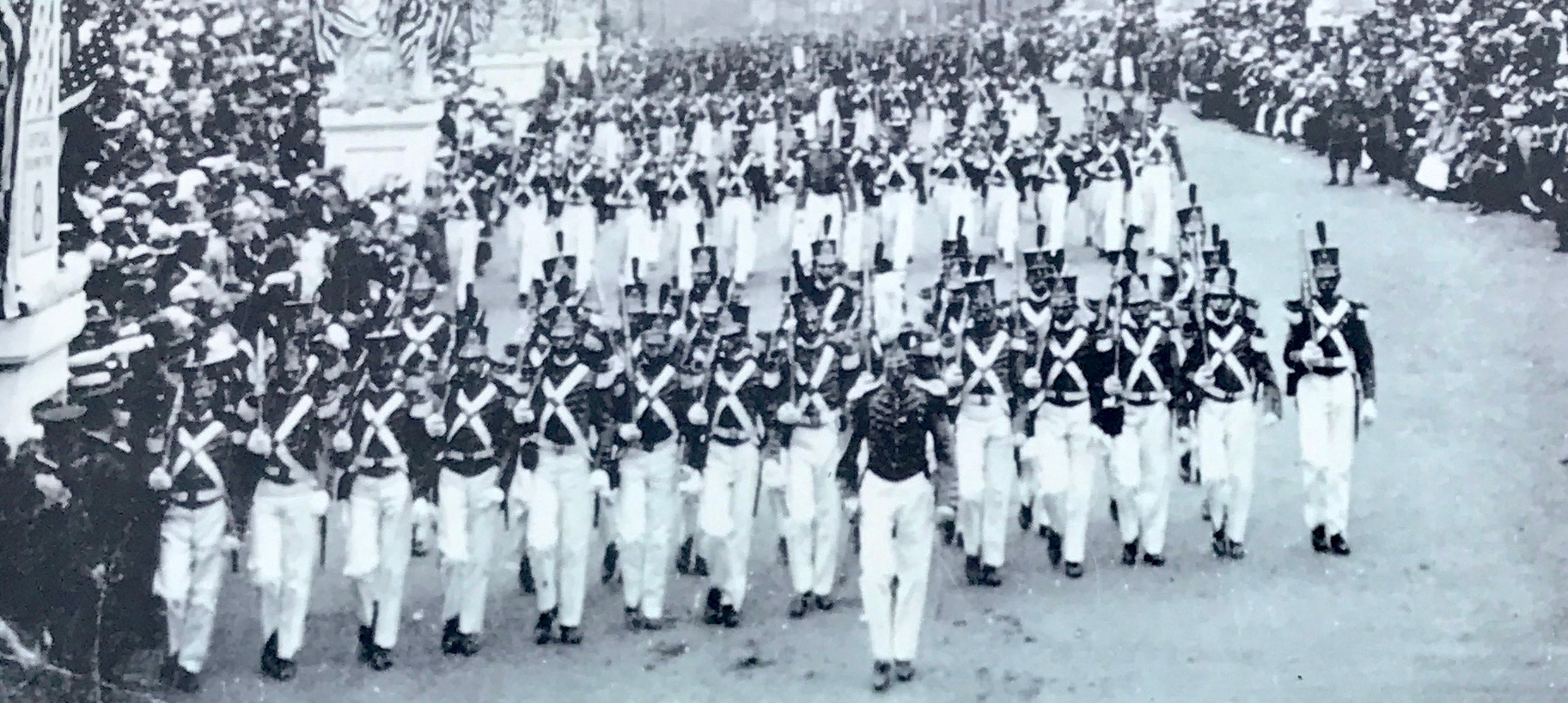
The successful defense of Baltimore from British attach has been remembered and commemorated every year since 1814. This photo, taken in 1880, shows the last 12 surviving of the remaining defenders of the fort at a celebration at Druid Hill Pavilion in Baltimore.
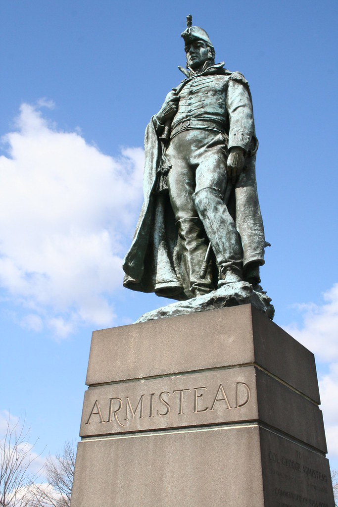
In September 1914, the nation observed the 100th anniversary of the writing of “The Star-Spangled Banner.” The fort was leased by the city and served as the centerpiece of the commemorative activities, which included a parade of tall ships, visiting U.S. Naval Vessels, parades, firework shows and the dedication of a monument to Major George Armistead, who commanded the fort in 1814.
From Flikr by day92783
Somehow, I managed to miss the stature, so here it is, courtesy of a Google search.
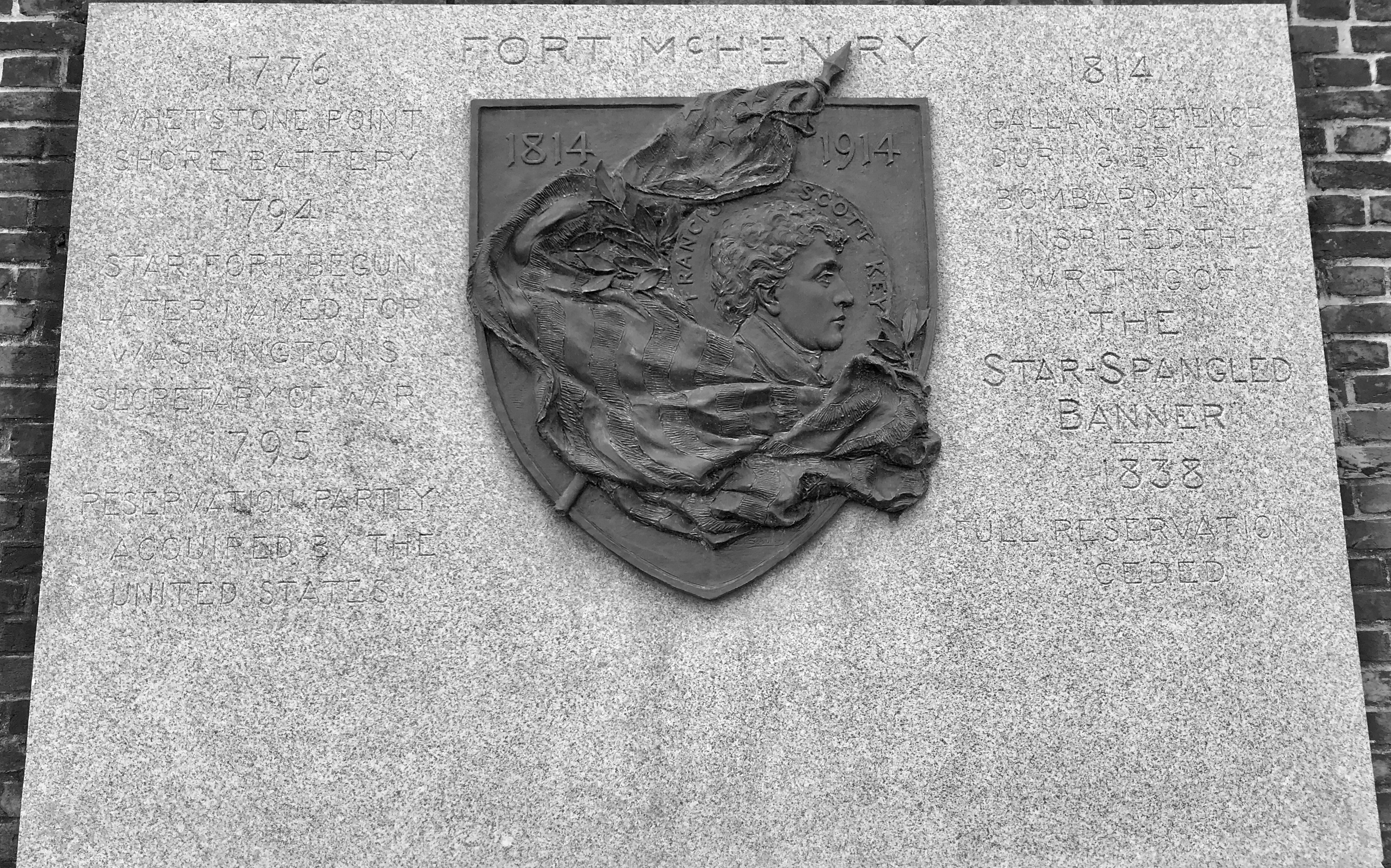
This tablet was dedicated to Francis Scott Key during the Centennial celebration in 1914. Designed by Hans Schuler, the bronze shield depicts and American flag and myrtle, symbolic of love and immortality, surrounding a portrait of Francis Scott Key.
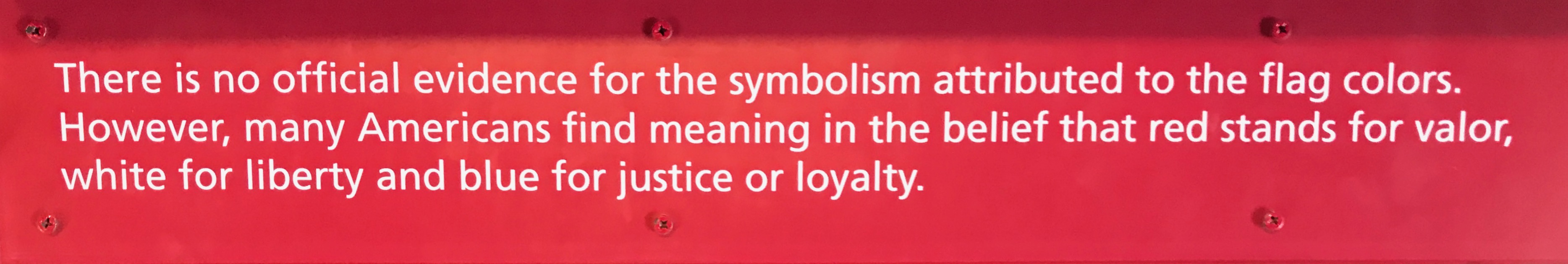
I always visit the museums and study the displays, as time allows. Here are some questions that I found interesting.
Answer:
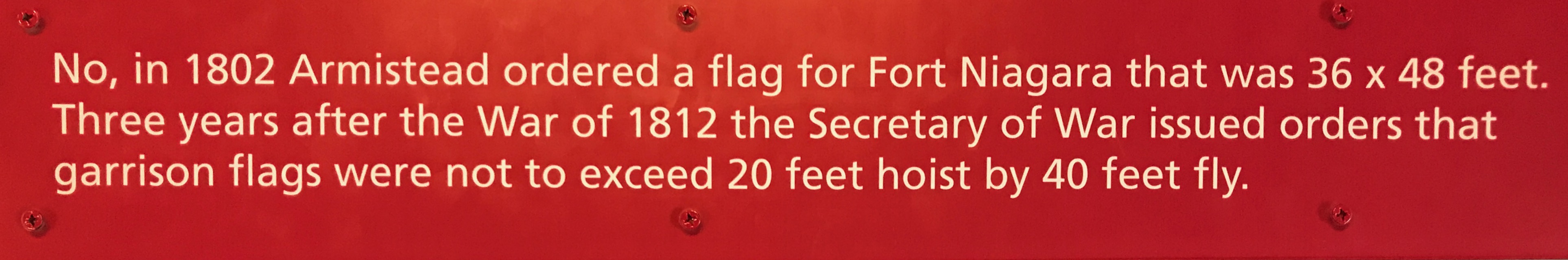
Wow! There’s that Fort Niagara connection again!
And the answer is:
And with that, it was time to find the exit. There was one more thing to see before I was on my way.
This is the ravelin magazine. Near the end of the Civil War, several large cannon were located on the ravelin.
The ravelin is a triangular fortification located in front of the innerworks of the fort. You can see it here, pointing toward the lower right in the photo.
The commanding officer ordered that 1,000 rounds of ammunition be kept nearby for each gun. In 1866, this magazine and two others were built to safely store the additional gunpowder.
The covered entrance with its angled stairway was designed to prevent enemy projectiles from reaching the explosives. Three feet of concrete and up to 16 feet of earth were laid over the arched brick vault.
With that, it was time to head out. I had one more stop I wanted to make before I called it a day.
I made my way into the city.
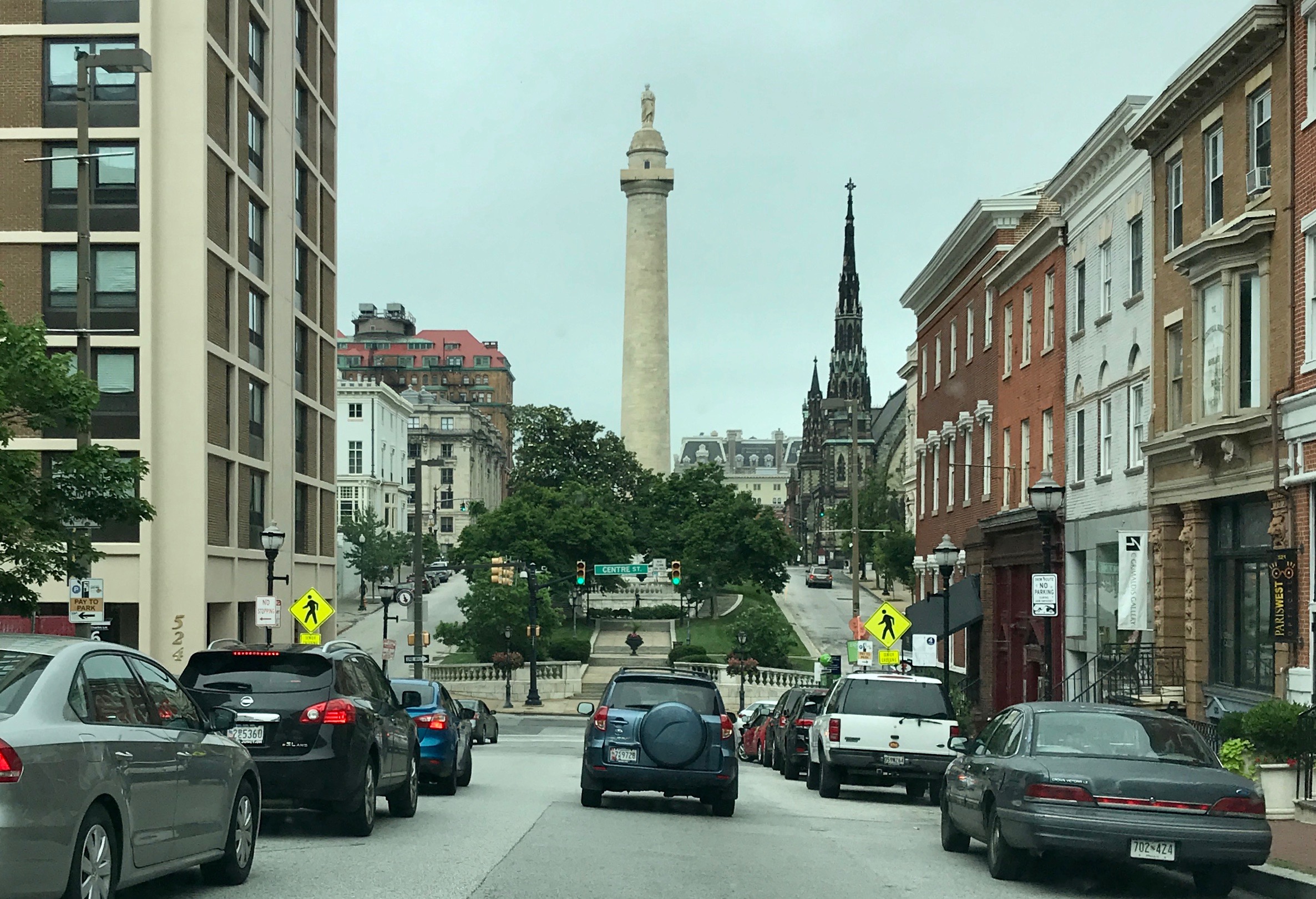
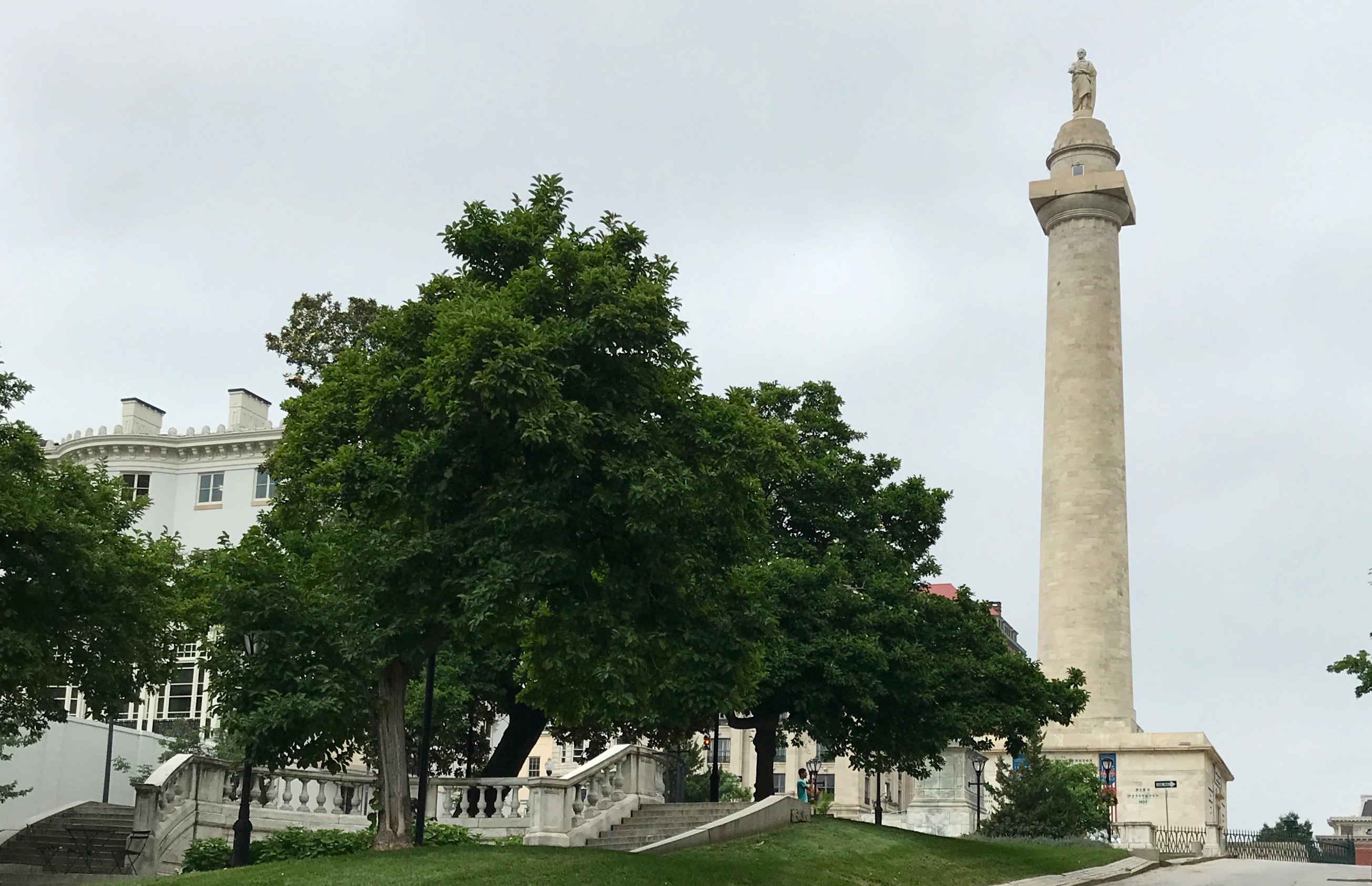
My destination was the first major monument to honor George Washington.
The Monument was designed by American Architect Robert Mills, who also designed the later Washington Monument on the National Mall in Washington, D.C.. Construction began in 1815 on land donated by Colonel John Eager Howard from his extensive estate just north of Baltimore Town. The statue, by Italian-born sculptor Enrico Causci, was installed in 1829.
Washington is depicted on the top of the Monument resigning his commission as Commander-in-Chief of the Continental Army, an act which took place in the Old Senate chamber in the Maryland State House in the state capital of Annapolis, Maryland on December 23, 1783. The Confederation Congress was meeting in the Maryland capitol which served for a few months as the temporary national capital. While there, the Congress also ratified the Treaty of Paris of 1783, ending the American Revolutionary War and recognizing the independence of the United States by Great Britain.
So much history!
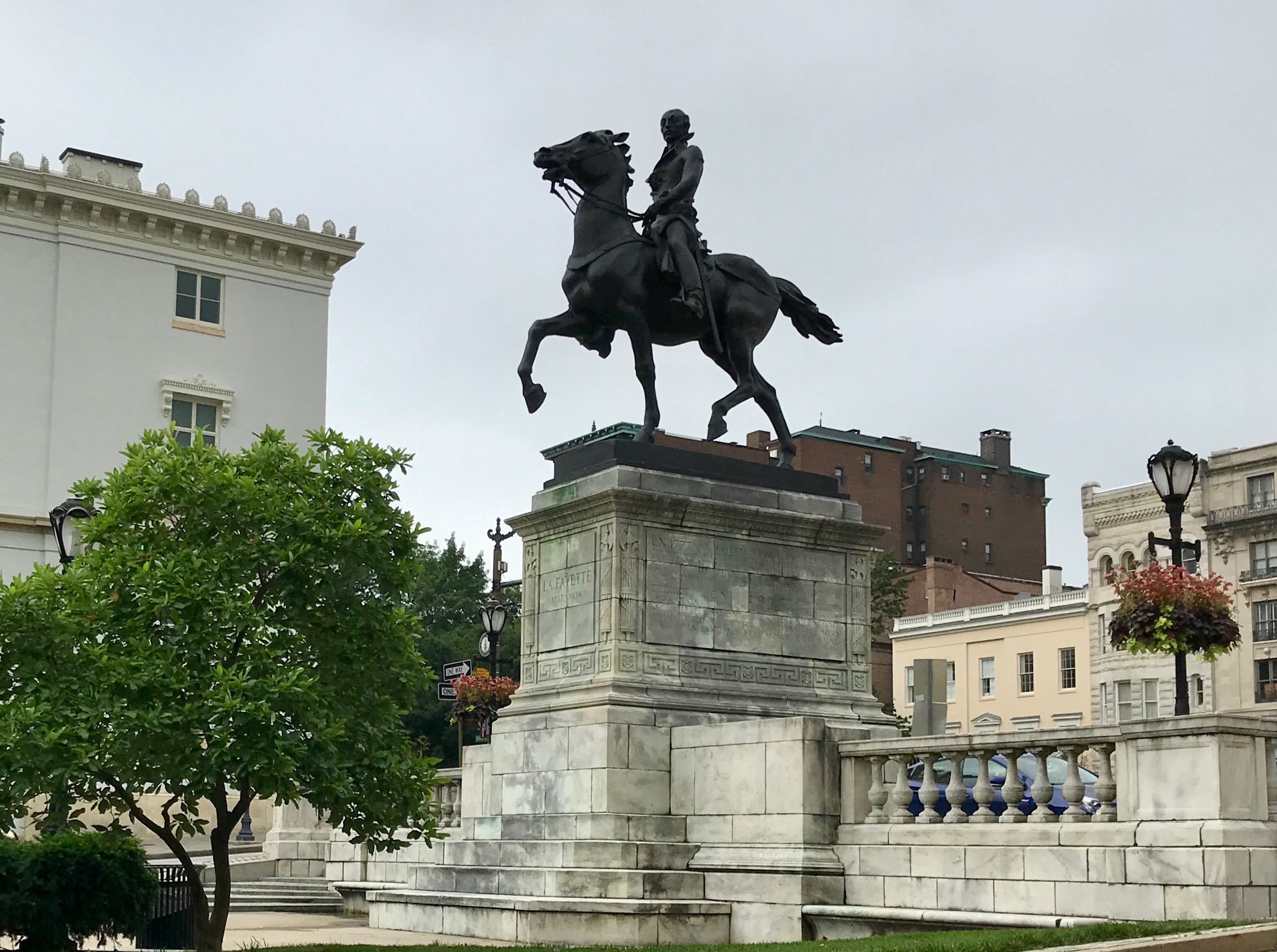
Lafayette is there with Washington, too. (I would have been surprised if he weren’t.)
I could have gotten out of the car and climbed the 227 steps to the top to take in the view, but I was tired and parking wasn’t readily found. I decided to head back to the hotel.
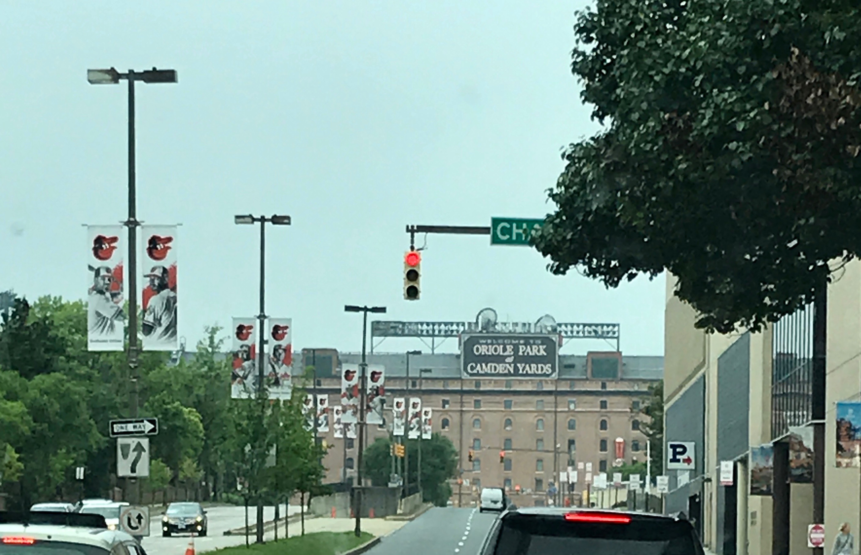
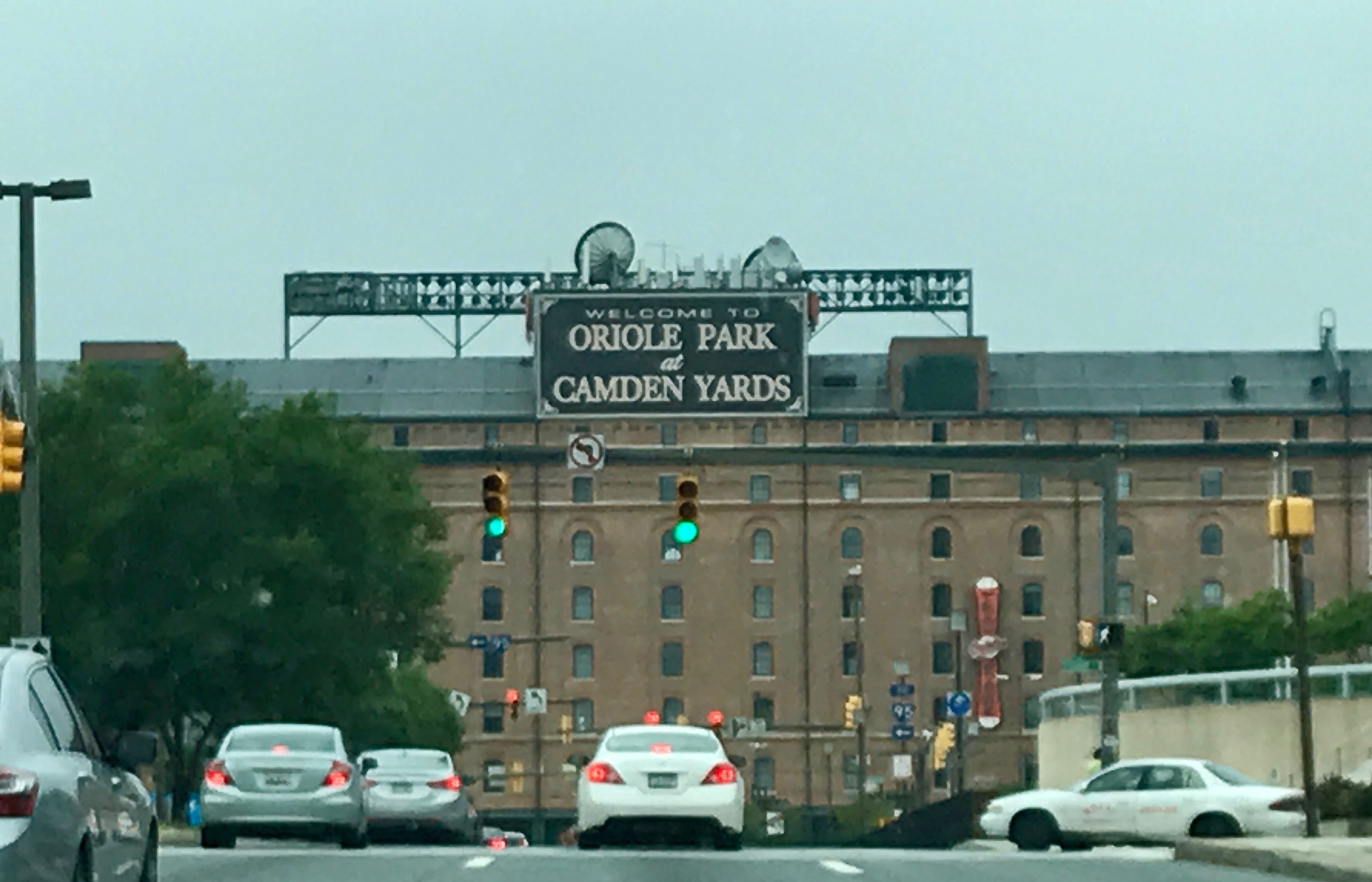
But, hey, what is that? Camden yards? Good thing the light is red. I have time to snap a photo.
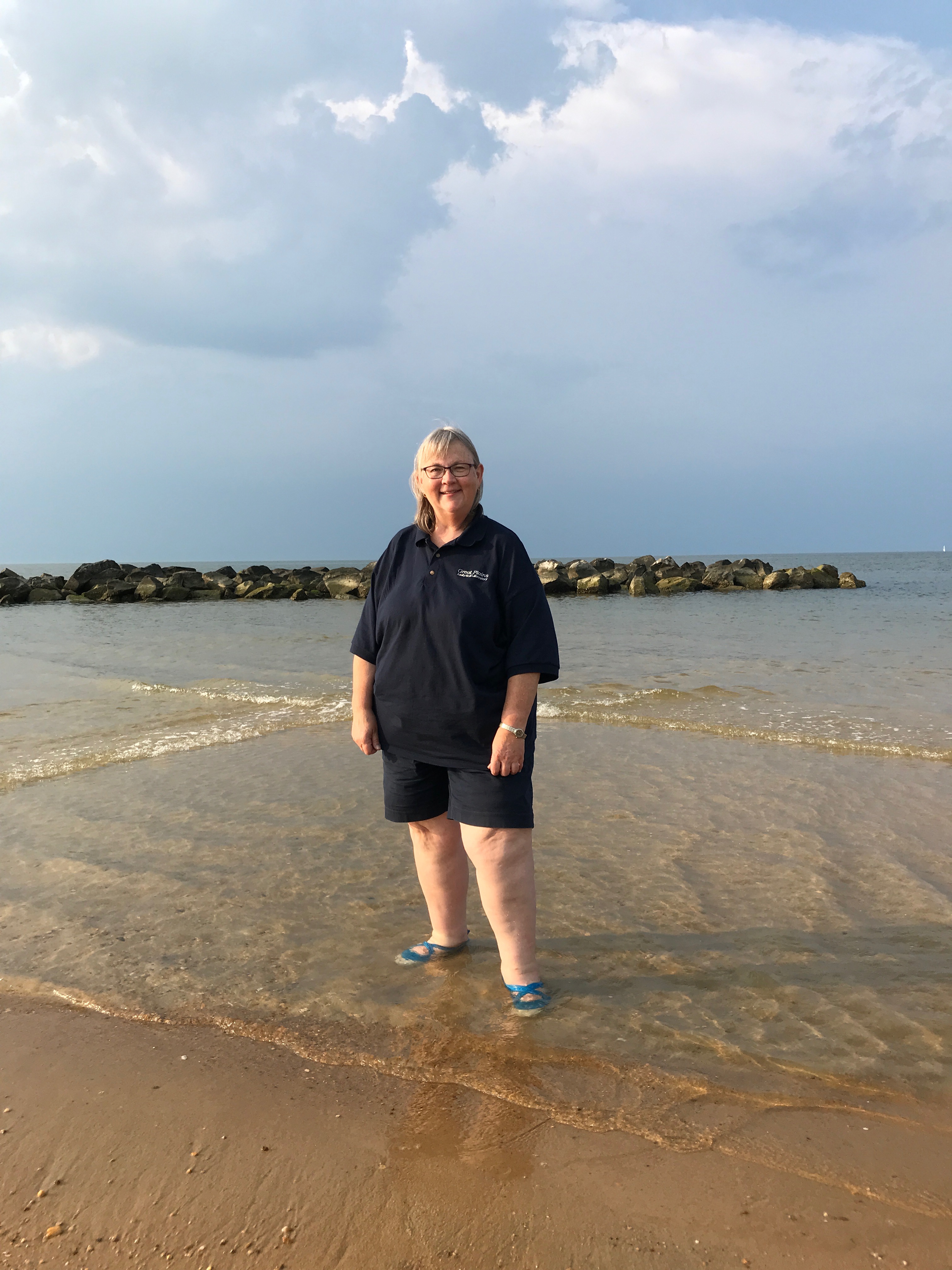
During the week as a seed courier, you never know what you will find or where the road will take you. For instance, one day, I ended up near the shore. Which shore? I have no idea!
It must have been somewhere near a port. Look at all those ships lined up waiting to enter.
I had to have my picture taken in the water. Okay, I was only up to my ankles, but not bad for the end of a work day.
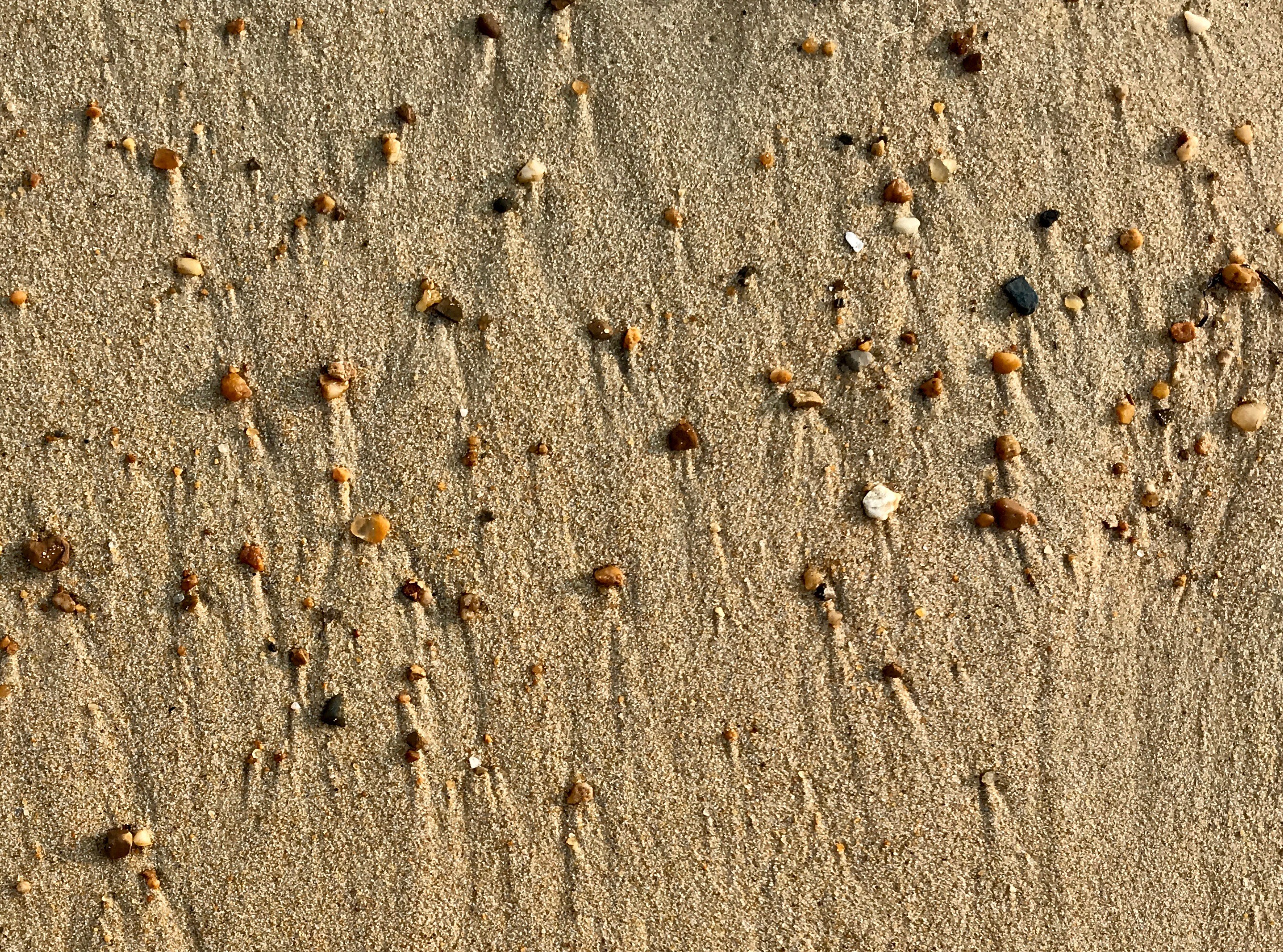
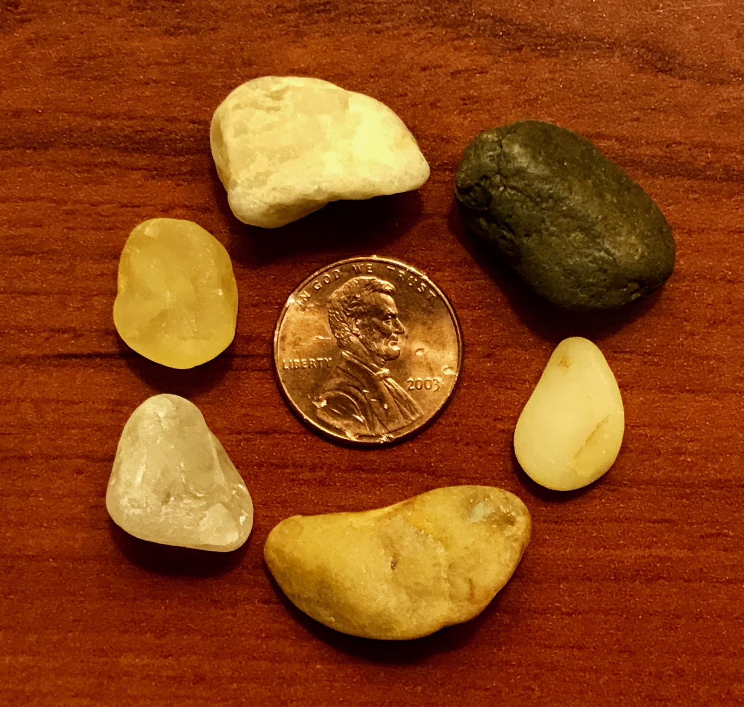
I also noticed all the little rocks in the sand. Time for a little “catch-and-release” rock collecting – with a difference. I picked up a few that caught my eye and took them back to the hotel room – wherever that was.
I took a picture, but then slipped them into my luggage. They actually made it home with me and are living in a little dish on my dresser.
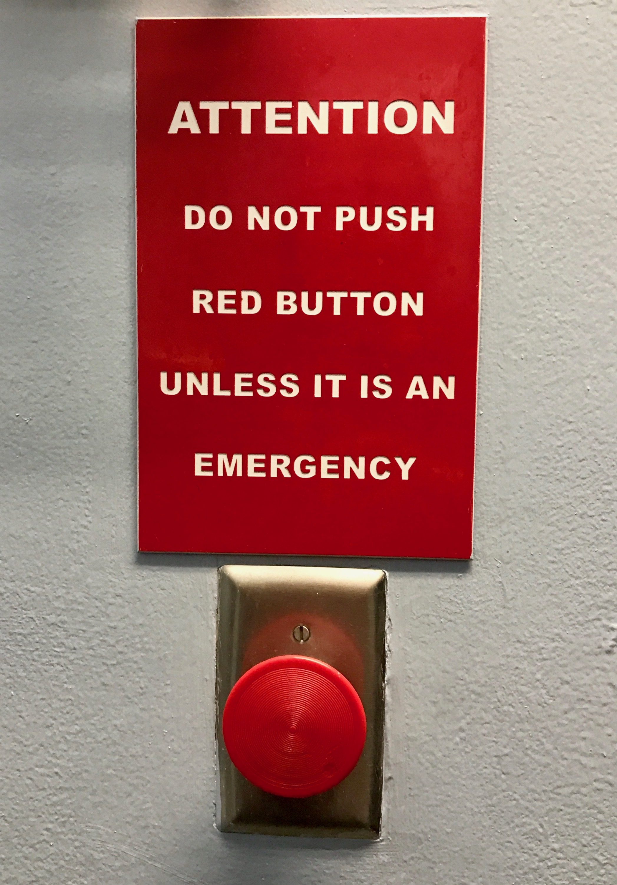
I really stayed in some “unique” establishments. For instance, what sort of emergency might I have that would require me to push this button? And, you have to know the sign made me want to push the button all the more!
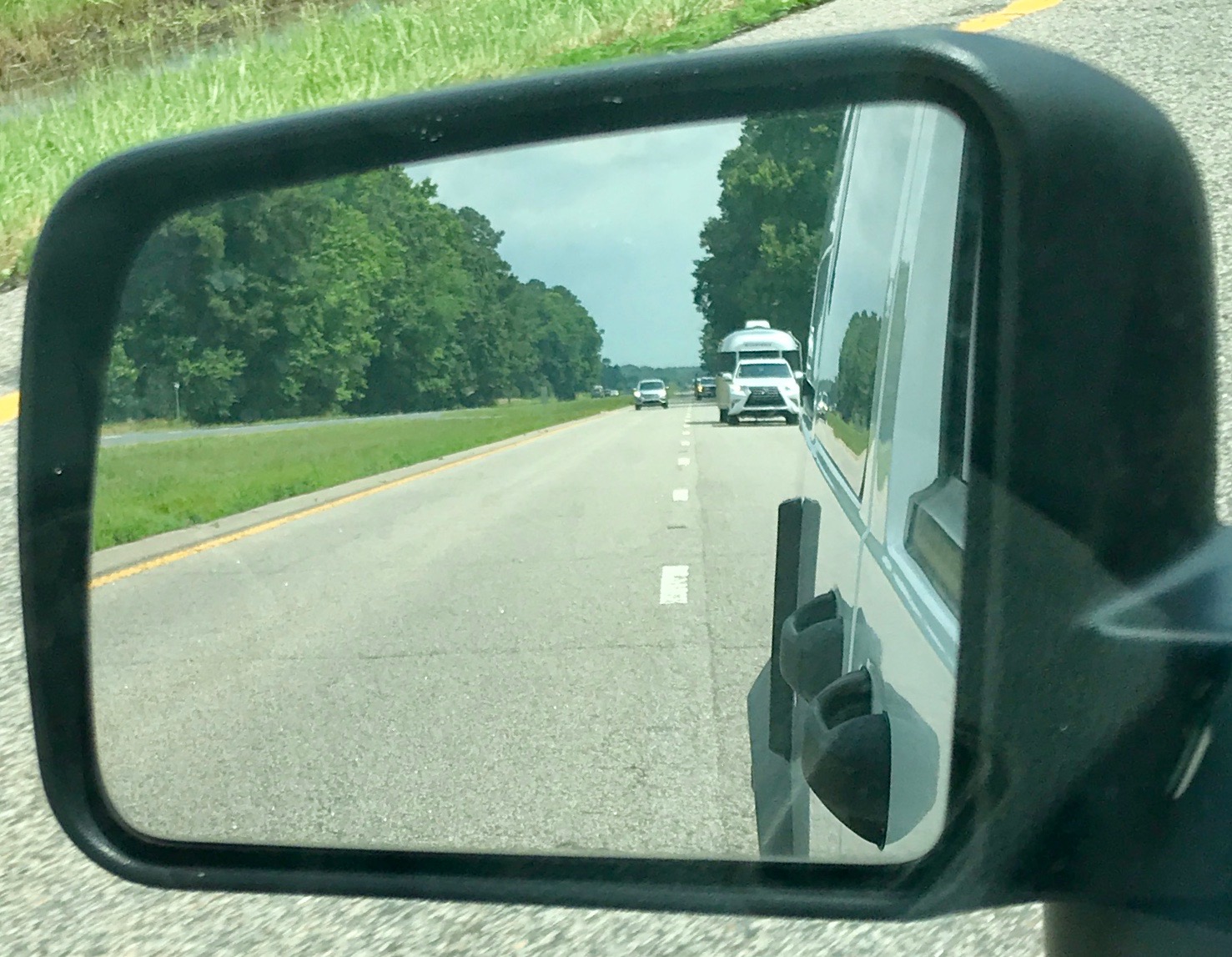
Continuing down the road in the morning, I was delighted to be able to snap this photo of an Airstream in my rearview mirror.
Photo from the Internet for nostalgia purposes
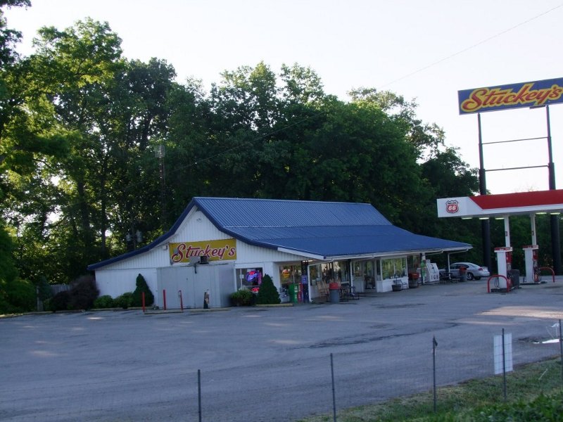
When I was a kid and I would take the rare trip with my parents, I remember being mystified by the blue roofs on the Stuckey’s and I couldn’t wrap my head around the concept of the pecan logs they advertised.
What in the world is a pecan log? I knew what logs were and what pecans were, but what is a pecan log? (I’ve already told you I was a very literal child.) They were probably 25¢ back then – too rich for our family’s blood.
I was about to find out!
It turns out that the center is a cylinder of some sort of white nougat that is rolled in pecans. It was good enough, but once is enough.
Of course, this is probably not the size that was sold in the mid ’60s. Everything is inflated. For instance, a 25¢ log in the mid ’60s would now cost around $2.00. Since the price on this one was $5.99, I’m sure it wasn’t what was sold when Stuckey’s dotted the landscape.
In 1965 dollars, this would have cost about 75¢. When I was a kid, in the mid ’60s, I could buy six 5¢ candy bars for a quarter at Kay’s Drugs in Kenmore.
Ah, but I digress…
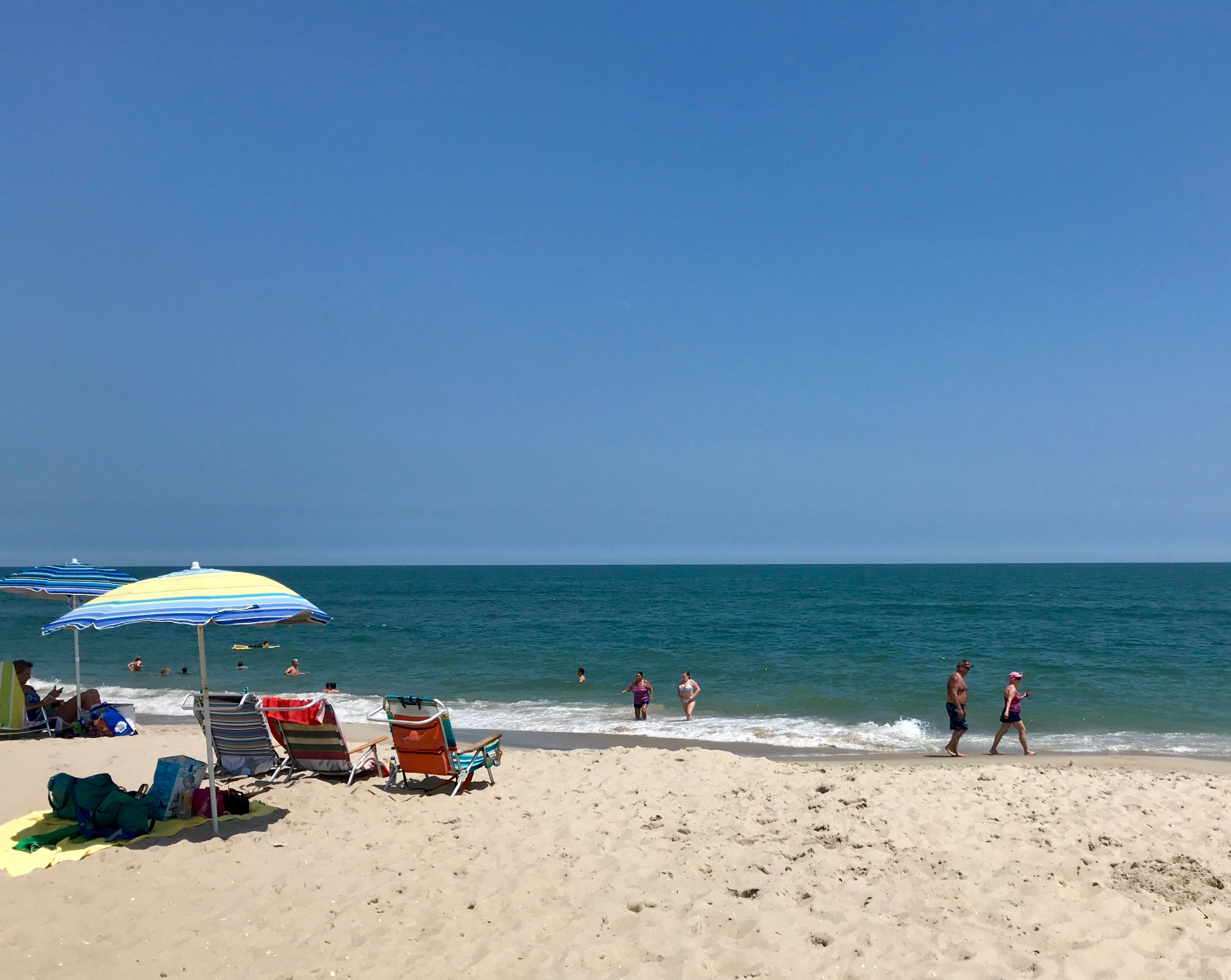
And, speaking of digressing, my route took me near Assateague National Seashore. I didn’t really have time to enjoy the park, but I had been meaning to buy my America the Beautiful Lifetime Senior Pass!
It used to be an outrageously good deal at $20 for a lifetime of visiting national parks and federal recreational lands. You had to be 62 to buy it, and I missed the deadline by three months. They raised the price to $80, but for a lifetime of enjoyment, it is still a great deal. The ranger who helped me with the purchase told me that the ponies that make the park famous are just down the road a little, so I decided to see if I could see any of them.
I pulled over and parked where I was told they like to hang out. Do you see them?
I zoomed in as much as my iPhone could handle and you can kind of make them out just below the middle of the frame. Not much to write home about.
I continued to the end of the road and parked the car. I had to take a gander at the ocean, even if I didn’t really have time to even wade a little bit. Beautiful!
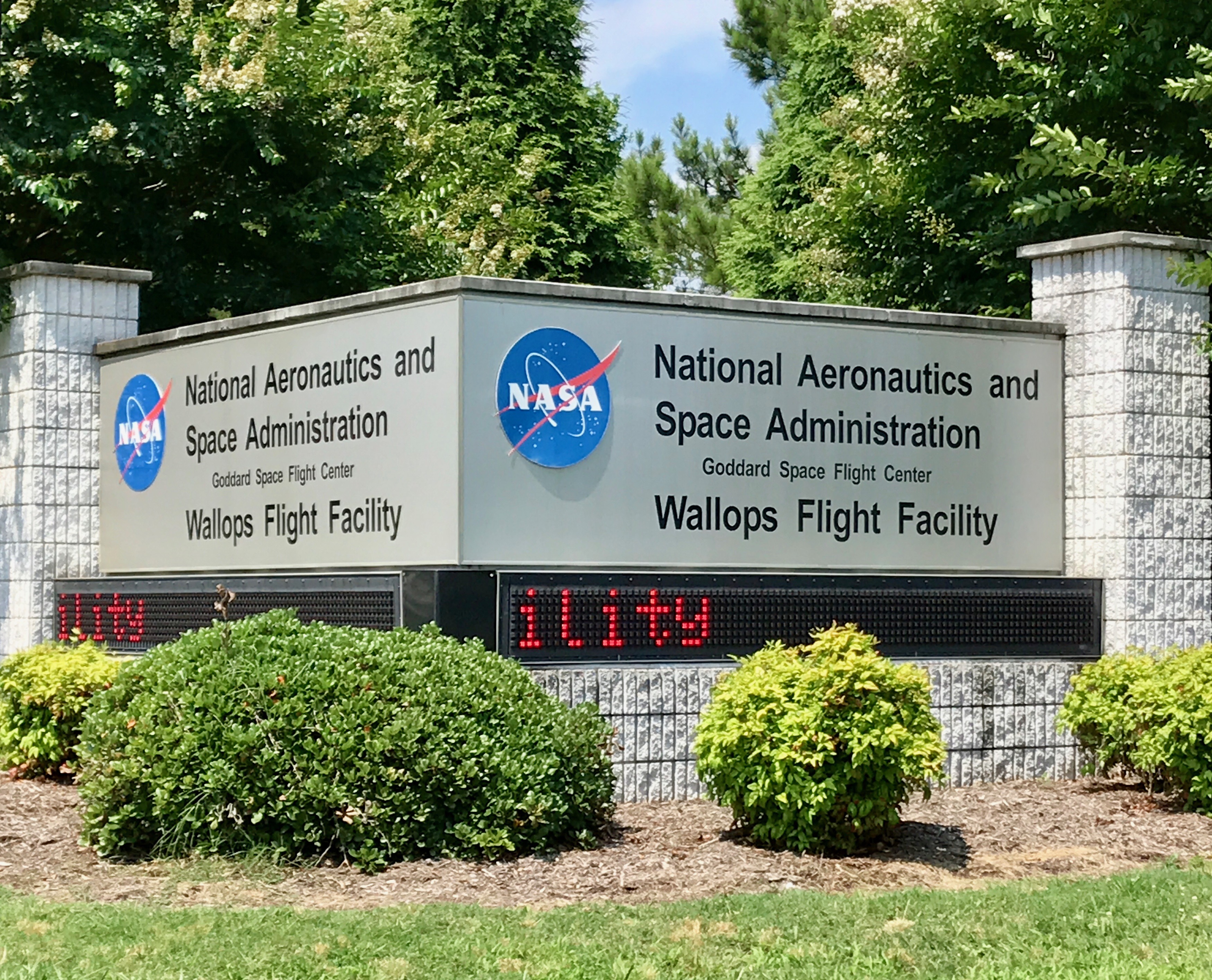
As I was leaving the area, I noticed the marquee for the Wallops Flight Facility. James Michener mentioned it frequently in his books, so I had to grab a quick photo.
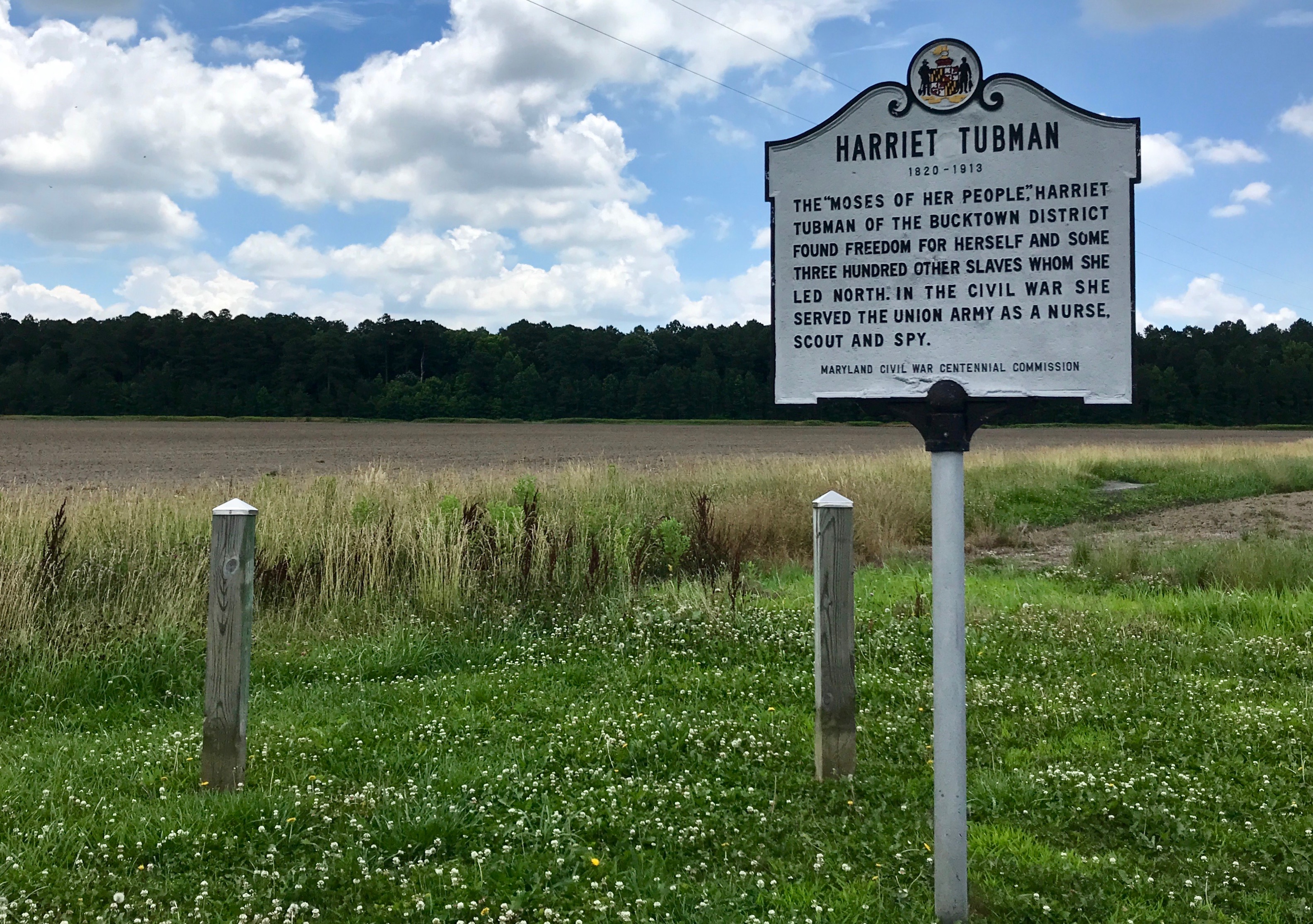
Another place that my HISTORY Here app directed me to was Harriet Tubman‘s birthplace. Of course, no one is really 100% sure where she was born, but I guess there is some evidence that the land she was born on was in this area.
A friend mentioned that she thought that this was a rather sorry memorial to such an important person. The thing is that this site was about 10 miles off the main road and a person can’t control where they are born.
There is a Harriet Tubman Underground Railroad State Park. I drove by it as I continued on my way down the main road. It looked interesting, and I picked up a brochure about it when I stopped at a rest stop along the way. It’s definitely on my “next time” list.
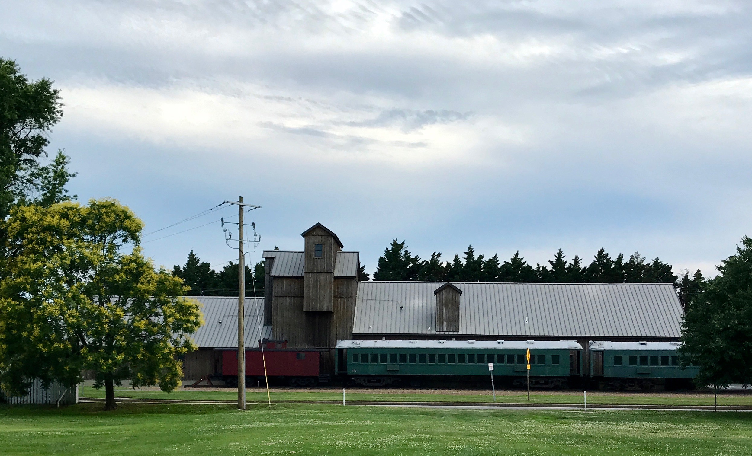
I stopped for the night near Chesterton, Maryland, right on the banks of the Chester River.
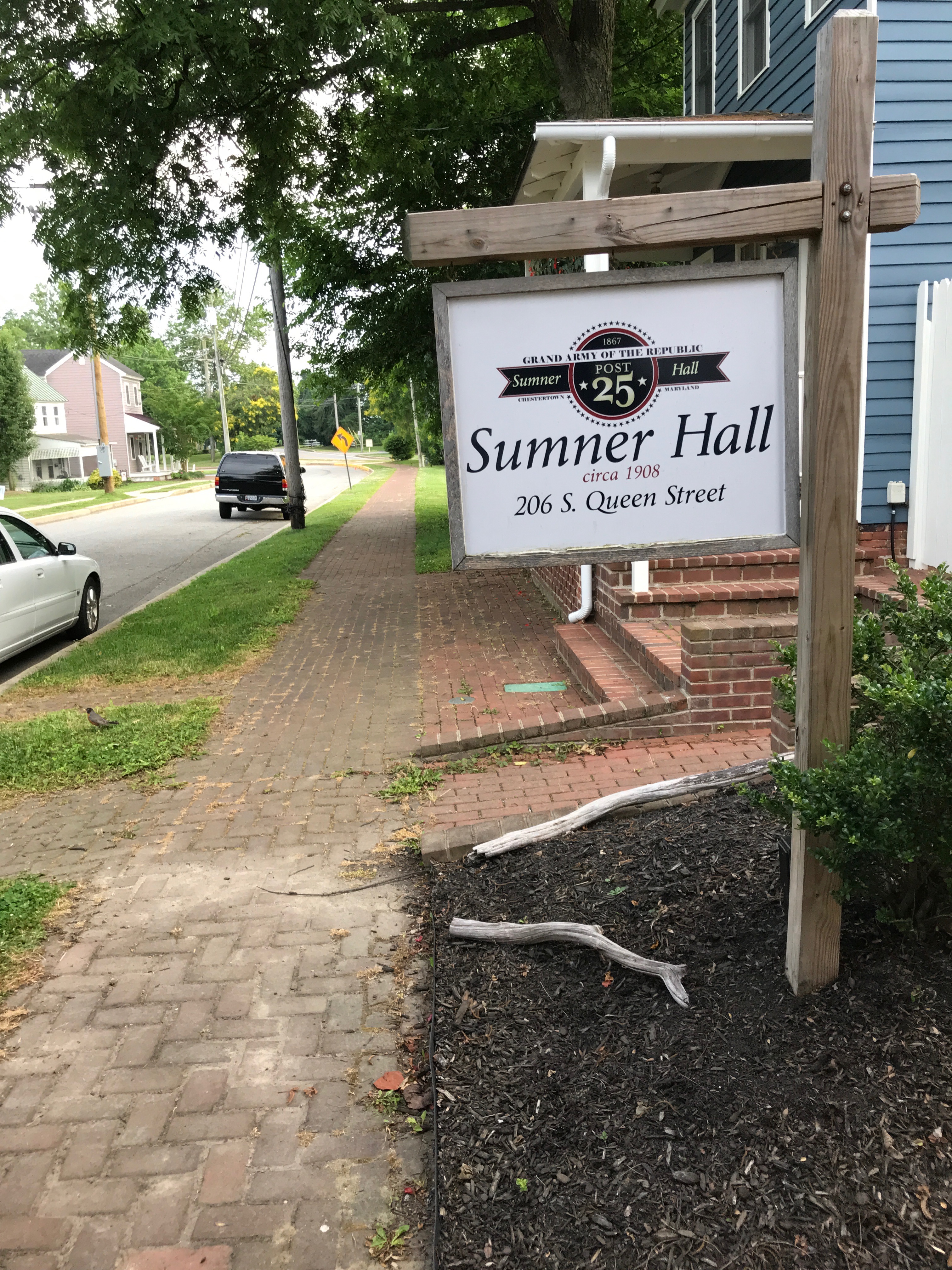
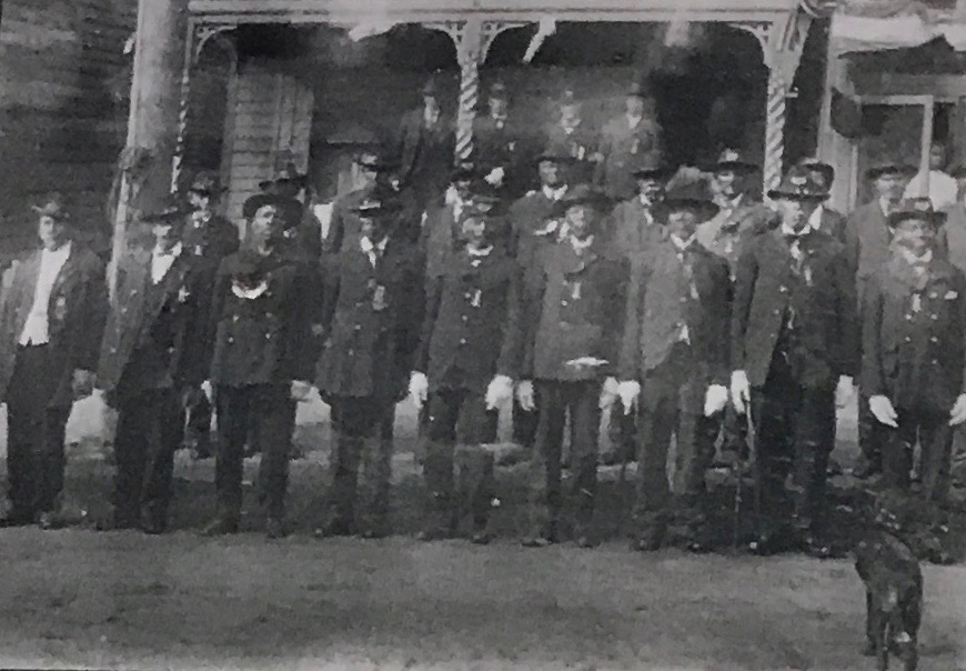
I prowled around a bit, to see what I could see. I came across this hall for veterans of the Civil War.
It was for African American Civil War veterans. It is one of only two halls known to survive that were built for soldiers who served in the USCT – the United States Colored Troops. These were segregated units composed of former slaves and free blacks. They were commanded by white officers.
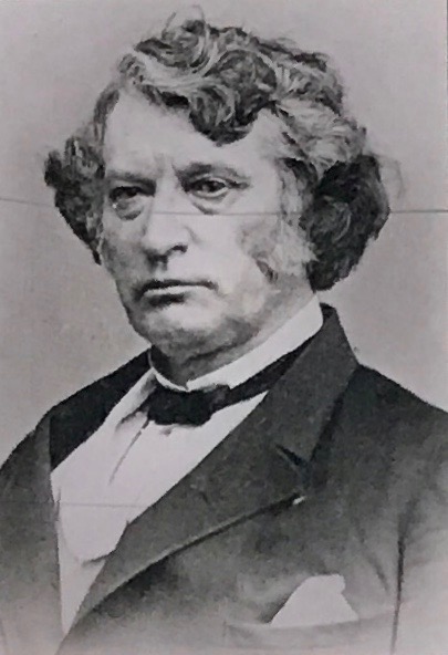
A small group of veterans formed the post shortly after the war, naming it for the abolitionist Massachusettes senator, Charles Sumner, who urged President Abraham Lincoln to extend full rights to African Americans.
As with most places at the end of my work day, Sumner hall was closed, so I didn’t get to go inside.
I also didn’t get to go inside the train museum.
But I was fine with that.
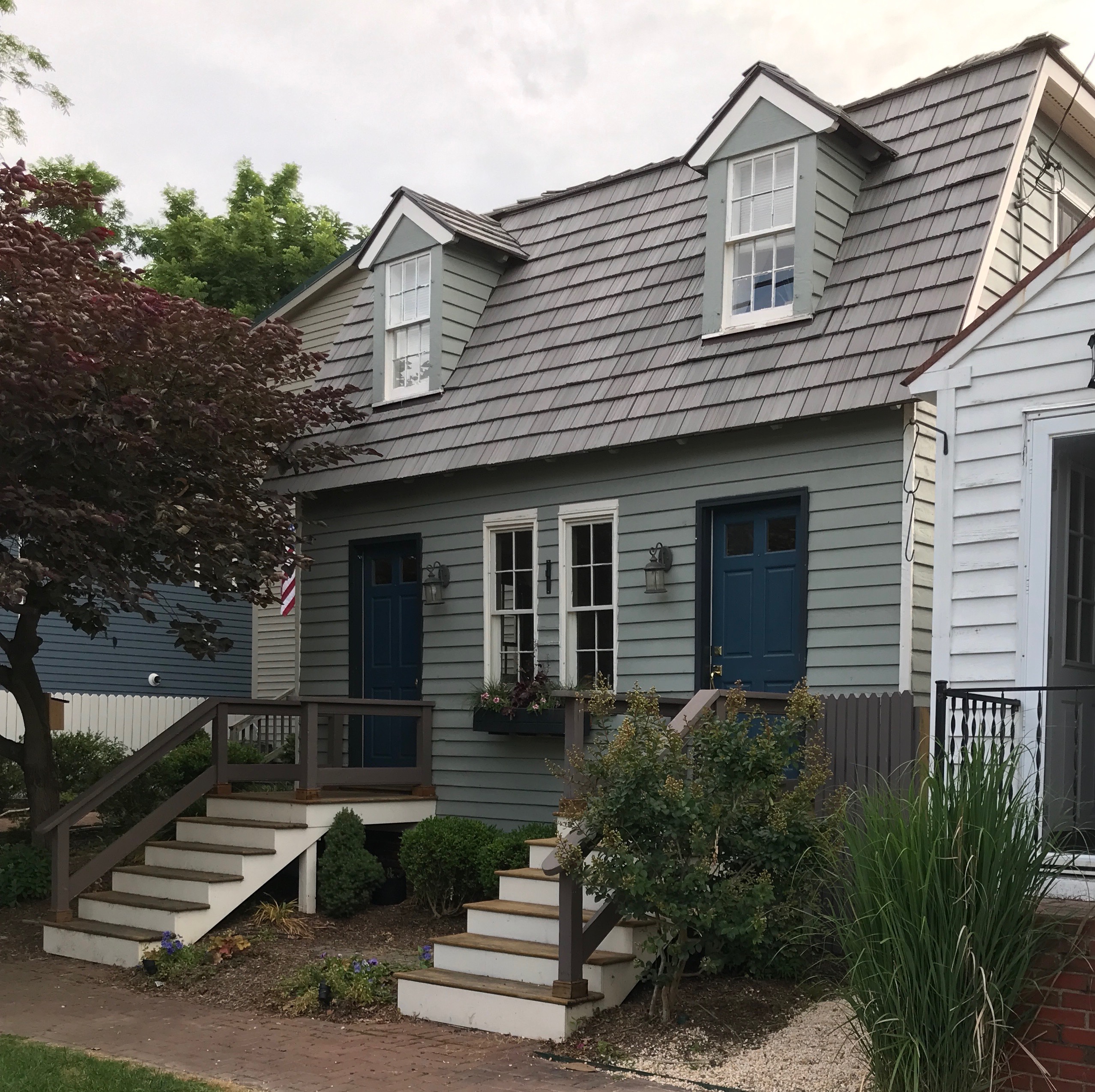
I thought these side-by-side duplexes were cute. I saw several of them as I took a quick glance around town. They seemed unique to the area.
What was next on my agenda was dinner. I had seen a place down by the river I wanted to try.
I headed back to the flags by the river.
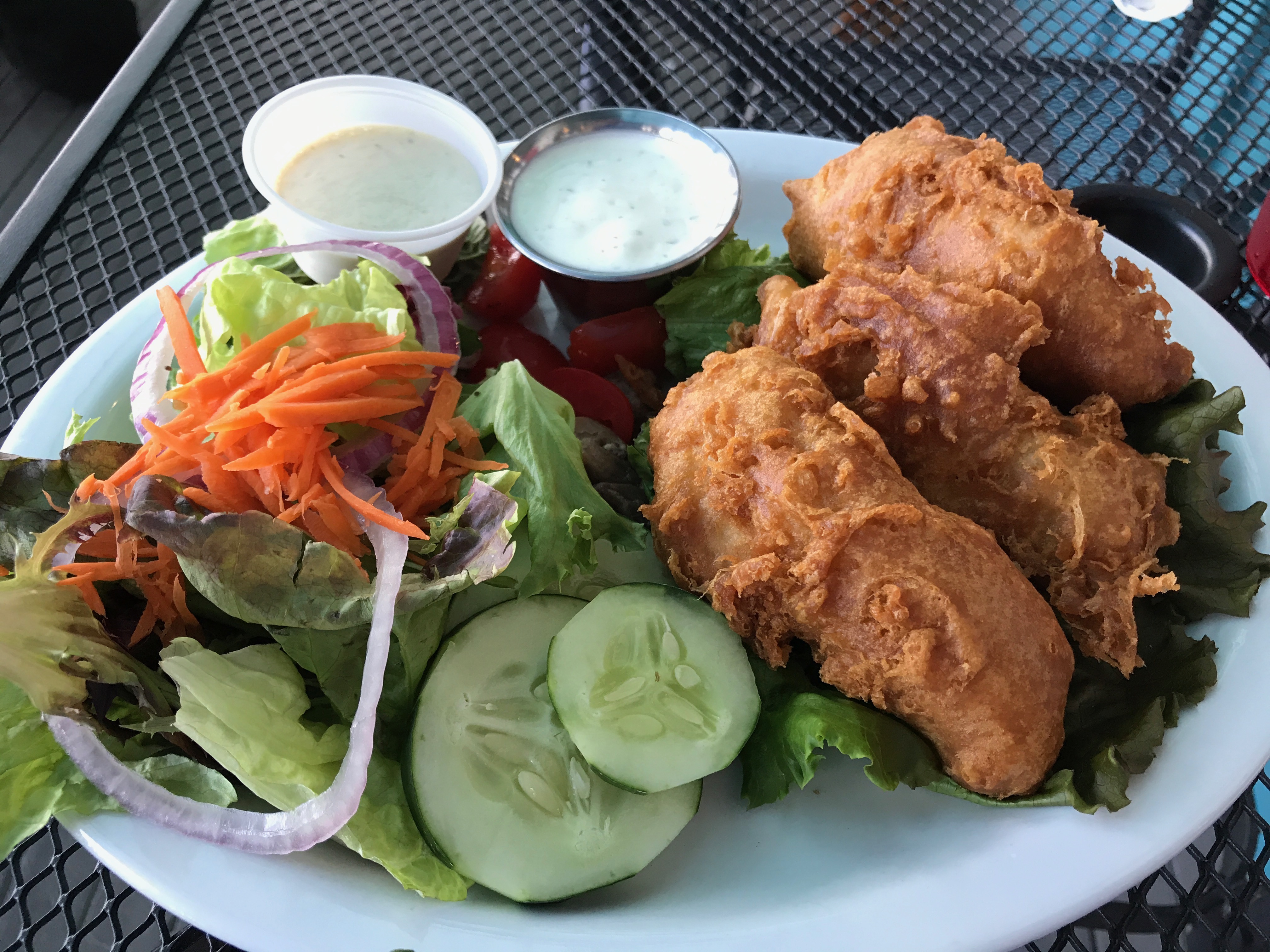
Those who know me well will wonder what is up with all the fish. I don’t usually eat seafood. But, when it’s battered, deep fried and slathered with ketchup, I do like fish. (Why they bring it with tartar sauce is a mystery to me.)
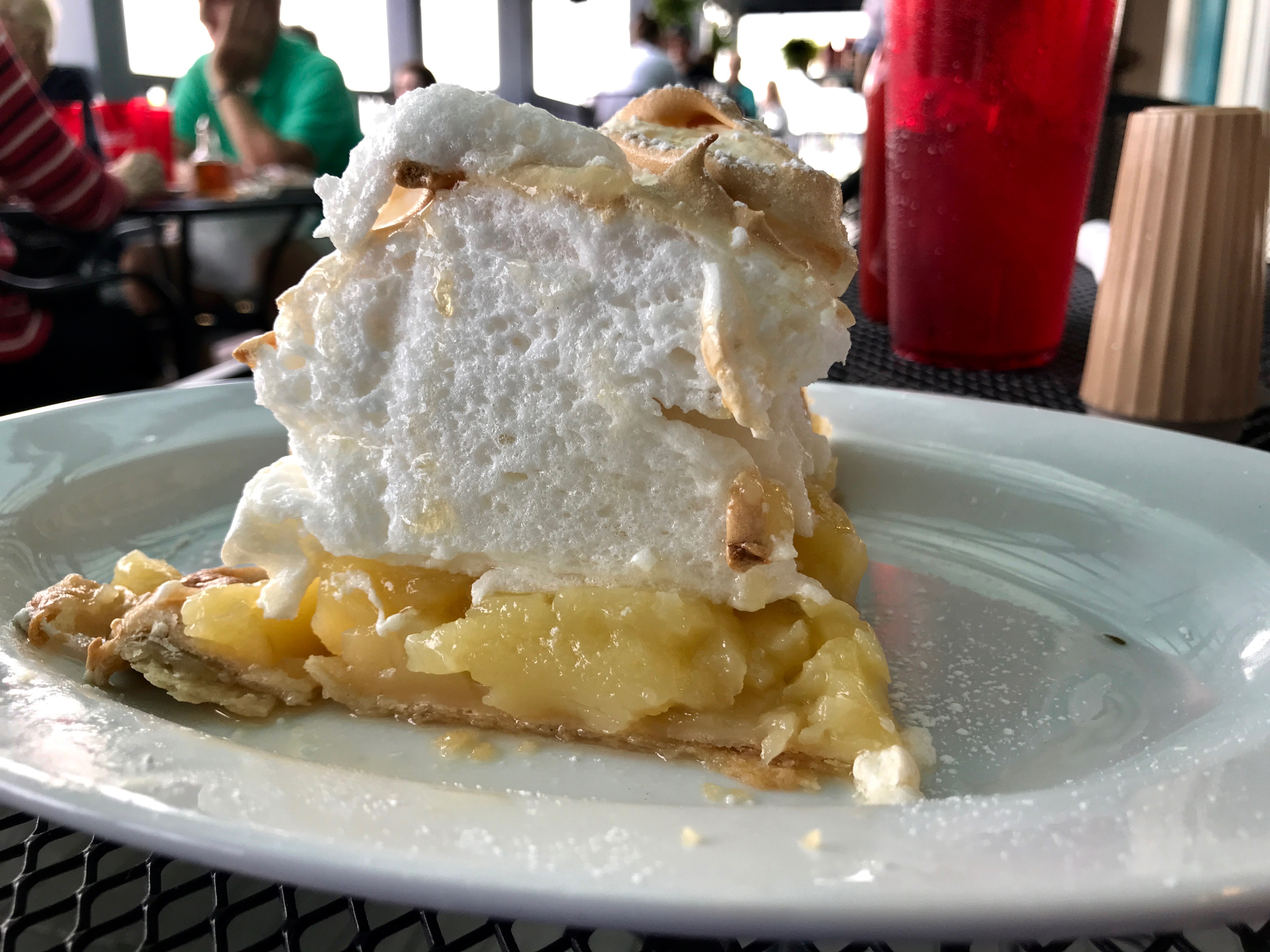
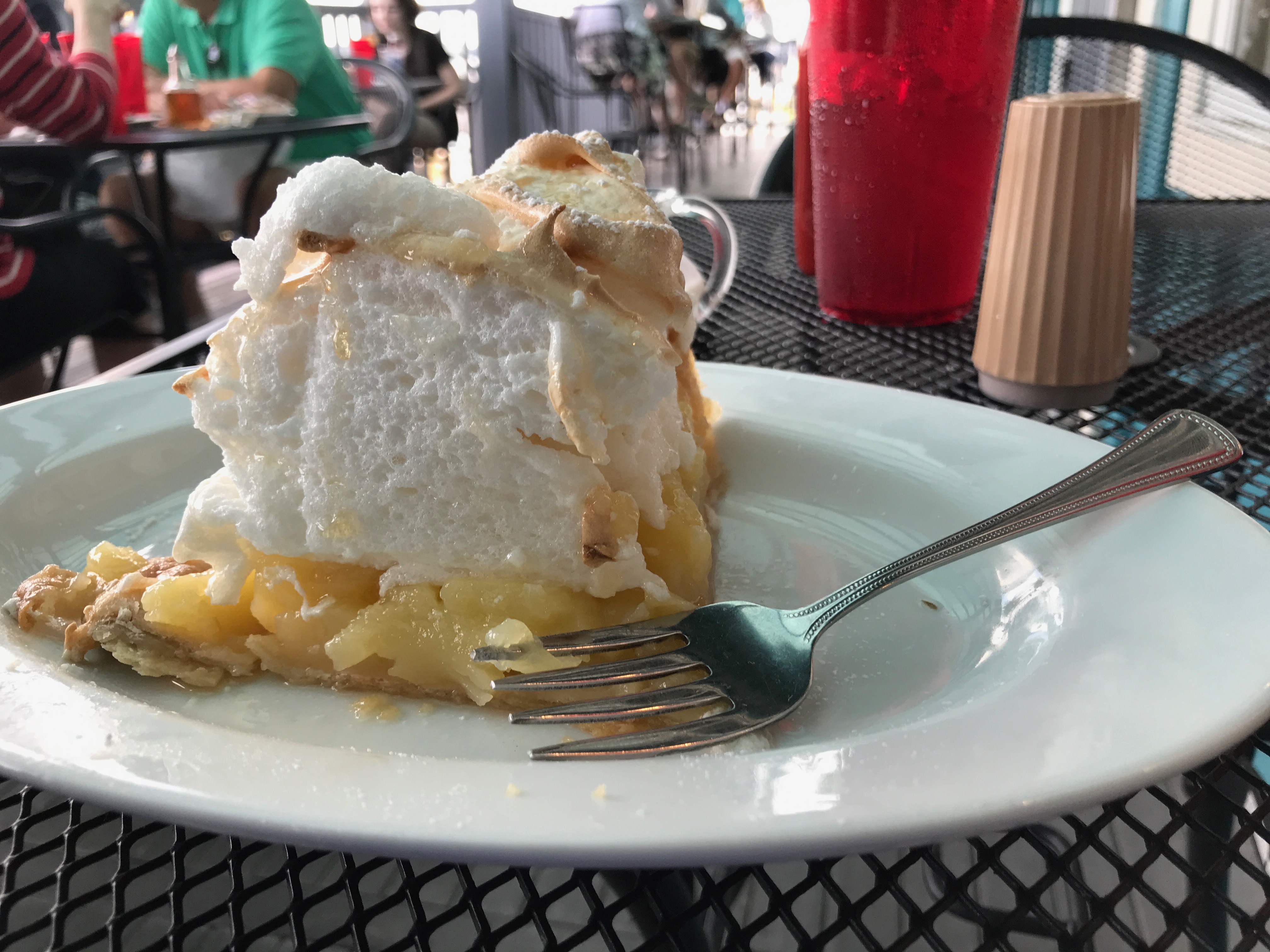
I decided to indulge in dessert.
Oh, my! Pie!
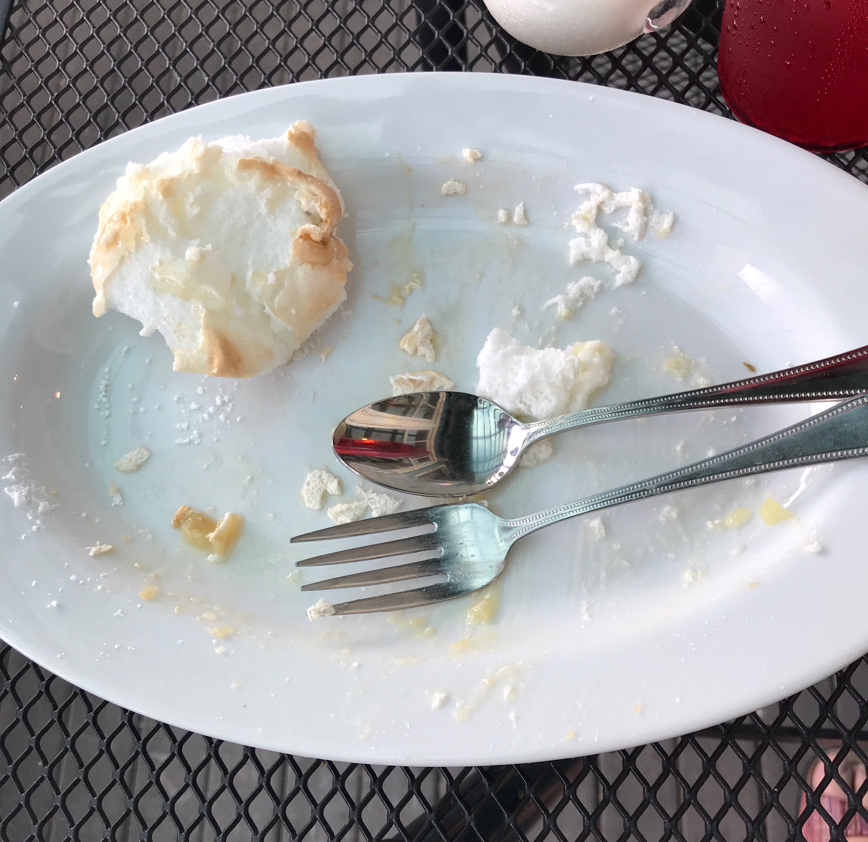
I figured that I would just eat part of it. After all, it wasn’t like I was going to starve before my next meal.
But it turned out to be so tasty that I did a pretty good job of finishing it up. After dinner, it was time to head back to wherever I had booked for the night.
On the way, I passed this historical marker for a place that no longer exists. It’s interesting (to me) that this was erected in 1932. I imagine it was to celebrate the bicentennial of Washington’s birth in 1732.
And with that, my scattershot tourism post comes to a close. It’s amazing that I could get so much in over several days while carrying out my duties.
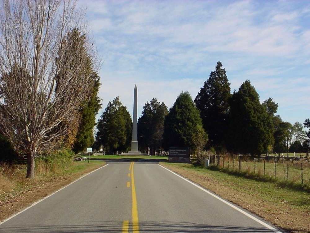
I was zigging and zagging my way around Virginia, collecting samples of wheat to ship back to the lab. I kept seeing signs for George Washington’s birthplace. When it got toward lunchtime, I figured that I might as well take my lunch break there.
So, where was George born? His family plantation was at the confluence of Popes Creek and the Potomac River. On this map, it is by the little river just northwest of the green state park.
I headed the truck down the driveway.
The Memorial Shaft obelisk just inside the entrance is made of Vermont marble and is a one-tenth scale replica of the Washington Monument in Washington, D.C. I made my way to the Visitor’s Center and waited a few minutes for the tour to begin.
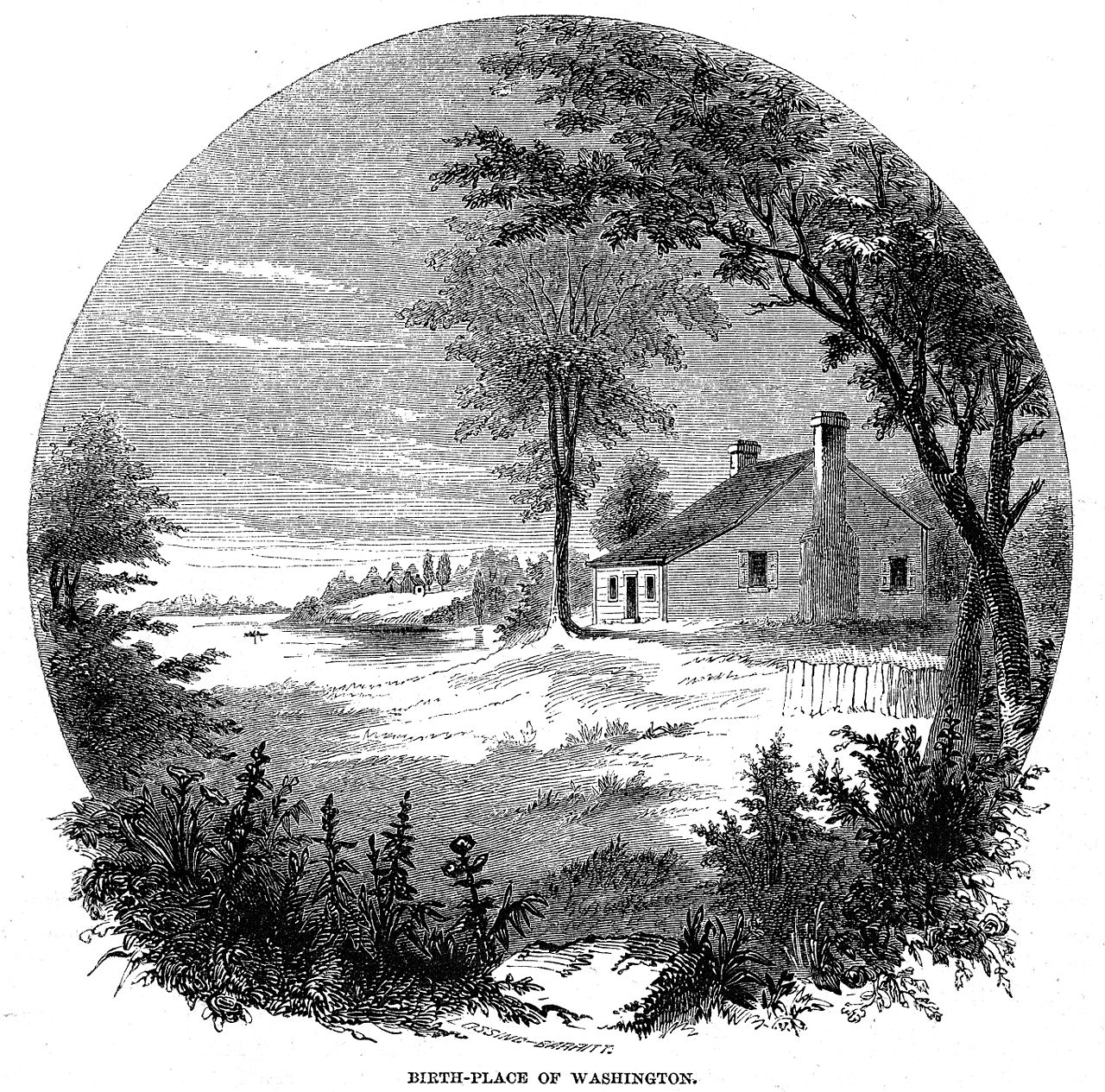
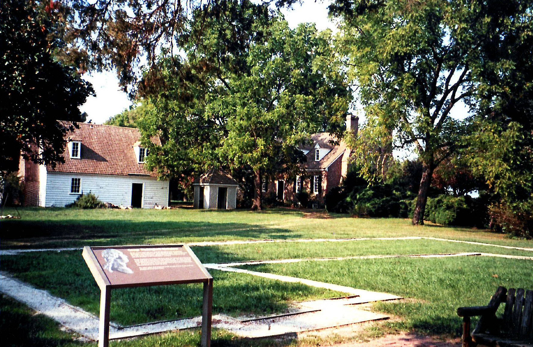
While I was waiting, I read the displays. George Washington was born February 22, 1732, in a house that was begun before 1718. His father, Augustine Washington, enlarged and added on to it, so that by the mid-1770s it was a ten-room house known as “Wakefield.” Unfortunately, it was destroyed by fire and flood on Christmas Day in 1779 and was never rebuilt.
By Benson J. Lossing & William Barritt for Harper & Brothers (publisher) – “Harper’s New Monthly Magazine” Vol. XII, No. LXIX, February, 1856, p. 291. New York: Harper & Brothers (Publisher)”The Cooper Collections ” (uploader’s private collection)Digitized by Centpacrr, Public Domain, https://commons.wikimedia.org/w/index.php?curid=27527277
Of course, since this drawing was done seventy-six years after it burned down, who knows how accurate it is?
After a short wait, it was time to meet the ranger and leave for the tour.
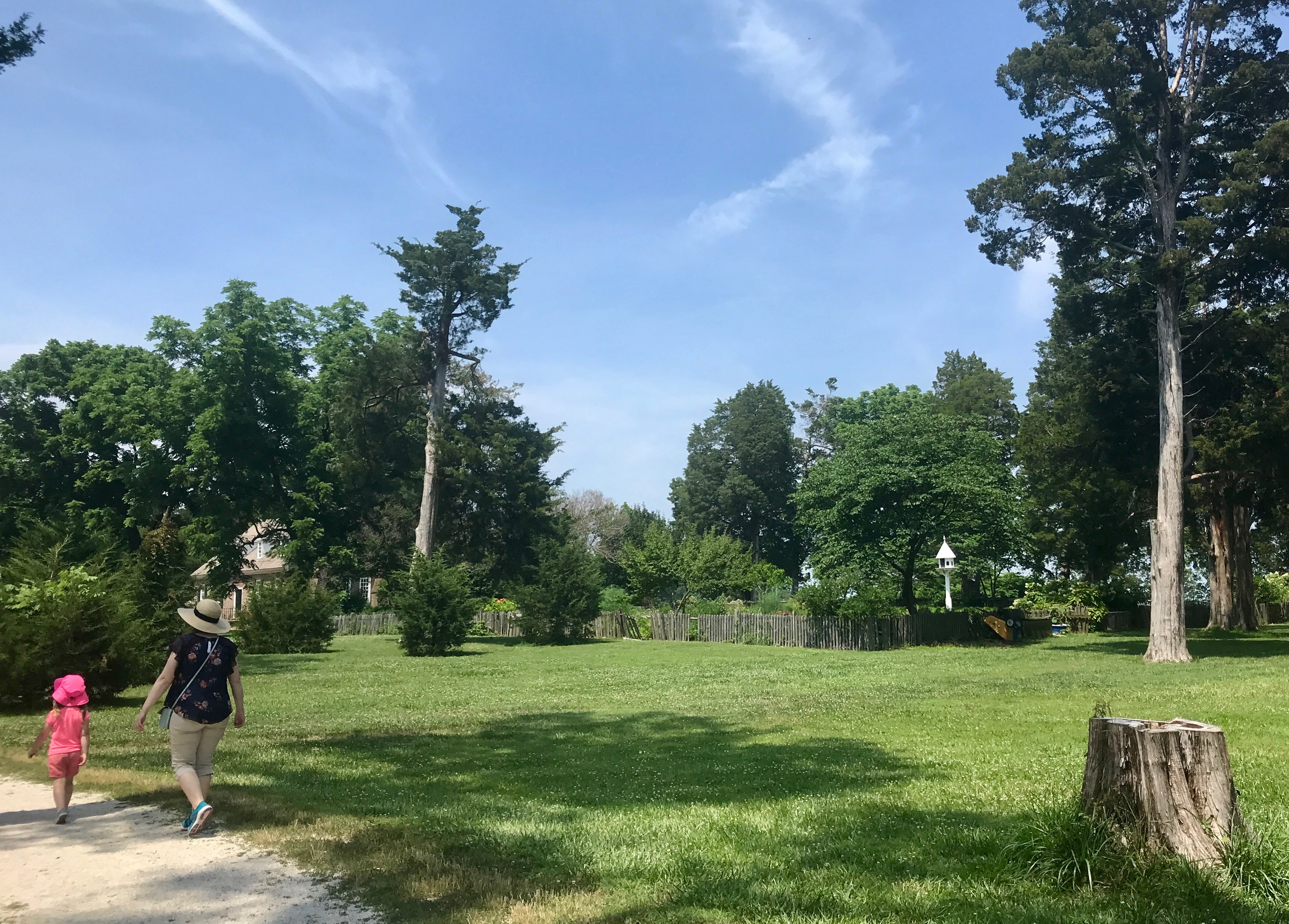
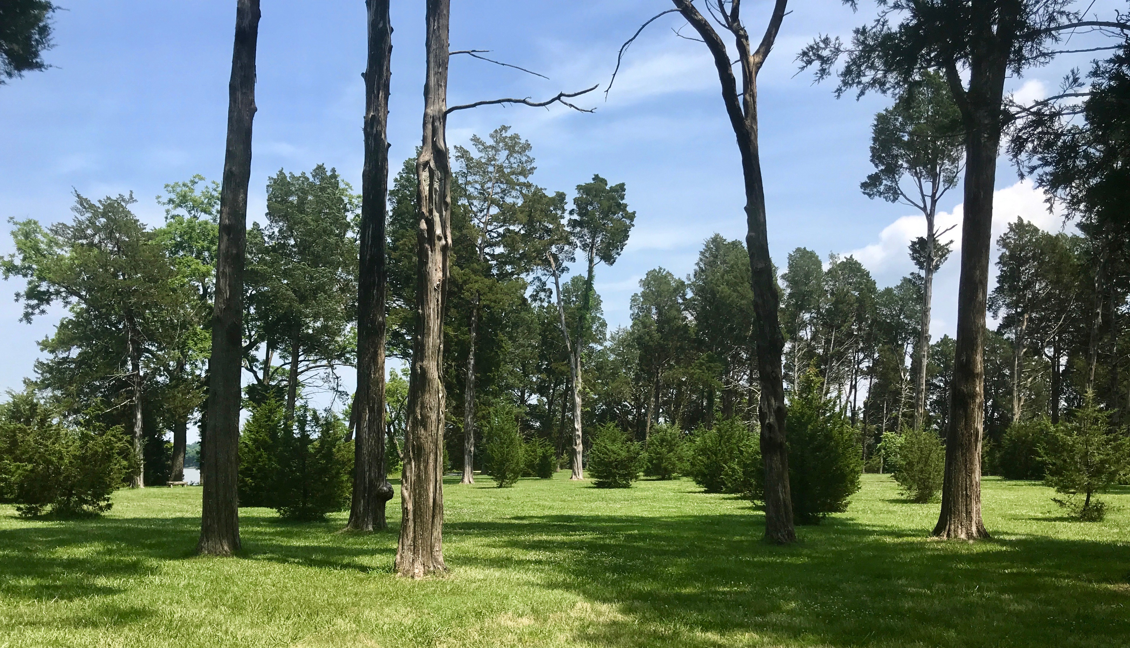
The grounds were pretty. In George Washington’s time, they were growing tobacco. His father had “20 or so” enslaved Africans working this plantation.
After a short walk, we got to the memorial house, which was built in the early 1930s.
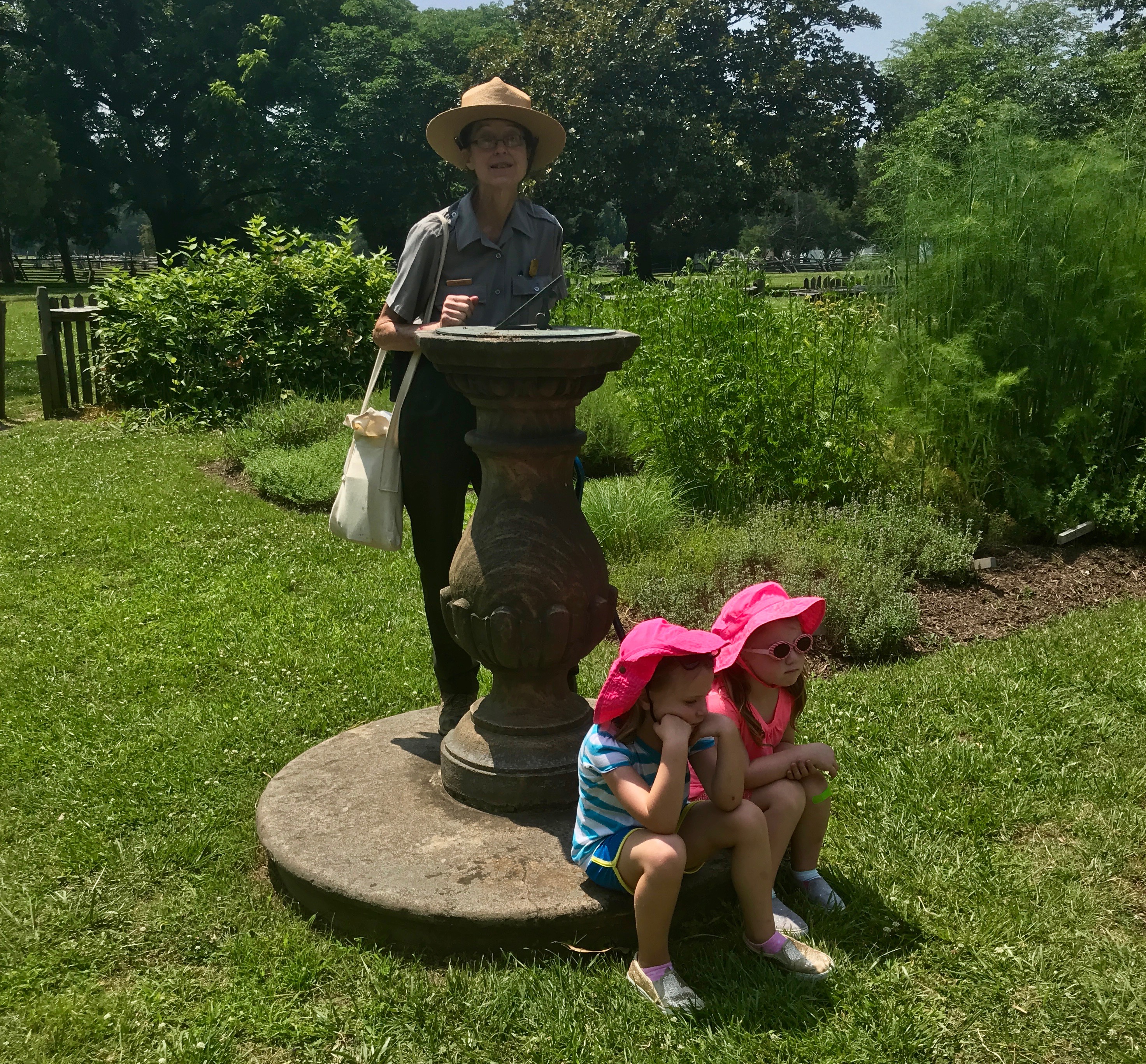
The little girls in the pink hats were less than enchanted, but I found the ranger to be well-informed and very interesting.
I guess it really was time for lunch.
By James G. Howes, Attribution, https://commons.wikimedia.org/w/index.php?curid=44251802
She explained to us that for a long time, they assumed that the part of the land outlined with white was the foundations of the house. But, as the field of archeology has advanced, they now believe that this is not the exact spot where he was born.
The park was opened in honor of the 200th anniversary of Washington’s birth. They hope to be able to pin the exact location down more precisely by the 300th anniversary, which will be here before you know it – 2032.
The ranger lead the way into the Memorial House, which represented how a wealthy planter would have lived at the time of Washington’s birth.
Before we enter, let us take a moment to appreciate the bond…
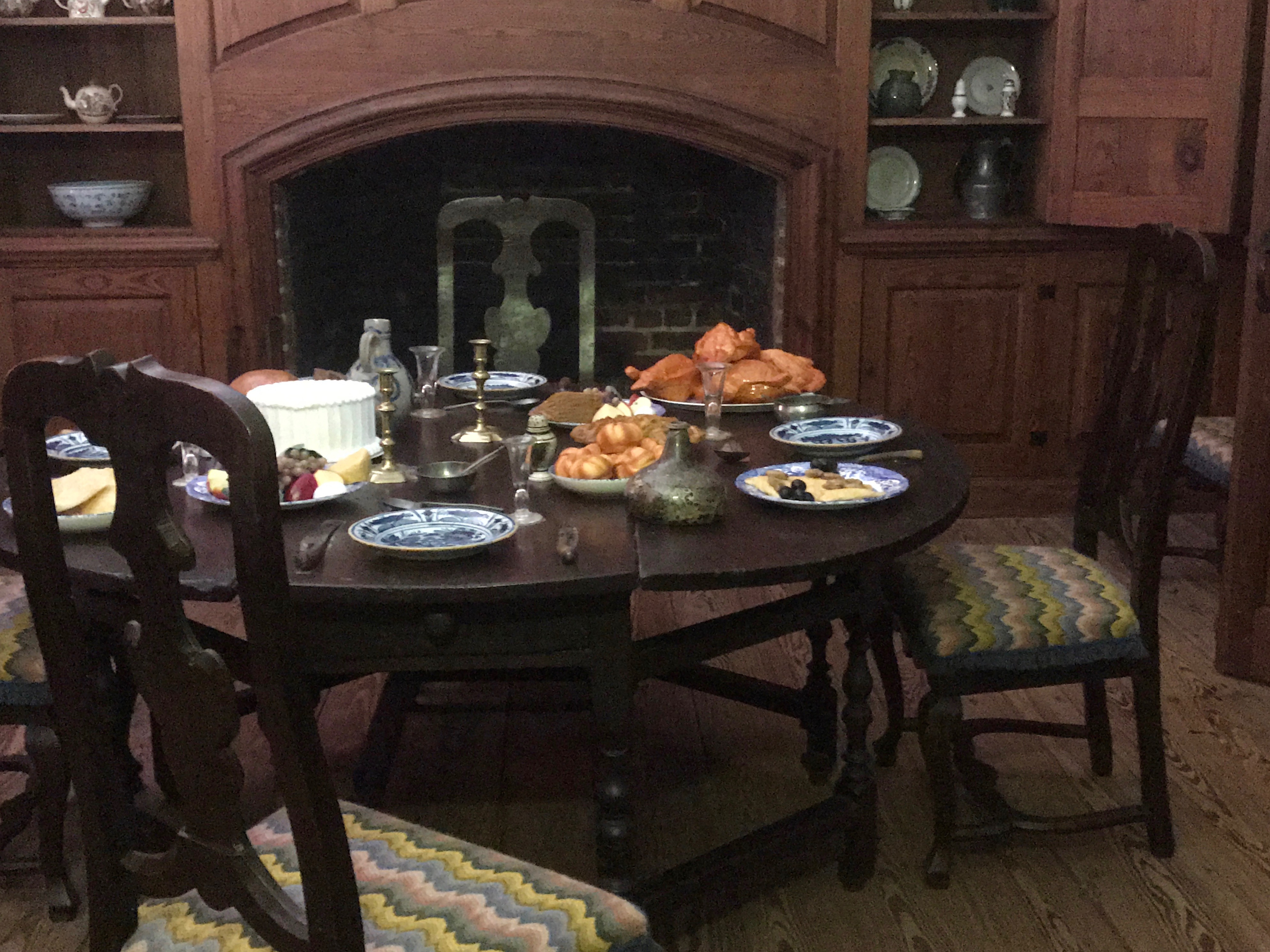
There was the dining room, with the table laid as if they were expecting us.
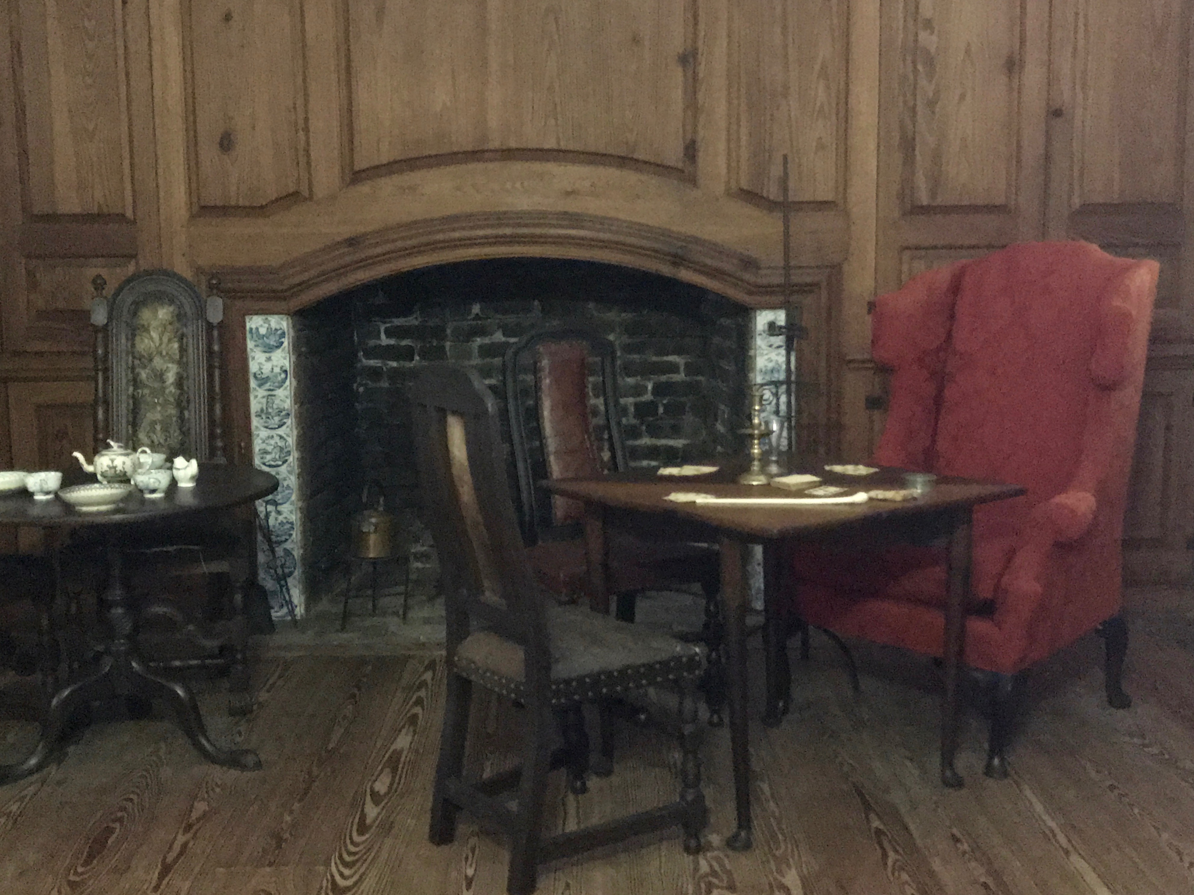
After dinner, time would be spent in the parlor.
Bedtime would roll around soon enough.
Of course, for those middle of the night potty trips, there were the chamber pots.
I could have roamed the grounds for a while longer, but I felt that I needed to continue on my way. After all, this was just my lunch break and I still had a few more facilities to call on that day.
There was one more area I wanted to visit and that was the boat landing for Popes Creek.
The boat landing was located somewhere near here. Several times a year, ships from English would anchor in the river channel. A small fleet of boats would then ferry the cargo – china, spices, linens, wines, silver and other luxuries – to the landing. On the return trip to England, the boats would carry hogsheads of Augustine Washington’s primary cash crop, tobacco.
Of course, nowadays we have a different cash crop.
Tourism and recreation.
By now, I felt that I really needed to get moving, but I paused long enough to look down the pathway toward the family graveyard. Thirty-two graves of Washington family members have been found at the Bridges Creek cemetery plot, including George’s half-brother, father, grandfather, and great-grandfather.
And with that I was on to my next site. It was on the water, and they load the grain right onto barges. This was the first time I had seen how they got the wheat off the trucks!
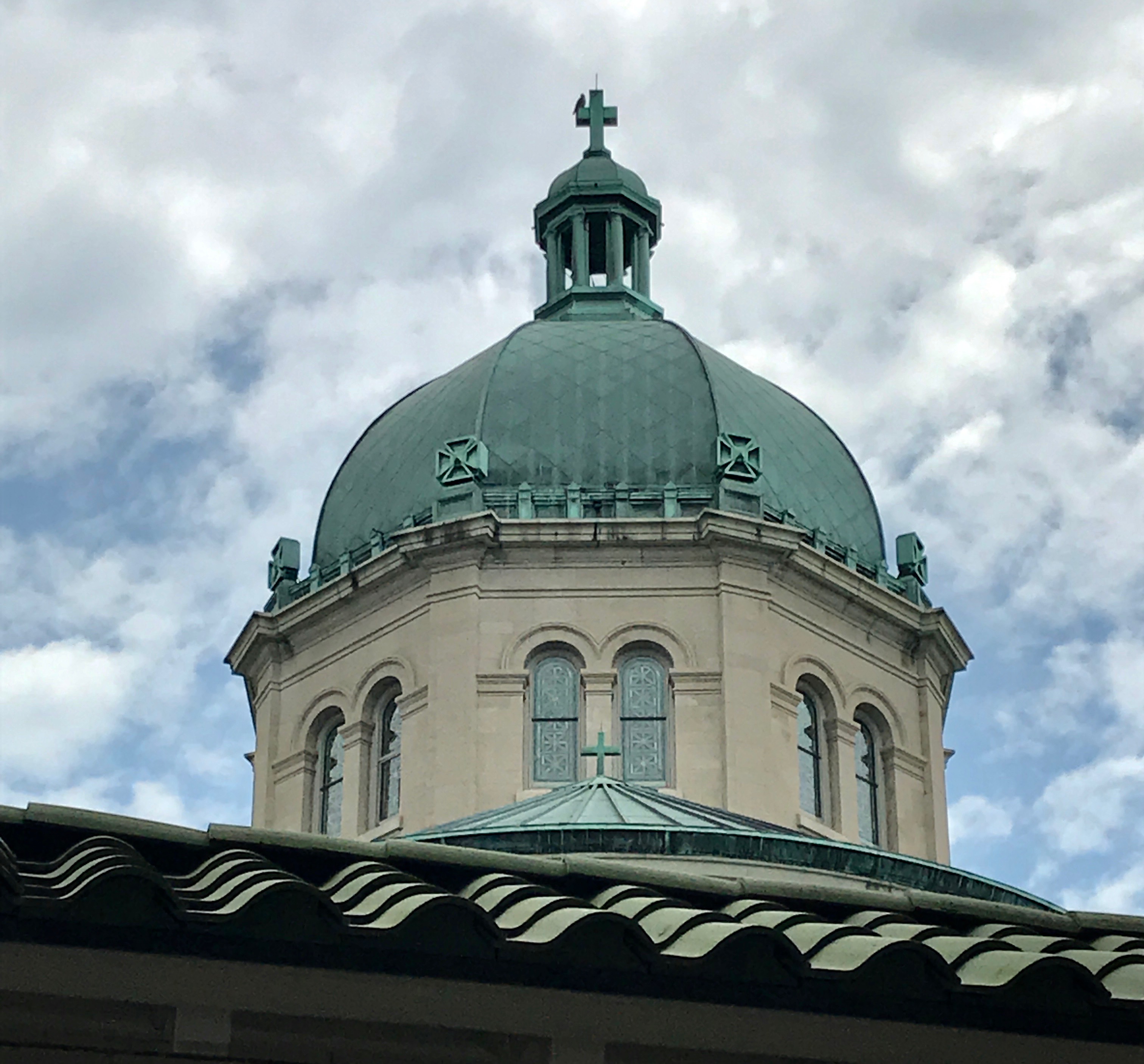
First stop was mass at the Cathedral of the Sacred Heart.
I ended up parking kind of a ways away, but I managed to get there on time – more or less.
Just glancing around during the service, I thought that this would be a fun place to spend some time exploring.
The Corinthian capitals on the columns were elegant, and there were lovely architectural details abounding. The stained glass windows were eye-catching – but in a completely different way from the Tiffany windows in the Blandford Church in Petersburg.
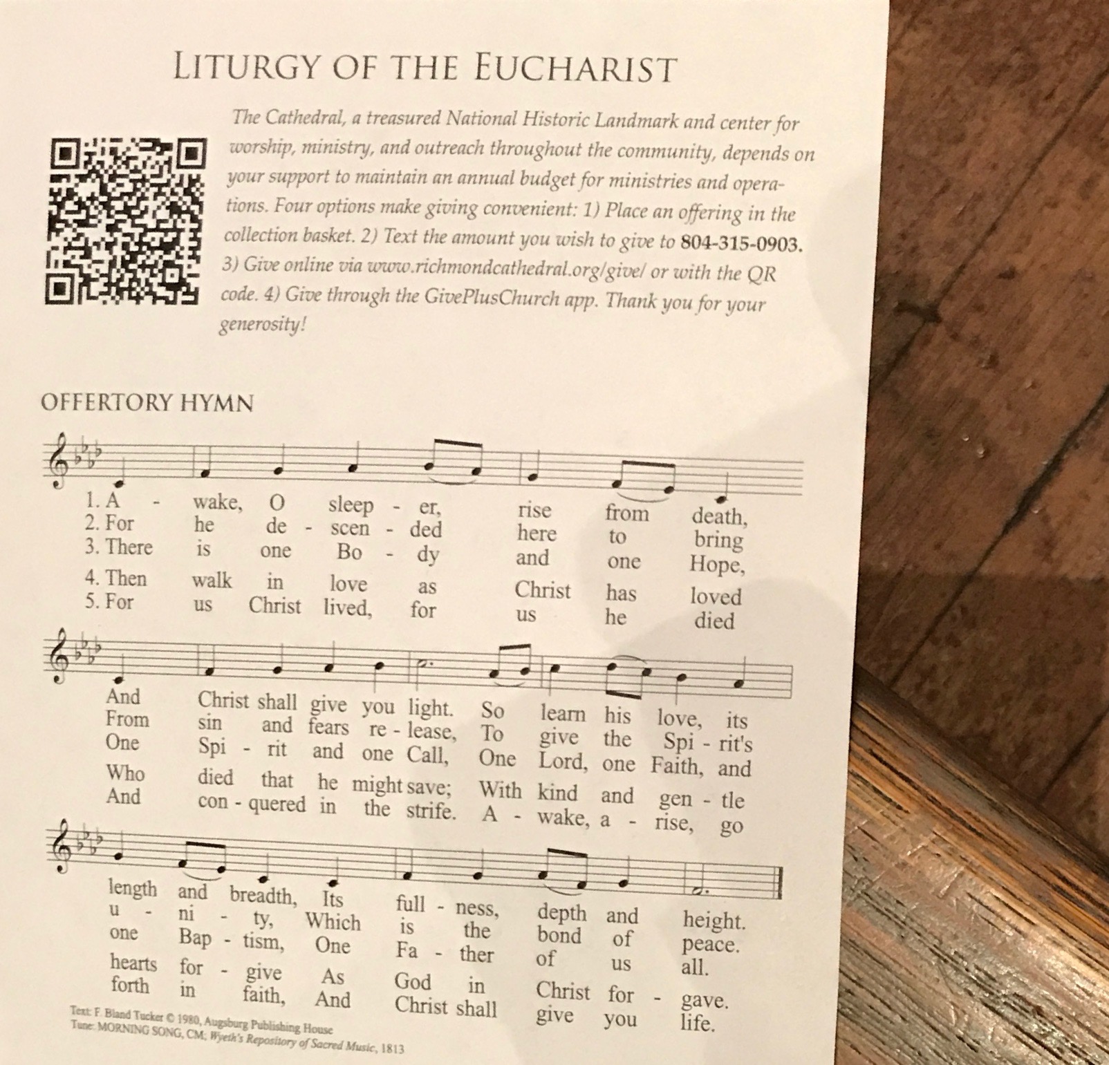
I snapped a photo of the mass guide for two reasons.
Awake, O Sleeper is a favorite hymn of mine. This one has a different tune than the one I know, but I like the words.
I found their take on how to participate in the offertory to be interesting. Put your donation in the basket, text, go online, or use the app.I guess I was just ahead of my time. I suggested alternative collection methods back in the ’90s, but they weren’t interested in the idea back at St.Augustine Cathedral in Kalamazoo.
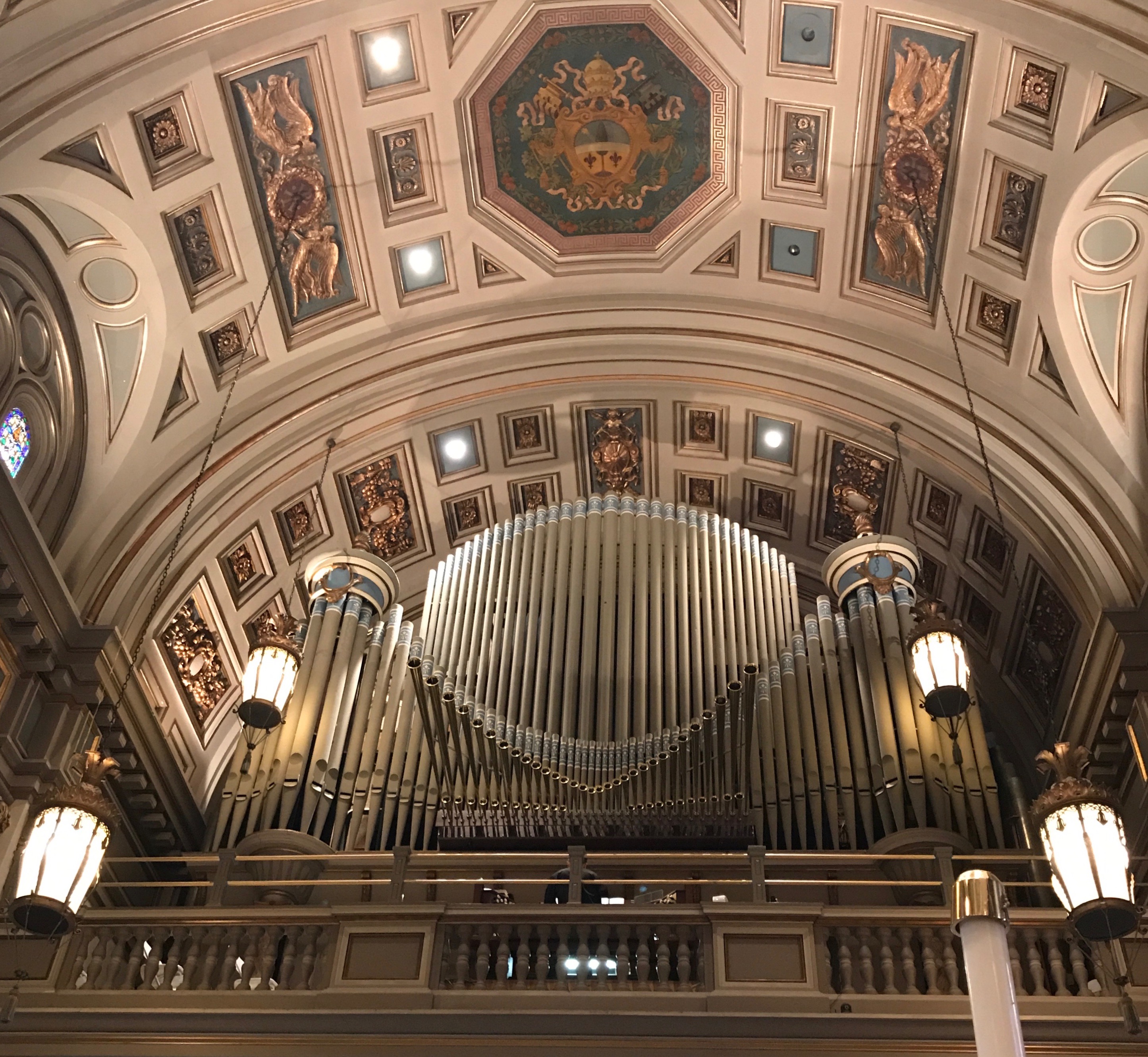
Speaking of Cathedrals, you have to know that there is a pipe organ lurking somewhere. Those who know me well – or have been reading my blog – know that I have a less than favorable opinion of pipe organ music. Pipe organs themselves don’t offend me. It’s just when they are played…
See? From this vantage point, the organ merely looks like a decorative architectural detail.
The dome over the crossing was lovely.
I am sorry to say that I don’t recognize the saints in many of these side altars. I didn’t see labels and there was no information about them in my Preferred Source or on the Cathedral’s webpage.
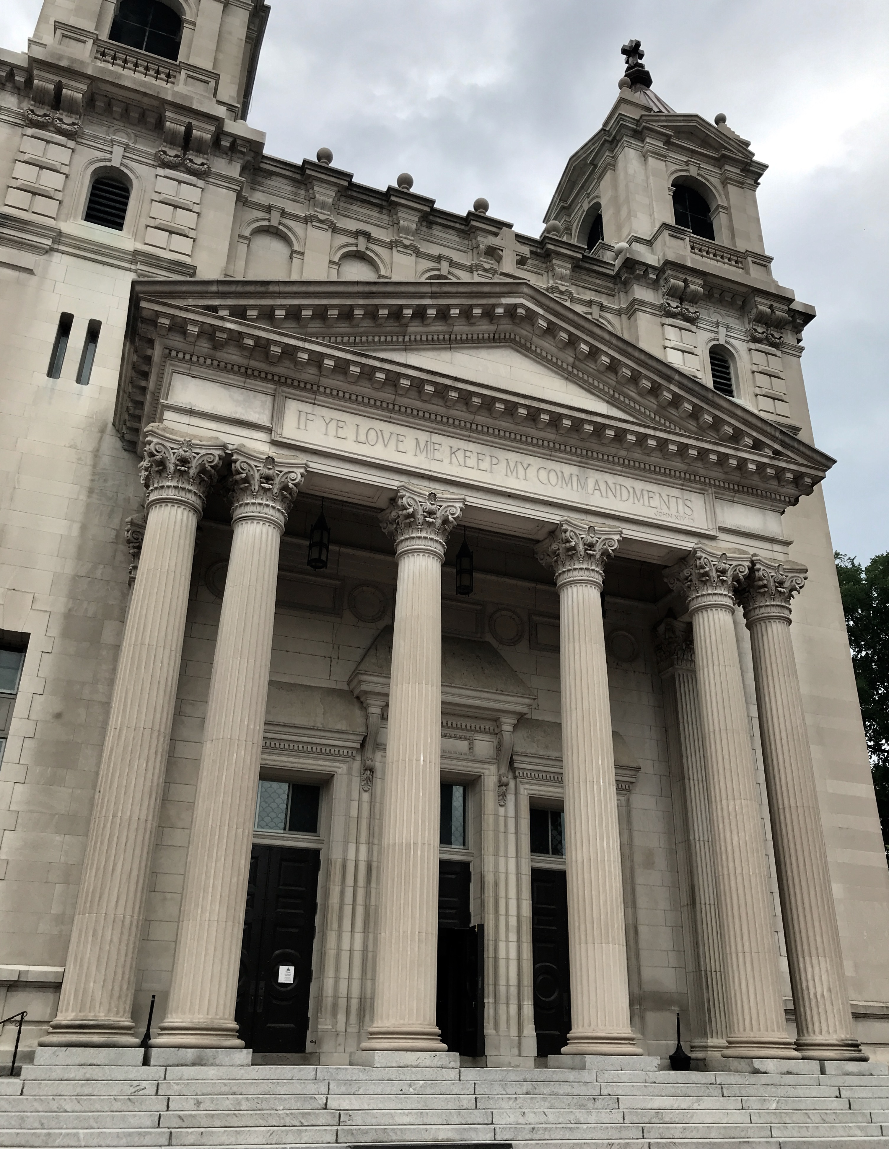
What I did find that was interesting was that the Cathedral was funded by one family – the Ryans, Thomas Fortune Ryan and his wife, Ida Mary. The cornerstone was laid in 1903, and the stone block came from the Garden of Gethsemane. It was built in the style of Italian Renaissance Revival, and it was the only cathedral at that time known to be constructed by the exclusive patronage of a single family.
Virginia-born Thomas converted to Roman Catholicism en route to Baltimore, Maryland in 1868. In Baltimore Ryan made his fortune in railroads and streetcar transit and married Ida Mary Barry, the daughter of a Catholic former employer. Thomas and Ida each donated $250,000, which would work out to about $15,000,000 in today’s money. I imagine Ida must have inherited her money from her father, Thomas’ former employer, which would mean that transportation was behind the funding of this building.
Anyway, back to the statues.
While this one isn’t labeled, either, it certainly looks like Mary.
I would guess that this is Saint Peter, because he is holding the keys to heaven.
If I had to guess, I’d say this is Jesus.
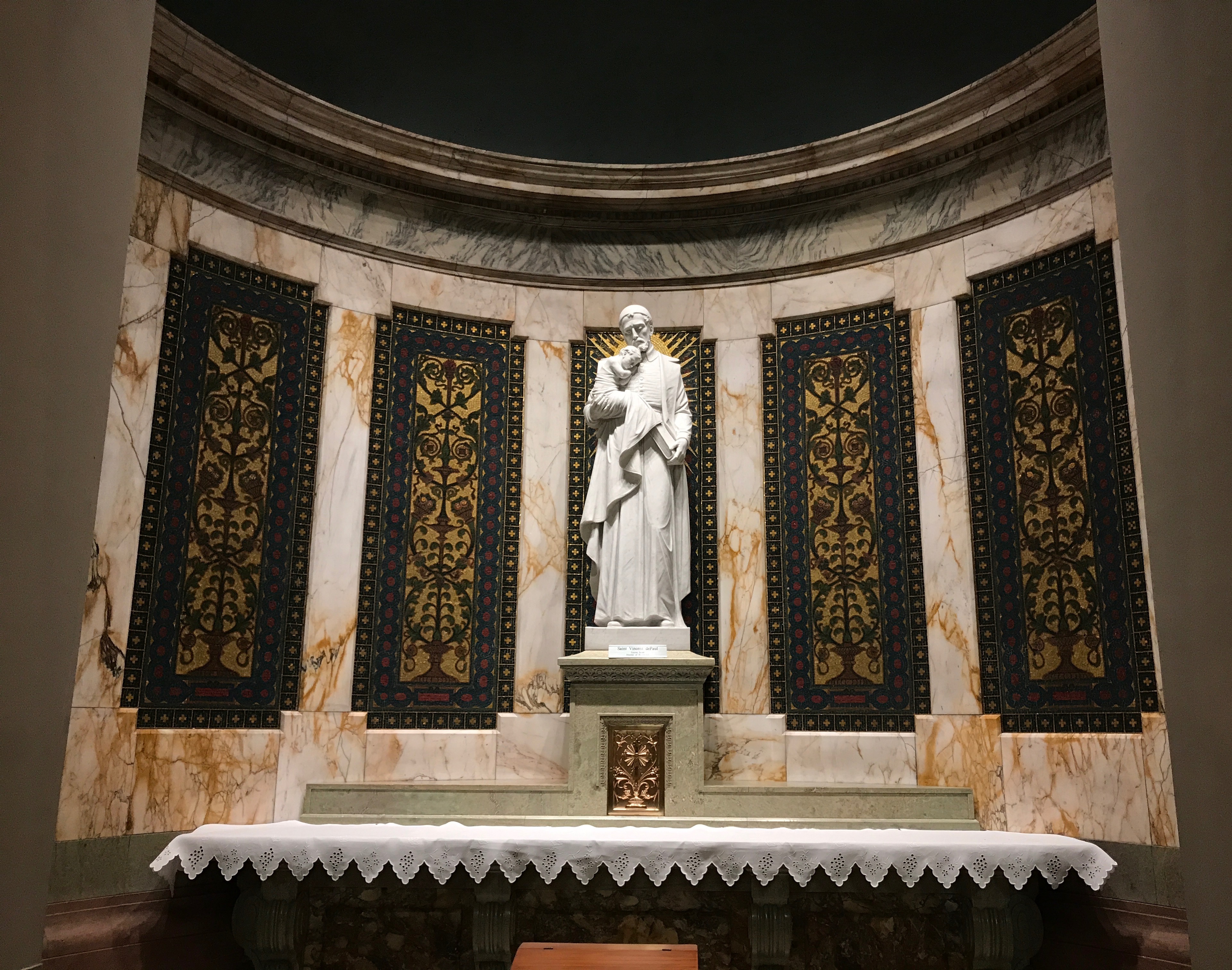
This statue actually has a label. This altar is dedicated to Saint Vincent de Paul. According to my Preferred Source, he is the patron saint of charities, horses, hospitals, leprosy, lost articles, Madagascar, prisoners, spiritual help, volunteers, and Richmond, Virginia, if I am reading that correctly. Another source has him more narrowly defined as the patron saint of charity.
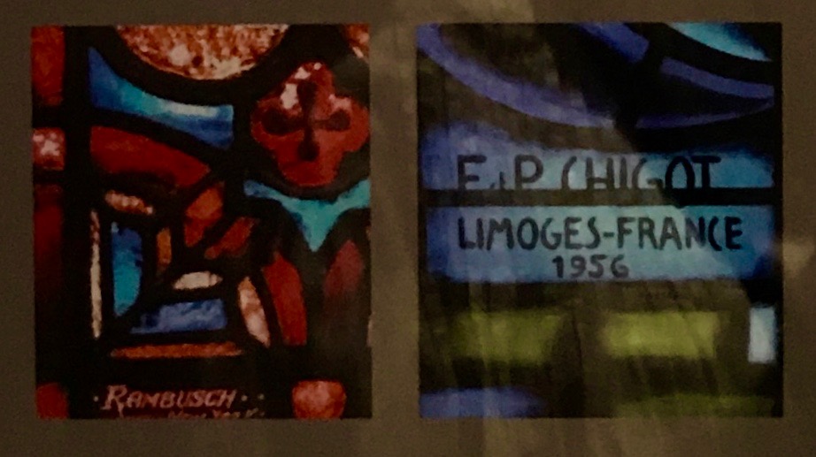
The windows are also worth some time to admire. In 1931, the Cathedral commemorated its Silver Jubilee and commissioned Rambusch Decorating Company of New York to paint and decorate the church for the anniversary celebrations. Four of the windows in the ambulatory, which is the area behind the main altar, were designed by Rambusch for the occasion. Unfortunately, I don’t have shots of those windows, as it was difficult to position myself to get a clear photo.
But, here is a shot of the iron grille that divides the ambulatory from the main altar.
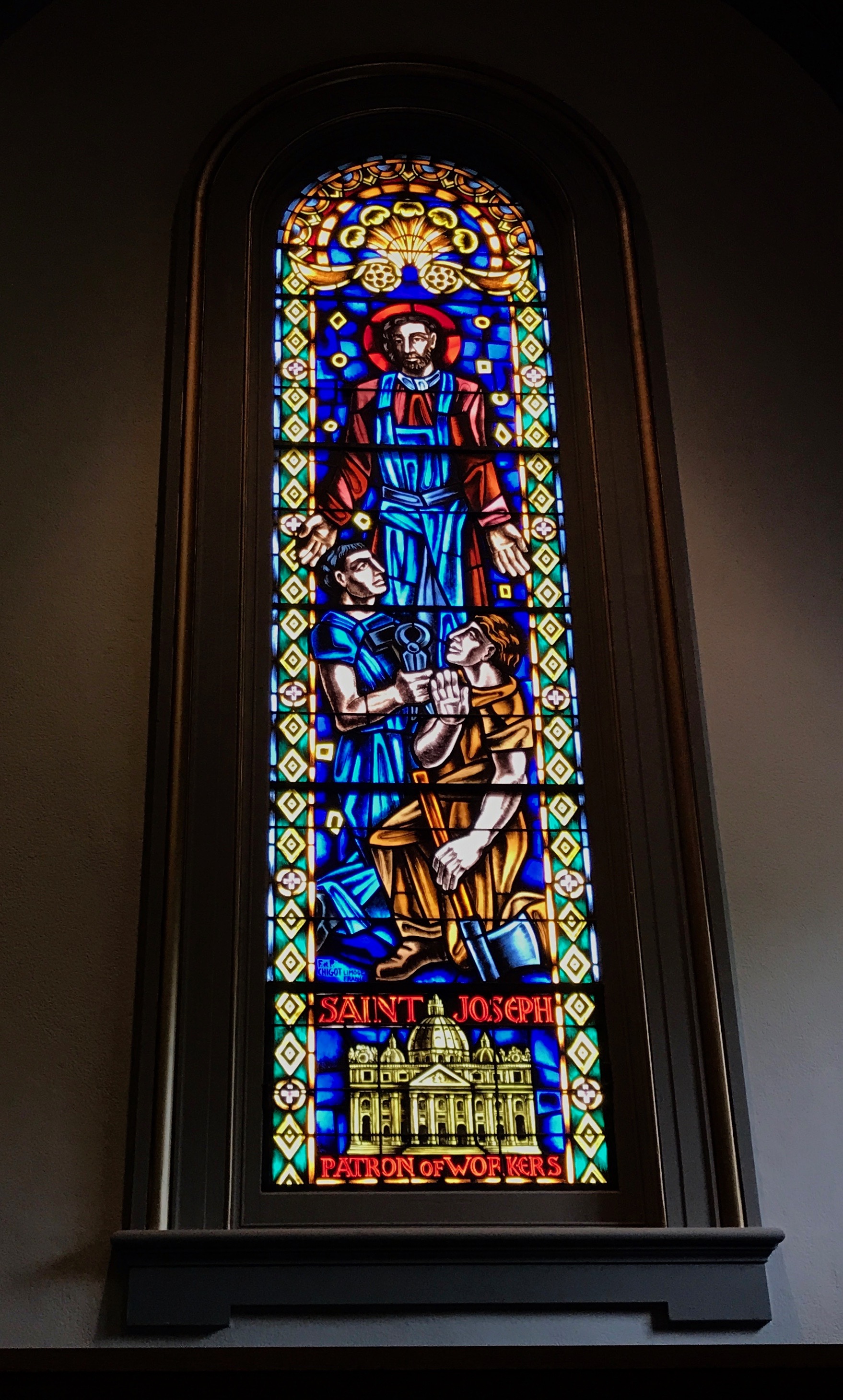
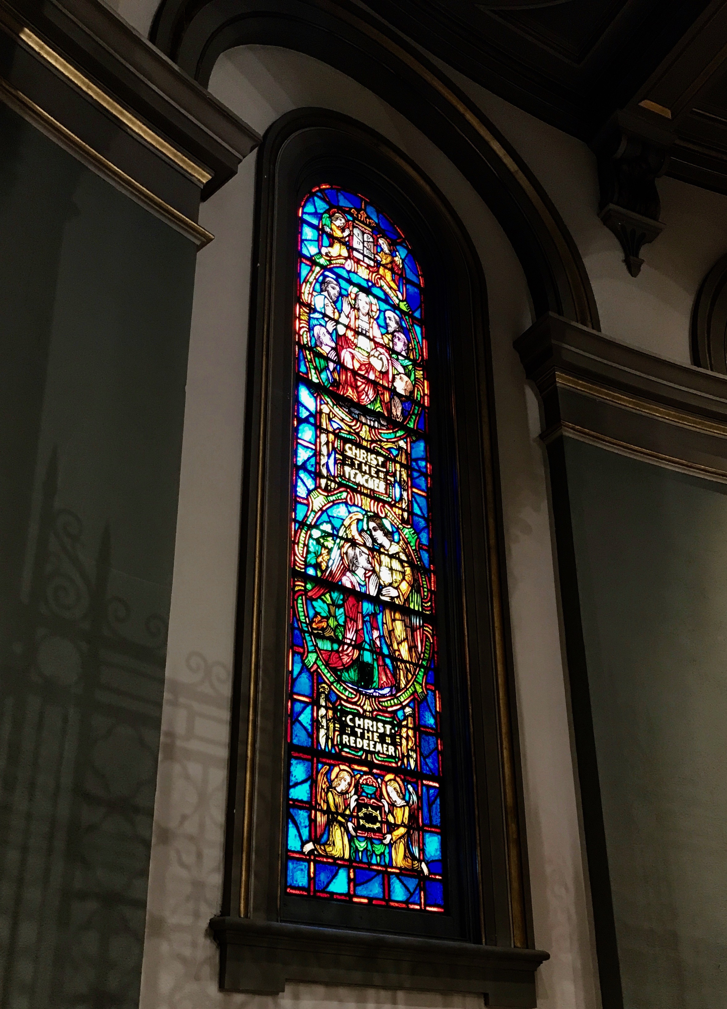
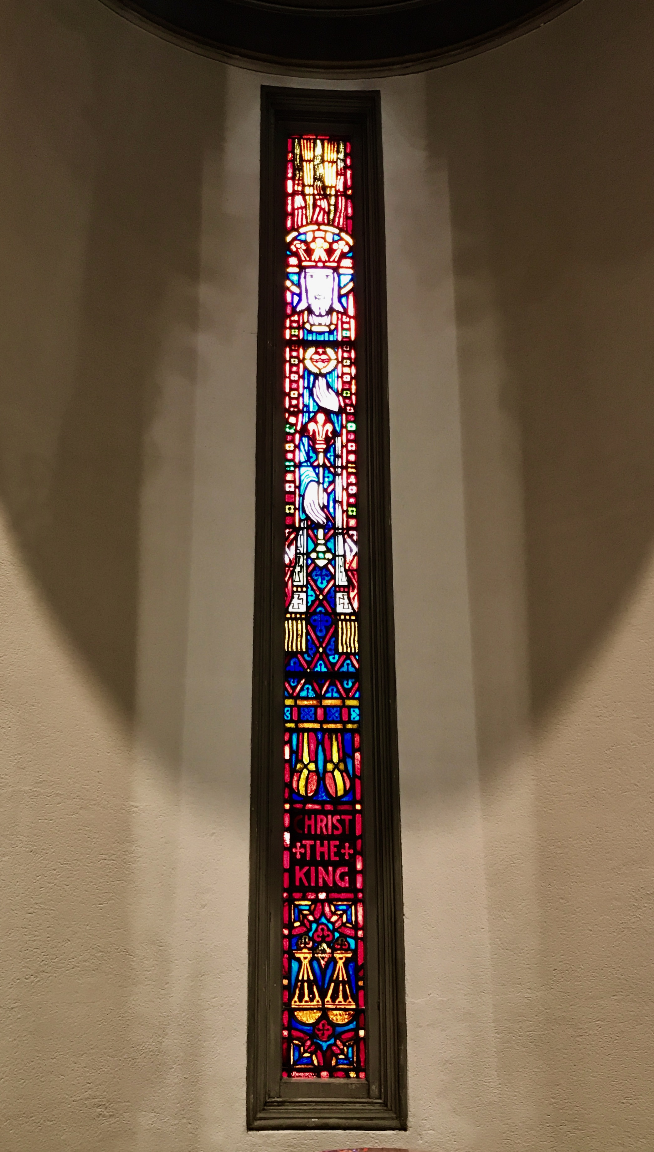
In 1956, the artisans Frances and Pierre Chigot of Limoge, France were commissioned to design several new windows for the church in honor of its 50th anniversary. Here is a sampling of what they created.
Saint Joseph, Patron of Workers.
Christ the teacher. This was in the ambulatory, and you can see the shadows cast by the grille. You can also see the oblique angle I had to stand at to snap this photo. The windows for the silver jubilee are right behind the altar.
The last window in my collection is Christ the King. If you enjoy “midcentury modern” stained glass, you can do no better than to plan a visit to Richmond’s cathedral.
While the building is impressive, I am pleased that they didn’t forget the needs of the people.
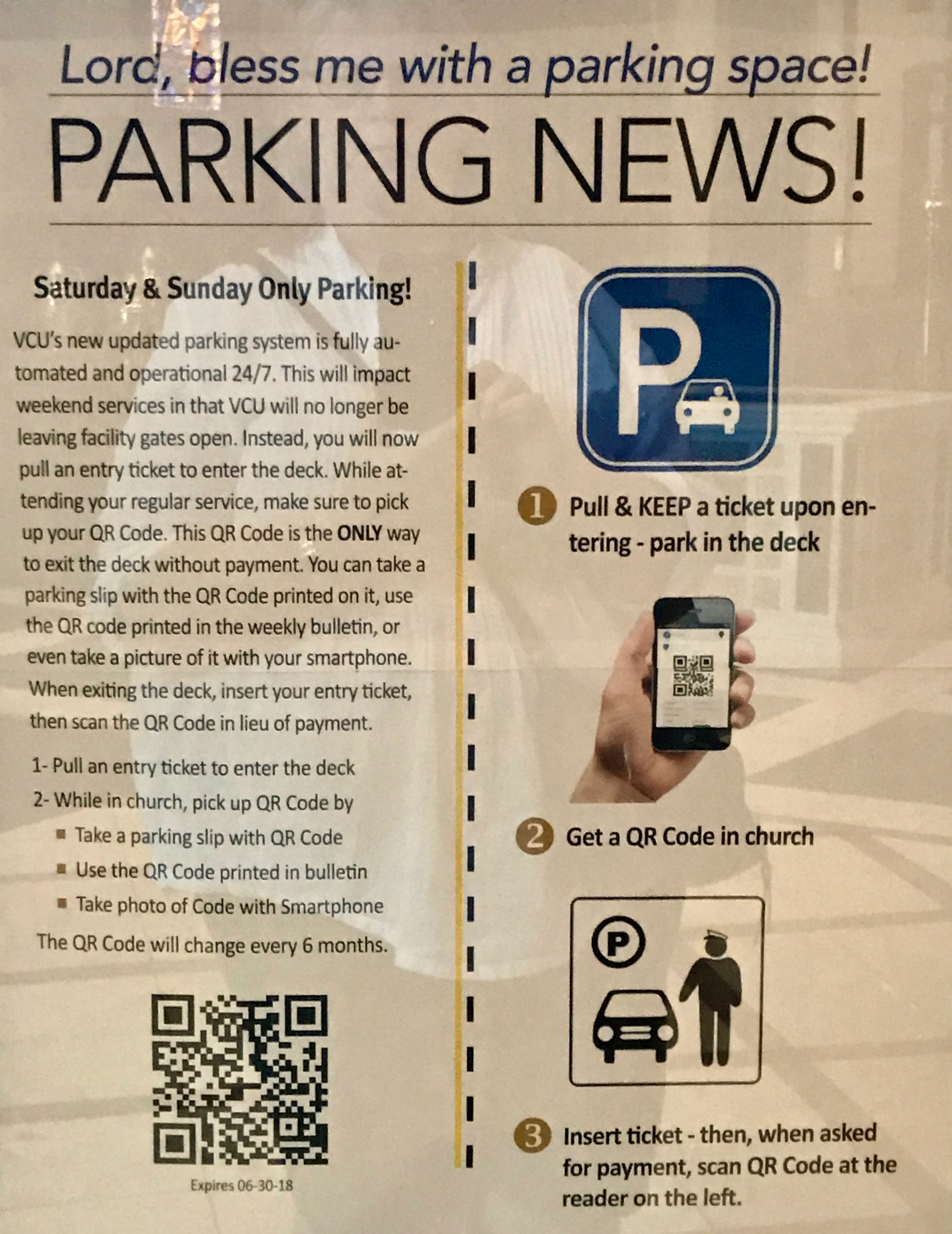
Lord, bless me with a parking space!
They didn’t forget our parking needs, either. Maybe I spent too long admiring the church after mass, but for some reason, I ended up having to pay for my parking. Or, maybe I parked in the wrong space. Oh, well…
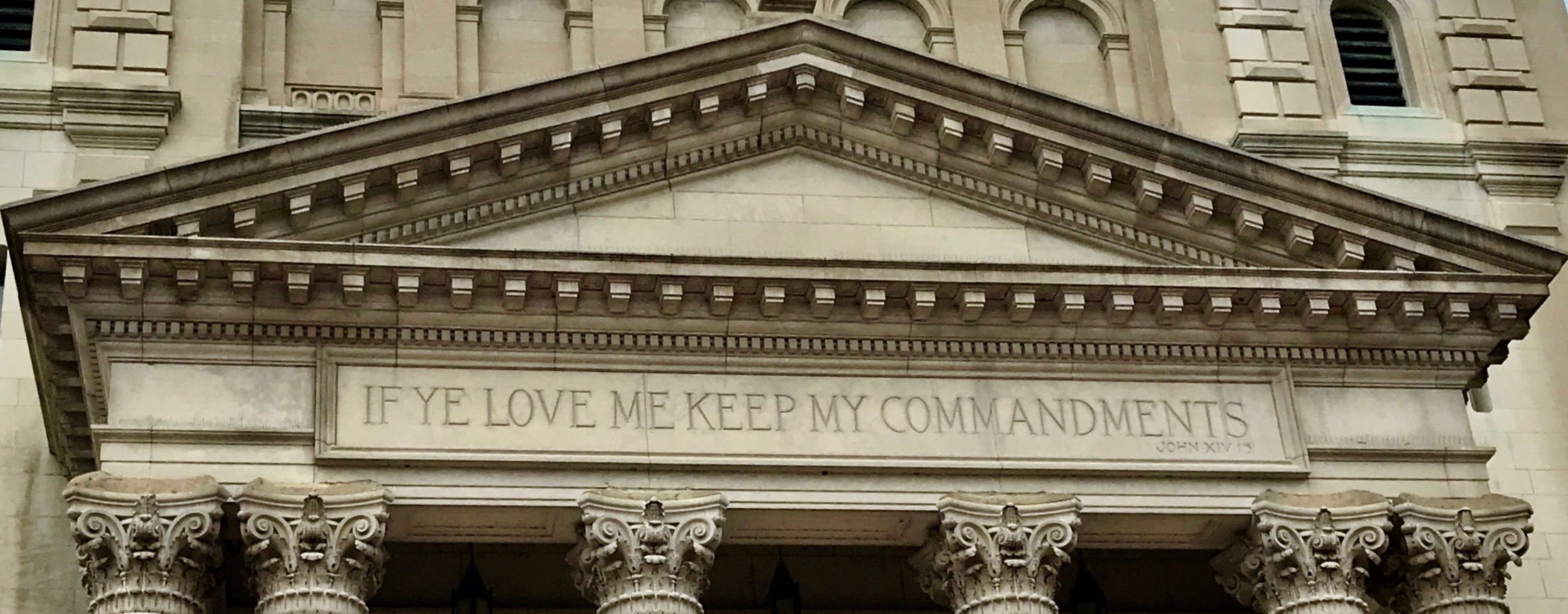
I liked the inscription over the door.
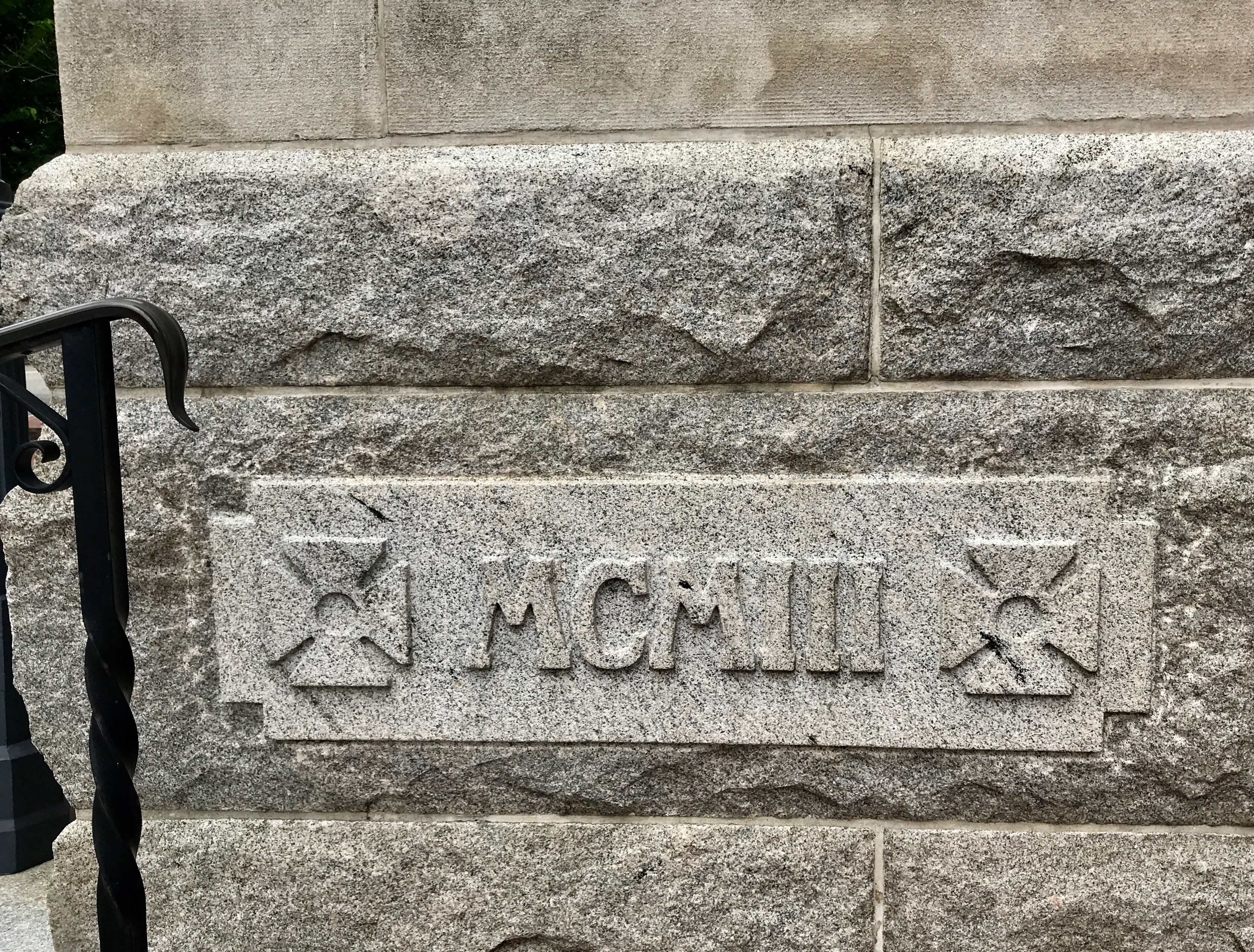
I also liked the Roman numerals on the cornerstone. 1903. I wonder if this was the stone from the Garden of Gesthemane?
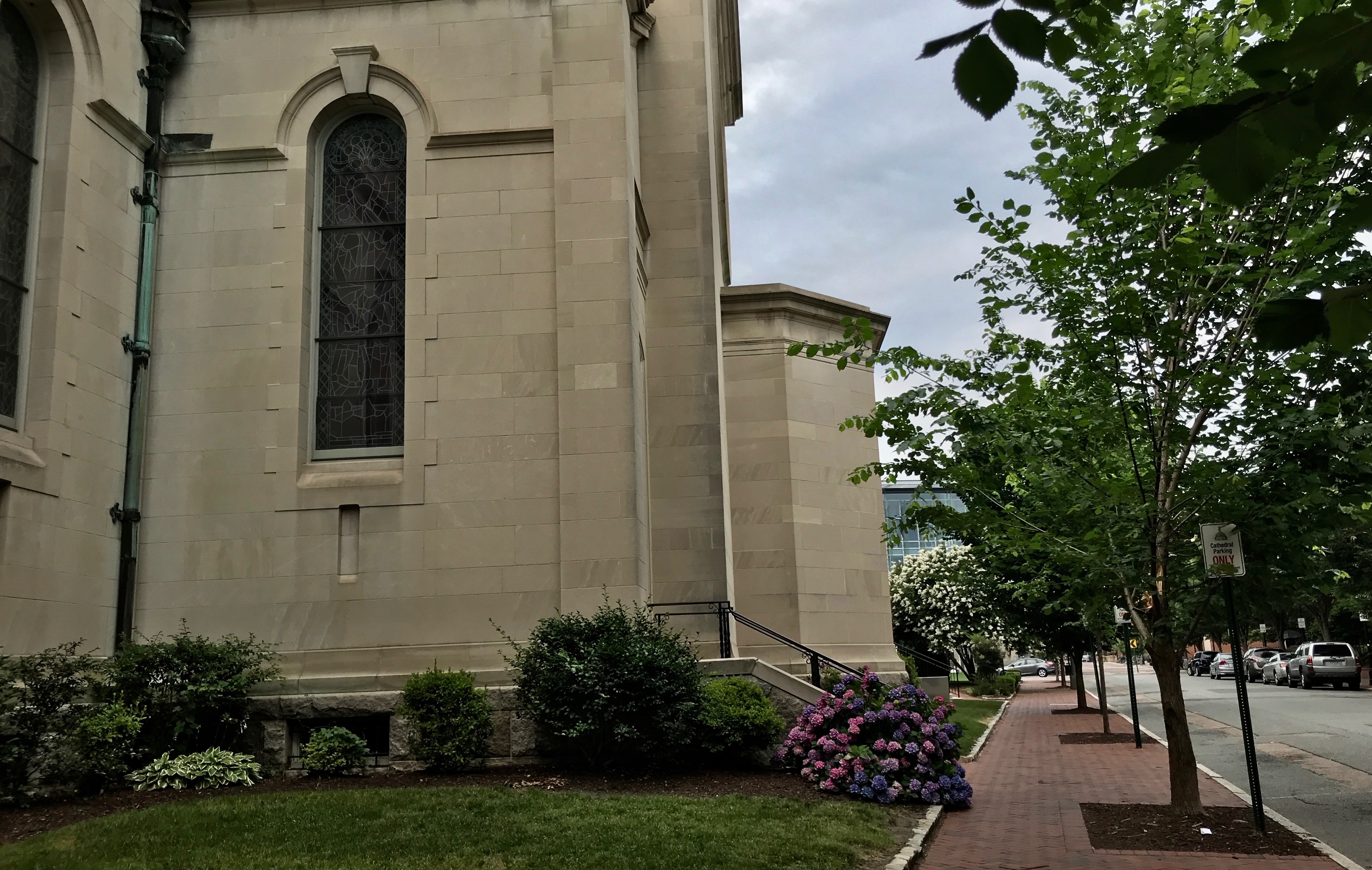
I headed back to find my car. The grounds of the cathedral were very nicely landscaped.
The cupola over the dome gave the exterior a regal appearance.
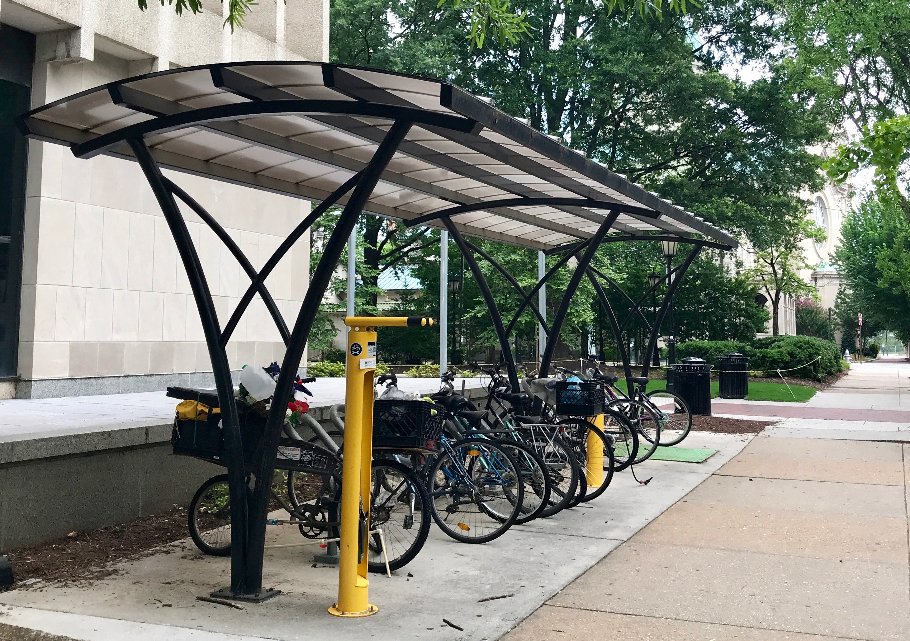
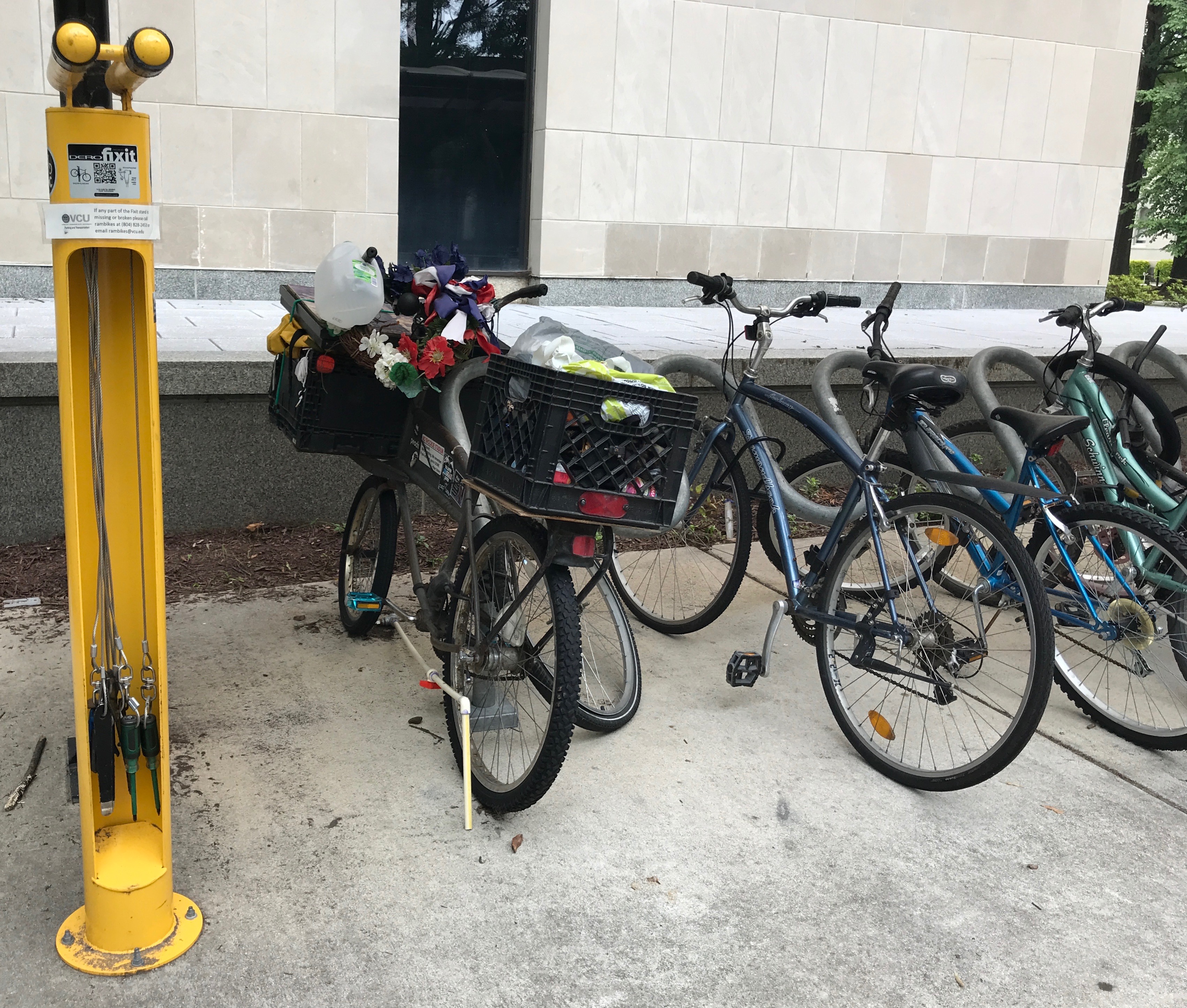
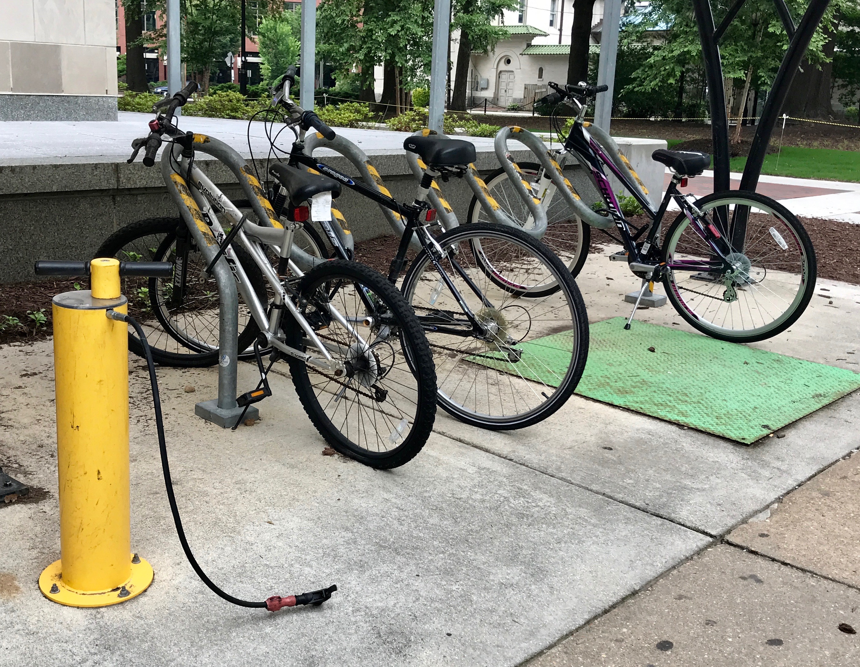
On my way back to the parking structure, I passed several facilities that really contribute to making a city “bike friendly.” I loved this little shelter.
And those yellow poles? They are bicycle fixit stations! There are tools on all those cables.
This one is a pump! I’d say Richmond is the most progressively bike-friendly city I’ve seen in the United States.
I retrieved my car and set out to find some lunch.
Here’s a thing that I do that helps me when I am on the move so much. Once I park, I take a photo of the street and the street sign. That way, I have a record of where to start looking for my car. I can also show it to people on the street when I ask for help. So far, I haven’t had to ask anyone for help, but I have checked my photos from time to time to help me head in the right direction.
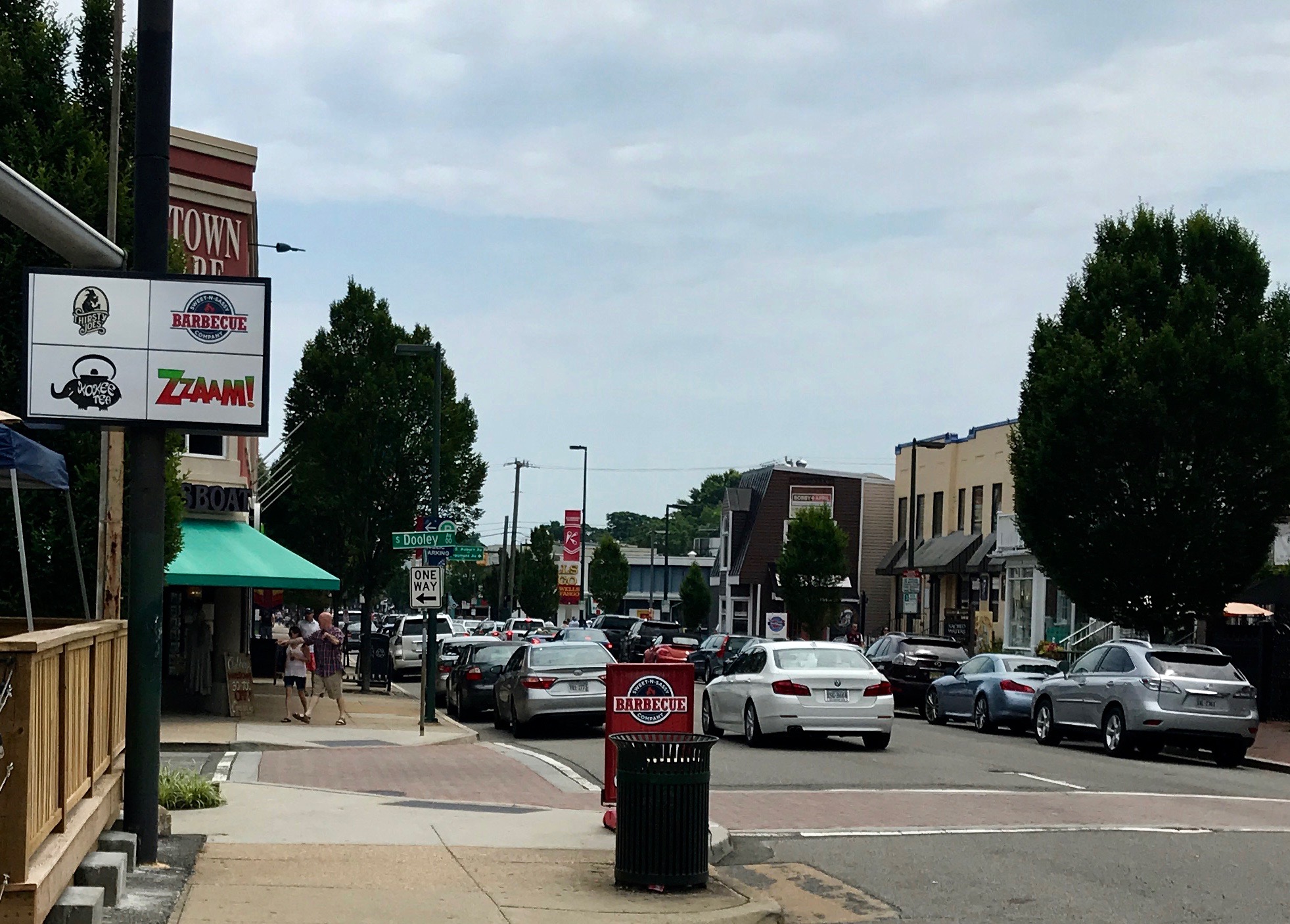
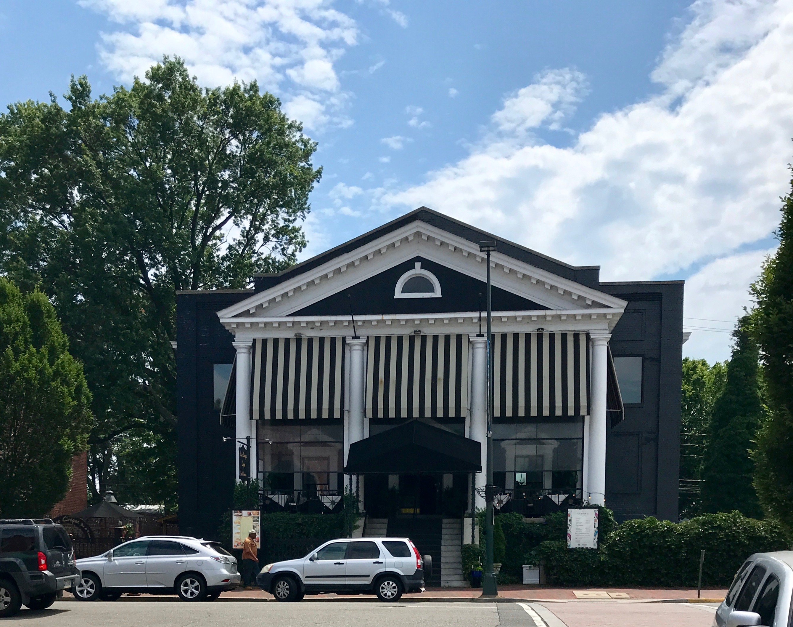
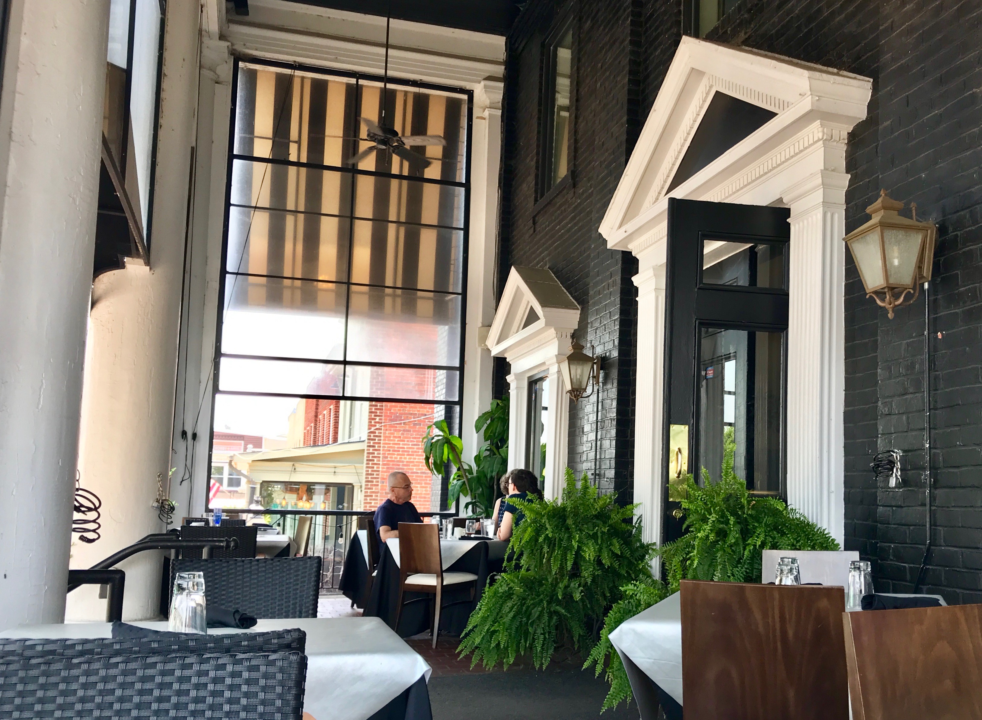
I Googled for someplace interesting to eat and found this place.
It was so relaxed and a pleasant respite from the sun.
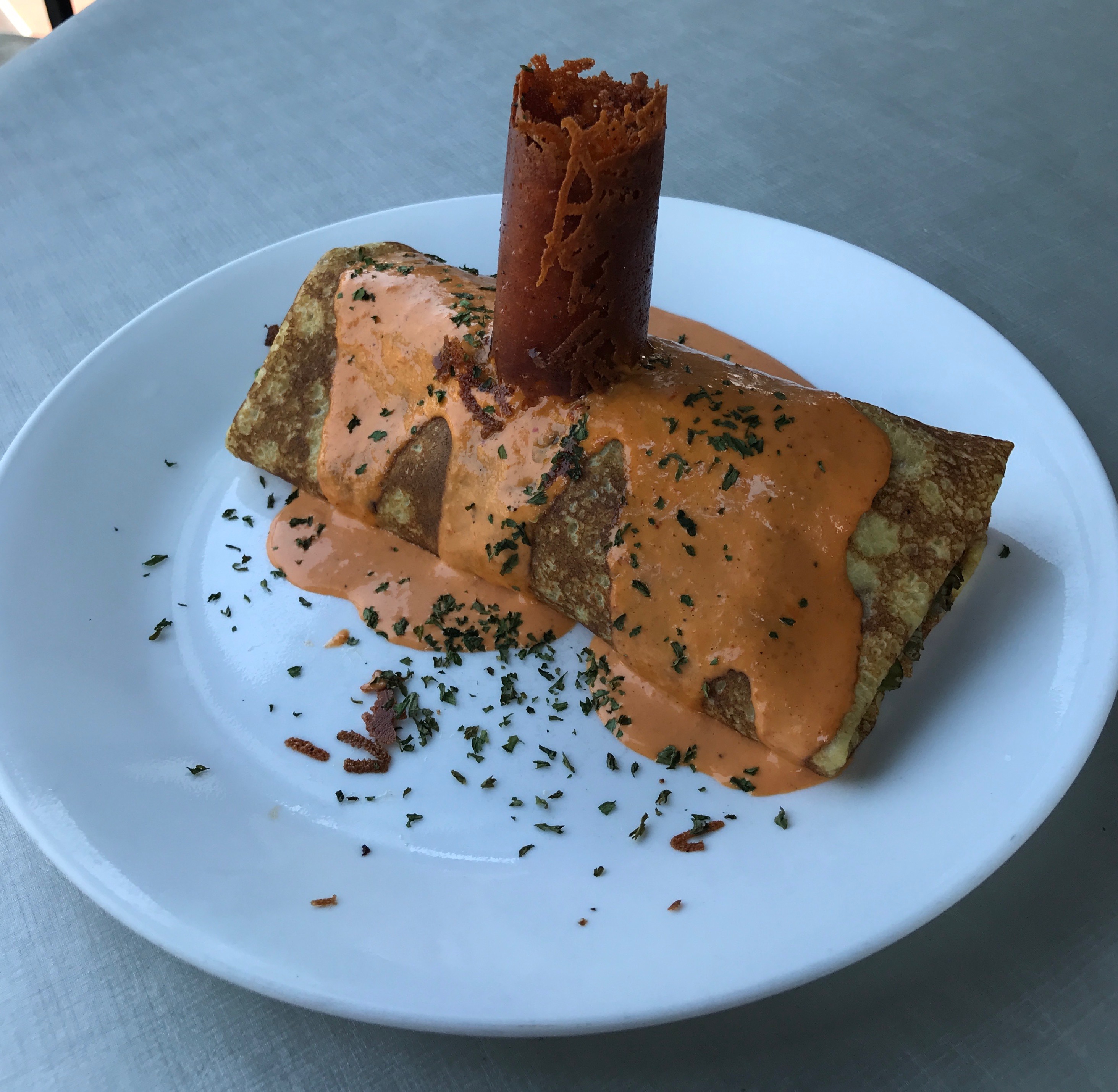
I started off with a salad.
This was the main course. I think it was a crepe of some sort with a cylinder of some sort of cheese stuck in the top. It actually sounded more attractive in the menu, but I think it was acceptable fare.
Heading back to my car, I noticed this sticker on a car. It was the first time I’d noticed it, but after this, I saw them quite frequently. Wouldn’t it be nice we were patient with everyone?
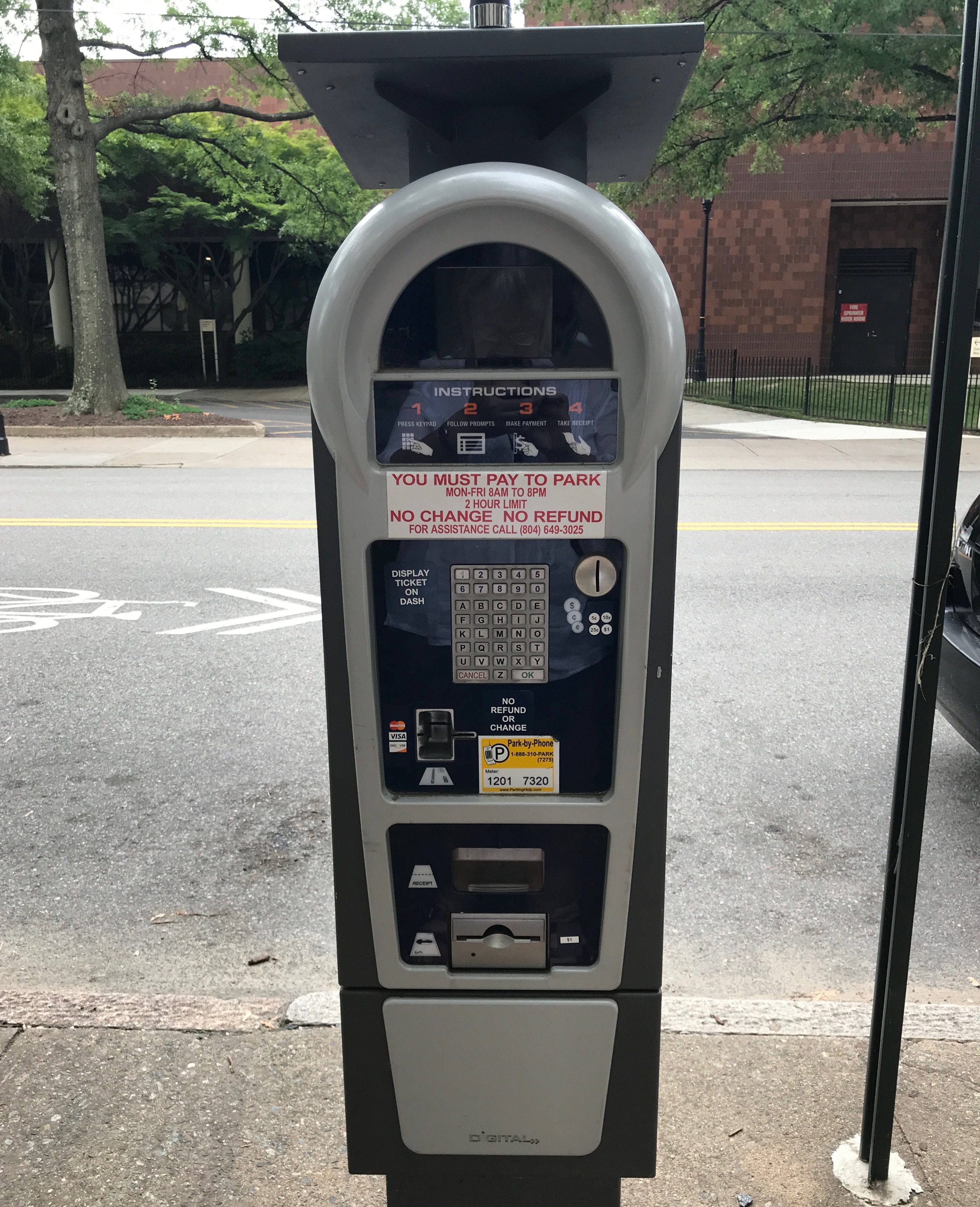
I also noticed what appeared to be a solar powered parking meter. Luckily, this was Sunday, and I didn’t have to worry about paying. These parking meters seem to be getting more complicated every year.
My next stop was the state capitol.
A little more drive-by tourism. I snapped this photo through the car window while I was stopped. I figured I could read it from the photo later.
I snapped this one, too.
Finally, I snapped a shot to remind myself of where I ended up parking.
I strolled past a building undergoing some radical changes. The reinforcements make it look like they are trying to preserve the facade on the right side of the building. It would be interesting to see what becomes of it.
I turned the corner and headed toward the capitol.
Of course the tourist entrance was on the other side. I started across the front of the building.
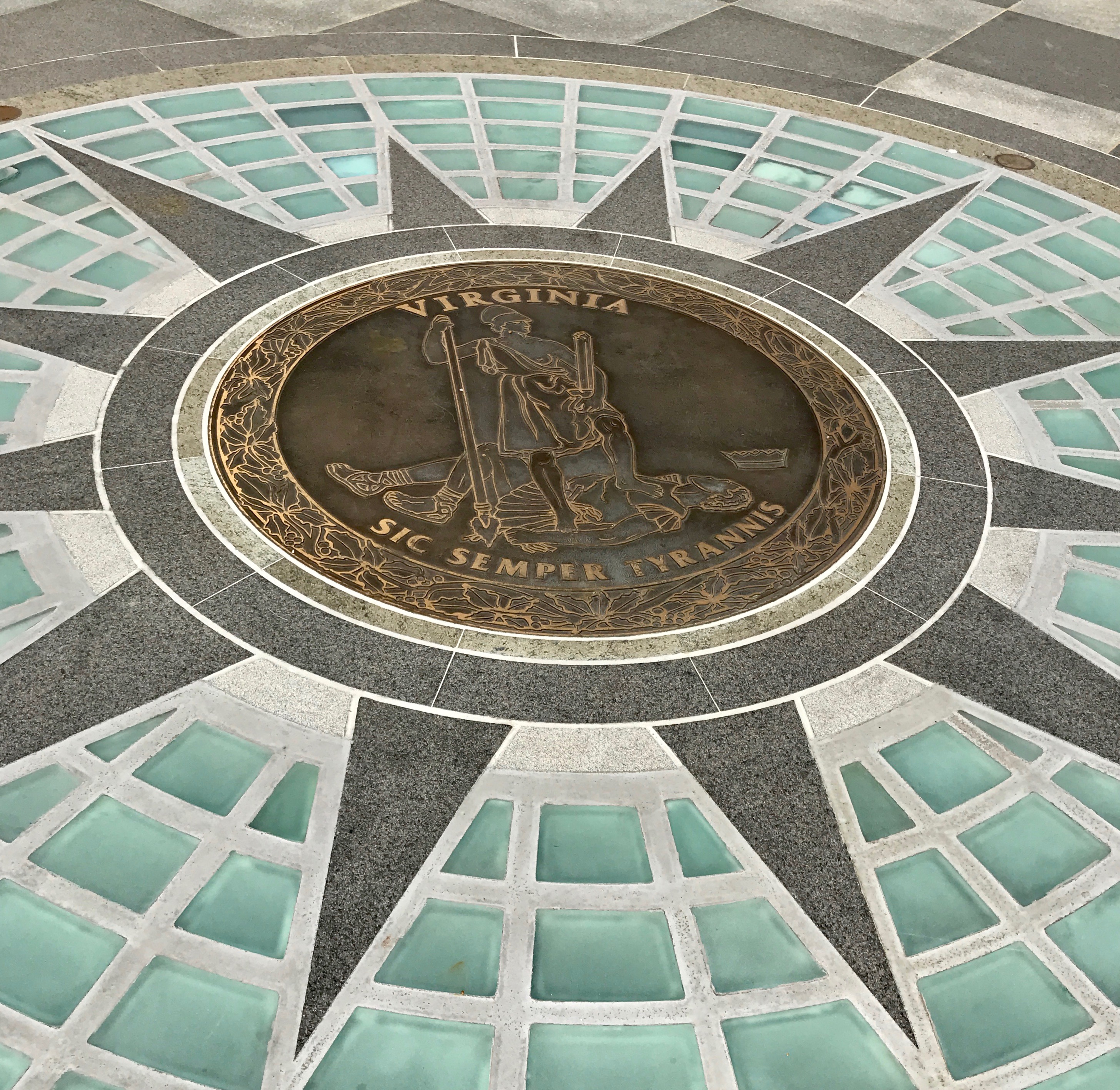
I crossed the state seal. Those of you who have studied the assassination of Abraham Lincoln will recognize the Virginia motto as what John Wilkes Booth shouted after he leapt down to the stage. Sic temper tyrannis.
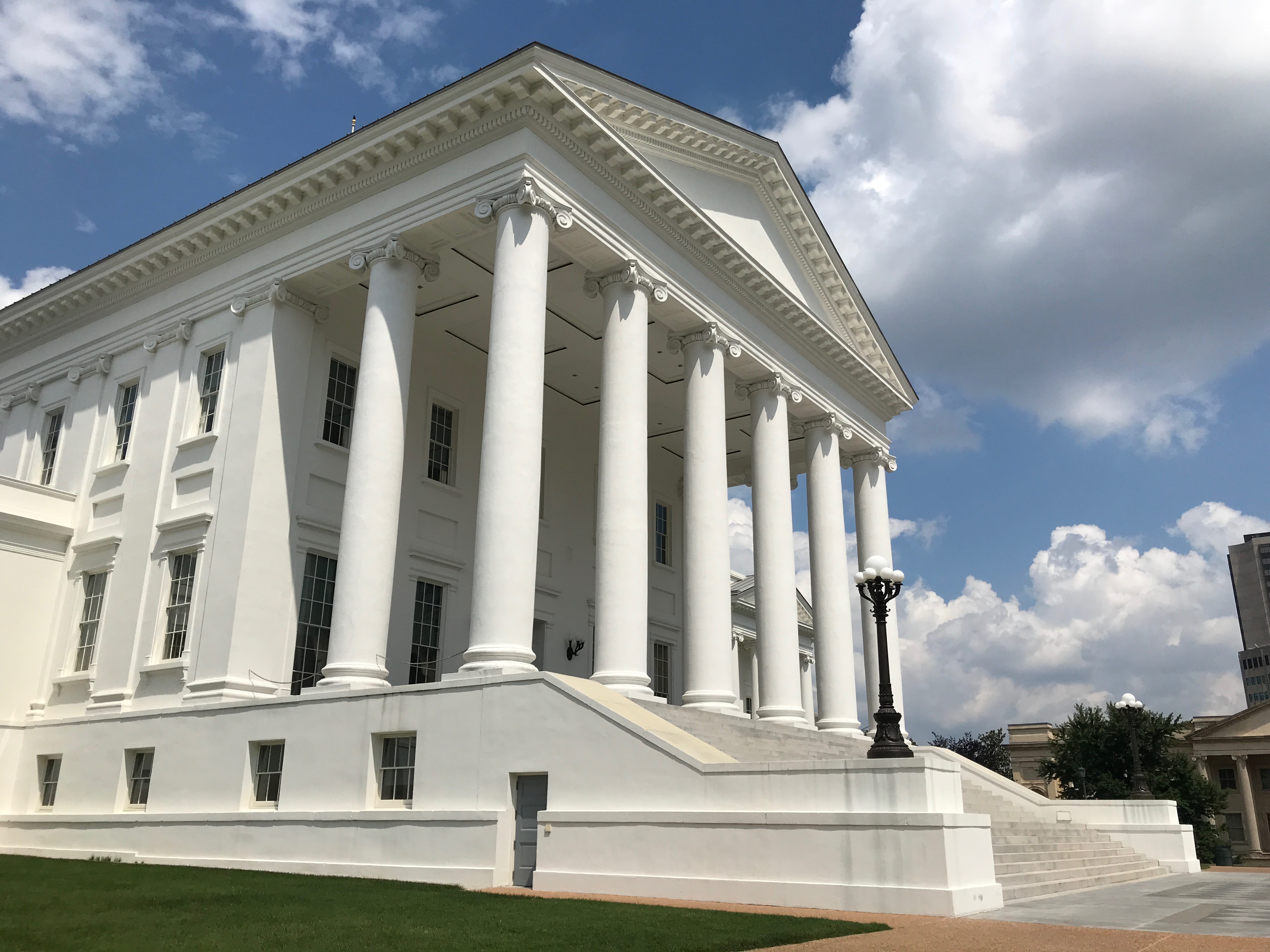
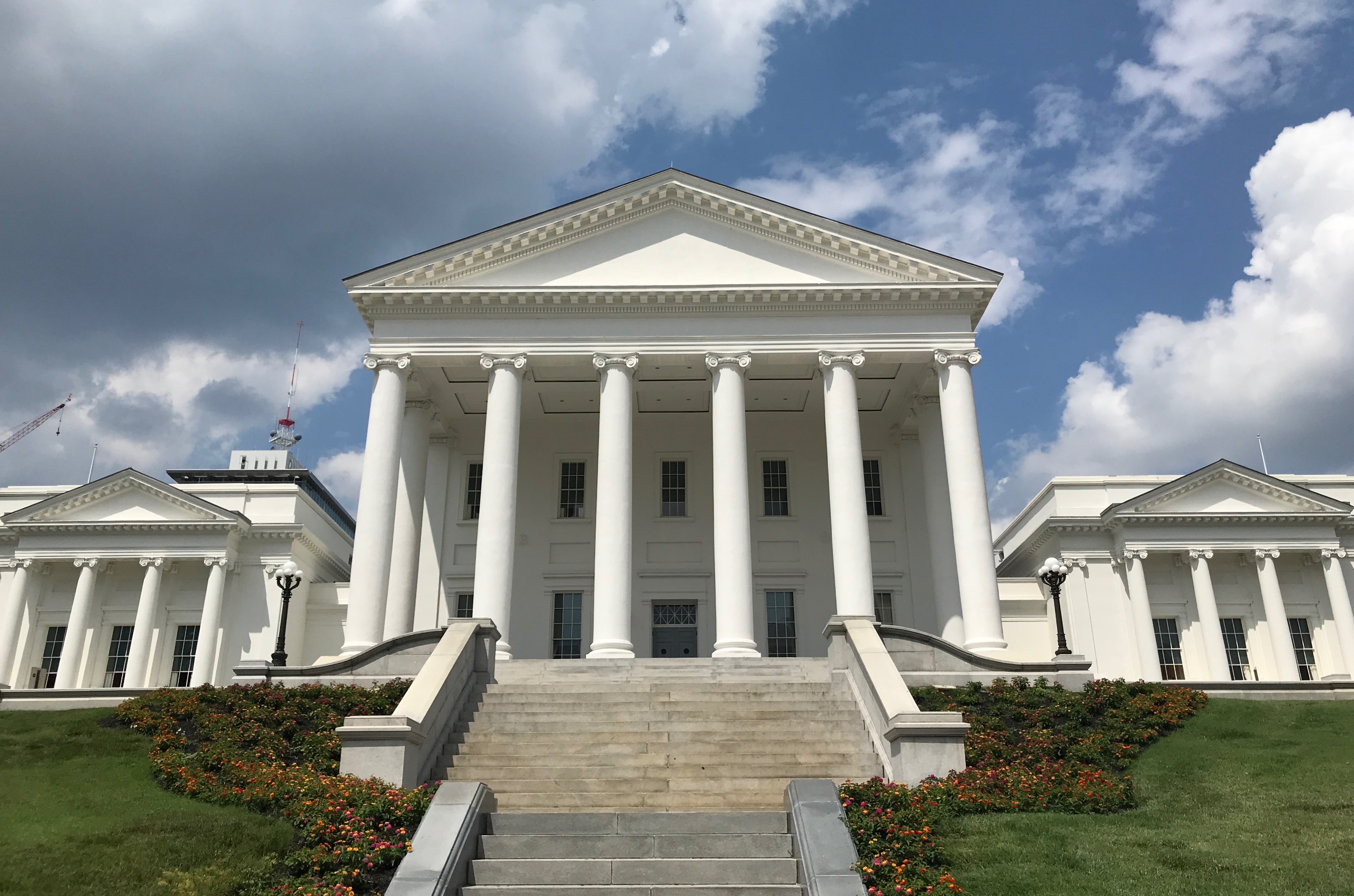
It’s quite the majestic looking building.
I finally made it around to the tourist entrance, which was in a newer addition. I was a little late for the tour, but I could catch up with them. They had already gotten to the older part of the building.
I am always looking around corners and into the backs of buildings. I thought this stairwell was interesting.
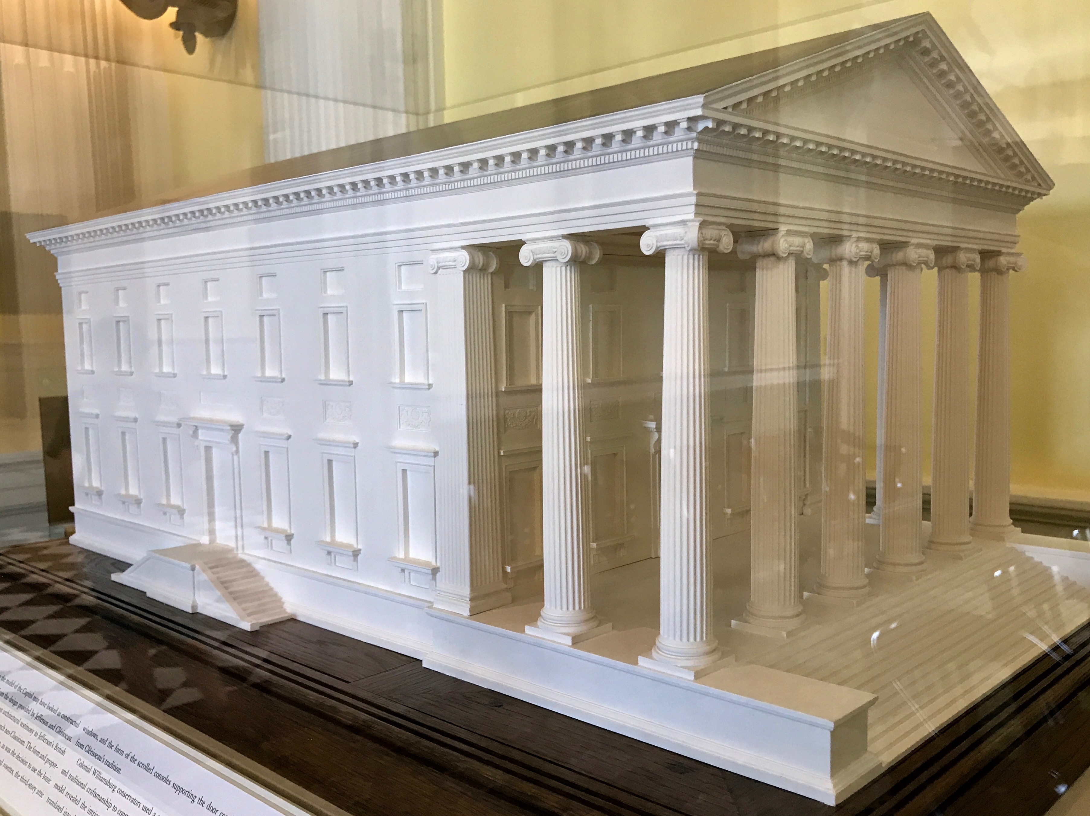
The guide took us into the rotunda. I find it interesting that this building has a rotunda but no dome.
It sure looks like it has a dome, doesn’t it? But, the managed to hide it under the peaked roof.
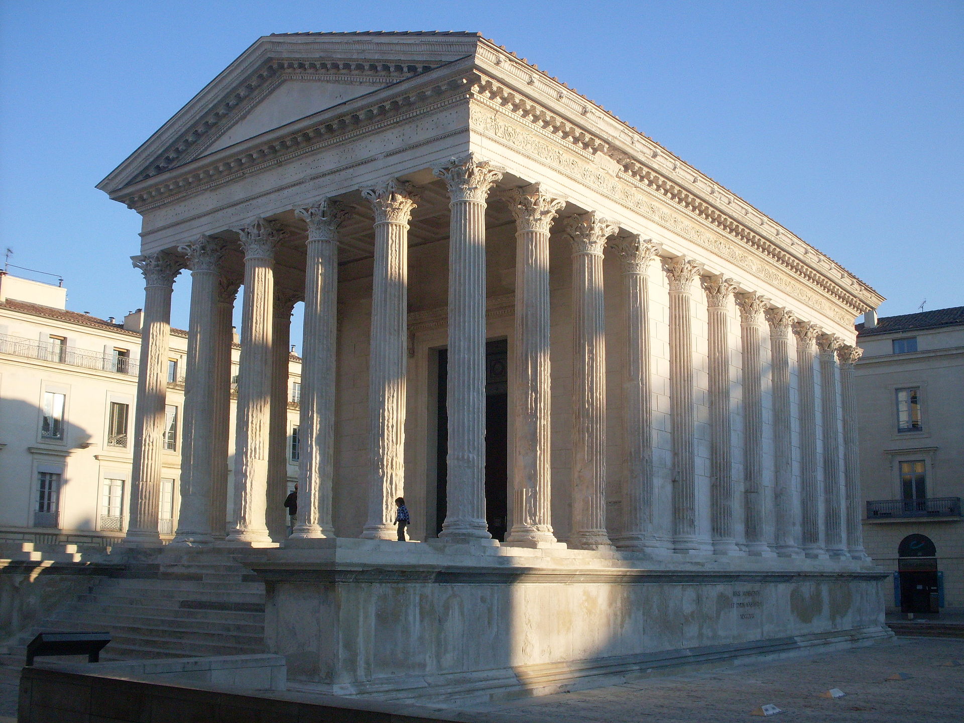
You can see from the model that there is no dome. That’s the way Thomas Jefferson and French architect Charles-Louis Clerisseau designed it. According to my Preferred Source, the design was modeled after the Maison Carrée at Nimes in southern France, which is one of the best preserved Roman temple facades to be found in the territory of the former Roman Empire.
By Danichou – Own work, Public Domain, https://commons.wikimedia.org/w/index.php?curid=12835245
This is the Maison Carrée.
In considering the fact that this capitol doesn’t have a dome, I thought that it was quite unusual. In fact, twelve of the fifty state capitols don’t have external domes:
Alaska
Delaware
Florida
Hawaii
Louisiana
Nebraska
New Mexico
New York
North Dakota
Ohio
Tennessee
So, now you know!
The cornerstone was laid on August 18, 1786, even before the design was completed. Later that year, a set of architectural drawings and a plaster model were sent from France to Virginia. It was sufficiently completed for the General Assembly to meet there in October 1792.
But, back to the tour.
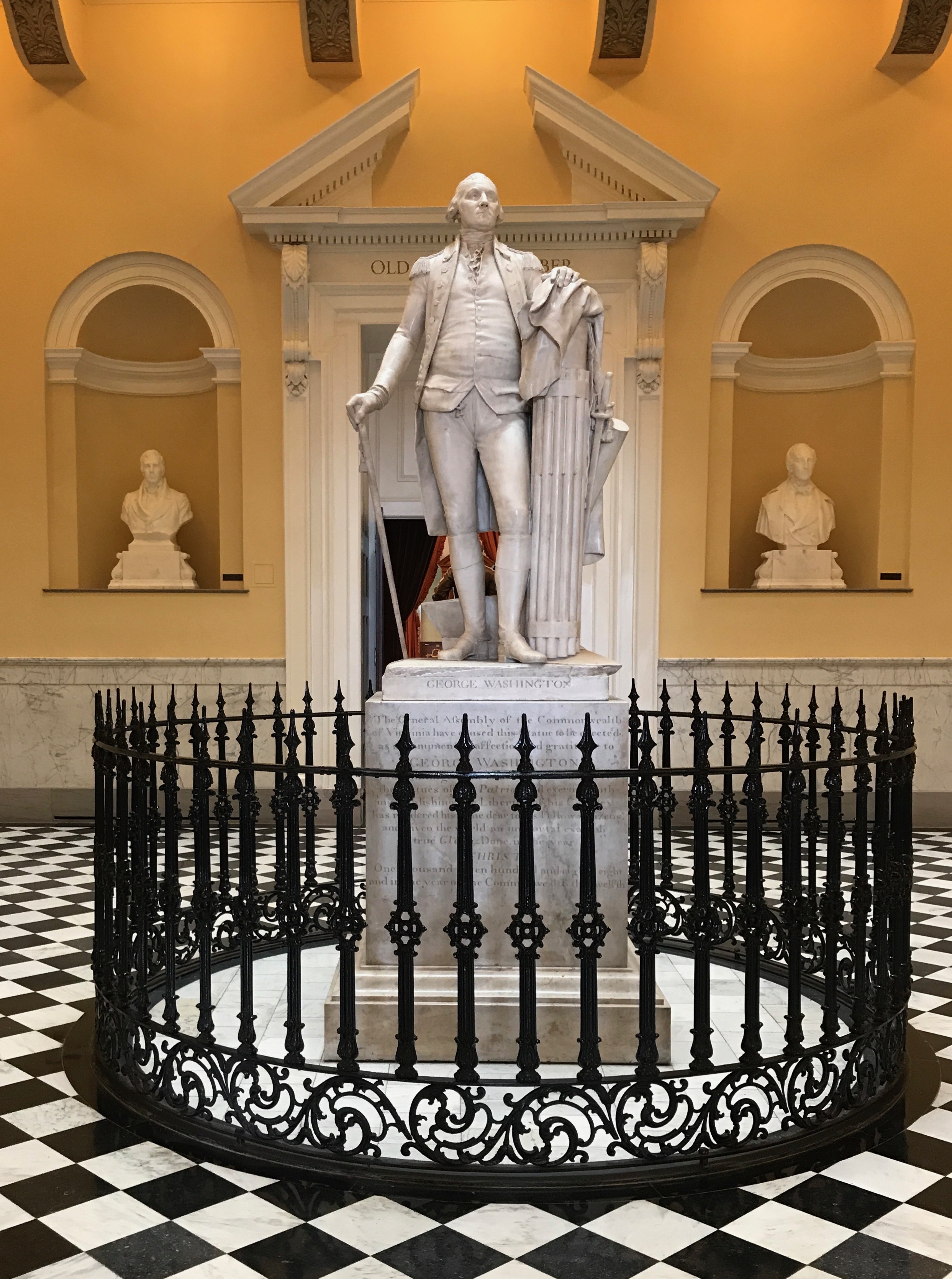
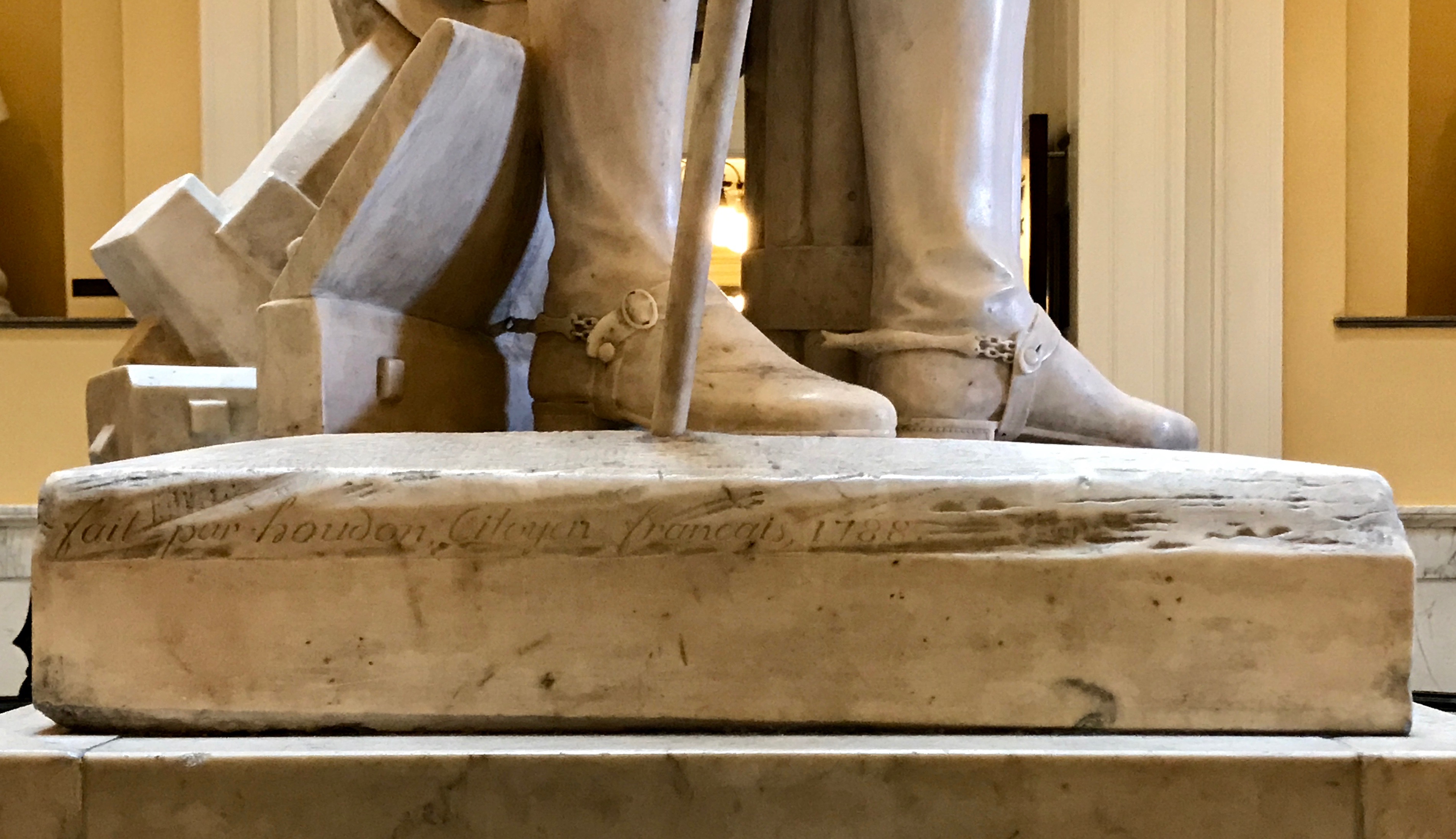
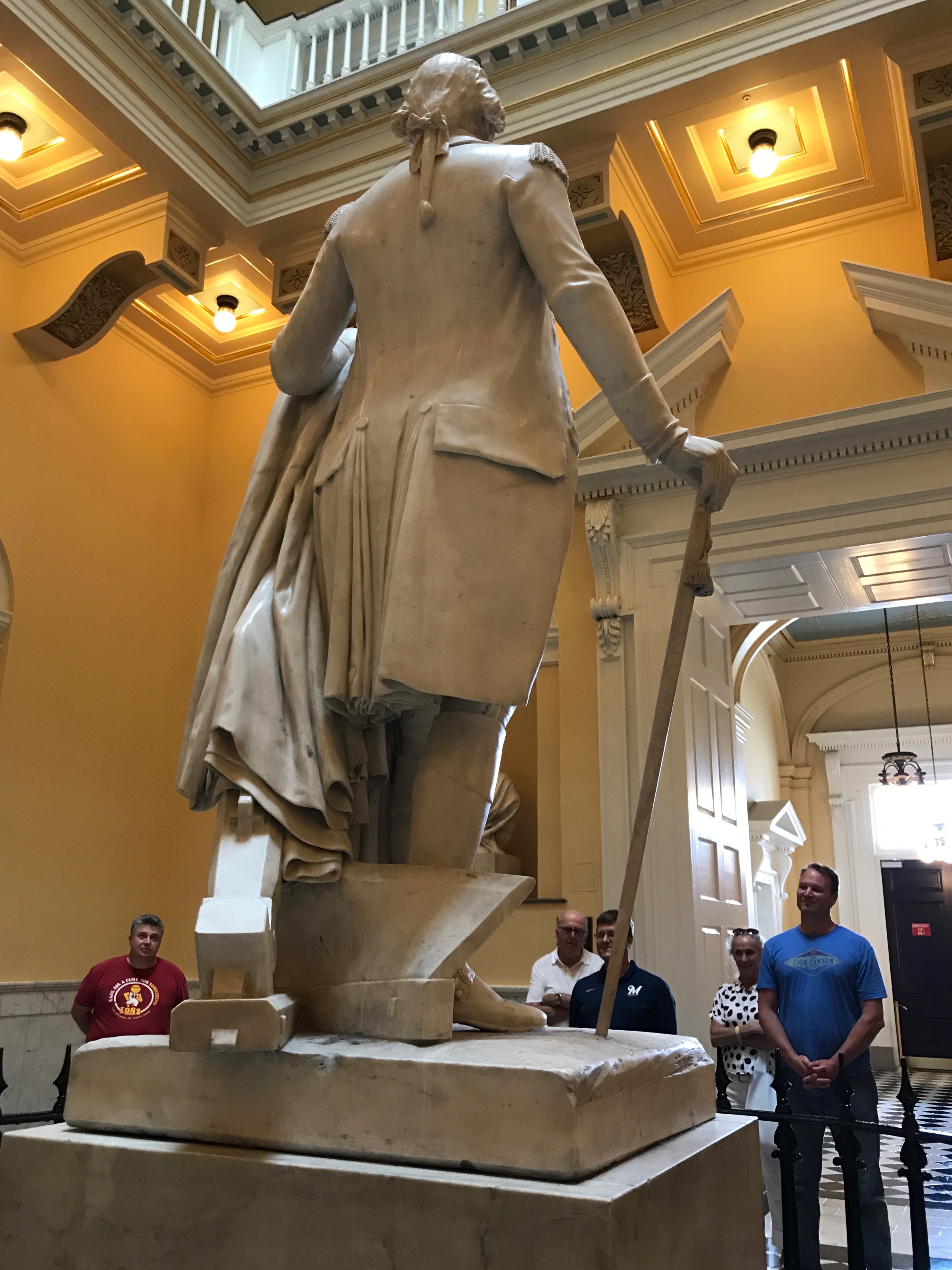
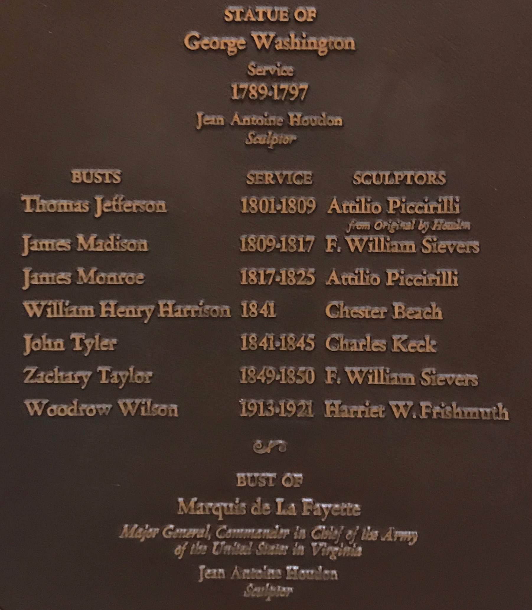
Houdon’s statue of George Washington has pride of place in the rotunda.
Benjamin Franklin invited Jean-Antoine Houdon to cross the Atlantic from France in 1785 so that Washington could model for him. Washington sat for wet clay life models and a plaster life mask. These models served formally commissions of statues of Washington, including this one that was commissioned by the Virginia General Assembly.
If you look carefully, you can see the artist’s signature on the left side of the base.
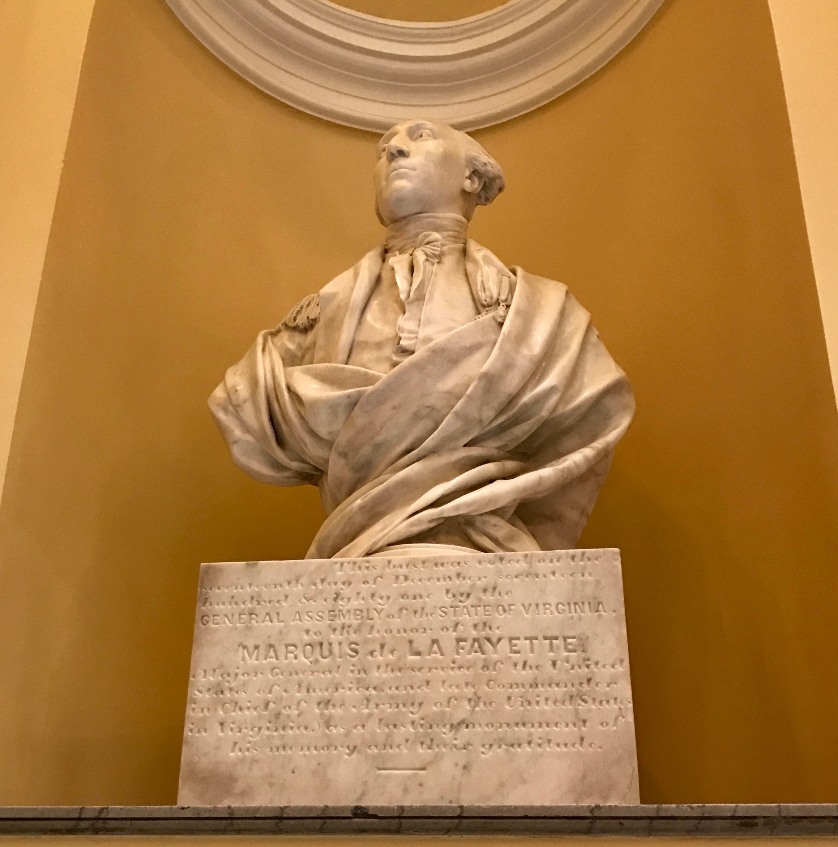
At the same time that the Virginia General Assembly commissioned a marble state of Washington, they also commissioned a marble bust of the Marquis de Lafayette.
The intent was that the statuary would represent public virtue from the Old and New Worlds. Lafayette was voted a citizen of Virginia by an “act of assembly” for his service on behalf of the Commonwealth during the American Revolution.
There were many other busts in the rotunda.
There were eight presidents that were born in Virginia!
After the Rotunda, we continued on to other parts of the Capitol.
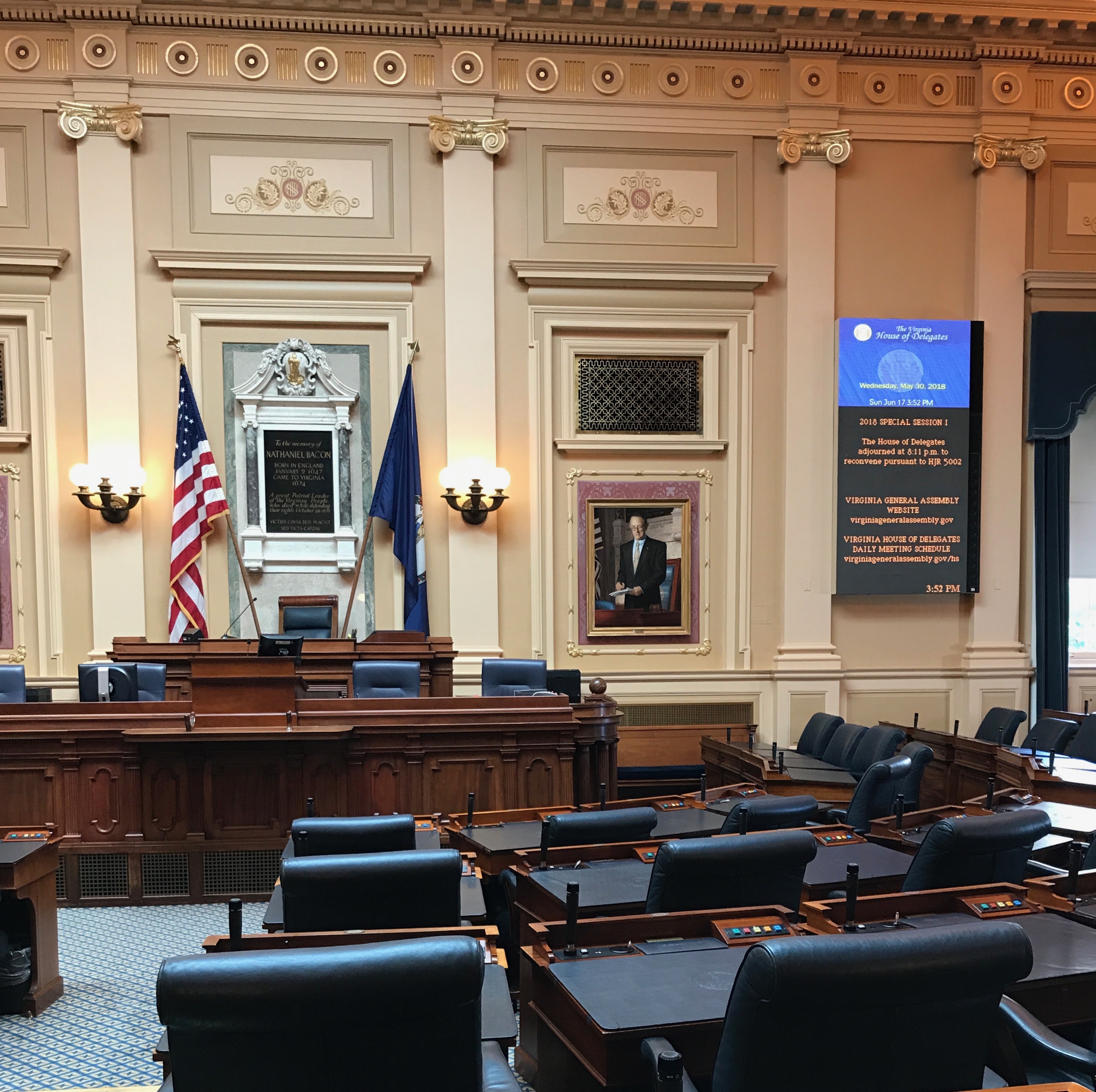
It looks like a comfortable place to work.
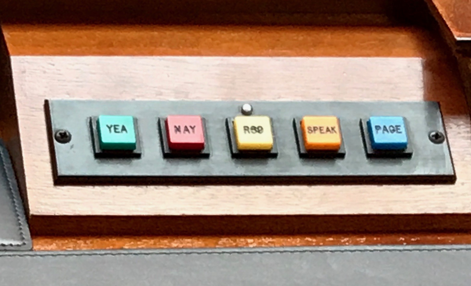
I guess pushing a button is easier or more accurate that raising your hands and having someone count.
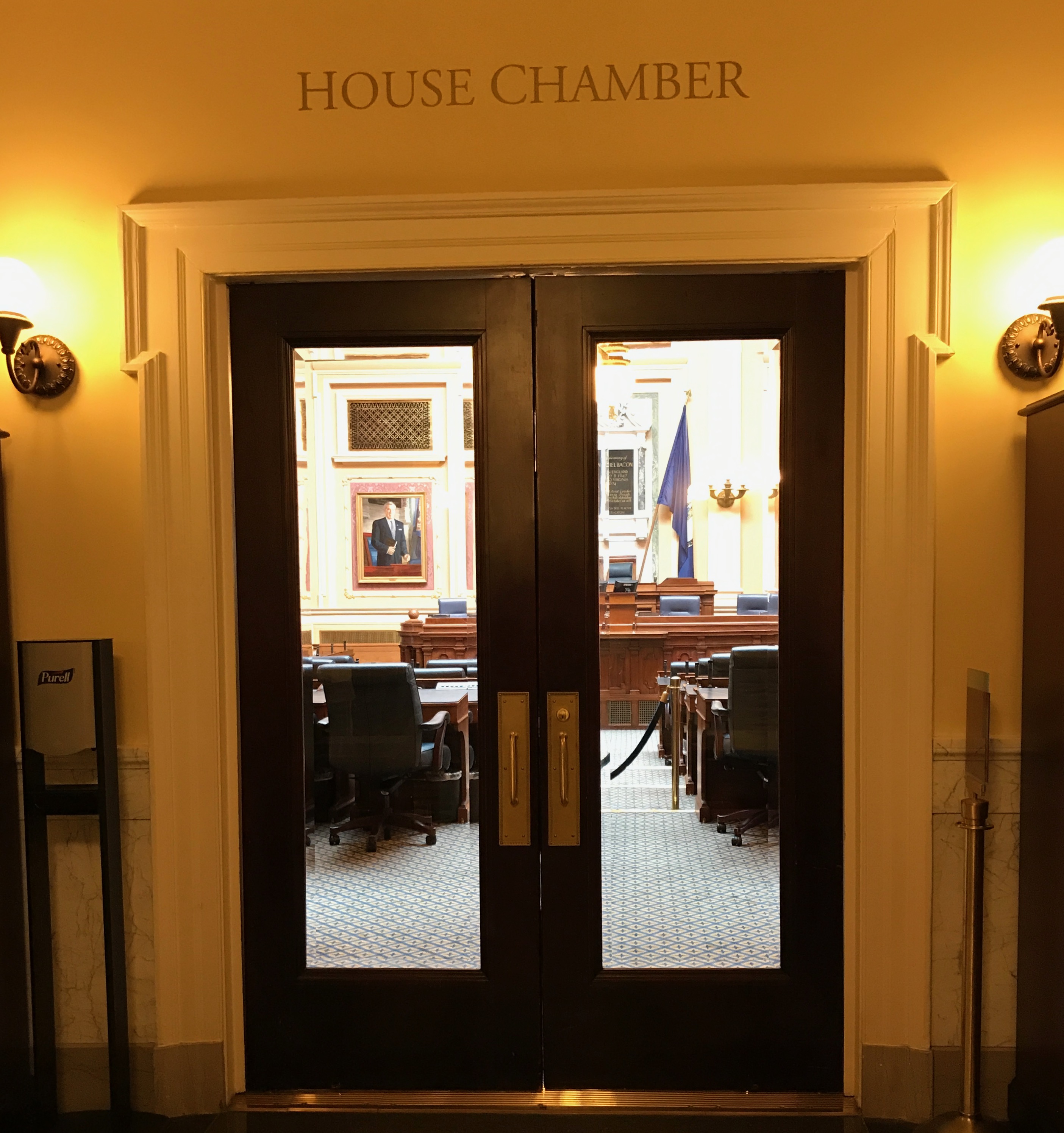
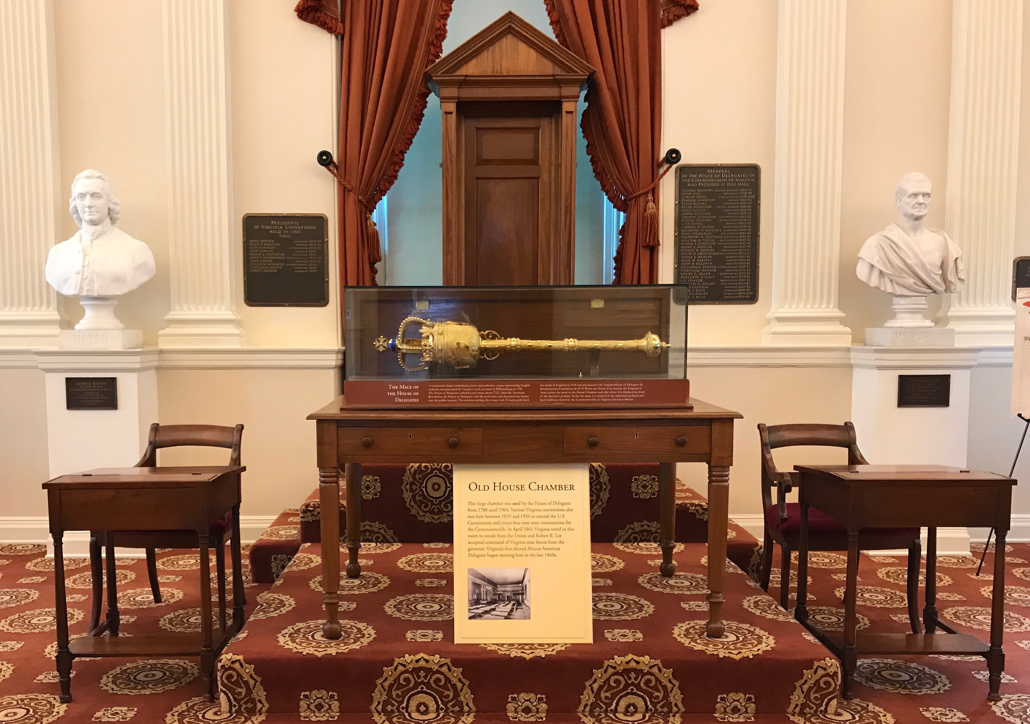
We continued on to the Old House Chamber.
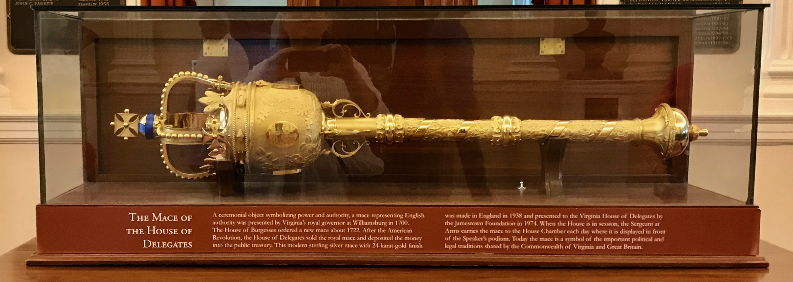
In the Old House Chamber, there is a copy of The Mace of the House of Delegates.
It seems that Virginia’s royal governor at Williamsburg presented this mace to the House of Burgesses in 1700. The house of Burgesses ordered a new mace in around 1722. After the American Revolution, the House of Delegates sold the royal mace and deposited the money into the public Treasury.
This modern mace was made in England in 1938 and was made of sterling silver with a 24-karat-gold finish. It was presented to the Virginia House of Delegates by the Jamestown Foundation in 1974. I guess the folks in Jamestown must have just held on to it and admired it from 1938-1974.
When the House is in session, the Sergeant at Arms carries the mace to the House Chamber each day, where it is displayed in front of the Speaker’s podium. According to the information with the mace, “Today the mace is a symbol of the important political and legal traditions shared by the Commonwealth of Virginia and Great Britain.
I guess they are finally over that little fracas that happened in 1776.
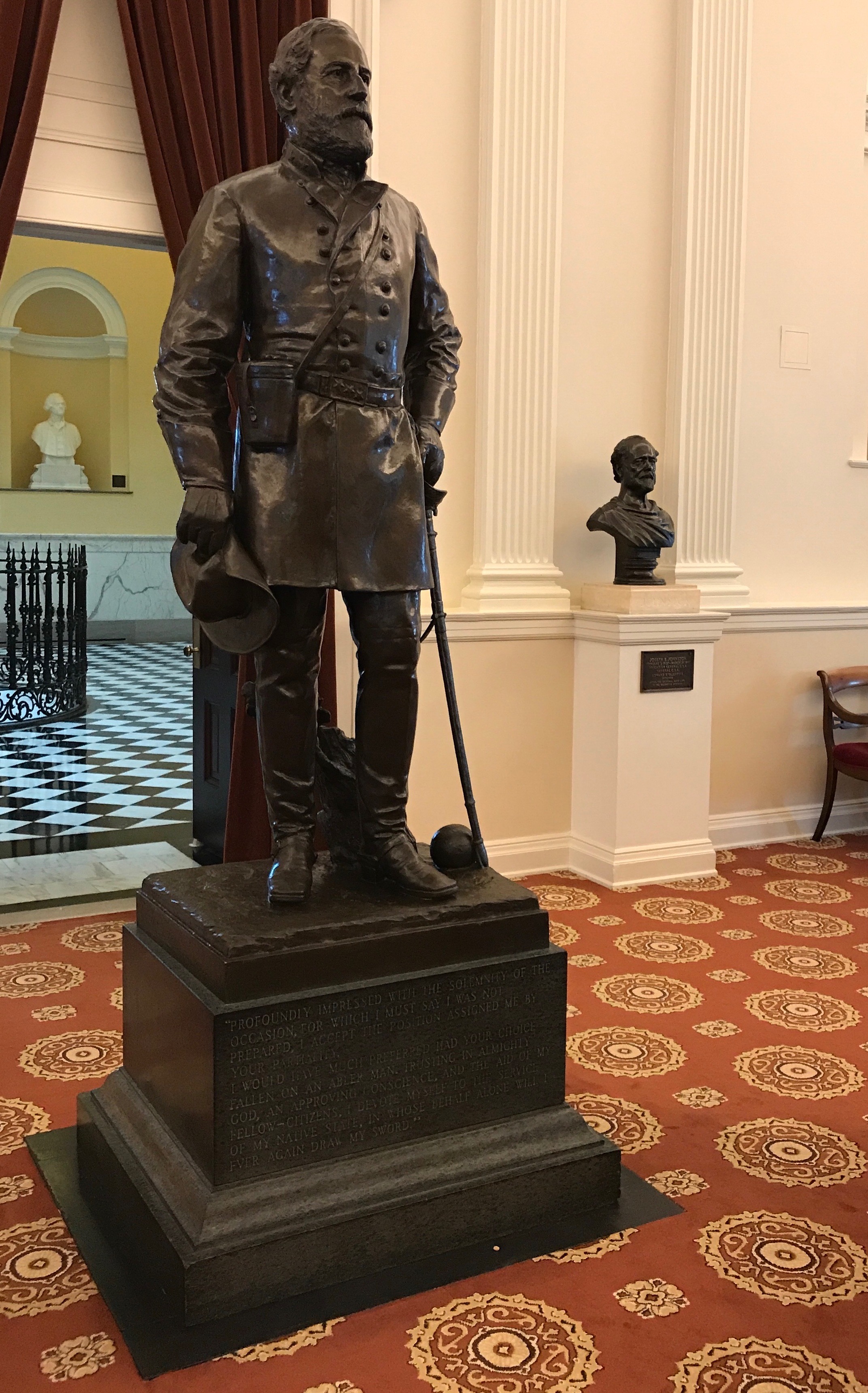
As we crossed back to the Senate Chamber, we passed this statue of Robert Lee.
Have you ever noticed that it doesn’t sound right without that “E?”
Robert E. Lee.
Incidentally, the statue was erected where Lee stood on April 23, 1861, when at the age of 54 he accepted command of the military forces of the Commonwealth of Virginia.
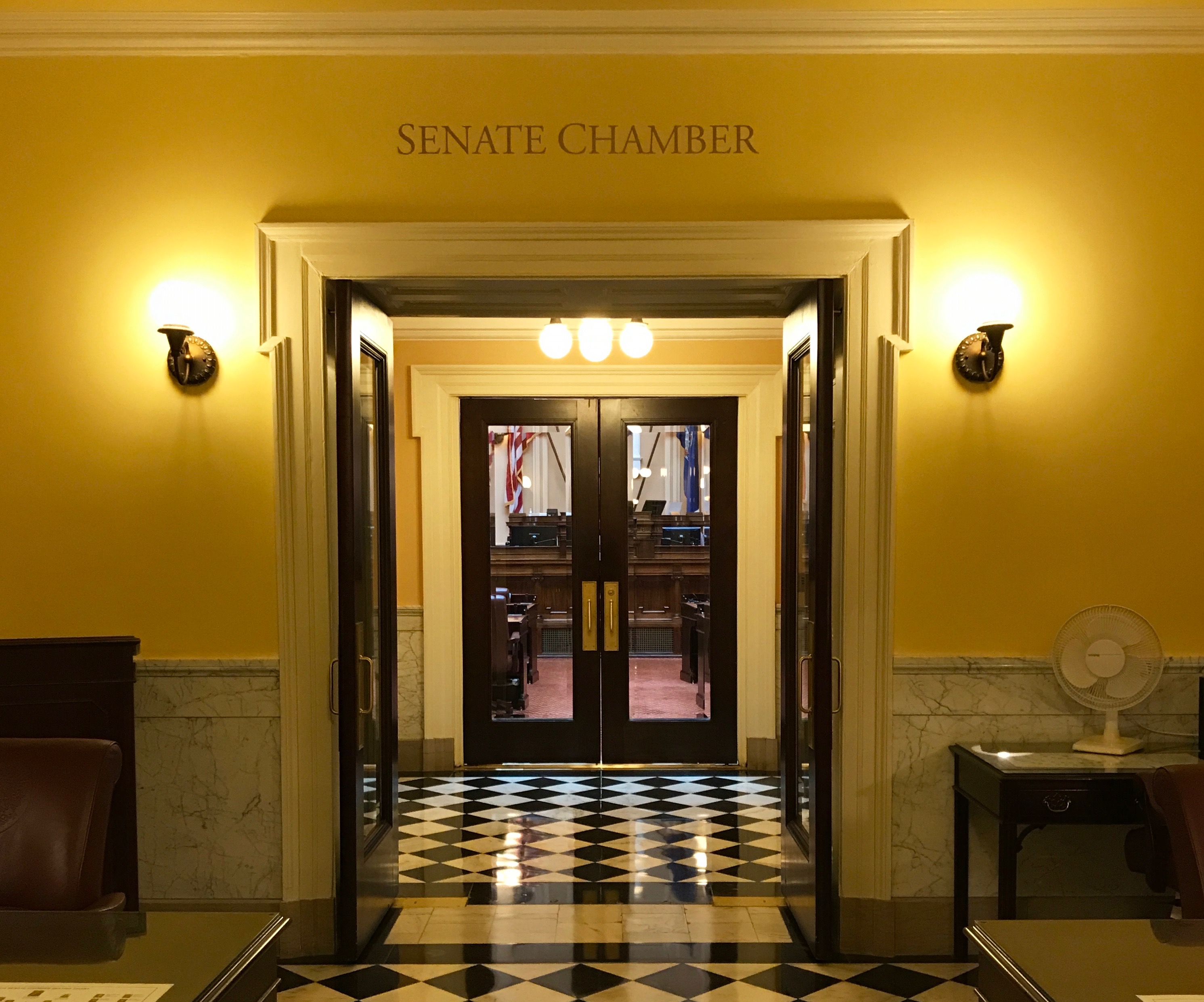
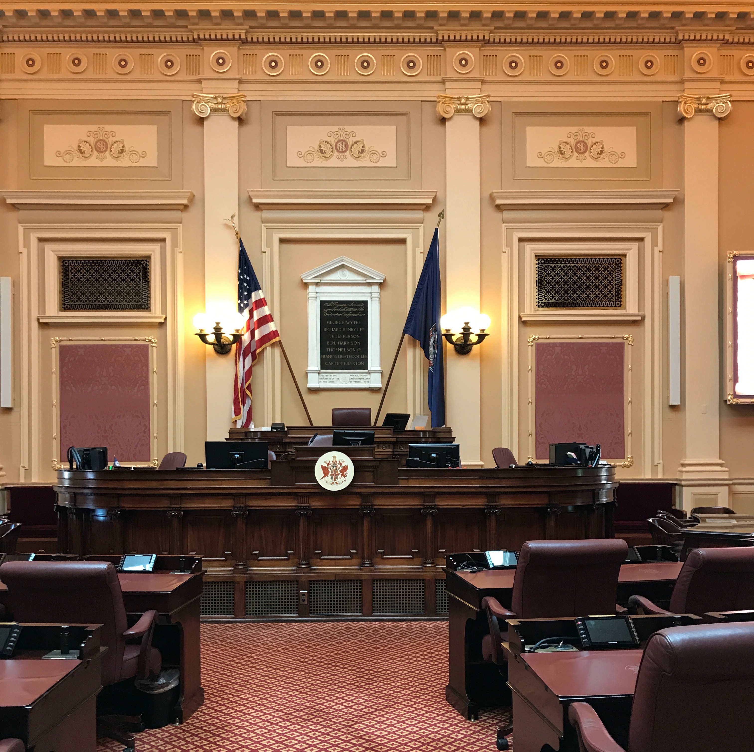
We entered the Senate Chamber.
It doesn’t look that different from the House Chamber, except for the color scheme.
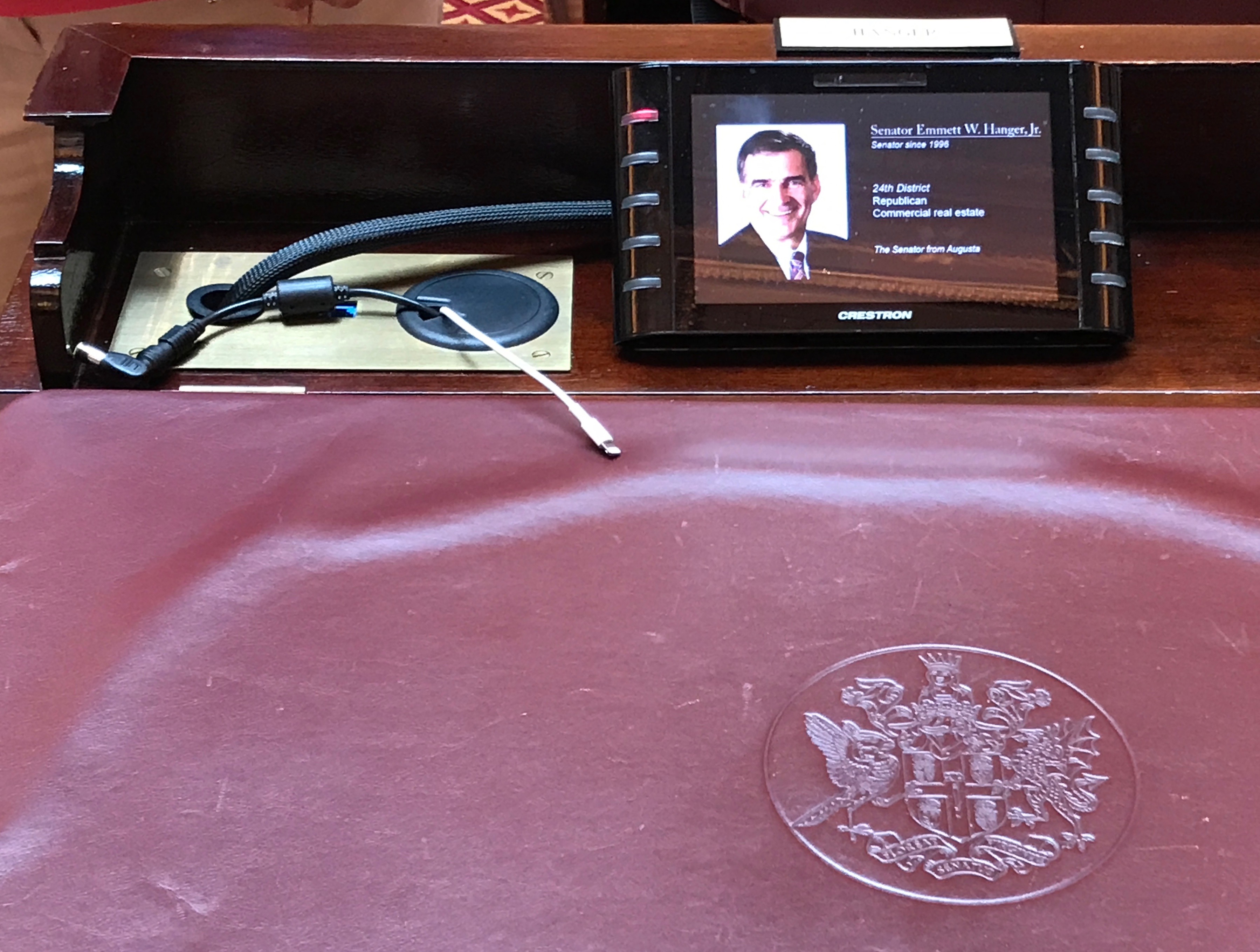
Oh, and the more up-to-date technology.
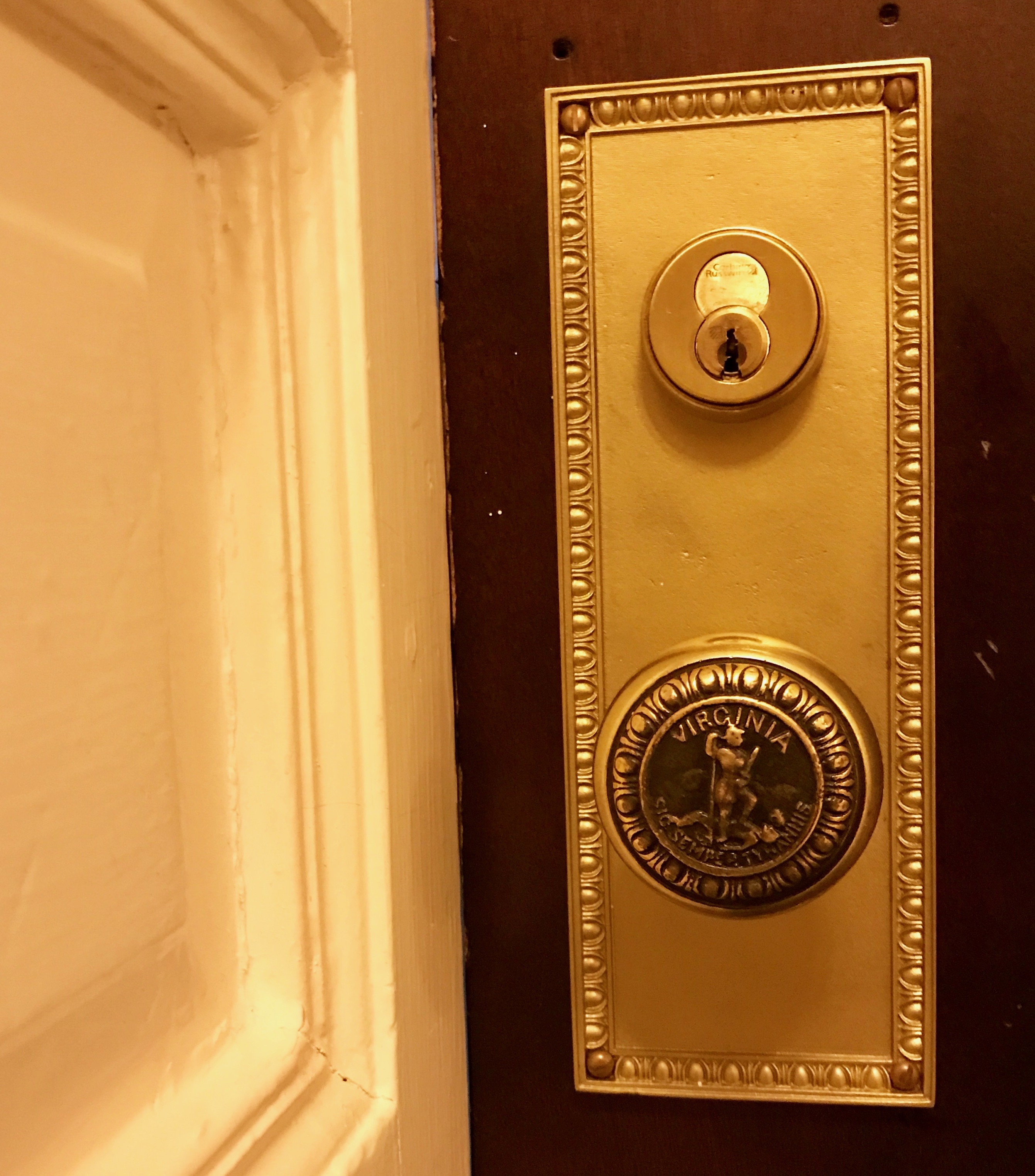
I was thrilled to find a fancy Virginia doorknob. One of these days, I’ll pull together a collection of doorknobs and hinge photos.
And with that it was time to head outside.
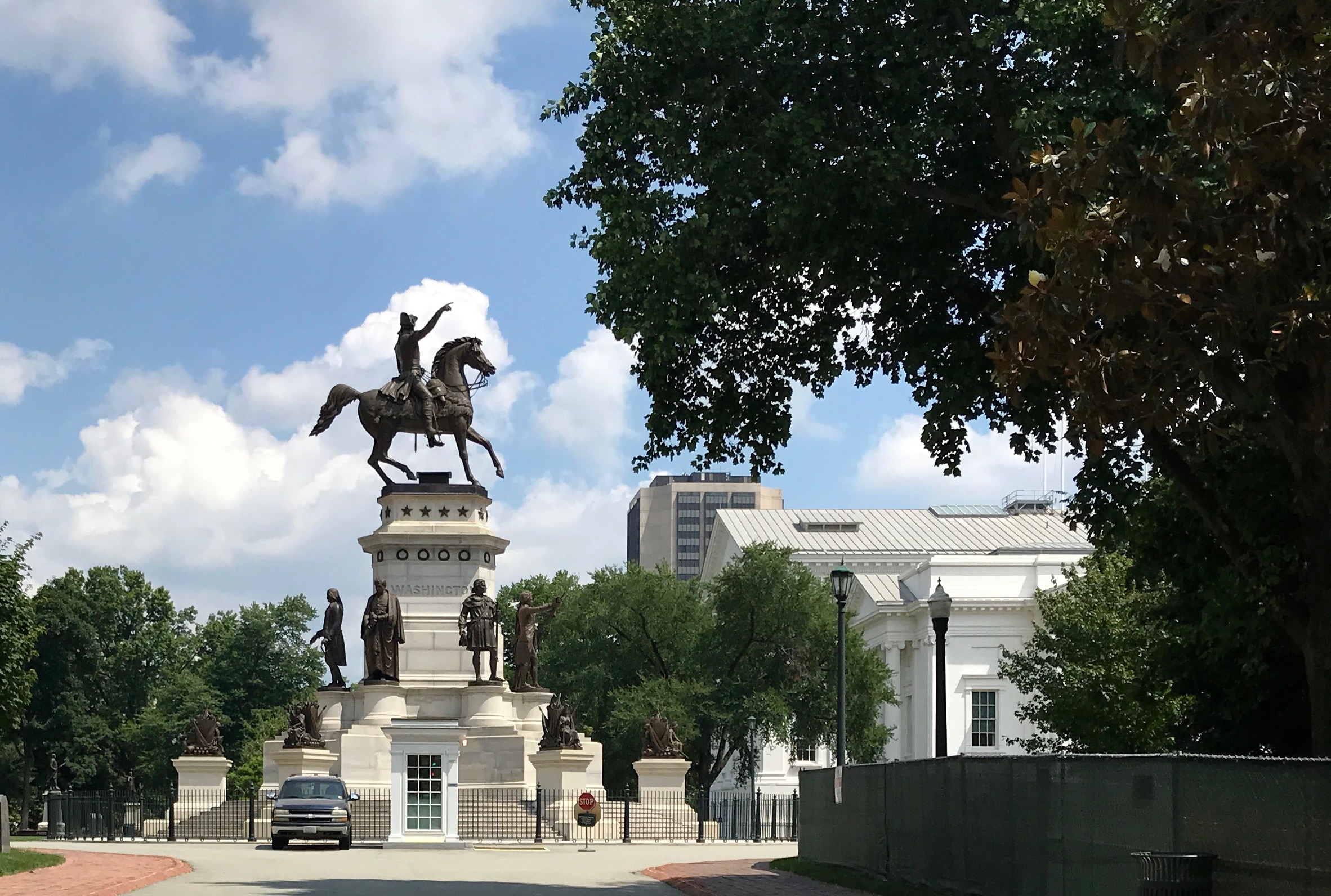
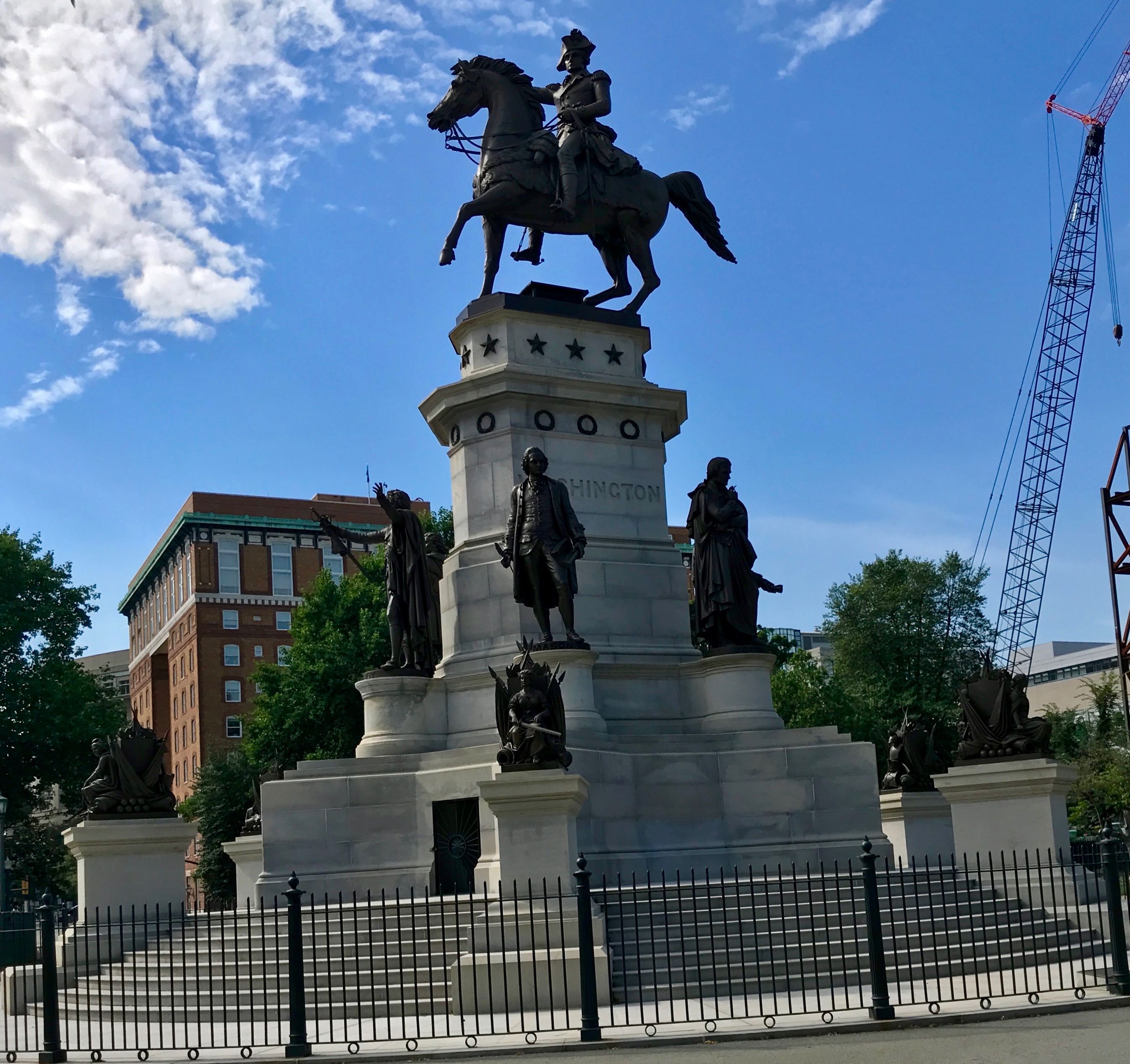
There’s Washington again. This large equestrian statue by Thomas Crawford, was intended to honor Washington and to glorify Virginia’s contributions to our nation’s independence.
The cornerstone was laid on February 22, 1850, Washington’s birthday. Washington’s stature was unveiled on his birthday in 1858. Unfortunately, Crawford died in 1857, before completing the monument.
In addition to Washington, the following native sons are included: Andrew Lewis, Patrick Henry, George Mason, Thomas Jefferson, Thomas Nelson, and John Marshall.
Randolph Rogers completed the work Crawford started. The final pieces were put into place in 1869.
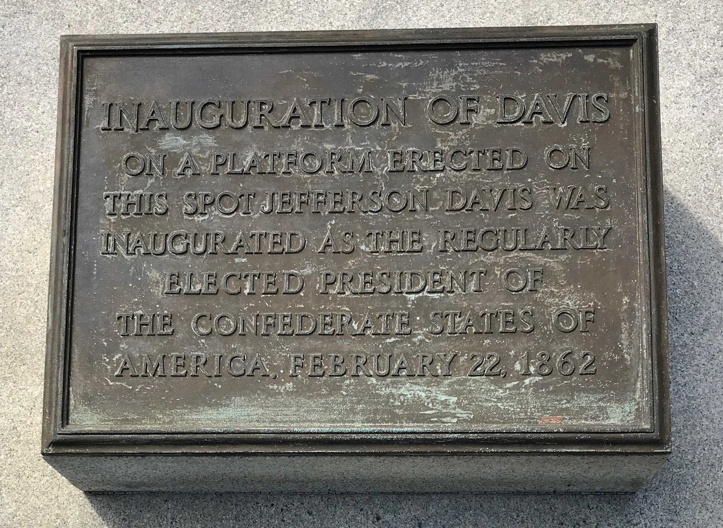
This plaque commemorates Jefferson Davis’ inauguration in 1862.
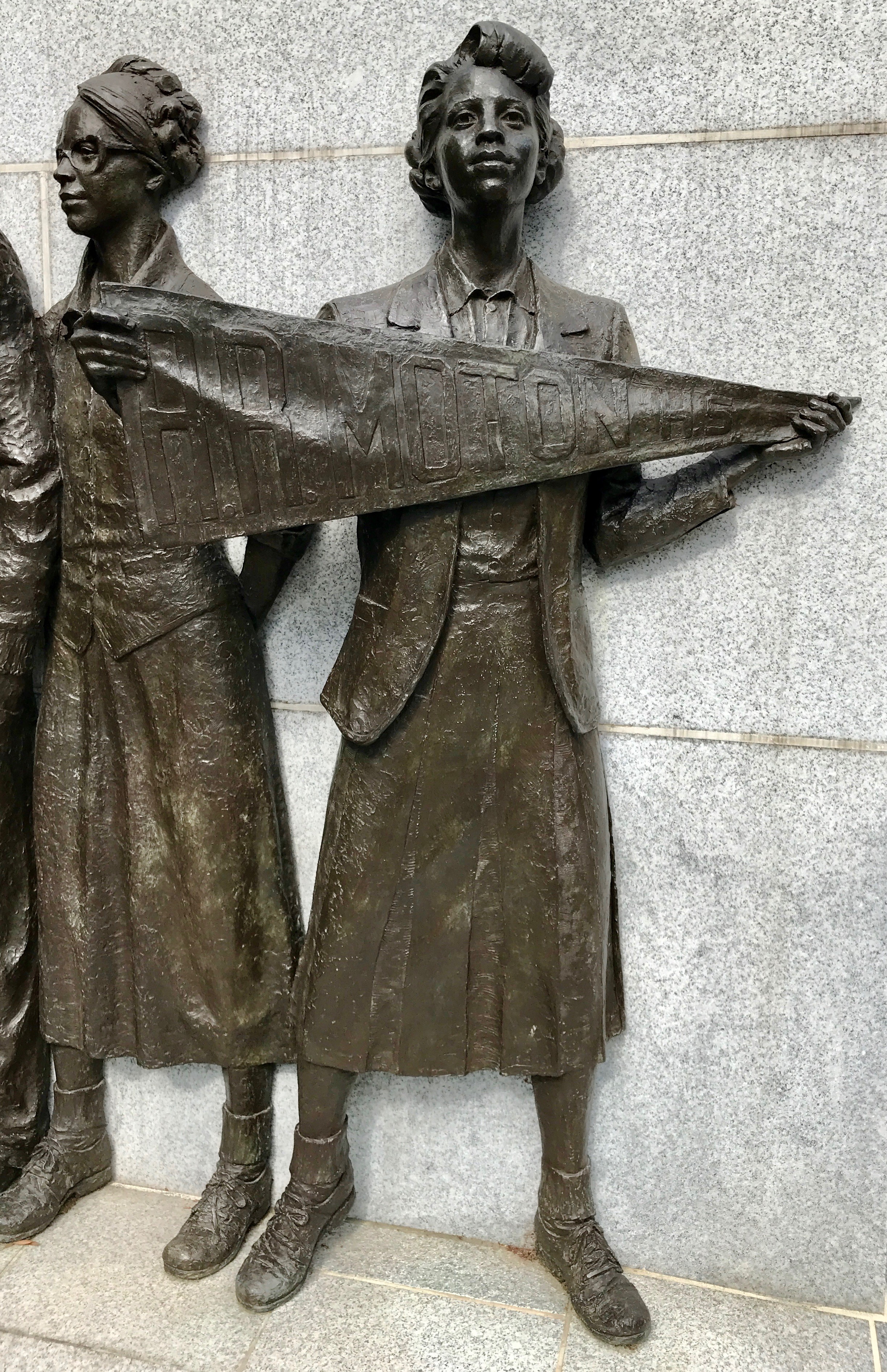
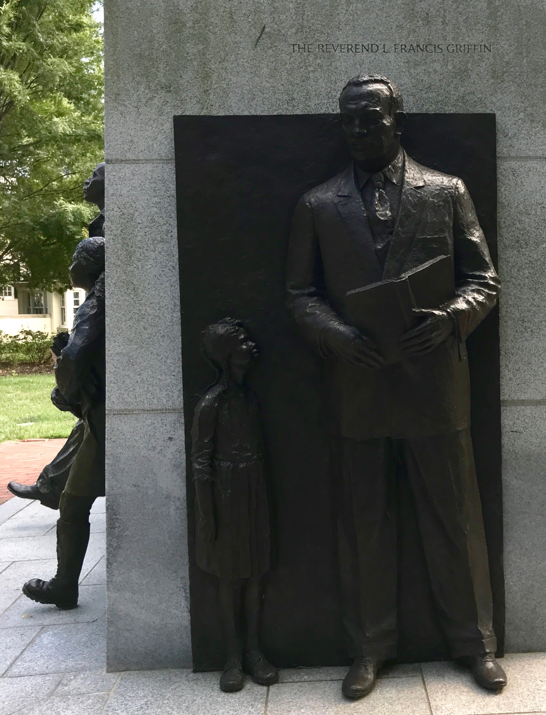
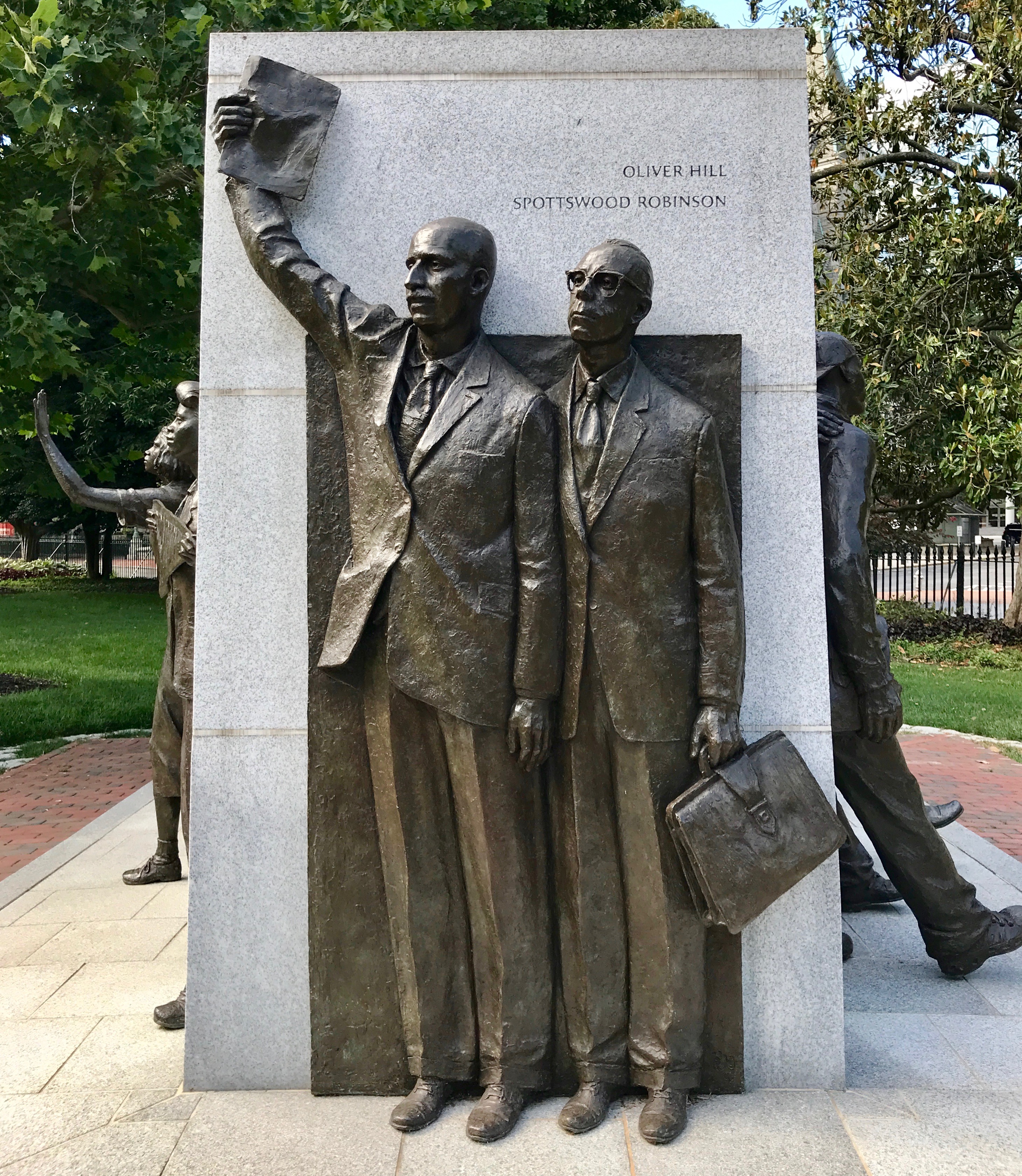
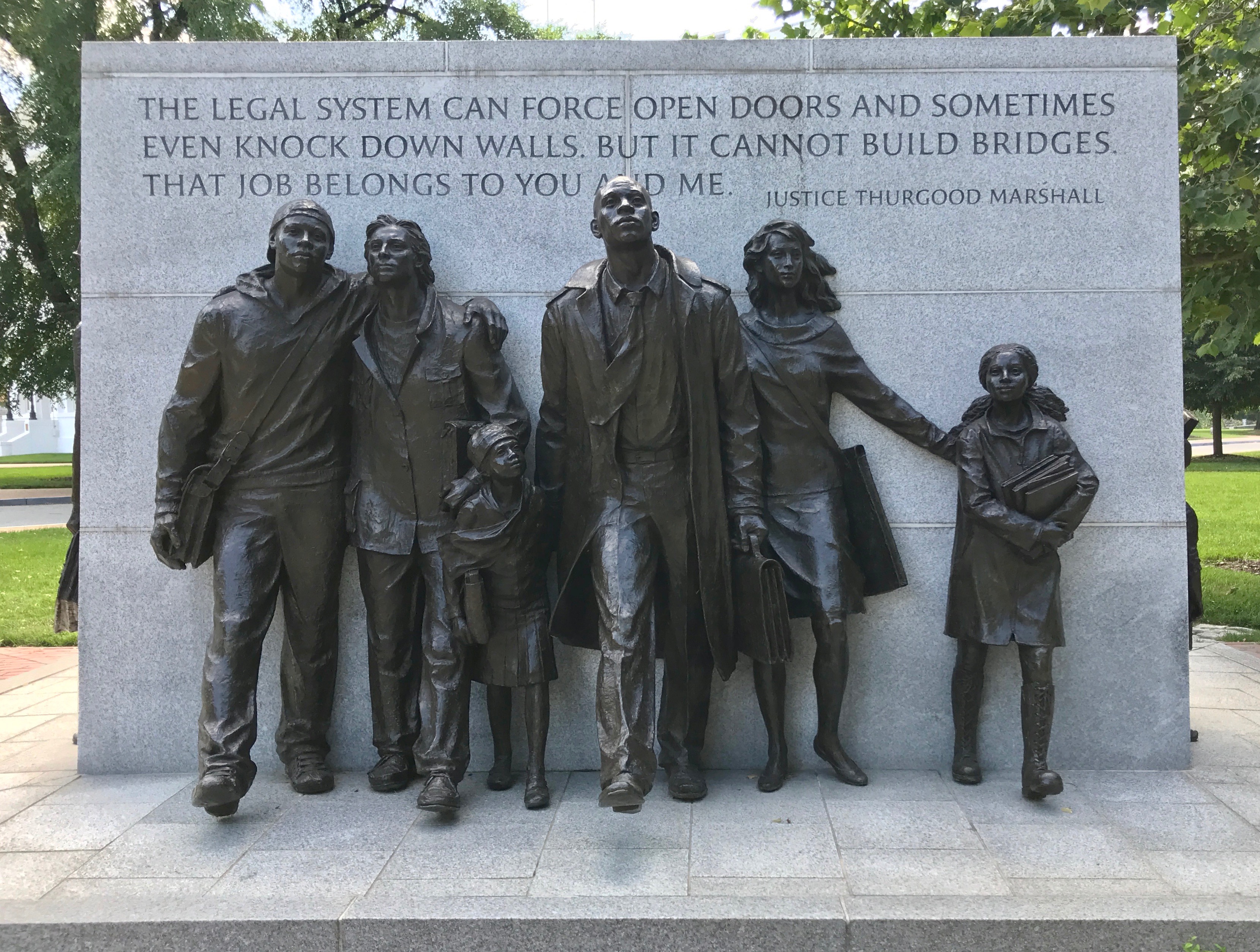
I do find it hopeful that this statue commemorating the struggle for civil rights is so much more impressive than that small plaque.
On April 23, 1951, 16-year-old Barbara Johns and several fellow students led a strike to protest the deplorable conditions at their racially segregated school.
The Reverend L. Francis Griffin united parents in support of the strike.He encouraged the students to contact NAACP attorneys Oliver Hill and Spottswood Robinson.
The lawsuit that followed was brought before the U.S. Supreme Court and joined with four other cases as Brown v. Board of Education Topeka in 1954. The Supreme Court ruled that racially separate educational systems are inherently unequal and unconstitutional.
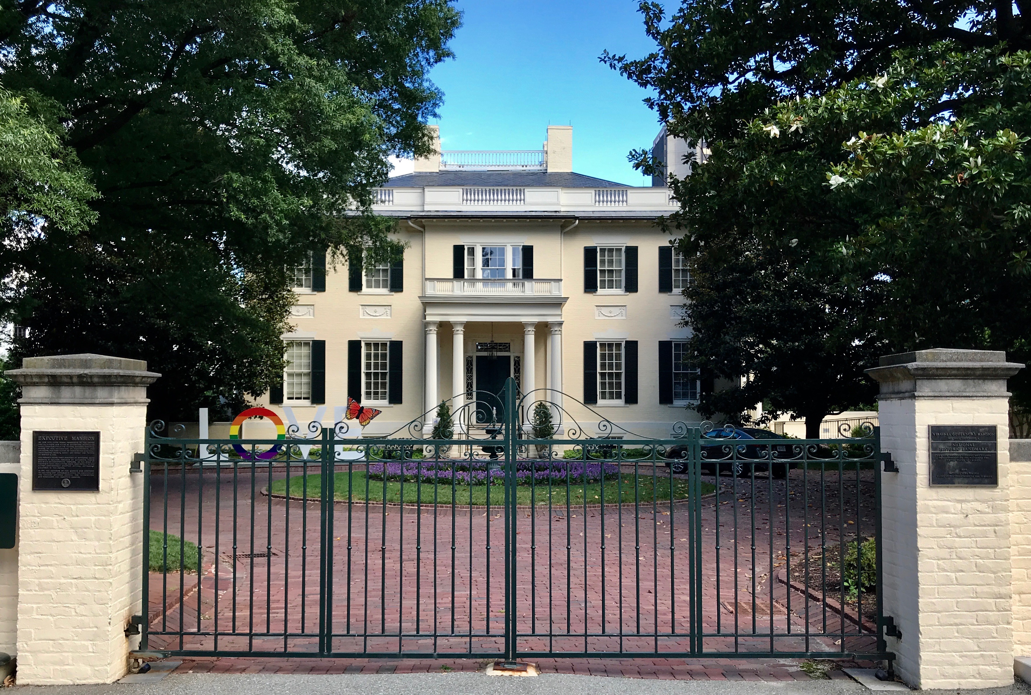
On my way back to my car, I passed the Executive Mansion.
On this site live three presidents on the United States; Monroe and Tyler as governors, and William Henry Harrison while his father, Benjamin Harrison, was governor. The first house on this site was also home to governors Patrick Henry and Henry Lee, father of Robert E. Lee.
The present house was designed by Alexander Harris in 1813 and built by Christopher Tompkins, and has been the home of Virginia’s chief executives since that date. It is the oldest continuously occupied official governor’s residence in the nation.
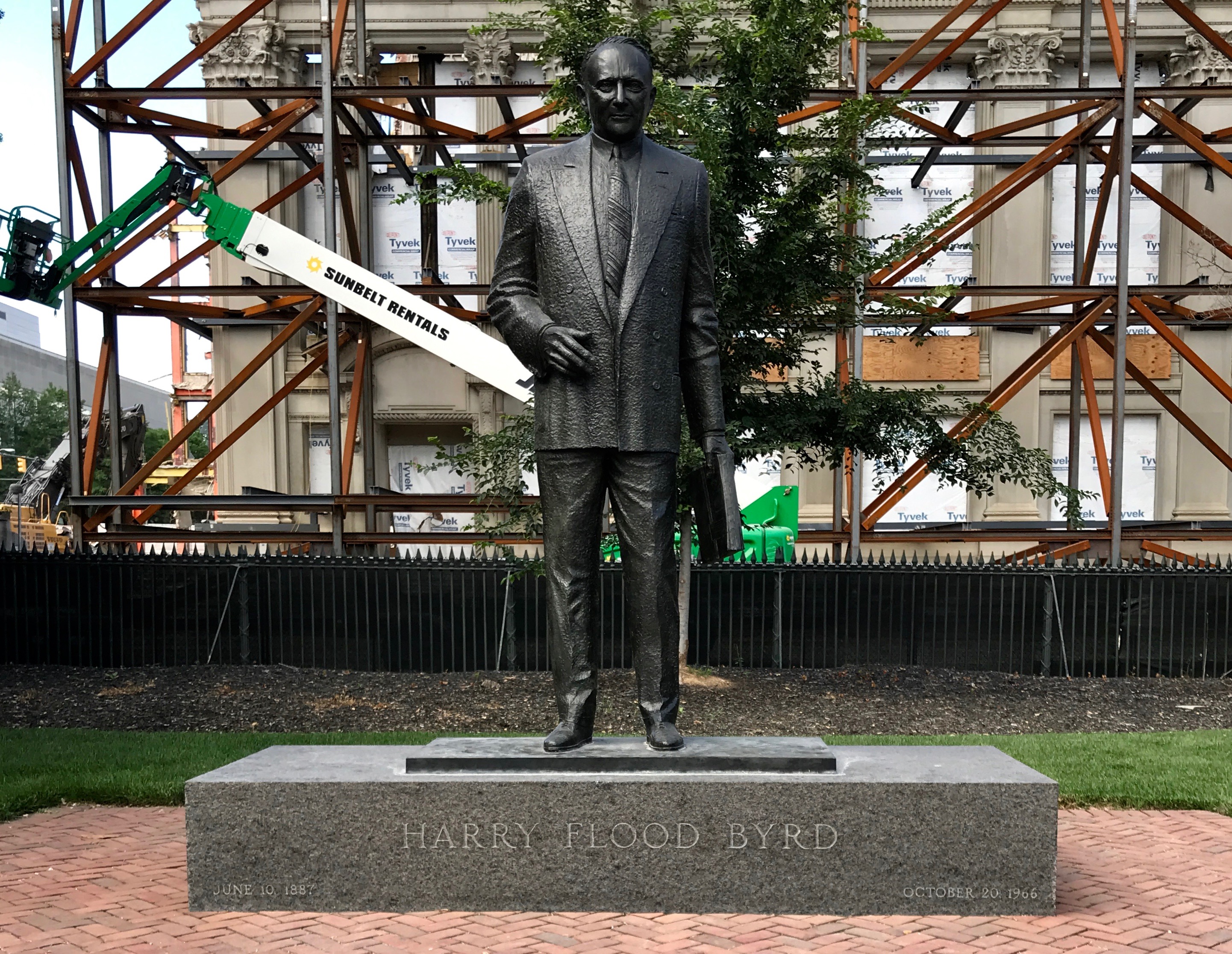
The last statue I passed before leaving the area is a memorial to Senator Byrd. He was a state senator 1916-1926, governor of Virginia 1926-1930 and a United States Senator 1933-1965. That’s some longevity!
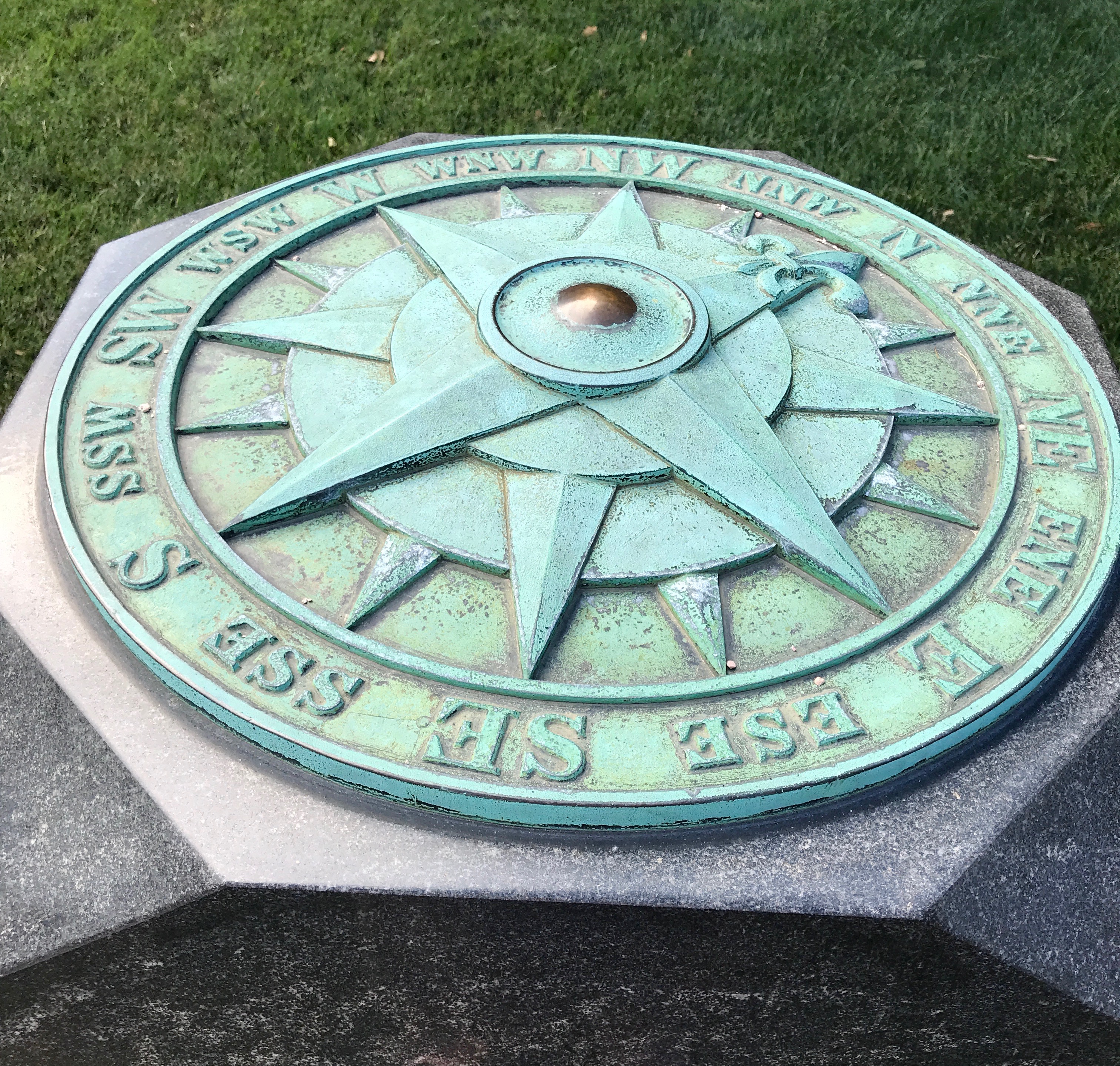
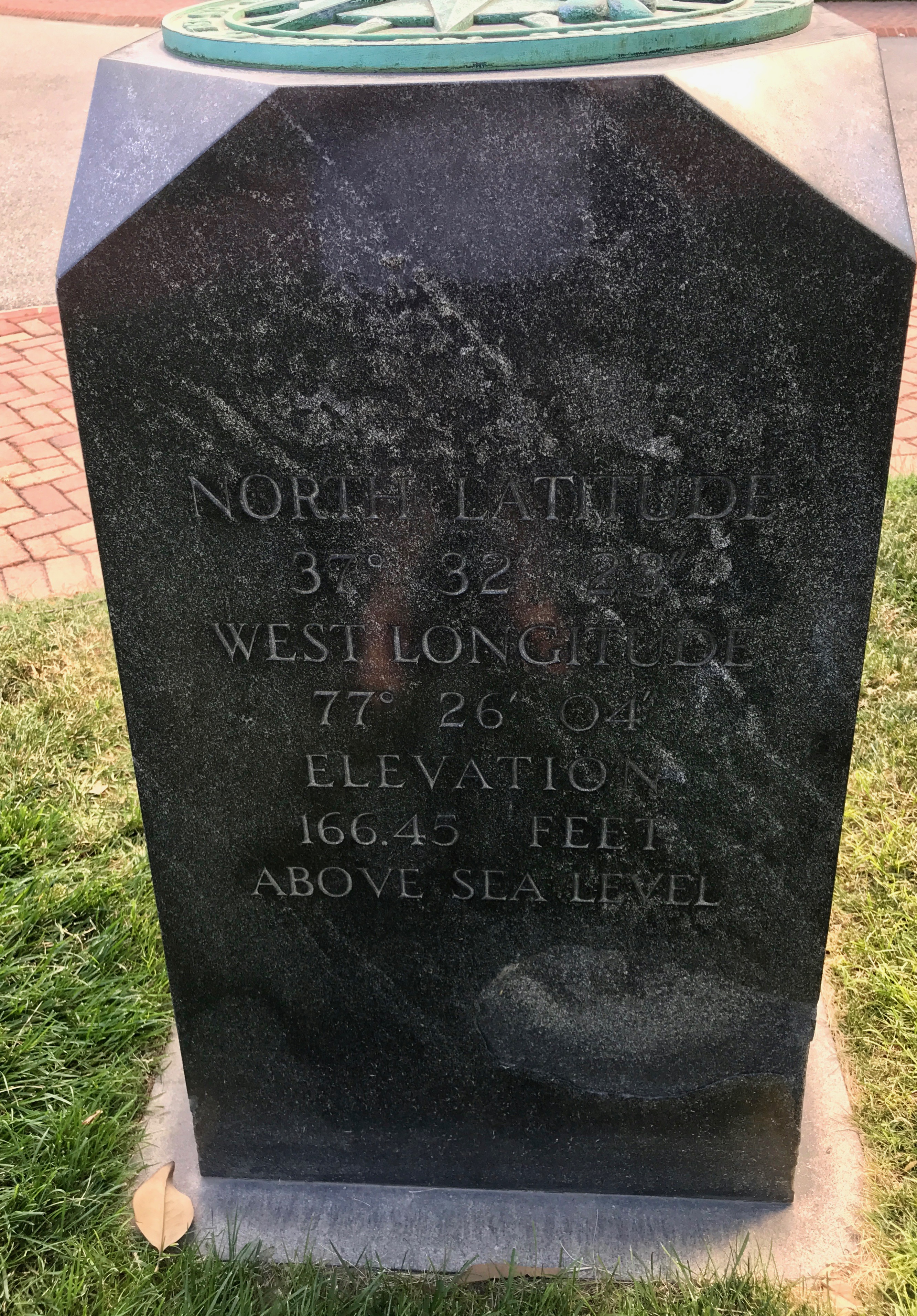
The geographer in me was fascinated by this marker.
It’s the point for the measurement of distances from Richmond on highways of Virginia.
It also has the latitude, longitude and elevation above sea level.
I wonder where the next week’s travels will take me?