OKC…OK?

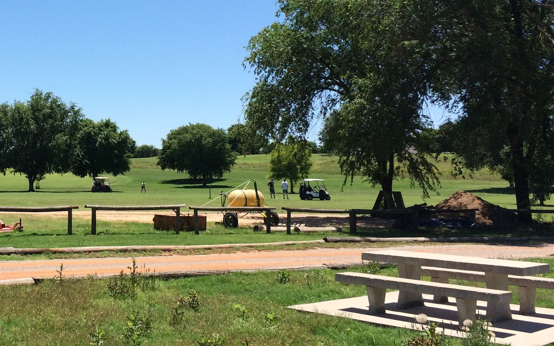
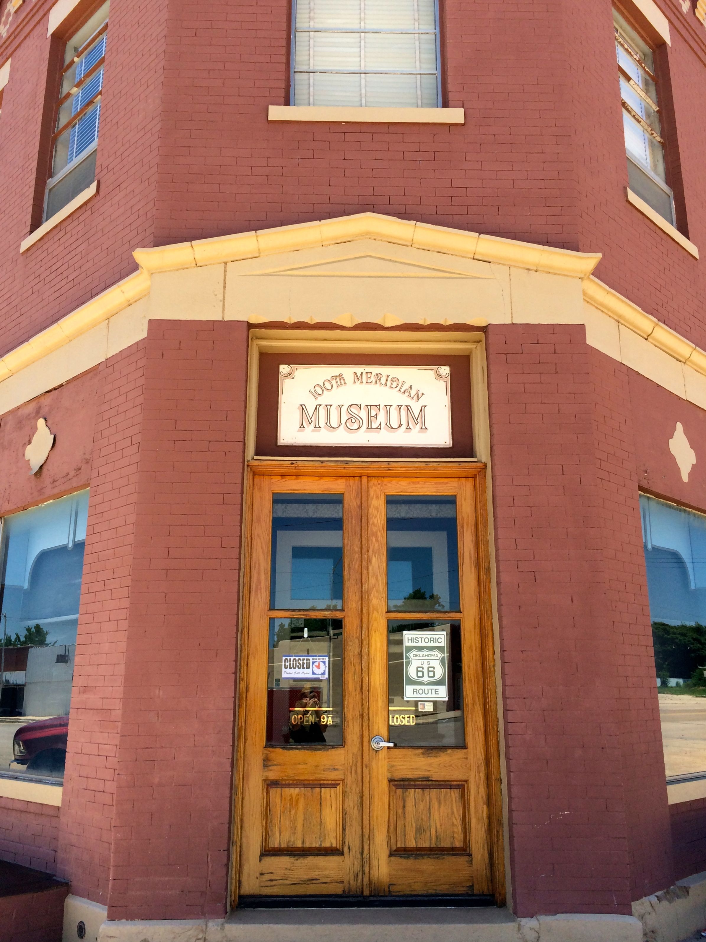
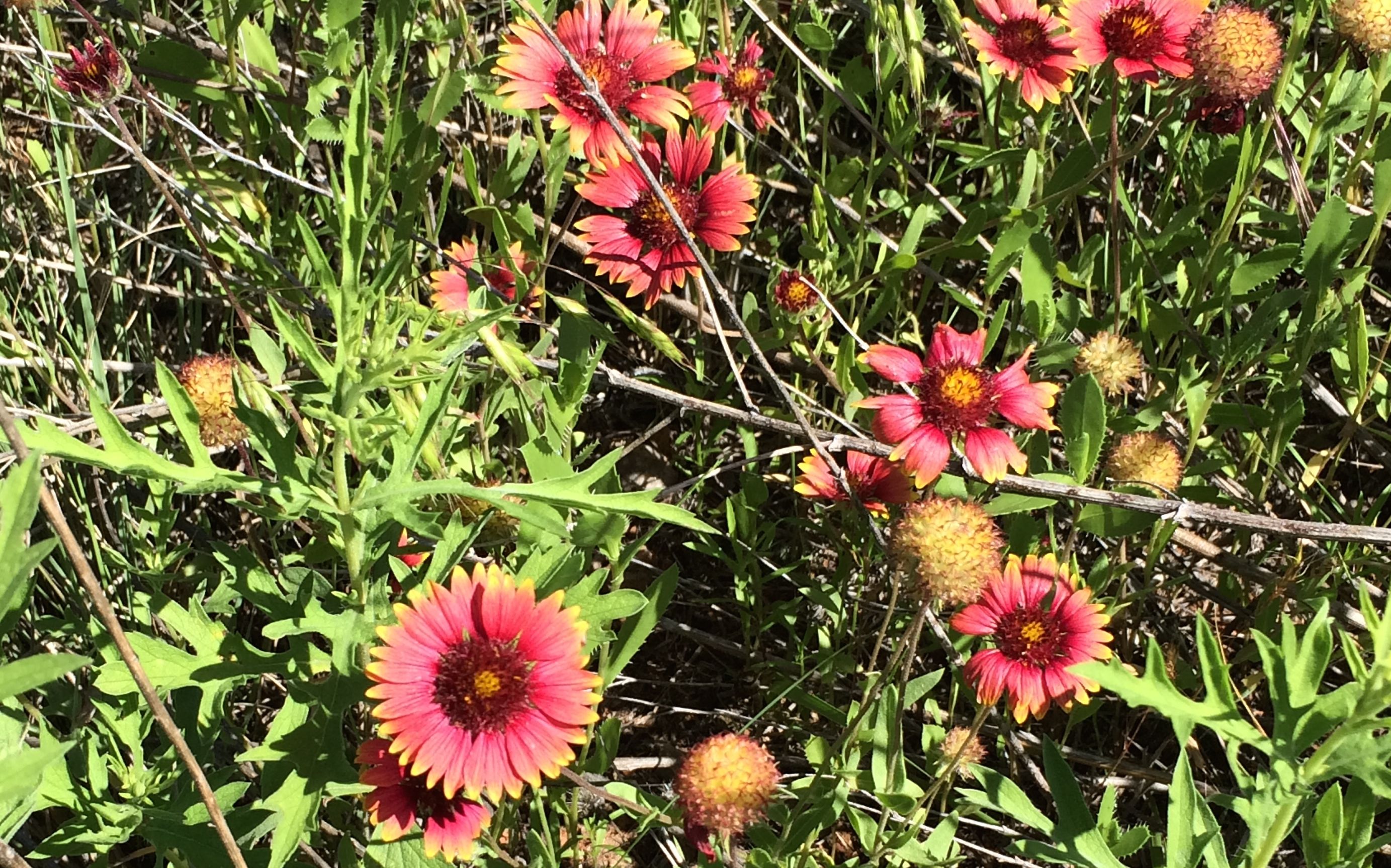
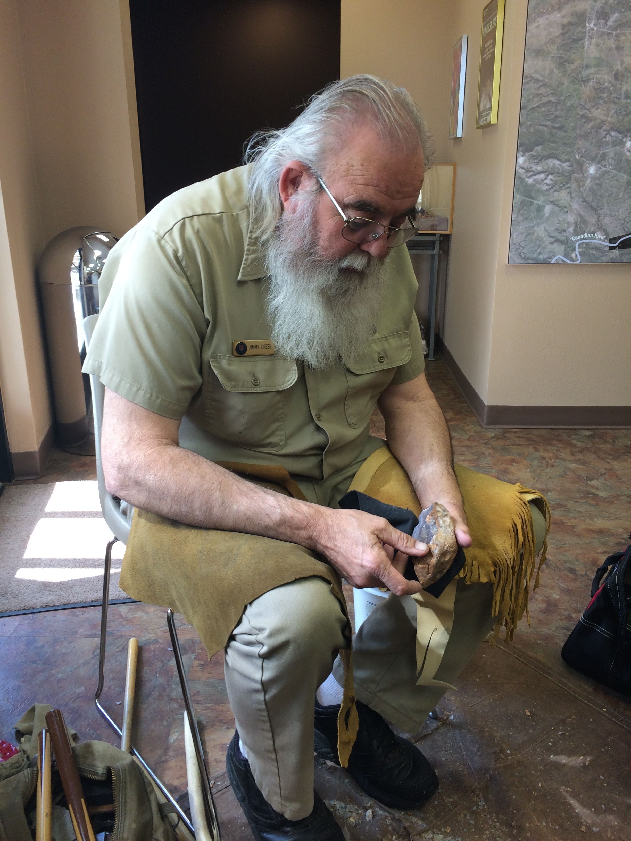
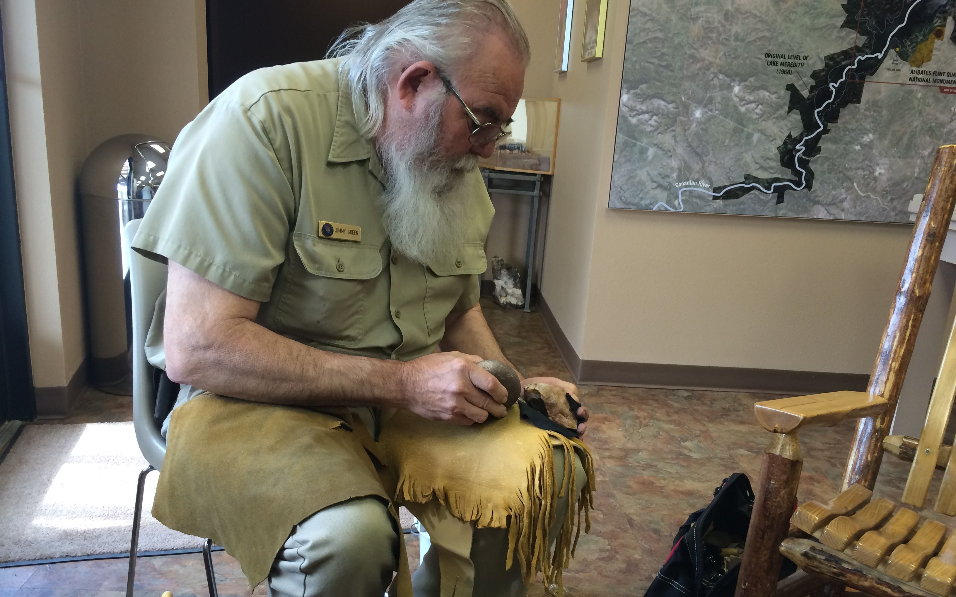
Scissortail Campground in Edmond, Oklahoma was my next home for a few days. It was on a lake and it had good TV and cell reception. It was a friendly little community with a good library with free wifi. I spent a couple of days just relaxing and taking care of business.

One day, though, I went into Oklahoma City, or OKC as they call it.

I stopped at the tourism office on the way into town and got some information about things to do. The information specialist recommended that I park at the Bass Pro store and then take the free Downtown Discovery bus to see the popular tourist sites.

Bass Pro

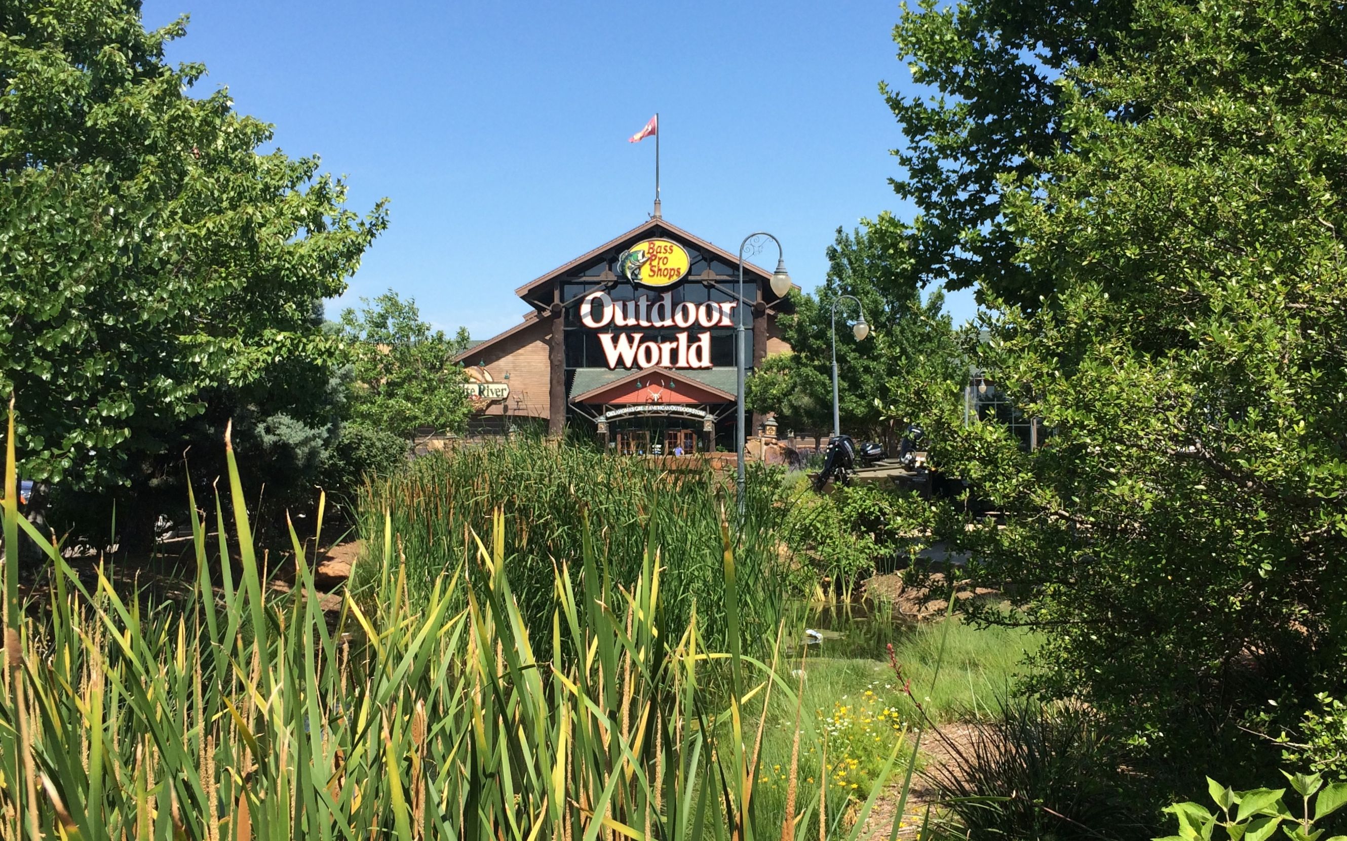
I wasn’t sure that this was legit, but I did need some stuff that Bass Pro might carry, so I figured I’d park and buy what I needed and then my conscience would be clear. Unfortunately, they didn’t have what I needed. Oh well…I tried.

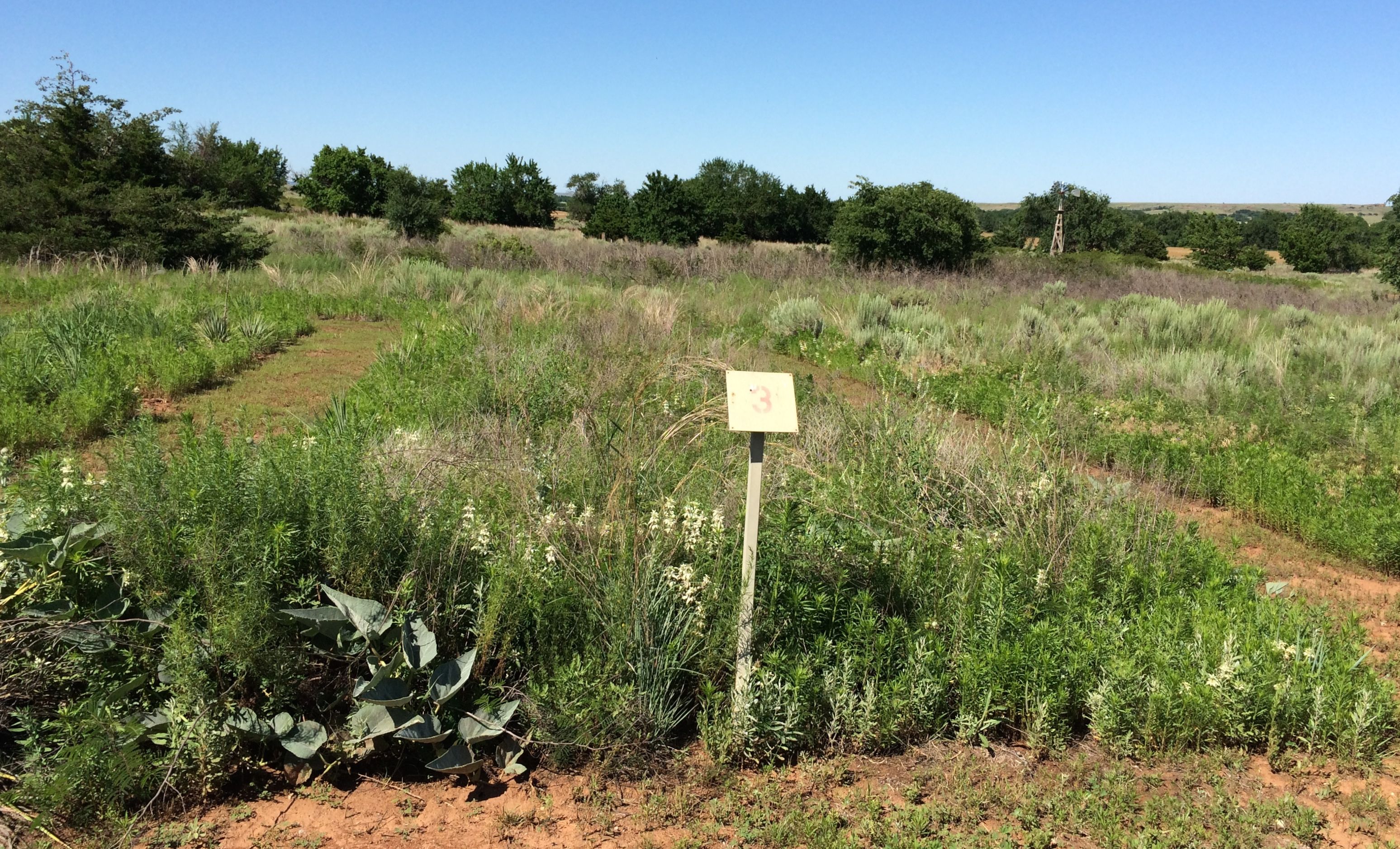
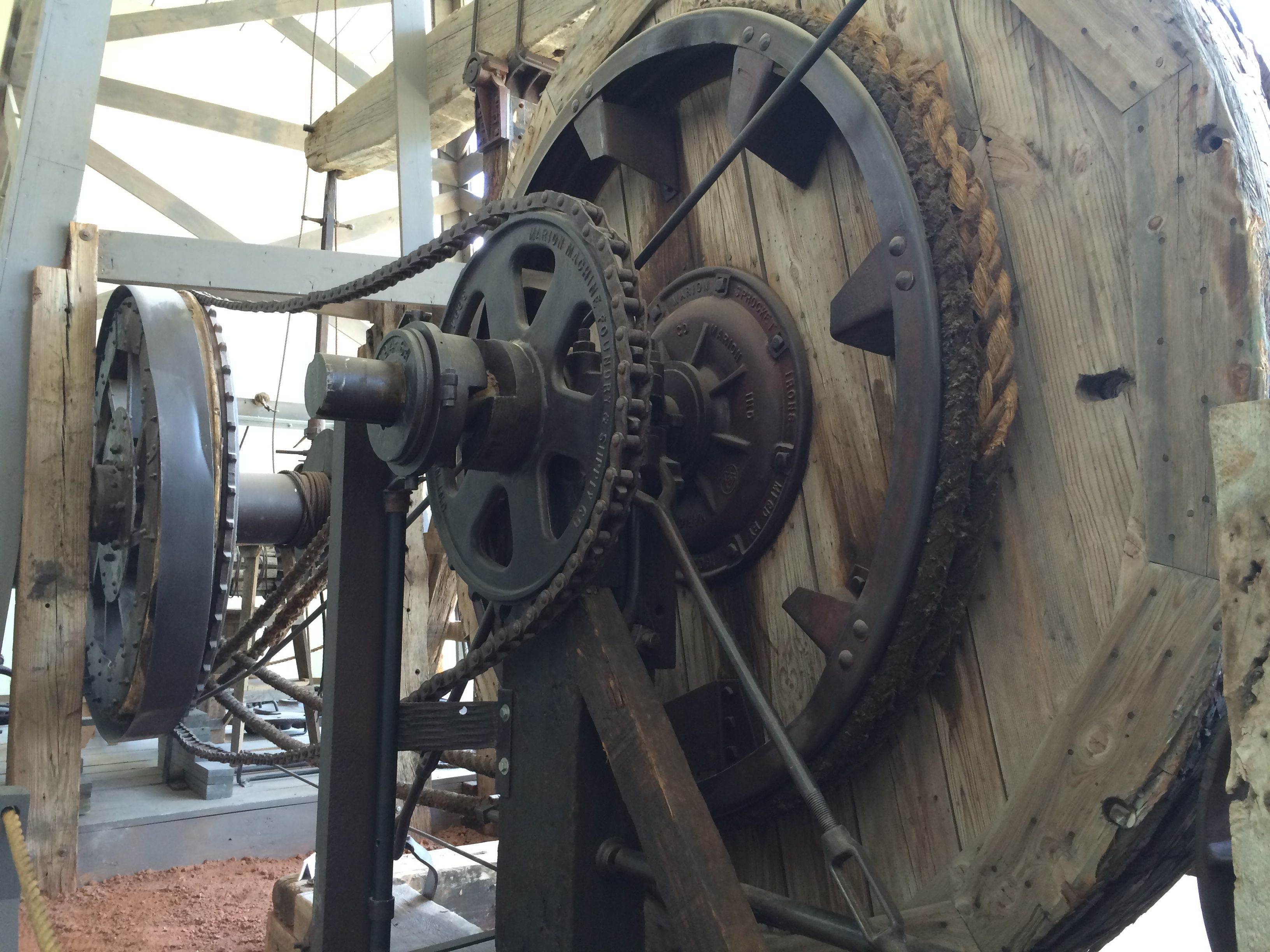
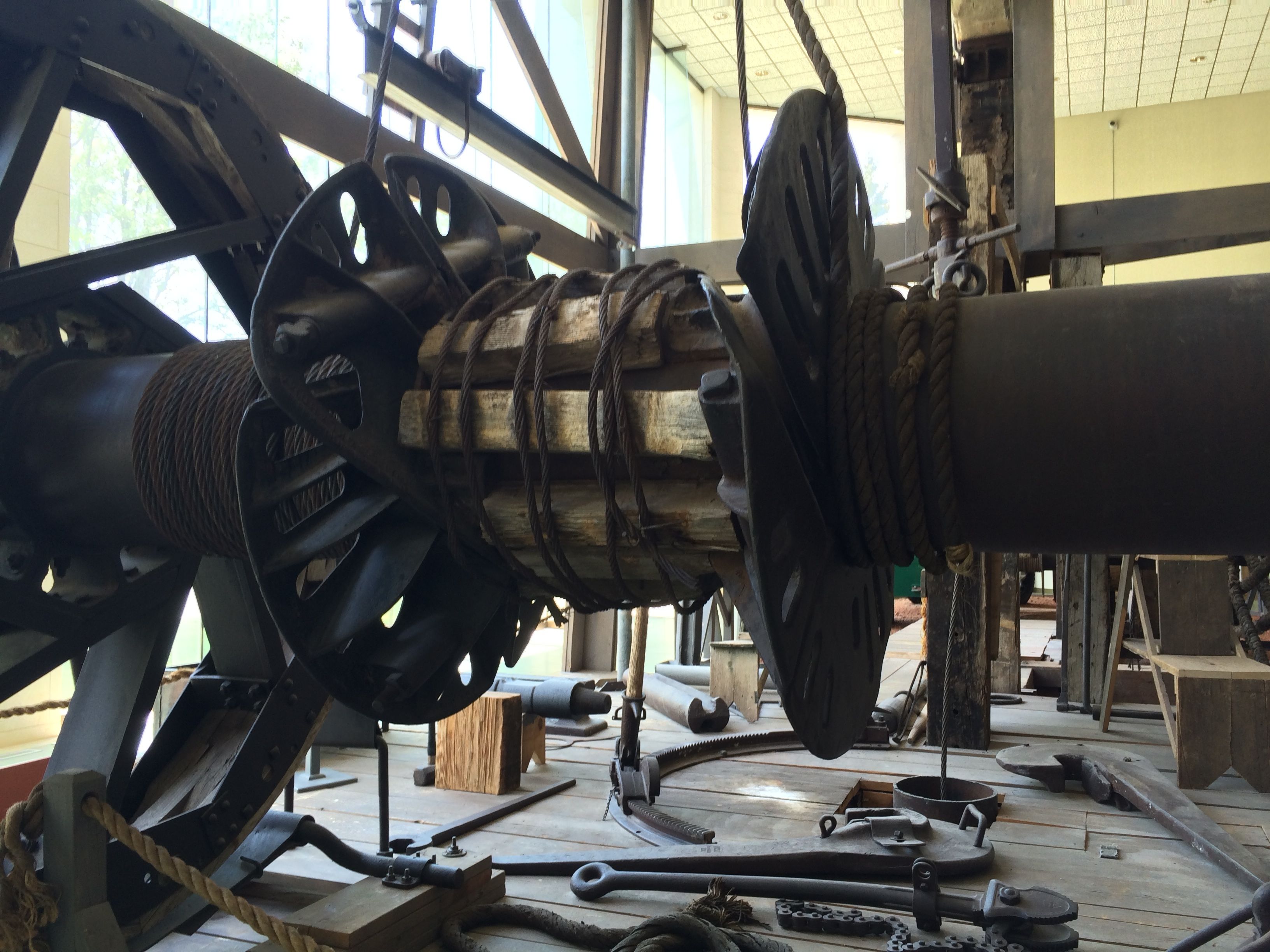
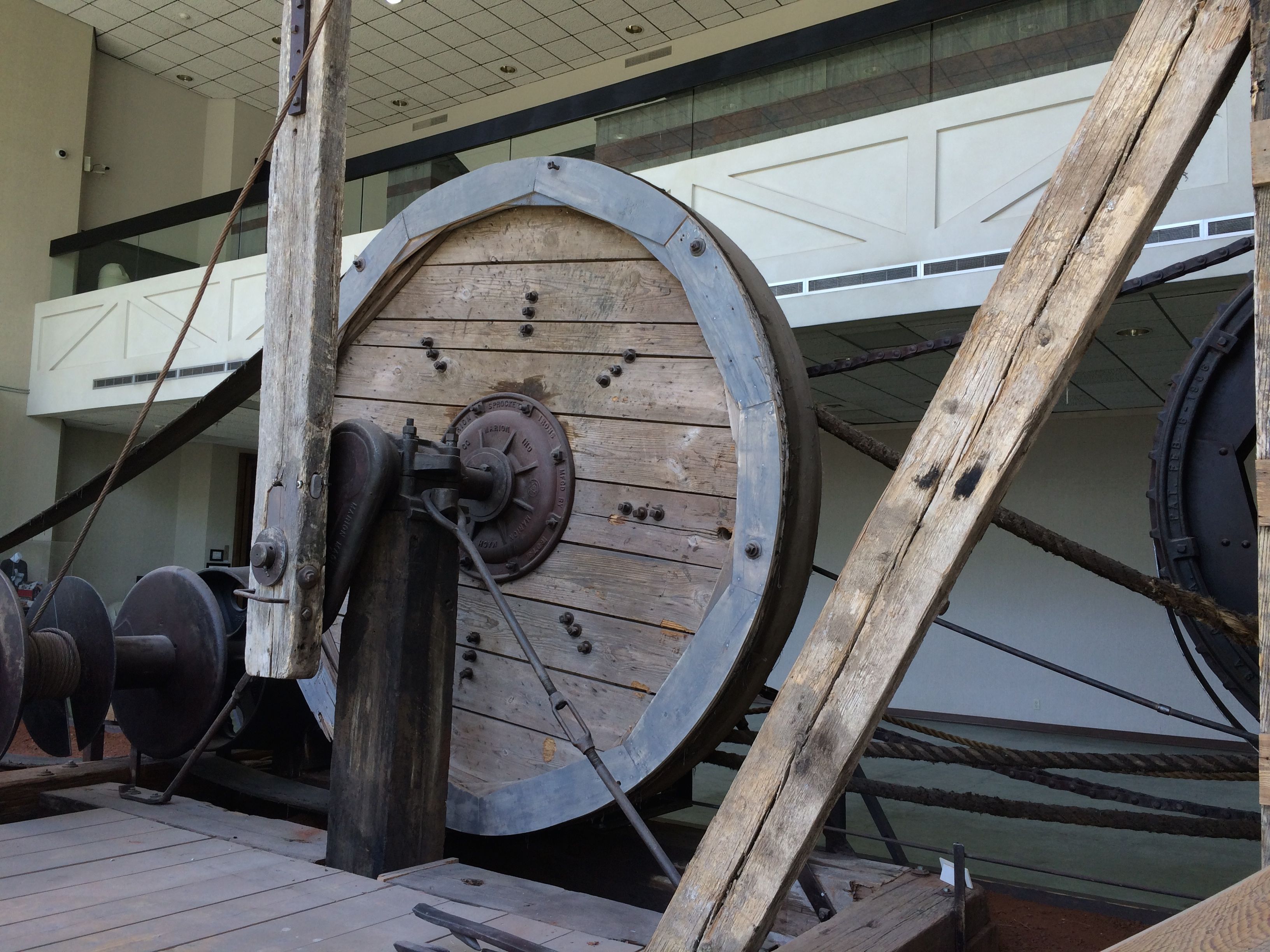
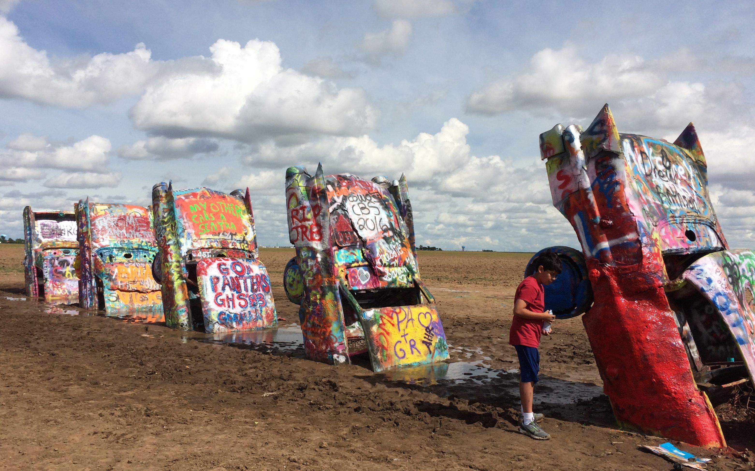
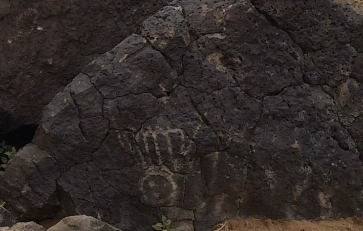
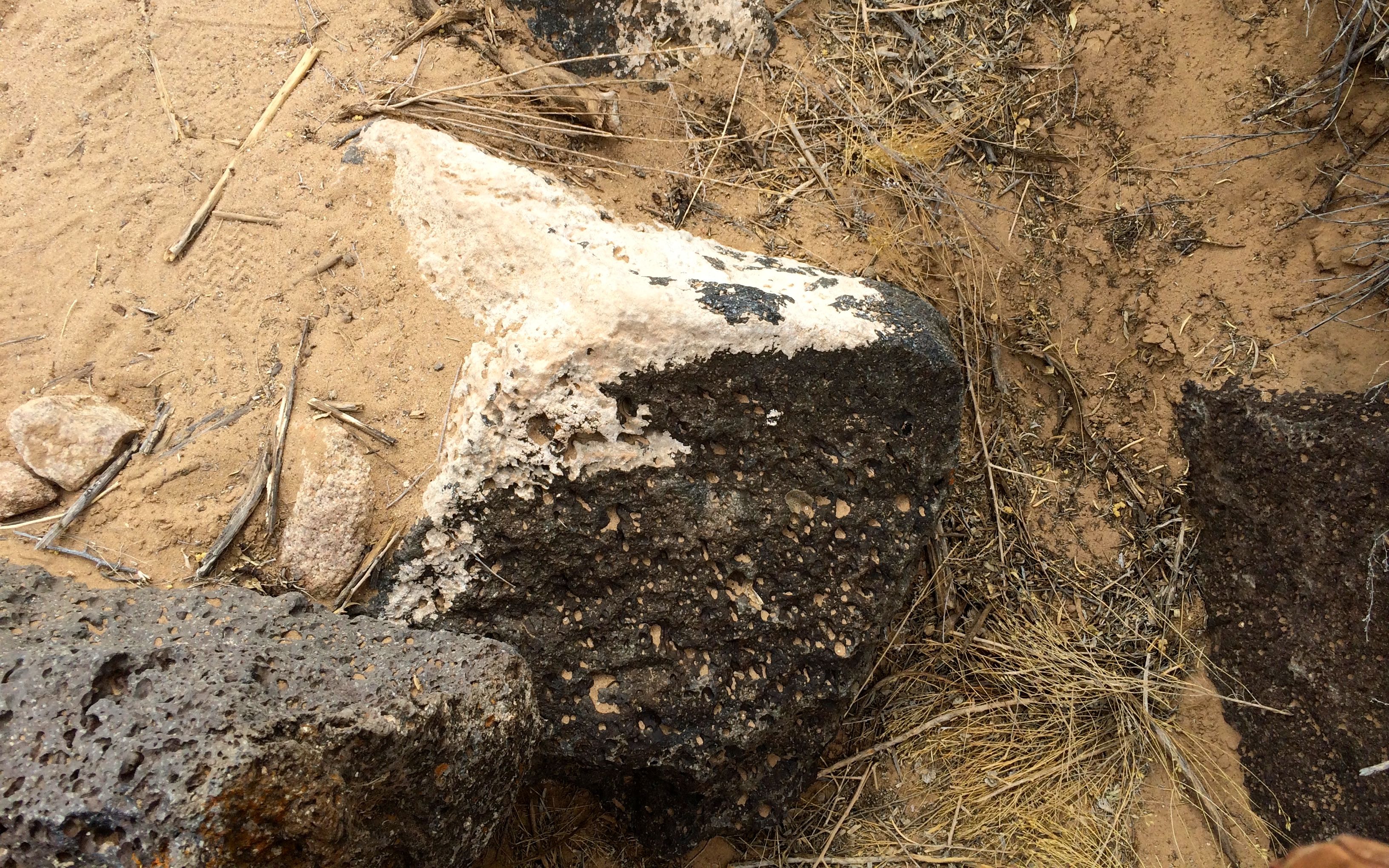
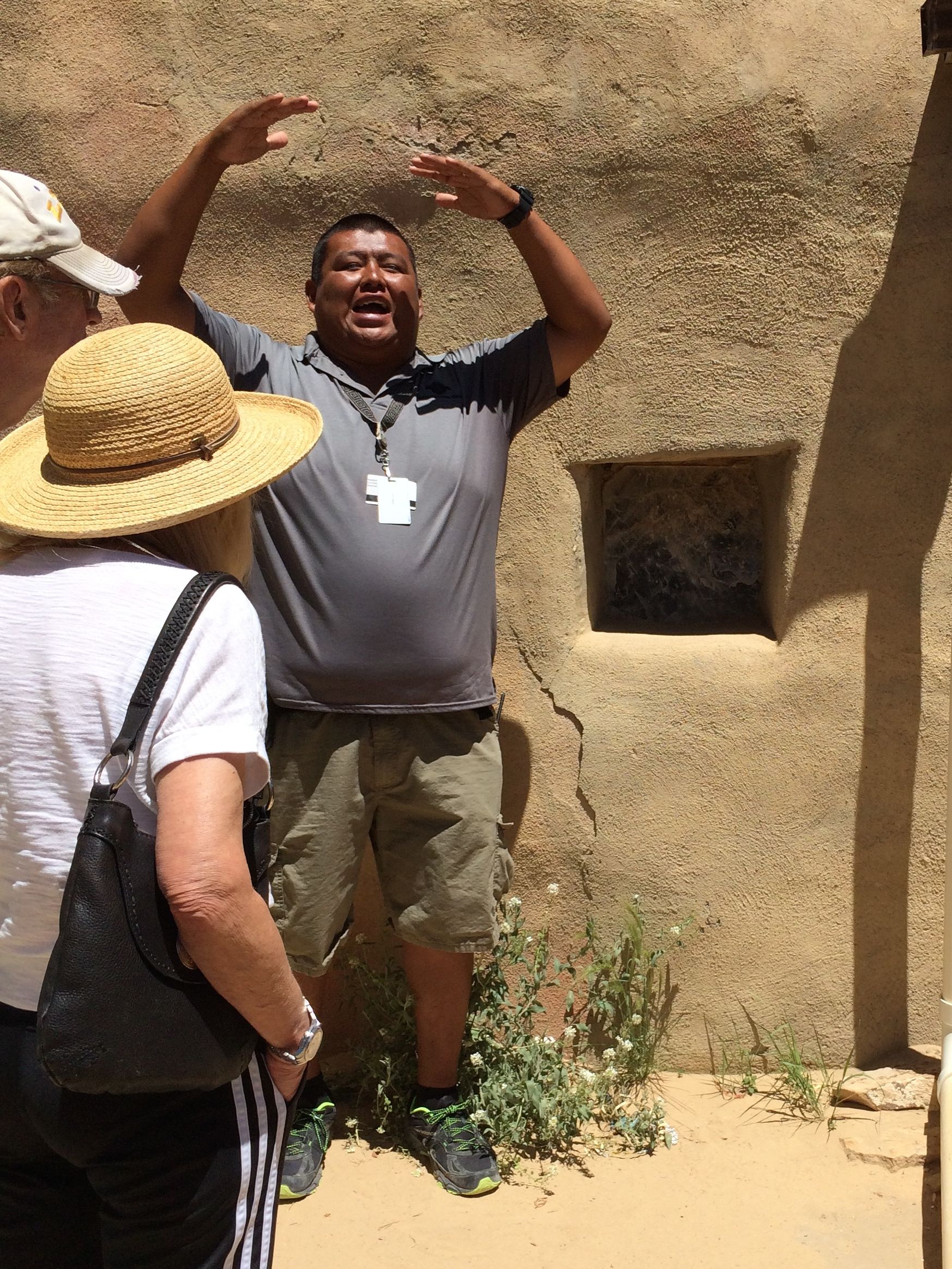
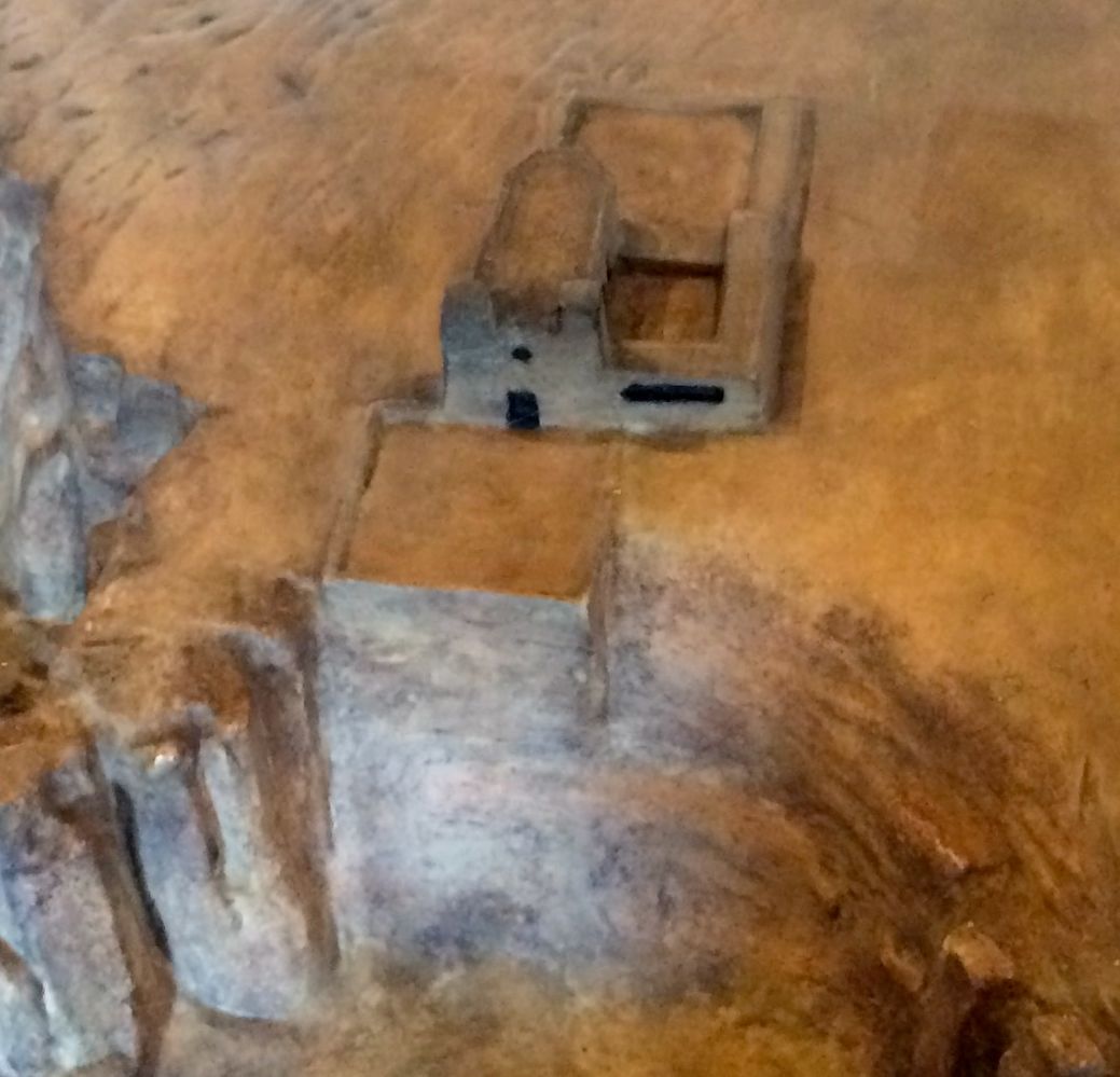
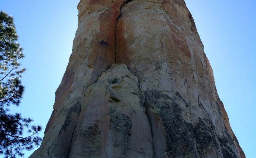
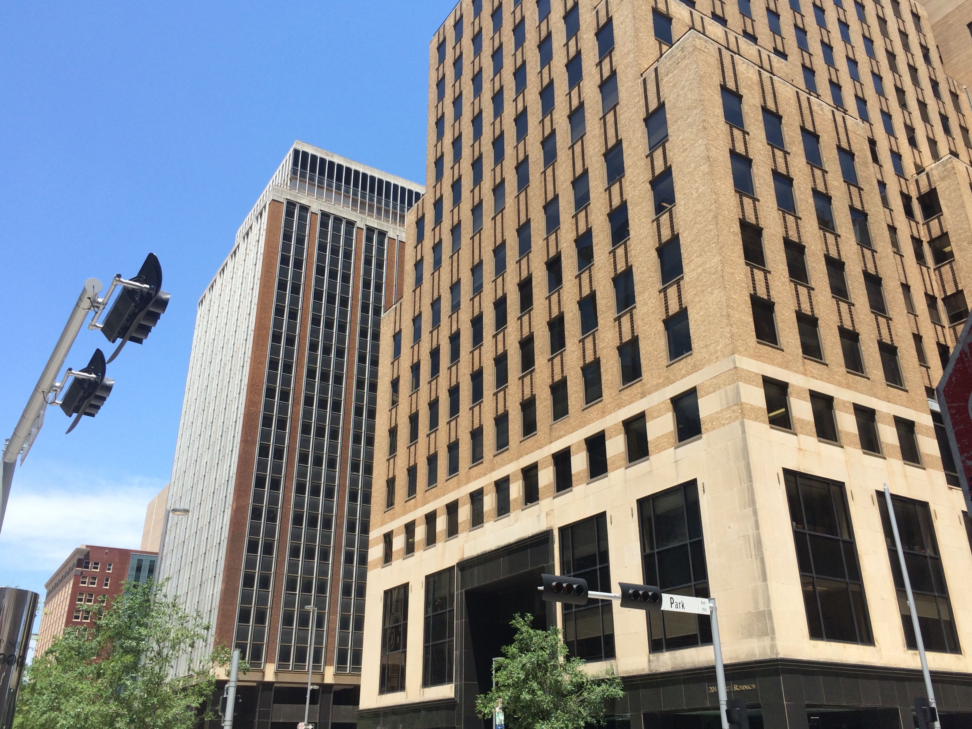
I wandered around a bit. I noticed some interesting industrial buildings and got a little closer.

Producers Cooperative Oilmill

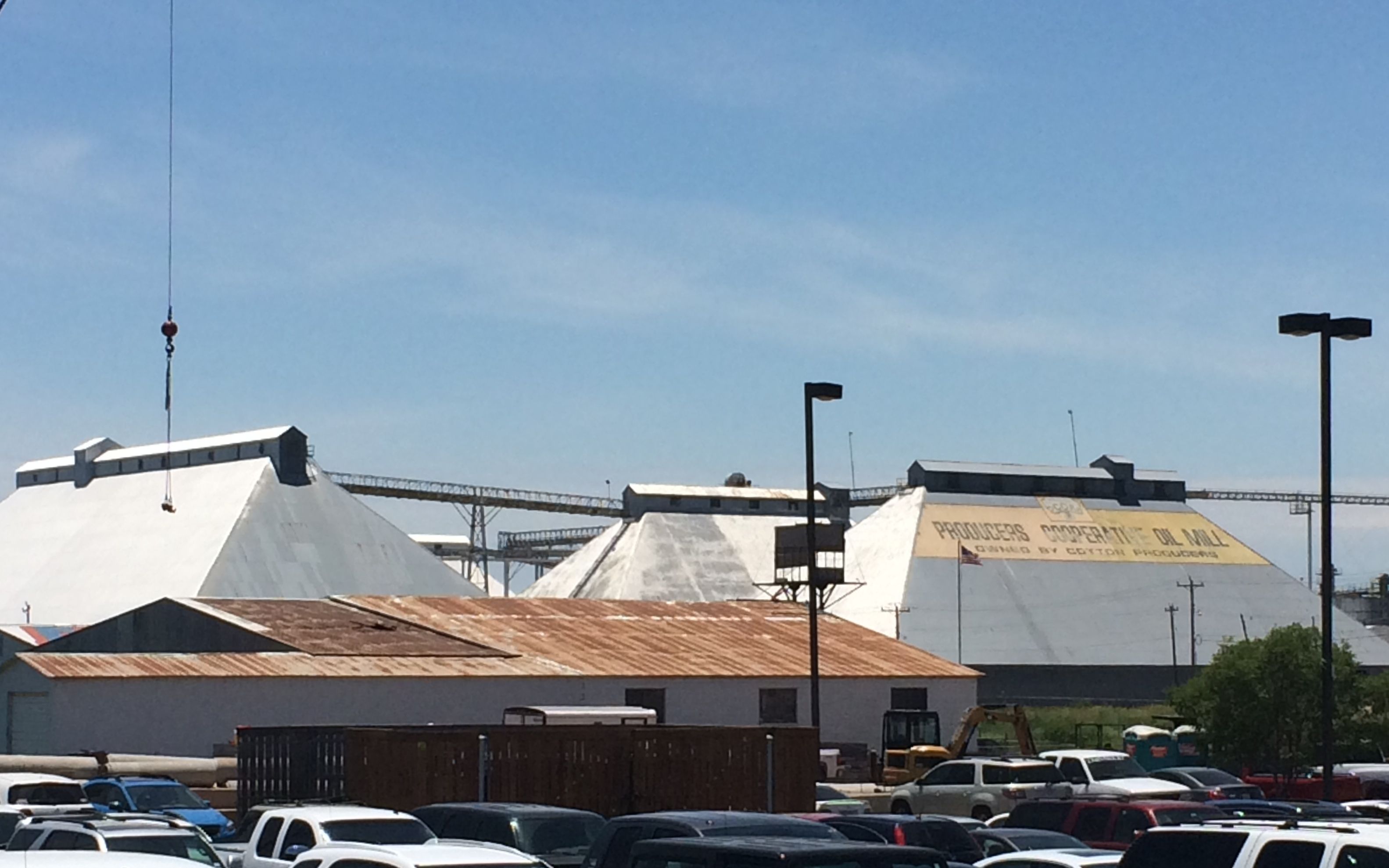
Hmm…I wonder what it is?

Producers Cooperative Oilmill closeup

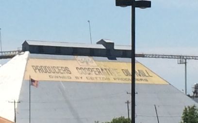
I didn’t know Oklahoma was a cotton producing state. It actually has a long history of cotton growing cotton. It was first planted in 1825 in the Choctaw Nation. Colonel Robert M. Jones, a Choctaw, owned an operation, that in 1851, exceeded five thousand acres. Approximately 2,275 African American slaves harvested seven hundred bales that year.

Cotton production has fluctuated over the years, but it seems to be flourishing now. In 2015, two hundred ten thousand acres were harvested. The yield was 269,000 bales. A bale weighs 480 pounds. That’s a whole lot of cotton!

Fun facts to know and tell!

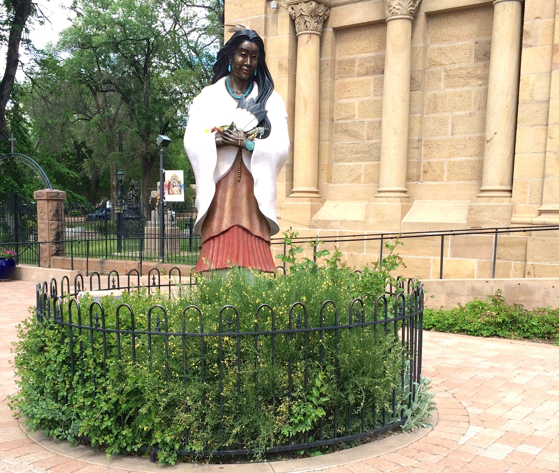
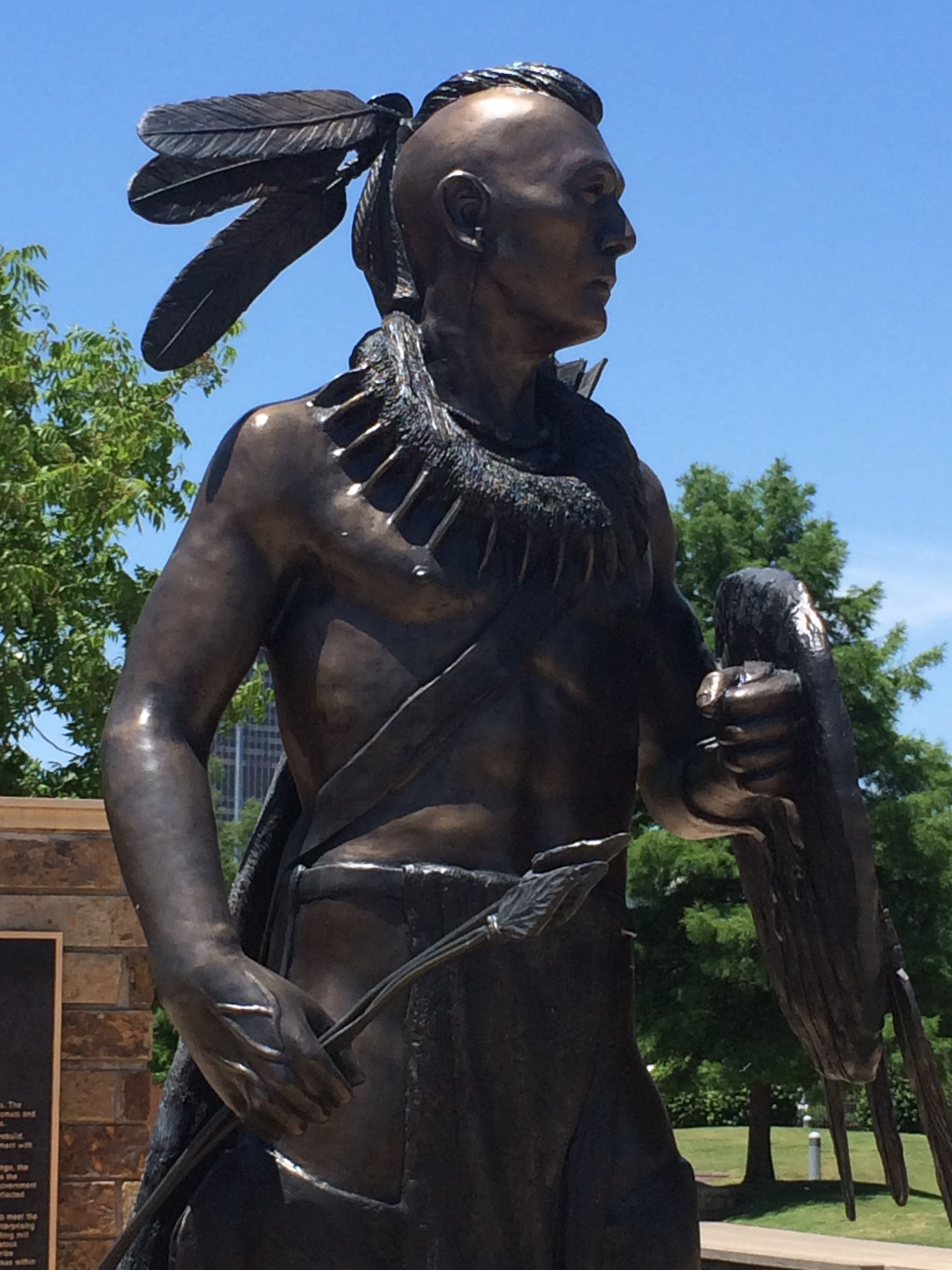
Nearby, there was a statue and  plaques honoring the Cherokee.

Cherokee statue

Just a little further along, was a building with the Sonic logo.

Sonic headquarters

Sonic’s headquarters is located in Oklahoma City. If it seems like their drive-ins are all over the place, I think it is because they are! In 2015, there were 3,526 restaurants, and it seems like new ones are springing up all the time. They even have one next door to the headquarters building.

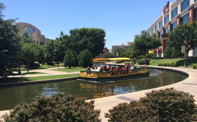
The Sonic headquarters looks out on the canal.

Canal

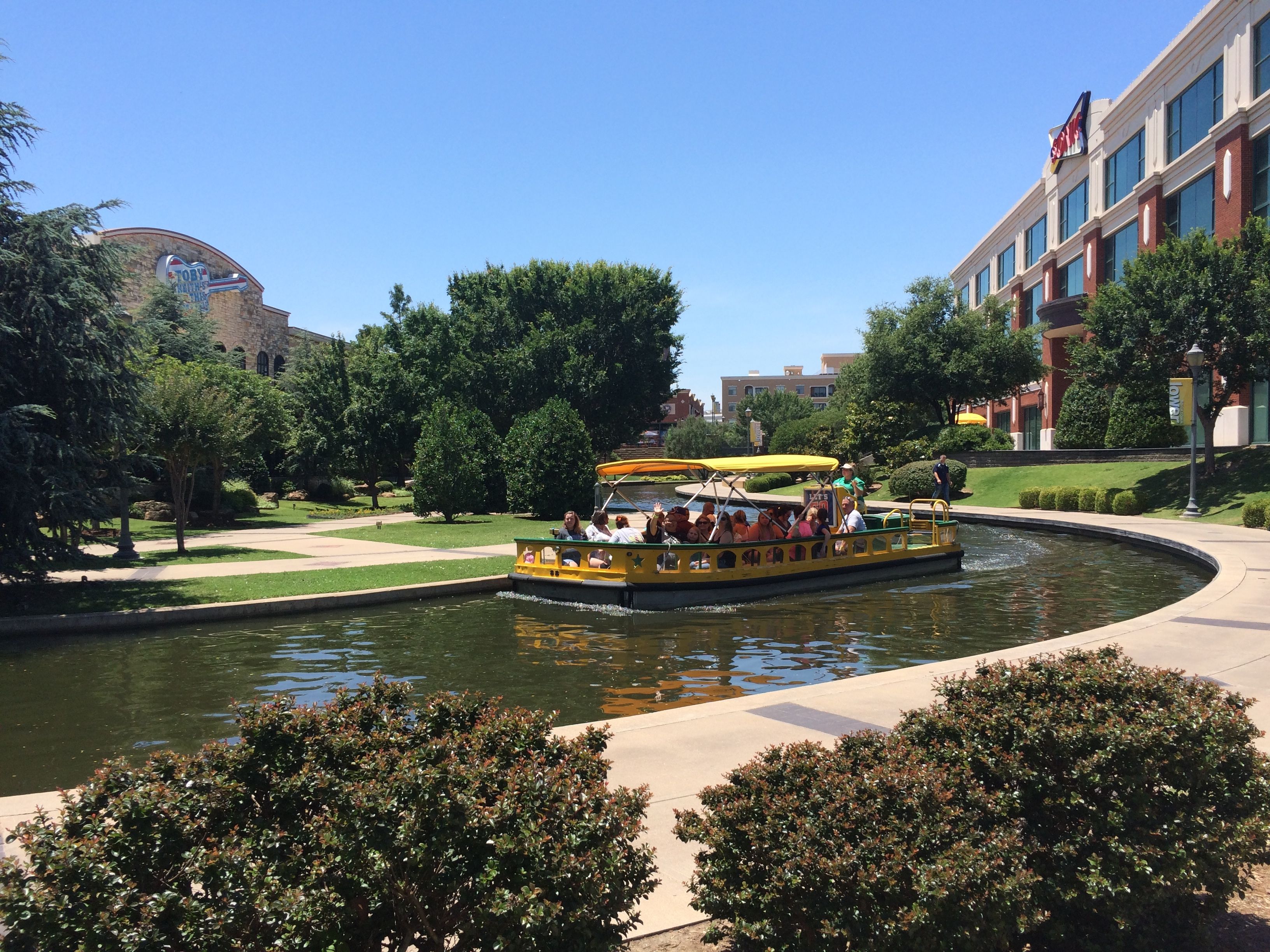
You can buy tickets for a ride on the canal. From the information I read, you could hop on at a stop and buy a ticket. I asked a passing boatman about where the stop was, and he told me that I had to buy a ticket at a building further down the canal. By the time I had walked most of the length of the canal, I figured that I didn’t need a boat ride. I had already seen the sights!

I kept walking, but I never came across one of the Downtown Discovery bus stops. I did see some interesting architecture along the way.

Hotel

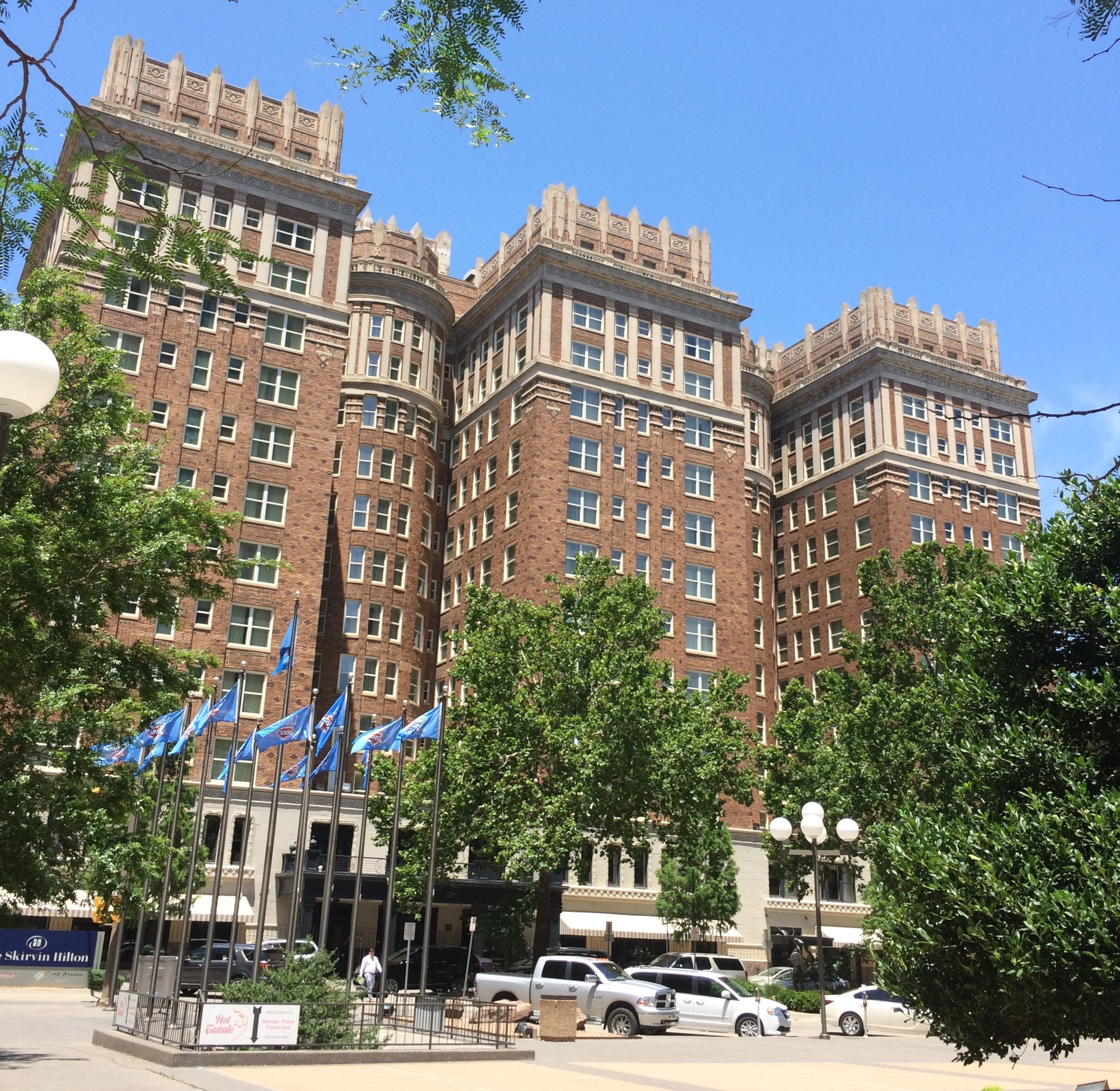
This was a novel treatment of the typical three-wing hotel. This one has smaller semi-circular wings between the main ones.

entryway

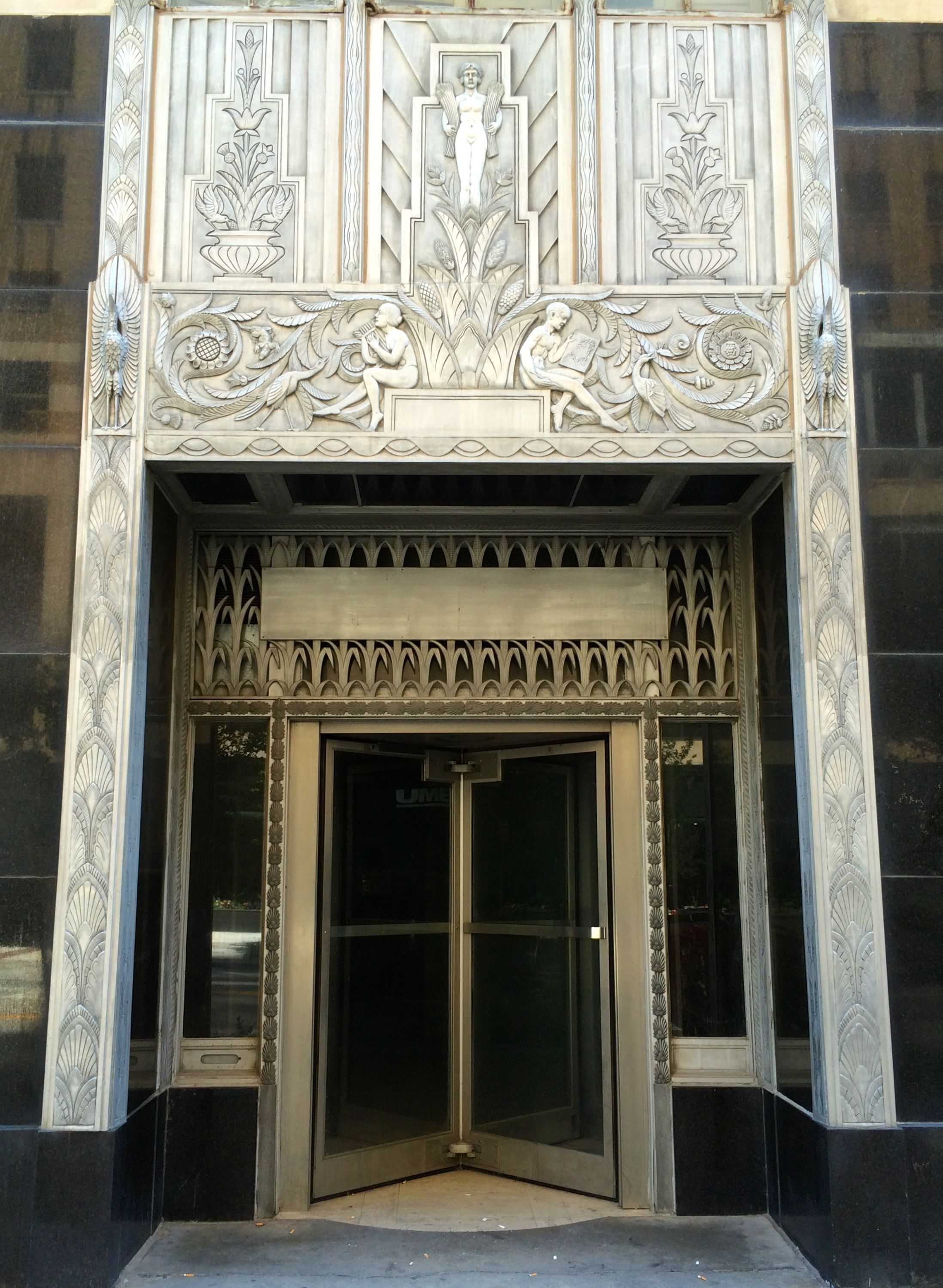
This building had elegant treatments around the doors and windows.

reflecting building

This building was all windows, and it reflected a wavy image of the building across the street.

building being reflected

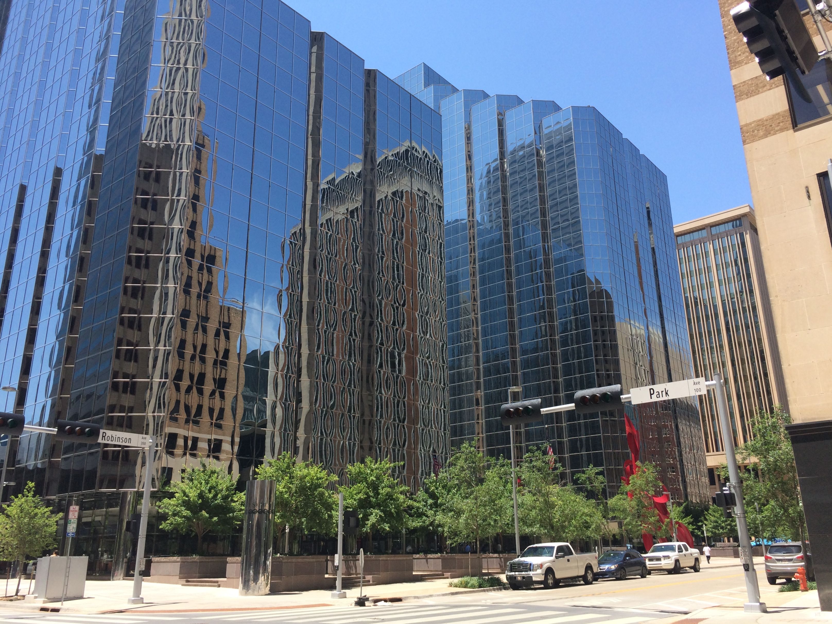
These are the buildings that were being reflected.

Canyon of shiny buildings

There was even a canyon of shiny buildings. Some local workers in their suits paused to see what I was looking at. They had never noticed it before. Tourists do provide a service!

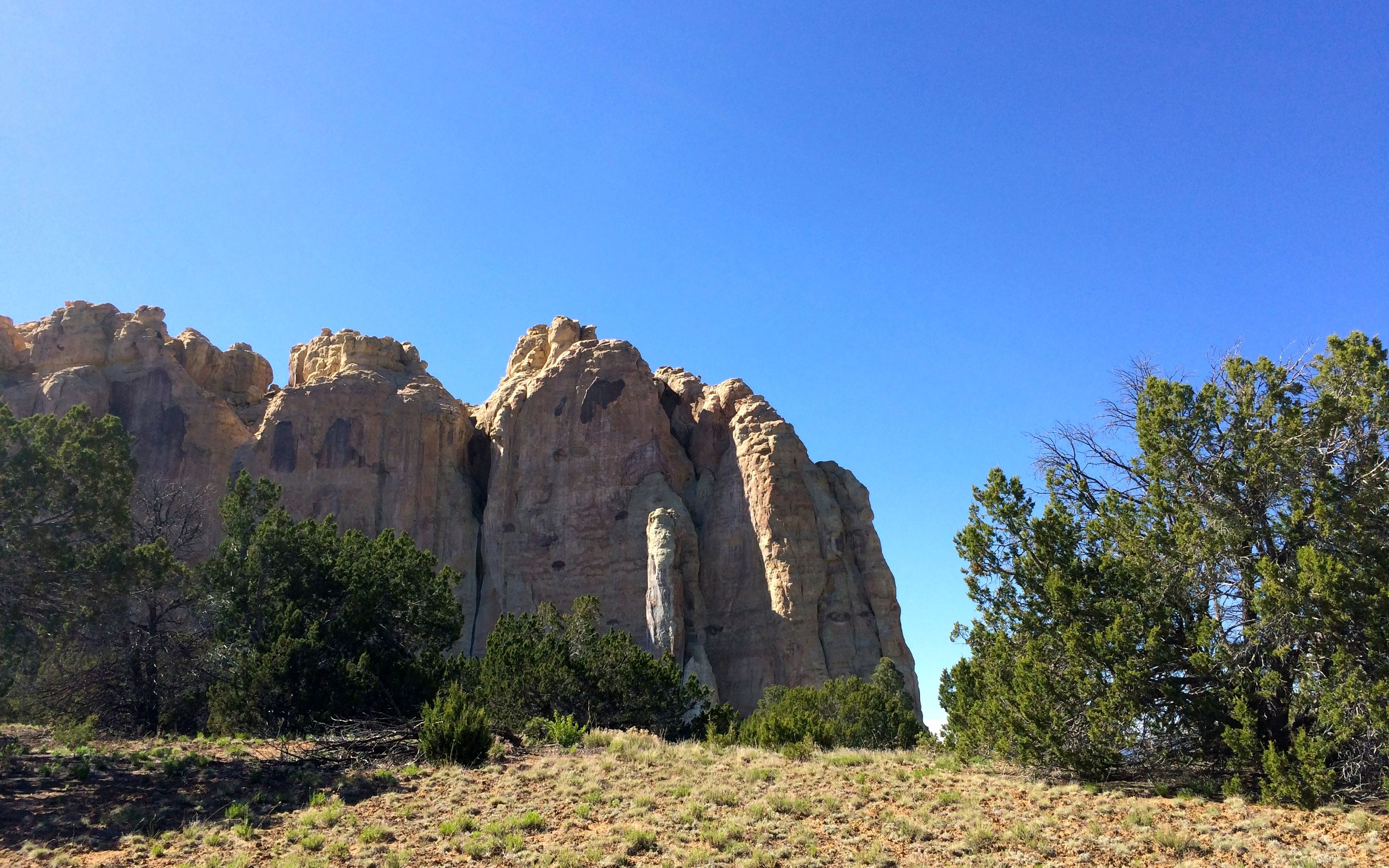
After a long, long walk in the sun, I finally arrived at the site of the Murrah Building.

Murrah Federal Building Plaza

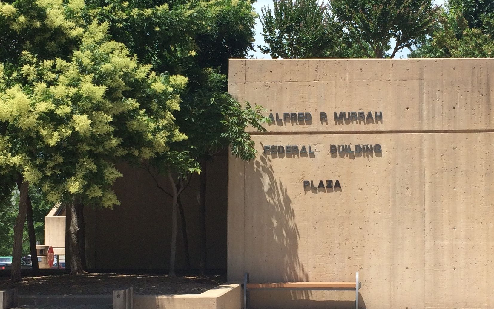
I will never forget the coverage of this tragedy on Wednesday, April 19, 1995. They have created a moving memorial.

Wood impressions in cement

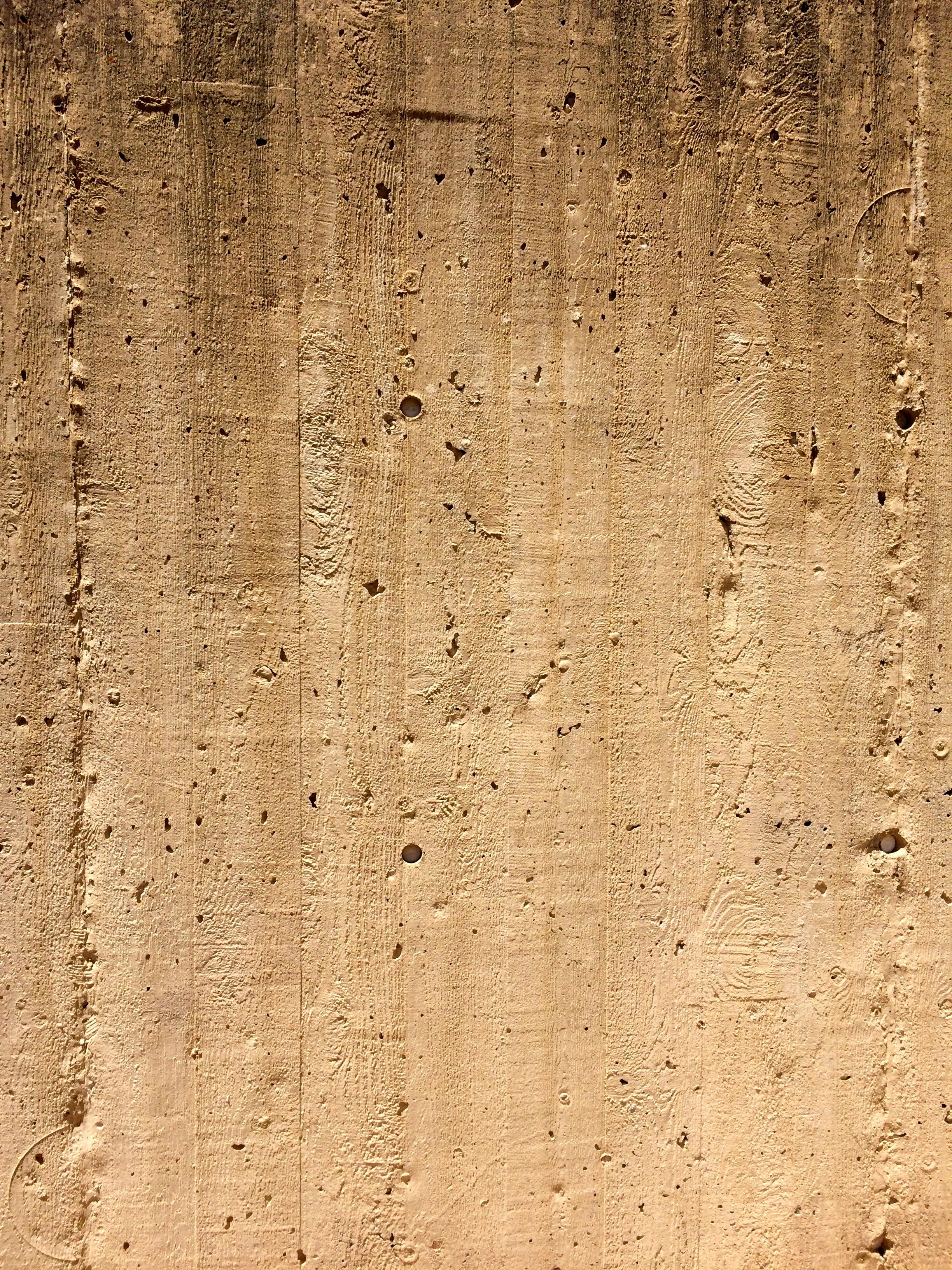
The texture of the wood in the concrete walls caught my attention. The first time I saw this method of building the first time in the 1970s at the Ontario Science Centre in Toronto, where the impressions of the wood holding the concrete were used as a design element.

The Playground

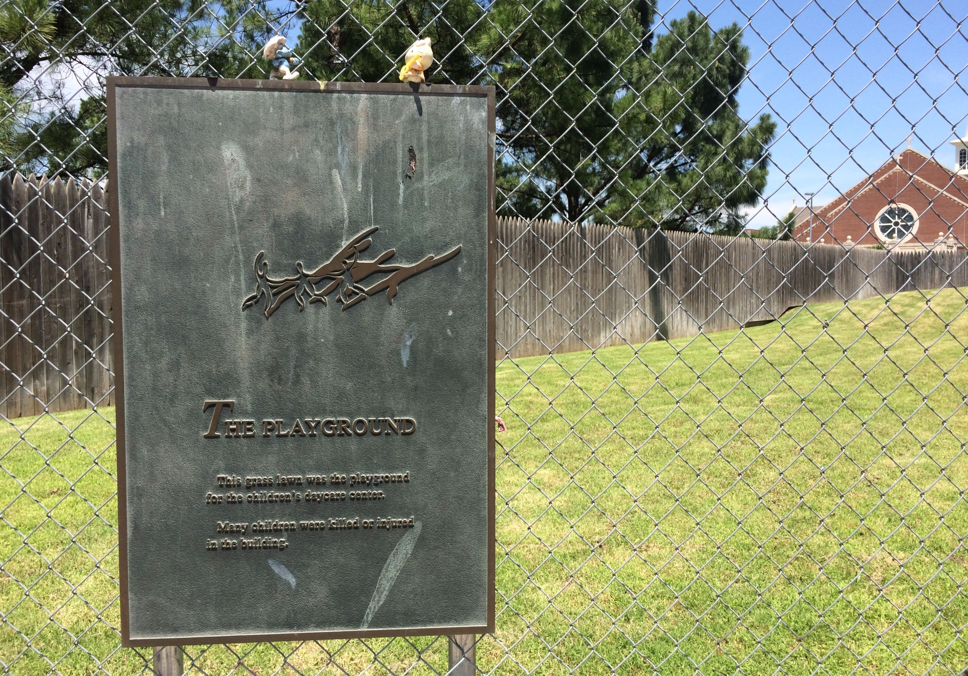
The Playground from the daycare center was there. It was up on top of the memorial.

Looking down at the empty chairs

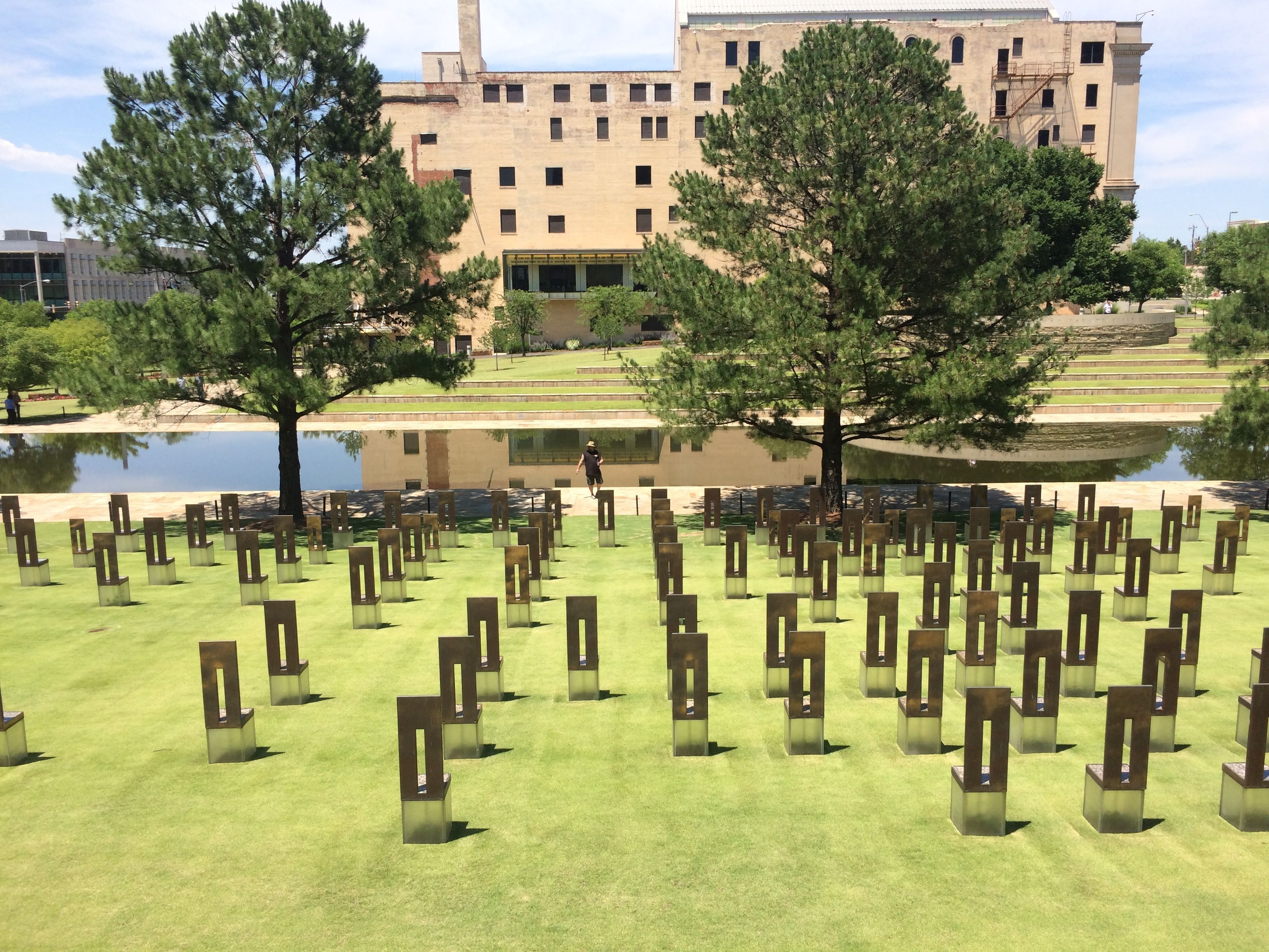
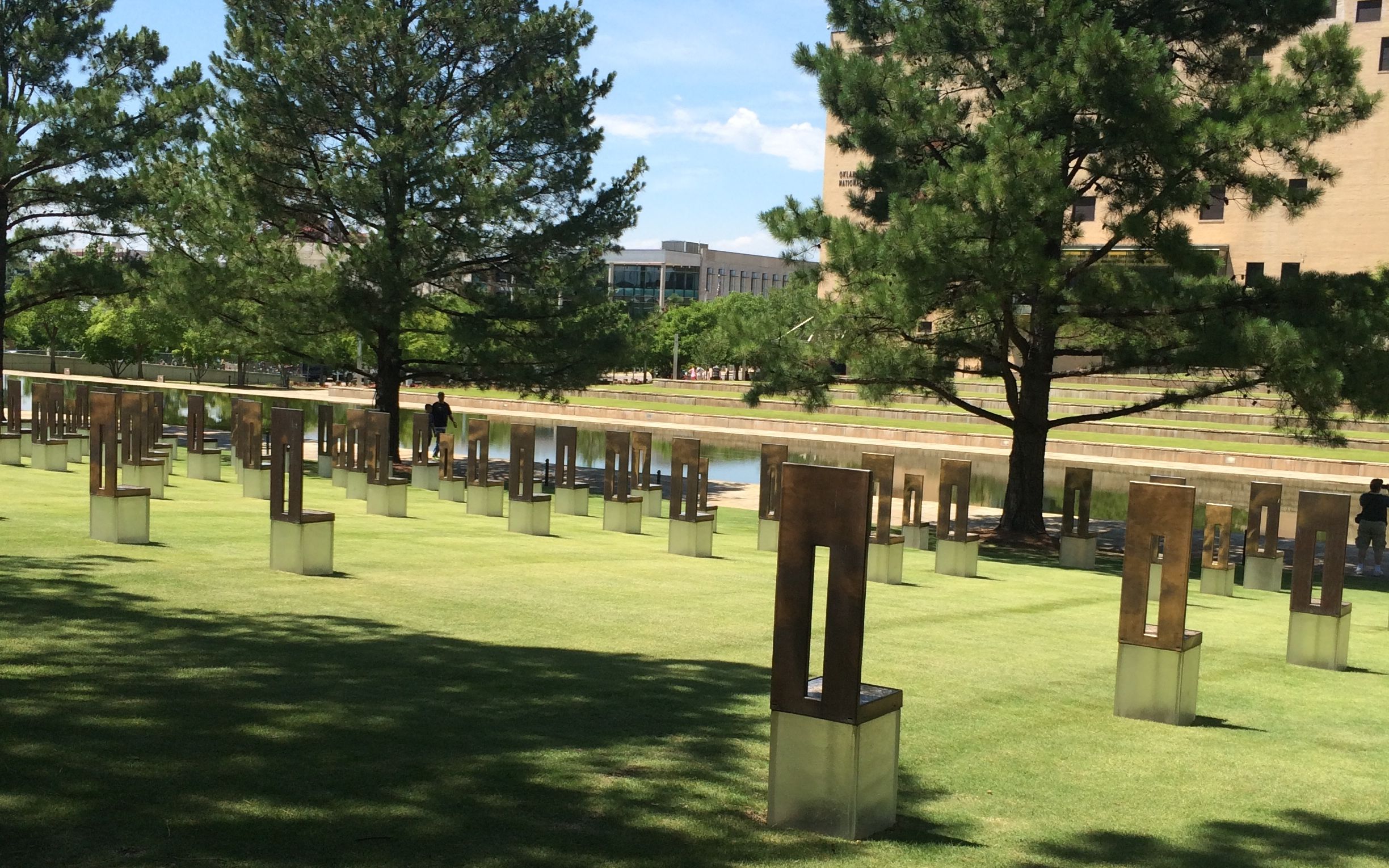
From up on top, there is a view of the 168 empty chairs facing the reflecting pool.

Looking through the gates

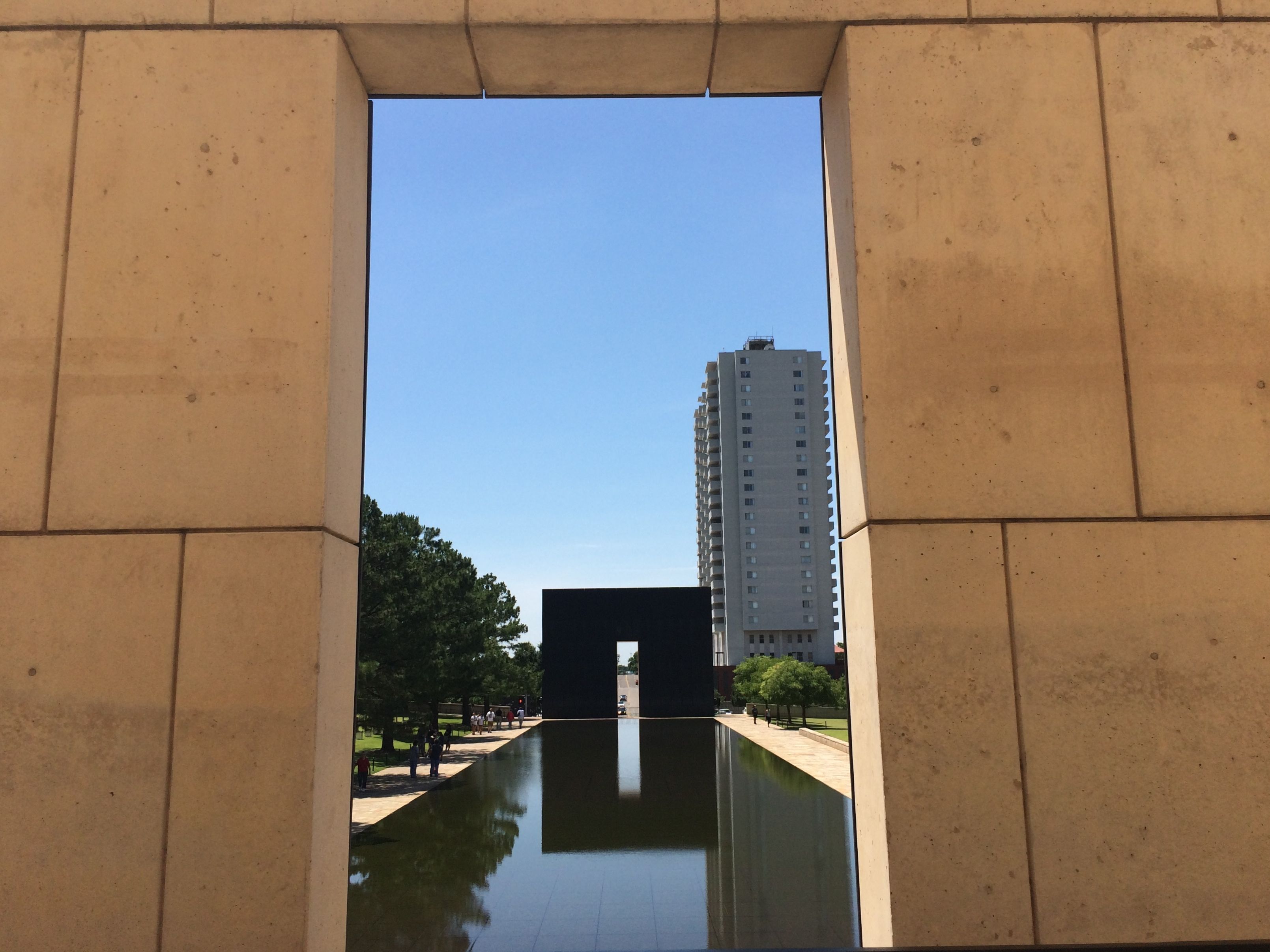
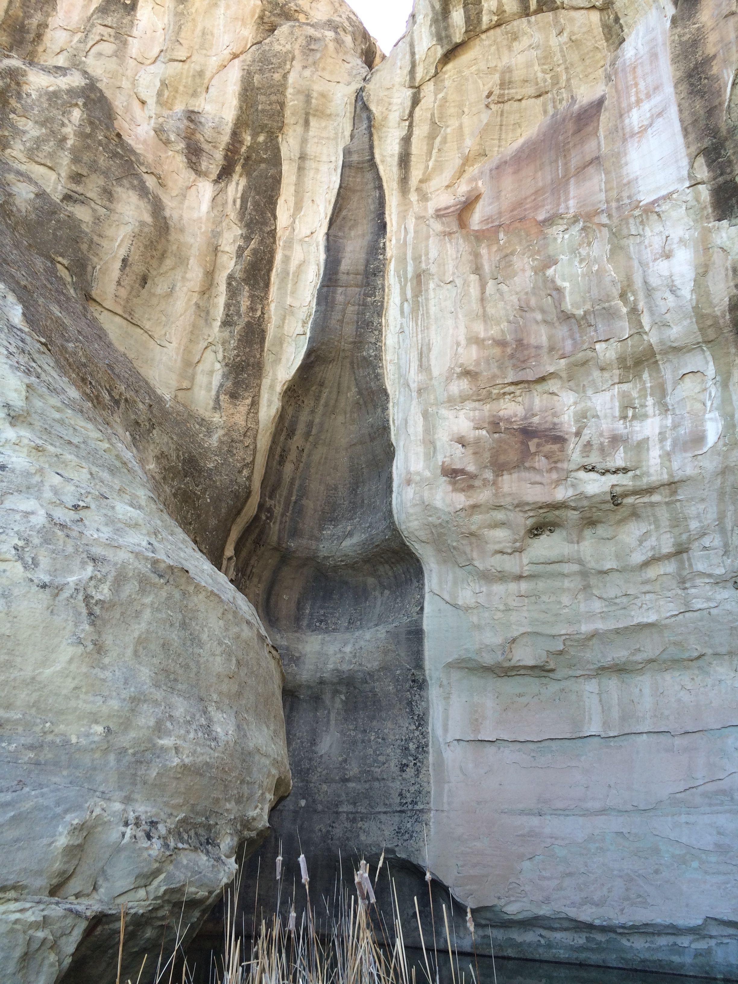
I came around to the gates. This picture looks through the 9:01 gate toward the 9:03 gate. The reflecting pool occupies what had been N.W. Fifth Street. The bomber drove down this street and pulled in front of the building that had been on the left side of the pond.

survivors' names

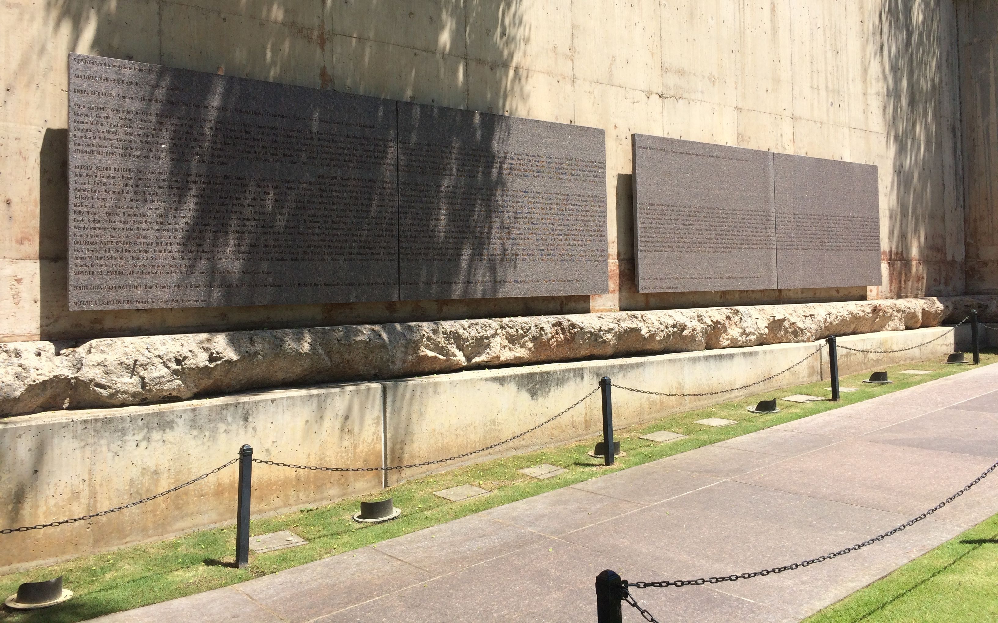
Survivors’ names are inscribed on marble slabs that came from the Murrah Building. The path around the footprint of the building is also made of materials from the building.

The Field of Empty Chairs is a tribute to the 168 people who were killed in the terrorist attack. The nine rows of chairs represent the nine floors of the former Murrah Building. Each person’s chair is positioned in the row that corresponds with the floor that they worked on or were visiting. There are five chairs on the west side of the field for the people who were killed outside the Murrah Building.

chairs facing the pond

The bottom portion of the chairs are glass and they are illuminated at night. The guard I spoke with told me that the memorial is beautiful and peaceful at night.

chairs of different sizes

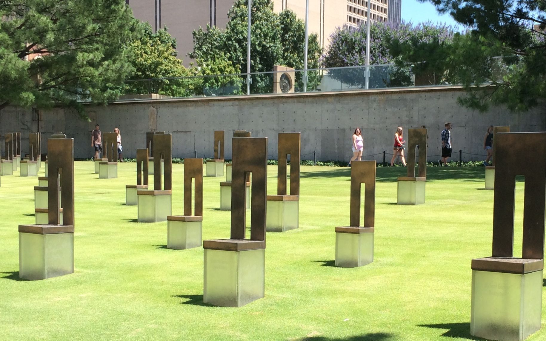
The smaller chairs represent the children who died in the attack.

reflecting pool

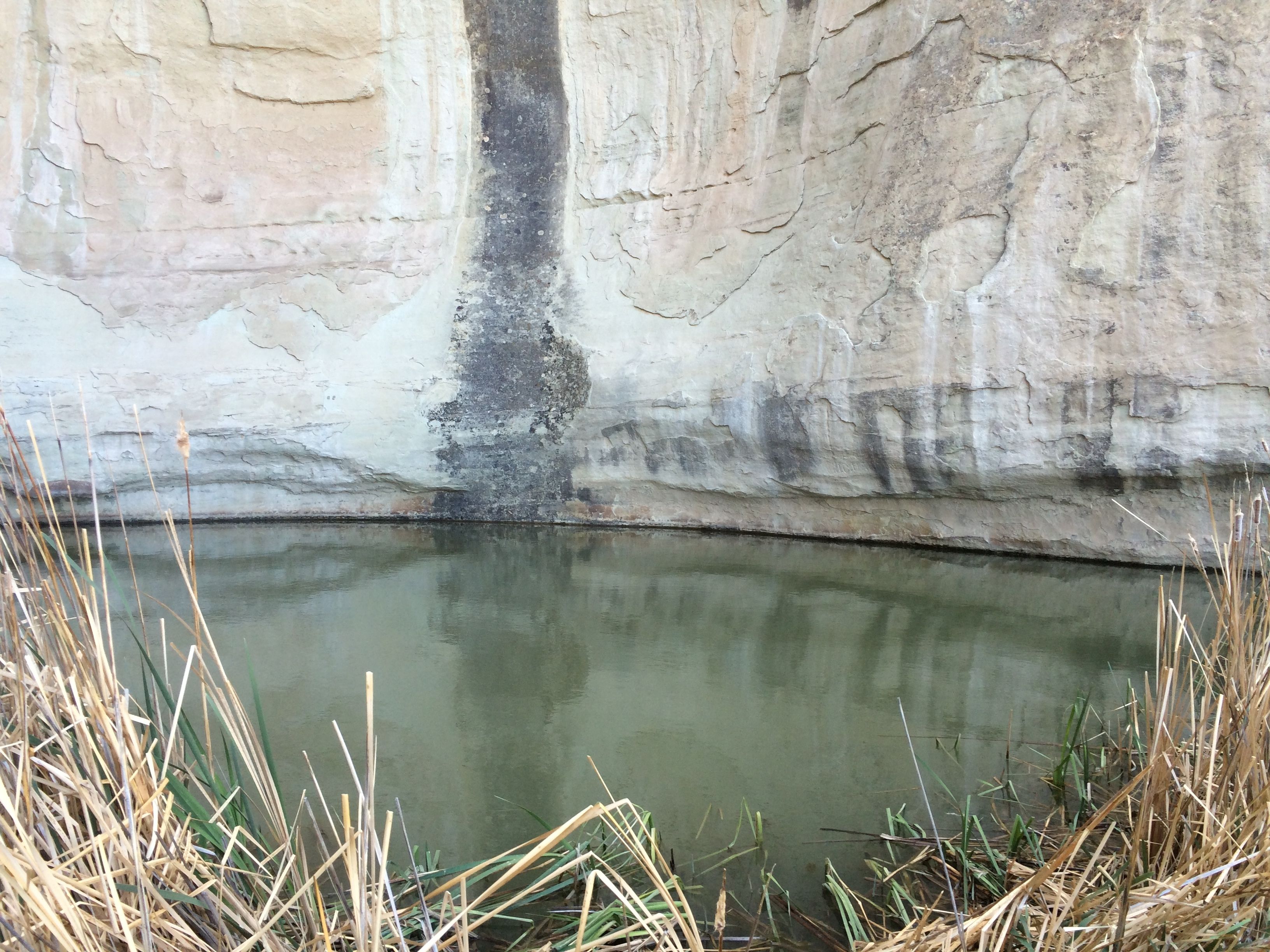
The reflecting pool is really shallow. I enjoyed watching the ducks splash about in the water. I don’t think that water was deeper that two inches. They water was continually circulating – draining over the edges and being replenished.

On the exterior of the memorial, there is chain link fence that recalls the original memorials that sprang up after the attack.

fence with memorials

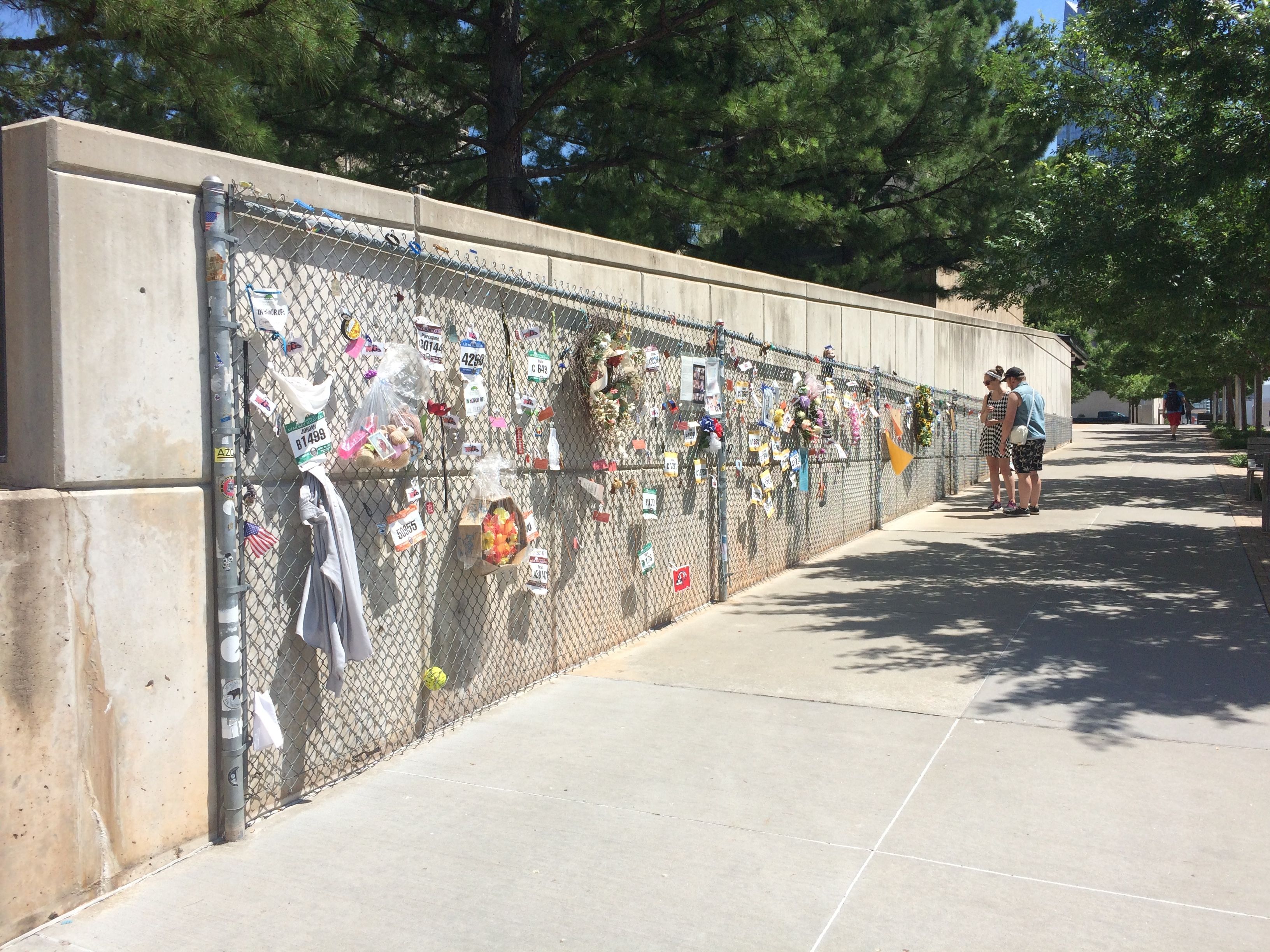
People are still leaving memorials. As I understand it, the offerings are cataloged in the museum next door. I opted not to visit the museum. I was hot and tired and ready to head back.

I finally found a bus stop at the memorial. I pulled out the brochure and figured out a phone number to call. The operator explained that a bus would be by shortly, and so I waited.

Oklahoma City Landrun City manhole cover

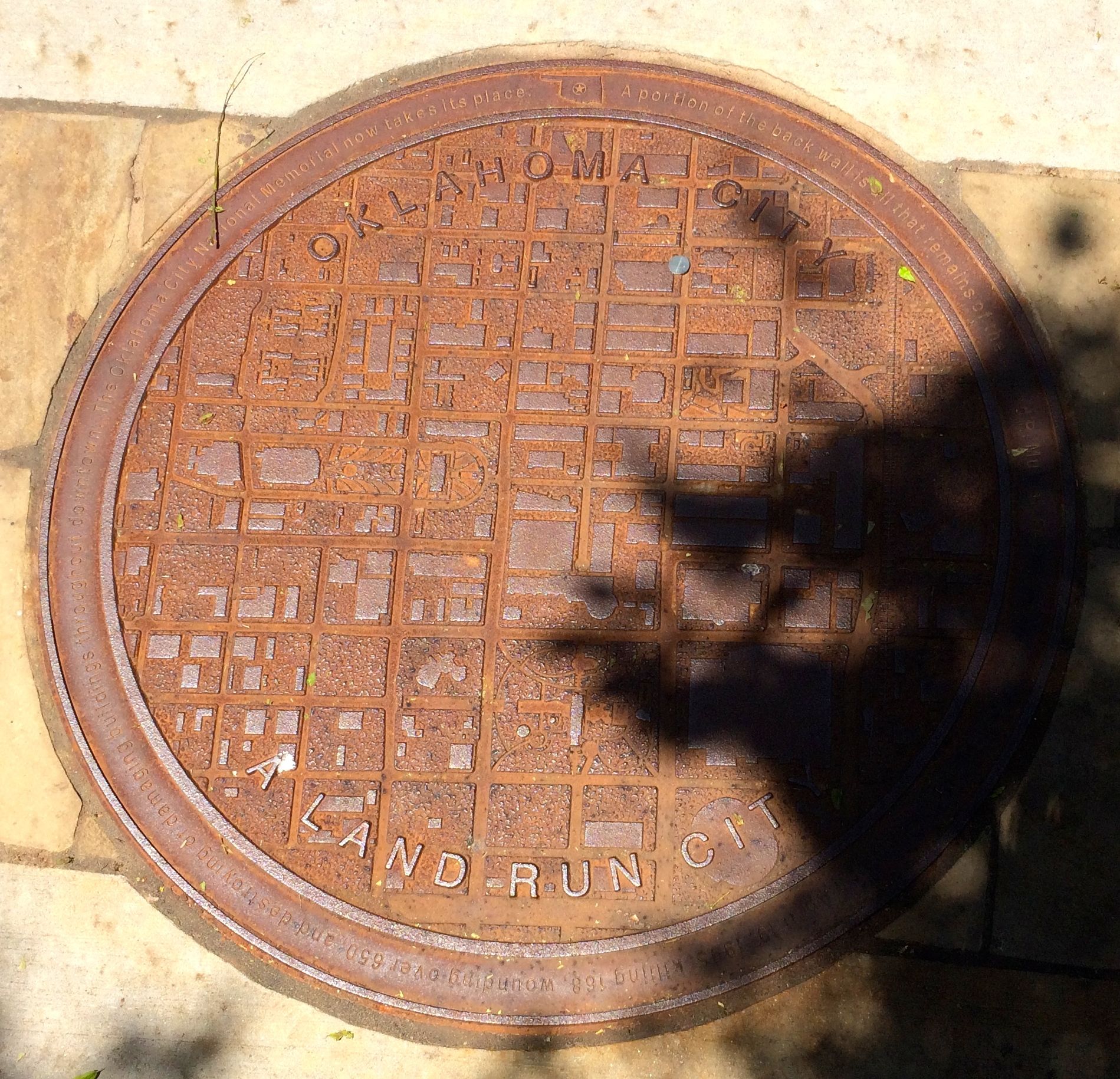
Of course, I always find things to look at. Interesting manhole cover.

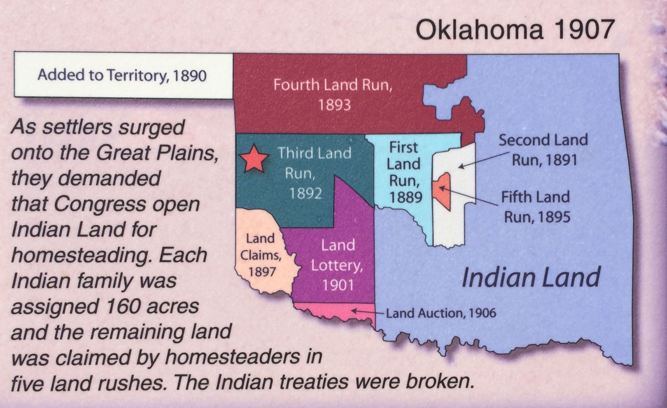
The friendly bus driver picked me up and drove me back to Bass Pro Shop. Before I got to my truck, though, I noticed a sign for The Land Run of 1889.

The Land Run of 1889 plaque

The sign says it all.

The monument was an amazing group of statues.

getting ready to fire the starting shot

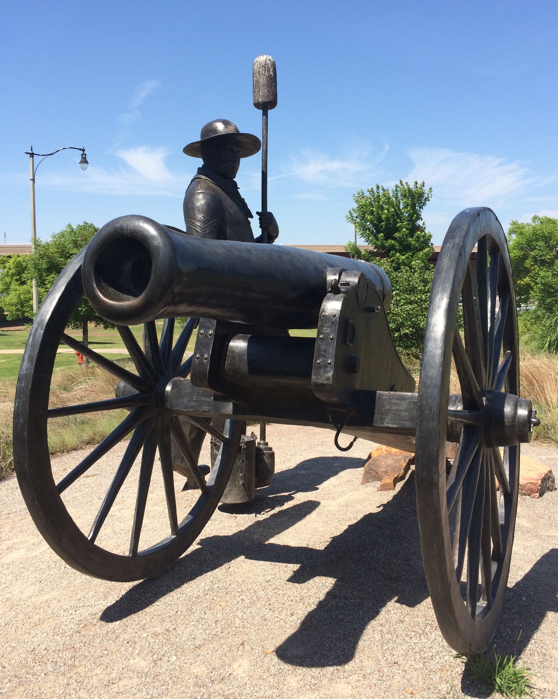
Off to the right side, there is a soldier waiting to fire the cannon shot to start the land run. On the left side, there is explosive action!

view from the end

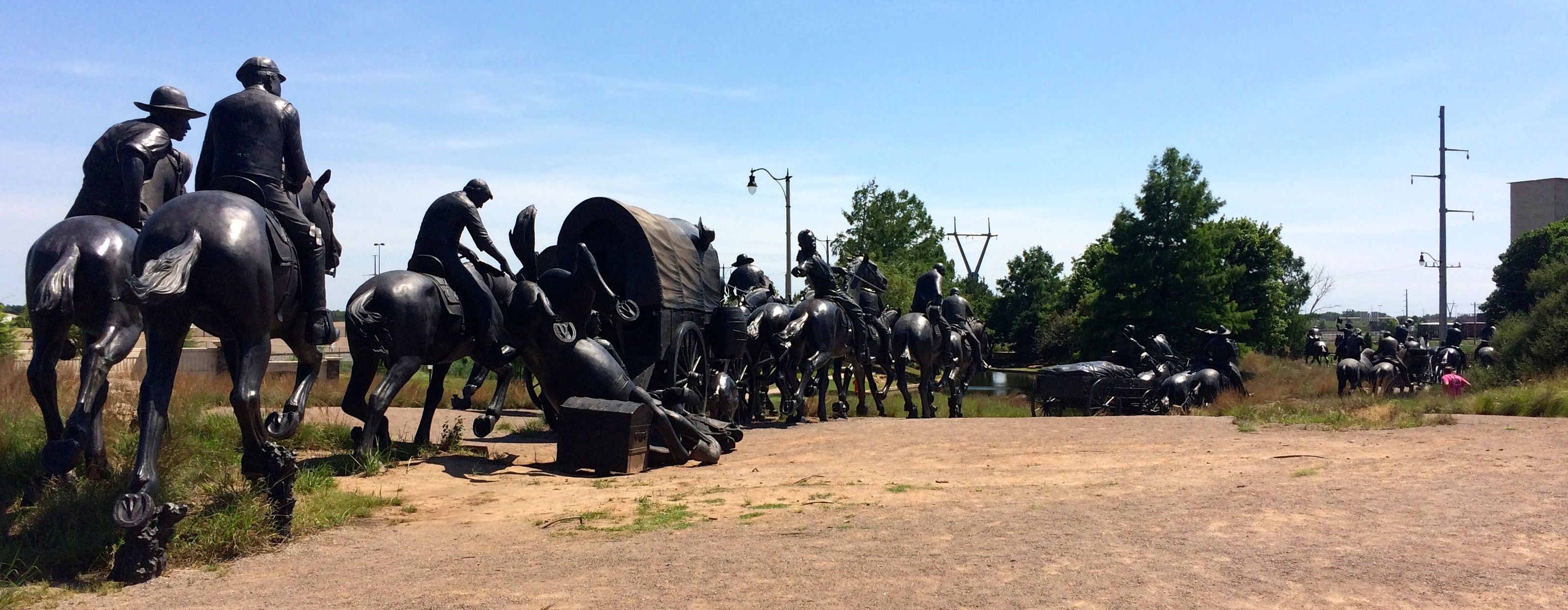
You could really spend a long time studying all the details and making up stories to go with the people that are portrayed. It was kind of hard to get good photos with the equipment I had and the light, but here are some to give you a taste.

Horse falling over trunk

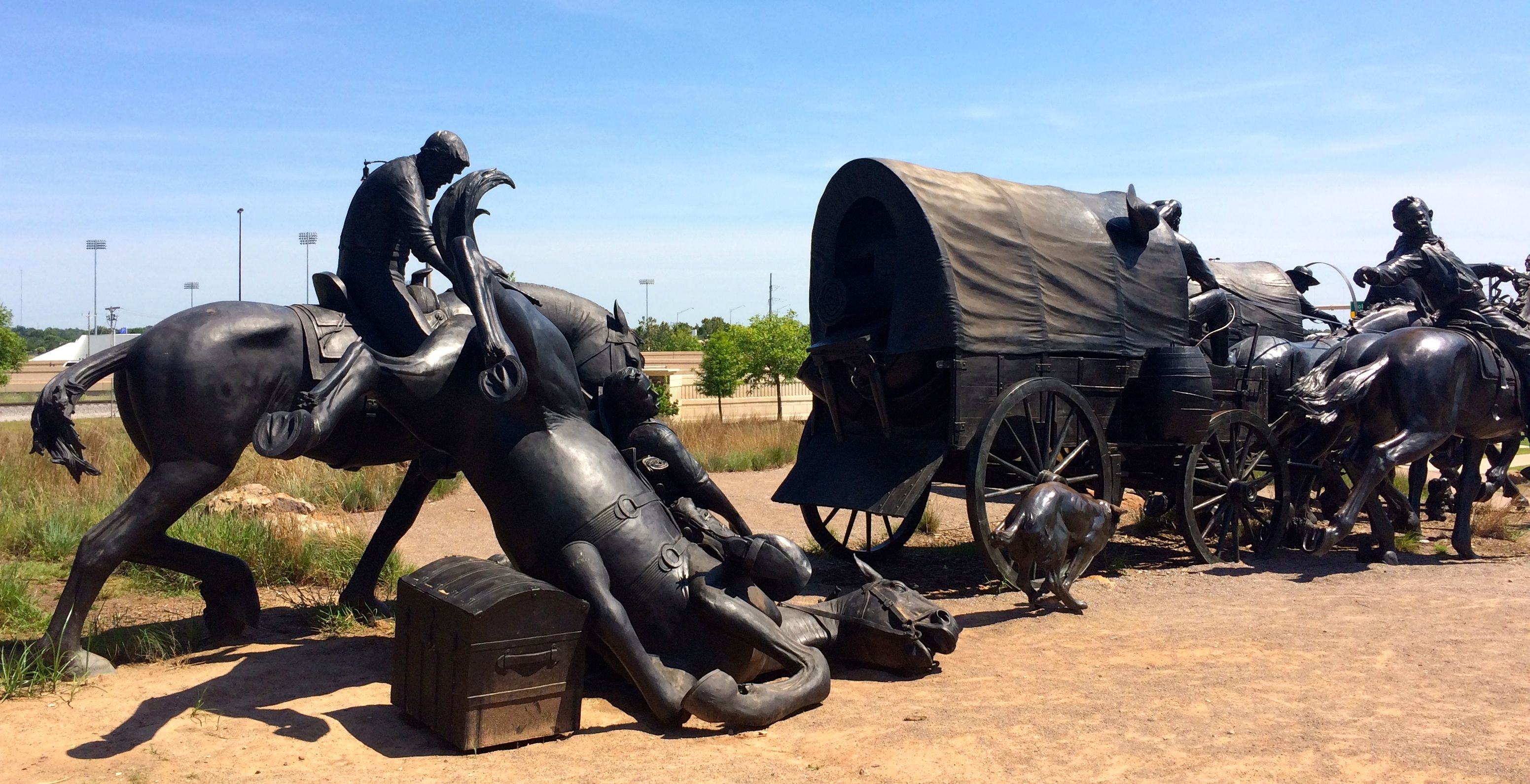
This horse tripped over a trunk that fell out of the wagon in front of it.

Woman riding side saddle

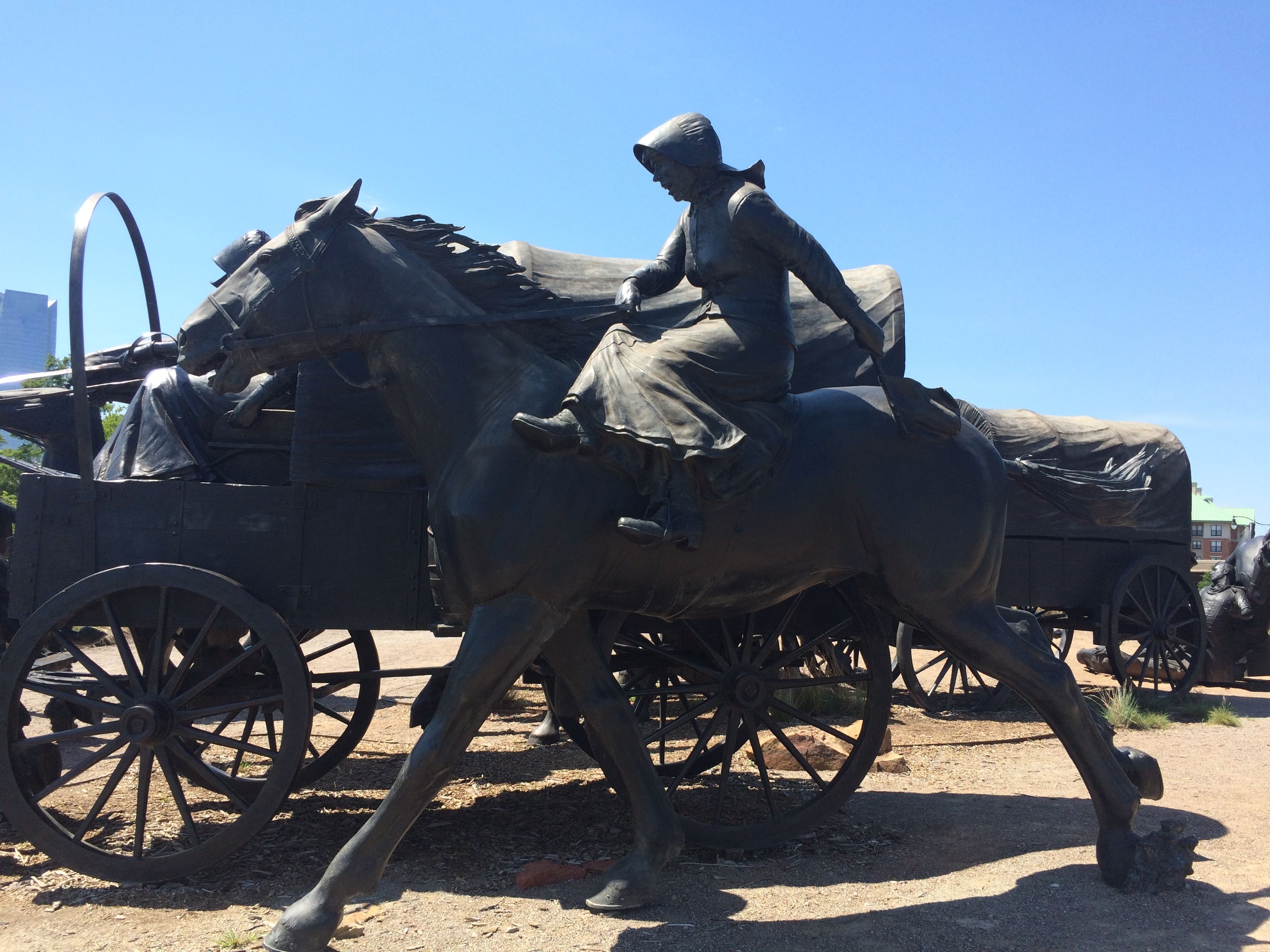
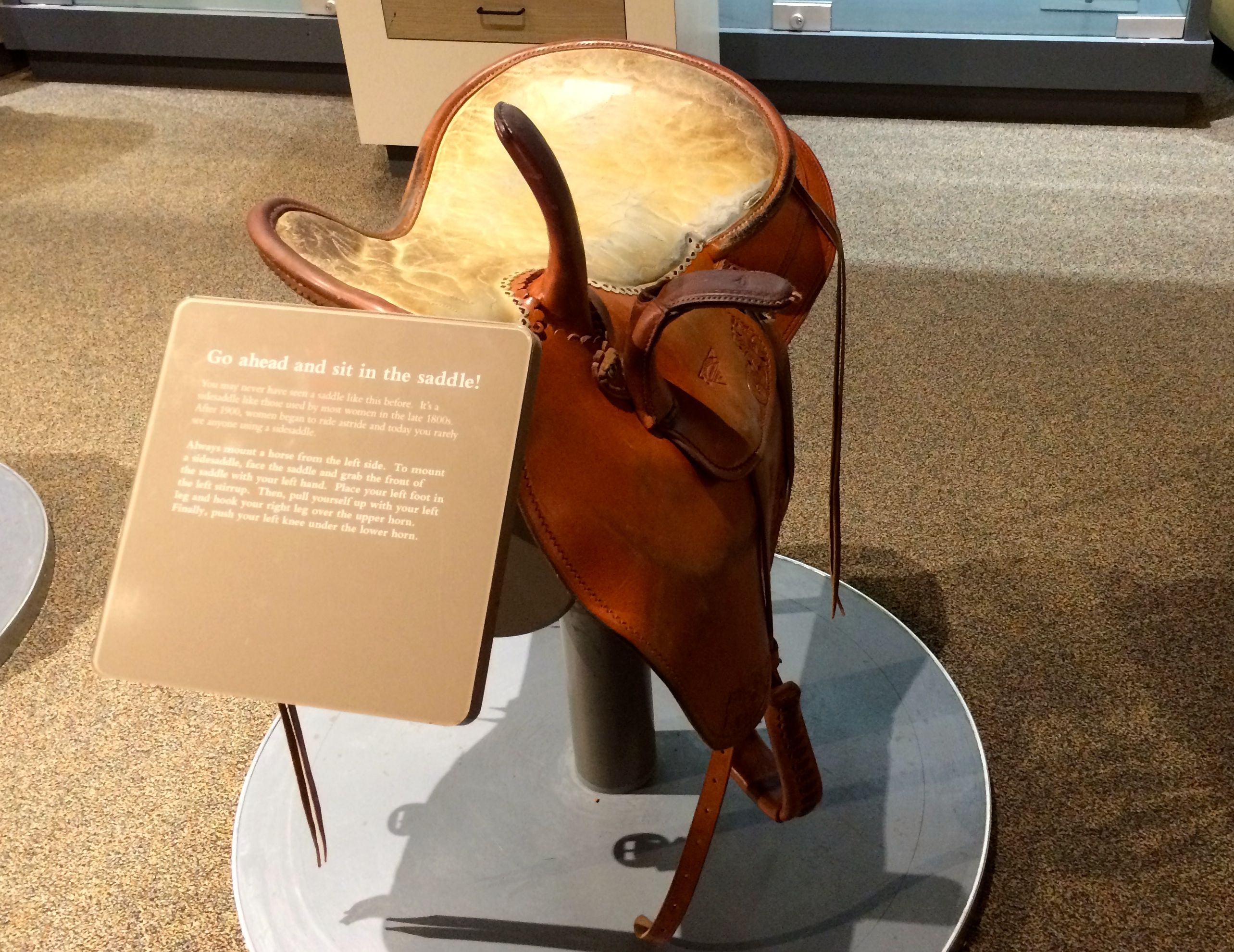
This homesteader is riding sidesaddle!

crossing the canal

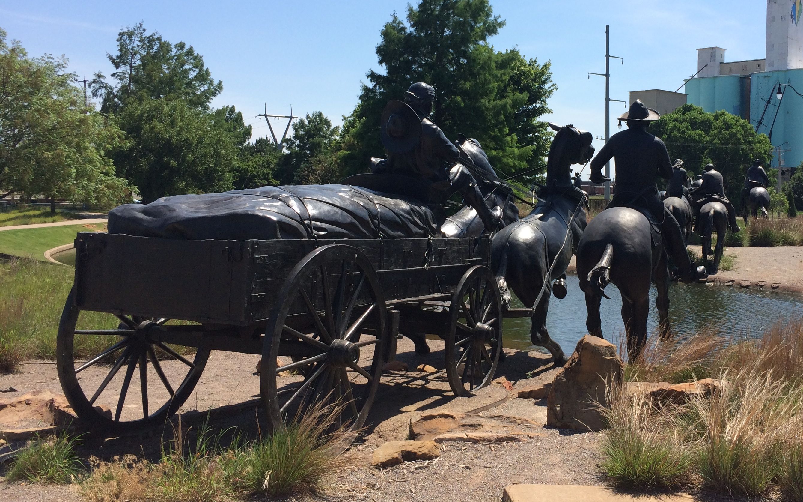
The riders and wagons proceed across the canal and off into the distance.

larger than life

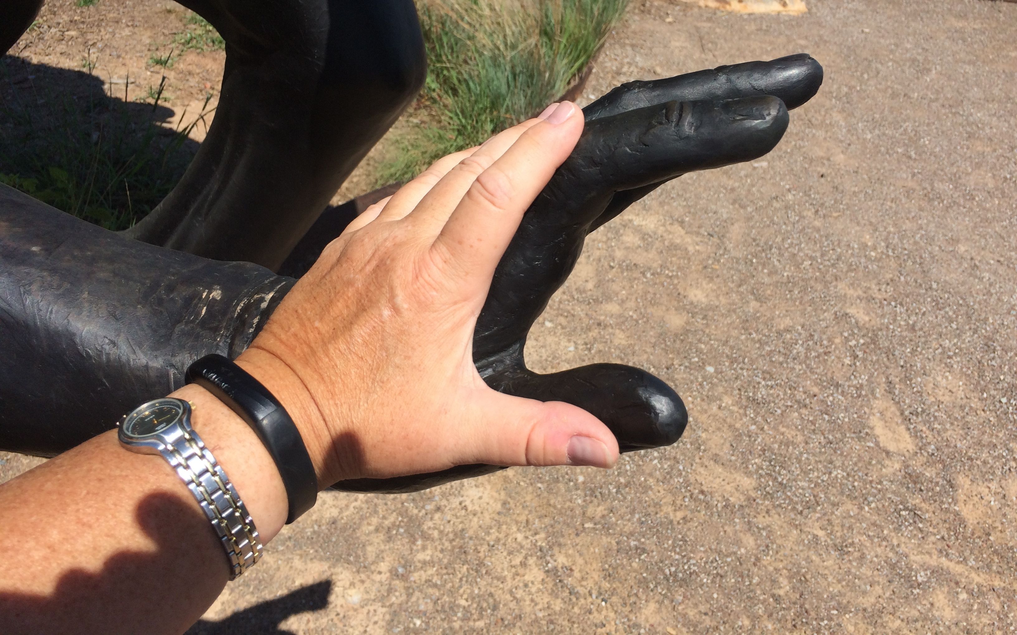
Just to give you an idea of the scale of the sculptures, here is a shot of my hand next to one of the riders.

And with that, it was time to head back to the campground. Is there  more to do in Oklahoma City? Definitely!

And I’m going to save that for another visit.


Dang Me!


https://www.youtube.com/watch?v=l1s7HHnnjU4

When I was at Alibates Quarries National Monument, I picked up a brochure about Route 66 in Oklahoma. In thumbing through it, I found out that there was a Roger Miller museum in his home town of Erick, just across the border. A few miles further, the town of Sayre had a municipal RV park with full hookups for only $12 a night.

With attractions like that, I decided to stop in Sayre and then double back to visit the Roger Miller Museum in Erick.

Welcome Sayre City Park sign

I followed the signs and I had my pick of sites. They have 80 sites, but the highest number of fellow campers was eight.

view of the golf course

There were nice, level campsites with solid picnic tables. My site even had a view of the golf course. How many resorts charge extra for that?

There was even a greeting from my folks when I got there. A golf ball from Dad was sitting right there, and it was marked with Mom’s repeating numbers.

golf ball

That night, I got settled in and added a new state to my map.

Adding a new state to the map

Oklahoma!

(Oh, go ahead and sing it…I’ll wait.)

The next day, I set out to see Erick, Oklahoma and the Roger Miller Museum, which was…

Roger Miller Museum Erick

CLOSED!

The brochure said it would be open. I checked their website, and it said it would be open. It wasn’t.

199th Meridian Museum Erick

Neither was the 100th Meridian Museum, which was across the street. And, unfortunately, there wasn’t a Sheb Wooley Musuem. (Although it probably would have been closed too.)

Erick banners

Oh, who is Sheb Wooley?

Why, he’s the man who gave us the One-eyed, One-horned Flying Purple People Eater!

In the words of the great Roger Miller, “Dang me!”

There was nothing else to do in Erick, so I consulted my HistoryHere app and decided to visit the Washita Battlefield National Historic Site, which was about 45 miles away.

Washita Battlefield

In this landscape of gently rolling hills, just before dawn on November 27, 1868, the village of Black Kettle was attacked by the 7th U.S. Cavalry under the leadership of Lt. Col. George Custer. It was bitterly cold and 18 inches of snow had fallen when they surrounded the village and launched their attack.

Custer’s orders were to go down south till he came to the Washita River and follow it down until he came across the hostiles. He was then to shoot and hang all the warriors, capture all the women and children, and destroy the camp and horses. Custer was going to do exactly what he was told because he wanted to get back into the good graces of Generals Sheridan, Sherman, and Grant.

While the exact number of casualties is uncertain, Black Kettle, who had been working for peace, and his wife were killed. The 51 lodges in the village were burned along with the band’s winter supply of food and clothing. The Calvary  captured the village’s 850 horses and killed 650 of them.

53 women and children were captured and taken to Camp Supply, which was around 80 miles away. They were later taken to Fort Hayes, Kansas. They were released in July, 1869.

What a sad and shameful part of our country’s history.

Eagle Nest photo

This is a photo of Eagle Nest, taken in August 1948, when he was 94 years old. He was the last known living Cheyenne survivor of the Washita attack.

As I am always drawn to maps. I had to snap some shots of how the land possession changed over the years.

Indian Territory 1850

Indian Territory 1880

Oklahoma 1907

Outside the National Park Service building, there was an interpretive trail that gave some information about the homesteaders.

At high noon on April 19, 1892, hopeful homesteaders gathered to stake a claim to farmland on Cheyenne-Arapaho Indian Reservation. Some people snuck in ahead of time and hid until it was time to stake their claim. They were called the “Sooners”, which is the nickname of the University of Oklahoma football team. The nickname of Oklahoma is the “Sooner State.”

dugout

The homesteaders built houses called “dugouts”. They are built into hillsides so that they needed to build fewer walls.

Morton George Custer Family 1899

Here is a shot of some settlers in front of one of their dugouts.

They had a working windmill along the trail. After seeing the display at the Panhandle-Plains Historical Museum in Canyon, Texas, it was cool to see one in action.

There was also a display about how fire contributes to the health of the grasslands. The land would have burned either naturally from lightning or from Native Americans setting the fires about every three to five years. These three plots were set aside so that one would be burned each year.

Plot 3 burned 2014

This plot was burned in the winter of 2014.

plot 1 burned 2015

This one was burned in the winter of 2015.

Plot 2 burned 2016

This plot was burned this year – during the winter of 2016.

Osage Orange windbreak (windrift?)

During the Depression, young men were hired by the Civilian Conservation Corps to plant wind breaks like this one of Osage orange trees.

OK State wild flower Indian blanket

The Oklahoma state wildflower is the Indian Blanket.

Solar bird house

This birdhouse with solar array caught my eye. I imagine that they are tracking something, but there was no signage explaining the project.

By that time, I was ready to head back to the campground in Sayre. On my way back into town, I was noticed something that made me park and go over to examine it.

Tornado shelter

The door is kind of hard to make out because of the shade trees, but this is a tornado shelter that runs under the street from one side to the other!

USA 1939 WPA

I don’t think you can read it, but the text on the shield reads “USA 1939 WPA”. The WPA sure contributed to the infrastructure of our country. I wish I could have asked someone how many times this shelter has been used since 1939?

Beckham County Courthouse Sayre OK

I also had to stop in to see the Beckham County Courthouse. It’s claim to fame is that it had a few moments of screen time in the 1940 movie, “The Grapes of Wrath” when the Okies were leaving Oklahoma.

Veterans memorials daughters of the confederacy

I was surprised to find this Veterans Memorial erected by the United Daughters of Confederacy in MCMLXXI. If I remember my Roman numerals correctly, it was put up in 1971. I was surprised that the Daughters of the Confederacy is still a going concern.

Buffalo in Sayre

On the left side of the courthouse was this buffalo soldier. The sculpture is called “Spirit of the West” and was installed in 2007 in honor of the Oklahoma Centennial.

Horse in downtown Sayre

While I was examining the courthouse, I heard the sound of horse hooves. I looked around and spied the horse and rider just before she got out of range.

And with that, I headed back to the park. I’d have to be hitching up and heading out of town in the morning.


Panhandle-Plains Historical Museum

After meeting the former Director of History and receiving strong recommendations from the Cabbages of Hutchinson, Kansas, I decided to stop in at Panhandle-Plains Historical Museum if I could find a place to park Bart and Flo. Luckily enough, I managed to squeeze into four spots on the side of the building.

Entrance

I passed between the cowboy and the indian and went inside.

You never know what you are going to find in a museum. I guess a bottle of crude oil is a worthy representation of the area.

Crude oil 1921

The first displays I saw pertained to more modern times. Oil drilling, roping, riding and ranching.

sidesaddle

I was particularly interested in this sidesaddle. It never occurred to me to wonder how women managed to remain on their horses when riding sidesaddle.

There was barbed wire, too.

1200 different kinds of barbed wire

Twelve drawers.

Drawer full of barbed wire

Ten different kinds of wire in each drawer. That’s a lot of variety!

Aluminum barbed wire pattented 1879

There was even aluminum barbed wire! I wonder if anyone ever used aluminum barbed wire? It would probably last a long time, but I imagine it would have been pretty expensive when it was patented in 1879.

JA Ranch under construction 1878

This is a photo of the JA Ranch, when it was under construction in 1878. I include it because Palo Duro Canyon State Park was once part of the ranch, if I understood correctly.

model of Antelope Creek house

This is a model of the Antelope Creek village, near the Alibates Flint Quarries, and a drawing of one unit of the village.

Drawing of Antelope Creek house

The residents of the village had long tunnels that they used to enter their houses. They had a model of part of a house, including the tunnel they had to crawl through. I imagine that must be a lot of fun for kids. I have long since passed the age where crawling into and through things is fun, so I passed on the experience. According to the display, archeologists discovered stones worn smooth from crawling into the houses. That must have been a fun discovery!

tool display that spans the ages

I particularly enjoyed the displays that focused on how people met similar needs with the materials they had on hand. For instance, this case focuses on how they built things across the ages.

Mens room with changing station

I just must have a bathroom fetish! However, I must say that I felt a little frisson of joy when I saw that they made it possible for men to change their children’s diapers.

Paleontology with definitions

I was also delighted with this entrance to the paleontology display. Not only was it a nice break from the darker exhibits, it included the definitions you would need to make sense of the exhibits.

geological time scale

And then there was a marvelous timescale that showed how the different periods related to each other. I have included a close-up of the gray plaque that explains how scientists revise what then know based on new findings.

INfo about the time scale

Impressive!

Gripphippus Gratus prehistoric horse

Of course, we are in Texas, so including the gripphippus gratis, a prehistoric horse, was a logical choice.

skeltons

They had some interesting skeletons. I like how brightly lit they are. I feel like I am in an art gallery!

gypsum

There’s the gypsum I saw in Palo Duro Canyon! It even has the brown “seam” in it! I wish there had been someone available to explain that layer to me.

windmill display

Windmills were very important to settling the area. Although the region receives only about 20 inches of rain and 15 inches of snow a year, the Ogallala Aquifer is right below their feet.

How rotary motion is used to pump water

They even had a demonstration that showed how the rotary motion of the wheel was changed to a reciprocating motion for pumping water. I may not crawl through tunnels anymore, but I had fun turning the wheel and watching the machinery work.

Incidentally, the American windmill was invented in Connecticut. Daniel Hallady invented, manufactured and marketed the first successful self-governing American windmill in 1854. A self-governing windmill automatically turns to face the wind when the wind changes direction. It also controls its speed to prevent it from self-destruction during high winds. I can see how it turns into the wind, but but I don’t see how it controls its speed – so don’t ask me.

red white and blue windmill

I meandered downstairs and took in the art exhibits. Photography of the artwork is prohibited, so I have no pictures of that. However, they had this sweet little hands-on display that invited patrons (presumably children) to create their own exhibits.

Create a gallery exhibit - but no photography of the artwork

I like how they walked the curators through the steps they needed to take to create their exhibits.

They had an enormous oil rig from the 1920s. It was so large that I couldn’t get a picture of the whole thing.

Cable Tool Drilling Rig

I found it intriguing that you could still smell the oil and hard work that went into it.

rig 2

And, again, you can see how the rotary motion was changed to a reciprocating motion.

Rig 3

There was more to explore, but my feet were getting tired and I still had to reach my campsite. Time to bid adieu to Canyon, Texas.

Canyon TX postcard

On to Oklahoma!

Palo Duro Canyon and TEXAS

Palo Duro Canyon State Park, near Amarillo, has several campgrounds. I was tempted to camp there. For one thing, I generally prefer staying in public facilities. It has been my experience that they are usually not as crowded. They are usually cheaper, too.

BUT the campgrounds in this park are at the bottom of the deepest canyon in Texas. To get to the campgrounds, you have to descend a 10% grade, switchbacking down the side of the canyon. Also, I heard that the campgrounds were muddy, which makes sense since they had had a bit of rain lately – and they were at the bottom of the canyon. Water does flow downhill, after all.  Also, if you descend a 10% grade switchbacking down the side of the canyon, you have to ascend a 10% grade switchbacking up the side of the canyon to get out.

I opted for the Palo Duro RV Park in Canyon, Texas, just ten miles from the park. It was only $25 and had a wonderful view of the interstate.

view from the trailer

That sign seems to be following me!

After my day of exploring the Alibates Quarries National Monument and the Cadillac Ranch, I just got settled in and prepared for the next day, when I would visit Palo Duro Canyon State Park.

The next day, I headed over to the park. I was happy to be able to make use of the Texas State Parks Pass that I had bought in February. I stopped off at the visitor center. They had an interesting display about the construction of the park, which was done by the CCC during the Great Depression. I had already stayed at one the Texas State Parks built by them, Balmorhea State Park, on my way west a few months ago. I have got to say that I am extremely in awe of the CCC. Not only did they build some wonderful parks, but the work they did and they pay they received was the salvation of many families during those dark days.

dining at the CCC

If I remember the numbers correctly, the men working in the CCC received $30 a month plus room and board. They got to keep $5 for themselves and the rest was sent back to their families.

building the road into the canyon CCC

Here’s a photo from the exhibit of them building the road down to the bottom of the canyon. They used dynamite, but, for the most part, it was just plain old hard work with picks and shovels.

The lodge

The visitor center is one of the buildings that the CCC built. It was originally the Coronado Lodge. Given the name, I assumed it must have been  hotel, but there was no information that I saw describing how it was used oringially. It seemed like a rather small building to be a hotel. However, it was solidly built and is still in use.

There was a great view from the parking area.

view into canyon from first overlook

When I arrived, the trails were closed due to the rain that they had received.

trail system closed

By the time I got to the floor of the canyon, they had determined that the trails had dried out enough for them to allow people back on them.

TEXAS sign

My first stop was not a trail; it was the ticket office of TEXAS. While I was parked at the Visitor Center and before I lost my cell phone connection, I called and ordered tickets for the show and for dinner beforehand. I stopped to pick up the tickets, but “will call” wasn’t open until 6:00. The woman I spoke with was very excited. This was opening night for the 51st season of the open air musical about the history of the Texas panhandle. On my way back to the truck, I stopped off to visit with some of the performers.

One of the stars of the show

I resisted the temptation to tell him to “break a leg”. That seemed like a bad thing to say to a horse.

I set out to explore. I drove through some of the campgrounds. They were in good condition, and they would have been fine to camp at – if only there wasn’t that 10% grade with switchbacks to negotiate.

I ended up at the Lighthouse trailhead parking lot. It seemed as good as any, and there was ample parking.

Lighthouse-Rock-profile

This was the goal of the hike. I didn’t make it all the way. I borrowed the photo from the Texas State Parks website. When you enter the trail, they provide a brochure with the signs of heatstroke and dehydration. It was hot, but I did have water, so I figured that I would give it a shot.

Trail up the hill

Some of the trails were kind of small footpaths. They seemed interesting, but I figured that they weren’t heading toward The Lighthouse.

Main trail

This one seemed more likely. It had definitely seen more traffic.

I tend to walk like a beachcomber. I walk a bit and then I stop and look at things. I bought one of those fitness trackers, and I continually get reports that my longest active time for a day was two minutes. That’s okay with me. I am walking to look at things, not just count steps.

what are those white layers?

Anyway, I was interested in the white layers that were exposed. I walked over to inspect them more closely.

Layers close up

They were very interesting! I found out later that the white layers are gypsum. I took a couple pieces with me so I could identify them. Since they were covered with the red soil, I soaked them in water. The water made them really easy to break apart. Remember the Mohs scale from my last post? Well, the only mineral on the scale softer than gypsum is talc!

indian rock

I walked on a bit until I came to a spot the trail guide told me was a place to view a hoodoo that looked like an Indian standing guard.

capitol dome ?

The taller formation is Capitol Peak. It was named for its resemblance to the Capitol Building in Washington D.C. There was a shelter at that spot, and I stopped and enjoyed the shade while I drank my water. I drank all the water I brought with me. I had more than half a gallon in my back pack! I figured that I had walked far enough if I felt the need to drink all my water by that point, so I headed back to the trailhead.

Spanish skirts

The formation across the valley is known as “Spanish Skirts”. At least, I think that’s what I was taking a picture of.

Layered rocks

There were lots of lovely layered rock formations. The colors don’t show up as vividly in the photos, but they were quite amazing.

Flood gauge

Speaking of amazing, I thought this flood gauge was worthy of a little examination. If you could see that the depth of water was three feet, you might be less inclined to try to go through. As they say out west, “Turn around. Don’t drown.”

What size stream could flood that high?

creek

It doesn’t look like much, does it? But, when you consider the size of the area that drains into the creek, I guess it makes sense that the water level could rise dramatically – and suddenly.

Raccoon paw prints

Looking into the mud on the banks of the creek, I could see what looks like raccoon paw prints.

I still had a little time to go before I could pick up the tickets for dinner and the show. I decided to stop off at the trading post for something to drink. I couldn’t help but notice these candies.

expensive candy

The bag is printed with the price, “2 for $1.59 or 89¢ each”. If you look careful at the orange sticker, it reads $1.29. I guess it’s all about supply and demand. As far as I was concerned, at that price I had no demand.

After nursing my diet Coke and enjoying the air conditioning for a while, it was finally time to go pick up my tickets.

TEXAS sign

It was time for TEXAS!

performer and his parents

While I was eating, I got to watch the excitement of performers on opening night. The young man in the white shirt came out to say hello to his parents. You could feel the happy, nervous energy he was exuding, and his parents were so proud of him.

After dinner I went to the entrance to the amphitheater to wait for them to open the gates. While I was there, I got to talking with a gentleman who had on the most gorgeous turquoise bolo tie. He told me that it had been his father’s and that he liked to collect Navajo jewelry. He showed me the bracelet he had on and said that he had just gotten a new one, but it was too big to wear with his dress shirt. Before he retired, he had been the director of history at the Panhandle-Plains Historical Museum.

You just never know who you are going to run into!

They opened the gates, and we went to take our seats. I ended up sitting next to the Cabbages of Hutchinson, Kansas. We got to talking about the PPHM (Panhandle-Plains Historical Museum) and they enthusiastically recommended it to me. I told them that I would give it a visit while I was in town.

While waiting for the show to start, I examined the stage. It looked like there would be some interesting scenery and set changes.

Stage left

The backdrop was the wall of the canyon.

The backdrop

I just couldn’t wait to see how all those doors would come into play!

Stage right

Unfortunately, I have no shots of the performance to share, as it was prohibited. But, you know how they say everything is bigger in Texas? I think that applies to musicals, as well. They have cast of 60 singers and dancers, at least six horses and a mule. There were three wagons, I think, a train, a cabin and a real, burning campfire that they moved out onto the stage. Oh, and the show ended with the Dancing Waters of TEXAS and fireworks.

Program

TEXAS! 

After the show, you know that 10% grade with switchbacks? Yep, time to reverse the process, this time in the dark.

Since I am reporting this to you, you know I made it out.

Back to Texas – Stinnett, Alibates Quarries, Cadillac Ranch

I set out from my campsite at Tetilla Peak fairly early. Not break-of-dawn-early, but definitely before noon. That’s pretty early for me. My plan was to stop at San Jon, New Mexico for the night. I had a lead on a free city park there. The next day, I’d continue on to a Lake Meredith National Recreation Area, where there were also some free campgrounds.

But, when I got to San Jon exit on I-40, I wasn’t ready to stop. It was early and I felt fresh, so I decided to head for Lake Meredith. The government website that I consulted showed some really lovely campsites with lake views, but I couldn’t locate them on a map. I checked with another of my sources, and I got directions for one of them and had my phone guide me there.

The sun was nearing the horizon when I found the campground. It was there. It was free. Unfortunately, it was at the bottom of a canyon and the dirt roads were already puddled. There was no cell reception, no one else was camped there AND rain was in the forecast. I decided that it wouldn’t do. So, I got myself turned around and headed back out of the canyon. Once I had a cell signal, I found another campground and headed that way. Twilight was fading fast.

I found the park and got settled in. Luckily it was in a town that had streetlights, so I was able to maneuver. But, after being on the road for at least eight hours, I wasn’t about to back in. I just headed in and stopped.

at the park

No one else was there and it was nice and quiet. It was so quiet that I slept in really late. Then I decided that I might as well just spend the day there and rest up from the drive.

Free camping sign

The good people of Stinnett were wonderfully hospitable. They allow people to camp there for three days for free. They even have water and electricity hookups, which I didn’t bother with. I think they have a waste tank dump, too. I had just dumped at Tetilla Peak, so I was all set in that department.

After a day of rest, I checked my connections and got backed out. They didn’t have much in town that I saw, but they did have two gas stations. I picked the one that was easier to pull into and filled up. While I was waiting for the person with the long, long trailer hauling a fork lift to finish up, I got to see an interesting garbage truck.

cylindrical trash truck

It was cylindrical!

cylindrical trash truck dumping

Up and in! It seems that this is how they handle trash – at least in this part of Texas. They have those dumpsters sitting out by the road in front of houses and businesses, rather than the “Herby Curbies” we had in Kalamazoo. Interesting. Or, maybe I am just easily amused.

I had two touristic activities on my schedule for the day. The first was Alibates Flint Quarries National Monument.

signs pointing to quarriy an campground

Incidentally, McBride Canyon was where I had tried to camp the day before. I took the road to the right and headed to the quarries.

I have always been attracted to “industrial” sites. To the Antelope Creek people, who called this place home from 1100 A.D. to 1500 A.D., this was an industrial site, at least in a sense. They quarried the Alibates flint into blanks that they used for trade.

Alibates flint is actually an “agatized dolomite”. Dolomite is a calcium-based rock, and I have heard it referred to as limestone. In checking my facts for this post, I am not sure that dolomite is limestone, but it does share some of the same properties. For instance, it does dissolve in rain water. One of the theories about where the flint came from is that silica rich ash from volcanic eruptions in what is now Yellowstone County in Wyoming settled on top of the older dolomite. As rainwater percolated through the ash, the silica was dissolved into the rainwater and soaked in to the dolomite. The calcium carbonate in the dolomite washed out, leaving the silica dioxide behind.

To my way of thinking, this sounds a lot like how petrified wood was formed. However, a know-it-all named George, who was on the tour with me, told me that I was all wrong. But, he didn’t know how to pronounce “Canyon de Chelly”, which he proceeded to lecture me on, even though I told him that I had just been there and took the tour. Mansplaining. Gotta love it.

Anyway, I arrived too late for the morning tour, but I got to watch a wonderful flint knapping demonstration.

Jimmy Green knapping

Jimmy Green, a volunteer, was knapping a nice piece of flint when he invited me to have a seat in one of the rockers and watch him work. He talked about his process and how he visualizes the shape he is going to make.

Jimmy green 2

He used a cobble as a hammer. He said that his hammer was missing, so he just went outside and picked up one to use. I love that casual approach to working. The tools don’t matter as much as the knowledge of the worker.

Jimmy using copper tools

He talked about making his tools. He made this copper-tipped tool himself by work-hardening the copper and then hammering it into the shape that he wanted. The wooden stick is looped through one of his belt loops to steady it, and then he hits the tool with a small copper hammer to get the flakes to split off.

finished arrowhead

At the end of the demonstration, he gifted me the arrowhead he made! I can’t wait to turn it into a necklace. I have to make sure that I figure out a way to dull the sharp edges, though. Flint can have an edge that is finer than steel or glass, according to the information in the exhibit in the museum. In fact, on the 10 point Mohs scale, flint is a 7.5. The softest mineral on the scale is talc at 1. The hardest is diamond at 10. Flint is between quartz at 7 and topaz at 8.

I was kind of excited to see the display on the Mohs scale, because we used to teach it in science a long time ago – before they “improved” the curriculum.

Jimmy said it was time for his lunch, so I thanked him for the great demonstration and toured the small museum and watched the video. I check to make sure that they were going to have an afternoon tour – they were – and then I went out to Flo and had a spot of lunch myself.

At the appointed time, I met the ranger and the only other member of the tour. Bob the ranger drove us up to the top of the mesa to begin our tour. Well, it wasn’t really the top of the mesa, as there was a steep trail with stairs cut into the side of the cliff. I think I read somewhere that it is like climbing a 10 story building.

Red soil in an arroyo

I paused to take a shot looking at the red soil showing on the other side of the small canyon we were ascending.

Flint group 1

The ranger told us we could pick up the flint – we just couldn’t take any with us. The Alibates flint is very colorful. The colors come from the trace mineral elements that were in the silica. The reds, oranges and yellow are caused by iron. Blues and deep greens are usually caused by manganese.

flint boulder

No wonder the flint was so highly prized! It was really beautiful. The boulders that lie on the surface are not useful for tools. The freeze/thaw cycle has created micro fractures that make them unsuitable for knapping.

We continued on the trail until we came to the top of the mesa, where the quarries were.

Rough trail sign

Rough trail…NOW they tell us!

quarries

According to the ranger, there are hundreds of quarries here. They aren’t much to look at right now, but when there was a fire a few decades back, he told us that  the landscape looked like it was full of World War I foxholes.

cores

We stopped at one quarry that had quite a few “cores” on the surface. Since the people were mining the flint and preparing blanks for trade, they would split off blanks until they couldn’t make anymore and then toss the smaller, leftover cores aside. One sign that this was a quarry for export and not just for their own use is that the smaller chips that are produced by knapping are not present here.

light colored ridge is the site of the village

Across the valley, you can see a light colored line. That is the location of the village. The ranger told us that the site is part of the national monument, but accessing it involves crossing private land. He said that they give tours in October, which is Texas Archeology Month. So, I guess if I want to see the Antelope Creek site, I have to come back in October.

The descent to the van went faster that the climb to the top. We got in the van and headed back to the visitor center. I thanked the ranger, bid adieu to know-it-all George and headed to Cadillac Ranch.

Cadillac ranch from a distance

Believe it or not, this is another thing I learned about in Sister Jeanne’s art history classes. It was created in 1974, and was made of older Cadillacs representing the changes in design of the automobile. According to the information I looked up, they were chronicling the birth and death of the tailfin. The are half-buried nose-first in the found at an angle corresponding to that of the Great Pyramid of Giza in Egypt.

Nowadays, people are encouraged to add their own marks to the installation.

family outing

While I was there, I saw several families with bags of cans of spray paint. What fun!

Cadillac Ranch at an angle

I walked around the cars, looking for a place I could make my mark. The left lend of the installation was muddy and had puddles.

left side with puddles

I finally found a spot where I could get close enough and not sink into the rich Texas farmland.

paint drips

There were layers upon layers of paint on these cars.

car

I didn’t have spray paint but I had some left-over acrylic craft paint in the trailer, so I figured I’d find a place where that would work.

my addition

I painted a portrait of Flo and left my blog address. I have no doubt that it has been painted over by now.

brother and sister

These kids were having so much fun!

father and son

I mean, really, doesn’t it make you want to add your own design?

paint on the ground

If painting the cars wasn’t enough, some people also had to add their marks to the ground.

Parked at Cadillac Ranch

It was a long day – time to get to the campground in Canyon, Texas.


A Quick Trip to Santa Fe

One day during my stay at Tetilla Peak, I decided to head north to Santa Fe. Now, I hate paying for parking, but finding on-street parking with BART (the Big Ass Red Truck) didn’t seem to be an option. After circling around the tiny streets in the center of town for a bit, I was pleased to find that the Cathedral had a lot. I could park there all day for $10. Such a deal!

Cathedral Basilica of St. Francis of Assisi

I was ready for lunch when I got there, and a place that I found on the internet sounded good.

Palacio Cafe
Palacio Cafe

As I scanned the menu, I noticed a mistake. Can you spot it?

Menu with meet

I ordered the cheese enchiladas, which came with beans and pozole. When asked if I wanted red chili or green chili, I applied what I had learned about life in New Mexico and said, “Christmas!”

Cheese Enchildas with beans and pozole

You can see the red sauce on the left side and the green on the right.

Thusly restored, I headed out to wander around and see what I could see. First stop was the Santa Fe Cathedral Park. The monument in the center was dedicated in 1998 to commemorate the 400th anniversary of Spanish settlement.

Santa Fe Cathedral park and Monument 400 years 1998

I headed around to the front of the Cathedral. Since this is the Cathedral Basilica of St Francis of Assisi, I wasn’t surprised to find a statue of him in front.

St Francis in front of the Cathedral

Behind the bronze statue of St. Francis, you can see a polychrome statue of a woman.

Saint kateri

She is Saint Kateri Tekakwitha. She was the first North American Indian to be beatified, which is the first step to being confirmed as a saint. She was canonized in October 2012. She lived from 1656 until 1680 and was known as Lily of the Mohawks.

altar

The Altar piece has rows of saints. Since I knew that this was a Basilica, I went looking for the three telltale symbols that a church is a basilica.

Basilica %22umbrella%22 and flag

The canopaeum – Check!

tintinabulum

The tintinnabulum – Check!

Basilica crest with keys

The Pope’s symbol – the crossed keys – on the seal of the basilica – Check!

The Cathedral of Saint Francis of Assisi was officially elevated to a basilica by Pope Benedict XVI on October 4, 2005, when it was named the Cathedral Basilica of Saint Francis of Assisi. I guess that’s why they seem to have included his name on their seal.

La Conquistadora
La Conquistadora

In a chapel to the left of the main altar is a statue known as La Conquistadora. In 1626, Fray Alonso Benavides brought the statue of Our Lady of the Rosary to Santa Fe. During the Pueblo Revolt in 1680, the statue was removed for safe keeping. When the Spanish settlers returned in 1693, they brought the statue back. They renamed her “La Conquistadora” in honor of what they believed was a peaceful acceptance of her by the natives.

Marimbas

In front of this chapel was a collection of marimbas. I would have loved to have heard them played during a mass!

Details inside cathedral

The interior of the cathedral is very colorful. I could have sworn I was in the cathedral when I passed through in 1987, but I remember it as being dusty and drab. So, either they did a wonderful job of restoration or I am thinking of some other building. Maybe it was some other city. It was a long time ago.

Across the street from the cathedral is the IAIA Museum of Contemporary Native Arts.

Columns at AIAI Museum of Cont. Art Yakita Starr Fields

These columns in front of the museum are the work by Yatka Starr Fields, who is Cherokee/Creek/Osage. I didn’t feel like visiting the museum during this visit, but I couldn’t help but admire the columns and the building.

Governor's Palace

I set out to stroll around the plaza. I headed for the Governor’s Palace.

Vendors at Governor's Palace

There are vendors selling their wares all along the front of the building. It reminded me of the plaza in Antigua, Guatemala. What wonderful memories!

I noticed that the Governor’s Palace was having a free night, and free is my favorite price. I decided to come back later.

I strolled about, enjoying being in Santa Fe. I saw the sign for the Loretto Chapel and the Miraculous Staircase. I remembered reading about the staircase in Ripley’s Believe It or Not back when I was a kid and I decided to check it out.

Loretto Chapel

The diocese of Santa Fe built the chapel for the Sisters of Loretto in the 1870s. The chapel was built without a way to get up to the choir loft. According to information at the chapel, that wasn’t unusual in New Mexico back then. The musicians would access the choir loft by climbing a ladder. The Sisters of Loretto, who wore habits, weren’t comfortable about climbing a ladder. When an itinerant carpenter came by and offered to build them a staircase, they accepted his offer.

Simulation of stairs without railing

This is a simulation of the staircase that the carpenter built. He built a staircase that makes two complete turns and he did it without using nails. No one knows how he did it as he insisted on complete privacy and he locked himself in the chapel for three months. He disappeared without accepting payment for his time or the materials. The Sisters say that St. Joseph built the staircase for them.

In 1887 – ten years after it was completed – they decided to add a handrail. They also added a brace, connecting it to the pillar closest to it.

Loretto Chapel staircase

The Sisters of Loretto closed their school in 1968. The diocese declined to accept the chapel and sold it to a private company that now operates it as a museum and wedding chapel.

altar of Loretto Chapel

This would be a lovely location for a wedding.

After my tour of the chapel, I walked around and did some window-shopping.

Jewelry in the window with financing options

I hadn’t intended to buy anything, but the sign that encouraged me to ask about their “special financing options” – well, that sort of sealed the deal. Lovely to look at, but nothing would be going home with me!

Survey Marker

I found a survey marker on the sidewalk. I do love to walk around and just look.

Los alamos markerI passed this sign at one point. I meant to get back to see the historical marker, but I couldn’t find it. Next time, I guess.

The free museum night at the Governor’s Palace was beginning, and I had to get over there. I wandered around and enjoyed the displays. I have no photos to share. The light wasn’t good for taking pictures. It was so dim in some places, that I could barely read the descriptions!

I finished my tour and left to retrieve my truck. The vendors had left their spots in front of the Governor’s Palace. Their spots were marked on the pavement for them to return to set up the next day.

numbers for vendors in front of Governor's Palace

They had packed up their wares and gone home.

It was time for me to go home, too.


Petroglyph National Monument

I set up camp at Tetilla Peak on the shore of Cochiti Lake, north of Albuquerque and south of Santa Fe. It took a bit of doing to get backed in. The site was at a weird angle to the road and they had very sturdy posts ringing the sites. Luckily, Christopher, from the next site over helped me get in.

Once in, though, I had quite a view. The mountains in the back.

Lake Cochiti view 2

And the lake in the front.

Lake cochiti view 1

The lake is manmade, and the campground is maintained by the Army Corps of Engineers. The water actually comes from the Rio Grande.

I decided to head into Albuquerque to visit Petroglyph National Monument. I headed for the Ranger Station to get information. It turns out that there are three separate petroglyph areas. The ranger talked with me about my level of interest, and I told him about all the different sites I’d already visited. He suggested I take the Piedras Marcadas trail.

I drove over to the north end of the park, about six miles away to the parking area. The Piedras Marcadas Canyon was right in front of a residential area. Since the park is a day use area, those folks have really quiet neighbors.

trail

I set of on this sandy trail toward the basalt stones that contained the petroglyphs.

glyph 3

According to the ranger, these petroglyphs are more recent than the ones that I saw at Three Rivers Petroglyphs Site, about 200 miles south of the National Monument.

glyphs 2

They had a different variety of petroglyphs here.

glyph 4

Some I’d never seen before.

glyph 5

Some reminded me of squashed bugs.

glyph 6

These seemed more abstract but the one in the middle reminded me of growing corn.

glyph 7

These seemed like some sort of animal.

glyph 9

A circular design lurked behind a rock.

glyph 10

This canyon is known for its handprint glyphs,

glyph 11

and mask glyphs.

rabbit

Along the way, I passed a lot of rabbits. Some posed like chocolate Easter bunnies.  Others ran away with their ears out.

white on black rock

I still need to figure out what this white rock is on the black basalt.

glyph 12

More hands.

glyph 13

And here is Kokopelli.

glyph 15

There are plants growing on the rocks. I wonder how much longer these rocks will be here?

glyph 18

This circular design was very interesting. I wish I could have gotten closer. Or, maybe a better camera would be nice.

glyph 20

This is also an interesting glyph. It kind of reminds me of Promo the Robot from Rocketship 7.

promo the robot

Or maybe not.

glyph 22

There were more masks.

glyph 23

They almost remind me of pictures my students used to draw of people.

glyph 24

As I said, there were a lot of petroglyphs that were new to me.

The piles of basalt

The sun came out as I got to the end of the trail and got ready to head back. I wonder if the people who made these petroglyphs looked at these rocks and thought, “Wow! What a lot of rocks I could use!”

Sandia Mountain

And I headed back to my car.


El Malpais National Monument

While I was in the Gallup, New Mexico area, I decided to check out El Malpais National Monument. I stopped in at the ranger station and told her that I was interested in seeing La Ventana Arch. She recommended that I take in the view from the Sandstone Bluffs Overlook.

It reminded me of the Valley of Fire BLM site I visited last year.

view from Sandstone Bluff

There were lava flows around sandstone bluffs. Most of the lava I saw seemed to be of the a’a type – the blocky lava – although they did have a sample of the pahoehoe lava – the ropey lava – in the ranger station.

It was really windy on the bluff.

pothole on top of Sandstone Bluff

It was so windy that there were little waves in the water in the pothole. I tried to get a shot that captured the water moving, but if you look closely, you can see how the water lapped against the far side of the pothole.

Stay back from edge

With my avoidance of heights, this sign was unnecessary – for me, at least.

On my way back to the main road, I passed the ruins of the Garrett Homestead. It was built between 1935-1937.

Garrett Ruins from the road

I parked the truck and went over to examine the ruins.

Garrett ruins from fireplace

During the Dust Bowl and the Great Depression, people tried to homestead in the area. Homesteaders had to make $800 worth of improvements and live on the land for seven of twelve months for three years before the land was theirs.

Garrett Ruins

It must have been incredibly difficult. According to the information available, many families were not able to make it and moved on to other places.

I got back in BART and continued on to La Ventana.

La Ventana

Mission accomplished!

Time to go back to the RV park and get ready for the next day’s travels.


Sky City – Acoma Pueblo

I love tourism offices – especially when they let me know about places to visit that I didn’t know about before I got there.

In this case, when I entered New Mexico, I learned about Acoma, otherwise known as Sky City.  I stayed at the RV park they run next to their casino next to I-40. The next day I went to visit the pueblo. I paused at a scenic overlook to take this photo of the 365 foot high mesa that it’s built on.

Acoma in the distance

I got to the Sky City Cultural Center and looked at the displays in the Haak’u Museum while I was waiting for my tour to begin.

They called my tour and they loaded up the bus for the trip up to the top of the mesa, where we met our tour guide, Brandon. On another note, I happened to meet his parents at a craft show in Cochita Pueblo, which was near my next stop. What a small world!

I also happened upon a model of Acoma at the Governor’s Palace Museum in Santa Fe.

Seal from the model in the Governor's Palace Santa Fe

It was made by William Henry Jackson for 1876 Centennial Exposition in Philadelphia.

diorama of Acoma

According to the label, this reflects the pueblo as it was in 1875. I include this model at the beginning of the post because it was difficult to take a photo that gave the sense of what I saw.

pot in window

Brandon walked us over to the first stop. Along the way, we passed this interesting shot. It shows that this is a living community. You can see the variety of building materials. They are not living their lives to be on display. They live and adapt and use what makes sense for them.

handhold on trail

Brandon pointed out this handholds. You can see two places on the rock on the left side of the photo. Before the road was put in, people used to go up and down via hand and toe holds. If I remember correctly, this path was modified to have steps in it for the Spanish priests to ascend and descend.

One of the rules of the tour was that we couldn’t take notes. We could take all the photos we wanted, but no video or audio recording was allowed. So, if you want to check my facts, I recommend that you visit Sky City yourself. As far as I am concerned, it’s worth a visit, even if you think I remembered everything Brandon told us. (I didn’t.)

generator

As I said, they live and adapt and use what makes sense for them. They don’t have electricity on the mesa, but they aren’t against using a generator to power tools when they are remodeling.

Brandon with window 1

Brandon pointed out one of the remaining mica windows in the pueblo. Mica is a mineral that is found in sheets. It’s translucent and permits light to enter the rooms, although you can’t see through these windows. These windows are several inches thick, and if I understand correctly, after the mineral is mined, it takes a few years to dry out or cure.

brandon with window 2

The sun glinted off the walls and the mica windows. The Spanish explorers thought that had found one of the cities of gold that they were looking for.

Brandon with window 3

Brandon was a very animated speaker.

second cistern

From what I remember, the pueblo originally depended on three cisterns for their water. They don’t use them anymore for drinking water, but the cisterns are still there.

Some of the buildings are older and some are newer. Brandon stopped by a doorway to show us one of the older buildings. Acama has been occupied continuously since 1200.

small door

When they first took up residency and began building their homes, the people were much smaller. Brandon attributed the dietary contributions of the Spanish to the increased height of his people.

Brandon told us that there were stone staircases inside that the women used. The men used ladders that they leaned against the outside to stay out of their way.

ladders with firewood

The buildings were originally built of sandstone. Adobe was a contribution from the Spanish, which they picked up in northern Africa – if I remember Brandon’s information correctly.

Brandon pointing out adobe with inclusions

Here he is, showing some of the older adobe. He is pointing out inclusions of bone, pottery and other materials.

close up of adobe with inclusions

Here’s a close up of the wall he was pointed to.

outside stairs

It gets very windy on top of the mesa. Sometimes the winds peak at 90 miles per hour, which is equivalent to a class 1 hurricane. As a result, some of the screen doors are very sturdy. To be extra secure, when people are out, they will put a heavy stone against the door.

Sturdy door, lock and rock. It seems like wearing suspenders with a belt.

no visitors beyond this point

Acoma is an place where people actually live, and so some places are off limits.

Old Acoma

This mesa is the site of Old Acoma, which is over 500 feet high. When the people of the pueblo left Mesa Verde, they were directed to go forth and call out “haak’u”. They were to listen for the echo and then build their home there. They heard the echo come from this mesa and built their home on top.

First there was a flood that stranded them on top. Then the pueblo was struck by lightning. According to Brandon, they realized that they made a mistake and went forth again listening for the echo. He told us that archeologists have examined the site and report that there are ruins up there.

New composting toilets

As I mentioned before, the pueblo adopts technologies that work for them. Here are solar powered composting toilets that are available for residents and visitors alike.

port-o-potty

The solar powered composting toilets are replacing the previous improvements.

Oven with firewood

Baking is done in wood fueled ovens. I saw at least three ovens around the pueblo, and stacks of firewood. They also use propane. At one point, I bought a bottle of water and it was cold. I didn’t ask, but I wonder if they have propane refrigerators. I have one in my trailer, although mine also runs on electricity.

In addition to selling water and soft drinks, they also sold crafts. If I weren’t living in a trailer, I would have loved to consider purchasing one of the fine pieces of pottery they had for sale. I enjoyed talking with the craftsmen. One woman even showed me the yucca fibers she used to make the fine lines on her pots.

Kiva ladder

Brandon pointed out the white ladders and told us that they lead to kivas.

Acoma National Forest and third cistern

Brandon told us that this is the Acama National Forest. Of course, it was a joke. It was planted in the 1970s by one of the three cisterns. It’s the only tree on the mesa.

Nave of church

This is the church that the Spanish made the people of the pueblo build after the massacre in 1599. It is too gruesome for me to relate, but if you care to read more about it, here is a report that reflects what Brandon told us.

We weren’t allowed to take pictures closer than this, but let me tell you about the it. The walls are very thick at the base and get thinner as they go up. The beams at the top are made of ponderosa pines that the Spanish made the Acoma carry from Mount Taylor, which is forty miles away. Brandon told us that trees the size of the beams weighed two tons, which the men were forced to carry the entire way.

Information I learned at the Governor’s Palace in Santa Fe said that the construction of the church required 18,000 tones of adobe, sandstone and mud. That’s on top of the trees used in the rafters.

When the church was built, the inside was painted with rainbows and corn, because they made their living farming. Now the people are ranchers, and the inside is decorated with paintings of cattle and sheep.

close up of church

The flat area in front of the church is where the cemetery is. We weren’t allowed to take pictures of the cemetery, but Brandon told us that originally the cliff fell away at this point. There are four layers of burials in the cemetery. Brandon told us that his grandmother was the last person interred in the cemetery.

The king of Spain was pleased that the church was completed, and sent bells for the towers.

bell in tower

Adobe, well-maintained, certainly stands up well in this dry climate.

original beam with carvings

This is part of the church.  The wood and the carvings are original from when it was built in 1641.

And then it was time to board the bus for return trip to the Cultural Center.

Taco Tuesday

And it was Taco Tuesday!


El Morro National Monument

While I was in Gallup, I went for a drive out to El Morro National Monument.

El Morro National MOnumnet sign

I thought I knew a lot of obscure Spanish words, but apparently I still have a few to learn. “El morro” means “the headland.”

El Morro

There are plenty of splendid rock formations in the area. What makes this one special is that was pool of water at the base of the rock.

Catchment basin

This feature has made it a valuable location down through the ages. On the top of the bluff are the ruins of Ancestral Puebloans and they must have used this pool. It isn’t a spring, rather it’s a catchment basin that collects run off from rain and snow.

Water tricking down

You can see where the water has been trickling into the pool for years and years.

The water is the big draw here, and the rock formation is kind of like a guest book for the people who have passed through over the years.

handrpint petroglyphs

The Ancestral Puebloans left their marks.

petroglyph bear claw 11

At the bottom, just left of center, you can see a bear claw. To the right side, you can see a zig zag line, which I have had several people at other petroglyph sites tell me represents a snake.

petroglyphs big horn sheep

They even put up pictures of big horn sheep!

Governor Don Juan de Onate April 16 1605

This signature was put on the rock in 1605, which was fifteen years before the Pilgrims landed on Plymouth Rock. The Spanish were exploring the area.

P gilmer breckinridge from michigan

P. Gilmer Breckinridge – otherwise known as “Peachy” – passed through in 1859. He was part of an Army experiment to use camels in the desert. According to the ranger, the Army thought that the camel experiment was a success and, but the Civil War intervened before they could implement the program. The camels were kept at Camp Verde in Texas, and the Confederates captured them at the beginning of the war. Most of the camels were sold at auction to zoos and circuses, although some of them escaped. Some of them were spotted in the wild up through the 1900s.

Just under “Peachy’s” signature, is the signature of D. Morrow from Michigan. He passed through in 1866 on his way to California. He returned to the area and became one of the area’s leading ranchers.

Peachy returned to Virginia and served in the Confederate Army during the Civil War. Unfortunately, he was killed in 1863 during a skirmish at Kennon’s Landing in Virginia.

RH Orton Capt1st Cal 1866RH Orton Capt1st Cal 1866

Captain Orton served in the Union Army during the Civil War. Later he served in New Mexico, and most likely made his inscription on his war to California, where he served as the adjutant-general.

Railroad workers

I asked the ranger about this inscription, too. He seemed to think it was made by someone connected with the railroad. The railroad passes quite a few miles to the north, so perhaps they were in the area scouting for a route.

Fading away

A great many of the 2,000 signatures on El Morro are fading away. The ranger told me that the first superintendent of was very aggressive about preserving the signatures.

Early preservation methods

He had the signatures deepened. He also used hard black pencils to trace over some of the signatures. He tried coating them with paraffin and carved little gutters to channel water away from the carvings. They don’t do that anymore.

land around the base

When I got to the junction where the trail returned to the visitor’s center, I paused to admire the view looking away from El Morro.

El Morro from the base

Then I turned back for one more glance at El Morro before I headed back to my truck.

Pile of rocks

Along the trail, I came across a pile of rocks. They looked like they had inscriptions on it, so of course I had to ask about them when I got back to the visitor’s center. The ranger told me that they used to have rocks in the front of the center for people to carve their names into. She said that they decided to discontinue that practice. I guess they rocks are just here until they put them someplace else.

I took a pass through the campground, just to see what they had to offer. There are nine campsites, but they are kind of tight. They don’t accept reservations and there are no hook ups at the sites, but the sites are free!  So, if you are a camper with a smaller RV or a tent, this sounds like a good deal.

After my drive-through of the campground, it was time to head back to Red Rock Park in Gallup. It was time to get packed up and ready to move on in the morning.